I-35 CORRIDOR VISION PLAN INTRODUCTION. Purpose. Background
|
|
|
- Sharleen Bradford
- 5 years ago
- Views:
Transcription

1 INTRODUCTION Purpose The Interstate 35-E Corridor Plan is intended to work conjunctively with the 2010 Red Oak Comprehensive Plan to promote positive and quality development and redevelopment along Interstate 35-E. Components of the Corridor Plan include a discussion of land use standards, site design principles, architectural design, aesthetics and gateway elements. This Corridor Plan is intended to strengthen the City s economy and protect the visual perception of Red Oak depicted along Interstate 35-E for both residents and visitors. The standards and discussions set forth in this Corridor Plan will provide a basis for the creation of an attractive visual image for Red Oak and will support and aid the City in attracting and maintaining quality land uses. The ultimate vision for the Interstate 35-E Corridor Plan is to create a positive and identifiable image for the City which increases the tax base, encourages appropriate and organized development, provides quality architectural design, increases the community s quality of life, promotes pedestrian oriented sites and creates a sense of community and place. Consideration for such issues will ultimately serve to aid in the long term sustainability of the corridor. Background The Interstate 35-E (I-35) Corridor is a vital arterial through the. Not only does it carry the most significant amounts of traffic through the City, the corridor plays an important role in the ultimate perception and identity of the community. In December, 2009, the City began the creation of its 2010 Comprehensive Plan intended to organize public input and create a plan which will guide the City for the next 15 years and beyond. As a component of the 2010 Comprehensive Plan, City officials identified the need to specifically address land uses and planning guidelines along the Interstate 35-E Corridor. The following report is intended to focus and organize ideas and strategies related specifically to the creation of quality development as well as enhancing and defining the image of Red Oak depicted along Interstate 35-E. 5-1


2 Recent developments in the corridor include such areas as 3RJ Business Park, Red Oak Town Village, Millenium Business Park, a new development at Buckskin Drive and Interstate 35, Red Oak Square and The Oaks Fellowship. Overall, the newer buildings are of higher aesthetic quality than older commercial businesses found along the corridor. The should protect and promote the recent success in attracting and building higher quality development. In addition to new developments, there are several large tracts of undeveloped land. The two largest undeveloped areas are located on the far northwest and far southwest sections of the corridor. These areas offer a one time, unique opportunity to create two large planned developments. The corridor has several areas with older commercial and retail sites. Land uses for these areas include salvage yards, auto sales, auto repair shops, and other commercial type uses. These areas are often characterized by smaller single use lots, limited architectural features and landscaping, and do not promote a positive memorable experience for corridor visitors. Older areas of the corridor offer opportunity for long-term redevelopment and enhancement of the City. 5-2


3 PUBLIC INVOLVEMENT Public participation is a fundamental component to the planning process it provides essential background information, formulates ideas, defines the intended corridor character and builds consensus. In recognition of this essential role, a Corridor Advisory Committee (CAC), comprised of Red Oak residents and business leaders, was created to help identify and formulate a vision for the corridor which best incorporate Interstate 35-E into the City s overall vision. A series of four CAC meetings were held, all of which focused on different topics related to Interstate 35-E. CAC members were given a variety of exercises in order to encourage participation and aid in the formulation of ideas. Additionally, issues, goals, objectives and strategies were formulated during these meetings. A summary of each meeting is as follows: Meeting #1 Issue Identification January 14, 2010 Corridor Advisory Committee Meeting #2 Land Use January 28, 2010 Corridor Advisory Committee Meeting #3 February 9, 2010 Corridor Advisory Committee Transportation and Aesthetics Meeting #4 March 4, 2010 Corridor Advisory Committee Implementation and Design 5-3
4 Meeting #1 The first CAC meeting was held on January 14, 2010 at Red Oak Municipal Center. The first meeting was conducted to introduce committee members to the purpose, scope and schedule of the Corridor Plan and to explain why these specific efforts are important for both the corridor and greater comprehensive planning efforts. In addition to an introduction to the intent of the Corridor Plan, initial planning exercises were conducted to formulate visioning ideas. The planning exercises conducted at this meeting included the issue identification, discussion of goals and objectives and study area boundary identification. Issue Identification An initial exercise conducted with the CAC was issue identification. The planning team along with the CAC identified the following issues: Opportunities Unique branding design available Several large tracts of available land for future developments Good visibility of land on southern portion of corridor due to topography Better quality construction throughout the corridor High traffic counts Good logo and identifiable image of new overpass structures Potential for additional east/west bridge crossings Floodplain areas a potential amenity for future development Potential amenity of Municipal Building Lake Constraints Appearance of junk yards on north end of corridor Unattractive small commercial uses along corridor/limited ability to consolidate smaller tracts Limited City image at southern City limit boundary/no significant gateways Limited landscaping features along corridor Unattractive businesses and perception Limited accessibility to certain areas Impact and uncertainty of Loop 9 access and configuration Limited density of housing near existing businesses Limited current access behind future large tract developments Limited incentive program to attract businesses Code compliance issues with existing businesses/poor visual quality and image Little restaurant or anchor retail businesses 5-4


5 Meeting #2 The second meeting was held on January 28, 2010 at Red Oak Municipal Center and focused on land use types and potential development and redevelopment strategies. At the meeting, a brief analysis of development occurring in surrounding communities was discussed to define Red Oak s economic context. Various land use strategies were introduced including: 1. Large Tract Strategies 2. Big Box Strategies 3. Existing Development Strategies 4. Highway Retail and Commercial Strategies 5. Code Enforcement Strategies Interstate 35-E Interchange Development in Round Rock The CAC participated in a land use strategy planning exercise. Based upon the existing parcel data, committee members and consulting staff prepared a generalized land use strategies map to serve as a preliminary guide. This guide aided in defining strategies and identifying the location of desired development types along Interstate 35-E. 5-5
6 Meeting #3 This meeting was conducted on February 9, 2010 at Red Oak Municipal Center. It focused on desirable transportation and aesthetic elements which may be appropriate for the corridor. Transportation Elements Due to the integral and complex relationship between transportation and land use, the first part of the meeting concentrated upon issues related to transportation, particularly as they apply to Interstate 35- E. Discussions included the relationship and impact of Loop 9, supporting roadways and pedestrian connections. The ramping and access configuration of Loop 9 was an important consideration for CAC members. Access may ultimately determine what types of land uses are appropriate at any given location, especially retail and office uses. Therefore, land use planning decisions may ultimately depend upon the final configuration of Loop 9. Supporting roadways refers to the character and context of roadways along, over or near Interstate 35- E. As visitors stop at various business establishments along the Interstate, roadway design may have a visual and aesthetic impact upon how Red Oak is perceived. Discussions regarding the types and quantity of landscaping, building setbacks, sidewalks and parking were held with the committee to gage initial perceptions on these issues. Pedestrian connections were also discussed with committee members, particularly regarding roadway design. Greenbelt trails, pedestrian and bicycle trails, sufficient sidewalks and safe roadway crossings were introduced and discussed. Proposed Loop 9 Configuration 5-6


7 Aesthetic Elements The importance of incorporating aesthetic elements was a second topic at the February 9 meeting. Aesthetic elements are often used to define or to create identifiable districts within a given area. They can enhance the sensory visual perception as well as the perceived quality of an area or community. Aesthetic elements may be location specific, unique, and expand upon a community s heritage, natural surroundings and architectural character. The following architectural elements, particularly in relation to roadway design, were discussed with committee members: Example of aesthetic elements, Frisco, TX Gateway Signage Bridge Enhancements/Signage Intersections and Driveway Treatments Medians and Median Treatments Landscape Enhancements Example of bridge or overpass enhancements Example of median and landscape enhancements 5-7
8 Meeting #4 The March 4, 2009 meeting was organized to outline architectural elements as well as potential implementation strategies. Recent construction efforts within Red Oak have utilized architectural enhancements such as awnings, masonry finishes and building articulation. Images depicting the types of new development occurring under current development standards were shown as a base for what changes or additions may be necessary. Different design elements such as pedestrian orientation, urban design, landscaping, building materials, vertical and horizontal building articulation, facades, parking, signage, access and connectivity were discussed in order to determine the appropriateness and degree of inclusion for the corridor plan recommendations. The second component of the meeting included implementation strategies. Various techniques were discussed with CAC members including: Overlay Districts Incentives programs Re-Zoning Purchasing of Property Code Enforcement 5-8
9 GOALS As an integral part of the corridor s development, the planning team has established goals to guide the development of the Interstate 35-E corridor. These goals are intended to be statements that clarify what citizens and City leaders envision for the Corridor Plan. These goals are planning tools that should be used by City staff, decision makers and citizens to guide the growth and physical development of the Interstate 35 Corridor for the next ten years, twenty years and beyond. The recommended I-35 Corridor Vision Plan goals include the following: 1. Encourage a diversification of land uses and increased economic activity along Interstate 35-E in order to expand the current tax base and ensure the long term economic and social sustainability of the community as a whole. 2. Create a positive and identifiable image of Red Oak along the Interstate 35-E Corridor. 3. Ensure that existing and future development is visually attractive by providing quality design, architectural standards and well-planned sites. 4. Ensure the corridor continues to attract and retain desirable land uses by requiring quality development standards. 5. Create a destination point along the I-35 Corridor which functions as an amenity to serve both residents and visitors alike. 6. Provide appropriate housing density near retail and commercial centers along the corridor in order to support retail and encourage walkable, livable centers. 5-9

10 STUDY AREA BOUNDARY Based on input received at CAC meetings as well as geographic analysis of the area, the planning team has defined a corridor study area to serve as the focus of this planning document recommendations. The final study area boundary to be used in this plan is depicted below: City Limit City Limit I-35 Corridor Study Area Boundary Map 5-10
11 EXISTING CONDITIONS Current conditions must first be examined to develop a feasible and applicable plan for the corridor s future developments. These existing conditions serve as a foundation for recommendations and implementation strategies. This section examines various components of the Interstate 35-E corridor, specifically existing land use, parcel data and existing site photos. Land Use Currently, the corridor contains a mixture of land uses including commercial, retail, industrial and residential. In addition, vacant land and flood plain areas are located along the corridor and provide unique natural features, creeks, topography and existing tree coverage. Along the southern portion of the study area is the Red Oak Valley Golf Club. Travelers along Interstate 35-E currently pass under three overpasses located at Ovilla Road, W. Red Oak Road and US 77. These bridges and areas are similar in style, landscaping and appearance and incorporate the City s Logo into their design. The logo is also found on the most identifiable feature to interstate travelers, the City s water tower, south of Ovilla Road. The has created a simple, yet unique logo and design theme found on most municipal structures and markers. Individual business pole signs, billboard signs and overhead power lines dominate the views and landscape along the corridor. As a whole, existing activity within the corridor lacks visual continuity in terms of architectural appearance. Land Use Observations Residential Uses Single-family residential is located in two primary areas: o Between Ovilla Road and Tater Brown Road, single-family residential dwelling units are present. Residential units generally do not abut Interstate 35-E access roads. Additionally, several commercial uses are mixed with residential uses within this area. This area was identified by the CAC as a location in need of future code enforcement strategies; however, a large portion of the area is currently outside of City Limits. o Between Overlook Drive and Interstate 35-E, south of Ovilla Road, another area of single-family residential dwelling units is present. This area is a mixture of traditional units, mobile homes and several commercial uses. This location was also identified by the CAC as an area in need of code enforcement strategies and re-development. Multiple-family residential is found on the east side of Interstate 35-E just south of Red Oak Road. These apartment units are garden style apartment construction and are currently in acceptable condition. This is the only area of multi-family identified within the corridor study boundaries. 5-11
12 Retail/Office/Commercial/Industrial Uses Commercial uses are the primary land uses along the entire study boundary; however, the greatest concentration of commercial establishments is found between Red Oak Road and Ovilla Road. These commercial establishments are generally small parcels and are often found mixed with residential areas. Office uses are found sporadically along the corridor and are primarily located near the intersection of Interstate 35-E and Ovilla Road. These establishments are small scale offices. No major office parks or large scale office complexes are found along the corridor. Retail uses are also located sporadically throughout the corridor, with the greatest concentrations of retail activity being located at Interstate 35-E and Ovilla Road. The majority of retail establishments in this area include fast food and gasoline service providers. A few strip center retail developments are also present. Industrial locations are limited along the corridor with only one parcel designated as industrial. This parcel is currently vacant and no concentrated industrial uses are occurring at this site. Generally speaking, the corridor has a mixture of commercial, office and retail uses but lacks any centralized concentration of services. There is also limited common appearance, identity, or organized cohesiveness. Public/Semi-Public Uses The Oaks Fellowship is located in the southern portion of the corridor. The Oaks is a significant feature along the corridor due to its large size with an expansive associated campus. The Red Oak Municipal Building, along with an adjacent pond, is also located within the corridor study boundary. The pond is within the Red Oak Creek floodplain which provides significant dense vegetation and topography. 5-12

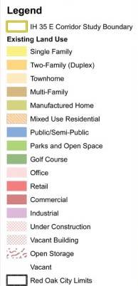
13 Existing Land Use Map 5-13

14 Parcel Data It is important to examine parcel data, particularly in relation to the size and types of existing parcels along the corridor. Future development will most likely be forced to work within the confinement of existing parcel configuration, whether development occurs within the existing parcel or combines parcels for a larger developable area. Northern Section Along the eastern portions of Interstate 35-E, a large quantity of the parcels are small single-developed commercial sites. Due to the fragmentation of the parcels within this area, it is likely that any future development will need to combine existing parcels in order to create a larger developable site area. Parcels in this area are both commercial and residential in uses. Along the western portions of Interstate 35-E, large vacant parcels of land exist. This creates significant development opportunities. This area has been identified as one of the key focus points for future development. Central Section Areas between Ovilla Road and Red Oak Road are generally a mix of smaller and Parcel Data Description Map medium sized parcels. Smaller parcels are predominant along the western side of the Interstate and include both residential and commercial uses. On the eastern side of the Interstate, many new developments have taken place, primarily commercial and retail uses. However, there are still a few vacant sites that offer opportunities for development near existing infrastructure. 5-14
15 Southern Section The southern section of the study area, located south of Red Oak Road, has a vast amount of vacant land. This area, along with the north-western sections of the study corridor has the most significant opportunity for future development, due to the availability of vacant land and the relatively large size of existing parcels. This area also contains Red Oak Golf Course and a large amount of floodplain along Red Oak Creek. Future site plans should consider these environmental and open space features and incorporate them as site amenities. List of existing parcels within I-35 corridor study area Current Land Use Number of Parcels Total Acreage Two-Family 2 Parcels 0.1 Acres Public (Churches) 4 Parcels 78.3 Acres Commercial 174 Parcels Acres Golf Course 7 Parcels Acres Industrial 1 Parcels 16.9 Acres Multi-Family 2 Parcels 5.6 Acres Manufactured Housing 93 Parcels 40.2 Acres Office 7 Parcels 10.4 Acres Commercial (Open Storage) 2 Parcels 2.0 Acres Parks and Open Space 1 Parcels 10.6 Acres Public/Semi-Public 3 Parcels 11.4 Acres Retail 23 Parcels 26.7 Acres Right-of-Way 2 Parcels Acres Single Family 194 Parcels 78.7 Acres Under Construction (Com) 1 Parcels 1.3 Acres Vacant 215 Parcels Acres Totals 731 Parcels Acres 5-15


 View looking")

16 Site Photos The following site photos depict typical existing conditions along the corridor. Existing images and aerial maps start at the north end of the study area and end at the southern City Limits. Tater Brown Road (Match A to next page) View looking south from City Limits Existing salvage yards at Tater Brown Road South view along access road Typical small commercial development, utility poles and sign clutter 5-16
 (Match B to")


17 Site Photos (Match A to previous page) (Match B to next page) Typical small lot mixed with residential and commercial uses Typical new development along corridor View looking south along access road View looking south along access road Existing utility poles and signs with limited landscape enhancements 5-17
 (Match C to")


18 Site Photos (Match B to previous page) (Match C to next page) Open lots and outdoor commercial sales Existing multi-family development Typical corridor view from hill top Commercial service uses along access road 5-18
")


19 Site Photos (Match C to previous page) Large undeveloped lots Existing Red Oak highway sign The Oaks Fellowship Church along southern section of corridor View looking north from southern City limits 5-19
20 5-20
21 RECOMMENDATIONS Following are recommendations for the. These recommendations are based upon public input obtained during the CAC meetings, planning team analysis, site visits, existing conditions, Red Oak ordinance review and planned projects. The recommendations are to be used as a reference and foundation from which ordinance and implementation actions should be derived. Vision The vision for the I-35 Corridor is to create high quality developments and a positive, identifiable image of Red Oak that will benefit residents, developers, visitors and the City. It is envisioned that new developments will be planned in an orderly fashion to create a sense of place and increase the economic vitality of the City. Streets will have unique lighting features, pedestrian activity, landscaping, less sign clutter and signs that provide opportunity for businesses to better promote themselves while benefiting Red Oak as a whole. New development sites will contain high architectural standards and streetscapes will contain sidewalks, trails and bike lanes linking people to new business and services. Site furnishings such as benches, tables and pedestrian lighting will complement pedestrian corridors and open space amenities. New developments within the corridor are envisioned to take advantage of several opportunities. First, new developments will be of the highest and best use for the corridor. Appropriate retail, restaurant, entertainment, office, and residential uses will be strategically located to serve the and ensure its long term economic viability. Next, new anchor retail sites will provide retail and commercial opportunities to residents and attract visitors traveling along I-35. A new lifestyle center development will create a destination point for Red Oak. This lifestyle center development will offer a pedestrian oriented site with a wide variety of retail, restaurant, residential, office and entertainment options. All new buildings and developments within the corridor will be built with quality design standards and incorporate similar materials, appropriate forms and creative site planning principles. As visitors and residents travel through the Red Oak I-35 corridor, they will be left with a positive and memorable experience. New gateway signage will greet north bound travelers along I- 35, giving new visitors a remarkable first impression of the City and residents a sense of pride. Increased landscape enhancements and cleanup efforts will create a new look for the corridor as well. Street trees, plantings along business fronts and at major intersections will provide year round visual interest. The vision is to create new opportunities for redevelopment. Redevelopment incorporating sound architectural construction, pleasing site design, increased landscape and identifiable elements will ensure continuity in future corridor activity and the long term success of the Red Oak I-35 Corridor. Over time, new developments will replace existing unsightly development and vacant land with higher standards and better place-making techniques, creating a positive image, better uses and increased visual quality. 5-21

22 I-35 Corridor Strategy Master Plan The planning team recommends that the corridor development and redevelopment be approached as individual parts which work collectively towards the benefit of the greater corridor as a whole. This approach allows the plan to specifically focus on the unique needs and opportunities associated with individual areas. In response, we have created the I-35 Corridor Strategy Master Plan to guide decision makers. The initial step of creating the master plan is to identify particular strategies which may be utilized along the corridor. The general strategies to follow are specifically related to the varying conditions which currently exist along the corridor. Development and Redevelopment As a basis for land use recommendations and redevelopment approaches, the planning team utilized a technique of categorizing opportunities and constraints associated with different portions of the I-35 corridor. Identifying opportunities and constraints along the corridor led to the organization of several potential strategies which may be utilized in appropriate areas. This is important because the corridor varies dramatically in the design and building composition; therefore, different strategies are appropriate for different areas of the corridor. Below are the five general strategies identified for the Interstate 35-E corridor. Large Tract Strategies The large tract areas are representative of locations with large parcel (over 100 acre) configuration and are primarily areas with vacant, undeveloped land. Due to the limited number of large tracts available for development along Interstate 35-E, these areas are particularly important in terms of development potential and should be protected and reserved accordingly. These areas best suited for master planned mixeduse developments. Two specific areas were Example of large tract Strategies identified as prime locations for large tract strategies the extreme northern and southern sections of the corridor. Both of these areas serve as gateways into the community particularly the southern portion of the corridor due to a general lack of development directly to the south of Red Oak. The southern area also has a large portion of floodplain along Red Oak Creek creating opportunities for open space and natural amenities as a component of any future development. 5-22


23 Example of big box strategies Big Box Strategies An important component of future retail development includes big box strategies. This type of development generally refers to retail anchor stores. These stores may be located alone or as part of a greater shopping center and are traditionally auto-oriented in nature, providing quick and easy access. Due to the relatively large nature of these anchor stores, tracts appropriate for big box developments are generally a minimum of 800 feet in depth. Examples would include Walmart, Target, Home Depot, Costco, and other similar retailers. Areas identified as appropriate for big box development were primarily located near Ovilla Road as well as potential sites at Red Oak Road and Interstate 35-E. Quality existing developments Existing Development Strategies In recent years, several new retail and commercial developments have been built along the Interstate 35-E corridor. These areas have incorporated a certain degree of architectural design, landscaping and enhanced visual quality. It is important that these areas be preserved and built upon and that they are connected and integrated into any new development to create a cohesive and identifiable feel to the corridor. These areas were primarily located along the central area of the corridor. Small Parcel Development Highway Retail and Commercial Strategies One of the issues identified by the CAC is the clustering of small tracts of commercial parcels along the interstate. These areas will require either individual site development or the consolidation of several parcels in order to create a larger contiguous parcel more appropriate for the corridor. These areas would be best served as primarily highway retail and commercial uses, and would directly front Interstate 35- E access roads. Examples would include small shopping centers, service centers and food establishments. Types of uses perceived as appropriate for this area includes businesses similar to what currently exist north of Red Oak Road. Due to the presence of residential land uses in this area, such establishments may also serve as a buffering technique. 5-23


24 Redevelopment Strategies One of the major issues facing the corridor is the redevelopment of existing small tract areas. These areas were observed by the planning team to contain limited quality development, limited aesthetic character and areas of numerous code enforcement issues. The areas are currently a mix of commercial and residential uses. Future redevelopment will likely involve a long term, multi-tool approach that will need to involve a high standard of development options. Example of redevelopment strategy areas I-35 Corridor Strategy Master Plan Zones The five previously identified strategies were used to achieve the identified goals for the Interstate 35-E corridor. These five strategies were seen to be appropriate for various areas along the corridor depending primarily upon existing conditions. In order to utilize these strategies in a practical way, the Interstate 35- E Corridor Strategy Master Plan creates eight specific zones. These zones were created in order to help organize future decision making by City staff as well as various stakeholders. The eight zones were established based upon the existing conditions primarily the types of development currently present and the size of various parcels of land. These zones ensure that location specific strategies are created and that recommended development is feasible and actionable. I-35 Corridor Strategy Master Plan Map 5-24


25 Zone 1 Offers large vacant tracts of land Significant location and visibility Recommended Planned Developments Larger anchor uses Mixed Uses Access options are key Recommended Intent Due to its location and physical characteristics, Zone 1 is envisioned to be one of the primary focal points for development along the corridor. Current physical characteristics include large quantities of vacant land and large tract sizes. These are significant features in terms of development potential due to the ability for developers to purchase large quantities of land from minimal land owners and due to the vacancy of land which reduces or even eliminates demolition costs. The location of Tract 1 is significant with its proximity to the interchange of Loop 9 and Interstate 35-E which enhances the visibility of the site. Visibility is an essential component for retail and commercial uses in order to capitalize upon passing traffic. It will therefore be important that the City continue its efforts in working with TxDOT/NTTA to ensure that accessibility from Interstate 35-E and Loop 9 be included. It is envisioned that development in Zone 1 be a master planned development where tracts of land are carefully planned and situated in a way which optimizes development potential, considers adjoining roadways, creates a cohesive and organized feel, and provides a gateway development on the northern end of Red Oak. Potential uses may include retail, office and big box uses with adjoining pad sites. 5-25

26 Along Loop 9, high density office space may be appropriate. Careful consideration should be given to building frontage, as development should be visible from Interstate 35-E, Ovilla Road and Loop 9. Additionally, access to Uhl Road should be considered due to planned access to Loop 9 at this location. Residential opportunities may also be appropriate within the master planned area and are specifically encouraged along the western edges of Zone 1. Medium density residential, such as townhomes and low density apartments, may be utilized in order to buffer existing single-family residential uses from more intense retail and commercial activity. Roadways/Parking Landscaping along Ovilla Road and the Interstate 35-E and Loop 9 frontage roads should be required. Pedestrian sidewalks should be included connecting zone 1 to surrounding neighborhoods, particularly along Ovilla Road. A collector roadway should be constructed to Uhl Road. Due to the auto-orientation of the site, parking lots should require landscaped island and tree covered walkways which safely guide patrons from parking lots to establishments. Land Use Types Retail, entertainment, commercial and service establishments such as theaters, clothing stores, restaurants, banks, grocery stores, and small office uses should be encouraged. Additionally, hotels and big box stores with associated pad sites should be encouraged. Medium density residential, such as townhomes, row houses or apartments, may be considered along the western sections of Zone 1 to function as a buffer between existing single family residential neighborhoods and more intense land uses. Public Space Linear parks, pocket parks, plazas, and public benches should be included where appropriate. Neighborhood parks may be appropriate along the western edges both as a residential amenity and as a buffer. 5-26

27 Zone 1 Conceptual Master Plan 5-27


28 Zone 1 Character Sketches View of Retail Center View of Residential Character 5-28

29 Zone 2 Offers large vacant tracts of land Significant location and visibility Recommended Planned Developments Large anchor uses Mixed Uses Access options is key Gateway to Red Oak from South Entertainment uses and open space amenities Recommended Intent Zone Two is identified as the second major area for potential development along the Interstate 35-E corridor. Past planning efforts by the City have identified this area as a potential location for a lifestyle center development. Additionally, the location of Zone 2 at the extreme southern portion of the City enables future development at this location to potentially serve as a gateway into the community, defining the overall identity of the corridor to those traveling along the Interstate. Large tracts of existing vacant land at this location mitigate complexities associated with the acquisition of land by developers; therefore, development at this location is recommended to be a master planned development with a specific site plan. A lifestyle center is recommended to be constructed in Zone 2, with special attention to designing for the public realm. For example, design should include pedestrian orientation, pedestrian amenities, urban design, streetscape enhancements, unified architectural character, and special consideration for the organization and location of buildings in order to enhance and create visual points of interest. A central public space should be a component of Zone 2 to create a destination along the corridor and serve as a location where community functions such as festivals and concerts. Due to the potential location of the lifestyle center in Zone 2, mixed-use development development which encourages a variety of compatible uses within the same location 5-29


30 is recommended in either a horizontal or a vertical integration. For example, office uses may be located above ground level retail for a vertical integration. Residential uses may also be located adjacent to or within walking distance of retail or office uses for a horizontal integration. Mixed-uses generally promote walkability and help to promote the viability of retail centers by increasing surrounding residential densities. Developments which should also be included within Zone 2 include a bowling alley, movie theater, hotel and big box stores and associated pad sites along the southern boundary. Finally, Zone 2 is adjacent to Red Oak Creek which creates opportunities for the inclusion of natural open space into site plans. Patios for retail or dining establishments may be located to face open space in order to allow patrons the ability to enjoy the natural beauty of Red Oak Creek. Pedestrian and bicycle trails may also be included linking Zone 2 to other portions of the community via nonmotorized means. Roadways/Parking Expansion of future roadways should be carefully designed as to be compatible with a lifestyle center site. Context sensitive deign should be used along future roadways to ensure compatibility with adjacent land uses. Arterials should incorporate greenways that include pedestrian sidewalks and bicycle trails and should connect Zone 2 with existing and future neighborhoods. Types of Uses Office, retail and residential uses should be incorporated within this site to create a mixed-use development. Medium density residential, such as live above lofts, apartments, townhomes, or garden homes, should be encouraged to increase adjacent population. 5-30

31 Zone 2 Conceptual Master Plan 5-31

32 Zone 2 Conceptual Lifestyle Center Site Plan 5-32

33 Zone 2 Character Sketches View of lifestyle center 5-33


34 Zone 3 Offers large tracts of land Significant locations and visibility Big box uses and associated pad sites Recommended Intent Zone 3 includes several potential development areas along the corridor. Zone 3 areas were identified as medium sized and somewhat undeveloped and suitable for big box development with pad sites. Examples of big box development would include a Target, Walmart, Home Depot or other similar types of developments. Typically, these types of retail centers include a major anchor store with smaller adjoining pad sites and are predominantly auto-oriented. Zone 3 areas are organized near Interstate 35-E overpasses allowing for accessibility and general accommodation of associated traffic. Because of the high visibility of these sites, site design and architecture character are very important. Big box stores require a density of surrounding households; therefore, new residential developments, single family (outside the corridor) and higher density (within the corridor) are recommended. Zone 4 Existing quality developments Maintain high standard Retail, small office and commercial Recommended Intent Zone 4 identified areas where newer development has taken place. Newer development in these locations has adhered to higher development standards and has incorporated certain architectural elements as well as landscaping and buffering. Strategies in this area should focus on preserving and building upon existing development. For example, any infill areas should be built to the same standards of existing development, if not higher, and should be compatible to the types of 5-34


35 development currently existing in order to create a sense of consistency. Retail, small office and commercial services are appropriate for this area. In particular, highway retail and commercial services are appropriate due to the visibility and access to Interstate 35-E. Zone 5 Significant tree cover and drainage way Open space as amenity Medium density residential Retail and small office Recommended Intent Zone 5 is a large, primarily undeveloped tract. The zone has a significant area of floodplain and tree coverage which should be considered an amenity in future site plans. Floodplain area would be a prime location for the incorporation of pedestrian trails which may ultimately connect development at this location to other points in the City. The floodplain area could also serve as a buffer for the large lot, single family tracts just west of Zone 5, allowing for commercial, retail and medium density residential uses. The zone should include retail and small office uses along Ovilla road. In addition, medium-density residential, such as townhomes and low-density apartments, may be utilized in remaining portions of the zone. Zone 6 Small lot Long term approach Redevelopment Encourage high development standards Retail, restaurant and small office Recommended Intent Areas in Zone 6 currently contain numerous small lots comprised of single family and commercial services. 5-35


36 Many buildings are substandard and have unsightly outdoor uses, storage and lack proper landscaping, driveways fencing and architectural features. These areas are recommended to be redeveloped with the highest and best use for the corridor. Such uses would include retail, restaurants and small office. Redevelopment of these areas will most likely include a long term approach. Zone 7 Small lot Long term approach Redevelopment Encourage high development standards Retail, restaurant and small office Recommended Intent Identical to Zone 6, Zone 7 currently contains numerous small lots comprised of older single-family and commercial services. Due to limited maintenance, the areas are unsightly and present a poor image of Red Oak along I-35. These areas are recommended to be redeveloped with the highest and best use for the corridor. Code compliance will be a key in these areas. Redevelopment and new businesses in the area should include small commercial and office uses. New potential uses could include professional insurance and realtor offices or an assisted living complex. Overall, redevelopment of these areas will most likely require an incremental approach over the long term. Zone 6 and Zone 7 are identical in regards to issues but have intentionally been separated into different zones. It is recommended that the majority of the City s redevelopment and code compliance resources and efforts be concentrated in Zone 7 as opposed to Zone 6. If high quality redevelopment occurs in Zone 7, it will screen or buffer the affects and appearance of issues identified in Zone 6 areas. 5-36


37 Zone 8 Greenbelt and floodplain Amenity Trail and pedestrian links Recommended Intent The large area of floodplain within the corridor study area has been identified as Zone 8. This area of floodplain and tree vegetation is envisioned to serve as an amenity to the surrounding areas. Development which borders Zone 8 should take advantage of its view and natural scenery. Restaurants and shopping centers could have outdoor patios overlooking the area. In addition, office or residential uses could have significant views from their buildings. Zone 8 should consider a trail system which links surrounding developments and neighborhoods. The floodplain area could also function as an ideal pedestrian crossing point under I-35, linking residents on both sides of the Interstate. 5-37


38 Corridor Gateway Elements The has invested time and money in establishing a unique brand and logo. It is the planning team s observation that the City s existing logo and branding efforts are high quality, very recognizable and contain appropriate materials, textures and colors. It is recommended that future corridor gateway elements, City facilities and utility structures incorporate and build upon the existing City brand and logo. Existing logo along bridge and water tower Corridor Gateway Signage Because of the visibility of the corridor, site selection, topography and the existing southern developments, a gateway monument sign is recommended at the City s southern limits. This sign should be a significant monument and able to be seen from the I-35 roadway. The sign is recommended to be located on the southeast side of the US 77 bridge crossing, visible to the north bound traffic. The gateway signage should be designed to take advantage of the topography associated with the existing overpass. The sign should be oriented towards the north bound traffic. In addition, future gateway signage should incorporate the exiting Red Oak logo, colors and materials found throughout the City s existing monument signage (see corridor gateway sketch on next page). Example of existing Red Oak sign with logo, architectural forms and materials Example of existing Red Oak sign with logo, architecture forms and materials 5-38


39 Proposed: Character sketch of recommended gateway signage Existing: Photo of existing areas for recommended gateway signage location 5-39


40 Existing Overpasses It is recommended that existing overpasses within the I-35 Corridor maintain a high level of visual quality. The overpasses and bridges found at Ovilla Road, Red Oak Road and US 77 will serve as gateway features. They provide an identifiable image of Red Oak for visitors by creating a distinguishable design element. Consideration and care should be given to maintain a high visual quality landscape associated with seasonal maintenance, planting and mowing. In addition, the visual quality of the bridges should be maintained with proper maintenance and painting as needed. In all cases, similar colors, textures, plants and materials should be used for all overpass areas. Example of existing City logo, textures and colors on overpass Future Overpass and Loop 9 No gateway signage is proposed for the north end of the corridor due to existing land uses, limited views and proposed Loop 9 corridor. However, any new overpasses and bridges associated with Loop 9 that are within the City limits of Red Oak should incorporate the existing Red Oak overpass standards. These existing standards include design elements such as utilizing the Red Oak logo, landscape enhancements as established at the existing overpasses and all associated concrete patterns, colors and textures. If Loop 9 is constructed at the northern City limits, it will serve as the City s northern identifiable gateway element and design considerations should be required to maintain continuity in overpass design consistent with the other Red Oak overpasses. Should the proposed Loop 9 corridor be realigned, gateway signage should be considered. Examples of existing overpass design with concrete pattern and graphic Example of existing landscape and stone wall along overpasses 5-40

41 Any additional east-west spanning bridge which crosses Interstate 35 should incorporate similar colors, landscape features, plantings, concrete patterns and City of Red Oak Logo and graphics as those found at existing Red Oak I-35 Corridor overpasses and bridges. In addition, any bridge structures, overpasses and or areas associated with Loop 9 found within the City Limits or ETJ of Red Oak should incorporate similar colors, landscape features and plantings, concrete patterns and City of Red Oak Logo and graphics as those found at existing Red Oak I-35 Corridor overpasses and bridges. Potential overpasses identified for future construction include bridges associated with Loop 9, a new bridge on the Red Oak Road. Location of proposed gateway elements 5-41

42 Loop 9 At the time of this report, a potential future project which has significant implications for Red Oak is Loop 9. The City has taken proactive efforts in helping to ensure that Loop 9, if constructed, will be an asset to the community rather than simply a regional corridor through the community. Under the current configuration of Loop 9, this roadway will straddle the Dallas/Ellis County line and primarily impact the northern portion of the City. Loop 9, if constructed, will significantly impact commercial frontage on the Interstate 35-E corridor due to an expansive five-level direct connection interchange similar to the High-Five interchange at IH-635 and US 75 in Dallas. Accessibility is often one of the major factors in determining what types of land uses are appropriate at certain locations. It is essential that this relationship be understood when determining what types of land uses are appropriate to be located along the potential interchange. Further, it is essential that the City continue working with TxDOT to ensure that the ultimate configuration of Loop 9, if built, not only benefits the City but provides the accessibility necessary to enhance development opportunity along the corridor. Finally, the full transportation system Lack of Development due to poor Accessibility will need to be analyzed in order to determine potential tract locations, building frontages and to provide the best possible development visibility from Interstate 35-E and Loop 9. The City needs to be prepared and plan for the possibility of Loop 9. To minimize the detrimental impacts that the interchange could have to adjacent development, the design of Loop 9 should require cross road access and frontage roads to access adjacent properties. Commercial opportunities should not be limited due to lack of access. The implications of accessibility are shown on the image above. With proper accessibility and connectivity, the Interstate 35-E interchange may serve as a significant development site, enabling Red Oak to attract and create development which both meets community needs and creates a significant tax base which ultimately enhances City services. Without such consideration, prime development site potential may be limited and thus the long-term value of the land underutilized. Further, it is critically important that supplemental access be provided to the development area within the influence area of the interchange. As sight visibility to the property will also be hindered (due to structural supports), supplemental access should be considered from Uhl and Houston School Roads to benefit the area. Additionally, consideration should be given to orienting development inward (away from the interchange) so that cohesive development can be created with other portions of Red Oak. 5-42

43 Design Guidelines The design guidelines are targeted at creating a framework for consistent, attractive and desirable developments along the I-35 corridor. These guidelines should apply to all new development and redevelopment regardless of use or parcel size. These design guidelines establish character through recommendations in vehicular circulation, pedestrian circulation, landscaping, streetscape and architecture. Vehicular Circulations The following are standards and guidelines to ensure the I-35 Corridor has similar transportation elements and enhancements, although with each new development and roadway it will be necessary to conduct an engineering study for individual parcels. Based on site visit observations, focus group meetings and review of the existing Red Oak zoning regulations, the following transportation elements are recommended for all parcels within the Corridor Study Area: New Major Roadways It is recommended that all new roadways being constructed in the I-35 Corridor include several desirable elements. First, all new major roadways should be constructed with sidewalks on each side of the roadway separated from the street by a landscaped parkway. The parkway may contain such elements as road signs, light poles or landscaping. Also, it is recommended Example of sidewalks, landscaping and parkway along major roadway that all future right of ways contain buried utility lines in order to minimize visual clutter. 5-43


44 Example of desirable Major Street section elements The illustration above depicts the typical desirable elements recommended for new major roadways within the I-35 Corridor. While the number of driving lanes may vary per major road type, the concept is to provide driving lanes divided by a median with pedestrian corridors on either side of the roadway Example of desirable Minor Street section elements separated by a parkway or landscaped zone. Minor street types, as well as collector and local streets, should use Context Sensitive Solutions in order to meet roadway traffic needs while also considering and incorporating roadways into the surrounding development. This is particularly important in retail and residential areas or areas with higher volumes of pedestrian traffic. Example of desirable Collector or Local Street section elements 5-44

45 Access Management and Connectivity Access management refers to the practice of controlling access allowed onto a roadway by considering specific design criteria for the location, spacing, design and operation of driveways, median openings and intersections. The primary goal of access management is to balance the access intensity with the desired mobility function of the roadway. Generally, as the mobility and capacity of a roadway are increased, the access to a specific facility is decreased in order to maintain the roadway efficiency and enhance traffic safety. Access management provides a significant benefit to the mobility and function of the roadway, and more importantly, reduces the potential for accidents by minimizing speed differentials between vehicles and turning movements. Research has shown that accident rates increase consistently with an increase in the number of roadway access points, while accident rates decrease with the construction of raised medians and controlled signalized cross access. Primary site entrances for vehicles should be part of an arrival sequence and should provide a clear line of site and avoid conflicts with pedestrian movements. Drive entrances should be spaced according to standards. Entrances should be enhanced with medians, lighting, plant material, paving variations, colors and signs. When site locations and sizes are appropriate, it is recommended that developers provide shared access into adjoining tracts of lands and align entrances with those on opposite sides of roadways. Site plans and developments should provide connections and cross access easements to adjacent properties, both as walkways and drives. This will create interconnections and provide greater circulation patterns and minimize roadways and intersections. Example of recommended access management and connectivity between individual developments 5-45


46 Median Treatments The use of medians is recommended to provide opportunities for increased visual quality. Medians should be used at entrances and within major roadways. Signs, pavers, lighting and plant materials may enhance their overall appearance. Intersection Enhancements In order to promote a pedestrian-oriented site and improve the corridor s image, it is recommended that clearly marked crosswalks at intersections and drop off areas be provided. Additionally, major intersections in the I-35 corridor should be aesthetically enhanced to create visual interest and to help promote the area as a district. The paving in the middle of intersections may be enhanced with changes in colors, textures and patterns. Additionally, light pole and traffic signal poles should be painted either black or a color matching the Red Oak Logo and should consider lighted street names. Example of median with signage and trees Example of intersection enhancements with crosswalk and changes in color, textures and materials General Parking Recommendations Shared parking should be required for large mixed-use sites. It is recommended that when multiple uses exist within a proposed development, a parking analysis be required at the site plan submittal. Developers should be required to provide a time of day and use study for parking spaces. Required parking should be determined based on peak demand studies using approved standards and meet the approval of the Red Oak Planning and Zoning Commission. For large master planned developments, required parking should be provided within 600 feet of building. Parking should be set back 10 feet to 15 feet from all major roadway surfaces including I-35 access roads, in order to provide areas for walks and landscaping. All parking surfaces should be paved and should prohibit the use of gravel, dirt or turf parking areas. Parking structures should be considered to reduce land requirements. Parking structures should emphasize community character as well as the character of the development site and break up its overall volume appearance. Such structures should be designed to complement the surrounding buildings architectural character. Parking structure facades should incorporate architectural elements 5-46


47 such as columns, rustication and belt courses. Their facades should use variations in wall planes with wall openings, canopies, articulation, wall breaks, balconies or awnings. In addition, the parking structure facades could use changes in materials and colors to add visual interest. In all cases, it is recommended that future parking structures not be able to use steel guard cables on their facades. Pedestrian Connectivity Example of sidewalk along new development As new development occurs in the Corridor Study Area, it is critical to promote and maintain pedestrian connectivity. Establishing a well connected pedestrian circulation system is an effective way to encourage people to travel short distances on foot or bike. Sidewalks and crossings are the most common approach to creating the network. In all cases, separation of vehicular and pedestrian traffic has shown to be the most effective method for increasing pedestrian safety. It is recommended that sidewalks be located along all front yards or in between roadway surfaces and developments. Within larger developments, site plans should be pedestrian oriented by providing safe sidewalk travel within parking lots and along business fronts. All sidewalks should provide an unencumbered pedestrian movement from site furnishing, utilities, signs, entry ways, vegetation and buildings. Trails and Bike Lanes In addition to sidewalks, it is recommended that the I-35 Corridor study area include trails and bike lanes. These are often located along secondary roadways and connect neighborhoods to key development or open space. These modes of transportation may be located along roadways, in floodplains and greenbelts or within a development itself. Trails and bike lanes should be connected to one another and serve as a network of transportation options. The City has taken Example of trails along within floodplain steps towards the creation of a Parks and Trails Master Plan. This Master Plan should be used conjunctively with any new development along the corridor to ensure that recommended trails and pedestrian pathways are included. The City may choose to require incorporation of the adopted Parks and Trails Master Plan as a condition precedent to development plat approval. 5-47


48 Safe Movement All roadway intersections should provide a safe pedestrian crossing. Where possible, crossings should be clearly defined with changes in material, colors and textures. Crossings may also be considered for anywhere a potential conflict could occur between vehicles and pedestrians. These additional areas would include driveways, major pedestrian corridors in large parking lots and major intersections in larger developments. These applications will provide pathway delineation as well as increase visual interest. In addition, way-finding Example of pedestrian crossings in larger development signage may be provided to direct pedestrian circulation. Example of pedestrian crossing at retail driveway 5-48


49 Landscape Example of landscape enhancements Landscaping is critical in creating desirable developments for the. Based on site visit observations, focus group meetings and review of the existing Red Oak Landscape Development Regulations, it is recommended that the landscape requirements be increased within the Corridor Study Area. The increased landscape standards will provide a desirable visual quality throughout the corridor. These increased landscape standards should become a part on the site plan review process for all corridor area developments. Existing requirements within the current Red Oak Landscape Development Regulations should still apply but where conflicts occur, the recommended standards should take precedence. These new standards should not be thought of as minimum requirements, such as screening, but as design elements used to enhance the City s image and quality of life. Example of landscape enhancements near building Landscaping should be utilized at key intersections and site entrances throughout the corridor. Plantings will help to define major portions of the site and will create a gateway for the development. The plant materials for these areas should include not only large trees and shrubs, but also seasonal color, small trees and specimen plants. Trees near buildings and pedestrian walkways should be pruned up to nine feet in height to ensure safe clearance. Landscape beds and planters should be provided at building entrances and outdoor seating areas. Planter styles and planting designs should emphasis the site s architectural characteristics. The planting design for developments should include a variety of plant material in addition to the required trees. The use of seasonal plants is encouraged to add color and variety to the landscape. With each site, developers and designers are encouraged to utilize their creativity to meet or exceed these landscape guidelines. The following are standards and guidelines to ensure that the Interstate 35- E corridor has similar elements and characteristics: 5-49


50 Large Development Open Space and Public Spaces For large tract development or large master planned areas, a minimum ten percent open space requirement should apply. Open space should generally not include required setbacks, parking islands or buffer yards. Open space may include areas of passive and active recreation such as trails, sitting areas, pavilions, lawns and plazas for gathering places, art or water features. Open space for large commercial, retail or mixed-use developments may also include public accessible spaces such as roof top gardens, plazas or courtyards. Example of public open space Permanently Landscaped Areas It is recommended that all developments within the corridor have at least twenty five percent of the entire site, tract or parcel in permanently landscaped areas. These areas may include the required open space, setbacks, yards, buffer yards, medians and landscape islands. These areas should establish minimums for the required large tree, small tree and shrubs per square feet. In addition, remaining permanently landscape areas should be covered with turf, groundcover, small shrubs or mulch. Example of permanently landscaped area Parking Lot Landscape Standards At least seventy five percent of the frontage of parking lots adjacent to the public right of way, within the street yard, should be screened with vegetation attaining a minimum height of three feet or a low masonry wall of equal height. Use of wall for parking lot screening should be accompanied with landscape planting in the form of low shrubs and ground cover to soften the appearance of the wall. Example of parking lot landscaped enhancements 5-50


51 Example of parking lot landscape recommendations Parking lots greater than 50 parking spaces should be broken up with a landscape median between every other parking bay. A landscape island should be provided at least every twelve stalls and include a minimum of one large tree. Parking lots greater than fifty parking stalls should provide a landscape median on each side of major internal parking drives. Landscape islands should be located at the terminus of each parking bay and include a minimum one large tree. Parking aisles should be arranged perpendicular to building entrances when possible. The ground surface for all parking lot landscape medians and landscape islands shall be covered with mulch, turf, small shrubs or groundcovers. Screening All service areas, refuse facilities and dumpster sites should be screened from public view. Masonry walls, fences and screening should be architecturally consistent with similar form, color and materials. Example of dumpster screening 5-51


52 Streetscape Streetscape elements play a vital role in enhancing a corridor. Streetscapes include such elements as banner poles, street furnishings, pavers, pedestrian lighting, art and gateway features. These elements can serve as district features, provide entry features, increase visual quality and enhance developments. Many of these elements not only provide continuity in site design but also provide a safer environment. Site Furnishings It is recommended that use of site furnishings be required by the City for all new developments and new transportation corridors. Site furnishings should emphasize the architectural character of each individual development or street scene. Continuity in styles, forms, materials and color between types of site furnishing will help to define an individual site or large development. Outdoor elements should be low maintenance and resistant to vandalism. Example of site furnishings along sidewalks Providing site furnishings along the Corridor is a great opportunity to both visually enhance the streetscape and provide pedestrians with an area to stop and rest. Benches and trash receptacles are two of the most common types of site furnishings. However, other site furnishings may include bike racks, bollards, tree grates, planters, tables and water fountains. Pedestrian seating should be provided within any significant commercial development and along major internal site circulation paths to create opportunities for public gathering. Other places that are appropriate for site furnishings would include passive and active outdoor spaces such as parks or plazas. Example of site furnishing in public space Example of site furnishings within retail development 5-52


53 Site Lighting Site lighting is recommended for all streets, sidewalks, parking lots and public outdoor spaces. Lighting should follow a system of hierarchy and include a family of street lights, parking lot lighting and pedestrian lights. Street lighting should mirror the opposite side of the roadway when possible. It is recommended that lighting locations be consistent and at a brightness level to provide safety and security while adhering to established dark sky principles. Street light poles should be rated for banners. Many of the newer developments in the have adopted a distinguishable lighting architecture. It is recommended that the I-35 corridor use similar historic style lighting poles with antique features and black paint finishes. Example of established architectural lighting designs within Red Oak 5-53


54 Example of recommended I-35 Corridor Signage to help reduce clutter Signage Signage establishes identity to buildings, businesses and developments. As one of the most visible elements in a streetscape or corridor, signs have a significant influence on the visual environment and upon a visitor s perception of the community. Effective signage contributes to a positive community image, thereby preserving property values and promoting the economic health of a community. As new development and redevelopment occurs in the I-35 corridor, special consideration should be given to the type of signage allowed or encouraged within the community. Signage applications should adhere to the existing Red Oak sign ordinance and standards. Within the study area, three signage examples are recommended; I-35 corridor signage, community corridor signage and special feature signage. I-35 Corridor Signage I-35 corridor signage is recommended for the parcels or developments directly adjacent to I- 35. Signs in this area are envisioned to have a uniform sign height relative to the elevation of the adjacent roadway. Generally, monument signs should be encouraged, but not required within the I-35 Corridor. The corridor may have signage with heights as recommended within the existing ordinance. On larger tracts and development, multiple tenants are appropriate. Example of recommended I-35 Corridor Signage to help reduce clutter 5-54


55 Community Corridor Signage Community corridor signage is recommended for use along major I-35 corridor arterial streets such as Red Oak Road or Ovilla Road. Signs in these areas are envisioned to be consistent with monument or ground signs. These signs offer a softer feel to roadway edges and allow for other visual elements of the site to be showcased. Special Feature Signage In addition to other signs examples in the previous sections, the use of special feature signage is recommended throughout the corridor. Such special feature signage should include banner signs on light poles, directory and way-finding signs. Way-finding signs are aimed at providing guidance to specific locations or features of an area. Way-finding signs may be used to direct vehicular traffic to a final destination within a district or large tract development. They may also be used to direct pedestrians or bicyclists along a trail corridor. These types of way-finding signs may be pole mounted, part of a monument sign, attached to traffic signal poles or attached to light poles. Example of Community Corridor Signage monument sign Example of Community Corridor Signage monument sign Examples of Special Feature Signage 5-55
56 General Sign Recommendations Signage design, color and materials should be consistent and compliment the architectural character of the accompanying structure, development or business. Signs should have limited text and sizes. Billboard signs should be restricted. Temporary signage should be regulated including marquee signs, sale signs, flags and inflatable signs. The number of attached sign and monument signs should be limited per business. The use of multi-tenant signs should be encouraged for commercial strip centers or large developments. The number and location of freestanding monument signs should be limited in business parks and retail centers to directly correspond with linear street frontage or the number of entry drives. Consider removing signage on properties that have been vacant in excess of a designated time period. For properties with excessive signage, encourage the voluntary reconfiguration of signs and or the removal of excessive signage. Encourage the use of monument type signage. 5-56

, middle (upper façade) and top (roof element).")
57 Architectural Character The following recommended architectural design elements should be incorporated into all new developments and redevelopments regardless of use or building size. These recommendations should be used in conjunction with existing Red Oak ordinances. Front Setbacks In order to provide areas for landscaping, signage and pedestrian movement, it is recommended that all buildings along I-35 and major roadways have a front yard setback of at least twenty five feet. Building Facades It is recommended that all multi-story buildings be designed with a distinguishable base (first floor), middle (upper façade) and top (roof element). This will create an interesting architecture style and help to create a unified character throughout the study area. Multi store buildings should be designed with the first floor at a pedestrian scale. Standards should be developed for building facades to incorporate certain design elements in order to promote a community character and pedestrian scale. These design elements should include architecture features such as cornice, piers, columns, rustication and belt courses. In addition, variations in wall planes such as the use of canopies, lighting fixtures, balconies and awnings are also recommended. Material Standards Masonry Requirements: All exterior building treatments within the study area are recommended to be one hundred percent masonry finishing. This will exclude windows, doors and associated trim. Exterior Insulation Finishing System (EIFS) should not make up more that fifteen percent of the exterior facade treatments. Example of masonry requirements 5-57


58 Accents and Changes in materials: It is recommended that no single masonry material make up the entire façade treatment. Standards should be developed that require a change in materials and the use of accent materials in order to maintain a high architectural quality. Example of accents and material changes Side and Rear Facades: Side and rear facades should be finished in a similar color, texture and materials as the main front façade of the building. Building Entries Building entrances should be easily identifiable and relate to both human scale and the scale of the buildings they serve. In order to create a pedestrian oriented environment in which buildings are oriented toward publicly accessible streets and sidewalks, a principal building should have its main entrance from a public sidewalk or plaza. Each non residential use with exterior, street oriented exposure shall have an individual public entry. Entries should be accented by architectural elements such as columns, overhangs, changes in roof design, awnings or balconies. Building Articulation Horizontal building articulation requirements should be developed based on building facades greater than forty feet in length. Articulation requirements should be based on a minimum required number of facade breaks at a minimum horizontal depth per breaks. For example, the City could require a recess or offset of 3 feet for every 40 feet of wall length. Vertical building articulation requirements should be developed based on building facades greater than forty feet in length. Articulation requirements should be based on a minimum width per facades width and a minimum height per percent of the facades total height. Articulation examples 5-58


59 Roofs Roofs should be designed as individual design elements and be utilized to block equipment and satellite dishes. Rooftops shall be viewed as a part of the site plan and should help to create an interesting skyline Large Tract Developments Site design standards should be developed for large tract or large master planned developments, including a lifestyle center or mixed-use sites. The site design standards should include the following elements: Building Orientation: Building orientation should consider uses both within structures and outside. Building masses help to define parking, open space, pedestrian circulation and activities. Buildings can also be utilized as focal points along a major axis. Clustering buildings often help to define outdoor spaces such as plazas and courtyards. The strategic arrangement of buildings can also minimize circulation conflicts. Buildings in mixed-used developments are often located directly at street level with parking behind or at the side of a building. View Corridor: The arrangement of streets, open space and buildings can create view corridors. View corridors will help to increase the area s visual quality and provide visitors a snap shot of major entrances, district boundaries and establish a strong sense of design. A major axis is often used along traffic routes with signature architecture elements or buildings located at the terminus. Examples of rooftop design, building orientation and view corridors 5-59

60 Block lengths: Block lengths in mixed-use style or master planned developments should generally be characterized by smaller, walkable blocks. These small block lengths and connected street patterns will provide traffic efficiency and opportunities for pedestrian connectivity. Example of short walkable blocks General Architectural Recommendations All building materials and appearances should be approved during a conceptual or site plan submittal. Wire mesh or chain link fences should be approved by the Planning and Zoning Commission and Council action through Planned Development Zoning. Exterior finishing or treatments should not include Concrete Masonry Unit (CMU) unless the CMU is colored, split face or oversized. The use of highly reflective materials and surfaces should be avoided. The use of mirrored glass glazing should be avoided. In order to promote a pedestrian-oriented development, exterior security fences located along public streets, along private streets or walkways that are publicly accessible through a public easement, or along publicly accessible open space shall not extend beyond building facades. The use of florescent colors and materials should be avoided. Painted brick or stone surfaces should be allowed through Planned Development Zoning. Metal buildings should not be allowed No metal buildings within public view. Outdoor storage that is not approved by the Planning and Zoning Commission should be well screened by walls or landscaping. Outdoor storage should be associated with seasonal retail. 5-60
Planning Districts INTRODUCTION
 INTRODUCTION To facilitate detailed examination of development prospects for all areas of the community, Delano has been divided into 14 planning districts. The location of these planning districts is
Table of Contents. Elm Avenue Improvement Plan City of Waco, Texas. Introduction 1. Existing Context 1 Figure 1 2.
 Table of Contents Introduction 1 Existing Context 1 Figure 1 2 Plan Guidelines 3 Future Urban Form 4 The West-End 4 Main Street 6 The East-End 7 Figure 2 9 Public Improvement Recommendations 7 General
The transportation system in a community is an
 7 TRANSPORTATION The transportation system in a community is an important factor contributing to the quality of life of the residents. Without a sound transportation system to bring both goods and patrons
City of Farmington. Downtown Plan. Amendment to the 1998 Master Plan Adopted October 11, 2004
 City of Farmington Amendment to the 1998 Master Plan Adopted October 11, 2004 Introduction Planning Background 1 Scope and Components of the Plan Amendment 2 Concept Introduction 3 Plan Concepts 3 Conceptual
section five BEAUTIFICATION PLAN
 section five BEAUTIFICATION PLAN BEAUTIFICATION PLAN Section Five Beautification Plan The goal of the Beautification Plan is to improve the Route 8-Sunnyland Corridor in terms of aesthetics and to create
CHAPTER 3 VISION, GOALS, & PLANNING PRINCIPLES. City of Greensburg Comprehensive Plan. Introduction. Vision Statement. Growth Management Goals.
 CHAPTER 3 VISION, GOALS, & PLANNING PRINCIPLES Introduction The Greensburg Comprehensive Plan is intended as a working community document. A combination of long and short-term goals, this document is intended
5.1 Site Plan Guidelines
 5. Community Core Guidelines Development of the Community Core will take place by plan of subdivision and site plan approval. It will occur in a phased manner that will reflect the timing of residential
Port Lavaca Future Land Use
 Port Lavaca Future Land Use Introduction The City of Port Lavaca is beginning to see sustained growth, after many years of relative stable population. New single family homes, apartments, and businesses
2.0 AREA PLANS. Lakeside Business District. Lakeside Business District Land Use Categories:
 Lakeside Business District Lakeside Business District Land Use Categories: Campus Commercial Campus Commercial means a mixture of uses which includes corporate offices, office parks, hotels, commercial,
hermitage town center
 hermitage town center A Community Vision prepared by Strada for The City of Hermitage and The Mercer County Regional Planning Commission January 2007 table of contents introduction 3 design principles
4. INDUSTRIAL 53 CASTLE ROCK DESIGN
 4. INDUSTRIAL 53 CASTLE ROCK DESIGN CASTLE ROCK DESIGN 54 4. INDUSTRIAL Overview Well-designed and attractive industrial centers are the product of blending economic realities with both functional and
Planning Board Briefing
 Planning Board Briefing Why Now? The Sector Plan Implementation Chapter States: Before Stage 1 begins, the following must occur: Approval of the Sectional Map Amendment. Approval of the Greater Lyttonsville
C. Westerly Creek Village & The Montview Corridor
 C. Westerly Creek Village & The VISION Community Vision When the goals of the city are achieved Westerly Creek Village, a distinctive community defined by Montview Boulevard and Westerly Creek, is a strong
4.1.3 LAND USE CATEGORIES
 4.1.3 LAND USE CATEGORIES a. City Center District The City Center District incorporates the existing character and mix of uses in downtown Belmont to encourage redevelopment and new development in keeping
Hockessin Community Redevelopment Plan
 Hockessin Community Redevelopment Plan 3.1 Introduction The Community Redevelopment Plan for the Village of Hockessin is the result of the people s vision for a distinct village center that serves as the
CHAPTER FIVE COMMUNITY DESIGN
 CHAPTER FIVE COMMUNITY DESIGN CHAPTER FIVE - COMMUNITY DESIGN Assumptions Frazier Park and Lebec have historically developed according to different patterns of spatial form. While both communities are
Community Design Plan
 Gardena General Plan 2006 Authority While the is not a required element of a General Plan, it is included because improving the community appearance and image is paramount to the overall quality of life
Section 9 NEIGHBORHOOD DESIGN
 Section 9 NEIGHBORHOOD DESIGN City of Lancaster Comprehensive Plan D u n k i n, S e f k o & A s s o c i a t e s, I n c. NEIGHBORHOOD DESIGN INTRODUCTION There are many ways in which a neighborhood can
A. Background Summary of Existing Challenges and Potential Possibilities. 1. Summary of Existing Assets and Potential Opportunities
 A. Background 1 A Main Street Master Plan Study was performed and completed in October of 2007. The study was initiated to review current land uses and development patterns along Main Street, from Parrish
Town Center. Block 5 Existing multifamily residential units are expected to remain.
 Area Guidelines Germantown s districts should be developed as distinct communities with unique features that are supported through the guidelines. The guidelines not only help distinguish these districts
Comprehensive Development Guide
 INDUSTRIAL ELEMENT Comprehensive Development Guide 1 Industrial Element 7.1 Hardin County Industrial Overview BG PKWY Fort Knox Industrial Corridor Comprised of 11 parcels totaling 720 acres of land 68
A. WHAT IS A GENERAL PLAN?
 I. Introduction A. WHAT IS A GENERAL PLAN? A general plan is the planning guideline for the future of a city. It contains goals and policies which regulate urban development, the protection of the natural
YONGE STEELES CORRIDOR SECONDARY PLAN. Young + Wright / IBI Group Architects Dillon Consulting Ltd. GHK International (Canada) Ltd.
 Ltd.") PART A: PREAMBLE 1.0 PURPOSE The purpose of this Secondary Plan is to provide a development framework for intensification of the Yonge/ Steeles corridor including the north side of Steeles Avenue West
PART A: PREAMBLE 1.0 PURPOSE The purpose of this Secondary Plan is to provide a development framework for intensification of the Yonge/ Steeles corridor including the north side of Steeles Avenue West
Clairtrell Area Context Plan
 Clairtrell Area Context Plan March 2005 Urban Development Services City Planning Contents 1. Introduction... 4 2. Development Structure... 6 2.1 Streets... 7 2.1.1 Sheppard Avenue and Bayview Avenue...
Implementation Guide Comprehensive Plan City of Allen
 Implementation Guide 2030 Comprehensive Plan City of Allen DRAFT 2015 Implementation Guide Allen 2030 Comprehensive Plan INTRODUCTION The Comprehensive Plan serves as a guide for the growth and development
SECTION TWO: Urban Design Concepts
 SECTION TWO: Urban Design Concepts The Gardnerville Plan for Prosperity shapes economic opportunities presented by regional growth. The Urban Design Concepts provide policies and concepts for land use,
CHAPTER 2: FUTURE LAND USE CONCEPTS
 CHAPTER 2: FUTURE LAND USE CONCEPTS INTRODUCTION The future land use concepts presented in this chapter are an expression of community support for a viable and vital US 50 Corridor. Land use recommendations
URBAN DESIGN BRIEF. 2136&2148 Trafalgar Road. Town of Oakville
 URBAN DESIGN BRIEF 2136&2148 Trafalgar Road Town of Oakville Prepared By: METROPOLITAN CONSULTING INC For 2500674 Ontario Inc November 2016 TABLE OF CONTENTS Page No. 1.0 Introduction/Description of Subject
Policies and Code Intent Sections Related to Town Center
 Policies and Code Intent Sections Related to Town Center The Town Center Vision is scattered throughout the Comprehensive Plan, development code and the 1994 Town Center Plan. What follows are sections
Draft Memorandum #1: Goals and Vision for Revitalization
 Keizer Revitalization Plan Draft Memorandum #1: Goals and Vision for Revitalization Submitted to: City of Keizer April 12, 2018 (revised) Prepared By: Angelo Planning Group and Otak, Inc. Project No. 17482.A
EXECUTIVE SUMMARY DRAFT CHAPTER 1 INTRODUCTION EXECUTIVE SUMMARY
 CHAPTER 1 EXECUTIVE SUMMARY INTRODUCTION Through the joint efforts of the City of Tulsa planning staff and the Land Services division of Indian Nations Council of Governments (INCOG), the Berryhill Land
7Page 91 CLEMMONS COMMUNITY COMPASS 7 COMMUNITY CHARACTER
 7 Community Character The beauty of Clemmons won t necessarily be a reflection of our past, but our future. This quote from Comprehensive Plan Steering Committee member Wayne Dodson captures the essence
CONTENTS 8.0 LAND USE 8.1 GENERAL LAND USE 8.2 RESIDENTIAL 8.3 MIXED USE 8.4 COMMERCIAL 8.5 EMPLOYMENT LANDS
 8-2 Land Use 8.0 LAND USE CONTENTS 8.1 GENERAL LAND USE 8.1.1 Uses provided for in all Land Use Designations 8.1.2 Uses prohibited in Hazardous Lands, Hazardous Sites and Special Policy Areas 8.1.3 Uses
Bel-Air Lexus Automobile Service Station
 Bel-Air Lexus Automobile Service Station Design Brief 443-447 McArthur Avenue Ottawa April 30, 2015 14-1299-MCA Site Details Application: Site Plan Control Legal Description and Municipal Addresses: 443
Status Update (2006 vs. Now) Citizen s Advisory Committee February Plan for Prosperity
 Citizen s Advisory Committee February Plan for Prosperity") Status Update (2006 vs. Now) Citizen s Advisory Committee February 2018 Plan for Prosperity 2000 2017 2000 2017 Gardnerville Population 6,000 5,760 5746 5,500 5,000 5,067 5,550 5,165 5,394 5,412 5,250
Status Update (2006 vs. Now) Citizen s Advisory Committee February 2018 Plan for Prosperity 2000 2017 2000 2017 Gardnerville Population 6,000 5,760 5746 5,500 5,000 5,067 5,550 5,165 5,394 5,412 5,250
Regency Developments. Urban Design Brief. Holyrood DC2 Rezoning
 Regency Developments Urban Design Brief Holyrood DC2 Rezoning Stantec Consulting Ltd. 7-31-2017 1. Overview Regency Developments intends to rezone the lands located at 8510 and 8511 93 Avenue, within the
CHAPTER 5 Public Realm Improvements
 5.1 OVERVIEW This chapter focuses on the public realm, that is, spaces within and directly adjacent to public rights-of-way (ROWs), including streets, Oso Creek, the rail corridor, and the freeway edge.
Small Area Plan. South Gateway
 Small Area Plan Adopted May 12, 2008 South Gateway Purpose. The South Gateway Small Area Plan defines the City s expectations for the future of the southern entrance to the City at Interstate 85 and Highway
3.0 URBAN DESIGN. December 6, OVERVIEW
 Urban Design 3.0 URBAN DESIGN December 6, 2007 3.1 OVERVIEW The highly urban character of Easton Place is defined by the overall design of the community. The following sections provide an overview of the
LUNDY S LANE COMMUNITY IMPROVEMENT PLAN STUDY
 PUBLIC INFORMATION MEETING #2 October 12, 2016 LUNDY S LANE COMMUNITY IMPROVEMENT PLAN STUDY AGENDA 5:00 to 5:30pm: Open House 5:30 to 6:15pm: Presentation 6:15 to 7:00pm: Individual paced workshop with
URBAN DESIGN BRIEF 181 Burloak Drive, Oakville
 URBAN DESIGN BRIEF 181 Burloak Drive, Oakville February 2017 Our File: 1730B 230-7050 WESTON ROAD / WOODBRIDGE / ONTARIO / L4L 8G7 / T: 905 761 5588/ F: 905 761 5589/WWW.MHBCPLAN.COM TABLE OF CONTENTS
IH35 Corridor Plan Amendment to the Comprehensive Plan
 IH35 Corridor Plan Amendment to the Comprehensive Plan Background The corridor plan for the IH35 corridor is an amendment to the Burleson comprehensive plan. Generally, the purpose of a corridor plan is
Visioning Statement and Guiding Principles
 Visioning Statement and Guiding Principles Planning for the Future The General Plan The General Plan represents Woodland's shared vision of the future and defines a path to lead the community toward its
Gold Line Bus Rapid Transit Transit Oriented Development (BRTOD) Helmo Station Area Plan
 Helmo Station Area Plan") Appendix F Gold Line Bus Rapid Transit Transit Oriented Development (BRTOD) Helmo Station Area Plan Introduction and Purpose of the Plan The Gold Line Bus Rapid Transit facility is an eleven-mile dedicated
Appendix F Gold Line Bus Rapid Transit Transit Oriented Development (BRTOD) Helmo Station Area Plan Introduction and Purpose of the Plan The Gold Line Bus Rapid Transit facility is an eleven-mile dedicated
ATTACHMENT A. SILVERDALE DESIGN STANDARDS Amendments to the Waaga Way Town Center Chapter
 ATTACHMENT A SILVERDALE DESIGN STANDARDS Amendments to the Waaga Way Town Center Chapter Chapter 10. Waaga Way Town Center 10.1 Physical Identity Elements & Opportunities The Waaga Way Town Center includes
[PLANNING RATIONALE] For Site Plan Control and Lifting of Holding Zone By-Law 101 Champagne Avenue. May 23, 2014
![[PLANNING RATIONALE] For Site Plan Control and Lifting of Holding Zone By-Law 101 Champagne Avenue. May 23, 2014](/thumbs/75/71599615.jpg "[PLANNING RATIONALE] For Site Plan Control and Lifting of Holding Zone By-Law 101 Champagne Avenue. May 23, 2014") [PLANNING RATIONALE] For Site Plan Control and Lifting of Holding Zone By-Law 101 Champagne Avenue May 23, 2014 Contents 1.0 Introduction... 2 2.0 Site Context... 2 2.1 Adjacent Uses... 2 Figure 1: Site
[PLANNING RATIONALE] For Site Plan Control and Lifting of Holding Zone By-Law 101 Champagne Avenue May 23, 2014 Contents 1.0 Introduction... 2 2.0 Site Context... 2 2.1 Adjacent Uses... 2 Figure 1: Site
Urban Design 9Identity
 Urban Design 9Identity URBAN DESIGN IDENTITY Urban design is about connecting people to their places through the built environment, nature, and overall urban form. Done well, it creates a memorable space
URBAN DESIGN BRIEF URBAN DESIGN BRIEF 721 FRANKLIN BLVD, CAMBRIDGE August 2018
 URBAN DESIGN BRIEF URBAN DESIGN BRIEF 721 FRANKLIN BLVD, CAMBRIDGE August 2018 DESIGN BRIEF CONTENTS PART A 1.0 INTRODUCTION 2.0 DESCRIPTION & ANALYSIS OF SITE CONTEXT 3.0 DESIGN CONSTRAINTS AND OPPORTUNITIES
ARISE: The Rock Renaissance Area Redevelopment & Implementation Strategy
 2014 Professional Awards 1 ARISE: The Rock Renaissance Area Redevelopment & Implementation Strategy Janesville, WI Completed December 2014 Analysis & Planning Purpose of Project 2 The purpose of the Rock
City of Heath. Town Center Concept
 In the give-and-take of getting projects designed, financed, and approved, the famous refrain from the film Field of Dreams is heard often: if you build it, they will come. From the perspective of the
Mark-up of the effect of the proposed Bronte Village Growth Area OPA No.18 on the text of section 24, Bronte Village, of the Livable Oakville Plan
 Mark-up of the effect of the proposed Bronte Village Growth Area OPA No.18 on the text of section 24, Bronte Village, of the Livable Oakville Plan Notes: This document is provided for information purposes
A P P E N D I X B - O P P O R T U N I T Y S I T E S
 A P P E N D I X B - O P P O R T U N I T Y S I T E S OPPORTUNITY SITES As listed in the Land Use Element, the City has identified 15 Opportunity Sites expected to be the focus of change and revitalization
E. RURAL COMMERCIAL/INDUSTRIAL PARK MODEL
 E. RURAL COMMERCIAL/INDUSTRIAL PARK MODEL 1. PURPOSE The purpose of the Rural Commerce/Industrial Park Model is to provide parameters within which a grouping of business buildings with parking, loading
IH35 Corridor Plan Amendment to the Comprehensive Plan
 IH35 Corridor Plan Amendment to the Comprehensive Plan Background The corridor plan for the IH35 corridor is an amendment to the Burleson comprehensive plan. Generally, the purpose of a corridor plan is
NEIGHBORHOOD DESIGN ELEMENT
 NEIGHBORHOOD DESIGN ELEMENT INTRODUCTION The following recommendations constitute an urban design oriented "neighborhood analysis" of Plantation. It is an optional Comprehensive Plan Element. The five
Urban Design Brief December 23, 2015 Southside Construction Group Official Plan & Zoning By-Law Amendment
 Urban Design Brief Proposed Official Plan & Zoning By-Law Amendment 3244, 3263 and 3274 Wonderland Road South Southside Group December 23, 2015 TABLE OF CONTENTS Page No. INTRODUCTION... 1 SECTION 1 LAND
PORT WHITBY COMMUNITY
 PORT WHITBY COMMUNITY SECONDARY PLAN UPDATE COMMUNITY IMPROVEMENT PLAN URBAN DESIGN GUIDELINES September 2015 DRAFT PROPOSED AMENDMENT NUMBER # to the Whitby Official Plan PURPOSE: The intent of this Amendment
COMMUNITY DESIGN. GOAL: Create livable and attractive communities. Intent
 COMMUNITY DESIGN Intent An attractive, well-designed County will attract quality development, instill civic pride, improve the visual character of the community, and create a strong, positive image for
9 th Street Sub Area Plan
 9 th Street Sub Area Plan In the 1990 s, when the Township prepared the last Master Plan, the 9 th Street corridor was studied as part of a larger 9 th Street Focus Area that included the West Main Street
Complete Neighbourhood Guidelines Review Tool
 Complete Neighbourhood Guidelines Review Tool Prepared By: City of Regina Planning Department October 2014 Page 1 of 14 Community Development Review Checklist for Secondary Plans and Concept Plans The
Executive Summary. NY 7 / NY 2 Corridor
 Executive Summary NY 7 / NY 2 Corridor Transportation and Land Use Study December 2005 Prepared for: Town of Colonie Capital District Transportation Committee Prepared by: Introduction: Land use decisions
AWH REPORT OF THE PLANNING AND DEVELOPMENT DEPARTMENT FOR APPLICATION FOR REZONING ORDINANCE TO PLANNED UNIT DEVELOPMENT
 AWH REPORT OF THE PLANNING AND DEVELOPMENT DEPARTMENT FOR APPLICATION FOR REZONING ORDINANCE TO PLANNED UNIT DEVELOPMENT MAY 8, 2014 The Planning and Development Department hereby forwards to the Planning
CITY OF PUYALLUP. Background. Development Services
 CITY OF PUYALLUP Development Services 333 South Meridian Puyallup WA 98371 To: City Council From: Katie Baker, AICP, Planning Division Re: South Hill Neighborhood Plan Adoption Date: (Meeting date: February
Prosperity Hucks Area Plan. Transportation and Planning Committee May 11, 2015
 Prosperity Hucks Area Plan Transportation and Planning Committee May 11, 2015 Presentation Outline 1. Background and Location 2. Community Dialog Process 3. Activity Center Recommendations 4. Wedge Recommendations
3. STRATEGY FOR NEIGHBORHOOD SUSTAINABILITY
 3. STRATEGY FOR NEIGHBORHOOD SUSTAINABILITY This neighborhood plan focuses on assuring that Government Hill retains a high degree of sustainability, in that it conserves built resources that are part of
PROPOSED REDEVELOPMENT OF THE GLEN ABBEY GOLF CLUB. STREETSCAPE DESIGN STUDY (excerpt from the Urban Design Brief) TOWN OF OAKVILLE.
 TOWN OF OAKVILLE.") PROPOSED REDEVELOPMENT OF THE GLEN ABBEY GOLF CLUB STREETSCAPE DESIGN STUDY (excerpt from the Urban Design Brief) TOWN OF OAKVILLE OCTOBER, 2016 for 2.4.2 STREETS Streets are the single largest component
PROPOSED REDEVELOPMENT OF THE GLEN ABBEY GOLF CLUB STREETSCAPE DESIGN STUDY (excerpt from the Urban Design Brief) TOWN OF OAKVILLE OCTOBER, 2016 for 2.4.2 STREETS Streets are the single largest component
WEST LOOP DESIGN GUIDELINES CHECKLIST
 WEST LOOP DESIGN GUIDELINES CHECKLIST Section 1.0 General Strategies 1.1 DESIGN EXCELLENCE: ENCOURAGE HIGH QUALITY AND INNOVATIVE DESIGN OF NEW BUILDINGS WITHIN THE WEST LOOP WITHOUT BEING PRESCRIPTIVE
Asbury Chapel Subdivision Sketch Plan
 Asbury Chapel Subdivision Sketch Plan PART 1: PROJECT SUMMARY Applicant: NVR Inc. Project Size: +/- 76.13 acres Parcel Numbers: 02101112,02116101,02116112, 02116113 Current Zoning: Transitional Residential
The Lower SaLuda Greenway
 The Lower SaLuda Greenway InITIaTIve a FLourIShInG Greenway. a hub For economic GrowTh. a ConneCTIon BeTween CoMMunITIeS. In April 2017 the Michael J. Mungo Foundation and Lexington County commissioned
Urban Design Brief to 1557 Gordon Street & 34 Lowes Road West
 Urban Design Brief 1533 to 1557 Gordon Street & 34 Lowes Road West Reid s Heritage Homes Ltd. & 883928 Ontario Ltd. and RHH Property Management Ltd. City of Guelph Zoning By-law Amendment November 2017
4. Shape Transitions. 4. Shape Transitions
 4. Shape Transitions 49 Zoning District Policies Overall Intent: Maintain neighborhood character by creating compatible transitions that minimize land use conflicts. Strategy: Define the character of zoning
KASPER. City of Georgetown, Texas PUD Planned Unit Development. December 30, 2015 Revised January 27, 2016
 KASPER City of Georgetown, Texas PUD Planned Unit Development December 30, 2015 Revised January 27, 2016 Applicant: Sentinel Land Company, LLC 4910 Campus Drive Newport Beach, CA Prepared by: SEC Planning
THEMES, VISION, + PRINCIPLES
 CHAPTER 2: THEMES, VISION, + PRINCIPLES This page intentionally left blank. 20 VISION DRAFT AUGUST 2018 2 2 THEMES, VISION, + GUIDING PRINCIPLES The Key Themes, Vision, and Guiding Principles presented
Additional information about land use types is given in Chapter 5. Design guidelines for Centers and Neighborhoods are given in Chapter 7.
 4. Place Types Introduction In Albemarle County s Development Areas, the Neighborhood is the fundamental unit of community planning. The County s Neighborhood Model, an adopted part of the Comprehensive
Elm Fork Land Use. Trinity River Corridor Project Committee May 13, 2013
 Elm Fork Land Use Trinity River Corridor Project Committee May 13, 2013 Purpose Discuss Trinity River planned Land Use and Appropriate Compatible Uses, particularly with respect to the Elm Fork Area 2
13 THORNHILL YONGE STREET STUDY IMPLEMENTATION CITY OF VAUGHAN OPA 669 AND TOWN OF MARKHAM OPA 154
 13 THORNHILL YONGE STREET STUDY IMPLEMENTATION CITY OF VAUGHAN OPA 669 AND TOWN OF MARKHAM OPA 154 The Planning and Economic Development Committee recommends the adoption of the recommendations contained
Seneca Meadows. Block 4 Locate office, technology, and medical development adjacent to I Screen views of garage structures from I-270.
 Seneca Meadows Seneca Meadows has an industrial park in its southern end and a mixed-use employment area planned for the north end. The district benefits from extensive I-270 visibility, stream valley
PUBLIC OPEN HOUSE SEPTEMBER 8 TH, 2010 CITY OF LETHBRIDGE DEVELOPMENT SERVICES
 PUBLIC OPEN HOUSE SEPTEMBER 8 TH, 2010 CITY OF LETHBRIDGE DEVELOPMENT SERVICES INTRODUCTION Why is the City creating the West Lethbridge Employment Centre Area Structure Plan? West Lethbridge Urbanization
Town Center (part of the Comprehensive Plan)
") Town Center (part of the Comprehensive Plan) Mercer Island Town Center Looking North (2014) In 1994, a year-long process culminated in a set of design guidelines and code requirements for the Town Center
Town Center (part of the Comprehensive Plan) Mercer Island Town Center Looking North (2014) In 1994, a year-long process culminated in a set of design guidelines and code requirements for the Town Center
SECTION II SECTION II STATEMENT OF GOALS, OBJECTIVES, PRINCIPLES, ASSUMPTIONS, POLICIES AND STANDARDS
 STATEMENT OF GOALS, OBJECTIVES, PRINCIPLES, ASSUMPTIONS, POLICIES AND STANDARDS 1 2 STATEMENT OF GOALS, OBJECTIVES, PRINCIPLES, ASSUMPTIONS, POLICIES AND STANDARDS INTRODUCTION The New Jersey Municipal
Chapter 1: Introduction
 Chapter 1: Introduction The Penn Avenue Community Works Corridor Vision and Implementation Framework presents an integrated communitybased vision and a coordinated, long-term implementation framework for
Scope of Services. River Oaks Boulevard (SH 183) Corridor Master Plan
 Corridor Master Plan") Scope of Services River Oaks Boulevard (SH 183) Corridor Master Plan PROJECT AREA The project area consists of the River Oaks Boulevard (SH 183) corridor bounded by SH 199 at the northern end and the Trinity
Scope of Services River Oaks Boulevard (SH 183) Corridor Master Plan PROJECT AREA The project area consists of the River Oaks Boulevard (SH 183) corridor bounded by SH 199 at the northern end and the Trinity
Cobb County Design Guidelines Mableton Parkway & Veterans Memorial Highway Community Design Workshop January 12, 2017
 Community Design Workshop January 12, 2017 Agenda Opening Remarks / Introductions Scope of Work Existing Conditions Key Issues / Opportunities VPS Summary Draft Vision & Goal Statement Implementation Concepts
East Central Area Plan
 East Central Area Plan Steering Committee Meeting March 8 th, 2018 CHUN Tears McFarlane House Vision Statement Development Opportunities Analysis Vision Elements 1. Equitable, Affordable and Inclusive
... the real city lives on... Character Area 5: LOWER WASHINGTON
 ... the real city lives on... Character Area 5: LOWER WASHINGTON 89 Boundaries This area is bordered by the extension of Fair Way to the north, the Napa River to the south, Gerard Street/Fire Station parking
Ten Mile Creek Planning Area
 PLANNING AREA POLICIES TEN MILE CREEK Ten Mile Creek Planning Area Location and Context The Ten Mile Creek Planning Area ( Ten Mile Creek area ) is located south of the current Boise AOCI, generally south
Overview of the Plan. The Building Blocks of Centers, Neighborhoods and Network INTERNAL DRAFT
 Overview of the Plan 4 East Davidson Ramah Church Rd June Washam Rd Bradford District Park Bradford Shearer Rd Campus District NC 73 Davidson-Concord North Rocky River This Master Plan projects an approximate
Strategic Growth Area #1 Northampton Boulevard Corridor Area
 Strategic Growth Area #1 Northampton Boulevard Corridor Area Description Strategic Growth Area #1 has established itself as a major employment center in Southside Hampton Roads. Opportunities exist to
6. DOWNTOWN. The Downtown Element focuses on supporting and expanding the vitality and enhancement of Downtown Chico as the City s central core.
 VISION In 2030, Downtown Chico is the heart of the community and the center of cultural activity. Engaging and active at the street level, it is a multi-story, mixed-use hub, with specialty retail, restaurants,
VISION, GOALS & CONCEPT DIAGRAM 2.0
 CHAPTER 2.0 2.1 Vision Creation Process 2.2 City Center Vision Statement, Goals and Objectives 2.3 Individual Zone Visions 2.4 Steps in City Building 2.5 Urban Form Concept Diagram for City Center VISION,
Danvers High Street I-1 District Study
 Danvers High Street I-1 District Study Presentation of Final Recommendations Planning Board Presentation June 26 th, 2018 1 Introductions Metropolitan Area Planning Council Sam Cleaves AICP, Principal
Appendix D North Road/N. Leroy Street Subarea Plan
 North Road/N. Leroy Street Subarea Plan INTRODUCTION The City of Fenton Master Plan was updated in 1996 and included a subarea plan for the North Leroy Street area of the City. It was recognized at that
DRAFT. October Wheaton. Design Guidelines
 October 2011 DRAFT Wheaton Design Guidelines 2 Draft - Design Guidelines - Wheaton Sector Plan Contents 04 Section 1: Introduction 06 Section 2: Context 08 Section 3: Design Guidelines 09 Goal 1: Create
V. Vision and Guiding Principles
 V. Vision and Guiding Principles The Master Plan for the Powers Ferry Corridor seeks a foundation in the desires of the community. At times, various elements of the community offered opposing viewpoints,
The Five Components of the McLoughlin Area Plan
 The Five Components of the McLoughlin Area Plan This documents contains the complete language of the five components of the McLoughlin Area Plan: The Vision Statement The Values The Guiding Principles
Chapter 6: Community Character
 Chapter 6: Community Character The term "community character" covers a broad spectrum of concerns. First and foremost, community character is a visual concept. In Long Grove, however, community character
FUTURE LAND USE ELEMENT
 FUTURE LAND USE ELEMENT GOAL I: To create and sustain a great place to live, play, and prosper Objective 1: The City of Ocala shall incorporate the principles and strategies of the Ocala 2035 Vision into
ARLINGTON COUNTY, VIRGINIA
 ARLINGTON COUNTY, VIRGINIA County Board Agenda Item Meeting October 15, 2005 DATE: September 28, 2005 SUBJECT: Request to Advertise the adoption of the 2005 Clarendon Sector Plan C. M. RECOMMENDATION:
EXISTING COMPREHENSIVE PLAN
 EXISTING COMPREHENSIVE PLAN Town Center Land Use Element: V. LAND USE POLICIES Town Center Mercer Island's business district vision as described in "Your Mercer Island Citizen-Designed Downtown" was an
Today Land & People. Northeast Nampa Gateway District. Employment. Land Use Characteristics. Demographics. Current Zoning
 Today Land & People Employment Major employers include Saint Alphonsus, the College of Western Idaho, the Auto Mall, Sorrento Lactalis and Walmart. 3,004 jobs in 2010 (COMPASS-CIM 2040 TAZ data) 4,345