City of Plattsburgh DRI: Downtown Streetscapes & Riverfront Access. Downtown Streetscape and Riverfront Access Design
|
|
|
- Kerry Bell
- 5 years ago
- Views:
Transcription
1 City of Plattsburgh DRI: Downtown Streetscapes & Riverfront Access

2 Welcome Thank you for coming this evening.

3 Agenda PART I - Project Context The Downtown Revitalization Program Our DRI Projects Other DRI Efforts in the City PART II Priorities & Concepts Public Input to Date Preliminary Ideas & Concepts Schedule PART III Discussion & Questions Questions & Suggestions Look Ahead & Next Steps

4 DRI & Project Overview Downtown Revitalization $10M in State funding awarded to the City through Includes several different revitalization efforts Each effort Identifies a number of priority targets and projects Many of these projects are happening in parallel over the next several years
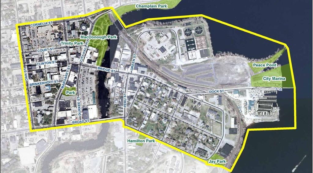
5 DRI Area
6 DRI Funding: DRI Overview Downtown Streetscapes: $1.3M
7 DRI Funding: DRI Overview Downtown Streetscapes: $1.3M Riverfront Access: $1.6M
8 DRI Funding: DRI Overview Downtown Streetscapes: $1.3M Riverfront Access: $1.6M OUR PROJECTS The focus of our discussion tonight
9 DRI Funding: DRI Overview Downtown Streetscapes: $1.3M Riverfront Access: $1.6M OUR PROJECTS Durkee Street: $4.3M Dock Street: $290,000 Downtown Rehabilitation: $1M Strand Art & Innovation: $495,000 Strand Capital Improvements, Marketing & Branding: $260,000 Downtown Plattsburgh Marketing, Branding & Signage: $250,000
10 DRI Funding: DRI Overview Downtown Streetscapes: $1.3M Riverfront Access: $1.6M OUR PROJECTS Durkee Street: $4.3M Dock Street: $290,000 Downtown Rehabilitation: $1M Strand Art & Innovation: $495,000 Strand Capital Improvements: $260,000 Downtown Plattsburgh Marketing: $250,000 Parallel efforts by other groups
11 DRI Funding: DRI Overview Downtown Streetscapes: $1.3M Riverfront Access: $1.6M OUR PROJECTS $1,300,000 + $1,600,000 $ 2,900,000 $ 100,000 = $2,800,000 Downtown Streetscapes Riverfront Access TOTAL Allocated to grant administration Available for design and construction

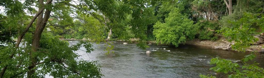
12 DRI Priorities Riverfront Access Macdonough Park: lighting, landscaping, paths, amphitheater, waterfront landing Riverfront boardwalk at Durkee Street: widening, surfacing, extension, benches, lighting River overlook with lighting, seating, and informational plaques Kayak launch with pad, ramp, railings, and storage Improvements to other walkways

13 DRI Priorities Downtown Streetscapes Improvements on up to five streets for pedestrians and bicycles Protected access on Veteran s Memorial Bridge Transformation of the park between Margaret & Durkee, including potential performance space
14 DRI Priorities
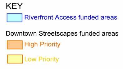
* Low Priority Areas Margaret Street City Hall Place Clinton Street Protection Ave Dock")
15 High Priority Areas: Arts Park & MacDonough Park Brinkerhoff Street Bridge Street Durkee Street Durkee Riverfront Green Street (to SRT)* Low Priority Areas Margaret Street City Hall Place Clinton Street Protection Ave Dock Street

16 DRI Funding: Project Context Downtown Streetscapes: $1.3M Riverfront Access: $1.6M Durkee Street: $4.3M Dock Street: $290,000 Downtown Rehabilitation: $1M Strand Art & Innovation: $495,000 Strand Capital Improvements: $260,000 Downtown Plattsburgh Marketing: $250,000 Parallel Projects
 Phase 3: near")

17 Parallel Projects Saranac River Trail Phases 2 & 3 Phase 2: up to Broad Street from the south (Spring 2019) Phase 3: near MLD/treatment plant (Dock Street to pedestrian bridge) Dock Street Development Minimal effects on other projects Anticipated 2019/2020

 and riverfront")
18 Parallel Projects Durkee Street: City Center Awaiting developer and concepts Retail/office/residential with outdoor space Possible 2019 start Design, approval & construction Need for parking plan Intersects with streetscapes (Durkee Street, Bridge Street) and riverfront boardwalk/overlook
 2022: potential mouth of river/mld area (TBD per testing) Impacts to Green Street (access route) and river access (riverbank")
19 Parallel Projects NYSEG Remediation Phased, anticipated through : Broad St to Bridge St (access at Broad St) 2021: Macdonough area (access near RR tracks & MLD) 2022: potential mouth of river/mld area (TBD per testing) Impacts to Green Street (access route) and river access (riverbank restoration)
 Funds for Strand Theater LWRP goals walkability, arts corridor, riverfront access, etc.")
20 Parallel Projects Downtown Marketing, Branding, and Signage Likely to be incorporated into streetscape and other projects: identity Other Projects: MLD Redevelopment (2019/2020) Funds for Strand Theater LWRP goals walkability, arts corridor, riverfront access, etc.

21 Riverfront Access & Streetscapes in Context
22 Riverfront Access & Streetscapes in Context Riverfront Access Macdonough Park: lighting, landscaping, paths, amphitheater, (waterfront landing) Riverfront boardwalk at Durkee Street: (coordinate design with development) widening, surfacing, extension, benches, lighting River overlook with lighting, seating, and informational plaques (Kayak launch) with pad, ramp, railings, and storage Improvements to other walkways Downtown Streetscapes Physical river access delayed due to NYSEG work, but concepts can be developed for future CFA funding applications Can also improve visual access Improvements on up to five streets for pedestrians and bicycles Protected access on Veteran s Memorial Bridge Transformation of the park between Margaret & Durkee, including a potential performance space


23 DRI & Project Overview Downtown Revitalization Many moving parts to this effort which are interdependent Requires coordination & phasing Our team s focus is making the downtown streetscape and waterfront the best it can be with the funds available How best to put that money to use?
24 Public Engagement Dot Polls Focus Groups Mailed & Online Survey s

25 Public Engagement Dot Polling Stands Available for 10 days at: City Hall The Bagel Pit Plattsburgh Public Library North Country Co-Op *** Battle of Plattsburgh Farmer s Market

26 Public Engagement Which downtown street is in most need of work? 1. Margaret Street 2. Bridge Street

27 Public Engagement Which recreational amenity is most needed downtown? 1. Splash Pad 2. Ice Skating Rink
28 Public Engagement Focus Groups 30-minute sessions: Senior Citizens Council of Clinton County Lake City Development Corporation Stafford Middle School Plattsburgh High School Topics: Greatest Assets Desired Changes Barriers to Coming Downtown 5-Year Vision Streetscapes More benches with water views Outdoor dining Outside art Plantings/educational Lighting (ped. bridge) Even, level sidewalks Bike lanes Waterfront Access Capitalize on natural assets Year-round opportunities Program space (movies, cooking competitions, skating, curling, biking) Food truck space Gathering place for all ages River access from Farmer s Market
29 Public Engagement Common Themes Parking Future of downtown Effect of potential paid parking on businesses Current rules not enforced Durkee Street Development Interested in its future Effect on other local businesses Want to learn more about project progress Farmer s Market Future: effect of Durkee development Sightlines to river Building for longer season North Country Co-Op Desire for programming area Parking for shoppers Other Items Accessibility & snow removal Safety for walking & biking: distracted drivers; traffic flow Vacant lots Potholes (challenge for all)

30 Public Engagement Mailed & Online Survey Mailed to ~1200 addresses within the DRI Study area 173 mailed responses *** Online Survey Oct 26 November online responses
31 Which of the following riverfront access improvements would you most like to see along the Durkee Street waterfront? (Select up to 3) A multi-use walking path along the river from MacDonough Park to Broad Street. A multi-use walking path along the river from MacDonough Park to Broad Street. A scenic overlook of the river near the Farmers Market. Additional connections to/extensions of the Saranac River Trail. Improved visibility of the river along Durkee Street, including the thinning of vegetation. A whitewater park and kayak/canoe launch near Broad Street. Additional connections to/extensions of the Saranac River Trail. A scenic overlook of the river near the Farmers Market. A whitewater park and kayak/canoe launch near Broad Street. Improved visibility of the river along Durkee Street, including the thinning of vegetation. Information kiosks, wayfinding signs and historic/environmental educational signs. Information kiosks, wayfinding signs and historic/environmental educational signs. Mailed Online
 A multi-use walking path along the river from MacDonough Park to Broad Street. A multi-use walking path along the river from MacDonough Park to Broad Street. A scenic overlook of the river near the Farmers Market.")

32 Which of the following riverfront access improvements would you most like to see along the Durkee Street waterfront? (Select up to 3) A multi-use walking path along the river from MacDonough Park to Broad Street. A multi-use walking path along the river from MacDonough Park to Broad Street. A scenic overlook of the river near the Farmers Market. Additional connections to/extensions of the Saranac River Trail. Improved visibility of the river along Durkee Street, including the thinning of vegetation. A whitewater park and kayak/canoe launch near Broad Street. Additional connections to/extensions of the Saranac River Trail. A scenic overlook of the river near the Farmers Market. A whitewater park and kayak/canoe launch near Broad Street. Improved visibility of the river along Durkee Street, including the thinning of vegetation. Information kiosks, wayfinding signs and historic/environmental educational signs. Information kiosks, wayfinding signs and historic/environmental educational signs. Mailed Online
33 Which of the following riverfront access improvements would you most like to see at Macdonough Park? (Select up to 3) Additional seating, pedestrian lighting, bike racks and similar amenities. Formal path connection to the pedestrian bridge north of the park. A performance amphitheater for special events. A performance amphitheater for special events. Formal path connection to the pedestrian bridge north of the park. Additional seating, pedestrian lighting, bike racks and similar amenities. Improved landscaping and tree plantings. Improved landscaping and tree plantings. Information kiosk, wayfinding signs and historic information. Information kiosk, wayfinding signs and historic information. Mailed Online


34 Which of the following riverfront access improvements would you most like to see at Macdonough Park? (Select up to 3) Additional seating, pedestrian lighting, bike racks and similar amenities. Formal path connection to the pedestrian bridge north of the park. A performance amphitheater for special events. A performance amphitheater for special events. Formal path connection to the pedestrian bridge north of the park. Additional seating, pedestrian lighting, bike racks and similar amenities. Improved landscaping and tree plantings. Improved landscaping and tree plantings. Information kiosk, wayfinding signs and historic information. Information kiosk, wayfinding signs and historic information. Mailed Online
35 In your opinion, what types of streetscape design improvements would most benefit downtown Plattsburgh? (Select up to 4) Attractive outdoor café spaces Small pocket parks / relaxation areas Attractive outdoor café spaces Small pocket parks / relaxation areas Bicycle racks, benches, trash receptacles Wider or improved sidewalks Wider or improved sidewalks Bicycle racks, benches, trash receptacles Wheelchair accessibility improvements New crosswalks, crossing signals Mailed Wheelchair accessibility improvements Online


36 In your opinion, what types of streetscape design improvements would most benefit downtown Plattsburgh? (Select up to 4) Attractive outdoor café spaces Small pocket parks / relaxation areas Attractive outdoor café spaces Small pocket parks / relaxation areas Bicycle racks, benches, trash receptacles Wider or improved sidewalks Wider or improved sidewalks Bicycle racks, benches, trash receptacles Wheelchair accessibility improvements New crosswalks, crossing signals Mailed Wheelchair accessibility improvements Online
37 Recognizing a limited budget, how should the funding be allocated? Concentrate the improvements to have a bigger impact in more focused areas. Concentrate the improvements to have a bigger impact in more focused areas. Spread the improvements widely to cover more territory. Spread the improvements widely to cover more territory. Mailed Online


38 Recognizing a limited budget, how should the funding be allocated? Concentrate the improvements to have a bigger impact in more focused areas. Concentrate the improvements to have a bigger impact in more focused areas. Spread the improvements widely to cover more territory. Spread the improvements widely to cover more territory. Mailed Online
39 Which of the following DRI-identified priority downtown streets would benefit the city the most from some of the design improvements listed above? Bridge Street from Peru Street to Margaret Street Bridge Street from Peru Street to Margaret Street Bridge Street from Peru Street to Dock Street Bridge Street from Peru Street to Dock Street Mailed Online


40 Which of the following DRI-identified priority downtown streets would benefit the city the most from some of the design improvements listed above? Bridge Street from Peru Street to Margaret Street Bridge Street from Peru Street to Margaret Street Bridge Street from Peru Street to Dock Street Bridge Street from Peru Street to Dock Street Mailed Online
41
 Water Feature (see example images below) Performance space / outdoor theatre Performance space")
 Better pedestrian connection between Durkee & Margaret Better pedestrian connection between Durkee &")
42 What types of improvements would make the park a more welcoming and active place for people? (Select up to 3) Water Feature (see example images below) Performance space / outdoor theatre Performance space / outdoor theatre Additional trees, landscaping Additional trees, landscaping Water Feature (see example images below) Better pedestrian connection between Durkee & Margaret Better pedestrian connection between Durkee & Margaret Mailed Online


43 What would make the biggest improvement to downtown? Mailed Online
44 Written Responses
45 Written Responses Response Topic Count Paths 69 Access to waterfront/view of waterfront 68 Landscaping 53 Amenities 45 Accessibility 33 Lighting 32 Water Features 31 Whitewater Park 27 Amphitheater 22 Family friendly/places to gathering 24 Art 17 Playground 12 Conductivity safe navigable paths that connect downtown to the waterfront and adjacent trails Amenities amphitheater, water features, white water park, playground, benches Aesthetic Improvements art, landscaping, accessibility, lighting, view of the waterfront, access to the waterfront
46 Full Survey Results

47 Pedestrian & Bicycle Study Five Intersections Studied Thursday & Saturday in September Highest traffic: Margaret/Bridge St. area Peak times: Lunch, Dinner


48 Intersections Studied Library YMCA Strand Key Bank Bagel Pit & JCEO Stafford Middle School

49 Thursday Traffic


50 Saturday Traffic
51 Spring 2019 Initial Impressions & Concepts
52 DRI Priorities
 Durkee Dot Polls: Top Streets Margaret Bridge Arts Corridor (Brinkerhoff) Focus Group Elements More benches with")
53 Looking Ahead to Streetscape Improvements Streetscape Goals Pedestrian & bike improvements on up to 5 streets Protected access on Veteran s Memorial Bridge Highest pedestrian and bicycle traffic was observed on Margaret & Bridge Streets Survey: Top Streets Bridge (Peru to Margaret) Durkee Dot Polls: Top Streets Margaret Bridge Arts Corridor (Brinkerhoff) Focus Group Elements More benches with water views Outdoor dining Outside art Plantings/educational Lighting (ped. bridge) Even, level sidewalks Bike lanes Survey Elements Café space Pocket parks Sidewalk improvements, street trees, furnishings (benches, bike racks, lighting)

54 Sidewalks Street trees Accessibility Lighting Benches Bike racks

55 Cafe Space High Score Outdoor Seating Lots of Activity What are the current issues?

56 Pocket Parks High Score Relaxation Shade Landscaping Where should they be?

57 Pedestrian Plaza Pedestrian Outdoor Cafes Gathering Space Can function as cafe space and pocket parks
58 Sidewalk Improvements
59 Potential Performance Space


60 Potential Performance Space Concept Sketches Macdonough Park (Riverfront Funds)


 Macdonough Park")
61 Potential Performance Space Concept Sketches Shaded seating area Bike rack Existing stairs Existing ramp/walk Upper plaza & bench Seating Tiered seating Event plaza Event stage Flexible paver plaza food trucks or event parking Existing ramp/walk Shaded seating area Bike rack Tiered seating Event plaza Event stage New ramp/walk Arts Park (Streetscape Funds) Macdonough Park (Riverfront Funds)
62 Riverfront Boardwalk Concept To Saranac River Trail To Macdonough Park Durkee Boardwalk (Riverfront Funds)
63 Riverfront Boardwalk Concept To Saranac River Trail Planted Areas with Seating To Macdonough Park Durkee Boardwalk (Riverfront Funds)
64 Riverfront Boardwalk Concept To Saranac River Trail Planted Areas with Seating Durkee Boardwalk (Riverfront Funds) Remove Invasive Species To Macdonough Park
65 Riverfront Boardwalk Concept Arts Park To Saranac River Trail Planted Areas with Seating Durkee Boardwalk (Riverfront Funds) Remove Invasive Species To Macdonough Park


66 Riverfront Boardwalk Concept Arts Park To Saranac River Trail Planted Areas with Seating Durkee Boardwalk (Riverfront Funds) Remove Invasive Species To Macdonough Park
67 Anticipated Schedule Next Steps January/February: Review & Refine Concept Designs March: Second : Streetscapes focus with update on park plans Spring 2019: Park Construction Begins April-August: Review & Refine Streetscape Designs Late 2019/Early 2020: Streetscape construction
 (Click on the")
68 Questions? Check DRI website for updates (Or Google Plattsburgh DRI ) (Click on the project name on the left)
69 Questions / Discussion Outdoor cafes Pocket Parks Sidewalk improvements Performance spaces Other topics

70 DRI Project Area
71 Thank you for attending this evening!
Johnson Street Bridge Public Realm Update
 Johnson Street Bridge Public Realm Update August 20, 2015 Background Johnson Street Bridge Replacement Project impacts a diverse range of stakeholders In addition to a new bridge, the project also includes
TOWN COUNCIL / PLANNING COMMISSION
 Workshop #3 TOWN COUNCIL / PLANNING COMMISSION January 20, 2011 Consultant Team In Attendance Tonight BMS Design Group Nevada City and San Francisco Michael Smiley, AICP, ASLA Partner-in-Charge Nancy L.
Building Great Neighbourhoods. Strathcona
 Building Great Neighbourhoods Strathcona March 21, 2018 Becky Redford Project Manager, Planning & Design Building Great Neighbourhoods Integrated Infrastructure Services Welcome and Purpose To provide
ROCKTON DOWNTOWN STREETSCAPE MASTER PLAN. Plan Commission Presentation April 10, 2018 Teska Associates Christopher Burke Engineering
 ROCKTON DOWNTOWN STREETSCAPE MASTER PLAN Plan Commission Presentation April 10, 2018 Teska Associates Christopher Burke Engineering AGENDA 1. Project Scope & Schedule 2. Steering Committee & Community
Mississippi Drive Corridor Revitalization. A DestinationTransportation Project...
 Mississippi Drive Corridor Revitalization A DestinationTransportation Project... Mississippi Drive Corridor Revitalization Welcome! Tonight s Agenda: Further define the Scope of the Project Discuss the
Maplewood Avenue Downtown Complete Street Project
 Maplewood Avenue Downtown Complete Street Project Second Public Meeting January 24, 2018 Welcome and Introduction of Project Team City Planning and Public Works Staff City of Portsmouth Juliet Walker Planning
Chapter 1: Introduction
 Chapter 1: Introduction The Penn Avenue Community Works Corridor Vision and Implementation Framework presents an integrated communitybased vision and a coordinated, long-term implementation framework for
Port Lavaca Future Land Use
 Port Lavaca Future Land Use Introduction The City of Port Lavaca is beginning to see sustained growth, after many years of relative stable population. New single family homes, apartments, and businesses
Project purpose. advise. The purpose of the Beaumaris Lake Open Space Rehabilitation project is to: + Develop a Functional Program Concept
 Project purpose owns Road Beaumaris Road The purpose of the Beaumaris Lake Open Space Rehabilitation project is to: + Develop a Functional Program Concept + Guide Rehabilitation of Landscape and Community
Potential Green Infrastructure Strategies May 6, 2015 Workshop
 Potential Green Infrastructure Strategies May 6, 2015 Workshop Background The City of Cortland is developing the Tioughnioga Urban Headwaters Green Infrastructure Action Plan with funding from the National
Study Area. Capitol Way. Greening America s Capitals 11/13/2014. A Greening America s Capitals Project
 Olympia, WA: Greening Capitol Way Supporting Communities move towards sustainability is a priority for the federal government. A Greening America s Capitals Project Office of Sustainable Communities U.S.
Fifth and Detroit Street Design May 2017 Capital Improvements Committee. DOWNTOWN Street Design
 1 Fifth and Detroit Street Design May 2017 Capital Improvements Committee Agenda 2 Review Street Configuration Prior Meeting Review Outreach Synopsis Functional Street Design Refinements Curb Edge, Turning
The Project. In 2013, construction was completed between 100 Street and 102 Street.
 The Project Jasper Avenue New Vision (JANV) is a major catalyst project identified in the Capital City Downtown Plan (2010) between 92 Street and 109 Street, including the streets half a block north and
West Dennis Center: Bass River to Old Main Street. West Dennis Business District: Old Main Street to Dennis Commons
 West Dennis Center: Bass River to Old Main Street West Dennis Business District: Old Main Street to Dennis Commons Dennisport Center: Dennis Commons to Division Street Main Street Project Goals Project
Community Assistantship Program. Milaca Downtown Revitalization
 Community Assistantship Program Milaca Downtown Revitalization Prepared in partnership with City of Milaca Prepared by Zachary Jorgensen Research Assistant University of Minnesota December, 2009 CAP Report
Dyersville Downtown Plan. Open House October 24, 2017
 Dyersville Downtown Plan Open House October 24, 2017 What is a Comprehensive Plan? - Vision - Guidance for decisions - Basis for regulations What is a Downtown Plan? - Understand priorities - Identify
The Vision. Photo provided by The Minervini Group. 46 Vision, Objectives & Strategies
 Vision, Objectives & Strategies The is the public framework and guide for future development of the Grand Traverse Commons. The establishes public polices for infrastructure, the preservation of natural
Emerson Park Master Plan Update. Public Meeting III August 27, 2014
 Emerson Park Master Plan Update Public Meeting III August 27, 2014 Meeting Agenda: Project Update Presentation of Master Plan Components Discussion and Feedback The Path Forward: Building on the Concept
4 Park Planning and Design
 4 Park Planning and Design Park Constellations Elliot Gateway/Mills Loring North Loop Commons Twins Minneapolis Park & Recreation Board Downtown Service Area Master Plan 4-1 PROJECT APPROACH REFERENCE
Michigan State University Barrier-Free/Accessibility Project Status Summary March 2017
 Projects Completed FY14, FY15 and FY16 (arranged alphabetically) Abrams Planetarium Install automatic door opener on main doors of the Planetarium. Completed: Summer 2016 Cost: $13,000 Akers Hall Renovations
Comprehensive Plan & Station Area Zoning
 Village of Tarrytown Comprehensive Plan & Station Area Zoning Public Workshop November 5, 2017 Warner Library WXY architecture + urban design Pace University - Land Use Law Center George M. Janes & Associates
Marpole Community Plan. Parks and Open Space
 Marpole Community Plan Parks and Open Space Community Workshop, March 13 th, 2013 Overview 1 Community Plan 2 City-wide initiatives 3 4 Overview 1 Community Plan 2 City-wide initiatives 3 4 Marpole: Boundaries
ROCKTON DOWNTOWN STREETSCAPE MASTER PLAN. Village Board Presentation May 8, 2018 Teska Associates Christopher Burke Engineering
 ROCKTON DOWNTOWN STREETSCAPE MASTER PLAN Village Board Presentation May 8, 2018 Teska Associates Christopher Burke Engineering AGENDA 1. Project Scope & Schedule 2. Steering Committee & Community Outreach
SOUTH UNIVERSITY Street Design Alternatives in Progress
 1 Alternatives in Progress 2016.01.20 Meeting Agenda 2 1. Progress & Schedule 2. Utilizing the Street Design Manual 3. Site Characteristics and Input Received 4. Street Geometry What can we accomplish
7Page 91 CLEMMONS COMMUNITY COMPASS 7 COMMUNITY CHARACTER
 7 Community Character The beauty of Clemmons won t necessarily be a reflection of our past, but our future. This quote from Comprehensive Plan Steering Committee member Wayne Dodson captures the essence
VEHICULAR AND PEDESTRIAN CIRCULATION
 This perspective sketch communicates the intended character and quality of a proposed streetscape design. Locate benches near a major intersection where people tend to gather. Seating and lighting provide
Complete Streets Master Plan for Downtown New Britain CRCOG Transportation Committee Meeting Monday, December 9, 2013
 CRCOG Transportation Committee Meeting Monday, December 9, 2013 Introduction Why the Project was Initiated About Downtown New Britain Master Plan Goals Master Plan Overview Master Plan Study Areas and
ARISE: The Rock Renaissance Area Redevelopment & Implementation Strategy
 2014 Professional Awards 1 ARISE: The Rock Renaissance Area Redevelopment & Implementation Strategy Janesville, WI Completed December 2014 Analysis & Planning Purpose of Project 2 The purpose of the Rock
2035 General Plan Update and Belmont Village Specific Plan. Joint Study Session with the City Council and Planning Commission April 12, 2016
 2035 General Plan Update and Belmont Village Specific Plan Joint Study with the City Council and Planning Commission April 12, 2016 Agenda 1. Welcome and Introductions 2. General Plan Update Status of
Workshop #3 June 13, 2016
 Downtown Ocoee Master Plan Workshop #3 June 13, 2016 Our Team Our Team and Tonight s Goal Quick Recap: Why a Downtown Plan? How are we developing the plan? How can you still be involved? What s left to
RESEDA - WEST VAN NUYS COMMUNITY PLAN
 RESEDA - WEST VAN NUYS COMMUNITY PLAN Executive Summary As part of the initial outreach effort, the Department of City Planning hosted two workshops for the Reseda-West Van Nuys Community Plan Area during
Elm Street Business District: Streetscape and Signage Plan
 Elm Street Business District: Streetscape and Signage Plan VILLAGE OF WINNETKA DOWNTOWN MASTER PLAN TASK FORCE MTG #1 Teska Associates 30 October 2017 AGENDA 1. Introductions and Walking Tour 2. Past Streetscape
The George Washington University Streetscape Concept Plan. May 6 th 2009 Public Presentation for Discussion EHRENKRANTZ ECKSTUT & KUHN ARCHITECTS
 The George Washington University Streetscape Concept Plan May 6 th 2009 Public Presentation for Discussion EHRENKRANTZ ECKSTUT & KUHN ARCHITECTS Agenda 1. Introduction & Overview 2. Background & Context
PRELIMINARY DESIGN + DEVELOPMENT PLAN
 WELCOME! To The Public Open House May 30 th, 2017 HARBOUR WEST PARKS Vision Project Overview The City s vision for Port Credit Harbour West Parks is to develop a vibrant waterfront destination that integrates
Welcome to the Public Meeting!
 Welcome to the Public Meeting! Please sign in, grab a paper survey, and check out the boards around the perimeter of the room. Once you ve viewed all of the boards, come join us in the middle of the room
A Vibrant Downtown. Chapter 5 Cary Public Art Opportunities 31
 A Vibrant Downtown Cary s vision for Downtown is a unique, vibrant, dynamic, pedestrian friendly location; a regional destination and a place to live, work, and recreate, according to the 2001 Town Center
Pedestrian and Bike Bridge LOGO
 6.2.2 Pedestrian and Bike Bridge The proposed pedestrian and bike crossing re-envisions the existing bridge at Pismo Creek on Cypress Street. The bridge is currently underutilized by vehicular through
alum creek park public workshop January 16, 2014
 alum creek park public workshop January 16, 2014 brief History Schneider Park Early 2000 s - Clean Ohio Fund - Acquisition & Invasive Species Removal SWBMP - Capital University agrees to assist with land
City of Le Sueur DOWNTOWN MASTER PLAN
 City of Le Sueur DOWNTOWN MASTER PLAN City Council Update 9/11/2017 Hoisington Koegler Group Inc. Presentation Agenda 01 Schedule Update / Tonight s Objectives 02 What We ve Heard - Engagement Comments
The Lower SaLuda Greenway
 The Lower SaLuda Greenway InITIaTIve a FLourIShInG Greenway. a hub For economic GrowTh. a ConneCTIon BeTween CoMMunITIeS. In April 2017 the Michael J. Mungo Foundation and Lexington County commissioned
Denver Moves: Transit Task Force
 Insert transit picture Denver Moves: Transit Task Force Meeting #8 October 5, 2017 1. Welcome & Introductions Opening remarks and housekeeping Task Force and audience introductions Upcoming events and
FROM DUPONT CIRCLE NORTH TO CALIFORNIA STREET, NW. Welcome!
 FROM DUPONT CIRCLE NORTH TO CALIFORNIA STREET, NW Welcome! Meeting Agenda 6:00 PM Open House 6:30 PM Presentation 7:00 PM Open House / Q&A at the Boards Project Design Team Connecticut Avenue, NW Project
PUBLIC RIGHT-OF-WAY IN THIS CHAPTER PUBLIC REALM
 PUBLIC RIGHT-OF-WAY This section provides design guidelines for improvements in the public right-of-way. The public right-of-way refers to streets, sidewalks, non-vehicular thoroughfares, parks and greenways
A larger version of this map is located on the last page of this PDF.
 MAP Committee Input McLoughlin Area Draft Vision Map A larger version of this map is located on the last page of this PDF. 1. The map above is intended to portray a vision for the McLoughlin area. It highlights
South Davis County COMMUNITY SPOTLIGHT
 South Davis County COMMUNITY SPOTLIGHT Davis/SLC Community Connector Bus Rapid Transit line connecting SLC & Davis County RTP Phase 1 Project Generate 3,100 average weekday riders Relieve congestion on
Route 1 Corridor Study
 Route 1 Corridor Study Westbrook, Connecticut A Vision for the Connecticut Shoreline Public Informational Meeting July 28, 2015 Lower Connecticut River Valley Council of Governments Fitzgerald & Halliday,
Elm Street Business District: Streetscape and Signage Plan
 Elm Street Business District: Streetscape and Signage Plan VILLAGE OF WINNETKA DOWNTOWN MASTER PLAN VILLAGE COUNCIL MEETING Final Streetscape & Signage Planning Teska Associates 04 June 2018 WHY WE RE
7-PARKS, OPEN SPACE & PUBLIC ART
 7-s, Open Space & Public Art 7-PARKS, OPEN SPACE & PUBLIC ART This chapter provides recommendations for the expansion of new parks, plazas and open space that serve the many user groups targeted for downtown.
Small Area Plan. South Gateway
 Small Area Plan Adopted May 12, 2008 South Gateway Purpose. The South Gateway Small Area Plan defines the City s expectations for the future of the southern entrance to the City at Interstate 85 and Highway
PIKE PINE RENAISSANCE: ACT ONE. October 19, 2017
 PIKE PINE RENAISSANCE: ACT ONE October 19, 2017 WATERFRONT SEATTLE PROGRAM PROJECT INTRODUCTION Pike and Pine streets, between First and Melrose avenues Pedestrian and streetscape improvements Budget:
City of Poughkeepsie Waterfront Redevelopment Strategy. Poughkeepsie Waterfront Redevelopment Strategy
 City of Poughkeepsie Waterfront Redevelopment Strategy Poughkeepsie Waterfront Redevelopment Strategy City of Poughkeepsie Prime Assets: Major Waterfront Advantages: - Central City of the Hudson River
Lower South Street/Louisa Street Charrette Final Presentation. September 22, 2009
 Lower South Street/Louisa Street Charrette Final Presentation September 22, 2009 Recap Mayor and Council called for a Charrette to engage the public on creating a vision for the Lower South Street area.
DOWNTOWN VISIONING FORUM AGENDA JUNE 5, 2014
 DOWNTOWN VISIONING FORUM AGENDA JUNE 5, 2014 Welcome and Introductions Evolution of the Downtown Proposed Downtown Plan Overview and Process Have Your Say! Next Steps Closing Comments 1 WELCOME & INTRODUCTIONS
STAFF REPORT Agenda Item: J.4 To: Mayor and City Council Date:
 STAFF REPORT Agenda Item: J.4 To: Mayor and City Council Date: 2-14-2007 Thru: Charles McNeely, City Manager Subject: Staff Report: Approval of a project to be submitted for the NDOT 2007-2009 Landscape
Lower Merion Commercial Districts Issues and Characteristics Handbook November 2013
 Lower Merion Commercial Districts Issues and Characteristics Handbook November 2013 DRAFT TOWNSHIP-WIDE VISION: To maintain and enhance commercial areas to complement the surrounding high-quality residential
Cold Lake Marina Master Plan
 Cold Lake Marina Master Plan Intro to Team Moffatt & Nichol is recognized throughout the world for our role in the revitalization and redevelopment of urban waterfronts, including the evolution of modern
Dundas Place Flexible Street Public Information Centre
 WELCOME TO THE DUNDAS PLACE DESIGN REVEAL Dundas Place Flexible Street Public Information Centre November 8, 2017 This project is funded by the City of London with support from the Government of Canada
PLAN ELEMENTS WORKSHOP. April 5, 2016
 PLAN ELEMENTS WORKSHOP April 5, 2016 needs more housing. But there is no one-size fits-all solution. Every neighborhood has its own character. In some places, density is not only appropriate it is badly
WARM SPRINGS PARK MASTER PLAN
 TABLE OF CONTENTS page 1.0 Introduction and Overview 1 2.0 Information Gathering 2 3.0 Conceptual Alternative Development 8 4.0 Master Plan Development 14 5.0 Construction Cost Estimates 19 LIST OF FIGURES
A BLUEPRINT FOR BROCKTON A CITY-WIDE COMPREHENSIVE PLAN
 A BLUEPRINT FOR BROCKTON A CITY-WIDE COMPREHENSIVE PLAN Public Meeting October 2016 1 Plan Summary and Discussion Public Meeting May 4 2017 City of Brockton Bill Carpenter, Mayor Department of Planning
Illustration of Eastlake Farmer s Cooperative Grain Elevator. Chapter 5: implementation 5-1
 Illustration of Eastlake Farmer s Cooperative Grain Elevator Chapter 5: implementation 5-1 chapter 5: implementation Introduction The Eastlake Subarea Plan includes a wide range of recommendations intended
Implementation Guide Comprehensive Plan City of Allen
 Implementation Guide 2030 Comprehensive Plan City of Allen DRAFT 2015 Implementation Guide Allen 2030 Comprehensive Plan INTRODUCTION The Comprehensive Plan serves as a guide for the growth and development
University of the District of Columbia Van Ness Campus Master Plan Community Open House 3. December 8, 2010
 University of the District of Columbia Van Ness Campus Master Plan Open House 3 December 8, 2010 Introductions Sequence of Work: Campus Master Plan BEGIN: INTRODUCE AND START WORK Project Initiation Team
GLEN ROAD PEDESTRIAN BRIDGE ENVIRONMENTAL ASSESSMENT STUDY PUBLIC INFORMATION CENTRE #2 OCTOBER 24, 2017
 GLEN ROAD PEDESTRIAN BRIDGE ENVIRONMENTAL ASSESSMENT STUDY PUBLIC INFORMATION CENTRE #2 OCTOBER 24, 2017 Glen Road Pedestrian Bridge Class Environmental Assessment 1 WELCOME! Welcome to the second Public
TEMPLE MEDICAL & EDUCATION DISTRICT
 City of Temple, Texas TEMPLE MEDICAL & EDUCATION DISTRICT 1 Description. The City of Temple joined in partnership with key public and private entities to jointly promote education and medical activities
Please read the entire document
 projects impacting the waterfront revitalization area. The waterfront revitalization area of the town will have to subareas to the west and east of the village. Page 6 of 6 Wayfinding master plan create
Whitemarsh Comprehensive Plan Update: Housing & Land Use. Public Workshop #3: September 20, 2018
 Whitemarsh Comprehensive Plan Update: Housing & Land Use Public Workshop #3: September 20, 2018 Agenda Welcome Process Recap What We ve Heard The Plan Framework Review of Recommended Actions Land Use Housing
BRADENTON RIVERWALK EXPANSION MASTER PLAN
 BRADENTON RIVERWALK EXPANSION MASTER PLAN INTRODUCTION & AGENDA Process Update Community Engagement Summary Center for Active Design (CfAD) Recommendations Context and Existing Conditions Master Plan Alternatives
COMPLETE GREEN STREET CHECKLIST
 COMPLETE GREEN STREET CHECKLIST This document was developed to dissect the structure of an urban street and explore opportunities to make our streets more complete while also integrating green street strategies.
ALLEN CREEK GREENWAY. Citizens Advisory Committee Meeting #5 July 19, Allen Creek Greenway Master Plan. July 2017
 1 ALLEN CREEK GREENWAY MASTER PLAN Citizens Advisory Committee Meeting #5 July 19, 2017 Agenda 2 Final DRAFT Preferred Plan (30 min) Master Plan Document Outline (5 min) Potential Implementation Strategy
IMAGINE CLEARWATER. Community Workshop 3. November 2016
 IMAGINE CLEARWATER Community Workshop 3 November 2016 Imagine Clearwater has been a 6-month community-focused process to re-envision the downtown waterfront. VISIONING FRAMEWORK MASTER PLAN HOW CAN WE
ROME WATERFRONT VILLAGE PROJECT NARRATIVE January 25, 2018
 January 25, 2018 The Rome Waterfront Village project is intended to foster the revitalization of the area between South James Street and Erie Boulevard north of the Erie Canal as well as improve public
Public Workshop 2 December 11, 2014 OLIN
 Public Workshop 2 December 11, 2014 OLIN TRIPLE IMAGE PANORAMA A NEW VISION FOR THE RIVERFRONT PROMENADE Burlington s Riverfront has historically been a defining character of the City s identity. This
Denton. A. Downtown Task Force
 2 Public Involvement Early and ongoing public involvement was solicited so that the public had ample opportunity to help direct the DTIP s concepts and implementation strategies. The residents of Denton
This Review Is Divided Into Two Phases:
 Semiahmoo Town Centre Review The purpose of this review: To review the Semiahmoo Town Centre Concept Plan, originally approved in 1993, to ensure that this centre will continue to serve the needs of South
Charles P. Johnson and Associates. Annapolis Landscape Architects
 Charles P. Johnson and Associates Annapolis Landscape Architects AGENDA Introduction Project Limits and Scope Site Analysis Opportunities & Constraints Program Goals Image Boards Design Alternatives Pros
Naomi Weiss, Executive Director, DBPA Jason Jeffries, Project Manager, City of Daytona Beach
 Naomi Weiss, Executive Director, DBPA Jason Jeffries, Project Manager, City of Daytona Beach Nottingham Plan 2002 Adopted Redevelopment Plan 2002 Riverfront Action Plan 2004 Downtown Vision Plan 2007
The Auburn Plan Designing the Future of Auburn February 28, 2005
 The Auburn Plan Designing the Future of Auburn February 28, 2005 Block-by-Block Bicycle Tour Aerial survey Focus Group Meetings September 7 and 8 Design Workshops October 11, 14, and 21 Revitalization
12 th Street Connector Alignment Study VISIONING PUBLIC WORKSHOP - JUNE 25, :00PM TO 8:00PM
 12 th Street Connector Alignment Study VISIONING PUBLIC WORKSHOP - JUNE 25, 2018 6:00PM TO 8:00PM Goals for Today s Workshop Agenda: Project Introduction, Purpose, and Goals Existing Conditions Traffic
LITTLETON RIVER DISTRICT REDEVELOPMENT PROJECT A LEGACY OF LEADERSHIP & COMMUNITY INVOLVEMENT
 LITTLETON RIVER DISTRICT REDEVELOPMENT PROJECT A LEGACY OF LEADERSHIP & COMMUNITY INVOLVEMENT Background Information Littleton Saranac Street Design Charrette Sponsored by the Town of Littleton and Plan
Reinventing Miner Avenue as a
 Reinventing Miner Avenue as a Complete Street Reinventing Miner Avenue as a Complete Street Agenda Project Overview / Introductions Previous Meeting Recap Economic Considerations Opportunities & Constraints
LUNDY S LANE COMMUNITY IMPROVEMENT PLAN STUDY
 PUBLIC INFORMATION MEETING #2 October 12, 2016 LUNDY S LANE COMMUNITY IMPROVEMENT PLAN STUDY AGENDA 5:00 to 5:30pm: Open House 5:30 to 6:15pm: Presentation 6:15 to 7:00pm: Individual paced workshop with
WELCOME! 8 8:30 6: TH STREET IMPROVEMENTS. Open House. Presentation & Q&A
 WELCOME! 168 TH STREET IMPROVEMENTS 6:30 Open House 7 8 Presentation & Q&A 8 8:30 Open House WELCOME Todd Pfitzer City of Omaha Engineer Bob Stubbe City of Omaha Public Works Director Jon Meyer Project
Tonight s Agenda. Summary Presentation Open House. Group Discussion Next Steps: online community wide survey
 Community Open House February 22, 2018 Tonight s Agenda Summary Presentation Open House Station 1: Project Overview and Community Input Station 2: Draft Vision and Guiding Principles Station 3: Western,
CITY OF BOCA RATON GOVERNMENTAL CAMPUS Master Plan Progress August 22, 2017
 CITY OF BOCA RATON GOVERNMENTAL CAMPUS Master Plan Progress August 22, 2017 This is a rare moment in the City s history which affords us the opportunity to create a civic landmark born of comprehensive
Downtown North Las Vegas Demonstration Site Project. Project Update
 Downtown North Las Vegas Demonstration Site Project Project Update 7.16.14 Presentation Overview Project Purpose and Process Planning Context Opportunities and Barriers Summary Community Input Preliminary
4.9 Mendocino Avenue Corridor Plan Design Guidelines
 4.9 Mendocino Avenue Corridor Plan Design Guidelines The Mendocino Avenue Corridor Plan addresses the area between College Avenue and Steele Lane. Mendocino Avenue is a busy arterial that runs parallel
New York Avenue Streetscape and Trail Project Public Meeting #1 Summary
 New York Avenue Streetscape and Trail Project Public Meeting #1 Summary I. King Jordan Student Academic Center (SAC) Gallaudet University, Washington, DC February 23, 2017 Table of Contents 1.0 Introduction...
TURN TO THE RIVER CITY PLAZA LANDSCAPE DESIGN CONCEPT May 25, 2016
 Turn to the River is a multi-year project of Art Spaces - Wabash Valley Outdoor Sculpture Collection, Inc. to connect downtown Terre Haute with the Wabash River through public art and design. The four-square
open house 3 CITY OF SALEM Downtown Streetscape Plan
 open house 3 Streetscape concepts CITY OF SALEM Downtown Streetscape Plan analysis concepts we are here refined concepts & document Feb 13th 1 2 3 apr 18th KICKOFF OPEN HOUSE Streetscape Work Group Walking
Our Legacy Projects DOWNTOWN JACKSONVILLE MASTER PLAN
 DOWNTOWN JACKSONVILLE MASTER PLAN A major component of our master plan is the creation of a strong and accessible open space and recreation system. The four most vital links in that system are our legacy
18 May 2016 CAMPUS MASTER PLAN UPATE
 18 May 2016 CAMPUS MASTER PLAN UPATE Council of the Deans ( Over view) AGENDA Engagement & What We Heard Focus Elements: 1. Development Framework Plan 2. Campus Mobility 3. Campus Guidelines 4. Wayfinding
Public Consultation Summary: Lakeview Place Making Workshop January 30, 2008.
 Page 1 of 11 Public Consultation Summary: Lakeview Place Making Workshop January 30, 2008. 1.0 Introduction: On January 30, 2008 the City of Mississauga, in conjunction with the consulting team of Brook
Parker Pine Curve Master Plan January 28th, 2009, Public Workshop Comments
 Group 1 Big Ideas Pedestrian friendly within and to development - bridge over Main Street from downtown. Campus feel. Parking garage like Castle Rocks - Taj garage may be tucked in hillside. Large (big
Copake Hamlet Plan: Visioning Workshop
 Copake Hamlet Plan: May 2-3 rd 2015 Design Team Mauricio Castro PLACE Alliance Ian Law PLACE Alliance Paula Diaz PLACE Alliance Mary Moore Wallinger PLACE Alliance Margaret Irwin River Street Planning
BUSINESS DISTRICT DESIGN GUIDELINES
 Des Plaines, Illinois Prepared for the City of Des Plaines by: The Lakota Group Laurie Marston, AICP March 2005 Section 5: Streetscape Elements Business District Design Guidelines STREETSCAPE ELEMENTS
A Vision for Walnut Creek
 A Vision for Walnut Creek Photo: City of Clive Walnut Creek Booklet 8 of 8 Greater Des Moines Water Trails and Greenways 1 Table of Contents Booklet 1: Water Trails Strategies and Policies Booklet 2: Beaver
Loved hearing what others shared and having a dialogue about the possibilities/opportunities
 MEMO To: Dave Efland, Director of Planning & Community Development November 7, 2018 From: Sarah Kelly and Emily Long, planning NEXT Re: Round 1 of Public Engagement, Delaware Together, Comprehensive Plan
CHAPPLES PARK MASTER PLAN
 CHAPPLES PARK MASTER PLAN Presentation of Preliminary Development Options Public Open House #2 Wednesday November 2 nd, 2016 TONIGHT S AGENDA 1. Welcome & Introductions 2. Presentation by Sierra Planning
Table of Contents. Planting of Trees and Grasses. Purpose. Research approach. Downtown District. Findings. Decorative Antique Lighting
 Community Redevelopment Authority 2017 Table of Contents Purpose Research approach Downtown District Findings Planting of Trees and Grasses Decorative Antique Lighting Pedestrian Services Cracked Sidewalks