BRADENTON RIVERWALK EXPANSION MASTER PLAN
|
|
|
- Opal Malone
- 5 years ago
- Views:
Transcription


1 BRADENTON RIVERWALK EXPANSION MASTER PLAN

 Recommendations")

2 INTRODUCTION & AGENDA Process Update Community Engagement Summary Center for Active Design (CfAD) Recommendations Context and Existing Conditions Master Plan Alternatives Questions
3 PROCESS Public / Stakeholder Input Online Survey and Research Master Plan Concept Development Master Plan Feedback Finalize Master Plan We are Here!

4 COMMUNITY OUTREACH Farmer s Market January 20, 2018 Community Conversations January 25, 2018, Manatee UMC January 30, 2018, Manatee UMC February 1, 2018, Manatee UMC Feb. 6, 2018, Preserve at Riverwalk Feb. 8, 2018, Spanish Engagement Workshop, Manatee UMC CfAD Research and Survey Results March 22, 2018, Manatee UMC CfAD Online Survey 6 weeks, Early 2018 Over 880 Responses Park for a Day Community Gathering at Mineral Springs Park and Powers Property April 14, 2018

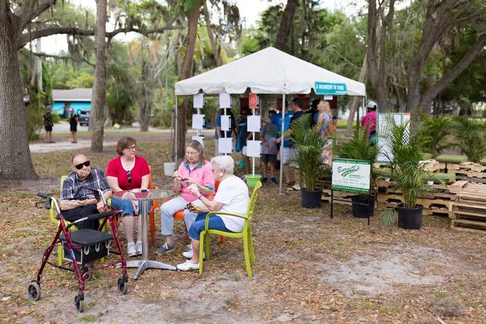
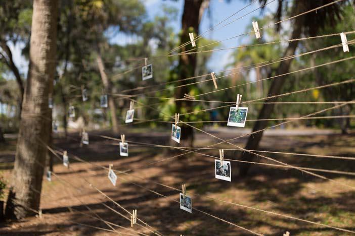

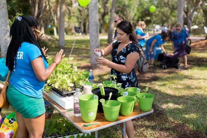
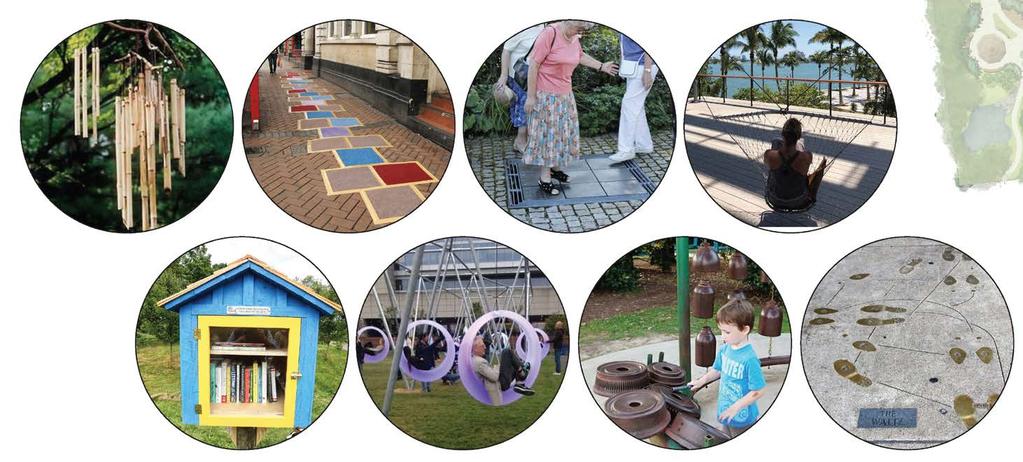
5 PARK FOR A DAY HIGHLIGHTS


6 Center for Active Design Survey & Research 5 Key Recommendations:

7 CONTEXT 1 mi.25 mi.7 mi.3 mi


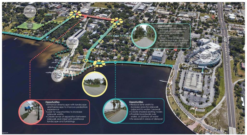
8 RIVERSIDE DRIVE E. (from RIVERFRONT BLVD TO 6 th St. E.) OPPORTUNITIES 1. Adjacency to water 2. Nearby parking and proximity to current Riverwalk 3. Connectivity between existing Riverwalk and Caddy s, marina Looking East on Riverside Dr E & 4 th E. : Approx. 45 ROW View to Desoto Bridge CONSTRAINTS 1. Right-of-way constraints 2. Maintaining vehicular access 3. Existing vegetation 4. Existing infrastructure (drainage, utilities) Looking South towards 4 th St NE Looking East on Riverside Dr E


9 6 th STREET & MANATEE AVENUE OPPORTUNITIES right-of-way 2. Connection to retail along Manatee avenue 3. Access to existing public transit 4. Views from 9 th St E to water 5. Existing sidewalk along north side of Manatee avenue Looking South - 6 th St E at Riverside Dr E Looking North - 6 th St E at 1 st Ave E CONSTRAINTS 1. Existing overhead powerlines 2. One-way traffic flow and speed along manatee avenue 3. Driveway connections 4. Municipal services (trash pick-up, mail) Municipal Services along 6 th St E Approaching Manatee Ave Looking East - Manatee Avenue at 6 th St E


10 MANATEE AVENUE & 9 TH STREET Looking East - Intersection of Manatee Avenue and 9 th St E Existing Shops on Manatee Avenue Corner of Manatee Avenue and 9 th St E Looking North The Preserve at Riverwalk, East of 9 th St E Existing Sidewalk on 9 th St E Looking North to Manatee River on 9 th St E

 View to Manatee River looking north on 9 th St E Looking East on Riverside")


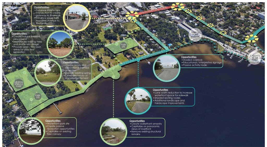
11 RIVERSIDE DRIVE E. (from 9 th ST. E. TO 14 th ST. E.) View to Manatee River looking north on 9 th St E Looking East on Riverside Dr E OPPORTUNITIES 1. Adjacency to water 2. Available green space between current street and seawall 3. Overlook opportunity 4. Connection to adjacent park space on east end 5. Expansion of Mineral Springs Park to waterfront creates approx. 3.5 acres of park CONSTRAINTS 1. Seawall 2. No existing pedestrian connection 3. Mangroves 4. Public utility storage area at 12 th and Riverside drive 5. 2 nd avenue bifurcating park two park sites Existing Utility Yard View to Manatee River at Riverside Dr E


12 MINERAL SPRINGS PARK & POWERS PROPERTY Overlook opportunity looking north on Riverside Dr E View of the Manatee River from the new park parcel OPPORTUNITIES 1. Adjacency to water 2. Available space between current street and seawall 3. Overlook opportunity 4. Connection to adjacent park spaces 5. Expansion of Mineral Springs Park to waterfront views 6. Waterfront easement between 11 th and 12 th St CONSTRAINTS 1. No existing pedestrian connection 2. Mangroves 3. Public utility storage area at 12 th and Riverside drive 4. 2 nd avenue bifurcating two park sites Pavilion at Mineral Springs Park Mineral Springs Park
13 PROPOSED MASTER PLAN
14 PROPOSED MASTER PLAN Riverside Dr. Riverside Dr. 6 th St. 9 th St. Mineral Springs Park / Powers Property Manatee Ave.

15 RIVERSIDE DRIVE Shift curbs south to meet existing southern sidewalk edge Street narrowed to 20 width Creates room for 10 sidewalk and planting along River s edge, 15 overall width Maintain existing private docks. Gates added for controlled access Seawall at western side modified to provide shaded game area Improved crosswalks Boardwalks to bring pedestrians out over water OPTION A

16 RIVERSIDE DRIVE OPTION B Maintain existing roadway dimensions 5-6 Sidewalk along River s edge Add chicanes (Curb Extensions) Slow down traffic Create landscape area OPTION C 8-10 Sidewalk along River s edge Roadway width minimized to 20 Trees planted in grates to create more pedestrian area

17 RIVERSIDE DRIVE GATEWAY PLAZA OPTION A

18 RIVERSIDE DRIVE OPTION B OPTION C


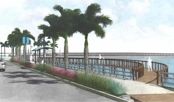
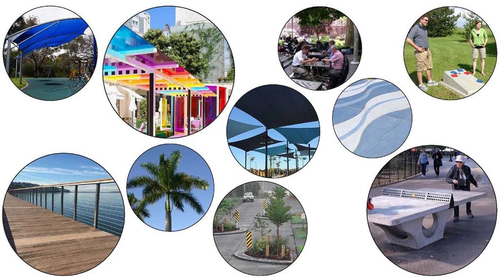
19 DESIGN IMAGERY RIVERSIDE DR.
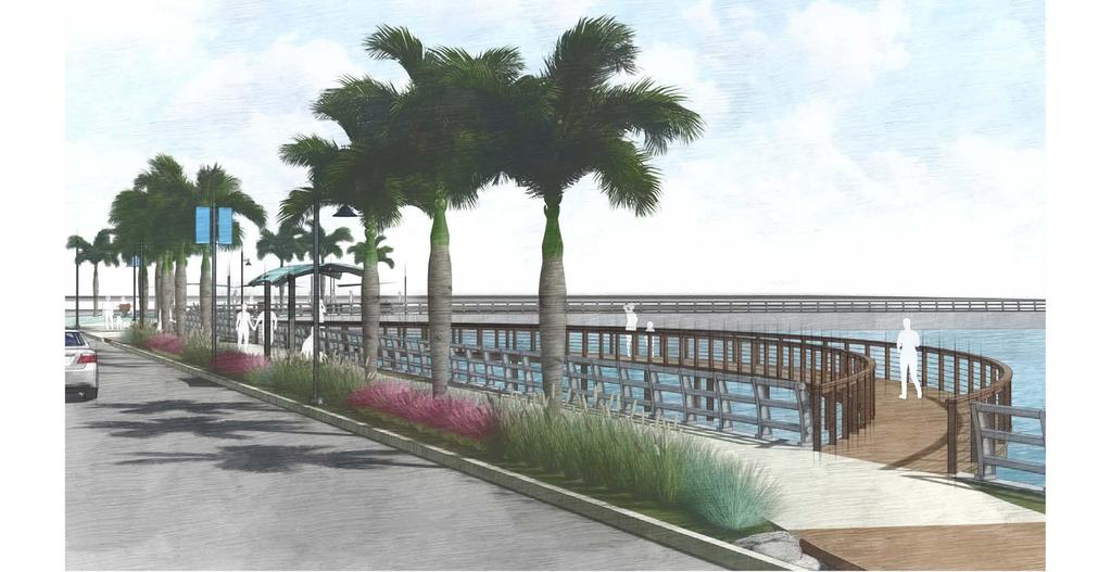
20


21 6 TH STREET Accent trees proposed under existing overhead power Sidewalk enhancements 36 high ornamental fence with gate & landscape enhancements on private property through City grant 6 TH STREET 6 TH STREET OPTION A OPTION B Looking South - 6 th St E at Riverside Dr E


22 6 TH STREET OPTION A 5 sidewalk, both sides 9 parallel parking Decorative street light with banners Seating area OPTION B 8 sidewalk on west side 5 sidewalk on east side Decorative street light with banners Seating area


23 DESIGN IMAGERY 6 th & 9 th STREETS


24 MANATEE AVENUE MANATEE AVENUE OPTION A Maintain existing brick pavers Create continuous planting bed Create seating nodes Proposed palms in landscape beds on north & tree wells on south side Relocate FPL lights to edge of sidewalk to minimize obstructions in the pedestrian path MANATEE AVENUE OPTION B Maintain existing brick pavers Create periodic planting beds Seating nodes with enhanced hardscape Proposed palms in existing tree wells on north & south side Relocate FPL lights to edge of sidewalk to minimize obstructions in the pedestrian path


25 MANATEE AVENUE OPTION A Existing Manatee Avenue - Looking East OPTION B Proposed Manatee Avenue - Looking West


26 DESIGN IMAGERY MANATEE AVE.


27 9 TH STREET Accent trees proposed under existing overhead power Reducing width of road to 20 to allow for construction of continuous sidewalk and landscape verge 36 high ornamental fence with gate & landscape enhancements on private property through City grant 9 TH STREET 9 TH STREET Looking North to Manatee River on 9 th St E OPTION A OPTION B


28 9 TH STREET OPTION A 5 Sidewalk, west sides 9 parallel parking Decorative street light with banners Seating area 8 Sidewalk on west side Decorative street light with banners Seating area OPTION B


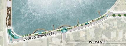
29 RIVERSIDE DRIVE R I V E R S I D E D R I V E E A S T OPTION A Maintain existing roadway width Maintain existing private docks. Gates added for controlled access Minimum 5 walking path Creation of natural shoreline for oyster restoration area Passive park with flex lawn, lookout tower, and inclusive play opportunities OPTION B Reduce road width to 20 Add parallel parking and planting islands R I V E R S I D E D R I V E E A S T R I V E R S I D E D R I V E E A S T


30 RIVERSIDE DRIVE Shaded Overlook at 9 th St and Riverside Dr Lookout Peninsula


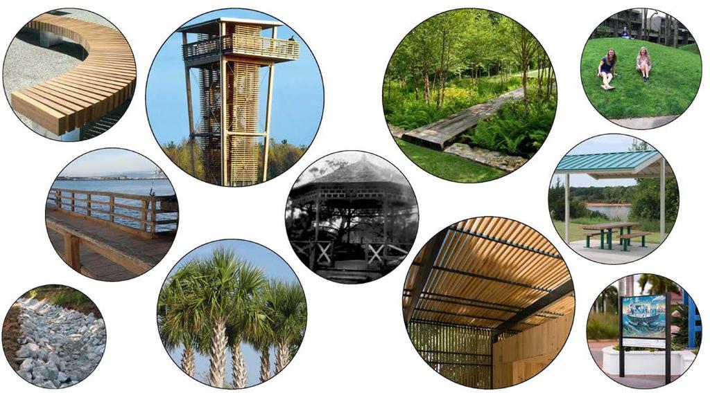
31 DESIGN IMAGERY RIVERSIDE DR. & PENINSULA
32 MINERAL SPRINGS PARK & POWERS PROPERTY OPTION A Public art / signage focusing on history & environment Passive park with shelters and small gathering spaces Open flex lawn along riverfront Boardwalk with sitting nodes connect to riverside drive Creation of natural shoreline Existing pier to be renovated for public use Existing trees to be saved Added parking Creation of creek bed to symbolize path of historic spring / creek, or for daylighting of spring

33 MINERAL SPRINGS PARK & POWERS PROPERTY OPTION B Public art focusing on history & environment Passive park with shelters and small gathering spaces Open flex lawn along riverfront Boardwalk with sitting nodes connect to riverside drive Creation of natural shoreline Existing pier to be renovated for public use Existing trees to be saved Added parking Creation of creek bed to symbolize path of historic spring / creek, or for daylighting of spring


34 MINERAL SPRINGS PARK & POWERS PROPERTY OPTION A OPTION B SOUTH FACING AERIAL


35 MINERAL SPRINGS PARK & POWERS PROPERTY OPTION A OPTION B NORTH FACING AERIAL


36 DESIGN IMAGERY MINERAL SPRINGS PARK & POWERS PROPERTY

37 PUBLIC ART / INTERPRETIVE SIGNAGE Content Options Branch Fort Grist / Saw Mill Angola Spring Nature Settlement Patterns

38 ACTIVITY NODES

39 CONCEPTUAL MASTER PLAN
40 QUESTIONS?

41 MATERIALS / DESIGN IMAGERY
42
43
SOUTH UNIVERSITY Street Design Alternatives in Progress
 1 Alternatives in Progress 2016.01.20 Meeting Agenda 2 1. Progress & Schedule 2. Utilizing the Street Design Manual 3. Site Characteristics and Input Received 4. Street Geometry What can we accomplish
STUDY AREA. Tonight s Agenda. Project Tasks Completed. Next Steps. Town of Oyster Bay Eastern Waterfront Community Vision & Revitalization Plan
 Town of Oyster Bay Eastern Waterfront Community Vision & Revitalization Plan Public Meeting January 27, 2009 Opening Remarks Presentation Tonight s Agenda Introduction Study Area Overview Public Participation
ROCKTON DOWNTOWN STREETSCAPE MASTER PLAN. Plan Commission Presentation April 10, 2018 Teska Associates Christopher Burke Engineering
 ROCKTON DOWNTOWN STREETSCAPE MASTER PLAN Plan Commission Presentation April 10, 2018 Teska Associates Christopher Burke Engineering AGENDA 1. Project Scope & Schedule 2. Steering Committee & Community
Maplewood Avenue Downtown Complete Street Project
 Maplewood Avenue Downtown Complete Street Project Second Public Meeting January 24, 2018 Welcome and Introduction of Project Team City Planning and Public Works Staff City of Portsmouth Juliet Walker Planning
VEHICULAR AND PEDESTRIAN CIRCULATION
 This perspective sketch communicates the intended character and quality of a proposed streetscape design. Locate benches near a major intersection where people tend to gather. Seating and lighting provide
SFMTA PHELAN LOOP AND PUBLIC PLAZA PHELAN OCEAN AVENUE
 SFMTA Municipal Transportation Agency Image: a bus in front of the Palace of the Legion of honor SFMTA PHELAN LOOP AND PUBLIC PLAZA PHELAN AVENUE @ OCEAN AVENUE Community Meeting May 23, 2012 San Francisco,
JACKsON STREET PIER CONCEPTUAL DESIGN PACKAGE SEPTEMBER 21, 2017
 JACKsON STREET PIER CONCEPTUAL DESIGN PACKAGE SEPTEMBER 21, 2017 JACKsON STREET PIER Process outline DESIGN PROCESS OVERVIEW: Sandusky s Jackson Street Pier Conceptual Design process included input from
Fifth and Detroit Street Design May 2017 Capital Improvements Committee. DOWNTOWN Street Design
 1 Fifth and Detroit Street Design May 2017 Capital Improvements Committee Agenda 2 Review Street Configuration Prior Meeting Review Outreach Synopsis Functional Street Design Refinements Curb Edge, Turning
Mississippi Drive Corridor Revitalization. A DestinationTransportation Project...
 Mississippi Drive Corridor Revitalization A DestinationTransportation Project... Mississippi Drive Corridor Revitalization Welcome! Tonight s Agenda: Further define the Scope of the Project Discuss the
LAKESHORE EAST - IJKL
 LAKESHORE EAST - SECOND COMMUNITY MEETING 9 AUGUST 08 RIVERWA LK LEVEL) (INTERMEDIATE COLUMBUS DR CHICAGO E WACKER HYATT REGENCY I CHICAGO RIVER NAVY PIER CHICAGO RIVE RWALK DR (UPP ER LEVEL RIVER GATEWAY
OPPORTUNITIES AND CONSTRAINTS - OXBOW PARK ENTRANCE AND PUT-IN
 OPPORTUNITIES AT OXBOW EXISTING WETLANDS Site is undeveloped and we can design a park that works well from the start. SAND BEACH Potential to eliminate invasive species. DEBRIS (CONCRETE, OLD CARS) VEGETATION
Johnson Street Bridge Public Realm Update
 Johnson Street Bridge Public Realm Update August 20, 2015 Background Johnson Street Bridge Replacement Project impacts a diverse range of stakeholders In addition to a new bridge, the project also includes
PARK PLAZA EXHIBIT A UNIVERSITY PARK, TX LAND USE STATEMENT TABLE OF CONTENTS CONCEPTUAL PD SUBMISSION OCTOBER 26, 2016
 EXHIBIT A PLANNED DEVELOPMENT #2 (PD-2) PARK PLAZA UNIVERSITY PARK, TX LAND USE STATEMENT Proposed zoning change request are for the property at the Southwest corner of Hillcrest Avenue and Daniel Avenue,
Riverfront Development Plan
 Planning Studies Project Overview: Continuity Developing Fort Myers underused riverfront was the final step in Downtown redevelopment. To mine all facets of the riverfront, the Plan had to be created cohesively
PRELIMINARY DESIGN + DEVELOPMENT PLAN
 WELCOME! To The Public Open House May 30 th, 2017 HARBOUR WEST PARKS Vision Project Overview The City s vision for Port Credit Harbour West Parks is to develop a vibrant waterfront destination that integrates
Main Street Reconstruction From Ninth Line to Stouffer Street. Town of Whitchurch-Stouffville. Public Information Centre
 Main Street Reconstruction From Ninth Line to Stouffer Street Town of Whitchurch-Stouffville Public Information Centre November 23, 2016 4:30 to 6:00 pm & 7:00 to 8:00 pm 6240 Main Street, Stouffville
Elgin O Hare Western Access Project Local Advisory Committee. February 10, 2014
 Elgin O Hare Western Access Project Local Advisory Committee February 10, 2014 Agenda Project status update Design and construction Funding Aesthetics Project events and outreach Land acquisition Next
FLORIN ROAD CORRIDOR Site Plan and Design Review Guidelines Checklist
 FLORIN ROAD CORRIDOR Site Plan and Design Review Guidelines Checklist Applicant s Name: Project Address: Phone: Email: Applicant shall fill out the design guidelines checklist for all guidelines applicable
Planning Board Briefing
 Planning Board Briefing Why Now? The Sector Plan Implementation Chapter States: Before Stage 1 begins, the following must occur: Approval of the Sectional Map Amendment. Approval of the Greater Lyttonsville
New York Avenue Streetscape and Trail Project Public Meeting #1 Summary
 New York Avenue Streetscape and Trail Project Public Meeting #1 Summary I. King Jordan Student Academic Center (SAC) Gallaudet University, Washington, DC February 23, 2017 Table of Contents 1.0 Introduction...
Building Great Neighbourhoods. Strathcona
 Building Great Neighbourhoods Strathcona March 21, 2018 Becky Redford Project Manager, Planning & Design Building Great Neighbourhoods Integrated Infrastructure Services Welcome and Purpose To provide
chapter DESIGN GUIDELINES NEW RIVER MASTER PLAN REPORT
 chapter DESIGN GUIDELINES NEW RIVER MASTER PLAN REPORT .76 DESIGN GUIDELINES An Overview design guidelines NEW RIVER MASTER PLAN Design Guidelines can transform the image of a city. Specific, design-based
New Park / Entry Court & Plaza Concept Design
 New Park / Entry Court & Plaza Concept Design The SECC Public realm is proposed to have a focus on health, wellness, and community and that site users will include patrons of the neighbourhood. The block
The open space system should provide connective elements, relate to natural resources, and enhance the suburban character of the landscape..
 The open space system should provide connective elements, relate to natural resources, and enhance the suburban character of the landscape.. Mixed-use and infill development should maintain or enhance
Presentation of the Staff Draft. July 17, 2014 SSRVP Team, Area 3
 Presentation of the Staff Draft July 17, 2014 SSRVP Team, Area 3 Presentation Overview Introduction Plan Framework Plan Recommendations Implementation Next Steps and Request for Public Hearing on September
Gold Line Bus Rapid Transit Transit Oriented Development (BRTOD) Helmo Station Area Plan
 Helmo Station Area Plan") Appendix F Gold Line Bus Rapid Transit Transit Oriented Development (BRTOD) Helmo Station Area Plan Introduction and Purpose of the Plan The Gold Line Bus Rapid Transit facility is an eleven-mile dedicated
Appendix F Gold Line Bus Rapid Transit Transit Oriented Development (BRTOD) Helmo Station Area Plan Introduction and Purpose of the Plan The Gold Line Bus Rapid Transit facility is an eleven-mile dedicated
Highland Falls Waterfront Redevelopment Feasibility Study Village Board Meeting March 20, 2017
 Village Board Meeting March 20, 2017 Agenda I. Public Meeting #1 Visioning Summary II. Public Meeting #2 Comment Summary III. IV. IV. Case Study: Milton Train Station Schematic Design Concepts Schedule/Next
Sub-committee on Harbour Plan Review of Harbour-front Enhancement Committee. Ninth Meeting
 Sub-committee on Harbour Plan Review of Harbour-front Enhancement Committee Ninth Meeting Date: 5 October 2005 Time: 3:30pm Venue: Conference Room 15/F, North Point Government Offices, 333 Java Road, North
TURN TO THE RIVER CITY PLAZA LANDSCAPE DESIGN CONCEPT May 25, 2016
 Turn to the River is a multi-year project of Art Spaces - Wabash Valley Outdoor Sculpture Collection, Inc. to connect downtown Terre Haute with the Wabash River through public art and design. The four-square
PUBLIC RIGHT-OF-WAY IN THIS CHAPTER PUBLIC REALM
 PUBLIC RIGHT-OF-WAY This section provides design guidelines for improvements in the public right-of-way. The public right-of-way refers to streets, sidewalks, non-vehicular thoroughfares, parks and greenways
Potential Green Infrastructure Strategies May 6, 2015 Workshop
 Potential Green Infrastructure Strategies May 6, 2015 Workshop Background The City of Cortland is developing the Tioughnioga Urban Headwaters Green Infrastructure Action Plan with funding from the National
V. Gateways GATEWAYS / V-1
 V. GATEWAYS / V-1 Many of Chesapeake s gateways are located on highways and call for bold and attractive designs that motorists can understand, appreciate, and enjoy. can also take the form of natural
DISCUSSION TOPIC: ST JOHNS RIVER & ITS TRIBUTARIES (BPII) 2030 COMPREHENSIVE PLAN POLICES AND REGULATORY FRAMEWORK
 2030 COMPREHENSIVE PLAN POLICES AND REGULATORY FRAMEWORK") DISCUSSION TOPIC: ST JOHNS RIVER & ITS TRIBUTARIES (BPII) 2030 COMPREHENSIVE PLAN POLICES AND REGULATORY FRAMEWORK St. John s River & Its Tributaries Issue Summary: The St. Johns River is an important
DISCUSSION TOPIC: ST JOHNS RIVER & ITS TRIBUTARIES (BPII) 2030 COMPREHENSIVE PLAN POLICES AND REGULATORY FRAMEWORK St. John s River & Its Tributaries Issue Summary: The St. Johns River is an important
Queensborough Eastern Neighbourhood Node. Community Open House
 Queensborough Eastern Community Open House The Vision The Queensborough Eastern will become the heart of eastern Queensborough. Through a sensitive mix of viable commercial and residential areas, the neighbourhood
South th E ast Communit ity Centre (SECC)
") South East Community Centre (SECC) 1 New Park Design & Community Centre Update Thursday, February 8, 2018 Public Open House Thank you for attending this Open House! The town and the Consulting Team will
South East Community Centre (SECC) 1 New Park Design & Community Centre Update Thursday, February 8, 2018 Public Open House Thank you for attending this Open House! The town and the Consulting Team will
Route 1 Corridor Study
 Route 1 Corridor Study Westbrook, Connecticut A Vision for the Connecticut Shoreline Public Informational Meeting July 28, 2015 Lower Connecticut River Valley Council of Governments Fitzgerald & Halliday,
Hamilton Road Corridor Streetscape Master Plan. Open House October 4 th, 2017
 Hamilton Road Corridor Streetscape Master Plan Open House October 4 th, 2017 Agenda 1. Introductions Agenda Overview 2. Project Background 3. Existing Conditions 4. Strengths, Weaknesses, Opportunities
III - design standards
 III - design standards The Circulation Classification and Character section of the Design Standards chapter prescribes the types of circulation routes, the location of the circulation routes, the connections
COMPLETE GREEN STREET CHECKLIST
 COMPLETE GREEN STREET CHECKLIST This document was developed to dissect the structure of an urban street and explore opportunities to make our streets more complete while also integrating green street strategies.
Lower South Street/Louisa Street Charrette Final Presentation. September 22, 2009
 Lower South Street/Louisa Street Charrette Final Presentation September 22, 2009 Recap Mayor and Council called for a Charrette to engage the public on creating a vision for the Lower South Street area.
ROME WATERFRONT VILLAGE PROJECT NARRATIVE January 25, 2018
 January 25, 2018 The Rome Waterfront Village project is intended to foster the revitalization of the area between South James Street and Erie Boulevard north of the Erie Canal as well as improve public
R STREET CORRIDOR NEIGHBORHOOD Site Plan and Design Review Supplemental Guidelines Checklist
 R STREET CORRIDOR NEIGHBORHOOD Site Plan and Design Review Supplemental Guidelines Checklist Applicant s Name: Project Address: Phone: Email: Applicant shall fill out the design guidelines checklist for
FROM DUPONT CIRCLE NORTH TO CALIFORNIA STREET, NW. Welcome!
 FROM DUPONT CIRCLE NORTH TO CALIFORNIA STREET, NW Welcome! Meeting Agenda 6:00 PM Open House 6:30 PM Presentation 7:00 PM Open House / Q&A at the Boards Project Design Team Connecticut Avenue, NW Project
SMALL LOT DESIGN STANDARDS. An Illustrated Working Draft for Test Implementation
 SMALL LOT DESIGN STANDARDS An Illustrated Working Draft for Test Implementation SMALL LOT DESIGN STANDARDS ILLUSTRATED WORKING FOR TEST IMPLEMENTATION OVERVIEW SMALL LOT CODE AMENDMENT & POLICY UPDATE
TOWN COUNCIL / PLANNING COMMISSION
 Workshop #3 TOWN COUNCIL / PLANNING COMMISSION January 20, 2011 Consultant Team In Attendance Tonight BMS Design Group Nevada City and San Francisco Michael Smiley, AICP, ASLA Partner-in-Charge Nancy L.
7-PARKS, OPEN SPACE & PUBLIC ART
 7-s, Open Space & Public Art 7-PARKS, OPEN SPACE & PUBLIC ART This chapter provides recommendations for the expansion of new parks, plazas and open space that serve the many user groups targeted for downtown.
Commercial Node Plan Devine Street/Jackson Blvd. COLUMBIA, SC
 Commercial Node Plan Devine Street/Jackson Blvd. COLUMBIA, SC 9.17.13 AGENDA 1 Introductions 2 Project Update 3 Concepts 4 Recommendations 5 Next Steps Introductions Project Update Process 5-Phase Process
VISION AND GUIDING DESIGN PRINCIPLES
 pleasure point commercial corridor VISION AND GUIDING DESIGN PRINCIPLES Public Draft November 26, 2018 County of Santa Cruz with assistance from MIG CONTENTS PART I: INTRODUCTION AND VISION... 3 Community
The Capital Design Advisory Committee St. Mary s College of Maryland & Historic St. Mary s City
 The Capital Design Advisory Committee St. Mary s College of Maryland & Historic St. Mary s City Welcome April 21, 2010 Capital Design Advisory Presentation: Relocating Margaret Brent Hall Traffic Calming
WESTERN ILLINOIS UNIVERSITY
 WESTERN ILLINOIS UNIVERSITY Quad Cities Riverfront Campus Preliminary Master Plan Presentation 2 February 1, 2006 Achieving Future Flexibility 1. Monitor space needs as the new buildings come on line and
City of Plattsburgh DRI: Downtown Streetscapes & Riverfront Access. Downtown Streetscape and Riverfront Access Design
 City of Plattsburgh DRI: Downtown Streetscapes & Riverfront Access Welcome Thank you for coming this evening. Agenda PART I - Project Context The Downtown Revitalization Program Our DRI Projects Other
This Review Is Divided Into Two Phases:
 Semiahmoo Town Centre Review The purpose of this review: To review the Semiahmoo Town Centre Concept Plan, originally approved in 1993, to ensure that this centre will continue to serve the needs of South
Village of Pemberton DOWNTOWN ENHANCEMENT INITIATIVE FRONTIER STREET PILOT PROJECT WE NEED YOUR HELP TO REVIEW THE PLAN
 Village of Pemberton DOWNTOWN ENHANCEMENT INITIATIVE FRONTIER STREET PILOT PROJECT WELCOME TO THE NEW FRONTIER STREET! WE NEED YOUR HELP TO REVIEW THE PLAN The Village of Pemberton would like your feedback
Naomi Weiss, Executive Director, DBPA Jason Jeffries, Project Manager, City of Daytona Beach
 Naomi Weiss, Executive Director, DBPA Jason Jeffries, Project Manager, City of Daytona Beach Nottingham Plan 2002 Adopted Redevelopment Plan 2002 Riverfront Action Plan 2004 Downtown Vision Plan 2007
lakeway mixed use tract open space plan
 LEGEND:. UNDISTURBED NATURAL AREA. ENTRY STATEMENT BUILT INTO HILLSIDE. R.O.W. PLANTING (STREET TREES/LIGHTS). HEB ENTRY DRIVE 5. BIO-FILTRATION IN MEDIAN 6. MAIN ENTRY @ MAIN STREET. EXISTING TREES TO
PARDI MARKET PLAZA PMSCDC WORKSHOP
 PARDI MARKET PLAZA PMSCDC WORKSHOP CITY OF DIXON FEBRUARY 23, 2017 Presented by: CITY STAFF INTRODUCTION Deborah Barr Associate Civil Engineer, Project Manager Joe Leach City Engineer/Public Works Director
open house 3 CITY OF SALEM Downtown Streetscape Plan
 open house 3 Streetscape concepts CITY OF SALEM Downtown Streetscape Plan analysis concepts we are here refined concepts & document Feb 13th 1 2 3 apr 18th KICKOFF OPEN HOUSE Streetscape Work Group Walking
Table of Contents. Elm Avenue Improvement Plan City of Waco, Texas. Introduction 1. Existing Context 1 Figure 1 2.
 Table of Contents Introduction 1 Existing Context 1 Figure 1 2 Plan Guidelines 3 Future Urban Form 4 The West-End 4 Main Street 6 The East-End 7 Figure 2 9 Public Improvement Recommendations 7 General
MISSION STREETSCAPE PLAN. Neighborhood Commercial Streets handle continuous activity. Neighborhood Commercial STREET ROW: Main Design Treatments
 Neighborhood Commercial STREET ROW: 64-80 Main Design Treatments CORNER reduce crossing distance for pedestrians, create entrances to a residential area and slow cars down. help widen sidewalk allocating
Pedestrian and Bike Bridge LOGO
 6.2.2 Pedestrian and Bike Bridge The proposed pedestrian and bike crossing re-envisions the existing bridge at Pismo Creek on Cypress Street. The bridge is currently underutilized by vehicular through
Waterfront Development Master Plan
 PORT of VANCOUVER USA Vancouver, WA Waterfront Development Master Plan DRAFT - FINAL CONCEPTUAL MASTER PLAN PROJECT TEAM NBBJ Heritage Research Associates JLA Kittelson Associates Leland Consulting Group
City of Dallas Complete Streets Program. SAME Infrastructure Forum February 2, 2018
 City of Dallas Complete Streets Program SAME Infrastructure Forum February 2, 2018 Complete Streets Design Manual Adopted by City Council January 27, 2016 JANUARY 27, 2016 2 What are Complete Streets?
East Midtown Greenway East 53 rd 61 st Street. Community Board 8 Project Introduction November 16, 2017
 East Midtown Greenway East 53 rd 61 st Street Community Board 8 Project Introduction November 16, 2017 Agenda Overview - Development of the East Midtown Waterfront Esplanade Current East Midtown Greenway
PUBLIC REALM DESIGN PLAN APRIL, 2012
 PUBLIC REALM DESIGN PLAN APRIL, 2012 Introduction NoMa is growing quickly. Fueled by transit accessibility, proximity to both Downtown and Capitol Hill and streamlined entitlements, the neighborhood has
Welcome! HORSESHOE BAY PARK. Welcome!
 Welcome! HORSESHOE BAY PARK Welcome! Where are we in the process? Today we would like your input on how Horseshoe Bay Park can be upgraded to serve the community s needs better. CONSULT STAKEHOLDERS TAKE
TRANSPORTATION & STREET DESIGN
 TRANSPORTATION & STREET DESIGN Review of Goals Connect neighborhoods to Square Enable access to the river Improve pedestrian environment Reorient road network to local use Three Specific Areas of Intervention
DRAFT. 10% Common Open Space
 % OF CHARLOTTE IS CATEGORIZED AS A. LAND USES : Placeholder map displaying location of Place Type GOALS: Accommodate XX% of future growth. Provide a concentration of primarily commercial and civic activity
ROCKTON DOWNTOWN STREETSCAPE MASTER PLAN. Village Board Presentation May 8, 2018 Teska Associates Christopher Burke Engineering
 ROCKTON DOWNTOWN STREETSCAPE MASTER PLAN Village Board Presentation May 8, 2018 Teska Associates Christopher Burke Engineering AGENDA 1. Project Scope & Schedule 2. Steering Committee & Community Outreach
4.0 Design Guidelines For The Village Centre. South fields Community Architectural Design Guidelines Town of Caledon
 4.0 Design Guidelines For The Village Centre 4.0 Design Guidelines for the Village Centre The Village Centre is the focal point of the entire South Fields Community and is designed as a traditional commercial
The Auburn Plan Designing the Future of Auburn February 28, 2005
 The Auburn Plan Designing the Future of Auburn February 28, 2005 Block-by-Block Bicycle Tour Aerial survey Focus Group Meetings September 7 and 8 Design Workshops October 11, 14, and 21 Revitalization
Illustrative Development Plan
 Illustrative Development Plan December 7, 005 045 Sansome St., Studio 3 San Francisco, CA 94 Area A - Increase visibility to waterfront and aquatic center from the Embarcadero - Provide streets rather
PUBLIC MEETING AND OPEN HOUSE: Don Mills Crossing Phase 2 Celestica Development Applications. February 21, 2017
 PUBLIC MEETING AND OPEN HOUSE: Don Mills Crossing Phase 2 Celestica Development Applications February 21, 2017 PURPOSE OF TONIGHT S MEETING Engage the community on the Don Mills Crossing Study and development
3.1 Existing Land Use
 3.0 Land Use This strategy has been developed taking into account the position of the Town of Sidney as the economic center of the Saanich Peninsula. It acknowledges existing land use patterns in the downtown
Community Design Plan
 Gardena General Plan 2006 Authority While the is not a required element of a General Plan, it is included because improving the community appearance and image is paramount to the overall quality of life
180 ZONING 180. ARTICLE XLII STREETSCAPE ENHANCEMENT OVERLAY ( SEO ) DISTRICT [Added Ord. No. 1086]
![180 ZONING 180. ARTICLE XLII STREETSCAPE ENHANCEMENT OVERLAY ( SEO ) DISTRICT [Added Ord. No. 1086]](/thumbs/75/72360049.jpg "180 ZONING 180. ARTICLE XLII STREETSCAPE ENHANCEMENT OVERLAY ( SEO ) DISTRICT [Added Ord. No. 1086]") 180 ZONING 180 ARTICLE XLII STREETSCAPE ENHANCEMENT OVERLAY ( SEO ) DISTRICT [Added 4-6-2016 Ord. No. 1086] 180.145. SEO DISTRICT 180.145.1. Intent. The SEO DISTRICT Regulations are intended to address
180 ZONING 180 ARTICLE XLII STREETSCAPE ENHANCEMENT OVERLAY ( SEO ) DISTRICT [Added 4-6-2016 Ord. No. 1086] 180.145. SEO DISTRICT 180.145.1. Intent. The SEO DISTRICT Regulations are intended to address
Figure 3-1: Public Realm Plan
 3 Public Realm Figure 3-1: Public Realm Plan 3.1 Public Realm Concept The public realm concept for the Little Mountain site integrates a clear and accessible movement network with public spaces for social
1. Parks & Recreation Neighborhood Parks Community Parks Special Use Sites 2. Open Space 3. Trails
 Appendix A: Park Classifications The intent of parks and recreation classifications is to aid in making acquisition and design decisions for park sites, facilities and the organization of recreation space
The following concept plans and illustrations are the result of this 10 month study of the alley connections from CSU to the River District.
 W E L C O M E T O T H E F O R T C O L L I N S D O W N T O W N A L L E Y S A N D I N T E G R AT E D W A L K W AY S M A S T E R P L A N O P E N H O U S E The following concept plans and illustrations are
MEMO 1. INTRODUCTION PURPOSE & PROCESS REQUEST
 MEMO Date: August 22, 2017 To: Board of Commissioners From: Jason Burdette, Planning Director Re: Davidson Commons East Hotel Stakeholder Feedback 1. INTRODUCTION PURPOSE & PROCESS This memorandum summarizes
Derby-Shelton Bridge Pedestrian and Bicyclist Enhancements [1]
![Derby-Shelton Bridge Pedestrian and Bicyclist Enhancements [1]](/thumbs/96/128011958.jpg "Derby-Shelton Bridge Pedestrian and Bicyclist Enhancements [1]") nhancements [1] STATUS OF PROJECT: The project has recently moved from the Preliminary Design Phase to the Final Design Phase following the most recent Public Involvement Meeting held on January 9, 2019
nhancements [1] STATUS OF PROJECT: The project has recently moved from the Preliminary Design Phase to the Final Design Phase following the most recent Public Involvement Meeting held on January 9, 2019
South East Sports Complex Phase I
 South East Sports Complex Phase I City of Spokane Design Review Board August 29, 2018 (Revised) Objectives 1. Early discussion and collaboration. 2. Provide framework / catalyst for future improvements
Community Engagement Committee Meeting #1 December 10, :30pm-8:30pm
 Community Engagement Committee Meeting #1 December 10, 2014 6:30pm-8:30pm Welcome and Introductions Dana Murdoch Minneapolis Park and Recreation Board Project Manager Ryan French Walker Art Center Director
Roanoke Rapids Streetscape Master Plan. City Council Presentation
 SCHEDULE: Stakeholder Meeting/Kick off November,2016 Master Planning Phase (November March 2017) Public Meeting #1 December 13, 2016 Review Meeting with Key Stakeholders Refine Concepts Based on Input
Broadway Avenue Streetscape Project City of Albert Lea. Streetscape Design Committee Meeting October 29, 2012
 Broadway Avenue Streetscape Project City of Albert Lea Streetscape Design Committee Meeting October 29, 2012 1 Presentation Outline Street Widths, Sidewalk Widths and Bump-Out Configuration Decorative
Chain Bridge Road Sidewalk Improvements Citizen Council Work Session
 Chain Bridge Road Sidewalk Improvements Citizen Council Work Session May 10, 2016 Project Location 2 Project Objectives Provide a continuous pedestrian facility (sidewalk) connection from Downtown City
URBAN DESIGN BRIEF URBAN DESIGN BRIEF 721 FRANKLIN BLVD, CAMBRIDGE August 2018
 URBAN DESIGN BRIEF URBAN DESIGN BRIEF 721 FRANKLIN BLVD, CAMBRIDGE August 2018 DESIGN BRIEF CONTENTS PART A 1.0 INTRODUCTION 2.0 DESCRIPTION & ANALYSIS OF SITE CONTEXT 3.0 DESIGN CONSTRAINTS AND OPPORTUNITIES
Design Guidelines for the Route 30 Corridor Master Plan: Subdivision and Land Development Elements
 Design Guidelines for the Route 30 Corridor Master Plan: Subdivision and Land Development Elements East Whiteland Township- Chester County, PA Prepared by: Draft: May 7, 2018 Design Guidelines for the
Master Plan Presentation August 12, 2015
 Master Plan Presentation August 12, 2015 A vision for tomorrow... May, 13 2015 prepared for: prepared by: SITE LOCATION SITE NTS SITE ANALYSIS +/- 17.8 Ac. RESIDENTIAL HOMES 1 2 RAIL ROAD (SAFETY CONCERNS)
Creative Village Design Review Committee
 N. Terry Ave. CVDRC Staff Report Creative Village Design Review Committee April 11, 2017 Case Number Agenda Item 4 W. Livingston Street Extension MPL2017-00023 ARB2017-00014 Applicant William Burns, Project
Whitemarsh Comprehensive Plan Update: Housing & Land Use. Public Workshop #3: September 20, 2018
 Whitemarsh Comprehensive Plan Update: Housing & Land Use Public Workshop #3: September 20, 2018 Agenda Welcome Process Recap What We ve Heard The Plan Framework Review of Recommended Actions Land Use Housing
Chapter 14 Streetscape Improvements
 This chapter presents streetscape design concepts for key streets and gateways in the Downtown Specific Plan area. This chapter is organized as follows: 14 Streetscape Improvements 14.1 Streetscape Treatments
John Portman Boulevard Corridor
 Corridor Multi-use Path + Streetscape Improvements February 8, 13 SOUTH SIDE BLOCK IMPROVEMENT NOTES: Consolidation of Utility/Sign Locations Remove Existing Trees Centennial Olympic Park Drive Planter
Highland Village Green Design Guidelines
 Highland Village Green Design Guidelines Publishing Information Title Highland Village Green Design Guidelins Author The City of Calgary Status DRAFT - Proposed document subject to changes Additional Copies
MIAMI 21 PUBLIC HEARING-FIRST READING 2009
 General Principles Public access waterfront walkways shall: 1. Feel public. No one should feel as if he or she is intruding on private property. The public should feel welcome and at ease to move along
MIDTOWN MIXED-USE VILLAGE. TECHNICAL DATA SHEET COMPONENT C-1 FOR PUBLIC HEARING - PETITION NUMBER Project No RZ1.1. Issued.
 N MIDTOWN MIXED-USE VILLAGE TECHNICAL DATA SHEET COMPONENT C- FOR PUBLIC HEARING - PETITION NUMBER 04-00 Project No. 496 Issued Revised SCALE: " = 0' N 0 0 0 40 RZ. c GENERAL PROVISIONS: a. SITE LOCATION.
Final Master Plan and Development Control Regulations
 1. INTRODUCTION CHECK LIST a. Introduction b. Table of contents c. Definitions. d. scope of works. 2. FINAL OVERALL MASTER PLAN a. SITE ANALYSIS and OVERVIEW: i. Existing and Proposed Site Plan Levels.
3.0 master plan concept
 3.0 master plan concept 3.1 introduction The purpose of the Huron Church Road Master Plan Concept is to provide an overview of the Master Plan design process, identify preliminary streetscape installations
Buildings may be set back to create small plazas provided that these setbacks do not substantially disrupt the street wall s continuity.
 6-22 Community Design Street Walls and Street-front Setbacks The siting of buildings will play a critical role in establishing the character and sense of place for the District. Siting buildings at the
STANDARD SPECIFICATIONS Book 2 ENGINEERING DRAWINGS INCLUDES ADDENDUMS
 STANDARD SPECIFICATIONS Book 2 ENGINEERING DRAWINGS INCLUDES ADDENDUMS July 23, 2018 Page 1 of 7 STANDARD LEGEND SYMBOLS (September, 1973)... AS-101A STANDARD LEGEND SYMBOLS (September, 1973)... AS-101B
PLAN ELEMENTS WORKSHOP. April 5, 2016
 PLAN ELEMENTS WORKSHOP April 5, 2016 needs more housing. But there is no one-size fits-all solution. Every neighborhood has its own character. In some places, density is not only appropriate it is badly