MASTER PLAN QUEEN ST. WEST BIA
|
|
|
- Audrey Reynolds
- 5 years ago
- Views:
Transcription


1
2 QUEEN ST. WEST BIA MASTER PLAN QUEEN ST. WEST BIA EXECUTIVE COMMITTEE IN ASSOCIATION WITH PMA LANDSCAPE ARCHITECTS LTD. SWEENY STERLING FINLAYSON & CO ARCHITECTS INC. FUGITIVE GLUE MARCH 2013

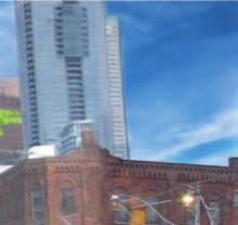
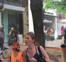
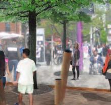
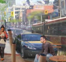
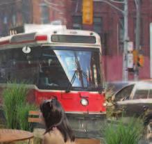


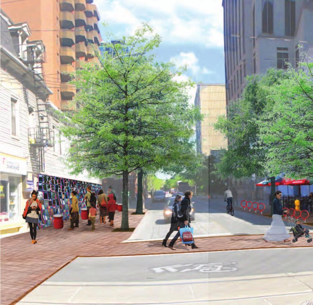
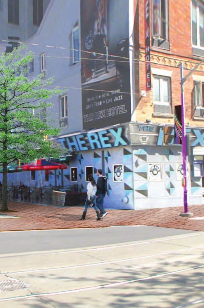
3 4.5.4 PLAZA VISUALIZATIONS BEFORE AFTER 74 QUEEN STREET WEST BIA STREETSCAPE MASTER PLAN
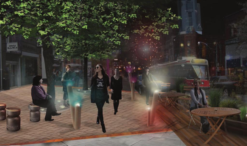
4 NIGHT 75


5 84 QUEEN STREET WEST BIA STREETSCAPE MASTER PLAN


6 3.0 STREETSCAPE APPROACH AND GOALS A key objective of the streetscape master plan is to create a consistent aesthetic vision for Queen St. West and identify streetscape improvements that can be implemented in the short and long-term. Below we have outlined the basic elements of the design team s proposal to upgrade the streetscape. These elements will help build the overall vision for Queen St. West, and capitalize on the existing strengths ato develop a unique, cohesive streetscape design. DESIGNATE 01 A LINEAR PLAZA AS THE HEART OF QUEEN ST. WEST As the widest part of stretch within the BIA, the civic linear plaza will be the headquarters for larger seasonal events and spontaneous happenings unique to Queen St. West. There will be an abundance of designated areas for seating, bike parking and people-watching. RECOGNIZE HERITAGE THROUGH UNIQUE PAVING AND SITE FURNISHINGS paving will distinguish the contributing heritage buildings on the street. Diagonal connections that visually link heritage architecture across Queen St. West proper, provide clues towards recognizing the context of a heritage landscape without compromising the quality of the materials. Site furnishings also 02Special reference heritage through material selection, shape and form. 950 PLAZA SPACE SQ. M 1,300 l.m CONTRIBUTING BUILDING-FACADE CREATE 03 GATEWAYS THAT WILL BRAND THE STREET AND PROVIDE LANDMARKS Strategically located, the gateways will both unify the street and compliment the already eclectic, unique identity of Queen St. West. The gateways will be works of public art in their own right and act as new landmarks for residents and visitor to the area. 04 Sophisticated durable and accessible materials will be selected for the paving treatment and street furnishings will be designed and sited to ensure fl exibility of the public space while maintaining minimum City clearances. The cleaner streetscape will inherently enhance the experience of the day and night life on Queen St. West 07 CONNECTION MAKE PEDESTRIANS A PRIORITY: ENCOURAGE PEDESTRIAN MOVEMENT BY MAXIMIZING CLEARANCES FOCAL POINTS of 2.1M ACCESSIBLE SIDEWALK WIDE 44 QUEEN STREET WEST BIA STREETSCAPE MASTER PLAN


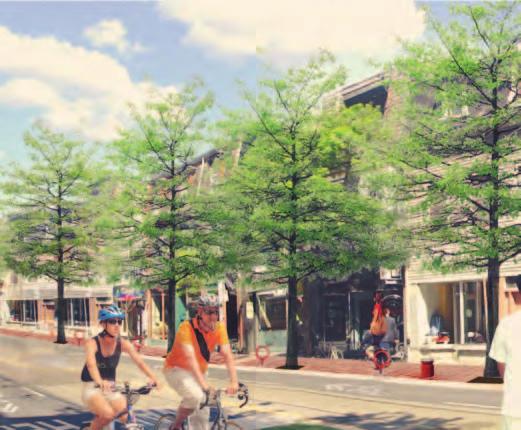
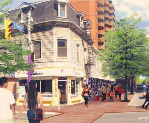
7 EMBRACE TECHNOLOGY AND INNOVATION TO INCREASE SOCIAL ENERGY select locations, wifi hotspots will be designated creating a social media connection or simply for wayfi nding along Queen St. West. Water conservation through a sidewalk strip drain along the curb edge will set a precedence for other BIA s throughout the GTA. Solar lighting and water bottle fi lling stations 05At are some other opportunities being explored. 07 WIFI STATIONS CREATE PARKETTES AND PARK-LETS THAT EXCITE AND ENGAGE PEOPLE minor intersections, the side fl ankages of buildings are great opportunities for developing parkettes that would help to inject green (i.e. trees and groundcover planting), public art, seating areas, mass bike parking, or simply something visually stimulating that would occur as a rhythm along Queen St. West. 06At Likewise the lay-by area just east of Spadina provides a huge opportunity for seasonal public space. PLANT MORE STREET TREES TO INCREASE TREE CANOPY trees to be planted along Queen St. West, and at proposed parkette locations. This objective will create more shade and therefore a more comfortable microclimate in pedestrian areas. A line of trees also gives the attractive experience of a boulevard allee, and visual cohesion of a street. 07High-canopy ADD BIKE RACKS AND A SHARED BIKE LANE TO ENCOURAGE CYCLISTS TO COME should be given towards a bike network will run along the street as a shared lane, complete with bike box markings major intersections to improve awareness and visibility of cyclists. An abundance of bike racks will be added in the street furnishings zone along the entire corridor with selected 08Consideration hubs for corralled bike parking PUBLIC PARKETTES TREES 195 BIKE RACKS 45


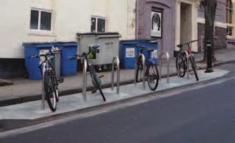
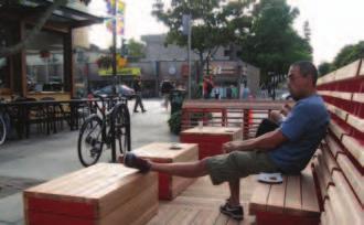
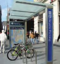
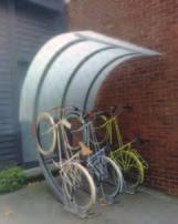
8 4.0 STREETSCAPE DESIGN AND GUIDELINES The following section outlines all elements included in the design which make up the Streetscape Master Plan. The implementation of all of these elements will need to be vetted through the detail design process, and checked against detailed above and below-ground conditions. S TREETSCAPE ELEMENTS INDEX bus shelter 1 Bus Shelters - Street Furniture Program The City of Toronto developed the Coordinated Street Furniture Program, through which it has contracted Astral Media to provide furniture for streetscapes across the City. Bus shelter sizes and locations need to be assessed at each location, and sized appropriately to meet the 2.1m sidewalk clearances. sidewalk standard 4 Queen St. West Sidewalk Standard A BIA-standard family of specialty paving will relate to the heritage contributing and noncontributing architecture. This material palette will include a consistent tree pit treatment, and trench drain detail. trash/recycling 2 Trash & Recycling Receptacles - Street Furniture Program The BIA needs to actively coordinate the location and sizes (where available) of all standard street furnishings, so that it is functional yet minimizes visual clutter on the streetscpape. 5 Trees, Tree Pits and Tree Guards Trash and recycling receptacles needs to be sized appropriately, and locations need to be assessed and directed by the BIA. tree pits Additional street trees will be installed where there are gaps within the existing line of trees, as well as at parkette locations. All street trees will be planted in continuous soil trenches to provide adequate soil volumes. The trees will be irrigated passively by means of trench drain that collects surface water which will lead to the soil below. The finishing treatment at the base of the tree will be consistent with the sidewalk standard. bike parking 3 Bike Parking There will be a new standard bike rack for the BIA. As this new BIA standard is implemented, the existing City bike rings will remain but become phased-out. The ambition is to double bike parking on the street, but predominantly at parkette locations wherever feasible. seating 6 Seating Existing Benches to remain until funding is available for custom furnishing program. Specific locations will be selected based on adjacent building usage, available sidewalk space and visibility. Existing benches can be reprogrammed for parkette spaces in the future. 50 QUEEN STREET WEST BIA STREETSCAPE MASTER PLAN


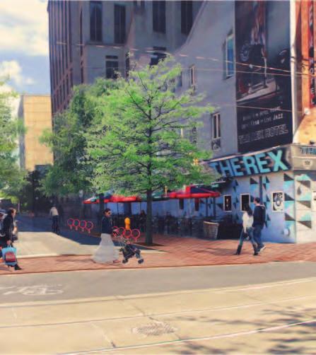
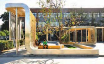
9 crosswalks 7 Articulated Crosswalks Crosswalks would ideally continue the standard sidewalk treatment (and specialty paving) through the road, to clearly denote a pedestrianpriority crossing. In the short-term, painted lines would also suffice. 11 bump outs Existing curb line Proposed Curb Extension Bump-Outs Where feasible, street corner bump-outs should be provided to maximize opportunities dedicated to the upgrades of the pedestrian realm. They can also be programmed as spaces dedicated to gateways, public art, planting, bike parking, and/ or patios. bike lanes 8 Bike Lanes Pursuing City of Toronto standard shared bike lanes into the roadway on both the north and south sides of Queen St. West should be considered. All types of commuters, regardless of the mode of transportation, should be encouraged to come to the stretch 12 bike box Bike Box As part of the strategy to encourage more cyclists through Queen St. West, improved bike boxes shall be located at street light intersections. These represent designated safe zones for cyclists as they ride up to a red light at an intersection. utility pole sleeves 9 Utility Pole Sleeves/Wayfinding Utility Pole Sleeves with the BIA s logo should be 13 Public Art and Gateways integrated into the existing utility poles. Colours and/or pattern to match BIA graphic branding. Wayfinding signage is to be incorporated into the streetscape elements program, or onto existing street signage, versus its own independent structure, to minimize visual clutter. public art/gateways Public art installations will be interspersed along Queen St. West at selected intersections. These gateway markers should be curated to reflect the identity and spirit of Queen St. West. The sculptures should be scaled appropriately to the context of the intersection to ensure visual impact at the vehicular and pedestrian scale. 10 parkettes Parkettes Side-flankage parkettes will be integrated at most intersections, and provide a rhythm of interesting urban park spaces to sit and linger, park one s bicycle or engage in public art. They are also excellent opportunities to successfully install more shade trees and planting. Parkettes are cost-efficient projects that can be built independently as funding arises. 14 park-lets Park-lets These seasonal urban parks or sidewalkextension zones will occupy existing parallelparking spots in the layby area east of Spadina. These Park-lets can provide seasonal patio spaces, extra bike parking, additional outdoor seating, gardens and planting, and/or public art. 51
10 4.1 S TREETSCAPE ELEMENTS VISUALIZATION BUMP OUTS BIKE PARKING BIKE LANES PARKETTES UTILITIY POLE SLEEVES BIKE BOX ARTICULATED CROSSWALKS POTENTIAL PUBLIC ART SEATING TREES, TREE PITS, TREE GUARDS 52 QUEEN STREET WEST BIA STREETSCAPE MASTER PLAN
11 53


 SITE FURNISHING ZONE constant (1.")
12 4.3 TYPICAL SIDEWALK CONDITION 3The typical condition for the sidewalk is divided into two areas: the pedestrian clearway and the site furnishing zone. All main pedestrian circulation will occur in the clearway, and all of the typical elements [outlined in section 4.4] will be placed in the site furnishing zone. PEDESTRIAN CLEARWAY varies (2.1m min) SITE FURNISHING ZONE constant (1.2m) continuous soil trench 56 QUEEN STREET WEST BIA STREETSCAPE MASTER PLAN
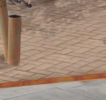
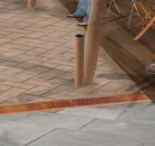
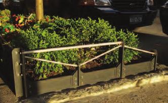
13 POLE COVER DECORATIVE WRAP TO COMPLIMENT BIA BRANDING SIDEWALK (TYPE 1 - Contributing) UNIT PAVERS OR SPECIALTY CAST-IN-PLACE CONCRETE TRENCH DRAIN (75mm wide) (various options) SPECIALTY CONCRETE OR CORTEN STEEL HERITAGE BANDING (100mm wide) (various options) SPECIALTY CONCRETE OR CORTEN STEEL OR UNIT PAVERS SIDEWALK (TYPE 2 - Non-contributing) UNIT PAVERS OR SPECIALTY CAST-IN-PLACE CONCRETE TREE GUARD CUSTOM TREE GUARD TO COMPLIMENT SITE FURNISHINGS TREE GUARD/PIT TREATMENT (1.6m x 1.6m) (various options) ARBOR RESIN OR CORTEN STEEL OR UNIT PAVERS 57


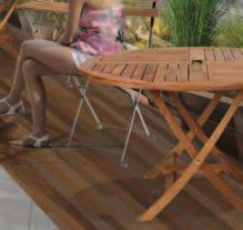
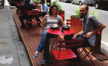
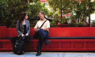
14 PARKLETS +/- 11m Right of Way with lay-by On a seasonal basis, the BIA should consider implementing Park-lets: it is an idea derived from maximizing pedestrian areas by replacing on-street parking stalls with seasonal parkettes, patios and the like. This urban design trend has precedence in Montreal, Vancouver, and San Francisco, and is in its experimental stages in Toronto. The layby parking area associated with the Linear Plaza directly east of Spadina is within the BIA s right-of-way, and therefore is a great opportunity to provide even more places for visitors and residents to linger, dine outdoors, rest, or park their bike. 72 QUEEN STREET WEST BIA STREETSCAPE MASTER PLAN

15 MH GAS PARKLET OPPORTUNITIES BC MH BC BIXI B C B HP HPT TTC CB C B HP TTC V HPTTC SL SL SL CB CCB C B CB TTCH HP MH MH MH TCH HP TTC CB C B HP HP C B VALVE TTC HP CB SL SL HP HW THW HP TH 73
16 85
PUBLIC RIGHT-OF-WAY IN THIS CHAPTER PUBLIC REALM
 PUBLIC RIGHT-OF-WAY This section provides design guidelines for improvements in the public right-of-way. The public right-of-way refers to streets, sidewalks, non-vehicular thoroughfares, parks and greenways
Toronto Complete Streets Guidelines
 Toronto Complete Streets Guidelines 108 110 7.1 Green Infrastructure Design Principles 112 7.2 Context-Sensitive Green Streets 114 7.3 Key Green Street Elements Green infrastructure refers to natural and
VEHICULAR AND PEDESTRIAN CIRCULATION
 This perspective sketch communicates the intended character and quality of a proposed streetscape design. Locate benches near a major intersection where people tend to gather. Seating and lighting provide
East Bayshore Road Neighbourhood
 East Bayshore Road Neighbourhood Northridge Property Management Urban Design Brief 3195 East Bayshore Road City of Owen Sound January 2016 East Bayshore Road Neighbourhood Northridge Property Management
TREE GUARDS AND EDGING
 CUSTOM BENCHES TREE GUARDS AND EDGING DETECTABLE WARNING PLATES Custom Bench with Rail Spikes (inset into concrete, wood bench seat) Custom Bench with Rail Wheel (inserted into end of bench) Tree guards
FLORIN ROAD CORRIDOR Site Plan and Design Review Guidelines Checklist
 FLORIN ROAD CORRIDOR Site Plan and Design Review Guidelines Checklist Applicant s Name: Project Address: Phone: Email: Applicant shall fill out the design guidelines checklist for all guidelines applicable
4.0 Design Guidelines For The Village Centre. South fields Community Architectural Design Guidelines Town of Caledon
 4.0 Design Guidelines For The Village Centre 4.0 Design Guidelines for the Village Centre The Village Centre is the focal point of the entire South Fields Community and is designed as a traditional commercial
GREENING THE BOULEVARD Master Plan Concepts for Venice Boulevard between Lincoln and Sawtelle
 GREENING THE BOULEVARD Katherine Spitz Associates Inc. 4212½ Glencoe Avenue Marina Del Rey, CA 90292 310 574 4460 Fax 574 4462 January 2008 Table of Contents Overview Proposed Design Improvements Illustration
AREA VIEW 1 AREA VIEW 2 DETAIL VIEW 1 KEY PLAN. Proposed Sitting Area. Parallel Parking Bay
 AREA VIEW 1 AREA VIEW 2 Existing Parkette Twenty Ninth St Thirtieth St Intersection Thirty Second Street Historic Marker TTC Crossing Intersection Twenty Eighth St Proposed Trees Thirty First St Media
Figure Example of out door dining in the public right-of-way.
 Section 2 Core Area Goal 2.2.1 To maintain and enhance the character of existing streets in the Downtown Area. Character Figure 2.2.1 Example of out door dining in the public right-of-way. A. Provide street
Chapter 7: Streetscape & Design Elements
 OVERVIEW Chapter 7: Streetscape & Design Elements During the public input phase of The Dixie Fix, the area of streetscape generated much interest. While safety and traffic flow are primary objectives of
Wayfinding. North Gateway: Integrate a vertical gateway marker on the west side of Ward Street at the south corner of Vernon Street.
 3.3.6.2 Wayfinding Existing Conditions Wayfinding signage is important to direct visitors and tourists to different locations in the downtown. A significant part of the wayfinding signage in the downtown
Lambeth Main Street Streetscape Improvements
 Lambeth Main Street Streetscape Improvements Open House October 5th, 2017 Agenda 1. Introduction 2. Project Background 3. Context 4. Project Objectives 5. Design Principles & Approach 6. Streetscape Design
SOUTH UNIVERSITY Street Design Setting a Direction for Schematic Design
 1 SOUTH UNIVERSITY Street Design Setting a Direction for Schematic Design Meeting Agenda 2 1. Project Scope 2. Design Direction 3. Design Details 4. Schedule and Construction Logistics 3 SOUTH UNIVERSITY
Figure 3-1: Public Realm Plan
 3 Public Realm Figure 3-1: Public Realm Plan 3.1 Public Realm Concept The public realm concept for the Little Mountain site integrates a clear and accessible movement network with public spaces for social
New-Cast Mixed-use Development Proposal King Street West, Newcastle, Ontario
 URBAN DESIGN BRIEF New-Cast Mixed-use Development Proposal King Street West, Newcastle, Ontario TABLE OF CONTENTS: 1.0 Executive Summary 2.0 Creating Vibrant and Sustainable Urban Places: Excerpts from
(DC1) Direct Development Control Provision DC1 Area 4
 Direct Development Control Provision DC1 Area 4") . General Purpose (DC) Direct Development Control Provision DC Area 4 The purpose of this Provision is to provide for an area of commercial office employment and residential development in support of the
. General Purpose (DC) Direct Development Control Provision DC Area 4 The purpose of this Provision is to provide for an area of commercial office employment and residential development in support of the
R STREET CORRIDOR NEIGHBORHOOD Site Plan and Design Review Supplemental Guidelines Checklist
 R STREET CORRIDOR NEIGHBORHOOD Site Plan and Design Review Supplemental Guidelines Checklist Applicant s Name: Project Address: Phone: Email: Applicant shall fill out the design guidelines checklist for
Community Design Plan
 Gardena General Plan 2006 Authority While the is not a required element of a General Plan, it is included because improving the community appearance and image is paramount to the overall quality of life
Cit of Kitchener Ur 6 an Design Manual PARTA. Desi n for _--::
 Cit of Kitchener Ur 6 an Design Manual Date PARTA Year ) Desi n for k Nodes Corridors _--:: Section Page 01 of 12 2 INTRODUCTION Purpose & Application Nodes and Corridors have been identified as key intensification
Appendix A COMMUNITY IMPROVEMENT PLAN DESIGN GUIDELINES
 Appendix A COMMUNITY IMPROVEMENT PLAN DESIGN GUIDELINES INTRODUCTION The continuous and desirable improvement of Arnprior requires a clear understanding of what is envisioned for the Town. These Design
Hamilton Road Corridor Streetscape Master Plan. Open House October 4 th, 2017
 Hamilton Road Corridor Streetscape Master Plan Open House October 4 th, 2017 Agenda 1. Introductions Agenda Overview 2. Project Background 3. Existing Conditions 4. Strengths, Weaknesses, Opportunities
DRAFT. October Wheaton. Design Guidelines
 October 2011 DRAFT Wheaton Design Guidelines 2 Draft - Design Guidelines - Wheaton Sector Plan Contents 04 Section 1: Introduction 06 Section 2: Context 08 Section 3: Design Guidelines 09 Goal 1: Create
COMPLETE GREEN STREET CHECKLIST
 COMPLETE GREEN STREET CHECKLIST This document was developed to dissect the structure of an urban street and explore opportunities to make our streets more complete while also integrating green street strategies.
VILLAGE OF SKOKIE Design Guidelines for Mixed-Use Districts NX Neighborhood Mixed-Use TX Transit Mixed-Use CX Core Mixed-Use
 VILLAGE OF SKOKIE Design Guidelines for Mixed-Use Districts NX Neighborhood Mixed-Use TX Transit Mixed-Use CX Core Mixed-Use TABLE OF CONTENTS CHAPTER 1 SITE DESIGN Purpose 1 CHAPTER 2 SITE DESIGN Streetscape
WELLINGTON STREET WEST COMMUNITY DESIGN PLAN
 36 3.CDP POLICIES 37 Wellington Street West CDP Vision Statement 38 3.1 Introduction 3.1.1 Purpose The development of buildings and public spaces is influenced by a variety of factors over time. City of
Landscape and Streetscape Design 2.5
 Landscape and Streetscape Design 2.5 2.5.1 Goals 2.5.2 Planting 2.5.3 Sidewalks and Pavement 2.5.4 Furnishings 2.5.5 Walls 2.5.6 Lighting 2.5.7 Stormwater 2.5.8 Street Cross Sections 2.5 LANDSCAPE AND
Design Guidelines and Standards for Sight Triangles. Sight Triangle MANUAL
 Design Guidelines and Standards for Sight Triangles Sight Triangle MANUAL Table of Contents 1.0 Introduction..............................................7 1.1 Key Terms..............................
lot flankage Y street 16m 6m landscape strip for large site 3m landscape strip for small medium site
 Commercial General Commercial Objectives Create developments compatible with adjacent land uses in scale, function and character Define a consistent and attractive street edge with quality landscaping,
CHAPTER 6 URBAN DESIGN
 CHAPTER 6 URBAN DESIGN WINNETKA DOWNTOWN PLAN 51 URBAN DESIGN isn t just about making places attractive. People tend to associate urban design with community beautification and while it does many things
South Yonge Street Corridor
 South Yonge Street Corridor Streetscape Master Plan Study Draft Final Executive Summary Prepared by: January 2012 In Partnership with: Introduction The Future... Yonge Street is at the forefront of York
4.9 Mendocino Avenue Corridor Plan Design Guidelines
 4.9 Mendocino Avenue Corridor Plan Design Guidelines The Mendocino Avenue Corridor Plan addresses the area between College Avenue and Steele Lane. Mendocino Avenue is a busy arterial that runs parallel
Chapter 14 Streetscape Improvements
 This chapter presents streetscape design concepts for key streets and gateways in the Downtown Specific Plan area. This chapter is organized as follows: 14 Streetscape Improvements 14.1 Streetscape Treatments
open house 3 CITY OF SALEM Downtown Streetscape Plan
 open house 3 Streetscape concepts CITY OF SALEM Downtown Streetscape Plan analysis concepts we are here refined concepts & document Feb 13th 1 2 3 apr 18th KICKOFF OPEN HOUSE Streetscape Work Group Walking
VISION AND GUIDING DESIGN PRINCIPLES
 pleasure point commercial corridor VISION AND GUIDING DESIGN PRINCIPLES Public Draft November 26, 2018 County of Santa Cruz with assistance from MIG CONTENTS PART I: INTRODUCTION AND VISION... 3 Community
appendix and street interface guidelines
 appendix five: building and street interface guidelines appendix 5 building and street interface guidelines BOULEVARDS Boulevards are generally characterized by higher levels of traffic movement at higher
Buildings may be set back to create small plazas provided that these setbacks do not substantially disrupt the street wall s continuity.
 6-22 Community Design Street Walls and Street-front Setbacks The siting of buildings will play a critical role in establishing the character and sense of place for the District. Siting buildings at the
Clairtrell Area Context Plan
 Clairtrell Area Context Plan March 2005 Urban Development Services City Planning Contents 1. Introduction... 4 2. Development Structure... 6 2.1 Streets... 7 2.1.1 Sheppard Avenue and Bayview Avenue...
4-1 An Urban Orchard at Downsview Park 4-2 Olive Square 4-3 Dundas St. West Parkettes 4-4 Montclair Parkette
 4-1 An Urban Orchard at Downsview Park 4-2 Olive Square 4-3 Dundas St. West Parkettes 4-4 Montclair Parkette 4-1 An Urban Orchard at Downsview D i PParkk 1-35 Carl Hall Road Project Team MMM Group Limited
Wheaton CBD & Vicinity Sector Plan D E S I G N G U I D E L I N E S
 Wheaton CBD & Vicinity Sector Plan D E S I G N G U I D E L I N E S 1 a b s t r a c t This document contains the design guidelines the property owners, community members, and planners should use to implement
The open space system should provide connective elements, relate to natural resources, and enhance the suburban character of the landscape..
 The open space system should provide connective elements, relate to natural resources, and enhance the suburban character of the landscape.. Mixed-use and infill development should maintain or enhance
Elm Street Business District: Streetscape and Signage Plan
 Elm Street Business District: Streetscape and Signage Plan VILLAGE OF WINNETKA DOWNTOWN MASTER PLAN TASK FORCE MTG #1 Teska Associates 30 October 2017 AGENDA 1. Introductions and Walking Tour 2. Past Streetscape
7Page 91 CLEMMONS COMMUNITY COMPASS 7 COMMUNITY CHARACTER
 7 Community Character The beauty of Clemmons won t necessarily be a reflection of our past, but our future. This quote from Comprehensive Plan Steering Committee member Wayne Dodson captures the essence
Urban Design & Placemaking
 Urban Design & Placemaking What is Urban Design? Urban Design is the discipline of creating equitable, vibrant, and sustainable places with distinct identities. The profession pulls from other built environment
Design Guidelines for the Route 30 Corridor Master Plan: Subdivision and Land Development Elements
 Design Guidelines for the Route 30 Corridor Master Plan: Subdivision and Land Development Elements East Whiteland Township- Chester County, PA Prepared by: Draft: May 7, 2018 Design Guidelines for the
FROM DUPONT CIRCLE NORTH TO CALIFORNIA STREET, NW. Welcome!
 FROM DUPONT CIRCLE NORTH TO CALIFORNIA STREET, NW Welcome! Meeting Agenda 6:00 PM Open House 6:30 PM Presentation 7:00 PM Open House / Q&A at the Boards Project Design Team Connecticut Avenue, NW Project
Please see attached for more detailed project information. Project Schedule Designer Award by SBC Executive Sub-Committee December 21, 2015
 Project Title Campus Beautification Projects Volunteer Blvd Ph 1 540/009-08-2015 Institution Description UT Knoxville This project will improve Volunteer Boulevard from West Cumberland Ave. to East Cumberland
Site Planning. 1.0 Site Context. 2.0 Pedestrian Circulation Systems. Pag e 2-23
 The following photographs from throughout the country illustrate key urban design principles. Photographs are provided to illustrate the overall urban design concepts described in Chapter 1 of the Downtown
Arterial Mainstreets ottawa.ca
 Urban Design Guidelines for Development along Arterial Mainstreets ottawa.ca Ce document est disponible en français sur ottawa.ca. This document is available in French on ottawa.ca. Approved by City Council
SUBCHAPTER 4-B GUIDELINES FOR THE B-3 COMMERCIAL CHARACTER AREA
 1 SUBCHAPTER 4-B GUIDELINES FOR THE B-3 COMMERCIAL CHARACTER AREA Downtown Bozeman should be the location of buildings of greatest height and intensity in the community. The following guidelines apply
Gas Stations ottawa.ca
 Urban Design Guidelines for Gas Stations ottawa.ca Ce document est disponible en français sur ottawa.ca. This document is available in French on ottawa.ca. Approved by City Council May 24, 2006 City of
Division VI Community Mixed Use (CMU) Architectural Guidelines and Standards
 Architectural Guidelines and Standards") Division VI 18.40.800 Community Mixed Use (CMU) Architectural Guidelines and Standards 18.40.810 Guidelines The goals of the Comprehensive Plan include a focus on pedestrian safety, amenities and aesthetics
Division VI 18.40.800 Community Mixed Use (CMU) Architectural Guidelines and Standards 18.40.810 Guidelines The goals of the Comprehensive Plan include a focus on pedestrian safety, amenities and aesthetics
City of Redlands Architectural Guidelines for Non-Residential Development
 14. Building articulation shall be included in the design of building, in order to create a formal entry statement. Avoid this Do this Page 11 15. Give special attention to creating pedestrian scale and
BUSINESS DISTRICT DESIGN GUIDELINES
 Des Plaines, Illinois Prepared for the City of Des Plaines by: The Lakota Group Laurie Marston, AICP March 2005 Section 5: Streetscape Elements Business District Design Guidelines STREETSCAPE ELEMENTS
FRUITVALE TRANSIT VILLAGE (Phase 2) Residential Project
 Residential Project") FRUITVALE TRANSIT VILLAGE (Phase 2) Residential Project DEVELOPER: SIGNATURE PROPERTIES ARCHITECT: HKIT ARCHITECTS April 23, 2010 TABLE OF CONTENTS 3 Vision 4 Description of Site 5 Guiding Concepts 6
FRUITVALE TRANSIT VILLAGE (Phase 2) Residential Project DEVELOPER: SIGNATURE PROPERTIES ARCHITECT: HKIT ARCHITECTS April 23, 2010 TABLE OF CONTENTS 3 Vision 4 Description of Site 5 Guiding Concepts 6
Fifth and Detroit Street Design May 2017 Capital Improvements Committee. DOWNTOWN Street Design
 1 Fifth and Detroit Street Design May 2017 Capital Improvements Committee Agenda 2 Review Street Configuration Prior Meeting Review Outreach Synopsis Functional Street Design Refinements Curb Edge, Turning
Executive Summary. NY 7 / NY 2 Corridor
 Executive Summary NY 7 / NY 2 Corridor Transportation and Land Use Study December 2005 Prepared for: Town of Colonie Capital District Transportation Committee Prepared by: Introduction: Land use decisions
Westwind Developments Ltd. PIONEER LANDS AREA STRUCTURE PLAN - PROPOSED AMENDMENT
 FEBRUARY 2013 TABLE OF CONTENTS 1.0 BACKGROUND... 1 1.1 Amendment... 1 2.0 LOCATION & CONTEXT... 2 2.1 Land Ownership... 2 3.0 POLICY CONTEXT... 3 3.1 Municipal Development Plan... 3 3.2 Capital Region
D ESIGN REVIEW COMMITTEE
 CVDRC STAFF REPORT C REATIVE VILLAGE D ESIGN REVIEW COMMITTEE March 14, 2017 Case Number LDC2017-00035 Applicant AGENDA ITEM 1 CREATIVE VILLAGE STREETSCAPE DESIGN GUIDELINES AMENDMENT Craig Ustler, Manager
STREETSCAPE MANUAL ONLINE TRAINING SESSION 3: Decision-Making
 TRAINING SESSION 3: The Urban Design Streetscape Manual is a reference tool developed to help implement City policy and guide the design, construction and maintenance of streetscape improvements in Toronto.
Community Mixed Use Zone Districts (CMU)
") 18.28.500 Community Mixed Use Zone Districts (CMU) The Community Mixed Use Zone Districts (CMU) are intended to help implement the land use goals and strategies found in the Golden Vision 2030 values,
18.28.500 Community Mixed Use Zone Districts (CMU) The Community Mixed Use Zone Districts (CMU) are intended to help implement the land use goals and strategies found in the Golden Vision 2030 values,
Urban Land Institute Toronto / January John Street Revitalization. Public Realm Improvement Plan
 Urban Land Institute Toronto / January 2013 John Street Revitalization Public Realm Improvement Plan Contents Introduction... 1 Process... 2 Existing Conditions... 4 Analysis > Synthesis... 6 Design Principles...
Roanoke Rapids Streetscape Master Plan. City Council Presentation
 SCHEDULE: Stakeholder Meeting/Kick off November,2016 Master Planning Phase (November March 2017) Public Meeting #1 December 13, 2016 Review Meeting with Key Stakeholders Refine Concepts Based on Input
THE CORPORATION OF THE CITY OF VAUGHAN MAJOR MACKENZIE STREETSCAPE STUDY
 THE CORPORATION OF THE CITY OF VAUGHAN MAJOR MACKENZIE STREETSCAPE STUDY STANTEC CONSULTING LTD. 300-675 Cochrane Drive, West Tower Markham, ON L3R 0B8 Tel: (905) 944-7777 Fax: (905) 474-9889 April 2010
The Project. In 2013, construction was completed between 100 Street and 102 Street.
 The Project Jasper Avenue New Vision (JANV) is a major catalyst project identified in the Capital City Downtown Plan (2010) between 92 Street and 109 Street, including the streets half a block north and
STREETSCAPE MANUAL ONLINE TRAINING SESSION 2: Searching the Manual
 TRAINING SESSION 2: The Urban Design Streetscape Manual is a reference tool developed to help implement City policy and guide the design, construction and maintenance of streetscape improvements in Toronto.
38 Queen s University Campus Master Plan Part 1
 38 Queen s University Campus Master Plan Part 1 46 The Campus at the City Scale Chapter 4 The Campus at the City Scale 39 Queen s is an urban University centrally located in Kingston. Decisions made by
STREETSCAPE MANUAL ONLINE TRAINING SESSION 2: Searching the Manual
 TRAINING SESSION 2: The Urban Design Streetscape Manual is a reference tool developed to help implement City policy and guide the design, construction and maintenance of streetscape improvements in Toronto.
C I T Y O F T O R O N T O L A W R E N C E A V E N U E E A S T S T U D Y. Northwest Corner of Birchmount Road and Lawrence Avenue East
 C I T Y O F T O R O N T O A P P E N D I X A Northwest Corner of Birchmount Road and Lawrence Avenue East 92 DILLON CONSULTING LTD. - J.C. WILLIAMS GROUP LTD. APPENDIX B LAWRENCE AVENUE EAST STUDY SUMMARY
Design Guidelines for PRINCESS ANNE COMMONS
 Design Guidelines for PRINCESS ANNE COMMONS January 25, 2002 To create a unique and identifiable place with attractive, exciting, efficient and safe components to enhance the consistency of the built environment
CENTERS AND CORRIDORS
 INITIAL DESIGN STANDARDS AND GUIDELINES for CENTERS AND CORRIDORS City of Spokane Planning Services Third Floor, City Hall 808 W. Spokane Falls Blvd. Spokane, WA 99201-3329 (509) 625-6300 www.spokaneplanning.org
SOUTH UNIVERSITY Street Design Alternatives in Progress
 1 Alternatives in Progress 2016.01.20 Meeting Agenda 2 1. Progress & Schedule 2. Utilizing the Street Design Manual 3. Site Characteristics and Input Received 4. Street Geometry What can we accomplish
Context Plan and Urban Design Guidelines for the lands west of Provost Drive
 Concord Park Place Context Plan and Urban Design Guidelines for the lands west of Provost Drive Amendment to the Bessarion-Leslie Context Plan October 2013 Concord Park Place Urban Design Guidelines The
The Vision. Photo provided by The Minervini Group. 46 Vision, Objectives & Strategies
 Vision, Objectives & Strategies The is the public framework and guide for future development of the Grand Traverse Commons. The establishes public polices for infrastructure, the preservation of natural
BUILDING SCALE AND SETBACKS 5 ELEMENTS:... 5 FAÇADES (COMMERCIAL/RESIDENTIAL) 5
 5") VISION STATEMENT 3 UTILIZATION OF THE GUIDELINES 3 IMPLEMENTATION 3 PROCEDURES FOR DESIGN REVIEW 3 LAND USE AND ZONING 4 LAND USE 4 ELEMENTS:... 4 ZONING 4 ELEMENTS:... 4 BUILDING SCALE AND SETBACKS 5
VISION STATEMENT 3 UTILIZATION OF THE GUIDELINES 3 IMPLEMENTATION 3 PROCEDURES FOR DESIGN REVIEW 3 LAND USE AND ZONING 4 LAND USE 4 ELEMENTS:... 4 ZONING 4 ELEMENTS:... 4 BUILDING SCALE AND SETBACKS 5
Planning Board Hearing October 20th, 2016
 Planning Board Hearing October 0th, 06 Developer: Real Estate Management & Leasing: Architect: Transportation Engineers: Landscape Architect: Civil Engineer: THE ARSENAL PROJECT Planning Board AGENDA Introduction
ROCKTON DOWNTOWN STREETSCAPE MASTER PLAN. Plan Commission Presentation April 10, 2018 Teska Associates Christopher Burke Engineering
 ROCKTON DOWNTOWN STREETSCAPE MASTER PLAN Plan Commission Presentation April 10, 2018 Teska Associates Christopher Burke Engineering AGENDA 1. Project Scope & Schedule 2. Steering Committee & Community
URBAN DESIGN BRIEF REPORT
 URBAN DESIGN BRIEF REPORT PREPARED FOR 2568401 ONTARIO INC NEW GASBAR, CONVENIENCE STORE & CARWASH DEVELOPMENT @ 1509 FANSHAWE PARK ROAD WEST LONDON, ONTARIO GAMA ENGINEERING INC. PROJECT NUMBER 1669 PREPARED
Georgeson Botanical Garden Master Plan
 Georgeson Botanical Garden Master Plan Alaska Chapter 2018-03-12 This Master Plan was developed by volunteers representing the Alaska Chapter of the American Society of Landscape Architects. Eliza Bober
Lower Merion Commercial Districts Issues and Characteristics Handbook November 2013
 Lower Merion Commercial Districts Issues and Characteristics Handbook November 2013 DRAFT TOWNSHIP-WIDE VISION: To maintain and enhance commercial areas to complement the surrounding high-quality residential
CHAPTER 8. Mrs. Zimman s Class - Central Elementary
 SUSTAINABILITY CHAPTER 8 Mrs. Zimman s Class - Central Elementary 8.1 OVERVIEW Green infrastructure also known as low impact development (LID) and environmental or sustainable site design is an environmentally
DRAFT. 10% Common Open Space
 % OF CHARLOTTE IS CATEGORIZED AS A. LAND USES : Placeholder map displaying location of Place Type GOALS: Accommodate XX% of future growth. Provide a concentration of primarily commercial and civic activity
INSTITUTIONAL USE DESIGN COMPATIBILITY TECHNIQUES
 INSTITUTIONAL USE DESIGN COMPATIBILITY TECHNIQUES INTRODUCTION Community institutions are an important part of the character and vitality of neighborhoods in Forsyth County. Institutional uses include
Mixed Use Centres Development Permit Guidelines
 1 Mixed Use Centres Development Permit Guidelines Area Commercial or Mixed Use development occurring in City Centre, Urban Centre, Neighbourhood Centre, or Institutional Complex land use designations is
STREETSCAPE MANUAL DRAFT
 5 STREETSCAPE MANUAL The Streetscape Manual aims to be fl exible and encourage innovative design. The purpose of the Streetscape Manual is to outline best practices at a detailed level for the design
QUESTION 8: What are your Public Realm priorities for implementation? What would you like to see happen first? TELL US WHAT YOU THINK
 Public Realm Plan How will the Public Realm Plan be implemented? The Public Realm Plan document will set out a vision for the next 30 years. Over time, Plan elements and aspects can be implemented as opportunities
The George Washington University Streetscape Concept Plan. May 6 th 2009 Public Presentation for Discussion EHRENKRANTZ ECKSTUT & KUHN ARCHITECTS
 The George Washington University Streetscape Concept Plan May 6 th 2009 Public Presentation for Discussion EHRENKRANTZ ECKSTUT & KUHN ARCHITECTS Agenda 1. Introduction & Overview 2. Background & Context
Image Credit: crja.com
 Image Credit: crja.com 6 ADDITIONAL PLACEMAKING ELEMENTS 6A 6B 6C 6D Signage and Wayfinding in the Public Realm Gateways Public Art Water Features ADDITIONAL PLACEMAKING ELEMENTS INTENT In addition to
Johnson Street Bridge Public Realm Update
 Johnson Street Bridge Public Realm Update August 20, 2015 Background Johnson Street Bridge Replacement Project impacts a diverse range of stakeholders In addition to a new bridge, the project also includes
Maplewood Avenue Downtown Complete Street Project
 Maplewood Avenue Downtown Complete Street Project Second Public Meeting January 24, 2018 Welcome and Introduction of Project Team City Planning and Public Works Staff City of Portsmouth Juliet Walker Planning
4. INDUSTRIAL 53 CASTLE ROCK DESIGN
 4. INDUSTRIAL 53 CASTLE ROCK DESIGN CASTLE ROCK DESIGN 54 4. INDUSTRIAL Overview Well-designed and attractive industrial centers are the product of blending economic realities with both functional and
Planning Board Briefing
 Planning Board Briefing Why Now? The Sector Plan Implementation Chapter States: Before Stage 1 begins, the following must occur: Approval of the Sectional Map Amendment. Approval of the Greater Lyttonsville
3.13. Development Guidelines
 3.3 Landscaping Elements Landscaping should be used to frame and soften structures, define site functions, enhance the quality of the environment, and screen undesirable views. Safety, environmental impacts,
City of Burlington Downtown Street Design & Construction Standards
 City of Burlington Downtown Street Design & Construction Standards Adopted April 16, 2018 b City of Burlington Downtown Street Design Standards CITY OF BURLINGTON, VT The Great Streets Initiative is a
Pedestrian and Bike Bridge LOGO
 6.2.2 Pedestrian and Bike Bridge The proposed pedestrian and bike crossing re-envisions the existing bridge at Pismo Creek on Cypress Street. The bridge is currently underutilized by vehicular through
Streets Vision
 streets 86 2.9 Vision : The Most Prevalent and Important Public Spaces Fixed routes of human travel have served as corridors for commerce and places for human interaction from the earliest trails and foot
MAIN STREET DESIGN GUIDELINES CONTEXT
 MAIN STREET DESIGN GUIDELINES CONTEXT VISION The re-imagining of Main Street offers an unparalleled opportunity to strengthen and link Fredericton North through the integration of local neighbourhoods,
SITE FURNISHINGS STANDARDS MANUAL
 University Planner's Office Architecture, Engineering & Construction University of Michigan January, 2011 http://www.umaec.umich.edu/ Table of Contents Introduction page 3 Campus Landscape Design Elements
Urban Design 9Identity
 Urban Design 9Identity URBAN DESIGN IDENTITY Urban design is about connecting people to their places through the built environment, nature, and overall urban form. Done well, it creates a memorable space
Market Place Bythell Place Queen Street Park Riverside Park. Public Spaces. Blenheim CBD Streetscape Final Report 36
 37 39 41 43 Market Place Bythell Place Queen Street Park Riverside Park Final Report 36 Market Place Market Place is a key space for Blenheim s street life, it is a meeting place, retail edge and pedestrian