TOWN OF NEWMARKET OLD MAIN STREET TERTIARY PLAN SEPTEMBER, 2018 (DRAFT)
|
|
|
- Neil Lang
- 5 years ago
- Views:
Transcription

1 TOWN OF NEWMARKET OLD MAIN STREET TERTIARY PLAN SEPTEMBER, 2018 ()


2


3
4 TABLE OF CONTENTS 1.0 INTRODUCTION Overview Purpose of the Tertiary Plan Location and Description of the Tertiary Plan Area VISION AND GUIDING PRINCIPLES Vision Statement Guiding Principles LAND USE AND DENSITY Introduction Objectives Policies TRANSPORTATION Introduction Objectives Policies SERVICING AND UTILITIES Introduction Objectives Policies 9
5 6.0 SITE DESIGN Introduction Objectives Policies BUILDING DESIGN Introduction Objectives Policies OPEN SPACES AND NATURAL HERITAGE Introduction Objectives Policies IMPLEMENTATION Introduction Policies 19 SCHEDULE 1: STUDY AREA 21 SCHEDULE 2: LAND USE 22 SCHEDULE 3: HEIGHT AND DENSITY 23 SCHEDULE 4: PARKS, OPEN SPACES AND NATURAL HERITAGE 24
6 1.0 INTRODUCTION 1.1 Overview 1.2 Purpose of the Tertiary Plan Newmarket is poised for growth. While the majority of this will occur through the redevelopment of the Davis Drive and Yonge Street corridors, other areas of the Town are facing development interest. One of these areas is the Old Main Street Neighbourhood. The character of the Old Main Street Neighbourhood has been influenced by a hierarchy of provincial, regional and municipal policies and regulations, as well as a number of historic and spatial elements, which combine to create a distinct sense of place and continue to inform future development patterns. Such development has contributed toward the incremental evolution of neighbourhood character over time. Old Main Street is a very old street and was established prior to modern engineering and planning standards. It has developed organically over the years and without an overall or consistent plan. The lotting is haphazard; there are some fairly large lots and some lots which are much smaller. Recently there has been an increased interest in redeveloping some of the larger properties along Old Main Street. As redevelopment was not previously considered in this area, it was determined this was an appropriate time to pause redevelopment in the area and undertake a study to determine what is the best form of, and best course of action for, redevelopment. The study resulted in this Tertiary Plan. A Tertiary Plan is a mini secondary plan. It is a policy document which sets out guidelines for development within a certain, small and specific area within the municipality. Tertiary Plans consider all of the planning elements that official plan and secondary plans speak to, such as density, unit type and housing mix, and land use. The purpose of the Old Main Street Tertiary Plan is to provide a detailed land use plan and policies to guide land use and development in accordance with the provisions of provincial plans and policies, the York Region Official Plan and the Town of Newmarket Official Plan. The Plan must be read in conjunction with the applicable policies of the Town of Newmarket Official Plan. The Old Main Street Tertiary Plan provides direction on the possibilities of redevelopment along Old Main Street. The Plan incorporates a detailed planning, transportation and servicing review and analysis of relevant background information, as well as a robust public and stakeholder consultation process. Policies have been prepared to address all relevant matters with respect to land use, density, stormwater management, low impact development, transportation and servicing infrastructure, open space and natural heritage. Additionally, the Plan incorporates urban design policies which aim to reinforce the character of the Old Main Street neighbourhood. Such policies address matters pertaining to building height and massing, building elements, garages and driveways, setbacks and landscaping, special features, and built heritage. The Old Main Street Tertiary Plan forms part of an amendment to the Town of Newmarket Official Plan, and could be used to inform an amendment to the Town of Newmarket Zoning By-law. Tertiary Plans are policy documents which set out guidelines for development within certain, small and specific areas of the municipality. The purpose of a Tertiary Plan is to assist Council, landowners, residents and developers to interpret the policies of the Town of Newmarket Official Plan, as they relate to where and how development is encouraged to take place within the Tertiary Plan area. Unlike Official Plans 1 INTRODUCTION


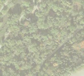

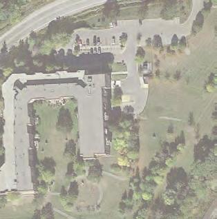
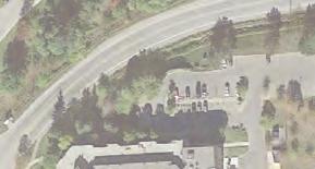
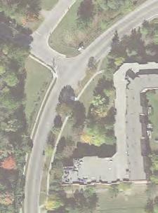
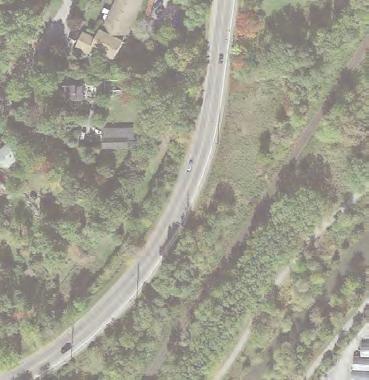


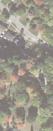
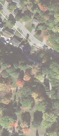

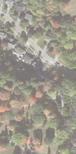
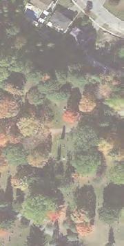


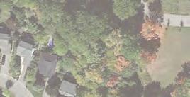


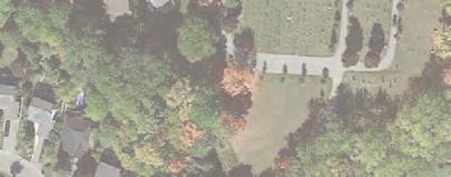
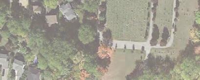
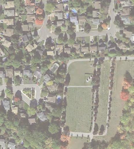
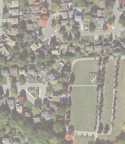
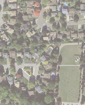
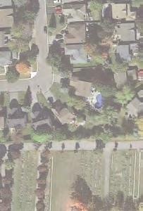
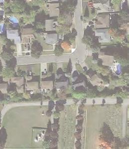
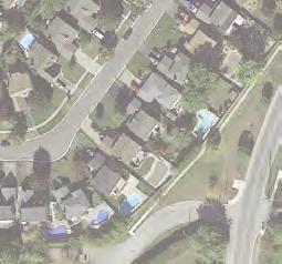
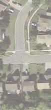
7 SELBY CRES DOVER CRES 244 WAKEFIELD PL SAINT JOHN CEMETERY B B B OLD 209 ST AIN BAYVIEW PARKWAY OPEN SPACE M CR nd ILL Ri XH ve r MAIN ST N BE Ho lla ES NEWMARKET CEMETERY MABEL DAVIS CONSERVATION AREA m 0m 0m Aerial Map - Old Main Street Study Area STUDY AREA AND CONTEXT 2

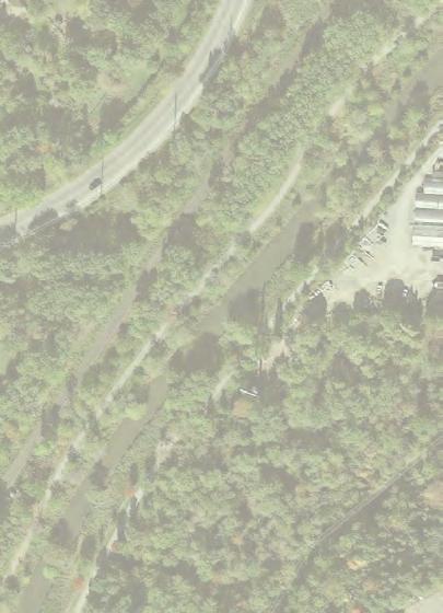
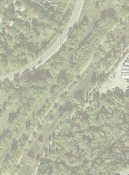
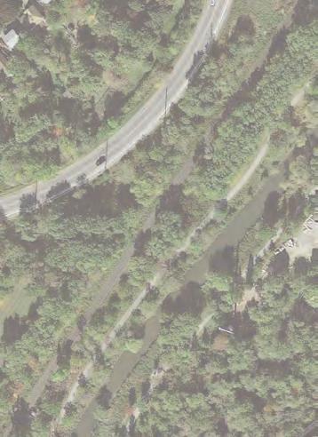
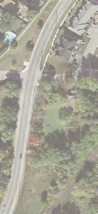
8 and Secondary Plans, Tertiary Plans are not statutory documents and do not have legislative requirements set out in the Ontario Planning Act. Notwithstanding, the Old Main Street Tertiary Plan establishes Council s intent and direction for the Old Main Street Neighbourhood on all relevant matters with respect to land use, density, stormwater management, low impact development, transportation and servicing infrastructure, open space, natural heritage and urban design. 1.3 Location and Description of the Tertiary Plan Area The Old Main Street Tertiary Plan specifically addresses properties which front onto either side of Old Main Street, between Bexhill Road and Main Street North. However, consideration is also given to all publicly and privately-owned lands which are generally bounded by Bexhill Road to the south, Main Street North to the east, properties fronting onto the south side of Dover Crescent to the north and St. John Cemetery to the west. View looking west from Main Street North. 3 INTRODUCTION
9 2.0 VISION AND GUIDING PRINCIPLES 2.1 Vision Statement The Old Main Street Neighbourhood will retain its rural, cottage-like and scenic natural character, while accommodating contextually-sensitive development. Future development will be planned and designed in a manner which respects the existing natural heritage system and topographical conditions; enhances existing landscaping and open space features, while introducing new and improved stormwater management facilities; facilitates the establishment of new pedestrian connections, gateway features, and the enhancement of Old Main Street; and respects prevailing site, building and architectural characteristics. 2.2 Guiding Principles Respect the Natural Heritage System and Existing Topography. Existing woodlots are encouraged to be protected, and significant natural heritage features are encouraged to be retained, in order to maintain a contiguous natural heritage system. Adequate buffers and open space linkages should be provided, in order to protect local wildlife habitat. Elements of the natural environment should be incorporated into future development, and existing topographical conditions should be respected. Enhance Landscaping and Open Space Features. The existing informal open space and recreational area should be enhanced, and existing landscape buffers should be improved to mitigate acoustic and visual impacts associated with Main Street North. A new stormwater management facility may be introduced at the foot of Old Main Street, to increase flood storage capacity, mitigate flooding and stormwater runoff, and improve stormwater treatment. The use of soft and permeable front yard landscaping is encouraged. Establish Pedestrian Connections and Gateway Features. Pedestrian connections should be provided to surrounding park, open space, natural heritage, trail, and public transit networks. Gateway treatments should be established at either end of Old Main Street, through the provision of accent planting, enhanced landscaping, traffic calming measures, special surface paving treatments, and signage. Enhance the Design of Old Main Street. The design of Old Main Street should be enhanced, while acknowledging its quiet, meandering and rural character. The street should be re-graded and repaved. Shoulder areas should be formalized. Subject to further assessment, it is proposed that the existing swale and road ditch drainage system be eliminated and frontage runoff be directed to a new road storm sewer. The new road should be urbanized with curbs and gutters. Street trees shoud be planted, where possible. Sidewalks and landscape buffers should be introduced. Respect Prevailing Site Design Characteristics. The predominant east-west alignment of existing lots should be maintained, with primary building façades and entrances oriented towards Old Main Street. The varied and porous character of Old Main Street, as well as prevailing front and side yard setbacks, should be acknowledged. Unobstructed views should be promoted between dwellings and adjacent streets and open spaces. Sky views, sunlight penetration, and privacy between adjacent properties should be maintained. Driveways and curb-cut widths should be minimized, and all parking should be provided within the lot. VISION AND GUIDING PRINCIPLES 4

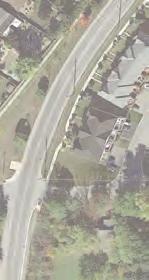
10 Respect Prevailing Building Design and Architectural Characteristics. A diverse and eclectic mix of traditional and contemporary architectural styles should be encouraged. The cottage-like character of many existing dwellings should be acknowledged. Finished ground floor heights should be minimized relative to established grade, in order to establish positive interfaces between buildings and the adjacent street. The prevailing rhythm of entrances, windows, address signage, wall-mounted lighting, and weather protection elements should be acknowledged. The prevailing character of 1 to 2 storey dwellings should be reflected, and issues contributing to perceived increases in building height should be mitigated. An appropriate variety of roof styles and building materials should be encouraged. View looking south from Old Main Street. 5 VISION AND GUIDING PRINCIPLES
11 3.0 LAND USE AND DENSITY 3.1 Introduction 3.3 Policies The Old Main Street Neighbourhood remains comprised entirely of single detached dwellings, the majority of which are relatively modest in size. Some include integral accessory dwelling units, such as basement suites. Future development within the Old Main Street Neighbourhood will retain its low-rise residential character, while augmenting existing single detached dwellings with new semi-detached dwellings, triplexes, fourplexes and detached accessory dwelling units. 3.2 Objectives The objective of these land use policies is to facilitate future development, including the introduction of new building typologies, in order to accommodate infill development while maintaining the stability of the Old Main Street Neighbourhood, and respecting prevailing land use and density characteristics. This section sets out policies that are intended to guide the provision of primary and accessory building typologies and associated development densities throughout the Old Main Street Neighbourhood Residential Areas i. Lands identified as Residential Areas on Schedule 2 are permitted to include a combination of single detached dwellings, semi-detached dwellings, triplexes, and fourplexes. i Residential Areas are permitted to include a maximum of 1 integral or detached accessory dwelling unit in combination with a single detached or semi-detached dwelling. The density of Residential Areas shall be limited to a floor space index of 1.0. LAND USE AND DENSITY 6
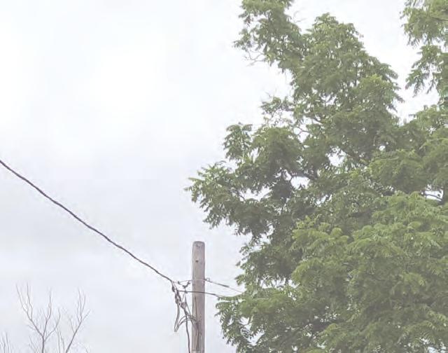
12 4.0 TRANSPORTATION 4.1 Introduction 4.2 Objectives Old Main Street extends approximately 530 metres, between Bexhill Road to the south and Main Street North to the northeast. Throughout its length, the pavement width varies between approximately 7 and 11 metres, and the right-of-way width varies between approximately 10 and 18 metres. The alignment of Old Main Street meanders as it traverses throughout the neighbourhood, adhering to a gentle slope and wrapping around significant topographical features. Old Main Street is characterized as a local road with a rural cross-section. Swales and culverts are provided throughout the length of the street, along its west side. Cubs and sidewalks are only provided at points of entry from Bexhill Road and Main Street North. Narrow gravel shoulders are provided in select locations, primarily in the northeastern-most portion of the neighbourhood. Street lights are mounted on hydro poles, which traverse along the west side of the street, throughout the neighbourhood. A community mailbox is provided adjacent to the sidewalk at the south end of the street, adjacent to Bexhill Road. Old Main Street will be reconstructed to local road standards utilizing an urban cross section with curb and gutters and under road storm sewer, eliminating the existing road ditch drainage system. Pavement design requirements (i.e. asphalt and granular thickness) will require geotechnical input. The elimination of the existing road ditch/swale drainage system will require further review to confirm its viability. This will be achieved through the completion of a Comprehensive Master Stormwater and Drainage Plan, with an associated survey of the study area and a geotechnical investigation. The objective of these transportation policies is to aim for the creation of an 18.0 m local road right-ofway, while minimizing associated grading impacts to adjacent properties and facilitating the introduction of new streetscape amenities. 4.3 Policies This section sets out policies that are intended to guide the development of transportation infrastructure throughout the Old Main Street Neighbourhood Old Main Street i. The Old Main Street right-of-way shall be widened to approximately 18.0 metres, between Bexhill Road and Main Street North, where feasible. i The redesign of Old Main Street shall acknowledge the quiet, meandering and rural character of the existing street. The redesign of Old Main Street shall endeavor to incorporate: a. 2 sets of 3.5 metre wide travel lanes, and 2 sets of 0.5 metre wide curb zones; b. a 1.4 metre wide pole zone on the east side of the right-of-way, adjacent to the curb; c. a 1.5 metre wide sidewalk, adjacent to the pole zone, on the east side of the right-of-way; 7 TRANSPORTATION
13 WEST PROPERTY LINE d. 2.5 metre wide on-street parking bays, provided in combination with landscaped bump-outs, at key locations and where space permits to provide supplementary visitor parking; e. a 5.0 metre wide boulevard with soft landscaping on the west side of the right-of-way, adjacent to the curb, and a 2.1 metre wide boulevard with soft landscaping on the east side of the right-of-way, adjacent to the sidewalk; OLD MAIN STREET (LOOKING NORTH) SOUTHBOUND iv. NORTHBOUND f. Low impact development features and permeable surface materials, where appropriate; and g. formal traffic calming measures, including measures such as boulevard bump-outs, raised pedestrian crossings, special surface paving treatments and signage, where feasible. The redesign of Old Main Street shall mitigate stormwater run-off. Idealized Cross-Section Diagram - For Illustrative Purposes Only PROPERTY LINE EAST 2% 2% landscaped boulevard curb travel lane travel lane curb pole zone sidewalk landscaped boulevard 5.0m 0.5m 3.5m 3.5m 0.5m 1.4m 1.5m 2.1m R.O.W. 18.0m EMERGING PREFERRED CROSS SECTION LOCAL ROAD 18m R.O.W. TRANSPORTATION 8
14 5.0 SERVICING AND UTILITIES 5.1 Introduction 5.2 Policies Residences on Old Main Street are all connected to the municipal water system. Most of the dwellings are connected to the municipal sanitary service, some are still on heritage septic systems. It appears the municipal water and sanitary systems could accept additional development, subject to the limitations of the larger system governed by the Region. Significant stormwater management and flooding issues shave been reported by residents throughout the neighbourhood, particularly properties on the east side of Old Main Street. 5.2 Objectives The objective of these servicing policies is to ensure all servicing and utility infrastructure complies with Town standards, and that adequate servicing and stormwater systems are provided to support future development. A Comprehensive Master Stormwater and Drainage Plan, with an associated survey of the study area and a geotechnical investigation, will be required to assess the feasibility of recommended stormwater measures. This section sets out policies that are intended to guide the development of servicing and utility infrastructure throughout the Old Main Street Neighbourhood Wastewater i. Future development shall improve and expand upon the existing wastewater sewer system, in order to reduce reliance on individual septic systems Water i. Future development shall connect to the municipal water system Grading and Drainage i. Design grades for all buildings shall be set to ensure that water is directed away from the building and neighbouring properties and toward the adjacent street. i iv. Existing grades, as set by the average grade of neighbouring properties, shall be maintained. Landscape design shall incorporate strategies to minimize stormwater run-off and reduce water consumption. Basements are not permitted within detached accessory dwelling units. 9 SERVICING AND UTILITIES
15 v. Site Drainage and Grading Plans shall be completed for all properties where detached accessory dwelling units are proposed in order to ensure that development sufficiently mitigates potential impacts on adjacent properties and manages stormwater run-off. These plans shall be stamped by a Professional Engineer licensed to practice in the Province of Ontario Stormwater Management i. The existing linear swale and culvert system along the west side of Old Main Street shall be replaced with a sub-surface storm sewer system. The feasibility of the storm sewer system will be dependent on the completion of a Comprehensive Master Stormwater and Drainage Plan for the area. This Plan will address the catchment areas flows to be intercepted into the new storm sewer, the need for upstream, new development runoff controls and downstream outlet controls and capacity constraints. i Future development shall explore opportunities to improve on-site stormwater management. Increases in post-development flows may require mitigation. This will be evaluated on a case-by-case basis, through the completion of a Comprehensive Master Stormwater and Drainage Plan. Future development should incorporate low impact development measures (LIDs) iv Utilities where feasible, to manage stormwater on-site. These could include bioswales, infiltration galleries; rain gardens and soil cells. LID measures will also be considered within the proposed road right-of-way, including the potential use of permeable pavements in sidewalk areas. The feasibility of incorporating low impact development measures should be confirmed through the Comprehensive Master Stormwater and Drainage Plan. i. Future development shall consider the visual impact and location of existing above and below-grade utilities including telephone, hydro, water and natural gas. i iv. Future development shall consider implications arising from the potential need for relocation and/or burying of existing utilities. Existing vehicle-oriented lighting standards shall be replaced with new pedestrian-oriented lighting standards. Waste and recycling storage areas shall be located to the side or rear of buildings, or shall be screened from view along Old Main Street. v. Utilities, infrastructure and servicing shall be located so as not to interfere with existing trees, mature tree growth or landscaping. SERVICING AND UTILITIES 10
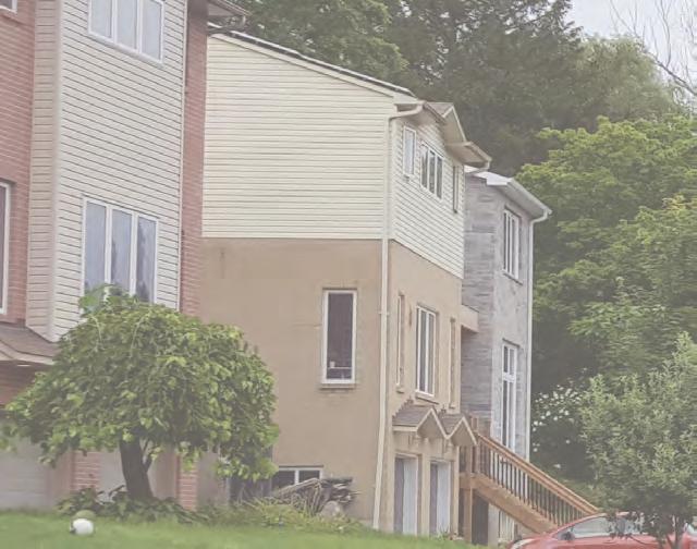
16 6.0 SITE DESIGN 6.1 Introduction Properties located in the central-most portion of the Old Main Street Neighbourhood are generally smaller, while parcels located at the northern and southernmost portions are generally larger. Throughout the neighbourhood, all properties are irregular in shape. Lot depths range between approximately 30 and 160 metres, while lot frontages range between approximately 15 and 50 metres. Due to the variety of lot shapes and dimensions, existing lot coverages range significantly between approximately 5% and 30%. Front yard setbacks range between 5 and 18 metres. The southern-most portion of the neighbourhood is generally characterized by shallow front yard setbacks, while the northern-most portion is generally comprised of deeper front yard setbacks. Side yard setbacks vary significantly, depending on the size and shape of the parcel. Generally, narrower properties are characterized by narrower side yard setbacks, and wider properties are characterized by deeper side yard setbacks. Rear yard setbacks also vary significantly, depending on the size and shape of the parcel. Rear yard setbacks range between approximately 5 and 150 metres. Front yards are generally characterized by manicured grass, which occupies the majority of the frontage with trees, accent planting adjacent to the street and/ or building entrance, and pedestrian walkways. The street interface varies throughout the course of the neighbourhood. Where the southern-most portion incorporates a light to moderate tree canopy and some low vegetated screening elements, the northern-most portion incorporates a light to heavy tree canopy, tall vegetated screening elements and wooden fencing. Rear yards are generally characterized by manicured grass and, in some cases, patios and/or decks with trees, accent planting, walkways, accessory structures, and privacy fencing. Side yards vary in character, depending on the nature of on-site parking. The majority of parcels contain individual driveways and curb cuts. The width of the driveway and associated curb cut generally facilitates 1 to 2 parking lanes. However, a small number of properties on the east side of Old Main Street have shared driveways. In these circumstances, the width of associated curb cuts is increased to facilitate 2 to 3 parking lanes. There are also a number of instances, on the west side of Old Main Street, where single parcels contain multiple curb-cuts. The location of driveway entrances is generally staggered, establishing a rhythm of front yard landscaping between adjacent driveways. Exceptions include a small number of properties with adjacent but separated driveways and curb cuts. Such conditions disrupt the prevailing rhythm of front yard landscaping, producing large swaths of uninterrupted paving. Parking is provided on-site in a variety of forms. This includes side yard parking pads, integral front yard garages, and detached rear yard garages. Throughout the neighbourhood, the majority of parcels contain either parking pads or detached rear yard garages. Properties along the east side of Old Main Street are generally characterized by side yard parking pads or detached rear yard garages. In contrast, the west side of Old Main Street incorporates a small number of properties with detached rear yard garages within the northern-most portion of the neighbourhood, and a small number of properties with parking pads, but is primarily comprised of parcels with integral garages. Future development within the Old Main Street Neighbourhood will take a contextually-sensitive approach to the dimensioning and orientation of new development parcels, the organization of private landscaping and amenity spaces, the layout and design of driveways and parking facilities, and the siting and orientation of new buildings. 11 SITE DESIGN
17 6.2 Objectives The objective of these site design policies is to facilitate future development, including the introduction of new building typologies, while respecting the prevailing lot development and site design characteristics of the Old Main Street Neighbourhood. 6.3 Policies This section sets out policies that are intended to guide lotting patterns and the design of sites throughout the Old Main Street Neighbourhood Lot Dimensions i. Future development shall maintain the appearance of prevailing lot dimensions and areas, while facilitating contextuallysensitive infill and introducing new forms of low-rise residential housing Lot Coverage i. Limitations shall be placed on lot coverage, in order to ensure the provision of adequate landscaping and amenity spaces, while maintaining on-site stormwater management functions Location and Orientation i. Future development shall maintain the predominant east-west alignment of existing parcels. Future development shall minimize overview and shadow impacts on adjacent properties. i iv Setbacks Primary dwellings shall be located near the front of the property, with primary façades and entrances oriented toward Old Main Street. Where permitted, detached accessory dwelling units shall be located near the rear of the property, with primary façades and entrances oriented toward the rear yard amenity space or exterior side yard in the case of corner conditions. i. Primary dwellings shall maintain the appearance of prevailing front, side and rear yard setback conditions while facilitating contextually-sensitive infill and introducing new forms of low-rise residential housing. i Integral garages shall maintain adequate front yard setbacks to facilitate on-site parking. Detached accessory dwelling units shall maintain adequate side and rear yard setbacks Separation Distances i. Adequate separation distance shall be provided between primary dwellings and detached accessory dwelling units, where permitted Landscaping and Amenity Space i. Soft landscaping shall be provided within the front, side and rear yards where space is not required for porches, decks, driveways, parking pads, and pedestrian walkways. SITE DESIGN 12
18 i iv. Permeable surface materials shall be incorporated throughout landscaped areas and outdoor amenity spaces where driveways, parking pads, and pedestrian walkways are provided, where feasible. Plantings should be specified and strategically located to provide significant visual impact on Old Main Street, private streets and the central open space, and to maintain privacy for accessory dwelling units and neighbouring properties. Unobstructed views shall be provided between dwellings and Old Main Street. This shall be achieved through the siting of elements such as landscaping, fencing, and municipal address signage. v. Single detached and semi-detached dwellings shall incorporate private outdoor amenity space through the provision of landscaped rear yards. Notwithstanding this, single detached and semi-detached dwellings may incorporate supplementary private outdoor amenity space through the provision of upper storey balconies and terraces. vi. Triplexes and fourplexes shall incorporate communal outdoor amenity space through the provision of landscaped rear yards. Furthermore, triplexes and fourplexes shall incorporate private outdoor amenity space through the provision of upper storey balconies and terraces Parking i. All required parking shall be provided onsite. i iv. Reduced parking standards shall be considered through the implementing Zoning By-law for the length of Old Main Street. Future development shall accommodate parking in a variety of forms, including integral or detached garages, parking pads, or some combination of the two. Tandem parking spaces, whether situated within the driveway, the garage, or a combination of the two, shall be permitted as a means of satisfying on-site parking requirements for multiple vehicles. v. Driveways and curb-cuts shall be minimized in width. vi. v vi Driveways and curb-cuts shall either be consolidated and shared between adjacent properties, or staggered relative to one another. Driveways shall incorporate permeable surface materials, where feasible. Garages shall be designed so as not to visually detract from the primary dwelling or accessory dwelling unit, where permitted. 13 SITE DESIGN
19 6.3.8 Pedestrian Access i. Pedestrian walkways shall be provided to facilitate direct and barrier-free access between Old Main Street and the integral or detached accessory dwelling unit, where feasible Entrances Downcast pedestrian-scaled lighting, which does not spill over onto adjacent properties, shall be provided in key locations, including primary and secondary building entrances. i. Future development shall promote an appropriate rhythm of ground-related building entrances with associated windows, address signage, wall-mounted lighting, and weather protection elements such as canopies or roof overhangs, entry patios or porches, and a small number of stairs. i iv. Primary building entrances shall be located on the primary façade of the building, and shall be visible and directly accessible from Old Main Street. Single detached and semi-detached dwellings may incorporate a secondary building entrance for integral accessory dwelling units. Such entrances shall be situated within the interior or exterior side yard, shall not detract from the visual prominence of the primary entrance, and shall be accessible from Old Main Street. Triplexes shall incorporate 1 primary building entrance, with individual units accessed via an interior corridor and stairwell. v. Fourplexes shall incorporate a maximum of 2 primary building entrances, with individual units accessed via interior corridors and stairwells. SITE DESIGN 14
20 7.0 BUILDING DESIGN 7.1 introduction 7.2 Objectives The Old Main Street Neighbourhood is characterized by a diverse and eclectic mix of architectural styles. Existing buildings are generally built at or close to established grade, with a small number of steps to the front door and, in some instances, an open or partially enclosed front porch. All properties contain building heights which range between 1 and 2 storeys. Properties located on the east side of Old Main Street are generally characterized by 1 storey dwellings, which reflect the area s traditional cottage-like character, and the nature of post-war veterans housing. However, a small number of these properties contain buildings with a partial 2nd storey. Some of these are vertical additions to traditional 1 storey cottages, while others were purpose built. In contrast, properties located along the west side of Old Main Street contain a greater mix of 1 and 2 storey buildings, with a significant number of partial or full 2nd storeys. The majority of properties contain buildings with pitched gable, hipped, or hybrid gable-hipped roofs. Front and back pitches and side to side pitches exist in equal proportion. In some instances, such buildings incorporate small dormer windows, and/or intermediate roof pitches above the ground floor. The area does not incorporate flat roof buildings. Buildings are primarily clad in wooden or vinyl siding, brick masonry, or a combination of the two. A small number of older buildings, located at the southern-most extent of the study area, have been clad in white stucco for the purpose of encasing and protecting their original façades. Future development within the Old Main Street Neighbourhood should take a contextually-sensitive approach to the massing, articulation and detailing of new buildings, as well as the organization of building entrances, and habitable indoor and outdoor spaces. The objective of these building design policies is to facilitate future development, including the introduction of new building typologies, while respecting prevailing building design characteristics throughout the Old Main Street Neighbourhood. 7.3 Policies This section sets out policies that are intended to guide the design of future buildings throughout the Old Main Street Neighbourhood Building Heights and Massing i. Future development shall acknowledge, and respond to, the height of existing adjacent buildings. i iv. Future development shall mitigate issues surrounding the perception of excessive building height. Future development shall acknowledge the prevailing ground-related character of buildings, and shall ensure a direct interface and positive relationship between the building and Old Main Street. Single detached and semi-detached dwellings, as well as fourplexes, shall have a maximum building height of 2 storeys. v. Triplexes shall have a maximum building height of 3 storeys. However, preference is given to 2 storey buildings with basement units. vi. Detached accessory dwelling units shall have a maximum building height of 2 storeys. 15 BUILDING DESIGN
21 v vi ix. Single detached and semi-detached dwellings, as well as triplexes and fourplexes, shall have a finished first floor height which establishes a positive interface with Old Main Street. Detached accessory dwelling units shall have footprints and gross floor areas which are less than that of the primary dwelling. Triplexes shall incorporate an up-down configuration only, and shall read as a large single detached dwelling. Side-side and front rear triplexes are not permitted. x. Fourplexes shall incorporate a combined updown and side-side configuration only, and shall read as set of semi-detached dwellings. Front-back fourplexes are not permitted Terraces and Balconies i. Terraces and balconies are permitted at the front and rear of primary dwellings Building Articulation and Materials i. Future development shall facilitate a diverse and eclectic mix of traditional and contemporary architectural styles, while acknowledging the modest and prevailing cottage-like character of buildings along Old Main Street. i Future development shall acknowledge the predominant cladding patterns, and the use of traditional colour pallets. Building materials shall be selected for their functionality and aesthetic quality, as well as their durability, long-term maintenance requirements, and energy efficiency. iv. Exterior walls shall be articulated through material and colour composition, as well as appropriate architectural details. v. Blank wall conditions are not permitted within front or exterior side yard conditions. vi Roofs Where permitted, blank wall conditions shall be articulated through material and colour composition, as well as appropriate architectural details. i. Future development shall promote a variety of roof designs and types, while acknowledging the prevailing character of pitched gable, hipped, or hybrid gablehipped roofs. i iv. Notwithstanding policy 7.3.4i, flat roof conditions are not in keeping with the character of the Old Main Street Neighbourhood and are not permitted unless being utilized as part of an upperstorey terrace. Future development shall mitigate the perception of building height through the selection of appropriate roof types, slopes and scales. The materiality and colour of rooftops, whether flat or pitched, shall complement the façade materials and overall design of the building. v. Future development is encouraged to incorporate structures which are roughin ready and can support the future installation of solar panels. BUILDING DESIGN 16
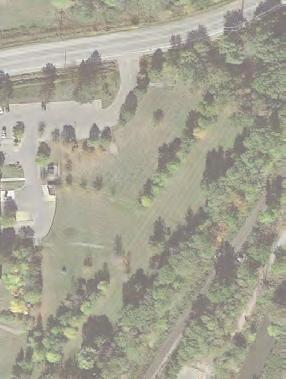
22 introduction OPEN SPACES AND NATURAL HERITAGE The Old Main Street Neighbourhood benefits from proximity and access to an extensive park and open space network, and natural heritage system. Within the neighbourhood, publicly owned lands along the east side of Old Main Street, north of Bexhill Crescent, function as a stormwater management facility and landscape buffer along the edge of Main Street North. Portions of these lands also serve as an informal open space, and are commonly used by local residents for a combination of active and passive recreational uses including soccer, baseball, lawn-bowling, picnicking and informal gathering. The interface between the Neighbourhood and Main Street North is characterized by moderate topographical changes and wooded areas. This buffers the neighbourhood from Main Street North, which functions as a by-pass around Old Main Street. The Old Main Street Neighbourhood contains protected woodlots, contiguous wooded areas and individual public and private landscapes, including trees that contribute to the form and function of the urban forest. Urban forests are vital components of the Town s natural infrastructure in that they provide an array of benefits to residents, ranging from stormwater retention and air pollution removal to improved human health and recreational opportunities. Future development within the Old Main Street Neighbourhood will protect significant natural features and local wildlife habitat. This will be achieved by establishing appropriate buffers to these features, while integrating elements of the natural environment into new development. Furthermore, future development will respect existing topographical conditions and enhance the existing open space network, while exploring opportunities to establish gateway features and improve connections to the broader open space network. 8.2 Objectives The objective of these open space and natural heritage policies is to facilitate future development, including the introduction of new building typologies, in a manner that protects, restores and enhances existing natural features, and sustains and improves the urban forest. This includes the ecological connectivity and functionality of the natural heritage system and other naturalized areas. 17 OPEN SPACES AND NATURAL HERITAGE
23 8.3 Policies This section sets out policies that are intended to guide the preservation and enhancement of the open space and natural heritage system throughout the Old Main Street Neighbourhood Woodlots and Natural Heritage System i. Existing woodlots and significant portions of naturalized areas shall be protected, in order to maintain a continuous natural heritage system. i iv. An adequate buffer between development, the existing woodlots and naturalized areas shall be maintained to protect the form and ecological function of these natural / naturalized features. Future development shall respect the significance of the Regional Greenlands System, and resulting limitations placed on infill and redevelopment in select locations. The protection of existing woodlots and naturalized areas does not mean that they will come under public ownership. They may be protected by buffers, zoning, or a combination of both Topographical Conditions i. Future development shall respect existing topographical conditions and changes, and resulting limitations placed on infill and redevelopment in select locations. Future development shall limit the extent of topographical changes adjacent to Old Main Street Open Space i. Future development shall enhance the appearance of landscaped boulevards along the length of Old Main Street by incorporating accent planting and increasing the urban tree canopy, where feasible. i The existing informal open space and recreational area along the east side of Old Main Street shall be enhanced. Future development shall maintain existing landscape buffers, which mitigate acoustic and visual impacts associated with vehicle traffic on Main Street North Gateways and Crossings i. Consideration shall be given to the introduction of some or all of the following features at either end of Old Main Street: accent planting and enhanced landscaping, as well as boulevard bumpouts, raised pedestrian crossings, special surface paving treatments, and signage. Consideration will be given to improving pedestrian connections between Old Main Street and the surrounding park, open space, trail and public transit networks, through the provision of dedicated pedestrian crossings. OPEN SPACES AND NATURAL HERITAGE 18
24 9.0 IMPLEMENTATION 9.1 introduction This section sets out policies that are intended to guide and facilitate the implementation of the Old Main Street Tertiary Plan. 9.2 Policies This section sets out policies that are intended to guide the preservation and enhancement of the open space and natural heritage system throughout the Old Main Street Neighbourhood Interpretation i. The Old Main Street Tertiary Plan is a statement of policy intended to guide the development of the Old Main Street Neighbourhood. The Town may permit some flexibility in the interpretation of general policies, provided the intent of the Plan is maintained and the objectives and targets are achieved. i iv. The Old Main Street Tertiary Plan shall be read in conjunction with the Town of Newmarket Official Plan. The schedules included in the Old Main Street Tertiary Plan are general. Minor adjustments to the boundaries of designations are permitted without amendment to this Plan, except where the designations are established by fixed boundaries, such as the existing street rights-of-way, or where they are specifically stated as fixed in the policies of this Plan. Minor variations from numerical requirements in this Plan, with the exception of permitted maximum building heights and densities, may be permitted without amendment to the Old Main Street Tertiary Plan where it is demonstrated, through a site-specific application, to be appropriate, and provided that the general intent and applicable policies of this Plan are met Coordination of Development i. It is the policy of this Plan that development shall be coordinated with the provision of the sanitary sewers and stormwater management facilities. As such, no development shall be permitted to proceed until it can be demonstrated, to the satisfaction of the Town, that adequate provision of these services is or will be available, or that arrangements satisfactory to the Town for the provision of these services have been made. This policy will be implemented through the use of a Holding Symbol H. Future development should be planned comprehensively. Where possible, development blocks with multiple land owners should be coordinated and phased with affected landowners and, where applicable, adjacent parcels. Nonparticipating lands within the development block should be conceptually addressed through a phasing plan. Development of smaller parcels shall be discouraged where, in the opinion of the Town, such development would compromise the effective redevelopment of the development block in accordance with the 19 IMPLEMENTATION
25 provisions of this Plan. Landowners shall be encouraged to amalgamate parcels or enter into agreements with neighbouring landowners in order to demonstrate, to the satisfaction of the Town, that development achieves the intended built form, density and other provisions of this Plan, in a logical and comprehensive manner Concept Site Plan i. Policy of the Newmarket Official Plan requires a Concept Site Plan and a Streetscape and Landscape Plan as part of a complete application. Within the Old Main Street Neighbourhood, these plans shall include, where appropriate: a. a context plan that demonstrates the compatibility of the development within the surrounding context; b. a lotting plan that delineates and dimensions the development within each development block; c. a description and illustrations of the build-out for every phase of the development; d. proposed density and massing of buildings for individual buildings as well as each development block; e. access and circulation plan for pedestrians, vehicles and cyclists; f. proposed streetscape improvements; and g. locations and conceptual design of any open spaces Zoning i. To implement development in accordance with this Plan, Council shall enact amendments to the Town s Zoning By-law; and In addition to Policy of the Town of Newmarket Official Plan, the Town may, when enacting implementing zoning bylaws, apply the Holding Symbol H and specify the future uses of lands that, at present time, are considered premature or inappropriate for development for any one of more of the following reasons. a. Public infrastructure, such as sanitary sewers and stormwater management facilities, are insufficient to serve the proposed development; b. Development relies upon other matters occurring first, such as the consolidation of land ownership; c. Technical studies are required, such as a Comprehensive Stormwater Management and Drainage Plan and/or other matters that Council considers necessary; and/or d. Servicing allocation has not been granted. IMPLEMENTATION 20
26 Schedule 1: Study Area Tertiary Plan Boundary CN - GO Rail Corridor Holland River SELBY CRES WAKEFIELD PL BEXHILL CRES MAIN ST N DOVER CRES OLD MAIN ST D N - GO Railway Holland River m 21 IMPLEMENTATION
27 Schedule 2: Land Use Residential Area Parks and Open Space Natural Heritage System Floodplain and Hazard Lands SELBY CRES WAKEFIELD PL BEXHILL CRES Tertiary Plan Boundary CN - GO Rail Corridor Holland River MAIN ST N DOVER CRES OLD MAIN ST CN - GO Railway Holland River m 22
28 Schedule 3: Height and Density WAKEFIELD PL Medium Density (Permitted Max. Height = 3 Storeys Permitted Max. Density = 1.0 FSI) Parks and Open Space Natural Heritage System Floodplain and Hazard Lands SELBY CRES BEXHILL CRES Tertiary Plan Boundary CN - GO Rail Corridor Holland River MAIN ST N DOVER CRES OLD MAIN ST D CN - GO Railway Holland River m 23
29 Schedule 4: Parks, Open Spaces and Natural Heritage Parks and Open Space Natural Heritage System Floodplain and Hazard Lands Streetscape Improvements SELBY CRES WAKEFIELD PL BEXHILL CRES Tertiary Plan Boundary CN - GO Rail Corridor Holland River MAIN ST N DOVER CRES OLD MAIN ST A CN - GO Railway Holland River m IMPLEMENTATION 24
30
Wide asphalt driveway abutting school property. garage built with incompatible materials, too close to park. incompatible fencing materials
 Wide asphalt driveway abutting school property incompatible fencing materials garage built with incompatible materials, too close to park Lack of plantings as a buffer between private property and open
DRAFT Northeast Quadrant of Kipling Avenue and Highway 7 DRAFT AUGUST 29, Goals Land Use. The goals of this Plan are to:
 AUGUST 29, 2017 12.15 Northeast Quadrant of Kipling Avenue and Highway 7 12.15.1 Goals 12.15.2 Land Use The goals of this Plan are to: 12.15.2.1 General Provisions: a) Ensure the development of a compact
City of Vaughan Urban Design Guidelines for Infill Development in Established Low-Rise Residential Neighbourhoods
 City of Vaughan Urban Design Guidelines for Infill Development in Established Low-Rise Residential Neighbourhoods DRAFT - September 2016 Contents 1. Introduction 1 2. Policy Context 3 3. Characteristics
Urban Design Guidelines Townhouse and Apartment Built Form
 Urban Design Guidelines Townhouse and Apartment Built Form Town of Wasaga Beach Table of Contents 1. Introduction 1.1. Purpose 1.2. Urban Design Principles 1.3. Application of Guidelines 2. Site Design,
URBAN DESIGN BRIEF URBAN DESIGN BRIEF 721 FRANKLIN BLVD, CAMBRIDGE August 2018
 URBAN DESIGN BRIEF URBAN DESIGN BRIEF 721 FRANKLIN BLVD, CAMBRIDGE August 2018 DESIGN BRIEF CONTENTS PART A 1.0 INTRODUCTION 2.0 DESCRIPTION & ANALYSIS OF SITE CONTEXT 3.0 DESIGN CONSTRAINTS AND OPPORTUNITIES
CONTENTS 8.0 LAND USE 8.1 GENERAL LAND USE 8.2 RESIDENTIAL 8.3 MIXED USE 8.4 COMMERCIAL 8.5 EMPLOYMENT LANDS
 8-2 Land Use 8.0 LAND USE CONTENTS 8.1 GENERAL LAND USE 8.1.1 Uses provided for in all Land Use Designations 8.1.2 Uses prohibited in Hazardous Lands, Hazardous Sites and Special Policy Areas 8.1.3 Uses
The West Vaughan Employment Area Secondary Plan Policies
 Part 2: The West Vaughan Employment Area Secondary Plan Policies 2.1 General Policies It is the policy of Council: 2.1.1. That the West Vaughan Employment Area (the WVEA), identified on Schedule 1, will
Uptown Rideau Street Secondary Plan [Amendment #166, January 12, 2016]
![Uptown Rideau Street Secondary Plan [Amendment #166, January 12, 2016]](/thumbs/76/73760497.jpg "Uptown Rideau Street Secondary Plan [Amendment #166, January 12, 2016]") [Amendment #166, January 12, 2016] The policies of this Secondary Plan are in effect, save and except for the property at 560 Rideau Street, for which there remains a site specific appeal to this Secondary
[Amendment #166, January 12, 2016] The policies of this Secondary Plan are in effect, save and except for the property at 560 Rideau Street, for which there remains a site specific appeal to this Secondary
Duplex Design Guidelines
 Duplex Design Guidelines Adopted by Council May 29, 2006 Prepared By: Table of Contents 1.0 Application and Intent 1 2.0 Areas of Application 2 3.0 Design Principles 3 4.0 Design Guidelines 4 4.1 Site
GUIDELINES REPLACEMENT HOUSING GUIDELINES LOCATION INTRODUCTION URBAN DESIGN GUIDELINES
 Replacement housing in the former City of North York will be consistent with the following urban design guidelines. They provide a framework for residential re-development in the former City of North York
KEY MAP DEVELOPMENT PERMIT AREA MAP. Sunnymede North Sub-Area Plan
 Richmond Official Community Plan BROADMOOR AREA SUNNYMEDE NORTH SUB-AREA PLAN Bylaw 7100 Schedule 2.6C SUNNYMEDE NORTH SUB-AREA PLAN SUNNYMEDE NORTH SUB-AREA PLAN SUNNYMEDE NORTH SUB-AREA PLAN KEY MAP
East Bayshore Road Neighbourhood
 East Bayshore Road Neighbourhood Northridge Property Management Urban Design Brief 3195 East Bayshore Road City of Owen Sound January 2016 East Bayshore Road Neighbourhood Northridge Property Management
II. SINGLE FAMILY RESIDENTIAL
 II. SINGLE FAMILY RESIDENTIAL Castle Rock is made up of numerous individually built houses and subdivision tracts that have been developed during the past century. Some of the tracts are diverse in architectural
PLANNING JUSTIFICATION REPORT
 PLANNING JUSTIFICATION REPORT 55 DELHI STREET CITY OF GUELPH PREPARED FOR: VESTERRA PROPERTY MANAGEMENT PREPARED BY: LABRECHE PATTERSON & ASSOCIATES INC. SCOTT PATTERSON, BA, CPT, MCIP, RPP PRINCIPAL,
BENSON / HUNT TERTIARY PLAN
 BENSON / HUNT TERTIARY PLAN TABLE OF CONTENTS 1.0 INTRODUCTION 1.1 Purpose 2 1.2 How to Read This Plan 3 1.3 Tertiary Plan Context 3 1.4 Vision and Principles 5 1.5 Public Consultation 5 2.0 PLANNING CONTEXT
Proposed for Vic West Neighbourhood Plan. Design Guidelines for Intensive Residential Development - Townhouse and Attached Dwelling
 Proposed for Vic West Neighbourhood Plan Design Guidelines for Intensive Residential Development - Townhouse and Attached Dwelling Design Guidelines for Intensive Residential Development - Townhouse and
FORMER CANADIAN FORCES BASE (CFB) ROCKCLIFFE SECONDARY PLAN. Official Plan Amendment XX to the Official Plan for the City of Ottawa
 ROCKCLIFFE SECONDARY PLAN. Official Plan Amendment XX to the Official Plan for the City of Ottawa") FORMER CANADIAN FORCES BASE (CFB) ROCKCLIFFE SECONDARY PLAN Official Plan Amendment XX to the Official Plan for the City of Ottawa 1 INDEX THE STATEMENT OF COMPONENTS PART A THE PREAMBLE PAGE Purpose...
FORMER CANADIAN FORCES BASE (CFB) ROCKCLIFFE SECONDARY PLAN Official Plan Amendment XX to the Official Plan for the City of Ottawa 1 INDEX THE STATEMENT OF COMPONENTS PART A THE PREAMBLE PAGE Purpose...
Housing and Coach House Guidelines - Ladner
 Housing and Coach House Guidelines - Ladner Policy D.8: Encourage Compatible Housing Design Encourage housing design that is sensitive to existing single family housing neighbourhoods by requiring a design
Derry Green Corporate Business Park
 Town of Milton Derry Green Corporate Business Park Urban Design Guidelines BMI/Pace - June 2010 Draft 3 Prepared by: Brook McIlroy Planning + Urban Design / Pace Architects Suite 300-51 Camden Street Toronto,
Design Guidelines - 1 -
 Design Guidelines REAR YARDS Rear yard decks and porches, attached to a garden or garage suite, should be permitted provided minimum rear yard setbacks, separation distances, and necessary site access
Urban Design Brief December 23, 2015 Southside Construction Group Official Plan & Zoning By-Law Amendment
 Urban Design Brief Proposed Official Plan & Zoning By-Law Amendment 3244, 3263 and 3274 Wonderland Road South Southside Group December 23, 2015 TABLE OF CONTENTS Page No. INTRODUCTION... 1 SECTION 1 LAND
Urban Design Brief Proposed Residential Development 5219 Upper Middle Road City of Burlington
 Urban Design Brief Proposed Residential Development 5219 Upper Middle Road City of Burlington Prepared by Weston Consulting Prepared for BLOOMFIELD DEVELOPMENT INC. Date: March 2017 Table of Contents 1.
Clairtrell Area Context Plan
 Clairtrell Area Context Plan March 2005 Urban Development Services City Planning Contents 1. Introduction... 4 2. Development Structure... 6 2.1 Streets... 7 2.1.1 Sheppard Avenue and Bayview Avenue...
MULTIFAMILY RESIDENTIAL DESIGN PRINCIPLES Site Plan and Design Review Principles Checklist
 MULTIFAMILY RESIDENTIAL DESIGN PRINCIPLES Site Plan and Design Review Principles Checklist Applicant s Name: Project Address: Phone: Email: Applicant shall fill out the design guidelines checklist for
PORT WHITBY COMMUNITY
 PORT WHITBY COMMUNITY SECONDARY PLAN UPDATE COMMUNITY IMPROVEMENT PLAN URBAN DESIGN GUIDELINES September 2015 DRAFT PROPOSED AMENDMENT NUMBER # to the Whitby Official Plan PURPOSE: The intent of this Amendment
Toronto Complete Streets Guidelines
 Toronto Complete Streets Guidelines 108 110 7.1 Green Infrastructure Design Principles 112 7.2 Context-Sensitive Green Streets 114 7.3 Key Green Street Elements Green infrastructure refers to natural and
URBAN DESIGN BRIEF 181 Burloak Drive, Oakville
 URBAN DESIGN BRIEF 181 Burloak Drive, Oakville February 2017 Our File: 1730B 230-7050 WESTON ROAD / WOODBRIDGE / ONTARIO / L4L 8G7 / T: 905 761 5588/ F: 905 761 5589/WWW.MHBCPLAN.COM TABLE OF CONTENTS
Urban Design Brief. Watson Parkway North & Watson Road North Guelph, Ontario. Prepared by Coletara Development
 Urban Design Brief Watson Parkway North & Watson Road North Guelph, Ontario Prepared by Coletara Development December, 2013 Urban Design Brief, Coletara Development 1 Introduction This Urban Design Brief
FRASER LANDS CD-1 GUIDELINES (BLOCKS 68 AND 69) Adopted by City Council April 1989
 Adopted by City Council April 1989") $1 City of Vancouver Land Use and Development Policies and Guidelines Community Services, 453 W. 12th Ave Vancouver, BC V5Y 1V4 F 604.873.7344 fax 873.7060 planning@city.vancouver.bc.ca FRASER LANDS CD-1
$1 City of Vancouver Land Use and Development Policies and Guidelines Community Services, 453 W. 12th Ave Vancouver, BC V5Y 1V4 F 604.873.7344 fax 873.7060 planning@city.vancouver.bc.ca FRASER LANDS CD-1
GUIDELINES WESTON LOCATION: URBAN DESIGN GUIDELINES
 Development in the Weston area will be consistent with the following urban design guidelines. The guidelines correspond to Site and Area Specific Policies 45, 46, 47, 48, 49, 51, 52 and 232 in Chapter
Urban Design Brief Woodland Cemetery Funeral Home 493 Springbank Drive
 Urban Design Brief Woodland Cemetery Funeral Home The Incorporated Synod of the Diocese of Huron April 15, 2016 Urban Design Brief April 15, 2016 TABLE OF CONTENTS Page No. INTRODUCTION... 1 SECTION 1
URBAN DESIGN BRIEF. 2136&2148 Trafalgar Road. Town of Oakville
 URBAN DESIGN BRIEF 2136&2148 Trafalgar Road Town of Oakville Prepared By: METROPOLITAN CONSULTING INC For 2500674 Ontario Inc November 2016 TABLE OF CONTENTS Page No. 1.0 Introduction/Description of Subject
3.3 Building Elements
 3.3 Building Elements Building elements refer to the design details that together compose the street-related face of a building. The articulation of these design details including the slope and orientation
MOMENTUM. Design Brief. Site Plan Control and Minor Variance Applications. 59 Russell Avenue
 MOMENTUM PLANNING AND COMMUNICATIONS Design Brief Site Plan Control and Minor Variance Applications 59 Russell Avenue December 2014 Revised February 2015 Prepared by: Dennis Jacobs MCIP, RPP Index 1. Introduction
Mixed Use Centres Development Permit Guidelines
 1 Mixed Use Centres Development Permit Guidelines Area Commercial or Mixed Use development occurring in City Centre, Urban Centre, Neighbourhood Centre, or Institutional Complex land use designations is
Urban Design Brief Fanshawe Park Road. Competition Toyota
 Urban Design Brief 1300 Fanshawe Park Road Competition Toyota May 2, 2014 TABLE OF CONTENTS Page No. INTRODUCTION... 1 SECTION 1 LAND USE PLANNING CONTEXT... 1 1.1 The Subject Lands... 1 1.2 The Proposal...
6.0 Land Use Policies for Rural Settlements. 6.1 Rural Settlement Strategy
 6.0 Land Use Policies for Rural Settlements 6.1 Rural Settlement Strategy INTRODUCTION AMENDMENT NO. 131 PURPOSE Designated rural settlements comprise Rural Clusters, Villages and Serviced Villages as
Highland Village Green Design Guidelines
 Highland Village Green Design Guidelines Publishing Information Title Highland Village Green Design Guidelins Author The City of Calgary Status DRAFT - Proposed document subject to changes Additional Copies
Urban Design Manual PLANNING AROUND RAPID TRANSIT STATIONS (PARTS) Introduction. Station Study Areas
 Introduction. Station Study Areas") 111111 PLANNING AROUND RAPID TRANSIT STATIONS (PARTS) Introduction The ION rapid transit system will link Waterloo, Kitchener and Cambridge through a central transit corridor (CTC). There are a number
111111 PLANNING AROUND RAPID TRANSIT STATIONS (PARTS) Introduction The ION rapid transit system will link Waterloo, Kitchener and Cambridge through a central transit corridor (CTC). There are a number
Urban Design Brief to 1557 Gordon Street & 34 Lowes Road West
 Urban Design Brief 1533 to 1557 Gordon Street & 34 Lowes Road West Reid s Heritage Homes Ltd. & 883928 Ontario Ltd. and RHH Property Management Ltd. City of Guelph Zoning By-law Amendment November 2017
Part 9 Specific Land Uses - Housing on Small and Narrow Lots
 19 HOUSING ON SMALL AND NARROW LOTS This section of the DCP applies where development for the purpose of a dwelling house, attached dwellings, or semi-detached dwellings is or are proposed in the R2 Low
Infill Residential Design Guidelines
 Infill Residential Design Guidelines Adopted March 23, 2004 Amended September 10, 2013 City of Orange Community Development Department Planning Division Phone: (714) 744-7220 Fax: (714) 744-7222 www.cityoforange.org
Mark-up of the effect of the proposed Bronte Village Growth Area OPA No.18 on the text of section 24, Bronte Village, of the Livable Oakville Plan
 Mark-up of the effect of the proposed Bronte Village Growth Area OPA No.18 on the text of section 24, Bronte Village, of the Livable Oakville Plan Notes: This document is provided for information purposes
4 Residential and Urban Living Zones
 4 Residential and Urban Living Zones Refer to Chapters 11 to 20 for additional rules that may apply to these zones. 4.1 OBJECTIVES AND POLICIES Objective Res1 Policy 1 Policy 2 Policy 3 Policy 4 Policy
11.4 Highway 400 North Employment Lands Secondary Plan APPROVED BY THE ONTARIO MUNICIPAL BOARD ON NOVEMBER 21, 2011
 11.4 Highway 400 North Employment Lands Secondary Plan APPROVED BY THE ONTARIO MUNICIPAL BOARD ON NOVEMBER 21, 2011 11.4.1 General 11.4.1.1. as approved by the Ontario Municipal Board on November 21, 2011,
WINDSOR GLEN DESIGN GUIDELINES
 WINDSOR GLEN DESIGN GUIDELINES Adopted by Council, 2006 WINDSOR GLEN REDEVELOPMENT DESIGN GUIDELINES August 2006 1.0 Master Plan Organization For this area of the Coquitlam Town Centre, a mix of high,
5.1 Site Plan Guidelines
 5. Community Core Guidelines Development of the Community Core will take place by plan of subdivision and site plan approval. It will occur in a phased manner that will reflect the timing of residential
Attachment 1 TOWN OF NEW TECUMSETH. Manual for the Preparation of an Urban Design Report
 Attachment 1 TOWN OF NEW TECUMSETH Manual for the Preparation of an Urban Design Report July 2010 TABLE OF CONTENTS Background, Policy Framework and the Preparation of Urban Design Reports 1. Introduction
Tel: (705) Fax: (705)
 Fax: (705)") 521 and 525 Essa Road City of Barrie Tel: (705) 812-3281 Fax: (705) 812-3438 Email: INFO@IPSCONSULTINGINC.com 1 5 0 D U N L O P S T R E E T E A S T, S U I T E 2 0 1, B A R R I E O N T A R I O L 4 M 1 B
521 and 525 Essa Road City of Barrie Tel: (705) 812-3281 Fax: (705) 812-3438 Email: INFO@IPSCONSULTINGINC.com 1 5 0 D U N L O P S T R E E T E A S T, S U I T E 2 0 1, B A R R I E O N T A R I O L 4 M 1 B
Urban Design Brief 1576 Richmond Street City of London
 Urban Design Brief City of London Treadstone Developments October 31, 2014 Urban Design Brief October 31, 2014 TABLE OF CONTENTS Page No. INTRODUCTION... 1 SECTION 1 LAND USE PLANNING CONCEPT... 1 1.1
BYLAW C A Bylaw of Rocky View County to amend Land Use Bylaw C
 BYLAW C-7720-2017 A Bylaw of Rocky View County to amend Land Use Bylaw C-4841-97. The Council of Rocky View County enacts as follows: PART 1 TITLE This Bylaw shall be known as Bylaw C-7720-2017. PART 2
THE CITY OF VAUGHAN BY-LAW BY-LAW NUMBER A By-law to adopt Amendment Number 1 to the Official Plan of the Vaughan Planning Area.
 THE CITY OF VAUGHAN BY-LAW BY-LAW NUMBER 015-2014 A By-law to adopt Amendment Number 1 to the Official Plan of the Vaughan Planning Area. NOW THEREFORE the Council of the Corporation of the City of Vaughan
Bel-Air Lexus Automobile Service Station
 Bel-Air Lexus Automobile Service Station Design Brief 443-447 McArthur Avenue Ottawa April 30, 2015 14-1299-MCA Site Details Application: Site Plan Control Legal Description and Municipal Addresses: 443
Dufferin Street and Centre Street Area Specific Policies
 12.XX 12.XX.1 12.XX.1.1. 12.XX.2. 12.XX.2.1. 12.XX.2.2 Dufferin Street and Centre Street Area Specific Policies Goals The goal of this Plan is to provide the necessary land use and development policies
Planning & Development. Background. Subject Lands
 Planning & Development APPLICATION BRIEFING Prepared For: Planning Advisory Committee Submitted by: Jason Fox, Director of Planning & Development Date: Subject: Development Agreement Application by Brentwood
4.0 Design Guidelines For The Village Centre. South fields Community Architectural Design Guidelines Town of Caledon
 4.0 Design Guidelines For The Village Centre 4.0 Design Guidelines for the Village Centre The Village Centre is the focal point of the entire South Fields Community and is designed as a traditional commercial
DAVENPORT VILLAGE SECONDARY PLAN
 27 DAVENPORT VILLAGE SECONDARY PLAN 27. DAVENPORT VILLAGE SECONDARY PLAN 1. VISION FOR THE DAVENPORT VILLAGE SECONDARY PLAN Davenport Village, municipally known as 830, 940, 980 and 1100 Lansdowne Avenue,
TABLE OF CONTENTS 1.0 INTRODUCTION... 3
 TABLE OF CONTENTS 1.0 INTRODUCTION... 3 1.1. BACKGROUND... 3 1.2. THE PROPOSAL... 5 2.0 EXISTING POLICY FRAMEWORK... 5 2.1. PROVINCIAL POLICY STATEMENT (PPS)... 5 2.2. CITY OF LONDON OFFICIAL PLAN (OP)...
ELMVALE ACRES SHOPPING CENTRE MASTER PLAN
 ELMVALE ACRES SHOPPING CENTRE MASTER PLAN Contents 1.0 INTRODUCTION... 2 2.0 LOCATION... 2 3.0 EXISTING CONTEXT... 2 4.0 VISION & GUIDING PRINCIPLES... 2 5.0 LAND USE AND BUILT FORM... 4 5.1 St. Laurent
appendix and street interface guidelines
 appendix five: building and street interface guidelines appendix 5 building and street interface guidelines BOULEVARDS Boulevards are generally characterized by higher levels of traffic movement at higher
QUEEN-RIVER SECONDARY PLAN
 34 QUEEN-RIVER SECONDARY PLAN 34. QUEEN RIVER SECONDARY PLAN 1. INTRODUCTION The Queen-River area is approximately 6.4 hectares and is located at the eastern edge of the Downtown as shown on Map 34-1.
B L A C K D I A M O N D D E S I G N G U I D E L I N E S for Multi-family Development
 B L A C K D I A M O N D D E S I G N G U I D E L I N E S for Multi-family Development Adopted June 18, 2009 This section of the Design and focuses on site planning and design guidance for new multi-family
New-Cast Mixed-use Development Proposal King Street West, Newcastle, Ontario
 URBAN DESIGN BRIEF New-Cast Mixed-use Development Proposal King Street West, Newcastle, Ontario TABLE OF CONTENTS: 1.0 Executive Summary 2.0 Creating Vibrant and Sustainable Urban Places: Excerpts from
SUBCHAPTER 4-B GUIDELINES FOR THE B-3 COMMERCIAL CHARACTER AREA
 1 SUBCHAPTER 4-B GUIDELINES FOR THE B-3 COMMERCIAL CHARACTER AREA Downtown Bozeman should be the location of buildings of greatest height and intensity in the community. The following guidelines apply
TALL BUILDING GUIDELINES
 TALL BUILDING GUIDELINES Urban Design Guidance for the Site Planning and Design of Tall Buildings in Milton May, 2018 A Place of Possibility Contents 1.0 INTRODUCTION 1 1.1 What is a Tall Building? 2
4 RESIDENTIAL ZONE. 4.1 Background
 4 RESIDENTIAL ZONE 4.1 Background The residential areas within the City are characterised by mainly lowrise dwellings sited on individual allotments. Past architectural styles, settlement patterns and
Corridor Transformation Strategy
 Corridor Transformation Strategy County Road 22 Special Planning Area Design Guidelines January 2012 D14-06017 Corridor Transformation Strategy County Road 22 Special Planning Area Corridor Design Guidelines
THE CITY OF VAUGHAN BY-LAW BY-LAW NUMBER
 THE CITY OF VAUGHAN BY-LAW BY-LAW NUMBER 123-2013 A By-law to designate the whole of the City of Vaughan as a Site Plan Control Area, and to adopt site development guidelines and rules of procedure for
URBAN DESIGN BRIEF Gordon Street City of Guelph. Prepared on behalf of Ontario Inc. March 25, Project No. 1507
 URBAN DESIGN BRIEF 1131 Gordon Street City of Guelph Prepared on behalf of 1876698 Ontario Inc. March 25, 2016 Project No. 1507 423 Woolwich Street, Suite 201, Guelph, Ontario, N1H 3X3 Phone (519) 836-7526
CONTENTS 6.1 URBAN DESIGN
 6-2 Urban Design and Sustainable Development 6.0 URBAN DESIGN AND SUSTAINABLE DEVELOPMENT CONTENTS 6.1 URBAN DESIGN 6.1.1 General Policies 6.1.2 The Public Realm 6.1.3 Streets and Blocks 6.1.4 Streetscapes
2.5 Roads. Loading and service areas adjacent to Highway 401 should be screened through architectural walls and/or landscape buffer planting.
 N HIGHWAY OFF RAMP 2.5 Roads A legible road network with a clear hierarchy will help create a connected community, both within and surrounding the Milton Heights. The following section outlines the proposed
LIST OF FIGURES APPENDIX. Urban Design Brief: Proposed Townhouse Development, 299 Tartan Drive (City of London ON)
") URBAN DESIGN BRIEF PROPOSED TOWNHOUSE COMPLEX 299 TARTAN DRIVE, LONDON ON December 2013 TABLE OF CONTENTS 3.0 Neighbourhood Character Statement... pg. 14 1.0 Land Use Planning Context...... pg. 1 1.1 Subject
URBAN DESIGN BRIEF PROPOSED TOWNHOUSE COMPLEX 299 TARTAN DRIVE, LONDON ON December 2013 TABLE OF CONTENTS 3.0 Neighbourhood Character Statement... pg. 14 1.0 Land Use Planning Context...... pg. 1 1.1 Subject
240 and 242 Finch Avenue West Zoning By-law Amendment Application Preliminary Report
 REPORT FOR ACTION 240 and 242 Finch Avenue West Zoning By-law Amendment Application Preliminary Report Date: March 1, 2019 To: North York Community Council From: Director, Community Planning, North York
I615. Westgate Precinct
 I615. Westgate Precinct I615.1. Precinct Description The Westgate Precinct is located approximately 18km west of the Auckland city centre. There are seven Sub-precincts in the Westgate Precinct: Sub-precinct
(DC1) Direct Development Control Provision DC1 Area 4
 Direct Development Control Provision DC1 Area 4") . General Purpose (DC) Direct Development Control Provision DC Area 4 The purpose of this Provision is to provide for an area of commercial office employment and residential development in support of the
. General Purpose (DC) Direct Development Control Provision DC Area 4 The purpose of this Provision is to provide for an area of commercial office employment and residential development in support of the
Long Branch Neighbourhood Character Guidelines Final Report
 STAFF REPORT ACTION REQUIRED Long Branch Neighbourhood Character Guidelines Final Report Date: October 26, 2017 To: From: Wards: Reference Number: Etobicoke York Community Council Director, Community Planning,
[PLANNING RATIONALE] For Site Plan Control and Lifting of Holding Zone By-Law 101 Champagne Avenue. May 23, 2014
![[PLANNING RATIONALE] For Site Plan Control and Lifting of Holding Zone By-Law 101 Champagne Avenue. May 23, 2014](/thumbs/75/71599615.jpg "[PLANNING RATIONALE] For Site Plan Control and Lifting of Holding Zone By-Law 101 Champagne Avenue. May 23, 2014") [PLANNING RATIONALE] For Site Plan Control and Lifting of Holding Zone By-Law 101 Champagne Avenue May 23, 2014 Contents 1.0 Introduction... 2 2.0 Site Context... 2 2.1 Adjacent Uses... 2 Figure 1: Site
[PLANNING RATIONALE] For Site Plan Control and Lifting of Holding Zone By-Law 101 Champagne Avenue May 23, 2014 Contents 1.0 Introduction... 2 2.0 Site Context... 2 2.1 Adjacent Uses... 2 Figure 1: Site
*** DRAFT 2 FOR PUBLIC REVIEW ***
 6.7 The area is generally bounded by the Red Hill Valley Parkway to the west, Lake Avenue to the east, the Queen Elizabeth Way (QEW) to the north, and by the properties just south of Queenston Road to
LOW DENSITY RESIDENTIAL
 LOW DENSITY RESIDENTIAL Corner lots with coach houses to increase diversity, provide unity to the streetscape and increase eyes on the street. Garages and ancillary units accessed via rear lanes. Parking
Urban Design Brief. 583, 585 and 589 OXFORD STREET EAST. Salt Clinic Canada Inc.
 Urban Design Brief 583, 585 and 589 OXFORD STREET EAST Salt Clinic Canada Inc. February 3, 2013 TABLE OF CONTENTS Page No. INTRODUCTION... 1 SECTION 1 LAND USE PLANNING CONCEPT... 1 1.1 The Subject Property...
Queensborough Eastern Neighbourhood Node. Community Open House
 Queensborough Eastern Community Open House The Vision The Queensborough Eastern will become the heart of eastern Queensborough. Through a sensitive mix of viable commercial and residential areas, the neighbourhood
PROPOSED REDEVELOPMENT OF THE GLEN ABBEY GOLF CLUB. STREETSCAPE DESIGN STUDY (excerpt from the Urban Design Brief) TOWN OF OAKVILLE.
 TOWN OF OAKVILLE.") PROPOSED REDEVELOPMENT OF THE GLEN ABBEY GOLF CLUB STREETSCAPE DESIGN STUDY (excerpt from the Urban Design Brief) TOWN OF OAKVILLE OCTOBER, 2016 for 2.4.2 STREETS Streets are the single largest component
PROPOSED REDEVELOPMENT OF THE GLEN ABBEY GOLF CLUB STREETSCAPE DESIGN STUDY (excerpt from the Urban Design Brief) TOWN OF OAKVILLE OCTOBER, 2016 for 2.4.2 STREETS Streets are the single largest component
DESIGN GUIDELINES FOR: INTENSIVE RESIDENTIAL DEVELOPMENT TOWNHOUSE AND ROWHOUSE
 DESIGN GUIDELINES FOR: INTENSIVE RESIDENTIAL DEVELOPMENT TOWNHOUSE AND ROWHOUSE 1. Introduction Townhouse and Rowhouse Building Typologies Within these guidelines, the term rowhouse means a single row
City of Bellingham. Multifamily Residential Design Handbook
 City of Bellingham Multifamily Residential Design Handbook ADOPTED BY RESOLUTION 2001-23 ON JULY 16, 2001 TABLE OF CONTENTS INTRODUCTION Purpose... 2 Applicability... 2 How to Use the Handbook... 2 Review
URBAN DESIGN BRIEF. April FREEPORT Street TOWNHOUSES. 711 FREEPORT St., LONDON
 URBAN DESIGN BRIEF April 2013 FREEPORT Street TOWNHOUSES 711 FREEPORT St., LONDON TABLE OF CONTENTS 1.0 Land Use Planning Context...... pg. 1 1.1 Subject Lands... pg. 1 1.2 Proposed Development... pg.
FREEWAY/TOURIST DISTRICT
 FREEWAY/TOURIST DISTRICT DESIGN STANDARDS FOR THE CITY OF MOUNTLAKE TERRACE March, 2014 MOUNTLAKE TERRACE FREEWAY/TOURIST DESIGN STANDARDS March, 2014 1 TABLE OF CONTENTS Introduction...1 Design Site Design
SECTION E. Realizing the Plan
 SECTION E Realizing the Plan 60 DESIGN REGINA - OFFICIAL COMMUNITY PLAN SECTION E Realizing the Plan Design Regina has been an ambitious plan-making exercise, with a high level of community, stakeholder,
Development Control Plan
 Development Control Plan Liberty Grove Development Control Plan Date of Adoption: 4 September 2007 Effective Date: 7 March 2008 Index 1 INTRODUCTION... 3 1.1 NAME OF PLAN... 3 1.2 AREA TO WHICH THIS PLAN
Figure 3-1: Public Realm Plan
 3 Public Realm Figure 3-1: Public Realm Plan 3.1 Public Realm Concept The public realm concept for the Little Mountain site integrates a clear and accessible movement network with public spaces for social
medium desnity housing
 This section updated September 2013 This part of the Plan sets out the assessment criteria for medium density housing. The criteria are designed to give designers and builders flexibility and to provide
13. New Construction. Context & Character
 13. New Construction Context & Character While historic districts convey a sense of time and place which is retained through the preservation of historic buildings and relationships, these areas continue
MILTON HEIGHTS COMMUNITY January 2006 Revised February 2015 Revised November 2015
 REVISED DRAFT MILTON HEIGHTS COMMUNITY January 2006 Revised February 2015 Revised November 2015 Urban Design Guidelines Milton Heights Landowners Group This page has been intentionally left blank. Contents
YONGE STEELES CORRIDOR SECONDARY PLAN. Young + Wright / IBI Group Architects Dillon Consulting Ltd. GHK International (Canada) Ltd.
 Ltd.") PART A: PREAMBLE 1.0 PURPOSE The purpose of this Secondary Plan is to provide a development framework for intensification of the Yonge/ Steeles corridor including the north side of Steeles Avenue West
PART A: PREAMBLE 1.0 PURPOSE The purpose of this Secondary Plan is to provide a development framework for intensification of the Yonge/ Steeles corridor including the north side of Steeles Avenue West
AREASTRUCTURE PLAN AMENDMENT COCHRANE NORTH
 AREASTRUCTURE PLAN AMENDMENT COCHRANE NORTH In order to implement the vision outlined in the Conceptual Scheme, the following three amendments to the Cochrane North ASP are proposed: 1. Allow commercial
599 Kennedy Road - Official Plan Amendment and Zoning Amendment Application - Preliminary Report
 STAFF REPORT ACTION REQUIRED 599 Kennedy Road - Official Plan Amendment and Zoning Amendment Application - Preliminary Report Date: March 7, 2017 To: From: Wards: Reference Number: Scarborough Community
DRAFT DRAFT DRAFT DRAFT
 # 19 EXPAND GREEN AND OPEN SPACES AND COMMUNITY FACILITIES IN TANDEM WITH NEW DEVELOPMENT The role of Eglinton will change in the coming years, along with the intensity of activity and land uses. As more
FRUITVALE TRANSIT VILLAGE (Phase 2) Residential Project
 Residential Project") FRUITVALE TRANSIT VILLAGE (Phase 2) Residential Project DEVELOPER: SIGNATURE PROPERTIES ARCHITECT: HKIT ARCHITECTS April 23, 2010 TABLE OF CONTENTS 3 Vision 4 Description of Site 5 Guiding Concepts 6
FRUITVALE TRANSIT VILLAGE (Phase 2) Residential Project DEVELOPER: SIGNATURE PROPERTIES ARCHITECT: HKIT ARCHITECTS April 23, 2010 TABLE OF CONTENTS 3 Vision 4 Description of Site 5 Guiding Concepts 6
URBAN DESIGN + ARCHITECTURAL CONTROL GUIDELINES
 Appendix I BRESLAU SETTLEMENT PLAN URBAN DESIGN + ARCHITECTURAL CONTROL GUIDELINES Table of Contents 1.0 INTRODUCTION 1 2.0 DESIGN GUIDELINES FOR THE PUBLIC REALM 2 2.1 General Design Principles 2 2.2
RIVERSIDE DESIGN CD-1 GUIDELINES. Adopted by City Council August 9, 1983
 $1 City of Vancouver Land Use and Development Policies and Guidelines Community Services, 453 W. 12th Ave Vancouver, BC V5Y 1V4 F 604.873.7344 fax 873.7060 planning@city.vancouver.bc.ca RIVERSIDE DESIGN
18. Form & Character Development Permit Areas
 18. Form & Character Development Permit Areas 18.1. Overview 18.1.1. AREAS Lands designated as Downtown Smithers, Mixed Residential and Highway 16 Commercial and identified on Schedule: C. 18.1.2. PURPOSE