HATCHAM, ILDERTON & OLD KENT ROAD
|
|
|
- Timothy McCarthy
- 5 years ago
- Views:
Transcription
1 SUB AREA 4 HATCHAM, ILDERTON & OLD KENT ROAD (SOUTH)


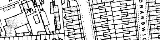
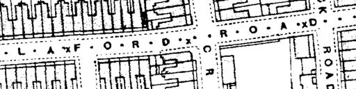

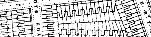


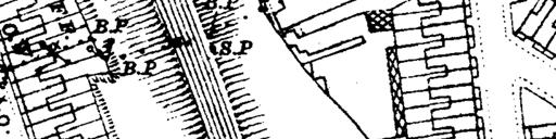


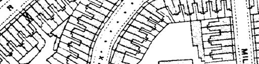
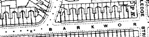
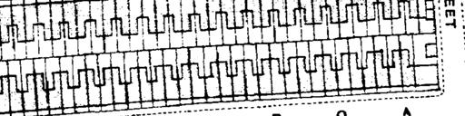
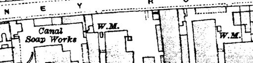
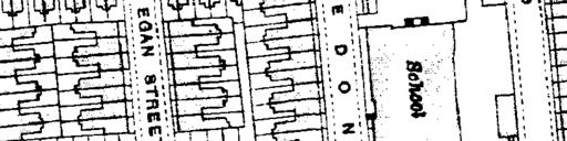

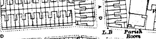
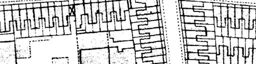
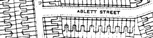
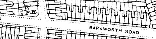
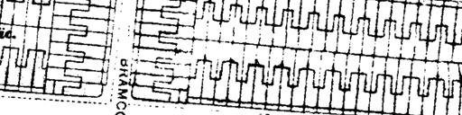
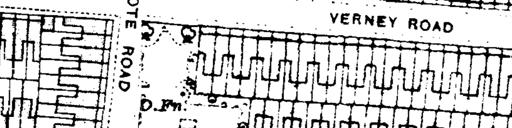
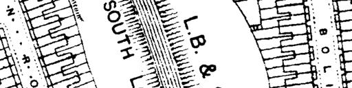
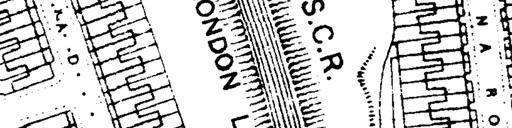
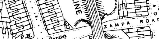
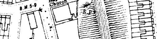


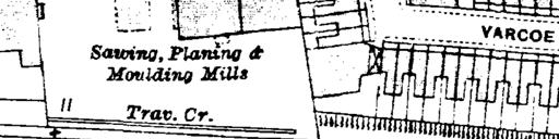

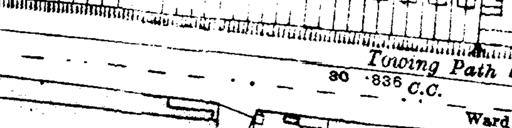

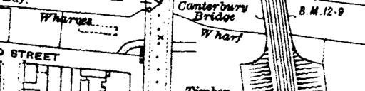
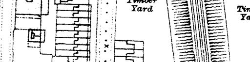
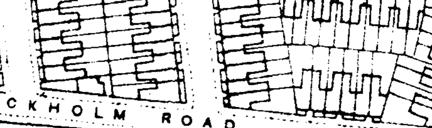
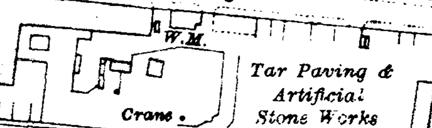
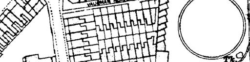
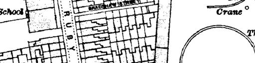
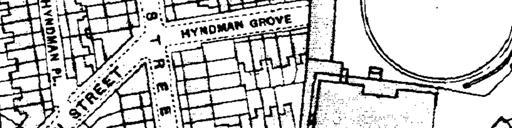
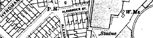
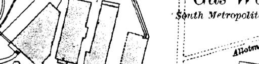
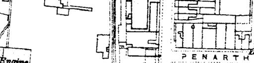
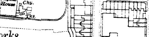
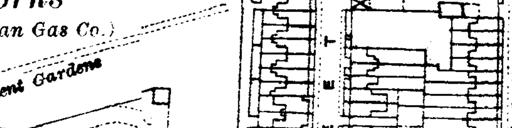
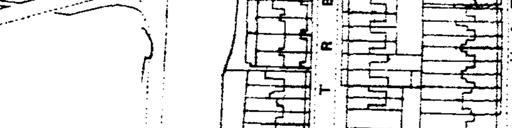
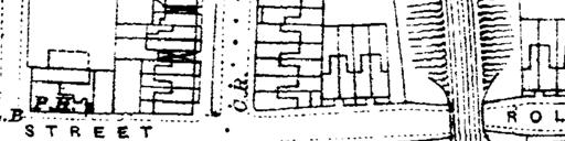

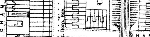
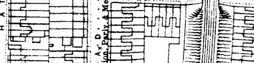
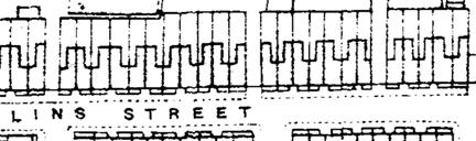
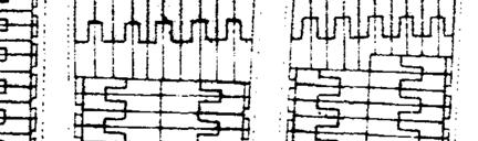
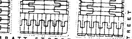
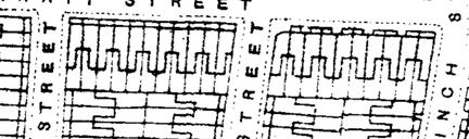

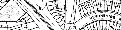
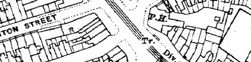
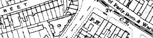
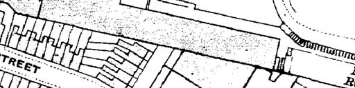
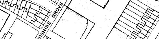
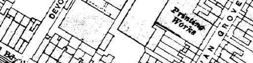
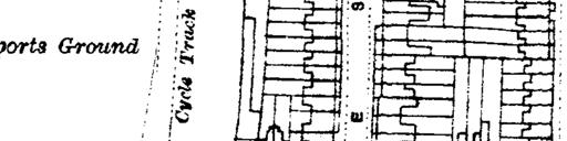
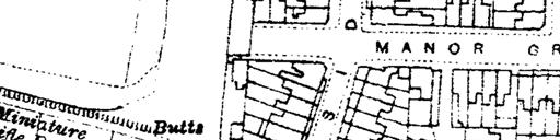

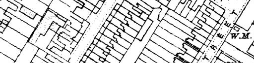

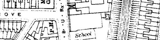
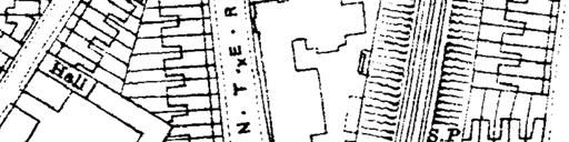

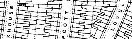
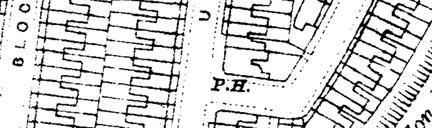
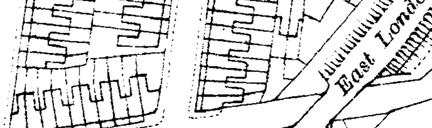
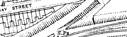
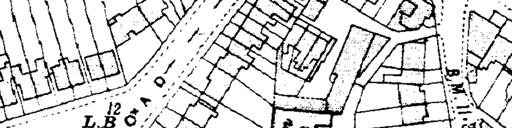
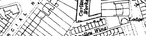
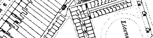


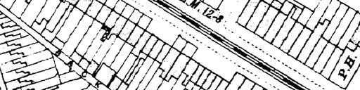
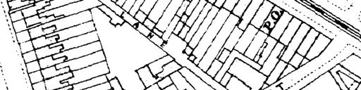
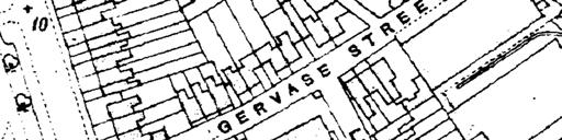
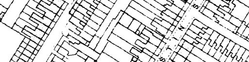
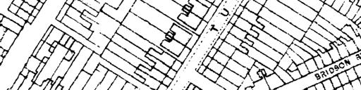
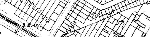
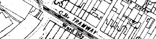
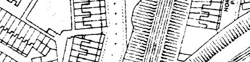
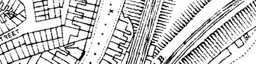
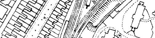
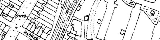

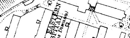


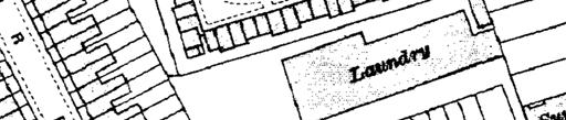
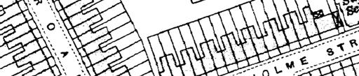
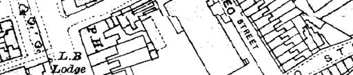

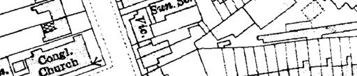
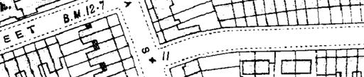
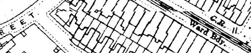

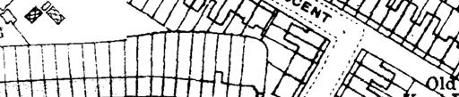
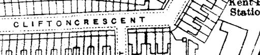
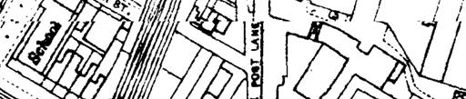


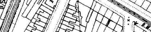
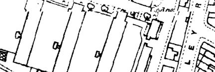
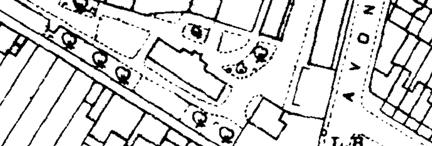
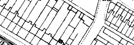
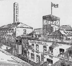
2 H I S T O RY The area has long been home to a mix of houses and flats, shops and factories. In the nineteenth century, the development of the gasworks, the Surrey Canal, railways and nearby docks brought large number of jobs. This created huge demand for new homes and to the east of the gasworks, the area around Hatcham Road and Ilderton Road was mainly residential, with streets lined by modest Victorian terraces with small back yards. The area was heavily bombed during World War II, leaving large parts of it in ruin. After the war, town planners set out to separate housing from industrial and residential uses. The area around Hatcham Road was redeveloped with small scale industrial units lining the once residential streets, which has made accessing units with large vehicles difficult. On Old Kent Road itself, the frontages on either side of the southern end of Old Kent Road were mainly residential, with small shops and pubs on the ground floor. One exception was the ABC cinema which stood on the corner of Gervase Road and the Old Kent Road. Housing and factories made way for retail warehouses and for Brimmington Park which was established in the 1970s and 80s. The Tustin estate, which is on the north side of Old Kent Road was built in the late 1960s and replaced terraced housing. To the south of Old Kent Road is the listed Licensed Victuallers Benevolent Institution. The courtyard and chapel built in to the design of Henry Rose. Other ranges were added between 1858 and The complex was bought by the council in 1959 and renamed Caroline Gardens, it continues to house older people. Top: Drawing of the Lines Bros factory on Ormside Street Below: Lines Brothers advertisement Right: Ordnance survey map of area from metres Scale: 1:4, OLD KENT ROAD Area Action Plan


3 KEY Site Allocations Conservation Areas THE AREA TODAY Grade II Listed Building Buildings of townscape merit The frontages on Old Kent Road today are fragmented and interrupted by car parks, a petrol station and the podium around the Tustin estate. It is easy to miss the entrance to Brimmington Park and the south side of the road is dominated by the supermarket and Toys r us store which were designed for car users. To the north of the Old Kent Road, the eastern side of Ilderton Road is lined mainly by industrial uses and depots, such as the Jewsons store which take advantage of Ilderton Road s links to the wider highway network. However, Ilderton Road also feels rather neglected and has the character of a servicing corridor. Buildings of architectural or historic interest Registered Parks Southwark/Lewisham Borough Boundary ILDERTON PRIMARY SCHOOL MILLWALL FC The area around Hatcham Road is a densely populated industrial estate. However, the type of businesses on the estate is changing and as the manufacturing businesses have moved out, a mix of some faith premises and increasingly startup businesses, artists and small scale makers have moved in. The small scale industrial units in buildings such as the Penarth centre, 180 Ilderton Road and Hatcham Studios are home to a mix of artists and creative industries. IWMF OKR16 LEWISHAM OKR18 TUSTIN ESTATE OKR17 Top: Hatcham Studios Middle: Hatcham Road Bottom: Reconstruct Art Studios 126 OLD KENT ROAD Area Action Plan metres Scale: 1:4,000 SA4.1 - Site Allocations and Conservation

4 SITES AND MASTERPLANS HATCHAM ROAD AND ILDERTON ROAD (OKR 16) Plan We want to build on the identity the Hatcham Road and Ilderton Road area as a place with thriving business community. Hatcham Road will provide a range of workspaces including light industrial units suitable for small scale manufacturing and makers, artists studios and managed offices. The addition of new homes will help create a vibrant new neighbourhood in which people can live and work. This mix of uses is something that has not been done on this scale in London before. The east side of Ilderton Road is suitable for depot and industrial uses, also within mixed use development that provides new homes. New pocket parks and greener and safer streets will improve the environment for people walking and cycling. Site area: 7.9 ha There are currently around 70 businesses and 720 jobs in this site. Indicative capacity: around 1,460 homes 1,170 jobs Redevelopment must: Replace existing employment floorspace (B use class) and provide a range of employment spaces which is consistent with the building and land use types shown in Figure SA4.3; and Retain the land on the west side of Ormside Street and the Penarth Centre as Strategic Protected Industrial Land, suitable for B class uses and other sui generis transport related uses, such as car repairs. In addition, arts and cultural uses in D class will be permitted in the Penarth Centre. Residential and other sensitive uses will not be permitted in SPIL; and Provide land for an expansion of Ilderton Primary School; and Provide a new park with a commercial focus and to create a new east-west walking and cycling link between Ilderton Road and Ormside Street; and Enable the provision future walking and cycling links through the Integrated Waste Management facility; and Provide on-site servicing. Phasing The council has received planning applications and pre-application enquiries for a number of sites in the area. Land ownership is fragmented and development is expected to occur incrementally over time, providing scope for a managed re-location strategy for businesses. KEY MAP OKR 16 Victoria Wharf Artist Space NEW BERMONDSEY MASTERPLAN metres Scale: 1:4, OLD KENT ROAD Area Action Plan SA4.2 - Sub Area 4 Masterplan


5 SOUTH OF OLD KENT ROAD (760, 812 and 840 OLD KENT ROAD, TOYS R US AND ALDI STORES) (OKR 17) DEVON STREET AND SYLVAN GROVE (OKR 18) Plan Development will provide new frontages on to the Old Kent Road. There will be shops, a supermarket, cafes and restaurants at ground floor with flats and other uses above. Parking will be underground or wrapped with other uses and new green links will be made to Brimmington Park. The Toys r us site will be a new underground station. Station entrances will open into a generous public square that will give views to Caroline Gardens and will be accessible from surrounding residential neighbourhoods. Site area: 2.0 ha There are currently around 10 businesses and 75 jobs in this site. KEY MAP OKR 17 Plan Development will reinforce the frontages on Old Kent Road with shopping and retail uses at ground floor and new and refurbished business space, including the retained Daisy Business Park, providing space suitable for offices, studios and managed workspaces. Existing trees on Old Kent Road will be retained and enhanced. There will be a new pocket park at the end of Devon Street which sits within a network of new and improved streets which provide strong links back to Ilderton Road, Old Kent Road and routes east towards Sylvan Grove and the Tustin estate and west towards the gasworks. KEY MAP OKR 18 Indicative capacity: 1,700 homes 316 jobs Redevelopment must: Replace existing employment space, including retail floorspace (A use class); and Potentially provide a new tube station; and Provide residential flats or offices above employment space; and Provide new a new green park between Asylum Road and Brimmington Park; and Provide a new station square; and Provide on-site servicing. Phasing The Toys r us store and adjacent garage are proposed as an underground station and works site. These sites would be available for development following completion of the station, currently programmed for 2028/29. The Aldi site is available for redevelopment, subject to Aldi finding a solution that enables the store to continue trading. Site area: 3.0 ha There are currently around 30 businesses and 130 jobs in this site. Indicative capacity: 740 homes 710 jobs Redevelopment must: Replace existing employment space, including retail floorspace (A use class); and Provide residential or other town centre uses above employment space; and Provide new a new public square off Devonshire Grove; and Provide a new access road into the IWMF; and Provide on-site servicing. Phasing The council has received pre-application enquiries for a number of sites including the Daisy Business Park and the HSS Hire Shop. Development is expected to take place over the next 10 years. Parade of shops on Old Kent Road Daisy Business Park 130 OLD KENT ROAD Area Action Plan OLD KENT ROAD Area Action Plan 131


.")

6 BUILDING TYPOLOGIES AND LAND USES It is important that development provides a range of commercial spaces including shops, offices, small, medium and large sized industrial and warehousing units and that these can be integrated into mixed use areas. HORIZONTAL MIX: Depots and medium-large storage and distribution units in mixed use developments Units at the rear, which are adjacent to the railway embankment should have large floorspans, minimising the number of columns at ground floor. Ceiling heights should be at least 7m. There should be sufficient space for on-site servicing and storage. Yards and servicing may be covered if there is sufficient height for operations and should be designed to minimise impacts on residential amenity. Frontages on Ilderton Road to provide space for offices, showrooms, staff facilities, residential cores or retail where appropriate. KEY HORIZONTAL MIX - DEPOTS VERTICAL MIX - SMALL OFFICE SMALL INDUSTRIAL UNITS HIGH STREET RESIDENTIAL GROUND FLOORS PRIMARY SCHOOL EXPANSION RETAINED BUILDINGS AND INDUSTRIAL LAND Suitable uses: Builders merchants, vehicle storage, warehouses, distribution, depots (Class B1c, B8 and sui generis depot uses). VERTICAL MIX: Small office and studio Workspace will be provided at ground and first floor. Ground floor ceiling heights should be a minimum of 4m. Basement levels should be utilised to accommodate residential servicing, storage or commercial uses where appropriate Suitable uses: Artists studios, galleries, maker spaces and office space (Class B1a and/or B1c use). HORIZONTAL/VERTICAL MIX: Small industrial units The street frontages on ground and first floor should provide space for offices, showrooms, staff facilities, studios etc. Ceiling heights should be a minimum of 4m at ground floor. The central space should be a minimum of 7m high. The number of columns on plan should be reduced to an absolute minimum. Individual units should be accessible off street via roller shutter doors. Residential amenity space should be provided on the rooftop. 7m Suitable uses: Light industrial uses (Class B1c use) and maker spaces within the central space. VERTICAL MIX: High street New retail use to be provided below residential flats or office uses. Where there are large retail units at ground floor, these will be double height and served by generous footways. Suitable uses: Larger retail units on Old Kent Road suitable for supermarkets or larger stores. Small shops or cafés can be integrated on Ilderton Road or Hatcham Road where these serve the local residential and worker population OLD KENT ROAD Area Action Plan metres Scale: 1:4,000 SA4.3 - Sub Area 4 Typologies Plan


7 KEY ACCESS, SERVICING AND FRONTAGES SERVICING ROUTES Servicing Servicing to commercial spaces and yards should take place off-street to ease pressure on the road network. Where possible: Servicing should be rationalised to serve multiple commercial units to reduce the number of trips; Undercrofts should have a minimum height of 5m to allow clearance for delivery vehicles; and Consideration should be given to pedestrian and cycle movement in considering the design and location of loading bays and servicing access points m Frontages Frontages should help generate activity and vibrancy at ground floor by: Containing doors and windows which overlook streets and avoiding blank facades; Locating back-of-house functions, such as refuse stores, discretely to minimise their visual impact; Ensuring that any parking which is located within basements or structures where it can be wrapped with other uses; Making ground floor working spaces located around Hatcham and Ilderton Road visible from the street with openings thought of as a window into working. Whilst solid external roller shutters should be avoided, innovative solutions to create adaptable and secure ground floor openings should be used; Providing shopping and commercial frontages onto Old Kent Road itself. Road network The council will explore the potential to implement one-way movement on the Hatcham Road estate to enable wider pavements, greening and additional loading bays; Development should provide a new vehicle access route into the Integrated Waste Management Facility on the alignment of Devonshire Grove. This should enable twoway vehicular movement into and out of the IWMF and will enable the closure of the existing egress route. We will explore the potential to signalise the new junction with TfL; and Proposals for additional vehicle servicing routes onto Old Kent Road will not be acceptable. The diagram above illustrates a typical undercroft entrance, showing: 1. The approach will have tactile paving and sufficient visibility around corners 2. Gates will slow down lorries and provide security to commercial units Active frontages overlook the public realm and generate activity and vibrancy at ground floor. New buildings fronting on to Old Kent Road will create active frontages made up of retail or other town centre uses. In the Hatcham and Ilderton area, where working spaces will be created at lower levels, users should be visible from the public realm. Whilst external roller shutters will be avoided, innovative solutions to create flexible and adaptable ground floor openings will be used. This could include folding windows, or horizontal metal blades like those at Alex Monroe s workshop on Tower Bridge Road. Residential entrances will be clearly identifiable. Utilitarian spaces like refuse stores will be discreetly located to minimise their visual impact on the public realm, without compromising functionality. Above: Typical undercroft entrance metres Scale: 1:4, OLD KENT ROAD Area Action Plan SA4.4 - Sub Area 4 Servicing Plan


8 KEY Southwark Park SURREY QUAYS STREETS, PARKS AND PUBLIC BUILDINGS GREEN LINKS BAKERLOO LINE STATION OPTION LOCAL VIEWS Development must help improve the environment for people walking and cycling, help strengthen the network of parks and improve the links between parks, the new tube station and other local facilities such as schools, churches and shops on the Old Kent Road. SOUTH BERMONDSEY OLD KENT ROAD Existing trees retained and enhanced with new planting. There will be shops and retail uses on either side of the road and a good crossing point to Brimmington Park. A new tube station will dramatically improve the accessibility of this part of the Old Kent Road. STATION SQUARE Generous square at entrance to the underground station. BRIMMINGTON PARK There is an opportunity to give the park a much stronger presence on Old Kent Road with a much improved entrance. There is also potential to improve the sports pitches in the park and make better use of the railway arches. New green links should be created between the park and Asylum and Old Kent Road at the rear of retail stores and along the northern edge of 812 Old Kent Road. DEVONSHIRE GROVE New access road into the Integrated Waste Management Facility, enabling the closure of the existing egress road and direct access between the IWMF and the Old Kent Road. DEVON STREET TO TUSTIN ESTATE Development should help link Devon Street to the Tustin estate. This is a series of connecting streets which provide a quieter route for people walking and cycling. LOCAL VIEWS Open up and retain view towards Caroline Gardens from Devonshire Grove and the listed gasholder from Asylum Road and Commercial Way ILDERTON ROAD New developments should create better frontages onto Ilderton Road and there is an opportunity to improve the junctions and crossing points to provide much stronger connections to Bridgehouse Meadows. ARCHES AND BRIDGES Southwark will work with Network Rail, Lewisham Council and developers to make improvements to the bridges in the viaduct to make them lighter and more attractive. BRIDGEHOUSE MEADOWS LINKS Links to Bridgehouse Meadows should be made greener and safer. These can also make use of good quality existing buildings such as the Penarth Centre and the Georgian buildings on Ilderton Road to help create a pleasant walking environment. MANOR GROVE The streetscape and mature trees on Manor Grove should be retained and enhanced. HATCHAM ROAD PARK A new pocket green park space will be created within Hatcham Road which will be fronted by business units, encouraging places to sit, eat lunch and socialise within working hours. The park will also benefit existing and new residents and facilitate social interaction. ILDERTON PRIMARY SCHOOL We will explore the potential to expand Ilderton Primary School. As well as new school space this could provide a new a new entrance to the school from Record Street. 6 Caroline Gardens 2 4 Listed Gasholder n o 13 Gas Holder Park New Square Station Square Daisy Business Park 5 1 Bramcote Park Penarth Centre 11 Ilderton Primary School Christ 10 9 the King Chapel Tustin Towers 12 Pilgrims Way Primary school 8 7 Georgian shops Milwall FC Bridgehouse Meadows Listed Terrance OLD KENT ROAD Area Action Plan Brimmington Park SA4.5 - Sub Area 1 Public Realm Plan

9 BUILDING HEIGHTS Building heights in this area will vary in relation to the character and importance of surrounding spaces. 1. HATCHAM AND ILDERTON The key elements of the building heights strategy here are: The majority of buildings around Hatcham Road should be between 5 and 8 storeys, with some additional height on the corners of the perimeter blocks on Manor Grove, Penarth Street and Record Street; and There is scope for taller buildings on the east side of Ilderton Road, particularly at the northern and southern ends which have better public transport accessibility, and around the important junction with Surrey Canal Road; The tallest buildings will be of a similar height to the existing towers on the Tustin estate. 3. DEVON STREET AND SYLVAN GROVE The key elements of the building heights strategy here are: The buildings fronting on to Old Kent Road should be between 8 storeys to frame the high street; Buildings set back from Old Kent Road should rise to between 8 and 12 storeys; and There is scope for Tier Two and Tier Three tall buildings within the northern parts of the site, adjacent to a commensurately sized open space at the centre of the area. 2. SOUTH OF OLD KENT ROAD Buildings heights here will be significantly taller, reflecting the Stations and Crossings strategy. The key elements of the building heights strategy here are: Immediately adjacent to the station entrance and station square, there should be a Tier One tower of up to 40 storeys in height; and Other buildings in the area will vary in height between 8 and 16 storeys, depending on their immediate context. The design of taller buildings will: Carefully consider their impact on the skyline, especially in the context of surrounding heritage assets; Moderate the scale and modulation of façade elements to take long distance views into account (e.g. creating larger apertures); and Be grounded in public realm of a generosity that is commensurate to their height. Indicative building heights and locations provided for illustration only 138 OLD KENT ROAD Area Action Plan


10 DESIGN GUIDANCE 1. HATCHAM AND ILDERTON The design of buildings in this area should reflect its robust and functional industrious character by: Using brick, stone and concrete as the main building materials, with details highlighted in metal; Expressing structural elements like concrete lintels to add visual interest; Punching window openings into the building fabric, resulting in deep reveals; and Avoiding the use of lightweight materials like glass balustrades and timber cladding. Comfortable within the overall building framework, with vertical features continuing all the way down to the street, rather than visually separating upper and lower floors. 3. DEVON STREET AND SYLVAN GROVE The design of this area will combine the industrious character of Hatcham and Ilderton Roads with the high street character of Old Kent Road by: Retaining the Victorian warehouse building at the Daisy Business Park, including the south facing gable; Retaining the Victorian warehouse building at the northern edge of Sylvan Grove; and Using the retained building to inform the position and design of both open space and other buildings within the area. ELEVATION EXAMPLE residential 3m 7m Building design will be robust and functional in its appearance, with: Brick, stone and concrete as the main building materials; Expressed structural elements; Deep window reveals; and The opportunity for some more intricate detailing. 4m LIGHT INDUSTRIAL RESIDENTIAL LIGHT INDUSTRIAL LIGHT INDUSTRIAL SERVICING Reconstruct Art Studios, Record Street 2. SOUTH OF OLD KENT ROAD The design of buildings in this part of the area should represent a greater transformation from its current character. This should be expressed by: Lighter and more varied architecture, that retains some commonality with the buildings around Hatcham and Ilderton Road; More sculptural building forms, with framed rather than punched openings and more delicate or intricate detailing; Appropriate depth and layering of facades; and Using brick or stone as the main building materials, with details highlighted in metal. The high street character of this part of Old Kent Road should be reintroduced with new shop fronts that are: Expressed according to a rhythm and proportion informed by traditional shop fronts elsewhere along Old Kent Road; and Aerial view of Old Kent Road 140 OLD KENT ROAD Area Action Plan OLD KENT ROAD Area Action Plan 141
11
SANDGATE STREET, VERNEY ROAD AND OLD KENT ROAD
 SUB AREA 3 SANDGATE STREET, VERNEY ROAD AND OLD KENT ROAD (SOUTH) H I S T O RY The Surrey Canal was one of the earliest developments in the area, being completed in the early 1800s, before the railways
16. Peckham Peckham Area Vision
 16. 16.1. Area Vision 16.1.1. is: A lively town centre providing a range of daytime and night time activities on Rye Lane including a Library, a Leisure Centre and many independent retailers which specialise
Peckham Peckham Area Vision Map
 Area Vision Map PNAAP13 PNAAP8 Sumner Road Surrey Canal Walk Bird in Bush Park Key: NSP Site Allocations PNAAP Allocations Greenspace Low Line Cycle Network Primary Shopping Areas Square Surrey Canal Walk
8. Camberwell 8.1. Camberwell Area Vision
 8. 8.1. Area Vision 8.1.1. is: Centred on a medieval village centre which has become a thriving modern town centre surrounded by residential streets laid out in the Georgian era; Linked by rail to central
Camberwell Camberwell Area Vision Map
 Area Vision Map NSP23 Burgess Park Edmund Street NSP29 NSP30 NSP31 New Road Benhill Road NSP27 NSP33 Green Brunswick Park NSP22 station NSP24 Peckham Road NSP26 St Giles Church Lucas Gardens NSP28 NSP25
5. Bankside and The Borough 5.1. Bankside and The Borough Area Vision
 5. 5.1. Area Vision 5.1.1. are: A globally significant central London business district which is home to international business headquarters; At the heart of the commercial and cultural life of the capital
Rotherhithe Rotherhithe Area Vision Map
 Area Vision Map CWAAP1 Improved pedestrian and cycle links to the wider area Improved link from town centre to River Thames and docks CWAAP2 Brunel Museum NSP79 CWAAP3 Proposed Thames Crossing Station
6. Bermondsey 6.1. Bermondsey Area Vision
 6. 6.1. Area Vision 6.1.1. is: An inner-london neighbourhood characterised by modest worker ho associated with the historic Rotherhithe docks and local manufacturing industries such as biscuits, jam, vinegar
10. East Dulwich East Dulwich Area Vision
 10. 10.1. Area Vision 10.1.1. is: A predominantly residential area characterised by mostly medium density housing, including many family homes. Many parts of have retained historic character and it includes
13. London Bridge London Bridge Area Vision
 13. 13.1. Area Vision 13.1.1. is: A globally significant central London business district which is home to international business headquarters; Internationally renowned for its prominent riverfront location
Elephant and Castle. Elephant and Castle Area Vision Map. Elephant and Castle. 216 New Southwark Plan Proposed Submission Version NSP42 NSP49 NSP44
 Area Vision Map Lamberth North Station Waterloo Road Southwark Station NSP49 NSP43 Blackfriars Rd St George s Road Borough Road NSP48 Great Suffolk Street NSP42 NSP44 NSP45 Borough Station Newington Gardens
12. Herne Hill and North Dulwich Herne Hill and North Dulwich Area Vision
 12. 12.1. Area Vision 12.1.1. is: A residential neighbourhood which spans Southwark and Lambeth with many buildings of historic interest including the arts and crafts Sunray Estate and Stradella Road Conservation
London Bridge London Bridge Area Vision Map
 Area Vision Map Borough Market Southwark Cathedral NSP54 Hay s Galleria Key: NSP Site Allocations Greenspace Low Line Thames Path Cycle Network Primary Shopping Areas Borough High Street Tube Station NSP51
Herne Hill and North Dulwich Herne Hill and North Dulwich Area Vision Map
 Area Vision Map East Dulwich station Greendale Playing Fields Green Dale Sunray Gardens North Dulwich station Herne Hill station Herne Hill Velodrome NSP50 Edward Alleyn Club Key: NSP Site Allocations
East Grove Public Realm
 H - - MP - Elephant Park Public Realm RO EY DN NEW KENT ROAD E AC PL The public realm has been designed to create an environment which is easy to move through, accessible to all, safe and playful. The
ILLUSTRATIVE MASTERPLAN
 ILLUSTRATIVE MASTERPLAN The Development Dairy Crest (Imperial College) The Proposed Development aims to create a new high quality residential neighbourhood, alongside a new public park for White City.
Artists impression of the Park Promenade and plot H4 with café and restaurant uses that is still subject to change
 The Park Promenade Artists impression of how a café might look Artists impression of the Park Promenade and plot H4 with café and restaurant uses that is still subject to change Precedent images for balconies
97 Lea Bridge Road, Leyton, E10 7QL London Borough of Waltham Forest December 2015
 97 Lea Bridge Road, Leyton, E10 7QL London Borough of Waltham Forest December 2015 Public Realm and Landscape Proposals LEA BRIDGE ROAD, WALTHAMSTOW Public Realm & Landscape Proposals BDP(90)RPT001 December
East Dulwich East Dulwich Area Vision Map
 Area Vision Map Denmark Hill Station Peckham Rye Station Nunhead Station Peckham Rye NSP38 Station NSP37 Goose Green NSP39 North Dulwich Station Key: Dulwich Village NSP40 St Barnabas Church Court Lane
Introduction to MP3. MP3 H4 Park Central (North)
") MP H4 Park Central (North) Introduction to MP A visualisation of the Illustrative Masterplan with MP shaded in blue MP is the third phase of the Elephant Park regeneration and is bounded by on the north,
MP H4 Park Central (North) Introduction to MP A visualisation of the Illustrative Masterplan with MP shaded in blue MP is the third phase of the Elephant Park regeneration and is bounded by on the north,
REPORT BACK BROADSHEET 3 May 2016
 Paddington Place REPORT BACK BROADSHEET May 06 Architects and planners should work with the community first and then thinking about developers profits second. - Quote from participant at Paddington Place
GREENFORD HALL & ADJOINING LAND
 GREENFORD HALL & ADJOINING LAND CONTENTS 1. Introduction 1. Introduction 2. Urban Context 2.1 The Site and Surroundings 2.2 Urban Context Map 2.3 Access and Movement 3. Planning Context 3.1 Planning History
APPENDIX 1: SITE ALLOCATIONS. GREAT WEST CORRIDOR Local Plan Review
 APPENDIX 1: SITE ALLOCATIONS GREAT WEST CORRIDOR Local Plan Review 1000 Great West Road Ward: Brentford Address: 1000 Great West Road Brentford TW8 9DW Source: Call for sites 2016 PTAL: 2 Site Area (ha):
6 Site Framework Strategies
 6 Site Framework Strategies 6.1 Introduction Section 6 identifies a number of specific areas which are considered to be key sites within the Plan area and which may have potential for development / redevelopment.
Introduction. Welcome to this consultation regarding the draft redevelopment proposals for the former CeramTec factory on Sidmouth Road, Colyton.
 Introduction Welcome to this consultation regarding the draft redevelopment proposals for the former CeramTec factory on Sidmouth Road, Colyton. We are currently considering options for the mixed-use redevelopment
Stoke Newington High Street 1.0 Site Analysis
 1.0 Site Analysis 9-11 Stoke Newington Church Street Grade II Existing Entrance via Wilmer Place Stoke Newington Church Street 187-191, 18th C; Grade II* including forecourt wall, railings and gates Rights
3.3. Urban Structure Defining a New Hierarchy of Routes and Spaces >Images
 Section 3.0 I The Masterplan Framework 18 >Images Examples of high quality routes and spaces 3.3. Urban Structure The success of any masterplan lies in a clear definition of the future urban structure
WELCOME. Welcome to our second public exhibition on proposals for the redevelopment of the Paddington Central Management Office.
 WELCOME Management Office Paddington Central Welcome to our second public exhibition on proposals for the redevelopment of the Paddington Central Management Office. Following feedback from meetings with
PUBLIC REALM STRATEGY
 CONSULTATION DRAFT PUBLIC REALM STRATEGY Trenchard Street & Frogmore Street City Design Group Place Directorate Public Realm Strategy Trenchard Street & Frogmore Street Contents 1. Introduction 2. Understanding
YMCA Erdington (Phase 2), 300 Reservoir Road, Erdington, Birmingham, B23 6DB
, 300 Reservoir Road, Erdington, Birmingham, B23 6DB") Committee Date: 13/06/2013 Application Number: 2013/03011/PA Accepted: 30/04/2013 Application Type: Full Planning Target Date: 30/07/2013 Ward: Stockland Green YMCA Erdington (Phase 2), 300 Reservoir Road,
Committee Date: 13/06/2013 Application Number: 2013/03011/PA Accepted: 30/04/2013 Application Type: Full Planning Target Date: 30/07/2013 Ward: Stockland Green YMCA Erdington (Phase 2), 300 Reservoir Road,
4. MASTERPLAN FRAMEWORK
 6a 6b 4. MASTERPLAN FRAMEWORK 6. Car Parks 6c Car Parks 6a and 6b will provide permanent parking. Area 6a will serve the foodstore with tarmac surfacing within a defined area to the west of the adjacent
Horwood Map of London, Westminster & Southwark First edition
 Barratt London is developing plans in tandem with Southwark Council and TfL to transform the southern end of Blackfriars Road. The residential-led, mixed-use scheme will deliver new private and affordable
(DC1) Direct Development Control Provision DC1 Area 4
 Direct Development Control Provision DC1 Area 4") . General Purpose (DC) Direct Development Control Provision DC Area 4 The purpose of this Provision is to provide for an area of commercial office employment and residential development in support of the
. General Purpose (DC) Direct Development Control Provision DC Area 4 The purpose of this Provision is to provide for an area of commercial office employment and residential development in support of the
DRAFT DRAFT DRAFT DRAFT
 # 19 EXPAND GREEN AND OPEN SPACES AND COMMUNITY FACILITIES IN TANDEM WITH NEW DEVELOPMENT The role of Eglinton will change in the coming years, along with the intensity of activity and land uses. As more
WELCOME. We are interested in your ideas and feedback, so please fill out one of our feedback forms.
 WELCOME WE ARE PLEASED TO PRESENT OUR LATEST PROPOSALS FOR A NEW AND ENHANCED WALTHAMSTOW TOWN CENTRE The purpose of this exhibition is to update you on how the scheme has been developed, incorporating
PLANNING STATEMENT. Market House Market Place Kingston upon Thames KT1 1JS
 PLANNING STATEMENT To support planning and listed building consent applications for change of use from Class A1 shop and Class A3 cafe to Class A3 restaurant at: Market House Market Place Kingston upon
Vision for Irvine: a self-confident town where people aspire to live and work and which they are proud to call home
 Vision for Irvine: a self-confident town where people aspire to live and work and which they are proud to call home Stunning view out to the harbourside Artist s impression of how the Bridgegate area could
Public Consultation. Land at Monks Farm, North Grove. Welcome
 Welcome Welcome to our public exhibition for development on Land at Monks Farm, orth Grove. Gallagher Estates and Gleeson Strategic Land are preparing an outline planning application for new homes, open
NEIGHBORHOOD 3: UNIVERSITY EDGE
 NEIGHBORHOOD 3: UNIVERSITY EDGE Aerial View of North Indiana Avenue EXISTING CHARACTER The University Edge neighborhood represents the primary town/gown interface between the campus and the city of Bloomington,
WEST LOOP DESIGN GUIDELINES CHECKLIST
 WEST LOOP DESIGN GUIDELINES CHECKLIST Section 1.0 General Strategies 1.1 DESIGN EXCELLENCE: ENCOURAGE HIGH QUALITY AND INNOVATIVE DESIGN OF NEW BUILDINGS WITHIN THE WEST LOOP WITHOUT BEING PRESCRIPTIVE
Colchester Northern Gateway Master Plan Vision Review Draft. July 2016
 Colchester Northern Gateway Master Plan Vision Review Draft July 2016 Contents Introduction 4 Context 8 Purpose of the Report 8 Strategic Position 9 Overview of the Process 11 2012 Master Plan Vision 12
Urban Design Assessment
 3 Urban Design Assessment Page 27 3:1. Urban form Figure Ground The plan to the left is a 'figure ground' plan of the Southall area. This shows that Southall is a distinct place, surrounded by open land
01 the vision NEW LYNN IS WAITING FOR THE GREAT LEAP FORWARD
 [A] FRAMEWORK 01 the vision 02 the framework 03 urban design principles 04 c o n t e x t 05 issues a n d o p p o r t u n i t i e s 06 creating a t.o.d. 07 key recommendations 08 seven strategic areas of
Sheffield Victoria Station Development Prospectus January 2014
 6 Billion extra GVA growth for Sheffield City Region s economy Sheffield Victoria Station Development Prospectus January 2014 Document produced by Sheffield City Council Introduction The construction of
22.15 OUTDOOR ADVERTISING SIGNAGE POLICY
 22.15 OUTDOOR ADVERTISING SIGNAGE POLICY This policy applies to all land where a planning permit is required to construct or display a sign under the provisions of the Kingston Planning Scheme. 22.15-1
3.0 Area-Wide Strategies 30
 3.0 Area-Wide Strategies 30 3.6 Tourism Strategy This section of the plan aims to develop and improve the tourism potential of the area. Strategic Context The City Plan outlines the potential of Cork to
Woodbrook - Shanganagh
 Section 4: Key Sites Framework Strategy Woodbrook - Shanganagh Local Area Plan 2017-2023 4. Site Framework Strategies The Master Plans shall have regard to the thematic objectives under the LAP Development
Character Area 1: Town Core
 Character Area 1: Town Core Map S 354 Copyright Cotswold District Council 109 Character Area 1: Town Core Key Characteristics 355 356 357 358 359 360 361 362 363 364 365 366 367 368 369 370 Copyright Cotswold
SCHEDULE 12 TO THE DESIGN AND DEVELOPMENT OVERLAY GLEN WAVERLEY ACTIVITY CENTRE STRUCTURE PLAN
 DD/MM/YY Proposed C120 SCHEDULE 12 TO THE DESIGN AND DEVELOPMENT OVERLAY Shown on the planning scheme map as DDO12. GLEN WAVERLEY ACTIVITY CENTRE STRUCTURE PLAN 1.0 Design objectives DD/MM/YY Proposed
Huddersfield Urban Design Framework. 3. Framework
 3. Framework The illustrative plan has been used as the basis for developing an urban design framework and strategy in Part 3 of this report. This is based on a series of regulatory plans that code the
Stowford Mill, Ivybridge Introduction
 Stowford Mill, Ivybridge Introduction 1. What is the purpose of this exhibition? Burrington Estates would like residents and interested parties to have the opportunity to review updated proposals for the
Land at Cardigan Street / Belmont Row / Gopsal Street, Eastside, Birmingham, B4 7RJ
 Committee Date: 02/10/2014 Application Number: 2014/05637/PA Accepted: 07/08/2014 Application Type: Full Planning Target Date: 02/10/2014 Ward: Nechells Land at Cardigan Street / Belmont Row / Gopsal Street,
Site 5 Development Brief
 Union Street Crichton Street South Crichton Street Thomson Avenue (Northern Boulevard) Site 5 South Union Street Earl Grey Place West Site 6 Riverside Esplanade (Southern Boulevard) South Crichton Street
COURTHOUSE CAMPUS BARNSLEY Executive Summary March 2010
 COURTHOUSE CAMPUS BARNSLEY Executive Summary March 2010 Estell Warren Cartwright Pickard Buro Happold King Sturge BWA Barnsley Metropolitan Borough Council introduction Courthouse Campus is the last major
BROMLEY-BY-BOW SUPPLEMENTARY PLANNING DOCUMENT (ADOPTED - APRIL 2017)
") BROMLEY-BY-BOW SUPPLEMENTARY PLANNING DOCUMENT (ADOPTED - APRIL 2017) CONTENTS 1. Introduction 4 PART A: SETTING THE SCENE 6 2. Background, purpose and structure of this SPD 6 3. Planning Policy Framework
BROMLEY-BY-BOW SUPPLEMENTARY PLANNING DOCUMENT (ADOPTED - APRIL 2017) CONTENTS 1. Introduction 4 PART A: SETTING THE SCENE 6 2. Background, purpose and structure of this SPD 6 3. Planning Policy Framework
MVRC ARCHITECTURAL DESIGN STATEMENT
 11251 MOONEE VALLEY RACING CLUB MAY 201 CONTENTS 0 Contents Introduction 1 Site Analysis a. Site Features b. Built form Interfaces c. Existing Streetscape d. Site Opportunities and Constraints 2 Masterplan
Former Keighley College Buildings, North Street
 Introduction The Vision To create a high quality, mixed-use destination that will lead to the successful redevelopment of the site and contribute to the wider regeneration of the town centre The Opportunity
Welcome. To download the materials on display today, please visit the project website
 Welcome Welcome to this public exhibition hosted by Hadley Property Group. This marks the start of our public consultation for the proposed redevelopment of the underutilised Hawes & Curtis site at 590
Planning scheme policy for Landsborough (urban design guidelines)
") SC6.2 SC6.2.1 Planning scheme policy for Landsborough (urban design guidelines) Purpose The purpose of this planning scheme policy is to provide advice about achieving outcomes in the Landsborough local
SC6.2 SC6.2.1 Planning scheme policy for Landsborough (urban design guidelines) Purpose The purpose of this planning scheme policy is to provide advice about achieving outcomes in the Landsborough local
Welcome to this public exhibition on our plans for the Camberwell Union, a creative centre on the site of the Burgess Business Park in Camberwell.
 WELCOME 5 1 6 4 2 3 Outline of the 'Camberwell Union' site Welcome to this public exhibition on our plans for the Camberwell Union, a creative centre on the site of the Burgess Business Park in Camberwell.
Introduction and welcome
 Introduction and welcome London Borough of Barking and Dagenham and East Thames Group a housing association and charity working in east London and Essex - are working together to regenerate the eastern
Town Center. Block 5 Existing multifamily residential units are expected to remain.
 Area Guidelines Germantown s districts should be developed as distinct communities with unique features that are supported through the guidelines. The guidelines not only help distinguish these districts
WELCOME TO THE NEW WILTON PARK
 WELCOME TO THE NEW WILTON PARK VISION HISTORY OF WILTON PARK TOWARDS A PLANNING APPLICATION Our objective is to create a truly outstanding environment at Wilton Park. At the heart of our proposals is a
WELCOME. Spend a little Live a lot. View of store entrance, overlooking the adjacent park - bonded warehouse detailing
 WELCOME View of store entrance, overlooking the adjacent park - bonded warehouse detailing Aldi is pleased to be bringing forward a planning application to develop a new discount foodstore on Commercial
Conservation Area Designation, amendments and Review
 Conservation Area Designation, amendments and Review Location: No.s 37-49 (odd) Twickenham Road Date Assessed: January 2018 Adjacent Conservation Area Significance: Teddington Lock CA. The Teddington Lock
East Bayshore Road Neighbourhood
 East Bayshore Road Neighbourhood Northridge Property Management Urban Design Brief 3195 East Bayshore Road City of Owen Sound January 2016 East Bayshore Road Neighbourhood Northridge Property Management
THE WHARVES DEPTFORD STATEMENT OF COMMUNITY INVOLVEMENT EXECUTIVE SUMMARY. May 2015 MOVING FORWARD
 THE WHARVES DEPTFORD MOVING FORWARD THE WHARVES DEPTFORD STATEMENT OF COMMUNITY INVOLVEMENT EXECUTIVE SUMMARY May 2015 2 The Wharves Deptford Statement of Community Involvement The Wharves Deptford Statement
4 Proposed masterplan 4.1 Proposed masterplan: The scheme The scheme s component parts Urban form and grain
 4 Proposed masterplan 4.1 Proposed masterplan: The scheme... 36 4.2 The scheme s component parts... 36 4.2.1 Urban form and grain...36 4.2.2 Retail Circuits...38 4.2.3 Mix of uses...39 4.2.4 Public realm...40
Workshop 3. City of Burlington Waterfront Hotel Planning Study. September 14, The Planning Partnership
 Workshop 3 City of Burlington Waterfront Hotel Planning Study September 14, 2017 The Planning Partnership The Waterfront Hotel Planning Study 01 The Brant & Lakeshore Planning Study will establish a Strategic
Newcourt Masterplan. November Exeter Local Development Framework
 Newcourt Masterplan November 2010 Exeter Local Development Framework Background The Exeter Core Strategy Proposed Submission sets out the vision, objectives and strategy for the development of Exeter up
Response to the London Bridge Area Vision and Site Allocations within the New Southwark Plan
 1 Melior Place London SE1 3SZ 020 7407 4701 teamlondonbridge.co.uk info@teamlondonbridge.co.uk 28 April 2017 Response to the London Bridge Area Vision and Site Allocations within the New Southwark Plan
NORTH CIRCULAR ROAD - REGENERATION IN ACTION
 NORTH CIRCULAR ROAD - REGENERATION IN ACTION Notting Hill Housing is a social enterprise which has been at the forefront of vibrant urban regeneration since 1963. Notting Hill has over 25,000 homes across
7.1 Area 1: Haslemere Conservation Area
 7.1 Area 1: Haslemere Conservation Area Detailed map of Haslemere Town Conservation Area as of 2006 Crown copyright and database right 2011 Ordnance Survey LA100025451 27 The Conservation Area is characterised
Proposals for the regeneration of Standard Quay, Faversham, Kent
 Proposals for the regeneration of Standard Quay, Faversham, Kent The purpose of this information is to explain the progress in regenerating Standard Quay and to outline proposals with indicative timescales
THE WORTHING SOCIETY. 18 Mill Road Angmering BN16 4HT
 1 THE WORTHING SOCIETY 6 th January 2015 The Head of Planning, Regeneration and Well-being Portland House, Worthing. Dear Sir, Aquarena Redevelopment Application Reference: AWDM/1636/14 18 Mill Road Angmering
The Proposed Auckland Unitary Plan (notified 30 September 2013)
") 3 Business zones Introduction There are 10 business zones in the Unitary Plan: City Centre Metropolitan Centre Town Centre Local Centre Neighbourhood Centre Mixed Use General Business Business Park Light
3 Business zones Introduction There are 10 business zones in the Unitary Plan: City Centre Metropolitan Centre Town Centre Local Centre Neighbourhood Centre Mixed Use General Business Business Park Light
2.0 Strategic Context 4
 2.0 Strategic Context 4 2.1 The Area Action Plan is a non-statutory plan, which forms a corporate policy document, expressing particular issues and areas of concern while also providing a vision for the
Memorial Business Park Site. Proposed Future Development. Design guidelines. August
 Memorial Business Park Site Proposed Future Development Design guidelines August 2014 www.designenvironment.co.nz 0064 3 358 3040 Contents 1.0 Background 1.1 Introduction 3 1.2 Objectives 4 2.0 Context
Welcome to the Ashley Road South Consultation Event!
 Welcome to the Ashley Road South Consultation Event! Ashley Road South will be a place that inspires people. It is aspirational, and has the potential to be one of the best development sites in north London.
MATURE SUBURBS RESIDENTIAL DEVELOPMENT GUIDELINES
 MATURE SUBURBS RESIDENTIAL DEVELOPMENT GUIDELINES DRAFT FEBRUARY 2005 BIRMINGHAM CITY COUNCIL 1 Introduction Mature Suburbs Residential Development Guidelines - Interim Supplementary Planning Advice -
Aerial view of Hackney Wick. PTE - Diespeker Wharf, Islington. PTE - Deptford Lounge
 80-84 & 88 WALLIS ROAD Welcome Welcome to this public exhibition of our plans for 80-84 and 88 Wallis Road (known as Daro Factors). Our proposals aim to replace the low grade warehouse buildings and to
The Master Plan also identified a number of issues and these issues remain and if anything have become more acute since 1997.
 Ringsend AAP Introduction Dublin Docklands Area Master Plan (the Master Plan) identified a number, of areas within Docklands where more detailed planning would be appopriate. One of those areas is the
8. Urban Villages. Other Relevant Policies & Bylaws Official Community Plan Development Permit Area Designations and Guidelines
 8. Urban Villages Urban villages provide walkable shops and services, encourage a neighbourhood social life, create a sense of place and provide different housing options. More housing near Urban Villages
... the real city lives on... Character Area 5: LOWER WASHINGTON
 ... the real city lives on... Character Area 5: LOWER WASHINGTON 89 Boundaries This area is bordered by the extension of Fair Way to the north, the Napa River to the south, Gerard Street/Fire Station parking
West Street Underpass View
 Underpass View distinctly maidenhead THE SITE TODAY View towards Telephone Exchange View west down View east from A4 The 0.24 ha site is a car park situated at the end of. runs to the north. Service bays
Tall Buildings Strategy
 Chapter 8 Tall Building Strategy Mayor of London 115 existing & consented tall buildings effect on views of palace of westminster Chapter 8 Tall Buildings Strategy tall building cluster upto 150m with
Bel-Air Lexus Automobile Service Station
 Bel-Air Lexus Automobile Service Station Design Brief 443-447 McArthur Avenue Ottawa April 30, 2015 14-1299-MCA Site Details Application: Site Plan Control Legal Description and Municipal Addresses: 443
Welcome to our public exhibition
 About our development Welcome to our public exhibition This exhibition gives you the chance to view and comment on our proposals for a new residential development of 165 high-quality homes, along with
ROYAL MINT COURT SECURES PLANNING CONSENT FOR 600,000 SQ. FT. COMMERCIAL SCHEME FOR OVER 6,000 LONDON WORKERS
 PAGE 1 OF 5 ROYAL MINT COURT SECURES PLANNING CONSENT FOR 600,000 SQ. FT. COMMERCIAL SCHEME FOR OVER 6,000 LONDON WORKERS JULY 2016 Approved plans will transform the historic 5.2 acre central London site
Chapter 2: OUTLINE PLANNING APPLICATION PROPOSALS. A New Garden Neighbourhood Matford Barton 17
 Chapter 2: OUTLINE PLANNING APPLICATION PROPOSALS A New Garden Neighbourhood Matford Barton 17 2.1. SUMMARY AND STATUS OF THE PROPOSALS 2.1.1. The parameter plans and associated wording in this chapter
Design and Access Statement Volume I Part 7 of 9 Masterplan. May 2018 Allies and Morrison
 Design and Access Statement Volume I Part 7 of 9 Masterplan May 2018 Allies and Morrison 4.3 Central Cluster 303 CANADA WATER MASTERPLAN Design and Access Statement May 2018 4.3 Central Cluster L H K
Lancaster Conservation Area Appraisal. Character Area 8. Cathedral
 Lancaster Conservation Area Appraisal Character Area 8. Cathedral March 2013 118 3.8 Character Area 8. Cathedral 3.8.1. Definition of Special Interest "This character area is distinctive for the fine group
SITE ANALYSIS MEMORIAL HOSPITAL NORTH ADELAIDE LARGE INSTITUTIONS AND COLLEGES DPA MEMORIAL HOSPITAL
 SITE ANALYSIS KING WILLIAM RD Located at: 1-20 Sir Edwin Smith Avenue 1-10 Pennington Terrace 1-23 Kermode Street HISTORY The hospital is a private, not-for-profit hospital and was established as a memorial
Proposed Illustrative Masterplan Cumulative Revised Proposals. Properties
 Proposed Illustrative Masterplan Cumulative Revised Proposals Earls Court Project Application 2 Royal Borough of Kensington & Chelsea Environmental Statement, Volume II - Site Wide Development Option -
H13. Business Mixed Use Zone
 H13. Business Mixed Use Zone H13.1. Zone description The Business Mixed Use Zone is typically located around centres and along corridors served by public transport. It acts as a transition area, in terms
BORRISOKANE SETTLEMENT PLAN
 BORRISOKANE SETTLEMENT PLAN 1.0 General Introduction and Development Context Location Borrisokane is located 15km north of Nenagh on the N52. While the town is primarily residential, it acts as a market
12. Environmental baseline and assessment of impacts: Southeastern section
 12. Environmental baseline and assessment of impacts: Southeastern section 12.1 Introduction 12.1.1 This chapter describes the southeast route section of Crossrail from the Isle of Dogs station to the
MANAGING GROWTH Tower Hamlets Perspective. Sripriya Sudhakar Place Shaping Team Leader
 MANAGING GROWTH Tower Hamlets Perspective Sripriya Sudhakar Place Shaping Team Leader Accommodating Growth in a Compact City INTENSIFICATION Numbers Steady increase in population / targets Places varies
Welcome to our exhibition
 Welcome to our exhibition The Homes & Communities Agency (HCA) welcomes you to this public exhibition explaining our proposals for the redevelopment of the former Lea Castle Hospital site. About the Homes
Dulwich Dulwich Area Vision Map
 Area Vision Map Greendale Playing Fields East Lordship Lane Peckham Rye Park Herne Hill North St Barnabas Church Friern Road Edward Alleyn Club Herne Hill Velodrome Picture Gallery Village/College Road