EXISTING PLANS Harriet Festing Center for Neighborhood Technology Midlothian Community Meeting March 12, 2015
|
|
|
- Lily Richards
- 6 years ago
- Views:
Transcription

1 EXISTING PLANS Harriet Festing Center for Neighborhood Technology Midlothian Community Meeting March 12, 2015
2
3

4
5

6
7 BENEFITS Bring economic, community + environmental benefits Enhance property values Use multiple funding sources e.g. transport $ Quick to install Spread the risks + benefits across the Village

8 2005 VILLAGE CENTER ENHANCEMENT PLAN Key Goals Create a central place for the Midlothian community. Establish a pedestrianoriented, mixed-use district. Improve the business mix and tax base of the Village. Maximize transit-oriented redevelopment opportunities. Improve pedestrian and vehicular access and circulation. Enhance the visual character and appeal of the Study Area.

9 2005 VILLAGE CENTER ENHANCEMENT PLAN Location of Floodways and Floodplains The floodway area generally is the channel where the majority of the flow of water is occurring. The most sustainable approach to development is to keep all development outside of the floodway. The floodplain area generally is outside the limits of the floodway where there is not too much flow, but instead water backs up into these areas as the waterway elevation rises. Developing land outside of the floodplain is not always possible, however keeping the floodplain in its natural state will reduce the long-term flooding issues a community will have.

10 2005 VILLAGE CENTER ENHANCEMENT PLAN Preferred Concept Focus on development and redevelopment in Floodways and Floodplains Appropriate and creative floodplain management was to be the key to the development of the preferred concept plan

11 2005 VILLAGE CENTER ENHANCEMENT PLAN Areas of Floodplain and Floodway Fill Three areas identified as development areas that, if brought out of the Floodway and Floodplain, would become key opportunity sites. Floodplain Fill Area 1 Major Mixed-Use Development Site - the largest opportunity site in the Study Area. Floodplain Fill Area 2 Residential Infill Site - large residential redevelopment area. Floodplain Fill Area 3 Far Future Commercial Redevelopment Site - an opportunity site fronting Pulaski Road. 4 Compensatory Storage Sites at $5 Million Estimated Cost

12 2011 ACTIVE TRANSPORTATION PLAN Recommends existing Natalie Creek Walk Trail be improved and extended Recommends create Bike Boulevard Loop linking all important places - Metra Station, connecting to the Village green, parks and residential neighborhood streets.

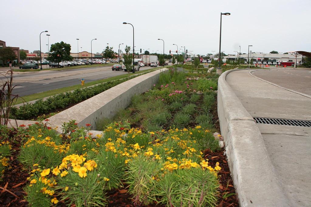
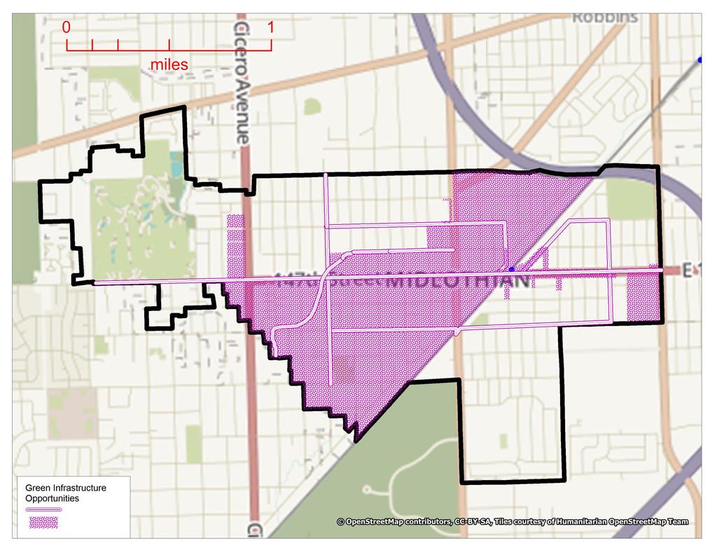
13 2013 MIDLOTHIAN CREEK GREEN INFRASTRUCTURE PLAN A + B Natalie Creek Greenspace Flood Reduction and Midlothian Meadows Green Neighborhood Improvements Site-based GI installations including: Stormwater swales and stormwater bump-outs during capital improvement of roads Rain gardens and rain barrel programs for residents Stormwater tree plantings Combined sewer/aging sewer replacement Trails and street linkages/streetscapes to neighboring public open space C. Midlothian Transit-Oriented Development Includes above along with Redevelopment into transit-oriented area Midlothian Creek Trailway/Bikeway (where feasible) Midlothian Creek stream/riparian edge improvement + restoration Trails and street linkages/ streetscapes to neighboring public open space and neighborhood park district building Address FEMA/MWRD discrepancies

14 2014 VILLAGE CENTER PLAN Recommendations of graduate students from the University of Illinois at Chicago Critical Issue 4: Conflict Between Flood Issues and Development Priorities Past planning efforts focused on the Village Center have identified land west of the Metra railway as a focus for new development. Due to the existence of both a 500 and 100 year flood plain, which covers a significant portion of this property rendering it legally and logistically undevelopable, this land is inappropriate for new development. New development has been prioritized for the area east of the Metra train line. This new Core development project will help provide an anchor tenant in the village center to help spur new retail development while also focusing development outside of areas most impacted by the area s flooding issues.

15 2014 VILLAGE CENTER PLAN A: Objective: Visually establish village center as a space and activity center/node. B: Strategy: Install gateway features to signify entry points into the Village Center. C: Objective: Establish a civic presence in the Village Center D: Objective: Establish gazebo park as the civic activity center. E: Objective: Enhance green space
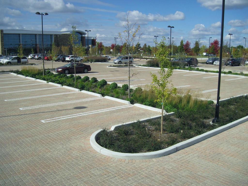
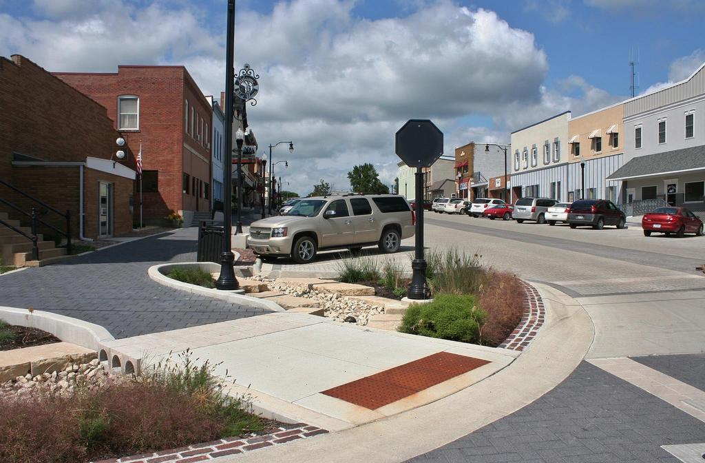
16 2014 VILLAGE CENTER PLAN Strategies include Green Infrastructure Green space enhancement- Ulitlize green infrastructure stormwater best management practices (BMPs) to increase the land s stormwater storage capacity through retention and infiltration. Realign parking situation (Metra and new uses A on the map above) Parking Lot Design Criteria: Should contain a certain percentage of vegetation, trees/parking spot ratio stormwater mitigation measures should also be incorporated into these new design standards. Implement Road Diets 147th Street as a Complete Street Increase of parkway space Require substantial vegetative planters and include storm water mitigation
17 ADDITIONAL INITIATIVES RTA TOD Project. Corridor of sidewalk replacements, decorative crosswalks and decorative pedestrian lighting streets surrounding METRA station Illinois Green Infrastructure Grant Project Rain garden, Native Plantings, Porous Pavement and Open Space south of the Village Hall Redevelopment Sites Vacant former car dealerships, representing approximately 16 acres, on Cicero Avenue at 145th St Kedzie Corridor Revitalization Plan Development of Superblock - 147th Street to the north and the Sundrop Prairie Nature Preserve to the south Specific sites on Kedzie Avenue at the northwest corner of 147th and Kedzie and the other on the west side of Kedzie between 147th and 149th Streets.


18 147 th Street
19
20 THANK YOU Harriet Festing RainReady.org cnt.org
The transportation system in a community is an
 7 TRANSPORTATION The transportation system in a community is an important factor contributing to the quality of life of the residents. Without a sound transportation system to bring both goods and patrons
Draft Bergamot Area Plan
 ATTACHMENT 1 Draft Bergamot Area Plan Taskforce on the Environment April 15, 2013 www.bergamotplan.net 1 Overview WHAT IS THE BERGAMOT AREA PLAN? A Community-Based Planning Document Guiding the Future
Green Infrastructure Program Updates
 Metropolitan Water Reclamation District of Greater Chicago Green Infrastructure Program Updates Calumet Stormwater Collaborative June 1, 2018 - Chicago Stormwater Management Programs Flooding remains our
DRAFT ROOSEVELT ROAD. District Recommendations. Figure 5.23 The Roosevelt Road Corridor
 CHAPTER 5 Figure 5.23 The Road Corridor Road will develop as a mixed-use corridor, emphasizing regional retail, west of the river and mixed-use development east of the river. KEY RECOMMENDATIONS 1. High
Atlanta BeltLine Subarea 3 Master Plan Update
 Atlanta BeltLine Subarea 3 Master Plan Update April 14, 2018 Workshop Meeting 1 22 miles, connecting 45 neighborhoods 22 MILES of transit 46 MILES of streetscapes and complete streets 33 MILES of urban
Green Infrastructure & Low Impact Development
 Green Infrastructure & Low Impact Development CITY OF COVINGTON STORMWATER MANAGEMENT WHAT IS GREEN INFRASTRUCTURE? Green infrastructure uses vegetation, soils and natural processes to manage water and
Transportation. Strategies for Action
 Transportation A major priority for the Overlake Neighborhood is to develop a multimodal transportation system. To achieve this system, a balance has to be found among travel, circulation and access needs;
Gold Line Bus Rapid Transit Transit Oriented Development (BRTOD) Helmo Station Area Plan
 Helmo Station Area Plan") Appendix F Gold Line Bus Rapid Transit Transit Oriented Development (BRTOD) Helmo Station Area Plan Introduction and Purpose of the Plan The Gold Line Bus Rapid Transit facility is an eleven-mile dedicated
Appendix F Gold Line Bus Rapid Transit Transit Oriented Development (BRTOD) Helmo Station Area Plan Introduction and Purpose of the Plan The Gold Line Bus Rapid Transit facility is an eleven-mile dedicated
Northwest Rail Corridor and US 36 BRT Development Oriented Transit Analysis 4.4 STATION AREA FINDINGS
 4.4 STATION AREA FINDINGS Each station is different, and each one requires a separate set of recommendations based on the vision for the site. This section outlines an initial TOD strategy and recommendations
Civic Center District
 Civic Center District The Civic Center district is the civic and social heart of Warrenville, containing such public buildings as the City Hall, Warrenville Public Library, Police Station, Park District
Planning Districts INTRODUCTION
 INTRODUCTION To facilitate detailed examination of development prospects for all areas of the community, Delano has been divided into 14 planning districts. The location of these planning districts is
CITY OF COLWICH COMPREHENSIVE PLAN LAND USE LAND USE 1
 LAND USE LAND USE 1 WHAT YOU WILL FIND IN THIS CHAPTER: Discussion of today s conditions and tomorrow s projections Discussion of challenges and opportunities Discussion of the environmental quality goals,
City of Long Beach. creating vibrant and exciting places
 City of Long Beach creating vibrant and exciting places Land Use Element Urban Design Element Overview of the two draft General Plan elements Discuss areas of change Economic goals of the plans Case study
City of Ennis. Downtown Master Plan Catalyst Projects
 City of Ennis Downtown Master Plan Catalyst Projects Revised Framework Plan REVISED Project Types and Descriptions Project Types A. Visitor Attracting Projects: Projects in this category are intended to
JANUARY 19, 2011 CENTRAL AVENUE-METRO BLUE LINE TRANSIT-ORIENTED DEVELOPMENT IMPLEMENTATION PROJECT COMMUNITY FORUM
 CENTRAL AVENUE-METRO BLUE LINE TRANSIT-ORIENTED DEVELOPMENT IMPLEMENTATION PROJECT COMMUNITY FORUM JANUARY 19, 2011 THE MARYLAND-NATIONAL CAPITAL PARK AND PLANNING COMMISSION PRINCE GEORGE S COUNTY PLANNING
Implementation Guide Comprehensive Plan City of Allen
 Implementation Guide 2030 Comprehensive Plan City of Allen DRAFT 2015 Implementation Guide Allen 2030 Comprehensive Plan INTRODUCTION The Comprehensive Plan serves as a guide for the growth and development
PrairieWalk Pond Lisle, IL
 PrairieWalk Pond Lisle, IL Hybrid of Native Vegetation and Traditional Landscape Design Scott Kuykendall, Planning Resources Inc. Awards 2011 Chicago Wilderness Conservation & Native Landscaping Award
CHAPTER 8. Mrs. Zimman s Class - Central Elementary
 SUSTAINABILITY CHAPTER 8 Mrs. Zimman s Class - Central Elementary 8.1 OVERVIEW Green infrastructure also known as low impact development (LID) and environmental or sustainable site design is an environmentally
WEST LOOP DESIGN GUIDELINES CHECKLIST
 WEST LOOP DESIGN GUIDELINES CHECKLIST Section 1.0 General Strategies 1.1 DESIGN EXCELLENCE: ENCOURAGE HIGH QUALITY AND INNOVATIVE DESIGN OF NEW BUILDINGS WITHIN THE WEST LOOP WITHOUT BEING PRESCRIPTIVE
The West Vaughan Employment Area Secondary Plan Policies
 Part 2: The West Vaughan Employment Area Secondary Plan Policies 2.1 General Policies It is the policy of Council: 2.1.1. That the West Vaughan Employment Area (the WVEA), identified on Schedule 1, will
Potential Green Infrastructure Strategies May 6, 2015 Workshop
 Potential Green Infrastructure Strategies May 6, 2015 Workshop Background The City of Cortland is developing the Tioughnioga Urban Headwaters Green Infrastructure Action Plan with funding from the National
Green Gables. April 24, 2013
 Green Gables Preliminary and Final Plat April 24, 2013 Development Team Green Gables Development Corporation (Owner/Developer) DTJ Design (Planner/Landscape Architect) Enertia Consulting Group (Civil Engineer)
Green Infrastructure and Low-Impact Development Technologies
 Green Infrastructure and Low-Impact Development Technologies The guiding principles of these technologies is to manage stormwater at their sources using natural means, and establish conditions so that
include playgrounds, sports fields, community gardens and picnic areas.
 DEVELOPMENT PLAN OPEN SPACE SYSTEM OPEN SPACE SYSTEM The neighborhood provides for a range of open space types. The Village Square is an important open space in the neighborhood. It serves as a gathering
Workshop #3 June 13, 2016
 Downtown Ocoee Master Plan Workshop #3 June 13, 2016 Our Team Our Team and Tonight s Goal Quick Recap: Why a Downtown Plan? How are we developing the plan? How can you still be involved? What s left to
3. VISION AND GOALS. Vision Statement. Goals, Objectives and Policies
 Vision Statement Queen Creek s interconnected network of parks, trails, open spaces and recreation opportunities provide safe and diverse activities and programs that sustain its unique, small town, equestrian
What s Green Infrastructure?
 What s Green Infrastructure? Green infrastructure is strategically planned and managed networks of natural lands, working landscapes and other open spaces that conserve ecosystem values and functions and
Southeast Michigan Council of Governments
 Southeast Michigan Council of Governments SEMCOG Green Infrastructure Activities Regional Green Infrastructure Vision GLRI Green Streets EPA Technical Assistance MDOT Grants Green Infrastructure Vision
implementation10 Village of Greendale Comprehensive Plan: Greendale, Wisconsin. Revisiting a Greenbelt Community
 implementation10 Village of Greendale Comprehensive Plan: 2010 - Village of Greendale Comprehensive Plan: 2010 - Implementation The recommendations of this Plan must be implemented by the Village of Greendale,
38 Queen s University Campus Master Plan Part 1
 38 Queen s University Campus Master Plan Part 1 46 The Campus at the City Scale Chapter 4 The Campus at the City Scale 39 Queen s is an urban University centrally located in Kingston. Decisions made by
Welcome! to Keller Town Hall
 Welcome! to Keller Town Hall Keller Town Center Planning a New Downtown What is Keller Town Center? A new, growing downtown district planned as an urban village A combination of retail and office spaces,
Green Infrastructure The Indianapolis Greenways Connection
 Green Infrastructure The Indianapolis Greenways Connection Fewer things in the transportation industry today make better since than combining the needs for pedestrian and bike trails with the need to locate,
Issues, Challenges & Opportunities
 Below is a summary of issues, challenges, and opportunities relating to the revitalization of Downtown Romeoville and potential development of the Village s East Side TOD Area. Current Issues & Challenges
Chapter 5: Natural Resources and Environment
 NATURAL RESOURCES AND ENVIRONMENT 5-1 5 Chapter 5: Natural Resources and Environment BACKGROUND AND INTENT Urban expansion represents the greatest risk for the future degradation of existing natural areas,
Land Use. Hardware Street Vendor Mixed-Use
 Land Use Definition Land Use is the way a piece of real estate is utilized. Existing, proposed, and adopted land uses all play a role in the planning process. Once a land use plan is adopted, the next
EXHIBIT A. Tax Increment Reinvestment Zone No. 1 (Town Center) First Amended Project Plan 1
 First Amended Project Plan 1") EXHIBIT A Tax Increment Reinvestment Zone No. 1 (Town Center) First Amended Project Plan 1 1 As amended by Resolution No. 2008-02-001(TR1R) of the Tax Increment Reinvestment Zone No.1, and approved to
EXHIBIT A Tax Increment Reinvestment Zone No. 1 (Town Center) First Amended Project Plan 1 1 As amended by Resolution No. 2008-02-001(TR1R) of the Tax Increment Reinvestment Zone No.1, and approved to
Willamette Falls Downtown District Policies and Design Guidelines
 Willamette Falls Downtown District Policies and Design Guidelines The District Policies and Design Guidelines are mandatory for future development within the Willamette Falls Downtown District, and will
Draft Memorandum #1: Goals and Vision for Revitalization
 Keizer Revitalization Plan Draft Memorandum #1: Goals and Vision for Revitalization Submitted to: City of Keizer April 12, 2018 (revised) Prepared By: Angelo Planning Group and Otak, Inc. Project No. 17482.A
Growth Management: Common Value 2 of Community Character
 Growth Management: Common Value 2 of Community Character 24 Why is Growth Management a Common Value? Effective Growth Management is essential to protecting our surrounding ecosystem and reinforcing our
Northwest commuter rail station US 36 BRT. Westminster Station
 Northwest commuter rail station Westminster Station US 36 BRT Westminster Center US 36 & Church Ranch Broomfield Flatiron/96 th St. US 36 & McCaslin Table Mesa Boulder Junction 13-month effort that will
NEORSD Green Infrastructure Grant (GIG) Program Opening Remarks
 Program Opening Remarks") NEORSD Green Infrastructure Grant (GIG) Program Opening Remarks 2019 NEORSD GIG Eligibility and Technical Requirements Project must be located in the Sewer District s combined sewer area Location Applicant
NEORSD Green Infrastructure Grant (GIG) Program Opening Remarks 2019 NEORSD GIG Eligibility and Technical Requirements Project must be located in the Sewer District s combined sewer area Location Applicant
The Floyds Fork Area Study A Framework for Growth
 The Floyds Fork Area Study A Framework for Growth 2 21 st Century Parks Master Plan: The Fork 3 Neighborhood Development Area Policy Recommendations 1. Create incentives to promote infill of existing development
North Street Reconstruction & Integrated Stormwater Management System
 OWEA Watershed Workshop-October 30 th, 2014 North Street Reconstruction & Integrated Stormwater Management System Ted Blahnik, PE Principal-Williams Creek Consulting North Street: A Case Study for Integrated
Cornwall Park Neighborhood Plan
 [1] Cornwall Park Neighborhood Plan As adopted by Ordinance No. 8868 and amended by Ordinance Nos. 8946, 9200, 9201, 9233, 9301, 9305, 9749, 9787, 9764, 10502 and 10738, 2000-12-094, 2004-12-087, 2004-12-091,
Multimodal Station Planning Working Session Rebuilding a Better I-84 in Hartford. August 10, 2017
 Multimodal Station Planning Working Session Rebuilding a Better I-84 in Hartford August 10, 2017 Station Urban Design Principles + Guidelines Station Urban Design Principles + Guidelines The station should
WAYNE GLEN (also known as the Richter Property) A model Low Impact Development (LID) community.
 A model Low Impact Development (LID) community.") WAYNE GLEN (also known as the Richter Property) A model Low Impact Development (LID) community. Sketch Plan Submission Tredyffrin Planning Commission i Meeting January 17, 2013 114 Forrest Avenue, Suite
WAYNE GLEN (also known as the Richter Property) A model Low Impact Development (LID) community. Sketch Plan Submission Tredyffrin Planning Commission i Meeting January 17, 2013 114 Forrest Avenue, Suite
Silverdale Regional Center
 Silverdale Regional Center Vision for Silverdale Regional Center The Silverdale Regional Center Plan (Plan) will guide the evolution of the Silverdale Regional Center from a collection of strip malls and
Seneca Meadows. Block 4 Locate office, technology, and medical development adjacent to I Screen views of garage structures from I-270.
 Seneca Meadows Seneca Meadows has an industrial park in its southern end and a mixed-use employment area planned for the north end. The district benefits from extensive I-270 visibility, stream valley
Subregion 4 Central Avenue-Metro Blue Line Corridor Transit-Oriented Development (TOD) Implementation Project. Community Meeting April 27, 2011
 Implementation Project. Community Meeting April 27, 2011") Subregion 4 Central Avenue-Metro Blue Line Corridor Transit-Oriented Development (TOD) Implementation Project Community Meeting April 27, 2011 Overview Introduction to Subregion 4 TOD Implementation Program
Subregion 4 Central Avenue-Metro Blue Line Corridor Transit-Oriented Development (TOD) Implementation Project Community Meeting April 27, 2011 Overview Introduction to Subregion 4 TOD Implementation Program
Access to the University of North Carolina at Chapel Hill, UNC Hospitals, and Chapel Hill Transit.
 M 1/ 4 1/ 2 E IL M E IL Station Family: County: City: UNC Hospitals WHY THIS STATION? University Village Orange Chapel Hill Access to the University of North Carolina at Chapel Hill, UNC Hospitals, and
Integrating Sustainability in Policy, Planning and Zoning. Jeff LeJava Associate Counsel Open Space Institute
 Integrating Sustainability in Policy, Planning and Zoning Jeff LeJava Associate Counsel Open Space Institute WELCOME& OVERVIEW Pace LULC awarded a Cleaner, Greener Communities Program Grantfrom NYSERDAto
Creating Community Around Commuter Rail in Arvada Colorado. Presented By Mike Elms, AICP Community Development Director City of Arvada Colorado
 Creating Community Around Commuter Rail in Arvada Colorado Presented By Mike Elms, AICP Community Development Director City of Arvada Colorado Arvada s s Location 10 miles west of Denver A first tier suburb
Storm Water Managament at the University of Michigan
 Storm Water Managament at the University of Michigan Standard Operating Procedure Date: 06/23/17 Revision #: 03 The green roof installed on top of the Mott Children s & Von Voigtlander Women s Hospital.
VILLAGE & TOWN OF BERGEN: COMPREHENSIVE PLAN
 VILLAGE & TOWN OF BERGEN: COMPREHENSIVE PLAN CPC Public Hearing April 21, 2016 History 1996 Comprehensive Plan Comprehensive Plan Update Committee Consultant (LaBella Associates): December 2014 Residents
Harlem Avenue Corridor Plan: Corridor Planning Across Municipal Boundaries
 Harlem Avenue Corridor Plan: Corridor Planning Across Municipal Boundaries Heather Tabbert, Manager, Local Planning and Programs Division Regional Transportation Authority (RTA) Jen McNeil Dhadwal, Principal
3 Vision and Goals. Vision and Goals. Blueprint for Bloomsburg. Vision. Town of Bloomsburg Comprehensive Plan,
 Vision and Goals 3 Vision and Goals Citizens of the Town of Bloomsburg clearly value their natural and cultural heritage, the walkable, mixed use pattern of downtown, the access to education, and the community
NORTH COLLEGE PARK. Residential Neighborhood and Neighborhood Center OBJECTIVES EXISTING SITUATION AND ISSUES CONCEPT
 Greenbelt Metro Area Sector Plan - Subarea Design Policies and Guidelines - North College Park 119 NORTH COLLEGE PARK Residential Neighborhood and Neighborhood Center CONCEPT North College Park is envisioned
BURTON STATION STRATEGIC GROWTH AREA PLAN UPDATE PUBLIC MEETING 3/26/18
 BURTON STATION STRATEGIC GROWTH AREA PLAN UPDATE PUBLIC MEETING 3/26/18 1 WHERE WE ARE? 2 PRIMARY OBJECTIVES OF THE PLAN UPDATE 1. Update the land use designation for Burton Station Village to reflect
Physical Approaches to Flood Mitigation
 Physical Approaches to Flood Mitigation ational Academy of Sciences /19/2017 Chicago Area Before Development Widespread Flooding Waterways and Marshes Absorbent Ground Early settlers came to this location
Status Update (2006 vs. Now) Citizen s Advisory Committee February Plan for Prosperity
 Citizen s Advisory Committee February Plan for Prosperity") Status Update (2006 vs. Now) Citizen s Advisory Committee February 2018 Plan for Prosperity 2000 2017 2000 2017 Gardnerville Population 6,000 5,760 5746 5,500 5,000 5,067 5,550 5,165 5,394 5,412 5,250
Status Update (2006 vs. Now) Citizen s Advisory Committee February 2018 Plan for Prosperity 2000 2017 2000 2017 Gardnerville Population 6,000 5,760 5746 5,500 5,000 5,067 5,550 5,165 5,394 5,412 5,250
Preliminary Recommendations Tk Takoma/Langley Crossroads Sector Plan
 Preliminary Recommendations Tk Takoma/Langley Crossroads Sector Plan Vision is to achieve a Transit Oriented, pedestrian friendly Community that Celebrates and builds upon the cultural Diversity of the
A larger version of this map is located on the last page of this PDF.
 MAP Committee Input McLoughlin Area Draft Vision Map A larger version of this map is located on the last page of this PDF. 1. The map above is intended to portray a vision for the McLoughlin area. It highlights
124 Subarea Visions. Vision Plan. A. Nelessen Associates, INC I Visioning I Planning I Urban Design
 Subareas 124 Subarea Visions The next seven sections describe specific recommendations tailored to each subarea. Each subarea is discussed separately except for certain aspects of 95th Street and Antioch
Corridors. Re-vitalize our Corridors and Gateways
 Corridors Re-vitalize our Corridors and Gateways Artist s rendering from the 287 Strategic Plan, 2015 Corridors are the major throughways of Loveland but they also provide important commercial, community
Beaverton City Council: Work Session. SIDEDistrict. May 6, 2014
 BEAVERTON Beaverton City Council: CREEK Work Session SIDEDistrict May 6, 2014 Tonight s Agenda BEAVERTON CREEK SIDE Brief updates Creekside Vision Scenarios & discussion: Redevelopment & Parking Project
Draft Plan Recommendations
 Draft Plan Recommendations Sponsored by Henry County and the Atlanta Regional Commission T S W TEAM Tunnell-Spangler-Walsh & Associates URS Corporation Marketek Study Area 1,300 acres Includes parts of
Connecting Master Plans, Asset Management, and CIP s to Bolster Economic Development
 Connecting Master Plans, Asset Management, and CIP s to Bolster Economic Development Presented By Paul Montagno, AICP, Carlisle Wartman Associates And Terry Moultane, AICP, Bay City What We re Covering
The following principles guide the development of goals and strategies to protect and promote these amenities:
 OPEN SPACE/PARKS/TRAILS/RECREATION GOALS/STRATEGIES Cherry Hills Village is a living environment that offers low density development, open areas, public scenic vistas, public trails and public parks. This
Carlsbad Village Redevelopment Concept Summary of Features
 Carlsbad Village Redevelopment Concept Summary of Features Calthorpe Associates November 5, 2003 The Redevelopment Concept illustrates a vision for the future of Carlsbad Village. The overall vision of
Urban Planning and Land Use
 Urban Planning and Land Use 701 North 7 th Street, Room 423 Phone: (913) 573-5750 Kansas City, Kansas 66101 Fax: (913) 573-5796 Email: planninginfo@wycokck.org www.wycokck.org/planning To: From: City Planning
BROOKHILL NEIGHBORHOOD MODEL ZONING MAP AMENDMENT PREFACE TO APPLICATION
 BROOKHILL NEIGHBORHOOD MODEL ZONING MAP AMENDMENT PREFACE TO APPLICATION June 15, 2015 Revised: August 1, 2016 I. VISION Brookhill is a proposed community based upon the principles of Albemarle County
Design Standards. Green Development. Shadow Studies. Standards. July 2010 Updated October 2014
 Urban Design Design Standards Urban Standards July 2010 Updated October 2014 Green Development Shadow Studies Standards Table of Contents 1 Introduction 1.1 Purpose. 6 1.2 Preface.. 7 2 LID Stormwater
José Campos Manager of Planning and Design Review SPUR San José Symposium October 12, 2018
 1 Transbay: Freeways to New Ways José Campos Manager of Planning and Design Review SPUR San José Symposium October 12, 2018 2 Transbay freeway land pre-1989 3 1989 Loma Prieta Earthquake 4 TRANSBAY c.
C. Westerly Creek Village & The Montview Corridor
 C. Westerly Creek Village & The VISION Community Vision When the goals of the city are achieved Westerly Creek Village, a distinctive community defined by Montview Boulevard and Westerly Creek, is a strong
Presentation Item C Annotated Model Outline for a Framework for a Green Infrastructure Plan
 Date: August 17, 2016 To: From: Subject: Management Committee Dan Cloak, Consultant Presentation Item C Annotated Model Outline for a Framework for a Green Infrastructure Plan Recommendation: Receive the
LAND USE AMENDMENT DOWNTOWN COMMERCIAL CORE (WARD 7) MACLEOD TRAIL SE AND 5 AVENUE SE BYLAW 254D2017
 MACLEOD TRAIL SE AND 5 AVENUE SE BYLAW 254D2017") Page 1 of 10 EXECUTIVE SUMMARY This Land Use Amendment application seeks to redesignate a full downtown block (currently the YWCA site) from a Direct Control based on the CM-2 District (Land Use Bylaw
Page 1 of 10 EXECUTIVE SUMMARY This Land Use Amendment application seeks to redesignate a full downtown block (currently the YWCA site) from a Direct Control based on the CM-2 District (Land Use Bylaw
Section4 Design Vision & Implementation Plan
 Section4 Design Vision & Implementation Plan W Woodschurch Rd 4.1 Design Focus Areas The Framework Plan is simply the starting point for directing the design and implementation of a wide range of transportation
Sustainable Storm Water Management
 Incorporating Water Management into the Community Planning Process August 16, 2012 Sustainable Storm Water Management Samantha Brown Environmental Engineer SD1 SD1 s Service Area CVG Airport SD1 Service
The Floyds Fork Area Plan
 The Floyds Fork Area Plan Growth Framework and Design Principles Presented by: Wallace Roberts & Todd, LLC March 24, 2009 Ted Wathen / Quadrant Agenda Project overview and purpose Growth framework Design
Elliot Park 2. Neighborhood Master Plan. Historical Perspective
 Elliot Park 2 Neighborhood Master Plan Historical Perspective August 2002 Early History Development patterns and the growth of Minneapolis largely grew out of the city s historical response to its geography.
3.5 Historic Old Town Character Area
 3.5 Historic Old Town Character Area Downtown Suwanee is characterized by two areas: Historic Old Town and Town Center. Due to their proximity and similar purposes, the two areas can function together
The Benefits and Challenges Associated with Green Infrastructure Practices
 The Benefits and Challenges Associated with Green Infrastructure Practices Thomas M. Evans ASLA, LEED AP Regional Green Infrastructure Design Services Director OWEA Technical Conference, June 20, 2013
EXISTING COMPREHENSIVE PLAN
 EXISTING COMPREHENSIVE PLAN Town Center Land Use Element: V. LAND USE POLICIES Town Center Mercer Island's business district vision as described in "Your Mercer Island Citizen-Designed Downtown" was an
SUMMERSIDE / MT. CARMEL REINVESTMENT CORRIDOR COMMUNITY DEVELOPMENT STRATEGY
 SUMMERSIDE / MT. CARMEL REINVESTMENT CORRIDOR COMMUNITY DEVELOPMENT STRATEGY FEBRUARY 2013 I. Location of the Summerside/Mt. Carmel Reinvestment Corridor The Summerside/Mt. Carmel Reinvestment Corridor
Volume 2: Implementation Plan
 Volume 2: Implementation Plan February 25 th 2002 Implementation Introduction This document outlines the steps that should be taken to implement the Washington Heights Neighborhood Plan. The City Council
Ivywild On The Creek PRELIMINARY CREEK DISTRICT MASTER PLAN
 Ivywild On The Creek PRELIMINARY CREEK DISTRICT MASTER PLAN Introduction: Rejuvenating an extraordinary Creekside neighborhood THE CREEKSIDE DISTRICT The Ivywild On The Creek Neighborhood District Master
City of Farmington. Downtown Plan. Amendment to the 1998 Master Plan Adopted October 11, 2004
 City of Farmington Amendment to the 1998 Master Plan Adopted October 11, 2004 Introduction Planning Background 1 Scope and Components of the Plan Amendment 2 Concept Introduction 3 Plan Concepts 3 Conceptual
Meeting Agenda. 1. Introductions (5 min)
") Meeting Agenda Monaca, PA Ohio River Brownfields Redevelopment Planning Federal/State/Regional Partners Meeting June 5, 2012; 3-4pm EDT Conference call-in #: 1-866-299-3188 Conference code: 202 566 0633#
Meeting Agenda Monaca, PA Ohio River Brownfields Redevelopment Planning Federal/State/Regional Partners Meeting June 5, 2012; 3-4pm EDT Conference call-in #: 1-866-299-3188 Conference code: 202 566 0633#
Billing Code: DEPARTMENT OF HOUSING AND URBAN DEVELOPMENT [Docket No. FR-6072-N-01]
![Billing Code: DEPARTMENT OF HOUSING AND URBAN DEVELOPMENT [Docket No. FR-6072-N-01]](/thumbs/91/107309814.jpg "Billing Code: DEPARTMENT OF HOUSING AND URBAN DEVELOPMENT [Docket No. FR-6072-N-01]") This document is scheduled to be published in the Federal Register on 12/18/2017 and available online at https://federalregister.gov/d/2017-27194, and on FDsys.gov Billing Code: 4210-67 DEPARTMENT OF HOUSING
This document is scheduled to be published in the Federal Register on 12/18/2017 and available online at https://federalregister.gov/d/2017-27194, and on FDsys.gov Billing Code: 4210-67 DEPARTMENT OF HOUSING
Request for Statement of Interest in Implementation of the Roosevelt Road Redevelopment Plan
 425 Hillside Avenue Request for Statement of Interest in Implementation of the Roosevelt Road Redevelopment Plan I. INTRODUCTION The is seeking the services of a qualified consulting firm to prepare plans
East Whiteland Township Current Land Development Projects
 Current Land Development Projects A. Lincoln Court (Lancaster Avenue / Malin Road) Demolish existing 2 story brick and stucco structure Build onto existing 1 story masonry shopping center to add 8 new
Design for Health Comprehensive Plan Review Checklists. Design for Health,
 Comprehensive Plan Review Checklists, 2007 info@designforhealth.net These Comprehensive Plan Review Checklists summarize the key points of the (DFH) background and health impact assessment (HIA) materials.
APPENDIX 4 NEWBURY TOWNSHIP TOWN CENTER MASTER PLAN
 APPENDIX 4 NEWBURY TOWNSHIP TOWN CENTER MASTER PLAN Prepared by the Urban Design Center of Northeast Ohio September, 2008 Newbury Township Land Use Plan A4-1 INDEX Page No. 1 Newbury Township Town Center
Robbinsdale LRT Station. CDI Development Guidelines. August Overview
 Robbinsdale LRT Station August 2018 Overview The City of Robbinsdale may have the coolest opportunity site along the 13 mile stretch of the Bottineau LRT corridor / Blue Line extension. Located a block
Pedestrian and Bike Bridge LOGO
 6.2.2 Pedestrian and Bike Bridge The proposed pedestrian and bike crossing re-envisions the existing bridge at Pismo Creek on Cypress Street. The bridge is currently underutilized by vehicular through
Table of Contents. Elm Avenue Improvement Plan City of Waco, Texas. Introduction 1. Existing Context 1 Figure 1 2.
 Table of Contents Introduction 1 Existing Context 1 Figure 1 2 Plan Guidelines 3 Future Urban Form 4 The West-End 4 Main Street 6 The East-End 7 Figure 2 9 Public Improvement Recommendations 7 General
Third Ave CSO Integrated Green Infrastructure
 Third Ave CSO Integrated Green Infrastructure Neil Myers Williams Creek Consulting OWEA Annual Conference June 2013 For growing municipalities to be perceived as world class communities, each must move
Street Flooding Mitigation Plan KYOVA Interstate Planning Commission. Presented to AMPO National Conference October 18, 2017
 Street Flooding Mitigation Plan KYOVA Interstate Planning Commission Presented to AMPO National Conference October 18, 2017 Saleem Salameh, Ph.D., P.E., M.ASCE Chet Parsons, AICP CTP Agenda: Background
Sustainable Development Call for Projects Western Infrastructure Project Submissions
 2009-2010 Sustainable Development Call for Projects Western Infrastructure Project Submissions January 20, 2010 2009-2010 SDCFP Summary of Infrastructure Funding Infrastructure Projects Number of Projects
REPORT OF THE PLANNING AND DEVELOPMENT DEPARTMENT FOR APPLICATION FOR REZONING ORDINANCE TO PLANNED UNIT DEVELOPMENT AUGUST 18, 2016
 REPORT OF THE PLANNING AND DEVELOPMENT DEPARTMENT FOR APPLICATION FOR REZONING ORDINANCE TO PLANNED UNIT DEVELOPMENT AUGUST 18, 2016 AWH The Planning and Development Department hereby forwards to the Planning