Great Hammerton Growth Area: Our Vision August Hammerton Growth Area Harrogate: Our Vision
|
|
|
- Erica Spencer
- 6 years ago
- Views:
Transcription

1 Great Hammerton Growth Area: Our Vision August 2015 Hammerton Growth Area Harrogate: Our Vision i

2 Contents 1.0 Introduction Our Vision Principle of Development Site Context Townscape Character Historic Context Constraints Opportunities Design Concept Transport and Accessibility Deliverability and Next Steps 21 All images Nathaniel Lichfield & Partners unless otherwise stated. Designed by Nathaniel Lichfield & Partners Ltd Trading as Nathaniel Lichfield & Partners. All Rights Reserved. Registered Office: 14 Regent s Wharf, All Saints Street, London N1 9RL. All plans within this document produced by NLP are based upon Ordnance Survey mapping with the permission of Her Majesty s Stationery Office. Crown Copyright reserved. Licence number AL50684A ii

3 1.0 Introduction This document sets out Commercial Estates Group s emerging vision for a mixed use, residential led development at land around Green Hammerton, to help meet the need for new homes in the Harrogate District over the 21 year Plan Period. It describes the assessments undertaken to date to create an initial illustrative master plan, and provides some background in respect of the planning and environmental matters to be considered moving forward. This document demonstrates firstly that a significant development is achievable at this location and secondly CEG s eagerness to work with the Council and local stakeholders to bring this site forward for development as a sustainable community. Hammerton Growth Area Harrogate: Our Vision 1
4 2

5 2.0 Our Vision Our vision is to create a sustainable, mixed use community and infrastructure, with high design and environmental standards, respectful of its local heritage and context and its wider setting. The development will be deliverable, commercially viable and contribute positively to delivering around 5,000 homes, along with new, high quality employment provision. It will build on the existing infrastructure, such as the road and rail links, and provide all of the necessary additional infrastructure required to sustain the community. The following sections set out how this vision translates into a masterplan for the development of Great Hammerton. Hammerton Growth Area Harrogate: Our Vision 3
6 4
7 3.0 Principle of Development National Planning Policy The National Planning Policy Framework establishes a presumption in favour of sustainable development. For plan-making this means that Local Planning Authorities should positively seek opportunities to meet the development needs of their area in full. A key requirement of the NPPF is for Local Planning Authorities to boost significantly the supply of new homes. This is reflected by a requirement to seek opportunities to deliver a wide choice of high quality homes, including affordable homes, which widen the choice for home ownership and create sustainable, inclusive communities. The NPPF provides the opportunity for Green Belt boundaries to be reviewed as part of the Local Plans process. Local Policy The Harrogate district does not have an up-to-date plan setting out its housing requirement. Policy SG1: Settlement Growth: Housing Distribution of the Core Strategy (adopted in February 2009) uses the Regional Spatial Strategy for the Yorkshire and Humber (RSS) housing requirement of 390 dwellings per annum (net). The Sites and Policies Development Plan Document Submission Draft (November 2013) (S&P DPD) sought to deliver the Harrogate Core Strategy housing requirement of 390 dwellings per annum. However, following the S&P DPD Examination in Public, the Inspector recommended in a letter to the Council on the 29th April 2014 that they withdraw the S&P DPD on two grounds: 1. Employment Land Requirements; and 2. Housing Requirements. In relation to housing requirements the Inspector specifically states: It is accepted by the Council that the submitted DPD falls considerably short of meeting the objectively assessed need. The DPD seeks to provide 390 dwellings per annum, in line with the Core Strategy, as opposed to the Strategic Housing Market Assessment (2011) projections (sub-national and employment led projections) of 862 and 1,086. Other parties have put forward different but not dissimilar figures. This is a very substantial shortfall. The Harrogate district Local Plan Issues and Options Consultation draft states that there is a need to plan for 13,041 new homes over the period of the Local Plan, based on a figure of 621 new homes per year. Taking into account the recent completions, existing planning permissions, sites identified as suitable for new homes, windfall sites and an overall non-completion rate of 10%, the Councils consultation documents states a requirement to identify future housing land to deliver around 6,364 homes. On behalf of CEG, NLP has prepared an assessment of the housing need in Harrogate district using its Headroom model. This concluded that Harrogate district will actually require at least 800 homes per year, rather than 621, equating to a need for 16,800 homes over the plan period. Taking the above factors into account, the Local Plan would need to identify future housing land to deliver around 10,350 homes. CEG s view is that the district housing requirement could be met in three basic ways: 1. Extensions to existing settlements: This would require development in the Green Belt and would place added pressure on the services, facilities and infrastructure in historic settlements such as Harrogate, Knaresborough and Ripon. 2. One or more new settlements: This would provide an opportunity to create a long term plan for settlements in less sensitive but accessible locations with new infrastructure. It would relieve pressure on the Green Belt, other environmentally sensitive locations and the infrastructure of existing settlements. 3. A combination of extensions and new settlements: This option would provide scope for sustainable extensions to existing settlements in less sensitive locations alongside improvement to local infrastructure. A smaller new new growth area or growth areas could also be provided. Given the extent of the housing requirement and the district s environmental and infrastructure constraints, CEG s view is this final option is likely to be the most preferable in overall planning and sustainability terms. The precise housing requirement for the district will be subject to further discussion, however, irrespective of the final figure, the most sustainable and appropriate solution to delivering the housing needs of the district would be to deliver a settlement of around 5,000 homes at Hammerton. Hammerton Growth Area Harrogate: Our Vision 5
 Kirk Deighton Wetherby Google")
8 A61 A1(M) Killinghall Flaxby Whixley Knaresborough A59 Green Hammerton Goldsborough A59 Harrogate Kirk Hammerton A658 North Deighton Tockwith A1(M) Kirk Deighton Wetherby Google Boston Spa 6


 to the west and York, 10.1 miles (16.3 km) to the east.")
 1.")
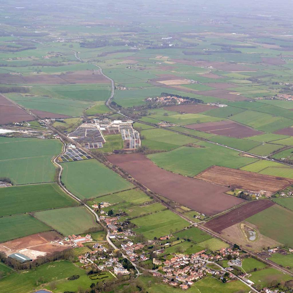
9 4.0 Site Context Green Hammerton is a new growth area sustainable location for a new settlement with key road and rail links to Harrogate and York, and beyond. The site surrounds Green Hammerton and is north of Kirk Hammerton, separated by the railway line. Whixley lies to the north west. Green Hammerton is located on the A59, 3.6 miles (5.8 km) from junction 47 of the A1(M). The A59 provides a direct road link to Harrogate, 11.9 miles (19.2 km) to the west and York, 10.1 miles (16.3 km) to the east. Kirk Hammerton and Cattal railway stations lie to the south of Green Hammerton on the Harrogate line, providing a regular service between Harrogate and York. Site Characteristics TO NORTH YORKSHIRE A1(M) 1. Proximity to A59 and A1, Harrogate and York 2. Proximity to both Cattal and Hammerton railway stations. HARROGATE KNARESBOROUGH A59 GREEN HAMMERTON RAILWAY LINE A59 YORK WETHERBY A1(M) TO LEEDS Hammerton Growth Area Harrogate: Our Vision 7


10 8

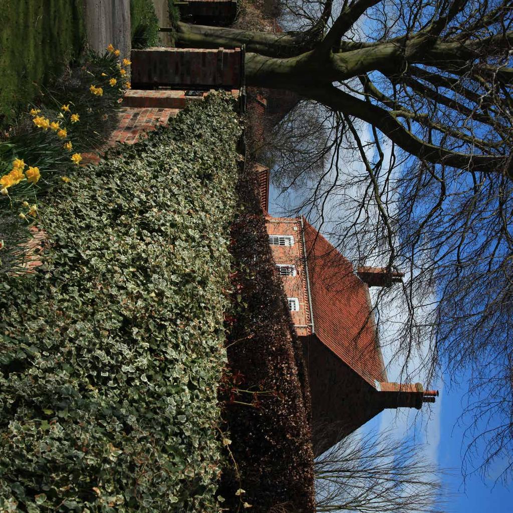
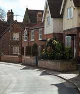
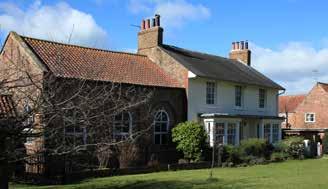
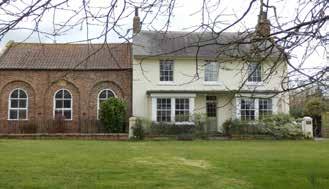
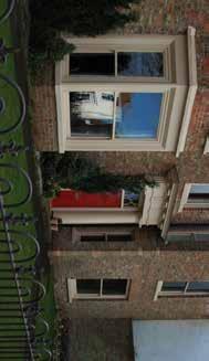
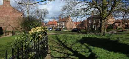
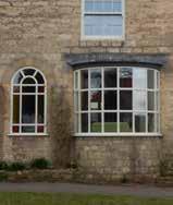
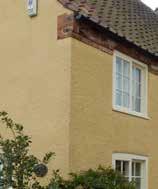
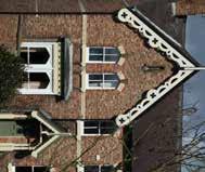
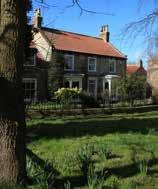
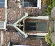
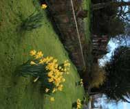
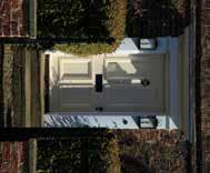
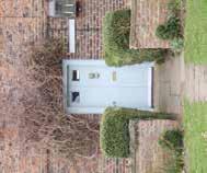
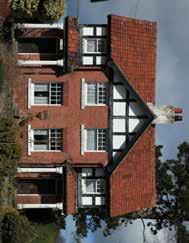
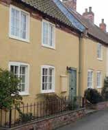
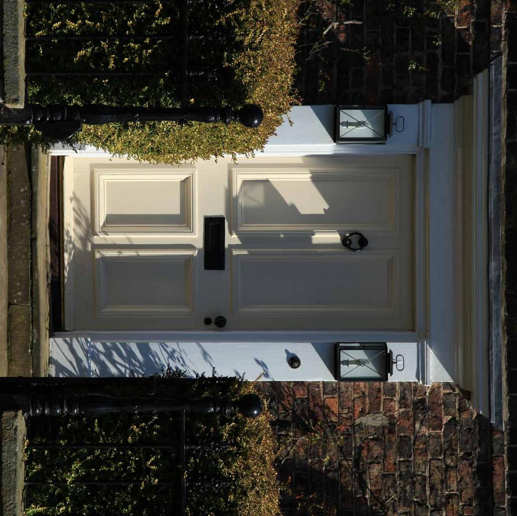
11 5.0 Townscape Character Locally distinctive townscape evolves as a place over many years reflected in street layout, built form and character. Both Green Hammerton and Kirk Hammerton have well defined main trees, with a variety of buildings in terms of size and design. The interaction with the surrounding countryside varies. Green Hammerton is a historic settlement which has retained its traditional character within a rural setting. The village green is characterised by a wide open space fronted by houses along a rural lane. Buildings are typically wide fronted framing the open space. Most houses are built in red brick with pantiled roofs, a consistent material palette is accented with distinctive architectural features. Hammerton Growth Area Harrogate: Our Vision 9
12 10


 from York (Poppleton")


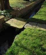
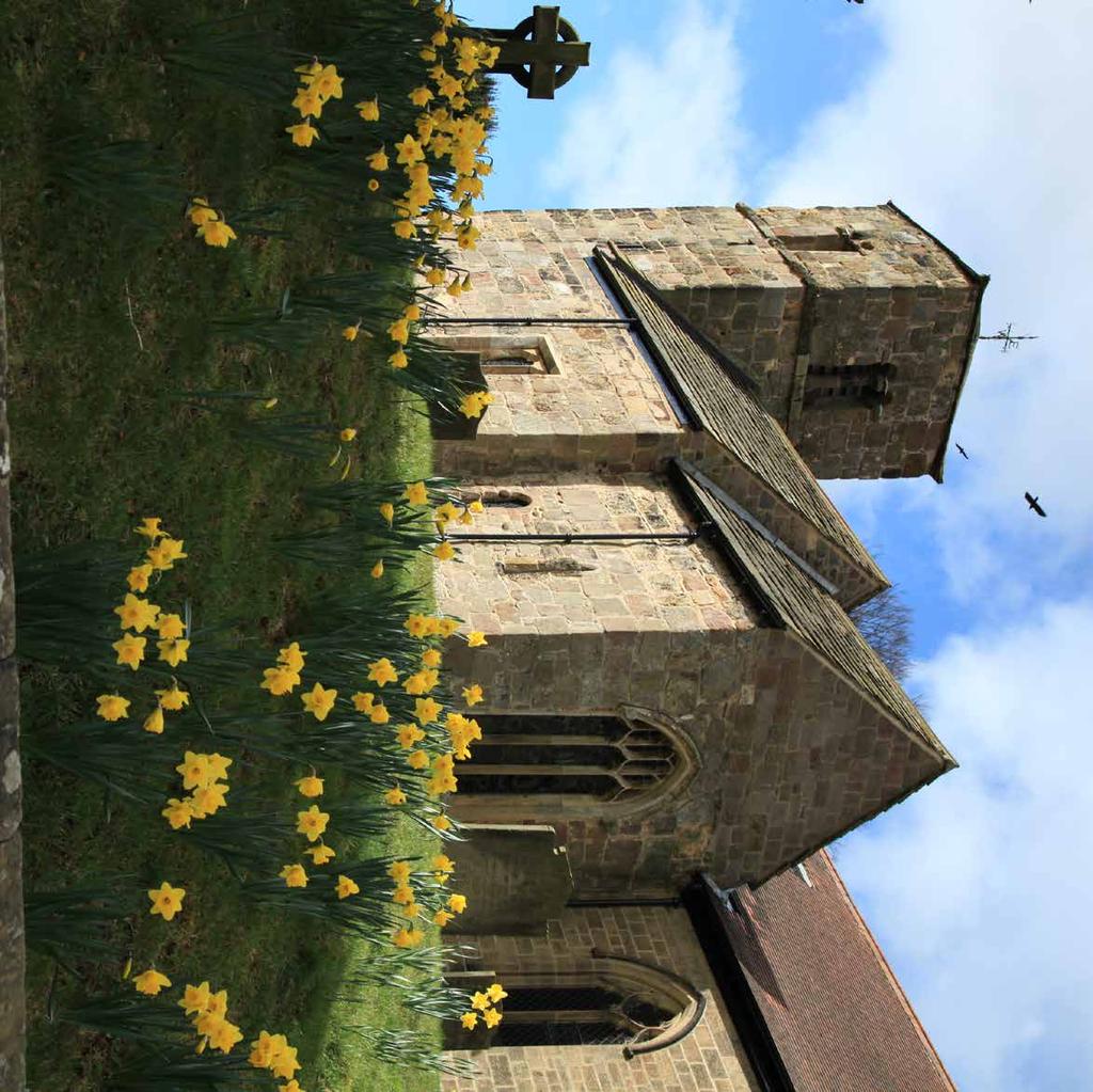
13 6.0 Historic Context Hammerton is derived from tun and hamor meaning the homestead by a hill. Boroughbridge Road passes through Green Hammerton and aligns with the Roman road from York to Aldborough. This road was the key route from Harrogate to York before the by-pass A59 was built in The village developed in linear form along the Roman Road and to either side of The Green, which gave access to the Manor, now long gone The East and West Yorkshire Junction Railway opened a route of 15 miles (24km) from York (Poppleton Junction) to Knaresborough in In 1851 a viaduct over the River Nidd completed the route to Harrogate. Hammerton and Cattal railway stations were stops on the original railway line. As demonstrated by the historic mapping, Green Hammerton has experienced limited growth and remains a compact, linear settlement Sources: Kirk Hammerton Parish Council Website Archive page BBC York and North Yorkshire - Archeology - Green Hammerton Dig Green Hammerton Conservation Area Character Appraisal 2015 Hammerton Growth Area Harrogate: Our Vision 11
 Woodland Johnsons wholesale nursery N")
14 25m Whixley 30m Green Hammerton 20m 45m 45m 30m 20m Cattal Railway Station Hammerton Railway Station Kirk Hammerton Constraints Plan KEY Settlement area Roman Road (indicative) Parish boundary Listed building Roads Watercourse Public right of way Conservation area Railway line Floodplain Contours A59 barrier Railway station Watermain (potential location) Woodland Johnsons wholesale nursery N Views to Green Hammerton 12


15 7.0 Constraints Understanding the site features that act as potential constraints and opportunities for development is central to preparing a responsive masterplan. The key constraints of the site and its surroundings are illustrated opposite. Landscape Considerations Land to the east of Green Hammerton falls within the low-lying farmland character area within the River Ouse and Lower River Nidd River Corridors. The land is flat to very gently undulating below 20m AOD. The fields immediately surrounding Green Hammerton are bound by a strong hedgerow network which provides an important landscape setting. Land to the west of Green Hammerton falls within the Whixley arable farmland character area. The land is gently undulating from between 20m AOD to 45m AOD. Medium to large sized fields are bound by a mix of hedges and fencing, the Johnsons wholesale nursery covers a large area in contrast with the arable land. New development should respect the local landform with integrated landscaping defining development limits. Heritage and setting Careful design and landscaping will minimise impacts on heritage assets and landscape character; and ensure that both Green Hammerton and Kirk Hammerton s special character and appearance is conserved. The site is adjacent to Green Hammerton and Kirk Hammerton Conservation areas which include clusters of Grade II listed buildings. Providence House is a Grade II listed building located north of the A59 on the approach to Green Hammerton from the west. A Roman crossing point was discovered close to the River Nidd to the east of Green Hammerton. The direction of the road suggests it may align with Boroughbridge Road through Green Hammerton. A59 The A59 is a major road providing links to the A1(M) and Harrogate to the west and to York to the east. This busy route separates part of Green Hammerton and is a barrier between Green Hammerton and Kirk Hammerton. Railway Line The Harrogate to York railway line is located south of the A59 to the north of Kirk Hammerton. Three level crossings provide links over the railway line at Cattal railway station, Hammerton railway station and Parker Lane. The stations lie on the periphery of the settlements and are not readily accessible. Utilities The water pipeline between Marton service reservoir (North Yorkshire) and Acomb Landing water treatment works (City of York), follows the A59 and curves around the north east of Green Hammerton, the exact route of the pipeline is subject of further investigation. Hammerton Growth Area Harrogate: Our Vision 13

16 25m Whixley 30m Green Hammerton 20m 45m 45m 30m 20m Cattal Railway Station Hammerton Railway Station Kirk Hammerton Opportunities Plan KEY Settlement area Potential new village Watercourse Potential to downgrade A59 Roads Railway station Public right of way Potential development extents Railway line Potential new railway station Potential park and ride Contours Woodland Parkland setting Long distance views N 14


17 8.0 Opportunities The site presents an opportunity to to positively contribute to meeting housing need and infrastructure, deliver affordable housing, and promote sustainable living in a manner which respects the existing landscape pattern and creates an attractive new settlement. Access and Movement There is an opportunity to downgrade the A59 through Green Hammerton and reroute traffic onto a new by-pass road. A park and ride at one of the stations could encourage sustainable transport use for journeys to Harrogate and York via train. There is also potential to site a new railway station on Parker Lane in a location which is more central and accessible to Green Hammerton. Key Views Key views can help structure the layout of built form and open spaces. Coney Garth Hill provides elevated views towards York and beyond. There are also views of and from Providence Hill to the south west. Within Green Hammerton there are strong views of the open countryside from The Green to the west, connecting the village with its surrounding arable landscape. Beyond The Green there are views from Back Lane and Water Slack Lane across open countryside. There is potential to protect the landscape setting of Green Hammerton with designated parkland and green corridors maintaining views and sense of openness. Landscape Setting The pattern of existing hedgerows provides a well-defined landscape structure to the site which can help to shape a development. There is an opportunity to create greenway linkages following the hedge lines which would provide attractive pedestrian routes and preserve wildlife corridors. Sustainability There are opportunities in conjunction with development and infrastructure to provide new village centres with services and facilities within walking distance for new and existing residents. Hammerton Growth Area Harrogate: Our Vision 15

18 Concept Plan KEY Settlement area Potential new village Watercourse Potential to downgrade A59 Roads Railway station Public right of way Potential to reroute A59 Railway line Potential new railway station Contours Potential green corridors N Potential park and ride Woodland Parkland setting 16

19 9.0 Design Concept The concept for the site is to create village communities within an overall connecting landscape framework. With the potential for new local centres and large areas of open space. The new communities will benefit both new and existing residents. Key masterplan principles Principle 1: A high quality place Our vision is to create a distinctive, high quality place and an accessible, legible and attractive environment for people to live and work in. The new neighbourhoods could support up to 5000 homes, including affordable housing with local centres and supporting employment and community facilities to meet the day to day needs and some of the high order goods and services. Principle 2: A walkable place The neighbourhoods should be at a scale and form of development which connect by foot at around a 400m radius. Within each neighbourhood there should be a mix of land uses and a compact built form with safe and attractive pedestrian corridors. Principle 3: Respect the setting of Green Hammerton The development will draw on the natural and built environment, heritage and natural assets of Green Hammerton and Kirk Hammerton to create a framework for new development, fostering a sense of legacy and natural evolution. The development will protect the setting of Green Hammerton and key views through the site. The re-routing of the A59 and downgrading of the existing road will integrate Green Hammerton. Principle 4: Integration at countryside boundaries The interface with the countryside around the site will be softened by the provision of buffer landscape treatments at the edges of the development and the extension of green fingers into the development area, to bring the countryside into the new neighbourhoods. Visual integration will be achieved through the retention of key trees and hedge lines within the site and respecting key views. Principle 6: Create a generous landscape framework An extensive network of green open spaces will surround and permeate the heart of the new neighbourhoods, connecting the existing and future communities to the surrounding countryside. Orchards and allotments will provide opportunities for local food production. Woodland planting will help enclose the settlement and community squares and gardens will provide the focal point for new homes. Sustainable Urban Drainage Systems will underpin the network of green spaces reducing the risk of flooding, assisting with sustainable water management and providing rich habitats for wildlife. WEST HAMMERTON GREEN HAMMERTON Principle 7: Local distinctiveness High quality architecture will be used and varied to reflect the local vernacular while allowing for more modern interpretation. Buildings will be adaptable and sustainable. A copy of the initial Illustrative Masterplan is enclosed overleaf. EAST HAMMERTON KIRK HAMMERTON Hammerton Growth Area Harrogate: Our Vision 17

20 Illustrative Masterplan KEY Employment Primary School site Residential - low density District Centre Local Centre Secondary School site Residential - high density Parks, natural and seminatural open space, amenity green space N Residential - medium density Landscape buffers 18


21 10.0 Transport and Accessibility It is important that transport and access to the development provides opportunities for sustainable travel choices. We will respect existing Public Rights of Way and think creatively about new pedestrian and cycling networks through the site and connections beyond including making the most of the opportunity created by the existing railway stations. Key improvements could comprise: 1. Improvements to the site access onto the A59 2. Bus routes 3. A park and ride at Hammerton Station 4. A new rail station We will work with the local authority, Network Rail and public transport providers to identify the potential scope to improve public transport connections to the site. It is also critical we ensure that the highways infrastructure can accommodate the development. We will work with the North Yorkshire County Council and Harrogate Borough Council to ensure that appropriate highways improvement works are identified and delivered as part of the scheme. Hammerton Growth Area Harrogate: Our Vision 19

22 20


23 11.0 Other Community Infrastructure In addition to the transport infrastructure, it will be crucial that the necessary community infrastructure required to support the new sustainable communities is provided alongside the new housing and at the right times. The delivery of infrastructure is a fundamental objective of CEG s proposal. The community infrastructure provision will initially build upon and improve the existing infrastructure of Green Hammerton and Kirk Hammerton (e.g. primary schools, local shops, post office, village hall, etc) but will quickly result in a wide range of new additional facilities and services to support the new residents living in the area. It is likely that the development of 5,000 homes will result in the delivery of the following facilities and services in central and accessible locations within the development: 1 district centre and 4 local centres, which will include GP surgeries, community halls, post offices, dentists and local shops; 4 new primary schools and 1 new secondary school; A range of types and sizes of public open space throughout the development, including parks, playgrounds and sports pitches. This community infrastructure is shown on the initial illustrative masterplan. Hammerton Growth Area Harrogate: Our Vision 21
24 22
25 12.0 Deliverability and Next Steps Deliverability Based on a minimum requirement of 800 homes per year, there would be a total requirement of 16,800 homes over the 21 year plan period and a shortfall of around 10, 350 dwellings. The 2000 homes suggested in the Hammerton and Cattal Area under Option 3 of the Local Plan Issues and Options document would therefore be insufficient to meet the housing needs of the Borough. This shortfall is best accommodated through a combination of some additional urban extensions and significant growth at Hammerton to the order of 5,000 new homes and assoicated infrastructure. Having undertaken initial assessments of the site potential, CEG is confident that it can deliver the significant sustainable growth of Hammerton to help meet the identified local and district housing needs. The vision and its masterplan are an important first step in developing our proposals. Further analysis of these areas will now be undertaken to produce more detailed proposals including the potential mix of uses and associated facilities. The options will be shared with Harrogate Borough Council and promoted through the emerging Local Plan incorporating engagement with local communities, councillors and other stakeholders. Hammerton Growth Area Harrogate: Our Vision 23
26 Client Commercial Estates Group Planning Consultant and Masterplanning Nathaniel Lichfield & Partners Transport Bryan G Hall 24
WELCOME GYPSY LANE. Wider Site Location plan. Proposals for the development of LAND OFF FOXLYDIATE LANE WEBHEATH. Proposals for the development of
 WELCOME The developers are preparing an outline planning application for a residential led development and need the community s views in order to develop the proposals further WHAT IS PROPOSED? A high
Former Panshanger Aerodrome, Welwyn Garden City Masterplan Scenarios. Mariposa Investments
 Former Panshanger Aerodrome, Welwyn Garden City Masterplan Scenarios Mariposa Investments Contents 1.0 Introduction 1 2.0 The Site and Surroundings 2 3.0 Local Area Context 6 4.0 Site Features 10 5.0 Development
Public Consultation. Land at Monks Farm, North Grove. Welcome
 Welcome Welcome to our public exhibition for development on Land at Monks Farm, orth Grove. Gallagher Estates and Gleeson Strategic Land are preparing an outline planning application for new homes, open
Newcourt Masterplan. November Exeter Local Development Framework
 Newcourt Masterplan November 2010 Exeter Local Development Framework Background The Exeter Core Strategy Proposed Submission sets out the vision, objectives and strategy for the development of Exeter up
Kibworth Harcourt. Introduction. Introduction
 Introduction Introduction Welcome to this public exhibition on the proposals for the delivery of new homes on land at The Kibworths. The purpose of today s exhibition is to give you the opportunity to
Settlement Boundaries Methodology North Northumberland Coast Neighbourhood Plan (August 2016)
") Introduction This background paper sets out a methodology for the definition of settlement boundaries in the North Northumberland Coast Neighbourhood Plan. The neighbourhood plan is planning positively
Introduction This background paper sets out a methodology for the definition of settlement boundaries in the North Northumberland Coast Neighbourhood Plan. The neighbourhood plan is planning positively
INTRODUCTION. Land south of Bishopswood Lane, Tadley
 0 INTRODUCTION THE SITE Introduction Gladman Developments Ltd. has successfully invested in communities throughout the UK over the past 0 years, developing high quality and sustainable residential, commercial
WELCOME. Land North of STEVENAGE. We would like to thank you for attending our public exhibition today.
 WELCOME We would like to thank you for attending our public exhibition today. The purpose of this event is to share our proposals and hear your thoughts on our ideas. Members of the project team are on
INTRODUCTION NORTH HEYBRIDGE GARDEN SUBURB
 INTRODUCTION This event is being hosted by the promoters of the proposed North Heybridge Garden Suburb who are working with Maldon District Council and other key stakeholders on the preparation of a comprehensive
8.0 Design and Form of Development 43/
 42/ 8.0 Design and Form of Development 43/ Rothwells Farm, Golborne/ Development Statement Figure 7. Site Constraints Key 44/ Site Boundary 360 Bus Route/Stops Existing Trees Underground Water Pipe Sensitive
Welford-on-Avon Neighbourhood Plan Consultation Event Sunday, 6 April Your name Your address
 Welford-on-Avon Neighbourhood Plan Consultation Event Sunday, 6 April 2014 Your name Your email address Please either: - complete this feedback form and put it in the box before leaving the Memorial Hall
SOUTH EAST LINCOLNSHIRE LOCAL PLAN: HOUSING PAPER DONINGTON (JUNE 2016)
") SOUTH EAST LINCOLNSHIRE LOCAL PLAN: HOUSING PAPER DONINGTON (JUNE 2016) 1 DONINGTON S PLACE IN THE SPATIAL STRATEGY 1.1 Policy 2 of the South East Lincolnshire Local Plan 2011-2036 Draft for Public Consultation
SOUTH EAST LINCOLNSHIRE LOCAL PLAN: HOUSING PAPER DONINGTON (JUNE 2016) 1 DONINGTON S PLACE IN THE SPATIAL STRATEGY 1.1 Policy 2 of the South East Lincolnshire Local Plan 2011-2036 Draft for Public Consultation
Neighbourhood Planning Local Green Spaces
 Neighbourhood Planning Local Green Spaces Introduction... 2 1. Why green space is important... 4 2. Neighbourhood plans and green space... 6 3. Evidence... 8 Statutory designations... 9 Green space audit...
Copyright Nigel Deeley and licensed for reuse under this Creative Commons Licence
 1 Copyright Nigel Deeley and licensed for reuse under this Creative Commons Licence Prepared by the Neighbourhood Plan Steering Group on behalf of Garway Parish Council with assistance from 2 Table of
Land at Fiddington Hill Nursery, Market Lavington
 Land at Fiddington Hill Nursery, Market Lavington Briefing Report for Market Lavington Parish Council Persimmon Homes (Wessex) April 2016 Background This brief report has been prepared following the Market
WELCOME. Olney Road, Lavendon INTRODUCTION. The Site. The Application. The Need for Housing. A Sustainable Location LAVENDON TURVEY OLNEY ROAD
 0 WELCOME INTRODUCTION Gladman Developments Ltd have successfully invested in communities throughout the UK over the past 0 years, developing high quality and sustainable residential, commercial and industrial
Public Consultation 23 January Peel Hall, Warrington Board 1. A message from Satnam... Site history...
 Board 1 A message from Satnam... Thank you for attending today s public consultation about proposals to develop a new residential neighbourhood at. The display boards show why the development is needed
Welcome. Site/11/04. Site/11/03. Proposed Site. 11,400 new homes needed in east Cambs
 Welcome Welcome to our consultation on our proposals for new homes on land north east of Soham Road, Fordham. Members of the project team are available to answer any questions you have and listen to feedback.
Statement of Community Involvement LAND OFF SOUTHDOWN ROAD HORNDEAN, HAMPSHIRE
 LAND OFF SOUTHDOWN ROAD HORNDEAN, HAMPSHIRE CONTENTS Page 1. Introduction 3 2. Pre-application Discussions 4 3. The Consultation Process 5 4. Consultation Feedback 7 5. Responses to Consultation Feedback
WELCOME. North East Haverhill. The Planning Process
 WELCOME North East The site to the North East of, known as Great Wilsey Park, is identified by St Edmundsbury Borough Council in its Core Strategy as capable of delivering a Sustainable Urban Extension.
DUNSFOLD NEIGHBOURHOOD PLAN Site Selection Policies
 DUNSFOLD NEIGHBOURHOOD PLAN Site Selection Policies The criteria for assessing sites for future housing and business development in Dunsfold are set out below. (Development criteria, covering what it is
EAST LEEDS EXTENSION: NORTH EAST QUADRANT DEVELOPMENT FRAMEWORK MAY 2012
 EAST LEEDS EXTENSION: NORTH EAST QUADRANT DEVELOPMENT FRAMEWORK MAY 2012 White Laith Developments Limited Barton Willmore Beansheaf Farmhouse Bourne Close Reading RG31 7BW T: 0118 943 0000 F: 0118 943
Welcome to our exhibition
 Welcome to our exhibition The Homes & Communities Agency (HCA) welcomes you to this public exhibition explaining our proposals for the redevelopment of the former Lea Castle Hospital site. About the Homes
Great Easton Neighbourhood Plan Statement of Basic Conditions
 Great Easton Neighbourhood Plan 2017-2031 Statement of Basic Conditions OCTOBER 2016 GREAT EASTON PARISH COUNCIL Contents 1.0 Introduction....Page 2 2.0 Summary of Submission Documents and Supporting Evidence..
Land at Rampton Road. Cottenham
 Land at Rampton Road Cottenham Introduction TEP is preparing an outline planning application for 54 dwellings on 6.9 hectares of land adjacent to Rampton Road, Cottenham on behalf of the owners Cambridgeshire
LEEDS SITE ALLOCATIONS PLAN MATTER 3 GREEN BELT KCS DEVELOPMENT AUGUST 2017
 LEEDS SITE ALLOCATIONS PLAN MATTER 3 GREEN BELT KCS DEVELOPMENT AUGUST 2017 Smith Limited Suite 9C Joseph s Well Hanover Walk Leeds LS3 1AB T: 0113 2431919 F: 0113 2422198 E: planning@peacockandsmith.co.uk
PROPOSAL FOR NEW HOMES ON LAND OFF WALTON ROAD
 PROPOSAL FOR NEW HOMES ON LAND OFF WALTON ROAD The Homes and Communities Agency are developing proposals to deliver new homes on surplus public sector land off Walton Road. The thoughts of the local community
Briefing Document of CNP. June 2017
 Cholsey Parish Council Cholsey Neighbourhood Plan Briefing Document of CNP June 2017 Cholsey Neighbourhood Plan Page! 1 of! 8 Cholsey Plan Briefing v1.4 Page Left Intentionally Blank Cholsey Neighbourhood
Droitwich Spa 6. Reasoned Justification
 87 Droitwich Spa 6 Reasoned Justification 6.1 Droitwich Spa is identified in the settlement hierarchy (Policy SWDP1) as a main town being the largest settlement in Wychavon District with an estimated population
Welcome to our public exhibition
 About our development Welcome to our public exhibition This exhibition gives you the chance to view and comment on our proposals for a new residential development of 165 high-quality homes, along with
Reserved Matters application for a site that straddles the boundary between CBC and BBC
 BBC APPLICATION 15/02682/MAR NUMBER CBC APPLICATION CB/15/04294/RM NUMBER LOCATION Wixams Land at former storage depot, Bedford Road, Wilstead Bedfordshire PROPOSAL Reserved Matters Application for Strategic
Neighbourhood Planning Guidance Local Green Spaces
 Neighbourhood Planning Guidance Local Green Spaces Introduction This guidance note has been produced for communities preparing neighbourhood plans in North Dorset to help them to identify, assess and designate
Plumpton Neighbourhood Development Plan Revised Pre Submission Document - Regulation 14 Consultation
 REPRESENTATIONS... Plumpton Parish Council Plumpton Neighbourhood Development Plan Revised Pre Submission Document - Regulation 14 Consultation Representations submitted on behalf of: Cala Homes (South
LOGGERHEADS NEIGHBOURHOOD PLAN LOCAL GREEN SPACE DESIGNATION OCTOBER 2016
 DRAFT LOGGERHEADS NEIGHBOURHOOD PLAN LOCAL GREEN SPACE DESIGNATION OCTOBER 2016 1. Introduction For many local communities, green infrastructure in and around their neighbourhood is an important issue,
Rochford District Council Allocations Development Plan Document: Discussion and Consultation Document Sustainability Appraisal
 Option SWH1 Balanced Communities Option SWH1 1 To ensure the delivery of high quality sustainable communities where people want to live and work Will it ensure the phasing of infrastructure, including
Blandford Forum Town Council, Blandford St Mary Parish Council and Bryanston Parish Council
 Blandford Forum Town Council, Blandford St Mary Parish Council and Bryanston Parish Council Blandford + Neighbourhood Plan 2 Pre-Submission Plan Consultation (November 2018) Representations submitted on
Land East of Cromwell Lane
 Land East of Cromwell Lane VISION DOCUMENT AUGUST 2016 The proposals for Land East of Cromwell Lane will be defined by existing landscape features, ensuring that the development offers a quality place
Planning and Sustainability Statement
 Land adjacent to Manor Farm, Catterick Village Pallett Hill Sand and Gravel Co Ltd Proposed 10 new dwellings, (6 No market dwellings and 4 No affordable dwellings) with access, associated car parking and
INTRODUCTION. Land West of Main Road, Stanton Harcourt THE SITE. Why is the Site Suitable for Development?
 0 INTRODUCTION THE SITE Application Boundary Gladman Developments Ltd has successfully invested in communities throughout the UK over the past 0 years, developing high quality and sustainable residential,
Development of land adjacent to Braggs Farm Lane and Rumbush Lane, Dickens Heath. Welcome. Today s exhibition. The proposal site
 Welcome Welcome to this event to discuss the development of land adjacent to Braggs Farm Lane. is currently in the preliminary stages of designing proposals to sensitively develop this site with high-quality
Welcome to this exhibition which shows emerging ideas for land owned by University of Bristol at Long Ashton.
 1 Introduction Welcome to this exhibition which shows emerging ideas for land owned by University of Bristol at Long Ashton. The University of Bristol owns a 170 acre site south of Long Ashton village
DESIGN & ACCESS STATEMENT
 DESIGN & ACCESS STATEMENT January 2016 Contents Introduction section 1 Section 1 - Introduction Section 2 - Assessment Section 3 - Involvement Section 4 - Evaluation Section 5 - Design Section 6 - Layout
PDP DESIGN & ACCESS STATEMENT
 PDP The Planning & Design Partnership Planning.. Architecture.. Interiors.. Landscape The Chicory Barn Studio, The Old Brickyards, Moor Lane, Stamford Bridge York, The East Riding Of Yorkshire, YO41 1HU.
TRANSFORMING TUDOR NURSERIES
 TRANSFORMING Welcome to today s exhibition which outlines our proposals to transform the part-dilapidated former Tudor Nurseries into a characterful development providing new homes, a retirement village,
Story Homes. Land at Thirsk Road, Kirklevington. An Introduction to Story Homes. Our Foundations. Commitment to Consultation.
 Story Homes An Introduction to Story Homes Founded by Fred Story in 1987, Story Homes has a long and successful reputation of building high quality and high specification homes. The family owned business
The journey so far. The new masterplan for Dargavel Village
 The journey so far Our vision for Dargavel Village began over ten years ago when the original masterplan for transforming the former Royal Ordnance Factory site into a thriving community was established.
Perth and Kinross Council Development Management Committee 20 February 2013 Report of Handling by Development Quality Manager
 Perth and Kinross Council Development Management Committee 20 February 2013 Report of Handling by Development Quality Manager 4(4)(iii) 13/81 Erection of sports hall, associated changing facilities, offices
Examination of South Cambridgeshire Local Plan
 Matter SC6A - Policy SS/5 Waterbeach New Town Historic England( formerly English Heritage) 874 Rep Nos 59748, 60250, 60253 Examination of South Cambridgeshire Local Plan Historic England, Hearing Statement
GREENBANK DEVELOPMENT MASTERPLAN
 DEVELOPMENT MASTERPLAN POTENTIAL TRAIN STATION COMMUNITY CENTRE Greenbank will be a connected masterplanned community providing easy access to local and surrounding amenity. Affordable quality homes, green
Linby Neighbourhood Plan Masterplan Safeguarded Land Top Wighay Farm March Linby Neighbourhood Development Plan Masterplan 1
 Linby Neighbourhood Plan Masterplan Safeguarded Land Top Wighay Farm March 2017 Linby Neighbourhood Development Plan Masterplan 1 Linby Neighbourhood Development Plan Masterplan 2 Contents: Section 1:
Chapter 2: OUTLINE PLANNING APPLICATION PROPOSALS. A New Garden Neighbourhood Matford Barton 17
 Chapter 2: OUTLINE PLANNING APPLICATION PROPOSALS A New Garden Neighbourhood Matford Barton 17 2.1. SUMMARY AND STATUS OF THE PROPOSALS 2.1.1. The parameter plans and associated wording in this chapter
Parish of Repton NEIGHBOURHOOD DEVELOPMENT PLAN
 Parish of Repton NEIGHBOURHOOD DEVELOPMENT PLAN BASIC CONDITIONS STATEMENT December 2018 CEF 4 Legal Requirements This statement has been produced by the NDP Working Group on behalf of Repton Parish Council
Ward: Southbourne. Outline application with all matters reserved. Erection of 5 no. dwellings and associated works.
 Parish: Southbourne Ward: Southbourne SB/16/00205/OUT Proposal Site Outline application with all matters reserved. Erection of 5 no. dwellings and associated works. Dunkirk South Lane Southbourne Emsworth
The Fairfield Partnership Vision for North-East Elsenham
 The Fairfield Partnership Vision for North-East Elsenham August 2009 Frequently Asked Questions Who is The Fairfield Partnership? The Fairfield Partnership is a joint venture between Marchfield Developments
DEVELOPMENT MANAGEMENT REPORT
 ITEM A08-1 DEVELOPMENT MANAGEMENT REPORT TO: BY: DATE: DEVELOPMENT: SITE: WARD: APPLICATION: APPLICANT: Development Management Committee Development Manager Proposed live/work unit in connection with existing
WHITELEY TOWN COUNCIL NORTH WHITELEY DEVELOPMENT SEPTEMBER 2014
 WHITELEY TOWN COUNCIL NORTH WHITELEY DEVELOPMENT SEPTEMBER 2014 Dear Resident This Special Edition of the Whiteley Voice which has been prepared in conjunction with the North Whiteley Consortium is to
Local Allocation LA1 Marchmont Farm Hemel Hempstead. Master Plan
 Local Allocation LA1 Marchmont Farm Hemel Hempstead Master Plan Adopted July 2017 i Foreword Adopted Master Plan for Local Allocation LA1 Marchmont Farm, Hemel Hempstead Six Local Allocations (Green Belt
Environmental and Landscape Mapping
 Environmental and Landscape Mapping In support of the Calveley Neighbourhood Plan November 2016 Project Name and Number: Calveley Neighbourhood Plan 16-025 Document Name and Revision: Environmental and
Application and Proposals. Part 211
 Application and Proposals Part 211 Site Location and Context The application site comprises two distinct land parcels totalling some 135 hectares. The site is bisected eastwest by Churchlands Development.
Former North Works, Lickey Road, Longbridge, Birmingham
 Committee Date: 14/11/2013 Application Number: 2013/06431/PA Accepted: 27/08/2013 Application Type: Full Planning Target Date: 26/11/2013 Ward: Longbridge Former North Works, Lickey Road, Longbridge, Birmingham
Welcome. Land adjacent Sandy Lane WALTHAM CHASE THE PROPOSED SITE
 Land adjacent Sandy Lane WALTHAM CHASE Existing Linden Homes developments Welcome Welcome to Linden Homes Southern s ( Linden ) public exhibition about its proposals for a range of high-quality homes for
Land North of Hall Road, Rochford. Rochford District Council. Planning Application Index. Prepared on behalf of Bellway Homes Ltd
 Land North of Hall Road, Rochford Rochford District Council Planning Application Index Prepared on behalf of Bellway Homes Ltd April 2010 Land North of Hall Road, Rochford Rochford District Council Scope
LAND EAST OF HORNDEAN. 1. Welcome. Morrisons supermarket. Keydell Nurseries A3(M)
") 1. Welcome Bloor Homes welcomes you to today s Public Exhibition relating to development proposals for Land to the East of Horndean. Idsworth Close Rowlands Castle Road Roa d Dell Piece East J2 Pyle Farm
1. Welcome Bloor Homes welcomes you to today s Public Exhibition relating to development proposals for Land to the East of Horndean. Idsworth Close Rowlands Castle Road Roa d Dell Piece East J2 Pyle Farm
PHASE III: Reserved Matters Submission
 Statement of Compliance with the outline approval for the proposed residential development of land at: BURGES LANE, WIVELISCOMBE PHASE III: Reserved Matters Submission Foreword Contents: This Statement
7.1.6 The main components of the development strategy for Hertford are as follows:
 Chapter 7 Hertford 2 Chapter 7 Hertford 7.1 Introduction 7.1.1 The County town of Hertford lies at the confluence of four rivers in a valley setting, which in the past has influenced its shape and form.
SITE ASSESSMENT CHECKLIST
 1. Site Details a. What is the site s name/reference? SITE ASSESSMENT CHECKLIST CR3NPWHY 3007 Gasometer Site Godstone Road CR3 0EG b. Where is the site located? Wyhteleafe; Godstone Road. Urban category1
5. Bankside and The Borough 5.1. Bankside and The Borough Area Vision
 5. 5.1. Area Vision 5.1.1. are: A globally significant central London business district which is home to international business headquarters; At the heart of the commercial and cultural life of the capital
LETTER OF OBJECTION LAND TO THE SOUTH WEST OF FORGE GARAGE, HIGH STREET, PENSHURST, KENT, TN11 8BU
 Senior Planning Officer Andrew Byrne Sevenoaks District Council Community & Planning Services PO Box 183 Argyle Road Sevenoaks Kent TN13 1GN 04 November 2011 Your Ref: 11/02258/FUL For the attention of
Herne Hill and North Dulwich Herne Hill and North Dulwich Area Vision Map
 Area Vision Map East Dulwich station Greendale Playing Fields Green Dale Sunray Gardens North Dulwich station Herne Hill station Herne Hill Velodrome NSP50 Edward Alleyn Club Key: NSP Site Allocations
1. Local Plan Context
 1. Local Plan Context WHY ARE YOU HERE? ABOUT US PLANNING APPLICATION CONSULTATION Stewart Milne Homes are in the process of preparing a detailed planning application for a development of approximately
Longbridge Town Centre Phase 2 Planning Application
 Longbridge Town Centre Phase 2 Planning Application Non-Technical Summary of the Environmental Statement December 2013 Introduction A full application for Planning Permission has been submitted to Birmingham
an Inspector appointed by the Secretary of State for Communities and Local Government
 Appeal Decision Site visit made on 14 July 2015 by I Radcliffe BSc(Hons) MCIEH DMS an Inspector appointed by the Secretary of State for Communities and Local Government Decision date: 18 August 2015 Appeal
3. Neighbourhood Plans and Strategic Environmental Assessment
 1. Introduction This report sets out a draft Screening Determination for the Preston Parish Council s Neighbourhood Plan and has been prepared by rth Hertfordshire District Council. The purpose of the
Draft Hailey Neighbourhood Plan
 Persimmon Homes (Wessex) Draft Hailey Neighbourhood Plan Representations to West Oxfordshire District Council s Regulation 16 Consultation December 2018 2 Copyright 2018 Persimmon Homes Ltd. All rights
Camberwell Camberwell Area Vision Map
 Area Vision Map NSP23 Burgess Park Edmund Street NSP29 NSP30 NSP31 New Road Benhill Road NSP27 NSP33 Green Brunswick Park NSP22 station NSP24 Peckham Road NSP26 St Giles Church Lucas Gardens NSP28 NSP25
WELCOME LAND EAST OF TYE LANE, WALBERTON. Above all, it s about people
 WELCOME Welcome to this public exhibition relating to our draft residential proposals for the land east of Tye Lane, Walberton. Today gives you the opportunity to have an active role in shaping these ideas
What do you like about South Marston?
 What do you like about South Marston? What you have said so far: Strong and separate identity, distinct from Swindon Village character (Church, School, Green and Hall) Surrounding working countryside and
WINCHESTER TOWN 3.1 LOCATION, CHARACTERISTICS & SETTING
 WINCHESTER TOWN 3.1 LOCATION, CHARACTERISTICS & SETTING 3.1.1 The area referred to by the City Council, as Winchester Town, consists of the Winchester Wards plus the adjoining built up areas of Badger
PLANNING STATEMENT (INCLUDING HOUSING, AFFORDABLE HOUSING STATEMENT AND SUSTAINABILITY STATEMENT) TO ACCOMPANY AN OUTLINE PLANNING
 TO ACCOMPANY AN OUTLINE PLANNING") PLANNING STATEMENT (INCLUDING HOUSING, AFFORDABLE HOUSING STATEMENT AND SUSTAINABILITY STATEMENT) TO ACCOMPANY AN OUTLINE PLANNING APPLICATION FOR THE DEVELOPMENT OF UP TO 230 DWELLINGS; CLASS B1 BUSINESS
PLANNING STATEMENT (INCLUDING HOUSING, AFFORDABLE HOUSING STATEMENT AND SUSTAINABILITY STATEMENT) TO ACCOMPANY AN OUTLINE PLANNING APPLICATION FOR THE DEVELOPMENT OF UP TO 230 DWELLINGS; CLASS B1 BUSINESS
Neighbourhood Plan Representation
 Date: 10 th November 2017 Neighbourhood Plan Representation Land to the east of Callow Hill Road, Alvechurch Introduction This representation has been prepared by RPS Planning and Development on behalf
Schedule of Planning Applications Committee Date: 23 May Reference: 06/17/0726/F Parish: Hemsby Officer: Mr J Beck Expiry Date:
 Schedule of Planning Applications Committee Date: 23 May 2018 Reference: 06/17/0726/F Parish: Hemsby Officer: Mr J Beck Expiry Date: 22-05-2018 Applicant: Proposal: Site: Mr Gillett Change of use to the
ALLERTHORPE NEIGHBOURHOOD PLAN
 Allerthorpe s Neighbourhood Plan sets out a vision for the Parish for the next 15 years (2018 2033) that builds on and reflects the opinions and views of parish residents. VISION In 2033 Allerthorpe will
ENVIRONMENTAL AND LANDSCAPE MAPPING
 APPENDIX IV : Environmental and Landscape Mapping ENVIRONMENTAL AND LANDSCAPE MAPPING Calveley Neighbourhood Plan November 2016 ENVIRONMENTAL AND LANDSCAPE MAPPING Calveley Neighbourhood Plan Calveley
CLEVE PARK, THORNBURY
 CLEVE PARK, THORNBURY Community Planning Day Report Back Broadsheet February 206 A VISION FOR CLEVE PARK Over 0 local people attended the Cleve Park Community Planning Day at Armstrong Hall on Saturday
Wyvern Park Skipton Environmental Statement. Non-technical Summary - April 2015
 Wyvern Park Skipton Environmental Statement Non-technical Summary - April 2015 BWB Consulting Ltd Whitehall Waterfront 2 Riverside Way Leeds LS1 4EH Telephone: +44(0)113 233 8000 Copyright This Report
ROCHFORD LOCAL DEVELOPMENT FRAMEWORK: Sustainability Appraisal/ Strategic Environmental Assessment. Rochford Core Strategy Preferred Options Document
 ROCHFORD LOCAL DEVELOPMENT FRAMEWORK: Sustainability Appraisal/ Strategic Environmental Assessment Non Technical Summary Rochford Core Strategy Preferred Options Document October 2008 SUSTAINABILITY APPRAISAL
PUBLIC REALM STRATEGY
 CONSULTATION DRAFT PUBLIC REALM STRATEGY Trenchard Street & Frogmore Street City Design Group Place Directorate Public Realm Strategy Trenchard Street & Frogmore Street Contents 1. Introduction 2. Understanding
Site ref: AS06 Site Name or Address: Murreys Court, Agates Lane
 Site ref: AS06 Site Name or Address: Murreys Court, Agates Lane Proposed Land Use: Total Site Area (Ha): Housing 1.85 Ha Description: It is understood that the owner has no plans to dispose of the site
CENTRAL BEDFORDSHIRE COMMITTED TO WORKING TOGETHER WITH LOCAL COMMUNITIES
 WELCOME Thank you for coming to our consultation event to find out more about our emerging proposals for Hayfield Park, a residential development jointly promoted by the Hayfield Consortium: Martin Grant
WETHERBY TOWN COUNCIL. Neighbourhood Development Plan Basic Conditions Statement
 WETHERBY TOWN COUNCIL Neighbourhood Development Plan Basic Conditions Statement SEPTEMBER 2017 WETHERBY NEIGHBOURHOOD DEVELOPMENT PLAN: BASIC CONDITIONS STATEMENT 1. Legal Requirements 1.1 This Statement
Oxford Green Belt Study. Summary of Final Report Prepared by LUC October 2015
 Oxford Green Belt Study Summary of Final Report Prepared by LUC October 2015 Project Title: Oxford Green Belt Study Client: Oxfordshire County Council Version Date Version Details Prepared by Checked by
Planning Statement. Land at Hookstone Road and Hornbeam Park Avenue. Report. Harrogate College. April gva.co.uk
 Report First Floor, City Point 29 King Street Leeds LS1 2HL T: +44 (0)8449 02 03 04 F: +44 (0)113 280 8080 Land at Hookstone Road and Hornbeam Park Avenue Harrogate College April 2016 gva.co.uk Contents
Thank you for coming. We want to hear your views on proposed improvements to the A1 between junction 65 (Birtley) and junction 67 (Coal House).
 and junction 67 (Coal House).") Welcome Thank you for coming. We want to hear your views on proposed improvements to the between junction 65 (Birtley) and junction 67 (Coal House). This is your opportunity to provide comments on our
Welcome Thank you for coming. We want to hear your views on proposed improvements to the between junction 65 (Birtley) and junction 67 (Coal House). This is your opportunity to provide comments on our
Sustainability Statement. Whitby Business Park Area Action Plan
 Sustainability Statement Whitby Business Park Area Action Plan November 2014 Contents Page 1. Introduction 1 2. Scoping 3 3. Sustainability Appraisal of Options 6 4. Assessment of Draft Area Action Plan
17. Coolaney-Rockfield Mini-Plan
 County Development Plan 2017-2023 Consolidated Draft + Adopted Amendments - August 2017 17. Coolaney-Rockfield Mini-Plan Village profile Coolaney is located approximately 23 km to the south-west of Sligo
Welcome to our Public Consultation
 About our development This exhibition gives you the chance to view and comment on our emerging plans for a proposed residential development located on land to the West of Alwyn Road, Rugby. Welcome to
Peckham Peckham Area Vision Map
 Area Vision Map PNAAP13 PNAAP8 Sumner Road Surrey Canal Walk Bird in Bush Park Key: NSP Site Allocations PNAAP Allocations Greenspace Low Line Cycle Network Primary Shopping Areas Square Surrey Canal Walk
1. Nantwich - Planning for a Sustainable Future
 1. Nantwich - Planning for a Sustainable Future Cheshire East Council is charged with preparing its Development Plan to guide housing and other growth over the period to 2030. The Council intends to publish
OKEFORD FITZPAINE NEIGHBOURHOOD PLAN
 OKEFORD FITZPAINE NEIGHBOURHOOD PLAN Dear Parishioner, The Neighbourhood Plan Project Team have prepared this leaflet to summarise the full Neighbourhood Plan document. It provides a summary of the Vision,
Site ref: AS11 Site Name or Address: Land South of Ermyn Way
 Site ref: AS11 Site Name or Address: Land South of Ermyn Way Proposed Land Use: Total Site Area (Ha): Residential 11.4 Ha Description: The site comprises an area to the south of Green Lane and Ermyn Way,