SFMTA PHELAN LOOP AND PUBLIC PLAZA PHELAN OCEAN AVENUE
|
|
|
- Piers Baldwin
- 6 years ago
- Views:
Transcription

1 SFMTA Municipal Transportation Agency Image: a bus in front of the Palace of the Legion of honor SFMTA PHELAN LOOP AND PUBLIC PLAZA PHELAN OCEAN AVENUE Community Meeting May 23, 2012 San Francisco, CA
2 Agenda Phelan Loop Relocation Project Update 10 Minutes Phelan and Ocean Ave. Reconfiguration Questions 10 Minutes Public Plaza Design Concepts 20 Minutes Questions / Discussion 30 Minutes Breakout Period 10 Minutes Cast Your Vote for Preferred Concept Next Steps 10 Minutes Phelan Loop 2
3 Phelan Loop Project and Phelan & Ocean Ave. Reconfiguration Project Team San Francisco Municipal Transportation Agency Department of Public Works Office of Economic and Workforce Development San Francisco Planning Department San Francisco Fire Department Phelan Loop 3
4 Context Ingleside Branch Public Library Avalon Bay Development Future Multi-Family Housing Public Plaza Fire Station & Future Phelan Bus Loop City College Phelan Loop & Public Plaza 4

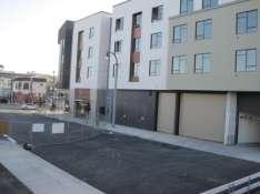
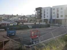
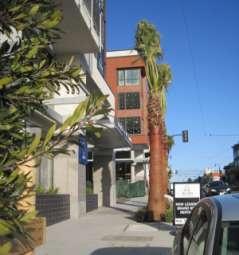
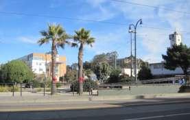
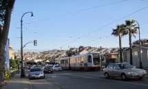
5 Ocean Avenue Today Neighborhood Context Phelan Loop & Public Plaza 5
6 Phelan Loop Relocation Project Objectives Relocate the current Phelan Bus Loop to better accommodate existing loop routes: 49 Mission/Van Ness and 8X Express buses improved bus loop operations Improve customer amenities Facilitate a Transit-Oriented Development (TOD) with multimodal transit surrounded by mixed-use/ affordable housing (up to 72 units of low income housing) and a public open space plaza to revitalize the area Phelan Loop 6
7 Phelan Loop Relocation Project: Scope of Work New Bus Loop New clockwise bus loop behind firehouse New overhead trolley coach system New light poles New boarding islands and sidewalk with shelters New operator restroom New landscaping Firehouse Upgrades New sound wall New window and ventilation system New reconfigured parking area Reconfigure Ocean/Phelan Intersection 8 parking spaces on Phelan Ave near Ocean Ave to be eliminated Phelan Loop 7

8 Phelan Loop Relocation Project Plan Bus Loop Phelan Loop 8
9 Phelan Loop Relocation Project: Operation Impacts There will be little if any effect on MUNI running times or costs in transitioning from the existing loop to the new one. They are operationally equivalent. The new loop will be closer to City College Passenger transfers between the 49/8X and K-line (EB) will be somewhat less convenient. Transfers between the 43 and the 49/8X will be more convenient. Phelan Loop 9

10 Phelan Loop Visualization Phelan Loop 10

11 Phelan Loop Visualization Phelan Loop 11
12 Phelan & Ocean Avenue Reconfiguration Objectives To facilitate bus movements exiting the new Phelan Loop To improve pedestrian safety To improve southbound traffic flow on Phelan Avenue Scope of Work Create 3rd southbound lane on Phelan Move median on Phelan 8 feet west Remove pork-chop islands at NE & NW corners Shorten crossing distance across Phelan Ave. by bulbing out sidewalk corners. Improving traffic signal sight line. Eliminating 4 parking spaces on east side of Phelan. Phelan Loop 12
13 Phelan & Ocean Avenue Reconfiguration Phelan Loop 13
14 Phelan Loop Relocation Project Schedule Phase Start Finish Duration Conceptual Design Fall 2009 Spring Months Detailed Design Winter 2011 Spring Months Bid/ Award Summer 2012 Fall Months Construction Fall 2012 Spring* Months ALL CONSTRUCTION COMPLETE: FALL 2013 *Bus Operations begin in March 2013 Phelan Loop 14
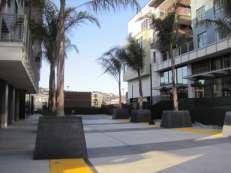
15 Questions? Public Plaza 15
16 Public Plaza Project Project Team San Francisco Municipal Transportation Agency Department of Public Works Office of Economic and Workforce Development San Francisco Planning Department City College of San Francisco Bernal Heights Neighborhood Center and Mercy Housing California Public Plaza 16

17 Context Ingleside Branch Public Library Avalon Bay Development Future Multi-Family Housing Public Plaza Fire Station & Future Phelan Bus Loop City College Phelan Loop & Public Plaza 17

18 Public Plaza Project Description The public plaza project is one of several projects that resulted from a community planning effort to organize and envision Ocean Avenue in the context of the larger Balboa Park Station Area Plan. Balboa Park Station Area Plan, 2008 Public Plaza 18
19 Public Plaza Project Community Planning History 2008: Balboa Park Station Area Plan Drafted 2009: Community Planning for the Multi-Family Housing 2010: Plaza Early Conceptual Design Community Process led by Bernal Heights Neighborhood Center and Mercy Housing California, Public Plaza 19

20 Public Plaza Early Conceptual Design 2010 Public Plaza 20
21 What is the function and character of the Plaza? Neighborhood / Community Gathering Space Front Door to the Mixed-Family Housing Development Gateway to City College Transit Node All of the Above Public Plaza 21


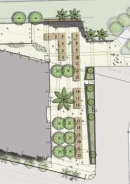
22 Public Plaza Dimensions Phelan Avenue Public Plaza 22
")
 (80 wide )")
 (Plaza")
23 Local Scale Comparisons Balboa Park Set of Four Tennis Courts (120 x 200 ) (Plaza scale) 19 th Avenue Width (at Ocean Ave Intersection) (80 wide ) (Plaza scale) Civic Center UN Plaza Farmer s Market Space (65 x 360 ) (Plaza scale) Public Plaza 23
24 Permitted Uses at Public Plaza Passive Seating / Resting Areas Outdoor Seating for Ground floor Restaurant /Café at Multi- Family Housing Development Performing / Entertainment Space Safe & Inviting connection for People walking to and from City College and the Bus Loop Temporary Vending/Retail Uses as permitted City College Uses for Educational and Informational Purpose Public Plaza 24

25 Public Plaza Site Analysis Public Plaza 25

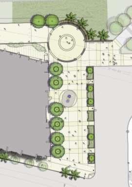
26 Public Plaza Design Concept 1 Public Plaza 26

27 Public Plaza Concept 1 Visualization Design Concept 1 Public Plaza 27
28 Public Plaza Concept 1 Visualization Design Concept 1 Public Plaza 28

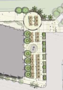
29 Public Plaza Design Concept 2 Public Plaza 29

30 Public Plaza Concept 2 Visualization Design Concept 2 Public Plaza 30 30
31 Public Plaza Concept 2 Visualization Design Concept 2 Public Plaza 31

32 Public Plaza Site Design Concept 3 Public Plaza 32

33 Public Plaza Concept 3 Visualization Design Concept 3 Public Plaza 33
34 Public Plaza Concept 3 Visualization Design Concept 3 Public Plaza 34
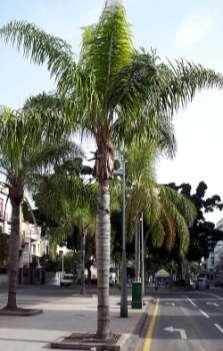

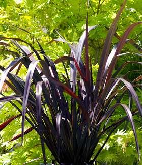


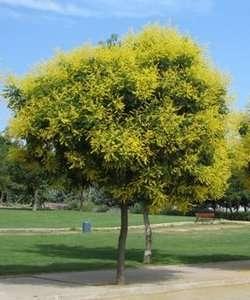
35 Landscaping Plant Palette Deciduous Trees Palm Trees Native Grasses Public Plaza 35


36 Paving Options Unit Pavers Scored Concrete Etched Concrete Custom Design Patterns Colored Concrete Public Plaza 36


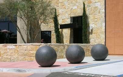
37 Plaza Feature Options Public Art Climbable Structures Ornamental Trees Pavement Art Public Plaza 37
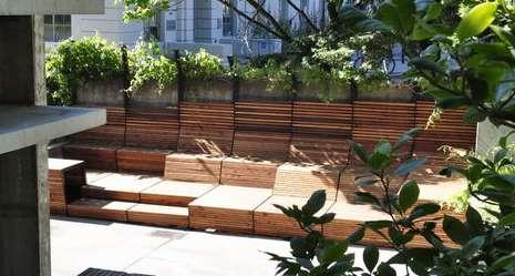
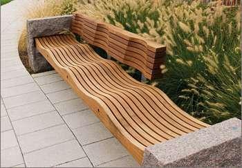
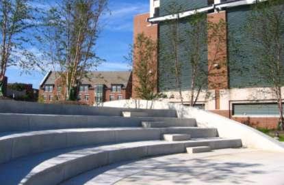


38 Materials: Seating Options Benches Custom Public Plaza 38 38


39 Planter Options Planter Benches Stone Cast-in-place Concrete Corten Steel Public Plaza 39


40 Lighting Options Public Plaza 40 40


41 Metal Gatework & Accessories Low Custom Gates Trellis Structures Tree Grates Site Drainage Public Plaza 41 41

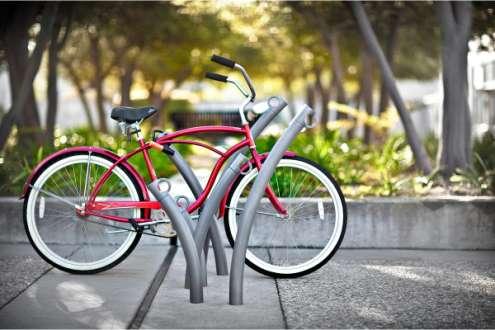

42 Site Furnishings Bollard Lighting Bike Racks Sculptural Bollards Public Plaza 42 42


43 Summary of Design Options Design 1 Design 2 Design 3 Public Plaza 43

44 Multifunctional Plaza: Farmers Market Concept Design 1 Design 2 Design 3 Public Plaza 44
45 Questions? Public Plaza 45

46 Breakout Session Public Plaza 46
47 Public Plaza Project Timeline Baseline Project Schedule Phase Start Finish Duration Conceptual Design Spring 2012 Fall months Design Winter 2012 Summer months Bid/Award Fall 2013 Winter months Construction Summer 2014* Spring months OPENS TO THE PUBLIC: SPRING 2015 *Estimated date of time when Housing Project is almost completed Public Plaza 47
48 Summary and Next Steps Public Plaza 48
Cleveland Park Streetscape and Drainage Improvement Project 1
 Cleveland Park Streetscape and Drainage Improvement Project 1 Urban Context Washington, D.C. Connecticut Avenue Cleveland Park Streetscape and Drainage Improvement Project 2 Neighborhood Context Contributing
Fifth and Detroit Street Design May 2017 Capital Improvements Committee. DOWNTOWN Street Design
 1 Fifth and Detroit Street Design May 2017 Capital Improvements Committee Agenda 2 Review Street Configuration Prior Meeting Review Outreach Synopsis Functional Street Design Refinements Curb Edge, Turning
SOUTH UNIVERSITY Street Design Alternatives in Progress
 1 Alternatives in Progress 2016.01.20 Meeting Agenda 2 1. Progress & Schedule 2. Utilizing the Street Design Manual 3. Site Characteristics and Input Received 4. Street Geometry What can we accomplish
GREENING THE BOULEVARD Master Plan Concepts for Venice Boulevard between Lincoln and Sawtelle
 GREENING THE BOULEVARD Katherine Spitz Associates Inc. 4212½ Glencoe Avenue Marina Del Rey, CA 90292 310 574 4460 Fax 574 4462 January 2008 Table of Contents Overview Proposed Design Improvements Illustration
Though functionally a part of the Ocean Avenue Neighborhood Commercial
 Phelan Loop area, existing conditions Phelan Loop area, with proposed infill development and open space Though functionally a part of the Ocean Avenue Neighborhood Commercial District, the, along the north
SOUTH UNIVERSITY Street Design Setting a Direction for Schematic Design
 1 SOUTH UNIVERSITY Street Design Setting a Direction for Schematic Design Meeting Agenda 2 1. Project Scope 2. Design Direction 3. Design Details 4. Schedule and Construction Logistics 3 SOUTH UNIVERSITY
Dogpatch/22nd Street Greening
 TEAM MEMBERS Prepared for: GreenTrustSF Central Waterfront www.gtsfcw.org Prepared by: Fletcher Studio San Francisco, CA www.fletcherstudio.com Landscape Architecture Urban Design Environmental Planning
BRADENTON RIVERWALK EXPANSION MASTER PLAN
 BRADENTON RIVERWALK EXPANSION MASTER PLAN INTRODUCTION & AGENDA Process Update Community Engagement Summary Center for Active Design (CfAD) Recommendations Context and Existing Conditions Master Plan Alternatives
Maplewood Avenue Downtown Complete Street Project
 Maplewood Avenue Downtown Complete Street Project Second Public Meeting January 24, 2018 Welcome and Introduction of Project Team City Planning and Public Works Staff City of Portsmouth Juliet Walker Planning
PUBLIC RIGHT-OF-WAY IN THIS CHAPTER PUBLIC REALM
 PUBLIC RIGHT-OF-WAY This section provides design guidelines for improvements in the public right-of-way. The public right-of-way refers to streets, sidewalks, non-vehicular thoroughfares, parks and greenways
AvalonBay Communities + BRIDGE Housing. Mission Housing Habitat for Humanity Pacific Union Development Corporation
 AvalonBay Communities + BRIDGE Housing Mission Housing Habitat for Humanity Pacific Union Development Corporation Tonight s Agenda Recap of discussion from last CAC meeting Updates on meetings with Stakeholders
VEHICULAR AND PEDESTRIAN CIRCULATION
 This perspective sketch communicates the intended character and quality of a proposed streetscape design. Locate benches near a major intersection where people tend to gather. Seating and lighting provide
Main Street Reconstruction From Ninth Line to Stouffer Street. Town of Whitchurch-Stouffville. Public Information Centre
 Main Street Reconstruction From Ninth Line to Stouffer Street Town of Whitchurch-Stouffville Public Information Centre November 23, 2016 4:30 to 6:00 pm & 7:00 to 8:00 pm 6240 Main Street, Stouffville
Lambeth Main Street Streetscape Improvements
 Lambeth Main Street Streetscape Improvements Open House October 5th, 2017 Agenda 1. Introduction 2. Project Background 3. Context 4. Project Objectives 5. Design Principles & Approach 6. Streetscape Design
FROM DUPONT CIRCLE NORTH TO CALIFORNIA STREET, NW. Welcome!
 FROM DUPONT CIRCLE NORTH TO CALIFORNIA STREET, NW Welcome! Meeting Agenda 6:00 PM Open House 6:30 PM Presentation 7:00 PM Open House / Q&A at the Boards Project Design Team Connecticut Avenue, NW Project
REPORT TO BOARD ON PREFERENCES tbp/architecture CCSF Facilities Master Plan, October 23, 2016
 PURPOSE The purpose of this report is to update the Board on the Facilities Master Plan initiative. PROCESS The Board conducted a Study Session about Phase 1 Needs on August 18, 2016. Since that time,
Pedestrian and Bike Bridge LOGO
 6.2.2 Pedestrian and Bike Bridge The proposed pedestrian and bike crossing re-envisions the existing bridge at Pismo Creek on Cypress Street. The bridge is currently underutilized by vehicular through
COMPLETE GREEN STREET CHECKLIST
 COMPLETE GREEN STREET CHECKLIST This document was developed to dissect the structure of an urban street and explore opportunities to make our streets more complete while also integrating green street strategies.
DRAFT. 10% Common Open Space
 % OF CHARLOTTE IS CATEGORIZED AS A. LAND USES : Placeholder map displaying location of Place Type GOALS: Accommodate XX% of future growth. Provide a concentration of primarily commercial and civic activity
HOOVER-UNION TRIANGLE
 HOOVER-UNION TRIANGLE TABLE OF CONTENTS INTRODUCTION Who? What? Why? MEETING #1 RECAP [3/25] Presentation Activities Post-it Boards Photos Generated Schemes MEETING #2 RECAP [4/8] Presentation Schematic
Lower Merion Commercial Districts Issues and Characteristics Handbook November 2013
 Lower Merion Commercial Districts Issues and Characteristics Handbook November 2013 DRAFT TOWNSHIP-WIDE VISION: To maintain and enhance commercial areas to complement the surrounding high-quality residential
The open space system should provide connective elements, relate to natural resources, and enhance the suburban character of the landscape..
 The open space system should provide connective elements, relate to natural resources, and enhance the suburban character of the landscape.. Mixed-use and infill development should maintain or enhance
Millbrae TOD #2 Project Analysis
 Millbrae TOD #2 Project Analysis Project Description A Site Development Permit and Conditional Use Permit are proposed to allow for a mixed-use transitoriented development on approximately 9 Acres located
4.9 Mendocino Avenue Corridor Plan Design Guidelines
 4.9 Mendocino Avenue Corridor Plan Design Guidelines The Mendocino Avenue Corridor Plan addresses the area between College Avenue and Steele Lane. Mendocino Avenue is a busy arterial that runs parallel
Johnson Street Bridge Public Realm Update
 Johnson Street Bridge Public Realm Update August 20, 2015 Background Johnson Street Bridge Replacement Project impacts a diverse range of stakeholders In addition to a new bridge, the project also includes
Inner Sunset Streetscape Improvement Project. Operations and Customer Service Committee July 11, 2017
 Inner Sunset Streetscape Improvement Project Operations and Customer Service Committee July 11, 2017 1 Inner Sunset Streetscape Improvement Project Inner Sunset Streetscape Improvement Project sfmta.com/innersunset
Figure Example of out door dining in the public right-of-way.
 Section 2 Core Area Goal 2.2.1 To maintain and enhance the character of existing streets in the Downtown Area. Character Figure 2.2.1 Example of out door dining in the public right-of-way. A. Provide street
Hamilton Road Corridor Streetscape Master Plan. Open House October 4 th, 2017
 Hamilton Road Corridor Streetscape Master Plan Open House October 4 th, 2017 Agenda 1. Introductions Agenda Overview 2. Project Background 3. Existing Conditions 4. Strengths, Weaknesses, Opportunities
PHASE 3-4 PARKS SOUTH PARK AND CHANNEL PARK
 PHASE 3-4 PARKS SOUTH PARK AND CHANNEL PARK Sheet List L1.0 L2.0 L3.0 L4.0 L5.0 L6.0 L7.0 L8.0 L9.0 L10.0 L11.0 L12.0 L13.0 L14.0 L15.0 L16.0 L17.0 L18.0 L19.0 L20.0 L21.0 L22.0 Cover Open Space Context
Design Guidelines for the Route 30 Corridor Master Plan: Subdivision and Land Development Elements
 Design Guidelines for the Route 30 Corridor Master Plan: Subdivision and Land Development Elements East Whiteland Township- Chester County, PA Prepared by: Draft: May 7, 2018 Design Guidelines for the
Roanoke Rapids Streetscape Master Plan. City Council Presentation
 SCHEDULE: Stakeholder Meeting/Kick off November,2016 Master Planning Phase (November March 2017) Public Meeting #1 December 13, 2016 Review Meeting with Key Stakeholders Refine Concepts Based on Input
Chapter 14 Streetscape Improvements
 This chapter presents streetscape design concepts for key streets and gateways in the Downtown Specific Plan area. This chapter is organized as follows: 14 Streetscape Improvements 14.1 Streetscape Treatments
MISSION STREETSCAPE PLAN. Neighborhood Commercial Streets handle continuous activity. Neighborhood Commercial STREET ROW: Main Design Treatments
 Neighborhood Commercial STREET ROW: 64-80 Main Design Treatments CORNER reduce crossing distance for pedestrians, create entrances to a residential area and slow cars down. help widen sidewalk allocating
ANCHOR TO ANCHOR. Rescale the street to create an iconic boulevard.
 ANCHOR TO ANCHOR Rescale the street to create an iconic boulevard. UR NE ER UV GO NE LA OBJECTIVES 1. Maintain appropriate traffic flow and prioritize commercial curb access 2. Mark gateways at the street
RESEDA - WEST VAN NUYS COMMUNITY PLAN
 RESEDA - WEST VAN NUYS COMMUNITY PLAN Executive Summary As part of the initial outreach effort, the Department of City Planning hosted two workshops for the Reseda-West Van Nuys Community Plan Area during
VISION AND GUIDING DESIGN PRINCIPLES
 pleasure point commercial corridor VISION AND GUIDING DESIGN PRINCIPLES Public Draft November 26, 2018 County of Santa Cruz with assistance from MIG CONTENTS PART I: INTRODUCTION AND VISION... 3 Community
Division VI Community Mixed Use (CMU) Architectural Guidelines and Standards
 Architectural Guidelines and Standards") Division VI 18.40.800 Community Mixed Use (CMU) Architectural Guidelines and Standards 18.40.810 Guidelines The goals of the Comprehensive Plan include a focus on pedestrian safety, amenities and aesthetics
Division VI 18.40.800 Community Mixed Use (CMU) Architectural Guidelines and Standards 18.40.810 Guidelines The goals of the Comprehensive Plan include a focus on pedestrian safety, amenities and aesthetics
V. Gateways GATEWAYS / V-1
 V. GATEWAYS / V-1 Many of Chesapeake s gateways are located on highways and call for bold and attractive designs that motorists can understand, appreciate, and enjoy. can also take the form of natural
Commercial Node Plan Devine Street/Jackson Blvd. COLUMBIA, SC
 Commercial Node Plan Devine Street/Jackson Blvd. COLUMBIA, SC 9.17.13 AGENDA 1 Introductions 2 Project Update 3 Concepts 4 Recommendations 5 Next Steps Introductions Project Update Process 5-Phase Process
University of the District of Columbia Van Ness Campus Master Plan Community Open House 3. December 8, 2010
 University of the District of Columbia Van Ness Campus Master Plan Open House 3 December 8, 2010 Introductions Sequence of Work: Campus Master Plan BEGIN: INTRODUCE AND START WORK Project Initiation Team
CAMPUS MASTER PLAN DRAFT PLAN UPDATE JANUARY
 NEW MEXICO HIGHLANDS UNIVERSITY CAMPUS MASTER PLAN DRAFT PLAN UPDATE JANUARY 27 2010 MASTER PLANNING GOALS TO BALANCE THE STRATEGIC GOALS OF THE UNIVERSITY WITH THE PHYSICAL CAMPUS through the assessment
open house 3 CITY OF SALEM Downtown Streetscape Plan
 open house 3 Streetscape concepts CITY OF SALEM Downtown Streetscape Plan analysis concepts we are here refined concepts & document Feb 13th 1 2 3 apr 18th KICKOFF OPEN HOUSE Streetscape Work Group Walking
ROCKTON DOWNTOWN STREETSCAPE MASTER PLAN. Plan Commission Presentation April 10, 2018 Teska Associates Christopher Burke Engineering
 ROCKTON DOWNTOWN STREETSCAPE MASTER PLAN Plan Commission Presentation April 10, 2018 Teska Associates Christopher Burke Engineering AGENDA 1. Project Scope & Schedule 2. Steering Committee & Community
Bow to Bluff Public Realm Plan Design Update
 Bow to Bluff Public Realm Plan Design Update December 017 Great public spaces encourage people to gather, recreate, explore and discover. Introduction The City of Calgary is planning to improve the corridor
CONTEXT + PROGRAM. CONTEXT - Site Photos RIALTO THEATRE STATION DEPOT HOTEL CONGRESS GREYHOUND SITE 4TH AVENUE BROADWAY BOULEVARD
 PROJECT SITE - View facing South - GREYHOUND SITE RIALTO THEATRE HOTEL CONGRESS STATION DEPOT BROADWAY BOULEVARD 4TH AVENUE CONGRESS STREET TOOLE STREET CONTEXT - Site Photos CONTEXT + PROGRAM 6th Avenue
City of Farmington. Downtown Plan. Amendment to the 1998 Master Plan Adopted October 11, 2004
 City of Farmington Amendment to the 1998 Master Plan Adopted October 11, 2004 Introduction Planning Background 1 Scope and Components of the Plan Amendment 2 Concept Introduction 3 Plan Concepts 3 Conceptual
2. reimagine kings way undercroft as a community space
 2. reimagine kings way undercroft as a community space CLARENDON STREET CLARKE STREET QUEENS BRIDGE STREET MORAY STREET CITY ROAD BALSTON STREET BOYD KINGS WAY POWER STREET KAVANAGH WEST GATE FREEWAY Figure
Review of Opportunity Area C Draft Comprehensive Plan and Draft BOS Follow-On Motions. Special Working Group Meeting March 4, 2015
 Review of Opportunity Area C Draft Comprehensive Plan and Draft BOS Follow-On Motions Special Working Group Meeting March 4, 2015 The slides that follow identify where the draft Comprehensive Plan has
TOWN COUNCIL / PLANNING COMMISSION
 Workshop #3 TOWN COUNCIL / PLANNING COMMISSION January 20, 2011 Consultant Team In Attendance Tonight BMS Design Group Nevada City and San Francisco Michael Smiley, AICP, ASLA Partner-in-Charge Nancy L.
WINDSOR GLEN DESIGN GUIDELINES
 WINDSOR GLEN DESIGN GUIDELINES Adopted by Council, 2006 WINDSOR GLEN REDEVELOPMENT DESIGN GUIDELINES August 2006 1.0 Master Plan Organization For this area of the Coquitlam Town Centre, a mix of high,
New Park / Entry Court & Plaza Concept Design
 New Park / Entry Court & Plaza Concept Design The SECC Public realm is proposed to have a focus on health, wellness, and community and that site users will include patrons of the neighbourhood. The block
W O R K S H O P S U M M A R Y
 W O R K S H O P S U M M A R Y Community Workshop #2: Preliminary Design Strategies October 27, 2007 Upper Market Community Workshop Series and Design Plan Page 1 of 13 INTRODUCTION The Upper Market Community
Charles P. Johnson and Associates. Annapolis Landscape Architects
 Charles P. Johnson and Associates Annapolis Landscape Architects AGENDA Introduction Project Limits and Scope Site Analysis Opportunities & Constraints Program Goals Image Boards Design Alternatives Pros
III. PROJECT DESCRIPTION
 III. PROJECT DESCRIPTION LOCATION AND BOUNDARIES The City of Manhattan Beach is located in the South Bay region of Los Angeles County, California, approximately 2 miles south of the Los Angeles International
Technical Advisory Committee
 CULVER DOWNTOWN STREETSCAPE PLAN STREETSCAPE IDEAS REPORT 01.08.2008 Project Team Matt Crall, Transportation and Growth Management Quick Response Program Donna McCormack, City of Culver Darrell Newton,
Figure 3-1: Public Realm Plan
 3 Public Realm Figure 3-1: Public Realm Plan 3.1 Public Realm Concept The public realm concept for the Little Mountain site integrates a clear and accessible movement network with public spaces for social
3.1 community vision. 3.3 required plan elements
 Chapter 3 Community Form 3.1 community vision 3.2 Parks & landscaping concepts 3.3 required plan elements D R A F T 20 Community Form Chapter 3 3.0 Community form 3.1 community vision The Specific Plan
FOUNTAIN SQUARE RENOVATIONS JOINT WARD 1 & 4 PUBLIC MEETING EVANSTON PUBLIC LIBRARY JUNE 7, 2016, 7:00 PM
 FOUNTAIN SQUARE RENOVATIONS JOINT WARD 1 & 4 PUBLIC MEETING EVANSTON PUBLIC LIBRARY JUNE 7, 2016, 7:00 PM PROJECT AREA CLARK STREET SHERMAN AVENUE PROJECT AREA CLARK STREET SHERMAN AVENUE FOUNTAIN SQUARE
CIVIC CENTER PUBLIC REALM PLAN OVERVIEW
 Photo Credit: Blake Marvin. CIVIC CENTER PUBLIC REALM PLAN OVERVIEW WAR MEMORIAL TRUST JULY 13, 2017 CIVIC CENTER PUBLIC REALM PLAN PRESENTATION OVERVIEW 1. Introduction 2. Planning History 3. Design Challenges
Design Guidelines and Standards for Sight Triangles. Sight Triangle MANUAL
 Design Guidelines and Standards for Sight Triangles Sight Triangle MANUAL Table of Contents 1.0 Introduction..............................................7 1.1 Key Terms..............................
Table of Contents. Elm Avenue Improvement Plan City of Waco, Texas. Introduction 1. Existing Context 1 Figure 1 2.
 Table of Contents Introduction 1 Existing Context 1 Figure 1 2 Plan Guidelines 3 Future Urban Form 4 The West-End 4 Main Street 6 The East-End 7 Figure 2 9 Public Improvement Recommendations 7 General
LOMA VISTA ROUND 1 - COMMUNITY WORKSHOP AND OPEN HOUSE SUMMARY
 LOMA VISTA ROUND 1 - COMMUNITY WORKSHOP AND OPEN HOUSE SUMMARY Reagan Elementary School, Clovis, CA May 14, 2014 6:30pm-8:30pm SUMMARY On Wednesday, May 14, 2014, staff from the City of Clovis and PlaceWorks
Lehigh Acres Land Development Regulations Community Planning Project
 Lehigh Acres Land Development Regulations Planning Effort Summary In July, 2010 Commissioner Frank Mann invited the Lehigh Acres community to start discussing how to achieve their recently adopted community
Jewel. Platte. of the. Plattsmouth Main Street Landscape Architecture by HDR
 Jewel of the Platte Plattsmouth Main Street Landscape Architecture by HDR Plattsmouth, Nebraska is a historic community of 6,500 residents located along the west bank of the Missouri River, just south
Carson Street Streetscape Improvements. Request for Proposals
 Carson Street Streetscape Improvements Request for Proposals Complete Design Services for a Landscape/Streetscape Plan for Carson Street (Pioneer Boulevard to Norwalk Boulevard) Submittal Deadline: October
lakeway mixed use tract open space plan
 LEGEND:. UNDISTURBED NATURAL AREA. ENTRY STATEMENT BUILT INTO HILLSIDE. R.O.W. PLANTING (STREET TREES/LIGHTS). HEB ENTRY DRIVE 5. BIO-FILTRATION IN MEDIAN 6. MAIN ENTRY @ MAIN STREET. EXISTING TREES TO
CHAPTER 12 DESIGN GUIDELINES FOR PUBLIC IMPROVEMENTS
 CHAPTER 12 DESIGN GUIDELINES FOR PUBLIC IMPROVEMENTS Introduction This chapter provides design guidelines for public sector improvements in the downtown. This includes streetscape design, as well as the
Community Mixed Use Zone Districts (CMU)
") 18.28.500 Community Mixed Use Zone Districts (CMU) The Community Mixed Use Zone Districts (CMU) are intended to help implement the land use goals and strategies found in the Golden Vision 2030 values,
18.28.500 Community Mixed Use Zone Districts (CMU) The Community Mixed Use Zone Districts (CMU) are intended to help implement the land use goals and strategies found in the Golden Vision 2030 values,
Complete Streets Master Plan for Downtown New Britain CRCOG Transportation Committee Meeting Monday, December 9, 2013
 CRCOG Transportation Committee Meeting Monday, December 9, 2013 Introduction Why the Project was Initiated About Downtown New Britain Master Plan Goals Master Plan Overview Master Plan Study Areas and
Transportation. Strategies for Action
 Transportation A major priority for the Overlake Neighborhood is to develop a multimodal transportation system. To achieve this system, a balance has to be found among travel, circulation and access needs;
TOM ELIOT FISCH/KnappArchitects with. 141 CIVIC DESIGN SUBMITTAL 14 May 2012
 TOM ELIOT FISCH/KnappArchitects with 141 BAY VIEW HUNTERS POINT TIMELINE Corner of Third and Newcomb Opera House Site 1868 1945 1966 1700s 1700-1775 Ohlone tribe occupy tidal wetlands; Spanish missionairies
LELAND & VISITACION PARK COMMUNITY MEETING
 LELAND & VISITACION PARK COMMUNITY MEETING July 16th, 2016 SAN FRANCISCO RECREATION AND PARK GLS LANDSCAPE ARCHITECTURE BAYSIDE DEVELOPMENT LLC MEETING OBJECTIVES 1. FEEDBACK ON LELAND / BAYSHORE CORNER
The Project. In 2013, construction was completed between 100 Street and 102 Street.
 The Project Jasper Avenue New Vision (JANV) is a major catalyst project identified in the Capital City Downtown Plan (2010) between 92 Street and 109 Street, including the streets half a block north and
PROPOSED REDEVELOPMENT OF THE GLEN ABBEY GOLF CLUB. STREETSCAPE DESIGN STUDY (excerpt from the Urban Design Brief) TOWN OF OAKVILLE.
 TOWN OF OAKVILLE.") PROPOSED REDEVELOPMENT OF THE GLEN ABBEY GOLF CLUB STREETSCAPE DESIGN STUDY (excerpt from the Urban Design Brief) TOWN OF OAKVILLE OCTOBER, 2016 for 2.4.2 STREETS Streets are the single largest component
PROPOSED REDEVELOPMENT OF THE GLEN ABBEY GOLF CLUB STREETSCAPE DESIGN STUDY (excerpt from the Urban Design Brief) TOWN OF OAKVILLE OCTOBER, 2016 for 2.4.2 STREETS Streets are the single largest component
GROUND LEVEL ENLARGEMENT / STREETSCAPE AT PIER AVENUE STRAND & PIER HOTEL HERMOSA BEACH HARDSCAPE MATERIAL KEY MAP PIER AVENUE
 COMPOSITE LANDSCAPE LOT B ( MAX SPACES) WILSHIRE BLVD, SUITE 0 BEVERLY HILLS, CA 0 TH STREET WILSHIRE BLVD, SUITE 0 BEVERLY HILLS, CA 0 BRYANT STREET, SUITE 00 SAN FRANCISCO, CA 0 S. FIGUEROA ST. TH FLOOR
Reconfiguration of The Six Points Interchange. Community Update #2 June 18, 2014
 Reconfiguration of The Six Points Interchange Community Update #2 June 18, 2014 Outline 1. Project overview 2. How did we get here? 3. Etobicoke Centre 4. Existing and future road network 5. Design Update
NOVEMBER 2016 AARP IN ST. LOUIS & CITIZENS FOR MODERN TRANSIT PLACEMAKING STRATEGIES FOR ST. LOUIS TRANSIT DRAFT
 NOVEMBER 2016 AARP IN ST. LOUIS & CITIZENS FOR MODERN TRANSIT PLACEMAKING STRATEGIES FOR ST. LOUIS TRANSIT DRAFT SECTION 3 RECOMMENDATIONS AARP IN ST. LOUIS + CMT + ARCTURIS + THE INNIS GROUP 37 SECTION
Civic Center District
 Civic Center District The Civic Center district is the civic and social heart of Warrenville, containing such public buildings as the City Hall, Warrenville Public Library, Police Station, Park District
Streets Vision
 streets 86 2.9 Vision : The Most Prevalent and Important Public Spaces Fixed routes of human travel have served as corridors for commerce and places for human interaction from the earliest trails and foot
THE NEIGHBORHOOD TODAY
 THE NEIGHBORHOOD TODAY CORE AREA VISION How are we Good Urbanism A Site s DNA thinking about Elements of great Unique elements urban communities embedded in a place the site and design? ELEMENTS LIKE:
STREETSCAPE IMPROVEMENTS - RECOMMENDATIONS
 STREETSCAPE IMPROVEMENTS - RECOMMENDATIONS Figure 4.3.1- A map of all of the recommended streetscape improvements. The key component of downtown s public realm, apart from its public spaces, is its street
SAN FRANCISCO MUNICIPAL TRANSPORTATION AGENCY
 THIS PRINT COVERS CALENDAR ITEM NO. : 10.3 DIVISION: Sustainable Streets BRIEF DESCRIPTION: SAN FRANCISCO MUNICIPAL TRANSPORTATION AGENCY Approving the removal of Municipal Railway bus zones at various
Standards (R-3) Figure B-11: R-3 Residential Standards Exhibit
 Figure B-11: R-3 Residential Standards Exhibit") Avila Ranch Avila Ranch Specific Plan Development Standards High Medium Density - High Residential Density Residential Lot and Building Lot and Standards Building (R-3) Standards (R-3) EXAMPLES These sketches
Avila Ranch Avila Ranch Specific Plan Development Standards High Medium Density - High Residential Density Residential Lot and Building Lot and Standards Building (R-3) Standards (R-3) EXAMPLES These sketches
Public input has been an important part of the plan development process.
 Lakewood s Comprehensive Plan recognizes that transportation helps shape the community, and that the way the community provides for the safe and efficient movement of people affects the character of the
SPRINGHILL LAKE TRANSIT VILLAGE
 Greenbelt Metro Area Sector Plan - Subarea Design Policies and Guidelines - Springhill Lake Transit Village 113 SPRINGHILL LAKE TRANSIT VILLAGE Residential Neighborhood and Village Center CONCEPT Springhill
Program Schedule, Budget and Scope
 Sewer System Improvement Program + Program Schedule, Budget and Scope Mission & Valencia Green Gateway Presentation: July 9, 2013 San Francisco Public Utilities Commission Mission & Valencia Green Gateway
Project Status. Construction is underway for Phase 3. Overall Project Area and Schedule. Schedule of Current Construction Phases.
 I-95 Avenue Interchange Project Status Construction is underway for Phase 3. Overall Project Area and Schedule Phase 0: Completed 2010 Section GR0: Completed in Fallin 2010 Phase 2: Completed Section GR2:
More than 30 adults and 19 children were involved in these community workshops.
 Linwood Workshops held at Household of Faith Deliverance Church 3.29.08 and 4.05.08 What is a Design Workshop? We use the term workshop (often called charrette among design professionals) to describe a
FANSHAWE PARK ROAD/RICHMOND STREET INTERSECTION IMPROVEMENTS. PUBLIC INFORMATION CENTRE 2 June 16, 2016
 FANSHAWE PARK ROAD/RICHMOND STREET INTERSECTION IMPROVEMENTS Municipal Class Environmental Assessment PUBLIC INFORMATION CENTRE 2 June 16, 2016 ACCESSIBILITY Under the Accessibility Standards 2015 for
Landscape and Streetscape Design 2.5
 Landscape and Streetscape Design 2.5 2.5.1 Goals 2.5.2 Planting 2.5.3 Sidewalks and Pavement 2.5.4 Furnishings 2.5.5 Walls 2.5.6 Lighting 2.5.7 Stormwater 2.5.8 Street Cross Sections 2.5 LANDSCAPE AND
Status Report: MD 355 Project
 Status Report: MD 355 Project OCTOBER 2006 M-NCPPC MONTGOMERY COUNTY PLANNING DEPARTMENT Summary of Community Comments, and break to the Results of the MD 355 Participation Session Brookside Gardens -
Official Community Plan Bylaw No. 4360, 2004, Amendment Bylaw No. 4897, 2016 (Sewell s Landing)
") District of West Vancouver Official Community Plan Bylaw No. 4360, 2004, Amendment Bylaw No. 4897, 2016 (Sewell s Landing) Effective Date: 1089612v1 District of West Vancouver Official Community Plan Bylaw
District of West Vancouver Official Community Plan Bylaw No. 4360, 2004, Amendment Bylaw No. 4897, 2016 (Sewell s Landing) Effective Date: 1089612v1 District of West Vancouver Official Community Plan Bylaw
PART TWO: PROJECT SPECIFIC DESIGN GUIDELINES
 PART TWO: PROJECT SPECIFIC DESIGN GUIDELINES 2.1.0 GENERAL REQUIREMENTS: 1. Approved warm season turf varieties shall be used for LMD/CFD, commercial, industrial, and public landscape areas. The use of
REBUILD GUTTER AND ROLLED CURB TO MATCH EXISTING DETAIL. (TYPICAL) REPAIR EXISTING BENCH FINISH. RETURN TO EXISTING LOCATIONS.
 REPAIR EXISTING BENCH FINISH. RETURN TO EXISTING LOCATIONS.") MILL STREET REBUILD GUTTER AND ROLLED CURB TO MATCH EXISTING DETAIL. CURB RAMP FLUSH WITH STREET. REMOVE TWO PARKING SPACES FOR BIKE RACKS AND WASTE RECEPTACLES OVER CONCRETE SURFACE. REMOVE ONE PARKING
MILL STREET REBUILD GUTTER AND ROLLED CURB TO MATCH EXISTING DETAIL. CURB RAMP FLUSH WITH STREET. REMOVE TWO PARKING SPACES FOR BIKE RACKS AND WASTE RECEPTACLES OVER CONCRETE SURFACE. REMOVE ONE PARKING
lot flankage Y street 16m 6m landscape strip for large site 3m landscape strip for small medium site
 Commercial General Commercial Objectives Create developments compatible with adjacent land uses in scale, function and character Define a consistent and attractive street edge with quality landscaping,
DRAFT. October Wheaton. Design Guidelines
 October 2011 DRAFT Wheaton Design Guidelines 2 Draft - Design Guidelines - Wheaton Sector Plan Contents 04 Section 1: Introduction 06 Section 2: Context 08 Section 3: Design Guidelines 09 Goal 1: Create
REDLANDS TRANSIT VILLAGES SPECIFIC PLAN
 REDLANDS TRANSIT VILLAGES SPECIFIC PLAN CITY COUNCIL STUDY SESSION JANUARY 4, 2019 Redlands Blvd. Eureka St. Orange St. State St. Citrus Ave. Vine St. GENERAL PLAN TRANSIT VILLAGES WE ARE HERE SPECIFIC
UNION STUDIO Greater Kennedy Plaza!
 April May 2013 UNION STUDIO Greater Kennedy Plaza! It s time: Providence s civic plaza and transit hub is re-imagined as a vibrant urban gathering place 1 Kennedy Plaza Reborn THE TEAM Client: The City
Courthouse Square Planning & Urban Design Study. Courthouse Square Working Group #13 October 15, 2014
 Courthouse Square Planning & Urban Design Study Courthouse Square Working Group #13 October 15, 2014 1 Courthouse Square Process Working Group Community Courthouse Square Advisory Groups & Civic Associations
CITY OF BOYNTON BEACH SE 1 ST STREET COMPLETE STREETS IMPROVEMENTS
 CITY OF BOYNTON BEACH SE 1 ST STREET COMPLETE STREETS IMPROVEMENTS N Project Location -Town Square -Villages at Ocean SE 1st St, between E Woolbright Rd and SE 2nd Ave Project Location -Boynton One -Publix