MAY 2012 CITY OF ST. LOUIS PARK, MINNESOTA SAINT LOUIS PARK BELTLINE AREA FRAMEWORK & DESIGN GUIDELINES
|
|
|
- Dylan Carr
- 6 years ago
- Views:
Transcription

1 30YEARS SAIN LOUIS PARK BELLINE AREA FRAMEWORK & DESIGN GUIDELINES CIY OF S. LOUIS PARK, MINNESOA MAY 2012
2 ACKNOWLEDGEMENS MAYOR AND CIY COUNCIL: FOR FURHER INFORMAION CONAC: BELLINE ADVISORY COMMIEE: PLANNING AND DESIGN CONSULANS: 30YEARS 123 North hird Street Suite 100 Minneapolis, MN P: (612) F: (612) website: Greg Ingraham Jeff McMenimen Jeff Miller PAGE II
3 CREDIS PHOOGRAPHS USED HROUGHOU HIS DOCUMEN ARE COPYRIGHED BY HE FOLLOWING INDIVIDUALS, ORGANIZAIONS, OR PRIVAE FIRMS: Metropolitan Design Center, University of Minnesota SWA Group Design Workshop PBIC Image Library Project for Public Spaces Kevin Perry, Bureau of Environmental Services, City of Portland Atelier Dreiseitl Waterscapes PAGE III
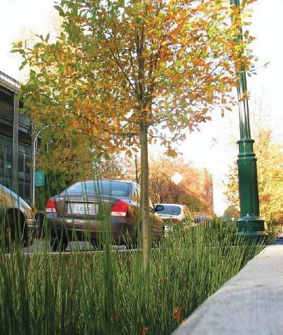
4 PAGE IV ABLE OF CONENS EXECUIVE SUMMARY SECION II: DESIGN GUIDELINES SECION I: FRAMEWORK Chapter 1: Beltline Area oday A. Evolution of Beltline Area B. Existing Character C. Southwest LR Planning Chapter 2: Vision, Guiding Principles & Development Patterns A. Vision B. Guiding Principles C. Land Uses & Buildings Patterns D. Connectivity & Access Patterns Chapter 3: Beltline Character Districts A. Beltline Boulevard ransit Street B. Beltline/Nordic Ware Business Park C. Bass Lake Preserve Pocket Neighborhood D. CSAH 25 South Wedge E. riangle Neighborhood Chapter 4: Public Systems & Spaces Design Guidelines A. Streets 1. Street Network & Design 2. Sidewalks 3. Walk/Bike Crossings 4. On-Street Bikeways 5. Bus Facilities 6. raffic Calming 7. Lighting 8. Street Plantings 9. Street Furnishings 10. Community Identity/Public Art B. ransit Station 1. ransit-oriented Development 2. Walk/Bike Accessibility 3. Bus/Shuttle Accessibility 4. Safety, Security and Comfort 5. Community Identity/Public Art C. Walk/Bike Network 1. Local Network 2. Cedar Lake Regional rail D. Open Space, Parks and Plazas 1. Parks and Open Spaces 2. Plazas E. Public Parking F. Signage G. Stormwater Management H. Utilities

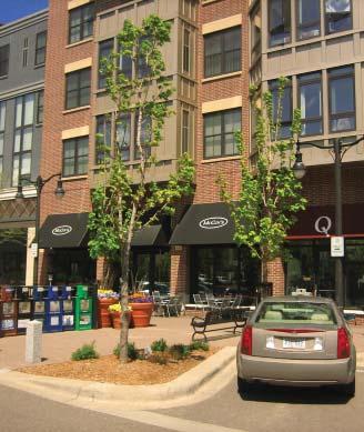
5 Chapter 5: Private Development Design Guidelines A. Site Development 1. Building Placement and Setbacks 2. Landscaping 3. Stormwater Management 4. Walk/Bike Connections B. Buildings 1. Uses 2. Height and Massing 3. Form and Façade 4. Roofs 5. Exterior Building Materials 6. Entries 7. Green Design C. Private Off-Street Parking D. Service, Delivery & Storage Areas E. Lighting F. Signage GLOSSARY PAGE V
 property just south of and largely")
6 EXECUIVE SUMMARY PAGE 1 EXECUIVE SUMMARY he proposed Southwest LR line connecting Minneapolis to St. Louis Park, Hopkins, Minnetonka and Eden Prairie will travel in the existing railroad corridor located on Hennepin County Regional Railroad Authority (HCRRA) property just south of and largely parallel to CSAH 25/ H 7. Current LR plans show the future Beltline ransit Station being located just southeast of the intersection of Beltline Boulevard and CSAH 25. he Beltline Station study area is generally defined as the area between H 100 (west), Excelsior Boulevard/CSAH 3 (south), France Ave (east), and Minnetonka Boulevard/CSAH 5 (north). he Beltline Station study area encompasses three defined neighborhoods within St. Louis Park: Wolfe Park, riangle and Minikahda Oaks. he purpose of the Beltline Area Framework & Design Guidelines is to provide a guide to help shape future changes in the Beltline area. In light of the future addition of a Beltline ransit Station, the Beltline area will continue to evolve with other infrastructure changes, redevelopment and reinvestment. he Framework describes the future vision for the Beltline area and the Design Guidelines provide recommendations for the design of future public and private investment in the Beltline area. he Framework envisions the Beltline area as a transitoriented community hub for jobs, neighborhoods, and recreation. he future Beltline area will have a unique and well-defined sense of identity with strong connections to both local and regional destinations. New development and redevelopment will enhance and reinforce the Beltline area s role as a regional employment center surrounded by desirable neighborhoods and a wealth of parks and open spaces. his future vision is supported and reinforced by 10 guiding principles, which are: 1. Create a unique sense of identity for the Beltline area 2. Weave together the distinct Beltline districts 3. Increase street connectivity and mobility 4. Assure superior walking and biking accessibility 5. Foster the Beltline area as a growing regional employment center 6. Capture the value of transit 7. Promote transit-oriented development 8. Create a connected network of great public spaces 9. Advocate for a convenient, safe and pleasant transit station center 10. Manage parking effectively he Framework also describes the preferred development pattern for the Beltline area, including land uses, development form, connectivity/access, mix of distinct Beltline character districts, and Beltline s overall area identity. he Design Guidelines provide design guidance for future private development and public systems/spaces in the Beltline area. he private development design guidelines address site development, buildings, parking, service/ delivery/storage areas, signage, and lighting within the Beltline Area. he public systems/spaces design guidelines address the development of all future above ground, visible elements of the public environment including street and roadway

7 design, sidewalks and trails, public gathering spaces, public transit and parking facilities, storm water management and utility structures. he Framework and Design Guidelines are advisory and are intended to complement the City s policies and regulations. Priority Action Plan R ecommended initial action step to implement the Framework for the Beltline area are: 1. Pursue rezoning of employment-oriented areas to the Business Park (BP) zoning designation and address the land use designation and zoning for mixed-use areas. 2. Prepare a detailed bicycle and pedestrian connectivity plan for the Beltline area. 3. Begin planning, funding and concept design work for the redesign of CSAH 25 (east of Beltline/Ottawa) from a divided highway to an urban street. Work with Hennepin County to get the project in its work plan as a priority project for planning, design and funding. 4. Use the Beltline Design Guidelines with Metropolitan Council and Hennepin County during the upcoming Southwest LR ransitional Station Area Action Plan and Preliminary Engineering processes to help shape the Beltline area LR design. 5. Prepare a feasibility analysis of key Beltline area transportation projects - new street connections (e.g. northsouth, Park Glen Road, Raleigh, 32nd Street), the Beltline/ Ottawa and CSAH 25 intersection, the LR line/railroad and Beltline/Cedar Lake rail intersection and the CSAH 25,east of Beltline/Ottawa, urban street design. 6. Consider creating a transit station area overlay zoning district for the Beltline transit station area. 7. Conduct a detailed redevelopment study of areas adjacent to CSAH 25 in conjunction with the redesign of the roadway. Existing patterns of the Beltline area EXECUIVE SUMMARY PAGE 2

8
9 FRAMEWORK

10 Figure 1.1: Planned Southwest LR route and stations FRAMEWORK - BELLINE AREA ODAY PAGE 5
Corridor Vision. 1Pursue Minnehaha-Hiawatha Community Works Project. Mission of Hennepin County Community Works Program
 1Pursue Minnehaha-Hiawatha Community Works Project Minnehaha-Hiawatha Community Works is a project within the Hennepin Community Works (HCW) program. The mission of the HCW program is to enhance how the
Comprehensive Plan Advisory Panel Meeting #3
 Comprehensive Plan Advisory Panel Meeting #3 November 7, 2016 Agenda 1. September 19 th Meeting Notes 2. Summary of Focus Areas Charrette 3. Heart of the City Focus Area a. HOC2/Station Areas Concept &
Midtown Greenway Land Use and Development Plan Executive Summary
 Midtown Greenway Land Use and Development Plan Executive Summary Introduction The Midtown Greenway Land Use and Development Plan sets policy direction for land use and development in the Midtown Greenway
The University District envisions, in its neighborhood
 Envisioning the University District Link Light Rail in Seattle s neighborhoods CIY OF SEALE CONCEP-LEVEL SAION AREA PLANNING RECOMMENDAION RESOLUION # 30165 EXHIBI L Vision 08.2000 he University District
The transportation system in a community is an
 7 TRANSPORTATION The transportation system in a community is an important factor contributing to the quality of life of the residents. Without a sound transportation system to bring both goods and patrons
Corridor Background. Defining the Corridor Study Area. Lake Street. 38th Street. 46th Street
 1 Corridor Background Defining the Corridor Study Area Minnehaha Avenue (CSAH 48) and Hiawatha Avenue (MN 55) are parallel diagonal roadways, approximately three blocks apart, that provide two direct arterial
St. Louis Park Wooddale LRT Station Site development guidelines
 St. Louis Park Wooddale LRT Station Site development guidelines November 2013 OVERVIEW St. Louis Park s convenient location as a neighbor to Minneapolis means you re only minutes away from some of the
Transportation Committee
 Transportation Committee Business Item No. 2013-286SW Meeting date: October 14, 2013 For the Metropolitan Council meeting of October 16, 2013 Subject: Southwest Light Rail Transit (Green Line Extension):
Chapter 1: Introduction
 Chapter 1: Introduction The Penn Avenue Community Works Corridor Vision and Implementation Framework presents an integrated communitybased vision and a coordinated, long-term implementation framework for
Preliminary Recommendations Tk Takoma/Langley Crossroads Sector Plan
 Preliminary Recommendations Tk Takoma/Langley Crossroads Sector Plan Vision is to achieve a Transit Oriented, pedestrian friendly Community that Celebrates and builds upon the cultural Diversity of the
Implementation Guide Comprehensive Plan City of Allen
 Implementation Guide 2030 Comprehensive Plan City of Allen DRAFT 2015 Implementation Guide Allen 2030 Comprehensive Plan INTRODUCTION The Comprehensive Plan serves as a guide for the growth and development
Chapter 2: Vision, Goals and Strategies
 Chapter 2: Vision, Goals and Lake Elmo Today & Tomorrow Comprehensive Plan 2040 2 VISION, GOALS & STRATEGIES - DRAFT 4-6-2018 INTRODUCTION Comprehensive Plan Purpose Perhapse the most important objective
Hopkins. Development Guidelines May Overview. Sponsored by: Blake Road Corridor Collaborative City of Hopkins
 Hopkins Blake Road LRT Station Area Development Guidelines May 2015 Sponsored by: Blake Road Corridor Collaborative City of Hopkins Overview Hopkins is a dynamic community of over 17,000 residents located
4 Park Planning and Design
 4 Park Planning and Design Park Constellations Elliot Gateway/Mills Loring North Loop Commons Twins Minneapolis Park & Recreation Board Downtown Service Area Master Plan 4-1 PROJECT APPROACH REFERENCE
Introduction. Chapter 1. Purpose of the Comprehensive Plan Plan Organization Planning Process & Community Input 1-1
 Chapter 1 Introduction Lakewood 2025: Moving Forward Together Purpose of the Comprehensive Plan Plan Organization Planning Process & Community Input 1-1 Purpose of the Comprehensive Plan The Comprehensive
PLAN ELEMENTS WORKSHOP. April 5, 2016
 PLAN ELEMENTS WORKSHOP April 5, 2016 needs more housing. But there is no one-size fits-all solution. Every neighborhood has its own character. In some places, density is not only appropriate it is badly
1.0 VISION STATEMENT. December 6, PRINCIPLES
 Vision Statement Lincoln Regional Airport 1.0 VISION STATEMENT 1.1 City LOCATION of AND OVERVIEW The Easton Lincoln Place Land Use Master Plan identifies the principles, goals, policies, and standards
BeltLine Corridor Environmental Study
 BeltLine Corridor Environmental Study Citywide Conversation on Transit and Trails April 2, 2009 Agenda & Introductions Introductions Environmental Study Process Overview of the BeltLine Project BeltLine
ELMVALE ACRES SHOPPING CENTRE MASTER PLAN
 ELMVALE ACRES SHOPPING CENTRE MASTER PLAN Contents 1.0 INTRODUCTION... 2 2.0 LOCATION... 2 3.0 EXISTING CONTEXT... 2 4.0 VISION & GUIDING PRINCIPLES... 2 5.0 LAND USE AND BUILT FORM... 4 5.1 St. Laurent
#27. Timing: Short term. Costs: $$
 Land Use & Physical Resources PROJECT #27 Mobility S t u d y a n d i m p l e m e n t H i a w a t h a A v e n u e / M N 5 5 traffic signal improvements Environment & Natural Resources Economic Development
Lower Merion Commercial Districts Issues and Characteristics Handbook November 2013
 Lower Merion Commercial Districts Issues and Characteristics Handbook November 2013 DRAFT TOWNSHIP-WIDE VISION: To maintain and enhance commercial areas to complement the surrounding high-quality residential
Lehigh Acres Land Development Regulations Community Planning Project
 Lehigh Acres Land Development Regulations Planning Effort Summary In July, 2010 Commissioner Frank Mann invited the Lehigh Acres community to start discussing how to achieve their recently adopted community
CHAPTER 1. Ms. Guajardo s Class - Central Elementary CH 1 1
 INTRODUCTION CHAPTER 1 Ms. Guajardo s Class - Central Elementary CH 1 1 1.1 SETTING South Centre City is a linear corridor south of Downtown Escondido paralleling Centre City Parkway and South Escondido
Table of Contents. Elm Avenue Improvement Plan City of Waco, Texas. Introduction 1. Existing Context 1 Figure 1 2.
 Table of Contents Introduction 1 Existing Context 1 Figure 1 2 Plan Guidelines 3 Future Urban Form 4 The West-End 4 Main Street 6 The East-End 7 Figure 2 9 Public Improvement Recommendations 7 General
CHAPTER 7: VISION AND ACTION STATEMENTS. Noble 2025 Vision Statement
 CHAPTER 7: VISION AND ACTION STATEMENTS This chapter presents the vision, policy and action statements that transform the comprehensive planning study, an analysis of Noble s past, future trends and community
Southwest Light Rail Transit (LRT) A corridor of opportunity
 A corridor of opportunity") Southwest Light Rail Transit (LRT) A corridor of opportunity Minneapolis Jobs: 151,200 Suburban Jobs: 72,400 Downtown Minneapolis 147,000 emp.* West Calhoun 4,200 emp. Beltline Business Park 6,000 emp.
Southwest Light Rail Transit (LRT) A corridor of opportunity Minneapolis Jobs: 151,200 Suburban Jobs: 72,400 Downtown Minneapolis 147,000 emp.* West Calhoun 4,200 emp. Beltline Business Park 6,000 emp.
A larger version of this map is located on the last page of this PDF.
 MAP Committee Input McLoughlin Area Draft Vision Map A larger version of this map is located on the last page of this PDF. 1. The map above is intended to portray a vision for the McLoughlin area. It highlights
Blue Line LRT Extension
 v e Noble Pkwy Noble Pkwy Xerxes Ave N Shingle Creek Penn Ave N Penn Ave N Fremont Ave N Lyndale Ave N S Washington Ave University Ave NE Blue Line LRT Extension LIGHT RAIL PLATFORM AND STATION DESIGN
Missing Link Study Grand Rounds Parkway Planning and Design Introduction
 Missing Link Study Grand Rounds Parkway Planning and Design Introduction June 19, 2007 Minneapolis Park and Recreation Board HNTB Hoisington Koegler Group Inc. Hess Roise 1 The Missing Link Study The Minneapolis
Corridors. Re-vitalize our Corridors and Gateways
 Corridors Re-vitalize our Corridors and Gateways Artist s rendering from the 287 Strategic Plan, 2015 Corridors are the major throughways of Loveland but they also provide important commercial, community
Hockessin Community Redevelopment Plan
 Hockessin Community Redevelopment Plan 3.1 Introduction The Community Redevelopment Plan for the Village of Hockessin is the result of the people s vision for a distinct village center that serves as the
2040 LUP is a part of the Comprehensive Plan and carries the same legal authority. Economic Challenges
 1.1. Guiding Anchorage s Growth Where will new residents settle over the next two decades? Where will people work, shop, and play? Will there be enough room to grow? How will Anchorage look? Will growth
Independence Boulevard Area Plan Planning Committee Public Comment May 18, 2010
 Independence Boulevard Area Plan Planning Committee Public Comment May 18, 2010 Presentation Outline Focus on Key Recommendations within Draft Plan Plan Purpose and Development Process Draft Plan Policies
Seneca Meadows. Block 4 Locate office, technology, and medical development adjacent to I Screen views of garage structures from I-270.
 Seneca Meadows Seneca Meadows has an industrial park in its southern end and a mixed-use employment area planned for the north end. The district benefits from extensive I-270 visibility, stream valley
Plano Tomorrow Vision and Policies
 Plano Tomorrow Vision and Policies PLANO TOMORROW PILLARS The Built Environment The Social Environment The Natural Environment The Economic Environment Land Use and Urban Design Transportation Housing
BROOKHILL NEIGHBORHOOD MODEL ZONING MAP AMENDMENT PREFACE TO APPLICATION
 BROOKHILL NEIGHBORHOOD MODEL ZONING MAP AMENDMENT PREFACE TO APPLICATION June 15, 2015 Revised: August 1, 2016 I. VISION Brookhill is a proposed community based upon the principles of Albemarle County
V. Vision and Guiding Principles
 V. Vision and Guiding Principles The Master Plan for the Powers Ferry Corridor seeks a foundation in the desires of the community. At times, various elements of the community offered opposing viewpoints,
CHARLES PUTMAN CHARLES PUTMAN AND ASSOCIATES, INC
 MEMORANDUM CHARLES PUTMAN & ASSOCIATES, INC. LAND DEVELOPMENT CONSULTANTS PLANNING ZONING PERMITTING 4722 NW Boca Raton Boulevard, Suite C-106 Boca Raton, Florida 33431 Phone: 561/994-6411 FAX: 561/994-0447
CITY OF CHARLOTTESVILLE, VIRGINIA CITY COUNCIL AGENDA
 CITY OF CHARLOTTESVILLE, VIRGINIA CITY COUNCIL AGENDA Agenda Date: December 16, 2013 Action Required: Adoption of Resolution Presenter: Staff Contacts: Title: James E. Tolbert, AICP, Director of NDS James
Status Report: MD 355 Project
 Status Report: MD 355 Project OCTOBER 2006 M-NCPPC MONTGOMERY COUNTY PLANNING DEPARTMENT Summary of Community Comments, and break to the Results of the MD 355 Participation Session Brookside Gardens -
Executive Summary. NY 7 / NY 2 Corridor
 Executive Summary NY 7 / NY 2 Corridor Transportation and Land Use Study December 2005 Prepared for: Town of Colonie Capital District Transportation Committee Prepared by: Introduction: Land use decisions
Mark-up of the effect of the proposed Bronte Village Growth Area OPA No.18 on the text of section 24, Bronte Village, of the Livable Oakville Plan
 Mark-up of the effect of the proposed Bronte Village Growth Area OPA No.18 on the text of section 24, Bronte Village, of the Livable Oakville Plan Notes: This document is provided for information purposes
TOWN COUNCIL / PLANNING COMMISSION
 Workshop #3 TOWN COUNCIL / PLANNING COMMISSION January 20, 2011 Consultant Team In Attendance Tonight BMS Design Group Nevada City and San Francisco Michael Smiley, AICP, ASLA Partner-in-Charge Nancy L.
THEMES, VISION, + PRINCIPLES
 CHAPTER 2: THEMES, VISION, + PRINCIPLES This page intentionally left blank. 20 VISION DRAFT AUGUST 2018 2 2 THEMES, VISION, + GUIDING PRINCIPLES The Key Themes, Vision, and Guiding Principles presented
Kenilworth Station Art and Landscape Committee (KSALC) June 25, 2015
 June 25, 2015") Kenilworth Station Art and Landscape Committee (KSALC) June 25, 2015 1 Today s Topics Welcome and Introductions Appoint Committee Co-Chairs Summary of Community Workshop #1 Kenilworth Channel Bridge Design
Kenilworth Station Art and Landscape Committee (KSALC) June 25, 2015 1 Today s Topics Welcome and Introductions Appoint Committee Co-Chairs Summary of Community Workshop #1 Kenilworth Channel Bridge Design
Tyvola & Archdale Transit Station Area Plan. June 5, 2008
 Tyvola & Archdale Transit Station Area Plan Second Public Meeting June 5, 2008 Presentation Outline 1. Purpose and Process 2. Station Area Overview 3. Plan Recommendations 4. Comments Received and Proposed
Tyvola & Archdale Transit Station Area Plan. May 15, 2008
 Tyvola & Archdale Transit Station Area Plan First Public Meeting May 15, 2008 Presentation Outline 1. Purpose and Process 2. Station Area Overview 3. Plan Recommendations Vision Land Use Transportation
Status Update (2006 vs. Now) Citizen s Advisory Committee February Plan for Prosperity
 Citizen s Advisory Committee February Plan for Prosperity") Status Update (2006 vs. Now) Citizen s Advisory Committee February 2018 Plan for Prosperity 2000 2017 2000 2017 Gardnerville Population 6,000 5,760 5746 5,500 5,000 5,067 5,550 5,165 5,394 5,412 5,250
Status Update (2006 vs. Now) Citizen s Advisory Committee February 2018 Plan for Prosperity 2000 2017 2000 2017 Gardnerville Population 6,000 5,760 5746 5,500 5,000 5,067 5,550 5,165 5,394 5,412 5,250
Community Open House March 26 th, 2018
 Community Open House March 26 th, 2018 Open House Agenda 1. Overview of Planning Process What we heard 2. Future Land Use Policy 3. Priority Growth Areas 4. Plan Elements Making it happen What is a Comprehensive
North Fair Oaks Community Plan Summary and Information
 North Fair Oaks Community Plan Summary and Information WHAT IS THE NORTH FAIR OAKS COMMUNITY PLAN? The North Fair Oaks Community Plan is part of the San Mateo County General Plan, and establishes policies
DOMINION BOULEVARD CORRIDOR STUDY AND ECONOMIC DEVELOPMENT STRATEGIC PLAN A MODEL FOR CHESAPEAKE S FUTURE
 DOMINION BOULEVARD CORRIDOR STUDY AND ECONOMIC DEVELOPMENT STRATEGIC PLAN A MODEL FOR CHESAPEAKE S FUTURE Overview I. Draft Plan Process II. Draft Plan Overview a. Market Analysis b. Master Land Use Plan
City of Nogales General Plan
 Open Space, Parks, Recreation and Trails City of Nogales General Plan Residents of Nogales place a high priority in the development of a comprehensive system of open space, parks, recreation and trails
Infrastructure Engineering Planning Construction Suite 300 Minneapolis, MN Tel: Fax:
 Infrastructure Engineering Planning Construction 701 Xenia Avenue outh uite 300 Minneapolis, MN 55416 Tel: 763-541-4800 Fax: 763-541-1700 Memorandum To: Minnehaha Creek Watershed District Board From: Tony
URBAN DESIGN BRIEF URBAN DESIGN BRIEF 721 FRANKLIN BLVD, CAMBRIDGE August 2018
 URBAN DESIGN BRIEF URBAN DESIGN BRIEF 721 FRANKLIN BLVD, CAMBRIDGE August 2018 DESIGN BRIEF CONTENTS PART A 1.0 INTRODUCTION 2.0 DESCRIPTION & ANALYSIS OF SITE CONTEXT 3.0 DESIGN CONSTRAINTS AND OPPORTUNITIES
DRAFT Civic Center Station Area Plan. Executive Summary
 DRAFT Civic Center Station Area Plan Executive Summary This project is funded in part through the Metropolitan Transportation Commission s Station Area Planning Program. The preparation of this report
Integrating Land Use and Transportation
 FEATURE Integrating Land Use and Transportation For years the transportation profession has emphasized mobility in the development of plans, programs, and projects. This emphasis on mobility moving people
INDEPENDENCE BOULEVARD AREA PLAN. Economic Development Committee Overview May 25, 2010
 INDEPENDENCE BOULEVARD AREA PLAN Economic Development Committee Overview May 25, 2010 Presentation Outline Plan Purpose and Development Process Draft Plan Policies and Implementation Strategies Request
Preliminary Plan Framework: Vision and Goals
 Preliminary Plan Framework: Vision and Goals Draft: May 2015 Introduction Since the Town of Milliken s comprehensive plan was last updated in 2010, the community was heavily impacted by the 2013 flood,
MINNEHAHA. Hiawatha. Strategic. Framework. Community Works. Investment
 Strategic Investment Framework MINNEHAHA Hiawatha Community Works A partnership and unity between County, City, Neighborhoods and Community Project Partners Hennepin County City of Minneapolis Neighborhood
TOD 101 CREATING LIVABLE COMMUNITIES WITH TRANSIT
 1 CREATING LIVABLE COMMUNITIES WITH TRANSIT What are transit Centered Communities? Benefits of Partnerships to Support and Implement What You Will Learn Portland s Pearl District Your Trainers Today Catherine
CHAPTER 7: Transportation, Mobility and Circulation
 AGLE AREA COMMUNITY Plan CHAPTER 7 CHAPTER 7: Transportation, Mobility and Circulation Transportation, Mobility and Circulation The purpose of the Transportation, Mobility and Circulation Chapter is to
Making TOD Work in the Heart of Suburban Sprawl
 Making TOD Work in the Heart of Suburban Sprawl Rocky Mountain Land Use Institute March 6, 2009 Speakers Ben Herman, FAICP, Principal Clarion Associates Darcie White, AICP, Principal Clarion Associates
Chapter 1.0 Introduction
 Chapter 1.0 Introduction 1.1 Background The North Metro commuter rail line is part of the RTD FasTracks regional transit system expansion program to build more than 100 miles of rail transit throughout
ROBBINSDALE LRT STATION CDI DEVELOPMENT GUIDELINES
 August 2018 OVERVIEW The City of Robbinsdale has a prime-opportunity site in the middle of the 13 mile stretch of the Bottineau LRT corridor / Blue Line extension. Robbinsdale offers a prominent, vital,
DRAFT ROOSEVELT ROAD. District Recommendations. Figure 5.23 The Roosevelt Road Corridor
 CHAPTER 5 Figure 5.23 The Road Corridor Road will develop as a mixed-use corridor, emphasizing regional retail, west of the river and mixed-use development east of the river. KEY RECOMMENDATIONS 1. High
FUTURE LAND USE ELEMENT
 FUTURE LAND USE ELEMENT GOAL I: To create and sustain a great place to live, play, and prosper Objective 1: The City of Ocala shall incorporate the principles and strategies of the Ocala 2035 Vision into
Welcome to the Oakridge Centre Open House
 Welcome to the Oakridge Centre Open House Why is the City hosting this event? This open house is to inform you of a rezoning application submitted to the City of Vancouver to amend the existing CD-1 (Comprehensive
Wheaton CBD & Vicinity Sector Plan D E S I G N G U I D E L I N E S
 Wheaton CBD & Vicinity Sector Plan D E S I G N G U I D E L I N E S 1 a b s t r a c t This document contains the design guidelines the property owners, community members, and planners should use to implement
CHAPTER 3 VISION, GOALS, & PLANNING PRINCIPLES. City of Greensburg Comprehensive Plan. Introduction. Vision Statement. Growth Management Goals.
 CHAPTER 3 VISION, GOALS, & PLANNING PRINCIPLES Introduction The Greensburg Comprehensive Plan is intended as a working community document. A combination of long and short-term goals, this document is intended
Commercial Node Plan Devine Street/Jackson Blvd. COLUMBIA, SC
 Commercial Node Plan Devine Street/Jackson Blvd. COLUMBIA, SC 9.17.13 AGENDA 1 Introductions 2 Project Update 3 Concepts 4 Recommendations 5 Next Steps Introductions Project Update Process 5-Phase Process
Illustration of Eastlake Farmer s Cooperative Grain Elevator. Chapter 5: implementation 5-1
 Illustration of Eastlake Farmer s Cooperative Grain Elevator Chapter 5: implementation 5-1 chapter 5: implementation Introduction The Eastlake Subarea Plan includes a wide range of recommendations intended
Planning Charlotte s Future. Planning Committee June 21, 2016
 Planning Charlotte s Future Planning Committee June 21, 2016 Charlotte s Vision Livable city Vibrant economy Thriving natural environment Diverse population Choices for housing, education, employment Safe
Preserve existing neighborhoods and yet, at the same time broaden housing choice,
 Chapter IV. 2030 Land Use Plan Section A of this Chapter includes a brief summary and analysis of existing land use in the city. It provides the historical context for previous development patterns and
Sub Area 2: Downtown Overland Park
 Downtown 132 2.12 encompasses over 600 acres and extends between 71st Street and 87 th Street including Downtown Overland Park. The area is home to several individual historic sites and structures, including
Potential Green Infrastructure Strategies May 6, 2015 Workshop
 Potential Green Infrastructure Strategies May 6, 2015 Workshop Background The City of Cortland is developing the Tioughnioga Urban Headwaters Green Infrastructure Action Plan with funding from the National
Wadsworth Boulevard S TAT I O N A R E A P L A N
 Wadsworth Boulevard S TAT I O N A R E A P L A N City of Lakewood Adopted November, 2006 The Vision The City of Lakewood s overall vision is to transform the area around the light rail station into a mixed-use
NORTH LAKE SPECIFIC PLAN AREA
 NORTH LAKE SPECIFIC PLAN AREA June 21, 2018 WELCOME Workshop Agenda Introduction Provide information about the program and introduce the team Background Information Share information about the North Lake
Welcome. Walk Around. Talk to Us. Write Down Your Comments
 Welcome This is an information meeting introducing the applications for proposed redevelopment of the Yorkdale Shopping Centre site at 3401 Dufferin Street and 1 Yorkdale Road over the next 20+ years,
Grand Rounds History
 Grand Rounds History 1883 Plan for Minneapolis Park System prepared by Landscape Architect Horace W. S. Cleveland. The system of connecting parks and parkways was first called the Grand Rounds by William
Mississippi Skyway Preliminary Engineering Report
 EXECUTIVE SUMMARY Mississippi Skyway Preliminary Engineering Report CITY OF RAMSEY, MINNESOTA DECEMBER 2014 City of RAMSEY EXECUTIVE SUMMARY Project Need and Intent The Mississippi Skyway pedestrian bridge
Cobb County Design Guidelines Mableton Parkway & Veterans Memorial Highway Community Design Workshop January 12, 2017
 Community Design Workshop January 12, 2017 Agenda Opening Remarks / Introductions Scope of Work Existing Conditions Key Issues / Opportunities VPS Summary Draft Vision & Goal Statement Implementation Concepts
Transportation. Strategies for Action
 Transportation A major priority for the Overlake Neighborhood is to develop a multimodal transportation system. To achieve this system, a balance has to be found among travel, circulation and access needs;
Mendota-Lebanon Hills Greenway Master Plan Executive Summary. August draft for more information visit
 Mendota-Lebanon Hills Greenway Master Plan Executive Summary August 2013 draft for more information visit www.hkgi.com/projects/dakota INTRODUCTION The Mendota-Lebanon Hills Greenway Master Plan portrays
Tonight s Agenda. 7:45 p.m. Next Steps 8:00 p.m. Close
 Community Workshop #3 January 28, 2016 Team Tonight s Agenda 6:00 p.m. Welcome and Introductions! 6:15 p.m. Draft Specific Plan Overview Project Process Update Vision and Objectives Overview Key Findings
Sheridan Boulevard S TAT I O N A R E A P L A N S H E R I D A N B O U L E VA R D S TAT I O N A R E A P L A N
 Sheridan Boulevard S TAT I O N A R E A P L A N 1 City of Lakewood Adopted November, 2006 S H E R I D A N B O U L E VA R D S TAT I O N A R E A P L A N The Vision The City of Lakewood s overall vision is
Atlanta BeltLine Corridor Environmental Study. Scoping Meeting August 2008
 Atlanta BeltLine Corridor Environmental Study Scoping Meeting August 2008 What Will We Be Discussing Today? Study Overview - How Did We Get Here? - What Is the Study About? - Who Is Involved? - Where Is
The Five Components of the McLoughlin Area Plan
 The Five Components of the McLoughlin Area Plan This documents contains the complete language of the five components of the McLoughlin Area Plan: The Vision Statement The Values The Guiding Principles
WELCOME and introduction
 1 WELCOME and introduction Mobility Hub Locations within Burlington STUDY OVERVIEW STUDY OBJECTIVES The City of Burlington is developing four Area Specific Plans, one for each of Burlington s Mobility
Por favor, levanten la mano si necesita traduccion en espanol Please raise your hand if you need Spanish translation
 FEDERAL BOULEVARD CORRIDOR WIDE STUDY PUBLIC MEETING #1 APRIL 27, 2016 Por favor, levanten la mano si necesita traduccion en espanol Please raise your hand if you need Spanish translation HDR DESIGN WORKSHOP
Regency Developments. Urban Design Brief. Holyrood DC2 Rezoning
 Regency Developments Urban Design Brief Holyrood DC2 Rezoning Stantec Consulting Ltd. 7-31-2017 1. Overview Regency Developments intends to rezone the lands located at 8510 and 8511 93 Avenue, within the
SECTION II SECTION II STATEMENT OF GOALS, OBJECTIVES, PRINCIPLES, ASSUMPTIONS, POLICIES AND STANDARDS
 STATEMENT OF GOALS, OBJECTIVES, PRINCIPLES, ASSUMPTIONS, POLICIES AND STANDARDS 1 2 STATEMENT OF GOALS, OBJECTIVES, PRINCIPLES, ASSUMPTIONS, POLICIES AND STANDARDS INTRODUCTION The New Jersey Municipal
Public Consultation Summary: Lakeview Place Making Workshop January 30, 2008.
 Page 1 of 11 Public Consultation Summary: Lakeview Place Making Workshop January 30, 2008. 1.0 Introduction: On January 30, 2008 the City of Mississauga, in conjunction with the consulting team of Brook
, C-MS I June 3, 2016 $1500 pd chk #216918
 , C-MS-8 LOTS 21 THROUGH 40, INCLUSIVE, BLOCK 299 CLEMENTS ADDITION TO THE CITY OF DENVER SOUTHEAST QUARTER OF SECTION 34, TOWNSHIP 3 SOUTH, RANGE 68 WEST, SIXTH PRINCIPAL MERIDIAN, CITY
AGINCOURT SECONDARY PLAN
 1 AGINCOURT SECONDARY PLAN 1. AGINCOURT SECONDARY PLAN The following policies and principles apply to the area herein referred to as Agincourt, as outlined on Map 1-1. 1. GENERAL POLICIES 1.1 This Secondary
GUIDELINES EXHIBITION PLACE LOCATION: OBJECTIVES. Structure Plan URBAN DESIGN GUIDELINES
 Development in the Exhibition Place lands will be consistent with the following urban design guidelines. They provide a framework for new development of the lands and are to be read in conjunction with
Joint Public Hearing. Preliminary Subregion 5 Master Plan and Proposed Sectional Map Amendment
 Preliminary Subregion 5 Master Plan and Proposed Sectional Map Amendment Joint Public Hearing April 11, 2013 Council Hearing Room Upper Marlboro 7:00 pm His Lordship s Kindness (Clinton) Presentation Overview
NEC of Central Avenue and Indian School Road
 NEC of Central Avenue and Indian School Road For this location, there are two applicable plans that provide guidance on development. The two plans include the Indian School Specific Plan (1991) and the
DRAFT City of Titusville 2040 Comprehensive Plan Future Land Use, Housing, and Transportation Elements April 16, 2018
 DRAFT City of Titusville 2040 Comprehensive Plan Future Land Use, Housing, and Transportation Elements April 16, 2018 Prepared by Canin Associates for the City of Titusville About the Comprehensive Plan:
Be it enacted by the Town Board of the Town of Guilderland that the following new A (Transit Oriented Development (TOD) District) is adopted:
 District) is adopted:") Local Law No. 4 of 2018 (Adoption of 280-18A (Transit Oriented Development District) Be it enacted by the Town Board of the Town of Guilderland that the following new 280-18A (Transit Oriented Development
Local Law No. 4 of 2018 (Adoption of 280-18A (Transit Oriented Development District) Be it enacted by the Town Board of the Town of Guilderland that the following new 280-18A (Transit Oriented Development
Plan Framework Report. Attachment A
 Plan Framework Report Attachment A Uptown-Douglas Corridor Plan - Plan Framework Report Contents Introduction... 1 Planning Process... 3 Project Objectives... 4 Vision... 5 Community Values... 6 Structural