I-84 Hartford Project Open Planning Studio #12. April 25, 2017
|
|
|
- Grant Goodman
- 6 years ago
- Views:
Transcription

1 I-84 Hartford Project Open Planning Studio #12 April 25, 2017
2 Meeting Agenda 1. I-84 Hartford Project alternatives update 2. Multimodal station area planning 3. I-84 / I-91 Interchange Study coordination

3 I-84/I-91 INTERCHANGE STUDY Images from the OPS Photos taken by team I-84 Hartford Project Alternatives Update

4 Alternatives Screening Scoping Current Status Reasonable Range of Alternatives
5 Project Cost Estimates September 2015 Based on conceptual ideas Risk workshop Early 2017 Design of Alt s progressed Risk workshop Cost range for Lowered Highway is unchanged
6 On-going Work Continue to refine the Lowered Highway Alternative East end interchange options Stage construction scenarios Multimodal station planning Environmental documentation process


7 Environmental Review Process On-going technical analysis Draft EIS out for public review, Summer 2018 Public Hearing, end of 2018 Final EIS, Summer 2019 Record of Decision, Fall 2019

8 I-84/I-91 INTERCHANGE STUDY Images from the OPS Photos taken by team Next Steps Multimodal Station Area Planning

9 Railroad Corridor - Proposed Existing Griffin Line Union Station

10 Multimodal Station Study Area
 Status Data collection is ongoing Visioning / programming exercise is")
11 Hartford Multimodal Station Planning and Design Kicked off in January month effort Define program Develop site layout alternatives Identify preferred site layout Prepare conceptual design plans (15%) Status Data collection is ongoing Visioning / programming exercise is starting

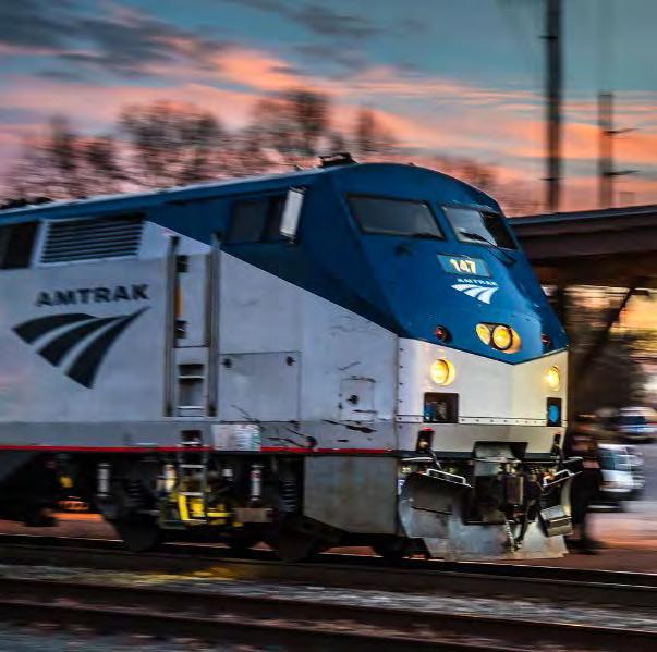
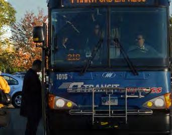
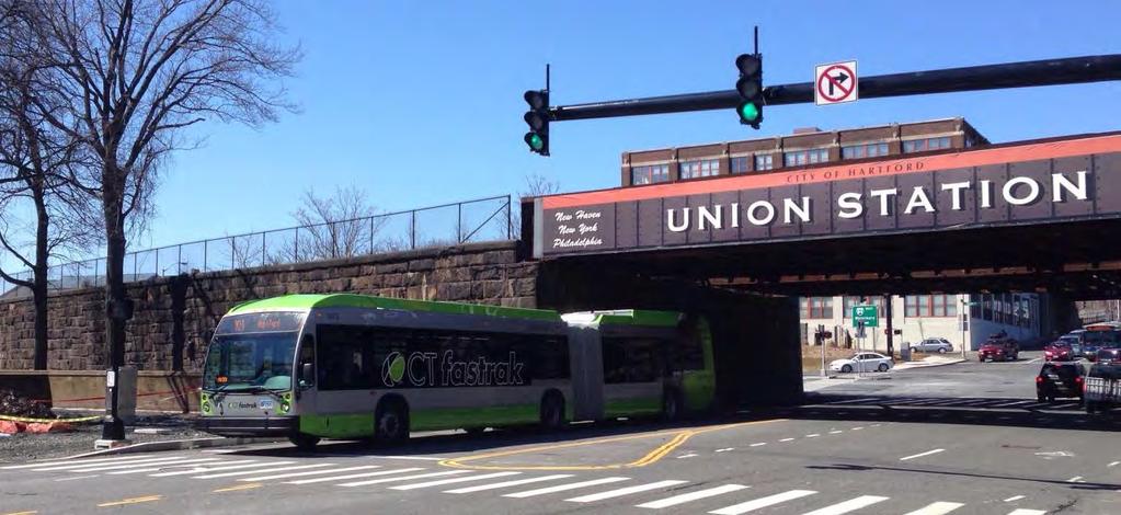
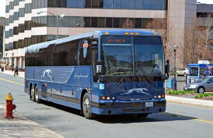

12 Different Modes and Users

13 Programming the Hartford Multimodal Station Six-step process 1. Establish goals and objectives 2. Research station design requirements 3. Gather / verify relevant information 4. Identify strategies, constraints, and opportunities 5. Determine quantitative requirements 6. Summarize the program
14 Gather / Verify Relevant Information What is the passenger load for each mode? What is transit equipment load / need? What are the customer service requirements? What are back-of-house needs? What amenities will be provided? What codes will drive programming decisions? What are access issues?
 *Source= NEC")
15 Known Program Elements Projected ridership* Express rail (297,200 annual riders) Corridor rail (1,032,600 annual riders) Regional rail (46,800 annual riders) Platform size Two platforms planned 1,000 long, 24 wide, 4 above top of rail Parking displacement 197 spaces in Union Station Spruce Street lot Other parking impacts from I-84 Hartford Project (3,675-4,390 spaces) *Source= NEC FEIS

16 Known Program Elements Zoning New form based code allows for mixed use development Downtown districts - DT-2 / DT-3 Main street districts - MS-1 / MS-2 Commercial industrial mix districts - CX-1


17 Known Program Elements Union Station National Register of Historic Places

18 Transit Oriented Development Opportunities What are the best ways to encourage development? Retail Restaurants Residential Office Lodging / hotels


19 Participate In Our Workshop! View preliminary concepts Take the survey Tell us your design goals and priorities
 Transit operations discussion (October) 15% architectural drawings")
20 Next Steps Complete programming data gathering Conceptual site alternatives Preferred site concept (September) Transit operations discussion (October) 15% architectural drawings (December)
21 Multimodal Station Planning CTDOT I-84 Hartford Project Team Multimodal Station Planning City City Planning Capital Gateway Consultants (HOK, PB) Stakeholders PAC TTC Public

22 I-84 / I-91 Interchange Study
23 Background Constructed in the 1960s; modified in the late 1980s Serves 275,000 vehicles per day Physical and environmental constraints
24 Interchange Deficiencies Highway bottleneck Ramp capacity Interchange spacing Windsor N West Hartford Hartford East Hartford Legend: Two through lanes Three through lanes
25


26 Study Approach What is the vision for Hartford and East Hartford? Improved quality of life Enjoyment of the riverfront Recaptured land Development opportunities New public spaces Job creation
27 Study Approach Transportation alternatives that could serve the vision: Regional and local systems Highway, bus, and rail transport Intermodal and non-motorized options
28 Process / Schedule Estimated 18-month duration Three preliminary alternatives Screening Remaining alternatives advanced to conceptual design
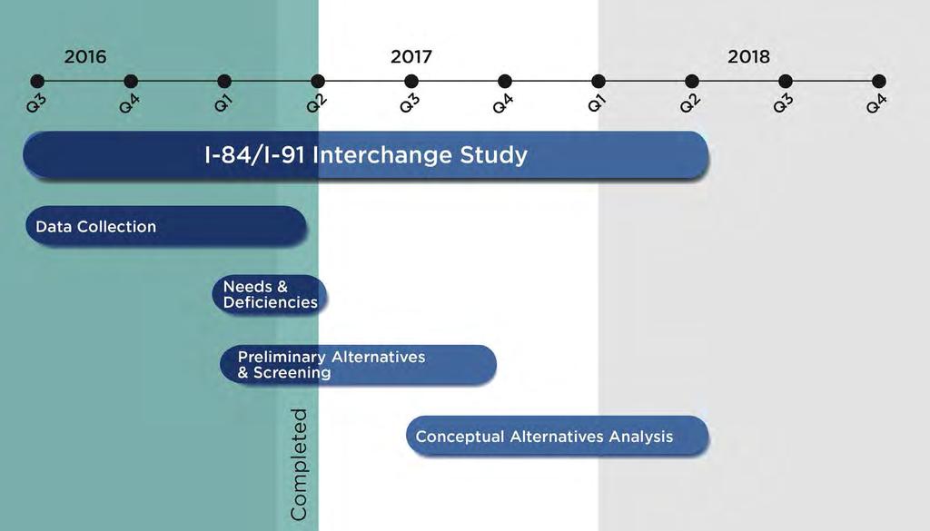
29 Process
 ~875 acres NWI Connecticut and Hockanum")
30 Wetlands: CT Soils / National Wetlands Inventory (NWI) Study area: ~570 acres inland wetland soils / 390 acres hydric soils (CT DEEP) ~875 acres NWI Connecticut and Hockanum Rivers
31 Wetlands: CT Soils / National Wetlands Inventory (NWI) Study area: ~570 acres inland wetland soils / 390 acres hydric soils (CT DEEP) ~875 acres NWI Connecticut and Hockanum Rivers
32 Flood Prone Areas Study area: ~1,200 acres in 100-year flood zone ~2,230 acres in 500-year flood zone; most protected by levee Connecticut and Hockanum Rivers

33 Flood Prone Areas Study area: ~1,200 acres in 100-year flood zone ~2,230 acres in 500-year flood zone; most protected by levee Connecticut and Hockanum Rivers
34 Potential EJ Population Minority: ~81% of population Southwest of Downtown and East Hartford Low income: ~ 48% of population Southwest of Downtown

35 Potential EJ Population Minority: ~81% of population Southwest of Downtown and East Hartford Low income: ~ 48% of population Southwest of Downtown
36 Study Screening Criteria Each of the preliminary alternatives will be evaluated based on: Environmental impacts Socio and economic impacts and benefits Feasibility Mobility Cost
37 NEPA / CEPA Requirements NEPA EIS / CEPA EIE Required Potential significant impacts and permitting requirements Interchange project has independent utility Interchange project has its own Purpose and Need Dual NEPA / CEPA document and process


38 Expanding Opportunities in the Hartford Region by Rethinking the Transportation Network Connecticut Department of Transportation


39 A Vision for the Future: Reshaping the Region s Core Rethink transportation systems to solve regional problems and unlock Hartford and East Hartford s potential Achieve city and regional goals for near and long-term growth Spur economic development, reinvestment, jobs, and improved quality of life Reconnect Hartford and East Hartford to the river and to each other Support new public transit and new public spaces
40 Current Condition: A Constrained and Fragmented Core The existing highway network is a constraint on downtown growth The network fragments the commercial and civic core and limits each district s potential


41 Challenges of Existing Infrastructure I-84 VIADUCT Aging infrastructure dividing the downtown core I-84 DOWNTOWN Barrier to economic growth 84/91 INTERCHANGE Congestion generator at city gateway I-91, RAIL CORRIDOR, AND FLOOD CONTROL Barriers between downtown and the river I-84 EAST HARTFORD Highway infrastructure takes valuable land


42 Previous Concept: I-291 Bypass (not implemented) Potential bypass to reduce the size of I-84 through Hartford Only 5-10% of trips would have been taken out of city center Opposed during planning and ultimately shelved I-291 Bypass I-84 Hartford Project
43 Highway Scenarios Currently Being Considered Options for I-84 and I-91

44 Existing Network I-84 Hartford Project is ongoing I-84 through downtown fragments the city s core I-91, the rail line, and the flood wall create a barrier between the city and river I-84 Hartford Project Existing I-91

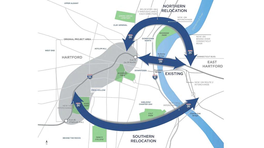
45 Scenario #1: I-84 South Tunnel and I-91 Capping A new I-84 South Tunnel is shown as a southern bypass between Flatbush Ave. and the Charter Oak Bridge I-91 is capped in key locations between the Charter Oak Bridge and Riverside Park I-91 Capping I-84 Hartford Project I-84 South Tunnel
46 Scenario #2: I-84 North Alignment and I-91 Capping A new I-84 North Alignment is shown that relocates the 84/91 interchange out of the city center New bridge over the CT River I-91 is capped in key locations I-84 North Alignment I-91 Capping I-84 Hartford Project
47 Combined scenarios Conceptual level of work to date Additional analysis needed to determine feasibility of options or combination of options I-84 North Alignment I-91 Capping I-84 Hartford Project I-84 South Tunnel
48 Reimagining the Riverfront For Hartford and East Hartford
49 Combined scenarios Conceptual level of work to date Additional analysis needed to determine feasibility of options or combination of options

50 Removing the I-91 barrier creates a new riverfront park New Connecticut River Esplanade Hartford s reconnection to the water Creates an overall network with East Hartford Links destinations and creates recreation loops Connecticut River Esplanade iquilt Expanded East Hartford Riverfront Parks Coltsville National Historical Park

51 Current Potential view

52 Potential view Colt Armory redeveloped Public transit Existing flood wall elevation Connecticut River Esplanade Transit-oriented development Connecticut River

53 Riverfront: Existing Replace with update Downtown Hartford I-91 elevated barrier Rail/ Flood Wall Connecticut River
 Connecticut")
54 Riverfront: Potential Downtown Hartford Rail I-91 Flood Wall under cap (+ Connecticut River Esplanade) Connecticut River
55 Promoting Economic Development In Hartford and East Hartford
56 Combined scenarios
57 Economic development tied to the green network Growth in Hartford could potentially occur to the north, west, and south Growth in East Hartford could occur north and south of CT Blvd. with a mix of uses taking advantage of the waterfront Growth to North: DoNo and Upper Albany Growth to South: Colt and Charter Oak Growth in East Hartford Potential Brainard Airport Redevelopment

58 Existing transportation network limits the city s potential Downtown East Hartford

59 Transformed riverfront catalyzes development on both sides Downtown New Riverfront Boulevard with below East Hartford
60 Potential redevelopment sites A high-level analysis of sites shows potential areas for city growth and revitalization Other areas may be possible Current uses, ownership, market demand and development economics will be critical factors

61 Potential redevelopment sites Approximately 150 acres of development or redevelopment potential 70 acres 50 acres 30 acres
62 Integrating Public Transit Making connections east/west and north/south
63 Combined scenarios CTfastrak has exceeded ridership goals and expansion to the east is ongoing Existing CTfastrak
64 The public transit network can be further enhanced Enhanced public transit could occur north/south along a new riverfront, tying together key destinations and residential areas Potential BRT/LRT Expanded CTfastrak Existing CTfastrak
65 Current view

66 Potential view Colt Building Convention Center Connecticut River Esplanade Connecticut River Boulevard CT River
67 Key Transformations In Hartford and East Hartford

68 Key Transformations CONNECTICUT RIVER ESPLANADE World-class waterfront I-84 HARTFORD PROJECT Reconnecting a divided downtown BULKELEY BOULEVARD A new Main Street between Htfd and E. Htfd 84/91 INTERCHANGE Easing congestion by relocating it to the north Downtown Hartford + opportunity for prime waterfront development Riverfront park with rail passing through landscape raised to meet future flood line

69 Tangible Results for East Hartford A transformed transportation network to free up valuable land for growth A transformed riverfront to expand the amenities of Great River Park and catalyze development Approximately 50 acres of development in the form of new construction or redevelopment along Connecticut Blvd and the Business Park Significant job creation Reconnecting to Downtown Hartford and creating economic and recreational synergies

70 Tangible Results for Hartford A transformed transportation network to support urban growth, not constrain it A transformed riverfront as the centerpiece of a thriving Capitol city Approximately 100 acres of development in the form of new construction or redevelopment Significant job creation 45 acres of new green space in the form of a new Connecticut River Esplanade


71 Participate In Our Workshop! Tell us your vision for transportation in the greater Hartford region Share your ideas for how big, or small, this project should be Discuss which impacts and opportunities most interest you
72 Thank You! Thank you for your time. We appreciate your commitment to helping us reach the best possible solution for the State of Connecticut, the Capitol Region, and the City of Hartford. -Your I-84 Hartford Project Team
LEGEND. Existing Transit Services in Project Area. I-84 / I-91 INTERCHANGE STUDY I-84 / I-91 Transit Map. Connecticut Department of Transportation
 I-84 / I-91 INTERCHANGE STUDY Basemap 91 Je Alb nn ing sr d Ea st Ha r t for d H ar tfor d H a r t fo r d r t fo r d We s t H a. 5 a ny Av e. FD Oat es Ave. Pa r k. Ave 44 44 A sy lum Av e. Bulkeley Bridge
Atlanta BeltLine Corridor Environmental Study. Scoping Meeting August 2008
 Atlanta BeltLine Corridor Environmental Study Scoping Meeting August 2008 What Will We Be Discussing Today? Study Overview - How Did We Get Here? - What Is the Study About? - Who Is Involved? - Where Is
PD&E STUDY SR 9/I-95 FROM SOUTH OF SR 870/COMMERCIAL BOULEVARD TO NORTH OF CYPRESS CREEK ROAD FM # ETDM 14222
 PD&E STUDY SR 870/COMMERCIAL BOULEVARD TO NORTH OF CYPRESS CREEK ROAD FM # 435808-1-22-02 ETDM 14222 WELCOME TO THE KICK-OFF MEETING May 24, 2016 1 1 2 3 4 5 6 PLANNING PROJECT DEVELOPMENT AND ENVIRONMENT
CAPITAL GATEWAY CONCEPT PLAN
 CAPITAL GATEWAY CONCEPT PLAN Purpose & Goals of the Concept Plan The Purpose: Develop an urban design strategy Identify recommended infrastructure design elements The Goal: Maximize short- and long-term
Southern Gateway Project and Public Green
 Southern Gateway Project and Public Green Transportation and Trinity River Project Committee May 23, 2016 Purpose of Presentation Provide the history and an overview of the Southern Gateway Project (SGP)
Railyard Alternatives and I-280 Boulevard Feasibility Study. MTA Board Meeting May 6, 2014
 Railyard Alternatives and I-280 Boulevard Feasibility Study MTA Board Meeting May 6, 2014 Planned Infrastructure Major pieces of new infrastructure are planned including: Downtown Rail Extension (DTX)
I-84 HARTFORD PROJECT HARTFORD, CONNECTICUT DRAFT PURPOSE AND NEED STATEMENT
 I-84 HARTFORD PROJECT HARTFORD, CONNECTICUT DRAFT PURPOSE AND NEED STATEMENT October 2016 I. PROJECT BACKGROUND AND HISTORY The City of Hartford is the capital of Connecticut, and the largest employment
BeltLine Corridor Environmental Study
 BeltLine Corridor Environmental Study Citywide Conversation on Transit and Trails April 2, 2009 Agenda & Introductions Introductions Environmental Study Process Overview of the BeltLine Project BeltLine
TOWN COUNCIL / PLANNING COMMISSION
 Workshop #3 TOWN COUNCIL / PLANNING COMMISSION January 20, 2011 Consultant Team In Attendance Tonight BMS Design Group Nevada City and San Francisco Michael Smiley, AICP, ASLA Partner-in-Charge Nancy L.
BeltLine Corridor Environmental Study
 BeltLine Corridor Environmental Study Joint TAC and SAC Meeting December 8, 2008 What We Will Discuss Today Outreach and Agency Coordination Scoping Results Existing Conditions Historical and Archeological
REVIEW AND EVALUATION OF REGIONAL LAND USE
 REVIEW AND EVALUATION OF REGIONAL LAND USE AND TRANSPORTATION SCENARIOS #220831 Environmental Justice Task Force October 7, 2014 VISION 2050 Process Development of Guiding Vision for Land Use and Transportation
Shift Rapid Transit Public Participation Meeting May 3, 2017
 Shift Rapid Transit Public Participation Meeting May 3, 2017 Shift Rapid Transit Initiative Largest infrastructure project in the city s history. Rapid Transit initiative will transform London s public
Northwest Rail Corridor and US 36 BRT Development Oriented Transit Analysis 4.4 STATION AREA FINDINGS
 4.4 STATION AREA FINDINGS Each station is different, and each one requires a separate set of recommendations based on the vision for the site. This section outlines an initial TOD strategy and recommendations
PROJECT BACKGROUND. Preliminary Design Scope and Tasks
 PROJECT BACKGROUND Preliminary Design Scope and Tasks The purpose of this Study is the development of preliminary designs for intersection improvements for Trunk Highway (TH) 36 at the intersections of
NORTH CLAYMONT AREA MASTER PLAN COMMUNITY WORKSHOP #1 FEBRUARY 3, 2016
 NORTH CLAYMONT AREA MASTER PLAN COMMUNITY WORKSHOP #1 FEBRUARY 3, 2016 1. Introduction To the team and to the Plan Planning Partners The Claymont Community WILMAPCO New Castle County Claymont Renaissance
Memorandum CITY OF DALLAS
 Memorandum DATE September 23, 2016 CITY OF DALLAS TO The Honorable Members of the Transportation and Trinity River Project Committee: Lee M. Kleinman (Chair), Deputy Mayor Pro Tem Erik Wilson (Vice-Chair),
RESOLUTION NO. R Refining the route, profile and stations for the Downtown Redmond Link Extension
 RESOLUTION NO. R2018-32 Refining the route, profile and stations for the Downtown Redmond Link Extension MEETING: DATE: TYPE OF ACTION: STAFF CONTACT: Capital Committee Board PROPOSED ACTION 09/13/2018
University of Saskatchewan CAMPUS MASTER PLAN. Senate Meeting Preliminary Presentation. April 21, 2018 DIALOG ECS DA WATT
 University of Saskatchewan CAMPUS MASTER PLAN Senate Meeting Preliminary Presentation April 21, 2018 DIALOG ECS DA WATT project process presentation agenda Stakeholder Engagement Project Control phase1
D-O LRT Zoning Discussion. Chapel Hill Boards & Commissions October 16, 2017
 D-O LRT Zoning Discussion Chapel Hill Boards & Commissions October 16, 2017 Update on Overall D-O LRT Station Area Initiative Objectives Design and educate on principles of Good Transit-Oriented Development
CONTEXT: the Highway, the River + the Railroads run through us.
 CONTEXT: the Highway, the River + the Railroads run through us. I-25 36 In the past they have divided us, now we have an opportunity to unite us. I-76 I-270 I-76 CSU I-25 LEGEND Cut + Cover River North
12 th Street Connector Alignment Study VISIONING PUBLIC WORKSHOP - JUNE 25, :00PM TO 8:00PM
 12 th Street Connector Alignment Study VISIONING PUBLIC WORKSHOP - JUNE 25, 2018 6:00PM TO 8:00PM Goals for Today s Workshop Agenda: Project Introduction, Purpose, and Goals Existing Conditions Traffic
WELCOME TO OPEN HOUSE TWO November 28, 2018
 Langstaff Road Weston Road to Highway 7 Class Environmental Assessment Study WELCOME TO OPEN HOUSE TWO November 28, 2018 Please sign in and join our mailing list Study Overview York Region is conducting
PLAN ELEMENTS WORKSHOP. April 5, 2016
 PLAN ELEMENTS WORKSHOP April 5, 2016 needs more housing. But there is no one-size fits-all solution. Every neighborhood has its own character. In some places, density is not only appropriate it is badly
City of Tacoma Planning and Development Services
 Agenda Item E-1 City of Tacoma Planning and Development Services To: Planning Commission From: Elliott Barnett, Planning Services Division Subject: Tacoma Mall Regional Center Subarea Plan and EIS Meeting
The Lincoln Neighborhood Corridor Plan. The LiNC
 October 1, 2014 Planning Commission Study Session The Lincoln Neighborhood Corridor Plan The LiNC Purpose of Tonight s Meeting Introduction to The LiNC Review of Existing Conditions and Community Identified
Isabel Neighborhood Plan: Alternatives
 Isabel Neighborhood Plan: Alternatives Presented by: Lori Parks, Associate Planner February 2, 2015 Agenda 1. Background on BART to Livermore 2. Isabel Neighborhood Plan 3. Alternative Scenarios 4. General
Tysons Circulator Study: Process and Preliminary Results Summary. March 2012
 Tysons Circulator Study: Process and Preliminary Results Summary March 2012 Background: 1. The Comprehensive Plan for the Tysons Corner Urban Center calls for a System of Circulators in Tysons Corner to:
Julia Rivera Trinity College Doug Moore
 REPORT OF MEETING Date and Time: Wednesday, March 1, 2017, 12:30 PM Location: The Lyceum, 227 Lawrence Street, Hartford Subject: Public Advisory Committee Meeting #14 1. Attendees NAME ORGANIZATION EMAIL
CHAPTER 7: Transportation, Mobility and Circulation
 AGLE AREA COMMUNITY Plan CHAPTER 7 CHAPTER 7: Transportation, Mobility and Circulation Transportation, Mobility and Circulation The purpose of the Transportation, Mobility and Circulation Chapter is to
A BLUEPRINT FOR BROCKTON A CITY-WIDE COMPREHENSIVE PLAN
 A BLUEPRINT FOR BROCKTON A CITY-WIDE COMPREHENSIVE PLAN Public Meeting October 2016 1 Plan Summary and Discussion Public Meeting May 4 2017 City of Brockton Bill Carpenter, Mayor Department of Planning
The Hartford Line Transit-Oriented Development (TOD) Action Plan. Maxwell L. Sokol, AICP WSP USA, Lead Planner New York, NY
 Action Plan. Maxwell L. Sokol, AICP WSP USA, Lead Planner New York, NY") The Hartford Line Transit-Oriented Development (TOD) Action Plan Maxwell L. Sokol, AICP WSP USA, Lead Planner New York, NY Key Presentation Take-Aways Deliberately build upon prior efforts at the local,
The Hartford Line Transit-Oriented Development (TOD) Action Plan Maxwell L. Sokol, AICP WSP USA, Lead Planner New York, NY Key Presentation Take-Aways Deliberately build upon prior efforts at the local,
PRINCE GEORGE S PLAZA TRANSIT DISTRICT DEVELOPMENT PLAN AND TRANSIT DISTRICT OVERLAY ZONE UPDATE
 PRINCE GEORGE S PLAZA TRANSIT DISTRICT DEVELOPMENT PLAN AND TRANSIT DISTRICT OVERLAY ZONE UPDATE UNIVERSITY PARK TOWN LISTENING SESSION JUNE 12, 2014 Prince George s County Planning Department The Maryland-National
South King County High Capacity Transit Corridor Report. Figure Other Infrastructure
 South King County High Capacity Transit Corridor Report Figure 3-10. Other Infrastructure 30 Shorelines and Critical Areas The corridor is framed by three major water bodies: Puget Sound to the west, Elliott
CITY OF CHARLOTTESVILLE, VIRGINIA CITY COUNCIL AGENDA
 CITY OF CHARLOTTESVILLE, VIRGINIA CITY COUNCIL AGENDA Agenda Date: December 16, 2013 Action Required: Adoption of Resolution Presenter: Staff Contacts: Title: James E. Tolbert, AICP, Director of NDS James
Gold Line Bus Rapid Transit Transit Oriented Development (BRTOD) Helmo Station Area Plan
 Helmo Station Area Plan") Appendix F Gold Line Bus Rapid Transit Transit Oriented Development (BRTOD) Helmo Station Area Plan Introduction and Purpose of the Plan The Gold Line Bus Rapid Transit facility is an eleven-mile dedicated
Appendix F Gold Line Bus Rapid Transit Transit Oriented Development (BRTOD) Helmo Station Area Plan Introduction and Purpose of the Plan The Gold Line Bus Rapid Transit facility is an eleven-mile dedicated
PREPARED FOR: PLATTEVIEW ROAD CORRIDOR STUDY EXECUTIVE SUMMARY
 PREPARED FOR: PLATTEVIEW ROAD CORRIDOR STUDY EXECUTIVE SUMMARY SEPTEMBER 2016 Introduction The Platteview Road Corridor Study was led by the Metropolitan Area Planning Agency (MAPA) with assistance from
Welcome. Green Line LRT. Beltline Alignment Options. Stay engaged! Follow the Green Line story at calgary.ca/greenline
 Welcome Green Line LRT Beltline Alignment Options Stay engaged! Follow the Green Line story at calgary.ca/greenline Green Line LRT Why are we here? Our Challenge Determine the best alignment in the Beltline.
East Corridor Final Environmental Impact Statement
 East Corridor Final Environmental Impact Statement Alternatives Considered Operating Plan The requirements for opening day operations versus year 2030 are based on ridership and operations. Opening day
South Davis County COMMUNITY SPOTLIGHT
 South Davis County COMMUNITY SPOTLIGHT Davis/SLC Community Connector Bus Rapid Transit line connecting SLC & Davis County RTP Phase 1 Project Generate 3,100 average weekday riders Relieve congestion on
Downingtown Station Relocation Plan Site Selection Memo June 12, 2012
 Downingtown Station Relocation Plan Site Selection Memo 06.12.12 June 12, 2012 Background and Overview Downingtown is a borough in Chester County, Pennsylvania located approximately 32 miles west of Philadelphia
Corridor Vision. 1Pursue Minnehaha-Hiawatha Community Works Project. Mission of Hennepin County Community Works Program
 1Pursue Minnehaha-Hiawatha Community Works Project Minnehaha-Hiawatha Community Works is a project within the Hennepin Community Works (HCW) program. The mission of the HCW program is to enhance how the
ARISE: The Rock Renaissance Area Redevelopment & Implementation Strategy
 2014 Professional Awards 1 ARISE: The Rock Renaissance Area Redevelopment & Implementation Strategy Janesville, WI Completed December 2014 Analysis & Planning Purpose of Project 2 The purpose of the Rock
Coordinated Transit Planning in Toronto SmartTrack GO RER Scarborough Relief Line Waterfront Transit
 Coordinated Transit Planning in Toronto SmartTrack GO RER Scarborough Relief Line Waterfront Transit Public Information Centres February 2016 Transportation Planning Section City Planning Division Toronto
City of Farmington. Downtown Plan. Amendment to the 1998 Master Plan Adopted October 11, 2004
 City of Farmington Amendment to the 1998 Master Plan Adopted October 11, 2004 Introduction Planning Background 1 Scope and Components of the Plan Amendment 2 Concept Introduction 3 Plan Concepts 3 Conceptual
Chairman and Members of the Planning and Development Committee. Thomas S. Mokrzycki, Commissioner of Planning and Building
 LA.09.TOR (Toronto) DATE: TO: FROM: SUBJECT: Chairman and Members of the Planning and Development Committee Thomas S. Mokrzycki, Commissioner of Planning and Building Central Waterfront Secondary Plan
Comprehensive Plan Advisory Panel Meeting #3
 Comprehensive Plan Advisory Panel Meeting #3 November 7, 2016 Agenda 1. September 19 th Meeting Notes 2. Summary of Focus Areas Charrette 3. Heart of the City Focus Area a. HOC2/Station Areas Concept &
Eastside Transit Corridor Phase 2 Technical Study Update Community Outreach Meeting February 2017
 Eastside Transit Corridor Phase 2 Technical Study Update Community Outreach Meeting February 2017 Purpose of Tonight s Meeting Recap of Board motion (2014) and technical study process Provide update on
Gary & Regional Investment Project. October 27, Creating Tomorrow Today Comprehensive Regional Plan - NIRPC
 Creating Tomorrow Today 2040 Comprehensive Regional Plan Gary & Regional Investment Project October 27, 2010 Creating Tomorrow Today - 2040 Comprehensive Regional Plan - NIRPC What is NIRPC? - Northwestern
NORTH-SOUTH CORRIDOR STUDY EXECUTIVE SUMMARY. Executive Summary
 Executive Summary Background As congestion continues to affect mobility in the region, the Ozarks Transportation Organization (OTO) is particularly concerned with traffic movement. The North-South Corridor
Honorable Members of the Mobility Solutions, Infrastructure and Sustainability Committee
 Memorandum DATE January 23, 2019 CITY OF DALLAS TO Honorable Members of the Mobility Solutions, Infrastructure and Sustainability Committee SUBJECT I-30 East Project Update On Monday, January 28, 2019,
Chapter 1.0 Introduction
 Chapter 1.0 Introduction 1.1 Background The North Metro commuter rail line is part of the RTD FasTracks regional transit system expansion program to build more than 100 miles of rail transit throughout
Executive Summary. NY 7 / NY 2 Corridor
 Executive Summary NY 7 / NY 2 Corridor Transportation and Land Use Study December 2005 Prepared for: Town of Colonie Capital District Transportation Committee Prepared by: Introduction: Land use decisions
1 INTRODUCTION Purpose Project Background PROJECT CONTEXT Background The Capital City Downtown Plan...
 Attachment 3 Contents CONTENTS 1 INTRODUCTION... 3 Purpose... 3 Project Background... 3 2 PROJECT CONTEXT... 9 Background... 9 The Capital City Downtown Plan... 9 The LRT Expansion Plan - LRT Downtown
DOMINION BOULEVARD CORRIDOR STUDY AND ECONOMIC DEVELOPMENT STRATEGIC PLAN A MODEL FOR CHESAPEAKE S FUTURE
 DOMINION BOULEVARD CORRIDOR STUDY AND ECONOMIC DEVELOPMENT STRATEGIC PLAN A MODEL FOR CHESAPEAKE S FUTURE Overview I. Draft Plan Process II. Draft Plan Overview a. Market Analysis b. Master Land Use Plan
HIGHWAY INFLUENCES ON REGIONAL DEVELOPMENT. Tony Hartzel, TxDOT Northeast Texas Public Information Mgr.
 HIGHWAY INFLUENCES ON REGIONAL DEVELOPMENT Tony Hartzel, TxDOT Northeast Texas Public Information Mgr. Feb. 2, 2018 Highways and Redevelopment Central Expressway LBJ Freeway 2 What is Dallas CityMAP? Process
Eastern Terminus TECHNICAL MEMORANDUM CENTRAL BROWARD EAST-WEST TRANSIT ANALYSIS BROWARD COUNTY, FLORIDA
 Eastern Terminus TECHNICAL MEMORANDUM CENTRAL BROWARD EAST-WEST TRANSIT ANALYSIS BROWARD COUNTY, FLORIDA FINANCIAL PROJECT ID NUMBER 411189-2-22-01 FLORIDA DEPARTMENT OF TRANSPORTATION DISTRICT 4 Prepared
Route 110 Alternatives Analysis
 Route 110 Alternatives Analysis Public Meeting #1 December 15, 2014 Source: Town of Babylon Agenda Welcome/Introduction Hon. Antonio A. Martinez Deputy Supervisor, Town of Babylon Update on East Farmingdale
Relief Line Project Assessment
 Relief Line Project Assessment Stakeholder Advisory Meeting #4 May 30, 2016 Tonight s Meeting PURPOSE To present and discuss: Results of the evaluation of potential alignments Emerging preferred alignment
Complete Streets Master Plan for Downtown New Britain CRCOG Transportation Committee Meeting Monday, December 9, 2013
 CRCOG Transportation Committee Meeting Monday, December 9, 2013 Introduction Why the Project was Initiated About Downtown New Britain Master Plan Goals Master Plan Overview Master Plan Study Areas and
GATEWAY AREA STRUCTURE PLAN
 CHESTERMERE GATEWAY AREA STRUCTURE PLAN COMMUNITY OPEN HOUSE SEPTEMBER 22 nd, 2015 PLAN AREA ± 512 hectares (± 1,265 acres) GATEWAY LOCATION UNDEVELOPED LANDS PRESENT AGRICULTURAL USE REGIONAL LAND USE
Anatomy of A Vibrant Downtown. Anatomy of a Vibrant Downtown
 Anatomy of A Vibrant Downtown The goal of MAIN ST. REVITALIZATION PLANNING is to provide a framework that will help transform your downtown into a VIBRANT DOWNTOWN a place where people love to LIVE, WORK,
Seneca Meadows. Block 4 Locate office, technology, and medical development adjacent to I Screen views of garage structures from I-270.
 Seneca Meadows Seneca Meadows has an industrial park in its southern end and a mixed-use employment area planned for the north end. The district benefits from extensive I-270 visibility, stream valley
ASPEN HILL Minor Master Plan Amendment
 ASPEN HILL Minor Master Plan Amendment Project Briefing Planning Board Agenda Item #7 Andrea Gilles, Area 2 June 5, 2014 Briefing Purpose 1. Follow-up evaluation on Mixed-Use land use in the Minor Amendment
ELK GROVE GENERAL PLAN VISION
 2-1 CHAPTER 2: 2-2 CREATING OUR The Community Vision for Elk Grove, expressed through a Vision Statement and a series of Supporting Principles, is a declaration of the kind of community that Elk Grove
2. AGENCY COORDINATION AND PUBLIC INVOLVMENT
 2. AGENCY COORDINATION AND PUBLIC INVOLVMENT This chapter discusses the process carried out for conducting agency coordination and public involvement activities. TECHNICAL ADVISORY COMMITTEE A Technical
2035 General Plan Update and Belmont Village Specific Plan. Joint Study Session with the City Council and Planning Commission April 12, 2016
 2035 General Plan Update and Belmont Village Specific Plan Joint Study with the City Council and Planning Commission April 12, 2016 Agenda 1. Welcome and Introductions 2. General Plan Update Status of
Evaluation Criteria. Detailed Evaluation Criteria
 Evaluation Criteria Detailed Evaluation Criteria Community Well-being A safe and socially inclusive service that improves access to key community destinations and provides transportation choices for Calgarians.
Eglinton West LRT Update
 Eglinton West LRT Update Community Consultation Update May 16, 2016 Background Rapid transit along Eglinton Ave between Kennedy Station and Pearson Airport was included in the Metrolinx Regional Transportation
Workshop 3. City of Burlington Waterfront Hotel Planning Study. September 14, The Planning Partnership
 Workshop 3 City of Burlington Waterfront Hotel Planning Study September 14, 2017 The Planning Partnership The Waterfront Hotel Planning Study 01 The Brant & Lakeshore Planning Study will establish a Strategic
SOUTHWEST TRANSITWAY (STAGE 2) PUBLIC OPEN HOUSE
 PUBLIC OPEN HOUSE") WELCOME! SOUTHWEST TRANSITWAY (STAGE 2) PUBLIC OPEN HOUSE Monday, November 18, 2013 3:30 to 5:30PM and 7:00 to 9:00PM Tuesday, November 19, 2013 3:30 to 5:30PM and 7:00 to 9:00PM Welcome to the Southwest
WELCOME! SOUTHWEST TRANSITWAY (STAGE 2) PUBLIC OPEN HOUSE Monday, November 18, 2013 3:30 to 5:30PM and 7:00 to 9:00PM Tuesday, November 19, 2013 3:30 to 5:30PM and 7:00 to 9:00PM Welcome to the Southwest
Union City General Plan Update. City Council Meeting Item VII.a July 28, 2015 Land Use Concepts and Evaluation Criteria
 Union City General Plan Update City Council Meeting Item VII.a July 28, 2015 Land Use Concepts and Evaluation Criteria Meeting Outline The Update Process Overview and Purpose Draft Focus Area Concepts
INTEGRATING FAST FERRY SERVICE IN WOODBRIDGE
 INTEGRATING FAST FERRY SERVICE IN WOODBRIDGE TECHNICAL ASSISTANCE PANEL DECEMBER 12, 2018 MONTH DATE YEAR Urban Land Institute The mission of the Urban Land Institute is to provide leadership in the responsible
WHAT IS THE PURPOSE OF THE OPEN HOUSE?
 WHAT IS THE PURPOSE OF THE OPEN HOUSE? OPEN HOUSE PURPOSE The purpose of the open house is to provide an update on the study process and introduce the preliminary concept alternatives. The open house provides
St. Clair Avenue West Area Transportation Master Plan
 1 (Between Keele Street and Old Weston Road) Public Information Centre 1 December 2, 2015 2 Welcome Welcome to the first Public Information Centre for the St. Clair Avenue West Area. The panels will present
I-90 ALLSTON INTERCHANGE A MULTIMODAL TRANSPORTATION PROJECT PUBLIC INFORMATION MEETING SEPTEMBER 18, 2014 JACKSON MANN COMMUNITY CENTER
 I-90 ALLSTON INTERCHANGE A MULTIMODAL TRANSPORTATION PROJECT PUBLIC INFORMATION MEETING SEPTEMBER 18, 2014 JACKSON MANN COMMUNITY CENTER 1 Project Need Deteriorating viaduct requiring replacement All Electronic
Transportation. Strategies for Action
 Transportation A major priority for the Overlake Neighborhood is to develop a multimodal transportation system. To achieve this system, a balance has to be found among travel, circulation and access needs;
The Community and Transportation Linkage Planning Program
 The Community and Transportation Linkage Planning Program Sandy Misiewicz, AICP Capital District Transportation Committee Senior Transportation Planner II CSS National Dialog 2 October 1, 2013 Capital
Link Union Station (Link US) Project Open House September 26, 2018
 Project Open House September 26, 2018") Link Union Station (Link US) Project Open House September 26, 2018 Major Project Components 1. New rail communication, signals, and tracks 2. New run-through tracks over US-101 and new loop track 3. New
Link Union Station (Link US) Project Open House September 26, 2018 Major Project Components 1. New rail communication, signals, and tracks 2. New run-through tracks over US-101 and new loop track 3. New
Preliminary Recommendations Tk Takoma/Langley Crossroads Sector Plan
 Preliminary Recommendations Tk Takoma/Langley Crossroads Sector Plan Vision is to achieve a Transit Oriented, pedestrian friendly Community that Celebrates and builds upon the cultural Diversity of the
Kanata Light Rail Transit Planning and Environmental Assessment Study
 Kanata Light Rail Transit Planning and Environmental Assessment Study Public Open House #2 Transportation Services Department December 7, 2017 Agenda Review study progress Confirm the Preferred Corridor
Route 5 Corridor Land Use and Transportation Plan
 N Y S M P O Integrated Transportation Planning & Community Design Processes ALBANY Great streets do not just happen... They are streets for both pedestrians and drivers. They have definition, a sense of
Point A Point B Point C Point D. City of Hapeville Public Meeting July 25, 2017
 City of Hapeville Public Meeting July 25, 2017 Fulton County Transit Master Plan Overview Following last year s ¾-cent TSPLOST effort, the Mayors of the 14 Cities outside of Atlanta and the Fulton County
open public hearing and allow public comment request to continue LPA public hearing to January 16, 2014 at 10:30 am
 TODAY S AGENDA Work Session LPA Transmittal Public Hearing open public hearing and allow public comment request to continue LPA public hearing to January 16, 2014 at 10:30 am staff will issue a recommendation
Atlanta BeltLine Subarea 3 Master Plan Update
 Atlanta BeltLine Subarea 3 Master Plan Update April 14, 2018 Workshop Meeting 1 22 miles, connecting 45 neighborhoods 22 MILES of transit 46 MILES of streetscapes and complete streets 33 MILES of urban
The Trinity River Corridor Project Update
 The Trinity River Corridor Project Update Councilmember Carolyn A. Davis Community Meeting October 14, 2008 The project covers 20 miles of the Trinity River, approx. 10,000 acres 2 Trinity River Corridor
40 Years of Smart Growth Arlington County s Experience with Transit Oriented Development in the Rosslyn-Ballston Metro Corridor
 40 Years of Smart Growth Arlington County s Experience with Transit Oriented Development in the Rosslyn-Ballston Metro Corridor A presentation by the Arlington County Department of Community Planning,
India Basin/Hunters Point Shoreline Community Workshop May 21, 2008
 India Basin/Hunters Point Shoreline Community Workshop May 21, 2008 Workshop Agenda Welcome Process Overview Context & Existing Conditions Presentation of Draft Concepts Land Use and Open Space Priorities
Examples of Asset Based Approaches to Development. Economic and Community Development Suffield, CT
 Examples of Asset Based Approaches to Development Presented by: Patrick McMahon, Director of Economic and Community Development Suffield, CT Neighborhood Commercial Development Wilson, CT Issues Elevated
Waterfront Development Master Plan
 PORT of VANCOUVER USA Vancouver, WA Waterfront Development Master Plan DRAFT - FINAL CONCEPTUAL MASTER PLAN PROJECT TEAM NBBJ Heritage Research Associates JLA Kittelson Associates Leland Consulting Group
SW Ecodistrict A VISION PLAN FOR A MORE SUSTAINABLE FUTURE June 25, 2013
 Urban Land Institute The Past, Present and Future of Sustainable Urbanism in Southwest DC SW Ecodistrict A VISION PLAN FOR A MORE SUSTAINABLE FUTURE June 25, 2013 Study Area The National Mall DOE FAA FAA
Description of Preferred Alternative
 Chapter 2 Description of Preferred Alternative 2.1 Introduction This chapter of the programmatic Sammamish Town Center Sub-area Plan Final EIS provides a more detailed description of the Preferred Alternative
Transit / Housing Oriented Redevelopment
 Broward County Urban Planning and Redevelopment Department Kick-Off Meeting October 24, 2007 Transit / Housing Oriented Redevelopment 1 Future Land Use 2 Broward County Charter Voters approved in 1974.
PART 1. Background to the Study. Avenue Study. The Danforth
 The Danforth 1.1/ Study Purpose & Key Municipal Goals 1.2/ The Local Advisory Committee 1.3/ The Project Team 1.4/ Study Process/Summary of Method 1.5/ Summary of Consultation 1.1 Study Purpose and Key
STEERING COMMITTEE MEETING # 5 SEPTEMBER 18, 2018
 STEERING COMMITTEE MEETING # 5 SEPTEMBER 18, 2018 STEERING COMMITTEE MEETING #5 AGENDA 1. Introduction 2. Market Conditions 3. Preliminary Development Concepts 4. Open Discussion 5. Next Steps PLANNING
Green Line North Centre City Alignment
 Project overview The Green Line will be an important piece of Calgary's transit network, adding 40 kilometres of track to the existing 59 kilometre LRT system. End-to-end, the line will connect North Pointe
SOUTH NATOMAS COMMUNITY PLAN
 SOUTH NATOMAS Community Plan Part Three : COMMUNITY PLAN AREAS AND SPECIAL STUDY AREAS SACRAMENTO 2030 GENERAL PLAN Contents Community Location... 3-SN-3 Community Vision... 3-SN-4 Community Profile...
COMMUNITY OPEN HOUSE. March 28, 2012
 COMMUNITY OPEN HOUSE March 28, 2012 THE CASE FOR URBAN INVESTMENT One of the best things that cities can do to create jobs especially in the private sector is to improve the quality of life of their inhabitants.
Asheville Design Center March 2010
 Community-Based Design Update Asheville Design Center March 2010 www.ashevilledesigncenter.org 1 introduction contents 1. Introduction 2. Background 3. ovember Design Charrette 4. January Work Session
Key Themes and Responses May 2016
 King and Victoria Transit Hub and Waterloo Street Pedestrian Access Key Themes and Responses May 2016 The following summarizes what Regional staff heard about the King Victoria Transit Hub and Waterloo
PACE CENTRAL HARLEM AVENUE CORRIDOR STUDY. Steering Committee Meeting #1 January 18, 2018
 PACE CENTRAL HARLEM AVENUE CORRIDOR STUDY Steering Committee Meeting #1 January 18, 2018 1 Agenda 1. Welcome & Introductions 2. Project Overview 3. Public Involvement Plan Highlights 4. Framing Workshop