ORDINANCE NO N.S.
|
|
|
- Jonathan Freeman
- 6 years ago
- Views:
Transcription
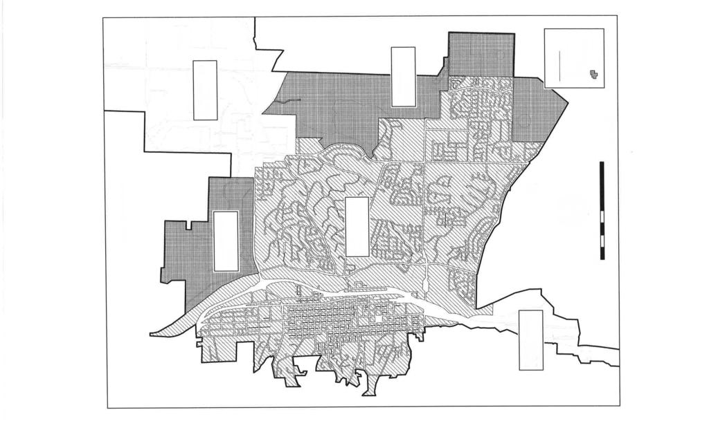
1 ORDNANCE NO N.S. A ORDNANCE OF THE CTY COUNCL OF THE CTY OF EL PASO DE ROBLES APPROVNG RESDENTAL GRADNG ORDNANCE AMENDMENT/ ZONE CHANGE APPLCANT - CTY OF PASO ROBLES 2016 GRADNG ORDNANCE AMENDMENT WHEREAS, the City of Paso Robles has initiated an amendment to the City's Zoning Ordinance consisting of a comprehensive amendment to the City's Residential Grading Ordinance (Zoning Ordinance sections 21.14A and 21.16E) (Project); and WHEREAS, the City Council appointed a Grading Ordinance Advisory Committee to review the existing Grading Ordinance and recommend changes to improve the City's review and permitting process; and WHEREAS, the City's Grading Ordinance Advisory Committee has recommended the following amendments to the City Council; 1. Alternative digital slope mapping methodology. 2. Definitions of terminology. 3. New Hillside Development District mapping with separate standards for: a. nfill Hillside Overlay District b. Other Zoning District (Theater Drive area / Airport area) Specific Plans 4. New pad grading allowance for existing lots. 5. Ridgeline protection requirements for specific plan areas. 6. 3D computer modeling of slopes on "challenging" sites. 7. Removal of mass grading prohibition and replacement with a flexible performance standard. 8. Creation of single grading performance standards table. 9. Consolidation and simplification of the landscape requirements. 10. Removal of redundant and antiquated sections; and c. WHEREAS, the proposed Grading Ordinance amendments are consistent with the Goals and Policies of the General Plan Land Use Element and Housing Element; and WHEREAS, the Planning Commission held a public hearing on August 9, 2016 to consider the proposed amendment and environmental determination and is recommending the City Council approve the Negative Declaration and the proposed Zoning Ordinance amendment; and WHEREAS, a public hearing was conducted by the City Council on September 6, 2016, to consider the Planning Commission's recommendation and to accept public testimony on the nitial Study, Negative Declaration and Zoning Ordinance amendment. NOW, THEREFORE BE T RESOLVED by the City Council of the City of Paso Robles, as follows: Section 1. All of the above recitals are true and correct and incorporated herein by reference. Section 2. Based on the facts and analysis presented to it, including all written and oral testimony, the Planning Commission hereby makes following findings regarding Zoning Ordinance Amendment15-005: a. The Zoning Ordinance Amendment is consistent with the Goals and Policies of the General Plan Land Use Element and Housing Element to protect scenic views and provide adequate housing supply for all income categories. b. Zoning Ordinance Amendment would provide for orderly development within the City. Section 3. Based on all of the foregoing, the City Council of El Paso de Robles introduce for first reading by title only, Draft Ordinance A amending the Zoning Ordinance (Grading Ordinance Amendment RZ ) as attached hereto and incorporated herein by reference: Repeal and replace Section 21.14A as shown on the Exhibit A Repeal and replace Section 21.16E as shown on the Exhibit B CC Ordinance 1035 N.S. Page 1 of 15


2 PASSED AND ADOPTED by the City Council of the City of El Paso de Robles this 20 th day of September 2016 by the following vote: AYES: NOES: ABSTAN: ABSENT: Gregory, Hamon, Reed, Martin Strong Steven W. Martin, Mayor ATTEST: Exhibit A - Repeal and replace Section 21.14A Exhibit B - Repeal and replace Section 21.16E CC Ordinance 1035 N.S. Page 2 of 15
3 Exhibit A - Repeal and Replace Section 21.14A Chapter 21.14A - HLLSDE DEVELOPMENT DSTRCT 21.14A Purpose. The purpose of the Hillside Development District is to establish development standards that conserve the natural character of hillside areas, preserve and enhance the scenic amenities of the City and minimize the environmental impact resulting from extensive grading in visually sensitive areas. The Hillside Development District is not a grading code; compliance With these hillside development standards does not in any way imply that the resultant development is safe from erosion, land slippage or other hazards related to development on land with significant slopes, cuts or fills. Any development in hillside areas shall be performed in a manner consistent with recommendations of licensed civil engineer and subject to approval of the City Engineer. (Ord. 571 N.S. 1 Exh. A (part), 1989) 21.14A Applicability. A. The Hillside Development District is established as an overlay district on the properties shown on Figure 21.14A.020 and over all properties, including properties outside of the hillside development district boundaries, where the average natural (ungraded) slope of the net developable areas of a property is 10% or greater. 1. The average slope of the net developable area of a property shall consist of the gross acreage of a property, minus the following: a. Any dedication necessary to provide for the full rights-of-way of arterial and/or collector streets, as designated by the circulation element of the general plan, adjacent to and/or within a proposed subdivision, parcel map or lot line adjustment, in accordance with adopted standards for city streets; b. Any areas of the site with natural slopes of 35% or greater; c. Any areas of the site within the outer driplines of a compact grouping of 1 O or more oak trees ("mature" as defined in Chapter of this code), where driplines between trees in the grouping are separated by 10 feet or less; d. Any areas of the site within the floodway of the Salinas River. 2. Average slope of the net developable area shall be calculated using the following formula: Average slope = i X Lx A J Where: i = Contour interval in feet. Contour intervals shall not exceed five (5) feet. L = Combined length of contour lines measured within the net developable area = A constant that converts square feet into acres and expresses slope in percent. A = Acreage of net developable area. B. Alternatively, a slope analysis map may be developed and presented to display: 1. slope ranges listed in Chapter 21.16E surface boundary, reflecting all exceptions listed in Chapter 21.14A.020 CC Ordinance 1035 N.S. Page 3 of 15
4 3. labeled existing ground contours with an interval of at least two feet 4. This slope map is presented with the statistics of the surface created, including average slope. C. The hillside development standards are in addition to those development standards established within Chapter (district use tables) except where th1e development standards for the primary district, as listed in the district use tables, are more restrictive than the development standards for hillside areas. D. Where necessary to accomplish the purposes of this chapter, the City Council, Planning Commission and Development Review Committee and Community Development Director may impose additional conditions which may serve to limit the types and intensities of land uses to achieve the purpose and intent of this chapter. E. Where a slope map reveals that a proposed tentative tract map has areas that fall under several slope categories, and that one or more 0f these areas are relatively small or narrow, the planning commission and/or City Council may apply the standards applicable to the nearest predominant slope category to ensure that strict compliance with the minimum lot size, width and depth requirements would not result in a subdivision with non-uniform lot areas or non-orderly development. (Ord. 807 N.S. 1, 2001: Ord. 635 N.S. Exh. A (part), 1992; Ord. 571 N.S. 1 Exh. A (part), 1989) 21.14A Definitions A. Hillside: The term Hillside pertains to those areas with average slopes over 10%. B. Ridgeline: A ridgeline is a geological feature consisting of a line formed against the horizon by hills or bluffs. Ridgelines are typically considered significant when visible from beyond the project site C. Mass Grading: Mass grading is the excavation or deposition (cut and fill) of earthwork across a parcel for the construction of multiple buildings or other improvements. Mass grading usually involves the movement of earthen materials across existing or proposed property lines for the purpose of balancing the overall earthwork. Typically massing grading would involve grading multiple single-family residential parcels within a tract. D. Viewshed: A viewshed is the geographical area that is typically visible from a location beyond a project site. t includes all surrounding points that are in line of sight with that location and excludes points that are beyond the horizon or obstructed by terrain and other features (e.g., buildings, trees). E. Pad Grading: Pad grading is the excavation or deposition (cut and fill) of earthwork to create a relatively flat area on a single parcel for the construction of improvements. F. Native Slope: Native slope is the existing gradient of a land surface prior to human disturbance. G. Contour Grading: Contour grading is the design of earthwork to blend the constructed landform with the surrounding landforms to create a more visually appealing fit. H. Developable Area: Developable area shall be defined as that area used for streets, driveways, graded pads for improvements, and graded slopes.. Slope Banding: Banding is the subdivision of a contour map into bands of topography that fall into distinct categories or areas of similar gradient. See slope categories below. CC Ordinance 1035 N.S. Page 4 of 15
5 K. Slope Categories: Slope categories for determining lot sizes, widths and depths shall be determined by the category of the natural (ungraded) slope of the developable area of the lot. For this purpose, the following slope categories are established: 0 to 4.99 percent, 5 to 9.99 percent, 10 to percent, 15 to percent, and 25 to percent A Standards for hillside grading Within the Hillside Development Districts identified on Figure 21.14A.020, the requirements and standards for the creation of new lots, via tract or parcel maps, the reconfiguration of existing lots via lot line adjustment, or the development of existing lots shall be as follows in the respective primary zoning districts: A. Within the nfill Hillside Overlay District, as specified within the R-1 district regulations (Section ); B. Within other zoning districts, the standards specified within the R-1 district regulations (Section ) shall be used as guidelines, and may be used as the basis for requirements by the Planning Commission and City Council. C. Within the Chandler Ranch, Berkey, Olsen and Beechwood Specific Plan Areas the standards specified within the R-1 district regulations (Section ) shall be used as guidelines for the preparation of individual specific plan grading standards. The City Council shall find the specific plan grading standards are consistent with the intent of the R-1 district regulations. t is recognized that the minimum lot sizes, widths, depths and development standards prescribed for the R-1 district may not be appropriate for hillside development within other zoning districts. Therefore, where necessary to accomplish the purposes of this chapter, the Planning Commission and City Council may require minimum lot sizes, widths, depths and development standards which are greater (more restrictive) than those prescribed by the primary district regulations other than the R-1 district. n no instance shall lot sizes or development standards be less than those prescribed in either the R-1 district or the other primary zone district, whichever is more restrictive. (Ord. 571 N.S. 1 Exh. A (part), 1989) CC Ordinance 1035 N.S. Page 5 of 15
6
7 21.14A Standards applicable to existing hillside lots. Within the nfill Hillside District, the following requirements and standards for development of alreadycreated lots shall be in addition to those required in the regulations for the primary zoning districts: A. Those existing hillside lots which were created prior to the effective date of the ordinance (1989) codified in this chapter shall incorporate into their development all of the above-referenced standards for development of already-created lots, to the maximum extent feasible. B. t is not the intent of these regulations to preclude development of an existing and legally recognized parcel, and the Planning Commission and City Council may modify these standards to allow reasonable development of existing parcels where such modifications can be found by the Planning Commission and City Council to be consistent with the purpose and intent of these regulations. C. ndividual pad grading shall be permitted on an existing lot with an average slope less than 15%. D. ndividual pad grading may be approved by the Development Review Committee on existing lots with an average slope over 15% based on review of grading plans, slope landscape plan and preliminary architectural elevations. E. Development Review Committee approval, in accordance with Chapters 21.23A and , shall be obtained prior to issuance of grading and building permits on lots with average slopes over 15%. (Ord. 571 N.S. 1 Exh. A (part), 1989) 21.14A Ridgelines. Subdivisions shall be designed to minimize landform alteration as viewed from outside the site. Landscaping and contour grading shall be used to mitigate the visual effects of grading. Each Specific Plan shall include grading policies for the protection of prominent ridgelines A Development Review Committee requirements. A. Applications for development review of development on hillside lots shall consist of the plans (including topographic detail), drawings and other information to explain a development project as required in the City's standardized development handbook. Additional information shall be provided when it is determined by the Community Development Director to be necessary to illustrate the applicant's intent and/or impacts resulting from a specific project design element. B. On particularly challenging sites, the Community Development Director, Development Review Committee, or Planning Commission may require 30 computer modeling of the raw grading landforms to better describe the land surface. Additional architectural rendering of site features and landscaping may be submitted at applicant's discretion. (Ord. 635 N.S. Exh. A (part), 1992: Ord. 571 N.S. 1 Exh. A (part), 1989) CC Ordinance 1035 N.S. Page 7 of 15
8 Exhibit B - Repeal and Replace Section 21.16E Article. - SNGLE-FAMLY RESDENTAL GRADNG STANDARDS 21.16E.010 -Purpose. The purpose of the R-1 district is to provide a district reserved for the development of single- family residential (one dwelling unit per lot) neighborhoods and compatible land uses, in both hillside and nonhillside areas. (Ord. 572 N.S. 2 Exh. A (A), 1989) 21.16E.020 -Applicability of hillside regulations. The infill hillside overlay district is defined in Chapter 21.14A. The overlay district defines geographic areas subject to hillside development standards when average slope of the net developable area of the property are 10% or greater. (Ord. 572 N.S. 2 Exh. A (BJ, 1989) 21.16E Planned development overlay district applicability. A. The planned development overlay district (Chapter 21.16A) may be used as an overlay district to the R-1 district for the purposes of modifying the R-1 development standards contained within this chapter in order to create a subdivision with uniform lot areas and/or dimensions or to cluster lots in order to provide common open space. B. The number of single-family lots that may be created on a property via a subdivision or parcel map in the R-1, PD zoning district may be determined via application of density factors to the net developable acreage of a property via the two-step process outlined in Section A.020. C. Determine Maximum Density for Average Slope. The maximum density, (single-family lots per acre) of a property proposed for development shall be determined by multiplying the property's net developable acreage by the maximum number of dwelling units (single-family lots) per net developable acre listed in the table below for the average slope of the net developable area. Average Slope of Net Developable Area(%) ' Maximum number of dwelling units (single-family lots) per net developable acre R-1,PD R-1,8-1,PD R-1,8-2,PD R-1,8-3,PD R-1,8-4,PD R-1,8-5,PD O ' lo. J CC Ordinance 1035 N.S. Page 8 of 15
9 Exceptions. a. On properties where the land use element of the general plan establishes maximum densities at one, two or three units per acre (i.e., RSF-1, RSF-2 and RSF-3 land use categories), maximum densities shall not exceed that established by the general plan. b. On properties that have been assigned zoning that includes a density factor appended to the base zoning district (e.g., R-1, PD2, which allows up to two single-family lots per acre), maximum densities shall not exceed the appended density factor. (Ord. 771 N.S. Exh. A, 1999: Ord. 635 N.S. Exh. A (part), 1992; Ord. 572 N.S. 2 Exh. A(C), 1989) Article. - New Single-Family Residential lots 21.16E.050 -Applicability. The minimum standards set out in this article shall apply to the creation of new lots via parcel or tract maps or the reconfiguration of existing lots via lot line adjustments consistent with the requirements of Section 21.14A. (Ord. 572 N.S. 2 Exh. A(E) (part), 1989) 21.16E Maximum developable slope. No new lots shall be created which would necessitate the placement of building foundations upon natural slopes of 35% or greater. An applicant may be required to demonstrate that a tot has an adequate buildable area, in a manner subject to the approval of the Planning Commission and/or City Council. Exception: The Development Review Committee may approve decks and similar features on slopes over 35% if a finding can be made that there will be no changes or negative impacts to the native slope. (Ord. 572 N.S. 2 Exh. A(El(l), 1989) 21.16E lot sizes. Minimum lot sizes shall be as set out in Table 21.16E.090. (Note: lot sizes are shown in square feet, unless otherwise noted. Lot sizes do not include fee or easement dedications for public street purposes.) CC Ordinance 1035 N.S. Page 9 of 15
10 TABLE 21.16E.090 MNMUM LOT SZE PER ZONNG DSTRCT Slope 1 R-1 R-1, B-1 R-1, B-2 R-1, B-3 R-1, B-4 R-1, B-5 (percent) (sq. ft.) (sq. ft.) (sq. ft.) (sq. ft.) (sq. ft.) (sq. ft.) , ,000 7,500 10, , acre 2 acres - -- J , ,000 10,000 20,000 acre 2 acres ---, , ,500 12,500 20,000 1 acre 2 acres ,000 15,000 15,ooo 1 ro.ooo 1 acre 2 acres _j , ,000 20, acr 2 acres 1 20,000 (Ord 572 NS 2 Exh. A(EX4). 1989) 21.16E Lot widths. Minimum lot widths shall be as set forth in Table 21.16E.100. Lot widths shall be measured at the front building setback line for all lots and shall not include driveway strips for flag lots. TABLE 21.16E.100 MNMUM LOT WDTH PER ZONNG DSTRCT Slope R-1 jr-1, B-1, R-1, B-2 R-1, B-3 R-1, B-4 R-1, B-5 ' (percent) (sq. ft.) (sq. ft.) (sq. ft.) (sq. ft.) (sq. ft.) (sq. ft.) _J 100 r (Ord 572 NS. 2 Exh. A(EXS), 1989) CC Ordinance 1035 N.S. Page 10 of 15
11 21.16E Buildability Demonstration. A. As part of an application for a tract or parcel map or lot line adjustment, it shall be the responsibility of the applicant to demonstrate, to the satisfaction of the Community Development Director, that the new lots to be created are buildable in a manner consistent with this code. For the purpose of demonstrating that lots are buildable, detailed drawings of conceptual site and grading plans for individual lots may be required by the Community Development Director to be submitted with the application. B. The number and location of existing trees, especially oak trees, shall be a consideration in the design and sizing of lots. Oak tree presenation is a high priority for the City of El Paso de Robles, and parcels shall be configured in a manner designed to preclude future conflicts between creation of an adequate building envelope and the presenation of oak trees consistent with the City's Oak Tree Ordinance. (Ord. 797 N.S. 1 (part), 2000: Ord. 572 N.S. 2 Exh. A{E)(7), 1989) 21.16E Flag lots. The driveway strips for flag lots may not be used for calculation of minimum lot size. (Ord. 572 N.S. 2 Exh. A{E)(8), 1989) 21.16E Grading limitations. The following grading standards shall apply: A. Preliminary grading plans shall be submitted with every application for a subdivision map and may be required for submittal of parcel maps and lot line adjustment applications. B. Where mass or pad grading can be conducted in a manner consistent with the purpose and intent of this chapter and such grading is necessary for the reasonable use of the property. The goal shall be to minimize exposed slopes and retaining wall heights and to install mitigating landscaping. C. The vertical height of graded slopes and/or exterior retaining walls to create pads shall be limited as specified in Table 21.16E The maximum vertical height of a graded slope or combination of graded slope and the exposed face of an exterior retaining wall used to create a pad shall be related to the size of the lot and shall not exceed the following limits. CC Ordinance 1035 N.S. Page 11 of 15
12 Table 21.16E Side / Front Yards Rear Yards All Yards Lot Size (sq ft) 2:1 Slope 3:1 Slope Retaining 2:1 Slope 3:1 Slope Retaining ;:: 4:1 Slope Max Max Walls** Max Max Walls** Max Vertical Vertical Vertical Vertical Vertical Vertical Wall Vertical Change Change Change Change Change Face (feet) Wall (feet) (feet) (feet) (feet) (feet) Face (feet) :;; 7, unlimited 7,001-9, unlimited ;:: 10, unlimited ** Multiple retaining walls may be permitted consistent with Figure 21.16E.020A The graded slopes and / or retaining walls between two adjacent lots should be constructed on the lower lot. Between two adjacent lots, property lines must be located at the top of slopes. Setbacks from property lines to graded slopes shall be consistent with California Building Code. E. All retaining walls to create building pads shall be constructed of masonry materials. F. The exposed face of a building stem wall shall not exceed nine (9) feet in average height and shall be landscaped and/or screened in a manner subject to approval of the Development Review Committee. G. Usable Yards. All lots shall provide a usable, unobstructed natural or manufactured (graded) area ten (10) feet in depth. "Usable" means that the slope is not more than five (5) percent. Where a residential building is designed to be built into existing natural slopes, this requirement may be met by providing either a five (5) foot wide usable manufactured area no less than the full width of a dwelling unit, or a deck a minimum of ten (10) feet in depth and no less than the full width of a dwelling unit. When the standard cannot be met, an alternative useable area may be approved by the DRC. H. The underside of decks that are three feet or higher above grade shall be screened with landscaping and/or architectural features. CC Ordinance 1035 N.S. Page 12 of 15

13
14 21.16E.145-Visual Mitigation Measures A. Contour Grading 1. The overall shape, height and grade of graded slopes shall not exceed 2: 1; 3: 1 slopes are preferred. (Exception: The City Engineer may approve steeper cut slopes for construction of streets, where a registered soils engineer recommends such approval.) 2. Slope grading design shall be based on the concepts of "contour grading," a technique that strives to maintain the pre-existing landform or to replicate natural landform patterns in the case of extensive grading. 3 The crest of all graded slopes in excess of six (6) feet vertical height shall be rounded. Where graded slopes intersect, the ends of each slope shall be horizontally rounded and blended. B. Slope Landscape, Maintenance and Fencing 1. All graded slopes with vertical heights of three (3) feet or greater shall be provided with planting materials and an irrigation system that are under the control of a single property owner or under the jurisdiction of a common maintenance organization. The owner shall be responsible for the installation and maintenance of the irrigation. 2. A Conceptual Slope Landscape, maintenance and fencing plan shall be submitted with any map, development plan or site plan that proposed cut or fill slopes with vertical heights of three feet or greater. The plan shall be prepared by a landscape architect or qualified professional, reviewed and approved by the Development Review Committee, and contain the following minimum information: 3. a. dentification of all manufactured slopes that are visible from a public street. b. Conceptual Landscape planting plans including: i. Adequate mixture of trees, shrubs and groundcover to assure complete landscape coverage, soil stabilization and to promote varying height and mass of landscaping. ii. iii. iv. Minimum of one tree for every 500 square feet of slope area. Use of drought tolerant, native plant species when possible. Plantings should be compatible with the natural vegetation and that on surrounding properties. Planting within 30 feet of buildings should be fire-resistant. c. Conceptual irrigation plan. d. Phasing plan for the timing of landscaping and irrigation installation. e. dentify the proposed future maintenance mechanism or parties responsible for short term and long term maintenance. f. Color and materials for retaining walls. g. Provide location, construction detail, materials and heights for all fencing located on and along slopes. i. Transparent view fencing should be used along the top on slopes exceeding 1 O feer in height. ii. Fencing should be placed at the top of manufactured slopes. Final landscape, irrigation and fencing installation plans shall be submitted concurrently with residential building permits applications for lots with slopes identified on the Conceptual Slope Landscape Plan. All landscaping, irrigation and fencing shall be installed prior to final inspection. CC Ordinance 1035 N.S. Page 14 of 15
15 (Ord. 807 N.5. 2, 2001: Ord. 797 N.5. 1 (part), 2000: Ord. 747 N.5. 2, 1998; Ord. 727 N.5. Exh. A, 1997; Ord. 572 N.5. 2 Exh. A(E)(9), 1989) 21.16E Oak tree preservation. Creation of new lots and streets shall be designed to protect oak trees in a manner consistent with the city's oak tree preservation ordinance (Chapter ). (Ord. 797 N.5. 1 (part), 2000: Ord. 572 N.5. 2 Exh. A(E)(lO), 1989) 21.16E Utilities. A. All utility service lines shall be under-grounded. B. Transformers, control points and other utility housings shall be located so as to minimize their visual impact and shall be screened in a manner approved by the architectural review committee. (Ord. 572 N.5. 2 Exh. A(E)(ll), 1989) 21.16E Hillside street standard. Use of the hillside street standard shall be subject to Planning Commission or City Council approval in conjunction with applications for tract maps, parcel maps, or a waiver of street improvements to be approved as specified in Chapter 21.23A. (Ord. 572 N.5. 2 Exh. A(E}(12), 1989) CC Ordinance 1035 N.S. Page 15 of 15
ORDINANCE WHEREAS, this Ordinance is consistent with the City of Winter Garden Comprehensive Plan; and
 ORDINANCE 17-06 AN ORDINANCE OF THE CITY COMMISSION OF THE CITY OF WINTER GARDEN, FLORIDA, CREATING ARTICLE XIV OF CHAPTER 118 OF THE CITY OF WINTER GARDEN CODE OF ORDINANCES PROVIDING FOR THE EAST PLANT
Example Codes. City of Brentwood, Tennessee Brentwood Hillside Protection Overlay District Summary
 Example Codes City of Brentwood, Tennessee Brentwood Hillside Protection Overlay District Summary The City of Brentwood in July 2007 adopted a Hillside Protection (HP) Overlay District to address the problems
ORDINANCE NO. City of Bellingham City Attorney 210 Lottie Street Bellingham, Washington INFILL HOUSING ORDINANCE Page 1
 ORDINANCE NO. AN ORDINANCE RELATING TO LAND USE PLANNING AND ZONING, CREATING A NEW BMC CHAPTER 20.28 INFILL HOUSING, AND NEW SUBSECTION BMC 20.12.030.E, GREEN FACTOR LANDSCAPING STANDARDS, AND AMENDING
THE CITY COUNCIL OF THE CITY OF SAN JUAN BAUTISTA DOES HEREBY ORDAIN AS FOLLOWS:
 ORDINANCE NO. 2016 01 AN ORDINANCE OF THE CITY OF SAN JUAN BAUTISTA AMENDING THE SAN JUAN BAUTISTA MUNICIPAL CODE TO ADD CHAPTER 11-08 HILLSIDE DEVELOPMENT REGULATIONS WHEREAS, the City Council has reviewed
Infill Residential Design Guidelines
 Infill Residential Design Guidelines Adopted March 23, 2004 Amended September 10, 2013 City of Orange Community Development Department Planning Division Phone: (714) 744-7220 Fax: (714) 744-7222 www.cityoforange.org
PC RESOLUTION NO
 PC RESOLUTION NO. 14-01-14-02 TENTATIVE TRACT MAP fttm) 17441. REZONE {RZ) 13-003, ARCHITECTURAL CONTROL (AC) 13-003, TREE REMOVAL PERMIT (TRP) 13-052. GRADING PLAN MODIFICATION (GPM) 13-002. CONDITIONAL
ORDINANCE NO WHEREAS, the City of Kalama has many areas of timberland and open areas inside its City limits adjacent to residential areas;
 ORDINANCE NO. 1342 AN ORDINANCE OF THE CITY OF KALAMA, WASHINGTON ADOPTING A NEW KALAMA MUNICIPAL CODE CHAPTER 17.20 ESTATE LOT FLOATING ZONE TO PROVIDE TRANSITIONAL ZONING OPTIONS FOR RESIDENTIAL DEVELOPMENT
A. General Plan: Land Use, Growth Management and the Built Environment Element. d. Use visually unobtrusive building materials.
 Chapter 16 Hillside Protection 16.010 Purpose This chapter establishes the regulations for development and alteration of properties in hillside and ridgeline areas in order to preserve the essential scenic
RESOLUTION NO. WHEREAS, the proposed Master Plan for Villa Esperanza (VE), located at 2116
, located at 2116") RESOLUTION NO. A RESOLUTION OF THE CITY COUNCIL OF THE CITY OF PASADENA APPROVING A MASTER PLAN FOR VILLA ESPERANZA WHEREAS, the proposed Master Plan for Villa Esperanza (VE), located at 2116 Villa Street
RESOLUTION NO. A RESOLUTION OF THE CITY COUNCIL OF THE CITY OF PASADENA APPROVING A MASTER PLAN FOR VILLA ESPERANZA WHEREAS, the proposed Master Plan for Villa Esperanza (VE), located at 2116 Villa Street
Neo-Traditional Overlay Application
 MAYOR AND CITY COUNCIL OF LAUREL DEPARTMENT OF ECONOMIC AND COMMUNITY DEVELOPMENT 8103 Sandy Spring Road Laurel, Maryland 20707 (301) 725-5300 Internet Address http://www.cityoflaurel.org E-mail: ecd@laurel.md.us
Landscape and fencing requirements of this Chapter shall apply to all new landscaped areas.
 Chapter 19.06. Landscaping and Fencing. Sections: 19.06.01. Purpose. 19.06.02. Required Landscaping Improvements. 19.06.03. General Provisions. 19.06.04. Landscaping Plan. 19.06.05. Completion of Landscape
City of Lafayette Study Session Staff Report Design Review Commission
 City of Lafayette Study Session Staff Report Design Review Commission Meeting Date: April 24, 2017 Staff: Payal Bhagat, Senior Planner Subject: HDP18-15 & HDP31-15 Ramesh Patel & Melcor Development (Owners),
GENERAL LANDSCAPE PROVISIONS. The following landscape provisions shall be adhered to by all land uses unless otherwise noted:
 CHAPTER 1.18 Sections: 1.18.005 Purpose. 1.18.010 Landscaping, Buffering, and Fencing Improvements Required. 1.18.015 General Landscape Provisions. 1.18.020 Landscaping Plan. 1.18.025 Single-Family Dwellings
CHESAPEAKE LANDSCAPE ORDINANCE
 CHESAPEAKE LANDSCAPE ORDINANCE CONSERVATION PRESERVATION CZO 19-600 Effective October 16, 2008 BUFFER YARD C PARKING LOT REFORESTATION YEAR 1 REFORESTATION YEAR 4 BUFFER YARD F CBPA REFORESTATION Page
Glenborough at Easton Land Use Master Plan
 Implementation 114 9.0 IMPLEMENTATION 9.1 OVERVIEW This chapter summarizes the administrative procedures necessary to implement the proposed land use plan, infrastructure improvements, development standards,
ARTICLE IV: DEVELOPMENT STANDARDS 404 MASTER PLANNING
 IV 13 404 MASTER PLANNING Master Planning through the Site Analysis (Master Planning Site Analysis) or Planned Development (Master Planning Planned Development) is provided to encourage development which
A RESOLUTION OF THE PLANNING COMMISSION OF THE CITY
 RESOLUTION NO. A RESOLUTION OF THE PLANNING COMMISSION OF THE CITY OF SIGNAL HILL, CALIFORNIA, RECOMMENDING CITY COUNCIL ADOPTION OF ZONING ORDINANCE AMENDMENT 16-03, A REQUEST TO AMEND THE OFFICIAL ZONING
Zoning Ordinance Chapter 10
 CHAPTER 10 - WASHES SECTION 10.0 GENERAL: A. The purpose of this Ordinance is to establish standards for development in or near Major and Minor Washes as defined in Appendix A Glossary of Terms and Definitions
CHAPTER SPECIAL PURPOSE AND OVERLAY ZONING DISTRICTS
 Special Purpose and Overlay Zoning Districts 106.28.010 CHAPTER 106.28 - SPECIAL PURPOSE AND OVERLAY ZONING DISTRICTS SPECIAL PURPOSE AND OVERLAY ZONING DISTRICTS Sections: 106.28.010 - Purpose 106.28.020
COMPLIANCE CHECKLIST HILLSIDE RESIDENTIAL DESIGN GUIDELINES MANUAL
 COMPLIANCE CHECKLIST HILLSIDE RESIDENTIAL DESIGN GUIDELINES MANUAL The following checklist summarizes development guidelines and standards. See the appropriate section for a complete explanation of the
Planned Development Review Revisions (Project No. PLNPCM )
") Planned Development Review Revisions (Project No. PLNPCM2014-00139) Standard residential development Planned Development Example: Smaller lot sizes than what is allowed to create open space amenity. What
Planned Development Review Revisions (Project No. PLNPCM2014-00139) Standard residential development Planned Development Example: Smaller lot sizes than what is allowed to create open space amenity. What
MORAGA HILLSIDES AND RIDGELINES PROJECT
 MORAGA HILLSIDES AND RIDGELINES PROJECT STEERING COMMITTEE MEETING, JUNE 29, 2016 Project Overview The Hillsides and Ridgelines project will amend existing Town hillside regulations to increase certainty,
City of Lafayette Staff Report
 City of Lafayette Staff Report For: By: Design Review Commission Greg Wolff, Senior Planner Meeting Date: April 27, 2015 Subject: SS03-15 Gundi & Peter Younger (Owners), R-40 Zoning: Request for a Study
ORDINANCE NUMBER DRAFT. An ordinance amending Title 21- Subdivision and Title 22- Planning and Zoning of the
 0 0 ORDINANCE NUMBER DRAFT An ordinance amending Title - Subdivision and Title - Planning and Zoning of the Los Angeles County Code, establishing drought-tolerant landscaping standards. The Board of Supervisors
CITY OF SAN MATEO ORDINANCE NO
 CITY OF SAN MATEO ORDINANCE NO. 2012-4 AMENDING SECTION 27.38.090, OPEN SPACE REQUIREMENTS, OF CHAPTER 27.38, CBD DISTRICTS-CENTRAL BUSINESS DISTRICT, SECTION 27.64.023, PARKING PROHIBITED ON LAWNS, FLOWERS,
5.1.1 The streetscape along US Highway 64 (Brevard Road); and, The built environment within new residential developments; and,
; and, The built environment within new residential developments; and,") Article 5. Landscaping 5.1 Purpose The Town of Laurel Park s landscape standards are designed to create a beautiful, aesthetically pleasing built environment that will complement and enhance community
Article 5. Landscaping 5.1 Purpose The Town of Laurel Park s landscape standards are designed to create a beautiful, aesthetically pleasing built environment that will complement and enhance community
The maximum amounts shown in the Engineer s Report for each of those categories for FY 2008/09 are as follows (per house/per year):
:") Agenda Item No. August 28, 2007 TO: FROM: SUBJECT: Honorable Mayor and City Council Attention: David J. Van Kirk, City Manager Dale I. Pfeiffer, Director of Public Works RESOLUTION INITIATING PROCEEDINGS,
Agenda Item No. August 28, 2007 TO: FROM: SUBJECT: Honorable Mayor and City Council Attention: David J. Van Kirk, City Manager Dale I. Pfeiffer, Director of Public Works RESOLUTION INITIATING PROCEEDINGS,
ARTICLE V PLANNED UNIT DEVELOPMENT DISTRICT
 ARTICLE V PLANNED UNIT DEVELOPMENT DISTRICT A. Purpose and Objective The Planned Unit Development (PUD) procedure provides a flexible land use and design regulation through the use of performance criteria
ORDINANCE NO. SECTION 1. This ordinance, due to its length and corresponding cost of
 Introduced by: ORDINANCE NO. AN ORDINANCE OF THE CITY OF PASADENA AMENDING CHAPTER 17.44 OF THE ZONING CODE (TITLE 17) TO INCORPORATE THE CALIFORNIA DEPARTMENT OF WATER RESOURCES MODEL WATER EFFICIENT
GENERAL PLAN CONSISTENCY ANALYSIS
 GENERAL PLAN CONSISTENCY ANALYSIS Prepared by Planning Staff 10/28/2013 APPLICABLE GOALS, POLICIES AND PROGRAMS FROM the LAND USE CHAPTER Goal LU-1 Policy LU-1.1 Policy LU-1.2 Goal LU-2 Protect the character
Baseline Hillside Project Kick-Off Meetings. February 2009
 Baseline Hillside Project Kick-Off Meetings February 2009 Regional Topography With Community Plan Boundaries The darker the great, the steeper the slope Purpose of Meeting Get everyone up to speed. Show
CITY OF KEIZER MASTER PLAN APPLICATION & INFORMATION SHEET
 CITY OF KEIZER MASTER PLAN APPLICATION & INFORMATION SHEET PRE-APPLICATION CONFERENCE Prior to the actual filing of a Master Plan application, it is strongly recommended that the applicant contact Planning
-MENDOCINO COUNTY PLANNING AND BUILDING SERVICES- DIVISION II OF TITLE 20--COASTAL ZONING CODE
 CHAPTER 20.504 VISUAL RESOURCE AND SPECIAL TREATMENT AREAS Sec. 20.504.005 Applicability. Sec. 20.504.010 Purpose. Sec. 20.504.015 Highly Scenic Areas. Sec. 20.504.020 Special Communities and Neighborhoods.
RESOLUTION NO
 RESOLUTION NO. 2018- RESOLUTION OF THE PLANNING COMMISSION OF THE CITY OF BELMONT APPROVING A SINGLE-FAMILY DESIGN REVIEW AND TREE REMOVAL PERMIT FOR A VACANT LOT ON LOWER LOCK AVENUE (APN: 043-042-750,
Site Design (Table 2) Fact Sheet & Focus Questions:
 Fact Sheet & Focus Questions:") Site Design (Table 2) Fact Sheet & Focus Questions: BACKGROUND WHAT IS SITE DESIGN? Site design refers to the arrangement of buildings and open spaces on adjacent sites to maximize the shared benefits
Site Design (Table 2) Fact Sheet & Focus Questions: BACKGROUND WHAT IS SITE DESIGN? Site design refers to the arrangement of buildings and open spaces on adjacent sites to maximize the shared benefits
COMMUNITY DESIGN. GOAL: Create livable and attractive communities. Intent
 COMMUNITY DESIGN Intent An attractive, well-designed County will attract quality development, instill civic pride, improve the visual character of the community, and create a strong, positive image for
F. The following uses in the HR District: attached single-family dwellings, condominiums, and institutional uses; and
 1102 DESIGN REVIEW 1102.01 PURPOSE AND APPLICABILITY Section 1102 is adopted to provide standards, criteria, and procedures under which design review may be approved. Design review is required for: A.
SECTION 39. Title V, Chapter 6, Article 2, added to the Zoning Code of Sacramento County shall read as follows: GREENBACK LANE SPECIAL PLANNING AREA
 SECTION 39. Title V, Chapter 6, Article 2, added to the Zoning Code of Sacramento County shall read as follows: GREENBACK LANE SPECIAL PLANNING AREA 506-20. INTENT. It is the intent of the Board of Supervisors
ARTICLE 6: Special and Planned Development Districts
 ARTICLE 6: Special and Planned Development Districts 6-10 Traditional Neighborhood Development (TND) District 6-10.10 Purpose and Intent The Traditional Neighborhood Development (TND) District provides
City of Lafayette Study Session Staff Report Design Review Commission
 ++ City of Lafayette Study Session Staff Report Design Review Commission Meeting Date: January 08, 2018 Staff: Subject: Chris Juram, Planning Technician SS12-17 Miramar Homebuilders, R-20 Zoning: Request
File No (Continued)
") (Continued) Request for: (1) a Site Plan Review; (2) a Variance (to build on a significant ridgeline); (3) an Oak Tree Permit (to encroach into the protected zone of 25 oak trees and for potential thinning
(Continued) Request for: (1) a Site Plan Review; (2) a Variance (to build on a significant ridgeline); (3) an Oak Tree Permit (to encroach into the protected zone of 25 oak trees and for potential thinning
CITY OF VACAVILLE PLANNING COMMISSION Agenda Item No. G. 1 STAFF REPORT August 4, Staff Contact: Tricia Shortridge (707)
") CITY OF VACAVILLE PLANNING COMMISSION Agenda Item No. G. 1 STAFF REPORT August 4, 2009 Staff Contact: Tricia Shortridge (707) 449-5140 TITLE: REQUEST: LONGS / CVS DRIVE-THRU PHARMACY & REMODEL TIME EXTENSION
CITY OF VACAVILLE PLANNING COMMISSION Agenda Item No. G. 1 STAFF REPORT August 4, 2009 Staff Contact: Tricia Shortridge (707) 449-5140 TITLE: REQUEST: LONGS / CVS DRIVE-THRU PHARMACY & REMODEL TIME EXTENSION
SPECIFIC PLAN Requirements
 CITY OF LANCASTER PLANNING DEPARTMENT 44933 Fern Avenue, Lancaster, California 93534 (661) 723-6100 SPECIFIC PLAN Requirements Purpose The purpose of a specific plan is to provide for the logical development
CITY OF CYPRESS 5275 Orange Avenue Cypress, California (714) DESIGN REVIEW COMMITTEE PERMIT PROCESS
 DESIGN REVIEW COMMITTEE PERMIT PROCESS") CITY OF CYPRESS 5275 Orange Avenue Cypress, California 90630 (714) 229-6720 DESIGN REVIEW COMMITTEE PERMIT PROCESS 1. Discuss project with Planning staff to determine zoning regulations, any unusual characteristics
CITY OF CYPRESS 5275 Orange Avenue Cypress, California 90630 (714) 229-6720 DESIGN REVIEW COMMITTEE PERMIT PROCESS 1. Discuss project with Planning staff to determine zoning regulations, any unusual characteristics
AWH REPORT OF THE PLANNING AND DEVELOPMENT DEPARTMENT FOR APPLICATION FOR REZONING ORDINANCE TO PLANNED UNIT DEVELOPMENT
 AWH REPORT OF THE PLANNING AND DEVELOPMENT DEPARTMENT FOR APPLICATION FOR REZONING ORDINANCE TO PLANNED UNIT DEVELOPMENT MAY 8, 2014 The Planning and Development Department hereby forwards to the Planning
Sanford/Lee County Technical Review Committee (TRC) DEADLINES & MEETING DATES
 DEADLINES & MEETING DATES") Sanford/Lee County Technical Review Committee (TRC) DEADLINES & MEETING DATES The following 2019 information is based on the information available to staff at the time of creation. Dates & time may change
Sanford/Lee County Technical Review Committee (TRC) DEADLINES & MEETING DATES The following 2019 information is based on the information available to staff at the time of creation. Dates & time may change
NOTICE OF SPECIAL MEETING
 NOTICE OF SPECIAL MEETING Pursuant to Section 54956 of the Government Code of the State of California, a Special meeting of the Tracy City Council is hereby called for: Date/Time: Location: Tuesday, April
4030 COMMERCIAL (C AND CM)
") 4030 COMMERCIAL (C AND CM) 4030.10 Intent and Purpose The C and CM districts are intended to permit the range of commercial uses in areas which are appropriate for such uses consistent with the General
4030 COMMERCIAL (C AND CM) 4030.10 Intent and Purpose The C and CM districts are intended to permit the range of commercial uses in areas which are appropriate for such uses consistent with the General
The following specific definitions shall apply to the landscaping and screening regulations contained in this article:
 ARTICLE XII. LANDSCAPING Sec. 5-421. Purpose. The purpose of landscaping and screening requirements is to improve certain setback and yard areas, including off-street vehicular parking and open-lot sales
Chapter PEDESTRIAN COMMERCIAL (PC) ZONING DISTRICT
 ZONING DISTRICT") Chapter 11-17 PEDESTRIAN COMMERCIAL (PC) ZONING DISTRICT Sections: 11-17-01 GENERAL PURPOSE 11-17-02 PERMITTED BUILDING TYPES 11-17-03 USES PERMITTED WITH DESIGN REVIEW 11-17-04 USES PERMITTED BY CONDITIONAL
Chapter 11-17 PEDESTRIAN COMMERCIAL (PC) ZONING DISTRICT Sections: 11-17-01 GENERAL PURPOSE 11-17-02 PERMITTED BUILDING TYPES 11-17-03 USES PERMITTED WITH DESIGN REVIEW 11-17-04 USES PERMITTED BY CONDITIONAL
PARK CITY MUNICIPAL CODE TABLE OF CONTENTS TITLE 15 LAND MANAGEMENT CODE - CHAPTER 2.21
 PARK CITY MUNICIPAL CODE TABLE OF CONTENTS TITLE 15 LAND MANAGEMENT CODE - CHAPTER 2.21 TITLE 15 - LAND MANAGEMENT CODE CHAPTER 2.21 - SENSITIVE LAND OVERLAY ZONE (SLO) REGULATIONS 15-2.21-1. PURPOSE...1
BUFFERS, TREE PROTECTION AND LANDSCAPING. Sec Purpose and Intent.
 ARTICLE 20 BUFFERS, TREE PROTECTION AND LANDSCAPING Sec. 20.1. Purpose and Intent. Trees improve air and water quality, reduce soil erosion, reduce noise and glare, provide habitat for desirable wildlife,
COUNTY COUNCIL OF PRINCE GEORGE'S COUNTY, MARYLAND SITTING AS THE DISTRICT COUNCIL 2010 Legislative Session. Council Members Dernoga and Olson
 DR- COUNTY COUNCIL OF PRINCE GEORGE'S COUNTY, MARYLAND SITTING AS THE DISTRICT COUNCIL 00 Legislative Session Bill No. CB--00 Chapter No. Proposed and Presented by Introduced by Co-Sponsors The Chairman
STAFF REPORT FOR STANDARD COASTAL DEVELOPMENT PERMIT #CDP FEBRUARY 26, 2015 CPA - 1 PO BOX 238 APTOS, CA 94001
 STAFF REPORT FOR STANDARD COASTAL DEVELOPMENT PERMIT #CDP 2014-0030 FEBRUARY 26, 2015 CPA - 1 OWNER/APPLICANT: AGENT: REQUEST: HANS HEIM PO BOX 238 APTOS, CA 94001 JAMES HAY PO BOX 762 MENDOCINO, CA 95460
Land Use and Planning
 9 Land Use and Planning This chapter describes existing land uses, the General Plan land use classification and zoning designation of the Project sites, and applicable General Plan policies. The chapter
R E S O L U T I O N. Single-Family Residence/ Church. 2,488 sq. ft. 2,488 sq. ft. Area Parking Required: Church
 R E S O L U T I O N WHEREAS, the Prince George s County Planning Board is charged with the approval of Detailed Site Plans pursuant to Part 3, Division 9 of the Zoning Ordinance of the Prince George s
CITY OF ZEELAND PLANNING COMMISSION
 APPLICATION FOR SITE PLAN REVIEW AND SPECIAL LAND USE Date City Official App. Filing Fee Rec'd ($350) NOTE TO APPLICANT: Please submit this application for Site Plan Review along with twenty (20) copies
PLANNING COMMISSION AGENDA REPORT SEPTEMBER 1, 2016
 PLANNING COMMISSION AGENDA REPORT SEPTEMBER 1, 2016 TO: Members of the Planning Commission FROM: Michael Klein, Planner FILE NO.: 150000780 PROPOSAL: APPLICANT: RECOMMENDATION: A request for a Site Plan
Improve the appearance of off-street parking areas, vehicular use areas, and property abutting public and private roads;
 Bedford Township, MI (Monroe Co.) 2012 http://library.municode.com/index.aspx?clientid=02123 400.1907 - Landscaping and screening. Se 1907. 1. Intent. Landscaping, greenbelts, and screening are necessary
EXHIBIT B PROJECT NARRATIVE POULSBO MEADOWS
 EXHIBIT B PROJECT NARRATIVE POULSBO MEADOWS Name of Project: Poulsbo Meadows; A Planned Residential Development (PRD)/Plat Applicants Name: PBH Group LLC/Byron Harris PO Box 1010 Silverdale, WA 98038 Description
CITY OF DEERFIELD BEACH Request for City Commission Agenda
 Item: CITY OF DEERFIELD BEACH Request for City Commission Agenda Agenda Date Requested: February 7, 2012 Contact Person: Gerald R. Ferguson - Director of Planning & Development Services Description: 3901
36.1. PURPOSE APPLICABILITY DESIGN REVIEW GUIDELINES
 CHAPTER 36: DESIGN STANDARDS 36.1. PURPOSE The purpose of this chapter is to ensure that projects are designed and constructed consistent with the Community Design Subelement of the Land Use Element and
IV.B. VISUAL RESOURCES
 IV.B. VISUAL RESOURCES ENVIRONMENTAL SETTING Existing Visual Character Project Site The project site is located at 17331-17333 Tramonto Drive in the Pacific Palisades community of the City of Los Angeles
ARTICLE 17 SITE PLAN REVIEW
 ARTICLE 17 SITE PLAN REVIEW 17.01 INTENT AND PURPOSE The intent of this section is to provide for consultation and cooperation between the applicant and the township planning commission so that the applicant
C-I-10. The effect of establishing a comprehensive site review as follows will: B. Reduce the cluttered aspects of current development by:
 C-I-10 PART C SECTION I ARTICLE 10 GENERAL REGULATIONS PROJECT SITE REVIEW I. Purpose The effect of establishing a comprehensive site review as follows will: A. Protect streetscapes from projects that
CHAPTER 26 LANDSCAPING (Chapter added in its entirety 05-08)
") CHAPTER 26 LANDSCAPING (Chapter added in its entirety 05-08) 26.01 DESCRIPTION AND PURPOSE. Landscaping is an important element of the use, development and preservation of land, and a significant factor
CHAPTER 26 LANDSCAPING (Chapter added in its entirety 05-08) 26.01 DESCRIPTION AND PURPOSE. Landscaping is an important element of the use, development and preservation of land, and a significant factor
Design Review Application *Please call prior to submittal meeting to determine applicable fees*
 CITY OF EAGLE 660 E. Civic Lane, Eagle, ID 83616 Phone#: (208) 939-0227 Fax: (208) 938-3854 Design Review Application *Please call prior to submittal meeting to determine applicable fees* FILE NO.: CROSS
GENERAL INFORMATIONaaaaaaaaaaaaaaaaaaaaaaaaaaaaaaaa
 To: Planning and Zoning Commission From: City Staff Date: November 15, 2016 Re: Case #16026 Raymore Activity Center Site Plan GENERAL INFORMATIONaaaaaaaaaaaaaaaaaaaaaaaaaaaaaaaa Applicant/ Property Owner:
APPENDIX C: HILLSIDE DEVELOPMENT REGULATIONS (prev. Ordinance #2008-1)
") APPENDIX C: HILLSIDE DEVELOPMENT REGULATIONS (prev. Ordinance #2008-1) 1. PURPOSE: The purpose of this section is to define the conditions under which hillside development may occur that will not result
APPENDIX C: HILLSIDE DEVELOPMENT REGULATIONS (prev. Ordinance #2008-1) 1. PURPOSE: The purpose of this section is to define the conditions under which hillside development may occur that will not result
HILLSIDE BUILDING COMMITTEE PLAN REVIEW DIRECTIONS
 HILLSIDE BUILDING COMMITTEE PLAN REVIEW DIRECTIONS 1 1. Review Hillside Regulations to ensure your design is in conformance with current Town Code. 2. Complete page 3 and contact Paul Mood at 480-348-3573,
WHEREAS, a number of these buildings are potentially historic structures;
 ORDINANCE NO. 10-03 AN URGENCY ORDINANCE OF THE CITY COUNCIL OF THE CITY OF MAYWOOD, CALIFORNIA, AMENDING THE MAYWOOD MUNICIPAL CODE BY ADDING CHAPTER 45 TO TITLE 5 AND ESTABLISHING A VOLUNTARY HISTORIC
COLVER ROAD INDUSTRIAL CONCEPT PLAN
 COLVER ROAD INDUSTRIAL CONCEPT PLAN A CONCEPTUAL LAND USE AND TRANSPORTATION PLAN FOR TA-4 AN URBAN RESERVE AREA OF THE CITY TALENT City of Talent Adopted by City Council Resolution No., June, 2015 PART
PLANNED DEVELOPMENT (MASTER PLAN & UNIT PLAN)
") Central Permit Center 555 Santa Clara Street Vallejo CA 94590 Business License Building Fire Prevention Planning Public Works 707.648.4310 707.648.4374 707.648.4565 707.648.4326 707.651.7151 PLANNED DEVELOPMENT
Central Permit Center 555 Santa Clara Street Vallejo CA 94590 Business License Building Fire Prevention Planning Public Works 707.648.4310 707.648.4374 707.648.4565 707.648.4326 707.651.7151 PLANNED DEVELOPMENT
CITY OF MALIBU PLANNING COMMISSION RESOLUTION NO
 CITY OF MALIBU PLANNING COMMISSION RESOLUTION NO. 16-54 A RESOLUTION OF THE PLANNING COMMISSION OF THE CITY OF MALIBU, CONSIDERING AN ADDENDUM TO THE CERTIFIED CRUMMER SITE SUBDIVISION FINAL EIR AND MAKING
OFFICE CONSOLIDATION SECONDARY PLAN AREA 22 THE BRAMALEA SOUTH INDUSTRIAL SECONDARY PLAN
 OFFICE CONSOLIDATION SECONDARY PLAN AREA 22 THE BRAMALEA SOUTH INDUSTRIAL SECONDARY PLAN November 2010 EXPLANATORY NOTES (Secondary Plan Area 22) General (pertaining to all secondary plan office consolidations)
EAST LAKE TARPON COMMUNITY OVERLAY
 EAST LAKE TARPON COMMUNITY OVERLAY East Lake Tarpon in Pinellas County Florida physical area is defined by the boundaries of the as shown in the map below and legal description in Appendix A. VISION: East
DCA , Stormwater Quality and Facilities Ordinance June 23, 2009
 PROPOSED NEW SECTION 10.486 Stormwater Quality and Detention Facilities, Public Streets. A. Purpose. It is the City s policy to maintain the natural hydrology and preserve water quality by mitigating the
CHAPTER ADDITIONAL REQUIREMENTS IN THE NC, NEIGHBORHOOD COMMERCIAL ZONE
 CITY OF MOSES LAKE MUNICIPAL CODE CHAPTER 18.31 ADDITIONAL REQUIREMENTS IN THE NC, NEIGHBORHOOD COMMERCIAL ZONE Sections: 18.31.010 Purpose 18.31.020 Minimum Lot Area 18.31.030 Setbacks 18.31.040 Maximum
Design Guidelines for Residential Subdivisions
 Design Guidelines for Residential Subdivisions Development Services 972-466-3225 cityofcarrollton.com This page intentionally left blank. Table of Contents Purpose... 1 Design Objectives... 1 Design Guidelines
PC RESOLUTION NO GRADING PLAN MODIFICATION (GPM)
") PC RESOLUTION NO. 16-07-26- GRADING PLAN MODIFICATION (GPM) 16-006 A RESOLUTION OF THE PLANNING COMMISSION OF THE CITY OF SAN JUAN CAPISTRANO, CALIFORNIA APPROVING GRADING PLAN MODIFICATION (GPM) 16-006,
PC RESOLUTION NO. 16-07-26- GRADING PLAN MODIFICATION (GPM) 16-006 A RESOLUTION OF THE PLANNING COMMISSION OF THE CITY OF SAN JUAN CAPISTRANO, CALIFORNIA APPROVING GRADING PLAN MODIFICATION (GPM) 16-006,
Major Subdivision Sketch Plan Checklist
 This checklist provides specific requirements that are apart of the Sketch process. The entire process is described by the Huntersville Subdivision Review Process which details all the submittal and resubmittal
STAFF REPORT TO THE CITY COUNCIL. Conduct Public Hearing to vacate certain public right of way adjacent to Sycamore Avenue and San Pablo Avenue
 STAFF REPORT TO THE CITY COUNCIL DATE: Adjourned Regular Meeting of December 16, 2014 TO: SUBMITTED BY: SUBJECT: Mayor and Members of the City Council Holly Smyth, Planning Director Conduct Public Hearing
Design Review Commission Report
 City of Beverly Hills Planning Division 455 N. Rexford Drive Beverly Hills, CA 90210 TEL. (310) 285-1141 FAX. (310) 858-5966 Design Review Commission Report Meeting Date: Thursday, March 2, 2017 Subject:
4.500 Preston Road Overlay District
 Section 4.500 Preston Road Overlay District 2004 Zoning Ordinance 4.500 Preston Road Overlay District (ZC 98-29; Ordinance No. 98-9-12) 4.501 Purpose To provide appropriate design standards for the use
14825 Fruitvale Ave.
 REPORT TO THE PLANNING COMMISSION Meeting Date: August 26, 2015 Application: PDR14-0017 Location/APN: 14825 Fruitvale Ave. / 397-18-028 Applicant/Owner: Staff Planner: Sin Yong Michael Fossati 14825 Fruitvale
Chapter RM MULTI FAMILY BUILDING ZONES
 Chapter 19.17 RM MULTI FAMILY BUILDING ZONES 19.17.010 Established 19.17.020 Primary Permitted Uses 19.17.030 Accessory Permitted Uses 19.17.040 Secondary Permitted Uses 19.17.050 Conditional Property
PRELIMINARY CONDITIONAL USE SUBMITTAL CHECKLIST REQUIREMENTS
 This checklist must accompany your submittal as the cover page. CONDITIONAL USE Application Submittal Checklist for PRELIMINARY AND FINAL APPROVAL Per Winter Park Land Development Code Sec. 58-90 PRELIMINARY
ROLL CALL Member Anthony, Member Avdoulos, Member Greco, Member Lynch, Member Maday, Chair Pehrson
 CALL TO ORDER The meeting was called to order at 7:00 PM. PLANNING COMMISSION ACTION SUMMARY CITY OF NOVI Regular Meeting July 11, 2018 7:00 PM Council Chambers Novi Civic Center 45175 W. Ten Mile (248)
ARTICLE 5 LANDSCAPE IMPROVEMENTS
 ARTICLE 5 LANDSCAPE IMPROVEMENTS 5-1 Purpose and Applicability 5-2 Landscape Plans and Installation 5-3 Landscaping Standards 5-4 Landscape Maintenance ARTICLE 5-1 PURPOSE AND APPLICABILITY 5-1-1 Purpose
Incentive Zoning Regulations Florida Municipal City of Orlando
 Topic: Resource Type: State: Jurisdiction Type: Municipality: Year (adopted, written, etc.): 2002 Community Type applicable to: Title: Incentive Zoning Regulations Florida Municipal City of Orlando Document
A BILL FOR AN ORDINANCE TO AMEND CHAPTER 9, KAUAI COUNTY CODE 1987, RELATING TO STREET REQUIRE:MENTS FOR SUBDIVISIONS
 ORDINANCE NO. BILL NO. { vy"yj1j A BILL FOR AN ORDINANCE TO AMEND CHAPTER 9, KAUAI COUNTY CODE 1987, RELATING TO STREET REQUIRE:MENTS FOR SUBDIVISIONS BE IT ORDAINED BY THE COUNCIL OF THE COUNTY OF KAUA'I,
Stormwater Management Resource Type:
 Topic: Erosion & Sedimentation Control; Stormwater Management Resource Type: Regulations State: New Mexico Jurisdiction Type: Municipal Municipality: City of Santa Fe Year (adopted, written, etc.): 2002
CLACKAMAS COUNTY ZONING AND DEVELOPMENT ORDINANCE
 704 RIVER AND STREAM CONSERVATION AREA (RSCA) 704.01 PURPOSE Section 704 is adopted to: A. Maintain the integrity of the rivers and streams in the County by minimizing erosion, promoting bank stability,
Eastcreek Farm. Planned Development Standards September, 2014
 Eastcreek Farm Planned Development Standards September, 2014 ekfarm Contents 01. General Standards 02. Residential Development Standards 03. Architectural Design Standards 04. Landscape Design Standards
DISCUSSION ON VACAVILLE S2 INVESTORS PROPERTY IN URBAN RESERVE
 Agenda Item No. 9C April 25, 2017 TO: FROM: SUBJECT: Honorable Mayor and City Council Attention: Jeremy Craig, Interim City Manager Barton Brierley, AICP, Community Development Director (Staff Contact:
Dwelling Units Max 12 dwelling units per acre/min 8 dwelling units per acre. Development Mix 80% non residential/20% residential
 13. OSTEEN LOCAL PLAN Background: The Osteen Local Plan area is located in southwest Volusia County along the SR 415 corridor between Lemon Bluff Road and Acorn Lake Road and includes 3,990 acres. The
Highway Oriented Commercial Development Criteria
 7.6 HOC-1 Highway Oriented Commercial District A. Statement of Purpose The Highway Oriented Commercial District (HOC-1) is intended to provide for the development of high density retail and service businesses
ORDINANCE NUMBER DRAFT. An ordinance amending Title 12 Environmental Protection of the Los Angeles County
 ORDINANCE NUMBER DRAFT 1 1 1 1 1 1 0 1 An ordinance amending Title 1 Environmental Protection of the Los Angeles County Code, establishing Low Impact Development standards. The Board of Supervisors of
CITY PLANNING COMMISSION AGENDA ITEM: C STAFF: ROBERT TEGLER FILE NO: CPC PUD QUASI-JUDICIAL
 CPC AGENDA June 8, 2006 Page 37 CITY PLANNING COMMISSION AGENDA ITEM: C STAFF: ROBERT TEGLER FILE NO: CPC PUD 05-294 - QUASI-JUDICIAL PROJECT: APPLICANT: OWNER: PARKWOOD AT WOLF RANCH NASS DESIGN ASSOCIATES
LANDSCAPING AND BUFFER REQUIRMENTS
 Page 1 of 9 TOWN OF HERMOSA ORDINANCE 10.10 Commercial Landscaping and Buffer Ordinance 10.10.1 - Purpose. To improve, protect and preserve the appearance, character, value and safety of the Town s urban