VILLAGE OF ROMEOVILLE
|
|
|
- Dustin Lawrence
- 6 years ago
- Views:
Transcription


1 VILLAGE OF ROMEOVILLE COMPREHENSIVE PLAN FRAMEWORK PLAN, KEY STRATEGIES & GUIDING PRINCIPLES December 8, 2016

2 KEY PLANNING THEMES 2
3 KEY PLANNING THEME #1 ADVANCING A BALANCED ECONOMIC BASE


4 KEY PLANNING THEME #1 ADVANCING A BALANCED ECONOMIC BASE OVERVIEW Romeoville s legacy as an industrial town has provided a strong local economy and significant job growth. While the industrial base will remain a dominant part of the Village s economy, diversifying employment opportunities, and providing for services, commercial, and entertainment uses that cater to needs of residents is necessary to create a more complete and sustainable community. An increasingly mobile and tech-focused consumer base has changed traditional shopping patterns, requiring new forms of development that support a mix of uses, improved pedestrian access, and entertainment and housing options that offer unique experiences. 4

![MAP] Encourage big box and other similar large-format retailers to locate in mixed use centers, while discouraging freestanding](/docs-images/75/72317782/images/5-1.jpg "locations Improve connectivity via roads and pedestrian/bicycle paths from neighborhoods and employment centers to retail nodes")
5 KEY PLANNING THEME #1 ADVANCING A BALANCED ECONOMIC BASE STRATEGIES & GUIDING PRINCIPLES Expand the retail and entertainment footprint at nodes of concentrated development, including Uptown Square and the Weber Road/Romeo Road area [SEE FRAMEWORK PLAN MAP] Encourage big box and other similar large-format retailers to locate in mixed use centers, while discouraging freestanding locations Improve connectivity via roads and pedestrian/bicycle paths from neighborhoods and employment centers to retail nodes 5
 between development Provide for high quality office spaces in and near nodes that provide locational and amenity advantages for firms serving")
![local markets, and the growing demand for offsite and specialty medical services [SEE FRAMEWORK PLAN MAP] Provide for high quality multiple-family housing options near nodes that also provide transit](/docs-images/75/72317782/images/6-1.jpg "access, dinning, entertainment, recreational, and employment offerings ABOVE: Site Development Guidelines for Lake St/Gary Ave Node Source: DuPage County Lake Street Corridor Planning Study, Teska")
6 KEY PLANNING THEME #1 ADVANCING A BALANCED ECONOMIC BASE STRATEGIES & GUIDING PRINCIPLES Diversify uses along the Weber Road corridor, with concentrated retail and mixed use development at nodes, and supportive land uses (office, residential, and services) between development Provide for high quality office spaces in and near nodes that provide locational and amenity advantages for firms serving local markets, and the growing demand for offsite and specialty medical services [SEE FRAMEWORK PLAN MAP] Provide for high quality multiple-family housing options near nodes that also provide transit access, dinning, entertainment, recreational, and employment offerings ABOVE: Site Development Guidelines for Lake St/Gary Ave Node Source: DuPage County Lake Street Corridor Planning Study, Teska Associates, Inc. Consider changes in corridor zoning to provide for mixed-use and other non-retail development 6


7 KEY PLANNING THEME #1 ADVANCING A BALANCED ECONOMIC BASE STRATEGIES & GUIDING PRINCIPLES Encourage mixed-uses at development nodes that emphasize free-standing land uses rather than vertical mixed-use projects, typical in dense urban centers Expand restaurant offerings in concentrated centers that appeal to a wide variety of tastes and budgets, and draw both residents and workers Integrate cultural arts and recreational uses appealing to the needs of all age groups, including senior citizens ABOVE: Site Development Guidelines for Lake St/Gary Ave Node Source: DuPage County Lake Street Corridor Planning Study, Teska Associates, Inc. 7

, and medical and technology oriented")
8 KEY PLANNING THEME #1 ADVANCING A BALANCED ECONOMIC BASE STRATEGIES & GUIDING PRINCIPLES Diversify the employment base, which has historically concentrated in the manufacturing, industrial, and warehouse sectors Expand opportunities within existing business sectors by seeking businesses that provide a greater variety of skilled and higher technology oriented jobs Expand employment opportunities beyond existing business sectors by encouraging business growth in non-traditional industries, focusing on emerging industries such as health care, specialty craft industries (such as local breweries), and medical and technology oriented businesses 8

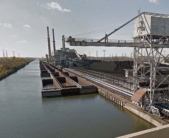
9 KEY PLANNING THEME #1 ADVANCING A BALANCED ECONOMIC BASE STRATEGIES & GUIDING PRINCIPLES Explore other non-traditional business opportunities, such as recreation and tourism based business and hospitality centers, that: Take advantage of Romeoville s environmental resources, including its network of parks, open spaces, and regional trails Educate the public about environmental protection efforts, including those focusing on wetlands and the Hines emerald dragonfly Build public education campaigns around any future efforts that redevelop former industrial sites, particularly along the river and canal, in a responsible manner for recreation or other uses 9

 10")
10 KEY PLANNING THEME #1 ADVANCING A BALANCED ECONOMIC BASE STRATEGIES & GUIDING PRINCIPLES Make existing commercial centers more experienced based places to enhance function, activity, and productivity Provide tangible experiences that can t be offered via online shopping; memorable experiences also encourage people to make return visits and use social media to spread the word Cultivate a greater sense of place via civic engagement in well planned public spaces (e.g., provide a civic plaza/park in Uptown Square to draw more people) 10
11 KEY PLANNING THEME #2 ENSURING MARKET-SUPPORTIVE STRATEGIES
12 KEY PLANNING THEME #2 ENSURING MARKET-SUPPORTIVE STRATEGIES OVERVIEW The Comprehensive Plan is guided by a realistic analysis of market conditions, that identifies feasible market-supportive strategies that the Village can undertake in cooperation with its partners. The Economic and Real Estate Market Analysis summarizes market findings and provide recommendations to diversify Romeoville s tax base relating to office, industrial, and retail uses. 12

13 KEY PLANNING THEME #2 ENSURING MARKET-SUPPORTIVE STRATEGIES STRATEGIES & GUIDING PRINCIPLES Capitalize on Romeoville s comparative advantages, including: Excellent interstate highway access Housing options at affordable price points Proximity to customers, suppliers, and support services Access to a broad labor base Excellent community services and amenities Positive business climate 13


14 KEY PLANNING THEME #2 ENSURING MARKET-SUPPORTIVE STRATEGIES STRATEGIES & GUIDING PRINCIPLES OFFICE MARKET: Attract compatible office uses with the recognition that the office market is limited in Romeoville INDUSTRIAL MARKET: Support a balanced economic base by taking a strategic approach when adding new industrial businesses to the Village s strong and growing industrial sector RETAIL MARKET: Concentrate retail uses at key nodes to strengthen a small core of commercial center rather than a scattered collection of retail businesses across the Village 14
15 KEY PLANNING THEME #3 ENHANCING ACCESS & MOBILITY


16 KEY PLANNING THEME #3 ENHANCING ACCESS & MOBILITY OVERVIEW Transportation planning in Romeoville will take a multimodal approach to ensure all modes are properly integrated into the design of the built environment. The provision of safe and convenient routes for motorists, pedestrians, and bicyclists are fundamentally tied to the Village s focus on strengthening access to transit facilities and enhancing connectivity to the local system of parks, forest preserves, and open space. 16

17 KEY PLANNING THEME #3 ENHANCING ACCESS & MOBILITY STRATEGIES & GUIDING PRINCIPLES Strengthen facilities that support the transport of goods, services, customers, and the workforce Encourage development patterns that minimize conflicts between regular auto traffic and trucks that form the lifeblood of Romeoville s strong industrial base Collaborate with Lewis University Airport to ensure future improvement and expansion plans are in concert with the Village s plans Improve transit facilities [see details on next slide] Create safe and connected pathways for pedestrians and bicyclists, particularly along major corridors, at major intersections, and within mixed use nodes Ensure all Village transportation plans are consistent with planned improvements from IDOT and Will County 17

18 KEY PLANNING THEME #3 ENHANCING ACCESS & MOBILITY STRATEGIES & GUIDING PRINCIPLES Expand the transit network to boost ridership and provide a greater amount of options to travel to, from, and around the Village Continue plans to build new Metra station Assess additional park-n-ride lots Improve existing Pace Routes 834 and 851, including potential for more stops and greater frequency Explore potential Pace routes on Weber Road and 135 th Street/Romeo Road RIGHT: Proposed land use and transportation concepts for Romeoville s Metra station area Source: Romeoville East Side Plan, Teska Associates, Inc. PREFERRED METRA STATION AREA CONCEPT PLAN 18


19 KEY PLANNING THEME #3 ENHANCING ACCESS & MOBILITY STRATEGIES & GUIDING PRINCIPLES Utilize the RTA s Setting the Stage for Transit and Pace s Transit Supportive Guidelines for integrating transit-supportive design into bus corridors and the Metra station area BEFORE AFTER Transit access Site and roadway design Pedestrian and bike access Parking RIGHT: Example bus corridor with before and after effects to illustrate transit-supportive design Source: RTA Setting the Stage for Transit, Teska Associates, Inc. 19

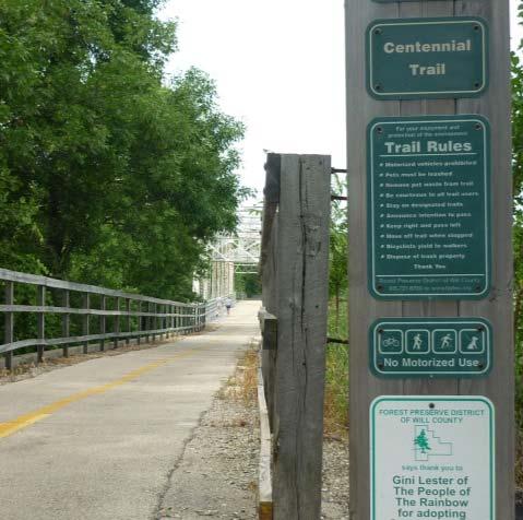
20 KEY PLANNING THEME #3 ENHANCING ACCESS: OPEN SPACE STRATEGIES & GUIDING PRINCIPLES Although the Village has establish a comprehensive park and recreation system, 40 acres of additional parks at 6 locations have been identified by the Village to serve existing and future growth Require open space contributions from new developments or fees-in-lieu to expand open space and recreational facilities across the Village Ensure all parks are accessible by pedestrians and bicyclists, including a reasonable walking distance to all homes, where practical 20
21 KEY PLANNING THEME #4 DIVERSIFYING THE HOUSING STOCK

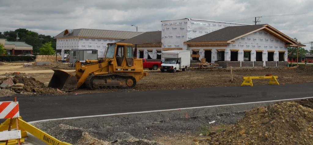
22 KEY PLANNING THEME #4 DIVERSIFYING THE HOUSING STOCK OVERVIEW Expanding housing options will ensure residents can age in place by finding suitable housing types that meet their changing needs over time without having to leave Romeoville. To meet this end, promote housing policies that support the distribution of diverse housing types at varying price points. Expand market rate housing, attainable housing, and rental housing as part of mixed-use projects, particularly in relation to Uptown Square, the proposed Metra station area on the East Side, and other areas at nodes along major transportation corridors. Examine residential zoning districts in the Village Code to determine if sufficient opportunity exists for development of a range of housing types. 22


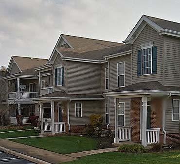
23 KEY PLANNING THEME #4 DIVERSIFYING THE HOUSING STOCK STRATEGIES & GUIDING PRINCIPLES Support the growing demand for apartment units, and the maintenance and investment of existing complexes Provide housing options that cater to the university community, including students, professors, and staff Integrate a mix of housing types near transit facilities with convenient access to restaurants, entertainment, and recreational opportunities The Springs at Weber Road and HighPoint Community are two apartment complexes serving Romeoville residents 23

24 KEY PLANNING THEME #4 DIVERSIFYING THE HOUSING STOCK STRATEGIES & GUIDING PRINCIPLES Continue advancing the Village s foreclosure mitigation program to minimize negative impacts of distressed properties Explore land banking opportunities to stabilize existing neighborhoods and stimulate new development Connect property and homeowners with maintenance and improvement programs to stabilize existing neighborhoods The property at 601 W 135 th Street is part of the Village s foreclosure mitigation program 24
25 KEY PLANNING THEME #5 LEVERAGING COMMUNITY PARTNERSHIPS


26 KEY PLANNING THEME #5 LEVERAGING COMMUNITY PARTNERSHIPS OVERVIEW From local businesses and industrial enterprises to educational institutions and community-based organizations, the Village continually strives to leverage its partnerships to support community events, provide services and programs to residents, advance the vibrant business culture, and enhance Romeoville s identity as an exemplar place to raise a family, enjoy natural amenities, do business, continue education, or visit for experiences that are unique to Romeoville. 26

27 KEY PLANNING THEME #5 LEVERAGING COMMUNITY PARTNERSHIPS OVERVIEW Through Romeoville s Where Community Matters branding program, the Village continues to value partnerships with its citizens, businesses and schools. The Village s Community of Partners campaign provides the platform on which to leverage resources and foster greater collaboration between schools, high education institutions, and businesses. The program goal is to improve academic achievement, foster successful individuals, and enrich student experiences. 27


28 KEY PLANNING THEME #5 LEVERAGING COMMUNITY PARTNERSHIPS OVERVIEW The CMAP GO TO 2040 Regional Plan recognizes the importance of strong partnerships that invest in communities and the local workforce as essential to creating sustainable economies. According to the CMAP Plan: The quality of our region's labor force is crucial for sustaining economic prosperity. Increasingly, job growth relies on the availability of well-educated, skilled workers for knowledge-based industries. LIVABLE COMMUNITIES EFFICIENT GOVERNANCE HUMAN CAPITAL REGIONAL MOBILITY 28


29 KEY PLANNING THEME #5 LEVERAGING COMMUNITY PARTNERSHIPS STRATEGIES & GUIDING PRINCIPLES Maintain strong working relationships with all of the Village s partners, from transit agencies, taxing districts, and other governmental bodies to businesses, non-profit foundations, and community-based organizations 29


30 KEY PLANNING THEME #5 LEVERAGING COMMUNITY PARTNERSHIPS STRATEGIES & GUIDING PRINCIPLES Work with local strategic partners to create efficiencies, leverage limited resources, and strengthen the collective capacity of Romeoville s network of organizations to enhance the quality-oflife for residents, strengthen the business environment, and create vibrant commercial areas Business partners can play many roles within the community, such as guest speakers, job shadowing, mentorships, and internships. In 2012, Nanophase Technologies Corporation entered into a collaboration with Lewis University to investigate aspects of engineered nanoparticle dispersions in polishing applications. 30

31 KEY PLANNING THEME #5 LEVERAGING COMMUNITY PARTNERSHIPS STRATEGIES & GUIDING PRINCIPLES Partner with higher educational institutions to advance the Village s strong economic base by educating and training students who will enter the local workforce that fill the employment needs of local businesses and industrial enterprises Lewis University Rasmussen College Joliet Junior College Romeoville High School Technical schools: Illinois Welding School and Wilco Career Center Promote Romeoville as a center for advanced education and skill development through partnerships with local educational institutions. Expand workforce development programs with local educational institutions to help workers gain marketable skills. Local colleges and technical schools provide a valuable tool with long-term benefits to local companies by ensuring a highly skilled and productive work force. 31
32 FRAMEWORK PLAN Romeoville s long range plan must be understood within the context of both its historic growth patterns and its current position in the region. Developing a long-term growth strategy is influenced by several factors, many of which the Village has no direct control. These factors include: Interstate, local roadway and rail systems Competitive market trade areas Retail concentrations of various types (neighborhood, downtown, and community) Regional open spaces and trail systems. PURPOSE The purpose of the Framework Plan is to illustrate the basic planning and development principles that have and will form the organizational structure for growth and development in Romeoville. 32

33 FRAMEWORK PLAN 33

34 FRAMEWORK PLAN As a maturing community with limited opportunities for expansion, the Framework Plan identifies several key areas within the community that will be subject to the most significant change over the next 10 years. They are: WEBER ROAD CORRIDOR Overall Approach: Diversify land uses along the corridor, providing a greater mix of commercial, residential, office, and retail/warehouse/service businesses. Weber Road/Romeo Road Node: Emphasize opportunities to create a mixed-use destination with linkages to nearby civic/education uses. Weber Road/Taylor Road Node: Provide uses that support key mixed-use/commercial nodes, such as residential, office and service businesses, with limited expansion of existing retail centers. 34

35 FRAMEWORK PLAN As a maturing community with limited opportunities for expansion, the Framework Plan identifies several key areas within the community that will be subject to the most significant change over the next 10 years. They are: Overall Approach: Strengthen the existing uses by creating an entertainment focused destination with supportive housing. Emphasize opportunities to build on new retail uses by clustering similar uses near Route 53 and expanding parking to the areas behind the Event Center. Explore the creation of a multipurpose central green/community gathering/and park space for events. 35

36 FRAMEWORK PLAN As a maturing community with limited opportunities for expansion, the Framework Plan identifies several key areas within the community that will be subject to the most significant change over the next 10 years. They are: UNIVERSITY DISTRICT Overall Approach: Explore the development of a mixed-use district that provides commercial and housing opportunities that cater to faculty and students of Lewis University, as well as local residents. Take advantage of connections to natural areas on the University property and Lockport Prairie Nature Preserve through old train ROW. Create linkages to the Lockport Metra Station to promote TOD development. 36
37 FRAMEWORK PLAN The Framework Plan map describes gateways, centers/nodes, linkages, paths, and corridors that make up the physical landscape of Romeoville. Greenway Corridors Gateways Nodes Connections Primary Use Districts Greenway corridors primarily consist of natural areas, such as streams, floodplains, wetlands, wildlife habitats, which should be preserved and protected from development, but which also serve as additional opportunities for nonmotorized connections and link to civic destinations. Gateways are of two types: Identity markers at the entries into the community and provide the first glimpse into a community s character, marked by welcome signs, special landscaping and highlights about its people and institutions; and Special Place markers identifying special districts in the Village, such the points of entry for the regional bike paths, as well as the entries to the Uptown area or other special districts. Nodes typically occur at the intersection of major roadway corridors, where concentrations of activities take place, such as major retail centers or institutions, such as Lewis University. Nodes consist of various types of land use concentrations, consisting of either areas of retail concentrations, or opportunities for new forms of development that provide for a great mix of uses and densities. Connections are the pedestrian and bicycle paths and corridors that provide non-motorized movement along which people travel and recreate, and which interconnect the City s neighborhoods. Primary Use Districts describes either the historic pattern of development to be preserved or expanded, and new approaches to development for existing areas, such as the Weber Road corridor, or new growth areas. 37
Visioning Statement and Guiding Principles
 Visioning Statement and Guiding Principles Planning for the Future The General Plan The General Plan represents Woodland's shared vision of the future and defines a path to lead the community toward its
Plano Tomorrow Vision and Policies
 Plano Tomorrow Vision and Policies PLANO TOMORROW PILLARS The Built Environment The Social Environment The Natural Environment The Economic Environment Land Use and Urban Design Transportation Housing
The Five Components of the McLoughlin Area Plan
 The Five Components of the McLoughlin Area Plan This documents contains the complete language of the five components of the McLoughlin Area Plan: The Vision Statement The Values The Guiding Principles
Issues, Challenges & Opportunities
 Below is a summary of issues, challenges, and opportunities relating to the revitalization of Downtown Romeoville and potential development of the Village s East Side TOD Area. Current Issues & Challenges
REGIONAL ACTIVITY CENTER
 DRAFT REGIONAL ACTIVITY CENTER 70 EAST BENCH MASTER PLAN DRAFT 06 Introduction The East Bench Regional Activity center is comprised of large educational, research, medical, and employment centers. These
CHAPTER 7: Transportation, Mobility and Circulation
 AGLE AREA COMMUNITY Plan CHAPTER 7 CHAPTER 7: Transportation, Mobility and Circulation Transportation, Mobility and Circulation The purpose of the Transportation, Mobility and Circulation Chapter is to
This page intentionally blank.
 This page intentionally blank. Parks, Recreation, and Open Space Chapter Relationship to Vision Vision Parks, Recreation and Open Space Chapter Concepts County Government. County government that is accountable
Preliminary Plan Framework: Vision and Goals
 Preliminary Plan Framework: Vision and Goals Draft: May 2015 Introduction Since the Town of Milliken s comprehensive plan was last updated in 2010, the community was heavily impacted by the 2013 flood,
Policies and Code Intent Sections Related to Town Center
 Policies and Code Intent Sections Related to Town Center The Town Center Vision is scattered throughout the Comprehensive Plan, development code and the 1994 Town Center Plan. What follows are sections
Comprehensive Plan ADOPTED APRIL 2014
 Comprehensive Plan ADOPTED APRIL 2014 8 8. Outstanding Recreational & Cultural Opportunities We are proud of our community s parks and recreation system. Our community will ensure that the legacy of our
EXISTING COMPREHENSIVE PLAN
 EXISTING COMPREHENSIVE PLAN Town Center Land Use Element: V. LAND USE POLICIES Town Center Mercer Island's business district vision as described in "Your Mercer Island Citizen-Designed Downtown" was an
Concord Community Reuse Project Goals and Guiding Principles. Overarching Goals (OG)
") Concord Community Reuse Project Goals and Guiding Principles Overarching Goals (OG) No priority is implied by the order of presentation of the goals and guiding principles. Overarching goals for the Concord
Concord Community Reuse Project Goals and Guiding Principles Overarching Goals (OG) No priority is implied by the order of presentation of the goals and guiding principles. Overarching goals for the Concord
DRAFT ROOSEVELT ROAD. District Recommendations. Figure 5.23 The Roosevelt Road Corridor
 CHAPTER 5 Figure 5.23 The Road Corridor Road will develop as a mixed-use corridor, emphasizing regional retail, west of the river and mixed-use development east of the river. KEY RECOMMENDATIONS 1. High
BROOKLYN PARK / 85TH AVE LRT STATION CDI DEVELOPMENT GUIDELINES DRAFT
 August 2018 Page intentionally left blank The Brooklyn Park Library adjacent to the 85th Ave LRT Station Area. OVERVIEW The Blue Line LRT Extension / Bottineau corridor offers a unique opportunity to leverage
1 October Dear Citizens of Charlotte and Mecklenburg County,
 1 October 2011 Dear Citizens of Charlotte and Mecklenburg County, As co-chairs of the Center City 2020 Vision Plan Steering Committee, we are proud to present the Center City 2020 Vision Plan, which sets
Town Center (part of the Comprehensive Plan)
") Town Center (part of the Comprehensive Plan) Mercer Island Town Center Looking North (2014) In 1994, a year-long process culminated in a set of design guidelines and code requirements for the Town Center
Town Center (part of the Comprehensive Plan) Mercer Island Town Center Looking North (2014) In 1994, a year-long process culminated in a set of design guidelines and code requirements for the Town Center
Economy Vision Statements: Social Wellbeing Vision Statements: Natural Environment Vision Statements:
 Economy Vision Statements: 1. Our business environment makes us a region of choice for new employers as we encourage entrepreneurship and have a vibrant, diversified and resilient regional economy. 2.
Land Use. Hardware Street Vendor Mixed-Use
 Land Use Definition Land Use is the way a piece of real estate is utilized. Existing, proposed, and adopted land uses all play a role in the planning process. Once a land use plan is adopted, the next
ROBBINSDALE LRT STATION CDI DEVELOPMENT GUIDELINES
 August 2018 OVERVIEW The City of Robbinsdale has a prime-opportunity site in the middle of the 13 mile stretch of the Bottineau LRT corridor / Blue Line extension. Robbinsdale offers a prominent, vital,
The transportation system in a community is an
 7 TRANSPORTATION The transportation system in a community is an important factor contributing to the quality of life of the residents. Without a sound transportation system to bring both goods and patrons
Chapter 4. Linking Land Use with Transportation. Chapter 4
 Chapter 4 Linking Land Use with Transportation Chapter 4 59 Chapter 4 Linking Land Use with Transportation Community Design and Transportation Program Introduction Since the 1950s, the predominant development
Chapter 1: Introduction
 Chapter 1: Introduction The Penn Avenue Community Works Corridor Vision and Implementation Framework presents an integrated communitybased vision and a coordinated, long-term implementation framework for
A BLUEPRINT FOR BROCKTON A CITY-WIDE COMPREHENSIVE PLAN
 A BLUEPRINT FOR BROCKTON A CITY-WIDE COMPREHENSIVE PLAN Public Meeting October 2016 1 Plan Summary and Discussion Public Meeting May 4 2017 City of Brockton Bill Carpenter, Mayor Department of Planning
Robbinsdale LRT Station. CDI Development Guidelines. August Overview
 Robbinsdale LRT Station August 2018 Overview The City of Robbinsdale may have the coolest opportunity site along the 13 mile stretch of the Bottineau LRT corridor / Blue Line extension. Located a block
CITY OF COLWICH COMPREHENSIVE PLAN LAND USE LAND USE 1
 LAND USE LAND USE 1 WHAT YOU WILL FIND IN THIS CHAPTER: Discussion of today s conditions and tomorrow s projections Discussion of challenges and opportunities Discussion of the environmental quality goals,
The University District envisions, in its neighborhood
 Envisioning the University District Link Light Rail in Seattle s neighborhoods CIY OF SEALE CONCEP-LEVEL SAION AREA PLANNING RECOMMENDAION RESOLUION # 30165 EXHIBI L Vision 08.2000 he University District
ELK GROVE GENERAL PLAN VISION
 2-1 CHAPTER 2: 2-2 CREATING OUR The Community Vision for Elk Grove, expressed through a Vision Statement and a series of Supporting Principles, is a declaration of the kind of community that Elk Grove
Ivywild On The Creek PRELIMINARY CREEK DISTRICT MASTER PLAN
 Ivywild On The Creek PRELIMINARY CREEK DISTRICT MASTER PLAN Introduction: Rejuvenating an extraordinary Creekside neighborhood THE CREEKSIDE DISTRICT The Ivywild On The Creek Neighborhood District Master
Corridor Vision. 1Pursue Minnehaha-Hiawatha Community Works Project. Mission of Hennepin County Community Works Program
 1Pursue Minnehaha-Hiawatha Community Works Project Minnehaha-Hiawatha Community Works is a project within the Hennepin Community Works (HCW) program. The mission of the HCW program is to enhance how the
PUBLIC OPEN HOUSE SEPTEMBER 8 TH, 2010 CITY OF LETHBRIDGE DEVELOPMENT SERVICES
 PUBLIC OPEN HOUSE SEPTEMBER 8 TH, 2010 CITY OF LETHBRIDGE DEVELOPMENT SERVICES INTRODUCTION Why is the City creating the West Lethbridge Employment Centre Area Structure Plan? West Lethbridge Urbanization
Strategic plan framework Steering Committee Meeting
 Strategic plan framework Steering Committee Meeting September 26, 2018 1 agenda 1 Welcome and Strategic Planning introductions Process Strategic Analyses Plan Framework 2 3 Brand Brand Development Naming
D-O LRT Zoning Discussion. Chapel Hill Boards & Commissions October 16, 2017
 D-O LRT Zoning Discussion Chapel Hill Boards & Commissions October 16, 2017 Update on Overall D-O LRT Station Area Initiative Objectives Design and educate on principles of Good Transit-Oriented Development
Sahuarita District & Phase 1 Master Plan. Town Council December 11, 2017
 Sahuarita District & Phase 1 Master Plan Town Council December 11, 2017 Visioning Study Visioning Process Advisory Group Meetings Community Questionnaire Town Center Case Studies Community Analysis The
Hopkins. Development Guidelines May Overview. Sponsored by: Blake Road Corridor Collaborative City of Hopkins
 Hopkins Blake Road LRT Station Area Development Guidelines May 2015 Sponsored by: Blake Road Corridor Collaborative City of Hopkins Overview Hopkins is a dynamic community of over 17,000 residents located
Wasatch CHOICE for 2040
 Wasatch CHOICE for 2040 Economic Opportunities We Can Choose a Better Future We enjoy an unparalleled quality of life along the Wasatch Front. People from all over the world are drawn to our stunning scenery,
Corridors. Re-vitalize our Corridors and Gateways
 Corridors Re-vitalize our Corridors and Gateways Artist s rendering from the 287 Strategic Plan, 2015 Corridors are the major throughways of Loveland but they also provide important commercial, community
CHAPTER 2: PLANNING PRINCIPLES
 CHAPTER 2: PLANNING PRINCIPLES 2 Comprehensive Principles The following overarching Principles provide the basis for the goals and policies included in the Mendocino County General Plan. These Principles
Regional Context Statement
 Regional Context Statement REGIONAL CONTEXT STATEMENT 3. REGIONAL CONTEXT STATEMENT In 1995, the Provincial Government passed into law the Growth Strategies Act. The purpose of this provincial initiative
PLAN ELEMENTS WORKSHOP. April 5, 2016
 PLAN ELEMENTS WORKSHOP April 5, 2016 needs more housing. But there is no one-size fits-all solution. Every neighborhood has its own character. In some places, density is not only appropriate it is badly
Gold Line Bus Rapid Transit Transit Oriented Development (BRTOD) Helmo Station Area Plan
 Helmo Station Area Plan") Appendix F Gold Line Bus Rapid Transit Transit Oriented Development (BRTOD) Helmo Station Area Plan Introduction and Purpose of the Plan The Gold Line Bus Rapid Transit facility is an eleven-mile dedicated
Appendix F Gold Line Bus Rapid Transit Transit Oriented Development (BRTOD) Helmo Station Area Plan Introduction and Purpose of the Plan The Gold Line Bus Rapid Transit facility is an eleven-mile dedicated
Harlem Avenue Corridor Plan: Corridor Planning Across Municipal Boundaries
 Harlem Avenue Corridor Plan: Corridor Planning Across Municipal Boundaries Heather Tabbert, Manager, Local Planning and Programs Division Regional Transportation Authority (RTA) Jen McNeil Dhadwal, Principal
Silverdale Regional Center
 Silverdale Regional Center Vision for Silverdale Regional Center The Silverdale Regional Center Plan (Plan) will guide the evolution of the Silverdale Regional Center from a collection of strip malls and
LAND USE ELEMENT. Purpose. General Goals & Policies
 LAND USE ELEMENT Purpose This Land Use Element contains the goals and policies necessary to support the City s responsibility for managing land resources and guiding development through implementing regulations,
In surveys, Dallas residents say what they want to change most
 NEIGHBORHOODS ELEMENT In surveys, Dallas residents say what they want to change most in the city is its appearance they want it to look beautiful, with trees and pedestrian-friendly neighborhoods. The
7Page 1 CLEMMONS COMMUNITY COMPASS 1 PLAN OVERVIEW
 1 Plan Overview WHAT IS I THE CLEMMONS COMMUNITY COMPASS? The Clemmons Community Compass is our community s comprehensive plan. It serves as our blueprint and provides direction for the future of the Village
3 Vision and Goals. Vision and Goals. Blueprint for Bloomsburg. Vision. Town of Bloomsburg Comprehensive Plan,
 Vision and Goals 3 Vision and Goals Citizens of the Town of Bloomsburg clearly value their natural and cultural heritage, the walkable, mixed use pattern of downtown, the access to education, and the community
iii. Visioning framework
 III. VISION iii. Visioning framework III.1 Overview A vision is a clear and succinct description of what an institution and its community should look like after it successfully implements its goals and
CAL POLY MASTER PLAN UPDATE, March 2015
 Some Key Themes in the General Guiding Principles Academic Mission The plan must foremost advance the University s academic mission and student success. Foresight and Adaptability The plan should take
ORANGE COUNTY IMPLEMENTING THE FOUR C s
 ORANGE COUNTY IMPLEMENTING THE FOUR C s East Central Florida Corridor Task Force O R A N G E COUN TY P LA N N I N G DIVISION C O M M U N I T Y, E N V I R O N M E N T A L A N D D E V E L O P M E N T S E
V. Vision and Guiding Principles
 V. Vision and Guiding Principles The Master Plan for the Powers Ferry Corridor seeks a foundation in the desires of the community. At times, various elements of the community offered opposing viewpoints,
Seneca Meadows. Block 4 Locate office, technology, and medical development adjacent to I Screen views of garage structures from I-270.
 Seneca Meadows Seneca Meadows has an industrial park in its southern end and a mixed-use employment area planned for the north end. The district benefits from extensive I-270 visibility, stream valley
RE-Imagining the Downtown Colorado Springs Master Plan
 RE-Imagining the Downtown Colorado Springs Master Plan 2016 APA Colorado State Conference October 25, 2016 Overview 8:00 Welcome, Introductions, and Overview 8:15 Downtown s Planning History 8:30 A Market
4- PA - LD - LIVELY DOWNTOWN. LD - Background
 4- PA - LD - LIVELY DOWNTOWN LD - Background The downtown has been the service centre for the community since the city s inception and the area continues to supply people with their personal services,
CHAPTER 2: FUTURE LAND USE CONCEPTS
 CHAPTER 2: FUTURE LAND USE CONCEPTS INTRODUCTION The future land use concepts presented in this chapter are an expression of community support for a viable and vital US 50 Corridor. Land use recommendations
Transportation. Strategies for Action
 Transportation A major priority for the Overlake Neighborhood is to develop a multimodal transportation system. To achieve this system, a balance has to be found among travel, circulation and access needs;
1 Introduction. 4 Environmental Integrity. 7 Community Facilities
 2037: A CALL TO ACTION 2017 COMPREHENSIVE PLAN EXECUTIVE SUMMARY is the purpose of the Q: What Comprehensive Plan? The comprehensive plan serves as a guide for the community s physical, social, and economic
17.11 Establishment of Land Use Districts
 17.11 Establishment of Land Use Districts 17.11.010 Purpose. To promote the health, safety, and general welfare of City residents and those who come to South Salt Lake to work, exchange commerce and recreate.
WEST OAKLAND SPECIFIC PLAN Final Plan. 2. Vision & Goals. 2.1 Community-Based Goals and Objectives
 WEST OAKLAND SPECIFIC PLAN Final Plan 2. Vision & Goals 2.1 Community-Based Goals and Objectives June 2014 2: Vision & Goals The vision of the West Oakland Specific Plan is to see this remarkable community
Port Lavaca Future Land Use
 Port Lavaca Future Land Use Introduction The City of Port Lavaca is beginning to see sustained growth, after many years of relative stable population. New single family homes, apartments, and businesses
CHAPTER 3 VISION, GOALS, & PLANNING PRINCIPLES. City of Greensburg Comprehensive Plan. Introduction. Vision Statement. Growth Management Goals.
 CHAPTER 3 VISION, GOALS, & PLANNING PRINCIPLES Introduction The Greensburg Comprehensive Plan is intended as a working community document. A combination of long and short-term goals, this document is intended
Midtown Greenway Land Use and Development Plan Executive Summary
 Midtown Greenway Land Use and Development Plan Executive Summary Introduction The Midtown Greenway Land Use and Development Plan sets policy direction for land use and development in the Midtown Greenway
Small Area Plan. South Gateway
 Small Area Plan Adopted May 12, 2008 South Gateway Purpose. The South Gateway Small Area Plan defines the City s expectations for the future of the southern entrance to the City at Interstate 85 and Highway
HE VISION. Building a Better Connected Place
 HE VISION Building a Better Connected Place WALK INTO THE FUTURE. Life in Cranberry, 2030 Here s what our residents told us they wanted to see in their community by 2030: The Cranberry of 2030 is a place
St. Louis Park Wooddale LRT Station Site development guidelines
 St. Louis Park Wooddale LRT Station Site development guidelines November 2013 OVERVIEW St. Louis Park s convenient location as a neighbor to Minneapolis means you re only minutes away from some of the
FUTURE LAND USE PLAN 7
 FUTURE LAND USE PLAN 7 The recommendations of each of the preceding chapters can be combined to present an overall Future Land Use Plan for Wilton. The Future Land Use Plan, presented on the following
Table of Contents. Elm Avenue Improvement Plan City of Waco, Texas. Introduction 1. Existing Context 1 Figure 1 2.
 Table of Contents Introduction 1 Existing Context 1 Figure 1 2 Plan Guidelines 3 Future Urban Form 4 The West-End 4 Main Street 6 The East-End 7 Figure 2 9 Public Improvement Recommendations 7 General
Vancouver. Title of the Initiative. Initiative Duration. Submitted by. Comments by the Jury
 134 Vancouver Title of the Initiative Initiative Duration Submitted by Comments by the Jury Visionary Vancouver: Creating a Welcoming and Sustainable Place for All 2009-2020 Wendy Au, Deputy City Manager,
About Momentum Midland
 About Momentum Midland Achieving a community s full potential in terms of economic development and quality of life is critically important to its long term sustainability. Core to achieving this is a vibrant
Further input invited as Colchester Growth Strategy nears final phase
 IUE 3 / NOVEMBER 2015 Further input invited as Colchester Growth trategy nears final phase trathcona County is seeking public feedback as it enters the final phase of work on a Growth Management trategy
THE 355/270 CORRIDOR:
 THE 355/270 CORRIDOR: Strategic Ideas for Sustaining a Livable Work Place Project Summary ACCESS LIFE DESIGN HEALTH WORK Montgomery County Planning Department The Maryland-National Capital Park and Planning
Chapter 1.0 Introduction
 Chapter 1.0 Introduction 1.1 Background The North Metro commuter rail line is part of the RTD FasTracks regional transit system expansion program to build more than 100 miles of rail transit throughout
2030 Comprehensive Plan VISION STATEMENT
 RESOURCE DOCUMENT for Steering Committee Meeting #2 July 12, 2017 2030 Comprehensive Plan VISION STATEMENT Steering Committee from 2008 Established the Lauderdale s Vision as: Creating a livable, lovable
178 Carruthers Properties Inc.
 178 Carruthers Properties Inc. Planning Rationale for 178 Carruthers Avenue Site Plan Control Application June 2014 Table of Contents 1.0 Introduction 2.0 Overview of Subject Property 3.0 Current Zoning
C. Westerly Creek Village & The Montview Corridor
 C. Westerly Creek Village & The VISION Community Vision When the goals of the city are achieved Westerly Creek Village, a distinctive community defined by Montview Boulevard and Westerly Creek, is a strong
Equitable Growth Through TOD Planning
 Equitable Growth Through TOD Planning Community Meeting # 2 November 2017 Goals Objectives Extend investment from downtown Connect neighborhoods physically and economically Enhance places based on local
Guiding Principles, Objectives, Strategies and Policies
 Guiding Principles, Objectives, Strategies and Policies Section 1 Introduction These Guiding Principles were adopted as part of the 1999 Athens-Clarke County Comprehensive Plan and are carried over, in
implementation10 Village of Greendale Comprehensive Plan: Greendale, Wisconsin. Revisiting a Greenbelt Community
 implementation10 Village of Greendale Comprehensive Plan: 2010 - Village of Greendale Comprehensive Plan: 2010 - Implementation The recommendations of this Plan must be implemented by the Village of Greendale,
Zoning and Development Considerations in the Boothbay Harbor Maritime/Water Dependent District
 Zoning and Development Considerations in the Boothbay Harbor Maritime/Water Dependent District Bob Faunce Lincoln County Planner Lincoln County Regional Planning Commission Board of Selectmen and Planning
3. VISION AND GOALS. Vision Statement. Goals, Objectives and Policies
 Vision Statement Queen Creek s interconnected network of parks, trails, open spaces and recreation opportunities provide safe and diverse activities and programs that sustain its unique, small town, equestrian
CHAPTER 1. Ms. Guajardo s Class - Central Elementary CH 1 1
 INTRODUCTION CHAPTER 1 Ms. Guajardo s Class - Central Elementary CH 1 1 1.1 SETTING South Centre City is a linear corridor south of Downtown Escondido paralleling Centre City Parkway and South Escondido
City of Long Beach. creating vibrant and exciting places
 City of Long Beach creating vibrant and exciting places Land Use Element Urban Design Element Overview of the two draft General Plan elements Discuss areas of change Economic goals of the plans Case study
MEETING PURPOSE AND OVERVIEW
 MEETING PURPOSE AND OVERVIEW On February 23, 2012, the City of Elk Grove hosted the first of two community workshops related to the Southeast Policy Area. The workshop was held from 6:00 8:30 p.m. in the
Welcome to the Oakridge Centre Open House
 Welcome to the Oakridge Centre Open House Why is the City hosting this event? This open house is to inform you of a rezoning application submitted to the City of Vancouver to amend the existing CD-1 (Comprehensive
CHARLES PUTMAN CHARLES PUTMAN AND ASSOCIATES, INC
 MEMORANDUM CHARLES PUTMAN & ASSOCIATES, INC. LAND DEVELOPMENT CONSULTANTS PLANNING ZONING PERMITTING 4722 NW Boca Raton Boulevard, Suite C-106 Boca Raton, Florida 33431 Phone: 561/994-6411 FAX: 561/994-0447
section 3: Vision, Values and Goals
 Vision, Values and Goals 3 2041 Vision: Victoria is an urban sustainability leader inspiring innovation, pride and progress towards greater ecological integrity, livability, economic vitality, and community
Windsor, Connecticut Plan of Conservation & Development DRAFT PLAN SUMMARY
 Windsor, Connecticut 2015 Plan of Conservation & Development DRAFT PLAN SUMMARY Plan Overview What is a Plan? Visionary Advisory Implementable Maintainable What it is not! Regulatory Binding Static Passive
Municipal Development Plan 2013
 UNIQUELY STONY PLAIN: Municipal Development Plan 2013 Quick Reference Guide What is a Municipal Development Plan (MDP)? The Town s highest-level planning document Sets the long-term vision and key themes
Supporting a Culturally Rich and Diverse City
 81 Supporting a Culturally Rich and Diverse City This paper is the sixth in a series of eight discussion papers. Culture. It s one of those words that we use a lot, but it has many different meanings,
Today Land & People. Northeast Nampa Gateway District. Employment. Land Use Characteristics. Demographics. Current Zoning
 Today Land & People Employment Major employers include Saint Alphonsus, the College of Western Idaho, the Auto Mall, Sorrento Lactalis and Walmart. 3,004 jobs in 2010 (COMPASS-CIM 2040 TAZ data) 4,345
Asset-Based Development Scenario
 Asset-Based Development Scenario The Asset-Based development scenario emphasizes existing regional assets, concentrating future development around these assets. Regional assets include sports arenas, higher
Municipal Development Plan Update Urban Service Area and Hamlets
 ENCLOSURE 1 Municipal Development Plan Update Urban Service Area and Hamlets Priorities Committee January 24, 2017 MUNICIPAL DEVELOPMENT PLAN UPDATE SHAPING OUR FUTURE MDP Update - Agenda MDP Update Public
JANUARY 19, 2011 CENTRAL AVENUE-METRO BLUE LINE TRANSIT-ORIENTED DEVELOPMENT IMPLEMENTATION PROJECT COMMUNITY FORUM
 CENTRAL AVENUE-METRO BLUE LINE TRANSIT-ORIENTED DEVELOPMENT IMPLEMENTATION PROJECT COMMUNITY FORUM JANUARY 19, 2011 THE MARYLAND-NATIONAL CAPITAL PARK AND PLANNING COMMISSION PRINCE GEORGE S COUNTY PLANNING
Urban Planning and Land Use
 Urban Planning and Land Use 701 North 7 th Street, Room 423 Phone: (913) 573-5750 Kansas City, Kansas 66101 Fax: (913) 573-5796 Email: planninginfo@wycokck.org www.wycokck.org/planning To: From: City Planning
A Plan for the Heart of the Region: Tukwila, WA
 : Tukwila, WA 1 The Plan orchestrates the Restructuring of a 1,000-acre Regional Shopping Area into a Social and Symbolic for the Region. REGIONAL CONTEXT Downtown Seattle (Metropolitan ) 20 miles Bellevue
TRANSIT-ORIENTED DEVELOPMENT POLICY DRAFT. City Planning and Development Department Kansas City, Missouri
 TRANSIT-ORIENTED DEVELOPMENT POLICY DRAFT City Planning and Development Department Kansas City, Missouri What is Transit Oriented Development (TOD)? Development that focuses land uses around a transit
DRAFT Land Use Chapter
 Stevens Creek Urban Village DRAFT 1 18 17 Land Use Chapter INTRODUCTION This Land Use Chapter describes how the Stevens Creek Urban Village will accommodate the growth that is planned for it in the Envision
Living in Albemarle County s Urban Places
 Living in Albemarle County s Urban Places ALBEMARLE COUNTY, VIRGINIA A Closer Look at Albemarle s Approach to Managing Growth and Creating Quality Urban Environments www.albemarle.org Page 2 Living in
WELCOME TO THE CHOUTEAU GREENWAY EQUITY WORKING GROUP!
 WELCOME TO THE CHOUTEAU GREENWAY EQUITY WORKING GROUP! Chouteau Greenway Steering Committee and Working Groups Overview Overview January 9, 2019 Chouteau Greenway will transform St. Louis by connecting
CITY COUNCIL AGENDA REPORT
 CITY COUNCIL AGENDA REPORT Subject: COUNCIL MOTION LRT ALIGNMENT REMOVAL FROM THE TRANSPORTATION MASTER PLAN On February 10, 2016 Councillor Hughes provided notice in accordance with Section 23 of Procedure
Vision 2020 Economic Redevelopment Team Final Report
 Vision 2020 Economic Redevelopment Team Final Report October 24, 2011 7/30/2011 1 2020 Visioning Redevelopment Economics Team Fritz Beiermeister Mike Evangelista Bill Largent Mark Lifter Team Members Shel