Hackbridge & Beddington Corner Neighbourhood Plan. Appendices
|
|
|
- Alvin Chapman
- 6 years ago
- Views:
Transcription

1 Hackbridge & Beddington Corner Neighbourhood Plan Appendices
2 Appendix 2 EVIDENCE BASE, GUIDANCE AND BIBLIOGRAPHY A number of documents, reports, studies and demographic / statistical data have been used and prepared to support the preparation of the draft Neighbourhood Plan. They comprise: Evidence Base Local Development Framework Documents Core Planning Strategy (2009) Site Development Policies DPD (2012) South London Waste Plan DPD (2012) Hackbridge Issues Paper SPD (2006) Sustainable Design and Construction IPG (2007) Draft Climate Change IPG (2011) Urban Design Guide SPD (2008) Car Clubs SPD (2007) Background Reports Prepared by Sutton Council Hackbridge Neighbourhood Profile (2012) The Hackbridge Project: Sustainable Suburb Charter (2009) Hackbridge Climate Change Adaptation Action Plan (2011) Borough Climate Change Adaptation Action Plan (2011) Study of Climate Change Impacts (2010) Understanding Sutton s Local Distinctiveness: Characterisation Report of Studies (2008) Borough Heritage Study (2008) PPS25 Sequential Test (2008) One Planet Sutton (2011) Housing Strategy and Beyond (2011) Studies Undertaken on Behalf of the Council Draft Hackbridge Masterplan (Tibbalds, 2009) Toolkit on Blue Infrastructure (BACA Architects, 2010) Developing Guidelines on Green Infrastructure (Global to Local, 2011) Tall Buildings Study (Gillespies, 2008) Strategic Flood Risk Assessment (Scott Wilson, 2008) Borough Heat Mapping Study (URS, 2011) Local Housing Needs Survey (Fordham, 2008) Neighbourhood Development Group Publications Statement of Consultation (2013) Application for Designation as a Neighbourhood Area (2012) Application for Designation as a Neighbourhood Forum (2012) Responses to Developers (2013) Hackbridge Walks (2011) Other Publications Office for National Statistics (ONS) GLA 2011 Round SHLAA Ward Population Projections (GLA, 2012) Retrofitting District Heating Systems (Bioregional, 2012) Hackbridge: A Zero Carbon Suburb (Bioregional, 2012) Census 2001 Census 2011 The Index of Multiple Deprivation (CLG, 2010) National Online Manpower Information System (NOMIS) - 2 -
3 Guidance The National Planning Policy Framework (CLG, 2012) The London Plan (Mayor of London, 2011) The Localism Act (2011) The Neighbourhood Planning (General) Regulations (2012) Neighbourhood Plans Roadmap Guide (Locality, 2012) Neighbourhood Plans Roadmap Quick Guide (Locality, 2002) Broadland District Council Neighbourhood Planning Guidance (2011) A Plain English Guide to the Localism Act (CLG, 2011) An Introduction to Neighbourhood Planning (CLG, 2011) Glasshouse Design Training (Glasshouse, 2011) Hackbridge.net (2011) CABE 'Building for Life'
4 Appendix 3 PLANNING TERMINOLOGY Core Planning Strategy: A development plan document. It sets out the long term vision (10+ years) for a local planning authority area, the strategic objectives, and the strategic planning policies needed to deliver that vision. Development Plan: comprises of the Unitary Development Plan in Sutton. Following the commencement of the Planning & Compulsory Purchase Act the Development Plan consists of the Regional Spatial Strategy (or Spatial Development Strategy in London), local development documents and the Unitary Development Plan (until its policies are superseded). Development Plan Documents (DPD): are prepared by the relevant planning authority. They set out the planning policies against which proposals for new development in an area (such as the London Borough of Sutton) will be assessed. The Development Plan Documents that local planning authorities must prepare include: Core Planning Strategy (Spatial Strategy); Site Development Policies; Site specific allocations of land; and Proposals map (with inset maps, where necessary) Green Infrastructure: including parks, green and open spaces and cemeteries. Green Space: those parts of an area which are occupied by natural, designed or agricultural landscape as opposed to built development; open space, parkland, woodland, sports fields, gardens, allotments, and the like. Independent Examination: An examination of a proposed Neighbourhood Plan, carried out by an independent person, set up to consider whether a Neighbourhood Plan meets the basic conditions required Joint Strategic Flood Risk Assessment (SFRA): provides further information on flood risk, and raises and informs a crucial debate that involves all those involved in the development process. The SFRA will identify constraints which will assist in the formulation of planning policies, it will aid the identification of the development potential of proposed sites and will aid in assessing future development proposals. In the case of Sutton the assessment is in partnership with the boroughs of Wandsworth, Merton and Croydon. Localism: Shifting power away from central government control to the local level. Making services more locally accountable, devolving more power to local communities, individuals and councils Local Development Documents (LDDs): compirse Development Plan Documents and Supplementary Planning Documents Local Development Framework (LDF): sets out, in the form of a portfolio, the local development documents which collectively delivers the spatial planning strategy for the local planning authority's area. Local Referendum: A direct vote in which communities will be asked to either accept or reject a particular proposal. Local List: A list produced by a local authority to identify buildings and structures of special local interest which are not included in the statutory list of listed buildings. London Plan: The Mayor s Spatial Development Strategy for London. Mixed Use: The development of a single building or site with two or more complementary uses
5 Metropolitan Open Land "Metropolitan Open Land" or "MOL" is a term or designation used only within London. Land designated MOL is afforded the same level of protection as the Green Belt. Designation is intended to protect areas of landscape, recreation, nature conservation and scientific interest which are strategically important. Consequently any development of any kind on MOL must not only both be what is regarded as appropriate in the same way as Green Belt but the planning permission to carry it out cannot be granted by a London Borough acting alone, but requires the concurrence of the Mayor of London and the Secretary of State for Communities and Local Government. In more detail, land designated as MOL should satisfy at least one of the following criteria: land that contributes to the physical structure of London by being clearly distinguishable from the built-up area land that includes open air facilities, especially for leisure, recreation, sport, arts and cultural activities and tourism which serve the whole or significant parts of London land that contains features or landscapes of historic, recreational, nature conservation or habitat interest, of value at a metropolitan or national level land that forms part of a Green Chain and meets one of the above criteria. National Planning Policy Framework (NPPF): The government policy document adopted in March 2012 intended to make national planning policy and guidance less complex and more accessible. The National Planning Policy Framework introduces a presumption in favour of sustainable development. It gives five guiding principles of sustainable development: living within the planet s means; ensuring a strong, healthy and just society; achieving a sustainable economy; promoting good governance; and using sound science responsibly. Neighbourhood Area: The local area in which a Neighbourhood Plan or Neighbourhood Development Order can be introduced. Neighbourhood Forum/ Neighbourhood Development Group: Designated by the local authority in non-parished areas, an organisation established for the purpose of Neighbourhood Planning to further the social, economic and environmental well being of the neighbourhood area. There can only be one forum in an area. Neighbourhood Planning: A community-initiated process in which people get together through a local forum or parish or town council and produce a plan for their neighbourhood setting out policies and proposals for the development they wish to see in their area. Neighbourhood [Development] Plan: A planning document created by a parish or town council or a neighbourhood forum, which sets out a vision for the neighbourhood area, and contains policies for the development and use of land in the area. Neighbourhood Plans must be subjected to an independent examination to confirm their soundness, and then to a local referendum. If approved by a majority vote of the local community, the Neighbourhood Plan will then form part of the statutory development plan. One Planet Living: a partnership between Bio-Regional and World Wildlife Fund based on 10 guiding principles of sustainability. The vision of one plant living is a world in which people everywhere can lead happy, healthy lives within their fair share of the earth s resources. Presumption In Favour Of Sustainable Development: The concept introduced in 2012 by the UK government with the National Planning Policy Framework to be the golden thread running through both plan making and decision taking. The NPPF gives five guiding principles of sustainable development: living within the planet s means; ensuring a strong, healthy and just society; achieving a sustainable economy; promoting good governance; and using sound science responsibly. Public Realm: Areas of space usually in town and city centres where the public can circulate freely, including streets, parks and public squares. Site Allocation Plan: A plan accompanying a planning policy document or statement which identifies sites within the plan area on which certain kinds of development are proposed, e.g. residential or retail development. Site Development Policies: one of the Development Plan Documents required to be prepared as part - 5 -
6 of the Local Development Framework. It consists of detailed policies to ensure that development within the planning authority s area helps to meet the vision set out in the Core Strategy. Stakeholders: People who have an interest in an organisation or process including residents, business owners and government. Strategic Environmental Assessment (SEA)/ Sustainability Appraisal (SA): a generic term used to describe environmental assessment as applied to policies, plans and programmes. The European SEA Directive (2001/42/EC) does not in fact use the term strategic environmental assessment. It requires a formal environmental assessment of certain plans and programmes, including those in the field of planning and land use. The sustainability appraisal covers wider objectives than the strategic environmental assessment but in practice both procedures will be combined. These processes feed into and are intended to improve the content of the LDF. Super Output Area (SOAs): are a geography designed for the collection and publication of small area statistics. They are used on the Neighbourhood Statistics site. Supplementary Planning Documents (SPD): cover a wide range of issues on which the planning authority wishes to provide policy guidance to supplement the policies and proposals in development plan documents. They are not subject to independent examination. Taller Building Categories: Mid-rise Buildings those that are considered to be tall in the context of relatively low-rise development but that in absolute terms are in the region of 4-6 storeys (12-18m) Tall Buildings those that are significantly taller than the mean height of surrounding development and will have a range of 7-10 storeys (21-30m) Very Tall Buildings those that are excessively taller than the surrounding built form and will be from 11 storeys upwards. Use Class: The legally defined category into which the use of a building or land falls (see Use Classes Order)
7 Appendix 4 PLANNING POLICY CONTEXT The London Borough of Sutton s planning policies are set out with the Sutton Local Development Framework (LDF) which includes the Core Planning Strategy (2009), Site Development Policies DPD (2012), Joint South London Waste Plan DPD (2012) and a range of supplementary planning documents (SPDs). When adopted the Hackbridge and Beddington Corner Neighbourhood Development will form part of this Local Development Framework and would be used in the determination of planning applications. The Neighbourhood Development Plan is a flexible community-based document, which is initiated through, a neighbourhood forum and ultimately adopted by the local planning authority as part of its development plan, setting out policies in relation to the development and use of land in a particular neighbourhood area. The Plan needs to be in general conformity with local development plan documents, (i.e. Sutton s adopted Core Strategy) as well as regional planning policy (i.e. The London Plan). Local planning authorities will have a duty to adopt a legally compliant Neighbourhood Development Plan. The Neighbourhood Planning (General) Regulations came into legal force on 6 th April 2012 and sets out the key stages in producing a Neighbourhood Development Plan. Once all the stages have been met the Council have to adopt the Neighbourhood Plan. Further information on the process can be found online at National and Regional Policy The National Planning Policy Framework (NPPF) was published in March 2012, setting out the Government s planning policies for England and how these are expected to be applied. The NPPF must be taken into account in the preparation of neighbourhood plans. The core message of the NPPF is to help achieve sustainable development with a presumption in favour of sustainable development. The NPPF states that Neighbourhood planning provides a powerful set of tools for local people to ensure that they get the right types of development for their community. The ambition of the neighbourhood should be aligned with the strategic needs and priorities of the wider local area. Neighbourhood plans must be in general conformity with the strategic policies of the Local Plan Neighbourhood plans and orders should not promote less development than set out in the Local Plan or undermine its strategic policies. Therefore neighbourhoods should: develop plans that support the strategic development needs set out in Local Plans, including policies for housing and economic development; plan positively to support local development, shaping and directing development in their area that is outside the strategic elements of the Local Plan; and Identify opportunities to use Neighbourhood Development Orders to enable developments that are consistent with their neighbourhood plan to proceed. Underneath the NPPF is the London Plan, the overall strategic plan for the Greater London Region, setting out an integrated economic, environmental, transport and social framework for the development of London over the next years. In addition the London Plan brings together the geographic and locational (although not site specific) aspects of the Mayor s other strategies, including housing, economic development and transport. For example, the London Plan 2011 sets Sutton s minimum annual housing target of 201 dwellings per annum. The London Plan only deals with those matters of strategic importance and, as such, planning policy documents that are prepared by Sutton, as well as neighbourhood plans prepared by communities need to be in general conformity with the policies contained within the London Plan. The London Plan is kept under review, in accordance with the Greater London Authority Act The current version of the Plan was published in July Core Planning Strategy (2009) - 7 -
8 The Core Planning Strategy is the over-arching strategy planning document for Sutton and was adopted in December It sets out the Council s long-term vision, spatial strategy and core policies for shaping future development of the Borough and managing change over a 15 year period (2009 to 2024). The document contains strategy policies for Hackbridge over these periods which are set out below. The Core Strategy identifies Hackbridge as the focus for a flagship sustainable regeneration project that brings about the renewal of the fabric of the area through environmentally innovative mixed-use redevelopment schemes. This high profile project will ensure that Sutton remains an exemplar authority at the forefront of best practice in terms of creating sustainable communities. As such the key diagram identifies Hackbridge as a sustainable neighbourhood. The existing local centre is identified as a Centre for Growth and Regeneration involving comprehensive redevelopment of the wider Hackbridge area, to provide a district centre and a sustainable mix of homes, businesses, shops and community and leisure facilities. Within the Hackbridge area, established industrial areas such as Felnex and the Wandle Trading Estate, as well as a number of other sites all provide opportunities for mixed-use redevelopment. The Core Planning Strategy also identifies Beddington Farmlands, to the east of Hackbridge and Beddington Corner, as incorporating part of the future Wandle Valley Regional Park. There are a number of policies contained within the Core Planning Strategy that relate specifically to Hackbridge: Place Making Policies (PMP) Core Policy PMP1 Housing Provision 20% of new dwellings over the plan period to be located within Hackbridge, in accordance with the London Plan housing target. Core Policy PMP4 Main Locations for Industry Retain and promote the intensification of employment uses as part of proposals for mixed-use development: Wandle Valley Trading Estate (40%), Hackbridge Station (30%) and Felnex (25%). Core Policy PMP5 Wandle Valley the Council will promote sustainable regeneration within the Wandle Valley Corridor by managing the re-use of land/premises within established industrial areas to provide mixed-use development for employment, housing and other purposes; improving accessibility by sustainable modes; protecting and enhancing the River Wandle and adjoining open spaces; Creating the Wandle Valley Regional Park; safeguarding mineral reserves; and undertaking restoration of mineral extraction/landfill. Core Policy PMP7 Hackbridge - The Council will promote the development of Hackbridge as a district centre and a sustainable neighbourhood and will support proposals for new shopping, housing and commercial development and a range of social and community facilities, which will contribute to the growth and regeneration of Hackbridge district centre and of the Hackbridge neighbourhood and the creation of a Low Carbon Zone within the neighbourhood, with zero carbon standards achieved for all new developments from 2011, including: - An expansion of the retail area, with an increased range and quality of retail facilities, including convenience and comparison shops; - The re-use of land and premises within the former Kelvin House site, the Felnex Trading Estate, Hackbridge Station and Wandle Valley Trading Estate established industrial areas; - The creation of a range of business/employment opportunities; - Local healthcare facilities; - Additional primary school accommodation; - Improvements to cycle and walking networks; and - The creation of additional public open spaces and a safe and attractive environment through enhancements to the public realm. Borough Policies (BP) Core Policy BP2 Affordable Housing The Council will seek affordable housing on all proposed development capable of achieving 10 units or more with an overall borough-wide target of 50% affordable housing. Core Policy BP5 Improving Health and Well Being The Council will support the development of additional local healthcare centres in Wallington and Hackbridge
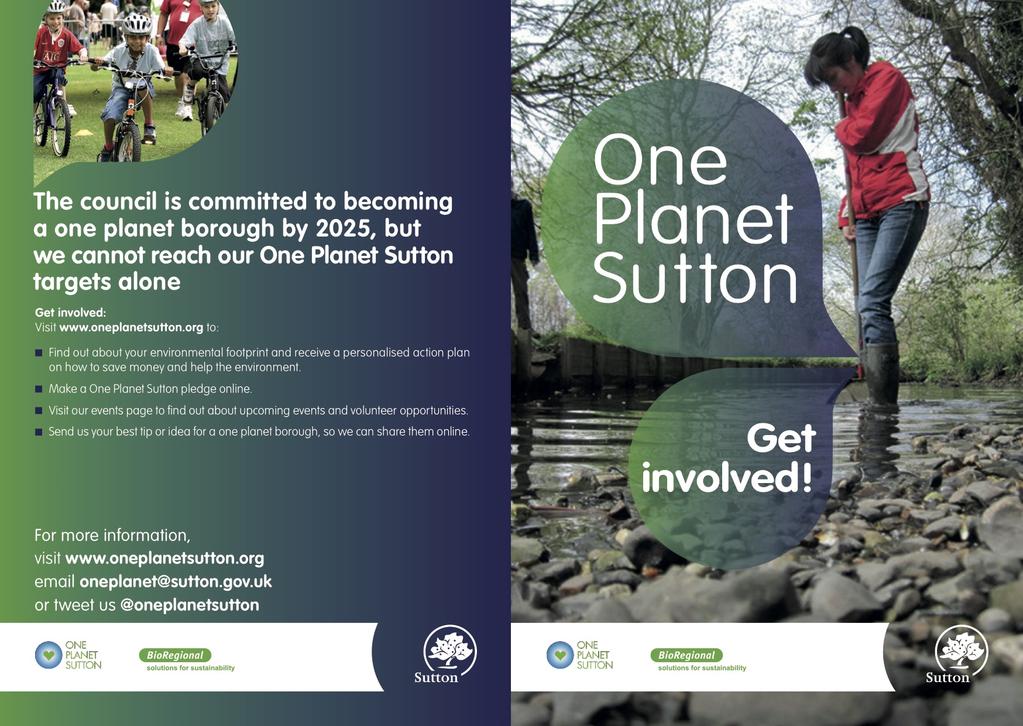
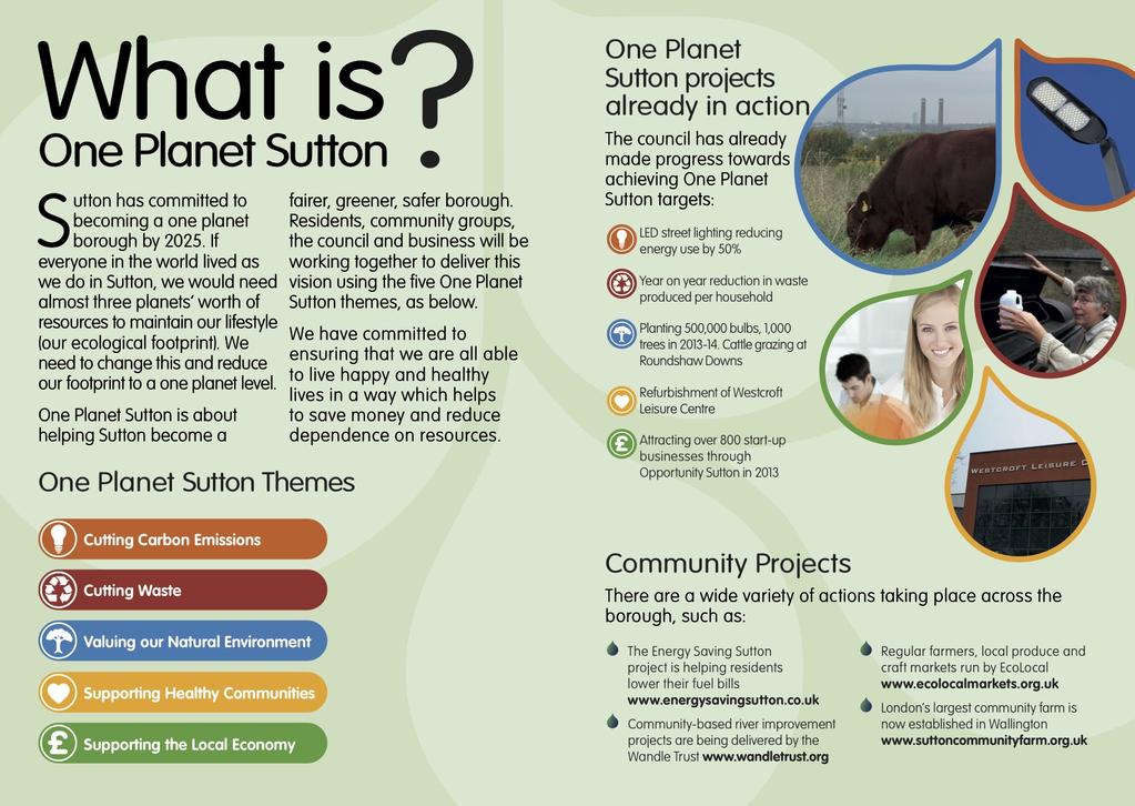
9 Core Policy BP6 One Planet Living One of the ways in which Sutton will deliver One Planet Living principles is through the sustainable regeneration and growth of the Hackbridge neighbourhood in line with One Planet Living principles and as Low Carbon Zones, with zero carbon standards to be achieved for all new developments within the Hackbridge neighbourhood from Core Policy BP9 Enabling Smarter Travel Choices The Council will look to introduce the following schemes to Hackbridge: - Replacement of the London Road Bridge (completed) - Improvements to the station area to improve bus/rail/cycle/pedestrian interchange facilities and access, and to enhance the station environment - Traffic management measures to reduce adverse impact of through traffic and improve movement Core Policy BP12 Good Urban Design - The Council will seek to ensure that development: - respects the local context and distinctive local character; - creates safe and attractive building layouts; - create vibrant, attractive and accessible public spaces; - creates easier movement; - creates a sense of welcome by promoting legible places through the development of landmark buildings, public realm features, landscape and public art; and - creates buildings that are adaptable and promote the best in sustainable design and construction. Core Policy BP13 Taller Buildings The Council will designate Areas of Taller Building Potential, including opportunities in Hackbridge (as set out on the adopted Proposals Map). Site Development Policies DPD (2012) The Site Development Policies DPD (The Sites DPD) puts forward policies for managing development across the Borough and identifies a range of sites to meet the development needs, in accordance with the Core Planning Strategy. These detailed development management policies support the strategic policies of the Core Planning Strategy by ensuring that new development is in accordance with spatial vision for the Borough. The Sites DPD identifies and allocates 5 sites within the Hackbridge and Beddington Corner Neighbourhood Area, four of which are for mixed use redevelopment. These sites are set out in Figure 3.1 Site Allocations in Hackbridge and Beddington Corner


10 Figure 3.1 Site Allocations in Hackbridge and Beddington Corner Felnex Trading Estate Land Adjoining Hackbridge Station Land North of BedZED Kelvin House Ownership Private Site Area 7.7 ha Existing Use Industry Relevant Planning Policies PMP1, PMP3, PMP4, PMP5, PMP7, BP5, BP7, BP9 and BP13 Allocation Mixed Use: Residential, Retail, Employment and Community PTAL Level Level 2 and 3 Site has Outline planning permission for mixeduse Comment redevelopment for up to 725 new dwellings, supermarket, open space, retail and employment. Ownership Private Site Area 1.2 ha Existing Use Industry Relevant Planning Policies PMP1, PMP3, PMP4, PMP5, PMP7, BP7, BP9 and BP13 Allocation Mixed Use: Residential and Employment PTAL Level Level 3 Comment The site has an indicative residential capacity of 60 units and is located in an area of taller building potential Ownership Area A: Private Area B: Council Site Area 7.5 ha Existing Use Vacant land Relevant Planning Policies PMP5, PMP7 and PMP9 Area A is allocated for eduction/community and Allocation Area B is allocated for the Regional Park and Playing Fields (this land is also safeguarded for mineral extraction. PTAL Level Level 1B and 2 The site is covered by a number of designations Comment including MOL, Metropolitan Green Chain, SINC and Archaeological Priority Area Ownership Private Site Area 0.3ha Existing Use Vacant Relevant Planning Policies PMP1, PMP3, PMP4, PMP7, BP7 and BP13 Allocation Mixed Use: Residential, Retail and Office PTAL Level Level 3 Comment The redevelopment of the site for 68 flats and ground floor retail was completed in

11 Wandle Valley Trading Estate Ownership Site Area Existing Use Relevant Planning Policies Allocation PTAL Level Private 2.3ha Industry PMP1, PMP3, PMP4, PMP5, PMP7, PMP9 and BP7 Mixed Use: Employment, Residential &Open Space 1a and 1b LDF requires retention of at least 40% employment, public open space on Area A and an indicative residential capacity of 50 units In addition to the Site Allocations listed above, full details of which are available in the Site Development Policies DPD, there are a number of other sites located within Hackbridge that are currently coming forward for redevelopment. These include Corbet Close, Nightingale Close and Durand Close. A full range of Sutton s planning policy documents, along with other evidence based reports, can be found on the Councils website at Other Relevant Documents There are a number of other documents that the Group has utilised in preparing the draft Neighbourhood Development Plan from Sutton Councils evidence base. Whilst these documents do not constitute strategic policies they are useful background reports that inform and provide information to aid the preparation of the draft plan. Hackbridge SPD: Issues Paper (2006) The Hackbridge issues paper was published for public consultation in September 2006, with the ultimate aim of becoming a supplementary planning document (SPD). The document set out some of the issues affecting the area and to involve the community in future discussions about plan preparation in the area. The issues identified by the paper were centred on certain themes such reinforcing the role of the local centre, promoting and protecting suburban employment and promoting sustainable development patterns. These are all still themes of discussion by the neighbourhood planning group. Draft Hackbridge Masterplan (2009) The draft Hackbridge Masterplan, produced on behalf of the Council by Tibbalds, was published for public consultation in January The aim of the draft Masterplan was to provide an evidence base for Sutton s policy approach for growth in Hackbridge and to produce detailed proposals for the development of Hackbridge. The Group reviewed the work of the draft Masterplan at a public workshop in November 2011 to assess whether the aspiration were still supported. Whilst never formally adopted by Sutton Council the draft Masterplan continues to be a good source of information for the group. The Hackbridge Project: Sustainable Suburb Charter (2009) The Hackbridge Project: Sustainable Suburb Charter was devised with the vision By 2025 Hackbridge will be a sustainable suburb based on One Planet Living principles, a suburb where people living, working and visiting are fully aware of their ecological footprint and understand what they can do to reduce it. The Charter sets out how the Council will work with developers, the community and other key stakeholders in the area to ensure the sites identified for redevelopment are considered in a constructive, collaborative open and holistic manner
12 Hackbridge Climate Change Adaptation Action Plan (2011) The draft Hackbridge Climate Change Adaptation Action Plan (AAP) is the key output arising from the Council's participation in the EU GRaBS project1 (Green and Blue Space Adaptation for Urban Areas and Eco Towns) ensure that existing and new mixed use urban development is adapted to the impact of climate change through improving local and regional planning policy, particularly through planning, to put in place green and blue infrastructure. This document was informed by public consultation on the wider GRaBS project. One Planet Sutton (2011) The principles of One Planet Living are fundamental to the Neighbourhood Plan. The One Planet Sutton document details the principles and summaries targets for achieving them. Moving Forward The Neighbourhood Planning (General) Regulations came into legal force on 6 th April 2012 and sets out the key stages in producing a Neighbourhood Development Plan: The first stage in the process involves the community group applying to the local council for an area to formally designate a neighbourhood area for the purposes of neighbourhood planning. This stage was formally completed in September 2012 The second stage would involve that community group applying to the local authority to be formally designated as a neighbourhood forum for the purposes of preparing a neighbourhood plan for the designated area. Both these stages involve a 6-week consultation with the community. This stage was also completed in September 2012 Once the area is defined the Neighbourhood Development Group begin developing their draft proposals into a plan that can be used in the determination of planning applications. This document Public consultation will be undertaken to inform the final draft of the neighbourhood plan, prior to submission to the Local Authority. Once a final draft of the neighbourhood development plan has been drafted it will be sent to the local authority to check conformity with planning policy, that it meets procedural requirements and check that it is legally compliant. The draft plan will be formally consulted for a period of 6-weeks in If the council is satisfied then the draft plan must be submitted to an independent assessor. The assessor will ensure that it complies with legal requirements and national policy, and is aligned with neighbouring plans and the strategic elements of the local development plan; If the assessor is satisfied then the plan can proceed to referendum where the local community will vote on whether they want it to be adopted. This ensures YOU get the final say. Once all the above stages have been met the Council have to adopt the Neighbourhood Plan. Further information on the process can be found online at

13 Appendix 5 ONE PLANET LIVING
14 - 14 -
15 Appendix 6 ONE PLANET LIVING ACTION PLAN Please go to for all the tools you need to create a One Planet Living Action Plan
Parish of Repton NEIGHBOURHOOD DEVELOPMENT PLAN
 Parish of Repton NEIGHBOURHOOD DEVELOPMENT PLAN BASIC CONDITIONS STATEMENT December 2018 CEF 4 Legal Requirements This statement has been produced by the NDP Working Group on behalf of Repton Parish Council
Great Easton Neighbourhood Plan Statement of Basic Conditions
 Great Easton Neighbourhood Plan 2017-2031 Statement of Basic Conditions OCTOBER 2016 GREAT EASTON PARISH COUNCIL Contents 1.0 Introduction....Page 2 2.0 Summary of Submission Documents and Supporting Evidence..
ROCHFORD LOCAL DEVELOPMENT FRAMEWORK: Sustainability Appraisal/ Strategic Environmental Assessment. Rochford Core Strategy Preferred Options Document
 ROCHFORD LOCAL DEVELOPMENT FRAMEWORK: Sustainability Appraisal/ Strategic Environmental Assessment Non Technical Summary Rochford Core Strategy Preferred Options Document October 2008 SUSTAINABILITY APPRAISAL
Sustainability Statement. Whitby Business Park Area Action Plan
 Sustainability Statement Whitby Business Park Area Action Plan November 2014 Contents Page 1. Introduction 1 2. Scoping 3 3. Sustainability Appraisal of Options 6 4. Assessment of Draft Area Action Plan
Newcourt Masterplan. November Exeter Local Development Framework
 Newcourt Masterplan November 2010 Exeter Local Development Framework Background The Exeter Core Strategy Proposed Submission sets out the vision, objectives and strategy for the development of Exeter up
Plumpton Neighbourhood Development Plan Revised Pre Submission Document - Regulation 14 Consultation
 REPRESENTATIONS... Plumpton Parish Council Plumpton Neighbourhood Development Plan Revised Pre Submission Document - Regulation 14 Consultation Representations submitted on behalf of: Cala Homes (South
INTRODUCTION NORTH HEYBRIDGE GARDEN SUBURB
 INTRODUCTION This event is being hosted by the promoters of the proposed North Heybridge Garden Suburb who are working with Maldon District Council and other key stakeholders on the preparation of a comprehensive
BEDFORD BOROUGH COUNCIL PLAN IMPLEMENTATION MONITORING REPORT
 BEDFORD BOROUGH COUNCIL PLAN IMPLEMENTATION MONITORING REPORT 2017-18 Summary 1 Progress on local development documents 1 Local development documents adopted in the monitoring period 1st April 2017 31st
Neighbourhood Planning Local Green Spaces
 Neighbourhood Planning Local Green Spaces Introduction... 2 1. Why green space is important... 4 2. Neighbourhood plans and green space... 6 3. Evidence... 8 Statutory designations... 9 Green space audit...
Rochford District Council. Adopted 16 December Local Development Framework. Development Management Plan LDF.
 Rochford District Council Adopted 16 December 2014 Local Development Framework Development Management LDF www.rochford.gov.uk Contents Page 1 Introduction... 3 The Role of the Development Management...
Vigo Neighbourhood Plan Basic Conditions Statement
 Vigo Neighbourhood Plan Basic Conditions Statement Plan Period: 2016 to 2028 Status: Submission Version Qualifying Body: Vigo Parish Council Glossary of Some Terms & Abbreviations Used in this Document
3. Neighbourhood Plans and Strategic Environmental Assessment
 1. Introduction This report sets out a draft Screening Determination for the Preston Parish Council s Neighbourhood Plan and has been prepared by rth Hertfordshire District Council. The purpose of the
WELCOME GYPSY LANE. Wider Site Location plan. Proposals for the development of LAND OFF FOXLYDIATE LANE WEBHEATH. Proposals for the development of
 WELCOME The developers are preparing an outline planning application for a residential led development and need the community s views in order to develop the proposals further WHAT IS PROPOSED? A high
Town and Country Planning (Local Planning) (England) Regulations 2012, Regulation 22 Submission of Legacy Corporation Local Plan
 (England) Regulations 2012, Regulation 22 Submission of Legacy Corporation Local Plan") Level 10, 1 Stratford Place Montfichet Road London E20 1EJ Tel: +44 (0) 20 3288 8821 Fax: +44 (0) 20 3288 1851 alex.savine@londonlegacy.co.uk Stuart Liddington The Planning Inspectorate 3/12 Kite Wing
Level 10, 1 Stratford Place Montfichet Road London E20 1EJ Tel: +44 (0) 20 3288 8821 Fax: +44 (0) 20 3288 1851 alex.savine@londonlegacy.co.uk Stuart Liddington The Planning Inspectorate 3/12 Kite Wing
Taking forward the All London Green Grid
 Taking forward the All London Green Grid Foreword Earlier this year, the Mayor published the All London Green Grid Supplementary Planning Guidance to the London Plan which set the vision, and framework,
Wildlife and Planning Guidance: Neighbourhood Plans
 Wildlife and Planning Guidance: Neighbourhood Plans This Leaflet is one of a series of 4 Wildlife and Planning Guidance Leaflets and is intended to provide useful information to assist you to campaign
Policy and Resources Committee 10 th October Green Infrastructure Supplementary Planning Document (SPD) Summary. Title
 Summary. Title") Policy and Resources Committee 10 th October 2017 Title Report of Wards Status Urgent Key Enclosures Officer Contact Details Green Infrastructure Supplementary Planning Document (SPD) Deputy Chief Executive
Policy and Resources Committee 10 th October 2017 Title Report of Wards Status Urgent Key Enclosures Officer Contact Details Green Infrastructure Supplementary Planning Document (SPD) Deputy Chief Executive
Enclosures Appendix 1: Draft Golders Green Station Planning Brief. Summary
 Policy and Resources Committee 23 February 2017 Title Report of Wards Status Urgent Key Golders Green Station Draft Planning Brief Cath Shaw Commissioning Director - Growth & Development Interim Deputy
Effingham Neighbourhood Plan 1. Basic Conditions Statement
 Effingham Neighbourhood Plan 1 Basic Conditions Statement Effingham Neighbourhood Plan 2016: Basic Conditions Statement 2 Contents This statement has been prepared by Effingham Parish Council to accompany
Site Assessment Technical Document Appendix A: Glossary
 Central Bedfordshire Council www.centralbedfordshire.gov.uk Site Assessment Technical Document Appendix A: Glossary July 2017 1.1.11-1 - ii Appendix A: Glossary Term Agricultural Land Classification AONB
South Worcestershire Development Plan. South Worcestershire Design Guide Supplementary Planning Document
 South Worcestershire Development Plan South Worcestershire Design Guide Supplementary Planning Document Statement of Consultation: Early Engagement Scoping Paper February 2017 1. Introduction 1.1 This
By to: 30 March Thank you for the opportunity to respond to this important consultation.
 70 Cowcross Street London EC1M 6EJ Tel: 0207 253 0300 Fax: 0207 490 3001 office@cprelondon.org.uk www.cprelondon.org.uk Environment, Housing & Regeneration London Borough of Sutton 24 Denmark Road Carshalton
Schedule of Planning Applications Committee Date: 23 May Reference: 06/17/0726/F Parish: Hemsby Officer: Mr J Beck Expiry Date:
 Schedule of Planning Applications Committee Date: 23 May 2018 Reference: 06/17/0726/F Parish: Hemsby Officer: Mr J Beck Expiry Date: 22-05-2018 Applicant: Proposal: Site: Mr Gillett Change of use to the
LDF. Development Management DPD: Preferred Policy Options Document. Local Development Framework. Rochford District Council
 December 2011 Local Development Framework Development Management DPD: Preferred Policy Options Document LDF www.rochford.gov.uk Contents Page 1 Introduction...3 The Role of the Development Management Development
Stantonbury Neighbourhood Plan
 Stantonbury Neighbourhood Plan 2018-2031 Basic Conditions Statement October 2018 Intentionally blank 1.0 Basic Conditions Statement Introduction 1.1 This statement has been prepared by Stantonbury Parish
Settlement Boundaries Methodology North Northumberland Coast Neighbourhood Plan (August 2016)
") Introduction This background paper sets out a methodology for the definition of settlement boundaries in the North Northumberland Coast Neighbourhood Plan. The neighbourhood plan is planning positively
Introduction This background paper sets out a methodology for the definition of settlement boundaries in the North Northumberland Coast Neighbourhood Plan. The neighbourhood plan is planning positively
Planning and Regulatory Committee 20 May Applicant Local Councillor Purpose of Report
 Planning and Regulatory Committee 20 May 2014 7. APPLICATION FOR PLANNING PERMISSION FOR THE CARRYING-OUT OF DEVELOPMENT PURSUANT TO PLANNING PERMISSION REFERENCE NUMBER 603451 DATED 28 FEBRUARY 2007 WITHOUT
Wildlife and Planning Guidance: Local Plans
 Wildlife and Planning Guidance: Local Plans This Leaflet is one of a series of 4 Wildlife and Planning Guidance Leaflets and is intended to provide useful information to assist you to campaign effectively
Reference: 16/1447/FUL Received: 7th March 2016 Accepted: 7th March 2016 Ward: East Finchley Expiry 2nd May 2016
 Location 374B Long Lane London N2 8JX Reference: 16/1447/FUL Received: 7th March 2016 Accepted: 7th March 2016 Ward: East Finchley Expiry 2nd May 2016 Applicant: Ms Katrin Hirsig Proposal: Single storey
Local Development Scheme
 Local Development Scheme 2012 2016 The Local Development Scheme (LDS) is a project plan that outlines how and when the Authority will update its planning policies and other associated documents. It ensures
Scottish Natural Heritage. Better places for people and nature
 Scottish Natural Heritage Better places for people and nature Contents Summary... 3 SNH approach... 5 Place-making in policy and practice... 6 Developing the contribution of the natural heritage to place-making...
Brighton Marina Neighbourhood Forum AGM. City Plan Part Two - Draft Plan
 Brighton Marina Neighbourhood Forum AGM City Plan Part Two - Draft Plan 16 May 2018 Sandra Rogers Planning Manager Carly Dockerill & Robert Davidson Principal Planning Officers Presentation outline: Context
Newcastle upon Tyne. Ub Urban development perspectives: Innovative strategies for sustainable planning
 Newcastle upon Tyne Ub Urban development perspectives: Innovative strategies for sustainable planning Nicola Woodward Head of Planning and Housing Strategy, Newcastle City Council UK Planning Policy Context
1 The development hereby permitted shall be carried out in accordance with the following approved plans:
 Location The Avenue Tennis Club The Avenue London N3 2LE Reference: 16/6509/FUL Received: 10th October 2016 Accepted: 10th October 2016 Ward: Finchley Church End Expiry 5th December 2016 Applicant: Mrs
Cottenham Civil Parish. Neighbourhood Development Plan to 2031
 Cottenham Civil Parish Neighbourhood Development Plan 2017 to 2031 Cottenham Parish Council Basic Conditions Statement December 2018 In 2031 Cottenham will still be an attractive safe rural village, proud
Reference: 15/06961/RCU Received: 13th November 2015 Accepted: 17th November 2015 Ward: Coppetts Expiry 12th January 2016
 Location 91 Manor Drive London N20 0XD Reference: 15/06961/RCU Received: 13th November 2015 Accepted: 17th November 2015 Ward: Coppetts Expiry 12th January 2016 Applicant: Mr Christos Papadopoulos Proposal:
WINCHESTER TOWN 3.1 LOCATION, CHARACTERISTICS & SETTING
 WINCHESTER TOWN 3.1 LOCATION, CHARACTERISTICS & SETTING 3.1.1 The area referred to by the City Council, as Winchester Town, consists of the Winchester Wards plus the adjoining built up areas of Badger
Reserved Matters application for a site that straddles the boundary between CBC and BBC
 BBC APPLICATION 15/02682/MAR NUMBER CBC APPLICATION CB/15/04294/RM NUMBER LOCATION Wixams Land at former storage depot, Bedford Road, Wilstead Bedfordshire PROPOSAL Reserved Matters Application for Strategic
London Borough of Sutton Environment & Neighbourhoods
 London Borough of Sutton Environment & Neighbourhoods Simon Latham - Executive Head of Economic Development, Planning and Transportation Direct Line: 0208 770 6038 e-mail: simon.latham@sutton.gov.uk Date:
Croydon s Future. Councillor Paul Scott Chair Of the Planning Committee Croydon Council
 Croydon s Future Councillor Paul Scott Chair Of the Planning Committee Croydon Council capacity for London s growth 1x croydon COA = Our COA has significantly more capacity than other Opportunity Areas
Briefing Document of CNP. June 2017
 Cholsey Parish Council Cholsey Neighbourhood Plan Briefing Document of CNP June 2017 Cholsey Neighbourhood Plan Page! 1 of! 8 Cholsey Plan Briefing v1.4 Page Left Intentionally Blank Cholsey Neighbourhood
Neighbourhood Plan Representation
 Date: 10 th November 2017 Neighbourhood Plan Representation Land to the east of Callow Hill Road, Alvechurch Introduction This representation has been prepared by RPS Planning and Development on behalf
Basic Conditions Statement Exmouth Neighbourhood Plan
 Exmouth Neighbourhood Plan 2018-2031. On behalf Exmouth Neighbourhood Plan Steering Group July 2018 Table of Contents 1. Introduction... 4 2. Legal Requirements... 5 3. Why there is a need for a Neighbourhood
The Gwennap Parish Vision Statement
 QUICK GUIDE What is a Neighbourhood Development Plan? Ultimately it is a document used by developers or anyone wishing to submit a planning application that describes the vision, strategy, plans, regeneration,
Kibworth Harcourt. Introduction. Introduction
 Introduction Introduction Welcome to this public exhibition on the proposals for the delivery of new homes on land at The Kibworths. The purpose of today s exhibition is to give you the opportunity to
REFERENCE: B/00601/12 Received: 11 February 2012 Accepted: 21 February 2012 WARD(S): High Barnet Expiry: 17 April 2012
: High Barnet Expiry: 17 April 2012") LOCATION: 37 Kings Road, Barnet, Herts, EN5 4EG REFERENCE: B/00601/12 Received: 11 February 2012 Accepted: 21 February 2012 WARD(S): High Barnet Expiry: 17 April 2012 Final Revisions: APPLICANT: PROPOSAL:
LOCATION: 37 Kings Road, Barnet, Herts, EN5 4EG REFERENCE: B/00601/12 Received: 11 February 2012 Accepted: 21 February 2012 WARD(S): High Barnet Expiry: 17 April 2012 Final Revisions: APPLICANT: PROPOSAL:
Sustainability. Calverton Neighbourhood Plan. SEA Screening Statement & HRA
 Sustainability Calverton Neighbourhood Plan SEA Screening Statement & HRA November 2016 Calverton Neighbourhood Plan 2016-2028 Submission Plan Submitted to Gedling Borough Council in accordance with Regulation
2.0 Strategic Context 4
 2.0 Strategic Context 4 2.1 The Area Action Plan is a non-statutory plan, which forms a corporate policy document, expressing particular issues and areas of concern while also providing a vision for the
Brookside Walk Children's Play Area, London, NW4
 LOCATION: Brookside Walk Children's Play Area, London, NW4 REFERENCE: H/05584/13 Received: 26 November 2013 Accepted: 11 December 2013 WARD(S): Hendon Expiry: 05 February 2014 Final Revisions: APPLICANT:
Draft Hailey Neighbourhood Plan
 Persimmon Homes (Wessex) Draft Hailey Neighbourhood Plan Representations to West Oxfordshire District Council s Regulation 16 Consultation December 2018 2 Copyright 2018 Persimmon Homes Ltd. All rights
Wallingford Neighbourhood Plan
 Wallingford Neighbourhood Plan Introduction What is neighbourhood planning? Neighbourhood planning was introduced by the Localism Act 2011 to give local people more influence over how development comes
Strategic Environmental Assessment Screening Report. Dublin Port Masterplan Review 2017
 Strategic Environmental Assessment Screening Report Dublin Port Masterplan Review 2017 Table of Contents 1 Introduction... 1 2 Purpose of the Masterplan... 2 3 Task 1.1 Pre-Screening Check... 5 4 Task
LDF. Local Development Framework. Manor House Area Action Plan. Adopted January 2013 PJ50811
 LDF Local Development Framework Manor House Area Action Plan Adopted January 2013 PJ50811 CONTENTS PART A Introduction, Baseline and Options 1. Introduction 4 1.1. Why prepare an Area Action Plan? 4 1.2.
DUNSFOLD NEIGHBOURHOOD PLAN Site Selection Policies
 DUNSFOLD NEIGHBOURHOOD PLAN Site Selection Policies The criteria for assessing sites for future housing and business development in Dunsfold are set out below. (Development criteria, covering what it is
Garages To Rear Of The Willows 1025 High Road London N20 0QE
 Location Garages To Rear Of The Willows 1025 High Road London N20 0QE Reference: 15/03944/FUL Received: 25th June 2015 Accepted: 2nd July 2015 Ward: Totteridge Expiry 27th August 2015 Applicant: Mr Alex
March General enquiries: Web site:
 REDEVELOPMENT OF WILSON HOSPITAL FOR MITCHAM LOCAL CARE CENTRE Community Planning & Design Brief for Merton Clinical Commissioning Group and London Borough of Merton March 2016 1. Mitcham Cricket Green
Description Details submitted pursuant to discharge of condition 5 (Design Code) attached to planning permission 13/01729/OUT.
 attached to planning permission 13/01729/OUT.") ITEM 9 Application Number: 18/00266/DISCON Description Details submitted pursuant to discharge of condition 5 (Design Code) attached to planning permission 13/01729/OUT. AT The Point, 602 Midsummer Boulevard,
ITEM 9 Application Number: 18/00266/DISCON Description Details submitted pursuant to discharge of condition 5 (Design Code) attached to planning permission 13/01729/OUT. AT The Point, 602 Midsummer Boulevard,
WHITELEY TOWN COUNCIL NORTH WHITELEY DEVELOPMENT SEPTEMBER 2014
 WHITELEY TOWN COUNCIL NORTH WHITELEY DEVELOPMENT SEPTEMBER 2014 Dear Resident This Special Edition of the Whiteley Voice which has been prepared in conjunction with the North Whiteley Consortium is to
Ebbsfleet Development Corporation
 Title of Paper Planning and Housing Delivery Report September 2018 Presented by Sub-Committee Mark Pullin, Chief Planning Officer Planning Committee Purpose of Paper and Executive Summary This paper provides
18 Birkbeck Road London NW7 4AA. Reference: 15/02994/HSE Received: 14th May 2015 Accepted: 26th May 2015 Ward: Mill Hill Expiry 21st July 2015
 Location 18 Birkbeck Road London NW7 4AA Reference: 15/02994/HSE Received: 14th May 2015 Accepted: 26th May 2015 Ward: Mill Hill Expiry 21st July 2015 Applicant: Proposal: Mrs Tania Kallis Single storey
Background Information
 Background Information view at site entrance THE LONDON BOROUGH OF SUTTON As the strategic local authority the Council is working with a range of partners to take forward various development sites in Hackbridge.
Cotswolds AONB Landscape Strategy and Guidelines. June 2016
 Cotswolds AONB Landscape Strategy and Guidelines June 2016 Cotswolds AONB Landscape Strategy and Guidelines Introduction The evolution of the landscape of the Cotswolds AONB is a result of the interaction
Welcome. Proposals for land at Smug Oak Lane BRICKET WOOD
 Proposals for land at Smug Oak Lane BRICKET WOOD Previous Linden Homes and Wates Developments scheme Welcome Welcome to Linden Homes and Wates Developments public exhibition. Working together as joint
6B Bertram Road London NW4 3PN
 Location 6B Bertram Road London NW4 3PN Reference: 16/6621/RCU Received: 14th October 2016 Accepted: 19th October 2016 Ward: West Hendon Expiry 14th December 2016 Applicant: Proposal: Ms Kavita Singh Erection
Former North Works, Lickey Road, Longbridge, Birmingham
 Committee Date: 14/11/2013 Application Number: 2013/06431/PA Accepted: 27/08/2013 Application Type: Full Planning Target Date: 26/11/2013 Ward: Longbridge Former North Works, Lickey Road, Longbridge, Birmingham
Appendix A: Retail Planning Assessment
 Rotherham Town Centre Masterplan Appendix A: Retail Planning Assessment 139 Appendix A Rotherham Town Centre Masterplan Retail Planning Background and Policy Context 1. Introduction 1.1 The Masterplan
PUBLIC REALM STRATEGY
 CONSULTATION DRAFT PUBLIC REALM STRATEGY Trenchard Street & Frogmore Street City Design Group Place Directorate Public Realm Strategy Trenchard Street & Frogmore Street Contents 1. Introduction 2. Understanding
3.1 The hybrid planning application proposes the following description of development:
 CHAPTER 3: PROPOSED DEVELOPMENT 3.1 The hybrid planning application proposes the following description of development: Hybrid (part-outline/part-full) planning application for a single composite development
Peter Brett Associates LLP (PBA) act on behalf of db symmetry ltd in respect of the proposed symmetry park, Kettering development (the Site).
 act on behalf of db symmetry ltd in respect of the proposed symmetry park, Kettering development (the Site).") Our ref: 30062 2 nd August 2017 Kettering Borough Council Planning Department Municipal Offices Bowling Green Rd Kettering NN15 7QX 61 Oxford Street Manchester M1 6EQ T: +44 (0)161 245 8900 E: manchester@peterbrett.com
Our ref: 30062 2 nd August 2017 Kettering Borough Council Planning Department Municipal Offices Bowling Green Rd Kettering NN15 7QX 61 Oxford Street Manchester M1 6EQ T: +44 (0)161 245 8900 E: manchester@peterbrett.com
Final Revisions: Provision of single storey modular classroom and associated works.
 LOCATION: St Catherines Catholic Primary School, Vale Drive, Barnet, Herts, EN5 2ED REFERENCE: B/01924/12 Received: 17 May 2012 Accepted: 28 May 2012 WARD(S): Underhill Expiry: 23 July 2012 Final Revisions:
Chapter 2: OUTLINE PLANNING APPLICATION PROPOSALS. A New Garden Neighbourhood Matford Barton 17
 Chapter 2: OUTLINE PLANNING APPLICATION PROPOSALS A New Garden Neighbourhood Matford Barton 17 2.1. SUMMARY AND STATUS OF THE PROPOSALS 2.1.1. The parameter plans and associated wording in this chapter
REFERENCE: B/03745/12 Received: 02 October 2012 Accepted: 05 October 2012 WARD(S): Totteridge Expiry: 30 November 2012.
: Totteridge Expiry: 30 November 2012.") LOCATION: 15A Pyecombe Corner, London, N12 7AJ REFERENCE: B/03745/12 Received: 02 October 2012 Accepted: 05 October 2012 WARD(S): Totteridge Expiry: 30 November 2012 Final Revisions: APPLICANT: PROPOSAL:
LOCATION: 15A Pyecombe Corner, London, N12 7AJ REFERENCE: B/03745/12 Received: 02 October 2012 Accepted: 05 October 2012 WARD(S): Totteridge Expiry: 30 November 2012 Final Revisions: APPLICANT: PROPOSAL:
Tall Buildings Strategy
 Chapter 8 Tall Building Strategy Mayor of London 115 existing & consented tall buildings effect on views of palace of westminster Chapter 8 Tall Buildings Strategy tall building cluster upto 150m with
Has there been interest in the site from other parties since St. Modwen owned it? No
 Wolverton Works Q&A from November Public Meeting January 2016 1. General Proposals Can you explain the phases and why they have been timed in the way they have? The discount foodstore will be delivered
Perth and Kinross Council Development Management Committee 8 June Pre-Application Report by Development Quality Manager
 Perth and Kinross Council Development Management Committee 8 June 2016 5(3)(i) 16/259 Pre-Application Report by Development Quality Manager Residential development at St Martins Road, Land 120 metres West
Welcome to the Oakridge Centre Open House
 Welcome to the Oakridge Centre Open House Why is the City hosting this event? This open house is to inform you of a rezoning application submitted to the City of Vancouver to amend the existing CD-1 (Comprehensive
Colchester Northern Gateway Master Plan Vision Review Draft. July 2016
 Colchester Northern Gateway Master Plan Vision Review Draft July 2016 Contents Introduction 4 Context 8 Purpose of the Report 8 Strategic Position 9 Overview of the Process 11 2012 Master Plan Vision 12
Copyright Nigel Deeley and licensed for reuse under this Creative Commons Licence
 1 Copyright Nigel Deeley and licensed for reuse under this Creative Commons Licence Prepared by the Neighbourhood Plan Steering Group on behalf of Garway Parish Council with assistance from 2 Table of
Planning Committee 04/02/2015 Schedule Item 6. Smith Farm Estate, Old Bridge Close, Northolt, UB5 6UA.
 Planning Committee 04/02/2015 Schedule Item 6 Ref: Address: Ward: Proposal: PP/2014/5145 Smith Farm Estate, Old Bridge Close, Northolt, UB5 6UA. Greenford Broadway Installation of sports pitch, reconstruction
Tāhuhu whakaruruhau ā-taone The sheltering ridge pole
 B2. Tāhuhu whakaruruhau ā-taone - Urban growth and form B2.1. Issues Tāhuhu whakaruruhau ā-taone The sheltering ridge pole Auckland s growing population increases demand for housing, employment, business,
Fixing the Foundations Statement
 Fixing the Foundations Statement 13 th August 2015 The Heritage Alliance is the largest coalition of non-government heritage interests in England, bringing together 98 national organisations which are
policy requirements: developer to prepare masterplan / development brief to be agreed with the Council who may adopt this as Supplementary Guidance.
 policy The Inner Moray Firth Local Development Plan states: site: IN69 Bogbain (East) : area (ha): 18.2 uses: business. requirements: developer to prepare masterplan / development brief to be agreed with
Welcome. /The Design Companion 4. /Planning London 7. /Getting Homes Built 8. /Transport & Streets 10. /Tech & The City 12
 Welcome With the draft publication of the London Plan and the Mayor s Transport Strategy (MTS) this year s events programme will examine both documents in detail with a wide range of seminars, debates
DRAFT STRATEGIC ENVIRONMENTAL ASSESSMENT REPORT
 DRAFT STRATEGIC ENVIRONMENTAL ASSESSMENT REPORT Published by Limpsfield Parish Council in accordance with EU Directive 2001/42 on Strategic Environmental Assessment and with the Environmental Assessment
WETHERBY TOWN COUNCIL. Neighbourhood Development Plan Basic Conditions Statement
 WETHERBY TOWN COUNCIL Neighbourhood Development Plan Basic Conditions Statement SEPTEMBER 2017 WETHERBY NEIGHBOURHOOD DEVELOPMENT PLAN: BASIC CONDITIONS STATEMENT 1. Legal Requirements 1.1 This Statement
1.3 The following table presents a Statement of Compliance demonstrating how the Standish Neighbourhood Plan meets those requirements.
 1. Introduction 1.1 This Basic Condition Statement was prepared to accompany the draft Standish Neighbourhood Plan (2018). 1.2 Paragraph 8 of Schedule 4B of the Town and Country Planning Act 1990 requires
building with nature - a new benchmark for green infrastructure
 building with nature - a new benchmark for green infrastructure Danielle Sinnett, Gemma Jerome, Sarah Burgess, Nick Smith and Roger Mortlock outline the aims, development and proposed operation of Building
Tennis Court Rear Of 3-5 Corringway London NW11 7ED
 Location Tennis Court Rear Of 3-5 Corringway London NW11 7ED Reference: 18/4122/FUL Received: 3rd July 2018 Accepted: 3rd July 2018 Ward: Garden Suburb Expiry 28th August 2018 Applicant: Ms Sarah Robinson
Welford-on-Avon Neighbourhood Plan Consultation Event Sunday, 6 April Your name Your address
 Welford-on-Avon Neighbourhood Plan Consultation Event Sunday, 6 April 2014 Your name Your email address Please either: - complete this feedback form and put it in the box before leaving the Memorial Hall
SOUTH CAMBRIDGESHIRE DISTRICT COUNCIL. REPORT TO: Planning Committee 1 April 2015 Planning and New Communities Director
 SOUTH CAMBRIDGESHIRE DISTRICT COUNCIL REPORT TO: Planning Committee 1 April 2015 AUTHOR/S: Planning and New Communities Director Application Number: Parish(es): Proposal: Site address: Applicant(s): Recommendation:
LAVANT NEIGHBOURHOOD DEVELOPMENT PLAN
 LAVANT NEIGHBOURHOOD DEVELOPMENT PLAN 2016-2032 PRE-SUBMISSION NEIGHBOURHOOD PLAN SUSTAINABILITY APPRAISAL Lavant Parish Council March 2016 2 INTRODUCTION TABLE OF CONTENTS INTRODUCTION... 4 What is a
Local Development Plan for Glasgow
 Local Development Plan for Glasgow Forbes Barron Head of Planning & Building Control Services Context and Process for LDP NPF 3 Principles An 80% reduction in emissions by 2050. Achieving the aims of the
Planning and Sustainability Statement
 Land adjacent to Manor Farm, Catterick Village Pallett Hill Sand and Gravel Co Ltd Proposed 10 new dwellings, (6 No market dwellings and 4 No affordable dwellings) with access, associated car parking and
Plan Modification to Chapter B2 of the Auckland Unitary Plan(AUP) Operative in part (15 November 2016)
 Operative in part (15 November 2016)") UNITARY PLAN UPDATE REQUEST MEMORANDUM TO FROM Phill Reid Linley Wilkinson DATE 25 September 2018 SUBJECT Plan Modification to Chapter B2 of the Auckland Unitary Plan(AUP) Operative in part (15 November
UNITARY PLAN UPDATE REQUEST MEMORANDUM TO FROM Phill Reid Linley Wilkinson DATE 25 September 2018 SUBJECT Plan Modification to Chapter B2 of the Auckland Unitary Plan(AUP) Operative in part (15 November
DEVELOPMENT MANAGEMENT REPORT
 ITEM A07-1 DEVELOPMENT MANAGEMENT REPORT TO: BY: Development Management Committee (South) Development Manager DATE: 21 June 2016 DEVELOPMENT: SITE: WARD: APPLICATION: APPLICANT: Outline application for
1.0 Purpose of a Secondary Plan for the Masonville Transit Village
 Report to Planning and Environment Committee To: Chair and Members Planning & Environment Committee From: John M. Fleming Managing Director, Planning and City Planner Subject: Masonville Transit Village
WELCOME. Land North of STEVENAGE. We would like to thank you for attending our public exhibition today.
 WELCOME We would like to thank you for attending our public exhibition today. The purpose of this event is to share our proposals and hear your thoughts on our ideas. Members of the project team are on
Planning and Growth Management Committee. Chief Planner and Executive Director, City Planning Division. Pg12013 (File No NNY 34 OZ)
") 865 York Mills Road Official Plan Amendment Application Preliminary Report STAFF REPORT ACTION REQUIRED Date: February 28, 2012 To: From: Wards: Reference Number: Planning and Growth Management Committee
865 York Mills Road Official Plan Amendment Application Preliminary Report STAFF REPORT ACTION REQUIRED Date: February 28, 2012 To: From: Wards: Reference Number: Planning and Growth Management Committee
FOR SALE RESIDENTIAL DEVELOPMENT OPPORTUNITY BLAIRTUMMOCK EASTERHOUSE
 FOR SALE RESIDENTIAL DEVELOPMENT OPPORTUNITY BLAIRTUMMOCK EASTERHOUSE RESIDENTIAL DEVELOPMENT SITE Land at Blairtummock, Easterhouse Residential Development Opportunity Site area of 5.71 hectares (14.11
WOKING DESIGN SUPPLEMENTARY PLANNING DOCUMENT (SPD)
") Agenda Item No. 5 EECUTIVE - 15 JANUARY 2015 Executive Summary WOKING DESIGN SUPPLEMENTARY PLANNING DOCUMENT (SPD) The report outlines the various responses to the consultation on the Design Supplementary
Agenda Item No. 5 EECUTIVE - 15 JANUARY 2015 Executive Summary WOKING DESIGN SUPPLEMENTARY PLANNING DOCUMENT (SPD) The report outlines the various responses to the consultation on the Design Supplementary