Parks. Network Plan. For more information, contact Greater Wellington. 142 Wakefield Street PO Box Manners Street Wellington 6142
|
|
|
- Myrtle George
- 6 years ago
- Views:
Transcription

1 Parks Network Plan For more information, contact Greater Wellington 142 Wakefield Street PO Box Manners Street Wellington 6142 T F July 2011 GW/CP-G-11/101
2 Date of effect of plan This Greater Wellington Parks Network Plan was adopted by the Greater Wellington Regional Council on December 2010 and came into effect on 1 January This is now the operative management plan for all Greater Wellington parks and replaces the previous management plans for each area: Regional Forest Lands Management Plan, 2006 Regional Parks Network Management Plan, 2003 Battle Hill Farm Forest Park, 2008 Belmont Regional Park, 1996 East Harbour Regional Park, 2007 Kaitoke Regional Park, 2005 Queen Elizabeth Park, Minister of Conservation sign-off 02
3 Contents Foreword...5 Part 1 Introduction to the plan Purpose of the plan...7 How to use the plan Requirement for the plan...9 Part 2 Greater Wellington parks History of Greater Wellington parks Relevant legislation and policies The relationship of Greater Wellington parks to other public lands Relationship of Greater Wellington parks to the community Why our parks are valuable...15 Part 3 General management framework Management framework summary Greater Wellington parks vision Guiding principles for management...17 Part 4 General management outcomes and policies Biodiversity and ecosystems Landscape and geological features Cultural heritage Land management Visitor services Park infrastructure Partnership in parks Research Land tenure, acquisition and disposal...31 Part 5 Monitoring and review of this plan Plan review Plan monitoring...33 Part 6 Park-specific management and policies Akatarawa Forest Battle Hill Farm Forest Park Belmont Regional Park East Harbour Regional Park Kaitoke Regional Park Pakuratahi Forest
4 Contents 6.7 Queen Elizabeth Park Wainuiomata Recreation Area...93 Part 7 Rules for use and development Introduction Allowed activities Managed activities Restricted activities Prohibited activities Glossary References/bibliography Appendix 1 History of parks...i Appendix 2 List of lands in each park legal descriptions...iii Appendix 3 Greater Wellington Parks, Forests and Reserves Bylaw xxiv 04
5 Foreword Wellington s regional parks are a precious community resource. They are valuable storehouses of biodiversity and a source of great pleasure for the ever increasing numbers of people who visit them. They provide a superb scenic backdrop to the urban settings of the Region. This Parks Network Plan covers over 33,000 hectares, including five regional parks, Akatarawa and Pakuratahi Forests and Wainuiomata Recreation Area. Some areas are adjacent to city parks and trails while several are more remote forest areas. They each have their own special characteristics but they all share certain key qualities. This Greater Wellington Parks Network Plan is designed to provide a coherent, consolidated management regime for the network as a whole as well as specific management provisions for each park. In the Wellington Regional Strategy, quality open space is recognised as a fundamental requirement of world class cities and regions. People are becoming more aware of regional parks role in conserving vital ecosystems and the merits of linking the open spaces provided around the region by territorial authorities and the Department of Conservation. Parks need to be places that are relevant to people. Although there will always be those who value the parks but do not visit them, many use the parks and appreciate the experiences they offer. Our aim is to maximise the availability of our parks network to as many sectors of society as possible. Working with the community in developing the range of experiences in our parks will be a core element of the new management regime. There are clearly opportunities to develop new recreational and educational experiences and provide for sustainable economic activities where these are compatible with the local ecology and public amenity values. We need to strike a balance between the needs of people and the needs of the environment. This is not always easy. It requires flexibility and imagination and a better public understanding of the interface between human activity and local ecology. Nigel Wilson Chair Social and Cultural Wellbeing Committee, Greater Wellington Regional Council 05
6
7 Introduction
8 1 Introduction to the plan 1.1 Purpose of the plan This plan sets out the direction for managing the regional parks and forests in the Wellington region (referred to as parks ). It provides a framework for addressing issues common to these areas and managing them in a comprehensive and consistent way. The plan highlights the unique nature and values in the different parks, and addresses the need for specific management of these areas. It represents a common understanding between Greater Wellington and the community about the future management of the parks network. This plan will be known as the Greater Wellington Parks Network Plan, or parks network plan, and applies only to those lands that form the parks network of Greater Wellington (refer Map 1 inside cover), namely: Akatarawa Forest (between Upper Hutt and the Kapiti Coast) Battle Hill Farm Forest Park (on the Paekakariki Hill Road) Belmont Regional Park (on the hills between Wellington, Lower Hutt and Porirua) East Harbour Regional Park (on the hills behind Eastbourne, Parangarahu Lakes, Baring Head) Kaitoke Regional Park (northeast of Upper Hutt off State Highway 2) Pakuratahi Forest (east of Upper Hutt, including the Rimutaka Rail Trail) Queen Elizabeth Park (on the Kapiti Coast) Wainuiomata Recreation Area (east of Wainuiomata). As further land areas are identified as Greater Wellington parks, these areas will be added by a variation to the management plan. While some lands have a specific primary purpose (such as future water supply 1 ), their management shares many common elements so the lands can be managed as a network. Each park provides a different experience and contains special features and values which contribute to the network. The plan is not intended to deliver funding. However, it does guide the resourcing decisions that need to be made for existing parks. The plan does not remove the need for consents or authorisations required by other plans or regulatory frameworks, in particular, the Resource Management Act 1991 and the Historic Places Act Akatarawa and Pakuratahi Forests, while held for future water supply, are large areas of land that provide extensive recreational opportunities complementing those of other public park lands. 07
9 How to use the plan The parks network plan is comprised of the following parts: Part 1 Introduction Part 2 Greater Wellington Parks Part 3 Management framework Part 4 General management outcomes and policies Part 5 Monitoring and review Part 6 Park-specific management and policies Part 7 Rules for use and occupation of parks Identifies why we have management plans and what land this plan covers Provides a context for how the parks evolved, the legislation that governs them and the values of parks Outlines the vision for Greater Wellington parks and the principles on which the outcomes and policies in the plan are based States the generic policies (including biodiversity, landscape, heritage, land management) that apply across the whole of the parks network Details the monitoring and review requirements of the plan Covers individual park areas and includes brief descriptions of each park Provides detail on park specific policies where they are different or need further explanation than just the generic policies. It also includes: Key characteristics of the park The legal status of the park The management focus for the park for the life of the plan A list of any future changes that are anticipated Park maps. Identifies what activities are allowed, where, and how the activities will be managed. This part also outlines the process for considering new activities: assessment, criteria for public notification and conditions for approval. The general policies that apply across the network (found in part 4) are not necessarily repeated in the park-specific chapter (part 6). For example, the policies relating to natural hazards apply to all of the parks. In other cases, such as protection of significant landscapes, the general outcome and policies are outlined in part 6 with specific details in the parkspecific section (i.e. which landscapes should be protected in Belmont). Therefore it is recommended that the plan be read as a whole. parks is shown in the current maps. These place each park in context by showing the surrounding area, including its natural and cultural features, along with existing facilities. The projected future changes maps provide a picture of changes that may occur in the future. In particular, environmental, heritage and recreation based projects or programmes are identified, as are any park developments or external proposals. The plan should also be read with reference to the individual current and future changes park maps. The physical layout of each of the 08
10 1.2 Requirement for the plan The Local Government Act 2002 (LGA 2002) and the Wellington Regional Water Board Act do not require park management plans to be developed, although they do allow for them. However, as many areas of our regional parks are held as reserves, Greater Wellington is required to develop plans under the Reserves Act The Reserves Act 1977 requires reserve management plans. The purposes of these plans are to: provide for and ensure the use, enjoyment, maintenance, protection, and preservation, as the case may require, and, to the extent that the administering body s resources permit, the development, as appropriate, of the reserve for the purpose for which it is classified, and shall incorporate and ensure compliance with the principles set out in this Act for a reserve of that classification [Section 41(3) Reserves Act]. Greater Wellington considers it best practice to prepare a plan that includes all land that contributes to the regional park network, whether held under the Reserves Act 1977, Wellington Regional Water Board Act 1972, fee simple or any other legislation, to ensure an integrated management approach across the parks network. The process of preparing the plan requires a consultation and submission process which gives the public the opportunity to contribute to the formulation of policy and decision-making on matters that will affect the future of the parks. These processes meet the requirements of the Local Government Act 2002 (Section 83, of the LGA 2002). 2 And the Wellington Regional Council (Water Board Functions) Act
11 2 Greater Wellington parks 2.1 History of Greater Wellington parks The origin of lands managed today by Greater Wellington as a network of regional parks and forests can be traced back to the 1880s parks movement. In these very early days, parks were largely a means to provide the common people a respite from the crowding and pollution caused by industrialisation. By 1911 New Zealand urban populations outnumbered their rural counterparts, and with a rising standard of living and greater leisure time, there was an increase in amateur and academic scholars exploring New Zealand s geology, botany and Maori history. Exploration of New Zealand s outdoors grew as tramping became a popular recreational pursuit for a wide range of social groups. The concept of protection of forests to moderate flooding, reduce erosion and ensure good water quality was generally well understood. The period from the 1920s to the 1950s was characterised by growing demand for greater quantity and quality of water for the growing urban areas of the Hutt Valley and Wellington. The early 1970s were characterised by a perceived decrease in landscape resources, lack of recreational resources and restricted rights of access. In the Wellington region, demand for public access to land for recreation was not reflected in how the water catchments were managed. The Local Government Act 1974 empowered the Wellington Regional Council to hold, manage and purchase land for regional parks. In 1976 the Wellington Regional Planning Authority prepared a document titled Regional Parks for the Wellington Region that recognised that a growing regional population, wealth, mobility and attitudes towards leisure and the environment created demands for outdoor recreation opportunities in the region. The document set the agenda for the formation of what was to become the Wellington Regional Council Parks Department and the regional parks and forests network. Managed public access through providing regional parks was seen as the key to addressing the conflicts and demands of public access to lands in the periurban Wellington Region. In 1980 the Wellington Regional Council was formed, amalgamating the functions of the former Wellington Regional Water Board and Wellington Regional Planning Authority. A dedicated Parks Department operating within the Wellington Regional Council was created to manage and oversee the establishment of the regional parks and forests network. The Parks Department established the groundwork for the parks at Battle Hill, Belmont, Queen Elizabeth and Kaitoke. Pencarrow, or East Harbour Regional Park, took a little longer to become part of the park network. A regional park at Makara did not eventuate. For a fuller description of the regional parks network history, refer to Appendix 1 of this document. 10
12 2.2 Relevant legislation and policies There are a range of regulatory frameworks affecting the parks network which regulate and determine its use and development. Statutory framework. Reserves Act 1977 Wellington Regional Water Board Act 1972 Local Government Act 2002 Strategic planning GW Parks Network Plan Operational planning Individual Parks Operation Plans Asset Management Plans Funding Long Term Plan Annual Plan Monitoring & evaluation Annual Report Parks Annual Report 11
13 Key legislation includes: Local Government Act 2002 This Act provides a framework for local authorities to play a broad role in promoting the social, economic, environmental and cultural wellbeing of their communities through a sustainable development approach. The Act sets out principles and consultation requirements for local authorities in performing their functions. The only specific provisions relating to parks are about restrictions on disposal. It requires local authorities to consult before selling any park or part of a park that is not a reserve under the Reserves Act This Act also allows regional councils to apply for regional parks to be protected in perpetuity through an Order in Council and also create bylaws for managing reserves. Reserves Act 1977 Provides for the acquisition of land for reserves, and the classification and management of reserves (including leases and licences). The majority of Greater Wellington s parks classified under the Reserves Act reserves are recreation reserves, with some scenic and local purpose. Refer to legislative status for each individual park in part 6. Wellington Regional Water Board Act 1972 Sets out Greater Wellington s legal responsibilities and powers over the forest lands. Greater Wellington officers and rangers are empowered by the Act s bylaws to control activities in the forests (see Appendix 3). In 2005 a local Bill was passed by Parliament allowing renewable energy generation to take place on land designated for water catchment or forestry purposes. This resulted in the Wellington Regional Council (Water Board Functions) Act Resource Management Act 1991 This plan must comply with regional and district plans prepared under the Resource Management Act Greater Wellington parks are located in a number of districts and therefore subject to the district plans (namely those of Wellington City, Porirua City, Hutt City, Upper Hutt City and Kapiti Coast District Councils). Other relevant legislation includes: Conservation Act 1987 Biosecurity Act 1993 Historic Places Act 1993 Health and Safety in Employment Act 1992 Building Act 1991 Crown Minerals Act 1991 Treaty of Waitangi (State Enterprise) Act 1998 Freshwater Fisheries Act Other regulatory considerations relate to network utility providers, designations, roading and transportation, and Crown policies for settling claims under the Treaty of Waitangi. Iwi management plans provide another significant policy consideration. Greater Wellington has a number of important policies and requirements that affect the management of parks including its: Regional Policy Statement Regional Plans Long Term Plan Wellington Regional Open Space Strategy & Action Plan 2009 Environmental strategies, eg, Wetland Action Plan, Strategy for Achieving Riparian Management in the Wellington Region Regional Pest Management Strategy Regional Land Transport Strategy Fire Protection Plan for Greater Wellington Regional Council Parks and Forests Greater Wellington Parks, Forests and Reserves Bylaw
14 2.3 The relationship of Greater Wellington parks to other public lands Open space in the Wellington region is made up of local parks, forests and conservation areas, as well as our rivers and coastline. The regional parks and forests (which make up Greater Wellington s parks network 3 ) are an important part of the wider Wellington Region s open space network. The Department of Conservation, city and district councils also manage a number of parks and reserves for the public. It is important to recognise how each agency has different roles in the provision of open space opportunities, although they overlap to some extent. See Map 2 Open space in the Wellington region. The Wellington Regional Open Space Strategy & Action Plan is being implemented as part of the Wellington Regional Strategy by representatives of all of the region s territorial authorities, the Department of Conservation, Queen Elizabeth II National Trust, The Port Nicholson Block Settlement Trust and Mana Whenua Iwi. This strategy is integrating planning by linking open space opportunities for organised sport/activities, informal recreation, ecological functions, landscapes and partnership programmes. The lands that the Department of Conservation manages are predominantly distant from urban areas and tend to offer low-impact recreational opportunities, such as walking, tramping, picnicking and camping. In the Wellington region, the Department s lands range from urban fringe to remote experience 4. At the other end of the spectrum, city and district councils focus on meeting local 3 Greater Wellington also manages other lands such as river corridors that contribute to recreational opportunities in the Region but are not covered in this plan. For example, the Hutt River Trail also provides public access to rivers for recreation and key links between recreational areas, as well as enabling links between remaining areas of native bush. 4 DOC also manages two marine reserves in the Wellington Region, Kapiti and Taputeranga Marine Reserve. community and recreational needs by providing smaller parks, sports fields, playgrounds, local reserves and urban beaches in urban or peri-urban areas. Some territorial authorities also provide larger, multi-purpose parks and, while these can contain large natural areas, they are usually smaller than regional parks. Regional parks lie somewhere in between the Department of Conservation areas, and city and district council parks in both scale and focus. They provide a mix of conservation and recreational opportunities, focusing on protecting values of regional significance. In recreational terms, regional parks span the range from peri-urban to back country. They are large open spaces or areas of bush near urban areas that are visited by people across the region. Together, these various public lands offer a broad spectrum of recreational opportunities and meet a wide range of community, environmental and conservation needs. Greater Wellington, the Department of Conservation and territorial authorities work together to ensure that environmental and heritage values are protected in the most appropriate way, and that recreational opportunities across the region enhance and complement each other to address the needs of communities. As shown in Map 2, some of Greater Wellington s parks are adjacent to or near other ecological and recreational areas. Greater Wellington will continue to work with other agencies to enhance access to and values of these areas, eg, through developing ecological corridors, recreational linkages and complementary experiences. Greater Wellington currently manages land owned by other organisations, including Hutt City Council, Wellington City Council, Porirua City Council, Department of Conservation, the Crown and tangata whenua. There are also a variety of agencies that Greater Wellington has potential partnership activities with, including recreation, health, justice and conservation. 13
 14")
15 Map 2 Open space in the Wellington region (Source: Wellington Regional Strategy) 14
16 2.4 Relationship of Greater Wellington parks to the community Greater Wellington recognises that it is important to develop partnerships with tangata whenua, private and public organisations, and community groups, including volunteers. Tangata whenua Tangata whenua have an ongoing relationship with and interests in the lands on which the regional parks are established. Greater Wellington works with tangata whenua to recognise and, where appropriate, provide for their interests in park management. There are a number of claims registered with the Waitangi Tribunal that cover the regional parks. At the time of writing this plan the Tribunal has heard two claims that include the land areas managed by Greater Wellington. Other claims will be heard over the coming years with Tribunal resolution yet to be determined. Whilst Crown land may be available for the settlement of Treaty claims, land owned by Greater Wellington is considered to be private land and is not available for Treaty settlements. Greater Wellington will be kept informed of the status of Treaty claims and settlements and may have some change in responsibilities as the Crown and tangata whenua settle these longstanding grievances. Community groups and individuals Throughout the parks network, a variety of friends groups and other similar groups and organisations support a range of Greater Wellington goals, activities and projects. These groups have often evolved through addressing park issues, and with discussion and identification of mutual activities and outcomes, relationships have been fostered to achieve the outcomes of this plan. Greater Wellington, in partnership with individuals and groups, provides opportunities for people to achieve a variety of benefits including: the sense of satisfaction of giving something to places they value and enjoy, physical exercise, social interaction with like minded people, learning a range of skills, and passing on knowledge to others. 2.5 Why our parks are valuable Parks have long been recognised as major contributors to the physical and aesthetic quality of urban settlements. Traditional values identify parks as places of recreation and visual assets to communities. Over time, policymakers, practitioners and the public have begun to recognise the wider benefits of parks to the community as valuable contributors to biodiversity values, job opportunities, youth development, public health and community building. Parks can provide a wide range of values to the community. Parks conserve nature, cultural and scenic values Greater Wellington parks protect natural, scenic and cultural values that contribute significantly to the identity of the Wellington region and its people. In an increasingly urbanised environment, our parks conserve important natural areas of biodiversity and ecosystems such as lowland forests, wetlands and dunes which are home to many rare plants and animals, and contribute to healthy soils, ecosystems and ecosystem services. Cultural features and historic sites in parks represent the living history of our relationships with the land, for both pakeha and Māori. These are special and irreplaceable parts of our identity and should be protected for future generations. Care of these places is particularly relevant from a Māori world view where the land is part of our ancestor (Papatūānuku). Greater Wellington parks contain many areas and values of significance to tangata whenua (as expressed in recent Treaty settlements), who continue to have interests in the lands. 15
17 Our parks provide important open spaces near urban areas and contribute to the scenic backdrop of the region. By protecting a diversity of landscapes, they provide an important opportunity for people in the region to experience, enjoy and connect with our natural and cultural heritage. Parks provide social and economic benefits and recreational opportunities Our children visit parks with their schools to plant trees and learn how to look after the environment. Parks are available to be used as outdoor interactive classrooms to learn about conservation, farming and outdoor skills. Members of the community are involved in projects to protect or restore wetlands, native bush and historic features of parks. Parks contribute to healthy lifestyles and wellbeing Our parks are popular places for walking, biking and picnics with the family, plus a whole lot more. People can enjoy a break from the city life, take small or long walks or engage in more adventurous activities, such as mountain biking and four wheel driving. Parks can also be places for organised recreation such as club events. Together, parks provide a wide range of opportunities for different activities in different environments. These activities contribute to healthy lifestyles and wellbeing. This role is increasingly important in the light of increasingly stressful and sedentary lifestyles 5. Parks are often used for promotional and recreational activities and as places to meet and gather. They contribute to the development of cohesive and vibrant societies. Regional parks offer economic benefits from commercial activities. They are the location of local events, films and tours which attract visitors both locally and internationally. The Wellington region is actively promoted as a film location and has gained international attention in this way. As a destination, parks attract visitors to the region and provide jobs in recreation or tourism related areas. Forestry and farming are not only tools to manage the land but also provide an income stream that can go back into park development. There are renewable energy opportunities in regards to both wind and hydro resources, particularly in the forests and water supply areas. For example, small hydro power development, in association with any new water source developments may be appropriate. The Wellington region has been recognised for its wind energy resource and there are potential wind energy sites on Greater Wellington land. 5 Healthy Open Space, Regional Public Health Information Paper (March 2010) 16
18 3 General management framework 3.1 Management framework summary The management framework sets out how the parks will be managed and will guide decisions on future activities, facilities, development and investment in parks. 1. A parks vision identifies the key outcomes of the parks for the community. 2. The parks network guiding principles relate to values the community attribute to Greater Wellington s parks network. These principles serve as the basics for policy. All outcomes and policies in the management plan will relate to at least one, and often multiple, guiding principles. 3. Each park has its own special characteristics, which have been identified to provide guidance as to the appropriateness of new activities, facilities and developments. Park key characteristics have been expressed as people and land. Land includes the physical landscape, either modified or unmodified, and the values attributed to the physical landscape, including ecosystem services and biodiversity values. People includes present activities and facilities, and historical interactions with the land which now hold heritage and cultural value. 4. The management focus provides further guidance at a park specific level, for considering proposals for new activities, facilities and developments. For each park, there is a list of actions consistent with the outcomes and policies of Part Greater Wellington parks vision To enrich lives by connecting people with healthy natural places This means that in our parks you will find: Healthy natural ecosystems and the varied landscapes that sustain them Heritage features that tell the stories of human interaction with our landscape A variety of easily accessible settings, natural and modified, for people to experience and enjoy. The vision provides the basis for the development of this plan and the outcomes for its achievement. Achieving the vision and outcomes is dependent on the participation of the people of the region, including tangata whenua, local councils, central government, volunteers, non-government organisations and industry. It is only by working in partnership that we can realise the vision and have a parks network that continues to enrich the community for generations to come. 3.3 Guiding principles for management The following guiding principles relate to values the community attribute to the regional parks network: ENVIRONMENT 1 Protect and care for ecosystems of important ecological value Each park and forest contains important ecological areas, such as remnant forests, wetlands, streams and dunes. These will be protected and managed to maintain their important environmental values. Water catchments will be protected and managed to ensure clean water for the region. 17
19 2 Restore significant, degraded ecosystems to a healthy functioning state and increase indigenous biodiversity Some of these ecosystems require restorative actions to increase the range of biodiversity features and species. 3 Sustainably manage modified ecosystems, such as those on farms and forests Farming and forestry will be undertaken where they contribute to integrated catchment management, maintain landscape settings, provide access for recreational activities and follow best practice principles. 4 Protect the visual quality of significant landscapes from inappropriate development and use Significant geological features and regionally significant landscapes that have high cultural or historic values will be protected and managed with minimal built development. 5 Enhance ecological connections between natural areas and within catchments The protection and enhancement of ecological corridors between natural areas will be undertaken to enhance the biodiversity of the parks network, adjoining land and the region. 6 Mitigate and adapt to the effects of climate change through resilient ecosystems and carbon sequestration processes The active protection and restoration of indigenous ecosystems, as well as informed management of modified ecosystems, will minimise greenhouse gas emissions. RECREATION 7 Provide for a range of recreation opportunities within the network that cater for varying age, ability and experience Greater Wellington will provide for a range of outdoor recreational activities and attractions across the network that are appropriate to the park setting and reflect the needs and values of the region s diverse communities, and the environmental values of each particular park. These activities and attractions may be undertaken in partnership with clubs, events or licensees to meet community s needs. 8 Provide for a range of settings and facilities for people to enjoy time out, explore nature and learn in a safe environment Each park contains different attractions, which are made available through services, trails and facilities that are appropriate to an individual park or part of the park. Risk from natural hazards to people and assets is minimised. 9 Encourage stewardship of the resources found within the Greater Wellington parks network Greater Wellington will promote the parks as places for the community to participate in a range of conservation projects and will support groups and events that offer participants outdoor experiences and skills enrichment in activities such as camping, mountain biking, tramping and hunting. 10 Connect open spaces through recreation corridors such as walking trails and cycle tracks Where feasible, access routes will be made available to offer a range of walking and cycling opportunities across the parks network to enhance understanding of ecological, landscape and heritage values. This will be achieved in partnership with other open space providers in the Wellington region. 18
20 HERITAGE 11 Identify and protect significant heritage features and associated history, stories and knowledge The parks network contains sites of regional significance to tangata whenua and the wider community, eg, waahi tapu, historic places and structures. Greater Wellington will work with tangata whenua and the regional community to record, acknowledge and maintain associations with these heritage features. 12 Provide interpretation, activities and learning experiences to enhance community understanding of the natural and cultural heritage in our parks Where appropriate, Greater Wellington will provide information on significant ecological and heritage features, including opportunities for the regional community to experience parks through a range of educational activities and experiences. COMMUNITY 13 Base relationships with tangata whenua on good faith, cooperation and understanding, with an emphasis on areas of mutual interest Tangata whenua will be involved in areas of mutual interest. 14 Promote community participation and sense of ownership Greater Wellington will encourage and engage in partnerships with different interest groups and organisations, to accomplish mutual goals for the benefit of the parks and ecosystems of the region. Greater Wellington will support volunteers and community groups and work co-operatively with leaseholders to enhance park visitor experiences. 15 Ensure the Greater Wellington parks are accessible to all Greater Wellington recognises the diversity of ages, abilities and interests of people visiting parks and will provide appropriate opportunities to youth, the elderly, those with disabilities and different ethnicities. MANAGEMENT 16 Manage all activities in parks to ensure that they do not compromise what makes parks a special place for visitors Greater Wellington will manage activities in parks to make certain that traditional informal activities are retained and that restricted activities, such as large events, and leases on land, do not impact on park values and the quality of visitor experience (outlined in the park characteristics). Farming and forestry will be used to provide an income stream, manage rural settings and recreation opportunities and settings, where appropriate. 17 Ensure decisions about the future of the Greater Wellington parks network are based on up-to-date quality information Decisions will be better informed through the use of research and monitoring; input will be sought from the public, interest groups and existing stakeholders and partners. 18 Promote in conjunction with other organisations and landholders, a variety of open space settings that meets the needs of the community for current and future generations The lands owned or managed by Greater Wellington will contribute to and enhance the open spaces provided in the Wellington region. 19
21 4 General management outcomes and policies 4.1 Biodiversity and ecosystems Outcomes Outcome 1: Ecosystems of important ecological value are protected and cared for. Outcome 2: Significant, degraded ecosystems and indigenous biodiversity are restored to a healthy functioning state. Outcome 3: Ecological connections between natural areas and within catchments of regional parks and adjoining lands are enhanced. Policies Indigenous plants and fauna Policy 1: To protect significant indigenous ecosystems and biodiversity based on an assessment of: a. Representativeness (regionally or nationally) rarity or vulnerability b. The current or potential degree of threat. Policy 2: To enhance or restore areas that: a. Have the potential to be significant areas of indigenous vegetation or are significant habitats of indigenous fauna b. Will increase resilience, or prevent the isolation or fragmentation of the ecosystem c. Have special features such as unique species to the area, geological features or, cultural or spiritual values that make the area specifically valuable. Policy 3: To consider and actively pursue when assessing and implementing enhancement and restoration projects: a. The level of public support and opportunities for involvement b. Opportunities for planting species that may be used for social and cultural purposes (eg, medicinal use, weaving) c. The contribution the project could make to ecological corridors/connections d. The opportunity for involvement of community, industry and not for profit organisations. Policy 4: To enable the return of native fauna where: a. The species have previously been recorded or there is evidence of the species being present in the area b. Conditions can be controlled to provide a high chance of their survival in the area c. Appropriate translocation approval and permits have been obtained from the Department of Conservation d. Best practice is followed for the release and post-release monitoring. Policy 5: To allow for natural regeneration of modified or degraded native ecosystems where they are likely to regenerate without active intervention, ie, where there is a local seed source and the ecosystem has the capacity to restore itself Removal of natural materials Policy 6: To provide for the use and removal of natural materials (such as plants, animals, soil and rocks) from parks for Greater Wellington management purposes, subject to the relevant policies in this plan and relevant legislation, eg, - Reserves Act Policy 7: To allow for the removal of natural materials, under the following circumstances: a. By tangata whenua for customary purposes b. By members of the community for scientific research, cultural or social purposes, or conservation and ecological restoration projects; and c. Where a permit has been authorised by Greater Wellington (refer to Rule 7.3). Policy 8: To leave fallen indigenous trees in situ for ecological purposes, unless removal is required for management purposes or public safety. Policy 9: To provide for the removal or trimming of vegetation by network utility operators, subject to conditions and in consultation with Greater Wellington. 20
22 Policy 10: To consider, when assessing applications for the use or remove of materials from a park: a. The legal status of the land and species concerned b. The ecological effects of the activity including effects on populations habitats and functioning of the ecosystem over time c. The impact on ecological diversity and connectivity d. The public good benefit for any commercial activity e. The impact on existing users of the park f. The availability of alternative opportunities g. The effect the removal would have on any historic and cultural site or other values. Note: Refer to Part 7 (Rules) for more information on removal of natural materials as a managed activity Introduced plants Policy 11: To give primacy to planting and replanting indigenous vegetation over introduced plants. Policy 12: To plant introduced plants only where: a. They have a specific purpose (eg. nitrogen fixing, flood protection, amenity value, carbon sequestration) in accordance with the management outcomes of the area b. The area has low indigenous values c. They pose a low threat to the indigenous ecosystem. Policy 13: To remove introduced plants for ecological purposes, except where they: a. Contribute towards the key characteristics of the park b. Have a high amenity value c. Are of historical or cultural significance d. Are acting as a nurse crop for native species e. Are necessary for viable farming or plantation forestry activities f. Provide another important function such as erosion control, carbon sequestration or protection of heritage features Pest plants and pest animals Policy 14: To actively control pest plants and pest animals to assist the recovery of indigenous ecosystems and sustain their life-supporting capacity. Policy 15: To provide additional levels of pest management in specified areas, and to protect sites or features of significant ecological value such as those developed as mainland islands. Policy 16: To base pest plant and animal control programmes on the: a. Vulnerability and ecological value of the ecosystem under threat b. Nature and extent of the threat posed c. Distribution and size of the pest population d. Impact of any adverse effects of methods employed e. The most efficient and cost effective techniques available. Policy 17: To take all practicable steps to prevent new pest plant and pest animal infestations by: a. Minimising opportunities for introduction (eg, specifying cleaning requirements for didymo during sporting events) b. Surveying for new infestations (including the location, nature and extent) c. Proactively containing and eradicating at the early stage of detection. Policy 18: To control pest plants and animal impact by: a. Using the most effective and efficient techniques available b. Measuring the effectiveness of each process c. Observing non-target species, the environment and human health for adverse effects d. Collaborating with adjoining property owners on pest programmes and control methods. 21
23 4.1.5 Water Policy 19: To maintain aquatic ecosystem values by: a. Collecting information about and monitoring the health of our wetlands b. Protecting wetlands, and restoring damaged wetlands to a healthy state 6 c. Employing riparian management as a tool for rehabilitating any degraded aquatic habitat in the stream catchment d. Ensuring fish passage is not impeded when constructing tracks and culverts, and constructing fish passages where required e. Where possible, developing fish passage over obstructions within the park. Policy 20: To minimise threats to the water quality and quantity in streams, rivers, lakes and wetlands by preventing activities within the park that would compromise the ability of freshwater systems to function. Policy 21: To manage current and future water supply catchments to ensure their potential as a source of secure, sustainable, fresh and clean water for the region. METHODS The following methods may be employed to achieve the outcomes and policies in this section: Riparian management Ecological restoration Fire control Environmental monitoring Pest plant/animal control Permits Resource consents. 6 Within Greater Wellington parks a number of major wetlands exist, including Queen Elizabeth Wetlands, Battle Hill Wetland, Draper s Flats Swamplands, Martins River Swampland, Pakuratahi Ladle Bend Wetland and the Parangarahu Lakes [Source: Wetlands Action Plan, Greater Wellington, 2003]. 4.2 Landscape and geological features Outcomes Outcome 4: The integrity of important landscapes and geological features are protected from inappropriate development and use. Policies Policy 22: To identify: a. The diverse range of distinctive landscapes and geological features of each park b. Areas of particular significance to tangata whenua c. Significant modified landscapes or features that have high historic or cultural value. Policy 23: To protect identified landscapes and geological features from inappropriate development and use. Policy 24: To give weight to the values of identified landscapes and geological features in considering what management methods are appropriate. Policy 25: To consider the impact of any new proposals or activities on important landscapes and geological features including the views of these from within the park. Policy 26: To manage land use, developments or other activities to ensure that park values are not compromised. This includes: a. Managing the scale of development so it is appropriate to its setting b. Ensuring any tracks or access ways are constructed to minimise visual effects on landforms c. Minimising the intrusion of any built structures on the landscape. METHODS The following methods may be employed to achieve the outcomes and policies in this section: Design guidelines Education Research and inventory. 22
24 4.3 Cultural heritage Outcomes Outcome 5: Significant heritage features and associated histories, stories and knowledge are identified and protected. Outcome 6: The cultural heritage in Greater Wellington parks is enhanced through cultural awareness and appreciation. Policies Protection and management Policy 27: To identify and protect significant historic and cultural features (including built heritage) taking into account: a. Historic values (as they relate to themes, events or people in the past) b. Social values (sentiment, recognition) c. Tangata whenua values d. Physical values (archaeological, architectural, technological, integrity, age and any collective or group values (ie, contributes to the heritage values of a wider group of features, places or setting) e. Surroundings, rarity and representativeness. Policy 28: To manage historic and cultural heritage features, taking into account their significance and any potential future threats (due to such things as visitor pressures, competing land use, natural processes and information loss, impact of activities, and proposed use or works). Policy 29: To manage sites of significance to tangata whenua in a manner determined through consultation, taking into account nationally and locally established protocols relating to the management of cultural artefacts or human remains and tangata whenua requirements for the disclosure and non-disclosure of sites and information. Policy 30: To adhere to nationally established procedures where historic and cultural heritage features or artefacts are unearthed (refer to Historic Places Act 1993 or Antiquities Act 1975) or sites discovered during day to day park operations noting that: a. Work should cease in the vicinity of the discovery, and the Greater Wellington Accidental Discovery Protocol (2008) followed b. Tangata whenua be informed of any discovery of Māori artefacts in parks and their advice sought on appropriate protocols for the care or repatriating artefacts, where appropriate Information gathering and interpretation Policy 31: To encourage greater awareness of the range and significance of the cultural heritage values and features of the regional parks within the community. Policy 32: To present and interpret significant heritage values to the community, except where: a. Cultural heritage features may be at risk from damage or vandalism through increased knowledge or access b. Cultural heritage features may be in particularly sensitive areas such as grave sites or wāhi tapu, for which greater information and public access could degrade the areas physically or spiritually. Policy 33: To work with relevant tangata whenua, community groups and historical societies to identify, assess and interpret historical and heritage sites. Policy 34: To identify, protect and preserve information and knowledge related to significant heritage sites and values of the parks according to national standards and tangata whenua tikanga while having regard to relevant privacy issues. METHODS The following methods may be employed to achieve the outcomes and policies in this section: Management guidelines Conservation plans Research and inventory Interpretation Programmes and events. 23
25 4.4 Land management Outcomes Outcome 7: Modified ecosystems (such as farming and forestry) are good examples of sustainable management. Outcome 8: The risk from natural hazards to people, assets and the environment are minimised. Outcome 9: Resilient ecosystems and carbon sequestration processes mitigate effects of climate change. Outcome 10: Any impacts of public utilities and community infrastructure are minimised. Policies Farm and plantation forestry Policy 35: To protect soil resources by: a. Minimising use of any chemicals necessary for land management b. Using appropriate methods to minimise erosion c. Retiring land with significant risk of erosion. Policy 36: To ensure that farming and forestry practice minimise sediment and nutrient discharges and downstream effects on catchments by: a. Encouraging indigenous vegetation along riparian margins b. Using setbacks when replanting riparian areas with plantation forestry (minimum 20 metres from the bank of rivers wider than 3 metres, lakes and wetlands) c. Using setbacks when replanting riparian areas with plantation forestry (minimum of 10 metres from the bank of streams wider than 1 metre) d. Rationalising exotic forest boundaries e. Utilising existing access arrangements through plantation forestry areas. Policy 37: To allow pastoral farming where it: a. Contributes to the public use, enjoyment and educational potential of regional parks and forests b. Remains reasonably accessible to the public, allowing for integration of recreational activities c. Is managed consistently with the outcomes for the protection of the natural and cultural resources of the park d. Does not adversely affect significant ecosystems or historical and cultural heritage features e. Is in accordance with, and models, good land management practices and animal husbandry. Policy 38: To maintain current forestry where on assessment it: a. Will not degrade the quality and quantity of future water supply b. Provides a commercial return to Greater Wellington (including revenue from emission trading units) and an economic contribution to the region c. It is more than or as effective as indigenous vegetation in protecting unstable slopes d. Provides a recreational asset. METHODS The following methods may be employed to achieve the outcomes and policies in this section: Riparian management Sustainable farm management plans Sustainable forestry management plans Pest plant and animal control Natural hazards Policy 39: To avoid, where possible, locating facilities or structures in identified high hazard zones such as floodplains, dune systems or erosion prone or unstable land. Policy 40: To treat coastal erosion as a natural process, favouring dune restoration solutions over structural interference. 24
26 Policy 41: To manage erosion or other hazard risks in a way that preserves the ecological and landscape values. Policy 42: To limit and/or manage public access (either temporarily or permanently), to facilities or structures that pose a risk to health and safety as a result of a hazard. Policy 43: To prevent and manage fires to preserve historic flora and fauna values and minimise risk to life and property. METHODS The following methods may be employed to achieve the outcomes and policies in this section: Hazards register Signage Relocation or removal of structures/access Climate change Policy 44: To respond to the impacts of climate change by improving ecosystem resilience and increasing the capacity of parks to sequester carbon through: a. Identifying and implementing reversion and planting opportunities for increasing carbon sequestation b. Restoring ecosystems and assisting natural regeneration of the native ecosystem by controlling browsing animals and weed pests. Policy 45: To improve the resilience of the parks network against the likely impacts of climate change through: a. Better understanding specific risks to each park b. Improving the ability of natural ecosystems to adapt through appropriate planting and management c. Ensuring new park infrastructure is appropriately located and designed. METHODS The following methods may be employed to achieve the outcomes and policies in this section: Sustainable farm management plans Pest plant and pest animal control Riparian management Park closures Policy 46: To temporarily restrict or close access to a park, or part thereof where: a. There is a danger to public and/or animal health and safety b. Where continued access will cause further environmental or cultural degradation to a particular site c. An event or activity has been granted the right to restrict public access as part of its approval conditions d. Park operations require temporary closure including but not limited to park maintenance, pest control, farming and forestry operations, and water collection and distribution e. Restricting access is an obligation under a specific Act, such as the Biosecurity Act, Forest Rural Fire Act or the Public Health Act. Policy 47: To ensure that the public are adequately informed regarding closures, using signage or other media, including an explanation of reasons and the length of time an area will be closed Utilities Policy 48: To recognise and provide for the operation and maintenance of existing network utilities within regional parks as allowed activities. Policy 49: To comply with relevant legislation and regulations for the operation and maintenance of network utilities, including: a. Maintaining safe distances from network utilities for activities and developments, eg, when tree planting b. The removal or management of vegetation near utilities including transmission lines, underground services and pipelines, subject to consultation with Greater Wellington (except in cases of emergency where Greater Wellington will be informed as soon as practical). 25
27 Policy 50: Applications for the development of additional network utilities within the parks will be considered as restricted activities and assessed according to the process set out in Part 7 (Rules). Policy 51: Additional utility facilities approved under Policy 50 and Part 7 (Rules) will be subject to a licence or an easement where: a. They cannot be reasonably located outside park land, or if specifically provided for, as a purpose for which the park is held b. It is consistent with policies in this management plan and they are of a scale, nature, colour and intensity of use that relates to, and is integrated with, the existing landscape c. Public access to utilities is to be denied only where necessary for the protection of public safety or the security or competent operation of the activity concerned d. They are located in, or added to, an existing structure or facility and use existing access options wherever possible e. The works are of national interest. Policy 52: To consider a fee or require a bond where appropriate for the construction of utilities, or other mitigation or compensation measures where public network utilities occupy or cross the park. Policy 53: Where work is undertaken Greater Wellington may require site restoration or maintenance after the completion of work. Policy 54: To require that power cables and telephone lines be placed underground, where possible. Explanation: Network utilities such as water, gas, electricity supply, and telecommunications have an important role in contributing to the health, safety and well-being of our region. As parks are places of public recreation, it is important that Greater Wellington is informed about planned works so that public health and safety issues can be managed. Refer to the National Environmental Standard on Electricity Transmission Activities for more information relating to the use, operation, maintenance, upgrading, replacement and relocation of transmission lines and the use of access tracks Renewable energy generation Policy 55: To require the Greater Wellington Regional Council to review each proposal on a case by case basis, taking into account land status 7, the effect on park characteristics and all other relevant policies and outcomes within this plan. Policy 56: To require any proposed development to take into account the appropriate design principles outlined in part Explanation: Renewable energy generation could be created by wind turbines, solar panels, hydro turbines and/or bio energy. The Wellington region has been recognised for its wind energy resource and there are potential wind energy sites on Greater Wellington land. A number of streams and rivers flow through Greater Wellington s parks. Some of these may provide opportunities for small hydro power developments, particularly in association with any new water source developments. The Wellington Regional Council (Water Board Functions) Act 2005 allows for the construction and operation of electrical installations or works for renewable energy in forest and water collection areas. For further information on renewable energy and regionally significant infrastructure, refer to the Regional Policy Statement Mineral exploration, prospecting and mining Policy 57: To prohibit mineral exploration, prospecting and mining in the regional park network. 7 Note: The provisions in the Wellington Regional Council (Water Board Functions) Act 2005 which covers some lands within the Greater Wellington Parks Network allows for the development of alternative energy generation on forest lands. 26
28 4.5 Visitor services Outcomes Outcome 11: Public experiences in parks are safe, enjoyable and informative. Outcome 12: Parks can be accessed by all sectors of the community. Policies Education and promotion Policy 58: To encourage responsible behaviour and good stewardship, including but not limited to a leave only footprints approach 8. Policy 59: To promote parks as places to learn about the environment, cultural heritage, native ecosystems and best practice in the sustainable management of land. Policy 60: To increase understanding of parks key characteristics and improve park management through: a. Information gathering, research and monitoring by Greater Wellington b. Incorporating Māori knowledge and values c. Facilitating research that might be utilised by Greater Wellington. Policy 61: To develop relationships with other agencies and the community that will increase community awareness and facilitate learning through hands-on experiences and interpretation of the natural and cultural heritage of parks, eg, ecology, farming and history. Policy 62: To work along side other agencies and the community to utilise the Greater Wellington parks network to encourage healthy lifestyles and develop conservation and outdoor skills. Policy 63: To deliver quality information to the public about the opportunities available in parks, targeting particular groups to increase their access to them (by knowing what is available and suitable for them). METHODS The following methods may be employed to achieve the outcomes and policies in this section: Ranger service Marketing Interpretation and signage Programmes and events Community partnerships Education. 8 Note that all park visitors are required to remove any rubbish they bring to or generate in the park, except at designated campgrounds, where limited rubbish facilities will be provided. 27
29 4.6 Park infrastructure Outcomes Outcome 13: People of different age, ability and interests can access parks (where appropriate). Outcome 14: Recreation corridors such as walking trails and cycle tracks connect parks. Outcome 15: Opportunities and settings for sustainable activities and uses that are consistent with this plan and the management focus of parks are provided. Policies Design principles Policy 64: To concentrate intensive use and development of park facilities at existing developed areas and main park entrances, wherever possible. Policy 65: To ensure any new park infrastructure (facilities, buildings and other structures): a. Meets any national design standards relevant to the structure and use b. Fits with the focus for the park c. Recognises and reflects the park s key characteristics and is in keeping with the setting of the park, utilising materials which reflect the natural or historical context d. Takes into account the needs of people, including safety, security, disabilities and/or limited mobility e. Does not detract from or adversely affect the existing heritage of the area, including archaeological sites f. Minimises displacement of other activities and park users g. Has considered alternative locations and alternative means of meeting the intended purpose, including using or adapting existing infrastructure h. Where practical and appropriate, group built structures together to minimise vegetation clearance and visual intrusion on the landscape. Explanation: The parks provide open space settings with low to moderate levels of development and built structures. Policy 66: To provide amenities and vehicle parking areas which take into account the type of recreational activity and uses as well as the desired level of public use in each location. Policy 67: To provide signs and track markers for visitor information and interpretation to help promote the safe and enjoyable use of parks, considering: a. Appropriate location to entrance points and car parking areas b. Grouping signs or using other techniques to minimise visual clutter Access Policy 68: To maintain a variety of recreational opportunities throughout the network that recognises the diversity of cultures, ages, fitness levels and physical abilities. Not all opportunities will be available in all parks. Policy 69: To develop new outdoor recreational opportunities or provide for recreational needs suitable for the particular park (outlined in Part 6). Policy 70: To separate or limit recreational activities and uses, where necessary, to protect health and safety, environment or heritage values or to prevent conflict. Policy 71: To specifically focus on developing easy to moderate trails close to park entrances giving increased opportunities for the elderly, disabled and children s buggies. Policy 72: To develop better linkages between existing areas or potential areas of open space by: a. Working with private landowners, councils, eg, where subdivision is proposed, other agencies and community groups to link open space through trails b. Liaison with adjoining private landowners c. Advocating for public transport and nonvehicular links to parks. 28
30 Policy 73: To maintain a network of tracks and other facilities that provides a range of recreational activities and experiences. Policy 74: To give priority when developing new tracks to linkages, circuits and loop tracks Naming and commemorations Policy 75: To promote awareness of, and respect for, Māori language and place names within parks. Policy 76: To consider when naming areas, tracks or features, giving preference to names that reflect: a. Tangata whenua values b. Natural and physical features c. Local history and heritage d. Cultural and community associations e. An individual or organisation that significantly contributes to the park or facility through gifting or sponsorship or personal commitment of time and energy. Policy 76: To require the approval of Greater Wellington Regional Council when naming or renaming parks, forests or significant features, following appropriate consultation with tangata whenua, the public and interest groups. Policy 78: To manage plaques, memorials and commemorative structures as restricted activities. These will only be approved where: a. The person(s) has contributed in a significant way to the regional parks network or to the structure on which the plaque is placed b. It relates to significant historical, environmental, or cultural events within the park, or the opening or naming of a park or a major facility in the park c. The design and location does not detract from the park s key characteristics or cause the displacement of other park activities. Policy 79: To only maintain or replace plaques, memorials and commemorative structures where there is agreement between the contributing party and Greater Wellington. Policy 80: To permit commemorative tree planting in designated areas only. Policy 81: To prohibit the spreading or burial of ashes and the burial of body parts within parks, with the exception of reinterment of koiwi. METHODS The following methods may be employed to achieve the outcomes and policies in this section: Design guidelines Concept plans Advocacy/monitoring Use and development Policy 82: To provide for sustainable activities and uses that are consistent with the outcomes of this plan and the management focus and key characteristics of the park. Policy 83: To manage and maintain discretion over specified activities to ensure appropriate allocation of park resources. Policy 84: To maintain discretion over other activities (including new activities and utilities) to avoid or limit impacts on the environment and key park characteristics, as well as ensure the safety of park users. Policy 85: To follow a process for determining whether new activities and development are appropriate for the park (refer to Rules Part 7). Policy 86: To prohibit activities that are inappropriate for the park setting or outside the specified location (refer to Rules Part 7). Explanation: The details for managing use and development within parks are set out in Rules Part 7, which is the method for implementing these policies. 29
31 4.7 Partnership in parks Outcomes Outcome 16: Relationships based on good faith, cooperation and understanding to achieve the outcomes of this plan and contribute to a sustainable region are maintained and enhanced. Outcome 17: Where areas of parks or features are owned or under the control of tangata whenua or other organisations, a joint management regime is in operation. Outcome 18: The management of parks reflects the needs of park users. Outcome 19: Community participation and sense of ownership are promoted. Policies Policy 87: To develop and maintain relationships with tangata whenua through: a. Ensuring their traditional guardianship role and interests in respect of their lands, forests, fisheries and other taonga are actively recognised and provided for b. Providing opportunities to participate in traditional guardianship roles, the maintenance of mauri, and the management and protection of wāhi tapu c. Customary use of natural resources within the context of sustainable management d. Participation in: identification of the cultural importance of areas, the information provided to the public, and the interpretation of tangata whenua history e. Promoting awareness of, and respect for, tangata whenua culture, interests, heritage, language and place names within parks f. Consulting with tangata whenua on the planning, development and management of parks. Explanation: Greater Wellington has responsibilities under the Local Government Act 2002 regarding consultation with tangata whenua. In the development of this plan and future plans, settlements as a result of Treaty of Waitangi claims have been and will be considered. Note that a number of other parts of this plan have provisions also relating to tangata whenua, both within general policies and park-specific policies (part 6). Policy 88: To work with the Department of Conservation, neighbours, and local authority landowners to ensure that: a. Issues of interest and concern are addressed in the development of management plans and ongoing management b. The enhancement of the environment and recreational amenities in the parks network is achieved. Policy 89: To encourage and support community group involvement in parks using a variety of mechanism such as: a. Park friends groups, volunteer programmes b. Collaboration in running events c. Consultation and engagement over park issues, including development and/or planning. Policy 90: To promote and provide opportunities for tangata whenua, individuals, volunteers, private sector, businesses and community groups to be involved in park activities that support the outcomes and policies in this plan, such as: a. Environmental and heritage protection and enhancement b. Recreational amenity development and maintenance c. Communication between different groups with an interest in a particular park d. Research on park issues and values e. Volunteering specialist knowledge for education and interpretation. 30
32 Policy 91: To establish, where appropriate, formal agreements with all groups, volunteers and/or organisations who contribute to parks in an advocacy, restoration and/or education role. METHODS The following methods may be employed to achieve the outcomes and policies in this section: Partnerships Programmes and events Consultation Joint administration of land Sponsorship Voluntary involvement. 4.8 Research Outcome Outcome 20: Up-to-date, quality information on which to make decisions about the future of the parks network is provided. Policies Policy 92: To undertake, allow for (as a managed activity) and support research which: a. Increases knowledge and understanding of the significance and condition of natural and cultural heritage, as well as recreational values b. Increases the ability to effectively manage these resources and any threats to these c. Does not detract from park visitors use and enjoyment of parks or adversely impact the key characteristics of the park. Policy 93: To assess changes over time in the park environment and visitor/non-visitor needs and preferences. 4.9 Land tenure, acquisition and disposal Outcome Outcome 21: To provide a variety of open space settings that meets the needs of the community, for current and future generations. Policies Policy 95: To give primacy when making decisions, to the land tenure and associated provisions in legislation for an area within the park. In particular, the provisions of the Local Government Act 2002, Reserves Act 1977 and the Wellington Regional Water Board Act Policy 96: To negotiate, where appropriate, for the lease, acquisition, right-of-way, caveat, disposal, purchase or gifting of land under public and private ownership within or adjacent to parks. When acquiring or disposing of land, to consider how the proposal will: a. Enhance the benefit, enjoyment and use of parks by the public b. Improve public access to or use of open space c. Further protect the character of existing parks d. Protect the important environmental and cultural heritage values e. Enhance or add to existing recreational opportunities f. Rationalise boundaries so as to achieve better linkages to other open space areas and benefit the future management of the park g. Enhance or add to ecological corridor opportunities h. And that no other mechanism (such as a management agreement by another agency) can achieve the purpose. 9 Also the Wellington Regional Council (Water Board Functions) Act
33 Policy 97: To consider the acquisition of new parks where: a. There is a deficiency in large open space (greater than 150 hectares) within the area and acquisition has the potential to provide a variety of recreational opportunities that will benefit the region b. The open space is accessible from urbanised areas or areas of significant project growth c. It will provide protection to areas that have regionally or nationally significant ecological, landscape or heritage values d. It does not replace, but complements, other open space opportunities in the area, such as local parks. Policy 98: To manage any land acquired using the outcomes and policies of this plan alongside relevant legislative requirements. 32
34 5 Monitoring and review of this plan Outcome Outcome 22: The plan is reviewed regularly to ensure it meets changing circumstances and is responsive to increased knowledge. Policies 5.1 Plan review Policy 100: To review the plan at least every 10 years, unless a review or variation is initiated by: a. Results from monitoring that indicate the need for a change or review b. The identification of new management issues, problems or activities that are not addressed in the plan but for which policy is required c. Changes in national policy including new or amended laws, regulations or other actions which may render the plan inoperable or illegal d. Policy changes made by Greater Wellington that affect the way parks are managed e. New parks purchased or land placed under the control of Greater Wellington f. Treaty of Waitangi settlements that require changes in the way that management occurs or decisions are made. Explanation A scheduled review provides the opportunity to assess park management in the light of new issues and circumstances to ensure that the management plan continues to be relevant and provides clear direction to guide park management into the future. Policy 101: To follow the procedure set out in Section 41 of the Reserves Act 1977, as applicable. 5.2 Plan monitoring Policy 102: To undertake data collection and analysis that accurately measures the effectiveness of management plans, policies and rules at least every three years. Policy 103: To monitor the use and development of parks and the resulting effects using, but not limited to, the key indicators in Table 1. Table 1 Monitoring methods Key indicators Biodiversity and ecosystems Landscape and geological features Cultural heritage Land management Visitor services Ecosystem health Viability of populations of threatened species Changes in animal and plant pest populations over time Environmental enhancements Landscape quality changes Cultural heritage resource conditions Sustainable land use of farmed areas Forestry, farming practices Recreational assets condition Recreational activity participation Park user satisfaction Community partnerships Explanation: Greater Wellington will monitor the park environment, the effect of land use and developments and visitor experience, as necessary, to assess the appropriateness and effectiveness of this plan. Monitoring programmes will be identified and implemented through Greater Wellington s annual planning process. Monitoring techniques may change over time in response to changing circumstances and developments in monitoring tools. 33
35 34

36 Park-specific management and policies Akatarawa Forest
37 6 Park-specific management and policies 6.1 Akatarawa Forest Legal status Title held: Legislative status: Wellington Regional Council Administered under Local Government Act 2002, Wellington Regional Water Board Act 1972 Territorial Authority: Kapiti Coast District Council, Upper Hutt City Council The land is held fee simple for the purposes of recreation, forestry and water supply, vested pursuant to the Wellington Regional Water Board Act 1972, and subject also to the Wellington Regional Council (Water Board Functions) Act Refer to Appendix 2 for legal description of land parcels Background Akatarawa Forest is located in the steep hill country of the Akatarawa Ranges, from the west of the Hutt Valley to the Kapiti Coast. The forest covers 15,500 hectares and is the largest forest/park managed by Greater Wellington. It contains pockets of original and larger regenerating lowland podocarp forest, as well as areas of exotic plantations. The forest has important environmental, cultural and heritage values, and provides for a wide range of recreational opportunities. In terms of the lower North Island, the area s indigenous values are considered to be ecologically significant. There are several wetlands in the Akatarawa and Whakatikei River catchments. Past logging of podocarp from large areas of the Akatarawa Forest has left a mosaic of forest, bush and shrub lands, which provide for a high diversity of bird and insect life. Some 1,000 hectares of original lowland podocarp forest and 500 hectares of red beech/miro/rimu forest still remain in parts of the Akatarawa Forest. In addition, small but significant, stands of the original montane totara/kamahi and miro/ kamahi forest remain on high ridges around the peaks of Mounts Maunganui, Wainui, Titi and Barton. Akatarawa Forest s ecological values are regionally important and include representative examples of original montane and lowland forest inhabitants, including rare ferns, and a rich bird life. Each of the region s surviving indigenous bird species are found here, including long-tailed cuckoos, tui, whitehead and New Zealand falcon. Importantly, Akatarawa Forest links with other publicly held land, making it part of the ecological corridor between the Tararua, Rimutaka Ranges and Orongorongo. Māori sites of significance are limited, as there were few early permanent Māori settlements in the area. Māori often moved through the area travelling to the Wairarapa and the west coast. It was an area of mahinga kai used extensively for hunting birds and fishing, as well as gathering forest foods and materials. Ngāti Toa Rangātira and Wellington based Taranaki iwi retain mana whenua over the lands. European settlers logged the area for its valuable timber resources, including rimu and totara. Old logging tracks and milling relics are scattered throughout the forest. Akatarawa Forest also includes approximately 3,000 hectares of exotic species, mainly mixed age pine and macrocarpa forest (part of Greater Wellington s plantation forests). These exotic forests include the Whakatikei, Valley View, Hukinga, Maungakotukutuku, Akatarawa Saddle and Puketiro blocks. These are managed primarily for commercial purposes but also provide some recreational opportunities. This plan does not cover the forestry operations or harvesting, as these are covered by operational plans for Greater Wellington s production forestry. 35
38 Akatarawa Forest provides the opportunity for backcountry oriented recreation. The area has become the main location for motorised recreation (vehicles and bikes), utilising the road network for forestry and track, both past and present. It is also an important area for mountain biking (including the internationally renowned Karapoti Classic mountain bike course), as well as hunting. The Cannon Point Walkway and Birchville Dam are popular with walkers, while trampers and hunters use the more remote track network. Various groups, including the Army and Police, carry out exercises in the forest. Land status a future water collection area The Akatarawa and Pakuratahi Forests are potential water sources for the region s future generations. The term future water collection areas refer to land held under the Wellington Regional Water Board Act for water supply purposes that are not yet used for water supply. Some land is also held and/or used for exotic plantation forestry. Full legal descriptions of the land parcels can be found in the Appendix 2. Protecting and sustaining the water resource for future generations is paramount and is achieved by protecting and sustainably managing the forest ecosystems. This plan provides a framework for this management. Vegetation binds the soil, helping maintain the area s physical and ecological integrity that in turn influences water quality, particularly in steep forested areas. Rivers, streams and wetlands directly contribute to water quality and the values of these resources must be maintained. In the past, land management focused on water quality values alone. However, an important outcome of that management is the significant contribution to regional indigenous biodiversity. Holding the land for future water collection purposes does not preclude access to and recreational use of these areas but does provide a bottom-line for management. Off-road recreation The Akatarawa Forest is one of the few places in the Wellington region where the wider community can undertake off-road activities with motorbikes, quads and 4WD vehicles. The area also caters for a range of mountain biking and multisport events. The Akatarawa Recreational Access Committee (ARAC) whose membership is made up of 4WD, off-road enthusiasts and other like minded groups who use the Akatarawa Forest for a range of recreation opportunities, jointly developed the Motorised Recreation User Code and Management Guidelines (1997) with Greater Wellington. 11 ARAC was formed to be a voice for the user groups within the forests and is one of many groups that work alongside Greater Wellington to promote the values of the parks and develop opportunities to be involved. Refer to Map 20 for a map of the area approved for use by motorised recreation, and to Greater Wellington website for more information Park key characteristics Land Future water supply area Native forested areas including original montane and lowland forest (regionally significant) and wetlands Important ecological linkages from the Kapiti Coast to the Tararua Ranges Productive landscape (commercial plantation forestry). 10 Wellington Regional Council (Water Board Functions) Act The motorised recreation user code outlines the restrictions and behaviour standards necessary to meeting statutory obligations protecting the environment, other recreational users and adjoining landowners. 36
39 People History of logging and associated historic structures Remote experiences, including tramping and hunting on forestry roads, tracks and routes Motorised recreation in a remote location, including 4WD, motorcycle and quad bike events Karapoti area for mountain biking, including an annual national mountain biking event Management focus The primary focus for Akatarawa Forest is to: 1. Manage the water resource within the future water collection area to ensure that it is healthy and that its potential as a sustainable source of secure, fresh, clean water for the region in the future is protected 2. Ensure there is provision for water supply infrastructure as required. The secondary focus is to: 3. Protect the native forest vegetation 4. Manage forestry production on a rotational basis 5. Ensure a range of back-country recreational experiences are offered 6. Manage the current network of tracks for activities including motorised recreation 7. Allow wind energy development on selected ridgelines Specific policies for Akatarawa Forest Biodiversity and ecosystems a. To have particular regard for the high priority indigenous areas when determining ecosystem protection and enhancement priorities, as listed in Table 2. Landscape and geological features b. To protect the park s key landscape features and values from inappropriate use and development, specifically: The steep forested valleys and crest of hilltops The backdrop of Mt Wainui to the Kapiti Coast. Cultural heritage c. To protect significant modified landscape features of the Birchville dam, historic logging tramways and any associated historic logging structures. Land management d. To keep Mt Wainui remote area free from formal tracks and developments. e. To preserve existing small-scale exotic woodlots and stands through their natural life for amenity values and cultural associations, and upon the demise of these stands, to leave the land to regenerate in indigenous forest, unless it is located within existing plantation forest. f. To allow for the development of the Greater Wellington Regional Council approved wind farm development adjacent to Battle Hill Farm Forest Park, and associated utility infrastructure. 37
40 Visitor services g. To offer varied opportunities for park users by providing multiple use tracks and facilities where possible, appropriate and compatible with the primary management outcome of future water supply. h. To allow public access on foot or bicycle to all parts of the park, subject to: Temporary or localised restrictions where plantation forestry operations are taking place Other management purposes (including but not limited to: spraying, fire management and pest management). i. To allow public access by motorised vehicles on designated tracks subject to: All clubs and individuals following the principles of Tread Lightly and the Motorised Recreational User Code and Management Guidelines 1997 Periodic or localised restrictions, eg, when plantation forestry operations occur. j. To maintain with ARAC and community input, the Orange Hut, as a shelter for recreationalists in the forest. k. To liaise with Upper Hutt City Council and Kapiti Coast District Council regarding provision of vehicle parking areas and other facilities at park entrances. l. To manage the following as the main public entrances: Maungakotukutuku (Raumati off Maungakotukutuku Road) Karapoti (Upper Hutt off Karapoti Road). m. To maintain the following secondary entrances: Via Battle Hill Regional Park (ridge entrance) Bulls Run/Cooks Road (off Moonshine Road) Valley View Road (Totara Park Upper Hutt) Tulsa Park and Bridge Road (Totara Park and Upper Hutt). n. To require applicants to give three months notice and public notification of any closure of the Akatarawa Forest. Partnership in parks o. To recognise Ngāti Toa Rangatira and the Port Nicholson Block Settlement Trust s relationship to the park through: Participation in assessment of the significant features of the park Identification of traditional trails through the park. p. To support a partnership approach to maintaining the Akatarawa catchment through: Maintaining water quality of the Akatarawa catchment Protecting and enhancing the indigenous forest cover and insect and bird life Maintaining the habitat for indigenous fish. q. To support the partnership with ARAC (Akatarawa Recreational Access Committee) in meeting the outcomes of this plan. r. To ensure that any new partnerships contribute to an advocacy, restoration or education outcome for Akatarawa Forest. 38
41 Table 2 Significant indigenous environmental areas and features Akatarawa Forest Area Description Reasons for significance General Mt Wainui Mt Barton, Maunganui, Titi and Wainui Summits Upper Akatarawa Valley Indigenous bird, fish and macroinvertebrate habitat Lowland to montane miro rimu/kamahi forest on lower hill slopes; montane halls totara kamahi forest on upper hill slopes Hill slopes and summits: Montane miro-kamahi forest. Main ridges: Montane Halls totara kamahi forest. Lowland to montane red beech/ rimu/kamahi forest and rimu/ rata/hinau/kamahi forest. Lowland podocarp/kamahi forest; lowland to montane hard beech forest; montane kamahi forest Threatened species: kaka (nationally endangered) New Zealand falcon (nationally vulnerable) kereru (gradual decline) yellow crowned ka ka riki (gradual decline) long finned eel (gradual decline) giant kokopu (gradual decline) dwarf galaxiids (gradual decline) koura (gradual decline). Regional example of montane miro-kamahi forest. Contains rare ferns and original pre-european forest types for the area. Relatively unmodified on upper slopes. Snow grass species are found at the summit. Adiantum fulvum (regionally sparse) Adiantum viridescens (regionally sparse) Streblus banksii (nationally sparse). Representative examples of montane podocarp broadleaved forest types, little modified from pre-european times. Hall s totara-kamahi forest occurs on only two peaks in the Region Mt Wainui and Maunganui. Maunganui and Wainui summits identified in the Kapiti Coast District Council District Plan s Heritage Register (E17). One of few remaining large areas of accessible and reasonably unmodified native forest. Contains excellent stands of Hall s totara. High scenic and recreational value. Important habitat and natural corridor values. Identified in the Kapiti Coast District Council District Plan s Heritage Register (E17). Significant species: Brachyglottis kirkii var kirkii Kirks Tree Daisy (nationally serious decline, regionally critical) Drucella integristipula (a threatened liverwort only known from a handful of sites in New Zealand) Trichomanes strictum fern (nationally sparse, regionally data deficient) Trichomanes colensoi fern (nationally sparse, regionally critical) Trichomanes elongatum fern (regionally critical), Grammitus pseudociliata strap fern (regionally deficient data) Hymenophyllum atrovirens (nationally sparse, regionally critical). 39
42 Area Description Reasons for significance Akatarawa, West Deep Creek, Plateau Draper s Flat Martin s River Whakatikei Headwaters Valley View Unmodified red beech forest with some podocarp forest to the north Raupo wetland Kahikatea swamp Kahikatea, sphagnum moss Manuka, sphagnum moss In the 1980s this area was recommended to become a formally recognised as a conservation area. Kākāriki are present in numbers. Identified in the Kapiti Coast District Council District Plan s Heritage Register (E17). Akatarawa wetlands: these wetlands all provide important examples of threatened wetland ecosystems. Martin s River and Whakatikei headwater wetlands have been identified as wetlands of national importance for biodiversity Projected changes Refer to Map 4 (following pages). Work with the Department of Conservation and other landowners to develop recreational links to the Kapiti Coast and Queen Elizabeth Park. Proposed or potential renewable-energy and water supply development. Undertake wetland restoration projects. Monitor effects of pest control programmes Park maps The following pages contain: Map 3: Akatarawa Forest in 2010 Map 4: Akatarawa Forest projected future changes. For more information Greater Wellington Plantation Forest Working Plan (for information on the forestry operations, including harvesting) Regional Forest Lands Resource Statement (Greater Wellington, 2008) 40
 Whareroa Farm Park (DOC) Maungakotukutuku (DOC) Tararua Forest Park (DOC) Natural Features Natural vegetation Plantation forest Pasture / grass Rivers and")
43 Airstrip Drive Valley View Road Battle Hill Farm Forest Park (GWRC) Motocross Track Cooks Road Pakuratahi Forest Park (GWRC) Kaitoke Regional Park (GWRC) km Queen Elizabeth Park (GWRC) Whareroa Farm Park (DOC) Maungakotukutuku (DOC) Tararua Forest Park (DOC) Natural Features Natural vegetation Plantation forest Pasture / grass Rivers and streams High point Park Facilities: Roads and Tracks Forest Roads Unmaintained link road Shared track (refer to Rules) Walking track Marked route Park Facilities: General Major Entrance with sign Minor Entrance with map board Activity Centre has: Information displays Car park Picnic area Toilets 4x4 licence Lookout Leases and licences Heritage Feature Wilderness camping Hunting (refer to Rules) Other Features Public Road Gate Public Reserves (external to park) Power pylons lines State Highway Titi Road Deadwood Stream Paekakariki Hill Road Horokiri Stream Puketiro Road Bulls Run Road Hydro Road Moonshine Road Rimu Road Dopers Creek Whakatikei River Hutt River Hukinga Road Little Akatarawa River UPPER HUTT Mt Barton 627m Titi 613m Maunganui 708m Deadwood Road Puketiro Forest Whakatiki Road Titi Stream Pram Track McGhies Bridge Hukinga Forest Woolshed Road Akatarawa River West Birchville Dam Whakatiki Forest Campbell s Mill Rd Valley Road Perhams Road Martins Creek AKATARAWA FOREST in 2010 Abbott 433m 552m Little Akatarawa Forest Hydro Road Norms Crossing Orange Hut Wainui 722m Valley View Forest Devil s Staircase Maungakotukutuku entrance Rock Garden Deadwood 575m Wainui Stream Toi Toi Road Clearys Road Cannon Point 345m Price s Flat Karapoti Gorge Walkway Cannon Point Totara Valley Park View entrance Road entrance McGhies Road Cedarholm Creek Road Bridge Road entrance Karapoti entrance Kapiti 4x4 Licence Karapoti Road Akatarawa River State Highway 2 Akatarawa Road 41
44 Airstrip Drive Valley View Road Windfarm access road Proposed windfarm ridgline corridors Proposed windfarm ridgline corridors Ecology 1 2 Battle Hill Farm Forest Park (GWRC) Motocross Track Cooks Road Proposed water storage dam and approximate shoreline Pakuratahi Forest Park (GWRC) Kaitoke Regional Park (GWRC) km Queen Elizabeth Park (GWRC) Whareroa Farm Park (DOC) Maungakotukutuku (DOC) Tararua Forest Park (DOC) Indigeneous forest health Whakatikei wetland restoration Intended ecological link Recreation Advocate recreation improvement with other management authorities Utilities Indicative location of proposed windfarm [with associated roads and power lines] Proposed water supply storage lake Titi Road Deadwood Stream Paekakariki Hill Road Horokiri Stream Puketiro Road Bulls Run Road Hydro Road Moonshine Road Rimu Road Dopers Creek Whakatikei River Hutt River Hukinga Road Little Akatarawa River UPPER HUTT Mt Barton 627m Titi 613m Maunganui 708m Deadwood Road Puketiro Forest Whakatiki Road Titi Stream Pram Track McGhies Bridge Hukinga Forest Woolshed Road Akatarawa River West Birchville Dam Whakatiki Forest Campbell s Mill Rd Valley Road Perhams Road Martins Creek AKATARAWA FOREST- Projected future changes Abbott 433m 552m Little Akatarawa Forest Hydro Road Norms Crossing Orange Hut Wainui 722m Valley View Forest Devil s Staircase Maungakotukutuku entrance Rock Garden Deadwood 575m Wainui Stream Toi Toi Road Clearys Road Cannon Point 345m Price s Flat Karapoti Gorge Walkway Cannon Point Totara Valley Park View entrance Road entrance McGhies Road Cedarholm Creek Road Bridge Road entrance Karapoti entrance 1 2 To be read in conjunction with 2010 map Karapoti Road Akatarawa River State Highway 2 Akatarawa Road 42

45 Park-specific management and policies Battle Hill Farm Forest Park
46 6.2 Battle Hill Farm Forest Park Legal status Title held: Legislative status: Wellington Regional Council Administered under Local Government Act 2002, the park includes scenic reserve under the Reserves Act 1977 Territorial Authority: Porirua City Council The park comprises five adjacent lots acquired in July 1987 and held in fee simple. Two anomalies in the legal boundary line deserve note. Firstly, the 3.2 kilometre straight line on the park s northern boundary is interrupted by a re-entrant strip corresponding to a truncated remnant of paper road. Secondly, the historic cemetery, together with an access strip, is excluded from the park, although physically incorporated within it. On 29 October 1988 the park was designated a regional recreation reserve by Hutt County Council and this designation continues in the Porirua City Council District Plan. Battle Hill Farm Forest Park is subject to the existing Transmission Gully route designation. A native bush remnant on the western boundary is gazetted as scenic reserve under the Reserves Act Refer to Appendix 2 for legal descriptions of land parcels Background Battle Hill Farm Forest Park (Battle Hill) is situated on the Paekakariki Hill Road in the Horokiri Valley. It is the smallest of the regional parks, covering 500 hectares. The park is rich in Māori and European history. Various tributaries of the Horokiri Stream cross Battle Hill. Its terrain encompasses rolling land on the valley floor with high steep hills on the east, extending to the Akatarawa Forest boundary. The eastern hills are covered in plantation forestry with a small remnant of native lowland forest on the lower face. The remainder of the park is mainly in pasture. In fact, it is one of the last remaining extensive pastoral properties in the area, preserving the land use pattern established in the area a century ago. Battle Hill is the site where, in August 1846, government forces tried to storm the temporary pa in pursuit of Te Rangihaeata. The pa was constructed on an almost unassailable razorback ridge near the summit of Battle Hill. The government forces were unsuccessful as Te Rangihaeata was never captured but he was forced to live out the remaining 10 years of his life in exile. The small forest remnant of 35 hectares, located to the north of the park entrance, is dominated by tawa and titoki, with kohekohe on the upper slopes. In swampy lower areas kahikatea, pukatea and swamp maire are present. Located in this remnant forest is Rhabdothamnus solandri an orange flowered shrub pollinated only by honey eaters (bellbird and tui) that are present in the park. Battle Hill is an attraction for walking, mountain biking, horse riding, picnicking and camping. From the main entrance a number of tracks give access to the battle site and lead toward the rear of the park and up the eastern slopes. It is also used for sports events and film locations. The park provides an opportunity for people to experience an operational, productive farming unit. Hundreds of school children, community groups and corporate groups visit and participate in its upkeep each year. 43
47 Battle Hill was bought from the Crown in 1987 to provide recreational access to a working farm, with the additional benefit of being able to secure access into Greater Wellington owned indigenous and exotic forests adjacent to the park. The first management plan was approved in the early 1990s. Since that time, management and concept plans have been developed for improving the tracks and infrastructure as well as environmental restoration and plantings. A number of volunteers are involved with predator control in the park. The proposed Transmission Gully motorway will cut the park in two, separating the farm and forest remnant from the production forest. This will have an impact on park use, and potentially, the leasehold viability of the farm. Greater Wellington will ensure that access to both future areas of the park will be retained for farming, operational and recreational activities. For more information refer to the resource statement documents Park key characteristics Land Ecological links between Pauatahanui and the Hutt Valley through Puketiro Forest and Akatarawa Forest Horokiri Stream, a tributary to the Pauatahanui Inlet and wetland (areas of significant conservation value) Bush remnant containing a rare plant Rhabdothamnus solandri Best practice examples of retiring land and restoring wetlands and assists towards the health of the Pauatahanui Inlet and Porirua Harbour management. People Site of an historic event, a battle between Ngāti Toa Rangatira and New Zealand Government forces A sustainable working farm environment, which is historically significant, that can be accessed by the general public, to observe, learn and participate Education opportunities (working farm and catchment management) Popular horse riding and mountain biking area Basic camping and picnicking in a rural environment Productive landscape (commercial plantation forestry) Ken Gray Centre (primary function as an education centre) Management focus The focus for Battle Hill Farm Forest Park is to: 1. Protect and interpret the historical and ecological sites located in the park 2. Provide a working farm experience for all visitors 3. Provide education on sustainable farming and forestry practices 4. Allow for limited camping opportunities 5. Provide a backdrop for compatible recreation activities 6. Ensure access links across the park are retained when Transmission Gully motorway is developed 7. Implement sustainable farm management plan actions Sustainable Farm Plans are being prepared for each of the major farmed areas in the regional parks. The recommendations of these will assist Greater Wellington to make decisions about what areas remain farmed, what areas should be retired or put into alternative use. 44
48 6.2.5 Specific policies for Battle Hill Biodiversity and ecosystems a. To source plants from the Tararua and the Sounds-Wellington ecological districts, with reference to the species list provided by the Wellington Botanical Society when planting the Battle Hill native bush remnant (Scenic Reserve). b. To have particular regard for the high priority indigenous areas when determining ecosystem protection and enhancement priorities as listed in Table 3. Landscape and geological features c. To protect the park s key landscape features and values from inappropriate use and development. Key landscape features include: The European style pastoral character The combination of unbroken pastured river flats, to forested steeplands of the eastern hills and the ridgeline Heritage areas, including farmyard and cemetery Patchwork of mature specimen trees and native vegetation Native bush remnant. Land management d. To permit the use of aircraft for farming, management purposes or emergency purposes within the park. e. To prohibit the construction of wind turbines within the Battle Hill Farm Forest Park. f. To recognise a potential route for a wind farm access road and ancillary underground services in conjunction with existing and/or future logging roads. Explanation: In 2009 the adopted Battle Hill Farm Forest Park Management Plan prohibited construction of wind turbines (or blade flyover) within the park boundary. This provision has been included in this Plan. However, the Plan includes a specific policy to allow wind farm development within Akatarawa Forest, adjacent to Battle Hill Farm Forest Park. There is the potential for a wind farm access road and ancillary underground services to be developed through Battle Hill Farm Forest Park at or about the 350 metre contour in conjunction with the upgrading of existing, and the provision of new, logging roads. The construction of one access road capable of serving both purposes of a logging road and a wind farm access will minimise adverse effects and be an efficient use of resources. Visitor services g. To use The Abbot Homestead grounds and The Ken Gray Education centre as the main focal points for visitor activity. Partnership in parks h. To recognise Ngāti Toa Rangatira relationship to the park through: The requirement of their participation in any Resource Management Act planning matters Involvement in the identification, protection and preservation of information and knowledge relating to significant heritage sites and values of the park Participation in assessment of the significant features of the park Investigating options with Ngāti Toa Rangatira to enable them to exercise their role as kaitiaki over sites of significance; with particular emphasis on the battle site. i. To liaise with, in regards to decision making, Porirua City Council on the management and use of the land to provide an integrated approach to environmental management, including stream and harbour catchment programmes and district wide recreational activities. j. To ensure that any new partnerships contribute to advocacy, restoration or education outcomes for Battle Hill Park. 45
49 Table 3 Significant indigenous environmental areas and features Battle Hill Farm Forest Park Area Description Reasons for significance Native Bush Remnant (referenced in Porirua City District Plan as SES 139) Swampy Gully Wetland and restoration plantings Horokiri Stream, tributaries and riparian plantings (1.5 hectares of restored riparian plantings) Puketiro Forest Riparian Remnant 35 hectare remnant block of coastal native vegetation located in the western part of Battle Hill. Approximately 10 hectares of progressively restored wetland located on a tributary of the Horokiri Stream Horokiri Stream and tributaries drain the hills above Transmission Gully and the Horokiri Valley into the Pauatahanui Inlet hectares Puketiro Forest riparian remnants; within plantation forestry Threatened species: Contains last self-sustaining population of the rare plant, Rhabdothamnus solandri in the region. Habitat values, particularly in conjunction with adjacent neighbouring bush block. Native restoration, using appropriate locally sourced species with future habitat values. Rehabilitation of ecosystem integrity through maintenance of water quality and habitats. Provide habitat for a number of rare or threatened native fish and macroinvertebrate species, including long finned eel and giant kokopu, lamprey and koura. Assist in maintaining water quality and ecosystem health within the catchments. Contains regionally rare or threatened species or scarce habitats Projected changes Refer to the Map 6 (following pages). Work towards better recreational linkages between Akatarawa Forest and Belmont Regional Park through Battle Hill Farm Forest Park. Implement a sustainable farm plan including retirement of pasture, nutrient budgets, fencing of waterways and native re-vegetation. Work towards improvements in forest health of native bush remnant. Proposed logging roads. Potential wind farm access road and ancillary underground services. Work with the New Zealand Transport Agency with regards to the Transmission Gully route and other agencies to: (a) ensure recreation and management access links across the park and (b) advocate for a non-motorised/shared track from the park towards Haywards Hill Road Park maps The following pages contain: Map 5: Battle Hill Farm Forest Park in 2010 Map 6: Battle Hill Farm Forest Park projected future changes. For more information Battle Hill Sustainable Farm Plan (Hanford, 2009) Battle Hill Farm Forest Park Resource Statement (Greater Wellington, 2006) Design Report: Battle Hill Farm (Bowman, 1988) Battle Hill House Report: conservation assessment (Bowman, 1991) Graves, Battle Hill: conservation plan (Bowman, 2006) 46

50 BATTLE HILL FARM FOREST PARK in 2010 BATTLE HILL Summit 251m Farm grazing Licence Battle Site Swampy Gully Paddock Bush Remnant Colonial Farm Gas Line Ridge Ken Gray Education Centre Deer Paddock AKATARAWA FOREST 464m Horokiri Stream Historic graves Pony Club Homestead ABBOTT 433m Natural Features Natural vegetation Plantation forest Pasture / grass High point Rivers and streams Natural and man made ponds Park Facilities: General Major Entrance with sign Minor Entrance with map board Activity Centre has: Information displays Car park Picnic area Toilets Pony Club Leases and Licences Camping Ground Pads for open fires Heritage Feature Park Facilities: Tracks Shared track Walking track Other Features Road Forestry road Gate Building Public Reserves (external to park) Power pylons lines Public road No dogs in park (Refer to Rules) Paekakariki Hill Road km 47

51 BATTLE HILL FARM FOREST PARK - Projected future changes BATTLE HILL Summit 251m Bush Remnant 3 Swampy Gully Paddock 2 Gas Line Ridge Ken Gray Education Centre Deer Paddock AKATARAWA FOREST 464m Horokiri Stream Homestead Link to Flightys Rd ABBOTT 433m Ecology 1 2 Management of Native Bush Remnant Swampy Gully riparian planting 3 Pasture retirement Extent of projects Ecological links Recreation Advocate recreation improvement with other management authorities External impacts Transmission Gully Route Designation Potential power transmission line Proposed logging road Potential combined windfarm access and logging road Potential windfarm access road within 350m contour envelope Paekakariki Hill Road km To be read in conjunction with 2010 map 48

52 Park-specific management and policies Belmont Regional Park
53 6.3 Belmont Regional Park Legal status Territorial Authority: Hutt City Council, Porirua City Council, Wellington City Council Title Held Explanation Wellington Regional Council Waitangirua Farm 13 within the park is owned by Wellington Regional Council and was purchased with the assistance of Crown grants from Landcorp Farming Ltd in July 2006, totalling 1,000 hectares. It is primarily managed as farm, by way of a lease. However, it also contains: Walkway through the farm under the New Zealand Walkways Act 1990 Eight areas covenanted to the Minister of Conservation (80 hectares). Wellington Regional Council also owns three areas of land as fee simple, totalling 293 hectares. A small 0.56 hectare block at the end of Cornish Street, Petone, and two larger blocks at Stratton Street. A further 2.12 hectare block is held as a utility reserve for the purpose of a future water reservoir to transfer to Porirua City Council. Hutt City Council Department of Conservation Wellington City Council Porirua City Council Owns 1,078 hectares of the park. The majority of these lands are recreation reserve and by agreement (dated 22 November 2004) Hutt City Council transferred its administering body powers and responsibility for management to Greater Wellington. These areas are as follows: Kilmister Block (632 hectares) currently leased to Landcorp Farming Limited Korokoro Valley/Maungaraki recently gazetted scenic reserve Sweetacres (Normandale Road area) a number of recreation reserves (43 hectares in total) Speedy s Stream/Belmont Stream (65 hectare block). Owns two recreation reserves: Dry Creek Recreation Reserve (532 hectares) and the Takapu Block (290 hectares) that are controlled and managed by Greater Wellington. Owns 105 hectare parcel (accessed off Horokiwi Road). Proposed to be gazetted as scenic reserve and managed by Greater Wellington Owns 44 hectare parcel (near Takapu Road). To be managed by Greater Wellington by agreement (Section 17 of LGA 2002) 13 Porirua City Council also acquired hectares of Waitangirua Farm. This land is held as recreation reserve. It is intended that Porirua City Council (PCC) and Greater Wellington will enter into an agreement, whereby Porirua City Council will transfer its administering body powers and responsibility for management to Greater Wellington. 49
54 Porirua City Council also owns the eight hectare recreation reserve Cannons Creek Lake Reserve which provides a western entrance to the park, as outlined in a memorandum of understanding between Councils. Refer to Appendix 2 for legal descriptions of land parcels. There is also a designation for the Transmission Gully route project 14 which dissects the western section of the park (Cannon s Creek) from the rest of Belmont Park. This has significant implications for the park and its future management. At the time of writing of this plan the New Zealand Transport Agency was gathering information in preparation for the possible future lodging of regulatory consents for the project. The main gas line, substation and transmission line are also present in the park as existing public utilities Background Belmont Regional Park is located in the hill country between Porirua, the Hutt Valley and Wellington city, encompassing 3,500 hectares, with large sections of the park including ridge-tops visible from Hutt, Porirua and Wellington cities. Characterised by steep hills and valleys, it is the head of several stream catchments which define the park: Duck Creek to the north, Cannons Creek and Takapu Stream to the west, Korokoro Stream to the south, and Speedy s Stream and Belmont Stream to the east. Ancient boulders can be seen on top of the peneplain. 14 The 27-kilometre Transmission Gully route is a proposed highway that will run from MacKay s Crossing, just north of Paekakariki, crossing State Highway 58 to the southern reconnection to State Highway 1 near Linden. The project is one component of a package of rail and road options that are intended to address congestion, traffic flow and road safety in the Wellington Region [Source: New Zealand Transport Agency website, April 2010] The majority of the park is pasture land, while some of the steeper slopes and gullies are re-vegetating in gorse and native bush. Native vegetation dominates the Korokoro and Dry Creek valleys. Small blocks of radiata pine and macrocarpa are situated at Stratton Street and Korokoro Forks. There are a number of lowland indigenous bush remnants which are some of the few remaining in the southwest of the region. The indigenous habitat of the park provides a bird corridor to Wellington city and beyond. Part of Belmont Regional Park provided a route between Wellington and Porirua harbours for Ngāti Toa Rangātira and the various Wellington based Taranaki iwi who retain mana whenua over these lands. Belmont Regional Park also contains Korokoro Stream known as Te Korokoro o te Mana - the throat of Te Mana - meaning the food supply of Te Mana (the stream was an important food supply source). The park s European heritage features include the original main coach road from Wellington, the Korokoro concrete gravity dams 15 built in 1903 and munitions bunkers from World War II. Belmont Regional Park s first management plan was established in 1977, with a focus on open space and recreation. The park offers panoramic hilltop views with many opportunities for walkers, cyclists and horse riders. A number of multisport events occur in the park. The Stratton Street Woolshed is a facility used for education, events and meetings. A number of community groups have interest in the park, including Friends of Belmont, Belmont Area Mountain Bike Association, and others that are involved in forest restoration (Korokoro Environmental Group, Friends of Maara Roa and other individuals). For more information refer to the resource statement documents. 15 The upper dam was built for town water supply and the lower dam for mill operations. (Source: Walls for water, Offer R.E. 1997) 50
55 6.3.3 Key park characteristics Land Ecological corridors between Porirua, Lower Hutt and Wellington cities Important in-stream and downstream values of Duck Creek, Korokoro Stream, Cannon s Creek, Belmont and Speedy s Streams Original forest remnants and regenerating bush (including Cannons Creek Reserve, Korokoro Bush) Highly visible landscape surrounding areas, including grassed rolling farmland hilltops with open vistas onto the Hutt Valley and Porirua areas Geological features, including block fields, peneplain remnants and solifluction deposits. People Various historical features, including the munitions bunkers, Old Coach Road, water supply infrastructure Historical Māori routes A sustainable working farm operation, which helps to provide open space experience Recreation links between Porirua, Lower Hutt and Wellington cities Important mountain biking area for medium to challenging rides Significant sites for community restoration projects Management focus The focus for Belmont Regional Park is to: 1. Protect the geological landscape of the boulder block fields 2. Provide extensive open space for outdoor recreation by retaining farming of the open tops 3. Conserve and enhance native forest in the valleys 4. Maintain examples of the historic munitions bunkers 5. Implement a sustainable farm management plan Re-evaluate future land management of areas that are separated by the Transmission Gully motorway project from the main park body Specific policies Biodiversity and ecosystems a. To have particular regard for the high priority indigenous areas when determining ecosystem protection and enhancement priorities (included in Table 4). Landscape and geological features b. To protect the park s key landscape features and values listed below from inappropriate use and development: Grassed open hill tops (generally above the 250 metre contour) Fossil gullies (filled with soil and associated materials from surrounding hills). c. To advocate for the protection of the park s key geological features and values listed below from inappropriate use and development: The peneplain remnants of Boulder Hill (442 m), Belmont (456 metres), Cannons Head (390 metres), Belmont Road Trig (382 metres), Round Knob (410 metres), northeast of Hill Road (362 metres) and ITA (362 metres) Remnants of greywacke of Belmont Block Field (part) and Hill Road Block Field (part) The glacial feature of the solifluction debris tongue (Hill Road area) The fault-related features of Korokoro Stream, Dry Creek and Takapu Stream, as well as the notched ridges and spurs along the western hills of Lower Hutt. 16 Sustainable farm plans are being prepared for each of the major farmed areas in the regional parks. The recommendations of these will assist Greater Wellington to make decisions about what areas remain farmed, what areas should be retired or put into alternative use, or riparian management. 51
56 Cultural heritage d. To manage the key sites of cultural heritage significance in the park, which include: The lower dam in Korokoro Valley The upper reservoir and dam in Korokoro Valley That portion of the Belmont Pauatahanui Old Coach Road and associated early settler homestead sites within the park The Belmont historic munitions bunkers and associated facilities. Land management e. To manage the open hill tops of Belmont through pastoral farming operations with either sheep and/or cattle. f. To permit the use of aircraft for farming, management purposes or emergency purposes within the park. g. To prohibit the construction of wind farms in Belmont Regional Park. Explanation: While there has been consideration of wind farm developments in the park, it is not considered an appropriate activity under the current management focus. Any proposals for developments of this kind in a recreation reserve would require a public consultation process and a change to a local purpose reserve. Visitor services h. To manage the following as the main public entrances: Cornish Street (Korokoro) Oakleigh Street (Maungaraki) Stratton Street (Normandale) Dry Creek (Haywards) Cannons Creek (Porirua). i. To manage the following as secondary park entry areas: Normandale Road (Normandale) Kaitangata Crescent (Kelson) Hill Road Takapu Road Belmont Road (Pauatahanui). Partnership in parks j. To recognise Ngāti Toa Rangatira and the Port Nicholson Block Settlement Trust s relationship to the park through: Identification of the traditional trails through the park Development of relationship to the park through interpretation and other media. k. To support a partnership approach to improving the Korokoro Stream catchment through: Maintaining water quality of the Korokoro Stream Protecting and enhancing indigenous forest cover and insect and bird life Maintaining and improving the habitat for indigenous fish. l. To liaise with, in regards to decision making, the Department of Conservation, Hutt City Council, Porirua City Council, Wellington City Council and New Zealand Historic Places Trust on the management and use of the land to provide an integrated approach to environmental management programmes and recreational activities. m. To support the partnership with the Friends of Belmont, Korokoro Environment Group and Friends of Maara Roa (Cannons Creek) and other formal groups or associations in implementing and meeting the outcomes of this plan. n. To ensure that any new partnerships contribute to advocacy, restoration, recreation or education outcomes for Belmont Regional Park. o. To adopt a management agreement for the ongoing management of land purchased by adjoining territorial authorities to be included as part of Belmont Regional Park. 52
57 Table 4 Protected and managed natural areas Belmont Regional Park Greater Wellington environmental management areas) Department of Conservation ecosites District Plan status Conservation covenant Reserve status Reserves Act 1977 Ecological values (All lowland forest or scrubland on hill country) 1. Korokoro Valley 2. Stratton Street Korokoro Stream Bush (400 hectares) SNR 26 Hutt City DP Department of Conservation Recreation Reserve * Rimu-rata/tawa-kohekohe forest remnant Broadleaf regenerating forest, Nikau regeneration Species: Forest gecko, New Zealand pigeon. Freshwater fish: giant kokopu, banded kokopu, inanga, koaro and long finned eel. 3. Speedy s Bush Speedys Bush (40 hectares) SNR 49 Hutt City DP Recreation Reserve * Pukatea/tawa forest remnant. Broadleaf regenerating forest. Freshwater fish: giant kokopu, banded kokopu, inanga, koaro and long finned eel. 4. Landcorp Remnants Hill Road Bush (70 hectares) SNR 63 Hutt City DP Yes (4 plus 1) Belmont Road (D) 0.37 hectares (E) 0.46 hectares (F) 1.57 hectares (G) 7.45 hectares (H) hectares Pursuant Sec 77 Reserves Act 1977 Broadleaf regenerating forest (mahoe, tawa). 5 Kilmister Block Bush Belmont Saddle Bush (15 hectares) SNR 2 Hutt City DP Recreation Reserve * Broadleaf regenerating forest (rimu, pigeonwood) Belmont Road Bush A (5 hectares) SNR 2 Hutt City DP Recreation Reserve * Regenerating broadleaf forest. Coprosma areolata shrubland. 53
58 Greater Wellington environmental management areas) Department of Conservation ecosites District Plan status Conservation covenant Reserve status Reserves Act 1977 Ecological values (All lowland forest or scrubland on hill country) Belmont Road Bush B (5 hectares) SNR 2 Hutt City DP Recreation Reserve * Regenerating broadleaf forest. Coprosma areolata shrubland. 6. Boulder Hill Bush Boulder Hill Bush (200 hectares) SNR 3 Hutt City DP Recreation Reserve Tawa/miro forest remnant Regenerating broadleaf forest. Species: New Zealand pigeon. 7. Dry Creek Bush Belmont Bush (60 hectares) SNR 1 Hutt City DP Recreation Reserve Pukatea-matai/tawa forest remnant Species: New Zealand pigeon. Haywards Shrubland (200 hectares) SNR 17 Hutt City DP Recreation Reserve Regenerating shrubland. 8. Cannon s Creek Bush Cannons Creek Bush (50 hectares) SES 12 Porirua City DP Yes- Cannon s Creek (B) 11.3 hectares Landscape Protection Area Porirua City Tawa-kohekohe forest remnant. SES 12 Porirua City DP Yes- Takapu Road (A) 29.2 hectares Landscape Protection Area Porirua City Regenerating broadleaf forest. 9. Nikau Remnant Belmont Hills Bush (10 hectares) Wellington City Council - Not in District Plan Yes-nr, Round Knob (C) 9 hectares Pursuant Sec 77 Reserves Act 1977 Regenerating broadleaf forest (Nikau, broadleaf). 10. Duck Creek Rare and threatened native freshwater fish. 11. Boulder Hill remnant Podocarp remnant with broadleaf. Abbreviations: *Reservation in process SNR Significant Natural Area SES Significant Ecological Area SSWI Sites of Special Wildlife Interest 54
59 6.3.6 Projected changes Refer to Map 8 (following pages). Implement the recommendations outlined within the sustainable farm management plan when completed 17. Map known traditional trails through the park, and develop interpretation at appropriate sites. Develop walking and biking tracks that link the park s track network to complement, and where possible connect to other open space areas, for instance, the Hutt River Trail, the Eastern Hills and Wellington city s Outer Green Belt. Encourage and provide public access tracks and recreational corridors into the park from adjacent land, eg, Lincolnshire Farm, Porirua East and Warspite Avenue, Whitby, Brady Road and Cornish Street. Work with community groups to: Identify options for providing mountain biking opportunities in the park Restore ecological areas within the park. Develop and implement a conservation plan to preserve examples of the Belmont historic munitions bunkers. Work with the New Zealand Transport Agency with regards to the Transmission Gully route and with other agencies to ensure recreational and management access links across the park from Porirua to Hutt City are maintained. Improve ecological linkages running along the western (Hutt Valley) side of Belmont and from Korokoro to Cannons Creek Park maps The following pages contain: Map 7: Belmont Regional Park in 2010 Map 8: Belmont Regional Park projected future changes. For more information Amenity Lakes Management Plan (Cannons Creek Lake Reserves) Northern Reserves Management Plan (Wellington City Council, 2008) Making tracks (Hutt City Council, 2009) Urban Forest Plan (Hutt City Council, 2009) Reserve Strategic Directions (HCC, 2001) Cannons Creek Restoration and Development Plan (WRC, 2001) Landscape Concept Development: Dry Creek (Boffa Miskell, 2004) Concept Design: Korokoro Dam Lookout (GWRC, 2004) Belmont Magazines, Heritage Assessment (2 volumes) (Bowman, 2006) 17 The sustainable farm management plan will assist Greater Wellington when making decisions about the farmland within the park (including the Waitangirua Farm) to identify productive farmland and retire other areas such as gullies for soil conservation and sediment control, as well as for carbon sequestration. 55
60 BELMONT REGIONAL PARK in 2010 Pony Club Farm grazing Licence Old Coach Road Pony Club Natural Features Natural vegetation Plantation forest Pasture / grass High point Rivers and streams Other Features Public Road 250 metre contour Power pylons Building Public land (outside of park) Park Facilities: General Major Entrance with sign Minor Entrance with map board Activity Centre has: Information displays Car park Picnic area Toilets Pony Club Leases and Licences Heritage Feature Old Coach Road Formation (Shared track and Farm road - refer to Rules) Park Facilities: Tracks Farm roads Shared track (refer to Rules) Walking track Marked route Rahui Gr 56


61 BELMONT REGIONAL PARK - projected future changes Links to Porirua City tracks 4 Access across new State Highway 5 1 Link to WELLINGTON via Lincolnshire Farm Links to Hutt City tracks Improve link between foreshore and park Links to Whitby Link to Brady Rd Access across future motorway Promote Dry Creek links with the Hutt cities Legend Linkage improvement Native ecology Intended recreation link Advocate for improved links with other land management authorities Location improvements New entrance External impacts Transmission Gully Motorway Designation To be read in conjunction with 2010 map Ecology 1 Korokoro forest health 2 Speedy s forest health 3 Dry Creek forest health 4 Cannons Ck revegetation 5 Stratton St and Hill Rd revegetation Recreation 1 Develop walking tracks 2 Develop biking tracks 3 Evaluate options for land management west of motorway designation Heritage 1 Preserve examples of Belmont magazine bunkers 3 Rahui Gr 57
62 58

63 Park-specific management and policies East Harbour Regional Park
64 6.4 East Harbour Regional Park Legal status Regional park/forest Title held by Legislative status East Harbour Regional Park Northern Forest Wellington Regional Council Hutt City Council (Hutt City Council transferred its administering body powers and responsibility for management to Wellington Regional Council) Crown Department of Conservation (Land vested in Wellington Regional Council) Administered under Local Government Act The majority is held under the Reserves Act 1977 as Scenic reserve. East Harbour Regional Park Pencarrow Lighthouse 17 Parangarahu Lakes and Baring Head Wellington Regional Council Crown - Department of Conservation (land vested in Wellington Regional Council) Port Nicholson Block Settlement Trust Administered under Local Government Act The majority is also held under the Reserves Act 1977 as recreation reserve. The area also includes: Esplanade reserves Scientific reserve Territorial Authority: Hutt City Council The majority of the park is held as scenic and recreation reserve under the Reserves Act Hutt City Council transferred its administering body powers and responsibility for management to Greater Wellington Regional Council (under Section 17 of the Local Government Act 2002). Crown land has been vested in Greater Wellington through the Reserves Act The Parangarahu Lakes area is predominantly recreation reserve, with smaller parcels of land held by other bodies: the Historic Places Trust (the Pencarrow Lighthouse footprint) and Taranaki Whānui ki Te Upoko o Te Ika (the area around the lakes and dendroglyph site). Baring Head is classified recreation reserve and vested in Greater Wellington. Refer to the Appendix 2 for legal description of land parcels. 18 The historic Pencarrow Lighthouse is located adjacent to the park and accessed through land managed by Greater Wellington Regional Council Background East Harbour Regional Park is located on the eastern side of Wellington Harbour. The park covers just over 2,000 hectares and is made up of three separate blocks: the northern forest, the Parangarahu lakes and Baring Head. It is one of two Greater Wellington parks that adjoin the coastline. The northern forest covers the steep hill country between Eastbourne, eastern bays and Wainuiomata. These hills, covered in beech/rata forest, provide a forest backdrop to the harbour. The valley floors contain lush lowland podocarp/broadleaf forest. The area is easily accessible from Eastbourne and Wainuiomata, and provides excellent opportunities for walking, tramping, dog walking and picnicking. This area has deer and pig hunting managed through a permit system. The upper Gollans Valley is a designated remote zone, providing a wilderness experience close to the city. The park is also used for multisport events. 59
65 A number of local community groups have interests in the park, including the Eastbourne Forest Rangers, East Harbour Environmental Association and Mainland Island Restoration Operation (MIRO). MIRO is actively involved in maintaining the park, undertaking predator control and other management activities to protect the high biodiversity values in the area. It is home to most of the region s native forest bird species and, more recently, the North Island robin. To improve the biodiversity values of the area, the majority of the Gollans Valley is managed as a mainland island through ongoing predator control and monitoring. The Parangarahu Lakes area is adjacent to the main harbour entrance and contains the nationally significant freshwater Lakes Kohangapirirpiri and Kohangatera. These lakes and their associated wetlands are home to a high number of native plants and wildlife. This area also has important cultural and historic sites, including Pencarrow Lighthouse (owned by the Historic Places Trust). The area is accessible to the public by foot or bike along the gravel Pencarrow Coast Road, which is managed by Hutt City Council. Baring Head, at the southern terminus of the East Harbour hills, consists of a reserve around the Baring Head Lighthouse and the adjoining land. The site, with its lighthouse above the cliffs, provides a visual backdrop for Wellington Harbour. The rocks below the lighthouse are popular for rock climbing. The park includes several sites of significance, including pa and cultural harvesting locations, areas that were once occupied by Māori, who retain mana whenua over the lands. Taranaki Whānui ki Te Upoko o Te Ika, a collective of people from Te Ati Awa, Taranaki, Ngāti Ruanui, Ngāti Tama and Ngāti Mutunga whose ancestors migrated to Wellington in the 1820s and 1830s and signed the Port Nicholson Block Deed of Purchase in The Port Nicholson Block runs from the Rimutaka Summit to the south coast at Pipinui Point (Boomrock) around the coastline to Turakirae in the east and up the Rimutaka ridgeline to the summit. Treaty of Waitangi redress recognises the traditional, historical, cultural and spiritual association of Taranaki Whânui ki Te Upoko o Te Ika with places and sites managed by the Crown within their area of interest. The deed of recognition 19 signed in December 2008 allows Taranaki Whânui ki Te Upoko o Te Ika and the Crown to protect and enhance the conservation values associated with these sites, and includes: 1. The lakebeds of Lake Kohangatera and Lake Kohangapiripiri (the Parangarahu Lakes, commonly referred to as the Pencarrow Lakes) and two esplanade reserves (the space occupied by water in the lakes and the space occupied by the air above the water remains in Crown ownership) 2. Dendroglyph sites near the Parangarahu Lakes (which will be vested as Māori Reservations). Taranaki Whānui ki Te Upoko o Te Ika, is represented by the Port Nicholson Block Settlement Trust Board. The East Harbour hills above Eastbourne have been popular with walkers since the late 1800s. The popular Butterfly Creek picnic area was developed in the early 1900s as a stop-off for people walking through to the Rimutaka Ranges. While parts of the park have been long protected, the park was first proposed as Pencarrow Regional Park in This proposal was much larger than the current park and the concept was subsequently reworked to only include publicly held land. In 1991 Greater Wellington purchased the Parangarahu Lakes area (formerly the Pencarrow Lakes block) in recognition of the importance of the lakes and wetlands. The first management plan was developed in 1995 and included land from the Department of 19 Deed of Recognition refer to Glossary for definition 60
66 Conservation, Hutt City Council and Greater Wellington. The park is now managed by Greater Wellington as East Harbour Regional Park. For more information refer to the resource statement documents Key park characteristics Land Significant landscape comprising native forest and coastal escarpment, which is highly visible from urban areas A mainland island sanctuary in the forest behind Eastbourne Geological features and associated habitats Nationally significant Kohangapiripiri and Kohangatera Lakes with raised beaches and marine terraces High biodiversity values in the upper Gollans Valley Regionally significant lowland forest of mixed podocarp and broadleaf containing threatened species. People Long history of Māori occupation, particularly in the Parangarahu Lakes area Prominent historic Pencarrow Lighthouse and associated history Historic Butterfly Creek walkway and picnic area Bush and coastal tracks suitable for walking and tramping Rock climbing opportunities at Baring Head Significant sites for community restoration projects Management focus The focus for East Harbour Regional Park is to: 1. Protect conservation and heritage values 2. Provide compatible passive recreation in the northern forest and coastal areas 3. Work with iwi (Port Nicholson Block Settlement Trust) and the Department of Conservation to development appropriate management of the Parangarahu Lakes 4. Work with MIRO and other voluntary groups to protect and develop the mainland island and to assist in the re-introduction of species to the area 5. No significant new developments Specific policies Biodiversity and ecosystems a. To have particular regard for the high priority indigenous areas when determining ecosystem protection and enhancement priorities as listed in Table 5. b. To restore the Parangarahu Lakes area with plants sourced in the Tararua Ecological District. c. To advocate and influence the management of land in Gollans Valley, including adjoining land as opportunities arise. Landscape and geological features d. To protect the park s key landscape features and values from inappropriate use and development, specifically: The forested hills overlooking Eastbourne and Wainuiomata; Upper Gollans Valley Coastal hills and escarpment at the eastern entrance of Wellington Harbour The Parangarahu lakes and wetlands (the former drowned valleys occupied by Lakes Kohangapiripiri and Kohangatera). e. To advocate for the protection of the geological features, the raised beaches and interglacial marine terraces along the southern coast, from inappropriate use and development. 61
67 Cultural heritage f. To support the protection of significant modified landscape features of the historic Pencarrow Lighthouse and the Baring Head Lighthouse, from inappropriate use or development 20. Land management g. To keep the Gollans Valley remote area free from formal tracks and developments. Visitor services h. To manage the small-scale picnic facility at Butterfly Creek. i. To maintain the following as secondary entrances to the park: Eastbourne: Burdans Gate, Korohiwa Bay (bus barn), Kowhai Street, Muritai Park and MacKenzie Road Days Bay: Williams Park (Kereru Track), Ferry Road, Korimako Road York Bay: Kaitawa Road Lowry Bay: Cheviot Road, Dillon Street Point Howard: Howard Road, Ngaumatau Road Wainuiomata Hill Road: near the lookout Wainuiomata: Lees Grove, Fraser Street, Gardiner Grove, Stanley Street, Puriri Street and Broad Gully Moana Road (Days Bay). 20 The Historic Pencarrow Lighthouse is owned by the Historic Places Trust as well as the small footprint of land on which it sits. Partnership in parks j. To recognise the Port Nicholson Block Trust (the Trust) relationship to East Harbour Regional Park (Parangarahu Lakes) through participation in a Roopu Tiaki (advisory group) to develop a memorandum of understanding on the management of the Parangarahu area which will include, but not be limited to: Ecological restoration of the Kohangatera and Kohangapiripiri Lakes and their waterways Access for cultural harvesting Provisions around the Trust exercising kaitiaki over sites of significance Approval process for the use or removal of natural materials for commercial activities/purposes in the Parangarahu lakes area. k. To liaise with, in regards to decision making, Hutt City Council, the Department of Conservation, and the New Zealand Historic Places Trust on the management and use of the land to provide an integrated approach to environmental management programmes and recreational activities. l. To seek and gain approval of Hutt City Council, as landowner, if negotiating the disposal, right-of-way or lease of land for periods of greater than five years. m. To liaise with Hutt City Council regarding provision of vehicle parking areas, where practicable, at key park entrances. n. To gain approval of Hutt City Council for any new commemorative tree planting on land owned by that Council. o. To support the partnership with Mainland Island Restoration Operation (MIRO) and East Harbour Environmental Association in meeting the outcomes of this plan. p. To ensure that any new partnerships contribute to advocacy, restoration or education outcomes for East Harbour Regional Park. 62
68 Table 5 Significant indigenous environmental areas and features East Harbour Regional Park Area Description Reasons for significance Northern Forest and Gollans Valley Remote Area Gollans Stream, Butterfly Creek Throughout northern block. Eastbourne Hills predominantly covered in lowland beech forest black beech (Nothofagus solandri var solandri) dominate on dry, exposed ridges and hard beech (N. truncata) on shallow slopes. Lowland podocarp/broadleaf forest found in valleys of lower Butterfly Creek and middle reaches of Gollans Stream. The upper reaches of these streams pass through relatively pristine beech and podocarp/broadleaf forest. Gollans Stream is about 14 kilometres long and has a catchment of 1,700 hectares. Diverse mix of native plant communities. 264 species of native vascular plants recorded in area, including 10 regionally threatened species and one endemic species (Libertia edgariae). One of the richest orchid floras for an area of this size with 33 species recorded. Wide range of native bird species present: tui, bellbird, grey warbler, fantail, silvereye, rifleman, tomtit, shining cuckoo, kereru, whitehead, morepork, long-tailed cuckoo and New Zealand falcon. Good numbers of Wainuia sp. land snails present. Forest Ringlet butterfly. Northern rata (Metrosideros robusta) found throughout hills. There are large stands of terrestrial rata, but epiphytic rata are also present. Podocarps present: mature rimu (Dacrydium cupressinum), miro (Stachypitys ferrugineus), matai (prumnopitys taxifolia) and kahikatea (Dacrycarpus dacrydiodes). Pukatea also common emergent species. 86 species of moss have been recorded in Butterfly Creek area and 105 species of fungi in the park as a whole. Nine species of native freshwater fish have been recorded in Gollans Stream and Butterfly Creek. Some of these species may no longer be present because of built and natural barriers at the coast that restrict fish migration between freshwater and the sea. Recent surveys indicate long finned eels, giant kokopu, koura, banded kokopu. 63
69 Area Description Reasons for significance Pencarrow Lakes and wetlands Baring Head Kohangapiripiri freshwater lake fed by Cameron Creek. Lake is about 13 hectares, and 1-2 metres deep with 43 hectares of wetland. Kohangatera slightly more brackish than Kohangapiripiri. Fed by Gollans Stream. 17 hectares with 150 hectares of wetland. The lakes are separated from sea by gravel beach ridges. Wetlands support highly indigenous plant communities in a relatively unmodified state identified as wetlands of national importance for biodiversity. There are a number of regionally threatened species, including two aquatic plants Lepilaena bilocularis and Ruppia polycarpa and three semi-aquatics Crassula kirkii, Glossostigma diandrum and Ranunculus macropus. Also regarded as locally significant are Eryngium vesiculosum (sea holly), Glossostigma elatinoides, Gratiola sexdentata, Limosella lineate (mudwort) and Scheonoplectus validus (clubrush). 30 bird species have been recorded for the two lakes. Native fish, including long finned eels, giant kokopu and bullies. Gravel beaches are outside the park but are important because they preserve a unique record of historical uplifts, support a rare biotic community (including Muehlenbeckia ephedrodes) and are a natural water levelling mechanism for the lake and gateway for fish populations. The rare spotted skink (Oligosoma lineoocellatum) present Projected changes Refer to Map 10 (following pages). Investigate development of a marked route access from behind the Wainuiomata Golf Course, linking into the existing track network in the northern forest along the ridgeline. Work with MIRO on ecological restoration of parts of the Northern Forest, including species reintroduction. Work with Hutt City Council on a possible recreational link over the Wainuiomata Road between East Harbour Regional Park (Northern Forest) and Wainuiomata mountain bike park Park Maps The following pages contain: Map 9: East Harbour Regional Park Northern Forest in 2010 Map 10: East Harbour Regional Park Northern Forest projected future changes Map 11: East Harbour Regional Park Parangarahu Lakes area and Baring Head in Note: There is no East Harbour Regional Park Parangarahu Lakes area and Baring Head projected future changes map. This will be reviewed when the new management regime for Parangarahu Lakes is finalised. For more information East Harbour Regional Park Resource Statement (Greater Wellington, 2007) Wetlands Action Plan (Greater Wellington, 2003) A landscape restoration plan for the Kohanga Lakes Block (Park, 2007) 64

70 Point Howard York Bay Lowry Bay Howard Road Wainuiomata Hill Main Ridge Track Puriri EASTBOURNE Butterfly Creek Ferry to Wellington Gollans Stream Hawtrey 343m Main Ridge Track Lowry 373m SEAVIEW Cheviot Road Ngaumatau Road Dillon Street Kaitawa Road WAINUIOMATA ROAD Lees Grove Zigzag WAINUIOMATA To Parangarahu Lakes Area Korohiwa / Bus Barn Burdans Gate Kowhai Street Muritai Park MacKenzie Butterfly Creek Picnic Area EAST HARBOUR REGIONAL PARK: NORTHERN FOREST IN 2010 Days Bay Park Facilities: General Major Entrance with information kiosk Minor Entrance with map board Map board Car park Picnic area Toilet Mainland Island Ferry Road Williams Park KOTARI Gollans Stream GOLF COURSE Eastern Hills Mountain Bike Park (HCC) Korimako Track Kereru Track Fern Gully COAST ROAD Wainuiomata River Rata Ridge Rimutaka Forest Park (DoC) Park Facilities: Tracks Natural Features Shared track (refer to Rules) Walking track Marked route (Tramping) Wilderness camping Hunting (refer to Rules) No horses (refer to Rules) Natural vegetation Plantation forest High point Rivers and streams Other Features Public Road Public land (outside of park) 0 1km 2 km 65

71 1 Mainland Island A Point Howard 2 Howard Road Wainuiomata Hill Main Ridge Track Puriri EASTBOURNE York Bay Lowry Bay Lowry 373m Butterfly Creek Ferry to Wellington Gollans Stream Hawtrey 343m WAINUIOMATA SEAVIEW Cheviot Road Ngaumatau Road Dillon Street WAINUIOMATA ROAD Kaitawa Road Lees Grove Fern Gully Zigzag Ferry Road Rata Ridge To Parangarahu Lakes Area Korohiwa / Bus Barn Burdans Gate Kowhai Street Muritai Park MacKenzie Butterfly Creek Picnic Area EAST HARBOUR REGIONAL PARK: NORTHERN FOREST - Projected future changes Days Bay Williams Park KOTARI Main Ridge Track Gollans Stream GOLF COURSE Eastern Hills Mountain Bike Park (HCC) Korimako Track Kereru Track COAST ROAD Wainuiomata River Rimutaka Forest Park (DoC) Ecology Projects 1 2 Mainland Island Extent Northern forest health Recreation Projects A New tramping route along ridgeline Intended recreation link Advocate for improved links with other land management authorities To be read in conjunction with 2010 map 0 1km 2 km 66

 Heritage feature Lighthouse No horses except Camerons Ridge Track (refer to Rules) Parangarahu Lakes area Baring Head Circuit Block Lakes Lighthouse Track")
72 Gollans Stream EAST HARBOUR REGIONAL PARK - Parangarahu Lakes Area & Baring Head in 2010 Cameron Creek To Burdans Gate and Eastbourne Inconstant Point Pencarrow Head Cameron Ck Wetland Gollans Stream Wetland Lake Kohangapiripiri Old Pencarrow Lighthouse grave Lake Kohangatera Fitzroy Bay Paiaka wreck site * 1 kilometre Note: No projected future changes map is provided for in this plan. Natural Features Natural vegetation Pasture / grass Rivers and streams High point Park Facilities: Tracks Shared track (refer to Rules) Walking track Marked route Other Features Limited access gravel road Public Reserves (external to park) Heritage feature Lighthouse No horses except Camerons Ridge Track (refer to Rules) Parangarahu Lakes area Baring Head Circuit Block Lakes Lighthouse Track Circuit Cameron Ridge Track Block Cameron Ridge Track Lakes 67
73 68

74 Park-specific management and policies Kaitoke Regional Park
75 6.5 Kaitoke Regional Park Legal status Title held: Legislative status: Wellington Regional Council Administered under Local Government Act 2002, Wellington Regional Water Board Act 1972 (for water supply and recreation) Territorial Authority: Upper Hutt City Council The land is held fee simple for the purposes of recreation, forestry and water supply, vested pursuant to the Wellington Regional Water Board Act 1972, and subject also to the Wellington Regional Council (Water Board Functions) Act Refer to Appendix 2 for legal descriptions of land parcels Background Kaitoke Regional Park lies in the southern foothills of the Tararua Ranges, approximately 10 kilometres north of Upper Hutt City on the way to the Wairarapa. The park is about 2,860 hectares and entirely owned by Greater Wellington. The steep forested hill country of the Hutt Water Collection Area provides a backdrop to the park, while the park s river terraces and gentle hills provide opportunities for recreation. The hills and terraces are covered in native forests that include podocarp and beech forest. A matai-totara bush remnant is adjacent to the Te Marua park entrance. Native birds are common within the park, including kereru, fantails, grey warblers, tui, bellbirds and rifleman, as well as fish such as bullies, koaro and freshwater crayfish. Māori sites of significance are limited, as there were few early permanent Māori settlements in the area. However, Māori often moved through the area when travelling to the Wairarapa and the west coast. It was also an area of mahinga kai and used for hunting birds and fishing, as well as gathering forest foods and materials. Ngāti Toa Rangātira and the various Wellington based Taranaki iwi retain mana whenua over the lands. Since the waterworks scheme and facilities were completed in 1957, the Kaitoke area has been popular for picnicking and swimming. The area was included in the Wellington Regional Water Board Act In 1976 the Wellington Regional Planning Authority identified the area as a potential regional park because of the unspoiled forests, as well as the recreational and educational opportunities. The park s development began in 1983, providing a place for informal recreation in areas of open space. The park s indigenous forest is readily accessible for all ages and fitness levels. The Hutt and Pakuratahi Rivers provide great places to swim and walk. The Hutt is one of the best trout rivers in the Region and the Hutt River gorge is popular for white water recreation. Tramping, cycling, camping, dog walking and horse riding are also popular activities. Picnic tables, barbecues and camping facilities are provided. In addition, the water treatment plant, the Kaitoke weir and the Stuart Macaskill Lakes key parts of the water supply system for the Upper Hutt, Lower Hutt, Porirua and Wellington metropolitan areas are viewable from lookouts within the park. 69
76 It should be noted that the Hutt Water Collection Area is excluded from this management plan. The Greater Wellington Water Collection Areas Asset Management Plan guides management of the Hutt Water Collection Area. The Te Marua Water Treatment Plant and Stuart Macaskill Lakes, as well as other water supply infrastructure including a pumping station, flume bridge and pipelines are within the park boundary but are also excluded from the provisions of this plan. The operation and maintenance of these facilities takes precedence. For more information refer to the resource statement documents. Key park characteristics Land Beech/broadleaf forest, including some southern rata and native mistletoe Important fragment of matai-totara bush (Te Marua Bush) Ecological corridor between Rimutaka and Tararua Ranges Pristine waterways that host native ecosystems, as well as contributing to the Wellington region s water supply Old river terraces and geological features from past tectonic movement along the Hutt River and gorge. People Water supply infrastructure Camping/picnicking adjacent to a native forest, linking to a range of easily accessible walking opportunities Easy walking access to native forest Water based recreational opportunities Management focus The focus for Kaitoke Regional Park is to: 1. Ensure fresh, clean water for the region, continuing to restrict access to sections of the park for water supply purposes 2. Protect the native forest for biodiversity purposes, as well as a backdrop for recreational activities 3. Provide passive recreation and camping in the flat areas that are open to the public 4. Undertake no significant new development other than for water supply purposes Specific policies Biodiversity and ecosystems a. To restore Te Marua bush in accordance with the species list provided by the Wellington Botanical Society. b. To have particular regard for the high priority indigenous areas listed in Table 6 when determining ecosystem protection and enhancement priorities. Landscape and geological features c. To protect the park s key landscape features and values list below from inappropriate use and development, including: Hutt River Gorge, Kaitoke Hill, Southern Ridge and Wellington Fault line, River Terraces, and Putaputa catchment. d. To protect geological features such as the Pleistocene gravel exposures and fault terraces at Te Marua, landscape features and indigenous forest along the southern ridge and the Hutt Gorge. 70
77 e. To advocate for the protection of the park s key geological features and values listed below from inappropriate use and development: Pleistocene gravel exposures to the south of Te Marua Pakuratahi bluff and loess deposits Fault preservation site behind the Te Marua Plant (an example of an offset Ohakea terrace and riser) Vertical strata visible from the Kaitoke weir. Cultural heritage f. To develop and implement conservation plans for significant heritage features, including, but not limited to: Benge Homestead site Logging tramways Original travel routes to the Tararua Ranges. Land management g. To ensure that any development recognises the regional importance of the water supply functions of the Te Marua Pumping Station and Stuart Macaskill Lakes. h. To demonstrate the importance of water supply as an essential utility in the region, and provide for ongoing operation and maintenance. i. To restrict public access to water supply infrastructure, as necessary, for its safe and efficient operation. j. To allow for the upgrade or development of additional water utilities, eg, pipelines, treatment facilities, water storage or associated infrastructure. Visitor services k. To manage Te Marua and Pakuratahi Forks as the main entrances. l. To manage Kaitoke Hill as a secondary park entrance area. m. To provide for memorial tree planting and Celebrate Life plantings at the Totara Grove (Te Marua). n. To maintain discretion over whether alcohol is permitted during peak periods of campground use to ensure the safety of campers and park staff. o. To permit camping and overnight stays, including campervans, at designated sites only (indicated through park signage and information). Stays are for a maximum of one week. Campervan dumpsites are not provided. p. To manage the camping areas at a basic level. q. To restrict public access to the weir and pump house, the Stuart Macaskill Lakes and the Te Marua Water Treatment Plant, as operational areas. r. To allow wilderness camping in the park interior. Partnership in parks s. To recognise Ngāti Toa Rangatira and the Port Nicholson Block Settlement Trust s relationship to the forest through: Participation in assessment of significant features of the forest Identification of traditional trails through the forest. t. To liaise with, in regard to decision making, Upper Hutt City Council and the Department of Conservation on the management and use of the land to provide an integrated approach to environmental management programmes and recreational activities. u. To ensure that any new partnerships contribute to advocacy, restoration or education outcomes for Kaitoke Regional Park. 71
78 Table 6 Significant indigenous environmental areas and features Kaitoke Regional Park Area Description Reasons for significance Te Marua Bush Hutt River Pakuratahi River Southern Ridge Park interior Pakuratahi Forks Small remnant found below Stuart Macaskill Lakes Generally Downstream of the Kaitoke Weir Te Marua, including lower terraces Generally South-eastern area of park Ridge track: Native flowering mistletoe (Peraxilla tetrapetala) Lowland/flat land black beech forests Steep land rimu-rata/hinau/kamahi forests Hard beech forest; red beech-rimu/kamahi forest; black beech. Also rewarewa, Halls totara, miro, maire, kahikitea, pukatea, northern rata associations. Umbrella fern (Gleichenia microphylla) Matai-totara bush that was once widespread in the area and is now one of the few examples in the region of this ecotype. A native flowering mistletoe is also found here. Good diversity of indigenous fish species relatively unaffected by development. Recognised as having important trout habitat in the Regional Freshwater Plan. Identified as part of the Upper Hutt groundwater zone in the Regional Freshwater Plan Good diversity of indigenous fish species relatively unaffected by development, endemic dwarf galaxiids and long finned eel. Identified as part of the Pakuratahi groundwater zone in the Regional Freshwater Plan. Threatened plant species: chronically threatened gradual decline. Large variety of plant species and community types, identified in New Zealand Forest Service Surveys and the Biological Resources of the Wellington Region as significant. Also identified in several Key Native Ecosystem surveys in the 1990s and Department of Conservation in Easily accessible examples of forest successional processes, including regeneration, as well as altitudinal sequences. Threatened plant species: Umbrella fern (Sticherus cunninghammii regionally rare), strap fern (Grammitis pseudociliata - regionally data deficient), gully tree fern (Cyathea cunninghammii regionally sparse. Thelymitra aff. Ixioides (regionally critical) Threatened bird species: New Zealand falcon (nationally vulnerable) and kereru (gradual decline) Regionally rare species. 72
79 6.5.5 Projected changes Refer to Map 13 (following pages). Evaluate the options for better use of the lower and upper terraces to provide for the increasing number of day and overnight visitors. Work with the New Zealand Transport Agency for an off road cycle path between the park and Te Marua to link with the Hutt River Trail. Undertake ecological restoration in association with community groups at Te Marua Bush and Te Marua Remnants. Review demand and opportunities for walks in the Te Marua area and encourage use of access link to Pakuratahi Forest. Form a low level link to Pakuratahi Forks, to create a loop route with the Ridge Track. Improve forest health through pest control programmes Park maps The following pages contain: Map 12: Kaitoke Regional Park in 2010 Map 13: Kaitoke Regional Park projected future changes. For more information Kaitoke Regional Park Resource Statement (Greater Wellington, 2005) Top terrace development plan: Pakuratahi Entrance (Armstrong, 2000) Te Marua: Kaitoke Regional Park Development Plans (Anstey, 2002) 73
 No horses")
80 KAITOKE REGIONAL PARK in 2010 Pony Club Grazing licence Grazing licence 2 Grazing licences Park Facilities: General Major Entrance with sign Minor Entrance with map board Activity Centre has: Information displays Car park Picnic area Toilets Camping Ground BBQ Picnic shelter Built Lookout Heritage feature Pony Club Leases and licences Wilderness camping Hunting (refer to Rules) No horses through Waterworks Rd 0 1 Natural Features Natural vegetation Plantation forest Pasture / grass Rivers and streams high point Park Facilities: Tracks Shared track (refer to Rules) Walking track Disabled access Marked route Other Features Public Road Gate Water storage lakes Managed public access (refer to Rules) Public Reserves (external to park) State Highway Buildings 2 3 Kilometres Hutt River Putaputa Stream Kororipo Stream TE MARUA Te Marua entrance State Highway Underpass Access to Pakuratahi Forest Tunnel Gully Entrance (GWRC) Stuart Macaskill Lakes (closed to the public) Water Treatment Plant (closed to the public) Hutt River Ridge Track Pakuratahi Forest Rimutaka Rail Trail Entrance (GWRC) State Highway 2 Waterworks Road Pakuratahi River Kaitoke Campground Terrace Walk Swingbridge Track Pakuratahi Forks Track to Hutt Forks and Hutt Water Collection Area Kaitoke Hill Track Pylon Loop Track Farm Creek Access to Tararua Forest Park (DoC) Pakuratahi North Forest (GWRC) Water Intake weir Hutt Water Collection Area (GWRC) Tararua Forest Park (DoC) 74
81 TE MARUA KAITOKE REGIONAL PARK - To be read in conjunction with 2010 map Projected future changes Link to Hutt River Trail Te Marua entrance 2 Kororipo Stream 3 State Highway Underpass Access to Pakuratahi Forest Tunnel Gully Entrance (GWRC) Ecology 1 2 Link topakuratahi Forest and Rimutaka Rail Trail Stuart Macaskill Lakes (closed to the public) 1 Putaputa Stream Hutt River Indigeneous forest health Te Marua bush restoration Bush remnants restoration 3 Ridge Track Pakuratahi Forest Rimutaka Rail Trail Entrance (GWRC) Water Treatment Plant (closed to the public) Tararua Forest Park (DoC) Kaitoke Hill Track Pylon Loop Track Recreation Low level link to Te Marua A A Kaitoke Campground: evaluate balance between day visitor and camper improvements State Highway 2 Advocate recreation improvement with other management authorities Waterworks Road Pakuratahi River Hutt River Kaitoke Campground Terrace Walk Swingbridge Track Pakuratahi Forks Water Intake weir Hutt Water Collection Area (GWRC) Farm Track to Hutt Forks and Hutt Water Collection Area Creek Access to Tararua Forest Park (DoC) Pakuratahi North Forest (GWRC) Kilometres 75
82 76

83 Park-specific management and policies Pakuratahi Forest
84 6.6 Pakuratahi Forest Legal status Title held: Legislative status: Wellington Regional Council Administered under Local Government Act 2002, Wellington Regional Water Board Act 1972 (for water supply and recreation Some land gifted by Forest and Bird which is to be gazetted as reserve under the Reserves Act Territorial Authority: Upper Hutt City Council The land is held fee simple for the purposes of recreation, forestry and water supply, vested pursuant to the Wellington Regional Water Board Act 1972, and subject also to the Wellington Regional Council (Water Board Functions) Act Refer to Appendix 2 for a legal description of land parcels Background Pakuratahi Forest covers the western side of the Rimutaka Ranges north of Upper Hutt and includes land in the Kaitoke basin, as well as the Pakuratahi catchment area. It can be accessed from a number of points: Maymorn Railway Station in Upper Hutt, Plateau Road (Tunnel Gully), places along State Highway 2, and also Cross Creek (Featherston) through the Rimutaka Forest Park. At just over 8,000 hectares, this future water collection area forms a link with the Hutt and Wainuiomata catchments. Unlike Akatarawa Forest, Pakuratahi is one large catchment and is generally steeper. Exotic plantation stands are found mainly in the central part of the forest, just south of State Highway 2 (approximately 775 hectares). It contains both original and regenerating indigenous vegetation and has important environmental, cultural and heritage values, as well as providing recreation opportunities. Ecological values include a regionally significant wetland habitat at Ladle Bend. The upper part of the catchment (approximately 3,000 hectares) contains regionally significant beech stands and the only snow tussock in the Rimutaka Ranges. The park supports indigenous bird and fish populations, including whitehead, rifleman, tomtit and five species of bully, as well as dwarf galaxiid. The park forms an ecological corridor linking the Tararua and Rimutaka Ranges, and kaka have been recorded using this corridor. Pakuratahi Forest has heritage values of national and regional significance, as the original railway line formation between Wellington and the Wairarapa runs through the area. The formation is registered under the Historic Places Act and includes a number of tunnels at Mangaroa and the Summit. As with neighbouring Kaitoke Regional Park, Māori sites of significance are limited as there were few early permanent Māori settlements in the area. Māori moved through the area travelling to the Wairarapa and the west coast. It was an area of mahinga kai used for hunting birds and fishing, as well as gathering forest foods and materials. Ngāti Toa Rangātira and the various Wellington based Taranaki iwi retain mana whenua over the lands. Pakuratahi Forest provides both a destination and also a recreational link between Kaitoke Regional Park (via the underpass on State Highway 2) and Cross Creek, and Rimutaka Forest Park (managed by the Department of Conservation) The easy gradient of the Rimutaka Rail Trail (on the western side) is popular for walking and biking and continues into Cross Creek on the eastern side. Summer provides the opportunity to swim in Pakuratahi River running adjacent to the trail. The Tunnel 77
85 Gully area is also popular for picnicking, events and short walks. The Mangaroa forest area is often used by horse riders. On Mt Climie there are a number of leases for communication masts which form an important part of the Region s communication infrastructure. The road to these masts is maintained by those who own them. For more information refer to the resource statement documents Key park characteristics Land Future water supply area Part of a contiguous link with the Hutt and Wainuiomata catchments Unique ecological features of beech stands, wetland habitat and snow tussock Mt Climie ridgeline as a prominent backdrop to Upper Hutt and surrounds Examples of altitudinal changes in vegetation. People Historic railway formation and associated structures (tunnel and bridges) Recreational opportunities for walkers and mountain bikers in Tunnel Gully and on the Rimutaka Rail Trail from Maymorn to Summit Tunnel Productive landscape (commercial forestry) Management focus The primary focus for Pakuratahi Forest is to: 1. Ensure the water resource within the future water collection area is healthy and that its potential as a sustainable source of secure, fresh and clean water for the region in the future is protected 2. Provide for water supply infrastructure as required. Secondary focus for Pakuratahi Forest is to: 3. Protect the native forest for biodiversity purposes 4. Preserve its heritage features 5. Manage Pakuratahi for production forestry on a rotational basis 6. Provide a range of recreational opportunities 7. Undertake no significant new developments other than for water supply purposes Specific policies Biodiversity and ecosystems a. To have particular regard for the high priority indigenous areas when determining ecosystem protection and enhancement priorities as listed in Table 7. Landscape and geological features b. To protect the park s key landscape features and values from inappropriate use and development, specifically: The Mt Climie ridgeline as the backdrop to Upper Hutt City and northern skyline of Wellington city Areas of the Pakuratahi Forest visible from State Highway 2 The upper Pakuratahi valley as a remote wilderness area that is largely unmodified. Cultural heritage c. To protect significant modified landscape features of the Rimutaka rail formation and any associated historic structures from inappropriate use or development. This includes: Setting aside buffer zones of permanent indigenous vegetation on either side of the Rimutaka Rail Trail When replanting exotic forests leaving 40 metres setback on either side of the railway formation 78
86 Retaining existing exotic forests which have the primary purpose of protecting unstable slopes where they are more effective than indigenous vegetation. Land management d. To allow for the development of water utilities, eg, pipelines, treatment facilities, water storage or associated infrastructure. Visitor services e. To allow public access on foot to all parts of the forest, subject to temporary or localised restrictions where plantation forestry operations are taking place or for other management purposes. f. To offer varied opportunities for regional forest users by providing multiple use tracks and facilities, where possible, appropriate and compatible with the primary management outcome of future water supply. g. To allow horse access in designated areas, west of the Tunnel Gully Recreation Area, subject to periodic or localised restrictions for management purposes. Horses are not allowed through tunnels or other parts of the Pakuratahi Forest. h. To manage the following as main park entrances: Tunnel Gully (Plateau Road, Upper Hutt) Rimutaka Rail Trail entrance off State Highway 2. i. To maintain the following as secondary entrances to the park: Summit Tunnel, (Rimutaka Forest Park Department of Conservation) Maymorn, (Upper Hutt) State Highway 2 Underpass (Kaitoke Hill). j. To manage the following areas as recreation areas: Rimutaka Trig Track Rimutaka Rail Trail Summit Rail Yards Tunnel Gully recreation area. Partnership in parks k. To recognise Ngāti Toa Rangatira and the Port Nicholson Block Settlement Trust s relationship to the forest through: Participation with assessments of the significance of features of the forest Identification of the traditional trails through the forest. l. To support a partnership approach to maintaining the Pakuratahi catchment through: Maintaining water quality of the Pakuratahi catchment Protecting and enhancing the indigenous forest cover and insect and bird life Maintaining the habitat for indigenous fish. m. To liaise with, in regard to decision making, Upper Hutt City Council, New Zealand Historic Places Trust and the Department of Conservation on the management and use of the land to provide an integrated approach to environmental management programmes and recreational activities. n. To ensure that any new partnerships contribute to advocacy, restoration or education outcomes for Pakuratahi Forest. o. To undertake liaison with the Department of Conservation to improve public access and make suitable family cycling available between Cross Creek and Lake Wairarapa. 79
87 Table 7 Significant indigenous environmental areas and features Pakuratahi Forest Area Description Reasons for significance General Climie Peaks Nos 1 and 2 Tunnel Gully Upper Pakuratahi Catchment Pakuratahi Rivers Headwaters Pakuratahi Ladle Bend Wetland Indigenous bird, fish and invertebrate habitat Montane/sub-alpine vegetation, only snow tussock in the Rimutaka Range at spot height 826 Lowland forest vegetation, podocarp/beech/hardwood Extensive beech forests Montane to sub-alpine red beech/silver beech forest. Rimu/miro/silver beech forest; silver beech forest Manuka Wetland Threatened species: Kaka (nationally endangered) New Zealand falcon (nationally vulnerable) kereru (gradual decline) yellow crowned kākāriki (gradual decline) long finned eel (gradual decline) giant kokopu (gradual decline) dwarf galaxiids (gradual decline) koura (gradual decline). The area contains: Pittosporum rigidum Brachyglottis kirkii var kirkii Kirks Tree Daisy (nationally serious decline, regionally critical) Pimelia gnidia (regionally data deficient) Lycopodiella lateris (regionally data deficient, only site in the lower North Island) Astelia affnervosa (undescribed species). Area contains swamp maire, large stands of terrestrial rata, has high scenic and recreation values. Pittosporum cornifolium (regionally sparse) and Metrosideros robusta (northern rata) are also found here. Extensive mixed beech forests including the southern limit of red beech in the North Island. Recommended by PASAC8 for protection as an extension to the Bawbaw Ecological Area Also identified as a SSWI for its significant wildlife values. Southern limit of red beech in the North Island. Contains northern rata and is relatively unmodified. This wetland is regionally significant in terms of habitat type. 80
88 Area Description Reasons for significance The Puffer, Tararua Forest Park Various ferns and orchids The area is nationally recognised for the diversity of orchid species and contains regionally rare ferns and orchids: Brachyglottis kirkii var kirkii Kirks Tree Daisy (nationally serious decline, regional critical) Pterostylis cardiostigma (regionally sparse); Pterostylis tasmanica (nationally serious decline). Rifle Range Bush Podocarp/hardwood/hard beech Significant remnant containing maire tawake (swamp maire), now much depleted in the area Projected changes Refer to Map 15 (following pages). Promote integration with the Hutt River Trail (Te Marua) for mountain-biking through the Maymorn entrance. Investigate better links with the Wairarapa and Lake Wairarapa through the Rimutaka Rail Trail and Rimutaka Forest Park. Improved forest health through pest control programmes Park maps The following pages contain: Map 14: Pakuratahi Forest in 2010 Map 15: Pakuratahi Forest projected future changes. For more information Greater Wellington Plantation Forest Working Plan (for information on the forestry operations including harvesting) Regional Forest Lands Resource Statement (Greater Wellington, 2008) Ecological Assessment of selected ridgelines in Pakuratahi Forest: Mount Climie Area (Froude, 2004) 81
89 Park Facilities: General Major Entrance with sign Minor Entrance with map board Activity Centre has: Information displays Car park Picnic area Toilets Horse riding (refer to Rules) Kart Club Leases and Licences Railway Formation Heritage feature Wilderness camping Hunting (refer to Rules) Bridge Tunnel Park Facilities: Tracks Shared track (refer to Rules) Walking track Marked route PAKURATAHI FOREST in 2010 Rimutaka Forest Park (DOC) Natural Features Natural vegetation Plantation forest Pasture / grass High point Rivers and streams Water storage lakes Other Features Public roads Forestry roads DOC tracks Public land (outside of park) Railway formation, tunnels and bridges Emerald hill, Upper Hutt city Maymorn Station entrance Tunnel Gully entrance Railway formation, tunnels and bridges Kart Club Gliding Club Rimutaka Rail Trail entrance NZDA State Highway 2 Kaitoke Regional Park (GWRC) Kaitoke Shelter (DoC) Grazing licence Tararua Forest Park (DOC) 3 kilometres 82
 via Maymorn Rd Maymorn Station entrance Tunnel Gully entrance Link to Kaitoke Regional Park (Te Marua) and Hutt River Trail 1 0 1 2 3")
90 Ecology 1 Indigeneous forest health Recreation Advocate recreation improvement with other management authorities Emerald hill, Upper Hutt city PAKURATAHI FOREST- To be read in conjunction with 2010 map Projected future changes Link to Hutt River Trail (Te Marua) via Maymorn Rd Maymorn Station entrance Tunnel Gully entrance Link to Kaitoke Regional Park (Te Marua) and Hutt River Trail kilometres Rimutaka Forest Park (DOC) Rimutaka Rail Trail entrance Advocate to DoC for upgrading of the Cross Creek track to cater for family cycling and access to Wairarapa Moana Wetlands Park State Highway 2 Kaitoke Regional Park (GWRC) Kaitoke Shelter (DoC) Tararua Forest Park (DOC) 83
91 84

92 Park-specific management and policies Queen Elizabeth Park
93 6.7 Queen Elizabeth Park Legal status Title held: Legislative status: Department of Conservation (Greater Wellington appointed to control and manage) Administered under Local Government Act 2002, the whole park is recreation reserve under the Reserves Act Territorial Authority: Kapiti Coast District Council The land is held under the Reserves Act 1977 as recreation reserve by the Crown, with Greater Wellington appointed to control and manage. Refer to Appendix 2 for a legal description of land parcels Background Queen Elizabeth Park 21 is located on the Kapiti Coast between Paekakariki and Raumati, 40 kilometres north of Wellington city. It sits on the seaward side of the Whareroa Farm (currently managed by the Department of Conservation). The park s 638 hectares are predominately farmland and dunes one of the Kapiti Coast s last areas where the complete dune system (from beach to the inland dunes) is intact and undeveloped. The eastern length of the park is adjacent to State Highway 1 and is currently farmed. Queen Elizabeth Park is an area rich in history. Māori lived here for hundreds of years with major settlements at Wainui and Whareroa until the late 19th century. The area was a significant wetland with waterways that were canoed by Māori. The area that is now Queen Elizabeth Park includes several 21 The naming of Queen Elizabeth Park occurred after the death of George VI and prior to the coronation of Queen Elizabeth II, hence the omission of Second from the name. pa areas occupied by Māori and Ngāti Toa Rangātira who retain mana whenua over the lands. The history of both Queen Elizabeth and Whareroa is intertwined. European settlers began clearing the forests and draining the wetlands for farming in the mid-1850s. During World War II the park s sandy beach and rural surrounds were an ideal training ground for American troops preparing to fight in the Pacific. From June 1942 to November 1943 a total of 20,000 US Marines were housed at the park in three army camps. Camp Russell was built near the MacKay s Crossing entrance, Camp Paekakariki on what is now the southern entrance, and Camp MacKay over State Highway 1 on the present day Whareroa Farm. After World War II the land was acquired as a park and named after Queen Elizabeth II. From 1953 the Queen Elizabeth Park Board managed the park and during the s recreational facilities were developed, including the motor camp and tramways museum. In 1990 management was passed to Greater Wellington. Later, other buildings were moved to the MacKay s entrance, including the historic barn and other built structures, which provide a hub for family activity. Tangata whenua of the area are Ngāti Toa Rangatira. A number of hapu of Te Ati Awa ki Whakarongotai previously lived in the Whareroa area to the north. The remaining kahikatea bush remnant and wetland areas at the MacKay s Crossing are being gradually restored. The community also is involved with planting and enhancing the now rare coastal habitats. Spinifex, pingao and shore bindweed feature in the foredunes, while the backdunes which are less vulnerable to sand drift support muehlenbeckia, taupata, harakeke (flax) and bracken. There is a huge variety of birds in the area, both coastal species and those that are at home in the mahoe, kawakawa and kaikomako trees within the bush remnants. 85
94 Whareroa farm (managed by the Department of Conservation) and Queen Elizabeth Park were managed as one unit by the Lands and Survey Department during the 1950s to 1970s. Management of Queen Elizabeth Park was transferred to Kapiti Coast District Council before being transferred to Greater Wellington in the mid 1990s. The park is particularly popular during the summer months for picnicking, swimming and beach activities. The park hosts festivals and equestrian events and provides a range of all season cycling opportunities for commuters and recreational cyclists. The Tramways Museum and horse riding attracts people to the MacKay s entrance where the park ranger is based. Facilities are provided at the southern end of the park (Paekakariki), at MacKay s Crossing and at Whareroa on the coast. Friends of Queen Elizabeth Park and other local community groups are actively involved in environmental restoration on the park. For more information refer to the resource statement documents Key park characteristics Land An intact coastal dune system and bush remnant Ecological links through Whareroa Farm to Akatarawa Forest Park (sea to mountain connection) In-stream values of Whareroa and Wainui streams and associated wetlands catchments Farmed rural environment with open space values Restoration plantings in wetlands, dune areas and bush remnant. People Recent history of European occupation, early settlement, farming, military camps Significant occupation site for local Māori with associated features, including pa and middens Historic tramway from MacKay s Crossing to Whareroa Beach Wide range of recreational opportunities, including walking, swimming, picnicking, bicycle rides, camping and community events Historic and current links through to Whareroa farm (which is managed by Department of Conservation) Horse riding and associated events Significant sites for community restoration projects Coastal setting of a tranquil nature Management focus The focus for Queen Elizabeth Park is to: 1. Preserve the coastal ecosystems, dunes, wetlands and bush remnant 2. Implement a sustainable farm management plan and continue farming operations to manage open space where appropriate 3. Provide family recreational opportunities 4. Make provisions for a heritage precinct and associated visitor attractions 5. Recognise the historical occupation of the area by both European settlers and Māori 6. Re-evaluate future land management of the north-eastern area of the park that may be affected by any expressway development 7. Work with the Department of Conservation to integrate management processes, where appropriate, between Queen Elizabeth Park and Whareroa Farm. 86
95 6.7.5 Specific policies Biodiversity and ecosystems a. To have particular regard for the high priority indigenous areas and links with Whareroa Farm when determining ecosystem protection and enhancement priorities as listed in Table 8. b. To restore the coastal dunes and native forest remnants with plants sourced from the Foxton Ecological District. Landscape and geological features c. To protect the park s key landscape features and values from inappropriate use and development, specifically: The beach from Raumati to Paekakariki The Whareroa dune complex All wetlands and streams The modified landscapes of Whareroa and Wainui pa. d. To advocate for the protection of the following significant geological features which contribute to the landscape experience of Queen Elizabeth Park: Kapiti Island Te Ramoroa fan MacKay s Crossing sea cliff. Cultural heritage e. To protect significant cultural heritage values and features relating to Māori, early European settlers, and WWII US Marine occupation. f. To recognise the following cultural heritage sites, and to develop and implement conservation plans where applicable: Wainui Pa and Whareroa Pa United States Marine camps Budge House (ranger s residence) MacKay s Crossing Stables (listed as barn horse stables under the Kapiti Coast District Council District Plan) Tramway Museum. Land management g. To recognise existing legal easements for gas pipelines across the park, work permits will be obtained and notice given at least 72 hours prior to the Natural Gas Corporation (Transmission), with 24 hours prior notice for on-site locations. Two days prior notice for work permits will be given to Gas Direct. h. To use the area as a site for Civil Defence emergencies of regional or national significance. i. To carry out all activities associated with the disturbance, disposal, removal and recording of World War II Ordnances, in accordance with operating procedures. Visitor services j. To manage MacKay s Crossing and Wellington Road (Paekakariki) as the main park entrances. k. To manage the following as secondary entrances: Tilley Road (Paekakariki) The Esplanade, Rainbow Court, and McKenzie Road (Raumati South). l. To maintain the following memorials: Queen Elizabeth Park Board memorial at Wainui Pa The three kahikatea trees planted in 2002 to remember Queen Elizabeth, the Queen Mother The MacKay s Crossing gates in remembrance of WWII Marines The commemorative plaque at MacKay s Crossing interpretation panels. Partnership in parks m. To consult and/or involve Tangata Whenua in the following: Any Resource Management Act planning matters Commercial proposals within the Queen Elizabeth Park 87
96 The approval process for the use or removal of natural materials for commercial purposes. n. To recognise Ngāti Toa Rangatira s relationship to the park through supporting the vesting of the Wainui urupa land, and the joint protection and management of this site. o. To recognise Te Ati Awa Ki Whakarongotai to enable them to exercise their role as kaitiaki over sites of significance and in particular Whareroa Pa site in developing: A management and maintenance programme for the protection of the site Development of a concept plan including options for restoring or creating a replica of the Whareroa Pa site. p. To liaise with, in regards to decision making, Kapiti Coast District Council and the Department of Conservation, on the management and use of the land to provide an integrated approach to environmental management programmes and recreational activities. q. To work with Kapiti Coast District Council to develop links and cycle ways that incorporate tracks within Queen Elizabeth Park, where appropriate. r. To support the partnership with Friends of Queen Elizabeth Park in meeting the outcomes of this plan. s. To ensure that any new partnerships contribute to advocacy, restoration or education outcomes for Queen Elizabeth Park. t. To liaise with the Department of Conservation with regards to joint promotion of Whareroa and Queen Elizabeth Park. u. To work with Department of Conservation in managing linkages, including conservation, heritage and recreation between Whareroa and Queen Elizabeth Park. 88
97 Table 8 Significant indigenous environmental areas and features Queen Elizabeth Park Area Description Reasons for significance Coastal and Inland Dunes Wetlands: MacKay s Crossing Poplar Avenue Wainui wetland Streams: Wainui Whareroa Kahikatea remnant forest Unmodified regenerating coastal foredunes adjacent to beach Consolidated inland foredunes All wetlands Cluster of approximately 20 hectares of ponding wetlands in an ephemeral wetland system Wetland, fenced and regenerating in the northern end of the park Small recently rehabilitated wetland adjacent to Wainui Stream in the south of the park Flows through southern end of the park, reasonably unmodified with little erosion and high water flow Flows through the northern end of the park, highly modified catchment, meanders at river mouth through native coastal vegetation Approximately 1 hectare of kahikatea remnant adjacent to wetlands in the MacKay s Crossing wetland system The dunes in the park are examples of a once far more extensive system, containing valuable representation of geological, vegetative and faunal data of the area. Listed in Kapiti Coast District Council District Plan as site of ecological and geological significance). Plant communities listed in Regional Plant Strategy (Department of Conservation) as being of considerable conservation concern. Provides habitat for birds, fish, frogs, invertebrate and wetland plant communities. (Mentioned in Greater Wellington Wetland Action Plan as sites for future consideration.) Wainui and Whareoa streams both provide significant habitat for freshwater fish and invertebrates and in particular giant kokopu, long-finned eel and koura (listed as gradual decline in the New Zealand Threat Classification System). Provides spawning ground for inanga at river mouth. Extremely rare kahikatea forest remnant (one of two remnants that remain on the Kapiti Coast). The remnant is dominated by kahikatea and pukatea, with some tawa, swamp maire and matai. Listed in Kapiti Coast District Council District Plan as site of ecological significance. 89
98 6.7.6 Projected changes Refer to Map 17 (following pages). Undertake ecological restoration in conjunction with community groups at the following locations: Poplar Avenue wetlands (Raumati South) and Whareroa Stream The coastal dune formation along the length of the park for erosion control and to restore habitat Forest remnant extension/wetland restoration. Provide for managed shoreline retreat. Develop walking and cycling links to Whareroa Farm in conjunction with the Department of Conservation. Develop and implement the recommendations of the sustainable farm management plan, including investigating potential for wetland reversion to the north of MacKay s Crossing visitors area. Develop Wainui, Whareroa and particularly MacKay s as the main focal points for visitor activity. Make provision for a heritage precinct which contains facilities and activities that are family friendly and focused on heritage. Develop a secondary entrance at Poplar Avenue. Investigate neighbourhood park for local use at Paekakariki in conjunction with Kapiti Coast District Council. Work with community groups and other agencies to implement a cycle plan to link Raumati South and Paekakariki, providing better opportunities both for commuter and family friendly recreational cycling. Identify and develop access links for non-motorised recreation to Whareroa Farm (Department of Conservation) and Akatarawa Forest. Name the new shared tracks in the park: Yankee Trail, and Te Ara O Tipapa (refer to future changes park map). Work with the New Zealand Transport Agency (NZTA) and other agencies to maximise recreational opportunities from any proposed roading developments by NZTA Park maps The following pages contain: Map 16: Queen Elizabeth Park in 2010 Map 17: Queen Elizabeth Park projected future changes. For more Information Wetlands Action Plan (Greater Wellington, 2003) Pest Plant Control Plan for Queen Elizabeth Park Kapiti Coast: Choosing Futures (Kapiti Coast District Council, 2006) Queen Elizabeth Regional Park Resource Statement (Greater Wellington, 2007) Wellington Regional Civil Defence Emergency Management Group Plan Parks and Forests Standard Operating Procedures Earthworks and Buried Ordnance in Queen Elizabeth Park Queen Elizabeth Park Cycling Concept Plan (The Kennett Brothers, 2008) Restoration and Re-vegetation sites in Queen Elizabeth Regional Park (Susan Forbes, Kotuku Consulting, 2005) Five Year restoration plan for QE Park foredunes (Harley & Bergin 2010) Contaminated sites assessment (Montgomery Watson, 2001) Mackays Crossing Wetlands: hydrogeological study and evaluation of welands restoration proposal (Phreatos Groundwater Consulting, 2001) Popular Avenue wetland revegetation plan: Raumati South (Wildland Consultants 2009) Restoration and Revegetation Sites in QEP (Carson, 2009) 90
 Natural Features Natural vegetation Plantation forest Pasture / grass")
99 Paekakariki Surf Club Motor Camp Weaving Group Wainui Pa Southern grazing Licence Remnant forest Equestrian Club Tram lines Whareroa Farm (DOC) Gates Stables Horse riding Licence Tramways Museum Whareroa Pa Model Plane Club Northern grazing License Raumati South Poplar Ave Wetland Pony Club Coastal Escarpment (KCDC) Natural Features Natural vegetation Plantation forest Pasture / grass Sandhills Rivers and streams Natural and man made ponds Park Facilities: General Major Entrance with sign Minor Entrance with map board Activity Centre has: Information displays Car park Picnic area Toilets Pony Club Leases and Licences Heritage feature Park Facilities: Tracks Shared track (refer to Rules) Walking track Other Features Public Road Tramline Buildings Public Reserves (external to park) Valley Rd QUEEN ELIZABETH PARK in 2010 Wainui Stream 0 Whareroa Stream Railway Swamp (DOC) MacKays Crossing km State Highway 1 91
100 Paekakariki B Strengthen link to Paraparaumu 3 Railway Whareroa Farm (DOC) Enhance links to State Highway, Whareoa farm and Valley Rd Coordinate with NZTA, KCDC and DoC to achieve attractive entry to Park and Whareroa farm Raumati South Coastal Escarpment (KCDC) Valley Rd QUEEN ELIZABETH PARK - Projected future changes Wainui Stream 1 0 C A 1 D Whareroa Stream Swamp (DOC) MacKays Crossing km 1 1 A E *GW will work with New Zealand Transport Agency on finalising options for the expressway To be read in conjunction with 2010 map Ecology Projects Forest with Remnant committed extention funding / wetland restoration Poplar St wetland revegetation Coastal dunes revegetation Raumati, Whareroa Stream, Paekakariki, Wainui 4 Whareroa Stream riparian revegetation 5 Managed retreat of shoreline Extent of project Ecological links Recreation A B C D E Projects without committed funding Develop cycleway linking Paekakariki and Raumati Potential neighbourhood park Yankee Trail as new name for track Te Ara o Tipapa as new name for walking track Minor entrance on Poplar Ave Intended recreation link Advocate recreation improvement with other management authorities NZTA options for MacKays - Peka Peka expressway * Heritage Projects 1 Heritage / Nature interpretation at Wainui Pa, Whareroa Pa, MacKays Crossing, Raumati South 2 Potential heritage precinct State Highway 1 92

101 Park-specific management and policies Wainuiomata Recreation Area
102 6.8 Wainuiomata Recreation Area Legal status Title held: Legislative status: Wellington Regional Council Administered under Local Government Act 2002, Wellington Water Board Act 1972 Territorial Authority: Hutt City Council The land is held fee simple for the purposes of recreation, forestry and water supply, vested pursuant to the Wellington Regional Water Board Act 1972, and subject also to the Wellington Regional Council (Water Board Functions) Act Refer to Appendix 2 for a legal description of the land parcels Background While the Wainuiomata Recreation Area has always been used for recreation by the public, this is the first time the area has been considered as part of the network of parks and forests and included in the management plan. Wainuiomata Recreation Area is a short drive from Wainuiomata township at the foot of one of the largest pristine lowland forest areas in the lower North Island. The Recreation Area is smaller than the other parks and forests in the network at around 340 hectares. The narrow valley has some mown flats and eucalyptus stands, while the valley sides are regenerative native bush. The map indicates the end of unrestricted public access. Beyond this point are the Morton Dam, the water treatment plant and the beginning of the Wainuiomata/ Orongorongo Water Collection Area to the northeast, where restricted access is maintained for public safety and security reasons 22. In 2012 the Wainuiomata Recreation Area will be extended to include the Lower Dam and surrounds. This extension is shown on the Wainuiomata Recreation Area Projected Future Changes map. The Lower Dam has been developed as a wetland and provides a significantly sized habitat for native wildlife. An environmental education centre is being developed adjacent to the dam. At the main entrance, the Triangle Paddock and its surrounding area are currently well used by local residents, especially in the summer. The swimming holes on the Wainuiomata River are particularly popular with teenagers and the tracks are regularly used by walkers and people exercising their dogs. The area has plenty of space for family outings and picnicking in the shade. Upstream, Māori sites of significance are limited, as there were few early permanent Māori settlements in the area. Māori used the hills and valleys to travel between the Wairarapa and Te Whanganui a Tara (Wellington Harbour). It was an area of mahinga kai, used extensively for hunting birds and fishing, as well as gathering forest foods and materials. Ngāti Toa Rangātira and the Wellington-based Taranaki iwi retain mana whenua over the lands. Some of the lower valley was logged for timber and the valley has been used as a source of Wellington s drinking water. In 1884 a concrete-faced earth dam known as the Lower Dam was completed. It is one of New Zealand s earliest construction sites. The Morton Dam was constructed in 1912 for water storage and decommissioned in Water is now taken instream from weirs in both the Orongorongo and Wainuiomata Rivers, upstream from the Wainuiomata Recreation Area. 22 Since 2001 Greater Wellington has allowed controlled access above Morton Dam, running a small number of organised group walking tours in the water collection area. 93
103 Recreational activities in this area will generally be of a low key nature, providing opportunities for a range of walks for different abilities and experiences. For more information refer to the resource statement documents Park key characteristics Land Gateway to Wainuiomata/Orongorongo water catchment area Regenerating native forest Lower Dam wetland. People Easy access to recreational opportunities including dog walking, short walks, picnicking and swimming Location of historic dam Environmental education and interpretation opportunities around water supply Management focus The focus for the Wainuiomata Recreation Area is to: 1. Ensure fresh, clean water for the region, continuing to restrict access to sections adjacent to the recreation area for water supply purposes. 2. Habitat restoration. 3. Enhancing short duration walking opportunities that are family friendly. 4. Enhancing recreational facilities that are suitable for those with limited mobility. 5. Providing educational opportunities (water supply and environment) Specific policies Biodiversity and ecosystems a. To develop a table of high priority indigenous areas to help determine ecosystem protection and enhancement. Cultural heritage b. To maintain the Lower Dam as a significant heritage feature. Land management c. To ensure the water treatment facilities adjacent to the Wainuiomata Recreation Area are sufficiently protected. Visitor services d. To maintain the Hine Road/Triangle Paddock as the main entrance to the park, with an activity node at the Lower Dam. Partnership in parks e. To recognise Ngāti Toa Rangatira and the Port Nicholson Block Settlement Trust s relationship to the park through: Participation in assessment of significant features of the park Identification of traditional trails through the park. f. To support a partnership approach in maintaining the Wainuiomata catchment through: Maintaining water quality of the Wainuiomata catchment Protecting and enhancing the indigenous forest cover and insect and bird life Maintaining the habitat for indigenous fish. 94
104 g. To liaise with, in regard to decision making, Hutt City Council and the Department of Conservation on the management and use of the land to provide an integrated approach to environmental management programmes and recreational activities. h. To ensure that any new partnerships contribute to advocacy, restoration or education outcomes for Wainuiomata Recreation area Park maps The following pages contain: Map 18: Wainuiomata Recreation area in 2010 Map 19: Wainuiomata Recreation area projected future changes. For more information Wainuiomata Recreation Area Draft Concept Plan (Greater Wellington, March 2002) Projected changes Refer to Map 19 (following pages). Work towards improvements in indigenous forest health. Open access to the Lower Dam area as associated facilities in 2012 including an educational centre for small groups to be based. Develop interpretation based on the history and present day development of the water supply function and the local ecology and conservation management. Continue to restore the habitat in Lower Dam wetland area. Link a route to the Rimutaka Forest Park tracks, providing more options for walkers in the area. Develop recreational opportunities for those with limited mobility. 95
105 Sledge Track Creek Whakanui Track McKerrow Track WAINUIOMATA RECREATION AREA in 2010 Moores Valley Rd Reservoir Road Richard Prouse Park (HCC) Gum tree grove Hine Road Harry Todd Reserve (HCC) Rimutaka Forest Park (DOC) Wainuiomata / Orongorongo Water Collection Area (managed access) (GWRC) Natural Features Natural vegetation Plantation forest Pasture / grass Rivers and streams Park Facilities: Tracks Shared track (refer to Rules) Walking track Park Facilities: General Major Entrance with sign Minor Entrance with map board Car park Information kiosk Wilderness camping Hunting (refer to Rules) Other Features Public Road Gate Bridge Pony Club Managed public access to Water Collection Area Public Reserves (external to park) Buildings DOC tracks Nikau Creek Whakanui Track km 96
 (GWRC) Ecology 1 Indigenous forest health Sledge Track Creek Reservoir Road Richard Prouse Park (HCC) Harry Todd Reserve (HCC) Hine Road C Gum tree")
 McKerrow Track 0 0.")
106 WAINUIOMATA RECREATION AREA - Projected future changes To be read in conjunction with 2010 map Moores Valley Rd B A Wainuiomata / Orongorongo Water Collection Area (managed access) (GWRC) Ecology 1 Indigenous forest health Sledge Track Creek Reservoir Road Richard Prouse Park (HCC) Harry Todd Reserve (HCC) Hine Road C Gum tree grove 1 Recreation A B C D Lower Dam landscape improvements Public access extended to Lower Dam in 2012 Improve Hine Rd entrance Route linking Nikau Creek track to Whakanui Track Extension of public access Potential activity centre Nikau Creek Whakanui Track D Whakanui Track Rimutaka Forest Park (DOC) McKerrow Track km 97
107 98

108 Rules for use and development
109 7 Rules for use and development 7.1 Introduction This part of the plan outlines the rules relating to the provision and management of recreational and non-recreational activities in the Greater Wellington parks network. Within the parks a range of activities are offered. As activities have potential impacts on other park visitors and the environment, they need to be managed by way of Greater Wellington giving authority to each of these activities. Each activity is identified as fitting one of the following four categories, which determines what type of permission level applies and what process any activity is subject to. Allowed activities Managed activities Restricted activities Prohibited activities Table 9 provides a summary of the activities by park. 99
110 Table 9 Rules applying to activities in the parks network Note: The following table is intended as a guide. Refer to specific rules for detailed requirements. Activity in parks Akatarawa Battle Hill Belmont East Harbour Northern Forest East Harbour Parangarahu/ baring head Kaitoke Pakuratahi Queen Elizabeth Wainuiomata Specific Rules Aircraft landings 7.4 Animals, excluding dogs/horses Ashes burial/spreading Camping (designated sites) Camping (wilderness based) Collecting natural materials Commercial activity Dog walking * * *excludes farm areas Events (commercial, or larger than 30 people) Filming (commercial) Firearms (refer also Hunting) Fires (open) 7.3.2, Fireworks
111 Activity in parks Akatarawa Battle Hill Belmont East Harbour Northern Forest East Harbour Parangarahu/ baring head Kaitoke Pakuratahi Queen Elizabeth Wainuiomata Specific Rules Hang gliding/ para penting Horse riding Hunting Informal games n/a n/a n/a 7.2.2, , , , Lease/licence 7.4 Motorised recreation (Cat A: club/casual) , Motorised recreation (Cat B: special events) Mountain biking , Picnicking 7.2.2, Swimming 7.2.2, Walking, tramping running , Activity Category Allowed Managed Restricted Prohibited 101
112 7.2 Allowed activities These are activities that are generally allowed in all parks, but may be subject to restrictions in order to protect park values and provide for the health, safety and well being of visitors The following activities are allowed to be undertaken by individuals or groups for non-commercial purposes and may be subject to certain conditions and temporary restrictions: a. Walking, hiking, tramping b. Running c. Picnicking, barbequing d. Informal group games e. Swimming f. Filming or photography for personal, family and noncommercial purposes 23 g. Mountain biking on designated shared trails, and with consideration to other users on shared trails, refer to Rules h. Dog walking, where responsible dog handling practices are followed at all times refer to Rules i. Horse riding on designated shared trails, and with consideration to other users on shared trails, refer to Rules j. Fires in designated areas at Battle Hill and Kaitoke Regional Parks In order to protect the park environment, the health, safety and well-being of other users and to facilitate park operations, restrictions may be placed on allowed or managed activities relating to: a. Group size (up to 30 people is considered to be allowable) b. Time of the day and duration of the activity (assessed on impact) c. Location (ensuring that there is no user conflict with park users or park occupiers) d. Season or time of the year (restrictions in regards to: events during public holidays, and farming, eg, lambing) e. Infrastructure conditions (any use of tents, marquees, stages, etc.) f. Environmental conditions (any impact on the land, surrounding environment) g. Where the activities are large in scale (over 30 people), or may have other impact, they will be managed through a concession (refer to Restricted activities in Rule 7.4). Explanation Allowed activities are largely informal, unstructured activities that are traditionally associated with parks. They have a low impact on park values and other users and need few restrictions. The public do not need to book these activities or seek specific approval for them. Some activities, including mountain biking and horse riding, will only be allowed on identified tracks or areas, otherwise these are specifically prohibited. 23 Definition of Non commercial the person undertaking the filming/photography or any of the subjects are not receiving any form of payment or gain for the activity. 102
113 Dogs Dogs must be under control as defined in the Dog Control Act 1996 in Greater Wellington parks Dogs are specifically prohibited in: a. Battle Hill Farm Forest Park b. Farmed areas of Belmont Regional Park and Queen Elizabeth Park c. Parangarahu Lakes (East Harbour Regional Park) Not withstanding 7.2.5, dogs are allowed for: a. farming purposes (where they are under the control of a Greater Wellington officer or lessee) b. disability assistance (certified to assist a person with a disability) c. hunting purposes (where a hunting permit specifies the use of a dog). Horse riding Casual horse riding is allowed on designated shared trails in Queen Elizabeth (excluding the coastal dune area), Belmont and Battle Hill Farm Forest Parks only (refer to Rules ) Horse riding may be undertaken through the allocation of a permit in East Harbour (Parangarahu Lakes) and Kaitoke Regional Parks, Akatarawa and Pakuratahi Forests Horse riding in Pakuratahi Forest is prohibited on the Mt Climie Road, and above Ladle Bend bridge on the Rimutaka Incline Track Horse riding adjacent to the Parangarahu Lakes at East Harbour is only permitted on the Cameron Ridge Track, and prohibited elsewhere Horse riding may be restricted to some locations or conditions (refer to Rule 7.2.3). Mountain biking Mountain biking is allowed on roads and shared tracks (refer to Rules , and park maps) Mountain biking may be restricted to some locations or conditions (refer to Rule 7.2.3). Picnics, barbequing, informal gatherings and group games Picnics, barbequing, informal gatherings and group games and other similar activities are allowed and some facilities are provided, but restrictions may apply to some locations or conditions (refer Rule 7.2.3). Shared track use All users of shared tracks must respect and be courteous to other users When riding, users must be especially cautious around walkers and other shared track users. Swimming Swimming, kayaking and other similar activities are allowed, but restrictions may apply to some locations (refer to Rule 7.2.3) Swimming is prohibited in any water catchment dam, water reservoir or water supply facility. Walking, tramping, running Walking, hiking, tramping, running and other similar activities are allowed on all parks network tracks, open country and farmed areas, but restrictions may apply to some locations (refer to Rule 7.2.3) Where these activities are undertaken through untracked bush or farmland, participants are encouraged to consider how they can minimise the impact of their activity on the surrounding environment. 103
114 7.3 Managed activities Managed activities are generally undertaken in a specific location and may involve temporary allocation of a park area or structure for a specific use. Approval for partaking in a managed activity will be by way of a permit which is issued by a Greater Wellington park ranger or a Greater Wellington authorised officer Managed activities (via a permit system or ranger approval): a. Camping at designated sites (as per each park map) b. Designated picnic areas or specified site reservations for groups c. Recreational hunting in specified areas d. Usage of key park facilities e. Motorised recreation (club/casual use) in Akatarawa Forest f. Removal of exotic materials, eg, pine firewood g. Lighting fires outside designated areas h. Conducting research i. Collection of natural materials, eg, seeds for propagation j. Horse riding at Pakuratahi and Akatarawa Forests, and East Harbour k. Hunting including carrying a firearm in Akatarawa, East Harbour (northern area), Kaitoke, Pakuratahi l. Parapenting and gliding at designated sites m. Other activities identified in this parks network plan where a permit is required. Explanation Permits will be allocated for activities where there is a need to regulate the temporary exclusive use of an area, and to avoid over-allocation of resources and conflict between users. Key park facilities currently include the Ken Gray Educational Centre at Battle Hill and the Stratton Street Woolshed at Belmont. Motorised recreation, including motorbikes and 4WD vehicles, is only permitted in the identified areas of the Akatarawa Forest. Camping To provide camping at the following designated sites: a. Battle Hill Farm Forest Park: Battle Hill entrance campground b. Belmont Regional Park: Stratton Street entrance campground and Dry Creek entrance campground c. Kaitoke Regional Park: Kaitoke entrance campground Camping may be restricted to some locations or conditions (refer to Rule 7.2.3) Motor homes, campervans, and caravans may be restricted to some locations or conditions (refer to Rule 7.2.3) Wilderness camping will be allowed in the Akatarawa and Pakuratahi Forests, East Harbour Regional Park northern forest area, Kaitoke Regional Park and Wainuiomata Recreation Area, no closer than 500 metres from any road entrance Wilderness campers are required to carry in and out all equipment and rubbish Wilderness camping may be restricted to certain locations or conditions (refer to Rule 7.2.3). 104
115 Designated sites Greater Wellington may provide designated sites in some parks for group activities that exceed the park s allowed group size when the location has the capacity to: a. provide certainty of allocation b. provide for a demand from large and organised groups c. reduce conflict between park users for a range of activities d. concentrate activities in locations where adverse impacts from the activities are less likely to occur. Hunting Recreational hunting will be managed only in the backcountry of: Akatarawa and Pakuratahi Forests, Kaitoke Regional Park, East Harbour Regional Park northern forest and Wainuiomata Recreation area only (refer to maps for specified areas) Recreational hunting will be for identified or particular game species and/or season, by permit. Hunting will take into account the management of ecological values and public safety Recreational hunting does not take priority over other pest animal management techniques. Motorised recreation Motorised recreation (Category A) will be managed only on specified tracks in the Akatarawa Forest (refer Map 20) Motorised recreation (Category B) will otherwise be managed as a restricted activity (refer to f) For management purposes Greater Wellington may open or close part of a track used for motorised recreation due to: a. Operational activities including but not limited to; harvesting, pest management control b. An activity or event having been granted the right to restrict public access as part of approved conditions c. Track maintenance or public safety All clubs and individuals using motorised vehicles in the Akatarawa Forest are required to adhere to the principles of the following Tread Lightly code: T Travel and recreate with minimum impact R Respect the environment E Educate yourself, plan and prepare before you go A Allow for future use of the outdoors, leave it better than you found it D Discover the rewards of responsible recreation LIGHTLY Explanation This plan provides for two categories of motorised recreation:, Category A (club/casual use in Akatarawa Forest) and Category B (special one-off events on parks ( refer to Rule 7.4 Restricted Activities). The Akatarawa Forest is the main location for motorised recreation by rugged 4WD vehicles and trail bikes in the Wellington Region. Greater Wellington works closely with Akatarawa Recreational Access Committee (ARAC), a community group 105

116 Map 20 Akatarawa Forest Motorised Recreation Access Tracks 106
117 who partners with the Council to ensure appropriate use and care of the area for motorised activities. Greater Wellington is working with ARAC to develop a protocol for managing the track network by: Monitoring track use (by type), track condition, and impacts on the environment (including sedimentation) Improving public safety, minimising conflicts between users Determining appropriate track opening, rehabilitation, temporary and permanent closures Identifying notification procedures. When finalised, this protocol will be available on the Greater Wellington website. Acknowledging that there is an increase in interest in gaining access to Greater Wellington parks for undemanding 4WD experiences (called shiny 4WDs), a further category for this type of motorised recreation has been provided for. Motorised recreation (Category B) allows for a limited number of 4WD events to occur in some parks as a concession approved by the manager. Motorised recreation is managed to take account of noise, public safety and the protection of ecological values. Motorised recreation will be monitored and areas for off-track use managed by: monitoring sediment issues associated with use by vehicles; managing track rehabilitation in conjunction with clubs/users; and managing temporary and permanent closures and limits on type of vehicles as tools to regulate effects. Fires Open fires for cooking purposes or similar will only be permitted at designated sites in Battle Hill Farm Forest Park and Kaitoke Regional Park, subject to approval and fire restrictions Portable gas barbeques and camping stoves will be allowed in parks, subject to fire restrictions. These must be attended at all times Greater Wellington may use open fires for operational purposes where the necessary fire permits have been obtained from the relevant authority. 7.4 Restricted activities Restricted activities are those that are not specifically allowed or managed through a permit system, or are not prohibited in this management plan and require a case-bycase assessment. Each application is considered on its individual merits, compatibility and appropriateness to the location. Some applications may need to be publicly notified, and can be either approved, subject to conditions, or declined. They may: Be new activities and developments (Refer to Policy 85) Involve the exclusive use of an area for an extended period of time Require the development of permanent structures and buildings Include commercial activities Be large scale events and a range of other uses. 107
118 7.4.1 Greater Wellington will give consideration to, and where required approval for, all activities involving occupation or temporary use of an area of the parks or forests, or their resources if they are not: a. Identified in this parks network plan as allowed activities in Rules 7.2 b. Managed via a permit process as identified in Rules 7.3 c. Prohibited by this plan as identified in Rules Greater Wellington will manage approved activities that are not allowed, managed by permit or prohibited in this plan as either a: a. Concession or b. Easement or c. Lease or d. Licence and e. With any conditions as required by Council, refer Rule Restricted activities may include, but are not limited to: a. Commercial activities (including concerts, multisport events, guiding tours, selling food, hiring equipment or offering transport) b. Filming and photography; (refer to Filming explanation below) c. Conducting events (eg, multi-sports) d. Conducting one-of activities involving site occupation or use e. Building structures or shelters or campsites f. Motorised recreation (Category B) for special one-off events g. Approval of the fill or cut of earthworks (minimum of 10 m3) either internally within Greater Wellington or externally applied for by another party h. Infrastructure upgrades i. Other activities identified in this parks network plan as restricted. Filming explanation Greater Wellington parks have been the backdrop for a number of films and commercials which have helped to promote Wellington as a good film location and contribute to the regional economy. Greater Wellington, in conjunction with Film Wellington and Film NZ, aims to facilitate filming opportunities within parks. To this end, Greater Wellington has worked with the film industry to develop a filming protocol which takes into account the need for timely processes and appropriate practices to protect park values. This filming protocol aligns, where possible, with the Film New Zealand and the Department of Conservation s Code of Practice: Filming on Public Conservation lands which outlines the screen production industry s sustainability commitment and practices. Public notification Applications for restricted activities (concessions, easements, leases and licences) will be publicly notified when: a. The term sought exceeds 10 years b. The activity occurs on land held under the Reserves Act and public notification is required under that Act c. Where it falls under Section 138 of the Local Government Act 2002 d. In the opinion of Greater Wellington it is in the public interest e. It receives requests for easements that would significantly affect the park land f. An application to construct or modify a permanent utility would significantly alter the nature, scale or intensity of the effect on the park. 108
119 Information required with application (concessions, easements, leases or licences): All applications are required to include the following relevant information: a. A description of the proposed activity, including the preferred location, number of people involved and the duration/frequency of the activity b. An explanation of how the activity is aligned with the parks management focus c. A description of the impacts that the activity will have on the immediate and surrounding environment (including affected species) d. An assessment that demonstrates that no other suitable location in or outside of the park, is suitable and available for the activity e. A statement detailing what, if any other approvals or consents are required from other agencies f. Identification of any affected parties, including tangata whenua, and any consultation undertaken with these parties g. Where required, written confirmation that the applicants holds current public liability insurance policy cover and, where appropriate, to include fire suppression insurance h. Where required, a business plan for concessions, lease and licence applications for all long-term (12 months period or longer) or large scale commercial events i. Where the activity may use public roads, an audited traffic management plan is to be submitted with all full concession applications when the event planned will: i. Close road(s) to vehicular traffic ii. Disrupt vehicular traffic in any way (ie, stopping or slowing traffic flow for a period of time) iii. Block a footpath resulting in pedestrians needing to find an alternative route around the activity or event. Application timeframe To ensure adequate timeframes for processing applications for restricted activities, Greater Wellington requests that applications are received as follows: a. One month prior to any small (less than 150 people) activity/event b. Two months prior to any large activity event (greater than 150 people) or concessionaire type activity c. At least three months for any easement, licence and/or lease activity Applications lodged for activities which cannot comply with the timeframes will be considered by additional fees may apply. Decision making guidelines Greater Wellington Regional Council will consider the following criteria in regards to applications for concessions, easements leases and licences: a. The degree to which the proposal is consistent with the park key characteristics, the management focus, any proposed concept plans and relevant policies as outlined in this plan b. Whether the proposal is consistent with the reserve classification for land which is subject to the provisions of the Reserves Act 1977 c. Whether the proposal is consistent with all additional Acts that guide Greater Wellington in the management of the area of interest, including the Reserves Act 1977, Local Government Act 2002, Queen Elizabeth II National Trust Act 1977 and the Wellington Regional Water 109
120 Board Act 1972, Wellington Regional Council (Water Board Functions) Act 2005 and all other relevant legislation, Greater Wellington policy, bylaws, plans and strategies d. Any effects on park infrastructure, approved activities, the surrounding environment and the enjoyment of other park users e. The extent to which the proposal affects current or future public access f. How the activity would benefit Greater Wellington parks and forests g. The level of any additional benefits, enjoyment and use opportunities for park visitors, local and regional community and tangata whenua h. The degree to which persons are affected (including tangata whenua) by the proposal i. Any enabling of tangata whenua to enhance their hauora (long-term well-being) while sustaining the mauri of the park s natural and cultural values j. Whether the proposal could reasonably be undertaken in another location, eg, on another park or on another location in the park, where the potential adverse effects would be significantly less k. The degree to which the applicant has promoted appropriate behaviour in the park with respect to environmental stewardship and other park users l. The degree of risk caused by the activity (in relation to biosecurity, sustainability, etc.) Greater Wellington will give preference to licenses over leases so as not to restrict public access Greater Wellington will give consideration to the applicants known or past history of meeting obligations, outcomes and results Decisions on whether to grant or decline an application for a concession, easement, lease, or licence shall be made in the following manner: a. Where the park is held under the Local Government Act 2002, or is held freehold by Greater Wellington, or under the Wellington Region Water Board Act or its amendments, then Greater Wellington shall make decisions with regards to the criteria outlined in Rule b. Where the park is either gazetted under the Reserves Act 1977 or held as manage and control under the Reserves Act 1977 or for where the Reserves Act 1977 requires the decision to be made by the Minister of Conservation then Greater Wellington shall forward its recommendations to the Minister of Conservation to make the final decision. Explanations There are a number of existing activities on the parks that are generally compatible with the vision and outcomes of regional parks but offer an exclusive service to a selected group. The most appropriate way of providing for these existing activities and any future proposed activities of this type is by way of a licence. Leases grant a legal right to occupy land covered by the agreement. The lessee is able to carry out activities as of right when provided for under a lease without further reference to the Council, and to restrict public access to the leased land. Greater Wellington will only consider leases in exceptional circumstances, and will give preference to licences over leases. 110
121 Restricted imposition of conditions When approving restricted activities, Greater Wellington can impose conditions that include, but are not limited to: a. The location b. The duration c. The time of day and year the activity may be undertaken d. Measures for mitigating adverse effects on the environment and natural and heritage resources e. Measures for monitoring the effects of the activity f. The number of people who may participate g. The use of park facilities or services h. Health and safety factors i. A trial period to assess the effects of the activity on the park j. Payment of bonds, application fees, activity fees, and/or market based rents based on Greater Wellington rental policy k. Periodic monitoring and reporting be carried out and submitted to Greater Wellington l. Inclusion of termination provisions may be imposed for leases and licences where the land is required for future recreation or other public purposes m. Compliance with all relevant Greater Wellington policies, bylaws and management plans, and/or local authority plans n. An initial basic rate for leases and licences for where there are no applicable existing leases or licences by a registered valuer, to be assessed in light of the current market value of any equivalent leases and licences o. Any other matter Greater Wellington considers relevant to ensure the activity is compatible with the outcomes of this plan. 7.5 Prohibited activities These are activities considered to be inappropriate because of their permanent adverse effects on the environment or that are incompatible with the park characteristics and/or management focus and other approved activities. Prohibited activities include mining, commercial resource harvesting, use of fireworks and amplified sound not associated with an approved event Council will prohibit activities from occurring that would have a permanent adverse impact on the park values or would significantly detract from the enjoyment and safety of other park users Enforcement of all activities will be through the Greater Wellington Regional Parks, Forests and Reserve Bylaw The following activities are prohibited in all parks: a. Spreading of ashes or body parts b. Erection of private dwellings c. Depositing rubbish d. Fireworks e. All mining activities. 111
122 112
123 Glossary Casual use Commercial activity Deeds of Recognition Easement Forest health Hapu Iwi High impact activity High impact activity consideration guidelines Kaitiaki/kaitiakitanga Koiwi Lease Identified as non-commercial activities/uses with fewer than 30 participants resulting in low impacts. Any activity where the purpose is to operate a business and/or obtain profit or gain from its operations utilising the Greater Wellington parks and forests, including Conducting a trade, business or occupation on Greater Wellington owned or managed land, or Profit and private benefit are involved. An agreement between the administering Crown agency and a claimant group in recognition of their special association with a site as stated in a Statutory Acknowledgement, and specifying the nature of their input into the management of the site. Identifies a right of access over or through land and may allow for the installation of pipelines, cables/overhead wires or utility services. Includes work related to caring for the health of the forest through pest control, vegetation surveys and monitoring. Sub tribe with common interest in land. Tribe, people. Activities resulting in more than minor environmental/social effects. In considering whether an activity is high impact, the following factors will be taken into account: Size of group Location Duration Time of day Season or time of year Infrastructure conditions Environmental conditions Sensitivity of the site Level of potential public interest Regional signification of proposed activity/event, eg, golf courses, major sporting events, shooting ranges. Where the exercise of guardianship/custodianship/stewardship is undertaken by tangata whenua. Bones, human remains. Exclusive rights to occupy buildings or a specified area of land. Leases are granted according to the relevant provisions of the Reserves Act 1977 and/or Wellington Regional Water Board Act 1972, Wellington Regional Council (Water Board Functions) Act
124 Licence Low impact activity Mahinga kai Main Entrance Mainland islands Mana whenua Mauri Network Utilities Non-commercial activity Open Space Allows the right to occupy or work in an area but not necessarily to the exclusion of the public or other licensees. Licences may allow temporary modifications to the land, such as re-locatable buildings, campsites or facilities. Licences are granted according to the relevant provisions of the Reserves Act 1977 and/or Wellington Regional Water Board Act 1972, Wellington Regional Council (Water Board Functions) Act Activities that are considered to result in little or no significant environmental/social impacts. Refers to tangata whenua interests in traditional food and other natural resources and the places where those resources are obtained. Major entry point to a park, may include access to formed parking areas, park information, public amenities and facilities, and access to active and passive recreational activities and park settings. Forms of conservation management which aims to protect and restore habitats on the mainland through intensive management of introduced pests. Mainland island habitats are manageable areas, isolated by means of fencing, geographical features or more commonly, intensive management. Iwi having authority over land. Life principles present in all things. Includes works undertaken by network utility operators, as defined in Section 166 of the Resource Management Act, including: a) Navigation and survey aids, beacons and meteorological activities b) Services reticulation networks of local authorities c) All structures necessary for the operation of the network utility d) Privately owned aerials and antennas; and e) The operation and maintenance of the network utility. Note: this does not include roading infrastructure. Network Utility Operation/Operator has the same meaning as in Section 166 of the RMA. Includes any activity: Where a private individual, club or any organisation will not profit or gain from the use of Greater Wellington s parks and forests A person undertaking the activity or event, or any of the subjects are not receiving any form of payment for the activity Where there are more than 30 participants (with the exemption of motorised recreation) Subject to standard terms and conditions for use of parks/forests. Open space as defined in the Wellington Open Space Strategy & Action Plan is any area of land or water with recreational, ecological, landscape, cultural and/or historic value that provides public access. 114
125 Passive Recreation Permits Partnership Rongoa Secondary Entrance Statutory Acknowledgements Tangata whenua Taonga raranga Taonga Wilderness camping Includes activities such as walking, cycling, nature observation and picnicking. Passive recreation provides important benefits for mental health and stress reduction. A written authority for entry or to enable an activity or event to be undertaken on a park area for a limited period. Cooperative between two or more parties with a common goal, who combine resources to establish a mutual direction or complete a mutually beneficial project. Traditional Māori medicine. Minor park entry point with limited parking and information, access to active and passive recreation activities and park settings. Acknowledge of areas or sites with which claimant groups have a special relationship, and will be recognised in any relevant proceedings under the Resource Management Act. People of the land. Woven treasures. Treasure, artefacts. Back-country style camping where there are no facilities provided and the style of camping remains low impact on the environment. Utility Refer to Network Utility. 115
126 References/bibliography Regional Pest Management Strategy 2009 Greater Wellington Heritage Assets Management Plan October 2008 (draft) Greater Wellington Draft Regional Policy Statement 2009 Wellington Regional Council Plantation Forest Working Plan Greater Wellington Regional Council Parks and Forests Concessions Guidelines 2008 Greater Wellington Accidental Discovery Protocol 2008 Greater Wellington Parks, Forests and Reserves Bylaw 2009 National Environmental Standard on Electricity Transmission Greater Wellington s Riparian Management Strategy 2003 Wetland Action Plan, Greater Wellington 2003 NZ Native plants recommended for restoration and/or amenity purposes in Wellington Regional Parks: a report for Parks and Forest Department, Mitcalfe B,
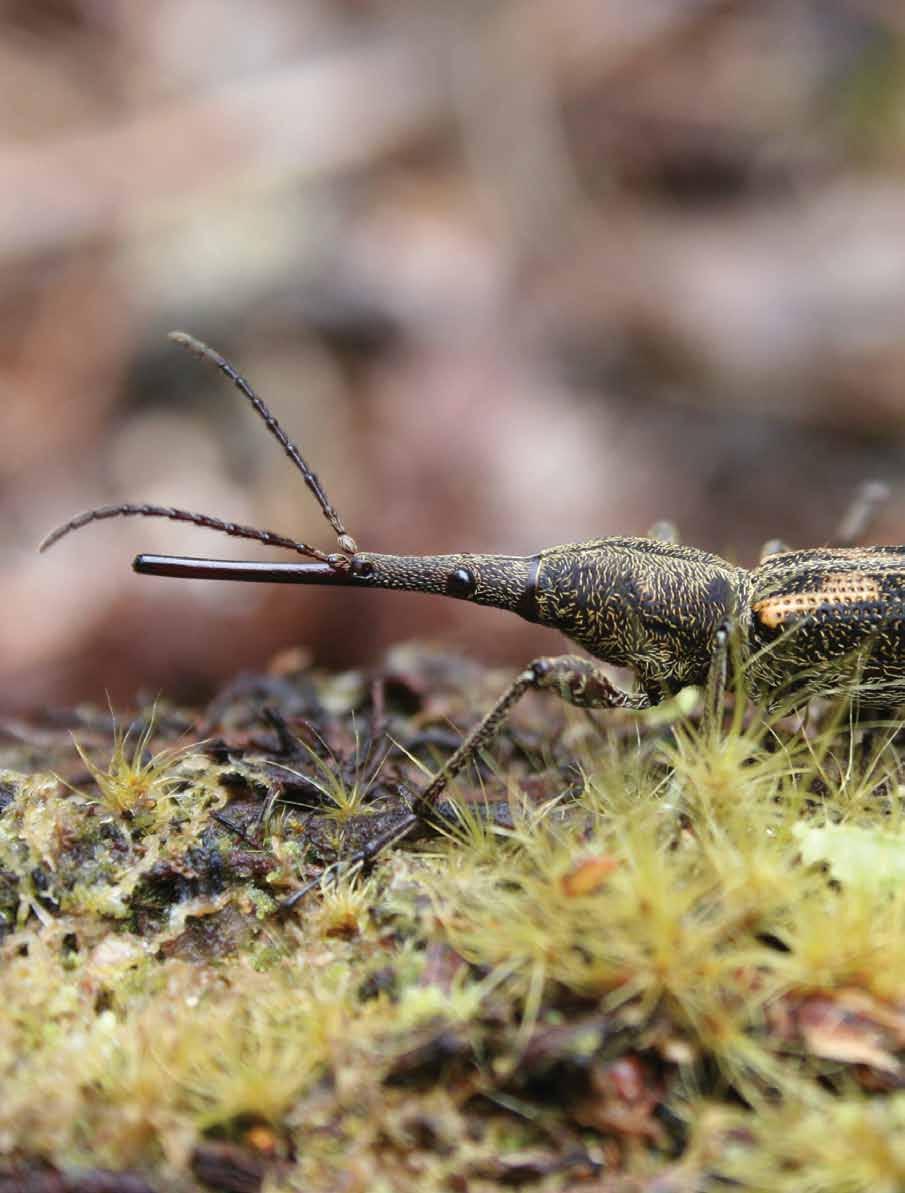
127 Reference information
General management framework, outcomes and policies
 General management framework, outcomes and policies Management framework, & 3 General management framework 3.1 Management framework summary The management framework sets out how the parks will be managed
Chapter 3: Natural Environment. Proposed Waikato District Plan Stage 1. (Notified version)
") Chapter 3: Natural Environment Proposed Waikato District Plan Stage 1 Page 2 of 7 Contents Chapter 3: Natural Environment... 3 3.1 Indigenous Vegetation and Habitats... 3 3.1.1 Objective Biodiversity and
Chapter 3: Natural Environment Proposed Waikato District Plan Stage 1 Page 2 of 7 Contents Chapter 3: Natural Environment... 3 3.1 Indigenous Vegetation and Habitats... 3 3.1.1 Objective Biodiversity and
B4. Te tiaki taonga tuku iho - Natural heritage
 B4. Te tiaki taonga tuku iho - Natural heritage Tuia I runga, tuia i raro, tuia ki te waonui a Tiriwa Bind the life forces of heaven and earth to the great realm of Tiriwa B4.1. Issues Auckland s distinctive
Section 3b: Objectives and Policies Rural Environment Updated 19 November 2010
 Page 1 of Section 3b 3b RURAL ENVIRONMENT 3b.1 Introduction The Rural Environment comprises all the land outside of the Residential, Town Centre and Industrial Environments. Most land within the District
Tāhuhu whakaruruhau ā-taone The sheltering ridge pole
 B2. Tāhuhu whakaruruhau ā-taone - Urban growth and form B2.1. Issues Tāhuhu whakaruruhau ā-taone The sheltering ridge pole Auckland s growing population increases demand for housing, employment, business,
PART 5 - NATURAL AND PHYSICAL ENVIRONMENT
 CONTENTS...PAGE 5.1 INTRODUCTION...3 5.2 NATURAL RESOURCES...4 5.3 PHYSICAL RESOURCES...4 5.4 COASTAL ENVIRONMENT...4 5.5 HERITAGE FEATURES...4 5.6 HAZARDS...4 5.7 SUMMARY...4 ISTHMUS SECTION - OPERATIVE
H7 Open Space zones. (a) provide for the needs of the wider community as well as the needs of the community in which they are located;
 provide for the needs of the wider community as well as the needs of the community in which they are located;") H7. Open Space zones H7.1. Background The majority of land zoned as open space is vested in the Council or is owned by the Crown. However some areas zoned open space are privately owned. While the open
H7. Open Space zones H7.1. Background The majority of land zoned as open space is vested in the Council or is owned by the Crown. However some areas zoned open space are privately owned. While the open
Section 6A 6A Purpose of the Natural Features and Landscapes Provisions
 Section 6A 6A Purpose of the Natural Features and Landscapes Provisions This Chapter addresses the protection and management of natural features and landscapes within the City. The City has a number of
Plan Modification to Chapter B2 of the Auckland Unitary Plan(AUP) Operative in part (15 November 2016)
 Operative in part (15 November 2016)") UNITARY PLAN UPDATE REQUEST MEMORANDUM TO FROM Phill Reid Linley Wilkinson DATE 25 September 2018 SUBJECT Plan Modification to Chapter B2 of the Auckland Unitary Plan(AUP) Operative in part (15 November
UNITARY PLAN UPDATE REQUEST MEMORANDUM TO FROM Phill Reid Linley Wilkinson DATE 25 September 2018 SUBJECT Plan Modification to Chapter B2 of the Auckland Unitary Plan(AUP) Operative in part (15 November
Appendix A. Planning Processes. Introduction
 1 Planning Processes Introduction This appendix outlines a number of planning processes which are used in the Auckland Region to support the effective management of development in the region s rural and
Appendix 1 Structure plan guidelines
 Appendix 1 Structure plan guidelines This appendix forms part of the regional policy statement [rps]. 1.1. Introduction Structure plans are an important method for establishing the pattern of land use
RURAL ZONE - POLICY. Rural Zone Policy. Issue: Rural Environment. Ruapehu District Plan Page 1 of 8
 Rural Zone Policy RU2 RURAL ZONE - POLICY RU2.1 Introduction The natural resources of the rural environment in the Ruapehu District provide the basis for the existing and potential character, intensity
Section 32 report: Natural heritage for the Proposed Natural Resources Plan for the Wellington Region
 Section 32 report: Natural heritage for the Proposed Natural Resources Plan for the Wellington Region Issues and Evaluation Report Section 32 report: Natural heritage for the Proposed Natural Resources
STRATEGIC DIRECTION. QLDC PROPOSED DISTRICT PLAN [PART TWO] DECISIONS VERSION 3 strategic direction
![STRATEGIC DIRECTION. QLDC PROPOSED DISTRICT PLAN [PART TWO] DECISIONS VERSION 3 strategic direction](/thumbs/79/79711764.jpg "STRATEGIC DIRECTION. QLDC PROPOSED DISTRICT PLAN [PART TWO] DECISIONS VERSION 3 strategic direction") 3 STRATEGIC DIRECTION QLDC PROPOSED DISTRICT PLAN [PART TWO] DECISIONS VERSION 3 strategic direction QLDC DISTRICT PLAN [PART TWO] AUGUST 2015 3 strategic direction 3.1 Purpose This chapter sets out the
3 STRATEGIC DIRECTION QLDC PROPOSED DISTRICT PLAN [PART TWO] DECISIONS VERSION 3 strategic direction QLDC DISTRICT PLAN [PART TWO] AUGUST 2015 3 strategic direction 3.1 Purpose This chapter sets out the
Scottish Natural Heritage. Better places for people and nature
 Scottish Natural Heritage Better places for people and nature Contents Summary... 3 SNH approach... 5 Place-making in policy and practice... 6 Developing the contribution of the natural heritage to place-making...
2A District-wide Policies
 2A Introduction This Chapter contains policies which are relevant to subdivision, use and development activities occurring across all zones and areas of the District. The policies in this Chapter implement
10.0 Open Space and Public Realm
 10.0 Open Space and Public Realm 10.0 Open Space and Public Realm The Public Open Space System is comprised of: outdoor spaces available for public use that are either publicly owned (e.g., parks and
SUSTAINABLE MANAGEMENT
 . Sustainable Management.1 The Concept of Sustainable Management The concept of sustainable management recognises there are limits to the use of natural and physical resources and there is a need to balance
1 INTRODUCTION TO NATURAL ENVIRONMENT
 Kāpiti Coast District Plan Review Section 32 Analysis Summary Report 1 INTRODUCTION TO NATURAL ENVIRONMENT Diverse landscapes, plants and animals make up the natural environment of the District. Much has
Proposed Southland District Plan 2012 Appeal Version October 2016
 S e c t i o n 3. 5 - F i o r d l a n d / R a k i u r a Z o n e The Fiordland/Rakiura Zone encompasses the Fiordland and Rakiura National Parks and part of Mt Aspiring National Park. It also includes areas
CA.1 Coastal Area. Index. CA.1.1 Description and Expectations
 Index.1.2.3.4 CA.2 CA.2.1 CA.2.2 CA.2.3 CA.3 CA.3.1 CA.3.2 CA.3.1 CA.4 CA.4.1 CA.4.2 CA.4.3 CA.4.4 CA.5 CA.5.1 CA.5.2 Description and Expectations Objectives Policies Guidance Note Landuse Eligibility
LANDSCAPE GUIDELINES. Countryside & Coastal Countryside Environments. Landscape, Natural Character & Amenity Values Guide
 Landscape, Natural Character & Amenity Values Guide Copyright WDC 2009 Version A2 18May09 Environmental Services Group Publication Countryside & Coastal Countryside Environments START HERE Quality Land
Cotswolds AONB Landscape Strategy and Guidelines. June 2016
 Cotswolds AONB Landscape Strategy and Guidelines June 2016 Cotswolds AONB Landscape Strategy and Guidelines Introduction The evolution of the landscape of the Cotswolds AONB is a result of the interaction
SECTION 2.4 URBAN DEVELOPMENT AND STRATEGIC URBAN DIRECTIONS
 SECTION 2.4 URBAN DEVELOPMENT AND STRATEGIC URBAN DIRECTIONS 2.4.1 INTRODUCTION In 1993/94 the Hastings District Council completed the Hastings Urban Development Strategy. The purpose of this study was:
Appendices. Contents. Appendices - Sep 1997 CP-1 AP-1
 Appendices Contents 1. Goals for Protected Areas in British Columbia... AP-3 2. Guiding Principles for Protected Areas... AP-4 3. Resource and Recreation Use Guidelines for Protected Areas... AP-5 4. Aboriginal
Managing our Landscapes Conversations for Change
 Managing our Landscapes Conversations for Change Frequently Asked Questions The new State Government is committed to a significant reform program that will change the way natural resources are managed.
CITY VIEW OBJECTIVES
 SECTION 2: CITY VIEW OBJECTIVES CONTENTS 2.1 Introduction 1 2.2 Strategic Direction 1 2.3 The City View Resource Management Issues for the City 1 2.4 The Goal 3 2.5 The City View Objectives 3 Palmerston
Hobart A Strategic Framework
 Hobart 2025 A Strategic Framework Adopted by the Hobart City Council 15 October 2007 Table of Contents Introduction...2 Vision and Future Directions...3 FD1 Offers opportunities for all ages and a city
E15. Vegetation management and biodiversity
 E15. management and biodiversity E15.1. Background contributes to a range of ecosystem services such as erosion and sediment control, reducing stormwater flows, protecting or enhancing water quality, amenity
6 Landsc apes and rur al char ac
 LANDSCAPES AND RURAL CHARACTER QLDC PROPOSED DISTRICT PLAN [PART TWO] DECISION VERSION ter 6 Landsc apes and rur al char ac 6.1 Purpose Appendix C QLDC DISTRICT PLAN [PART TWO] DECISION VERSION 6 Landsc
Types of Reserves. Recreational activities
 VALLEY FLOOR AND EASTERN HILLS Physical and ecological features Large, flat valley floor and river plain with intensive urban development Hutt River / Te Awa Kairangi and tributaries Waiwhetu Stream Eastern
5. Initiating a restoration project
 5. Initiating a restoration project CONTRIBUTING TO CONSERVATION In many parts of the country, restoration planting is your last and only option for repairing or rebuilding damaged native communities so
DRAFT GREATER SYDNEY REGION PLAN OBJECTIVES, STRATEGIES AND ACTIONS
 Greater Sydney Commission DRAFT GREATER SYDNEY REGION PLAN OBJECTIVES, STRATEGIES AND ACTIONS Issued: 26 OCTOBER 2017 Version: 1 Subject: Greater Sydney Region and District Plans This information note
Rural Environment and Conservation
 Rural Environment and Conservation 117 Rural Environment and Conservation Introduction and Resources 118 BSc (Hons) Conservation and Environment 119 BSc (Hons) Wildlife Management 120 BSc (Hons) Rural
Schedule of Planning Applications Committee Date: 23 May Reference: 06/17/0726/F Parish: Hemsby Officer: Mr J Beck Expiry Date:
 Schedule of Planning Applications Committee Date: 23 May 2018 Reference: 06/17/0726/F Parish: Hemsby Officer: Mr J Beck Expiry Date: 22-05-2018 Applicant: Proposal: Site: Mr Gillett Change of use to the
The management plan meets the requirements of the Reserves Act 1977.
 SUBURBAN RESERVES MANAGEMENT PLAN 2015 I 4 INTRODUCTION 1.1 PURPOSE OF THE PLAN Within any community, open space holds important landscape, recreational, social, ecological, amenity, and cultural or heritage
Site Assessment Technical Document Appendix A: Glossary
 Central Bedfordshire Council www.centralbedfordshire.gov.uk Site Assessment Technical Document Appendix A: Glossary July 2017 1.1.11-1 - ii Appendix A: Glossary Term Agricultural Land Classification AONB
SUSTAINABILITY PLAN OTTAWA COUNTY PARKS AND RECREATION COMMISSION FALL 2017
 SUSTAINABILITY PLAN OTTAWA COUNTY PARKS AND RECREATION COMMISSION FALL 2017 Table of Contents Introduction Natural Resources Quality of Life Community Continuing the Mission Sustainability Measuring Sustainability
AUCKLAND COUNCIL DISTRICT PLAN PAPAKURA SECTION
 AUCKLAND COUNCIL DISTRICT PLAN PAPAKURA SECTION OPERATIVE 16 JUNE 1999 D P Hawkins, Mayor T McLean, Chief Executive Officer Given under the Common Seal of the Papakura District Council this 16th day of
GIBBSTON CHARACTER ZONE. QLDC PROPOSED DISTRICT PLAN [PART FOUR] AUGUST gibbston character zone
![GIBBSTON CHARACTER ZONE. QLDC PROPOSED DISTRICT PLAN [PART FOUR] AUGUST gibbston character zone](/thumbs/75/72573993.jpg "GIBBSTON CHARACTER ZONE. QLDC PROPOSED DISTRICT PLAN [PART FOUR] AUGUST gibbston character zone") 23 GIBBSTON CHARACTER ZONE QLDC PROPOSED DISTRICT PLAN [PART FOUR] AUGUST 2015 23 gibbston character zone QLDC PROPOSED DISTRICT PLAN [PART FOUR] AUGUST 2015 23 gibbston character zone 23.1 Zone Purpose
23 GIBBSTON CHARACTER ZONE QLDC PROPOSED DISTRICT PLAN [PART FOUR] AUGUST 2015 23 gibbston character zone QLDC PROPOSED DISTRICT PLAN [PART FOUR] AUGUST 2015 23 gibbston character zone 23.1 Zone Purpose
3. STATEMENTS OF DESIRED CHARACTER FOR PLANNING AREAS AND PRECINCTS
 3.30 Planning Area No. 30 Mary River Valley 3.30.1 Location and Role This Planning Area encompasses rural lands in the western part of the Shire. These lands are located within the catchment area of the
7. Landscape. Introduction
 Introduction Our landscapes provide us with a Marlborough identity and are an integral part of the Marlborough environment. Landscapes are distinct spatial areas influenced by location-specific processes
Call for Artists for: Design and Construction of Environmental Art Activation Story Mill Community Park, Bozeman, MT
 Call for Artists for: Design and Construction of Environmental Art Activation Story Mill Community Park, Bozeman, MT Seeking artists to design, fabricate and install art elements in the nature sanctuary
FOREST SERVICE MANUAL NATIONAL HEADQUARTERS (WO) WASHINGTON, DC
 WASHINGTON, DC") Page 1 of 11 FOREST SERVICE MANUAL NATIONAL HEADQUARTERS (WO) WASHINGTON, DC FSM 2300 RECREATION, WILDERNESS, AND RELATED RESOURCE MANAGEMENT Amendment No.: 2300-2011-2 Effective Date: October 19, 2011
Page 1 of 11 FOREST SERVICE MANUAL NATIONAL HEADQUARTERS (WO) WASHINGTON, DC FSM 2300 RECREATION, WILDERNESS, AND RELATED RESOURCE MANAGEMENT Amendment No.: 2300-2011-2 Effective Date: October 19, 2011
Western City District What we heard
 What we heard Vision to 2056 and Priorities Governance and implementation Infrastructure and funding The protection of the natural landscape including biodiversity and the Metropolitan Rural Area for food
HAWKE S BAY REGIONAL PARK NETWORK PLAN
 HAWKE S BAY REGIONAL PARK NETWORK PLAN Introduction s and Background to the Plan Key 1. Tutira Regional Park 2. Waihapua Forest - Future Regional Park 3. Tangoio Forest - Future Regional Park 4. Waitangi
PART 3 - RESOURCE MANAGEMENT
 CONTENTS... PAGE 3.1 INTRODUCTION... 3 3.2 NATURAL AND PHYSICAL ENVIRONMENT... 3 3.3 URBAN SUSTAINABLE MANAGEMENT... 5 3.4 RESOURCE MANAGEMENT ISSUES... 5 3.5 RESOURCE MANAGEMENT OBJECTIVES AND POLICIES...
Development of green infrastructure in EU regions Nature-based solutions delivering multiple benefits
 Development of green infrastructure in EU regions Nature-based solutions delivering multiple benefits A Policy Brief from the Policy Learning Platform on Environment Introduction What is green infrastructure?
Group Executive Liveability and Natural Assets
 Strategic policy Community Gardens Policy Corporate Plan reference: Endorsed by Council on: Policy Owner: A healthy environment Maintaining and enhancing the region s natural assets, liveability and environmental
THE AOTEAROA-NEW ZEALAND LANDSCAPE CHARTER
 THE AOTEAROA-NEW ZEALAND LANDSCAPE CHARTER NEW ZEALAND INSTITUTE OF LANDSCAPE ARCHITECTS Draft for review and discussion by NZILA members: March 2009 Updated version for NZILA Exec: November 2009 Updated
NEW ZEALAND COASTAL POLICY STATEMENT
 NEW ZEALAND COASTAL POLICY STATEMENT 1994 This New Zealand Coastal Policy Statement 1994 was issued by notice in the Gazette on 5 May 1994. PREFACE The Resource Management Act 1991 established a new coastal
This page intentionally blank.
 This page intentionally blank. Parks, Recreation, and Open Space Chapter Relationship to Vision Vision Parks, Recreation and Open Space Chapter Concepts County Government. County government that is accountable
SECTION ONE North East Industrial Zone Design Guide Palmerston North City Council June 2004
 SECTION ONE North East Industrial Zone Design Guide Palmerston North City Council June 2004 young heart easy living 1 Preface Industrial areas are a very important component of the economic well-being
VCA Guidance Note. Contents
 Contents 1. Introduction... 2 2. Who can register a VCA?... 2 3. VCAs and sustainable development... 3 4. Verifying conservation performance... 4 4.1 Transparent, voluntary commitments... 4 4.2 Independent
Published in March 2005 by the. Ministry for the Environment. PO Box , Wellington, New Zealand ISBN: X.
 Action Pack Published in March 2005 by the Ministry for the Environment Manatū Mō Te Taiao PO Box 10-362, Wellington, New Zealand ISBN: 0-478-18994-X ME number: 580 This document is available on the Ministry
3-2 Environmental Systems
 3-2 Environmental Systems 3.0 ENVIRONMENTAL SYSTEMS CONTENTS 3.1 GREENWAY SYSTEM 3.1.1 General Policies 3.1.2 Natural Heritage Network 3.1.3 Natural Heritage Network Enhancement Lands 3.1.4 Rouge Watershed
A Joined-up Regional Landscape: A Roadmap to connect the parts
 Breaking the Barriers: Engineering Solutions to Ecological Problems A Joined-up Regional Landscape: A Roadmap to connect the parts Associate Professor Darryl Low Choy Urban Research Program Outline Nature
Western Sydney Parklands Australia s Largest Urban Park
 Western Sydney Parklands Australia s Largest Urban Park 37 WLA 1 MAGAZINE 21 38 WESTERN SYDNEY PARKLANDS AUSTRALIA S LARGEST URBAN PARK Large urban parks have dual roles to play in meeting the demands
Our City Centre is a vibrant, creative and welcoming destination, with a modern business, cultural, shopping, leisure and residential offer
 3. Sheffield in 2034 Our City sits at the heart of a strong, distinctive and internationally successful City Region economy which supports innovation and enterprise Our City Centre is a vibrant, creative
Parks, Open Space and Trails
 Introduction Parks have often been referred as the lungs of our cities, cleansing the air of pollutants and particulate matter. Parks are also gathering places for families and community. They offer spaces
Policy and Resources Committee 10 th October Green Infrastructure Supplementary Planning Document (SPD) Summary. Title
 Summary. Title") Policy and Resources Committee 10 th October 2017 Title Report of Wards Status Urgent Key Enclosures Officer Contact Details Green Infrastructure Supplementary Planning Document (SPD) Deputy Chief Executive
Policy and Resources Committee 10 th October 2017 Title Report of Wards Status Urgent Key Enclosures Officer Contact Details Green Infrastructure Supplementary Planning Document (SPD) Deputy Chief Executive
Rochford District Council Allocations Development Plan Document: Discussion and Consultation Document Sustainability Appraisal
 Option SWH1 Balanced Communities Option SWH1 1 To ensure the delivery of high quality sustainable communities where people want to live and work Will it ensure the phasing of infrastructure, including
Wetland Design Manual. A1: Vision, core outcomes and aspirational outcomes
 Wetland Design Manual A1: Vision, core outcomes and aspirational outcomes Table of contents Introduction 5 Vision 6 Core outcomes 7 Effective pollutant removal and flow management... 7 Community safety...
Taking forward the All London Green Grid
 Taking forward the All London Green Grid Foreword Earlier this year, the Mayor published the All London Green Grid Supplementary Planning Guidance to the London Plan which set the vision, and framework,
APPENDIX K WINDSOR OFFICIAL PLAN
 CEAA ENVIRONMENTAL ENVIRONMENTAL IMPACT ASSESSMENT AMBASSADOR BRIDGE ENHANCEMENT PROJECT Replacement Span and Plaza Expansion APPENDIX K WINDSOR OFFICIAL PLAN Avalon Consulting Professionals of Ontario,
POLICY SRT/D4 STORMWATER MANAGEMENT
 POLICY SRT/D4 STORMWATER MANAGEMENT BACKGROUND Increasing population, decreasing rainfall and increasing community expectations regarding environmental issues have led to increasing recognition of the
Letcombe Brook Project Officer
 Letcombe Brook Project Officer Job Description Responsible to: Responsible for: Purpose of post: Key Committees: Chairman and Trustees of Letcombe Brook Project. Project volunteers and any relevant personnel
1 Introduction. Chapter. In this chapter:
 Chapter 1 Introduction In this chapter: 1.1 A Snapshot of the Region 1.2 Towards a Sustainable Region 1.3 The Provincial Context 1.4 Purpose and Organization The Regional Municipality of York Official
Are healthy and attractive for people and their communities, and protect and enhance our environment.
 Are healthy and attractive for people and their communities, and protect and enhance our environment. LIVING WATERWAYS IS A BEST PRACTICE ENVIRONMENTAL MANAGEMENT APPROACH TO DELIVER ENDURING, ENGAGING
Sunshine Coast Council Coastal Management Overview. January 2016 edition
 Sunshine Coast Council Coastal Management Overview January 2016 edition Mayor Mark Jamieson Mayor s foreword Our impressive beaches are fundamental to our Sunshine Coast lifestyle, economy and coastal
3.0 PART THREE: STRATEGIES FOR RESERVES
 3.0 PART THREE: STRATEGIES FOR RESERVES 3.1 RESERVE ACT OBJECTIVES The purposes of the Reserves Act 1977 are: providing for the preservation and management of areas for the benefit and enjoyment of the
D10. Outstanding Natural Features Overlay and Outstanding Natural Landscapes Overlay
 D10. Outstanding Natural Features Overlay and Outstanding Natural Landscapes Overlay D10.1. Background These provisions give effect to Policy 15(a) of the New Zealand Coastal Policy Statement 2010, and
PART 6 - HUMAN ENVIRONMENT
 CONTENTS...PAGE 6.1 INTRODUCTION...3 6.2 ISSUES AND STRATEGY...3 ISTHMUS SECTION - OPERATIVE 1999 Page 1 Page 2 ISTHMUS SECTION - OPERATIVE 1999 PART 6 - HUMAN ENVIRONMENT 6.1 INTRODUCTION The Plan seeks
D10. Outstanding Natural Features Overlay and Outstanding Natural Landscapes Overlay
 D10. Outstanding Natural Features Overlay and Outstanding Natural Landscapes Overlay D10.1. Background These provisions give effect to Policy 15(a) of the New Zealand Coastal Policy Statement 2010, and
3. Highway Landscaping Assessment
 Guidelines for Highway Landscaping 3-1 3. Highway Landscaping Assessment 3.1 Introduction This section outlines the steps necessary to assess the highway landscaping component of a state highway construction
Community Conservation Workshop. Lake Placid
 Community Conservation Workshop Lake Placid 2 Community Conservation Program Welcome! We have designed a Community Conservation Program that listens to the needs of community members. We are conducting
UNIVERSITY TOWN NEIGHBOURHOODS 5.2 ECO-CORRIDOR MELBOURNE CAMPUS MASTER PLAN 2014
 5.2 ECO-CORRIDOR 37 ECO-CORRIDOR EXISTING CONDITIONS & VISION NEIGHBOURHOOD VISION Investment in the Eco-corridor Neighbourhood will signify the University s commitment to supporting local ecology and
Draft Eastern District Plan
 Draft Eastern District Plan Submission_id: 31238 Date of Lodgment: 13 Dec 2017 Origin of Submission: Online Organisation name: Turrulla Gardens Pty Ltd C/- Mecone Organisation type: Industry First name:
Natural Resource Management Strategy. Northern Tasmania. Summary. Natural Resource Management Strategy for Northern Tasmania Summary
 Natural Resource Management Strategy Summary Northern Tasmania 2015 2020 Natural Resource Management Strategy for Northern Tasmania 2015 2020 - Summary i Disclaimer NRM North use reasonable means to verify
I326. Ōrākei 1 Precinct
 I326. Ōrākei 1 recinct I326.1. recinct Description The Ōrākei 1 recinct includes the land identified as hapu reservation (land held for the purposes of a marae, church, urupa and related hapu amenities)
Neighbourhood Planning Local Green Spaces
 Neighbourhood Planning Local Green Spaces Introduction... 2 1. Why green space is important... 4 2. Neighbourhood plans and green space... 6 3. Evidence... 8 Statutory designations... 9 Green space audit...
The European Landscape Convention And National Landscape Strategy. Tony Williams Irish Landscape Institute
 The European Landscape Convention And National Landscape Strategy As a reflection of European identity and diversity, the landscape is our living natural and cultural heritage, be it ordinary or outstanding,
Connecting people to parks
 Connecting people to parks Introduction from the Governor It is up to all of us to ensure the conservation of our State s wonderful national parks, marine parks and other conservation reserves continues
Parish of Repton NEIGHBOURHOOD DEVELOPMENT PLAN
 Parish of Repton NEIGHBOURHOOD DEVELOPMENT PLAN BASIC CONDITIONS STATEMENT December 2018 CEF 4 Legal Requirements This statement has been produced by the NDP Working Group on behalf of Repton Parish Council
Sustainability Statement. Whitby Business Park Area Action Plan
 Sustainability Statement Whitby Business Park Area Action Plan November 2014 Contents Page 1. Introduction 1 2. Scoping 3 3. Sustainability Appraisal of Options 6 4. Assessment of Draft Area Action Plan
Scottish Natural Heritage Sharing Good Practice Programme
 Scottish Natural Heritage Sharing Good Practice Programme January December 2018 Sharing Good Practice is a unique programme of events for people from a wide variety of sectors, including land managers,
Yarra Strategic Plan community engagement summary
 Yarra Strategic Plan community engagement summary Between May and August 2018 Melbourne Water undertook community engagement to build the content of the draft Yarra Strategic Plan. This engagement included
ENGLISH HERITAGE STRATEGY MAKING THE PAST PART OF OUR FUTURE
 ENGLISH HERITAGE STRATEGY 2005 2010 MAKING THE PAST PART OF OUR FUTURE ENGLISH HERITAGE STRATEGY 2005 2010 English Heritage is the Government s statutory adviser on the historic environment. Our role is
Gulf Islands National Park Reserve Management Plan Newsletter #3
 Management Plan Newsletter #3 P A R K S C A N A D A November 2011 Parks Canada is using a multi-phase planning process to develop the first management plan for the park. This newsletter provides a short
I541. Te Arai North Precinct
 I541. Te Arai North Precinct I541.1. Precinct Description The Te Arai North Precinct contains approximately 616ha of coastal land north of Te Arai Point, generally known as Mangawhai North Forest. The
CHAPTER 8 ISSUES, CONCERNS, CONSTRAINTS AND OPPORTUNITIES
 CHAPTER 8 ISSUES, CONCERNS, CONSTRAINTS AND OPPORTUNITIES Introduction This River Conservation Plan was developed during a time of tremendous activity and effort in planning the transformation of the Delaware
Understanding Wellington City s DISTRICT PLAN
 Understanding Wellington City s DISTRICT PLAN Wellington City Council 1 UNDERTANDING WELLINGTON CITY S DISTRICT PLAN CONTENTS 1. Introduction...3 1.1. Overview of this Guide...3 1.2. What is the District
Parks and Open Spaces
 Christchurch has a reputation as the Garden City. It would be disappointing if we lost the general greenness of the place. It was great when the Council decided to make a full basketball court at Rowley
Great Easton Neighbourhood Plan Statement of Basic Conditions
 Great Easton Neighbourhood Plan 2017-2031 Statement of Basic Conditions OCTOBER 2016 GREAT EASTON PARISH COUNCIL Contents 1.0 Introduction....Page 2 2.0 Summary of Submission Documents and Supporting Evidence..
TOPIC PAPER 2: Links to other sustainability tools
 TOPIC PAPER 2: INTRODUCTION 1.1 Landscape Character Assessment can inform a range of other sustainability tools and methodologies. Equally these other tools may assist in reaching decisions concerning
The Proposed Auckland Unitary Plan (notified 30 September 2013)
") 8 Special Purpose zones 8.1 Airport zone The Airport zone applies to the Kaipara Flats Airfield, North Shore Airfield, Auckland International Airport and Ardmore Airport. Auckland International Airport
8 Special Purpose zones 8.1 Airport zone The Airport zone applies to the Kaipara Flats Airfield, North Shore Airfield, Auckland International Airport and Ardmore Airport. Auckland International Airport
BRE Strategic Ecological Framework LI Technical Information Note 03/2016
 BRE Strategic Ecological Framework Technical Information Note 03/2016 September 2016 Contents 1. Introduction 2. Aims of BRE s Strategic Ecological Framework 3. How SEF is different from previous approaches
3 Urban Design and the State Highway Network
 NZ Transport Agency Page 1 of 14 Urban Design Professional Services Guide 1 Introduction This is a professional services guide on urban design, which provides direction to the NZ Transport Agency (NZTA)
AUCKLAND UNITARY PLAN
 AUCKLAND UNITARY PLAN Report To: Report Name: Executive summary Unitary Plan Political Working Party Issues and approaches for rural and coastal areas There are 12 key issues facing rural and coastal areas
3. VISION AND GOALS. Vision Statement. Goals, Objectives and Policies
 Vision Statement Queen Creek s interconnected network of parks, trails, open spaces and recreation opportunities provide safe and diverse activities and programs that sustain its unique, small town, equestrian