Stadium District Masterplan
|
|
|
- Marcus Norman
- 6 years ago
- Views:
Transcription

1 Stadium District Masterplan Masterplan (noun): an evolving long-term planning document that establishes the framework and key elements of a site. It reflects a clear vision synthesizing developer goals and public aspirations for a project, giving them form and organization, while defining a realistic goal for implementation. Masterplan (verb): to develop or improve (land, a community, a building complex, or the like) through a long-range plan that balances and harmonizes all elements of space, functionality and design. PROCESS AND TIMELINE MASTERPLAN EAST PERSPECTIVE UHCA Pre-consultation Meeting Stakeholder Engagement Workshop # Stakeholder Engagement Workshop # UHCA Pre-consultation Meeting Community Forum Community Walkabout Public Design Workshop Draft Policies Open House SSC Redevelopment Website Launches City Council Public Hearing & ARP Approval Masterplanning Workshop # Masterplanning Workshop # City-led Transportation Meeting Community Association Meeting # Community Association Meeting # Masterplanning Workshop # Masterplan Community Open House # Masterplan Community Open House # Development Permit Preparation Development Permit Open House # Development Permit Open House # Development Permit Submission City Review & Community Circulation Development Permit Open House # Development Permit Approval Construction Documentation Preparation Construction Start Jun/, 00 Feb/, 0 Nov/0, 0 Mar/, 0 Feb/, 0 Mar/, 0 Mar/, 0 May/, 0 Jun/, 0 Jul/, 0 Oct/, 0 Nov/, 0 Feb/, 0 Apr/, 0 Apr/, 0 Apr/, 0 Nov/, 0 Nov/, 0 Dec/ 0 -Apr/ May/ Oct/ 0 Nov/ 0 Dec/ 0 Mar/ 0 VISIONING CITY-LED ARP MASTERPLAN We Are Here DEVELOPMENT PERMIT CONSTRUCTION WESTERN SECTURITIES ATTENDED SSASPG MEETINGS NEXT STEPS* DISCLAIMER *Dates are estimates and are subject to change. The Masterplan shown in this presentation depicts a conceptual vision for the redevelopment of Stadium Shopping Centre and is subject to change during the detailed design and development permit process.


2 Vision and Guiding Principles The new Stadium District will create an attractive, vibrant, mixeduse destination providing employment opportunities, residential accommodations, and community services. STADIUM SHOPPING CENTRE TODAY THE NEW STADIUM DISTRICT GUIDING THE VISION Stadium Shopping Centre has been an integral retail amenity for the University Heights community since its development in, supporting the needs of residents, students, and professors of all ages. The City s desire to increase the area s density both in local population and land use has been documented since the 0s. As Calgary moves towards implementing these integrated, mixeduse environments, it is important that any new development builds upon the character of the surrounding area, supporting the uniqueness of the community. The new Stadium District establishes the site as a community asset reaching its full potential. The new centre will be an attractive, vibrant, mixed-use centre balancing its location near the residential neighborhood of University Heights and major city institutions such as Foothills Hospital and the University of Calgary in order to provide local employment opportunities, residential accommodations, and community services. Each of these new amenities will provide positive contributions with a long-lasting impact, improving the quality of life for existing and future residents. To achieve this balance, the Stadium District will establish an open and accessible urban environment for the University Heights community. Through the coordination of building, landscaping, and open spaces, the project will synthesize connections between the built environment and the community at large with gathering spaces that are universally navigable. To achieve the vision for the Stadium District, a series of principles led the creation of the plan. Each of the principles helps frame a particular urban characteristic that is needed to create an urban environment that can fully embrace an existing community and establish a sense of ownership over the area. These principles include: Mix of uses Transit orientation Community gathering spaces Improved Public Accessibility Community Amenities Residential Diversity PRIMARY ENTRANCE EAST PERSPECTIVE GUIDING PRINCIPLES MIXED-USES TRANSIT-ORIENTATION COMMUNITY GATHERING SPACE PUBLIC ACCESSIBILITY RESIDENTIAL DIVERSITY COMMUNITY AMENITIES


3 Masterplan The Masterplan establishes architectural and public realm guidelines and standards to create a vibrant, mixed-use development. STADIUM DISTRICT MASTERPLAN Ground floor amenities such as restaurants and a transit plaza will help create a dynamic pedestrian experience. 0 0 LEGEND Active residential frontages create a sense of safety along the western passageway adjacent to the school. 0 Primary Entrance/Roundabout Residential w/grocery store Residential w/retail Central Plaza Transit Stops Hotel Class A Office w/retail Pedestrian Bridge Retail Kiosk Below grade parking entry/exit Landscape buffers Tree lined streets with wide sidewalks and bicycle lanes allow for convenient access for all modes of transportation.


4 Built Form The Stadium District will establish a pedestrian-oriented urban environment with limited shadowing and massing impacts while engaging the surrounding communities. SHADOWS Buildings within the project area have been massed to reduce significant shadowing impacts on the school site, parks, and central space as per ARP requirements. The diagrams to the right show shadows for the Stadium District from 0 AM to PM Mountain Standard Time for March / September st. The project complies as per the following, 0 AM NOON No Shadow Impact on Uxbridge Avenue PM PM Shadow impact analysis is provided between 0- MST on March / September. Shadows do not penetrate along m setback along school site for more than hour. M M M M No shadows east of Uxbridge at noon on March/ September STUDY MARCH/SEPTEMBER ST BUILDING MASSING LAND USES & PHASING To ensure the urban environment will achieve the vision and guiding principles of the Stadium District, a series of massing studies were conducted. Through community outreach it was determined that placing massing along th Avenue and establishing reduced building heights along the Northeast corner were the preferred massing strategies to be incorporated into the final site design. The proposed land-uses offer opportunities for all of the guiding principles to be incorporated in a manner that contributes to the entire community. An appropriate mix of actual tenants to suit the nature and scale of this mixed-use development will help to complete the vision. MODERATE HEIGHT BUILDINGS near existing residential development TALLER BUILDINGS Along Th Avenue The practicalities and efficiencies of construction will influence phasing, as well as market demands and project economics. ue ven A h t E AV EN U Uxb ridg TH W Total Use Summary ND / SCA 0 M PE SE BUF TB FER AC K LA er rt d ha n C ou nt gr ou lay tm l P es oo W ch S Pedestrian Connections to the community. Pedestrian Connections to the community. Shadows do not penetrate along m setback along school site for more than hour. *The massing, built form and land use illustrated on this page is conceptual and may change through the development permit approval process. LARGER CENTRAL OPEN SPACE (than required by ARP) ed rive Note - Land uses and yields are conceptual and subject to change. MASSING & ARP COMPLIANCE LAND USE DISTRIBUTION & PHASING


5 Circulation Improvements to the project area will create a comprehensive, connected network for automobiles, transit, bicycles, and pedestrians. The circulation and transportation improvements follow the guidance of the accepted Transportation Impact Assessment (TIA). Unwin Road Ulster Road 0 Primary Entrance/Roundabout Residential w/grocery store 0 Residential w/retail Central Plaza Transit Stops Hotel Class A Office w/retail Pedestrian Bridge Retail Kiosk Below grade parking entry/exit Landscape buffers 0 Main Arterial Collector Local Street Street Parking Loading Dock Parkade Entrance Intersection Underground Access Project Boundary th avenue Uxbridge Drive Bus Line Bus Stop Intersection Project Boundary th avenue Uxbridge Drive STADIUM DISTRICT MASTERPLAN PROPOSED STREET NETWORK PROPOSED TRANSIT NETWORK Multi-Use Pathway m Bikelane Bike Sharrows Note: Incorporation of bike storage and repair facility will be explored through detailed design. Major Pedestrian Circulation Pedestrian Bridge Bus Stop Roads Surface Parking Loading Zone Parkade Ramp Loading Zone Parking Access Note: Between to below-grade parking levels. PROPOSED BICYCLE NETWORK PROPOSED PUBLIC PEDESTRIAN NETWORK PROPOSED SURFACE PARKING STRATEGY


6 Public Realm CONCEPT DESIGN The open space concept aims to create an activated public realm that is connected to the surrounding urban fabric and creates a continuous environment for pedestrians throughout the site. The framework for the plan layers many spatial elements to create multifaceted areas including; localized grade changes, accessible green roofs, a pedestrian focused circulation network, a vibrant material and vegetation palette and six open space types. CENTRAL PLAZA NIGHT PERSPECTIVE CENTRAL PLAZA DAY PERSPECTIVE GATEWAY PLAZA SUMMER PERSPECTIVE GATEWAY PLAZA WINTER PERSPECTIVE Looking North-West across the Square Looking South-East across the Square Looking North-West across the plaza Looking North-West across the plaza MIXED-USE BUILDINGS Retail/ Residential Office Hotel Cafe / Retail Central Plaza Kiosk Bus Stop Pavilions GATEWAYS + EDGES 0 Vehicular Access off Uxbridge Drive Vehicular Access off Unwin Drive Pedestrian Bridge Entry West Edge Multi-Use Pathway MAJOR PUBLIC OPEN SPACES Central Plaza - Main Square Gateway Plaza Off Avenue Pedestrian Green Link Potential Green Roof PUBLIC REALM SURFACES 0 Servicing Lane (also pedestrian link) Pedestrian Priority - Public Sidewalk / Multi use Pathway Pedestrian Walkway PARKING Entry Ramp to Underground Parking Short Stay Parking Pedestrian Access to Underground Parking Underground Parking Exit Lane NORTH-EAST UNDERPASS PERSPECTIVE Looking North-East toward exterior stair feature


7 Open Space Concepts CENTRAL PLAZA - MAIN SQUARE PLAZA DESIGN ELEMENTS 0 TH AVENUE - GATEWAY PLAZA CENTRAL PLAZA PLAN VIEW Flexible Open Plaza Lighting & Water Jet System Kiosk/ Underground Parking Access Patio Seating Rock Feature Large Willow Tree Rubber Play Pad Stage Sculpture Feature Active Retail Frontage Short Term Parking Stalls TH AVE GATEWAY PLAZA - PLAN VIEW PLAZA DESIGN ELEMENTS 0 Upper Open Plaza Lower Entrance Plaza Accessibility Ramp Multi-Use Path Sidewalk Feature Willow Tree Crab Apple Tree Orchard Row of Thunderchild Trees Hotel Patio Seating Potential Signage Location 0 SECTION THROUGH THE CENTRAL PLAZA SECTION THROUGH FRONTAGE ALONG TH AVENUE 0 ANGLED PARKING PLAY AREA WATER MULTI-USE JET CENTRAL PLAZA FEATURE ONE-WAY LANE (SHARED SPACE) UPPER PLAZA SUNKEN COURT THUNDER -CHILD TREE ALLEE 0M CRAB LOWER PLAZA RAMP -APPLE ORCHARD SHARED SURFACE TH AVENUE - CORRIDOR PLAZA SMART SURFACE PUBLIC REALM SHARED SURFACE WESTERN PEDESTRIAN GREEN LINK CORRIDOR DESIGN ELEMENTS TH AVE CORRIDOR - PLAN VIEW 0 Gateway Plaza 0m Ramp Multi-Use Path Sidewalk Public Seating Row of Crab Apple Trees Row of Thunderchild Trees Transit Shelter Potential Signage Location Hotel Roof Garden Landscape buffer along Avenue MULTI-USE PATHWAY SIDEWALK GRASS/ SHRUBS Multi-Use Path Residential Roof Garden Tree Allee/Multiuse Pathway Main Underground Parking Ramp Short Term Parking Private Townhouse Patios Pedestrian/ Bike Path Pedestrian Linkage Laneway UXBRIDGE DRIVE PLAN VIEW DESIGN ELEMENTS WESTERN PATHWAY PLAN VIEW Multi-Use Path Pedestrian Path Main Vehicular Access Residential Roof Garden Trees Allee Underpass Entrance Short Term Parking Bus Shelter 0 SECTION THROUGH WESTERN PATHWAY SECTION THROUGH AVENUE CORRIDOR PUBLIC BUS SHELTER BATTED VEGETATION UXBRIDGE DRIVE CORRIDOR DESIGN ELEMENTS CRABAPPLE TREES SEATWALL THUNDERCHILD TREE ALLEE MULTIUSE PATH TREE ALLEE SECTION THROUGH UXBRIDGE DRIVE PRIVATE RESIDENCE ENTRY+ PATIO RESIDENCE ROOFTOP PATIO PEDESTRIAN BUS PATHWAY SHELTER MULTI-USE PATHWAY TRANSIT HUB MULTI-USE PATHWAY BATTED VEGETATION SHARED SURFACE SHARED SURFACE TRANSIT HUB VEGETATION BUFFER

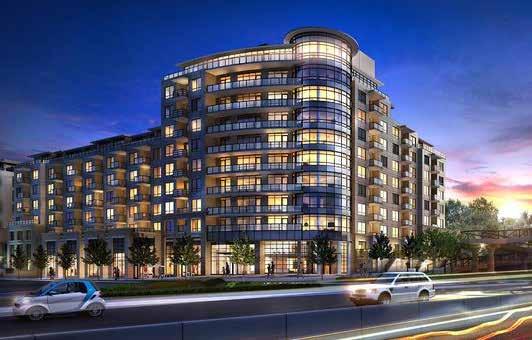
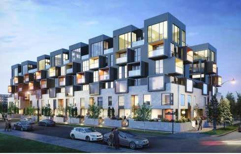
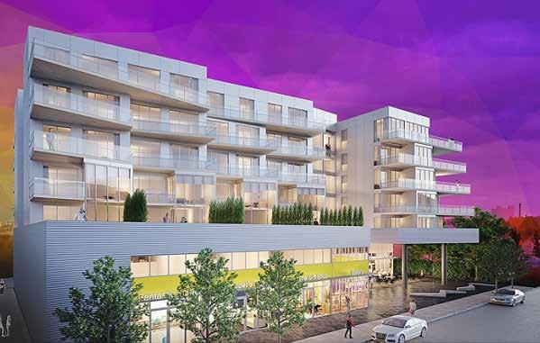

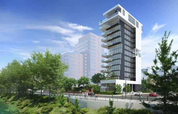
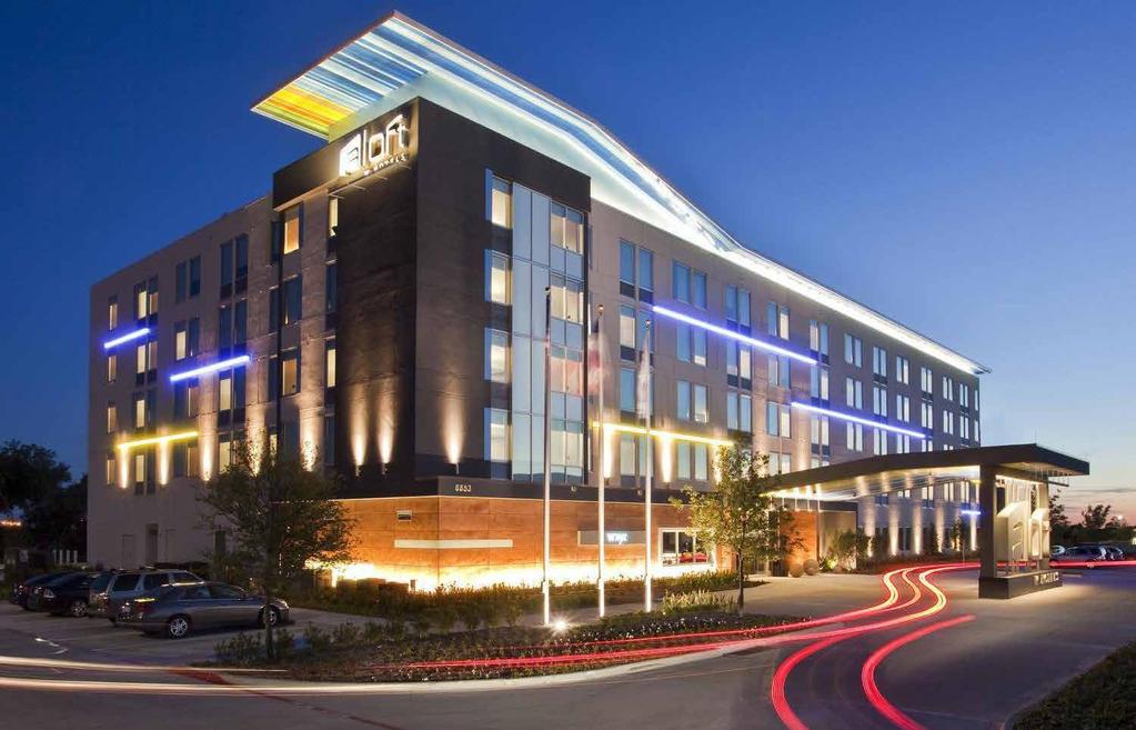
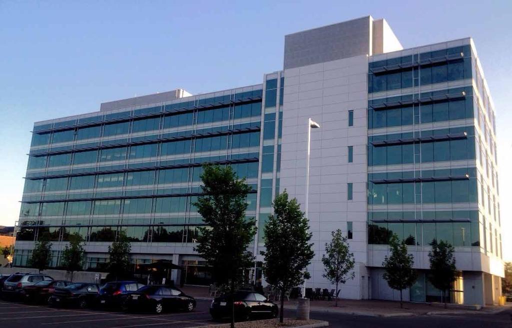
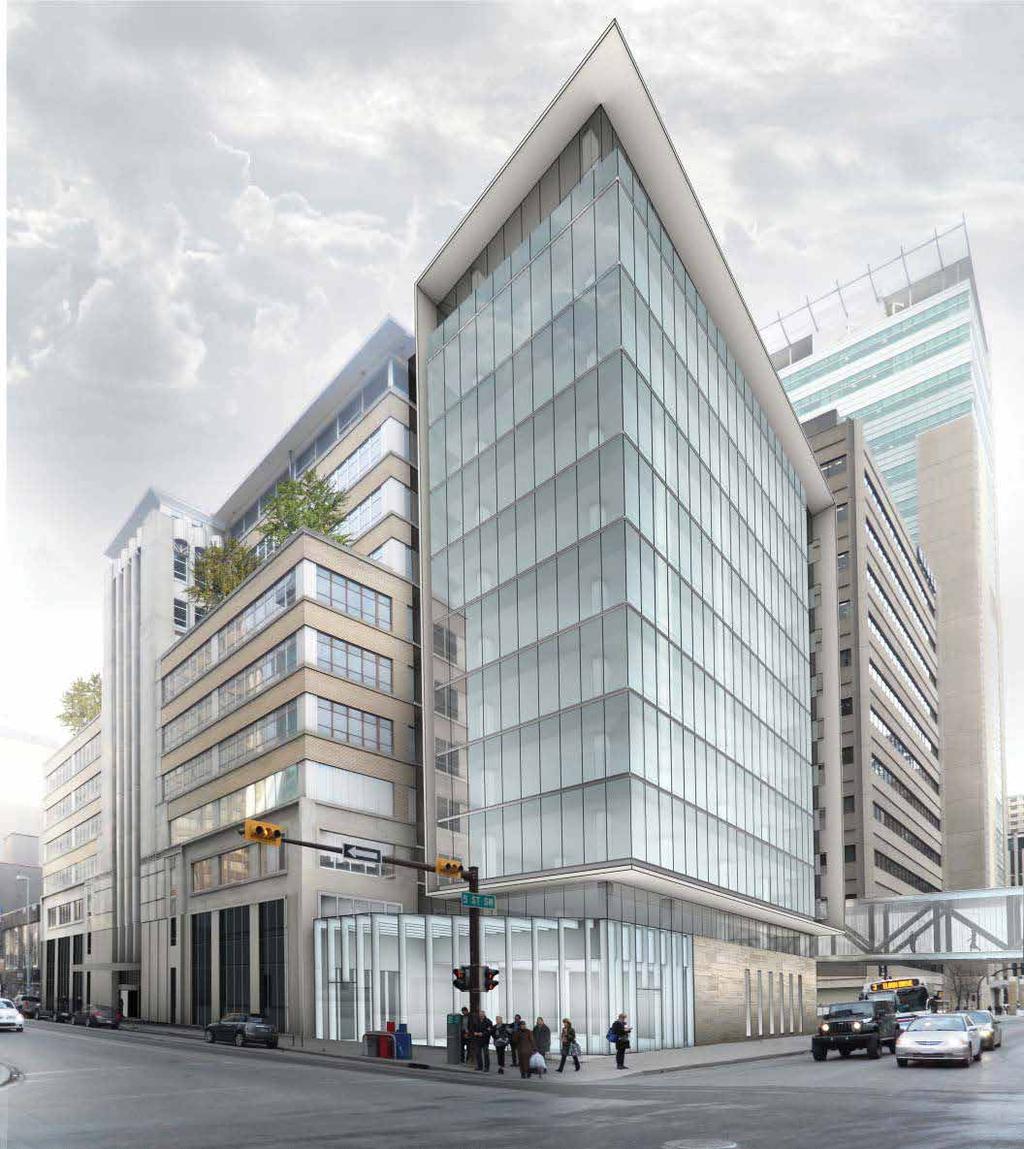
8 Calgary Precedent Building Styles MIXED-USE (RETAIL/RESIDENTIAL), BRENTWOOD MIXED-USE (RETAIL/RESIDENTIAL), BRIDGELAND RESIDENTIAL, BRIDGELAND MIXED-USE (RETAIL/RESIDENTIAL), INGLEWOOD MIXED-USE (RETAIL/OFFICE), TH AVE SW RESIDENTIAL, MISSION OFFICE, GLENMORE MIXED-USE (RETAIL/OFFICE), DOWNTOWN HOTEL, BANFF TRAIL
Figure 3-1: Public Realm Plan
 3 Public Realm Figure 3-1: Public Realm Plan 3.1 Public Realm Concept The public realm concept for the Little Mountain site integrates a clear and accessible movement network with public spaces for social
Stadium District Development Permit Progress
 Stadium District Development Permit Progress PROJECT OVERVIEW The Stadium Shopping Centre has been a community asset within University Heights since, predating the University of Calgary. Located at the
THE NEIGHBORHOOD TODAY
 THE NEIGHBORHOOD TODAY CORE AREA VISION How are we Good Urbanism A Site s DNA thinking about Elements of great Unique elements urban communities embedded in a place the site and design? ELEMENTS LIKE:
Executive Summary. NY 7 / NY 2 Corridor
 Executive Summary NY 7 / NY 2 Corridor Transportation and Land Use Study December 2005 Prepared for: Town of Colonie Capital District Transportation Committee Prepared by: Introduction: Land use decisions
Parcel 5. Level 1 Application March 12, Design Submittal POST ROAD RESIDENTIAL
 P:\3371 Providence \graphic\meetings and Presentations\2018.03.12_Level 1 Submission/ I-195 Level Redevelopment 1 Design Submission.pdf District Commission Introduction The Level 1 conceptualization of
Minto In Kensington Open House. Thursday March 23, pm Hillhurst Sunnyside Community Association Ave NW
 Minto In Kensington Open House Thursday March 23, 2017 6-8 pm Hillhurst Sunnyside Community Association 1320 5 Ave NW Project Background & Timeline Background Project Highlights Minto Communities continues
TOWN COUNCIL / PLANNING COMMISSION
 Workshop #3 TOWN COUNCIL / PLANNING COMMISSION January 20, 2011 Consultant Team In Attendance Tonight BMS Design Group Nevada City and San Francisco Michael Smiley, AICP, ASLA Partner-in-Charge Nancy L.
PLAN ELEMENTS WORKSHOP. April 5, 2016
 PLAN ELEMENTS WORKSHOP April 5, 2016 needs more housing. But there is no one-size fits-all solution. Every neighborhood has its own character. In some places, density is not only appropriate it is badly
Policies and Code Intent Sections Related to Town Center
 Policies and Code Intent Sections Related to Town Center The Town Center Vision is scattered throughout the Comprehensive Plan, development code and the 1994 Town Center Plan. What follows are sections
chapter DESIGN GUIDELINES NEW RIVER MASTER PLAN REPORT
 chapter DESIGN GUIDELINES NEW RIVER MASTER PLAN REPORT .76 DESIGN GUIDELINES An Overview design guidelines NEW RIVER MASTER PLAN Design Guidelines can transform the image of a city. Specific, design-based
Welcome. Walk Around. Talk to Us. Write Down Your Comments
 Welcome This is an information meeting introducing the applications for proposed redevelopment of the Yorkdale Shopping Centre site at 3401 Dufferin Street and 1 Yorkdale Road over the next 20+ years,
McCowan Precinct Plan Study Background & Deliverables
 1 DRAFT & WITHOUT PREJUDICE McCowan Precinct Plan Study Background & Deliverables In September, 2011, City Planning (Scarborough District) began a study of an area within the Scarborough Centre, identified
Town Center (part of the Comprehensive Plan)
") Town Center (part of the Comprehensive Plan) Mercer Island Town Center Looking North (2014) In 1994, a year-long process culminated in a set of design guidelines and code requirements for the Town Center
Town Center (part of the Comprehensive Plan) Mercer Island Town Center Looking North (2014) In 1994, a year-long process culminated in a set of design guidelines and code requirements for the Town Center
WELCOME and introduction
 1 WELCOME and introduction Mobility Hub Locations within Burlington STUDY OVERVIEW STUDY OBJECTIVES The City of Burlington is developing four Area Specific Plans, one for each of Burlington s Mobility
ELMVALE ACRES SHOPPING CENTRE MASTER PLAN
 ELMVALE ACRES SHOPPING CENTRE MASTER PLAN Contents 1.0 INTRODUCTION... 2 2.0 LOCATION... 2 3.0 EXISTING CONTEXT... 2 4.0 VISION & GUIDING PRINCIPLES... 2 5.0 LAND USE AND BUILT FORM... 4 5.1 St. Laurent
Seneca Meadows. Block 4 Locate office, technology, and medical development adjacent to I Screen views of garage structures from I-270.
 Seneca Meadows Seneca Meadows has an industrial park in its southern end and a mixed-use employment area planned for the north end. The district benefits from extensive I-270 visibility, stream valley
Wadsworth Boulevard S TAT I O N A R E A P L A N
 Wadsworth Boulevard S TAT I O N A R E A P L A N City of Lakewood Adopted November, 2006 The Vision The City of Lakewood s overall vision is to transform the area around the light rail station into a mixed-use
Workshop 3. City of Burlington Waterfront Hotel Planning Study. September 14, The Planning Partnership
 Workshop 3 City of Burlington Waterfront Hotel Planning Study September 14, 2017 The Planning Partnership The Waterfront Hotel Planning Study 01 The Brant & Lakeshore Planning Study will establish a Strategic
EXISTING COMPREHENSIVE PLAN
 EXISTING COMPREHENSIVE PLAN Town Center Land Use Element: V. LAND USE POLICIES Town Center Mercer Island's business district vision as described in "Your Mercer Island Citizen-Designed Downtown" was an
New Westminster Downtown Parking Strategy Public Open House #1 September 13, 2012
 New Westminster Downtown Parking Strategy Public Open House #1 September 13, 2012 The City is preparing a strategy for parking in Downtown New Westminster. The study team and a group of key stakeholders
AMITY STATION Revised Concept Plan Review West Rosemary Street Chapel Hill, NC September 27, 2016
 AMITY STATION Revised Concept Plan Review West Rosemary Street Chapel Hill, NC September 27, 2016 DEVELOPER'S PROGRAM Introduction This is a request for review of a Revised Concept Plan by Chapel Hill
ASPEN HILL Minor Master Plan Amendment
 ASPEN HILL Minor Master Plan Amendment Worksession #3 Planning Board Agenda Item #5 MONTGOMERY COUNTY PLANNING DEPARTMENT Maryland-National Capital Park and Planning Commission Area 2 Planning November
Sustainability, Health, Safety, Recreation & Open Space Working Group August 3, 2017
 Sustainability, Health, Safety, Recreation & Open Space Working Group August 3, 2017 DOWNTOWN OAKLAND SPECIFIC PLAN WELCOME Sustainability, Health, Safety, Recreation & Open Space Working Group Social
In partnership with: Harbor Corridor Plan Bali Hi Mobile Home Park July 24, 2013
 In partnership with: Harbor Corridor Plan Bali Hi Mobile Home Park July 24, 2013 Project Intro 2-miles of Harbor Boulevard Westminster/17 th Street to just north of Edinger Avenue Many people use the corridor
City of Farmington. Downtown Plan. Amendment to the 1998 Master Plan Adopted October 11, 2004
 City of Farmington Amendment to the 1998 Master Plan Adopted October 11, 2004 Introduction Planning Background 1 Scope and Components of the Plan Amendment 2 Concept Introduction 3 Plan Concepts 3 Conceptual
appendix and street interface guidelines
 appendix five: building and street interface guidelines appendix 5 building and street interface guidelines BOULEVARDS Boulevards are generally characterized by higher levels of traffic movement at higher
The University District envisions, in its neighborhood
 Envisioning the University District Link Light Rail in Seattle s neighborhoods CIY OF SEALE CONCEP-LEVEL SAION AREA PLANNING RECOMMENDAION RESOLUION # 30165 EXHIBI L Vision 08.2000 he University District
VISION AND GUIDING DESIGN PRINCIPLES
 pleasure point commercial corridor VISION AND GUIDING DESIGN PRINCIPLES Public Draft November 26, 2018 County of Santa Cruz with assistance from MIG CONTENTS PART I: INTRODUCTION AND VISION... 3 Community
Regency Developments. Urban Design Brief. Holyrood DC2 Rezoning
 Regency Developments Urban Design Brief Holyrood DC2 Rezoning Stantec Consulting Ltd. 7-31-2017 1. Overview Regency Developments intends to rezone the lands located at 8510 and 8511 93 Avenue, within the
(DC1) Direct Development Control Provision DC1 Area 4
 Direct Development Control Provision DC1 Area 4") . General Purpose (DC) Direct Development Control Provision DC Area 4 The purpose of this Provision is to provide for an area of commercial office employment and residential development in support of the
. General Purpose (DC) Direct Development Control Provision DC Area 4 The purpose of this Provision is to provide for an area of commercial office employment and residential development in support of the
URBAN DESIGN BRIEF. 2136&2148 Trafalgar Road. Town of Oakville
 URBAN DESIGN BRIEF 2136&2148 Trafalgar Road Town of Oakville Prepared By: METROPOLITAN CONSULTING INC For 2500674 Ontario Inc November 2016 TABLE OF CONTENTS Page No. 1.0 Introduction/Description of Subject
Don Mills Crossing Study and Celestica Lands Development Application Community Meeting, Open House, and Breakout Discussions
 Consultation Summary Don Mills Crossing Study and Celestica Lands Development Application Community Meeting, Open House, and Breakout Discussions This report is not intended to provide a verbatim transcript
North Fair Oaks Community Plan Summary and Information
 North Fair Oaks Community Plan Summary and Information WHAT IS THE NORTH FAIR OAKS COMMUNITY PLAN? The North Fair Oaks Community Plan is part of the San Mateo County General Plan, and establishes policies
PINE CURVE REZONING. BACKGROUND Purchased as two parcels in 2001 and 2002
 BACKGROUND Purchased as two parcels in 2001 and 2002 WHAT THE PROJECT IS AND IS NOT A Rezoning establishes the land use standards for Annexed and Zoned Greater Downtown District Historic Center September
This Review Is Divided Into Two Phases:
 Semiahmoo Town Centre Review The purpose of this review: To review the Semiahmoo Town Centre Concept Plan, originally approved in 1993, to ensure that this centre will continue to serve the needs of South
Urban Design 9Identity
 Urban Design 9Identity URBAN DESIGN IDENTITY Urban design is about connecting people to their places through the built environment, nature, and overall urban form. Done well, it creates a memorable space
HIGHLAND VILLAGE GREEN URBAN DESIGN PRINCIPLES/GUIDELINES
 URBAN DESIGN GUIDING PRINCIPLES/GUIDELINES CONTEXT/CHARACTER The City of Calgary s Municipal Development Plan (MDP), Transit-Oriented Development (TOD) Policy Guidelines and Main Street/Corridor policy
New-Cast Mixed-use Development Proposal King Street West, Newcastle, Ontario
 URBAN DESIGN BRIEF New-Cast Mixed-use Development Proposal King Street West, Newcastle, Ontario TABLE OF CONTENTS: 1.0 Executive Summary 2.0 Creating Vibrant and Sustainable Urban Places: Excerpts from
The Cambie Corridor 2015 Fall workshop series. What we heard WORKSHOP OUTLINE
 The Cambie Corridor 2015 Fall workshop series W 16 AVE Area 5 CAMBIE CORRIDOR Phase 3 What we heard ovember 21, 2015, 9am-noon, 1:30-4:30pm Peretz Centre 89 Participants* WORKSHOP OUTLIE Introductions
Lehigh Acres Land Development Regulations Community Planning Project
 Lehigh Acres Land Development Regulations Planning Effort Summary In July, 2010 Commissioner Frank Mann invited the Lehigh Acres community to start discussing how to achieve their recently adopted community
URBAN DESIGN BRIEF URBAN DESIGN BRIEF 721 FRANKLIN BLVD, CAMBRIDGE August 2018
 URBAN DESIGN BRIEF URBAN DESIGN BRIEF 721 FRANKLIN BLVD, CAMBRIDGE August 2018 DESIGN BRIEF CONTENTS PART A 1.0 INTRODUCTION 2.0 DESCRIPTION & ANALYSIS OF SITE CONTEXT 3.0 DESIGN CONSTRAINTS AND OPPORTUNITIES
Waterfront Development Master Plan
 PORT of VANCOUVER USA Vancouver, WA Waterfront Development Master Plan DRAFT - FINAL CONCEPTUAL MASTER PLAN PROJECT TEAM NBBJ Heritage Research Associates JLA Kittelson Associates Leland Consulting Group
Summary of Public Input & Discussion of Alternatives
 Meeting #4 Summary of Public Input & Discussion of Alternatives May 6 th, 2009 City of Bellingham, Washington April 1 April 15 April 22 May 6 Introduction, Character and Boundary Study Areas Public Realm:
Yonge Eglinton Centre Urban Design Guidelines
 Yonge Eglinton Centre Urban Design Guidelines City Planning Urban Design January 2009 YONGE EGLINTON CENTRE INTRODUCTION.................................................... 1 GENERAL SITE PLAN OBJECTIVES......................................
Lower Merion Commercial Districts Issues and Characteristics Handbook November 2013
 Lower Merion Commercial Districts Issues and Characteristics Handbook November 2013 DRAFT TOWNSHIP-WIDE VISION: To maintain and enhance commercial areas to complement the surrounding high-quality residential
RECOMMENDATION(S) OF THE CALGARY PLANNING COMMISSION
 OF THE CALGARY PLANNING COMMISSION") Page 1 of 21 EXECUTIVE SUMMARY This DC Direct Control District application is intended to bring consistency between the Stadium Shopping Centre Area Redevelopment Plan (ARP) that was approved by Council
Page 1 of 21 EXECUTIVE SUMMARY This DC Direct Control District application is intended to bring consistency between the Stadium Shopping Centre Area Redevelopment Plan (ARP) that was approved by Council
2.0 THE PLATINUM TRIANGLE VISION
 2.0 THE PLATINUM TRIANGLE VISION The envisions an exciting future for the area surrounding Angel Stadium of Anaheim, the Honda Center and The Grove of Anaheim. 2.1 Planning Principles In order to further
DOWNTOWN GEORGETOWN PLANNING STUDY
 DOWNTOWN GEORGETOWN PLANNING STUDY Community Workshop #3 Thursday, May 4, 08 The Planning Partnership OVERVIEW OF STUDY, PROCESS & MILESTONES We are here PURPOSE OF THE STUDY To develop a clear vision
WEST LOOP DESIGN GUIDELINES CHECKLIST
 WEST LOOP DESIGN GUIDELINES CHECKLIST Section 1.0 General Strategies 1.1 DESIGN EXCELLENCE: ENCOURAGE HIGH QUALITY AND INNOVATIVE DESIGN OF NEW BUILDINGS WITHIN THE WEST LOOP WITHOUT BEING PRESCRIPTIVE
Plan Framework Report. Attachment A
 Plan Framework Report Attachment A Uptown-Douglas Corridor Plan - Plan Framework Report Contents Introduction... 1 Planning Process... 3 Project Objectives... 4 Vision... 5 Community Values... 6 Structural
Today Land & People. Northeast Nampa Gateway District. Employment. Land Use Characteristics. Demographics. Current Zoning
 Today Land & People Employment Major employers include Saint Alphonsus, the College of Western Idaho, the Auto Mall, Sorrento Lactalis and Walmart. 3,004 jobs in 2010 (COMPASS-CIM 2040 TAZ data) 4,345
Sub Area 2: Downtown Overland Park
 Downtown 132 2.12 encompasses over 600 acres and extends between 71st Street and 87 th Street including Downtown Overland Park. The area is home to several individual historic sites and structures, including
Public Consultation Summary: Lakeview Place Making Workshop January 30, 2008.
 Page 1 of 11 Public Consultation Summary: Lakeview Place Making Workshop January 30, 2008. 1.0 Introduction: On January 30, 2008 the City of Mississauga, in conjunction with the consulting team of Brook
Mark-up of the effect of the proposed Bronte Village Growth Area OPA No.18 on the text of section 24, Bronte Village, of the Livable Oakville Plan
 Mark-up of the effect of the proposed Bronte Village Growth Area OPA No.18 on the text of section 24, Bronte Village, of the Livable Oakville Plan Notes: This document is provided for information purposes
2013 CAMPUS MASTER PLAN UPDATE
 The University of North Carolina at Greensboro 2013 CAMPUS MASTER PLAN UPDATE Board of Trustees December 6, 2013 MASTER PLAN GOALS 1. Plan for an engaging, collaborative learning environment that aligns
AvalonBay Communities + BRIDGE Housing. Mission Housing Habitat for Humanity Pacific Union Development Corporation
 AvalonBay Communities + BRIDGE Housing Mission Housing Habitat for Humanity Pacific Union Development Corporation Tonight s Agenda Recap of discussion from last CAC meeting Updates on meetings with Stakeholders
Highland Village Green Design Guidelines
 Highland Village Green Design Guidelines Publishing Information Title Highland Village Green Design Guidelins Author The City of Calgary Status DRAFT - Proposed document subject to changes Additional Copies
Metrogate Agincourt Redevelopment
 Toronto Urban Design Guidelines Metrogate Agincourt Redevelopment City Planning Urban Design September 2008 METROGATE AGINCOURT REDEVELOPMENT TABLE OF CONTENTS 1.0 INTRODUCTION......................................................
Sheridan Boulevard S TAT I O N A R E A P L A N S H E R I D A N B O U L E VA R D S TAT I O N A R E A P L A N
 Sheridan Boulevard S TAT I O N A R E A P L A N 1 City of Lakewood Adopted November, 2006 S H E R I D A N B O U L E VA R D S TAT I O N A R E A P L A N The Vision The City of Lakewood s overall vision is
Urban Design Manual PLANNING AROUND RAPID TRANSIT STATIONS (PARTS) Introduction. Station Study Areas
 Introduction. Station Study Areas") 111111 PLANNING AROUND RAPID TRANSIT STATIONS (PARTS) Introduction The ION rapid transit system will link Waterloo, Kitchener and Cambridge through a central transit corridor (CTC). There are a number
111111 PLANNING AROUND RAPID TRANSIT STATIONS (PARTS) Introduction The ION rapid transit system will link Waterloo, Kitchener and Cambridge through a central transit corridor (CTC). There are a number
Tel: (705) Fax: (705)
 Fax: (705)") 521 and 525 Essa Road City of Barrie Tel: (705) 812-3281 Fax: (705) 812-3438 Email: INFO@IPSCONSULTINGINC.com 1 5 0 D U N L O P S T R E E T E A S T, S U I T E 2 0 1, B A R R I E O N T A R I O L 4 M 1 B
521 and 525 Essa Road City of Barrie Tel: (705) 812-3281 Fax: (705) 812-3438 Email: INFO@IPSCONSULTINGINC.com 1 5 0 D U N L O P S T R E E T E A S T, S U I T E 2 0 1, B A R R I E O N T A R I O L 4 M 1 B
DRAFT: NOT FINAL DESIGN
 T H E M E S O F S T A K E H O L D E R I N P U T GREEN INFRAST RUCTURE & EDGES STEWARDSHIP THROUGH P ARTNERSHIP AMENITIES & ANCHORS DESTINATION DISTRICT sustainable landscapes & infrastructure that are
REPORT BACK BROADSHEET 3 May 2016
 Paddington Place REPORT BACK BROADSHEET May 06 Architects and planners should work with the community first and then thinking about developers profits second. - Quote from participant at Paddington Place
Former Rockcliffe Airbase Community Design Plan Guiding Design Vision and Principles December 4, 2013
 APPENDIX 5 - Guiding Design Vision and Principles Former Rockcliffe Airbase Community Design Plan Guiding Design Vision and Principles December 4, 2013 Vision Statement The redevelopment of the former
Complete Neighbourhood Guidelines Review Tool
 Complete Neighbourhood Guidelines Review Tool Prepared By: City of Regina Planning Department October 2014 Page 1 of 14 Community Development Review Checklist for Secondary Plans and Concept Plans The
Chapter 2: OUTLINE PLANNING APPLICATION PROPOSALS. A New Garden Neighbourhood Matford Barton 17
 Chapter 2: OUTLINE PLANNING APPLICATION PROPOSALS A New Garden Neighbourhood Matford Barton 17 2.1. SUMMARY AND STATUS OF THE PROPOSALS 2.1.1. The parameter plans and associated wording in this chapter
GO Station Mobility Hubs: Draft Precinct Plans. Committee of the Whole July 12, 2018
 GO Station Mobility Hubs: Draft Precinct Plans Committee of the Whole July 12, 2018 Purpose of this Workshop Present Draft Precinct Plans for the 3 GO Station Mobility Hubs Continue the conversations that
Danvers High Street I-1 District Study
 Danvers High Street I-1 District Study Presentation of Final Recommendations Planning Board Presentation June 26 th, 2018 1 Introductions Metropolitan Area Planning Council Sam Cleaves AICP, Principal
V. Vision and Guiding Principles
 V. Vision and Guiding Principles The Master Plan for the Powers Ferry Corridor seeks a foundation in the desires of the community. At times, various elements of the community offered opposing viewpoints,
DRAFT. October Wheaton. Design Guidelines
 October 2011 DRAFT Wheaton Design Guidelines 2 Draft - Design Guidelines - Wheaton Sector Plan Contents 04 Section 1: Introduction 06 Section 2: Context 08 Section 3: Design Guidelines 09 Goal 1: Create
Subarea 4 Indian Creek. Vision The combination of park networks and transportation amenities make Subarea 4 the greenest hub in the Corridor.
 indian creek 180 extends south from 101st Street to I-435. The I-435 and Metcalf intersection is one of the primary intersections in the Kansas City Metro Area. The area includes several residential neighborhoods
GOODY CLANCY WITH KITTELSON & ASSOCIATES RHODESIDE & HARWELL FARR ASSOCIATES W-ZHA
 1 1. Welcome 5 min. 2. Follow-up from 9/22 / Corridor of Light, ground floor uses 20 min. 3. Small on-site open spaces / Overview of types, identities 15 min. 4. Rosslyn Plaza Park / Rosslyn Plaza PDSP
City of Long Beach. creating vibrant and exciting places
 City of Long Beach creating vibrant and exciting places Land Use Element Urban Design Element Overview of the two draft General Plan elements Discuss areas of change Economic goals of the plans Case study
Lambeth Main Street Streetscape Improvements
 Lambeth Main Street Streetscape Improvements Open House October 5th, 2017 Agenda 1. Introduction 2. Project Background 3. Context 4. Project Objectives 5. Design Principles & Approach 6. Streetscape Design
Transportation. Strategies for Action
 Transportation A major priority for the Overlake Neighborhood is to develop a multimodal transportation system. To achieve this system, a balance has to be found among travel, circulation and access needs;
Clovis Urban Greening Plan. Community Workshop #2 Northwest
 Clovis Urban Greening Plan Community Workshop #2 Northwest Thursday, October 9, 2014 WHAT IS AN URBAN GREENING PLAN? A guide to help the City to improve quality of life for residents Identification of
1.4 TRANSIT VISION 2040 FROM VISION TO ACTION THEME 1: PUTTING TRANSIT AT THE CENTRE OF COMMUNITIES. Fully integrate transit with community design
 TRANSIT VISION 2040 FROM VISION TO ACTION TRANSIT VISION 2040 defines a future in which public transit maximizes its contribution to quality of life with benefits that support a vibrant and equitable society,
Create Policy Options Draft Plan Plan Approval. Public Consultation Events. Phase 2
 Background Grandview-Woodland Community Plan In the spring of 2012, the City of Vancouver embarked on a comprehensive community planning program in the Grandview-Woodland neighbourhood. The process has
DRAFT Northeast Quadrant of Kipling Avenue and Highway 7 DRAFT AUGUST 29, Goals Land Use. The goals of this Plan are to:
 AUGUST 29, 2017 12.15 Northeast Quadrant of Kipling Avenue and Highway 7 12.15.1 Goals 12.15.2 Land Use The goals of this Plan are to: 12.15.2.1 General Provisions: a) Ensure the development of a compact
5.1 Site Plan Guidelines
 5. Community Core Guidelines Development of the Community Core will take place by plan of subdivision and site plan approval. It will occur in a phased manner that will reflect the timing of residential
Description of Preferred Alternative
 Chapter 2 Description of Preferred Alternative 2.1 Introduction This chapter of the programmatic Sammamish Town Center Sub-area Plan Final EIS provides a more detailed description of the Preferred Alternative
4.9 Mendocino Avenue Corridor Plan Design Guidelines
 4.9 Mendocino Avenue Corridor Plan Design Guidelines The Mendocino Avenue Corridor Plan addresses the area between College Avenue and Steele Lane. Mendocino Avenue is a busy arterial that runs parallel
Little Mountain UDP Presentation
 Summary of UDP Evaluation of Dec 2015 Plan Dec 2015 Site Plan Transitional edges work well Central spine and permeability are strong Tree retention is good Establish Big Idea Sameness of built form contributes
SYRINGA VALLEY SPECIFIC PLAN NARRATIVE
 SYRINGA VALLEY SPECIFIC PLAN NARRATIVE Introduction With this application, Pleasant Valley South LLC ( Pleasant Valley ) seeks the City of Boise s approval of a new Specific Plan Ordinance to be added
LAND USE AMENDMENT DOWNTOWN COMMERCIAL CORE (WARD 7) MACLEOD TRAIL SE AND 5 AVENUE SE BYLAW 254D2017
 MACLEOD TRAIL SE AND 5 AVENUE SE BYLAW 254D2017") Page 1 of 10 EXECUTIVE SUMMARY This Land Use Amendment application seeks to redesignate a full downtown block (currently the YWCA site) from a Direct Control based on the CM-2 District (Land Use Bylaw
Page 1 of 10 EXECUTIVE SUMMARY This Land Use Amendment application seeks to redesignate a full downtown block (currently the YWCA site) from a Direct Control based on the CM-2 District (Land Use Bylaw
Midtown Greenway Land Use and Development Plan Executive Summary
 Midtown Greenway Land Use and Development Plan Executive Summary Introduction The Midtown Greenway Land Use and Development Plan sets policy direction for land use and development in the Midtown Greenway
Cit of Kitchener Ur 6 an Design Manual PARTA. Desi n for _--::
 Cit of Kitchener Ur 6 an Design Manual Date PARTA Year ) Desi n for k Nodes Corridors _--:: Section Page 01 of 12 2 INTRODUCTION Purpose & Application Nodes and Corridors have been identified as key intensification
FUTURE LAND USE ELEMENT
 FUTURE LAND USE ELEMENT GOAL I: To create and sustain a great place to live, play, and prosper Objective 1: The City of Ocala shall incorporate the principles and strategies of the Ocala 2035 Vision into
ROBBINSDALE LRT STATION CDI DEVELOPMENT GUIDELINES
 August 2018 OVERVIEW The City of Robbinsdale has a prime-opportunity site in the middle of the 13 mile stretch of the Bottineau LRT corridor / Blue Line extension. Robbinsdale offers a prominent, vital,
burlington mobility hubs study Downtown Burlington Mobility Hub
 burlington mobility hubs study Downtown Burlington Mobility Hub Draft Precinct Plan Workbook PIC #3, September 7, 2017 downtown mobility hub objectives City staff and their consultants are proposing an
Bow to Bluff Public Realm Plan Design Update
 Bow to Bluff Public Realm Plan Design Update December 017 Great public spaces encourage people to gather, recreate, explore and discover. Introduction The City of Calgary is planning to improve the corridor
BUILDING SCALE AND SETBACKS 5 ELEMENTS:... 5 FAÇADES (COMMERCIAL/RESIDENTIAL) 5
 5") VISION STATEMENT 3 UTILIZATION OF THE GUIDELINES 3 IMPLEMENTATION 3 PROCEDURES FOR DESIGN REVIEW 3 LAND USE AND ZONING 4 LAND USE 4 ELEMENTS:... 4 ZONING 4 ELEMENTS:... 4 BUILDING SCALE AND SETBACKS 5
VISION STATEMENT 3 UTILIZATION OF THE GUIDELINES 3 IMPLEMENTATION 3 PROCEDURES FOR DESIGN REVIEW 3 LAND USE AND ZONING 4 LAND USE 4 ELEMENTS:... 4 ZONING 4 ELEMENTS:... 4 BUILDING SCALE AND SETBACKS 5
North Downtown Specific Plan MEMORANDUM
 North Downtown Specific Plan MEMORANDUM MEETING DATE: November 13, 2017 TO: Members of the North Downtown Specific Plan Advisory Committee FROM: Jeanine Cavalli, Senior Planner SUBJECT: Materials for the
Tonight s Agenda. Summary Presentation Open House. Group Discussion Next Steps: online community wide survey
 Community Open House February 22, 2018 Tonight s Agenda Summary Presentation Open House Station 1: Project Overview and Community Input Station 2: Draft Vision and Guiding Principles Station 3: Western,
NORTH LAKE SPECIFIC PLAN AREA
 NORTH LAKE SPECIFIC PLAN AREA June 21, 2018 WELCOME Workshop Agenda Introduction Provide information about the program and introduce the team Background Information Share information about the North Lake
Presentation of the Staff Draft. July 17, 2014 SSRVP Team, Area 3
 Presentation of the Staff Draft July 17, 2014 SSRVP Team, Area 3 Presentation Overview Introduction Plan Framework Plan Recommendations Implementation Next Steps and Request for Public Hearing on September
Community Design Plan
 Gardena General Plan 2006 Authority While the is not a required element of a General Plan, it is included because improving the community appearance and image is paramount to the overall quality of life
Bank Street Secondary Plan
 1.1 Introduction The is a guide to the long term design and development of the portion of Bank Street between Riverside Drive and Ledbury Park, and provides direction on land use, built form, design, parking,
City of Nogales General Plan
 Open Space, Parks, Recreation and Trails City of Nogales General Plan Residents of Nogales place a high priority in the development of a comprehensive system of open space, parks, recreation and trails
SECTION TWO: Overall Design Guidelines
 SECTION TWO: Overall Design Guidelines This section provides overall design principles and guidelines for the Gardnerville Mixed-use Overlay. They provide criteria for mixed-use places consisting of residential,