QUINCE ORCHARD/FIRSTFIELD CORRIDOR CITY OF GAITHERSBURG MTAP 2017
|
|
|
- Gwendoline Jennings
- 6 years ago
- Views:
Transcription

1 QUINCE ORCHARD/FIRSTFIELD CORRIDOR CITY OF GAITHERSBURG MTAP 2017 ULI LEADERSHIP INSTITUTE 2017
2 The Team Allison Davis, WMATA Daniel Park, Rodgers Consulting Debbie Albert, Arlington County Harry Ross, OPX Design Consultancy Martha Coello, Fairfax County
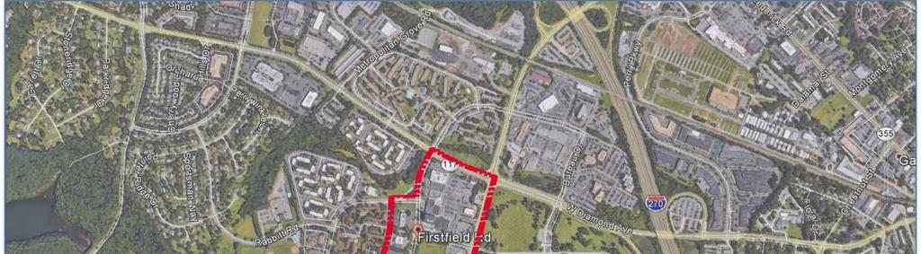
3 Firstfield/Quince Orchard Road Corridor
4 City of Gaithersburg mtap Questions How can reinvestment in aging light industrial, flex, and Class B office be encouraged given uses and conflicts? What regulatory mechanisms could the City pursue to engage partners and support reinvestment? What capital improvements and collaborative actions will best connect the various uses? What tools could stimulate adaptive reuse of underperforming commercial buildings? Should the character/direction of this corridor change from employment? What are the highest and best uses of the land?
5 MTAP Process/Approach Review City and County Documents Review Similar mtaps Site Visit and Discussion with City Staff Interview Existing Developers Team Work Sessions Individual Research

6 Current Conditions: Planned Land Use 2009 Master Plan Land Use Element Adopted December 19, 2011

7 Current Conditions: Zoning Study Area Zoning C-2 General Commercial Purpose: Commercial uses serving regional and local area and compatible with cohesive and attractive shopping and office area E-1 Urban Employment MXD Mixed Use Development Purpose: Implementation of master plan land use recommendations through a flexible approach to design and multi-use

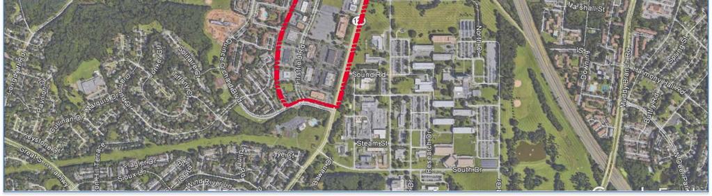
8 Current Conditions: Site Office, flex, R&D space 74+ acres and 21 parcels ~13 parcels are major focus Approved MXD on 15+ acres Three main developers Buildings from 1970s/ early 1980s


9 Current Conditions: Access Less than 1 mile to I-270 MARC: 1.2 miles Metro: 4.5 miles RideOn: 71/78: Peak period/peak direction 56: All day, but few key connections Unlimited parking No bike lanes Some sidewalks

10 Critical Issues: City of Gaithersburg Master Plan recommends as employment hub City has been successful in attracting R&D, particularly biotech Older buildings, high potential, limited incentive for reinvestment Far from frequent transit Little connectivity between parcels MXD approval may increase developer interest in residential Big Question: How to maintain goal of employment hub while encouraging reinvestment and remaining successful in the tech sector market?


11 Critical Issues: Alexandria Realty Maximize profit Focus on maintaining high occupancy rates Promote existing amenities and encourage tenant engagement Seeking a campus feel with interconnections between tenants Traffic flows, congestion, and connectivity Big question: How to maintain 100 percent occupancy with minimal improvements to their properties?


12 Critical Issues: Federal Realty Long term retail leases Potential redevelopment along frontage as retail leases expire Mixed-use not likely because of competition from Metro-accessible sites Improved transit connectivity, links to Lakeforest Mall and Shady Grove desirable Civic use Limited connections between flex office and retail center Questions in the area remain and make it difficult to determine the identity of this site. Continue to promote their value-based retail center

13 Critical Issues: Regional Crashing market for suburban office parks Millennials, millennials, millennials Worsening traffic congestion Limited funds to expand transit
14 Summary of Critical Issues Identity What is the future vision for the Firstfield Corridor? What distinguishes the corridor in Gaithersburg? How can the area be marketed to the outside? Consistency Are policies and regulations in place that are consistent with the future vision? Amenities What keeps residents and employees nearby? Are uses lacking that would help fulfill the future vision? Connectivity Are uses sufficiently connected to create a cohesive community? How do you promote synergy and movement within the corridor? Transportation How can the Firstfield Corridor make better transportation connections within and outside of the area?
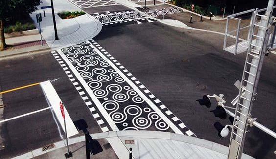
15 Summary of Recommendations
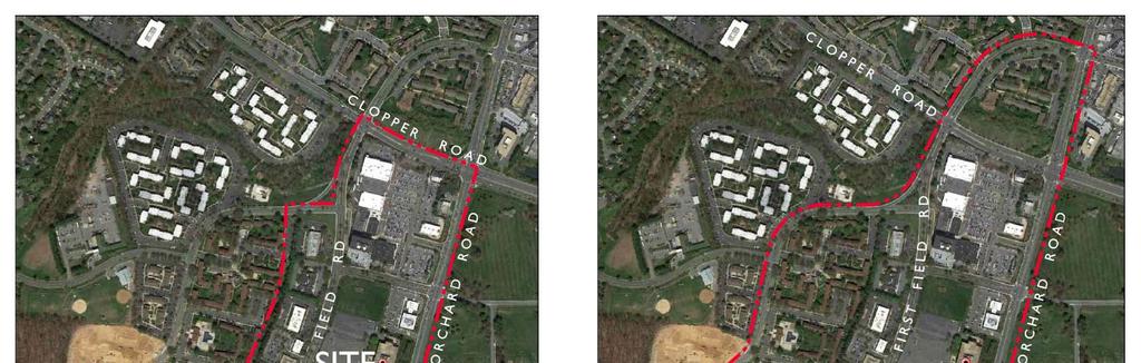
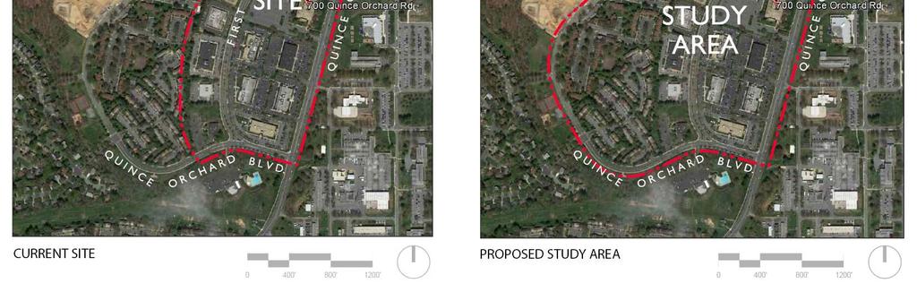
16 (1) Visioning: Redefine the Study Area

17 (1) Visioning: Stakeholders and Leaders City officials City staff Residents Business owners Employees Developers

18 (1) Visioning: Charette and Scenarios

19 (2) Area Plan Vehicular Connectivity Firstfield Corridor Pedestrian Connectivity Land Use Relationships
. Encourage inter parcel connections where possible.")
20 (2) Area Plan: Vehicular Connectivity Perform area wide traffic study to relieve residential traffic on Quince Orchard by way of Firstfield Corridor. Promote parking reduction at R&D parcels. Encourage structured parking (podium). Encourage inter parcel connections where possible.


21 (2) Area Plan: Firstfield Corridor Characterize the ultimate corridor through a modified road section MODIFIED ROAD SECTION
22 (2) Area Plan: Pedestrian Connectivity Require sidewalk connections on both sides of Firstfield Road. Encourage through block connections. Encourage amenity paths to provide a residential loop. Incentivize more public open space.

23 (2) Area Plan: Land Use Conceptual Site Plan

24 (2) Area Plan: Land Use Conceptual Site Plan

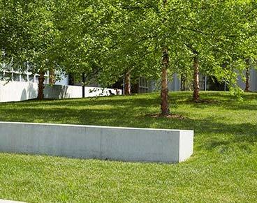
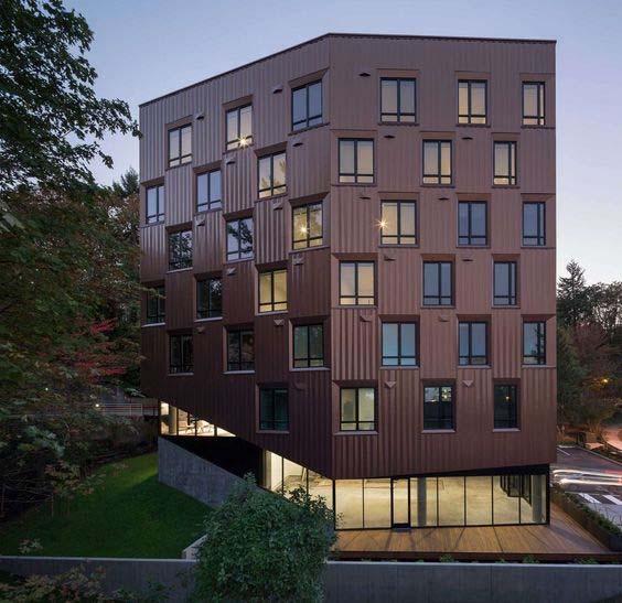
25 (2) Area Plan: Architecture and Placemaking

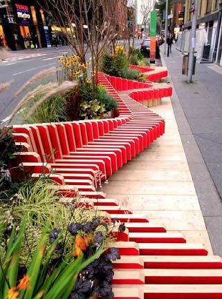


26 (2) Area Plan: Architecture and Placemaking
27 (2) Area Plan: Architecture and Placemaking
28 (3) Zoning: Evaluate Zoning Ordinance Reinforce master plan intent, of employment hub targeted for growth and revitalization, through Zoning Ordinance Establish and adopt purpose statements E-1 Urban employment E-2 Moderate intensity industrial park I-1 Light industrial I-3 Industrial and office park (has existing purpose) I-4 General industrial
29 (3) Zoning: Evaluate Zoning Ordinance Review allowed uses in E-1 district and consider: Limiting general office, retail and restaurant uses to accessory only General office accommodated in MXD, C, CD, CBD and other General office competes with R&D; drives up land values Expanding use list with breweries, distilleries, industrial catering, tech incubator/maker spaces Light industrial uses compatible with R&D use Similarly require specialized buildings and zoning Provides diversification of uses Attracts people after business hours
30 (3) Zoning: Evaluate Zoning Ordinance Establish use classification system for employment and industrial uses Groups land uses and activities based on similar functional or physical characteristics Provides Zoning Administrator with basis for interpretations about specific uses both listed and not listed in Ordinance More effectively anticipates future uses by providing an objective basis for similar use determinations
31 (3) Zoning: Evaluate Zoning Ordinance Review E-1 bulk, placement, parking Height: increased to 85-feet in 2016 Provides for expansion/ redevelopment Consider reducing setbacks to back of sidewalk Creates urban edge; Flexibility for redevelopment Maintain increased setbacks for height >45 feet and adjacent to residential Consider reducing parking ratio Eliminates excess parking; Flexibility for redevelopment; Opportunities for gathering spaces


32 (3) Zoning: Evaluate Zoning Ordinance Review other E-1 provisions Consider use classification system for public assembly uses, such as athletic events; theatres; religious institutions applied across the city Treat similar uses equally Consider whether public assembly use appropriate in E-1 district Reserve industrial and employment districts for industrial and employment uses (maintaining lower land values)


33 (4) Branding and Marketing Strategy Realign existing City Plans 2009 Master Plan Outline vision for Firstfield Corridor Strategic Plan Market and promote distinct areas of the City, including Firstfield as the City s center for R&D Growgaithersburg.com Highlight the advantages of Firstfield as well as other distinct areas of the City

34 (4) Branding and Marketing Strategy Short-term Alternatives to a Business Improvement District Initial steps towards branding by the City Stakeholder councils for residential, office, and retail Set the stage for community and private stakeholder ownership


35 (4) Branding and Marketing Strategy Expand City message to include Firstfield Corridor Financial incentives specifically for the corridor Technical assistance in finding and combining funding sources and incentives Financial assistance for architectural/planning services Periodic tax relief


36 (5) Citywide Investments Gaithersburg Shuttle Corridor Cities Transitway Conference Center
37 Summary of Recommendations Identity Consistency Amenities Connectivity Transportation 1. Collaborate with community to create a vision 2. Create area plan based on vision 3. Evaluate and realign zoning ordinance 4. Develop branding and marketing strategy 5. Encourage city-wide investments
THE 355/270 CORRIDOR:
 THE 355/270 CORRIDOR: Strategic Ideas for Sustaining a Livable Work Place Project Summary ACCESS LIFE DESIGN HEALTH WORK Montgomery County Planning Department The Maryland-National Capital Park and Planning
TOD 101 CREATING LIVABLE COMMUNITIES WITH TRANSIT
 1 CREATING LIVABLE COMMUNITIES WITH TRANSIT What are transit Centered Communities? Benefits of Partnerships to Support and Implement What You Will Learn Portland s Pearl District Your Trainers Today Catherine
Status Report: MD 355 Project
 Status Report: MD 355 Project OCTOBER 2006 M-NCPPC MONTGOMERY COUNTY PLANNING DEPARTMENT Summary of Community Comments, and break to the Results of the MD 355 Participation Session Brookside Gardens -
TEMPLE MEDICAL & EDUCATION DISTRICT
 City of Temple, Texas TEMPLE MEDICAL & EDUCATION DISTRICT 1 Description. The City of Temple joined in partnership with key public and private entities to jointly promote education and medical activities
Plano Tomorrow Vision and Policies
 Plano Tomorrow Vision and Policies PLANO TOMORROW PILLARS The Built Environment The Social Environment The Natural Environment The Economic Environment Land Use and Urban Design Transportation Housing
V. Vision and Guiding Principles
 V. Vision and Guiding Principles The Master Plan for the Powers Ferry Corridor seeks a foundation in the desires of the community. At times, various elements of the community offered opposing viewpoints,
ARLINGTON COUNTY, VIRGINIA
 ARLINGTON COUNTY, VIRGINIA County Board Agenda Item Meeting October 15, 2005 DATE: September 28, 2005 SUBJECT: Request to Advertise the adoption of the 2005 Clarendon Sector Plan C. M. RECOMMENDATION:
MONTGOMERY COUNTY METRO STATION AREA DESIGN CHARRETTE
 MONTGOMERY COUNTY METRO STATION AREA DESIGN CHARRETTE Shady Grove Metro Station Area Charrette Closing Presentation October 25-28, 2000 MONTGOMERY COUNTY, MD M-NCPPC Design Collective, Inc. Architects
CHAPTER 3 VISION, GOALS, & PLANNING PRINCIPLES. City of Greensburg Comprehensive Plan. Introduction. Vision Statement. Growth Management Goals.
 CHAPTER 3 VISION, GOALS, & PLANNING PRINCIPLES Introduction The Greensburg Comprehensive Plan is intended as a working community document. A combination of long and short-term goals, this document is intended
Route 1 Corridor Study
 Route 1 Corridor Study Westbrook, Connecticut A Vision for the Connecticut Shoreline Public Informational Meeting July 28, 2015 Lower Connecticut River Valley Council of Governments Fitzgerald & Halliday,
ULI St. Louis Technical Assistance Panel
 ULI St. Louis Technical Assistance Panel ULI St. Louis Technical Assistance Panel Sponsored by: Citizens for Modern Transit in partnership with METRO ULI St. Louis Mission Statement The mission of the
REGIONAL ACTIVITY CENTER
 DRAFT REGIONAL ACTIVITY CENTER 70 EAST BENCH MASTER PLAN DRAFT 06 Introduction The East Bench Regional Activity center is comprised of large educational, research, medical, and employment centers. These
Silverdale Regional Center
 Silverdale Regional Center Vision for Silverdale Regional Center The Silverdale Regional Center Plan (Plan) will guide the evolution of the Silverdale Regional Center from a collection of strip malls and
QUEEN-RIVER SECONDARY PLAN
 34 QUEEN-RIVER SECONDARY PLAN 34. QUEEN RIVER SECONDARY PLAN 1. INTRODUCTION The Queen-River area is approximately 6.4 hectares and is located at the eastern edge of the Downtown as shown on Map 34-1.
Sheridan Boulevard S TAT I O N A R E A P L A N S H E R I D A N B O U L E VA R D S TAT I O N A R E A P L A N
 Sheridan Boulevard S TAT I O N A R E A P L A N 1 City of Lakewood Adopted November, 2006 S H E R I D A N B O U L E VA R D S TAT I O N A R E A P L A N The Vision The City of Lakewood s overall vision is
LUNDY S LANE COMMUNITY IMPROVEMENT PLAN STUDY
 PUBLIC INFORMATION MEETING #2 October 12, 2016 LUNDY S LANE COMMUNITY IMPROVEMENT PLAN STUDY AGENDA 5:00 to 5:30pm: Open House 5:30 to 6:15pm: Presentation 6:15 to 7:00pm: Individual paced workshop with
Economy Vision Statements: Social Wellbeing Vision Statements: Natural Environment Vision Statements:
 Economy Vision Statements: 1. Our business environment makes us a region of choice for new employers as we encourage entrepreneurship and have a vibrant, diversified and resilient regional economy. 2.
The transportation system in a community is an
 7 TRANSPORTATION The transportation system in a community is an important factor contributing to the quality of life of the residents. Without a sound transportation system to bring both goods and patrons
FOUR MILE RUN VALLEY WORKING GROUP AND CHARGE
 FOUR MILE RUN VALLEY WORKING GROUP AND CHARGE Adopted April 16, 2016 Amended July 19, 2016 Overview of Integrated Effort The overall goal of the Four Mile Run Valley (4MRV) initiative is to develop a comprehensive
IMPLEMENTING SOMERSET COUNTY S INVESTMENT FRAMEWORK
 IMPLEMENTING SOMERSET COUNTY S INVESTMENT FRAMEWORK SMART CONSERVATION THROUGH SMART GROWTH NJ LAND CONSERVATION RALLY March 22, 2014 Laurette Kratina, PP, AICP, Supervising Planner Somerset County Planning
REQUEST Current Zoning: O-15(CD) (office) Proposed Zoning: TOD-M(CD) (transit oriented development mixed-use, conditional)
 (office) Proposed Zoning: TOD-M(CD) (transit oriented development mixed-use, conditional)") Rezoning Petition 2016-117 Zoning Committee Recommendation January 4, 2017 REQUEST Current Zoning: O-15(CD) (office) Proposed Zoning: TOD-M(CD) (transit oriented development mixed-use, conditional) LOCATION
Rezoning Petition 2016-117 Zoning Committee Recommendation January 4, 2017 REQUEST Current Zoning: O-15(CD) (office) Proposed Zoning: TOD-M(CD) (transit oriented development mixed-use, conditional) LOCATION
Courthouse Square Implementation Comment/Response Matrix
 Courthouse Square Implementation /Response Matrix 1 Are open space symbols binding? GLUP No, open space symbols are not binding, as the GLUP is a policy instrument illustrating the County s future vision
Arlington County Retail Plan
 Arlington County Retail Plan Draft April 28, 2015 EXECUTIVE SUMMARY Arlington will be a community where retail is convenient, appealing, activating and sustainable; that provides interest and authenticity,
2040 LUP is a part of the Comprehensive Plan and carries the same legal authority. Economic Challenges
 1.1. Guiding Anchorage s Growth Where will new residents settle over the next two decades? Where will people work, shop, and play? Will there be enough room to grow? How will Anchorage look? Will growth
FUNDING CORRIDOR REVITALIZATION
 FUNDING CORRIDOR REVITALIZATION Integrated corridor planning for the 21 st Century America Planning Association Annual Conference Atlanta, GA April 27, 2014 Mariia Zimmerman, MZ Strategies, LLC mariia@mzstrategies.com
3. VISION AND GOALS. Vision Statement. Goals, Objectives and Policies
 Vision Statement Queen Creek s interconnected network of parks, trails, open spaces and recreation opportunities provide safe and diverse activities and programs that sustain its unique, small town, equestrian
Sacramento Area Council of Governments (SACOG)
") Sacramento Area Council of Governments (SACOG) The Blueprint Vision The SACOG Board of Directors adopted the Preferred Blueprint Scenario in December 2004, a bold vision for growth that promotes compact,
Sacramento Area Council of Governments (SACOG) The Blueprint Vision The SACOG Board of Directors adopted the Preferred Blueprint Scenario in December 2004, a bold vision for growth that promotes compact,
MALL REVITALIZATION CASE STUDIES
 MALL REVITALIZATION CASE STUDIES DECEMBER 9, 2012 MALL REVITALIZATION OVERVIEW Introduction Sample Case Studies prepared for Lacey Woodland District Steering Committee as it considers strategies to revitalize
Rio/29 Small Area Plan. Design Plan & Implementation Framework Open House - January 25, 2018
 Rio/29 Small Area Plan Design Plan & Implementation Framework Open House - January 25, 2018 MEETING PURPOSE PRESENTATION 1. Orient to the updated design plans 2. Introduce implementing options 3. Explain
Chapter 4. Linking Land Use with Transportation. Chapter 4
 Chapter 4 Linking Land Use with Transportation Chapter 4 59 Chapter 4 Linking Land Use with Transportation Community Design and Transportation Program Introduction Since the 1950s, the predominant development
Cumberland Region Tomorrow is a private, non-profit, citizen based regional organization working with Greater Nashville Regional Council
 Cumberland Region Tomorrow is a private, non-profit, citizen based regional organization working with Greater Nashville Regional Council and others in the public and private sectors, dedicated to planning
The Vision. Photo provided by The Minervini Group. 46 Vision, Objectives & Strategies
 Vision, Objectives & Strategies The is the public framework and guide for future development of the Grand Traverse Commons. The establishes public polices for infrastructure, the preservation of natural
Gold Line Bus Rapid Transit Transit Oriented Development (BRTOD) Helmo Station Area Plan
 Helmo Station Area Plan") Appendix F Gold Line Bus Rapid Transit Transit Oriented Development (BRTOD) Helmo Station Area Plan Introduction and Purpose of the Plan The Gold Line Bus Rapid Transit facility is an eleven-mile dedicated
Appendix F Gold Line Bus Rapid Transit Transit Oriented Development (BRTOD) Helmo Station Area Plan Introduction and Purpose of the Plan The Gold Line Bus Rapid Transit facility is an eleven-mile dedicated
Wadsworth Boulevard S TAT I O N A R E A P L A N
 Wadsworth Boulevard S TAT I O N A R E A P L A N City of Lakewood Adopted November, 2006 The Vision The City of Lakewood s overall vision is to transform the area around the light rail station into a mixed-use
Complete Neighbourhood Guidelines Review Tool
 Complete Neighbourhood Guidelines Review Tool Prepared By: City of Regina Planning Department October 2014 Page 1 of 14 Community Development Review Checklist for Secondary Plans and Concept Plans The
TRANSPORTATION ELEMENT GOALS, OBJECTIVES, AND POLICIES
 TRANSPORTATION ELEMENT GOALS, OBJECTIVES, AND POLICIES GOAL 2 The City shall provide a safe, convenient, effective, and energy efficient multimodal transportation system which is coordinated with the Future
4.1.3 LAND USE CATEGORIES
 4.1.3 LAND USE CATEGORIES a. City Center District The City Center District incorporates the existing character and mix of uses in downtown Belmont to encourage redevelopment and new development in keeping
Chapter 1: Introduction
 Chapter 1: Introduction The Penn Avenue Community Works Corridor Vision and Implementation Framework presents an integrated communitybased vision and a coordinated, long-term implementation framework for
Land Use Amendment in Southwood (Ward 11) at and Elbow Drive SW, LOC
 at and Elbow Drive SW, LOC") 2018 November 15 Page 1 of 10 EXECUTIVE SUMMARY This land use amendment application was submitted by Rick Balbi Architect on 2017 August 31 on behalf of Sable Developments Ltd, and with authorization from
2018 November 15 Page 1 of 10 EXECUTIVE SUMMARY This land use amendment application was submitted by Rick Balbi Architect on 2017 August 31 on behalf of Sable Developments Ltd, and with authorization from
CHAPTER 1. Ms. Guajardo s Class - Central Elementary CH 1 1
 INTRODUCTION CHAPTER 1 Ms. Guajardo s Class - Central Elementary CH 1 1 1.1 SETTING South Centre City is a linear corridor south of Downtown Escondido paralleling Centre City Parkway and South Escondido
Implementation Guide Comprehensive Plan City of Allen
 Implementation Guide 2030 Comprehensive Plan City of Allen DRAFT 2015 Implementation Guide Allen 2030 Comprehensive Plan INTRODUCTION The Comprehensive Plan serves as a guide for the growth and development
Transit-Oriented Mixed Use Zoning in Montgomery County, Maryland
 Transit-Oriented Mixed Use Zoning in Montgomery County, Maryland Nkosi Yearwood Community-Based Planning Division Montgomery County Planning Department Rail Volution 2007 Miami, Florida The General Plan
SOUTH MAIN RIVER COMMUNITY REINVESTMENT PROJECT AREA PLAN DATED AUGUST 31, 2018
 SOUTH MAIN RIVER COMMUNITY REINVESTMENT PROJECT AREA PLAN DATED AUGUST 31, 2018 Redevelopment Agency of the City of Logan, Utah South Main River Community Reinvestment Project Area - 1 - INTRODUCTION 1.
Scope of Services. River Oaks Boulevard (SH 183) Corridor Master Plan
 Corridor Master Plan") Scope of Services River Oaks Boulevard (SH 183) Corridor Master Plan PROJECT AREA The project area consists of the River Oaks Boulevard (SH 183) corridor bounded by SH 199 at the northern end and the Trinity
Scope of Services River Oaks Boulevard (SH 183) Corridor Master Plan PROJECT AREA The project area consists of the River Oaks Boulevard (SH 183) corridor bounded by SH 199 at the northern end and the Trinity
Citizen Comment Staff Response Staff Recommended Revision Planning Committee
 Citizen Comment Staff Response Staff Recommended Revision Planning Committee Area No. 1: Owner desires retail land uses. Area No. 1a: Owner of two small parcels adjacent to Area No. 1 desires retail land
C. Westerly Creek Village & The Montview Corridor
 C. Westerly Creek Village & The VISION Community Vision When the goals of the city are achieved Westerly Creek Village, a distinctive community defined by Montview Boulevard and Westerly Creek, is a strong
City of Tacoma Planning and Development Services
 Agenda Item E-1 City of Tacoma Planning and Development Services To: Planning Commission From: Elliott Barnett, Planning Services Division Subject: Tacoma Mall Regional Center Subarea Plan and EIS Meeting
Integrated Urban Development. April Reflections from the NZPI Study Tour of Portland, Seattle and Vancouver
 Integrated Urban Development April 2009 Reflections from the NZPI Study Tour of Portland, Seattle and Vancouver Integrated Urban Development Urban Growth Management Transportation Transit Orientated Mixed
AMITY STATION Revised Concept Plan Review West Rosemary Street Chapel Hill, NC September 27, 2016
 AMITY STATION Revised Concept Plan Review West Rosemary Street Chapel Hill, NC September 27, 2016 DEVELOPER'S PROGRAM Introduction This is a request for review of a Revised Concept Plan by Chapel Hill
4- PA - LD - LIVELY DOWNTOWN. LD - Background
 4- PA - LD - LIVELY DOWNTOWN LD - Background The downtown has been the service centre for the community since the city s inception and the area continues to supply people with their personal services,
Welcome to the Oakridge Centre Open House
 Welcome to the Oakridge Centre Open House Why is the City hosting this event? This open house is to inform you of a rezoning application submitted to the City of Vancouver to amend the existing CD-1 (Comprehensive
Courthouse Square Planning & Urban Design Study. Courthouse Square Working Group #13 October 15, 2014
 Courthouse Square Planning & Urban Design Study Courthouse Square Working Group #13 October 15, 2014 1 Courthouse Square Process Working Group Community Courthouse Square Advisory Groups & Civic Associations
Clairtrell Area Context Plan
 Clairtrell Area Context Plan March 2005 Urban Development Services City Planning Contents 1. Introduction... 4 2. Development Structure... 6 2.1 Streets... 7 2.1.1 Sheppard Avenue and Bayview Avenue...
7Page 91 CLEMMONS COMMUNITY COMPASS 7 COMMUNITY CHARACTER
 7 Community Character The beauty of Clemmons won t necessarily be a reflection of our past, but our future. This quote from Comprehensive Plan Steering Committee member Wayne Dodson captures the essence
TOWN COUNCIL / PLANNING COMMISSION
 Workshop #3 TOWN COUNCIL / PLANNING COMMISSION January 20, 2011 Consultant Team In Attendance Tonight BMS Design Group Nevada City and San Francisco Michael Smiley, AICP, ASLA Partner-in-Charge Nancy L.
A BLUEPRINT FOR BROCKTON A CITY-WIDE COMPREHENSIVE PLAN
 A BLUEPRINT FOR BROCKTON A CITY-WIDE COMPREHENSIVE PLAN Public Meeting October 2016 1 Plan Summary and Discussion Public Meeting May 4 2017 City of Brockton Bill Carpenter, Mayor Department of Planning
COMMUNITY DESIGN. GOAL: Create livable and attractive communities. Intent
 COMMUNITY DESIGN Intent An attractive, well-designed County will attract quality development, instill civic pride, improve the visual character of the community, and create a strong, positive image for
JANUARY 19, 2011 CENTRAL AVENUE-METRO BLUE LINE TRANSIT-ORIENTED DEVELOPMENT IMPLEMENTATION PROJECT COMMUNITY FORUM
 CENTRAL AVENUE-METRO BLUE LINE TRANSIT-ORIENTED DEVELOPMENT IMPLEMENTATION PROJECT COMMUNITY FORUM JANUARY 19, 2011 THE MARYLAND-NATIONAL CAPITAL PARK AND PLANNING COMMISSION PRINCE GEORGE S COUNTY PLANNING
6. DOWNTOWN. The Downtown Element focuses on supporting and expanding the vitality and enhancement of Downtown Chico as the City s central core.
 VISION In 2030, Downtown Chico is the heart of the community and the center of cultural activity. Engaging and active at the street level, it is a multi-story, mixed-use hub, with specialty retail, restaurants,
S C O P E O F W O R K A P R I L
 white flint 2 sector plan S C O P E O F W O R K A P R I L 2 0 1 2 MONTGOMERY COUNTY PLANNING DEPARTMENT M-NCPPC MontgomeryPlanning.org 1 white flint 2 sector plan Scope of Work abstract This scope of work
5 Land Use Element49
 5 Land Use Element 49 City of Forney - Comprehensive Plan Land Use Introduction Forney s Comprehensive Plan is a guide for physical and economic development in the City of Forney over the next 20-years.
PART 1. Background to the Study. Avenue Study. The Danforth
 The Danforth 1.1/ Study Purpose & Key Municipal Goals 1.2/ The Local Advisory Committee 1.3/ The Project Team 1.4/ Study Process/Summary of Method 1.5/ Summary of Consultation 1.1 Study Purpose and Key
SOUTH FLORIDA TOD GRANT UPDATE
 Palm Beach Transportation Planning Agency October 2018 SOUTH FLORIDA TOD GRANT UPDATE Presented by Treasure Coast Regional Planning Council in partnership with SFRTA & SFRPC What is Transit Oriented Development
2.0 THE PLATINUM TRIANGLE VISION
 2.0 THE PLATINUM TRIANGLE VISION The envisions an exciting future for the area surrounding Angel Stadium of Anaheim, the Honda Center and The Grove of Anaheim. 2.1 Planning Principles In order to further
RE-Imagining the Downtown Colorado Springs Master Plan
 RE-Imagining the Downtown Colorado Springs Master Plan 2016 APA Colorado State Conference October 25, 2016 Overview 8:00 Welcome, Introductions, and Overview 8:15 Downtown s Planning History 8:30 A Market
Silver Line CPAM UPDATE. Transportation and Land Use Committee October 14, 2016
 Silver Line CPAM UPDATE Transportation and Land Use Committee October 14, 2016 Purpose Recap Project History and Map Changes Provide Overview of CPAM Components Discuss Transportation Impacts Discuss Fiscal
THAT the attached Terms of Reference for the Thornhill Centre Street Study be approved.
 COMMITTEE OF THE WHOLE AUGUST 18, 2003 THORNHILL CENTRE STREET STUDY PLANNING FILE: 15.92 Recommendation The Commissioner of Planning recommends: THAT the attached Terms of Reference for the Thornhill
SUMMERSIDE / MT. CARMEL REINVESTMENT CORRIDOR COMMUNITY DEVELOPMENT STRATEGY
 SUMMERSIDE / MT. CARMEL REINVESTMENT CORRIDOR COMMUNITY DEVELOPMENT STRATEGY FEBRUARY 2013 I. Location of the Summerside/Mt. Carmel Reinvestment Corridor The Summerside/Mt. Carmel Reinvestment Corridor
Allen Street Civic District Redevelopment Area Plan Redevelopment Plan & Proposal State College Planning Commission State College Redevelopment
 Allen Street Civic District Redevelopment Area Plan Redevelopment Plan & Proposal State College Planning Commission State College Redevelopment Authority September 17, 2015 Discussion Points Overview of
North Fair Oaks Community Plan Summary and Information
 North Fair Oaks Community Plan Summary and Information WHAT IS THE NORTH FAIR OAKS COMMUNITY PLAN? The North Fair Oaks Community Plan is part of the San Mateo County General Plan, and establishes policies
Ivywild On The Creek PRELIMINARY CREEK DISTRICT MASTER PLAN
 Ivywild On The Creek PRELIMINARY CREEK DISTRICT MASTER PLAN Introduction: Rejuvenating an extraordinary Creekside neighborhood THE CREEKSIDE DISTRICT The Ivywild On The Creek Neighborhood District Master
Reshaping The City: New Visions for Urban Transport. Trent Lethco, Associate Principal Allison Davis, Senior Planner Vicent Risica, Planner Arup
 Reshaping The City: New Visions for Urban Transport Trent Lethco, Associate Principal Allison Davis, Senior Planner Vicent Risica, Planner Arup Agenda Where are we now? Rethinking infrastructure? Cities
18 May 2016 CAMPUS MASTER PLAN UPATE
 18 May 2016 CAMPUS MASTER PLAN UPATE Council of the Deans ( Over view) AGENDA Engagement & What We Heard Focus Elements: 1. Development Framework Plan 2. Campus Mobility 3. Campus Guidelines 4. Wayfinding
38 Queen s University Campus Master Plan Part 1
 38 Queen s University Campus Master Plan Part 1 46 The Campus at the City Scale Chapter 4 The Campus at the City Scale 39 Queen s is an urban University centrally located in Kingston. Decisions made by
Executive Summary. NY 7 / NY 2 Corridor
 Executive Summary NY 7 / NY 2 Corridor Transportation and Land Use Study December 2005 Prepared for: Town of Colonie Capital District Transportation Committee Prepared by: Introduction: Land use decisions
Volume 2: Implementation Plan
 Volume 2: Implementation Plan February 25 th 2002 Implementation Introduction This document outlines the steps that should be taken to implement the Washington Heights Neighborhood Plan. The City Council
The Urban Core: Downtown Lincoln
 The 'P' Street corridor linking The Urban Core: Downtown Lincoln the Haymarket District to the Antelope Valley Parkway is a place of many possibilities. What are the conditions & attributes that will successfully
Wasatch CHOICE for 2040
 Wasatch CHOICE for 2040 Economic Opportunities We Can Choose a Better Future We enjoy an unparalleled quality of life along the Wasatch Front. People from all over the world are drawn to our stunning scenery,
Miami Valley Regional Planning Commission Regional Land Use Planning
 Miami Valley Regional Planning Commission Regional Land Use Planning This document provides an overall approach on the region-based land use planning process, outlining the major tasks and work elements
Town Center (part of the Comprehensive Plan)
") Town Center (part of the Comprehensive Plan) Mercer Island Town Center Looking North (2014) In 1994, a year-long process culminated in a set of design guidelines and code requirements for the Town Center
Town Center (part of the Comprehensive Plan) Mercer Island Town Center Looking North (2014) In 1994, a year-long process culminated in a set of design guidelines and code requirements for the Town Center
FOUR MILE RUN VALLEY WORKING GROUP AND CHARGE Adopted April 16, 2016 Amended July 19, 2016
 FOUR MILE RUN VALLEY WORKING GROUP AND CHARGE Adopted April 16, 2016 Amended July 19, 2016 Working Group Charge The Working Group is charged by the County Board to collaborate with staff to provide commission,
Attachment B: Centers and Corridors Proposal
 Attachment B: Centers and Corridors Proposal B. B This page is intentionally left blank. ATTACHMENT B: CENTERS AND CORRIDORS FRAMEWORK PROPOSAL B-2 Table of Contents Introduction... B-7 Focus Area... B-7
2030 Comprehensive Plan VISION STATEMENT
 RESOURCE DOCUMENT for Steering Committee Meeting #2 July 12, 2017 2030 Comprehensive Plan VISION STATEMENT Steering Committee from 2008 Established the Lauderdale s Vision as: Creating a livable, lovable
Mini Technical Assistance Panel. Rock Spring Park
 Mini Technical Assistance Panel Rock Spring Park May 22, 2013 The Team Jason Bonnet, Forest City Washington Matthew Flis, Town of Vienna William Herbig, National Capital Planning Commission Sophie Lambert,
Economic Development & Housing Council Committee Comprehensive Plan Update September 20, 2005
 1 Economic Development & Housing Council Committee Comprehensive Plan Update September 20, 2005 Purpose To update the Committee on the ForwardDallas! Plan, including: Status Anticipated Products Public
DRAFT Subject to Modifications
 TREASURE COAST REGIONAL PLANNING COUNCIL M E M O R A N D U M To: Council Members AGENDA ITEM 8 From: Date: Subject: Staff May 19, 2017 Council Meeting Florida Department of Transportation Complete Streets
Cobb County Design Guidelines Mableton Parkway & Veterans Memorial Highway Community Design Workshop January 12, 2017
 Community Design Workshop January 12, 2017 Agenda Opening Remarks / Introductions Scope of Work Existing Conditions Key Issues / Opportunities VPS Summary Draft Vision & Goal Statement Implementation Concepts
EXISTING COMPREHENSIVE PLAN
 EXISTING COMPREHENSIVE PLAN Town Center Land Use Element: V. LAND USE POLICIES Town Center Mercer Island's business district vision as described in "Your Mercer Island Citizen-Designed Downtown" was an
Planning Board Briefing
 Planning Board Briefing Why Now? The Sector Plan Implementation Chapter States: Before Stage 1 begins, the following must occur: Approval of the Sectional Map Amendment. Approval of the Greater Lyttonsville
SECTION E. Realizing the Plan
 SECTION E Realizing the Plan 60 DESIGN REGINA - OFFICIAL COMMUNITY PLAN SECTION E Realizing the Plan Design Regina has been an ambitious plan-making exercise, with a high level of community, stakeholder,
GO Station Mobility Hubs: Draft Precinct Plans. Committee of the Whole July 12, 2018
 GO Station Mobility Hubs: Draft Precinct Plans Committee of the Whole July 12, 2018 Purpose of this Workshop Present Draft Precinct Plans for the 3 GO Station Mobility Hubs Continue the conversations that
Concord Community Reuse Project Goals and Guiding Principles. Overarching Goals (OG)
") Concord Community Reuse Project Goals and Guiding Principles Overarching Goals (OG) No priority is implied by the order of presentation of the goals and guiding principles. Overarching goals for the Concord
Concord Community Reuse Project Goals and Guiding Principles Overarching Goals (OG) No priority is implied by the order of presentation of the goals and guiding principles. Overarching goals for the Concord
Urban Planning and Land Use
 Urban Planning and Land Use 701 North 7 th Street, Room 423 Phone: (913) 573-5750 Kansas City, Kansas 66101 Fax: (913) 573-5796 Email: planninginfo@wycokck.org www.wycokck.org/planning To: From: City Planning
Urban Design Manual PLANNING AROUND RAPID TRANSIT STATIONS (PARTS) Introduction. Station Study Areas
 Introduction. Station Study Areas") 111111 PLANNING AROUND RAPID TRANSIT STATIONS (PARTS) Introduction The ION rapid transit system will link Waterloo, Kitchener and Cambridge through a central transit corridor (CTC). There are a number
111111 PLANNING AROUND RAPID TRANSIT STATIONS (PARTS) Introduction The ION rapid transit system will link Waterloo, Kitchener and Cambridge through a central transit corridor (CTC). There are a number
Planning Charlotte s Future. Transportation & Planning Committee March 14, 2016
 Planning Charlotte s Future Transportation & Planning Committee March 14, 2016 Charlotte s Vision Livable city Vibrant economy Thriving natural environment Diverse population Choices for housing, education,
Lower Merion Commercial Districts Issues and Characteristics Handbook November 2013
 Lower Merion Commercial Districts Issues and Characteristics Handbook November 2013 DRAFT TOWNSHIP-WIDE VISION: To maintain and enhance commercial areas to complement the surrounding high-quality residential
NEC of Central Avenue and Indian School Road
 NEC of Central Avenue and Indian School Road For this location, there are two applicable plans that provide guidance on development. The two plans include the Indian School Specific Plan (1991) and the
CHAPTER 7: Transportation, Mobility and Circulation
 AGLE AREA COMMUNITY Plan CHAPTER 7 CHAPTER 7: Transportation, Mobility and Circulation Transportation, Mobility and Circulation The purpose of the Transportation, Mobility and Circulation Chapter is to
ASPEN HILL Minor Master Plan Amendment
 ASPEN HILL Minor Master Plan Amendment Project Briefing Planning Board Agenda Item #7 Andrea Gilles, Area 2 June 5, 2014 Briefing Purpose 1. Follow-up evaluation on Mixed-Use land use in the Minor Amendment
Seneca Meadows. Block 4 Locate office, technology, and medical development adjacent to I Screen views of garage structures from I-270.
 Seneca Meadows Seneca Meadows has an industrial park in its southern end and a mixed-use employment area planned for the north end. The district benefits from extensive I-270 visibility, stream valley