Visioning & Testing Urban Futures: Exploring a Smart Cities Approach to the Greater Toronto Area
|
|
|
- Deborah Blair
- 6 years ago
- Views:
Transcription
1 Visioning & Testing Urban Futures: Exploring a Smart Cities Approach to the Greater Toronto Area John Danahy Centre for Landscape Research, Cities Centre, & Knowledge Media Design Institute University of Toronto


2 Smart Cities Research at the Daniels Faculty, University of Toronto


3 KMDI Knowledge Media Design Institute, Faculty of Information, University of Toronto


4 Smart Cities Research at the Faculty of Engineering, University of Toronto


5 Geospatial Collections at the UofT Digital Map Library and the Ontario Scholars GeoPortal that support Smart Cities Research


6 Fast and affordable tools can enable Real Time Visualization and Projective Modeling that allows people to see for themselves Steinitz, Ervin, Hoinkes, Wright, Bohus, Danahy, Bishop, Allsopp, Greenberg, Stirling

7 Centre for Landscape Research Real-time 4D data driven and analytical interactive City models


8 Centre for Landscape Research Canadian Centre for Architecture 4D data driven timeline 3D interactive City model of Montreal 1700s 1800s

9 Centre for Landscape Research Canadian Centre for Architecture 4D data driven timeline 3D interactive City model of Montreal 1700s 1800s


10 Ottawa National Capital Views Real-time Evaluation and Change Model Ottawa National Symbols Views Control and Economic Capacity Negotiations CLR-UofT, DTAH, NCC,

11 Combining Remote sensed temperature with 3D built form to study urban heat island issues - CLR GEOIDE NCE Identifying vulnerable locations to target Toronto s Green Standard to mitigate urban heat island effects through green roofs or cash in lieu to improve the unban forest GEOIDE NCE

12 Combining Remote sensed temperature with 3D built form to study urban heat island issues CLR GEOIDE NCE To most of us, that apparence or realism is conveyed primarily by visual representations:

13 Centre for Landscape Research GEOIDE NCE Combined model of 3D City, with heat island data and lidar tree canopy

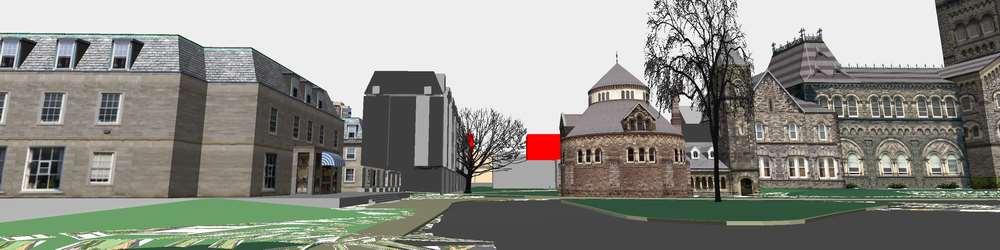
14 Centre for Landscape Research City of Toronto 3D model of Garrison Creek underground infrastructure with 3D VR model.

15 The overall problem with this phenomenon in Canadian cities is that the livable pre automobile streetcar landscape of the large 19 th Century cities is at capacity.

16 Urbanity is a new phenomenon in most Canadian cities. For instance, only thirty years ago it was against the law to have an outdoor café in Toronto, there were no sidewalk amenities or trees on Metropolitan roads


17 Today, many people have discovered positive aspects of urban living

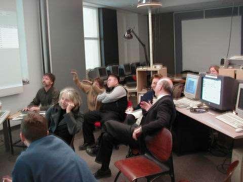
18 and a reverse migration is fostering lifestyles that minimize the need for a car.

19 Jan Gehl s analysis of the shift in the role of the public realm street from a place of necessary work activity to a place for freedom of choice activities and urban social life.

20 David Hulchanski, Cities Centre, UofT

21 However, gentrification and cost have supplanted the original high quality immigrant staging neighbourhoods that are inherently walkable and have the highest possibilities for urbanity.

22 David Hulchanski, Cities Centre, UofT

23 Paul Hess, Cities Centre, UofT Walkability Poor in the affordable Post war Suburbs + little or no Transit

24 3. Is this a clash of ethics? The Provincial assumption is that their policy will force denser development to make transit more affordable. Until transit is equitably distributed in all neighbourhoods, gentrification based on travel times may displace affordable neighbourhoods again. David Hulchanski, Cities Centre, UofT

25 at CLR we have been exploring the possibilities, inventing software & testing in real world practice access grid - student review with NZ Hoinkes, Danahy, Lindquist


26 CLR Community Workshops Toronto Rail Lands and Waterfront Friends of Fort York
27
28
29

30 Now, a new future is supported by the Province and the City The Citizens Lakeview Legacy Project becomes endorsed by all levels of government and proceeds as Inspiration Lakeview

31 The Citizens Lakeview Legacy Project becomes endorsed by all levels of government and proceeds as Inspiration Lakeview following the City of Mississauga s Strategic Plan Pillars (above)

32 Issue: How to retrofit the automobile scaled post WWII Canadian Cities as Smart Sustainable Cities?

33 Lakeview Legacy Vision Plan sought to restructure the infrastructure and livability of this Post WWII brownfield post industrial community as a smart eco community. The plan was developed over a two year period by the Lakeview Ratepayers Association with support from the CLR-UofT

34 Lakeview Legacy Vision Plan A Citizen s Plan empowered by collaboration with the University Lakeview Ratepayers Association // Centre for Landscape Research, University of Toronto


35 On October 6 and December 2,3,4, we had very passionate idea exchanges during public engagement Inspiration Lakeview
 was a 15 foot long physical process model but lacked detailed digital metrics and context.")
36 Visualizing the follow-up professional plan in the Citizen s Base Model for comparison and negotiation. Professional model (Urban Strategies) was a 15 foot long physical process model but lacked detailed digital metrics and context. Centre for Landscape Research, UofT

37 Centre for Landscape Research, University of Toronto, Graduate MLA, March and MUD students developed alternative strategies with sustainability metrics and indicators.

38 Yuda Ho MLA Thesis - Centre for Landscape Research, University of Toronto, alternative strategies with sustainability metrics and indicators

39 Yuda Ho MLA Thesis - Centre for Landscape Research, University of Toronto strategies for examining sustainable lifestyle factors and site considerations

40 Wei Pang MLA Thesis - Centre for Landscape Research, University of Toronto strategies for examining sustainable urban hydrology and constructed wetlands for tertiary waste treatment

41 Wei Pang MLA Thesis - Centre for Landscape Research, UofT - strategies for examining sustainable urban hydrology

42 Wei Pang MLA Thesis - Centre for Landscape Research, UofT - Metrics for examining sustainable urban hydrology
43 Wei Pang MLA Thesis - Centre for Landscape Research, UofT - Metrics for examining sustainable urban hydrology
44 MAP 4 Medium & Small Blue Moves Urban Strategies Inc s Inspiration Lakeview Plan for sustainable urban hydrology


45 MAP 4 Medium & Small Blue Moves

46 a proposed way that KMDI and Cities Centre at UofT could collaborate on smart cities research
47
48

49 Stirling, &Co

50 The goal of the GEOIDE TSII#201 project Connecting urban design and performance models in a visual environment for decision making in urban sustainability Smart Cities Research at University of Toronto
51 Integrated Decision Support for Sustainable Communities October 5, 2010 Smart Cities Research at University of Toronto
52 Research Leadership Steve Easterbrook Dept of Computer Science, UofT Andrew Clement, Faculty of Information, UofT John Danahy, John H. Daniels Faculty of Architecture Paul Guild, Dept of Management Sciences, UofW Bryan Karney, Dept of Civil Engineering, UofT Eric Miller, Director, Cities Centre, Prof, Dept of Civil Engineering, UofT Gerald Penn, Dept of Computer Science, UofT Konstantinos N (Kostas) Plataniotis, Dept of ECE, UofT Frank Tompa, School of Computer Science, UofW Smart Cities Research at University of Toronto


53 Project Team RESEARCH INVESTIGATORS Eric Miller, UofT Stephen Sheppard, UBC John Danahy, UofT Jeff Cassello, UofWaterloo Reob Feick, UofWaterloo Ron Kellet, UBC Chris Kennedy, UofT Ted Kesik, UofT Stephane Roche, Laval Rob Wright, UofT Kathryn Grond, UofT Jacob Mitchel, UofT, DTAH Eugene Mohareb, UofT RESEARCH PARTNERS ESRI Canada, ESRI Redlands, Bill Miller Toronto Regional Conservation Authority Waterfront Toronto City of Richmond City of Surrey Dutoit Alsopp Hillier Halsall Associates Autodesk Canada Smart Cities Research at University of Toronto

54 Research Overview
55 Research Themes Data Integration and Management: Handling very large datasets, containing disparate sources and types of data; Privacy and Security: Protecting the privacy of all citizens in data that capture increasingly more detail about everyday activities, while making that data accessible for research and analysis; Modeling and Simulation: Designing and testing optimal methods for visualizing complex spatial, temporal, socio-economic patterns for research and decision-making purposes; Visualization: Creation of collaborative and immersive visualizations for decision making for government, private sector and communities; Decision Support and Public Engagement: Participatory design, social networking, and interactive engagement of decision makers at all levels. Smart Cities Research at University of Toronto
56 Partners Universities University of Toronto University of Waterloo Ontario Institute of Technology Research Programs: NSERC Business Intelligence Network Public Sector Independent Electricity System Operator (IESO) Ontario Power Authority Toronto District School Board Ontario Centres of Excellence Sue Sault Marie Innovation Centre Neptis Foundation Private Sector IBM Canada Zerofootprint Palomino Archestra Parallel Worlds Government City of Toronto Office of the Information and Privacy Commissioner of Ontario National Sciences and Engineering Research Council of Canada (NSERC) Smart Cities Research at University of Toronto
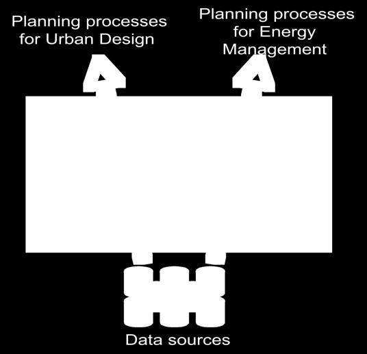
57 Smarter Planet: Smart Cities Municipal decision-making must be informed by strategic plans, watershed plans, official plans, district plans, business improvement plans, heritage strategies, zoning plans, special study plans, urban design guidelines, design review panels These are communicated in a multitude of ways including maps, physical and digital models Integration of data across scale and scope including location, geographic and planning data is necessary to support decision-makers Cities have complex networks of stakeholders to engage in decision-making, each with their own perspectives, needs and language Smart Cities Research at University of Toronto

 Macro Processes (regional economy, )")


58 Typology of Models Spatial Temporal Representation of the Physical World (buildings, transport networks, etc.) Macro Processes (regional economy, ) Market Interactions (demand, supply, prices) Technology Performance (energy, road congestion, etc. Individual Agents Actions (travel, demographics, etc.) Smart Cities Research at University of Toronto Eric Miller

59 Transportation systems models Smart Cities Research at University of Toronto Eric Miller

60 Auto Emissions by location and time of day Link-based running emissions by time of day Source: Hatzopoulou, Zone-based soak emissions by time of day

61 Pollution exposure by location & time of day Smart Cities Research at University of Toronto Source: Hatzopoulou, 2008.
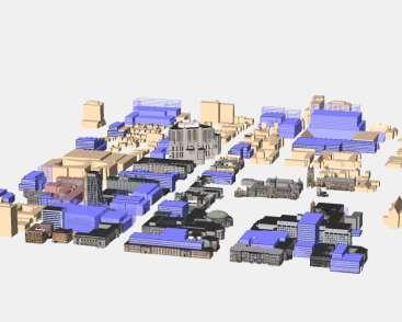
62 The Greater Toronto Areas - GTA The GTA & GGH is a large metropolitan region that lacks a coherent regional GIS suitable for sustainability decision making processes We aim to connect disparate urban design and evaluation models in a visual environment for decision making in urban sustainability Today I am illustrating a case study of the Waterfront Toronto on the West Don Lands show the first protoype integrating street scale drawings, 3D max, and a carbon-energy evaluation tool As time permits, I will show aspects of the Pearson Airport Eco Industrial Zone case study Smart Cities Research at University of Toronto Eric Miller


63 Carbon Tool/GBR Team


64 Target Range Exercise Land-Use Transit Oriented Development City of Toronto 96% of households are within 400m of a TTC station Walkability City of Toronto ~45% of housing units are within 800m of at least 5 basic services Jobs within 800m of housing: ~50% of housing unit count Smart Cities Research at University of Toronto Cities Centre


65 Urban Design Models URBAN DESIGN MODELS Master plan: streets, parcels, public realm Building footprint and heights CAD URBAN PERFRMANCE MODELS Census data Traffic Models Building Resource Models Neighborhood Carbon Model Excel + software Case Study: West Don Lands Urban Design and Master Plan Create common geodatabase and import to GIS Smart Cities Research at University of Toronto Cities Centre ARC GIS SPATIAL MODEL and VISUALIZATIONS wat 2D or 3D maps of carbon by building Regional travel behavior DASHBOARDS and WEB APPLICATIONS Flex or HTML5


66 Urban Performance Models URBAN DESIGN MODELS Traffic Model Work Trip Destinations for Residents of West Don Lands TTS Traffic Zones 2001 Master plan: Population model (population synthesis) streets, parcels, public realm TASHA : Trip Planning Building footprint and EMME2: Traffic Assignment heights Create CAD common geodatabase and import to GIS URBAN PERFRMANCE MODELS Census data Traffic Models Building Resource Models Neighborhood Carbon Model Excel + software Smart Cities Research at University of Toronto Cities Centre ARC GIS SPATIAL MODEL Brampton and VISUALIZATIONS 2D or 3D maps of carbon by building Regional travel behavior Hamilton Mississauga Richmond Hill Kilometers Markham Toronto DASHBOARDS and West Don WEB Lands APPLICATIONS Flex or HTML5 Number of Trips by Quartiles: Municipalities 2006 Traffic zone is not a destination
 Master plan:")


67 Urban Performance Models URBAN DESIGN Traffic Model MODELS Building Resource models Population model (population synthesis) Master plan: Carbon Model Operational energy consumption and streets, TASHA parcels, : Trip Planning generation public Regional realm Carbon factors applied to build-out Building EMME2: Traffic Assignment scenarios Consumption of water, waste, materials footprint and heights Carbon output per resident and Create building area CAD common geodatabase and import to GIS URBAN PERFRMANCE MODELS Census data Traffic Models Building Resource Models Neighborhood Carbon Model Excel + software Smart Cities Research at University of Toronto Cities Centre ARC GIS SPATIAL MODEL and VISUALIZATIONS 2D or 3D maps of carbon by building Regional travel behavior DASHBOARDS and WEB APPLICATIONS Flex or HTML5
68 Spatial Models URBAN DESIGN MODELS Master plan: streets, parcels, public realm Building footprint and heights CAD URBAN PERFRMANCE MODELS Census data Traffic Models Building Resource Models Neighborhood Carbon Model Excel + software Create common geodatabase and import to GIS Smart Cities Research at University of Toronto Cities Centre ARC GIS SPATIAL MODEL and VISUALIZATIONS 2D or 3D maps of carbon by building Regional travel behavior DASHBOARDS and WEB APPLICATIONS Flex or HTML5


69 Smart Cities Research at University of Toronto Cities Centre

70 Dashboards URBAN DESIGN MODELS Dashboard can create opportunities for the public and experts alike to test options, such as individual building and roof potential for Solar PV applied to Provincial funding Master plan: streets, parcels, public realm Building footprint and heights CAD URBAN PERFRMANCE MODELS Census data Traffic Models Building Resource Models Neighborhood Carbon Model Excel + software Create common geodatabase and import to GIS ARC GIS SPATIAL MODEL and VISUALIZATIONS 2D or 3D maps of carbon by building Regional travel behavior Example: FLEX web based Solar and Thermal Calculator, Feick, Uof Waterloo DASHBOARDS and WEB APPLICATIONS Flex or HTML5
71 Wei Pang MLA Thesis examining daily lifestyle requirements
72 Decision Support Techniques To address these problems, we will investigate and integrate techniques from four existing approaches to community decision-making: Decision theatre makes use of immersive visualizations, in which a group of people engaged in complex decision processes can be brought together in a specially designed theatre that provides large format immersive visualizations of the 3D built environment and of 3D views of abstract data spaces. Participatory Design provides a methodology to explore design choices and understand needs. These have traditionally been used for user interface design and workflow systems, The challenge here is to enhance PD methods with ways of exploring complex datasets that complement the participants own experiences.
73 CLR 3D negotiation models - University of Toronto

74 CLR 3D negotiation models - University of Toronto

75 CLR participatory negotiation models complete streets Lakeshore Road Community symposium
76 CLR 3D City Models that Show Me the integration of smart cities thinking from metrics to human scale experience
77 Decision Support Techniques Online Communities, The challenge in online communities is to find ways of building trust and assessing credibility and expertise of individual participants and information sources, when traditional social processes for recognizing credibility are absent. We will explore how to combine online community building with face-to-face techniques such as decision theatre and participatory design, to adapt to complex decision tasks requiring consensus-building and creative design solutions. Crowdsourcing, which bring together large numbers of people to create complex shared knowledge sources (e.g. Wikipedia, OpenStreetMap, etc) [c1]. These depend on simple protocols for editing a large shared knowledge-base, along with sophisticated social processes for maintaining overall editorial guidance to ensure the result is coherent. We plan to build on our existing prototype for an online shared carbon calculator, INFLO [c2] which acts as a visual wiki for quantitative analysis of complex decision problems, where participants can extend the analysis and link it to new data sources as they become relevant.

78 An example of the effort to holistically integrate human and technical factors in smart city thinking by Boyd Cohen /the-smartest-cities-inthe-world-2015-methodology He describes the current phase of smart cities thinking as one that incorporates citizen co-creation /the-3-generations-ofsmart-cities


79 There are many approaches to smart cities by various industries, municipal infrastructure departments and technical disciplines. Often these models appear very technical and leave out the dimensions of the livable smart city that are becoming a widely accepted requirement of a smart city. The next phase of smart city model research is to marry the technical models with human centric urban design models that capture lifestyle factors.

80 Smart Cities Research at University of Toronto


81 UofT President Gertler s priority on using the University s location in the Toronto Region as an asset and a responsibility


82 Bringing together the University Talent & Creating Research Catalogues
83 Smart Cities Research at University of Toronto

84 Smart Cities Research at University of Toronto

85 Smart Cities Research at University of Toronto
City of St. Thomas New Official Plan
 City of St. Thomas New Official Plan Sustainable & Healthy Community Workshop Ann Joyner and Paddy Kennedy Dillon Consulting Limited Work Shop Outline Introduction Presentation Exercise 1 (individual)
SCARBOROUGH SUBWAY EXTENSION. Scarborough Subway Extension. Final Terms of Reference
 Scarborough Subway Extension Final Terms of Reference 1 1.0 Introduction and Background 1.1 Introduction Toronto City Council recently confirmed support for an extension of the Bloor-Danforth Subway from
Smart Growth for Dallas
 Smart Growth for Dallas Data-driven decisions for the future of Dallas parks, open spaces, and green infrastructure Dallas Park and Recreation Board March 10, 2016 Agenda I. Welcome and Introductions II.
planning toronto s downtown Parks and Public Realm Plan Request for Proposals Information Meeting Andrew Farncombe, Project Manager August 19, 2015
 planning toronto s downtown Parks and Public Realm Plan Request for Proposals Information Meeting Andrew Farncombe, Project Manager August 19, 2015 BATHURST ST Keeping Downtown a great place to live, work,
COMMUNITY SUSTAINABILITY AND ENVIRONMENTAL MASTER PLAN IMPLEMENTATION UPDATE
 Attachment 1 COMMUNITY SUSTAINABILITY AND ENVIRONMENTAL MASTER PLAN IMPLEMENTATION UPDATE Priorities and Key Initiatives Committee May 2013 Page E-1 How we grow Goal 2: To ensure sustainable development
Streets for People, Place-Making and Prosperity. #TOcompletestreets
 COMPLETE STREETS FOR TORONTO Streets for People, Place-Making and Prosperity COMPLETE STREETS: A NEW APPROACH A Complete Streets design approach considers the needs of all users people who walk, bicycle,
Vancouver. Title of the Initiative. Initiative Duration. Submitted by. Comments by the Jury
 134 Vancouver Title of the Initiative Initiative Duration Submitted by Comments by the Jury Visionary Vancouver: Creating a Welcoming and Sustainable Place for All 2009-2020 Wendy Au, Deputy City Manager,
3. Endorse the LRT vision in transforming Surrey into Connected-Complete-Livable communities, and more specifically, the official vision statement:
 CORPORATE REPORT NO: R038 COUNCIL DATE: February 20, 2017 REGULAR COUNCIL TO: Mayor & Council DATE: February 16, 2017 FROM: General Manager, Engineering FILE: 8740-01 SUBJECT: Surrey Light Rail Transit
Town of Oakville Streetscape Strategy
 Town of Oakville Streetscape Strategy Endorsed by PDC on February 10, 2014 (PD-011-14) Town of Oakville Streetscape Strategy [endorsed by PDC February 10, 2014] 0 Town of Oakville Streetscape Strategy
HARVARD PROJECT ON SOUTHWEST FLORIDA AND SEA LEVEL: THE CASE OF COLLIER COUNTY (INCLUDING NAPLES, MARCO ISLAND & EVERGLADES CITY)
") HARVARD PROJECT ON SOUTHWEST FLORIDA AND SEA LEVEL: THE CASE OF COLLIER COUNTY (INCLUDING NAPLES, MARCO ISLAND & EVERGLADES CITY) PROPOSAL DATE: MAY 21, 2016 Professor Charles Waldheim, Principal Investigator
HARVARD PROJECT ON SOUTHWEST FLORIDA AND SEA LEVEL: THE CASE OF COLLIER COUNTY (INCLUDING NAPLES, MARCO ISLAND & EVERGLADES CITY) PROPOSAL DATE: MAY 21, 2016 Professor Charles Waldheim, Principal Investigator
Active Neighbourhoods Canada SUMMARY REPORT
 Prepared by the Toronto Centre for Active Transportation JUNE 2017 Active Neighbourhoods Canada SUMMARY REPORT OF 4 ONTARIO PROJECTS Sharing participatory methods in Ontario Active Neighbourhoods Canada
Welcome to the Oakridge Centre Open House
 Welcome to the Oakridge Centre Open House Why is the City hosting this event? This open house is to inform you of a rezoning application submitted to the City of Vancouver to amend the existing CD-1 (Comprehensive
WELCOME and introduction
 1 WELCOME and introduction Mobility Hub Locations within Burlington STUDY OVERVIEW STUDY OBJECTIVES The City of Burlington is developing four Area Specific Plans, one for each of Burlington s Mobility
Central City District What we heard
 What we heard Vision to 2056 and Priorities Governance and implementation Infrastructure and funding The vision for a metropolis of three cities, and the 30 minute city. Feedback requested: Clearer communication
Streets, Connectivity & Built Environment Working Group August 2, 2017
 Streets, Connectivity & Built Environment Working Group August 2, 2017 DOWNTOWN OAKLAND SPECIFIC PLAN WELCOME Streets, Connectivity & Built Environment Working Group Social Equity Meeting August 2, 2017
Graduate-Level Course List
 CRPLAN 5001 - Introduction to GIS (4) Introduction to the basic principles of geographic information systems and their use in spatial analysis and information management. Prereq: Sr or Grad standing. Not
1.3 TRANSIT VISION 2040 FROM VISION TO ACTION THEME 1: PUTTING TRANSIT AT THE CENTRE OF COMMUNITIES. Fully integrate transit with community planning
 TRANSIT VISION 2040 FROM VISION TO ACTION TRANSIT VISION 2040 defines a future in which public transit maximizes its contribution to quality of life with benefits that support a vibrant and equitable society,
OUR GREATER SYDNEY A metropolis of three cities. OVERVIEW. connecting people. DRAFT Greater Sydney Region Plan
 OUR GREATER SYDNEY 2056. A metropolis of three cities. OVERVIEW. connecting people. DRAFT Greater Sydney Region Plan October 2017 This document is an overview of the draft Greater Sydney Region Plan. To
Western City District What we heard
 What we heard Vision to 2056 and Priorities Governance and implementation Infrastructure and funding The protection of the natural landscape including biodiversity and the Metropolitan Rural Area for food
Sustainability, Health, Safety, Recreation & Open Space Working Group August 3, 2017
 Sustainability, Health, Safety, Recreation & Open Space Working Group August 3, 2017 DOWNTOWN OAKLAND SPECIFIC PLAN WELCOME Sustainability, Health, Safety, Recreation & Open Space Working Group Social
Statement of. Planning Intent. Mick Gentleman MLA Minister for Planning
 Statement of Planning Intent 2 015 Mick Gentleman MLA Minister for Planning Minister s message As Minister for Planning, I would like Canberra to be a city renowned not only for its liveability, but its
Public Open House. YWCA, 87 Elm Street December 2nd, 2017, 10 a.m. 2 p.m.
 Public Open House YWCA, 87 Elm Street December 2nd, 2017, 10 a.m. 2 p.m. 1 A 25-Year Downtown Plan A blueprint for future growth and infrastructure in the heart of Toronto Ensuring growth contributes positively
A BLUEPRINT FOR BROCKTON A CITY-WIDE COMPREHENSIVE PLAN
 A BLUEPRINT FOR BROCKTON A CITY-WIDE COMPREHENSIVE PLAN Public Meeting October 2016 1 Plan Summary and Discussion Public Meeting May 4 2017 City of Brockton Bill Carpenter, Mayor Department of Planning
Section 1 Introduction
 Section 1 Section 1,, describes the role of the Official Plan. The Official Plan is one of five growth management plans that was completed under the umbrella of Ottawa 20/20. 1.1 The Role of the Official
An advanced tool for assessing and guiding sustainable urban development
 Improving Transportation Demand Management through Sustainable Urban Planning and Design: Recommendations from International Green Model City Initiative (IGMC) Lu Haifeng Secretary-General Global Forum
MOBILITY HUB GUIDELINES 2012 TAC Sustainable Urban Transportation Award Submission BACKGROUND MOBILITY HUB GUIDELINES
 MOBILITY HUB GUIDELINES 2012 TAC Sustainable Urban Transportation Award Submission BACKGROUND Rapid population growth, increasing congestion, and years of under investment in transit in the Greater Toronto
TOD 101 CREATING LIVABLE COMMUNITIES WITH TRANSIT
 1 CREATING LIVABLE COMMUNITIES WITH TRANSIT What are transit Centered Communities? Benefits of Partnerships to Support and Implement What You Will Learn Portland s Pearl District Your Trainers Today Catherine
2.0 A FRAMEWORK FOR SUSTAINABLE GROWTH CONTENTS
 2-2 A Framework for Sustainable Growth 2.0 A FRAMEWORK FOR SUSTAINABLE GROWTH CONTENTS 2.1 MANAGING SUSTAINABLE GROWTH THE VISION TO 2031 2.2 GOALS AND OBJECTIVES 2.2.1 Protecting the Natural Environment
Robbinsdale LRT Station. CDI Development Guidelines. August Overview
 Robbinsdale LRT Station August 2018 Overview The City of Robbinsdale may have the coolest opportunity site along the 13 mile stretch of the Bottineau LRT corridor / Blue Line extension. Located a block
John M. Fleming Managing Director, Planning and City Planner. Old East Village Dundas Street Corridor Secondary Plan Draft Terms of Reference
 Report to Planning and Environment Committee To: From: Subject: Chair and Members Planning & Environment Committee John M. Fleming Managing Director, Planning and City Planner Old East Village Dundas Street
section 3: Vision, Values and Goals
 Vision, Values and Goals 3 2041 Vision: Victoria is an urban sustainability leader inspiring innovation, pride and progress towards greater ecological integrity, livability, economic vitality, and community
1 Introduction. 4 Environmental Integrity. 7 Community Facilities
 2037: A CALL TO ACTION 2017 COMPREHENSIVE PLAN EXECUTIVE SUMMARY is the purpose of the Q: What Comprehensive Plan? The comprehensive plan serves as a guide for the community s physical, social, and economic
Urban Design Manual PLANNING AROUND RAPID TRANSIT STATIONS (PARTS) Introduction. Station Study Areas
 Introduction. Station Study Areas") 111111 PLANNING AROUND RAPID TRANSIT STATIONS (PARTS) Introduction The ION rapid transit system will link Waterloo, Kitchener and Cambridge through a central transit corridor (CTC). There are a number
111111 PLANNING AROUND RAPID TRANSIT STATIONS (PARTS) Introduction The ION rapid transit system will link Waterloo, Kitchener and Cambridge through a central transit corridor (CTC). There are a number
Synopsis of 50 years of Planning in the Greater Golden Horseshoe (GGH), Ontario, Canada. Olusola Olufemi 2015
, Ontario, Canada. Olusola Olufemi 2015") Synopsis of 50 years of Planning in the Greater Golden Horseshoe (GGH), Ontario, Canada Olusola Olufemi 2015 Canada Background Canada s population is 34,834,841 (July 2014 est.) Capital city: Ottawa Canada
Synopsis of 50 years of Planning in the Greater Golden Horseshoe (GGH), Ontario, Canada Olusola Olufemi 2015 Canada Background Canada s population is 34,834,841 (July 2014 est.) Capital city: Ottawa Canada
City of Toronto Official Plan Indicators
 City of Toronto Official Plan Indicators Attachment 1 2017 Gladki Planning Associates in association with Hemson Consulting & Studio Jaywall City of Toronto Official Plan Indicators 1 Introduction What
Official Plan Review
 Official Plan Review Summary Report - The Built Environment August 2014 Part 1: Introduction Planning for a healthy, prosperous and sustainable community is an important goal for our municipality. From
Mobility Hub Guidelines: Tools for Achieving Successful Station Areas
 Mobility Hub Guidelines: Tools for Achieving Successful Station Areas This paper introduces Metrolinx s recently released Mobility Hub Guidelines and highlights two key aspects of the document: the importance
Burlington s Strategic Plan
 Burlington s Strategic Plan 2015 2040 DRAFT FOR CONSULTATION burlington.ca/strategicplan Welcome to Burlington s 2015 2040 Strategic Plan The City of Burlington s 2015-2040 Strategic Plan is the result
Scottish Natural Heritage. Better places for people and nature
 Scottish Natural Heritage Better places for people and nature Contents Summary... 3 SNH approach... 5 Place-making in policy and practice... 6 Developing the contribution of the natural heritage to place-making...
Zagreb. Strategic planning. City of Zagreb City Office of Strategic Planning and Development of the City
 Zagreb http://www.zagreb.hr/ Strategic planning Through ZAGREBPLAN a vision of Zagreb was defined: City of Zagreb as an urban incubator of sustainable concepts, entrepreneurship and new values City of
Cambie Corridor Planning Program Phase Two Draft Plan. Standing Committee on City Services and Budgets May 5, 2011
 Cambie Corridor Planning Program Phase Two Draft Plan Standing Committee on City Services and Budgets May 5, 2011 Cambie Corridor Program Terms of Reference approved July 2009 Land Use Transportation Energy
DRAFT FOR PUBLIC REVIEW. Game Plan for a Healthy City
 DRAFT FOR PUBLIC REVIEW 2018 Game Plan for a Healthy City 2 Denveright. Parks & Recreation Game Plan Draft for Public Review Draft for Public Review Executive Summary Game Plan Overview Executive Summary
PLAN ELEMENTS WORKSHOP. April 5, 2016
 PLAN ELEMENTS WORKSHOP April 5, 2016 needs more housing. But there is no one-size fits-all solution. Every neighborhood has its own character. In some places, density is not only appropriate it is badly
13 Extending the Esri Enterprise Licence Agreement
 Clause 13 in Report No. 10 of Committee of the Whole was adopted, without amendment, by the Council of The Regional Municipality of York at its meeting held on May 21, 2015. 13 Extending the Esri Enterprise
The Esri Public Works Platform. More Than Mapping
 The Esri Public Works Platform More Than Mapping Intelligent Public Works Sustaining a safe, vibrant community requires a smart public works system. Esri created a platform that connects public works departments
Inspiring Technovation
 1 2 Table of content List of table and figures... Executive summary... 1. Introduction... 2. Material and methods... 3. Results... 3.1 Today s facts about Versailles: a diagnostic approach... 3.1 Vision
13 THORNHILL YONGE STREET STUDY IMPLEMENTATION CITY OF VAUGHAN OPA 669 AND TOWN OF MARKHAM OPA 154
 13 THORNHILL YONGE STREET STUDY IMPLEMENTATION CITY OF VAUGHAN OPA 669 AND TOWN OF MARKHAM OPA 154 The Planning and Economic Development Committee recommends the adoption of the recommendations contained
Smart Growth for Dallas
 Smart Growth for Dallas Using data and GIS to improve the social, economic, and environmental resilience of Dallas Dallas Park and Recreation Board November 1, 2018 About Our Partners The Trust for Public
CONTENTS 2.0 A FRAMEWORK FOR SUSTAINABLE GROWTH 2.1 MANAGING SUSTAINABLE GROWTH THE VISION TO GOALS AND OBJECTIVES 2.3 MARKHAM STRUCTURE
 2 A Framework for Sustainable Growth 2.0 A FRAMEWORK FOR SUSTAINABLE GROWTH CONTENTS 2.1 MANAGING SUSTAINABLE GROWTH THE VISION TO 2031 2.2 GOALS AND OBJECTIVES 2.2.1 Protecting the Natural Environment
- Displacement of disadvantaged populations by profit-driven redevelopment projects;
 PROJECT DESCRIPTION LED Landscape Education for Democracy LED (Landscape Education for Democracy): An interdisciplinary, international course unit training conceptual thinking, diversity management and
BROOKLYN PARK / 85TH AVE LRT STATION CDI DEVELOPMENT GUIDELINES DRAFT
 August 2018 Page intentionally left blank The Brooklyn Park Library adjacent to the 85th Ave LRT Station Area. OVERVIEW The Blue Line LRT Extension / Bottineau corridor offers a unique opportunity to leverage
4 Sustainability and Growth Management
 4 Sustainability and Growth Management Introduction Traditionally, has assumed growth and development with limited consideration for the long-term negative social, environmental or economic impacts on
CITY OF VAUGHAN D R A F T YONGE STREET STUDY. June 2008 YOUNG + WRIGHT /IBI GROUP ARCHITECTS DILLON CONSULTING LTD.
 CITY OF VAUGHAN June 2008 YOUNG + WRIGHT /IBI GROUP ARCHITECTS GHK SUSTAINABILITY INTERNATIONAL + LIVABILITY (CANADA) LTD. = COMMUNITY VALUE DILLON CONSULTING LTD. Public Open House Tonight s Meeting WELCOME
Fort Wellington National Historic Site
 Fort Wellington National Historic Site DECEMBER 2015 PUBLIC CONSULTATION DOCUMENT Invitation to participate Fort Wellington National Historic Site has begun the process of reviewing its management plan.
implementation r expression in landscape
 6 ubc okanagan implementation campus plan r expression in landscape 68 6 implementation campus plan sections The Campus Plan supports the academic mission, values and commitments of the University by providing
Plano Tomorrow Vision and Policies
 Plano Tomorrow Vision and Policies PLANO TOMORROW PILLARS The Built Environment The Social Environment The Natural Environment The Economic Environment Land Use and Urban Design Transportation Housing
WELCOME TO THE CHOUTEAU GREENWAY ECONOMIC DEVELOPMENT WORKING GROUP!
 WELCOME TO THE CHOUTEAU GREENWAY ECONOMIC DEVELOPMENT WORKING GROUP! Chouteau Greenway Steering Committee and Working Groups Overview Overview January 9, 2019 Chouteau Greenway will transform St. Louis
Current Canadian Aerospace Industry!
 ED13.2 Current Canadian Aerospace Industry Comprised of 817 companies and employs 170,000 people nationwide. It generates $41 billion in revenue. Between 2007-2012, Research and Development (R&D) investment
Toronto Complete Streets Guidelines
 c. DTAH 58 60 3.1 70 3.2 Performance Measurement 71 3.3 Exceptions Chapter 3 describes the five general steps in the street design process. Not all projects follow these steps, as the number of steps and
RESILIENT COMMUNITIES PROJECT CITY OF MINNETONKA
 RESILIENT COMMUNITIES PROJECT CITY OF MINNETONKA BUILDING COMMUNITY-UNIVERSITY PARTNERSHIPS FOR SUSTAINABILITY Presentation to The League of Women Voters March 16, 2013 Julie Wischnack, Community Development
Gather information from online resources covering the following topics:
 Assignment #1: Regional Analysis Project Site Location: Greater Boston Area What comprises a region? The many elements within a region comprise the region as a whole. Natural as well as manmade environmental
SOUTH AFRICA S PREPARATIONS FOR HABITAT III COMMON AFRICAN POSITION FOR HABITAT III. Habitat III Urban Breakfast 5 October 2016
 SOUTH AFRICA S PREPARATIONS FOR HABITAT III COMMON AFRICAN POSITION FOR HABITAT III Habitat III Urban Breakfast 5 October 2016 Context and Background 1. Africa intends actively shaping the New Urban Agenda,
1 Port Street East: Delivering on the Vision. Andrew Whittemore Director, City Planning Strategies. Ruth Marland. TOPCA May 23, 2017
 1 Port Street East: Delivering on the Vision Andrew Whittemore Director, City Planning Strategies Ruth Marland TOPCA May 23, 2017 Strategic Leader, City Planning Strategies Mary Ellen Bench City Solicitor
CITY CORE 2050 A VISION FOR THE HEART OF THE REGION
 CITY CORE 2050 A VISION FOR THE HEART OF THE REGION INITIAL SCOPE OF WORK OCTOBER 17, 2017 CITY CORE 2050 Phase 1 January to July 2018 A public conversation about challenges and opportunities A preliminary
A community driven catalyst for an equitable, healthy, (economically viable and environmentally) sustainable corridor
 sustainable corridor") Economy Environment Equity Building Sustainability Supporting neighborhoods Preserving municipal resources A community driven catalyst for an equitable, healthy, (economically viable and environmentally)
Economy Environment Equity Building Sustainability Supporting neighborhoods Preserving municipal resources A community driven catalyst for an equitable, healthy, (economically viable and environmentally)
Create Policy Options Draft Plan Plan Approval. Public Consultation Events. Phase 2
 Background Grandview-Woodland Community Plan In the spring of 2012, the City of Vancouver embarked on a comprehensive community planning program in the Grandview-Woodland neighbourhood. The process has
Public Open House. Overview of the Downtown Plan Official Plan Amendment April 23, 2018
 Public Open House Overview of the Downtown Plan Official Plan Amendment April 23, 2018 1 A 25-Year Plan for Downtown To ensure growth contributes positively to Toronto s Downtown as a great place to live,
Transit / Housing Oriented Redevelopment
 Broward County Urban Planning and Redevelopment Department Kick-Off Meeting October 24, 2007 Transit / Housing Oriented Redevelopment 1 Future Land Use 2 Broward County Charter Voters approved in 1974.
Moving from Vision to Action
 Moving from Vision to Action Photo: John Carvalho What does it mean for a city to move? To see its people belong and connect? To prosper? To become green? Those are the pillars that are helping Mississauga
INTERNATIONAL SOCIETY OF CITY AND REGIONAL PLANNERS 2016 ISOCARP AWARD FOR EXCELLENCE
 INTERNATIONAL SOCIETY OF CITY AND REGIONAL PLANNERS 2016 ISOCARP AWARD FOR EXCELLENCE PROJECT DESCRIPTION WHAT IS ZIBI? Zibi is a world-class sustainable community and redevelopment project by Windmill
CANADIAN SOCIETY OF LANDSCAPE ARCHITECTS STRATEGIC PLAN 2012_14
 CANADIAN SOCIETY OF LANDSCAPE ARCHITECTS STRATEGIC PLAN 2012_14 about the CSLA _ history The Canadian Society of Landscape Architects was founded in 1934. By that time, landscape architects were active
WELLINGTON STREET WEST COMMUNITY DESIGN PLAN
 36 3.CDP POLICIES 37 Wellington Street West CDP Vision Statement 38 3.1 Introduction 3.1.1 Purpose The development of buildings and public spaces is influenced by a variety of factors over time. City of
1. MAKING CHOICES. What kind of city will Toronto be in the 21st century?
 1. MAKING CHOICES Toronto is a great city! It has evolved into a special place that people care about deeply. It is a wonderful city in which to live, offering a diversity and richness of urban life that
Remi Mendoza City Planning Academy March 13, 2017
 Remi Mendoza City Planning Academy March 13, 2017 1 What is the General Plan? The 2030 General Plan 5-Year Update (2035 General Plan) Questions and Answers 2 Guidebook for development and growth Required
City of Tacoma Planning and Development Services
 Agenda Item E-1 City of Tacoma Planning and Development Services To: Planning Commission From: Elliott Barnett, Planning Services Division Subject: Tacoma Mall Regional Center Subarea Plan and EIS Meeting
Blueprint Denver A BLUEPRINT FOR AN INCLUSIVE CITY. Executive Summary
 Blueprint Denver A BLUEPRINT FOR AN INCLUSIVE CITY Executive Summary PUBLIC REVIEW DRAFT 2 1/7/2019 DENVERIGHT BLUEPRINTDENVER Blueprint Denver: A Blueprint for an Inclusive City An Equitable City Planning
Bachelor of City Planning [BCP] (Hons)
![Bachelor of City Planning [BCP] (Hons)](/thumbs/96/128460542.jpg "Bachelor of City Planning [BCP] (Hons)") November 2015 A/Prof Simon Pinnegar Discipline Director, Planning Bachelor of City Planning [BCP] (Hons) What s new? https://www.be.unsw.edu.au/undergraduate-degrees/city-planning/sydney-changing-were-also-changing
November 2015 A/Prof Simon Pinnegar Discipline Director, Planning Bachelor of City Planning [BCP] (Hons) What s new? https://www.be.unsw.edu.au/undergraduate-degrees/city-planning/sydney-changing-were-also-changing
38 Queen s University Campus Master Plan Part 1
 38 Queen s University Campus Master Plan Part 1 46 The Campus at the City Scale Chapter 4 The Campus at the City Scale 39 Queen s is an urban University centrally located in Kingston. Decisions made by
CITY COUNCIL AGENDA REPORT
 CITY COUNCIL AGENDA REPORT Subject: COUNCIL MOTION LRT ALIGNMENT REMOVAL FROM THE TRANSPORTATION MASTER PLAN On February 10, 2016 Councillor Hughes provided notice in accordance with Section 23 of Procedure
North District What we heard
 What we heard Vision to 2056 and Priorities Governance and implementation Infrastructure and funding The vision for a metropolis of three cities, and the 30 minute city. Feedback emphasised: That for the
WELCOME TO THE CHOUTEAU GREENWAY DESIGN, DEVELOPMENT AND CONSTRUCTION WORKING GROUP!
 WELCOME TO THE CHOUTEAU GREENWAY DESIGN, DEVELOPMENT AND CONSTRUCTION WORKING GROUP! Chouteau Greenway Steering Committee and Working Groups Overview Overview January 9, 2019 Chouteau Greenway will transform
ICLEI Webinar Sustainability in the Master Plan and Zoning Code
 ICLEI Webinar Sustainability in the Master Plan and Zoning Code Sustainability in Grand Rapids 2000 2002 New Master Plan 2004 2005 Neighborhood Pattern Workbook 2006 2007 Form-Based Zoning Ordinance 2007
South Norfolk Municipal Facilities Study
 South Norfolk Municipal Facilities Study City of Chesapeake, VA P r e s e n t e d b y H B A A r c h i t e c t u r e & I n t e r i o r D e s i g n, I n c. 1 Purpose of the Study (Phase I) Identify potential
Figure 4-1: Mississauga is situated near the centre of the Greater Golden Horseshoe, one of the fastest growing regions in North America.
 4 Vision 4.1 Introduction The vision for Mississauga is that it will be a beautiful sustainable city that protects its natural and cultural heritage resources, particularly the Lake Ontario waterfront,
TORONTO DISTRICT SCHOOL BOARD SCHOOLS WITHIN MIXED USE BUILDINGS: COMMERCIAL AND CONDOMINIUM BUILDINGS. Planning and Priorities Committee
 23 Report No. 15-05-2615 TORONTO DISTRICT SCHOOL BOARD SCHOOLS WITHIN MIXED USE BUILDINGS: COMMERCIAL AND CONDOMINIUM BUILDINGS TO Planning and Priorities Committee 10 June 2015 RECOMMENDATION IT IS RECOMMENDED
Silverdale Regional Center
 Silverdale Regional Center Vision for Silverdale Regional Center The Silverdale Regional Center Plan (Plan) will guide the evolution of the Silverdale Regional Center from a collection of strip malls and
From i-waterfront to i-canada. The Role of Intelligent Communities in Canada's Digital Opportunity
 From i-waterfront to i-canada The Role of Intelligent Communities in Canada's Digital Opportunity 2015 Hutchison Management International Inc. All Rights Reserved April 29, 2015 From Automation to Smart/Intelligent
Equitable Development: Building Great Communities Through Collaborative Problem Solving
 Equitable Development: Building Great Communities Through Collaborative Problem Solving Carlton C. Eley Capital Area Planning Conference October 28, 2011 Topics to be Addressed What is Equitable Development
NEW YORK AND CONNECTICUT SUSTAINABLE COMMUNITIES. Fair Housing & Equity Assessment & Regional Planning Enhancement
 NEW YORK AND CONNECTICUT SUSTAINABLE COMMUNITIES Fair Housing & Equity Assessment & Regional Planning Enhancement November 12, 2013 Yonkers Public Library Federal grant to improve regional planning to
Libby Zemaitis October 18, 2017 Climate Outreach Specialist, NYS DEC Hudson River Estuary Program
 1 Supporting Hudson Riverfront communities as Climate-Adaptive Leaders Libby Zemaitis October 18, 2017 Climate Outreach Specialist, NYS DEC Hudson River Estuary Program The Hudson River Estuary Program
PLAN ON A PAGE SUMMARY
 Questions? Please Call - 423-989-5518. PLAN ON A PAGE SUMMARY The Plan on a Page is a tool for the City of Bristol to engage Bristol s neighborhoods, community organizations, and interest groups to organize
URBAN PLANNING AND POLICY DEVELOPMENT CONCENTRATIONS
 URBAN PLANNING AND POLICY DEVELOPMENT CONCENTRATIONS Urban Planning and Policy Development Concentrations Five issue-oriented concentrations, or specialties, reflect the strengths of the faculty in the
TRANSIT-ORIENTED DEVELOPMENT POLICY DRAFT. City Planning and Development Department Kansas City, Missouri
 TRANSIT-ORIENTED DEVELOPMENT POLICY DRAFT City Planning and Development Department Kansas City, Missouri What is Transit Oriented Development (TOD)? Development that focuses land uses around a transit
Cambie Corridor Planning Program Phase One. Standing Committee on Transportation and Traffic January 19, 2010
 Cambie Corridor Planning Program Phase One Standing Committee on Transportation and Traffic January 19, 2010 Work Program Terms of Reference approved July 2009 Land Use Transportation Energy Cambie Corridor
1 Introduction. Chapter. In this chapter:
 Chapter 1 Introduction In this chapter: 1.1 A Snapshot of the Region 1.2 Towards a Sustainable Region 1.3 The Provincial Context 1.4 Purpose and Organization The Regional Municipality of York Official
ART$inspired$by$ENGINEERING
 1 Public Art Competition with Concordia for Legado in collaboration with 11.2016&& ART$inspired$by$ENGINEERING ENGINEERING$inspired$by$ART$ Redefine'the'connectivity'between'art'and'engineering.'There'are'three'place'holders'on'the'site'
EAST SELKIRK SECONDARY PLAN
 EAST SELKIRK SECONDARY PLAN The Regional Planning Context West St. Paul St. François Xavier Headingly Cartier Rockwood Stonewall Rosser Winnipeg St. Andrews St. Clements Selkirk Springfield Taché East
Transforming Auckland: Institutional, technological and cultural innovations for sustainable cities
 Transforming Auckland: Institutional, technological and cultural innovations for sustainable cities A Thematic Research Initiative of The University of Auckland Professor Larry Murphy (Acting Director)
CITYWIDE PLANNING DIVISION
 2014-2019 CITYWIDE PLANNING DIVISION a five-year work program for long-range planning November 2016 TODAY S PRESENTATION 1. Overview 2. Planning Priorities 3. Topics/Focus Areas 5. Essential Practices
Elfrida Growth Area Study
 Elfrida Growth Area Study Public Information Centre #2 December 6, 2017 6:00-8:30 pm PLANNING & ECONOMIC DEVELOPMENT DEPARTMENT Purpose of the Study The Elfrida Area has been identified as the preferred