Prepared by the Maryland-National Capital Park and Planning Commission 8787 Georgia Avenue Silver Spring, Maryland
|
|
|
- Margery Park
- 6 years ago
- Views:
Transcription
1 Planning Board Draft Twinbrook Sector Plan An Amendment to the North Bethesda/Garrett Park Master Plan Prepared by the Maryland-National Capital Park and Planning Commission 8787 Georgia Avenue Silver Spring, Maryland Approved by the Montgomery County Council Date Adopted by the Maryland-National Capital Park and Planning Commission Date Twinbrook Sector Plan Planning Board Draft i
2 ABSTRACT TITLE: SUBJECT: Planning Board Draft of the Twinbrook Sector Plan An Amendment to the North Bethesda/Garrett Park Master Plan A redevelopment plan for the Twinbrook Metro Station area DATE: SOURCE OF COPIES: ABSTRACT: The Maryland-National Capital Park and Planning Commission 8787 Georgia Avenue Silver Spring, MD This document contains the text and supporting maps of the Twinbrook Sector Plan. It is a comprehensive amendment to the approved and adopted 1992 North Bethesda/Garrett Park Master Plan. It also amends the General Plan (On Wedges and Corridors) for the Physical Development of the Maryland-Washington Regional District Within Montgomery and Prince George s Counties, as amended. The Plan makes recommendations for land use, urban design, environment, transportation, and community facilities to be implemented through zoning that is intended to guide development. Twinbrook Sector Plan Planning Board Draft ii
3 CERTIFICATION OF APPROVAL AND ADOPTION Twinbrook Sector Plan Planning Board Draft iii
4 THE MARYLAND-NATIONAL CAPITAL PARK AND PLANNING COMMISSION The Maryland-National Capital Park and Planning Commission is a bi-county agency created by the General Assembly of Maryland in The Commission's geographic authority extends to the great majority of Montgomery and Prince George's Counties; the Maryland-Washington Regional District (M-NCPPC planning jurisdiction) comprises 1,001 square miles, while the Metropolitan District (parks) comprises 919 square miles, in the two counties. The Commission has three major functions: 1. The preparation, adoption, and from time to time, amendment or extension of The General Plan (On Wedges and Corridors) for the Physical Development of the Maryland-Washington Regional District in Montgomery and Prince George's Counties; 2. The acquisition, development, operation, and maintenance of a public park system; and 3. In Prince George's County only, the operation of the entire County public recreation program. The Commission operates in each county through a Planning Board appointed by and responsible to the county government. All local plans, recommendations on zoning amendments, administration of subdivision regulations, and general administration of parks are responsibilities of the Planning Boards. The Maryland-National Capital Park and Planning Commission encourages the involvement and participation of individuals with disabilities, and its facilities are accessible. For assistance with special needs (e.g., large print materials, listening devices, sign language interpretation, etc.), please contact the Community Outreach and Media Relations Division, or TDD Twinbrook Sector Plan Planning Board Draft iv
5 ELECTED AND APPOINTED OFFICIALS County Council Michael Knapp, President Philip Andrews, Vice-President Roger Berliner Mark Elrich Valerie Ervin Nancy Floreen George L. Leventhal Marilyn J. Praisner Duchy Trachtenberg County Executive Isiah Leggett The Maryland-National Capital Park and Planning Commission Royce Hanson, Chairman Samuel J. Parker, Jr., Vice Chairman Commissioners Montgomery County Planning Board Royce Hanson, Chairman John M. Robinson, Vice Chair Allison Bryant Jean B. Cryor Eugene R. Lynch Prince George's County Planning Board Samuel J. Parker, Jr., Chairman Sylvester J. Vaughns, Vice Chair Sarah A. Cavitt Jesse Clark Colonel John H. Squire Twinbrook Sector Plan Planning Board Draft v
6 NOTICE TO READERS A sector plan, after approval by the County Council and adoption by The Maryland-National Capital Park and Planning Commission, constitutes an amendment to the General Plan for Montgomery County. It provides a set of comprehensive recommendations and guidelines for the use of publicly and privately owned land within its plan area. Each sector plan reflects a vision of future development that responds to the unique character of the local community within the context of a countywide perspective. Sector plans are intended to provide a point of reference with regard to public policy. Together with relevant master and functional plans, sector plans should be referred to by public officials and private individuals when decisions are made that affect the use of land within the plan s boundaries. Sector plans generally look ahead 20 years from the date of adoption, although they are intended to be updated and revised every ten to fifteen years. The original circumstances at the time of plan adoption will change, and specifics of a sector plan may become less relevant as time passes. Twinbrook Sector Plan Planning Board Draft vi
7 THE SECTOR PLAN PROCESS STAFF DRAFT PLAN This document is prepared by the Montgomery County Department of Park and Planning for presentation to the Montgomery County Planning Board. The Planning Board reviews the Staff Draft Plan, makes preliminary changes as appropriate, and approves the Plan for public hearing. After the Planning Board s changes are made, the document becomes the Public Hearing (Preliminary) Draft Plan. PUBLIC HEARING DRAFT PLAN This document is a formal proposal to amend an adopted master plan or sector plan. Its recommendations are not necessarily those of the Planning Board; it is prepared for the purpose of receiving public hearing testimony. The Planning Board holds a public hearing and receives testimony on the Draft Plan. After the public hearing record is closed, the Planning Board holds public worksessions to review the testimony and to revise the Public Hearing Draft Plan as appropriate. When the Planning Board s changes are made, the document becomes the Planning Board Draft Plan. PLANNING BOARD DRAFT PLAN This document is the Planning Board's recommended Plan and it reflects the revisions made by the Planning Board in its worksessions on the Public Hearing Draft Plan. The Regional District Act requires the Planning Board to transmit the sector plan directly to the County Council with copies to the County Executive. The Regional District Act then requires the County Executive, within sixty days, to prepare and transmit a fiscal impact analysis of the Planning Board Draft Plan to the County Council. The County Executive may also forward to the County Council other comments and recommendations regarding the Planning Board Draft Plan within the sixty-day period. After receiving the Executive's fiscal impact analysis and comments, the County Council may hold a public hearing to receive public testimony on the Sector Plan. After the record of this public hearing is closed, the Council's Planning, Housing, and Economic Development (PHED) Committee holds public worksessions to review the testimony and makes recommendations to the County Council. The Council holds its own worksessions, then adopts a resolution approving the Planning Board Draft Plan, as revised. ADOPTED PLAN The Sector Plan approved by the County Council is forwarded to The Maryland-National Capital Park and Planning Commission for adoption. Once adopted by the Commission, the Plan officially amends the various master plans, functional plans, and sector plans cited in the Commission's adoption resolution. Twinbrook Sector Plan Planning Board Draft vii
8 TABLE OF CONTENTS Plan Goals 1 Key Recommendations 2 Plan Area Context 5 Development Character and Existing Land Use 5 Plan Boundary 7 Relationship to the MD-355/I-270 Corridor 7 Relationship to the City of Rockville 12 Areawide Proposals 13 Land Use and Zoning 13 Connections 17 Public Amenities and Community Facilities 27 Environmental Resources 31 Twinbrook s Neighborhoods 33 Metro Core Area 33 Technology Employment Area 39 Light Industrial Area 49 Implementation 53 Zoning 53 Public Improvements for Redevelopment 58 Capital Improvements 60 Appendix 63 Planning History 63 Population and Housing 64 Transportation 66 Environment 67 Historic Resources 70 Community Facilities 72 Parks and Recreation 72 Public Schools 74 Fire, Rescue, and EMS 76 Planning Process 76 Twinbrook Sector Plan Planning Board Draft viii
9 List of Illustrations Existing Land Use 6 Twinbrook Illustrative 8 Twinbrook Regional Location 10 Sector Plan Boundaries 1992 and Twinbrook Plan Concept 14 Proposed Land Use 15 Bikeways 19 Pedestrian and Bicycle Connections 20 Street Sections Other Streets 22 Plan of Twinbrook Parkway 23 Illustrative of Twinbrook Parkway at Fishers Lane 24 Street Classifications 26 Public Amenities and Community Facilities 28 Analysis Areas 34 Metro Core Illustrative 35 Metro Core Area Existing and Proposed Zoning 36 Technology Employment Area Illustrative 39 Fishers Lane at Washington Avenue Section 40 Technology Employment Area Existing and Proposed Zoning 41 Plan of Fishers Lane 42 Illustrative of Fishers Lane with Urban Park 43 Street Section Parklawn Drive at Washington Avenue 44 Street Section Parklawn drive at Wilkins Avenue 44 Light Industrial Area Illustrative 50 Light Industrial Area Existing and Proposed Zoning 51 Existing Zoning 56 Proposed Zoning 57 Potential Housing Growth in Twinbrook 65 Environmental Change 69 Higgins Cemetery 71 Existing and Proposed Park and Recreation Facilities 73 Community Facilities 75 List of Tables Twinbrook Zones Existing and Proposed 16 Bikeway Classifications 18 City of Rockville Bike Routes 21 Street and Highway Classifications 25 Transferable Development Rights 55 Proposed Amendments to I-4 Zone in Transit Station Development Areas 55 Proposed Zoning 58 Programmed Capital Improvement Projects, Fiscal Year Proposed School CIP Projects 61 Proposed CIP and Private Redevelopment Projects 62 Land Use in the Twinbrook Plan Area 66 Estimated Trip Generation 67 Twinbrook Sector Plan Planning Board Draft ix
10 Twinbrook Sector Plan Planning Board Draft x
11 Plan Goals The Twinbrook Sector Plan area is located in the County s I-270 Corridor, along the Metro Red Line, and adjacent to the City of Rockville. Redevelopment since 1992 has begun to change Twinbrook s character. The Twinbrook Station project in Rockville is redeveloping Metro s surface parking lots into a main street style community of office, retail, and residential uses. This Plan seeks to meet that change with complementary uses and connections that fulfill long-standing County policies to direct density and mixed uses to areas with transit access. Twinbrook is envisioned as a community of employment, residential, retail, and technology uses in an urban environment. Convenient to transit, employment, and services, Twinbrook will integrate its land use, urban design, environmental, transportation, and community facilities to create a distinct community connected to the resources of the Washington region. The Plan s recommendations seek to create Twinbrook as a distinct and varied community. Redevelopment in Twinbrook has the opportunity to create a technology node that builds on existing government agencies and private businesses, makes use of adjacent light industrial sites for incubator activities, and develops a community profile with housing and retail near the Metro station and park connections. Create Twinbrook as a distinct place along the Metro Red Line The Twinbrook Sector Plan makes recommendations for three mutually supportive districts. The Metro Core Area west of Twinbrook Parkway, an area of mixed uses focused on the Metro station and its emerging neighborhood. The Technology Employment Area along Fishers Lane and Parklawn Drive, with mixed uses featuring advanced technology and biotechnology activities in an area of high quality public design. The thriving goods and services businesses in the Light Industrial Area around Washington and Wilkins Avenues. Provide opportunities for housing The Plan encourages a range of new housing near Metro and jobs, improving the balance of jobs and housing in the I-270 Corridor and fulfilling the 1992 Plan s housing recommendations. The Plan recommends housing in the Metro Core area, building on the emerging Twinbrook Station neighborhood. Reduce the impact of development on the natural environment The Plan proposes mixed-use development near the Metro station to create a walkable environment that encourages fewer vehicle trips. Redevelopment will require improved stormwater management techniques, an increase in the requirement for pervious surface, and substantial tree cover, which will transform an area of paved parking lots into one of mixed public spaces and buildings. Create a connected road network A grid street pattern with a range of route options will be created through redevelopment and will improve traffic flow and intersection impacts. Provide an improved system of pedestrian and bicycle connections Twinbrook Sector Plan Planning Board Draft 1
12 The Plan recommends routes that connect within and through the area, to the Metro station, and to adjacent regional parks and trails. Encourage high quality design features The Plan s recommendations will provide an upgraded public environment by incorporating parks, streetscaping, public open spaces, connections, and the natural environment into redevelopment that will serve future employees and residents. Establish a development envelope balanced with infrastructure capacity The mixed uses, road network, and community facilities proposed in this Plan maintain a balance while allowing for redevelopment that will make best use of the Metro system. Key Recommendations Land Use and Zoning Apply the TOMX-2 and TOMX-2/TDR Zones to encourage high-density, mixed-use development near Metro. Establish and apply the TOMX-1/TDR Zone to facilitate moderate-density, mixed-use development on sites farther away from Metro. Amend the I-4 Zone in Transit Station Development Areas to facilitate an urban environment, with standards appropriate to a transit-accessible area of light industrial uses. Urban Design Establish design standards for Fishers Lane and Parklawn Drive to redevelop them as active streets, connecting to Metro, linked by a streetscaped pedestrian/vehicle connection, and lined with commercial, retail, and some residential uses. Create public open spaces at the eastern end of Fishers Lane and along Parklawn Drive that contribute to a network of green spaces and pedestrian routes. Ensure that new development and redevelopment contribute to improving both the natural environment and community spaces. Twinbrook Sector Plan Planning Board Draft 2
13 Transportation Create a network of local streets that offers alternative vehicle routes. Create and enhance pedestrian and bike routes that connect to parks and the Metro station. Park and Recreation Facilities Improve connections to public and private parks and open spaces. Secure new urban parks east of Twinbrook Parkway, along Parklawn Drive and at the eastern end of Fishers Lane. Establish a pedestrian and bicycle trail route through the Plan area s northeast corner connecting to M- NCPPC park facilities, Rock Creek Park, and Veirs Mill Road, as well as a connection south to the planned Montrose Parkway hiker-biker trail. Environmental Resources Integrate urban design, parks, land use, and transportation recommendations with environmental improvements to create an urban form that promotes the function of healthy natural processes. Encourage the highest feasible use of green building and site design. Reduce automobile dependence by encouraging increased pedestrian activity and transit accessibility. Historic Resources Add the Higgins Cemetery to the Master Plan for Historic Preservation and incorporate its open space with the area s system of open space and pedestrian routes. Twinbrook Sector Plan Planning Board Draft 3
14 Twinbrook Sector Plan Planning Board Draft 4
15 Plan Area Context DEVELOPMENT CHARACTER AND EXISTING LAND USE Land uses in Twinbrook are a mix of small and large commercial users on a mix of small and large lots, ranging from the 15-story Parklawn Building offices to a few remaining single-family houses used by commercial operations. Most development falls in between, a mix of simple office buildings and warehouses. Surrounding Fishers Lane, properties assembled into larger lots have encouraged office and biotechnology redevelopment and have upgraded sidewalks, streetscapes and public spaces. South of Parklawn Drive, the pattern of small residential lots, remains, and with fewer assemblages, has allowed a mix of high tech support services and traditional industrial services. The 1992 Plan envisioned Twinbrook as an area of residential and industrial uses, and recommended retaining a significant portion of the area for light industrial uses with redevelopment and employment focused on sites nearest the Metro station. To those ends, it confirmed the I-1 and I-4 industrial zones. To encourage mixed-use development, the Plan also allowed the application of the TS-M, TS-R, and O-M floating zones. That Plan increased the area s density, recognizing its proximity to Metro, but limited by road capacity and traffic standards. This Plan roughly maintains the level of commercial redevelopment, but significantly increases the amount of housing to create the desired mixed-use profile and make best use of nearby transit. Most of Twinbrook is zoned I-1 and I-4. The 109 acres of industrially zoned land make up about five percent of the County s total industrial land. As it has throughout the County, this industrial zoning has generated office and laboratory uses. Other zoning designations include single-family residential zones (R-200 and R- 90) and commercial zones (C-O and O-M) that reflect earlier land use decisions to move from residential to commercial uses in the area. The environment and public realm have received little attention. As a center for office and industrial uses along a rail line, Twinbrook sites have been paved for storage and parking as needed. Without a resident population, there has been little impetus to create park and recreation facilities. Nonetheless, the area is close to Rock Creek Regional Park and redevelopment can help regenerate the natural environment, add park facilities, and make park and trail connections. Twinbrook Parkway connects Veirs Mill Road and Rockville Pike. As a through route, it tends to divide the area, particularly for pedestrians. It also gathers traffic from the area s two parallel primary streets, Fishers Lane and Parklawn Drive, and so has the potential for congestion. The area also is close to the proposed Montrose Parkway and regional bike routes, and to Metro. The Metro station straddles the City of Rockville and the County and its surface lots are undergoing redevelopment into a mixed-use community, the Twinbrook Station project. The Twinbrook Station project will be a mixed-use, main street pattern community with 1,595 multifamily housing units, and approximately 500,000 square feet of retail and office space. It will significantly change the area s character and is the starting point for many of this Plan s recommendations which seek to create Twinbrook as a distinct community of complementary uses. Twinbrook Sector Plan Planning Board Draft 5
16 Existing Land Use Twinbrook Sector Plan Planning Board Draft 6
17 PLAN BOUNDARY The area addressed by the Twinbrook Sector Plan is located in the North Bethesda planning area, three miles north of the Beltway, and adjacent to the Metro Red Line. The Twinbrook area s northern and western edges abut the City of Rockville and the CSX/MARC rail line. Its eastern boundary is adjacent to Parklawn Memorial Park and to the south is the future Montrose Parkway right-of-way. This Plan expands the Twinbrook area defined in the 1992 Plan, nearly doubling it to 154 acres. The northeastern boundary has been extended to include the Parklawn Building s northern parking lot. The boundary has been further adjusted to reflect the City of Rockville s June 2005 annexation of land east of the Metro station. The area s southern boundary now includes the entire area of light-industrial land along Wilkins Avenue and Parklawn Drive. Including these properties allows the Plan to address the Light Industrial Area as a whole and to incorporate current facility planning recommendations for the future Montrose Parkway. Finally, this Plan designates the area of the Twinbrook Sector Plan as a Transit Station Development Area (TSDA). The recommended TOMX Zones are allowed only in areas so designated by a master plan, and Road Code business street standards would be applicable. RELATIONSHIP TO THE MD 355/I-270 CORRIDOR Beginning with the General Plan, expanded upon in the 1970 North Bethesda/Garrett Park Master Plan, and continuing through successive plans, the County has recognized the MD 355/I-270 Corridor as a distinct place and recommendations in area plans strive to support the corridor s advanced technology and biotechnology centers with transit-accessible communities of residential and commercial options, while continuing the County s strong tradition of linked open spaces and parks. Located along the Metro Red Line, Twinbrook will be one of a number of transit-oriented communities in the MD 355/I-270 Corridor. The County has undertaken the MD 355/I-270 Corridor project to coordinate issues that cross planning area boundaries. The project will examine the character of corridor communities, support advanced technology uses, balance jobs and housing, enhance mobility, address environmental needs, and coordinate public facilities. This Plan s recommendations fulfill countywide policies in the MD 355/I-270 Corridor by supporting its concentration of biotechnology and advanced technology uses and by adding housing incentives to help balance jobs and housing. The Plan also recommends retaining and maximizing the existing light industrial uses that support not only the County s basic high-technology economy, but provide services to residents as well. The Plan also addresses community character with design and environmental standards for street oriented, high quality redevelopment. Twinbrook Sector Plan Planning Board Draft 7

18 Twinbrook Illustrative Twinbrook Sector Plan Planning Board Draft 8

19 SAM REPAIR The Plan s recommendations will create a living and working community marked by public spaces and amenities, and connected to parks and Metro Twinbrook Metro Station U.S. Pharmacopeia headquarters Fishers Place project Parklawn Building Proposed Boland Trane project The Plan envisions Twinbrook as a single community of complementary residential and commercial neighborhoods. Twinbrook Station project Metro Core Area Technology Employment Area Light Industrial Area Twinbrook Sector Plan Planning Board Draft 9
20 Twinbrook Location in MD-355/I-270 Corridor Twinbrook Sector Plan Planning Board Draft 10

21 Sector Plan Boundaries 1992 and 2008 Twinbrook Sector Plan Planning Board Draft 11
22 RELATIONSHIP TO THE CITY OF ROCKVILLE The Twinbrook Sector Plan area lies within the City of Rockville s Urban Growth Area and includes land that abuts the City s current boundaries. In June 2005, the City annexed the roughly sixteen acres east of the Metro station proposed for redevelopment as a mixed-use community, Twinbrook Station, a project that achieves some of the goals identified in previous City and County planning efforts. The City of Rockville is completing its own master planning for areas adjacent to the Twinbrook Metro Station. In the Rockville Pike Corridor Neighborhood Plan, which abuts Twinbrook at the Metro station, the City has designated the area west of the CSX tracks as a Metro Performance District and has developed urban design goals and development guidelines intended to focus significant commercial and residential densities at the Twinbrook Metro Station. The Twinbrook Neighborhood Plan abuts the northern edge of the County s Twinbrook Plan area and is designed to maintain the existing residential communities, allow further study of industrial land use policy, and explore traffic calming, pedestrian safety, and policies that enhance the area s environmental quality. Just as the City and County share the land surrounding the Metro station, they share a vision of its redevelopment, with density and activity focused to create a distinct neighborhood of varied uses and public spaces. This Plan recommends redevelopment with compatible uses and densities. Twinbrook Sector Plan Planning Board Draft 12
23 Areawide Proposals The goal of creating Twinbrook as a distinct place requires addressing planning issues that shape the community. Proposed land uses are intended to create balance and options, urban design to define pedestrian ways and public space, transportation to provide choices for local and through travel, the environment to return function and quality, and community facilities that serve this newly shaped community. LAND USE AND ZONING The Twinbrook Sector Plan area is within the orbit of change taking place at the Metro station and in the City of Rockville. The Plan s proposed mixed uses and complementary light industrial uses offer an opportunity to create a fully rounded community on both sides of the Metro station. The 1992 Plan focused density at the Metro station and on the area s central block between Fishers Lane and Parklawn Drive, creating a spine of mixed-uses. While Twinbrook Station was approved at the Metro station, a more homogenous pattern of laboratory and office uses developed along Fishers and Parklawn Drive east of Twinbrook Parkway. This Plan refocuses efforts to develop the remaining sites near Metro and insert mixed use potential through the center of the area. To facilitate the desired development pattern while allowing market flexibility, the Plan recommends the Transit Oriented Mixed Use (TOMX) zones in areas closest to Metro. These zones allow a broad range of technology and commercial uses, along with housing. They also require significant public amenities and urban design improvements. The TOMX densities range from.5 to 2 FAR, lower than CBD zones but high enough to focus intensity at this transit station area. The recommended densities vary with site location and the development undertaken, and the Plan places density caps on some sites to moderate trip generation. The Plan also proposes a TOMX/TDR option that supports the county s agricultural preservation program, primarily but not exclusively used as a residential incentive. The 1992 Plan limited office uses in the light industrial areas by rezoning them to I-4. This Plan goes further to retain and support industrial uses by recommending modifications to the I-4 Zone that would support redevelopment on the area s small sites. Allowing the Planning Board to grant waivers from lot sizes, setbacks, and green areas, and allowing a limited residential component will provide development options that encourage continued light industrial uses in the urban pattern prevalent at this location. TOMX Zones Design Standards in Twinbrook The TOMX Zones encourage an urban pattern through density, building coverage, and development standards, and ensure that mixed-use development is served by appropriate public facilities and amenities. In Twinbrook, the density and proximity of retail, office, laboratory, and residential uses require excellence in project design that is guided by Plan recommendations. Development must create street-oriented buildings; side, rear, or below-grade off-street parking; street facades Twinbrook Sector Plan Planning Board Draft 13

24 Twinbrook Plan Concept Twinbrook Sector Plan Planning Board Draft 14
25 Proposed Land Use Twinbrook Sector Plan Planning Board Draft 15
26 TOMX development under the Optional Method requires improvements and amenities substantially beyond the minimal public facilities needed to accommodate development. Amenities will create public open spaces, give attention to the character of streets, create pedestrian routes, and enhance the natural environment, including: Fountains that are design features as well as masking noise and mitigating heat islands Shared mid-block parking facilities that contribute to streetscape with retail frontage or other design elements. Where security elements are necessary, they should be designed in the context of streetscape enhancements between buildings and the curb, such as raised planters, decorative walls and fencing, street furniture, bollards, and light fixtures. Art and entertainment venues Twinbrook Zones Existing and Proposed Zone Description FAR Minimum Lot Size/Height Comments Existing I-1 Light Industrial none none/42 ft, up to 120 ft Allows office uses I-4 Low Intensity Light Industrial 1 1 acre/42 ft No office uses R-90 Residential, One-family n.a. 9,000 sf/35 ft Suburban single-family R-200 Residential, One-family n.a. 20,000 sf/50ft C-O Commercial Office none/42 ft No mixed uses O-M Office, Moderate Intensity 1.5 none/42 ft No mixed uses TS-M Transit Station Mixed Use 3 40,000/master plan Density capped by TS-R Transit Station Residential ,000/master plan master plan Proposed TOMX-1/TDR TOMX-2 Transit Oriented Mixed Use with TDR potential Transit Oriented Mixed Use ,000 sf/50 ft 18,000 sf/master plan Height and density determined at site plan through master plan TOMX-2/TDR Transit Oriented Mixed Use with TDR potential 2 18,000 sf/master plan guidance I-4 (amended) Light Industrial in TSDAs 1 1 acre unless waived by Planning Board Lot size and dimension waivers and accessory residential with Planning Board approval Twinbrook Sector Plan Planning Board Draft 16
27 The TOMX Zones allow the transfer of public use space, density, and uses between lots within the same transit station development area. In Twinbrook, transfers would be most appropriate where they can create substantial public open spaces and cluster retail uses. Transfers can also distribute density between sites to achieve the desired urban pattern and character. Redevelopment in the Technology Employment Area will require new building types to serve advanced technology and biotechnology users that require a changing mix of uses including conference spaces, offices, laboratories, and limited manufacturing of prototypical products, and high quality interior and exterior spaces that can support collaborative efforts that drive innovation. The TOMX zones support these uses that encourage innovative design, flexibility, and a streamlined development process that all support business development. CONNECTIONS The Plan s proposed density and use changes must be supported by connected systems of sidewalks, paths, bike routes, and streets to make Metro truly accessible. In this relatively small Plan area, attention to detail will help create effective connections that are essential to making Twinbrook a functioning residential and commercial transit-oriented community. Pedestrian System A successful pedestrian environment is a collaboration of public and private design efforts and the accumulation of many decisions. The following recommendations are intended to focus attention on those details and identify improvements in the public and private realms to create streets to serve pedestrians, transit users, drivers, residents, shoppers, and employees. This Plan recommends a local network of sidewalks lining Twinbrook streets, but also makes regional connections with paths and sidewalks to Metro and to regional park trails. Routes through the area can also connect residents in the Plan area and beyond it to commercial services along Rockville Pike. Construct streetscaped sidewalks throughout the Plan area. They should be 8 to 10 feet wide, set off the curb, and buffered with street trees. Redevelopment projects should devise a streetscape plan that includes bicycle facilities, and coordinates all aspects of the street and building relationship to create pedestrian safety, comfort, and convenience. Buildings should be sited and designed to create clear streetfront entrances and active street facades. Sidewalks and bike routes should connect to open spaces in the Plan area, to Metro, and to regional trails, parks, and destinations. Provide safe and effective pedestrian crossing treatments at all street intersections. Design intersections to include pedestrian-supportive characteristics such as reduced corner radii, accessible crosswalks at all intersection approaches, and special visible or textured crosswalk treatments. Bicycle System A network of connected bikeways through Twinbrook has the potential to link the plan area and surrounding neighborhoods with regional parks and transit service. The system proposed connects to the City of Rockville s proposed bike route plan to create seamless connections. Twinbrook Sector Plan Planning Board Draft 17
28 Support the 1992 Plan s recommendation for bike lanes along Twinbrook Parkway connecting Aspen Hill with Rockville and North Bethesda. This bike route is included n the Countywide Bikeways Functions Master Plan. Provide a trail connection north through the Plan area into parkland, Rock Creek Park and to Viers Mill Road. Provide a southern connection to the Montrose Parkway hiker-biker trail. Establish a network of bikeways within the Plan area that connect to the regional bike route system, including access via the proposed trial from the north end of the Plan area connecting to Rock Creek Park and Viers Mill Road. Ensure a shared use path connection from Parklawn Drive to the proposed bike route along the Montrose Parkway. Ensure that redevelopment projects include the planned bike routes in street cross-sections and site design, minimizing curb cuts, and including bicycle amenities such as bike racks and lockers. Bikeway Classifications Bikeway Name Route # Type Limits Countywide Bikeways Functional Master Plan Routes Parklawn Drive BL-27 bike lane Plan southern boundary to 600 feet west Twinbrook Parkway Twinbrook Parkway BL-28 bike lane Rockville Pike (MD 355) to Veirs Mill Road (MD 586) Montrose Parkway SP-50 shared use path Falls Road (MD 189) to Veirs Mill Road (MD 586) Local Bike Routes Fishers Lane LSP-1 shared use path Twinbrook Parkway to cemetery access road Wilkins Avenue B-1 bike lane or signed, Washington Avenue via Kraft Drive and Wilkins shared roadway Avenue Extended to Twinbrook Parkway Wilkins Avenue Extended to Veirs Mill Road B-2 shared use path Wilkins Avenue Extended through thumb parcel Twinbrook Sector Plan Planning Board Draft 18
29 Bikeways Twinbrook Sector Plan Planning Board Draft 19
30 Pedestrian and Bicycle Connections Twinbrook Sector Plan Planning Board Draft 20
31 The City of Rockville and the County use the same bike route standards and connect their routes to each other and to Metro. The following paths converge in the Twinbrook Plan area. City of Rockville Bike Routes Bikeway Name Type Limits Ardennes Avenue signed shared roadway Twinbrook Parkway to Rockville city limits Fishers Lane signed shared roadway Through Twinbrook Station to Metro Lewis Avenue signed shared roadway Connection to Metro Halpine Road signed shared roadway Connection to Metro Twinbrook Parkway signed shared roadway Consistent with County route Street Character Streets are the most important open space elements in defining the public realm and creating memorable places. Using buildings to create spaces defines the street as public space and provides an interesting pedestrian environment. Streets should include amenities, landscaping, and sidewalks, but most importantly, should make desired connections. The County s Road Code will establish standards that support the Plan s goals for safe and pleasant pedestrian routes and street crossings for this Transit Station Development Area. Some streets in the Light Industrial Area date from the land s initial subdivision as a residential community, and are built to older standards. These streets function adequately and should be allowed to remain with minimal improvements, to allow small lots to redevelop without undue burden. All other new and existing streets in the area of the Twinbrook Plan should be designed to meet the needs of pedestrians, with the following features. Facades located to create a continuous building line along the street with the occasional defined and usable open space Closely spaced street trees in a lawn panel where parking is prohibited. Trees should be given extensive soil treatment and irrigated with graywater, where possible On-street parking and a minimal number of driveway cuts Utilities relocated underground and within the street right-of-way on highly visible streets Street crossings that are smoothly paved, visible to drivers and pedestrians, buffered from traffic, and unencumbered by utilities. Support the design guidance for Fishers Lane, Parklawn Avenue, Washington Avenue, and the extension of Wilkins Avenue in this Plan. Twinbrook Sector Plan Planning Board Draft 21
32 Street Sections Other Streets 60 ROW 2 Lanes The following Twinbrook streets are important shaping elements and should be treated as such. Twinbrook Parkway is the area s most visible road, classified as an arterial and carrying both through and local traffic. From the southern Rockville City Limits to Ardennes Avenue, it should be a six-lane, divided road. From Ardennes Avenue north to the boundary of the Plan area, it should be a four-lane, divided road. Its right-of-way should include bike lanes and sidewalks set off from the curb by a lawn panel of street trees. Twinbrook Parkway should serve vehicle traffic as well as pedestrians, particularly at its intersections with Fishers Lane and Parklawn Drive, where building massing, frontage, and uses are encouraged to be pedestrian oriented. Features should include: Buildings sited to frame public space and to allow for sidewalks on both sides of the street and using reflective paving materials if possible Pedestrian crosswalks at the intersections with Fishers Lane and Parklawn Drive should be clearly marked, provide adequate distance from stopped cars, and made handicapped accessible Signal timing that allows safe pedestrian crossings at morning and evening rush hour Combined vehicular entrances to minimize driveway cuts Pedestrian refuge in the median Bike lanes along Twinbrook Parkway as recommended in the Countywide Bikeways Functional Master Plan. A 120-foot right-of-way to accommodate pedestrian and bike areas. Twinbrook Sector Plan Planning Board Draft 22

33 Plan of Twinbrook Parkway Twinbrook Sector Plan Planning Board Draft 23

34 Illustrative of Twinbrook Parkway at Fishers Lane 120 ROW 6 Lanes Divided Construction of Montrose Parkway will provide an important commercial link to I-270, but will also provide an opportunity for park and trail connections. Support the 1992 Plan s recommendation and the recommendations in the 2000 Montrose Road Limited Amendment to construct the Montrose Parkway from Montrose Road to Veirs Mill Road. This road section should include bicycle and pedestrian paths in initial construction. Support the eastern leg of the Montrose Parkway with the addition of an interchange at Parklawn Drive. Confirm the 1992 Plan s support for a future transitway in the Montrose Parkway right-of-way. The 1992 Plan recommended that the eastern portion of the Montrose Parkway be designed as either a four-lane divided roadway or a three-lane roadway with a reversible lane. The Phase I facility planning for the Parkway confirmed that a four-lane divided roadway is needed. This Plan recognizes that the 1992 Plan s recommendation for a future transitway in the Montrose Parkway right-of-way should not affect either the recommended 300-foot right-of-way or the current facility design. The 1992 Plan transitway concept remains a potential long-term strategy. The current facility design emphasizes use of the 300-foot right-ofway as a green buffer between the four-lane Montrose Parkway and adjacent communities. Roadway Rights-of-Way and Standards Roads are classified by the access they offer to adjacent properties, from limited access freeways to local residential streets, and each road type must be built to defined standards. The Twinbrook Plan area has two classes of roads: arterials for access to and through the area, and business streets that provide property access. The public streets not explicitly referenced in this Plan should be considered business streets and may be augmented or refined as redevelopment allows. Ensure that right-of-way truncations at intersections allow building placement close to corners, create adequate pedestrian spaces, and create safe sight lines. New unclassified streets serving local traffic in the Plan s redeveloping areas should be built to create a connected grid and constructed to business street standards. Twinbrook Sector Plan Planning Board Draft 24
35 All roads should be built with bicycle and pedestrian facilities using green design elements such as bioswales and other techniques to address stormwater management. Unclassified streets in the Light Industrial Area should continue at their current rights-of-way. Street and Highway Classifications Master Plan Name Limits Travel Lanes* Min. ROW of Highways Arterial Streets A-37 Twinbrook Parkway Southern Rockville city limits to 6, divided 120 Ardennes Avenue Twinbrook Parkway Ardennes Avenue to 950 feet north of Ardennes Avenue 4, divided 120 A-64 Parklawn Drive From 600 west of Twinbrook 4 80 Parkway to Montrose Parkway A-270 Montrose Parkway MD 355 to Parklawn Drive 4, divided 300 A-270 Montrose Parkway Parklawn Drive to Rock Creek Park 4, divided 300 Business Streets B-1 Fishers Lane City limits to Parklawn Memorial Park 2 70 B-9 Wicomico Avenue Wicomico Avenue to Parklawn Drive 2 70 B-12 Washington Avenue Twinbrook Parkway to Kraft Drive Extended 2 70 B-13 Kraft Drive Extended Washington Avenue to Wilkins 2 70 Avenue B-14 Wilkins Avenue Extended Fishers Lane to Parklawn Drive 2 70 B-15 Wilkins Avenue Parklawn Drive north to Parklawn 2 70 Drive south B-16 Wilkins Avenue Extended Fishers Lane north to Twinbrook Parkway 2 70 * These are the number of planned through travel lanes for each segment, not including lanes for turning, parking, acceleration, deceleration, or other purposes auxiliary to through travel. Twinbrook Sector Plan Planning Board Draft 25
36 Street Classifications Twinbrook Sector Plan Planning Board Draft 26
37 Parking Requirements Parking supply management can influence commuter choices and auto use, and can be managed by user fees such as metered on-street parking or by limiting available parking through planning and zoning policies. This Plan supports the 1992 Plan s recommendation to limit parking supply by pursuing the Zoning Ordinance s incentives based on Metro station proximity and by investigating opportunities for further restrictions or incentives in revisions to the Ordinance. Opportunities to replace surface parking with parking structures should also be pursued. Encourage shared and structured parking rather than surface lots and explore the feasibility of a parking lot district. Parking should be located mid-block, built with green construction techniques and with retail or active streetfront facades. Set aside on-street and garage parking spaces for flex and zip car programs in public and private facilities. Support and encourage the use of parking standards in Section 59-E of the Zoning Ordinance, including parking credits, parking waivers, and parking reductions. Locate parking garages in a way that does not interrupt pedestrian scaled street activity and that limits auto travel though pedestrian areas. Transportation Demand Management (TDM) Support the established North Bethesda Transportation Management District (TMD), by rezoning for transitfriendly land uses, and by supporting the use of parking credits, waivers, and reductions as allowed in the Zoning Ordinance. Encourage expanded shuttle bus service that includes midday service, particularly connected to the Metro station and MARC services. PUBLIC AMENITIES AND COMMUNITY FACILITIES This Plan seeks to provide public services to employees and residents as part of building a well-rounded and well-served community. As a small planning area, without a current resident population, opportunity and demand for facilities in Twinbrook has been limited. This Plan recommends incorporating parks, paths, and other public facilities into redevelopment projects to provide community facilities to serve new residents and an increased employee population. Use opportunities generated by redevelopment to create urban parks and open spaces to serve residents and employees. Ensure that changing public service needs are met. Incorporate landscaped open spaces into commercial and residential redevelopment that may be private, but are open for public enjoyment. The TOMX Zones recommended for much of the Plan area require a significant component of public amenities, recognizing that, along with land uses, they contribute to defining the character of a place. This Plan proposes specific, large public open spaces that will anchor a network of smaller spaces, both created Twinbrook Sector Plan Planning Board Draft 27
38 through redevelopment. They are designed to serve both residents and employees with places for the informal activities of public life. The zones requirements for public use space are significant, and those spaces should be high quality environments that will serve well into the future, that will provide an attractive setting for technology businesses, and that will serve as meeting points between the varied land uses allowed. Public spaces should be intensively designed to offer varied recreation and open space options on small sites. Public spaces should function to support and enhance the natural environment with design features that also perform environmental functions, such tree coverage and pervious surfaces. Allow public space requirements on separate sites to be combined to create larger spaces or design with more function and visual impact than individual sites. In contrast, the Plan s recommendation to maintain the existing light industrial uses under an amended I-4 Zone recognizes a business area in which improvements to the public realm are less important. The following elements, reflecting on the adjoining map, illustrate public facilities and amenities recommended in this Plan. 1. Fishers Lane Streetscaping and Intersection Improvements Though this intersection is marked with special paving, redevelopment will increase the number of people crossing to and from Metro. Pedestrian safety issues that can be addressed in design and operations should be examined. Improvements here should also be coordinated with Parklawn Drive s intersection with Twinbrook Parkway and should contribute to creating the east side of Twinbrook Parkway between the two streets as a pedestrian environment. 2. Sidewalk and Trail Connection to Rock Creek Park A bike and pedestrian connection to a local and regional park would be a significant asset for this community. It will be necessary to work with property owners to create a short easement between the Plan area and the park. 3. Parklawn Drive-Fishers Lane Pedestrian Connections These routes already exist as a driveway and a somewhat hidden stairway. Both should be made more visible and accessible to create a comprehensive pedestrian route through the area that eventually reaches Metro. 4. Parklawn Drive Streetscaping and Intersection Improvements As with Fishers Lane, the sidewalks, street character, and pedestrian crossing should be upgraded for safety and appearance through redevelopment. Twinbrook Sector Plan Planning Board Draft 28
39 Public Amenities and Community Facilities Twinbrook Sector Plan Planning Board Draft 29
40 5. Washington Avenue Sidewalk The street is proposed to be extended to the north as a vehicle and pedestrian connection, and anchored at the south with a pedestrian crossing of the CSX tracks that also serves the extended Kraft Drive from the east. A sidewalk along the street, through the Light Industrial Area, will create a complete pedestrian network. 6. Frederick Avenue-Wicomico Avenue Pedestrian Link A desire line path has already been created here to link to Metro, but it is a dangerous route, climbing up an embankment and crossing Twinbrook Parkway at mid-block. This safer route should be established beneath the Twinbrook Parkway overpass through redevelopment of the Wicomico Avenue area. 7. Kraft Drive-Bou Avenue Pedestrian Link Extending Kraft Drive to meet the southern end of Washington Avenue will complete one link in an east-west pedestrian route through the Plan area. 8. Wilkins Avenue-Parklawn Drive Pedestrian Link This route will complete another link in an east-west pedestrian route and create a shorter pedestrian route to the bus stops on Parklawn Drive. 9. Parklawn Drive-Montrose Parkway Trail Connection The Montrose Parkway will have a vehicle connection with Parklawn Drive. The road design should include a safe and separate pedestrian and bike route from existing sidewalks to the proposed trail. 10. Twinbrook Station Green Though outside the Plan area, this green is a significant space that marks the Metro station and provides a community focus. It will be mirrored by a similar, green open space at the eastern end of Fishers Lane. 11. Fishers Lane Park This is one of the large public open spaces proposed in the Plan and while at the intersection of proposed streets and driveways should be large, visible, and predominantly pervious. 12. Parklawn Drive Park This park is the second large public open space proposed in the Plan and will be created at some point along the length of Parklawn Drive. It should coordinate with the pedestrian space at Washington Avenue and should be visible and substantially pervious. 13. Higgins Cemetery This historic site is privately owned and maintained, but is a significant open space in this largely developed Plan area. Any redevelopment of sites and paths adjacent to it should complement and respect the cemetery s boundaries. Twinbrook Sector Plan Planning Board Draft 30
41 Recreation Facilities A key to providing adequate, close-to-home recreation is ensuring that opportunities are incorporated into plans for new development, which should provide private recreation areas for all age groups, as appropriate. Private redevelopment should include: playgrounds for young children multi-use courts for children, teens, and young adults level grass areas for leisure and informal play to serve people of all ages adult recreation areas walking and bicycling paths. In mid-rise and high-rise housing and transit station areas such as Twinbrook, indoor recreation areas will be essential. Project development should explore innovative approaches to providing recreation facilities as well as landscaping, seating areas, and public art that improves the working and living environment. Require two new urban parks. A new public urban park, privately developed, should be created along Parklawn Drive as a public amenity space related to new development. It should complement the streetscape and urban design features, relate to the Parklawn-Fishers mid-block path and provide seating areas. A second park, also privately developed and maintained and open to area residents, should be located at the eastern end Fishers Lane, incorporated into pedestrian road improvements and connected to sidewalks and bike routes. Improve existing sidewalks and paths, and create new routes. New and redeveloped areas should emphasize walkways and path connections to parks and recreation facilities inside and outside of the planning area. These routes should be wide enough for safety and lighted for night use. ENVIRONMENTAL RESOURCES Rezoning and redevelopment in Twinbrook is an opportunity to improve environmental sustainability both function primarily air and water quality and appearance by incorporating features such as pervious open spaces and tree-planting into land use, transportation, park, and urban design recommendations. Metro station locations such as Twinbrook already create environmental benefits by redeveloping built environments and using existing infrastructure with proximity to transit, thereby containing the impacts of development. This Plan s environmental goal is to move beyond the benefits of location through green building and site design. Redevelopment of the area should create a recognizably green setting in function and appearance where residents and employees can walk between work and transit and to community services and retail. Increase the amount of pervious surface to improve the quality and reduce the quantity of stormwater runoff, mitigate heat island effects, and contribute to a green and pedestrian-friendly environment. A significant portion of paved area should be shaded through trees within five years of occupancy or paved with reflective materials. Twinbrook Sector Plan Planning Board Draft 31
42 Street trees should be spaced and sized to create 30 percent canopy coverage on redeveloped areas and open space should be planted and substantially pervious. Improve air quality through development decisions that increase tree canopy and pervious surfaces, and the use of reflective materials. Encourage public and private projects to use emerging technologies in building, site, and road design that incorporate stormwater treatment features into urban design and streetscape options. They can include, but not be limited to green streets (as defined in the County Road Code), water features that buffer noise and capture stormwater, graywater cisterns, and open spaces that can capture, filter and reuse stormwater. Encourage redevelopment that creates connected street patterns that contribute to a safe and pleasant pedestrian and bicycle network that encourages residents and employees to replace auto trips with walking and bicycling options. Support a shuttle bus system that encourages residents and employees to replace short auto trips. Encourage site and building design that locates public and other occupied spaces away from noise sources. Encourage new development to integrate noise mitigation measures at the earliest possible stage. Twinbrook Sector Plan Planning Board Draft 32
43 Twinbrook s Neighborhoods This Plan divides Twinbrook into three neighborhoods that reflect the area s variety of uses and its potential for change. Building on the base of redevelopment around the Metro station, the high technology uses along Fishers Lane, and the light industrial enclave to the south, Plan recommendations create the potential for the neighborhoods to combine into a complete community of connected mixed uses supported by transit and public facilities. METRO CORE AREA (West of Twinbrook Parkway) Sites in this nine-acre area west of Twinbrook Parkway are focused around Wicomico Avenue and the western ends of Fishers Lane and Parklawn Drive. They contain a mix of commercial and light industrial uses on sites abutting the Twinbrook Station project. They are suited to continue its housing, mixed-use, and pedestrianoriented pattern. Twinbrook Parkway is a route through the Plan area, but by virtue of its overpass, traffic, and topography, is a barrier, particularly for pedestrians. The 1992 Plan recognized the area s proximity to Metro and recommended it for mixed-use redevelopment under the TS-R and O-M floating zones. Since the 1992 Plan, the sites in the Metro Core Area in the Twinbrook Station project have been annexed into the City of Rockville. Twinbrook Station was approved under the TS-R floating zone applied at the applicant s request. The area s proximity to the Metro station, WMATA s interest in redeveloping its parking lot, and a low-density base zone (R-90) encouraged its redevelopment into the mixed-use residential and commercial community envisioned for Metro station areas. Of the Metro Core Area sites that remain in the County s jurisdiction, one has developed using the O-M floating zone and others remain in light industrial use in the R-90 and I-1 Zones. The haphazard mix of uses reflects the variety of zoning. All are single use zones and some, such as the R-90, are no longer relevant in an urban area. This uneven zoning pattern makes it difficult to encourage redevelopment with uses and densities appropriate to the Metro station. The existing recommendation for an O-M floating zone is cumbersome to apply and does not allow the housing or the neighborhood retail uses now desired. Further, the remaining sites recommended for TS-R are too small to develop under the zone and have no options for assembling. For these reasons, the Metro Core Area is recommended for unified zoning in the TOMX-2 Zone or TOMX- 2/TDR Zone, allowing mixed-use potential and the use of TDRs as a residential incentive on several sites. Redevelopment in the Metro Core should continue the walkable street and community character established by Twinbrook Station. With the Metro and urban scale and density mixed uses, this entire area will become a center for the Twinbrook neighborhoods in Rockville and the County where people can work, play, or errands and enjoy the mix of uses and public amenities. Development should also provide pedestrian and vehicle connections to Metro and to other parts of the Plan area. Twinbrook Sector Plan Planning Board Draft 33

44 Analysis Areas Twinbrook Sector Plan Planning Board Draft 34

45 Design Guidelines Establish varied building heights, but no higher than those at Twinbrook Station, with 10 to 12 stories near the Metro station, stepping down to four and five stories next to the residential communities along Twinbrook Parkway. Encourage a mix of uses, including street-oriented, neighborhood serving retail and office uses. Additional residential potential is encouraged through the use of TDRs. Optional method development must follow the design guidelines outlined in this Plan. Provide a variety of urban open spaces such as pocket parks, plazas, landscaped lawns panels, and other gathering spaces. Locate buildings close to the street with parking in the rear or center of the blocks. Create shared parking when possible. Redevelopment should be compatible with the uses and connections of surrounding uses. Make improved sidewalk connections to the recreation center north of the sites on Twinbrook Parkway. As redevelopment occurs south of Wicomico Avenue, provide a pedestrian path to the Metro station from Frederick Avenue, under the Twinbrook Parkway overpass. Metro Core Area Illustrative Looking north between CSX tracks and Twinbrook Parkway M Twinbrook Metro Station Analysis Area 1 Analysis Area 2 Analysis Area 3 M Twinbrook Sector Plan Planning Board Draft 35
46 Metro Core Area Existing and Proposed Zoning Twinbrook Sector Plan Planning Board Draft 36
47 Area 1 While some properties in this roughly six-acre area have been assembled, others are the original small residential lots. They are situated around Wicomico Avenue and adjoin the Twinbrook Station development. All are recommended for the TOMX-2/TDR Zone. The 1992 Plan recommended that some of this area be included in the TS-R Zone at the Metro station, which would become Twinbrook Station, but not all of the lots were assembled. The area s central section, around Wicomico, was to maintain its O-M zoning, under which the existing office building was developed at a.56 FAR. The O-M Zone allows up to 1.5 FAR. A small triangle of land abutting the railroad tracks was recommended for rezoning from I-1 to O-M. This site has not redeveloped and retains its I-1 zoning. Rezoning these sites to TOMX-2/TDR provides an incentive to assemble the lots and allow the active mix of residential, retail, and office uses that extend character of the Twinbrook Station project. Redevelopment should continue the street pattern and ensure vehicle and pedestrian connections to the Metro station. The full 2 FAR is appropriate in this area, since it is close to Metro. Any development above 1.5 must be applied to residential uses and secured through the use of TDRs. Sites could also redevelop with residential buildings that have ground floor retail uses at 2 FAR using TDRs and creating MPDUs and workforce housing. Recommendations Rezone sites from R-90, O-M, and I-1 to TOMX-2/TDR. Limit commercial development to 1.5 FAR and allow additional residential development up to 2 FAR with the use of TDRs. Wherever possible, locate structured parking adjacent to Metro/MARC tracks to mitigate noise. Redevelopment should complete a pedestrian link from the Light Industrial Area, underneath Twinbrook Parkway to the Metro station. Abutting railroad tracks, Twinbrook Parkway and adjacent redevelopment in the City of Rockville, building heights may go no higher in feet than the tallest buildings at Twinbrook Station. Area 2 These two properties on about two acres contain a gas station and office building that adjoin the Twinbrook Station project. The 1992 Plan recommended this site for the O-M floating zone on an I-4 base zone, but the floating zone was never applied. Redevelopment density and mixed uses here should continue the Twinbrook Station pattern of buildings oriented to the street and create pedestrian connections. The full 2 FAR is appropriate in this area, but any development above 1.5 must be applied to residential uses and secured through TDRs. The site could also redevelop completely with residential uses at 2 FAR with TDRs and provide MPDUs and Workforce Housing units. Recommendations Rezone from I-4 to TOMX-2/TDR, continuing the pattern established by Twinbrook Station. Limit commercial development to 1.5 FAR and allow additional residential development up to 2 FAR with the use of TDRs. Twinbrook Sector Plan Planning Board Draft 37
48 Development should continue the neighborhood street pattern of buildings oriented to the street, streetscaping, and small urban open spaces. Provide pedestrian connections to the Twinbrook Station project. Building heights should step down from Twinbrook Parkway to be compatible with adjacent redevelopment in the City of Rockville. Area 3 These two sites, together slightly more than one acre, are farther north along Twinbrook Parkway and contain a mix of office and retail uses. An adjacent site on the southern portion of this block was annexed by the City of Rockville in 2003 and though currently vacant, is approved for an office building. The western side of this block, in the City of Rockville, is under consideration for garden apartment development. Because the County sites are within easy walking distance of Metro, and because they are adjacent to proposed development of increasing density, the Plan recommends them for moderate intensity mixed-use. Because of their small size, TDRs are not recommended. Recommendations Rezone from O-M to TOMX-2 with a 1.5 FAR cap, consistent with uses and densities proposed for adjacent sites in the City of Rockville. Encourage development to continue the neighborhood street pattern of buildings oriented to the street with streetscaping and small urban open spaces. Ensure pedestrian connections to the Twinbrook Station project. Building heights should step down from Twinbrook Parkway to be compatible with adjacent redevelopment in the City of Rockville. Twinbrook Sector Plan Planning Board Draft 38
 and other federal agencies have located here, near the Metro Red Line, and between the NIH Bethesda campus and the Shady Grove Life Sciences Center.")
49 TECHNOLOGY EMPLOYMENT AREA (East of Twinbrook Parkway along Fishers Lane and Parklawn Drive) This 56-acre area east of Twinbrook Parkway is a mix of office and laboratory uses, some of them recently developed. The National Institutes of Health (NIH) and other federal agencies have located here, near the Metro Red Line, and between the NIH Bethesda campus and the Shady Grove Life Sciences Center. The area s most prominent building is the 1.3-million square foot Parklawn Building. Associated with it are sites to the north and south with significant development potential that have long been used as employee parking lots. These sites combined with redevelopment potential of the Parklawn Building, have the ability to substantially change the area s character. The small lots surrounding Washington Avenue are the sites of the area s early development the residential Spring Lake neighborhood, subdivided in While the 1978 Plan noted 13 remaining residential units, these have all since evolved into commercial and light industrial uses that provide jobs and services to neighboring businesses and residents. The goal of this Plan is to improve the area s urban environment, build on its existing concentration of technology uses, and create an employment district with a high quality public and private realm that can serve residents and employees. An internal network of streets should make pedestrian and vehicle connections that create safe and pleasant routes to Metro and other destinations. Streetscape should be substantial and public use space requirements can create visible and useful public open spaces, particularly along Parklawn Drive. Buildings of varied height and character should define Fishers Lane and Parklawn Drive. Technology Employment Area Illustrative Looking north between Twinbrook Parkway and Parklawn Memorial Park Analysis Areas Analysis Area 4 Analysis Area 5 Analysis Area 6 Analysis Area 7 Analysis Area 8 Twinbrook Sector Plan Planning Board Draft 39
50 Design Guidelines Require the design of the proposed major public use spaces recommended for Fishers Lane and Parklawn Drive to be 85 percent pervious surface. Optional method development must follow the design guidelines outlined in this Plan. Create a connected system of public green open spaces along pedestrian routes, including parks along Fishers Lane and Parklawn Drive and a mid-block connection between those streets. Streets and Street Character The area s parallel streets, Fishers Lane and Parklawn Drive, are a defining feature and the Plan s recommendations aim to create them as active streets, lined with commercial, retail, and residential uses, making a direct connection to the Metro station. The eastern end of Fishers Lane will be anchored with a public open space and as sites redevelop they should create a connected street system to provide pedestrian access and alternative vehicle routes. Rezoning should create opportunities for re-use of the Parklawn Building, and require design improvements and an urban environment that will serve into the future. Fishers Lane and Parklawn Drive are the major streets through the Technology Employment Area, with sites fronting on both. The Plan also recommends that Wilkins Lane be extended north through the Plan area to connect with Twinbrook Parkway. Redevelopment will offer the opportunity to upgrade the street environment, create connections, and coordinate land uses and public spaces. Specific recommendations follow. Fishers Lane is a business street with a 70-foot right-of-way that should include two vehicle travel lanes, onstreet parking, sidewalks, a shared use path, and streetscaping. It is envisioned as a pedestrian-oriented street lined with activating retail and service uses, connecting to the Metro station. The street design should focus on the pedestrian experience. Its intersection with Twinbrook Parkway is a significant pedestrian crossing and should be marked by wide sidewalks. Fishers Lane at Washington Avenue Section 70 ROW 2 Lanes Twinbrook Sector Plan Planning Board Draft 40

51 Technology Employment Area Existing and Proposed Zoning Twinbrook Sector Plan Planning Board Draft 41

52 Plan of Fishers Lane Twinbrook Sector Plan Planning Board Draft 42

53 Illustrative of Fishers Lane with Urban Park Though Parklawn Drive also serves the Plan s Light Industrial Area, its character is most important in shaping the Technology Employment Area. It should maintain its classification as a four-lane arterial road for its length from Montrose Parkway to the Metro station, but its vehicle and pedestrian function should be improved with four lanes and include wide sidewalks and a bike lane. Sidewalks on both sides of the street should be set off from the curb edge by a lawn panel and street trees. Pedestrian crosswalks should be provided at Twinbrook Parkway and Wilkins Avenue. The intersection with Washington Avenue should be marked and landscaped for safe pedestrian crossing and Metro access. With future traffic generated by Montrose Parkway, design recommendations will ensure that the road also serves as a safe and pleasant pedestrian route. The streetscape of both Fishers Lane and Parklawn Drive should connect with the proposed pedestrian connection between the two streets. Planting patterns, street furniture, and crossing points should all mark and support this pedestrian space. Street features should include: Retail, employment, formal public spaces and other activating uses lining the street Wide sidewalks on both sides of the street using reflective paving materials if possible An anchoring feature at the eastern end of Fishers Lane that includes a major green open space incorporating complementary environmental and design features On-street parking with single-station parking meters, shared parking facilities, and combined vehicle entrances to minimize curb cuts. Parklawn Drive could be realigned to the south, away from the Parklawn Building, to improve site security and create a safe pedestrian crossing, if necessary to meet the tenant s security needs. Connections to the extension of Washington Avenue, which should be animated by storefronts and doorways, and should take advantage of the grade change in its design. Twinbrook Sector Plan Planning Board Draft 43


54 Street Sections Parklawn at Washington Parklawn at Wilkins 80 ROW 4 Lanes Divided 80 ROW 4 Lanes Redevelopment will create the need and opportunity for the Wilkins Avenue Extension as an alternate vehicle route through the Plan area. This road extension is envisioned in three sections. The southernmost, from Parklawn Drive to Fishers Lane allows vehicles, shuttle buses, bikes, and pedestrians an alternative to the intersection of Twinbrook Parkway and Parklawn Drive. The middle link, from Fishers Lane through the Plan area s northeast corner, should be routed to meet any security needs and to minimize environmental impacts. It provides access to redevelopment on that site and continues a through connection. The northernmost link, from the property line north to Twinbrook Parkway, provides access to the eastern portion of the planning area and completes the bypass of the Twinbrook Parkway and Parklawn Drive intersection. These sections would be staged to coincide with redevelopment. The first two sections would be completed as part of site redevelopment. The third section, envisioned as a commercial street with a 70-foot right-of-way, is potentially outside the Twinbrook Plan area. It would require coordination with properties outside the planning area and could be implemented as a private street. Its route should minimize impact on any adjacent residential development and should be outside the recommended stream buffer. All segments of the road should include bicycle and pedestrian facilities and be built using green design elements, such as bio-swales and other techniques to address stormwater management. A planned extension of Washington Avenue runs through this area, connecting the two existing segments of Washington Avenue with a final segment between Parklawn Drive and Fishers Lane. This will add an important connecting element to the expanding grid in Twinbrook. Improvements should recognize its importance as both a vehicle and pedestrian link. Guidance for Washington Avenue is provided in the discussions of Area 4, 6, and 8. Twinbrook Sector Plan Planning Board Draft 44
55 Area 4 The U.S. Pharmacopeia (USP) building and Fishers Place office projects were recently developed and under proposed rezoning would have no additional redevelopment potential. Other sites in this 19-acre area are zoned I-1 and are used as parking lots or built with light industrial and laboratory uses. The 1992 Plan also described USP as built out and this Plan recommends rezoning this site capped at its current FAR to reflect the current use and density. The 1992 Plan recommended the TS-M Zone in this area to create mixed uses, and anticipated nearly 500,000 square feet of new development. Instead, under the I-1 base zone with no FAR limit, Fishers Place was built at 715,200 square feet and an FAR of Fishers Place, and the remaining sites (4.24 acres), are recommended for a 1.5 FAR density cap, reflecting this location further removed from Metro. The recommendation provides redevelopment incentive for projects that complement the existing offices and would contribute to creating street and pedestrian connections. Recommendations Rezone the USP site from C-O to TOMX-2, with a 1.83 FAR cap reflecting the existing density of construction completed in Rezone Fishers Place from I-1 to TOMX-2, with a 1.5 FAR cap. Rezone remaining 4.24 acres from I-1 to TOMX-2, with a 1.5 FAR cap. Overcome Twinbrook Parkway s effect as a pedestrian barrier by improving the safety of pedestrian crossings at the intersection with Fishers Lane. Fishers Lane should be lined with buildings oriented to the street and treated with streetscape features that connect to the proposed open space at the eastern end of the street. Place buildings along Twinbrook Parkway to create a wide and landscaped sidewalk. Create a connected grid of new streets throughout this large block that are defined by buildings, streetscaping, and public spaces. Development and building heights should be compatible with adjacent garden apartments. Area 5 This site comprises two properties both in use as parking lots, of nine acres and approximately four acres. The nine-acre property, accessible only from Fishers Lane, is surrounded by a cemetery and garden apartments. It was not included in the 1992 Plan and remains in the R-200 Zone (from earlier development patterns) with a special exception for the parking lot use. The roughly four-acre property is zoned I-1. Given the distance from Metro, the site is appropriate for lower intensity redevelopment. This Plan proposes a new TOMX-1/TDR Zone on this site that includes the potential for non-residential use of TDRs. This substantial density increase provides incentive for redevelopment and a TDR opportunity. Redevelopment will provide significant public improvements, including a public space at the end of Fishers Lane, and sidewalk and trail connections. Twinbrook Sector Plan Planning Board Draft 45
56 Recommendations Rezone this site from R-200 to TOMX-1/TDR. Commercial development limited to.5 FAR, with TDRs required for all development above.3 FAR. Any development over.3 FAR under optional method must use TDRs, and TDRs must also be used for residential development up to the 1 FAR maximum. Route the proposed extension of Wilkins Avenue away from the stream valley buffer. Provide stream restoration or off-site mitigation to minimize the impact of redevelopment. Create a public space at the eastern end of Fishers Lane to mirror the public open space proposed at the western end in Twinbrook Station. Create sidewalk and path connections through this site that connect with the proposed trail connection to the north. Contribute to a street grid that serves vehicles and pedestrians. Development and building heights should be compatible with adjacent garden apartments. Require redevelopment to set aside open space that marks the proposed trail connection, provides green space within the Plan area, and further buffers the adjacent stream. Area 6 The two sites in this roughly six-acre area are highly visible and accessible. They are currently developed with office uses. This Plan continues the 1992 Plan s recommendation for mixed commercial development in a pattern that contributes to the area s pedestrian environment. The site in this area facing Twinbrook Parkway deserves particular attention. Though the road is a major auto thoroughfare, at this point its western side will be fronted with the street-focused development of Twinbrook Station and pedestrians from Fishers Lane and Parklawn Drive will be crossing to the Metro station. Accordingly, land use and urban design facing Twinbrook Parkway should create a street-focused, pedestrian environment. A planned extension of Washington Avenue runs through this area connecting Washington Avenue segments north of Fishers Lane and south of Parklawn Drive. Improvements should recognize the changing character of the land uses along the road and its importance as a pedestrian link. Work with business and property owners through the CIP to determine an appropriate route. Provide streetscaping and public use space along this road segment. Recommendations Twinbrook Sector Plan Planning Board Draft 46
57 Rezone from I-1 to TOMX-2/TDR, with a 1.5 FAR cap on commercial development, with up to 2 FAR for residential development with TDRs. Land uses and building arrangement along the block of Twinbrook Parkway between Fishers Lane and Parklawn Drive should mirror pedestrian-scaled uses across Twinbrook Parkway at Twinbrook Station. Create the extension of Washington Avenue north across Parklawn Drive to Fishers Lane and Twinbrook Parkway as a pedestrian-friendly environment lined with buildings and streetscaping, and marked with public open space. Establish streetscape and contribute to a new urban park along Parklawn Drive, east of Twinbrook Parkway. Improve the pedestrian crossing of Twinbrook Parkway at Parklawn Drive. Building heights should step down toward Twinbrook Parkway to contribute to a pedestrian friendly block between Fisher s Lane and Parklawn Drive. Area 7 This roughly ten-acre area includes a small, residentially zoned site at the eastern end of Fishers Lane and the Parklawn Building. The Parklawn Building was built in the early 1970s under a contract with the federal government, at a higher density than currently allowed or considered (an FAR of 5.16). Prior plans for the area made no recommendations for changing the building or its use, given the federal government s longterm lease. The Food and Drug Administration s relocation to White Oak leaves Health and Human Services as the only tenant. With the agency s lease due in 2009, the building may be upgraded as office space or reconfigured for mixed uses. The 1992 Plan recommended only that no further special exceptions for parking on adjacent sites be issued. This Plan recommends rezoning the building to TOMX-2 allowing re-use that would keep the building viable and generate employees, residents, and street activity at an urban scale. Any redevelopment should make vehicle and pedestrian connections within and through the Plan area and should contribute to streetscape and urban design improvements, including urban park and open spaces. Twinbrook Sector Plan Planning Board Draft 47
58 Recommendations Rezone the Parklawn Building and surrounding sites from R-90, R-200, and I-1 to TOMX-2, with a 1.5 FAR cap. Because this building was legally developed at 5 FAR, its existing height and density are grandfathered in this Plan for this building. Alternate uses, especially housing, are recommended should the federal agency lease not be renewed. Improve the visibility and accessibility of the existing pedestrian connection on the building s west side. Encourage redevelopment in a main street pattern of mixed uses incorporating street orientation, pedestrian connection, a shuttle bus route, and public spaces into the design. Provide stream restoration or off-site mitigation to minimize the impact of redevelopment. Create a public space at the eastern end of Fishers Lane to mirror the public open space proposed at the western end in Twinbrook Station. Contribute to a new urban park along Parklawn Drive, east of Twinbrook Parkway. Build the extension of Wilkins Avenue with streetscaping and sidewalks and contribute to a street grid. Area 8 This 15 acre area comprises sites lining Parklawn Drive and Washington Avenue. Redevelopment should contribute to the mixed-use pedestrian environment. The area includes the Parklawn Building s nearly fouracre southern parking lot, and small light industrial businesses and office buildings. All are recommended for the TOMX-2/TDR mixed use zone, reflecting their proximity to both Metro and bus transit along Parklawn Drive. To retain industrial uses, the 1992 Plan rezoned portions of this area to the I-4 Zone. This Plan instead, treats the street-fronting blocks on Parklawn Drive and around Wicomico Avenue as one unit, drawing density and mixed uses along both sides of the street. Redevelopment should be in an urban pattern, with buildings edging the street, should create significant streetscaping including public space, and should contribute to vehicle and pedestrian connections. Recommendations Rezone from R-90, I-1 and I-4 to TOMX-2/TDR. Limit commercial development to 1.5 FAR and allow additional residential development up to 2 FAR with the use of TDRs. Provide stream restoration or off-site mitigation to minimize the impact of Contribute to a new urban park along Parklawn Drive, east of Twinbrook Parkway. Buildings along this southern frontage of Parklawn Drive should be oriented to the street, with parking to the rear or side. Street frontage should include pedestrian amenities and streetscape. Twinbrook Sector Plan Planning Board Draft 48
59 Redevelopment in this area should make street and landscaping connections with the proposed northern extension of Washington Avenue. Consider adding a pedestrian crossing on the south side of the intersection of Parklawn Drive and Twinbrook Parkway. LIGHT INDUSTRIAL AREA (Washington Avenue and Wilkins Avenue) Of the County s nearly 2,500 acres of industrial land, 109 acres, zoned I-1 and I-4, are located in Twinbrook. Because the County has a limited and decreasing amount of industrial land, and because this land provides valuable jobs and services, this Plan seeks to preserve Twinbrook s industrial potential, as did the 1992 Plan. The I- 4 Zone s development standards should be amended for Transit Station Development Areas (TSDAs) to recognize the realities of these small lots, and allow businesses to evolve without relocating. Area 9 This 58-acre area surrounding Carroll Avenue, Wilkins Avenue, and Parklawn Drive is a mix of light industrial uses, some that serve technology businesses, others traditional light industrial and service commercial uses. It is also an area that can meet the needs of start-up businesses. The predominance of small lots in the areas surrounding Carroll Avenue reflects the area s prior residential development. The residential Spring Lake neighborhood was subdivided in While the 1978 Plan noted 13 remaining residential units, these have all since evolved into commercial and light industrial uses that provide jobs and services to neighboring businesses and residents. Similar commercial and industrial uses continue in the area around Wilkins Avenue, but on generally larger sites, oriented and connected to Randolph Road and the future Montrose Parkway. The area includes light industrial uses, construction companies, and wholesale businesses. These industrial areas are some of the few remaining in the County and provide useful jobs and services. As in the 1992 Plan, this Plan recognizes the value of these uses and the limited options they have for relocation in the County. To help preserve them, the 1992 Plan rezoned the area south of Parklawn Drive from I-1 to I-4, which successfully limited office encroachment. But owners of smaller properties have found that the I-4 Zone s development standards limit their ability to upgrade and even modestly expand their businesses. The I-4 Zone s requirement for a minimum one-acre lot size is oriented to creating suburban pattern of large lots in an Industrial Park setting. The setbacks, green space, and parking requirements further limit building potential in this area. Without development standards suitable for industrial uses on small sites, these light industrial uses may be forced to relocate. Design Guidelines The mix of light industrial and retail uses in the area around Washington and Wilkins Avenues should be maintained with an opportunity for businesses to evolve in place. Redevelopment is intended to be on the existing small sites, not on assembled lots and accordingly improvements to the public realm will be minimal. Vehicle and pedestrian connections should build to follow the existing street grid pattern and cross-section. Connections across this area to the Metro station will be incremental, but vital to linking residents and employees to transit, shopping, and parks facilities. Twinbrook Sector Plan Planning Board Draft 49

60 Washington Avenue runs from the southern end of the Plan area through the Light Industrial Area and into the Technology Employment Area. Improvements should recognize the changing character of the land uses along the road and its importance as a pedestrian link. Work with business and property owners through the CIP to determine an appropriate route and character for a sidewalk. Extend Washington Avenue to Kraft Drive. This route would also eventually connect an at-grade pedestrian crossing of rail tracks at Bou Avenue extended. Light Industrial Area Illustrative Looking north between CSX tracks and Parklawn Drive 1 1 Boland Services project Analysis Area 9 Twinbrook Sector Plan Planning Board Draft 50
61 Light Industrial Area Existing and Proposed Zoning Twinbrook Sector Plan Planning Board Draft 51
62 Recommendations Amend the I-4 Zone to allow urban development patterns and small business development. Allow parking waivers in this area, recognizing its proximity to transit. Create a pedestrian connection to the Metro station beneath Twinbrook Parkway along the east side of the railroad tracks. Work with the County-owned outlots and private owners to create a safe and feasible route. Establish CIP projects for sidewalks along Washington Avenue and a sidewalk connection from Parklawn Drive to the Montrose Parkway hiker/biker trail. Encourage redevelopment projects to contribute to the area s environmental and urban design goals, including accommodating stormwater management. Ensure a pedestrian and bicycle connection at the southern end of Washington Avenue across the CSX tracks. Through redevelopment, consider a pedestrian route through the large block created by Wilkins Avenue and Parklawn Drive, to more conveniently connect pedestrians to the bus routes along Parklawn Drive. Explore the potential for a mid-block pedestrian connection between Wilkins Avenue and Parklawn Drive to improve pedestrian access to bus service. Designate the Higgins Cemetery (#32-50) in the Twinbrook Plan area to the Master Plan for Historic Preservation. Twinbrook Sector Plan Planning Board Draft 52
63 Implementation The recommendations of the Twinbrook Sector Plan will be achieved primarily through redevelopment that follows urban design guidance for projects developed under TOMX and I-4 Zones. The zoning recommendations allow mixed uses and provide development standards appropriate to densely developed areas near transit. The density levels, mixed uses, and design guidance make the best use of Metro and contribute to an active, pedestrian-scaled community. Public capital improvements are also critical implementation tools. Capital improvement projects (CIP) ensure that public facilities will be supplied in a timely manner. The capital improvements projects are critical to creating the pedestrian links and spaces that complement and connect improvements made through private redevelopment. The Plan s CIP recommendations should be built in concert with redevelopment. The Plan s goals will also be implemented by applying its recommendations and guidelines through the development review process. Environmental, urban design, transportation, and park recommendations will improve environmental function, create a complete pedestrian system, create a street, trail, and sidewalk network, and connect the community to the park system. ZONING This Plan recommends modifying the Zoning Ordinance to support mixed uses and provide development standards appropriate to densely developed areas near transit. The density levels, mixed uses, and design guidance are intended to make the best use of Metro and to contribute to an active, pedestrian-scaled community. The application of the mixed-use, higher intensity TOMX zones reflects the Plan s intent to provide a high quality, mixed-use community offering services and amenities for residents and employees. The zones are recommended at varied intensities, reflecting proximity to the Metro station, the character of adjoining uses, and the existing zoning. These Euclidean zones are recommended to allow flexible redevelopment in Metro station areas outside Central Business Districts (CBDs) with densities and development standards appropriate for a transit station area. Their standards recognize the character of suburban Metro stations, suitable for a higher intensity mixed-use development, and the opportunity station-area development offers for increasing transit ridership. Metro Core and Technology Employment Areas Applying mapped TOMX zones rather than floating zones recommended in the 1992 Plan ensures that development will reflect the Plan vision, will more closely direct redevelopment, and will still allow market flexibility with mixed uses. The TOMX zones in Twinbrook increase the potential for housing to shape a mixeduse community. Development that follows the urban design requirements and Plan guidance will create extensive improvements to the public realm that build a walkable, urban style community. Twinbrook Sector Plan Planning Board Draft 53
64 Light Industrial Area Twinbrook s existing service and retail industrial uses provide important support functions for residents and businesses. This Plan proposes amending the I-4 Zone in Transit Station Development Areas (TSDAs) to support the existing service and retail businesses by allowing smaller lot sizes and ancillary housing. These changes allow the dense, more urban character of transit station industrial development that can flourish on smaller lots and be supported by complementary residential uses. TOMX Zones The TOMX Zones are intended to create distinct and compact mixed use centers for housing and employment, in accordance with guidelines in master and sector plans. The Plan recommends modifying the TOMX-2 and TOMX-2 TDR Zones and creating the TOMX-1 and TOMX-1/TDR Zones. The modifications allow greater flexibility for redevelopment, but in return, higher development standards will be required. To ensure that new development in Twinbrook reflects the level of quality anticipated by this Plan, all development under the Optional Method must follow the guidelines established for the zones. These zones standards and incentives create a mix of uses that includes housing, office space for advanced technology and biotechnology uses, and retail that offers jobs and meets the service needs of residents and employees ranging from an FAR of.5 to 2. The zones encourage an urban pattern through density, building coverage, and development standards, and ensure that mixed-use development is served by appropriate public facilities and amenities. GUIDELINES FOR OPTIONAL METHOD DEVELOPMENT To ensure that new development in Twinbrook reflects the level of quality anticipated by this Plan, and achieves the other policy objectives of this Plan, development in the TOMX Zone Optional Method developments must meet certain expectations. To qualify for the Optional Method in the in the TOMX Zones, projects must demonstrate to the Planning Board, at time of project plan review, how they achieve the following elements: The highest feasible amount of MPDU and Work Force housing Superior design Significant public amenities and facilities Sustainable design Maximum feasible use of TDR potential granted to the site APPLICATION The TOMX-1/TDR Zone is applied in the Technology Employment Area on Site 5. An option for the commercial use of TDRs is recommended for this site. TDR use is required for all development above.3 FAR. Commercial development is capped at.5 FAR, and TDRs are required for residential development above.5 FAR. The TOMX-2 Zone is applied in the Metro Core Area on Site 3 and in the Technology Employment Area on Site 4. Density on both sites is capped at 1.5 FAR. The TOMX-2/TDR Zone is applied in Metro Core Area on Sites 1 and 2, and in the Technology Employment Area on Sites 6 and 8. Commercial potential is capped at 1.5 FAR for all sites. Development above 1.5 FAR for all sites must be residential and use TDRs. Twinbrook Sector Plan Planning Board Draft 54
65 Transferable Development Rights Site Size Zoning Recommended Residential TDR Potential Non Residential TDR Potential 1 6 acres TOMX-2/TDR FAR 2 2 acres TOMX2/TDR FAR 5 9 acres TOMX-1/TDR FAR FAR 6 6 acres TOMX-2/TDR FAR 8 15 acres TOMX-2/TDR FAR The potential number of TDRs, dwelling units, and non-residential square feet that will be generated by these recommendations will be a factor of the calculation ratio established in the TOMX/TDR Zones. I-4 Zone The Plan proposes modifying the I-4 Zone to increase development flexibility and provide an accessory residential use option in this area of urban oriented light industrial uses. The Plan s goal to maintain the area s existing character is supported by modifications, applicable in Transit Station Development Areas that allow the Planning Board to waive or reduce development requirements related to lot size, setbacks, green area, and parking. The proximity to transit also supports the potential for limited live-work structures, providing upper floor housing, if clearly subordinate to the main business. This type of dwelling is intended to support the primary economic function of the area, not create significant housing resources. These live-work units would be authorized by the Planning Board under additional standards that address compatibility, parking, and the units size and location in a given building. Proposed Amendments - I-4 Zone in Transit Station Development Areas Existing I-4 Proposed TSDA I-4 Minimum lot size 1 acre Less than 1 acre Setbacks 100 from adjacent single family residential n.a. in Twinbrook 10 from adjacent commercial uses No change 50 from rail, utility r.o.w. or arterial road No change separating from residential 25 from arterial road separating from May be reduced to 10 commercial Green space 20% May be reduced to 10% or relocated Parking requirements Per article 59.E: 1.5 spaces per 1,000 sf of Setbacks reduced to 10 building Building height 3 stories/42 No change Uses Light industrial uses Adds live/work accessory units FAR 1 FAR No change Twinbrook Sector Plan Planning Board Draft 55
66 Existing Zoning Twinbrook Sector Plan Planning Board Draft 56
67 Proposed Zoning Twinbrook Sector Plan Planning Board Draft 57
68 Proposed Zoning District Metro Station Area Area 1, Wicomico Avenue 6 acres Area 2, north of Fishers Lane 2 acres Area 3, north of Ardennes Avenue 1 acre Technology Employment Area Area 4, USP 2 acres Area 4, Fishers Place, Pollinger, parking lot, 16 acres Area 5, Northern HHS Parking Lot, 9 acres Area 6, between Fishers Lane and Parklawn Drive, 6 acres Area 7, Parklawn Bldg 10 acres Area 8, south of Parklawn Drive 10 acres Proposed Zoning Density Caps TOMX-2/TDR Cap commercial density at 1.5 FAR Up to 2.0 FAR with TDR use TOMX-2/TDR Cap commercial density at 1.5 FAR Up to 2.0 FAR with TDR use TOMX-2 Cap density at 1.5 TOMX-2 TOMX-2 TOMX-1/TDR TOMX-2/TDR TOMX-2 TOMX-2/TDR Light Industrial Area Area 9 I-4 TSDA 1.0 FAR Cap density at recently developed 1.83 FAR Cap density at 1.5 FAR Cap commercial density at.5 FAR Up to 1.0 FAR with TDR use Cap commercial density at 1.5 FAR Up to 2.0 FAR with TDR use Cap density at 1.5 FAR, existing building density is grandfathered Cap commercial density at 1.5 FAR Up to 2.0 FAR with TDR use PUBLIC IMPROVEMENTS FOR REDEVELOPMENT In the Twinbrook area, intended for dense, mixed use development with an urban character, the details of development are important in creating the connections, open space, and amenities that complete the community. This Plan recommends parks, streetscaping, trail connections, and road projects tied to private redevelopment projects. Redevelopment will proceed after County Council approval of the zoning text amendments and the completed sectional map amendments. Before development proceeds, the boundary of the North Bethesda TMD should be amended to include all TOMX zoned properties. Area 1 (Wicomico Avenue) Establish the pedestrian route to the Metro station, intended for eventual connection beneath Twinbrook Parkway. Twinbrook Sector Plan Planning Board Draft 58
69 Areas 4 and 5 (Fishers Lane) Provide streetscape improvements along Fishers Lane. Contribute to a new urban park at the end of Fishers Lane. Provide Wilkins Avenue Extended connection. Provide trail connection to the Rock Creek Stream Valley Park through the Plan area s northeast corner to connect with the existing regional park and trail system. On the northern end of Area 5, incorporate forestation, shared use path, and stream buffering. Areas 6 and 7 (Fishers Lane and Parklawn Drive) Provide road and streetscape improvements along Fishers Lane. Construct a new urban park at the end of Fishers Lane. Provide intersection improvements at Twinbrook Parkway and Fishers Lane. Provide Wilkins Avenue Extended connection, routed away from adjacent streams and incorporating a stormwater management facility. Provide road and streetscape improvements along Parklawn Drive. Construct the extension of Washington Avenue from Fishers Lane to Parklawn Drive. Area 8 (Parklawn Drive) Provide road and streetscape improvements along Parklawn Drive. Construct a new urban park. Provide intersection improvements at Twinbrook Parkway and Parklawn Drive. Participate in the established North Bethesda TMD for all employers with over 25 employees. Before any further zoning changes are considered, the following projects should be completed or fully funded for construction through the CIP. Metro Core Area Provide a pedestrian underpass and bikeway connection to Metro along the east side of the CSX rail line at Frederick Avenue that will improve access to Metro. Technology Employment Area Provide northernmost extension of Wilkins Avenue to Twinbrook Parkway. Light Employment Area Construct Kraft Drive extension. Construct the Frederick-Wicomico pedestrian connection underneath Twinbrook Parkway. Implement the recommended pedestrian connection across the CSX tracks to Nebel Street extended. Construct bike lanes along Parklawn Drive from the shared use path on Montrose Parkway to Twinbrook Parkway and the Metro station. Twinbrook Sector Plan Planning Board Draft 59
70 CAPITAL IMPROVEMENTS PROGRAM The Capital Improvements Program (CIP) allocates public resources among varying needs and populations. Determination of project funding is based on fiscal planning, projects readiness for programming, and identification of needs. Along with other County agencies, the M-NCCPC is responsible for identifying some of those needs in its master and sector plans. As noted in the CIP, One objective is to give high priority to areas of the greatest employment and residential density when allocating public investment. The following tables identify programmed CIP projects and CIP projects proposed by this Plan. School projects are listed according to the November 2006 Capital Projects Status Report. Programmed Capital Improvement Projects, Fiscal Year Project # Description Agency Cost Comments Public Safety Rockville Fire Station # 3 renovation Fire/Rescue Services 500K through FY06 Nearing Completion Police 1,246K through FY06 Site selection, planning and design for new station st District Police Station Rockville Transportation North Bethesda Trail Nearing Completion North Bethesda Trail bridges Nearing Completion Twinbrook Station Access Nearing Completion Montrose Parkway East DPW&T 2,287K through FY06 Fund planning stage of road segment that will travel from Parklawn to Veirs Mill M-NCPPC Montrose Trail 649K Proposal for western portion of Montrose Parkway, eventual connection to eastern portion Twinbrook Sector Plan Planning Board Draft 60
71 Proposed School CIP Projects School Project Project Status Completion Comments Walter Johnson Cluster Walter Johnson HS Auditorium Approved SY Modernization Recommended August 2009 Site work Recommended August 2010 Ashburton ES Classroom additions Recommended August 2008 To meet projected enrollment Farmland ES Classroom additions Approved SY Gymnasium Approved SY Modernization Programmed August 2011 Garrett Park ES Modernization Programmed January 2012 Gymnasium Programmed January 2012 Luxmanor ES Classroom additions Recommended August 2008 To meet projected Modernization Proposed TBD enrollment Richard Montgomery Cluster Richard Montgomery Replacement facility Approved August 2007 To meet projected HS Site work Approved August 2008 enrollment College Gardens ES Modernization Recommended Gymnasium Approved This Plan relies on redevelopment and private investment to achieve some improvements in the private and public realms. The Plan also recommends public sector investment to complete the desired improvements. In combination, public and private investment can ensure best use of Metro and coordination of transportation, urban design, and environmental recommendations. Relevant agencies should pursue federal, state, and local grant and targeted program monies to complete these projects, such as Montgomery County s streetscaping grants. Twinbrook Sector Plan Planning Board Draft 61
72 Proposed CIP and Private Redevelopment Projects Project Description Responsibility Estimated Improvements Land Use/Urban Design Fishers Lane Streetscape Streetscaping Private Sidewalks, landscaping, amenities that serve design and environmental goals Parklawn Drive Streetscaping Private Sidewalks, landscaping, amenities that serve design and environmental goals Park/pedestrian space Private Connecting two large blocks to increase pedestrian access Fishers Lane/Parklawn Drive mid-block connection New urban park Along Parklawn Drive Private Designed to complement streetscape and located to complement mid-block connection Fishers Lane public space Public and usable open space Private Located at eastern end of Fishers, to serve employees and residents and create a link point for sidewalks and trail Washington Avenue Environment Wilkins stormwater facility Alternative fuel bus shuttle Transportation Twinbrook Parkway street crossings Trail and bicycle link to Veirs Mill Road Pedestrian connection over CSX Pedestrian connection under Twinbrook Parkway Bike routes Montrose Parkway Wilkins Avenue Extended Public, centrally located parking garage Historic Preservation Higgins Cemetery Public Services MCPS EMS/Fire Streetscape and sidewalk improvements Street treatment and other techniques Connect increased community of residents and employees to Metro Pedestrian connections to Metro From planning area to regional parks Between Washington Avenue and Bou Avenue via Kraft Drive Between Wicomico Avenue and Washington Avenue Along Twinbrook Parkway, Parklawn Drive, Montrose Parkway, Fishers Lane, Ardennes Avenue Segments and Parklawn Drive interchange Completed in two segments north and south of Fishers Lane Incorporate cemetery into area urban design and park plans Public and/or private Public and/or private Public and/or private Public and/or private Public and/or private Public and/or private Public and/or private Public and/or private Public Public and/or private Public and/or private Public and/or private Pedestrian connection to Metro Protect the headwaters of the streams in the area Work with Ride-On and businesses to provide this service to encourage Metro use and minimize air pollution Safe street crossings are vital to increase walking and transit use Opportunity to make a trail link and preserve forest Connects pedestrians to Montrose Crossing Pedestrian connection to Metro As recommended in Bikeways Master Plan Include bike and pedestrian routes and landscape buffering Make vehicle and pedestrian connections, preserve stream buffer Constructed when density warrants Connect with Twinbrook Parkway outlot landscaping Review capacity as development proceeds Review capacity as development proceeds Twinbrook Sector Plan Planning Board Draft 62
73 Appendix PLANNING HISTORY Development in Twinbrook was established as the residential Spring Lake subdivision in 1892 and the area was eventually zoned R-90. The R-90 zoning at the eastern end of Fishers Lane is a holdover from this era, as are the small lots in the industrial area south of Parklawn Drive. By the time of the 1970 North Bethesda/Garrett Park Master Plan land uses around Twinbrook Parkway were commercial and industrial. That Plan also describes the area straddling the Rockville and County lines as one of three primary impact areas from the proposed transit line. Because the area is primarily within the City and at the time, the station was planned to be located entirely within the City, the Twinbrook area of the County is not specifically addressed in the Plan. The station was later moved to the south, and the area is more directly addressed in later plans. Overall, the 1970 Plan s policies and recommendations recognized the impact of I-270 and transit, and established a pattern of mixed offices, retail uses, and multifamily dwellings around transit stations that stands to this day. The 1978 Twinbrook Sector Plan begins by stating The Twinbrook Metro station was located to serve a number of primary passenger generators including Parklawn HEW [the building was leased by the federal Health Education and Welfare agency, which later became Health and Human Services], and other commercial and industrial employers. The Plan noted that the area is dominated by the Parklawn Building and recommended retaining the area s existing I-1 zoning to limit development in the area in response to a County Council mandate to decrease trip generation. The Twinbrook area was last examined in the 1992 North Bethesda/Garrett Park Master Plan. That Plan compared the area to the adjacent City of Rockville, which had begun redeveloping land around the Twinbrook Metro Station with moderate density office buildings and townhouses, while County sites remained low-intensity uses. The Plan recognized the area as an underutilized yet potentially important asset and sought through rezoning, to introduce a residential component into the area, to retain industrial uses, and to improve the area s urban design. The primary implementation tools recommended were the Transit Station-Mixed and Transit Station-Residential floating zones. These zones allow mixed uses, but require a cumbersome review process and offered a lower density potential than the underlying I-1 base zone. In redeveloping the area, property owners used the underlying I-1 Zone that offered them a simpler process, more density, and enough flexibility to meet market demands for office and laboratory space. As a result, the area redeveloped without the desired component of housing or urban design improvements. This Plan proposes the Euclidean TOMX Zones that allow mixed uses, require public amenities, emphasize high quality design, and are shaped by plan recommendations. The 1992 Plan recognized another significant feature of the area, the Parklawn Building, then tenanted by the federal government s Department of Health and Human Services. At that time, the 1.3 million square foot building housed almost 6,000 employees. The government s lease will end in 2009, and the agency is seeking improved space, either in the building or elsewhere. This Plan seeks to ensure that future redevelopment of the building and site contributes to the desired mixed-use urban environment and continues the development of technology uses. Twinbrook Sector Plan Planning Board Draft 63
74 The 1992 Plan also identified and created an industrial sanctuary on sites south of Parklawn Drive, rezoning them from I-1, which allows office uses, to I-4, a strictly light industrial zone. While this has maintained the industrial uses, many of the smaller lots cannot expand or improve their businesses under the I-4 Zone s current development standards, and may be forced to relocate. In the 2000 planning and design charrette, the M-NCPPC staff worked extensively with community members and consulting architects to develop an Initial Concept Plan for the Twinbrook area. The concept plan described a community with an identifiable center, a public space at Metro, new residential development, a transit center, and higher densities at the Metro core. Since that charrette, the JBG Companies teamed with WMATA to create Twinbrook Station, a mixed-use development on Metro and private property that will meet many of the charrette s goals. The project accommodates Metro buses and parking, includes 1,595 residential units, and organizes mixed office and retail uses around a central green. Since its design and approval, Twinbrook Station has been annexed by the City of Rockville, but has become a driver of change in the Twinbrook Plan area. Other desired elements of character and use identified by the charrette included a mix of uses, an expanded circulation network, and an emphasis on streetscape design and urban design standards. This Plan fills out the charrette recommendations with mixed-use zones that build on the pattern established by Twinbrook Station. Through time, Twinbrook has consistently been shaped by its proximity to transit, and early development patterns and plan recommendations have sought to build on this resource. This Plan proposes zoning and improvements to the public realm that move Twinbrook closer to becoming the mixed-use, transit-oriented community envisioned in previous plans. POPULATION AND HOUSING The Twinbrook Plan area has no resident population, but 2000 Census data for the larger surrounding North Bethesda planning area provides a profile of other Metro Red Line communities. North Bethesda residents tend to be older and more educated than the County average; 76 percent have a bachelor s degree or higher. At $79,620, the area s median household income reflects this level of education. Slightly more than half of North Bethesda residents work in the County and prefer to drive to their jobs, with an average commuting time of close to 30 minutes. About half of North Bethesda households are married couples. One-third of the households are single-person households. This percentage jumps for those living in high-rise apartments to 61.4 percent. North Bethesda households generate the smallest percentage of school-age children (5.3 percent in high-rise and 11.8 percent in garden apartments). More North Bethesda householders own their home or apartment than rent. Twinbrook Sector Plan Planning Board Draft 64
75 Potential Housing Growth in Twinbrook Twinbrook Sector Plan Planning Board Draft 65
76 There are about 18,000 housing units in North Bethesda, primarily multifamily, ranging from single-family attached townhouses to buildings with 20 or more units; and extensive stable single-family neighborhoods border Twinbrook in the City of Rockville. More than half of North Bethesda householders live in multifamily housing (54.3 percent), in contrast to the I-270 Corridor (32.0 percent) and Countywide (30.8 percent). Households in all locations and apartment types have at least one car. Another nearly 6,000 dwelling units have been approved or are proposed for the North Bethesda area, and include the 1,595 units at Twinbrook Station, and 2,200 units among various projects in White Flint. Land Use in the Twinbrook Plan Area Land Use Existing 1992 Proposed 2008 Proposed Residential (total) du 1,000 2,600 du* - Workforce housing du - MPDUs du Commercial 4.0m sf 5.2m sf 4.8m sf *The Twinbrook Station project in the City of Rockville will generate 1,595 units and redevelopment of the Parklawn Building could generate another 700 units. TRANSPORTATION: EXISTING CONDITIONS AND ANALYSIS As did the 1992 Plan, this Plan seeks to build on Twinbrook s existing network of transportation routes and modes, completing links and providing alternatives. This network has evolved with the area s land use, from a railroad village and suburban neighborhood built on a grid of streets to a Metro-accessible employment center with office buildings set in parking lots. Twinbrook has primarily been a business location, with Metro proximity. It has access to the east via Twinbrook Parkway and Randolph Road, and to the west to I-270 and the Beltway along Montrose Road and Rockville Pike. Proximity to Rockville Pike and Viers Mill Road also offers alternative routes north and south. This central and convenient location continues to place demands on all travel modes in the area and this Plan supports the objectives of the 1992 plan to provide a balanced system, increase non-auto alternatives, and improve local circulation. Along with the existing network, the proposed Montrose Parkway East runs along the Plan area s southern boundary and intersects with Parklawn Drive. To determine a development balance, road capacity was measured and modeled regionally and locally. The regional model develops baseline conditions of planned land use and road improvements, while a local model measures development scenarios within the Plan area. In Twinbrook, these models generated two pieces of information: a cordon line analysis measuring trips in and out of the area and critical lane volume measuring intersection congestion. Both models include a completed Montrose Parkway. Twinbrook Sector Plan Planning Board Draft 66
77 The modeling used a number of land use scenarios that were measured against a baseline of build out of current Master Plan recommendations. Since the TOMX zones allow a wide range of land uses, modeled redevelopment scenarios included housing, industrial, and residential focuses. This Plan s land use recommendations could generate an increase in square footage over the 1992 master plan to accommodate the desired residential and technology redevelopment. Modeling projections indicate a three to five percent potential increase in trips generated, depending on build-out and land use. The Plan s recommendations for road connections, pedestrian routes, and staging will help mitigate the increase in trips. Estimated Trip Generation ,118 12, , Existing and Approved Development 1992 Master Plan 2007 Recommendation ENVIRONMENT: EXISTING CONDITIONS AND ANALYSIS Twinbrook has changed significantly from its original natural state and from its early development as a 19 th century railroad village to become a center of office and light industrial uses along a busy rail line. Its continuing evolution with mixed-use redevelopment should contribute to restoring portions of natural function and appearance as sites are redeveloped. The Plan area is approximately 80 percent impervious with a majority of the imperviousness devoted to automobile use (42 percent surface parking lots and 11 percent roads). This imperviousness has allowed uncontrolled run-off that contributes to poor water quality in the Rock Creek watershed. Between 1951 and 1970, the area s streams were buried and piped to accommodate development. This left no open streams in the Plan s area and contributed to erosion and poor water quality in the nearby Rock Creek mainstem. Precursors of ozone and fine particles are declining in the Washington Metropolitan area and will probably continue to do so until This is due to a combination of better emission controls on new automobiles and 2004 federal regulations placed on power plants in the mid-west. The State Implementation Plan (SIP) to bring this region into compliance with EPA eight-hour ozone air quality Twinbrook Sector Plan Planning Board Draft 67
78 standards is under review by EPA. The Washington Metropolitan Council of Governments (WMCOG) is currently working on a SIP to meet annual and daily particulate matter standards. Although the region has improved air quality with respect to ozone, carbon dioxide emissions are still of great concern. WMCOG believes that unless action is taken, carbon dioxide emissions from added population will increase 48 percent by Twinbrook also has significant noise volumes from a variety of sources including Twinbrook Parkway and other roads, and from the Metro and CSX service on the rail tracks. Once built, the Montrose Parkway East will be another source of noise. Although a certain level of noise is inevitable in urban locations, targeted mitigation can reduce overall noise levels. The pedestrian system proposed in this Plan is intended to have a transportation function connecting to Metro and other parts of the planning area, and a design function creating and connecting public spaces. The pedestrian system also has an environmental function in encouraging walking that replaces short auto trips and adding more opportunities for tree planting and pervious surfaces. Most Twinbrook streets have sidewalks, although they are often narrow, unshaded, cluttered with street furniture, and pass by blank building facades or parking lots. This Plan strives to create an improved pedestrian network that encourages walking. The 20 percent public use space requirement of the TOMX Zones is a significant increase over the 10 percent required by current zones and has the potential to generate up to 12 acres of visible and accessible open space that could create up to ten acres of high quality pervious ground that is well located to serve environmental and design purposes. Further, streetscaping requirements and recommendations for planting street trees in panels will contribute additional pervious surface. Twinbrook also has environmental advantages; its proximity to Metro makes it ideal for transit-oriented redevelopment. Nationally recognized environmental building standards award points for many features of proposed redevelopment in Twinbrook, including proximity to transit and use of existing infrastructure at a higher intensity. Carbon Footprint Analysis In the Twinbrook Sector Plan area a minimum of 20,825 tons or 47 percent of projected carbon dioxide emissions for new residential units can be avoided each year through improved building design, behavioral change of residents, and increased transportation efficiencies. Although we are not able to estimate how much, emissions can be further reduced through energy efficiency measures made to existing buildings by planting shade trees, sealing the building envelope, or upgrading HVAC systems. And further savings can be realized by constructing new high performance commercial or industrial buildings. Twinbrook Sector Plan Planning Board Draft 68
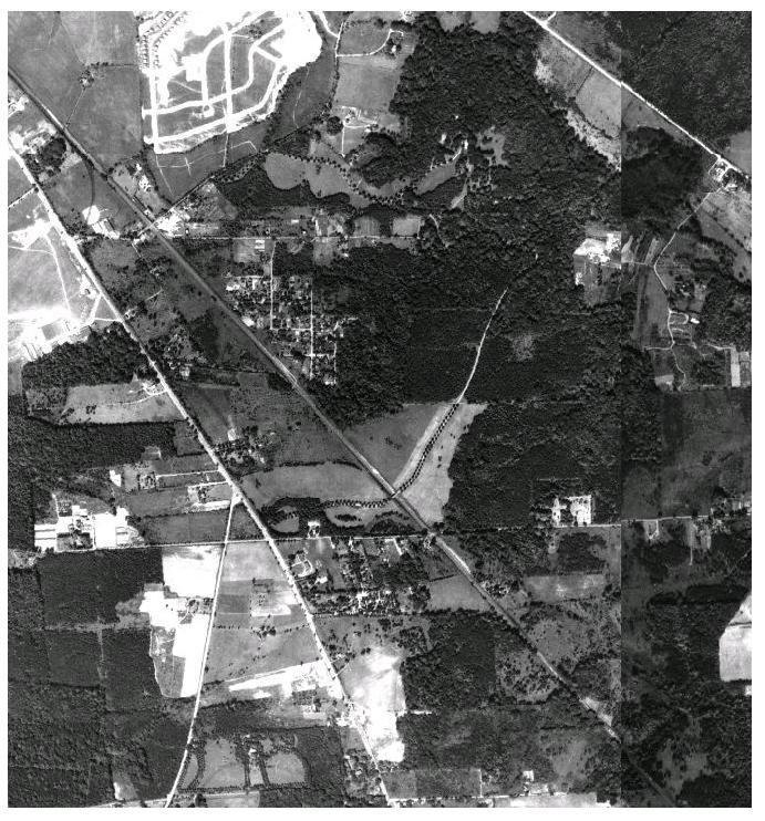
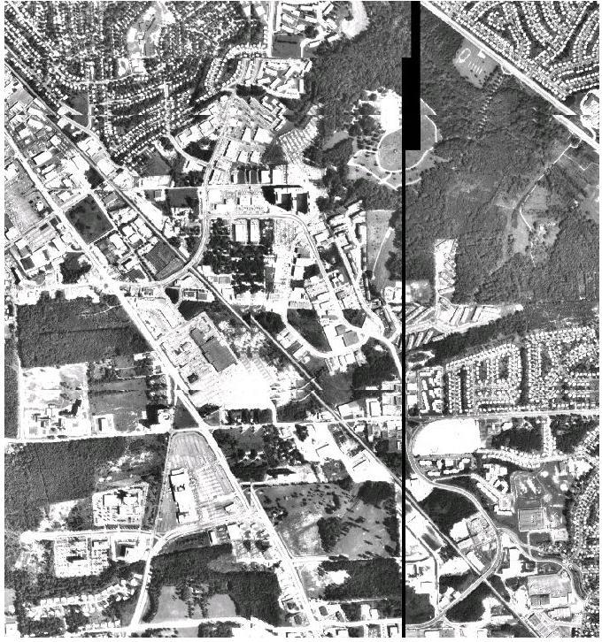
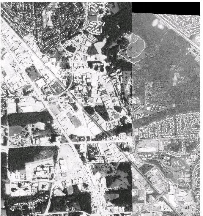
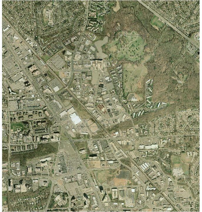
79 Environmental Change Twinbrook Sector Plan Planning Board Draft 69
80 Of the 20,825 tons of carbon emissions avoided, eight percent can be saved by constructing new residential properties with energy efficient windows and appliances rather than conventional models. Another six percent can be saved when residents change behavior to use energy efficient (LED or CFC lighting), adjusting the thermostat by 10 degrees on winter nights and summer days, and by recycling aluminum, glass, plastic, steel cans, and magazines. The greatest amount of CO 2, 33 percent, can be saved by both replacing one car in a two car family with a more energy efficient model (35 mpg following the new federal requirement) and replacing the second car with use of public transportation, walking, and/or bicycling. The amount of carbon emissions avoided was calculated with the Environmental Protection Agency Personal Emissions Calculator. Using this model, the average carbon dioxide each household emits per year is 27 tons. This assumes there are two people living together in a dwelling unit with electric heat. Following national averages they use an average amount of gas and electricity and do not recycle as part of their lifestyle. They own two cars with a fuel economy of 20 miles per gallon and drives 462 miles per week. If each of the anticipated dwelling units in Twinbrook were two person households having conventional lifestyles and the units they live in were built in a conventional manner, approximately 44,300 tons of carbon dioxide per year will be added to the total carbon dioxide currently emitted. The Plan s recommendations would reduce those emissions by approximately one-half. HISTORIC RESOURCES This Plan endorses all of the historic designations made in the 1992 Plan and adds the recommendation to designate the Higgins Cemetery (#32-50) in the Twinbrook Plan area to the Master Plan for Historic Preservation. The environmental setting of the cemetery is the entire 14,400 square foot site. Even though the cemetery is not currently included in the Locational Atlas, which identifies resources potentially suitable for preservation, it has been identified and researched. Based on this research, this Plan recommends that the cemetery be protected by designation on the Master Plan for Historic Places. The Higgins Cemetery, a small family burial ground, is located in the 5700 block of Arundel Avenue. The period of significance for the cemetery dates between 1816 and The plot holds at least 11 known burials of Higgins family members and possibly includes graves of several of their slaves. The Higgins family is important in state and local history. James Higgins ( ), a planter who served in the Maryland militia during the Revolutionary War, and his wife Luraner Becraft Higgins ( ) were the first generation to be buried on the farm. Their son James Becraft Higgins ( ) and his wife Mary Eleanor ( ) are memorialized by a red sandstone monument placed in the center of the cemetery in Twinbrook Sector Plan Planning Board Draft 70
81 Higgins Cemetery Twinbrook Sector Plan Planning Board Draft 71
82 Their granddaughter Luraner Higgins ( ) and her husband George Knowles ( ) who founded Knowles Station (now the town of Kensington), are also buried here. Other grandchildren and greatgrandchildren of James and Luraner Higgins were interred here between 1869 and The Higgins Cemetery and farmhouse survived subdivision of the farm in 1891 as Spring Lake Park, but this marked the start of nearly a century of neglect. A grass roots community project led to incorporation of the Higgins Cemetery Historic Preservation Association, which took title to the property in Since then, the volunteer organization and its private and public partners have documented the property through research and archaeology, removed invasive trees and debris, prepared a master plan, and reconstructed the Higgins monument. Future plans are to repair additional gravestones, recreate the fence, install appropriate plantings, and install interpretive signs for future generations. COMMUNITY FACILITIES Parks and Recreation: Existing Conditions and Analysis There is no existing parkland within the boundaries of the Twinbrook Plan. Near the area s eastern edge is Rock Creek Stream Valley Park, which abuts the Parklawn Memorial Park cemetery and is accessible from Twinbrook Parkway. Its paved hiker/biker path extends 14 miles from Rock Creek Regional Park south to the District line. Nearby resources within the park include a group picnic area and a primitive camping area. Twinbrook is also served by local parks in adjacent planning areas. Closest to the Plan area is the Twinbrook Park along Twinbrook Parkway, and though it is in the City of Rockville s jurisdiction, it is a recreation resource for future Twinbrook residents. The Parklawn Local Park on Veirs Mill Road includes two heavily used soccer fields. Winding Creek Local Park, also off of Veirs Mill Road, has been recently renovated and will eventually be connected to the Twinbrook Plan area via a bike route along Montrose Parkway and from there to the Rock Creek Stream Valley Park. It includes a playground, basketball court, and two soccer fields. The Parklawn Memorial Park, on the Plan area s eastern boundary, also offers visual open space and is used informally for walking. Park paths and trails should work with the system of sidewalks and pedestrian routes to make walking connections between the community and its parks. The 2003 Park Users Satisfaction Survey identified trail use (walking, biking, jogging etc.) has been identified as the most popular recreation activity of County residents of all ages and abilities. Trail resources in the Twinbrook area include the Rock Creek Stream Valley Park Trail and the future Matthew Henson Trail that will connect the Rock Creek Trail with Northwest Branch and along streets to Wheaton Regional Park. A bike path along Montrose Parkway will make this trail network accessible from the planning area s southern boundary. Improved walking connections are needed within the Twinbrook area. This Plan s sidewalk and trail recommendations will connect residents and employees to both Metro and the park system via a system of comprehensive streetscape improvements and privately provided urban open spaces. Existing and Proposed Parks and Recreation Facilities Find on Map Tree Twinbrook Sector Plan Planning Board Draft 72
83 RECREATION NEEDS ASSESSMENT Parks for Tomorrow (1998) indicates that urban residential areas including Twinbrook need several types of recreation including hiker/biker paths and community connectors, neighborhood recreation for new residential areas, and urban recreation and open space for existing and proposed businesses. This Plan s recommendations recognize that urban areas present distinct challenges and opportunities to provide park and recreation resources and strive to incorporate and create those resources with redevelopment. The 2005 Park, Recreation, and Open Space Master Plan measures need based on residential population. Its assumptions are suburban in nature that housing will be built on large tracts of land and that desired facilities are playing fields and courts. Accordingly, it indicated that the North Bethesda planning area, which includes Twinbrook, needs additional ball fields, soccer fields, and playgrounds. Large recreation areas cannot be provided in Twinbrook, given the scarcity and value of land in the planning area. This Plan recommends facilities scaled to an urban area and provided through a combination of public and private efforts. Proposals include small urban public spaces, larger park spaces, and connections to nearby local and regional parks. COMMUNITY RECREATION CENTERS The Twinbrook Plan area is served by recreation centers in surrounding communities. The closest center is the Twinbrook Recreation Center just north of the Plan area on Twinbrook Parkway owned and operated by the City of Rockville. Its facilities include a gym and fitness room, game courts, computers, and community meeting rooms. Twinbrook is also within the service area of the Montgomery Aquatic Center in North Bethesda and could be served by a planned recreation center in the Rock Spring area. This plan supports construction of the CIP planned recreation center in the Rock Spring area of North Bethesda. Public Schools At present, without a resident population, the Twinbrook Plan area does not generate any students in the Montgomery County Public Schools (MCPS) system. The Plan s proposal to allow multi-family housing through the TOMX zones will likely generate students. The MCPS regularly estimates student generation based on Census and other sample demographic information. The following estimates of demand are based on recommendations for more housing in the Twinbrook Plan area. The estimated additional dwelling units proposed by this Plan could generate an estimated 138 new students to be served. This does not include students generated in the approximately 1,600 dwelling units at Twinbrook Station. Twinbrook Sector Plan Planning Board Draft 73

84 Community Facilities Twinbrook Sector Plan Planning Board Draft 74
Establish a network of streetscaped vehicle and pedestrian routes that connect within and outside the Plan area.
 This Plan s urban design goals are to create an urban scale, walkable community with connections to transit, parks, and services and with amenities and facilities for residents and employees. The 1992
S C O P E O F W O R K A P R I L
 white flint 2 sector plan S C O P E O F W O R K A P R I L 2 0 1 2 MONTGOMERY COUNTY PLANNING DEPARTMENT M-NCPPC MontgomeryPlanning.org 1 white flint 2 sector plan Scope of Work abstract This scope of work
master plan of highways bus rapid transit amendment
 Scope of Work master plan of highways bus rapid transit amendment September 2011 Montgomery County Planning Department M-NCPPC MontgomeryPlanning.org 1 Scope of Work master plan of highways bus rapid transit
The transportation system in a community is an
 7 TRANSPORTATION The transportation system in a community is an important factor contributing to the quality of life of the residents. Without a sound transportation system to bring both goods and patrons
CONTENTS BACKGROUND AND CONTEXT... 3 Plan Area... 3 History... 3 Previous Planning Initiatives... 4 PLANNING FRAMEWORK... 5 Countywide Transit
 CONTENTS BACKGROUND AND CONTEXT... 3 Plan Area... 3 History... 3 Previous Planning Initiatives... 4 PLANNING FRAMEWORK... 5 Countywide Transit Corridors Functional Master Plan... 5 Veirs Mill Road Bus
Prepared by: The Maryland-National Capital Park and Planning Commission. Approved by: The Montgomery County Council January 17, 2006
 Prepared by: The Maryland-National Capital Park and Planning Commission Approved by: The Montgomery County Council January 17, 2006 Adopted by: The Maryland-National Capital Park and Planning Commission
Branch Avenue Corridor
 Approved Branch Avenue Corridor Sector Plan Prince George s County Planning Department The Maryland-National Capital Park and Planning Commission September 2008 Abstract TITLE: AUTHOR: SUBJECT: The Maryland-National
WOODMONT TRIANGLE AMENDMENT TO THE SECTOR PLAN FOR THE BETHESDA CBD
 APPROVED AND ADOPTED M A R C H 2 0 0 6 WOODMONT TRIANGLE AMENDMENT TO THE SECTOR PLAN FOR THE BETHESDA CBD THE MARYLAND-NATIONAL CAPITAL PARK AND PLANNING COMMISSION 8787 Georgia Avenue, Silver Spring,
Transit-Oriented Mixed Use Zoning in Montgomery County, Maryland
 Transit-Oriented Mixed Use Zoning in Montgomery County, Maryland Nkosi Yearwood Community-Based Planning Division Montgomery County Planning Department Rail Volution 2007 Miami, Florida The General Plan
Preliminary Port Towns Sector Plan and Proposed Sectional Map Amendment March 2009
 Preliminary Port Towns Sector Plan and Proposed Sectional Map Amendment March 2009 BLADENSBURG u COLMAR MANOR u COTTAGE CITY u EDMONSTON The Maryland-National Capital Park and Planning Commission Prince
DRAFT. October Wheaton. Design Guidelines
 October 2011 DRAFT Wheaton Design Guidelines 2 Draft - Design Guidelines - Wheaton Sector Plan Contents 04 Section 1: Introduction 06 Section 2: Context 08 Section 3: Design Guidelines 09 Goal 1: Create
Proposed Comprehensive Plan Strategies DRAFT for discussion June 28, 2017
 Proposed Comprehensive Plan Strategies DRAFT for discussion June 28, 2017 Land Use Rural Areas Refine the Farm and Forest area (FF) Update FF boundaries to account for existing lots less than five acres
Subregion I. Proposed Sectional Map Amendment, August Preliminary Master Plan and
 Subregion I Preliminary Master Plan and Proposed Sectional Map Amendment, August 2007 The Maryland-National Capital Park and Planning Commission www.mncppc.org/pgco Abstract TITLE: AUTHOR: SUBJECT: Preliminary
Town Center. Block 5 Existing multifamily residential units are expected to remain.
 Area Guidelines Germantown s districts should be developed as distinct communities with unique features that are supported through the guidelines. The guidelines not only help distinguish these districts
master plan of highways
 scope of work master plan of highways abstract This Scope of Work outlines the tasks and goals of updating the Master Plan of Highways, as well as the outreach that will be used in the planning process.
THE 355/270 CORRIDOR:
 THE 355/270 CORRIDOR: Strategic Ideas for Sustaining a Livable Work Place Project Summary ACCESS LIFE DESIGN HEALTH WORK Montgomery County Planning Department The Maryland-National Capital Park and Planning
Seneca Meadows. Block 4 Locate office, technology, and medical development adjacent to I Screen views of garage structures from I-270.
 Seneca Meadows Seneca Meadows has an industrial park in its southern end and a mixed-use employment area planned for the north end. The district benefits from extensive I-270 visibility, stream valley
Transportation. Strategies for Action
 Transportation A major priority for the Overlake Neighborhood is to develop a multimodal transportation system. To achieve this system, a balance has to be found among travel, circulation and access needs;
WHEREAS, after consideration of the evidence presented at the public hearing on January 14, 2010, the Prince George's County Planning Board finds:
 R E S O L U T I O N WHEREAS, the Prince George s County Planning Board has reviewed DDS-600 requesting a departure for the location of two loading spaces without driveway access along Toledo Terrace in
Policies and Code Intent Sections Related to Town Center
 Policies and Code Intent Sections Related to Town Center The Town Center Vision is scattered throughout the Comprehensive Plan, development code and the 1994 Town Center Plan. What follows are sections
4.1.3 LAND USE CATEGORIES
 4.1.3 LAND USE CATEGORIES a. City Center District The City Center District incorporates the existing character and mix of uses in downtown Belmont to encourage redevelopment and new development in keeping
MONTGOMERY COUNTY METRO STATION AREA DESIGN CHARRETTE
 MONTGOMERY COUNTY METRO STATION AREA DESIGN CHARRETTE Shady Grove Metro Station Area Charrette Closing Presentation October 25-28, 2000 MONTGOMERY COUNTY, MD M-NCPPC Design Collective, Inc. Architects
Sector Plan. Planning Board Draft. montgomery county planning department The Maryland-National Capital Park and Planning Commission
 Sector Plan Planning Board Draft montgomery county planning department The Maryland-National Capital Park and Planning Commission WHITE FLINT ABSTRACT This Plan contains the text and supporting maps for
ELMVALE ACRES SHOPPING CENTRE MASTER PLAN
 ELMVALE ACRES SHOPPING CENTRE MASTER PLAN Contents 1.0 INTRODUCTION... 2 2.0 LOCATION... 2 3.0 EXISTING CONTEXT... 2 4.0 VISION & GUIDING PRINCIPLES... 2 5.0 LAND USE AND BUILT FORM... 4 5.1 St. Laurent
Executive Summary. NY 7 / NY 2 Corridor
 Executive Summary NY 7 / NY 2 Corridor Transportation and Land Use Study December 2005 Prepared for: Town of Colonie Capital District Transportation Committee Prepared by: Introduction: Land use decisions
A. Background Summary of Existing Challenges and Potential Possibilities. 1. Summary of Existing Assets and Potential Opportunities
 A. Background 1 A Main Street Master Plan Study was performed and completed in October of 2007. The study was initiated to review current land uses and development patterns along Main Street, from Parrish
MONTGOMERY COUNTY PLANNING DEPARTMENT THE MARYLAND-NATIONAL CAPITAL PARK AND PLANNING COMMISSION
 MONTGOMERY COUNTY PLANNING DEPARTMENT THE MARYLAND-NATIONAL CAPITAL PARK AND PLANNING COMMISSION Staff Report: Sketch Plan #320110010, Mid-Pike Plaza ITEM #: MCPB HEARING DATE: January 20, 2011 REPORT
EXISTING COMPREHENSIVE PLAN
 EXISTING COMPREHENSIVE PLAN Town Center Land Use Element: V. LAND USE POLICIES Town Center Mercer Island's business district vision as described in "Your Mercer Island Citizen-Designed Downtown" was an
Status Report: MD 355 Project
 Status Report: MD 355 Project OCTOBER 2006 M-NCPPC MONTGOMERY COUNTY PLANNING DEPARTMENT Summary of Community Comments, and break to the Results of the MD 355 Participation Session Brookside Gardens -
DRAFT. 10% Common Open Space
 % OF CHARLOTTE IS CATEGORIZED AS A. LAND USES : Placeholder map displaying location of Place Type GOALS: Accommodate XX% of future growth. Provide a concentration of primarily commercial and civic activity
White Flint C 3. midtown on the pike. Draft Plan. Community Culture Commerce. Draft Plan
 Community Culture Commerce White Flint C 3 Draft Plan midtown on the pike Draft Plan montgomery county planning department The Maryland-National Capital Park and Planning Commission Draft White Flint Sector
Wheaton CBD & Vicinity Sector Plan D E S I G N G U I D E L I N E S
 Wheaton CBD & Vicinity Sector Plan D E S I G N G U I D E L I N E S 1 a b s t r a c t This document contains the design guidelines the property owners, community members, and planners should use to implement
SPRINGHILL LAKE TRANSIT VILLAGE
 Greenbelt Metro Area Sector Plan - Subarea Design Policies and Guidelines - Springhill Lake Transit Village 113 SPRINGHILL LAKE TRANSIT VILLAGE Residential Neighborhood and Village Center CONCEPT Springhill
ARLINGTON COUNTY, VIRGINIA
 ARLINGTON COUNTY, VIRGINIA County Board Agenda Item Meeting October 15, 2005 DATE: September 28, 2005 SUBJECT: Request to Advertise the adoption of the 2005 Clarendon Sector Plan C. M. RECOMMENDATION:
I. Introduction. Prior Approvals
 Statement of Justification First National Bank 19790 Crystal Rock Drive, Germantown, Maryland Application for Site Plan and Limited Preliminary Plan Amendment I. Introduction DPH Architecture, for First
MONTGOMERY COUNTY PLANNING DEPARTMENT THE MARYLAND-NATIONAL CAPITAL PARK AND PLANNING COMMISSION
 MONTGOMERY COUNTY PLANNING DEPARTMENT THE MARYLAND-NATIONAL CAPITAL PARK AND PLANNING COMMISSION MCPB Item No. Date: 1/26/12 Hanover Shady Grove, Sketch Plan 320120020 Joshua Sloan, Coordinator, Joshua.Sloan@MontgomeryPlanning.org,
B L A C K D I A M O N D D E S I G N G U I D E L I N E S for Multi-family Development
 B L A C K D I A M O N D D E S I G N G U I D E L I N E S for Multi-family Development Adopted June 18, 2009 This section of the Design and focuses on site planning and design guidance for new multi-family
white flint 2 sector plan
 white flint 2 sector plan Public Hearing Draft NOVEMBER 2016 MONTGOMERY COUNTY PLANNING DEPARTMENT M-NCPPC MontgomeryPlanning.org White Flint 2 Sector Plan Public Hearing Draft Abstract This Plan contains
Derry Green Corporate Business Park
 Town of Milton Derry Green Corporate Business Park Urban Design Guidelines BMI/Pace - June 2010 Draft 3 Prepared by: Brook McIlroy Planning + Urban Design / Pace Architects Suite 300-51 Camden Street Toronto,
Germantown Forward Status Report to the Planning Board M NCPPC
 Germantown Forward Status Report to the Planning Board Germantown Forward March 27, 2008 What s new? CCT alignment Capital Improvement Program Agency partners Water quality conditions Sustainability Design
MONTGOMERY COUNTY PLANNING DEPARTMENT THE MARYLAND-NATIONAL CAPITAL PARK AND PLANNING COMMISSION
 MONTGOMERY COUNTY PLANNING DEPARTMENT THE MARYLAND-NATIONAL CAPITAL PARK AND PLANNING COMMISSION MCPB Item No. Date10/25/12 Sketch Plan No. 32012004, White Flint Mall Redevelopment Nkosi Yearwood, Senior
, C-MS I June 3, 2016 $1500 pd chk #216918
 , C-MS-8 LOTS 21 THROUGH 40, INCLUSIVE, BLOCK 299 CLEMENTS ADDITION TO THE CITY OF DENVER SOUTHEAST QUARTER OF SECTION 34, TOWNSHIP 3 SOUTH, RANGE 68 WEST, SIXTH PRINCIPAL MERIDIAN, CITY
CHAPTER 7: Transportation, Mobility and Circulation
 AGLE AREA COMMUNITY Plan CHAPTER 7 CHAPTER 7: Transportation, Mobility and Circulation Transportation, Mobility and Circulation The purpose of the Transportation, Mobility and Circulation Chapter is to
Planning Board Briefing
 Planning Board Briefing Why Now? The Sector Plan Implementation Chapter States: Before Stage 1 begins, the following must occur: Approval of the Sectional Map Amendment. Approval of the Greater Lyttonsville
Staff Report and Recommendation
 Community Planning and Development Planning Services 201 W. Colfax Ave., Dept. 205 Denver, CO 80202 p: 720.865.2915 f: 720.865.3052 www.denvergov.org/cpd TO: City Council Neighborhoods and Planning Committee
The West Vaughan Employment Area Secondary Plan Policies
 Part 2: The West Vaughan Employment Area Secondary Plan Policies 2.1 General Policies It is the policy of Council: 2.1.1. That the West Vaughan Employment Area (the WVEA), identified on Schedule 1, will
Silverdale Regional Center
 Silverdale Regional Center Vision for Silverdale Regional Center The Silverdale Regional Center Plan (Plan) will guide the evolution of the Silverdale Regional Center from a collection of strip malls and
ORDINANCE AN ORDINANCE TO ADD A NEW SECTION 4.N. IN THE ZONING CODE FOR THE TOWN OF MIDDLETOWN, RELATING TO MIXED-USE DEVELOPMENT
 Introduced: November 5, 2018 Approved: ORDINANCE 18-11-01 AN ORDINANCE TO ADD A NEW SECTION 4.N. IN THE ZONING CODE FOR THE TOWN OF MIDDLETOWN, RELATING TO MIXED-USE DEVELOPMENT BE IT ENACTED BY THE MAYOR
STATEMENT OF JUSTIFICATION CLARKSBURG PREMIUM OUTLETS AT CABIN BRANCH NORTH DISTRICT, PHASE
 STATEMENT OF JUSTIFICATION CLARKSBURG PREMIUM OUTLETS AT CABIN BRANCH NORTH DISTRICT, PHASE 1 Southwest Corner of Clarksburg Road and Interstate-270 Clarksburg, Maryland Application for Site Plan #820140160
Hockessin Community Redevelopment Plan
 Hockessin Community Redevelopment Plan 3.1 Introduction The Community Redevelopment Plan for the Village of Hockessin is the result of the people s vision for a distinct village center that serves as the
REQUEST Current Zoning: O-15(CD) (office) Proposed Zoning: TOD-M(CD) (transit oriented development mixed-use, conditional)
 (office) Proposed Zoning: TOD-M(CD) (transit oriented development mixed-use, conditional)") Rezoning Petition 2016-117 Zoning Committee Recommendation January 4, 2017 REQUEST Current Zoning: O-15(CD) (office) Proposed Zoning: TOD-M(CD) (transit oriented development mixed-use, conditional) LOCATION
Rezoning Petition 2016-117 Zoning Committee Recommendation January 4, 2017 REQUEST Current Zoning: O-15(CD) (office) Proposed Zoning: TOD-M(CD) (transit oriented development mixed-use, conditional) LOCATION
Implementation Guide Comprehensive Plan City of Allen
 Implementation Guide 2030 Comprehensive Plan City of Allen DRAFT 2015 Implementation Guide Allen 2030 Comprehensive Plan INTRODUCTION The Comprehensive Plan serves as a guide for the growth and development
1.0 Introduction. Purpose and Basis for Updating the TMP. Introduction 1
 1.0 Introduction The Town of Castle Rock is situated between the metropolitan areas of Denver and Colorado Springs, amidst a unique terrain of rolling hills, mesas, ravines, and waterways. Like many Front
Rock Spring Master Plan Community Meeting #8: Preliminary Recommendations
 Rock Spring Master Plan Community Meeting #8: Preliminary Recommendations July 18, 2016 Ι Walter Johnson High School Andrea Gilles, andrea.gilles@montgomeryplanning.org Ι www.montgomeryplanning.org/community/rockspring/
MONTGOMERY COUNTY PLANNING DEPARTMENT THE MARYLAND-NATIONAL CAPITAL PARK AND PLANNING COMMISSION
 MONTGOMERY COUNTY PLANNING DEPARTMENT THE MARYLAND-NATIONAL CAPITAL PARK AND PLANNING COMMISSION MCPB Item No. 6 Date: 7.22.13 Bethesda Purple Line Station Minor Master Plan Amendment, Scope of Work Elza
Gold Line Bus Rapid Transit Transit Oriented Development (BRTOD) Helmo Station Area Plan
 Helmo Station Area Plan") Appendix F Gold Line Bus Rapid Transit Transit Oriented Development (BRTOD) Helmo Station Area Plan Introduction and Purpose of the Plan The Gold Line Bus Rapid Transit facility is an eleven-mile dedicated
Appendix F Gold Line Bus Rapid Transit Transit Oriented Development (BRTOD) Helmo Station Area Plan Introduction and Purpose of the Plan The Gold Line Bus Rapid Transit facility is an eleven-mile dedicated
Preliminary Recommendations Tk Takoma/Langley Crossroads Sector Plan
 Preliminary Recommendations Tk Takoma/Langley Crossroads Sector Plan Vision is to achieve a Transit Oriented, pedestrian friendly Community that Celebrates and builds upon the cultural Diversity of the
Rock Spring Master Plan Community Meeting #6: Land Use + Transportation Forecasts
 Rock Spring Master Plan Community Meeting #6: Land Use + Transportation Forecasts May 23, 2016 Ι Walter Johnson High School Andrea Gilles, andrea.gilles@montgomeryplanning.org Ι www.montgomeryplanning.org/community/rockspring/
The Maryland-National Capital Park and Planning Commission
 Approved BOWIE Master Plan & Sectional Map Amendment and VICINITY The Maryland-National Capital Park and Planning Commission www.mncppc.org/pgco Abstract Title Author Subject Approved Master Plan for Bowie
Clairtrell Area Context Plan
 Clairtrell Area Context Plan March 2005 Urban Development Services City Planning Contents 1. Introduction... 4 2. Development Structure... 6 2.1 Streets... 7 2.1.1 Sheppard Avenue and Bayview Avenue...
Planning Districts INTRODUCTION
 INTRODUCTION To facilitate detailed examination of development prospects for all areas of the community, Delano has been divided into 14 planning districts. The location of these planning districts is
MEMORANDUM BACKGROUND. lcouncilmembers should bring their copy of the Plan to the meeting.i. AGENDA ITEM #l0a November 28, 2017.
 AGENDA ITEM #l0a November 28, 2017 Worksession MEMORANDUM November 22, 2017 TO: FROM: SUBJECT: County Council ~ Marlene Michaelson, Senior Legislative Analyst Grosvenor-Strathmore Metro Area Minor Master
Metro. Activity Center Design Guidelines. Recommendations For Developing Focused, Mixed-Use Commercial/Residential Centers
 Metro Activity Center Design Guidelines Recommendations For Developing Focused, Mixed-Use Commercial/Residential Centers Metro Activity Centers What is a MAC? Legacy, the adopted guide for the future growth
Approved and Adopted JANUARY 2018
 Approved and Adopted JANUARY 2018 Abstract This Plan contains the text and supporting maps for a comprehensive amendment to the approved and adopted 1992 North Bethesda/Garrett Park Master Plan and the
Public input has been an important part of the plan development process.
 Lakewood s Comprehensive Plan recognizes that transportation helps shape the community, and that the way the community provides for the safe and efficient movement of people affects the character of the
CHAPTER 1. Ms. Guajardo s Class - Central Elementary CH 1 1
 INTRODUCTION CHAPTER 1 Ms. Guajardo s Class - Central Elementary CH 1 1 1.1 SETTING South Centre City is a linear corridor south of Downtown Escondido paralleling Centre City Parkway and South Escondido
The subject site plan amendment proposes the following revisions to the approved site plan:
 PROPOSED AMENDMENT The subject site plan amendment proposes the following revisions to the approved site plan: 1. The building footprint was modified to accommodate the revised architectural design. 2.
Sheridan Boulevard S TAT I O N A R E A P L A N S H E R I D A N B O U L E VA R D S TAT I O N A R E A P L A N
 Sheridan Boulevard S TAT I O N A R E A P L A N 1 City of Lakewood Adopted November, 2006 S H E R I D A N B O U L E VA R D S TAT I O N A R E A P L A N The Vision The City of Lakewood s overall vision is
RESIDENTIAL DISTRICTS
 RESIDENTIAL DISTRICTS The residential district standards have been revised to reflect on-the-ground conditions, while continuing to respect the use patterns established within the neighborhoods. This will
Access Management: An Overview
 Figures 1-5 Below Evolution of development along a highway. In the early stages, land along the road is used for farming with little traffic generated. As time passes, the highway corridor becomes a de
DRAFT Northeast Quadrant of Kipling Avenue and Highway 7 DRAFT AUGUST 29, Goals Land Use. The goals of this Plan are to:
 AUGUST 29, 2017 12.15 Northeast Quadrant of Kipling Avenue and Highway 7 12.15.1 Goals 12.15.2 Land Use The goals of this Plan are to: 12.15.2.1 General Provisions: a) Ensure the development of a compact
CHAPTER VIII Implementation
 CHAPTER VIII Implementation VIII. Implementation The vision for the Marlboro Pike Corridor will require that a variety of participants work together to make it a reality. The following action steps outline
NORTH COLLEGE PARK. Residential Neighborhood and Neighborhood Center OBJECTIVES EXISTING SITUATION AND ISSUES CONCEPT
 Greenbelt Metro Area Sector Plan - Subarea Design Policies and Guidelines - North College Park 119 NORTH COLLEGE PARK Residential Neighborhood and Neighborhood Center CONCEPT North College Park is envisioned
VISION AND GUIDING DESIGN PRINCIPLES
 pleasure point commercial corridor VISION AND GUIDING DESIGN PRINCIPLES Public Draft November 26, 2018 County of Santa Cruz with assistance from MIG CONTENTS PART I: INTRODUCTION AND VISION... 3 Community
Public Meeting: July 11, 2016
 Public Meeting: July 11, 2016 MONTGOMERY COUNTY PLANNING DEPARTMENT Maryland-National Capital Park and Planning Commission Tonight s Agenda Preliminary Recommendations Background and Context 2009 Twinbrook
BUILDING SCALE AND SETBACKS 5 ELEMENTS:... 5 FAÇADES (COMMERCIAL/RESIDENTIAL) 5
 5") VISION STATEMENT 3 UTILIZATION OF THE GUIDELINES 3 IMPLEMENTATION 3 PROCEDURES FOR DESIGN REVIEW 3 LAND USE AND ZONING 4 LAND USE 4 ELEMENTS:... 4 ZONING 4 ELEMENTS:... 4 BUILDING SCALE AND SETBACKS 5
VISION STATEMENT 3 UTILIZATION OF THE GUIDELINES 3 IMPLEMENTATION 3 PROCEDURES FOR DESIGN REVIEW 3 LAND USE AND ZONING 4 LAND USE 4 ELEMENTS:... 4 ZONING 4 ELEMENTS:... 4 BUILDING SCALE AND SETBACKS 5
A. WHAT IS A GENERAL PLAN?
 I. Introduction A. WHAT IS A GENERAL PLAN? A general plan is the planning guideline for the future of a city. It contains goals and policies which regulate urban development, the protection of the natural
Town Center (part of the Comprehensive Plan)
") Town Center (part of the Comprehensive Plan) Mercer Island Town Center Looking North (2014) In 1994, a year-long process culminated in a set of design guidelines and code requirements for the Town Center
Town Center (part of the Comprehensive Plan) Mercer Island Town Center Looking North (2014) In 1994, a year-long process culminated in a set of design guidelines and code requirements for the Town Center
Mark-up of the effect of the proposed Bronte Village Growth Area OPA No.18 on the text of section 24, Bronte Village, of the Livable Oakville Plan
 Mark-up of the effect of the proposed Bronte Village Growth Area OPA No.18 on the text of section 24, Bronte Village, of the Livable Oakville Plan Notes: This document is provided for information purposes
MONTGOMERY COUNTY PLANNING DEPARTMENT THE MARYLAND-NATIONAL CAPITAL PARK AND PLANNING COMMISSION
 MONTGOMERY COUNTY PLANNING DEPARTMENT THE MARYLAND-NATIONAL CAPITAL PARK AND PLANNING COMMISSION MCPB Item No. Date: 3.10.2016 Site Plan 820160040 Nora School Parker Smith, Planning Technician, Area 1,
1.0 VISION STATEMENT. December 6, PRINCIPLES
 Vision Statement Lincoln Regional Airport 1.0 VISION STATEMENT 1.1 City LOCATION of AND OVERVIEW The Easton Lincoln Place Land Use Master Plan identifies the principles, goals, policies, and standards
John M. Fleming Managing Director, Planning and City Planner. Old East Village Dundas Street Corridor Secondary Plan Draft Terms of Reference
 Report to Planning and Environment Committee To: From: Subject: Chair and Members Planning & Environment Committee John M. Fleming Managing Director, Planning and City Planner Old East Village Dundas Street
MONTGOMERY COUNTY PLANNING DEPARTMENT THE MARYLAND-NATIONAL CAPITAL PARK AND PLANNING COMMISSION
 MONTGOMERY COUNTY PLANNING DEPARTMENT THE MARYLAND-NATIONAL CAPITAL PARK AND PLANNING COMMISSION White Flint 2 Sector Plan: Briefing and Preliminary Staff Recommendations MCPB Item No. Date: 07/28/2016
Lower Merion Commercial Districts Issues and Characteristics Handbook November 2013
 Lower Merion Commercial Districts Issues and Characteristics Handbook November 2013 DRAFT TOWNSHIP-WIDE VISION: To maintain and enhance commercial areas to complement the surrounding high-quality residential
FUTURE LAND USE ELEMENT
 FUTURE LAND USE ELEMENT GOAL I: To create and sustain a great place to live, play, and prosper Objective 1: The City of Ocala shall incorporate the principles and strategies of the Ocala 2035 Vision into
CITY OF PUYALLUP. Background. Development Services
 CITY OF PUYALLUP Development Services 333 South Meridian Puyallup WA 98371 To: City Council From: Katie Baker, AICP, Planning Division Re: South Hill Neighborhood Plan Adoption Date: (Meeting date: February
MONTGOMERY COUNTY PLANNING DEPARTMENT
 MONTGOMERY COUNTY PLANNING DEPARTMENT THE MARYLAND-NATIONAL CAPITAL PARK AND PLANNING COMMISSION Ourisman Ford at Montgomery Mall, Sketch Plan No. 320170100 MCPB Item No. Date: 11-30-17 LS Lori Shirley,
June White Flint. Urban Design Guidelines
 June 2010 White Flint Urban Design Guidelines Context Montgomery County s General Plan envisioned urban centers along the I-270 corridor as places where compact, transit serviceable growth and employment
Small Area Plan. South Gateway
 Small Area Plan Adopted May 12, 2008 South Gateway Purpose. The South Gateway Small Area Plan defines the City s expectations for the future of the southern entrance to the City at Interstate 85 and Highway
Review of Opportunity Area C Draft Comprehensive Plan and Draft BOS Follow-On Motions. Special Working Group Meeting March 4, 2015
 Review of Opportunity Area C Draft Comprehensive Plan and Draft BOS Follow-On Motions Special Working Group Meeting March 4, 2015 The slides that follow identify where the draft Comprehensive Plan has
THE CITY OF VAUGHAN BY-LAW BY-LAW NUMBER A By-law to adopt Amendment Number 1 to the Official Plan of the Vaughan Planning Area.
 THE CITY OF VAUGHAN BY-LAW BY-LAW NUMBER 015-2014 A By-law to adopt Amendment Number 1 to the Official Plan of the Vaughan Planning Area. NOW THEREFORE the Council of the Corporation of the City of Vaughan
AWH REPORT OF THE PLANNING AND DEVELOPMENT DEPARTMENT FOR APPLICATION FOR REZONING ORDINANCE TO PLANNED UNIT DEVELOPMENT
 AWH REPORT OF THE PLANNING AND DEVELOPMENT DEPARTMENT FOR APPLICATION FOR REZONING ORDINANCE TO PLANNED UNIT DEVELOPMENT MAY 8, 2014 The Planning and Development Department hereby forwards to the Planning
COMMUNITY DESIGN. GOAL: Create livable and attractive communities. Intent
 COMMUNITY DESIGN Intent An attractive, well-designed County will attract quality development, instill civic pride, improve the visual character of the community, and create a strong, positive image for
[PLANNING RATIONALE] For Site Plan Control and Lifting of Holding Zone By-Law 101 Champagne Avenue. May 23, 2014
![[PLANNING RATIONALE] For Site Plan Control and Lifting of Holding Zone By-Law 101 Champagne Avenue. May 23, 2014](/thumbs/75/71599615.jpg "[PLANNING RATIONALE] For Site Plan Control and Lifting of Holding Zone By-Law 101 Champagne Avenue. May 23, 2014") [PLANNING RATIONALE] For Site Plan Control and Lifting of Holding Zone By-Law 101 Champagne Avenue May 23, 2014 Contents 1.0 Introduction... 2 2.0 Site Context... 2 2.1 Adjacent Uses... 2 Figure 1: Site
[PLANNING RATIONALE] For Site Plan Control and Lifting of Holding Zone By-Law 101 Champagne Avenue May 23, 2014 Contents 1.0 Introduction... 2 2.0 Site Context... 2 2.1 Adjacent Uses... 2 Figure 1: Site
PROPOSED REDEVELOPMENT OF THE GLEN ABBEY GOLF CLUB. STREETSCAPE DESIGN STUDY (excerpt from the Urban Design Brief) TOWN OF OAKVILLE.
 TOWN OF OAKVILLE.") PROPOSED REDEVELOPMENT OF THE GLEN ABBEY GOLF CLUB STREETSCAPE DESIGN STUDY (excerpt from the Urban Design Brief) TOWN OF OAKVILLE OCTOBER, 2016 for 2.4.2 STREETS Streets are the single largest component
PROPOSED REDEVELOPMENT OF THE GLEN ABBEY GOLF CLUB STREETSCAPE DESIGN STUDY (excerpt from the Urban Design Brief) TOWN OF OAKVILLE OCTOBER, 2016 for 2.4.2 STREETS Streets are the single largest component
New Partners for Smart Growth Conference February 5, 2010
 Dan Stroh, Planning Director City of Bellevue Planning and Community Development Bellevue, WA New Partners for Smart Growth Conference February 5, 2010 Summary of Project Long-range plan update for Bel-Red
Subarea 4 Indian Creek. Vision The combination of park networks and transportation amenities make Subarea 4 the greenest hub in the Corridor.
 indian creek 180 extends south from 101st Street to I-435. The I-435 and Metcalf intersection is one of the primary intersections in the Kansas City Metro Area. The area includes several residential neighborhoods
Civic Center District
 Civic Center District The Civic Center district is the civic and social heart of Warrenville, containing such public buildings as the City Hall, Warrenville Public Library, Police Station, Park District
14 October 10, 2012 Public Hearing APPLICANT: MPB, INC
 14 October 10, 2012 Public Hearing APPLICANT: MPB, INC PROPERTY OWNER: MUNDEN & ASSOCIATES, LP STAFF PLANNER: Karen Prochilo REQUEST: Conditional Change of Zoning (AG-1 & AG-2 to Conditional O-2) ADDRESS
TRANSIT ORIENTED DEVELOPMENT PINELLAS COUNTY MPO LIVABLE COMMUNITIES INITIATIVE PINELLAS COUNTY COMPREHENSIVE PLAN AMENDMENTS
 PINELLAS COUNTY MPO LIVABLE COMMUNITIES INITIATIVE MODEL LAND DEVELOPMENT CODE TRANSIT ORIENTED DEVELOPMENT PINELLAS COUNTY COMPREHENSIVE PLAN AMENDMENTS MPO Livable Communities Initiative Goal: Improve