Smart Growth for Dallas
|
|
|
- Abigayle Smith
- 6 years ago
- Views:
Transcription
1 Smart Growth for Dallas Data-driven decisions for the future of Dallas parks, open spaces, and green infrastructure Dallas Park and Recreation Board March 10, 2016
2 Agenda I. Welcome and Introductions II. Program Overview III. Live Demo: Decision Support Tool The Trust for Public Land Climate-Smart Cities: Healthy, Connected Chattanooga IV. Community Engagement buildingcommunityworkshop: People Organizing Place (POP) V. Urban Heat Island The Texas Trees Foundation VI. How can this be used in Dallas? VII. Questions and Discussion 2
3 I. WELCOME & INTRODUCTIONS 3

4 About The Trust for Public Land The Trust for Public Land works across the country to create new parks and protect land for people, ensuring healthy, livable communities for generations to come. Since our founding in 1972, we ve created and protected more than 5,000 special places across the country. More than 7 million people live within a 10-minute walk of a place that we have created or protected. We have helped generate nearly $60 billion in public funding for parks and natural areas through ballot measures supported by nearly 100 million voters in 37 states. 4

5 About Our Partners The buildingcommunityworkshop is a Texas based nonprofit community design center seeking to improve the livability and viability of communities through the practice of thoughtful design and making. We enrich the lives of citizens by bringing design thinking to areas of our city where resources are most scarce. The Texas Trees Foundation preserves, beautifies, and expands parks and other public natural green spaces, public streets, boulevards, and rights-of-way by planting trees and encouraging others to do the same through educational programs that focus on the importance of building and protecting the urban forest today as a legacy for generations to come. 5
6 II. PROGRAM OVERVIEW Smart Growth for Dallas 6
7 WITH A GROWING POPULATION AND BOOMING ECONOMY, DALLAS STANDS ON THE CUSP OF A NEW ERA IN ITS HISTORY. 7

8 WITH A GROWING POPULATION Through optimism and collaboration, AND our city is busy BOOMING ECONOMY, re-creating DALLAS STANDS ON our public spaces in the most extraordinary THE CUSP OF A NEW ways imaginable. ERA IN ITS HISTORY. 8
9 BUT CHALLENGES STILL REMAIN 9

10 BUT CHALLENGES STILL REMAIN 10
11 11
12 12


13 13

14 14


15 Dallas green assets offer cost-effective and unique strategies for addressing the city s biggest economic social and ecological challenges of today. 15
16 WITH DALLAS GROWTH ONLY ACCELERATING, NOW IS THE TIME TO LAY THE FRAMEWORK FOR SMART, DATA- DRIVEN DECISIONS ABOUT OUR CITY S FUTURE. 16
17 Introducing: Smart Growth for Dallas Data-driven decisions for the future of Dallas parks, open spaces, and green infrastructure 17


18 Key Deliverables Community Engagement Identification of High- Priority Parcels Interactive Decision Support Tool Feasibility Study for Demonstration Project 18


19 Building on local success In collaboration with bcworkshop, Texas Trees Foundation, and others, we developed Smart Growth for Dallas to be the next step that continues the work already underway in Dallas. bcworkshop Race and the Control of Public Parks Texas Trees Foundation State of the Dallas Urban Forest 19


20 using a proven framework. Smart Growth for Dallas deploys The Trust for Public Land s innovative Climate-Smart Cities methodology in our local context. This program uses four strategies to help cities improve their climate resiliency: We ve successfully deployed this program in cities across the country, including: Chattanooga, TN Boston, MA Boston, MA New York, NY Los Angeles, CA Kirkland, WA 20


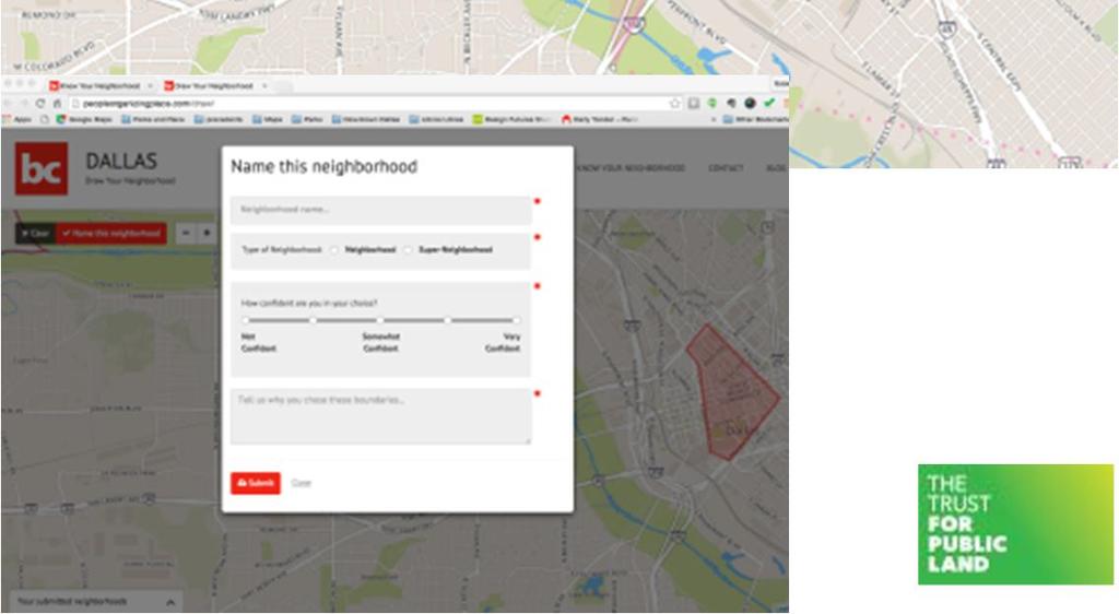
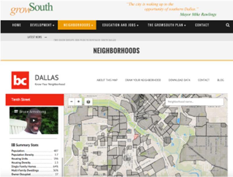
21 Community Engagement COMMUNITY MEETINGS Series of large and small-format meetings across the city to frame objectives, gather non-gis data, and share results of program. TECHNICAL ADVISORY COMMITTEE Composed of representatives from the project partners, City of Dallas staff, and community stakeholders. Will provide expert input regarding planning objectives, data sources, and priorities. STORY WEBSITE Interactive mapping website of Dallas parks, open spaces, and green assets. Will share results of Smart Growth for Dallas in a variety of formats, including videos featuring Dallas residents and park users. 21


22 GIS-Based Analysis & Mapping IDENTIFY HIGH-PRIORITY PARCELS City-scale map identifying areas of high-opportunity, based on analysis of triple-bottom line objectives. List of specific high-priority parcels that meet criteria for acquisition or green infrastructure intervention. Economic valuation of parcels identified in report will be available for a select number of parcels DECISION SUPPORT TOOL Interactive web-based platform to provide customizable map-based analysis of land in Dallas, based on identified economic, social, and ecological objectives. Provides extensive data and priority modeling results at the parcel level Users may identify high-value parcels, analyze parcels against spatial data, and make individual parcel reports 22

23 Demonstration Project Feasibility Study A PLAN TO MOVE FORWARD With the results of the GIS analysis in-hand, we ll contribute our expertise in project design and development, green infrastructure planning, real estate, and fundraising to help implement onthe-ground smart growth strategies. 23
24 Our Triple Bottom Line Strategy Using community engagement and GIS analysis to optimize future green asset investments based on economic, social, and ecological objectives Community engagement Social Objectives Identify highpriority parcels GIS Analysis Ecological Objectives Economic Objectives Interactive decision support tool 24
25 Ecological Objectives ABSORB Identify high-priority areas where parks, open space, and green infrastructure have potential to absorb stormwater and improve water quality in our creeks, lakes, and the Trinity River COOL Work with The Texas Trees Foundation & Georgia Tech to identify priority areas where heat island has a disproportionate effect on vulnerable populations PROTECT Identify optimum locations for additions to green buffers along the Trinity River and its tributaries, improving flood protection and reducing flood risk 25
26 Social Objectives ACTIVATE Analyze current strengths and gaps in park facility usage and activation, to identify targets for future investment of green assets. CONNECT Identify priority locations for deployment of green assets to improve connectivity between parks, trails, bike lanes, transit networks, residential, and employment centers. EDUCATE Identify education campuses with need for increased green space or park access. 26
27 Social Objectives (continued) EQUITY Identify opportunities for green asset investments to reduce barriers between social groups, improve park access for vulnerable and underserved populations, and make Dallas parks and open space more equitable. HEALTH Identify highest priority neighborhoods for increased access to active recreation features for city residents, supporting more active and healthy lifestyles. 27
28 Economic Objectives RECREATION VALUE Use a survey of residents and GIS analysis to quantify the economic value of recreation benefits that may be provided by creating a park on a specific parcel of land. HEALTH VALUE Calculate the economic value of medical care cost savings that may be realized by Dallas residents through their likely usage of a new park. PROPERTY VALUE Calculate the added market value that the creation of a park could bring to existing nearby residential properties. 28
29 III. LIVE DEMO Healthy Connected Chattanooga Decision Support Tool 29
30 IV. COMMUNITY ENGAGEMENT buildingcommunityworkshop 30
31 Community Engagement Citywide Community Engagement Informing the broader community of project process, objectives, schedule, & opportunities for participation Collect information to inform the filtering of prioritized new park and park redevelopment opportunities in Phase 1 Seven meetings Spread across the city, guidance from partners and DPARD on locations Report on findings Identification of new GIS data needed for Phase 2, guidance for the Technical Advisory Committee 31
32 Community Engagement Local Community Engagement: Focused to gather information not captured in GIS analysis or not yet considered for GIS analysis Gather stories about the relationship between parks and neighborhoods 20 meetings Spread across the city with a variety of audiences: neighborhood groups, friends of parks groups, park users, Parks Department staff, service providers Report on findings Identification of new GIS data needed for Phase 2, guidance for the Technical Advisory Committee 32
33 Citywide Public Presentation Share the findings of the program Seven meetings Spread across the city in similar locations to the launch of the program Public website Share the process and results in an accessible manner Inform on how the program results are implemented 33
34 Storytelling Short Film on the program and process Reporting our and sharing stories Neighborhood Stories Share stories about the connections between parks and neighborhoods, either importance People Organizing Place website of Dallas Parks Share park features, stories, Friends Groups, etc. Mapping new or desired park features 34
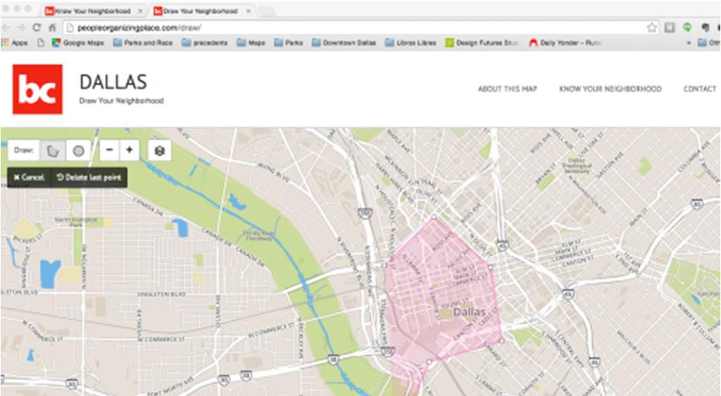

35 Storytelling peopleorganizingplace.org 35
36 V. URBAN HEAT ISLAND The Texas Trees Foundation 36

37 Green is the New Black: Managing Rising Heat Trends in Dallas Matt Grubisich Texas Trees Foundation 37


38 anomaly risk response 38


39 Drivers of the urban heat island 1. Loss of natural vegetation 2. Replacement of vegetation with impervious materials 3. Waste heat from vehicles, industry, building air conditioning 4. Trapping of heat by building canyons 39

:")
40 global vs. urban rates of warming ( F/decade):
")
41 Urban warming rankings * warming in excess of rural trend ( F/decade) 41

42 Jason Vargo Climate-responsive design 42

43 Temperature change from trees and green roofs F no change F F F F 43

44 New green spaces & green roofs 44
45 2050 avoided mortality in Atlanta Region through green and white strategies Avoided deaths per 100,000 population
46 VI. HOW CAN DALLAS USE THIS? 46


47 Use Case: Site Selection 47


48 Use Case: Making the Case - Chicago 48

49 Use Case: Making the Case New Orleans 49

50 Use Case: Making the Case New Orleans 50

51 Use Case: Making the Case New Orleans 51
52 Use Case: Making the Case New Orleans 52
53 Closer Look: Cross Kirkland Corridor Analysis 53
54 Closer Look: Cross Kirkland Corridor Analysis Cross Kirkland Corridor 0.38% Mode Shift 2.07% Mode Shift Units Days days of use/year Average length of bicycle trips miles Annual average daily traffic trips per day Mode shift from driving to biking Credit for activity centers near the project Annual Auto Trips Reduced trips/year Annual Auto VMT Reduced miles/year Annual Emission Reductions lbs CO 2 /year CO 2 saving per VMT reduced lbs CO 2 /mile 54
55 VII. QUESTIONS & DISCUSSION 55
56 Contact Us Robert Kent The Trust for Public Land North Texas Area Director e: t: Isaac Cohen buildingcommunityworkshop e: t: Matt Grubisich The Texas Trees Foundation Operations Director & Urban Forester e: t:
Smart Growth for Dallas
 Smart Growth for Dallas Using data and GIS to improve the social, economic, and environmental resilience of Dallas Dallas Park and Recreation Board November 1, 2018 About Our Partners The Trust for Public
The Trust for Public Land: Smart Growth for Dallas
 The Trust for Public Land: Smart Growth for Dallas Where could you walk in ten minutes? The Trust for Public Land land for people Trust for Public Land 4 Creating more parks for Texans Urban green assets
Blueprint Denver Task Force Meeting #
 Blueprint Denver Task Force Meeting #1 6.23.16 1. Welcome and Introductions Your name and affiliation Name 1 thing you love about Denver Name 1 thing you d change about Denver All in 30 seconds! Ready,
The Five Components of the McLoughlin Area Plan
 The Five Components of the McLoughlin Area Plan This documents contains the complete language of the five components of the McLoughlin Area Plan: The Vision Statement The Values The Guiding Principles
WELCOME TO THE CHOUTEAU GREENWAY DESIGN, DEVELOPMENT AND CONSTRUCTION WORKING GROUP!
 WELCOME TO THE CHOUTEAU GREENWAY DESIGN, DEVELOPMENT AND CONSTRUCTION WORKING GROUP! Chouteau Greenway Steering Committee and Working Groups Overview Overview January 9, 2019 Chouteau Greenway will transform
WELCOME TO THE CHOUTEAU GREENWAY ECONOMIC DEVELOPMENT WORKING GROUP!
 WELCOME TO THE CHOUTEAU GREENWAY ECONOMIC DEVELOPMENT WORKING GROUP! Chouteau Greenway Steering Committee and Working Groups Overview Overview January 9, 2019 Chouteau Greenway will transform St. Louis
495/MetroWest Development Compact Plan Citizen Planner Training Collaborative Conference. March 17, 2012
 495/MetroWest Development Compact Plan Citizen Planner Training Collaborative Conference March 17, 2012 Project Process Local and Regional Priority Areas Growth Scenarios Transportation Investment Categories
DRAFT FOR PUBLIC REVIEW. Game Plan for a Healthy City
 DRAFT FOR PUBLIC REVIEW 2018 Game Plan for a Healthy City 2 Denveright. Parks & Recreation Game Plan Draft for Public Review Draft for Public Review Executive Summary Game Plan Overview Executive Summary
Transportation Land Use Integration & Regional Planning. Don Kostelec, AICP Senior Planner, Louis Berger Group February 1, 2010
 Transportation Land Use Integration & Regional Planning Don Kostelec, AICP Senior Planner, Louis Berger Group February 1, 2010 Transportation Land Use Integration DOT-HUD-EPA Sustainable Communities Initiative
2040 LUP is a part of the Comprehensive Plan and carries the same legal authority. Economic Challenges
 1.1. Guiding Anchorage s Growth Where will new residents settle over the next two decades? Where will people work, shop, and play? Will there be enough room to grow? How will Anchorage look? Will growth
greenprint midtown SUSTAINABILITY ACTION PLAN 2012
 greenprint midtown SUSTAINABILITY ACTION PLAN 2012 MIDTOWN ALLIANCE SOUTHFACE ENERGY INSTITUTE RENAISSANCE PLANNING GROUP SUSTAINABLE ATLANTA PERKINS+WILL 2 GREENPRINT MIDTOWN 1. Introduction Sustainability
From Partnership to Reality
 From Partnership to Reality New Partners for Smart Growth February 4, 2011 What is Sustainable (human) Development? It is development that meets the needs of the present without compromising the ability
Plano Tomorrow Vision and Policies
 Plano Tomorrow Vision and Policies PLANO TOMORROW PILLARS The Built Environment The Social Environment The Natural Environment The Economic Environment Land Use and Urban Design Transportation Housing
VACANT TO VIBRANT : GREEN INFRASTRUCTURE & URBAN REVITALIZATION
 VACANT TO VIBRANT : GREEN INFRASTRUCTURE & URBAN REVITALIZATION Calumet Summit 2013: Connecting for Action Lauren Riga, Director City of Gary Department of Green Urbanism Gary Storm Water Management District
A BLUEPRINT FOR BROCKTON A CITY-WIDE COMPREHENSIVE PLAN
 A BLUEPRINT FOR BROCKTON A CITY-WIDE COMPREHENSIVE PLAN Public Meeting October 2016 1 Plan Summary and Discussion Public Meeting May 4 2017 City of Brockton Bill Carpenter, Mayor Department of Planning
Envision Concord Public Event Part 1 October 21, :30 AM 12:00 PM Concord-Carlisle High School Cafeteria
 Envision Concord Public Event October 21, 2017 9:30 AM 12:00 PM Concord-Carlisle High School Cafeteria Good Morning! Welcome & Introduction Gary Kleiman & Elise Woodward, Envision Concord Committee Co-Chairs
Blueprint Denver A BLUEPRINT FOR AN INCLUSIVE CITY. Executive Summary
 Blueprint Denver A BLUEPRINT FOR AN INCLUSIVE CITY Executive Summary PUBLIC REVIEW DRAFT 2 1/7/2019 DENVERIGHT BLUEPRINTDENVER Blueprint Denver: A Blueprint for an Inclusive City An Equitable City Planning
Rezoning Issues Setting a Foundation for Zoning Decisions
 Rezoning Issues Setting a Foundation for Zoning Decisions City Council Workshop May 2, 2016 Agenda Goal Need actionable items and sequence of steps Foundation for Zoning Decisions Council Workshop Discussion
Welcome to the Oakridge Centre Open House
 Welcome to the Oakridge Centre Open House Why is the City hosting this event? This open house is to inform you of a rezoning application submitted to the City of Vancouver to amend the existing CD-1 (Comprehensive
Mary Norwood. Mayoral Forum on Greenspace Responses
 1. What do you believe is the single most pressing issue impacting Atlanta s urban forest and greenspace, and how would you solve that issue? Preserving and Protecting Atlanta s forest cover Lungs of Atlanta
CITY OF CHARLOTTESVILLE, VIRGINIA CITY COUNCIL AGENDA
 CITY OF CHARLOTTESVILLE, VIRGINIA CITY COUNCIL AGENDA Agenda Date: December 16, 2013 Action Required: Adoption of Resolution Presenter: Staff Contacts: Title: James E. Tolbert, AICP, Director of NDS James
EXECUTIVE SUMMARY EXECUTIVE SUMMARY
 1 EXECUTIVE SUMMARY EXECUTIVE SUMMARY Penn s Landing is envisioned as a welcoming riverfront green space adjacent to a refurbished civic marina becoming the centerpiece for adjacent development. With a
NASSAU COUNTY TOWN HALL NEW YORK & CONNECTICUT SUSTAINABLE COMMUNITIES. A Unique Bi-State Partnership to Improve Jobs, Housing and Transportation
 NASSAU COUNTY TOWN HALL NEW YORK & CONNECTICUT SUSTAINABLE COMMUNITIES A Unique Bi-State Partnership to Improve Jobs, Housing and Transportation Police Headquarters Auditorium Mineola, NY December 9 th,
CHOUTEAU GREENWAY INTENDED OUTCOMES AND GOALS
 CHOUTEAU GREENWAY INTENDED OUTCOMES AND GOALS OUTCOMES EXCEPTIONAL EXPERIENCE CIVIC WELL-BEING CONNECTIVITY GOALS Inclusive gathering places where all people are welcome Transparency, accountability, and
Community Gardens. A Component of the Dallas Sustainable Communities Initiative
 Community Gardens A Component of the Dallas Sustainable Communities Initiative Dallas City Council Transportation and Environment Committee June 8, 2009 Purpose of briefing To update the Committee on efforts
Planning for TOD Implementation at a Corridor Scale
 Planning for TOD Implementation at a Corridor Scale Catherine Cox Blair, Reconnecting America Presentation to Northwest Corridor Working Group November 6, 2013 What is Reconnecting America? Reconnecting
CHAPTER 1 Introduction
 CHAPTER 1 Introduction From sea to summit, Lane County covers almost 4,800 square miles of diverse Oregon landscape. Stretching from the Pacific Ocean through the Coastal Range, the Willamette Valley to
DOMINION BOULEVARD CORRIDOR STUDY AND ECONOMIC DEVELOPMENT STRATEGIC PLAN A MODEL FOR CHESAPEAKE S FUTURE
 DOMINION BOULEVARD CORRIDOR STUDY AND ECONOMIC DEVELOPMENT STRATEGIC PLAN A MODEL FOR CHESAPEAKE S FUTURE Overview I. Draft Plan Process II. Draft Plan Overview a. Market Analysis b. Master Land Use Plan
Implementation Guide Comprehensive Plan City of Allen
 Implementation Guide 2030 Comprehensive Plan City of Allen DRAFT 2015 Implementation Guide Allen 2030 Comprehensive Plan INTRODUCTION The Comprehensive Plan serves as a guide for the growth and development
This page intentionally blank.
 This page intentionally blank. Parks, Recreation, and Open Space Chapter Relationship to Vision Vision Parks, Recreation and Open Space Chapter Concepts County Government. County government that is accountable
Streets for People, Place-Making and Prosperity. #TOcompletestreets
 COMPLETE STREETS FOR TORONTO Streets for People, Place-Making and Prosperity COMPLETE STREETS: A NEW APPROACH A Complete Streets design approach considers the needs of all users people who walk, bicycle,
City of Missoula and Missoula County Open Space Planning Open House
 City of Missoula and Missoula County Open Space Planning Open House FEBRUARY 6, 2018 The following slides contain the display board content from the open house. Please use boards to answer questions in
Industrial Corridor Modernization Little Village
 Industrial Corridor Modernization Little Village Rahm Emanuel, Mayor David Reifman, Commissioner Dept. of Planning and Development Working Group April 26, 2018 dpd@cityofchicago.org cityofchicago.org/dpd
IDENTIFICATION TO IMPLEMENTATION THE JOURNEY OF CITY RESILIENCE
 IDENTIFICATION TO IMPLEMENTATION THE JOURNEY OF CITY RESILIENCE Cities are dynamic, living and growing entities. They are centers of art, heritage and cultural pride and their vibrancy attracts visitors,
Creative Use of Aging Infrastructure
 Creative Use of Aging Infrastructure ULI, New York July 2007 October 22, 2014 Summary To be built over the 101 Freeway between Hollywood Boulevard and Santa Monica Boulevard. A mile in length 44 acres
WELCOME TO THE CHOUTEAU GREENWAY EQUITY WORKING GROUP!
 WELCOME TO THE CHOUTEAU GREENWAY EQUITY WORKING GROUP! Chouteau Greenway Steering Committee and Working Groups Overview Overview January 9, 2019 Chouteau Greenway will transform St. Louis by connecting
1 Introduction. Chapter. In this chapter:
 Chapter 1 Introduction In this chapter: 1.1 A Snapshot of the Region 1.2 Towards a Sustainable Region 1.3 The Provincial Context 1.4 Purpose and Organization The Regional Municipality of York Official
March 14, Will Allen Director of Strategic Conservation Planning
 New Frontiers in Land Conservation: Green Infrastructure for Urban Vacant and Underutilized Lands 23 rd Annual RMLUI Conference March 14, 2014 Will Allen Director of Strategic Conservation Planning Special
Smart City Governance URBIS Solutions. David Ludlow, Assoc. Professor European Smart Cities University of the West of England, Bristol
 Smart City Governance URBIS Solutions David Ludlow, Assoc. Professor European Smart Cities University of the West of England, Bristol Integrated smart city model Smart Mobility Services focused on decreasing
City of Tacoma Planning and Development Services
 Agenda Item E-1 City of Tacoma Planning and Development Services To: Planning Commission From: Elliott Barnett, Planning Services Division Subject: Tacoma Mall Regional Center Subarea Plan and EIS Meeting
BAGBY STREET RECONSTRUCTION PROJECT OCTOBER 2, 2015
 BAGBY STREET RECONSTRUCTION PROJECT OCTOBER 2, 2015 CLAIRE HEMPEL, PLA, AICP, LEED GA PREPARED BY Aspen Asheville Austin Chicago Denver Dubai Houston Lake Tahoe Los Angeles MIDTOWN : A MODEL OF URBAN DEVELOPMENT
CHAPTER 8 ISSUES, CONCERNS, CONSTRAINTS AND OPPORTUNITIES
 CHAPTER 8 ISSUES, CONCERNS, CONSTRAINTS AND OPPORTUNITIES Introduction This River Conservation Plan was developed during a time of tremendous activity and effort in planning the transformation of the Delaware
City of Hermosa Beach Administrative Policy #
 City of Hermosa Beach Administrative Policy # SUBJECT: Living Streets Policy Date: Approved by: City Council Authority: Public Works Department & Community Development Department Mayor, PURPOSE The City
Scope of Services. River Oaks Boulevard (SH 183) Corridor Master Plan
 Corridor Master Plan") Scope of Services River Oaks Boulevard (SH 183) Corridor Master Plan PROJECT AREA The project area consists of the River Oaks Boulevard (SH 183) corridor bounded by SH 199 at the northern end and the Trinity
Scope of Services River Oaks Boulevard (SH 183) Corridor Master Plan PROJECT AREA The project area consists of the River Oaks Boulevard (SH 183) corridor bounded by SH 199 at the northern end and the Trinity
Onondaga County Sustainable Streets Project. Onondaga County Planning Federation June 7, Onondaga County Sustainable Streets Project 1
 Onondaga County Sustainable Streets Project Onondaga County Planning Federation June 7, 2012 Onondaga County Sustainable Streets Project 1 Sustainable Streets 1. Introduction to the SMTC 2. Sustainable
Comprehensive Plan ADOPTED APRIL 2014
 Comprehensive Plan ADOPTED APRIL 2014 8 8. Outstanding Recreational & Cultural Opportunities We are proud of our community s parks and recreation system. Our community will ensure that the legacy of our
Silverdale Regional Center
 Silverdale Regional Center Vision for Silverdale Regional Center The Silverdale Regional Center Plan (Plan) will guide the evolution of the Silverdale Regional Center from a collection of strip malls and
ICLEI Webinar Sustainability in the Master Plan and Zoning Code
 ICLEI Webinar Sustainability in the Master Plan and Zoning Code Sustainability in Grand Rapids 2000 2002 New Master Plan 2004 2005 Neighborhood Pattern Workbook 2006 2007 Form-Based Zoning Ordinance 2007
City of Nogales General Plan
 Open Space, Parks, Recreation and Trails City of Nogales General Plan Residents of Nogales place a high priority in the development of a comprehensive system of open space, parks, recreation and trails
National Association of Conservation Districts. Kris Hoellen Vice President, Sustainable Programs The Conservation Fund September 19, 2013
 National Association of Conservation Districts Kris Hoellen Vice President, Sustainable Programs The Conservation Fund September 19, 2013 Our Mission The Conservation Fund forges partnerships to conserve
BeltLine Corridor Environmental Study
 BeltLine Corridor Environmental Study Citywide Conversation on Transit and Trails April 2, 2009 Agenda & Introductions Introductions Environmental Study Process Overview of the BeltLine Project BeltLine
SH 199 Corridor Master Plan. Community Meeting No. 2 May 31, 2017
 Community Meeting No. 2 May 31, 2017 Transportation Projects On or Near SH 199 SH 199 from 0.3 miles south of FM 1886 to south end of Lake Worth bridge Construct freeway mainlanes and frontage roads 10-Year
Urban Park Guidelines
 Park Planning & Stewardship Division Park & Trail Planning Section Urban Park Guidelines Objectives, Outreach Strategy Recommendations and Plan Schedule PARK PLANNING & STEWARDSHIP Brooke Farquhar, Rachel
Introduction. Chapter 1. Purpose of the Comprehensive Plan Plan Organization Planning Process & Community Input 1-1
 Chapter 1 Introduction Lakewood 2025: Moving Forward Together Purpose of the Comprehensive Plan Plan Organization Planning Process & Community Input 1-1 Purpose of the Comprehensive Plan The Comprehensive
Rapid Transit Implementation Working Group
 Rapid Transit Implementation Working Group October 12, 2017 1 Agenda 1. Consultation Update 2. Technical Work Update 3. LTC Rapid Transit Integration 4. Next Steps 2 Consultation Update 3 Consultation
FUNDING CORRIDOR REVITALIZATION
 FUNDING CORRIDOR REVITALIZATION Integrated corridor planning for the 21 st Century America Planning Association Annual Conference Atlanta, GA April 27, 2014 Mariia Zimmerman, MZ Strategies, LLC mariia@mzstrategies.com
Atlanta BeltLine Subarea 3 Master Plan Update
 Atlanta BeltLine Subarea 3 Master Plan Update April 14, 2018 Workshop Meeting 1 22 miles, connecting 45 neighborhoods 22 MILES of transit 46 MILES of streetscapes and complete streets 33 MILES of urban
City of Tacoma Planning and Development Services
 Agenda Item D-1 City of Tacoma Planning and Development Services To: Planning Commission From: Elliott Barnett, Planning Services Division Subject: Application #2014-08 Open Space Element Update Meeting
3. VISION AND GOALS. Vision Statement. Goals, Objectives and Policies
 Vision Statement Queen Creek s interconnected network of parks, trails, open spaces and recreation opportunities provide safe and diverse activities and programs that sustain its unique, small town, equestrian
Complete Streets in Lancaster County
 Complete Streets in Lancaster County PRESENTED BY: Robert Bini, AICP Director for Transportation Planning November 14, 2017 Lancaster County is a growing county of over 534,000 and the bottom line is...
RE-Imagining the Downtown Colorado Springs Master Plan
 RE-Imagining the Downtown Colorado Springs Master Plan 2016 APA Colorado State Conference October 25, 2016 Overview 8:00 Welcome, Introductions, and Overview 8:15 Downtown s Planning History 8:30 A Market
SAN RAFAEL GENERAL PLAN 2040 INTRODUCTION AND OVERVIEW
 SAN RAFAEL GENERAL PLAN 2040 INTRODUCTION AND OVERVIEW Steering Committee Presentation February 14, 2018 Purpose of General Plan Guide land use and development decisions Coordinate transportation, infrastructure,
CHAPTER 1. Ms. Guajardo s Class - Central Elementary CH 1 1
 INTRODUCTION CHAPTER 1 Ms. Guajardo s Class - Central Elementary CH 1 1 1.1 SETTING South Centre City is a linear corridor south of Downtown Escondido paralleling Centre City Parkway and South Escondido
10.0 Open Space and Public Realm
 10.0 Open Space and Public Realm 10.0 Open Space and Public Realm The Public Open Space System is comprised of: outdoor spaces available for public use that are either publicly owned (e.g., parks and
Toronto Complete Streets Guidelines
 c. DTAH 58 60 3.1 70 3.2 Performance Measurement 71 3.3 Exceptions Chapter 3 describes the five general steps in the street design process. Not all projects follow these steps, as the number of steps and
REQUEST FOR QUALIFICATIONS
 REQUEST FOR QUALIFICATIONS VILLAGE OF HAMBURG COMPREHENSIVE ZONING/LAND USE REGULATIONS UPDATE Prepared By: Village of Hamburg 100 Main Street Hamburg, New York 14075 Village of Hamburg RFQ Page 1 of 10
Living Cities Workshop Wednesday February 10th, 2016 Parliament House, Canberra
 Living Cities Workshop Wednesday February 10th, 2016 Parliament House, Canberra Report Contents The Workshop A Five Point National Green Infrastructure Plan The Living Cities Alliance Living Cities Workshop
ForwardDallas! Comprehensive Plan. City Council Briefing February 15, 2006
 ForwardDallas! Comprehensive Plan City Council Briefing February 15, 2006 Purpose Brief City Council on the preliminary products of the Forward Dallas! Comprehensive Plan 2 Where we are in the process
ITEM #8. Regional Smart Growth Program. Regional Smart Growth Program. Presentation Overview. Coast Highway Vision and Stategic Plan.
 Regional Smart Growth Program Economic Development Commission What is Smart Growth? Adopted as part of the Regional Comprehensive Plan (RCP) RCP provides vision for region based on Smart Growth and sustainability
FOUR MILE RUN VALLEY WORKING GROUP AND CHARGE
 FOUR MILE RUN VALLEY WORKING GROUP AND CHARGE Adopted April 16, 2016 Amended July 19, 2016 Overview of Integrated Effort The overall goal of the Four Mile Run Valley (4MRV) initiative is to develop a comprehensive
Locally Produced Food. Access to Nutritious Foods
 a healthy LA ...eats well Locally Produced Food Access to Nutritious Foods The types, amount, and availability of healthy food is just as important in promoting healthier lifestyles and combating chronic
Get Connected: Balancing Built and Natural Environments for Sustainability
 Get Connected: Balancing Built and Natural Environments for Sustainability The Mid-South Regional Greenprint and Sustainability Plan seeks to connect a network of green space across Shelby County TN, Fayette
Cumberland Region Tomorrow is a private, non-profit, citizen based regional organization working with Greater Nashville Regional Council
 Cumberland Region Tomorrow is a private, non-profit, citizen based regional organization working with Greater Nashville Regional Council and others in the public and private sectors, dedicated to planning
Natural Environment White Paper & new partnerships to deliver green infrastructure. Henry Smith, Project and Policy Assistant, TCPA
 Natural Environment White Paper & new partnerships to deliver green infrastructure Henry Smith, Project and Policy Assistant, TCPA Presentation outline 1) Green Infrastructure introduction The TCPA s work
REGIONAL ACTIVITY CENTER
 DRAFT REGIONAL ACTIVITY CENTER 70 EAST BENCH MASTER PLAN DRAFT 06 Introduction The East Bench Regional Activity center is comprised of large educational, research, medical, and employment centers. These
Sustainability, Health, Safety, Recreation & Open Space Working Group August 3, 2017
 Sustainability, Health, Safety, Recreation & Open Space Working Group August 3, 2017 DOWNTOWN OAKLAND SPECIFIC PLAN WELCOME Sustainability, Health, Safety, Recreation & Open Space Working Group Social
INTEGRATING PROTECTED AREAS INTO THE WIDER LANDSCAPE, SEASCAPE AND RELATED SECTORS. An Overview
 INTEGRATING PROTECTED AREAS INTO THE WIDER LANDSCAPE, SEASCAPE AND RELATED SECTORS An Overview USING AN EXAMPLE FROM NORTHEAST US Relationship of IPAWLS guide to other planning and assessment processes
Atlanta BeltLine, Inc. Pathways to Urban Sustainability
 Atlanta BeltLine, Inc. Pathways to Urban Sustainability September 30, 2010 WHAT IS THE ATLANTA BELTLINE? Transit 22-mile loop Parks 1300 + new acres Trails 33 miles Jobs & Economic Development 20 areas,
Hopkins. Development Guidelines May Overview. Sponsored by: Blake Road Corridor Collaborative City of Hopkins
 Hopkins Blake Road LRT Station Area Development Guidelines May 2015 Sponsored by: Blake Road Corridor Collaborative City of Hopkins Overview Hopkins is a dynamic community of over 17,000 residents located
The GATEWAYS Sub Area Master Plan. City of Walker
 The GATEWAYS Sub Area Master Plan City of Walker Introduction: The Walker City Commission and Planning Commission decided in 2011 to create a sub-area master plan for the Remembrance Road and Wilson Avenue
Ivywild On The Creek PRELIMINARY CREEK DISTRICT MASTER PLAN
 Ivywild On The Creek PRELIMINARY CREEK DISTRICT MASTER PLAN Introduction: Rejuvenating an extraordinary Creekside neighborhood THE CREEKSIDE DISTRICT The Ivywild On The Creek Neighborhood District Master
2011 ASLA Design Awards. Westside Creeks Restoration Plan Merit Award AECOM, Fort Collins. Planning & Urban Design
 2011 ASLA Design Awards Westside Creeks Restoration Plan Merit Award AECOM, Fort Collins Planning & Urban Design Project Fact Sheet Category of Entry: Rotating Specialty Award: 2011 2011 ASLA Colorado
BEST PRACTICES IN CREATIVE PLACEMAKING VA Hometown Summit: The Future of Small Cities April 13-15, 2017, Charlottesville, VA
 The Strand American Conservatory Theater in San Francisco BEST PRACTICES IN CREATIVE PLACEMAKING VA Hometown Summit: The Future of Small Cities April 13-15, 2017, Charlottesville, VA AGENDA Background
Ecosystem Services beyond Flood Mitigation
 Sustainable Urban Drainage Systems Ecosystem Services beyond Flood Mitigation Professor Tony Wong Chief Executive & Director Centre for Water Sensitive Cities Monash University Effective Drainage & Flood
Portage County Parks, Trails and Greenways Plan
 Portage County Parks, Trails and Greenways Plan Agenda for Local Planning Meeting Introductory Presentation Why we need a Plan Plan project goals and process Benefits Overview of local planning region
Phase 1 : Understanding the Campus Context. Phase 2 : APPROACHES - Alternates & Preferred Plan
 Introduction MASTER PLAN PURPOSE WHY A CAMPUS MASTER PLAN? The purpose of the Master Plan at the University of Illinois at Chicago is to translate UIC s strategic goals and objectives into a compelling
Port Credit Local Advisory Panel October 20 th Meeting
 Port Credit Local Advisory Panel October 20 th Meeting Focus Of This Evening s Meeting: 1. Hurontario Main Street Higher Order Transit Study 2. Port Credit Mobility Hub & GO Station Parking Structure Study
BUDGETING FOR OUTCOMES TRINITY RIVER CORRIDOR
 BUDGETING FOR OUTCOMES TRINITY RIVER CORRIDOR Trinity River Corridor Team Members: Kelly High, Streets Department Megan Lam, Office of Financial Services Mike Mikeska, Dallas Water Utilities Diana Ochoa,
PUBLIC SPACES MASTER PLAN UPDATE (POPS) Crystal City Citizen s Review Council October 24, 2018
 Crystal City Citizen s Review Council October 24, 2018") PUBLIC SPACES MASTER PLAN UPDATE (POPS) Crystal City Citizen s Review Council October 24, 2018 1 PLANNING CONTEXT Arlington County Comprehensive Plan UPDATE Related Documents: CIP Sector Plans Area Plans
PUBLIC SPACES MASTER PLAN UPDATE (POPS) Crystal City Citizen s Review Council October 24, 2018 1 PLANNING CONTEXT Arlington County Comprehensive Plan UPDATE Related Documents: CIP Sector Plans Area Plans
Overview of Southwestern Pennsylvania Commission s (SPC) 2040 Long Range Transportation Plan (LRTP)
 2040 Long Range Transportation Plan (LRTP)") Overview of Southwestern Pennsylvania Commission s (SPC) 2040 Long Range Transportation Plan (LRTP) Presented to Pennsylvania Agency Coordination Meeting May 27, 2015 Doug Smith & Ryan Gordon 1 Southwestern
Overview of Southwestern Pennsylvania Commission s (SPC) 2040 Long Range Transportation Plan (LRTP) Presented to Pennsylvania Agency Coordination Meeting May 27, 2015 Doug Smith & Ryan Gordon 1 Southwestern
1 ESRI User Conference Eastside Greenway
 1 ESRI User Conference Eastside Greenway Grand Rapids, Michigan ~200,000 residents 45 sq. miles Leader in smart public investment Green infrastructure program ArtPrize BeerCity USA 2 ESRI User Conference
Route 1 Corridor Study
 Route 1 Corridor Study Westbrook, Connecticut A Vision for the Connecticut Shoreline Public Informational Meeting July 28, 2015 Lower Connecticut River Valley Council of Governments Fitzgerald & Halliday,
The Value Proposition of New Urban Parks in Small Cities: Exploring Newburgh, New York as a Prototypical Case Study
 The Value Proposition of New Urban Parks in Small Cities: Exploring Newburgh, New York as a Prototypical Case Study By Arianna Koudounas Georgetown MURP December 2015 SAFE HARBORS GREEN Newburgh, NY NOW
MAXIMIZING PROJECT SUCCESS THROUGH BEST PRACTICES IN CREATIVE PLACEMAKING Juanita Hardy, ULI Senior Visiting Fellow
 The Strand American Conservatory Theater in San Francisco MAXIMIZING PROJECT SUCCESS THROUGH BEST PRACTICES IN CREATIVE PLACEMAKING Juanita Hardy, ULI Senior Visiting Fellow Spring Meeting, May 2-4, 2017
Toronto Complete Streets Guidelines Stakeholder Advisory Group #
 Toronto Complete Streets Guidelines Stakeholder Advisory Group #1 2015-03-24 What are Complete Streets? 2 Streets designed with all users in mind: pedestrians/those with disabilities cyclists street car
1 Introduction. 4 Environmental Integrity. 7 Community Facilities
 2037: A CALL TO ACTION 2017 COMPREHENSIVE PLAN EXECUTIVE SUMMARY is the purpose of the Q: What Comprehensive Plan? The comprehensive plan serves as a guide for the community s physical, social, and economic
Vacant Land Management and Reclamation in Philadelphia
 Vacant Land Management and Reclamation in Philadelphia J. Blaine Bonham, Jr. New Partners for Smart Growth Conference Building Safe, Healthy, and Livable Communities Washington D.C. February 7 9, 2008
2019 Legislative Priorities
 Florida Recreation and Park Association 2019 Legislative Priorities The Florida Recreation and Park Association believes there should be public investment in parks, open space and recreation to achieve
Introducing the Main Street Strategic Toolbox
 Ulster County Main Streets: A Regional Approach Ulster County Planning Department, 244 Fair Street, Kingston NY 12401 Why do we take a regional approach to Main Streets? There are many different approaches
Yadkin River Greenway Feasibility Study Fact Sheet Village of Clemmons, Town of Lewisville, Town of Bermuda Run
 Fact Sheet Village of Clemmons, Town of Lewisville, Town of Bermuda Run Project Background The Yadkin River Greenway Feasibility Study is a joint project with the Village of Clemmons, the Town of Bermuda