DEVELOPMENT PLAN
|
|
|
- Eugene Johnston
- 6 years ago
- Views:
Transcription
1 KILDARE COUNTY DEVELOPMENT PLAN VOLUME
2 2 Kildare County Development Plan Kildare County Development Plan
3 KILDARE COUNTY DEVELOPMENT PLAN VOLUME 2 Kildare County Development Plan Kildare County Development Plan
4 CONTENTs Introduction 2 Core Strategy 3 Settlement Strategy 4 Housing 5 Economic Development, Enterprise & Tourism 6 Movement & Transport Infrastructure 8 Energy & Communications 9 Retail 0 Rural Development Social, Community & Cultural Development 2 ArchitecturAL & Archaeological Heritage Natural Heritage & Green InfrastructurE 4 Landscape, Recreation & Amenity 5 Urban Design Guidelines 6 Rural Design Guidelines 7 Development Management Standards GLOSSARY Kildare County Development Plan Kildare County Development Plan
5 List of Figures Figure No. Description Page No. Figure No. Description Page No. Figure No. Description Page No. Figure No. Description Page No. 2. Population Change per Municipal District Patterns of Population and Household Change Housing Completions Population and Housing Unit Targets House Completions County Kildare Rural One Off Housing in Kildare Quarrying with Gradual Restoration Example of Town Centre Infill Site Strategy 5.2 Example of Town Centre Brownfield Site Strategy Example of Backland Site Strategy Example of Greenfield Site Strategy Example of Corner Building Avoid sites which lead to ribbon development Avoid sites on corners Avoid sites which could lead to the eventual merging of individual settlements 6.5 Sites with good development potential within an existing cluster of rural buildings Site Analysis Sketch Site Layout Sketch Indicative Room Orientation and Solar Gain 6.9 Avoid building on elevated unsheltered and exposed sites 6.0 Blend sympathetically with the topography of the site 6. Landscape Room, Co. Sligo LID Architects Haynestown, Naas Contemporary house design based on traditional narrow plan, Louisburgh Co. Mayo, Cox Power Architects Proportional Systems Traditional House maintains a balance of proportions Common roof profiles Appropriate minimal roof edge treatment 6.27 Appropriate minimal eaves and verge detail 6.28 Avoid roofs with large overhangs which result in the roof sitting like a lid on the building 6.29 Barrel Roof, Rosslea, Co. Fermanagh. Aughey O Flaherty Architects 6.30 Example of traditional roof light flush with slate detail; Naas Co. Kildare Image of traditional stone wall at Devoy Barracks, Co. Kildare Sketch of entrance driveways Stone wall, pillars and gate, Naas Gates to farmhouse Kildare Country Garden Indigenous Species Image of roof solar panel Refurbishment and Extension. Ballymahon House, ODOS Architects 6.48 Cottage Renovation and Barn Roofed Extension. Michael Kelly Architects 6.49 Extension to side of house. Glengowla, Co. Galway. Boyer Kennihan Architects Traditional Building Line and Roof Line throughout County Kildare Arterial Street Link Street Link Street Link Street Shared Surface Street Swales at Upton, Northampton Houses positioned parallel to the public road in the form of ribbon development and irrespective of site analysis and desirable orientation, which leads to a loss of the rural character of the area Castlegrey, Denise Murray, Murray O Laoire Architects 6.4 Gray House O Donnell Tuomey Architects 6.5 Louisburgh, Co. Mayo, Cox Power Architects 6.6 Sketch of 930s County Council cottage 6.7 Linear Farm Complex, Caragh Road, Naas 6.8 Modest Farmhouse Typology in Plan Large House on a small site Dormer House, Deep Floor Plan Sketch of Traditional Cottage Narrow Floor Plan Examples of traditional chimneys Examples of correct window division Timber Window upvc Window Appropriate simple design vertical sheeted doors 6.35 Contemporary Porch, Louisburgh, Co. Mayo. Cox Power Architects Traditional House with porch, Naas Appropriate Conservatories Conservatories to avoid Successful combination of traditional and contemporary materials. Castlegrey. Denise Murray. Murray O Laoire Architects 38 6 Kildare County Development Plan Kildare County Development Plan
6 List of Tables List of MAPS Table No. Description Page No. Table No. Description Page No. Map No. Description Page No. Map No. Description Page No. 2. Patterns of Population and Household Change Settlement Hierarchy and Typology County Kildare 2.3 NSS/RPG Population Targets for Mid-East Region and GDA 2.4 RPG Population and Housing Targets for County Kildare 206 and County Kildare Settlement Hierarchy Housing Allocation Settlement Hierarchy Population and Housing Allocation Development Capacity in Kildare Guidance on Appropriate Locations for New Residential Development 4.2 Indicative Density Levels (a) Schedule of Local Need Category of Applicant 4.3 (b) Schedule of Local Need Category of Applicant Designated Rural Nodes Employment Requirements Economic Development Hierarchy Industries affected by the Seveso III Directive 0 6. Priority Road and Bridge Projects Regional Roads Identified for Improvement Net Retail Floorspace Trading in 206 (m²) Register of Historic Monuments in Kildare Natura 2000 Sites in Co. Kildare Natural Heritage Areas in Co. Kildare Nature Reserve and Ramsar sites Sites of Geological Importance Tree Preservation Orders in Co. Kildare Landscape Sensitivity Classification to Landscape Character Areas 4.2 Landscape Sensitivity Classification to Landscape Character Areas 4.3 Likely compatibility between a range of land-uses and Principle Landscape Areas. 4.4 Likely Compatibility between a range of Land-Uses and Proximity to Principal Landscape Sensitivity Factors Scenic Routes in County Kildare Views of the River Liffey from Bridges Views of the Rye Water River from Bridges Views of the River Barrow from Bridges adjacent Lands and Roads Views to and from Bridges on the Grand Canal Views to and from all Bridges on the Royal Canal Recreational Woodlands in Co. Kildare Hierarchy of Open Space in Co. Kildare Guiding Principles for Development in Consolidation and Expansion Areas 350. Municipal District Areas in County Kildare 2. Population Change per ED Population Density per Sq.Km RPG Settlement Strategy Environmental Sensitivities Preferred Development Strategy Core Strategy Map Settlement Hierarchy Map Rural One Off Dwellings in 998 (by Electoral Division) 4.2 Rural One Off Dwellings as of Q4 205 (by Electoral Division) 4.3 Rural One Off Dwellings built between 999 and 205 (by Electoral Division) 4.4 Rural Housing Policy Zones Road and Rail Network Aerodrome Context Map Kilrush Aerodrome Weston Aerodrome Architectural Conservation Areas Map Ballitore ACA Kilcock ACA Leixlip ACA Maynooth ACA Monasterevin ACA Moone ACA Prosperous ACA Rathangan ACA Kildare ACA Athy ACA Naas ACA Protected Area Carton Demesne Protected Area Castletown - Donaghcumper 3. Special Areas of Conservation and Special Protection Areas Natural Heritage Areas Landscape Character Areas Landscape Sensitivity Areas County Retail Hierarchy Plot Ratio Standards Casement Aerodrome Scenic Routes & Viewpoints Indicative Net Floorspace Potential (m²) Labour Input including Casual, Contract and Relief Workers on Farms in the County Persons Aged 5 years and Over in the Labour Force, Classified by Occupational Group 0.3 Criteria for Assessment of One-Off Enterprises in Rural Areas Zones of Archaeological Potential National Monuments in State Ownership National Monuments in State Guardianship Monuments vested in the Care of Kildare County Council 2.5 National Monuments which are subject to Preservation Order in County Kildare Native Trees and Shrubs Housing Mix Statements Minimum Floor Area and Storage Requirements for Dwelling Houses 7.5 Minimum Private Open Space Requirements for Dwelling Houses 7.6 Minimum Floor Area and Storage Requirements for Apartments 7.7 Minimum Amenity Space Requirements for Apartments Buildings Lines from Public Roads Car Parking Standards Cycle Parking Standards Naas Core Retail Area Newbridge Core Retail Area Leixlip Core Retail Area Celbridge Core Retail Area Kilcock Core Retail Area Maynooth Core Retail Area Athy Core Retail Area Clane Core Retail Area Kildare Core Retail Area Kildare County Development Plan Kildare County Development Plan


7 FOREWoRD The Kildare County Development Plan was prepared following a period of extensive public consultation and was adopted in February 207 by the Elected Members of Kildare County Council. The Development Plan is one of the most important policy documents for the county as it sets out an agreed vision that will guide the future growth and sustainable development of our county over the next 6 years. Kildare is one of the fastest growing and diverse counties in Ireland with vibrant towns, villages and rural areas and many historic sites and landscape features of local, national and international significance. This County Development Plan has come at a time of change globally. Kildare by virtue of its location within the Greater Dublin Area, its young and highly educated population and strong economic base is in an excellent position to embrace the future. The broad range of policies and objectives contained in the Development Plan, reflect the county s capacity to pay a key role in accommodating sustainable growth and to support quality of life and prosperity among all citizens, whilst maintaining the county s unique natural and built environment. The implementation of the Development Plan is fundamental to achieving the Council s corporate vision, which is to make County Kildare an attractive place in which to live, work and do business. Everyone with an interest in County Kildare is a stakeholder in the County Development Plan and we can all contribute to realise its policies and objectives through a sense of shared vision. I would like to take this opportunity to compliment and thank the Elected Members and the staff of Kildare County Council, who have worked in close partnership over the past two years on the preparation of the new Plan. Peter Carey Chief Executive Kildare County Council st March Kildare County Development Plan Kildare County Development Plan
 of: Athy, Kildare - Newbridge, Celbridge Leixlip, Maynooth and Naas who together form Kildare County")
8 KILDARE COUNTY COUNCIL The County Development Plan was adopted by the Elected Members of Kildare County Council on st February 207. The Plan came into effect on st March 207. Kildare County Council has a total of 40 County Councillors from the Municipal Districts (MD) of: Athy, Kildare - Newbridge, Celbridge Leixlip, Maynooth and Naas who together form Kildare County Council. in November 206. The Plan was adopted in February 207. At each stage a Chief Executive s Report that summarised the issues raised in the submissions and observations received was submitted to the Elected Members of Kildare County Council for their consideration during the plan making process. The County Development Plan, as published and uploaded to the Council s website in May 207, supersedes the interim copy uploaded to the website on st March 207 and incorporates the Material Alterations to the Draft Plan adopted by the members of Kildare County Council in February 207 and consequential changes arising therefrom. COUNTY COUNCIL MEMBERS Athy MD Aoife Breslin Labour, Mark Dalton Non Party, Ivan Keatley Fine Gael (Mayor), Thomas Redmond Sinn Fein, Martin Miley Jnr. Fianna Fáil, Mark Wall Labour. Kildare-Newbridge MD Suzanne Doyle Fianna Fáil, Paddy Kennedy Non Party, Mark Lynch Sinn Fein, Fiona Mc Loughlin Healy Fine Gael, Joanne Pender Non Party, Sean Power Fianna Fáil, Mark Stafford Fine Gael, Morgan Mc Cabe Non Party, Martin (Murty) Aspell Fianna Fáil. Celbridge-Leixlip MD Kevin Byrne Labour, Bernard Caldwell Non Party, Ide Cussen Sinn Fein, Anto Larkin Non Party, Brendan Young Non Party, Michael Coleman Fianna Fáil, Joe Neville, Fine Gael. Acknowledgements The Council thanks the following individuals and organisations for supplying images that are used in this document: Stephen Maher Photography, Tourism Ireland, Tourism Kildare, Waterways Ireland, The Irish National Stud and Japanese Gardens, House 7 Architects, The Irish Defence Forces, Maynooth University, Kildare GAA (Sportsfile, Inpho, Sean Brilly), Bord na Mona, Love Kildare Digital Photo Competition Winners 206 (Adrian Meaney, Susan Heffernan, Pawal Zygmunt, Martin Moran, Liam O Brien, Cathy O Brien, Michael Lothian, Yvonne Stynes, Mai Bergin, Georgie Pouch, Rodrigo Rocha, Martin Turdanes, James Mahon, Ruth Dowling, Sean Dunne, Sheila Kavanagh, Vaidas, Kurmauskas, Lilian Webb). Maynooth MD Reada Cronin Sinn Fein, Tim Durkan Fine Gael, Daragh Fitzpatrick Fianna Fáil, Padraig Mc Evoy Non- Party, John Mc Ginley Labour, Teresa Murray Non Party, Naoise O Cearuil Fianna Fáil, Paul Ward Fianna Fáil, Brendan Weld Fine Gael. Naas MD Anne Breen Labour, Fintan Brett Fine Gael, Deborah Callaghan Fianna Fáil, Billy Hillis Fine Gael (Deputy Mayor), Seamie Moore Non Party, Sorcha O Neill Sinn Fein, Robert Power Fianna Fáil, Darren Scully Fine Gael, Carmel Kelly Fianna Fáil. PUBLIC CONSULTATION review process In accordance with the statutory process for the preparation of a Development Plan as set out under the Planning and Development Act 2000 (as amended), the Council published notice of its intention to review the Kildare County Development Plan and to prepare a new development plan in April 205 and carried out an initial stage of public consultation between April and May 205; the Council published the Draft Kildare County Development Plan in May 206 and carried out public consultation between May and July 206; the Council published Proposed Material Alterations to the Draft Plan in November 206 and carried out public consultation 2 Kildare County Development Plan Kildare County Development Plan


9 . Introduction & Strategic Context AIM To build on the strengths of the county by facilitating sustainable development, through the provision of high quality employment opportunities and residential developments supported by quality urban and rural environments with physical and social infrastructure to support communities throughout the county. 4 Kildare County Development Plan Kildare County Development Plan


10 . Introduction The County Development Plan has been prepared in accordance with the requirements and provisions of the Planning and Development Act 2000 (as amended). It sets out an overall strategy for the proper planning and sustainable development of the functional area of County Kildare, over the period and beyond. Following the implementation of the Local Government Reform Act 204, this development plan incorporates the areas formerly within the administrative areas of Naas Town Council and Athy Town Council. The County Development Plan will replace the Naas and Athy Town Development Plans when adopted and Local Area Plans will be prepared for Naas and Athy. The Local Government Reform Act 204 also established a Municipal District system of local administration. There are five Municipal Districts in County Kildare, namely: Naas Municipal District; Athy Municipal District; Maynooth Municipal District; Celbridge-Leixlip Municipal District; and Kildare-Newbridge Municipal District Map. Municipal District Areas in County Kildare 6 Kildare County Development Plan Kildare County Development Plan
11 The Plan sets out an overall vision, with strategies, policies and objectives for the county as a whole. Its successful implementation will have a positive impact on all areas within the county, including the former Town Council areas. It builds on the Two Year Progress Report of the Kildare County Development Plan , taking into account recent development trends, national, regional and local policy developments and the EU requirement to carry out Strategic Environmental Assessment and Appropriate Assessment. This Plan is set out in a written statement with accompanying maps as follows:.. Volume Written Statement Chapter sets out the introduction and strategic context for the Plan. Chapters 2 and 3 set out the Core Strategy and Settlement Strategy for County Kildare. Chapters 4 to 4 set out detailed policies and objectives under a range of specific topic headings which the County Council seeks to achieve over the six-year life of this Plan e.g. housing, economic development, enterprise, tourism, retail, transport, infrastructure, energy, rural development, social and community development, heritage and landscape. Chapters 5 and 6 outline urban and rural design guidance to promote quality developments. Chapter 7 sets out development management standards to be applied to future development proposals in the county. The purpose of these standards is to guide and assist the formulation of development proposals and to regulate the impact of development on the environment...2 Volume 2 Land Use Plans Volume Two consists of the land use plans for the small towns, environs areas, villages and rural settlements in Kildare...3 Appendices The Appendices incorporate the Housing Strategy, Record of Monuments and Places, Record of Protected Structures, Scenic Routes and Statement Pursuant to Section 28 of the Planning and Development Act 2000 (as amended)...4 Policies and Objectives The Plan includes specific policies and objectives in each chapter. These are specific approaches or actions that the Council will endeavor to realise to ensure that policies are implemented, and that all development proposals are consistent with the proper planning and sustainable development of the county. In the interest of clarity, any reference to a policy and objective in the text of this Plan shall be construed as an objective of this Plan for the purposes of the Planning and Development Act 2000 (as amended) and the Planning and Development Regulations 200 (as amended)..2 Content This Plan sets out an overall strategy for the proper planning and sustainable development of County Kildare. It has been prepared having regard to those matters that must be included in a County Development Plan (i.e. mandatory objectives) as well as those matters that may be included (discretionary objectives) as required by the Planning and Development Acts 2000 (as amended). The main mandatory objectives of the Planning Acts that are relevant to this Plan are as follows: Zoning of land for residential, commercial, industrial, agricultural, recreational, open space or otherwise, or a mixture of those uses; The provision of infrastructure including transport, energy and communication facilities, water supplies, waste recovery and disposal facilities, waste water facilities and ancillary facilities; The conservation and protection of the environment, including, in particular, the archaeological and natural heritage and protection of European sites and any other sites which may be prescribed; The encouragement, pursuant to Article 0 of the Habitats Directive, of the management of features of the landscape, such as traditional field boundaries, important for the ecological coherence of the Natura 2000 network and essential for the migration, dispersal and genetic exchange of wild species; It should be noted that there shall be no presumption in law that any land zoned in a particular development plan (including a development plan that has been varied) shall remain so zoned in any subsequent development plan (Section 0(8) Planning and Development Acts ). The promotion of compliance with environmental standards and objectives established: (i) for bodies of surface water, by the European Communities (Surface Waters) Regulations (2009); (ii) for groundwater, by the European Communities (Groundwater) Regulations 200; which standards and objectives are included in river basin management plans (within the meaning of Regulation 3 of the European Communities (Water Policy) Regulations, 2003); The integration of the planning and sustainable development of County Kildare with the social, community and cultural requirements of the county and its population; The preservation of the character of the landscape, including the preservation of views and prospects and the amenities of places and features of natural beauty or interest; The protection of structures, or part of structures, which are of special architectural, historical, archaeological, artistic, cultural, scientific, social or technical interest; The preservation of the character of architectural conservation areas; The development and renewal of areas identified having regard to the core strategy, that are in need of regeneration, in order to prevent - (i) adverse effects on existing amenities in such areas, in particular as a result of the ruinous or neglected condition of any land, (ii) urban blight and decay, (iii) anti-social behaviour, or (iv) a shortage of habitable houses or of land suitable for residential use or a mixture of residential and other uses; The provision of accommodation for travellers, and the use of particular areas for that purpose; The preservation, improvement and extension of amenities and recreational amenities; Reducing the risk of a major accident having regard to the Major Accidents Directive; The provision of services for the community including schools, crèches and other educational and childcare facilities; The promotion of sustainable settlement and transportation strategies in urban and rural areas including the promotion of measures to: (i) reduce energy demand in response to the likelihood of increases in energy and other costs due to long-term decline in non-renewable resources; (ii) reduce anthropogenic greenhouse gas emissions; and (iii) address the necessity of adaptation to climate change, in particular, having regard to location, layout and design of new development. The preservation of public rights of way which give access to mountains, lakeshores, riverbanks or other places of natural beauty or recreational utilities; Providing a framework for the identification, assessment, protection, management and planning of landscapes, having regard to the European Landscape Convention. In accordance with Section 5() of the Planning and Development Act 2000 (as amended), there is a duty on the planning authority to take such steps within its powers as may be necessary for securing the objectives of this Plan. The Council recognises the role and importance of infrastructure providers, semi-state bodies and landowners/stakeholders in Kildare in realising the objectives of this Development Plan. 8 Kildare County Development Plan Kildare County Development Plan
12 .3 Key Challenges With a population of 20,32 in 20, Kildare has the 5th highest population of all local authority areas in Ireland. The population living within Kildare is now equivalent to 4.58% of the State total (of 4.58 million). In the 5 years between Census 2006 and Census 20, Kildare experienced the 6th highest rate of population growth with an increase of 3% (23,977 persons) on the 2006 population (86,335 persons). Nationally, there was an increase of 8.2% over the same period. Given that the largest town in Kildare (Newbridge) had a recorded population of 2,56 in 20, the population increase is equivalent to an additional town in just 5 years. Much of this population growth has occurred in the main commuter areas of the county where there have been high levels of new residential developments (Naas, Clane, Sallins, Kilcock, Maynooth and Celbridge). However some of the larger towns such as Newbridge experienced lower levels of population growth due to infrastructural constraints. Overall, the population structure in Kildare is now one of the youngest in the State. With 28.3% of its population in the 0-8 age cohort, Kildare has the 3rd youngest population of all council areas in Ireland. While there was a significant upward trend in population between 200 and 20, the economic downturn has reduced the level of growth in more recent years. The full effects of the economic downturn on population and housing in Kildare will become evident in the 206 Census. Kildare remains a key growth area in the Greater Dublin Area. The key challenges facing Kildare for the Plan period include the following: (i) (ii) Directing population growth to the main urban centres with maximum growth focused on the Metropolitan towns of Maynooth, Celbridge, Leixlip and Kilcock; Promoting sustainable economic and community development and the delivery of the objectives contained in the Local Economic and Community Plan; (iii) Promoting a balance between jobs and settlement centres and facilitating employment growth in the Hinterland towns of Naas, Newbridge, Kildare, Monasterevin, Athy and Kilcullen at a scale appropriate to the level of population and housing growth; (iv) Facilitating the provision of housing in accordance with the Core Strategy and the Housing Strategy of this Plan; (v) Unlocking infrastructural constraints and ensuring adequate investment in infrastructure, to maintain and facilitate economic development; (vi) Delivering community and recreational facilities in tandem with significant population change throughout the settlement centres in the county; (vii) Ensuring that new public and private development is sustainable and of a high quality; (viii) Protecting the built heritage, unique landscape, natural heritage and biodiversity of the county for their intrinsic value and as a resource for the tourist economy of the future; (ix) Regenerating urban and rural areas, including tackling urban blight and dereliction; (x) Integrating climate change considerations into the strategic approach and objectives; (xi) Integrating the implementation of the Habitats Directive, which seeks to prevent any plans or projects which would be likely, either individually or in combination with other plans or projects, to give rise to significant adverse direct, indirect or secondary impacts on the integrity of any Natura 2000 site and to recognise that such projects will not be permitted unless for imperative reasons of overriding public interest; and (xii) Seeking to ensure the integration of the recommendations of Appropriate Assessment (at all levels of the planning hierarchy) as relevant and appropriate. The chapters that follow in this Plan set out the planning policy response of the County Council to these challenges..4 Main Policy Considerations The Planning and Development Act 2000 (as amended) require that a development plan shall, so far as is practicable, be consistent with national plans, policies and strategies, which relate to the proper planning and sustainable development of the area covered by the plan. The most central Government plans, guidelines, policies and strategies influencing the preparation of this Plan are noted below. Other relevant documents include various Guidelines for Planning Authorities issued by the Minister for the Environment, Community and Local Government and include: Architectural Heritage Protection Guidelines; Childcare Facilities Guidelines; Design Manual for Urban Roads and Streets; Development Contributions Schemes Guidelines; Development Plan Guidelines; Implementation of SEA Directive (200/42/EC): Assessment of the Effects of Certain Plans and Programmes on the Environment; Landscape and Landscape Assessment; The Planning System and Flood Risk Management; Provision of Schools and the Planning System; Quarries and Ancillary Activities; Retail Planning Guidelines and accompanying Retail Design Manual; Spatial Planning and National Roads Guidelines; Sustainable Rural Housing; Sustainable Residential Development in Urban Areas and accompanying Urban Design Manual; Sustainable Urban Housing - Design Standards for New Apartments; Telecommunications Antennae and Support Structures; Tree Preservation Guidelines; Wind Energy Development; and Any updated or superseding versions of the documents that may be published during the lifetime of this Plan..4. National Policies and Strategies The following paragraphs set out a brief summary of the main provisions of national plans, policies and strategies, which relate to the proper planning and sustainable development of the area covered by this Plan. (i) National Spatial Strategy for Ireland (NSS) The NSS provides a framework to promote and direct balanced regional development and sustainable growth. It also guides policies, programmes and investment. The strategy emphasises continued strong growth in the Greater Dublin Area (GDA) but with significant improvement in the regions outside the capital and more particularly in the nine gateway cities and nine hub towns. Kildare has neither a gateway nor hub town and as such will have to compete with higher order cities and towns to secure funding for strategic investment opportunities. Notwithstanding this, the GDA is identified for consolidation and in strategic terms the following issues are of particular importance for Kildare: Effective integration of land use and transportation; Supporting the region s capacity for innovation; Facilitating ease of movement of people and goods; and Maintaining a high quality environment. The review of the National Spatial Strategy commenced in December 205 and is due to be updated and replaced by the National Planning Framework (NPF). A Roadmap for the delivery of the National Planning Framework 206, published in December 205, outlined the process and timeline for the delivery of the NPF. The NPF will be structured around the following four potential themes: Maximising the potential of our cities, town and rural areas to be successful, sustainable places; Identifying infrastructure priorities Transitioning to a low carbon economy Ensuring the resilience of our natural resources and cultural assets. It is expected that a Draft National Planning Framework will be published in 207. In the interim the County Development Plan has to have regard to the provisions of the existing National Spatial Strategy. 20 Kildare County Development Plan Kildare County Development Plan
13 (ii) (iii) (iv) Building on Recovery: Infrastructure and Capital Investment Succeeding the National Development Plan and Transport 2, the Government s capital investment plans set out the framework for infrastructure investment in Ireland. Building on Recovery is primarily targeted at addressing priority needs in transport, education, health, housing and environment, through Exchequer investment, PPP projects and capital projects undertaken by Stateowned companies. Funding for specific infrastructural projects will benefit County Kildare and, along with national priorities such as social housing provision, enterprise supports, smarter travel and carbon reduction measures, are reflected in the policies and objectives of this Plan. Our Sustainable Future: A Framework for Sustainable Development for Ireland (202) The national strategy for sustainable development sets out a medium to longterm framework for advancing sustainable development and the green economy in Ireland. Our Sustainable Future identifies the area of spatial planning as a key challenge for sustainable development and, while acknowledging significant recent progress in this area, sets out a series of measures to address these challenges, e.g. zoning on a quantifiable consistent needs-based approach, fiscal and taxation measures to ensure the timely release of development lands, implementation of national and regional monitoring systems and the development of an integrated approach to green infrastructure. It acknowledges that the principles of sustainable development are supported by development planning and the cross-links between policy areas. Smarter Travel, A Sustainable Transport Future Smarter Travel, A Sustainable Transport Future is the transport policy for Ireland for the period The policy recognises the vital importance of continued investment in transport to ensure an efficient economy and continued social development, but it also sets out the necessary steps to ensure that people choose more sustainable transport modes such as walking, cycling and public transport. Actions are proposed: To reduce distance travelled by car and encourage smarter travel; To ensure alternatives to the car are more widely available; To strengthen institutional arrangements to deliver the targets set out in Smarter Travel. (v) National Cycle Policy Framework This document, building on Smarter Travel, A Sustainable Transport Future , sets a target of 0% of journeys to be by bicycle by Interventions to the physical environment that need to be made to encourage cycling are outlined and the role of local authorities in implementing this framework is set out. (vi) National Climate Change Adaptation Framework; Building Resilience to Climate Change (202) The National Climate Change Adaptation Framework provides the policy context for a strategic national adaptation response to climate change in Ireland. Adaptation refers to the adjustment or preparation of natural or human systems to a new or changing environment, with the aim of moderating harm or exploiting beneficial opportunities. The second phase of the framework involves the development and implementation of sectoral and local adaptation action plans which will form part of the comprehensive national response to the impacts of climate change. The framework requires local authorities to integrate climate change adaptation into development planning, and to have a clearer process to climate change-proof objectives and also to embrace both mitigation and adaptation measures across the major elements of such plans. (vii) Government White Paper Ireland s Transition to a Low Carbon Energy Future The White Paper Ireland s Transition to a Low Carbon Energy Future , is an update of national energy policy. The White Paper sets out a framework to guide policy and the actions of Government up to The paper takes into account European and International climate change objectives and agreements, as well as Irish social, economic and employment priorities. As Ireland progresses towards a low carbon energy system, this policy update will support secure supplies of competitive and affordable energy to citizens and businesses in Ireland. (viii) National Energy Efficiency Action Plan The National Energy Efficiency Action Plan outlines Government actions to achieve its target of 20% energy savings across the economy by A strategy is outlined to reduce the country s dependency on imported fossil fuels, improve energy efficiency across a number of sectors and ensure a sustainable energy future. The Government s energy policy framework Delivering a Sustainable Future for Ireland The Energy Policy Framework for is designed to steer Ireland towards a new and sustainable energy future, one that helps increase security of supply, makes energy more affordable, improves national competitiveness and reduces our green house gas emissions (ix) National Renewable Energy Action Plan (200) The National Renewable Energy Action Plan sets out Ireland s national targets for the share of energy to come from renewable sources in 2020, in the areas of transport, electricity and heating. A target of 40% electricity consumption from renewable sources by 2020 is set. The Plan also outlines interactions between the planning system and renewable energy policy and infrastructure, and the need for an integrated approach at national, regional and local level to ensure that this target is met. (x) Actions for Biodiversity Ireland s National Biodiversity Plan Ireland s second National Biodiversity Plan builds upon the achievements of the first plan and focuses on actions that were not fully completed and addresses emerging issues. The measures Ireland will take are presented as 02 actions under a series of seven strategic objectives. The objectives include the conservation of biodiversity in the wider countryside, within and outside protected areas; the mainstreaming of biodiversity across the decision making process in the State and the strengthening of the knowledge base on biodiversity. (xi) National Broadband Plan (202) The National Broadband Plan, updated in 205, aims to ensure that all citizens and businesses have access to high speed broadband. It is planned that by the end of 206, 70% of premises.6 million properties will have access to quality high speed broadband, with an intervention strategy focusing on the remaining 30% of the country. Effective broadband connectivity is vital to social inclusion and economic growth at local and national levels. (xii) Water Services Strategic Plan, A Plan for the Future of Water Services (205) On January st 204, Irish Water replaced local authorities as the provider of public water and wastewater services in the country. Irish Water is now responsible for the operation of public water and wastewater services, including the management of national water assets, maintenance of the system, investment and planning and management of capital projects. The operation of those water assets is done through Service Level Agreements (SLAs) with all 3 local authorities, who continue to provide day to day operations. 22 Kildare County Development Plan Kildare County Development Plan

14 In 205, Irish Water published Water Services Strategic Plan, A Plan for the Future of Water Services. This document provides for the first time an opportunity to consider at a national level the way that water services are delivered in Ireland. The Water Services Strategic Plan sets out strategic objectives for the delivery of water services up to The Plan details current and future challenges which affect the provision of water services; identifies the priorities to be tackled in the short and medium term; and sets out 6 key objectives (as per Ministerial Directive)..4.2 Regional Policies and Strategies Regional policies and strategies provide the policy link between national policies and guidance documents and local authority planning policies and decision. The most relevant are outlined in the following sections. (i) Regional Planning Guidelines for the Greater Dublin Area (RPGs) The Regional Planning Guidelines (RPGs) is a policy document which aims to direct the future growth of the GDA and works to implement the strategic planning framework set out in the NSS. The Guidelines provide an overall strategic context for the Development Plans of each local authority in the GDA including population and housing targets, and also provide a framework for future investment in environmental services, transportation and other infrastructure. The core principles of the RPGs are as follows; Dublin as the capital will serve a wide range of international, national, regional and local needs. The Dublin and Mid-East Regions will be attractive, vibrant locations for industry, commerce, recreation and tourism and will be a major focus for economic growth within the State. In this regard, Maynooth, Leixlip and Naas have been identified as primary economic growth towns and as part of economic clusters with adjoining designated towns. Kildare town and Athy in south Kildare are designated as secondary economic growth centres serving south Kildare. Development in the GDA shall be directly related to investment in integrated high quality public transport services and focused on compact urban form. The key growth centres in the county are located on or in close proximity to quality public transport services, comprising Naas, Newbridge, Maynooth, Leixlip, Celbridge, Kilcock, Kildare, Monasterevin, Kilcullen and Athy. Development within the Metropolitan Area which includes the north east Kildare towns of Maynooth, Leixlip, Celbridge and Kilcock, will be consolidated to achieve a more compact urban form, allowing for the accommodation of a greater population than at present, with a muchenhanced public transport system, with the expansion of the built up areas providing for well designed urban environments linked to high quality public transport networks, enhancing the quality of life for residents and workers alike. Development in the Hinterland Area will be focused on the high quality integrated growth and consolidation of development in key identified towns to include Kildare, Monasterevin, Kilcullen and Athy, separated from each other by extensive areas of strategic green belt land devoted to agriculture and similar uses. These towns will have high levels of employment activity, higher order shopping and a full range of social services, with good road and bus linkages to other towns and by high quality public transport to Dublin City. They will play a key role in serving the surrounding rural communities and smaller towns and villages. The Planning and Development Act 2000 (as amended) places an obligation on the planning authority to prepare a core strategy which shows that the development objectives in the plan are consistent, as far as practicable, with national and regional development objectives set out in the National Spatial Strategy and Regional Planning Guidelines. Chapters 2 and 3 set out the Core Strategy. (ii) Retail Strategy for the Greater Dublin Area This Strategy aims to set out a co-ordinated and sustainable approach to the assessment and provision of retail within the GDA so that: Adequate and suitable provision is made to meet the needs of changing population patterns, both overall and locally, and provide for healthy competition and consumer choice. Retail is provided in suitable locations, integrated within existing growth areas and public transport investments. Significant overprovision is avoided, which would place more marginal locations under severe pressure and undermine sustainability driven policies aimed at revitalising town centres. A series of policy recommendations draws on quantitative analysis undertaken as part of the review, examining market patterns, expenditure and future growth projections. By setting out a strategic framework for retail, the strategy seeks to give guidance on where future retail should be provided and what issues need to be addressed. (iii) To this end, the strategy proposes a retail hierarchy as a core spatial policy around which future growth, rejuvenation and expansion in the retail sector needs to be focused. The retail planning strategy and policies for County Kildare are framed within the context of the Retail Strategy for the GDA. Transport Strategy for the Greater Dublin Area The NTA Transport Strategy for the Greater Dublin Area was formally approved by the Minister for Transport, Tourism and Sport in April 206. This updates the Draft Transport Strategy for the GDA and aims to contribute to the economic, social and cultural progress of the Greater Dublin Area by providing for the efficient, effective and sustainable movement of people and goods. 24 Kildare County Development Plan Kildare County Development Plan
15 (iv) (v) The strategy sets out a cohesive and integrated transport framework to support and sustain the region s development. Key priorities are: To address urban congestion; To protect the capacity of the strategic road network; To reduce the share of trips undertaken by car and increase walking, cycling and public transport; To provide a safe cycling network; To enhance the pedestrian environment, in particular to overcome severance and increase permeability; and To consider all-day travel demand from all societal groups. Eastern and South Eastern River Basin Management Plans ( ) The Water Framework Directive was adopted in 2000 and requires the preparation of a management plan for all waters in an area called a River Basin District. The main aim of the Directive is to maintain all water bodies, rivers, lakes, groundwater and estuaries at high status, to prevent deterioration in the existing status of water and to achieve at least good status in relation to all waters by 205. Parts of Kildare are located in the Eastern River Basin District and the remainder in the South Eastern River Basin District. The River Basin Management Plans describe in detail the status of all waters and protected areas and put in place Programmes of Measures to provide the works necessary to bring water bodies to good quality status. These measures have informed the preparation of this Plan. Preparation for the second cycle of River Basin Management Plans is now underway. Water Supply Project Eastern and Midlands Region On st January 204, Irish Water also took over the management of the Water Supply Project Eastern and Midlands Region (WSP). The project is an intensive research and assessment process to identify a new major source of water for the Eastern and Midlands Region of the country, including County Kildare. In November 205 Irish Water published a report that identifies abstraction from the Parteen Basin in Tipperary as the emerging preferred option for the new source of water supply. A third phase of public consultation following this report s publication concluded in February 206. In November 206, Irish Water published the Final Options Appraisal Report (FOAR) which identified abstraction from the Parteen Basin in Tipperary as the preferred scheme. The public consultation for this phase of the project concluded in February County Kildare Plans, Strategies and Studies Kildare County Council policy documents are also relevant to this Plan. These include the Corporate Plan, the Local Economic and Community Plan and Local Area Plans. (i) Kildare County Council Corporate Plan Kildare County Council s Corporate Plan serves as a strategic framework for action during the lifetime of the Council, and is one of a number of documents setting out the aims and principles that will inform and guide the activities of the Council over the period The Plan outlines that the introduction of the Local Government Reform Act 204 and the roll out of the Government s reform agenda Putting People First has introduced an important new dynamic to local government, through organisational changes and new functions and roles. The core values of the County Council and the key strategic objectives to be pursued are set out in the Plan. These are to Support and enhance local democracy. Facilitate and encourage sustainableeconomic growth and employment. Develop and grow Kildare s social and physical infrastructure. Improve efficiency and effectiveness in the delivery of services. Promote and develop Kildare as a place to live, learn, work, visit and do business. (ii) (iii) Kildare Local Economic and Community Plan (LECP) The Local Government Reform Act 204 seeks to create a stronger and clearer role for local government in economic development and community development and introduced Local Economic and Community Plans. The LECP sets out, for a six-year period, the objectives and actions needed to promote and support the economic development and the local and community development of the county, both by the Council itself directly and in partnership with other economic and community development stakeholders. Local Area Plans In accordance with the Planning and Development Act 2000 (as amended), Local Area Plans (LAPs) are required to be prepared for designated Census towns within the county with a population over 5,000. Towns with a population of,500 also require LAPs to be prepared, unless objectives for the area of the town are included within the County Development Plan. LAPs set out in greater detail the Council s requirements for new development, including such factors as density, layout and design requirements, community facilities, transportation, open space and recreational facilities. These plans must be consistent with the County Development Plan. Local Area Plans were adopted for Kilcock, Kilcullen, Kildare, Newbridge, Maynooth, Monasterevin and Sallins during the course of the County Development Plan. A number of small towns which previously had LAPs were incorporated into the County Development Plan in 202, by way of a variation. These are Kill, Prosperous, Rathangan, Athgarvan, Derrinturn and Castledermot. This Plan will replace the Naas Town Development Plan and the Athy Town Development Plan when adopted. Kildare County Council will prepare Local Area Plans for Naas and Athy to provide more detailed planning policies for these areas. (iv) The local area plans will be set within the overall framework of the County Development Plan including the Core Strategy and other overarching policies and development management objectives and standards. Other Plans and Strategies A number of other plans and strategies have been carried out which inform the preparation of this Plan and include: a) The County Heritage Plan which outlined an action plan for the conservation, preservation and enhancement of Kildare s heritage including natural heritage. This Plan is being reviewed and a new Heritage Plan will be published in 207. b) The County Biodiversity Plan provides a framework for conserving biodiversity and natural heritage at a local level. It consists of a number of practical actions which serve to raise awareness of and enhance the protection, conservation and management of our natural heritage. c) The Kildare Age Friendly Strategy aims to make Kildare a great place to grow old. The strategy highlights that this can only be achieved through maximum collaboration, cohesion and cooperation across groups and agencies. Age friendly indicators developed by The World Health Organisation relate to the health, care, transport, housing, labour, social protection, information and communication sectors. The policies and objectives of this plan promote an age friendly county that enables people of all ages to actively participate. 26 Kildare County Development Plan Kildare County Development Plan

16 .5 Environmental Assessment The County Development Plan is also required to be in compliance with other legislation and guidance, in particular the requirements for Strategic Environmental Assessment and Appropriate Assessment..5. Strategic Environmental Assessment Strategic Environmental Assessment (SEA) is the term which has been given to the environmental assessment of plans, a statutory requirement pursuant to the requirements of the EU SEA Directive (200/42/EC) and the Planning and Development (SEA) Regulations 2004 (as amended). It is a systematic process of predicting and evaluating the likely environmental effects of implementing aplan, in order to ensure that these effects are appropriately addressed at the earliest appropriate stage of decision-making on a par with economic and social considerations. The environmental issues considered by the SEA are as follows: Biodiversity (flora, fauna) Landscape/Geology Agriculture and Forestry Population Water Quality Air Quality Waste Management Cultural and Material Assets Climate A formal process of Strategic Environmental Assessment (SEA) was carried out as an integral part of the preparation of this Plan. The Development Plan has been systematically assessed and where necessary, amended or environmental mitigation measures are included to prevent or reduce significant adverse effects posed by the Plan are identified and have been integrated into the Plan. The SEA Environmental Report provides a clear understanding of the likely environmental consequences of decisions regarding the future accommodation of development in County Kildare, and has guided the preparation of objectives, policies and development alternatives for the Development Plan, with the aim of achieving sustainable development in the county without causing adverse harm to the environment. The Environmental Report is a separate document, to be read in parallel with this plan. An SEA Statement is also included summarising how environmental considerations have been integrated into the plan, how the Environmental Report and the outcome of consultations were taken into account, the reasons for choosing the plan as adopted in the light of other reasonable alternatives considered and monitoring measures..5.2 Appropriate Assessment (AA) Article 6(3) of Habitats Directive (92/43/EEC) establishes the requirement for Appropriate Assessment (AA) of plans and projects likely to affect European (Natura 2000) sites. Natura 2000 sites include Special Areas of Conservation (SACs) and Special Protection Areas (SPAs). Applying the Precautionary Principle and in accordance with Article 6(3) of the Habitats Directive, a Stage 2 Appropriate Assessment was carried out. This stage concluded that the risks to the qualifying interests and conservation objectives of the Natura 2000 network have been addressed by the inclusion of mitigation measures that will prioritise the avoidance of impacts in the first place and mitigate impacts where these cannot be avoided. In addition, all lower level plans and projects arising through the implementation of the Plan will themselves be subject to Appropriate Assessment. Having incorporated mitigation measures, it is considered that the Plan will not have a significant adverse effect on the integrity of the Natura 2000 network. The Natura Impact Report is a separate document, to be read in parallel with this plan. In any case where, following screening, it is found that the proposed plan or project may have an impact on the objectives of a Natura site, or such an impact cannot be ruled out, an Appropriate Assessment must be undertaken. This process comprises the assessment, based on scientific knowledge, of the potential impacts of the plan on the conservation objectives of any Natura site and the development, where necessary, of mitigation or avoidance measures to preclude negative effects. The impacts assessed must include the indirect and cumulative impacts of the plan, considered with any current or proposed activities, developments or policies impacting on the site. The AA process informs plans of the environmental impacts of alternative actions and contributes to the integration of environmental considerations into plan making. A formal process of Appropriate Assessment was carried out as part of the preparation of this County Development Plan. On the basis of the screening for Appropriate Assessment, it was concluded that the Plan could, in the absence of mitigation, result in adverse impacts on the Natura 2000 network. 28 Kildare County Development Plan Kildare County Development Plan


17 2. Core Strategy 2 AIM To respond in a coherent sustainable, spatial fashion to the challenges facing the county, while building on its strengths and providing a more focused approach to planning for future growth. The Core Strategy facilitates a more consolidated compact urban form, maintenance and improvement of a sustainable economic base, and the creation of sustainable and integrated communities, together with the balancing of our natural and built environment with sustainable and appropriate development. 30 Kildare County Development Plan Kildare County Development Plan

18 2. Statutory Context and Background The Planning and Development (Amendment) Act 200 introduced a requirement for an evidence based Core Strategy to form part of all Development Plans. The purpose of the Core Strategy is to articulate a medium-to-longer term quantitatively based strategy for the spatial development of the area of the planning authority and in doing so to demonstrate that a development plan and its policies and objectives are consistent with national and regional development objectives set out in the National Spatial Strategy (2002) and the Regional Planning Guidelines (200). The Act requires a Core Strategy to include a settlement hierarchy; evidence based population and housing targets for all towns, villages and the open countryside; to demonstrate how future development supports public transport and services; and to demonstrate regard for the Retail Planning Guidelines for Planning Authorities, DECLG (202). While the Act does not expressly require the Core Strategy to contain information concerning other land uses such as employment and commercial zones, the Guidance Note on Core Strategies, DECLG (200) recommends that planning authorities undertake an appropriate level of analysis to ensure that sufficient lands are zoned at suitable locations, taking account of higher level planning policies and required physical infrastructure. The Core Strategy should be represented in the written statement, by a diagrammatic map or other such visualisations, and in the Core Strategy tables. 2.2 Strategy In accordance with the Planning and Development (Amendment) Act 200, the first Core Strategy for Kildare was set out in the County Development Plan. The Core Strategy in this Plan builds on the principles of the previous Strategy. Chapter 2 Core Strategy and Chapter 3 Settlement Strategy set out an overarching strategy for the development of the county to 2023 and beyond and translate the strategic planning framework of the NSS and RPGs to county level. The Core Strategy addresses the period from Census 20 to 2023 and incorporates preliminary population and household figures from Census 206 (CSO July 206). It is recognised that, as Kildare is part of the Greater Dublin Area (GDA) it will be influenced by and have influence over future economic, social and environmental trends in the region. The RPGs (and forthcoming Regional Spatial and Economic Strategy) provide a broad planning framework giving an overall strategic context to the development plans of each local authority in the GDA. This Development Plan seeks to encourage the focus of new development on: (i) (ii) (iii) (iv) (v) (vi) (vii) (viii) (ix) (x) Consolidation within the existing urban footprint with particular focus on the Metropolitan and Hinterland towns; Supporting the achievement of more sustainable towns and villages through residential and employment opportunities together with supporting social and community facilities; Supporting national investment in public transport services by focusing new development areas in key locations to achieve the integration of land uses and high quality public transport provision; Achieving economies of scale for services and infrastructure in identified growth towns; Promoting economic development and employment opportunities within defined economic clusters; Facilitating development in the smaller towns and villages in line with the ability of local services to cater for growth that responds to local demand; Recognising the role of the rural countryside in supporting the rural economy and its role as a key resource for agriculture, equine, bloodstock, forestry, energy production, tourism, recreation, mineral extraction and rural based enterprises; Supporting, facilitating and promoting the sustainable development of renewable energy sources in the county; Protecting local assets by preserving the quality of the landscape, open space, recreational resources, natural, architectural, archaeological and cultural heritage and material assets of the county; Promoting social inclusion and facilitating the delivery of objectives contained in the Kildare Local Economic and Community Plan (LECP) Kildare in Context Kildare has an area of 69,426 hectares. Its topography consists of a large fertile plain broken only by a few hills such as Dunmurray Hill and the Hill of Allen, with upland areas mainly on the eastern boundary with County Wicklow. The fertile plain forms part of the central lowlands of Ireland and extends throughout most of the county including the unique landscape of the Curragh. Significant areas of bogland are located to the north west of the county. The uplands to the east separate the plains from the Wicklow Mountains and Blessington. Kildare is one of the fastest growing counties in Ireland. It contains many vibrant towns including Maynooth, Leixlip, Celbridge and Kilcock within the north east and the strong growth cluster of Naas, Newbridge and Kilcullen within the centre of the county. The towns of Kildare, Monasterevin and Athy support south and west Kildare. Smaller towns, villages and settlements are located throughout the county supporting more rural populations together with large tracts of agricultural lands which have significant value, both as important agricultural enterprises, food sources or as open green areas between towns and the built up areas. Many of the main transportation corridors linking the GDA to the rest of the country pass through Kildare. These include three motorway corridors, National Primary Routes and National Secondary Routes. Various regional and local routes also traverse the county together with four mainline railway passenger services (Refer to Map 2.6). Over the last decade, the county has also witnessed an unprecedented growth in the quality and quantum of its retail offer. This plan seeks to continue to sustain and improve the retail profile and competitiveness of the county within the retail economy of the GDA. In this regard, the preparation of Chapter 9 Retail has been informed by the Retail Strategy for the GDA 2.3. Population Growth Trends The population of the county has increased from 86,335 in 2006 to 20,32 in 20, representing a growth of 3%, the second highest in the State. Over a 20 year period (99-20), Kildare experienced a 7.5% increase in its population. The most recent increase in population can be explained by high levels of natural increase (birth rate) and a strong performance in net migration Population Change ED Map 2. illustrates percentage population change between per Electoral Division (ED). Growth in population has occurred within and around the central towns of Naas, Newbridge, Kildare, Clane and Kilcullen, resulting in a dense pattern of growth along the M7 and M9 motorways. Significant pockets of population growth have also occurred in the north of the county. Populations more than doubled in the rural hinterlands of urban centres like Athy, Naas, Newbridge, Clane and Kilcock and the village of Caragh. While the Athy area experienced significant population increase, the majority of the south of the county experienced lower levels of growth. Most areas of the county experienced an increase in population. In a small number of ED s e.g. north of Rathangan (Killinthomas), south of Ballymore Eustace (Gilltown), Newbridge town centre, Pollardstown, Ballysax, Athy West and south of Maganey (Ballaghmoon), population decreased slightly Kildare County Development Plan Kildare County Development Plan

19 Population Density 20 The distribution of population in County Kildare is outlined on Map 2.2. It varies significantly from concentrations of over 3,000 persons per square kilometre in major urban centres like Naas, Newbridge, Leixlip and Athy to more sparsely populated rural areas in the west and south of the county. In terms of density per square kilometre, Sallins, Celbridge and Kilcock are the most densely populated urban areas in Kildare. The most populated areas in Kildare are within and close to the main urban settlements of Newbridge, Naas, Celbridge, Leixlip, Maynooth and Athy. At Municipal District level, the population breakdown is as follows: Newbridge and Kildare 50,06 persons; Naas 46,855 persons; Maynooth 46,037 persons; Celbridge and Leixlip 36,630 persons; and Athy 30,648 persons. Maynooth MD (+ 9.2%) had the largest increase in population between 2006 and 20. Celbridge - Leixlip MD had a modest increase of 7.7%, which is below the County average of 2.9%. Population Change NEWbridge kildare NAAS maynooth celbridge leixlip athy % Population Change NEWbridge kildare NAAS maynooth celbridge leixlip athy kildare state 2,63 4,34 4,304 5,299 7,402,000 3,000 5,000 7, Figure 2. Population Change per Municipal District Population Change, 2006 to 20 Map % Population Change, 2006 to 20 Map 2. Population Change per ED Offaly Percentage Change in Population to 20 Clogherinka Killina Williamstown Lackagh / Mountrice M4 Carbury Moyvalley Broadford Ticknevin Rathangan Elistown Cadamstown Lullymore Derrinturn Kildare Newtown Johnstownbridge Ballyteague Kilshanchoe Timoghan Maynooth Timahoe Newtownmoneenluggagh Staplestown Coill Dubh / Coolreagh Propserous Allenwood Allen Newbridge - Kildare Robertstown Kilmeague Milltown Clongorey / Blacktrench Meath Carragh M7 Newbridge Twomile House Kilcock Rathcoffey Clane Naas Sallins Maynooth Straffan Johnstown Naas Tipperkevin Kill M4 Celbridge Ardclough N7 Rathmore / Eadstown Kilteel Leixlip/ Collinstown Celbridge - Lexlip South Dublin 2 Monasterevin M7 Maddenstown Brownstown Cutbush Athgarvan M9 Kilcullen Brannockstown Ballymore- Eustace Kildangan Nurney Kildoon Suncroft Ballyshannon N78 M7 Boleigh Calverstown Narraghmore Laoighis Kilberry Castlemitchell N78 Athy Athy Kilmead M9 Crookstown Balitore Wicklow Timolin Moone Ballyroe Kilkea Maganey / Levitstown Castledermot Carlow % Population Change 06- < 0% 0% to <8% 8% to <4% 4% to <25% 25% to <52% Greater than 52% Indicator Averages Kildare: 2.9% Mid-East.7% Dublin: 7.2% Greater Dublin Area: 8.5% State: 8.2% Contextual Layers Municipal Districts Motorway Roads Railway Canal Rivers Kildare County Council All-Island Research Observatory An tionad Breathnaithe um Thaighde Uile-Éireann Ordnance Survey Ireland Licence No. 204/26/CCMA/KildareCC Ordnance Survey Ireland/Government of Ireland Data Source: CSO & AIRO Produced by: All-Island Research Observatory (AIRO) Km 34 Kildare County Development Plan Kildare County Development Plan

20 Map 2.2 Population Density per Sq. Km Population and Household Patterns Changes in population and household patterns are important concepts in development plans in order to estimate land and services required for residential development, community facilities, employment, infrastructure etc. Table 2. and Figure 2.2 show the pattern of population and household change in the county from A total of 7,837 dwellings were built in Kildare between 2006 and 20, with most of these dwellings constructed in the period. The Maynooth MD accommodated the highest proportion of these dwellings (30%), followed by Athy MD (24%), Kildare Newbridge MD (23%), Naas MD (20%) and Celbridge Leixlip MD (3%). Although there was a significant increase in housing numbers, the average household size fell from 3.07 persons in 2006 to 2.67 persons in Table 2. Patterns of Population and Household Change Population and Households Co. Kildare Population 22,656 34,88 63,944 86,335 20,32 222,30 Households 32,589 39,04 50,94 60,957 78,794 80,746 Size Census 206, Preliminary Results, CSO, July , ,000 50,000 Population households 00,000 50, Figure 2.2 Patterns of Population and Household Change Kildare County Development Plan Kildare County Development Plan
.")
21 2.4 Planning Policy Zones Regional Context The Regional Planning Guidelines for the Greater Dublin Area (RPGs) identify two planning policy zones in the Greater Dublin Area (GDA) (Refer to Map 2.3). These comprise the Metropolitan Area which includes the north east Kildare towns of Maynooth, Leixlip, Celbridge and Kilcock in northeast Kildare and the Hinterland Area which includes the rest of Kildare. The key objective for the future development of the Metropolitan Area is to ensure consolidation of urban centres, development of brownfield sites especially along public transport corridors, the provision and facilitation of an integrated public transport system and the achievement of a greater use of sustainable transport modes through the integration of land use and transportation planning. Development in the Hinterland Area is to be concentrated in strategically placed, strong and dynamic urban centres absorbing most new population growth in the Hinterland Area and acting as key centres for the provision of services for surrounding smaller towns in rural areas, with all other towns and villages growing at a sustainable and self-sustaining scale. These planning policy zones are supported by a settlement hierarchy with the identification of key growth towns to be consolidated, developed and supported within a sustainable urban form. Map 2.3 illustrates the RPG settlement strategy including the Metropolitan and Hinterland Areas. 2.5 Settlement Hierarchy Regional Context The settlement strategy of the RPGs ranks settlements in the GDA from Large Growth Towns to Moderate Sustainable Growth Towns. At the lower level of the settlement hierarchy each local authority within the GDA should define small towns and villages as part of the development plan process Settlement Hierarchy Defining Principles The principles governing the categorisation of each settlement type are summarised in the following paragraphs followed by Table 2.2 which identifies the overall settlement hierarchy for County Kildare. Large Growth Towns are strategically positioned to make the most of their connectivity and high quality connections to Dublin City Centre, whilst also supporting and servicing a wider local economy. They are important centres for delivery of public services, alongside IDA promoted companies, high order retail businesses and supported enterprise centres providing a strong commercial hub. Large Growth Towns are divided into Levels I and II. This recognises the smaller population base and a lesser range of facilities provided within Level II towns. The division allows for growth in Level II towns in line with new facilities and services as these towns expand. Moderate Sustainable Growth Towns are located within both the Metropolitan and Hinterland Areas. They are at sub-county town level, with lesser levels of economic activity beyond that required to service the local population. Most of these towns are envisaged as having an interacting and supporting role to their adjacent higher order town in the Hinterland areas or as part of Dublin City within the Metropolitan area. Small Towns within the Hinterland Area - are not listed under the RPGs. Such centres are to comprise populations of between,500 and 5,000, with relatively small and locally financed businesses. In terms of facilities, the RPGs recognise that small towns contain retail facilities mainly in the convenience category, and services such as primary schools, secondary schools, health clinics and sports facilities. Villages comprise populations of circa,000 people, serving smaller rural catchment areas and providing local services with, in some cases, smaller scale rural enterprises. Map 2.3: RPG Settlement Strategy Kildare County Development Plan Kildare County Development Plan

22 2.5.2 Rural Settlements Countryside It should also be noted that Kildare, as a diverse county, contains significant rural areas. This Plan therefore recognises the need to protect and support lower order rural settlements and the countryside by recognising the need to accommodate limited growth in accordance with requirements for local housing demands and the needs of genuine rural dwellers, while providing careful management of physical and environmental resources. The Sustainable Rural Housing - Guidelines for Planning Authorities, DEHLG (2005) identify that Kildare falls within two areas i.e. areas under strong urban influence and also stronger rural areas. Table 2.2 Settlement Hierarchy and Typology County Kildare The guidelines advise that only people who are part of the rural community are facilitated for one-off housing and that there is careful management of the rural environs of major urban areas to ensure their orderly development in the future. To facilitate the management of rural one off housing, rural policy zones have been identified on the basis of key considerations which are outlined in detail in Chapter 4. The rural settlements and the countryside have a smaller proportion of the allocated overall growth for the county (.6% in rural settlements and 8% in the rural countryside (Refer to Chapter 3). 2.6 SEA and the Settlement Strategy As part of the Strategic Environmental Assessment of this Plan, a review of environmental sensitivities of the county has been undertaken. Map. 2.4 outlines at a macro level the environmental sensitivities of the county. The Macro-Environmental Sensitivity Map illustrates environmental conditions at a very broad strategic level for the county as a whole. These considerations have informed the preferred development strategy for the county. It has been compiled having regard to a number of environmental factors including: Landscape character area boundaries; Ecological values; Land cover; Topography; Soils; Settlement patterns; Existing and planned waste water services; Infrastructure and capacity; and Existing and planned transport infrastructure and capacity. The Macro-Environmental Sensitivity Map illustrates that at a broad strategic level there is a corridor of more robust environmental conditions that follows the more fertile lowlands of the centre of the county. The north-east of the county has a concentration of high capacity public transport routes, a high density of serviced lands and a lower density of ecological and landscape designations. Environmental sensitivities increase to the south-east on account of uplands and increase towards the north-west on account of bogs and wetlands. In these areas there is a lower proximity and concentration of quality transport and high capacity water services. 2 Hierarchy Description Locations Large Growth Towns I Key destinations, economically active towns supporting surrounding areas. Naas Map 2.4 Environmental Sensitivities Large Growth Towns II Smaller in scale but strong active growth towns, economically vibrant with high quality transport links to larger towns/city. Newbridge Maynooth Leixlip (inc. Collinstown) Moderate Sustainable Growth Towns In Metropolitan Area, strong edge of Metropolitan area district service centres, HQ linkages and increased densities at nodes on public transport corridors. In Hinterland Areas, circa 0km from large growth town on public transport corridor, serve rural hinterland as market town. Celbridge Kilcock Kildare Monasterevin Kilcullen Athy Small Towns Good bus or rail links; circa 0km from large growth towns. Clane Prosperous Rathangan Sallins Athgarvan Castledermot Derrinturn Kill 40 Kildare County Development Plan Kildare County Development Plan

23 As the map illustrates a broad scale generalisation of sensitivities, all applications for development must be considered having regard to the individual environmental conditions of the subject site, including the availability of wastewater treatment infrastructure and services and the assimilative capacity of rivers into which treated effluent will be discharged. 2.7 Preferred Development Strategy The preferred development strategy has been informed by the RPGs and the environmental sensitivities of the county. It is based on building strong urban centres while protecting the rural hinterlands. The focus is on achieving: Critical mass in the Metropolitan urban areas (Maynooth, Leixlip, Celbridge, Kilcock) and in key towns and villages in the Hinterland (Naas, Newbridge, Athy, Kildare, Monasterevin and Kilcullen); Establishing a hierarchy of smaller rural settlements to develop rural centres capable of providing a range of services and employment to their local populations; Managing development in rural areas with a focus on agricultural diversification, appropriate rural enterprise (e.g. renewable energy production) and the strengthening of existing towns and villages; Protecting the environment by implementing an environmental protection policy which recognises the various environmentally sensitive zones within the county but not to mutually exclude appropriate and otherwise acceptable uses and development. 2.8 Population and Housing Growth The RPGs translate the national and regional population and housing targets set by the NSS to county level. The Core Strategy legislation requires the County Development Plan to be consistent with the population allocations and housing targets set out in the RPGs. The current RPG targets date from 2009 and are based on demographic data derived from Census Updated population and housing targets are likely to be published in 207 as part of the preparation of the National Planning Framework (NPF) and Regional Table 2.3 NSS/RPG Population Targets for Mid- East Region and GDA Spatial and Economic Strategies (RSES), the planned successors to the NSS and RPGs. The 2009 figures will continue to apply until such time as the updated figures are issued by the RPGs. The population target for the Greater Dublin Area is,955,800 persons by 206 and 2,03,900 persons by Within the GDA, the population target for the Mid East Region is 594,600 persons by 206 and 639,700 persons by 2022 (Refer to Table 2.3). Census 20 Census Target 206 Target Mid East Region 53, , , ,700 Map 2.5 Preferred Development Strategy GDA,804,56,904,806,955,800 2,03,900 The RPGs population targets and housing allocations for County Kildare are set out in Table 2.4 with Census 2006, Census 20 and Census 206 housing and population figures included to allow for comparison. Table 2.4 RPG Population and Housing Targets for County Kildare 206 and 2022 County Kildare Census 2006 Census 20 Census 206 * Target 206 Target 2022 Target end Q 2023* Pop 86,335 20,32 222,30 234, , ,600 Housing 68,840 78,794 80,746 93,748 2,477 3,243 * Adjusted to end Q 2023 based on the quarterly average Regional Planning Guidelines Review, Gateway and Hubs Population Targets, October Census 206, Preliminary Results, CSO, July Kildare County Development Plan Kildare County Development Plan
24 Census 206 indicates that population growth in the GDA was slower than anticipated by the RPGs. The 206 population of Kildare is 2,292 persons below the RPG 206 allocation for the County, while the number of households is 3,002 units below the RPG 206 target. The RPG population targets for Kildare (Table 2.4 refer) represent an increase of 30,50 persons on Census 206 levels by areas. While sufficient land is identified to cater for the housing demands of the county up to 2023 and beyond some Towns, Villages and Settlements have surplus capacity relative to the Core Strategy allocation and some have a shortfall. The zoning surpluses and shortfalls that are identified in Table 3.4 will be addressed through the relevant land use plans, as appropriate. County Kildare 2023 Population Target: 253, Housing Unit Target: 32,497 35% 65% The RPG housing allocations for Kildare (Table 2.4 refers) represent an increase of 3,73 housing units on Census 206 levels by This leaves a remaining allocation of 3,73 units from April 206 to the end of 2022.The RPG allocation adjusted to the end of the first quarter of 2023 (end of Plan period) results in a population allocation of 253,600 persons and a housing target of 3,243 units to the end of the plan period. This equates to a housing allocation of 32,497 additional units in Kildare between April 206 and April Headroom It is considered that the growth allocations for each Town, Village and Settlement, as set out in Table 3.3 incorporates an inbuilt headroom to meet anticipated need and to ensure continuity of supply of zoned lands over the 9 year period from 207 to 2026 and beyond, in accordance with the requirements of the Development Plan Guidelines, DECLG, This approach is supported by the population growth forecasts published by the CSO in 203 and preliminary Census results published in July 206.,374 Housing Units Metropolitan Area Location Leixlip Maynooth Celbridge Kilcock 2,23 Housing Units Hinterland Allocation Minimum of 60% into hinterland towns Remaining 40% (or lower) for smaller towns, rural settlements & rural housing Distribution of Growth and Housing Land Capacity Distribution of Growth Growth targets have been allocated to towns, villages and settlements based on the RPG targets and RPG policy requirements. It is a requirement of the RPGs that a minimum of 35% of overall growth is directed into the Metropolitan area (Maynooth, Celbridge, Leixlip and Kilcock) and the remaining 65% to the Hinterland area (Figure 2.4 refers). Of the proportion allocated to the Hinterland, in line with national and regional policy to direct growth into designated growth centres, a minimum of 60% of the allocation is directed to the main urban centres (Naas, Newbridge, Kildare, Monasterevin, Athy and Kilcullen) with the remaining 40% to small towns/villages and the rural countryside. Chapter 3 sets out the allocation of housing in more detail. Section 3.5, Table 3.3 sets out growth targets for towns, villages, rural settlements, rural nodes and the open countryside during the Plan period, based on a requirement for 32,497 housing units. Housing Land Capacity Section 3.6, Table 3.4 sets out the capacity of identified housing lands to accommodate RPG growth allocations during the Plan period. The capacity of housing lands identified in Local Area Plans (LAPs), Environs Plans, Village Plans and Settlement Plans is set out in addition to the capacity assigned to rural The RPG target of 32,497 completions to the end April 2023 necessitates an annual average output of c. 4,642 housing units over the seven year period from This is very high when compared against historic completion rates in Kildare. Fig. 2.3 shows annual completions of 2,869 units per annum over the 0 year period from 2000 to Over a nine year period from 207 to 2026 an annual average output of c. 3,250 units would be required. This is considered achievable based on historic outputs. The capacity of settlements in Kildare to accommodate the level of growth envisaged by the RPGs and to deliver sustainable communities that are well served by social and physical infrastructure will need to be carefully considered as part of the Local Area Plan process for the Growth Towns. no. units built Figure 2.3 Housing Completions Figure 2.4 Population and Housing Unit Targets Employment in Kildare The labour force in Kildare has expanded from a total of 97,79 in 2006 to 04,226 in 20. Kildare now has the 5 th highest labour force of all local authorities in Ireland, equating to 67.7% of the total population aged 5 years and over, the 3 rd highest in the country (national rate of 6.9%). The labour force participation rate is varied across the Kildare urban hierarchy but generally rates are highest in the main employment centres and commuter towns where rates are well above the county average. Urban areas have a higher participation rate of 66.9% compared to 62.4% in the rural areas. Minimum 60% Hinterland Towns Naas Newbridge Kildare Monasterevin Athy Kilcullen Maximum 40% Rural Area Small Towns Villages Rural Settlements Rural Nodes Rural Housing The economic down turn resulted in Kildare having an unemployment rate of 7.9% in 20, compared to the national average of 9%. Developments in more recent times impacted on the numbers in the labour force with 3,98 people recorded on the live register in County Kildare in December 205 (down from 34,458 in December 2009) while the national unemployment rate in December 205 was at 8.8%. With an improving economic climate nationally, it is imperative that the necessary spatial strategy is put in place to support, maintain and improve a sustainable economic base, maintain existing jobs and create new employment opportunities. 44 Kildare County Development Plan Kildare County Development Plan
25 2. overall Economic Strategy The strategy for the future economic development of the county is set out in Chapter 5 and is informed by the existing RPGs and the Local Economic and Community Plan (LECP) prepared by the Kildare Local Community and Development Committee in 205. The focus will be on developing the strategic economic growth centres and supporting the sustainable economic growth towns. The economic growth centres are focused on multi-modal corridors. These connect the economic growth centres within the region with both the Dublin City-region gateway and beyond through adjoining regions to other key towns and NSS gateways, benefiting from national investment on these corridors. 2.. Primary Economic Growth Towns Naas, Maynooth and Leixlip are identified as primary economic growth towns to be promoted for regional enterprise. In these towns critical mass is a core objective for economies of scale to justify strategic infrastructure provision Economic Clusters Economic clusters are also promoted as part of the overall economic strategy. Naas is clustered with Newbridge and Kilcullen while Maynooth and Leixlip are clustered with Celbridge and Kilcock. Clusters are to develop in a mutually dependent way, so that the amenities and economies of the whole cluster are greater than the sum of the individual parts Secondary Economic Growth Towns Kildare Town and Athy are identified as secondary economic growth centres, providing an important and complementary role in developing economic growth and sectoral interests in tandem with primary economic growth towns. Athy has close linkages and interactions with Carlow in the south east region Hinterland Towns The town of Monasterevin within the Hinterland area will provide new employment opportunities at a district level for the urban areas as well as its large rural hinterland. Employment uses that build on the existing assets of the town (such as the quality of transportation infrastructure and equestrian and heritage links) should be encouraged. This will assist in reducing long distance commuting patterns creating more sustainable communities Small Towns and Villages The small towns of Athgarvan, Castledermot, Clane, Derrinturn, Kill, Prosperous, Rathangan and Sallins together with the villages of Johnstown, Straffan, Ballymore Eustace, Allenwood, Johnstownbridge, Coill Dubh/Coolearagh, Kilmeague, Caragh, Kildangan, Suncroft, Robertstown and Ballitore, Crookstown, Moone, Timolin will seek to supply new local employment opportunities Rural Areas Within the rural areas there are clear locational requirements for employment generating uses including, but not limited to, green energy projects such as renewable energies and resource recovery, but also food production, agri-business, quarrying, forestry, bloodstock, horticulture and rural based tourism. 2.2 Sectoral Strengths To realise the potential of the identified economic growth centres the Plan seeks to develop sectoral strengths around the growth centres as follows: Maynooth and Leixlip based on the presence of Maynooth University, Intel and Hewlett Packard, should brand itself as the knowledge valley, a centre of excellence in the knowledge based economy. The key focus is directed to hi tech/bio tech sectors, research and development, ICT and manufacturing. Sectoral opportunities within Naas are to focus on high tech manufacturing, ICT, food research and production, public administration, office based industry, tourism and bloodstock. Newbridge has established itself in the pharmaceutical, distribution, manufacturing, innovation, R&D sectors (e.g. Bord na Mona, Horse Racing Ireland and the Department of Defence). Development of Newbridge will seek to complement the sectoral strengths of the primary economic growth town of Naas. Celbridge and Kilcock are designated as supporting centres to Maynooth and Leixlip and will support the knowledge based economy focusing on manufacturing/office based industry, logistics, tourism and natural and built heritage. Within Kildare Town and Athy the development of high value-added manufacturing sectors and internationally traded sectors, in tandem with IDA support around transport corridors and routes, are also supported, in tandem with continued investment in education and skills development. Kildare Town and Athy have the opportunity to develop and promote their economic base through development as important tourism destinations. 2.3 Creation of Sustainable and integrated Communities In parallel with the provision of a more consolidated and compact urban form, together with the provision of employment opportunities, is the need to create sustainable and more socially inclusive integrated communities. The strategy will seek to provide quality homes, in mixed tenure neighbourhoods, catering for a wide range of family types. There is also a clear need to ensure that social and community facilities, including recreation and amenity facilities, are provided in tandem with residential development. The provision of infrastructure such as schools, retail and childcare facilities is necessary to complement and support increasing populations throughout the county. The creation of vibrant and bustling towns and villages is necessary, with a diverse mix of activities to facilitate the creation of sustainable and integrated communities. 2.4 Balancing the Environment with Sustainable and appropriate Development Heritage is recognised as an important environmental and economic resource and its conservation and enhancement is a major objective of this Plan. A key challenge is to balance the protection of our natural and built environment with the pressure for development. An important mechanism to achieve this is to formulate appropriate policies and objectives for the protection, enhancement and management of our heritage. This will also be achieved through the actions of the County Kildare Heritage Plan and County Biodiversity Plan. 2.5 Climate Change The National Climate Change Adaptation Framework Building Resilience to Climate Change was published by the Department of the Environment, Community and Local Government in 202. Local authorities are obliged to prepare Local Adaptation Plans in consultation with all relevant internal and external stakeholders. Kildare County Council is committed to preparing a Local Adaptation Plan, which will inform policy making at a local level in the future. The County Development Plan seeks to promote a series of policies and objectives throughout that will ameliorate the effects of climate change and introduce resilience to its effects to support the implementation of the National Climate Change Strategy , DEHLG (2007) and the National Climate Change Adaptation Framework Building Resilience to Climate Change, DECLG (202). 2.6 delivering the Core Strategy 2.6. Policies: Settlement Strategy CS CS 2 CS 3 CS 4 Provide new housing provision in accordance with the County Settlement Hierarchy. Direct appropriate levels of growth into the designated growth centres and moderate sustainable growth towns. Support rural communities through the identification of lower order centres including small towns, villages and settlements to provide more sustainable development centres in the rural areas. Deliver sustainable compact urban areas through a plan-led approach Policies: Economic Development CS 5 Support the development of the identified strategic growth centres of Naas, Maynooth, Leixlip and Newbridge as focal points for regional critical massing and employment growth Kildare County Development Plan Kildare County Development Plan


26 Map 2.6 Core Strategy Map 2 CS 6 CS 7 CS 8 Encourage and facilitate new employment opportunities within economic clusters and the hinterland towns. Promote and attract economic activity at appropriate locations throughout the county. Address commuting patterns by building up the local economy to a more sustainable level Policies: Balancing the Environment with Sustainable and Appropriate Development CS 2 CS 3 Protect and conserve the natural environment. Protect and conserve nationally important and EU designated sites Policies: Sustainable and Integrated Communities CS 9 Promote and facilitate the development of sustainable communities through land use planning, by providing for land uses capable of accommodating employment, community, leisure, recreational and cultural facilities having regard to the quality of the environment, including the natural environment, landscape character and the archaeological and architectural heritage. CS 4 CS 5 Promote and enhance biodiversity throughout the county. Ensure that the built heritage is appropriately protected through the Record of Protected Structures with policies to support the sensitive reuse and integration of such structures into new development works Policies: National Climate Change Strategy Legend Large Growth Town I Large Growth Town II Moderate Growth Town Small Town CS 0 CS Ensure that developments are accessible to and meet the needs of all individuals and local community groups. Seek the delivery of physical and community infrastructure including strategic open space and recreational areas in conjunction with high quality residential developments to create quality living environments. CS 6 Support the implementation of the National Climate Change Strategy and the National Climate Change Adaption Framework Building Resilience to Climate Change 202 through the County Development Plan and through the preparation of a Climate Change Adaptation Plan in conjunction with all relevant stakeholders. Core Strategy Map Map Ref: V.2.6 Dwawing No: 200/6/868 Drawn by: H.MF 48 Kildare County Development Plan Kildare County Development Plan


27 3. Settlement Strategy 3 AIM To provide a coherent planning framework for the development of the county, founded on a well developed urban structure supporting diverse rural areas, protecting the rural environment and delivering on a more sustainable living-working environment. 50 Kildare County Development Plan Kildare County Development Plan

28 3. Background A settlement strategy is a spatial expression of population distribution, settlement size, settlement role and settlement hierarchy. The settlement strategy in this Plan provides a strategic direction to the management of growth, investment and resources in accordance with the core strategy outlined in Chapter 2. This chapter accords with the over-arching strategic policies of the Regional Planning Guidelines (RPGs), whilst having regard to key planning considerations including infrastructure provision and environmental protection. This Plan proposes a structured approach to spatial planning and a settlement strategy founded on a well-developed urban structure supporting diverse rural areas. The strategy is based on the consideration of environmental sensitivities, survey work and the level of existing and proposed physical and social infrastructure. It seeks to strengthen the urban fabric of the county, with an emphasis on building critical mass in key towns. Rural populations will continue to be supported through the settlement centres and through a sustainable approach to maintaining rural economy and population, balanced against responsible environmental protection. 3.2 Setting the Context The diversity of County Kildare requires a settlement strategy designed to sustain a healthy network of settlements across both the Metropolitan and Hinterland areas of the county. An examination of the dynamics and distribution of population and settlement within the county for the period indicates the following key trends: The period showed continued increase in population at an average rate of 4,795 persons per annum over the five years, representing a slight decrease in the average of 5,598 over the preceding four years ( ). The greatest growth in population in the County s urban areas was in Newbridge with an increase in population of 4,59 persons, followed by Celbridge (2,275), Maynooth (,795), Clane (,734), Sallins (,477) and Kilcock (,433). Continued pressure for development at the edges of the County s main urban centres and in the adjoining rural hinterlands. A limited number of areas experienced population stagnation including north of Rathangan, south of Ballymore Eustace, Newbridge town centre, Pollardstown, Ballysax, west Athy and south of Maganey. The draw of Dublin as an employment hub, with 40% of the workforce leaving Kildare for employment, is reflected in the County s settlement pattern. Higher population densities are located in the Metropolitan northeast and within and around the towns of Naas, Newbridge, Athy, Kildare, Monasterevin and Kilcullen. Between 2009 and 203 rural one-off dwellings accounted for 40% of all builds in Kildare. This high figure reflected the relatively low level of construction within the urban areas of Kildare due to the economic downturn and capacity / infrastructural issues within the Osberstown waste water treatment catchment. An average of 264 rural dwellings were built per annum in Kildare between This has consolidated a pattern of dispersed rural development. 3.3 Settlement Hierarchy A settlement hierarchy is set out to underpin decisions regarding the location and scale of new developments such as housing, employment creation and social and physical infrastructure provision. Investment in infrastructure should be focused on locations that are the most environmentally robust and provide the best economic return. National and regional planning policy documents referenced in Section.4. of this Plan and the environmental sensitivities referred to in Section 2.6 have informed the Preferred Development Strategy for the county, as detailed in Section 2.7. The Preferred Development Strategy forms the basis for the settlement hierarchy. An analysis of the capacity of towns and villages throughout the county to accommodate future growth has been undertaken. The key issues examined in determining the capacity of each settlement for development include the following: Strategic Environmental Assessment of this Plan; RPGs for the Greater Dublin Area ; Existing population base; Level of social infrastructure; Level of physical infrastructure; Environmental constraints; Settlement form; and The Sustainable Residential Development in Urban Areas and accompanying Urban Design Manual, DECLG (2009). Arising from the foregoing considerations, the Settlement Hierarchy for County Kildare is outlined in Table 3.. A total of 74 settlements are identified ranging from Large Growth Towns to Rural Nodes. Map 3. illustrates the Settlement Hierarchy. The key principles governing the role of each settlement category are set out in Section 3.4. Table 3. County Kildare Settlement Hierarchy Settlement Category Large Growth Town I Large Growth Town II Moderate Sustainable Growth Towns Small Towns Villages Rural Settlements Rural Nodes Designated Settlement Naas Maynooth, Leixlip (including Collinstown), Newbridge Metropolitan Area Celbridge, Kilcock Hinterland Area Athy, Kildare, Monasterevin, Kilcullen Clane, Sallins, Kill, Prosperous, Rathangan, Athgarvan, Derrinturn, Castledermot Johnstown, Straffan, Ballymore-Eustace, Allenwood, Johnstownbridge, Coill Dubh / Coolearagh, Kilmeague, Caragh, Kildangan, Suncroft, Robertstown & Ballitore/Timolin/Moone/Crookstown Broadford, Milltown, Kilteel, Staplestown, Ardclough, Allen, Brannockstown, Twomilehouse, Brownstown, Cutbush, Maddenstown, Nurney, Calverstown, Rathcoffey, Narraghmore, Maganey/ Levitstown, Kilmead, Kilberry Clogherinka, Cadamstown, Kilshanchoe, Newtown, Tirmoghan, Carbury, Timahoe, Lackagh /Mountrice, Ballyshannon, Ballyroe, Kilkea, Ellistown, Moyvalley, Rathmore/Eadestown, Newtownmoneenluggagh, Kildoon, Booleigh, Castlemitchell, Williamstown, Clongorey/Blacktrench, Ballyteague, Lullymore, Ticknevin, Tipperkevin, Killina 3 52 Kildare County Development Plan Kildare County Development Plan

29 Map 3. Settlement Hierarchy Map Settlement Hierarchy Map Legend Date: February 207 Adopted Map Ref: V.3. Dwawing No: 200/09/ Designated Role of Settlement Category Within the hierarchy each settlement category has a designated role Role of Large Growth Towns I and II Large Growth Towns I (potential population of up to 50,000) and Large Growth Towns II (5,000-30,000) are designated to act as important selfsustaining regional economic drivers, accommodating significant new investment in transport, housing, economic and commercial activity, while capitalising on international connectivity and high quality connections to Dublin City Centre. They also have a key role in supporting and servicing a wider local economy Role of Moderate Sustainable Growth Towns Moderate Sustainable Growth Towns are located both within the Metropolitan and Hinterland areas. These towns in the Metropolitan area will continue to have a strong role as commuter locations within the fabric of continued consolidation of the Metropolitan area. Future growth is related to the capacity of high quality public transport connections and the capacity of social and physical infrastructure. Connectivity to adjoining suburbs / towns and employment locations within the Metropolitan area is also a key requirement particularly focused on local bus / cycle/ pedestrian routes. Within the Hinterland area the overall function is for the Moderate Sustainable Growth Towns to develop in a self-sufficient manner, reducing commuting levels and ensuring sustainable levels of housing growth, providing a full range of local services adequate to meet local needs at district level and for surrounding rural areas. The provision of a strong social infrastructure in tandem with growth in population, particularly in relation to schools and leisure facilities is also required. These towns will also seek to encourage economic opportunities through the provision of high quality transport connections, good social infrastructure provision and a strong local labour market Role of Small Towns Small Towns within the Hinterland area generally comprise populations of between,500 5,000. Their role is to develop as key local centres for services with levels of growth to cater for local need at an appropriate scale and to support local enterprise to cater for local demand. The rate of growth will be controlled to limit pressure on services, the environment and unsustainable commuting patterns. Small Town Plans have been prepared to provide a planning framework for their future development and are detailed in Volume 2, Section Role of Villages Villages located both within the Metropolitan and Hinterland area will continue to develop as local centres for services with growth levels to cater for local need at an appropriate scale. There is a need to control expansion to minimise pressure on services, the environment and unsustainable commuting patterns. These villages will also support local enterprise that supports their sustainable growth. Village plans have been prepared to provide a planning framework for their future development and are detailed in Volume 2, Section Role of Rural Settlements and Rural Nodes Rural Settlements and Rural Nodes are located throughout the county. It is proposed that settlements will develop as local centres for rural catchments with growth appropriate to cater for local demand. Lower densities will be encouraged in appropriate locations to provide alternatives to one-off rural dwellings in the immediate rural area. Expansion will be controlled to minimise pressure on services, the environment and unsustainable commuting patterns. Rural Settlements have a higher order function than Rural Nodes. Rural Nodes comprise largely unserviced areas with limited social and community infrastructure and will accommodate limited development at a sustainable scale for local demands by way of small scale cluster developments. The planning framework for future development of the rural settlements is detailed in Volume 2, Section 2. Planning policy for future development in Rural Nodes is detailed in Chapter 4. 3 Drawn by: H.MF 54 Kildare County Development Plan Kildare County Development Plan
30 3.4.6 Sequential Approach All towns, villages, settlements, rural nodes (as appropriate) should be developed in a sequential manner, with suitable undeveloped lands closest to the core and public transport routes being given preference for development in the first instance. Zoning shall extend outwards from the centre of an urban area with strong emphasis placed on encouraging infill opportunities. Areas to be zoned should generally be contiguous to existing zoned development lands. 3.5 Housing and Population Allocation Chapter 2 outlines the RPGs population allocation and housing growth targets for the County to the end of The RPG targets have been adjusted to the end of the first quarter of 2023, to coincide with the life of this Plan. The population target for Kildare to the end of the Plan period is 253,600, giving rise to the need for 32,497 additional residential units by This equates to a population increase of 7% over 20 levels. The distribution of housing targets over the plan period, in accordance with the Core Strategy is outlined in Table 3.2. It should be noted that in calculating unit projections, the RPGs apply a standardised vacancy rate of 6.5% to reflect the need for the market to operate efficiently and to allow for the normal turnover of the housing stock. In the RPGs the four Metropolitan towns of Maynooth, Celbridge, Leixlip and Kilcock must accommodate a minimum of 35% of the total growth rate allocation for the county. This target will increase their share of the total population in the county from 25% in 20 to 27% in The RPGs objective is to allocate growth within the Hinterland towns of Naas and Newbridge and to consolidate growth in Kildare, Athy, Monasterevin and Kilcullen. This is achieved by allocating a minimum 4% of the total growth rate for the county to these towns. This will increase their share of the total population in the county from 32% in 20 to 35% in Table 3.3 lists the percentage allocation of growth in the various towns, villages and settlements in Kildare. Expansion in small towns is managed by retaining the 9% growth rate allocated over the period to these settlements. The remaining 0% growth rate is allocated to the rural hinterland with 2% designated to Rural Settlements and Rural Nodes and 8% allocated to the wider rural area. The percentage of the population residing in the County s towns and villages will continue to increase over the period of this Plan. While the proportion living in rural settlements and the rural countryside is planned to reduce, the absolute numbers in these areas is expected to increase. 3 Table 3.2 Housing Allocation Settlement Housing Unit Allocation % County Total % Allocation Metropolitan/ Hinterland Metropolitan Allocation Hinterland Town Allocation Rural Areas Leixlip Maynooth Celbridge Kilcock Naas Newbridge Kildare Monasterevin Athy Kilcullen Small Towns, Villages, Rural Settlements, Rural Nodes, One-off Rural Housing,406 35% 35% 3,356 4% 65% 7,727 24% Total 32,497 00% 56 Kildare County Development Plan Kildare County Development Plan
31 Table 3.3 Settlement Hierarchy Population and Housing Unit Allocation Settlement Type Towns/Villages 20 Pop Census 206 Pop Est. 20 Dwellings 206 Dwellings Est. Allocated Growth (%) New Dwellings Target (units) Dwellings Forecast 2023 Pop Forecast Large Growth Town I Naas* 20,73 2,873 7,685 7, % 4,842 2,79 28, Large Growth Town II Maynooth** 2,50 3,2 4,923 5, % 3,542 8,588 8,996 Leixlip 5,452 6,37 5,506 5, % 3,35 8,958 9,794 Newbridge 2,56 22,768 8,26 8,42.6% 3,770 2,9 26,896 Moderate Sustainable Growth Towns (6) Celbridge 9,537 20,63 6,9 7,084 0% 3,250 0,333 22,80 Kilcock** 5,533 5,843 2,60 2,24 4%,300 3,54 7,764 Kildare 8,42 8,598 3,263 3, %,527 4,872 0,750 Monasterevin 3,70 3,98,67, % 845 2,502 5,525 Kilcullen 3,437 3,629,383,48 2.5% 82 2,230 4,927 Small Towns (8) Athy* 9,926 0,482 4,30 4, %,560 5,968 3,52 Clane 6,702 7,077 2,637 2, % 780 3,483 7,668 ZONED LAND Prosperous 2,248 2, % 325,03 2,432 Rathangan 2,374 2, % 292,244 2,739 Sallins 5,283 5,579,978 2,027.9% 67 2,645 5,824 Athgarvan,06, % ,267 Castledermot,398, % 62 84,792 Derrinturn,54, % ,396 Kill 3,095 3,268,200,230.3% 422,652 3,64 Villages (5) Johnstown (,004), Straffan (635), Ballymore Eustace (872), Allenwood (845), Johnstownbridge (650), Coill Dubh (687) Coolearagh (384), Kilmeague(997), Caragh (882), Kildangan (470), Suncroft (735), Robertstown (669), Ballitore (556) Crookstown (29), Moone 44), Timolin (96) 9,779 0,327 3,029 3,05 3.7%,202 4,307 9,495 Rural Settlements (8) (205 Survey) Rural Nodes (23) Broadford (45), Milltown (77), Kilteel (63), Staplestown (98), Ardclough (53), Allen (62), Brannockstown (86), Twomilehouse (263), Brownstown (456), Cutbush (246), Maddenstown (4), Nurney (342), Calverstown (459), Rathcoffey (70), Narraghmore (229), Maganey/ Levitstown (69), Kilmead (258) Kilberry (63) Clogherinka, Cadamstown, Kilshanchoe, Newtown, Tirmoghan, Carbury, Timahoe, Lackagh/Mountrice, Ballyshannon, Ballyroe, Kilkea, Ellistown, Newtownmoneenluggagh, Kildoon, Booleigh, Castlemitchell, Williamstown, Clongorey/Blacktrench, Ballyteague, Lullymore, Ticknevin, Tipperkevin & Killina, Moyvalley, Rathmore/ Eadestown 2,960 3,26,950,999.3% 422 2,42 5,324 53,395 56,385 8,77 9, % 55 9,340 52,98 RURAL HINTERLAND Rural Dwellers 8% 2,600 2,600 Blessington Environs % ,064 ZONED LAND County Total 20,32 222,30 78,794 80,746 00% 32,497 3,8 253,552 * Following the dissolution of the Town Councils, the CDP incorporates the areas of the former Naas and Athy Town Councils and LAP s will be prepared for these Towns. ** The Core Strategy figures do not include Meath County Council s allocation for housing in the environs of Maynooth and Kilcock as follows: Maynooth 200 residential units Kilcock units under Phase (.5 ha) and a further 65 ha of residential land under Phase 2 *** The Core Strategy figures do not include Meath County Council s allocation in the environs of Maynooth and Kilcock Refer to Table 3.2. Note: The 2023 dwelling forecasts are based on the sum of 206 Dwellings Estimate plus New Dwelling Target ; The 2023 population forecasts are based on the sum of 20 Dwellings (Census) plus New Dwelling Target , with RPG assumptions of housing vacancy and household occupancy applied. LAPs and other reviews will take account of new population and housing data, as it becomes available, including Census 206 Population and Housing data. 58 Kildare County Development Plan Kildare County Development Plan Kildare County Development Plan

32 Table 3.3 Settlement Hierarchy Population and Housing Unit Allocation Development Capacity In order to implement the settlement strategy of this Plan, an understanding of the existing development capacity within each of the designated towns and villages is required. It should also be noted that the relevant requirements of the Habitats Directive and the River Basin Management Plans and Flood Risk Assessment may also impact on the development potential of particular areas. Table 3.4 details the development capacity of identified housing lands in the county. The capacity of zoned lands in Local Area Plans (LAPs), Environs Plans, Village Plans and Settlement Plans in May 206 is set out in addition to the capacity assigned to rural areas. While sufficient land is zoned to cater for the housing demands of the county up to 2023 and beyond some Towns, Villages and Settlements have surplus capacity relative to the Core Strategy allocation and some have a shortfall. The zoning surpluses and shortfalls that are identified in Table 3.4 will be reviewed through the relevant land use plans. In this regard, there shall be no presumption in law that any land zoned in a particular development plan (including a development plan that has been varied) shall remain so zoned in any subsequent development plan (Section 0(8) of the Planning and Development Acts refers). Alternative land use zonings will be considered in the first instance to address surplus residential zoning. In the event that surplus zonings are retained the development of lands will be subject to a sequential phasing approach, with phases extending outwards from the town or village core to more peripheral lands. Three of the four Metropolitan towns in the north east of the county have insufficient zoned land to cater for the target allocation over the period of this Plan. Kilcock has a slight oversupply while Leixlip, Maynooth and Celbridge have an undersupply. Within the Hinterland area the towns of Kildare, Athy and Sallins have surplus capacity for residential development. This will be addressed through the relevant LAPs. Volume 2 of this plan sets out a planning framework for the future development of each of the Small Towns, Environs, Villages and Rural Settlements. Section sets out the planning framework for the six small towns with a population of under 5,000 people (Kill, Prosperous, Rathangan, Athgarvan, Derrinturn and Castledermot). Section 2 sets out the land use strategy for the Villages and Rural Settlements. The planning framework for all towns, environs areas, villages and rural settlements accords with their designated role within the overall Core Strategy. A strategic land use and transportation study of north east Kildare including the Metropolitan area towns of Leixlip, Maynooth, Celbridge and Kilcock involving all strategic stakeholders (including Meath, Fingal and South Dublin County Councils) will be prepared, which will inform the future planning and development of this area. 3 6 Kildare County Development Plan Kildare County Development Plan Kildare County Development Plan
 Core Strategy Allocation 206-2023 Potential Units Deliverable 205** 206-2023 Capacity")
33 Table 3.4 Development Capacity in Kildare Housing Capacity Year of Plan Quantum of Undeveloped Zoned Land 205 (Ha) Core Strategy Allocation Potential Units Deliverable 205** Capacity Deficit (units)*** Capacity Surplus (units)*** Units Granted / Not Built Naas & Environs ,842 4,626 26,072 Maynooth**** ,542 2,385, Leixlip ,35 2,209,06 68 Newbridge ,770 3, Celbridge ,250 2, Kilcock** ,300, Kildare ,527 3,554 2,027,03 Monasterevin Kilcullen Athy ,560, Clane Prosperous CDP Rathangan CDP Sallins , Athgarvan CDP Castledermot CDP Derrinturn CDP Kill CDP Johnstown,Straffan, Ballymore-Eustace, Allenwood, Johnstownbridge, Coill Dubh /Coolearagh, Kilmeague, Caragh, Kildangan, Suncroft, Robertstown, Ballitore, Crookstown/Moone /Timolin (See Table 2.3 of Vol. 2 Section 2 for zoning) CDP See Village Plans Blessington Environs CDP Rural Settlements CDP Rural Nodes CDP Rural Dwellers CDP 2,600 2,474,202,84 6 Total 32,497 33,0 3,968 3,996 7,525 Net Capacity ,558 * The capacity of undeveloped zoned land in the county was calculated as part of the Housing Land Availability Survey 205 (reviewed March 206 prior to the publication of the Draft County Development Plan). This survey determined the capacity of all undeveloped zoned land in the county based on the density standards set out in each Development Plan or Local Area Plan. ** The Net Capacity figure is the sum of all lands currently zoned, adjusted to exclude surplus zoning (capacity beyond the plan period) and include deficits that will be addressed through LAPs. **** The Core Strategy figures do not include Meath County Council s allocation for housing in the environs of Maynooth and Kilcock (refer to Table 3.3 for details) 3.7 Infrastructural Deficiencies and Environmental Constraints The development targets set out for each designated settlement are subject to the capacity of necessary physical infrastructure and the ability of receiving environments to accommodate any proposed growth. All potential developments will be subject to adequate physical services being available in terms of transportation, infrastructure, potable water, wastewater and surface water drainage. 3.8 POLICIES: Settlement Strategy SS SS 2 SS 3 Manage the county s settlement pattern in accordance with the population and housing unit allocations set out in the RPGs, the Settlement Strategy and hierarchy of settlements set out in Table 3.. Direct growth into the Large Growth Towns, followed by Moderate Sustainable Growth Towns and Small Towns, whilst also recognising the settlement requirements of rural communities. Ensure that the zoning of lands is in accordance with the Core Strategy and Settlement Strategy. SS 4 SS 5 Review the zoning of lands in instances where there is an oversupply of land for housing and to consider alternative land use zoning objectives to reduce the quantum of housing lands in the first instance. The phased development of housing lands will be considered as a secondary solution only. Implement through appropriate policies the principles and guidance set out in: (i) The Sustainable Residential Development Development in Urban Areas, DEHLG (2009) and accompanying Urban Design Manual-A Best Practice Guide (2009), and: (ii) The Design Manual for Urban Roads and Streets, DTTS and DECLG (203) In the preparation and review of town, village and settlement plans. 3.9 OBJECTIVES: Settlement Strategy It is an objective of the Council to: SO Support the sustainable long-term growth of the Metropolitan Area towns of Leixlip, Maynooth, Celbridge and Kilcock and zone additional lands, where appropriate, to meet the requirements of the Core Strategy and Settlement Hierarchy of this Plan. 64 Kildare County Development Plan Kildare County Development Plan
34 SO 2 SO 3 SO 4 SO 5 SO 6 Carry out a strategic Land Use, Employment and Transportation Study of north east Kildare including the Metropolitan area towns of Leixlip (and Collinstown), Maynooth, Celbridge and Kilcock. The preparation of the study will have regard to existing and emerging local area plans. It is envisaged that the study will involve the participation of all strategic stakeholders, including the National Transportation Authority, adjoining local authorities (i.e. Meath, Fingal and South Dublin County Councils), the Regional Assembly, transportation providers, Waterways Ireland, Government Departments and Environmental Agencies. Facilitate the implementation of the settlement strategy through the prioritisation of key strategic infrastructure in accordance with the Council s Capital Works Programme and subject to the availability of financial resources. Ensure that the scale and form of developments envisaged within towns and villages is appropriate to their position within the overall Settlement Hierarchy set out in Table 3.. Due regard will be given to the Sustainable Residential Development in Urban Areas - Guidelines for Planning Authorities, DEHLG (2009), the accompanying Urban Design Manual A Best Practice Guide ( 2009) and the Urban Design Guidelines contained within Chapter 5 of this Plan. Implement Section 0(8) of the Planning and Development Acts 2000 (as amended) as appropriate which states there shall be no presumption in law that any land zoned in a particular development plan (including a development plan that has been varied) shall remain so zoned in any subsequent development plan. Identify and retain green belt separation areas between the development boundaries of the County s towns and villages in the interest of avoiding coalescence of settlements and to retain their distinctive character and identity. SO 7 SO 8 SO 9 SO 0 SO SO 2 Provide a greater degree of co-ordination between large population centres and corresponding growth in employment, public infrastructure, strategic and local amenities, community facilities, schools, public transport etc. through a plan-led approach. Support the development of rural settlements and rural areas in a balanced, sustainable manner, having regard to the overall settlement hierarchy, social, economic and environmental characteristics of their area and their residents and in accordance with the policies and objectives set out in Chapters 4, 0 and Section Volume 2 as may be appropriate. Sequentially develop lands within towns and villages in accordance with the Development Plan Guidelines, DEHLG (2007) Prepare a preliminary monitoring evaluation report on the likely significant environmental effects of implementing the County Development Plan, to coincide with the Manager s report to the Elected Members on the progress achieved in securing plan objectives within two years of the making of the Plan. (This review is required under Section 5 of the Planning and Development Act 2000 (as ameded)). Assess as part of the mid-term review of this Plan (in accordance with Section 5 (2) of the Planning and Development Act 2000 (as amended), the implications of the 206 Census data for the county, the forthcoming National Planning Framework and the Regional Spatial and Economic Strategy and any revised national population projections / allocations issued by the DHPCLG and to consider revisions if appropriate to the Settlement Strategy by way of variation of this Plan. Investigate, in consultation with government departments, statutory agencies and stakeholders, options for the future growth of Leixlip, including the feasibility of developing a new residential district to the north of the Dublin Sligo rail corridor. The Regional Planning Guidelines designate Leixlip as a Large Growth Town II within the metropolitan area of Dublin. SO 3 The future growth strategy for Leixlip should be consistent with emerging regional and national spatial planning policy, represent efficient use of public investment in infrastructure and facilities (transport, water, waste water and roads) and seek to minimise impacts on the environment. Carry out a review of residential zonings in villages following the adoption of the Regional Spatial and Economic Strategy or prior to the publication of the Chief Executive s Two Year Progress Report on the County Development Plan, whichever is sooner. Where, taking into account national and regional planning policy, a shortfall of zoned land is identified, the Chief Executive shall initiate steps to address this Kildare County Development Plan Kildare County Development Plan


35 4. Housing 4 AIM To facilitate the provision of high quality residential developments at appropriate locations in line with the settlement strategy. To ensure the provision of appropriate densities at suitable locations; to include an appropriate mix of house sizes, types and tenures in order to meet a variety of household needs and to promote balanced and sustainable communities. 68 Kildare County Development Plan Kildare County Development Plan


36 4. Introduction The Council has statutory obligations to ensure that sufficient land is zoned for all types of housing to meet the projected housing requirements of the county over the Plan period A core objective of the National Housing Policy Statement DCLG (20) is: to enable each household to have access to good quality housing that is appropriate to its circumstances and in a community of its choice. With rapid housing growth in the period 99 to 20, Kildare experienced a 7.5% increase in its population. The more recent growth rate of population from 2006 to 20 of 2.9% is the second highest in the State. Over 72% of the county s population live on 5% of the county s total land area, with the northeast of the county having the highest population densities. Expansion will focus on the creation of sustainable communities at locations that can be served by the necessary infrastructure. This approach will make the best use of the county s land and infrastructure resources by ensuring that new development is linked to existing transport services, physical and social infrastructure and amenities. Housing provision will be informed by the housing needs of the county while having regard to the following in relation to Kildare: Larger than average household size; Rapidly increasing number of people 65 years and over; and Third youngest population in the State. Figure 4. House Completions Co. Kildare Policy Context A number of national policy publications provide guidance on how to deliver quality urban areas and sustainable urban communities. Planning applications in towns, villages and settlements should take cognisance of the following documents: Urban Regeneration and Housing Act 205 (Part V); Sustainable Urban Housing: Design Standards for New Apartments, Guidelines for Planning Authorities (205); Design Manual for Urban Roads and Streets (203) (DMURS); Sustainable Residential Development in Urban Areas (2009); Urban Design Manual A Best Practice Guide (2009). Government Policy on Architecture (2009); Best Practice Guidelines Quality Housing for Sustainable Communities (2007) Housing Strategy The preparation of a Housing Strategy which is included in Appendix of this Plan is a mandatory requirement of the Planning and Development Act 2000 (as amended). The Housing Strategy shall estimate the need for social and affordable housing in the county. Part V of the Planning and Development Act 2000 (as amended) requires that in preparing a Housing Strategy a planning authority shall take into account: Most recent social housing needs; Consultation with approved housing bodies in its functional area; and Government policies and objectives that relate to housing and in particular social integration. The Housing Strategy also assesses the mix of housing types and tenures that are required to serve the needs of the county s forecast population and sets out a range of measures to address housing segregation and provide social housing including the reservation of lands for social housing. The Strategy is based on the population and housing projections set out in the Core Strategy, the most recent summary of social housing assessment within the county, the Social Housing Strategy 2020 (204) and the Implementation Plan on the State s Response to Homelessness (204). The Core Strategy projects a likely need for 32,497 additional housing units in Kildare over the period The Housing Strategy forecasts that,283 social housing units will need to be provided up to Pursuant to Part V of the Planning and Development Act 2000 (as amended), a 0% social housing requirement will be applied to planning permissions for new residential development on lands zoned solely for residential, or a mixture of residential or other uses. Policy: General Housing HS Implement the Housing Strategy (and any superseding Housing Strategy agreed by the Council) and to carry out a review of the Housing Strategy following adoption of the Regional Spatial and Economic Strategy. Where this review outlines that new or revised housing needs have been identified since the adoption of the County Development Plan, the Council will take appropriate steps to adjust the Housing Strategy. Objectives: General Housing It is an objective of the Council to: HSO HSO 2 HSO 3 HSO 4 Secure the implementation of the Housing Strategy Apply a 0% social housing requirement, pursuant to Part V of the Planning and Development Act 2000 (as amended) to all sites that are zoned solely for residential use, or for a mixture of residential and other uses. Increase the stock of social housing within the county in order to meet the long term housing needs of those households on the local authority housing list. Promote social integration and facilitate a diverse range of dwelling tenures within housing developments, including social housing within all Municipal District Areas of the county. HSO 5 HSO 6 HSO 7 HSO 8 Build and support the delivery of new housing appropriate to the needs of the county in terms of the demand for social housing, the needs of older people, homeless people, students, people with disabilities and the Traveller community. Meet the county s housing need for social housing provision through a range of mechanisms, including Part V of the Planning and Development Act 2000 (as amended), a social housing building programme, acquisition, leasing, the Housing Assistance Payment (HAP) scheme, the Rental Accommodation Scheme (RAS) and the utilisation of existing housing stock. Work in partnership with statutory and voluntary agencies in assessing and addressing the needs and requirements of individuals for housing in Kildare. Ensure that an appropriate mix of housing types and sizes is provided in each residential development. 4.2 Housing Supply The Core Strategy identifies a likely need for approximately 32,497 housing units in the county up to Chapter 3 sets out growth targets for towns, villages, settlements and rural areas during the Plan period. Growth is directed based on the status of the town or settlement within the settlement hierarchy and the capacity of physical and social infrastructure and the environment to accommodate growth. The Plan will support consolidation through infill development and the redevelopment of areas that are in need of renewal and the sustainable extension of established urban areas Kildare County Development Plan Kildare County Development Plan

37 Policy: Housing Supply HU Seek to ensure that sufficient zoned land continues to be available at appropriate locations to fulfil the housing requirements of the county as set out in the Core Strategy. Objective: Housing Supply It is an objective of the Council to: HUO Ensure that sufficient and appropriately located land is zoned to satisfy development needs within the county, in compliance with the Core Strategy and Settlement Strategy set out in this Plan. 4.3 Sustainable Communities Creating a sustainable neighbourhood requires the provision of a range of facilities and services to cater for all, such as schools, care centres, cultural spaces and good public transport links, all within walking distance of each other. Sustainable neighbourhoods must also incorporate quality living spaces, amenity areas and green infrastructure. The provision of such social facilities and services involves a number of agencies and requires an inter-agency response to ensure the timely delivery of necessary infrastructure. Central to the delivery of social infrastructure is to ensure the optimum use of community facilities and services between neighbourhoods and communities. Policy: Sustainable Communities HCO 2 HCO 3 HCO 4 orientation of dwellings, the optimum use of renewable sources of energy and the use of scarce natural resources in the construction, maintenance and management of dwellings. Encourage appropriate densities for new housing development in different locations through the local area plan process while recognising the need to protect existing residential communities and the established character of the area. Ensure that all new urban development is of a high design quality and supports the achievement of successful urban spaces and sustainable communities. Require the submission of a design statement with planning applications that incorporate 0 or more residential units. 4.4 Residential Urban Design Guidelines for Planning Authorities in relation to residential development advocate a holistic approach to the creation of sustainable communities and residential neighbourhoods with an emphasis on the design of quality urban environments. The Guidelines on Quality Housing for Sustainable Communities, DEHLG (2007) advise that successful design and good quality sustainable housing developments require a balance between a range of issues such as accessibility, security, safety, privacy, community interaction, availability of appropriate services and the provision of adequate, good quality space. Policy: Housing Urban Design HD Ensure that all new residential development within the county is of high quality design and complies with Government guidance on the design of sustainable residential development and urban streets. Objectives: Housing Urban Design It is an objective of the Council to: HDO HDO 2 HDO 3 Ensure that residential development contributes to the creation of sustainable communities in accordance with the requirements of the Guidelines for Planning Authorities on Sustainable Residential Development in Urban Areas, DEHLG (2009) and the companion Urban Design Manual- A Best Practice Guide, DEHLG (2009). Ensure that residential development provides an integrated and balanced approach to movement, place making and streetscape design in accordance with the requirements of the Design Manual for Urban Roads and Streets, DEHLG (203). Encourage appropriate design and densities for new residential development while recognising the need to protect existing residential communities and the established character of the area. Where appropriate, local area plans may incorporate additional guidance in the form of design briefs for important, sensitive or larger development sites. Densities should take account of the location of a site, the proposed mix of dwelling types and the availability of public transport services. As a general principle, higher densities should be located within walking distance of town and district centres and high capacity public transport facilities. Policy: Location and Density LD Promote residential densities appropriate to its location and surrounding context. Objectives: Location and Design It is an objective of the Council to: LDO LDO 3 LDO 4 Ensure that the density of residential development maximises the value of existing and planned physical and social infrastructure and makes efficient use of zoned lands in accordance with the Guidelines for Planning Authorities on Sustainable Residential Development in Urban Areas, DEHLG (2009). Require higher residential densities at appropriate locations as set out in the Guidelines for Planning Authorities on Sustainable Residential Development in Urban Areas, DEHLG (2009). Recognise that lower densities /serviced sites in certain towns and villages may be considered on serviced land where the demand for the development of single houses in the rural area is particularly high. 4 HC Support the development of sustainable communities and to ensure that new housing development is carried out in accordance with Government policy in relation to the development of housing and residential communities. Objectives: Sustainable Communities It is an objective of the Council to: HCO Have regard to the Quality Housing for Sustainable Communities Design Guidelines, DEHLG (2007), which provide guidance on the efficient use of land, infrastructure and energy, the design and The Guidelines for Planning Authorities on Sustainable Residential Development in Urban Areas, DEHLG (2009) set out urban design criteria that should be used in the design of all residential areas. Best practice examples of the implementations of these urban design criteria are illustrated under the companion Urban Design Manual A Best Practice Guide, DEHLG (2009). This Manual sets out a series of non-prescriptive questions which should be considered during the design process. The Design Manual for Urban Roads and Streets, DTTAS & DECLG (203) provides further guidance in relation to the design of streets and presents a series of principles, approaches and standards to be applied to streets to create safe and successful places. 4.5 Location and Density The Guidelines for Planning Authorities on Sustainable Residential Development in Urban Areas, DEHLG (2009) outline sustainable approaches to the development of urban areas. The guidelines recognise that land is a scarce resource that needs to be used efficiently. These guidelines set out a range of appropriate residential densities for different contexts based on site factors and the level of access to services and facilities, including transport. 72 Kildare County Development Plan Kildare County Development Plan
38 Table 4. Guidance on appropriate locations for new residential development Locations Appropriate for New Residential Development Town Centre and Brownfield Sites Large towns often contain central sites of strategic importance, some of which may be brownfield in nature. These sites have the greatest potential for the creation of sustainable patterns of development. They can also assist in regeneration, making more intensive use of existing infrastructure, support local services and employment, encourage affordable housing provision and sustain alternative modes of travel such as walking, cycling and public transport. Public Transport Corridors To maximise the return on transport investment, it is important that land use planning underpins the efficiency of public transport services by sustainable settlement patterns including appropriate densities on lands within existing or planned transport corridors. Walking distances from public transport nodes (e.g. stations /bus stops) shall be used in defining such corridors within local area plans. Higher densities shall be determined on a site by site basis for sites within 500 metres walking distance of a bus stop, or within km of a rail station with decreasing densities with distance away from such nodes. These densities shall take into account the capacity of public transport. Inner Suburban / Infill The existing built fabric of large towns often contains residential areas where additional dwellings can be accommodated without compromising the existing residential amenity or residential character of the area. The provision of additional dwellings within inner suburban areas of towns can be provided either by infill or by sub-division. Infill residential development may range from small gap infill, unused or derelict land and backland areas, up to larger residual sites or sites assembled from a multiplicity of ownerships. Sub-division of sites can be achieved where large houses on relatively extensive sites can accommodate new residential development without a dramatic alteration in the character of the area or a negative impact on existing residential amenities. Sub-division shall be considered subject to safeguards regarding residential amenity, internal space standards, private and public open space, car parking and maintenance of the public character of the area. Outer Suburban / Greenfield Sites Outer Suburban or Greenfield sites are the open lands on the edge of large towns. The development of these sites may require the provision of new infrastructure, roads, sewers and ancillary social and commercial facilities, schools, shops, employment and community facilities. It is therefore necessary to achieve net residential densities that make efficient use of these lands in the context of their location and provide a variety of housing types in order to justify the development of these sites. In certain cases, to facilitate a choice of housing types within the county, limited provision may be made within large towns for lower density schemes provided that, within a neighbourhood or district as a whole, appropriate densities are achieved. Centrally Located Sites within Small Town / Village The emphasis in designing and considering new proposals should be on achieving a good mixed quality development that reinforces the existing urban form, makes effective use of premium, centrally located land and contributes to a sense of place by strengthening, for example, the street pattern or creating new streets. Innovation and flexibility will be essential in the interpretation of standards so that they do not become inflexible obstacles to the achievement of an attractive village and small town character in new developments. Edge of centre sites within small town/village The emphasis is on achieving successful transition from central areas to areas at the edge of the smaller town or village. Development of such sites tends to be predominantly residential in character and given the transitional nature of such sites, densities in the range of dwellings per hectare will be appropriate including a wide variety of housing types from detached dwellings to terraced type accommodation. Edge of small town / village In order to offer an effective alternative to the provision of single houses in surrounding unserviced rural areas, it is appropriate to consider proposals for developments with densities of less than 5-20 dwellings per hectare along or inside the edge of smaller towns and villages, as long as such lower density development does not represent more than 20% of the total new planned housing stock of the small town or village in question. Such development also needs to ensure the definition of a strong urban edge that defines a clear distinction between urban and the open countryside. The quality of new development will also be key. 4 Institutional Lands Institutional lands may be located in suburban areas and characterised by large buildings set in substantial open lands which in some cases may offer recreational or amenity open space opportunity to the wider community. Where a local area plan has indicated that such lands should be developed for residential purposes, it may be appropriate to retain some of the open character of the lands. The quantum, type and nature of open space to be retained shall be determined by an assessment of the nature of the existing site and the quality and provision of existing or proposed open space in the area generally. Proposed development must also have regard to the policies and objectives for architectural and archaeological heritage set out in Chapter 2 of this Plan. The relevant local area plan shall set targets for density yields, recreational uses and urban form with a clear objective of retaining the open character. In the absence of such detail, any application for development of institutional lands shall be accompanied by a masterplan outlining proposals for the entire landholding. Rural Settlements The emphasis is on the sequential development of lands in small rural settlements in a sequence extending outwards from the centre, with undeveloped lands closest to the settlement core being given first priority. In order to offer an effective alternative to the provision of single houses in surrounding unserviced rural areas, proposals for developments with densities of 5 dwellings per hectare will be considered. The sequencing of development should avoid significant leapfrogging where development of new residential areas takes place at some remove from the existing contiguous settlement. The overall expansion of larger rural settlements should proceed on the basis of a number of well-integrated sites within and around the village core. Individual housing schemes will generally not be larger than about 0-2 units. A strong emphasis will also be placed on encouraging infill opportunities. Source: Guidelines for Planning Authorities on Sustainable Residential Development in Urban Areas, DEHLG (2009) Note: Not all locations for new residential development as listed in the table above will be considered appropriate in every circumstance and in order to avoid leapfrogging of development that new residential development will only be considered in some of these circumstances where it can be demonstrated that it is sequential in nature. 74 Kildare County Development Plan Kildare County Development Plan
39 Table 4.2 Indicative Density Levels Category Large Towns (Pop >5,000) Location for New Residential Development Town Centre & Brownfield Sites Public Transport Corridors Inner suburban/infill Institutional Lands General Density Parameters (Units per Ha) Site Specific 50 units per ha Site Specific 35-50units per ha Subject to the design principles and standards set out in: Chapter 2 Architecture and archaeological Heritage MDO 2 Specify target housing mixes, as appropriate, for certain sites and settlements as part of the Local Area Plan, Small Town Plan or Settlement Plan processes. MDO 3 Require that applications for residential or mixed use development with a residential element are accompanied by a Statement of Housing Mix, in accordance with Table 7.3, to address the mix of dwelling types proposed. The Statement of Housing Mix should demonstrate a need for such accommodation, based on local demand and the demographic profile of the area. Traveller Accommodation The Draft Traveller Accommodation Programme sets out the Council s policy regarding the provision of Traveller Accommodation. The Council will, as necessary, continue to update its accommodation programme for the Travelling Community. The Council will endeavour to provide accommodation for members of the Travelling Community. Homelessness The Council will continue to work in conjunction with voluntary groups and other agencies in the provision of emergency accommodation for the homeless and for those in need of crisis facilities. Small Towns & Villages I (Pop 2,000-5,000) and Small Towns & Villages (Pop 400-2,000) Rural Settlements (Pop ) Outer Suburban / Greenfield Centrally located sites within Small Towns/Village Edge of centre sites within Small Town/Village Edge of Small Town/Village Infill, backland and edge of centre sites within Rural Settlements units per ha units per ha units per ha 5-20 units per ha with lower density in some cases 5 units per ha with lower density in some cases Source: Guidelines for Planning Authorities on Sustainable Residential Development in Urban Areas, DEHLG (2009) 4.6 Mix of Dwelling Types The average household size is 2.94 persons in Kildare. This is down from 3.9 in 2002 and 3.0 in Kildare has a rapidly increasing 65 and over age cohort, representing 7.9% of residents in the county. The county also has a high level of population in the 0-4 and 5-2 age cohorts. Therefore, this Plan sets out to ensure that new residential development provides a wide variety of housing types that reflect and cater for the diverse housing needs of the county s population. Housing variety and mix will be carefully considered when assessing planning applications for all residential developments. Where required a statement should detail the proposed housing mix and why it is considered appropriate, having regard to the issues outlined above. Policy: Mix of Dwelling Types MD Chapter 6 Urban Design Guidelines Chapter 7 Development Management Standards Ensure that a wide variety of adaptable housing types, sizes and tenures are provided in the county in accordance with the Guidelines for Planning Authorities on Sustainable Residential Development in Urban Areas and the accompanying Urban Design Manual to support a variety of household types. Objectives: Mix of Dwelling Types It is and objective of the Council to: MDO Require that new residential developments provide for a wide variety of housing types, sizes and tenures. 4.7 Specific Needs Housing Housing for older people The changing nature of the age profile of the county requires greater consideration of the housing needs of the elderly. There are two aspects which need to be addressed in order to provide housing for older people: Sheltered housing, nursing homes and other residential facilities catering specifically for older people should be appropriately located close to public transport, community facilities, retail and other amenities. For those who wish to continue to live independently in their community but wish to downsize, it is important to provide a range of attractive and appropriately located accommodation choices which will in turn address the underutilisation of larger houses, particularly in more established areas. Student Accommodation The provision of appropriate student accommodation will enable Maynooth University to continue to develop as a national and international centre for education and research. Purpose built student accommodation is generally of a higher density with a range of ancillary facilities appropriate for student living. Student accommodation should be located convenient to the University by foot, bicycle or public transport and generally, either within the college campus or appropriately zoned and located lands within Maynooth Town. Special Needs Housing The Council will support the provision of housing to cater for the needs of persons with special needs, such as persons with physical disabilities and/or learning disabilities. This accommodation should be appropriately located close to facilities and services. Policies: Specific Needs Housing SN SN 2 SN 3 SN 4 Seek to ensure that groups with special housing needs, such as the elderly, people with disabilities, the homeless, those in need of emergency accommodation and Travellers are accommodated in a way suitable to their specific needs. Support the provision of accommodation for older people in established residential and mixed use areas that offer a choice and mix of accommodation types to older people for independent living, semi independent living and assisted living. Provide for and facilitate the provision of accommodation to meet the needs of older people and to encourage the provision of a range of housing options for elderly persons in central, convenient and easily accessible locations and to integrate such housing with mainstream housing. Implement the Draft Kildare County Traveller Accommodation Programme (and any superseding programmes agreed by the Council) in accordance with the principles of proper planning and sustainable development Kildare County Development Plan Kildare County Development Plan

40 Objectives: Specific Needs Housing It is an objective of the Council to: SNO SNO 2 SNO 3 SNO 4: SN0 5 SNO 6 SNO 7 Support: (a) The provision of housing for groups with specific housing needs, including the elderly, people with disabilities, the homeless, those in need of emergency accommodation and Travellers, at appropriate locations and in accordance with the policies and objectives of this Plan. (b) Geographical balance in the provision of housing for groups with specific housing needs. Ensure the housing mix of new residential schemes takes account of the needs of older people in terms of appropriately designed, located and sized units. Provide for the sub division of large houses or amalgamation of smaller houses within established areas for the purpose of providing semi-independent or nursing home accommodation. Such development should be subject to the normal development management standards set out in Chapter 7 of this Plan. Identify locations in Local Area Plans, Small Town Plans or Settlement Plans to cater for the needs of the elderly and promote co-location of other facilities where appropriate. Carry out, during the lifetime of this Plan, a comprehensive study of options for housing for older people in those parts of the county with the highest proportions of older people and to make specific recommendations for housing provision is these areas. Facilitate the development of appropriately located and designed student accommodation to allow Maynooth University to continue to develop as a national and international centre for education and research. Ensure that Traveller accommodation is located in proximity to key services including education, community, health, recreation and public transport facilities. SNO 8 SNO 9 Provide longer term sustainable Traveller accommodation development, while ensuring proper provision of infrastructure for all accommodation including halting sites. Facilitate the provision of purpose built standalone dwellings within mixed schemes for people with special needs in conjunction with voluntary groups and other agencies. SNO 0 Facilitate the provision of accommodation close to key services and public transport facilities that are appropriate to the needs of persons with disabilities in conjunction with the HSE, voluntary bodies and the private sector. 4.8 Design and Layout High quality design should be guided by the principles set out in the Guidelines for Planning Authorities on Sustainable Residential Development in Urban Areas (2009), the companion Urban Design Manual A Best Practice Guide (2009) and the Design Standards for New Apartments Guidelines for Planning Authorities (205). Standards in relation to the quality of residential development including public open space, private open space, dwelling unit sizes, privacy and aspect are set out under Chapter 7 of this Plan. The standards are framed by the policies and objectives set out below. Policy: Design and Layout DL Promote a high quality of design and layout in new residential developments and to ensure a high quality living environment for residents, in terms of the standard of individual dwelling units and the overall layout and appearance of the development. Objectives: Design and Layout It is an objective of the Council to: DLO Create high quality living environments for residents in terms of individual dwelling units and the overall layout, design and function of the developments through the implementation of the standards set out in Chapter 7 Development Management Standards and the principles set out in the DLO 2 DLO 3 DLO 4 DLO 5 Guidelines for Planning Authorities on Sustainable Residential Development in Urban Areas (2009) and the companion Urban Design Manual A Best Practice Guide (2009) and the Design Standards for New Apartments Guidelines for Planning Authorities (205). Promote new residential developments that take account of energy efficient and renewable energy opportunities. Support dwellings that are designed to be sufficiently adaptable to enable people to live comfortably through different stages of their lives and changing household needs. Promote the carrying out of basic habitat assessments to inform the design of new developments in order to ensure that proposals for development integrate the protection and enhancement of green infrastructure, biodiversity and landscape features (including trees and hedgerows) where possible and minimise adverse impacts on existing habitats (whether designated or not), by including mitigation and/or compensation measures, as appropriate. Develop typologies for adaptable housing types that meet the life cycle needs of communities having regard to CSO sociodemographic data. 4.9 Private and Semi Private open Space Appropriate provision shall be made for functional and attractive public open space and amenity areas as an integral part of any new development proposal. Refer to Chapter 7, Development Management Standards. Policy: Private and Semi Private Open Space OS Ensure that all dwelling units have access to high quality, functional private open space that is carefully integrated into the design of new residential developments. Objectives: Private and Semi Private Open Space It is an objective of the Council to: OSO Ensure that all private open spaces for dwellings, apartments and duplexes are designed in accordance with the standards set out in the Guidelines for Planning Authorities on Design Standards for New Apartments (205), the Guidelines for Planning Authorities on Sustainable Residential Development in Urban Areas and the companion Urban Design Manual A Best Practice Guide (2009). 4.0 public Open Space The provision of public space that is functional, appropriately designed and well located is a key element of high quality residential environments. Larger public open space should have active and passive recreation areas that enhances the visual character, identity and amenity of the area. Refer to Chapter 7, Development Management Standards. Policy: Public Open Space PS Ensure that all residential development is served by a clear hierarchy and network of high quality public open spaces that enhances the visual character, identity and amenity of the area Kildare County Development Plan Kildare County Development Plan

41 Objectives: Public Open Space It is an objective of the Council to: PSO PSO 2 Ensure that public and semi private open space in new residential development complies with the quantitative and qualitative standards set out in the Guidelines for Planning Authorities on Sustainable Residential Development in Urban Areas and in Chapter 7 of this Plan. Ensure that there is a clear definition between public, semi private and private open space and that all public and semi private open spaces benefit from passive surveillance from residential development. 4. residential development in established urban areas - infill, backland, subdivision of sites and corner sites. The development of additional new housing, which respects the amenity and character of the existing residential area and is coherent and well designed, can contribute to enhancing the vibrancy and character of an existing area while also contributing to the efficient sustainable use of serviced lands. Sustainable intensification of existing residential areas can be achieved through infill development, the subdivision of larger houses, backland development, family flats and extension to dwelling houses. Refer to Chapter 7 of this Plan for standards in relation to this type of development. Housing in Town Centres The Council will generally take a supportive approach to accommodating the provision of new or refurbished housing development in town centre locations where such proposals positively contribute to the overall vitality and vibrancy of the town/village. The onus will be on the developer to demonstrate that any such proposal is complementary to the overall function of the town centre and does not detract from the main commercial offering. The Council will be particularly supportive of proposals which aim to bring back into use underutilised upper floor areas in town centres for residential use subject to meeting satisfactory design and accommodation standards for such development. Urban Infill and Backland Development The development of underutilised infill and backland sites in existing residential areas is generally encouraged. A balance is needed between the protection of amenities, privacy, the established character of the area and new residential infill. The use of contemporary and innovative design solutions will be considered for infill and backland development and connections to the surrounding area and services should be identified and incorporated into proposals. Extensions to Dwellings Domestic extensions are an effective way for homeowners to adapt to changing household needs without having to move house. The design, scale and layout should have regard to the amenities of adjoining properties, particularly as regards overshadowing and privacy. Family Flat Family flats are a way of providing additional accommodation with a level of independence for an undefined temporary period of time. Applications for family flats will be considered subject to criteria set out in Chapter 7 of this Plan. Sub-Division of Dwellings New households in existing residential areas may be catered for through the sub-division of existing dwellings. The subdivision of dwellings will generally only be considered for exceptionally large dwellings on relatively extensive sites in urban areas and subject to compliance with the relevant development management standards set out in Chapter 7. Policy: Sustainable residential development in established urban areas SR Support sustainable residential development in established urban areas at appropriate locations, to support the ongoing viability of social and physical infrastructure and services, and to meet the future housing needs of the county. Standards in relation to residential development in established urban areas are set out under Chapter 7 of this Plan. Objectives: Sustainable residential development in established urban areas It is an objective of the Council to: SRO SRO 2 SRO 3 SRO 4 Encourage the consolidation of existing settlements through well designed infill developments in existing residential areas, located where there are good connections to public transport and services and which comply with the policies and objectives of this Plan. Consider backland development generally only where development is carried out in a planned and coordinated manner. Facilitate the extension of existing dwellings in accordance with the standards set out in Chapter 7 of this Plan. Facilitate the provision of a family flat or mews type development in circumstances where the planning authority is satisfied that the proposal complies with the standards set out in Chapter 7 of this Plan. SRO 5 SRO 6 To facilitate sub division of larger dwellings on extensive sites in urban areas that are well served by public transport and subject to adherence to the relevant standards set out in Chapter 7 of this Plan. Support and facilitate the provision of new or refurbished residential development in town centres, particularly at upper floor locations, where such proposals positively contribute to the overall vitality and vibrancy of the particular town/village, and to operate flexibility in relation to the open space and car parking standards set out in Chapter 7 of this Plan where it can be demonstrated that the amenities of future occupants and the surrounding area will not be compromised and subject to compliance with specific policy objectives and / or standards contained in Guidelines issued under Section 28 of the Planning and Development Act 2000 (as amended) Kildare County Development Plan Kildare County Development Plan
42 4.2 Housing in Rural Areas Aim To encourage the sustainable provision of one off rural housing in accordance with the settlement strategy and to ensure that development of rural areas takes place in a way that is compatible with the protection of key economic, environmental, natural and cultural heritage resources of the county Introduction Chapters 2 and 3 set out in the Core Strategy and Settlement Strategy for County Kildare. Population and housing targets have been allocated to towns, villages, settlements and rural areas based on the strategic recommendations of the Regional Planning Guidelines for the Greater Dublin Area (RPGs). The Council acknowledges the distinct characteristics of rural communities in Kildare and through the policies and objectives of this Plan, will endeavour to sustain and renew rural communities. The Plan seeks to facilitate housing in rural areas for people who have a genuine need to live in rural areas and who will contribute to the rural community, while protecting rural areas from housing that would adversely impact on landscape character, environmental quality, the rural economy and the rural character of the area. The Settlement Strategy makes provision to accommodate up to 8% of the county s projected housing growth over the Plan period in rural areas. Other projected housing growth will be directed into the settlements, villages and towns of the county Policy Context In recognition of the sustained pressure for one-off dwellings in the State a number of policy documents have been issued over the last decade outlining the policy and operational approaches for rural oneoff housing. Key elements of the relevant policy documents are summarised as follows: The National Spatial Strategy (NSS), advises planning authorities to ensure that key assets in rural areas are protected. It recognises that the demand for one-off housing tends to come from two distinct areas rural generated housing demand and urban generated housing demand. Rural generated housing demand arises from persons who are an intrinsic part of the rural area by way of family links to the area and/or who work in a type of employment, intrinsic to the rural economy, which requires them to live in a rural area, to be close to their rural based employment. Urban generated housing demand is defined as housing in rural areas sought by people living and working in urban areas. The NSS states that urban generated housing should take place, as a general principle, within the built up areas and on lands identified, through the development plan process, for integrated, serviced and sustainable development. The strategy states that towns and villages have a key role in catering for this type of housing demand in a sustainable manner. The NSS recognises that the challenge is to ensure that the towns and villages of the county offer a variety of attractive and affordable housing options to meet the housing needs of urban communities. This will assist in mitigating excessive levels of pressure for urban generated development in rural areas, especially those closest to the environs of larger towns. It will also enhance the availability and affordability of housing in rural areas to meet the housing needs of the established rural community and accommodate sustainable population growth in a way that supports the viability of rural services provision. The NSS advise that where local needs assessment criteria have been satisfied and subject to satisfying good practices in relation to site location, landscape / environmental sensitivities and design, rural generated housing needs should be accommodated where they arise. Sustainable Rural Housing - Guidelines for Planning Authorities, issued by the DEHLG in 2005 identify that Kildare falls within areas under strong urban influence and also within stronger rural areas. The guidelines require that only people who are part of the rural community are facilitated for one-off housing and that there is careful management of the rural environs of major urban areas to ensure their orderly development in the future. The DEHLG Circular Letter SP5/08 (2007) provides guidance in relation to local need and occupancy conditions. Rural One Off Housing - % of total housing RURAL ON-OFF HOUSING 0,506 0,527 Figure 4.2 Rural One-Off Housing in Kildare ,846 2,030 3,34 4,286 4,586 5,438 6,548 7,403 7,896 The EPAs Code of Practice for Wastewater Treatment and Disposal Systems Serving Single Houses (2009) provides a framework of best practice in relation to the development of wastewater treatment and disposal in rural areas for the protection of the environment and water quality Local Context Based on the rural typologies set out in the NSS, the rural area of Kildare falls within the areas under strong urban influence and stronger rural areas categories. This is evident at a local level through a strong demand for rural one-off housing. Kildare County Council commissioned the All Island Research Observatory (AIRO), Maynooth University to undertake a study of rural housing development in the county to inform the review of the County Development Plan. The Kildare Rural Housing Study 206, AIRO, quantifies the extent of rural housing that has occurred between 998 and 205 in County Kildare using GeoDirectory and Census data. There were a total of 80,096 housing units in Kildare in 205 and of these 9,465 or 24.2% are classified as rural one-off dwellings. A total of 8,959 rural one-off dwellings were constructed between 998 and 205 (Figure 4.2 refers). This is an average of 530 dwellings per annum. 25, ,000 5,000 0,000 5, RURAL ON-OFF HOUSING % HOUSING - RURAL ONE-OFF This refers to all dwellings situated outside of the towns, villages and settlements identified in the Kildare CDP ,307 8,54 8,80 9,60 9,282 9,373 9, % HOUSING - RURAL ONE-OFF Rural One Off Housing 4 82 Kildare County Development Plan Kildare County Development Plan
43 The key findings of the Kildare Rural Housing Study, AIRO, 206 are as follows: In 998, there were 0,464 rural one-off dwellings in County Kildare; In 205 there were 9,37 rural one-off dwellings in County Kildare. A total of 8,959 rural one-off dwellings were constructed between 998 and 205, at an average of 530 dwellings per annum. In 998 a total of 3 Electoral Divisions had more than 250 rural one-off dwellings and no Electoral Division had more than 400 rural one-off dwellings. In 205 a total of 34 Electoral Divisions had more than 250 rural one-off dwellings and of these 7 Electoral Divisions had more than 400 rural oneoff dwellings. Rural dwellers in Kildare have a 64% higher travel time to key services when compared to occupants of dwellings in designated towns, villages or settlements in Kildare. The cost of providing key services such as roads, public transport, postal services, electricity and communications to dispersed rural communities in Ireland is higher than the cost of provision in designated towns, villages or settlements. There is a need to strike a reasonable balance between the need to support sustainable development, the diversification of the rural economy, the promotion of economic development, and the protection of the environmental and natural heritage resources of the county. Maps 4., 4.2 and 4.3 detail the increase in rural housing between 998 and 205 by Electoral Division. Map 4. Rural One Off Dwellings in 998 (by Electoral Division) Map 4.2 Rural One Off Dwellings as of Q (by Electoral Division) Map 4.3 Rural One Off Dwellings built between 999 and 205 (by Electoral Division) 4 While there is a need to recognise the genuine needs of people living and working in rural areas and the contribution that they make to rural community life, the incremental level of rural housing development in the county is considered to be unsustainable in the longer term. The open rural character of many areas has been eroded by piecemeal housing development and the capacity of the environment and the road network to accommodate new development is reaching its capacity in many areas of the county. This, coupled with a sustained demand for rural housing that will continue into future generations, creates an imperative to carefully manage future rural housing development in County Kildare and to facilitate the provision of more sustainable housing options for rural communities. Map 4. shows all dwellings located in the rural Kildare by the end of 998 with the majority of Electoral Divisions (EDs) accommodating up to 75 rural one-off dwellings. Three EDs have greater than 250 rural one off dwellings i.e. the areas surrounding Rathcoffey, Allenwood and Derrinturn. No ED had more than 400 rural one off dwellings. Map 4.2 shows the total number of rural one off dwellings per ED by the end of 205. This illustrates a more widespread pattern with high concentrations of rural one off housing development i.e. over 250 units, in a much greater number of EDs. Map 4.2 also shows eight EDs with more than 400 new units per ED. Map 4.3 shows the number of dwellings built per ED during the period 999 to 205. A significant level of development is evident in the north-east and northwest, with EDs surrounding Rathcoffey, Straffan, Kilcock, Derrinturn, Maynooth, Celbridge and Leixlip experiencing significant growth of greater than 200 new rural one off dwellings in the period. Almost the entire central area of the County has experienced growth of up to 200 new rural one off dwellings per ED e.g. areas surrounding Naas, Kildare, Monasterevin, Newbridge, Kilcullen and Calverstown. 84 Kildare County Development Plan Kildare County Development Plan Kildare County Development Plan

44 Map 4. Rural One Off Dwellings in 998 (by Electoral Division) Map 4.2 Rural One Off Dwellings as of Q (by Electoral Division) Map 4.3 Rural One Off Dwellings built between 999 and 205 (by Electoral Division) Rural Housing Strategy The focus of this rural housing strategy is to facilitate in a sustainable manner the legitimate needs of rural communities or those who by their occupation make a significant contribution to community life in the county. It is equally important to recognise the role of the rural countryside in the economic development of the county and the need to protect the rural area as an environmental and economic resource. The rural housing strategy seeks to: Formulate policies which guide residential development to the most appropriate locations in rural areas, in the interests of protecting natural and manmade assets. Key assets in rural areas such as water quality, natural / cultural heritage and the quality of the landscape must be protected; Apply appropriate policy criteria to regulate the provision of rural housing in accordance with the relevant national and regional guidelines; and Ensure best practice is applied regarding site location, landscape and environmental sensitivities, design, layout, access, drainage and impacts on soils, flood risk assessment and management, water table and water quality Rural Policy Zones To facilitate the management of rural one-off housing, Map 4.4 identifies two rural policy zones which have been identified on the basis of a number of key considerations and challenges. (ii) Consideration of landscape character areas and landscape sensitivities (see Chapter 4). A landscape sensitivity rating is a measure of the ability of the landscape to accommodate change or intervention without suffering unacceptable impacts. The sensitivity of the landscapes in the county is rated as low, medium, high, special and unique. In general, the uplands and river valleys / water corridors have been given a high rating, transition lands a medium rating and the lowland plains and boglands a mix of low and medium rating. (iii) Consideration of the Kildare Rural Housing Study, AIRO, 206 which details the level of rural housing across the county. (iv) The ability of the rural area to absorb further development. This has been informed by considerations of the density of development arising from the 20 Census and the Geo-Directory 205 which maps one-off dwellings throughout the county. The highest concentrations of population in the rural area are located in the north east of the county and on the periphery of the main towns of Leixlip, Maynooth, Celbridge, Clane, Naas, Newbridge and Athy. In addition there are significant levels of one-off dwellings in the rural environs of towns and villages such as Allenwood, Derrinturn, Kilcock, Kilcullen, Kildare, Prosperous, Rathangan and Sallins and in the peripheral areas of rural villages such as Allen, Caragh, Carbury, Cutbush, Kilmeague, Nurney, Rathcoffey, Suncroft, Calverstown, Brannockstown and Two Mile House and in particular along the regional and local roads serving these areas. Map 4.4 Rural Housing Policy Zones 4 These comprise: (i) Consideration of environmental sensitivities as informed by the Strategic Environmental Assessment which divides the county into five environmentally sensitive areas comprising: Most Sensitive - unique landscape areas including The Curragh and Pollardstown Fen; Sensitive - being special landscape areas including the Chair of Kildare, the Northern Hills, River Liffey and River Barrow. High Sensitivity - landscape areas including the Western Bogland and Eastern Uplands located to the north west and south east of the county; Medium Sensitivity - landscape areas including Eastern Transition Lands and Southern Eastern Uplands; Low Sensitivity - landscape areas including the North Western Lowlands, Northern Lowlands, Central Undulating Lands and Southern Lowlands. Consideration of (i) (iv) above results in a categorisation of the county into rural areas with particular characteristics. These characteristics have informed the classification of the county into the following Rural Housing Policy Zones (See Map 4.4): Rural Housing Policy Zone : Northern, central and eastern areas of the county (along the border with Wicklow) more populated areas with higher levels of environmental sensitivity and significant development pressure. Rural Housing Policy Zone 2: South west of the county areas under pressure for development but with lower concentrations of population and lower levels of environmental sensitivity. The two Rural Housing Policy Zones have different local need criteria, which have been tailored in accordance with the sensitivity of the location (see Table 4.3). An applicant must comply with either Category of Applicant or Category of Applicant 2. The applicant must also meet one of the local need criteria in order to be considered eligible for a rural one off house. Rural Housing Policy Zone 87 Kildare County Development Plan Kildare County Development Plan Kildare County Development Plan
45 4.2.7 Rural Housing Policy Rural generated housing demand will be managed having regard, inter alia, to the applicant s genuine local need, together with the protection of key economic, environmental, natural and heritage assets, such as the road network, water quality, important landscapes, habitats and the built heritage. In order for an applicant to be considered for a one-off dwelling in the rural area of Kildare, an applicant must: Table 4.3(b) Schedule of Local Need Category of Applicant 2 Category Of Applicant 2 A member of the rural community. The applicant must demonstrate a genuine local need to reside close to their family home by reason of immediate family 2 ties or their active and direct involvement in a rural based enterprise. (A) Meet one of the following categories of applicant:. A member of a farming family who is actively engaged in farming the family landholding. OR 2. A member of the rural community. AND (B) Meet one of the local need criteria set out in Table 4.3 (a) and (b) Schedule of Local Need. Table 4.3(a) Schedule of Local Need Category of Applicant Category of Applicant A member of a farming family who is actively engaged in farming the family landholding. The applicant must demonstrate a genuine local need to reside in the area through active and direct involvement in the running of the family farm. The farm must be in the ownership of the applicant s immediate family for a minimum of seven years preceding the date of the application for planning permission. Local Need Criteria Rural Housing Policy Zone Rural Housing Policy Zone 2 (i) Persons engaged full time in agriculture (including commercial bloodstock/ horticulture), wishing to build their home in the rural area on the family landholding and who can demonstrate that they have been engaged in farming at that location for a continuous period of over 7 years, prior to making the application. (i) Persons engaged full time in agriculture (including commercial bloodstock/ horticulture), wishing to build their home in the rural area on the family landholding and who can demonstrate that they have been engaged in farming at that location for a continuous period of over 5 years, prior to making the application. Local Need Criteria Rural Housing Policy Zone Rural Housing Policy Zone 2 (i) Persons who have grown up and spent substantial periods of their lives (2 years) living in the rural area of Kildare as members of the rural community and who seek to build their home in the rural area on their family landholding and who currently live in the area. Where no land is available in the family ownership, a site within 5km of the original family home may be considered. (ii) Persons who have grown up and spent substantial periods of their lives (2 years) living in the rural area of Kildare, as members of the rural community who have left the area but now wish to return to reside near to, or to care for immediate family members, seeking to build their home in the rural area on the family landholding or on a site within 5km of the original family home. (iii) Persons who can satisfy the Planning Authority of their commitment to operate a full time business from their proposed home in the rural area where they have existing links to that rural area and that the business will contribute to and enhance the rural community and that the nature of such enterprise is location dependent and intrinsically linked to a rural location. (i) Persons who have grown up and spent substantial periods of their lives (2 years) living in the rural area of Kildare as members of the rural community and who seek to build their home in the rural area on their family landholding and who currently live in the area. Where no land is available in the family ownership, a site within 8km of the original family home may be considered. (ii) Persons who have grown up and spent substantial periods of their lives (2 years) living in the rural area of Kildare, as members of the rural community who have left the area but now wish to return to reside near to, or to care for immediate family members, seeking to build their home in the rural area on the family landholding or on a site within 8km of the original family home. (iii) Persons who can satisfy the Planning Authority of their commitment to operate a full time business from their proposed home in the rural area where they have existing links to that rural area and that the business will contribute to and enhance the rural community and that the nature of such enterprise is location dependent and intrinsically linked to a rural location. 2 Immediate family members are defined as mother, father, son, daughter, brother, sister or guardian. Note: Applications for rural one off dwellings will be considered, subject to the policies and objectives set out in the County Development Plan, where it is demonstrated that the development would not prejudice the environment and the rural character of the area. In this regard factors such as the sensitivity of the receiving environment, the nature and extent of existing development and the extent of development on the original landholding will be considered. 4 Immediate family members are defined as mother, father, son, daughter, brother, sister or guardian. 90 Kildare County Development Plan Kildare County Development Plan
46 4.3 policies: Rural Housing RH RH 2 RH 3 RH 4 RH 5 RS 6 RH 7 RH 8 Ensure that the planning system guides development to the appropriate locations in rural areas thereby protecting natural and man-made assets in those areas. Manage the development of one off housing in conjunction with the rural housing policy zone map (Map 4.4) and accompanying Schedules of Category of Applicant and Local Need Criteria set out in Table 4.3. Documentary evidence of compliance with the rural housing policy must be submitted as part of the planning application. Require applicants to demonstrate that they are seeking to build their home in the rural area in Kildare for their own full time occupation. Applicants will be required to demonstrate that they do not own or have not been previously granted permissions for a one off rural dwelling in Kildare and have not sold this dwelling or site to an unrelated third party, save in exceptional circumstances. Restrict residential development on a landholding, where there is a history of development through the speculative sale or development of sites, notwithstanding the applicant s compliance with the local need criteria. Restrict occupancy of the dwelling as a place of permanent residence for a period of seven years to the applicant / occupant who complies with the relevant provisions of the local need criteria. Recognise and promote the agricultural and landscape value of the rural area and prohibit the development of urban generated housing in the rural area. Encourage the appropriate re-use and adaptation of the existing rural residential building stock in preference to new build. Recognise that exceptional health circumstances, supported by relevant documentation from a registered medical practitioner, may require a person to live in a particular environment. Housing in such circumstances will generally be encouraged in areas close to existing services and facilities and in Rural Settlements. All planning permissions for such housing granted in rural areas shall be subject to a seven year occupancy condition Siting and Design It the policy of the Council to: RH 9 Ensure that, notwithstanding compliance with the local need criteria, applicants comply with all other normal siting and design considerations (Refer to Chapter 6 for further guidance) including the following: (i) (ii) (iii) (iv) The location and design of a new dwelling shall take account of and integrate appropriately with its physical surroundings and the natural and cultural heritage of the area and respect the character of the area. Development shall have regard to Chapter 6 Rural Design Guidelines (and any subsequent changes to these guidelines) and Chapter 7 Development Management Standards. Appropriate landscaping of proposed development using predominantly native species as per Table 7.2 of this Plan. The protection of features that contribute to local attractiveness including; landscape features, hedgerows, trees, historic and archaeological landscapes, water bodies, ridges, skylines, topographical features, geological features and important views and prospects. The capacity of the area to absorb further development. In particular, the following factors will be examined; the extent of existing development in the area, the extent of ribbon development in the area, the degree of existing haphazard or piecemeal development in the area and the degree of development on a single original landholding. RH 0 (v) (vi) (vii) The ability to provide safe vehicular access to the site without the necessity to remove extensive stretches of native hedgerow and trees. The need for the removal of extensive roadside hedgerow may indicate that the site is unsuitable for development. The ability of a site in an unserviced area to accommodate an on-site waste water disposal system in accordance with the EPA Code of Practice for Wastewater Treatment Systems for single houses (2009), the County Kildare Groundwater Protection Scheme, and any other relevant documents / legislation as may be introduced during the Plan period. The ability of a site in an unserviced area to accommodate an appropriate on-site surface water management system in accordance with the policies of the Greater Dublin Strategic Drainage Study (2005), in particular those of Sustainable urban Drainage Systems (SuDS); (viii) The need to comply with the requirements of The Planning System and Flood Risk Management Guidelines for Planning Authorities, DEHLG (2009). Control the level of piecemeal and haphazard development of rural areas close to urban centres and settlements having regard to potential impacts on: (i) (ii) (iii) The orderly and efficient development of newly developing areas on the edges of towns and villages; The future provision of infrastructure such as roads and electricity lines; and The potential to undermine the viability of urban public transport due to low density development. RH RH 2 RH 3 Preserve and protect the open character of transitional lands outside of settlements in order to prevent linear sprawl near towns, villages and settlements and to maintain a clear demarcation and distinction between urban areas and the countryside. This will not apply to persons building on family land where another family site is not available to them. Discourage ribbon development (defined as five or more houses alongside 250 metres of road frontage) 4. The Council will assess whether a given proposal will exacerbate such ribbon development, having regard to the following: (i) The type of rural area and circumstances of the applicant; (ii) The degree to which the proposal might be considered infill development; (iii) The degree to which existing ribbon development would coalesce as a result of the proposed development; (iv) Local circumstances, including the planning history of the area and development pressures. (v) Notwithstanding the above, special regard will be given to the circumstances of immediate family members of a landowner on single infill sites in a line of existing dwellings with 5 or more houses along a 250 metres of road frontage. Consider applications for the provision of a recessed cluster form of development. The cluster shall be designed in such a way that is appropriate to the rural context and shall be set back into the landscape from the public road. Clusters shall not exceed five houses and will be subject to normal, planning, siting, design and local need considerations. Where there is a likelihood of more than one applicant seeking planning permission over a period of time, the Council will engage with the landowner to provide for an appropriate site layout capable of accommodating a recessed cluster development. 4 Appendix 4 of Guidelines for Planning Authorities on Sustainable Rural Housing (2005) Kildare County Development Plan Kildare County Development Plan
47 RH4 Only consider family members for backland development. The proposed development shall have no negative impact on third parties/ neighbouring property owners and viable sites with sufficient independent percolation areas will be required in order to meet technical guidelines. Sufficient screening will be required to screen the house from adjacent homes and this has to be in place prior to occupation of the house. Only single storey bungalow (including attic accommodation) type houses will be allowed in such backland locations to limit visual impact and overlooking Access and Entrances RH 5 RH 6 RH 7 Restrict new accesses for one-off dwellings onto regional roads, where the 80km/hr speed limit applies in order to avoid the premature obsolescence of regional roads, (see Chapter 6), through the creation of excessive levels of individual entrances and to secure investment in non-national roads. Where applicants comply with Policy RH 2 and cannot provide access onto a nearby county road and therefore need to access a Regional Road, permission will only be granted to maximise the potential of an existing entrance and the onus will be on applicants to demonstrate that there are no other accesses or suitable sites within the landowner s landholding. Strictly control developments which require vehicular access from public roads that were formerly towpaths or from existing towpaths along the Grand Canal and Royal Canal. This is in addition to restrictions relevant to the Canals designation as Natural Heritage Areas. It is policy to consider housing applications for established families only along roads that were formerly towpaths along the Canals and that such developments will be strictly controlled. Require that the design of entrance gateways should be in keeping with the rural setting. All applications for a dwelling in a rural area should include detailed drawings and specifications for entrance treatments. The roadside boundary should ideally consist of a sod/earth mound/ fencing planted with a double row of native hedgerow species (refer to Table 7.2) e.g. Hawthorn, field maple, holly, blackthorn, hazel etc. High block walls and gates and ornamental features will not be permitted Housing application on the basis of equine (or other) rural enterprise Where an applicant seeks permission for a one-off house on the basis of a full time rural dependent business (equine or other) from their proposed home / landholding in the rural area and where it will contribute to and enhance the rural community the Council will consider facilitating such applicants in accordance with Local Need Criteria set out in Table 4.3. RH 8 Ensure that planning applications for a rural dwelling on the basis of the establishment of a full-time viable commercial equine or other rural enterprise on site will generally be favourably considered, having regard to the following criteria: (i) (ii) (iii) The landholding shall comprise a minimum of 5 Hectares. All other siting and design considerations will be taken into account in assessing the application. It must be demonstrated that the nature of the enterprise is location dependent and intrinsically linked to a rural location Restoration/Refurbishment of Vernacular Structures Vernacular is a term used to describe something that is common to a specific area or place. When the term is used in relation to buildings or architecture it refers to the ordinary structures that functioned as the homes, farms, workplaces and community buildings of a locality. The buildings in Kildare tend to be simple in design and form. Kildare has a significant number of attractive vernacular structures within the rural area. Rather than continue to lose the vernacular built heritage of Kildare, the Council will promote the retention and appropriate refurbishment of vernacular buildings within the county. It is policy of the Council: RH 9 RH 20 RH 2 Protect the vernacular building stock in the rural areas of the county. Promote the re-use and sensitive restoration of existing dwellings, particularly those of traditional vernacular architecture. Regard should be had to Kildare County Council s Reusing Farm Buildings A Kildare Perspective, (2006) and any other design guidelines issued during the period of the Plan. Encourage the sensitive restoration of a derelict traditional vernacular structure as an alternative to the construction of a one-off dwelling elsewhere subject to the following: The vernacular dwelling must be capable of being suitably restored to habitable accommodation in keeping with its original character without the necessity to demolish or significantly alter it. Documentary evidence to include a structural survey and photographs. The distinctive character and original historic fabric of the structure is retained using appropriate traditional construction methods and materials. The applicants or proposed occupants will not be required to comply with local need criteria, identified in the Plan (Table 4.3). Normal planning, siting and design considerations will be taken into consideration Replacement of Existing Dwellings RH 22 Accept the replacement of a dwelling other than a vernacular dwelling in circumstances where such a dwelling house is habitable, subject to the following: (i) The structure must last have been used as a dwelling and the internal and external walls and roof must be intact. (ii) A report from a suitably qualified competent person shall be submitted to verify that the dwelling is habitable but that replacement of the dwelling is the most sustainable option. (iii) Documentary evidence of the most recent date of occupation should be submitted with the application. (iv) The design of the proposed replacement house shall be of a high standard and its scale and character appropriate to the site and to existing development in the vicinity and to the rural area. (v) Normally a condition to demolish the existing dwelling will be included in any grant of permission. (vi) Require applicants to comply with local need criteria identified in Table 4.3 of the Plan. Normal planning considerations will be taken into account in the assessment of planning applications for replacement dwellings. (vii) In cases where an applicant/occupant wishes to replace an existing habitable dwelling on the same footprint and of the same or similar floor area there will be no requirement to comply with local need criteria identified in this Plan Replacement of Derelict Dwellings RH 23 Facilitate the sensitive replacement of a structurally unsound derelict dwelling 6 as an alternative to the construction of a one off dwelling elsewhere in the countryside. The scale of the replacement dwelling shall have regard to the site size. Documentary evidence in the form of a structural survey and photographs shall be submitted to accompany the application. The proposed applicant shall comply with local need criteria identified in the Plan and shall be subject to an occupancy condition. 5 The structure, including walls must be intact and capable of restoration. 6 Structure in a ruinous or dangerous condition Kildare County Development Plan Kildare County Development Plan

48 4.3.7 Areas Bordering Neighbouring Counties Where an applicant seeks permission for a one-off house on family land in County Kildare but is from a neighbouring county, the Council will consider facilitating such applicants. RH 24 Assess applications for one-off housing, in areas bordering neighbouring counties, where the proposed site is located on family land within County Kildare, at a distance of up to 2km located in Zone and up to 5km located in Zone 2, from the county boundary. Applicants will be required to demonstrate, to the satisfaction of the planning authority, that no suitable family owned site is available in the adjoining county and that all other aspects of rural housing policy including local need 7, siting and design are complied with. The applicant shall also fully demonstrate that they are building their first rural dwelling and that it will be for their permanent place of residence. 7 Applicants will be required to demonstrate that their genuine local need albeit relevant to the adjoining county, is similar to that required under Table 4.3 (Schedule of Local Need Criteria), with appropriate supporting documentation demonstrating same Rural Nodes Rural nodes, (see Table 4.4) comprise largely unserviced areas with limited social and community infrastructure. It is anticipated that each rural node can cater for a 0-5% population growth from their current population base over the period of the Plan. Rural nodes are designated for limited development at a sustainable scale for immediate local need through the development of clusters. Rural Nodes serve as areas where members of the rural community can live as an alternative to housing in the open countryside. The Settlement Strategy encourages appropriate levels of consolidation. Many Rural Nodes have a more residential focus with fewer services available than the villages. Existing nodes are diverse in their role and function within the rural area. Consideration of planning applications for development within the nodes will have regard to the role and form of the node within the wider rural area with particular care being taken that these settlements do not compete with villages in the services they provide or the role and function they play within the rural area. RH 25 Facilitate the following types of applications for housing in the rural nodes: (i) Individual one-off houses subject to applicants meeting the local need criteria identified in the Plan (refer to Map 4.4 and Table 4.3). (ii) Small scale clusters of dwellings / serviced sites of not more than 5 housing units for applicants / occupants complying with local need criteria (refer to Map 4.4 and Table 4.3), and subject to the provision of appropriate physical infrastructure. Table 4.4 Designated Rural Nodes Rural Nodes Ballyshannon Ballyroe Ballyteague Booleigh Cadamstown Carbury Castlemitchell Clogherinka Clongorey/ Blacktrench Eadestown Ellistown Kildoon Kilkea RH 26 RH 27 Killina Kilshanchoe Lackagh / Mountrice Lullymore, Moyvalley Newtown Newtownmoneenluggagh Rathmore Ticknevin Tipperkevin Tirmoghan Timahoe Williamstown Ensure that all new developments in the rural nodes particularly cluster development, contribute to and integrate successfully with the existing settlement and to promote the development of central brownfield sites, if existing, as appropriate. Require, in all cases, that special care is taken to protect the architectural and environmental quality identifying the character of the existing settlement form Specialised Care Facilities RH 28 Manage the provision of specialised care facilities, such as care homes, nursing homes etc in rural areas by encouraging applicants to locate in villages and settlements where services / facilities are more readily available and accessible Holiday Homes RH 29 RH 30 RH 3 RH 32 Facilitate well located and appropriately scaled holiday home developments in locations that can best accommodate them, such as villages and settlements, where services / facilities are more readily available and accessible. Restrict tourist accommodation on greenfield sites in the rural countryside. However, some tourist development, by its nature, may require a rural location and in this regard consideration may be given to: (i) The re-use of redundant farm buildings of vernacular importance for owner run agri-tourism enterprises. It will normally be a condition of permission that housing associated with agritourism enterprises should be retained within the farm complex ownership and shall not be sold. (ii) Housing for tourists at golf courses, established equestrian centres, or as part of a major integrated tourism development proposals will only be acceptable in the rural countryside in exceptional circumstances where the proposal is of such strategic significance that it is of benefit on a county, regional or national scale. In such circumstances, all housing shall be retained within the ownership of the tourism enterprise and shall not be sold. Require applications for holiday home development in demesne areas to be accompanied by an overall Masterplan for the entire demesne landscape. Require planning permission for holiday home and tourist development on unzoned lands to be subject to an agreement pursuant to Section 47 of the Planning and Development Act 2000 (as amended), prohibiting the sale of individual units Kildare County Development Plan Kildare County Development Plan

49 4 4.4 Objectives: Rural Housing It is an objective of the Council to: RO RO 2 Prepare a Kildare Single Rural Houses Design Guide over the lifetime of the Plan. Until such time as this is prepared, all new housing in the rural countryside shall achieve the highest quality of layout and design in accordance with the standards set out in Chapter 6 of this Plan. Continue to monitor and map, in conjunction with All Island Research Observatory (AIRO), Maynooth University, the level and pattern of one off housing in rural areas and rural nodes during the period of the Development Plan as a means of monitoring and informing the rural housing policy. RO 3 RO 4 Implement the provisions of the Rural Housing Policy through the management of the provision of one-off housing in order to protect the physical, environmental, natural and heritage resources of the county, in conjunction with providing for rural housing for those persons who comply with the Local Need provision of the Plan. Investigate the feasibility of providing/ facilitating serviced sites in rural nodes, villages, settlements and small town to cater for rural generated housing demand for persons who meet the criteria set out in Table 4.3 Schedule of Local Need, as an alternative to housing in the rural countryside. 98 Kildare County Development Plan Kildare County Development Plan


50 5. Economic Development Enterprise & Tourism 5 AIM To provide for the future well-being of the residents of the county and the region by facilitating economic development; to promote the growth of employment opportunities in all sectors including tourism in accordance with the principles of sustainable development; to achieve a reduction in the unsustainable levels of commuting from the county; to provide a greater focus on community building and improving quality of life. 00 Kildare County Development Plan Kildare County Development Plan

51 5. Introduction Following a period of significant contraction between 2008 and 204, the Irish economy experienced a return to economic growth in 205. More encouragingly, this recovery is now evident at a local level through income growth and increased consumer spending. Kildare is well positioned to benefit from economic recovery, with a relatively young and highly-educated population, an attractive environment and a strategic position within the Greater Dublin Area (GDA). Kildare is strategically positioned to benefit from local, national and international markets owing to its location proximate to Dublin and the ports and airports of the GDA. There is also an excellent road and rail network through the county, linking Kildare to important centres of economic, sporting, and cultural activity throughout the State. The county contains a number of employers of significant size including Intel, HP and Maynooth University in north Kildare, Kerry Group in Naas, Pfizer in Newbridge, Bord na Mona in both Newbridge and rural Kildare, the equine industry and the Defence Forces. The county has a strong network of towns, villages and settlements that provide a diverse range of services including civic uses, retailing, professional services and hospitality and tourism related services. Kildare also has a strong rural economy with equine, agriculture, energy production and tourism featuring strongly. This chapter seeks to build on the current economic strengths of the county. The Plan sets out a framework for the spatial development of enterprise and employment that is consistent with and aligned to national, regional and local economic development policies. The policies and objectives seek to support and facilitate economic activity across a range of sectors, in accordance with the principles of proper planning and sustainable development. 5.2 Regional Context The Government s Action Plan for Jobs 202 lays the foundations for building on the strengths of each region and developing their full potential for enterprise growth and job creation. A series of Regional Action Plans were prepared on foot of the national plan. The Plan for the Mid East Region ( ) covers the counties of Kildare, Meath and Wicklow. The primary objective of the Regional Action Plan for Jobs is to increase employment in the region by 0-5% by 2020 and to ensure that the unemployment rate is within % of the State average. The Regional Planning Guidelines (RPGs) provide the spatial strategy to support economic development at a regional level. The economic development strategy presented in the RPGs identifies key areas of enterprise development potential in the GDA. It focuses on enhancing strategically important aspects of the business environment so as to create the conditions for attracting investment by both foreign and indigenous companies, stimulating entrepreneurship and enabling companies to grow and target international markets. It focuses on a multi-dimensional economic role for the region in which the whole of the region can both contribute to and benefit from positive economic outcomes. The GDA economic strategy is based on the following principles: (i) Continued development of the Dublin Gateway as an international focus for economic activity. (ii) Development of economic clusters centred on strategic economic growth corridors and growth towns. (iii) A focus on economic growth along multi-modal growth corridors in the GDA, which connect the economic growth centres within the region both to the Dublin Gateway, to adjoining regions and to other key towns and NSS gateways, benefiting from national investment on these corridors. 5.3 County Context In 202 there were 7,774 active enterprises in Kildare. Fewer than 2% (4 enterprises) of these are large scale employers (more than 250 employees), and 92% (7,60 enterprises) are small scale (0 employees or fewer). The 4 large firms employed 27.5% of the Kildare workforce, while the 7,60 smaller firms employed 3.4% of the workforce. This profile reflects Kildare s success in attracting both foreign direct investment (FDI) by overseas multi-national companies, as well as the activities of a wide range of SMEs and microenterprises Kildare Local Economic and Community Plan, 206 (LECP) The Local Government Reform Act 204 provides a stronger and clearer role for local government in economic and community development and includes a requirement that local authorities prepare Local Economic and Community Plans (LECP). Local government will be the main vehicle of governance and public service at local level, leading economic, social and community development. The Kildare LECP 206 presents a detailed overview of how Kildare is performing at local, regional and national level across a variety of indicators, culminating with a number of high level goals, objectives and actions needed to promote and support the economic, local and community development of Kildare. A key element of the LECP process has been the carrying out of detailed socio-economic analysis of the county by the All-Island Research Observatory (AIRO) in Maynooth University, which identified the following key findings in respect to the economy and employment characteristics of Kildare: The population in Kildare has increased by more than 7% in the last 20 years; Population density is highest in the north east of the county; Kildare s urban population (72%) lives on 5% of the total land area within the county with the remaining rural population (28%) living on the remaining 95%; Kildare s labour force was 04,226 persons in 20 with a participation rate of 66%, the third highest in the State; Over 40% of the total workforce living in Kildare work outside the county, mostly in Dublin (73% of all commuters); Kildare is a significant employment destination, with 7% of its total jobs undertaken by inbound commuters; and Kildare has a well educated population, with 38% having a third level qualification, the fifth highest proportion in the State. The LECP is complementary to the Core Strategy of the Kildare County Development Plan and the strategies and objectives of this chapter will provide the framework to support the delivery of the LECP. It will be an action of the Council to seek to develop the LECP socio-economic baseline data into a Kildare Data Hub, to serve as an online socio-economic profile and information tool for the county Economic Development Strategy The economic development strategy for the County is derived from the RPGs and the Core Strategy. Economic development will be focused into existing settlements where services are available and where economic diversification and networking can be fostered. The scale of future development in each settlement will have regard to a settlement s position within the overall settlement hierarchy and its capacity to facilitate development. The focus is on developing strategic economic growth centres that will act as engines for economic growth throughout the County. In 20 Kildare had a population of 20,32 persons. The labour force was 04,226 persons and of these, 85,587 persons were in employment. 60% of residents in employment worked in the county and over 40% commuted out of the county. There was a total of 55,98 jobs in the county. The labour force will continue to increase and it will be important to promote employment-generating activities that reflect the education and skills base of the County s population. 5 Census Kildare County Development Plan Kildare County Development Plan

 and that almost 33,000 new jobs will be required between 20 and 2023 to")
52 Table 5. Employment Requirements Kildare Population 86,335 20,32 253,600* Labour Force 97,79 04,226 26,800* Jobs Ratio No. Jobs 60,78 55,98 88,760* Source: CSO * Denotes an estimate The jobs ratio provides a good indicator of the balance that exists between the location of the labour force and the location of jobs. It is often used as an indicator to measure the sustainability of settlements, and it is suggested that it should not fall below It is estimated that the labour force of Kildare could increase to as much as 26,800 persons by 2023 (50% of population) and that almost 33,000 new jobs will be required between 20 and 2023 to achieve a jobs ratio of 0.70 (Refer to Table 5.). The Economic Development Strategy of this Plan seeks to foster employment creation and maximise the jobs potential in growth towns and throughout the county, to achieve a greater alignment between population and employment opportunities. It is important to ensure that there is an adequate supply of zoned land for employment purposes at appropriate locations to accommodate employment growth. There is a total of 802 hectares 2 of undeveloped land available for employment purposes in the large Growth Towns I and II and Moderate Sustainable Growth Towns. This offers significant potential for future economic development within these key centres. Adequate infrastructure is essential to facilitate future economic development in the county and Kildare County Council will continue to work with infrastructure providers to secure adequate water services, effective public transport, energy, telecommunications, waste management and education facilities to support employment development. Quality of life considerations are a key component for investment and this Plan will seek to protect the attributes that make Kildare attractive. Indicators such as commuting times, availability of key services and recreation opportunities and the quality of the built and natural environment are important. University lands) and in Naas for additional foreign direct investment or smaller scale enterprises. This will need to be addressed in the forthcoming Local Area Plans (LAPs). Economic Clusters Economic clusters are also promoted as part of the overall economic strategy. In this regard, Naas and Newbridge are clustered with Kilcullen, while Maynooth and Leixlip are clustered with Celbridge and Kilcock. Clusters are to be developed in a mutually dependent way, so that the amenities and economies of the whole cluster are greater than the sum of the individual parts. A total of 577 hectares of land is available for employment purposes in these centres. Secondary Economic Growth Towns Athy and Kildare are identified as secondary economic growth towns, providing an important and complementary role in developing economic growth and sectoral interests in tandem with the primary economic growth towns. Athy has close linkages and interactions with the town of Carlow in the South East Region and is within the European Commission s Regional State Aid area A total of 98 hectares of land is zoned for employment purposes in Athy and Kildare. Hinterland Towns Monasterevin has been identified as a district employment centre to provide employment for its urban area as well as a large rural hinterland. A total of 36 hectares of land is zoned and available for employment purposes in Monasterevin. Small Towns & Villages In the small towns of Clane, Prosperous, Rathangan, Sallins, Athgarvan, Castledermot, Derrinturn and Kill together with the villages of Johnstown, Straffan, Ballymore Eustace, Allenwood, Johnstownbridge, Coill Dubh/Coolearagh, Kilmeague, Caragh, Kildangan, Suncroft, Ballitore, Timolin, Moone, Crookstown, the Council will seek to encourage local employment opportunities that assist in reducing long distance commuting patterns and support sustainable communities. Rural Areas In the rural areas there are rural settlements and rural nodes which provide opportunities for employmentgenerating uses including green energy projects, resource recovery, food production, forestry and agribusiness, bloodstock, horticulture, rural based tourism and resource based enterprises. 5 This Plan seeks to support and facilitate the economic development of the county across a range of sectors whilst acknowledging in particular the growing importance of the knowledge economy, and the further development of the important primary and secondary economic growth towns. The following paragraphs together with Table 5.2 outline the hierarchy of employment centres, and the sectoral strengths for each settlement: Primary Economic Growth Towns Naas, Maynooth and Leixlip (including Collinstown) are identified as primary economic growth towns to be prioritised for local and regional enterprise. Critical mass is a core objective, supported by density levels which enable competitiveness and sustainability and create opportunities for economies of scale to justify strategic infrastructure provision. A total of 334 hectares of land is zoned and available for employment purposes in these centres. There is a shortfall of zoned employment lands in the three northern towns of Maynooth, Celbridge and Leixlip (outside of Intel, Hewlett Packard and Maynooth 2 This figure represents what is available for employment uses in committed/uncommitted lands which have not been developed to date. Select brownfield/vacant sites have also been included in this figure. 04 Kildare County Development Plan Kildare County Development Plan
53 Table 5.2 Economic Development Hierarchy Hierarchy of Employment Centres Primary Economic Growth Towns / Clusters Secondary Economic Growth Towns District Employment Centres Local Employment Centres Rural Employment Areas Metropolitan Area Maynooth, Leixlip (including Collinstown) Both supported by Celbridge and Kilcock. Hinterland Area Naas, Newbridge Supported by Kilcullen Athy Kildare Monasterevin Small Towns Clane Prosperous Rathangan Sallins Athgarvan Castledermot Derrinturn Kill Villages Johnstown Straffan Ballymore Eustace Allenwood Johnstownbridge Coill Dubh/ Coolearagh Kilmeague Caragh Kildangan Suncroft Robertstown Ballitore, Timolin Moone Crookstown Rural Settlements, Rural Nodes and Rural Countryside. Identified for regional population growth and serve a pivotal role in employment and provision of goods and services. Important supporting and complementary role in developing regional economic growth in tandem with the primary economic growth towns and large hinterland areas. Main town providing employment needs of the urban area as well as a large rural hinterland. Small towns and key villages providing employment needs for local hinterlands. Rural employment in the countryside. Sectoral Strengths Knowledge based economy focusing on high-tech/biotechnology, research and development, ICT and manufacturing. High-tech manufacturing and research, ICT, food production, public administration, wholesale and retail trade, banking, tourism and bloodstock. Development of high value added manufacturing sectors, logistics and internationally traded sectors in tandem with IDA support, around transport corridors and routes such as rail stations, is advocated, together with continued investment in education and skills development. Kildare town also has the opportunity to develop and promote its economic base through capitalising as an important tourism destination. Innovation in indigenous enterprise (both high-tech and traditional) and business start-ups. Local investment, generally small scale industry. Agriculture, horticulture, forestry, tourism, energy production, rural resource-based enterprises Land-Use and Economic Development Policies: Economic Development Strategy ECD ECD 2 ECD 3 ECD 4 Facilitate and support the growth of the economy in Kildare and the Greater Dublin Area in a sustainable manner, and in accordance with the RPGs economic strategy (or the forthcoming Regional Spatial and Economic Strategy). Support and facilitate the economic development of the county in accordance with the economic development strategy of the County Development Plan, across a range of sectors. There will be a general presumption against development that would prejudice the achievement of the Economic Development Strategy. Ensure that sufficient land is zoned for economic activity through the development plan and Local Area Plans, in accordance with the Regional Planning Guidelines and the Regional Spatial and Economic Strategy. Such land will normally be protected from inappropriate development that would prejudice its long term development for employment and economic activity. Seek, in so far as is possible, to locate people intensive employment development close to the strategic public transport network for the region that is outlined in the Transport Strategy for the Greater Dublin Area and other Regional Plans. ECD 5 (i) Promote and facilitate regional scale employment development as a priority in the Primary Economic Growth Centres of Maynooth and Leixlip/ Collinstown supported by Celbridge and Kilcock in the Metropolitan area; and Naas/Newbridge in the Hinterland area supported by Kilcullen and the Secondary Economic Growth Towns of Athy and Kildare. (ii) Recognise the supporting role of economic clusters (Celbridge and Kilcock to Maynooth and Leixlip, and Kilcullen to Naas and Newbridge) in the delivery of critical mass to deliver employment opportunities on a regional scale. ECD 6 ECD 7 ECD 8 ECD 9 (iii) To promote the development of the Moderate Sustainable Growth town of Monasterevin as a district employment centre. (iv) To promote small towns and villages as local employment centres where investment can be focused on creating additional employment opportunities that will sustain a local rural hinterland. (v) To promote rural economic development by adopting a policy framework that recognises the need to promote the long-term sustainable social and environmental development of rural areas, encourages economic diversification and facilitates the growth of rural enterprises. Support and facilitate the development of an environment that fosters innovation, enterprise and entrepreneurship. Support and promote proposals for SME business development in centres where existing infrastructural facilities are available or where they can be provided with services and good communications. Support start-up businesses and small scale industrial enterprises, particularly those that have a creative and innovative dimension. Encourage and facilitate small indigenous industries at appropriate locations, in recognition of their increasing importance in providing local employment and helping to stimulate economic activity within small communities. ECD 0 Co-operate with local and national development agencies to maximise job creation opportunities and to engage with existing and future large-scale employers in order to maximise job opportunities in the county. ECD Encourage the provision of live-work units as part of mixed-use developments in appropriate locations (particularly at ground floor level) to provide accommodation for the creative sectors and small businesses and to facilitate home-working. Such development should be of suitable design so as to protect the amenity of adjacent residents Kildare County Development Plan Kildare County Development Plan
54 ECD 2 Facilitate the development of agriculture, bloodstock, horticultural and rural related enterprises in the county. ECD 3 ECD 4 ECD 5 Facilitate home-working and innovative forms of working which reduce the need to travel. Encourage mixed-use settlement forms and sustainable centres, in which employment and residency are located in close proximity to each other and strategic multi-modal transport corridors, and to reduce long distance commuter trends and congestion. Continue to develop, encourage and create an environment for innovation, enterprise and entrepreneurship within the county. ECD 6 Ensure a high quality living environment in Kildare which will help to retain the county s indigenous skilled population and to attract additional high skilled labour into the county. ECD 7 Identify and promote a range of locations within the county for different types of enterprise activity including international business and technology parks, small and medium enterprises (SME) and micro enterprise centres. ECD 8 Support the use of town centre locations for new service focused enterprises. ECD 9 Ensure that zoning for employment uses will be carried out in a manner which protects investment in the national road network, in accordance with Chapter 2 of the DECLG guidelines on Spatial Planning and National Roads. ECD 20 Seek to ensure that any significant future employment developments in the vicinity of the strategic road network will be accompanied by a mobility management plan that seeks to provide for an appropriate level of non car based transport options, utilising the strategic public transport network. Objectives: Economic Development Strategy It is an objective of the Council to: EO Promote initiatives with relevant agencies, such as Solas and KWETB, to expand training and education services that will support business skills development in the county. EO 2 EO 3 EO 4 Work with Irish Water, to support the provision of water, wastewater treatment and waste management facilities to accommodate the future economic growth of the county and to seek to reserve capacity in water services infrastructure for employment generating uses. Continue to promote Kildare as a strategically located economic and employment hub within the Greater Dublin Area. Continue to develop North Kildare as a digital economy hub and leadership hot spot by: Building on an existing critical mass in the IT and digital sector and attracting further significant investment to further develop the sector to its maximum potential. Developing Collinstown as an employment hub in northeast Kildare and ensuring that sufficient lands are zoned for enterprise and employment uses in this Plan and/or in Local Area Plans. Capitalising on the other assets and resources of North Kildare, i.e. quality of life, education and skill set of its workforce. Mobilising support for, and active involvement in, efforts to pursue these objectives on the part of leaders in the ICT and Education/Research sectors, and the economic development agencies by establishing a network or forum. Promoting innovation and facilitating the development of advanced technologies across enterprises generally. Promoting linkage between the ICT and Research sectors, and other relevant sectors and enterprises, to achieve synergy between these groups. Availing of funding opportunities under all relevant programmes, particularly by maximising the potential to combine opportunities in a complementary manner that will better support relevant projects and initiatives. EO 5 EO 6 EO 7 EO 8 EO 9 EO 0 EO EO 2 EO 3 EO 4 Work closely with local, regional and national enterprise authorities, notably IDA and Enterprise Ireland, and establish a regular joint meeting on a six monthly basis to co-ordinate activities and supports, so as to maximise resources and avoid duplication. Facilitate the development of, and upgrade to, the broadband and fibre network for the county. Integrate relevant actions from the Mid Eastern Economic Development Action Plan (203) into any economic development strategy for the county, including the forthcoming Regional Spatial and Economic Strategy for the Eastern and Midlands Region. Carry out an audit of business/enterprise/ industrial parks in Kildare to identify the existing range of facilities, as well as infrastructural and service deficits, and so plan for current and future needs. Acquire suitable land (subject to the availability of funding), including where appropriate, disused sites in State ownership, for creative and innovative entrepreneurial initiatives and the provision of clustered incubator units. Support the further development of Maynooth University as a leading third level research and educational facility, and work with Maynooth University and other third level institutes (e.g. Tallaght and Carlow IT) to develop and improve linkages between the third level sector and relevant employment providers in the surrounding sub region and the county in general. Work in conjunction with Maynooth University and other third level education institutions, in the creation and fostering of enterprise, research and development. Continue to work with key state agencies and other stakeholders to seek opportunities for employment creation in the county. Support initiatives targeting unemployed people to access training, education and re-skilling that fits with business and employer needs. Support the use of town centre locations for new service focused enterprises. EO 5 EO 6 Support the development of the microbrewery industry in appropriate industrial areas and in town or village centre locations where it is directly associated with the sale of the product for consumption on or off the premises, subject to normal safeguards and the protection of the amenity of the area. Carry out a strategic assessment of employment lands in the county to inform the Regional Spatial and Economic Strategy, and in particular to assess the need for new employment sites in the economic growth centres of County Kildare. 5.4 Enterprise Development Enterprise development is the term used to describe a broad range of economic activity that produces a range of goods and services. It also includes officebased industry producing an end product or service such as call centres, telephone or web-based services. Enterprise development uses should generally be provided in enterprise locations such as business or technology parks, or at town centre locations. It is important to ensure that there is adequate protection of the most suitable land for expansion in this sector with particular reference to the employment hierarchy. Appropriately zoned land will be identified in the relevant Local Area Plans/Development Plans so that opportunities can be exploited as they arise and a range of choice provided to the investor. It is necessary to ensure that sufficient land is zoned for enterprise development, particularly in the primary economic growth towns/clusters in north Kildare (Maynooth and Leixlip (including Collinstown) with Kilcock and Celbridge in a supporting role), in central Kildare (Naas, Newbridge and Kilcullen), and in the secondary economic growth towns of Athy and Kildare. It is noted that strategic land banks have been zoned in the primary economic growth centre of Naas at the Northwest Quadrant/Millennium Park and in Leixlip at Collinstown. There is also a significant quantum of land (72 Ha) zoned for Research and Technology north and west of Maynooth University to provide for local and regional economic growth. Athy and Kildare, as secondary economic growth centres, have sufficient lands zoned to accommodate further employment opportunities Kildare County Development Plan Kildare County Development Plan
55 Objectives: Enterprise Development It is an objective of the Council to: EO 7 EO 8 EO 9 Seek to ensure that the Councils planning and other functions support economic development, including business start-up companies, so as to maximise their business potential, and to promote a best practice enterprise culture that makes it easier to do business in Kildare. Provide supports, guidance and solutions that equip entrepreneurs, owners and managers with the skills to identify and exploit business opportunities, and compete successfully within a competitive business environment. Serve as a champion and advocate for the establishment of a best practice enterprise culture among start-ups, micro and small businesses, and promote enterprise and selfemployment as a viable career option among the wider population, and particularly among school and college leavers. 5.5 Prevention of Major Accidents Two firms in Kildare fall within the terms of the SEVESO III Directive (202/8/EU). The Directive seeks to prevent major industrial accidents that involve dangerous substances and to limit the consequences of accidents on people, property and the environment. In accordance with Section 0(2) (k) of the Planning and Development Act 2000 (as amended), this Plan seeks to ensure that: Proposals for new industries at risk of causing major accidents; Proposals for the expansion of existing industries designated under the directive; and Other developments proposed near to existing SEVESO III industries; take account of the need to prevent major accidents involving hazardous substances and safeguard the public, property and the environment. The industries that are currently covered are outlined in Table 5.3. The Health and Safety Authority (HSA) has been designated as the central competent authority for the enforcement of the SEVESO III Directive and has established generic consultation distances for these facilities. Table 5.3 Industries affected by the Seveso III Directive Establishment Irish Industrial Explosives Intel Ireland Ltd Address Clonagh, Enfield Industrial Park, Collinstown, Leixlip It is also noted that Johnston Logistics in South Dublin located in Rathcoole, is also a designated SEVESO site. Policies: Major Accidents ECD 2 Comply with the SEVESO III Directive, to reduce the risk of accidents and to limit the consequences of major industrial accidents by, where appropriate, taking into account the advice of the Health and Safety Authority and the Fire Authority where proposals for new developments are considered. ECD 22 Have regard to the following in the preparation of spatial plans and in assessing planning applications for new development, or the expansion of existing development involving hazardous substances: The Major Accidents Directive (SEVESO III, 202/8/EU). Potential adverse impacts on public health and safety. HSA Technical advice. The need to maintain appropriate safe distances between residential areas, areas of public use and areas of natural sensitivity. The need to minimise risk to strategic infrastructure. The specialist advice of the Fire Authority. 5.6 Retail and Commercial Development The retail strategy for the county is set out in Chapter 9 and seeks to direct retail growth in accordance with a designated retail hierarchy and outline key considerations for the distribution of floorspace at each appropriate level. Like the commercial sector, the retailing sector contributes significantly to employment and provides access to goods and services. It is important to ensure that this sector is allowed to expand with a choice of locations either in town centres or on appropriate sites elsewhere as outlined in Chapter 9, while at all times having regard to protecting the primacy of core town centre sites. In general, where a proposal involves the provision of goods or services to a significant number of visiting members of the public, it will clearly be appropriate for it to be located within a town centre. 5.7 Regeneration The Urban Regeneration and Housing Act 205 aims to incentivise urban regeneration and facilitate increased activity in the housing construction sector. Under the Urban Regeneration and Housing Act 205, the Planning Authority is required to identify vacant sites that fall within the definition set by the Act, maintain a register of vacant sites and apply a levy in respect of such sites. The sustainable development of vacant sites in Kildare will be promoted through the targeted application of the Urban Regeneration and Housing Act, 205 (Vacant Site Levy) in towns that are the subject of a statutory Local Area Plan. In order to enhance the appearance and socio economic performance of the towns, villages and settlements in the county, Kildare County Council will proactively engage with the members of each Municipal District in devising and delivering plans and projects for regeneration. Urban Renewal Plans shall be informed by a Town Centre Health Check and shall incorporate a public realm enhancement plan. Funding at both national and EU Level should be targeted to empower local communities to make a difference at a local level. The Council has established the Shop Front/Town Centre Improvement Grant Scheme to financially assist and support independent business owners to improve the appearance of their shop fronts/commercial properties. The scheme will operate in 206. This funding is being provided in recognition of the significant impact that a building s facade has our town centres. Objectives: Regeneration It is an objective of the Council to: EO 20 EO 2 EO 22 EO 23 EO 24 EO 25 Identify and implement flagship projects in conjunction with each Municipal District for urban renewal in the centres of towns and villages. These will seek to strengthen the economic and social fabric of these towns/villages and increase their capacity to support the economic and social wellbeing of their rural hinterland. Address derelict sites in towns and villages by invoking the powers of the Derelict Sites Act. Promote the sustainable development of vacant residential and regeneration sites in towns that are the subject of a statutory Local Area Plan, through the application of the Urban Regeneration and Housing Act 205, Vacant Site Levy, on lands zoned for Town Centre, Regeneration and Residential uses. Progress involvement in the EU funded, Urbact III Project City Centre Doctor and strengthen partnership with other European cities so as to inform future development strategies for retail innovation in Naas town centre. This project will be assessed as a pilot project with a view to adopting a similar approach in other towns in the county, as appropriate. Manage and deliver the Shop Front/Town Centre Improvement Grant Scheme to financially assist and support independent business owners to improve the appearance of their shop fronts/commercial properties. Establish a programme to work with property owners and the community to improve facades and streetscapes in towns and villages in Kildare. 5 0 Kildare County Development Plan Kildare County Development Plan


56 5.8 Rural Development The maintenance of sustainable rural communities will require a parallel programme of economic development measures in order to support continuing employment and/or self-employment in those communities. These supports could include skills development or skills renewal working through agencies such as Kildare LEO and KWETB. To an increasing extent these interventions, if they are to be effective, must be innovative in terms of programme content, design and delivery. They must also be contemporary in terms of their fit with the needs of the modern economy, and they cannot simply be a rehash of interventions delivered over the past two or three decades. Another support intervention required to develop the rural economy must be the availability of high-speed fast broadband to all homes and small businesses across the county. Recent research indicates that such internet connectivity is currently available to only 6% of Kildare s rural population. In terms of a renewed policy focus on community and economic development in rural areas, further initiatives could be taken at sectoral level to explore employment opportunities in sectors that have a natural fit with rural areas. This could include business start-ups and job creation in sectors such as agri-business, renewable energy, rural tourism, and rural transport. One of the most fundamental challenges facing rural economies is the impact of restructuring in agriculture and traditional industry, and the associated need for diversification and employment creation in the nonfarm rural economy. In conjunction with facilitating innovative enterprise that is compatible with rural locations, key potential employment areas are outlined in the remainder of this chapter with further detail (including policies and objectives on each area) provided in Chapter Agriculture The changing nature and composition of Ireland s economy will impinge directly upon the economic viability of the agricultural sector. In terms of employment, some 4% of the labour force of County Kildare is engaged in the farming, fishing and forestry occupational group. There is a need to recognise the economic value of agriculture and to protect productive agricultural land from inappropriate industrial, commercial or residential development. Objective: Agriculture It is an objective of the Council to: Another feature of the changing employment patterns in the sector is the growing number of part-time farmers. Despite the decline in fulltime agricultural employment, it is recognised that the agricultural industry is important to the Kildare economy and plays a major role in preserving and improving the natural environment. A total of 3,66 persons in County Kildare were engaged in farming, fishing and forestry as their primary employment (Census of Population 20). Important areas for future development are the agri-food and horticulture sectors, both of which represent higher value-added activity than traditional agricultural enterprises. EO 26 Promote the Smart Farming initiative to farmers across Kildare to inform them of environmental sustainability and resource management so as to reduce CO2 production on farms Kildare County Development Plan Kildare County Development Plan

57 5.0 Energy Production and the Green Economy Living more sustainably is essential if future generations in Kildare are to enjoy an environment equal to or better than the one we experience today. Awareness about sustainable practices is a critical first step in supporting a sustainable county. There is a considerable amount of policy direction from government in this area. Ireland s third National Energy Efficiency Action Plan (NEEAP 3) was published in 204. The plan notes that Ireland has maintained its commitment to a 20% energy savings target in 2020 and to achieving a 33% reduction in public sector energy use. These remain the central pillars of our national energy efficiency policy. In support of this, the Green Economy Progress Report (203) recognises that the Green Economy is one of the most dynamic and rapidly growing markets in the world, with green goods and services predicted to grow globally at an average growth rate of nearly 4% per annum. Underlining this point, a recent report by the Irish business sector, Unlocking Opportunity: The Business Case for Climate Action in Ireland (Sept 204) indicated that up to 90,000 new jobs could be created through climate action undertaken by Irish business and Government. It is a priority of this Plan to support and capitalise on the employment and enterprise potential of the green economy. The plan also aims to support the development of a secure and affordable energy supply and renewable and efficient energy infrastructure (including buildings for business, public sector and the community) to improve competitiveness, security and reduce costs. Policy: Energy Production and the Green Economy ECD 23 Facilitate and encourage the development of the alternative energy sector and to work with relevant agencies to support the development of alternative forms of energy where such developments are in accordance with the proper planning and sustainable development of the area. Objectives: Energy Production and the Green Economy It is an objective of the Council to: EO 27 EO 28 Work with Sustainable Energy Authority of Ireland (SEAI) to: Undertake energy master planning and compile a sustainable energy action plan and heat map for the county. Develop a Local Authority Renewable Energy Strategy (LARES) incorporating EU guidelines and training. Promote the SEAI publication Passive Homes - Guidelines for the Design and Construction of Passive House Dwellings in Ireland. Improve the efficiency of the residential housing stock in the county by promoting the take up of: The Energy Efficiency Insulation (Phase ) scheme and any future programmes for retrofit. The Better Energy Home Grants. EO 29 EO 30 EO 3 EO 32 EO Equine Support and promote the operations of Kildare County Council and public sector buildings as exemplars of energy efficient buildings, smart energy management and green procurement. Investigate the establishment of an Energy Agency/Not for Profit Organisation for County Kildare and other adjacent counties e.g. Meath and Wicklow, to enable EU and Irish funding and financing to be obtained for the development of a sustainable economy and green infrastructure. Explore the formation of a best practice learning network between Kildare County Council and the FDI sector in the county, many of which are leaders in sustainability. Work with relevant stakeholders to understand the potential of rural Kildare to deliver services and employment to meet the county s urban demands (e.g. energy, food, natural resources) in line with a local development strategy. Actively work with the LEO, EPA, SEAI, local and national business and social enterprise partners to support entrepreneurship and investment in innovation, technology and services for the development of a green economy in key sectors. It is estimated that 5,000 people are directly employed in the equine industry within the county, with a further c. 0,000 people in associated industries and services. There are 04 stud farms in the county. Race courses at Punchestown, Naas and The Curragh, the State owned National Stud Farm, Kill International Equestrian Centre, and Goff s Equine Auction Centre are important economic contributors to the county. There are considerable opportunities to optimise these existing resources in order to increase employment and to further develop equine tourism and promote Kildare as a location for national and international equine events. There is also scope to further diversify the sports related horse industry which, given the proximity to Dublin, could be integrated with show jumping, eventing and general equine related leisure activities. Policies: Equine ECD 24 Actively promote and support the equine industry as an economic driver for Kildare. ECD 25 Support the redevelopment and upgrading of the Curragh, Punchestown and Naas racecourses and their associated facilities. 5.2 rural Enterprise This Plan supports innovation in indigenous industry (both high tech and traditional) and will encourage business start-ups in rural employment centres (i.e villages/settlements). It is acknowledged that certain kinds of rural enterprises, especially those that involve natural resources and serve rural communities at an appropriate scale, have a role to play in rural development. Where appropriate locations are available, and subject to proper planning considerations including adequate infrastructure, these activities can be located in the rural area or where existing employment hubs exist. Policies: Rural Enterprise ECD 26 Support the development of indigenous industry and business start-ups in rural employment centres (villages and settlements) in Kildare, subject to compliance with siting, design and environmental considerations. ECD 27 Support and facilitate sustainable agriculture, agri-food, horticulture, forestry, renewable energy and other rural enterprises at suitable locations in the county. Objectives: Rural Enterprise It is an objective of the Council to: EO 34 EO 35 EO 36 Commence implementation of the Athy Regeneration Strategy as a Rural Economic Development Zone (REDZ). Identify other potential REDZ zones across the county and assist them to prepare for future funding opportunities. Commence implementation of the new LEADER Rural Development Strategy for the county. 5 EO 37 Support a programme of Agri-Innovation/ Agri-Tech, Agri-Green, Food Innovation, and Niche Food for consumers. 4 Kildare County Development Plan Kildare County Development Plan

58 5.3 Tourism Tourism and recreation make a positive contribution to the economic and social wellbeing of the county. Kildare s close proximity to Dublin offers significant opportunities to expand the existing tourism offer and brand for the county. With Dublin being the sixth most popular city region in Europe for city breaks, Kildare s location, its rich built and natural heritage along with its horse racing and golfing attractions provide opportunities to attract spinoff tourism from the city region and neighbouring counties, including Wicklow. 5.5 tourist attractions in kildare Tourism is an important sector of Kildare s economy and it has grown substantially over the last number of years. Because of its proximity to the Dublin tourism hub, the tourism sector requires a particular strategic approach for success. This includes an emphasis on boutique and special character hotels offering an accommodation plus product (e.g. leisure, recreation, outdoor pursuits, heritage and selected sports). Kildare currently has a varied tourism portfolio with a position of excellence in heritage, golf, equine and horse racing. Whether operating individually, within clusters, or along touring routes, these facilities and activities must be developed and marketed as attractive day visits or touring options that appeal to both domestic and international visitors. These areas have a sustainable and competitive tourism product and have the potential for future tourism growth based on a supply of resources and features around which the tourism product can be built. The relationship between tourism/recreation and the environment must be managed in a way that continues to support local communities and remains viable in the long term. Kildare s tourist attractions are therefore important assets for the development of the county and fundamental to the enjoyment by both visitors and residents. The key focus for the South East Fáilte Ireland region (in which Kildare is located) will be the further development and promotion of the local culture and heritage product. There is strong potential for eco-tourism within the county. Eco-tourism unites conservation, communities and sustainable travel. It promotes enhanced awareness and positive appreciation of local resources, traditions and ways of life and generates opportunities to optimise the use of amenities and share benefits throughout the area. Activities and attractions based on local amenities and natural heritage, as set out below, contribute to the overall eco-tourism product and play an important role in supporting and diversifying the economy of rural communities. 5.4 the County Development Plan and its Role in Tourism and recreation From a land use perspective the County Development Plan has an important role to play in the development of this key economic industry, with the overall aim of maintaining and facilitating the expansion of the tourism product within the county. In this regard the County Development Plan can influence the tourism product provided within the county by: Facilitating the expansion of the existing tourism product within the county; Identifying strategic sites capable of accommodating new tourism ventures while also ensuring the preservation of the natural landscape of the area; Ensuring the effective management and enhancement of the appearance of urban and rural areas through appropriate development; Setting out specific criteria for towns and villages in order to enhance the public realm and create more attractive places to visit; and Facilitating the development of alternative products such as eco-tourism, heritage tourism, craft and artisan studios and spaces. In the context of tourism, the natural environment, landscape, built heritage and attractive towns and villages play a key role. Significant natural attractions include the Curragh plains, the bogs to the west, the rolling hills of the eastern uplands, the waterways of the River Liffey, the River Barrow and the Grand and Royal Canals. The rich architectural and archaeological heritage of the county is also acknowledged with many renowned structures and houses including Castletown House, Carton House, the Wonderful Barn, Moone High Cross and Castledermot Round Tower. Sport activity in the county, particularly equine and golf play an important role in the local economy. In recent years tourism has included golf, angling and horse racing, and these activities have excellent potential for expansion and diversification. Both the Curragh and Punchestown racecourses hold festivals that attract international publicity and international tourists. Key golf clubs include the K Club which hosted the 2006 Ryder Cup, Carton and Palmerstown. It is important to protect and enhance the qualities of such areas so that they can continue to contribute to the growth in tourism visitors into the county as a whole. There are a number of areas of strategic tourism potential in the county. These are outlined on Map 5.. Concentrations of tourist attractions are located within the cluster around Kildare Town including; St Brigid s Cathedral and Round Tower, the Irish National Stud, Japanese Gardens, St Fiachra s Garden, Kildare Town Heritage Centre and Kildare Outlet Village. There is also a wide range of tourist attractions in the North Kildare Area including, Castletown House and Demesne, Carton House, Maynooth Castle, Conolly s Folly, Leixlip Castle and St Patrick s College Maynooth. 5.6 tourism and Kildare s Economy Kildare is a major visitor destination within the eastern region. Visitors numbers and expenditure in the Mid East Region in 204 reveal that of the 78,000 overseas visitors which visited the region, 83,000 (c.23%) visited Kildare. Overseas visitor revenue from tourism generated 29m in the Mid East region in 204, with Kildare accounting for 70million (c.24%) of this figure. Notwithstanding the decline in tourism revenue in the region in recent years, numbers are recovering and Kildare holds a strong position from which to further develop, promote and expand the tourism industry within the county. 5 6 Kildare County Development Plan Kildare County Development Plan

59 In recognition of this, Fáilte Ireland alongside Kildare and Wicklow Tourism prepared the Kildare Wicklow Destination Development Strategy. This strategy sets out a number of strategic goals and objectives aimed at promoting linkages for tourism between the two counties and thus increasing the visitor numbers within each county. PolicIies: Tourism ECD 28 Promote, protect, improve, encourage and facilitate the development of tourism throughout the county as an important contributor to job creation in accordance with the proper planning and sustainable development of the area. ECD 29 Direct tourism based development where appropriate, into existing settlements where there is adequate infrastructure to service activity and where it can contribute to the maintenance of essential services. ECD 30 Maintain a clean and attractive environment, to protect tourism amenities within the county from insensitive or inappropriate development, particularly any development that threatens the tourism resources and tourism employment in the county. ECD 35 Facilitate the erection of standardised signage for tourism facilities and tourist attractions as part of national and regional initiatives. ECD 36 Consider suitable sites for caravanning, camping, and hostelling, in consultation with Fáilte Ireland. ECD 37 Identify strategic sites capable of accommodating new tourism ventures while also ensuring the preservation of the natural landscape of the area having regard to economic, environmental and social sustainability considerations. Objectives: Tourism It is an objective of the Council to: EO 38 EO 39 Introduce, develop, and support a rural Tourism Cluster (comprised of ten member micro-enterprises) that will trade on-line as an aggregated virtual tourism entity. Encourage clustering of tourism products and services within identified hubs and nodes and to avail of shared infrastructure and services where possible, to increase linkages within and reduce leakage from the local economy. 5.7 fáilte Ireland Strategies Fáilte Ireland, the national tourism development authority, aims to guide and promote tourism as a leading indigenous component of the Irish economy and has developed the following strategies. Ireland s Ancient East To offer visitors a compelling motivation to visit the east of Ireland, Fáilte Ireland has developed a new umbrella destination brand called Ireland s Ancient East. The brand is rooted in the rich history and diverse range of cultural heritage experiences that are particularly prevalent in the East and South regions of Ireland. During the life-time of this Plan there will be a phased roll-out of the branding strategy, with investment in orientation signage and the enhancement of the visitor experience across the programme area. Kildare-Wicklow Destination Grand Tour The counties of Kildare and Wicklow have been identified as one of 0 key destinations by Fáilte Ireland for the development of tourism. It is envisaged that this strategy will form a key element of the broader Ancient East initiative with the destination containing the necessary concentration of product, attractions and accommodation to become a tourism destination of significance. Kildare s proximity to Dublin offers significant latent potential to grow and attract visitor numbers and revenue. The overall aim of the strategy is for Kildare and Wicklow to capitalise on their geographical location in order to draw more visitors into the area, staying for longer periods and experiencing the range of product on offer. The strategy aims to do this through a coordinated and cooperative approach with Fáilte Ireland as facilitator to enhance, develop and create new products, services and amenities that will result in new innovations and a competitive destination for overseas and domestic visitors. The key actions set out in the strategy aim to: Maintain and improve existing infrastructure; Provide a high quality workforce with strong communication skills; and Develop a defined tourism product. 5 ECD 3 Promote the sustainable development of the tourism sector in appropriate locations throughout the county, acknowledging that Ireland s largest tourist market (i.e. Dublin) is highly accessible through the existing transport system. ECD 32 Support the development of new tourist facilities or upgrading/ extension of existing tourist facilities at tourist sites in accordance with proper planning and sustainable development principles. These facilities should avail of shared infrastructure and services where possible. ECD 33 Facilitate the development of tourism infrastructure such as accommodation, restaurants, car and coach parking and toilet facilities in the designated hubs throughout the county. ECD 34 Facilitate the expansion of existing tourism and recreation related development, and the development of new tourism and recreation related development, subject to the protection of the receiving environment. EO 40 EO 4 EO 42 EO 43 EO 44 Support the expansion and development of tourism in Kildare, investigating the feasibility of key opportunities such as those centred on the racing industry, retail, golf and eco-tourism to include: Arthur s Way, the Dublin Galway Greenway, the Barrow Blueway, the Shackleton Trail, the Gordon Bennett Route, the Grand Canal Greenway and other opportunities. Develop innovative marketing campaigns to promote Kildare s heritage, culture, attractions and festivals and events. Strengthen and support Kildare s digital tourism marketing capability, online presence and social media platforms. Develop an implementation strategy to maximise Kildare s potential to become a dedicated and recognised location for recreational and cultural tourism within the Greater Dublin Area. Work with adjoining local authorities and tourism bodies to develop the tourism potential of the county and region. 8 Kildare County Development Plan Kildare County Development Plan
60 Objectives: Fáilte Ireland Strategies It is an objective of Council to: EO 45 EO 46 EO 47 Work with Fáilte Ireland on the development of Ireland s Ancient East, as well as any smaller scale plans or programmes that are prepared to give effect to the strategy. Kildare County Council will consult with Fáilte Ireland as required on the assessment of any such plans, programmes or policies to ensure that they are adequately screened or assessed in full compliance with Directives including the SEA Directive and the Habitats Directive. Support and facilitate Fáilte Ireland and Kildare Fáilte initiatives for the development of tourism in the county including the Kildare-Wicklow Destination Grand Tour. Work with Kildare Fáilte to: Implement a tourism development strategy in the county and identify the particular role and competence of all partner agencies; Develop an appropriate and compelling marketing proposition and plan for Kildare as a tourism destination; Develop a suite of training programmes that will ensure that tourism businesses in the county can recruit staff with appropriate skills and provide for career development; and Promote the Green Hospitality Programme. 5.8 the Barrow Blueway Kildare Fáilte published the Kildare Strategic Tourism Development Plan This strategy focuses on the core product of Kildare itself: its people, its places, its culture and experiences. Arising from the objectives set out in this and other strategies, Waterways Ireland in conjunction with Kildare, Carlow, Laois and Kilkenny County Councils, LEADER Companies and Fáilte Ireland have set out a strategy to develop the existing track way along the Barrow Line of the Grand Canal and Barrow River as a 2 km shared-use trail for tourism and recreational purposes, branded the Barrow Blueway. This Strategy also proposes to open up the Canals across Kildare to link with Dublin, the Barrow River system and Mullingar to the west, so that visitors can enjoy walkways, cycle paths and navigational improvements for recreational purposes. The development of such greenways elsewhere in the country has stimulated and created significant new visitor activity and expenditure. Objective: The Barrow Blueway It is an objective of the Council to: EO 48 Continue to work closely with key stakeholders in the tourism industry including Kildare Fáilte, Fáilte Ireland, Waterways Ireland and the National Parks and Wildlife Services, in order to develop the Barrow Blueway and Grand Canal for tourism and recreation. 5.9 greenways Walking/Cycling Combined off-road cycle and walking routes and recreational trails developed along abandoned rail lines, utility corridors or other natural linear open spaces, such as river banks and canals, are often referred to as Greenways. International trends suggest that the walking and cycling sectors of the tourism economy have the potential to grow considerably during the lifetime of the Plan. County Kildare is ideally placed to exploit this trend. The fact that both the Grand Canal and the Royal Canal, the River Liffey and the River Barrow all pass through the county, offers significant potential to expand on green routes to and from the main tourist market in Dublin. Kildare has a wealth of trails; along the Royal Canal (Dublin to Galway Greenway), Heritage Trails (Arthur s Way), Slí na Sláinte routes and Historic Walking trails, all of which need to be supported and enhanced around a coherent active tourism strategy. Objectives: Greenways Walking/Cycling It is an objective of Council to: EO 49 Work with the National Transport Authority (in conjunction with relevant objectives in Chapter 6), Kildare Fáilte, Fáilte Ireland, Waterways Ireland and all stakeholders to develop a co-ordinated approach to the selection, delivery and servicing of future greenways, blueways, trails and routes throughout the county. EO 50 EO 5 EO 52 EO 53 Promote the development of walking and cycling routes throughout the county as an activity for both international visitors and local tourists, in a manner that is compatible with nature conservation and other environmental policies. Investigate the feasibility of developing a walkway/cycleway along the former Tullow railway line in County Kildare. Promote and develop the towpaths along the Grand Canal, the Royal Canal (including from Maynooth to the Dublin County Boundary as part of the Dublin to Galway Greenway project), the Barrow Line and the Corbally Line as cycleways, in co-operation with Waterways Ireland and neighbouring Local Authorities. Investigate the feasibility of a River Liffey Greenway from the Dublin to Wicklow borders heritage Tourism Heritage Tourism is a branch of tourism that involves visiting historical, industrial or natural sites, and which is oriented towards the cultural heritage of the location where tourism is occurring. It is recognised as one of the most important and fastest growing aspects of the tourist industry. County Kildare with its array of heritage sites including historical garden demesnes, military, architectural heritage, interpretive centres, archaeology and historic town centres is well positioned to benefit from this form of tourism. Tourism based on the heritage assets of a destination can provide an additional opportunity to increase the length of time visitors stay in the county, as well as reinforcing cultural identity by creating revenue to conserve built heritage and support cultural heritage. County Kildare has a rich and varied culture and heritage which forms the basis of much of the county s tourism industry. Policy: Heritage Tourism ECD 38 Work with stakeholders including the OPW, the Heritage Council, the Arts Council, local communities and businesses to support the development of heritage and cultural tourism in County Kildare. 5.2 EVENT AND FESTIVALS TOURISM Festivals can be a key driver of local economies and a means of revitalising and maintaining local culture. Festivals are important in terms of attracting visitors to the county during the off-peak season and encouraging dwell time. County Kildare hosts a wide range of festivals and annual events including the internationally renowned Punchestown and The Curragh racing festivals which provide a significant boost to the County s tourism industry. Policy: Events and Festivals ECD 39 Support and promote existing festivals and sporting events to increase the cultural, heritage and lifestyle profile of the county, and where appropriate to promote and facilitate the development of new events and venues to host these events agriculture Based Tourism Policies: Agriculture Based Tourism It is policy of the Council to: ECD 40 Support agri-tourism initiatives including but not limited to visitor accommodation and supplementary activities such as organic farmers markets, health farms, heritage and nature trails, pony trekking, boating, walking, eco tourism, open farms and pet farms, ensuring that all built elements are appropriately designed and satisfactorily assimilated into the landscape. ECD 4 Facilitate and encourage the re-use of redundant farm buildings of vernacular importance for appropriate owner-run agritourism enterprises subject to the proper planning and sustainable development of the area Kildare County Development Plan Kildare County Development Plan

61 5.23 sport and Recreation Policies: Sports and Recreation It is policy of the Council to: ECD 42 Support the sustainable tourist related development of the Bloodstock and Equine Industries. ECD 43 Recognise the importance of angling and the golf industry to tourism in the county. ECD 44 Promote the development of international and Olympic class sporting facilities in County Kildare. EO 56 Recognise the sensitive and unique quality and importance of Castletown House and its demesne and history as a unique element of heritage, tourism and educational potential, to ensure that the integrity of the house and its demesne, as well as its collection of buildings, artefacts, landscapes, views and prospects, is fully protected, and to ensure that any future development within or without the demesne and its environs which impacts on it, is appropriate to its status as a house and demesne of national and international significance. ECD 45 Support the development of tourism activities on and adjacent to waterways, subject to normal planning and environmental criteria and in accordance with the requirements of the Birds and Habitats Directive, Water Framework Directive and all other relevant European Directives. Objectives: Sports and Recreation It is an objective of the Council to: EO 53 EO 54 EO 55 Support the development of appropriate Integrated Tourism/Leisure facilities in Palmerstown Demesne. Recognise the importance of the Kildare Hotel and Country Club Straffan as a tourism facility of national and international significance. The Council will support and encourage further appropriate development of tourism and recreational facilities at the Kildare Hotel and Country Club. Recognise the sensitive and unique quality of Carton House as a tourism facility of national and international significance and to ensure that its integrity is protected. The Council will support and encourage further appropriate development of the tourism and recreational facilities at Carton House, having regard to its status as a house and demense of international heritage importance inland Waterways The waterways of County Kildare include the River Liffey, the Barrow River System, the Grand Canal and the Royal Canal and are rich natural resources that attract many visitors to the County each year. In addition to their scenic beauty they offer opportunities for a wide range of activities such as angling, boating, bird-watching, canoeing, and other water based interests. Policies: Inland Waterways It is policy of the Council to: ECD 46 Maximise opportunities for the use of canals and other waterways including the River Liffey and River Barrow as tourism and recreational amenities. In this regard the Council will co-operate with Waterways Ireland, National Parks and Wildlife Service and community groups to develop the infrastructure, quality and amenity of these waterways. ECD 47 Facilitate infrastructure for water based activities such as boating, canoeing, angling, cruising, bathing and other sustainable water based interests. ECD 48 Facilitate Waterways Ireland in the restoration of the Grand Canal and Royal Canal. ECD 49 Preserve the undeveloped sections of the Liffey Valley as a resource for tourism and to develop paths and walkways where appropriate, subject to environmental and other constraints and considerations. ECD 50 Reserve, where feasible, land adjacent to river banks and lakes for public access and to facilitate the creation of linear parks to accommodate walking/cycling routes. Objective: Inland Waterways It is an objective of the Council to: EO 57 Develop, in conjunction with the relevant authorities, berthing and other ancillary infrastructure at key locations along the canal systems, particularly in areas where tourism is underdeveloped at present Kildare County Development Plan Kildare County Development Plan

62 24 Kildare County Development Plan Kildare County Development Plan


63 6. Movement & Transport 6 AIM To promote ease of movement within and access to County Kildare, by integrating sustainable land use planning with a high quality integrated transport system; to support improvements to the road, rail and public transport network, together with cycleway and pedestrian facilities and to provide for the sustainable development of aviation travel within the county in a manner which is consistent with the proper planning and sustainable development of the county. 26 Kildare County Development Plan Kildare County Development Plan
64 6. Introduction The transportation system caters for the movement of communities and businesses. National and regional transport policy recognises that current transport trends in Ireland and the GDA, in particular levels of car use, are unsustainable and that a transition towards more sustainable modes of transport, such as walking, cycling and public transport is required. Kildare County Council recognises its important role as a local authority in increasing accessibility, promoting active travel modes and seeking to reduce car use by a variety of means and to better integrate land use and transportation planning at a county level. The Council will proactively engage with the National Transport Authority and other relevant transport agencies in seeking to achieve the above sustainable transport aim. Kildare has a widespread transport network with many of the main transportation corridors linking Dublin to the rest of the country passing through County Kildare. The M4 runs east-west along the northern boundary of the county, the M7 runs diagonally on the northeast-southwest axis through the centre of the county and the M9 runs southwards to Castledermot, Carlow and onwards. There are also four mainline railway passenger services traversing the county, the Sligo, Cork/ Limerick, Galway and Waterford lines and two suburban services linking Kildare to Heuston Station and Maynooth to Connolly Station. Many residents of Kildare commute for employment. While 60% of those in employment have jobs within the county, over 40% travel outside of the county to their job. There is a significant level of commuting into the north-eastern part of the county where there is a concentration of major employers. Dublin is the dominant employment destination with over 72% of outward Kildare commuters working in Dublin City Centre, South Dublin, Fingal, Dun Laoghaire Rathdown and Meath. Other commuting routes include connections to adjacent towns such as Carlow and Portlaoise in the south of the county. Commuting patterns in Kildare rely heavily on private car transport: 66% of commuters use private car transport. 8% of commuters use bus and/or rail for their daily commute. 6% of commuters walk or cycle to work, school or college. This latter figure is well below the regional average of 22%. It is clear that if current trends in the region in relation to vehicular traffic continue, congestion will increase, transport emissions will grow, economic competitiveness will suffer and quality of life within Kildare will decline. A major challenge facing Kildare during the lifetime of this Plan and beyond is the need to promote and provide for sustainable transportation options whilst also providing for increased vehicular trips in the county through road improvement and management of demand where possible. The Council will be guided by the sustainable transport principles set out in the NTA Transport Strategy for the Greater Dublin Area The Council is committed to focussing on the need to underpin the planning process with an integrated approach to sustainable transport. The Council will endeavour to ensure that the accessibility of all areas will improve and will co-operate with the relevant statutory agencies and organisations in the achievement of national and regional policy. 6.2 Policy Context 6.2. Smarter Travel A Sustainable Transport Future A New Transport Policy for Ireland This is the transport policy for Ireland for the period It recognises the vital importance of continued investment in transport to ensure an efficient economy and continued social development, but also promotes more sustainable transport modes such as walking, cycling and public transport Design Manual for Urban Roads and Streets, DTTS and DECLG (203) (DMURS) DMURS provides mandatory guidance for all urban roads and streets within the 60 km/h urban speed limit. It seeks to address street design within urban areas (i.e. cities, towns and villages) and to put well designed streets at the heart of sustainable communities. It sets out an integrated design approach. What this means is that the design must be: (a) Influenced by the type of place in which the street is located, and (b) Balance the needs of all users National Cycle Policy Framework The National Cycle Policy Framework (as part of Smarter Travel A Sustainable Transport Future) (2009) sets out a national policy for cycling, in order to create a stronger cycling culture, a more friendly environment for cycling and improved quality of life. The vision is that all cities, towns and rural areas will be bicycle friendly. The policy document sets a target of 0% of all commuter trips by bicycle by 2020 and places emphasis on promoting and integrating cycle networks Transport Strategy for the Greater Dublin Area, NTA This strategy provides a framework for the planning and delivery of transport infrastructure and services in the Greater Dublin Area (GDA) over the next two decades. It also provides a transport planning policy around which other agencies involved in land use planning, environmental protection, and delivery of other infrastructure such as housing, water and power, can align their investment priorities Spatial Planning and National Road Guidelines for Planning Authorities, DECLG (202) The DECLG issued these guidelines in 202 following consultation with representatives from local authorities, the DTTS and the NRA, to assist road and planning authorities. These guidelines set out planning policy considerations relating to development affecting national primary and secondary roads, including motorways and associated junctions, outside the 50-60km/h speed limit zones for cities, towns and villages. These guidelines encourage a collaborative approach between planning authorities and TII in ensuring that Ireland s national roads system is planned for and managed in an integrated manner enabling economic development while encouraging a shift towards more sustainable travel and transport in accordance with the Government s overarching transport policy objectives set out in Smarter Travel: A New Transport Policy for Ireland Rural Transport Initiative Rural Transport Initiatives are supported by the DTTS under the Rural Transport Programme and part financed by the EU through the National Development Plan. There are currently two companies offering a rural transport service within the county. 6.3 Movement and Transportation The social, economic and environmental wellbeing of County Kildare and the GDA is dependent on the efficient and sustainable movement of people and goods within and through the county. This can be achieved by providing a range of transport options that are safe, convenient, reliable and offer value for money. The Council recognises its role in working with the relevant transport agencies to seek to ensure that as high a proportion as possible of trips are conducted by sustainable means. The Council also recognises that a large proportion of trips will continue to be served by private vehicles and that provision will need to be made for new road infrastructure and for improvements to the existing network. The Council is committed to supporting: Sustainable forms of transport such as public transport, walking and cycling; The development of new road infrastructure that provides access to new communities and economic development areas; and Improvements to the national, regional and local road network. Policies: Movement and Transport MT MT 2 Promote the sustainable development of the county through the creation of an appropriately phased integrated transport network that services the needs of communities and businesses. Support sustainable modes of transport by spatially arranging activities around existing and planned high quality public transport systems Kildare County Development Plan Kildare County Development Plan


65 MT 3 MT 4 MT 5 MT 6 MT 7 MT 8 Influence people s travel behaviour and choices towards more sustainable options by working closely with relevant organisations in improving and accessing public transport facilities. Develop sustainable transport solutions within and around the major towns in the county that encourage a transition towards more sustainable modes of transport, whilst also ensuring sufficient road capacity for trips which continue to be taken by private vehicles. Prioritise the development of new urban distributor/link/arterial roads to provide access to new communities and employment development to support the economic development of the county. Co-operate with and support the National Transport Authority and relevant regional agencies to facilitate the planning, delivery and implementation of improvements to the transport network of the county and the Greater Dublin Area. Focus on improvements to the national, regional and local network that provide additional capacity in order to reduce congestion and provide for current and future demand. Seek to address urban congestion with particular emphasis on facilitating improved bus transport movement and reliability and improved links to bus and railway stations. MT 9 MT 0 MT MT 2 MT 3 MT 4 MT 5 Preserve free from development, proposed public transport and road corridors (including cycle corridors) where development would prejudice the implementation of projects identified by the TII, NTA, DTTS and KCC. Provide better connectivity across the River Liffey, River Barrow, the canals and the railways. Focus on improvements to the local road and street network that better utilise existing road space and encourage a transition toward more sustainable modes of transport, while ensuring sufficient road capacity exists for trips which will continue to be taken by private vehicle. Assess all rail, road and river/canal bridges and underpasses for capacity to meet transport needs and develop solutions to address any identified deficits in conjunction with all relevant authorities. Support the N7 Newlands Cross to Naas (TEN-T) Study and the N4 Junction (M50) to N4 Junction (Leixlip) (TEN-T) Study and to facilitate, where appropriate, any improvements/measures that may arise as a result of the studies. Support the sustainable development of aviation travel in a manner that is consistent with the proper planning and sustainable development of the county. (i) Seek to channel HGV traffic associated with landfill and extractive sites onto the regional and national road networks insofar as possible. 6 (ii) Seek appropriate and proportionate contributions towards the cost of road improvements which benefit the development, in accordance with Sections 48 or 49 of the Planning and Development Act 2000 (as amended). 30 Kildare County Development Plan Kildare County Development Plan
66 Objectives: Movement and Transportation It is an objective of the Council to: MTO MTO 2 MTO 3 MTO 4 Prepare a County Mobility Plan that addresses the long term mobility needs of communities and businesses in the county. The plan should address urban and rural transport issues, the integration of transport modes and public transport connections between key settlements of the county, including the primary growth towns. Prepare a Strategic Land Use and Transportation Study for: (a) North East Kildare including the Metropolitan area towns of Leixlip, Maynooth, Celbridge and Kilcock; and (b) The central towns of Naas, Newbridge, Kilcullen, Kildare Town and Clane; In consultation with the NTA, DTTS, TII and other stakeholders to inform the strategic development of these areas and identify the roads and transportation infrastructure that is required to support the future development of these areas. Review and implement Integrated Transport Studies for Maynooth, Leixlip, Celbridge, Naas, Newbridge, Kildare and Athy in conjunction with the DTTS, TII and NTA and to prepare new Integrated Transport Studies for other towns, villages and settlements as required, to provide a framework to cater for the movement of pedestrians, cyclists, public transport and private vehicles. Work with all relevant stakeholders and agencies (including the NTA and An Taisce Green Schools) to identify appropriate opportunities to provide Park and Stride facilities within towns and villages at locations that allow safe pedestrian access to school sites. Park and Stride locations should seek to reduce traffic movements in the vicinity of schools and allow parents to park or drop children off at the edge of a town or village and to walk safely to schools. 6.4 Public Transport Levels of public transport use vary significantly across the county. While trips to Dublin are reasonably well catered for and used, a significant proportion of the county s workforce live and work within the county. The use of public transport is particularly low in areas where it is difficult to reach services by foot and where services are infrequent or removed from employment areas. Policies: Public Transport PT PT 2 PT 3 PT 4 PT 5 PT 6 PT 7 PT 8 PT 9 Promote the sustainable development of the county by supporting and guiding national agencies including the National Transport Authority in delivering major improvements to the public transport network and to encourage public transport providers to provide an attractive and convenient alternative to the car. Generate additional demand for public transport services by strengthening development around existing and planned high capacity transport routes and interchanges throughout the county. Support rural public transport initiatives. Support sustainable transport initiatives in Kildare that are consistent with the goals of Smarter Travel A Sustainable Transport Future, A New Transport Policy for Ireland and other government investment programmes. Facilitate the provision of bus parking on suitable sites in towns to improve access to tourism and heritage facilities. Facilitate the provision of taxi and hackney services and appropriately located parking where required. Improve access to public transport as part of road improvement projects where possible. Increase the catchment of public transport services by reducing walking and cycling distances through the implementation of Local Permeability Improvements. Facilitate the provision of park and ride facilities in appropriate locations within convenient reach of transport nodes and along strategic transport corridors. PT 0 PT PT 2 PT 3 Support and encourage the development and expansion of rural transport initiatives in conjunction with other statutory and development agencies. Promote access to bus and rail services for people with disabilities. Liaise with and encourage transport providers and other agencies (e.g. NTA, developers etc) to provide appropriate bus shelters and real time information panels at bus stops. Liaise with and encourage transport providers and other agencies (e.g. NTA, developers etc) to provide appropriate waiting rooms and real time information panels at all train stations. Objectives: Movement and Transportation It is an objective of the Council to: PTO : PTO 2 PTO 3 PTO 4 PTO 5 PTO 6 PTO 7 Actively seek funding for projects under the NTA s Sustainable Transport Measures Grants programme that contribute to improving the transport offer for those choosing alternatives to the private car. Support and encourage the development and expansion of rural transport initiatives and bus shelters in conjunction with other statutory and development agencies. Support the delivery of the NTAs Greater Dublin Area Transport Strategy ( ) in Kildare. Work with statutory agencies and stakeholders to promote and facilitate the development of a public transport hub near Naas which will connect road, rail transport and public bus transport. Investigate, in co-operation with Irish Rail and the National Transport Authority, the provision of new railway stations in the county and the upgrading/relocation of existing stations, to rectify existing constraints in the network. Examine existing public transport links within the county with a view to promoting and facilitating improvements where feasible. Promote and support the upgrading of, the Maynooth rail line and the Kildare rail line, in accordance with the Transport Strategy for the Greater Dublin Area and in co-operation with the NTA. 6.5 Walking and Cycling The Council recognises the importance of both walking and cycling to the overall well being and quality of life of residents. Walking and cycling trends vary across the county. This highlights the difference in the convenience of walking or cycling as an option, due to the level of connectivity, road safety and quality of facilities provided. Levels of walking and cycling are higher in residential areas that are close to employment centres and education facilities. Through the implementation of the Design Manual of Urban Roads and Streets, DTTS and DECLG (203) and the Permeability Best Practice Guidelines, NTA (203), there are opportunities to make walking and cycling more attractive and to increase the proportion of daily journeys taken by foot. The Council will encourage and support the delivery of a high quality, permeable and attractive pedestrian and cycling network that allows for multiple direct connections between key destinations. The planning authority will seek to implement pedestrian and cycling improvements with the assistance of the NTA through the Green Schools Programme and the Sustainable Transport Grants Scheme. The planning authority will also ensure that road safety and traffic management systems outside existing and planned schools are to the highest standard across the county. Policies: Walking and Cycling WC WC 2 WC 3 WC 4 Prioritise sustainable modes of travel by the development of high quality walking and cycling facilities within a safe street environment. Promote the development of safe and convenient walking and cycling routes. Ensure that connectivity for pedestrians and cyclists is maximised in new communities and improved within the existing areas in order to maximise access to town centres, local shops, schools, public transport services and other amenities. Ensure that all new roads and cycle routes implement the National Cycle Manual, with a focus on a high level of service for cyclists and encouraging a modal shift from car to cycling Kildare County Development Plan Kildare County Development Plan

67 WC 5 WC 6 WC 7 WC 8 WC 9 WC 0 Identify new walking and cycling routes and linkages on all sites where new development is proposed and to ensure that all streets and street networks are designed to prioritise the movement of pedestrians and cyclists. Ensure that all roads in existing and new developments are designed in accordance with the principles, approaches and standards contained in the Design Manual for Urban Roads and Streets 203, the NTA National Cycle Manual and other appropriate standards. Provide for safer routes to schools within the county and promote walking and cycling as suitable modes of transport as part of the Green Schools Programme and other local traffic management improvements. Require the provision of secure cycle parking facilities in towns, at public service destinations and in all new residential and commercial developments. Minimise wait-times for pedestrians and cyclists at junctions. Support the implementation of the Greater Dublin Area Cycle Network Plan, NTA (205), in a balanced way in County Kildare. Objectives: Walking and Cycling It is an objective of the Council to: WCO Prepare a Cycle Network Study for each of the major towns in Kildare consisting of primary links identified in the Greater Dublin Area Cycle Network and local links, all in accordance with the National Cycle Manual. The report shall also identify pinch points on the links and propose draft widths and level of service facilities. WCO 2 Seek funding to develop Local Permeability Schemes in established areas in order to promote active modes of travel in conjunction with the NTA. WCO 3 Carry out local traffic management improvements to provide safer routes to schools in order to encourage students, where possible, to walk and cycle as a sustainable alternative to the car. These improvements may be carried out in conjunction with the NTA, through the Sustainable Transport Management Grants Scheme. WCO 4 Secure the development of the following specific cycle schemes (subject to funding from the NTA) as part of GDA Cycle Networks Projects: WCO 5 WCO 6 WCO 7 WCO 8 WCO 9 Greater Dublin Area Cycle Network Plan Urban and Inter Urban Schemes; Dublin Road Corridor Scheme Naas; Maynooth Town North South Corridor; Naas to Sallins; North Kildare Cycleway (Dublin Galway Route); Barrow Blueway (Waterways Ireland); Kilcullen Road; and Kill to Naas. Support green and blueway projects that promote walking and cycling in conjunction with the relevant organisations and bodies including: The delivery of the Barrow Blueway by Waterways Ireland and associated works to enhance the amenity use of the river and canal area. The delivery of Greenway projects as specified in the Greater Dublin Cycle Network. The development of further Sli na Sláinte routes in the county. Provide secure cycle parking facilities in public areas in towns and at public service destinations. Identify a palate of path surfaces that optimise pedestrian safety and are efficient for street cleaning and take a consistent approach in the implementation of same in the civic realm. Actively support the implementation of the National Cycle Policy Framework, with a focus on encouraging a modal shift from vehicular to cycling modes. Identify off-site school drop off points as appropriate during the preparation of Local Area Plans, Small Town Plans and Village Plans, to reduce traffic congestion and facilitate and encourage walking to and from school. 6.6 Road and Street Network Continued investment in the county s road and street network is necessary to ensure the sustainable efficient movement of people and goods within the county, to provide access to developing areas and to support economic activity. As part of the overall National Roads Development Programme, it is an objective to carry out a number of specific projects during the lifetime of the plan as funding becomes available. Kildare County Council intends to proceed with a number of specific projects during the period of this plan. The Council may at its discretion, introduce roads objectives other than those listed in this Plan. The Council will have regard to the Design Manual for Roads and Bridges, guidance set out in the Design Manual for Urban Roads and Streets (203), the Guidelines for Setting and Managing Speed Limits in Ireland (205) and other appropriate standards. These documents seek to implement a range of design measures that ensure roads and streets are designed and managed to cater for all road users. The road network will require improvement and careful management in order to: Provide a safe and attractive street environment which encourages reduced vehicle speeds in urban areas and encourage people to walk and cycle; Prioritise sustainable modes of transport so as to reduce traffic congestion on the existing road network; Meet the road and transport needs of the county; Facilitate access to key employment areas to and from the national road network; Improve and manage access to and from the national road network to facilitate all traffic and mitigate impacts on the national, regional, local road and street network; Provide access to new communities and through development lands. Policies: Road and Street Network It is the policy of the council to: RS Ensure ongoing competitiveness and the efficient movement of people and goods in the county through the improvement and expansion of the road and street network within the county to support economic development and provide access to existing communities, new communities, employment areas and development. RS 2 RS 3 RS 4 RS 5 RS 6 RS 7 Improve safety on the road and street network and manage congestion. Ensure that all new developments in proximity to Motorway Routes, National Routes and Regional Routes provide suitable noise protection measures to protect sensitive noise receptors from traffic noise. Restrict development which cannot ensure adequate noise reduction in areas where noise levels are predicted to rise above limits set out in the NRA guidelines for the treatment of noise and vibration in national road schemes over the following 5 years. Ensure that all existing and new developments in proximity to Motorway Routes, National Routes and Regional Routes are designed in such a way as to prevent light overspill onto adjacent un-lit public roads. Secure the implementation of major road projects as identified within the Transport Strategy for the Greater Dublin Area subject to the Principles of Road Development criteria set out in Section of the Transport Strategy for the Greater Dublin Area Secure the implementation of major road projects that are consistent with the Principles of Road Development criteria set out in Section of the Transport Strategy for the Greater Dublin Area , and are identified within this County Development Plan (Table 6. and Table 6.2) and Local Area Plans Kildare County Development Plan Kildare County Development Plan
, the National Cycle Manual (200) and other relevant standards where appropriate.")
68 RS 8 RS 9 Ensure that the planning, design and implementation of all road and street networks within urban areas across the county accord with the principles set out in the Design Manual for Urban Roads and Streets (203), the National Cycle Manual (200) and other relevant standards where appropriate. Co-operate with adjoining authorities and other public authorities to secure new and/ or improved road infrastructure at towns bordering the county boundary including Blessington, Kilcock, Maynooth and Leixlip. Objectives: Road and Street Network It is an objective of the Council to: RSO RSO 2 Develop a Road Safety Plan in line with the National Road Safety Strategy and in consultation with the Road Safety Authority and relevant stakeholders. Ensure the planning, design and completion of the Athy Distributor route along a new corridor to reduce congestion on the existing urban road network (N78 National Secondary Arterial route through Athy town centre). Table 6. Priority Road and Bridge Projects Name Athy Distributor Road Sallins By-Pass Newbridge Link Road Realignment of bend at Castlemitchell on R428 R46 Athgarvan road improvement works on approach roads into the village Route R407 R428 R46 Road Improvement works at approach roads into Athgarvan, c. km RS 0 Ensure the protection of the strategic transport function of national roads, including motorways, in line with national policy as set out in the Spatial Planning and National Road Guidelines for Planning Authorities (202). RSO 3 Implement the recommendations of the Kildare Noise Action Plan , to seek to reduce, where necessary, the harmful effects of traffic noise, through appropriate mitigation measures that meet the best environmental options not entailing excessive cost (BATNEEC). Moyglare Road (Maynooth LAP roads objective PC04(e)) Inner Relief Road, (Maynooth LAP roads objective TR02(d)) R48 to L02 c. 3km Kilcock Road to Moyglare Road Note: This table is not exhaustive, other projects to be identified in the Local Maynooth Area Outer Plans Relief but delivery Road, of the projects is subject to approval L02 Moyglare of fun Road and Dunboyne Road (Co. Meath) (Maynooth LAP roads objective TR02(b)) to be delivered by Meath County Council under Section 85 agreement L02 Inner Relief Road, Naas (Naas Town LAP roads objective RPO 4) R40 to R445 c..5m of Blessington Road to Dublin Road 6 Inner Relief Road, Clane (Clane LAP roads objective TR 3) New bridge crossing in Celbridge (Celbridge LAP roads objective TR4) R403 to R407 Capdoo, Celbridge Road to Kilcock Road Upgrade existing bridge in Celbridge (Celbridge LAP roads objective TR 7b) Inner Relief Road, Newbridge (Newbridge LAP roads objective SR05(a)) Inner Relief Road, Newbridge (Newbridge LAP roads objective SR05(a)) Examine options for road improvements on the L2030 from Newhall to Caragh Examine options for road improvements on the R409 from Halverstown Cross Roads to Blackwood Cross Roads L2028 to R46 Between Great Connell Road to Athgarvan Road (Liffey Hall Junction) with bridge crossing over River Liffey. R445 to L208 Between Naas Road and Great Connell Road L2030 R409 Examine options for a link road from the R407 to the R403 including a new Liffey Crossing east of Clane. Examine options in consultation with South Dublin County Council, Fingal County Council, Meath County Council, TII and other statutory agencies for the delivery of an orbital link road from the M4 to the M3 in Meath. Improvement to Moore s Bridge Improvement to Morristown Bridge Improvement to Kildangan Bridge Note: This table is not exhaustive, other projects shall be identified in LAPs. The delivery of any project is subject to approval of funding. 36 Kildare County Development Plan Kildare County Development Plan
69 RSO 4 RSO 5 Identify long term road corridors suitable for the development of high capacity roads within the developable area of towns and villages within the county, that are consistent with the Principles of Road Development criteria set out in Section of the Transport Strategy for the Greater Dublin Area and implement the short to medium term road improvement programme over the life of the County Development Plan. Maintain corridors free from development to facilitate future roads, cycle facilities and other transport infrastructure improvement in order to facilitate road and bridge projects set out in Table 6., with the further progression of those road projects subject to assessment against the Principles of Road Development criteria set out in Section of the Transport Strategy for the Greater Dublin Area Where the road project is an orbital road around a town centre, its development needs to be accompanied by and facilitate enhanced public transport, cycling and pedestrian facilities in the relevant centre, as required by Section of the Transport Strategy for the Greater Dublin Area Motorways The motorway network primarily serves long and middle distance traffic originating in or passing through the county including the transportation of freight. These routes have an important role to play in the economic development of the county and the state. Policies: Motorways M M 2 M 3 Work with Transport Infrastructure Ireland to develop the motorway network through the county. Ensure that the capacity, efficiency and safety of the motorway network is maintained and improved in conjunction with Transport Infrastructure Ireland. Ensure that the capacity, efficiency and safety of motorway routes and their interchanges is protected and to prevent development that could hinder the future upgrading of motorway routes and interchanges. M 4 M 5 Examine the feasibility of the provision of a connection between the M7 and the east side of Newbridge in consultation with the TII and having regard to the requirements of the Spatial Planning and National Road Guidelines, DECLG (202). Support and facilitate the adequate provision of Motorway Service Stations identified in the Spatial Planning and National Roads Guidelines for Planning Authorities, DECLG (202) and the NRA Motorway Service Area Policy guidance document (204). Objectives: Motorways It is an objective of the Council to: MO MO 2 MO 3 MO 4 MO 5 MO 6 MO 7 MO 8 MO 9 Complete the development of the third lane in each direction along the M7 including improvement of interchanges as the need arises. Complete an additional interchange along the M7 Naas by-pass, providing access to Millennium Park. Complete the upgrade and improvement of the M7 Newhall Interchange (Junction 0) and preserve that area free from development. Examine the feasibility of the provision of a connection between the M7 and the east side of Newbridge in consultation with the TII and having regard to the requirements of the Spatial Planning and National Road Guidelines, DECLG (202). Improve safety and capacity at the M7 Monasterevin Interchange (Junction 4) by providing an upgrade of the interchange. Improve safety and capacity at the M4 Maynooth Interchange (Junction 7) and to investigate the provision of a future improved connection to the M4, at this location or elsewhere near Maynooth. Examine the feasibility of delivering an overpass of the M7 from the Cherry Avenue site in Kildare Town to the Irish National Stud in consultation with TII. Examine the feasibility of delivering an overpass of the M4 to link the Wonderful Barn at Leixlip to Castletown Demesne in Celbridge in consultation with TII. Provide for all vehicle movements at the M7 (Junction ) / M9 (Junction ) Interchange National Roads The national road network primarily serves long and middle distance traffic originating in or passing through the county. These routes have an important role to play in the economic development of the county. National roads are defined as arterial routes within DMURS for urban areas. There are three National Routes in County Kildare. The N7 linking Naas and Dublin; The N8 running along the border between Kildare and Wicklow; and The N78 connecting Ballitore (Junction 3 on M9) and Athy and onwards to Ballylynan. In terms of future major road infrastructure proposals the Council is required to safeguard and make provision for the Leinster Orbital Route linking Drogheda, Navan, Trim and Naas Policies: National Roads NR Ensure that the county s national roads system is planned for and managed in an integrated manner enabling sustainable economic development of the county and wider area while encouraging a shift towards more sustainable travel and transport in accordance with the Core Strategy, the Spatial Planning and National Roads Guidelines (202) and the Transport Strategy for the Greater Dublin Area NR 2 (a) Avoid the creation of any additional access points from new development or the generation of increased traffic from existing access points to National Roads, to which a speed limit of greater than 60 kph applies in accordance with the requirements set out in the Spatial Planning and National Road Guidelines, DECLG (202). (b) New access to facilitate orderly urban development on appropriately zoned land on the approach to or exist from towns, villages or settlements that are subject to a speed limit of 60 kph before a lower 50 km limit is encountered may be permitted subject to road safety audit carried out in accordance with NR 3 NR 4 NR 5 NR 6 NR 7 the requirements set out in the Spatial Planning and National Road Guidelines, DECLG (202). (a) New access to lands adjoining national roads within the 50 kph speed limits may be considered in accordance with normal road safety traffic management and urban design criteria for built up areas. Recognise the strategic importance of the proposed Leinster Orbital Route (linking Drogheda, Navan, Trim and Naas) and cooperate with the NTA, TII and other Local Authorities in clarifying and finalising the route proposed in the Regional Planning Guidelines for the Greater Dublin Area 200 and the NTA Transport Strategy for the Greater Dublin Area This is important in order to protect and preserve the corridor free from development. Identify the future needs of the national route network and co-operate in fulfilling these needs in conjunction with TII. Improve connectivity between the local road network and the national/regional road network. The Council will ensure that any future development in this regard complies with the guidance to safeguard the overall operational function of the national road network as set out in the Spatial Planning and National Roads Guidelines, DECLG (202). Co-operate with other agencies in the provision of additional links between the national road network and public transport especially rail and bus transport including strategic park and ride facilities. Protect the capacity, efficiency and safety of the national road network Kildare County Development Plan Kildare County Development Plan

70 Objectives: National Roads It is an objective of the Council to: NRO NRO 2 NRO 3 Provide an alternative road to the arterial (National Secondary) N78 road through Athy which connects the N78 south of the town with the improved N78 link road north of Athy, which connects to the M9 motorway. This is necessary to reduce congestion on the national road system and within the town, improve safety and reduce the vulnerability of the national road network at this river crossing. Preserve the N7 Johnstown Interchange (Junction 8) area free from development for the provision of future access to Naas. Upgrade the section of the N8 National Secondary Road (Tallaght/Baltinglass) that is contained in County Kildare. Developments of strategic, local, regional or national importance, where there is a significant gain to the county through employment creation or other economic benefit. Where applicants comply with Table 4.3 Schedule of Local Need Criteria (see Chapter 4), are proposing to build a home on their family landholding and cannot provide access onto a nearby county road. In this instance, applicants will only be permitted to maximise the potential of existing entrances. The onus will be on the applicant(s) to demonstrate that there are no other accesses or suitable sites within the family landholding (Refer to Policy RH 5). Where it is proposed to demolish an existing dwelling and replace with a new dwelling, where there is an existing entrance onto the regional road Regional Roads Regional roads link the principal towns in the county and surrounding counties. They also serve local traffic. They are generally unimproved legacy roads and a significant number carry a considerable volume of traffic. It is important for the sustainable economic and social development of the county that the carrying capacity of these routes is preserved. Regional roads are defined as Link Roads in DMURS for urban areas. Policies: Regional Roads RR RR 2 Maintain and improve the capacity, safety and function of the regional road network (as finance becomes available) and to ensure that it is planned for and managed to enable the sustainable economic development of the county and wider area while encouraging a shift towards more sustainable travel and transport in accordance the Core Strategy, the Spatial Planning and National Roads Guidelines (202) and the Transport Strategy for the Greater Dublin Area Restrict new access onto regional roads where the 80km per hour speed limit currently applies, except in the following exceptional circumstances: RR 3 RR 4 RR 5 RR 6 RR 7 Identify the strategic road network needed for the future development of County Kildare and an order of priority for future road improvements. Improve and re-align where necessary and as funds allow, the regional roads. Preserve free from development proposed transport routes (or optional routes) identified in Local Area Plans, including those identified in the Naas and Athy Town Plans. Identify and preserve free from development routes for additional crossings of the river Liffey in order to accommodate increased traffic (between the Dublin Metropolitan Area and the population and employment centres in Kildare). Improve connectivity across the railways and canals in County Kildare. Objectives: Regional Roads It is an objective of the Council to: RRO Ensure the planning, design and completion of the Athy Distributor Road along a new corridor to reduce congestion on the existing urban road network (N78 National Secondary arterial route through Athy town centre). 6 RRO 2 Seek to progress the regional roads identified for improvement as set out in Table 6.2 subject to funding. 40 Kildare County Development Plan Kildare County Development Plan
71 Table 6.2 Regional Roads Identified for Improvement Road No. R25 R57 R57 Location Kilcock to county boundary Junction with R48 at Maynooth to county boundary County boundary at Offaly Bridge to county boundary at Catherinestown Local Roads Local roads are roads serving those areas of the county not served by the national, regional or motorway networks. They are largely unimproved legacy roads and a significant number carry a considerable volume of traffic. Local roads are defined as local streets in the Design Manual for Urban Roads and Streets (203) in urban areas. LR 7 Ensure that all developments allow for and ensure full connectivity (pedestrian, cycle and vehicular) to the adjacent lands which are zoned for development and lands which may be zoned for development in the future. Objective: Local Roads It is an objective of the Council to: R48 R48 R49 County boundary at Leixlip to county boundary at Cloncurry via Maynooth and Kilcock County boundary at Kilmurry to county boundary at Clonard Leixlip to county boundary Policies: Local Roads LRO Maintain and improve all local roads as per the annual Road Work Programme. R58 R60 R40 R40 R402 R403 R403 R404 R405 R406 R407 R408 R409 R40 R4 R42 R43 R43 R43 R44 R45 Allen Bridge, Kilcock to county boundary Ballynadrummy to county boundary Junction with R43 at the Curragh to county boundary at Ballinure via Rathangan County boundary at Boyne Bridge to county boundary at Ballyboggan County boundary at Kishawanny to county boundary at Johnstown Bridge County boundary at Backweston to Clane via Celbridge Clane to Junction with R402 via Prosperous, Allenwood & Derrinturn Leixlip to Junction with the R403 Maynooth to county boundary at Hazelhatch via Celbridge Maynooth to Barberstown Kilcock to Naas via Clane Inner Relief Road Prosperous to Maynooth Naas to Junction of R403 at Blackwood Naas to county boundary via Eadestown Naas to county boundary via Ballymore Junction with R448 at Sidegate to county boundary at Tober Lower via Brannockstown Ballymore to Brannnockstown Brannockstown to Ballymany via Kilcullen Ballymany to Kildare Monasterevin to Junction with R403 at Allenwood via Rathangan Allenwood to Kildare via Kilmeague R45 Kildare to junction with the R 448 at Crookstown R46 R46 R47 R48 R48 R49 R424 R427 R428 R445 R448 R448 R449 Junction with R43 at Kinneagh to Newbridge Newbridge to Junction with the R45 at Milltown Monasterevin to county boundary at Newacre via Athy Athy to county boundary at Newtown via Castledermot Kilcullen to Athy Rathangan to county boundary Monasterevin to county boundary Junction with R47 at Cloney to county boundary Athy to county boundary at Blackford Naas to county boundary at Killinure via Newbridge, Kildare & Monasterevin Naas to Kilcullen and junction with M9 Kilcullen to county boundary at Gorteengrone Junction with R48 at Intel to junction with R405 at Celbridge LR LR 2 LR 3: LR 4 LR 5 LR 6 Ensure that the safety and capacity of the local road network is maintained and improved where funding allows and to ensure that local streets and roads within the county are designed to a suitable standard to accommodate the future needs of the county. The design of these roads and streets should balance the needs of place and movement with providing a safe street environment for all road users. Seek to improve the quality of the pavement of local roads. Improve all county roads to an appropriate standard subject to availability of resources. Ensure that all new streets in housing and mixed use schemes are designed, in accordance with: Design Manual for Urban Roads and Streets (203); Sustainable Residential Development in Urban Areas (2009) and accompanying Best Practice Design Manual (2009); Architecture Towards a Sustainable Future: Delivering Quality within the Built Environment (2009); Any new guidance / standards from the DECLG; and Any other relevant design standards. Ensure that all streets and street networks within urban areas are designed to passively calm traffic through the creation of a self regulating street environment. Ensure that all developments can provide full connectivity to the adjacent road network (pedestrian, cycle and vehicular). 6.7 Parking The Development Management Standards set out in Chapter 7 of this Plan set out maximum car parking standards. This affords a degree of flexibility and allows developers to submit a car parking analysis of a particular area to demonstrate the supply and demand for car parking spaces. Analysis of car parking is assessed on a case by case basis depending on the nature and location of the development and its proximity to public transport. There is scope within the car parking standards as set out to consider the requirements of each site. Policies: Parking PK PK 2 PK 3 Prepare parking strategies and investigate the appropriate locations for vehicular, bicycle and park and ride facilities within the county. The council will seek to provide these facilities either on its own or in cooperation with others. The locations of such facilities can be identified where appropriate through the Local Area Plan process or any planning processes/mechanisms. In relation to proposed new park and ride sites, the Council will ensure such facilities are plan led in a co-ordinated strategy for such sites in consultation with the NTA and TII where appropriate. Design car parking layouts in accordance with the Design Manual for Urban Roads and Streets (203). Carefully consider the number of parking spaces provided to service the needs of new development. 6 R747 Ballitore to county boundary 42 Kildare County Development Plan Kildare County Development Plan
72 PK 4 PK 5 PK 6 PK 7 PK 7 PK 8 Manage the provision of onstreet parking by encouraging short term business/ shopping activity and the needs of residents whilst discouraging long stay on street commuter parking and parking by HGVs. Seek to ensure that all new private car parking facilities are provided to an appropriate standard, proximate to the development which it serves. Seek the provision of designated HGV parking areas within new industrial developments, as appropriate. Ensure that car parking does not detract from the comfort and safety of pedestrians and cyclists or the attractiveness of the landscape. Minimise the impact of out of town parking on urban centre regeneration. Encourage the use of materials and engineering solutions that optimise natural surface water drainage as part of Sustainable Urban Drainage Systems (SUDS) associated with large scale car parks. Objectives: Parking It is an objective of the Council to: PKO PKO 2 Prepare parking strategies and investigate the appropriate locations for vehicular, bicycle and park and ride facilities within the county. The Council will seek to provide these facilities either on its own or in cooperation with others. The locations of such facilities can be identified where appropriate through the Local Area Plan process or any planning processes / mechanisms. In relation to proposed new park and ride sites, the Council will ensure that such facilities are plan-led in a co-ordinated strategy for such sites in consultation with the NTA and TII where appropriate. Identify areas for the provision of public car parking spaces, including adequate and appropriately located spaces for people with disabilities. 6.8 Road and Street Design The design of roads and streets, the regulation and management of speed and the safety of road users are all intrinsically linked. (i) The Design Manual for Urban Roads and Streets, DTTS and DECLG (203) (DMURS) DMURS indicates that the speed at which people drive is primarily influenced by the design of the road or street and that regulatory features, such as speed limits, do not influence driver behaviour to the same extent. A broad range of place based measures, such as built form, landscaping and pedestrian and cyclist movement, as well as more conventional measures, will need to be taken into account in the design of roads and streets. The design of streets will have a major influence on the quality of life and the public realm enjoyed by people. A place based approach that is responsive to the surrounding environment is required. The design of urban streets in Ireland is overseen by DMURS which is mandatory for all urban roads and streets within the 60 km/h urban speed limit zone except for: Motorways; and In exceptional circumstances, certain urban roads and streets with the written consent of the relevant Sanctioning Authority. DMURS highlights how in recent times the car has become the dominant force in determining how urban areas are designed. A focus on vehicle movement has led to the implementation of road standards in urban areas (e.g. road widths, building setbacks, junction designs) that are at odds with the design of traditional towns and villages where development fronted the street and streets were multi-functional spaces shared by all users (pedestrians, cyclists, cars). In more recent years, in response to increased traffic volumes, neighbourhoods have been divided into neighbourhood cells that are broken up by large distributor roads designed to carry high traffic volumes. While efficient in moving vehicular traffic, the approach has had a negative impact on place making and on the usability of the street for other users. In line with broader government policies relating to the environment, place making, planning and sustainable transport, DMURS seeks to achieve a balance between traffic movement and the provision of well-designed streets that are part of the overall design of a neighbourhood. There are roads throughout the county that are not fronted with development. Whilst the Planning Authority will implement the appropriate geometric standards from DMURS, where applicable, many of these roads are unlikely to significantly change due to the constrained nature of the road-side environment. In such cases a range of secondary measures shall be applied to ensure that an attractive boundary is provided. Harsh measures such as bare concrete walls will not be permitted and alternative boundary/ landscape measures such as street trees, screen planting and planted verges should be provided. (ii) Special Speed Limits The making of Special Speed Limits is a reserved function of the Elected Members by the making of a Bye Law under the Road Traffic Act 2004 (as amended) and is subject to the requirements of by the Guidelines for Setting and Managing Speed Limits in Ireland (205). This includes the application of Special Speed Limits in lieu of the default limits, such as 30 km/h and 40 km/h zones in areas such as housing estates, town and village centres and around schools. The introduction of special speed limits serves to make areas safer for more vulnerable road users. Policies: Road and Street Design RS RS 2 RS 3 Ensure that streets and roads within the county are deigned to balance the needs of place and movement, to provide a safe traffic calmed street environment in accordance with the principles set out in the Design Manual for Urban Roads and Streets (203) while meeting the needs of all road users. Ensure that all streets and street networks are designed to passively calm traffic through the creation of a self regulating street environment, through a multi disciplinary team approach (e.g. engineers, planners, architects, landscape architects, urban designers). Ensure that all new roads and streets within urban areas are designed in accordance with the principles, approaches and standards contained within the Design Manual for Urban Roads and Streets (203) and other appropriate standards. RS 4 RS 5 Actively pursue and advance national and local initiatives in relation to road design and safety. Ensure that the design and speed limits of street networks and associated junctions in new residential estates facilitate the implementation of: (i) Speed limits in accordance with the Guidelines for Setting and Managing Speed Limits in Ireland DTTS (205); (ii) Design Manual for Urban Roads and Streets, DTTS and DECLG (203). Objective: Road and Street Design It is an objective of the Council to: RSO Set and apply speed limits taking into account the function of the road or street, the characteristics of the surrounding area, the design of the street environment and the presence of vulnerable users. The speed limits shall be in accordance with the Road Traffic Act 2004 (as amended) and subject to the requirements of the Guidelines for Setting and Managing Speed Limits in Ireland (205) 6.9 Traffic and Transportation Management The Traffic Management Centre of Kildare County Council utilises Intelligent Transport Systems and Communications infrastructure to monitor and manage the urban transport network within the county. It oversees the installation, operation and control of signals at both junctions and pedestrian crossings. A comprehensive maintenance function for the county s traffic signal network is also in place. Policies: Traffic and Transportation Management TM TM 2 Manage traffic in urban areas and prioritise the movement of pedestrians, cyclists and public transport particularly at key junctions. Manage traffic so as to minimise the impact of queues on the road network with priority as follows: motorways (highest), national roads, regional roads, local roads, entrances to developments (lowest) Kildare County Development Plan Kildare County Development Plan
73 TM 3 TM 4 TM 5 TM 6 TM 7 Effectively manage the flow of through traffic along the strategic road network and maximise the efficient use of existing resources. Minimise the impact of new developments on the county road and street network by implementing mobility management initiatives. Support the use of Intelligent Transport Systems (ITS) technology for pedestrian, cyclist and vehicular traffic, public transport and parking management in all new developments. Require all major developments to submit Traffic Impact Assessments and Mobility Management Plans Require the inclusion of a Road Safety Impact Assessment as part of any proposed development/project of a significant scale which may have potential implications on major transport infrastructure. Such assessments shall be in accordance with the TII publication NRA HD 8 Road Safety Impact Assessment. Objectives: Traffic and Transportation Management It is an objective of the Council to: TMO TMO 2 Maintain existing vehicle actuated (VA) traffic signals to MOVA or SCOOT 2 traffic signals as appropriate and improve energy efficiency of signals through use of ELV or LED lights. Carry out a review of Traffic Management Plans including the following towns in conjunction with the NTA: Maynooth Naas Newbridge Kildare Celbridge Athy Microprocessor Optimised Vehicle Actuation is control software to self-optimise the control system for traffic signals. 2 SCOOT (Split Cycle Offset Optimisation Technique) is a tool for managing and controlling traffic signals in urban areas. 6.0 Public Lighting The appropriate lighting of our road network can positively contribute to a reduction in both the number of and the severity of road traffic accidents. The application of adequate lighting and using the appropriate light source provides an increase in personal safety, particularly for vulnerable road users. With recent technological advances in street lighting more energy efficient solutions are now available in order to reduce revenue costs and minimise impact on the environment. Good street lighting can enhance the night time environment which helps promote the night time economy as activities in towns continue beyond dusk and into the later hours. Policies: Public Lighting PL PL2 PL 3 PL 4 PL 5 PL 6 Ensure street lighting is provided in accordance with Kildare County Councils Street Lighting and Planning Guidance policy document in either draft or adopted form. The document outlines the general principles and requirements for street lighting in the county. Ensure that all new developments are connected into the public footpath network and that adequate public lighting is provided. Ensure that planned landscape planting takes cognisance of the need to protect the area surrounding street light installations to avoid possible adverse affects on the delivery of effective street lighting. Ensure future street lighting installations are not adversely impacting on sensitive physical, environmental, natural and heritage resources within the county. Remove inappropriate and unnecessary street lighting and cabling following a full and appropriate assessment. Ensure that future street lighting provisions in the county will comprise white light delivered by LED luminaries. The LED lights will provide greater colour rendering and provide sharper contrast and improved safety for road users. Objectives: Public Lighting It is an objective of the Council to: PLO PLO 2 PLO 3 Focus expansion of the public lighting network in areas where there will be maximum return on investment. Improve the efficiency of public lighting assets in order to minimise electricity usage. Ensure that the county s public lighting installations are planned and managed in a sustainable manner. 6. aviation 6.. Introduction This section of the Plan sets out the general restrictions on development in the vicinity of aerodromes within or adjoining County Kildare. It is a responsibility of the Irish Aviation Authority (IAA), when notified, to evaluate planning applications which might affect the safe and efficient navigation of aircraft and to advise the Council of potential hazards to air navigation. The safeguarding requirements in the vicinity of civil aerodromes are principally set out as International Standards and Recommended Practices within Annex 4 of the Convention on International Civil Aviation, which is published by the International Civil Aviation Organisation (ICAO) and IAA. In 204, the IAA introduced an online facility called Asset which (a) provides details and plotted guidance in relation to aeronautical restrictions, and (b) would allow a developer to carry out an initial assessment of a proposed development in relation to such restrictions Terms and Definitions The safeguarding requirements in the vicinity of civil aerodromes are principally set out as International Standards and Recommended Practices within Annex 4 to the Convention on International Civil Aviation published by the ICAO. The IAA also provides guidance material on Aerodrome Annex 4 Surfaces (205). These provide dimensions and the basic criteria varying in relation to the size, shape and usage of different aerodromes. Additional aeronautical restrictions may arise in relation to any Communication, Navigation or Surveillance (CNS) facilities under the IAA s control (such as DVOR/DME facilities at Weston Aerodrome). Proposed developments which might affect such CNS facilities would be assessed under the IAA s two step process described in the policy document of 205. The documents provide dimensions and basic criteria needed for the preparation of safeguarding maps for all civil aerodromes, with dimensions and criteria varying in relation to the size, shape and usage of different aerodromes. The locations of Aerodromes at Kilrush, Weston, Casement, Stramillan and Gowran Grange, are outlined on Map 6.2. Airport/Aircraft Noise Airport-generated noise may affect areas around and in line with its runways. Maximum permitted air craft levels are set by ICAO, with limits and methods of calculation for each classification of aircraft set out in the ICAO s Annex 6- Environmental Protection Volume : Aircraft Noise. Compliance with Annex 6 noise standards is regulated within the EU by the European Aviation Safety Agency and within individual States by the aircraft registration authorities (i.e. by the IAA for Irish registered [ E.I.- reg] aircraft). Reference Codes For Obstacle Limitation purposes Code, Code 2, Code 3 or Code 4 refer broadly to the length(s) of runway(s) at an airport or aerodrome. ( Aerodrome and airport have the same meaning in the above context). Department of Defence Casement Aerodrome at Baldonnell (being a military aerodrome) does not fall under the control of the IAA. However, ICAO Standards and Recommended Practices are generally applied as policy by the Department of Defence at Casement Aerodrome. Stopway This is defined by ICAO as a defined rectangular area on the ground at the end of take-off run available prepared as a suitable area in which an aircraft can be stopped in the case of an abandoned take-off. In effect a Stopway is a physical paving which increases the Accelerate-stop distance available [ASDA]. Clearway This is defined by ICAO as a defined rectangular area on the ground or water under the control of the appropriate authority, selected or prepared as a suitable area over which an aeroplane may make a portion of its initial climb to a specified height. It can be a different/greater length than a Stopway and in effect it is not a physical item but is a wide clear airspace which increases the take-off distance available [TODA] Kildare County Development Plan Kildare County Development Plan
 or a natural surface (grass, dirt, gravel, ice or salt).")
74 29 Runway This is a designed rectangular area on a land aerodrome prepared for the landing and takeoff of aircraft. Runways may be a man-made surface (often asphalt, concrete, or a mixture of both) or a natural surface (grass, dirt, gravel, ice or salt). Policies: General Aviation GA GA 2 GA 3 GA 4 GA 5 GA 6 Support the safe and efficient navigation of aircraft in the vicinity of established Aerodromes. Restrict the development of new aerodromes or the intensification of established aerodromes where the operational, safety and technical requirements associated with the proposed development conflict with the achievement of the Core Strategy or the proper planning and sustainable development of the area. Carefully consider the impact of new Aerodromes or of an intensification of use of existing Aerodromes on the established character and amenities of an area. There will be a general presumption against development where the technical and safety requirements associated with such development would conflict with the achievement of the Core Strategy and/or the proper planning and sustainable development of the county including the development of sustainable transport. Consult with the Irish Aviation Authority on all applications in the vicinity of aerodromes for development that exceed 45 metres in height, or where it is considered appropriate. Ensure that development in the vicinity of aerodromes does not involve processes that produce atmospheric obscuration or attract bird concentrations, which might interfere with aircraft operations. Proposed landfill sites within a radius of 8km of the centreline of any runway are not generally considered acceptable. Any proposed landfill sites within a radius of 3km from any runway centreline should be notified to the Irish Aviation Authority. (i) Ensure that industrial processes which involve radio frequency energy, for example induction furnaces, radio frequency heating, radio frequency welding, transmission masts, etc, should not cause interference to radio navaids. GA 7 GA 8 GA 9 GA 0 GA (ii) Ensure that Eirgrid or Eircom overhead lines near or serving the Aerodrome or Navaid sites should be buried underground for a minimum distance of 00 metres, from the edge of the runway strip or from the radio installations NDB/ DME facility, VHF Communications Antennae etc. at the aerodrome, whichever is the greater. Overhead lines beyond 00 metres should approach from a direction broadly perpendicular to the runway centre line and be referred to the Irish Aviation Authority. Have regard to the International Standards and Recommended Practices as contained in Annex 4 to the Convention on International Civil Aviation published by the International Civil Aviation Organisation. Seek, when necessary, information (including aircraft movement logs) detailing (a) the number of aircraft movements and (b) the type and capacity of aircraft using an aerodrome, in order to allow a full assessment of any significant impact that may arise in relation to a new aerodrome or to an increase or change of use of an existing aerodrome in the interests of public safety. Restrict the development of buildings, overhead lines or structures in the Inner Approach Areas of aerodromes. Consider, in conjunction with relevant agencies and bodies, the introduction of Public Safety Zones in the vicinity of aerodromes within or affecting Kildare by way of variation of this development plan. Support the sustainable development of aviation travel in a manner that is consistent with the proper planning and sustainable development of the area. Note: Public Safety Zones in the vicinity of aerodromes are areas in which development, or certain types of development, may be restricted to provide added safety for persons on the ground. The adoption of Public Safety Zones (in which development is restricted) can have the collateral/added benefit of restricting development in those areas where higher levels of aircraft noise occur. Public Safety Zones (PSZs) are areas to take into account in the preparation of emergency and crash plans in the vicinity of aerodromes. It is important to note that PSZs are not in any way a substitute for the Annex 4 requirements. Grange R424 Clogharinka Duffy Ballynadrumny Carbury Killinthomas Kilberry Km R40 R427 R47 R428 R40 R49 R47 R402 R44 M4 M7 R48 Stramillan Lullymore Rathangan Moyvalley Cadamstown R44 Cherryville R47 Kilshanchoe Derrinturn Nurney R45 R402 M7 Ardscull Kildare County Council Planning Department, Áras Chill Dara, Devoy Park, Naas, Co Kildare. R40 N78 R403 Boley Fontstown R48 Killkea Maganey R45 Burtown Allenwood R445 Allen R45 Johnstown Bridge Suncroft R45 Timahoe Milltown Kilmeage M7 Cooleragh Robertstown Curragh camp M9 R43 R403 R46 Ballyfair Ballitore Timolin Moone Knocknacree R48 R43 Narraghmore Cloncurry Athgarvan Old kilcullen N78 R46 Calverstown Crookstown Graney Donadea Staplestown Prosperous Carragh Colbinstown M9 Corbally Mainham M7 Milemill C: Kilrush Kilgowan Aerodrome M9 R747 M7 M4 R445 R409 R48 R408 R448 R407 R42 R43 See Map ref. V-6.3 Sallins R42 R448 R407 R445 R447 M7 M4 R408 R403 Brannockstown Aerodrome Context Map County Development Plan m O.D. R48 R40 N7 Straffan Johnstown Furness Punchestown R43 R4 Ballymore Eustace Legend R406 5,000M Outer Horizontal Surface (at Weston) 0,000M N8 R m O.D. Kill Gowran Grange R405 R57 M4 R449 N8 R48 N7 A: Weston Aerodrome See Map ref. V-6.4 Co. Kildare Kilteel R404 Map Ref.: N.T.S. Date: Febuary 207 Ordnance Survey Ireland. All rights reserved. Licence No 2009/26/CCMA Kildare County Council 05 B: Casement Aerodrome See Map ref. V Outer Horizontal Surface (at Casement) A: Kilrush Aerodrome (Map Ref V-6.3) B: Weston Aerodrome (Map Ref V-6.4) C: Casement Aerodrome (Map Ref V-6.5) Other Aerodromes Noise Significant Area Take Off Climb Approach Area Inner Horizontal Surface Conical Surface Kildare County Boundary Map Ref.: V-6.2 Drawing No.: 200/5/78 Drawn by: This drawing is to be read in conjunction with the written statement DMcN Kildare County Development Plan Kildare County Development Plan
75 6..3 Kilrush Aerodrome (Map 6.3) Location and Description Kilrush Aerodrome is one of only a few small (and currently unlicensed) aerodromes wholly located in County Kildare. It is located beside the R48 road, between Kilcullen and Athy. Aeronautical restriction will particularly affect development in the nearby elevated area of Bullhill. Policy: Kilrush Aerodrome KA Safeguard the operational, safety and technical requirements of Kilrush Aerodrome. with its safe operation in the context of proper planning and sustainable development of the area and the protection of amenities. Objectives: Weston Aerodrome It is an objective of the Council to: WAO WAO 2 Prevent encroachment of development in the vicinity of Weston Aerodrome which may interfere with its safe operation. Have regard to the advice of the statutory bodies responsible for the control and safety of operations at Weston Aerodrome, in the context of the proper planning and sustainable development of the area and the protection of amenities. The following should be noted: (a) The safeguarding in relation to the Code 4 and Code 3 runways at Casement Aerodrome restricts development (to a very significant extent in certain areas) on the approach to its subsidiary runway 05, for a distance of up to 5km from that runway, of which more than 0km on the approach lies above County Kildare (reaching to the outskirts of Naas). (b) The village of Kilteel and its immediate surroundings lie above an approach surface to Casement Aerodrome. Development in this area (and in all areas above 236.6m elevation being the elevation of Casement Aerodrome s Outer Horizontal Surface) will be monitored and restricted (including any masts or aerials). Policy: Other Aerodromes AF Consult with the Irish Aviation Authority in relation to proposed developments in other aerodromes in the county and in the vicinity of these aerodromes. Objective: Kilrush Aerodrome It is an objective of the Council to: KAO Work to ensure that any further development within a 2.7km radius of Kilrush Aerodrome s runways will be governed by limitations as set down by the ICAO in Annex 4, this includes both Inner Horizontal Surface (2Km) and Conical Surface (plus 0.7Km). The planning authority will consult with the Irish Aviation Authority on development within this area Weston Aerodrome (Map 6.4) Location and Description Weston Aerodrome is located to the south of Leixlip, on lands either side of the boundary between County Kildare and South Dublin County. The majority of the aerodrome, runway and associated infrastructure is located on lands within the South Dublin County Council administrative area, with the runways Stopway and Clearway located in County Kildare. The Lyons Hill area is affected by the Outer Horizontal Surface for Weston Aerodrome (which is at 96.3m OD elevation). Policy: Weston Aerodrome WA Have regard to the advice of the statutory bodies responsible for the control and safety of operations at Weston Aerodrome, to prevent encroachment of development around the Aerodrome which may interfere WAO 3 WAo 4 Refer any development within 3.6km of Weston Aerodrome s runway (i.e. within the area of its Horizontal and Conical Surfaces) to the Irish Aviation Authority, and also to refer to the IAA any development of 50m or greater in height above ground level within a 0km radius of Weston Aerodrome (i.e. within the area of its Outer Horizontal Surface). Seek to develop a common protocol with South Dublin County Council to guide the consideration of applications at Weston Casement Aerodrome (Map 6.5) Location and Description Casement Aerodrome is located wholly within South Dublin County, at about 2.5 kilometres from the nearest point on the county boundary with Kildare. It is the principal State military aerodrome, with substantial fixed-wing training and helicopter operations. Safeguarding It is the general policy of the Department of Defence that the ICAO civil aviation standards and recommended practices be adopted in relation to Casement Aerodrome. In several areas in Kildare the land lies above various Obstacle Limitation Surfaces generated from Casement Aerodrome. (c) Lyons Hill in Kildare is affected by the obstacle limitation surfaces of Casement Aerodrome and Weston Aerodrome. (d) The western approach to the main runway at Casement lies directly to the south of Celbridge. Development of normal height is unlikely to be problematic in that location. Policy: Casement Aerodrome CA Safeguard the current and future operational, safety and technical requirements of Casement Aerodrome and to facilitate its ongoing development for military and ancillary uses within a sustainable development framework. Objective: Casement Aerodrome It is and objective of the Council to: CAO Refer significant / major new development within approximately 6km of Casement Aerodrome or at Kilteel, to the Department of Defence Other Aerodromes There are two other aerodromes located wholly in County Kildare at Gowran Grange, Punchestown and Stramillan, Monasterevin that are currently unlicensed Kildare County Development Plan Kildare County Development Plan


 37.35m O.D.")


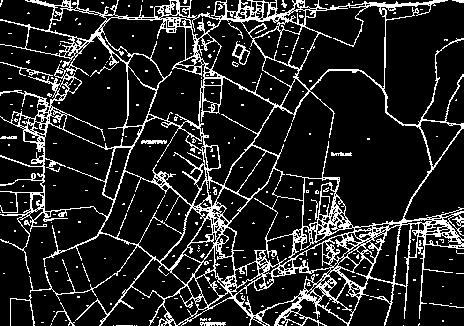

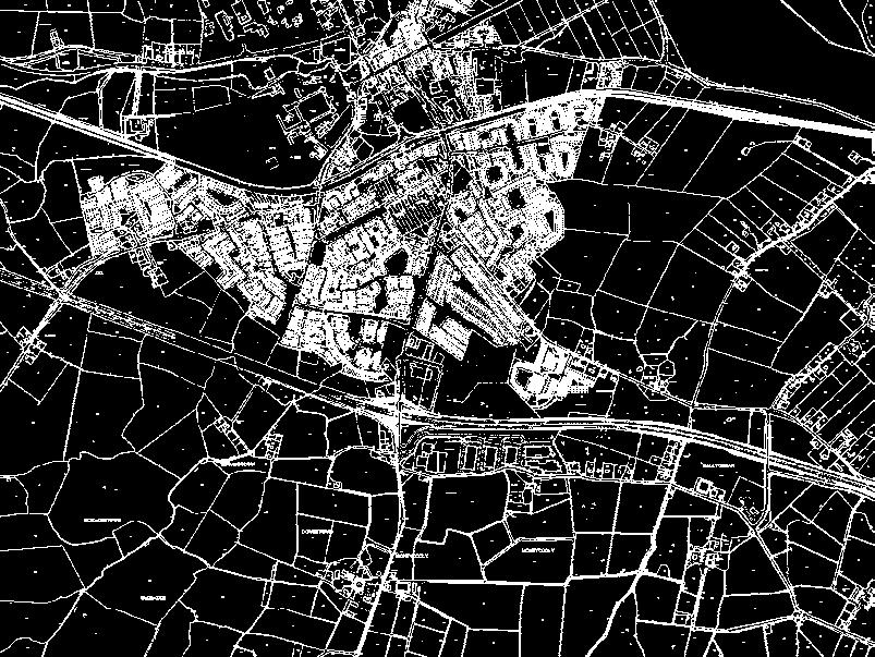


76 m Kildare County Council Planning Department, Áras Chill Dara, Devoy Park, Naas, Co Kildare Kildare County Council Planning Department, Áras Chill Dara, Devoy Park, Naas, Co Kildare m O.D. D. O. O.D.35m O.D.55m County Development Plan Weston Aerodrome County Development Plan m O.D..55 m O.D Kilrush Aerodrome Inner Horizontal Surface at (Kilrush) 37.35m O.D. 04 ff Co. Dublin Noise Significant Area Take Off Climb Approach Area Inner Horizontal Surface Conical Surface Kildare County Boundary -o ke Ta February 207 N.T.S. y wa O.D Approach Drawn by:. O.D t February 207 Date: B.Ryan 6.3. O.D V-6.4 Drawn by: B.Ryan Drawing No.: 200/5/779 Map Ref.: 3m Co. Dublin This drawing is to be read in conjunction with the written statement Ordnance Survey Ireland. All rights reserved. Licence No2009/26/CCMA Kildare County Council N.T.S. 4 ce rfa Su n) l a o nic st Co (W e m.33 9 Scale: Inner Horizontal Surface at (Weston) 9.33m O.D. Clearway & Stopway n Ru m V-6.3 Drawing No.: 200/5/778 Map Ref.: This drawing is to be read in conjunction with the written statement Ordnance Survey Ireland. All rights reserved. Licence No2009/26/CCMA Kildare County Council Date: Scale: 0m Legend Co. Kildare O.D 3m h 76.3 roac b pp lim A ff C m eo Tak O.D m ch proa Ap Elevation: 46.33m O.D. Weston Aerodrome e ac urf l S n) a nic sto Co (We Co. Kildare Approach Area Inner Horizontal Surface Conical Surface Legend m O.D. rface al Su ) Conaict (Kilrush.D. 5m O 37.3 Elevation: 92.35m O.D. Kilrush Aerodrome m O.D m O.D. 0m 58.6 m.35m O.D m 58 O.D.55m Kildare County Development Plan Kildare County Development Plan


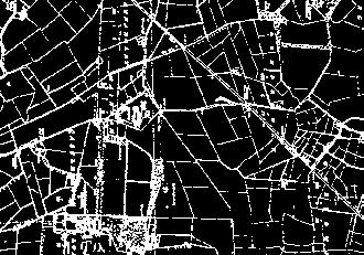


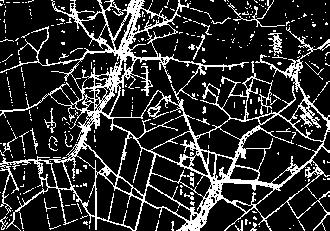


77 Co. Dublin Co. Kildare See Map Ref 6.4 Weston Aerodrome 0,000 Km 9. O.D m O.D O.D 86.6m O.D. 65.8m Appr oa ment ch to runw ay Case m D. 2m 97. O. Casement Aerodrome Elevation: 86.6m O.D. m ,000 Km m O.D. 6 O.D. Ou t at ( er Ho r We sto izonta n) ls urf Inner Horizontal Surface at (Casement) 3.6m O.D. ace 3.6m O.D O. D. 23.6m O.D. al nt izo ) or ent rh m te se Ou (Ca at rfa Su se Ap m pr en oa t r ch un t w o ay 05 4m Conical Surface ( Casement ) Ca ce Co Kildare Co. Dublin Legend Approach Area Inner Horizontal Surface Conical Surface Kildare County Council Planning Department, Áras Chill Dara, Devoy Park, Naas, Co Kildare. 54 Kildare County Boundary 4000m Casement Aerodrome Kildare County Development Plan County Development Plan Scale: Date: N.T.S. February 207 Ordnance Survey Ireland. All rights reserved. Licence No 2009/26/CCMA Kildare County Council Map Ref.: V-6.5 Drawing No.: 200/5/780 Drawn by: B.Ryan This drawing is to be read in conjunction with the written statement Kildare County Development Plan


78 7. Infrastructure 7 AIM To develop, protect, improve and extend water, waste water and flood alleviation and environmental services throughout the county in conjunction with other statutory bodies and to prioritise the provision of water services infrastructure to complement the overall strategy for economic and population growth and to achieve improved environmental protection. 56 Kildare County Development Plan Kildare County Development Plan
79 7. Background The availability of high quality water and drainage infrastructure and environmental services are necessary to facilitate the sustainable development of the county and to protect the environmental quality. While Irish Water is responsible for all aspects of public water services planning, delivery and operation, Kildare County Council continues to provide some water services functions, as an agent of Irish Water. Kildare County Council is responsible for the management of surface water, with the Office of Public Works having overarching responsibility for flood risk management. Kildare County Council also has a statutory role in regulating waste management and in pollution control. This chapter sets out policies and objectives in relation to investment in the county s infrastructure and in relation to environmental protection. 7.2 Infrastructure Provision 7.2. Water The combined historical impact of increased population and commercial development has resulted in water demands increasing from 50,000 cubic metres per day in 2003 to 78,000 cubic metres per day in 205. Approximately 94% of the water supply to the county comes from outside Kildare primarily from regional plants at Ballymore Eustace (Dublin City Council) and Leixlip (Fingal County Council). The Council will therefore strive to promote key water supply projects to facilitate the future development of the county in conjunction with Irish Water Wastewater Kildare is served by circa 37 wastewater treatment plants. The largest wastewater treatment plants are located at Osberstown and Leixlip. Wastewater collection and treatment capacity has struggled to keep pace with development and many networks and plants in the county are operating at capacity. A contract to upgrade the capacity of the Osberstown Wastewater Treatment Plant commenced in 204 and will be completed in late 207. The Leixlip wastewater treatment plant is currently being upgraded and is due for commissioning in mid 207. A significant proportion of this capacity will be absorbed by a large industrial connection and headroom capacity for other development will be limited. It is planned to connect to the Ringsend catchment by 2020, which discharges treated effluent to Dublin Bay. The capacity of treatment works and the associated networks will be a key factor that will influence the future development of the county. Furthermore, Irish Water intends to prepare Drainage Area Plans (DAPs) for the Lower Liffey Valley Regional Sewerage Scheme (including the towns of Kilcock, Maynooth, Leixlip and Celbridge) during 207. The DAPs will identify solutions to provide capacity for future residential development and to meet environmental compliance requirements Strategic Infrastructure The county is dependent on strategic national and regional solutions to the provision of water and wastewater infrastructure. The development of a new regional water supply source and the implementation of the recommendations of the Greater Dublin Strategic Drainage Study are central to the long term sustainable development of the county Flooding The EU Floods Directive and the National Flood Policy Review Report (2004) are the driving forces behind flood management in Ireland. The Planning System and Flood Risk Management Guidelines for Planning Authorities, DECLG and OPW (2009) address flood risk management and the planning system. A Strategic Flood Risk Assessment (SFRA) of the county has been prepared to support the Strategic Environmental Assessment of the County Development Plan. It was carried out in accordance with the Flood Risk Management Guidelines (2009) and is a separate document to be read in parallel with this plan. Catchment Flood Risk Assessments and Management Studies (CFRAMS) are ongoing and include the river catchments of the key water courses in the county. 7.3 Policy / Legislative Context The provision of water, drainage and environmental services must have regard to relevant policy and legislative provisions which are outlined in the following sections Water Services Acts ( ) The Water Services Acts provide the legislative framework in relation to the planning, management and delivery of water supply and wastewater collection and treatment services. It incorporates a comprehensive review, update and consolidation of all existing water services legislation and facilitates the establishment of a comprehensive supervisory regime to ensure compliance with specified performance standards Water Framework Directive (2000) The EU Water Framework Directive (2000/60/EC), is a single piece of legislation covering rivers, lakes, groundwater, transitional (estuarine) and coastal waters together with heavily modified and artificial water bodies. It seeks to prevent further deterioration of and the protection, enhancement and restoration of the status of all bodies of water with the aim of achieving at least good ecological status by 205. Management of water quality is to be centred on river basins, through the implementation of River Basin Management Plans (RBMP). In the case of Kildare the relevant Plans include the South Eastern (River Barrow catchment) and Eastern River Basin Districts (River Liffey and River Boyne catchments). Ireland is now preparing for the second cycle, which proposes a National River Basin Management Plan to be in place by the end of Groundwater Protection Scheme (2004) Groundwater is protected under EU and National legislation. Local Authorities and the Environmental Protection Agency have responsibility for enforcing this legislation. The Geological Survey of Ireland (GSI), in conjunction with the DECLG and the EPA issued guidelines on the preparation of groundwater protection schemes. A Groundwater Protection Scheme for County Kildare was prepared in 2004 by the GSI in partnership with Kildare County Council Greater Dublin Area Strategic Drainage Study (2005) The Greater Dublin Strategic Drainage Study delivered an overview of the performance of the drainage infrastructure in the region s catchments and proposed infrastructural improvement works to facilitate the anticipated future growth in the catchment to 203. Irish Water, with the support of Kildare County Council, now manages the major and minor capital works for combined (surface water) and wastewater networks Sustainable Urban Drainage Systems (SuDS) Sustainable Urban Drainage Systems (SuDS) are advocated within the Greater Dublin Strategic Drainage Study with an objective to ensure that any future development does not increase flooding or pollution of rivers. The system aims to mimic the natural drainage of a site to minimise the effect of a development on flooding and pollution of waterways Rural Water Programme (2009) Funding under this programme is provided from the Department of Housing, Planning, Community and Local Government (DHPCLG). 206 marked the first year in transitioning to a new Rural Water Multi- Annual Programme from The objectives of which are to provide enhanced funding certainty for priority investment needs in order to support the implementation of proper planning and sustainable development in rural areas, to meet the requirements of the Drinking Water Directive in relation to rural water supplies and to support the delivery of measures identified in River Basin Management Plans to meet the objectives of the Water Framework Directive. Where appropriate, the multi-annual rural water programme will seek to establish synergies with Irish Water s 25 year Water Services Strategic Plan and Irish Water s Capital Investment Plans. The key objectives of the Rural Water Programme are as follows: To protect public health by ensuring compliance with the Drinking Water Directive, so that water intended for human consumption is wholesome and clean. To pursue a planned approach to investment and ensure best practice in all aspects of management and operation of rural water schemes Kildare County Development Plan Kildare County Development Plan

80 To give practical effect to the principle of partnership with the voluntary group scheme sector in the determination and implementation of policy on rural water supply through the local monitoring committees. To assist in the effective administration of the devolved rural water programme. To sustain the rural environment and promote rural economic development. A Rural Water Strategic Plan is in place so that the objectives listed above can be met efficiently and effectively in rural County Kildare. 5% of the population of the county is served by group water schemes and private wells EPA Code of Practice for Wastewater Treatment and Disposal Systems Serving Single Houses (2009) The code of practice establishes an overall framework of best practice in relation to the development of wastewater treatment and disposal systems in unsewered rural areas, for protection of the environment and specifically water quality. All planning applications for one off houses must be assessed in relation to the EPA Code of Practice. 7.4 Strategy The Council recognises the importance of the continued development of sustainable wastewater, water supply and drainage services in the county to facilitate economic development and quality of life for a growing population. Irish Water is required by Water Services legislation to prepare a Water Services Strategic Plan (WSSP). The WSSP must set out the objectives of Irish Water in relation to the provision of water services over a 25 year period and is subject to approval by the Minister for the DHPCLG. The WSSP sets a context for lower tier investment and implementation plans for key water services areas. The Council will facilitate Irish Water in the delivery of the WSSP. The alleviation of flood risk and the consequences of flooding including the provision of Flood Management Systems throughout the county is also a key component of the Infrastructure strategy. 7.5 Water and Drainage Policies 7.5. Policies: Water Supply WS WS 2 WS 3 WS 4 WS 5 Work in conjunction with Irish Water to protect existing water infrastructure and to promote investment in the water network to support environmental protection and facilitate the sustainable development of the county. Promote and support the implementation of Irish Water s Eastern and Midlands Water Supply Project to increase the water supply throughout the Dublin and Eastern and Midlands regions. Maximise the use of existing capacity in water services in the planning of new development and to ensure that full consideration is given to the level of investment required in the provision of water services, particularly in environmentally sensitive areas, when zoning for new development. Ensure that adequate water services will be available to service development prior to the granting of planning permission and to require developers to consult with Irish Water regarding available capacity prior to applying for planning permission. Work in conjunction with Irish Water to protect, manage and optimise water supply networks in the county including the protection of wayleaves and buffer zones. WS 6 WS 7 WS 8 WS 9 WS 0 WS WS 2 WS 3 Work in conjunction with Irish Water to promote the ongoing upgrade and expansion of water supply services to meet the future needs of the county and the region including facilitating the provision and zoning of appropriate sites required for water services infrastructure as necessary. Facilitate Irish Water s implementation of their Water Conservation Project targeting leakage reduction. Promote water conservation and demand management and best demand management practices in all developments, including rain water harvesting and grey water recycling and supporting the implementation of BS855: 2009 Rainwater Harvesting Systems Code of Practice. Manage, protect and enhance surface water and groundwater quality to meet the requirements of the EU Water Framework Directive. Maintain, improve and enhance the environmental and ecological quality of the county s surface and groundwaters by implementing the programme of measures set out in the River Basin Management Plan(s). Protect groundwater in the county from risk of pollution and ensure the implementation of the Kildare Groundwater Protection Scheme and such other relevant documents and legislation as may be introduced. Promote the proper management of Group Water Schemes in accordance with the Rural Water Strategic Plan. Have regard to the requirements of the Habitats Directive in all proposed projects or plans. WS 4 (a) Recognise the strategic importance of the Eastern Regional Water Supply Scheme and co-operate with Irish Water, the Department of Housing, Planning, Community and Local Government and other statutory agencies in finalising the route. (b) Preserve the emerging corridor of the Eastern Regional Water Supply Scheme free from development Policies: Water Quality The EU Water Framework Directive (2000/60/EC) is a single piece of legislation covering water bodies such as rivers, lakes and groundwater, its remit is to protect and restore water quality. The management of the water quality is through the implementation of River Basin Management Plan(s) (RBMP). The Directive includes a requirement to contribute to mitigating the effects of floods. WQ WQ 2 WQ 3 WQ 4 WQ 5 WQ 6 Co-operate with the EPA and other authorities in the continued implementation of the EU Water Framework Directive and assist and co-operate with the lead authority for the River Basin Management Plan(s). Ensure, through the implementation of the River Basin Management Plan(s) and the associated Programmes of Measures and any other associated legislation, the protection and improvement of all drinking water, surface water and ground waters throughout the county. Work, in co-operation with relevant organisations and major stakeholders, to ensure a co-ordinated approach to the protection and improvement of the county s water resources. Work in conjunction with Irish Water with the aim of improving the quality of drinking water and reducing the level of unaccounted for water through targeted leak reduction. Support the implementation of Irish Water s Water Safety Plans to ensure that public drinking water sources and their contributing catchments are protected from pollution. Protect recognised salmonid water courses in conjunction with Inland Fisheries Ireland such as the Liffey catchment, which are recognised to be exceptional in supporting salmonid fish species Kildare County Development Plan Kildare County Development Plan
.")
81 7.5.3 Policies: Wastewater The largest wastewater treatment plants are located at Leixlip, (serving Kilcock, Maynooth, Celbridge, Leixlip and Straffan) and Osberstown (serving Naas, Newbridge, Kilcullen, Athgarvan, Prosperous, Sallins, Clane and Kill). There are also smaller plants located in Athy, Kildare Monasterevin, Castledermot, Robertstown and Ballymore Eustace among others serving their local catchment. WW WW 2 WW 3 WW 4 WW 5 WW 6 Work in conjunction with Irish Water to protect drainage infrastructure and promote investment in the drainage network to support environmental protection and facilitate the sustainable growth of the county. Seek to ensure that all towns and villages are provided with an adequate waste water treatment plant within the limits of cost effectiveness and availability of finance. Maximise the use of existing capacity in wastewater services in the planning of new development and to ensure that full consideration is given to the level of investment required in the provision of wastewater services, particularly in environmentally sensitive areas, when zoning for new development. Ensure that adequate wastewater services will be available to service development prior to the granting of planning permission. Applicants who are proposing to connect to the public wastewater network should consult with Irish Water regarding available capacity prior to applying for planning permission. Work in conjunction with Irish Water to protect, manage and optimise wastewater drainage networks in the county including the protection of wayleaves and buffer zones. Work in conjunction with Irish Water to promote the ongoing upgrade and expansion of wastewater services to meet the future needs of the county and the region including facilitating the provision and zoning of appropriate sites required for wastewater services infrastructure as necessary. WW 7 WW 8 WW 9 Support Irish Water in delivering key waste water projects in the county including: Osberstown Wastewater Treatment Plant Upgrade, Leixlip Wastewater Treatment Plant Upgrade, Upper Liffey Valley Sewerage Scheme, Kildare Town Network Upgrade, and Local Network Reinforcement Projects. Require all new development to provide a separate foul and surface water drainage system and to prohibit the discharge of additional surface water to combined sewers other than in exceptional circumstances. Support Irish Water in the promotion of effective management of trade discharges to sewers in order to maximise the capacity of existing sewer networks and minimise detrimental impacts on sewage treatment works. WW 0 Refuse residential development that requires the provision of private waste water treatment facilities, other than single house systems. WW Promote the changeover from septic tanks to collection networks in all cases where this is feasible and desirable (subject to connection agreements with Irish Water) and that all new developments utilise and connect to the public wastewater infrastructure. The provision of individual septic tanks and treatment plants in the plan area will be strongly discouraged to minimise the risk of groundwater pollution. Where such facilities are permitted, full compliance with the prevailing regulations and standards, including the EPA Code of Practice for Wastewater Treatment and Disposal Systems Serving Single Houses (PE. 0), (2009), as may be amended, will be required. WW 2 Ensure that existing and permitted private wastewater treatment plants are operated in compliance with their wastewater discharge license, in order to protect water quality. WW 3 Require existing developments that are in close proximity to a public sewer to connect to that sewer, subject to a connection agreement with Irish Water Surface Water and Flood Alleviation The control of surface water and appropriate measures for eliminating flood risk are part of the Council s sustainable water services policy. The Office of Public Works (OPW) is the lead agency for flood risk management in Ireland. The coordination of Government Policy in terms of flood risk identification, assessment and management is the responsibility of the OPW, and as such it is primarily charged with ensuring Ireland s compliance with its legal obligations in relation to flood risk. The Council is required to implement and comply with the Planning System and Flood Risk Management Guidelines, DEHLG (2009). Kildare County Council has carried out a Strategic Flood Risk Assessment (SFRA) for this plan as required by these guidelines. The SFRA is a countywide assessment of flood risk to inform strategic land-use decisions with the purpose of ensuring that flood risk management is fully integrated into the Development Plan. The SFRA of this Plan is a live document and any updates to it including the identification of flood zones will inform future planning decisions throughout the county Policies: Surface Water and Flooding SW SW 2 SW 3 Manage, protect and enhance surface water quality to meet the requirements of the EU Water Framework Directive. Incorporate Flood Risk Management into the spatial planning of the county, to meet the requirements of the EU Floods Directive and the EU Water Framework Directive. Support and co-operate with the Office of Public Works in delivering the Catchment Based Flood Risk Assessment and Management Programme in particular the Eastern and South Eastern CFRAM studies and associated Flood Management Plans. The recommendations and outputs arising from these studies shall be incorporated in preparing plans and assessing development proposals. SW 4 SW 5 SW 6 SW 7 Support the implementation of the EU Flood Risk Directive (2007/60/EC) on the assessment and management of flood risks and the Flood Risk Regulations (SI No 22 of 200). Manage flood risk in the county in accordance with the requirements of the Planning System and Flood Risk Management Guidelines for Planning Authorities, DECLG and OPW (2009) and circular PL02/204 (August 204), in particular when preparing plans and programmes and assessing development proposals. For lands identified in the Strategic Flood Risk Assessment a sitespecific Flood Risk Assessment to an appropriate level of detail, addressing all potential sources of flood risk, is required, demonstrating compliance with the aforementioned Guidelines or any updated version of these guidelines, paying particular attention to residual flood risks and any proposed site specific flood management measures. Ensure effective management of residual risks for development permitted on floodplains. Maintain and enhance the existing surface water drainage systems in the county and promote and facilitate the development of Sustainable Urban Drainage Systems including integrated constructed wetlands and to promote and support the retrofitting of SuDS in established urban areas Kildare County Development Plan Kildare County Development Plan
.")

82 SW 8 SW 9 SW 0 SW SW 2 SW 3 Incorporate Sustainable Urban Drainage Systems as part of all plans to address the potential for sustainable urban drainage at district or site level. Limit the surface water run off from new developments through the use of Sustainable Urban Drainage Systems (SuDS). These systems should not adversely impact on open space provision in residential areas. Liaise with the Office of Public Works in delivering on flood management works and schemes, as may arise, through the OPW Non-Coastal Minor Works Programme and through the OPW s Capital Programme. Ensure that all towns, villages and settlements are provided with adequate flood alleviation measures within the limits of cost effectiveness and the availability of finance. Ensure that flood risk management is incorporated into the preparation of Local Area Plans in accordance with The Planning System and Flood Risk Management - Guidelines for Planning Authorities, DECLG and OPW (2009). Ensure that the Justification Test for Development Management is applied to proposals for development in areas at a high or moderate risk of flooding where the development proposed is vulnerable to flooding and would generally be inappropriate as set out in Table 3.2 of the The Planning System and Flood Risk Management - Guidelines for Planning Authorities (2009). SW 4 SW 5 SW 6 SW 7 SW 8 SW 9 Seek to ensure that development will not interfere with or interrupt existing surface water drainage systems. Ensure that the reasonable requirements of Inland Fisheries Ireland are adhered to in the construction of flood alleviation measures in the county. Recognise the important role of bogland and other wetland areas in flooding patterns. Development in these areas shall therefore be subject to a Flood Risk Assessment in accordance with the relevant guidance. Require development proposals which may affect canals and their associated infrastructure to prepare a Flood Risk Assessment in accordance with the relevant guidance. Ensure development proposals in rural areas (excluding one-off rural housing) demonstrate compliance with the following: The ability of a site in an unserviced area to accommodate an on-site waste water disposal system in accordance with the County Kildare Groundwater Protection Scheme, and any other relevant documents and legislation as may be introduced during the Plan period. The ability of a site in an unserviced area to accommodate an appropriate onsite surface water management system in accordance with the policies of the Greater Dublin Strategic Drainage Study (2005), in particular those of Sustainable Urban Drainage Systems (SuDS). The need to comply with the requirements of The Planning System and Flood Risk Management Guidelines for Planning Authorities, published by the Minister for the Environment, Heritage and Local Government (2009). Liaise with the Office of Public Works in delivering flood management and alleviation programmes to include, but not limited to, the following: South Eastern CFRAMS and the recommendations therein. Eastern CFRAMS and the recommendations therein. SW 20 SW 2 Newbridge Surface Water Improvement Schemes. Morrell River Flood Management Scheme. Hazelhatch Flood Management Scheme. Develop and resource a multi-annual programme for the maintenance of river channels under the responsibility of Kildare County Council, to include but not limited to: Barrow Drainage District. Greese Drainage District. Lerr Drainage district. Ensure that rural one off residential developments maintain existing drainage systems, particularly at access points to the property Objectives: Water and Drainage It is an objective of the Council to: WDO Continually monitor and review the water quality standards of Kildare County Council in light of European Communities (Drinking Water) Regulations 2007 (SI 278 of 2007), as may be amended and to ensure continuing compliance. WDO 2 Acknowledge the strategic policy recommendations in relation to flood risk identified in the Regional Planning Guidelines for the Greater Dublin Area WDO 3 Liaise with adjoining Local Authorities, all relevant departments and agencies in the alleviation of flood risk in the county. WDO 4 Promote rain water harvesting in all developments and in particular in larger schemes. WDO 5 Liaise with Irish Water to promote the sustainable development of water supply and drainage infrastructure in the county and the region, in accordance with the objectives and recommendations set out in the Greater Dublin Drainage Study, Irish Water s Water Services Strategic Plan and the Eastern and Midlands Water Supply Project. WDO 6 Present business cases to Irish Water to secure capital investment for required infrastructural projects in the county based on the Core Strategy. WDO 7 Protect the natural resources of the county which are the foundation for the Green Infrastructure network and a basis for growth and competitive advantage in the tourism, food and fisheries sectors. WDO 8 Work in conjunction with Irish Water to identify and facilitate the timely delivery of the water services required to realise the development objectives of this plan Kildare County Development Plan Kildare County Development Plan
83 7.6 environmental Services Aim To conform to European, National and Regional policies in relation to the provision of waste management and to protect and enhance water, air and noise quality Context Protection of the physical environment is of primary importance. The Council seeks to ensure the provision of the highest standards of waste management facilities and collection and to prevent and control water, air and noise pollution. The Development Plan is required to include objectives for waste recovery and disposal facilities, therefore the objectives of the relevant waste management plan are deemed to be included in the Development Plan. Waste Management policies and objectives in Kildare are reflective of the overarching EU, National and Regional policy and legislation. The Eastern-Midlands Region Waste Management Plan provides the framework for waste management in the region and sets out a range of policies and actions to meet specified mandatory and performance based targets. The Eastern Midlands Region was identified in the Government s 202 blueprint for a circular waste economy A Resource Opportunity Waste Management Policy in Ireland. It recognises that managing waste in a sustainable and self sufficient manner will be one of the key challenges for the region. In many instances change is being incentivised through government backed financial measures such as the Repak subsidy on dry recyclables or charges such as the landfill levy. The market for recycled goods, however, continues to be volatile and very much contingent on world economic trends. In truth, waste management is now very much a private sector activity while the role of the local authorities is largely confined to regulation and educational activities. The substantial increase in the landfill levy has had the effect of reducing the number of landfills, to such an extent that there are only two now in operation in the Eastern and Midland Region. The new Regional Waste Plans were formally approved in May 205. This sets ambitious targets as follows:- % reduction per annum in the quantity of household waste generated per capita over the period of the Plan (i.e. by 202). Achieve a recycling rate of 50% of Managed Municipal Waste by Reduce to 0% the direct disposal of unprocessed residual municipal waste to landfill from 206 onwards. A comprehensive set of policies is included, aimed at achieving these overarching objectives Strategy The Council s strategy for sustainable environmental management seeks to conform to European and National Waste Strategies in matters relating to the production, handling, treatment and disposal of waste within the county and to co-operate with and participate in the preparation of regional plans for the collection, treatment, handling and disposal of waste. The strategy also seeks to improve noise impacts and air quality standards of the county and to control harmful emissions to water and air under the relevant regulations. Central to the strategy is a focus on the promotion of environmental protection through education Litter The Litter Management Plan details the measures proposed by Kildare County Council in relation to litter prevention and control Pollution Control Water, Air and Noise The importance of a clean environment for the economic and social life of the county is well recognised. In relation to water, air and noise pollution continuous effective monitoring and enforcement in relation to pollution control measures is imperative and will continue over the period of the Plan. The Kildare Noise Action Plan (203) seeks to avoid, prevent and reduce where necessary the harmful effects of long term exposure to environmental noise. All proposed development will be in accordance with the EU Ambient Air Quality and Cleaner Air for Europe (CAFÉ) Directive (2008/50/EC). In this regard, continuous effective monitoring and enforcement in relation to pollution control measures is imperative and will continue over the period of this plan Policies: Waste Management WM WM 2 WM 3 WM 4 WM 5 Implement European Union, National and Regional waste related environmental policy, legislation, guidance and codes of practice to improve management of material resources and wastes. Have regard to European Union, National and Regional policy relating to air quality, light pollution and noise pollution and to seek to take appropriate steps to reduce the effects of air, noise and light pollution on environmental quality and residential amenity. Support the implementation of the Eastern-Midlands Region Waste Management Plan by adhering to overarching performance targets, policies and policy action. Support waste prevention through behavioural change activities that disassociate economic growth with resource use. Provide, promote and facilitate high quality sustainable waste recovery and disposal infrastructure and technology in keeping with the EU waste hierarchy and to adequately cater for a growing residential population and business sector. WM 6 WM 7 WM 8 WM 9 Seek the provision of adequately sized public recycling facilities in association with new commercial developments and in tandem with significant change of use / extensions of existing commercial developments where appropriate. Secure appropriate provision for the sustainable management of waste within developments, including the provision of facilities for the storage, separation and collection of such waste. Require the submission of either a certificate of exemption or a valid planning permission for a Waste Facility Permit or a Certificate of Registration application, in accordance with the Waste Management (Facility Permit and Registration) Regulations 2007 (as amended). Provide each town, village or settlement, subject to the availability of finance with appropriate recycling facilities in the form of a kerbside collection, civic site and bring bank recycling facilities. WM 0 Encourage waste prevention, minimisation, reuse, recycling and recovery as methods of managing waste. Where waste management is not being carried out properly, the Waste Management Act 996 (as amended), will be used as a means of ensuring specific national policies and regulations are adhered to. WM Promote and facilitate communities to become involved in environmental awareness activities and community-based recycling initiatives or environmental management initiatives, which will lead to local sustainable waste management practices. WM 2 Ensure the provision of waste management facilities in County Kildare (either directly by the Council or in co-operation or partnership with other local authorities and the private sector) is subject to the specific requirements of the Eastern-Midlands Region Waste Management Plan WM 3 Strictly control the raising of land for the purpose of private housing in the interests of pollution control, drainage, flood alleviation and amenity Kildare County Development Plan Kildare County Development Plan

84 WM 4 Require that all intensive agricultural waste, organic waste, municipal sludge and industrial sludge recovered through land spreading, be carried out under an accepted Nutrient Management Plan which must demonstrate nutrient uptake and capacity in spreadlands, sufficient storage facilities, compliance with relevant legislation including the Nitrates Regulations 2009, Waste Management Act 996 (as amended), Sludge Management Plan for Kildare, River Basin Management Plans, Kildare County Council s Sludge Protocol and any future revisions and replacements of these documents. WM 5 Support and facilitate the separation of waste at source into organic and non organic streams or other waste management systems that divert waste from landfill and maximise the potential for each waste type to be reused and recycled or composted and divert organic waste from landfill, in accordance with the National Strategy on Biodegradable Waste 2006 and the Eastern Midlands Region Waste Management Plan WM 6 Work in conjunction with Government departments and agencies and all other relevant stakeholders to remediate Kerdiffstown Landfill in a socially, economically and environmentally sustainable manner that will both manage and reduce environmental risk and accommodate an appropriate end use that is compatible with the established character of the area. WM 7 Facilitate the development of waste management infrastructure that is of an appropriate scale and is related to the needs of the county and the Eastern and Midlands Waste Region, subject to the protection of the environment, landscape character, road network and the amenities of the area. WM 8 Facilitate the ongoing operation of the Drehid waste facility in so far as operations at the facility relate to the waste management needs of the county and the Eastern and Midlands Waste Region and subject to the protection of the environment, landscape character, road network and the amenities of the area Policy: Litter L Implement the strategic actions of the Litter Management Plan and its review when completed Policies: Pollution Control - Water, Air and Noise PC PC 2 PC 3 PC 4 Implement the provisions of EU and National legislation on air, light and noise control and other relevant legislative requirements, as appropriate, in conjunction with all relevant stakeholders. Implement the relevant spatial planning recommendations and actions of the Kildare Noise Action Plan Ensure that future developments are designed and constructed to minimise noise disturbance and take into account the multi functional uses of streets including movement and recreation, as detailed in the Urban Design Manual (2009) and the Design Manual for Urban Roads and Streets (203). Ensure external lighting schemes minimise light spillage or pollution in the immediate surrounding environment and do not adversely impact on residential or visual amenity and biodiversity in the surrounding areas. PC 5 PC 6 PC 7 PC 8 PC 9 PC 0 Promote and support the ban on the use, marketing, sale and distribution of bituminous coal in Naas, Newbridge, Celbridge, Leixlip and Maynooth. Enforce, where applicable, the provisions of the Environmental Noise Regulations (2006). Ensure that noise levels caused by new and existing developments throughout the county do not exceed normally accepted standards and that new developments shall incorporate measures to ensure compliance with the Environmental Noise Regulations 2006 and any subsequent revision of these Regulations. Regulate and control activities likely to give rise to excessive noise (other than those activities which require regulation by the Environmental Protection Agency). Require activities likely to give rise to excessive noise to install noise mitigation measures and monitors. Ensure that all future development is in accordance with the EU Ambient Air Quality and Cleaner Air for Europe (CAFÉ) Directive (2008/50/EC) Objectives: Environmental Services It is an objective of the Council to: EN EN 2 EN 3 EN 4 Promote environmental protection through education. Facilitate the implementation of the Eastern Midlands Region Waste Management Plan Investigate the possibility of the provision of a recycling facility in the north of the county and to seek new markets for recycling in existing centres. Facilitate the implementation of the Kildare Noise Action Plan and Litter Management Plan and any subsequent amendments during the period of this Plan. EN 5 EN 6 EN 7 EN 8 EN 9 EN 0 EN Continue the monitoring and review of the trade effluent discharge licences of effluent and to include food service establishments in this monitoring. Continue to monitor air quality at selected locations throughout the county in cooperation with the Health Service Executive and the Environmental Protection Agency. Require the submission of Annual Environmental Reports (which require ongoing monitoring of specified environmental parameters) on specified developments through the planning process. Investigate and develop best practice guidelines in relation to design, location and size of bin storage areas in apartment or higher density housing schemes. Implement the objectives of the National Waste Prevention Programme at a local level with businesses, schools, householders and community groups and within the Council s own activities. Promote and increase the amount of waste reused and recycled consistent with the Eastern Midlands Region Waste Management Plan and Waste Hierarchy and facilitate recycling of waste through adequate provision of facilities and good design in new developments. Complete and implement the Kildare Litter Management Plan Kildare County Development Plan Kildare County Development Plan


85 8. Energy & Communications 8 AIM To encourage and support energy and communications efficiency and to achieve a reasonable balance between responding to EU and National Policies on climate change, renewable energy and communications and enabling resources to be harnessed in a manner consistent with the proper planning and sustainable development of the county. 70 Kildare County Development Plan Kildare County Development Plan
86 8. Background Climate change is one of the biggest issues facing our environment and is widely regarded as being caused by the warming effect of greenhouse gases. The burning of carbon based fossil fuels is responsible for over half of all greenhouse gas emissions globally. These emissions are mainly generated from energy generation, transportation, industry and residential and commercial buildings. European and national energy policy prioritise measures to support climate change resilience, through reduced energy consumption and increasing the proportion of energy consumed from alternative non-polluting, low carbon and renewable energy sources (wind, solar, hydro, and geothermal) across the sectors. The energy targets set out in EU legislation have been translated into the National Renewable Energy Action Plan (NREAP) 200 and the National Energy Efficiency Action Plan (NEEAP) (updated in 204). Ireland is committed to producing at least 6% of all energy consumed by 2020 from renewable sources. This will be met by 40% from renewable electricity, 2% from renewable heat, and 0% from renewable transport. The EU has recently adopted a target for the year 2030 of at least 27% of energy being renewable energy. In Ireland, by 203, 7.8% of gross final energy use came from renewable sources, with renewable electricity accounting for 20.9% of all electricity generated. The Council supports programmes for renewable energy production and conservation measures and has established an inhouse Energy Management team. To sustain continued growth, Kildare County Council will require energy to power homes, business, public services and transport. Energy supply needs to be reliable, efficient and robust so that it can facilitate growth across all sectors. Kildare County Council will make every effort to increase energy efficiency and unlock renewable energy potential. In 205, the Government published a new White Paper Ireland s Transition to a Low Carbon Energy future which is a complete energy policy update, setting out a framework to guide Government policy up to Its objective is to guide a transition to a low carbon energy system, while providing secure supplies of competitive and affordable energy. The Government s vision is to transform Ireland into a low carbon society and economy by 2050, with 2030 representing a significant milestone. The aim is to reduce greenhouse gas emissions from the energy sector by between 80% to 95% (compared to 990 levels) by 2050, while ensuring that secure supplies of competitive and affordable energy remain available to citizens and businesses. In 202, the Government published The Strategy for Renewable Energy The document includes 36 actions to maximise the economic potential of renewable energy including wind power, bio energy and wave and tidal power. The strategy points out that green energy and clean technology already support an estimated 9,000 jobs in Ireland. Ireland has also agreed with the EU that, by 2020, 40% of all electricity consumed will be generated from renewable power. 8.2 Communications Background The widespread availability of a high quality Information and Communications Technology (ICT) network within County Kildare will be critical to the development of the county s economy, and will also support social development. Kildare is well served by a number of telecom providers each using various forms of technology including fibre-optic and wireless technology. The Council recognises that high speed broadband is essential as an economic facilitator in a knowledgebased economy and will continue to work closely with the Department of Communications, Climate Action and Environment to implement the National Broadband Plan. 8.3 Strategy This Plan aims to support the development of indigenous renewable energy resources and the maximisation of electricity production in a manner that is in accordance with the principles of proper planning and sustainable development. It seeks: To support national and EU policy for the provision of new and innovative sources of renewable energy. To facilitate energy supply and distribution in the county in order to support an efficient and vibrant economy. To ensure that the location of renewable energy structures should minimise and/or mitigate any adverse visual and environmental impacts on the built or natural environment. To encourage the improvement of energy efficiency of the existing building stock, and to promote energy conservation in the design and development of all new buildings in the county. To promote sustainable approaches to residential development through spatial planning, layout, design and construction. The strategy of the Council for the development of communications is to facilitate the enhancement of telecommunications infrastructure within the county, to maintain economic competitiveness and, in so doing, to support the provision of appropriate infrastructure, including broadband connectivity and other technologies, in association with the appropriate service providers. 8.4 Renewable Energy Due to increased energy requirements and national and EU targets for energy consumption from renewable sources, the electricity supply must be augmented by alternative forms of generation. The Council recognises the range of new and developing technologies that can contribute to minimising greenhouse gas emissions and to securing a greater proportion of our energy needs from renewable resources. Renewable energy can be defined as energy generated from resources that are unlimited, rapidly replenished or naturally renewable and not from the combustion of fossil fuels. The Department of Communications, Climate Action and Environment is currently preparing a Draft Renewable Electricity Policy and Development Framework which will guide the development of large scale renewable electricity projects on land. The framework will be primarily for the guidance of An Bord Pleanála, planning authorities, other statutory authorities, the general public and persons seeking development consent in relation to such projects. It will seek to broadly identify suitable areas in the State where large scale renewable electricity projects can be developed in a sustainable manner. Policies: General Energy ER Respond to the European and National Energy Programme through the County Development Plan with policies and objectives that promote energy ER 2 ER 3 ER 4 ER 5 ER 6 ER 7 ER 8 conservation, increased efficiency and growth of locally based renewable energy alternatives, in an environmentally and socially acceptable and sustainable manner. Support infrastructural renewal and development of electricity and gas networks in the county, subject to safety and amenity requirements. Support regional, national and international initiatives for limiting emissions of greenhouse gases through energy efficiency and the development of renewable energy sources which make use of the natural resources in an environmentally and socially acceptable manner. Have regard to the requirements of the service providers in the provision of strategic infrastructure whilst also seeking to ensure that development, including the location of high voltage transmission power lines, is controlled, particularly adjoining existing dwellings, except where no other alternative can be shown to exist. Seek the co-ordinated delivery of infrastructure and services to support sustainable communities. Support and encourage the sustainable development of renewable energy autoproduction units (the production of energy primarily for on-site usage) for existing and proposed developments in line with relevant design criteria, amenity and heritage considerations and the proper planning and sustainable development of the area. Adopt a positive approach to renewable energy proposals, having regard to the proper planning and sustainable development of the area, including community, environmental and landscape impacts and impacts on protected or designated heritage areas/structures. Have regard to the Renewable Electricity Policy and Development Framework, when adopted, when assessing any renewable energy proposals Kildare County Development Plan Kildare County Development Plan
87 Objective: General Energy It is an objective of the Council to: ERO Prepare and implement an Energy Strategy in tandem with the preparation of a Climate Change Adaptation Strategy, following consultation with the Sustainable Energy Authority Ireland (SEAI), the Environmental Protection Agency (EPA) and other relevant stakeholders. The strategy will also be informed by relevant actions contained in the LECP. This will result in a structured response to energy cost changes and support work with central government to reduce market volatility. This could then assist community stakeholders and the renewable energy sector to cooperate in developing appropriate projects of sufficient scale with stable demand and thereby attract employment investment. 8.5 Wind Energy Wind Energy can make a significant contribution to reaching Ireland s renewable energy targets to 2020 and beyond. The Council is currently preparing a Wind Energy Development Strategy which will be informed by the DECLGs Wind Energy Development Guidelines which are currently under review. This county-wide strategy will be structured in line with the Methodology for Local Authority Renewable Energy Strategies prepared by the Sustainable Energy Authority of Ireland (SEAI). The wind resource potential of the county has been assessed using the SEAI Wind Atlas for Ireland to show areas potentially viable for wind turbine development. Wind Energy Development facilitators such as wind speed and constraints such as proximity to residential properties and heritage sites have been inputted into a GIS model to identify possible suitable locations. The Wind Energy Development Guidelines, once finalised, will determine the appropriate distances and thresholds that will allow the Kildare Wind Energy Development Strategy to be completed. The Council will encourage small to medium scale autoproduction wind energy developments in industrial and business parks. In appropriate locations these turbines can generate power to be used on-site with any surplus being fed back into the national grid. It is noted that the Planning and Development Regulations include exemptions for uses of this nature. Advances in technologies in this area aid the potential for such development to be designed to suitably integrate with the built fabric of these areas. Policies: Wind Energy WE WE 2 WE 3 Have regard to the Department of the Environment, Heritage and Local Government s Guidelines for Planning Authorities on Wind Energy Development (or any update of this document) in assessing all planning applications for wind farms. Encourage the development of wind energy in suitable locations in an environmentally sustainable manner and in accordance with Government policy and the Kildare Wind Energy Strategy. Ensure that the assessment of wind energy development proposals will have regard to: the sensitivities of the county s landscapes; the visual impact on protected views, prospects, scenic routes, historic demesnes as well as local visual impacts; the impacts on nature conservation designations, archaeological areas and historic structures, public rights of way and walking routes; local environmental impacts, including those on residential properties, such as noise and shadow flicker; the visual and environmental impacts of associated development, such as access roads, plant and grid connections; the scale, size and layout of the project and any cumulative effects due to other projects; the impact of the proposed development on protected bird and mammal species; the county s Wind Energy Strategy (when adopted); the impact of the grid connection from the proposed wind farm to the ESB network. WE 4 WE 5 Encourage small to medium scale wind energy developments within industrial or business parks, and support small community-based proposals in urban areas, provided they do not negatively impact on the environmental quality and visual or residential amenities of the area. Adopt a positive approach to smallscale wind energy developments for autoconsumption purposes, having regard to the proper planning and sustainable development of the area including residential amenity, heritage, environmental and landscape impacts Objective: Wind Energy It is an objective of the Council to: WEO Prepare a Wind Energy Development Strategy and to publish it as a proposed variation of this plan following the completion of the review of the DECLG s Wind Energy Development Guidelines. 8.6 Hydro Energy There are three ESB hydroelectric power stations located in the county - Golden Falls, Leixlip and Poulaphouca. The Council will encourage the use of rivers for hydro energy production. It is important that hydro schemes, including micro-hydro schemes, incorporate proposals for landscaping of dam walls and ancillary developments and also measures to minimise noise emissions and to reduce the overall impact of schemes. The Council recognises the potential for further development of small-scale hydro electricity projects in the county, in particular for on-site consumption to meet the electricity requirements of proposed new buildings, or refurbishment of existing buildings appropriate to their riverside location and setting. Many of the rivers and tributaries in the county are protected under the Birds and Habitats Directives or another heritage designation such as protected structures and this should be a consideration during the investigation of any possible suitable site. Policies: Hydro Energy HD HD 2 HD 3 HD 4 Seek to ensure that proposals for hydro energy installations, including micro-hydro schemes have regard to the free passage of fish and other water-based amenity activities. The Council will have regard to the recommendations of Inland Fisheries Ireland in relation to the protection of fisheries resources, and of the Department of Communications, Climate Action and Environment in assessing proposals. Support the roll out of small-scale hydroelectric projects on rivers, water courses, dams and weirs across the county, where projects do not impact negatively on freshwater species, biodiversity and natural or built heritage features. Seek to ensure that, in sensitive landscapes, powerlines connecting the hydro unit to the national grid will be laid underground. Ensure that the assessment of hydro energy development proposals will have regard to: the sensitivity of the landscape; the visual impact on protected views, prospects and scenic routes as well as local visual impacts; the impacts on nature conservation designations, archaeological areas and historic structures, public rights of way and walking routes Kildare County Development Plan Kildare County Development Plan


88 Solar energy technology is no different to other forms of renewable energy technology as it is constantly evolving. Like all forms of development, solar farms have the potential to affect the landscape and natural and built heritage. Cumulative impacts may also arise with farms located close to each other. Site selection is vital for potential solar farms as solar resource, topography and proximity to the grid must be considered. There are also many environmental considerations associated with solar farms. Policies: Solar Energy SE Promote the development of solar energy infrastructure in the county, in particular for on-site energy use, including solar PV, solar thermal and seasonal storage technologies. Such projects will be considered subject to environmental safeguards and the protection of natural or built heritage features, biodiversity views and prospects. the guidance provided in relation to compatibility with landscape designations of Tables 4.3 and 4.4 of Chapter 4 of this plan; the need for, and impact of, security measures such as lights and fencing; the need to ensure that heritage assets are conserved in a manner appropriate to their significance, including the impact of proposals on protected views and scenic routes etc. As the significance of a heritage asset derives not only from its physical presence, but also from its setting, careful consideration should be given to the impact of large scale solar farms on such assets, e.g. historic demesnes. Depending on their scale, design and prominence, a large scale solar farm within the setting of a heritage asset may cause substantial harm to the significance of the asset; SE 3 SE 4 the need to consider ecology so as to avoid or minimise damage on important species or protected habitats; the energy-generating potential, which can vary for a number of reasons including latitude and aspect; the design of the scheme needs to be carefully considered including layout, scale, land cover panel, height, landscaping, access roads, noise, cumulative impacts and the design of ancillary elements; Encourage the use of passive solar design principles for residential building(s). Support and encourage the installation of solar collectors and panels for the production of heat or electricity in residential and commercial buildings, in line with relevant design criteria. SE 2 Ensure that the assessment of solar energy development proposals will have regard to: site selection, by focussing in the first instance on developing solar farms on previously developed and nonagricultural land, provided that it is not of high environmental value; where a proposal involves greenfield land, whether (i) the proposed use of any agricultural land has been shown to be necessary and poorer quality land has been used in preference to higher quality land; and (ii) the proposal allows for continued agricultural use where applicable and/or encourages biodiversity improvements around arrays; the nature of solar farms as normally temporary structures. Decommissioning and site rehabilitation plans will be required providing for the land be restored to its previous use; the proposal s impact through glint and glare on neighbouring uses and on transportation and aviation safety; the proposal s visual and landscape impact and the potential to mitigate these impacts through, for example, screening with native hedges; Solar Energy As solar energy technologies have become more effective, areas in northern Europe like Ireland have become viable for technologies including solar panels/ tubes on roof spaces and the commercial development of solar farms together with storage facilities. As a result, solar generated energy is increasingly contributing to a reduction in energy demand and energy costs for a range of commercial, industrial and residential properties. On-site autoconsumption technologies can make a significant contribution towards a reduction in energy costs and this will continue as technologies develop further. The Council recognises this contribution and will encourage the use of solar energy in residential, commercial and industrial developments. Solar technologies could also be incorporated into the built fabric of existing buildings. 76 Kildare County Development Plan Kildare County Development Plan
89 8.8 Bio Energy Bio energy may be defined as energy derived from biomass. Bio energy technologies may be broken into three groups: Combustion using biomass solely and with fossil fuels; Biochemical process leads to the production of biofuels; Thermochemical process - leads to the production of biogas. Biomass is defined as the biodegradable proportion of products, waste and residues from agriculture, forestry and related industries, including fisheries and aquaculture and the biodegradable fraction of industrial and municipal waste. It can produce electricity and/or heat; biomass can be burned to produce heat that is used to create steam to turn turbines and produce electricity Projects involving the combustion of biomass can range in size from a domestic boiler to industrial installations. The main feedstocks are wood chip and wood pellets, energy crops and the combustion of municipal waste in waste-to-energy facilities. Biofuels may be defined as liquid or gaseous fuels for transport produced from biomass. Biogas can be injected into the natural gas grid to complement or substitute natural gas and can also be compressed and used for a transport fuel. Policies: Bio Energy BE BE 2 BE 3 Facilitate the development of projects that convert biomass to energy, subject to proper planning considerations. Locate biomass installations in areas that do not affect residential or visual amenity and which are served by public roads with sufficient capacity to accommodate increased traffic flows. Promote domestic biological treatment including composting of kitchen and garden waste. 8.9 Energy from Waste The Council recognises that there is much potential for the capturing and utilisation of waste heat generated by premises which could be captured and reused onsite. Such waste heat can be generated from processes including thermal generating stations, site power generation, industrial processes, wastewater systems and waste to energy plants. Proposals for waste to energy development, including anaerobic digestion and dry digestion for farm or other wastes and byproducts, will be considered. Suitable areas for such development include those with intensive agricultural activities, such as dairying, pig and poultry farming. Policies: Energy from Waste EW EW 2 Facilitate and support sustainable smallscale waste to energy proposals in suitable locations, subject to national and regional policy, normal siting, design, environmental and planning considerations. Promote the development of waste heat technologies and the utilisation and sharing of waste heat in new or extended industrial and commercial developments, where the processes associated with the primary operation onsite generates waste heat. 8.0 Energy Efficiency in Buildings The design, construction and operation of new buildings, have a significant role to play in reducing energy demand and increasing energy efficiency into the future. The energy efficiency and renewable energy requirements for the construction of new residential and non-residential buildings are primarily addressed in the current Building Regulations Part L ( ). The regulations prescribe that a reasonable proportion of the energy consumption to meet the energy performance of a dwelling is provided by renewable energy sources. The Council promotes energy efficient design and recommends consideration of energy design at the earliest stage in the design process through careful site selection and the design of new buildings with regard to orientation so as to maximise solar gain. Careful consideration should also be given to the adaptability of buildings over time to enable the building stock to be retrofitted to meet higher efficiency standards in the future. The upgrading and refurbishment of homes and business premises can make a significant contribution in reducing energy demands and costs. The energy performance of existing buildings is one of the foremost considerations in responding to the energy challenges in the county. Policies: Energy Efficiency in Buildings EB EB 2 EB 3 Ensure that new development is designed to take account of the impacts of climate change, and that energy efficiency and renewable energy measures are incorporated in accordance with national building regulations, policy and guidance. Adopt and maintain energy conservation measures within Council owned developments and to encourage developers to adopt measures to enhance energy conservation through building design. Provide energy conservation and efficiency measures and facilitate innovative building techniques that promote energy efficiency and the use of renewable energy sources, in accordance with national policy and guidelines. Objective: Energy Efficiency in Buildings It is an objective of the Council to: EBO : Seek to achieve the objectives of the Building Energy Rating system insofar as it relates to public buildings in the control of the Local Authority and to support and encourage all other public and non-public buildings in achieving their energy rating requirements. 8. geo Thermal Energy Geothermal energy means energy stored in the form of heat beneath the surface of solid earth. It is generally classified as deep or shallow, depending on the depths involved. Deep geothermal energy can be used for both thermal and electricity generation but as of yet, due to the depths involved and the resultant costs, it has not been developed in Ireland. The Sustainable Energy Authority of Ireland (SEAI) has developed a geothermal mapping system which identifies the temperature at various depths for the whole country. This type of renewable energy generation may become viable as technologies advance. Shallow geothermal energy, also known as ground source energy, is most frequently used for providing heat. It can be found anywhere and has been harnessed by homes and commercial and recreational buildings in Ireland for heating purposes. Geothermal energy is extracted through heat pumps which work by circulating a heat transfer fluid around a sealed pipe network buried in the ground. The ground maintains a constant temperature in this country of between and 3 degrees and the heat pumps take advantage of this by transferring the heat stored in the ground in winter to the building and doing the opposite to cool buildings in the summer. For each unit of electricity used in a heat pump up to four units of heat are generated. Policies: Geo Thermal Energy GT GT 2 Facilitate large and smaller scale geothermal energy generating developments, subject to the proper planning and sustainable development of the area and consideration of environmental and ecological sensitivities. Promote the use of geothermal heat pumps for space heating and cooling as well as water heating in domestic, commercial and recreational buildings subject to the protection of water quality and any other relevant considerations. 8.2 Energy Supply and infrastructure The Council acknowledges the need to utilise electricity for domestic and commercial use within the county. Notwithstanding the Council s desire to promote the growth in renewable energy alternatives, the majority of the county s energy is generated from non-renewable sources such as the burning of coal, oil, peat and natural gas. For the most part this energy is transferred around the county on the national grid transmission infrastructure. While the main source of electricity generation in Ireland is from non-renewable sources, electricity generation from renewable sources is increasing Kildare County Development Plan Kildare County Development Plan
90 8.2. Gas The natural gas pipeline infrastructure is under the responsibility of Gas Networks Ireland division of Ervia and the Cork Dublin high pressure gas transmission pipeline that runs through the county. Natural gas is available in a number of the county s towns. Gas Networks Ireland continues to assess the feasibility of new connections bringing gas to additional towns. Natural gas is the cleanest of all fossil fuels and its chemical composition makes it a more environmentally friendly fuel than oil, coal or peat. The existing gas network within the county has the capacity for connections and local distribution network extensions. The Council acknowledges the importance of gas for both economic development and as a provider of domestic energy within the county. Policy: Gas GS Support the infrastructural renewal and development of the gas networks in the county, subject to proper planning, heritage and amenity requirements Electricity Supply and Infrastructure The Government Policy Statement on the Strategic Importance of Transmission and Other Energy Infrastructure (202) acknowledges the strategic and economic importance of investment in networks and energy infrastructure. The Government endorses the major investment underway and proposed in the high voltage electricity system under Eirgrid s Grid 25 Programme. The Council acknowledges the strategic need to have available adequate electricity for domestic and commercial use within the county to enable the further development of the county. The demand for electricity continues to grow at a national, regional and local level. Ireland s electricity network is currently undergoing a programme of renewal through upgrade of the existing network, along with the construction of new lines and transmission/distribution stations. Kildare is one of the best served locations in terms of the transmission network and has the following notable features: One of the two 400kV lines from Moneypoint terminates at Dunstown, Naas. Dunstown steps down from 400kV to 220kV and transmits power through Kildare and into Dublin via a network of 00kV and 220kV lines. The highest voltage lines of the Eirgrid Transmission System serve Kildare and thus enable the county to have the potential to be in a position to meet future electricity demands 2. However it should be noted that there may be a future requirement to reinforce the local network in order to support or optimise Dublin flows. GRID 25 is the Development Strategy of Eirgrid (published in 2008), the national transmission system operator of the wholesale power market. Eirgrid s development strategy recognises the need to strike a sustainable balance between cost, reliability, security and environmental impact in the provision of electricity transmission networks. Eirgrid is currently in the process of reviewing its current grid development strategy with a new draft strategy published in March 205 for consultation. In addition, Eirgrid is also preparing a new Grid Implementation Plan which will replace its original Grid 25 Implementation Programme which is a regional spatial 6 year development plan for grid development. It is recognised that the development of transmission lines for electricity interconnectors will contribute to the on-going development of a single European Electricity Grid and single European Electricity Market in compliance with Directive 2009/72/ EC concerning common rules for the internal market in electricity and Regulation 74/2009 on conditions for access to the network for cross-border exchanges in electricity. The development of electricity interconnectors will be informed by the 0 year Network Development Plan managed by the European Network of Transmission System Operators for Electricity (ENTSO-E). It is anticipated that growth in the Greater Dublin Area will give rise to demand for increased energy supply and a pressure to connect the region with other regions via the hinterland area that includes County Kildare. The Council will support and facilitate the requirements of the major service providers, such as Gas Networks Ireland, Eirgrid and ESB, where it is proposed to enhance or upgrade existing facilities or networks or to provide new infrastructure subject to landscape, residential amenity and environmental considerations including where appropriate environmental assessments in accordance with EU Directives i.e. EIA, Habitats and Floods Directives. The Council recognises the need for the development and renewal of transmission networks, in order to meet both economic and social policy goals. Planning applications involving the siting of overhead cables should seek to minimise visual impact by avoiding areas of high landscape sensitivity, sites and areas of nature conservation and/or archaeological interest. The route of the lines should also follow natural features of the environment, with preference given to undergrounding services where appropriate. All electricity lines of 38kV and over shall comply with all internationally recognised standards with regard to proximity to sensitive receptors including dwellings, nursing homes, hospitals, other inhabited structures and schools/crèches. The removal of significant lengths of hedgerow should be avoided where possible. However if hedgerows/trees are removed during construction they shall be replaced with native species that reflect those occurring in the surrounding area. ESB Networks is the owner of the Electricity Network and, as the licensed Distribution System Operator, is responsible for planning, operating and maintaining all the distribution networks. In Kildare this includes the 0kV and 38kV systems, the medium voltage (0kV and 20kV) network, and the low voltage electricity network in the county. ESB Networks is engaged in continual upgrade and development of the Medium Voltage Network. It is envisaged that Ireland s MV (Medium Voltage) overhead electricity network will be either converted to 20kV or refurbished, in order to ensure a secure, high quality supply with adequate capacity for existing and future loads. The recent increase in transformer capacity at Naas 38kV station and the development of the 0kV/ MV Monread Station has also reinforced the network in County Kildare. Policies: Electricity Supply and Infrastructure TN TN 2 TN 3 TN 4 TN 5 Ensure that planning applications involving the siting of electricity power lines and other overhead cables and their support structures, consider in full, the impacts of such development on the landscape, nature conservation, archaeology, residential and visual amenity. Seek the undergrounding of all electricity, telephone and TV cables wherever possible and specifically in areas of sensitivity, in the interest of visual amenity. Provision should be made for the unobtrusive siting of transformer stations, pumping stations and other necessary service buildings. Pole mounted equipment (such as transformers) will not be permitted. Recognise the development of secure and reliable electricity transmission infrastructure as a key factor for supporting economic development and attracting investment to the area and to support the infrastructural renewal and development of electricity networks in the county. Support the sustainable improvement and expansion of the high voltage electricity transmission power lines and distribution network, subject to human health, landscape, residential amenity, tourism, equine industry and environmental considerations. Require developers to outline in any proposed planning application for high voltage transmission lines: (a) the key drivers for the project; (b) the manner in which the preferred technological solution has been arrived at, including considerations of alternatives; (c) How environmental assessments have informed options relating to undergrounding/partial undergrounding/overgrounding of transmission infrastructure; (d) how the preferred route and substation requirements within the county were selected and justification for same, having regard to paragraph (c) above; 8 Formerly Bord Gais Eireann 2 Source: Availability of Services in Kildare County, MDM Consulting Engineers 3/0/0 80 Kildare County Development Plan Kildare County Development Plan
91 TN 6 TN 7 TN 8 TN 9 TN 0 (e) the cumulative impact of the proposal with other planned projects. Where impacts are inevitable mitigation measures shall be clearly outlined. Have regard to the requirements of the service providers in the provision of strategic infrastructure while also seeking to ensure that development, including the location of high voltage transmission power lines, is controlled, particularly adjoining existing dwellings, except where no other alternative can be shown to exist. Ensure that the ability of the area to absorb overhead transmission lines is considered with reference to landscape character designations of the county as outlined in Chapter 4 of this plan or following any forthcoming National Landscape Guidelines issued pursuant to Section 28 of the Planning and Development Act 2000 (as amended). Ensure that the landscape and visual assessment of any proposal focus on the potential of the development to impact upon county landscape designations and important designated sites. Proposed overhead lines shall as far as possible seek to avoid areas of sensitivity (e.g. areas of high amenity, high sensitive landscape designations, scenic views, protected structures etc). Where avoidance is not possible full consideration shall be given to undergrounding the lines. Have regard to the potential impact of proposed overhead high voltage transmission powerlines on the established equine industry in the county, such as the sport horse and the thoroughbred bloodstock sectors, and to ensure that appropriate mitigation measures are provided to mitigate any adverse impact on this important industry. Ensure that the developers of high voltage transmission overhead lines seek to minimise the visual impact of the lines. In this regard detailed consideration shall be given to appropriate support structure designs and the reason for the selection of particular support structure design over other designs. Where appropriate alternative solutions including monopole designs or such other designs or mitigation measures shall be given due consideration. TN TN 2 TN 3 TN 4 Ensure that additional infrastructure and/ or substation sites that are required to accommodate high voltage transmission power lines shall be detailed, including consideration of alternatives. Mitigation measures shall be outlined to minimise the visual impact of the multiplicity / convergence of overhead lines including any associated tie-ins at substations. Where there is a multiplicity and or convergence of overhead lines the undergrounding of existing and/or proposed lines shall be investigated by applicants. Ensure that proposals for development which would be likely to have a significant effect on nature conservation-sites and / or habitats or species of high conservation value will only be approved if it can be ascertained, by means of an Appropriate Assessment or other ecological assessment, that the integrity of these sites will not be adversely affected except where there are imperative reasons of overriding public interest (IROPI). Seek compliance with any statutory government guidelines issued by the DECLG pursuant to Section 28 of the Planning and Development Act 2000 (as amended). This includes the review by the expert group on Health Effects of Electromagnetic Fields, Department of Communications, Energy and Natural Resources (2007) and any further reviews. Seek to ensure that there is adequate electrical infrastructure and network capacity to provide a reliable supply to all those working and living in the county, and thereby support national economic growth and social development. Objective: Electricity Supply and Infrastructure It is an objective of the Council to: TNO Support the statutory providers of national grid infrastructure by safeguarding strategic corridors (where strategic route corridors have been identified) from encroachment by other development, that might compromise the provision of energy networks. 8.3 telecommunications infrastructure Government policy for the development of telecommunications infrastructure is set out in Telecommunications Antennae and Support Structures Guidelines for Planning Authorities (996), and in circular letter PL07/2 which updated certain sections of the guidelines. The planning authority will have regard to the Guidelines and to such other publications and material as may be relevant in the consideration of planning applications for such structures. Free-standing masts should be avoided in the immediate surrounds of small towns and villages. In the vicinity of larger towns communications providers should endeavour to locate infrastructure in industrial estates or on industrial zoned land. Only as last resort when all other alternatives have been exhausted should free standing masts be located in residential areas or close to schools and hospitals. Policies: Telecommunications TL TL 2 TL 3 TL 4 Support national policy for the provision of new and innovative telecommunications infrastructure and to recognise that the development of such infrastructure is a key component of future economic prosperity and social development. Promote and facilitate the provision of an appropriate telecommunications infrastructure, including broadband connectivity and other technologies within the county. Co-operate and co-ordinate with relevant bodies regarding the laying of key infrastructural services within towns and villages and, where practicable, encourage the efficient and shared use of said infrastructural services. Co-operate with telecommunication service providers in the development of the service, having regard to proper planning and sustainable development. TL 5 TL 6 TL 7 TL 8 TL 9 TL 0 TL Have regard to the provisions of the Telecommunications Antennae and Support Structures Guidelines for Planning Authorities (996) and circular letter PL07/2 and to such other publications and material as may be relevant during the period of the Plan. Achieve a balance between facilitating the provision of telecommunications infrastructure in the interests of social and economic progress, and sustaining residential amenity and environmental quality. Ensure that the location of telecommunications structures minimises and/or mitigates any adverse impacts on communities, public rights of way and the built or natural environment. Minimise the number of masts and their visual impact on the environment, by continuing to facilitate appropriate development in a clustered manner, where feasible, respecting the scale, character and sensitivities of the local landscape, whilst recognising the need for economic activity within the county. It will be a requirement for applicants to satisfy the planning authority that a reasonable effort has been made to share installations. In situations where it is not possible to share a support structure, applicants should be encouraged to share a site or to locate adjacently so that masts and antennae may be clustered. Minimise the provision of overground masts and antennae within the following areas: Areas of high amenity/sensitive landscape areas (refer to Chapter 4); Areas within or adjoining the curtilage of protected structures; On or within the setting of archaeological sites. Discourage the development of individual telecommunications support structures and antennae for private use. Require all telecommunications services to be placed underground and that any works carried out on footpaths make provision for future services Kildare County Development Plan Kildare County Development Plan
92 8.4 broadband Broadband is currently available in many areas throughout the county. However a number of areas of the county do not yet have adequate coverage. The 20 Census noted that 7% of houses in the county had broadband. Broadband is seen as a key enabling infrastructure for the knowledge-intensive services and activities on which future prosperity will increasingly depend. The National Broadband Plan began a formal procurement process in Q The plan aims to cover 96% of Ireland s national land mass and aims to deliver 30Mbps download speeds and 6Mbps upload speeds. The last of the businesses and homes targeted are planned to be connected by Policies: Broadband BR BR 2 BR 3 BR 4 BR 5 Assist in the provision of information and communication technologies throughout the county. Co-operate with the Department of Communications, Climate Action and Environment and public and private agencies where appropriate, in improving high quality broadband infrastructure throughout the county. Facilitate the delivery of high capacity Information and Communications Technology (ICT) infrastructure, broadband network and digital broadcasting throughout the county. Support the provision of the National Broadband Plan in so far as it relates to the county. Cooperate with service providers in securing a greater range and coverage of telecommunications services in order to ensure that people and business have equitable access to a wide range of services and the latest technologies as they become available. 8 Objective: Broadband It is an objective of the Council to: BRO Seek to provide public wifi zones in and around all public buildings. 84 Kildare County Development Plan Kildare County Development Plan


93 9. RETAIL 9 AIM To continue to sustain and improve the retail profile and competitiveness of County Kildare within the retail economy of the Greater Dublin Area and beyond, through harnessing the assets and potential of centres at all levels of the County Retail Hierarchy. 86 Kildare County Development Plan Kildare County Development Plan
94 9. Background The preparation of this chapter has been informed by both the Retail Strategy for the Greater Dublin Area (the Regional Retail Strategy 2008) which guides the policies for retail planning across the seven councils which make up the Greater Dublin Area (GDA) and the Core Strategy and Settlement Strategy, Chapters 2 and 3 respectively of this Plan. The requirement for a Regional Retail Strategy covering the GDA is one which has been set out in successive retail planning guidelines for planning authorities issued since 2000, including the most recent in 202. In accordance with these Retail Planning Guidelines it is envisaged that a review and update of the Regional Retail Strategy will be prepared in 206 in conjunction with the Council, other local authorities in the defined area, the Department of Housing, Planning, Community and Local Government (DHPCLG) and other designated agencies as appropriate. The retail policies and objectives set out in this chapter will provide an important contribution to the review and update of the Regional Retail Strategy. They will, however, provide one component to the wider perspective and approach to strategic retail planning across the region. Consequently, to ensure consistency with the future multi-authority Regional Retail Strategy, the retail policies and objectives of this Plan will be reviewed and a Variation to this Plan prepared, as appropriate. Under the Retail Planning Guidelines of 2000 and 2005, the Council was required to prepare a County Retail Strategy. These were issued as Draft County Retail Strategies in 2005 and 200. Both of these provided the basis of the retail chapters of the and County Development Plans respectively. The strategies also informed the Naas Town Plan and Athy Town Plan over the period. Under the 202 Retail Planning Guidelines, there is no longer a requirement for the Council to prepare an individual County Retail Strategy. The guidelines solely require that the Council must prepare a joint or multi-authority retail strategy with the other local authorities in the GDA. There have been very important changes introduced through the 202 Retail Planning Guidelines, and these are reflected in both the retail policies and objectives of this chapter and Chapter 7 Development Management Standards. An important constant in the guidance remains, i.e. what development plans should address in respect of retail planning. The requirements have been extended since the previous Retail Planning Guidelines and the current guidelines require, as a minimum, that development plans: i. State the elements of their settlement hierarchy in line with the relevant regional planning guidelines and their core strategy; ii. iii. iv. Outline the level and form of retail activity appropriate to the various components of the settlement hierarchy in that core strategy; Define, by way of a map, the boundaries of the core shopping areas of city and town centres and also the location of any district centres; Include a broad assessment (m²) of the requirement for additional retail floorspace only for those plans covered by a joint or multiauthority retail strategy; v. Set out strategic guidance on the location and scale of retail development to support the settlement hierarchy, including, where appropriate, identifying opportunity sites which are suitable and available and which match the future retailing needs of the area; vi. Identify sites which can accommodate the needs of modern retail formats in a way that maintains the essential character of the shopping area; vii. Include objectives to support action initiatives in city and town centres; such as: Mobility management measures that both improve accessibility of retail areas while aiming to develop a pedestrian and cyclist friendly urban environment and vibrant street life; Public realm interventions aimed at improving the retailing experience through high quality civic design, provision of attractive street furnishing, lighting and effective street cleaning/business improvement district type initiatives; and viii. Identify relevant development management criteria for the assessment of retail development in accordance with these guidelines. These requirements underpin the retail policies and objectives of this Plan and provide the guidance to assist the formulation and assessment of development proposals. 9.2 Retail Context The importance, profile and competitiveness of the county regionally, nationally and internationally have changed to differing degrees across the different sectors of the retail market in the years since it was assessed as part of the preparation of the first Regional Retail Strategy (the Retail Planning Strategy for the Greater Dublin Area 200). Of key importance are the following trends and developments: A significant improvement in the county s convenience offer through the combination of: The introduction of new large scale convenience stores; Increased market penetration of the international discounters; and The profile of successful franchising with local previously independent businesses under the umbrella of both national and international convenience operators in centres at all levels of the County Retail Hierarchy. These improvements have generally been witnessed in all of the main centres of the county, although there are exceptions where permitted schemes have not been progressed, with those in Athy, Naas and Sallins specifically highlighted. Whitewater Shopping Centre, Newbridge is the largest and best anchored shopping centre outside of the Dublin Region, with Marks & Spencer and Debenhams, especially as the former is not currently trading in either Limerick or Waterford or to their optimum format in Galway. The Kildare Village Outlet Centre is the only designer outlet centre on the island of Ireland, which is only matched in the UK by the sister centre in Bicester, near Oxford. It has a regional, national and international profile and draw, which is set to increase through the recently opened extension to the centre. Naas establishing itself as the key location in the county and outside of the Dublin region for national and international bulky goods operators to locate, which is evidenced in the calibre tenants that have been secured. The County Development Plan highlighted that the county had witnessed an unprecedented growth in the quality and quantum of its retail offer between 200 and March 2009 (the cut-off date for baseline information incorporated in the plan). Despite the impact of the recession, this growth has continued with the net retail floorspace of the county increasing by 7.2% from 6,545m² to 89,254m² between 2009 and January 206 (the baseline cut-off date for retail quantitative data for this Plan). It is noted that the 2009 figure is lower than that set out in the Draft County Retail Strategy 200 as this has been adjusted to exclude schemes which were well advanced at that stage and were included in the retail floorspace profile of the county. As with the Draft County Retail Strategy 200, a new retail floorspace survey was not conducted as part of the preparation of this Plan, with the last survey in the county being that undertaken for the preparation of the Retail Planning Strategy for the Greater Dublin Area 200. It comprised generally, but not exclusively, surveying all towns and villages in the Greater Dublin Area with a population greater than,000 (based on the 996 Census). The survey also quantified vacant floorspace in the different centres. In the absence of a new floorspace survey the approach adopted, in both the Draft County Retail Strategy 200 and this Plan, has been to update the information with that on trading new retail floorspace. It does not include a quantitative assessment of vacant floorspace in the county s different centres, but this has been assessed qualitatively in the retail health checks conducted as part of the preparation of this Plan. The approach adopted is that which was applied in the preparation of the 2008 Regional Retail Strategy and is that generally being applied by local authorities in the GDA and remainder of the country in the review and update of City and County Development Plans. The majority of the increase in the county s retail floorspace is attributable to permissions which were granted in Very few since then have been built out and are fully trading albeit there are important exceptions to this. These include the expansion of the Kildare Village Outlet Centre and the increased presence of international convenience discounters. For the immediate future, as a result of confidence in the retail sector only slowly recovering, this trend is likely to continue, with many of the current permissions unlikely to be delivered or be so in the format or scale as granted. The current net floorspace for the county and its main centres in the County Retail Hierarchy is set out in Table Kildare County Development Plan Kildare County Development Plan
95 Table 9. Net Retail Floorspace Trading in 206 (m²) Centre Convenience Comparison Retail Warehousing Total Athy 5,620 4, ,484 5 Ballymore- Eustace Castledermot, ,209 4 Celbridge 5,276 3,22 0 8,398 6 Clane 2, ,590 Kilcock ,789 3 Kilcullen, ,805 2 Kildare 5,208 5,485,00 2,803 4 Kill Leixlip 3,453, ,766 8 Maynooth 8,732 4, ,998 3 Monasterevin,956, ,68 0 Naas 2,04 4,986 25,455 52,482 Ranking The sustained, albeit reduced, increase in the county s retail floorspace reflects and responds to the continuing attraction and competiveness of Kildare for shopping, compared to the position at the time of the Retail Planning Strategy for the Greater Dublin Area 200. This is evidenced in both the increase in resident expenditure retained within the county and the inflows of expenditure to the county over the last fifteen or so years. There were no new household or shopper surveys undertaken as part of the preparation of this Plan, but those conducted for that of the Draft County Retail Strategy 200 were reviewed. The findings of these surveys were assessed as remaining appropriate in January 206, taking due account of: (i) The critical mass and attraction of the county s existing and new floorspace across all sectors of the retail market; and (ii) The potential impact on shopping patterns of large scale predominantly comparison developments and extensions in neighbouring local authority areas. Retail Expenditure Assumptions On the basis of the above, the assumptions in respect of outflow and inflow of expenditure across the county as a whole, accepting this will vary in respect of centres closer to neighbouring local authorities, are: Comparison Expenditure Inflows: 5.0%, which is a 9.0% improvement since 200 that has been underpinned by, to differing degrees, the regional, national, international attraction and profile of the combination of the Newbridge Whitewater Shopping Centre, Kildare Village Outlet Centre and the suite of Naas s retail parks. Although there have continued to be important improvements in the quality and quantum of the county s retail floorspace, there remains considerable scope for further enhancement. This is of key importance if the county s attraction for living, working, leisure and investment is to be sustained over the period of this Plan and beyond. Achievement of this underpins the retail vision, policies and objectives of the Plan. 9.3 Strategy The overall strategy for retail planning and development in the county is structured by the following: (a) Strategic Policy Framework; (b) Retail Policies for Towns and Settlements in Kildare; and (c) General Retail Policies. Newbridge 9,224 25,396 7,475 42,095 2 Prosperous,279 3, ,05 9 Rathangan ,052 5 Sallins 2,477 2, ,89 7 Total 62,800 90,979 35,475 89,254 Of the total current floorspace, some 33.2% is convenience, 48.% comparison and 8.7% retail warehousing. These percentages have changed little since the 2009 adjusted baseline, although there has been both a slight increase in the convenience share and a parallel decrease in that of retail warehousing. The effects of the recession are well illustrated by comparison of the total new floorspace in the county built and trading between and which was 94,76m² and 30,98m² respectively, with that of the latter period being less than a third of the previous one. Of the new floorspace trading since 2009, some 42.9% was convenience, 46.0% mainstream comparison and.% bulky goods. This is a very different balance to that which prevailed between 200 and 2009, where the percentages were 29.5%, 50.4% and 20.% respectively. The difference between the two periods reflects primarily the slowdown in the delivery of comparison floorspace and specifically that of bulky goods floorspace between 2009 and 206. In respect of the latter, this also can be taken to reflect the effectiveness of the policies of the County Development Plan , which did not permit mainstream convenience and comparison retailing in retail parks and this may have served to erode market interest in new applications. Convenience Resident Expenditure Retention: 97.8%, an increase of 5.8% since the Retail Planning Strategy for the Greater Dublin Area 200 surveys and remains exceptionally high and positive Convenience Expenditure Inflows: 6.0% - this is a decrease from 200 (9.0%) but indicates the impacts of significant improvements in the offers of neighbouring counties Comparison Resident Expenditure Retention: 33.0%, which is a 4.0% improvement since the 200 baseline survey and reflects the sustained improvement in the offer and attraction of key centres and schemes, regionally, nationally and internationally, in the county despite the competition from the improving offers of neighbouring counties The strategic policy framework, which underpins the specific and general retail policies and objectives of this Plan, comprises the: County Retail Hierarchy Sequential Approach Core Retail Areas Broad Assessment of the Requirement for Additional Retail Floorspace Kildare County Development Plan Kildare County Development Plan
96 9.3. County Retail Hierarchy The County Retail Hierarchy in general is aligned with that of the Plan s Settlement Strategy but it is acknowledged that there are divergences between this and where a centre is appropriately designated in the County Retail Hierarchy. This is reflected in the Plan s retail policies and objectives which recognise that, while a centre may be significant in its population size and economic importance, this currently may not be matched by its profile and role in retailing in the county. The County Development Plan County Retail Hierarchy was reviewed in the preparation of this Plan against the Settlement Strategy. Key considerations in the review of the County Retail Hierarchy have been the retail performance and current potential of the different centres in the hierarchy. From this, the following are highlighted: Table 9.2 County Retail Hierarchy (i) The County Retail Hierarchy remains consistent with the Regional Retail Hierarchy but, in the forthcoming review and update of the latter, the Council will be seeking to have Maynooth designated as the Level 2 Metropolitan Area Major Town serving North East Kildare, and (ii) To ensure the integrity of the County Retail Hierarchy, there have been minor adjustments to which tier within the different levels of the hierarchy certain centres appropriately sit (e.g. Kilcock is not a retail centre on par with Maynooth and this needs to be recognised). Policy: County Retail Hierarchy Level Metropolitan Area Hinterland Area R Guide major retail development in accordance with the framework provided by the County Retail Hierarchy (Table 9.2) to enable an efficient, equitable and sustainable distribution of retail floorspace throughout the county. Level 2 Major Town Centres Twin County Town Centres Leixlip (including Collinstown) Naas and Newbridge Level 3 Town Centres Sub County Town Centres/Town Centres Tier Town Centre Celbridge and Maynooth Tier 2 Town Centre Kilcock Tier Sub County Town Centre Athy and Kildare Town Tier 2 Town Centre Clane, Kilcullen, Monasterevin Level 4 Village Centres Local Centres Small Towns & Large Village Centres Straffan Tier Small Town Centres Castledermot, Prosperous, Rathangan and Sallins Tier 2 Large Village Centres Allenwood, Ballitore, Ballymore-Eustace, Crookstown, Derrinturn, Kill and Robertstown In accordance with the Retail Planning Guidelines and the Regional Retail Strategy, the County Retail Hierarchy provides the strategic policy framework for the spatial distribution of new retail development. The emphasis is on strategic guidance on the location and scale of retail developments with the hierarchy setting the framework for the spatial distribution of the quantum and nature of convenience and comparison floorspace. It is defined as follows: Level 2 Major Town and County Town Centres: major convenience and comparison. Level 3 Town and Sub County Town Centres: large scale convenience and middle order comparison, but not excluding higher order comparison particularly that related to the tourism economy. Level 4 Village Centres and Small Town Centres: predominantly additional convenience but not excluding tourism related comparison Sequential Approach The Sequential Approach is incorporated in the strategic policy framework for guiding new retail development. It recognises the importance of sustaining the vitality and viability of town and village centres. Planning applications for retail development proposals, including extensions or material change of use of existing developments (as introduced in the Retail Planning Guidelines 202), must comply with the criteria of suitability of use, size, scale and accessibility and the following key principles of the Sequential Approach: i. In the first instance, the priority should be given to locating retail development in town centres or village centres; ii. If it can be demonstrated to the satisfaction of the Council that town/village centre locations are not readily available within a reasonable and realistic timescale then edge of centre sites can be considered. In the Retail Planning Guidelines, these are defined as sites that are within metres of the Core Retail Area of a centre; and iii. Only after the options for town centre (or village centre) and edge of centre sites are exhausted should out of centre locations and sites be considered. The detail of the requirements for retail applications and the assessment of these by the Council under the tests of the Sequential Approach are provided in the 202 Retail Planning Guidelines. Policy: Sequential Approach R 2 Guide retail development where practical and viable in accordance with the framework provided by the Sequential Approach to enable the vitality and viability of existing town and village centres to be sustained and strengthened Core Retail Areas The Core Retail Area is that part of a town centre which is primarily devoted to shopping, as distinct from the wider Town Centre Zoning Objective. It is normally defined as the area including and immediate to the prime pitch. This is the area that achieves the highest rentals, best yields, is highest in demand from retailers, developers and investors and the area in which pedestrian flows are greatest. The designation of Core Retail Areas generally is only applicable to the main towns in the County Retail Hierarchy whereas in smaller centres retail floorspace is on the whole more dispersed. The designated Core Retail Areas of the main centres in the county are provided later in the chapter in Maps Policies: Core Retail Areas R 3 R 4 Define the Core Retail Area within the Development Plan/Local Area Plans of the county s main centres to provide guidance on the application of the Sequential Approach. Confirm the Town Centre zoning in adopted Local Area Plans and, where appropriate, designate further Town Centre Expansion Areas subject to the tests of the Sequential Approach to enable the vision for these centres to be achieved and to provide the appropriate guidance to applicants. 9 Level 5 Corner Shops Smaller Village Centres/Crossroads/Rural Settlements 92 Kildare County Development Plan Kildare County Development Plan
97 College Park Tank Convent Basketball Ground College Tank Ramp Church (Catholic) Tk Grotto Statue SALLINS LANE CHAPEL LANE 3-8 Dublin Road Car Park Area under construction Centre Tk Weston 5 8 Henry Court 2 4 Tk 25 Dept of MARKET SQUARE Bank Library Sports Ground JAMES'S 378 LANE STREET School Social Welfare JAMES'S LANE Power's Court 4 5 JAMES'S STREET 5 EYRE Flats STREET PATRICK STREET JOHN STREET -4 STREET JOHN'S COURT 8 THOMAS 5 4 JOHN 0 STREET STREET Flats EYRE FRANCIS LANE LANE FRANCIS STREET Flats Car Park 7 26 Bank Bank 2 PO 3 4 Tk Tks Factory Toilets Car Park Tks Water Tower G S Sta 4 9 Liffey View Library 4 Ryston View KILBELIN Swimming Pool FOSTER PLACE CANNING CANNING PLACE Droicead Conloac RIVER LIFFEY ABBEY ROAD Car Park STREET Ramp Main Street North Ramp Shopping Centre Car Park Tank Car Park STREET 6 PO CHURCH LANE CHURCH LANE JOHN'S LANE Poplar Square Car Park FRIARY Hotel Friary Court Tennis Ground Tennis Ground Monastery MHUIRE MHUIRE PAIRC CHARLETON AVE E&4E Sports & Leisure 3D,4D D,2D 7D,8D 5D,6D c,2c STATION ROAD &2 5&6 3&4 7& Health Centre 2 ST JOSEPHS AVENUE 22 McElwain Mews 2 3 Annfield Terrace 2324 STATION ROAD 6 HENRY COLLEGE PARK 5 6 LANE HENRY Mc Elwain Terrace DAWSON STREET STREET LIMERICK STREET 8 CHARLOTTE STREET LANE EYRE STREET EYRE -3 COURT GEORGE'S Georges Street STREET ROBERT STREET ANNE STREET -8 Flats 9-2 Main Street Car Park G S Sta LIFFEY TCE Arts Centre Liffey Terrace Sports Ground St Bridgit's Tce Athgarvan Road -2 5 ATHGARVAN ROAD ABBEY Town Hall Church Church CHURCH LANE Tank ROAD Pairc Mhuire HENRY ROAD 2 HENRY STREET Moorefield Terrace Edward Street Cutlery Road Stand ABBEY Bank Ryston Gate Factory Car Park CANAL Library 6 Hotel 2 STREET Court House 7 38 Bank Main Street South Bank Bank Car Park Area under construction Millbrook Court MOOREFIELD ROAD &38 34&37 28&32 33&36 27&3 26&30 25&29 9&23 20&24 7&2 8&22 2&6 &5 9&3 0&4 3&7 4&8 Edward Street 2&6 &5 GANDOUGE LANE Shopping Centre Car Park Pitch And Putt Course CILLCORBAN CORBAN'S LANE Area under Construction Edward Street KILCULLEN ROAD NEW ROW ROW 27 Dara Court 2 School Lakelands Shopping centre Shopping Centre Fire Station NAAS Car Park The Green LOUGHBWEE Sports Ground Area under construction Sports Ground CRESCENT M Car Park Kildare County Council Planning Department, Áras Chill Dara, Devoy Park, Naas, Co Kildare. School Naas Core Retail Area County Development Plan Existing Area Expansion Area Scale: N.T.S. Date: February 207 Ordnance Survey Ireland. All rights reserved. Licence No.: 2009/26/CCMA (Kildare County Council) Lakelands Map Ref.: V-9. Drawing No.: 200/6/80 Drawn by: M.H This drawing is to be read in conjunction with the written statement M 3 2A 2 A Kildare County Council Planning Department, Áras Chill Dara, Devoy Park, Naas, Co Kildare. 202 Newbridge Core Retail Area County Development Plan Existing Area Expansion Area Scale: N.T.S. Date: February 207 Ordnance Survey Ireland. All rights reserved. Licence No.: 2009/26/CCMA (Kildare County Council) Map Ref.: V-9.2 Drawing No.: 200/6/802 Drawn by: M.H This drawing is to be read in conjunction with the written statement 94 Kildare County Development Plan Kildare County Development Plan
98 CAPTAIN`S HILL 82 RYE RIVER CRESCENT Church (C of I) RYE RIVER PARK RYE RIVER CLOSE RIVERDALE RIVERDALE RIVERDALE St Mary's Park ELM PARK Apts 2 THE SLIP RYE RIVER AVENUE 5 6 RYE RIVER GARDENS Dúncarraig Hotel DARA CRESCENT s Leixlip House Weir RYE RIVER COURT RYE RIVER MALL Convent 7 8 Car Park Bank Rye Water 25 Main Street Tk Church (Cath) 2 Bank Weir 52 5 BUCKLEY`S LANE P.O. 8 7 Main Street Hotel RALPH SQUARE Liffey View Apts School Bank Main Street 47 4 Car Park Car Park Health Centre Leixlip Library Tk Rye Bridge Church (C of I) Car Park River Liffey Town Co Bdy County Council Bdy County Council Bdy Town Co Bdy UND Leixlip Bridge A Bank 9 Rye Water Boat House Post Office Bank Tk Tk Tk Tk(C) Steps Reservoir (Covered) Celbridge LIFFEY UND Steps Reservoir (Covered) DUBLIN ROAD Leixlip Castle Town Co Bdy Steps Elevated Walkway FB Riverview Apts M 0 ROW ENGLISH ROW Tk M Tk Kildare County Council Planning Department, Áras Chill Dara, Naas, Co Kildare. Leixlip Core Retail Area County Development Plan Existing Area Scale: N.T.S. Date: February 207 Ordnance Survey Ireland. All rights reserved. Licence No.: 2009/26/CCMA (Kildare County Council) Map Ref.: V-9.3 Drawing No.: 200/6/803 Drawn by: B.R This drawing is to be read in conjunction with the written statement Kildare County Council Planning Department, Áras Chill Dara, Naas, Co Kildare. RIVER Celbridge Core Retail Area County Development Plan Existing Area Scale: N.T.S. Date: February 207 Ordnance Survey Ireland. All rights reserved. Licence No.: 2009/26/CCMA (Kildare County Council) Map Ref.: V-9.4 Drawing No.: 200/6/802 Drawn by: B.R This drawing is to be read in conjunction with the written statement 96 Kildare County Development Plan Kildare County Development Plan
99 Bridge Street Car Park Chapel Moyglare Court 50 The Arches. 60 (-22) Tk Chapel Car Park Saint Patrick' College Maynooth Car Park Car Park Car Park 83 7 Church (C of I) Castleview House 46 G S Sta 40 BARTON HALL Bank Fire Station Car Park Hall Car Park Health Clinic Bank Car Park Bank Area under construction FB Bank Station Duke's Harbour Lyreen Court Playground 5 8 FB Geraldine Court 2 Car Park Playground A Newman Place Car Park Town Bridge Leinster Lodge Apts. (-2) Leinster Court Sports Ground LEINSTER Silken Gardens a 2b 80 4 CARTON SQUARE P.O O' NEILL Car Park Castlebridge PARK Parklands Close Convent Deans Court Church Maria Villa 9 Castlepark Avenue Castlepark Avenue Castlepark Square Castlepark Drive Pebble Hill Area under construction The Courtyard 8 Church Street Burial Ground Mill Lane Church Church (site of) CR County Brid School CARTON SQUARE Dillon's Row Nagle Court Pebble Hill Castlepark Square Area under construction Lane Burial Ground Carton Square (20-2) (24-25) (32-33) 72 (60-6) (56-57) A Lyreen Park Carton Avenue School DILLON'S ROW (46-47) (48-49) (54-55) New Lane CROSS LANE CONVENT LANE Charter House School Car Park Car Park Manor Mills Church (Cath) LYREEN RIVER POUND LANE Back Lane (Stable Lane) COATES LANE DOUBLE LANE Leinster Cottages BUCKLEY'S LANE BACK The Court LANE CARTON AVENUE (The Lime Walk) 545 Dublin Road PO School Street The Square Rye River Walk UND Water Wheel Mill Street (Bridge St) Leinster Street KELLY'S LANE FAGAN'S LANE Court House Main Street Square Straffan Road MANOR COURT D0CTOR'S LANE Library Maynooth 9B Doctor's Lane Shopping Centre LEINSTER MEWS PARK Shopping Mall Delivery Ramp Hotel Platform Shaw Bridge Harbour Street New Road Well Sports Ground Sports Ground PARSON STREET Sports Ground STRAFFAN ROAD Royal Canal Way ROYAL CANAL 37 8 Parkland's Close Parkland's Crescent 2 PARKLANDS CRESENT PARKLANDS COURT 9 Kilcock Station PARSON STREET PARSON 2 3 LODGE ROYAL CANAL Platform Platform Platform Platform 0 Parklands Rise PARKLANDS LAWNS Parklands Place Courthouse Monumemt -7 Pump M Kildare County Council Planning Department, Áras Chill Dara, Naas, Co Kildare. Platform 2 Kilcock Core Retail Area County Development Plan Existing Area 3 Connaught Court -6 Scale: N.T.S. Map Ref.: V-9.5 Date: February 207 Ordnance Survey Ireland. All rights reserved. Licence No.: 2009/26/CCMA (Kildare County Council) Drawing No.: 200/6/805 Drawn by: B.R This drawing is to be read in conjunction with the written statement NEWTOWN ROAD Parson Court ROYAL CANAL SILKEN VALE Car Park Silken Vale THE 5 4 ARCHES C 350B 350A M Kildare County Council Planning Department, Áras Chill Dara, Devoy Park, Naas, Co Kildare A SILKEN VALE A A THE OLD GREENFIELD ARCHES A A A A A Maynooth Core Retail Area County Development Plan Existing Area Expansion Area Parklands 6 Square 62 Scale: ROCKFIELD WALK ROCKFIELD GARDENS N.T.S. 6 5 Rockfield Square Date: February 207 Ordnance Survey Ireland. All rights reserved. Licence No.: 2009/26/CCMA (Kildare County Council) ROCKFIELD RISE ROCKFIELD ROCKFIELD AVENUE AVENUE ROCKFIELD GROVE Map Ref.: ROCKFIELD GREEN V-9.6 Drawing No.: 200/6/806 Drawn by: B.R This drawing is to be read in conjunction with the written statement 7A Kildare County Development Plan Kildare County Development Plan
100 Cromaboo Bridge Car Park 5 6 Pond MOUNT OFFALY Car Park School Barrack Well Tk Town Park BARRACK LANE Tk LOWER St JOSEPHS TERRACE CONVENT Clonmullin Estate GS BARRACK LANE 7 9 VIEW 0 48 Library School 4 2 Grotto Athy U D C MOONEEN RIVER Convent View 7 Greenhills Rathstewart Bridge Hotel School Greenhills School Bank RIVER BARROW GARTER LANE 2 STANHOPE STREET 6 Parochial House Church (Cath) 43 STANHOPE PLACE Presbytery CHAPEL LANE 5 52 School Leinster Street MOUNT HAWKINS KIRWAN'S LANE St Michael's Terrace 29 Liffey Lawns Health Centre Main Street Bank 38 Burial Ground Central Park St LANE LANE JOHN'S White Castle Hotel 24 LANE PO Church HIGGINSON'S LANE STREET 2 CANAL SIDE Church (Meth) 2 32 GREEN ALLEY Riversdale G S Sta St JOHN'S LANE 26 G S Sta Duke 44 PO Street CONVENT LANE Church (Cath) Priory Court (-6) 62 St Dominic's Priory Bank RIVER BARROW Toilets BARROW QUAY 30 Court House Library EMILY SQUARE The Abbey (in Ruin) Town Hall Bank 23 Fire Station EMILY ROW Janeville Place MEETING LANE CONOLLY'S LANE 28 JANEVILLE OFFALY STREET 22 STREET Church (C of I) MEETING BEECH 2 9 Butlers Lane GROVE ATHY (Urban District) Rectory CHURCH St Michael's Court Liffey Lawns Ramps Bank 2 Site of Monastery Grave Yard Beech Court Factory GRAND CANAL RIVER Tk St PATRICK'S AVENUE Bellaville Yew Tree Square Car Park 0 GRAND 50 Factory M 50 CANAL BARROW Marino Court ES CARLOW ROAD M Abbeyland - Tk Kildare County Council Planning Department, Áras Chill Dara, Devoy Park, Naas, Co Kildare. Athy Core Retail Area County Development Plan Existing Area Expansion Area Scale: N.T.S. Map Ref.: V-9.7 Date: February 207 Ordnance Survey Ireland. All rights reserved. Licence No.: 2009/26/CCMA (Kildare County Council) Drawing No.: 200/6/807 Drawn by: M.H This drawing is to be read in conjunction with the written statement Kildare County Council Planning Department, Áras Chill Dara, Naas, Co Kildare. Clane Core Retail Area County Development Plan Existing Area Scale: N.T.S. Map Ref.: V-9.8 Date: February 207 Ordnance Survey Ireland. All rights reserved. Licence No.: 2009/26/CCMA (Kildare County Council) Drawing No.: 200/6/808 Drawn by: DMcN This drawing is to be read in conjunction with the written statement 200 Kildare County Development Plan Kildare County Development Plan
101 CH Table 9.3 Indicative Net Floorspace Potential (m²) Park Convenience Comparison CHAPEL HILL FIRE CASTLE LANE Round Tower Cathedral Church Of Ireland Car Park 3 Dara Park 9 Period Low High Low High ,626 25,0 2,047 28, ,908 37,480 30,30 4,50 Total ,534 62,49 5,357 69, School HEFFERNAN'S LANE 5 Bangup Lane 3 Claregate Street Credit Union Bride Street Market Statue Church (Catholic) Car Park M Kildare County Council Planning Department, Áras Chill Dara, Naas, Co Kildare. Square Toilets Monument Kildare Core Retail Area County Development Plan Existing Area yd Nugent Street Dublin Road Presentation Convent Scale: Water Tower N.T.S. Date: February 207 Ordnance Survey Ireland. All rights reserved. Licence No.: 2009/26/CCMA (Kildare County Council) PO Map Ref.: School V-9.9 Drawing No.: 200/6/809 Drawn by: DMcN This drawing is to be read in conjunction with the written statement Broad Assessment of the Requirement for Additional Retail Floorspace The broad assessment of the requirement for additional retail floorspace was previously not included in the most recent County Development Plans but was an inherent part of the 2005 and 200 Draft County Retail Strategies, which informed the retail policies and objectives of the respective plans. To meet the requirements of the 202 Retail Planning Guidelines it is included in this Plan in Table 9.3. The broad assessment is provided as guidance and is not intended to be prescriptive. This qualification is provided to highlight the capacity for additional retail floorspace in the county but is not a simple arithmetic exercise as different proposals will have their own catchment areas and trade draws depending on the scale, nature and location of the proposed development. It is, thus, a tool to inform decision making with the real control factor being meeting the tests of the assessment criteria for retail developments outlined in Chapter 7. The assessment is founded on the approach adopted in the two previous Draft County Retail Strategies of 2005 and 200. The key inputs to deriving the assessment are: The most up to date population baseline and forecasts provided in the Core and Settlement Strategies of the Plan, with the foundation being those in the Regional Planning Guidelines 200. Data and trends provided in the CSO Annual Services Inquiry (ASI), Consumer Price Index (CPI) and Regional Incomes and County Gross Domestic Product (GDP). The Economic and Social Research Institute s (ESRI) Medium Term Review: which provides forecast growth trends to Current retail floorspace and assumptions on full planning permissions and their likelihood of being built out. The outflows from and inflows to the county of consumer expenditure, as outlined in Section 9.2. A 203 Price Year for the assessment is adopted as this is the latest year for which disaggregated information is available. The assessment covers the period of this Plan and the next, as was the approach adopted in the 2005 and 200 Draft County Retail Strategies. This approach recognises that many applications take time to deliver and often span two plan periods. The potential for additional floorspace over the next two plan periods is in respect of convenience floorspace but below that for comparison, particularly under the high growth scenario. However, this comparative assessment highlights the impact of the recession and its continued influence on retail expenditure potential, with the key recent published indicators of this summarised as follows: i. The CSO ASI 203 total comparison retail turnover is just over 4% less than that which prevailed at 2006 (the base year for the Draft County Retail Strategy 200). In contrast, total convenience turnover is just over 0% of that at 2006 but has grown at slower pace than trends at the peak of the economy. The decrease in the former highlights the significantly less expenditure on comparison goods during the recession; Kildare County Development Plan Kildare County Development Plan

102 ii. The CSO 203 County Incomes and Regional Gross Domestic Product for Kildare of 7,209 is between that which prevailed in 2002 and 2003, whereas that at 2006 was 2,7 which was close to the peak in It is important to highlight that the county has continued to outperform the State average under these indices and is second to the Dublin Region as a whole in the country; and iii. Convenience per capita spend has overtaken that of comparison, contrary to the trend prevailing in the Draft County Retail Strategy 200. This noted, per capita levels derived for convenience in 206 in the Draft County Retail Strategy 200 will not be achieved until 208 and those in respect of comparison, not until at least The economy is forecast to grow over the coming years however, the ESRI and other authoritative bodies/forecasters are more cautious than previously. This position, and that in respect of key indicators, will be monitored and updated by the Council in its assessment of retail applications. Policy: Retail Floorspace R 5 Have due regard to the broad assessment for additional retail floorspace in the Plan period and beyond in the determination of retail planning applications, in parallel with a more detailed appraisal under the plan s retail development management criteria as set out in Chapter Retail Policies for Towns and Settlements in Kildare 9.4. Hinterland Area: Level 2 Twin County Town Centre Naas Based on the 20 Census of Population, marginally Naas is no longer the largest town in the county with it being overtaken by Newbridge its Twin County Town Centre in the County Retail Hierarchy. However, this is set to be readdressed through the Settlement Strategy over the period of this Plan, given that Naas is designated as a Large Growth Town I in the Regional Planning Guidelines. Although it is perceived to also have lost its ranking as the largest retail centre in the county, the floorspace assessment confirms that Naas has the largest retail floorspace in Kildare and this approximates to some 27.8% of the county s total, even when key vacancies are taken into account. Underpinning this is that Naas has 9.2% of the county s convenience floorspace and 7.8% of its bulky goods floorspace, with the latter accounting for 48.5% of total retail floorspace in the town and its environs. It has resulted in Naas sustaining and enhancing its role and profile as the largest and most important bulky goods shopping destination outside of the Dublin Region in the GDA. Concerns have been raised in respect of the diminished vitality and vitality of the Core Retail Area of Naas in recent years. Key issues in the equation that underpin this are: the stalling of the delivery of Naas Shopping Centre at Corban s Lane, the lost progress on the redevelopment/regeneration of the former Superquinn store site and the closures of both Marks & Spencer in the Naas Town Centre scheme and the Naas Shopping Mall. Additionally, outside of the Core Retail Area, has seen the closure of Penneys on the Blessington Road. Although all of the above have had an impact on the vitality and viability of the Core Retail Area, in view of the general strength, resilience and attraction of the independent businesses in the area, the town continues to perform relatively well. In addition, there has been to differing degrees, a continued revitalisation of Friary Lane by niche retailers, restaurants and cafes. However, there are concerns in respect of the increased presence of budget retailers, betting shops and takeaway outlets which serve to undermine the profile and ambience of the Core Retail Area. The above noted, Naas requires to sustain its profile and retail floorspace growth through the delivery of mainstream national and international comparison retailers in the heart of and adjacent to the town centre. The priorities over the Plan period and beyond are working with stakeholders to secure: the completed development of the Naas Shopping Centre/Corban s Lane site; and the redevelopment/regeneration of the former Superquinn, Penneys and Naas Shopping Mall sites. Additionally, a better focus is required on the enhancement and improvement of the quality of the heritage environment of the town centre. Policies: Naas R 6 R 7 Promote and encourage major enhancement and expansion of mainstream comparison floorspace and town centre functions in the Hinterland Area Twin County Town of Naas, to reflect its role as a Major Town Centre and further develop its competitiveness and importance as a key centre in the GDA. Restrict the granting of permissions for both convenience and mainstream comparison floorspace in the town and its environs outside of the designated Core Retail Area until proposals for the redevelopment/regeneration of some of the following key sites have been achieved: Naas Shopping Centre Corban s Lane The former Superquinn site The Naas Shopping Mall The former Penneys outlet on Blessington Road Hinterland Area: Level 2 Twin County Town Centre Newbridge Although Newbridge is second to Naas in respect of its total retail floorspace, it has sustained and enhanced its profile as the most important mainstream comparison shopping retail destination in Kildare, with mass appeal that extends beyond the county s boundaries. This is based on the combined quality and quantum of the Whitewater Shopping Centre and Penneys higher and middle order comparison offer, which have elevated the town to one of the most important Level 2 centres in the GDA, and subsequently nationally, given that the former is anchored by both Marks & Spencer and Debenhams. At present, Newbridge has 22.3% of the county s retail floorspace and significantly 27.9% of its mainstream comparison floorspace, which accounts for 60.3% of the town s total floorspace. These figures confirm the role and importance of Newbridge being the most important mainstream comparison shopping destination in the county. Despite the recession, the combination of the retail offer and the integral cinema complex in the Whitewater Shopping Centre has sustained an important boost to the town centre and a further benefit to trade in local restaurants, cafes and bars and the night time economy. Additionally, there has been; (i) The regeneration/redevelopment of the former Atlantic Homecare site on Newbridge Retail Park through the introduction of both SuperValu and Home Store and More; and (ii) The increasing national and international profile and attraction of the Newbridge Silverware Visitor Centre, which incorporates both an award winning restaurant and the Museum of Style Icons, with the most recent published statistics indicating that the centre is fifth in the top 0 of most visited nonpaying visitor centres in the country. As was the case at the time of the Draft County Retail Strategy 200, there has been a visual environmental improvement in the quality of Newbridge Town Centre which has redressed issues that previously prevailed. These benefits require to be spread throughout the town centre by facilitating enhanced linkages along Main Street and to the Edward Street/Main Street North/Charlotte Street/ Eyre Street area. This noted, the latter area has begun to evolve and develop a niche and momentum in the intervening years. Over the period of this Plan and beyond, the priority is for Newbridge to sustain and enhance its role and importance in the national and regional retail hierarchies. Unlike the majority of higher order centres in the GDA and wider country, Newbridge has the scope and potential to achieve this within the town centre through the regeneration of land and buildings. The objective must be to maximise the potential of regeneration to consolidate, integrate and visually improve the town centre. Policies: Newbridge R 8 Support and implement appropriate development of lands for the future expansion of Newbridge Town Centre, Kildare County Development Plan Kildare County Development Plan
103 R 9 R 0 R and specifically the Whitewater Shopping Centre, facilitated by the expansion of the Core Retail Area. Provide the framework for a more integrated approach to the planning of the town centre through the Newbridge Local Area Plan , and in particular Edward Street/Main Street North/Charlotte Street/ Eyre Street area being a focus for achieving greater linkage and commercial synergy. Continue to enhance the profile of Newbridge through strategic environmental enhancement, the creation of spaces and places of interest and the introduction of public art. Support the further development of the tourism asset and attraction of the Newbridge Silverware Visitor Centre, given its benefits to both the retail and tourism economies of the town and county Metropolitan Area: Level 2 Major Town Centre Leixlip Leixlip, including Collinstown, was designated as the location for the Metropolitan Area Level 2 Major Town Centre to serve North East Kildare in the Regional Retail Strategy and consequently in the County Development Plan , with the timeframe for this being achieved determined as being gradually across a 20 year period from The designation and objective was founded in the Retail Planning Strategy for the Greater Dublin Area 200, which identified the need for a Level 2 Major Town Centre in North East Kildare to better meet the existing and potential shopping needs of people living in this area of the county/gda. To ensure consistency with the Regional Retail Hierarchy, Leixlip (including Collinstown) remains the designated Level 2 Metropolitan Area Major Town Centre in the county. However, in the interim period, given the impacts of the recession, Leixlip, including Collinstown, is no longer considered by the Council as being the realistic location for its designated role in the Regional and County Retail Hierarchies. The basis of this will be submitted by the Council in its inputs/co-operation in the preparation of both the programmed 207 Regional Spatial and Economic Strategy (RSES) and the new Regional Retail Strategy which informs this. Key influences in respect of this include: The significant improvement of the relatively nearby expanding Level 2 Metropolitan Area Major Town Centres of Blanchardstown and Liffey Valley, as well as proximity to Dublin City Centre. The significant retail profile and potential of Maynooth. In 20, Leixlip had the fourth largest population in the county and this position is projected to remain over the period of this Plan. However, it is eighth in terms of its quantum of retail floorspace. As has long been recognised, there is relatively limited potential for expansion of Leixlip Town Centre s retail offer. Accordingly, the continued enhancement and consolidation of the traditional heart of the town centre is promoted. The expansion of the established neighbourhood scale centres at Confey and Louisa Bridge is also encouraged. In addition, Leixlip has the relatively untapped potential of its heritage and tourism assets which requires to be harnessed. Policies: Leixlip R 2 R 3 R 4 Seek the re-designation of Leixlip as a Metropolitan Area Level 3 Centre in the new GDA Retail Hierarchy. Work with development interests/ landowners and other key stakeholders in the development of a revised plan for the lands at Collinstown. Encourage and facilitate sustaining and enhancing the retail, commercial, leisure and services offer of Leixlip as a Level 3 Town Centre and harnessing the potential of its heritage and tourism assets Metropolitan Area: Level 3, Tier Town Centres Celbridge and Maynooth Celbridge is underperforming in meeting the needs of local people in the town and its hinterland in an efficient and equitable way. The key opportunities for this to be satisfactorily addressed will be identified in the forthcoming Celbridge/Castletown Local Area Plan, with due regard to the significance of the heritage of the 8th century streetscape, including buildings and their river frontages, historic houses, their settings, associated demesnes and landscapes being of significant importance. The new Celbridge/ Castletown Local Area Plan will provide more specific detail at a local level on the most appropriate locations and extent for new retail provision and expansion within the town, taking account of heritage and landscape character. In contrast, although there has not been any significant new retail floorspace since 2009, Maynooth has sustained its position as the third largest retail centre in Kildare. Additionally, it is recognised as the only town which has the scope and potential to be the designated Level 2 Metropolitan Area Major Town Centre serving North East Kildare. To ensure consistency with the Regional Retail Hierarchy, Maynooth remains designated as a Tier Level 3 Town Centre in this Plan. There will, however, be a submission by the Council on the preparation of both the Regional Spatial and Economic Strategy and new Regional Retail Strategy which seeks the re-designation of Maynooth as the area s Level 2 Major Town Centre, and that this not be constrained to being achieved gradually over a twenty year time period. The area identified for this to be achieved is the Town Centre Expansion Area to maximise linkage and synergy with the town s Core Retail Area. Policies: Celbridge and Maynooth R 5 R 6 R 7 R 8 Encourage the development of the retail, commercial, leisure and service role of Celbridge as a self-sustaining main centre in the Metropolitan Area of the county and GDA. Promote and progress the delivery of the integrated expansion of Celbridge Town Centre while taking account of its Georgian streetscape and historic setting and to facilitate town centre consolidation, through the re-use and regeneration of backlands and other key lands and buildings around the town centre. Seek the re-designation of Maynooth as the Metropolitan Area Level 2 Major Town Centre to serve North East Kildare in the new GDA Retail Hierarchy. Secure the achievement of Maynooth becoming a Metropolitan Area Level 2 Major Town Centre through encouraging the redevelopment of the Town Centre Expansion Area and the regeneration of backland areas of the town centre. R 9 Investigate the need for any additional retail provision as appropriate within existing and expanding residential areas in future Local Area Plans during the period of this Plan Metropolitan Area: Level 3, Tier 2 Town Centre Kilcock While consistent with the GDA Retail Hierarchy, Kilcock has been re-designated in this Plan as a Level 3, Tier 2 Town Centre. This is to sustain the integrity of the County Retail Hierarchy and responds to the fact that the town s population and retail offer are not comparable to that of either Celbridge or Maynooth. It is evidenced by Kilcock having less than half the population of the two larger centres (in 20 it was the ninth largest town in the county), and its total retail floorspace at thirteenth in the county s size rankings. There has been market interest for retail investment in the town with a Tesco Express and a SuperValu store on the north of the square having opened. These are important additions to the town s retail offer. However, its further development as a retail centre higher in the County Retail Hierarchy is recognised to be limited in view of Kilcock s proximity to Maynooth, the third most important retail centre in the county. Set against this and other influences, it is unlikely that the town will regain its parity designation with these larger centres in the Metropolitan Area in the foreseeable future. It is, however, important that Kilcock further develops its role, function and attraction to better meet the retail needs of the town and its hinterland area s growing population. Additionally, Kilcock has a heritage townscape, a profile on the Royal Canal and is a key location on the M4 between the Dublin conurbation and the midlands, which are assets that require to be maximised. The latter is evidenced by the town increasingly being a sought location as a strategic distribution hub for major retail companies. Policies: Kilcock R 20 R 2 Encourage and facilitate the regeneration of land and buildings in the Kilcock Core Retail Area and other Town Centre zoned lands. Work with all stakeholders in further promoting the asset of Kilcock s heritage townscape and location on the Royal Canal Kildare County Development Plan Kildare County Development Plan

104 9.4.6 Hinterland Area: Level 3, Tier Sub County Town Centres Athy and Kildare Town Reflecting their key roles as Sub County Town Centres, Athy and Kildare are the sixth and seventh largest towns in the county and have the fifth and fourth largest quantum of retail floorspace respectively. The nature and profile of retail floorspace in both differs significantly and will continue to be so. This is founded on the following: i. Athy s profile and its existing and potential both convenience and mainstream comparison floorspace. There are planning permissions for both which would significantly sustain and enhance the attraction of the Sub County Retail Centre. However, a combination of both the effects of the recession and the impact of this on developer/operator investment strategies has put on hold the implementation of these permissions. As a consequence, while sustaining its role and importance as a Hinterland Area Tier Sub County Town Centre, Athy is increasingly underperforming in this role. This is well evidenced by the increasing level of vacancies in the south-western parts of the town s designated Core Retail Area. The objective, thus, must be for the Council to work with the developers/ applicants to encourage and facilitate the delivery of permissions; ii. In contrast, Kildare Town has witnessed its regional, national and international retail profile being further enhanced through the recent opening of the extension of the Kildare Village Outlet Centre. In parallel, since the 2009 floorspace assessment, there has been the introduction of the neighbouring Tesco anchored shopping centre and an international discounter to Kildare Town s retail profile. However, there are concerns that these developments are not providing the sought after linkages and benefits to the vitality and viability of the Core Retail Area of the town. Policies: Athy and Kildare Town R 22 R 23 R 24 R 25 R 26 R 27 Promote and encourage major enhancement and expansion of the retail offer and town centre functions of Athy and Kildare Town to sustain and enhance their importance as Sub-County Town Centres within the South Sub-Area of the county. Support and implement appropriate development of lands for the future expansion of Athy Town Centre and specifically those facilitated by the expansion of the Core Retail Area and the designation of those lands as the Town Centre Retail Expansion Area in the forthcoming Athy Local Area Plan. Work with all stakeholders in Athy to redress the high retail expenditure leakage from the town, its catchment area and the south of the county as a whole and deliver the vision and potential of the town, as set out in the Athy Town Development Plan Encourage and facilitate the further expansion of the Kildare Village Outlet Centre in accordance with the guidance in the Retail Planning Guidelines 202 and to achieve greater linkage and synergy with Kildare Town Centre and the offers and attractions of Naas and Newbridge. In any future expansion of the Kildare Village Outlet Centre it should be demonstrated that there will be no capacity impacts on the national motorway and regional and local road networks. Investigate the need for any additional retail provision as appropriate within existing and expanding residential areas in future Local Area Plans during the period of this Plan. Identify and zone suitable locations for retail warehouse development in Kildare Town in the review and update of the Kildare Town Local Area Plan Hinterland Area: Level 3, Tier 2 Town Centres Clane, Kilcullen, Monasterevin Clane has been re-designated from a Hinterland Area Level 3, Tier Sub County Town Centre to a Level 3, Tier 2 Town Centre as it has not developed the retail potential and Sub County Town Centre role envisaged in the County Development Plan As with Kilcullen and Monasterevin the town s retail potential is influenced by its proximity to one or more of the higher order centres of Naas, Newbridge, Celbridge and Kildare Town, despite Clane having the eighth largest population in the county. While the population of all the towns increased at a greater rate and significantly so in the cases of Clane (34.9%) and Kilcullen (23%), than the county average of 2.9% between 2006 and 20, no new significant retail floorspace has been developed in any of them since Consequently, and more so than was the position in the County Development Plan , the three towns retail floorspace has failed to keep pace with the needs of their rapidly growing populations. As the Settlement Strategy indicates, this population growth is projected to continue over the period of this Plan and, thus there is an increasing need for considerable enhancement of the retail offer in each of these towns. Policies: Clane, Kilcullen, Monasterevin R 28 R 29 R 30 Encourage the growth and development of retail and other town centre services/ functions in Clane, Kilcullen and Monasterevin, to enable them to grow into more self-sustaining towns in the County s Settlement and Retail Hierarchies, with Clane growing into its potential as a Hinterland Area Level 3, Tier Sub County Town Centre to redress the strategic spatial deficiency in main Sub County Town Centres in the north of the county. Progress the redevelopment/ regeneration of town centre sites, with any expansion of Clane, Kilcullen and Monasterevin s main food and comparison offers being in the town centres or appropriate edge of centre locations. The emphasis is on consolidation of these town centres through mixed-use retail-led regeneration. Develop and build on the tourism potential of Kilcullen and Monasterevin s heritage and natural environments as part of an integrated strategy for raising their profiles and identities Metropolitan Area: Level 4 Village Centre Straffan Straffan remains the only designated Metropolitan Area Level 4 Village Centre in the County Retail Hierarchy. It is a village that, in view of its structure, lack of village centre or edge of centre opportunities and restricted residential development potential, will only witness limited growth in its retail and nonretail services offer over the timescale of this Plan. Any enhancement will generally be through infill development and the re-use and regeneration of land and buildings, with quality of design and respect for the character of the village being key requirements. Additionally, Straffan has scope and potential to improve its tourism profile, which is largely generated from its close association with the K Club. Policy: Straffan R 3 Monitor the sustainability of local shopping and services provision in Straffan and encourage applications for retail and tourism related development that serve to consolidate and enhance the quality of the village centre Hinterland Area: Level 4, Tier Small Town Centres Castledermot, Prosperous, Rathangan and Sallins There are a number of centres in the Hinterland Area of Kildare that have a range of shopping, non-retail services and, to differing degrees civic and community functions which render them Small Town Centres in the county context. This is consistent with their designations in the Settlement Strategy. Consequently, they are designated as Level 4, Tier Small Town Centres in the County Retail Hierarchy and are Castledermot, Prosperous, Rathangan and Sallins. As with the Hinterland Area, Level 3 Town Centres, each of the towns witnessed population increases above that of the county average between 2006 and 20, with Castledermot (57.6%), Rathangan (38.2%) and Sallins (38.8%) being significantly above the 3% county average. As was the position in the CDP , there has not been a parallel increase in shops and services since the 2009 floorspace assessment to meet the needs of their growing populations or that of their rural hinterlands. Currently, this is not set to change in the foreseeable future to any great degree. While the Settlement Strategy promotes continued growth of the populations of all three towns over the period of this Plan, the percentage Kildare County Development Plan Kildare County Development Plan


105 increases will be below the 22.3% forecast for the county as a whole between 207 and This noted, there is considerable need for the enhancement of their retail floorspace, particularly in respect of convenience shopping, over the period of the Plan. Policies: Castledermot, Prosperous, Rathangan and Sallins R 32 R 33 Facilitate and encourage the provision of shops and services to consolidate and strengthen the role of Level 4, Tier Small Town Centres in meeting the needs of their existing and expanding populations and those of their rural hinterlands. Encourage and respond positively to applications for retail and other town centre developments in Castledermot, Prosperous, Rathangan and Sallins where they serve to consolidate the town centres and respect and enhance the existing built fabric Hinterland Area: Level 4, Tier 2 Village Centres Allenwood, Ballitore, Ballymore Eustace, Crookstown, Derrinturn, Kill and Robertstown Kildare has a number of large urban centres in its context as a predominantly rural county. Consequently, the importance of key Level 4, Tier 2 Hinterland Area Village Centres in the County Settlement Hierarchy, and ensuring their proper planning and sustainable development, is recognised in the Council s programme of existing and emerging Village Plans (Volume 2 Section 2 refers). Village centres play an important part in rural community life within the county. By reason of their size (in general all had populations of under,000 at the time of the 20 Census) and the increasing influence of larger centres they serve, on the whole, smaller catchment areas and have a more limited range and quality of retail and non-retail services floorspace than Level 4, Tier Small Town Centres. Not all of the villages in the county have any retail floorspace and, hence, only those which do are designated Level 4, Tier 2 Village Centres in the County Retail Hierarchy. These are Allenwood, Ballitore, Ballymore-Eustace, Crookstown, Derrinturn, Kill and Robertstown. The performance and potential of each of these centres varies. The retail planning policy for the majority of the centres over the timescale of this Plan is to secure the consolidation of each through the re-use and regeneration of existing lands and buildings. Policies: Allenwood, Ballitore, Ballymore Eustace, Crookstown, Derrinturn, Kill and Roberstown R 34 R 35 Facilitate the local provision of shops and services in Level 4, Tier 2 Village Centres to meet the needs of existing and expanding populations. Encourage and facilitate preservation of retail, other services and tourism potential within established rural centres. 9.5 General Retail Policies In addition to specific policies, a number of general policies are defined to shape retailing in the county over the period of this Plan and beyond. These have been informed by the Retail Planning Guidelines, the Regional Retail Strategy and both the review of the County Retail Strategy 200 and the performance of the retail economy in the county in the interim years Convenience Retailing The Council supports the enhancement of the convenience/food shopping offer across all centres of the County Retail Hierarchy. It is a priority of the Council to ensure the sustained vitality, viability and attraction of centres at all levels of the County Retail Hierarchy, that new foodstores are located in the centre of towns and villages, with all other applications demonstrating that they fully meet the tests of the Sequential Approach. Additionally, the Council has concerns with the exclusion of any comparison threshold within the net floorspace cap of 3,000m² for large convenience stores in the county, as set out in the 202 Retail Planning Guidelines, specifically as a number of the main national and international convenience operators are potentially opening the door to in-store High Street mainstream fashion brand concessions. This has very real potential implications for the vitality, viability and attraction of main centres in the County Retail Hierarchy. Over the period of this Plan, it is an issue which will be fully addressed in the assessment of applications for large scale convenience stores. Policies: Convenience Retailing R 36 R 37 Request that the nature of the comparison component of proposed large convenience stores is provided in detail, and a transparent and evidence-based Retail Impact Assessment (RIA)/Retail Impact Statement (RIS) provided in support of the application. Refuse permission for edge of and out of centre large convenience stores which include a large component of High Street fashion brands in the comparison mix proposed in the interests of sustaining and further enhancing the vitality, viability and attraction of the Core Retail Areas of the main town centres in the county Corner Shops and Smaller Villages/Settlements Meeting the retail and community needs of people living in Kildare is an important objective of the Council through this Plan and is consistent with the objectives of the Retail Planning Guidelines 202 and the Regional Retail Strategy. Policies: Corner Shops and Smaller Villages/Settlements R 38 Retain, encourage and facilitate the retail role of Corner Shops and Smaller Villages around the county. R 39 Encourage and facilitate preservation of retail and other services within established rural centres Enhancement of Towns and Villages Over the last fifteen years County Kildare has witnessed a significant improvement in its attraction for convenience, higher and middle order mainstream comparison and bulky goods shopping for both residents of the county and national and international visitors alike. This has helped decrease the outflows of expenditure from the county and increased the level of inflows. It is recognised that the quality and quantum of retail floorspace is not the only factor underpinning Kildare s attraction as a place people want to live, work and invest in and visit. Key in this equation is the quality of the public realm and the design of new developments. Progress on improvements to the public realm has been achieved to differing degrees in the county in recent years and the quality of design of new developments has been a key criterion in the assessment of proposals. This progress and approach requires not only to be sustained but further enhanced/progressed, consistent with the 202 Retail Planning Guidelines accompanying Design Guide Manual, over the period of this Plan and beyond, if Kildare and its towns and villages are to remain key attractors for living, working and investing in across all sectors of the economy Kildare County Development Plan Kildare County Development Plan

106 Policies: Enhancement of Towns and Villages R 40 R 4 R 42 R 43 Encourage and facilitate the enhancement and environmental improvement of the county s towns and villages and review the approaches of the exemplars in Ireland and overseas to inform how this can be achieved. Pursue all avenues of funding, including State funding, to secure resources for the enhancement, renewal and regeneration of the public realm of the county s towns and villages. Ensure that the best quality of design is achieved for all new retail development and that it respects and enhances the specific characteristics of the different towns and villages in the county in terms of design, scale and external finishes. Protect and enhance the amenities and character of town centres in accordance with the principles of proper planning and sustainable development. The Council will encourage the further improvement and development of commercial, service, social and cultural functions which its town and village centres perform while ensuring the protection of the important heritage and architectural quality of their streetscapes. This will apply to the skyline, shop fronts and advertising structures. R 44 Work with other statutory and nonstatutory stakeholders in the preparation of environmental improvement/design strategies that harness the heritage and potential of the main towns in the first instance, founded on models successfully being implemented in such centres as Clonakilty in Cork and Westport in Mayo New District and Neighbourhood Centres Kildare has continued to witness one of the largest increases in population in the country since 996. Growth has been based on the rapid expansion of new residential areas in the county s towns and villages, which followed development/expansion trends of the previous twenty to thirty years. To respond to the needs of these growing areas of population, the Council recognises that provision for new District and Neighbourhood Centres may be required in existing and expanding residential areas to ensure that needs are met in a more efficient, equitable and sustainable way, with the former only applicable to the largest centres in the County Retail Hierarchy. New District and Neighbourhood Centres should complement rather than compete with town centres. In accordance with the Retail Planning Guidelines definition, their predominant retail role should be main food shopping supported by a mix of local, civic, community and non-retail services and a limited quantum of comparison shopping, which should be lower order in nature. What is appropriate will be determined by the application of the tests of the assessment criteria for retail developments as outlined in Section 7.3 of Chapter 7, Development Management Standards. Neighbourhood Centres will be of a more limited size and function, in accordance with national and regional retail guidance. They will typically be anchored by a small supermarket/general grocery store and have a small range of local shops and services. Policy: New District and Neighbourhood Centres R 45 Investigate the need for any additional retail provision as appropriate within existing and expanding residential areas in future Local Area Plans during the period of this Plan and having regard to the possible impact on town centres, with the key emphasis being securing and sustaining the vitality and viability of the Core Retail Areas of the county s centres across all levels of the County Retail Hierarchy Retail Warehouse Parks There was increasing pressure in the county over the period of the County Development Plan for other forms of retailing than bulky goods shopping to be permissible in retail parks, specifically main food and discount convenience and mainstream comparison floorspace. To protect the vitality and viability of the county s town centres and avoid retail parks emerging as out of centre shopping centres, this pressure was resisted by the Council through the adopted policies in the County Development Plan This responds to evidence noted in the Retail Planning Guidelines that planned retail parks do not have any material impact on town centres provided that the range of goods sold is limited to truly bulky goods or goods generally sold in bulk. To remove the potential for any adverse impact on town centres, the Council will continue to restrict by condition the range of goods sold in retail parks to the sale of bulky goods. In accordance with the Retail Planning Guidelines, if there are or have been a number of retail park applications over a period of three years in the same area then the Council will require applicants to provide an assessment of the cumulative impact of more than one retail park proposal. Policies: Retail Warehouse Parks R 46 R 47 Prohibit mainstream and discount convenience retail developments in retail parks. Prohibit mainstream comparison floorspace or retailers in retail parks Retail Development in Business Parks and Employment Areas Single-use large employment areas, be they business parks or industrial parks and estates, have generally been superseded by more mixed-use sustainable development models that combine working, living, leisure, shopping and local services provision. In addition to being a more sustainable development strategy for major strategic greenfield and brownfield locations, the introduction of local shopping and services provision is an important ingredient in the attraction and competitiveness of such areas. In respect of older employment areas, retail provision will be limited unless it directly interfaces with existing and expanding residential areas and forms part of a strategic approach to provision in the suburbs of the county s main centres. Any further retail floorspace in employment areas will be restricted to meeting the convenience and non-retail services needs of employees rather than facilitating the creation of a new Neighbourhood or District Centre. Policies: Business Parks and Employment Areas R 48 R 49 R 50 Ensure that the level of retail and local services provision in existing and new major employment areas sustains and enhances their attraction as locations for investment. Provide the land-use and retail planning framework to ensure that the mixed-use strategies for new employment areas respond to the wider context of need and demand in related expanding residential areas and individual main centres in the interests of ensuring that these locations are attractive to new residents, workers and employers. Limit the level of shopping and local services provision in existing industrial estates or business parks. Stand-alone mainstream and discount convenience or comparison floorspace will not be permitted in existing or emerging employment areas, unless it is proven to be part of the wholesale retail market sector Re-Use and Regeneration of Derelict and Underutilised Land and Buildings Re-use and regeneration of derelict/obsolete/ underutilised land and buildings in town and village centres is a sustainable and desirable objective. In the context of the county, regeneration and renewal are particularly important in town and village centres, as they will help achieve preservation and restoration of the character and quality of the centres, particularly in terms of vernacular/historical architecture, scale, height, density and massing. The potential for the 9 22 Kildare County Development Plan Kildare County Development Plan
107 re-use and regeneration of derelict buildings and brownfield or underutilised sites in town/village/ smaller centre locations should be promoted in the formulation of retail and mixed-use development proposals. Only where suitable, available and viable land and buildings cannot be found should alternative options be considered by applicants. Policies: Re-use and Regeneration of Derelict and Underutilised Land and Buildings R 5 R 52 Identify obsolete and potential renewal areas and to encourage and facilitate the re-use and regeneration of derelict land and buildings in the county s main towns, villages and smaller centres. The Council will use its statutory powers, where appropriate, to facilitate this and will consider such buildings and lands for inclusion in the Register of Derelict Sites. Work with landowners and development interests to pursue the potential of suitable, available and viable land and buildings for retail and other town centre uses across all centres in the County Retail Hierarchy Retailing in Tourism and Leisure Kildare is rich in its tourism potential through its natural assets, rivers and canals, built heritage, equine industry and internationally important racecourses, recreational assets, visitor attractions (such as Castletown House, the Japanese Gardens, the National Stud and the Newbridge Silverware Visitor Centre), excellence in its hospitality sector and, more recently, the introduction of the mass appeal of the Kildare Village Outlet Centre. To date, the full retail dimension of the county s tourism economy has not been harnessed. As this is of considerable importance to the wider Kildare economy, retail-related tourism requires to develop a greater critical mass and profile, in the interests of the attraction and competitiveness of the county. Policies: Retailing in Tourism and Leisure R 53 Encourage and facilitate the development of retailing in the tourism and leisure sectors, subject to protecting tourism and leisure amenities from insensitive and inappropriate development. R 54 Encourage and facilitate the delivery of tourism related retail developments and initiatives, subject to compliance with this Plan s objectives and its Development Management assessment criteria in Chapter Garden Centres and Agri- Business Diversification The profile and mixed-use diversification of existing and new garden centres and agri-businesses has been an increasing trend over the last decade in the county. The Council in principle supports this as both contribute to the economies of Kildare s rural areas. However, through their expansion and diversification, such developments should not become alternatives to small towns and village centres, as this could impact on the viable sustainability of existing retail and nonretail services businesses and the expansion of these offers in the county s smaller rural centres. Sustaining, protecting and enhancing the vitality, viability and attraction of small towns and villages in the county is a priority of the Council and proposals that could undermine this will be resisted. Policy: Garden Centres and Agri Business Diversification R 55 Seek comprehensive details such as Retail Impact Assessment/Retail Impact Statement and other appropriate studies, for all proposals for new garden centres or agri-businesses or extensions to either (which include retail and restaurant/cafe floorspace) to enable assessment of their potential impact on nearby small towns and villages. In addition, such proposals may also require the submission of Traffic and Transport Assessment, where required, under the NRA Traffic and Transport Assessment Guidelines (204) or any update to same Casual Trading The Council will carry out its statutory functions under the Casual Trading Act 995, including the issuing of permits and the designation of Casual Trading areas where the Council considers these to be necessary. Policies: Casual Trading R 56 R 57 R 58 Prosecute in situations where the Casual Trading Act 995 is being contravened. Take cognisance of the proper and sustainable development of the county s towns and villages, including the preservation and improvement of amenities, the safety and convenience of pedestrians, the traffic likely to be generated by Casual Trading and the promotion of tourism. Encourage and support the development and attraction of quality town markets selling artisan food and craft produce in centres, at all levels of the County Retail Hierarchy, in recognition of their potential to sustain and increase the attractiveness of these centres Non-Retail Uses in Core Retail Areas and Other Main Streets While the retail offer and attraction of Kildare s main centres has witnessed a significant improvement over the last fifteen years, the parallel introduction of nonretail and lower grade retail uses in Core Retail Areas and other main streets has changed the characteristics and ambience of these centres. Such uses may include amusement/gaming arcades, bookmakers, fast food outlets, budget shops, charity shops, telephone/ mobile shops and business and financial services. It is recognised that in the majority of the county s main centres the retail footprints do not meet the requirements of national and international operators and the space provides the opportunity for the introduction of alternative occupiers, often without a planning application for a change of use being required. To maintain the integrity, critical mass of quality retail activity, viability and vitality of Core Retail Areas and other main streets, the Council will seek to discourage an overconcentration of the aforementioned uses in prime retail areas. Policies: Non Retail Uses in Core Retail Areas and Other Main Streets R 59 Refuse planning applications for amusement/ gaming arcades as they are considered to be an undesirable use and potentially detrimental to the business and commercial environment of centres in the county. R 60 Discourage where possible within its statutory powers the introduction of non-retail and lower grade retail uses in Core Retail Areas and other streets, in the interests of maintaining and sustaining the retail attraction of the county s centres Innovation in the County s Retail Offer Although the recent recession has had significant impacts, taking a longer term perspective over the last fifteen-plus years the retail sector has emerged as one of the most dynamic and competitive in the economy. This is set to be the case over the period of this Plan and the next. However, in the most recent forecasts of both the CSO and ESRI, there is, rightly, caution on whether the retail sector achieves the level and profile of its boom years in the last decade. This noted, to ensure that the county sustains and enhances its attraction and competitiveness as a retail destination, it must be proactive and responsive in respect of innovation in retailing and new retail market trends. The benefits of this approach are demonstrated in the success of the Kildare Village Outlet Centre and its role in raising the retail profile of the county in regional and national shopping patterns, as well as introducing an international dimension to its shopper attraction. Retailing is a key part of Kildare s tourism offer and, as such, is important to the county s economy as a whole. Encouraging and facilitating innovation, be that in trading format, location or product, will assist the county to build on the success that has been established to date and, consequently its retail profile and attraction. Policies: Innovation in the County s Retail Offer R 6 R 62 Encourage and facilitate innovation in the county s retail offer and attraction. Review and monitor retail trends that could have an influence on the performance of the sector within Kildare and pursue/harness new concepts and formats in the county s retail structure Kildare County Development Plan Kildare County Development Plan

108 Policy: Criteria for Assessing Retail Proposals R 64 Assess all applications for large retail development in accordance with the criteria set out above and in Section 7.3 of Chapter 7, Development Management Standards of this Plan. 9.6 Retail Objectives RTO 6 RTO 7 Reinforce the heart of town and village centres as the priority location for new retail development, with quality of design and integration/linkage being fundamental prerequisites. Align, as far as practicable, new retail development with existing and proposed public transport infrastructure and services and encourage access by foot and bicycle to reduce the dominance of access by private car. R 63 Require applicants for retail planning consents to confirm their proposed hours of opening. 24 hour opening of shops will only be permitted where it can be clearly demonstrated that there will be no negative impact on the residential amenity of neighbouring areas. Proposed hours of opening for various uses may also be prescribed in Local Area Plans Criteria for Assessing Retail Proposals In accordance with the requirements of the Retail Planning Guidelines 202, all applications for significant development should be assessed against a range of criteria. These criteria are provided in Section 7.3 of Chapter 7 of the Plan. As a general rule, developments in excess of,000m² (gross) of convenience floorspace and 2,000m² (gross) of comparison will be assessed by the criteria. Where an application is made within existing defined Level 2 Major Town or County Town Centres it will not always be necessary to demonstrate the quantitative need for retail proposals in assessing such proposed developments. In setting out the retail impact, the focus should be on how the scheme will add/ detract from the quality of the town centre in respect of improving the retail offer, urban design, integration with the built fabric and quality of life within the town/centre. An additional consideration should be whether the proposed development has the potential to result in displacement of retail activity from established areas of the town centre. However, this approach only applies to town centres and edge of centre sites. Proposals not in compliance with the County Retail Hierarchy should have a full assessment, specifically in respect of the tests of the Sequential Approach. This guidance is in accordance with that provided in the Regional Retail Strategy In making applications for retail development above the Plan s assessment criteria thresholds, applicants should also ensure that the proposal demonstrates compliance with the assessment criteria of both the Regional Planning Guidelines 202 and the Regional Retail Strategy. If the retail proposal, whether significant or not, is in compliance with development plan policies and proposals in all material respects, it should expect to meet with approval. In accordance with the Regional Planning Guidelines, in such instances it should not be necessary for the applicant to provide additional supporting background studies. However, the onus is on an applicant to demonstrate convincingly that the proposal does comply with the development plan. Where there is doubt on any aspect of a planning application, the Council will require a detailed justification related to the matter that is questionable. It is an objective of the Council to: RTO RTO 2 RTO 3 RTO 4 RTO 5 Ensure that the retail needs of the county s residents are met as fully as possible within Kildare, taking cognisance of the Regional and County Retail Hierarchies, to enable the reduction in the requirement to travel to meet these needs and in the interests of achieving greater social inclusion and accessibility to shopping and services across all sectors of the community. Reinforce the County Retail Hierarchy which assists in defining the county s settlement structure and provides clear guidance on where major new retail floorspace would be acceptable. Ensure an efficient, equitable and sustainable spatial distribution of main centres across the county in the interests of the proper planning and sustainable development of the area. Continue to address leakage of retail expenditure from Kildare through securing the development of the appropriate quality and quantum of additional convenience, comparison and bulky goods floorspace in centres across the county. Sustain and enhance the increase in comparison expenditure inflows to the county and its attraction as a retail destination in the GDA, nationally and internationally through delivering a quality and quantum of retail offer in the main centres in the County Retail Hierarchy. RTO 8 RTO 9 Encourage and facilitate the preservation and enhancement of the retail and services role of both individual villages and village/ settlement clusters around the county. Encourage and facilitate the re-use and regeneration of derelict land and buildings for retail and other town centre uses, with due cognisance to the Sequential Approach. RTO 0 Promote retail-led tourism in Kildare and to facilitate the provision of tourism infrastructure. RTO Encourage and facilitate innovation and diversification in the county s retail profile and offer. RTO 2 Support existing retail facilities and to facilitate the provision of new facilities as appropriate where such proposals are in accordance with the Retail Planning Guidelines, the Regional Retail Strategy, the Core Strategy and Settlement Strategy and the proper planning and sustainable development of the area. RTO 3 Support a diverstiy of the retail offer, including the sustainability of the independent retail sector in the county. RTO 2 Support existing retail facilities and to facilitate the provision of new facilities as appropriate where such proposals are in accordance with the Retail Planning Guidelines, the Regional Retail Strategy, this Plan s Core and Settlement Strategies and the proper planning and sustainable development of the area. RTO 3 Support a diversity of the retail offer in the county and including the sustainability of independent retail sector in the county Kildare County Development Plan Kildare County Development Plan


109 0. Rural Development AIM To support the provision of a high quality rural environment; encourage diversification and improved competitiveness of the rural economy; sustain the livelihood of rural communities and promote the development of the wider rural economy, all within the context of the sustainable management of land and resources Kildare County Development Plan Kildare County Development Plan
110 0. Background In recent years the rural economy of County Kildare has experienced rapid change. While traditionally agriculture sustained much of the rural economy, the restructuring of this sector has resulted in a diversification of traditional farm prices, an increase in part time farming / off-farm employment and a decrease in the number of individual farmsteads. In addition rural areas, particularly those close to the larger towns, have experienced rapid population growth and have faced much pressure for non-rural based development. The need to manage the demand for one-off rural housing is also recognised and is addressed in detail in Chapter 4. The Council is committed to promoting balanced and inclusive rural communities, to achieving an appropriate scale of development supporting farming and other rural based economic activity (such as equine development, forestry and boglands) as important sources of income, while also fostering sustainable economic diversification and development in rural areas. 0.2 National and Regional Policy 0.2. National Policy The National Spatial Strategy (NSS) outlines the future potential of rural areas beyond traditional uses and suggests how alternative employment can be developed by building on local strengths in tourism, agriculture, enterprise, local services and land based natural resources. The framework for developing the rural economy includes a number of interventions to support rural areas. These include physical infrastructure, improvement of transport services, promoting the diversification of the rural economy, the modernisation and competitiveness of the farming and food processing sector as well as enhancing the quality of the rural environment. It also seeks to tackle social exclusion and provide income support for lowincome farmers, together with the enhancement of rural amenities and services. Ireland s Rural Development Programme is part of the Common Agricultural Policy (CAP), a common set of objectives, principles and rules through which the European Union (EU) co-ordinates support for European agriculture. Previous Irish Rural Development Programmes have included measures such as the Disadvantaged Areas Schemes (DAS), Agri-Environment Schemes such as the Rural Environment Protection Scheme (REPS), and wider community development initiatives delivered under LEADER. Arising from the most recent reform of CAP the main objectives of the Rural Development Programme are to: enhance the competitiveness of agriculture; ensure the sustainable management of natural resources and climate action; and achieve the balanced regional development of rural economies and communities Regional Planning Guidelines ( ) The RPGs recognise the need to facilitate rural development by improving the overall viability of the rural economy together with the provision of improved Information and Communications Technology (ICT), particularly broadband. It highlights, in particular, the growth of the specialist food production sector in the region. It acknowledges that peri-urban areas and greenbelt-zoned lands across the fringe of the Metropolitan area can exploit markets through offerings in specialised greenoriented activities, rural tourism and leisure for both international and local markets, alongside more traditional rural activities capitalising on strong connectivity to urban populations and markets. 0.3 Strategy This strategy seeks to promote the achievement of the goals and objectives of European and National plans and strategies. The Council will continue to support the work of local agencies and groups responsible for rural development within the county. A number of elements of the county s rural economy will be promoted including agriculture, equine, horticulture, forestry, boglands and renewable energy together with the continued modernisation of the farming / food sector. In parallel, the quality of the rural environment will be enhanced and protected from inappropriate development and/or practices. 0.4 Kildare s Rural Economy It is important to recognise that there is a role for rural employment in contributing to the general economic development of the county. In rural areas of the county there is a need to balance social and economic activity with the protection of the environment and character of the rural landscape. The rural employment base should encourage diversification of the rural economy, by promoting economic growth in key towns / villages and settlements to support local populations, by facilitating stronger rural based activities including tourism and leisure activities and encouraging more appropriate forms of rural development. It is the intention of the Council to restrict development in rural areas to appropriate forms of development that have a social or economic connection to the local area Agriculture Over the past number of years there has been a significant fall off in agricultural employment. This is indicative of the changing nature of the rural economy. The total area of land farmed in Kildare is 3,765 ha, comprising 67% of the overall area of the county. Since 99 the number of farms has reduced from 3,25 in 99 to 2,578 in 200, representing a reduction of 20%, compared to a 7% reduction for the State as a whole. The 200 Census of Agriculture has recorded Kildare s average farm size as 44.3ha. This compares to the 2000 Census of Agriculture Figure of 2,694 farms with an average size of 4.8ha. Table 0. Labour Input including Casual, Contract and Relief Workers on Farms in the County 200 Labour Input 200 Total Farms 2,578 Regular Labour Family 2,853 Non Regular Labour Source: CSO Census of Agriculture 200 Non Family 340 Contract 60 Casual 62 Relief 4 Defined as a single unit, both technically and economically, which has a single management and which produces agricultural products. Source: CSO Census of Agriculture 200 In terms of employment, the 20 Census of Population recorded 3,66 persons of the labour force of County Kildare in the farming, fishing and forestry occupational group, with 2,947 persons recorded in that group in the 2006 Census of Population. These figures show that whilst the number of farms may have decreased over the period, their average size increased marginally, indicating that consolidation of farms may have taken place, to create larger, more viable / diversified landholdings employing larger numbers of people. Table 0.2 Persons aged 5 years and over in the labour force, classified by occupational group. Census Year Total in Labour Force (Persons) Farming, Fishing, Forestry (Persons) Kildare ,220 2,947 Kildare ,79 2,85 Kildare 20 85,587 3,66 Source: CSO Census of Population 2002, 2006 and 20 Teagasc National Farm Survey 204 shows that over half (5%) of all farm households have off-farm income, with 29% of farmers working off-farm. Agricultural land-use in the county generally follows the suitability and use of the soils. Specialised beef production is the most common type of farming, accounting for 42% of the total farms according to the 200 Census of Agriculture. The need for diversification from traditional agricultural practices is acknowledged. Examples of such diversification include: Specialist farming practices e.g. horticulture, equine facilities, poultry, mushroom growing and specialised animal breeding; Farm enterprises such as processing, co-ops, farm supply stores and agri-business; Production of organic and speciality foods to meet the increase in demand for such products; Conversion of redundant farm buildings of vernacular importance for appropriate owner-run enterprises, such as agri-tourism; and Renewable energy Kildare County Development Plan Kildare County Development Plan

111 The Council will encourage farming practices and production methods that have regard to conservation, landscape protection, the protection of wildlife habitats, endangered species, flora and fauna and water quality Equine The equine industry is hugely important to the economy of the county, generating significant foreign direct investment and attracting large numbers of tourists to the county each year. The Irish Field Directory records 04 stud farms in the county. It is estimated that Kildare has the highest concentration of licensed trainers at 3.5% and also has the highest concentration of registered breeders at 3.7% of the island total 2. The industry directly employs approximately 5,000 people in the county, with a further c.0,000 people working in associated industries and services. Three premier race courses are located in the county (i.e. The Curragh, Punchestown and Naas) together with training and educational facilities for the equine industry. In addition there has been significant growth in the sport horse industry. At present, in County Kildare there are 4 Association of Irish Riding Establishments (AIRE) approved equestrian centres, some of which are known internationally. An increasing number of establishments in the county are concentrating specifically on breeding, training and competing sport horses. In recognising the importance of the bloodstock industry, both in land-use and in terms of direct and indirect employment generated by it, the Council will continue to support and encourage the development of a vibrant bloodstock industry, which plays a major role in the rural economy Horticulture It is estimated that horticulture generates 2.7 million each year from the activities of an estimated 35 nurseries in the county 3. Growth in the nursery stock industry is likely to continue with garden retailers continuing to increase purchases from the local nursery stock. The development of a well managed, sustainable horticulture sector, which can capitalise on the proximity to the available markets in the Greater Dublin Area and beyond, will be encouraged. 2 Source; Horse Racing Ireland 3 The Kildare County Development Board Report Kildare 202 An Economic, Social and Cultural Strategy Agri Food Sector The agri-food sector is one of Ireland s most important indigenous manufacturing sectors, accounting for employment of around 50,000 people. It includes approximately 600 food and drinks firms throughout the country that export 85% of our food and seafood to more than 60 countries worldwide. Research has shown that Ireland s investment in agriculture produces a far bigger return than investment in other sectors. This is because agriculture sources 7% of raw materials and services from Irish suppliers, compared to 44% for all manufacturing companies. Data from the Central Statistics Office (CSO) indicates that the agri-food sector (including agriculture, food, drinks and tobacco) accounts for around 7% of GDP with primary agriculture accounting for around 2.5% of GDP. It is likely that this sector will play a crucial role in the rural economy and in the development of the county in general into the foreseeable future. The Council will endeavour to support this sector of the rural economy where appropriate. The growing trend of farmers markets for the sale of locally produced goods will be encouraged at appropriate locations subject to the proper planning and sustainable development of the area Forestry In 202, 0,396 ha of the county was in forest cover 4. This accounts for only 6.% of the overall land of the county. Of this forested area, 50% is in public ownership, with the remainder in private ownership. A majority of native species are planted in the forests (62%). Currently only 0.5% of the country is forested. This degree of forest cover is below the national objective set out in the Strategic Plan for the Development of the Forestry Sector in Ireland Growing for the Future (996), which sets a target of 7% of the country s total land area to be under forest cover by The Environmental Impact Assessment (Amendment) Regulations 203, provided for the introduction of a new statutory consent system for forestry which is operated by the Forest Service of the Department of Agriculture, Food and the Marine. While the Forest Service determines applications for initial afforestation and felling, it consults with the Council in circumstances where the proposal relates to a designated scenic area, an area of high amenity, applications greater than 0 hectares within the catchment area of designated local authority water schemes, all applications for areas greater than 25 hectares and clear felling proposals at the end of rotation, to ensure that felling is not incompatible with environmental protection. The Council will seek to accommodate afforestation throughout the county where it is deemed appropriate. Forestry activities should be appropriate in terms of nature and scale so they are not visually intrusive on the landscape or cause damage to important habitats or the ecology of the area. The use of native species or broadleaf / conifer mixture and age class diversity can also enhance the visual impact and biodiversity of forests. The careful selection of areas for felling together with the size and shape will minimise landscape impact and create opportunities to introduce age structure diversity within the forest Boglands 24,300 ha (60,045 acres) of land in County Kildare is covered by bogs, which represents 4% of the total land coverage of the county. Most of the bogland resources in Kildare are located in the north-west and south-west of the county, the majority of which are raised bogs with smaller blanket bog areas. Bórd na Móna owns c. 8,500ha of peatlands in the county, representing c.0% of its national landholding. Extensive peat production takes place at various sites within the county, including sites at Kilberry, Ballydermot/Lullymore, Timahoe, Gilltown bog, Prosperous bog and Allen bog, for energy supply and to support the horticulture business. A further two bogs, Derrylea and Umeras to the east of Portarlington are on the Kildare/Offaly border. Many of the county s peatland resources are designated Special Areas of Conservation and Natural Heritage Areas. Under the Habitats Directive, it is a legal requirement to protect bogs. It is an objective of the Government that domestic turf cutting on these designated raised bogs will be phased out over the coming years. The potential for the utilisation of protected peatland areas for tourist, amenity, educational and research purposes is acknowledged and promoted. 4 National Forest Inventory, Forest Service of the Department of Agriculture and Food (202). Bórd na Móna has produced a 5 year strategy, Sustainability 2030, which outlines the company s plan to complete the transition from energy peat production into new sustainable business. The strategy recognises the role and responsibility of Bord na Móna in the rehabilitation of its peatlands to an environmentally sustainable condition with a higher biodiversity value. The potential for eco-tourism based on the unique characteristics of the peatlands and the biodiversity habitats they provide is also being investigated. Policies: Boglands BL BL 2 BL 3 Ensure that a balanced approach is taken to the development of the county s peat resources and the restoration of cutaway bogs, in order to minimise the negative impact on biodiversity and the archaeological and cultural heritage of the county. Seek a balance between the peat extraction potential of the county, whilst ensuring the protection and conservation of bogland habitats. Limiting extraction to those bogland areas currently under development will help to minimise impacts by localising effects and thus protect the bog landscape character areas within the county. Take a balanced approach to the redevelopment of cutaway bogs recognising their significant landscape, environmental and heritage value. Future development should seek to conserve cutaway bogs and maximise their potential for wildlife, biodiversity, conservation and amenity in the first instance, whilst the potential for economic uses such as grassland, forestry and renewable energy in some circumstances is acknowledged, subject to the protection of the environment and landscape character Kildare County Development Plan Kildare County Development Plan
112 BL 4 BL 5 BL 6 BL 7 Liaise with Bord na Móna, the Irish Peatland Conservation Council, Coillte and the National Parks and Wildlife Service of the Department of Housing, Planning, Community and Local Government to ensure the sustainable use of cutaway bogland, with due consideration given to their ecological and amenity value. Seek a Hydrological Report which will also incorporate Flood Risk Assessment in accordance with the Planning Guidelines The Planning System and Flood Risk Management (2009) for significant developments within boglands, so as to ensure that the quality of ground or surface water is assessed and mitigation measures identified. This assessment should address the issue of ground and slope stability. Support the development of the peatlands within the county for appropriate alternative uses, subject to environmental considerations and nature designations. Recognise the potential and support the appropriate development of eco tourism developments based on the unique characteristics and biodiversity of bogland in Kildare Tourism Tourism is a growing sector within Kildare s rural economy. The natural environment and landscape of the county together with tourism linked to equine, field sports, golf amenities and retreat centres are significant attractions to a wide ranging consumer profile. Rural tourism has the potential to support and augment the county s economic profile. The Council will endeavour to facilitate the development of the tourist industry in rural areas in accordance with the policies and objectives outlined in Chapter 5 Economic Development Green Energy Projects Rural areas have the potential to be harnessed for renewable energy projects including wind, hydro and solar energy. In addition, waste to energy projects, such as biomass, anaerobic digestion and dry digestion may be suitable subject to planning and development considerations. The Council will support renewable energy projects in rural areas. However, it is mindful of the need to protect landscape sensitivities, residential amenities, views or prospects, public rights of way, wildlife, habitats, special areas of conservation, protected structures, bird migration paths etc. Chapter 8 - Energy and Communications of the Plan outlines policies and objectives for renewable energy within the county, which includes rural areas Mineral Resources Mineral resources are generally located within the rural area. The nature of the extractive industry is such that the industry must be developed where the resource occurs. The industry can have damaging environmental effects and permission will only be granted where the Council is satisfied that residential and natural amenities will be protected, pollution will be prevented and aquifers and ground water safeguarded. Section 0.7 outlines in more detail considerations in relation to the sector together with appropriate policies and objectives Rural Enterprises The Council acknowledges that the development of rural enterprise and employment opportunities will be vital to sustaining the rural economy. In accordance with the economic strategy for the overall county, employment, servicing the rural areas, should, in general, be directed to local employment centres, small towns and villages (see Chapter 5 Table 5.2 Economic Development Hierarchy, County Kildare), catering for local investment and smallscale industry. Within the rural settlements / nodes and the rural countryside, agriculture, horticulture, forestry, tourism, energy production and rural resources-based enterprise should be facilitated. Key considerations for rural enterprise will include: In general, existing footloose commercial or industrial activities in towns and villages will not be permitted to re-locate to unserviced rural areas. Horticulture, forestry, tourism, energy production and rural resource based enterprises will be facilitated in the rural areas, subject to proper planning considerations. Where established authorised rural based enterprises seek to expand beyond their existing capacity and, in the opinion of the planning authority, the expansion proposed would seriously affect the rural nature or amenity of the rural areas and surrounding countryside, it will generally be encouraged to locate in serviced zoned lands. One-off enterprises in the rural area may be located in the open countryside only where the Council is satisfied that the enterprise is suitable for that location in the first place and that it will comply with the criteria outlined in Table 0.3. Commercial / industrial developments in rural areas may be acceptable subject to proper planning considerations, where the Council is satisfied that the proposed development requires to be located in the rural area due to its dependence on an existing local resource or source material that is required for the carrying out of the industrial process / commercial activity / service. The local resource or source of material shall be in close proximity to the location of the proposed development. Apart from rural housing, as provided for in Chapter 4, there are other land-uses which may be considered in the rural countryside. Where an area is not within an identifiable settlement, and is not otherwise zoned as part of this Plan, or any of the Local Area Plans, the use of such land shall be deemed to be primarily agricultural Kildare County Development Plan Kildare County Development Plan
113 Table 0.3 Criteria for Assessment of One-off Enterprises in Rural Areas. 0.5 Rural Development Policy 0.5. Policies: Rural Economy It is policy of the Council to: RE 0 Promote resource efficiency and support the shift toward a low-carbon and climateresilient economy in the agriculture, food and forestry sectors. Conversion of redundant farm buildings of vernacular importance for appropriate owner-run enterprises, such as agri-tourism. Proposals for the development of one-off new small-scale enterprises in rural areas outside of designated employment centres will be assessed against the following criteria: As a general guide, development proposals shall be limited to small-scale business development with a floor area at circa 200 sq. m. and shall be appropriate in scale to its location; The development will enhance the strength of the local rural economy; The proposed development shall be located on the site of a redundant farm building / yard or similar agricultural brownfield site; There is a social and economic benefit to being located in a rural area; The proposal will not adversely affect the character and appearance of the landscape; The development will not be detrimental to the amenity of nearby properties, and in particular the amenities of nearby residents; The existing or planned local road network and other essential infrastructure can accommodate extra demand generated by the proposal; The proposal should be accompanied by a mobility plan catering for employees home to work transportation; Adequate proposals to cater for any waste arising at the facility; All advertising should be kept to a minimum and be suitable in design and scale to serve the business; Proper planning and sustainable development; The proposals should conform to other objectives of the County Development Plan. RE RE 2 RE 3 RE 4 RE 5 RE 6 RE 7 RE 8 RE 9 Support the implementation of the National Rural Development Programme Liaise and co-operate with statutory, local development, sectoral community / voluntary agencies and groups to develop economic, social and cultural benefits for the rural community. Support and facilitate the work of Teagasc and other farming / local bodies within the county in the promotion of the rural economy, including agriculture development, rural diversification and in the development of initiatives to support farming, create inclusive rural communities and improve access and services in rural areas. Support the provision of a high quality rural environment, encourage diversification and improved competitiveness of the rural economy, sustain the livelihood of rural communities and promote the development of the wider rural economy, all within the context of the sustainable management of land and resources. Support and facilitate sustainable agriculture, horticulture, forestry, renewable energy and other rural enterprises at suitable locations in the county. Support the restoration, preservation and enhancement of ecosystems dependent on agriculture and forestry. Promote social inclusion, poverty reduction and economic development in rural areas. Support farm diversification, where a proposed business initiative is subordinate to the primary agricultural use of the site, subject to traffic and environmental safeguards. Protect agriculture and traditional rural enterprises from unplanned and/or incompatible urban development Policies: Agriculture It is policy of the Council to: AG AG 2 AG 3 AG 4 AG 5 AG 6 Support agricultural development and encourage the continuation of agriculture as a contributory means of maintaining population in the rural area. Encourage the development of environmentally sustainable agricultural practices, to ensure that development does not impinge on the visual amenity of the countryside and that watercourses, wildlife habitats and areas of ecological importance are protected from the threat of pollution. Ensure that all agricultural activities comply with legislation on water quality, such as the Phosphorous Regulations, Water Framework Directive and Nitrates Directive. Support agricultural activities which encourage bio-diversity as identified in the County Biodiversity Plan (adopted November 2008) and the National Biodiversity Plan (200). Support local employment and training opportunities, particularly where existing farm income is in decline and requires alternative skills and enterprises. Support those who live and work in rural areas and who wish to remain on the land-holding. Favourable consideration will be given to on-farm based diversification, which is complementary to existing agricultural practices, is operated as part of the farm holding and is intended to supplement existing farm income such as: Specialist farming practices e.g. horticulture, equine facilities, poultry, mushroom growing and specialised animal breeding; Farm enterprises such as processing, coops, farm supply stores and agri-business; Production of organic and speciality foods to meet the increase in demand for such products; Policies: Horticulture HT HT 2 Encourage the development of environmentally sustainable horticultural practices, to ensure that development does not impinge on the visual amenity of the countryside and that watercourses, wildlife habitats and areas of ecological importance are protected from the threat of pollution. Support the horticulture and nursery stock industry as a means of diversifying agriculture and contributing to maintaining population in the rural area Policies: Equine Industry EQ EQ 2 EQ 3 EQ 4 EQ 5 Encourage the expansion of the bloodstock industry by protecting the environment and amenity value of rural areas from encroachment by urban sprawl and incompatible development. Support equine related activities e.g. farriers, bloodstock sales, etc. of an appropriate size and at suitable locations. Ensure that equine based developments are located on suitable and viable landholdings and are subject to normal planning, siting and design considerations. Protect the Curragh, Punchestown and Naas racecourses from any development that would interfere with their amenity qualities while, at the same time, promoting the enhancement of facilities for race-goers. Recognise and support the development of the Irish sport horse industry in the county, including breeding, competing and training. EQ 6 Support the relevant equine bodies / organisations in the county in the pursuit of their objective to maintain the position of the equine industry in the world s international markets Kildare County Development Plan Kildare County Development Plan


114 Implementing the guidance outlined in the National Indicative Forestry Statement (2008); Promoting research and development in forestry and forest products; and FT 0 Require all applications for new forestry developments to have regard to the policies and objectives for the landscape character areas of the county outlined in Chapter 4 of the Plan. RLE 3 Require new buildings and structures: To be sited as unobtrusively as possible; To be clustered to form a distinct and unified feature in the landscape; To utilise suitable materials and colours; To utilise native species in screen planting in order to integrate development into the landscape. EQ 7 EQ 8 EQ 9 Support the role of Goff s facility at Kill as a horse sales facility, which plays an important role in the economic and social development of the equine industry at national, regional and county level. Ensure that The Curragh remains the centre of excellence in Ireland for horse training. Promote and encourage the development of activities that relate to the equine industry in the county such as riding schools, pony trekking and the development of bridle paths Policies: Forestry FT FT 2 Encourage the development of a well managed sustainable forestry sector in a manner that maximises its contribution to national economic and social well being and which is compatible with the protection of the environment. Support the Forest Service of the Department of Agriculture, Food and the Marine in: Implementing Sustainable Forest Management (SFM), with a view to ensuring that all timber produced in the county is from sustainably managed forests; Implementing the suite of guidelines published by the Forestry Service to ensure that the environmental aspects of Sustainable Forest Management are achieved; FT 3 FT 4 FT 5 FT 6 FT 7 FT 8 FT 9 By providing planning and other inputs into EIA process for afforestation proposals. Increase quality planting and promote the planting of diverse species. Encourage forestry and forestry related development as a means of diversifying from traditional farming activity. Promote forestry development of appropriate scale and character while ensuring that such development does not have a negative impact on the countryside, (including public access/rights of way, traditional walking routes and recreational facilities) or does not cause pollution or degradation of wildlife habitats, natural waters or areas of ecological importance. Encourage the improved management of woodlands and to promote the Native Woodland Conservation Scheme 205 and the Native Woodland Establishment GPC 9 & GPC 0 Silviculture Standards 205, which aim to protect and enhance existing native woodlands and to increase the total native woodland cover where appropriate, in forms that respect and enhance local character and local biodiversity. Ensure that buffer zones or exclusion zones are applied to aquatic zones and sites of archaeological importance respectively as deemed appropriate by the planning authority. Require the repair of any road damaged due to forestry work by the forestry company responsible. Actively partake in the Neighbour Wood Scheme (Department of Agriculture, Food and the Marine) and to identify areas at a local level that are suitable for woodland which are accessible and attractive to the local community. FT Encourage private forestry developers to provide access through their forests for walking routes, mountain bike trails, bridle paths plus other non-noise generating activities as part of an integrated development Policies: Rural Enterprise It is policy of the Council to: RLE RLE 2 Encourage expansion and employment in local enterprises and industries such as agriculture, horticulture, forestry, peatlands, food, crafts, tourism and energy. Encourage the sustainable and suitable re-use of farm buildings in the county and to ensure that such works, where relevant, have regard to Re-Using Farm Buildings A Kildare Perspective produced by Kildare County Council in RLE 4 RLE 5 RLE 6 RLE 7 Encourage the development of alternative rural based small-scale enterprises. The Council will consider the use, nature and scale of developments when assessing such applications. In addition, the Council will also consider the requirement to locate such developments in rural areas. Encourage the conservation and promotion of bio-diversity in all rural development activities. Support the development of renewable energy production, including energy crops, in rural areas where it is considered appropriate. Promote the provision of broadband and other communications infrastructure in rural areas of the county Kildare County Development Plan Kildare County Development Plan


115 RLE 8 RLE 9 Consider other appropriate land-uses in the rural countryside, apart from rural housing as provided for in Chapter 4. Where an area is not within an identifiable settlement, and is not otherwise zoned as part of this Plan, or of any of the town development plans, the use of such land shall be deemed to be primarily agricultural. Support the improvement of existing community and recreational facilities in rural areas, subject to compliance with the relevant environmental and planning criteria. RLE 0 Ensure that applicants comply with all other normal siting and design considerations including the following: The ability of a site in an unserviced area to accommodate an on-site waste water disposal system in accordance with the County Kildare Groundwater Protection Scheme, and any other relevant documents / legislation as may be introduced during the Plan period. The ability of a site in an unserviced area to accommodate an appropriate onsite surface water management system in accordance with the policies of the Greater Dublin Strategic Drainage Study (2005), in particular those of Sustainable urban Drainage Systems (SuDS). The need to comply with the requirements of The Planning System and Flood Risk Management Guidelines for Planning Authorities, Department of Environment, Heritage and Local Government (2009). 0.6 objectives: Rural Enterprise It is an objective of the Council to: REO REO 2 REO 3 REO 4 Continue to support rural development within the county as a contributory means of sustaining the rural economy. Ensure that all planning applications for one off enterprises in rural areas have regard to the criteria listed at Table 0.3 of the Plan. Support rural employment initiatives within the county where environmental impact and trip attraction are minimal and where supported by the necessary physical and communications infrastructure. Ensure that all new developments and practices do not undermine rural ecosystems, landscapes and conservation areas and are conducted in a manner consistent with the protection of the local environment and in line with national legislation and relevant guidelines. Aggregate resources are important to the general economy and provide a valuable source of employment in some areas of the county. The Department of the Environment and Local Government Report Preventing and Recycling Waste Delivering Change (2002) calls for the re-use or recycling of 85% of construction and demolition (C and D) waste by 203. If achieved, this target, together with other national sustainable development objectives and a leveling off of construction activity, is likely to lead to a decrease in the rate of extraction of aggregates in the future. The nature of the extractive industry is such that the industry is required to be developed where the resource occurs and may give rise to land-use and environmental issues that must be considered in the planning process. It is necessary to ensure that aggregates can be sourced without significantly damaging the landscape, environment, groundwater and aquifer sources, road network, heritage and / or residential amenities of the area Kildare County Development Plan Kildare County Development Plan


116 0.7 extractive Industry Aim To ensure that adequate supplies of aggregates are available to meet the future needs of the county and region in line with the principles of sustainable development and environmental management. Figure 0. Quarrying with Gradual Restoration Scenario 2 (A) contrasts how traditional bottomup approach to extraction which results in the maximum areas of exposed working for the maximum period of time with the least potential for ongoing restoration. Scenario 2 (B) illustrates how top down extraction allows the exposed vertical surface ( the working face ) to be partially covered with soil placed on a bench. This forms a growing medium for trees and shrubs that can begin to establish and mature while the next, lower, layer of the quarry is being developed Siting of Extractive Industries The extractive industry depends on the locational siting of the resource. In County Kildare, these resources are concentrated in the slopes of the eastern upland areas and the central uplands. They can also be found in some parts of the transitional lands to the east and south east of the county and also in the north western lowlands. Upland areas are considered sensitive in landscape terms, due to their elevated and conspicuous nature, particularly on the generally flat topography and open character of Kildare landscapes. The generally upland or elevated location of quarries has the potential for significantly affecting the local landscape by visual intrusion, especially when the development reaches primary ridgelines. Major ridgelines (i.e. skylines) are visible over a wide area and consequently are vulnerable features because any development on or in the vicinity of skylines has the potential to affect the visual integrity of a wide area. In some cases, visibility can be partially screened by occurring topography (i.e. the quarry will only be visible on one side of the hill, or screened by undulating lands) and vegetation (i.e. forestry and planting will screen the lower quarry faces). Nevertheless, the visual impact of quarry works is likely to be significant on the local landscape Layout and Design of Extractive Industries In order to minimise visibility from the surrounding countryside, overburden (topsoil, subsoil and waste) should be located to enclose and screen the proposed development. This objective must take account of the operation s reasonable requirement to minimise the length of haulage routes and to avoid double handling of material within the site Long Term Vision Extractive operations should outline a long term strategic vision with proposals to minimise a wide or long exposed work face, dispersed structures and incongruous spoil heaps. The principal cause of this problem is the tendency to begin working at the toe of the steepest face. A more appropriate alternative is to begin at the upper part of the resource and to gradually work downward (See Fig 0..). This facilitates continuous restoration, minimises visibility and contributes to a significantly smaller environmental footprint Kildare County Development Plan Kildare County Development Plan
117 Fig 0. also illustrates how the adoption of gradual and on-going restoration coupled with top down extraction allows extraction to continue with minimal visibility of either the working faces or the equipment. The resultant profile of the quarry illustrates how it will be much more easily assimilated into the form of the existing landscape, especially once planting becomes mature Post Closure of Extractive Industry Rock quarries usually result in steep rock faces and a flooded pit. With reasonable and economic design, these can become valuable local habitats and even recreational amenities. Sand and gravel workings on the other hand can easily be restored to agricultural use. However, post closure uses must have regard to the likely land-use context at the time of closure. Furthermore, allowing rehabilitation of quarry faces to take place parallel to extraction operations and providing planting on earth mounds at quarry entrances significantly reduces visual impacts while allowing for ecological and habitat recovery. Road reinstatement should also be on-going during operations, rather than after the site has been exhausted, in the interests of road and traffic safety Registration of Quarries Section 26 of the Planning and Development Act, 2000 (as amended) introduced a system of once off registration for all quarries (by April 27th 2005), except those for which planning permission was granted in the five years before Section 26 became operative. Section 26 of the Act came into effect on 28th April The registration system had two purposes: firstly, to give a snapshot of the current use of land for quarrying/sand and gravel extraction and secondly, to permit the introduction of new or modified controls on the operation of certain quarries / pits. Kildare County Council received 67 valid registration applications and has compiled a register of all quarries within the county arising from this process. A number of new legislative provisions are contained in the Planning and Development Act 2000 (as amended) and the Environment (Miscellaneous Provisions) Act 20; these were commenced on 5 November 20. Under Section 26A of the Planning and Development Act, 2000 (as amended) the Planning Authority had a maximum of 9 months to examine every quarry in its administrative area to determine whether development was carried out which would have () required Environmental Impact Assessment (EIA), or (2) a determination as to whether EIA would have been required and/or (3) an Appropriate Assessment (AA). Following from the above noted determinations the Planning Authority was then required to make a further decision in relation to the planning status of the quarries, including the original Section 26 registration status (where applicable). The combined results of the determinations for EIA/ AA and the planning/s26 status and operational history of the quarries, informed what S26A notice was issued,i.e. notice requiring application for substitute consent to be made to An Bord Pleanála or notice of intention to take enforcement action requiring cessation of quarrying operations. The Council undertook an assessment of all quarries in Kildare as required under Section 26A of the Planning & Development Act, 2000 (as amended). Of the 85 sites examined by the Planning Authority Section 26A notices were issued for a total of 77 quarries. Section 26A provided that the owner/ operator of a quarry may apply to An Bord Pleanála for a review of the determination of the Planning Authority. Of the 77 notices issued by the Planning Authority a total of 40 were the subject of an application for review lodged with An Bord Pleanála Landscape Impacts In terms of location, Chapter 4 of this Plan in relation to landscape identifies protected views, scenic routes and amenity areas in the county. In the assessment of planning applications related to the extractive industry, including restoration / rehabilitation of existing pits, the planning authority will have regard to the policies / objectives for the specific landscape character of the area within which the application site is located Archaeological Assessment The Archaeological Code of Practice (Code of Practice between the Department of the Environment, Heritage and Local Government and the Irish Concrete Federation, 2009) shall be among the guidelines used in the archaeological assessment of all extractive development applications, with best practice adopted in all cases Policies: Extractive Industry EI EI 2 EI 3 EI 4 Have regard to Section 26A of the Planning and Development Act 2000 (as amended) and related provisions, Guidelines for Planning Authorities, DECLG (202) and Quarries and Ancillary Activities Guidelines for Planning Authorities, DEHLG (2004) or as may be amended from time to time. Recognise the role and facilitate the exploitation of County Kildare s natural aggregate resources in a manner which does not unduly impinge on the environmental quality and the visual and residential amenity of an area, while continuing to regulate the extraction of aggregates and to seek the delivery of environmental benefits in the form of sustainable habitat creation in conjunction with the restoration phases of development. Facilitate the sourcing of aggregates for and the operation of the extractive industry in suitable locations, subject to the protection of landscape, environment, road network, heritage, visual quality and amenity of the area. Ensure that extraction activities address key environmental, amenity, traffic and social impacts and details of rehabilitation. In the assessment of planning applications for new development, intensification of use or diversification of activity, the Council will have regard to the nature of the proposal, the scale of activity proposed, the impact on the adjoining road network, the effect on the environment including important groundwater and aquifer sources, natural drainage patterns and surface water systems and the likely effects that any proposed extractive industry may have on the existing landscape and amenities of the county, including public rights of way and walking routes. EI 5 EI 6 EI 7 EI 8 EI 9 EI 0 Ensure that development for aggregate extraction, processing and associated concrete production does not significantly impact the following: Special Areas of Conservation (SACs). Special Protection Areas (SPAs). Natural Heritage Areas (NHAs). Other areas of importance for the conservation of flora and fauna. Zones of Archaeological Potential. The vicinity of a recorded monument. Sensitive landscape areas as identified at Chapter 4 of this Plan. Scenic views and prospects. Protected Structures. Established rights of way and walking routes. Consult with the Geological Survey of Ireland (GSI), with regard to any developments likely to have an impact on Sites of Geological Importance listed in the County Development Plan (Chapter 2). Require submission of an Appropriate Assessment under Article 6 of the Habitats Directive where any quarry / sand and gravel extraction is likely to have an impact on a Natura 2000 site (see Chapter 3). Require relevant planning applications to be accompanied by an Environmental Impact Statement. An Ecological Impact Assessment (EcIA) may also be required for sub-threshold development to evaluate the existence of any protected species/habitats on site. Require a detailed landscaping plan to be submitted with all planning applications indicating proposed screening for the operational life of the site. The predominant use of native plant species in the proposed landscaping plan is encouraged. Require detailed landscaping and quarry restoration plans to be submitted with each application. Habitats and species surveying shall be carried out and shall influence the restoration plan for the site Kildare County Development Plan Kildare County Development Plan
; and Wildlife, Habitats and the Extractive Industry Guidelines for the protection of biodiversity within the extractive industry,")
118 Environmental Management Guidelines Environmental Management in the Extractive Industry (Non Scheduled Minerals), EPA (2006) Archaeological Code of Practice between the DEHLG and ICF (2009); Geological Heritage Guidelines for the Extractive Industry, (2008); and Wildlife, Habitats and the Extractive Industry Guidelines for the protection of biodiversity within the extractive industry, NPWS (2009) Objectives: Extractive Industry It is an objective of the Council to: EO Continue to implement the provisions of S26A of the Planning and Development Act 2000 (as amended), including taking enforcement action against quarry owners/ operators who do not comply with the requirements of the Act. EO 2 Support regional policy for the adequate supply of aggregate resources to ensure continued growth of the county and region. EI EI 2 EI 3 Ensure that the full cost of road improvements, including during operations and at time of closure, which are necessary for the quarrying of sand and gravel, shall be borne by the industry itself and that the industry shall also contribute to the recreation and amenity of the county. Ensure that all existing workings are rehabilitated to suitable land-uses and that extraction activities allow for future rehabilitation and proper land-use management. Require, where permission is granted for quarrying/extraction of aggregates, the submission by the developer of a bond (cash deposit, bond from an insurance company or other security acceptable to the planning authority) for the satisfactory completion and restoration of the site. EI 4 EI 5 EI 6 Consider, in certain circumstances, granting planning permission for quarrying / sand and gravel extraction for a temporary period. Such period to be decided by the planning authority depending on the merits of the application. Protect and safeguard the county s natural aggregate resources from inappropriate development, by seeking to prevent incompatible land-uses that could be located elsewhere from being located in the vicinity of the resource, since the extraction of minerals and aggregates is resource based. Have regard to the following guidance documents (as may be amended, replaced or supplemented) in the assessment of planning applications for quarries and ancillary facilities: Quarries and Ancillary Activities: Guidelines for Planning Authorities, DEHLG (2004); EO 3 Ensure that the extractive industry minimises and / or mitigates any adverse visual and / or environmental impacts on the built or natural environment through adherence to the EPA publication Environment Management in the Extractive Industry (Non-scheduled minerals) (2006) and any subsequent revisions and the requirements of the Programme of Measures from the River Basin Management Plans Kildare County Development Plan Kildare County Development Plan

119 . Social, Community & Cultural Development AIM To ensure that County Kildare is an attractive place to live and work by building strong, inclusive communities that have a sense of place and belonging. This will be supported by the provision of accessible community based facilities from which services and supports can be provided. 238 Kildare County Development Plan Kildare County Development Plan

120 . Background Building strong, inclusive communities is a key element in achieving sustainable development objectives. In this regard, the Council will facilitate the delivery of social, community and cultural infrastructure to meet the needs of the existing and future population. The provision of community infrastructure and services is central to fostering sustainable communities and delivering successful places. Access to education, health and community support services, amenities, leisure services and a good quality built environment is a prerequisite for the creation of sustainable communities. Social inclusion is a key objective at national and local level. It refers to the way in which all persons in a community are integrated in an equal manner by reducing barriers to participation, e.g. discrimination and/or physical barriers such as accessibility. In order to combat social exclusion, actions must be taken at both national and local level to focus on the most disadvantaged areas, ensuring that those at risk of social exclusion have the opportunities and resources necessary to participate fully in economic, social, cultural life and enjoy a standard of living and wellbeing that is considered normal in today s society..2 national Context At a national level Towards 206 proposes a lifecycle approach to tackling poverty and social exclusion. The targets and interventions through which agreements are to be achieved are outlined in The National Action Plan for Social Inclusion Reference has been made in the preparation of this Plan to various national strategies including The Provision of Schools and the Planning System A Code of Practice for Planning Authorities, DEHLG (2008), Childcare Facility Guidelines for Planning Authorities, DELG (200); and Sustainable Residential Development in Urban Areas Guidelines for Planning Authorities, DEHLG (2009)..3 local Context A number of recent policy publications specific to Kildare provide guidance on social, community and cultural development. The provision of services must have regard to relevant local policy provisions as follows: The Kildare Local Community Development Committee (LCDC) was established in 204 to develop, coordinate and implement a coherent and integrated approach to local and community development. The Local Economic and Community Plan (LECP) is a central component of the local authority s role in economic and community development. The Social Inclusion and Community Activation Programme (SICAP) was adopted by the LCDC and is informed by the LECP. It responds to social inclusion issues throughout the county. The Traveller Accommodation Programme , prepared to address the accommodation needs of Travellers within County Kildare. The Integration Strategy 205, which outlines strategies to promote and support integration throughout the county. (Continue to) Make Inroads: An Arts Development Plan for Kildare County Council IDEAS REALISED: Spreading the word, Kildare County Council Library Services Development Plan Kildare Children and Young People s Services Committee Plan The Kildare Sports Partnership Strategic Plan Strategy The promotion of social inclusion, cultural development and the provision of community facilities through the planning process will be facilitated in accordance with the following principles: Ensure sufficient and appropriately zoned land is identified through the relevant Local Area Plans and village plans to meet community infrastructure requirements over the period of this Plan: Promote the retention and enhancement of existing community services; Require the provision of services and facilities in tandem with housing developments (e.g. shops, businesses, schools, childcare, recreational/sports areas and community centres); Require the provision of neighbourhood centres and community facilities within walking distance of and concurrent with new residential development, and promote the use of shared facilities; Use the Council s Development Contribution Scheme to provide benefits to the community, including the provision of open space, recreational facilities and community facilities; Facilitate the provision of access and facilities for people with disabilities and the integration of ethnic-minority groups in the county; Promote the development of, and access to, public transport and safe pedestrian and cycle routes; and Ensure that relevant development proposals incorporate access to facilities for people with disabilities such as level access to buildings, dished kerbs, appropriate parking spaces and accessible toilet facilities..5 Kildare LCDC & Kildare lecp The Local Government Reform Act 204 required the establishment for the first time of Local Community Development Committees (LCDC) within all Local Authorities. The Kildare LCDC is now established and brings together members and officials of Kildare County Council, representatives of other statutory agencies, community representatives and representatives from civil society. The purpose in this respect is to secure the participation of all stakeholders who can contribute to building a joined-up approach to the development of local and community development in Kildare. The Local Government Reform Act 204 also required all local authorities to prepare an integrated Local Economic and Community Plan (LECP), that identifies objectives and actions for strengthening economic and community development in the county. The Kildare LECP was adopted in December 205 and is a central component of the local authority s role in economic and community development over the lifetime of this Plan. Kildare LECP was developed based on a highly collaborative and integrated model. This ensures that relevant community and economic elements will be implemented in an integrated way. While the Kildare LECP provides the framework for this development, the County Development Plan provides the spatial strategy for the realisation of these objectives and actions in a sustainable and planned manner. Policies: LCDC and LECP LE Deliver on the objectives and actions set out in the Kildare LECP to strengthen economic and community development in the county. Objectives: LCDC and LECP It is an objective of the Council to: LEO LEO 2 LEO 3 LEO 4 Liaise with community and economic stakeholders to promote the sustainable development of economic and community services and infrastructure in the county, in accordance with the objectives and actions set out in the Kildare LECP Develop and expand the Integrated Services Programme (ISP) to help deliver community infrastructure, supports and services in a planned and coordinated manner within the county. Utilise the Kildare LECP Baseline Report (205), and any subsequent update of this evidence base, to inform the development of policies, objectives and actions for the delivery of community facilities and services within LAPs and planning schemes. Support and promote volunteerism through participation in the Public Participation Networks (PPN) structure and by supporting the work of Kildare Volunteer Centre. 240 Kildare County Development Plan Kildare County Development Plan
121 .6 community Services and facilities The provision of community services and facilities creates an environment in which members of the community can meet and access the services and supports essential for health, well-being and social development. The provision of community, leisure and cultural facilities and a good quality environment ensure attractive residential environments. While Kildare has a wide range of community services and facilities (and more are planned) across the county, the county s young and growing population will place considerable pressure on these in the short to medium term. The Council will seek to ensure that an appropriate range of community facilities is provided in all communities, taking account of the population profile and growth targets identified in the Core Strategy. The Kildare Sports Partnership Strategic Plan sets out measures to increase participation in sport and physical activity. Similarly, the Arts Development Plan for Kildare Local Authorities presents a number of guiding principles for a local arts service which engages and inspires citizens, and places the arts at the centre of the economic, social, and cultural development of the county. The Council will seek the provision of and access to services and facilities to meet the needs of the county s growing population over the period of this Plan. Policies: Community Services and Facilities C C 2 C 3 C 4 Ensure that sufficient lands in appropriate locations are zoned to cater for social and community needs. Promote the shared use of educational and community facilities for community and non-school purposes where possible, so as to maximise the sustainable use of such infrastructure and promote community cohesion. Assess the suitable provision of nursing homes, crèches and other commercially run community facilities and amenities at appropriate locations, during the preparation of Local Area Plans and Village Plans. Promote the highest levels of universal accessibility in all community facilities. Objectives: Community Services and Facilities It is an objective of the Council to: CO CO 2 CO 3 CO 4 CO 5 CO 6 CO 7 Map current and future anticipated community facilities across the county to respond to population growth and increased service need. Ensure that community facilities are provided in new communities on a phased basis in tandem with the provision of housing in accordance with approved Local Area Plans or Planning Schemes. In this regard, applicants will be required to submit a Social Infrastructure Assessment (SIA) for the following: Residential schemes on zoned land which are greater than 50 units. Residential schemes on zoned lands in Town and Village Plans which are greater than 0 units, Residential schemes on unzoned lands which are greater than 0 units Other cases where deemed necessary by the Planning Authority. In certain large mixed use schemes the frontloading of such infrastructure may be required prior to the commencement of development. Carry out a review of the Social Infrastructure Asessment (SIA) process to assist in the implementation of objective CO above. Ensure that community buildings are flexible and adaptable and can be used by all age cohorts, including young people (youth programmes, youth cafes, etc). Progress priority community facilities in Kilcock (Bawnogues), Athy (Former Dominican Church) and Kildare Town (Cherry Avenue). Support the work of Kildare Sports Partnership in promoting participation in sports and physical activity across the county, through the provision of recreational and sports amenity space. Progress plans to develop a swimming pool in North Kildare in conjunction with other relevant bodies. CO 8 CO 9 Capitalise on Kildare s strength as a home to regional scale recreational facilities, national and international festivals and sporting events by promoting, encouraging and facilitating further development of the social economy and associated spin offs in a sustainable manner. Support the development of improved universally accessible facilities and services at Barretstown..7 Social Inclusion and community Development The Social Inclusion and Community Activation Programme (SICAP) is overseen by the LCDC. SICAP aims to tackle poverty, social exclusion and long-term unemployment through local engagement and partnership between disadvantaged individuals, community organisations and public sector agencies. SICAP is informed by the LECP and responds to social inclusion issues highlighted in the county. The Public Participation Network (PPN) was set up in County Kildare. Membership is open to all community and voluntary groups and organisations active in the county. The PPN will be the main link through which the Council will connect with and seek representation from the local Community/Voluntary, Social Inclusion and Environmental sectors. Policies: Social Inclusion and Community Development SC SC 2 SC 3 Promote social inclusion through equality of access to services and facilities and to assist in the removal of barriers to full participation in society. Ensure that all arts and cultural facilities in the ownership and management of the Council are accessible to the wider community and to promote the role of these facilities as focal points for the community. Support and encourage communities in the restoration and rehabilitation of community halls / centres, thereby facilitating a greater level of social and community inclusion. Assistance in the form of funding would be subject to budget allocations..8 groups with Specific Design / planning Needs There are a number of groups in society with specific design and planning needs including: children, young people, people with disabilities, older people, ethnic minorities and the Traveller community. The Council recognises the importance of planning for the needs of these groups..8. Children and Young People The 20 Census states that County Kildare is the youngest county in the country, with 37% of the population aged under 24 years. Kildare also has an increasingly high birth rate. In 203 Kildare had the second highest birth rate nationally (3,47 births). These factors have a bearing on the present and future need for facilities such as childcare, play areas for children, youth spaces, sports facilities, schools and safe walking and cycling routes in the county. The CSO (Central Statistics Office) Regional Population Projections projects a nationwide increase in the number of young persons (i.e. those aged 0-4 years) up to 202, before decreasing again between 2026 and 203. The Mid-East Region is expected to be the only region to show an increase over the period of 4.7%, while all other regions are expected to experience a decrease in the population in this age group by 203. Thus the provision of youth facilities will be a priority in future planning for the county. Kildare Children and Young Peoples Services Committee (CYPSC) brings together the main statutory, community and voluntary providers of services to children and young people. They provide a forum for joint planning and co-ordination of activity to ensure that children, young people and their families receive improved and accessible services. The Council will work closely with CYPSC to implement actions that respond to children and young people s needs. Comhairle na nóg is the representative voice of young people in the county. The Council recognises the importance of the provision of play areas for children as part of the development of communities. All play areas should be located where they can be overlooked by dwellings but will not cause unreasonable nuisance problems for residents. Play areas shall be designed specifically for children s play and include play equipment and safety surfacing which conform to relevant safety standards. 242 Kildare County Development Plan Kildare County Development Plan

122 Play should also be provided for in a less formal way. Children use their whole environment to play and it is possible through careful design and landscaping to provide play features that would not have the insurance, supervision, security or maintenance implications of traditional play areas. It is the intention of the Council to encourage the development of built environments where living predominates over traffic to facilitate this. There is also a particular need to recognise the recreational needs of teenagers and young adults. Depending on the age profile of an area, there are a number of facilities including multi-purpose play areas which would typically provide a hard surfaced area allowing for basketball and other hard court sports, skate parks, youth clubs and internet cafes. The Council recognises the importance of planning for the needs of this group, as this age cohort will become more prominent in the coming years. Regardless of the form of play provision, planning applications will be required to contain full details of design, management and maintenance for all play provision. The Council will endeavor to ensure that such facilities are inclusive and accessible to relevant age groups..8.2 People with Disabilities People with disabilities and the mobility impaired face particular physical barriers to access and movement. For people with mobility impairments, ensuring level / ramped access to buildings, dished kerbs and the provision of appropriate parking and toilets facilities are important. For people with visual impairments, tactile paving that can be felt underfoot and audible signals at pedestrian crossings are necessary. The focus of this Plan is to encourage integration of accommodation within a mix of housing types providing mobility and access for people with disabilities in order to remove barriers to involvement in community and employment activities. Specific planning and design polices will be implemented including the provision of: Dwellings located close to community services and public transport; Housing units designed to accommodate a live-in carer if required; Accommodation for those with disabilities within mixed residential developments; and Pavements, pedestrian crossings and street layouts designed for the mobility impaired. Kildare has made significant progress in access and equality of opportunity in a wide variety of areas. These include staff training, provision of assistive technologies and specialist design of public counters, adaptive work to Council houses, footpath and traffic signal improvements and accessible signage for people with visual impairments and works to community facilities. The Council will continue to enforce the requirements of Part M of the Building Regulations for all new buildings and refurbishment projects where public access is required..8.3 Older People According to Census 20, the 65 and over age cohort has rapidly increased in Kildare, representing 7.9% of the total population living in the county. This is an increase of.2% since There are very clear spatial differences with the rate of older people in rural Kildare at 0.4% compared to 7% in urban Kildare. The CSO report Regional Population Projections projects that the number of old persons (65 years and over) will almost double in every region over the life-time of the projections, with the most marked increases are likely to occur in the Mid-East (+36.5%) and Midland (+95.%) regions. The Kildare Age Friendly Counties Programme was launched in 200. Arising from the Programme Naas took part in the Age Friendly Town Initiative in 203. The Age Friendly Towns Project is an initiative of the Ageing Well Network. An Age-Friendly Town is a town where the community understands and responds to the needs of older people. A set of objectives, key actions and recommendations is set out in the Programme to develop Naas as an age friendly town. There is widespread recognition of the need to plan and design for housing, community and care facilities for the elderly. The NESC report Well-Being Matters: A Social Report for Ireland (2009) points to a number of ways whereby the quality of life of older people can be improved through planning and the built environment. These measures include: Availability of a mix of dwelling types (integrated housing and care services) of good design across all tenures; Preparation of Housing Action Plans to address special needs and specifically the role of the voluntary and co-operative housing sector; Inter-agency co-operation to cater for care needs in accommodation; Services to provide enhanced home security and energy conservation, including improved heating systems and insulation; and Further development of the rural transport initiative (RTI) to support community based living. The National Quality Standards for Residential Care Settings for Older People in Ireland published by the Health Information and Quality Authority (February 2009) set standards for the provision of care facilities for the elderly. These standards provide a baseline for those with the responsibility for providing nursing home facilities and include specific standards for the design and layout of the internal and external environment of care facilities. This Plan will provide for a mixed urban/rural setting for nursing homes in the county..8.4 Traveller Community The Traveller Accommodation Programme assessed the need for Traveller accommodation in the county. It sets out the Council s policy regarding the provision of Traveller accommodation. The Council will, as necessary, continue to update its accommodation programme for the Travelling Community. The Council will endeavour to provide accommodation for members of the Travelling Community. The continuing implementation of the Traveller Accommodation Programme will address the provision of accommodation appropriate to the particular needs of Travellers. The promotion of mainstream public services that are accessible, relevant and welcoming to Travellers is vital, as well as ensuring that members of the Travelling Community can easily access facilities such as shops, schools, childcare and community facilities..8.5 Ethnic Minority Groups Kildare is becoming an increasingly diverse county. Certain areas of the county have a more ethnic or culturally diverse population than others and service provision and community facilities in these areas should reflect the varying needs of the community. A very clear spatial pattern is evident with the highest concentration of non Irish nationals in Urban (4.4%) compared to Rural Kildare (4.7%)..8.6 Groups with Specific Design / Planning Needs Policy: Young People and Children SN Consider the needs of children and young people, including those with disabilities and additional needs, in the provision of indoor and outdoor recreational facilities (refer to Chapter 4 Landscape, Recreation & Amenity for more detail). Objectives: Young People and Children It is an objective of the Council to: SNO SNO 2 SNO 3 Develop open spaces throughout the county which will encourage a range of recreational and amenity activities that will cater for both active and passive recreation. Carry out an audit of leisure facilities and to facilitate local community groups / sporting organisations in the development of sport and recreational facilities, in particular, through land use zoning within the local area plan process as appropriate. Increase and improve the provision for children s play across the county. The provision of facilities such as play areas should have regard to the appropriateness of the location, the suitability of the building, the relationship to adjoining uses, the requirement for car parking and the amenity of adjacent uses. The provision of facilities such as play areas should have regard for children with special needs. 244 Kildare County Development Plan Kildare County Development Plan

123 SNO 4 SNO 5 Develop a partnership approach in funding and developing play opportunities throughout the county and in accordance with any forthcoming Council Play Policy. Seek to integrate the design of youth space facilities as part of all newly planned community facilities in the county. Policies: People with Disabilities PD PD 2 Ensure that all buildings, public and open spaces, recreational and amenity areas are accessible for people with disabilities, having regard to the Building Regulations, the objectives of Building for Everyone (National Disability Authority) and Access for the Disabled (No. to 3) (National Rehabilitation Board). Provide for the needs of people with visual difficulties in the design of pedestrian facilities, by assessing the options available and choosing the most appropriate design to implement on a case by case basis. Objectives: People with Disabilities It an objective of the Council to: PDO PDO 2 Ensure that parking spaces provided for people with disabilities are appropriately indicated and are located in a manner which has regard to dismounting, safety of driver and passengers, etc. Ensure that all footpaths and public areas are accessible and safe for people with disabilities and/or reduced mobility, etc. by continuing a programme of footpath development and improvements. Policies: Older People OP Facilitate the provision of continuing care facilities for the elderly, such as own homes (designed to meet the needs of elderly people), sheltered housing, day-care facilities, nursing homes and specialised care units (e.g. dementia specific units) at appropriate locations throughout the county. OP 2 OP 3 OP 4 OP 5 OP 6: Cater for the diversity of older people s needs by promoting adaptability and flexibility in the design of homes, and the promotion of appropriate commercial and community facilities in population centres with higher proportions of older people. Provide for a mixed urban/rural setting for nursing homes in the county and to site residential care facilities for the elderly in accordance with the following: (i) Facilities should be located close to community and social facilities required by occupants (e.g. shops, post office, community centres, etc) thereby ensuring that older people can remain part of existing communities. (ii) Facilities should be easily accessible for residents, employees, visitors and service providers. Such facilities will generally be acceptable in villages and rural settlements to cater for local demand. A mobility strategy shall be provided detailing connections to town and village centres for residents, employees and visitors. (iii) Facilities should be located within an environment that is suitable for their stated purpose, integrating within the wider community while providing a safe environment for residents. (iv) Facilities should be located in an area which can benefit from the creation of strong links between the care for the elderly facilities and the local community including activities linked to other community groups. To require the design and layout of residential care facilities for the elderly to comply with all relevant standards set out in the National Quality Standards for Residential Care Settings for Older People in Ireland published by the Health Information and Quality Authority (2009) or the relevant standards for any subsequent national guidelines. Continue to develop and implement the Age Friendly Programme and Actions in Naas and to investigate the possibility of expanding the programme into other towns and villages throughout the county. To adopt the ethos of McAuley Place, Naas as a recognised model of Positive Ageing and best practice in Ireland in planning and delivering services to older people. Objective: Older People It is an objective of the Council to: OPO Assess the suitability and demand for care facilities for the elderly as part of the review of Local Area Plans and to facilitate the use of appropriate sites within towns and villages for such uses..9 local Development / Community groups The Council recognises the important role played by local development / community groups in the overall development of the county and will continue to support these groups in the development of facilities through the reservation of suitable land and the provision of funding where available and appropriate. As part of Local Government Reform, the Local Community Development Committee (LCDC) replaced the former County Development Boards in 204. Its role is to coordinate and implement a coherent and integrated approach to local and community development. The LCDC brings together local authority members and officials, representatives from state agencies, the Local Development Company, and the Public Participation Network. In addition to the LCDC, the Integrated Services Programme (ISP) is operational as a pilot scheme in County Kildare. The ISP identifies needs in targeted towns with state agencies, voluntary sector organisations, local businesses and community leaders. A number of the priorities identified require planning support. Examples to-date include the Hive youth facility in Kildare Town and the integrated development plan for the Bawnogues in Kilcock. This County Development Plan will support the ISP in delivering its priorities. Policies: Local Development/ Community Groups LDG Continue to co-operate with statutory bodies, in particular the Local Community Development Committee (LCDC) and other agencies including the voluntary sector, resident, business and environmental groups to counter disadvantage and social exclusion, to secure improvements in LDG 2 the quality of community facilities and to promote equality of access to public and social services for all members of the community. Support the Kildare Integrated Services Programme in the delivery of its objectives in County Kildare. 246 Kildare County Development Plan Kildare County Development Plan


124 ACO 3 ACO 4 Develop Kildare town as a tourism centre within the county and seek the development of a museum or a cluster of museums featuring the heritage and attractions of the town including natural heritage, history, the equine industry and the Defence Forces. Support the provision of a performing arts space in North Kildare. Library Services Development Plan ) charts the future direction of Kildare s library service through strategies and actions that take cognisance of the changing technological, economic and social profile of county. Policies: Library Services ACO 5 ACO 6 Support the delivery of the strategic objectives set out in (Continue to) Make Inroads: An Arts Development Plan for Kildare Local Authorities (and any future plan) in delivering sustainable arts development in the county. Promote and support Kildare as a film destination and to support the emerging film industry within Kildare by building on the progress to date to attract and develop film across Kildare and identifying potential suitable sites for film studios in Kildare. LS LS 2 Support the delivery of libraries, arts and cultural facilities and services across communities in Kildare, particularly those that have grown rapidly. Provide and improve access to library services and provide an integrated approach to the delivery of library, arts, genealogy, archives and local studies services. Objectives: Library Services It is an objective of the Council to:.0 Arts and Culture in the Community (Continue to) Make Inroads: An Arts Development Plan for Kildare County Council outlines a framework for arts development in the county. The plan recognises Kildare as a county in transition, on the border of Dublin city. The cultural and physical landscape of north Kildare is changing with the increase in population and new communities. At the same time, however, many parts of the county remain rural and isolated. The plan is interactive, flexible and responsive to the citizens of County Kildare. Strategic objectives for the delivery of key developments are set out. Kildare County Council regards the partnership approach set out in (Continue to) Make Inroads as fundamental for sustainable arts development. Policies: Arts/Culture in the Community AC AC 2 Develop and improve the physical infrastructure of cultural facilities countywide. Ensure that all arts and cultural facilities in the ownership and management of the Council are accessible to the wider community and to promote the role of these facilities as focal points for the community. Objectives: Arts/Culture in the Community It is an objective of the Council to: ACO Continue the physical enhancement programme of arts spaces in libraries, including visual arts and gallery performance and workshop facilities. ACO 7 ACO 8 Support the development of Athy Heritage and Museum, including the Shackleton exhibition and incorporating the potential of the Dominican site and Library and Community Arts Centre, as a unique cluster of Arts, Culture and Heritage in the south of the county. Support and promote additional cultural and arts spaces throughout Kildare.. Library Services Library services, arts service and cultural facilities all play an important role in helping communities in Kildare to become better places to live, where people feel connected and part of the broader community. Kildare County Council has a network of 5 branch libraries throughout the county. There is also a Mobile Library service, a Local Studies service (Kildare Collections and Research Service) with a genealogy service and the county archives. Kildare s public libraries are being re-imagined as facilities for community, arts and cultural activities. LBO LBO 2 LBO 3 Improve library provision and services to all settlements/areas in which population and/ or demands have increased, subject to the availability of resources and finance. Support the development of the county s library services and the implementation of the objectives and actions set out in the Kildare Library Service Plan (and any future Plan) in delivering educational, cultural, training and learning centres across the county. Provide and improve access for the disabled in both proposed and existing library accommodation. ACO 2 Support the existing Heritage Centres by the promotion of further heritage services within the county. This is a particular focus of the policy document prepared by the Department of the Environment, Community and Local Government entitled The Public Library as a Catalyst for Economic, Social, and Cultural Development a Strategy for Public Libraries Reflecting this, Ideas Realised: Spreading the Word (The Kildare County Council 248 Kildare County Development Plan Kildare County Development Plan

125 .2 Educational Facilities Strong educational attainment is an essential platform to develop and maintain thriving communities. While educational progression is generally high across the county, localised factors associated with educational disadvantage exist across Kildare. The rapid population growth experienced in Kildare has also impacted on the service delivery, with the county having the second highest pupil/teacher ratio of primary schools in the state. At central government level, Better Outcomes, Brighter Futures: The National Policy Framework for Children & Young People , published by the Department of Children and Youth Affairs (204), sets objectives to increase the numbers of children and young people engaged in learning and achieving in education and being part of positive networks of friends, family and community. In supporting these outcomes, local authorities will increasingly need to participate in a wider multiagency effort to build on existing good practice around clustering of schools to enable better access to educational supports, particularly for children with special educational needs, and to position these cluster arrangements to encourage greater connections between schools and community and State services. An emphasis on forward planning is required to ensure that all children can avail of their education as locally as possible. The Guidelines on Sustainable Residential Development in Urban Areas, DEHLG (2009), highlight the importance of schools and their provision in tandem with residential development. The Department of Education and Skills is responsible for the delivery of educational facilities and services. The Provision of Schools and the Planning System, a Code of Practice for Planning Authorities, published jointly by the Department of Education and Science and the Department of Environment Heritage and Local Government, sets out the best practice approach that should be followed in facilitating the timely and cost effective roll out of school facilities. Kildare County Council will work with the Department of Education and Skills, under the nationally agreed Memorandum of Understanding on the provision of school sites, to support the Department s Schools Building programme and to proactively identify and acquire sites for new primary and post primary schools where the Department has identified a need or evidence of demonstrable need is presented by the local community. Kildare is fortunate in that it is one of only five counties in the State to have a university. Maynooth University is Ireland s fastest-growing university with,200 students registered in 205, having more than doubled in size since 999. It is projected that the number of students attending the University will increase to 3,000 by The University acts as a leading centre for international, national and local lifelong learning and development and is of both social and economic importance to the development of the county and the region. Policies: Educational Facilities EF EF 2 EF 3 EF 4 Work in conjunction with the relevant education authorities to promote and support the provision of primary and post-primary schools in the county and to support the Department of Education and Skills School Building Programme by planning for future schools based on forecast need. Promote, in conjunction with the relevant authorities, the provision of improved third level facilities within the county. Establish local centres of education and training excellence across Kildare to engage people to up-skill, train and re-train to fit employer needs and employment growth areas (LECP Action 6.2.). Work in conjunction with the relevant education authorities to promote the provision for after-school care and community use of school buildings / facilities, by the incorporation of design specifications appropriate to such use in any new schools programme and in existing school expansions or upgrades. EF 5 Facilitate the further development of the primary school and its facilities at Ballyshannon. Objectives: Educational Facilities It is an objective of the Council to: EFO EFO 2 EFO 3 EFO 4 EFO 5 EFO 6 EFO 7 Co-operate with the Department of Education and Skills, the Kildare Wicklow Education and Training Board (KWETB) and School Management Boards in the identification of appropriate sites for school facilities in accordance with the proper planning and sustainable development. Engage with the Department of Education and Skills to develop a clear analysis of projected school demand across all age cohorts, in order to plan appropriately for the expansion and development of new schools within the county. Support the development of Maynooth University as a leading centre for international, national and local lifelong learning and development. Promote the clustering of education-related services and facilities proximate to existing third-level facilities. Explore the potential for a dedicated technical college within the county. Promote links between Maynooth University and other education and training facilities in the county. Promote the clustering of educational facilities and ensure that new schools are located and designed so as to facilitate walking and cycling. The transport network in the vicinity of schools should also seek to facilitate the safe movement of pedestrians and cyclists..3 Childcare Facilities The provision of childcare facilities, in its various forms, is recognised as a key piece of social infrastructure required to enable people to participate more fully in society. Childcare services in Kildare are delivered primarily by the private and voluntary sectors and regulated under the Childcare Act 99 and the Childcare Regulations 206. The population of County Kildare has the youngest age profile of any county in the State. It is therefore essential that the infrastructure, services and supports required to enable children and young people to reach their full potential and to support an economically active population are in place and easily accessible. Central to this is the provision of good quality and accessible childcare and early education facilities at community level. Kildare County Council is working with Kildare County Childcare Committee to improve the quality, provision and affordability of childcare in the county. Government policy seeks to support the development of stable, integrated and sustainable infrastructure that meets regulation standards. This can be supported by Kildare County Council through the County Development Plan and other Council policy. The Council will have regard to the criteria specified in the Childcare Facilities for Planning Authorities, DEHLG (200) and any updated policy guidance, regarding the provision of childcare and early years education facilities, together with the requirements of Chapter 7, Development Management Standards. The provision of childcare facilities will be encouraged at the following locations: Business Parks and major employment centres; Neighbourhood and district retail centres; Large scale retail developments; In, or in the vicinity of, schools and major educational facilities; In, or adjacent to, community centres and facilities; Adjacent to public transport nodes; and Convenient to new and existing residential developments. Policies: Childcare and Pre-School Facilities CPF CPF 2 Work with national (e.g. TUSLA) and local agencies (e.g. Kildare Childcare Committee) to improve the quality, provision and affordability of childcare in the county. Facilitate and encourage the provision of childcare facilities, including community crèche facilities, of an appropriate type and scale, at appropriate locations throughout the county and to identify suitable locations through the Local Area Plan process, where appropriate. 250 Kildare County Development Plan Kildare County Development Plan
126 Objectives: Childcare and Pre-School Facilities It is an objective of the Council to: CPFO Ensure the provision of childcare facilities in accordance with the Childcare Facilities: Guidelines for Planning Authorities (DEHLG) and the Child Care (Pre-School Services) Regulations 996 and 997, Ready, Steady, Play! A National Play Policy (2004) and any other relevant statutory guidelines which may issue during the period of this Plan. CPFO 2 Facilitate and encourage the provision of childcare facilities, including community crèche facilities, of an appropriate type and scale, at appropriate locations throughout the county. CPFO 3 Work with national and local agencies to develop childcare policy and initiatives which achieve a range of viable childcare options and to work towards a standard of excellence for the county. The Council (through the Economic Development, Enterprise and Planning SPC), in consultation with national and local agencies, will undertake a study of early years childcare and education needs in County Kildare (inc. school age provision) and develop a series of multi-agency actions and targets to support the provision of good quality infrastructure and services at optimal locations throughout Kildare. CPFO 4 Work with Kildare County Childcare Committee in delivering high quality accessible childcare at community level. CPFO 5 Ensure that there is a planned approach to economic and community development that takes account of the need for high quality accessible childcare. CPFO 6 Assess, in conjunction with the Kildare County Childcare Committee, the continuing needs around childcare and related facilities and review progress on provision during the two year progress report of this Plan..4 Health Services Access to health services is very challenged in Kildare. There are variations in terms of the level of GP services across the county, with Kilcock and Kildare Town having the lowest rates in the county. Naas General Hospital serves the catchment area of Kildare and West Wicklow. The hospital currently has 243 patient beds which include 8 day service beds. An important aspect of the hospital s role is the provision of a 24-hour Emergency Department. The hospital was granted planning permission in 204 for an extension to accommodate additional day services and an extended Oncology department. A new direction for healthcare provision has been set out in national policy documents such as Healthy Ireland; A Framework for Improved Health and Wellbeing , the Mental Health Commission s Quality Framework for Mental Health Services in Ireland (2007), and the Department of Health s suicide reduction strategy, Connecting for Life: Ireland s National Strategy to Reduce Suicide The emerging emphasis in the delivery of health services is on a multi-agency approach to service provision. There is a growing emphasis on primary health care services delivered in community settings, with an expectation that local authorities will become increasingly involved in facilitating and enabling these services. Planning to participate in this multiagency approach is an important strand in the County Development Plan. Provision of public health care services for County Kildare is the responsibility of the Health Service Executive (HSE). The HSE is rebalancing its approach with a shift from secondary care to primary care provision. The primary care model has a stronger emphasis on working with communities and individuals to improve their health and well-being. Building on the National Health Strategy Quality and Fairness- A Health System for You, the primary care model aims to ensure everyone has ready access to a broad spectrum of care services through a local primary care team. Several Primary Care Centres have been developed in the county in recent years. They will continue to be facilitated on suitably zoned lands and in close proximity to new and existing residential areas, to allow communities access to multidisciplinary health care in easily accessible locations throughout the county. In new development areas, medical practices should be provided for at the planning and design stage, either within the town, district or local / neighbourhood centres or within housing areas, preferably in purpose built premises, the locations of which should have minimal impact on residential amenity. Policies: Health Services HS HS 2 HS 3 HS 4 HS 5 Respond to current and future health needs to support healthy communities across the county and to facilitate and enable a multiagency approach to service delivery in community settings. Support and co-operate with promoters or operators of public and private health care facilities by facilitating and encouraging the provision of improved health care facilities in appropriate locations. Facilitate the integration of appropriate healthcare facilities within new and existing communities. Support the provision of one stop primary care medical centres and GP practices, particularly along public transport routes and at locations easily accessible to members of the wider community. Facilitate the further development of Naas General Hospital as an important and major centre for healthcare in the county. Objectives: Health Services It is an objective of the Council to: HSO HSO 2 Support the provision of after-care facilities for vulnerable groups (such as older people, people undergoing addiction treatment, people with disabilities, etc.) within appropriately located and designed Primary Health Centres, in order to improve social inclusion across the county. Support the increased provision of accessible and equitable primary care and mental health services at appropriate locations across the county. HSO 3 HSO 4 HSO 5 Support the delivery of infrastructure, facilities and services that promote and support healthy communities across Kildare. This includes progress to establish primary care centres in Kilcock, Celbridge and Kildare Town and the provision of high quality amenity space that promotes healthy lifestyles. Support the work of Kildare Sports Partnership and the Sports National Governing Bodies to increase participation in sports and physical activity. Support the implementation of Healthy Ireland Strategy and the Healthy Schools programme across Kildare..5 Fire Services The Council provides a Fire Service to the citizens of County Kildare, currently having six Fire Stations at Newbridge, Naas, Athy, Maynooth, Monasterevin and Leixlip. In addition the Fire Service headquarters service provides support to the stations as well as fire safety and emergency planning services. The Council will seek to ensure that this service is maintained and improved to meet the needs of all citizens in the county. Policy: Fire Services FS Improve fire service provision where required to all settlements/areas in which population and/or demands have increased subject to the availability of resources and finance..6 Places of Worship/ Burial Grounds The Council has responsibility for the provision of burial grounds including, as necessary, the acquisition of lands and the undertaking of any necessary works on these lands. Local Area Plans and Village Plans within this Plan will ensure that adequate land is reserved to accommodate such a use in accordance with the future needs of the county. A number of burial grounds may need to be extended and / or new sites identified over the period of this Plan. 252 Kildare County Development Plan Kildare County Development Plan

127 The Council recognises the importance of places of worship and multi-faith centres in meeting the diverse religious and cultural needs of Kildare s citizens. Given the potential noise and traffic impacts associated with the use of a building as a place of public worship or religious instruction, it is important that places of worship and associated uses are suitably located. BGO 3 Investigate the feasibility of developing lands adjacent to Bodenstown cemetery to facilitate an extension to the existing graveyard and to facilitate development of suitable facilities for visitors to Wolfe Tone s grave. Policies: Places of Worship and Burial Grounds BG BG 2 BG 3 Protect the cultural heritage of historical burial grounds within the county and to encourage their management and maintenance in accordance with conservation principles. Provide or assist in the provision of burial grounds and extensions to existing burial grounds at appropriate locations throughout the county. Support and facilitate the development of places of worship and multi-faith facilities at appropriate locations, such as town and village centres. Objectives: Burial Grounds It is an objective of the Council to: BGO BGO 2 Facilitate the development of new or extended burial grounds and crematoria by reservation of land at suitable locations and provision of local authority burial grounds subject to appropriate safeguards with regard to environmental, noise and traffic impacts. Explore the feasibility of the provision of a district-type burial ground, including crematoria and a natural wood cemetery (subject to a site specific feasibility study), at two locations as follows; (i) North-east of the county (ii) Centre of the county.7 Social, Community and cultural Events Annual social, community and cultural events, such as outdoor concerts and annual festivals have taken place in a number of locations throughout the county. The Council will continue to support such events in accordance with planning regulations and health and safety requirements. The locations for these events will take into account the needs of local residents including noise levels, traffic management and car parking arrangements, security and liaison with Gardaí, health and safety issues and litter prevention. Policy: Social, Community and Cultural Events SCC Plan sustainable social, cultural and community facilities events across the county as a mechanism to promote and support community development, healthy lifestyles, training, education and recreational opportunities. Objective: Social, Community and Cultural Events It is an objective of the Council to: SCCO Support social, community and cultural events in the county, such as outdoor concerts and annual festivals, at appropriate locations and at an appropriate type and scale, in accordance with planning regulations and health and safety requirements. 254 Kildare County Development Plan Kildare County Development Plan


128 2. Architectural & Archaeological Heritage AIM To protect, conserve and manage the archaeological and architectural heritage of the county and to encourage sensitive sustainable development so as to ensure its survival and maintenance for future generations Kildare County Development Plan Kildare County Development Plan
129 2. Background The urban and rural areas of County Kildare contain a wealth of architectural and archaeological heritage. This comprises country houses and demesnes, planned towns, vernacular structures, industrial and ecclesiastical architecture and a considerable amount of features of interest including stone walls and street furniture. Each stage of growth within the county has left a unique imprint on its built form and heritage. Much of the existing development in the county has its origins in the eighteenth and nineteenth centuries. During this time landlords planned urban settlements while concurrently building fine country houses e.g. Castletown and Carton. The commencement of the Grand Canal in 756 and the Royal Canal in 789 helped sustain urban and industrial growth in eighteenth century Kildare. Industrial heritage plays a very important role in the county with canals, distilleries and forges making a strong contribution to the character of places. The advent of the railways added to the county s architectural heritage including structures of dramatic architecture e.g. the Barrow Bridge (c.847) viaduct at Monasterevin. Vernacular structures, such as thatched cottages and farmhouses, reflect how the majority of the population lived, and they form an integral part of the character of the county. Extensive architectural developments also took place during the 9 th century underpinned by the military presence on the Curragh. Fine examples of Edwardian architecture survive from the 20 th century, along with buildings and developments associated with Bord na Mona and Kildare County Council. The county also has a rich heritage of gardens and designed landscapes associated with demesnes. There was a great flourishing of garden design in the eighteenth and nineteenth centuries. The geometric layouts were replaced by more natural layouts in the later period. This was also the period when many of our town squares and public gardens were developed. Architectural and archaeological heritage is an intrinsic part of our heritage and it provides our society with an opportunity to learn about the past, reinforce our sense of place and to act as guardians for future generations. 2.2 Strategy The strategy for the architectural and archaeological heritage of the county is as follows: Protect and conserve buildings, structures and sites of special architectural, historic, archaeological, artistic, cultural, scientific, social or technical interest. Protect and conserve the archaeological heritage of the county. The Council will favour the preservation insitu of all sites, monuments and features of significant historical or archaeological interest in accordance with the recommendation of the Framework and Principles for the Protection of Archaeological Heritage (999) or any superseding national policy. Protect and conserve areas that have particular environmental qualities that derive from their overall layout, design and character. Protect and conserve historic milestones, street furniture, and other significant features of interest wherever feasible. Encourage the rehabilitation, renovation and reuse of existing older buildings where appropriate. 2.3 national Policy The unprecedented level of development over recent years has brought many changes to the built environment. As a result architectural and archaeological conservation has become an increasingly important element of landuse planning Architectural Heritage The Convention for the Protection of the Architectural Heritage of Europe (The Granada Convention) was ratified by Ireland in 997. Comprehensive and systematic legislative provisions for the protection of architectural heritage were introduced by the Planning and Development Act, It is a mandatory requirement for the Development Plan to include a Record of Protected Structures (RPS). The Department of Arts, Heritage and the Gaeltacht (DAHG) Architectural Heritage Advisory Service (AHAS) has published Architectural Heritage Protection, Guidelines for Planning Authorities (20) and A Government Policy on Architecture , which contain important policy and advice for the protection of architectural heritage. The DAHG is publishing on an ongoing basis The Advice Series, which are illustrated booklets designed to guide those responsible for historic buildings on how best to repair and maintain their properties. A National Inventory of Architectural Heritage (NIAH) Garden and Demesne Survey of Historic Designed Landscapes is also being prepared by the DAHG. The objective of the NIAH survey of demesnes is to begin a process of understanding the extent of Ireland s historic gardens and designed landscapes. The International Council on Monuments and Sites (ICOMOS) is a non-governmental organisation working to promote the application of theory, methodology and scientific techniques to the conservation of architectural and archaeological heritage. The charters and guidance from ICOMOS, ( will inform the protection of built heritage of the county. These charters are reviewed and updated by ICOMOS Archaeological Heritage The European Convention on the Protection of the Archaeological Heritage (Valetta, 992) was ratified by Ireland in 997. It relates to the protection of archaeological heritage and includes the setting and context of archaeological sites. The Framework and Principles for the Protection of the Archaeological Heritage (999) published by the former Department of Heritage, Gaeltacht and the Islands outlines guiding policies for the protection of the archaeological heritage of Ireland. The National Heritage Plan and the County Kildare Heritage Plan also provide a clear and coherent strategy and framework for the protection and enhancement of heritage including archaeological heritage. Archaeological heritage is legally protected from unauthorised damage or interference through powers and functions under the National Monuments Acts Section 2 of the National Monuments (Amendments) Act 994 made provision for the compilation of all recorded sites and features of historical and archaeological importance in the county into the Record of Monuments and Places (RMP) (Appendix 2). A number of monuments are further protected by being in the ownership or guardianship of the State or the subject of preservation orders (National Monuments) and registration orders, see Tables Works to or at these monuments require the consent of the Department of Arts, Heritage, Regional, Rural and Gaeltacht Affairs (DAHRRGA). The National Monuments Acts provide for the protection of all previously unknown archaeology that becomes known (e.g. through ground disturbance, fieldwork, or the discovery of sites underwater). 2.4 Protected Structures The county has a wealth of structures of special architectural, historical, archaeological, artistic, cultural, scientific, social or technical interest. Such features are contained in the Record of Protected Structures (RPS). A protected structure, unless otherwise stated, includes the exterior and interior of the structure, the land lying within the curtilage of the structure and any other structure lying within the curtilage. The protection also extends to any features specified as being in the attendant grounds. The RPS is a live register and additions to and deletions from it can be made as a result of the review of the County Development Plan under Section 2 and outside it under Section 55 of the Planning and Development Act 2000 (as amended). The RPS for County Kildare is set out in Appendix 3 of this Plan. This includes the RPS for Naas and Athy. A number of additions and deletions to the RPS are proposed. See Appendix 3 Table A3. to A3.7 for details. The placing of a structure on the RPS seeks to ensure that the character of the structure is maintained and any changes or alterations to it are carried out in such a way as to retain and enhance this character. Works to a protected structure, that would, materially affect the character of the structure, require planning permission. It is important to note that not all works to a Protected Structure will constitute material alterations. Under Section 57 of the Planning and Development Act, 2000 (as amended), owners/occupiers may request a declaration from the Planning Authority as to the type of works, which it considers, would or would not materially affect the character of the structure Policies: Protected Structures PS Conserve and protect buildings, structures and sites contained on the Record of Protected Structures of special architectural, historical, archaeological, artistic, cultural, scientific, social or technical interest Kildare County Development Plan Kildare County Development Plan

130 PS 2 PS 3 PS 4 Protect the curtilage of protected structures or proposed protected structures and to refuse planning permission for inappropriate development within the curtilage or attendant grounds of a protected structure which would adversely impact on the special character of the protected structure including cause loss of or damage to the special character of the protected structure and loss of or damage to, any structures of architectural heritage value within the curtilage of the protected structure. Any proposed development within the curtilage and/or attendant grounds must demonstrate that it is part of an overall strategy for the future conservation of the entire built heritage complex and contributes positively to that aim. Require that new works will not obscure views of principal elevations of protected structures. Support the re-development of Clongowes Wood College to ensure the continued and enhanced educational use of this protected structure. Any proposed development within the curtilage and/ or attendant grounds must demonstrate that it is part of an overall strategy for the future conservation of the entire complex including the structures, demesne and/or attendant grounds. PS 8 PS 9 PS 0 PS may also describe how the works have been designed or specified to have regard to the character of the architectural heritage. Encourage high quality design in relation to planning applications that are made for the construction of extensions or new buildings affecting protected structures or older buildings of architectural merit not included in the RPS. Favourably consider the change of use of any structure included on the Record of Protected Structures provided such a change of use does not adversely impact on its intrinsic character. Actively encourage uses that are compatible with the character of protected structures. In certain cases, the Planning Authority may relax site zoning restrictions / development standards in order to secure the preservation and restoration of the structure. Promote the maintenance and appropriate re-use of buildings of architectural, cultural, historic and aesthetic merit which make a positive contribution to the character, appearance and quality of the streetscape or landscape and the sustainable development of the county. Any necessary works should be carried out in accordance with best conservation practice. PS 5 PS 6 PS 7 PS 8 PS 9 Require an Architectural Heritage Assessment Report, as described in Appendix B of the Architectural Heritage Protection, Guidelines for Planning Authorities, DAHG (20), to accompany all applications involving a protected structure. Protect and retain important elements of the built heritage including historic gardens, stone walls, landscapes and demesnes, and curtilage features. Encourage appropriate change of use and reuse of industrial buildings, provided such a change does not seriously impact on the intrinsic character of the structure and that all works are carried out in accordance with best conservation practice. Require where appropriate that a Conservation Plan is prepared in accordance with DAHG Guidelines and conservation best practice to inform proposed visual or physical impacts on a Protected Structure, its curtilage, demesne and setting. Have regard where appropriate to DAHG Guidelines and conservation best practice in assessing the significance and conservation of a Protected Structure, its curtilage, demesne and setting. PS 20 PS 2 Have regard where appropriate to DAHG Guidelines and conservation best practice in assessing the impact of development on a Protected Structure, its curtilage, demesne and setting. Preserve and protect the historic architectural and military heritage of The Curragh Camp Objectives: Protected Structures It is an objective of the Council to: PSO PSO 2 PSO 3 Review and amend on an ongoing basis the Record of Protected Structures and make additions, deletions and corrections as appropriate over the period of this Plan. See the RPS in Appendix 3 Table A3. to A3.5 for the structures formerly on the Naas and Athy Records of Protected Structures). Prepare a Buildings at Risk Register to prevent the endangerment of Protected Structures, historic or vernacular buildings. Prepare a Local Area Plan for Celbridge (including Castletown Demesne) in conjunction with relevant bodies to protect the views as outlined in objective PSO 4 and Map 2.3. PS 5 PS 6 Maintain the views from Castletown House to the River Liffey and to maintain views along paths within the curtilage of the House. Maintain the views to and from Carton House and within Carton Demesne. PS 2 Promote the retention of original or early building fabric including timber sash windows, stonework, brickwork, joinery, render and slate. Likewise the Council will encourage the re-instatement of historically correct traditional features. PS 7 Promote best practice and the use of skilled specialist practitioners in the conservation of, and any works to, protected structures. Method statements should make reference to the DAHG Advice Series on how best to repair and maintain historic buildings. As outlined in the Architectural Heritage Protection Guidelines, DAHG, a method statement is a useful tool to explain the rationale for the phasing of works. The statement could summarise the principal impacts on the character and special interest of the structure or site and describe how it is proposed to minimise these impacts. It PS 3 PS 4 Retain where practicable a protected structure which has been damaged by fire, and to retain those elements of that structure that have survived (either in whole or in part) and that contribute to its special interest. Refuse planning permission for the demolition of any protected structure unless the Council is satisfied that exceptional circumstances exist. The demolition of a protected structure with the retention of its façade will likewise not generally be permitted Kildare County Development Plan Kildare County Development Plan
131 PSO 4 PSO 5 PSO 6 PSO 7 PSO 8 Protect the views at Castletown House Axial views between the Castletown House and Conolly s Folly; Views between Castletown House and the Wonderful Barn; Views from the House to the river and across the back parterre; Views across the river and to the linked demesnes of Donaghcumper and St. Wolstans; Views from the main avenue to the river towards Castletown, and up and down the river to Celbridge and New Bridges. Preserve the views to and from Carton House within the Demesne walls, as outlined in Map 2.2. Ensure that in the event of a planning application being granted for development within the curtilage of a protected structure, the proposed works to the protected structure should occur in the first phase of the development to prevent endangerment, abandonment and dereliction of the structure. Safeguard the amenities of Castletown House including the main avenue, Donaghcumper, St Wolstans and the River Liffey environs as shown on Map 2.3. Carry out an audit and assess the condition of all protected structures within the Council s ownership and devise a management plan for these structures Objectives: Architectural Conservation It is an objective of the Council to: ACO ACO 2 Carry out field surveys of industrial architectural and archaeological types in the county and make recommendations for their protection. Co-operate with Waterways Ireland in the management, maintenance and enhancement of the Royal Canal and Grand Canal and associated structures/features. ACO 3 ACO 4 Carry out an audit of all historic rail and road bridges and disused railway lines in Kildare and liaise with Iarnród Eireann and the Transport Infrastructure Ireland regarding same. Carry out a pilot study on the sympathetic re-use of a Protected Structures/ or groups of buildings in an Architectural Conservation Area (ACA) to address high quality residential reuse in historic urban cores of towns and villages. 2.5 country Houses and Demesnes County Kildare boasts a large number of country houses and demesnes where the grounds and settings constitute an intrinsic element of their character. The two most notable houses and demesnes in the county and in Ireland are Castletown House in Celbridge and Carton House in Maynooth and their demesnes, both of which are accessible to the public. Piecemeal development of demesnes can be detrimental to the historical and architectural importance of the demesne and country house. It is an objective of the Council to prohibit development in gardens or landscapes which are deemed to be an important part of the setting of a protected structure or where they contribute to the character of an Architectural Conservation Area Policies: Country Houses and Demesnes CH CH 2 CH 3 Promote appreciation of the landscape and historical importance of traditional and historic gardens, demesnes and parks within Kildare in general and particularly where they constitute an important setting to a protected structure. Preserve and protect the historic gardens and designed landscapes identified in the National Inventory of Architectural Heritage. Encourage conservation, renewal and improvement which enhances the character and the setting of parks, gardens, and demesnes of historic interest within the county CH 4 CH 5 CH 6 CH 7 CH 8 CH 9 Co-operate with owners in the protection, promotion and enhancement of heritage gardens and parks in the county, to support public awareness, enjoyment of and access to these sites and to seek the cooperation and assistance of other interested parties, including Government Departments and state agencies, in this regard. Have regard to Guidance Notes for the Appraisal of Historic Gardens, Demesnes, Estates and their Settings published by Cork County Council 2006, in the appraisal and description of historic designed landscapes, demesnes and gardens. Designate Architectural Conservation Areas where considered appropriate, to preserve the character of a designed landscape. Preserve, protect and where necessary encourage the use of, heritage/ traditional varieties of plants and trees that form part of the local/ regional biodiversity resource and that contribute to local identity. Require where appropriate that a Conservation Plan is prepared in accordance with DAHG Guidelines and conservation best practice to inform proposed visual or physical impacts on a demesne, designed landscape or a park. Require that planning applications take into consideration the impacts of the development on their landscapes and demonstrate that the development proposal has been designed to take account of the heritage resource of the landscape Objectives: Country House and Demesnes It is an objective of the Council to: CHO CHO 2 Assess the demesnes and historic designed landscapes within Kildare and promote the conservation of their essential character, both built and natural, while allowing for appropriate re-use. Carry out a pilot study to protect and enhance the amenity value of significant demesnes in the county. 2.6 Vernacular Architecture Vernacular architecture is generally classified as the homes and workplaces of the general population built by local people using local materials. This is in contrast to formal architecture, such as the grand estate houses of the gentry, churches and public buildings, which were often designed by architects or engineers. The majority of vernacular buildings are domestic dwellings. Examples of other structures that may fall into this category include shops, outbuildings, mills, limekilns, farmsteads, forges, gates and gate piers. This architecture was once commonplace but is becoming increasingly rare. The loss of thatched cottages in the county is increasing and every effort will be made by the Council to encourage and facilitate the survival of the remaining examples. The Council through its Heritage Plan carried out a survey of thatched cottages in The survey revealed that the number of thatched cottages decreased from 92 in 987 to 55 in The traditional farm complexes and historic agricultural buildings of Kildare are also under increasing threat as they are seen to be no longer economically viable as part of the modern farm. Often these farm buildings are located on the site of an inhabited main house or active farm but have become redundant and become derelict. Generally these structures are of mud-wall or rubble stone construction with external lime renders. In some cases, agricultural outbuildings belong to large estates and are of fine cut stone, with excellent detailing of features. The Council will encourage the appropriate re-use of these structures rather than their replacement or dereliction. Reference in this regard should be made to Reusing Farm Buildings, A Kildare Perspective (2007) published by Kildare County Council. Other types of vernacular architecture under increasing pressure for demolition and alteration are historic shop and pub fronts. The loss of vernacular architecture is seen not only in the loss of entire buildings but also in the gradual attrition of details such as the replacement of roof coverings and windows with modern materials, removal of external render, inappropriate re-pointing and the addition of inappropriate extensions. Alterations to individual buildings can have a significant and cumulative effect on streetscapes and landscapes. By the very nature of vernacular architectural heritage, it is normally the case that they are the most sustainable forms of construction, built with local materials in a style responding to Kildare County Development Plan Kildare County Development Plan

132 local conditions, with a low energy use. Many of our surviving examples of vernacular architecture are homes and places of work, which by definition need to evolve with a changing society to facilitate ongoing occupancy and survival. Any such changes need to be sympathetic to the special features and character of the building Policies: Vernacular Architecture VA VA 2 VA 3 VA 4 VA 5 VA 6 VA 7 VA 8 Encourage the protection, retention, appreciation and appropriate revitalisation of the vernacular heritage of the county. Resist the demolition of vernacular architecture, in particular thatched cottages and farmhouses and to encourage their sensitive reuse having regard to the intrinsic character of the structure. Have regard to guidance in The Thatched Houses of Kildare and Reusing Farm Buildings, A Kildare Perspective published by Kildare County Council in assessing planning applications relating to thatched cottages and traditional farm buildings. Preserve the character and setting (e.g. gates, gate piers, courtyards etc.) of vernacular buildings where deemed appropriate by the planning authority. Protect (through the use of ACAs, the RPS and in the normal course of development management) vernacular buildings where they contribute to the character of areas and/or where they are rare examples of a structure type. Ensure that both new build, and extensions to vernacular buildings are of an appropriate design and do not detract from the buildings character. Seek the repair and retention of traditional timber and/or rendered shop fronts and pub fronts, including those that may not be protected structures. Have regard, where appropriate, to guidance in the DAHG Guidelines and conservation best practice in assessing proposed interventions and planning applications relating to vernacular structures, traditional farmhouses, their curtilage, out buildings and settings. It is the objective of the council: VAO VAO 2 Identify and retain good examples of historic street furniture in situ e.g. cast-iron postboxes, water pumps, signage, street lighting, kerbing and traditional road and street surface coverings. Develop and publish guidelines on the conservation and appropriate reuse of Local Authority Cottages and similar vernacular structures. 2.7 Architectural Conservation Areas The Planning and Development Act 2000 (as amended), provides that all development plans must now include objectives for preserving the character of Architectural Conservation Areas (ACAs). An ACA is a place, area, groups of structures or townscape of special architectural, historical, archaeological, artistic, cultural, scientific, social or technical interest, or which contribute to the appreciation of protected structures, and whose character it is an objective of a development plan to preserve. In these areas, the protection of the architectural heritage is best achieved by controlling and guiding change on a wider scale than the individual structure, in order to retain the overall architectural or historic character of an area. Kildare Town has a defined boundary, an Urban Character Statement and policies to protect the character of the ACA (Maps 2.9). Boundaries for Architectural Conservation Areas have been defined for Athy, Ballitore, Kilcock, Leixlip, Maynooth, Monasterevin, Naas, Moone, Prosperous and Rathangan (Maps refer). New development within these areas will only be granted planning permission if it can be demonstrated that it will not harm the character or appearance of the area. ACAs provide an opportunity to build upon an existing character by establishing a high standard of urban design. A distinctive sense of place can be created through street lighting, street furniture, paving, signage, and by encouraging best conservation practice in the repair and maintenance of historic buildings, and also by insisting on high design standards for new developments Policies: Architectural Conservation Areas ACA ACA 2 ACA 3 ACA 4 Investigate the designation of further ACAs at appropriate locations throughout the county including Celbridge, Johnstown, Ballymore Eustace, Kilcullen, Brannockstown, Rathmore, Clane and Newbridge. Ensure that any development, modifications, alterations, or extensions within an ACA are sited and designed appropriately, and are not detrimental to the character of the structure or to its setting or the general character of the ACA and are in keeping with any Architectural Conservation Area Statement of Character Guidance Documents prepared for the relevant ACA. Have regard to DAHG Guidelines and conservation best practice in assessing the significance of a historic town or urban area and the formulation of an ACA or in assessing development proposals relating to an ACA. Require where appropriate that a Conservation Plan is prepared in accordance with DAHG Guidelines and conservation best practice to inform proposed visual or physical impacts on an ACA. ACA 5 Have regard to Guidelines for the Management and Development of Architectural Conservation Areas published by Cork County Council (2006) for development within ACAs Objectives: Architectural Conservation Areas It is an objective of the Council to: ACAO Prepare Guidelines for the Management and Development of ACAs identified in this plan. ACAO 2 Prepare a character statement appraisal and area specific policy for each ACA to include Athy, Ballitore, Kilcock, Leixlip, Maynooth, Monasterevin, Moone, Naas, Prosperous, Rathangan, Celbridge, Johnstown, Ballymore Eustace, Kilcullen, Brannockstown, Rathmore, Clane and Newbridge and to preserve, protect and enhance the character of these areas. ACAO 3 Carry out a pilot study on developing a proactive and dynamic framework for ACAs for the physical and economic enhancement of the built heritage character of a town/village Kildare County Development Plan Kildare County Development Plan


 Ordnance Survey Ireland. All rights reserved. Licence No.")

 Map Ref.: V-2. Drawing No.")
133 Kilcock Maynooth Leixlip 08 Prosperous 8 28 MILL LANE The Cottage Mill View UND Abbyfield Ballitore CF Rathangan Naas The Burrow Kildare Burrow Square Burrow Square Ballitore Bridge Creamery Monasterevin 4 COCKPIT LANE Ballitore 33 Athy Moone Architectural Conservation Area Locations Ballitore ACA Kilcock ACA Maynooth ACA Leixlip ACA Prosperous ACA Rathangan ACA Kildare ACA Monasterevin ACA Moone ACA Athy ACA Naas ACA M Ballitore House Quakers Meeting House River Greese 2 Kildare County Council Planning Department, Áras Chill Dara, Devoy Park, Naas, Co Kildare. Architectural Conservation Areas Map County Development Plan Scale: N.T.S. Date: February 207 Drawing No.: 200/09/79 (Adopted) Ordnance Survey Ireland. All rights reserved. Licence No.: 2009/26/CCMA (Kildare County Council) Map Ref; V-2 Drawn By: DMcN Kildare County Council Planning Department, Áras Chill Dara, Devoy Park, Naas, Co Kildare. Ballitore ACA County Development Plan Architectural Conservation Area Scale: N.T.S. Date: February 207 Ordnance Survey Ireland. All rights reserved. Licence No.: 2009/26/CCMA (Kildare County Council) Map Ref.: V-2. Drawing No.: 200/5/78 Drawn by: DMcN This drawing is to be read in conjunction with the written statement 266 Kildare County Development Plan Kildare County Development Plan
134 67 4 RIVERDALE CR OVE R GR RIVE RYE CF Sports Ground Riverdale RYE NT ESCE R CR RIVE RIVER DALE RYE Sports Ground St Mary's Park RIVER DALE 3 OSE R CL RIVE RIVER DALE Car Park School 703 R PARK RYE RIVE E Kilcock HAIN LAN SILLEAC School Dúncarraig 3m 5 D UN.8 AV UE EN 7 R S EN RD GA E RIV Steps Leixlip House Church Weir RYE RIVER MALL 4.9 CW 4 4 UND 9 UND CW CW 8 FW Bank Car Park 7 FW Rye Water County Meath Bridge rch Ch Church (Catholic) 52 ne P.O. e tre t UND Car Park y Co Bd Coun Coun uncil ty Co Bdy uncil Town Co Bdy UND Bdy CW Leixlip Bridge River UND ND Liffey U ey UND Rive r Liff Rye Water Boat House Tk et Tk(C) re La Tk Walk Tk St ne Reservoir (Covered) Steps ol Steps D ho Bridge Street r's Town Rye River tle 4 UND PO Bu 2 ty Co FW Car Park 6 Car Park Car Park The Square E Liffey View Apts Health Centre La Park LAN Black Castle CASTLE PARK Church (C of I) Car Rye Bridge ne MILL CR 2 Fire Stn. 337 Hotel ds w un Ne Bank 7 5 e La Weir Main et Stre Lan ch 2 Po et re St ur 25 Ralph Square Mi ll L an e 8 TC 333 CW CW `s kley Buc u Ch 7 CR D N U CR CW 4 SILLEACHAIN LANE URT ER CO RYE RIV 7 Presbytery -4 CW Convent 8 FW Cypress Springs Our Ladys Parish Centre Captain`s Hill 6 55 Hotel ER E RY Leixlip RIV Church (Cath) E RY FF Playground Schools Bdy Sc UN Reservoir (Covered) Tks Co Steps CR Town Leixlip Castle way alk dw ate Elev Roa rbo Shaw Bridge ur Str ee 54 4 ock Courthouse m Car Park Sluice Gates 2-7. Co ur Connaught Court M 7 Co Council Bdy e Fa Kildare County Development Plan Architectural Conservation Area Rochfo Kilcock ACA County Development Plan Area under construction UND 200 M UND CW Kildare County Council Planning Department, Áras Chill Dara, Devoy Park, Naas, Co Kildare Reservoir irg re en W Salmon Lift Tennis Ground t St UND rd Ris 0 tfor 3 ly ol M tion Monumemt Pump 9 53 e ar Pla Sta UND Kilc t New Ha rm CR tfo d Well Pla Scale: N.T.S. Date: February 207 Ordnance Survey Ireland. All rights reserved. Licence No.: 2009/26/CCMA (Kildare County Council) Map Ref.: V-2.2 Drawing No.: 200/5/782 Drawn by: DMcN This drawing is to be read in conjunction with the written statement Kildare County Council Planning Department, Áras Chill Dara, Devoy Park, Naas, Co Kildare. Water Treatment Works Leixlip ACA Scale: N.T.S. Date: February 207 County Development Plan Ordnance Survey Ireland. All rights reserved. Licence No.: 2009/26/CCMA (Kildare County Council) Architectural Conservation Area Map Ref.: V-2.3 Drawing No.: 200/5/783 Drawn by: DMcN. This drawing is to be read in conjunction with the written statement Kildare County Development Plan
135 'S Car Park 5 RO W CR DIL LO N 396 UN D CW 4 Tk R OU HA L NA ec ou Y'S LE CK BU 9 rt NE LA ES AT LY RE EN RB 8 Th ry Ma 2 Togher Wood N LA Ho E 9A S da he og Dr rary E Monasterevin Togher Grove 3 TOG RO La ne T ES tor's W Doc GH 5 24 Lein CW 26 rs 5 ste Brook Lawns 25 Cinema tre 2 et D UN Shopping Centre AN ow AD D sr lan e Wh RO UN CO AN H ED A F AF R ST T OR Car Park CF Castleview House Credit Union G FW CW Brook Lawns 30 M FW AD 20 The Glebe Sports Ground Car Park UR Aula Maxima RO 9 8 Lyreen Court ER -4 D EN FW 7 8 TO D R O D UN el Swimming Pool Car Park W he et W TO AD RO R O r ER GH 4 AD 3 e Str ate LA 6 HER 3 NE TO Chapel en Ri Lyre 9 et tre Newman Place R'S Tk 9B Lib N LA Ma 2 School Maynooth ver Togher House Tk e L ins Geraldine Court G S Sta Tk 4 3 ne a sl pk Tk D0C FB St School Bank Car Park Church (Catholic) 6 et trecourt House in S Square Bank 8 5 CA 28 RIV ER 24-2 NE LA 22 D UN 7 NE Y'S LL Mill W Library 5 an LA KE CR Area under construction Sports Ground Tk Convent 3,2b Bank CW D UN Mill Race,3b 2,2a Bank UND Tks Area under construction CO N'S GA P Manor Mills L FA d oun CR ane Hall Shopping Centre & Appartments Mill Race ne La BARTON HALL MANOR MILLS SHOPPING CENTRE & APARTMENTS ROAD NE LA 23 LE UB DO 9 D ck Ba 3,3a 9 ne c 3 Bell Harbour a kl Ba 2 Maynooth Flats NT 5 0 UN CW Charter House E NV CO 9 UND Car Park 88 4 LA Leinster Cottages Church (Cath) 4 3 NE CR 8 Car Park S OS Car Park Tk Creamery Hall FW GMG Tk Church (C of I) 8 CW Monument Area under construction CW CW Car Park Car Park W 36 D UN EET RO nal DA l Ca ON RS Roya Health Clinic 6 HE AD STR RO PA 24 N 2 Way Town Bridge Playground 7 8 Distillery Court 3 Playground UN D FB FA Sports Ground Ground RAF Sports 0 Bicentenary Garden ST Fn School School et Fire Station 8 63 tre Chapel GMG 2 Parochial House 66 OG St Joseph's Square Lake 4 67 S ore Mo Car Park Drogheda Court Hotel Car Park Tk FB UND Duke's Harbour 2 32 FW Saint Patrick' College Maynooth Chapel DR 4 Hall Rectory Sports Ground CC form ST D PA UN RS 0 4 ON Station et Plat re form St Fire Station Pl L NA CA n LODGE L YA RO rm atfo ai CF M RS 4 orm Platf 2 ON FB FB PA Maynooth College 42 Plat 3 RE UN D ET Church (C of I) 40 KILCOCK Tk School Rowan House Sports Ground John Hume building 5 rary UN D Lib 8 Market Square 22 The Island 23 0 nc N ou rt Car 6 3- E ILK ark ES CH AR NEW 5 AL Tk Silken Vale Bridge AR E TH 74 CR UND 0A C B A UND LE VA EN SILK 35 0 e N NEWTOW A A 35 s Clo 5 54 w ROAD A NEWTOWN GROVE ROAD ES NEWTOWN 56 8 ES rro Ba GR CH EE OLD NFI 7 9 D EL A Bond AN LC YA WB Tk RO Chy 39 Chy E TH Monument ns li Dub VA S P 5-8 TOW LE 34-2 RO N so 7 AD UN D 33 Par -4 nk Ba t tree 27 D UN 8 34 The Arches. 3 84B 3A A Moore Abbey 4A 35 Chapel A A BROOK 2 LD A ROOK CLOSE WB MEADO M Residential Home Car Park MEAD M ROAD FIE BEAU 0 34 Old Greenfield CRESC ENT 2 LAWNS MEADOW 2 OOK 9 Hotel 755 3A 34 OWBR 26 UE Convent 740 6A AVEN UND Kildare County Council Planning Department, Áras Chill Dara, Devoy Park, Naas, Co Kildare. 270 Kildare County Development Plan Maynooth ACA County Development Plan Architectural Conservation Area Scale: N.T.S. Date: February 207 Ordnance Survey Ireland. All rights reserved. Licence No.: 2009/26/CCMA (Kildare County Council) Map Ref.: V-2.4 Drawing No.: 200/5/784 Drawn by: GMG This drawing is to be read in conjunction with the written statement Kildare County Council Planning Department, Áras Chill Dara, Devoy Park, Naas, Co Kildare. Monasterevin ACA County Development Plan Scale: N.T.S. Date: February 207 Ordnance Survey Ireland. All rights reserved. Licence No.: 2009/26/CCMA (Kildare County Council) Architectural Conservation Area Map Ref.: V-2.5 Drawing No.: 200/5/785 Drawn by: B.R This drawing is to be read in conjunction with the written statement Kildare County Development Plan
136 Moone 2 8 Prosperous Weir Mill Race Saint Columcille's Tk Well Moone Bridge Well Glenmona Mooneabbey House Park Cottage River Greese The Buggawn 303 Emerson Court Ann Street a Anne Street Emerson Court 65a Anne Street The Villa 49 50a a 57 3 Anne Street Emerson Way 3 Weaver's 8 Court 4 Brookes Mill Main Street Brookes Grove Carra Choill Parc (-7) Temple Court (8-2) Prosperous 0 5 4a 4 Churchview Lawns 5 Villa Court 27 Tennis Ground Church Villa Crescent 2 School M 0 Blackstick Place M Kildare County Council Planning Department, Áras Chill Dara, Devoy Park, Naas, Co Kildare. Moone ACA County Development Plan Architectural Conservation Area Scale: N.T.S. Map Ref.: V-2.6 Date: February 207 Ordnance Survey Ireland. All rights reserved. Licence No.: 2009/26/CCMA (Kildare County Council) Drawing No.: 200/5/786 Drawn by: DMcN This drawing is to be read in conjunction with the written statement Kildare County Council Planning Department, Áras Chill Dara, Devoy Park, Naas, Co Kildare. Prosperous ACA County Development Plan Architectural Conservation Area Scale: N.T.S. Map Ref.: V-2.7 Date: February 207 Ordnance Survey Ireland. All rights reserved. Licence No.: 2009/26/CCMA (Kildare County Council) Drawing No.: 200/5/787 Drawn by: DMcN. This drawing is to be read in conjunction with the written statement 272 Kildare County Development Plan Kildare County Development Plan
137 2 CHAPEL LANE PRIEST'S LANE School 2 PRIEST LANE Kildare Lourdesville 4 PALACE FIELD Flats ROAD Tower View Park Glebelands Rathangan Flats CHAPEL HILL STATION Ard Mhuire Church (Church of Ireland) WHITE ABBEY ROAD FIRE CASTLE LANE 5 6 Round Tower Cathedral Church Of Ireland Park G.S Parochial Hall Cathedral Court CHAPEL HILL Fire Castle Lane Car Park Dara Park Parish Centre Main Street Credit Union Chapel Street Memorial CLEAMORE ROAD Cleamore Tce MALONE'S LANE Claregate Street LANE HEFFERNAN'S 5 3 Market Square Statue Car Park Toilets Monument yd NUGENT STREET Water Tower Rathangan Lodge Market Square Bridge Street ACADEMY STREET BANGUP LANE BRIDE STREET Dublin Street PO BEECHGROVE School School Credit Union G S Stn Car Park Memorial Garden School 6 5 Hotel Rathangan Bridge Presentation Convent Library Hotel Fn Church (Catholic) ST BRIGID'S SQUARE School Hall Statue CR MEADOW ROAD Tannery Wharf 4 8 Tannery Walk Tannery Lane 3 Tannery Row Tannery Road Tannery Road School UND UND Dun-na-rí GREY ABBEY ROAD UND 2 Tannery Close M M Kildare County Council Planning Department, Áras Chill Dara, Devoy Park, Naas, Co Kildare. Rathangan ACA County Development Plan Architectural Conservation Area Scale: N.T.S. Map Ref.: V-2.8 Date: February 207 Ordnance Survey Ireland. All rights reserved. Licence No.: 2009/26/CCMA (Kildare County Council) Drawing No.: 200/5/789 Drawn by: DMcN. This drawing is to be read in conjunction with the written statement Kildare County Council Planning Department, Áras Chill Dara, Devoy Park, Naas, Co Kildare. Kildare ACA County Development Plan Architectural Conservation Area Scale: N.T.S. Map Ref.: V-2.9 Date: February 207 Ordnance Survey Ireland. All rights reserved. Licence No.: 2009/26/CCMA (Kildare County Council) Drawing No.: 200/5/789 Drawn by: DMcN This drawing is to be read in conjunction with the written statement 274 Kildare County Development Plan Kildare County Development Plan
138 The Bleach 2 Fire Stn Corn Mill 2 Chy Tanks Silos Tanks 32 3 Woodstock Lodge Tank Shackleton Court Tanks Silos Holmcroft Estate Cardington Court St Dominic's Park Chy Silos Tank Town Park Health Centre 0 3 ES Corn Mill Car Park Health Centre Tank 23 Páirc Bhride Tank Park Carbury Park Castle Athy Lock Bridge Augustus Shrine Ramps 20 Avondale Drive 7 6 Woodstock Castle (in Ruins) Minch's Tanks 70 2 Terrace 85 Factory Sports Ground Tanks Tonlegee Court ES Factory Town Park Church (Meth) Greenhills ES Riversdale School G S Sta Tank Factory 6 44 Ardrew Court School G S Sta Factory Factory 8 47 Ardrew Court Cluain Bearu Greenhills 50 Tank Factory LANE Tank 7 7 RIVER BARROW Barrack Well Burial Ground 7 48 Water Treatment Plant Tank Church (Cath) 23 Bank Tank 6 Priory Court (-6) WB Dun Brinn Factory 2 St Dominic's Priory Level Crossing White Castle Lawn 5 Bank Sewage Works Kildare Co Co Liable 20 Cromaboo Bridge Barrow Lock to Grotto Rathstewart Bridge White Castle Car Park Horse Filter Toilets LANE Bridge 8 Athy U D C 2 24 to Library School Parochial House EMILY SQUARE Court House The Abbey Church (Cath) 29 Fire Station Weir 2 3 Town Hall Hotel Bank to Presbytery Janeville Place ATHY Convent 22 Church (C of I) 5 Marino Court Liable to Flooding School Car Park School Butlers Lane Tank Weir 7 Clonmullion Retirement Village Dukes Lodge Rectory 5 Dukes Court Level Crossing 2 78 Ardreigh Island St Michael's Court School Clonmullin Estate A A Avenue Park Swimming Pool People's Park 3 Graysland Railway Station Cemetery Church Crescent Sports Ground 37 Oak Lawn Rheban Manor FB Cemetery 37 Cemetery Fairfield Church (in Ruins) Bothar Buí 9 0 Cemetery Manor Rheban Rheban Manor Church (Presby) School 6 Earl's Court Model Farm Mansfield Grove The Orchard Ashville GRAND Convent 4 9 Area under construction Area under construction Area under Construction Moneen River 56 3 Bearú Mhór Spring Gardens 4 Rathstewart Crescent Corráin Bhearú Slí Bhearú CF GRAND 3 The Sycamores 4 RIVER MONEEN RIVER MONEEN RIVER School Naas 0 2 ROAD Victoria Terrace 5 6 Railway Terrace School BARROW Car Park Michael Dooley Terrace UPPER St JOSEPHS TERRACE Athy MONEEN RIVER MONEEN LANE Abbey Cottages CANAL Tank Ramp Car Park Grotto Church (Catholic) Statue Fr Murphy's Terrace 5 SALLINS Abbey Court 3-8 ROAD Ramp College Tk CHAPEL LANE 0Kv WOODSTOCK STREET Martin's BARRACK LANE BARRACK LANE BARRACK LANE LOWER St JOSEPHS TERRACE BARROW MOONEEN RIVER STANHOPE PLACE CONVENT MOUNT HAWKINS VIEW Convent View 8 6 Leinster Court GERALDINE ROAD 6 7 GERALDINE ROAD 9 8 CANAL Abbey Bridge ABBEY ROAD Basketball Ground Ramp Tank Main Street South Shopping Centre Car Park Poplar Square JOHN'S LANE DUBLIN FRIARY Hotel Friary Court ROAD ABBEY STREET 0 PO Bank CHURCH LANE CHURCH LANE 36 Health Centre Library 2 Library 6 2 STREET Court House 7 38 Bank Main Street South Bank Car Park CILLCORBAN Factory 2 9 Tennis Ground Tennis Ground Monastery Tennis Ground Factory GRAND CANAL NELSON STREET 2 SHREWLEEN LANE Terrace 4 3 WOODSTOCK STREET HIGGINSON'S LANE 720 William Street GREEN ALLEY St JOHN'S LANE St JOHN'S Duke Street CONVENT LANE RIVER GARTER BARROW QUAY STANHOPE STREET 6 5 EMILY ROW MEETING LANE CHAPEL LANE 248 CONOLLY'S LANE OFFALY STREET 5 4 Leinster Street MEETING LANE BEECH GROVE Athy (Urban District) KIRWAN'S LANE St Michael's Terrace 9 0 ROAD Boherboy Grand Canal CANAL Car Park ABBEY STREET Town Hall Church Ramp Church Car Park CHURCH LANE Tank Car Park Tank ROAD Factory FRIARY UPPER WILLIAM STREET CANAL SIDE CANAL SIDE GRAND CANAL GRAND CANAL RIVER BARROW RIVER BARROW JANEVILLE MOUNT OFFALY CARLOW ROAD CHURCH St PATRICK'S AVENUE AUGHABOURA 98 Aughaboura Bridge 2 35 HARBOUR VIEW CANAL Hotel 2-22 Bank CORBAN'S LANE Millbrook Court 22 M V Flooding New Rowe 27 School Lakelands 7 FORTBARRINGTON ROAD Liable Flooding 2 CHANTERLANDS St Ita's Place 0 2 ST ITA'S PLACE ROAD -6 NAAS Car Park The Green LOUGHBWEE Dara Court 2 Sports Ground Sports Ground Liable Flooding Ardreigh Island RIVER BARROW MOUNT Oak Lawn 7 Kingsgrove RATHASKER St Michael's Terrace 3 Car Park School Lakelands RIVER Tank BARROW OFFALY Highland View Tce 2 3 Tower View Car Park D 2D 3D 4D 5D Lakelands 6D Ardrew Fields Ardrew Fields M 8 Dun Brinn Bleach Road Ardrew Heights Barrow View Kingsgrove : Grand Canal Area 2: Emily Square Area 36A 37 37A 3838A 49 50A 5A Kingsgrove -32 3: Model Farm School Area 22 Drive 52A 53A 2 Dun Na Rí M 2 St Conleth's Place 20 St Conleth's Place ROAD Fair Green Car Park Lake Sluice Lakelands Kildare County Council Planning Department, Áras Chill Dara, Devoy Park, Naas, Co Kildare. Athy ACA County Development Plan Architectural Conservation Area Scale: N.T.S. Map Ref.: V-2.0 Date: February 207 Ordnance Survey Ireland. All rights reserved. Licence No.: 2009/26/CCMA (Kildare County Council) Drawing No.: 200/5/78 Drawn by: B.R. This drawing is to be read in conjunction with the written statement Kildare County Council Planning Department, Áras Chill Dara, Devoy Park, Naas, Co Kildare. Naas ACA County Development Plan Architectural Conservation Area Scale: N.T.S. Map Ref.: V-2. Date: February 207 Ordnance Survey Ireland. All rights reserved. Licence No.: 2009/26/CCMA (Kildare County Council) Drawing No.: 200/5/78 Drawn by: B.R. This drawing is to be read in conjunction with the written statement 276 Kildare County Development Plan Kildare County Development Plan


139 278 Kildare County Development Plan Kildare County Development Plan
140 2.8 Archaeological Heritage Archaeological heritage includes structures, groups of buildings, developed sites, all recorded monuments as well as their contexts, and moveable objects. There is an abundant and diverse archaeological heritage within the county, monuments and artefacts that represent all periods. Archaeological heritage is legally protected from unauthorised damage or interference through powers and functions under the National Monuments Acts Section 2 of the National Monuments (Amendments) Act 994 made provision for the compilation of all recorded sites and features of historical and archaeological importance into the Record of Monuments and Places (RMP), which is compiled by the National Monuments Services of the Departments of Arts, Heritage and the Gealtacht. The RMP for Kildare is set out in Appendix 2. Section 2 of the National Monuments (Amendment) Act 994 requires an owner/occupier to give two weeks written notice of proposals to carry out works at or in relation to a recorded monument. significant archaeology identified. These areas are designated under the National Monuments Acts as recorded monuments and are listed on the RMP. Table 2. lists the zones of archaeological potential in County Kildare derived from the Urban Archaeological Surveys. Table 2. Zones of Archaeological Potential Settlements Ardree, Ardscull, Athy, Ballymore Eustace, Castledermot, Celbridge, Clane, Cloncurry, Dunmanoge, Harristown, Kildare, Kilkea, Kill, Leixlip, Moone, Naas, Old Kilcullen, Oughterard, Rathangan, Rathmore, Silliothill 2.9. Policies: Archaeological Heritage AH 3 AH 4 Secure the preservation (in-situ or by record) of all sites, monuments and features of significant historical or archaeological interest, included in the Record of Monuments and Places and their settings, in accordance with the recommendations of the Framework and Principles for the Protection of Archaeological Heritage, DAHG (999), or any superseding national policy document. Ensure that development in the vicinity of a site of archaeological interest is not detrimental to the character of the archaeological site or its setting by reason of its location, scale, bulk or detailing and to ensure that such proposed developments are subject to an archaeological assessment. Such an assessment will seek to ensure that the development can be sited and designed in such a way as to avoid impacting on archaeological heritage that is of significant interest including previously unknown sites, features and objects. 2.0 Walled Towns Kildare, Naas, Athy and Castledermot are all former walled towns. Each of these walled towns is regarded as a single recorded monument, listed as a walled town, town or similar and all are areas of special archaeological interest. Conservation and Management Plans have been produced for the walled towns of Kildare and Castledermot. It is proposed to prepare a plan for Athy. Town walls and other defences are categorised as National Monuments (rather than Recorded Monuments ) under the National Walled Towns Policy, DAHG (2008) Policies: Walled Towns AH 0 Avoid disturbance, removal and alteration of the line of town walls as detailed in Conservation and Management Plans or the potential line of the town walls as identified in the Urban Archaeological Survey. Some archaeological structures within the county may, in some situations, also be considered as architectural heritage and may therefore appear on both the Record of Monuments and Places (RMP) and the Record of Protected Structures (RPS). Accordingly these structures are protected by both the National Monuments Acts and the Planning and Development Acts 2000 (as amended). A number of monuments are further protected by being in the ownership or guardianship of the State or the subject of preservation orders (National Monuments) and registration orders, Tables ). Works to or at these monuments require the consent of the Minister for Arts, Heritage, Regional, Rural and Gaeltacht Affairs. The National Monuments Acts provide for the protection of all archaeological heritage, whether known, newly discovered, or yet to be discovered (e.g. through ground disturbance, fieldwork, or the discovery of sites underwater). 2.9 urban Archaeological Survey of Kildare In 986 an Urban Archaeological Survey of Kildare was conducted. A number of medieval / early modern towns with known archaeological potential were surveyed and zones of potentially AH AH 2 Manage development in a manner that protects and conserves the archaeological heritage of the county, avoids adverse impacts on sites, monuments, features or objects of significant historical or archaeological interest and secures the preservation in-situ or by record of all sites and features of historical and archaeological interest. The Council will favour preservation in situ in accordance with the recommendation of the Framework and Principals for the Protection of Archaeological Heritage (999) or any superseding national policy. Have regard to the Record of Monuments and Places (RMP), the Urban Archaeological Survey and archaeological sites identified subsequent to the publication of the RMP when assessing planning applications for development. No development shall be permitted in the vicinity of a recorded feature, where it detracts from the setting of the feature or which is injurious to its cultural or educational value. AH 5 AH 6 AH 7 AH 8 AH 9 Contribute towards the protection and preservation of the archaeological value of underwater or archaeological sites associated with rivers and associated features. Contribute towards the protection of historic burial grounds within the county and encourage their maintenance in accordance with conservation principles in co-operation with the Historic Monuments Advisory Committee and National Monuments Section of Department of Arts, Heritage, Regional, Rural and Gaeltacht Affairs (DAHRRGA). Promote and support in partnership with the National Monuments Section of the Department of Arts, Heritage, Regional, Rural and Gaeltacht Affairs (DAHRRGA), the concept of Archaeological Landscapes where areas contain several Recorded Monuments. Encourage, where practicable, the provision of public access to sites identified in the Record of Monuments and Places under the direct ownership, guardianship or control of the Council and/or the State. Encourage the provision of signage to publicly accessible recorded monuments. AH Retain where possible the existing street layout, historic building lines and traditional plot widths where these derive from medieval or earlier origins Objectives: Walled Towns It is an objective of the Council to: AO AO 2 AO 3 AO 4 Support the membership of Kildare, Naas, Athy and Castledermot in the Walled Towns Network. Prepare a Conservation and Management Plan for Athy and Naas Walled Towns. Support the inclusion of walled towns in County Kildare in the Historic Towns Initiative piloted by the DAHG. Seek the preparation and implementation of heritage led regeneration plans (including the public realm) for the historic core of relevant towns in Kildare. Continue to develop the programme of survey and maintenance of Council-owned monuments and structures of historic interest through the Historic Monuments Advisory Committee and with the support of the National Monuments Section of the Department of the Arts, Heritage, Regional, Rural and Gaeltacht Affairs Kildare County Development Plan Kildare County Development Plan
141 2. World Heritage The protection of the world s cultural and natural heritage is of high importance for present and future generations and to this end the State is committed to the identification, protection, conservation, presentation and transmission of its World Heritage Sites to future generations in accordance with Article 4 of the World Heritage Convention. A Tentative List is an inventory of those properties which a country intends to consider for nomination to the World Heritage List. The new Tentative List was approved by the Minister for Arts, Heritage and the Gaeltacht and submitted to UNESCO in March 200. The nomination of any property from the new Tentative List for inscription on the World Heritage List will only take place after consultation with relevant stakeholders, interested parties and local communities. One site in Kildare, Dún Ailinne outside Kilcullen has been included on the Tentative List as part of a larger assembly of sites i.e. The Royal Sites of Ireland, which include Cashel, Dún Ailinne, Hill of Uisneach, Rathcroghan Complex, the Tara Complex and Eamhain Mhacha. 2.2 Features of Historical interest Features of historical interest situated within the public realm can contribute to the character, interest and visual amenity of rural, suburban, urban and industrial places throughout the county and are therefore worthy of retention and refurbishment Policy: Features of Historical Interest HF Secure the identification, protection and conservation of historic items and features of interest throughout the county including street furniture, surface finishes, roadside installations, items of industrial heritage and other stand alone features of interest (items not listed on the RMP or RPS) Objectives: Features of Historical Interest It is an objective of the Council to: Table 2.2 National Monuments in State Ownership Monument Townland RMP number Grange Castle Grange West KD Manorial House Jigginstown KD Castle, Church, Cross Kilteel Upper KD KD Castle Maynooth KD Ringfort Mullaghreelan KD High Crosses, Round Tower Old Kilcullen KD , KD , KD ,KD , KD , KD Round Tower, Church Oughterard KD , KD Church & Graveyard (Monastic Site) Taghadoe Standing Stone Punchestown KD KD Policy: World Heritage AH 2 Contribute towards the protection of any site designated as World Heritage Site in Kildare Objective: World Heritage It is an objective of the Council to: HFo HFo 2 Ensure that development within the county including Council development seeks to retain, refurbish and incorporate features of historical interest. Develop a database of features of historical interest within villages and towns in County Kildare and ensure they are included in relevant Local Area Plans. Round Tower Taghadoe KD Conolly Folly- Folly/Obelisk Barrogstown West KD Castledermot Abbey Friary (Fransciscan) KD Castle Rathcoffey Demesne Table 2.3 National Monuments in State Guardianship KD AO 5 Recognise the potential World Heritage Site in Kildare on the UNESCO Tentative List Ireland-200 and support the nomination of Dún Ailinne to World Heritage status. Monument Townland RMP Number Round Tower, Crosses Castledermot KD KD KD KD KD Furness Church Forenaghts Great KD St. John s Tower Skenagun KD Kildare County Development Plan Kildare County Development Plan

142 Table 2.4 Monuments Vested in the Care of Kildare County Council Item and Location Townland RMP Number Carrick Castle Carrick KD Kinnafad Castle Kinnafad KD Remains of Mortuary Chapel at Carbury Carbury St Patrick s Chapel, Ardrass Ardrass KD Arch of Haynestown Castle Haynestown Great Connell standing stone Great Connell KD Moone High Cross and graveyard Moone KD Eagle Monument at Belan, Moone Moone Table 2.5 National Monuments which are subject to Preservation Order in County Kildare P.O. Order Number Monument Townland RMP Number 0/972 The Ring Earthwork Sillagh KD /972 Monastic Lullymore East KD /993 TPO Ringfort Donadea KD /973 Standing Stone Kilgowan KD /976 Two Ringforts Brewel West KD KD /976 Stone Circle Brewel West KD KD /977 Moated House Site Ballykeelan KD /999 Medieval Settlement Ballymore Eustace KD /2000 Remains of sunken garden, pavilion & defensive earthworks Jigginstown KD KD KD KD KD /07 Archaeological Complex Kill Hill KD KD KD KD /939 House or Castle Jigginstown KD KD /940 Tumulus or Moat Carrigeen K D /940 Broadleas Circle (Pipers Stones) 93/940 Standing Stone Longstone Broadleas Commons Broadleas Commons KD KD /940 Standing Stone Craddockstown West KD /940 Ringfort & Standing Stone 83/948 St. Johns Tower (see Nat Mon no 503) Forenaghts Great Skenagun 200/995 Dun Ailline Knockaulin & Glebe North 4/956 Rectilinear Earthwork- Pudderhall Moat Clownings 9/940 Moat Ardscull KD KD KD KD KD KD KD KD KD /956 Ring-barrow Grangebeg KD /956 Ring-barrow Lackagh Beg KD /956 Motte Rathmore East KD /970 Ringfort Rathangan KD /970 Rath Rathaskar KD Kildare County Development Plan Kildare County Development Plan
 Ballybrack, Ballyloughan, Clonduff, Graiguepottle, Clonfert South KD024-003----")
143 Table 2.6 Register of Historic Monuments in Kildare Name Townland RMP Number Portion of the of the Pale (Linear Earthwork) Ballybrack, Ballyloughan, Clonduff, Graiguepottle, Clonfert South KD KD KD KD KD Portion of Pale Castlebrown or Clongowes KD KD Earthwork Mullamast KD Carbury Castle Carbury KD KD Standing Stone Kilgowan KD Motte & Bailey Donode Big KD Ringfort Blackhall KD Multiple Ring Barrow Killcullenbridge KD Four groups of Barrows Barrettstown KD Remains of Sunken Garden,Pavilion & Defensive Earthwork Jigginstown KD KD KD to KD Ringfort Ladytown KD Ringfort Moone KD Old Priory or Nunnery of Graney Graney East KD Ringfort Alliganstown KD Early Church Site Dunmurraghill KD Inauguration Mound Kilteel Lower KD Motte & Bailey Mainham KD Earthworks Assoc. with Early Church Site Donaghmore KD Motte Naas West KD Ring Barrow Timolin KD Fulacht Fiadh Mount Prospect KD Ringfort Kennycourt KD Motte & Bailey Oldconnell KD Fulacht Fiadh Complex/Area Tipper South KD , KD KD , KD KD , KD Castle Rathcoffey Demense KD Ringbarrow Punchestown Great KD Medieval Settlement Kilteel KDD , KD to KD KD Church Enclosure & Graveyard Grange KD KD Tumulus Grangebeg/Ballygreany KD Church & Graveyard Dunfierth KD Medieval Bridge Three Enclosures Medieval settlement Parsonstown, Coneyburrow & St. Wolstan s Ballymore Eustace West Ballymore Eustace East KD Greyfriars Abbey Kildare/Grey Abbey KD , KD Ecclesiastical Remains, Church & Graveyard, Round Tower, Souterrain(s) Killashee Kildare County Development Plan Kildare County Development Plan


144 3. Natural Heritage & Green Infrastructure AIM To contribute towards the protection, conservation and management of natural heritage including sites designated at national and EU level and protected species and habitats outside of designated sites and to develop a Green Infrastructure network in the interests of the proper planning and sustainable development of the county Kildare County Development Plan Kildare County Development Plan
145 3. background Heritage is recognised as an important environmental and economic resource that requires care and management through the planning process. Kildare has a wide range of habitat types and landscapes supporting diverse species both in natural and seminatural state and managed locations. These include grassland, woodland, stream and canal habitats, bogland and riparian habitats. These habitats support a variety of species and ecosystems that contribute to the unique biodiversity of Kildare. Many of these areas are coming under pressure as development intensifies the demand for land. It is imperative that measures are put in place to respond to these pressures and that any development will not have a detrimental effect on the natural environment. 3.2 strategy The following strategy will guide the Council s heritage policies and objectives as set out in this Plan: To protect and conserve nationally important and EU designated sites including Special Protection Areas, candidate Special Areas of Conservation and proposed Natural Heritage Areas. To promote conservation and development measures while promoting the orderly and sustainable development of County Kildare. To avoid undue negative impacts upon the natural environment. To promote appropriate enhancement of the natural environment as an integral part of future development. To mitigate the effects of harm where it cannot be avoided. 3.3 Policy Context While legislative provisions exist governing protection of important habitats and species, there are also a number of policy documents which seek to protect and enhance national heritage and promote the enhancement of biodiversity National Heritage Plan (2002) The conservation of our natural heritage is a key objective of Government which, through the National Heritage Plan, recognises that heritage is a communal and mutually shared asset to be protected by the actions of all. It sets out a clear and coherent strategy and framework for the protection and enhancement of Ireland s national heritage with a core objective to protect national heritage as well as promoting it as a resource to be enjoyed by all National Biodiversity Plan (200) The National Biodiversity Plan recognises that conservation and enhancement of biological diversity is essential for sustainable development and for maintaining quality of life. The National Biodiversity Plan reflects that of the EU Convention on Biological Diversity. Ireland s economic development and the health and wellbeing of our society will be linked with the success of the actions taken to maintain and restore biodiversity County Kildare Heritage Plan On foot of the National Heritage Plan Kildare County Council prepared a County Kildare Heritage Plan which comprises a five year action plan for the conservation, preservation and enhancement of Kildare s heritage including natural heritage. The County Kildare Heritage Plan will be reviewed during the lifetime of this plan County Biodiversity Plan The County Biodiversity Plan provides a framework for conserving biodiversity and natural heritage at a local level. It complements the Kildare Heritage Plan by including detailed actions to deliver positive outcomes focused on species and habitats. A key focus of the plan is gathering information on and managing the biodiversity resource, education, awareness raising and the promotion of effective cooperation between stakeholders. The County Kildare Biodiversity Plan will be reviewed during the lifetime of this plan. Key actions of the Biodiversity Plan that have been achieved include the publication of the following guidance documents: Good Practice Guidelines for Developers - Biodiversity and Development in Co. Kildare (2009). Good Practice for Householders Biodiversity and Development in Co. Kildare (2009). 3.4 general Natural Heritage Policies and Objectives Policies: General Natural Heritage NH NH 2 NH 3 Facilitate, maintain and enhance as far as is practicable the natural heritage and amenity of the county by seeking to encourage the preservation and retention of woodlands, hedgerows, stonewalls, rivers, streams and wetlands. Where the removal of such features is unavoidable, appropriate measures to replace like with like should be considered, subject to safety considerations. Promote the carrying out of basic habitat assessments to inform the design of new developments in order to ensure that proposals for development integrate the protection and enhancement of biodiversity and landscape features wherever possible, by minimising adverse impacts on existing habitats (whether designated or not) and by including mitigation and/or compensation measures, as appropriate. Require compliance with Article 0 of the Habitats Directive with regard to encouraging the management of features in the landscape which are of major importance for wild fauna and flora. Such features are those which, by virtue of their linear and continuous structure (such as rivers with their banks or the traditional systems for marking field boundaries) or their function as stepping stones (such as ponds or small woods), are essential for the migration, dispersal and genetic exchange of wild species. Objectives: General Natural Heritage It is an objective of the Council to: NHO Identify and protect, in co-operation with the relevant statutory agencies and other relevant groups, sites of local biodiversity importance (Local Biodiversity Areas), not otherwise protected by legislation. NHO 2 NHO 3 NHO 4 NHO 5 Implement the actions contained in the County Biodiversity Plan through the identification of priority actions subject to the availability of funding. Integrate biodiversity considerations into Local Area Plans, programmes and activities. Identify, conserve and provide guidance on development in important local biodiversity sites. Carry out habitat mapping on a phased basis (including wetlands) within the plan area. This habitat mapping will identify Local Important Biodiversity areas in cooperation with NPWS, DAHG and Inland Fisheries Ireland. 3.5 legislative Context Ireland has signed and ratified a number of international conventions and agreements including the Convention on Biological Diversity, the Convention on the Conservation of European Wildlife and Natural Habitats (Bern) and the Convention on Wetlands of International Importance (Ramsar). These various obligations are given legal effect through both European and National legislation and have resulted in the designation of natural heritage sites throughout the country EC Birds Directive (Directive 2009/47 EC) The EU Birds Directive (Council Directive 79/409/ EEC) and the EU Habitats Directive (European Directive 92/43/EEC) provides for the establishment of the Natura 2000 network of sites of highest biodiversity importance for rare and threatened habitats and species across the EU. The Natura 2000 network of European sites comprises Special Areas of Conservation (SAC), and Special Protection Areas (SPA). Special Areas of Conservation (SACs) are selected for the conservation of Annex I habitats and Annex II species. The habitat types and species listed are considered to be most in need of conservation at a European level. Special Protection Areas (SPAs) are protected sites classified in accordance with Article 4 of the EU Birds Directive and are selected for the conservation of Kildare County Development Plan Kildare County Development Plan

146 Annex I birds and other regularly occurring migratory birds and their habitats. Poulaphouca Reservoir is the only candidate SPA site located in the county (Map 3. Refers). The Annex habitats and species for which each Natura 2000 site is selected corresponds to the qualifying interests of the sites; from these the conservation objectives of the site are derived. There are 8 Natura 2000 sites within the county (Table 3. and Map 3. Refer). Table 3.: Natura 2000 Sites in Co Kildare The assessment is based on best scientific knowledge by a person with ecological expertise. It addresses the potential impacts of the plan or project on the conservation objectives of any Natura 2000 site. The impact assessed must include the indirect and cumulative impacts of approving the plan or project, together with any current or proposed activities, developments or policies impacting on the site. The potential impacts of policies outside Natura 2000 sites but potentially impacting upon them (known as ex situ impacts) must also be included in the assessment. Guidelines issued by the DEHLG in 2009 entitled Appropriate Assessment of Plans and Projects in Ireland, Guidance for Planning Authorities should be referenced in this regard. plans or projects and to ensure that projects which may give rise to significant cumulative, direct, indirect or secondary impacts on Natura 2000 sites will not be permitted (either individually or in combination with other plans or projects) unless for reasons of overriding public interest. Objective: Natura 2000 It is an objective of the Council to: NHO 6 Request the National Parks and Wildlife Service to prioritise the preparation of Management Plans for Natura 2000 Sites which are located within the county. Table 3.2: Natural Heritage Areas in Co. Kildare Site Name Site Number Carbury Bog Hodgestown Bog Ballina Bog Corballis Hill Curragh Derryvullagh Island Donadea Wood 0039 Dunlavin Marshes Site Name Site Code Pollardstown Fen SAC Ballynafagh Bog SAC Ballynafagh Lake SAC Rye Water Valley at Carton SAC Mouds Bog SAC River Barrow and Nore SAC Red Bog SAC Poulaphouca Reservoir SPA European Designation It is a requirement under the Planning and Development Act 2000 (as amended), for each County Development Plan to include objectives for the conservation and protection of Natura 2000 and other sites. Development within the county has the potential to impact on the integrity of European Sites located both within and outside of the county. A planning authority must have regard to any European Site when making a decision in relation to a plan or project. All plans or projects, unless they are directly connected with or necessary to the management of a Natura 2000 site, are required to be subject to screening for Appropriate Assessment, to determine if they are likely to have a significant effect on a Natura 2000 site, either individually or in combination with other plans or projects. A project or plan may only proceed if it can be concluded on the basis of Appropriate Assessment that there will be no adverse effects on the integrity of a Natura 2000 site. If adverse effects are likely, or in cases of doubt, then derogation under Article 6 (4) shall apply, but only in cases of imperative reasons of over-riding public interest. Policies: Natura 2000 NH 4 NH 5 NH 6 Support the conservation and enhancement of Natura 2000 Sites including any additional sites that may be proposed for designation during the period of this Plan and to protect the Natura 2000 network from any plans and projects that are likely to have a significant effect on the coherence or integrity of a Natura 2000 Site. Prevent development that would adversely affect the integrity of any Natura 2000 site located within and immediately adjacent to the county and promote favourable conservation status of habitats and protected species including those listed under the Birds Directive, the Wildlife Acts and the Habitats Directive. Ensure an Appropriate Assessment, in accordance with Article 6(3) and Article 6(4) of the Habitats Directive and with DEHLG guidance (2009), is carried out in respect of any plan or project not directly connected with or necessary to the management of a Natura 2000 site to determine the likelihood of the plan or project having a significant effect on a Natura 2000 site, either individually or in combination with other Natural Heritage Areas The Wildlife Acts ( ) provide for the statutory protection of species and habitats of national importance and sites of geological interest and the control of activities which may impact adversely on the conservation of wildlife. Under the Wildlife (Amendment) Act 2000, Natural Heritage Areas (NHAs) are designated to conserve species and habitats of national importance and sites of geological interest. The designation of these sites is the responsibility of the National Parks and Wildlife Division of the Department of the Arts, Heritage, Regional, Rural and Gaeltacht Affairs and is an ongoing process as boundaries are revised and adjusted and new sites added. There are 23 designated or proposed Natural Heritage Areas (NHAs), within the county (Table 3.2 and Map 3.2 Refer). Grand Canal Kilteel Wood Liffey at Osberstown Liffey Bank at Athgarvan Liffey Valley Meander Belt Mouds Bog Oakpark Pollardstown Fen Poulaphouca Reservoir Red Bog Royal Canal Ballynafagh Bog Ballynafagh Lake Barrow Valley at Tankardstown Rye Water Valley /Carton Nature Reserves and Ramsar Sites A nature reserve is an area of importance to wildlife, which is protected under Ministerial Order. Ramsar Sites are designated for the conservation of wetlands, particularly those of importance to waterfowl. These sites were designated under the Ramsar Convention on Wetlands of International Importance. Pollardstown Fen is designated as a nature reserve and as a Ramsar Site. Pollardstown Fen has also been designated as a Council of Europe Biogenic Reserve Kildare County Development Plan Kildare County Development Plan

, Ramsar Sites and Nature Reserves is designed and sited to minimise its impact on the biodiversity,")
147 Table 3.3: Nature Reserve and Ramsar Sites Site Name Pollardstown Fen Pollardstown Fen Designation Nature Reserve Ramsar Site Policies: Natural Heritage Areas NH 7 NH 8 NH 9 Contribute towards the protection of the ecological, visual, recreational, environmental and amenity value of the county s Natural Heritage Areas and associated habitats. Ensure that any proposal for development within or adjacent to a Natural Heritage Area (NHA), Ramsar Sites and Nature Reserves is designed and sited to minimise its impact on the biodiversity, ecological, geological and landscape value of the site, particularly plant and animal species listed under the Wildlife Acts and the Habitats and Birds Directive including their habitats. Ensure the impact of development within or adjacent to national designated sites Natural Heritage Areas, Ramsar Sites and Nature Reserves that is likely to result in significant adverse effects on the designated NH 0 site is assessed by requiring the submission of an Ecological Impact Assessment (EcIA) prepared by a suitably qualified professional, which should accompany planning applications and council developments, as not all developments are likely to result in adverse effects. Restrict development within a proposed Natural Heritage Area to development that is directly related to the area s amenity potential subject to the protection and enhancement of natural heritage and visual amenities including biodiversity and landscapes. 3.6 Protected Habitats and Species Certain plant, animal and bird species are protected by law. This protection applies wherever the plants, animal or bird species are found and is not confined to sites designated by law and their habitats. This includes plant species listed in the Flora (Protection) Order of 205 and animals and birds listed in the Wildlife Acts of and any subsequent statutory instruments, those listed in Annex IV of the Habitats Directive and those listed in Annex I of the Birds Directive. 3.7 Protected Habitats and species outside Designated Areas The county supports a range of plant, animal and bird species that are deemed to be rare and threatened under European and Irish legislation and which are known to exist outside of designated sites such as Natura 2000 sites or Natural Heritage Areas. This includes nationally rare plants, plants listed in the Red Data Lists of Irish Plants, Flora (Protection) Order of 205 (or other such Orders) and their habitats and animals and birds listed in the Wildlife Acts of and subsequent statutory instruments. It is the policy of the Council to protect and promote the conservation of biodiversity outside of designated areas and to ensure that species and habitats that are protected under the Wildlife Acts , the Birds Directive 979 and the Habitats Directive 992 are adequately protected. Policies: Protected Habitats and Species NH NH 2 Ensure that development does not have a significant adverse impact on rare and threatened species, including those protected under the Wildlife Acts 976 and 202, the Birds Directive 979 the Habitats Directive 992 and the Flora Protection Order species. Ensure that, where evidence of species that are protected under the Wildlife Acts , the Birds Directive 979 and the Habitats Directive 992 exists, appropriate avoidance and mitigation measures are incorporated into development proposals as part of any ecological impact assessment. In the event of a proposed development impacting on a site known to be a breeding or resting site of species listed in the Habitats Regulations or the Wildlife Acts a derogation licence, issued by DAHRRGA, may be required.3.8.invasive Species 3.8 invasive Species Invasive species, both invertebrate and plants, can represent a major threat to local, regional, and national biodiversity. Terrestrial and aquatic habitats can be negatively affected, resulting in significant damage to conservation and economic interests, such as agriculture, forestry and civil infrastructure. It is the policy of the Council to support measures for the prevention and / or eradication of invasive species within the county.. Policies: Invasive Species NH 3 NH 4 NH 5 Support measures for the prevention and / or eradication of invasive species within the county Promote best practice with respect to minimising the spread of invasive species in the carrying out of development and to support measures for the prevention and / or eradication of invasive species within the county. Require, as part of the planning application process, the eradication/control of invasive introduced species including Japanese Knotweed, when identified on a site or in the vicinity of a site, in accordance with Regulation 49 of the European Communities (Birds and Natural Habitats) Regulations 20 to 205. Objectives: Invasive Species It is an objective of the Council to: 3 NHO 7 NHO 8 Complete a programme of mapping of invasive species in the county. Raise awareness of potential threats caused by invasive species, their methods of dispersal and appropriate control measures in association with relevant authorities. 294 Kildare County Development Plan Kildare County Development Plan


148 Legend Site No Site Name Natural Heritage Areas Hodgestown Bog Carbury Bog River Barrow and Nore Proposed Natural Heritage Areas Ballina Bog Ballynafagh Bog Ballynafagh Lake Barrow Valley at Tankardstown Corballis Hill Curragh Derryvullagh Island 0039 Donadea Wood Dunlavin Marshes Grand Canal Kilteel Wood Liffey at Osberstown Liffey Bank at Athgarvan Liffey Valley Meander Belt Mouds Bog Oakpark Pollardstown Fen Poulaphouca Resarvoir Red Bog Royal Canal Rye Water Valley/Carton 3 Special Areas of Conservation and Special Protection Areas V.3. M.HF Natural Heritage Areas V.3.2 M.HF 296 Kildare County Development Plan Kildare County Development Plan
149 3.9 Geology The Geological Survey of Ireland (GSI), in partnership with the National Parks and Wildlife Service, is seeking to identify geological and geomorphological sites of national significance for statutory designations as Natural Heritage Areas. Other geological sites of national or local importance are being identified as Sites of Geological Importance and by virtue of their recognition in Development Plans will be protected from potentially damaging development. An audit of the Geological Heritage of County Kildare was carried out in 2005, which identified 20 geological sites of interest in the county. The list of Sites of Geological Importance of Importance is set out in Table 3.4. The Sites of Geological Importance that are protected under this Plan are mapped on the County Development Plan maps that accompany this written statement. Policy: Geology NH 6 Maintain the conservation value and seek the sustainable management of the county s geological heritage resource. Objectives: Geology It is an objective of the Council to: NHO 9 Contribute towards the protection of Geological Natural Heritage Areas that become designated during the life time of the plan from inappropriate development. NHO 0 The Council will publish the findings of the audit of Geological Heritage of County Kildare. Table 3.4: Sites of Geological Importance Site Name Geological Interest Location Chair of Kildare Dunmurry Hill Precambrian - Devonian Palaeontology Precambrian - Devonian Palaeontology Carrickanearla, Conlanstown, Cannonstown. Dunmurry Hill of Allen Cambrian-Silurian Barnacrow Slate Quarries Cambrian-Silurian Slate Quarries Ballysax Quaternary Curragh Glen Ding Quaternary Blessington, Athgarrett, Newtown Great, Newtown Park Pollardstown Fen and Springs Quaternary Scarlettstown, Roseberry, Rathbride, Cornelscourt Moorhill Quaternary Kilcullen The Curragh Quaternary St. Ledgers Bottoms Ballykane Hill Lower Carboniferous Kilrainy Carbury Castle Lower Carboniferous Carbury Carrick Hill, Edenderry Lower Carboniferous Carrick Liffey Oxbow Liffey Valley Fluvial/Lacustrine Geomorphology Fluvial/Lacustrine Geomorphology Celbridge Ballymore Eustace-Kilcullen Kilbrook Spring Hydrogeology Kilbrook Louisa Bridge Springs (Cold and Warm) Hydrogeology Leixlip 3 St Brigid s Well - Japanese Gardens Hydrogeology Kildare St. Patrick s Well () Hydrogeology Barrettstown, Naas St. Patrick s Well Hydrogeology Ardrass Lower St. Peter s Well Hydrogeology Dunmurraghill 298 Kildare County Development Plan Kildare County Development Plan

150 Supports unique habitats for wildlife, biodiversity, and fragile ecosystems; Has important recreational, tourism and cultural roles; Provides corridors for walking and cycling; Assists in climate change adaptation - including flood alleviation; Provides or supports forestry, crop production, agriculture and energy development; Provides places for local food production - in allotments, gardens and through agriculture; Provides green buffers /green wedges between built up areas; Improves air quality; Provides ready access to nature for the populace; Increases environmental education and awareness; Improves health and well-being; Assists in place-making by positively recognising and maintaining the character of particular locations. GI 2 GI 3 value of green spaces through the integration of Green Infrastructure (GI) planning and development in the planning process. Develop and support the implementation of a Green Infrastructure Strategy for County Kildare taking full account of the Actions for Green Infrastructure in the GDA identified in the Regional Planning Guidelines Identify Green Infrastructure resources within and on the edge of the settlement boundaries by expanding the existing programme of Green Infrastructure mapping and to include, during the review process of Local Area Plans, Green Infrastructure policies and objectives. GI 4 Require that all Local Area Plans protect and manage the Green Infrastructure network in an integrated and coherent manner and add additional Green Infrastructure where possible. 3.0 Green Infrastructure The environmental and heritage resources of the county are a vital resource for our county and can be described as the county s Green Infrastructure. Green Infrastructure is broadly defined as a strategically planned and managed network featuring areas with high quality biodiversity (uplands, wetlands, peatlands, rivers and coast), farmed and wooded lands and other green spaces that conserve ecosystem values which provide essential services to society (Comhar 200). The Green Infrastructure network supports native plant and animal species and provides corridors for their movement, maintains natural ecological processes and biodiversity, sustains air and water quality and provides vital amenity and recreational spaces for communities, thereby contributing to the health and quality of life of residents and visitors to the county. The European Union s Biodiversity Strategy (20) seeks to halt biodiversity loss in Europe by The strategy is built around six mutually supportive targets which address the main drivers of biodiversity loss. Target 2 aims to ensure that by 2020, ecosystems and their services are maintained and enhanced by establishing Green Infrastructure and restoring at least 5% of degraded ecosystems. Responding to the Biodiversity Strategy, the EU published Building a Green Infrastructure for Europe and Green Infrastructure: Enhancing Europe s Natural Capital Strategy (203), which sets out to promote the deployment of Green Infrastructure in the EU in urban and rural areas. The strategy aims to create a robust enabling framework in order to promote and facilitate Green Infrastructure (GI) projects. The EU GI strategy is made up of the following four main elements: Promoting GI in the main EU policy areas; Supporting EU-level GI projects; Improving access to finance for GI projects, Improving information and promoting innovation. Individually, each Green Infrastructure site has an important role and benefit in both urban and rural areas which can be strengthened and enhanced when the sites are linked together into a network of Green Infrastructure. Many social, economic and environmental benefits can be achieved especially when the Green Infrastructure is proximate to where people live and work. The benefits of Green Infrastructure include the following: Green Infrastructure planning is a proactive approach to the sustainable development of natural resources and biodiversity, and in particular, uses the multifunctionality of nature to maximise its benefits. Strategic Green Infrastructure planning will assist in meeting statutory obligations under EU directives and national legislation, such as the Water Frameworks Directive, Strategic Environmental Assessment (SEA), Floods Directive and Birds and Habitats Directives. Sites of national and international biodiversity value are designated as Special Areas of Conservation (SAC), Special Protection Areas (SPA) and Natural Heritage Areas (NHA). These are protected under law and through the planning system. However, they account for only a small proportion of the county s Green Infrastructure. Substantial areas of land occur outside of protected areas which have a high biodiversity value, such as rivers, streams, hedgerows and woodlands, parks and open spaces and other less obvious areas such as rear gardens. These areas form an important part of the county s Green Infrastructure and support connectivity within the network. Policies: General Green Infrastructure GI Ensure the protection, enhancement and maintenance of Green Infrastructure and recognise the health benefits as well as the economic, social, environmental and physical GI 5 GI 6 GI 7 Encourage, pursuant to Article 0 of the Habitats Directive, the management of features of the landscape, such as traditional field boundaries and laneways, important for the ecological coherence of the Natura 2000 network and essential for the migration, dispersal and genetic exchange of wild species. Provide for the incorporation of underpasses and/or Green Bridges at ecologically sensitive locations on the county s road and rail corridors that will facilitate the free movement of people and species through the urban and rural environment. Promote a network of paths and cycle tracks to enhance accessibility to the Green Infrastructure network, while ensuring that the design and operation of the routes respect and where possible enhances the ecological potential of each site. Objectives: General Green Infrastructure It is and objective of the Council to: GIO Prepare a Green Infrastructure Strategy for County Kildare in accordance with international best practice Kildare County Development Plan Kildare County Development Plan
151 GIO 2 GIO 3 Complete the mapping of Green Infrastructure for each town, village and settlement in County Kildare and to develop specific policies and objectives for each area. Prepare an inventory of locally important Biodiversity sites in the county to support the nationally designated sites and seek to ensure that they are protected through local authority planning processes Trees, Woodlands and Hedgerows Trees, woodlands and hedgerows make a valuable contribution to the landscape and visual amenity of County Kildare and provide wider environmental benefits that include carbon storage. Trees, either individually, as specimen trees, or in groups also make an important contribution to the landscape of many of the country house demesnes throughout the county. They perform many functions such as shelter from wind, act as a natural barrier, absorb pollutants and provide a biodiversity function in terms of provision of habitat and food sources. They are important producers of oxygen and act as carbon sinks. Hedgerows, in many instances double hedgerows, often form townland boundaries and as such are an important historic resource. These hedgerows also act as wildlife corridors. In urban settings trees or groups of trees can contribute significantly to the local landscape or townscape and to the successful integration of new buildings into the landscape. The planting or retention of mature trees can contribute to amenity and more attractive developments as well as providing important wildlife habitats. The retention of trees should be considered at the design stage of any development. When planting hedgerows, species indigenous to the area should be used. The County Kildare Hedgerow Survey (2006) identified the predominant hedgerow species in Kildare. These species are listed in Chapter 7, Development Management Standards. There are a number of existing Tree Preservation Orders in the county as follows; Table 3.5 Tree Preservation Orders in Co. Kildare Clane 987/ OS 6 4 Ballymore Eustace 99/ OS 6 29 Clogheen (Moore Abbey) 988/ OS 6 28 Clongowes 987/ OS 6 4 Policies: Trees, Woodlands and Hedgerow GI 8 GI 9 GI 0 GI GI 2 GI 3 Contribute towards the protection of and manage existing networks of woodlands, trees and hedgerows which are of amenity or biodiversity value and/or contribute to landscape character, and to strengthen local networks. Ensure that proper provision is made for the consideration, protection and management of existing networks of woodlands, trees and hedgerows when undertaking, approving or authorising development. Ensure a Tree Management Plan is provided to ensure that trees are adequately protected during development and incorporated into the design of new developments. Ensure that hedgerow removal to facilitate development is kept to an absolute minimum and, where unavoidable, a requirement for mitigation planting will be required comprising a hedge of similar length and species composition to the original, established as close as is practicable to the original and where possible linking in to existing adjacent hedges. Native plants of a local provenance should be used for any such planting. Restrict the cutting of hedges during the bird-nesting season (st March until 3st August), except in certain legally defined circumstances, in accordance with the provisions of the Wildlife (Amendment) Act Recognise the biodiversity and archaeological importance of townland boundaries, including hedgerows, and promote their protection and retention. GI 4 GI 5 GI 6 GI 7 Contribute towards the protection where possible of the trees which are considered an important component of demesne landscapes. Encourage the protection of historic hedgerows or significant hedgerows which serve to link habitat areas to each other and the surrounding countryside. Encourage the planting of woodlands, trees and hedgerows as part of new developments using native plants of local provenance. Carry out a survey of trees within the main urban settlements as part of the preparation of local area plans and to include policies for the protection of trees within local area plans where appropriate. Objectives: Trees, Woodlands and Hedgerow It is an objective of the Council to: GIO 4 GIO 5 Encourage the development of proposals for new woodlands utilising funding available through schemes such as the NeighbourWood and Native Woodland Schemes. Seek to retain and supplement existing tree, woodland and hedgerow planting on Council-owned lands Inland Waterways Network The maintenance of rivers and streams in an open, semi-natural condition can provide effective measures to protect and maintain biodiversity, and to help manage fluvial and pluvial flooding whilst supporting a quality, multi-functional green network generating multiple benefits for the environment, tourism and society. Aquifers, rivers, streams, canals, lakes and groundwater provide a network of waterways and form a major and unique element of the Green Infrastructure Network. Kildare is traversed by some of the more productive and important salmonid systems in the region, i.e. Rivers Liffey, River Barrow and River Boyne. The maintenance of rivers and streams in an open, seminatural condition can provide effective measures to protect and maintain biodiversity and to help manage fluvial and pluvial flooding whilst supporting a quality, multi-functional green network generating multiple benefits for the environment, tourism and society. Policies: Inland Waterways Network GI 8 GI 9 GI 20 GI 2 GI 22 GI 23 Contribute towards the protection of and manage the natural, historical and amenity value of, the county s waterways and to strengthen a network of waterways at a regional level. Require the submission of an Ecological Impact Assessment where deemed necessary by the planning authority (and where necessary an Appropriate Assessment in relation to Natura 2000 sites) including bat and otter surveys for developments along river, stream and canal corridors. Maintain a biodiversity zone of not less than 0 metres from the top of the bank of all watercourses in the county, with the full extent of the protection zone to be determined on a case by case basis by the Council, based on site specific characteristics and sensitivities. Strategic Green Routes / Blueways / Trails will be open for consideration within the biodiversity protection zone, subject to appropriate safeguards and assessments, as these routes increase the accessibility of the Green Infrastructure Network. Ensure that expert advice is sought in developing lighting proposals along river, stream and canal corridors, in order to mitigate impacts of lighting on bats and other species. Require that runoff from a developed area will not result in deterioration of downstream watercourses or habitats, and that pollution generated by a development is treated within the development area prior to discharge to local watercourses. Contribute towards the protection of rivers, streams and other water courses and, wherever possible, maintain them in an open state capable of providing suitable habitats for fauna and flora while discouraging culverting or realignment Kildare County Development Plan Kildare County Development Plan

152 GI 24 GI 25 Consult, as appropriate, with Inland Fisheries Ireland in relation to any development that could potentially impact on the aquatic ecosystems and associated riparian habitats. Ensure the protection, improvement or restoration of riverine floodplains and to promote strategic measures to accommodate flooding at appropriate locations, to protect ground and surface water quality and build resilience to climate change Urban Green Infrastructure Green Infrastructure within urban areas provides valuable connections from the urban centres to the wider countryside and thereby strengthening the Green Infrastructure Network. Urban Green Infrastructure includes residential gardens, the parkland settings of enterprise and employment areas, street verges, open spaces and parks, woodlands, hedgerows, cemeteries and allotments. They all collectively contribute to a strengthened Green Infrastructure network and to the benefits afforded to urban areas such as the greening of our urban areas, the creation of attractive open spaces, better health and human well-being and local distinctiveness. GI 27 GI 28 GI 29 GI 30 management and enhancement of the existing Green Infrastructure of the local area in terms of the design, layout and landscaping. Require all new developments to identify, protect and enhance ecological features by making provision for local biodiversity (e.g. through provision of swift boxes or towers, bat roost sites, green roofs, etc.) and provide links to the wider Green Infrastructure network as an essential part of the design process. Restrict development that would fragment or prejudice the Green Infrastructure network. Strengthen ecological links between urban areas, Natura 2000 sites, proposed Natural Heritage Areas, parks and open spaces and the wider regional Green Infrastructure network. Require multifunctional open space provision within all new developments; this includes provision for ecology and sustainable water management. a move away from the conventional practice of piping all surface water directly to the nearest watercourse or river towards an approach were water is either infiltrated or conveyed more slowly to water courses via constructed wetlands, permeable surfaces, filter strips, ponds, swales and basins, all of which contribute to more environmentally friendly and aesthetically pleasing methods of controlling surface water. Many SuDS features have the potential to contribute significantly to the Urban Green Infrastructure Network. To be effective, SuDS should operate on a district and/or countywide scale and form part of the wider Green Infrastructure network. Policies: Green Infrastructure and SuDS GI 3 Promote and support the development of Sustainable Urban Drainage Systems (SuDS). GI 32 GI 33 Promote and support the development of Sustainable Urban Drainage Systems (SuDS) such as integrated constructed wetlands, permeable surfaces, filter strips, ponds, swales and basins at a site, district and county level and to maximise the amenity and bio-diversity value of these systems. Promote the provision of Green Roofs and/ or Living Walls in developments where expansive roofs are proposed, such as industrial, retail and civic developments. Objective: Green Infrastructure and SuDS It is an objective of the Council to: GIO 6: Showcase good examples of Sustainable Urban Drainage Systems (SuDS) which maximise amenity and biodiversity. Existing Green Infrastructure should be identified at the initial stages of the planning process for development and should guide the design of an appropriate site layout which is reflected in the landscape plan. The landscaping plan submitted with an application should clearly illustrate how existing Green Infrastructure, and opportunities to create more linkages, have informed and been incorporated into the development, layout and, if appropriate, management proposals. A high standard of design, finish, layout and landscaping will be required for industrial, office, warehousing and business park developments. Comprehensive landscaping plans must be prepared by a fully qualified landscape architect. Policies: Urban Green Infrastructure GI 26 Ensure that the Green Infrastructure Strategy and Network is used to inform the development management process to ensure that new residential areas, business/ industrial development and other relevant projects contribute towards the protection, Green Infrastructure within Public Open Spaces and Parks Local networks of high quality, well managed and maintained open spaces, sports and recreational facilities help to enhance the urban environment, contribute to a high quality living environment and strengthen the Green Infrastructure network in the county. They provide habitats for ecological processes, a focal point for active and passive recreation, promote community interaction and help mitigate the impacts of climate change. The Kildare Open Space Strategy was prepared in It identified a hierarchy of open space within the county. Setting Green Infrastucture and Sustainable Urban Drainage Systems Sustainable Urban Drainage Systems (SuDS) drain surface water in an environmentally friendly way by replicating natural systems in managed environments. SuDS systems seek to collect, store and release surface water back to the environment using natural systems in a slow and controlled way, thereby reducing the risk of fluvial and pluvial flooding. SuDS represents Kildare County Development Plan Kildare County Development Plan


153 4. Landscape, Recreation & Amenity AIM To provide for the protection, management and enhancement of the landscape of the county and to ensure that development does not disproportionately impact on the landscape character areas, scenic routes or protected views, through the implementation of appropriate policies and objectives to ensure the proper planning and sustainable development of the area Kildare County Development Plan Kildare County Development Plan

154 4. Background Landscape embraces all that is visible when one looks across an area of land. As well as being an important part of people s lives, giving individuals a sense of identity and belonging, landscape is the context in which all changes take place. The landscape of County Kildare comprises a central plain bounded to the east by the Kildare uplands, which lie at the foot-hills of the Wicklow and Dublin Mountains. The Curragh, the boglands of north-west Kildare and the fertile lowlands of the south all comprise part of the central plain. The plain lands are interrupted by two groups of isolated hills, the Chair of Kildare and the Newtown Hills. The location of these hills within the central plain has a considerable impact on the landscape of Kildare. Inland waters comprise the River Liffey, River Barrow, River Slate, River Boyne, Royal Canal, Grand Canal and Rye Water River that traverse the county, providing important landscape features. 4.2 national Policy Context The Council will undertake a review of its Landscape Character Assessment on foot of any actions from the forthcoming National Landscape Character Assessment. 4.3 strategy The natural diversity of the landscape, coupled with human interaction in the form of introduced features such as hedgerows, woodlands, archaeological monuments, settlements and buildings, all serve to give Kildare its distinctive characteristic landscape. All development which takes place has the ability to impact on this landscape, positively and negatively. It is essential therefore that the landscape is protected and managed in a sustainable and coherent manner. A review of the Kildare County Development Plan landscape provisions was undertaken to provide a robust strategy which classifies the landscape of the county, appraises landscape sensitivity, making a judgement on sensitivity to change and taking into account historical, cultural, religious and other understandings of the landscape. Map 4. Landscape Character Areas The importance of landscape and visual amenity and the role of planning in its protection are recognised in the Planning and Development Act 2000 (as amended). This requires that development plans include objectives for the preservation of landscape, views and prospects and the amenities of places and features of natural beauty. It also provides for the designation of Landscape Conservation Areas (LCA), Areas of Special Amenity (ASA) and the assessment of landscape character. In 2000, the Department of Environment, Heritage and Local Government issued Landscape Assessment Consultation of Guidelines for Planning Authorities (DEHLG, 2000). These seek to ensure that: the environment and heritage generally are maintained in a sustainable manner, while at the same time enabling a proactive approach to development. In 205, the Department of the Environment, Community and Local Government issued A National Landscape Strategy of Ireland , which states that: Landscape Character Assessments will be prepared at local and intra-local authority level, building on the National Landscape Character Assessment, using Landscape Character Assessment Guidelines. These regional and local landscape character assessments will inform and guide landscape policy, action plans and local authority development plans. 4.4 Landscape Character Assessment In 2004, a Landscape Character Assessment (LCA) of the county was undertaken and is contained in Volume II of the Kildare County Development Plan The LCA focused on characterisation i.e. the discernment of the character of the landscape based on its land cover and landform, but also on its values, such as historical, cultural, religious and other understandings of the landscape. It concentrates on the distinctiveness of different landscapes and on the sensitivity of that landscape to development. Map 4. outlines the indicative Landscape Character Areas of the county. Landscape Character Areas are areas that generally share the same characteristics. Minor or very small distinctive features that arise from localised topographic circumstances are outcrops, rivers, bogs, fens are mapped [see map 4.] as Subordinate Landscape Areas. Table 4. indicates the dominant sensitivity of each Landscape Character Area. It is important to note that within each of these areas there can be a wide variety of local conditions that can significantly increase or decrease sensitivity. Notwithstanding this observation, it is possible to identify a dominant sensitivity within each area as highlighted in Table 4.. This is determined by examining the presence/absence or dominance of sensitivity factors within each area by using landscape sensitivity. The resulting classification is then used to produce an evidenced based Landscape Sensitivity Map. Landscape Character Areas County Development Plan co Ordnance Survey Ireland All rights reserved. Licence No.: 2009/26/CCMA (Kildare County Council) V /6/866 M.HF This drawing is to be read in conjunction with the written statement Kildare County Development Plan Kildare County Development Plan
 Class Low Sensitivity North Western")


155 Table 4. Landscape Sensitivity Classification to Landscape Character Areas Table 4.2 Landscape Sensitivity Classification to Landscape Character Areas Sensitivity of Principal Landscape Character Assessment (Dominant Sensitivity Outlined) Class Low Sensitivity North Western Lowlands Class Northern Lowlands Class Class 2 Medium Sensitivity Class 3 High Sensitivity Class 4 Special Sensitivity Class 5 Unique Sensitivity Sensitivity Landscape Character Area Location Description Class Low Sensitivity North-Western Lowlands Northern Lowlands Central Undulating Lands Southern Lowlands Areas with the capacity to generally accommodate a wide range of uses without significant adverse effects on the appearance or character of the area. Central Undulating Lands Class Western Boglands Class 3 Southern Lowlands Class Eastern Transition Class 2 Eastern Uplands Class 3 South-Eastern Uplands Class 2 Class 2 Medium Sensitivity Eastern Transition Lands South-Eastern Uplands Areas with the capacity to accommodate a range of uses without significant adverse effects on the appearance or character of the landscape having regards to localised sensitivity factors. Sub-ordinate Landscape Areas Northern Hills Class 4 Chair of Kildare Class 4 The Curragh Class 5 Pollardstown Fen Class 5 Class 3 High Sensitivity Western Boglands Eastern Uplands Areas with reduced capacity to accommodate uses without significant adverse effects on the appearance or character of the landscape having regard to prevalent sensitivity factors. Allen Bog Class 4 River Liffey Class 4 River Barrow Class 4 Class 4 Special Chair of Kildare Northern Hills River Liffey River Barrow Areas with low capacity to accommodate uses without significant adverse effects on the appearance or character of the landscape having regard to special sensitivity factors Landscape Sensitivity Based on the findings of the Landscape Character Assessment a landscape sensitivity rating was developed for each of the Landscape Character Areas. Landscape sensitivity is a measure of the ability of the landscape to accommodate change or intervention without suffering unacceptable effects to its character and values. It is determined using the following factors: slope, ridgeline, water bodies, land use and prior development. The Landscape Character Areas have been mapped according to their landscape sensitivity (Tables 4., 4.2 and Map 4.2 refer). Class 5 Unique The Curragh Pollardstown Fen Areas with little or no capacity to accommodate uses without significant adverse effects on the appearance or character of the landscape having regard to unique and special sensitivity factors Kildare County Development Plan Kildare County Development Plan


156 Landscape Sensitivity Areas Legend Sensitivity Factors River Barrow and Liffey Ridgelines Green Urban Areas Broad Leaved Forest Mixed Forest Natural Grassland Moors and Heathland Agricultural Land with Natural Vegetation Peat Bogs Water Bodies pnha SAC SPA Scenic Routes Hilltop Views Scenic Viewpoints Scale: N.T.S Map Ref: 4.2 Date: February 207 Drawing No: 200/09/396 Drawn by: M.HF 4 Legend Area of Sensitivity 32 Kildare County Development Plan Kildare County Development Plan Kildare County Development Plan
157 4.4.2 Impact of Development on Landscape In order to determine the likely perceived impact of a particular development on the landscape, the potential impact of the development must be viewed in light of the sensitivity of the area. Table 4.3 below provides guidance on the likely compatibility between a range of land-use classes Table 4.3 Likely compatibility between a range of land-uses and Principle Landscape Areas. Compatibility Key Most High Medium Low Least Principal Landscape Character Areas North Western Lowlands Sensitivity Class Northern Lowlands Western Boglands 3 Eastern Transition 2 Eastern Uplands 3 South-Eastern Uplands Sub-ordinate Landscape Areas 2 Agriculture and Forestry Agriculture Forestry Housing Rural Housing Urbanisation Urban Expansion and the principle landscape areas of the county classified by sensitivity. Table 4.4 identifies the likely compatibility between a range of land-uses and proximity of less than 300m to the principle Landscape Sensitivity Factors. It should be noted that all developments are unique and at micro / local level landscapes vary in terms of their ability to absorb development and each site should be assessed on its individual merits. Industrial Projects Tourism Projects Infrastructure Major Powerlines * Extraction Sand & Gravel Rock Energy Windfarm Solar Table 4.4 Likely compatibility between a range of land-uses and proximity to Principal Landscape Sensitivity Factors. 5 - Likely to be very compatible in most circumstances. 4 - Likely to be compatible with reasonable care. 3 - Likely to be compatible with great care. 2 - Compatible only in certain circumstances. - Compatible only in exceptional circumstances. 0 - Very unlikely to be compatible. Proximity within 300m of Principal Landscape Sensitivity Factors. Agriculture and Forestry Agriculture Major Rivers and Water bodies Canals Ridgelines Green Urban Areas Broad-Leaved Forestry Mixed Forestry Natural Grasslands Moors and Heathlands Agricultural Land with Natural Vegetation Peat Bogs Scenic View Scenic Route Forestry Housing Rural Housing Urbanisation Urban Expansion Industrial Projects Tourism Projects infrastructure Major Powerlines Extraction Sand and Gravel Rock Energy Windfarm Solar Northern Hills 4 Chair of Kildare 4 The Curragh 5 Pollardstown Fen 5 Allen Bog 4 River Liffey 4 River Barrow 4 4 * Major Powerlines are intended to include only those conveyed entirely on lattice towers [i.e. 220kV and 400kV] 35 Kildare County Development Plan Kildare County Development Plan Kildare County Development Plan

158 4.5 areas of High Amenity In addition to Landscape Character Areas and the sensitivity of these areas to development, there are certain special landscape areas within the county, some of which overlap with sensitive landscapes. For the purposes of this Plan these areas have been defined as Areas of High Amenity. They are classified because of their outstanding natural beauty and/or unique interest value and are generally sensitive to the impacts of development. These areas are outlined in the following sub-sections The Curragh and Environs The Curragh, located between Newbridge and Kildare Town, is the largest area of unenclosed natural grassland in the country and provides a valuable amenity area for the surrounding towns of Kildare, Newbridge and Kilcullen. The Curragh Camp and the Curragh Racecourse are located within the plain. The Curragh constitutes a unique national asset from the point of view of landscape and geomorphology which extends over 2000 hectares and is a historic open plain of high conservation value. Extensive views can be obtained from the south-east of the site, at St. Ledgers Bottoms, around much of the perimeter of the site. The sense of openness has been diminished over the years with the development of the military camp, the racecourse complex, the railway, the new motorway and power lines. The Curragh is of conservation value for a number of reasons. It is most unusual in an Irish and European context, in that it is an extensive open plain area of lowland acidic grassland, succeeding to dry heath in places. It has been grazed but unfertilised for hundreds, perhaps even thousands, of years. Due to the management regime on the open grassland, nationally important populations of rare fungi are found which only occur in ancient grasslands. Land-use at the Curragh is dominated by sheep grazing on the open plains, which are commonage. Horse exercising and training are carried out on the many gallops. There is a military range at the south east of the Curragh where target practice is regularly carried out Pollardstown Fen Pollardstown Fen is situated on the northern margin of the Curragh, approximately 3km west-north-west of Newbridge. It lies in a shallow depression, running in a north-west/south-east direction. Pollardstown Fen is the largest remaining calcareous spring-fed fen in Ireland. Covering an area of 220 ha, it is recognised as an internationally important fen ecosystem with unique and endangered plant communities. From a landscape point of view, the unique vegetation and the low-lying nature of the area allows for extensive vistas of the site along the local roads, as well as to the hilltops in the vicinity (e.g. The Hill of Allen). Consequently, development can have a disproportionate visual impact in the local context, due to an inherent inability to be visually absorbed by the existing topography The River Liffey and the River Barrow Valleys The River Liffey and River Barrow valleys are of significance in terms of landscape and amenity value and as such are sensitive to development. They are characterised by smooth terrain and low vegetation, with extensive upland views (i.e. the Chair of Kildare to the west and the Eastern Uplands to the east) and distant views including the neighbouring Wicklow Mountains. The topography is such that it allows vistas over long distances without disruption along the river corridor. As a result development on the banks of the rivers can have a disproportionate visual impact, due to an inherent inability to be visually absorbed. However, the undulating topography occurring within the river valleys provides physical shielding and has the potential to visually enclose the built form within the river valley, where it does not break the skyline. Shelter vegetation exists along some stretches of the valleys with the presence of natural and native woodland that grows on the floodplains of the rivers, as well as by conifer plantation in adjacent lands. This vegetation has a shielding and absorbing quality in landscape terms. It can provide a natural visual barrier as well as adding to the complexity of a vista, breaking it up to provide scale and containment for built forms. Many views of the river valleys are available from local roads and from viewing points located along the valleys. While river valleys represent potentially vulnerable linear landscape features, as they are often highly distinctive in the context of the general landscape, in certain circumstances landscape sensitivities may be localised or site-specific The Grand and Royal Canal Corridors The Grand Canal and the Royal Canal are extensive water corridors that flow through the county. The Grand Canal flows in an east to south-west direction and divides at Sallins into the Naas and Corbally Branch, and is further divided in three branches at Robertstown; the Milltown Feeder, the Barrow Line and the continuation of the Grand Canal into neighbouring County Offaly. The Royal Canal flows in an east to west direction along the northern boundary of the county through Leixlip, Maynooth and Kilcock and continues into County Meath. The canal corridors and their adjacent lands have been landscaped and enhanced along the sections where the canals flow through urban areas. Canal locks are distinctive features of these water corridors. The smooth terrain, generally gentle landform and low canal bank grassland that characterise the canal corridors allow vistas over long distances without disruption, where the canal flows in a straight-line direction. Consequently, development can have a disproportionate visual impact along the water corridor and it can prove difficult for the existing topography to visually absorb development. The occurrence of natural vegetation, coniferous and mixed plantations adjacent to the water corridors can have shielding and absorbing qualities in landscape terms, by providing natural visual barriers. Canal corridors are potentially vulnerable linear landscape features, as they are often highly distinctive in the context of the general landscape. In some cases landscape sensitivities may be localised or site-specific East Kildare Uplands The Eastern Uplands are located in the east of the county and are part of the Wicklow Mountain complex. The topography rises from the lowland plains, through undulating terrain to the highest point of 379m above sea level (O. D.) at Cupidstownhill, east of Kilteel. The elevated nature of this area provides a defined skyline with scenic views over the central plains of Kildare and the neighbouring Wicklow Mountain which further define the skyline and the extent of visibility. The East Kildare Uplands are rural in character with a number of scenic views from elevated vantage points. The general land use on the uplands is pasture, with some tillage, quarrying and forestry. Along a number of roads, which cross the upper and lower slopes of the uplands, there are long-distance views towards the Kildare lowlands and the Chair of Kildare. The sloping land provides this area with its distinctive character and intensifies the visual prominence and potential adverse impact of any feature over greater distances. Slope also provides an increased potential for development to penetrate primary and secondary ridgelines when viewed from lower areas. In the Eastern Kildare Uplands, nearly all ridgelines are secondary when viewed from the lowland areas, as the Wicklow Mountains to the east define the skyline (i.e. form primary ridgelines). Gently undulating topography and shelter vegetation provided by conifer and woodland plantation can provide a shielding of built form. Views of the River Liffey Valley as well as of the Poulaphouca Reservoir are available from the hilltops and high points on some of the local roads. 4.6 scenic Routes and protected Views Scenic routes and protected views consist of important and valued views and prospects within the county. Table 4.5 lists the specific scenic routes which provide views of the landscape of the county and many built and archaeological features. Maps 4.2 and 4.3 also outline the scenic routes within the county. In addition to scenic routes there are a number of protected views throughout the county. These are located particularly along water corridors and to and from the hills in the countryside. The Council recognises the need to protect the character of the county by protecting views and scenic routes. However, it is acknowledged that in certain circumstances, some development may be necessary Kildare County Development Plan Kildare County Development Plan

159 Table 4.5 Scenic Routes in County Kildare No Description Location Views of Old Kilcullen, from N78 Motorway Interchange to South of Moortown House Knockbounce, Old Kilcullen, Hacklow, Halverstown 2 Views to the East of Yellowbogcommon, from N9 Motorway Interchange to Halverstown Cross Roads 3 Views of Curragh Plains, from the M7 Interchange to St. Ledgers Bottoms 4 Views of Curragh Plains including Little Curragh; County Road from Kildare Town Boundary to Military Ranges, R43 from Kildare Town Boundary to Motorway Interchange Yellowbogcommon, Glebe South St. Ledgers Bottoms, Curragh Curraghfarm, Strawhall, Curragh, Little Curragh 5 Views of Moat and Ardscull, N78 from Russelstown Cross Roads to Kilmead Tullygorey, Aghanure, Ardscull, Youngstown 6 Views of Robertstown Countryside and Views across the Canal Mylerstown, Lowtown, Littletown, Derrymullen, Robertstown East In this regard, appropriate location, siting and design criteria should strictly apply. All proposals will be assessed taking into account the overall character of the scenic route and the character of the landscapes through which the route passes, in accordance with the criteria outlined in section Views to and from the county s waterways: Grand Canal, Royal Canal, River Liffey, River Barrow and the Rye Water River. River floodplains and canal banks are generally sensitive to development to varying degrees. Both the rivers and the canal corridors provide a contrast of form and colour on the landscape. The widths of rivers and canals vary throughout their corridors and with that the visual amenity also varies. In some areas the vegetation along the banks of water corridors has been cleared and pasturelands characterise the surrounding landscape while at other points debris and vegetation cover the banks. Debris material affects both the quality of the waters and the scenic views at some locations. Urban and rural development has taken place along some sections of the canals and rivers, interrupting the integrity of these linear landscape features and in some cases significantly affecting their scenic amenity value. It is important that development does not further interrupt the integrity of river and canal corridors. Tables identify the protected views to and from the Royal and Grand Canal and to and from the River Liffey, River Barrow and Rye River Views to and from Hills As the landform of the county is generally flat, with very little variation in topography and predominantly low vegetation, extensive views can be obtained from hilltops, allowing vistas over long distances, and similarly from the lowland areas the eye is drawn to the primary and secondary ridgelines that define the skyline throughout the county. Ridgelines are conspicuous features of the natural landscape as they perform an important role as dominant landscape focal points. It is important that development does not interrupt the integrity of ridgelines. Development on steeply sloping land can be viewed over greater distances. 4.7 advertising in the countryside The proliferation of signs and hoardings in the countryside detracts from the visual amenity of the Kildare rural landscape. This signage is a distraction to road users and may constitute a traffic hazard. 7 Views of Blessington Lake; N8 from Poulaphouca Bridge to County Boundary at Bishopslane and from County Boundary at Glashina to County Boundary at Glebe 8 Views of Bogland Plains; L3002 from Kilmoney Cross Roads to Feighcullen Cross Roads at Boston Hill 9 Views of River Liffey; R4 Liffey Bridge at Ballymore Eustace to Cross Roads Boundary at Silverhill Upper Townland Bishopslane, Crosscoolharbour, Pipershall, Hempstown, Common Glebe East, Glemore, Barrettstown Bostoncommon, Drinnastown, Kilmoney North Broadleas Commons, Bishopsland 0 Views of the West Plains on the Oughterard Road (L2009) Bishopscourt Lower, Boston Views of the Upland Areas on the Oughterard Road (L608) Pluckerstown, Oughterard, Castlewarden North 2 Views West of Kildare Plains from Redbog Area and Views towards Caureen; from Rathmore Cross Roads to Pipershall 3 Views to the River Liffey on the R43 from Brannockstown Cross Roads to Ballymore Eustace. 4 Views to and from Red Hill and Views of Central Kildare Plains and Boglands on the R40 and adjoining Roads 5 Views to and from Dunmurray and Views of Central Kildare Plains and Boglands on the R40 and adjoining roads 6 Views of Chair of Kildare and Views of Central Kildare Plains and Boglands on the R45 and adjoining roads Greenmount, Redbog, Pipershall, Rathmore West Rochestown, Gaganstown, Ardenode East Cross Roads to Ballymore Eustace, Ballymore Eustace West Redhill, Loughandys, Water Grange, Knocknagalliagh, Rathwalkin Kilmoney South, Carrickanearla, Guidenstown, Dunmurray Grange Common, Blakestown, Conlanstown, Canonstown, Carrickanearla 7 Views of Kildare Plains and Boglands from Hill of Allen Dunbyrne, Barncrow, Baronstown West 8 Views from South/South-East Side of the Hill of Allen on the Milltown/Allen Road; R45 from Baronstown Barnacrow to Allen cross roads 9 Views of Canal, River Slate and Surrounding Countryside from R44 at Rathangan Barnacrow Bonaghmore, Kilmoney North, Mullantine, Mount Prospect, Newtown Kildare County Development Plan Kildare County Development Plan
160 20 Views of Plains of Kildare and West Central Boglands. Views to and from Newtown Hills (including county roads 5027, 007) 2 Views to and from Corballis Hills; County Roads from Carrigeen to Sherrifhill Cross Roads 22 Views to the North-West of the Open Countryside; from Kilteel Village to Rathmore Village 23 Views East at Brewel; L43 from Kingland Castle Ruins to Ballintaggart 24 Views across the Barrow Valley; L397 from Pinhill cross roads to Burton cross roads 25 Views to the North-West of Kildare Plains; N78 South of Moortown House to Tippeenan Lower. Newtown, Grange, Kilbridge, Ovidstown, Killickaneeny, Nicholastown. Corballis, Tankardstown, Ballynacarrick Upper/ Lower, Sherrifhill, Alymerstown Furryhill, Kilteel Lower, Rathmore East Brewel East, Ballintaggart Burton Big, Ballinadrum, Glassely Moortown, Thomastown, Ballyshannon, Tippeenan Lower 26 Views to and from Hughestown Hill (L8052) Hughestown, Carrigeen Hill, Ballynacarrick Lower, Davidstown 27 Views to the south of open countryside; from L38 Kilmeague cross roads to Coolaght 28 Views from county roads (L507 & L26) of Carbury Castle and Hill: Teelough road junction with the R402 and upland area at Mylerstown Kilmeague, Coolaght Calfstown, Mylerstown, Knockcor, Carbury, Coolcor. Table 4.6 Views of the River Liffey from Bridges View Reference RL RL 2 RL 3 RL 4 RL 5 RL 6 RL 7 RL 8 RL 9 RL 0 Bridge Townland/Location Leixlip Bridge Leixlip New Bridge Coneyburrow Celbridge Bridge Celbridge Straffan Bridge Lodgepark Straffan Alexandra Bridge Abbeyland Millicent Bridge Castlesize Caragh Bridge Halverstown/ Gingerstown Victoria Bridge Moortown/ Yeomanstown New Bridge Droichead Nua (Newbridge) Athgarvan Bridge Rosetown/Athgarvan Table 4.8 Views of the River Barrow from bridges, adjacent lands and roads View Reference RB RB 2 RB 3 RB 4 RB 5 RB 6 RB 7 RB 8 Bridge Townland / Location Greese Bridge Jerusalem Newtownpilsworth Maganey Bridge Maganey Lower Tankardstown Bridge Grangemellon Bert Bridge Tyrellstown Dunrally Bridge Lowtown Pass Bridge Passlands Mill Bridge Baylough Bridge Table 4.9 Views to and from bridges on the Grand Canal 29 Views of countryside and East Kildare Uplands from Bishopshill Commons 30 Within Carton Demesne Walls: Views to and from Carton House, the Lake and Woodland Areas Carrigeen, Barrettstown Carton RL RL 2 RL 3 Kilcullen Bridge Kilcullen New Bridge Cramersvalley/Carnalway Ballymore Bridge Ballymore Eustace View Reference GC Bridge Townland / Location Old Grange Bridge Old Grange 3 Views within Castletown - Donaghcumper Rural Area; Views to the South and North from Castletown House, including axial views to the Obelisk and the Wonderful Barn. 32 Views of the River Liffey from the main avenue of Castletown House 33 Views to and from the Ridgeline on the East Kildare Uplands and Views of the Central Plains 34 Views towards Lyons Hill, Liffey Valley, Clonaghlis and Oughterard; R403 from Barberstown Cross Roads to Saint Patrick s Hill Castletown, Barrogstown, Barnhall, Rinawade, Crodaun Castletown Cromwellstownhill, Cupidstown Hill, Rathbane, Punchestown, Caureen, Hempstown Common, Pipershall, Crosscoolharbour Barberstown Lower, Ardrass Upper, Castledillon Lower, Friarstown 35 Views of Dún Ailinne from the N78 - to Knockbounce Moortowncastle, Moortown, Old Kilcullen, Glebe North, Knockaulin, Knockbounce 36 Views of the Gibbet Rath and the Curragh from the N7 at St. Ledgers Bottoms St. Ledgers Bottoms Table 4.7 Views of the Rye Water River from Bridges View Reference Bridge Townland / Location RW Black Bridge Kellystown / Blakestown RW2 RW3 RW4 Carton Bridge Carton Demesne Sandfords Bridge Carton Demesne Kildare Bridge Carton Demesne GC2 GC3 GC4 GC5 GC6 GC7 GC8 GC9 GC0 GC GC2 GC3 GC4 Henry Bridge Clonaghris Ponsonby Bridge Barrowrath Devonshire Bridge Sherlockstown Common Digby Bridge Aghpaudeen Landenstown Bridge Landenstown Connaught Bridge Newtown Cock Bridge Goatstown Bonynge Bridge Mouds Binn s Bridge Robertstown Fenton Bridge Lowtown Bond Bridge Derrymullen Hamilton s Bridge Killinagh Lower Ticknevin Bridge Ticknevin 4 37 Views of Pollardstown Fen GC5 Harberton Bridge Littletown 38 Views of Allenwood to Lullymore Local Road GC6 New Bridge Littletown 39 Views of Lullymore to Rathangan Local Road GC7 Skew Bridge Ballyteige North 40 Views of Ballynafagh Lake GC8 Huband Bridge Grangeclare West GC9 Pim Bridge Newpark 322 Kildare County Development Plan Kildare County Development Plan

161 GC20 GC2 GC22 GC23 GC24 GC25 GC26 GC27 GC28 GC29 GC30 GC3 GC32 GC33 GC34 GC35 GC36 Pluckerstown Bridge Pluckerstown Milltown Bridge Milltown Ballyteige Bridge Ballyteige Glenaree Bridge Glenaree Rathangan Bridge Rathangan Wilson s Bridge Kiltaghan North Ummeras Bridge Ummeras More Aylmer Bridge Kearneystown Upper High Bridge Old Grange Milltown Bridge Moatstown Tandy Bridge Naas Abbey Bridge Naas Ploopluck Bridge Naas Limerick Bridge Naas Milltown Old Bridge Clogheen Bridge Bunberry Bridge Table 4.0 Views to and from all bridges on the Royal Canal View Reference Bridge Townland / Location RC Bailey s Bridge Maws RC2 Cope Bridge Newtown/Leixlip RC3 Louisa Bridge Easton/Leixlip RC4 Deey Bridge Collinstown RC5 Pike Bridge Railpark/Donaghmore RC6 RC7 Mullen Bridge Railpark/Maynooth Bond Bridge Maynooth Legend RC8 Jackson s Bridge Laraghbryan East RC9 Chambers Bridge Maws RC0 Shaw Bridge Kilcock RC Allen Bridge Boycetown Scenic Routes and Viewpoints M.HF Kildare County Development Plan Kildare County Development Plan
162 4.8 policies: General Landscape 4.8. General Landscape LA LA 2 LA 3 LA 4 LA 5 LA 6 LA 7 Ensure that consideration of landscape sensitivity is an important factor in determining development uses. In areas of high landscape sensitivity, the design, type and the choice of location of proposed development in the landscape will also be critical considerations. Protect and enhance the county s landscape, by ensuring that development retains, protects and, where necessary, enhances the appearance and character of the existing local landscape. Require a Landscape/Visual Impact Assessment to accompany significant proposals that are likely to significantly affect: Landscape Sensitivity Factors; A Class 4 or 5 Sensitivity Landscape (i.e. within 500m of the boundary); A route or view identified in maps 4.2 and 4.3 (i.e. within 500m of the boundary). Seek to ensure that local landscape features, including historic features and buildings, hedgerows, shelter belts and stone walls, are retained, protected and enhanced where appropriate, so as to preserve the local landscape and character of an area, whilst providing for future development. Prohibit advertising structures and hoardings in the open countryside. The Council will use its enforcement powers under the Planning Acts to secure the removal of unauthorised advertising signs and hoardings including those that are affixed to trailers, wheeled vehicles etc. Preserve, where permissible, the open character of commonage. Be informed by consideration of the County Landscape Character Appraisal Lowland Plains and Boglands Character Area LL LL 2 LL 3 LL 4 LL 5 Recognise that the lowlands are made up of a variety of working landscapes, which are critical resources for sustaining the economic and social wellbeing of the county. Continue to permit development that can utilise existing structures, settlement areas and infrastructure, whilst taking account of the visual absorption opportunities provided by existing topography and vegetation. Recognise that this lowland landscape character area includes areas of significant landscape and ecological value, which are worthy of protection. Recognise that intact boglands are critical natural resources for ecological and environmental reasons. Recognise that cutaway and cut-over boglands represent degraded landscapes and/or brownfield sites and thus are potentially robust to absorb a variety of appropriate developments Upland Character Areas including East Kildare Uplands (Area of High Amenity) LU LU 2 Ensure that development will not have a disproportionate visual impact (due to excessive bulk, scale or inappropriate siting) and will not significantly interfere with or detract from scenic upland vistas, when viewed from areas nearby, scenic routes, viewpoints and settlements. Ensure that developments on steep slopes (i.e. >0%) will not be conspicuous or have a disproportionate visual impact on the surrounding environment as seen from relevant scenic routes, viewpoints and settlements. LU 3 LU 4 LU 5 Facilitate, where appropriate, developments that have a functional and locational requirement to be situated on steep or elevated sites (e.g. reservoirs, telecommunication masts or wind energy structures) where residual adverse visual impacts are minimised or mitigated. Maintain the visual integrity of areas which have retained a largely undisturbed upland character. Have regard to the potential for screening vegetation when evaluating proposals for development within the uplands Eastern Transition TA TA 2 TA 3 TA 4 Maintain the visual integrity of areas which have retained an upland character. Recognise that the lowlands in the transitional area are made up of a variety of working landscapes that are critical resources for sustaining the economic and social well-being of the county. Continue to permit development that can utilise existing infrastructure, whilst taking account of local absorption opportunities provided by the landscape, landform and prevailing vegetation. Continue to facilitate appropriate development, in an incremental and clustered manner, where feasible, that respects the scale, character and sensitivities of the local landscape, recognising the need for sustainable settlement patterns and economic activity within the county Water Corridors (Rivers and Canals) (Areas of High Amenity) WC : Seek to locate new development in the water corridor landscape character areas towards existing structures and mature vegetation. WC 2 WC 3 WC 4 WC 5 WC 6 WC 7 WC 8 WC 9 Facilitate appropriate development that can utilise existing structures, settlement areas and infrastructure, whilst taking account of the visual absorption opportunities provided by existing topography and vegetation. Control development that will adversely affect the visual integrity of distinctive linear sections of water corridors and river valleys and open floodplains. Co-operate with the DHPCLG/DAHRRGA in the protection and conservation of both the Royal and Grand Canals and the River Barrow, designated as a pnha and csac respectively and in the sections of the River Liffey designated as a pnha. Promote the amenity, ecological and educational value of the canals and rivers within the county while at the same time ensuring the conservation of their fauna and flora, and protection of the quantity and quality of the water supply. Support and promote an extension of the proposed Special Amenity Area Order for the Liffey Valley from Lucan to Leixlip (which is envisaged by the Dublin Local Authorities) to other parts of the Valley within County Kildare. Explore the establishment of the Barrow Valley and the Royal and Grand Canals as Areas of Special Amenity, as per section 202 of the Planning and Development Act 2000 (as amended). Contribute towards the protection of waterbodies and watercourses, including rivers, streams, associated undeveloped riparian strips, wetlands and natural floodplains, from inappropriate development. This will include buffers free of development in riverine and wetland areas, as appropriate. Have regard to the relevant aspects of the Inland Fisheries Ireland s publication Planning for Watercourses in an Urban Environment Kildare County Development Plan Kildare County Development Plan


163 4.8.6 The Curragh and Environs (Area of High Amenity) CU CU 2 CU 3 Restrict development, particularly on the Curragh edge, or where it obtrudes on the skyline as viewed from the Curragh Plains and to avoid the over development of the edge of the Curragh. Ensure that fencing, earth works or planting do not conflict with the intrinsic quality of the landscape. Co-operate with all relevant stakeholders including the Department of Defence, the DHPCLG, the racehorse industry, the owners of sheep grazing rights and the various interests currently with rights to the Curragh in the review of the protection and conservation of the Curragh, designated as a pnha. 4.9 scenic Routes and protected Views 4.9. Scenic Routes SR SR 2 Protect views from designated scenic routes by avoiding any development that could disrupt the vistas or disproportionately impact on the landscape character of the area, thereby affecting the scenic and amenity value of the views. Review and update all Scenic Routes and Views in the county during the lifetime of the Plan (Tables refer) Water Course and Canal Corridor Views CU 4 Restrict the development of vertical structures within the Curragh Plains including advertising signs, hoardings, fencing etc. which create visual clutter and disrupt the open nature of the Plains Pollardstown Fen (Area of High Amenity) PF Restrict development within the immediate environs of the Fen which may have a negative impact on the water quality and water quantity of the Fen. PF 2 Co-operate with the DHPCLG / DAHRRGA and other statutory bodies in the protection and conservation of the Fen, a designated psac, and the immediate environs of the Fen. PF 3 Promote the amenity, ecological and educational value of the Pollardstown Fen Area. WV WV 2 WV 3 Curtail any further development along the canal and river banks that could cumulatively affect the quality of a designated view. Preserve and enhance the scenic amenity of the river valleys and canal corridors and the quality of the vistas available from designated views. Prevent inappropriate development along canal and river banks and to preserve these areas in the interests of biodiversity, built and natural heritage and amenity by creating or maintaining buffer zones, where development should be avoided. 4.0 OBJECTIVES: Landscape It is an objective of the Council to: LO LO 2 LO 3 LO 4 LO 5 Have regard to the Landscape Sensitivity Factors in the vicinity of sites in the consideration of any significant development proposals. Ensure landscape assessment will be an important factor in all land-use proposals. Investigate the feasibility of preparing a Landscape Conservation Area Assessment within the county to identify any area(s) or place(s) within the county as a Landscape Conservation Area, in accordance with the Planning and Development Act 2000 (as amended). Protect the visual and scenic amenities of County Kildare s built and natural environment. Preserve the character of all important views and prospects, particularly upland, river, canal views, views across the Curragh, views of historical or cultural significance (including buildings and townscapes) and views of natural beauty. LO 6 LO 7 LO 8 LO 9 LO 0 LO Preserve and protect the character of those views and prospects obtainable from scenic routes identified in this Plan, listed in Table 4.5 and identified on Map 4.3. Encourage appropriate landscaping and screen planting of developments along scenic routes. Where scenic routes run through settlements, street trees and ornamental landscaping may also be required. Prepare further detailed guidance in relation to views and prospects available along scenic routes occurring within the boundaries of Local Area Plans. Plant gateway roundabouts within the county with innovative design themes, having regard to traffic safety. Review and update the County Landscape Character Assessment in accordance with all relevant legislation and guidance documents and to ensure consistency with the forthcoming National Landscape Character Assessment. Prepare a Historic Landscape Characterisation of the county Kildare County Development Plan Kildare County Development Plan
164 4.. Background Recreation and amenity areas within the county include natural, recreational and sporting amenities as well as social and community infrastructure. These facilities provide many cultural, social, economic and environmental benefits and provide a positive contribution towards quality of life. The provision of a range of amenities which can cater for the demands of an increasing population and which will be accessible for all sectors and age groups of the population is a central element in the delivery of sustainable communities Strategy The strategies for the provision of recreation and amenity resources in the county seeks; 4. Recreation and Amenities Aim To develop recreation areas and the amenities of County Kildare in an equitable, environmental and sustainable way. To provide an opportunity for all sectors of Kildare s population, and visitors to the county, to avail of good quality recreational, sports and open space facilities, suitable to their needs; To ensure that the natural resources which form the basis for countryside recreation are protected and effectively managed; and To provide and maintain facilities in an economically and environmentally sustainable manner. It is recognised that the countryside of Kildare provides an important resource in outdoor recreational facilities not only for the population of Kildare but also for those visiting the county. The Council recognises the significance of natural amenities as a major resource for visitors and local people. The National Countryside Recreation Strategy was finalised in It defines the scope, vision and a suggested framework for the implementation of countryside recreation as agreed by Comhairle na Tuaithe. This strategy informed Kildare Sports Partnership in the preparation of the sports and recreation Strategic Plan for physical recreation in County Kildare. (i) Forest Parks, Woodlands & Boglands Approximately 9,200 ha of land in Kildare is under forest cover. Forests and woodlands provide benefits over and above the revenue yielded from timber and other wood based products. These include recreational and tourism amenities for local communities. Table 4. outlines recreational woodlands in the county. Table 4. Recreational Woodlands in County Kildare Name Location Owner 24,300 ha of peatland cover 4.4% of the county. Of the total bog cover, 0% remains intact, 39% is under industrial peat extraction, 25% consists of cutover and cutaway bog and 24% is modified fen area. Some of these boglands are used for recreation/ education purposes such as the Bog of Allen Nature Centre in Lullymore, operated by the Irish Peatland Conservation Council and Lullymore Heritage Park. (ii) Cycling Cycling as a means of recreational activity has increased in popularity over the past number of years. The Council acknowledges that provision for cyclists should be provided as resources permit and where appropriate. (iii) Walking Two long distance walking routes are located along the Grand Canal and Royal Canal. Both are scheduled for improvement in the coming years. Arthur s Way walking route has also been developed between Leixlip and Oughterard. A development by the Council under Part 8 of the Planning and Development Act 2000 (as amended) has been approved to provide a long distance walking route along the Royal Canal between Maynooth and Moyvalley. It is proposed to develop a section of the Grand Canal between Lowtown and Athy and the River Barrow between Athy and the county boundary as part of the Barrow Blueway. Other shorter routes are located mainly in urban settings, comprising heritage trails and Slí na Sláinte routes. There are a number of demesne lands within the county which are open to the public for passive recreation, for example Castletown in Celbridge. The eastern uplands, the boglands, the water corridors and disused railway lines coupled with a rich natural, architectural and built heritage provide excellent opportunities to develop further long distance routes (cycling/walking). County Kildare Walking Routes Project conducted an audit of walking routes in the county in It evaluated existing walking routes and made recommendations for their future management and promotion Recreation and Amenity Access to opportunities for recreation and amenity is an important consideration in improving quality of life. This is likely to become more significant as the population increases and land becomes more valuable and pressure from competing land uses becomes more intense. Local networks of high quality, well managed and maintained open spaces, sports and recreational facilities help to enhance the urban environment and should be planned to be easily accessible to all. (i) Open Space New development of housing and / or commercial development influences the need for new sports and outdoor community facilities. The zoning of land for open space is an important element of land-use planning and should be provided within development plans and Local Area Plans as appropriate. The Kildare Open Space Strategy was prepared in July 20. It identified a hierarchy of open space within the county, including three categories of open space types, which will influence future open space provision in Kildare (Table 4.2 Refers) This strategy includes an audit of facilities currently available and an assessment of current and future needs within the county. Recommendations are outlined for the current and future open space requirements for villages and towns in the county and will form an important input into the preparation of future Local Area Plans. The provision of accessible open space is an integral part of the provision of high-quality green infrastructure for communities. Overall, the Council will seek the provision of open space at a standard of 2.0 ha per 000 population in accordance with the Kildare Open Space Strategy Countryside Recreation Countryside recreation includes a wide range of activities including horse riding, cycling, walking, picnicking, country drives, off-road biking, nature trails, bird watching, painting, photography, field studies, orienteering, para- and hang-gliding, rock climbing, adventure sports, camping, archaeological guided walks and water related activities which include swimming, boating, canoeing and kayaking. Donadea Forest Park Donadea Coillte Moore Abbey Monasterevin Coillte Mullaghreelan Wood Kilkea Coillte Rahin Edenderry Coillte Kilinthomas Rathangan Coillte (iv) Public Rights of Way Existing public rights of way constitute an important amenity and the Council recognises the importance of maintaining established rights of way and supporting initiatives for establishing walking routes and general accessibility. Developed in co-operation with the Irish Heart Foundation, the HSE, Kildare Sports Partnership and local communities Kildare County Development Plan Kildare County Development Plan
165 Table 4.2 Hierarchy of Open Space in County Kildare. County hierarchy of open space provision Areas of open space within settlements Areas of open space that serve a number of settlements Strategic Areas of open space within the county Typology Amenity green space Local Park Neighbourhood Park Regional Park Country Park Green corridors Natural/semi natural green spaces Purpose Source: Open Space Strategy for County Kildare, 20 (ii) Allotments An emerging new form of open space is the use of land for allotments. Allotment gardens allow a number of people to cultivate their own vegetables in individual plots/land parcels on lands owned by another private individual or body. These facilities can have a number of benefits including the promotion of healthy lifestyles, biodiversity and providing a cheaper local and sustainable source of food. There are 77 no. allotments at the Wonderful Barn in Leixlip. (iii) Green Infrastructure Green infrastructure refers to the network of linked high quality green spaces and other environmental features within an urban setting. This strategically planned and delivered network should be designed and managed as a multifunctional resource, capable of delivering a wide range of environmental and quality of life benefits for local communities. This includes climate change adaptation, waste and water Small areas of open space associated with housing developments. Small Park ( >2ha) located within settlements for local use for passive recreation. Large Park (> 6ha) located within settlements for local use to contain facilities for active recreation. Large areas, corridors, or networks of open space, the majority of which will be publicly accessible and will provide a range of facilities and features offering recreational, ecological, landscape, cultural or green infrastructure benefits. Large facility of high scenic quality accessible to the public to which users may travel some distance by car usually seeking a family day out. Linear green spaces such as canal and river corridors which are accessible to the public. Areas of undeveloped or previously developed land with habitats such as woodland or wetland areas which are accessible to the public. management, food production, recreation and health benefits, biodiversity enhancement linkages and economic benefits. In developing green infrastructure, opportunities should be taken to develop and enhance networks for cycling, walking and other non- motorised transport. Green infrastructure includes parks, open spaces, playing fields, woodlands, allotments and private gardens. (iv) Liffey Valley Park As most of the River Liffey flows through County Kildare, it has played a critical role in the social, economic and cultural life of the county and in particular the development of the towns and villages along its length. In 2006 the strategy document Towards a Liffey Valley Park was published. It represents the first comprehensive strategy for that section of the river between Chapelizod in Dublin and Celbridge in Co. Kildare. (v) Sports and Recreational Facilities The development of sport and recreation is important in encouraging a sense of wellbeing and social contact. Kildare County Council acknowledges the very important roles that open space and sporting and social clubs play in enhancing the social and recreational life of Kildare s communities. Facilities for both formal and informal recreation, and catering for the entire community of all abilities, are required. The Council has prepared an audit of sports facilities in the county. The audit of arts and community facilities within the county has to be completed. This audit will influence the future provision of sports and recreational facilities in the county. The Council will endeavour, through this Plan and the Development Management process, to provide appropriate land for recreational and amenity open space. This land shall be available to the public, and generally in or adjacent to areas of existing or zoned residential use, or close to centres of rural communities. Kildare County Council will continue to liaise with sporting organisations to ensure that where possible the needs of sports clubs and the communities are met in the provision of quality facilities. The Council will generally favour developments which seek to cluster sporting activities and integrate them with community facilities, including schools, to ensure a more sustainable and efficient use of shared arrangements such as parking, playgrounds, changing rooms etc. Public swimming pools have been provided in Athy and Naas to service the south and mid county areas. It is envisaged that another pool would be developed in North East Kildare Children s Play Facilities Children s play is important to their development. It is through play that they learn to socialise and interact with the world. In supporting play, residential areas, parks and open spaces should be available and be safe and enjoyable for children of different ages. The Council acknowledges the overarching role of the National Play Policy Ready, Steady, Play, as published by the Department of Health and Children, The objectives of Ready, Steady, Play are: To improve the quality and safety of playgrounds and play areas; To ensure that children s play needs are met through the development of a child-friendly environment; To give children a voice in the design and implementation of play policies and facilities; and To maximise the range of public play opportunities available to all children, particularly children who are marginalised, disadvantaged or who have a disability. Playgrounds have been provided in Rathangan, Suncroft, Nurney, Ellistown and assistance has been given for the provision of a playground in Castlemitchell. Playgrounds are planned for Kill and Sallins. The Council will seek to develop a Play Policy for the county which will guide the provision and development of play opportunities within the county over the lifetime of this Plan. The Council also acknowledges Teenspace - The National Recreation Policy for Young People (2007). The policy seeks to address the recreational needs of young people between the ages of 2 and 8. The policy s core objectives are: To give young people a voice in the design, implementation and monitoring of recreation policies and facilities; Promote organised activities for young people and examine ways to motivate them to be involved; Ensure that recreational needs of young people are met through the development of youth friendly and safe environments; Maximise the range of recreational opportunities available for young people who are marginalised, disadvantaged or have a disability; Promote relevant qualifications /standards in the provision of recreational activities; Develop a partnership approach in developing and funding recreational opportunities across statutory community and voluntary sectors; and Improve information on recreational provision for young people in Ireland, including evaluation and monitoring. The Strategic Plan for sports and recreation for the county acknowledges the needs of young people Kildare County Development Plan Kildare County Development Plan

166 4.2 POLICIES: Recreation and Amenity 4.2. Countryside Recreation CR CR 2 CR 3 CR 4 CR 5 CR 6 CR 7 Support the diversification of the rural economy through the development of the recreational potential of the countryside in accordance with the National Countryside Recreation Strategy. Support the development of woodland areas in conjunction with proposed development and on Council-owned lands. Develop and implement a County Walking Strategy, within the lifetime of the Plan, in consultation with statutory bodies and landowners, and in accordance with the recommendations of the County Kildare Walking Routes Project, This strategy will seek to identify established walking routes in the county, evaluate these routes and make recommendations for their promotion. Develop, in conjunction with the Irish Sports Council and adjoining Local Authorities, long distance walking and cycling routes. Investigate the possibility of developing long distance walking routes, within the lifetime of the Plan, along disused sections of railway lines (e.g. Tullow line) and canals in the county (Corbally Line, Blackwood Feeder, and Mountmellick Line). Develop, in conjunction with local communities, short walking routes, such as looped walks, heritage trails and Slí Na Sláinte routes. Facilitate, where appropriate, the provision of cycle-ways or walkways along the extent of the canals and watercourses in the county in co-operation with landowners, Waterways Ireland, Government Departments and other Local Authorities. CR 8 CR 9 CR 0 CR CR 2 CR 3 CR 4 CR 5 Explore the feasibility of developing the route of the Slí Mór and Slí Dála as long distance walking routes in co-operation with the Irish Sports Council, Fáilte Ireland and other Local Authorities. Promote the expansion of cycle facilities throughout the county and to liaise with Fáilte Ireland, the Sports Council, the National Transport Authority and other bodies in the development of cycling touring routes throughout the county and adjoining counties, in particular in areas of high amenity. Investigate the possibility of providing appropriately designed quality signage for walking and cycling routes throughout the county. Support and promote public access to upland areas, rivers, lakes and other natural amenities which do not endanger the conservation of such natural amenities. Facilitate the development of a walking route between Ballymore Eustace, Golden Falls, Poulaphouca, Russborough and Barrettstown, in cooperation with landowners and government agencies. Encourage and support the development of water safety awareness initiatives in association with Kildare Water Safety and related statutory bodies. Seek to provide car parks for walkers at appropriate access points to amenities, where feasible, and subject to compliance with the requirements arising from the Habitats Directive. Ensure that any increase in visitor numbers is managed to avoid significant negative effects including loss of habitat and disturbance; and that projects are a suitable distance from the edge of sensitive habitats such as rivers and streams Public Rights of way RW RW 2 RW 3 RW 4 Preserve, protect, promote and improve, for the common good, existing rights of way which contribute to general amenity, particularly those which provide access to archaeological sites and National Monuments and amenities, including upland areas and water corridors, and to create new ones or extend existing ones where appropriate either by agreement with landowners or through the use of compulsory powers, without adversely affecting landscape conservation interests. Seek to ensure that new development will not have a negative impact on established walking routes/public rights of way, in particular in areas of high amenity and along the inland waterways of the county. Identify existing rights of way and walking routes prior to any new planting, new infrastructural development and any new energy / telecommunications or golf course developments. Seek to improve the condition and appearance of existing rights of way as part of a proposed development where the applicant has confirmed the legal status of existing rights of way Open Space OS OS 2 OS 3 OS 4 OS 5 Implement the recommendations of the Kildare Open Space Strategy 202 and make provision for a hierarchy of parks, open spaces and outdoor recreation areas within towns and villages so that the population can participate in a wide range of active and passive recreational pursuits within easy reach of their homes and places of work. Require the provision of good quality, well located and functional open space in new residential developments to cater for all age groups. Preserve, manage and maintain to a high standard the existing public parks and open spaces in the county. Develop and improve physical linkages and connections between the network of open spaces. Retain, where appropriate, areas adjacent to waterways as a linear park which may link into the wider open space network Recreation and Amenity RA RA 2 RA 3 Zone lands for sports and recreational amenities within Local Area Plans in accordance with established local demands and needs. Prohibit the development of areas zoned open space/amenity or areas which have been indicated in a previous planning application as being open space. Avoid the loss of an existing amenity or recreational facility through any development proposal, unless: (i) The facility or amenity was established as an interim use pending the completion of an improved or satisfactory replacement facility. or (ii) The applicant can demonstrate that there is an insufficient local demand for the existing facility. or Kildare County Development Plan Kildare County Development Plan

167 RA 4 RA 5 RA 6 RA 7 RA 8 RA 9 RA 0 RA (iii) Satisfactory alternative provision can be made by the applicant prior to the commencement of development. Require the provision of recreational facilities concurrent with new residential developments as deemed necessary by the Council. Types of facilities to be provided will be dependent upon factors such as the size of a given development proposal and the availability of facilities (if any) in the area. Seek improvement in the range, quality and capacity of sporting and recreational facilities through initiatives in partnership with community groups and sporting organisations, and to cater for all age-groups and abilities. Encourage the clustering of sport and community facilities and to encourage them to be multi-functional and not used exclusively by any one group. Consider the future needs of sporting facilities i.e. capacity, access and community facilities, in the provision of new or in the expansion of existing sporting facilities. Promote town and village centre sites for sports and recreational facilities and to facilitate out of town/village sites, where appropriate, (following a sequential test), in servicing large hinterland communities, where the site includes comprehensive off road parking, conforms to all safety guidelines and is in accordance with the proper planning and sustainable development of the area. Complete the swimming pool programme which will meet the needs of the whole county through the provision of a north Kildare swimming pool within the Leixlip Amenities Campus. Seek to promote additional non-mainstream facilities for children and teenagers through the provision of suitable recreation and amenity facilities in all major towns and villages. Commence the process of identifying the location, procurement and development of three regional type parks, as outlined in the Council s Kildare Open Space Strategy, Allotments AL Facilitate the development of allotments of an appropriate scale and in accordance with current guidelines, which meet the following criteria: (i) The lands are situated within or immediately adjacent to the edge of towns/villages or are easily accessible to the residents of a particular town or village; and (ii) Adequate water supply and adequate parking facilities can be provided Green Infrastructure GI GI 2 GI 3 GI 4 GI 5 GI 6 Facilitate and promote the development of green infrastructure which allows for the development of active and passive recreation and the protection and enhancement of heritage and landscape features. Make provision for habitat creation/ maintenance and facilitate biodiversity by encouraging the development of linear parks, nature trails, wildlife corridors and urban woodlands. Provide a hierarchy of high quality and multi-functional public parks and open spaces. Support and facilitate the provision of a network of high quality, well located and multifunctional public parks and open spaces throughout the county and to protect and enhance the environmental capacity and ecological function of these spaces. Connect parks and areas of open space with ecological and recreational corridors to aid the movement of biodiversity and people and to strengthen the overall Green Infrastructure network. Enhance and diversify the outdoor recreational potential of public open spaces and parks, subject to the protection of the natural environment. GI 7 GI 8 Minimise the environmental impact of external lighting at sensitive locations within the Green Infrastructure network to achieve a sustainable balance between the recreational needs of an area, the safety of walking and cycling routes and the protection of light sensitive species such as bats. Promote the planting of woodlands, forestry, community gardens, allotments and parkland meadows within the county s open spaces and parks to promote the development of multifunctional amenity areas with enhanced biodiversity value Liffey Valley Park LV LV 2 Progress the implementation of the flagship projects identified in the report Towards a Liffey Valley Park Strategy. Pursue the creation of a Liffey Valley Regional Park together with Fingal and South Dublin County Councils within the lifetime of the Plan Children s Play Areas CP CP 2 CP 3 Develop and implement a Play Policy for County Kildare which will set out a strategy for the provision, resourcing and implementation of improved opportunities for children to play. Provide play facilities adjacent to other community and childcare facilities, in so far as is possible, and to ensure their proper management and maintenance. Seek the provision and suitable management of children s play areas in new housing developments and to implement measures to find suitable sites for their provision to serve existing residential areas Kildare County Development Plan Kildare County Development Plan

168 4.3 OBJECTIVES: Recreation and Amenity It is an objective of the Council to: RAO RAO 2 RAO 3 RAO 4 RAO 5 RAO 6 RAO 7 RAO 8 RAO 9 Facilitate the provision of a variety of amenities within the county, including natural amenities, walking routes, cycling routes, and sports facilities. Develop and implement a county walking strategy in consultation with statutory bodies and landowners and in accordance with the recommendations of the County Kildare Walking Routes Project, Support the Sports and Recreation Strategic Plan (or as it may be amended) for the county, in co-operation with Kildare Sports Partnership, during the lifetime of this Plan Develop a Play Policy for County Kildare. Complete the arts and community facility audit for the county to inform future requirements over the period of this Plan. Designate or zone, through the Local Area Plan process, suitable active and passive open space in all settlements, commensurate with their existing and future needs. Require passive and active open space to be provided in tandem with new residential development. Protect and develop substantial connected networks of green spaces in urban areas and urban fringe areas adjacent to the countryside to serve the growing communities in urban centres. Identify flagship projects for the River Liffey Valley from Celbridge to Ballymore Eustace as recommended in the report Towards a Liffey Valley Park Strategy. RAO Preserve the pedestrian link between the River Liffey and the Grand Canal at the Leinster Aqueduct and to explore making the existing underpass fully accessible as recommended in the report Towards a Liffey Valley Park Strategy. RAO 2 Seek to identify, list and map public rights of way in County Kildare that give access to seashore, mountain, lakeshore, riverbank or other places of natural beauty or recreational utility over the lifetime of the plan and to provide for the preservation of such public rights of way. RAO 3 Develop long distance walking routes throughout the county including along: The Royal Canal The Grand Canal The River Barrow RAO 4 Identify the sites for three regional type parks in the Naas-Newbridge-Allenwood, Cellbridge-Maynooth-Leixlip and Athy areas, and to commence the process of delivery of same. RAO 0 Investigate the feasibility of creating a pedestrian link between the Liffey Valley, the Wicklow Mountains and the Wicklow Way, in consultation with Wicklow County Council, as recommended in the report Towards a Liffey Valley Park Strategy Kildare County Development Plan Kildare County Development Plan


169 5. Urban Design AIM To create vibrant and bustling towns and villages with a diverse mix of activities where residents can benefit from quality urban living Kildare County Development Plan Kildare County Development Plan
170 5. Background Through the planning process, local authorities have a key role in relation to the formation of the built environment. The pattern of development over the past few decades differs significantly from the traditional compact urban form of the 20 th century, being generally low-density suburban type single land use housing on greenfield sites at the edge of towns. Factors such as increased distance from the town centre, low density single land use and layouts based on a non-permeable system of hierarchical roads, have combined to make private transport necessary to access employment, shopping and other facilities, resulting in more unsustainable development patterns. Many of Kildare s town and village centres display poor quality public realm, vacant shops, poor mix of uses and visual clutter. This chapter places an emphasis on the contribution that good places, streets, buildings and mix of uses can make on town and village centres based on the conviction that a successful public realm, where people feel safe and comfortable, and enjoy using streets and places both during the day and into the evening, is also likely to sustain the economic viability of the area. The chapter also outlines guidelines to support a key element of the core strategy to consolidate urban centres and support the achievement of sustainable towns and villages, and should be read in conjunction with relevant guidelines in this area to include: Guidelines for Planning Authorities on Sustainable Residential Development in Urban Areas (Cities, Towns and Villages), DEHLG, (2009). Urban Design Manual: A Best Practice Guide, DEHLG, (2009). Government Policy on Architecture , DEHLG (2009). Design Manual for Urban Roads and Streets, DTTS and DECLG (203). Kildare Shopfront Guidelines, Kildare County Council (203). Sustainable Urban Housing: Design Standards for New Apartments, DECLG (205.) 5.2 strategy The strategy seeks to realise the full potential of the inherent character of Kildare s towns by ensuring that they are: Strengthened so that they continue to remain and flourish at the heart of communities, providing vibrant, dynamic and diverse town centres. Consolidated improving connectivity and facilitating the comprehensive mixed-use regeneration of infill and brownfield development. Extended (where appropriate) by ensuring that the form and structure of the towns and villages are extended for the benefit of the existing communities This approach seeks the creation of compact sustainable towns where citizens can have a good quality of life by reducing urban sprawl and unsustainable travel patterns. 5.3 strengthening The last number of years has seen significant changes to town centres across the county. The onset of the economic recession in late 2007 has led to a very significant slowdown in the development of the retail sector, in particular in town centres. Tackling emerging vacancy rates is a particular challenge for this plan, and is a key component in maintaining the vitality and viability of our town centres. The success of town centres is also dependent on a positive image of the physical and environmental quality of the public realm. This is also necessary to ensure vibrant and bustling towns centres with a diverse mix of activities. This section outlines the factors which can have a significant impact on the vibrancy and vitality of towns centres. The Design Manual for Urban Roads and Streets, DTTS and DECLG (203) contains guidance on street design including inter alia appropriate use of materials and finishes; street furniture; planting; signage in order to improve the public realm Town Centres Town centres are dynamic environments. With the challenges they face today it is important that they reinvent themselves and evolve in order to provide attractive retail environments and a range of experiences and variety that can compete with out-of-town shopping centres. Shopping centres have set a new benchmark in terms of curated space, retail mix, value, entertainment and marketing against which town centres are judged. Town centres need to identify the challenges and evolve and compete. The aim of this Plan is to support and further develop the role of town centres in their evolution as inclusive, diverse and attractive service, recreational and living centres for residents and visitors alike. Creativity and innovation will be promoted which contribute to the personality of individual town centres and respect their existing character. In order to maintain the attractive characteristics of our town centres, applications for new development/ changes of use within town centres will need to ensure proposals will not detract from the amenity, vitality and character of the area. Diversity of shops and businesses is required to ensure the vitality and viability of town centres. Therefore the greater the mix of shops and services, the greater the attraction of the town centre. Having large areas of the town and village centres with one single use can make daytime and evening time use of the public realm unattractive. Accommodating a mix of uses within the public realm to ensure daytime levels of activity combined with evening time activity such as pubs and restaurants will increase the vitality of the public realm. Good quality streets must have a good horizontal grain of active frontages and the right mix of uses. In cases where there is a proliferation of uses which threaten the vibrancy and mixed use character of the town centre they will be discouraged. Apart from restaurants and bars, non-retail uses should be located on upper floors so that retail frontage can be maintained at street level. The Council will actively encourage initiatives such as living over the shop. Independent street access to upper floors of shop units should therefore be retained to ensure use of the upper floors of buildings for residential accommodation and/or commercial development. In an increasingly competitive retail environment best practice now advocates that town centres, in order to compete, should put in place visionary, strategic and strong operational management teams and co-ordinate efforts. The Council may consider the preparation of strategy documents which address specific issues that affect the appearance or functioning of a town centre and its retail areas Shopfronts Towns and villages would benefit enormously from an improvement in the quality of shopfronts. Shopfronts and use of colour can have a significant impact on the quality of the public realm. The basic rules of good shopfront design are based on restraint in signage, sophisticated use of colour and complete harmony with the upper floor facades of their buildings. The architectural merit of buildings and the collective townscape qualities of the street are being eroded by poor quality shopfronts. The council promotes and encourages high quality public realm through the design of shopfronts. Kildare Shopfront Guidelines provides guiding principles for both designers and shop owners on the aspects of good shopfront design. The Council has established the Shop Front/ Town Centre Improvement Grant Scheme to financially assist and support independent business owners to improve the appearance of their shop fronts/ commercial properties. The use of Irish Language signage will be encouraged in the grant scheme. This funding is being provided in recognition of the fact that a building s facade makes a big impact on our town centres Cultural and Social Activity Public spaces should be capable of accommodating civic activities such as markets, festivals and events which allow for an animated urban landscape, by day and by night, on a year round basis. The addition of public art into the urban landscape further enhances its attractiveness and can add greatly to a creative town. The resurgence in popularity of farmer s markets is something that will be encouraged and facilitated. Such markets serve as gathering places for people and help grow and connect urban and rural economies Kildare County Development Plan Kildare County Development Plan


171 5.3.4 Architectural Style Town and village centres should consist of a concentration of uses defined by architectural language and styles which have evolved over time. The design of individual buildings, and their form when combined into urban blocks, is central to defining the vitality and viability of towns and villages. The quality of the architectural design improves economic value and is a key element in regeneration proposals. Improving the design of buildings so that they are well thought through, sustainable and contribute to the public spaces they affect will improve the experience of all communities in everyday life. The Government s Policy on Architecture seeks to promote awareness and understanding of the contribution of good design to civic life. It recognises that architectural quality is measured by a building s contextual and environmental response in addition to the aesthetic qualities of the individual building. The policy places an emphasis on the imperative to develop and maintain communities in a sustainable manner through the protection of the built heritage, the adaptation and reuse of the existing building stock and the application of urban and landscape design, urban and building conservation and architectural quality criteria at every level in the planning process. 5.4 consolidation Increasing permeability and connectivity between the surrounding residential areas and town/village centres will provide easier pedestrian and cyclist access, thus aiding consolidation and ensuring the primacy of the town/village core as the main economic, commercial and retail area. Guidance relating to permeability and connectivity are contained in the Design Manual for Urban Roads and Streets, DTTS and DECLG (203) and in section Overall Layout Design Considerations of this chapter. Intensifying development within our urban areas can occur by utilising underdeveloped sites within the town centres. These underdeveloped sites include infill, derelict and brownfield sites Infill Infill development opportunities exist throughout many towns and villages. They provide the opportunity to revitalise existing communities by promoting the development of commercial buildings, public facilities and new homes. Subject to the zoning provisions of each Local Area Plan, retail and commercial uses will be encouraged on the ground floor with offices and living accommodation on the upper floors. Table 5. outlines the key principles for infill development Brown Field Previously developed lands often comprising 970s industrial estates, factory buildings or storage facilities, former religious buildings or military barracks constitute brownfield sites. They are frequently located in or immediately adjacent to town and village centres comprising low density low grade architecture, and will be identified as part of the review of Local Area Plans. The intensive use of these lands through new developments presents opportunities to create sustainable urban quarters with a mix of uses, creating compact neighbourhoods with pedestrian orientated streets. Figure 5.2 Example of Town Centre Brownfield Site Strategy 5 Figure 5. Example of Town Centre Infill Site Strategy 344 Kildare County Development Plan Kildare County Development Plan


172 5.5 Expansion The expansion of a town or village may be required in certain circumstances. This generally refers to the development of previously undeveloped land within or adjacent to the urban cores. The primary objective is to ensure that any expansion does not detract from the primacy of main streets as the core urban centre, but rather reinforces the activities there. Careful phasing of development may be required in order to integrate the new development into the existing core. Expansion should ensure the development of well connected sustainable neighbourhoods proximate to public transport services and a range of community infrastructure. This should be achieved through the development of green infrastructure strategies for recreation, amenity, biodiversity and climate change reasons. Chapter 3 Natural Heritage and Green Infrastructure provides polices and objectives in relation Green Infrastructure Backland Significant backland areas exist within many towns and villages throughout the county. They generally relate to undeveloped lands behind town centre buildings immediately to the rear of street fronting buildings, what might be considered the back gardens of these buildings. Opportunities exist to develop these plots singly or through an amalgamation of plots Greenfield Edge Development in edge of town / greenfield edge sites will primarily be residential development with supporting community uses and neighbourhood centres. The character of these areas should have less intensity of development, providing a transition towards the open countryside. Table 5. outlines the key principles for consolidation and expansion areas. Figure 5.4 Example of Greenfield Site Strategy Figure 5.3 Example of Backland Site Strategy Kildare County Development Plan Kildare County Development Plan
173 5.6 Best Practice To guide sustainable urban growth and to create a distinctive, enduring environment, the following principles should inform development proposals: Character: A development that creates an identity and character which reinforces locally distinctive patterns of development and landscape. Continuity and Enclosure: Public and private spaces that are clearly distinguished, and continuity of street frontages and enclosure of space by the built form, is achieved. Quality of the Public Realm: Public spaces and routes that are attractive, safe, uncluttered and work effectively for all in society, including older people and people with mobility impairments. Ease of Movement: Creation of areas which are easy to get to and move through, by putting people before traffic. Legibility: Legible places provided with recognisable routes, intersections and landmarks. Adaptability: Places that can change easily and can respond to changing social, technological and economic conditions. Diversity: The promotion of choice through a mix of compatible developments and uses that work together to ensure a place that responds to local needs, as well as providing for a diverse society of different incomes at different stages of their lives. Environmental Sustainability: Enhancing local ecology by promoting biodiversity, by allowing new wildlife habitats to establish and protecting existing ones. Liveable Environments: Encouraging walkable environments which facilitate access to public transport in order to reduce reliance on the private car, as well as the provision of a well connected open space network Kildare County Development Plan Kildare County Development Plan
174 Table 5. Guiding Principles for Development in Consolidation and Expansion Areas. Infill Development Guiding Principles Brownfield Development Guiding Principles Other Guiding Principles Applicable to Infill and Brownfield Backland Development Guiding Principles Greenfield Edge Development Guiding Principles Other Guiding Principles Applicable to Backland and Greenfield Within these areas proposals shall have regard to the surrounding character, particularly where the proposed development is located on a small plot. In cases where development is located on a large plot or significant infill site, it may be in a position to establish its own character. Development shall comprise a high quality design, fine grained active frontage blocks continuing the existing building line. Buildings shall provide a strong frontage that delineate spaces. New buildings should be permanent, timeless and contemporary structures, thereby promoting a town with a collection of new and historic buildings, presenting an appropriate mix of building styles. Streets may be punctuated intermittently by individually designed buildings where a landmark building is required to ensure visual interest and to develop a stimulating streetscape where appropriate. Development to the rear or adjacent to existing built form shall have regard to amenity of these buildings. It is envisaged that development should be provided in the form of clearly defined blocks with semi-private enclosed courtyard type open spaces providing car parking, rear access and communal spaces. The landscape design of these spaces should respond to the various needs of the community by providing for active and supervised play in overlooked areas whilst ensuring recreational spaces in quieter areas. Mixed use buildings / schemes will be encouraged where compliant with the relevant zoning provisions. A mix of housing, community uses and offices shall overlook adjacent streets and landscaped courtyards. In particular apartment developments will be encouraged in the corner sites to enhance these prominent positions and take advantage of dual aspect. Pocket parks shall be incorporated into the layout to provide playgrounds, amenity for residents and green links between larger parks and the open countryside. Good public lighting shall be provided to the edge of open space, cycleways and pedestrian routes. Quality public realm shall be achieved using a high standard of quality finishes and treatments The design and layout shall incorporate the principles of passive surveillance to encourage a community atmosphere and to discourage anti-social behaviour, by overlooked open space, cycleways and pedestrian routes, therefore reducing the need for CCTV technology. Private and public areas should be clearly delineated. Private areas should be protected from undue overlooking and public areas easily accessible and overlooked. Access arrangements should be organised to avoid any adverse disruption to the appearance of the streetscape. An inner relief road may be required in certain circumstances. Care needs to be taken so that it does not create a second main street threatening the viability of the existing town centre. To facilitate integration, linkages between the existing street and the backlands should be explored, along which development can occur. Development shall comprise active frontages at ground floor level with mixed use developments / schemes including community uses, as may be defined by the relevant zoning provisions. The built form shall comprise buildings following a perimeter block/courtyard form, with a quality public realm. Pocket parks shall be incorporated into the layout to provide playgrounds, amenity for residents and green links between larger parks and the open countryside. Good public lighting shall be provided to the edge of open space, cycleways and pedestrian routes. Private and public areas shall be delineated. Private areas shall be protected from undue overlooking, with accessible overlooked public areas. Development to the rear or adjacent to existing built form shall have regard to amenity of these buildings. Development shall be of low intensity, providing a transition to the countryside. It shall generally be block structure and comprise a mix of house types. Apartments will not normally be permitted. Housing facing open countryside or addressing parkland may have the ability to absorb larger type houses. A broader variety of boundary treatments and the potential for direct vehicular access to dwellings should create a different character from other types of development within urban centres. Small pocket parks and more local areas of open space should be creatively incorporated into housing layouts, which should be overlooked in order to promote natural surveillance. These series of open spaces encourage integrated use and participation amongst the community, and in particular should provide for playgrounds, amenity space for residents and green links. Community facilities and neighbourhood centres and public transport linkages should be provided within an easy walking distance (400m) of any residential unit. Quality public realm shall be achieved using a high standard of quality finishes and treatments. Any expansion should ensure the development of well connected sustainable neighbourhoods, proximate to public transport services and a range of community infrastructure. The design and layout shall be based on the development of a green infrastructure strategy for recreation, amenity, biodiversity and climate change reasons. The design and layout shall incorporate the principles of passive surveillance to encourage a community atmosphere and to discourage anti-social behaviour, by overlooked open space, cycleways and pedestrian routes, therefore reducing the need for CCTV technology. Buildings shall be positioned to provide transparency and glimpses of the public spaces defined by them. Good public lighting shall be provided to the edge of open space, cycleways and pedestrian routes Kildare County Development Plan Kildare County Development Plan


175 5.7 Detailed Urban Design considerations The following sections outline detailed urban design considerations: 5.7. Scale / Mass / Composition The size of a building should be relative to its surroundings. Scale is therefore one of the key elements in the design consideration for new buildings. Scale, mass or bulk essentially refers to the size of the plot, average storey height and also the manner in which the façade is articulated. If these aspects of a building s design are excessively large when compared to adjoining buildings along a street, then the scale of the building is likely to be out of place on the streetscape. Exceptions may be permitted in the following circumstances: If it is a building of major public significance. If the nature of the use demands such a building and if the location is suitable for such a building. The degree to which it can contribute to the economic vitality of the town centre Key Buildings Gateway and landmark buildings can emphasise the urban identity of a place. Their purpose is to provide a signal of a significant place either in terms of movement or use. These buildings have the potential to act as important landmarks and should therefore address the significance of the site. Suitable locations for these buildings include important street corners or junctions, corner sites, the end of vistas and gateways, local centres and the edges of public squares. They ensure visual interest and develop a stimulating streetscape and should only occur at these locations Corner Sites Corners shall be reinforced by buildings which address both street frontages. These buildings shall be designed with windows and, where appropriate, entrance ways onto both streets. Various options can be explored, e.g. an increase or stepping up in building height, a round corner, a stepped back corner (for example, to create a civic space), or a simple splayed corner. Such buildings shall be designed to an exceptional standard on all elevations. Figure 5.5: Example of Corner Building Building Line Building lines are created by the position of the building frontage along the street edge. This is important as the position of the building line determines the width of the street, therefore influencing the sense of enclosure created Roofline The scale of buildings and their rooflines have a direct influence on the skyline. Rooftops of traditional buildings are generally constructed of slate and contain features such as chimneys which add visual interest and variety to the skyline. In many contemporary buildings, roofs tend to be flat; where this type of roof occurs on a building with a long façade it can result in monotony. In such cases the monotony can be relieved by variations in building height at appropriate locations (i.e. stepping up heights at the corners or at the centre of a symmetrical building). Regard should be had to the following: Rooflines should respond to the articulation of the rest of the façade so that the building can be read from the bottom to the top. The roofline should acknowledge the rhythm, harmony and scale of the entire street frontage. Materials should be chosen for their compatibility with the existing rooftops of towns in the county, e.g. dark grey slate. Machine and mechanical plant rooms should be designed as an integral part of the building and should not appear as a disruption of the roof line Perimeter Block Residential layouts should generally utilise the perimeter block principle, as a departure from more recent cul-de-sac type layouts. This will increase pedestrian permeability and legibility of a new development area and will help to define streets and public spaces Courtyard Buildings Courtyards can occur primarily in town centre developments. They should be treated as semi-public/ private space and their use is to provide: A communal outdoor space; A threshold space prior to access to the rear of properties; and A location for secure cycle and car parking. These spaces must be safe environments that are policed by natural surveillance from the individual properties; it is therefore imperative that dead corners that may be hidden from view are avoided. Priority should be given to pedestrian movement as it is intended that these areas will provide informal play for small children. Courtyards should therefore be treated as shared surfaces. Courtyard developments should be orientated to maximise daylight. Seating shall also be provided and orientated to capture the sunshine; this will allow casual residential users to engage with courtyard activities. Small areas of ornamental planting and patches of lawn shall be discouraged. In such instances it may be appropriate to increase building heights so as to provide greater emphasis on the building, but there will also be a greater expectation of design quality and architectural treatment. The significance of these buildings does not always need to be expressed in terms of height. Differentiation in building materials and form can also convey their importance. In towns and villages throughout Kildare, building lines generally are continuous but not rigidly straight. They tend to be more organic in nature, staggering at certain intervals, adding significantly to the character of the street and sense of enclosure. Generally, existing and established building lines should be maintained. Building lines may be relaxed to accentuate an important building or place or where important areas of public or civic space are required. Existing building lines may also be relaxed where innovative design solutions can demonstrate that the design will positively enhance the streetscape. Figure 5.6 Traditional building line and roofline typical throughout Co. Kildare Kildare County Development Plan Kildare County Development Plan
176 5.7.8 Building Type and Height In order to conserve and develop the vitality of urban cores, a mix of uses and a healthy balance of economic, residential, cultural and recreational activity should be maintained. By increasing the amount of services and amenities within urban centres, the provision of a wide range of local jobs will be encouraged. It is therefore imperative that urban centres provide a diverse range of activities and uses. Development should be designed for a diverse community which encourages sustainable living and reinforces neighbourhood values. Residential development should provide a variety of house types to accommodate a good mix of household types, including first time buyers, single people, families, empty nesters and the elderly, in order to ensure a social mix and balance is achieved. In general, heights should respect the local streetscape. In towns varied building heights will be considered across residential, mixed use and town centre areas to support consolidation and to create a sense of place, urban legibility and visual diversity. Higher Buildings are higher than the overall building height in a given area, and can act as local or district landmarks. Tall Buildings are defined as buildings that are significantly higher than their surroundings and / or have a considerable impact on the skyline. For the purposes of this County Development Plan Tall Buildings are defined as buildings that exceed five storeys (c. 5 metres in height). The Planning Authority will be positively disposed toward Higher Buildings in towns where it is demonstrated that the proposal will: Make a positive contribution to the locality and is of an exceptional design quality; Not unduly impact on any vistas or views towards significant natural, built and landscape features or amenities including designated views and prospects; Not result in any undue overshadowing of nearby properties, especially residential properties or areas of public open space, and Not have a detrimental effect on any existing building which has special visual identity. Tall buildings will only be considered at locations of strategic planning importance as identified in a Local Area Plan Neighbourhood Centres Local or neighbourhood centres, where appropriate, may typically include services and facilities such as shops, pub, post office, crèche, doctor s surgery, health centre, community centre, civic space, park, playground, primary school, as well as some local services and/or employment uses, and should comply as appropriate with the relevant provisions of Chapter 9 Retail. Local / neighbourhood centres should generally be located within five minutes walking distance ( m) of significant residential development schemes Car Parking Parking standards are set out in Section of Chapter 7. Regard shall be had to the following in relation to the location and layout of car parking areas: Car parking should generally be sited within established site boundaries in such a manner as to ensure minimal injury to the amenity of adjoining premises. In town centres parking spaces should be located behind buildings or underground wherever possible, to encourage the continuity of streetscapes. Landscaping and tree planting must be provided to counteract the appearance of parking areas. Where on-street parking is proposed properly marked car parking spaces shall be provided with regular tree planting and a high standard of kerbing and paving. Generally not more than five perpendicular or two parallel car parking spaces shall be provided between trees. Where surface car parking is required it should be designed to be overlooked and therefore comply with the principles of passive surveillance, and should not dominate the street frontage. Cycle parking facilities shall be conveniently located, secure, easy to use, adequately lit and well posted. Weather protected facilities should be considered where appropriate. In addition, parking should be placed within a populated, well-supervised area, and monitored by CCTV where possible Protection of the Existing Environment All development proposals immediately adjoining existing development shall provide for the protection of existing residential amenities and shall have particular regard to minimising overlooking and visual intrusion. Kildare County Council places significance on the existing heritage fabric of the towns and villages within the county. These represent key heritage and cultural assets for Kildare and include protected structures of special architectural, historical and cultural interest Building Language and Finishes Good modern architecture and design should prevail throughout developments. There should be consistency in materials, colour, proportions, roof pitches, building detail, street/route surfaces, planting and street furniture within a development. Certain principles will apply in relation to materials and finishes for a development, as follows: In general, finishes and materials should be of a high quality nature and should be used in a consistent and restrained manner. Where possible natural materials should be used including wood, stone, slate etc. The use of native Irish material should be maximised. Materials and finishes should, as far as possible, reflect an Irish vernacular and, where appropriate and feasible, a Kildare vernacular. Use of non-natural materials such as clay pantiles will be permitted in limited circumstances where it is considered that such use contributes to the overall design quality of the scheme. In the interests of sustainable development environmentally friendly materials should be used. In cases where it can be demonstrated that the design of a building is of an exceptional nature and particularly in the case of gateway and landmark buildings, consideration will be given to the use of modern materials in the context of a modern design approach to such buildings. External wall finishes may include render, dry dash and brick. Timber cladding will be considered in exceptional circumstances, particularly in apartment and mixed use development schemes, and shall be assessed at planning application stage on a case by case basis as follows: In all cases, details of the type of timber proposed and the reason for using timber as part of the development scheme shall be demonstrated as part of the planning application. In the case of apartment and mixed use development schemes and in addition to the above, a maintenance agreement shall be put in place which shall provide for regular maintenance and cleaning of the timber finishes and replacement as appropriate. The use of colour should form part of any design proposal; however, this should have regard to the traditional use of colour in the Irish context. In general, the design of schemes should focus on having a commonality of approach in terms of particular housing areas, with a clearly different approach between housing areas. In addition, there should also be an overall and consistent design paradigm for the entire scheme. All walking and cycling routes should be overlooked where feasible by adjoining uses to ensure passive surveillance. 5.8 overall Layout Design considerations Understanding the context and the potential of a site through a detailed site analysis will inform the design process for future development proposals. The urban structure shall consist of a framework of routes and spaces that provide connectivity within a development as well as to existing and planned routes in adjoining developments. Design considerations should include: Recognisable routes, intersections and key buildings should be provided to help people find their way around. Priority should be given to pedestrians and cyclists by providing routes that are direct, safe and secure. Streets should be designed and well lit to give control to pedestrians and therefore encourage pedestrian activity. Attractive and successful outdoor areas should provide a quality public realm which is essential to providing each area with its own individual identity. Passive supervision of the public realm, which is the most effective means of preventing anti-social behaviour Kildare County Development Plan Kildare County Development Plan


177 Buildings should be orientated to maximise privacy, where appropriate, and elements such as planting and boundary treatment used to maximum effect. Residential layouts should, where appropriate, utilise the perimeter block principle as a departure from more recent cul-de-sac type layouts. All housing should at a minimum be dual aspect and designed so that greatest advantage is taken of southwest orientation. Development should be designed for a diverse community which will encourage sustainable living and reinforce neighbourhood values Permeability Central to the vitality of any urban centre is its network of pedestrian paths and routes. A fine grained network is critical to the creation of a human scale environment attractive and accessible for the pedestrian. All new development should provide a fully permeable and recognisable interconnecting network of streets. Permeability within town and village centre must be protected and where possible improved. Any new development should open up new routes as part of the development. Permeability through existing housing estates shall be subject to local public consultation. diminish the need for CCTV technology. The creation of observed public spaces and route ways should not reduce or detract from the private nature of other spaces and buildings Public Space To create vibrant bustling towns and villages and to integrate new development into the backland areas the provision of a network of public spaces should be explored. These spaces should be designed to vary in size and use, providing for children s play and kick-about spaces, passive recreation and landscaped and planted areas to serve the entire community. Public spaces should be linked through high quality pedestrian and cycle routes combined with views and vistas and should be overlooked by adjoining accommodation to ensure passive surveillance Transportation Network Development must emphasise permeability for all modes of transport and should be designed on the basis of the following considerations: Pedestrians and cyclists Public Transport Access for emergency vehicles Efficient circulation of local traffic Externalising non-local traffic Street Hierarchy A network of high quality, attractive streets, comprising of a high standard of quality finishes and treatments such as paving and landscaping, to create an environment with a definite sense of place, should be achieved. All development should include a hierarchy of streets designed to recognise the needs of pedestrians and cyclists and therefore encourage healthy activity. This can be achieved by paying close attention to the design of street surfaces and planting, which should be integrated with passive traffic calming measures such as changes in road colour, planting, narrowing of streets or other forms of traffic calming. Footpath Verge Road Verge Footpath Cycleway Parking Parking Cycleway The purpose of any proposed network is to adequately serve the maximum extent of development whilst discouraging unnecessary through-traffic. Guidance relating to street design is contained in the Design Manual for Urban Roads and Streets, DECLG (203). Arterial Streets Aerterial Streets should be provided in the form of spacious, tree-lined streets to provide a safe environment for pedestrians and cyclists with associated cycle lanes, footpaths and verges. These streets should fronted by buildings and comprise a high quality public realm, planted with appropriate native species Legibility All new development should provide: Recognisable routes which provide a coherent and easily read pattern of streets, lanes, squares, urban rooms and green spaces. Intersections and landmark buildings which are provided to help people find their way around and aid orientation. Main routes should be distinguished by exploiting vistas, key buildings and landmarks. The activities and functions of the places should be made visible, thus bringing a sense of liveliness to places Streetscape The streetscape should be characterised by quality buildings and a high consistent standard of finishes and treatments such as paving, landscaping and street furniture, thereby creating an environment with a definite sense of place Cycling and Pedestrian Linkages Cycling and pedestrian linkages are necessary to promote integration and sustainable development patterns. New development should seek to achieve: Convenient and prominent pedestrian access points in terms of signage, lighting and gradients; A pattern of footpaths/pavements, which allows easy permeability and a choice of routes filtering through the area; Routes from houses to local facilities, including shops, schools and bus stops, shall be direct and pleasant avoiding steep slopes or steps/kerbs where possible; Utilising green open space networks for longer distance walks; Providing dedicated pedestrian routes along green corridors. 5 All streets/roads, walking/cycling routes and public spaces should be overlooked by adjoining accommodation to ensure passive surveillance to For a cycle network to be successful it should be continuous and convenient with appropriate trip-end provision. Figure 5.7 Arterial Street 356 Kildare County Development Plan Kildare County Development Plan


178 Link Streets The majority of circulation routes within new developments should be provided by link streets. The design of the link street shall vary according to the density of the area it is in, and this largely affects the distribution of parking and kerb alignment. Where the density is medium the road width will be maintained as above but the parking will be provided on one side only and staggered along the length of the street. Footpath Verge Parking Road Parking Verge Footpath Footpath Verge Parking Road Parking Verge Footpath 5 Figure 5.8 Link Street Figure 5.9 Link Street 358 Kildare County Development Plan Kildare County Development Plan


179 Where the built density decreases away from the urban area, the street design will largely be less formal in character as appropriate at the edges of a built up area. Streets may be characterised by a variable kerb alignment and road width. Mews / Shared Surface Streets Shared surface streets may occur where the character is most urban, typically in the town centres. These streets should be designed as shared level surfaces, where pedestrians and cyclists have equal priority with vehicles, therefore having the advantage of providing sufficient space for large vehicles to approach close to buildings without giving the impression of a tarmac prairie. These streets must have building frontages on both sides. Green Space Parking Road Parking Verge Footpath Shared Surface Street Figure 5.0 Link Street 5 Figure 5. Shared Surface Street 360 Kildare County Development Plan Kildare County Development Plan

")

180 5.8.8 Storm Water Run-off Permeable surfaces (gravel, turf and structurally reinforced turf, grass-crete, trees and shrubbed areas etc.) should be used to aid water runoff wherever possible. Porous pavements give trees the rooting space they need to grow to full size, and in the void spaces within these surfaces naturally occurring micro-organisms digest car oils and the oil ceases to exist as a pollutant. Rainwater infiltration through the pavement into underlying soil reduces stormwater volumes and restores natural subsurface flow paths. It is good practice to undertake a safety audit or risk assessment of a SuDS scheme before the design is finalised to ensure that risks to maintenance workers and the public (especially children) have been designed out as far as possible. Designs to implement sustainable urban drainage systems to manage surface water and flooding within developments shall be identified. Details of maintenance agreements should be agreed with the planning authority in writing prior to commencement of development Sustainable Urban Drainage Systems (SuDS) SuDS should be an important part of the drainage infrastructure of a development. The system should provide the major structuring element of landscape and it is important that all development considers the relationship with SuDS as an element of drainage infrastructure as well as a leisure and visual amenity. The use of swales should be explored as part of SuDS to retain and discharge water. Swales should be linked and have a storage and infiltration function and mainly convey runoff to shallow storage wetlands appropriately located. Swales located throughout the development lands should also provide the underlying basis of the landscape structure of new development and form part of a cohesive urban structure, integrated with both the streets and built form. Figure 5.2 Swales at Upton, Northhampton, UK SuDS should be planted utilising indigenous species that can withstand both dry and very wet conditions. A similar landscape treatment will be utilised across the system so that it reads as a single network. The system should be capable of accommodating all storm events. Designers should be mindful that future surface water drainage systems should have regard to the natural drainage of the area. The development of an appropriate management regime is also critical in the avoidance of future problems. Figures show how swales may be incorporated into the landscape and could provide developments with a sense of place. There can be a perception that SuDS components, especially ponds and wetlands, pose some public safety risks. With careful design these perceived risks to public safety can be reduced. If ponds are properly designed with shallow side slopes, shallow shelving edges and strategically placed barrier vegetation they are at least as safe as many other watercourses, ponds and lakes that are unfenced in parks, country parks and similar locations. Figure 5.3 Swales at Upton, Northhampton, UK Figure 5.4 Swales at Upton, Northhampton, UK Kildare County Development Plan Kildare County Development Plan


181 6. Rural Design AIM To promote architecture and design which complements and reinforces the existing character of the rural landscape through the identification of guiding principles resulting in good quality design and sustainable development Kildare County Development Plan Kildare County Development Plan


182 6. Context This chapter outlines guiding principles for potential applicants proposing to build, renovate or extend individual houses in rural County Kildare. The key criteria which are addressed include site selection, site layout, house design, key architectural and landscape elements. For matters relating to an applicant s qualification under the county rural housing policy, reference should be made to Chapter 4 of this Plan. 6.2 strategy The unrestrained growth of single houses in the countryside is recognised as being unsustainable and an environmental threat in terms of water quality, loss of rural amenity and landscape, increased vehicular traffic and loss of habitats. It is therefore a key policy of this Plan to cater for genuine local housing need and channel other housing into rural settlements and nodes, thereby sustaining the vitality and viability of these rural communities. The Council recognises that there may be circumstances where rural housing is required, and therefore seeks to promote the benefits of grouped or small clusters of housing within existing rural settlements and nodes in order to facilitate a rural housing need. In particular the Council will encourage small-scale infill development within settlements and nodes in order to consolidate these existing communities and strengthen their role, in order to provide a viable alternative to one-off housing in the open countryside and support small scale local service provision and home-based economic activity. Where exceptional circumstances require that a dwelling needs to be located within the open countryside, the rural design strategy seeks to encourage imaginative and innovative design as well as more traditional type solutions, which complement their rural surroundings. It promotes an understanding of key design principles and the characteristics of Kildare s heritage and landscape. The building of a new house within a cluster or in the countryside should: Be a positive addition to the rural environment and community; Reflect its location and contribute to the character of the area by acknowledging the local built heritage and using local materials; Embrace contemporary rural living and lifestyle as an alternative to the suburban style of many new homes in the open countryside; Be timeless and capable of adaptation; Be durable and built of materials which improve with age and which are well detailed; and Respect, learn and interpret from the past to achieve well designed architecture, be it in a contemporary or traditional style. Objectives: Rural Design It is an objective of the Council to: RDo RDo 2 Prepare further guidance regarding how the principles of this chapter could be further implemented. Run a Design Awards Scheme to encourage excellence in the built environment. 6.3 the Site 6.3. The Right Site When building a house in the rural countryside the assessment of the right site requires careful consideration. Development in the countryside has tended to focus on the use of road frontage sites, often carved out of larger fields. Here buildings dominate the view and inappropriate suburban gardens, roadside boundary walls and gates are introduced into the landscape. Such development changes the character of the countryside and, when repeated, leads to ribbon development and a loss of rural character of the area. Figure 6. Houses positioned parallel to the public road in the form of ribbon development and irrespective of site analysis and desirable orientation, which leads to a loss of the rural character of the area. Existing older buildings are often a good starting point when choosing sites. With their existing boundaries, landscaping and traditional design they generally fit seamlessly into the landscape. Renovation of an existing rural building could provide a satisfactory design solution. Where additional accommodation is required it could be provided by extending the existing structure in a sympathetic and appropriate manner. Alternatively existing buildings can be retained as out-buildings with a new structure integrated into the group. Even when the original building has fallen derelict or been demolished, a well defined site with mature boundaries can be capable of absorbing and integrating the proposed dwelling into the rural landscape. Proposals should preferably allow for the existing structures to be retained and re-used in their general existing forms. There may be other instances of such natural sites where existing trees, hedgerows, buildings, slopes and other natural features provide a backdrop to development and can give new structures a sense of place. Site Selection - Key Principles Choose a site with identifiable and well established boundaries (on all sides) which separate the site naturally from its surroundings. Reuse, adapt or extend existing rural structures where possible. Avoid choosing sites which are carved out of larger fields. Figure 6.2 Avoid sites which lead to ribbon development Kildare County Development Plan Kildare County Development Plan


183 Figure 6.3 Avoid sites on corners Site Analysis and Layout Site analysis is a record of all the data of the site and its context. Particular site conditions should be noted and mapped, including the identification of and information on any neighbouring development as well as the traditional characteristics of development which are found in the locality. Site- specific information which needs to be collected includes: Orientation Aspect Topography Existing Buildings and Materials Existing Landscape Features Boundary Treatments Prevailing Wind Direction Traditional rural buildings often hug the contours of the site for shelter and use native planting to minimise the impact of the weather. A rural dwelling would rarely be located in an elevated or exposed location. Designers should show a similar understanding of topography and the traditional approach when siting new rural housing. It is important that the site is respected. Any proposed design should respect and work with the existing site contours, established features and the existing vegetation and trees, where possible seeking shelter and integration. A good site analysis will lead to an appropriate site layout and ensure that the proposed house can be absorbed more naturally into the landscape. The design of the house should therefore be site specific and evolve from a study of the location, its orientation and topography. Figure 6.8 Indicative Room Orientation and Solar Gain Occupants of the traditional rural house worked the land. As part of the rural economy these buildings sat naturally in the rural landscape and were sited for shelter. Views from the house were not the dominant factor when choosing a site. Figure 6.9 Avoid building on elevated unsheltered and exposed sites Figure 6.4 Avoid sites which could lead to the eventual merging of individual settlements Figure 6.6 Site Analysis Sketch Figure 6.5 Site with good development potential - within an existing cluster of rural buildings Figure 6.7 Site Layout Sketch Figure 6.0 Blend sympathetically with the topography of the site Kildare County Development Plan Kildare County Development Plan


184 Site Layout - Key Principles Position buildings along the contours of the site. Blend sympathetically with the topography of the site. Use or retain existing trees, buildings, slopes and other natural features to provide a setting. Site the building to exploit passive solar gain and shelter from the prevailing winds. Avoid sites which may impact on scenic views or detract from the visual appearance of the countryside. Avoid buildings on prominent hillside locations or on ridges. Don t artificially alter the natural levels of the site. Avoid excessive cutting and filling locating housing on platforms. 6.4 appropriate House Design The success of new houses in the rural landscape is measured by: How well new buildings reflect advanced technology and modern lifestyles; and How the architecture of the proposed building responds to its environment and local heritage. While it is the aim of this chapter to promote innovation through design that is both contemporary and timeless, it is important that architecture respects and acknowledges the characteristics that contribute to the rural character of Kildare. The following sections will examine such issues as scale, form and proportions which will determine the mass of the building and ensure that it is overall aesthetically pleasing. Figure 6.2 Haynestown, Naas. Figure 6.4 Gray House. O Donnell Tuomey Architects. Figure 6.3 Castlegrey. Denise Murray, Murray O Laoire Architects. Figure 6.5 Louisburgh, Co. Mayo. Cox Power Architects. Figure 6.: Landscape room, Co. Sligo. LID Architects Kildare County Development Plan Kildare County Development Plan


 are not vernacular typologies of the Kildare countryside and are therefore not generally considered appropriate, save in suitable settings where")

185 6.4. Kildare s Rural Houses Rural traditions of building in County Kildare are influenced by history, climate and local geology, and were determined in the past by the local availability of materials for buildings. There are a number of existing rural building types which contribute to the county s landscape and heritage: Scale, Form and Proportion A building s size should be relative to its surroundings. Its mass should therefore relate proportionately to the landscape setting and site size. Large buildings generally are unlikely to be compatible within a small enclosed site. New dwellings, especially in the more sensitive landscape areas, should try to replicate simple traditional forms, particularly imitating the narrow house plan. Care should be taken in the overall design of a dwelling to ensure that the proportion, height, scale and form are in keeping with the character of the locality, thus blending seamlessly into the landscape. Country Estates Classical Farmhouses Vernacular Cottages Land Commission and County Council Housing Modern One-off Houses from the 960s onwards Figure 6.8 Modest farmhouse typology in plan Overall Characteristics - Key Principles Design buildings which are simple in form. Ensure that they are well proportioned. Figure 6.9 Large house on a small site Figure 6.2 Sketch of traditional cottage narrow floor plan Figure 6.6 Sketch of 930s County Council cottage. All contain the same general characteristics such as: Appropriate scale and form as well as good proportions and simplicity; A recti-linear plan, usually no more than one room deep, most commonly with a gable end roof; Extensions, stores and other ancillary structures were added with lean-to roofs or split-level roofs; and Two-storey dwellings such as the classical farmhouse have symmetry and classical proportions. Design buildings which are restrained and absent of fussy add-ons or frills Use quality local materials that are well detailed. Use simple construction techniques. Avoid buildings which are complex in shape and poorly proportioned. Avoid deep boxy buildings. Recognise the rural nature of the site. Log Cabins (completely finished timber buildings) are not vernacular typologies of the Kildare countryside and are therefore not generally considered appropriate, save in suitable settings where other criteria in relation to the design and siting of the structure are met. Throughout the county there are one-and-a-half storey houses which previously may have been single storey. In recent years interpretation of this type has led to the design of the Dormer type dwelling. Often the roofscape of dormer type houses becomes the principal feature in the landscape. The deep house plan of this type of dwelling results in a bigger, higher and wider massing of the structure. Figure 6.22 Contemporary house design based on traditional narrow plan. Louisburgh, Co. Mayo. Cox Power Architects 6 Figure 6.7 Linear farm complex, Caragh Road, Naas. Figure 6.20 Dormer house, deep floor plan 372 Kildare County Development Plan Kildare County Development Plan
; and A simple composition with")


186 6.4.3 Elevational Proportions The traditional rural house maintained a balance of proportions between the walls and openings by demonstrating the following key factors: Height of the building relative to its openings, with openings exhibiting vertical emphasis; A high solid-to-void relationship (i.e. greater wall surface area than window and doors); and A simple composition with symmetrical arrangement features, as can be seen in the sketch below A comprehensive proportioning system should be applied to contemporary dwellings to ensure that the new house relates to its surroundings. Overall Design - Key Principles Develop a house that is simple in form. Ensure that the dwelling relates to the rural building form of that particular area of Kildare. Ensure that the house incorporates the distinctive characteristics of rural Kildare. Achieve attractive proportions in the building design. Utilise a plan which will allow a good solid-tovoid relationship in its windows and doors. Break down the massing of the house to articulate different elements in order to reduce its bulk where necessary. Develop a house of appropriate scale relative to the site. Ensure that the scale of the building is appropriate to the existing character and buildings of the locality. 6.5 architectural Elements The following section deals with design detail and construction which are essential to the success of the appearance of a new house in the landscape Roofs Roofs in rural areas give buildings their distinctive profile. Indigenous rural houses tend to have simple roof shapes. They are mostly gabled and have slopes generally between 35 o - 45 o. Figure 6.27 Appropriate minimal eaves and verge detail Figure 6.25 Common roof profiles Figure 6.23 Proportioning Systems While all building elements have a certain size, which may be predetermined by the manufacturer, the size of each element should be perceived relative to the sizes of the other elements around it. Figure 6.28 Avoid roofs with large overhangs which result in the roof sitting like a lid on the building. While pitched roofs are most commonly used, other shapes of roof are of course possible, but great care should be taken to ensure that they are in keeping with the overall design concept; inspiration can be taken from the typical agricultural buildings found throughout the county. Figure 6.24 Traditional house maintains a balance of proportions. Figure 6.26 Appropriate minimal roof edge reatment Kildare County Development Plan Kildare County Development Plan


.")

187 6.5.2 Chimneys Chimneys can significantly contribute to the overall design of a dwelling if appropriately proportioned and detailed. They should be located through and across the ridge. In traditional gabled houses they are generally found flush with the face of the wall Windows Windows are the most important feature of a building. The choice of window style affects the overall appearance of the house. All windows and their subdivisions should relate to the proportioning system of the entire building. Windows with a vertical emphasis generally work better as they help to balance the width of the building and provide better light, views and articulation between the interior and exterior. Windows - Key Principles In the interests of sustainable development environmentally friendly materials should be used. Window ventilators must be concealed. Windows to bathrooms should not normally be on the principal elevations. Coloured glass may be used in certain circumstances but avoided on principal elevations. Windows with clip-on glazing bars should be avoided. Plain frosted glass should only be used in obscured windows - not patterned or textured. Sash windows should be of the double hung type (a top- or bottom-hung hinge is acceptable for cleaning or escape purposes only). Panes must also be proportioned so that they are taller than they are wide. Figure 6.29 Barrel Roof, Rosslea, Co. Fermanagh. Aughey O Flaherty Architects. If dormers or rooflights are used, they should always suit the roof they sit within in terms of scale and materials. Roof lights flush to the roof are acceptable. Figure 6.3 Examples of traditional chimneys Roofs & Chimneys - Key Principles Roofs should be appropriately scaled and proportioned. Roof coverings on pitched roofs can be slate, tiles, metal sheeting, thatch, glass and zinc. Roofs may contain solar water collectors and/ or photovoltaic systems, which should be incorporated into the overall roof design. The treatment of eaves should be studied carefully and relate directly to the proposed building type. Overhanging eaves should be avoided. It is preferable to use a plaster finish around dormer windows. Chimneys should be substantial and robust, and rise generously above roofs. Chimney materials should be appropriate for the style and material of the walls below. Vent stacks should be enclosed within chimneys. Where this is not practical, vent pipes should be clad in lead where they emerge above roof slopes. Figure 6.32 Examples of correct window division Window reveals should be a minimum of 75 mm where a subsill is used and a minimum of 50 mm where there is no subsill. Figure 6.30 Example of traditional rooflight flush with slate detail; Naas, Co. Kildare Timber window upvc window Figure 6.33 upvc windows can appear chunky and two dimensional whereas timber windows appear three dimensional. Bay windows should be well designed with respect to proportion, scale and detail and should reflect the local vernacular Kildare County Development Plan Kildare County Development Plan


188 6.5.4 Doors Doors provide a point of access to the house and thereby separate the outside and inside spaces. Traditionally they were the only element of embellishment on the exterior of a house. Proportion, detail, colour and simplicity should be the main considerations when designing or choosing doors. The most successful type of doors for vernacular houses are tongue and groove vertical boarded doors. Doors - Key Principles Doors should reflect the shape of the opening. The most successful type of doors are tongue and groove vertical boarded or panelled timber doors. Varnished hardwood reproduction doors, U-PVC and metal doors should generally be avoided. Front doors should be recessed from the front face of the house by at least 00mm and, in houses without porches, by a full wall thickness. Use sustainable painted or natural hardwood alternatives. While the door and surround needs to admit light into the hallway, avoid large glazed panels in doors which can look over elaborate. A window above or beside the door (used traditionally) is a good alternative. Avoid bulkhead lighting. Instead explore other locations of light fittings such as beside the door or recessed above. Design ESB meter boxes so that they are recessed Porches Porches and door surrounds were relatively rare in traditional vernacular architecture in Kildare, particularly among traditional two storey houses. Porches, however, play an important role in the energy efficiency of a house. They provide a buffer area between inside and outside by providing a lobby, thereby minimising heat loss from the house. Many older two-storey houses internalised porches in the form of a lobby within the house. This solution should be explored in new designs for houses. Where porches are required they should be closely integrated with the vocabulary of the building and their materials should relate to the main house. Figure 6.35 Contemporary Porch. Louisburgh, Co. Mayo. Cox Power Architects. Figure 6.36 Traditional House with Porch, Naas Porches - Key Principles Avoid introducing a different material for this element only, such as brick or stone. Roofing on door hoods and porches should reflect the roofing material of the principal structure. The use of fake classical style porches should be avoided. The shape and size of the porch should be well proportioned. Small roofs do not need rainwater goods. Figure 6.34 Appropriate simple design vertical sheeted doors Fanlights or other glazing should not be located within the door leaf itself, with the exception of a pair of clear glazed upper panels in a 6 panel door, or a single clear glass pane with simple frame in a cottage style door. Fanlights located above the door head frame are a common characteristic in vernacular architecture, used to provide light to the hallway beyond. Half-round clear glazed fanlights are a common feature in traditional two storey farmhouse architecture Kildare County Development Plan Kildare County Development Plan


189 6.5.6 Conservatories Conservatories can form attractive features of new houses. Many new eco-houses and passive houses are designed with a sun space as a central part of the house in order to maximise solar gain. Care should be taken to ensure that conservatories and sunrooms are an integral part of the design and not merely an add-on to the side of the houses. Where conservatories are required as an addition to an existing house, proportion, size and spatial layout size require careful consideration - sunrooms immediately beside kitchens are the most extensively used. Conservatories - Key Principles The shape and scale of the conservatory should be consistent with the house. upvc conservatories should generally be avoided due to their bulky sections and harsh colour Finishes, Materials and Colours Not only does the shape and form give a building its identity, but also the finishes, materials and colours used need to be carefully considered. The palette of materials, in particular those used in the elevations of any one dwelling, should be kept to a minimum. Locally sourced materials should be used where possible, e.g. stone and timber. Indigenous materials have a natural harmony and should be selected with care to ensure that they improve with age and weathering. The palette of materials used in the structure should be specifically chosen to respond to the setting. Finishes, Materials And Colour - Key Principles Use a small number of high quality finishes. Minimise the use of upvc, particularly white fascias, soffits and rainwater goods. Avoid dry dash, brick and artificial stone. These finishes are generally not suited to rural areas. Avoid quoins which are generally not suited to rural areas. Use natural, soft colours on external walls. They provide an attractive contrast to dark roofs and strong window and door colour. Avoid bright and garish colours. Use natural slate where possible as it is durable and improves with age. Slates should be a dark colour; do not mix colours of slate. Avoid expensive add-ons and frills which are often added to compensate for poor design. Figure 6.37 Appropriate Conservatories Figure 6.39 Successful combination of traditional and contemporary materials. Castlegrey. Denise Murray, Murray O Laoire Architects. Figure 6.38 Conservatories to avoid Kildare County Development Plan Kildare County Development Plan


190 6.6 elements of Landscape The following section deals with the importance of linking the dwelling with the landscape through appropriate boundary treatment, landscaping and entrances Boundary Treatments Boundaries and the materials used on them can impact the rural nature of an area. Boundaries can provide a significant level of richness and add to the character of a dwelling site and therefore attention should be given to their design. The objective in site selection is to ensure that a majority of the boundaries should already be in place in the form of existing hedgerows and trees. Where boundaries need to be completed care should be taken to link the buildings to the landscape. By landscaping the boundaries of the house the visual impact of the development will be softened and it will be more easily absorbed into the surrounding countryside. New boundaries should be planted before or at least simultaneously with the building work in order to anchor the new building to the surrounding landscape. In general high walls and fences, in particular decorative brickwork, should be avoided. Stone walls may be appropriate in certain parts of the countryside. Timber post and rail stud fencing may be acceptable where it is planted with indigenous hedgerows. The Council will actively discourage high roadside boundary walls, entrance gates and piers which appear incongruous and dominating in the Kildare landscape Entrances Vehicular entrances to new rural houses must provide clear visibility. The entrance must comply with the policies and controls set out in Section 7.7 of Chapter 7 Development Management Standards, of this Plan. Figure 6.42 Stone wall, pillars and gate, Naas Where existing boundaries need to be removed in order to achieve required set-backs they should be replaced with an earth or sod and stone boundary or the planting of a new semi-mature hedgerow of indigenous species. Existing stone walls should be relocated behind the line of vision. Boundaries & Entrances - Key Principles Avoid replacing boundaries with unsympathetic fencing, pre-cast decorative concrete blocks and artificial stone. Driveways should follow the contours of the site in order to avoid highly visible and unnatural looking straight roads. Driveways should be surfaced with local material rather than tarmacadam. Avoid fussy and elaborate entrance gates and lights as well as spikey stonework capping. Buffer the house as viewed from the road. Commence planting of the required boundaries before the construction of the house commences. Avoid high boundary walls and entrance piers/gates which dominate the site and the surrounding rural area. Figure 6.43 Gates to farmhouse, Kildare Figure 6.4 Sketch of Entrance Driveways Figure 6.40 Image of traditional stone wall at Devoy Barracks, Co. Kildare Kildare County Development Plan Kildare County Development Plan


191 6.6.3 Rural Gardens Trees and hedgerows help blend new buildings into the landscape and greatly enhance the amenity and wildlife value of rural developments. Irish country gardens stand out from the traditional suburban gardens by the way they embrace the house and appear to connect seamlessly to the natural landscape. Trees and hedgerows will provide the site with colour, texture and structure. Effective planting will screen unattractive views, absorb road noise and provide privacy. Landscaping plans should be based on prevailing site opportunities and conditions. The following key elements should be incorporated within the landscape plan in order to produce a cohesive and effective layout: Native tree planting; and Landscaping - Key Principles Avoid suburban type landscaping formal symmetrical layouts, straight lines are not appropriate in rural areas. Design informal layouts. Plant wild meadows or strimmed grass areas which are more natural to rural areas. Reduce or avoid large areas of mown lawn. Plant native trees in groups of three or more. Avoid planting non-native single species such as Leyland Cypress Retain ponds and ditches on the site. Create new mixed hedgerows of native/local species to maintain biodiversity. Apple Tree Whitethorn Blackthorn Shelter from the prevailing winds Plant native species; they do not require a lot of maintenance to survive and provide enormous benefits for wildlife habitats. For information on native species please refer to Kildare County Council s publication, Good Practice Guidelines for Householders Biodiversity and Development in County Kildare. Gooseberry Blackberry Willow Raspberry Figure 6.44 Country Garden White Ash Alder Plum Trees Figure 6.45 Indigenous Species Kildare County Development Plan Kildare County Development Plan

192 6.7 sustainability and Energy efficiency Rural housing has significant energy impacts. The dwellings themselves tend to be above the national average in terms of floor area, hence requiring more energy. There are also increased transport requirements as rural housing is further away from towns and villages with their services, e.g. schools, shops and places of employment. However, they also present an opportunity to integrate a wide range of sustainable energy approaches and technologies. Rural houses should therefore be designed and built so that they use as little energy as possible, by minimising heat loss and increasing solar gain. This will ensure that the householder is investing in a future-proofed home Energy Efficiency in Buildings The EU Directive on the Energy Performance of Buildings (EPBD), contains a range of provisions aimed at improving energy performance in houses. The incorporation of good design is considered as being the key in achieving optimum energy performance of buildings. As part of the Energy Performance Building Directive, a Building Energy Rating (BER) certificate, which is effectively an energy efficiency label, is required for all houses. Similar to electrical appliances there are ratings A, B, C, D and so on with A being the most efficient. Houses should be designed to achieve the highest possible energy rating, which will reduce the over all running cost of the house as well as being good for the environment Solar Energy The Council will support the development of solar energy in the built environment as it has the capacity to make a significant contribution to energy production. Additionally, planning applications for buildings should incorporate basic passive solar design principles to: Maximise solar gains in building through good orientation, layout, and glazing; Avoid heat losses through ensuring a high level of insulation and air-tightness of buildings; and Ensure a high degree of comfort by using controlled ventilation and day lighting. Figure 6.46 Image of roof solar panel Sustainability and Energy Efficiency - Key Principles Achieve the highest possible energy rating for your house. Ensure that the house is orientated to achieve the maximum benefit from solar gain and provide large areas of south facing glazing. Provide enhanced levels of insulation in order to reduce energy consumption. Incorporate solar water heaters and/or photovoltaic panels into the design of the roof. Explore other renewable energy sources such as micro wind turbines, heat pumps, heat recovery systems, biomass such as wood burning stoves and wood pellet boilers. Information on renewable energy sources and possible grants available can be found on Reduce water consumption by rain water recycling rainwater collected from the roof which can be used to flush toilets. Use sustainable building materials such as locally sourced natural materials and recyclable building materials. Use intelligent heating systems with time/ temperature/zone/function controls. Incorporate energy efficient lighting systems into the design of the house. 6.8 Accessibility / Lifetime Adaptability / Extensions Buildings should be designed with flexibility and adaptability in mind. The following section looks at the accessibility of the house for both the owner and visitors and explores how houses can be adapted and extended as the needs of occupiers change Accessibility All new houses should be reasonably accessible for older people, the very young and people with disabilities. The house should be able to provide for the needs of people with moderate mobility difficulties and the normal frailty associated with old age Lifetime Adaptability Designers should consider not just the immediate needs of the occupiers but also their changing needs over their lifetime. The design of the new house should provide flexibility in use and adaptability. Ensure that the house can provide for the needs of older people who may wish to remain independent in their homes by planning for a future bedroom downstairs during the design phase so that costly remodelling of the house is avoided at a later stage. This room could also facilitate working from home possibilities. Ensure that the house at the very least complies with the requirements of Part M of the Building Regulations Solar Siting Microclimate is the variation in local climate around a building. It therefore has an important impact on both the energy requirements and the performance of a building. The design and orientation of buildings and space can bring about more sustainable communities and reduce the operational costs throughout a building s life by reducing the need for artificial lighting and heating. In some cases, site planning and appropriate orientation alone can almost halve the energy demand of a dwelling Extensions The new house should be designed so that it is capable of absorbing a sensitive future extension if necessary, rather than building a new dwelling. A distinction should generally be made between the old and the new so that the various building phases can be seen as a harmonious progression of development with the external form and historic character of the building being maintained. Care should be taken that the proposed extension does not compromise the daylight, natural ventilation or structural integrity of the original building. A good design should not confuse the legibility of the original building footprint and form Kildare County Development Plan Kildare County Development Plan


193 Where extensions are proposed to an existing cottage care should be taken so that the extension does not detract from the original character of the building. Accessibility, Lifetime Adaptability and Extensions - Key Principles As a rule, extensions to the front and gable of cottages are to be avoided. An extension to the front can mask original detailing or it can alter the proportions of the front facade which detracts from the original character. An extension to the side can upset the symmetry of the cottage, or can result in the loss of the original scale of the cottage. An extension to the rear that is visible from the road or above the original ridge line can also detract from the character of the cottage. Rear extensions should take account of side and rear views from a public road, and the extension should not dominate the existing cottage. Plan for change. Aim to ensure that the house can meet the changing needs of the occupants over their lifetimes. Ensure that the house is capable of providing for the needs associated with moderate mobility difficulties. Ensure that the house can provide for the needs of older people without costly remodelling of the dwelling. Refer to documents such as Buildings for Everyone by the National Rehabilitation Board or Meeting Part M and designing lifetime homes by the Joseph Rowntree Foundation and Quality Housing for sustainable communities by the Department of the Environment, Heritage and Local Government or on Extensions should be simple and complement the existing building. Extensions are generally best located to the rear of the house. Care should be taken that larger extensions do not disturb the scale of the original house. Where possible match the existing widths of the gables of the original house and maintain a similar pitch and eaves height. Where extensions are being added to traditional vernacular architecture it is good practice to make the new extension demonstrably different from the old. 5 Figure 6.47 Refurbishment and Extension. Ballymahon House. ODOS Architects. Figure 6.48 Cottage Renovation and Barn Roofed Extension. Michael Kelly Architects. Figure 6.49 Extension to side of house. Glengowla, Co. Galway. Boyer Kennihan Architects Kildare County Development Plan Kildare County Development Plan


194 7. Development Management Standards AIM To ensure the orderly and sustainable development of the county through the setting out of objectives and standards for the management of development Kildare County Development Plan Kildare County Development Plan
195 7. Background Development management is a statutory process that ensures that development takes place in an orderly and efficient manner. Specific control measures are outlined to ensure that new development is of high quality and relates to the character, scale, layout and form of the area in question. Development will be managed by means of established and proven principles aided by guiding standards, in particular guidelines issued to the planning authority by the Minister regarding its functions, under Section 28 of the Planning and Development Act 2000 (as amended). There is an obligation on the Council to ensure that permissions granted under the Planning Acts are consistent with the policies and objectives set out in this Plan. This chapter focuses on the general planning standards and design criteria that will be applied by the council to ensure that future development is in accordance with these policies and objectives. There is provision for a degree of flexibility of approach in particular circumstances. This applies where proposed development is otherwise consistent with proper planning and sustainable development and the preservation and improvement of amenities. The granting of planning permission does not in itself enable development to commence. There may be other legal and procedural requirements to consider, e.g. property title, building regulations, public health acts, fire regulations, air and water pollution legislation etc. 7.. Enforcement To ensure that the integrity of the planning system is maintained and that it operates for the benefit of the whole community, the Council will take enforcement action in cases of unauthorised development, where it is appropriate to do so, consistent with the provisions of Part VIII of the Planning and Development Act 2000 (as amended). Under planning legislation any development which is not specifically exempt development requires planning permission and development which does not have that permission is unauthorised development, as is development which has been, or is being, carried out in breach of conditions specified in a planning permission. In carrying out its enforcement functions, the Council may issue Warning Letters and/or Enforcement Notices, or take injunctive proceedings pursuant to Section 60 of the Planning and Development Act 2000 (as amended). Proceedings for non-compliance with an Enforcement Notice will be taken in the District Court in most cases. However, where appropriate, injunctions will be sought in the Circuit Court or High Court. In all cases involving legal proceedings the Council will seek to recover its costs, in addition to any fines imposed by the courts Failure to Comply with Previous Permission The Council may refuse permission for a development arising from past failures to comply with any previous permission, where they are deemed to be of a substantial nature, and where it is appropriate to do so, having regard to the provisions of Section 35 of the Planning and Development Act 2000 (as amended) Non-Conforming Uses Throughout the county there are uses that do not conform to the zoning objectives for that area. These are uses which;. Were in existence on st October 964; 2. Have valid permissions; or 3. Have no permission and which may or may not be the subject of enforcement proceedings. Extensions to and improvement of premises referred to in categories and 2 above may be permitted. This would apply where proposed development would not be seriously injurious to the amenities of the area and would not prejudice the proper planning and sustainable development of the area Material Contravention The Council has a statutory obligation to take such steps as may be necessary to secure the objectives of the County Development Plan. In appropriate circumstances the Council may permit a material contravention of the County Development Plan. The granting of a permission that materially contravenes the County Development Plan is a reserved function of the Elected Members of the Council, or the Municipal District as appropriate, exercisable following a public consultation process and consideration of a report prepared by the Chief Executive Development Contributions The Council, taking into consideration the capital expenditure necessary for the provision of infrastructure, will require the payment of financial contributions in accordance with the Development Contributions Scheme. Developers may also be required to carry out works at their own expense to facilitate their development and these will be specified as a condition of their planning permission Environmental Impact Assessment Certain developments may require the submission of an Environmental Impact Statement in accordance with the provisions of the Planning and Development Regulations, 200 (or as may be amended from time to time) Appropriate Assessment All plans or projects, including the Council s own proposals under Part 8 of the Planning and Development Regulations 200 (as amended), unless they are directly connected with or necessary to the management of a Natura 2000 site, are required to be subject to screening for Appropriate Assessment, to determine if they are likely to have a significant effect on a Natura 2000 site, either individually or in combination with other plans or projects. Full Appropriate Assessment must be carried out unless it can be established through screening that the plan or project in question will not have a significant effect on the Natura 2000 Site Pre-Application Discussions The Council will endeavour to facilitate pre-planning discussions through individual meetings / planning clinics as deemed appropriate. The carrying out of consultations shall not prejudice the performance by the Council of any other of its functions under the Planning and Development Act 2000 (as amended), or any regulations made under the Act, and cannot be relied upon in the formal planning process or in legal proceedings Bonds To ensure that developments undertaken by private developers are satisfactorily completed, developers will be required to give cash deposits or submit a bond from an insurance company or other financial institution acceptable to the Council, for the satisfactory completion of developments and their ancillary services. In determining the method of security, previous records of applicants compliance and construction standards will be taken into account. This bond or security must be adequate to secure the completion of the development and must be in place before development is commenced Digitised Planning Applications & ICT The Council will require all applications over three housing units and all commercial developments to provide site drawings to fit into National Grid Coordinates in order to comply with the requirements for Geographical Information Systems (GIS) mapping and inventory. It is envisaged that the DHPCLG will bring forward regulations and guidelines to permit the lodging of planning applications electronically. 7.2 general Development Standards 7.2. Building heights In general, heights should respect the local streetscape. In towns, varied building heights are supported across residential, mixed use and town centre areas to support consolidation and to create a sense of place, urban legibility and visual diversity. Development proposals that include building heights that are greater than the prevailing building height in the area should be supported by a strong urban design rationale (as part of a Design Statement). The appropriate maximum or minimum height of any building will be determined by: The prevailing building height in the surrounding area. The proximity of existing housing. The formation of a cohesive streetscape pattern, including height and scale of proposed development relative to width of street or area of open space Kildare County Development Plan Kildare County Development Plan

196 The impact on any Protected Structures, Architectural Conservation Areas and/or other sensitive sites. Tall buildings, defined here as buildings that exceed five storeys and/or 5 metres, will only be considered at areas of strategic planning importance identified in a Local Area Plan. Table 7. Plot Ratio Standards Plot Ratio Standards Location Plot Ratio The potential of roof top spaces in tall buildings for open space/amenity use should be considered, subject to considerations of design, relationship with surrounding properties, use and management Site Coverage Town Centre / Brownfield Inner Suburban Outer Suburban In close proximity to public transport Site coverage standards are intended to avoid the adverse effects of over-development. Outer Suburban Remote from public transport Site Coverage = Total area of ground covered by buildings Total ground area within the site curtilage The maximum site coverage shall be 50% for residential development, 75% for industrial and 66% for retail and commercial development. Within town centre zones, the maximum site coverage shall be 80% for all development. These particular site coverage standards shall be acceptable only where consistent with other standards such as open space requirements, car parking, plot ratio, building lines and building heights, fire safety and building regulations together with the amenity of adjoining dwellings / properties. In considering applications for redevelopment of existing sites, due regard will be had to the established site coverage Plot Ratio The purpose of plot ratio standards is to prevent the adverse effects of over-development on the layout and amenity of buildings and also to ensure an adequate sense of enclosure and the efficient and sustainable use of serviced land. Plot Ratio = Gross building floor area Gross site area The gross floor area is the sum of all floorspace within the external walls of the buildings, excluding plant, tank rooms and car parking areas. The gross site area comprises all land within the curtilage of the site. In considering applications for redevelopment of existing sites, due regard will be had to the established plot ratio Overlooking In general, a minimum distance of 22 metres between opposing above-ground floor level windows is required for habitable rooms. In cases of innovative design where overlooking into habitable rooms does not occur, this figure may be reduced. A separation distance of 35 metres will normally be required in the case of overlooking living room windows and balconies at upper floors. Adequate separation distances will be required for buildings overlooking school playgrounds or other sensitive uses. These will be determined at planning application stage. Innovative design solutions to avoid undue overlooking will be encouraged Overshadowing Where development of a significant height is located close to existing development, the planning authority may require daylight and shadow projection diagrams to be submitted. The recommendations of Site Layout Planning for Daylight and Sunlight: A Guide to Good Practice (BRE 99) or Lighting for Buildings Part 2 992: Code of Practice for Day Lighting B.S and any updates to these documents should be followed as a minimum in this regard Soft Landscaping Planting and landscaping should be used to incorporate new buildings into their surroundings and provide privacy between dwellings. New planting should consist of local native plant types indigenous to the area and be incorporated into the site so as to enhance overall appearance and biodiversity (Refer to Table 7.2) and contribute to the green infrastructure of the area. In landscaping plans as part of planning permissions the planning authority will seek to ensure the planting of semi-mature trees depending on location and circumstances. Planning applications on lands containing mature trees and / or substantial hedgerows shall include a detailed tree / hedgerow survey of the site. All trees with stem girth of 75mm and height above.5m from ground level should be included. Trees should be surveyed by reference to species, branch canopy, spread, shape, height and condition. Existing trees (particularly mature trees) shall be protected during site development works and shall be sensitively incorporated into the design of development layouts, e.g. in public / private open space and at boundaries. Measures to protect the trees with secure fencing (prior to any site or engineering works commencing) shall be indicated on a site management plan. Semi-mature trees are defined as trees with an overall height in excess of 4 metres and/or a stem girth measurement (circumference) of 20 centimetres or larger. Where the removal of hedges / trees during development is proposed, those to be removed shall be identified on drawings. A detailed replanting proposal shall be submitted. This proposal should provide for the replacement of, at minimum, an equal amount of similar indigenous hedgerows and the planting of a minimum of five mature / established trees per tree felled. These shall be incorporated into the overall design of the scheme. The replacement of hedgerows / trees shall have due regard to the ecological function of hedgerows as a wildlife corridor and shall not work in isolation from the remaining hedgerow network. To ensure that trees and hedgerows are protected on a site and that all agreed landscaping is carried out, a bond or cash lodgement may be required as part of a grant of planning permission, the amount of which shall be determined by the Council. The Good Practice Guidelines for Developers Biodiversity and Development in County Kildare, Kildare Heritage Series Vol. and The Good Practice Guidelines for Householders Biodiversity and Development in County Kildare, Kildare Heritage Series Vol. 2 should also be referenced for advice regarding landscaping and biodiversity matters. Softlandscaping proposals for public areas shall also be assessed with regard to the principles of the Urban Design Manual Best Practice Guide (DEHLG, 2009), as appropriate Kildare County Development Plan Kildare County Development Plan
197 Table 7.2 Native Trees and Shrubs Common name Height (max) Suitable for public open spaces Suitable for streets and confined spaces Suitable for tubs, containers and raised beds etc. Guide to planting: See key below Alder 22m Yes No Yes ADPS Alder Buckthorn 6m Yes No Yes D Ash 28m Yes No No ADIPS Aspen 24m Yes No No DPSV not close to buildings or services. Arbutus (strawberry 8m Yes No Yes Not frost hardy tree) Bramble 2m No No No C / H tends to be invasive Broom 2m Yes No Yes tolerates dry conditions Burnet Rose 2m Yes No Yes, but vigorous C / H. Restricted distribution. Not commonly. Common (or 2.5m Yes No In a rural setting HV European) Gorse Crab Apple 6m Yes No No AHIP Dog Rose 2m Yes No Yes. Vigorous C / H Downy Birch 8m Yes Yes Yes ADIP Elder 6m In hedge No No V Guelder Rose 4.5m Yes No No DH Hawthorn 9m Yes Yes Yes AHIPS Hazel 6m Yes No No AHS Holly 5m Yes Yes Yes AHPS Honeysuckle climber Yes On walls No C Ivy climber Yes Yes Yes C Juniper 6m Yes No No S Pedunculate Oak 30m Yes No No AI only suitable for large spaces Rowan or Mountain 9m Yes Yes Yes ADHIP Ash Scots Pine 24m Yes No No AI Sessile Oak 30m Yes No No AI only suitable for large spaces Sliver Birch 8m Yes Yes Yes ADIP Sloe, Blackthorn 3m Yes No No AHPV Spindle 7.5m Yes No No H Whitebeam spp. 2 Yes Yes Yes IPS Wild Cherry 5m Yes Yes Yes AHI Wild Privet 3m Yes Yes Yes No Willow spp. 6m Some No No V Not suitable near buildings or services Wych Elm 30m Yes No PS Yew 4m Yes No Yes AIPS Key - Table 7.2 (Native Trees and Shrubs) A C H I D P S V Grows in a wide variety of soils Climber Suitable for hedging Suitable as an individual tree Tolerates or prefers damp conditions Tolerates smoke or pollution Tolerates shades Invasive Access to Land Development should be designed in such a fashion that it will not prejudice the provision of vehicular or pedestrian access, or key infrastructural services in adjoining lands. Development should also be designed so as to ensure ransom strips will not inhibit future development Hard Landscaping Hard landscaping design, including paving and street furniture, is an important element in defining the character of streets and public open spaces. Hard landscaping can help to provide a visual link to the surroundings; define and enclose spaces and delineate public from private space; provide security to private areas; distinguish between pedestrian, cycle and vehicle movement; and provide suitable play space for children. Hard-landscaping proposals for public areas shall also be assessed with regard to the principles of the Urban Design Manual Best Practice Guide (DEHLG, 2009), as appropriate. Materials must be appropriate, durable and of good quality. Careful consideration must be given to the design of hard surfaces such as streets, squares, open spaces, paved areas, footpaths and driveways. Hard landscaping design shall have regard to the use of Sustainable urban Drainage Systems (SuDS) to minimise runoff and maximise efficient management of surface water. Walls, fences, metal railings and gates used to define spaces and their usage have a major impact on the visual character of development. These should be carefully selected with local distinctiveness in mind and will need to be an integral part of the overall design concept. The siting of street furniture should not provide obstacles for people with disabilities. The integration of art into the public domain can contribute positively to the urban form, creating local distinctiveness and enhancing a public space. Where possible and practicable existing stone walls should be retained as part of new developments Universal Access The Council will require that proposed developments, in their layout and design, are accessible, understandable and usable to the greatest extent possible by all people, regardless of their age, size, ability or disability. All developments must make provision for the disabled in accordance with the recommendations of Buildings for Everyone 2002 published by the National Disability Authority and Technical Guidance Document M Access and Use of the Building Regulations Design Statements Design Statements will be required to be submitted with applications for: Over 0 residential units; Commercial, retail or community developments of,000 sq.metres and above; and Key or sensitive sites in settlements, as may be identified during the preparation of LAP / town plans or at planning application stage. The level of detail to be included in Design Statements will be proportionate to the scale and complexity of the development and relevant to the site context. This should be decided in consultation with the Planning Authority at pre-application stage. Where a design statement is a requirement for a particular development it shall outline how the particular design addresses development plan and / or Local Area Plan policies, objectives and guidance, in particular those relating to urban design as well as national guidance. The design statement should clearly describe how the proposal relates to the site and contextual analyses. The following requirements must be included in a design statement: Desire lines to local centres, public transport and other facilities; A discernible focus of the scheme or a demonstration that the development reinforces an existing local centre; Kildare County Development Plan Kildare County Development Plan
198 Retention and successful exploitation of local views into and out of the scheme and highlighting of selected focal points.; Response to local character without necessarily repeating adjacent forms and details; Existing buildings, landform and ecological features should be noted on drawings; Creative use of local materials and locally found details; Demonstration of contemporary and innovative architecture and design that ensures the creation of a unique sense of place; and The drawings and statements should illustrate why a particular design solution was arrived at for that particular site and how the design responds to the ecology, topography and features (both natural and manmade) existing on site and immediately adjacent to the site (Policy VRS 8 of Volume 2, Section 2 Village Plans and Rural Settlements also refers). 7.4 residential Development Good design is at the core of creating a good quality residential environment. The design of new housing developments should pay particular attention to the characteristics of the local setting. It is imperative that a high standard of design and quality of environment are created, which in turn will contribute to a sense of place and an identity being created. The planning authority will also have regard to: The policies and objectives set out in Chapter 4 Housing; The guidelines contained in Chapters 5 and 6 of this Plan as appropriate; The Sustainable Residential Development in Urban Areas, Guidelines for Planning Authorities, DEHLG (2009); The accompanying document Urban Design Manual Best Practice Guide, DEHLG (2009); Quality Housing for Sustainable Communities Best Practice Guidelines, DEHLG (2009); The Design Manual for Urban Roads and Streets, DTTS and DECLG (203); The Council s Taking in Charge Policy Statement (2008) as amended; Construction standards and specifications set out in Recommendations for Site Development Works for Housing Areas DELG (998); The Planning System and Flood Risk Management, Guidelines for Planning Authorities, DEHLG (2009); Sustainable Urban Drainage Systems (SuDS) described in the Greater Dublin Strategic Drainage Study (2005); The provisions of the Building Regulations , in so far as they are relevant to the proper planning and sustainable development of the area; and Any other relevant guidance documents published during the lifetime of this Plan Development Capacity Where land is being developed for housing, the following considerations will be taken into account in the assessment of the proposal: The need for land to be used economically; Appropriate density; The capacity of the physical and social infrastructure to cater for the design population; The adequacy of community facilities; Adequate privacy and residential amenity for individual dwelling units; The safety of proposed layouts and the capacity of the existing transportation network to absorb future development; and Adequate provision for cycle and vehicular parking, open space, landscaping and planting. Phasing of development may be required where social and physical constraints are identified Density Indicative density levels are set out in Table 4.2 of Chapter 4. Local Area Plans will identify density targets for particular sites as appropriate. Higher residential densities will be encouraged at appropriate locations. Such development must ensure a balance between reasonable protection of existing residential amenities and the established character of these areas Housing Mix It is an objective of the Council to ensure an appropriate mix of house types and sizes. In order to enable proper evaluation of proposals relative to this objective, a Statement of Housing Mix shall be submitted with planning applications for residential units, subject to the thresholds below. Table 7.3 Housing Mix Statements Location of proposed development Where a specific Target Housing Mix applies (as may be specified in a Local Area Plan) Within a Large Growth Town / Moderate Sustainable Growth Town Within a Small Town Within a Village / Rural Settlement / Rural Node Threshold 0 units or more 50 units or more 25 units or more 0 units or more The Statement shall set out how the proposed housing mix has been determined, having regard to local supply and demand, and how the proposal meets any Target Housing Mix for the area, if applicable. A Housing Mix Statement will be required for applications that fall below the thresholds set out in Table 7.3, where the number of units permitted under previous applications on the landholding, when taken in conjunction with the number proposed in the subject application, would cumulatively meet or exceed the threshold Layout The layout of new residential development should be designed to achieve the following: A strong sense of identity and a sense of place. Permeable layouts, with multiple connections to adjoining sites / estates for pedestrians and cyclists. Priority in the order of pedestrian > cyclist > public transport > car. A good sense of enclosure. Active frontage and supervised spaces. High quality materials and planting. Detailed guidance regarding proposed layouts is contained in Chapter 5 of this Plan and in the Design Manual for Urban Roads and Streets, DTTS and DECLG (203), New developments should take full account of the characteristics of the natural and built environment of the site, the views and vistas to and from the site, and the surrounding areas. The detailed requirements set out in Section Soft Landscaping in relation to the retention of trees and hedgerows, and their incorporation into proposed public and private open space and boundaries, shall apply. Particular attention shall be given to boundaries with adjoining developments to ensure that natural boundaries are incorporated as an integral part of the design and that gaps between boundaries are avoided. Gated developments will not be permitted as they reduce social inclusion and integration within the existing community and generally fail to address the existing streetscape Dwelling Houses Design/ Layout/Boundary Treatment In addition to an appropriate layout, a high standard of building design, detailing, specification of materials and a high standard of craftsmanship will be required. The planning authority welcomes contemporary designs and innovation. Context remains very important, particularly in the case of the smaller towns and villages in the county. Dwelling design shall have regard to the following requirements: - Minimum required floor areas: Table 7.4 Minimum Floor Area and Storage Requirements for Dwelling Houses Unit Type (House) Floor Area One Bedroom 55m2 3m2 Two Bedroom 85 m2 6m2 Three Bedroom 00 m2 9m2 Storage Area Four Bedroom 0m2 0m Kildare County Development Plan Kildare County Development Plan

199 Dual aspect shall be incorporated into all dwelling units. A minimum distance of 2.5m between semidetached and detached housing shall generally be provided. Adequate provision shall be made for the storage and collection of waste materials. Each house shall have adequate screened storage for at least 3 number wheelie bins. Terraced / townhouse schemes shall include appropriate design measures for refuse bins, details of which should be clearly shown at planning application stage. Bins should not be situated immediately adjacent to the front door or ground floor window, unless adequate screened alcoves or other such mitigation measures are provided. Innovative design solutions shall be required in this regard. Terraced / townhouse schemes shall include appropriate design measures for bicycle storage, details of which should be clearly shown at planning application stage. Storage should be provided through one of the following: (a) Incorporation of a utility/store room accessed from close to the front of the house. (b) Provision of access to the rear of houses. (c) Provision of sheltered parking at a public space. Special consideration should be given to boundary treatments particularly where these adjoin existing dwellings. Boundaries between the rear of existing and proposed dwellings shall be a minimum of.8m high and shall be constructed as capped, rendered concrete block or brick walls, to ensure privacy, security and permanency. Minimum private open space requirements: Table 7.5 Minimum Private Open Space Requirements for Dwelling Houses Unit Type (House) One Bedroom 48m 2 Two Bedroom 55 m 2 Floor Area High quality boundary treatments are generally required to enclose private open space. A.8m 2m high wall of solid block, capped and plastered on both sides, is generally acceptable. The Council will consider alternative boundary treatments on their merits. All boundaries shall be of high quality solid construction with no gaps. Post and wire or timber post and panel fencing is not permitted. Concrete post and base with timber panel fencing will be considered for the side boundaries between rear gardens, provided a 2m length of.8-2m high block wall, capped and plastered, is provided for the initial 2m from the rear building line of the house. Two metre high screen walls should be provided between all areas of public space and rear gardens. Where concrete screen walls along the edge of public areas are proposed (e.g. open space or footpaths) they should be suitably rendered and capped. Proposals for planting along the public side of the wall shall be included on a landscaping plan. An additional inner grass verge shall be provided at the footpath to facilitate this if necessary. In the interest of passive surveillance, where side boundary walls adjoin the public footpath, the walls shall be a maximum of metre in height as far as the rear building line of the dwelling (beyond which a 2m wall may be provided). Private open space should be designed so that it is usable for the proposed residents. Long narrow rear gardens or awkward shapes are therefore not acceptable. Generally windows in the gable / side walls of dwellings will not be permitted where the window would closely overlook the curtilage of the adjoining dwelling. Storage should be additional to kitchen presses and bedroom furniture, but may be partly provided in these rooms. Storage should be provided off a hallway or landing to facilitate access. Hot presses or boiler space do not count as general storage areas. As a rule, no individual storage room within a dwelling should exceed 3.5 sq metres. Dwellings may provide storage for bulky items outside individual units and this may satisfy part of the general storage requirement Apartment Developments The provision of apartment schemes shall only be considered in appropriate locations, at a suitable scale and extent. Primarily this will be in town centre locations and proximate to public transport. While planning applications for apartments shall be assessed against the Sustainable Urban Housing: Design Standards for New Apartments, Guidelines for Planning Authorities, DECLG (205), the Council strongly encourages the provision of apartments above these standards, in the interest of building attractive living environments and creating sustainable communities. Proposals for apartment development will be assessed with due attention to: appropriate mix; floor areas and room widths; aspect; floor to ceiling height; lift / stair core access; storage provision (for general, refuse and bulky items); private and communal amenity space ; communal facilities ; car and bicycle parking; and adaptability. Each apartment development should include a mix of residential units including a number of one bedroom units. Studio-type apartments will only be considered in certain limited circumstances where a specific need has been demonstrated, and will be subject to stipulations regarding management and tenure (i.e. type and duration of occupancy). Apartment design shall have regard to the requirements below as a minimum. Minimum floor areas and storage requirements in accordance with Table 7.6: Table 7.6 Minimum Floor Area and Storage Requirements for Apartments Unit Type (Apartment) Floor Area Studio 40m2 3m2 One Bedroom 45m2 3m2 Two Bedroom 73m2 6m2 Three Bedroom 90m2 9m2 Storage In a proposed apartment scheme of more than 0 units, the minimum floor areas above should be exceeded by at least 0% for the majority of apartments. (In schemes of 0 99 units it is acceptable to distribute the additional minimum 0% floor area across all units). At least 50% of apartments should be dual aspect. Ground level floor to ceiling heights shall be a minimum of 2.7m, and may be required to be higher in the case of any north-facing single aspect units, in multi-storey buildings or urban centre locations. Design proposals shall allow for satisfactory use of a building in the event of prolonged lift failure, and discourage the habitual use of the lift, through the provision of pleasant, safe circulation space. All apartments shall have easily accessible general storage areas (in addition to kitchen / bedroom presses, hotpress and boiler space). No individual storage room within an apartment should exceed 3.5 sq metres. Storage for bulky items may be provided outside apartment units in dedicated secure areas, e.g. at ground or basement level. (This storage may be used to satisfy up to 50% of the minimum storage requirements for an apartment, but shall not serve to reduce the minimum floor area required in each apartment unit). Private amenity space shall be provided, primarily accessible from the main living area of the apartment, generally in the form of balconies / terraces. Vertical privacy screens should be provided at adjoining balconies. Sliding doors / screens should be considered to give protection from inclement weather. Communal amenity space should be provided, suitable for passive recreation and including play spaces for smaller children. Three Bedroom 60 m 2 Four Bedroom or more 75m Kildare County Development Plan Kildare County Development Plan
200 Minimum private amenity space and communal amenity space requirements shall be in accordance with Table 7.7: Table 7.7 Minimum amenity Space Requirements for Apartments Unit Type (Apt) Private Space Studio 4m2 4m2 One Bedroom 5m2 5m2 Two Bedroom 7m2 7m2 Three Bedroom 9m2 9m2 Communal Space Off-street vehicular parking, e.g. basement parking, to be provided, along with drop-off spaces at street level. Cycle storage areas which are convenient and accessible to each of the apartments shall be provided. Communal facilities (including those associated with the running of the scheme such as cleaners stores, management room or on-site accommodation for management staff) should be indicated at planning application stage, along with refuse arrangements that provide adequate, secure, accessible storage areas with visual screening. In the case of residential accommodation over non-residential uses, a separate access should be provided for the upper floor accommodation, and proper sound-proofing, ventilation and storage must be built into the design of the building. Normal planning and urban design considerations shall continue to be applied to proposed apartment schemes, e.g. external design, height, overlooking and the need to present a live edge to the street. Planning Applications for apartment schemes should be accompanied by a schedule of accommodation setting out the number and types of apartments and for each unit: Unit floor area; Whether it exceeds minimum standards and by how much; Amenity and storage areas associated with the unit; Aspect of unit; Primary staircore / lift access point for unit; Details of long-term running and maintenance arrangements; A Statement of Housing Mix in accordance with Section of this Plan; and Where proposals do not fully meet all requirements, the applicant shall identify where this occurs, and indicate any alternative compensatory design solutions Public Open Space for Residential Development The provision of accessible open space is a key part of the provision of high-quality green infrastructure for communities. Public open space must be carefully designed as an integral part of the layout of all residential schemes / mixed schemes and should be addressed at the initial design stages. All applications for residential developments shall include a landscape plan. Open space shall be provided within the development site as follows: In greenfield sites, the minimum area of open space that is acceptable within the site is 5% of the total site area. In institutional sites a minimum requirement of 20% of the site area may be required. In all other cases, public open space should be provided at the rate of 0% of the total site area. A relaxation of these standards may be considered where the overall density of a proposal is <8 dwellings per hectare, as the provision of space within the curtilages of the dwellings above the minimum required may be taken into account. Where a public space is not fully usable due to the presence of infrastructure or occurrence of repeated flooding, the Council will require this to be offset by provision at another location, or addressed through a financial contribution in lieu of the shortfall arising, in accordance with the Council s Development Contribution Scheme. SuDS are not generally acceptable as a form of public open space provision, except where they contribute in a significant and positive way to the design and quality of open space. Where the Council considers that this is the case, in general a maximum of 0% of the open space provision shall be taken up by SuDS. Each application shall also have regard to the qualitative standards outlined in Section 4.8 of the Sustainable Residential Development in Urban Areas, Guidelines for Planning Authorities, DEHLG, (2009). The following should also be taken into consideration in relation to public open space: Areas of public open space should be generally flat. While some undulation may be incorporated as a design feature, areas with high gradients, containing swales or attenuation ponds, or otherwise impractical to function effectively as amenity / play areas, will not be acceptable as open space. Narrow tracts of land (less than 0m) or pieces of land left over after planning are not acceptable. Public and semi-private open space in all residential developments will be required to incorporate natural features that promote children s play. Opportunities for children s play should be addressed as part of the landscape plan. Public open space should be innovative in its design approach, and designed to be functionally accessible to the maximum number of dwellings within the residential area. Public open space should be overlooked by as many dwellings as possible. Houses shall not generally be permitted to back onto public open spaces. Natural features, e.g. trees, hedgerows and wetland sites, should be retained, protected and incorporated into public open space areas. On large sites, areas should be identified for a hierarchy of uses, e.g. more casual pocket parks for smaller children to play, informal kick about areas, areas for passive amenity, etc. Appropriate pedestrian and cycle linkages between open spaces should be clearly indicated on the site layout plan. Care should be taken during the design process to connect existing and proposed areas of open space, thus providing green linkages for wildlife habitats. The use of hard landscaping elements should also be identified. The design of lanes connecting housing estates or within housing estates should be of sufficient width to allow for the safe movement of pedestrians and cyclists. Laneways should be adequately overlooked and lit and not be excessive in length Extension to Dwellings Primarily, the design and layout of extensions should have regard to the character of the existing dwelling, the nature of the surrounding area and the amenities of adjoining properties, particularly as regards sunlight, daylight and privacy. The following basic principles shall be applied: The extension should be sensitive to the existing dwelling in its form, scale and appearance and should not adversely distort the scale or mass of the structure or adjoining properties. The extension should complement the area in which it is located, and its design and scale should have regard to adjoining properties. However, a flexible approach will be taken to the assessment of alternative design concepts and contemporary designs will be encouraged. In rural areas, the design of extensions should have regard to the Key Principles set out in Chapter 6 Rural Design Guide. The extension should not provide for new overlooking of the private area of an adjacent residence where no such overlooking previously existed. In an existing developed area, where a degree of overlooking is already present, the new extension must not significantly increase overlooking possibilities. New extensions should not overshadow adjacent dwellings to the degree that there is a significant decrease in daylight or sunlight entering into the house. The physical extensions to the floor area of a dwelling should not erode its other amenities. In all cases a minimum private rear garden area must be retained Family Flat This is a temporary arrangement to accommodate an immediate family member or a carer within an existing dwelling unit in a semi-independent capacity. Applications for a family flat shall have regard to the following requirements: Applicants shall submit documentary evidence at application stage to demonstrate the need for a family flat; The proposed unit should be linked directly to the main dwelling by a connecting door; Kildare County Development Plan Kildare County Development Plan
 shall be limited to the side or rear of the house.")
201 Accommodation must be subsidiary to the main dwelling in scale and only in exceptional cases will more than one bedroom be permitted; and Any external doors permitted (to provide access to private / shared open space or for escape from fire) shall be limited to the side or rear of the house. It is normal procedure to include conditions in any grant of permission that the family flat cannot be sold, conveyed or leased separately from the main residence, and that when the need for the family flat no longer exists the dwelling must be returned to a single dwelling unit. retail development) a part of the infrastructure may be taken in charge and part will be required to be managed by a management company. In mixed developments the public infrastructure should be laid out and constructed in such a manner that there is a clear distinction between the areas and infrastructure that are to be taken in charge and those that will be managed by a management company. Taking in charge drawings should precisely identify the demarcation between public and private space, particularly where it is not identifiable by boundary treatments. short let during academic holiday period), proposed management structure and the design (dwelling mix, open space provision, car parking provision, etc) and demonstrating that the design is suitable to meet the accommodation needs of the intended occupants and would not impact on the amenities of the area. The Planning Authority will exercise flexibility with regard to the application of Development Plan standards where it is demonstrated that the proposal adequately addresses the needs of the intended future occupants. 7.6 Student Accommodation In considering planning applications for student accommodation, Kildare County Council will have regard to the Department of Education and Science Guidelines on Residential Development for 3rd Level Students (999) and the supplementary review document of July The following matters will be considered on all proposals: The location of the site in relation to educational facilities; The proximity of the site to existing or planned public transport corridors and cycle routes; The potential impact on local residential amenities; The standard of accommodation (bedrooms, bathrooms, communal rooms, open space) as set out in the above Guidelines; The level and quality of on-site facilities, including storage facilities, waste management, cycle storage, leisure facilities, car parking and amenity; The architectural quality of the design and external layout, with respect to materials, scale, height and relationship to adjacent structures; The provision of documentary evidence of a qualifying lease as defined in the Guidelines on Residential Development for 3rd Level Students to prove that the accommodation is for let to students within the academic year; Whether internal layouts are flexible in terms of future possible changes of uses rationale; and Any alternative uses for the proposed development outside of the academic year Vehicular Parking in Residential Areas Car parking standards are set out in Table 7.9. Residential areas should not be dominated by car parking along access streets. The design quality of the street is paramount (Refer to the Design Manual for Urban Roads and Streets, DTTS and DECLG (203). New residential development should take account of the different criteria regarding car parking including: Vehicular parking for detached and semi-detached housing should be within the curtilage of the house; Vehicular parking for apartments, where appropriate, should generally be at basement level. Where this is not possible, parking for apartments and terraced housing should be in informal groups overlooked by residential units; The visual impact of large areas of parking should be reduced by the use of screen planting, low walls and the use of different textured or coloured paving for car parking bays; and Consideration needs to be given to parking for visitors and people with disabilities Taking in Charge and Management Companies The Council s policy on the taking in charge of residential developments is set out in the Taking in Charge Policy Statement (June 2008), which it is intended to review within the lifetime of this Plan. Management companies are not required and are not envisaged for conventional housing developments. Apartment developments are not taken in charge by the local authority and therefore a management company is required. In mixed developments (e.g. conventional houses, apartments and commercial / Where management companies are required, a properly constituted management company shall be established for the purposes of maintaining public lighting, roads, parking areas, services, open spaces and public areas in apartment schemes. In particular, management companies are advised to have a lighting maintenance contract in place with a suitable service provider. The Multi-Unit Developments Act 20 came into effect on April 20; this regulates the ownership and management of the common areas of appropriate multi-unit developments, and provides for the setting up of owners management companies to manage such areas Naming and Advertising of New Developments Names of residential and other developments shall reflect local heritage by incorporating local place names or names of geographical, historical or cultural significance to the site location. Names of developments shall include the use of the Irish language. In order to ensure the above and to avoid confusion and duplication, the naming of developments will require the prior agreement of the Planning Authority. Proposed names shall be submitted to the Planning Authority and agreed prior to launching any advertising campaign for the development Student Accommodation Kildare County Council recognises the growing demand for student accommodation in the county and particularly in proximity to Maynooth University. Applications for purpose built student housing will require a statement that outlines the proposed terms of occupation (e.g. term-time for students and 7.5 childcare Facilities All childcare facilities shall be provided in accordance with the Childcare Facilities: Guidelines for Planning Authorities (DEHLG). In particular the following should be noted: One childcare facility is generally required to cater for 20 places in developments of 75 houses, including local authority and social housing schemes, in accordance with DEHLG Guidelines. This standard may be varied depending on local circumstances. The Council will consult with the Kildare County Childcare Committee in this regard. The complete conversion of existing semidetached and terraced dwellings within housing estates to childcare facilities is generally discouraged. The childcare use should remain secondary and the bulk of the house should be retained for residential purposes. In new housing estates, purpose built facilities are normally required; these are best located at or near the front of the estate. Full off-street parking for crèches will generally be required. Developers shall generally be required to provide childcare facilities as part of Phase of development. Applicants are recommended to seek the advice of the Kildare County Childcare Committee, HSE, and other relevant bodies in the design of childcare facilities prior to the submission of a planning application. In assessing a proposal for student accommodation, the planning authority will take cognisance of the amount of student accommodation which exists in the locality and will resist the over-concentration of such schemes in any one area, in the interests of sustainable development and residential amenity Kildare County Development Plan Kildare County Development Plan
 illustrates the appropriate use of integrated or segregated cycle facilities according to speed volume.")
202 7.7 transport In towns, villages and settlements the Council shall have regard to the Design Manual for Urban Roads and Streets, DTTS and DECLG (203) (DMURS). Figure 4.52 from DMURS (extract from National Cycle Manual) illustrates the appropriate use of integrated or segregated cycle facilities according to speed volume. summary, the Council considers that the design of streets in urban areas should determine vehicular speeds and that lower vehicular speeds should be encouraged in all cases Building Lines It is the policy of the Council where developments are permitted in rural areas along National, Regional and County Roads that they must conform to the minimum setbacks listed in Table 7.8. All measurements are taken from the nearest edge of road surface. Other building lines may be specified in recognition of local conditions. In situations where there is an established building line, new houses, where appropriate, shall conform to the established building line. Table 7.8 Building Lines from Public Roads Motorways 9m Access onto Public Roads Generally, where the capacity, width, alignment or surface condition of the road are inadequate, development will not be favoured. Where new development would adversely impact on road drainage, development will not be permitted unless applicants agree proposals with the Council to improve the road. The Council requires the submission of a Traffic and Transport Assessment (TTA) as part of planning applications for larger developments in accordance with the NRA Traffic and Transport Assessment Guidelines May 204 document. These guidelines advise that applicants should consult with the Transportation Department of the Council prior to submission of an application Access Requirements Generally, it is the policy of the Council to discourage the proliferation of access points onto public roads, particularly in areas where the maximum speed limit applies or where road safety is of concern. The Council also encourages and promotes shared access points in all circumstances. Where the removal of hedgerow is required in order to achieve sight lines, the minimum amount of hedgerow shall be removed. The new boundary should be planted with suitable indigenous species as outlined in sections and The provision of sheep / cattle grids in new developments adjacent to the Curragh will be mandatory Stopping Distances and Sightlines National Primary National Secondary 9m 9m Sightline requirements are determined by the Council on a case by case basis. Factors including the type, speed limit and condition of the road are taken into consideration: Where sightlines are inadequate and would give rise to a traffic hazard, development will not be permitted. Regional Road 3m Urban / County Road 8.5m Distributor 8.5m Where the improvement of sightlines requires the substantial or complete removal of an existing hedgerow, the developer must include detailed landscape proposals to minimise the impact. In cases where an access already exists with inadequate sightlines, it is Council policy to recommend the closing up of this entrance and to facilitate another entrance with adequate sightlines. All applications for planning permission must clearly indicate the sightlines available at the proposed access. Figures 7. and 7.2 show the recommended method of measuring sightlines. Guidance for both stopping distances and visibility splays at junctions and accesses in rural areas is set out in the DMRB. Guidance on both stopping distances and visibility splays at junctions and accesses in urban areas is set out in Chapter 4 of the Design Manual for Urban Roads and Streets, DTTS and DECLG (203). In Building lines in developed areas will be determined having regard to the historic urban grain of the area and the need to provide pedestrian friendly streets with a sense of enclosure. Proposed developments should have regard to Chapter 5 Urban Design Guidelines on this matter. Proposals for residential developments near busy roads in urban areas may be required to show how it is proposed that impacts of noise are mitigated. A Noise Impact Assessment along with noise screening measures such as facade insulation and noise barriers should form part of proposals, as appropriate. Figure 7. Method of Measuring Sightline Where a development requires that the existing roads / footpaths and public lighting be improved / extended, or any other works carried out to facilitate a development, the developer may be required to provide these as a condition of planning permission. Figure 7.2 Method of Measuring Sightlines Kildare County Development Plan Kildare County Development Plan

203 7.7.5 Street Lighting and Public Utilities Street lighting should, at a minimum, comply with the standards set out in the most recent revision of Kildare County Council document Street Lighting Technical Specification. All new luminaries shall be fitted with LED light sources. Pedestrian links must also be illuminated. Lighting levels within a new development must create a secure environment. Dark corners and alleyways should be avoided. The planning authority may require residential schemes to comply with any forthcoming National Specification for Public Lighting. Where a residential development has not yet been taken in charge by the County Council, the developer is responsible for the management and maintenance of the public lighting in the development, including the payment of all utility bills. To preserve the amenity and visual character of an area, and in the interests of public safety, all services including electricity, public lighting, telephone, broadband and television cables shall be provided underground in appropriate ducting in all new developments. Provision should be made for the unobtrusive siting of transformer stations, pumping stations and other necessary service buildings. Pole mounted equipment (such as transformers) will not be permitted. The Planning Authority will require utility boxes to be carefully integrated into the surrounding environment. Conditions may be included in permissions in relation to external materials and screening for such utility boxes or any above ground installations Car Parking The Council will normally require the provision of car parking spaces within the curtilage of the site or convenient to the development. The provision should be based on the extent to which the development is likely to generate demand for additional parking spaces. Car parking standards are set out in Table 7.9 below to guide proposed development. Other than Residential, parking standards are maximum standards, having regard to the need to balance demand for parking against the need to promote more sustainable forms of transport, to limit traffic congestion and to protect the quality of the public realm from the physical impact of parking. Therefore the number of spaces provided should not exceed the maximum provision set out below. Additionally, the maximum provision of parking should not be viewed as a target. Lower rates of parking may be appropriate at certain sites. In determining this, the Council will have regard to The proximity of the site to public transport. The proximity of the site to the town centre and services that fulfil day-to-day needs; The potential for linked trips (where multiple needs are fulfilled in one journey); The nature of the uses of the site and likely durations of stays; The nature of surrounding uses and potential for dual use of parking spaces depending on peak hours of demand; Proximity to public car-parking areas; The need to protect the vibrancy of town centres and regenerate vacant / underused buildings; Any modal shift demonstrated through a Traffic and Mobility Assessment; and The suitability of a contribution in lieu of parking in accordance with the Development Contribution Scheme, as part of a grant of planning permission. The Council reserves the right to alter the requirements outlined below, having regard to the circumstances of each particular development. For any commercial use not specified, the default parking rate will be calculated based on those of a comparable use and / or as part of Transport and Traffic Assessment. Large complex developments may be assessed separately with regard to the circumstance of each case. The Council requires the submission of a Mobility Management Plan with planning applications where developments include substantial parking requirements. This should outline a series of measures to encourage sustainable travel modes and reduce carborne traffic within a development In addition to car parking standards, sufficient space will be required within the curtilage of the site for all service vehicles involved in the operation of the business or building. Set-down / drop off areas and coach parking areas should be provided as appropriate. The minimum size for a car parking space shall be 2.5m x 5.0m and circulation aisle 6m wide. Loading bays shall be a minimum of 3 x 6m. 5% of parking spaces in non-residential developments should be set aside for disabled parking. The Council will liaise with ESB Networks to continue the roll-out of rapid charge points throughout the county. Non-residential developments shall provide facilities for the charging of batteryoperated cars at a rate of up to 0% of the total car parking spaces in order to meet the targets of the Governments Electric Transport Programme and in response to Climate Change the Government s National Policy Position on Climate Action and Low Carbon Development Kildare County Development Plan Kildare County Development Plan

204 Table 7.9 Car Parking Standards Residential House 2 spaces per unit Apartment.5 spaces per unit + visitor space per 4 apartments Other Accommodation Hotel / Guesthouse per bedroom Nursing Home per 3 residents Student Accommodation To be determined by the Planning Authority on a case by case basis Retail Convenience per 20sqm gross floor area Convenience > 000 sq m GFA per 5 sqm gross floor area Comparison per 20sqm gross floor area Warehousing / Showrooms per 30 sqm gross floor area Other Commercial Bank / Financial Institution per 4sqm gross floor area Lounge / Bar per 5sqm gross floor area Restaurant / Cafe per 0sqm gross floor area Takeaway per 20sqm gross floor area Function Room, Club per 0sqm gross floor area Enterprise / Employment Industry / Manufacturing per 33 sqm gross floor area Warehousing Office Town Centre Office Park Education / Childcare Crèche Primary School Secondary School University / College of Higher Education Medical Hospital Clinic / Group Medical Practices Community / Recreational Theatre, Cinema Church or other place of worship Stadium Playing fields Gymnasium / Recreation Centre Community Centre / Library Funeral Home per 00sqm gross floor area per 30 sqm gross floor area per 20 sqm gross floor area Where the floor area exceeds 500 sqm, space per 50 sq m 0.5 per staff member plus per 4 children 2 per classroom 2 per classroom per classroom + per 5 students.5 per bed 2 per consulting room per 4 seats per 4 seats space per 3 seats 5 spaces per pitch per 5 sqm gross floor area per 0 sqm gross floor area per 0 sqm gross floor area Cycle Parking The planning authority requires the provision of a minimum level of secure cycle parking facilities in association with new development and a change of use. This is consistent with the objectives and policies of the Department of Transport s National Cycle Policy Framework (2009). Where the provision of cycle parking facilities is intended for use by the staff of that particular development, stands should be covered and located within the curtilage of the development to ensure security and supervision. Cycle stands for use by visitors should be located to maximise convenience to the entrance of buildings, and positioned so as to ensure safety, security and supervision. The cycle parking standards set out in Table 7.0 shall apply, and cycle parking provision should be in accordance with the National Cycle Manual, NTA (20). Along with cycle parking, sufficient shower and changing facilities should be made available in larger commercial developments/places of employment. The following standards shall apply: Office developments: 250 m m 2 : shower 500 m 2 to 000 m 2 : 2 showers shower per additional 000 m 2 thereafter Non-office development: shower for the first 5 cycle parking spaces and shower per 0 cycle parking spaces thereafter, unless otherwise agreed with the Planning Authority. Changing/drying areas, toilets and lockers should be provided in association with shower facilities. The planning authority will allow a degree of flexibility in town and village centre locations, where sites may be constrained. Where cycle parking would be better provided at communal, strategic locations around the town centre, a financial contribution in lieu of cycle parking will be considered, in accordance with the Development Contributions Scheme. The Council may also request the provision of public cycle parking facilities, where possible at existing transport nodes, public buildings, retail centres and other locations not specified below Kildare County Development Plan Kildare County Development Plan
205 Table 7.0 Cycle Parking Standards Accommodation Apartments Hotel / Guesthouse Nursing Home Student Accommodation Retail space per unit + visitor space per 2 units space per 0 bedrooms + space per 5 staff space per 0 residents + space per 5 staff space per bedroom + visitor space per 5 bedrooms <00 sqm GFA space per 20 sqm gross floor area or space per car space, whichever is greater > 00 sqm GFA and <500 sqm GFA space per 40 sqm gross floor area or space per 2 car spaces, whichever is greater >500 GFA space per 0 car parking spaces or space per 00 sqm gross floor area, whichever is greater Warehousing / Showrooms Other Commercial Bank / Financial Institution Lounge / Bar / Restaurant / Café / Function Room Enterprise / Employment Industry / Manufacturing Warehousing Office Education / Childcare Crèche Primary School Secondary School University / College of Higher Education Medical Hospital Clinic / Group Medical Practices Community / Recreational Theatre, Cinema, Stadium, Place of Worship Playing Fields Gymnasium / Recreation Centre Community Centre / Library Funeral Home space per 250 sqm gross floor area space per 00sqm gross floor area space per 30 sqm dining / public floorspace space per 00sqm gross floor area space per 00sqm gross floor area space per 50 sqm gross floor area space per 5 staff + space per 0 children space per 5 staff + space per 5 students space per 5 staff + space per 3 students space per 5 staff + space per 2 students space per 5 staff + space per 0 beds space per 5 staff space per consulting room space per 0 seats 20 spaces per pitch space per 50 sqm gross floor area space per 0 sqm gross floor area space per 5 sqm gross floor area 7.8 Surface Water / Flooding The management of surface water run-off and flood risk is a key consideration in the assessment of planning applications. All applications for development shall include proposals for restricting the rate of surface water run-off in accordance with the recommendations of the Greater Dublin Strategic Drainage Study (GDSDS). Developments shall incorporate Sustainable urban Drainage Systems (SuDS) as appropriate in accordance with the recommendations of the Greater Dublin Strategic Drainage Study (GDSDS). Proposals for development shall be subject to sitespecific flood risk assessment in accordance with Chapter 7 of the County Development Plan. Applicants shall have regard to the strategies, objectives and policies contained within Chapter 7 of the County Development Plan at all stages of their development proposals, as well as the requirements of The Planning System and Flood Risk Management Guidelines for Planning Authorities, DEHLG (2009). Proposals for surface water attenuation systems should include maintenance proposals and procedures. Proposals to construct new and replacement culverts and bridges on watercourses shall be subject to the approval of the Office of Public Works, in accordance with Section 50 of the Arterial Drainage Act 945 and the Planning System and Flood Risk Management Guidelines, DEHLG, (2009). These applications will be made to the Office of Public Works by the developer post receipt of planning permission. Approval shall be obtained prior to commencement of the works. The minimum permissible diameter of any culvert shall be 900mm with access to be provided for maintenance as appropriate. Peak flood flows used in the design of culvert sizes, channel sizes and flood alleviation works to be undertaken as part of a development shall be calculated in accordance with a method approved by the Office of Public Works. Applicants are required to conduct a flood impact assessment in accordance with The Planning System and Flood Risk Management Guidelines for Planning Authorities (2009) in all applications where a potential flood risk exists. All new developments shall be designed and constructed to meet the following minimum flood design standards: For urban areas the % AEP storm event + a 20% allowance for climate change For rural areas - the % AEP storm event + a 20% allowance for climate change. AEP = Annual Exceedence Probability represents the probability that a given rainfall total accumulated over a given duration will be exceeded in any one year. Where streams, open drains or other watercourses are being culverted, the minimum permissible culvert diameter is 900mm. Access should be provided for maintenance as appropriate. The appropriate Office of Public Works approved method for assessing flood flows, which will depend on catchment size, shall be used in all designs. These flood flows will be used to generate channel sizes, culvert sizes and any required flood alleviation works, which will be undertaken by the developer prior to the commencement of any development. 7.9 employment Including extractive Industry and agricultural Buildings The above uses have significant potential to impact on the landscape. Applications will be required to ensure that development is in accordance with the guidance provided in Chapter 4 Landscape, Recreation and Amenity, in particular Tables 4.3 and 4.4, with regard to compatibility between the land-use and the principal Landscape Character Areas of the county, and the proximity to Landscape Sensitivity Factors Employment Uses The following information should be submitted as part of any application for industrial / commercial / business development: Details of the nature and scale of the proposed operation, to include opening hours and anticipated traffic levels. Availability of adequate services to serve the development, or the ability of the applicant to provide these services in a manner which does not adversely impact on surrounding properties or the broader environment Kildare County Development Plan Kildare County Development Plan
206 Proposals for the safe storage and disposal of waste in a manner which is visually and environmentally acceptable. Storage should generally be confined to the rear of the premises; height should be such that the materials stored are adequately screened either by the building unit or an alternative screening method. Compatibility of existing adjacent land uses with the proposed development, and mitigation measures to preserve and protect the amenity of the adjacent uses, should this be necessary. Availability of adequate sight lines (or ability of applicant to provide same) as per the relevant NRA Standards and safe road access for anticipated levels of traffic to be generated by the proposed development. Generally, only one vehicular access point will be permitted. Adequate parking and circulation areas should be provided by the applicant within the curtilage of the proposed development, unless otherwise agreed with the planning authority. Advertising signage shall be detailed at planning application stage and shall be sympathetic in size, scale, design, materials and colour with the surrounding landscape / streetscape. Lighting should be unobtrusive and should not adversely affect traffic safety on adjacent roads Industry and Warehousing Development Industry and warehousing schemes will be required to present a good quality appearance, helped by landscaping and careful placing of advertisement structures. In relation to industrial development the following should be taken into consideration: Individual buildings should exhibit a high quality of modern architectural design and finish (including the use of colour); In the case of two or more industrial / warehouse units, a uniform design is required for boundary treatments, roof profiles and building lines; Areas between the building and road boundary may include car parking spaces provided adequate screen planting is incorporated into the design proposal; Adequate provision shall be made on the site for parking of vehicles, storage and stacking space. Storage and stacking areas shall be located to the rear of the building or, where such facilities are located at the side, provision for screening shall be made; The building line from adjoining land-uses will be determined at Local Area Plan level having regard to the nature of uses and site specific matters, or in accordance with Section 7.7 of this Plan; The front building line shall be as determined in consultation with the planning authority and, where required, the existing roadside boundary shall be set back; Any industrial or commercial development shall not be injurious to the residential amenity of adjoining properties; A landscaped buffer zone (minimum 5-0 metres) will be a requirement of planning permissions for any industrial / warehousing development where it adjoins another zoning or where it would impact on the amenities of adjoining land uses; and Proposals shall be submitted to incorporate Sustainable Drainage Systems (SuDS) in developments Business and Technology Parks Business parks shall be laid out in open parkland setting with a high level of landscaping, and provision shall be made for pedestrian and cycle paths. The following design issues should be taken into consideration: Individual buildings should exhibit a high quality contemporary design and finish including colour; Car parking shall be provided in a discreet, landscaped and well-screened environment with a view to minimising its visual impact, particularly when viewed from approach roads; Proposals shall be submitted to incorporate Sustainable Urban Drainage Systems (SuDS) and other measures that address adaptation to climate change including the creation of integrated wetlands, the construction of green / living roofs whereby opportunities for existing solar energy and wind energy are taken; In order to ensure attractive open parkland setting, the building line on all principal road frontages shall generally be not less than 5 metres from the road and the site coverage behind the building line shall not exceed 45%. There shall be a minimum planted strip of 5 metres in width on all principal road frontages. Where a proposed development is located within convenient walking distance of a high quality public transport network the above requirement may be varied so as to achieve a scale of development and density of employment appropriate to the proximity of the site to a high quality public transport network; Outdoor Smoking Areas Outdoor smoking in front of buildings can seriously distract from the amenities and appearance of such spaces. This issue is of particular concern at public buildings and buildings with large numbers of employees. It shall be a requirement of planning permission that smoking areas are sheltered and located away from entrances and other prominent places, in order to avoid a negative impact on individuals accessing the building and/or on the appearance of the public realm Loading and Unloading In addition to the general car parking requirements, service parking space may be required for cars or other vehicles necessarily involved in the operation of the business or a particular building, e.g. delivery and collection of goods. In all major developments of an industrial / commercial nature, developers will be required to provide loading and unloading facilities sufficient to meet the likely demand of such development Extractive Industry Applications should submit information on the following items at application stage: Map(s) showing (a) total site area, (b) area to be excavated, (c) any ancillary proposed development, (d) nearest dwellings or any other development (within km of the site); Description of the aggregate(s) to be extracted, method of extraction, any ancillary processes (such as crushing, concrete manufacture, etc.), equipment to be used, stockpiles, storage of soil and overburden, storage of waste materials, settling ponds; Total and annual tonnage of extracted aggregates, expected life of the extraction, maximum extent and depth of working, phasing programme; Description of development works (buildings, fixed and mobile plant, roads, fuel tanks, water supply and drainage, earth mounds, etc.); Description of water courses and water table depth, natural and cultural heritage, traffic impact and waste management; Description of cumulative impact when taken together with other quarries in the vicinity; Likely environmental effects; Proposed mitigation measures; Restoration and after-care proposals; and Proposals for surface water management and flood risk minimisation. In order to facilitate the sustainable development of the extractive industry, the Council will require the lodgement of a financial bond to ensure the satisfactory reinstatement of the site following the completion of extraction and the payment of an adequate contribution towards the upgrading or repair of the local road network. The Council will assist developers in scoping for Environmental Impact Statements Home- Based Economic Activity Home-based economic activity is defined as smallscale commercial activity carried out by a resident of a house which is subordinate to the use of the dwelling as a place of residence. In dealing with applications for such developments the planning authority will have regard to the following: - The nature and extent of the work; The effects on the amenities of adjoining properties particularly as regards hours of operation, noise and general disturbance; The anticipated levels of traffic generation; and The generation, storage and collection of waste. Permissions for home-based economic activity will generally be restricted to use by the applicant only in a rural area and access by visiting members of the public may also be restricted. Applications may be subject to a temporary permission, in order to enable the planning authority to monitor the impact of the development Agricultural Developments Agricultural developments have the potential for creating impacts on the environment and landscape. The traditional form of agricultural buildings is disappearing with the onset of advanced construction methods and a wider range of materials. Some new farm buildings have the appearance of industrial buildings and, due to their scale and mass can have serious visual impacts. In the construction and layout of agricultural buildings, the Council will require that buildings be sited as unobtrusively as possible and that the finishes and colours used blend into the surroundings. The Council accepts the need for 7 44 Kildare County Development Plan Kildare County Development Plan
207 agricultural buildings and associated works (walls, fences, gates, entrances, yards etc.) to be functional, but they will be required to be sympathetic to their surroundings in scale, materials and finishes. Buildings should relate to the landscape and not the skyscape. Traditionally this was achieved by having the roof darker than the walls; Appropriate roof colours are dark grey, dark reddish brown or a very dark green. Where cladding is used on the exterior of farm buildings, dark colours (preferably dark green, red or grey) with matt finishes will normally be required. The grouping of agricultural buildings will be encouraged in order to reduce their overall impact in the interests of amenity; The removal of hedges to accommodate agricultural developments should be a last resort. A landscaping plan is required as part of an application for agricultural development and should include screening and shelterbelt planting, composed principally of native species; and Other considerations which will arise in such developments will be traffic safety, pollution control, and the satisfactory treatment of effluents, smells and noise. Proper provision for disposal of liquid and solid wastes will have to be made. In addition, the size and form of buildings and the extent to which they can be integrated into the landscape will be factors which will govern the acceptability or otherwise of such development. Proposals for preventing surface water runoff onto the public road shall be included with planning applications. 7.0 Waste Disposal and Recovery In assessing development proposals for, or including, waste recovery / disposal facilities, the Planning Authority will have regard to the provisions of the Eastern-Midlands Region Waste Management Plan , planning legislation, the County Development Plan policies as set out in Chapter 7 and other relevant planning documents. Larger proposals for waste recovery / disposal facilities are considered by An Bord Pleanála through the Strategic Infrastructure Development (SID) process. The Planning Authority will contribute to the SID process on relevant proposals Waste Recovery/Disposal Facilities Planning applications for waste related facilities will be assessed with regard to: The sensitivity of the site: Facilities impacting upon Special Areas of Conservation (SACs), Special Protection Areas (SPAs), Natural Heritage Areas (NHAs), areas protected for landscape character, visual amenity, geology, heritage or cultural value, or areas at risk of flooding, will not be permitted. Nature of Operation and Materials: The Council will consider the type, source and volume of waste material to be processed and its method of processing, including hours of operation and duration of permission sought. Traffic and Transport: A Traffic and Transportation Assessment will be required to be submitted in most cases. All proposals shall indicate details of road access, sightlines / visibility, vehicle turning manoeuvres, parking areas, pull-in areas, the number and types of vehicles which will frequent the site, the carrying loads of vehicles, and haul routes. Surface Water Drainage: A Sustainable Drainage system will be applied to proposed developments, and proposals shall have regard to the requirements of the EU Water Framework Directive and associated River Basin Management Plans. Emissions: Details of potential noise, fumes, odours, dust, grit, vibration and lighting, along with controls and monitoring of same, will be required. Landscaping and Restoration Proposals: Boundary treatments, screening proposals and remediation measures, including a timeframe for implementation, shall be required. Impact on Residential Amenity: The Council will consider the proximity to residences and the impact on same (including through the considerations of traffic, emissions etc. outlined above). Environmental Impact Assessment: Proposals shall be screened for the requirements of mandatory and sub-threshold Environmental Impact Assessment. An Environmental Impact Statement shall be submitted as required. Appropriate Assessment: All developments will be screened for the need to undertake Appropriate Assessment. Development will not be permitted in the absence of screening, or a Stage 2 Appropriate Assessment if required Construction and Demolition Waste Construction and demolition waste management plans should be submitted as part of development proposals for projects in excess of any of the following thresholds: New residential development of 0 units or more; New developments other than above, including institutional, educational, health and other public facilities, with an aggregate floor area in excess of,250 sq metres; Demolition / renovation / refurbishment projects generating in excess of 00 cubic metres in volume of C&D waste; and Civil engineering projects generating in excess of 500 cubic metres of waste materials used for development works on the site. A Construction and Demolition Waste Management Plan, as a minimum, should include provision for the management of all construction and demolition waste arising on site, and make provision for the reuse of said material and / or the recovery or disposal of this waste to authorised facilities by authorised collectors. Where appropriate, excavated material from development sites should be reused on the subject site Bring Banks and Recycling Facilities Bring bank facilities will generally be required in conjunction with significant new commercial developments or extensions to same, and in conjunction with large scale residential and mixeduse developments. Bring bank facilities should include receptacles for glass, cans and textiles and, where practicable, receptacles for paper, cardboard, plastics, batteries, light bulbs and certain waste oils. All applications for bring bank facilities will be assessed on a case by case basis having regard to the following: Proximity to residential areas; The provision of an area of at least 0m by 4m; Truck access and clearance heights; A hard standing area and safe pedestrian walkway; A vehicle set down area only with no permanent parking provision; Suitable lighting and CCTV monitoring; and Noise mitigation, screening and/or landscaping as considered necessary by the Council. 7. Energy and Communications Energy and communications infrastructure have significant potential to impact on landscape. Applications will be required to ensure that development is in accordance with the guidance provided in Chapter 4 Landscape, Recreation and Amenity, in particular Tables 4.3 and 4.4, with regard to compatibility between the land-use and the principal Landscape Character Areas of the county, and the proximity to Landscape Sensitivity Factors. 7.. Wind Energy Proposals When assessing planning applications for wind energy developments the Council will have regard to the Wind Energy Development Guidelines for Planning Authorities, DoEHLG, (2006) and any amendments to the Guidelines which may be made. The assessment of wind energy development proposals will include consideration of the following as appropriate: Sensitivity of the landscape and adjoining landscapes to wind energy projects; Scale, size and layout of the project, any cumulative effects due to other projects, and the degree to which impacts are highly visible over extensive areas; Visual impact on protected views and prospects, and designated scenic landscapes as well as local visual impacts; Impact on nature conservation, ecology, soil, hydrology, groundwater, archaeology, historic structures, public rights of way and walking routes; Local environmental impacts including noise, shadow flicker; The visual and environmental impacts of associated development such as access roads, plant and grid connections; and The implications of extensive cabling beneath the public road. All proposals for the development of wind energy developments shall include an assessment indicating the impact of the proposed development on protected bird and mammal species. The Council may also require an Environmental Impact Statement to be submitted as part of any planning application for large scale commercial wind turbine schemes Kildare County Development Plan Kildare County Development Plan
208 7..2 Applications Proximate to Overhead Lines In determining applications proximate to overhead power lines the planning authority will have regard to the clearance distances as recommended by the Electricity Supply Board (ESB): For development in proximity to a 0kv or a 38kv overhead line, no specific clearance is required by the ESB. For development in proximity to a 0kv overhead line, a clearance distance of 20 metres either side of the centre line or 23 metres around a pylon is recommended. For development in proximity to a 220kv overhead line, a clearance distance of 30 metres either side of the centre line or around a pylon is required Telecommunications and Supporting Infrastructure Proposals for telecommunications antennae and support structures will be assessed in accordance with the Telecommunications Antennae and Support Structures Guidelines for Planning Authorities, DELG, (996), as revised by Circular Letter PL 07 / 2, and any other publications and material as may be relevant in the circumstances. Planning applications for new facilities should include: Details of the significance of the proposed development to the telecommunications network, including a map of the area and existing coverage in the area. A technical explanation of the reasons why coverage cannot be provided by existing antennae. Details of efforts made to share installations or co-locate / cluster with existing structures; this should reference a map showing the location of all existing structures within a minimum 2km radius of the proposed site. Evidence of consideration of alternative sites and explanation of their unsuitability. Visual impact assessment and mitigation measures (e.g. low and mid level landscape screening, use of tree-type masts, colour treatment of masts / antennae). When evaluating planning applications for the provision of such infrastructural installations, the Council will seek to ensure that: The preservation of residential and visual amenity is considered. The telecommunications infrastructure is sited so as not to cause a negative impact on the special character and appearance of designated conservation areas, protected structures and sites of archaeological importance. The location of commercial masts on State buildings will be discouraged. All masts on State buildings shall have regard to national and Council policies regarding schools and residential areas. Only as a last resort will masts be permitted within or in the immediate surrounds of smaller towns or villages, in a residential area or near a school, hospital or residential care home. If such a location should become necessary, sites already developed for utilities should be considered and masts and antennae should be designed and adapted for the specific locations. The support structure should be kept to the minimum height consistent with effective operation. At such locations the support structure should be monopole or poles rather than a latticed tripod or square structure. In the vicinity of larger towns, to encourage operators to locate in industrial estates or on industrially zoned land. The use of existing structures is always preferable to the construction of an independent antennae support structure. The possibilities offered by some commercial or retail areas should be explored in terms of potential locations for disguised masts. Tall buildings and rooftops, where antennae can be treated to blend in with surroundings, should be considered. In rural areas, the visual absorption opportunities provided by existing topography and vegetation should be taken into account. The possibility of placing towers and masts in forestry plantations should be considered provided of course, that the antennae are clear of obstructions. Where masts are located outside of forested areas, applicants will be required to indicate the technical reasons why forest areas are unsuitable. The design and visual appearance of masts, antennae and satellite dishes and their associated equipment, shall be as unobtrusive as possible. Sensitive design, painting of masts and screening will be expected to minimise visual impact. Green or black is a preferred colour at ground level. Within the life of a planning permission, opportunities to modify and improve existing structures shall be taken into consideration. In the event of obsolescence, the antennae and their support structure shall be demolished / removed and the site reinstated at the operator s expense. This will be a condition of planning permission. In accordance with the Habitats Directive, any project not directly connected with or necessary to the management of a Natura 2000 site but likely to have a significant effect thereon, either individually or in combination with other plans or projects, shall be subject to appropriate assessment of its implications for the site in view of the site s conservation objectives. 7.2 Seveso Sites Planning authorities are required to have regard to the potential effects of relevant development in terms of the risks or consequences of a major accident for public health and safety. Planning applications pertaining to or in proximity to Seveso sites are referred to the Health and Safety Authority (HSA) for their input. In assessing proposals the Planning Authority will have regard to the technical advice of the HSA in relation to proposed development and proposed land use(s). The Planning Authority will consider the need to maintain an appropriate safe distance of such establishments from residential areas, areas of public use, and areas of particular natural sensitivity, and will also consider the need to minimize risk to strategic infrastructure. For some types of development, particularly those involving large numbers of people and vulnerable occupants, the Planning Authority will consider the societal risk, i.e. the risk of large numbers of people being affected in a single accident. Developers of Seveso sites and any sites adjacent to Seveso sites are encouraged to consult with the HSA at the pre-planning stage to assess the impacts of their proposals. 7.3 Retail Development In accordance with the Regional Retail Strategy (Retail Strategy for the Greater Dublin Area ), where an application is made within the Core Retail Area of Level 2 Major Town Centres or County Town Centres, it will not always be necessary to demonstrate the quantitative need for retail proposals in applications for such proposed developments. The assessment process will focus on the qualitative aspects of the proposal, including urban design, integration with the built fabric of the Core Retail Area and the quality of life of the centre and wider town. The exception to this is where the scale of the proposal warrants such quantitative assessment/ consideration and could result in displacement of retail activity in the Core Retail Area. Where a development in an edge of centre or out of centre location is proposed and/or not in accordance with the Plan, then the criteria set out below will need to be addressed in applications and assessments Criteria for Assessment Applications for significant retail development as outlined in Chapter 9 will be assessed in accordance with the following criteria: (i) (ii) The need to support the long term strategy for town and village centres in the County Retail Hierarchy, as established in this Plan, and not materially diminish the prospect of attracting private sector investment into one or more such centres; The potential of the development to increase employment opportunities and promote sustainable economic regeneration in both urban and rural centres across all levels of the County Settlement and Retail Hierarchies; (iii) The potential of the development to increase the competition of the county regionally, nationally and internationally, as appropriate, and thereby attract further consumers/shoppers to the county and its towns and villages; (iv) Whether the development would respond to consumer demand in its retail offering and not diminish the range of activities that all centres across the County Retail Hierarchy can support and sustain; 7 48 Kildare County Development Plan Kildare County Development Plan
209 (v) (vi) Whether the development would cause an adverse impact on one or more centres in the County Retail Hierarchy, (either singly or cumulatively with recent developments or outstanding permissions (which have a realistic prospect of implementation)) sufficient to undermine the quality of the centre(s) or its wider function in the promotion and encouragement of the arts, culture, leisure and public realm functions, all of which are critical to the economic and social life of communities in the county; Whether the development would cause an increase in the number of vacant properties within the designated Core Retail Areas of towns at the higher levels of the County Retail Hierarchy but also generally in respect of the smaller, more rural centres in the county; (vii) Whether the development would ensure a high standard of access by public transport, foot and private car so that the proposal is easily accessible by all sections of society. Specifically, details of proposed Mobility Management Measures should be provided which outline how the proposed development could improve the accessibility of retail areas while aiming to contribute to the development of pedestrian and cyclist friendly centres and vibrant street and village life. This criterion is, on the whole, directed at applications in the county s main retail centres in recognition of the fact that communities in centres and areas in the more rural parts of the county are highly reliant on the private car, given both the lack of public transport and the distances involved; and (viii) Whether the development would link effectively with the town / village centre in which the development is proposed so that there is likely to be commercial synergy. In addition, the Council will seek that applications for new retail developments address and provide evidence in respect of the following: The relationship of the application to any Development / Local Area Plan allocations; An assessment of the proposal against the tests of the Sequential Approach, with specific information provided if a brownfield town or village centre site is not being promoted in the application. It should be demonstrated that all town or village centre options have been fully evaluated and that flexibility has been adopted in respect of the retail format; Qualitative and quantitative need for the proposal must be demonstrated, and it must be in accordance with the centre s role and level in the County Retail Hierarchy. In respect of quantitative need, this should be derived from the expenditure capacity within the relevant catchment area, which should be appropriate to the nature and quantum of the retail floorspace proposed. All applications should provide details of the methodology applied and the source inputs to the capacity assessment; The baseline information and capacity / impact assessment must be fit for purpose and transparent. Guidance on what the Council seeks in respect of this in Retail Impact Assessments / Retail Impact Statements (RIA / RIS) is provided in Appendix C of the Draft County Retail Strategy and applicants should give due consideration to this in the preparation of Retail Impact Assessments / Retail Impact Statements; The public realm interventions proposed in respect of major applications must be aimed at improving the retail experience through high quality civic design, cleaning and, as appropriate, Business Improvement District (BID) type initiatives; The extent to which the public realm interventions associated with new retail development in town and village centres contribute to and enhance the character of the area. Landscape features should form an integral part of the design, with a range of hard and soft landscaping features. The extent of exposed concrete should be minimised; and The extent to which it is relevant to consider the imposition of restrictions on the nature and range of goods permitted for sale. The Planning Authority will consider hours of operation in assessing planning applications for retail development and may attach conditions restricting same Local Centres In local centres it is a requirement to maintain a balance of appropriate commercial, service and residential uses. In assessing proposals the Planning Authority will have regard to the need to maintain and enhance the vitality, viability and the character of the area. 2 Available at KildareCountyRetailStrategy/) Shopping Centres Shopping centres must conform to the highest urban design standards, as is required in the Retail Planning Guidelines for Planning Authorities, DECLG (202) and its supporting Retail Design Manual. The design must ensure that the proposed centre will be integrated with and complementary to the streetscape and area in which it is located. Elements to be addressed include: The scale, design and enclosure of pedestrian space; Connectivity with surrounding routes and places. Where possible new connections shall be provided between desirable locations within the surrounding area; The provision and design of street furniture including public art, telephones, seats, litter bins etc; The provision, within the overall design of the centre, of public facilities, e.g. toilets, separate childcare areas, (including baby changing / feeding facilities that are designed and located away from toilet facilities), access and facilities for disabled people including toilets and parking spaces. The centres, where appropriate, may include offices and medical centres; Activities and uses that keep the centre alive both during the day and evening, e.g. cafes, restaurants, public houses and theatres / cinemas (noting that these are generally only sustainable in the higher levels of the county s Settlement and Retail Hierarchy); The centre should provide active frontages to surrounding streets and should not be surrounded by car parking. Regard shall be had to the Design Manual for Roads and Streets (203) on these matters; Landscaping plans must accompany all applications. Shopping centres should provide recycling facilities and secure bicycle parking, discreetly located to ensure they do not detract from the ambience and environment of the centre and its immediate surrounds; and Where car parking cannot be designed as part of the public domain, security boundary treatments for after hours may be considered in appropriate circumstances Large Convenience Stores The Retail Planning Guidelines, DECLG, (202) introduced revised guidance and convenience retail floorspace caps with respect to large foodstores. The net convenience floorspace cap applicable to the county is 3,000m². In respect of the comparison component of such stores, the Retail Planning Guidelines 202 advise that there is no longer a cap on the amount of non-grocery space delineated in applications for new stores or their extension. Given the potential impact of this on existing town centre comparison floorspace, and the move by a number of major convenience companies to franchise space to mainstream national and international High Street comparison operators, the Council will require a RIA / RIS to be submitted in support of any application for large convenience stores. Comprehensive details of the nature of goods to be sold shall be provided Retail Warehousing Applications for retail warehousing shall be limited to bulky goods as described in the Retail Planning Guidelines 202. As set out in Chapter 9, there will be no exceptions to this, founded on the key objective of sustaining and further enhancing the vitality and viability of all centres in the County Retail hierarchy. This noted, if there are or have been a number of retail park applications in the same area over a period of three years, the Planning Authority will require applicants to provide an assessment of the cumulative impact of these proposals Motor Service Areas/Petrol Filling Stations (i) Motorway Service Areas The Council supports the development of on-line motorway service facilities in appropriate locations in accordance with the guidance set out in the Spatial Planning and National Roads Guidelines for Planning Authorities, DECLG (202). The Council will consider proposals for off line service facilities at appropriate locations where on-line services are not planned and it is demonstrated that the proposal is: In accordance with national guidance on the provision of motorway service areas; Required to meet the needs of road users on the National Road Network; Would not unduly impact on the safety, capacity or efficiency of the road network; and Would not impact negatively on the vibrancy or vitality of nearby town or village centres. A proliferation of private off-line service area facilities at national road junctions will not be permitted Kildare County Development Plan Kildare County Development Plan
210 (ii) Petrol Filling Stations Petrol filling stations must be located on the outskirts of the town or village but inside the 50km or 60km speed limits. The preferred location is on the near side of the roadway on the way out of town. The essential purpose of petrol stations is to provide facilities for the sale of fuels for vehicles. The Council however recognises the more diverse role of petrol stations in recent times, and the expansion from merely fuel depots to the provision of a wide range of convenience and other goods and services, including functioning as rest areas. Applications for planning permission for such development should contain the following elements: Detailed proposals for the service station will be required, including method of disposal of wastewater from carwash areas, traffic management, surface water outlet and oil interceptors etc. The development shall be designed and operated to avoid adverse effects on existing road drainage in the area. A high standard of overall design, architectural layout and material content to ensure an attractive development that integrates with and complements or enhances its surroundings. The forecourt canopy should be integrated into the overall design and sited so that it does not dominate the surrounding buildings. Advertising material should be kept to a minimum and no lighting shall be installed so as to cause glare or interference to any user of an adjacent public road. The modification of standard corporate designs may be required by the Council in order to reduce the visual impact of the development in sensitive environments. In such instances, standard petrol station canopies can be replaced with more sympathetic canopies designed to the satisfaction of the Council, such as light steel and glass or slated roofs with no attached advertising. Strident and multiple colouring should be avoided and will be discouraged. The size and colour should be such as to take cognisance of its setting and location in the landscape. The retail floor space of the shop shall not exceed 00 sq.m net; where permission is sought for a floor space in excess of 00 sq.m net, the sequential approach to retail development shall apply in accordance with the Retail Planning Guidelines, DECLG (202) i.e. the retail element of the proposal shall be assessed by the planning authority in the same way as would an application for retail development (without petrol/diesel filling facilities) in the same location. The layout of the station forecourt should be arranged to allow dedicated parking for those shopping at the shop. Where an associated shop is proposed, the application shall be considered in accordance with the Retail Planning Guidelines Fast Food Outlets/Take-Aways Amusement Arcades/Turf Accountants In order to maintain the appropriate mix of uses and protect the amenities in a particular area, it is the policy of the Council to prevent the excessive concentration of fast food outlets, take-aways, amusement arcades and turf accountants. The provision of any of the above will be assessed having regard to the following: The number and frequency of such facilities in an area and their cumulative impact in association with the proposed development; The need to safeguard the vitality and viability of shopping areas in the town centre and to maintain a suitable mix of retail uses; The proximity of such uses to other vulnerable uses, e.g. residences, schools, open space; The likely impact on general and residential amenity in terms of noise / disturbance, traffic, parking, litter and fumes; Proposed façade design, the type and degree of any advertising / signage and lighting, and the visual appearance of vents / extractors; and Reinforcement of the town centre as a priority location for coffee shops and restaurants. The design shall be required to respect the character of the street and the buildings. Noise insulation measures will be required at the time of the submission of the planning application and ongoing noise monitoring may be required. Adequate provision for refuse disposal, storage and collection must be indicated in both new and existing buildings. Fast food facilities should include proposals for on-street bins (with appropriate design for boxes / packaging) and a plan for their maintenance. Proposed opening hours must be specified; these will be controlled by the Planning Authority Hours of operation and control of sales hatches The hours of operation of shops and the use of wall / window / door hatches for shop sales shall be controlled, having regard to the following: The effects of noise, general disturbance, hours of operation, litter and fumes on the amenities of nearby residents; The need to safeguard the vitality and viability of shopping areas in town centres and to maintain a suitable mix of retail uses; Traffic considerations and pedestrian and public safety; and The number and frequency of similar facilities in the area. Sales hatches may be acceptable where shopfronts are removed from the public footpath and a specific need is demonstrated (e.g. late opening petrol stations). 7.4 Shopfronts, Advertising and Signage 7.4. Shopfronts Shopfronts are one of the most important elements in determining the character, quality and image of retail streets in County Kildare. In order to increase the attractiveness of the streetscape, the Council promotes a dual approach to shopfront design: Protecting traditional and original shopfronts. Encouraging good contemporary shopfront design. The design of shopfronts should reflect the scale and proportions of the existing streetscape. The Council will seek to retain the remaining traditional shopfronts of townscape importance. It should be noted that the replacement of an existing shopfront, or the insertion of a new shopfront requires planning permission and is not considered to constitute exempted development. Applications for new shopfronts or modifications to existing shopfronts will be assessed having regard to this Plan, Kildare County Council s Shopfront Guidelines (203) and any specific requirements contained in a Local Area Plan or Architectural Conservation Area Statement. Planning applications should contain the following elements: Detailed plans at a scale of :50. Such plans shall include details regarding the design, colour and detailing with regard to signage (including window adhesive signage), advertising and lighting. The use of garish colour should be avoided. All signage must be compatible with the existing streetscape. Timber, stone, glass and steel are preferred materials. Contemporary shopfronts will be encouraged provided they are designed to traditional principles of scale, proportion and detailing. The appearance and proportions of the original shopfront shall be retained. Changes in internal ceiling heights, where required, should not interfere with the proportions and depths of fascias. The twin elements of a fascia board (to carry names and advertising) and pilasters (to frame and delineate the shopfront boundary) shall be provided in all cases. The design must be approached in an integrated way (relate to the whole facade), including advertising, lighting and other features. Colour schemes should co-ordinate with adjoining buildings and shopfronts and should be chosen to enhance the proportions and detailing of the whole building. Vertical emphasis and proportions should be kept and plot divisions should be expressed externally (even if the shop crosses them internally). The removal of service wires associated with existing facades will be actively promoted in County Kildare. The Council will discourage, through its advice and guidelines and through the imposition of conditions in planning permissions, or refusal of permission in certain cases, the following: The removal of features or alterations to existing shopfronts where they are considered by the Council to be of historical or architectural interest, or of townscape value; The enlargement or remodelling to a horizontal emphasis of existing windows above ground floor level; The construction of fascias linking two or more buildings / plots which have different architectural identities; Kildare County Development Plan Kildare County Development Plan
211 The use of large areas of undivided glass or the provision of new display windows with a horizontal emphasis; The permanent removal of the shopfront and the creation of an opening through which direct trading onto the pavement is carried out; The use of standardised brand names, logos, corporate designs as part of shopfront fascia advertising, where it conflicts with the existing streetscape; and The use of external roller shutters and their boxes and projecting brand signs on the exterior of shop-fronts. It is acknowledged that retail and other multiples, e.g. turf accountants, banks and building societies tend to have their own corporate identity and standardised signage. In sensitive locations, standard shopfronts can weaken the special local identity of an area. This will not be permitted. Compromise proposals which maintain corporate image without eroding local character will be explored Advertising on Shopfronts In respect of shops and other business premises, advertising should be designed as an integral part of the shopfront and in most cases will be required to be located within the fascia. Signs will not be allowed to dominate the facade or interfere with windows or other features or detailing on the building. The Council will encourage the following types of advertising: The use of traditional painted sign-writing on fascia boards, using appropriate colour schemes; The use of solid block individual lettering affixed directly to fascia boards or facades; The use of spotlighting or floodlighting of fasciaboards, shopfronts or entire facades (provided that the light fixtures are of modest form and size and that such lighting will not cause a traffic hazard); The painting of stallrisers and other features to enhance the design of the shopfront, using appropriate colour schemes; and The provision of traditional timber or wrought iron hanging signs, with painted or enamelled finishes. Such signs shall be of a limited size and projection and shall be limited to a maximum of one sign for each building facade. Commercial interests will not necessarily be allowed to use standardised shopfront design, corporate colours or materials. Compatibility with individual buildings and with the streetscape is considered by the Council to be more important than uniformity between the branches of one company. While each case will be considered on its merits, the following types of advertising will not be permitted by the Council, and will be actively discouraged: The use of plastic, PVC, perspex and neon signs or lettering or detailing on any exterior. Internally illuminated box fascia signs. Internally illuminated projecting signs, whether fixed or hanging. Flashing, reflectorised, neon or glitter-type signs or detailing at any location on the exterior of the building, or so located within the interior as to be intended to be viewed from the exterior. The erection of any signs or other devices which project above the level of the eaves or parapet, or obtrude on the skyline, or outside the general bulk of the building. The provision of multiple signs, whether small or large, that would cause visual clutter on buildings or within the streetscape of a village or settlement; The use of inappropriate brand or corporate advertising. Each case will be examined on its merits Canopies The erection of plastic or fabric canopies or the Dutch type will be discouraged. Such canopies disrupt the view along the street and obscure both shopfront detail and neighbouring advertising and are generally not acceptable. Where shading of a window display is required, the use of traditional rectangular sun blinds / awnings of the retractable type may be permitted. The erection of a canopy or awning requires planning permission Roller Shutters The installation of security shutters can visually destroy and deaden the shopping street at night, thereby detracting from the environment of the town. It is the policy of the Council to discourage the use of such shutters and to ensure the removal of unauthorised ones. The erection of a roller shutter and its associated housing requires planning permission. Where security shutters are considered to be essential, e.g. because of the type of business transacted or goods stored, and where the location so indicates, the Council may permit them provided that they meet the following criteria: They must be of the open-grille type or timber panelled shutters painted to match the shop-front colour scheme. This will be favourably considered in place of roller shutters in order to enhance the streetscape. Internal roller shutters located behind display window. In exceptional circumstances steel security shutters may be acceptable on certain businesses for security reasons. Each case will be examined on its merits Other Signage/Advertising The Kildare County Council Signage Policy adopted in 203, which has regard to the Transport Infrastructure Ireland Policy on the Provision of Tourist and Leisure Signage on National Roads (20) and the Spatial Planning and National Roads Guidelines (202) amongst other documentation, sets out the Council s approach to effectively manage signage. All applications for signage shall be considered having regard to this policy document in terms of: Demonstrable need; Intended duration of signage; Scale of signage; Type of advertising, if applicable; Proximity to other signage in terms of proliferation and visual clutter; Pedestrian / cyclist movement; Impact on visual amenity; Impact on traffic safety; Impact on built heritage and streetscape; and Impact on natural heritage, areas of high amenity and landscape sensitivity factors Outdoor Advertising Structures Outdoor advertising structures, including trailer type structures, will not generally be permitted within the county, whether freestanding or attached to buildings. In particular, the use of gables or sides of buildings for the exhibition of advertising structures will not be permitted. Billboards or similar types of advertisements may be permitted in limited circumstances for a specified time period, where it can be demonstrated that the development will enhance the area e.g. by screening an unsightly site or derelict structure. The use of freestanding signs / advertising boards on or over the public footpath will not be permitted Fingerpost Signage The siting of fingerpost signs over or along or above a public road is subject to a sign licence under Section 254 of the Planning and Development Act 2000 (as amended). Such signs will not be permitted along motorways / interchanges or national routes. Proposed signage will be subject to the considerations at above. In addition Generally only one sign per establishment will be permitted Only the primary route to the facility shall be signed The sign should be located within 2km of the facility or at a relevant junction Advertising on Bus Shelters In considering applications for bus shelters with associated advertising, the planning authority will have regard to the particular circumstances of each case, such as location, scale and type of advertising proposed and the effect on the amenities of the area and streetscape. 7.5 Built and Natural Heritage 7.5. Development in Relation to Protected Structures In assessing proposals for development affecting a protected structure, the Council will require planning permission for works, both to the exterior and interior, which materially affects the character of a protected structure or any element of the structure which contributes to its special interest. What might be regarded normally as minor alterations to buildings may not necessarily be regarded as such in the case of protected structures Kildare County Development Plan Kildare County Development Plan

212 Such works can include: Window replacement and fenestration changes. Wholesale plastering / pointing / painting or painting of previously unpainted elements. Modifications of brickwork and stonework. The removal / alteration of architectural detailing including joinery and decorative plasterwork. Inappropriate interior works including the removal of walls, the creation of openings and partitioning of rooms. Works to roofs and railings involving the removal of original materials and replacement with inappropriate materials. An architectural heritage assessment report, as described in Appendix B of the DEHLG Architectural Heritage Protection, Guidelines for Planning Authorities (2004) shall accompany planning applications for works to protected structures. This report shall: Outline the significance of the building; Include a detailed survey of the building, including a photographic survey; Detail the proposed works it is intended to carry out; and Contain a full assessment on the materials and method proposed to carry out these works, their impact on the character of the structure and the reversibility of the proposed works. In considering applications for alterations and / or additions to a protected structure, the Council shall have regard to the various elements of the structure, which give the protected structure its special character, and how these would be impacted on by the proposed development. The details required to be submitted will be dependent on the significance of the building and the nature of works proposed. All works to protected structures shall be carried out in accordance with best conservation practice. In the case of a proposal to materially change the use of a protected structure, the suitability of such use, having regard to its potential impact on the structure, including works necessary to comply with Building Regulations, will be considered. Key considerations will comprise: The reversibility of the proposed alterations; and In the case of buildings within the curtilage of a protected structure, whether such buildings are of heritage value or not. Replacement windows should be made from a similar material to the original windows of the building. The style and proportions of replacement windows should also be similar to the original windows. All applicants should be guided by the DEHLG Architectural Heritage Protection, Guidelines for Planning Authorities (2004) and in particular Chapter 6 on Development Control where it states at paragraph The conservation of historic buildings is a specialised discipline. An applicant should be advised that a level of specialised expertise may be necessary to guide on best practice in dealing with works to a protected structure. This will be increasingly important depending on the scale and complexity of works proposed to the structure or when considering the design and scale of new structures within the curtilage. An applicant should seek advice from a qualified and experienced architectural conservation consultant at feasibility stage Development within the Curtilage, Attendant Grounds and Setting of Protected Structures In considering applications for development within the curtilage and/or attendant grounds of a protected structure, the Council shall have regard to the following: The various elements of the structure which give the protected structure its special character and how these would be impacted on by the proposed development. The proximity of any new development to the main protected structure and any other buildings of heritage value. The design of the new development that should relate to and complement the special character of the protected structure. High quality design will be a foremost consideration when assessing proposals for development within the curtilage of a protected structure, with particular emphasis on siting, building lines, proportions, scale, massing, height, roof treatment and materials. This does not preclude innovative contemporary buildings. High quality contemporary interventions will be encouraged over historic pastiche. Development proposals should include appraisal of the wider context of the site and structure including its demesne landscape, where applicable Development within view of the Curtilage, Attendant Grounds and/or Demesne of Protected Structures Proposed development which might have an adverse impact on the setting of a protected structure, including its curtilage and attendant grounds, will not be encouraged. Proposed development within view of protected structures, including their curtilage, demesne lands and attendant grounds shall have regard to the following: Development shall not be permitted where it adversely affects or would adversely interfere with the setting of protected structures; Outward and inward views from the protected structure are to be protected; Where relevant, outward and inward views from key points within the curtilage, demesne lands and attendant grounds are to be protected; Development proposals must demonstrate that they are part of an overall strategy for the conservation of the entire built heritage complex and contribute positively to that aim; and The likely impact of any proposed development on the protected structure and its setting, including its curtilage and attendant grounds, in terms of design, scale, massing, height, plot, width, roof treatment, materials, landscaping, mix and intensity of use proposed should be indicated in any planning proposal Development in Architectural Conservation Areas In Architectural Conservation Areas the Council will have regard to the following: The effect of the proposed development on buildings and the surrounding environment, both natural and man-made. The impact of development on the immediate streetscape in terms of design, scale, height, plot, width, roof treatment, materials, landscaping, mix and intensity of use proposed. New alterations and extensions should complement existing buildings / structures in terms of design, external finishes, colour, texture, windows / doors / roof / chimney / design and other details. In dealing with advertisements in Architectural Conservation Areas, the overriding consideration will be the enhancement and protection of the essential visual qualities of the area Kildare County Development Plan Kildare County Development Plan
elbridge Core Strategy
 C elbridge Core Strategy Celbridge is designated as a Moderate Growth Town in the RPGs. The County Development Plan reinforces this designation in its settlement strategy. Moderate Growth Towns within
DUBLIN DOCKLANDS MASTER PLAN AND RELATIONSHIP WITH OTHER PLANS
 .1 National Policy and Programmes.1.1 Sustainable Development A Strategy for Ireland, 1997.1.2 National Climate Change Strategy, 2007-2012.1. National Development Plan 2007-201.1.4 National Spatial Strategy,
Development Plan. Development Plan. Kildare County. Kildare County. Plean Forbartha Chontae Chill Dara. 2 nd May Kildare County Council
 Plean Forbartha Chontae Chill Dara Kildare County Development Plan 2011 2017 Development Plan Kildare County 2 nd May 2011 Kildare County Council Head Office Áras Chill Dara, Devoy Park, Naas, Co Kildare
Great Easton Neighbourhood Plan Statement of Basic Conditions
 Great Easton Neighbourhood Plan 2017-2031 Statement of Basic Conditions OCTOBER 2016 GREAT EASTON PARISH COUNCIL Contents 1.0 Introduction....Page 2 2.0 Summary of Submission Documents and Supporting Evidence..
Submission to the Kildare County Council Development Plan North Kildare Chamber. Executive Summary
 ` 28 th May 2015 Submission to the Kildare County Council Development Plan 2017-2023 North Kildare Chamber Executive Summary North Kildare Chamber s mission is to work with businesses, community groups,
Development Plan Your county, your future ISSUES PAPER
 Development Plan 2017-23 Your county, your future ISSUES PAPER Welcome from the Chief Executive Kildare County Development Plan 2017 2023 Kildare County Council commences the preparation of the 2017-2023
ROCHFORD LOCAL DEVELOPMENT FRAMEWORK: Sustainability Appraisal/ Strategic Environmental Assessment. Rochford Core Strategy Preferred Options Document
 ROCHFORD LOCAL DEVELOPMENT FRAMEWORK: Sustainability Appraisal/ Strategic Environmental Assessment Non Technical Summary Rochford Core Strategy Preferred Options Document October 2008 SUSTAINABILITY APPRAISAL
Variation No 1: Dundalk & Environs Development Plan Core Strategy
 Variation No 1: Dundalk & Environs Development Plan 2009-2015 Core Strategy Adopted on 29 th August 2011 CONTENTS Page Section 1 1.0 Synopsis 1 1.1 Background Document 1 1.2 Variation of Dundalk and Environs
Guidelines for Planning Authorities and Part V of the Planning and Development Act 2000: December 2000
 Slide 1 Slide 2 Slide 3 Slide 4 As a planner in practice, whether within the Local Authority, private practice or An Bord Pleanala, due regard must be given to the guidance provided by the Department in
Chapter 3 Core Strategy
 Chapter 3 Core Strategy 3.0 Introduction The core strategy sets out how the development objectives in the Development Plan are consistent with the National Spatial Strategy and the Regional Planning Guidelines.
Chapter 2 Core Strategy
 Chapter 2 Core Strategy 11-24 2.1 Introduction 2.2 Strategic Planning Approach 2.3 Growth Consistency with the National Spatial Strategy & Regional Planning Guidelines 2.1 Introduction The overall strategy
City Regions Ireland
 City Regions Ireland 01 CITY REGIONS IRELAND COMPRISES OF CORK CHAMBER, DUBLIN CHAMBER, LIMERICK CHAMBER, WATERFORD CHAMBER AND GALWAY CHAMBER, ALL MEMBERS OF CHAMBERS IRELAND. 5 CITIES 8 PRINCIPLES A
Chapter 9 Retail. Chapter 9. Retail
 Chapter 9 Retail Chapter 9 Retail Aim: To continue to sustain and improve the retail profile and competitiveness of County Kildare within the retail economy of the Greater Dublin Area and beyond, through
Sustainability Statement. Whitby Business Park Area Action Plan
 Sustainability Statement Whitby Business Park Area Action Plan November 2014 Contents Page 1. Introduction 1 2. Scoping 3 3. Sustainability Appraisal of Options 6 4. Assessment of Draft Area Action Plan
Ireland 2040 Our Plan Press Release
 Ireland 2040 Our Plan Press Release Today the Government published Ireland 2040 Our Plan for its final round of public consultations. Over the next number of weeks, until 3 November, the public will have
Proposed Variation to the Midleton Town Development Plan 2013
 Volume 1 Proposed Variation to the Midleton Town Development Plan 2013 Vacant Site Levy-Residential and Regeneration Areas Inclusion of new text and objective in relation to the Vacant Site Levy and Regeneration
4. Housing AIM. 68 Kildare County Development Plan Kildare County Development Plan
 . Housing AIM To facilitate the provision of high quality residential developments at appropriate locations in line with the settlement strategy. To ensure the provision of appropriate densities at suitable
Western City District What we heard
 What we heard Vision to 2056 and Priorities Governance and implementation Infrastructure and funding The protection of the natural landscape including biodiversity and the Metropolitan Rural Area for food
1 Introduction. Chapter. In this chapter:
 Chapter 1 Introduction In this chapter: 1.1 A Snapshot of the Region 1.2 Towards a Sustainable Region 1.3 The Provincial Context 1.4 Purpose and Organization The Regional Municipality of York Official
3. Neighbourhood Plans and Strategic Environmental Assessment
 1. Introduction This report sets out a draft Screening Determination for the Preston Parish Council s Neighbourhood Plan and has been prepared by rth Hertfordshire District Council. The purpose of the
Maynooth. Local Area Plan Plean Cheantar Aitiuil Mháigh Nuad. 26th August 2013
 Maynooth Local Area Plan 2013 2019 Plean Cheantar Aitiuil Mháigh Nuad 26th August 2013 Table of Contents PART A Introduction and Context 1.0 Introduction 5 1.1 Local Area Plans Status and Process 6 1.2
Variation No. 2 Introduction & Explanatory Document Variation made on 19th May 2014
 Meath County Development Plan 2013 2019 Variation No. 2 Introduction & Explanatory Document Variation made on 19th May 2014 1.0 INTRODUCTION The Meath County Development was adopted on 17 th December
Overview Report. Proposed Development
 Overview Report Proposed Development the construction of a 1km cycle/pedestrian trail including a new footbridge, new car park and entrance road at Drumshanbo Lock and a new pedestrian/cycle road crossing,
Draft Island Development Plan
 Draft Island Development Plan February 2015 Written Statement Contents Part One 1 About the Island Development Plan What is the Island Development Plan? What is the Island Development Plan used for? Structure
WINCHESTER TOWN 3.1 LOCATION, CHARACTERISTICS & SETTING
 WINCHESTER TOWN 3.1 LOCATION, CHARACTERISTICS & SETTING 3.1.1 The area referred to by the City Council, as Winchester Town, consists of the Winchester Wards plus the adjoining built up areas of Badger
Parish of Repton NEIGHBOURHOOD DEVELOPMENT PLAN
 Parish of Repton NEIGHBOURHOOD DEVELOPMENT PLAN BASIC CONDITIONS STATEMENT December 2018 CEF 4 Legal Requirements This statement has been produced by the NDP Working Group on behalf of Repton Parish Council
Appendix. Statement Outlining Compliance with Ministerial Guidelines
 18 Appendix Statement Outlining Compliance with Ministerial Guidelines A18 Statement Outlining Compliance with Ministerial Guidelines Under section 28 of the Planning and Development Act 2010, Meath County
Scottish Natural Heritage. Better places for people and nature
 Scottish Natural Heritage Better places for people and nature Contents Summary... 3 SNH approach... 5 Place-making in policy and practice... 6 Developing the contribution of the natural heritage to place-making...
Poolbeg West SDZ Draft Planning Scheme
 Poolbeg West SDZ Draft Planning Scheme Introduction/vision Housing Community Economy/Employment Movement/transport Infrastructure green infrastructure /open space Land-use and phasing Public Realm Urban
DAREBIN PLANNING SCHEME AMENDMENT C137
 Who is the planning authority? Planning and Environment Act 1987 DAREBIN PLANNING SCHEME AMENDMENT C137 EXPLANATORY REPORT This amendment has been prepared by the Darebin City Council, who is the planning
Glossary of Terms. 430 Kildare County Development Plan Kildare County Development Plan
 Glossary of Terms 430 431 Glossary of Terms Appropriate Assessment A requirement to consider the possible nature conservation implications of any plan or project on the Natura 2000 site network before
PSRC REVIEW REPORT & CERTIFICATION RECOMMENDATION
 PSRC REVIEW REPORT & CERTIFICATION RECOMMENDATION KITSAP COUNTY COUNTYWIDE PLANNING POLICIES July 2, 2012 BACKGROUND A major emphasis of the Washington State Growth Management Act (GMA) is the need to
Edenderry Local Area Plan
 Edenderry Local Area Plan 2017-2023 MATERIAL ALTERATIONS TO DRAFT EDENDERRY LOCAL AREA PLAN Public Display Document Section 1: Introduction 1.1 Introduction This report focuses on the proposed material
Cotswolds AONB Landscape Strategy and Guidelines. June 2016
 Cotswolds AONB Landscape Strategy and Guidelines June 2016 Cotswolds AONB Landscape Strategy and Guidelines Introduction The evolution of the landscape of the Cotswolds AONB is a result of the interaction
Rochford District Council Allocations Development Plan Document: Discussion and Consultation Document Sustainability Appraisal
 Option SWH1 Balanced Communities Option SWH1 1 To ensure the delivery of high quality sustainable communities where people want to live and work Will it ensure the phasing of infrastructure, including
A Growing Community Rural Settlement Areas
 Town of Huntsville Official Plan Review - POLICY BACKGROUND PAPER A Growing Community Rural Settlement Areas BACKGROUND: In addition to the fully municipally-serviced Urban Settlement Area and the Hidden
3. Settlement Strategy
 . Settlement Strategy AIM To provide a coherent planning framework for the development of the county, founded on a well developed urban structure supporting diverse rural areas, protecting the rural environment
Strategic Environmental Assessment Screening Report. Dublin Port Masterplan Review 2017
 Strategic Environmental Assessment Screening Report Dublin Port Masterplan Review 2017 Table of Contents 1 Introduction... 1 2 Purpose of the Masterplan... 2 3 Task 1.1 Pre-Screening Check... 5 4 Task
2.0 Strategic Context 4
 2.0 Strategic Context 4 2.1 The Area Action Plan is a non-statutory plan, which forms a corporate policy document, expressing particular issues and areas of concern while also providing a vision for the
Perth and Kinross Council Development Management Committee 8 June Pre-Application Report by Development Quality Manager
 Perth and Kinross Council Development Management Committee 8 June 2016 5(3)(i) 16/259 Pre-Application Report by Development Quality Manager Residential development at St Martins Road, Land 120 metres West
Plumpton Neighbourhood Development Plan Revised Pre Submission Document - Regulation 14 Consultation
 REPRESENTATIONS... Plumpton Parish Council Plumpton Neighbourhood Development Plan Revised Pre Submission Document - Regulation 14 Consultation Representations submitted on behalf of: Cala Homes (South
Draft Monaghan County Development Plan
 1 Contents Page No Chapter 1 Introduction 1 1.0 Introduction 1 1.1 Plan Area 1 1.2 Plan Title 2 1.3 Legal Status 3 1.4 Challenges for Co. Monaghan 5 1.5 Content and Format 6 1.6 Preparation of the Draft
Official Plan Review
 Official Plan Review Summary Report - The Built Environment August 2014 Part 1: Introduction Planning for a healthy, prosperous and sustainable community is an important goal for our municipality. From
LONGDEN VILLAGE DEVELOPMENT STATEMENT
 LONGDEN VILLAGE DEVELOPMENT STATEMENT 2017-2027 1 Longden Development Statement 2017-2027 15/01/18 1. Background 1.1 Longden Village Longden village is a very rural and traditional community first mentioned
Chapter 2: OUTLINE PLANNING APPLICATION PROPOSALS. A New Garden Neighbourhood Matford Barton 17
 Chapter 2: OUTLINE PLANNING APPLICATION PROPOSALS A New Garden Neighbourhood Matford Barton 17 2.1. SUMMARY AND STATUS OF THE PROPOSALS 2.1.1. The parameter plans and associated wording in this chapter
Newcourt Masterplan. November Exeter Local Development Framework
 Newcourt Masterplan November 2010 Exeter Local Development Framework Background The Exeter Core Strategy Proposed Submission sets out the vision, objectives and strategy for the development of Exeter up
Tiane Ltd Submission on Draft National Planning Framework Ireland 2040
 Tiane Ltd Submission on Draft National Planning Framework Ireland 2040 Date: 31 st March 2017 Authors: Ken Swaby / Ben Waite Approved By: Christy O'Sullivan ILTP Project Code & Reference: GOLDENATH Distribution:
Town of Cobourg Heritage Master Plan. Statutory Public Meeting
 Town of Cobourg Heritage Master Plan Statutory Public Meeting April 25 th 2016 Presentation Overview 1. Introduction 2. Project background and schedule overview 3. Review of strategic direction content
APPENDIX I STATEMENT OF COMPLIANCE. Plean Forbartha Chontae na Gaillimhe // Galway County Development Plan
 APPENDIX I STATEMENT OF COMPLIANCE Plean Forbartha Chontae na Gaillimhe // Galway County Development Plan Statement of Compliance Pursuant to Section 28 of the Planning and Development Act 2000 (as amended),
EVALUATION OF MASTER PLAN ALTERNATIVES
 7 The Environmental Report is required to identify, describe and evaluate reasonable alternatives, taking into account the objectives and geographical scope of the Master Plan 2008. Three plan alternatives
WELCOME. Land North of STEVENAGE. We would like to thank you for attending our public exhibition today.
 WELCOME We would like to thank you for attending our public exhibition today. The purpose of this event is to share our proposals and hear your thoughts on our ideas. Members of the project team are on
Rathmolyon Written Statement
 Settlement Rathmolyon Position in Settlement Hierarchy Village - Local centre for services and local enterprise development Position in Retail Strategy Fourth tier retail centre Population (2011) Census
CLOUGHJORDAN SETTLEMENT PLAN
 CLOUGHJORDAN SETTLEMENT PLAN 1.0 General Introduction and Development Context Location The market town of Cloughjordan lies close to the border with Offaly at the junction of the R490 and R491 Regional
Basic Conditions Statement Exmouth Neighbourhood Plan
 Exmouth Neighbourhood Plan 2018-2031. On behalf Exmouth Neighbourhood Plan Steering Group July 2018 Table of Contents 1. Introduction... 4 2. Legal Requirements... 5 3. Why there is a need for a Neighbourhood
KELLS DEVELOPMENT PLAN
 KELLS DEVELOPMENT PLAN 2013-2019 J Statement Outlining Compliance with Ministerial Guidelines Adopted 7th October 2013 APPENDIX J STATEMENT OUTLINING COMPLIANCE WITH MINISTERIAL GUIDELINES Under section
A VISION FOR SOUTH DUBLIN S FUTURE. Proposed Variation No. 2. Vacant Site Levy. Planning Report
 A VISION FOR SOUTH DUBLIN S FUTURE Proposed Variation No. 2 Vacant Site Levy Planning Report February 2018 Proposed Variation No. 2 South Dublin County Council County Development Plan 2016-2022 This is
NOVEMBER 2013 CARRICK ON SUIR TOWN DEVELOPMENT PLAN Carrick on Suir Town Council
 NOVEMBER 2013 CARRICK ON SUIR TOWN DEVELOPMENT PLAN 2013 Carrick on Suir Town Council Effective from the 26 th November 2013 TABLE OF CONTENTS Table of Figures... 6 List of Tables... 7 Schedule of Policies...
The Gwennap Parish Vision Statement
 QUICK GUIDE What is a Neighbourhood Development Plan? Ultimately it is a document used by developers or anyone wishing to submit a planning application that describes the vision, strategy, plans, regeneration,
BETTER PUBLIC TRANSPORT PROJECT WATERBEACH TO SCIENCE PARK AND EAST CAMBRIDGE CORRIDORS
 Report To: Greater Cambridge Partnership Joint Assembly 20 th September 2018 Lead Officer: Peter Blake GCP Director of Transport BETTER PUBLIC TRANSPORT PROJECT WATERBEACH TO SCIENCE PARK AND EAST CAMBRIDGE
SUSTAINABLE MANAGEMENT
 . Sustainable Management.1 The Concept of Sustainable Management The concept of sustainable management recognises there are limits to the use of natural and physical resources and there is a need to balance
5. Economic. & Tourism AIM
 . Economic Development Enterprise & Tourism AIM To provide for the future well-being of the residents of the county and the region by facilitating economic development; to promote the growth of employment
South Worcestershire Development Plan. South Worcestershire Design Guide Supplementary Planning Document
 South Worcestershire Development Plan South Worcestershire Design Guide Supplementary Planning Document Statement of Consultation: Early Engagement Scoping Paper February 2017 1. Introduction 1.1 This
Variations 1 & 2. Chapter Title 1 A VISION FOR SOUTH DUBLIN S FUTURE
 Variations 1 & 2 Chapter Title 1 A VISION FOR SOUTH DUBLIN S FUTURE SOUTH DUBLIN COUNTY COUNCIL DEVELOPMENT PLAN 2016-2022 The Members of South Dublin County Council resolved to adopt Variation No. 1 and
Plan Modification to Chapter B2 of the Auckland Unitary Plan(AUP) Operative in part (15 November 2016)
 Operative in part (15 November 2016)") UNITARY PLAN UPDATE REQUEST MEMORANDUM TO FROM Phill Reid Linley Wilkinson DATE 25 September 2018 SUBJECT Plan Modification to Chapter B2 of the Auckland Unitary Plan(AUP) Operative in part (15 November
UNITARY PLAN UPDATE REQUEST MEMORANDUM TO FROM Phill Reid Linley Wilkinson DATE 25 September 2018 SUBJECT Plan Modification to Chapter B2 of the Auckland Unitary Plan(AUP) Operative in part (15 November
Stantonbury Neighbourhood Plan
 Stantonbury Neighbourhood Plan 2018-2031 Basic Conditions Statement October 2018 Intentionally blank 1.0 Basic Conditions Statement Introduction 1.1 This statement has been prepared by Stantonbury Parish
North District What we heard
 What we heard Vision to 2056 and Priorities Governance and implementation Infrastructure and funding The vision for a metropolis of three cities, and the 30 minute city. Feedback emphasised: That for the
Hobart A Strategic Framework
 Hobart 2025 A Strategic Framework Adopted by the Hobart City Council 15 October 2007 Table of Contents Introduction...2 Vision and Future Directions...3 FD1 Offers opportunities for all ages and a city
Local Development Scheme
 Local Development Scheme 2012 2016 The Local Development Scheme (LDS) is a project plan that outlines how and when the Authority will update its planning policies and other associated documents. It ensures
Appendix 1 Structure plan guidelines
 Appendix 1 Structure plan guidelines This appendix forms part of the regional policy statement [rps]. 1.1. Introduction Structure plans are an important method for establishing the pattern of land use
2040 LUP is a part of the Comprehensive Plan and carries the same legal authority. Economic Challenges
 1.1. Guiding Anchorage s Growth Where will new residents settle over the next two decades? Where will people work, shop, and play? Will there be enough room to grow? How will Anchorage look? Will growth
SUSTAINABLE URBAN DEVELOPMENT AND COHESION POLICY EUROPEAN COMMISSION. Urban Policy within the framework of EU Cohesion Policy
 Urban Policy within the framework of EU Cohesion Policy 2007-2013 16/09/2007 SUSTAINABLE URBAN DEVELOPMENT AND COHESION POLICY 2007-2013 Marco Orani European Commission Directorate General for 1 SUSTAINABLE
Suffolk Coastal Local Plan Review Issues and Options, August 2017, Public Consultation
 Suffolk Coastal Local Plan Review Issues and Options, August 2017, Public Consultation Having reviewed the issues and options documents, the Society has made the following response: Part 1 - Strategic
Tāhuhu whakaruruhau ā-taone The sheltering ridge pole
 B2. Tāhuhu whakaruruhau ā-taone - Urban growth and form B2.1. Issues Tāhuhu whakaruruhau ā-taone The sheltering ridge pole Auckland s growing population increases demand for housing, employment, business,
A. The sites in Table 16 below, as identified on the Policies Map, are allocated for retail-led development:
 SWDP 44: Worcester City Centre A. The sites in Table 16 below, as identified on the Policies Map, are allocated for retail-led development: Table 16: Sites Allocated for Retail-Led Development Policy Reference
Taking forward the All London Green Grid
 Taking forward the All London Green Grid Foreword Earlier this year, the Mayor published the All London Green Grid Supplementary Planning Guidance to the London Plan which set the vision, and framework,
The protection of the agricultural resources of the Province;
 PART II INTRODUCTION An Official Plan is a policy document, which is intended to serve as the basis for making land use decisions and managing change in any municipality in Ontario. According to the Planning
2. Core Strategy 2 AIM
 . Core Strategy AIM To respond in a coherent sustainable, spatial fashion to the challenges facing the county, while building on its strengths and providing a more focused approach to planning for future
Settlement Boundaries Methodology North Northumberland Coast Neighbourhood Plan (August 2016)
") Introduction This background paper sets out a methodology for the definition of settlement boundaries in the North Northumberland Coast Neighbourhood Plan. The neighbourhood plan is planning positively
Introduction This background paper sets out a methodology for the definition of settlement boundaries in the North Northumberland Coast Neighbourhood Plan. The neighbourhood plan is planning positively
Pre Draft Manager s Report Meath County Development Plan TABLE OF CONTENTS
 Pre Draft Manager s Report Meath County Development Plan 2013-2019 TABLE OF CONTENTS Section 1 Introduction and Overview of Pre Draft Consultation Report 1.1 Introduction... 1 1.2 Pre Draft Public Consultation...
Planning and Sustainability Statement
 Land adjacent to Manor Farm, Catterick Village Pallett Hill Sand and Gravel Co Ltd Proposed 10 new dwellings, (6 No market dwellings and 4 No affordable dwellings) with access, associated car parking and
Our City Centre is a vibrant, creative and welcoming destination, with a modern business, cultural, shopping, leisure and residential offer
 3. Sheffield in 2034 Our City sits at the heart of a strong, distinctive and internationally successful City Region economy which supports innovation and enterprise Our City Centre is a vibrant, creative
SECTION ONE North East Industrial Zone Design Guide Palmerston North City Council June 2004
 SECTION ONE North East Industrial Zone Design Guide Palmerston North City Council June 2004 young heart easy living 1 Preface Industrial areas are a very important component of the economic well-being
17. Coolaney-Rockfield Mini-Plan
 County Development Plan 2017-2023 Consolidated Draft + Adopted Amendments - August 2017 17. Coolaney-Rockfield Mini-Plan Village profile Coolaney is located approximately 23 km to the south-west of Sligo
Landscape Act. (Act No. 110 of June 18, 2004)
") Landscape Act (Act No. 110 of June 18, 2004) INDEX Chapter I General Provisions (Articles 1 to 7) Chapter II Landscape Plans and Measures Based on Them Section 1 Formulation, etc. of Landscape Plans (Articles
Landscape Act (Act No. 110 of June 18, 2004) INDEX Chapter I General Provisions (Articles 1 to 7) Chapter II Landscape Plans and Measures Based on Them Section 1 Formulation, etc. of Landscape Plans (Articles
Land Use Amendment in Southwood (Ward 11) at and Elbow Drive SW, LOC
 at and Elbow Drive SW, LOC") 2018 November 15 Page 1 of 10 EXECUTIVE SUMMARY This land use amendment application was submitted by Rick Balbi Architect on 2017 August 31 on behalf of Sable Developments Ltd, and with authorization from
2018 November 15 Page 1 of 10 EXECUTIVE SUMMARY This land use amendment application was submitted by Rick Balbi Architect on 2017 August 31 on behalf of Sable Developments Ltd, and with authorization from
Killarney Town Development Plan ISSUES PAPER
 Killarney Town Development Plan 2015-2021 ISSUES PAPER 1 Introduction The Killarney Town Development Plan sets out the overall strategy for the proper planning and development of the town. The existing
Sustainable Growth. Sustainable Growth
 2 Sustainable Growth Sustainable Growth SUSTAINABLE GROWTH 2.1 COMMUNITY VISION... 2-5 2.2 THE CITY SYSTEM... 2-7 2.2.1 AREAS... 2-7 2.2.2 CITY-WIDE SYSTEMS... 2-8 2.2.3 PROVINCIAL PLAN BOUNDARIES AND
OUR GREATER SYDNEY A metropolis of three cities. OVERVIEW. connecting people. DRAFT Greater Sydney Region Plan
 OUR GREATER SYDNEY 2056. A metropolis of three cities. OVERVIEW. connecting people. DRAFT Greater Sydney Region Plan October 2017 This document is an overview of the draft Greater Sydney Region Plan. To
Ipswich Issues and Options for the Ipswich Local Plan Review, August 2017, Public Consultation
 Ipswich Issues and Options for the Ipswich Local Plan Review, August 2017, Public Consultation Having reviewed the issues and options documents, the Society has made the following response: Part 1 Strategic
Appendix A. Planning Processes. Introduction
 1 Planning Processes Introduction This appendix outlines a number of planning processes which are used in the Auckland Region to support the effective management of development in the region s rural and
Central City District What we heard
 What we heard Vision to 2056 and Priorities Governance and implementation Infrastructure and funding The vision for a metropolis of three cities, and the 30 minute city. Feedback requested: Clearer communication
TRIM DEVELOPMENT PLAN Volume 1 Written Statement
 TRIM DEVELOPMENT PLAN 2014 2020 Volume 1 Written Statement Table of Contents Trim Development Plan 2014-2020 Volume 1 Written Statement 1 Introduction to the Trim Development Plan 2014-2020. 1 1.1 Introduction...
I615. Westgate Precinct
 I615. Westgate Precinct I615.1. Precinct Description The Westgate Precinct is located approximately 18km west of the Auckland city centre. There are seven Sub-precincts in the Westgate Precinct: Sub-precinct
2. Spatial Portrait, Vision and Objectives
 VISION & OBJECTIVES 2. Spatial Portrait, Vision and Objectives Introduction 2.1 This section sets out the spatial portrait of Uttlesford, the vision we have for the future of the area and the objectives
STATEMENT OF OBJECTION TO THE PROPOSED DEVELOPMENT OF LAND AT CHURCH CLIFF DRIVE FILEY
 STATEMENT OF OBJECTION TO THE PROPOSED DEVELOPMENT OF LAND AT CHURCH CLIFF DRIVE FILEY You will be aware that Scarborough borough council have adopted a new local plan that includes land at Church Cliff
Chapter 3. Settlement Strategy. Chapter 3 Settlement Strategy
 Chapter 3 Settlement Strategy Chapter 3 Settlement Strategy Aim: To provide a coherent planning framework for the development of the county, founded on a well developed urban structure supporting diverse
WELCOME GYPSY LANE. Wider Site Location plan. Proposals for the development of LAND OFF FOXLYDIATE LANE WEBHEATH. Proposals for the development of
 WELCOME The developers are preparing an outline planning application for a residential led development and need the community s views in order to develop the proposals further WHAT IS PROPOSED? A high
Brighton Marina Neighbourhood Forum AGM. City Plan Part Two - Draft Plan
 Brighton Marina Neighbourhood Forum AGM City Plan Part Two - Draft Plan 16 May 2018 Sandra Rogers Planning Manager Carly Dockerill & Robert Davidson Principal Planning Officers Presentation outline: Context
Making the case for Sustainable Transport Project Potential
 Making the case for Sustainable Transport Project Potential The Structural Investment Fund (SIF) Strategy for Greater Lincolnshire identifies the barriers to growth identified by having poor transport
Celbridge. Local Area Plan Statement. Planning Department Kildare County Council September 2017
 Celbridge Local Area Plan 2017-2023 Dréachtphlean Ceantair Áitiúil Cill Droichid Planning Department Kildare County Council September 2017 SEA Statement Kildare County Council Celbridge Local Area Plan