NORTH QUINCY STREET P LAN ADDENDUM DRAFT:
|
|
|
- Katrina White
- 5 years ago
- Views:
Transcription


1 NORTH QUINCY STREET P LAN ADDENDUM DRAFT:
2 a2 North Quincy Street Plan Addendum DRAFT North Quincy Street Plan Addendum DRAFT TABLE OF CONTENTS PAGE I. INTRODUCTION...1 Background...1 II. PLANNING HISTORY FOR THE AREA...3 North Quincy Street Plan...3 West Ballston Land Use Study...3 III. AREA ANALYSIS...5 Land Use and Zoning...5 Recent Development...5 Multimodal Transportation...9 IV. GUIDING PRINCIPLES + AREA CONCEPTS...11 Land Use Element...13 Transportation Element...15 Open Space Element...17 Building Form Element...19 Retail Element...21 V. RETAINED 1995 NORTH QUINCY STREET PLAN PRINCIPLES...23 VI. IMPLEMENTATION ACTIONS...25 APPENDICES I. Street Cross Sections...28 DRAFT Prepared By Arlington County: Planning Division, CPHD Transportation, DES Arlington Economic Development Park Development Division, DPR


 NQSP")


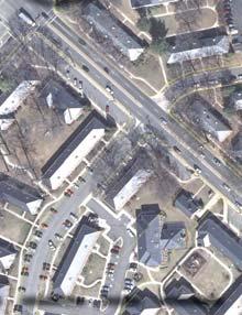
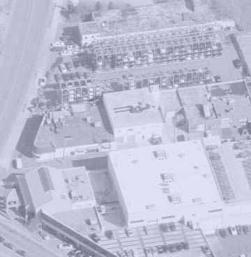
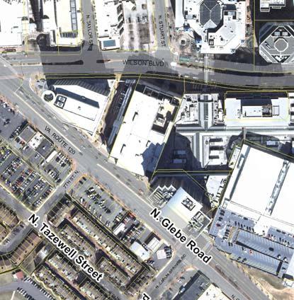
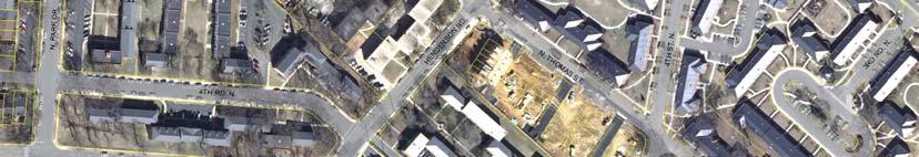
3 Surrounding Contextual Area Quincy Street Plan Area a3 Study Area: West Side Study Area: East Side 2012 NQSP Addendum Study Area 1995 NQSP Study Area Surrounding Contextual Area 2012 North Quincy Street Plan Addendum (NQSP) Study Area, (1995) NQSP Area, and Contextual Area Boundaries (2011 Aerial Image) DRAFT September 10, 2012
4 I. INTRODUCTION 1 Background In 2009, Arlington began a special planning review for a part of the original North Quincy Street Plan (NQSP) area. This study was undertaken in response to the approval of the Founders Square site plan and a proposed site plan amendment for the American Service Center property at 585 Glebe Road. Initially this study generally focused on the southwestern quadrant of the original NQSP area, which has not seen any new site plan development since the Plan s adoption in Today, the properties in this area present a mix of commercial and light industrial uses, many of which are associated with the operations of American Service Center North Quincy Street Plan Addendum DRAFT The forum for this study involved the Long Range Planning Committee (LRPC) of the Planning Commission, affected civic associations, pertinent property owners and other key stakeholders. The study set out to determine whether revisions to the community vision for this general area, as described in the NQSP and further reinforced through the North Quincy Street Coordinated Mixed-Use District on the General Land Use Plan, are needed. This question was timely given the preceding approval of the Founders Square project, with an overall scale of development different from that anticipated in the NQSP. As part of the study, a set of guiding principles with illustrations would be developed and incorporated into a new plan document to convey a refi ned vision of this area. In addition, this new plan document supersedes the NQSP, and relevant policies from that document that still apply have been incorporated into this document. As the study progressed, there was a desire among the LRPC to explore what potential development opportunities might arise through the consolidation of ASC s local operations and facilities on the west side of N. Glebe Road. Subsequently, per the County s request, several owners and potential developers of property on the west side of N. Glebe Road between N. Carlin Springs Road and N. Henderson Road began to analyze their sites and develop preliminary concepts for a consolidated, redevelopment project capable of meeting each property owner s key objectives. The special study being advanced with the LRPC was then expanded to include the subject properties west of N. Glebe Road. The intent of this North Quincy Street Plan Addendum is to provide refined guidance for future development within the areas described above. Although much of the analysis of this study focused on various scenarios that would allow the major property owners in the area (ASC and Harris Teeter) to build new facilities in the area, the main objective of the study was focused on developing a set of concepts and guiding principles to help guide decisions on potential future development, in a way that does not preclude the range of uses that might be considered within the study area. Together, the text and graphics in this document establish an updated vision for this area as the southern gateway to Ballston. The addendum is divided into five sections: Introduction, Planning History for the Area, Area Analysis, Guiding Principles and Area Concepts. The Planning History section summarizes the history of the 1995 North Quincy Street Plan (NQSP) and the planning of nearby properties west side of N. Glebe Road. The Area Analysis section describes recent development in the area, presents some key existing conditions and analyzes potential opportunities and constraints. The Guiding Principles and Area Concepts section presents a new vision described through text and exhibits that address land use, building form, transportation, open space, and retail conditions.


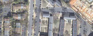
5 2 American Service Center Showroom, 585 North Glebe Road Existing land uses, east side of study area (between North Randolph and Quincy Streets) Existing land uses, west side of North Glebe Road DRAFT September 10, 2012
 along with General Land Use Plan (GLUP) amendments.")

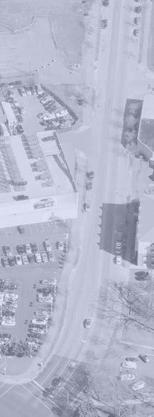
6 II. PLANNING HISTORY FOR THE AREA 2012 North Quincy Street Plan Addendum DRAFT 3 North Quincy Street Plan, 1995 Before N. Quincy Street was extended to N. Glebe Road, the County crafted a preferred vision for the area. In 1995, the County Board adopted the North Quincy Street Plan (NQSP) along with General Land Use Plan (GLUP) amendments. At that time, Note 14 was added to the GLUP to create the North Quincy Street Coordinated Mixed-Use District. This special district permits a 1.5 FAR base density, with potential increases to 2.5 FAR on the block west of N. Quincy Street for projects that achieve major elements of the plan. Other key aspects of the plan include: Commercial uses on the west block and residential uses to the east Neighborhood serving retail along Wilson Boulevard Provision of Mosaic Park to serve the neighborhood Increased pedestrian linkages Tapering down of building height to the residential neighborhoods. West Ballston Land Use Study, 1981 The 1980 Ballston Sector Plan established a future vision for much of Ballston, except for the area west of N. Glebe Road south of Fairfax Drive. The plan was silent on this area due to the ongoing status of the neighborhood conservation plan for the area. However, growing development pressures eventually led to the need for a West Ballston Land Use Study. The 1981 study primarily involved: Addressing development pressures along N. Glebe Road Seeking good transitions between high- and low-intensity areas Resolving inconsistencies between zoning and GLUP designations Amending the GLUP designation for properties along the west side of N. Glebe Road between Wilson Boulevard and the Hyde Park building to High-Medium Residential Mixed Use. Aerial perspective photo of North Quincy Street Plan Area (1980) Aerial perspective photo of West Ballston (2009)
) West Ballston")

7 4 Illustrative Plan (North Quincy Street Plan, (1995)) West Ballston Land Use Study (1981), Recommended GLUP Changes DRAFT September 10, 2012
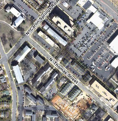
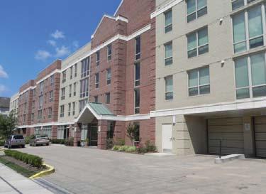
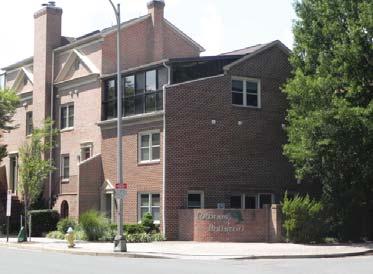
8 III. AREA ANALYSIS 5 Land Use and Zoning 2012 North Quincy Street Plan Addendum DRAFT East Side East of N. Glebe Road, the area is planned Medium Office-Apartment-Hotel with office densities up to 2.5 FAR, up to 115 apartment units/acre, and up to 180 hotel units/acre. Also, Note 14 on the GLUP established the North Quincy Street Coordinated Mixed-Use District which notes that to achieve these densities, a project must meet the goals set forth in the 1995 NSQP. The area is currently zoned a mix of C-2, CM, and C-O-2.5. The C-2 and C-M areas typically permit commercial or light industrial uses up to 1.5 FAR, inconsistent with the future planned uses for this area. The area currently contains a mix of auto-oriented commercial, service, and light industrial uses. West Side West of N. Glebe Road the area is planned High-Medium Residential Mixed-Use (up to 3.24 FAR including associated office and retail activities) transitioning to Low-Medium Residential (16-36 units/acre) along N. Thomas Street. The area is zoned a mix of C-O-2.5, C-2, R-C, and RA8-18. The R-C district permits residential and commercial uses up to 3.24 FAR, with limits on the commercial share of the project. RA8-18 permits apartments and townhomes at densities up to 36 units per acre. Much of the existing zoning is inconsistent with the future planned uses for this area. Currently, several automobile oriented service uses and a full service grocery store are located on the site. Recent Development East Side After the extension of North Quincy Street, several surrounding properties were repurposed or redeveloped. Until 2010, most of this activity involved changes to ASC properties to support their growth and expanded operations. Immediately north of the east side study area is the Founders Square site plan, most recently approved by the County Board in January When fully developed, this 5.3 acre project will feature a 20-story office building, a 13-story office building for DARPA (completed), a 17-story residential building, an 11-story hotel building (under construction), a 1-story retail building (completed), and a mid-block plaza and pedestrian connection. West Side Since the NQSP adoption, several development projects have been completed west of N. Glebe Road. The Carlin Retirement Home was completed in 1993, and in 1999 a Harris Teeter supermarket was built adjacent to the Hyde Park condominium. Along N. Thomas Street, the Ballston Crest Townhomes and Thomas Place Apartments were completed in 1995 and 2009, respectively.


9 6 Zoning Designations CM C-O C-O-A C-O-2.5 RC RA8-18 RA6-15 S-D Limited Industrial Districts Commercial Office Building, Hotel, Multiple-Family Dwelling Districts Commercial Office Building, Hotel, and Apartment Districts Commercial Office Building, Hotel, and Apartment Districts C-2 Apartment Dwelling and Commercial Districts Apartment Dwelling Districts Apartment Dwelling Districts Special Development Districts General Land Use Plan Designations, existing Zoning Classifications, existing DRAFT September 10, 2012


, Quincy")


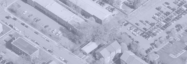
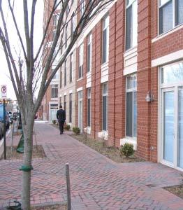
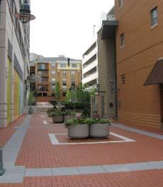
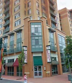
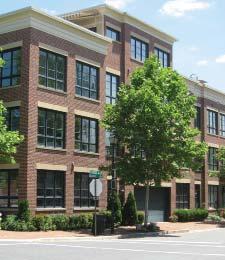
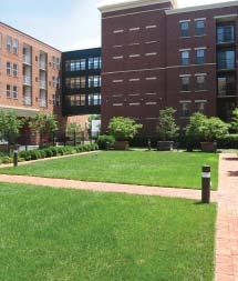
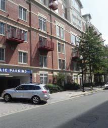
10 2012 North Quincy Street Plan Addendum DRAFT 7 Surrounding Development Several development projects have been recently completed near the study area. The Kettler Capitals Iceplex atop the Ballston Common garage opened in fall A 53-unit addition to the Birchwood Apartments was completed in 2002, and its original building was redeveloped in The completion of Liberty Center (2006), Quincy Crossing (2002), and the Hawthorne (2007) have also expanded the mix of high-density residential, retail and office uses nearby. The images across this spread illustrate several of the more notable development projects and reflect the variety of land uses in the area. Liberty Center 1 Kettler Ice Plex Mosaic Park 6 Phoenix House 7 Founders Square, west (rendering) Hyde Park Condominium 9 Ballston Crest Townhomes 10 Carlin Spring Apartments 11 The Carlin


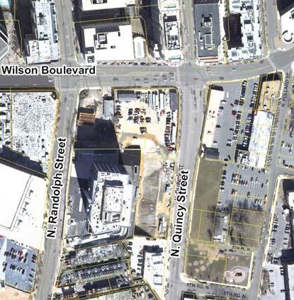
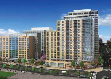
11 Founders Square, east (rendering) Study Area East Side Study Area West Side 8 Thomas Place Apartments Townes at Ballston Recent Development in the Vicinity DRAFT September 10, 2012

 and regional (WMATA) bus routes provide service through the study area.")
.")

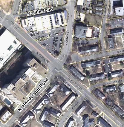
12 Multimodal Transportation 9 Existing Transit Services The area is well-established from a transportation perspective, with strong links to multi-modal transportation options. N. Glebe Road bisects the two sides of the study area and is part of the County s Primary Transit 2012 North Quincy Street Plan Addendum DRAFT Network, Multiple local (ART) and regional (WMATA) bus routes provide service through the study area. The study area is within 1/2 mile of the Ballston and Virginia Square Metro Stations, which generally translates to approximately a 10 minute walk. The pedestrian network in the area is good, as shown by the area s high Walk Score rating of 88 (out of 100). The walkability of the area can still be improved by breaking up the large blocks in the area and by further defining N. Glebe Road as a multi-modal roadway focusing more on the pedestrian environment, N. Quincy Street is a primary cycling route, with on-street bike lanes connecting into the County s broader biking network. All these existing services and facilities add to the multimodalism of the Ballston Metro Station 23A Metrobus on N. Randolph Street area and help reduce vehicle trips and on-site parking demands. ART41, Metrobus 23A on N. Randolph Street Metrobus 10B on N. Glebe Road


13 Transportation - Land Use Connections In Arlington, decades of planning have been based on the fundamental Ballston Metro Station M connections between land use and transportation facilities. High and medium-density mixed-use development works best if in locations that are pedestrian friendly, transit-oriented, and accessible via a wide variety of travel options. When the original planning for Metro was conducted in 10 the 1960s and 1970s, the rule of thumb was to target higher density and more intense uses on land generally within 1/4 mile of Metro. Over the years, mixed-use development has also been approved outside of the 1/4 mile radius, where high-quality transit service and pedestrian facilities support such development. In the graphic below, the study area is shown to be just outside the 1/4 mile to Metro, but within 1/2 mile, or 10 minute walk to the Ballston Metro Station. Given its specific location, future development in the study area s east and west sides has the potential to be transit-oriented and mixed-use, while comprising characteristics that reflect and embrace its location in a transition zone between central Ballston and lower density residential development along its edges. Study Area East Side Study Area West Side Metrobus Routes 1ABEF 10B 22A 23AC 25AB ARTbus Routes Existing Transit Service Distance from Metro Stations, Site Vicinity DRAFT September 10, 2012


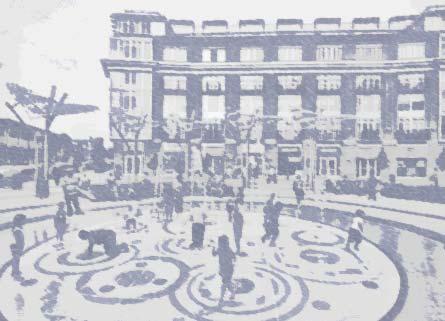
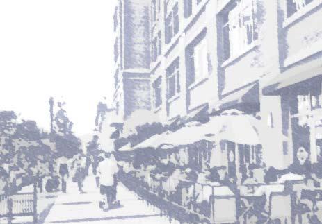
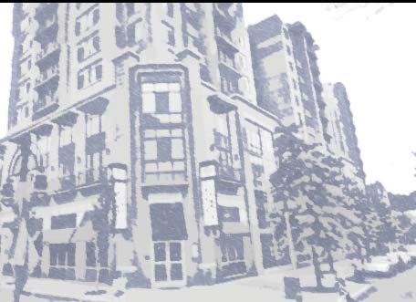
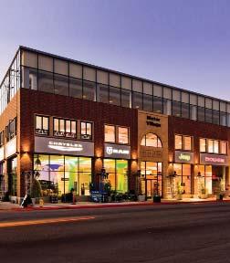
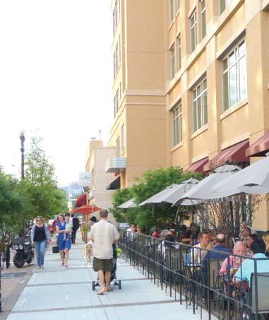
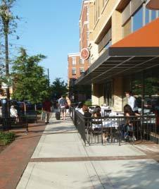
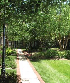
14 IV. GUIDING PRINCIPLES and AREA CONCEPTS EAST SIDE Visioning 2012 North Quincy Street Plan Addendum DRAFT 11 This section establishes a set of planning principles to guide future development decisions in the study area. To arrive at these principles, several build-out scenarios were modeled for analysis and discussion. These scenarios were developed around a set of core concept elements, described below. Through the review and discussion of these scenarios, general preferences for land use, building form, transportation, open space, and retail elements emerged, as reflected in this section s guiding principles and conceptual diagrams. Together, the core concept elements, guiding planning principles, and set of concept maps shall collectively guide decisions on future development proposals and other area improvements. Core Concept Elements This plan is based on a foundation of several core concept elements for what future development in the area should achieve. Briefly stated, the overall core concept elements aim to: Enhance the southern gateway of Ballston as a great, urban place; Allow established businesses to develop new, improved facilities while remaining in the community; Achieve a well-balanced mix of commercial and residential uses to provide for a vibrant neighborhood; Reinforce desired transitions between the high-density mixed-use core of Ballston and surrounding residential neighborhoods; Create new street connections and smaller blocks to improve circulation and permeability while better serving new development; Add to the variety of open space types and sizes in the area; Provide opportunities for increasing the affordable housing stock in the area. Transform N. Glebe Road into an urban boulevard with pedestrian scale and improvements. Vision: Representative Precedents The future vision of the study area includes the creation of a great place that fits appropriately into its context. The images to the right illustrate elements of other projects that may serve as inspiration for the type of place that can be created in south Ballston. While the goal is not to replicate any of these examples, these projects demonstrate ways in which development, urban streets, and public spaces in the study area can be approached in the future to implement the guiding principles and overall concept for the area.


15 Visioning WEST SIDE 12 DEVELOPMENT URBAN STREETS PUBLIC SPACES DRAFT September 10, 2012
16 Land Use Element 2012 North Quincy Street Plan Addendum DRAFT 13 Area-Wide Principles Encourage medium-scale development that creates a sensitive transition between high intensity development in the center of Ballston and surrounding lower density residential neighborhoods. Provide redevelopment opportunities to transform the area s primarily automobile-oriented development into an integrated mixed-use urban neighborhood while not precluding the range of uses that might be considered within the study area. Organize a rich mix of uses in a way that helps enliven the area and balance local travel demand. Ensure activated, interesting ground-floor retail frontages at key locations to enhance the pedestrian experience. Provide opportunities for increasing the County s affordable housing stock. East Side Concepts Implement medium-density mixed-use development (up to 4.0 FAR) through tools such as transfer of development rights or the provision of additional significant community benefits, in keeping with the spirit of the 1995 North Quincy Street Plan. West Side Concepts Locate ground-floor commercial uses along N. Glebe Road and explore residential, hotel, or commercial uses above and in the balance of the block that achieve effective transitions towards properties along N. Thomas Street. Consider a General Land Use Plan change for the N. Glebe Road frontage, (in conjunction with a site plan application) to Medium Office-Apartment- Hotel that would allow zoning with greater flexibility for land use and building height for better urban design and to not preclude desirable uses for the study area. If the study area was partly redesignated as Medium Office-Apartment-Hotel, then the provisions of corresponding zoning districts should apply. However, in considering additional density through bonuses, exclusions, or other methods, overall density should not exceed 3.24 FAR for the site. Consider a General Land Use Plan change for area at the corner of N. Carlin Springs Road and N. Thomas Street (in conjunction with a site plan application) to High-Medium Residential Mixed-Use that would not preclude redevelopment with a building form and massing compatible with surrounding properties.

17 LAND USE CONCEPT MAP EAST SIDE 14 Medium-Scale Mixed-Use Development Medium-Scale Mixed-Use Development WEST SIDE DRAFT September 10, 2012
18 Transportation Element 2012 North Quincy Street Plan Addendum DRAFT 15 Area-Wide Principles Improve connectivity and permeability by introducing new streets and multi-use paths that help break down existing superblocks. Make the pedestrian experience safer and more enjoyable by designing streets with wide sidewalks, additional street trees, improved crosswalks and on-street parking where possible. Transform this portion of N. Glebe Road into an urban boulevard through a combination of site-specific improvements and road-diet techniques, such as a reduction in the number of travel lanes and/or effective roadway width. Design and locate service and loading areas, access points, and traffic patterns to limit adverse impacts on surrounding properties and neighborhoods. Encourage shared parking to achieve efficiencies for complementary uses. Consider nearby parking availability and transit services when determining parking requirements. Locate transportation facilities generally where shown on the map unless noted otherwise, and determine their exact locations with the review and analyses of future site plans. East Side Concepts Provide a new 5th Road N. that begins at N. Randolph Street and connects with the existing 5th Road east of N. Quincy Street, with future redevelopment. Provide an additional new street in the interior of the block, as a primary location for the service, loading and garage entries for new development. Explore a variety of locations for pedestrian connections through the block, including the potential conversion of existing 5th Road N. into an attractive and direct connection between Glebe and Randolph Park and Mosaic Park. West Side Concepts Continue N. Randolph Street westward across into the block. Extend N. Tazewell Street through the block to the Hyde Park property, and focus service, loading and garage entrances along this new segment. Consider a secondary connection between N. Glebe Road and the extended N. Tazewell Street to help meet the service requirements of the block. Explore multiple opportunities for multi-use paths to improve pedestrian circulation through the block.


19 TRANSPORTATION CONCEPT MAP Legend Proposed streets Possible alley configuration and general location Proposed pedestrian/bike connections Aligned intersections DRAFT September 10, New 5th Rd. N. Extension N. Glebe Rd. as Urban Boulevard Multi-modal pedestrian oriented corridor N. Tazewell St. Extension New N. Randolph St. Extension WEST SIDE EAST SIDE
20 Open Space Element 2012 North Quincy Street Plan Addendum DRAFT 17 Area-Wide Principles Create a high quality urban environment with meaningful and successful open spaces that vary in size, and should provide opportunities for both active and passive recreation with a goal of creating a consolidated public park. Provide easily accessible open spaces that are designed for a number of activities that help meet the community s public space needs. Achieve pedestrian connections that reflect existing travel patterns, strengthen desired linkages, and provide visibility of an access to public open spaces without sacrificing the utility of such spaces. Design open spaces so that they are perceived as areas for public use. Areas identified as public open spaces should be controlled by the County either through fee ownership or access and use easements. Ground level spaces should integrate with and support abutting first floor uses. Consider opportunities for publicly-accessible open spaces on top of structures to accommodate a range of activities, such as community gardening or active recreation. In addition to or in lieu of public open spaces on-site, consider how projects may contribute to the improvement, expansion or enhancement of other existing or planned open spaces nearby (such as Mosaic Park and Glebe & Randolph Park). East Side Concepts Establish a landscaped gateway plaza with canopy trees and other green features at the corner of N. Glebe Road and N. Quincy Street, defined by strong architectural features and/or focal points, to complement the other three green corners defining this intersection. Provide a strong connection linking the West Side, Glebe & Randolph Park, and Mosaic Park. Along that connection, provide opportunities for smaller, more intimate setbacks or open space areas for respite. West Side Concepts Encourage property consolidation to achieve fewer, larger public open spaces, intended for a mix of park uses, as opposed to an excess of smaller spaces. This may be achieved through coordinated redevelopment of the entire west side study area or by encouraging adjacent property owners to create a large space at the interface of two or more properties along street frontage.

21 OPEN SPACE CONCEPT MAP Mosaic Park 18 Public Open Space P e d e s Glebe and Randolph Park t r i a n P e r m e a b i l i t y New green space EAST SIDE Existing green spaces WEST SIDE DRAFT September 10, 2012
22 Building Form Element 2012 North Quincy Street Plan Addendum DRAFT 19 Area-Wide Principles Consider refinements to the previously planned building heights identified in the 1995 North Quincy Street Plan (east side) and the General Land Use Plan (west side) that reflect both the evolved context in the area and the continued desire for effective and sensitive transitions. Establish maximum building heights that are appropriate for the area and will achieve the desired transitions between central Ballston and its edges. Encourage architecture that generally provides buildings with modestly-sized floor plates and slender building towers, except where large format commercial uses are approved. Incorporate building form elements that help limit the perceived length of any individual long building walls, such as varied building modulation and massing, building articulation, and/or fenestration techniques. Incorporate focal points or features to add visual interest and help establish a more distinct sense of place, to be achieved through architectural, landscape, or other urban design elements. Wrap each level of above-grade parking, if approved, with active uses to the extent possible. East Side Concepts Allow building heights up to 10 stories (commercial or residential) along N. Randolph Street, and require buildings to step down to N. Quincy Street with maximum heights of 5 stories (residential). West Side Concepts Concentrate the greatest building heights along N. Glebe Road, tapering down sensitively to the surrounding low-rise residential properties. Consider building heights up to 14 stories (residential) immediately adjacent to N. Glebe Road, to allow a more varied building height profile and to ensure lesser heights and better transitions in the balance of the block. If other upper story uses are provided in buildings along N. Glebe Road, their height should not exceed that of a 14 story residential building. Allow heights up to 5 stories (residential) along the southwest edge of the development to reinforce a sensitive transition to the low-scale residential developments along N. Thomas St.

23 BUILDING FORM CONCEPT MAP EAST SIDE 20 Focal point DRAFT September 10, 2012
24 Retail Element 2012 North Quincy Street Plan Addendum DRAFT 21 Area-Wide Principles Encourage retail and retail-related outdoor activities along a N. Glebe Road that is transformed into an urban boulevard, at the corners of arterial streets, and along frontages facing public open spaces. Designate areas less viable for retail as optional retail locations, where flexible building designs do not preclude retail while also permitting other uses. Allow flexibility for future development providing major retail and commercial establishments along N. Glebe Road. Ensure ground floor uses and building massing and frontages are designed to add interest and enhance the pedestrian experience. East Side Concepts Identify the N. Glebe Road frontage and the corner spaces at the new 5th Road N. and N. Randolph and N. Quincy Streets as required retail or commerce locations. Designate both sides of the new 5th Road N. as optional retail locations. West Side Concepts Identify the N. Glebe Road frontage as required retail or commerce locations. Designate the N. Randolph Street extension into the block as optional retail locations.
 EAST SIDE 22 Required Retail Optional Retail Optional Retail Required Retail WEST SIDE")
25 RETAIL CONCEPT MAP Approved Retail (SP SP#72 #72, 650 N. Glebe Rd. ) EAST SIDE 22 Required Retail Optional Retail Optional Retail Required Retail WEST SIDE DRAFT September 10, 2012
26 V. RETAINED 1995 NORTH QUINCY STREET PLAN PRINCIPLES 2012 North Quincy Street Plan Addendum DRAFT 23 As stated in the introduction, this planning document is intended to update the planning guidance in and supercede the 1995 North Quincy Street Plan (NQSP). However, the study area for the 2012 planning effort only included a portion of the original NQSP area, in addition to an area west of N. Glebe Road not originally subject to the NQSP. Therefore, this section presents principles from the 1995 NQSP that effect the block east of N. Quincy Street and are still considered relevant and appropriate. These principles are related to the NQSP s concept plan, land use recommendations, or urban design guidelines. (Principles relating to the western block have either been addressed by the Founders Square site plan or have been incorporated or revised based on this current planning effort, and are not listed below.) Concept Plan Elements Elements of the concept plan pertaining only to the area east of N. Quincy Street include: Consolidation of medium density residential uses on [the block east of N. Quincy Street] Provision of a neighborhood park east of N. Quincy Street in the center of the block (full build-out of Mosaic Park) A unified pedestrian walkway system, which includes walkways along the main street and neighborhood linkages Maximum building heights of 8 stories near the intersection of WIlson Boulevard and N. Quincy Street, with a maximum of 4 stories across the rest of the area Provision of a landscaped setback along N. Quincy Street Provision of special streetscape features along neighborhood linkages (N. Pollard Street) Preservation of the Buckingham building on the corner of N. Pollard Street and 5th Street N.) Land Use Reccomendations On February 4, 1995, the County Board approved several General Land Use Plan amendments for the study area intended to assist future implementation of the NQSP. These GLUP amendments followed a thorough evaluation of three alternatives, with the approved alternative being the one that was seen as best meeting the community goals for the area, including the redevelopment of residential uses on the block east of N. Quincy Street in conjunction with consolidation of commercial density west of N. Quincy Street. Other goals pertinent to the area east of N. Quincy Street include the provision of transitions between the denser commercial core of Ballston and the lower density residential neighborhoods, and compatibility with the Buckingham historic district. The GLUP amendments approved in 1995 included: Redesignating block west of N. Quincy Street from General Commercial to Medium Office-Apartment-Hotel General location of open space symbol reflecting the future Mosaic Park Adding Note 14, which designated the area as a special district
27 Urban Design Guidelines Elements of the urban design guidelines that remain relevant to the area east of N. Quincy Street include: Urban Plaza New public parks and plazas should offer frequent opportunity for public use and be integrated with the pedestrian network Broad paved areas should be provided in open space areas where intense activity is anticipated Trees of substantial size should be provided within public open spaces to help create a sense of scale and provide a canopy of shade Full-block development should be designed to maintain pedestrian connections and view corridors along major streets Horizontal expanse of long facades should be broken into increments that relate to a pedestrian scale and avoid expansive blank walls by using fenestration, architectural detailing, variable setbacks, and roof lines to define a sequence of bays Building mass should be articulated to create an aggregation of smaller forms as a means of reducing the perception of overwhelming bulk 24 Transitions Sensitive transitions in height shall be provided between N. Randolph Street and N. Pollard Street The building mass should be broken down into increments that correspond to the scale and massing of surrounding buildings through the use of setbacks, and variable roof heights Building Placement and Character In multi-story buildings, differentiate between the pedestrian-oriented uses at the sidewalk level and the office/residential levels above through the use of different texture, scale, and/or materials on the ground level Maintain compatibility with design features of surrounding buildings, including those in the Buckingham Historic District, to achieve continuity through similar building wall heights, architectural style, materials, colors, fenestration, placement and/or shape of buildings Outdoor spaces should be shaped and defined through the use of plant materials, building features and other landscape and architectural features Redevelopment of Full-Block/Large Scale Development DRAFT September 10, 2012


28 VI. IMPLEMENTATION RECOMMENDATIONS 25 This section lists recommendations necessary to support the implementation of the North Quincy Street Plan Addendum s vision and goals North Quincy Street Plan Addendum DRAFT Action 1: Adoption of the North Quincy Street Plan Addendum RECOMMENDATION: Adopt the North Quincy Street Plan Addendum as an updated plan to guide future development for the revitalization of the properties located in the study area. The recommendations in this Addendum for the block west of North Quincy Street shall supercede those presented in the 1995 North Quincy Street Plan. Action 2: General Land Use Plan Amendments RECOMMENDATION: Amend the General Land Use Plan to reflect the changes associated with Note 14 and the North Quincy Street Coordinated Mixed-Use District. These changes primarily include the updated goals and objectives for the North Quincy Street Coordinated Mix-Use District and the surrounding area west of N. Glebe Road as expressed in this Addendum, as well as the consideration of up to 4.0 FAR on the block between N. Randolph and Quincy Streets (still starting from the current base of 1.5 FAR). Action 3: Master Transportation Plan Amendments RECOMMENDATION: Amend the Master Transportation Plan (Street Typology Map) to identify this area as an area planned for new streets. The Master Transportation Plan (MTP) guides decisions that affect Arlington s transportation network and helps the public understand the rational behind the decisions. To help accommodate planned growth in the study area, the MTP should be amended to add this area as an area planned for new streets. As future development is proposed for these areas, staff, residents, and other stakeholders should refer to the MTP when forming decisions relating to the street network. As redevelopment projects are approved within the study area, the MTP Street Typology Map should be further amended to show the exact locations and extent of any newly approved and created streets in this area. Existing Master Transportation Plan Amendment: The existing Master Transportation Plan (top right) currently lacks any indication that new streets should be created in the study area with future development. In the proposed MTP map (bottom right) the study area east and west of Glebe Road is shown in blue hatch, which is a symbol indicating these as areas planned for new streets. The exact number and location of new streets should be guided by this Addendum and determined through future site plan approvals. Proposed
29 Action 4: Zoning Ordinance Amendments RECOMMENDATION: Amend the Zoning Ordinance to address the R-C District preamble language involving the one-quarter mile radius from a Metro Station entrance criteria as it pertains to at least the study area of this Addendum. During the course of this study, attention was brought to the current preamble language in the R-C District and the apparent requirement that to be rezoned to R-C, a site must be located onequarter mile or less from a Metro Station entrance in addition to being designated High-Medium Residential Mixed-Use on the General Land Use Plan. The relevant issue is that, although they have been designated High- Medium Residential Mixed-Use since 1981 and some have even been rezoned to R-C, several of the properties in the study area west of N. Glebe Road are further than one-quarter mile from the closest (Ballston) Metro Station entrance. To have the Zoning Ordinance language for R-C be more consistent with the vision for the area as portrayed by the GLUP, staff should revise the R-C district to address this one-quarter mile from Metro requirement, at least as it pertains to the study area of this Addendum. 26 DRAFT September 10, 2012
30 27 APPENDICES 2012 North Quincy Street Plan Addendum DRAFT

31 APPENDIX I. GENERAL STREET CROSS-SECTIONS 28 The Proposed Street Cross Section exhibits illustrated on the following pages in this document are conceptual. Exact dimensions and details including but not limited to the design of bulbouts, curb ramps and crosswalks, the configuration of bicycle lanes or sharrows, and landscaping features will be determined during engineering design and will reflect then-current County practices. Prior to implementation, the number of travel lanes shown in these cross-sections and proposed changes to other aspects of the transportation network will be reviewed further to determine the impacts upon traffic flow DRAFT September 10, 2012
 (w/ C&G) 8'-6 5'-6 5-6 8'-6 14' 7' 10 10 7' 14' Walkway Tree Pit Travel Lane Travel Lane")

32 2012 North Quincy Street Plan Addendum DRAFT SECTION: New 5th Road (east side) Complete Street Treatment North Building Face SECTION: New Q Street Complete Street Treatment West Building Face 34'-0 62'-0" Walkway Lane Lane Lane Lane way Tree Pit Parking Travel Travel Parking Tree Pit Walk- (w/ C&G) (w/ C&G) 8'-6 5' '-6 14' 7' ' 14' Walkway Tree Pit Travel Lane Travel Lane Parking Lane Tree Pit Walkway (w/ C&G) (w/ C&G) 6' 5'-6 5'-6 6' 11' ' 11'-6 29'-6" 52'-6" Building Face Building Face South East Fifth Road North: Fifth Road N. is proposed to be relocated to more of a mid-block location from its existing position close to N. Glebe Road. If implemented as an urban center local street, it could have a 62 building face to face dimension, allowing for 14 sidewalks, one parking lane, and one travel lane in each direction. New Q Street: This new street would extend southward into the block, perpendicular to the new 5th Road N. segment, and then curve eastward to intersect with Quincy Street N. This street provides prime locations for the building service, garage, and loading access points of new buildings. Likely to function more as a service alley, this street may have reduced dimensions between building faces and sidewalks and/or street trees. *This street could function as more of a service alley, with reduced dimensions between building faces and sidewalks and/or street trees.


33 3 SECTION: Randolph Street Extension Minimum Preferred West Building Face Walkway Tree Pit Travel Turn Lane Lane (w/ C&G) 8' '-6 Travel Lane (w/ C&G) 11' 11' 11' Building Face Tree Pit Walkway East 5-6 8' 13'-6 N. Randolph Street Extension: The extension of N. Randolph Street into the site west of N. Glebe Road should act as a gateway into the site with a street width similar to N. Randolph Street east of Glebe Road. The street is envisioned as a Type-B Primarily Urban Mixed-Use Arterial street. However, the dimensions shown in this cross-section may vary depending on the specific development program proposed for the site ' 33' 4 SECTION: Tazewell Street Extension Interim Treatment North Building Face Walkway 8'-6 Travel Lane (w/ C&G) '-0" 31'-6" Travel Lane (w/ C&G) 11-6 Fence Line Garage Ramp (for the Carlin) South Tazewell Street Extension (Interim): This new extension will be integral to future redevelopment on the block west of Glebe Rd. This street will provide access from N. Carlin Springs Road, and will be a primary location for building service, garage, and loading access points. Given existing physical constraints, this plan provides for an interim treatment for the segment approaching N. Carlin Springs Rd., which could be enhanced through future redevelopment of or modfications to the Carlin property. DRAFT September 10, 2012
 (w/ C&G) 6' 5'-6 5'-6 6' 11'-6 10-6 10 28'-6\" 51'-6\" 8' 11'-6 Building Face South Tazewell Street")


34 2012 North Quincy Street Plan Addendum DRAFT SECTION: Tazewell Street Extension Ultimate Treatment North SECTION: Glebe Road Streetscape Condition Building Face Building Face Walkway Lane Lane Lane way Tree Pit Travel Travel Parking Tree Pit Walk- (w/ C&G) (w/ C&G) 6' 5'-6 5'-6 6' 11' '-6" 51'-6" 8' 11'-6 Building Face South Tazewell Street Extension (Ultimate): Where physical constraints do not exist, the ultimate stree-section condition should be achieved. A minimum dimension of 51-6 should be provided between building faces, and may vary depending on the actual ground floor uses proposed as part of any future site plan proposal. On street parking, street trees, and other plantings should be included where feasible. Glebe Road: The proposed streetscape and sidewalk condition for Glebe Road in the study area includes a minimum 16-8 sidewalk with tree pits. This reflects a wider sidewalk than the 13-0 recommended in the R-B Corridor Streetscape Standards. This frontage should be primarily retail-oriented. West Walkway Tree Pit Travel Travel Lane Lane (w/ C&G) ' Travel Lane

35 7 SECTION: N. Carlin Springs Road Streetscape Condition N. Carlin Springs Road: The proposed streetscape and sidewalk condition for Glebe Road in the study area includes a minimum 13-8 sidewalk with tree pits. This reflects a wider sidewalk than the 10 width recommended in the R-B Corridor Streetscape Standards. This frontage should be primarily residential in character. Building Face 32 West Walkway Tree Pit Travel Travel Lane Lane (w/ C&G) 8-2 5' Travel Lane DRAFT September 10, 2012
36 North Quincy Street Plan Addendum DRAFT
NORTH QUINCY STREET PLAN ADDENDUM
 NORTH QUINCY STREET PLAN ADDENDUM a2 North Quincy Street Plan Addendum Adopted by the Arlington County Board on February 23, 2013 TABLE OF CONTENTS PAGE I. INTRODUCTION...1 ACKNOWLEDGEMENTS Members of
SP # Carlin Springs Road The Springs
 SP #430 4318 Carlin Springs Road The Springs SPRC #1 July 29, 2013 Site Site 2 Proposal GLUP change From Low-Medium Residential to High-Medium Residential Mixed-Use Rezoning From RA8-18 to R-C Site Plan
ARLINGTON COUNTY, VIRGINIA
 ARLINGTON COUNTY, VIRGINIA County Board Agenda Item Meeting October 15, 2005 DATE: September 28, 2005 SUBJECT: Request to Advertise the adoption of the 2005 Clarendon Sector Plan C. M. RECOMMENDATION:
From: Sent: To: Subject: Zoning: Landscaping:
 From: Bernard H. Berne [mailto:bhberne@yahoo.com] Sent: Tuesday, May 15, 2012 1:18 AM To: CountyBoard Subject: May 19, 2012 County Board Meeting: Goodyear Site Plan (SP #72-650 N. Glebe Road) and amendment
ATTACHMENT. To the west, north, and east of the block, primarily singlefamily detached residential patterns, with some townhouses, predominate.
 COMMENT / REVISION MATRIX (as of ) for Washington and Kirkwood Special GLUP Study "Plus" and Concept Plan 1 2 Resolve inconsistency between American Legion site area noted in Map 1 1.36 AC 1.29 AC and
ARLINGTON COUNTY, VIRGINIA
 ARLINGTON COUNTY, VIRGINIA County Board Agenda Item Meeting of April 23, 2019 DATE: April 12, 2019 SUBJECT: SP #413 SITE PLAN AMENDMENT to permit a fixed bar in a private outdoor café space with associated
EXISTING COMPREHENSIVE PLAN
 EXISTING COMPREHENSIVE PLAN Town Center Land Use Element: V. LAND USE POLICIES Town Center Mercer Island's business district vision as described in "Your Mercer Island Citizen-Designed Downtown" was an
Town Center (part of the Comprehensive Plan)
") Town Center (part of the Comprehensive Plan) Mercer Island Town Center Looking North (2014) In 1994, a year-long process culminated in a set of design guidelines and code requirements for the Town Center
Town Center (part of the Comprehensive Plan) Mercer Island Town Center Looking North (2014) In 1994, a year-long process culminated in a set of design guidelines and code requirements for the Town Center
Policies and Code Intent Sections Related to Town Center
 Policies and Code Intent Sections Related to Town Center The Town Center Vision is scattered throughout the Comprehensive Plan, development code and the 1994 Town Center Plan. What follows are sections
ELMVALE ACRES SHOPPING CENTRE MASTER PLAN
 ELMVALE ACRES SHOPPING CENTRE MASTER PLAN Contents 1.0 INTRODUCTION... 2 2.0 LOCATION... 2 3.0 EXISTING CONTEXT... 2 4.0 VISION & GUIDING PRINCIPLES... 2 5.0 LAND USE AND BUILT FORM... 4 5.1 St. Laurent
DEPARTMENT OF COMMUNITY PLANNING, HOUSING AND DEVELOPMENT Planning Division. Arlington County Planning Commission
 DEPARTMENT OF COMMUNITY PLANNING, HOUSING AND DEVELOPMENT Planning Division 2100 Clarendon Boulevard, Suite 700 Arlington, VA 22201 TEL 703.228.3525 FAX 703.228.3543 www.arlingtonva.us DRAFT TO: FROM:
ARLINGTON COUNTY, VIRGINIA
 ARLINGTON COUNTY, VIRGINIA County Board Agenda Item Meeting of July 21, 2012 DATE: July 12, 2012 SUBJECT: SP #416 SITE PLAN AMENDMENT to modify condition #6 to eliminate requirement to provide a pedestrian
A. Background Summary of Existing Challenges and Potential Possibilities. 1. Summary of Existing Assets and Potential Opportunities
 A. Background 1 A Main Street Master Plan Study was performed and completed in October of 2007. The study was initiated to review current land uses and development patterns along Main Street, from Parrish
City of Farmington. Downtown Plan. Amendment to the 1998 Master Plan Adopted October 11, 2004
 City of Farmington Amendment to the 1998 Master Plan Adopted October 11, 2004 Introduction Planning Background 1 Scope and Components of the Plan Amendment 2 Concept Introduction 3 Plan Concepts 3 Conceptual
CRYSTAL CITY BLOCK PLAN # CCBP- G 1 DRAFT
 CRYSTAL CITY BLOCK PLAN # CCBP- G 1 DRAFT BLOCK G (Metro Market Square block) Long Range Planning Committee Meeting January 29, 2018 1 1. Introduction 2 1. LRPC Meeting Purpose Review of proposed Crystal
TO: FROM: SUBJECT: Background
 TO: FROM: SUBJECT: Long Range Planning Committee and Zoning Committee of the Planning Commission Kellie Brown and Margaret Rhodes, Planning Division, CPHD DATE: June 8, 2017 Courthouse Square Implementation
THAT the attached Terms of Reference for the Thornhill Centre Street Study be approved.
 COMMITTEE OF THE WHOLE AUGUST 18, 2003 THORNHILL CENTRE STREET STUDY PLANNING FILE: 15.92 Recommendation The Commissioner of Planning recommends: THAT the attached Terms of Reference for the Thornhill
ARLINGTON COUNTY, VIRGINIA
 ARLINGTON COUNTY, VIRGINIA County Board Agenda Item Meeting of March 20, 2007 SUPPLEMENTAL REPORT #2 Additional and Revised Information DATE: March 20, 2007 SUBJECT: Request to Advertise Public Hearings
Rosslyn Sector Plan Implementation
 DEPARTMENT OF COMMUNITY PLANNING, HOUSING AND DEVELOPMENT Planning Division #1 Courthouse Plaza, 2100 Clarendon Boulevard, Suite 700 Arlington, VA 22201 TEL 703.228.3525 FAX 703.228.3543 www.arlingtonva.us
Buildings may be set back to create small plazas provided that these setbacks do not substantially disrupt the street wall s continuity.
 6-22 Community Design Street Walls and Street-front Setbacks The siting of buildings will play a critical role in establishing the character and sense of place for the District. Siting buildings at the
ARLINGTON COUNTY, VIRGINIA. County Board Agenda Item Meeting of February 23, 2019
 ARLINGTON COUNTY, VIRGINIA County Board Agenda Item Meeting of February 23, 2019 DATE: February 15, 2019 SUBJECT: Amendment to the Master Transportation Plan (MTP) Map to add a new section of North Kansas
A. WHAT IS A GENERAL PLAN?
 I. Introduction A. WHAT IS A GENERAL PLAN? A general plan is the planning guideline for the future of a city. It contains goals and policies which regulate urban development, the protection of the natural
ARLINGTON COUNTY, VIRGINIA
 ARLINGTON COUNTY, VIRGINIA County Board Agenda Item Meeting of October 21, 2017 DATE: October 2, 2017 SUBJECTS: Request to authorize advertisement of public hearings by the Planning Commission and County
Lehigh Acres Land Development Regulations Community Planning Project
 Lehigh Acres Land Development Regulations Planning Effort Summary In July, 2010 Commissioner Frank Mann invited the Lehigh Acres community to start discussing how to achieve their recently adopted community
Staff Report to the North Ogden City Planning Commission
 Staff Report to the North Ogden City Planning Commission SYNOPSIS / APPLICATION INFORMATION Application Request: Concept review on a legislative application to rezone land located at approximately 1750
DRAFT. October Wheaton. Design Guidelines
 October 2011 DRAFT Wheaton Design Guidelines 2 Draft - Design Guidelines - Wheaton Sector Plan Contents 04 Section 1: Introduction 06 Section 2: Context 08 Section 3: Design Guidelines 09 Goal 1: Create
PINE CURVE REZONING. Property does not meet criteria for open space preservation and is not a candidate for a park
 PINE CURVE REZONING BACKGROUND Purchased as two parcels in 2001 and 2002 Annexed and Zoned Greater Downtown District Historic Center September 25, 2002 and October 7, 2002 WHAT THE PROJECT IS AND IS NOT
PINE CURVE REZONING. BACKGROUND Purchased as two parcels in 2001 and 2002
 BACKGROUND Purchased as two parcels in 2001 and 2002 WHAT THE PROJECT IS AND IS NOT A Rezoning establishes the land use standards for Annexed and Zoned Greater Downtown District Historic Center September
Mark-up of the effect of the proposed Bronte Village Growth Area OPA No.18 on the text of section 24, Bronte Village, of the Livable Oakville Plan
 Mark-up of the effect of the proposed Bronte Village Growth Area OPA No.18 on the text of section 24, Bronte Village, of the Livable Oakville Plan Notes: This document is provided for information purposes
2.0 THE PLATINUM TRIANGLE VISION
 2.0 THE PLATINUM TRIANGLE VISION The envisions an exciting future for the area surrounding Angel Stadium of Anaheim, the Honda Center and The Grove of Anaheim. 2.1 Planning Principles In order to further
B. Blocks, Buildings and Street Networks
 B. Blocks, Buildings and Street Networks Figure IV.4 A rational block pattern with connected streets Introduction The single most important element in the physical and functional integration of mixed use
Future Five. Design/ Development Guidelines. January 2008 Amended June 08 per City Council motion
 Future Five Design/ Development Guidelines January 2008 Amended June 08 per City Council motion 5-Points Design Guidelines Table of Contents I. Introduction 3 II. Area boundaries 4 III. Review Process
Gold Line Bus Rapid Transit Transit Oriented Development (BRTOD) Helmo Station Area Plan
 Helmo Station Area Plan") Appendix F Gold Line Bus Rapid Transit Transit Oriented Development (BRTOD) Helmo Station Area Plan Introduction and Purpose of the Plan The Gold Line Bus Rapid Transit facility is an eleven-mile dedicated
Appendix F Gold Line Bus Rapid Transit Transit Oriented Development (BRTOD) Helmo Station Area Plan Introduction and Purpose of the Plan The Gold Line Bus Rapid Transit facility is an eleven-mile dedicated
Rosslyn Plaza PDSP (SP #422) SPRC Staff Presentation
 SPRC Staff Presentation") Rosslyn Plaza PDSP (SP #422) SPRC Staff Presentation ote Guiding Principles included in this document are taken from the latest working draft of the Guiding Principles dated. The illustrations included
Rosslyn Plaza PDSP (SP #422) SPRC Staff Presentation ote Guiding Principles included in this document are taken from the latest working draft of the Guiding Principles dated. The illustrations included
5.1 Site Plan Guidelines
 5. Community Core Guidelines Development of the Community Core will take place by plan of subdivision and site plan approval. It will occur in a phased manner that will reflect the timing of residential
ARLINGTON COUNTY, VIRGINIA. County Board Agenda Item Meeting of June 16, 2018
 ARLINGTON COUNTY, VIRGINIA County Board Agenda Item Meeting of June 16, 2018 DATE: June 7, 2018 SUBJECT: Z-2604-18-1 Rezoning from R-6 and R-5 Single Family Residential Districts to S-3A Special District
Yonge Eglinton Centre Urban Design Guidelines
 Yonge Eglinton Centre Urban Design Guidelines City Planning Urban Design January 2009 YONGE EGLINTON CENTRE INTRODUCTION.................................................... 1 GENERAL SITE PLAN OBJECTIVES......................................
DRAFT. 10% Common Open Space
 % OF CHARLOTTE IS CATEGORIZED AS A. LAND USES : Placeholder map displaying location of Place Type GOALS: Accommodate XX% of future growth. Provide a concentration of primarily commercial and civic activity
SITE PLAN REVIEW COMMITTEE MEETING AGENDA. Courthouse Plaza 2100 Clarendon Boulevard Cherry and Dogwood Rooms (C&D) Arlington, VA 22201
 Arlington, VA 22201") Page 1 SITE PLAN REVIEW COMMITTEE MEETING AGENDA DATE: Monday, May 15, 2017 TIME: 8:00 10:00 p.m. PLACE: Courthouse Plaza 2100 Clarendon Boulevard Cherry and Dogwood Rooms (C&D) Arlington, VA 22201 SPRC
Page 1 SITE PLAN REVIEW COMMITTEE MEETING AGENDA DATE: Monday, May 15, 2017 TIME: 8:00 10:00 p.m. PLACE: Courthouse Plaza 2100 Clarendon Boulevard Cherry and Dogwood Rooms (C&D) Arlington, VA 22201 SPRC
WEST LOOP DESIGN GUIDELINES CHECKLIST
 WEST LOOP DESIGN GUIDELINES CHECKLIST Section 1.0 General Strategies 1.1 DESIGN EXCELLENCE: ENCOURAGE HIGH QUALITY AND INNOVATIVE DESIGN OF NEW BUILDINGS WITHIN THE WEST LOOP WITHOUT BEING PRESCRIPTIVE
Highland Village Green Design Guidelines
 Highland Village Green Design Guidelines Publishing Information Title Highland Village Green Design Guidelins Author The City of Calgary Status DRAFT - Proposed document subject to changes Additional Copies
Washington Boulevard & Kirkwood Road SPECIAL GLUP STUDY PLUS and CONCEPT PLAN NOVEMBER 2017
 Washington Boulevard & Kirkwood Road SPECIAL GLUP STUDY PLUS and CONCEPT PLAN NOVEMBER 2017 Washington and Kirkwood Special GLUP Study PLUS AND CONCEPT PLAN a2 Washington Boulevard and Kirkwood Road Special
Clairtrell Area Context Plan
 Clairtrell Area Context Plan March 2005 Urban Development Services City Planning Contents 1. Introduction... 4 2. Development Structure... 6 2.1 Streets... 7 2.1.1 Sheppard Avenue and Bayview Avenue...
appendix and street interface guidelines
 appendix five: building and street interface guidelines appendix 5 building and street interface guidelines BOULEVARDS Boulevards are generally characterized by higher levels of traffic movement at higher
V. Vision and Guiding Principles
 V. Vision and Guiding Principles The Master Plan for the Powers Ferry Corridor seeks a foundation in the desires of the community. At times, various elements of the community offered opposing viewpoints,
, C-MS I June 3, 2016 $1500 pd chk #216918
 , C-MS-8 LOTS 21 THROUGH 40, INCLUSIVE, BLOCK 299 CLEMENTS ADDITION TO THE CITY OF DENVER SOUTHEAST QUARTER OF SECTION 34, TOWNSHIP 3 SOUTH, RANGE 68 WEST, SIXTH PRINCIPAL MERIDIAN, CITY
Appendix C: Interim Mixed-Use Evaluation Criteria
 Appendix C: Interim Mixed-Use Evaluation Criteria C-1 Appendix C: Interim Mixed-Use Evaluation Criteria PURPOSE: The implementation of numerous policies contained within the Master Plan hinges on the creation
Welcome. Walk Around. Talk to Us. Write Down Your Comments
 Welcome This is an information meeting introducing the applications for proposed redevelopment of the Yorkdale Shopping Centre site at 3401 Dufferin Street and 1 Yorkdale Road over the next 20+ years,
FUTURE LAND USE ELEMENT
 FUTURE LAND USE ELEMENT GOAL I: To create and sustain a great place to live, play, and prosper Objective 1: The City of Ocala shall incorporate the principles and strategies of the Ocala 2035 Vision into
Infill Residential Design Guidelines
 Infill Residential Design Guidelines Adopted March 23, 2004 Amended September 10, 2013 City of Orange Community Development Department Planning Division Phone: (714) 744-7220 Fax: (714) 744-7222 www.cityoforange.org
FOUR MILE RUN VALLEY WORKING GROUP AND CHARGE
 FOUR MILE RUN VALLEY WORKING GROUP AND CHARGE Adopted April 16, 2016 Amended July 19, 2016 Overview of Integrated Effort The overall goal of the Four Mile Run Valley (4MRV) initiative is to develop a comprehensive
The Village. Chapter 3. Mixed Use Development Plan SPECIFIC PLAN
 The Village SPECIFIC PLAN Chapter 3 3.1 INTRODUCTION 3.1.1 Purpose This Chapter describes the development regulations applicable to the Mixed-Use and Transit Center Planning Areas. These form-based regulations
TRANSIT ORIENTED DEVELOPMENT PINELLAS COUNTY MPO LIVABLE COMMUNITIES INITIATIVE PINELLAS COUNTY COMPREHENSIVE PLAN AMENDMENTS
 PINELLAS COUNTY MPO LIVABLE COMMUNITIES INITIATIVE MODEL LAND DEVELOPMENT CODE TRANSIT ORIENTED DEVELOPMENT PINELLAS COUNTY COMPREHENSIVE PLAN AMENDMENTS MPO Livable Communities Initiative Goal: Improve
City of Bristol Route 6 Corridor Implementation Program
 City of Bristol Route 6 Corridor Implementation Program FITZGERALD & HALLIDAY, INC. Innovative Planning, Better Communities June 2017 Route 6 Corridor Plan IMPLEMENTATION PROGRAM The following Implementation
ARLINGTON COUNTY, VIRGINIA
 ARLINGTON COUNTY, VIRGINIA County Board Agenda Item Meeting of March 10, 2012 DATE: February 29, 2012 SUBJECT: SP #197 SITE PLAN AMENDMENT to add a new condition #25 to allow a new use for a Yoga and Pilates
Urban Design Brief to 1557 Gordon Street & 34 Lowes Road West
 Urban Design Brief 1533 to 1557 Gordon Street & 34 Lowes Road West Reid s Heritage Homes Ltd. & 883928 Ontario Ltd. and RHH Property Management Ltd. City of Guelph Zoning By-law Amendment November 2017
Civic Center District
 Civic Center District The Civic Center district is the civic and social heart of Warrenville, containing such public buildings as the City Hall, Warrenville Public Library, Police Station, Park District
Washington Boulevard & Kirkwood Road SPECIAL GENERAL LAND U SE PLAN STU DY PLU S DRAFT JULY 21, 2017
 Washington Boulevard & Kirkwood Road SPECIAL GENERAL LAND U SE PLAN STU DY PLU S DRAFT JULY 21, 2017 Washington & Kirkwood Special GLUP Study PLUS a2 Washington Boulevard & Kirkwood Road Special GLUP Study
COMMUNITY DESIGN. GOAL: Create livable and attractive communities. Intent
 COMMUNITY DESIGN Intent An attractive, well-designed County will attract quality development, instill civic pride, improve the visual character of the community, and create a strong, positive image for
SP #94, AREP Rosslyn City Center
 SP #94, AREP Rosslyn City Center 1700 & 1810 N. Moore Street Department of Community Planning, Housing, and Development County Board July 15, 2017 1 19 th Street N. Wilson Boulevard Location Rosslyn City
7Page 91 CLEMMONS COMMUNITY COMPASS 7 COMMUNITY CHARACTER
 7 Community Character The beauty of Clemmons won t necessarily be a reflection of our past, but our future. This quote from Comprehensive Plan Steering Committee member Wayne Dodson captures the essence
Wheaton CBD & Vicinity Sector Plan D E S I G N G U I D E L I N E S
 Wheaton CBD & Vicinity Sector Plan D E S I G N G U I D E L I N E S 1 a b s t r a c t This document contains the design guidelines the property owners, community members, and planners should use to implement
4.1.3 LAND USE CATEGORIES
 4.1.3 LAND USE CATEGORIES a. City Center District The City Center District incorporates the existing character and mix of uses in downtown Belmont to encourage redevelopment and new development in keeping
Status Update (2006 vs. Now) Citizen s Advisory Committee February Plan for Prosperity
 Citizen s Advisory Committee February Plan for Prosperity") Status Update (2006 vs. Now) Citizen s Advisory Committee February 2018 Plan for Prosperity 2000 2017 2000 2017 Gardnerville Population 6,000 5,760 5746 5,500 5,000 5,067 5,550 5,165 5,394 5,412 5,250
Status Update (2006 vs. Now) Citizen s Advisory Committee February 2018 Plan for Prosperity 2000 2017 2000 2017 Gardnerville Population 6,000 5,760 5746 5,500 5,000 5,067 5,550 5,165 5,394 5,412 5,250
GUIDING PRINCIPLES IN THIS CHAPTER
 GUIDING PRINCIPLES The guiding principles and design concepts in this chapter work together with the Chapel Hill 2020 Comprehensive Plan to support new public places that can be enjoyed by all while also
URBAN DESIGN BRIEF URBAN DESIGN BRIEF 721 FRANKLIN BLVD, CAMBRIDGE August 2018
 URBAN DESIGN BRIEF URBAN DESIGN BRIEF 721 FRANKLIN BLVD, CAMBRIDGE August 2018 DESIGN BRIEF CONTENTS PART A 1.0 INTRODUCTION 2.0 DESCRIPTION & ANALYSIS OF SITE CONTEXT 3.0 DESIGN CONSTRAINTS AND OPPORTUNITIES
SECTION TWO: Urban Design Concepts
 SECTION TWO: Urban Design Concepts The Gardnerville Plan for Prosperity shapes economic opportunities presented by regional growth. The Urban Design Concepts provide policies and concepts for land use,
Chapter 1.0 Introduction
 Chapter 1.0 Introduction 1.1 Background The North Metro commuter rail line is part of the RTD FasTracks regional transit system expansion program to build more than 100 miles of rail transit throughout
Appendix I ARLINGTON COUNTY SECTOR PLANS SUMMARY RECOMMENDATIONS RELATED TO PUBLIC SPACES
 Appendix I ARLINGTON COUNTY SECTOR PLANS SUMMARY RECOMMENDATIONS RELATED TO PUBLIC SPACES The County has developed Sector Plans for various planning areas within Arlington County s Metro corridors. Following
REQUEST Current Zoning: O-15(CD) (office) Proposed Zoning: TOD-M(CD) (transit oriented development mixed-use, conditional)
 (office) Proposed Zoning: TOD-M(CD) (transit oriented development mixed-use, conditional)") Rezoning Petition 2016-117 Zoning Committee Recommendation January 4, 2017 REQUEST Current Zoning: O-15(CD) (office) Proposed Zoning: TOD-M(CD) (transit oriented development mixed-use, conditional) LOCATION
Rezoning Petition 2016-117 Zoning Committee Recommendation January 4, 2017 REQUEST Current Zoning: O-15(CD) (office) Proposed Zoning: TOD-M(CD) (transit oriented development mixed-use, conditional) LOCATION
CITY OF CHARLOTTESVILLE, VIRGINIA CITY COUNCIL AGENDA
 CITY OF CHARLOTTESVILLE, VIRGINIA CITY COUNCIL AGENDA Agenda Date: December 16, 2013 Action Required: Adoption of Resolution Presenter: Staff Contacts: Title: James E. Tolbert, AICP, Director of NDS James
PUBLIC RIGHT-OF-WAY IN THIS CHAPTER PUBLIC REALM
 PUBLIC RIGHT-OF-WAY This section provides design guidelines for improvements in the public right-of-way. The public right-of-way refers to streets, sidewalks, non-vehicular thoroughfares, parks and greenways
Midtown Greenway Land Use and Development Plan Executive Summary
 Midtown Greenway Land Use and Development Plan Executive Summary Introduction The Midtown Greenway Land Use and Development Plan sets policy direction for land use and development in the Midtown Greenway
Seneca Meadows. Block 4 Locate office, technology, and medical development adjacent to I Screen views of garage structures from I-270.
 Seneca Meadows Seneca Meadows has an industrial park in its southern end and a mixed-use employment area planned for the north end. The district benefits from extensive I-270 visibility, stream valley
This Review Is Divided Into Two Phases:
 Semiahmoo Town Centre Review The purpose of this review: To review the Semiahmoo Town Centre Concept Plan, originally approved in 1993, to ensure that this centre will continue to serve the needs of South
MURRAY CENTRAL STATION MASTER PLAN Central Station Area of Influence and Site Analysis
 CENTRAL STATION MASTER PLAN Central Station Area of Influence and Site Analysis OVERVIEW Planned Fire Station TAYLORSVILLE A thorough Site Analysis was conducted to ensure planning and design concepts
Planning Board Briefing
 Planning Board Briefing Why Now? The Sector Plan Implementation Chapter States: Before Stage 1 begins, the following must occur: Approval of the Sectional Map Amendment. Approval of the Greater Lyttonsville
ARLINGTON COUNTY, VIRGINIA
 ARLINGTON COUNTY, VIRGINIA County Board Agenda Item Meeting of April 12, 2014 DATE: April 2, 2014 SUBJECT: to the Arlington County Zoning Ordinance, Article 11.1 "CP-FBC" Columbia Pike Form Based Code
John M. Fleming Managing Director, Planning and City Planner. Old East Village Dundas Street Corridor Secondary Plan Draft Terms of Reference
 Report to Planning and Environment Committee To: From: Subject: Chair and Members Planning & Environment Committee John M. Fleming Managing Director, Planning and City Planner Old East Village Dundas Street
Establish a network of streetscaped vehicle and pedestrian routes that connect within and outside the Plan area.
 This Plan s urban design goals are to create an urban scale, walkable community with connections to transit, parks, and services and with amenities and facilities for residents and employees. The 1992
Courthouse Square Implementation Comment/Response Matrix
 Courthouse Square Implementation /Response Matrix 1 Are open space symbols binding? GLUP No, open space symbols are not binding, as the GLUP is a policy instrument illustrating the County s future vision
40 Years of Smart Growth Arlington County s Experience with Transit Oriented Development in the Rosslyn-Ballston Metro Corridor
 40 Years of Smart Growth Arlington County s Experience with Transit Oriented Development in the Rosslyn-Ballston Metro Corridor A presentation by the Arlington County Department of Community Planning,
Downtown Streetscape Manual & Built Form Standards
 City of Guelph Downtown Streetscape Manual & Built Form Standards July 2014 Prepared by Brook McIlroy Inc. in association with Unterman McPhail Associates and McCormick Rankin Inc. City of Guelph Downtown
North Oakville East Parks Facilities Distribution Plan. November, 2009
 North Oakville East November, 2009 POLICY CONTEXT 1) Purpose a) The purpose of this document is to be a guide for the location, configuration, design and development of the parks system for the North Oakville
VILLAGE OF SKOKIE Design Guidelines for Mixed-Use Districts NX Neighborhood Mixed-Use TX Transit Mixed-Use CX Core Mixed-Use
 VILLAGE OF SKOKIE Design Guidelines for Mixed-Use Districts NX Neighborhood Mixed-Use TX Transit Mixed-Use CX Core Mixed-Use TABLE OF CONTENTS CHAPTER 1 SITE DESIGN Purpose 1 CHAPTER 2 SITE DESIGN Streetscape
Metro. Activity Center Design Guidelines. Recommendations For Developing Focused, Mixed-Use Commercial/Residential Centers
 Metro Activity Center Design Guidelines Recommendations For Developing Focused, Mixed-Use Commercial/Residential Centers Metro Activity Centers What is a MAC? Legacy, the adopted guide for the future growth
[PLANNING RATIONALE] For Site Plan Control and Lifting of Holding Zone By-Law 101 Champagne Avenue. May 23, 2014
![[PLANNING RATIONALE] For Site Plan Control and Lifting of Holding Zone By-Law 101 Champagne Avenue. May 23, 2014](/thumbs/75/71599615.jpg "[PLANNING RATIONALE] For Site Plan Control and Lifting of Holding Zone By-Law 101 Champagne Avenue. May 23, 2014") [PLANNING RATIONALE] For Site Plan Control and Lifting of Holding Zone By-Law 101 Champagne Avenue May 23, 2014 Contents 1.0 Introduction... 2 2.0 Site Context... 2 2.1 Adjacent Uses... 2 Figure 1: Site
[PLANNING RATIONALE] For Site Plan Control and Lifting of Holding Zone By-Law 101 Champagne Avenue May 23, 2014 Contents 1.0 Introduction... 2 2.0 Site Context... 2 2.1 Adjacent Uses... 2 Figure 1: Site
PLANNING IN ARLINGTON. Briefing to Katie Cristol
 1 PLANNING IN ARLINGTON Briefing to Katie Cristol Overview 2 Comprehensive Plan - Background Administration of the Comprehensive Plan Review of the Comprehensive Plan Implementation of the Comprehensive
Gateway commercial MIXED USE MASTER SITE PLAN. CITILAND AIrDRIE GATEWAY VENTURE INC. airdrie GATEWAY COMMERCE CENTRE. airdrie, ALBERTA FEBRUARY 2012
 Gateway commercial MIXED USE MASTER SITE PLAN 1914 CENTRE STREET NORTH CALGARY, AB CANADA T2E 2S8 T. 403.264.7177 F. 403.264-7175 WWW.CITILAND.CA CITILAND AIrDRIE GATEWAY VENTURE INC. airdrie GATEWAY COMMERCE
Executive Summary. NY 7 / NY 2 Corridor
 Executive Summary NY 7 / NY 2 Corridor Transportation and Land Use Study December 2005 Prepared for: Town of Colonie Capital District Transportation Committee Prepared by: Introduction: Land use decisions
URBAN DESIGN BRIEF. 2136&2148 Trafalgar Road. Town of Oakville
 URBAN DESIGN BRIEF 2136&2148 Trafalgar Road Town of Oakville Prepared By: METROPOLITAN CONSULTING INC For 2500674 Ontario Inc November 2016 TABLE OF CONTENTS Page No. 1.0 Introduction/Description of Subject
The transportation system in a community is an
 7 TRANSPORTATION The transportation system in a community is an important factor contributing to the quality of life of the residents. Without a sound transportation system to bring both goods and patrons
Urban Design Manual PLANNING AROUND RAPID TRANSIT STATIONS (PARTS) Introduction. Station Study Areas
 Introduction. Station Study Areas") 111111 PLANNING AROUND RAPID TRANSIT STATIONS (PARTS) Introduction The ION rapid transit system will link Waterloo, Kitchener and Cambridge through a central transit corridor (CTC). There are a number
111111 PLANNING AROUND RAPID TRANSIT STATIONS (PARTS) Introduction The ION rapid transit system will link Waterloo, Kitchener and Cambridge through a central transit corridor (CTC). There are a number
SUBCHAPTER 4-B GUIDELINES FOR THE B-3 COMMERCIAL CHARACTER AREA
 1 SUBCHAPTER 4-B GUIDELINES FOR THE B-3 COMMERCIAL CHARACTER AREA Downtown Bozeman should be the location of buildings of greatest height and intensity in the community. The following guidelines apply
Prosperity Hucks Area Plan. Transportation and Planning Committee May 11, 2015
 Prosperity Hucks Area Plan Transportation and Planning Committee May 11, 2015 Presentation Outline 1. Background and Location 2. Community Dialog Process 3. Activity Center Recommendations 4. Wedge Recommendations
DENVER DESIGN DISTRICT GDP
 DENVER DESIGN DISTRICT GDP Urban Design Standards and Guidelines November 17, 2008 Amended February 3, 2016 City and County of Denver CF Property Management, Inc. C/O Denver Design District - Starboard
This page left intentionally blank.
 July 2012 This page left intentionally blank. Table of Contents Appendix A : Project Development Checklist Appendix B: At-Grade Rail Crossings Appendix C: Maintenance and Operations Examples Appendix D:
Issues Requiring Future Study
 Issues Requiring Future Study Transportation planning is an ongoing process that tends to identify new issues as it finds solutions for others. Some issues are so complex that a solution to one problem
McCowan Precinct Plan Study Background & Deliverables
 1 DRAFT & WITHOUT PREJUDICE McCowan Precinct Plan Study Background & Deliverables In September, 2011, City Planning (Scarborough District) began a study of an area within the Scarborough Centre, identified
SCHEDULE 'A' TO BY-LAW as Amended by AMENDMENT NO. 90 TO THE WHITBY OFFICIAL PLAN
 SCHEDULE 'A' TO BY-LAW 6413-10 as Amended by 6553-11 AMENDMENT NO. 90 TO THE WHITBY OFFICIAL PLAN SECTION A: GROWTH PLAN CONFORMITY PURPOSE: LOCATION: BASIS: The purpose of this Amendment is to: conform