NORTH NORTHAMPTONSHIRE JOINT CORE STRATEGY FEBRUARY 2016 PROPOSED MAIN MODIFICATIONS TO THE SUBMITTED PLAN
|
|
|
- Sylvia Harmon
- 5 years ago
- Views:
Transcription


1 JOINT CORE STRATEGY FEBRUARY 2016 PROPOSED MAIN MODIFICATIONS TO THE SUBMITTED PLAN
2 CONTENTS OF THE JOINT CORE STRATEGY This version of the Joint Core Strategy (JCS) identifies proposed Main Modifications (MM s) to the Plan that have arisen during the Examination process. These are annotated throughout, with new text in italics and deleted text shown struck through. Modifications that relate to the same issue are given the same MM reference number. The rationale for each MM is set out in a schedule of Main Modifications available on the JPU website at A schedule of minor typographical and factual corrections and updates is also available. These Minor Modifications have been made, but not annotated, in this version of the Plan. Schedules of Proposed Main and Minor Modifications are subject to a six week period of public consultation from 3rd February to 16th March Information on how to make representations is provided on page 11 of the Plan and on the JPU website. All representations on Main Modifications received by 5.00pm on 16th March will be passed on to the Planning Inspector, Mr Nigel Payne BSc (Hons) DipTP MRTPI MCMI, for his consideration as part of the examination of the JCS. Following this, the Inspector will complete his report, recommending any main modifications that he considers necessary to make the Plan sound. The JPU will consider separately any representations on the Schedule of Minor Modifications. Please note that, at this stage, only representations that relate to the Proposed Main or Minor Modifications can be accepted. Representations that relate to parts of the Strategy unaffected by the proposed modifications will not be accepted. 1. INTRODUCTION 4 2. VISION & OUTCOMES 12 KEY DIAGRAM 34 SECTION A CORE POLICIES 36 Policy 1 Presumption in favour of Sustainable Development 38 I. PROTECTING AND ENHANCING ASSETS 39 Policy 2 Historic Environment 41 Policy 3 Landscape Character 45 Policy 4 Biodiversity & Geodiversity 50 Policy 5 Water Environment, Resources & Flood Risk Management 54 Policy 6 Development on Brownfield Land & Land affected by contamination 56 Policy 7 Community Services & Facilities 60 II. ENSURING HIGH QUALITY DEVELOPMENT 61 Policy 8 North Northamptonshire Place Shaping Principles 64 Policy 9 Sustainable Buildings & Allowable Solutions 68 III. SECURING INFRASTRUCTURE AND SERVICES 69 Policy 10 Provision of Infrastructure 71 SECTION B SPATIAL POLICIES THE NETWORK OF URBAN & RURAL AREAS 74 Policy 11 The Network of Urban & Rural Areas 80 Policy 12 Town Centres and Town Centre Uses 87 Policy 13 Rural Exceptions 90 Policy 14 Deenethorpe Airfield Area of Opportunity CONNECTIONS WITHIN AND BEYOND NORTH NORTHAMPTONSHIRE 95 Policy 15 Well Connected Towns, Villages & Neighbourhoods 98 Policy 16 Connecting the Network of Settlements 101 Policy 17 North Northamptonshire s Strategic Connections 104 Policy 18 HGV Parking THE GREEN INFRASTRUCTURE FRAMEWORK 107 Policy 19 The Delivery of Green Infrastructure Special policy areas 109 Policy 20 Nene and Ise Valleys 111 Policy 21 Rockingham Forest DELIVERING ECONOMIC PROSPERITY 114 Policy 22 Delivering Economic Prosperity 117 Policy 23 Distribution of New Jobs 119 Policy 24 Logistics 121 Policy 25 Rural Economic Development and Diversification 123 Policy 26 Renewable Energy 127 Policy 27 Rockingham MRC Enterprise Area FEBRUARY DELIVERING HOMES 133 Policy 28 Housing Requirements & Strategic Opportunities 135 Policy 29 Distribution of new homes 139 Policy 30 Housing Mix and Tenure 147 Policy 31 Gypsies and Travellers 150
3 SECTION C DEVELOPMENT PRINCIPLES FOR STRATEGIC SITES 150 Policy 32 West Corby SUE 156 Policy 33 Rushden East SUE 161 Policy 34 Land at Cockerell Road, Corby 164 Policy 35 Land at Nene Valley Farm, Rushden 167 Policy 36 Land at Kettering North 172 Policy 37 Land at Kettering South 177 Policy 38 Rothwell North Sustainable Urban Extension 181 SECTION D MONITORING & IMPLEMENTATION FRAMEWORK 182 Performance Indicators and Targets for Monitoring 186 APPENDIX 1 POLICIES MAP 205 APPENDIX 2 GLOSSARY OF TERMS AND ABBREVIATIONS 210 LIST OF TABLES Table 1 Spatial Roles 78 Table 2 Place Shaping Principles 82 Table 3 Job Creation Targets 119 Table 4 Share of objectively assessed needs in the Housing Market Area 135 Table 5 Housing delivery in named settlements 140 Table 6 Required tenure as percentage of new housing 146 Table 7 Pitch Provision Table 8 Key Strategic Infrastructure Requirements 183 Table 9 Performance Indicators and Targets for Monitoring the Implementation of JCS Policies 186 LIST OF FIGURES Figure 1 Plan making in North Northamptonshire 4 Figure 2 The review of the Joint Core Strategy 5 Figure 3 Plan Area and adjoining Local Planning Authorities 9 Figure 4 National Context 13 Figure 5 Network of settlements in North Northamptonshire with populations of main towns 14 Figure 6 Environmental Designations 17 Figure 7 Projected percentage growth in population Figure 8 Forecast change in age structure of North Northamptonshire population Figure 9 Commuting flows to and from North Northamptonshire 22 Figure 10 The spatial scales relevant to Place Shaping 32 Figure 11 Components of the North Northamptonshire Spatial Strategy 33 Figure 12 North Northamptonshire Key Diagram 34 Figure 13 Landscape Character Types 43 Figure 14 Zero Carbon Hierarchy 67 Figure 15 Functional sub-areas of North Northamptonshire 75 Figure 16 Principal Sustainable Urban Extensions 76 Figure 17 Green Infrastructure Corridors 108 Figure 18 North Northamptonshire Housing Trajectory 134 Figure 19 Planned growth in dwelling stock Figure 20 Planned distribution of new housing compared to recent pattern of development ( ) 136 Figure 21 Forecast sources of Housing, Figure 22 West Corby Sustainable Urban Extension Site 153 Figure 23 Rushden East Sustainable Urban Extension Site 158 Figure 24 Cockerell Road Site, Corby 162 Figure 25 Nene Valley Farm Site, Rushden 165 Figure 26 Kettering North Site 169 Figure 27 Kettering South Site 174 Figure 28 Rothwell North Sustainable Urban Extension 178 FEBRUARY

4 1 INTRODUCTION 1.1 The North Northamptonshire Joint Core Strategy (JCS) is the strategic Part 1 Local Plan for Corby, East Northamptonshire, Kettering and Wellingborough. It outlines a big picture to be developed in more detail through the Part 2 Local Plans prepared by the District and Borough Councils and by Neighbourhood Plans prepared by Neighbourhood Planning Groups. The JCS is prepared by the Joint Planning Unit (JPU), reporting to the North Northamptonshire Joint Committee (JC) made up of elected representatives from the District, Borough and County Councils. Northamptonshire County Council is the minerals and waste planning authority. The Minerals and Waste Local Plan (adopted October 2014) forms part of the development plan. Figure 1: Plan making in North Northamptonshire 4 FEBRUARY The first Core Spatial Strategy (CSS) prepared by the JC was adopted in 2008 and covered the period to It has been reviewed to take account of progress and to plan forward to The review has also responded to the Government s reforms to the planning system, including the National Planning Policy Framework (NPPF) and the revocation of Regional Plans. These have given greater scope for the JCS to respond to local needs and aspirations, although it must still be based on sound evidence and meet objectively assessed development needs and infrastructure requirements. Upon its adoption the JCS will supersede the 2008 CSS in its entirety.
5 Early engagement & options development (consultation on scope of Plan) September 2009 March 2010 Consult on Issues Consult on emerging draft policies Consult on Strategic Sites and elements of evidence February March 2011 July October 2012 August October 2013 Consultation on Pre-Submission Plan Submit Plan January March 2015 Spring 2015 Monitoring & Review Examination Adoption Summer Autumn 2015 Summer 2016 Figure 2: The review of the Joint Core Strategy 1.3 The review started in Early work involved a series of stakeholder workshops run in conjunction with the Commission for Architecture and the Built Environment (CABE) and a Rural Workshop and Small Towns Workshop run with Action for Communities in Rural England (ACRE). Wider engagement has included consultation on an Issues Paper, which involved events in each of the towns and activities aimed at engaging young people. This included a Youth Conference organised with Groundwork North Northamptonshire. Reports on all previous consultation are available on the JPU web-site (in the Publications section under Engagement and Participation). 1.4 A 10 week consultation was undertaken between August and October 2012 on an Emerging Plan which included draft policies and the strategic sites to deliver these. The detailed feedback received from this consultation has informed the development of the JCS, most notably refinements to the approach to housing targets, and amendments to a number of policies to aid clarity and reduce duplication. Further consultation was undertaken on strategic housing and employment sites and the development principles for these between August and October Extensive technical work has been completed to ensure that the JCS is based on robust evidence 1 that justifies the choices made. As well as the evidence base prepared for the 2008 CSS (much of which remains relevant) further studies have been completed on matters including population, transport, employment, housing, retailing, flood risk, strategic sites and the urban structure of settlements. The policies have also been subject to plan wide viability testing to ensure that the proposals are viable across the area. An Infrastructure Delivery Plan (IDP) has informed the Plan and is published alongside this consultation. This, together with reports on technical work undertaken by or for the JPU, is available on the JPU web-site (in the Publications section under Evidence Base). Links to other relevant studies are provided throughout this Plan. 1 To view the evidence base, see A number of the strategic sites and Sustainable Urban Extensions (SUEs) identified in Policies 23 and 29 (and on the Key Diagram) already have planning permission or have been identified in adopted plans. FEBRUARY
6 1.7 The Plan takes forward many aspects of the 2008 CSS, including the emphasis on securing better infrastructure and services; the concentration of new development within the Growth Towns and connected settlements forming the urban spine of the area; and the vision for an enhanced framework of Green Infrastructure. Housing and employment targets, while lower than in the previous plan, remain high. This reflects the ambitions of the partner authorities and the major commitments that exist for development, particularly at the Sustainable Urban Extensions (SUEs). Although Government policy no longer identifies nationally important Growth Areas, North Northamptonshire remains well placed to play this role on the terms set out in this Plan. 1.8 While much remains the same, the review of the Core Strategy has resulted in a shift in approach on some issues. The most important changes are summarised below: n A more locally distinctive vision that sets out what the individual parts of North Northamptonshire will contribute to the area. This recognises two distinct functional sub-areas, with the northern area focused on Corby and Kettering and the southern area focused on Wellingborough and the Four Towns area of East Northamptonshire; n Increased protection for North Northamptonshire s cultural and environmental assets, through a set of Core Policies at the start of the Plan that seek to protect and enhance assets (policies 1 7); n Stronger recognition of the importance of the natural environment and the opportunities it provides, with new special policy areas for the Nene and Ise Valleys and the Rockingham Forest to supplement the existing approach to Green Infrastructure, in particular recognising its role in enhancing connectivity between settlements (policies 19 21); 2 This was permitted by the Secretary of State in June 2014 and is expected to open late in Rushden Lakes is a mixed retail, recreation and leisure scheme, including garden centre and retail units totalling no more than 32,511 square metres net sales area (of which no more than 929 sq m for convenience goods), together with an hotel and leisure club, restaurants and lakeside visitor centre. 6 FEBRUARY 2016 n Greater emphasis on urban design principles and how places could change for the better, in particular to enhance design quality and emphasise the importance of connectivity to make it easier for people to get into town centres and out to surrounding countryside and ensure that new developments connect well to existing settlements (policies 8 and 15); n Up to date housing targets to meet the objectively assessed needs in North Northamptonshire and to recognise the strategic opportunity to accommodate even more growth in Corby in line with the spatial strategy of the Plan (policies 28 and 29); n A more positive and flexible approach to economic development, with minimum job targets to deliver at least one job for each additional worker, plus additional growth in the southern area to tackle high levels of out-commuting and a historic jobs/worker imbalance in the Four Towns area. New policies are proposed on rural diversification and logistics (policies 22 25); n An enhanced role for Rushden as a Growth Town in recognition of local ambitions and the potential of the town to deliver significant new homes and jobs. The Sustainable Urban Extension proposed to the east of the town (policy 33) will play a major role in this, alongside the permitted retail and leisure development at Rushden Lakes (see paragraph 5.30); n An amended retail strategy reflecting the role that Rushden Lakes 2 will play in meeting the needs of residents in the southern area, and the need to adapt the offer in the town centres of Wellingborough and Rushden accordingly. The focus of investment in the northern area will be the town centres of Kettering and Corby;
7 n Identification of Strategic Sites to help deliver new homes, jobs and infrastructure. The Plan confirms support for strategic housing sites identified in previous plans and identifies the boundary of the Sustainable Urban Extension west of Corby (policy 32) and the broad location of a SUE to the east of Rushden (policy 33). A number of new strategic employment sites are identified and the area around the Rockingham Motor Racing Circuit (referred to as Rockingham Enterprise Area) is identified as having significant potential (policy 27). The Plan sets out development principles for these sites to guide their development n Providing a framework for locally-driven plans in the rural areas, through a simplified settlement hierarchy (policy 11) which provides more flexibility for local and neighbourhood plans to determine how much development is needed in local areas within the context of objectively assessed needs of the Housing Market Area. Strategic housing requirements are provided only for the four largest villages. A new policy (policy 13) outlines when development might be acceptable as an exception to the normal policy of restraint in the countryside and a long term, exceptional opportunity is identified to consider a new village at Deenethorpe Airfield (policy 14). 1.9 The following section of the Plan identifies the Vision and desired Outcomes for North Northamptonshire. The policies to help achieve these are arranged as follows: n Section A sets out Core Policies that are applicable to most forms and scales of development. Under the overall theme of sustainable development (Policy 1), policies are set out to: n Protect and enhance assets (Policies 2-7) n Ensure high quality development (Policies 8, 9); and n Secure necessary infrastructure and services (Policy 10). n Section B sets out Spatial Policies to develop shaping principles in greater detail. These start with a spatial strategy based on: n Establishing a strong network of settlements and rural areas (Policies 11-14) n Improving connections to places within and beyond the area (Policies 15-18) n Enhancing the framework of green infrastructure (Policies 19-21) This gives the context for subsequent policies on: n Delivering Economic Prosperity (Policies 22-27); and n Delivering Homes (Policies 28-31) n Section C sets out Development Principles for Strategic Sites for six strategic sites/ locations that are important to delivering the Plan. n Section D provides the Monitoring Framework through which the delivery of the Plan will be monitored and reviewed. n Appendix 1 is the Policies Map n Appendix 2 is a Glossary of Terms and Abbreviations, to complement the reference notes used throughout the Plan. FEBRUARY
8 THE CONTEXT FOR THE PLAN 1.10 The Plan takes into account other relevant strategies and programmes. This includes the requirements of the Northamptonshire Minerals and Waste Local Plan by recognising the importance of waste management infrastructure, and setting out a range of sustainable development measures. It has reflected the requirement to not sterilise mineral resources, particularly of allocated sites and maximise the use of recycled aggregates. The Plan also reflects the policy aims and key transport schemes of the Northamptonshire Transportation Plan (Local Transport Plan), as set out in policies of the Plan and its supporting text. To inform the infrastructure requirements of the Plan, set out in the Infrastructure Delivery Plan extensive dialogue has been undertaken with relevant agencies and reference has been made to the Strategic Economic Plans produced by Northamptonshire and South East Midlands Local Enterprise Partnerships (LEPs) and the plans, amongst others, of the education and health authorities and utility companies The Plan and its accompanying Infrastructure Delivery Plan notes the move by the Police and Health providers to develop a network of community facilities close to where people live, and the potential for mixed use community centres that provide these facilities. This is particularly relevant to the facilities that should be provided within Sustainable Urban Extensions. Future education requirements and the aspiration of the education authority to build schools where and when needed have been reflected in the distribution of development, and have underpinned the strategy to provide Sustainable Urban Extensions of a sufficient scale to incorporate these facilities An important component that has guided the preparation of the Plan is the requirement to apply a spatial planning dimension to the relevant Sustainable Community Strategies that have been prepared. These individual Strategies all contain a Vision and Objectives and deal with key inter-related themes such as: n Being successful through sustainable growth and regeneration ensuring that physical and social infrastructure will be in place to match growth, improving and protecting countryside and buildings for future generations in addition to regenerating and improving town centres; n Health and Wellbeing reducing health inequality, increasing life expectancy promoting social inclusion, sport and recreation and providing more access to healthy lifestyle options to improve health and wellbeing; n Education and skills Raising skills levels to ensure that workers have the right skills for a changing economy, addressing the skills shortage for year olds through work based learning; n Ensuring economic prosperity ensuring the availability of relevant and appropriate business skills and training opportunities; providing high quality infrastructure to support and encourage innovation and growth; build on the unique character and location; n Environment encouraging and promoting environmental protection, improving the environmental and visual quality of the area, managing resources effectively, sustainable transport for all; n Strong and Safe Communities Reducing and preventing crime as well as the fear of it by tackling violence, anti-social behaviour, re-offending and improving access to services and facilities. 8 FEBRUARY 2016

9 1.13 The Spatial Vision and Outcomes in the Plan and the policies to deliver these take forward the themes and visions and objectives of the Sustainable Community Strategies that are outlined above and seek to deliver these priorities. Monitoring of the Plan will be fundamental to assessing its effectiveness in delivering these themes and the Monitoring Framework is set out in Section D The Plan and the studies and consultation that underpin it, recognise the spatial relationships between North Northamptonshire and adjoining areas. The development of the Plan has been informed by constructive, active and ongoing engagement with adjoining planning authorities and public bodies. This is necessary to ensure that the Joint Committee satisfies the requirements of the Duty to Cooperate and that the Plan addresses crossboundary strategic matters including Transport linkages, Green Infrastructure and health care provision. This work and engagement has re-confirmed North Northamptonshire as a functional Housing Market Area and established that neighbouring authorities in West Northamptonshire and Bedfordshire (also formerly part of the Milton Keynes South Midlands (MKSM) Growth Area) are still planning for significant growth, as are Peterborough and Huntingdonshire to the east (formerly part of the Peterborough/Cambridge/Stansted Growth Area). The Joint Core Strategy does not identify any housing or other development specifically related to meeting objectively assessed housing needs for adjoining areas and vice versa as it has been confirmed that this is not necessary before For the period post-2029, options outside of the West Northamptonshire boundary area may need to be tested alongside others for meeting Northampton s longer term housing development needs. Through the duty to co-operate and co-ordination of plan making, the respective local planning authorities will work together to positively address this issue in reviewing future Local Plans. MM 1 Crown Copyright and database right Ordinance Survey Figure 3: Plan Area and adjoining Local Planning Authorities FEBRUARY
10 THE PLAN PERIOD 1.15 This Plan is for the period 2011 to 2031 and addresses the objectively assessed need for homes, jobs, retail floorspace and other development over this period. It also recognises the strategic opportunity for higher levels of development at Corby as the area becomes a destination of choice for a growing number of people and businesses to live and invest in The spatial strategy set out in the Plan will provide the basis for considering any future growth, with a continuing focus on the Growth Towns and the town centres in particular. The Plan (policy 11) indicates that, subject to further assessment, the identified Sustainable Urban Extensions (SUEs) have potential to continue to grow beyond 2031 (paragraph 5.9). This provides a continuing supply of housing and employment land. Potential further SUEs will be determined through a future review of the JCS. Subject to detailed assessment, the expansion of the principal SUEs set out in this Plan is likely to make the best use of investment in infrastructure and to support the viability of these developments This approach gives a degree of certainty to developers and infrastructure providers but does not pre-judge the technical work and consultation that needs to inform decisions on significant growth beyond 2031 in a review of the JCS. The approach also gives flexibility to monitor and review the Plan, for example in the light of the balance achieved between new homes and the delivery of new jobs and infrastructure. PREPARING A SOUND PLAN 3 To view the Sustainability Appraisal, see org.uk 1.18 This is the Plan that the North Northamptonshire Joint Committee considers to be sound The Plan is accompanied by a Sustainability Appraisal (SA) 3 which considers the social, environmental and economic effects of the Plan, the reasonable alternatives that have been considered in its development, and its contribution towards delivering sustainability objectives. An Appropriate Assessment has also been undertaken to consider the impact of the Plan on the Upper Nene Valley Gravel Pits Special Protection Area (SPA) It will be necessary to demonstrate that the Plan is sound as required by the National Planning Policy Framework (NPPF) namely that it is: n Positively prepared based on a strategy which seeks to meet objectively assessed development and infrastructure requirements, including unmet requirements from neighbouring authorities where it is reasonable to do so and consistent with achieving sustainable development; n Justified the most appropriate strategy, when considered against the reasonable alternatives, based on proportionate evidence; n Effective deliverable over the period to 2031 and based on effective joint working on cross-boundary strategic priorities; and n Consistent with national policy enabling the delivery of sustainable development in accordance with the policies in the NPPF. 10 FEBRUARY 2016
11 1.21 The Plan, incorporating Focused Changes arising from consultation on a Pre- Submission version, was submitted to the Secretary of State in July It is currently being examined by an independent Planning Inspector, who held hearing sessions in November During the course of these hearings the Inspector, in discussion with the JPU and other participants, identified a number of potential Main Modifications (MMs) to the Plan. These MMs have been annotated throughout this (February 2016) version of the Plan and the rationale for each is found on the accompanying schedule available on the JPU website (www. nnjpu.org.uk). An update to the Sustainability Appraisal (SA) of the Plan is also available Representations are invited on the proposed MMs and/ or updated SA. These will be passed on to the Planning Inspector for his consideration as part of the examination of the Plan. Following this, the Inspector will complete his report, recommending any Main Modifications that he considers necessary to make the Plan sound In addition to the proposed MMs, the JPU has identified a number of Minor Modifications to correct typographical or grammatical errors, or to provide factual updates. These Minor Modifications have been made, but not annotated, in this version of the Plan. However, they are shown on a schedule at and any comments on this will be considered by the JPU when the Plan is finalised. HOW TO COMMENT ON THE PROPOSED MAIN MODIFICATIONS This consultation runs for 6 weeks from Wednesday 3rd February to 5pm on Wednesday 16th March Representations received after this time will not be accepted or considered by the Inspector. Representations at this stage should relate only to the Main Modifications within this document (suffixed MM 1 MM 2 etc). Representations relating to areas of the Plan that are not subject to proposed MMs will not be considered and it is not necessary to re-submit previous representations, as these are already being considered by the Inspector. A response form is available on the JPU website or from the JPU at the address below. Comments should be provided to the JPU by 5.00pm on Wednesday 16th March This can be done in the following ways: to: consultation@nnjpu.org.uk (our preferred method of response), or post to: North Northamptonshire Joint Planning Unit c/o East Northamptonshire Council Cedar Drive Thrapston Northants NN14 4LZ For further information please visit the JPU website or telephone the JPU direct on FEBRUARY
12 2 VISION AND OUTCOMES SPATIAL PORTRAIT OF NORTH NORTHAMPTONSHIRE NATIONAL AND SUB-NATIONAL CONTEXT 2.1 North Northamptonshire is located on key strategic transport routes in the form of the A14 Trans European Route (E24) providing linkages to the M1 and M6 as well as to the East Coast ports and the Midland Mainline railway with stations at Wellingborough, Kettering and Corby providing links south to London St Pancras (average journey time 55 minutes from Wellingborough) with onward Eurostar trains, and north to the Leicester, Nottingham and beyond (although services north from Corby are currently limited). The international airports shown on Figure 4 are all within 70 miles of North Northamptonshire and convenient rail/bus access is available from stations on the Midland Mainline at Luton airport and at the East Midlands Parkway. 2.2 North Northamptonshire was previously identified in National and Regional policy as part of the Milton Keynes and South Midlands (MKSM) Growth Area. This was one of four areas identified to help accommodate the economic success of London and the wider South East by delivering major growth in well-designed communities, supported by substantial investment in infrastructure and services. This designation reflected the area s proximity and links to London and the South East, its economic potential (including its close relationship to the Oxford to Cambridge Arc) and the limited environmental/policy constraints compared much of the country (no designated Areas of Outstanding Natural Beauty or Green Belt). It also recognised the opportunity to use growth to support the regeneration of existing communities, in particular Corby. 4 northamptonshire.gov. uk/en/councilservices/ environ/economic/arc/ pages/default.aspx 2.3 Although the current Government has moved away from top-down planning, the factors that marked North Northamptonshire out as part of a nationally important growth area have not changed. Whilst the requirement is to meet full objectively assessed needs, significant potential exists for new homes and jobs through existing planning commitments, in particular the Sustainable Urban Extensions at the main towns, provided it is supported by adequate investment in infrastructure. 2.4 At the County level, the Northamptonshire Arc concept 4 seeks to ensure a coordinated approach to economic development, the environment and connectivity across Northamptonshire. In particular, it identifies connectivity issues and infrastructure deficit that, if not addressed, would prevent Northamptonshire from fulfilling its vision of sustainable growth. The Arc encompasses all the larger towns in the county including Northampton, Daventry and Towcester in the west and south (part of the West Northamptonshire administrative area), Kettering and Corby in the north and Wellingborough, Rushden, Oundle and Thrapston in the east. This potential is recognised in the Strategic Economic Plans 12 FEBRUARY 2016
, covering all four districts and the South East Midlands LEP (SEMLEP), which includes Corby and Kettering.")
 Kettering (56,226 6 ), Wellingborough (49,087) and Rushden (29,272) are located on a north-south spine, with a chain of smaller towns related to")
13 prepared by the Local Enterprise Partnerships (LEPs) which cover North Northamptonshire. These are the Northamptonshire Enterprise Partnership (NEP), covering all four districts and the South East Midlands LEP (SEMLEP), which includes Corby and Kettering. Figure 4: National Context THE NETWORK OF SETTLEMENTS 2.5 The four largest towns, Corby (population 54,927 5 ) Kettering (56,226 6 ), Wellingborough (49,087) and Rushden (29,272) are located on a north-south spine, with a chain of smaller towns related to the A6 corridor including Higham Ferrers, Irthlingborough, Burton Latimer, Desborough and Rothwell. To the east of this urban spine is the town of Raunds (population 8,641) and the towns of Oundle (population 5,735) and Thrapston (6,239) which serve a large rural catchment. 5 Usual resident population by Parish Census Table ks101ew. Published parish data can include more than one settlement. 6 Includes Kettering Town and Barton Seagrave. FEBRUARY
14 2.6 Outside these settlements, North Northamptonshire has over 100 villages. These range in scale from Rockingham with a population of 113 to Earls Barton with 5,387 residents. The villages within or close to the Urban areas tend be more reliant on the towns for employment and services than is the case for more remote villages such as King s Cliffe. Crown Copyright and database right Ordinance Survey Figure 5: Network of settlements in North Northamptonshire with populations of main towns (2011 Census) 2.7 The network of settlements provides a range of employment, services and facilities to serve the population of North Northamptonshire. For instance Kettering General Hospital provides acute care for the area, supplemented by local units in Corby and Wellingborough; and Tresham Institute provides further education from campuses in three of the Growth Towns. In terms of commuting and shopping patterns there are two distinct functional sub-areas in North Northamptonshire (see Figure 15 on page 71): the Northern area with Kettering and Corby as focal points; and the Southern area, focused on Wellingborough and Rushden, which has closer functional links with Northampton. 14 FEBRUARY 2016
15 2.8 While the network of settlements meets many of the needs of residents, there are some significant deficiencies in the employment, services and facilities available for an area of over 318,000 population, which is planned to grow to at least 382,300 7 by 2031 or 394,000 if opportunities for additional growth at Corby are achieved. For example, North Northamptonshire: n Has no university presence (the nearest being the University of Northampton); n Has relatively few high-tech and knowledge-based businesses; n Has a limited retail and leisure offer compared to neighbouring larger centres (although this is improving with a new cinema due to open in Corby in Summer 2015 and the Rushden Lakes development due to open in 2016) n Lacks a rapid public transit system to link existing urban areas and planned growth areas 7 Forecasts by Cambridge Centre for Housing and Planning Research (CCHPR), December Deficiencies such as these, result in North Northamptonshire losing significant wealth and skilled people, including graduates moving away to work, or commuting to London, Milton Keynes or other centres. At the 2011 census, 31% of the area s labour force was commuting to centres outside North Northamptonshire (compared to 24% in 2001). With a high dependency on car use, this puts significant additional traffic and congestion onto the local and strategic road network. This will increase if North Northamptonshire delivers housing growth without new jobs and an improvement in the range and quality of services and facilities to meet the needs and demands of local people 2.10 Despite the growth in commuting, travel patterns in North Northamptonshire, are still very localised in nature, meaning the vast majority of trips are being taken within the boundaries of the area. There is a significant movement between the towns in North Northamptonshire and, notably towards Northampton. Car-use dominates as a transport mode (being used for 69% 8 of trips to work) in comparison to less than 5% of trips being made by cycle or bus. Apart from the flagship X4 which links Milton Keynes, Northampton, Wellingborough, Kettering, Corby and Peterborough, bus connections from North Northamptonshire do not provide attractive alternatives to car use, particularly in the rural areas. The dominance of car-use contributes to problems of congestion on both strategic routes such as the A14 and A45, which is forecast to increase with planned growth and on the local road network, particularly in Kettering and Wellingborough town centres. Upgrading of the highway network, coupled with measures to manage demand for travel, support the use of electric vehicles and to secure modal shift (from car use to public transport, walking and cycling) are fundamental to support the delivery of sustainable growth Census Table qs701ew method of travel to work 2.11 Each settlement has its own distinctive character, reflecting its evolution. For example, many of the towns expanded significantly as centres for the boot and shoe industry or, in the case of Corby, for the steel industry. This has left a particular architectural legacy and urban structure of streets and buildings which is very different to the historic market town of Oundle and most of the villages. This character and urban structure has an important bearing on how settlements should develop in the future. The four largest towns of Corby, Kettering, Wellingborough and Rushden have reached the size where they have already built up to obvious physical barriers in a number of directions. The positioning of ring roads and other key infrastructure such as railway lines around settlements creates physical barriers to growth and to accessing the surrounding countryside. These barriers, together with the distance between the edge of the town and the centre, can present a number of challenges in creating new areas which integrate into the existing town and which support the town s centre. In the smaller towns, the same issues exist and are often compounded by cul-de-sac developments which prevent new streets being easily connected to existing ones, making it more difficult for pedestrians and cyclists to reach the town centres. FEBRUARY
16 2.12 Monitoring of design quality has shown more recently approved development being of higher quality. However, data has also identified a correlation between the number of houses on site and design quality, with smaller schemes generally performing better than larger schemes. Overall, design quality in North Northamptonshire is improving over time, albeit it is more difficult to achieve on larger sites, which tend to incorporate mass market house types, and standard street layouts. Many schemes are still failing to create characterful places and streets are tending to be designed for traffic rather than for people English Indices of Deprivation government/publications/ english-indices-ofdeprivation While a key concern of the Plan is to maintain the character of the smaller towns and villages, while allowing for necessary development, in a number of the larger towns the emphasis is on securing investment and renewal to transform run-down areas, including parts of the town centres of all of the four largest towns. Corby has 11 of the 50 of the most deprived wards in Northamptonshire (2010 English Indices of Deprivation 9 ), Wellingborough 7 and Kettering 6. East Northamptonshire has fewer deprived wards, and ranks well nationally. Small pockets of deprivation also exist in rural areas where some people encounter difficulties in accessing jobs, services and facilities, due in part to the limited availability of public transport. THE COUNTRYSIDE 2.14 The relationship between the network of settlements and the surrounding countryside is a distinctive feature of North Northamptonshire and one of its main attractions for new residents and businesses seeking a high quality environment. There is a marked contrast between the quiet rural character of much of the area, particularly in the Rural North of East Northamptonshire and the main settlements in the urban spine where the emphasis is on securing investment in growth and renewal The North Northamptonshire countryside incorporates many of North Northamptonshire s environmental and cultural assets and is a diverse mix of landscapes, each with its own distinctive visual, historic and ecological character. The northern and southern boundaries of North Northamptonshire are framed by river valleys; the Welland, which occupies the northern boundary, and the Nene. The Nene changes in character as it moves through the area, from a more urbanised west and a concentration of sand and gravel extraction, to a more tranquil rural north. The Welland is bordered by a dramatic scarp edge from where there are wide views across open countryside to the north, whilst in the south wooded ridgelines are characteristic. Much of the northern half of the area lies within the Rockingham Forest; over 200 square miles of woodland, pasture and farmland in North Northamptonshire and Peterborough, within which the King s Cliffe Hills and Valleys Landscape Character Area around King s Cliffe is recognised for its tranquillity. The various Country Parks and sites of historic importance, including Grade 1 listed assets such as Rockingham Castle, Boughton House represent valuable leisure, tourism and cultural resources within the countryside Compared to most of the country, North Northamptonshire has a low biodiversity offer, with habitats fragmented or degraded as a result of settlement expansion, infrastructure developments and agriculture. Its biodiversity and geodiversity assets face continuing pressure from new development, recreational use, the wider impacts of climate change and the introduction of non-native invasive species. These issues are being tackled through innovative approaches to planning and managing key Green Infrastructure assets. 16 FEBRUARY 2016

17 2.17 The Nene Valley Nature Improvement Area (NIA) was designated by the Government in March and extends from Daventry to Peterborough, including the River Nene and its main tributaries. NIAs are ecological networks established to reconnect wildlife habitats and helps species adapt to the challenges of climate change. At the heart of the NIA is the Upper Nene Valley Gravel Pits, a group of lakes and ponds along the Nene between Northampton and Thorpe Waterville, designated as a Special Protection Area (SPA) and Ramsar site due to its international importance for migratory birds The Rockingham Forest is home to a new scheme to plant significant areas of woodland as a local response to climate change known as Forest for Life Rockingham 11. Increased tree planting within the forest area can capture carbon, enhance the natural and cultural environment, reinforce ancient woodlands, link fragmented sites, create wildlife corridors and enhance biodiversity naturalengland.org.uk/ ourwork/conservation/ biodiversity/funding/nia/ projects/nenevalley.aspx 11 riverneneregionalpark. org/images/pdf_files/ River_Nene_Regional_ Park/Projects/RFFL/ FfLRNewsletter2014w.pdf LEGEND Ramsar Site Sites of Special Scientific Interest (SSSI) Special Protection Area (SPA) Nene Valley Nature Improvement Area (NIA) Rockingham Forest for Life Ancient Woodland Crown Copyright and database right Ordinance Survey Figure 6: Environmental Designations FEBRUARY
18 12 northamptonshire observatory.org.uk/ docs/doccensus2011 BulletinFirstRelease pdf 13 ons.gov.uk/ons/ dcp171778_ pdf 14 ONS Sub-National Population Projections November Cambridge Centre for Housing and Planning Research December 2013 POPULATION 2.19 The population of North Northamptonshire increased by nearly 11% between 2001 and 2011 from 285,600 to 316, This compares to growth of 7.2% in the population of England. Corby has seen the largest percentage population increase (14.4%), followed by Kettering (13.7%) and East Northamptonshire (13.3%). Only Wellingborough (4%) has seen population growth below the national average of 7.2%. At the 2011 census the populations of the local authorities was as follows: Corby 61,300; East Northamptonshire 86,800; Kettering 93,500 and Wellingborough 75, Population growth has underpinned significant growth in households over the same period. Three of the North Northamptonshire authorities are within the top 20 authorities in the country with the highest growth in households 13 between 2001 and 2011 (Kettering 16.8%, East Northamptonshire 15.2% and Corby 14.5%). At 6.7%, household growth at Wellingborough was below the national average of 7.9% The latest Office for National Statistics (ONS) 2012-based population projections 14 indicate that, if recent trends continue, the population of North Northamptonshire will grow from around 321,400 people in 2012 to 370,600 in 2031, an increase of 15.3%. For comparison, the population of England is projected to grow by 12.9% over this same period. The 2012 based projection assumes a lower birth rate and lower net in-migration than the population projections that underpin this Plan. The Plan is based on projections prepared by the Cambridge Centre for Housing and Planning Research (CCHPR) using previous ONS interim 2011-based projections adjusted and rolled forward to These project a North Northamptonshire population of 382,300 in 2031, representing a 20.2% increase over the plan period (or, for comparison with the latest ONS projections, 19.5% since 2012) The housing requirements set out in Policy 28 will accommodate the increase in households associated with the CCHPR projected level of population growth. The strategic opportunity for additional housing at Corby would enable the population of North Northamptonshire to grow even more, with an increase of 78,000 people (a 24.5% increase) over the plan period to 2031 (23.8% since 2012). Figure 7 shows planned population growth compared to national (2012) projections. % growth in population North Northamptionshire ONS 2012 based projection North Northamptionshire CCHPR 2011 based projection Figure 7: Projected percentage growth in population North Northamptionshire JCS strategic opportunity projection England ONS 2012 based projection 18 FEBRUARY 2016
19 2.23 The age structure of the population is forecast to change over the plan period, with significant implications for the homes, jobs, services and facilities that are required. Figure 8 shows that the growth in working age population is relatively modest but that there will be significant expansions in 60+ age groups (the number of people over 75 is forecast to increase by 92%). This will increase the demand for specialised provision such as designated, sheltered and extra-care housing and will also increase pressure on health and social services. It also creates the potential for large scale downsizing from under-occupied homes. At the other end of the age range, there will be a significant growth in the number of children (27% increase in 0-14 age group). School places will need to be provided for this expanding population. 75 & over Age Group ,000 20,000 30,000 40,000 50,000 60,000 70,000 80,000 Population KEY North Northamptonshire population 2011 Additional population arising by 2031 from Policy 28 minimum housing requirements Additional population arising by 2031 from Policy 28 strategic housing opportunity at Corby Source CCHPR 2013 Figure 8: Forecast change in age structure of North Northamptonshire population The CCHPR projections indicate that there will be a growth of over 30% in single person households, many of whom will consist of older people, and a 21% growth in couple households with no dependent children, together accounting for over 50% of household growth. FEBRUARY
20 HOUSING 16 Growth in dwelling stock between 2001 and 2011 censuses: Kettering 16.3%, Corby15.5%, East Northamptonshire 14.6%, Wellingborough 7% (ONS) 2.25 Whilst the economic recession has impacted on the delivery of North Northamptonshire s ambitious growth agenda, particularly in relation to housing and jobs growth, it remains one of the fastest growing areas in the country delivering 19,000 additional dwellings between 2001 and The dwelling stock in the Housing Market Area (HMA) grew by 13.3% between the 2001 and 2011 censuses, compared to 8.3% for England 16. There are planning consents in place for over 20,000 dwellings, notably through the Sustainable Urban Extensions (SUEs) The majority of development has been focused at the towns of Corby, Kettering and Wellingborough; however, these settlements have not accommodated the amount of development that was planned in the 2008 CSS. This is due to the recession and ongoing viability issues holding up development of most of the SUEs. In contrast, rates of development at the Market Towns and within the Rural Area have been broadly met or exceeded those set within the CSS and there remains significant development pressure in these locations The 2012 Strategic Housing Market Assessment (SHMA) notes that the housing offer in North Northamptonshire is very broad, ranging from lower cost options based around Corby, to the higher value properties available in the high demand area of East Northamptonshire. The area s housing market has been diversified through the growth of the private rented sector which appears to have responded to the increased requirement for smaller properties. Despite house prices being relatively low in the national context, affordability remains an important local issue, in part due to household incomes also being relatively low Population trends referred to above have significant implications for the type of housing required. The SHMA indicates that for singles and couples, there is an increased requirement for 1 and 2 bed properties in an area with historically low supply of smaller homes. A small increase in the requirement for family housing is complicated by the projected large increase in lone parent households who have incomes typically a third of the average. The implication is that there is a need for more family housing that is affordable to lone parents 2.29 The home ownership sector has been less responsive to demographic trends and has continued to develop a high level of traditional and larger family housing. The social rented sector continues to play an important role in housing smaller households and both need and demand are likely to increase under the joint pressures of demographic change and welfare reform. 20 FEBRUARY 2016
21 ECONOMY 2.30 North Northamptonshire has under-performed against the ambitious job requirements of the 2008 CSS, which has increased the imbalance between housing and job provision. In the period 2001 to 2011, 16,640 new homes were built in the HMA but there was an estimated net increase of only 7,500 workplace jobs 17. Data between 2011 and 2013 showed that workplace jobs fell by a further 1, North Northamptonshire 18 has around 0.85 jobs for each worker (economically active residents excluding those in full time education). It has become less self-reliant in terms of employment since 2001, with 69% of the labour force living and working in North Northamptonshire compared to 76% at the 2001 census. This is in part due to job losses during the recession, and population growth outstripping the creation of new jobs. 17 Source: Annual Business Inquiry ( ) Business Register and Employment Survey (BRES) ( ) Census 2.32 Corby has the closest balance between jobs and workers (0.97 jobs: worker), which is reflected in the highest level of self-containment and commuting patterns (67% of the resident labour force also works in Corby and it is the only district in North Northamptonshire with a net in-flow of commuters) and the shortest average journeys to work (15.4 km) East Northamptonshire stands out as the district with the poorest balance between jobs and workers (0.70 jobs per worker across the district and only 0.62 in the Four Towns area. Out-commuting to jobs in larger centres such as Wellingborough and Northampton results in the district having the lowest level of self-containment in commuting patterns (36.1%), the greatest net out-flow of commuters (12,200) and the longest average commuting distances (16.5km) Kettering is the main employment centre in North Northamptonshire, and after Corby, has the second highest level of self-containment in commuting patterns (52.3%) and the second shortest average journeys to work (15.8km) Wellingborough has a balance between jobs and workers (0.91) that is second only to Corby but has the second highest level of net out-commuting after East Northamptonshire (only 45.5% of its resident labour force works in the Borough). This is due to the accessibility of larger centres of employment, in particular Northampton, with 19% of working residents of Wellingborough working in Northampton Borough Broadly speaking there are two functional areas in North Northamptonshire, focused around Corby and Kettering in the North and Wellingborough and Rushden in the South. In addition to people living and working in North Northamptonshire, workers commute into and out of the area. Over 18,000 more workers commuted out of North Northamptonshire than commuted in. Northampton exerts a strong influence on the southern part of North Northamptonshire. FEBRUARY
22 Leicester Rutland South Kesteven Market Harborough Peterborough Corby Daventry Kettering East Northamptonshire Huntingdonshire Wellingborough Northampton South Northamptonshire Milton Keynes London Bedford Central Bedfordshire Travel to work flows Figure 9: Commuting flows to and from North Northamptonshire (2011 Census) 19 Annual Survey of Hours and Earnings, 2012 (ONS, December 2013) 2.37 The current economy is weighted towards lower-skilled and lower paid employment. Average workplace earnings are 430 per week, lower than 512 for England 19. Fewer residents are qualified to degree level, compared to 27% for England as a whole. Such a skills shortage acts as a barrier to growth given the link between a highly skilled workforce and high productivity and GVA Over a number of years Warehousing and Distribution (B8) has been the largest growth sector taking advantage of the excellent transport links, with sites closely related to the strategic road network and rail freight transfer points and is forecast to remain an important sector of the economy. East Northamptonshire has also benefitted from small and medium enterprises. The area has seen significant losses in manufacturing employment which in 1998 was the largest economic sector accounting for 1/3rd of all employment in North Northamptonshire. Corby was dependent on manufacturing for 50% of its jobs while in other districts manufacturing accounted for 30% of all employment. Between 1998 and 2008, all districts lost manufacturing employment. The largest losses were in Corby and Wellingborough, which both lost around 5,000 manufacturing jobs, contributing to a net loss of jobs in these areas (Corby lost 800 workplace jobs and Wellingborough 1,600 between 2001 and 2011). Between 2001 and 2011 East Northamptonshire and Kettering were the best performing local authorities in creating 4,300 and 5,600 workplace jobs respectively. 22 FEBRUARY 2016
23 wards within Corby, Kettering, Wellingborough and East Northamptonshire have been designated by the government as Assisted Areas 20 for the period 2014 to These comprise a mixture of urban and rural areas identified because they are less economically advantaged places that would benefit from additional support for development. Assisted Area status encourages business growth and offers eligibility for regional aid, but does not in itself confer any funding The town centres in North Northamptonshire are relatively small and poorly ranked compared to neighbouring centres. Kettering is the largest and highest ranked 21 retail centre in North Northamptonshire ranked 200th followed by Corby 365th and Wellingborough 374th. Consequently, there is a loss of trade from North Northamptonshire to larger, higher ranked centres, in particular from Rushden and Wellingborough in the southern area which lose trade to Milton Keynes ranked 29th and Northampton 56th. Leicester (ranked 17th) and Peterborough (54th) also exert influences on North Northamptonshire The North Northamptonshire Retail Capacity update 22 indicates that North Northamptonshire now retains around 61.5% of comparison retail spending, an increase from 50% in However, this increased retention has been driven by increased expenditure at out of centre and edge of centre retail parks rather than the town centres. Of the four main towns, only Corby has seen an increase in town centre expenditure as a result of the development of Willow Place. The approval of a major out of centre retail and leisure scheme at Rushden Lakes, will contribute towards retention of expenditure, particularly in the southern area but will impact on Wellingborough town centre in particular ukassistedareasmap. com/ 21 Venuescore Retail Rankings Roger Tym and Partners, May publications/docdetail. asp?docid=1181 INFRASTRUCTURE 2.42 North Northamptonshire benefits from excellent strategic connections. The E24 Trans European Route (also known as the A14) provides links to the M1 and M6 as well as the East Coast Ports. The Midland Main Line provides connections from Corby, Kettering and Wellingborough to London. International airports shown on Figure 4 are all within 70 miles of North Northamptonshire Whilst there remains a need for new infrastructure North Northamptonshire has seen significant infrastructure investment since the previous (2008) CSS. This investment has included the opening of Corby railway station and completion of the A43 Corby Link Road. Other improvements to key transport infrastructure are being delivered, notably between Junctions 7 and 9 of the A14, which was completed in 2015 and the electrification of the Midland Mainline between Bedford and Sheffield, benefitting Corby, Kettering and Wellingborough stations. Increased capacity across the transport network will improve efficiency and reliability whilst accommodating growth and supporting economic development Anglian Water, through its Asset Management Plan ( ) have assigned funding to enable the capacity of the Broadholme Sewerage Treatment works (which serves the majority of North Northamptonshire) to be upgraded as and when required by new development. In addition to this, progress is being made on the design work of a strategic sewer and pumping stations to link developments in Kettering to the Broadholme works (including the Kettering East urban extension). FEBRUARY
24 2.45 North Northamptonshire has sought to meet the challenges of climate change by supporting the development of new environmental technologies. Kettering Borough has an operational wind farm at Burton Wold (17 turbines generating 36.1 MW of electricity) which also has consent for a solar farm. Consent has also been granted for the New Albion Wind Farm near Rushton which will produce 16.1 MW of energy. Cumulatively, it is anticipated these schemes have the potential to produce enough electricity to power 75% of the current homes in Kettering. Alongside these schemes, a number of solar schemes have been approved across the area. In East Northamptonshire, a solar farm is operational near Islip and a renewable energy park has been consented at Chelveston airfield, which includes an operational wind farm, and consents for a solar farm, an anaerobic digestion plant and biooil electricity generators, with a capability to generate over 30 MW of energy Current market conditions both in North Northamptonshire and the wider East Midlands in relation to viability are challenging. This is having impacts on the standards that developments can achieve, and the levels of affordable housing and other contributions that can be provided. Viability conditions are, however, forecast to improve across the East Midlands. ISSUES TO BE ADDRESSED IN THE JOINT CORE STRATEGY 2.47 A number of inter-related issues identified by this Spatial Portrait need to be addressed if sustainable growth is to be delivered in North Northamptonshire. These set the context for the overall vision and outcomes of this Plan As an area North Northamptonshire has a number of key advantages that should support sustainable growth. These include: n Its location at the heart of England with good regional, national and international transport links; n The attractive rural setting and generally high quality environment and quality of life; n The network of settlements, each with its own distinctive character, providing accessible local services and facilities; n The relative affordability of housing compared to any other area within an hour of London; n The absence of major constraints to development and the substantial commitments that exist for employment and housing development However, the area has a number of challenges and issues to address. These include: n The lack of some key facilities and services, resulting in residents being reliant on larger centres outside North Northamptonshire. This is particularly the case in the southern area; n Town centres that struggle to compete with larger neighbours and have lost trade to out of centre developments; n The need to raise the quality of development and ensure that it connects to the existing settlement and contributes to making it more sustainable. This is a particular challenge where ring roads and modern cul-de-sac developments create barriers; n Some run-down and deprived urban areas in need of regeneration and restructuring; n High levels of population and household growth that will need services and facilities. In particular, the needs of an ageing population and also to provide for a significant growth in the number of children; 24 FEBRUARY 2016
25 n The ongoing need for affordable housing; n Gaps in infrastructure service provision and need for new infrastructure to support growth; n Dominance of car-use for even short journeys and the need to facilitate modal shift by providing attractive alternatives; n Limited biodiversity compared to other areas but significant environmental and heritage assets; n Imbalance between house building and job creation, resulting in increased out-commuting, particularly from the southern area; n Difficulty in diversifying the economy into higher value sectors and underperformance against job targets, notably in Corby and Wellingborough despite a significant over-supply of committed employment sites; n Housing delivery at the Growth Towns that has fallen short of targets despite permissions being in place, with ongoing development pressure at the Market Towns and villages; n The consequent need to unlock and bring forward the Sustainable Urban Extensions to underpin the sustainable growth of North Northamptonshire; n Viability challenges in securing the highest possible standards of development and infrastructure provision The vision and outcomes set out how the Plan aims to address these issues in order to deliver sustainable growth in a way that benefits existing as well as new communities and tackle environmental concerns, particularly around climate change. It incorporates the key principles, identified through place-shaping workshops in 2009/10 (see paragraph 1.3). These are that North Northamptonshire should be planned in a way that: 1. Improves its self-reliance in terms of both economic and social sustainability. This includes building up the network of settlements and the transport links between them so that together they can meet more of the needs of local people, thereby retaining people, wealth and skills in the area; 2. Increases its resilience to environmental and economic global changes. This includes promoting a strong green living agenda, incorporating enhancement of the green environment, promotion of environmental technologies, requiring the highest possible standards of design in new development and seeking patterns of development that allow people to choose healthy and environmentally friendly lifestyles including a shift away from car use; and 3. Reinforces its special urban-rural character, by enhancing the network of countryside and Green Infrastructure and maintains the separate and distinct character and identities of settlements by preventing coalescence Ecosystem services are an aspect of sustainable development that cuts across all of the above principles. These are defined as the benefits that the natural environment provides to humans including the production of clean water and many raw materials used in economic activities, regulation of climate and flooding, soil formation, crop pollination, and cultural benefits such as aesthetic value and recreational opportunities. Changes in land use can alter ecosystems and reduce their capacity to provide these services, detrimentally affecting the resilience of an area. It is therefore important to recognise the full range of ecosystem services and to enhance their provision where possible to ensure a sustainable environment that can adapt to climate change and continues to provide multiple benefits to society. FEBRUARY
26 VISION & OUTCOMES VISION By 2031, North Northamptonshire will be a showpiece for modern green living and well managed sustainable development: a resilient area where local choices have increased the ability to adapt to the impacts of climate change and to global economic changes. The special mixed urban-rural character of North Northamptonshire will have been maintained through urban-focused growth supporting a strong network of vibrant and regenerated settlements, which each maintain their separate and distinct character within an enhanced green framework of living, working countryside. North Northamptonshire will be outward looking, taking advantage of its excellent strategic transport connectivity to be a nationally important growth area and focus for inward investment. Plan led change will have made North Northamptonshire, its northern and southern sub-areas and individual settlements more self- reliant, with more choices available locally. Investment in infrastructure, services and facilities and growth in high quality jobs will have led to less need to travel and will have shaped places in a way that meets the needs and aspirations of local people. A strong focus on growing investment in tourism, leisure and green infrastructure will be balanced with the protection and enhancement of the area s landscape character and its valuable built and natural environment. North Northamptonshire will be an exemplar for construction based innovation and the delivery of low carbon growth. Its high quality environment and prosperous economy will ensure it has a stronger profile within the UK and Europe; widely recognised as a safe, healthy, affordable and attractive area for residents and visitors, and an excellent place for business to invest in. Ecosystems will be protected and enhanced and provision of ecosystem services increased where demand exists. The Rockingham Forest will be re-invigorated through major new tree planting, providing carbon storage and a focus for tourism, recreation and sustainable wood fuel production. Restored and newly created habitats in the Nene Valley Nature Improvement Area, will have delivered improvements for both wildlife and people and a step change in nature conservation whilst recognising its tourism potential. CONTRIBUTING TO THIS OVERALL VISION n Corby will be well on the way to doubling its population and will offer international class culture and sport facilities. Enterprise areas will have promoted the town as a base for businesses leading the way in high performance technologies, creative industries and the green economy. Smart and innovative regeneration and growth will have delivered a transformed, vibrant and growing Town Centre and sustainable urban extensions; together with a network of accessible natural green spaces forming the urban gateway to the wider Rockingham Forest. 26 FEBRUARY 2016
27 n East Northamptonshire will be the heartland of small and medium sized enterprises, based on regenerated and thriving market towns with an enhanced role for Rushden as the District s Growth Town. Implementation of the consented development at Rushden Lakes will have provided a new out of centre retail and leisure offer serving residents in the southern area of North Northamptonshire and delivering significant environmental benefits in the Nene Valley. Diverse, sustainable villages and a living, working countryside will provide the backdrop for tourism, creative industries and low carbon businesses to locate at the meeting point of the Nene Valley and Rockingham Forest. n Kettering will be the largest retail centre and its vibrant town centre, regarded for being characterful, distinctive and fun, will provide a focus for its surrounding market towns and villages. The town will be the focus for healthcare and will lead the way in renewable energy investment to strengthen the green economy. Its business community will capitalise on its excellent connectivity, including its position on the Trans-European (E24 route) A14 and on the electrified Midland Mainline rail route. n Wellingborough will be the gateway to North Northamptonshire for businesses looking for good rail connections to the south east and Europe, with a high profile office development centred on the railway station. Its historic core will be the heart of the community, serving the town and its prosperous satellite villages with a diversified retail, leisure and heritage offer. Achieving the Vision by 2031 depends upon the successful delivery of the following outcomes: 1. EMPOWERED AND PROACTIVE COMMUNITIES The Plan sets out a framework for place shaping, focusing on the issues that matter to local communities and providing a context within which community led planning initiatives can flourish and prosper. It seeks to create successful, safe, strong, cohesive and sustainable communities where residents are actively involved in shaping the places where they live. Policies to help achieve this outcome are: n Policy 1 Presumption in favour of Sustainable Development n Policy 7 Community Services & Facilities n Policy 10 Provision of Infrastructure n Policy 11 Network of Urban and Rural Areas FEBRUARY
28 2. ADAPTABILITY TO FUTURE CLIMATE CHANGE The Plan will create more sustainable places that are naturally resilient to future climate change. Carbon footprints will be minimised and sustainable transport choice will be improved. Low carbon growth will be delivered through policies that seek the highest viable standards for energy efficiency, renewable energy and sustainable construction. Policies to help achieve this outcome are: n Policy 1 Presumption in favour of Sustainable Development n Policy 4 Biodiversity and Geodiversity n Policy 5 Water Environment, Resources & Flood Risk Management n Policy 8 North Northamptonshire Place Shaping Principles n Policy 9 Sustainable Buildings & Allowable Solutions n Policy 19 The Delivery of Green Infrastructure n Policy 20 The Nene and Ise Valleys n Policy 21 Rockingham Forest n Policy 25 Rural Economic Development and Diversification n Policy 26 Renewable Energy 3. DISTINCTIVE ENVIRONMENTS THAT ENHANCE AND RESPECT LOCAL CHARACTER AND ENHANCE BIODIVERSITY The Plan sets out a framework for retaining the area s distinctiveness, by maintaining and enhancing landscape and townscape character. It promotes an integrated approach to biodiversity management and a net gain in Green Infrastructure, strengthening links between the countryside and the towns. Policies to help achieve this outcome are: n Policy 1 Presumption in favour of Sustainable Development n Policy 2 Historic Environment n Policy 3 Landscape Character n Policy 4 Biodiversity and Geodiversity n Policy 6 Development on Brownfield Land and Land affected by contamination n Policy 8 North Northamptonshire Place Shaping Principles n Policy 19 The Delivery of Green Infrastructure n Policy 20 The Nene and Ise Valleys n Policy 21 Rockingham Forest 4. EXCELLENT SERVICES AND FACILITIES EASILY ACCESSED BY LOCAL COMMUNITIES AND BUSINESSES The Plan establishes the priorities for future public and private investment and collaboration. It will help to secure provision of the infrastructure, services and facilities needed to sustain and enhance communities and support new development. 28 FEBRUARY 2016 Policies to help achieve this outcome are: n Policy 1 Presumption in favour of Sustainable Development n Policy 7 Community Services & Facilities n Policy 10 Provision of Infrastructure n Policy 18 HGV Parking n Policy 22 Delivering Economic Prosperity n Policy 28 Housing Requirements and Strategic Opportunities n Policy 32 Infrastructure Delivery Mechanisms
29 5. A SUSTAINABLE BALANCE BETWEEN LOCAL JOBS AND WORKERS AND A MORE DIVERSE ECONOMY The Plan provides for the workplaces, jobs, skills and sites to help build a more diverse, dynamic and self-reliant economy; one which is not overly dependent on in or out commuting. Higher skilled jobs will be facilitated through improved further education provision and enterprise and innovation will be enabled through next generation digital connectivity. Provision will be made to capitalise upon existing sectoral strengths in creating a stronger, greener economy. Policies to help achieve this outcome are: n Policy 1 Presumption in favour of Sustainable Development n Policy 22 Delivering Economic Prosperity n Policy 23 Distribution of new jobs n Policy 24 Logistics n Policy 25 Rural Economic Development and Diversification n Policy 26 Renewable Energy n Policy 27 Rockingham Enterprise Area 6. TRANSFORMED CONNECTIVITY The Plan seeks transformed connectivity at all levels. It sets out measures to enhance Neighbourhood Connectivity, establishes the requirement for inter urban transport links and for improvements to the strategic road network and main-line rail connections. It identifies the growth locations that will provide connections to and support the longerterm opportunity for the Northamptonshire Arc Rapid Transit network. Policies to help achieve this outcome are: n Policy 1 Presumption in favour of Sustainable Development n Policy 8 North Northamptonshire Place Shaping Principles n Policy 15 Well Connected Towns, Villages and Neighbourhoods n Policy 16 Connecting the Network of Settlements n Policy 17 North Northamptonshire s Strategic Connections n Policy 18 HGV Parking 7. MORE WALKABLE PLACES AND AN EXCELLENT CHOICE OF WAYS TO TRAVEL The Plan identifies the actions needed in order to make walking the first choice of transport to local services and jobs including increasing connectivity to and from new development and the countryside and centres and ensuring that developments allow movement through them. It makes the links to the Local Transport Plan for the county, which identifies improvements to public transport, cycling networks and travel information that will encourage a shift away from car use in the towns and increase transport choice in the rural area. Policies to help achieve this outcome are: n Policy 1 Presumption in favour of Sustainable Development n Policy 8 North Northamptonshire Place Shaping Principles n Policy 11 Settlement Design Principles n Policy 15 Well Connected Towns, Villages and Neighbourhoods n Policy 16 Connecting the Network of Settlements n Policy 19 The Delivery of Green Infrastructure FEBRUARY
30 8. VIBRANT, WELL CONNECTED TOWNS AND A PRODUCTIVE COUNTRYSIDE The Plan proposes sustainable urban-focused development and a proactive approach to meeting rural needs, supporting greater self-reliance for the area as a whole. The network of settlements will be strengthened through transformed public transport services within the north-south urban spine and out to the market towns in the east, with demand responsive services in the rural areas. Superfast broadband will support rural businesses, enable more working from home and assist the development of local food and fuel supply chains. Policies to help achieve this outcome are: n Policy 1 Presumption in favour of Sustainable Development n Policy 13 Rural Exceptions n Policy 15 Well Connected Towns, Villages and Neighbourhoods n Policy 16 Connecting the Network of Settlements n Policy 19 The Delivery of Green Infrastructure n Policy 25 Rural Economic Development and Diversification n Policy 28 Housing Requirements and Strategic Opportunities n Policy 29 Distribution of New Homes 9. STRONGER, MORE SELF-RELIANT TOWNS WITH THRIVING CENTRES The Plan proposes the regeneration of town centres and of older parts of towns will help to maximise the use of brownfield land for new development and inspire community confidence in the need for positive change. The Plan identifies the town centres at Kettering and Corby as areas of focus for leisure, retail and cultural facilities for the northern area, making them into real hearts for their communities. Implementation of the consented Rushden Lakes development will provide an additional retail and leisure focus serving the southern area, complementing Rushden and Wellingborough town centre, which will diversify and strengthen their convenience retail provision and cultural offers. Policies to help achieve this outcome are: n Policy 1 Presumption in favour of Sustainable Development n Policy 6 Development on Brownfield Land and Land affected by contamination n Policy 12 Town Centres n Policy 28 Housing Requirements and Strategic Opportunities n Policy 29 Distribution of New Homes 30 FEBRUARY 2016
31 10. ENHANCED QUALITY OF LIFE FOR ALL RESIDENTS The Plan identifies the quality and mix of housing needed to meet the full, objectively assessed needs of the housing market area, ensuring that a sufficient proportion is affordable and accessible to all. It supports initiatives that build stable, safe, healthy and strong communities, which means respecting cultural diversity and distinctiveness; planning new development to help reduce crime, anti-social behaviour and the fear of crime; promoting well-being and health; ensuring that development is of local character; and supporting area based renewal. Policies to help achieve this outcome are: n Policy 1 Presumption in favour of Sustainable Development n Policy 6 Development on Brownfield Land and Land affected by contamination n Policy 8 North Northamptonshire Place Shaping Principles n Policy 9 Sustainable Design & Allowable Solutions n Policy 10 Provision of Infrastructure n Policy 19 The Delivery of Green Infrastructure n Policy 21 Rockingham Forest n Policy 28 Housing Requirements and Strategic Opportunities n Policy 30 Housing Mix and Tenure n Policy 31 Gypsies and travellers and travelling show people n Policy 32 Infrastructure Delivery Mechanisms FEBRUARY
32 23 Place-shaping. A shared ambition for the future of local government, Sir Michael Lyons, March 2007 PLACE SHAPING 2.52 The Vision and Outcomes set out an ambitious agenda for place-shaping. Place Shaping refers to the ways in which local players collectively use their influence, powers, creativity and abilities to create attractive, prosperous and safe communities, places where people want to live, work and do business 23.This needs to be addressed at all spatial scales; from the individual building right up to North Northamptonshire as a whole. North Northamptonshire Settlement Neighbourhood Street Building Figure 10 The spatial scales relevant to Place Shaping 2.53 The Joint Core Strategy focuses on strategic place shaping issues, leaving Part 2 Local Plans and Neighbourhood Plans to flesh out the detail in response to local issues. However, Section A of this Plan sets out Core Policies that are applicable at all scales. They aim to safeguard and create good quality places that will support a high quality of life and a prosperous economy. 24 From the North Northamptonshire Urban Structure Study Consultation Draft, 2013 NNJPU 2014,which can be viewed as part of the Evidence Base, at Section B takes forward place shaping principles in greater detail at the North Northamptonshire level and for the main towns. Section C sets out development principles for proposed Sustainable Urban Extensions at Corby and Rushden, and for a number of strategic employment sites. Table 2 sets out place shaping principles for the towns FEBRUARY 2016

33 2.55 The overall spatial strategy is summarised on the Key Diagram on pages This includes policies and proposals that will help to deliver the following elements of place shaping: 1. Establish a strong network of urban and rural areas that make the area more selfreliant, with Sustainable Urban Extensions as key building blocks for sustainable growth 2. Improve connections to places within and beyond the area, with an emphasis on providing greater transport choice to reduce reliance on the private car 3. Enhance the framework of green infrastructure that is an essential part of the character of the area and provides vital ecosystem services Settlements Connections Green Infrastructure + + Figure 11 Components of the North Northamptonshire Spatial Strategy 2.56 In this way, the Plan addresses place shaping issues across a range of spatial scales, providing the strategic context for delivering sustainable growth in North Northamptonshire, which can be further developed through Part 2 Local Plans and Neighbourhood Plans and through individual development proposals. FEBRUARY


34 NORTH NORTHAMPTONSHIRE KEY DIAGRAM PETERBOROUGH NORTHAMPTON Figure 12: North Northamptonshire Key Diagram 34 FEBRUARY 2016
35 LEGEND Growth Towns (Policy 11) Market Towns (Policy 11) Urban Areas Broad location of Rushden East SUE (Policy 33) Deenethorpe Airfield Area of Opportunity (Policy 14) Kettering Energy Park (Policy 26) Committed Sustainable Urban Extensions (Policy 23, 29) A North East Corby B Kettering East C Wellingborough East D Wellingborough North E Desborough North F Irthlingborough West Proposed Sustainable Urban Extensions G Rothwell North (Policy 38) H West Corby (Policy 32) Environmental Assets Rockingham Forest Area (Policy 21) Area of tranquility (Policy 3) Upper Nene Valley Gravel Pits Special Protection Area (Policy 4) Nene Valley Nature Improvement Area (Policy 4) Sub regional Green Infrastructure corridors (Policy 19) River Network Area within 3km of Special Protection Area (Para 3.40) 1, 2, 3 Committed Strategic Sites (Policy 23, 29) 1 Gefco, Geddington Road, Corby Employment 2 Stanion Lane Plantation, Corby Employment 3 Little Stanion, Corby Residential 4 Cransley Park, Kettering Employment 5 Station Quarter, Kettering Employment 6 Park Farm Way, Wellingborough Residential 1, 2, 4 Proposed Strategic Sites (Policy 23, 29) 13 Land at Cockerell Road, Corby - Employment (Policy 34) 14 Land at Kettering North Employment (Policy 36) 15 Land at Kettering South Employment (Policy 37) 16 Land at Nene Valley Farm, Rushden Employment (Policy 35) 17 Rockingham MRC Enterprise Area Employment (Policy 27) 7 Warth Park, Raunds Employment 8 Rushden Lakes Retail & Leisure 9 Islip Vehicle Depot Site Employment 10 Appleby Lodge, Wellingborough Employment 11 A14/Junction 10 Business Park Employment 12 West End, Raunds 1 Strategic sites have been defined as 500+ dwellings or 5+ ha of employment land. Sustainable Urban Extensions have been defined as substantial mixeduse developments including employment, local facilities and at least 500 new homes, which are well integrated with the existing town. In addition to sites shown on the Key Diagram, the following sites have planning permission for substantial developments that fall just below this threshold: West Hill, Kettering (450 dwellings); Polwell Lane, Barton Seagrave (450 dwellings); Darsdale Farm, Raunds (460 dwellings); West End Raunds (230 dwellings); Northdale End Raunds (310 dwellings). 2 Reference is made to the main land-use in permitted schemes or adopted plans. Most developments will include a mix of other uses. 3 Sites with planning permission or resolution to grant planning permission or previously allocated. 4 Other strategic sites not yet with planning permission or resolution or allocated. Key Infrastructure Projects Strategic Sewer Wellingborough Improvements Tresham College Chowns Mill A14 Junction 10a A45 Stanwick to Thrapston Highway Improvements Highway Improvements Strategic Transport Corridors Highway Network Electrification of Midland Main Line Existing Rail Stations Proposed Strategic Bus Corridors and Coach Corridors (Policy 17) FEBRUARY
36 SECTION A CORE POLICIES SUSTAINABLE DEVELOPMENT IN NORTH NORTHAMPTONSHIRE 3.1 Sustainable development in North Northamptonshire is development that contributes to delivering the Vision and Outcomes of the Plan and accords with its policies to balance the economic, social and environmental needs of the area. Sustainable communities are those that incorporate sustainable development. The goal of sustainable development is to enable all people to satisfy their basic needs and enjoy a better quality of life, without compromising the quality of life for future generations. 25 DCLG (2012) National Planning Policy Framework see planningguidance. planningportal.gov.uk HOW THE PLAN LINKS TO NATIONAL POLICY REQUIREMENTS FOR SUSTAINABLE DEVELOPMENT 3.2 In accordance with the National Planning Policy Framework (NPPF) 25 Corby Borough, Kettering Borough, Borough of Wellingborough and East Northamptonshire Councils (the Local Planning authorities) will work proactively to ensure planning is not a barrier to new development. This Joint Core Strategy provides a clear framework not just for planning decisions but also many other forms of investment decisions. 3.3 The NPPF provides a comprehensive definition for sustainable development, in the context of the planning system. In practice, this requires that planning applications which accord with the policies in the Local Plan (In North Northamptonshire, the Part 1 Local Plan in the form of the Joint Core Strategy and, where relevant, the Part 2 Local Plans and Neighbourhood Plans) will be approved without delay, unless material considerations indicate otherwise. 3.4 The Councils will work proactively to ensure that the policies in the Local Plan and associated evidence base are kept up to date. Proposals will need to take account of local evidence. Where there are no policies relevant to the application or relevant policies are out of date at the time of making the decision, then the relevant local planning authority should grant permission for sustainable development unless material considerations indicate otherwise taking into account whether: n The proposal would conflict with the Spatial Vision and Outcomes set out in this plan; n Any adverse impacts of granting permission would significantly and demonstrably outweigh the benefits, when assessed against the policies in the NPPF taken as a whole; n Specific policies in the NPPF indicate that development should be restricted 3.5 It is necessary to apply the Government s policies regarding sustainable development in the North Northamptonshire context. 36 FEBRUARY 2016 SECTION A: CORE POLICIES

37 DELIVERING SUSTAINABLE DEVELOPMENT IN THE NORTH NORTHAMPTONSHIRE CONTEXT 3.6 Sustainable development will be delivered through a place shaping approach, which is directed by the needs of communities and by the distinct character and structure of settlements. The Vision and Outcomes are taken forward in the policies of the plan, starting with a set of Core Policies addressing the following themes, which apply across the area and to all forms of development. These themes relate to: n Protecting environmental and social assets for the benefit of present and future generations; n Designing sustainable places to ensure that new developments look good, work well and contribute to meeting the challenges of climate change; n Securing infrastructure and services to support prosperous, more self-reliant communities. 3.7 Development is not sustainable unless it can be delivered. The NPPF requires that the costs of policy requirements such as requirements for affordable housing and infrastructure contributions should, when taking account of the normal cost of development and mitigation, provide competitive returns to a willing land owner and willing developer to enable the development to be deliverable. 3.8 The cumulative impact of the policies in this Plan has been assessed through a planwide viability assessment 26, taking account of emerging proposals for the introduction of the Community Infrastructure Levy (CIL) in some of the districts. A broad assessment has also been made of the viability of the principal SUEs 27. These studies provide a snap-shot of viability issues shortly after an economic recession. They highlight the differences in viability across North Northamptonshire (with greater viability in the smaller towns and in the villages) and between different types of development (with smaller schemes that do not require significant infrastructure investment being more viable). 3.9 The viability assessments referred to above have informed the policies of this Plan. Where, notwithstanding this, site specific viability issues prevent a development meeting policy requirements, an independent viability assessment (funded by the developer) will be required. The local planning authority will work with the developer to address viability issues so that development is not inhibited unnecessarily. This may involve approaches such as the flexible application of affordable housing requirements or the deferment of infrastructure contributions. However it will not extend to permitting poor quality development to proceed without the necessary supporting infrastructure. 26 Plan-wide Viability Assessment 2012 and 2014, update by BNP Paribas Real Estate 27 SUE Viability Narrative Report. BNP Paribas Real Estates January 2015 The above documents can be viewed at nnjpu.org.uk POLICY REQUIREMENTS 3.10 The policies of this Plan act as an investment framework to guide the investment priorities of public bodies and infrastructure and service providers. They also set out what needs to be delivered by individual developments. Where policies require developments to contribute towards specific objectives, this may be through the design of the scheme; direct provision (on or off-site); and/or funding through CIL contributions (where adopted) or planning obligations. These contributions will be coordinated with any other funding sources which may be available. SECTION A: CORE POLICIES FEBRUARY
38 POLICY 1 PRESUMPTION IN FAVOUR OF SUSTAINABLE DEVELOPMENT When considering development proposals the Local Planning Authority will take a positive approach that reflects the presumption in favour of sustainable development contained in the National Planning Policy Framework. It will always work proactively with applicants jointly to find solutions which mean that proposals can be approved wherever possible, and to secure development that improves the economic, social and environmental conditions in the area meeting the challenges of climate change and protecting and enhancing the provision of ecosystems services. To be regarded as sustainable within the context of North Northamptonshire, development should contribute to delivering the Plan Vision and Outcomes through compliance with the relevant policies of this Plan. Development that conflicts with policies of the Plan will be refused unless material considerations indicate otherwise. Where a development is otherwise acceptable but an independent viability appraisal demonstrates that certain policy standards cannot be achieved, the Local Planning Authority will work with the applicant to consider alternative approaches to deliver the desired policy outcomes. 38 FEBRUARY 2016 SECTION A: CORE POLICIES
39 I. PROTECTING AND ENHANCING ASSETS 3.11 The scale of development planned across North Northamptonshire will place pressure on social and environmental assets. It is therefore important to protect, conserve and enhance the natural and local environment, protect valued landscapes, minimise impacts on biodiversity and enhance green networks, as well as ensuring development provides sufficient community services and facilities to meet the needs of the existing and future population. It will be important that the design of development respects its local and environmental context and that the infrastructure requirements arising from development are fully understood and planned for. HISTORIC ENVIRONMENT 3.12 The historic environment is one of the Plan area s most valued assets. It includes over 2800 designated heritage assets spread across the rural and urban landscapes of North Northamptonshire, and other distinctive characteristics including the views of church spires that are notable in the Nene Valley, and the distinctive building materials that characterise the settlements of North Northamptonshire, including the historic market towns of Oundle, Rothwell and Higham Ferrers and the towns of the county s boot and shoe industry. It is an important element of the landscape of North Northamptonshire and contributes to the individual character and appearance of settlements. It reflects human interaction with geology, topography and the natural environment over time and includes buildings and structures, parks and gardens, and archaeological remains that are an important aspect of the area s past. The historic environment can provide a range of other benefits including creating jobs, attracting business, enhancing tourism and is an important aspect in the achievement of sustainable development Elements of the historic environment that hold significance are termed heritage assets and include any building, monument, site, place, area or landscape positively identified as having a degree of significance meriting consideration in planning decisions. Heritage assets are the valued components of the historic environment and include designated heritage assets and non-designated assets. DESIGNATED HERITAGE ASSETS 3.14 Designated heritage assets within North Northamptonshire include scheduled monuments, listed buildings, registered parks and gardens, and conservation areas. North Northamptonshire contains many heritage assets of national importance including Grade 1 listed historic buildings and estates and their settings including Lyveden New Bield, Apethorpe Hall, Rockingham Castle, Kirby Hall and Boughton House. However, some of these assets are currently identified on the English Heritage Heritage at Risk Register 28, which identifies listed buildings, important historic sites, places and landmarks that are at risk from neglect or decay. These currently include: n Apethorpe Hall, Apethorpe; n Ashton Mill, Oundle Road, Ashton; n Lilford Hall, Lilford-cum-Wigsthorpe; n Church of St Peter, Berrister Place, Raunds; n Chester House, Higham Road, Irchester. 28 Heritage at Risk Register org.uk/publications/har registers/em-HARregister-2014.pdf SECTION A: CORE POLICIES FEBRUARY
40 NON-DESIGNATED HERITAGE ASSETS 3.15 Whilst not having statutory status, non-designated heritage assets are identified as having a degree of significance that merits consideration in the determination of planning applications. Non-designated heritage assets are an important component of North Northamptonshire and are at risk from the impact of development, or the cumulative loss of structures. These locally identified heritage assets can include buildings of local architectural or historic interest, locally important archaeological sites, undeveloped areas of visual importance and parks and gardens of local interest. Industrial heritage, including that of the boot and shoe industry, modern built assets, including 21st century architecture, can also contribute towards a sense of place and identity, and it may be appropriate to preserve these as future historic assets through local listings. Local Lists provide a positive way for the Councils to identify non-designated heritage assets against consistent criteria. THE ROLE OF HERITAGE ASSETS IN DELIVERING SUSTAINABLE DEVELOPMENT of the Planning (Listed Buildings and Conservation Areas) Act The conservation of heritage assets in a manner appropriate to their significance is a core planning principle in the NPPF. Great weight should be given to the conservation of designated assets with the greatest weight and protection being given to those of most importance (scheduled monuments and grade 1 and 2* listed buildings, parks and gardens). Any harm to a designated asset requires convincing justification. Where the harm is substantial, consent should be refused, unless outweighed by substantial public benefits or where the development would meet the tests for the conservation of the asset set out in the NPPF (para 133). Where the harm is less significant, this should be weighed against the public benefits, including securing the optimum viable use of the asset. In addition, and specifically in respect of listed buildings, the decision maker must have special regard to the desirability of preserving the building and its setting or any feature of special architectural or historic interest which it possesses Heritage assets are an irreplaceable resource and effective conservation delivers wider social, cultural, economic and environmental benefits. Conservation is an active process of maintenance and managing change. It requires a flexible and thoughtful approach to get the best out of diverse assets In the case of buildings, the risks of neglect and decay are best addressed by ensuring that they remain in active use that is consistent with their conservation. Ensuring such heritage assets remain used and valued may require sympathetic changes to be made. Appropriate marketing will be required to demonstrate the redundancy of a heritage asset, and that an appropriate viable use cannot be found. Where loss of historic features is unavoidable and justified, provision should be made for recording and the production of a suitable archive and report. 40 FEBRUARY 2016 SECTION A: CORE POLICIES
41 3.19 Heritage assets may be affected and harmed by direct physical change or by change in their setting. Being able to properly assess the nature, extent and importance of the significance of a heritage asset, and the contribution of its setting, is very important in understanding the potential impact and acceptability of development proposals. The NPPF defines setting as the surroundings in which the heritage asset is experienced. Its extent is not fixed and may change as the asset and its surroundings evolve. Significance relates to the value of heritage asset to this and future generations due to its heritage interest. The interest may be archaeological, artistic or historic. Significance derives not only from a heritage asset s physical presence but its setting, which may make a positive or negative contribution to the significance of an asset, may affect the ability to appreciate the significance or may be neutral It is important to create places that are sympathetic to the local character of the surrounding environment, achieved through the use of locally sourced materials where appropriate, which reflect the distinctive characteristics of the settlements in North Northamptonshire, and the creation of streetscapes that are visually sympathetic to the historic environment. It is expected that development will be of the highest standard of design in order to maintain and enhance the quality of the area or building, and be sensitive to its character and appearance. In considering applications for new development, the Councils will seek to ensure that the form, scale, design and materials of new buildings are complementary to the historic environment. Applications will need to be accompanied by a description of the significance of any heritage assets affected by the proposal and clear justification where any harm or loss of heritage asset is involved. POLICY 2 HISTORIC ENVIRONMENT The distinctive North Northamptonshire historic environment will be protected, preserved and, where appropriate, enhanced. Where a development would impact upon a heritage asset and/or its setting: a) Proposals should conserve and, where possible, enhance the heritage significance and setting of an asset or group of heritage assets in a manner commensurate to its significance; b) Proposals should complement their surrounding historic environment through the form, scale, design and materials; c) Proposals should protect and, where possible, enhance key views and vistas of heritage assets, including of the church spires along the Nene Valley and across North Northamptonshire; d) Proposals should demonstrate an appreciation and understanding of the impact of development on heritage assets and their setting in order to minimise harm to these assets and their setting. Where loss of historic features or archaeological remains is unavoidable and justified, provision should be made for recording and the production of a suitable archive and report; e) Where appropriate, flexible solutions to the re-use of buildings and conservation of other types of heritage assets at risk will be encouraged, especially, where this will result in their removal from the at risk register. SECTION A: CORE POLICIES FEBRUARY
42 30 Definition from the European Landscape Convention Both of these documents can be viewed at character.org.uk and click browse documents tab 31 River Nene Regional Park. Northamptonshire Environmental Character Assessment. LANDSCAPE CHARACTER 3.21 The landscape 30 is an area, as perceived by people, whose character is the result of the action and interaction of natural and/or human factors. Landscape is not purely a visual phenomenon and relies on a range of other dimensions including geology, landform, soils, ecology, archaeology, landscape history, land use, architecture and cultural associations. It provides the setting and context for development, and is also a key element of the urban/ rural character of North Northamptonshire, including the transition from settlements into the countryside The landscape in North Northamptonshire has been influenced by a combination of human and physical influences. These landscapes, both man-made and natural, are what makes the area distinctive and there is a pressing need to conserve and enhance many of the features of importance landscape settings, as well as recognising the importance of views and vistas of these 3.23 Some landscapes are more sensitive to change than others. Development can impact on the landscape through its effects on the character and the quality of the landscape and the degree to which development will become a significant or defining feature in the landscape, including skyline (where additional development appears disproportionately dominant), and loss of sense of remoteness. Visual impacts concern the degree to which proposed development will become a feature in particular views (or sequences of views) and the impacts this has on people experiencing views The Northamptonshire Landscape Character Assessment (LCA), which forms part of the Northamptonshire Environmental Character Assessment 31, identifies a range of landscape character types and 41 character areas across North Northamptonshire that sit within these, helping to identify what in a landscape sense gives a locality its own sense of place and what makes it different from its neighbouring areas. It recognises the broad floodplains of the Nene and Welland as key landscapes. The Assessment provides the basis for guiding, informing and understanding the ability of any location to accommodate change and to make positive proposals for conserving, enhancing or regenerating character as detailed proposals are developed. The LCA will be used in the determination of development proposals to ensure that the diverse character of the area s landscape is respected, retained and, where possible, enhanced for future generations. 42 FEBRUARY 2016 SECTION A: CORE POLICIES
43 Crown Copyright and database right Ordinance Survey LEGEND Farmed Scarp Slopes Limestone Plateau Wooded Limestone Hills and Valleys Broad River Floodplain Limestone Valley Slopes Farmed Claylands Rolling Ironstone Valley Slope Urban Wooded Clay Plateau Clay Plateau River Valley Floodplain Ironstone Plateau Low Wooded Clay Ridge Broad Unwooded Vale Undulating Hills and Valleys Figure 13: Landscape Character Types SECTION A: CORE POLICIES FEBRUARY
44 32 The list of information that the local planning authorities require to be submitted alongside a planning application 3.25 It is important that proposals understand and respond to the character of the landscape setting within which they are located. Where required by local validation requirements 32, planning applications should include a landscape and visual impact assessment to ensure that these issues are addressed as proposals are being designed. Landscape mitigation measures can reduce, potentially remedy or offset against negative landscape impacts. These measures should be designed to suit the existing landscape character and needs of the locality, respecting and building on local landscape distinctiveness and helping to address any existing landscape issues. Landscape mitigation measures can include location of development within the site, retention of existing landscape features such as trees and hedgerows, restoring degraded landscape and restoring hedgerow patterns ground modelling, planting and the creation of new landscape features The importance of tranquillity has long been emphasised by the Campaign to Protect Rural England (CPRE) and in 2008 it commissioned researchers to create a national tranquillity map. The CPRE findings and Landscape Character Assessment both recognise the importance of the King s Cliffe Hills and Valleys Landscape Character Area around King s Cliffe. This area is at the core of the Rockingham Forest and is the only landscape area associated with the Wooded Limestone Hills and Valleys landscape character type within the county This area is characterised as having significant wooded areas, with large areas designated as ancient woodland. It has villages of varying size, generally located on lower slopes adjacent to these watercourses. Outside these, the area is thinly settled with farms and individual dwellings. As a result of the sparse settlement pattern, the landscape retains a strong agricultural character, with arable farmland the predominant land use on the hills and valley slopes and pasture along the valley floor and close to woodlands. Although limited in number, country houses are important features in the landscape, and communication routes are principally confined to minor roads. These features combine to provide a peaceful and secluded local landscape The sense of elevation and enclosure varies dramatically across the landscape. Some areas on the fringes of the area afford long distance views over the surrounding lowlands. Within valleys and deep undulations where significant woodlands screen long and middle distance views, and intimate human scale landscape is perceived It is important to protect tranquillity in this area in particular from urban intrusion such as excessive levels of noise, light spillage and traffic and to ensure that development is of an appropriate density, and massing, consistent with its surroundings. Part 2 Local Plans may identify further areas of tranquillity based in areas which have remained relatively undisturbed by noise and are prized for their recreation and amenity value, based on local evidence. 44 FEBRUARY 2016 SECTION A: CORE POLICIES
45 POLICY 3 LANDSCAPE CHARACTER Development should be located and designed in a way that is sensitive to its landscape setting, retaining and, where possible, enhancing the distinctive qualities of the landscape character area which it would affect. Development should: a) conserve and, where possible, enhance the character and qualities of the local landscape through appropriate design and management; b) make provision for the retention and, where possible, enhancement of features of landscape importance; c) safeguard and, where possible, enhance important views and vistas including sky lines within the development layout; d) protect the landscape setting and contribute to maintaining the individual and distinct character, and separate identities of settlements by preventing coalescence; e) provide appropriate landscape mitigation and/or suitable off-site enhancements; and f) preserve tranquillity within the King s Cliffe Hills and Valleys Landscape Character Area (as shown on the Policy Map) and other areas identified in Part 2 Local Plans by minimising light and noise pollution and minimising the visual and traffic impacts of development. BIODIVERSITY AND GEODIVERSITY 3.30 Biodiversity and geodiversity are crucial in supporting the full range of ecosystem services provided by the landscape and interaction of species and their habitats, with their non-living environments. Biodiversity in particular enhances environmental resilience to events like droughts and flooding. Protecting and enhancing biodiversity can play an important role in mitigating effects of climate change, for example through reducing flood risk and providing new habitats North Northamptonshire s biodiversity and geodiversity assets are facing increasing pressure from new development, recreational use, the wider impacts of climate change and the introduction of non-native invasive species. There is a pressing need not only to protect, enhance and manage the adaptability of existing sites but also to restore and create habitats at a landscape scale, especially where this would contribute to the wider green infrastructure network and enable wildlife to move more freely. Wildlife and geological sites will not be considered in isolation but in the context of the surrounding landscape character, ecological functionality and potential connectivity to other sites Soils are an important asset in geodiversity, providing a growing medium for many resources including food and non-food crops. Soils should be protected from pollution and the best and most versatile agricultural land 33 should be safeguarded, wherever possible. SECTION A: CORE POLICIES 33 Agricultural Land Classification (ALC) defines the best and most versatile agricultural as Grades 1,2 and 3a. FEBRUARY
46 34 The mitigation hierarchy is a set of prioritised steps to alleviate environmental harm as far as possible through avoidance, minimisation (or reduction) and restoration of detrimental impacts to biodiversity. 35 Those species and habitats identified as being of principal importance for England, section 41 of the Natural Environment and Rural Communities Act 2006 (Department for Environment, Food and Rural Affairs Biodiversity 2020: a strategy for England s wildlife and ecosystem services, p.9) 36 Harm which results in an irreversible adverse change, or in some other substantial adverse change, in the functioning of an ecological system within any substantial part of that location; or harm which affects any species of special interest within that location and which endangers the long-term maintenance of the population of that species at that location (Department for Environment, Food and Rural Affairs Defra circular 01/2006 Environmental Protection Act 1990: Part 2A Contaminated Land, Annex 3, p. 86.) 37 Town & Country Planning Association, Communities and Local Government and Natural England Biodiversity positive: eco-towns biodiversity worksheet, p. 8. STATUTORY DESIGNATIONS 3.33 Within North Northamptonshire, the hierarchy of biological and geological sites includes those with international designations (the Upper Nene Valley Gravel Pits Special Protection Area (SPA) and Ramsar Site, national designations including Sites of Special Scientific Interest (SSSI), and National Nature Reserves (NNRs) and local sites with statutory protection i.e. Local Nature Reserves (LNRs). Outside of North Northamptionshire, the Nene Washes SPA and Ramsar Site is located downstream from the Upper Nene Valley Gravel Pits SPA and Ramsar Site on the Nene River. NON-STATUTORY DESIGNATIONS 3.34 Sites designated at a local level (e.g. Local Wildlife Sites, Local Geological Sites, Pocket Parks) are also important parts of North Northamptonshire s ecological network. These local sites contain a large proportion of the area s natural resource and contribute to the connectivity and resilience of the ecological network and the landscape as a whole Development will support the delivery of conservation at the landscape scale, helping to reverse fragmentation, increase habitat connectivity and create a coherent and resilient ecological network. This will include the recognition of the wider benefits of these habitats and species in the provision of ecosystem services. New development must take account of existing biodiversity resources on individual sites and contribute to the links between them The mitigation hierarchy 34 should be used to address potential harm to priority habitats 35 or species, identified through ecological surveys in accordance with local validation requirements. Negative impacts to biodiversity should be avoided, and unavoidable impacts should be mitigated and/or minimised. Compensation schemes for residual impacts should only be used as a last resort when independent expert advice indicates that it has a high probability of success. Compensation schemes must be deliverable and enforceable and are unlikely to be appropriate for irreplaceable features such as ancient woodlands and grasslands and veteran trees or where significant harm 36 is identified. Where avoidance of all impacts is not possible, the local planning authority will need to be satisfied that the development cannot reasonably be located on any alternative sites that would result in less or no harm Development should, where possible secure a net gain in biodiversity (a sustained increase in abundance, quality and extent of species and habitats of national, regional or local importance 37 ) through the maintenance, restoration and creation of priority habitats. Ecological networks will be strengthened by reversing habitat fragmentation and increasing habitat connectivity where possible by structuring and locating biodiversity gain in ways that enlarge and connect to existing biodiversity assets. The protection and recovery of priority species, linked to national and local targets will be supported and emphasis given to maintaining, restoring and creating priority and other natural and semi-natural habitats within and adjacent to development. Biodiversity gain should be appropriate to the scale, type and location of the development. Enhancements that add value to an existing habitat network and increase connectivity provide greater biodiversity benefits than those considered in isolation. 46 FEBRUARY 2016 SECTION A: CORE POLICIES
47 THE NENE VALLEY 3.38 The Nene Valley has significant environmental assets of international and national importance. These include: n the Upper Nene Valley Gravel Pits SPA/Ramsar Site (designated April 2011), which includes wetland habitats along the Nene Valley, between Earls Barton and Thorpe Waterville (near Thrapston) and; n the Nene Valley Nature Improvement Area (NIA) (designated April 2012), which covers the River Nene, River Ise, Harper s Brook and Willow Brook valleys The Upper Nene Valley Gravel Pits (extending for around 35 kilometres and covering around 1,370 hectares) is designated as a Special Protection Area (SPA) for its international importance as wetland habitat for non-breeding waterbirds. The site is also protected under the Ramsar Convention as a wetland of international importance and is designated as a Site of Special Scientific Interest (SSSI).The SPA itself is a composite site, is not uniform, and contains 20 separate blocks of land and water fragmented by various features, extending along the Nene Valley. The various blocks of the SPA have different sensitivities, some being more sensitive to development and recreational disturbance than others. The Nene Valley, and the SPA, runs through the local authority areas administered by South Northamptonshire Council and Northampton Borough (which in terms of strategic planning are part of West Northamptonshire), and the Borough Council of Wellingborough and East Northamptonshire Council (which are part of North Northamptonshire). Natural England published a Site Improvement Plan for the SPA in December 2014, providing an overview of the issues affecting the interest features of the site, and outlining measures to secure their improvement Site Improvement Plan can be viewed at naturalengland.org.uk/ publications/ ?category = a The designation of the Nene Valley as a NIA has enabled Natural England, the Wildlife Trust, local planning authorities and other relevant stakeholders to be proactive in bringing forward specific projects to enhance the natural environment. The Nene Valley NIA partnership is working to reverse the decline in biodiversity and restore the ecological network within the NIA on a landscape scale. It aims to meet the ecological challenges of a growing population, changing climate and need to produce food and provides a critical opportunity to create a resilient, sustainable ecological network along the course of the River Nene and its major tributaries. The site improvement plan states that Natural England and others, working with landowners and managers, will all play a role in delivering the priority measures to improve the condition of the features of the site. The role of the document is to address both historical and current problems which are impacting on the site and is not just focussed on impacts generated from new development. The North Northamptonshire Joint Planning Unit (and the Borough Council of Wellingborough and East Northamptonshire Council) together with nature conservation bodies and other organisations are named as Delivery Bodies, to address the specified Priority and Issue of Public Access/Disturbance by means of managing recreational impacts through access and habitat management and advice. The Site Improvement Plan is also proposing the formation of a Joint Strategic Partnership, to bring together and coordinate the various delivery partners, including the Joint Planning Unit. SECTION A: CORE POLICIES FEBRUARY
48 38a Natural England can be contacted at: naturalengland.org.uk MM 2 39 Visitor Access Study of the Upper Nene Gravel Pits SPA, Footprint Ecology 2014, see publications/docdetail. asp?docid= a This reflects the findings of the HRA Addendum report dated June 2015, and for the avoidance of doubt, any such financial developer contributions will not: n apply retrospectively to new homes that have already been constructed/completed n apply retrospectively to homes which already have outline (unless SPA related mitigation is a factor in imposed conditions or included within a Section 106 agreement), or full planning permission, but which have not yet been completed 3.40 Due to its international importance, where development would have an effect on the SPA, a Habitats Regulations Assessment will be required, which may include the need for an Appropriate Assessment. For developers, early consultation with Natural England is needed regarding proposals that could affect the SPA, as detailed in the Upper Nene Valley Gravel Pits SPA SPD, including all new residential development proposed within 3km of the designated site where such schemes involve a net gain in residential units 38a. A Habitats Regulations Assessment will consider the potential impacts of a development proposal against the conservation objectives of the SPA and ascertain whether it would affect the integrity of the SPA. Where the need for mitigation is identified, the necessary mitigation measures must then be identified and incorporated into the proposal. If the necessary mitigating measures cannot be identified and it cannot be ascertained that the proposal will not adversely affect the integrity of the SPA, the development will not be permitted. Where development proposals concern previously undeveloped farmland sites of 2 hectares or more, and any part of such sites are within 4km of the designated SPA, these sites should be subject to site specific wintering bird surveys to determine if the land is used by designated bird features and is therefore important supporting habitat. In such circumstances, for proposals where impacts to important supporting habitat may occur, it is recommended that planners and developers consult Natural England to agree the need for, and scope of surveys. If the proposed development site hosts an important population of birds for which the European site is designated, the land should be retained, not subject to increased disturbance and should not be built on, if avoidance or mitigation measures cannot ensure no adverse effects on integrity of the SPA A detailed study 39 to assess the impacts of visitor access in the SPA has been undertaken. This identifies that the collective effect of incremental increases of recreational pressure arising from developments, which individually may not have a significant effect, is a potential problem for the SPA A strategic approach to the long term management of visitor pressure within the Nene Valley is needed to restore, maintain and protect the ecological interest of the SPA. The Joint Planning Unit is producing a Mitigation Strategy (target date for completion and subsequent adoption as an Addendum to the Upper Nene Valley Gravel Pits Special Protection Area Supplementary Planning Document, by June 2016), to support policy implementation, identifying impact avoidance and mitigation measures, and addressing impacts associated with development arising from the JCS, including wider visitor, and recreational disturbance impacts. This will inform the development management process and decision making, in which new development in proximity to, or within the SPA (or other European Designated Sites) will need to demonstrate that there will be no significant adverse effects upon the integrity of the SPA and Ramsar site and the species for which the land is designated including the loss of supporting habitat. Any development that will lead to an increase in recreational activity on the SPA will be required to include the necessary mitigation including the development of, and implementation of habitat and access management plans, and which may take the form of a developer contribution to provide funding 39a towards measures set out in the Mitigation Strategy. This will apply in relation to all new residential MM2 48 FEBRUARY 2016 SECTION A: CORE POLICIES
49 development within 3 km of the designated SPA site (where such schemes involve a net gain in residential units). When planning new development, dialogue will be encouraged between the Borough Council of Wellingborough, East Northamptonshire Council, Natural England, developers, the SPA owners, the Wildlife Trust, and other interested parties, in order to minimise disturbance to protected species, to advise on development design and those outcomes to be resourced by developer contributions, where considered necessary to deliver mitigation measures. For residential development, the mitigation measures will be delivered in accordance with the detailed proposals outlined in the Mitigation Strategy and will consist of a combination of those measures set out in Policy 4 d) below. 3.42a The approach in North Northamptonshire to access and visitor management in the SPA should include: n Locating development away from sensitive sites where possible; n The management of visitor flow, and access on adjacent land, outside of the SPA; n Provision of new greenspace sites outside the SPA where access is promoted and encouraged; n Enhancement of access in areas away from designated sites; n Signage, interpretation and wardening within the SPA, and limiting access to some areas of the SPA; n Measures to screen or protect birds, e.g. screen planting and wildlife viewing points; n Habitat improvements to reduce the sensitivity of birds to disturbance, e.g. islands for roosting; and n Provision of designated access points for water sports; n apply to any development for which Natural England has already agreed that no HRA is required or that no likely significant effects will arise, unless it is considered that the previous conclusion is invalidated by the new visitor survey work that has been undertaken at the SPA/Ramsar site The North Northamptonshire Biodiversity Supplementary Planning Document (SPD) is being revised and a SPD on the SPA is being prepared, to outline in more detail the surveys and broad types of mitigation that may be required for developments within set distances from the SPA boundary. SECTION A: CORE POLICIES FEBRUARY
50 POLICY 4 BIODIVERSITY AND GEODIVERSITY A net gain in biodiversity will be sought and features of geological interest will be protected and enhanced through: a) Protecting existing biodiversity and geodiversity assets by: i. Refusing development proposals where significant harm to an asset cannot be avoided, mitigated or, as a last resort, compensated. The weight accorded to an asset will reflect its status in the hierarchy of biodiversity and geodiversity designations; ii. Protecting key assets for wildlife and geology, in particular the Upper Nene Valley Gravel Pits Special Protection Area and Ramsar Site, from unacceptable levels of access and managing pressures for access to and disturbance of sensitive habitats; iii. Protecting the natural environment from adverse effects from noise, air and light pollution; iv. where appropriate requiring developments to provide or contribute to alternative green infrastructure (Policy 19); and v. Ensuring that habitats are managed in an ecologically appropriate manner. b) Enhancing ecological networks by managing development and investment to: i. Reverse the decline in biodiversity and restore the ecological network at a landscape scale in the Nene Valley Nature Improvement Area (NIA); ii. Reverse habitat fragmentation and increase connectivity of habitats where possible by structuring and locating biodiversity gain in such a way as to enlarge and/or connect to existing biodiversity assets such as wildlife corridors; iii. Preserve, restore and create priority and other natural and semi-natural habitats within and adjacent to development schemes; c) Supporting, through developer contributions or development design, the protection and recovery of priority habitats and species linked to national and local targets. Such measures could include the retention of, and provision of areas of open green space, and hard and soft landscaping to address habitat and visitor management. d) Developments that are likely to have an adverse impact, either alone or in-combination, on the Upper Nene Valley Gravel Pits Special Protection Area or other European Designated Sites must satisfy the requirements of the Habitats Regulations, determining site specific impacts and avoiding or mitigating against impacts where identified. Mitigation may involve providing or contributing towards a combination of the following measures: i. Access and visitor management measures within the SPA; ii. Improvement of existing greenspace and recreational routes; iii. Provision of alternative natural greenspace and recreational routes; iv. Monitoring of the impacts of new development on European designated sites to inform the necessary mitigation requirements and future refinement of any mitigation measures. A Mitigation Strategy document concerning the Upper Nene Valley Gravel Pits Special Protection Area will be produced, with a view to its subsequent adoption as an Addendum to the Upper Nene Valley Gravel Pits Special Protection Area Supplementary Planning Document by June 2016, to support the adopted Joint Core Strategy Development proposals will need to take account of the Northamptonshire Biodiversity Supplementary Planning Document, and the Upper Nene Valley Gravel Pits Special Protection Area Supplementary Planning Document and the JPU Mitigation Strategy for the Upper Nene Valley Gravel Pits Special Protection Area. Where necessary, this will include new residential development contributing towards implementation of this Mitigation Strategy. MM2 50 FEBRUARY 2016 SECTION A: CORE POLICIES
51 WATER ENVIRONMENT, RESOURCES AND FLOOD RISK MANAGEMENT 3.45 An important part of North Northamptonshire s resilience and self-reliance is ensuring that its water environment is protected, that there is sufficient water and waste water infrastructure and that the area is resilient to flood risk, particularly when the impact of future climate change is considered. PRINCIPAL RIVER CATCHMENT AREAS 3.46 Most of North Northamptonshire is located within the River Nene catchment. Part of the northern area falls within the River Welland catchment and part of the south-east is located within the Great Ouse catchment The principal watercourses in North Northamptonshire are: n The River Nene and its main tributaries (the River Ise, Harpers Brook, Alledge Brook, Slade Brook and Willow Brook); and n The River Welland and its main tributary (the River Jordan) Development can have a significant impact on water resources, from putting additional strain on existing supplies, to affecting flood patterns by changing both the way that water flows across and percolates into land. It is essential to protect and enhance the quality and quantity of both ground and surface water, ensure necessary service provision, conserve water supplies and manage flood risk. DELIVERING IMPROVEMENTS TO WATER QUALITY 3.49 New developments will need to have the necessary means of water supply but this must not adversely affect the Upper Nene Valley Gravel Pits Special Protection Area (SPA) or overall water quality within the catchment The Water Framework Directive (WFD) 40 requires Member States to achieve good ecological status in all surface freshwater bodies between 2015 and 2027 and to ensure that in future there is no deterioration of the ecological potential of the water environment. Different water bodies are categorised based on four elements - biology, chemical water quality, physical structure and water quality which together determine the overall ecological potential of the surface water environment. The Anglian River Basin Management Plan 41 details what actions need to be taken in order for the WFD requirements to be met in the area. Development with the potential to lead to river status deterioration or compromise the achievement of good ecological status as set out in the Anglian River Basin Management Plan should be accompanied by a suitable assessment and proposals for mitigation. 40 European Directive 2000/60/EC establishing a framework for Community action in the field of water policy 41 Environment Agency (2009) River Basin Management Plan. Anglian River Basin District There is a presumption against the use of non-mains foul drainage, except where it is proven that it is not reasonable to use mains drainage, taking into account cost, practicality and sustainability. SECTION A: CORE POLICIES FEBRUARY
52 MANAGING FLOOD RISK 42 See paras of the NPFF. The Sequential Test ensures that a sequential approach is followed to steer new development to areas with the lowest probability of flooding. 43 To view the LFRMS, see org.uk 3.52 Flood risk can arise from fluvial sources (rivers), through surface water flooding (usually arising when rainfall overwhelms drainage systems) and groundwater flooding (when the water table rises above the ground surface). The location of development can play a significant role in flood risk management. The use of the sequential approach 42, in considering the locations of development, and also the specific uses within site boundaries can ensure that development is focused towards areas with lower probability of flooding Flood risk management will require a collaborative approach between agencies that have roles and responsibilities relating to flood risk management. The Flood and Water Management Act 2010 (The Act) gives Northamptonshire County Council (NCC) a lead responsibility in relation to all local flooding issues (Lead Local Flood Authority (LLFA)), notably the management of flood risk from surface run off, ordinary watercourses and groundwater, working in partnership with the Borough/District Councils, the Environment Agency (EA), water companies and other relevant parties. The responsibility for the assessment approval, adoption and maintenance of all surface water drainage systems will remain with the Local Planning Authorities, however, Northamptonshire County Council as the LLFA will provide the statutory consultee function. The water and sewerage companies are responsible for managing the risks of flooding from water and foul water or combined sewer systems. This new drainage consenting regime, also known as Sustainable Drainage System (SuDS) approval, is due to be implemented during It will operate entirely separately from the planning system. The Northamptonshire Local Flood Risk Management Strategy (LFRMS) 43 sets out how NCC as LLFA and the partnership will work together and the activities to improve management of local flood risk The Act also gives the EA a strategic overview of flood risk management. The EA are the lead authority for managing flood risk from reservoirs, main rivers and the sea, with an overview of all sources of flood risk The North Northamptonshire Flood Risk Management Study (2012) (FRMS) Update indicates that it is not possible to protect all of North Northamptonshire to a uniform standard due to the wide range of flooding sources including from fluvial (rivers), surface water run-off and the under capacity of some drainage systems. As a result, dependent on location, some areas of existing development will be at greater risk of flooding than others. Therefore, flood risk management which combines traditional flood defences with more accurate flood warning and mitigation measures that incorporate the idea of resilience and resistance are now considered more appropriate than flood defences alone The way in which developed, built up areas are drained is changing. Sustainable drainage systems are an important part of flood risk management, and are an essential component in the design of development. SuDS manage rainwater run off in a way that is similar to natural processes. It is important to identify the most natural position of SuD features early at the master planning stage. Consideration should also be given at this stage to the interplay between drainage and all aspects of land use, amenity and biodiversity to produce a holistic development proposal with integrated drainage. 52 FEBRUARY 2016 SECTION A: CORE POLICIES
53 3.57 Flood risk in North Northamptonshire will be managed through a positive approach that will increase the resilience of the area to risks arising from climate change. After taking into account the flood risk vulnerability of land uses, development must demonstrate through the application of the Sequential Test as set out in the NPPF, that there are no reasonably available sites in a lower flood risk zone or at a lower risk of flooding than the application site. Where necessary, the Exception Test set out in the NPPF should be applied. Development should be safe and not increase flood risk elsewhere Developers should manage flood risk on site for a 1% (1 in 100) annual probability flood with an allowance for climate change without increasing risk to others. Piecemeal flood-mitigation measures should be avoided by implementing strategic flood risk management infrastructure projects through partnership schemes that will benefit the main towns of North Northamptonshire and the wider area downstream, taking climate change into account. Developers should demonstrate how their schemes are informed by local studies including the relevant Strategic Flood Risk Assessments (SFRA s), Surface Water Management Plans (SWMPs) and the Northamptonshire Local Flood Risk Management Strategy (LFRMS), and where applicable, design to a higher standard of protection As well as being relevant to site selection, developers should where appropriate apply the sequential approach to locating development within the site boundary. New development should be located in areas at the lowest probability of flooding so that the most vulnerable development 44 is located in the lowest flood risk areas. STRATEGIC FLOOD RISK MANAGEMENT PROJECTS 44 As defined in Table 2: Flood Risk Vulnerability classification in Planning Practice Guidance to the NPPF, see planningguidance. planningportal.gov.uk/ blog/guidance/flood-riskand-coastal-change/ 3.60 The LFRMS considers that a strategic approach to managing flood risk should be undertaken including the development of strategic flood storage on river floodplains upstream of urban areas. The Environment Agency supports this strategic approach The Flood Risk Management Regulations (2009), which transpose the EU Flood Directive into UK legislation) set out the requirement for the EA to prepare a Flood Risk Management Plan (FRMP), which must be published by The plans will cover the same geographical area as the River Basin Management Plan and will be informed by the LFRMS, Surface Water Management Plans as well as carrying forward and updating CFMP actions Flood storage measures will be required in the Nene corridor and the upstream catchments of the Slade Brook and River Ise and Willow Brook to enable future growth to be facilitated. These schemes include the Slade Brook flood storage reservoir at Glendon Hall and Weldon flood storage reservoir enlargement In addition, there are small scale local improvements set out in the Infrastructure Delivery Plan that can have significant local benefits. Measures may include the creation of backwaters; the repositioning of bunds; tree planting, which can all reduce the impact of flood waters and improve water quality. SECTION A: CORE POLICIES FEBRUARY
54 45 See Glossary 3.64 These strategic and local schemes will be funded through development where appropriate, in accordance with Policy 10 of this Plan. They offer opportunities for creating additional benefits for the local communities in addition to flood alleviation, which include the creation of green infrastructure 45, recreational areas, wildlife habitats and corridors linking adjoining communities. Measures that maintain and improve the present standards of flood protection will be supported. POLICY 5 WATER RESOURCES, ENVIRONMENT AND FLOOD RISK MANAGEMENT Development should contribute towards reducing the risk of flooding and to the protection and improvement of the quality of the water environment. This will be achieved through the following criteria: a) Development should, wherever possible, be avoided in high and medium flood risk areas through the application of a sequential approach considering all forms of flooding for the identification of sites and also the layout of development within site boundaries; b) Development should meet a minimum 1% (1 in 100) annual probability standard of flood protection with allowances for climate change unless local studies indicate a higher annual probability, both in relation to development and the measures required to reduce the impact of any additional run off generated by that development to demonstrate that there is no increased risk of flooding to existing, surrounding properties; c) Development should be designed from the outset to incorporate Sustainable Drainage Systems wherever practicable, to reduce flood risk, improve water quality and promote environmental benefits; d) Where appropriate, development should, subject to viability and feasibility, contribute to flood risk management in North Northamptonshire; e) Following any identified mitigation, development that would lead to deterioration or may compromise the ability of a water body or underlying groundwater to meet good status standards in the Anglian River Basin Management Plan (required by the Water Framework Directive) is unlikely to be permitted; f) Development will only be permitted where it can be demonstrated that adequate and appropriate water supply and wastewater infrastructure is available (or will be prior to occupation). 54 FEBRUARY 2016 SECTION A: CORE POLICIES
55 MM 3 SECURING DEVELOPMENT OF BROWNFIELD LAND AND LAND AFFECTED BY CONTAMINATION 3.65 Focusing development on Ensuring that as much use as possible is made of suitable previously developed land (commonly referred to as brownfield land 46 ) is a priority for North Northamptonshire. It is an important part of ensuring North Northamptonshire s resilience, limiting the use of greenfield land, particularly of the best and most versatile agricultural quality, and ensuring the regeneration and restructuring of settlements. Brownfield sites do, however, often have ecological potential that should be considered under the provisions of policy Defined in NPPF (see gloassary) 3.66 Brownfield land may be subject to contamination from previous uses, which can pose risk to surface water, human health and the wider environment. North Northamptonshire s groundwater is dominated by secondary aquifers, notably the Northampton sands formation although smaller areas which lie over the Lincolnshire Limestone are classified as a Principal aquifer. These aquifers are capable of supporting water supplies at a local scale and support surface water features. They are vulnerable to contaminants. The Environment Agency (EA) is the statutory body responsible for the management of groundwater resources. The EA has prepared guidance on groundwater protection Groundwater protection: principles and practice which sets out its approach to the management and protection of groundwater. KEY LOCATIONS WITH AN IDENTIFIED HISTORY OR RISK OF CONTAMINATION 3.67 Certain parts of North Northamptonshire have a greater risk of ground contamination, arising predominantly from historic industrial processes, mineral extraction, landfill or intensive agricultural processes. These locations include: n Corby, Gretton and Weldon- legacy of former steelworks and ironstone quarrying; n Rushden, Higham Ferrers and Raunds former tanning, in association with boot and shoe industries; n Wellingborough, Kettering, Irthlingborough, Finedon and Islip Former sites of blast furnaces and/or metal treatment facilities; n Collyweston/King s Cliffe Slate quarries, former MOD uses and landfill sites Contamination can also occur in other locations, including in the countryside (e.g. by inappropriate spreading of materials such as sludges, or as a result of contamination being moved from its original source). In addition, some areas may be affected by the natural or background occurrence or potentially hazardous substances, such as radon, methane or elevated concentrations of metallic elements. MANAGING CONTAMINATION 3.69 A number of the potential development sites in North Northamptonshire are on brownfield land. Some sites are close to or include historic or current landfill sites. All new development must take into account the potential environmental impacts on people, buildings, land, air and water arising from the development itself and any former use of the site including, in particular, adverse effects arising from pollution. Consideration of these risks at an early stage is an important part of brownfield land regeneration. To assist the assessment of risk, the screening of sites that have potential to be affected by contamination should be undertaken. The results can be used to identify constraints that may be associated with land contamination. In enabling redevelopment of brownfield sites remediation may be necessary. The level of remediation required will be dependent on the proposed end use of the land. SECTION A: CORE POLICIES FEBRUARY
56 3.70 Where development is proposed on a site which is known or has the potential to be affected by contamination, a preliminary risk assessment should be undertaken by the developer and submitted to the local planning authority as the first stage in assessing the risk. Preliminary risk assessments and subsequent investigations should be carried out in accordance with the Environment Agency s Contaminated Land Report (CLR 11) Model Procedures for the Management of Land Contamination, or any subsequent replacements Unless this initial assessment clearly demonstrates that the risk from contamination can be satisfactorily reduced to an acceptable level, further site investigations and risk assessment will be needed before the application can be determined Remediation strategies should be proportionate to the proposed end use and should seek to ensure that there is no additional risk arising from the development. Remediation strategies are dependent on desktop/research based survey and potentially testing/site investigation and these will advise the necessary level of remediation. Prior to submitting SuDS proposals, developers should ensure that land is suitable for soakaways, and that the soakaways would provide effective drainage and protect vulnerable groundwater from contamination Where pollution issues are likely to arise, intending developers should hold preapplication discussions with the local planning authority, the relevant pollution control authority and stakeholders with a legitimate interest In cases where planning permission is granted for development of a site on which the presence of contamination is known or suspected, the responsibility for safe development for the site rests with the developer and landowner. POLICY 6 DEVELOPMENT ON BROWNFIELD LAND AND LAND AFFECTED BY CONTAMINATION MM 3 In allocating land for development and determining planning applications, priority will be given to the local planning authorities will seek to maximise the delivery of development through the reuse of suitable previously developed land and buildings within the urban areas. Where development is situated on a site with known or high likelihood of contamination, remediation strategies to manage this contamination will be required. Subject to the Policies in this Plan, planning permission will be granted for development on land affected by contamination where it can be established by the proposed developer that the site can be safely and viably developed with no significant impact on either future users or on ground and surface waters. 56 FEBRUARY 2016 SECTION A: CORE POLICIES
57 COMMUNITY SERVICES AND FACILITIES 3.75 To increase the self-reliance of North Northamptonshire it will be important to ensure that the needs of the existing and future population are met. Development, notably the Sustainable Urban Extensions will generate population that require new services and facilities Community services and facilities (sometimes referred to as Community assets) are those that provide for the health and wellbeing, social, educational, spiritual, recreational, leisure and cultural needs of the community. They play a vital role in promoting the sustainability of communities and contributing towards their self-reliance. Whilst the Growth Towns and Market Towns are the focus for facilities it will be important to provide services and facilities where they are appropriate to the needs of a community and to ensure the retention of premises and land for such uses. RETENTION, ENHANCEMENT AND NEW FACILITIES 3.77 The loss of services and facilities can have a significant impact on people s quality of life and the overall viability of communities. With an increasing proportion of older people in the population, access to locally based services will become increasingly important, reflecting lower mobility levels New development should retain, and, where possible, enhance existing community assets, services and facilities. It will be important that these are incorporated into the design of new development where possible. The co-location of community facilities achieved through measures such as the provision of multi-purpose community buildings is encouraged as this can represent an effective way of utilising existing assets to increase the provision of facilities and make them more viable. New services and facilities should be of an appropriate scale to meet the needs of the community where it is proposed Open space, sports, arts and culture, recreation are essential elements of sustainable communities that contribute towards health, quality of life, sense of place and overall well-being. In addition they can add to an area s uniqueness, making it a distinctive, stimulating and exceptional place in which to live and work. Spaces and facilities form part of the overall green infrastructure framework and within built up areas may also provide local linkages with town centres and urban neighbourhoods. The North Northamptonshire Strategic Sports Facilities Framework 47 or more detailed local assessments identify the level of provision required to meet population growth in North Northamptonshire. It also sets out a range of key sports facilities that should be safeguarded and enhanced. The Cultural Investment Framework 48 identifies the provision of cultural provision that is required to accompany growth in North Northamptonshire. The Infrastructure Delivery Plan sets out the necessary sport and cultural requirements. 47 The North Northamptonshire Strategic Sports Facilities Framework publications/docdetail. asp?docid= The North Northamptonshire Cultural Investment Framework publications/docdetail. asp?docid=1450 SECTION A: CORE POLICIES FEBRUARY
58 3.80 Where development would result in the loss of a facility, applications should be accompanied by an assessment which sets out; the availability of alternative or replacement facilities; including whether the services that the facilities provided are being delivered by other means; whether the facility is still required, or why it is no longer needed by the community it serves, or whether there may be wider community benefits associated with the new proposal. The viability of facilities is also an important consideration and applications should also be accompanied by marketing information to demonstrate why the existing use is not viable. This viability information should include details of previous use, accounts and marketing information demonstrating that the premises has been marketed for use as a community facility for a reasonable length of time and that no suitable user has been found/or is likely to be found. In considering the loss of a community facility, and the level of information required to justify this, the planning authority will take into account whether its disposal is part of a wider estate reorganisation programme to ensure the continued delivery of public services and related infrastructure, such as those being undertaken by the NHS. ASSETS OF COMMUNITY VALUE 3.81 Through mechanisms such as the new Community Rights to Challenge and Build, voluntary groups, neighbourhood forums, parish councils and other community organisations should consider opportunities to develop or establish new community facilities. Under the Localism Act 2011, the Community Right to Bid has given local groups the right to nominate a building or land for listing by the local planning authority as an Asset of Community Value (ACV). When such a listed asset is to be sold, local community groups will have a chance to make a bid to buy it on the open market as a six month moratorium would be in place, preventing the sale taking place to other buyers during this period. Local authorities should encourage and support viable local initiatives to establish new community projects ACCESS TO NATURAL GREENSPACES AND WOODLANDS 3.82 Open space can take many forms, from formal sports pitches to green spaces within a development, linear corridors and country parks. It can provide health and recreation benefits to people living and working nearby, have an ecological value and contribute towards green infrastructure Natural greenspaces are places where human control and activities are not intensive so that a feeling of naturalness is allowed to predominate. Natural England has provided guidance on accessibility standards for natural areas. The Accessible Natural Greenspace Standard (ANGSt) recommends that everyone should have a publically accessible area of natural greenspace of: n at least 2ha in size, no more than 300m from home n at least one 20ha site within 2km from home n one accessible 100ha site within 5 km of home, and n one accessible 500ha site within 10km of home. 58 FEBRUARY 2016 SECTION A: CORE POLICIES
59 3.84 There are currently no accessible 500ha sites in North Northamptonshire, a key greenspace deficit although there are plans alongside the Rushden Lakes development to open up and connect existing greenspace areas to create one contiguous natural greenspace area of around 500ha. Sites larger than 100ha are mainly open access woodlands of the Rockingham Forest and wetland areas in the Nene Valley The Woodland Trust has adopted a woodland access standard that aspires to everyone having access to a wood within easy reach of their homes. Whilst access is important it does need to be in appropriate locations and not override ecological values in sensitive areas. Across North Northamptonshire access to woodland is variable but access within 2ha of people s homes ranges from 0.2% to 15.4% of the population 49. The recommended woodland access standards are: 49 The Woodland Trust Space for People Targeting action for woodland access woodlandtrust.org.uk/ mediafile/ / space-for-people.pdf n a wood of at least 2ha within 500m of their home; and n a wood of at least 20ha within 4km of their home The North Northamptonshire Green Infrastructure Delivery Plan identifies a number of areas in North Northamptonshire that currently have poor or no access to significant (more than 20ha) accessible natural greenspace Public open space and other green spaces provide a major component of broader community assets. Individual areas of open space will be designated for protection through Part 2 Local Plans or neighbourhood plans. Evidence in support of a designation will be obtained with reference to: n Up to date quantitative and qualitative local needs assessments of open space, sport and recreation facilities, including the identification of high quality areas; n Assets of community value listings; n Parish/Community Plans Green areas identified through local assessments as being of particular importance to the community may also be designated for special protection as Local Green Space (LGS) through Part 2 Local Plans or Neighbourhood Plans. The preparation of action plans to protect and strengthen the features that make LGS distinctive and of value should also be considered. SECTION A: CORE POLICIES FEBRUARY
60 POLICY 7 COMMUNITY SERVICES AND FACILITIES Development should support and enhance community services and facilities, where appropriate by: a) Providing on site where necessary or contributing towards accessible, new or enhanced community services and facilities to meet the needs arising from the development utilising, where possible, opportunities for the co-location of facilities or the use of existing suitable sites; b) Providing accessible greenspace in accordance with Natural England s Accessible Natural Greenspace Standards (ANGSt) and the Woodland Trust s Woodland Access Standard unless local standards have been adopted. c) Safeguarding existing facilities unless it can be demonstrated that: i. they are no longer viable; and ii. no longer needed by the community they serve; and iii. are not needed for any other community use or that the facility is being relocated and improved to meet the needs of the new and existing community; d) Not resulting in a net loss of open space, allotments, sports and recreation buildings and land, including playing fields unless: i. the facility is surplus to requirements; or ii. a site of equivalent quality and accessibility can be provided, serviced and made available to the community prior to use of the existing site ceasing; or iii. the development is for alternative sports and recreation provision, the need for which clearly outweighs the loss. 60 FEBRUARY 2016 SECTION A: CORE POLICIES
61 II. ENSURING HIGH QUALITY DEVELOPMENT 4.1 A key element of the Place Shaping agenda that underpins the Plan is the importance of good design, both at proposal and settlement level. Good design is critical in ensuring that proposals create sustainable, connected, characterful and healthy places, which people will enjoy for years to come. In order to create sustainable places, all development will be assessed against the North Northamptonshire Place Shaping Principles set out in Policy 8, which provides a checklist of the key issues that need to be considered by development in delivering the highest possible quality of development sought by the Plan. These principles seek to ensure that development proposals support strong, vibrant and healthy communities, which, where possible, make physical activity easy to do and create inclusive places and spaces that support community engagement. The specific Place Shaping principles for the key settlements in North Northamptonshire are set out in Table 2 of the spatial policies section of the Plan. 4.2 As well as shaping development proposals, these principles should be used to help structure discussions between local communities, the local planning authority, the developer and other stakeholders. The principles should also be addressed in a Design and Access Statement where required by local validation requirements to accompany a planning application. Whilst smaller schemes may not require design and access statements it is important that these developments respond to their local context, and the North Northamptonshire Place Shaping Principles should be used to shape these schemes. CONNECTIVITY 4.3 The Urban Structure Study 50 (USS) found that many town centres are not as accessible as they could be, being disconnected from their immediate residential areas, transport interchanges or local open spaces. Blockages and barriers can include a street network with dead end streets and infrastructure such as railways and main roads. New development should provide connections to the maximum number of local streets and avoid dead ends to allow it to integrate into the wider settlement and connect to existing services and facilities, making legible routes, so places are easy for people to find their way around. Connectivity is a critical element in place shaping since well-connected towns and neighbourhoods can enhance land values; make local shops and facilities more viable; encourage people s safety and security by improving surveillance; encourage more walking and cycling, leading to health benefits; enable areas to be better served by bus; and reduce vehicle emissions through fewer car trips. 50 North Northamptonshire Urban Structure Study, January 2015, see The importance of accessibility and permeability was also emphasised in the New Urbanisms New Citizens Study 51 which examined, amongst other sites, completed schemes in North Northamptonshire. This sets out the importance of having local facilities within walking distance, but noted that if there are barriers, such as major roads, that need to be crossed to access these facilities this can be a significant issue for parents, children and young people as well as elderly people. It also emphasises the importance of centrally locating facilities in communities to ensure that all residents have easy and safe access to these wordpress.com SECTION A: CORE POLICIES FEBRUARY
62 CLIMATE CHANGE AND SUSTAINABILITY 4.5 Development needs to respond to climate change through its design, considering measures such as sustainable travel, landscape, planting for biodiversity, and sustainable drainage. It will also be important to consider the impacts on the wider natural environment. Where development will impact through air and light pollution, especially on designated sites 52, it will only be permitted where measures can be put in place to minimise or eliminate impacts to a level that provides a high standard of protection for health and environmental quality. 4.6 Incorporating ecologically sensitive design and features for biodiversity within a development scheme (Biodiversity by Design) 53 can achieve significant improvements for biodiversity. By addressing ecological and green infrastructure aspects early on, design aspects such as site layout, including wildlife corridors can be tailored to provide enhancements and improvements for biodiversity that may not be possible later on within the design process. Measures to encourage biodiversity can include green roofs, planting and landscaping, the use of native species, setting up bird and bat boxes and sustainable drainage systems. CHARACTER 4.7 Character can be defined as the combination of qualities or features, which distinguish one place from another. As such, it is insufficient to examine any single aspect of place in isolation, and character must be considered at all scales, from settlement to building. The USS and Building for Life Assessments have consistently identified that new developments often have a weak sense of character and identity. This is frequently the result of using standard responses to a range of design elements, such as public realm, landscaping or building typologies, resulting in developments which neither comprehensively respond to the established surrounding character, nor are sufficiently distinctive in themselves. 52 As set out in paragraphs 3.33 and Development should respect and enhance local character by ensuring that it responds to its topography, wider context, the landscape setting within which it is located, and the local streetscape and local building materials. This does not preclude innovative designs that can raise quality and can use materials and techniques that exceed the sustainability standards as set out in Policy A design-led approach is considered to be the most appropriate approach to determining densities on a site by site basis having regard to the objective of securing the efficient use of land and the particular characteristics of a site and the area in which it is located naturalengland.org.uk/ publication/ FEBRUARY 2016 SECTION A: CORE POLICIES
63 COMMUNITY 4.10 Development should ensure that new places are designed to be safe and healthy, responding to the needs of people of all ages, both within the proposed site, and in surrounding existing places. Designing places where people can be active, have places to meet and play, seeking to design out crime (53a) and ensuring that appropriate community and fire safety design considerations are incorporated within new development schemes will contribute towards the long-term sustainability and resilience of developments. Another important aspect is ensuring community safety and cohesion. Measures to assist with counter terrorism, community safety and security will need to be incorporated into the design of buildings and spaces, particularly public spaces that are likely to attract crowds. ASSESSING DESIGN QUALITY 4.11 There is a significant amount of national and local guidance relating to good design. Building for Life (BfL) published in 2012 and recognised as the industry standard is a toolkit helping developers and local authorities assess residential development and to assist in developing well designed schemes. It is based on a traffic light system, where the more green light answers to questions, the better the scheme is judged to be. Reds are to be avoided and ambers minimised. Developments which achieve 9 or more greens are eligible for Built for Life status, and those achieving all 12 can be recognised as Outstanding. BfL 12 has informed the North Northamptonshire Place Shaping principles. 54 a Having regard to Secured by Design Principles available at: securedbydesign.com 54 designcouncil.org.uk/ knowledge-resources/ building-life The quality of development can be reviewed by an independent panel of professionals through an Accredited Design Review. In North Northamptonshire this is provided by OPUN, the regional architecture centre alongside the National panel operated by Design Council/CABE. Significant projects should be referred to design review at an early stage. In addition, local design surgeries are provided in North Northamptonshire to assess major (10 + houses/1000sqm + commercial) or sensitive schemes, preferably at pre-application stage. These surgeries use a development team approach, typically with representatives of the police, highways, urban design and other professionals, as required, and will assess schemes using the Northamptonshire Place Shaping Principles and Building for Life 12 for residential schemes. SECTION A: CORE POLICIES FEBRUARY
64 POLICY 8 NORTH NORTHAMPTONSHIRE PLACE SHAPING PRINCIPLES Development should: a) Create connected places by ensuring that it: i. Connects to the maximum number of local streets, avoiding dead ends, to allow it to integrate into the wider settlement and to connect to existing services and facilities; ii. Integrates well with existing cycle, pedestrian, public transport and vehicular movement networks and links to these routes in the most direct and legible way possible, to achieve logical routes; iii. Improves or creates open green spaces which tie into the wider network of public green spaces and routes to allow for movement across the settlement through its green infrastructure; iv. Provides direct routes to local facilities within or outside the site to create more walkable neighbourhoods; and b) Make safe and pleasant streets and spaces by i. Prioritising the needs of pedestrians, cyclists and public transport users and resisting developments that would prejudice highway safety; ii. Ensuring a satisfactory means of access and provision for parking, servicing and manoeuvring in accordance with adopted standards; iii. Ensuring that streets and spaces are continuously enclosed by buildings, or by strong landscaping with well- defined public and private space; iv. Ensuring that streets and spaces, are overlooked, active, feel safe and promote inclusive access; v. Creating legible places which make it easy for people to find their way around; and v. Contributing, towards enhancements to the existing public realm such as tree planting to add to the character and quality of the main streets and to encourage walking and cycling. c) Ensure adaptable, diverse and flexible places by: i. Creating varied and distinctive neighbourhoods which provide for local needs through a mix of uses, unit sizes and tenures; and ii. Mixing land use and densities within settlements and ensuring that people can move easily between and through them by non-car modes; d) Create a distinctive local character by: i. Responding to the site s immediate and wider context and local character to create new streets, spaces and buildings which draw on the best of that local character without stifling innovation; ii. Responding to the local topography and the overall form, character and landscape setting of the settlement; and iii. The creative use of the public realm through the use of measures such as incidental play spaces, bespoke street furniture and memorable features. e) Ensure quality of life and safer and healthier communities by: i. Protecting amenity by not resulting in an unacceptable impact on the amenities of future occupiers, neighbouring properties or the wider area, by reason of noise, vibration, smell, light or other pollution, loss of light or overlooking; ii. Preventing both new and existing development from contributing to or being adversely affected by unacceptable levels of soil, air, light, water or noise pollution or land instability; iii. Incorporate ecologically sensitive design and features for biodiversity to deliver Biodiversity by Design ; iv. Seeking to design out antisocial behaviour and crime and reduce the fear of crime through the creation of safe environments that benefit from natural surveillance, defensible spaces and other security measures having regard to the principles of the Secured by Design ; v. Incorporating Proportionate and appropriate community and fire safety measures; and vi. Incorporating flexible and resilient designs for buildings and their settings, including access to amenity space. MM 4 64 FEBRUARY 2016 SECTION A: CORE POLICIES
65 MM 5 SUSTAINABLE BUILDINGS AND ALLOWABLE SOLUTIONS SUSTAINABLE BUILDINGS 4.13 The Building Regulations set national standards on key aspects of sustainable design including the reduction in carbon emissions and the efficient use of water. Those relating to carbon are being have been progressively strengthened in response to legally binding targets for the UK to reduce of greenhouse gas emissions from 1990 levels by 26% by 2020 and 80% by From 2016 all new larger housing developments 55 will need to be zero carbon 56 using Allowable Solutions if necessary (See 4.22). New public buildings will need to be zero carbon from 2018 and all other new non-residential buildings from The NPPF indicates that any local requirements for a building s sustainability should be consistent with the Government s zero carbon buildings policy and adopt nationally described standards. It stresses that the costs of any local requirements must not make development unviable. 55 Next Steps to Zero Carbon Homes: Small Sites Exemption, DCLG November This consultation indicates that that the Government s preferred definition of small sites will be those of 10 units or fewer There is a variety of nationally recognised standards addressing a wider range of sustainability issues than covered in Building Regulations. These include the Government s Code for Sustainable Homes (CSH) and the Building Research Establishment s Environmental Assessment Methodology (BREEAM). These standards have been incorporated into local plans including Policy 14 of the 2008 CSS. The local planning authorities have secured significant sustainable design measures in developments permitted under this policy. It is important that these proposals are implemented as agreed unless there has been a material change in their technical feasibility or economic viability Following a comprehensive review designed to reduce cost burdens and complexity 55, the Government has decided that, in future, technical standards relating to housing will be consolidated into the Building Regulations and accompanying Approved Documents. Energy efficiency and carbon compliance for individual homes will be covered in this way, with no provision for local variation. However, National Planning Practice Guidance emphasises the role of planning in reducing energy use through building orientation and form. In respect of water use, the Government proposes that an optional higher level of water efficiency of 110 litres/person/day (105 litres within the home and 5 litres external use) will be allowed in areas of water stress. This equates to the requirements set out in CSH level 3 and compares to the current Building Regulation level of 125 l/p/d. North Northamptonshire is classified by the Environment Agency as an area of water stress Housing Standards Review Technical Consultation, DCLG September Using current usage and climate change scenarios an indicative stress situation for each water authority has been arrived at. This is not related to the water company s ability to supply its customers or on public water supply. government/uploads/ system/uploads/ attachment_data/ file/244333/ water-stressedclassification-2013.pdf SECTION A: CORE POLICIES FEBRUARY
66 MM 5 57 Fixing the Foundations: Creating a more prosperous nation. HM Treasury July The definition for zero carbon currently stands at only regulated emissions for a building to be reduced to zero. These emissions include heating, fixed lighting, hot water and building services. Unregulated emissions from cooking or plugged in appliances such as computers or televisions are not included in zero carbon The Government announced in July that it is deferring its zero carbon homes 58 policy and associated allowable solutions that were to have been implemented in Until this is introduced, the local planning authorities will, subject to viability, continue to require developments of 200 or more dwellings to meet energy requirements equivalent to Level 4 of the outgoing CSH. This represents a 19% improvement on the current (2013) Building Regulations. The energy efficiency measures to be contained within revised Building Regulations will primarily This improvement can be delivered through fabric efficiency and/or an element of on-site low and zero carbon energy generation or contribution to Local Allowable Solutions as set out in paragraphs Alongside this, tthe Planning and Energy Act 2008 allows local planning authorities to specify in their local plans the minimum contribution to the building s energy needs from on-site renewables and from low carbon energy sources. Such an approach (often referred to as the Merton Rule) can lock in an amount of carbon reduction to on site activities and may reduce energy costs to the occupiers of a development. Policy 14 relating to the opportunity for an exemplar new village at Deenethorpe Airfield requires a bespoke energy strategy for renewable and low carbon sources to provide at least 80% of energy requirements on site. Policies 32, and 33 and 38 relating to SUEs at Corby, and Rushden and Rothwell require the preparation of bespoke energy strategies. In addition, Part 2 Local Plans may set out targets for on-site energy generation from renewables and from low carbon energy sources, in the context of local priorities and the viability of development within the area. Existing planning conditions relating to renewable or low carbon sources of energy generation should be met unless it can be demonstrated that there has been a material change in technical feasibility or economic viability Policy 9 recognises this changing national context, together with evidence that sustainability standards need to be applied flexibly to ensure that developments are viable. It encourages and promotes high standards of sustainable design and requires applicants to demonstrate how issues have been addressed, where appropriate, through Design and Access Statements. Further details will be set out in the North Northamptonshire Place Shaping Supplementary Planning Document Compliance with agreed standards should be demonstrated through the submission of a pre-assessment at planning stage, with planning conditions used to secure Design Stage/ Post-Construction reviews Developers are encouraged to exceed the minimum standards set out in this Plan and Building Regulations. In particular, the scale of consented developments and new proposals in this plan, including the Sustainable Urban Extensions and Strategic Employment Sites, provides opportunities for use of decentralised and renewable or low-carbon energy or a need to safeguard their potential future use. 66 FEBRUARY While sustainable design and construction cannot make development acceptable on land in an unsustainable location, the provision of exemplary standards of sustainable design will be an important material consideration in determining planning applications. Sustainable design technologies are becoming cheaper and some of the most fundamental aspects can be tackled at limited cost through a passive approach at the initial design stage, for instance building orientation and building form. Notwithstanding this, it is recognised that sustainable design measures in excess of minimum requirements may impact upon the viability of a development and will need to be considered as part of the overall package of planning benefits offered by a proposal. SECTION A: CORE POLICIES
67 LOCAL ALLOWABLE SOLUTIONS MM Until such time as overtaken by national standards, the local approach to seeking a 19% improvement on energy standards (compared to 2013 Building Regulations) for developments of 200 or more dwellings (or smaller sites that comprise part of a larger development) The Government s approach to zero carbon buildings will provides an opportunity to identify Local Allowable Solutions within North Northamptonshire. This will give developers the option of investing in a range of off-site solutions to off-set the remaining level of carbon emissions to achieve the target 19% improvement. for developers of large developments to choose to invest in. From 2016, zero carbon homes are to be achieved through: a. Carbon Compliance through Building regulations Part L 2016 Meeting 44% reduction in CO 2 levels from 2006 Building regulations (equivalent to CSH 4 energy requirements) b. Allowable Solutions Enabling larger developments to mitigate or off-set the remaining level of carbon emissions, if required, through a range of on-site or off-site solutions to achieve zero carbon. Zero Carbon 19% improvement on 2013 Building Regulations Allowable Solutions On-site Low-carbon Heat and Power Carbon Compliance Target 2013 Building Regulations Fabric Energy Efficiency Figure 14: Zero Carbon Reduction Hierarchy Developers will be able to decide how to meet the energy shortfall through Allowable Solutions through any combination of the following options: n More on-site measures or though connected measures i.e. District Heating n Meeting remaining carbon abatement requirement themselves through own off-site carbon abatement action n Contract a third party to deliver abatement measures n Paying into a fund 59 Adapted from www. zerocarbonhub.org/ definition.aspx?page= Subject to any national requirements, tthe preferred approach is for developments to deliver or contribute towards Allowable Solutions within North Northamptonshire. This will ensure that impacts are mitigated close to where they arise, and that the benefits arising from a development are experienced by the local community. The local planning authorities will identify a range of cost effective and verifiable Allowable Solutions within North Northamptonshire that developments can choose to invest in A range of Allowable Solutions are considered suitable for North Northamptonshire. These can include measures to reduce carbon emissions such as retro-fitting of community buildings, including schools, libraries or other public buildings with energy efficiency technology and retro-fitting of the existing housing stock with improved heating technology. The Rockingham Forest for Life (RfFL) 60 is an Allowable Solution whereby developers can directly support woodland planting as a carbon sink to play a major role in the off-site mitigation of carbon emissions from new developments. SECTION A: CORE POLICIES 60 riverneneregionalpark. org/default. asp?pageid=401 FEBRUARY
68 MM Where developers do not invest directly in an Allowable Solution, the Government has indicated that they will be able to pay into a fund. If this can be administered at a local rather than national level tthe North Northamptonshire local planning authorities will consider the establishment of a Community Energy Fund to make it easy for developers to invest in cost-effective local Allowable Solutions that deliver carbon mitigation and environmental benefits. POLICY 9 SUSTAINABLE BUILDINGS AND ALLOWABLE SOLUTIONS Development should incorporate measures to ensure high standards of resource and energy efficiency and reduction in carbon emissions. All residential development should incorporate measures to limit use to no more than 105 litres/person/day and external water use of no more than 5 litres/person/day or alternative national standard applying to areas of water stress. Design and access statements must demonstrate how sustainable design principles have been addressed. In particular: 1. Subject to economic viability, developments of square metres of nonresidential floorspace should, as a minimum meet BREEAM very good or equivalent nationally recognised standards. 2. The layout and design of sites, buildings and associated landscaping should: a. maximise the use of passive solar design to address heating and cooling; and b. where technically feasible, enable access to or provision of decentralised energy networks, or safeguard future opportunities to do so without major disruption; 3. Where, for sites of 200 or more dwellings, off-site local allowable solutions are to be used to reach energy targets above Building Regulations zero carbon, the presumption is that these should be achieved through investment in projects within North Northamptonshire such as: n Retro-fitting of community buildings n Retro-fitting of housing stock affordable and market housing n Tree planting schemes in the Rockingham Forest for Life area n Small scale renewable community projects n Other schemes that are able to capture carbon or reduce carbon emissions (through a decrease in non-renewable energy use or generation of renewable energy) 68 FEBRUARY 2016 SECTION A: CORE POLICIES
69 III. SECURING INFRASTRUCTURE AND SERVICES PROVISION OF INFRASTRUCTURE 4.27 Improved infrastructure is necessary to cater for a growing population and to also deal with existing deficiencies. The phasing and delivery of the necessary infrastructure, in co-ordination with proposed growth for the area, is essential to achieving sustainable communities and protecting and enhancing North Northamptonshire s environmental assets. Generally infrastructure can be divided into three types, and all three are required to deliver sustainable communities that function effectively: n Physical these are necessary to connect homes and workplaces to the wider environment such as transport, waste, utilities to meet the day to day needs; n Green to provide green spaces and habitat to allow ecosystems to function alongside development and includes land and water; and n Social to ensure that the communities can function effectively and covers a wide range of assets such as education, healthcare, sport facilities, libraries New development should be located and designed to minimise its demand on infrastructure. Design, layout and location of development can minimise the need for, or make more efficient use of some items of infrastructure. For example, improving water efficiency within homes and businesses reduces demand on potable water and sewerage infrastructure, the increase in provision of regular bus services can achieve modal shift, with fewer cars on the road that can ease congestion and help minimise costly highways improvements. Undertaking these small steps can develop better quality places and potentially release funds to support the delivery of critical infrastructure. The co-location of facilities achieved through measures such as the provision of multi-purpose community buildings or the location of services within the same building or site can in some instances help to increase the efficiency and viability of service provision Any necessary Infrastructure will need to be delivered in an appropriate timescale that is agreed with infrastructure providers and the local planning authorities. In the case of larger developments, this will be linked to specific trigger points that are set out in S106 agreements or through planning conditions. In addition where a Community Infrastructure Levy (CIL) is adopted this will be collected from the type of development set out in the schedule and spent on infrastructure to support the area, within the scope of the regulations. It will be important that development proposals fully consider the wider cumulative impacts on infrastructure of the scheme, alongside other committed and planned development. Key infrastructure requirements are identified in the policies of this plan and in the Monitoring and Implementation Framework in Section D The implementation of this Plan will require a co-ordinated approach to the activities of key delivery agencies including South East Midlands Local Enterprise Partnership (SEMLEP) and Northamptonshire Enterprise Partnership (NEP) and service providers to ensure that new development is phased and supported by necessary infrastructure provision. Opportunities to secure funding both through public and private means must be maximised. An Infrastructure Delivery Plan (IDP) has been prepared to identify the key infrastructure required to support the Plan, potential funding sources and broad phasing to be delivered alongside the proposed development in North Northamptonshire to SECTION A: CORE POLICIES FEBRUARY
70 4.31 North Northamptonshire s commitment to sustainable growth and close working with infrastructure providers has led to significant investment in a number of key infrastructure projects, notably strategic projects such as the A14 J7-J9 improvements, Corby train Station, the A43 Corby Link Road and committed funding for Broadholme Sewage Treatment Works improvements from Anglian Water. Despite this, a number of elements of the existing infrastructure in the plan area are already at or close to capacity The ongoing development in North Northamptonshire, including the delivery and implementation of the SUEs will need to be supported by improvements to the physical, social and green and blue infrastructure, which will affect the rate that development can be brought forward. This includes the roads, sewers, utilities, waste management facilities, broadband and public transport services needed for development to work, and the facilities such as schools, libraries, leisure centres, museums, green infrastructure, health and social care infrastructure and open spaces that make sustainable communities Funding for infrastructure will come from a variety of different sources such as planning obligations or the CIL where adopted. Contributions will either be direct provision, through development design or cumulatively with other developments. 61 Next Generation Access (NGA) is a network which enables the provision of broadband internet services capable of much higher speeds and enhanced data transfer capabilities than can be delivered over a (current generation) wired copper network. In the UK, Ofcom has defined this as a maximum download speed that is greater than 24Mbps (2010). NGA broadband consists wholly or partially of optical fibre elements and can be referred to as fibre-based broadband The demand for some of this infrastructure will be influenced by the success of policies and initiatives to encourage greener lifestyles for instance encouraging modal shift and reducing car trips generated by a development or reducing water use. It is essential that development is phased to ensure that sufficient infrastructure is in place. In relation to water quality it is important that development does not go ahead unless the required sewage and water infrastructure is in place to accommodate the required sewage to ensure that there will not be locally significant effects or adverse effects on Natura 2000 sites. In North Northamptonshire, this relates to the Upper Nene Valley Gravel Pits SPA Next Generation Access (NGA) 61 or fibre-based broadband is becoming an essential part of modern life as people and businesses increasingly use and rely on a much faster broadband internet connection to enhance their quality of life and business performanceit will support business transformation and growth, and will enable more people to work from home and remotely; it will reduce the need to travel; enrich children s schooling and increasingly provide access to public services, health care and on-line learning The availability of superfast broadband is increasingly influencing where businesses choose to locate or expand and where people choose to buy homes. All new premises should be able to access Next Generation Access broadband technology and the need to retrofit new properties should be avoided. Developers should anticipate future needs and secure an appropriate broadband supplier to design and deploy the broadband network (alongside other utilities) at the outset. Alternatively, if there is no commercial interest from any telecommunications provider to serve the development at the time of build, developers should seek advice from broadband providers on the layout, design and specification of ducting and other required infrastructure, both external and internal to premises, in advance of provision to ensure that it meets industry standards for telecommunications to enable a future supply. Developers may wish to consider efficiency opportunities for the provision of ducting alongside other utilities, including beneath carriageway and footways. 70 FEBRUARY 2016 SECTION A: CORE POLICIES
71 POLICY 10 PROVISION OF INFRASTRUCTURE Development must be supported by the timely delivery of infrastructure, services and facilities necessary to meet the needs arising from the development and to support the development of North Northamptonshire. To achieve this: a) A combination of funding sources will be sought to deliver the infrastructure required by this plan. Developers will either make direct provision or will contribute towards the provision of infrastructure required by the development either alone or cumulatively with other developments. b) Development should seek to minimise increases in the demand for infrastructure and services including through measures to encourage a reduction in car use, measures to limit the need for additional/expanded water and waste infrastructure and to create safe, healthy environments; c) Planning permission will only be granted if it can be demonstrated that there is or will be sufficient infrastructure capacity provided within an agreed timescale to support and meet all the requirements arising from the proposed development; d) The local planning authorities will work with developers and infrastructure/service providers to identify viable solutions to delivering infrastructure, where appropriate through phasing conditions, the use of interim measures and the provision of colocated facilities; e) Next Generation Access broadband should be provided to serve all areas by partnering with a telecommunications provider or providing on-site infrastructure to enable the premises to be directly served. SECTION A: CORE POLICIES FEBRUARY
72 SECTION B SPATIAL POLICIES SPATIAL STRATEGY 5.1 The Spatial Strategy defines the role that the Urban Areas (Growth Towns and Market Towns) and Rural Areas (Villages and Countryside) will play in building a more sustainable, self-reliant North Northamptonshire in a way that maintains the area s distinctive mixed urban-rural character. It provides the framework for more detailed Part 2 Local Plans and Neighbourhood Plans. The amount and distribution of new development, the part to be played by the town centres, and the provisions for infrastructure set out in this plan are determined largely by the roles that places are to play (summarised in Table 1) and the opportunities to use development to change places for the better (summarised in Table 2). 5.2 The revocation of the Regional Plan has allowed the spatial strategy for North Northamptonshire to be reviewed, taking greater account of local needs, opportunities and aspirations for development and positive change. Links with London and the wider South-East remain important to the future of the area, for all the reasons that previously warranted it being identified as a nationally important Growth Area. However, the new Plan takes greater account of North Northamptonshire s relationship with neighbouring areas, in particular Northampton. It supports the County Council s Northamptonshire Arc concept of an integrated approach to economic development, the environment and connectivity across the county. 5.3 The Plan seeks to increase the self-reliance of North Northamptonshire at all spatial scales: from the Housing Market Area as a whole; to the Northern and Southern functional sub-areas; and down to individual settlements. The general approach will be to meet needs as locally as possible, recognising that higher-order facilities serving more than one settlement should be in the most accessible location (by a choice of means of transport) for the population served. The plan also provides a framework for the component parts of North Northamptonshire to cooperate in securing a greater range of facilities and services to compete more effectively with neighbouring areas. This will involve building on existing strengths and supporting distinctive roles for places as referred to in the vision. 72 FEBRUARY 2016 SECTION B: SPATIAL POLICIES

73 5.4 Section A of this plan explains how the spatial strategy has evolved. The spatial strategy encompassed in the Vision and Outcomes for North Northamptonshire is amplified into the following key spatial themes that underpin this plan: A. Establishing a strong network of urban and rural areas that make North Northamptonshire more self-reliant in terms of access to jobs, shops, leisure, arts and culture, affordable homes and services such as education and training, with an emphasis on Sustainable Urban Extensions as key building blocks for sustainable growth; B. Setting out place-shaping principles for the main settlements to ensure that development and investment reinforce the best of local character and, where possible, change places for the better. This includes the objective to maintain the character of settlements by avoiding coalescence; C. Ensuring that the settlements are well-connected within and to each other and to places outside North Northamptonshire, with an emphasis on providing greater transport choice to support a modal shift away from reliance on use of the private car. This will mean planning communities in a way that makes public transport, walking and cycling attractive alternatives to car use for many people and ensuring that new development connects to the existing settlements. D. Enhancing the green infrastructure framework of countryside, open spaces, waterways and other natural, historic and recreation assets including the Nene and Ise Valleys and the Rockingham Forest. These are promoted for their importance for biodiversity, leisure, tourism and green economic uses and as an important element in maintaining the urban-rural character of the area. These spatial themes are amplified below and provide the context for subsequent policies on: E. Delivering economic prosperity through the identification and provision of high quality employment sites and the enhancement of the local skills base, enabling the provision of more and better jobs for a growing population. F. Delivering homes to accommodate significant population growth and inward investment, meeting the objectively assessed needs of the housing market area and planning positively for still higher levels of growth at Corby. G. An infrastructure strategy to secure the services and facilities required in support of sustainable communities. SECTION B: SPATIAL POLICIES FEBRUARY
74 1. THE NETWORK OF URBAN AND RURAL AREAS SETTLEMENT ROLES 5.5 The roles of settlements in North Northamptonshire are set out in Table 1 on page 74. Infrastructure investment and the distribution of new homes, jobs, shops and other types of development will contribute to creating a well-connected network of settlements that together meet most of the needs of residents in North Northamptonshire. The focus will be on: n Co-ordinated regeneration and growth in jobs, housing, leisure, retail and services at the Growth Towns of Corby, Kettering, Wellingborough and Rushden; n A scale of development related to existing commitments, infrastructure capacity, regeneration needs and local character at the Market Towns, allowing them to provide a strong service role for their local community and wider rural hinterland; n Supporting villages as focal points for community infrastructure and development to meet locally identified needs, where these cannot be met more sustainably at nearby larger settlements; n Maintaining a living, working countryside and improving the area s self-reliance by supporting opportunities to diversify the rural economy while conserving and enhancing the natural environment and maintaining distinctive and separate settlements by preventing coalescence. 5.6 The Plan recognises the different opportunities and aspirations that exist in the north and south of the plan area: n The north will deliver the bulk of new homes and jobs, with a strong focus on the Growth Towns of Corby and Kettering, where growth in population will be supported by expanded town centres and facilities to provide a counter-point to Northampton and other larger centres; n In the south, the Growth Towns of Wellingborough and Rushden will deliver significant growth, in particular in employment to reduce reliance on out-commuting. The permitted Rushden Lakes development will provide a major new retail and leisure development serving the southern area, allowing it and North Northamptonshire as a whole to become more self-reliant. 5.7 Distinctive and separate settlements will be maintained in North Northamptonshire. Part 2 Local Plans can identify areas of particular sensitivity to coalescence that should be protected strategically using measures such as strategic gaps to maintain the separate identities of settlements. 74 FEBRUARY Within the southern area, the close geographic and functional links between settlements will be strengthened by the development of Wellingborough East and Rushden Lakes. Joint work on Part 2 Local Plans and/or strategic master planning is encouraged to ensure that development and infrastructure are coordinated in this area, including maximising accessibility to Rushden Lakes and the Nene Valley by non-car modes and identifying areas of countryside to be protected, and where possible enhanced, to avoid coalescence between settlements. SECTION B: SPATIAL POLICIES
75 LEGEND Northern and Southern Functional Sub-Areas Settlements River Corridor Interdependencies Rail Network Primary Road Network Figure 15: Functional sub-areas of North Northamptonshire SUSTAINABLE URBAN EXTENSIONS 5.9 Sustainable Urban Extensions (SUEs) are key building blocks for growth in North Northamptonshire during and beyond the plan period to These large mixed-use developments are an opportunity to create well planned and managed new neighbourhoods that integrate physically and socially with the existing towns. The principal SUEs shown in Figure 16 include between 2,500 and 5,500 dwellings together with employment and supporting infrastructure and services. These SUEs are committed through planning permissions except for: n West Corby SUE, which was agreed as a broad location in the 2008 CSS. Policy 33 now allocates this land for a mixed-use development including around 4,000 new homes and sets out development principles to guide the preparation and consideration of a planning application; and n Rushden East SUE, which is a new proposal including around 2,500 dwellings and associated jobs and facilities, reflecting the status of Rushden as a Growth Town. Policy 33 identifies the broad location for this SUE, together with the key issues and development principles that need to be addressed as this is taken forward through master-planning. SECTION B: SPATIAL POLICIES FEBRUARY

76 LEGEND Committed Principal Sustainable Urban Extensions Proposed Principal Sustainable Urban Extensions Crown Copyright and database right Ordinance Survey Figure 16: Principal Sustainable Urban Extensions 5.10 Concentrating resources on a limited number of sites is designed to ensure that major growth is implemented effectively, bringing forward infrastructure quickly and minimising disruption to existing and new communities. The local planning authorities are working with the landowners and developers to ensure that the SUEs are implemented as soon as possible. Priors Hall (North East Corby) and Kettering East are underway and the consented SUE at Wellingborough East is due to commence in The SUEs will be delivered during and beyond the plan period to Further growth will be considered through a future review of the Plan. Subject to detailed assessment, the expansion of the principal SUEs identified in Figure 16 is likely to make best use of infrastructure investment and support the viability of these developments. 62 Locally-led Garden Cities Prospectus, DCLG April FEBRUARY The scale of consented and planned SUEs in North Northamptonshire provides a major opportunity to take forward the Government s Garden City/Suburb agenda. The SUEs, as part of the towns, should individually and collectively address the principles set out in the Governments Locally-led Garden Cities Prospectus 62, which are consistent with the aims and objectives of this Plan. SECTION B: SPATIAL POLICIES
77 THE RURAL AREAS 5.12 The villages vary greatly in character, size and function and it is important for plans to be responsive to local circumstances. The strategy is for development at villages to be limited to meeting locally arising needs unless meeting those needs would harm the form, character or setting of the village, result in coalescence or could not be served with suitable infrastructure. In these cases that need would be more sustainably met at a nearby larger settlement. Part 2 Local Plans may identify a more detailed rural settlement hierarchy based on local evidence in order to guide planning decisions and Neighbourhood Plans 5.13 Local needs in the rural areas both for affordable and market housing will generally relate to a village/parish or a group of villages/parishes where there is a strong functional relationship such as smaller villages relying on the school and shops in a larger village, and in turn helping to support those rural services. The need for rural development will be appraised with reference to Neighbourhood Plans, surveys and other community initiatives. These should distinguish the need for development to sustain thriving and sustainable rural communities from the more general demand for development in the rural area Local housing needs will be identified through site specific assessments agreed with the local planning authority. Evidence provided by applicants may be a material consideration where it demonstrates how a proposal will address issues such as a community s need for affordable housing, the need to support viable local services or to enable a local business to prosper. In line with an urban focused strategy it is reasonable to expect some needs arising in the rural area close to a Growth Town or Market Town to be met at these larger settlements. This is particularly the case for villages that are located within a 5 km 63 cycling distance of a Growth Town or Market Town to which they are linked by frequent public transport services The four largest villages (Earls Barton, Finedon, Irchester and Wollaston) are significantly bigger than any other villages. They have populations in the range 3,500 to 5,400 (2011 Census), compared to the next largest villages of Mawsley and Broughton at around 2,200 residents. This scale is likely to give rise to a strategically significant level of locally arising housing need over the period to Table 5 sets out a housing requirement for these four largest villages in order to provide a strategic steer for Part 2 Local Plans and Neighbourhood Plans. These villages are situated close to the Growth Towns of Wellingborough and/or Rushden, which are the most sustainable locations for residential development in the south of the plan area. In order to focus growth at these towns and to protect the character of the villages, additional housing development above the requirements identified in Table 5, other than small scale infilling in accordance with Policy 11, will be resisted unless agreed through the Part 2 Local Plan or Neighbourhood Plans. 63 CTC 2013 Average cycle distance= 5km which would take 15 minutes at a moderate 20 km/h 64 An hourly bus service linking a village to larger settlement in a journey time of 15 minutes or less 5.16 An exceptional opportunity has been identified to create an exemplar new village community at Deenethorpe Airfield. This will be assessed against Policy 14 and if acceptable, will be treated as a windfall in addition to the housing and employment targets for East Northamptonshire SECTION B: SPATIAL POLICIES FEBRUARY
78 INFILLING AND VILLAGE BOUNDARIES 5.17 Criterion 2b of Policy 11 refers to small scale infill development being permitted on suitable sites within villages. This refers to the development of vacant and under-developed land within the main built up areas of the village on land which is bounded by existing built curtilages on at least two sides, such as the filling in of a small gap in an otherwise substantially built up frontage In order to clarify the application of the criteria 2b and 2c of Policy 11, Part 2 Local Plans and/or Neighbourhood Plans may define village boundaries or more detailed village boundary criteria, taking account of the character of the village. Village boundaries can provide a tool to plan positively for growth and to prevent ad-hoc encroachment into open countryside, particularly for villages located close to larger settlements where coalescence is a concern. Alternatively, where greater flexibility is warranted, Local or Neighbourhood Plans may set out policy criteria to clarify when a site will be treated as lying within a village for the purposes of policy 11. TABLE 1: SPATIAL ROLES CATEGORY ROLES INCLUDE IMPLICATIONS Growth Towns Corby, Kettering Wellingborough and Rushden Market Towns Burton Latimer, Desborough, Higham Ferrers, Irthlingborough, Oundle, Raunds, Rothwell, Thrapston To provide the focus for major co-ordinated regeneration and growth in employment, housing, retail and higher order facilities serving one or more districts. To provide a strong service role for their local community and wider rural hinterland. Burton Latimer and Higham Ferrers provide a more localised convenience and service role, with growth pressures directed to the adjoining Growth Towns. Greatest share of new housing and the focus of employment, retail and leisure development, with scale dependent upon individual needs, opportunities and aspirations. Main locations for higher order facilities and for infrastructure investment, including improved transport choice and links to neighbouring towns. Development requirements will be met through a combination of the re-use of suitable previously developed land and buildings, the Sustainable Urban Extensions and other committed sites. Smaller greenfield developments may be allocated in Part 2 Local Plans or Neighbourhood Plans or identified by the local planning authority if required to maintain a deliverable 5 year supply of housing land against the objectively assessed needs set out in Policy 28. The regeneration of the town centres is a priority and will be the catalyst for growth in housing and employment (see Policy 12). The permitted out of centre Rushden Lakes development will provide an additional focus for retail and leisure investment in the southern sub-area. The scale of development at individual settlements will be related to existing commitments, the current and potential capacity of infrastructure and services, regeneration needs and the character of the town. Improved transport choice and strengthened links to the Growth Towns. Regeneration, diversification and expansion of the employment and service base at Desborough, Irthlingborough, Raunds and Thrapston. The consolidation and enhancement of the successful town centres at Rothwell and Oundle. Development requirements will be met through a combination of the re-use of suitable previously developed land and buildings, Sustainable Urban Extensions and other committed sites, and smaller greenfield developments identified in Part 2 Local Plans or Neighbourhood Plans. 78 FEBRUARY 2016 SECTION B: SPATIAL POLICIES
79 TABLE 1: SPATIAL ROLES CATEGORY ROLES INCLUDE IMPLICATIONS Villages All villages other than settlements of a dispersed form, which may be designated as open countryside, outside the formal settlement hierarchy To provide community infrastructure and services to meet day to day needs of residents and businesses in the rural areas. Focal points for development to meet locally identified needs, unless those needs can be met more sustainably at a nearby larger settlement The scale of development in an individual village, other than small scale infill opportunities, will be led by locally identified employment, housing, infrastructure and service requirements and dependent upon the form, character and setting of the village and its proximity to larger settlements. The plan sets out housing requirements for the largest villages of Earls Barton, Finedon, Irchester and Wollaston, where the scale of development arising from local needs will be of strategic significance. Part 2 Local Plans or Neighbourhood Plans should identify the best locations for accommodating these development needs and may test higher levels of growth. Development within villages that have only a limited range of services and facilities is likely to be limited to small scale infill development and rural exceptions affordable housing schemes, unless Local or Neighbourhood Plans identify growth as a means of sustaining or improving the range of services in the village. Part 2 Local Plans may identify villages that have a sensitive character or conservation interest, in which new development will be strictly managed. Opportunities for development to meet specific local needs may be identified through Neighbourhood Plans or the Community Right to Build. Open Countryside A living, working countryside providing the green setting for the network of settlements and supporting the area s self-reliance and resilience through food production; leisure and tourism; biodiversity resources; renewable energy; flood risk management and carbon capture. Strong development management will be required to ensure that development pressures are not diverted to villages if development at the Growth Towns and Market Towns is slower than planned. Development will be carefully managed to safeguard the intrinsic character and beauty of the countryside and to maintain distinctive and separate settlements by ensuring that development does not result in coalescence. Some small rural settlements with a dispersed built form may be designated as open countryside, where development will be limited. Support for agricultural and forestry enterprises and other appropriate rural businesses. Opportunities for diversification including the re-use of buildings and new tourism, recreation and renewable energy based activities. Opportunities will be taken to enhance the Green Infrastructure that provides an essential biodiversity and recreational resource and delivers other key ecosystem services such as flood risk management and carbon capture. SECTION B: SPATIAL POLICIES FEBRUARY
80 POLICY 11 THE NETWORK OF URBAN AND RURAL AREAS MM 6 Development will be distributed to strengthen the network of settlements in accordance with the roles in Table 1 and to support delivery of the place-shaping principles set out in Table 2. The special mixed urban/rural character of North Northamptonshire with its distinctive and separate settlements will be maintained through the avoidance of coalescence. Priority will be given to the re-use of suitable previously developed land and buildings within settlements, then to other locations that are readily accessible by a choice of means of travel. 1. THE URBAN AREAS a) The Growth Towns will be the focus for infrastructure investment and higher order facilities to support major employment, housing, retail and leisure development; b) The Market Towns will provide a strong service role for their local communities and surrounding rural areas with growth in homes and jobs to support regeneration and local services, at a scale appropriate to the character and infrastructure of the town; c) Provision will be made for new housing as set out in Policy 28. Any proposals for significant additional growth should be tested and supported through Part 2 Local Plans or Neighbourhood Plans; d) The Sustainable Urban Extensions shown on the Key Diagram provide strategic locations for housing and employment development within and beyond the plan period. If it is necessary to identify additional sites to maintain a 5 year deliverable supply of housing land in a district in accordance with Policy 28, these should be identified at the Growth Town followed, if necessary and relevant, by the Market Towns within that district. 2. THE RURAL AREAS a.) Development in the rural areas will be limited to that required to support a prosperous rural economy or to meet a locally arising need, which cannot be met more sustainably at a nearby larger settlement; b) Small scale infill development will be permitted on suitable sites within Villages where this would not materially harm the character of the settlement and residential amenity or exceed the capacity of local infrastructure and services. Part 2 Local Plans and/ or Neighbourhood Plans may identify sites within or adjoining Villages to help meet locally identified needs or may designate sensitive areas where infill development will be resisted or subject to special control; c) Local and Neighbourhood Plans will identify sites within or adjoining the villages to meet the rural housing requirements identified in Table 5. Other than small scale infilling or rural exceptions schemes, development above these requirements will be resisted unless agreed through the Part 2 Local Plan or Neighbourhood Plans to meet a particular local need or opportunity; d) Rural diversification and the appropriate re-use of rural buildings will be supported in accordance with Policy 25. Renewable energy developments will be considered under Policy 26. Other forms of development will be resisted in the open countryside unless there are special circumstances as set out in Policy 13 or national policy; e) The strategic opportunity for an exemplar sustainable new village community at Deenethorpe Airfield will be explored in accordance with Policy FEBRUARY 2016 SECTION B: SPATIAL POLICIES


81 PLACE SHAPING PRINCIPLES FOR THE URBAN AREAS 5.19 Policy 8 sets out North Northamptonshire place shaping principles, many of which are drawn from the Urban Structure Study. This study considered the framework of streets and open spaces and how they function together in each of the Growth Towns and Market Towns. It identified a number of broad principles that should shape development proposals and investment decisions in order to make North Northamptonshire s towns: vibrant places where it is easy and pleasant to get around, where people can access what they need or where they work easily, where people choose to walk, cycle or take public transport rather than to drive and where each town retains its local distinctiveness and has a strong, positive sense of place. North Northamptonshire Urban Structure Study, NNJPU, January 2015, at These principles are that the towns should: 1. Be well connected places to the centre, through the suburbs and to the countryside edge using street and green space connections; Source: Urban Structure Study, Have a mix of uses with services and jobs located where people can get to them easily, including by foot, bicycle and public transport; Source: Manual for Streets, Provide Streets for All designed to be safe, pleasant, lively and characterful. Source: David Lock Associates for Priors Hall Design Code, 2008 SECTION B: SPATIAL POLICIES FEBRUARY
82 5.21 These principles are outlined in more detail in Table 2. Together with the other policies of the Plan, notably Policy 15 these provide a set of guiding principles to help shape places over and beyond the plan period, ensuring that individual developments, public investment and Part 2 Local Plans and Neighbourhood Plans cumulatively contribute to creating more sustainable places. Table 2 should therefore be taken into account in preparing these plans and considering individual development proposals. Although the principles set out have been developed in relation to the towns, they are also relevant to many villages in North Northamptonshire. Policy 8 and the Place Shaping Principles will be further amplified through the preparation of the North Northamptonshire Place Shaping Supplementary Planning Document. TABLE 2: PLACE SHAPING PRINCIPLES FOR NORTH NORTHAMPTONSHIRE TOWNS 1. WELL CONNECTED PLACES Improve access to the centre 1a. Radial routes should be the priority for investment, as the most connected streets, to improve them for pedestrians, cyclists and public transport to create high quality streets from the edge to centre of the town. 1b. Where possible, land uses along radial and main streets should be intensified, with built form to line the streets to create activity and footfall. Improve access through the suburbs 1c. The wider network of streets should be linked to the radial routes in the most direct and clear way possible. 1d. Street networks should be as connected as possible to encourage walking, cycling and public transport and make places easier to get through. 1e. New development should be well connected with adjacent street networks and facilitate future development to do likewise. Cul-desacs should be used sparingly, and should be short. 1f. New development, and local investment should explore scope in existing neighbourhoods to link up cul-de-sacs to provide more connected streets. Improve access at the edge 1g. Barriers created by major roads within and at the edge of the towns should be tackled through measures to allow safe, direct and convenient crossing points for pedestrians and cyclists and landscaping or built form to make it obvious to road users where people will be crossing. 1h. New development adjacent to barriers should allow for access across the barrier, even if it cannot be achieved within the scope of the development itself, so that future streets could link across it. Improve access using connected green networks 1i. Routes to the rural edge should link up with other green infrastructure routes, footpaths and cycle ways. 1j. Green Infrastructure routes should be used to create additional pleasant linkages through towns to the edges. 1k. New developments should wherever possible connect to and expand the wider network of green routes, including the provision of new open spaces and/or Green Streets within or outside the development site itself. 82 FEBRUARY 2016 SECTION B: SPATIAL POLICIES
83 TABLE 2: PLACE SHAPING PRINCIPLES FOR NORTH NORTHAMPTONSHIRE TOWNS 2. MIX OF USES 2a. New or redeveloped local centres, schools and other civic uses should be located on the most accessible streets, and their location within the site should relate to the wider town. This may involve creating more than one entrance point. 2b. To maximise integration, the mix of uses within a development should take account of the needs of residents/businesses within the scheme and its relationship to the wider urban structure of the settlement including the location of the site in relation to existing services and facilities in the town. 2c. Employment should be provided, where possible, within mixed use areas including the provision of open space and, where possible, housing. A variety of unit sizes should be provided to allow for more routes through and more variety and activity. 2d. Where the need for very large buildings (for example large B8 warehouses) makes a mix of uses difficult to achieve, the development should allow staff to get to work by non-car modes and its design should seek to create an active, human-scale street scene by placing more active uses (such as offices) at the edge of building and/or wrapping the facades with smaller units. 2e. The provision of new open space should relate both to accessibility through it, and the local characteristics of open spaces, with the potential for fewer larger spaces on some sites. 2f. Non-residential areas should still seek to create a connected street network so that they form part of the overall town network, even though the urban blocks may need to be larger. 2g. New development should create walkable neighbourhoods where street layouts are configured to allow people to access a range of facilities. 3. STREETS FOR ALL 3a. The Local Planning Authorities may work with the County Council to develop corridor management plans to ensure that incremental improvements form part of a comprehensive plan for the whole route. These could improve key radial routes to encourage walking, cycling and public transport, with lower speeds along high quality, characterful streets. 3b. New developments should connect to existing, well-used routes in obvious and direct ways along well overlooked public spaces and streets. 3c. The design of new streets should contribute to a network that supports local pedestrian, cyclist and public transport movement. They should be safe and attractive places, with appropriate vehicle speeds and reflecting the best of local character. Where possible they should incorporate tree planting and street furniture. 3d. Streets should be well overlooked and active. New development should provide front doors at the front. Commercial developments should front the street, with car parking behind. SECTION B: SPATIAL POLICIES FEBRUARY
84 65 NPPF defines main town centre uses as: Retail development (including warehouse clubs and factory outlet centres); leisure, entertainment facilities the more intensive sport and recreation uses (including cinemas, restaurants, drive-through restaurants, bars and pubs, night-clubs, casinos, health and fitness centres, indoor bowling centres, and bingo halls); offices; and arts, culture and tourism development (including theatres, museums, galleries and concert halls, hotels and conference facilities). 66 North Northamptonshire Retail Capacity Update Roger Tym & Partners (RTP) 2011 TOWN CENTRES AND TOWN CENTRE USES 5.22 The town centres in North Northamptonshire are the focus of retail, leisure and cultural facilities and provide significant employment. They are the hearts of their communities and serve the surrounding rural area A key outcome sought by this plan is stronger, more self-reliant towns with thriving centres. This is supported by national policy, which requires planning authorities to plan positively to meet the needs of main town centre uses 65 in full, adopting a town centre first sequential approach. THE EXISTING NETWORK AND HIERARCHY OF CENTRES 5.24 Kettering is the largest centre within North Northamptonshire in terms of comparison shopping floorspace, and expenditure, followed (in order) by Wellingborough, Corby and Rushden. However, the town centres are small compared to those in neighbouring settlements such as Northampton, Leicester and Peterborough The SUEs will include district/local centres of an appropriate scale with convenience shops and facilities such as medical centres and schools to meet the dayto-day needs of residents. They will not provide significant convenience and comparison shopping provision or other facilities serving a wider area, which would be better located in the town centres The latest survey of shopping patterns 66 indicates that residents are spending more of their money in North Northamptonshire but that there is still a significant leakage of comparison spending, particularly from the southern area. The share of retained spending on comparison shopping is up from 50% in 2005 to 62% in This compares to 87% of convenience spending retained in the area. Despite the fact that an increasing amount of comparison spending is being retained, of the town centres, only Corby has seen its share grow, with gains elsewhere being a result of out-of-centre developments. CHALLENGES AND OPPORTUNITIES FOR TOWN CENTRES 67 government/uploads/ system/uploads/ attachment_data/ file/6292/ pdf 5.27 The Government has highlighted the challenges facing town centres in the face of pressures from out-of-town shopping and the growth of on-line retailing. It believes that, for town centres to prosper, they need to be social places with a vibrant evening economy and to offer something that neither shopping centres or the internet can match The Government-commissioned Portas Review 67 concluded that, to remain successful, town centres must diversify with a range of uses beyond their traditional retail roles. Cultural and tourism facilities should be retained and improved and new facilities incorporated within town centres and regeneration schemes through a variety of mechanisms: including art, indoor sport and leisure, heritage, libraries, green infrastructure, and bars and restaurants. Opportunities to provide housing within the town centres will be an important element of regeneration. 84 FEBRUARY In response to this the Government is introducing a package of support for high streets addressing the burdens of business rates, parking enforcement and planning restrictions, and supporting community-led renewal and business improvement districts and local markets. SECTION B: SPATIAL POLICIES
85 RUSHDEN LAKES 5.30 North Northamptonshire will soon have an additional focus of retail and leisure uses in the form of the out of centre Rushden Lakes development. This was permitted by the Secretary of State in June 2014 and is expected to open in Spring Rushden Lakes is a mixed retail, recreation and leisure scheme, including garden centre and retail units totalling no more than 28,209 32,511 square metres net sales area (of which no more than 929 sq m for convenience goods), together with an hotel and leisure club, restaurants and lakeside visitor centre. This development will enhance the retail and leisure facilities available to local residents in the southern area, helping to retain a higher proportion of spending and contributing to the goal of greater self-reliance. It will also provide opportunities for tourism based businesses, including those in town centres, to benefit from increased visitors to North Northamptonshire. MM 7 RETAIL STRATEGY 5.31 The planned expansion of housing and population in North Northamptonshire means that, even with the growth in on-line retailing, there is forecast to be an increase in spending available to support shops, restaurants and other businesses A qualitative need has been identified for the provision of a medium-sized foodstore (around 2,000 sq m net) to serve the Rothwell/Desborough area and a quantitative need for around 4,500 sq m of convenience goods floorspace in the southern area by It is expected that the Rushden Lakes development will account for most, if not all, of the forecast additional comparison goods spending in the southern area and will also divert some trade from existing shopping locations. The greatest impact will be upon Wellingborough town centre, which is forecast to lose around 12% of its comparison shopping turnover 69. In the northern area, the forecast growth in spending after 2021 presents the opportunity for the town centres of Kettering and Corby to expand and improve their retail offer. In order to attract this investment they need to compete effectively with out-of-town developments and neighbouring larger centres. 68 North Northamptonshire Retail Capacity Update, Peter Brett Associates October 2014, see Rushden Lakes Inspector s report 14th November 2013 paragraph In view of the scale of the consented Rushden Lakes scheme, Policy 12 does not identify a specific comparison retail floorspace requirement for Rushden or Wellingborough town centres. The retail capacity update indicates that growth in spending on comparison goods could support some additional floorspace after 2026 but that this is dependent upon the performance of the Rushden Lakes scheme. The need for additional retail floorspace in the southern area will therefore be monitored and reviewed when the Rushden Lakes development has become established commenced trading and trading patterns have bedded down. In the meantime, the emphasis will be on consolidating and developing a retail, leisure/culture and housing offer that allows Rushden and Wellingborough town centres to operate successfully alongside Rushden Lakes. These changes will be plan-led through the review of the Wellingborough Town Centre Area Action Plan and the preparation of the East Northamptonshire Four Towns Plan. MM 8 SECTION B: SPATIAL POLICIES FEBRUARY
86 5.35 Policy 12 identifies a minimum floorspace requirement for Kettering and Corby, giving them an equal share of the capacity forecast to arise from population growth in the northern area over the period to This reflects the fact that Kettering is currently the largest retail centre but that Corby is accommodating a greater share of planned population growth. These objectively assessed requirements will be met within the town centres through the implementation of the adopted Kettering Town Centre Area Action Plan and the Corby Town Centre Masterplan, or any subsequent plans prepared by the local planning authorities. These requirements are forecast to arise after 2021 but proposals for earlier development or development in excess of the minimum requirements will be supported in the town centres where this will allow them to strengthen their position relative to other retail centres Retail investment alone will not be sufficient to sustain and regenerate the town centres. Part 2 Local Plans will identify the extent of the town centres and, within them, the primary shopping areas where retention of retail uses is most important. They will set out policies and proposals to accommodate new uses including additional housing, and to create the conditions in which businesses can prosper. This includes the identification of development sites, an enhanced public realm, improved access and adequate car parking. Alongside these planning initiatives the partner Councils will work with local communities and businesses to take forward Government initiatives to support the town centres. 86 FEBRUARY 2016 SECTION B: SPATIAL POLICIES
87 POLICY 12 TOWN CENTRES AND TOWN CENTRE USES The vitality and viability of the town centres in North Northamptonshire will be supported by: a) Securing and maintaining a vibrant mix of retail, employment, leisure and cultural facilities and supporting the provision of additional residential uses on appropriate sites including the re-use of vacant space above shops. Part 2 Local Plans will identify the extent of the Town Centres, sites to accommodate town centre uses, and Primary shopping Areas. Within Primary Shopping Areas Proposals for change of use or redevelopment will be permitted if the proposal adds to the attractiveness of the centre and does not lead to the predominance of A1 retail use being critically undermined; b) Enhancing the public realm and improving access to the town centres for pedestrians, cyclists and public transport users and supporting proposals to provide convenient, safe and secure car parking; c) Maintaining and regenerating Kettering and Corby town centres as the focus of higher order facilities and retail investment serving growing communities in the north. This will include a minimum increase of 12,500 sq m net comparison shopping floorspace in each of Corby and Kettering town centres by 2031; d) Adapting and diversifying Wellingborough and Rushden town centres to operate successfully alongside the permitted out of centre retail and leisure development at Rushden Lakes, which will provide up to 32,511 sq m net retail sales area serving growing communities in the southern area; e) Supporting the provision of a medium-sized foodstore to serve the Desborough/ Rothwell area and an additional 4,100 sq m of convenience goods floorspace in the southern area by 2031; MM 10 f) Supporting development of town centre uses in the town centres of the Market Towns where this is of a scale and nature consistent with the character of the settlement and the role of Market Towns in providing mainly convenience shopping and local services. Part 2 Local Plans and Neighbourhood Plans may identify additional development opportunities where these do not undermine the focus of retail development at the town centres of the Growth Towns; and g) Applying the sequential and impact tests 70 set out in the NPPF to the assessment of retail development and other town centre uses that are proposed outside which cannot be accommodated within the defined town centre areas (other than small scale rural development and the creation of local centres to meet the day to day needs of residents in the SUEs). MM 9 70 See paras 26 and 27 of the NPPF, at planningguidance. planningportal.gov.uk SECTION B: SPATIAL POLICIES FEBRUARY
88 RURAL EXCEPTIONS 5.37 The spatial strategy seeks to focus development towards the urban areas to ensure that the character of the rural area is maintained and reinforced, and that the open countryside is strongly protected. However, there may be special circumstances where development is acceptable in the rural area that is not identified in Part 2 Local or Neighbourhood Plans. These developments may be justified to meet locally identified needs for employment and services or to provide affordable housing in the rural area on sites adjoining established settlements The rural exceptions mechanism secures a subsidy for affordable housing by allowing development to take place where permission would not otherwise be granted, and where, consequently, land values are low relative to normal development sites. It is expected that rural exception housing sites will be small in scale and normally be developed solely for affordable housing. In those cases where an element of market housing is required to crosssubsidise the delivery of affordable housing, the scale should be the minimum required to secure a viable scheme. This will need to be justified through a viability assessment which demonstrates that the land value is reasonable having regard to the planning status of the land as open countryside. Any market housing should itself be tailored to meeting local needs such as accommodation for older people who wish to remain within their local community, or live/work units for activities which are particularly suited to a rural area. Where affordable housing is provided under the provisions of Policy 13 this must remain affordable in perpetuity and be consistent with the requirements set out in the relevant Local Authority Housing Strategies The effective involvement of local communities is an essential prerequisite for the consideration of schemes to meet local housing needs, especially where the provision of market housing is proposed. 88 FEBRUARY 2016 SECTION B: SPATIAL POLICIES
89 DWELLINGS IN THE OPEN COUNTRYSIDE 5.40 This Plan seeks to avoid new isolated new homes in the countryside unless there are special circumstances as set out in the NPPF. One of the special circumstances in which isolated residential development may be justified is when accommodation is required to enable agricultural, forestry and certain other full-time workers to live at, or in the immediate vicinity of, their place of work to support the vitality and viability of the rural economy. It will often be as convenient and more sustainable for such workers to live in nearby towns or villages, or suitable existing dwellings. However, there will be some cases where the nature and demands of the work concerned make it essential for one or more people engaged in the enterprise to live at, or very close to the site of their work There are specific functional, financial and viability tests which need to be satisfactorily met in order for an isolated rural workers dwelling to be acceptable. These are: n A clearly established functional need for the development, and demonstration that this could not be fulfilled by another existing dwelling or accommodation in the area suitable for occupation by the workers concerned; n The rural enterprise concerned has been established for at least three years, has been profitable for at least one year and is currently financially sound with a clear prospect of remaining so; and n The size and scale of the proposed dwelling is commensurate with the established functional requirements The NPPF indicates that, exceptionally, the development of a dwelling in the countryside may also be acceptable if it is of an exceptional quality or due to the innovative design of the dwelling. It indicates that such a design should: n Be truly outstanding or innovative, helping to raise standards of design more generally in rural areas; n Reflect the highest standards in architecture; n Significantly enhance its immediate setting; n Be sensitive to the defining characteristics of the local area Within North Northamptonshire, this will only be the case where proposals provide innovative standards of sustainable design, in excess of those set out in Policy 9 and national regulations, and make an outstanding contribution to the character of the landscape, promoting and reinforcing local distinctiveness. These matters require rigorous assessment given the protection afforded to the open countryside. Promoters of such schemes should therefore seek early advice through an accredited design review to provide an independent assessment of the proposal. SECTION B: SPATIAL POLICIES FEBRUARY
90 POLICY 13 RURAL EXCEPTIONS MM 11 As an exception to the spatial strategy set out in Policy 11, Nnew development may be permitted in the rural area as set out below: adjoining established settlements, beyond their existing built up area or defined boundary. Rural Exception Housing Schemes should be purely affordable unless an element of market housing is essential to enable the delivery of the development. In such cases, the scale of market housing will be the minimum necessary to make the scheme viable and should be tailored to meeting specific local identified housing needs 1. Proposals should satisfy all of the following criteria: Development adjoining established settlements, beyond their existing built up area or defined boundary, where the proposal satisfies all of the following criteria: a) The form and scale of the development should be clearly justified by evidence that it meets an identified need arising within a village or network of villages through a local needs survey; b) Sites should be well-related to a settlement that offers services and employment to meet the day to day needs of occupants of the development; c) Development should enable access to local services and facilities by foot, cycle or public transport; d) The scale and nature of the development will not exceed identified needs and must be appropriate to the surroundings, minimise impacts on the environment and be supported by existing or new infrastructure. Rural Exception Housing schemes should be purely affordable housing unless an element of market housing is essential to enable the delivery of the development. In such cases, the scale of market housing will be the minimum necessary to make the scheme viable and should be tailored to meeting specific locally identified housing needs; e) Occupation of affordable units within the development will be controlled through a legal agreement or conditions to ensure that it remains available and affordable in perpetuity to meet local needs. 2. In open countryside, away from established settlements, permission will not normally be granted for new built residential development, with the exception of: a) Individual dwellings of exceptional quality or innovative design as set out in paragraphs and 5.423; and b) proposed ddwellings for rural workers at or near their place of work in the countryside, provided that: i. The dwelling is required to enable someone who is in full time employment in agricultural, forestry or similar rural businesses to meet the essential need of the enterprise concerned; and ii. It can be demonstrated the functional, and financial and viability tests in paragraph have been met. 90 FEBRUARY 2016 SECTION B: SPATIAL POLICIES
91 DEENETHORPE AIRFIELD AREA OF OPPORTUNITY 5.44 The Rural North of East Northamptonshire 71 has a special rural character, with a dispersed settlement pattern incorporating attractive villages and the historic market towns of Thrapston and Oundle. This Plan sets out how these existing settlements will contribute to meeting objectively assessed needs for housing, jobs, services and facilities, taking account of the need to protect the character of the settlements and surrounding countryside and to ensure that most new development is focused on the Growth Towns as the most sustainable places. 71 The Rural North is the area defined in East Northamptonshire Council s Rural North, Oundle and Thrapston Plan, see A potential exceptional opportunity has been identified to enable the Rural North to accommodate additional development through the creation of an exemplar new Garden Village including 1,000-1,250 homes at Deenethorpe Airfield. This would be in addition to growth delivered through an urban-focused spatial strategy elsewhere in North Northamptonshire (including the housing provision set out in policies 28 and 29) Deenethorpe Airfield is located between Corby (3.5km to Priors Hall centre, 8km to the town centre) and Oundle (9km). Development of the new Garden Village would enable the provision of dedicated pedestrian and cycle connections between Deenethorpe, Upper Benefield and the North East Corby sustainable urban extension (Priors Hall and Weldon Park). The airfield and its surroundings are in the single ownership of the historic Deene Estate. It contains extensive areas of previously developed land including parts of the main runway from the WWII USAAF bomber base. It has no designated areas of landscape, heritage or biodiversity value, but is surrounded by an attractive landscape, of farmland, containing historic villages and a number of designated heritage assets such as the Deene Park Registered Park and Garden. The airfield is located close to the A427 (and public transport services between Corby and Oundle) and development could potentially improve the highway network by providing a link between this road and the A The opportunity to consider the creation of a new village is considered a special opportunity arising in this location because of the commitment of the Deene Estate to use its landholdings and long term stewardship of the development to deliver an exemplar settlement, built to the highest possible standards of design and sustainability, with generous green space and a mix of homes, jobs, community facilities and services to create a balanced and cohesive community that is well integrated with the existing network of settlements. In particular, the single historic ownership of the site will enable substantial investment in infrastructure and community facilities early in the scheme Policy 14 sets out criteria against which this development opportunity can be refined and tested through the preparation of a masterplan. The onus is upon the Deene Estate (Brudenell family), in its role as promoter and intended long term steward of the Deenethorpe Airfield proposal, to satisfactorily demonstrate how the scheme would be an exemplar development. SECTION B: SPATIAL POLICIES FEBRUARY
92 CROSS-BOUNDARY WORKING 5.49 Any development at Deenethorpe Airfield should be complementary to the delivery of growth planned at Corby, particularly the SUEs, and must protect the setting of the village of Weldon from further coalescence. To achieve this, it will be necessary for the proposal to: n Provide a distinct offer as a genuinely exemplar sustainable rural community; n Include an extensive belt of countryside around the new village that will be protected and enhanced for the foreseeable future; n Demonstrate that the delivery of necessary transport infrastructure and the provision of public transport, health, education and other local services is properly co-ordinated across administrative boundaries. DELIVERING A MIXED AND BALANCED COMMUNITY 5.50 The new development must deliver a mixed and balanced community through the provision of a wide choice of high quality market and affordable homes to meet the needs of different groups including families and older people and those wishing to build their own homes. A housing strategy will be prepared to identify the mix of house sizes, types and tenures required to meet this objective. Only around 12% of the dwelling stock in the Rural North, Oundle and Thrapston area is affordable housing and there are very few shared ownership properties. The new village must help to address this deficit through the provision of affordable housing in accordance with Policy 30, to include intermediate tenures such as shared ownership. In addition specialist housing for older people and opportunities for self-built/custom-built housing should be provided. DEVELOPING A MASTERPLAN FOR DEENETHORPE AIRFIELD 5.51 Policy 14 sets out the exemplar standards and provisions that will need to be achieved in order for the proposed village to be supported. Based on this policy, the site promoters will work with the local planning authority and relevant Parish Councils (in particular, Deene and Deenethorpe, Benefield and Weldon) to prepare a masterplan for the new village, in consultation with local communities and other stakeholders including Corby Borough Council. This should take forward the vision for a sustainable garden village of a character and scale in keeping with East Northamptonshire s attractive small towns and villages, but which provides an exemplar of 21st Century standards of design, construction and community facilities The masterplan will consider infrastructure requirements and any necessary matters of avoiding, mitigating or as a last resort compensating for environmental impacts. This will include consideration of how the proposal will contribute to the wider network of settlements, providing a focus for rural services and connecting to and supporting services and facilities in nearby towns. Consideration of environmental impacts will include assessment and justification of any impact on the significance of heritage assets and their setting. 92 FEBRUARY The masterplan will include a delivery strategy to identify how and when the development will be implemented to the exemplary standards that are being proposed and with the required infrastructure and services. The mechanisms identified in the delivery strategy must provide a high degree of certainty that the exemplary standards and provisions set out in the masterplan will be achieved on the ground. This will include design coding, provisions for long term management and stewardship and opportunities for community governance, and the outline heads of terms for a legal agreement to deliver planned infrastructure and services. SECTION B: SPATIAL POLICIES
93 5.54 If the masterplan demonstrates to the satisfaction of the local planning authority that the criteria and standards set out in Policy 14 can be met in a viable development, it will be used as the basis for either a Part 2 Local Plan, or other site specific development plan document. or a Supplementary Planning Document to be adopted by East Northamptonshire Council. MM 12 POLICY 14 DEENETHORPE AIRFIELD AREA OF OPPORTUNITY The opportunity to create a new Garden village of between 1,000 and around 1,250 dwellings and associated employment and facilities at Deenethorpe Airfield will be assessed through the preparation of a masterplan and delivery strategy subject to public consultation and agreed with the local planning authority. The masterplan will assess environmental impacts, including upon heritage assets, and will identify phasing and funding requirements and a delivery strategy for the timely provision of infrastructure. For such a proposal to be supported, the masterplan will need to demonstrate how the proposal will avoid, minimise and where necessary mitigate or compensate any adverse environmental impacts, and how it will meet all of the following criteria: MM 13 MM 14 a) Create a model for sustainable rural living, with exemplary standards of design, construction and community facilities, made possible by the long term commitment of the Deene Estate, including through the use of pre-set design codes; b) Provide for the new village as a whole to be carbon neutral through: n Buildings utilising contemporary construction techniques and exemplary construction standards and including systems to reduce their energy demand; n A bespoke energy strategy including the production of heat and electricity from renewable and low carbon sources to provide at least 80% of energy requirements on site; n Investing in tree planting in the Rockingham Forest. c) Make effective use of previously developed land to restore despoiled landscape and remove the existing aviation activity and open storage uses; d) Support the rural economy through: i. The provision of land and buildings for owner occupiers of small and medium sized enterprises and service providers to build to their requirements within the design code; ii. Ensuring extra land will be made available under 10 year options to allow successful enterprises to expand; iii. Installation of super-fast broadband for all businesses and community facilities and also for all dwellings to support home working; iv. Use of mechanisms to deliver apprenticeships and training opportunities in association with the construction phases for the new village; v. Provision of community food production to serve local businesses. SECTION B: SPATIAL POLICIES FEBRUARY
94 MM 15 e) Provide a hub for rural services, phased early in the development, through: i. Providing nursery and primary education within the new village and identify how secondary education will be provided in a way that complements provision in neighbouring communities ii. The provision of appropriate health care facilities; iii. Provision of local shops and services including a range of spaces for the community use. f) Develop a balanced and mixed community, and address affordable housing needs through: i. Providing affordable housing including rented and shared ownership accommodation ; ii. Specialist provision to meet the needs of an ageing population; iii. Opportunities for bespoke individual and community custom-build projects including self-build housing subject to the design code. g) Maximise integrated transport choice and connections to services and facilities in neighbouring settlements through the preparation and implementation of a Travel Plan to achieve modal shift, including provisions for: i. A network of dedicated pedestrian and cycle links throughout the new village, with direct and clearly defined connections to neighbouring towns and villages; ii. A road network that allows the village to be served by public transport with the minimum possible diversion of services from the A427 to deliver viable public transport services to Corby and Oundle at the earliest possible opportunity; iii. Improving the highway network with a link between the A427 and A43; iv. Comprehensive infrastructure and incentives to facilitate the use of electric vehicles. h) Provide a sustainable waste water treatment facility that meets the requirements of the Water Framework Directive and secure improvements in water quality and surface water management; i) Strengthen the Green Infrastructure (GI), to enhance the landscape, prevent coalescence with neighbouring villages, support biodiversity, provide accessible opportunities for recreation and contribute to the Rockingham Forest for Life and wider Green Infrastructure links to nearby settlements through: i. Provision of parks, allotments and large private gardens; ii. Pro vision of significant areas of connected GI including new woodland, woodland pasture, agricultural meadows, open space and creative nature conservation including re-connecting the ancient semi natural woodlands of Weldon Park Wood to Langley Copse; iii. Creating an extensive walking, cycling and riding network with the new GI across the Deene Estate and into the wider area of the Rockingham Forest. j) Help achieve good ecological status on the Willow Brook, in accordance to the requirements of the Water Framework Directive, through contributing to protection and enhancement of its river quality elements and protecting ground water. k) Establish appropriate liaison and governance solutions by identifying the ways in which inclusive and continuous engagement, joint working and long term stewardship can be secured to deliver on the unique and exceptional garden village development. 94 FEBRUARY 2016 SECTION B: SPATIAL POLICIES
95 2. CONNECTIONS WITHIN AND BEYOND NORTH NORTHAMPTONSHIRE 6.1 Good transport and communication connections underpin a strong network of settlements and are essential to the economic prosperity of North Northamptonshire, the quality of life of local people and enhancing the urban structure of settlements. This Plan addresses connectivity at the following levels: n Neighbourhood connectivity improving connections, particularly for pedestrians and cyclists, between and around local neighbourhoods and villages and between settlements and the adjoining countryside; n Local connectivity improving connections to their most accessible town centre from urban neighbourhoods and from the urban fringes and rural hinterlands of North Northamptonshire; n Area connectivity connecting key places in North Northamptonshire; and n Strategic connectivity connecting North Northamptonshire at a national and regional level. 6.2 This Plan has been informed by the Northamptonshire Transportation Plan 72 (the Local Transport Plan prepared by the County Council) which sets out the strategic aims and goals for transportation in Northamptonshire. The Transportation Plan comprises a suite of documents which include a series of thematic daughter documents that provide more detail on specific strategies and policy for specific themes and areas. ACHIEVING MODAL SHIFT AND REDUCING THE NEED TO TRAVEL 6.3 The growth identified in the Plan will cause a significant increase in the demand for travel, particularly along the A14, A45 and A43 and on roads in towns, some of which are already congested at peak times. To alleviate the effects of growth on the transport network it will be necessary to increase levels of modal shift away from the private car towards other forms of travel including public transport, cycling and walking. The Plan takes forward the requirements of the Northamptonshire Transportation Plan by supporting the introduction of effective and attractive sustainable transport options that will encourage lasting modal shift in North Northamptonshire in order to deliver the following targets by 2031: 72 northamptonshire.gov. uk/en/councilservices/ Transport/TP/Documents/ PDF%20Documents/ Northamptonshire%20 Transportation%20 Plan%20-%20Fit%20 for%20purpose.pdf n A reduction of 5% in single occupancy car journeys to work from the existing built up areas of the Growth and Market towns; and n A reduction of 20% in single occupancy car journeys to work from new developments compared to adjoining wards. 6.4 These targets are considered to be challenging but realistic. New, large developments, in particular the Sustainable Urban Extensions provide the greatest scope for achieving modal shift because it is possible to design-in appropriate measures from the start. In contrast, it is much more difficult to achieve the same scale of change in existing areas, where a 5% target is considered more appropriate. In applying these targets to individual settlements and sites, account will be taken of local circumstances including existing levels of car use, the scale of development, the accessibility of the site and the viability of the development to sustain sustainable transport measures. SECTION B: SPATIAL POLICIES FEBRUARY
96 6.5 Reducing the need to travel and securing modal shift is dependent upon joint working between public and private sectors to design and implement an extensive range of measures in order to reduce the need to travel and, in particular, the need to travel by car. 6.6 In all matters of land use planning, priority will be given to sustainable means of transport with consideration given to user groups in accordance with the following user priority order: pedestrian cyclist public transport private vehicle. Reducing design speeds on residential roads, where appropriate and economically viable can support sustainable modes of transport. Planning policies will contribute to securing modal shift by: n Increasing the self-sufficiency of the area and individual settlements by maximising opportunities to access employment, services and facilities as locally as possible; n Ensuring that new developments are well connected to existing towns, services and facilities and that, where feasible, they contain an appropriate mix of land-uses; n Improving travel options for public transport, cycling and walking; requiring development to be designed around easy access to these modes including the provision of new services and facilities and prioritised routes within existing urban areas; n Improving the quality of parking in town centres, so it is convenient safe and secure, but where convenient and attractive alternatives to car use exist, or can be created managing parking supply at key destinations such as town centres and major retail and employment areas, in order to reduce congestion and level the playing field between the car and other travel options; n Promoting the transfer of road based freight transport to rail and water where it is feasible to do so; and n Promoting high speed electronic communications within all developments, allowing businesses to communicate effectively without travel and providing the opportunity for residents to work at home and more locally northamptonshire.gov. uk/en/councilservices/ Transport/TP/Documents/ PDF%20Documents/ Northamptonshire%20 Parking%20Strategy.pdf 6.7 The County Council s current parking standards for non-residential developments can be found within the Parking Supplementary Planning Guidance (March 2003) and for residential development within the Northamptonshire Place and Movement Guide (December 2008). This guidance is currently being reviewed and it is anticipated that new parking standards will be adopted in Autumn The Northamptonshire Parking Strategy (January 2013) 73 sets out that all developments will be assessed against these standards in order to determine the maximum parking requirement. Policy 8 requires the provision of parking in accordance with adopted standards and more detail will be provided in the Place Shaping SPD. 6.8 The funding and investment framework provided by the Plan will be critical to the successful delivery of a modal shift over its lifetime. The Sustainable Urban Extensions provide a major opportunity to forge new travel patterns and habits for new and existing communities. Alternatives to car use will need to be championed here and elsewhere through marketing, the use of technology such as smartcards and seed-funding or kick start funding of public transport, alongside the hard infrastructure provision. 96 FEBRUARY 2016 SECTION B: SPATIAL POLICIES
97 WELL CONNECTED TOWNS, VILLAGES & NEIGHBOURHOODS: THE CONNECTIVITY FRAMEWORK 6.9 A key ingredient of successful places is their connectivity. This section deals with physical connectivity; the ability of new developments to be integrated with the existing/ established built up area and ensuring that facilities can be easily accessed. Digital connectivity is also an important part of supporting economic growth and reducing the need to travel as set out in Policy 10. The Urban Structure Study 74 (USS) examines the scope for greater sustainable movement through the towns. The way settlements are designed and laid out has a dramatic effect on travel, which in turn affects the climate. Cars and lorries generate about a third of Northamptonshire s carbon dioxide (CO 2 ) emissions. Reducing the need to travel by car is best tackled through well-planned places where shops and services are located in the most accessible places and where streets, squares and open spaces are pleasant, safe and direct so that walking, cycling and public transport are an automatic choice uk/publications/docdetail. asp?docid= Better connectivity to the town centres will support their economic performance; improved links through suburban areas will support more travel by foot, bike and public transport; and enhanced connectivity to the rural area will improve access to the countryside and strengthen the urban-rural links which are a vital part of North Northamptonshire s character. THE USS INDICATES THAT PLACES SHOULD: n Be well connected to the centre and to the countryside; n Include a mix of land uses; and n Provide Streets for All, which are designed to be safe, pleasant, lively and characterful. CONNECTIVITY ACROSS MAJOR ROADS 6.11 The USS and work undertaken by Highways England 75 has identified particular issues with development located alongside ring roads which often comprise dual carriageways with speed limits of mph and very little frontage development. These routes can be intimidating to non-motorised users, creating a barrier to pedestrian movement. Furthermore, the design also limits opportunities for other modes of transport along them. In particular, these routes have sometimes been built without footways or provision for cycling. 75 HA Felixstowe to the Midlands Route Strategy Evidence Report April It is imperative that opportunities are taken, particularly where major development is being planned along or beyond such roads, to re-address the balance between place and movement and enhance connectivity across such routes. There is a strong preference for this to be achieved through the use of at-grade crossings along desire lines to ensure safer crossing points, combined with measures to improve the visual appearance of the road, reduce traffic speeds and enhance the safety of pedestrians and cyclists. These objectives will, however, need to be balanced against any demonstrable and detrimental impacts on the capacity of the road and the surrounding highway network and on the safety and technical and economic viability of solutions. SECTION B: SPATIAL POLICIES FEBRUARY
98 6.13 The USS also identifies the need to improve key radial routes, which provide the most direct access to the town centres. Improvements to these routes are likely to occur incrementally, as changes associated with development or local improvements are implemented. Corridor management plans can provide a mechanism for ensuring that incremental improvements form part of a comprehensive plan for the whole route, designed to improve pedestrian and cycle access and their overall quality and character through measures to lower speeds, encourage tree planting and provide active frontages. The local planning authorities may develop these plans in consultation with the County Council Enhanced connectivity can also be achieved through areas of open space, which can provide pleasant routes through towns and villages. Routes are, however, often fragmented and opportunities to link these areas will be pursued, in accordance with policy 19. Where there is little scope to achieve this, other local streets should be improved with public realm enhancements to make them much greener. These green streets will help to link open green spaces with additional street tree and shrub planting and reduced vehicular speeds that create a safer environment with greater emphasis on pedestrian and cycle movement. An example of this is the Greenway route which aims to provide a strategic cycling and walking route between Northampton and Peterborough and across the river valley of the Nene. POLICY 15 WELL-CONNECTED TOWNS, VILLAGES AND NEIGHBOURHOODS Connectivity will be strengthened within and around settlements by managing development and investment to: a) Improve access from the edge of towns to their centres by focusing activity and investment on the main radial routes and rebalancing design towards pedestrians, cyclists and public transport; b) Create safe, direct and convenient crossing points on those major roads that present a barrier to movement, where feasible; c) Design development to give priority to sustainable means of transport, including measures to contribute towards meeting the modal shift targets in the Northamptonshire Transportation Plan; d) Improve local integration by ensuring well-connected street networks, very limited use of cul-de-sacs (which should be short in length) and low design speeds for residential roads to allow cycling on street and pedestrian priority; e) Extend the existing Green Infrastructure network into new development and linking existing open spaces together through the provision of either new Green Infrastructure or Green Streets. 98 FEBRUARY 2016 SECTION B: SPATIAL POLICIES
99 CONNECTING THE NETWORK OF SETTLEMENTS: THE ROLE OF PUBLIC TRANSPORT 6.15 Enhanced public transport provision, both in terms of frequency and speed is fundamental to alleviating the impacts of development in North Northamptonshire and strengthening the network of settlements. Improving public transport links across North Northamptonshire will assist in mitigating any adverse impacts of development upon traffic flows along the key transport corridors such as the A14, A45 and A43. The Northamptonshire Bus Strategy outlines that to accommodate the levels of growth set out in the Plan the number of passengers will need to increase by around 50% from a 2012 base figure. The Strategy identifies a range of inter urban services that should be enhanced which provide linkages between the Growth Towns and across the County and beyond together with minimum levels of provision at the Market Towns and within the rural area, proportionate to population. NORTHAMPTONSHIRE ARC TRANSIT NETWORK 6.16 The Northamptonshire Arc 76 concept seeks to increase connections between Corby, Kettering, Rushden and Wellingborough to Northampton and Daventry. Detailed local studies and investigations co-ordinated by the County Council indicate that a new rapid-transit alternative is needed to help meet the forecast increase in demand for travel and manage its impact on the transport network The proposal is to develop and implement a strategy for a high quality Northamptonshire Arc Transit Network (NAT) utilising the latest technology (such as active demand management and real time information) to provide an attractive, practical, affordable and low carbon alternative to the private car not only for urban travel, but also for inter-urban journeys. This will link the urban spine of North Northamptonshire (the four Growth towns), with Northampton and Daventry northamptonshire.gov. uk/en/councilservices/ Environ/economic/arc/ Documents/PDF%20 Documents/Connecting Northamptonshire_ FinalMar2012_lowres.pdf 6.18 The NAT will incorporate bus based rapid transit links, which will be introduced between the town centres, major employment sites and major new developments such as the Sustainable Urban Extensions where commercially feasible. This will help to transform internal connectivity and improve access to transport hubs and the strategic network. This is a long term objective and it is likely that the network would be implemented in phases within and beyond the period of this Plan. SECTION B: SPATIAL POLICIES FEBRUARY
100 LOCAL HIGHWAYS IMPROVEMENTS 6.19 Planned improvements to the A509 between the A45 at Wellingborough and A14 at Kettering will reduce congestion along this route and enhance transport links between the two towns. The proposals (known as the Isham bypass and Isham to Wellingborough improvement) will bypass the settlements of Isham and Great Harrowden and bring traffic relief to these villages. Funding towards the Isham bypass has been secured through the Northamptonshire Growth deal, and the scheme is scheduled for completion by 2019 which will support the delivery of the Wellingborough North SUE. Implementation of this scheme, together with the completed A43 Corby Link Road, will mean that there will be few settlements still lying on North Northamptonshire s principal road network. It is not therefore proposed to build further village bypasses or other roads in North Northamptonshire unless improvements are needed due to the proximity to major new development The provision of a link road between Rothwell North and the A6 bypass and the Wellingborough Eastern Distributor Road, providing a link between the A509 and the A45, will be brought forward as part of the sustainable urban extensions at those towns. Similarly, the A427 Weldon Relief Road will be facilitated by proposed development at Weldon Park, which forms part of the North-East Corby sustainable urban extension. 77 Department of Transport, December government/uploads/ system/uploads/ attachment_data/ file/382808/dft-risoverview.pdf 6.21 Funding has been secured for Phase 2 of the Corby Northern Orbital Road, which will serve development to the north east of Corby and facilitate development at Rockingham Enterprise Area as set out in Policy 27. Funding has also been committed by the Government 77 to improve the A45 Chown s Mill roundabout. As well as being essential to North Northamptonshire s strategic connections (see Policy 17), this scheme will facilitate the development of the Rushden East SUE (Policy 33) The provision of a distributor road to the east of Kettering, linking the A43 Northern Bypass and a new junction on the A14 (Weekley-Warkton Avenue) will be brought forward as part of the proposed Kettering East Sustainable Urban Extension. As well as providing this connection (to the A43), enabling access to/from the north of the site it also provides substantial relief to the villages of Weekley and Warkton. Transport modelling indicates that this road will be required prior to the completion of 2,700 dwellings, in order to improve access to the Sustainable Urban Extension and provide some traffic relief to Kettering town centre, villages to the east and the A14. Development proposals should safeguard the potential for this distributor road. The development of the road will need to incorporate measures to mitigate its impact on the Grade 1 registered Park and Garden. These measures could include detailed alignment and specifications, including lighting, and provision for the replanting of the avenue. MULTI MODAL INTERCHANGES 6.23 The Northamptonshire Transportation Plan and its Bus and Rail Strategy daughter documents emphasise the importance of improving and developing bus interchanges in the Growth Towns and ensuring that the railway stations are improved and enhanced. Significant improvements are proposed at both Kettering and Wellingborough Rail Stations, which will act as focal points for major committed development around the stations and are important components to ensure the economic prosperity of North Northamptonshire. The development of multi-modal interchanges and increased access to stations by walking and cycling is supported as part of the wider package of station improvements. 100 FEBRUARY 2016 SECTION B: SPATIAL POLICIES
101 POLICY 16 CONNECTING THE NETWORK OF SETTLEMENTS Connections between the towns in the Northamptonshire Arc will be strengthened and links between the Market Towns and the train stations improved. This will be achieved through managing development and investment to: a) Prioritise enhanced public transport provision, including the Northamptonshire Arc Transit Network and its phased implementation for the introduction of rapid transit links between the town centres, major employment sites and Sustainable Urban Extensions where feasible; b) Improve and develop centrally located bus interchanges at Corby, Kettering, Wellingborough and Rushden; c) Develop multi modal interchanges at the railway stations to include facilities for service information, good access by foot and bicycle, provision for buses and taxis, and secure parking facilities; and d) Provide road infrastructure required to facilitate development, strengthen connections between settlements and/or, relieve existing communities from traffic, including but not limited to the following improvements: i. A43/A14 including the Weekley/Warkton Avenue as part of the Kettering East sustainable urban extension; ii. Rothwell North/A6 as part of the Rothwell North sustainable urban extension; iii. A509/A45 Wellingborough Eastern Distributor Road as part of the Wellingborough East sustainable urban extension; iv. Corby Northern Orbital Road (phase 2) as part of the Rockingham Motor Racing Circuit Enterprise Area; and v. A427 Weldon Relief Road as part of the North East Corby sustainable urban extension. vi. A45 Chown s Mill roundabout. SECTION B: SPATIAL POLICIES FEBRUARY
102 NORTH NORTHAMPTONSHIRE S STRATEGIC CONNECTIONS 6.24 Whilst improved self-reliance is a key aim of this Plan, North Northamptonshire will not meet all of the needs of local people. In particular, health and higher education facilities; retail and leisure services at surrounding large towns and cities; and employment opportunities will continue to draw people out of North Northamptonshire. Investment in strategic transport infrastructure to ensure that people and goods can move around is crucial to the future success and functioning of North Northamptonshire and its ability to attract and accommodate growth. North Northamptonshire s key strategic connections include the A14, A45 and A43 highway corridors and the Midland Main Line railway North Northamptonshire needs to be accessible for inward investors and local businesses need to be able to compete both in national and international markets. Arrival gateways to the area, and particularly to the Growth Towns utilising employment opportunities around the Stations, will be critical in presenting a competitive image for the area. Additionally, strategic transport routes, both road and rail, need to provide a high quality service without congestion or overcrowding. IMPROVING STRATEGIC CONNECTIONS 6.26 Improvements to North Northamptonshire s strategic connections will incorporate enhancements to increase the capacity of roads, including the creation of new roads, widening of existing roads and junction improvements alongside improvements to bus and rail services Extensive technical work has been undertaken with Highways England (HE) who is responsible for the Trunk Road network, (the A14, and A45) and the County Council who are responsible for all other roads, to determine the cumulative highway impacts of future developments, including any requirements for highways infrastructure to mitigate these impacts and to ensure that appropriate mechanisms are in place for the timely delivery of these The Joint Planning Unit is working closely with the County Council, Highways England, adjoining local authorities Northamptonshire Enterprise Partnership (NEP) and South East Midlands Local Enterprise Partnership (SEMLEP). This work will ensure consistency between the JCS and priority schemes identified in strategic economic plans, in order to support the funding and delivery of transport priorities required for the sustainable growth of North Northamptonshire within its wider context North Northamptonshire is dependent on investment beyond its boundaries to improve its connectivity. A key initiative for Northamptonshire and a major infrastructure gap in the national strategic road network is the interchange between the M1, M6 and A14 at Junction 19 of the M1. Relieving congestion at this junction and improving journey time reliability is critical to the logistics sector and the national economy. Work on this scheme, known as the M1 J19 Improvement commenced in January 2014 and is scheduled to be completed by Autumn The comprehensive upgrading of the A14 between Huntingdon and Cambridge (including the new Huntingdon southern bypass) is supported as part of the strengthening of the A14 as a trans-european network route that serves North Northamptonshire. 102 FEBRUARY 2016 SECTION B: SPATIAL POLICIES
103 6.30 Policy 17 lists schemes included in the Northamptonshire Transportation Plan (Major Roads Strategy 78 ). Many of these schemes are important to area connectivity, and strengthening connections between places in North Northamptonshire and beyond. Widening of the A14 between junctions 7 and 9 of the A14 around Kettering, a key priority for North Northamptonshire, was completed in There is also a need for junction improvements at Junctions 9 and 10 of the A14. As part of the Kettering East development the provision of a new junction to the east of A14 junction 10 (known as Junction 10a) is required, which will replace the east facing slip roads at Junction 10 and support the future growth of Kettering. The Government has committed funding for this scheme as part of its Roads Investment Strategy Improvements are needed to the A43 between Northampton and the A14 at MM 16 Kettering and further northwards at Corby. The A43 provides a key connection between North and West Northamptonshire. The County Council has already programmed dualling from Northampton as far as the Holcot/ Sywell roundabout. While it may not be possible to complete the dualling all the way to the A14 within the plan period, substantial progress will be necessary if slow journey speeds are not to become an impediment to the economy, and further phases of the dualling will be strongly supported. Essential improvements to the A45 include improvements to the Nene Valley Way between the M1 and Wellingborough and a number of A45 junctions between the A509 Wilby Way and B663 at Raunds, notably Chowns Mill have been identified as priority junctions requiring improvement. Funding to upgrade Chowns Mill has been committed by the Government in its Road Investment Strategy 80. These improvements form part of a wider package of improvements for the A43/A45 artery. The dualling of the A45 between Stanwick and Thrapston has been identified in the Northamptonshire Transportation Plan and the Road Investment Strategy identifies this as a scheme to be developed for the next road period (2020/1-2024/25). This remains an important local priority for North Northamptonshire, and measures to secure funding will be strongly supported. THE ROLE OF RAIL 78 northamptonshire.gov. uk/en/councilservices/ Transport/TP/Documents/ PDF%20Documents/ Adopted%20Major%20 Roads%20Strategy.pdf 79 Department of Transport, December government/uploads/ system/uploads/ attachment_data/ file/382808/dft-risoverview.pdf 80 northamptonshire.gov. uk/en/councilservices/ Transport/TP/Documents/ PDF%20Documents/ Rail%20Strategy%20 Consultation%20Draft. pdf 6.33 The re-opening of Corby Station to provide a rail link to the town has been a significant part of the Corby growth and regeneration strategy. The Northamptonshire Rail Strategy identifies a range of priorities to enhance rail provision within North Northamptonshire including the electrification of the Midland Main Line which has commenced and is due to be completed from Bedford to Corby by 2017 and northward from Kettering to Leicester by The partner councils in North Northamptonshire will continue to seek improved north and south bound services. This includes enhanced north bound services from Corby to Oakham, Melton Mowbray, and beyond to Derby and Nottingham The potential for provision of mainline services to new rail stations at Desborough and Irchester will be considered at a later date and the feasibility should be investigated. The Rail Strategy sets out that to succeed, any new station will need to demonstrate a positive business case, have a realistic chance of obtaining funding and have benefits to the local community which outweigh any localised disturbances in terms of additional road traffic generation or other negative impacts Whilst the proposed HS2 rail network does not pass through North Northamptonshire it will be important that current services on the Midland Main Line are maintained and potential opportunities to access HS2 routes from the Midland Main Line and exploit additional network capacity to reduce journey times and increase frequencies SECTION are supported. B: SPATIAL POLICIES FEBRUARY
104 POLICY 17 NORTH NORTHAMPTONSHIRE S STRATEGIC CONNECTIONS North Northamptonshire s strategic connections with surrounding areas will be strengthened and enhanced by managing development and investment to ensure that they are to the standard necessary to fulfil the role expected of them. New development that would prejudice their role will not be permitted. The priorities for further work and investment within North Northamptonshire in the period to 2031 are: a) Rail (Midland Main Line) Upgrading of the rail infrastructure to increase capacity for passengers and rail freight, including: i. Electrification and line speed improvements northbound, including from Corby, and southbound from all stations to London St Pancras International and Europe; ii. Station improvements, the provision of additional capacity and improved frequency of services calling at Corby, Kettering and Wellingborough; iii. Ensuring continuation of through services to Leicester, Derby and Nottingham and connecting with HS2 for onwards northbound travel; and iv. Investigation of the longer term potential for railway stations at Irchester (to serve Irchester, Higham Ferrers and Rushden) and Desborough (to serve Desborough and Rothwell). b) Bus Services i. A sub-regional bus network with priorities for investment being Bedford to Market Harborough, linking the towns in the urban spine with the Midland Main Line stations; and Peterborough to Northampton providing a direct strategic link along the A605/A45 spine; ii. Express coach services linking North Northamptonshire to the West Midlands and East Anglia along the A14; and iii. Real Time information at key boarding stops to give passengers details as to the expected likely arrival times of buses. c) Road Network i. A14 Kettering Bypass improvements between junctions 7 and 9; ii. A14 improvements at A509 junction 9 and A6 junction 10 including the provision of Junction 10a to serve the Kettering East SUE; iii. A45 improvements including the A45/A6 Chowns Mill junction and dualling between Stanwick and Thrapston; iv. A509 between A14 Kettering and A45 Wellingborough (including Isham Bypass and Isham to Wellingborough improvement); and v. A43 Kettering to Northampton improvements. 104 FEBRUARY 2016 SECTION B: SPATIAL POLICIES
105 HGV PARKING 6.36 Lorry parking facilities need to be available to serve strategic routes and freight attractors within the Plan area to assist in achieving the efficient, safe and secure movement of freight and reduce crime related to Heavy Goods Vehicles (HGVs) parked in unsecure locations. THE NEED FOR HGV PARKING 6.37 The Northamptonshire HGV Parking Study 81 considered the need for HGV parking facilities to meet strategic needs and to address existing local needs associated with major freight generators, particularly in the logistics sector. The Study identified a substantial gap between the availability of formal lorry parking facilities and demand and concluded that up to three lorry parks are required in Northamptonshire. The A14, A45 and A43 strategic corridors provide the preferred locations for new, designated truck stops and at least one facility should be located on both the A14 and A45 routes, each with provision for a minimum of 200 lorries. Research undertaken as part of the Study also indicated that 75% of drivers would be willing to travel 2km from these strategic corridors to find suitable parking facilities and that 25% would not be willing to leave their intended route. Shorter distances will also reduce the negative impacts arising from HGV movements. The Study concluded that truck stops may also be provided in other locations where a need can be demonstrated, including sites close to major freight attractors such as concentrations of distribution and industrial activities. It is important that access routes for HGVs avoid residential areas org.uk/docs/hgv%20 Parking%20Updated %20Feb%202009%20 Final.pdf 6.38 Subsequently, a detailed assessment of potential HGV parking sites along the A14 corridor has been undertaken and planning permission has been granted (2012) for a 24 hour, secure HGV parking facility with 204 spaces at junction 3 of the A14 near Rothwell. This provision will meet a significant proportion of the identified strategic need along the A14 corridor in North Northamptonshire. REVIEWING THE NEED FOR HGV PARKING 6.39 The need for HGV parking should be regularly reviewed to ensure that contributory factors that can impact on need such as changes in the provision of HGV parking facilities, the level of freight transferred from road to rail and additional freight generators are fully understood. Planning applications for new facilities or impacting on existing facilities should be accompanied by robust assessments of need, which should include an objective survey of market demand for the facility Strategic distribution businesses (also referred to as logistics) within North Northamptonshire attract significant HGV traffic and generate a need for HGV parking facilities, both overnight and for drivers awaiting their collection or delivery time slot. Where new developments are likely to create a demand for such provision or exacerbate an existing problem the local planning authority may require the applicant to make suitable onsite provision or provide a financial contribution towards an appropriate facility. SECTION B: SPATIAL POLICIES FEBRUARY
106 ENSURING SAFE AND SECURE HGV PROVISION 6.41 Lorry parks must include effective measures to create a safe and secure environment which restricts opportunities for crime to be committed. Proposals should incorporate Secured by Design principles and applicants are encouraged to seek Park Mark accreditation by Northamptonshire Police In order for a new truck stop to be acceptable in open countryside, the applicant must demonstrate that the need for the facility outweighs the need to protect the intrinsic character and beauty of the countryside in accordance with national policies and this Plan. Should sites be granted planning permission in an open countryside location, a restoration plan, which sets out how the site will be restored to its previous use in the event that the HGV parking operation ceases, will need to be agreed with the local planning authority. POLICY 18 HGV PARKING A net increase in HGV parking will be sought to address an existing shortfall and to meet the needs arising from new employment development by: a) Resisting the loss of lorry parks unless it can be demonstrated that: i. The facility is no longer required; or ii. An alternative use of the site is beneficial and replacement lorry parking will be provided in an appropriate location before the existing use ceases. b) Ensuring that where developments are likely to lead to an associated demand for lorry parking which is not already provided for by an appropriate facility, they contribute towards the provision of formal lorry parking facilities which could include lorry stacking areas within the proposed development or financial contributions towards extending or providing an appropriate facility. c) Granting planning permission for HGV parking facilities where it can be demonstrated that the proposal: i. Is supported by robust, up-to-date evidence of need; ii. Is of a size that is viable and makes a significant contribution to meeting the identified need; iii. Is located within 2kms of the trunk road network or a major freight attractor and can be directly accessed avoiding existing residential areas; iv. Is designed and laid out to a high standard and incorporates Secured by Design principles; v. Will provide a level of on-site facilities for lorry drivers appropriate to the size of the scheme, with any ancillary uses being of a type and scale appropriate to the main use of the site as a truck stop; vi. Incorporates suitable arrangements for the management and maintenance of the facility; and vii. Where located in the open countryside, incorporates a restoration plan agreed by the local planning authority for the after-use of the site to be implemented in the event of the cessation of the use of the site for HGV parking operations. 106 FEBRUARY 2016 SECTION B: SPATIAL POLICIES
107 3. THE GREEN INFRASTRUCTURE FRAMEWORK 7.1 The green infrastructure framework, including blue infrastructure comprising the network of rivers and lakes, provides a range of ecosystem services (see paragraph 2.51) and is vital in maintaining the rural/urban character of North Northamptonshire. The focus is on the strategic corridors of the Rivers Nene and Ise, and the Rockingham Forest area and includes the open countryside around urban areas, which is important to maintain distinct and separate settlements. In some instances there is limited connectivity to access the natural greenspace from the main towns and opportunities need to be taken to link urban parks and woodland into the wider countryside. 7.2 The network also provides opportunities to enhance tourism in North Northamptonshire, while ensuring that its most sensitive assets are protected. The special policy areas of the Nene and Ise Valleys and Rockingham Forest will be important in stimulating sustainable economic growth through tourism and rural diversification. 7.3 The special policy areas will be a focus for promoting: n Recreation and tourism n Public access n Environmental education n Biodiversity n Water management n Climate change mitigation n Green economic uses n Sustainable land management. GREEN INFRASTRUCTURE 7.4 Green infrastructure (GI) is a strategically planned and delivered network comprising the broadest range of high quality green spaces and other environmental features. It should be designed and managed as a multifunctional resource capable of delivering ecosystem services and quality of life benefits. For example GI supports healthier lifestyles, manages flood water, improves air quality and helps to mitigate the effects of climate change. Green infrastructure should thread through and surround the built environment and connect the urban area to its wider rural hinterland. 7.5 Green infrastructure networks have been identified at both strategic (i.e. subregional) and local scales across Northamptonshire. The sub-regional network consists of a series of interlinked corridors which broadly follow the main river valleys and tributaries and extend beyond the boundary of North Northamptonshire. These corridors connect areas of particular natural heritage, greenspace, biodiversity or other environmental interest. The sub-regional corridors are priority areas for investment and enhancement. 7.6 The sub-regional GI network is complemented by local GI corridors. These cover a variety of land uses and provide opportunities for projects and investment at a smaller, more local scale. Increasing the range of uses within each local corridor will improve benefits at the community level. The local corridor locations are indicative: their alignment and extent can be defined further through more detailed studies, including Sustainable Urban Extension, master plans, Part 2 Local Plans and Neighbourhood Plans. Northamptonshire Environmental Character and Green Infrastructure Suite (2006) SECTION B: SPATIAL POLICIES FEBRUARY
108 LEGEND Local Corridors Sub-regional Corridors 7a Ecton Wilby 1 Nene Valley (Northampton Wansford) 7b Rushden Souldrop 2 Ise Valley 8 Sywell Reservior Broughton 3 Jurassic Way 9a Hockley Lodge Finedon 4 Willow Brook 9b Finedon Little Addington 5 Harpers Brook 9c Little Addington Hargrave 6 Elton Park (Peterborough Wheel Link) 10a Rothwell (Triangular Lodge) Wicksteed Park 10b 10c Wicksteed Park Thrapston Thrapston Bythorn 11 Top Lodge Desborough 12a 12b 13a 13b 14a 14b 15a 15b Macmillan Way Stoke Albany Little Oakley Boughton Park Titchmarsh Wood Achurch Clopton Geddington Stanion Stanion Deene Park Brigstock Country Park Oundle Oundle Great Gidding 16 Oundle Wood Shire Hill Wood 17 Blatherwycke Fotheringhay 18 19a 19b Gretton Harringworth (Jurassic Way) Wakerley Wood Fineshade Wood King s Cliffe Wansford 20 Wellend Valley Figure 17: Green Infrastructure Corridors Crown Copyright and database right Ordinance Survey The development proposed in North Northamptonshire presents an opportunity to contribute to the green infrastructure network. Natural England encourages the integration of green infrastructure at the outset of development so that the greatest benefits will be gained. Development located within the GI network will be expected to contribute towards its enhancement. The JPU and local planning authorities will liaise with adjoining authorities to ensure that green infrastructure corridors are harmonised and enhanced across administrative boundaries and recognised in the development of specific proposals. 108 FEBRUARY 2016 SECTION B: SPATIAL POLICIES
109 7.8 The Green Infrastructure Delivery Plan identifies key green infrastructure projects planned or underway in North Northamptonshire. These projects are primarily a response to growth and development, which will increase the number of visitors to nature reserves and other natural areas. Creating new green infrastructure is one way to mitigate this pressure. Where not managed appropriately, visitor pressure can damage the features that made a site special and attractive to visit in the first place. The projects will help to reduce recreational impacts in key sensitive locations, notably within the Upper Nene Valley Special Protection Area (SPA). Many also address local deficiencies in access to natural green space (see Policy 7). Projects will be delivered by a wide range of partners, who must be prepared to take ownership of and commit to taking forward specific projects. 7.9 The Northamptonshire Local Nature Partnership is strengthening leadership on landscape and other environmental matters, and raising awareness of the services and benefits a healthy natural environment brings to economic, social and ecological wellbeing. The designation of the Nene Valley Nature Improvement Area (NIA) is helping to develop the next phase of environmental improvements to enhance and reconnect nature across the Nene Valley landscape. POLICY 19 THE DELIVERY OF GREEN INFRASTRUCTURE The special mixed urban and rural character of North Northamptonshire will be maintained and enhanced by: a) Managing development and investment to secure a net gain in green infrastructure through: i. Establishing multi-functional greenspaces within the GI network; ii. Providing, where opportunities exist, new wildlife habitats, facilities and routes to enhance assets and the linkages between them; iii. Supporting the strategic green infrastructure priorities of 1. The Nene and Ise Valleys (Policy 20) 2. The Rockingham Forest (Policy 21). b) Safeguarding identified sub-regional green infrastructure corridors by: i. Not permitting development that compromises their integrity and therefore that of the overall green infrastructure network; ii. Using developer contributions to facilitate improvements to their quality and robustness; iii. Investing in enhancement and restoration where opportunities exist.; c) Contributing towards the enhancement or ongoing management of local green infrastructure corridors by prioritising green infrastructure investment in areas where net gains can be made to the range of functions, particularly those that improve access between the towns and their surrounding countryside and remedy local deficiencies in open space provision and quality. d) Requiring, where appropriate, project level Habitats Regulations Assessments, to ensure the protection of European designated sites such as the Upper Nene Valley Gravel Pits Special Protection Area and Ramsar Site. SECTION B: SPATIAL POLICIES FEBRUARY
110 NENE/ISE VALLEYS 7.10 The Nene and Ise Valleys are the green and blue threads linking North Northamptonshire s urban centres with its countryside and containing many of its key environmental and green infrastructure assets. The Valleys include the settlements of: n Wellingborough, Irthlingborough, Ringstead, Thrapston and Oundle (Nene Valley); n Desborough/Rothwell, Geddington, Kettering and Burton Latimer (Ise Valley) 7.11 This special policy area offers opportunities to use and enjoy the rivers and lakes, increase waterway-based tourism including provision of marinas, moorings and boat hire, strengthen biodiversity conservation and management, create new and improve existing green infrastructure, enhance connections between settlements and create a sense of place in and around the river valleys Rushden Lakes will form a major new green and blue infrastructure resource, allowing the public to access and enjoy wildlife and other assets along the Nene Valley. The management proposals associated with the development will support the linking up via the North Northamptonshire Greenway (cycle and footway) of various established nature reserves along the Nene Valley, and through Wellingborough East and Chester Farm to Wellingborough railway station. It will also link to the adjacent Stanwick Lakes site, producing a total area under nature conservation management of about 500 hectares. The Rushden Lakes development will also incorporate a visitor centre from which conservation activities will be based. 82 River Nene Regional Park Nene Valley Strategic Plan Final Report October uk/docs/nene_valley_ Strategic_Plan Final_Version Low_ Resolution_01_11_10.pdf 7.13 The Nene Valley and Ise Valleys have a diversity of attractions like historic mills, tourist attractions including Wicksteed Park, water based country parks, nature reserves and traditional market towns alongside larger towns of Kettering and Wellingborough. Some such as Stanwick Lakes and Oundle have become destinations in their own right. Others have the potential to be better appreciated and provide tourism opportunities The Nene Valley Strategic Plan 82 identifies specific economic opportunities at each settlement in the Nene Valley. The riverside towns provide the main opportunities for tourism. The vision in the Strategic Plan is of a gradual transition from more formal activities in the urban centres to informal, dispersed activities in the rural area. The preparation of Town-River Plans for the urban areas as recommended in the Nene Valley Strategic Plan, or the inclusion of guidance within Part 2 Local Plans and/or Neighbourhood Plans to develop the potential of the towns as gateways to the river and the wider valleys, could help to identify site opportunities and proposals to improve visual and physical linkages with the waterways, including floodplain re-naturalisation and de-culverting within the urban area Increased visitor pressure must be managed to conserve the area s environmental assets particularly within and around the Upper Nene Valley Gravel Pits SPA. Certain locations within the SPA are more easily accessible, particularly close to the urbanised areas. Some of these areas are able to support higher levels of visitors than other areas as they contain suitable infrastructure to support visitors, whilst ensuring that biodiversity is protected. Development within the Nene Valley Nature Improvement Area (NIA) is expected to take account of the natural environment early in the design process and that ecological connection through and around the development site to the wider habitat networks is delivered. 110 FEBRUARY 2016 SECTION B: SPATIAL POLICIES
111 7.16 Environmental designations including the Special Protection Area (SPA), nature reserves and wildlife sites, determine the level of protection at some locations and the subsequent level of visitor access. A study undertaken to understand the impacts of visitor access in the SPA emphasises that within the SPA, visitor activity should be focussed on existing key sites such as Stanwick Lakes, and opportunities exist to enhance provision at other locations outside the SPA. Away from the honeypots access should be more low key, with measures put in place to ensure access levels remain low, particularly at the most sensitive sites. POLICY 20 THE NENE AND ISE VALLEYS The Nene and Ise Valleys will be priorities for investment in green infrastructure to strengthen biodiversity and landscape character, support a prosperous local economy, provide leisure and recreational opportunities and support the revitalisation of towns and the protection and enhancement of their surrounding countryside. Proposals should ensure the integrity of European designated sites such as the Upper Nene Valley Gravel Pits SPA are protected. This will be achieved by managing development and investment to: a) Improve visual and physical linkages between the rivers and waterways and adjacent settlements by creating and maximising vistas to the valley/water and ensuring development, public realm and access are orientated to the valley/water; b) Develop the tourism potential of Wellingborough, Thrapston and Oundle as gateways to the rivers and the wider valleys as focal points for the provision of waterside facilities; c) Prioritise the protection and enhancement of existing visitor attractions and facilities with appropriate infrastructure to ensure that these remain the focal points for visitors, in order to take the pressure off more sensitive locations. d) Support new green infrastructure and heritage based attractions of a type and scale that can be accommodated by existing or new infrastructure and which strike an appropriate balance between visitor numbers and biodiversity, landscape, local amenity and heritage interests; e) Provide a focus for improved navigation and enhanced waterways along the River Nene; f) Improve strategic recreation trails along the length of the Nene Valley and developing these in the Ise Valley. g) Identify opportunities and proposals for floodplain and river re-naturalisation, de-culverting within urban areas and river habitat improvements. SECTION B: SPATIAL POLICIES FEBRUARY
112 ROCKINGHAM FOREST 7.17 To address the issue of woodland fragmentation across North Northamptonshire and to align with the many other benefits of increasing tree planting, the Rockingham Forest area has been identified as a special policy area. In addition the Rockingham Forest was selected by Defra as one of only five climate change projects nationally, to support the UK Low Carbon Transition Plan and the government s Carbon Plan to pilot a Carbon Sink Forestry Project. The Forestry Commission, Woodland Trust and other key partners established the Rockingham Forest for Life (Forest for Life: Rockingham) project, which aims to: n Protect, enhance and increase existing ancient woodland through linkages and buffering; n Reinstate woodland on previously wooded sites; n Capture carbon dioxide by creating 40 hectares of new woodland each year; n Community engagement with local woodlands; and n Reinvigorate traditional woodland activities and food from the forest ,000 trees were planted on 6.6 ha of woodland in Weekley Hall Wood, March ,000 trees on 6 ha in the Boughton Estate, west of Weekley Hall wood 7.18 The project encompasses the community, land owning and business sectors. It seeks to secure private sector investment to provide additional funding and encourage the planting of sites that would not otherwise come forward. To date, significant tree planting through the project has already taken place, with over 29,000 trees planted on 12.6 ha at two sites 83 in the Rockingham Forest north of Kettering. The planting has used a mix of native trees to provide a range of environmental and landscape benefits. Alongside the creation of new woodland, the protection and buffering of ancient woodland will be important In addition to carbon capture, the establishment of new woodland will provide many other benefits associated with the creation of green infrastructure including reinforcing green infrastructure corridors, aid surface water management and improve landscape, urban and village settings. It also has the potential to play a major role in climate change adaption by increasing connectivity and enhancing existing and create new wildlife corridors The Rockingham Forest provides a range of tourism and recreational opportunities largely focussed around green infrastructure and heritage. The development of additional tourism facilities, including the provision of additional accommodation will need to be balanced with the need to protect and enhance environmental assets and ecosystem services as set out in policies 1-4 and infrastructure capacity. It will be important that new tree planting is appropriately sited and uses suitable species to ensure the successful enhancement of the forest. 112 FEBRUARY 2016 SECTION B: SPATIAL POLICIES
113 POLICY 21 ROCKINGHAM FOREST The Rockingham Forest will be regenerated to increase carbon storage, strengthen biodiversity, landscape character and green infrastructure, support a prosperous rural economy and provide appropriate leisure and recreational opportunities. This will be achieved through: a) 40ha a year of new tree planting appropriately sited and using suitable species secured through direct input of landowners, local communities and businesses, supported by funding mechanisms including development contributions; b) Linking fragmented habitats and protecting and reinforcing ancient woodland, particularly in and around urban areas supported through landscaping associated with development proposals; c) Supporting rural economic development in accordance with Policy 25, with a focus on woodland based activities including sustainable food and fuel production; d) Protecting or enhancing tourism and recreation attractions and supporting new green infrastructure and heritage attractions of a type and scale that can be accommodated by existing or new infrastructure and which strike an appropriate balance between visitor numbers and biodiversity, landscape, local amenity and heritage interests; e) Enhancing green links in accordance with Policy 19 to enable residents of towns and villages easy access to the forest on foot, horseback or bicycle. SECTION B: SPATIAL POLICIES FEBRUARY
114 4. DELIVERING ECONOMIC PROSPERITY 8.1 The Plan aims to make North Northamptonshire more self-reliant by achieving a sustainable balance between local jobs and workers and a more prosperous and diverse economy. It does so by: 1. Planning for enough jobs to match the forecast growth in labour force plus an additional number in the southern area to reduce further reliance on out-commuting. This results in a challenging minimum target for 31,100 net additional jobs alongside the strategic opportunity for 40,000 new homes over the period ; 2. Ensuring that the right amount and type of employment land is available in locations that balance the demands of the market with the capacity of infrastructure and the need to protect, and where possible enhance the environment. This includes a. Safeguarding existing and committed employment sites which are of the right quality and suitably located in relation to infrastructure and neighbouring uses. This will include safeguarding employment land allocations for a range of uses in support of a balanced economy; b. Providing for additional sites in sustainable locations, particularly to meet the needs of small and medium sized businesses and identified growth sectors; 3. Supporting the enhancement of skills in the local workforce through improved opportunities for education and training to provide a more dynamic and flexible labour market and providing the infrastructure required to support skills delivery at all ages; 4. Promoting the provision of infrastructure and services needed to provide a competitive business environment, including transport and electronic communications infrastructure notably enhanced broadband provision (see Policies 10 and 25) 5. Promoting the regeneration of the town centres as a focus of employment provision (see Policy 12), with the permitted Rushden Lakes development providing additional retail and leisure jobs in the south of the area; 6. Promoting the diversification of the rural economy, in particular by supporting the retention and development of local services and community facilities in villages; the development of rural economic activities; and supporting farm diversification including the conversion of existing farm buildings and infrastructure for employment and other commercial developments such as tourism related development. These themes are developed further on the next page and in Policy 23 which deals with the spatial distribution of economic development. 114 FEBRUARY 2016 SECTION B: SPATIAL POLICIES
115 JOBS/WORKER BALANCE 8.2 The Plan aims to ensure that, as a minimum, North Northamptonshire delivers enough new jobs for the labour force arising from planned population growth, plus additional jobs in the southern area to help reduce levels of out-commuting. 8.3 The 2011 Census indicates that around 69% of the employed labour force living in North Northamptonshire also works in North Northamptonshire. This has fallen from 76% at the 2001 census, reflecting the fact that housing growth has outstripped employment growth, which has under-performed against ambitious jobs targets, in part due to the recession. 8.4 The employment background paper 84a indicates that in 2011, over 18,000 more workers commuted out of North Northamptonshire, than commuted in, with the largest flows to Northampton. This is a significant pool of labour that could take up jobs closer to home within North Northamptonshire. 8.5 To maintain the existing achieve a better balance, between the projected labour force and employment opportunities within North Northamptonshire, it will be necessary to create a minimum of 24,200 31,100 net jobs across all sectors of the economy by b. However, in order to reduce reliance on out-commuting in accordance with the Vision and Outcomes of the Plan, Policy 23 sets a target of creating 31,100 jobs. This is a significant challenge when compared to the recent economic performance of the area, particularly in Wellingborough and Corby, which have lost jobs over a longer time period, particularly in the manufacturing sector. Achieving these job targets will require partnership working between the public and private sectors and close working with Northamptonshire Enterprise Partnership (NEP) and the South East Midlands Local Enterprise Partnership (SEMLEP) to ensure that priorities are aligned and that barriers to delivery and measures to resolve these are identified. The balance between new jobs and the additional labour-force arising from new homes will be monitored to ensure that future reviews of the JCS and Part 2 Local Plans will be able to respond if the economy is not delivering the required jobs, or if jobs growth outstrips the growth in labour force. 84a See MM 17 84b EEFM dwellingled scenario at Table 9 of Employment Background Paper EMPLOYMENT LAND 8.6 A major part of the strategy for generating new and better jobs and creating a stronger and more sustainable economy, will be the provision of the right amount and type of employment land in locations that balance the demands of the market with the need to protect, conserve and where possible enhance North Northamptonshire s environmental assets. Employment land in this instance refers to those uses falling within class B of the Use Classes Order including offices (B1) manufacturing (B2) and warehousing and distribution (B8) known in this Plan as Logistics. Driven partly by population growth, a significant proportion of new jobs (at least 35%) are likely be generated in other areas of the economy, including retail, leisure and professional and public services. These are referred to as non B jobs. SECTION B: SPATIAL POLICIES FEBRUARY
116 85 Sites with planning permission or allocated in an adopted Local Plan 86 As reported to 25th July 2013 JPC, Item 6 Appendix North Northamptonshire has an over-supply of committed employment land 85, particularly in the B1 sector 86. Nevertheless, to provide choice and flexibility to support the delivery of employment, the Plan has identified a number of additional high quality strategic employment sites. An important constraint to economic growth is the lack of available sites to support the expansion of existing businesses. The provision of smaller parcels of land within larger, strategic sites can help to support the expansion of existing businesses, and their retention in North Northamptonshire. A number of B1 sites are located in key locations, notably around the railway stations at Kettering and Wellingborough, and within the Sustainable Urban Extensions (SUEs). The delivery of B1 sites around the stations is a key priority of the Plan, and will be an important element of delivering high quality employment. 8.8 Existing employment sites also provide an important part of the employment land supply. Older employment areas provide opportunities to regenerate and improve the structure of settlements as well as retaining mixed use areas within towns allowing for journeys to work by foot or bicycle. Where there is an existing over-supply of committed employment land, the partner local planning authorities will undertake employment land reviews to inform Part 2 Local Plans to ensure that where sites are safeguarded for employment use, there is a reasonable prospect of the site being brought forward for that use. Proposals for alternative uses should be treated on their merits having regard to market signals and the relative need for different land uses to support sustainable local communities. SECTORAL STRENGTHS AND OPPORTUNITIES 8.9 Extensive work has been undertaken to identify sectoral strengths that can be used to stimulate economic growth. Capitalising on these opportunities will be important to ensure that North Northamptonshire provides new, high quality jobs in sectors that are attractive to the market. It will be important that these opportunities are appropriately located (policies 24, 26 and 27 provide specific locational guidance), and consistent with the need to protect environmental assets and recognise infrastructure capacity. The evidence base has identified particular sectoral strengths and opportunities in: n Logistics: Storage and distribution associated with B8 activities. These can include National and Regional distribution centres for blue chip companies. B8 logistics can provide a significant amount of office floorspace, and deliver higher value employment through providing higher paid jobs such as managerial positions. n High performance technologies, particularly related to motorsport: These include engineering, manufacturing, the application of lightweight materials and composites, testing, research and design, construction and electronics; n Renewable and low carbon energy and green technologies including wind, solar, biomass and other technologies, and associated research and development, food production and food production benefits. 116 FEBRUARY 2016 SECTION B: SPATIAL POLICIES
117 SKILLS 8.10 As well as the identification of priority sectors and sites, notably the redevelopment of Tresham campus at Wellingborough, the enhancement of skills in the workforce is crucial to attract inward investment and supporting the development of businesses. Opportunities for training schemes as part of new development will be encouraged, including initiatives to maximise local employment and training in the construction industry and to up-skill the logistics sector. Such initiatives are usually reliant on joined up working between a number of organisations in the identification and delivery of skills, training and recruitment programmes associated with development projects. Developer contributions and training and employment agreements will be encouraged to achieve this and, where possible, develop wider training infrastructure. POLICY 22 DELIVERING ECONOMIC PROSPERITY A stronger more sustainable economy that will deliver a minimum net increase of 31,100 jobs will be sought through: MM 18 a) Ensuring that sufficient high quality sites are identified to support the delivery of the minimum job targets in Table 3 (see Policy 23), recognising opportunities provided by the priority sectors of Renewable and Low Carbon Energy and Green Technologies, High Performance Technologies and Logistics; b) Prioritising the enhancement of existing employment sites and the regeneration of previously developed land; c) Safeguarding existing and committed employment sites for employment use unless it can be demonstrated by an applicant that there is no reasonable prospect of the site being used for that purpose and that an alternative use would: n Not be detrimental to the adequacy of the overall supply and quality of employment land within the district or to the mix of uses within a the Sustainable Urban Extensions; and/or n Resolve existing conflicts between land uses. MM 18 d) Supporting proposals that encourage a co-ordinated approach to skills and training provision and promote sector specific training. Training and employment agreements will be encouraged to facilitate increased opportunities for the local workforce; e) Safeguarding and enhancing North Northamptonshire s tourism and cultural assets and supporting proposals to expand the tourism industry in sustainable ways. SECTION B: SPATIAL POLICIES FEBRUARY
118 DISTRIBUTION OF JOBS 8.11 The job targets set out in Policy 23 are based on the size of the labour force arising from planned levels of housing. Additional jobs are identified for the southern area to reduce reliance on out-commuting Population growth and town centre regeneration will be important in bringing forward non B-class jobs for instance in public services to support a growing population. The permitted retail and leisure scheme at Rushden Lakes, which replaced a previous predominantly B1 development proposal, will deliver non B jobs in leisure and support tourism potential within the southern area. The Sustainable Urban Extensions shown on the Key Diagram are key elements of the employment strategy for North Northamptonshire and can provide a range of employment. Land supply analysis demonstrates that North Northamptonshire has a significant over supply of B1 land compared to market demand, and a requirement for additional B8 land has been identified within Kettering Borough. The Plan identifies strategic sites at A14 Junctions 9 and 10, to meet this shortfall, and recognises the important role of logistics to the economy. The Plan also identifies additional strategic employment sites to ensure that there are a range of high quality employment sites that are attractive to the market to provide sufficient choice and flexibility. DELIVERING A MIX OF EMPLOYMENT 87 Based on Scenarios in the North Northamptonshire Employment Targets Study (RTP 2011), see Progress in delivering jobs will be monitored against an indicative sectoral split required to achieve a more balanced economy 87. However, given the challenges that North Northamptonshire has faced in delivering economic growth, the Plan does not seek to be overly prescriptive by sub-dividing employment targets into different use-classes. Instead it has identified economic sectors that are well placed to deliver economic growth in North Northamptonshire (see para 8.9) and a range of high quality strategic sites to help achieve this The town centres, and committed sites around the railway stations are the preferred location for new office development followed by other areas with good transport connections. However, in view of the need to bring about economic growth as quickly as possible, certain types of business (such as research and development) may find more commercially attractive locations within the sustainable urban extensions or on other prominent strategic sites at the edge of towns. These will need to be in locations that are, or can be made, highly accessible by a range of modes of transport Quantifying future employment demand is not an exact science. To stimulate jobs growth and to ensure that enough land is identified to ensure balanced economic growth, this Plan identifies a number of high quality strategic employment sites, many of which already have planning permission that should be prioritised for inward investment and infrastructure provision and brought forward to support jobs growth in North Northamptonshire. 118 FEBRUARY It is important to ensure that wherever possible, the scale and mix of development at these committed sites is brought forward in line with consented schemes and approved master plans to contribute towards the delivery of balanced employment across North Northamptonshire. Proposals to change the mix of employment uses will need to satisfy the policies of this Plan and demonstrate that there is no reasonable prospect of the consented scale and mix of employment being brought forward. The use of Local Development Orders and other mechanisms to bring forward the delivery of these sites should be considered. SECTION B: SPATIAL POLICIES
119 The list of sites is not exhaustive and proposals that deliver jobs growth and economic prosperity will be positively considered subject to compliance with the plan. It will be important that the quantity and quality of existing and committed employment sites is regularly reviewed to ensure that a supply of high quality sites is maintained to deliver the minimum jobs targets and that previously developed land is put to beneficial use if no longer required for employment uses Where there is an identified shortfall of land against the employment targets set out in Policy 23, (having regard to the forecast provision of non B-class jobs), additional sites will be allocated through Part 2 Local Plans or Neighbourhood Plans. This will be a material consideration in determining planning applications for employment development. POLICY 23 DISTRIBUTION OF NEW JOBS In order to achieve a sustainable balance between local jobs and workers and a more diverse economy: a) The quantity and quality of existing and committed employment sites will be reviewed against the job creation targets set out below. TABLE 3: JOB CREATION TARGETS MINIMUM NET JOB GROWTH (IN ALL SECTORS) MM 18 Corby 9,700 East Northamptonshire 7,200 Kettering 8,100 Wellingborough 6,100 North Northamptonshire 31,100 b) Employment development of a scale and mix identified within existing commitments and approved master plans will be supported at the SUEs and strategic sites identified on the Key Diagram. These sites will act as the focus for the provision of high quality employment in North Northamptonshire. The use of Local Development Orders and other innovative mechanisms to facilitate delivery of these sites will be supported. MM 19 c) The town centres and areas around the railway stations at the Growth Towns will be the preferred locations for new office development with additional office sites at areas with good public transport connections. d) Where, taking account of the forecast growth in non-b class jobs, there is an identified shortfall in supply of deliverable sites to meet the minimum jobs targets in Table 3, additional sites will be allocated in Part 2 Local Plans and/or Neighbourhood Plans with priority given to sites within or adjoining the Growth Towns in locations that are capable of being accessed by a choice of means of transport. MM 18 e) Within the rural areas, new employment of an appropriate scale and type will be supported consistent with Policy 25. SECTION B: SPATIAL POLICIES FEBRUARY
120 LOGISTICS THE ROLE OF LOGISTICS IN THE NORTH NORTHAMPTONSHIRE ECONOMY 8.18 North Northamptonshire s central location and excellent strategic road connections has made it a centre for the logistics (B8) industry with a substantial increase in the stock of buildings over the last 10 years. Technical studies and market analysis have identified that this sector remains strong and that failure to meet this demand in North Northamptonshire through the provision of suitable sites will lead to activity being displaced away from the area and opportunities to capture investment, unlock other uses and the potential for high quality investment will be lost. A number of logistics sites are committed in North Northamptonshire and identified as strategic employment sites on the Key Diagram. 88 Research for Lambert Smith Hampton Industrial and Logistics Market 2014 identifies small units -10,000 sq ft (-929 sq m) medium 10,001-49,999 sq ft ( sq m) Mid Box 50,000 sq ft 99,999 sq ft (4645-9,300 sq m) and large units/ strategic distribution warehouses as 100,000 sq ft + (9300 sq m+) 8.19 This Plan recognises the opportunities provided by the logistics sector, notably its importance to the economy and creation of significant office based jobs (B1 sector) as ancillary uses. The early delivery of B8 units on strategic sites can pump prime developments, and contribute to the early delivery of infrastructure to act as a catalyst for delivering smaller employment units suitable for small and medium sized enterprises (see paragraph 8.7). In considering proposals for strategic distribution (see paragraph 8.20) in locations where there is also a market demand for smaller units, the local planning authorities will seek to negotiate a mix of unit sizes and employment uses, with a proportion of new floorspace in units of less than 9,300 sqm GFA. Proposals should be accompanied by information on market conditions, including the potential occupier market and the likely occupier property requirements taking into account an assessment of demand and supply. A delivery strategy should be provided by the applicant to demonstrate how these additional employment uses will be brought forward alongside the main B8 element of the scheme There are significant differences in the types of B8 development and subsequent operational requirements. Recent research 88 has indicated that operators are increasingly requiring larger sites that are known as Strategic distribution to serve the national warehouse and distribution market. For the purposes of this Plan, these are sites with individual units of over 100,000 square feet (9,300 square metres) The benefits of accommodating this strong sector of the economy must be balanced against the impacts that B8 developments, in particular large scale strategic distribution, have in terms of their significant land-take, HGV movements on the strategic and local road network (with associated parking requirements and damage to roads), alongside the visual, landscape and amenity impacts. 120 FEBRUARY 2016 SECTION B: SPATIAL POLICIES
121 SECURING THE HIGHEST STANDARDS OF LOGISTICS DEVELOPMENT 8.22 Policy 24 seeks to address these issues by maximising and safeguarding the potential for rail freight and supporting the development of Freight Consolidation Centres, where part loads are consolidated and delivered to the target area resulting in fewer journeys 89. The policy seeks to minimise the environmental impacts of logistics developments through sensitive design to reduce the impact on the landscape, townscape and wider setting and by achieving the highest possible standards of design and environmental performance. The use of green roofs, and the design and appearance of buildings can significantly reduce adverse impacts. Developments should contribute towards promoting and enhancing the wider green infrastructure network. There are considerable opportunities to integrate renewable energy generation, sustainable drainage systems (SuDs) and rainwater harvesting at design stage. 89 The Northamptonshire Transportation Plan notes that research from Freight Consolidation Centres already in operation suggests that they can reduce journeys by about 80% and cut carbon emissions from freight by over 50%. POLICY 24 LOGISTICS Proposals for logistics, including large scale strategic distribution will be supported where they comply with the spatial strategy, facilitate the delivery of a mix of jobs and are of the highest viable standards of design and sustainability. Proposals will need to satisfy all of the following criteria: a) Subject to market demand and viability, strategic distribution developments (involving individual units of 9,300 sq m or more floorspace) should also include the provision of a proportion of floorspace in the form of smaller employment units; MM 20 b) Have good access to the strategic road network with priority given to the development of freight consolidation centres and sites which can be served by rail freight and operate as inter-modal terminals. Long term opportunities to provide facilities for transferring freight delivery to rail will be safeguarded; c) Have good access to local labour supply and be accessible to the local workforce through public transport, walking and cycling; d) Achieve the highest possible standards of design and environmental performance through maximising the use of sustainable design and construction techniques; e) Be in locations which allow 24 hour operations with acceptable minimal environmental, community and landscape impact; MM 21 f) Provide sufficient infrastructure to mitigate highways impacts including the impact of additional HGV movements arising from the development; MM 22 g) Address the local operational requirements of HGV parking arising from the development or demonstrate that suitable adequate alternative accessible parking is available. SECTION B: SPATIAL POLICIES FEBRUARY
122 RURAL ECONOMIC DEVELOPMENT AND DIVERSIFICATION 8.23 Whilst the urban-focused spatial strategy in this Plan seeks to focus the majority of economic activity to the urban areas, primarily to the Growth towns, the rural areas have played, and will continue to play, an important role in North Northamptonshire s economy. Providing sustainable new employment opportunities within the rural areas that respect its quality and character can increase self-reliance and help reduce the decline of traditional rural employment. The Market towns and larger villages provide the most sustainable locations for rural economic development. Opportunities for farm diversification and conversion of redundant buildings for employment and other commercial uses such as tourism uses will be supported and encouraged where appropriate. Locations within established rural communities or closely related to these will provide the optimum opportunities for sustainable rural businesses to flourish It is important that the necessary infrastructure required to support rural economic development is developed including enhanced broadband provision (Policy 10). Policy 25 seeks to ensure the economic sustainability of rural communities, whilst avoiding urbanisation through excessive levels of traffic, noise and light pollution or through the significant adverse visual impact of large commercial buildings or open storage in the landscape. This is important in maintaining the attractive mixed rural/urban character of North Northamptonshire. PRIORITIES FOR THE RURAL AREAS 8.25 A range of businesses and operations require a rural location and in some instances may need to be located within the open countryside away from established communities, mostly due to their environmental impacts or functional requirements. Such uses may include: n Development associated with agriculture/forestry, e.g. agricultural or forestry workers dwellings, storage/livestock barns; n Development associated with existing/established rural businesses where expansion is compatible with the rural character; n Renewable energy schemes (see Policy 26); n Minerals extraction/waste disposal 90 Nene Valley Strategic Plan 2010 Section 7: A Living Countryside 8.26 Agriculture, horticulture and forestry play an important and varied role in supporting the rural economy, including the maintenance and management of the countryside and most valued landscapes. It is important that farmers are able to diversify into new agricultural and commercial ventures in order to ensure a farm s viability and to maximise opportunities to strengthen the rural economy, whilst maintaining the character of the rural landscape The Nene Valley Strategic Plan 90 (see paragraph 7.14) sets out that in addition to farming, forestry and expenditure related to the waterways and natural reserves, there are other opportunities for economic activity related to the rural environment. These other land based businesses such as niche food, craft and a small number of eco-tourism businesses also contribute to the visitor economy. The Nene Valley Plan considers that there is scope to expand this activity and sets out a range of activities that can be supported across North Northamptonshire. 122 FEBRUARY 2016 SECTION B: SPATIAL POLICIES
123 POLICY 25 RURAL ECONOMIC DEVELOPMENT AND DIVERSIFICATION 1. Sustainable Oopportunities to develop and diversify the rural economy that are of an appropriate scale for their location and respect the environmental quality and character of the rural area will be supported. Enhanced broadband provision to facilitate economic development within rural areas will be supported. Encouragement will be given towards: MM 23 a) The development and diversification of agricultural and other land based businesses including locally sourced produce and increasing use of sustainable food production methods; b) The provision and expansion of tourist and visitor facilities, recognising that locations with access to local services and facilities by foot, cycle or public transport provide the greatest opportunity for sustainable rural development; c) Commercial opportunities related to food, craft and ecotourism, and Green Infrastructure projects; d) The enhancement of local supply networks, linking businesses and consumers, that support the shift to a low carbon economy and to support local rural producers and businesses; 2. Farm Sustainable rural diversification activities should seek to complement and support the ongoing viability of the existing agricultural/farm business. Where proposals involve the re-use of rural buildings, a mix of uses will be supported, including small scale business, tourism activities, tourist accommodation, and live/ work units. MM 23 SECTION B: SPATIAL POLICIES FEBRUARY
124 91 The EU Renewable Energy Directive (2009/28/EC) requires the UK to produce 15% of energy consumption from renewable sources by The Government s Overarching National Policy Statement for Energy (EN-1), paras 97 and 98 and Planning Practice Guidance 93 Low Carbon Energy Opportunities and Heat Mapping for Local Planning Areas across the East Midlands, July 2011 RENEWABLE AND LOW CARBON ENERGY 8.28 Green Industries are a sectoral priority to support economic growth in North Northamptonshire and play an important role in securing resilience to climate change and long term energy security. The Government is committed to meeting the target for the UK to achieve 15% of its energy consumption from renewable sources by It has set out a positive framework 92 for low carbon and renewable energy development, where the technology is viable and where adverse environmental, economic and social impacts are addressed satisfactorily A key factor in North Northamptonshire becoming more self-reliant and resilient is ensuring that it generates a significant proportion of its own energy requirements from renewable sources. North Northamptonshire has delivered significant renewable energy provision in recent years, notably at Burton Wold wind farm near Kettering and Chelveston Energy Park in East Northamptonshire, alongside the recent development of a number of solar farms across the area. RENEWABLE ENERGY POTENTIAL IN NORTH NORTHAMPTONSHIRE 8.30 A Renewable Energy Study 93 has identified that on shore wind provides the largest potential renewable resource for North Northamptonshire with the greatest wind energy potential in the rural parts of the North Northamptonshire area although, heat pumps, solar photovoltaics (PV) and solar thermal also have significant potential across the area The rural parts of North Northamptonshire are also identified as having notable potential for the generation of energy from plant biomass in particular from energy crops and agricultural arisings. There are also many sites which have the potential for small scale hydro power, particularly along the Nene and Welland valleys. Although the combined potential for hydro power is relatively small, opportunities to exploit this potential are supported and should be considered where major new developments are planned nearby to these opportunities Resource opportunities from biofuels and renewables will have to be balanced with food production needs. Such land-uses should avoid the use of the best and most versatile agricultural land where possible, and incorporate opportunities to increase biodiversity. ENERGY PARKS 8.33 The co-location of renewable and low carbon technologies in Energy Park developments has the potential to strengthen the development of green industries in North Northamptonshire and support a sustainable and stable supply of energy The potential for such developments is greatest in locations where energy generators are already in operation; the necessary infrastructure exists or can be provided; they are close to existing or proposed major users of energy; and where adverse impacts of development can be satisfactorily mitigated. The Kettering Energy Park (locally referred to as Land at Burton Wold ) is considered to be the main area of opportunity in this regard. 124 FEBRUARY 2016 SECTION B: SPATIAL POLICIES
125 8.35 Kettering Borough Council has been proactive in contributing to national requirements for renewable energy, increasing the provision of energy from decentralised and renewable sources. The largest example of this is at Burton Wold, an operational wind farm located at J10 of the A14. This site already has 19 wind turbines (ranging from 1.6MW to 2MW each) and planning consent for two solar photovoltaic farms, which will generate 19.5MW and 11 MW of power respectively. Policy 26 identifies land at Burton Wold as a suitable Energy Park location to serve existing and planned development including the Kettering East SUE and complimentary employment uses. Its precise extent and mix of uses is to be determined through a Masterplan prepared in consultation with the local community and stakeholders for agreement with the local planning authority. The impacts of development at this location will be evaluated in greater detail through the consideration of any planning applications. FACTORS TO BE CONSIDERED IN ASSESSING PROPOSALS 8.36 The development of larger scale renewable and low carbon energy schemes can have a range of postive and negative effects on nearby communities. They can provide landowners with the opportunity for rural diversification, deliver local jobs and provide opportunities for enhanced community facilities and other benefits. However, equally these can also have negative effects including their impact on landscapes and the use of agricultural land, amongst others. These impacts will vary dependent on the scale and location of proposed development and the type of renewable and low carbon and renewable energy technology deployed. National guidance on assessing proposals is provided in the Planning Practice Guidance on Renewable and Low Carbon Energy 93a and the local planning authorities may produce SPDs providing further guidance such as the Wind and Solar Energy SPD adopted by East Northamptonshire Council in September b. In considering locations local planning authorities will need to ensure they take into account the requirements of the technology and its potential impacts on the local environment, including cumulative impacts. Policy 26 requires that proposals for renewable and low carbon energy generation are sensitively located, recognising that some landscapes can accommodate such developments with fewer negative impacts When considering planning applications for low carbon and renewable energy, an assessment will need to be provided which takes account of possible impacts of the proposal. These can include impacts on landscape, townscape, the highways network, heritage assets and their settings and areas of nature conservation interests. Proposals should be designed and operated to the highest environmental standards to minimise impacts on the amenity of the area, in respect of visual intrusion, noise, dust, odour and traffic generation Landscape and visual impact assessments must consider the potential cumulative impact of the development. Cumulative landscape impact refers to the effects of a proposed development on the fabric, character and quality of the landscape and is concerned with the extent to which developments begin to collectively change the overall character and perception of a particular landscape. 93a Planning Practice Guidance: Renewable and low carbon energy Developing a strategy for renewable and low carbon energy, DCLG 2015, See planningportal.gov.uk/ blog/guidance/renewableand-low-carbon-energy/ developing-a-strategyfor-renewable-and-lowcarbon-energy/ 93b Wind and Solar Energy Supplementary Planning Document, East Northamptonshire Council (2014), DCLG 2015, uk/downloads/file/7464/ wind_and_solar_power_ spd SECTION B: SPATIAL POLICIES FEBRUARY
126 8.39 If adverse impacts are identified and they are proven to be unavoidable, the proposal will be required to demonstrate that these have been minimised as far as possible. Where residual environmental effects remain after avoidance and minimisation, the level of harm and extent to which adverse impacts remain will be weighed against the public benefits of the proposal. In accordance with the NPPF and NPPG, applicants are encouraged to undertake inclusive and constructive engagement with local communities to ensure awareness of proposals affecting their locality. ENERGY DISTRIBUTION INFRASTRUCTURE 8.40 Western Power Distribution is the distribution network operator for the East Midlands and are responsible for the distribution of electricity across North Northamptonshire. They have advised that there are no technical constraints to importing energy into North Northamptonshire but limited capacity exists to feed any excess of locally generated electricity into the grid. This is the main barrier to large scale expansion of renewable energy generating capacity Balancing supply and demand will be important in North Northamptonshire. This can be achieved through a mix of development and detailed design measures to ensure that necessary infrastructure is in place to link to a specific demand. Alternative solutions could be delivered through matching generation and demand locally or the use of constraints agreements whereby energy generators can be temporarily excluded from the grid if capacity problems arise. DECENTRALISED ENERGY NETWORKS 8.42 Decentralised energy involves the generation and distribution of energy closer to the locations where energy is consumed. By locating energy generation close to where the energy is used, decentralised energy networks offer the potential for waste heat to be captured and distributed to buildings or industrial processes which need it, therefore increasing the efficiency of the power generation District Heating, where heat is created and delivered to a network of buildings across a network of pipes can represent a more effective way of generating and delivering heat than the use of individual heating schemes in every building. There can be a central heat source or a variety of sources creating the heat to be distributed. This can include but is not limited to waste heat from industrial processes or heat from heat pumps. The East Midlands study identified Priority Areas for district heating where there was high existing heat demand, a significant heat demand from anchor load sites and potential for future heat demand. Priority areas were identified in Kettering town centre and Corby Civic Hub Greater economies of scale can be achieved on larger developments which would make the initial outlay to incorporate local/decentralised energy networks a more feasible and viable possibility. There is also the opportunity for Renewable Heat Incentive payment to be received if biomass, heat pumps or other forms of renewable heat is used to generate the heat for the district heating network. 126 FEBRUARY 2016 SECTION B: SPATIAL POLICIES
127 POLICY 26 RENEWABLE AND LOW CARBON ENERGY Proposals for sensitively located renewable and low carbon energy generation will be supported where it can be demonstrated that the proposal meets all of the following criteria: a) The landscape impact of the development is minimised and mitigated against; b) The development links to a specific demand through a decentralised energy network or where this is not possible, the necessary infrastructure is provided to supply power to the National Grid; c) The siting of development avoids substantial harm to the significance of a heritage asset and its setting in accordance with the provisions of the NPPF; in a manner commensurate with its significance. Where the siting of development would lead to less than substantial harm to the significance of a heritage asset, that harm will be weighed against the public benefits of the proposal; MM 24 d) The siting of development does not significantly adversely affect the amenity of existing, or proposed, residential dwellings and/or businesses, either in isolation or cumulatively, by reason of noise, odour intrusion, dust, traffic generation, visual impact or shadow flicker; e) The development does not result in an adverse impact on the capacity and safety of the highways network and of public rights of way; f) The development includes a managed programme of measures to mitigate against any adverse impacts on the built and natural environment resulting from the construction, operation and decommissioning of any equipment/infrastructure; g) The development does not create a significant adverse cumulative noise or visual impact when considered in conjunction with other developments planned within North Northamptonshire and adjoining local authority areas; h) The development retains and enhances on-site biodiversity and supports the enlargement of, and/or connection to, existing biodiversity assets such as wildlife corridors, where possible; i) Proposals for Solar Photovoltaic farms avoid the best and most versatile agricultural land. SECTION B: SPATIAL POLICIES FEBRUARY
128 Provision will be made for the removal of apparatus and reinstatement of the site to an acceptable condition, should the scheme become redundant and/or at the end of the permitted period for time limited planning permissions. Land at Burton Wold is identified for an Energy Park to add to the range of renewable energy technologies already present. The development will serve as a decentralised energy network which will link the energy production to existing and new developments. Proposals within the Energy Park should meet criteria a) to i) above and should also be in accordance with a comprehensive masterplan which will be prepared in consultation with the local community and stakeholders and agreed by the local planning authority; This will: 1. Define development boundaries and also the renewable/low carbon technologies and land uses to be developed on the site; 2. Make provision for a mix of complimentary employment uses to facilitate development of local knowledge,expertise and research and development; 3. Demonstrate how the proposal will contribute towards meeting the energy needs of existing and planned development, including East Kettering SUE, strategic development at Junction 10 of the A14 and employment uses associated with the site; 4. Create a model for zero carbon energy through the installation of exemplary energy efficiency standards in buildings which use energy produced on-site in their operation. 128 FEBRUARY 2016 SECTION B: SPATIAL POLICIES
129 ROCKINGHAM MOTOR RACING CIRCUIT ENTERPRISE AREA 8.45 The proposed Rockingham Motor Racing Circuit Enterprise Area lies on the north eastern edge of Corby adjacent to the Priors Hall (part of the North East Corby Sustainable Urban Extension). The 300 ha area straddles the administrative boundaries of Corby and East Northamptonshire councils. Despite the proximity of urban Corby and the surrounding settlements of Gretton, Weldon and Deene, the land is distinct from its surroundings, due to the large scale infrastructure, buildings and road network The significant potential of this area has been recognised in a number of technical studies and was taken forward through including the Rockingham Development Framework (RDF 94 ) endorsed by Corby and East Northamptonshire Councils in 2011,. The RDF identifies significant employment potential in the period to 2031 and beyond, in particular for uses associated with motorsports and automotive industries. It provides a masterplan setting out broad place-shaping principles for the site, including the provision of a central boulevard and green infrastructure corridors. and in the Northamptonshire Enterprise Partnership s 2015 bid for the designation of an Enterprise Zone. The partners (including the two local planning authorities) are continuing to promote the economic potential of the area. Policy 27 provides a positive planning framework to help achieve this. MM Rockingham Development Framework, LDA Design.January See Rockingham is well placed to support the delivery of the priority economic sectors that are identified in paragraph 8.9 and Policy 22 of the Plan. Policy 27 embodies key elements of the RDF. While promoting high performance technologies and research and development, it also provides flexibility for a range of other high quality employment uses to come forward in response to market demands and in order to maintain development momentum recognising that there are a number of extant planning permissions within the site. Policy 27 provides flexibility for a range of employment uses to come forward in response to market demands. Significant opportunities exist to deliver high performance technologies and future vehicle technologies by attracting motorsports/automotive sector businesses capitalising on the opportunity provided by the motor racing circuit. The Enterprise Area is also well placed to support the delivery of other priority economic sectors including logistics and food and drink. 8.47a The development of the Enterprise Area to its full potential is a long term opportunity that will be delivered during and beyond the plan period and consequently the Plan is not reliant on the delivery of the site to meet its minimum jobs targets. The local planning authorities will encourage the preparation of a comprehensive masterplan for the Enterprise Area, incorporating the place-shaping principles set out in Policy 27. Proposals for development of individual parcels of land should demonstrate how they relate/ connect to the wider area, contributing to the delivery of the place-shaping principles and ensuring that they do not prejudice the delivery of other development within the Enterprise Area. Corby Borough and East Northamptonshire Councils alongside other partners are considering innovative mechanisms to facilitate delivery of the Enterprise Area. The Government announced in 2015 that it is considering the establishment of a formal Enterprise Zone in Corby. This would support business growth with financial incentives and simplified planning arrangements. Policy 27 of this plan provides a positive context to support the inclusion of the Rockingham Enterprise Area within an Enterprise Zone. SECTION B: SPATIAL POLICIES FEBRUARY
130 MM The previous heavy industrial land uses of most of the Enterprise Area have left large areas where ground conditions in the form of made ground and contamination will constrain detailed development proposals. These local environmental issues will need to be resolved as development proposals are brought forward in accordance with the requirements of Policy 6. The Enterprise Area also contains a variety of protected species and proposals will need to fully consider potential impact in accordance with relevant legislation and Policy There is high quality landscape to the north of the Enterprise Area and designated heritage assets to the east of the eastern boundary include the Grade I listed Kirby Hall. Weldon Lodge (Grade II) is located on the edge of the development site on Gretton Road. Applicants will be required to provide appropriate mitigation measures, in accordance with the relevant policies, to protect and enhance these assets and ensure high quality developments. These include reducing controlling noise levels, implementing measures such as minimising the defining an appropriate maximum height levels of buildings and introducing well-considered landscaping in accordance with a Landscape Strategy The Willow Brook runs west to east through the Enterprise area, and separates the northern from the southern sides. The impact of the proposals will be particularly pronounced for vehicle and pedestrian movements through the site north-south, and a pedestrian/cycle crossing route will need to be provided. Establishing strong connected green infrastructure both for provision of natural habitat, pedestrian and cycle movement and SUDS is essential. This should link the Willow Brook corridor with the Gretton Brook Corridor so that the area does not form a barrier to north-south movement, both for people working there, and for long-term future connections. Applicants should provide a landscape and open space strategy which sits parallel with a cycling/walking plan. This should identify the open spaces, their functions and character, how they link together, and the approach to their design Large scale water attenuation features, possibly focussed along the Willow Brook close to the lowest point of the site are needed to accept and intercept site run-off. Whilst the location and combination of these features fits with a green corridor running along the alignment of Willow Brook, the land-take and the topography of the corridor will require engineering. It is critical to maximise opportunities for improving the quality of the Willow Brook, to fulfil the requirements of the Water Framework Directive Good walking and cycling connections to the development Enterprise Aarea that link it to Priors Hall and the Town Centre will be important. The Willow Brook, links the Gretton Brook via a series of green infrastructure strips, and establishing a strong green infrastructure corridor will act as a natural habitat, whilst forming a pedestrian and cycling spine through the development and create a route that links Corby town centre and Priors Hall to the development GI corridor should form the basis of this. Careful design of this corridor will be required to ensure that the route is perceived as safe for pedestrians and cyclists and is well used It will be important that development is phased and focused in certain areas of the Enterprise Area, together with provision of appropriate temporary and other employment uses to build and maintain development momentum and contribute towards infrastructure delivery. Whilst the site has significant potential in the short, medium and long term it is important that development is phased in relation to the provision of on and off site infrastructure and mitigation of contaminated land constraints. 130 FEBRUARY 2016 SECTION B: SPATIAL POLICIES
131 8.53a The full development of the site will rely on the completion of the Northern Orbital Route, to allow for appropriate access to the whole of the Enterprise Area. This road performs an important role as part of a wider traffic route for the northern edge of Corby, as well as providing a spine through the Enterprise Area. The design criteria for this route should be reviewed, as there are few existing plot access points other than main roundabout junctions planned.. It is important that this route is safe and pleasant for walking and cycling, where possible including the provision of large trees to line and identify this route. Road infrastructure off-site will need is currently not able to accommodate additional levels of traffic and would have to be improved in order for large scale development to be accommodated. MM 25 POLICY 27 ROCKINGHAM MOTOR RACING CIRCUIT ENTERPRISE AREA The Rockingham Enterprise Area identified on the Policies Map will be a focus for high performance technologies and research and employment development within and beyond the plan period. Development proposals must include a land remediation strategy for the decontamination of the site and should demonstrate how, subject to viability, the proposal will contribute towards infrastructure requirements for the Enterprise Area such as phase 2 of the Northern Orbital Road. Development proposals will be supported where they support the will delivery a mix of high quality employment, particularly in priority employment sectors. of high performance technologies and research and development alongside other high quality employment in accordance with an agreed masterplan including: Proposals should demonstrate how they relate to the wider area and contribute to delivering the following place shaping principles: a) The creation of a distinctive landscaped spine or central boulevard to the development along the route of the Northern Orbital route Road, which allows for pedestrian and cycle movements; b) Clear definition of public and private space, High quality internal public realm and main development with frontages facing onto the main routes including the Northern Orbital Route, that where feasible, and high quality public realm and landscape treatment to help create a strong and identifiable image for the area; c) The establishment of a strong green infrastructure corridor along the Willow Brook, which links connects to the Gretton Brook via a series of green infrastructure strips. The corridor will act as a natural habitat, whilst at the same time forming the a pedestrian and cycling spine route through the development, creating a route that links linking Corby town centre and Priors Hall with development that includes green businesses and technologies; SECTION B: SPATIAL POLICIES FEBRUARY
132 MM 25 d) The creation of a A landscape/green infrastructure corridor along the Gretton Brook which provides an opportunity for wildlife connections into the plantation as well as along the stream course itself; e) Ensuring that the development protects, and where possible, enhances the setting of Weldon Lodge and heritage assets and setting at Kirby Hall; f) Provision of a small local centre within the site to provide small scale service or convenience shopping facilities to cater for employees within the area; g) Not increasing the visual impact of the existing built structures. 132 FEBRUARY 2016 SECTION B: SPATIAL POLICIES
133 5. DELIVERING HOMES 9.1 The NPPF emphasises that local planning authorities should plan to boost significantly the supply of housing. It requires an evidence-based approach to identifying and meeting the full, objectively assessed needs for market and affordable housing in the housing market area, as far as is consistent with the policies in the NPPF. 9.2 The North Northamptonshire Housing Market Area (HMA) has accommodated significant new housing in the past, in part due to the policy driven growth agenda promoted through the former Milton Keynes and South Midlands Sub-Regional Strategy. Despite the recession, around 19,000 new homes were built between 2001 and The dwelling stock in the HMA grew by 13.3% between the 2001 and 2011 censuses, compared to 8.3% for England 96. The vision is for the area to maintain this momentum of growth, with well managed sustainable development delivered, in large part, through Sustainable Urban Extensions (SUEs) at the main towns (see Policy 29). 9.3 DCLG household projections take account of past rates of growth and provide the starting point in considering how much housing is needed to satisfy demands (both locally generated and from inward migration) over the period to An extension of the latest DCLG (2011 based) interim household projections suggests that, if trends continue, there will be an additional 31,000 households in the HMA between 2011 and However, these official projections are likely to reflect the impact of the recession and other factors in suppressing rates of household formation and may also underestimate levels of in-migration to Corby. Demographic modelling 97, applying adjustments for these factors, gives a higher projection of 33,850 additional households in the period Assuming that around 3% of the dwelling stock is vacant at any point in time 98, the adjusted household projections give rise to a need for 34,900 net additional homes in the HMA over the period , which has been rounded up to a plan requirement of 35,000 dwellings. This represents an ambitious but realistic scale of housing delivery, which aligns with an equally ambitious employment strategy to deliver a minimum 31,100 jobs in the HMA (see Policy 22). It is more than twice the amount of housing required by natural change in the existing population Delivering this scale of housing growth will maintain North Northamptonshire as a nationally important growth area and a necessary focal point for infrastructure and economic investment. It complements the plans of neighbouring authorities, who are all intending to meet their own objectively assessed housing requirements and in some cases are, like North Northamptonshire, catering for significant in-migration. 95 North Northamptonshire AMR 2013 records 18,939 completions Growth in dwelling stock between 2001 and 2011 censuses: Kettering 16.3%, Corby15.5%, East Northamptonshire 14.6%, Wellingborough 7% (ONS) 97 Assessing the Housing requirements of North Northamptonshire, Cambridge Centre for Housing and Planning Research (CCHPR) December ONS Live Table 615, based on Council Tax records, indicates that 2.85% of dwellings in the HMA are vacant 99 CCHPR zero net migration projection is for 15,100 additional households The apportionment of this HMA total between the districts is set out in Policy 28. The local planning authorities will maintain a deliverable 5 year supply of housing land against the requirement for each 10 year period, with appropriate buffers as required by the NPPF. SECTION B: SPATIAL POLICIES FEBRUARY
134 9.7 In addition to these objectively assessed housing needs, the Plan incorporates a strategic opportunity for a further 5,000 dwellings at Corby, as the town works towards doubling its population to support ongoing regeneration. This would increase the HMA total to 40,000 dwellings, over 30% more than were delivered in the previous 20 years. Demographic modelling suggests that this is achievable if the town continues to attract levels of inward migration significantly in excess of DCLG projections. The Plan provides the conditions for this strategic opportunity to be realised, including the allocation of land for a SUE at West Corby, supporting regeneration of the town centre and development of major new employment, and ensuring that infrastructure plans accommodate the full growth ambition for the town. 9.8 Figure 18 shows the trajectories required to meet the objectively assessed housing needs of the HMA and also the strategic opportunity for additional growth at Corby. Both trajectories assume that completions will generally rise steadily until around 2021 as the economy and housing market recover from the recession, before levelling out at a consistent high rate of output as the SUEs are built-out. This is an aspirational but realistic basis for planning for housing and associated infrastructure as the economy recovers. Housing commitments, particularly at the SUEs, would allow for this accelerated delivery, if supported by the market. A faster recovery from the recession will be supported by a positive approach from the local planning authorities in line with Policy 1 and for this reason Policy 28 requires a five year supply of housing land to be maintained against average requirements over the plan period rather than against a rising trajectory between 2011 and Net additional dwellings pa 2,500 2,000 1,500 1, KEY Historic rate of Housing Completions = 30,000 dwellings JCS Policy 28 objectively assessed needs = 35,000 dwellings JCS Policy 28 Corby strategic opportunity = 40,000 dwellings Figure 18: North Northamptonshire Housing Trajectory 9.9 The minimum housing requirements identified in policy 28 represent an increase on the 2011 housing stock of 35% for Corby Borough (52% if the identified strategic opportunity is delivered); 24% for East Northamptonshire District (including 700 dwellings forming part of the Priors Hall SUE at Corby); 25% for Kettering Borough and 21% for the Borough of Wellingborough. This is shown in Figure 19. The distribution of growth to individual settlements is addressed in Policy FEBRUARY 2016 SECTION B: SPATIAL POLICIES
135 60,000 50,000 40,000 30,000 20,000 10,000 0 CBC (minimum) CBC (strategic opportunity) ENC KBC BCW Dwelling 2011 Figure 19: Planned growth in dwelling stock Policy The housing requirements in Policy 28 assume significantly higher levels of inmigration into Corby than the adjusted household projections suggest. Some of this enhanced growth will arise from demand that would otherwise be directed at Kettering Borough, resulting in a lower than projected rate of growth in that Borough. East Northamptonshire and Wellingborough will both accommodate the housing requirements arising from their adjusted household projections to POLICY 28 HOUSING REQUIREMENTS The local planning authorities will each maintain a rolling supply of deliverable sites to provide 5 years worth of housing (plus a buffer as required by national policy) and will identify developable sites or broad locations of growth for the rest of the plan period, against the requirements set out below. TABLE 4 SHARE OF OBJECTIVELY ASSESSED NEEDS IN THE HOUSING MARKET AREA ANNUAL AVERAGE DWELLINGS TOTAL Corby Borough 100 Requirement 460 9,200 Strategic Opportunity (710) (14,200) East Northamptonshire District 420 8,400 Kettering Borough ,400 Borough of Wellingborough 350 7,000 North Northamptonshire 1,750 (2,000) 35,000 (40,000) 100 The figures for Corby include 700 dwellings from the Priors Hall Sustainable Urban Extension that extends into East Northamptonshire District The local planning authorities will work proactively with applicants to bring forward sites to meet these identified housing requirements in line with the spatial strategy set out in Policy 11 and to realise the identified strategic opportunity for additional development at the Growth Town of Corby. SECTION B: SPATIAL POLICIES FEBRUARY
136 THE DISTRIBUTION OF NEW HOMES See Background Paper on the Distribution of Housing, NNJPU 2014) 9.11 The distribution of the housing requirements between settlements is set out in Policy 29 and Table 5. This reflects their role in the settlement hierarchy (Table 1) and identified opportunities and constraints. Part 2 Local Plans and/or Neighbourhood Plans will identify sites to deliver the housing requirements for the Growth Towns, Market Towns and named Villages set out in Table 5. These plans may assess higher levels of housing provision at individual settlements where this meets identified local needs and aspirations or, in the case of Growth Towns and Market Towns, would meet a shortfall in deliverable sites at another settlement within the same Part 2 Local Plan area (district or, in the case of East Northamptonshire, the Four Towns and RNOT areas) The distribution of the housing requirements set out in Policy 29 and Table 5 continues the urban-focussed approach from the 2008 CSS, with the four Growth Towns defined as the most sustainable locations for development in each district, followed by the Market Towns. Figure 20 shows that, compared to the existing pattern of housing, the distribution of the housing requirement set out in Table 5 seeks to strengthen the role of the Growth Towns and Market Towns. 80% 70% 60% 67.2% 59.9% 50% 40% 30% 20% 10% % 22.9% 20.6% 9.9% Growth Towns Market Towns Rural Area Share of total dwellings in HMA at 2011 Share of HMA new dwellings Figure 20: Planned distribution of new housing compared to existing housing stock at Figure 21 shows the identified sources of housing (at April 2015) to deliver the requirements set out in Policies 28 and 29. The Housing Background Paper identifies capacity in excess of the strategic target of 40,000 dwellings set out in Policy 29. However, at the settlement level there remains a shortfall in supply in some locations relative to the requirements in Table 5. This will be addressed in Part 2 Local Plans. 136 FEBRUARY 2016 SECTION B: SPATIAL POLICIES
137 9.4% 3.3% 6.4% 11.8% Net Completions Permissions/Resolution to grant/under Construction Allocations/Saved Local Plan/ Core Strategy locations Emerging Site Specific DPD allocations/ longer term sites 15.0% SHLAA and other sites identified by Local Authorities Residual requirement % Source: Housing Background Paper Update (EXAM 8), February 2016 Figure 21: Forecast sources of Housing, In accordance with Policy 11, high priority will be given to the reuse of suitable previously developed ( brownfield ) sites within the Growth Towns and Market Towns, particularly where these can be served by public transport. Development of these sites should contribute to the delivery of the place shaping principles set out in Table However, the supply of suitable previously developed land is limited compared to the identified housing requirements. The delivery of the Plan is therefore largely reliant upon the timely delivery of the Sustainable Urban Extensions (SUEs) and other strategic housing sites (these are defined as including at least 500 dwellings) shown on the Key Diagram. The importance of the SUEs to the spatial strategy for North Northamptonshire is explained further at paragraphs 5.9 to With the exception of the West Corby SUE, the Rushden East SUE (see paragraph 5.9) and the Rothwell North SUE, all of the sites shown on the Key Diagram are committed through planning permissions or resolutions to grant planning permission subject to the completion of necessary legal agreements. The boundaries shown for committed sites are the planning application boundaries. The extent of built development during the plan period may differ from the boundaries shown, as at Wellingborough North where only the initial phases of the development to the West of the A509 are expected to come forward by The broad location for the Rushden East SUE is an area of search which will be refined through master planning to define the extent of the development Land at Rothwell North shown on the Policies Map is allocated for a SUE by Policy 38. The site boundary relates to a current planning application for 700 dwellings, employment land and other facilities. As the application is at an advanced stage, and followed the preparation of the Rothwell and Desborough Urban Extensions Area Action Plan, development principles have not been prepared for this site. Site assessment work has indicated that there is potential for a larger site area which could accommodate additional dwellings. This additional land will considered in the Part 2 Local Plan prepared by Kettering Borough Council., which will set out development principles. MM 26 SECTION B: SPATIAL POLICIES FEBRUARY
138 100b Monitoring trigger at 25% above 5 year supply (See trigger at JCS Table 9, page 201) 101 The Strategic Housing Land Availability Assessment (SHLAA) provides the evidence base for this, see MM The local planning authorities will work with landowners, developers and other parties to overcome any constraints to delivery of the SUEs and other strategic sites shown on the Key Diagram. Progress will be monitored through the North Northamptonshire MM 27 Authorities Monitoring Report. If the SUEs and strategic other sites are not developed quickly enough to maintain a deliverable 5 year supply of housing land 100b against the requirements set out in Policy 28, the local planning authorities will: a. Iidentify additional sources of housing 101, with the priority being the Growth Town followed, where appropriate by the Market Towns. Additional sites should be capable of quick delivery, make appropriate contributions to infrastructure and help to deliver the place shaping principles set out in Table a In the event of the SUE/s in a district/ borough delivering less than 75% of projected housing completions in three consecutive years (based on the trajectories set out in Appendix 4), the Joint Committee will consider the need for a partial review of the JCS to ensure that the objectively assessed need for housing in the Housing Market Area is met. The local planning authorities will b. Cconsider using compulsory purchase powers or de-allocating sites/not renewing planning permissions where the failure to develop is due to a landowner or developer being unwilling to progress a viable scheme In addition to the strategy of focusing development at the Growth Towns, followed by the Market Towns, the Plan supports development to meet local needs and aspirations in the rural areas. This will be evaluated locally through Part 2 Local Plans and/or Neighbourhood Plans. However, these are not comprehensive in their coverage and it is necessary for the JCS to provide a strategic steer on the contribution that the Rural Areas will make to the supply of housing in North Northamptonshire. Table 5 uses information provided by the local planning authorities on the scale of housing expected to take place in the Rural Areas, based on local needs surveys and/or assessment of development opportunities. Where this local information is not available, Table 5 uses an estimate of the supply of housing from committed sites and a continuation of past rates of windfall development such as housing development on small infill sites within villages and the conversion of rural buildings. Table 5 sets out the baseline level of growth that should be planned for in the Rural Areas of each district/borough to contribute to meeting locally arising needs The rural housing requirements identified in Table 5 should be accommodated in Part 2 Local Plans and/or Neighbourhood Plans through allocating land in the most sustainable locations available and/or a windfall allowance (where there is compelling evidence that this will continue to provide a reliable source of supply). Part 2 Local Plans and/or Neighbourhood Plans may test higher levels of growth to address local needs and opportunities. The distribution of housing between villages will respond to local circumstances and needs and ensure that housing is located where it will enhance the vitality of rural communities. Isolated homes in the countryside will be resisted unless there are special circumstance as set out in the NPPF and Policy 13, including the essential need for a rural worker to live permanently at or near their place of work Based on evidence of local needs, Table 5 sets out housing requirements for the four largest villages of Earls Barton, Finedon, Irchester and Wollaston, where the scale of locally arising housing need will be of strategic significance over the plan period (see paragraph 5.15). Additional housing development above the requirements identified in Table 5, other than small scale infilling in accordance with Policy 11 or rural exceptions in accordance with Policy 13, will be resisted unless agreed through the Part 2 Local Plan and/or Neighbourhood Plans. 138 FEBRUARY 2016 SECTION B: SPATIAL POLICIES
139 9.22 The Rural Exceptions approach set out in Policy 13 provides scope for further rural housing to meet specific local needs. The Plan also recognises a strategic opportunity for an exemplar sustainable new village community to provide additional homes, jobs and services in the Rural North at Deenethorpe Airfield. This is to be explored against the criteria set out in Policy 14. If considered acceptable, the new village would be treated as a strategic opportunity over and above the minimum housing requirements for East Northamptonshire. POLICY 29 DISTRIBUTION OF NEW HOMES New housing will be accommodated in line with the Spatial Strategy with a strong focus at the Growth Towns as the most sustainable locations for development, followed by the Market Towns. Provision will be made for new housing as set out in Table 5. The priority is the re-use of suitable previously developed land and buildings in the Growth Towns and the Market Towns will be encouraged. Further development requirements will be focused on the delivery of the Sustainable Urban Extensions and other strategic housing sites identified on the Key Diagram. MM 28 The local planning authorities will work proactively with landowners, developers and other partners to ensure the timely delivery of the Sustainable Urban Extensions and other strategic housing sites shown on the Key Diagram. Progress will be monitored in the North Northamptonshire Authorities Monitoring Report. Where necessary to maintain a deliverable 5 year supply of housing sites for a district/borough, the relevant local planning authority will identify additional sources of housing at the Growth Town, followed if necessary and relevant by the Market Towns within that district/borough. The Strategic Opportunity identified in Policy 28 for an additional 5,000 dwellings at Corby will only be delivered through the successful implementation of the Sustainable Urban Extensions at that town. It is not transferable to other settlements. Other than small scale infilling (Policy 11) or rural exceptions schemes (Policy 13), levels of housing development in excess of the identified requirements for the named Villages and Rural Areas will only be permitted where tested and supported through Part 2 Local Plans or Neighbourhood Plans. These plans should also identify the phasing of individual housing sites in the rural areas to ensure that development opportunities are not exhausted early in the plan period. SECTION B: SPATIAL POLICIES FEBRUARY
140 TABLE 5: HOUSING DELIVERY IN NAMED SETTLEMENTS SETTLEMENT HOUSING REQUIREMENT ( ) CORBY BOROUGH 9,200 (strategic opportunity 14,200) Growth Town Corby 8,290 (strategic opportunity 13,290) Committed New village Little Stanion 790 Rural housing (excluding Little Stanion) 120 EAST NORTHAMPTONSHIRE TOTAL 8,400 Growth Town Rushden 3,285 Higham Ferrers 560 Irthlingborough 1,350 Market Towns Raunds 1,060 Thrapston 680 Oundle 645 Rural housing 820 KETTERING TOTAL 10,400 Growth Town Kettering 6,190 Market Towns Burton Latimer 1,180 Desborough 1,360 Rothwell 1,190 Rural housing 480 WELLINGBOROUGH TOTAL 7,000 Growth Town Wellingborough 5,750 Villages Earls Barton 250 Finedon 150 Irchester 150 Wollaston 160 Rural housing (outside the four named Villages) 540 NORTH NORTHAMPTONSHIRE TOTAL HOUSING REQUIREMENT 35,000 (STRATEGIC OPPORTUNITY 40,000) 140 FEBRUARY 2016 SECTION B: SPATIAL POLICIES
141 HOUSING MIX AND TENURE 9.23 In order to create sustainable, inclusive and mixed communities, the housing requirements set out in policies 28 and 29 should deliver a mix of housing based on current and future demographic trends, market trends and the needs of different groups in the community. Policy 30 sets out the overall approach that will be taken in considering the size and tenure of new housing and in encouraging development to meet the needs of particular groups. Part 2 Local Plans and Neighbourhood Plans may identify more specific requirements for particular locations Policy 30 is based on latest update of the Strategic Housing Market Assessment (SHMA) toolkit 102. This uses the demographic modelling undertaken by the Cambridge Centre for Housing and Planning Research 103 and applies local data for incomes and housing costs to identify the basic housing requirements of households. It provides the basis for developers, housing providers, the local planning authorities and neighbourhood planning groups to identify the mix of housing that will best meet identified housing needs and demands in particular localities and help to create a more balanced housing market. MIX 9.25 The 2015 SHMA toolkit update identifies the size of dwellings (minimum number of bedrooms) that are needed to accommodate the projected composition of new households. The need is for predominantly smaller dwellings in both the affordable 104 and market housing sectors. Around 70% of new households are forecast to be of a size that need 1 or 2 bedrooms, 30% will need 3 bedrooms and very few will need 4 or more bedrooms. 102 Interactive Toolkits Assessing the Housing Requirements of North Northamptonshire, CCHPR December 2013, see See Glossary 9.26 This demographic evidence of need does not take account of the aspiration of many households to have a spare bedroom, for example to provide a home office, give a young family the opportunity to expand or to enable older people to have a carer to stay. It may not always be possible to provide this additional space in the affordable housing sector in view of restrictions imposed on eligibility for welfare benefits. However, in the market sector there is likely to be a preference by consumers and providers for an additional bedroom. This flexibility will be supported provided that developments provide a significant proportion (generally at least 70%) of small and medium sized properties (1-3 bedrooms), which will provide the more affordable market housing options to meet identified needs. Proposals for higher proportion of larger (4+ bedroom) dwellings should be supported by evidence in relation to the existing housing stock (see paragraph 9.28) and the local housing market (ensuring that market demand can be met as far as possible at a cost that does not exclude local households). SECTION B: SPATIAL POLICIES FEBRUARY
142 9.27 As well as providing flexibility to accommodate some of the demand for larger dwellings, Policy 30 requires account to be taken of the composition of the existing dwelling stock in the neighbourhood/ward and the role that a development can play in filling any gaps in the provision of housing for different types of household. For instance an area where the housing stock is dominated by small (1 and 2) bedroom dwellings, it may benefit from the provision of some larger family housing. An over-concentration of single house types or tenures will be resisted where this would impact adversely on local infrastructure and amenities. The aim to provide a balanced dwelling stock also applies within the SUEs and other strategic developments where a broad mix of house sizes will be sought The SHMA toolkit highlights the issue of under-occupation, whereby either through choice or necessity, households live in properties with more bedrooms than they theoretically need. It forecasts that 11,900 older households (aged 65+) will be under-occupying their homes by Policy 30 encourages the provision of attractive housing opportunities to allow these households to down-size to smaller accommodation. This includes the provision of special forms of housing for older people (see paragraphs 9.41 and 9.42) Another aspect of size is the floorspace provided within individual dwellings. It is important that dwellings are fit for purpose, with enough space for basic furnishings, storage and activities. This links to accessibility standards (see paragraphs 9.43 to 9.46) as homes designed for people with mobility needs arising from frailty, disability or ageing will tend to require more generous space for circulation Following a comprehensive review of housing standards, the Government has introduced a nationally described space standard for new housing, which offers a consistent set of requirements with regard to the internal area of new homes. These standards will be applied in North Northamptonshire A key asset of North Northamptonshire, particularly in comparison to more urbanised areas, is the space that exists to give new residents a high quality of life with adaptable living space within their homes and adequate amenity space outside. Of a sample of housing developments permitted in North Northamptonshire in the period , most individual dwellings meet or exceed the proposed national space standard. This, and the viability assessment of the Plan, indicates that the proposed space standards are viable within North Northamptonshire. However, the sample identified dwellings permitted in all of the districts/boroughs that are smaller than the proposed national standards. These are unlikely to provide a high quality living environment, contrary to the objective of the Plan (Outcome 10) for an enhanced quality of life for residents. Policy 30 confirms that the proposed national space standards will be applied within North Northamptonshire. 142 FEBRUARY 2016 SECTION B: SPATIAL POLICIES
143 TENURE 9.32 At the 2011 census 106, 82.2% of households in North Northamptonshire occupied market sector housing (68.1% owner occupation and 14.1% private rent); 0.7% were in shared-ownership housing; and 15.7% were in social rented housing 107. A broad 80:20 split between new market and affordable housing would therefore maintain the existing balance of the housing stock. However, this would not meet forecast needs. The 2015 SHMA toolkit update indicates that, based on average house prices and household incomes, only 55.7% of new households in North Northamptonshire will be able to afford market housing. The remaining 44.3% are forecast to require affordable housing, including social and affordable rent and intermediate forms of tenure such as shared-ownership. Forecasts vary between the districts as shown in Table Census Table 3.2 KS402EW 107 The remaining households were recorded as living rent free TABLE 6 REQUIRED TENURE AS PERCENTAGE OF NEW HOUSING TENURE Affordable Social and affordable rent Intermediate tenures shared ownership CORBY 108 EAST NORTHANTS KETTERING WELLINGBOROUGH NORTH NORTHANTS The SHMA Toolkit indicates that the weekly cost of being an owner occupier in Corby are less than private rent for the same property. A combined % is therefore given for market housing tenures. Market Private rent Owner occupation Totals The extent to which the needs for different housing tenures, identified in Table 6, are accommodated in specific development schemes will depend on the viability of development and the mix of housing available in the locality Affordable housing needs will be met as far as possible through public and private sector investment. Public funding is constrained and a significant element of new affordable housing will need to be provided as part of private sector developments and through the exceptions approach set out in Policy The NPPF is clear that the scale of policy burdens, including affordable housing requirements, should not put the implementation of the Plan at serious risk. The viability appraisal undertaken during the preparation of this Plan 109 identifies how the viability of developments differs significantly according to their scale and location, necessitating a flexible approach to affordable housing requirements. Smaller developments are likely to have lower infrastructure costs and be able to support higher levels of affordable housing than larger schemes. The areas with highest development values (Oundle and many of the villages) can support higher levels of affordable housing than the Growth Towns and remaining Market Towns. 109 North Northamptonshire Planwide Viability Assessment, BNP Paribas January 2015 SECTION B: SPATIAL POLICIES FEBRUARY
144 MM The viability assessment reflected conditions shortly after a recession, using standardised assumptions on factors such as land values and development costs. In reality these vary between sites/developers and will change over the lifetime of the Plan. In practice, developers have been able to bring forward viable schemes with up to 30% affordable housing in some of the Growth Towns. The committed SUEs, with their major infrastructure costs, are committed to deliver up to 20% affordable housing. Policy 30 sets an aspirational figure over the plan period. This takes account of scheme-based evidence, together with the viability appraisal and the evidence of housing needs, to set out a flexible approach to affordable housing recognising that up front infrastructure costs of the SUEs may affect affordable housing delivery in the early phases, but this is likely to improve over the lifetime of the plan. This approach is aimed at maximising the contribution that individual developments make to meeting the needs set out in Table 6, without making otherwise acceptable schemes unviable and reflects the fact that viability and the definition of affordable housing may change over the plan period Policy 30 seeks the maximum reasonable amount of affordable housing in developments having regard to the viability of the development scheme and the objective of creating inclusive and mixed communities. Where a robust viability assessment indicates that a development cannot meet the Policy 30 targets in full, the local planning authority will negotiate with the developer to agree an appropriate scale of provision. Where the scale of infrastructure provision at larger sites necessitates a lower percentage of affordable housing in the early phases of the development, provisions should be made to provide additional affordable housing as viability improves over time. MM The viability appraisal suggests that residential developments as small as 5 dwelllings in the Rural Areas could contribute to affordable housing provision. However, National Planning Practice Guidance indicates that contributions should not be sought from developments of 10 or fewer dwellings. Subject to viability, affordable housing will therefore be sought on developments of 11 5 or more dwellings ( ha or more site area) in the rural areas (including all villages) and developments of 15 or more dwellings (or 0.5 ha or more site area) in urban growth areas (Growth Towns and Market Towns). In considering development proposals that fall below these thresholds, account will be taken of whether the site forms part of a larger development opportunity. In such cases, a proportionate element of affordable housing may be sought on the smaller scheme and any subsequent linked development schemes The presumption is that affordable housing will be provided on the application site and be located and designed to integrate with market sector housing. However, exceptionally, off-site provision or a financial contribution of broadly equivalent value may be negotiated where this will contribute to urban regeneration and/or contribute to creating mixed and inclusive communities Where an identified local affordable housing need cannot be met by applying Policy 30 targets to identified housing sites, it may be necessary to identify affordable housing allocations in Part 2 Local Plans and/or Neighbourhood Plans or to consider exceptions sites as set out in Policy FEBRUARY 2016 SECTION B: SPATIAL POLICIES
145 MEETING SPECIFIC HOUSING NEEDS OLDER PEOPLE 9.41 The SHMA 2015 update highlights the growth in older (65+ age group) households as the most pressing housing need facing North Northamptonshire. There is projected to be a growth of around 20,100 of these households between 2011 and 2031, representing 58% of the total household growth for North Northamptonshire. The largest projected growth is East Northants at 77% The provision of suitable and attractive homes for these households in both the market and affordable housing sectors is important in enabling older people to remain in their own homes as long as possible and in providing attractive housing options (of which bungalows are the preference of many households) to enable older people to downsize to accommodation that is more suited to their needs, freeing up under-occupied family housing. The SHMA toolkit forecasts the following requirements for special forms of housing for older people: a. 1,300 households requiring Designated housing, such as private sector retirement bungalows and apartments, that include the following features: n fully adapted accommodation; n integrated alarm with staff response when required; n facilitation of mutual support; and n opportunities for social activities. b. 600 households requiring Sheltered or Supported housing, which is as Designated Housing above but providing personal support to residents as required; c. 1,100 households requiring Extra Care housing, which crosses the boundary between highlevel support needs and high-level care needs, with a larger proportion in the latter category. ACCESSIBLE HOUSING 9.43 Related, but not exclusive, to housing for older people is the issue of accessible housing designed for people with particular mobility needs. Following the Housing Standards Review, the Government intends to amend the Building Regulations to provide optional levels of accessibility, with criteria for age friendly, accessible and adaptable housing. Local planning authorities will be able to adopt levels of accessibility, above the current minimum Building Regulation standards, to meet local needs, according to local circumstances and subject to viability testing Three tiers of accessibility are proposed: n Accessibility Category 1 (Mandatory minimum the current Building Regulation standard) n Accessibility Category 2 (Optional equivalent to Lifetime Homes standard) n Accessibility Category 3 (Optional wheelchair user dwellings) SECTION B: SPATIAL POLICIES FEBRUARY
146 110 Creating Sustainable Communities: Planning Obligations Framework and Guidance Consultation Draft, NCC October As indicated above, North Northamptonshire has an ageing population. The number of people over 75 is forecast to increase by 92% between 2011 and 2031, which will increase the need for Accessibility Category 2 and Category 3 housing. Northamptonshire County Council s Planning Obligations Framework 110 refers to the importance of meeting Lifetime Homes standards in strengthening local communities and reducing the need for residential care by allowing vulnerable people to remain in their homes In order to meet these identified needs Policy 30 indicates that all new dwellings should meet Category 2 of the proposed national accessibility standards (equivalent to Lifetime Homes). Achieving Category 3 accessibility is more costly. Part 2 Local Plans and/ or Neighbourhood Plans may identify, on the basis of local evidence, the proportion of new development that needs to comply with this category 3 taking account of: n The likely future need for people with disabilities, n Whether particular sizes and types of houses are needed to meet specifically evidenced needs, n The accessibility and adaptability of existing stock, n Overall impact on viability CUSTOM-BUILD HOUSING 9.47 Custom Build housing typically involves individuals commissioning the construction of a new house from a builder or physically building a house for themselves as a self-build project. It also includes community-led housing projects comprising mostly affordable homes for the benefit of the community, either individually or in cooperation with a builder or housing provider. 111 Right to Build: Supporting Custom and Self Build, DCLG consultation October Custom Built housing may be a more affordable route to home ownership and an opportunity for individuals to own bespoke and sustainably designed homes. It can offer opportunities to smaller builders and contractors, create local jobs and contribute to the local economy. The custom build industry currently provides around 10,000 homes per year across the UK and the Government is committed to doubling this over the next decade, making custom build a mainstream option for future home owners The Government has made information and finance available to support custom built schemes, introduced an exemption from CIL for people building their own homes, and is consulting on a new Right to Build to make it easier for people to find suitable building plots. It has given local communities powers to promote Custom-Built housing through Neighbourhood Development Orders and Community Right to Build Orders Proposals for individual and community custom-build developments which accord with the spatial strategy set out in Policy 11 will be supported and SUEs and other strategic developments should make available serviced building plots to facilitate this sector of the market. Policy 13 explains the circumstances in which new homes may be allowed outside settlement boundaries, as an exception to rural restraint policies. Based on evidence of local demand, Part 2 Local Plans and Neighbourhood Plans may identify specific sites to enable custom built housing to play a greater role in the delivery of housing in North Northamptonshire. 146 FEBRUARY 2016 SECTION B: SPATIAL POLICIES
147 POLICY 30 HOUSING MIX AND TENURE Housing development should provide a mix of dwelling sizes and tenures to cater for current and forecast accommodation needs and to assist in the creation of sustainable mixed and inclusive communities. In particular: a) The mix of house types within a development should reflect: i. The need to accommodate smaller households as set out in paragraph 9.26 and 9.27 with an emphasis on the provision of small and medium sized dwellings (1-3 bedrooms) including, where appropriate, dwellings designed for older people; ii. The existing housing stock within the settlement or neighbourhood/ward in order to address any gaps in provision and to avoid an over-concentration of a single type of housing where this would adversely affect the character or infrastructure of the area; MM 31 b) The internal floor area of new dwellings must meet the National Space Standards as a minimum in order to provide residents with adequate space for basic furnishings, storage and activities. In both affordable and market sectors, adaptable housing designs will be encouraged in order to provide flexible internal layouts and to allow for cost-effective alterations (including extensions) as demands and lifestyles change. c) New dwellings must meet Category 2 of the proposed National Accessibility Standards as a minimum and the local planning authority will negotiate for a proportion of Category 3 (wheel-chair accessible) housing based on evidence of local needs; d) On private sector developments of 15 or more dwellings (or 0.5 hectares or more of land) in the Growth Towns and Market Towns and 11 5 or more dwellings (or hectares or more of land) elsewhere, the local planning authority will seek the provision of affordable housing in line with the following targets: n Growth Towns and Market Towns excluding Oundle 30% of total dwellings n Rural areas including all villages plus Oundle 40% of total dwellings The precise proportion and tenure mix of affordable housing will take into account the need identified in the SHMA toolkit (or more up to date local assessment agreed with the local planning authority) and the viability of the development. MM 30 e) Affordable housing will be provided on site unless the developer can demonstrate exceptional circumstances which necessitate provision on another site, or the local planning authority is satisfied that off-site delivery or an equivalent financial contribution for affordable housing will support urban regeneration and/or the creation of sustainable mixed and inclusive communities; f) Proposals will be encouraged for market and affordable housing provision to meet the specialised housing requirements of older households including designated, sheltered and extra care accommodation and other attractive housing options to enable older households to down-size to smaller accommodation. SUEs and other strategic developments should make specific provision towards meeting these needs; g) Proposals for individual and community Custom-Build developments that are in line with the spatial strategy will be supported. SUEs and other strategic developments should make available serviced building plots to facilitate this sector of the market. SECTION B: SPATIAL POLICIES FEBRUARY
148 112 government/uploads/ system/uploads/ attachment_data/ file/6078/ pdf GYPSIES, TRAVELLERS AND TRAVELLING SHOW PEOPLE 9.51 It is important to provide for the housing needs of a range of specific groups, including Gypsies, Travellers and Travelling Show People. The National Planning Policy for Travellers Sites (March 2012) requires Local Planning Authorities to plan positively for the needs of travellers, to robustly assess needs and to identify criteria to guide land supply where there is an identified need. THE NEED FOR ACCOMMODATION nnjpu.org.uk/docs/ Northamptonshire% %20GTAA%20 UpdateFinal%20 Report% %20October% pdf 9.52 The 2011 Northamptonshire Gypsy and Traveller Accommodation Assessment (GTAA) 113 updates the 2008 assessment. The Update considered a range of Gypsy and Traveller groups in North Northamptonshire including English Gypsies, Irish Travellers, New Travellers and Travelling Show People across a range of tenure types. The study quantifies the accommodation and housing related support needs of Gypsies and Travellers in North Northamptonshire for the period , which are set out in Table 7 below. The Study will be updated to ensure that a robust evidence base is maintained. TABLE 7: PITCH PROVISION RESIDENTIAL PITCHES TRANSIT PITCHES TRAVELLING SHOWPEOPLE PLOTS Corby East Northamptonshire Kettering 13* 1 0 Wellingborough Total NN *This figure is the number required following the delivery of the 7 pitches at the Laurels, Desborough 9.52a The GTAA explains that at 2011 there was an overall requirement over the period to 2022 of some 30 residential pitches (in addition to new ones already planned) 4 transit pitches for Gypsies and Travellers and 6 plots for Travelling Show People. Since the publication of the study, additional sites have been brought forward alongside commitments within the individual Boroughs/Districts to meet a significant proportion of this need. Where necessary, the individual Boroughs/Districts will positively bring forward and allocate sites in Part 2 Local Plans, to accommodate the identified need, and support the delivery of private site provision using the criteria in Policy 31. In order to satisfy the requirements of the Duty to Cooperate they will also maintain a positive dialogue with adjoining authorities regarding Gypsy and Traveller provision. 148 FEBRUARY 2016 SECTION B: SPATIAL POLICIES
149 9.53 The priority in North Northamptonshire should be to bring forward residential pitches in the short term. If transit pitches are provided before the shortfall in residential pitches is met, there is a risk that they will effectively be used as permanent/residential sites with all the ensuing management issues that would arise On-going monitoring of site provision and vacant pitches should be undertaken by the Local Planning Authorities alongside discussions with Gypsies and Travellers to ensure that any additional need that may arise over the plan period is identified and can be taken into account when needs assessments are updated, and planning applications are determined. LOCATIONAL REQUIREMENTS FOR NEW SITES 9.55 Policy 31 sets out criteria to guide the consideration of locations for new sites and ensure that a balance can be achieved between the health and safety implications of a new site s location and its impact on the settled community. The settled community and neighbouring potential Gypsy and Traveller sites should also be involved in the consultation from an early stage. There may be scope for expanding existing sites to meet some of the need; however, the preference is for smaller sites, which tend to be easier to manage All sites should be closely linked to an existing settlement, having a functional relationship to ensure reasonable access to services and facilities. A key consideration for the location of transit sites is access to the primary road network. Consideration will be given to the identification of sites 114 which are suitable for mixed residential and business use in recognition of the benefits that such sites offer in terms of supporting traditional lifestyles and reducing the need for travel to work journeys. 114 A transit site is intended for short-term use by Gypsies and Travellers in transit. The site is normally permanent, while its residents are temporary and a maximum period of stay would be imposed. SECTION B: SPATIAL POLICIES FEBRUARY
150 POLICY 31 GYPSIES AND TRAVELLERS AND TRAVELLING SHOW PEOPLE Local Planning Authorities will protect existing lawful sites, plots and pitches for Gypsies and Travellers. Sufficient sites for gypsy and traveller, and travelling show people accommodation will be identified in line with a robust evidence base. Where necessary, part 2 Local Plans will allocate further sites for accommodation for gypsies, travellers and travelling show people. New site allocations and applications for planning permission should satisfy all of the following criteria: a) the site is closely linked to an existing settlement with an adequate range of services and facilities; b) the site, or the cumulative impact of the site, in combination with existing or planned sites, will not have an unacceptable impact on local infrastructure; c) the site provides a suitable level of residential amenity for the proposed residents; d) the site is served (or can be served) by an adequate water supply and appropriate means of sewage disposal; e) there is satisfactory access and adequate space for operational needs including the parking, turning and servicing of vehicles; f) the health and well-being of occupants is not put at risk including through unsafe access to the site, poor air quality and unacceptable noise or unacceptable flood risk and contaminated land; g) the size of the site and number of pitches does not dominate the nearest settled community; h) the proposed development does not have a significant adverse impact on the character of the landscape and takes account of the Landscape Character Assessment of the area. Appropriate landscaping and treatment to boundaries shall be provided to mitigate impact. 150 FEBRUARY 2016 SECTION B: SPATIAL POLICIES
151 SECTION B: SPATIAL POLICIES FEBRUARY

152 SECTION C DEVELOPMENT PRINCIPLES FOR STRATEGIC SITES INTRODUCTION This section of the Plan sets out the policy requirements for six sites allocated in the Plan and for the Rushden East Sustainable Urban Extension, for which a broad strategic location is identified. Each of the six allocated sites is accompanied by a map which shows the boundary of the site and which illustrates a number of place-shaping requirements. The map should be read in conjunction with the policy and supporting text. The precise location of the place-shaping requirements illustrated on the map, such as vehicular access points and pedestrian links, will be determined through the planning application process. WEST CORBY SUSTAINABLE URBAN EXTENSION SITE DESCRIPTION 10.1 The site of approximately 290 ha is separated from the urban area of Corby by the A6003 Uppingham Road and is bounded to the north, west and south by agricultural land. It forms a plateau between the slopes of the Welland Valley to the north and Harper s Brook to the south and is essentially in agricultural use with several blocks of woodland. KEY OBJECTIVES 10.2 The development should deliver: n a high quality, sustainable urban extension which is permeable and well-connected and integrated with the town of Corby and the countryside ; n a distinct and cohesive community with an enhanced quality of life for all residents; n high quality landscape treatment to enhance the character of the development and ensure that it is satisfactorily assimilated into the surrounding countryside and protects and, where possible, enhances the setting of heritage assets; n a broad balance and range of dwelling sizes, types and tenures to meet the needs of Corby; n a wide range of local employment and training opportunities that benefit the population of the urban extension and the wider area; n infrastructure to mitigate the impact of the development on the surrounding highway network; n services and community facilities that meet local needs arising from the development; n small scale retail development that meets local needs but does not compete with the town centre of Corby; n a network of connected green spaces which link to the wider green infrastructure framework and provide for the conservation, appropriate management and enhancement of important environmental assets, including biodiversity and archaeology within the ancient woodlands, and the creation of wildlife corridors and areas for formal and informal recreation; 152 FEBRUARY 2016 SECTION C: DEVELOPMENT PRINCIPLES FOR STRATEGIC SITES

153 n low carbon growth through the attainment of high standards, where viable, of energy and water efficiency; renewable energy provision; sustainable construction; and recycling; n a modal shift away from car use and towards more sustainable forms of transport; and n flood mitigation measures, including additional modelling of watercourses and consideration of surface water. Figure 22 : West Corby Sustainable Urban Extension Site PLACE-SHAPING REQUIREMENTS 10.3 Access arrangements: Multiple pedestrian and cycle access points will be required to connect with the town centre, neighbouring communities and wider countryside. Vehicular access should be taken from the A6003 with a northern link road to the A427 across land outside of the allocated area but owned by the site promoter Highway capacity: Together with the allocated employment site at Kettering North, the development is likely to increase traffic queues on the approaches to junction 7 of the A14. This will require further investigation and mitigation measures, where necessary. Enhancements will also be required at road junctions in the vicinity of the site and at junctions within Corby itself as appropriate. SECTION C: DEVELOPMENT PRINCIPLES FOR STRATEGIC SITES FEBRUARY
154 10.5 Improving connectivity: The A6003 acts as a major barrier to east-west movement between the urban extension and Corby, particularly for pedestrians and cyclists. A transport and movement strategy will need to be developed to ensure that West Corby is well-connected to neighbouring developments, the town centre and the countryside. The character of the A6003 will need to change so that safe and convenient links can be created across the road. Measures to improve connectivity must not compromise the road s function as a primary route Proposals will need to include the introduction of high quality and frequent bus services into the site in line with the Northamptonshire Bus Strategy and identify how these will be delivered Within the urban extension there should be a neighbourhood centre with attractive bus waiting facilities and a network of local centres at key junctions that benefit from passing trade and are well connected to surrounding residential and employment areas via safe and convenient routes. The centres should act as focal points for the community and incorporate retail development, local services and facilities and small-scale business floorspace uses (including, for example, offices, studios, workshops and live-work units), where these are compatible with the residential environment. The centres are also likely to be suitable locations for the secondary school and four primary schools needed to serve the urban extension Green infrastructure: West Corby is located in a strategic position with the Harper s Brook Sub-Regional Green Infrastructure Corridor (see Figure 17) to the north and the Stoke Albany-Little Oakley Local Green Infrastructure Corridor to the south. Swinawe Woods and Ash Coppice at the southern end of the site are Local Wildlife Sites and, more significantly, areas of ancient woodland. Swinawe Barn plantation to the east of these woods has been identified as a Potential Wildlife site whilst other potentially important habitats and features include watercourses, ponds, hedgerows and trees. King s Wood Local Nature Reserve (LNR), a further area of ancient woodland, is located to the east of the A A strategy will need to be developed to deliver a connected and accessible network of green infrastructure which: n Includes sustainable drainage infrastructure to serve the development; n Acts as a wildlife corridor. The ancient woodlands form irreplaceable ecosystems which should be retained, enhanced and sympathetically managed for nature conservation, and also their archaelogical interest, and protected from direct and indirect detrimental impacts including disturbance, noise, artificial lighting, dust effects and contamination. Areas of buffer planting should be provided adjacent to the ancient woodlands. Other potentially important habitats and features need to be evaluated and safeguarded and enhanced where possible and appropriate to do so. Areas of woodland should be linked using the existing hedgerow network and watercourses and planting will be required to create a green, accessible corridor which will permeate the development. The ecological assessment should consider the impact of development on King s Wood and visual and physical links to the LNR. 154 FEBRUARY 2016 SECTION C: DEVELOPMENT PRINCIPLES FOR STRATEGIC SITES
155 n Enhances recreational opportunities: The green infrastructure network should incorporate footpaths, cycleways and areas of formal and informal recreation. A bridleway (GS14) crosses the site from the A6003 to Great Cattage Wood. This will need to be integrated into the urban extension and opportunities to extend the bridleway network should be developed. n Ensure that the green infrastructure network is integrated with the wider countryside and supports opportunities to deliver improvements to connectivity between West Corby and the Harper s Brook Sub-Regional Green Infrastructure Corridor and Stoke Albany- Little Oakley Local Green Infrastructure Corridor Strategic landscaping and Heritage Assets: Rockingham Castle and the Grade II* Registered Park and Garden are located north of the A427 together with Conservation Areas and listed buildings at East Carlton, Middleton and Cottingham. Heritage assets in the village of Pipewell to the south-west of the allocated site include the scheduled Cistercian Abbey, a Conservation Area and listed buildings Preparation of the masterplan will require consideration of the location and height of development and the landscape structure. Proposals should provide for the protection of the rural setting of the heritage assets; the assimilation of the urban extension into the countryside; green infrastructure links into the sub-regional and local green infrastructure corridors and the wider countryside; and the mitigation of the potential impact of the proposed egg farm to the north of the urban extension (see the next page) The land between the allocated site and the A427 may be a suitable location for a future extension to West Corby. The masterplan should provide for the integration of this land into the urban extension and its possible development beyond the Plan period. However, the impact of development in this area on designated heritage assets north of the A427 will need to be assessed and mitigated, where necessary. The potential impact of the northern link road to the A427, which forms part of the proposals for the initial urban extension, will need to be included in this assessment Within the site there are areas of potential archaeological interest which should be investigated and, where appropriate, should influence the layout of the masterplan. Built features on the site (Middleton Lodge Farm and Beanfield Lawns Farm Cottages) are not listed but should be assessed to determine their heritage significance and ensure that they are able to be incorporated into the development, where feasible Water mains and Sewerage: Significant off-site sewerage and enhancements to the existing foul sewerage network will be required. There will be a need for improvements to the water supply network. Several water mains along the eastern edge of the site run parallel to the A6003 and a further main runs westwards from the water towers adjacent to the northeast corner of the site. The site layout should be designed to take this into account. This existing infrastructure is protected by easements and should not be built over or located in private gardens where access for maintenance and repair could be restricted. The mains should be located in highways or public open space. There are also 11kv overhead electricity cables on poles crossing the site. The water mains adjacent to the A6003 prevent built development directly fronting onto the road. Creating a sense of enclosure will need to be addressed creatively, ensuring that there are views from the road through landscaping or other place shaping features (such as public art) to buildings which front towards the A6003. SECTION C: DEVELOPMENT PRINCIPLES FOR STRATEGIC SITES FEBRUARY
156 10.15 Density: To make efficient use of land it is envisaged that the overall net density will be 35 dwellings per hectare. This will vary across the site with lower densities on the countryside edge and higher densities at places with good public transport accessibility such as around major nodes along good quality public transport corridors and around local/ neighbourhood centres Housing mix: To ensure social diversity and a cohesive community, proposals should provide for the seamless integration ( pepper-potting ) of a mix of housing sizes, types and tenures including starter homes, family housing and housing for the elderly Character areas: The development should be designed as a number of character areas, each with a distinctive treatment and developed in response to the site and its context to create a locally specific development that will contribute to a clear identity which gives residents a sense of place and belonging. New street patterns should be connected with limited use of cul-de-sacs; a clear street hierarchy; and mixed uses and civic uses on the most connected streets. There is an expectation that comprehensive design coding of development will be used to support the masterplan Pollution: The A6003 is a potential source of noise pollution. The need for mitigation measures should be assessed and implemented, where necessary. In addition, there is an extant planning permission for a major egg production farm on land directly adjoining the north-west boundary of the site. An assessment of the potential impact of the egg farm will need to be undertaken Minerals Safeguarding Area: Part of the site is within a Minerals Safeguarding Area as defined in the Northamptonshire Minerals and Waste Local Plan. An assessment will need to be undertaken to determine the economic importance of these deposits and the viability of prior extraction. POLICY 32 WEST CORBY SUSTAINABLE URBAN EXTENSION Land at West Corby, as shown on the Policies Map, is allocated for a mixed-use sustainable urban extension. The development should include: MM 32 a) the phased delivery of at least around 4,5000 dwellings in the period to 2031 to include the seamless integration of housing sizes, types and tenures; b) a wide range of employment opportunities that provide for at least 2,500 jobs in different sectors of the economy and include provision for small/medium size flexible units that can be used for B1 (business) and B2 (general industry) uses; c) primary and secondary education facilities to meet the needs of the development; and d) retail, leisure, social, cultural, green infrastructure, community and health facilities to meet the day to day needs of the development without adversely affecting the town centre of Corby. 156 FEBRUARY 2016 SECTION C: DEVELOPMENT PRINCIPLES FOR STRATEGIC SITES
157 A comprehensive masterplan for the whole development should be agreed by the local planning authority. The masterplan will make provision for the above requirements and; e) provide for development to commence adjacent to the existing town to avoid the creation of isolated areas of development; f) demonstrate that proposals will be implemented in a comprehensive manner linked to the delivery of infrastructure; g) detail the location of vehicular access points at safe and convenient locations along the A6003 and the A427; h) provide infrastructure to mitigate the impact on the surrounding highway network; i) provide for the comprehensive integration and connectivity of all of the land between the northern boundary of the site and the A427 to facilitate possible further development beyond the Plan period (post 2031) subject to a technical assessment, including the impact on heritage assets; MM 33 j) include an integrated transport network that is focused on walking, cycling and excellent public transport and provides convenient, permeable and safe routes that connect homes to destinations within the urban extension and link West Corby to adjoining neighbourhoods, the town centre, adjoining settlements and the countryside; k) include a connected and accessible network of high quality landscaping and green infrastructure which integrates the development into the countryside; enhances the character and ecological value of the site; provides buffers to protect and enhance ancient woodland; protects the setting of heritage assets; includes sustainable drainage infrastructure to serve the development; and incorporate open space for play, sport and recreation to meet the needs of the urban extension. Provision should be made for the effective management of landscape features and the new landscaping and green infrastructure; l) provide an energy strategy to ensure that the highest viable amount of heat and energy used within the development is generated on-site from renewable or low-carbon sources; and m) include mitigation measures, where necessary, to ensure that the development will not be adversely affected by the permitted egg farm or by the A6003 Uppingham Road. SECTION C: DEVELOPMENT PRINCIPLES FOR STRATEGIC SITES FEBRUARY
 has been identified to")
158 RUSHDEN EAST SUSTAINABLE URBAN EXTENSION In order to provide for significant expansion at Rushden in accordance with its status as a Growth Town, a broad strategic location for a Sustainable Urban Extension (SUE) has been identified to the east of the A6 as shown in Figure 23 below. This land is considered to be the most sustainable option for the future development of Rushden and provides a major opportunity for a high quality, cohesive and distinctive sustainable urban extension. It is a broad area of search and detailed boundaries will be determined through a master-planning process. Whilst the A6 bypass currently forms a significant barrier between the proposed urban extension and Rushden and Higham Ferrers, a range of solutions will be examined in order to create a development which is permeable and well-connected to the adjacent urban areas and the facilities these offer. Figure 23: Broad Location of Rushden East Sustainable Urban Extension KEY CONSTRAINTS The broad location contains several farm holdings and is predominantly in agricultural use. Other land uses include nurseries, allotments, scrapyard and some isolated dwellings. Rushden East is being actively promoted by several key landowners and developers. Whilst it is recognised that land assembly and planning processes could result in a significant lead-in time, the local planning authority will promote and encourage the early development of the SUE The A6 bypass creates a physical barrier between the SUE and Rushden and Higham Ferrers town centres and means that gaining east-west connections with these on foot and by cycle will need to be addressed. The A6 bypass is part of the principal road network and as such has high traffic flows and is designed for speeds of 60 mph and 70 mph with few access points along it. In order to improve connectivity to create a sustainable development, the character of the road would need to change, and the implications of this impact on the surrounding highway network will need to be tested. 158 FEBRUARY 2016 SECTION C: DEVELOPMENT PRINCIPLES FOR STRATEGIC SITES
159 10.23 Initial transport modelling work has shown that development will increase traffic flows and congestion on the A6 and A45, particularly at the Chowns Mill junction, which is already at capacity, and along the rest of the A45 corridor. Funding to upgrade Chowns Mill has been committed by the Government in its Road Investment Strategy (December 2014). A transport and movement strategy will be required to demonstrate how connectivity will be achieved. This will include details of how residents will access key services and employment destinations by public transport, building on existing services including the hopper bus service funded by the Rushden and Higham Ferrers town councils. Development east of the A6 would require a bus service looping through the site The Spire of St Mary s Church in Higham Ferrers can be seen from the A6, and views continue eastwards of the A6. Further assessment of how development may impact on the setting of the church and other heritage assets should be undertaken, including an assessment of the archaeological potential of the broad location It will be necessary to consider the impacts on the Upper Nene Valley Gravel Pits Special Protection Area (SPA), and to provide adequate alternative open space on-site to mitigate an increase in visitor impacts. Account will need to be taken of the Upper Nene Valley Gravel Pits Special Protection Area Supplementary Planning Document and of the Northamptonshire Biodiversity Supplementary Planning document. PLACE-SHAPING REQUIREMENTS Providing new jobs will be just as important as new homes to help redress the balance of jobs to homes in Rushden as a whole. The SUE will need to support job creation, entrepreneurship and innovation. A range of different job opportunities will be available through dedicated business, a local centre and opportunities for working and starting business at home. It will meet the day to day community needs of residents on site but also contribute to enhancing adjacent urban areas There will be high quality destination open space on site as well as other natural and formal green spaces and there will also be new green infrastructure connections to the wider Greenway network. The existing landscape character and built, historic and natural environment assets within and surrounding the site will inform the nature of the built development, including the treatment of the edges to sensitively manage the change from town to country and avoid coalescence with the villages of Caldecott, Chelveston and Newton Bromswold The development will be well connected to adjacent urban areas, especially the centres for pedestrians and cyclists and by public transport and car. Where Hayden Road meets the A6, there will be a central access opportunity to the town. The character and the environment of the A6 will be significantly changed between and in the vicinity of Newton Road and John Clarke Way to ensure a well-connected and high quality environment for people living at Rushden East whilst enabling relevant development and commercial opportunities such as a neighbourhood centre. SECTION C: DEVELOPMENT PRINCIPLES FOR STRATEGIC SITES FEBRUARY
160 10.29 The site itself will include a connected grid of streets, fronted by buildings, reminiscent of the urban structure of the Victorian and Edwardian streets in the town. A main street will run through the development linking the roundabouts at Newton Road and John Clarke Way. The local centre, or neighbourhood centre(s), will be located at accessible intersections to capture passing trade and contain a mix of uses including consideration of siting of primary schools. New homes will provide for a balanced and mixed community including family housing, affordable homes and specialist homes for the older population Sustainable drainage systems to manage surface water and existing watercourses should be accommodated in the development of the site. Other site specific constraints will need to be addressed in order for development to take place. Examples may include noise attenuation measures necessary as a consequence of the proximity to the A6 and contamination associated with uses such as the scrapyard to the south of Alexandra Road East Northamptonshire Council will work with the site promoters to prepare a Master Plan for the SUE, in consultation with the local community and other stakeholders. The Master Plan will guide the preparation of the Part 2 Local Plan covering Rushden, or the preparation of a planning application. The Master Plan will be an important tool in demonstrating how the site can be brought forward in a comprehensive manner in accordance with the JCS. It will illustrate the form and disposition of the development and establish the strategy towards matters such as land use, transport and movement, access, sustainable construction standards, open space and design. It will consider infrastructure requirements in greater detail and any necessary matters of avoiding, mitigating or compensating for environmental impacts. It will be fully informed by the views of the local community and interested parties and will include design principles that could be used to help guide future detailed design or adopted as a design code The Master Plan will also include a delivery strategy to identify how and when the development will be implemented; any matters to be resolved such as land assembly and preparation; infrastructure requirements and delivery; development phasing to ensure that where possible, housing provision is linked to the development of land for employment; and the likely need for development contributions taking into consideration the Community Infrastructure Levy (CIL) and Regulations. It will also identify the likely need for public sector intervention, by which agency and when. 160 FEBRUARY 2016 SECTION C: DEVELOPMENT PRINCIPLES FOR STRATEGIC SITES
161 POLICY 33 RUSHDEN EAST SUSTAINABLE URBAN EXTENSION Land to the East of Rushden is identified as the broad location for a sustainable urban extension to include around 2,000-2,500 dwellings and provision for an appropriate level of job opportunities, ancillary facilities, services and open space. Rushden East will be a sustainable and attractive development that helps meet the long-term aspirations for economic growth; offers a high quality of life for new and existing residents and enhances the image of the town as a whole. It will be a new distinctive neighbourhood with its own separate identity but well-connected and integrated with the town as a whole. A masterplan will be prepared in consultation with the local community and stakeholders and agreed by the local planning authority. The masterplan will define development boundaries and policy expectations for inclusion in the Part 2 Local Plan covering Rushden or the preparation of a planning application for development of the Sustainable Urban Extension. In order to avoid piece-meal development, the preparation and agreement of the masterplan is a prerequisite before any planning applications are granted planning permission. Any such planning applications will need to take into account the requirements of the Habitats Regulations Assessment legislation. Any development proposals must be consistent with the masterplan and must not in any way prejudice the implementation of the whole development. The masterplan should meet the policy requirements set out in this Plan, including the need to be informed by a project level Habitats Regulations Assessment (to ensure the protection of the Upper Nene Valley Gravel Pits Special Protection Area), and incorporate the following specific local requirements: ECONOMIC: a) Around 2,000-2,500 homes including affordable homes and homes for the older population. b) Good connections by all modes across the A6 to the rest of Rushden and to Higham Ferrers, in particular the town centres and other key service and employment destinations. c) A mix of employment opportunities that will make a significant contribution to delivering an enhanced balance between new homes and jobs in Rushden, including offices and industrial premises as well as local centre, small-scale business space and dwellings suitable for home working or business start-ups. d) The opportunity for further development beyond the current scale of development through safeguarding land and access opportunities. ENVIRONMENTAL: e) A sensitively designed environment responding to the existing landscape character and features, including how the edge of the site is treated. f) A permeable and well-connected grid of streets and new links to connect with the wider Greenway network. g) Appropriate green space, and other mitigation measures as may be required to mitigate impacts on the Upper Nene Valley Gravel Pits Special Protection Area, This should include the provision of a new and attractive destination open space. h) Green spaces with the imaginative use of water to both manage drainage and make them more attractive. i) A clear physical separation from the villages of Caldecott, Chelveston and Newton Bromswold but with footpaths and cycle ways to connect them to the new area. j) An energy strategy to ensure that the highest viable amount of heat and energy used within the development is generated on-site from renewable or low-carbon sources SOCIAL: k) Green spaces and community facilities including two new primary schools, primary health care, new community centre, land for a new cemetery and other local community facilities such as allotments. l) Land reserved for a potential new secondary school if required. MM 34 SECTION C: DEVELOPMENT PRINCIPLES FOR STRATEGIC SITES FEBRUARY

162 LAND AT COCKERELL ROAD, CORBY SITE DESCRIPTION The site of approximately 9.5ha consists of land formerly used as part of the British Steel Plant. Cockerell Road adjoins the eastern boundary whilst Courier Road, which provides access to the Phoenix Parkway retail park, is located to the south. Phoenix Parkway, which forms part of the principal road network, adjoins the north-east boundary of the site. To the west there is a railway line with residential development beyond. KEY OBJECTIVES The site should deliver: n employment and training opportunities; n a high quality, landscaped business park; n infrastructure needed to support the development; n opportunities for non-car based travel; n a net gain in green infrastructure and biodiversity; and n a development that is of the highest quality of design; supports low carbon growth through the attainment of high standards of energy efficiency, renewable energy provision and sustainable construction; and reduces the risk of flooding in accordance with policies in the Plan. PLACE SHAPING REQUIREMENTS Figure 24: Cockerell Road Site, Corby 162 FEBRUARY 2016 SECTION C: DEVELOPMENT PRINCIPLES FOR STRATEGIC SITES
163 10.35 Access arrangements: The principal vehicular access should be from Cockerell Road. The internal road system should be designed to facilitate low speeds to encourage walking and cycling with buildings that front onto Cockerell Road and internal roads within the development Highway capacity: Whilst the highway capacity in Corby is reasonably good, further investigation is required to determine the need for local capacity enhancements arising from the development Improving connectivity: Connectivity over the railway line should be enhanced and improvements should be provided on Courier Road and Phoenix Parkway to create a well-connected place that increases opportunities for walking and cycling to the nearby retail park and to the wider area. Measures should include safe links between the site and the proposed off-road pedestrian/cycle route link along Phoenix Parkway which will connect the urban extension at Priors Hall with the town centre Contributions will be sought towards the improvement of public transport provision in the area to increase the frequency of bus services and associated infrastructure Strategic landscaping and green infrastructure: The site is located within the Nene Valley Nature Improvement Area (see Policy 4) and adjacent to a reptile reserve on the adjoining railway embankment. An ecological assessment will be required which should pay particular attention to the possible use of the site by invertebrates, ground-nesting birds, reptiles and amphibians, including Great Crested Newts. The development will need to avoid adversely affecting the reptile reserve and proposals will be encouraged to contribute towards its enhancement The Willow Brook, situated at the northern end of the site, is designated a main river. Proposals should include the protection and enhancement of existing watercourses, and must not impede access to the main river for the purposes of maintenance and improvement. Proposals should include an avenue of trees or feature planting which can contribute towards green infrastructure, sustainable drainage, connectivity between habitats; and climate change mitigation a Sewerage: Localised sewerage upgrades may be required depending on the nature, size and density of the employment uses proposed. A contribution to a strategic main scheme will also be required. Sewers cross this site, therefore the site layout should be designed to take this into account. This existing infrastructure is protected by easements and should not be built over or located in private gardens where access for maintenance and repair could be restricted. The sewers should be located in highways or public open space Other considerations: A contaminated land survey will be required and any consequent remediation works that are identified must be implemented. The impact of noise and, if appropriate, light disturbance arising from the development on the neighbouring residential area to the west of the railway will need to be assessed and any necessary mitigation measures will need to be provided. An intermediate pressure gas main is located on Phoenix Parkway adjacent to the north east site boundary. SECTION C: DEVELOPMENT PRINCIPLES FOR STRATEGIC SITES FEBRUARY
164 POLICY 34 LAND AT COCKERELL ROAD, CORBY Land at Cockerell Road, as shown on the Policies Map, is allocated for a high quality business park with provision for flexible units that can be used for B1 (Business), B2 (general industry) or B8 (storage and distribution uses. Proposals should: a) include primary access from Cockerell Road with development fronting onto this road; b) provide for junction improvements, where necessary, to ensure that there is no deterioration of the local highway network arising from the development; c) enhance connectivity across the railway for pedestrians and cyclists to the residential development beyond; d) include improvements for pedestrians and cyclists on Courier Road and Phoenix Parkway; e) provide high quality landscaping as an integral part of the design concept; f) deliver a net gain in biodiversity, particularly through the inclusion of swales designed to provide connectivity between habitats; g) be sensitive to the existing reptile reserve located on the railway embankment directly to the west of the site; and h) contribute towards the following infrastructure requirements: n An off-road pedestrian/cycle link along Phoenix Parkway to link Priors Hall and the town centre; and n Enhancements to public transport provision and infrastructure. LAND AT NENE VALLEY FARM, NORTHAMPTON ROAD, RUSHDEN SITE DESCRIPTION The site of approximately 12ha is located on agricultural land to the east of the A45/ B645 (Northampton Road) junction. KEY OBJECTIVES The development should deliver: n Employment and training opportunities which help to build a more diverse, dynamic and self reliant economy and support sustainable housing growth; n Improvements to the road network, as necessitated by the development; n Accessible green infrastructure which links into the Nene Valley sub-regional corridor, providing opportunities to enhance access to the countryside from Rushden and protect and enhance biodiversity assets; n Direct and safe pedestrian and cycle links to the existing urban area and the enhancement of public transport; n High quality landscape treatment to enhance the character of the site and ensure that it is satisfactorily assimilated into the surrounding landscape; and n A high quality development that minimises carbon emissions in accordance with policies in the Plan. 164 FEBRUARY 2016 SECTION C: DEVELOPMENT PRINCIPLES FOR STRATEGIC SITES
. 10.")

165 PLACE SHAPING REQUIREMENTS Figure 25: Nene Valley Farm Site, Rushden Access: Vehicular access should be from Northampton Road (B645) Highway capacity improvements: The development is expected to increase congestion on the A45 during peak periods, particularly at the A6 Chown s Mill roundabout. Additional pressure on town centre junctions within Rushden and Higham Ferrers is also anticipated Connectivity improvements: To encourage a modal shift away from the car it will be essential to improve access for pedestrians and cyclists to neighbouring residential areas; the town centres of Rushden and Higham Ferrers; Rushden Lakes; and other retail outlets at Crown Park close to the A45/Northampton Road junction. Ensuring that the site is well served by public transport, particularly the northernmost part will be challenging and measures to achieve this will need to be developed through a transport and movement strategy Along the easternmost flank of the site there is a public footpath (UK 10) which provides an established connection between the urban area and the Nene Valley sub-regional corridor. A link between the site and this public footpath should be provided to enhance access both to the countryside and to the residential development to the east of the site. SECTION C: DEVELOPMENT PRINCIPLES FOR STRATEGIC SITES FEBRUARY
166 10.48 Strategic landscaping and green infrastructure: The site is within the designated Nene Valley Nature Improvement Area (see Policy 4) where the aim is to improve ecological connectivity and enlarge existing biodiversity assets. It is located within the Rushden-Souldrop Local Green Infrastructure Corridor and in close proximity to the Nene Valley Sub-Regional Green Infrastructure Corridor and Upper Nene Valley Gravel Pits Special Protection Area (SPA) and Ramsar site. There are Potential Wildlife Sites (PWS) directly north-east of the site and hedgerows and trees within the development area which form potentially important habitats and landscape features A strategy will be required to deliver a connected and accessible green infrastructure network which reinforces the location of the site within the Rushden-Souldrop Local Green Infrastructure Corridor. Proposals should: n Include sustainable drainage infrastructure to serve the development; n Enhance the value of the site as a wildlife corridor. The green infrastructure should link Northampton Road with the PWS to the north-east and the SPA site beyond. There are likely to be some species that are able to cross the A45 and the green infrastructure should therefore provide natural habitat similar to that within the neighbouring SPA; n Be informed and accompanied by a project level Habitats Regulations Assessment (HRA) to ensure the protection of the SPA. This HRA should take account of the Upper Nene Valley Gravel Pits Special Protection Area Supplementary Planning Document, and the need for a noise impact assessment to establish careful working practices (for example, minimisation of winter working close to the SPA, careful positioning of security lighting, and the use of standard noise control measures such as the damping of pile hammers, use of close board fencing, etc..); n Enhance opportunities for informal recreation and connectivity between Northampton Road and the Nene Valley. However, when developing improvements it will be important to ensure that the potential impact on the SPA is fully considered; and n Deliver high quality strategic landscaping to enhance the character of the development and reduce its visual impact. Proposals should provide for the retention, where possible, and reinforcement of important landscape features and incorporate these into the network of green infrastructure Flood risk management: The northernmost part of the site is within EA Flood Zone 2. This will necessitate appropriate application of the national sequential test for flooding and consideration of flood risk management on site. MM Landmark buildings: Built form: Key landmark buildings which will add to the quality of the development should be provided, particularly at in the south-west part of the site, including the A45/Northampton Road junction, by primarily B1 uses to create a significant gateway feature to Rushden and Higham Ferrers. and to provide attractive street frontages. The scale and design of development in the north-east part of the site should complement the high quality gateway development to the south-west. New development will be required to demonstrate that appropriate consideration has been given to its height, scale, massing and form. In particular the north-eastern part of the site, which is more elevated, will be required to demonstrate how its design and relationship with the surroundings have been taken into account in mitigating the visual impact of any future development. The site masterplan should include high quality strategic landscaping to help screen development in this part of the site. 166 FEBRUARY Residential amenity: There are several dwellings adjacent to the site. Ensuring that the amenity of residents is not diminished significantly will be an important consideration. This may be delivered through measures such as noise attenuation. SECTION C: DEVELOPMENT PRINCIPLES FOR STRATEGIC SITES
167 10.53 Minerals: The land is located within a Minerals Safeguarding Area. An assessment will need to be undertaken of the viability and need to undertake prior extraction of the mineral resource in accordance with the adopted Northamptonshire Minerals and Waste Local Plan Gas main: A high pressure gas main traverses the site, running much of its length from northeast to southwest. The easement standards associated with this will need to be defined and incorporated into the development a Sewerage and water infrastructure: There may be a requirement to upgrade the local sewerage system dependent on the nature, size and density of employment uses proposed. A contribution to a strategic water main scheme will also be required. POLICY 35 LAND AT NENE VALLEY FARM, NORTHAMPTON ROAD, RUSHDEN Land at Nene Valley Farm, Rushden, as shown on the Policies Map, is allocated for a mix of B1 (business) and B2 (general industry) employment uses together with a place of worship, open space and a small percentage of other employment uses where these are compatible with the intended primary uses. A comprehensive masterplan and project level Habitats Regulation Assessment, to be agreed by the local planning authority, should make provision for the above requirements and: a) Provide for vehicular access into the site solely from Northampton Road; b) Incorporate appropriate measures to ensure that there is adequate capacity in the surrounding highway network to accommodate traffic generated by the development; c) Include measures to enable the avoidance of significant adverse effects on the integrity of the Upper Nene Valley Gravel Pits Special Protection Area; d) Provide a network of high quality landscaping and a substantial, publically accessible, green infrastructure corridor which enhances connectivity between Northampton Road and the River Nene Sub-Regional Corridor and provides natural habitat for species within the surrounding area; e) Encourage modal shift through the provision of safe and convenient links for pedestrian and cyclists to the wider area and enhanced public transport; f) Include a high quality, landmark building(s) in the south-west part of the site including at the A45/Northampton Road/Crown Way roundabout as a gateway to Rushden and Higham Ferrers; and MM 35 g) Demonstrate how the height, scale, massing and form of development, particularly in the north-east part of the site, takes account of the site topography and the need to mitigate visual impacts; and MM 35 h) g) Deliver other infrastructure where this is made necessary by the development. SECTION C: DEVELOPMENT PRINCIPLES FOR STRATEGIC SITES FEBRUARY
168 LAND AT KETTERING NORTH SITE DESCRIPTION The site of approximately 75ha is located on the north side of Kettering adjacent to the A4300 (Weekley Wood Lane) and directly east of the Kettering Business Park. The allocation provides a major opportunity to develop employment uses within a high quality woodland setting. KEY OBJECTIVES The development should deliver: n employment and training opportunities to help build a more diverse, dynamic and self reliant economy; n improvements to the road network made necessary by the development; n opportunities for non-car based travel through the provision of public transport which is commercially sustainable in the long term; improved walking and cycling connections with the existing urban area and to existing bridleways; and a network of walking, cycling and equestrian infrastructure within the development, a connected network of green infrastructure which enhances biodiversity assets, recreational opportunities and links to the surrounding area; n high quality landscape treatment to assimilate the development into the countryside; create a high quality environment, mitigate the impact on heritage assets; and enhance the setting of Boughton House and Boughton House Registered Park and Garden; n low carbon growth through the attainment of high standards of energy and water efficiency; renewable energy provision; sustainable construction; and recycling; and n flood mitigation measures. 168 FEBRUARY 2016 SECTION C: DEVELOPMENT PRINCIPLES FOR STRATEGIC SITES
. 10.")

169 PLACE SHAPING REQUIREMENTS Figure 26: Kettering North Site Access: The site could be accessed from the A43 via the existing Kettering Business Park. There is also an opportunity to provide access off the A4300 (Weekley Wood Lane) Highway capacity: Together with the planned West Corby urban extension, the development is likely to increase traffic queues on the approaches to junction 7 of the A14. This will require further investigation and mitigation measures, where necessary Improving connectivity: Weekley Wood Lane forms a significant barrier for pedestrians and cyclists whilst the woodland to the south of the Lane further separates the site from Kettering. Despite a reduction in traffic along this section of road following the construction of the Corby Link Road, the planned Weekley-Warkton Avenue and development at Kettering East will increase traffic flows during the Plan period. A strategy will need to be developed to ensure that Kettering North is well-connected to the adjoining Business Park, the town centre and residential areas to the south of the A4300. SECTION C: DEVELOPMENT PRINCIPLES FOR STRATEGIC SITES FEBRUARY
170 10.60 Despite these constraints there are opportunities to improve connectivity. These improvements should include safe and convenient pedestrian and cycle links across Weekley Wood Lane and to the services and facilities on the adjoining Business Park. The woodland south of Weekley Wood Lane is in the ownership of the site promoter; proposals should enhance the safety and quality of links through this woodland to the residential area beyond and identify further opportunities to enhance connectivity towards the town centre. Appropriate measures to help reduce traffic speed along Weekley Wood Lane would be required Ensuring that the site is well served by public transport will be challenging. The adjoining Business Park is served by buses travelling between Kettering and Corby. Opportunities to either extend these routes into Kettering North or provide a new, convenient service into the development will need to be explored. Whilst bus stops are provided on the A43, the level of pedestrian permeability is poor, and pedestrian crossing facilities should be made more convenient Green infrastructure: Kettering North is located in close proximity to the Ise Valley Sub-regional Green Infrastructure Corridor (see Figure 17). Much of the woodland on the site and directly to the north is designated as a Local Wildlife Site and forms an important feature in the landscape. Part of the land has also been identified as a Potential Wildlife Site (PWS) with further PWSs located on adjacent land. Other potentially important habitats and features include hedgerows and trees, areas of semi-improved grassland and ditches A mitigation strategy will be required to deliver a connected and accessible green infrastructure network which: n includes sustainable drainage infrastructure to serve the development; n acts as a wildlife corridor. Existing woodland and other important habitats and features must be retained, where possible, and enhanced in a way that protects the Local Wildlife Sites from additional recreational pressure and drainage/run-off from development. The strategy should assess the opportunities in and around the development for other types of habitat creation, such as grasslands and wetlands, and the role of the PWSs in delivering off-site mitigation and contributing towards the green infrastructure network; n enhances recreational opportunities. Proposals should provide for the extension of the circular walk planned as part of the development of the adjoining North Kettering Business Park; and include a bridleway around the perimeter of the site to enhance the existing network and increase opportunities for horse riders; and n ensures that the green infrastructure network is integrated with the wider countryside and supports opportunities to deliver improvements to connectivity between Kettering and the Ise Valley corridor Strategic landscaping and Heritage Assets: High quality strategic landscaping must enhance the character of the development and ensure that it is integrated into the surrounding countryside. The eastern-most part of the site is particularly significant in terms of short, medium and long distance views from the Grade 1 listed Boughton House and parts of the associated Grade 1 Registered Park and Garden along the tree-lined Broad Walk Avenue. There are also glimpsed views into the site from the villages of Weekley and Warkton which both include a conservation area and listed buildings. 170 FEBRUARY 2016 SECTION C: DEVELOPMENT PRINCIPLES FOR STRATEGIC SITES
171 10.65 It will be vital to maintain the setting of these assets and detailed consideration must be given to the location and height of buildings and landscape structure. This must include consideration of the wider historic landscape character of the site and surrounding countryside and the need to respect and restore landscape features The Broad Walk Avenue frames long distance views from Boughton House and the Registered Park towards the horizon and hedgerow along the eastern boundary of the development site. The views must be maintained, continuing the sense of openness and the impression of a view to infinity. The development provides an important opportunity to re-establish a tree-lined avenue with strips of grassed land either side which once crossed the Broad Walk Avenue at a right angle along the eastern edge of the site (referred to as the lost corridor see below). This approach could also mitigate any visual impact on the heritage assets at Weekley and Warkton West of the lost corridor a substantial area of woodland could further serve to separate new development from the sensitive eastern edge of the site with a grass ride extending westwards across this woodland area, continuing the long distance views along the Broad Walk Avenue with further screening between the edge of the avenue and proposed development to the west Built form: The woodland setting of the site should provide inspiration for the development of contemporary, innovative buildings. Examples might include the use of timber, green walls and green roofs. Capitalising on the views of the landscape from within the buildings will provide a further opportunity to create an excellent place Renewable energy: The opportunity to provide combined heat and power using the neighbouring estate woodlands should be fully explored as part of a strategy to minimise carbon emissions a Residential amenity: There are dwellings adjacent to the south-west corner of the site area. The amenity of residents will need to be protected in accordance with Policy 8 (North Northamptonshire Place Making Principles) Other considerations: Whilst the site is screened from the A4300, the road represents a potential source of noise pollution and the need for attenuation measures will need to be assessed and, where necessary, agreed and implemented. SECTION C: DEVELOPMENT PRINCIPLES FOR STRATEGIC SITES FEBRUARY
172 POLICY 36 LAND AT KETTERING NORTH Land at Kettering North, as shown on the Policies Map, is allocated primarily for employment uses. The site will provide for a minimum of 40ha of B1 (business), B2 (general industry) and small scale B8 (storage and distribution) development together with approximately 3ha of leisure (D2) related uses. A comprehensive masterplan, to be agreed by the local planning authority, should make provision for the above requirements and include proposals: a) For vehicular access from the adjoining Kettering Business Park and from Weekley Wood Lane at safe and convenient locations; b) For infrastructure required to mitigate the impact of the development on the existing highway network; c) To deliver an integrated transport network that is focused on walking, cycling and excellent public transport and provides convenient, permeable and safe routes that connect Kettering North to the adjoining Kettering Business Park, the town centre, areas to the south of Weekley Wood Lane and to the countryside; d) To mitigate the impact of the development on the setting of heritage assets, respect and restore historic landscape features and enhance the significance and setting of Boughton House and Boughton House Registered Park and Garden; e) For a network of high quality landscaping and green infrastructure which integrates the development into the wider countryside and retains and enhances, where possible, the historic landscape and the ecological and recreational value of the site; f) To protect the Local Wildlife Sites from additional recreational pressure and potential drainage/runoff; g) For the extension of the Kettering Business Park circular walk and enhancement of the bridleway network; h) To deliver infrastructure made necessary by the development; and i) For the implementation of the masterplan linked to the delivery of infrastructure. 172 FEBRUARY 2016 SECTION C: DEVELOPMENT PRINCIPLES FOR STRATEGIC SITES
173 LAND AT KETTERING SOUTH SITE DESCRIPTION Land at Kettering South (the site) is located on agricultural land to the south of Kettering at junction 9 of the A14. The site incorporates two distinct parcels of land shown on the map on the next page. Parcel A lies north of Isham Road and adjacent to Pytchley Golf Course. It is the highest point of the site, being on the ridge line. The village of Pytchley is located to the south-west of parcel A. Parcel B, adjacent to the A509, slopes from west to east. The Midland Mainline railway forms the eastern site boundary with the River Ise and the town of Burton Latimer beyond. The village of Isham is located to the south. Directly north of the A14 there is a business park and a retail/leisure park. KEY OBJECTIVES The development should deliver: n employment and training opportunities to build a more diverse, dynamic and self-reliant economy; n a new gateway to Kettering which respects the setting and identities of neighbouring settlements; n improvements to the road network made necessary by the development; n opportunities for non-car based travel; n an accessible, connected green infrastructure network which links into sub-regional and local corridors; enhances access to the countryside; and protects and enhances biodiversity assets; n high quality strategic landscaping to enhance the character of the development; to ensure that it is satisfactorily assimilated into the surrounding countryside; and to provide amenity, recreational and ecological benefits; n development of a high quality of design which provide distinctiveness and character and creates a place where people want to invest in and work; and n low carbon growth through the attainment of high standards of energy efficiency; renewable energy; sustainable construction; and n flood mitigation measures. SECTION C: DEVELOPMENT PRINCIPLES FOR STRATEGIC SITES FEBRUARY
 development whilst Parcel A will provide opportunities for B1 (office) and B2 (general industrial) of a smaller scale")
174 PLACE SHAPING REQUIREMENTS Figure 27: Kettering South Site Land uses: Parcel B will primarily focus on the delivery of B8 (logistics) development whilst Parcel A will provide opportunities for B1 (office) and B2 (general industrial) of a smaller scale including the potential for a public service hub Access: Vehicular access to parcels A and B should be from Isham Rd and the A509 respectively Highway capacity: The development will result in the need for mitigation measures to enhance the capacity of the A14 junction. In addition, the site should contribute cumulatively to capacity enhancements needed in Kettering town centre Improving connectivity: The A14 acts as a major barrier and restricts connectivity for pedestrians and cyclists between the site and the urban area of Kettering. To encourage a modal shift away from the car a strategy will be developed to ensure that Kettering South is well connected to Kettering and Burton Latimer in a safe and direct manner. Proposals should include opportunities for improved public transport with a permeable network of roads and paths provided on parcel B. Enhancements to the A509 radial route will be required to facilitate improved access into Kettering and enable existing out of town retail and business areas directly north of the A14 to serve the development. In addition, a mix of uses within the site of an appropriate scale to meet the working-day needs of people would enhance the sustainability of the scheme. Such uses might include a newsagent s, a cafe or a crèche. 174 FEBRUARY 2016 SECTION C: DEVELOPMENT PRINCIPLES FOR STRATEGIC SITES
175 10.77 Strategic landscaping and green infrastructure: Strategic landscaping should enhance the character of the development and minimise visual impact on the surrounding area, including the market town of Burton Latimer and the villages of Isham and Pytchley. Limitations on the scale and height of buildings may also be necessary. The prominent and visually sensitive location of parcel A requires buildings and landscaping to be of a high quality of design to reflect the highly visible gateway location of the site. Built development on parcel A should be focused at the eastern end close to the A14 junction and landmark buildings should be incorporated into the masterplan to emphasise the importance of the site as a gateway to Kettering. Strategic landscaping should be provided in the west of the parcel at the earliest opportunity to provide a transition into open countryside and reduce the visual impact of the development. Proposals on parcel B should include strategic landscaping along the southern boundary at the earliest opportunity to limit the visual impact on Isham and should incorporate measures to screen the A Kettering South is located adjacent to the Ise Valley Sub-Regional Green Infrastructure Corridor and within the Rothwell-Wicksteed Park Local Green Infrastructure Corridor (see Figure 17). Whilst the site does not include designated wildlife sites, parcel B is within the Nene Valley Nature Improvement Area, where the aim is to improve ecological connectivity and enlarge biodiversity assets. Adjacent to the site there are several designated wildlife sites including Southfield Farm Marsh Site of Special Scientific Interest (SSSI) which lies to the north east of parcel B and is of national importance for its wet grassland and mire habitats Adjacent to parcel B there are also several Potential Wildlife Sites (PWS) along the River Ise and the brook that forms the southern boundary of the site. The north-east corner of parcel B contains a former Local Wildlife Site (Southfield Pasture) of wet grassland which may offer potential for habitat re-creation. Directly south of parcel A and west of parcel B there is a further PWS at Pytchley Lodge. Other important features include the small woodland in the north-west corner of parcel B, hedgerows, trees and water features A strategy will be required as part of the masterplan to deliver a connected and accessible green infrastructure network which: n acts as a wildlife corridor. Important habitats and features should be retained, where possible, and enhanced. Links to neighbouring wildlife sites, including PWSs, should be provided to enhance ecological connectivity. The creation of new habitat along the eastern boundary of parcel B could contribute to an enhanced habitat corridor along the River Ise. Habitat creation in this area may also serve a dual role by acting as a flood attenuation and storage area; n enhances recreational opportunities. Proposals should provide opportunities for informal recreation and include footpath and cycleway links that enhance connectivity with Kettering, Burton Latimer and the Ise Valley and Rothwell Wicksteed Park green infrastructure corridors; n provides strategic landscaping to enhance the character of the development and minimise visual impact on the surrounding area; and n includes sustainable drainage infrastructure to serve the development. SECTION C: DEVELOPMENT PRINCIPLES FOR STRATEGIC SITES FEBRUARY
176 10.81 Flood Risk: A significant proportion of parcel B, adjacent to the River Ise, is within flood zones 2 and 3. Proposals need to accord with Policy 5 of the Plan relating to flood risk management Archaeology: Within the site there are areas of potential archaeological interest which should be investigated and, where appropriate, should influence the layout of the masterplan Noise: The impact of noise on the development due to the proximity of the site to the railway and principal road network will need to be assessed and mitigated, where necessary Minerals: Much of the site is within a Minerals Safeguarding Area as defined in the Northamptonshire Minerals and Waste Local Plan. An assessment will need to be undertaken to determine the economic importance of these deposits and the viability of prior extraction a Water and Sewerage: Localised sewerage upgrades may be required depending on the nature, size and density of the employment uses proposed. A contribution to a strategic water main scheme will also be required. 176 FEBRUARY 2016 SECTION C: DEVELOPMENT PRINCIPLES FOR STRATEGIC SITES
177 POLICY 37 LAND AT KETTERING SOUTH Land at Kettering South, as shown on the Policies Map, is allocated for employment uses. Whilst Parcels A and B can come forward independently, as market demands dictate proposals should be supported by a comprehensive masterplan demonstrating how the development of parcels A and B will be coordinated to deliver a mix of employment uses, supporting infrastructure and connectivity between the parcels based on the following criteria: DEVELOPMENT OF PARCEL A SHOULD: a) Provide small employment units primarily for B1 (office) and B2 (general industrial) uses including the potential for a public service hub; b) Focus built development in the east of the parcel close to junction 9 of the A14. Proposals should be of a high quality of design, providing distinctiveness and character at this highly visible gateway location; c) Ensure that proposals incorporate sustainability measures such as green roofs, renewable energy generation, sustainable drainage systems and rainwater harvesting; d) Provide a connected network of high quality landscaping and green infrastructure to enhance the character of the development and to provide amenity and ecological benefits. This will include strategic landscaping in the west of the parcel at the earliest opportunity to provide a transition into open countryside and reduce the visual impact from neighbouring settlements; and e) Include vehicular access from Isham Road. DEVELOPMENT OF PARCEL B SHOULD: f) Focus on the delivery of B8 (logistics) development and ancillary B1 (office) and B2 (general industrial) uses; g) Ensure that development within the site boundary is directed to areas of lowest risk of flooding, consistent with the sequential test, and that extensive flood mitigation measures are provided to the east of the site. Built development on areas of Flood Zones 2 and 3 will only be acceptable subject to technical modelling and solutions being agreed with the Environment Agency, which demonstrate that flood risk has been satisfactorily addressed; h) Be of a high standard of design with buildings arranged to limit the visual impact on Isham and designed to incorporate sustainability measures such as green roofs, renewable energy generation, sustainable drainage systems and rainwater harvesting; i) Provide a connected network of high quality landscaping which minimises visual impact. Proposals should include the delivery of strategic landscaping at the southern edge of the development at the earliest opportunity to limit the visual impact on Isham; j) Provide an accessible network of green infrastructure which includes opportunities provided by the Ise-Valley corridor to integrate the development into the countryside, enhance the character and ecological value of the development, including buffering the adjacent Site of Special Scientific Interest, and create accessible, usable green space; k) Safeguard the route of the Isham bypass and provide vehicular access from the A509; and l) Include a permeable network of roads and paths. THE DEVELOPMENT OF PARCELS A AND B SHOULD TOGETHER: m) Contribute towards off-site highway works to accommodate traffic arising from the development and ensure that the impact on neighbouring settlements is minimised; and n) Provide strong connectivity to the urban area of Kettering and links to neighbouring settlements and countryside. Proposals should include significant walking and cycling infrastructure provision to, and through, the site and an improved public transport service. SECTION C: DEVELOPMENT PRINCIPLES FOR STRATEGIC SITES FEBRUARY

178 POLICY 38 ROTHWELL NORTH SUSTAINABLE URBAN EXTENSION SITE DESCRIPTION The site of the Rothwell North SUE is located on agricultural land measuring approximately 33.7 ha to the north of Rothwell. The site is bounded to the west by the A6, to the north by the Rothwell Gullet Local Nature Reserve, and to the south by the existing urban area of Rothwell. The B576 Rothwell to Desborough road divides the SUE into two parcels, the largest of which is to the west of the B576. The site is relatively flat in character, before the land falls away northwards to the River Ise and the outskirts of Desborough. KEY OBJECTIVES The site should deliver: n a Sustainable Urban Extension which provides around 700 dwellings, 3 hectares gross of B1 and B2 employment land adjacent to the A6 and a local centre, comprising shops and community facilities; n development in a number of distinct character areas, responding to the site and its context; n enhanced and new green infrastructure, with a buffer separating development from the Rothwell Gullet Local Nature Reserve n improved connectivity into Rothwell town centre, Desborough and to the wider area, safeguarding opportunities for future development to be equally well connected; n a strategic link road between the A6 and B576, to help relieve congestion in Rothwell town centre; and n space for the Montsaye Academy to expand. Figure 28: Rothwell North Sustainable Urban Extension 178 FEBRUARY 2016 SECTION C: DEVELOPMENT PRINCIPLES FOR STRATEGIC SITES
179 10.87 Access arrangements: New junctions should be provided with the A6 and B576 highways, with a strategic link road (SLR) between the two. The SLR will provide both for the movement of vehicles, and a residential street for local access, walking and cycling. Multiple pedestrian and cycle links should be provided to link the site with the town, and in particular the town centre, as well as the wider area including improved pedestrian and cycle links to Desborough. The creation of the new A6 junction should take place at an early stage in the development to prevent traffic congestion on existing routes Highway capacity: The increase in traffic resulting from the development will impact on junction 3 of the A14 and within Rothwell and, as a result, the site should contribute to essential highway improvements required, as advised by Highways England and NCC Highways. MM Improving connectivity: The development should provide a well- connected grid of streets, integrated with the surrounding area to provide strong links to the town centre, to the open countryside, and to Desborough and the Ise Valley, particularly for pedestrians and cyclists. The development should safeguard opportunities for new connections to the Montsaye Academy and to potential future development to the south and to the east (including the possibility, in the longer term, for an additional east-west link to the north of the town centre) Strategic landscaping and green infrastructure: The masterplan should ensure that substantial new green spaces are strategically planned to deliver multi-functional spaces which maximise biodiversity, recreational value and connectivity. The Landscape Strategy should make provision for strategic planting and greening at the entire northern edge of the development, to prevent visual coalescence with Desborough Biodiversity: Development should not adversely impact on Rothwell Gullet Local Wildlife Site or Rothwell Meadow Local Wildlife Site, both located on the northern boundary of the site. The Green Infrastructure provision should include a multi-functional open space which acts as a buffer between the development and these Local Wildlife Sites Density: The development should include a range of residential densities, which respond to the nature of the site and its surroundings and create different character areas within the development, whilst ensuring the efficient use of land. Development which abuts existing residential development should reflect the character of these areas in terms of built density and heights Housing mix: The development should provide a good mix of house types, sizes and tenures to meet the needs of all ages and sectors of society, in accordance with Policy 30 of this Plan and the most up to date Strategic Housing Market Assessment or equivalent local needs assessment. Affordable housing should be distributed throughout the site in small clusters and will be indistinguishable from other units in quality and appearance. SECTION C: DEVELOPMENT PRINCIPLES FOR STRATEGIC SITES FEBRUARY
180 10.94 Public realm improvements: Rothwell town centre currently suffers from congestion with high numbers of vehicles travelling through the town, particularly at peak times. The development should contribute towards funding a public realm improvement/ traffic calming scheme in Rothwell town centre. This is required to mitigate the impact of the development, reducing the dominance of the car and improving the environment for pedestrians and cyclists Surface Water Management and Flooding: Development should ensure that there is no detrimental impact on the water quality of existing watercourses, and that the development does not lead to flooding within the site or elsewhere. Development proposals should be accompanied by a Flood Risk Assessment and Strategic Surface Water Drainage Scheme. The SUE must incorporate Sustainable Drainage Systems (SuDS) to manage surface water, reduce flood risk and protect water resources and natural habitats Community facilities: Development should make provision for on-site open space, recreation and community facilities and contributions to off-site provision to improve the quality and accessibility of open space, green infrastructure, leisure and the wider public realm Schools: Secondary school provision is located at Montsaye Academy. To accommodate planned growth it is necessary to ensure sufficient land is available around the school for the provision of outdoor sports facilities and to future-proof the school to ensure capacity for any subsequent growth. The SUE should provide 2.13 ha of land for educational purposes at Monsaye Academy and contribute towards the development of existing schools. 180 FEBRUARY 2016 SECTION C: DEVELOPMENT PRINCIPLES FOR STRATEGIC SITES
181 POLICY 38 ROTHWELL NORTH SUSTAINABLE URBAN EXTENSION Land at Rothwell North, as shown on the policies map, is allocated for a mixed use sustainable urban extension. A comprehensive strategic masterplan, to be agreed by the local planning authority, should include: a) The phased delivery of around 700 dwellings in the period to 2031; b) 3 hectares gross of B1 and B2 employment land; c) A local centre comprising shops and community facilities that meet day to day needs of occupants of the development without adversely affecting the town centre of Rothwell; d) Enhanced and new green infrastructure including a multi-functional buffer around between the built form of the development and the Rothwell gullet and Rothwell Meadow Local Wildlife Sites. Development will include strategic planting and landscaping along the entire northern edge of the site to prevent a visual coalescence with Desborough; e) Roads and other infrastructure including a new roundabout junction off the A6 and a strategic link road within the Rothwell North SUE to a new appropriate junction off the B576 as well as a contribution to minor improvements to A14 Junction 3; f) A well-connected grid of streets, integrated with the surrounding area to provide strong links to the town centre, to the open countryside, and to Desborough and the Ise Valley, particularly for pedestrians and cyclists; g) Future potential for new connections to the Montsaye Academy and to potential future development to the south and to the east; h) A contribution to public realm/traffic calming, reducing the amount of through traffic in Rothwell Town Centre and reducing the dominance of the car and improving the shopping environment for pedestrians; i) A range of residential densities to reflect the different character areas within the site and the nature of surrounding land-uses; j) A sustainable urban drainage system; k) Physical improvements or financial contributions towards enhancement of the existing community centre in Well Lane or new provision of a community centre; l) Provision of an additional 2.13 hectares of land for educational purposes to the north west of Montsaye Academy along with education contributions for the future development of existing schools. m) An energy strategy to ensure the highest viable amount of heat and energy used within the development is generated on-site from renewable or low-carbon sources. MM 37 MM 36 MM 38 SECTION C: DEVELOPMENT PRINCIPLES FOR STRATEGIC SITES FEBRUARY
 are based on robust evidence of the objectively assessed needs for housing, employment and other development over the period to 2031")
182 SECTION D MONITORING & IMPLEMENTATION FRAMEWORK 11.1 This Plan and the supporting Infrastructure Delivery Plan (IDP) are based on robust evidence of the objectively assessed needs for housing, employment and other development over the period to 2031 and the required improvements to infrastructure and services. The Plan provides a clear framework for development in order that investment and action can be co-ordinated and geared to efficient and effective delivery. Its implementation will require concerted action by a range of organisations. These include parties from the public sector including the Borough and District Councils, Northamptonshire County Council, the relevant Local Enterprise Partnerships, departments and agencies of Central Government (for example Highways England) in addition to developers and businesses in the private sector. It is only by working together in a co-ordinated way that the vision for the area can be delivered The development outlined in this Plan will generate infrastructure requirements whilst also increasing pressure on existing infrastructure and services, some of which is already at or near to capacity. Ensuring that all new development proposals address their impact appropriately and deliver solutions that allow North Northamptonshire to grow in a sustainable manner is essential to the proper planning of the area. KEY INFRASTRUCTURE 11.3 The delivery of the spatial strategy will require specific items of infrastructure. To identify these requirements the IDP has assessed with stakeholders the quantum and distribution of development and identified the infrastructure requirements to ensure the needs of development are supported and delivered in a sustainable way The IDP provides information on the strategic and local infrastructure required, when it is required, the estimated costs and where the funding may come from and the level of funding gap that exists at that time. MM The Strategic Economic Plans prepared by the LEPs identify the key strategic infrastructure projects requirements listed in Table 8 on the next page. These schemes are fundamental important to the delivery of the JCS and progress will be monitored as part of the Monitoring Framework. 182 FEBRUARY 2016 SECTION D: MONITORING & IMPLEMENTATION FRAMEWORK
183 TABLE 8 KEY STRATEGIC INFRASTRUCTURE PROJECTS REQUIREMENTS INFRASTRUCTURE REQUIRED REASON DELIVERY MM 40 Chowns Mill roundabout improvements, A45/A6 Higham Ferrers/Rushden Isham bypass, Wellingborough A14 junction 10a, Kettering There is significant congestion at this strategic junction for local traffic as well as those travelling further between the M1 and the A14. Improvements will be required to ensure flow of traffic along this strategic route. The SUE to the East of Rushden will require improvements to this junction to deliver development. Directly related to Wellingborough development, specifically Wellingborough North SUE and employment opportunities. Preventing traffic congestion along this key route between Wellingborough and Kettering and impacts on the village of Isham. This is directly related to development at Kettering East and the business and energy park to the east of Kettering. For delivery completion by 2021/22. Funding announced, Dec 2014, in the Road Investment Strategy: Investment Plan for segregated lanes, signalisation and additional carriageways at a cost of around 25m. Highways England Agency, Northamptonshire County Council, NEP and East Northamptonshire Council. Through the Northamptonshire Growth Deal there is the provisional allocation of 15m, the remaining to 23.5m will come from partners. For delivery completion by Northamptonshire County Council, NEP and Borough Council of Wellingborough. For delivery completion by 20202/23. Subject to other contributions the Road Investment Strategy: Investment Plan is committed (around 25m) to provide a new grade separated junction (10a) and closure of the east facing slip road at junction 10 to facilitate access to Kettering East. A separate forward funding loan of 14.5m from the Governments Local Infrastructure Fund that will also secure access points, sewerage works and other site preparation for Kettering East. Corby Northern Orbital Road Phase 2 (Final) Tresham College, Wellingborough This road will help to open up employment opportunities around Rockingham Motor Speedway, and also improve traffic flows in this area of Corby, to support the development of Priors Hall. This will enable new sector based skills to be developed around high technology application and engineering. The college at Wellingborough is no longer at the cutting edge of further education in Wellingborough and requires rationalisation and refurbishment in addition there is a shortage of local provision. Highways England Agency, Northamptonshire County Council, SEMLEP, NEP, Developers and Kettering Borough Council. SEMLEP has awarded 3.85m from its Growing Places Fund as a loan to enable this road to be constructed in relation to Priors Hall SUE. Northamptonshire County Council, SEMLEP, Corby Borough Council and Bela Partnerships. Through the Northamptonshire Growth Deal this has been awarded 11.4m, in addition to 4.9m identified through partners. For delivery by Tresham College, NEP, Borough Council of Wellingborough. SECTION D: MONITORING & IMPLEMENTATION FRAMEWORK FEBRUARY
184 TABLE 8 KEY STRATEGIC INFRASTRUCTURE PROJECTS REQUIREMENTS INFRASTRUCTURE REQUIRED REASON DELIVERY A43 (Phase 3) Northampton to Kettering Dualling A45 Stanwick to Thrapston dualling To improve connectivity and accommodate growth in traffic between North and West Northamptonshire, the A43 needs to be dualled between Northampton and the A14. While it may not be possible to complete the dualling within the plan period, substantial progress will be necessary if slow journey speeds are not to become an impediment to the economy To provide a continuous express way between the A14 and M1 Phases 1 and 2, currently in progress, will complete dualling from Northampton to the Holcot/Sywell roundabout. Phase 3 will be defined once the impacts of Phase 1 in freeing up current congestion are known, and may not be a continuation of Phase 2. For completion in period Northamptonshire County Council, Borough Council of Wellingborough, Kettering Borough Council. At least one further phase of the dualling is likely to be completed within the plan period. The Road Investment Strategy: Investment Plan is supporting the dualling scheme to be developed in the next Road Period (2020/1 2025/6). The expected cost to range from 100m 250m. For completion 2027/28 Highways England 11.6 Further infrastructure that is required to deliver this Plan is detailed in the IDP and covers physical, green and social infrastructure. The nature of infrastructure provision and funding will mean that review of the IDP will be required as part of the Authorities Monitoring Report to reflect changes in investment programmes and further evidence base. This will also allow for flexibility if some infrastructure is not forthcoming and to consider ways that it could be delivered differently or might be mitigated. MONITORING THE JCS 11.7 Monitoring provides the basis for identifying whether or not the implementation of policy is delivering the vision and outcomes of the JCS. The Monitoring Framework set out in Table 9 has been developed to record and assess the implementation of JCS policies. It uses a series of indicators to show the outputs and wider outcomes of development and how the area is changing over the plan period. Responsibility for the monitoring of Part 2 Local Plans lies with the respective local planning authority. 184 FEBRUARY 2016 SECTION D: MONITORING & IMPLEMENTATION FRAMEWORK
185 11.8 The critical areas of the Plan that will be monitored include: n The completion of serviced employment floorspace, the creation of jobs and the availability of land for employment use in the future; n Housing completions by location and type and the availability of land for housing in the future; n The delivery of floorspace to support retail, community and healthcare land use; n The delivery of major infrastructure projects and provision of financial contribution towards such schemes; n The protection, enhancement and creation of assets in the natural environment The Monitoring Framework sets out the performance indicators and targets that will form the basis for monitoring the Plan. It provides the following information in respect of each of the outcomes in the JCS: n The indicator what we are measuring; n Who is responsible for delivery; n The target what is to be achieved and by when; n The source i.e. if it is local or national; n Triggers to establish significant discrepancies between actual policy implementation and established policy targets; n Contingency measures that may be considered if a trigger is identified If monitoring identifies that a policy is not working, key policy targets are not being met or the context has changed (for example the performance and nature of the economy), the JPU and partner local planning authorities will take remedial action, which may include: n Identifying the reasons for under-performance against targets and discussing with partners and stakeholders; n Reviewing the evidence base for availability and deliverability of housing/employment land; n Working with developers and landowners of existing committed or allocated sites to produce a viable and suitable schemes; and n Seeking to identify additional sources of finance or alternative programmes for the delivery of infrastructure. n Discuss with partners and service providers potential solutions to better address issues within the design of schemes If these actions fail to re-align delivery of outputs and outcomes then it may be necessary to consider a review of targets; consider changes to the allocation of employment/ housing land; or consider a review of this Plan, or Part 2 Local Plans. Where necessary to aid implementation, Supplementary Planning Documents or further guidance may be produced to provide further detail on specific policy areas The Authorities Monitoring Report (AMR) will report annually on the extent to which policies set out in the JCS and Part 2 Local Plans are being achieved and targets are being met. As well as linking with spatial outcomes and policies, indicators in the AMR also link to the sustainability appraisal objectives in order to identify the significant effects of policy implementation. It will also highlight progress in preparing Part 2 Local Plans against the milestones set out in the Local Development Scheme (LDS) and activity in related areas such as the implementation of CIL. SECTION D: MONITORING & IMPLEMENTATION FRAMEWORK FEBRUARY
186 PERFORMANCE INDICATORS AND TARGETS FOR MONITORING TABLE 9 PERFORMANCE INDICATORS AND TARGETS FOR MONITORING THE IMPLEMENTATION OF JCS POLICIES MONITORING INDICATOR TARGET MAIN POLICY DELIVERED ADDITIONAL POLICIES DELIVERED APPLICABLE JCS OUTCOME/S SA OBJECTIVE DELIVERED MAIN AGENCIES (FOR DELIVERY) DATA SOURCE TRIGGER (WHERE APPLICABLE) CONTINGENCY (WHERE APPLICABLE) INDICATOR TYPE Report the number of Grade I, II and II* Listed Buildings at Risk. Policy 2 aims to protect, preserve and enhance the historic environment of North Northants. Performance in this area is to be measured against the baseline position set out in the 2013 AMR where a general decrease is sought overall English Heritage LPAs Heritage at Risk Register (English Heritage) Local Reporting on LPA progress in compiling Local Lists of non-designated heritage assets. Each LPA to have compiled a list three years post the adoption of the JCS LPAs LPAs Contextual Reporting on size and type of development in the area of tranquillity. Developments have noise and light conditions to protect tranquillity LPAs LPAs GIS Local Protect and enhance the condition of SSSI s in favourable or recovering condition. Ensure the condition of SSSI s improves relative to the baseline position set out in the position set out in the 2013 AMR , 9, 15 LPAs Natural England Natural England Local Reporting on progress on identification and implementation of projects in the Nene Valley NIA. No specific target in Policy 4 although a net gain is sought overall. Progress will be monitored on this basis , 8, 9, 15 LPAs Natural England Natural England RNRP RNRP Local FEBRUARY 2016 SECTION D: MONITORING & IMPLEMENTATION FRAMEWORK
187 TABLE 9 PERFORMANCE INDICATORS AND TARGETS FOR MONITORING THE IMPLEMENTATION OF JCS POLICIES MONITORING INDICATOR TARGET MAIN POLICY DELIVERED ADDITIONAL POLICIES DELIVERED APPLICABLE JCS OUTCOME/S SA OBJECTIVE DELIVERED MAIN AGENCIES (FOR DELIVERY) DATA SOURCE TRIGGER (WHERE APPLICABLE) CONTINGENCY (WHERE APPLICABLE) INDICATOR TYPE Change in areas of biodiversity importance (ha). Policy 4 outlines that a net gain in biodiversity will be sought Northants Biodiversity Partnership LPAs Natural England Northants Biodiversity Action Plan LPAs NNJPU monitoring After former National COI E2 No. of Planning Permissions granted contrary to EA advice on water quality or flood risk grounds after applying the sequential and/ or exceptions test. No applications should be granted contrary to EA advice Environment Agency LPAs Developers NCC EA response objections to applications/ Quarterly Regional Flood and Coastal Committee LPA and NNJPU monitoring Target is zero permissions granted contrary to EA advice Identify cause and consider justification; Review implementation; Consider any remedial action; Consider policy review. After former National COI E1 No. of developments approved and completed with SuDS (including Green Roofs and Rainwater Harvesting). This includes residential and commercial development with a particular focus on Logistics operations where 100% green roof provision is expected , 14 LPAs LPAs (CDPSmart) Local Residential development permitted in Flood Zones 2 and 3. Required to establish how North Northamptonshire authorities are responding to the issue of local flooding NNJPU LPAs EA Flood Map for Surface Water Local % of river lengths assessed as having good biological/ chemical quality as defined by the Water Framework Directive. New development should address existing problems. Regular reporting of measurements , 13 EA Water companies EA Water companies Decrease of 5% in river lengths assessed as good biological/ chemical quality Identify cause and consider justification; Review implementation; Consider any remedial action; Consider policy review. Local SECTION D: MONITORING & IMPLEMENTATION FRAMEWORK FEBRUARY
188 TABLE 9 PERFORMANCE INDICATORS AND TARGETS FOR MONITORING THE IMPLEMENTATION OF JCS POLICIES MONITORING INDICATOR TARGET MAIN POLICY DELIVERED ADDITIONAL POLICIES DELIVERED APPLICABLE JCS OUTCOME/S SA OBJECTIVE DELIVERED MAIN AGENCIES (FOR DELIVERY) DATA SOURCE TRIGGER (WHERE APPLICABLE) CONTINGENCY (WHERE APPLICABLE) INDICATOR TYPE The number and % of new developments (e.g. housing, employment, retail) built on Brownfield Land by LPA (urban/ rural). No specific target in Policy 11 although use of PDL for development is prioritised. 6 11, LPAs Developers Neighbourhood Planning Groups LPAs Developers Identify cause After and consider former justification; National Review COI H3 and implementation; BD2 Consider any remedial action; Consider policy review. Review SHLAA and associated evidence bases to aid identification of additional sites as required. Provision of community services and facilities at SUEs and other developments. Development is to provide services that new populations require to increase selfreliance , 5 LPAs Developers LPAs Contextual Accessibility to services and facilities from new residential developments. Completed residential development within: n 0.4km of a bus stop; n 1km of a health centre (GP); n 2km of a Sports Centre; n 0.6km of a Primary School ; n 1.5km of a Secondary School. 7 4, , 2, 5, 7 LPAs Developers Bus Companies NHS NCC LPAs (GIS) NNJPU (GIS) Local 188 FEBRUARY 2016 SECTION D: MONITORING & IMPLEMENTATION FRAMEWORK
189 TABLE 9 PERFORMANCE INDICATORS AND TARGETS FOR MONITORING THE IMPLEMENTATION OF JCS POLICIES MONITORING INDICATOR TARGET MAIN POLICY DELIVERED ADDITIONAL POLICIES DELIVERED APPLICABLE JCS OUTCOME/S SA OBJECTIVE DELIVERED MAIN AGENCIES (FOR DELIVERY) DATA SOURCE TRIGGER (WHERE APPLICABLE) CONTINGENCY (WHERE APPLICABLE) INDICATOR TYPE Provision of accessible Greenspaces (ANGst). Access to a publicly accessible area of natural greenspace of: n At least 2ha in size, no more than 300m from home; n 20ha site within 2km of home; n 100ha site within 5km of home; n 500ha site within 10km of home , 3, 7, 8, 9 Developers Natural England Local Woodland Access. A wood of at least: n 2ha within 500m of home; n 20ha within 4km of home , 3,7, 8, 9 LPAs Woodland Trust Woodland Trust LPAs Local Building for Life Assessment (BfL12) of completed residential schemes. Schemes with 12 green scores on the traffic light system and eligible for Built for Life status (the awards) , 11, 17, 18 LPAs NNJPU Developers Design Officers Group Local BfL assessors Review with development management. Identify barriers preventing achievement. After former National COI H6 No. of developments assessed by accredited design review. No specific policy target in terms of numbers. Sensitive schemes (preferably at preapplication stage). 8 4, LPAs Developers Design Officers Group OPUN Contextual No. of developments assessed by local design surgery review. No specific policy target in terms of numbers. Local design surgeries to assess major (10+ houses/1000m²+ commercial) or sensitive schemes. 8 4, LPAs Developers Design Officers Group OPUN Contextual SECTION D: MONITORING & IMPLEMENTATION FRAMEWORK FEBRUARY
190 TABLE 9 PERFORMANCE INDICATORS AND TARGETS FOR MONITORING THE IMPLEMENTATION OF JCS POLICIES MONITORING INDICATOR TARGET MAIN POLICY DELIVERED ADDITIONAL POLICIES DELIVERED APPLICABLE JCS OUTCOME/S SA OBJECTIVE DELIVERED MAIN AGENCIES (FOR DELIVERY) DATA SOURCE TRIGGER (WHERE APPLICABLE) CONTINGENCY (WHERE APPLICABLE) INDICATOR TYPE Attainment of BREEAM very good (or equivalent nationally recognised standards) on Non-residential developments of 1,000+ m² floorspace. As a minimum, non-residential developments of 1,000+ m² floorspace should meet BREEAM very good (or equivalent nationally recognised) standards , 12, 19 LPAs Developers Commercial users Design Officers Group LPAs >10% of qualifying developments fail to achieve this standard. Review with development management. Identify barriers preventing achievement. Contextual Amount of carbon stored and type of allowable solutions achieved across North Northamptonshire, both on and off site, on sites of +10 dwellings. Housing to meet at least building regulations 2016 carbon emission reduction of 44% and then further reduce their emissions to 100% through the use of allowable solutions , 11, 12, 17, 19 LPAs NCC Developers Design Officers Group LPAs Developers After former National COI E3 Provision of superfast fibre broadband infrastructure. All new and existing premises should be able to access fibre based broadband , 12, 20 NCC Developers Broadband Providers NCC Local Delivery of infrastructure priorities identified to facilitate development against IDP timescales. n See JCS Table 8 n Measurement against details presented against the NN IDP , 16, 17, , 20 LPAs NCC HA Developers Service providers IDP Monitoring and review process Feedback from service providers NNJPU Any significant potential delay in the supply of infrastructure affecting housing delivery identified in the annual monitoring of the IDP. Contextual The Network of Urban and Rural areas: Annual progress on residential development. Location and levels of Residential development to align with the framework set in Tables 1 and FEBRUARY LPAs Developers Identify cause Contextual and consider justification; Review implementation; Consider any remedial action; Consider policy review. SECTION D: MONITORING & IMPLEMENTATION FRAMEWORK
191 TABLE 9 PERFORMANCE INDICATORS AND TARGETS FOR MONITORING THE IMPLEMENTATION OF JCS POLICIES MONITORING INDICATOR TARGET MAIN POLICY DELIVERED ADDITIONAL POLICIES DELIVERED APPLICABLE JCS OUTCOME/S SA OBJECTIVE DELIVERED MAIN AGENCIES (FOR DELIVERY) DATA SOURCE TRIGGER (WHERE APPLICABLE) CONTINGENCY (WHERE APPLICABLE) INDICATOR TYPE Progress report on Neighbourhood Plan development/ implementation. No specific target available contextual indicator , 5, 7, 17, 19, 20 LPAs Developers Neighbourhood Planning Groups LPAs Developers Neighbourhood Planning Groups Contextual Report progress of new infrastructure and facilities (including housing, employment, retail and leisure) in the Growth and Market Towns. Policy 11 is clear that the Growth Towns are to be the focus for new investment and the Market Towns are to accommodate homes and jobs to support regeneration and local services. Delivery will be monitored in relation to JCS Table 5/Policy 29 accordingly , 2, 5, 7, 17, 18, 19, 20, 21 LPAs Developers Service Providers LPAs Service Providers Contextual Reporting on new net comparison floorspace (m²) provided in Kettering and Corby town centres. 12,500m² (min) net comparison floorspace identified for each of Corby and Kettering Town Centres , 20, 21 Ellandi Town Centre Helical Bar owners Kettering and LPA monitoring Corby Borough Councils After former National COI BD4 Reporting on works in Wellingborough and Rushden Town Centres. Adaptation and diversification of Wellingborough and Rushden Town Centres to operate successfully alongside the permitted out of centre Rushden Lakes retail and leisure development , 20, 21 LPAs NCC Retailers Town Centre owners LPA monitoring After former National COI BD4 SECTION D: MONITORING & IMPLEMENTATION FRAMEWORK FEBRUARY
192 TABLE 9 PERFORMANCE INDICATORS AND TARGETS FOR MONITORING THE IMPLEMENTATION OF JCS POLICIES MONITORING INDICATOR TARGET MAIN POLICY DELIVERED ADDITIONAL POLICIES DELIVERED APPLICABLE JCS OUTCOME/S SA OBJECTIVE DELIVERED MAIN AGENCIES (FOR DELIVERY) DATA SOURCE TRIGGER (WHERE APPLICABLE) CONTINGENCY (WHERE APPLICABLE) INDICATOR TYPE Reporting progress on the provision of an additional 4,500m² convenience goods floorspace in the Southern Area by The 2014 retail capacity update identified a need for an additional 4,500m² of convenience goods floorspace in the Southern Area by Provision of this will be monitored and reported accordingly , 20, 21 LPAs Retailers LPAs Local Report on the quantum and scale of retail developments (m² net) approved outside of the defined town centre areas. No target although the preference is for retail and town centre uses to be provided in the defined town centre areas primarily , 20, 21 LPAs Retailers LPAs Experian Identify cause and consider justification; Review implementation; Consider any remedial action; Consider policy review. Contextual Number and type of affordable and market homes permitted and/ or built through application of Policy 13 in the rural area, by settlement and LPA. No target through policy. Dwellings delivered through Policy 13 are to be linked to locally identified needs and services. Contextual indicator to identify where development of this sort is occurring , 29, , 5 Developers Developers LPAs RSLs LPAs RSLs Contextual 192 FEBRUARY 2016 SECTION D: MONITORING & IMPLEMENTATION FRAMEWORK
193 TABLE 9 PERFORMANCE INDICATORS AND TARGETS FOR MONITORING THE IMPLEMENTATION OF JCS POLICIES MONITORING INDICATOR TARGET MAIN POLICY DELIVERED ADDITIONAL POLICIES DELIVERED APPLICABLE JCS OUTCOME/S SA OBJECTIVE DELIVERED MAIN AGENCIES (FOR DELIVERY) DATA SOURCE TRIGGER (WHERE APPLICABLE) CONTINGENCY (WHERE APPLICABLE) INDICATOR TYPE Number of dwellings permitted and/or built in the open countryside for rural workers to support the vitality and viability of the rural economy, by settlement and LPA. No target through policy. Dwellings delivered through Policy 13 are to be linked to locally identified needs and services. Contextual indicator to identify the level and location of this development type , 5, 6 Developers LPAs RSLs LPAs RSLs Contextual Report progress on development of the Deenethorpe Area of Opportunity. Policy 14 identifies an area of Opportunity for an exemplar new settlement at Deenethorpe which could provide new housing within East Northamptonshire District. There is no specific target relative to this indicator other than reporting progress on its implementation , , 7, 17, 19, 20 East Northants Council NNJPU Developers East Northants Council NNJPU Identify cause and consider justification; Review implementation; Consider any remedial action; Consider policy review. Contextual Report on progress in relation to delivery of highways and transport infrastructure, namely: n New or extended bus routes n Provision of Green Streets JCS outlines the need to deliver modal shift (with targets of 5% in existing developments and 20% in new developments). No specific target in relation to provision of Green Streets although a general increase in provision is supported , 19, 20 NCC Bus companies Developers NNJPU LPAs NCC Bus companies Developers NNJPU LPAs Design Officers Contextual SECTION D: MONITORING & IMPLEMENTATION FRAMEWORK FEBRUARY
194 TABLE 9 PERFORMANCE INDICATORS AND TARGETS FOR MONITORING THE IMPLEMENTATION OF JCS POLICIES MONITORING INDICATOR TARGET MAIN POLICY DELIVERED ADDITIONAL POLICIES DELIVERED APPLICABLE JCS OUTCOME/S SA OBJECTIVE DELIVERED MAIN AGENCIES (FOR DELIVERY) DATA SOURCE TRIGGER (WHERE APPLICABLE) CONTINGENCY (WHERE APPLICABLE) INDICATOR TYPE Report on progress in relation to delivery of highways and transport infrastructure, namely: n Local highways improvements; n Enhancement of Kettering and Wellingborough railway stations; n Enhancement of bus interchanges at Corby, Kettering, Wellingborough and Rushden; n Implementation of the Northants Arc Transit Network. Policy outlines improvements are needed to local highways, rail stations and bus interchanges are a priority and progress on their implementation will be monitored accordingly. Policy outlines the NAT as a priority to improve settlement connectivity and feedback on its implementation will be monitored accordingly , 19, 20 NCC Developers NNJPU LPAs Network Rail Bus Operators NCC Developers NNJPU LPAs Network Rail Bus Operators Contextual Report on progress in relation to delivery of highways and transport infrastructure, namely: n Midland Main Line rail improvements; n improvements to Bus Service; n Road Network improvements. Policy outlines a number of priorities for further work and investment. Progress on the attainment of these will be monitored accordingly , 19, 20 NCC NNJPU LPAs Network Rail Bus operators Highways England NCC NNJPU LPAs Network Rail Bus operators Highways England Contextual 194 FEBRUARY 2016 SECTION D: MONITORING & IMPLEMENTATION FRAMEWORK
195 TABLE 9 PERFORMANCE INDICATORS AND TARGETS FOR MONITORING THE IMPLEMENTATION OF JCS POLICIES MONITORING INDICATOR TARGET MAIN POLICY DELIVERED ADDITIONAL POLICIES DELIVERED APPLICABLE JCS OUTCOME/S SA OBJECTIVE DELIVERED MAIN AGENCIES (FOR DELIVERY) DATA SOURCE TRIGGER (WHERE APPLICABLE) CONTINGENCY (WHERE APPLICABLE) INDICATOR TYPE Number of HGV parking sites within 2km of the strategic road network (A14, A45, A43) or major freight attractors. Up to 3 additional lorry parks to be provided in Northamptonshire in locations which accord with Policy 18 (this figure is inclusive of the consented park at Rothwell, J3 of the A14) NCC Developers LPAs Highways England Developers NNJPU LPAs Highways England Contextual Provision of a net gain in Green Infrastructure across each of North Northamptonshire s LPA areas. No specific target in Policy 19 although a net gain is sought overall. 19 4, 20, , 3, 7, 8, 9 LPAs Wildlife Trust NCC LPAs Wildlife Trust NCC Local % of new residential development within 1km of natural greenspace (by LPA and typology). No specific target in Policy 19 although a net gain is sought overall. Indicator will be monitored on same basis as existing AMR , 3, 7, 8, 9 LPAs NNJPU (GIS analysis) Wildlife Trust Woodland Trust NCC Natural England Local Successful implementation of Green Infrastructure projects and investment at the local level. No specific target in Policy 19 although a net gain is sought overall , 3, 7, 8, 9 LPAs Wildlife Trust NCC Green Infrastructure Delivery Plan IDP Local The number of moorings and Marinas delivered in the Nene Valley No specific target in Policy 20 although a net gain is sought overall. Progress will be monitored on this basis , 3, 7 EA NCC RNRP EA Local SECTION D: MONITORING & IMPLEMENTATION FRAMEWORK FEBRUARY
196 TABLE 9 PERFORMANCE INDICATORS AND TARGETS FOR MONITORING THE IMPLEMENTATION OF JCS POLICIES MONITORING INDICATOR TARGET MAIN POLICY DELIVERED ADDITIONAL POLICIES DELIVERED APPLICABLE JCS OUTCOME/S SA OBJECTIVE DELIVERED MAIN AGENCIES (FOR DELIVERY) DATA SOURCE TRIGGER (WHERE APPLICABLE) CONTINGENCY (WHERE APPLICABLE) INDICATOR TYPE Reporting progress on the enhancement of existing visitor attractions and facilities in the Nene and Ise Valleys. No specific target available contextual indicator , , 3, 7 LPAs British Waterways Environment Agency RNRP Nene Valley Strategic Plan LPAs Contextual Reporting on the number/ area (ha) of trees planted in the Rockingham Forest. 40ha of new woodland per annum in the Rockingham Forest , 3, 7, 8, 9, 10, 11, 12, 13, 14, 15 RFFL Woodland Trust The Forestry Commission RFFL Local Reporting on enhanced and/ or new tourism and recreational opportunities in the Rockingham Forest. No specific target although additional tourism facilities, including new accommodation, are supported , 3, 7, 8, 9, 10, 11, 12, 13, 14, 15 LPAs RFFL Woodland Trust The Forestry Commission Developers RFFL Local Reporting on the enhancement of green links which enable greater accessibility to the Rockingham Forest via a foot, horseback or bicycle. No specific target although a general increase in provision is sought , 3, 7, 8, 9, 10, 11, 12, 13, 14, 15 LPAs RFFL Woodland Trust The Forestry Commission Developers RFFL Local 196 FEBRUARY 2016 SECTION D: MONITORING & IMPLEMENTATION FRAMEWORK
197 TABLE 9 PERFORMANCE INDICATORS AND TARGETS FOR MONITORING THE IMPLEMENTATION OF JCS POLICIES MONITORING INDICATOR TARGET MAIN POLICY DELIVERED ADDITIONAL POLICIES DELIVERED APPLICABLE JCS OUTCOME/S SA OBJECTIVE DELIVERED MAIN AGENCIES (FOR DELIVERY) DATA SOURCE TRIGGER (WHERE APPLICABLE) CONTINGENCY (WHERE APPLICABLE) INDICATOR TYPE No. of net additional jobs provided by LPA on an annualised basis. 31,100 minimum net increase in Jobs Annualised from 2015 adoption date , 19, 20, 21 LPAs NEP SEMLEP ABI IDBR Nomis <4,000 jobs ; <10,000 net additional jobs by 2021; >10,000 net jobs by 2021 Employment land reviews to be updated every 3 years to help gauge if further release of employment land is required; Identify reasons for employment trends where this deviates from Policy objectives. Consider allocation of additional land. Review policy. Contextual Total amount of new employment floorspace (use classes B1, B2, B8) provided on PDL No target contextual indicator , 19, 20 LPAs NEP LPAs (CDPsmart) After former National COI BD2 Contextual Total amount of additional employment floorspace provided annually (use classes B1, B2, B8). No target contextual indicator , 20 LPAs NEP LPAs (CDPsmart) After former National COI BD1 Contextual SECTION D: MONITORING & IMPLEMENTATION FRAMEWORK FEBRUARY
198 TABLE 9 PERFORMANCE INDICATORS AND TARGETS FOR MONITORING THE IMPLEMENTATION OF JCS POLICIES MONITORING INDICATOR TARGET MAIN POLICY DELIVERED ADDITIONAL POLICIES DELIVERED APPLICABLE JCS OUTCOME/S SA OBJECTIVE DELIVERED MAIN AGENCIES (FOR DELIVERY) DATA SOURCE TRIGGER (WHERE APPLICABLE) CONTINGENCY (WHERE APPLICABLE) INDICATOR TYPE Total amount of employment land available by use classes B1, B2 and B8 (ha) and LPA. No target. Indicator used to identify the amount of employment land available across North Northants. Comprises provision from sites allocated in development plans and with planning permission for employment use (but not already counted in development plan supply) , 19, 20 PAs NEP LPAs (CDPsmart) NEP Developers Amount of employment land available falls by >15% in a rolling 5 year period against the targets within the Employment Background Paper. Identify cause and consider justification (particularly if land is being lost to nonemployment uses). Review implementation. Consider any remedial action (including development management function if necessary). Consider allocation of additional employment land. Consider policy review. After former National COI BD3 Number of training schemes secured through new development and S106 agreements. Policy 22 aims to enhance workforce skills through training schemes secured through new development. Indicator to report on such incidences of workforce training , 19, 20 LPAs NEP SEMLEP LPAs (CDPSmart) S106 officers Contextual B-Class employment areas lost to other (non-b) uses. Policy 22 aims to safeguard employment areas for employment use. The target is to lose no such areas unless it can be demonstrated site is not viable for employment , 20 LPAs NEP SEMLEP Developers LPAs (CDPSmart) Any loss of employment land to other uses; Review development management policies and practices if necessary; Review annual reporting of change through AMR Undertake new Employment Land Reviews Review of Policy Contextual 198 FEBRUARY 2016 SECTION D: MONITORING & IMPLEMENTATION FRAMEWORK
199 TABLE 9 PERFORMANCE INDICATORS AND TARGETS FOR MONITORING THE IMPLEMENTATION OF JCS POLICIES MONITORING INDICATOR TARGET MAIN POLICY DELIVERED ADDITIONAL POLICIES DELIVERED APPLICABLE JCS OUTCOME/S SA OBJECTIVE DELIVERED MAIN AGENCIES (FOR DELIVERY) DATA SOURCE TRIGGER (WHERE APPLICABLE) CONTINGENCY (WHERE APPLICABLE) INDICATOR TYPE Reporting net job provision by LPA. Targets set in Policy 23/Table 3 used as proxy for measuring attainment (annualised per LPA) , 19, 20, 21 LPAs NEP SEMLEP ABI IDBR Nomis Contextual Number of Local Development Orders made by LPAs to grant planning permission. No specific target available contextual indicator , 19, 20, LPAs LPAs Contextual Number of office developments allocated/ consented/ completed at Growth Towns. No specific target available contextual indicator , 7, 19, 20, 21 LPAs LPAs (CDPSmart) Contextual Number of rural employment sites allocated /consented /completed within the rural areas. No specific target available contextual indicator , 7, 19, 20 LPAs LPAs (CDPSmart) Contextual Number and scale (m² floorspace) of new Logistics operations by location. No specific target available contextual indicator , 17, 19, 20 LPAs LPAs (CDPSmart) Contextual Renewable Energy technologies secured through new logistics operations. All new logistics development should incorporate renewable technologies of some sort , 12, 17, 19, 20 LPAs Developers LPAs (CDPSmart) Design Officers Contextual After former National COI E3 SECTION D: MONITORING & IMPLEMENTATION FRAMEWORK FEBRUARY
200 TABLE 9 PERFORMANCE INDICATORS AND TARGETS FOR MONITORING THE IMPLEMENTATION OF JCS POLICIES MONITORING INDICATOR TARGET MAIN POLICY DELIVERED ADDITIONAL POLICIES DELIVERED APPLICABLE JCS OUTCOME/S SA OBJECTIVE DELIVERED MAIN AGENCIES (FOR DELIVERY) DATA SOURCE TRIGGER (WHERE APPLICABLE) CONTINGENCY (WHERE APPLICABLE) INDICATOR TYPE Reporting on farm diversification and conversion of redundant buildings for employment and tourism related development. No specific target available contextual indicator , 6, 7, 8, 9, 15, 19, 20 Rural Estates Developers LPAs LPAs Contextual Permitted and Completed Renewable Energy Installations by type and area, (including District Heating Schemes but excluding Permitted Development). No specific target. Policy developed in the context of national commitment to increasing the supply of energy from renewable and low carbon sources. Policy intends to follow national guidance as a minimum as exists over course of JCS Plan Period (the government is committed to meeting 15% of the UK s energy demand from renewable sources by 2020) , 12, 15, 17, 19, 20 LPAs Developers Western Power Distribution Neighbourhood Planning Groups LPAs Western Power Distribution Developers After former National COI E3 Report progress on the development of the Kettering Energy Park of Opportunity and associated policy criteria. No specific target available contextual indicator , 11, 12, 17, 19, 20 Kettering Borough Council Western Power Distribution Developers Kettering Borough Council Western Power Distribution Developers Contextual 200 FEBRUARY 2016 SECTION D: MONITORING & IMPLEMENTATION FRAMEWORK
201 TABLE 9 PERFORMANCE INDICATORS AND TARGETS FOR MONITORING THE IMPLEMENTATION OF JCS POLICIES MONITORING INDICATOR TARGET MAIN POLICY DELIVERED ADDITIONAL POLICIES DELIVERED APPLICABLE JCS OUTCOME/S SA OBJECTIVE DELIVERED MAIN AGENCIES (FOR DELIVERY) DATA SOURCE TRIGGER (WHERE APPLICABLE) CONTINGENCY (WHERE APPLICABLE) INDICATOR TYPE Report progress on the development of the Rockingham Motor Racing Circuit Enterprise Area (REA) and associated policy criteria REA identified as a local focus for high performance technologies and research and development to 2031 and beyond. There is no specific target relative to this indicator other than reporting progress on its implementation , 7, 19, 20 Corby and East Northants Council Corby Borough Council NNJPU Developers NCC Corby Borough Council NNJPU Developers Contextual Plan Period Housing targets. See Policy 28/ Table LPAs NNJPU Developers LPAs NNJPU Developers After former National COI H1 Reporting on the Number of years housing land identified at local authority and North Northants level. Each LPA to identify sites sufficient to annually maintain a rolling 5 year supply of specific deliverable housing sites relative to their respective minimum plan requirement set out in Policy 28 (inclusive of a locally evidenced buffer) LPAs Developers LPAs A 25% buffer will be applied to each LPA s housing requirement on an annual basis. This is a monitoring tool which will serve as an early warning to Local Authorities when a housing land supply shortfall could be imminent and corrective action is required. Work with developers/ land owners to develop viable and suitable schemes; Review trajectories/ housing requirements; Regular SHLAA updates to aid with rolling site identification Identify cause and consider justification Review implementation Consider any remedial action Consider policy review Contextual MM 41 SECTION D: MONITORING & IMPLEMENTATION FRAMEWORK FEBRUARY
202 TABLE 9 PERFORMANCE INDICATORS AND TARGETS FOR MONITORING THE IMPLEMENTATION OF JCS POLICIES MONITORING INDICATOR TARGET MAIN POLICY DELIVERED ADDITIONAL POLICIES DELIVERED APPLICABLE JCS OUTCOME/S SA OBJECTIVE DELIVERED MAIN AGENCIES (FOR DELIVERY) DATA SOURCE TRIGGER (WHERE APPLICABLE) CONTINGENCY (WHERE APPLICABLE) INDICATOR TYPE Number of sites which have been deallocated/ had planning permission not renewed due to developer inertia. No specific target. The thrust of the Policy is to limit this number as low as possible overall , 19, 20 LPAs Developers LPAs Review implementation; Consider any remedial action; Consider policy review. Contextual Report Net additional dwellings in previous, current and future years. Meet or exceed targets in Policy 29/Table LPAs NNJPU Developers LPA Housing trajectories and site schedules NNJPU Monitoring Identify cause and consider justification; Review implementation; Consider any remedial action; Consider policy review. After former National COI H2a-d Report annual and cumulative housing delivery according to the settlement hierarchy. Report progress on housing delivery relative to the targets set out in Table LPAs Developers LPAs NNJPU Identify cause and consider justification; Review implementation; Consider any remedial action; Consider policy review. After former National COI H2a and b Report progress on the development of the Sustainable Urban Extensions and other key housing sites identified on Key Diagram. The JCS is clear that the SUEs and key housing sites will play an important role in the attainment of identified housing requirements and therefore updates will be provided relative to these sites , 5, 20 LPAs NNJPU Developers LPAs NNJPU Developers Identify cause Contextual and consider justification; Review implementation; Consider any remedial action; Consider policy review. 202 FEBRUARY 2016 SECTION D: MONITORING & IMPLEMENTATION FRAMEWORK
203 TABLE 9 PERFORMANCE INDICATORS AND TARGETS FOR MONITORING THE IMPLEMENTATION OF JCS POLICIES MONITORING INDICATOR TARGET MAIN POLICY DELIVERED ADDITIONAL POLICIES DELIVERED APPLICABLE JCS OUTCOME/S SA OBJECTIVE DELIVERED MAIN AGENCIES (FOR DELIVERY) DATA SOURCE TRIGGER (WHERE APPLICABLE) CONTINGENCY (WHERE APPLICABLE) INDICATOR TYPE Reporting on the number/ percentage of Affordable Homes provided as per the provisions of Policy 30 by settlement/area. n Corby, Kettering, Rushden and Wellingborough: Up to 30% of total dwellings on developments of 15 or more dwellings (or 0.5 ha or more land); n Market Towns (excluding Oundle): Up to 30% of total dwellings on developments of 15 or more dwellings (or 0.5 ha or more land); n Rural areas including all villages plus Oundle: Up to 40% of total dwellings on developments of 5 or more dwellings (or 0.2 ha or more land) , 5, 20 LPAs Developers Housing Officers CDPSmart Identify cause and consider justification; Review implementation; Consider any remedial action; Consider policy review. After former National COI H5 Reporting on the provision of designated, sheltered and extra care accommodation for older households. Targets will be derived from the SHMA Toolkit and updated on a regular basis. This will provide the basis for securing older household accommodation at the LPA level , 5, 20 LPAs Developers Housing Officers CDPSmart Identify cause and consider justification; Review implementation; Consider any remedial action; Consider policy review. Local Reporting on provision for individual and community custom build developments through a combination of actual dwellings or serviced plots allocated. No specific target although proposals which boost local provision of custom build housing are supported , 5, 6,19, 20 LPAs Developers LPAs CDPSmart Identify cause and consider justification; Review implementation; Consider any remedial action; Consider policy review. Local SECTION D: MONITORING & IMPLEMENTATION FRAMEWORK FEBRUARY
204 TABLE 9 PERFORMANCE INDICATORS AND TARGETS FOR MONITORING THE IMPLEMENTATION OF JCS POLICIES MONITORING INDICATOR TARGET MAIN POLICY DELIVERED ADDITIONAL POLICIES DELIVERED APPLICABLE JCS OUTCOME/S SA OBJECTIVE DELIVERED MAIN AGENCIES (FOR DELIVERY) DATA SOURCE TRIGGER (WHERE APPLICABLE) CONTINGENCY (WHERE APPLICABLE) INDICATOR TYPE Reporting on the provision of Gypsies, Travellers and Travelling Showpeople plots, residential and transit pitches relative to Table 7 targets. Table 7 outlines the accommodation requirements for Gypsies, Travellers and Travelling Showpeople for the period by local authority/north Northants level. Progress will be measured relative to these , 5, 7 Countywide Travellers Unit LPAs Countywide Travellers Unit Housing Officers Identify cause and consider justification; Review implementation; Consider any remedial action; Consider policy review. After former National COI H4 Report progress on development of Strategic Sites as outlined in Policies This Indicator will report progress on the development and implementation of each strategic site consistent with the requirements/ Objectives/targets as stated within each Policy. 32, 33, 34, 35, 36, 37, 38 10, 11, 22, 23, 29 4, 5, 9 1, 2, 5, 6, 7, 10, 11, 14 17, 19, 20, 21 Councils, NNJPU, Developers Councils, NNJPU, Developers Identify cause and consider justification; Review implementation; Consider policy review. Local 204 FEBRUARY 2016 SECTION D: MONITORING & IMPLEMENTATION FRAMEWORK


205 APPENDIX 1 POLICIES MAPS MM 42 APPENDIX 1: POLICIES MAP FEBRUARY


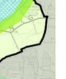


206 206 FEBRUARY 2016 APPENDIX 1: POLICIES MAP


207 MM 42 APPENDIX 1: POLICIES MAP FEBRUARY


208 JOINT CORE STRATEGY SPATIAL STRATEGY FEBRUARY 2016 APPENDIX 1: POLICIES MAP


209 MM 42 APPENDIX 1: POLICIES MAP FEBRUARY
210 APPENDIX 2 GLOSSARY OF TERMS AND ABBREVIATIONS DISCLAIMER The Glossary is a guide to planning terminology used in this Plan, where definitions are not provided in the supporting text. It is not a statement of policy or an interpretation of the law. Some of the definitions are drawn from the Glossary in the National Planning Policy Framework (NPPF). Accessibility: The extent to which employment, goods and services are made easily available to people, either through close proximity, or through providing the required physical links to enable people to go to locations where they are available. Affordable Housing: This includes social rented, affordable rented, and intermediate housing, provided to eligible households whose needs are not met by the market. Eligibility is determined with regard to local incomes and local house prices. Affordable housing should include provisions to remain at an affordable price for future eligible households or for the subsidy to be recycled for alternative affordable housing provision. See NPPF definition for further detail. Allocation: Land identified in a statutory development plan as appropriate for a specific land use. BREEAM (Building Research Establishment Environmental Assessment Method): An Environmental Assessment Method used to assess the environmental performance of both new and existing buildings. Brownfield Land: A general term used to describe land which has been previously developed or built upon. See Previously Developed Land. Climate Change: Long term changes in temperature, precipitation, wind, and all other aspects of the Earths climate. Comparison Retailing: The provision of items not obtained on a frequent basis. These include clothing, footwear, household and recreational goods. Community Infrastructure Levy (CIL): A planning charge, introduced by the Planning Act 2008 as a tool for local authorities in England and Wales to help deliver infrastructure to support the development of their area. This allows Local Authorities to raise funds from developers undertaking new building projects in their area. Ancient Woodlands: These are defined as areas where there is believed to have been continuous woodland cover since at least 1600 AD. It can include both ancient semi-natural and ancient replanted woodlands. They are irreplaceable habitats. B1 Business Use: Offices (other than those that fall within Use Class A2), research and development, light industry (in the Town and Country Planning Use Classes Order 1987 and its subsequent amendments). B2 General industrial Use: Use for the carrying out of an industrial process other than one falling in ClassB1 (in the Town and Country Planning Use Classes Order 1987 and its subsequent amendments). B8 Storage and Distribution: Use for Storage and distribution including wholesale warehouses, distribution centres and repositories, (in the Town and Country Planning Use Classes Order 1987 and its subsequent amendments). This use is often referred to as logistics. Community Right to Build Order: An Order made by the local planning authority, under the Town and Country Planning Act 1990, that grants planning permission for a sitespecific development proposal or classes of development. Connectivity: How places are linked with each other and how easy they are to move through. Convenience Retailing: The provision of everyday essential items, including food, drinks, newspapers/magazines and confectionary. D2 Assembly and leisure: Town and Country Planning (Use Classes) Order 1987 (as amended) includes cinemas, music and concert halls, bingo and dance halls (but not night clubs), swimming baths, skating rinks, gymnasiums or area for indoor or outdoor sports and recreations (except for motor sports, or where firearms are used). Defensible Space: An environment whose physical characteristics allow inhabitants themselves to become key agents in ensuring their security. There is a hierarchy Biodiversity: The variety of plants, animals and other living of space in the built environment ranging from totally public things in a particular area or region. It encompasses habitat through to totally private and defensible space. Clearly diversity, species diversity and genetic diversity. defining public and private space, allowing for the functions of those spaces, means that the spaces are more secure, 210 FEBRUARY 2016 controlled APPENDIX and 2: understood. GLOSSARY OF TERMS AND ABBREVIATIONS
211 Developer Contributions: Contributions made by a developer to remedy the impact of development, either by paying money for work to be carried out or services to be provided, or by directly providing facilities or works either on or off-site. Development Plan Documents (DPDs): In North Northamptonshire, these are Joint Core Strategy and Site Specific Plans, which together provide the Local Plans for the Districts and Boroughs in North Northamptonshire. The Local Plan, together with any Neighbourhood Plans, forms the Statutory Development Plan for an area, which is the starting point for considering planning applications (see Figure 1). District Centre: A centre that provides a broad diversity of retail uses and a number of facilities to serve the community, such as a group of shops including a supermarket or superstore and a range of non-retail services such as banks, building societies, and restaurants, as well as local public facilities such as a library and healthcare provision. Ecosystem services: The benefits people obtain from ecosystems such as food, water, flood and disease control and recreation (see paragraph 2.51). Environment Agency: This is a Public Body that is responsible for protecting and improving the environment of England and Wales, and for protecting communities from the risk of flooding and managing water resources. They are consulted throughout the plan making and decision making process in order to promote sustainable development. Evidence Base: The information and data gathered by local authorities to justify the soundness of the policy approach set out in Local Plans, including physical, economic, and social characteristics of an area. It includes consultation responses and the finding of technical studies. Examination: Once the JCS has been consulted upon, the document must be submitted to Government to test its soundness. A Planning Inspector leads the Examination and carries out the tests of soundness, hearing the issues and arguments surrounding the Plan. APPENDIX 2: GLOSSARY OF TERMS AND ABBREVIATIONS Five Year Housing Supply: The NPPF requires local planning authorities to identify and update annually a supply of specific deliverable sites sufficient to provide five years worth of housing against their housing requirements with an additional buffer (moved forward from later in the plan period) to ensure choice and competition in the market for land. Flood Risk Attenuation: Measures such as tanks and surface ponds that are designed to reduce or prevent water entering an area, sewers and rivers during periods of heavy rainfall. Flood Plain: Generally low lying areas adjacent to a watercourse, where water flows in times of flood or would flow but for the presence of flood defences. Flood Zone 1: An area with low probability of flooding. This zone comprises land assessed as having a less than 1 in 1000 annual probability of river or sea flooding. Flood Zone 2: An area with low probability of flooding. This zone comprises land assessed as having between a 1 in 100 and 1 in 1000 annual probability of river flooding or between a 1 in 200 and 1 in 1000 annual probability of sea flooding. Flood Zone 3a: An area with a high probability of flooding. This zone comprises land assessed as having a 1 in 100 or greater annual probability of river flooding or a 1 in 200 or greater annual probability of flooding from the sea. Flood Zone 3b: This is an area referred to as the functional floodplain. This zone comprises land where water has to flow or be stored in times of flood. Geodiversity: The range of rocks, minerals, fossils, soils and landforms. Greenfield Land: Land which has not previously been developed, including land in agriculture or forestry and land in built up areas used for outdoor sport and recreation (including public and private open space and allotments). Green Infrastructure (GI): A network of multi-functional green space, urban and rural, which is capable of delivering a wide range of environmental and quality of life benefits for local communities. GI includes parks, open spaces, playing fields, woodlands, allotments and private gardens, and for the purposes of this Plan, also includes water related blue infrastructure elements such as rivers, watercourses, lakes and ponds. FEBRUARY
212 Growth Deal: An agreement between Government and each Local Enterprise Partnership, which outlines the support that Government will provide and the activity, outputs, outcomes and impacts that the LEP will deliver in return. Habitats Regulations Assessment/Appropriate Assessment: The Habitats Directive (Directive 92/43/EEC) on the conservation of Natural Habitats and of Wild Fauna and Flora requires that any plan or project that is likely to have a significant effect on a designated habitat site, either individually or in combination with other plans or projects, is to be subject to an Appropriate Assessment (AA) of its implications for the site in view of the sites conservation objectives. In North Northamptonshire, there is only one European Designated habitat site, the Upper Nene Valley Gravel Pits Special Protection Area (SPA) and Ramsar site. See Natura 2000 site defintion. In North Northamptonshire, there is only one European Designated habitat site, the Upper Nene Valley Gravel Pits Special Protection Area (SPA) and Ramsar site. See Natura 2000 Site definition. Heritage Asset: A building, monument, site, place, area or landscape identified as having a degree of significance meriting consideration in planning decisions, because of its heritage interest. Heritage asset includes designated heritage assets and assets identified by the local planning authority, including local listing. High Speed 2 (HS2): A proposed fast rail route running initially between London and Birmingham, with later extensions to Leeds and Manchester. Housing Market Area (HMA): HMAs are geographical areas defined by household demand and preferences for housing, and reflect the key functional linkages between places where people live and work. The North Northamptonshire HMA comprises the four Council districts and boroughs of Corby, East Northamptonshire, Kettering and Wellingborough. Housing Strategy: A Housing Strategy is normally produced by each Council and sets out the key housing priorities that the individual Council feels needs to be addressed in order to meet the housing needs and aspirations of the local population. Infrastructure Delivery Plan (IDP): The IDP identifies the necessary social, physical and green infrastructure required to support the new development proposed in the Joint Core Strategy for North Northamptonshire up The Lifetime Homes: The Lifetime Homes standard is a set of 16 design criteria that provide a model for building accessible and adaptable homes. Following a review of housing standards, the Government intends to incorporate revised accessibility standards into the Building regulations (see paragraph ). Listed Buildings: Buildings of special architectural or historic interest. Listed buildings are graded 1, 2 or 2* with grade 1 being the highest. English Heritage is responsible for designating buildings for listing in England. Local Centre: A centre that includes a range of small shops and services of a local convenience nature, serving a small catchment. They might typically include a small supermarket, a newsagent, a sub-post office, a pharmacy and take-away. Local Development Orders: Local Development Orders are statutory documents that define what land uses may be developed without planning permission. Local Development Scheme: This sets out a programme for preparing local development documents/planning policy documents. Local Enterprise Partnership (LEP): In England, Local enterprise Partnerships{LEPs) are voluntary partnerships between local authorities and businesses set up in 2011 by Government, to help determine local economic priorities and lead economic growth and job creation within the local area. Within North Northamptonshire there are two LEPs. The Northamptonshire Enterprise Partnership (NEP), which covers the whole area, and the South East Midlands Local Enterprise Partnership (SEMLEP) which includes only the Boroughs of Corby and Kettering. Local Nature Reserve (LNR): Non-statutory habitats of local significance designated by a Local Authority where protection and public understanding of nature conservation is encouraged. Local Plan: The plan for the future development of the local area, drawn up by the local planning authority in consultation with the community. In law this is described as the Development Plan Documents adopted under the Planning and Compulsory Purchase Act document will be subject to monitoring and regular review. 212 FEBRUARY 2016 APPENDIX 2: GLOSSARY OF TERMS AND ABBREVIATIONS
213 Local Strategic Partnership: This is a partnership that brings together organisations from public, private, community and voluntary sector in a local authority area, so that different initiatives and services support each other and work together. The partnership is responsible for producing a Sustainable Community Strategy/Vision, setting out their local priorities and the key actions that may need to be taken to achieve these, in order to enhance the social, economic and environmental well-being of their area. Local Transport Plan: A 5 year strategy prepared by Local Transport Authorities, including the Northamptonshire County Council. It sets out the development of local, integrated transport, supported by a programme of transport improvements. Used to bid for Government funding towards transport improvements. It is also referred to as the Northamtonshire Transportation Plan in this area Logistics: see B8 Storage and Distribution. Mineral Safeguarding Area: An area designated by Northamptonshire County Council (as the Minerals Planning Authority) which covers known deposits of minerals which are desired to be kept safeguarded from unnecessary sterilisation by non-mineral development. Modal Shift: The result of a change from one mode of transport to another, for example private car use to bus use. National Planning Policy Framework (NPPF): This document sets out the Government s planning policies for England and how these are expected to be applied. Natura 2000 Site: Natura 2000 is an EU wide network of nature protection areas established under the 1992 Habitats Directive. It is comprised of Special Protection Areas (SPAs), designated by Member States for birds, and Special Areas for Conservation (SACs), for species and habitats. See Habitat Regulations Assessment/Appropriate Assessment. Natural Surveillance: The placement of physical features, activities, and people in a way that maximises visibility. It allows people to overlook and watch public or semi-public spaces either from surrounding buildings/ areas or by having enough people in them. This involves ensuring that public spaces are open and well lit, are overlooked by active windows and doors, and have a diversity of uses to ensure they are busy. Nature Improvement Area (NIA): An inter-connected network of wildlife habitats intended to to re-establish thriving wildlife populations and help species respond to the challenges of climate change. The Nene Valley NIA designated by the Government in 2012 (see paragraph 2.17). Neighbourhood Plans: A plan prepared by a parish council or Neighbourhood Forum for a particular neighbourhood area, made under the Planning and Compulsory Purchase Act Non B Employment Uses: Uses falling outside Class B of the Town and Country Planning Use Classes Order 1987 and its subsequent amendments. Such uses include retail, tourism, leisure education, and health. Northamptonshire Enterprise Partnership (NEP): See Local Enterprise Partnership. Northamptonshire Biodiversity Action Plan (BAP): Lists the most threatened habitats and species in the county, and sets out targets for action to aid their recovery. Planning Obligation: A legally enforceable obligation entered into under Section 106 of the town and Country planning act 1990 to mitigate the impacts of a development proposal. Previously Developed Land (PDL): The NPPF defines PDL as land which is or was occupied by a permanent structure, including the curtilage of the developed land (although it should not be assumed that the whole of the curtilage should be developed) and any associated fixed surface infrastructure. This excludes: land that is or has been occupied by agricultural or forestry buildings; land that has been developed for minerals extraction or waste disposal by landfill purposes where provision for restoration has been made through development control procedures; land in built-up areas such as private residential gardens, parks, recreation grounds and allotments; and land that was previously-developed but where the remains of the permanent structure or fixed surface structure have blended into the landscape in the process. PDL is still commonly referred to as brownfield land. Primary Shopping Area: Defined area where retail development is concentrated (generally comprising the primary and those secondary frontages which are adjoining and closely related to the primary shopping frontages) APPENDIX 2: GLOSSARY OF TERMS AND ABBREVIATIONS Public Realm: Areas available for everyone to use, including streets, squares and parks. FEBRUARY
214 Ramsar Sites: Wetlands of international importance, designated under the 1971 Ramsar Convention. See Habitats Regulation Asessment/Appropriate Assessment definition. Regional Plan/Regional Spatial Strategy: Former Strategic planning guidance for the Region that Development Plan Documents had to be in general conformity with. The former East Midlands Plan was issued in 2009 but has now been revoked by Government. Renewable and Low Carbon Energy: This includes energy for heating and cooling as well as generating electricity. Renewable energy covers those energy flows that occur naturally and repeatedly in the environment-from the wind, the fall of water, the movement of the oceans, from the sun and also from biomass and deep geothermal heat. Low carbon technologies are those that can help reduce emissions, as compared to the conventional use of fossil fuels. River Nene Regional Park (RNRP): An independent community interest company creating a green infrastructure network of environmental projects along the River Nene. Rural Exception Sites: Small sites used for affordable housing in perpetuity where sites would not normally be used for housing. Rural exception sites seek to address the needs of the local community by accommodating households who are either current residents or have an existing family or employment connection. Small numbers of market homes may be allowed at the discretion of the local planning authority, for example where essential to enable the delivery of affordable units without grant funding. Section 106 Agreement/Contribution: Refers to Section 106 of the Town and Country Planning Act 1990 and is a legally-binding agreement or planning obligation with a landowner in association with the granting of planning permission. These agreements are a way of delivering or addressing matters that are necessary to make a development acceptable in planning terms. Sequential Test: In the context of flood risk, it is a test to help steer new development to areas with the lowest probability of flooding. In the context of proposed development, the NPPF requires local planning authorities to apply a sequential test to planning applications for main town centre uses that are not in an existing centre and are not in accordance with an up to date Local Plan. Site of Specific Scientific Interest (SSSI): A site or area designated as being important due to its wildlife plants or flowers and/or unusual or typical geological features. SSSIs are identified by Natural England and have protected status under Wildlife and Countryside Act Soundness (tests of): Criteria which the Core Strategy must meet if it is to be found sound by the Planning Inspectorate (see paragraph 1.20). Spatial Planning: Spatial planning goes beyond older style traditional land use planning to bring together and integrate policies for the development and use of land with other policies and programmes which influence the nature of places and how they function. Special Protection Area (SPA): Areas which have been identified as being of international importance for the breeding, feeding, wintering or the migration of rare and vulnerable species of birds found within European Union countries. They are European designated sites, classified under the Birds Directive. South East Midlands Local Economic Partnership (SEMLEP): see Local Enterprise Partnership. Strategic Economic Plans: These are investment and growth strategies produced by the LEPs operating in this area, that is, the NEP and the SEMLEP. Strategic Flood Risk Assessment (SFRA): Assessment of all forms of flood risk from groundwater, surface water, impounded water bodies, sewer, river and tidal sources, taking into account future climate change predictions. This allows local planning authorities to use this information to locate future development primarily in low flood risk areas (Level 1 SFRA). For areas that have a higher risk of flooding, the SFRA examines the capacity of the existing flood prevention infrastructure (i.e. drainage) and identifies all the measures that any potential development may need to take to ensure that it will be safe and will not increase flood risk to third parties (Level 2 SFRA). Strategic Housing Land Availability Assessment (SHLAA): A technical study which assesses the amount and nature of land which could be made available for housing development. It is part of the evidence base that will inform the plan making process. 214 FEBRUARY 2016 APPENDIX 2: GLOSSARY OF TERMS AND ABBREVIATIONS
215 Strategic Housing Market Assessment (SHMA): A technical study which assesses housing need and demand across a defined market area and which is used to inform housing and planning policies. In this case, the defined market area is the North Northamptonshire Housing Market Area (HMA). Strategic Sites: For the purpose of this Plan, these are defined as 500+ dwellings or 5ha+ of employment land. Submission: Once the JCS has been the subject of final consultation, it must be submitted to Government so that it can be tested for soundness. See Examination. The Pre- Submission version of the JCS is effectively a draft of what the submitted document will look like. Supplementary Planning Document (SPD): Documents which add further detail to the policies in the Local Plan. They can be used to provide further guidance for development on specific sites, or on particular issues, such as design. Supplementary planning documents are capable of being a material consideration. Sustainability Appraisal (SA): This examines the impacts of the JCS strategies/policies against a large number of economic, social and environmental sustainability objectives. It also provides an indication of what measures may need to be taken to minimise/eliminate any adverse impacts and promote sustainable development. The Planning and Compulsory Purchase Act requires an SA to be undertaken for all Development Plan Documents/Local Plans throughout the plan making process. Sustainable Community Strategy (SCS): This sets the overall strategic direction and long-term vision for the economic, social and environmental wellbeing of a local area - typically 10 to 20 years - in a way that contributes to sustainable development in the UK. It is prepared by a Local Strategic Partnership (LSP), which is made up of public, private and voluntary sector organisations. It identifies the key long terms priorities for the area and how the LSP could work together to address these. Sustainable Development: At the heart of sustainable development is the idea of ensuring a better quality of life for everyone, now and for future generations A widely used definition was drawn up by the World Commission on Environment and Development in 1987 which stated that it was Development which meets the needs of the present, without compromising the ability of future generations to meet their own needs. Sustainable Transport Modes: Any efficient, safe and accessible means of transport with overall low impact on the environment, including walking and cycling, low and ultralow emission vehicles, car sharing and public transport. Sustainable Drainage Systems (SuDS); These are designed to manage excess rainwater where it falls rather than the traditional approach of channeling it through drains. Examples include ponds, reed beds, drainage channels and porous driveways. Sustainable Urban Extensions (SUEs): Substantial mixed use developments including employment, local facilities and at least 500 new homes, which provide well planned and managed new neighbourhoods that integrate physically and socially with the existing towns. Principal SUEs are those that include between 2,500 and 5,500 dwellings. Town Centre: Area defined on the local authority s proposal map, including the primary shopping area and areas predominantly occupied by main town centre uses within or adjacent to the primary shopping area. Urban Structure Study (USS): An analysis of the form and function of the framework of streets and open spaces in the 12 towns in North Northamptonshire. This has informed the policies of the JCS and will be form the basis of a North Northamptonshire place Shaping SPD. Windfall Sites: Sites which have not been specifically identified as available in the Local Plan process. They normally comprise previously developed sites that have unexpectedly become available. APPENDIX 2: GLOSSARY OF TERMS AND ABBREVIATIONS FEBRUARY
216 MM 43 APPENDIX 3 SCHEDULE OF EXTANT POLICIES REPLACED BY POLICIES IN THE ADOPTED NORTH NORTHAMPTONSHIRE JOINT CORE STRATEGY As per para 1.2 of the JCS upon its adoption the JCS will supersede the 2008 CSS in its entirety. DISTRICT/ BOROUGH (PLAN) POLICY POLICY NAME/ DESCRIPTION TO BE REPLACED BY JCS POLICIES DISTRICT/ BOROUGH (PLAN) POLICY POLICY NAME/ DESCRIPTION TO BE REPLACED BY JCS POLICIES Corby (Saved Local Plan) P2(J) New development 10 Corby (Saved Local Plan) P9(E) Woodland 4 Corby (Saved Local Plan) P5(J) Prestige Sites 8 Corby (Saved Local Plan) P10(E) Special Landscape Areas 3 Corby (Saved Local Plan) Corby (Saved Local Plan) Corby (Saved Local Plan) Corby (Saved Local Plan) Corby (Saved Local Plan) Corby (Saved Local Plan) Corby (Saved Local Plan) Corby (Saved Local Plan) Corby (Saved Local Plan) Corby (Saved Local Plan) Corby (Saved Local Plan) Corby (Saved Local Plan) Corby (Saved Local Plan) Corby (Saved Local Plan) Corby (Saved Local Plan) J16 Phoenix Industry 34 P5(R) P11(R) P6(T) New Housing Development Environmental Improvements Funding of Highway Schemes 10 4 & 8 10 P9(T) Car Parking 10 P3(C) Funding of Works 10 P5(C) Water Quality and Water Resources P8(C) Community Halls 7 P5(L) Play Space 7 P6(L) Allotments 7 P11(L) New Playing Fields 7 & 10 P1(E) P4(E) Environmental Protection on Sites Conservation of the Built Environment P7(E) SSSI and LNR 4 P8(E) CWS and RIGS 4 5 2,3,4 & 8 2 Corby (Saved Local Plan) Corby (Saved Local Plan) Corby (Saved Local Plan) Corby (Saved Local Plan) Corby (Saved Local Plan) Corby (Saved Local Plan) Corby (Saved Local Plan) Corby (Saved Local Plan) Corby (Saved Local Plan) Corby (Saved Local Plan) Corby (Saved Local Plan) Corby (Saved Local Plan) Corby (Saved Local Plan) Wellingborough (Saved Local Plan) Wellingborough (Saved Local Plan) P11(E) SLA Protection of Ancient Monuments and Archaeological Sites Rockingham Forest and Lower Nene Valley SLA The Welland Valley 3 P1(V) P2(V) P3(V) Housing Gretton and Weldon Housing Restricted Infill Villages Housing Restricted Infill Villages P4(V) Rockingham 11 P5(V) Local Needs 13 P6(V) Employment 11 P7(V) Employment 11 P9(V) Employment 11 P10(V) Shopping 7 P11(V) Shopping 12 E2 Non Industrial Uses in Industrial Estates G2 Flood Protection FEBRUARY 2016 APPENDIX 3: SCHEDULE OF EXTANT POLICIES REPLACED BY POLICIES IN THE ADOPTED NORTH NORTHAMPTONSHIRE JOINT CORE STRATEGY
217 DISTRICT/ BOROUGH (PLAN) POLICY POLICY NAME/ DESCRIPTION TO BE REPLACED BY JCS POLICIES DISTRICT/ BOROUGH (PLAN) POLICY POLICY NAME/ DESCRIPTION TO BE REPLACED BY JCS POLICIES Wellingborough (Saved Local Plan) G3 Areas of Restraint 3 & 11 Kettering (Saved Local Plan) RA6 Affordable Housing 30 Wellingborough (Saved Local Plan) G6 Open Countryside 11 & 3 Kettering (Saved Local Plan) RA7 Affordable Housing for Local Needs 13 Wellingborough (Saved Local Plan) Wellingborough (Saved Local Plan) Wellingborough (Saved Local Plan) Wellingborough (Saved Local Plan) G16 Art 8 G18 Sites of Nature Conservation G25 Implementation 10 H4 Restraint Villages and Open Countryside Wellingborough H8* Affordable Housing & 29 * Policy H8 has been replaced by Policy WTC13 within the area covered by the Wellingborough Town Centre Area Action Plan. Wellingborough (Saved Local Plan) Wellingborough (Saved Local Plan) Wellingborough (Saved Local Plan) Wellingborough (Saved Local Plan) Wellingborough (Saved Local Plan) Wellingborough (Town Centre AAP) Wellingborough (Town Centre AAP) Wellingborough (Northamptonshire County Structure Plan) Kettering (Saved Local Plan) Kettering (Saved Local Plan) Kettering (Saved Local Plan) Kettering (Saved Local Plan) Kettering (Saved Local Plan) H9 Affordable Housing 30 L2 S1 S2 S11 New Community Facilities Impact on the Town Centre Impact on Town Centre Retailing from Industrial Estates 7 & WTC13 Housing 30 WTC25 SDA1 Town Centre Infrastructure Strategic Development Area Proposals 22 & Affordable Housing 30 B5 Affordable Housing 30 D5 Affordable Housing 30 K3 Ise Valley 20 R6 Affordable Housing 30 East Northamptonshire Rural North, Oundle and Thrapston Plan (RNOTP) East Northamptonshire (RNOTP) East Northamptonshire (RNOTP) East Northamptonshire (RNOTP) East Northamptonshire (RNOTP) East Northamptonshire (RNOTP) East Northamptonshire (RNOTP) East Northamptonshire (RNOTP) East Northamptonshire (RNOTP) East Northamptonshire (RNOTP) East Northamptonshire (RNOTP) East Northamptonshire (RNOTP) East Northamptonshire (RNOTP) 1 Settlement Roles 11 3 Comprehensive Development 7 Flood Risk 5 8 Housing Mix Enhancing Biodiversity 13 Affordable Housing Requirements 14 Rural Exceptions Housing 19 Water Related Facilities along the River Nene Oundle Marina Farm Diversification Lorry Parking 18 OUN1 Infrastructure 10 OUN2 East Road, Oundle 22 APPENDIX 3: SCHEDULE OF EXTANT POLICIES REPLACED BY POLICIES IN THE ADOPTED NORTH NORTHAMPTONSHIRE JOINT CORE STRATEGY FEBRUARY
218 DISTRICT/ BOROUGH (PLAN) POLICY POLICY NAME/ DESCRIPTION TO BE REPLACED BY JCS POLICIES DISTRICT/ BOROUGH (PLAN) POLICY POLICY NAME/ DESCRIPTION TO BE REPLACED BY JCS POLICIES East Northamptonshire (RNOTP) OUN3 (2) Creed Road 28 East Northamptonshire (Saved Local Plan) S10 Farm Shops 25 East Northamptonshire (RNOTP) OUN4 Housing Allocations in Oundle (Phase 2) 28 East Northamptonshire (Saved Local Plan) TR6 Service areas 18 East Northamptonshire (RNOTP) OUN6 Fletton House, Glapthorn Road 7 East Northamptonshire (Saved Local Plan) HF1 Provision for housing in Higham Ferrers 28 East Northamptonshire (RNOTP) East Northamptonshire (RNOTP) East Northamptonshire (RNOTP) East Northamptonshire (Saved Local Plan) East Northamptonshire (Saved Local Plan) East Northamptonshire (Saved Local Plan) East Northamptonshire (Saved Local Plan) East Northamptonshire (Saved Local Plan) East Northamptonshire (Saved Local Plan) East Northamptonshire (Saved Local Plan) THR1 Infrastructure 10 KCF2 Willow Lane/ Wood Road 28 DA1 Deenethorpe Airfield 14 GEN3 Planning obligations 10 EN8 EN9 EN20 H2 H4 Protection of SSSIs, NNRs and LNRs Safeguarding sites of local conservation interest Protection of Important Open Land Land for housing in the towns Variety of dwelling types and densities H16 Local Needs housing 13 East Northamptonshire (Saved Local Plan) East Northamptonshire (Saved Local Plan) East Northamptonshire (Saved Local Plan) East Northamptonshire (Saved Local Plan) East Northamptonshire (Saved Local Plan) East Northamptonshire (Saved Local Plan) East Northamptonshire (Saved Local Plan) East Northamptonshire (Saved Local Plan) HF2 IR2 IR3 RU1 RU4-B RU4-D Provision for industrial and commercial development in Higham Ferrers Provision for industrial and commercial in Irthlingborough Provision for informal recreation in Irthlingborough Provision for housing in Rushden Provision for recretional use in Rushden South of Deacon Close Provision for recretional use in Rushden - East of Bedford Road RU5 Rushden Hospital 28 RU6 New primary school in Rushden East Northamptonshire (Saved Local Plan) AG5 Stables, riding schools and horticultural establishments 25 East Northamptonshire (Saved Local Plan) AG8 Relaxation of restrictive occupancy conditions FEBRUARY 2016 APPENDIX 3: SCHEDULE OF EXTANT POLICIES REPLACED BY POLICIES IN THE ADOPTED NORTH NORTHAMPTONSHIRE JOINT CORE STRATEGY
219 APPENDIX 4 THE ASSESSMENT OF HOUSING LAND SUPPLY RELATIVE TO THE REQUIREMENTS OF JOINT CORE STRATEGY POLICY 28 MM INTRODUCTION 1.1 The National Planning Policy Framework (NPPF) requires all local authorities to identify and update annually a supply of specific deliverable sites sufficient to provide five years worth of housing against their housing requirements, with an additional buffer of either 5% or 20% depending on the record of delivery. TABLE 1: CORBY BOROUGH: COMPOSITION OF FORECAST HOUSING SUPPLY, COMPONENT YIELD Extant planning permissions (unimplemented at ) 2,261 West Corby (JCS Allocation) This Appendix sets out a forward-looking assessment of housing land supply for each of the districts and boroughs from April This assessment is made against the housing requirements established in Policy 28 of the JCS, using the Sedgefield approach to any historic under-provision. These assessments are made relative to both 5% and 20% buffers for completeness (pursuant to NPPF para 47). 1.3 The assessment of sources of supply for each district/ borough uses information compiled for the 2014/15 Authorities Monitoring Report (AMR) (see EXAM 7 - Assessment of Housing Land Supply ). The projected housing supply for the North Northamptonshire Housing Market Area as a whole is presented at Annex A. 1.4 The housing land supply position is kept under review by the local planning authorities to inform consideration of planning applications, and will be updated annually through the Authorities Monitoring Report (AMR) prepared by the JPU. 2. CORBY BOROUGH COUNCIL: HOUSING LAND SUPPLY Table 1 below outlines the components which make up Corby Borough s housing land supply for the assessment period A cumulative supply of 3,068 dwellings has been identified. This supply figure is used as the basis for determining the Borough s overall housing land supply relative to the requirements of Policy 28 (Table 4). APPENDIX 4: THE ASSESSMENT OF HOUSING LAND SUPPLY RELATIVE TO THE REQUIREMENTS OF JOINT CORE STRATEGY POLICY 28 Unallocated sites with potential 380 Windfall Estimate (9 dwellings p.a ) 27 Total Supply , Table 2 outlines the assessment of Corby Borough s housing land supply for the period As detailed in Table 2 there will be an anticipated shortfall in the Borough relative to JCS requirements (40 dwellings overall). Following the Sedgefield approach, provision has been made for this shortfall in determining the requirement against which the overall supply position will be based. This is outlined at row (b) of Table 2 below. TABLE 2: ANALYSIS OF CORBY BOROUGH S HOUSING SUPPLY AGAINST THE JCS, (a) JCS Policy 28 Housing Requirement (b) JCS Housing Requirement inclusive of shortfall (+40) (c) Housing Requirement + shortfall + 5% buffer: 2,457 (d) Identified Housing supply : (e) Deliverable Housing Land (years), (inclusive of 5% buffer): 6.24 (d/c x 5) 2,300 2,340 Housing Requirement + shortfall + 20% buffer: 2,808 3,068 (from Table 1) Deliverable Housing Land (years), (inclusive of 20% buffer): 5.46 (d/c x 5) 2.3 Row (a) in Table 2 outlines the Borough s JCS requirements before making any provision for this projected shortfall. Row (b) includes this provision (2,340 dwellings) and provides the baseline against which NPPF buffers are to be added (row (c)). Row (d) reiterates the Borough s identified housing supply (from Table 1 above). Row (e) represents the assessment of how much housing land is available in the Borough, relative to the requirements identified in row (c). This shows that inclusive of both a 5% and 20% buffer, Corby Borough is able to demonstrate a five year supply of housing land relative to JCS requirements. FEBRUARY
220 3. EAST NORTHAMPTONSHIRE COUNCIL: HOUSING LAND SUPPLY Table 3 below outlines the components which make up East Northamptonshire s housing land supply for the assessment period A cumulative supply of 3,063 dwellings has been identified. This supply figure is used as the basis for determining the District s overall housing land supply position relative to the requirements of Policy 28 (Table 4). TABLE 3: EAST NORTHAMPTONSHIRE: COMPOSITION OF FORECAST HOUSING SUPPLY, COMPONENT YIELD Extant commitments 2,203 Emerging allocations 426 Unallocated sites with potential 311 Windfall estimate (41 dwellings pa ) 123 NPPF buffers (after para 47) are to be added (row (c)). Row (d) reiterates the identified housing supply (as outlined in Table 3 above). Row (e) represents the assessment of how much housing land is available in the District, relative to the requirements identified in row (c). This shows that inclusive of both a 5% and 20% buffer, the Council is able to demonstrate a five year supply of housing land relative to JCS requirements. 4. KETTERING BOROUGH COUNCIL: HOUSING LAND SUPPLY Table 5 below outlines the components which make up Kettering Borough s housing land supply for the assessment period A cumulative supply of 4,650 dwellings has been identified. This supply figure is used as the basis for determining the Borough s overall housing land supply position relative to the requirements of Policy 28 (Table 4). Total Supply , Table 4 outlines the assessment of East Northamptonshire s housing land supply for the period It details there will be an anticipated shortfall in the District relative to JCS requirements which needs to be accounted for (366 dwellings overall). Following the Sedgefield approach, provision has been made for this shortfall in determining the requirement against which the overall supply position will be based. This is outlined at row (b) of Table 4 below. TABLE 4: ANALYSIS OF EAST NORTHAMPTONSHIRE S HOUSING SUPPLY AGAINST THE JCS, (a) JCS Policy 28 Housing Requirement (b) JCS Housing Requirement inclusive of shortfall (+366) (c) Housing Requirement + shortfall + 5% buffer: 2,589 (d) Identified Housing supply : (e) Deliverable Housing Land (years), (inclusive of 5% buffer): 5.91 (d/c x 5) 220 FEBRUARY ,100 2,466 Housing Requirement + shortfall + 20% buffer: 2,959 3,063 (from Table 3) Deliverable Housing Land (years), (inclusive of 20% buffer): 5.18 (d/c x 5) 3.3 Row (a) in Table 4 outlines the District s JCS requirements before making any provision for this projected shortfall. Row (b) includes this provision (2,466 dwellings) and provides the baseline against which TABLE 5: KETTERING BOROUGH: COMPOSITION OF FORECAST HOUSING SUPPLY, COMPONENT YIELD Extant planning permissions (unimplemented at ) 3,743 JCS Allocation (Rothwell North) 375 Emerging Part 2 Local Plan Allocations Windfall estimate (76 dwellings pa ) APPENDIX 4: THE ASSESSMENT OF HOUSING LAND SUPPLY RELATIVE Total Supply , Table 6 outlines the assessment of Kettering Borough s housing land supply for the period It details there will be an anticipated shortfall in the Borough relative to JCS requirements (574 dwellings overall). Following the Sedgefield approach, provision has been made for this shortfall in determining the requirement against which the overall supply position will be based. This is outlined at row (b) of Table 6 below. TABLE 6: ANALYSIS OF KETTERING BOROUGH S HOUSING SUPPLY AGAINST JCS, (a) JCS Policy 28 Housing Requirement (b) JCS Housing Requirement inclusive of shortfall (+574) 2,600 3,174 TO THE REQUIREMENTS OF JOINT CORE STRATEGY POLICY 28
221 (c) Housing Requirement + shortfall + 5% buffer: 3,333 (d) Identified Housing supply : (e) Deliverable Housing Land (years), (inclusive of 5% buffer): 6.98 (d/c x 5) Housing Requirement + shortfall + 20% buffer: 3,809 4,650 (from Table 5) Deliverable Housing Land (years), (inclusive of 20% buffer): 6.10 (d/c x 5) 4.3 Row (a) in Table 6 outlines the Borough s JCS requirements before making any provision for this projected shortfall. Row (b) includes this provision (3,174 dwellings) and provides the baseline against which NPPF buffers (after para 47) are to be added (row (c)). Row (d) reiterates the identified housing supply (from Table 5 above). Row (e) represents the assessment of how much housing land is available in the Borough, relative to the requirements identified in row (c). This shows that inclusive of both a 5% and 20% buffer, Kettering Borough is able to demonstrate a five year supply of housing land relative to JCS requirements. 5. BOROUGH COUNCIL OF WELLINGBOROUGH: HOUSING LAND SUPPLY Table 7 outlines the components which comprise Wellingborough Council s housing land supply for the assessment period A cumulative supply of 4,394 dwellings has been identified. This supply figure is used as the basis for determining the Borough s overall housing land supply relative to the requirements of Policy 28 (Table 4). TABLE 7: BOROUGH COUNCIL OF WELLINGBOROUGH: COMPOSITION OF FORECAST HOUSING SUPPLY, COMPONENT YIELD Table 8 outlines the assessment of Wellingborough s housing land supply for the period It details an anticipated shortfall in housing delivery relative to JCS requirements (389 dwellings overall). Following the Sedgefield approach, provision has been made for this shortfall in determining the requirement against which the overall supply position will be based. This is outlined in row (b) of Table 8 below. TABLE 8: ANALYSIS OF WELLINGBOROUGH COUNCIL S HOUSING SUPPLY AGAINST THE JCS, (a) JCS Policy 28 Housing Requirement (b) JCS Housing Requirement inclusive of shortfall (+389) (c) Housing Requirement + shortfall + 5% buffer: 2,246 (d) Identified Housing supply : (e) Deliverable Housing Land (years), (inclusive of 5% buffer): 9.78 (d/c x 5) 1,750 2,139 Housing Requirement + shortfall + 20% buffer: 2,567 4,394 (from Table 7) Deliverable Housing Land (years), (inclusive of 20% buffer): 8.56 (d/c x 5) 5.3 Row (a) in Table 8 outlines the Borough s JCS requirements before making any provision for the projected shortfall. Row (b) includes this provision (2,139 dwellings) and provides the baseline against which NPPF buffers are to be added (row (c)). Row (d) reiterates the Borough s identified housing supply (from Table 7 above). Row (e) represents the assessment of how much housing land is available in the Borough relative to the requirements identified in row (c). This shows that inclusive of both a 5% and 20% buffer, the Council is able to demonstrate a five year supply of housing land relative to JCS requirements. Extant planning permissions (unimplemented at ) 3,885 Emerging allocations 242 Unallocated sites with potential 137 Windfall allowance (45 dwellings pa ) 135 Lapse Rate -5 Total Supply ,394 APPENDIX 4: THE ASSESSMENT OF HOUSING LAND SUPPLY RELATIVE TO THE REQUIREMENTS OF JOINT CORE STRATEGY POLICY 28 FEBRUARY
222 ANNEX A: NORTH NORTHAMPTONSHIRE HOUSING LAND SUPPLY NORTH NORTHAMPTONSHIRE (CUMULATIVE) NORTH NORTHANTS: BREAKDOWN OF HOUSING LAND SUPPLY SOURCE OF HOUSING SUPPLY Past Completions 1,101 1,198 1,450 1,515 Growth Towns Commitments West Corby SUE Estimated Completions Priors Hall Park SUE Estimated Completions Weldon Park SUE Estimated Completions Rushden East SUE Estimated Completions Irthlingborough West SUE Estimated Completions Kettering East SUE Estimated Completions Wellingborough East SUE Estimated Completions Wellingborough North SUE Estimated Completions Growth Towns Unallocated Sites With Potential Growth Towns Emerging Part 2 Allocations Growth Towns SHLAA Potential Market Towns Commitments Desborough North SUE Estimated Completions Rothwell North SUE Estimated Completions Market Towns Emerging Part 2 Allocations Market Towns Unallocated Sites With Potential Larger Villages Commitments Larger Villages Emerging Part 2 Allocations Rural Area Commitments Little Stanion Estimated Completions Rural Area Emerging Part 2 Local Plan Allocations Rural Area Unallocated Sites With Potential Rural Area SHLAA Potential Windfall Estimate Lapse Rate Totals 1,101 1,198 1,450 1,515 2,117 2,485 2,916 3,323 Cumulative Totals 1,101 2,299 3,749 5,264 7,381 9,866 12,782 16,105 Annualised Housing Requirement (1,750 Dpa) 1,750 1,750 1,750 1,750 1,750 1,750 1,750 1,750 Cumulative Housing Requirement 1,750 3,500 5,250 7,000 8,750 10,500 12,250 14,000 Monitor ,201-1,501-1,736-1, ,105 SUEs ,083 1, FEBRUARY 2016 APPENDIX 4: THE ASSESSMENT OF HOUSING LAND SUPPLY RELATIVE TO THE REQUIREMENTS OF JOINT CORE STRATEGY POLICY 28
223 TOTAL 5, , , , , , , , , , , ,304 3,147 2,985 2,952 2,538 2,155 1,943 1,835 1,837 1,725 1,773 1,567 43,866 19,409 22,556 25,541 28,493 31,031 33,186 35,129 36,964 38,801 40,526 42,299 43,866 1,750 1,750 1,750 1,750 1,750 1,750 1,750 1,750 1,750 1,750 1,750 1,750 15,750 17,500 19,250 21,000 22,750 24,500 26,250 28,000 29,750 31,500 33,250 35,000 3,659 5,056 6,291 7,493 8,281 8,686 8,879 8,964 9,051 9,026 9,049 8,866 1,467 1,566 1,905 1,955 1,580 1,480 1,455 1,455 1,455 1,455 1,250 1,042 21,332 APPENDIX 4: THE ASSESSMENT OF HOUSING LAND SUPPLY RELATIVE TO THE REQUIREMENTS OF JOINT CORE STRATEGY POLICY 28 FEBRUARY
224 ANNEX B: PROJECTED HOUSING LAND SUPPLY FOR THE NORTH NORTHAMPTONSHIRE HOUSING MARKET AREA Identified Housing Land Supply TOTALS ANNUALISED HOUSING REQUIREMENT (1,750 dpa) DWELLINGS 3,500 3,000 2,500 2,000 1,500 1, , , , , , , ,916 1,083 3,323 1,323 3,304 1,467 3,147 1,566 2,985 1,905 2,952 1,955 2,538 1,580 SUEs 2,155 1,480 1,943 1,455 1,835 1,455 1,837 1,455 1,725 1,455 1,773 1,250 1,567 1, YEAR 224 FEBRUARY 2016 APPENDIX 4: THE ASSESSMENT OF HOUSING LAND SUPPLY RELATIVE TO THE REQUIREMENTS OF JOINT CORE STRATEGY POLICY 28
225 APPENDIX 4: THE ASSESSMENT OF HOUSING LAND SUPPLY RELATIVE TO THE REQUIREMENTS OF JOINT CORE STRATEGY POLICY 28 FEBRUARY


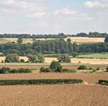

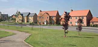


226
List of Tables. List of Figures
 North Northamptonshire Core Spatial Strategy ADOPTED JUNE 2008 Contents 1. Introduction 3 North Northamptonshire Local Development Framework 4 Sustainability Appraisal and Strategic Environmental Assessment
BEDFORD BOROUGH COUNCIL PLAN IMPLEMENTATION MONITORING REPORT
 BEDFORD BOROUGH COUNCIL PLAN IMPLEMENTATION MONITORING REPORT 2017-18 Summary 1 Progress on local development documents 1 Local development documents adopted in the monitoring period 1st April 2017 31st
North Northamptonshire Joint Core Strategy Consultation on Strategic Housing and Employment Sites
 North Northamptonshire Joint Core Strategy 2011 2031 Consultation on Strategic Housing and Employment Sites August 2013 1.0 The purpose of the consultation 1.1 The Joint Core Strategy (JCS) will identify
Sustainability Statement. Whitby Business Park Area Action Plan
 Sustainability Statement Whitby Business Park Area Action Plan November 2014 Contents Page 1. Introduction 1 2. Scoping 3 3. Sustainability Appraisal of Options 6 4. Assessment of Draft Area Action Plan
WINCHESTER TOWN 3.1 LOCATION, CHARACTERISTICS & SETTING
 WINCHESTER TOWN 3.1 LOCATION, CHARACTERISTICS & SETTING 3.1.1 The area referred to by the City Council, as Winchester Town, consists of the Winchester Wards plus the adjoining built up areas of Badger
ROCHFORD LOCAL DEVELOPMENT FRAMEWORK: Sustainability Appraisal/ Strategic Environmental Assessment. Rochford Core Strategy Preferred Options Document
 ROCHFORD LOCAL DEVELOPMENT FRAMEWORK: Sustainability Appraisal/ Strategic Environmental Assessment Non Technical Summary Rochford Core Strategy Preferred Options Document October 2008 SUSTAINABILITY APPRAISAL
Great Easton Neighbourhood Plan Statement of Basic Conditions
 Great Easton Neighbourhood Plan 2017-2031 Statement of Basic Conditions OCTOBER 2016 GREAT EASTON PARISH COUNCIL Contents 1.0 Introduction....Page 2 2.0 Summary of Submission Documents and Supporting Evidence..
Appendix A: Retail Planning Assessment
 Rotherham Town Centre Masterplan Appendix A: Retail Planning Assessment 139 Appendix A Rotherham Town Centre Masterplan Retail Planning Background and Policy Context 1. Introduction 1.1 The Masterplan
Tāhuhu whakaruruhau ā-taone The sheltering ridge pole
 B2. Tāhuhu whakaruruhau ā-taone - Urban growth and form B2.1. Issues Tāhuhu whakaruruhau ā-taone The sheltering ridge pole Auckland s growing population increases demand for housing, employment, business,
Parish of Repton NEIGHBOURHOOD DEVELOPMENT PLAN
 Parish of Repton NEIGHBOURHOOD DEVELOPMENT PLAN BASIC CONDITIONS STATEMENT December 2018 CEF 4 Legal Requirements This statement has been produced by the NDP Working Group on behalf of Repton Parish Council
Schedule of Planning Applications Committee Date: 23 May Reference: 06/17/0726/F Parish: Hemsby Officer: Mr J Beck Expiry Date:
 Schedule of Planning Applications Committee Date: 23 May 2018 Reference: 06/17/0726/F Parish: Hemsby Officer: Mr J Beck Expiry Date: 22-05-2018 Applicant: Proposal: Site: Mr Gillett Change of use to the
Plan Modification to Chapter B2 of the Auckland Unitary Plan(AUP) Operative in part (15 November 2016)
 Operative in part (15 November 2016)") UNITARY PLAN UPDATE REQUEST MEMORANDUM TO FROM Phill Reid Linley Wilkinson DATE 25 September 2018 SUBJECT Plan Modification to Chapter B2 of the Auckland Unitary Plan(AUP) Operative in part (15 November
UNITARY PLAN UPDATE REQUEST MEMORANDUM TO FROM Phill Reid Linley Wilkinson DATE 25 September 2018 SUBJECT Plan Modification to Chapter B2 of the Auckland Unitary Plan(AUP) Operative in part (15 November
Newcourt Masterplan. November Exeter Local Development Framework
 Newcourt Masterplan November 2010 Exeter Local Development Framework Background The Exeter Core Strategy Proposed Submission sets out the vision, objectives and strategy for the development of Exeter up
Rochford District Council Allocations Development Plan Document: Discussion and Consultation Document Sustainability Appraisal
 Option SWH1 Balanced Communities Option SWH1 1 To ensure the delivery of high quality sustainable communities where people want to live and work Will it ensure the phasing of infrastructure, including
WHITELEY TOWN COUNCIL NORTH WHITELEY DEVELOPMENT SEPTEMBER 2014
 WHITELEY TOWN COUNCIL NORTH WHITELEY DEVELOPMENT SEPTEMBER 2014 Dear Resident This Special Edition of the Whiteley Voice which has been prepared in conjunction with the North Whiteley Consortium is to
Neighbourhood Planning Local Green Spaces
 Neighbourhood Planning Local Green Spaces Introduction... 2 1. Why green space is important... 4 2. Neighbourhood plans and green space... 6 3. Evidence... 8 Statutory designations... 9 Green space audit...
Copyright Nigel Deeley and licensed for reuse under this Creative Commons Licence
 1 Copyright Nigel Deeley and licensed for reuse under this Creative Commons Licence Prepared by the Neighbourhood Plan Steering Group on behalf of Garway Parish Council with assistance from 2 Table of
Kibworth Harcourt. Introduction. Introduction
 Introduction Introduction Welcome to this public exhibition on the proposals for the delivery of new homes on land at The Kibworths. The purpose of today s exhibition is to give you the opportunity to
Local Development Scheme
 Local Development Scheme 2012 2016 The Local Development Scheme (LDS) is a project plan that outlines how and when the Authority will update its planning policies and other associated documents. It ensures
WELCOME GYPSY LANE. Wider Site Location plan. Proposals for the development of LAND OFF FOXLYDIATE LANE WEBHEATH. Proposals for the development of
 WELCOME The developers are preparing an outline planning application for a residential led development and need the community s views in order to develop the proposals further WHAT IS PROPOSED? A high
Welcome to our exhibition
 Welcome to our exhibition The Homes & Communities Agency (HCA) welcomes you to this public exhibition explaining our proposals for the redevelopment of the former Lea Castle Hospital site. About the Homes
INTRODUCTION NORTH HEYBRIDGE GARDEN SUBURB
 INTRODUCTION This event is being hosted by the promoters of the proposed North Heybridge Garden Suburb who are working with Maldon District Council and other key stakeholders on the preparation of a comprehensive
Welcome to our exhibition
 Welcome to our exhibition housing development A46 Wildmoor Alcester Road Canal Quarter A422 Town Centre housing development Warwickshire-based IM Properties, one of the UK s largest privately owned property
Cotswolds AONB Landscape Strategy and Guidelines. June 2016
 Cotswolds AONB Landscape Strategy and Guidelines June 2016 Cotswolds AONB Landscape Strategy and Guidelines Introduction The evolution of the landscape of the Cotswolds AONB is a result of the interaction
DUNSFOLD NEIGHBOURHOOD PLAN Site Selection Policies
 DUNSFOLD NEIGHBOURHOOD PLAN Site Selection Policies The criteria for assessing sites for future housing and business development in Dunsfold are set out below. (Development criteria, covering what it is
Our City Centre is a vibrant, creative and welcoming destination, with a modern business, cultural, shopping, leisure and residential offer
 3. Sheffield in 2034 Our City sits at the heart of a strong, distinctive and internationally successful City Region economy which supports innovation and enterprise Our City Centre is a vibrant, creative
Rushden Urban Extension
 Rushden Urban Extension Background Paper (Draft) August 2012 1.0 Introduction 1.1 A key issue that has been considered through the emerging North Northamptonshire Core Strategy review is the status and
Rushden Sustainable Urban Extension
 Rushden Sustainable Urban Extension Background Paper (Updated) August 2013 Rushden Sustainable Urban Extension Background Paper (Updated) August 2013 1.0 Introduction 1.1 A key issue that has been considered
WELCOME. Land North of STEVENAGE. We would like to thank you for attending our public exhibition today.
 WELCOME We would like to thank you for attending our public exhibition today. The purpose of this event is to share our proposals and hear your thoughts on our ideas. Members of the project team are on
2. Spatial Portrait, Vision and Objectives
 VISION & OBJECTIVES 2. Spatial Portrait, Vision and Objectives Introduction 2.1 This section sets out the spatial portrait of Uttlesford, the vision we have for the future of the area and the objectives
LONGDEN VILLAGE DEVELOPMENT STATEMENT
 LONGDEN VILLAGE DEVELOPMENT STATEMENT 2017-2027 1 Longden Development Statement 2017-2027 15/01/18 1. Background 1.1 Longden Village Longden village is a very rural and traditional community first mentioned
3. Neighbourhood Plans and Strategic Environmental Assessment
 1. Introduction This report sets out a draft Screening Determination for the Preston Parish Council s Neighbourhood Plan and has been prepared by rth Hertfordshire District Council. The purpose of the
Oxford Green Belt Study. Summary of Final Report Prepared by LUC October 2015
 Oxford Green Belt Study Summary of Final Report Prepared by LUC October 2015 Project Title: Oxford Green Belt Study Client: Oxfordshire County Council Version Date Version Details Prepared by Checked by
LOCAL DEVELOPMENT FRAMEWORK FOR NORTH NORTHAMPTONSHIRE TO 2021
 LOCAL DEVELOPMENT FRAMEWORK FOR NORTH NORTHAMPTONSHIRE TO 2021 A consultation document for the proposed Site Specific Allocations Development Plan Document for Corby Borough Consultation SEPTEMBER OCTOBER
Settlement Boundaries Methodology North Northumberland Coast Neighbourhood Plan (August 2016)
") Introduction This background paper sets out a methodology for the definition of settlement boundaries in the North Northumberland Coast Neighbourhood Plan. The neighbourhood plan is planning positively
Introduction This background paper sets out a methodology for the definition of settlement boundaries in the North Northumberland Coast Neighbourhood Plan. The neighbourhood plan is planning positively
Site Assessment Technical Document Appendix A: Glossary
 Central Bedfordshire Council www.centralbedfordshire.gov.uk Site Assessment Technical Document Appendix A: Glossary July 2017 1.1.11-1 - ii Appendix A: Glossary Term Agricultural Land Classification AONB
Northern Territory Compact Urban Growth Policy
 Northern Territory Compact Urban Growth Policy A Reference Policy Document to clause 2.7 (Reference to Policy) of the NT Planning Scheme May 2015 Table of Contents 1 Policy Setting... 3 1.1 Context for
South Worcestershire Development Plan. South Worcestershire Design Guide Supplementary Planning Document
 South Worcestershire Development Plan South Worcestershire Design Guide Supplementary Planning Document Statement of Consultation: Early Engagement Scoping Paper February 2017 1. Introduction 1.1 This
Droitwich Spa 6. Reasoned Justification
 87 Droitwich Spa 6 Reasoned Justification 6.1 Droitwich Spa is identified in the settlement hierarchy (Policy SWDP1) as a main town being the largest settlement in Wychavon District with an estimated population
Joint Core Strategy Rushden Sustainable Urban Extension
 Date Page 1 of 18 Report Originator Title Planning Manager Joint Core Strategy Rushden Sustainable Urban Extension 1. PURPOSE OF REPORT 1.1 To consider representations received on the emerging Joint Core
Stantonbury Neighbourhood Plan
 Stantonbury Neighbourhood Plan 2018-2031 Basic Conditions Statement October 2018 Intentionally blank 1.0 Basic Conditions Statement Introduction 1.1 This statement has been prepared by Stantonbury Parish
Peter Brett Associates LLP (PBA) act on behalf of db symmetry ltd in respect of the proposed symmetry park, Kettering development (the Site).
 act on behalf of db symmetry ltd in respect of the proposed symmetry park, Kettering development (the Site).") Our ref: 30062 2 nd August 2017 Kettering Borough Council Planning Department Municipal Offices Bowling Green Rd Kettering NN15 7QX 61 Oxford Street Manchester M1 6EQ T: +44 (0)161 245 8900 E: manchester@peterbrett.com
Our ref: 30062 2 nd August 2017 Kettering Borough Council Planning Department Municipal Offices Bowling Green Rd Kettering NN15 7QX 61 Oxford Street Manchester M1 6EQ T: +44 (0)161 245 8900 E: manchester@peterbrett.com
Annex B: SWDP Objectives mapped against Worcestershire SCS Objectives. Annex B: SWDP Objectives mapped against Worcestershire SCS Objectives
 Annex B: SWDP mapped against SCS Annex B: SWDP mapped against SCS in SCS Economic Success That Is Shared By All 1. A skilled prosperous economy 1. Development that focuses on improving A. Enhanced prosperity
Vigo Neighbourhood Plan Basic Conditions Statement
 Vigo Neighbourhood Plan Basic Conditions Statement Plan Period: 2016 to 2028 Status: Submission Version Qualifying Body: Vigo Parish Council Glossary of Some Terms & Abbreviations Used in this Document
Planning and Sustainability Statement
 Land adjacent to Manor Farm, Catterick Village Pallett Hill Sand and Gravel Co Ltd Proposed 10 new dwellings, (6 No market dwellings and 4 No affordable dwellings) with access, associated car parking and
Revised draft District Plan for Council
 Revised draft District Plan for Council June 2012 1 Chapter 1: Background to the revised draft District Plan 1.1 This revised draft District Plan has been written in the context of the Localism Act and
North District What we heard
 What we heard Vision to 2056 and Priorities Governance and implementation Infrastructure and funding The vision for a metropolis of three cities, and the 30 minute city. Feedback emphasised: That for the
1.3 The following table presents a Statement of Compliance demonstrating how the Standish Neighbourhood Plan meets those requirements.
 1. Introduction 1.1 This Basic Condition Statement was prepared to accompany the draft Standish Neighbourhood Plan (2018). 1.2 Paragraph 8 of Schedule 4B of the Town and Country Planning Act 1990 requires
Plumpton Neighbourhood Development Plan Revised Pre Submission Document - Regulation 14 Consultation
 REPRESENTATIONS... Plumpton Parish Council Plumpton Neighbourhood Development Plan Revised Pre Submission Document - Regulation 14 Consultation Representations submitted on behalf of: Cala Homes (South
DEVELOPMENT MANAGEMENT REPORT
 ITEM A08-1 DEVELOPMENT MANAGEMENT REPORT TO: BY: DATE: DEVELOPMENT: SITE: WARD: APPLICATION: APPLICANT: Development Management Committee Development Manager Proposed live/work unit in connection with existing
Cranfield University Masterplan
 Central Bedfordshire Council EXECUTIVE Tuesday, 5 December 2017 Cranfield University Masterplan Report of: Cllr Nigel Young, Executive Member for Regeneration, (nigel.young@centralbedfordshire.gov.uk )
Description Details submitted pursuant to discharge of condition 5 (Design Code) attached to planning permission 13/01729/OUT.
 attached to planning permission 13/01729/OUT.") ITEM 9 Application Number: 18/00266/DISCON Description Details submitted pursuant to discharge of condition 5 (Design Code) attached to planning permission 13/01729/OUT. AT The Point, 602 Midsummer Boulevard,
ITEM 9 Application Number: 18/00266/DISCON Description Details submitted pursuant to discharge of condition 5 (Design Code) attached to planning permission 13/01729/OUT. AT The Point, 602 Midsummer Boulevard,
Evesham 7. Reasoned Justification
 95 Reasoned Justification 7.1 Evesham is situated within the Vale of Evesham and has an estimated population of 22,800 (2009 Mid-Term Population Estimates). As a main town it provides a wide range of services
Appendix 1 Structure plan guidelines
 Appendix 1 Structure plan guidelines This appendix forms part of the regional policy statement [rps]. 1.1. Introduction Structure plans are an important method for establishing the pattern of land use
Western City District What we heard
 What we heard Vision to 2056 and Priorities Governance and implementation Infrastructure and funding The protection of the natural landscape including biodiversity and the Metropolitan Rural Area for food
elbridge Core Strategy
 C elbridge Core Strategy Celbridge is designated as a Moderate Growth Town in the RPGs. The County Development Plan reinforces this designation in its settlement strategy. Moderate Growth Towns within
Mid Sussex District Plan
 Mid Sussex District Plan 2014 2031 Consultation Draft November 2014 14 Scrutiny Committee for Planning and List of Policies POLICY: DP1 Sustainable Development in Mid Sussex... 20 POLICY: DP2 Sustainable
Rochford District Council. Adopted 16 December Local Development Framework. Development Management Plan LDF.
 Rochford District Council Adopted 16 December 2014 Local Development Framework Development Management LDF www.rochford.gov.uk Contents Page 1 Introduction... 3 The Role of the Development Management...
DRAFT STRATEGIC ENVIRONMENTAL ASSESSMENT REPORT
 DRAFT STRATEGIC ENVIRONMENTAL ASSESSMENT REPORT Published by Limpsfield Parish Council in accordance with EU Directive 2001/42 on Strategic Environmental Assessment and with the Environmental Assessment
STATEMENT OF OBJECTION TO THE PROPOSED DEVELOPMENT OF LAND AT CHURCH CLIFF DRIVE FILEY
 STATEMENT OF OBJECTION TO THE PROPOSED DEVELOPMENT OF LAND AT CHURCH CLIFF DRIVE FILEY You will be aware that Scarborough borough council have adopted a new local plan that includes land at Church Cliff
BETTER PUBLIC TRANSPORT PROJECT WATERBEACH TO SCIENCE PARK AND EAST CAMBRIDGE CORRIDORS
 Report To: Greater Cambridge Partnership Joint Assembly 20 th September 2018 Lead Officer: Peter Blake GCP Director of Transport BETTER PUBLIC TRANSPORT PROJECT WATERBEACH TO SCIENCE PARK AND EAST CAMBRIDGE
CENTRAL BEDFORDSHIRE COMMITTED TO WORKING TOGETHER WITH LOCAL COMMUNITIES
 WELCOME Thank you for coming to our consultation event to find out more about our emerging proposals for Hayfield Park, a residential development jointly promoted by the Hayfield Consortium: Martin Grant
OKEFORD FITZPAINE NEIGHBOURHOOD PLAN
 OKEFORD FITZPAINE NEIGHBOURHOOD PLAN Dear Parishioner, The Neighbourhood Plan Project Team have prepared this leaflet to summarise the full Neighbourhood Plan document. It provides a summary of the Vision,
Reserved Matters application for a site that straddles the boundary between CBC and BBC
 BBC APPLICATION 15/02682/MAR NUMBER CBC APPLICATION CB/15/04294/RM NUMBER LOCATION Wixams Land at former storage depot, Bedford Road, Wilstead Bedfordshire PROPOSAL Reserved Matters Application for Strategic
Ebbsfleet Development Corporation
 Title of Paper Planning and Housing Delivery Report September 2018 Presented by Sub-Committee Mark Pullin, Chief Planning Officer Planning Committee Purpose of Paper and Executive Summary This paper provides
Development Plans. Core Strategy. Adopted version July
 Development Plans Core Strategy Adopted version July 2013 www.milton-keynes.gov.uk/planning-policy Contents 1 2 3 4 5 6 7 8 Foreword Preface Foreword - the City that thinks differently Preparation process
Elderberry Walk. Developer HAB Housing
 Case studies Elderberry Walk Developer HAB Housing Development of 161 new homes on the former Dunmail Primary School site, focused around a central green street, with retained trees, new multifunctional
Chapter 2: OUTLINE PLANNING APPLICATION PROPOSALS. A New Garden Neighbourhood Matford Barton 17
 Chapter 2: OUTLINE PLANNING APPLICATION PROPOSALS A New Garden Neighbourhood Matford Barton 17 2.1. SUMMARY AND STATUS OF THE PROPOSALS 2.1.1. The parameter plans and associated wording in this chapter
SPG 1. * the northern and western sections which are open fields used for pasture and grazing;
 SPG 1 1.0 INTRODUCTION This development brief is based on the allocation of the Priors Hall site for employment and countryside recreational purposes in the Corby Borough Local Plan. The brief is intended
ENIVRONMENTAL CHARACTER & GREEN INFRASTRUCTURE SUITE POLICY AND CONTEXT
 ENIVRONMENTAL CHARACTER & GREEN INFRASTRUCTURE SUITE POLICY AND CONTEXT INTRODUCTION TO ENVIRONMENTAL CHARACTER STRATEGY AND GREEN INFRASTRUCTURE STRATEGY - POLICY CONTEXT As part of the government s Sustainable
Babergh and Mid Suffolk Joint Draft Local Plan Consultation, August 2017, Public Consultation
 Babergh and Mid Suffolk Joint Draft Local Plan Consultation, August 2017, Public Consultation Having reviewed the documents, the Society has made the following response: Housing Delivery Q 7. Do you agree
The targets do not adhere to the government projections or methodology, being aspirational rather than achievable.
 Question 1: Preferred Growth Option (see pages 7-9 of the consultation document) Do you agree with the preferred growth option for the Joint Local Plan? The targets do not adhere to the government projections
Policy and Resources Committee 10 th October Green Infrastructure Supplementary Planning Document (SPD) Summary. Title
 Summary. Title") Policy and Resources Committee 10 th October 2017 Title Report of Wards Status Urgent Key Enclosures Officer Contact Details Green Infrastructure Supplementary Planning Document (SPD) Deputy Chief Executive
Policy and Resources Committee 10 th October 2017 Title Report of Wards Status Urgent Key Enclosures Officer Contact Details Green Infrastructure Supplementary Planning Document (SPD) Deputy Chief Executive
About 10% of the Borough's population lives in the seven rural parishes. Population figures from the 1991 census are given below:-
 8. THE DISTRICT VILLAGES 8.1 Population About 10% of the Borough's population lives in the seven rural parishes. Population figures from the 1991 census are given below:- Village No. of Persons Cottingham
Application Guide. Should you have any questions on the Outline Application please contact:
 Application Guide Application Guide This guide describes the structure of the Outline Application, explains the different documents that have been submitted with it and identifies what will happen next.
Amy Burbidge North Northants Joint Planning and Delivery Unit Tresham Garden Village
 Amy Burbidge North Northants Joint Planning and Delivery Unit Tresham Garden Village Location Location Background Garden Village promoted through preparation of Joint Core Strategy ENC supportive, others
Neighbourhood Planning Guidance Local Green Spaces
 Neighbourhood Planning Guidance Local Green Spaces Introduction This guidance note has been produced for communities preparing neighbourhood plans in North Dorset to help them to identify, assess and designate
Wildlife and Planning Guidance: Neighbourhood Plans
 Wildlife and Planning Guidance: Neighbourhood Plans This Leaflet is one of a series of 4 Wildlife and Planning Guidance Leaflets and is intended to provide useful information to assist you to campaign
DUBLIN DOCKLANDS MASTER PLAN AND RELATIONSHIP WITH OTHER PLANS
 .1 National Policy and Programmes.1.1 Sustainable Development A Strategy for Ireland, 1997.1.2 National Climate Change Strategy, 2007-2012.1. National Development Plan 2007-201.1.4 National Spatial Strategy,
Central City District What we heard
 What we heard Vision to 2056 and Priorities Governance and implementation Infrastructure and funding The vision for a metropolis of three cities, and the 30 minute city. Feedback requested: Clearer communication
OUR AREA SECTION 02 I NEXT PAGE. 2.1 This section sets the scene in regard to the role of the Legacy Corporation and the baseline
 7 ADOPTED LOCAL PLAN SECTION 02 2.1 This section sets the scene in regard to the role of the Legacy Corporation and the baseline position of the Local Plan. It sets out the historical context and current
DEVELOPMENT MANAGEMENT REPORT
 ITEM A07-1 DEVELOPMENT MANAGEMENT REPORT TO: BY: Development Management Committee (South) Development Manager DATE: 21 June 2016 DEVELOPMENT: SITE: WARD: APPLICATION: APPLICANT: Outline application for
Ireland 2040 Our Plan Press Release
 Ireland 2040 Our Plan Press Release Today the Government published Ireland 2040 Our Plan for its final round of public consultations. Over the next number of weeks, until 3 November, the public will have
Land at Rampton Road. Cottenham
 Land at Rampton Road Cottenham Introduction TEP is preparing an outline planning application for 54 dwellings on 6.9 hectares of land adjacent to Rampton Road, Cottenham on behalf of the owners Cambridgeshire
Natural Environment White Paper & new partnerships to deliver green infrastructure. Henry Smith, Project and Policy Assistant, TCPA
 Natural Environment White Paper & new partnerships to deliver green infrastructure Henry Smith, Project and Policy Assistant, TCPA Presentation outline 1) Green Infrastructure introduction The TCPA s work
Welcome to the Oakridge Centre Open House
 Welcome to the Oakridge Centre Open House Why is the City hosting this event? This open house is to inform you of a rezoning application submitted to the City of Vancouver to amend the existing CD-1 (Comprehensive
The proposals presented in September drew a large number of comments and feedback and have been grouped together as follows:
 Appendix A Stakeholder presentation + powerpoint slides Planning Context and Emerging Proposals presentation Nick Tyrrell, Alder King, Planning Consultants Alder King began by setting the site context
WELCOME TO THE NEW WILTON PARK
 WELCOME TO THE NEW WILTON PARK VISION HISTORY OF WILTON PARK TOWARDS A PLANNING APPLICATION Our objective is to create a truly outstanding environment at Wilton Park. At the heart of our proposals is a
Basic Conditions Statement
 POTTON NEIGHBOURHOOD DEVELOPMENT PLAN Basic Conditions Statement Date: 19/10/2018 Version: 1 Status: draft Table of Contents 1 INTRODUCTION... 3 1.1 POTTON NEIGHBOURHOOD PLAN DESIGNATED AREA... 3 1.2 PREPARATION
2A District-wide Policies
 2A Introduction This Chapter contains policies which are relevant to subdivision, use and development activities occurring across all zones and areas of the District. The policies in this Chapter implement
Site Allocations and Development Management Policies
 Site Allocations and Development Management Policies March 2013 Publication Version Site Allocations and Development Management Policies Publication Version March 2013 This document is the Publication
Enclosures Appendix 1: Draft Golders Green Station Planning Brief. Summary
 Policy and Resources Committee 23 February 2017 Title Report of Wards Status Urgent Key Golders Green Station Draft Planning Brief Cath Shaw Commissioning Director - Growth & Development Interim Deputy
Ipswich Issues and Options for the Ipswich Local Plan Review, August 2017, Public Consultation
 Ipswich Issues and Options for the Ipswich Local Plan Review, August 2017, Public Consultation Having reviewed the issues and options documents, the Society has made the following response: Part 1 Strategic
A VISION FOR BLAIRGOWRIE
 Welcome to the Westpark Partnership and Lidl UK GmbH Community Presentation. The purpose of this presentation is for you to view and comment upon the revised and updated proposals for the allocated development
Welford-on-Avon Neighbourhood Plan Consultation Event Sunday, 6 April Your name Your address
 Welford-on-Avon Neighbourhood Plan Consultation Event Sunday, 6 April 2014 Your name Your email address Please either: - complete this feedback form and put it in the box before leaving the Memorial Hall
Planning Policy Statement 7: Sustainable Development in Rural Areas
 December 2003 Consultation Response Planning Policy Statement 7: Sustainable Development in Rural Areas A response by Friends of the Earth Introduction Friends of the Earth has a strong interest in the
The Bigger Picture: the case for strategic planning A briefing by the Campaign to Protect Rural England
 The Bigger Picture: the case for strategic planning A briefing by the Campaign to Protect Rural England September 2010 Introduction The creation of regional government has been described by the Conservative
Municipal Development Plan Update Urban Service Area and Hamlets
 ENCLOSURE 1 Municipal Development Plan Update Urban Service Area and Hamlets Priorities Committee January 24, 2017 MUNICIPAL DEVELOPMENT PLAN UPDATE SHAPING OUR FUTURE MDP Update - Agenda MDP Update Public
building activity into new devevelopment
 active design case study essex design guide: building activity into new devevelopment active design principles in action: 1. ACTIVITY FOR ALL 2. WALKABLE COMMUNITIES 3. CONNECTED WALKING & CYCLING ROUTES
UPDATED PLANNING STATEMENT TO ACCOMPANY AN APPLICATION FOR;
 UPDATED PLANNING STATEMENT TO ACCOMPANY AN APPLICATION FOR; URBAN EXTENSION COMPRISING UP TO 1000 NEW HOMES. INCLUDING HIGHWAY ACCESS ARRANGEMENTS FROM HALSE ROAD AND RADSTONE ROAD; LOCAL CENTRE, INCLUDING