The Lincoln Neighborhood Corridor Plan. The LiNC
|
|
|
- Dale Rich
- 5 years ago
- Views:
Transcription
1 October 1, 2014 Planning Commission Study Session The Lincoln Neighborhood Corridor Plan The LiNC
2 Purpose of Tonight s Meeting Introduction to The LiNC Review of Existing Conditions and Community Identified Issues Planning Scope and Timeline Commissioner Feedback


3 Streets A Community Resource Streets are for more than moving cars They provide networks for moving pedestrians, vehicles, bikes and transit They provide open space for gathering and recreation They are well designed and green to provide a quality environment for everyone

4 LUCE Vision ENHANCEMENT Streetscape enhancements Improved pedestrian environment Local-serving uses Better traffic and transit flow Façade improvements

5 Project Boundaries PNA FOSP Lincoln Blvd. OPA
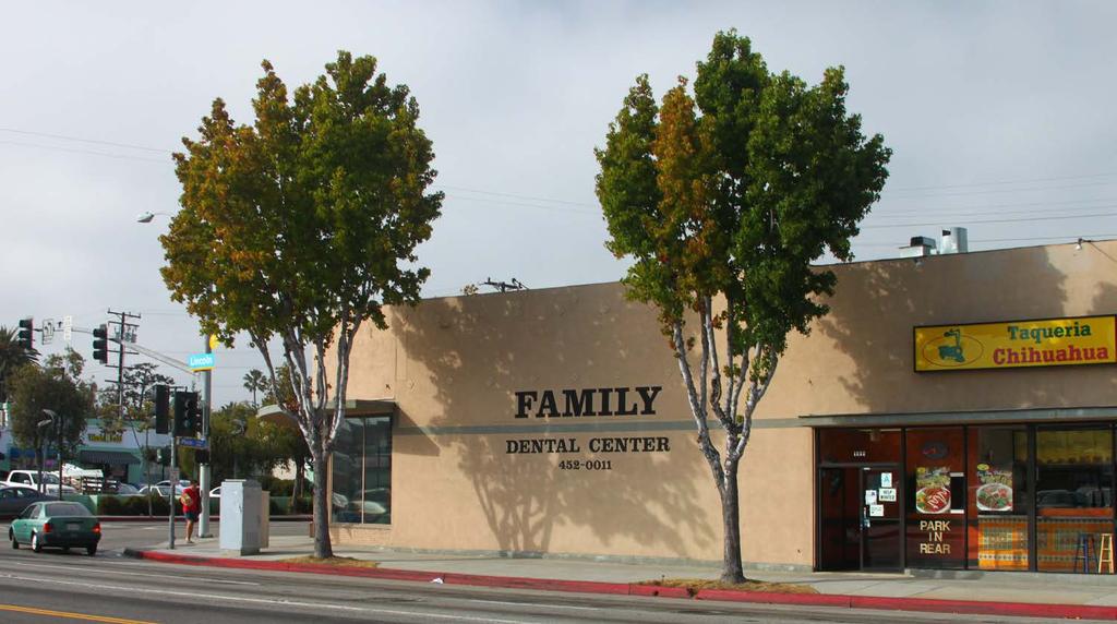
6 Existing Conditions
7


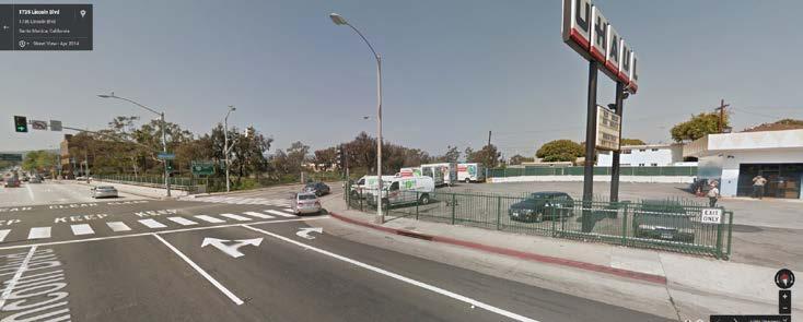
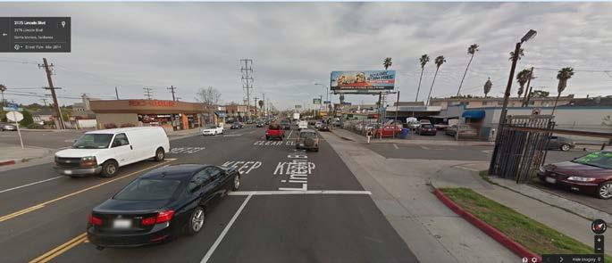
8 Existing Conditions STREET CHARACTERISTICS 76 Street 2 Travel lanes in each direction Center Turn Lane Parking on both sides 12 sidewalks Auto lighting only 12 feet 76 Feet 12 feet The street is wide and designed for the sole purpose of accommodating lots of vehicles


9 Existing Conditions BUILDING CHARACTERISTICS Mostly 1- and 2-story, some larger Older in nature Variety in lot depths and limited alley access limits redevelopment


10 Existing Conditions LAND USES Lots of small businesses Very few vacancies! Eclectic mix of old and new High % of auto-oriented: used cars, tire sales, repair Some retail/restaurant and neighborhood-serving


11 Existing Conditions 2012 RELINQUISHMENT Caltrans relinquished street to City control/operation 3 year process Planning effort identified to improve the boulevard
12 Streetscape and the Pedestrian Experience


13 Facades and Public Realm Issues: A DIAMOND IN THE ROUGH? Steel fencing, barbed wire and blank or non-transparent facades General lack of investment in storefronts and landscaping Code violations signage, windows


14 Barriers to Access 1200 Feet Limited Crossings Curb Ramps and driveways not ADA Compliant Signage and street furniture limits access

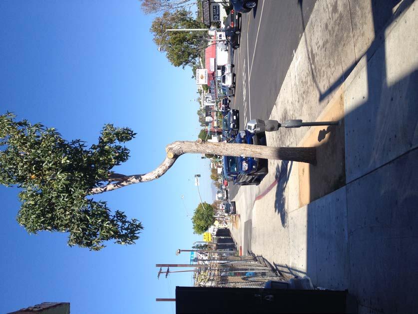
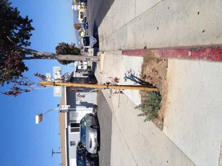
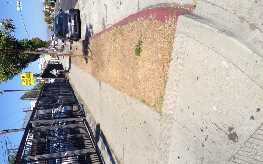
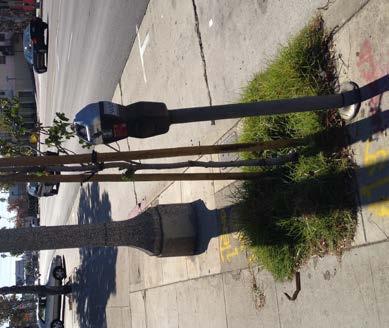
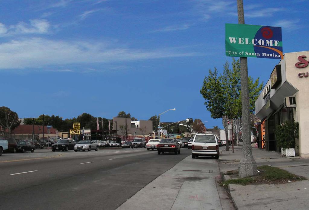
15 Landscaping and Trees LANDSCAPING/TREES Lots of mature trees Limited canopy (vase shaped) Wide spacing Some trees missing or in poor health Lack of care in parkways Weeds


16 Pedestrian Comfort and Safety PEDESTRIAN AMENITIES Wide sidewalks, but dirty and unkempt Trash and litter, few trash cans (only at bus stops) Street furniture and installations showing age No pedestrian lighting General feel of neglect


17 Street Life OPPORTUNITY FOR ENHANCEMENT Lots of community members use Lincoln Low Crime Stats Crime Homeless Issues Fire/Medical Frequent trash service Few Traffic Violations Limited evening uses


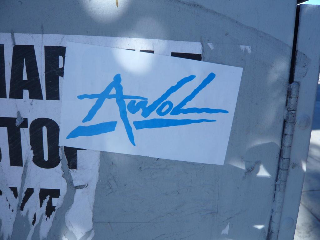
18 Visual Interest and Culture VISUAL AMENTIES Improving due to grassroots movement New investment cleaning up shopfronts Sporadic, needs coordinated approach
19 Traffic and Infrastructure


20 Congestion HIGH VOLUME 40,000+ Daily Vehicles Peak N/B: 7:30-9AM Peak S/B: 1-8PM


21 Transit Services RIDERSHIP Lincoln served by BBB#3 and R3 Congestion limits bus movements for much of the day Off-Peak Peak Commute BBB seeks ways to shorten travel times to increase ridership N/B


22 Freeway Off-Ramps and Bridge NO MANS LAND Confusing for pedestrians and a barrier to north/south connectivity Cluttered gateway into Downtown Santa Monica Infrastructure and lack of landscaping creates a hard edge
23 Land Uses and the Business Community


24 Land Uses that Serve Daily Needs MORE NEIGHOBORHOOD SERVING USES? New destinations desired by community: Restaurants Cafes and coffee shops General retail Grocery Entertainment, etc.


25 The Business Community ADDRESSING CORRIDOR AS A COMMUNITY Many businesses have nothing in common, save for Lincoln Blvd. Lack of pride in public realm, landscaping, pedestrian experience Limited coordination for events and marketing No voice for advocacy or improvements
26 The Lincoln Neighborhood Corridor Plan

27 Project Team

28 Project Team + The Studio of Tad Savinar
29 City Team Planning Public Works Big Blue Bus Economic Development Community and Cultural Services * Includes input from Police, Fire and Maintenance
30 Go from Good to Great! Project Goals Improve streetscape conditions for pedestrians, vehicles, transit and other users Retain existing businesses, and attract new ones that serve the local community. Assist with formation of merchant association or Business Improvement District Resolve parking issues and address retail demand Enhance transit ridership Beautify Lincoln Boulevard


31 DETAILED STREETSCAPE DESIGN Crosswalks and Signals ADA Accessibility Sustainable landscaping/ pedestrian lighting Intersection & Travel Lane Modifications Elimination of curb cuts and driveways Sidewalk Enhancements Project Scope
")

32 Project Scope BUSINESS IMPROVEMENT TOOLKIT Short-Term common sense approaches Long-Term Management (BID) Adaptive reuse standards and guidelines Improved Facades Event Programming Incentives to attract desired uses


33 Project Scope BEAUTIFICATION PROGRAM Paint and Planters Branding Opportunities Public Art and Murals Creative Signage Banners History-based Expressions Community-led and grass roots opportunities


34 Project Scope PARKING AND TDM Parking Inventory Study Smart meter data Ground effort Opportunities for employee shared parking Modifications to parking requirements to incentivize desired uses Trip reduction strategies and implementation measures


35 TRANSIT NETWORK ENHANCEMENTS Improve ridership, speed Improve visibility and use of bus stops Enhanced wayfinding Mobility Hubs at transit crossroads Project Scope Potential for dedicated bus lanes In coordination with City of LA


36 Project Scope PUBLIC OUTREACH Workshops Stakeholder Interviews Letters to Property Owners Focus Groups Social Media Demonstration Projects and Pop-up Events Mindmixer Public Participation Tools Collaboration with Lincoln Boulevard Taskforce
37 Project Timeline Initiation and Concepts Refinement Assessment Development and Selection 4 Plan Preparation and Adoption Fall/Winter 2014/5 Winter/Spring 2015 Summer/Fall 2015 Winter/Spring 2016


38 Visit us at Project updates Social media links Notifications Also at:
Draft Bergamot Area Plan
 ATTACHMENT 1 Draft Bergamot Area Plan Taskforce on the Environment April 15, 2013 www.bergamotplan.net 1 Overview WHAT IS THE BERGAMOT AREA PLAN? A Community-Based Planning Document Guiding the Future
Lower Merion Commercial Districts Issues and Characteristics Handbook November 2013
 Lower Merion Commercial Districts Issues and Characteristics Handbook November 2013 DRAFT TOWNSHIP-WIDE VISION: To maintain and enhance commercial areas to complement the surrounding high-quality residential
EXPO LINE COMMUNITY WORKSHOPS NOVEMBER 27 TH & DECEMBER 3 RD Los Angeles Department of City Planning
 EXPO LINE COMMUNITY WORKSHOPS NOVEMBER 27 TH & DECEMBER 3 RD 2012 Los Angeles Department of City Planning Agenda for Tonight Open House 6:00 to 6:15pm Presentation and Questions 6:15 to 6:50 Small Group
LUNDY S LANE COMMUNITY IMPROVEMENT PLAN STUDY
 PUBLIC INFORMATION MEETING #2 October 12, 2016 LUNDY S LANE COMMUNITY IMPROVEMENT PLAN STUDY AGENDA 5:00 to 5:30pm: Open House 5:30 to 6:15pm: Presentation 6:15 to 7:00pm: Individual paced workshop with
Transportation. Strategies for Action
 Transportation A major priority for the Overlake Neighborhood is to develop a multimodal transportation system. To achieve this system, a balance has to be found among travel, circulation and access needs;
Town Center (part of the Comprehensive Plan)
") Town Center (part of the Comprehensive Plan) Mercer Island Town Center Looking North (2014) In 1994, a year-long process culminated in a set of design guidelines and code requirements for the Town Center
Town Center (part of the Comprehensive Plan) Mercer Island Town Center Looking North (2014) In 1994, a year-long process culminated in a set of design guidelines and code requirements for the Town Center
THEMES, VISION, + PRINCIPLES
 CHAPTER 2: THEMES, VISION, + PRINCIPLES This page intentionally left blank. 20 VISION DRAFT AUGUST 2018 2 2 THEMES, VISION, + GUIDING PRINCIPLES The Key Themes, Vision, and Guiding Principles presented
Metro 2010 Pedestrian Symposium Walking into the Future City
 Metro 2010 Pedestrian Symposium Walking into the Future City John Kaliski, AIA, May 12, 2010 How can our transportation and land use policies create complete streets for all users? How do we optimize the
RESEDA - WEST VAN NUYS COMMUNITY PLAN
 RESEDA - WEST VAN NUYS COMMUNITY PLAN Executive Summary As part of the initial outreach effort, the Department of City Planning hosted two workshops for the Reseda-West Van Nuys Community Plan Area during
THE GREEN VISION WORKSHOP Friday, November 6, 2009
 THE GREEN VISION WORKSHOP Friday, November 6, 2009 SUSTAINABLE LONG RANGE PLANNING IN SANTA MONICA Eileen Fogarty Director, Planning and Community Development GREEN BUILDINGS Santa Monica has the most
Chapter 1: Introduction
 Chapter 1: Introduction The Penn Avenue Community Works Corridor Vision and Implementation Framework presents an integrated communitybased vision and a coordinated, long-term implementation framework for
MONTGOMERY COUNTY METRO STATION AREA DESIGN CHARRETTE
 MONTGOMERY COUNTY METRO STATION AREA DESIGN CHARRETTE Shady Grove Metro Station Area Charrette Closing Presentation October 25-28, 2000 MONTGOMERY COUNTY, MD M-NCPPC Design Collective, Inc. Architects
Making Transit Oriented Development Work For Boonton, NJ
 Making Transit Oriented Development Work For Boonton, NJ Bloustein School of Planning and Public Policy Studio Dan Burton Loannie Dao Webster Slater Brandon Williams Ian Watson Maria Laham Nicola Mammes
Table of Contents. Elm Avenue Improvement Plan City of Waco, Texas. Introduction 1. Existing Context 1 Figure 1 2.
 Table of Contents Introduction 1 Existing Context 1 Figure 1 2 Plan Guidelines 3 Future Urban Form 4 The West-End 4 Main Street 6 The East-End 7 Figure 2 9 Public Improvement Recommendations 7 General
Downtown North Las Vegas Demonstration Site Project. Project Update
 Downtown North Las Vegas Demonstration Site Project Project Update 7.16.14 Presentation Overview Project Purpose and Process Planning Context Opportunities and Barriers Summary Community Input Preliminary
ORANGE LINE TRANSIT NEIGHBORHOOD PLANS VAN NUYS NEIGHBORHOOD COUNCIL, PLUM COMMITTEE DEPARTMENT OF CITY PLANNING, CITY OF LOS ANGELES
 Photo: Mission Meridian(Moule & Polyzoides) ORANGE LINE TRANSIT NEIGHBORHOOD PLANS VAN NUYS NEIGHBORHOOD COUNCIL, PLUM COMMITTEE DEPARTMENT OF CITY PLANNING, CITY OF LOS ANGELES JULY 18, 2018 Project partially
Mid City Neighbors
 Mid City Neighbors 7.21.2014 www.memorialparkplan.net PURPOSE OF TONIGHT S MEETING 1. Introduction And Overview Of the Memorial Park Neighborhood Plan 2. Review of Outreach 3. Discussion Of The Plan s
Project Overview & Summary of Existing Conditions
 Project Overview & Summary of Existing Conditions 1 Project Overview Project Goals, History, Scope 2 Timeline / Process Overall Process & Where We Are Task Force Process & Role of Task Force Existing Conditions
Community Design Plan
 Gardena General Plan 2006 Authority While the is not a required element of a General Plan, it is included because improving the community appearance and image is paramount to the overall quality of life
Chapter 4. Linking Land Use with Transportation. Chapter 4
 Chapter 4 Linking Land Use with Transportation Chapter 4 59 Chapter 4 Linking Land Use with Transportation Community Design and Transportation Program Introduction Since the 1950s, the predominant development
VISION AND GUIDING DESIGN PRINCIPLES
 pleasure point commercial corridor VISION AND GUIDING DESIGN PRINCIPLES Public Draft November 26, 2018 County of Santa Cruz with assistance from MIG CONTENTS PART I: INTRODUCTION AND VISION... 3 Community
Pico Neighborhood Association
 Pico Neighborhood Association 7.24.2014 www.memorialparkplan.net PURPOSE OF TONIGHT S MEETING 1. Introduction And Overview Of the Memorial Park Neighborhood Plan 2. Review of Outreach 3. Discussion Of
East Central Area Plan
 East Central Area Plan Steering Committee Meeting March 8 th, 2018 CHUN Tears McFarlane House Vision Statement Development Opportunities Analysis Vision Elements 1. Equitable, Affordable and Inclusive
Lambeth Main Street Streetscape Improvements
 Lambeth Main Street Streetscape Improvements Open House October 5th, 2017 Agenda 1. Introduction 2. Project Background 3. Context 4. Project Objectives 5. Design Principles & Approach 6. Streetscape Design
Old Town Neighborhoods Plan. Choices Event Wednesday, December 9, 2015
 Old Town Neighborhoods Plan Choices Event Wednesday, December 9, 2015 Agenda 6:00 6:10 p.m. Welcome + Sign In 6:10 6:30 p.m. Presentation 6:30 8:00 p.m. Workshop + Open House Seeking your input on: Neighborhood
Welcome & Introductions
 Charrette Week Report Back - Thursday Evening April 25, 2013 Welcome & Introductions A New Master Plan Land Use and Circulation Putting data and information to work to create solutions for the master plan
PIKE PINE RENAISSANCE: ACT ONE. October 19, 2017
 PIKE PINE RENAISSANCE: ACT ONE October 19, 2017 WATERFRONT SEATTLE PROGRAM PROJECT INTRODUCTION Pike and Pine streets, between First and Melrose avenues Pedestrian and streetscape improvements Budget:
Dyersville Downtown Plan. Open House October 24, 2017
 Dyersville Downtown Plan Open House October 24, 2017 What is a Comprehensive Plan? - Vision - Guidance for decisions - Basis for regulations What is a Downtown Plan? - Understand priorities - Identify
Building Great Neighbourhoods. Strathcona
 Building Great Neighbourhoods Strathcona March 21, 2018 Becky Redford Project Manager, Planning & Design Building Great Neighbourhoods Integrated Infrastructure Services Welcome and Purpose To provide
ARLINGTON COUNTY, VIRGINIA
 ARLINGTON COUNTY, VIRGINIA County Board Agenda Item Meeting October 15, 2005 DATE: September 28, 2005 SUBJECT: Request to Advertise the adoption of the 2005 Clarendon Sector Plan C. M. RECOMMENDATION:
Ivywild On The Creek PRELIMINARY CREEK DISTRICT MASTER PLAN
 Ivywild On The Creek PRELIMINARY CREEK DISTRICT MASTER PLAN Introduction: Rejuvenating an extraordinary Creekside neighborhood THE CREEKSIDE DISTRICT The Ivywild On The Creek Neighborhood District Master
Figure BE-4: Urban Form - Corridors. Urban Form and Land Use. Page BE-24 Redwood City General Plan S A N F R A N C I S C O B A Y.
 and Land Use Bird Island S A N F R A N C I S C O B A Y Foster City Bair Island Belmont Greco Island San Carlos Veterans Blvd. El Camino Real Broadway Middleeld Rd. Menlo Park Woodside Rd. Features El Camino
TRANSIT-ORIENTED DEVELOPMENT POLICY DRAFT. City Planning and Development Department Kansas City, Missouri
 TRANSIT-ORIENTED DEVELOPMENT POLICY DRAFT City Planning and Development Department Kansas City, Missouri What is Transit Oriented Development (TOD)? Development that focuses land uses around a transit
July 12, Columbus City Council City Hall 90 West Broad Street Columbus, OH RE: I-70/71 Columbus Crossroads Project
 OHIO DEPARTMENT OF TRANSPORTATION DISTRICT 6 400 EAST WILLIAM STREET DELAWARE, OHIO 43015 800.372.7714 Columbus City Council City Hall 90 West Broad Street Columbus, OH 43215-9015 RE: I-70/71 Columbus
Elm Street Business District: Streetscape and Signage Plan
 Elm Street Business District: Streetscape and Signage Plan VILLAGE OF WINNETKA DOWNTOWN MASTER PLAN VILLAGE COUNCIL MEETING Final Streetscape & Signage Planning Teska Associates 04 June 2018 WHY WE RE
Lehigh Acres Land Development Regulations Community Planning Project
 Lehigh Acres Land Development Regulations Planning Effort Summary In July, 2010 Commissioner Frank Mann invited the Lehigh Acres community to start discussing how to achieve their recently adopted community
Santa Monica Chamber of Commerce DSP Subcommittee s DSP EIR Scoping Comments and Preliminary Comments on the DSP Framework
 Santa Monica Chamber of Commerce DSP Subcommittee s DSP EIR Scoping Comments and Preliminary Comments on the DSP Framework The Chamber of Commerce s DSP Subcommittee s comments on the scope of the DSP
Public input has been an important part of the plan development process.
 Lakewood s Comprehensive Plan recognizes that transportation helps shape the community, and that the way the community provides for the safe and efficient movement of people affects the character of the
Silverdale Regional Center
 Silverdale Regional Center Vision for Silverdale Regional Center The Silverdale Regional Center Plan (Plan) will guide the evolution of the Silverdale Regional Center from a collection of strip malls and
ITEM #8. Regional Smart Growth Program. Regional Smart Growth Program. Presentation Overview. Coast Highway Vision and Stategic Plan.
 Regional Smart Growth Program Economic Development Commission What is Smart Growth? Adopted as part of the Regional Comprehensive Plan (RCP) RCP provides vision for region based on Smart Growth and sustainability
JANUARY 19, 2011 CENTRAL AVENUE-METRO BLUE LINE TRANSIT-ORIENTED DEVELOPMENT IMPLEMENTATION PROJECT COMMUNITY FORUM
 CENTRAL AVENUE-METRO BLUE LINE TRANSIT-ORIENTED DEVELOPMENT IMPLEMENTATION PROJECT COMMUNITY FORUM JANUARY 19, 2011 THE MARYLAND-NATIONAL CAPITAL PARK AND PLANNING COMMISSION PRINCE GEORGE S COUNTY PLANNING
A larger version of this map is located on the last page of this PDF.
 MAP Committee Input McLoughlin Area Draft Vision Map A larger version of this map is located on the last page of this PDF. 1. The map above is intended to portray a vision for the McLoughlin area. It highlights
Copake Hamlet Plan: Visioning Workshop
 Copake Hamlet Plan: May 2-3 rd 2015 Design Team Mauricio Castro PLACE Alliance Ian Law PLACE Alliance Paula Diaz PLACE Alliance Mary Moore Wallinger PLACE Alliance Margaret Irwin River Street Planning
DRAFT. 10% Common Open Space
 % OF CHARLOTTE IS CATEGORIZED AS A. LAND USES : Placeholder map displaying location of Place Type GOALS: Accommodate XX% of future growth. Provide a concentration of primarily commercial and civic activity
City of Villages Parking Strategies. William Anderson, FAICP City Planning & Community Investment San Diego Parking Symposium July 14, 2006
 City of Villages Parking Strategies William Anderson, FAICP City Planning & Community Investment San Diego Parking Symposium July 14, 2006 City of Villages Strategy A hierarchy of walkable, mixed use districts
South Davis County COMMUNITY SPOTLIGHT
 South Davis County COMMUNITY SPOTLIGHT Davis/SLC Community Connector Bus Rapid Transit line connecting SLC & Davis County RTP Phase 1 Project Generate 3,100 average weekday riders Relieve congestion on
4- PA - LD - LIVELY DOWNTOWN. LD - Background
 4- PA - LD - LIVELY DOWNTOWN LD - Background The downtown has been the service centre for the community since the city s inception and the area continues to supply people with their personal services,
Route 1 Corridor Study
 Route 1 Corridor Study Westbrook, Connecticut A Vision for the Connecticut Shoreline Public Informational Meeting July 28, 2015 Lower Connecticut River Valley Council of Governments Fitzgerald & Halliday,
Hamilton Road Corridor Streetscape Master Plan. Open House October 4 th, 2017
 Hamilton Road Corridor Streetscape Master Plan Open House October 4 th, 2017 Agenda 1. Introductions Agenda Overview 2. Project Background 3. Existing Conditions 4. Strengths, Weaknesses, Opportunities
DOWNTOWN NORFOLK COUNCIL ACTION PLAN. Strategic Initiatives Focus Area Objectives. Departmental Focus Area Key Objectives
 DOWNTOWN NORFOLK COUNCIL ACTION PLAN FY18 Strategic Initiatives Focus Area Objectives Departmental Focus Area Key Objectives STRATEGIC INITIATIVES FOCUS AREA OBJECTIVE #1: NURTURE A VIBRANT URBAN ENVIRONMENT
Appendix A COMMUNITY IMPROVEMENT PLAN DESIGN GUIDELINES
 Appendix A COMMUNITY IMPROVEMENT PLAN DESIGN GUIDELINES INTRODUCTION The continuous and desirable improvement of Arnprior requires a clear understanding of what is envisioned for the Town. These Design
City of Bristol Route 6 Corridor Implementation Program
 City of Bristol Route 6 Corridor Implementation Program FITZGERALD & HALLIDAY, INC. Innovative Planning, Better Communities June 2017 Route 6 Corridor Plan IMPLEMENTATION PROGRAM The following Implementation
Courthouse Square Planning & Urban Design Study. Courthouse Square Working Group #13 October 15, 2014
 Courthouse Square Planning & Urban Design Study Courthouse Square Working Group #13 October 15, 2014 1 Courthouse Square Process Working Group Community Courthouse Square Advisory Groups & Civic Associations
Policies and Code Intent Sections Related to Town Center
 Policies and Code Intent Sections Related to Town Center The Town Center Vision is scattered throughout the Comprehensive Plan, development code and the 1994 Town Center Plan. What follows are sections
PLAN ELEMENTS WORKSHOP. April 5, 2016
 PLAN ELEMENTS WORKSHOP April 5, 2016 needs more housing. But there is no one-size fits-all solution. Every neighborhood has its own character. In some places, density is not only appropriate it is badly
Sahuarita District & Phase 1 Master Plan. Town Council December 11, 2017
 Sahuarita District & Phase 1 Master Plan Town Council December 11, 2017 Visioning Study Visioning Process Advisory Group Meetings Community Questionnaire Town Center Case Studies Community Analysis The
Summary of Public Input & Discussion of Alternatives
 Meeting #4 Summary of Public Input & Discussion of Alternatives May 6 th, 2009 City of Bellingham, Washington April 1 April 15 April 22 May 6 Introduction, Character and Boundary Study Areas Public Realm:
Complete Streets Master Plan for Downtown New Britain CRCOG Transportation Committee Meeting Monday, December 9, 2013
 CRCOG Transportation Committee Meeting Monday, December 9, 2013 Introduction Why the Project was Initiated About Downtown New Britain Master Plan Goals Master Plan Overview Master Plan Study Areas and
Ballston Station Multimodal Study. Stakeholder Meeting October 5, 2010
 Ballston Station Multimodal Study Stakeholder Meeting October 5, 2010 Agenda Welcome and Introductions Update on Short Term Improvements Update on the Multimodal Study Recap of Goals and Key Issues Working
TOWN COUNCIL / PLANNING COMMISSION
 Workshop #3 TOWN COUNCIL / PLANNING COMMISSION January 20, 2011 Consultant Team In Attendance Tonight BMS Design Group Nevada City and San Francisco Michael Smiley, AICP, ASLA Partner-in-Charge Nancy L.
Denver Moves: Transit Task Force
 Insert transit picture Denver Moves: Transit Task Force Meeting #8 October 5, 2017 1. Welcome & Introductions Opening remarks and housekeeping Task Force and audience introductions Upcoming events and
Study Area. Capitol Way. Greening America s Capitals 11/13/2014. A Greening America s Capitals Project
 Olympia, WA: Greening Capitol Way Supporting Communities move towards sustainability is a priority for the federal government. A Greening America s Capitals Project Office of Sustainable Communities U.S.
Zoning Code Issues Prioritization
 City of Streetsboro The City of Streetsboro has begun the process of updating its Zoning Code. The new Zoning Code will be based on the recently adopted Comprehensive Plan, which establishes the overall
Johnson Street Bridge Public Realm Update
 Johnson Street Bridge Public Realm Update August 20, 2015 Background Johnson Street Bridge Replacement Project impacts a diverse range of stakeholders In addition to a new bridge, the project also includes
PROTECT AND PROMOTE QUALITY OF LIFE AND LIVABILITY FOR THE CITIZENS OF GAINESVILLE THROUGH QUALITY URBAN DESIGN.
 Goals, & Urban Design Element PROTECT AND PROMOTE QUALITY OF LIFE AND LIVABILITY FOR THE CITIZENS OF GAINESVILLE THROUGH QUALITY URBAN DESIGN. GOAL 1 By 2003, the City shall adopt urban design standards
From Dismal to Great: How Underperforming Commercial Corridors are Crafting a Healthier, Better Connected Future
 From Dismal to Great: How Underperforming Commercial Corridors are Crafting a Healthier, Better Connected Future October 7, 2015 Urban Land Institute Fall Meeting San Francisco Participants: Moderator:
Executive Summary. NY 7 / NY 2 Corridor
 Executive Summary NY 7 / NY 2 Corridor Transportation and Land Use Study December 2005 Prepared for: Town of Colonie Capital District Transportation Committee Prepared by: Introduction: Land use decisions
Urban Design Manual PLANNING AROUND RAPID TRANSIT STATIONS (PARTS) Introduction. Station Study Areas
 Introduction. Station Study Areas") 111111 PLANNING AROUND RAPID TRANSIT STATIONS (PARTS) Introduction The ION rapid transit system will link Waterloo, Kitchener and Cambridge through a central transit corridor (CTC). There are a number
111111 PLANNING AROUND RAPID TRANSIT STATIONS (PARTS) Introduction The ION rapid transit system will link Waterloo, Kitchener and Cambridge through a central transit corridor (CTC). There are a number
The University District envisions, in its neighborhood
 Envisioning the University District Link Light Rail in Seattle s neighborhoods CIY OF SEALE CONCEP-LEVEL SAION AREA PLANNING RECOMMENDAION RESOLUION # 30165 EXHIBI L Vision 08.2000 he University District
NORTH LAKE SPECIFIC PLAN AREA
 NORTH LAKE SPECIFIC PLAN AREA June 21, 2018 WELCOME Workshop Agenda Introduction Provide information about the program and introduce the team Background Information Share information about the North Lake
DRAFT Civic Center Station Area Plan. Executive Summary
 DRAFT Civic Center Station Area Plan Executive Summary This project is funded in part through the Metropolitan Transportation Commission s Station Area Planning Program. The preparation of this report
NOVEMBER 2016 AARP IN ST. LOUIS & CITIZENS FOR MODERN TRANSIT PLACEMAKING STRATEGIES FOR ST. LOUIS TRANSIT DRAFT
 NOVEMBER 2016 AARP IN ST. LOUIS & CITIZENS FOR MODERN TRANSIT PLACEMAKING STRATEGIES FOR ST. LOUIS TRANSIT DRAFT SECTION 3 RECOMMENDATIONS AARP IN ST. LOUIS + CMT + ARCTURIS + THE INNIS GROUP 37 SECTION
Tyvola & Archdale Transit Station Area Plan. June 5, 2008
 Tyvola & Archdale Transit Station Area Plan Second Public Meeting June 5, 2008 Presentation Outline 1. Purpose and Process 2. Station Area Overview 3. Plan Recommendations 4. Comments Received and Proposed
appendix and street interface guidelines
 appendix five: building and street interface guidelines appendix 5 building and street interface guidelines BOULEVARDS Boulevards are generally characterized by higher levels of traffic movement at higher
2015 Livable Lents Community Survey
 5 INS All Responses YMCA Arts Center Mt Scott Community Center RD Planned Asian Health & Service Center FUER Malden Court Communtiy Orchard BLVD- ST Green Lents Tool Library Neighbors Come Together to
Good Design Guidelines for Downtown. Preliminary Findings and Recommendations
 Good Design Guidelines for Downtown Preliminary Findings and Recommendations City Council Meeting - February 5, 2017 Advisory Committee Team: Larry Paul: Planning Commission /Architect Bruce Bagnoli: Business
WEST LOOP DESIGN GUIDELINES CHECKLIST
 WEST LOOP DESIGN GUIDELINES CHECKLIST Section 1.0 General Strategies 1.1 DESIGN EXCELLENCE: ENCOURAGE HIGH QUALITY AND INNOVATIVE DESIGN OF NEW BUILDINGS WITHIN THE WEST LOOP WITHOUT BEING PRESCRIPTIVE
Citizen Advisory Group Meeting 5: Land Use April 14, 2011
 Citizen Advisory Group Meeting 5: Land Use April 14, 2011 Meeting Agenda 1. Background Review 2. Transportation Follow-up 3. PED Overlay Approach 4. Land Use Mapping 5. Group Exercise 6. Wrap-up and Next
STREETSCAPE SURVEY 2018
 STREETSCAPE SURVEY 08 - - 9-7 - 0-8 -6 - - -0-8 - - - -9-0 -7-8 -5-6 - - - - -5-6 - - - - 9-0 - 7-8 - 5-6 -7-8 - 6-6- 5-6 5-5 5-5- 5-8 5-7 - 6-5 6-6 5-5- - 5-9 5-0 5-5- - 5-5- 5-9 5-0 5-9 -5 5-5- 5-0 -
Request Alternative Compliance to the prescribed criteria of the Oceanfront Resort District Form- Based Code. Staff Recommendation Approval
 Applicant Property Owner Steven H. Murden Public Hearing June 14, 2017 City Council Election District Beach Agenda Item 8 Request Alternative Compliance to the prescribed criteria of the Oceanfront Resort
Good Neighbor Plan Dallas Love Field Airport Transportation and Environment Committee
 June 25, 2012 Good Neighbor Plan Dallas Love Field Airport Transportation and Environment Committee Overview Vision for Dallas Love Field Downtown Dallas 360 Plan Targeted Improvement Zones Lemmon Avenue
4.9 Mendocino Avenue Corridor Plan Design Guidelines
 4.9 Mendocino Avenue Corridor Plan Design Guidelines The Mendocino Avenue Corridor Plan addresses the area between College Avenue and Steele Lane. Mendocino Avenue is a busy arterial that runs parallel
Toronto Complete Streets Guidelines
 c. DTAH 58 60 3.1 70 3.2 Performance Measurement 71 3.3 Exceptions Chapter 3 describes the five general steps in the street design process. Not all projects follow these steps, as the number of steps and
Area Plans. September 18, 2012
 Area Plans September 18, 2012 Transfer ratio for existing development up to 1:6 depending on sending parcel sensitivity and distance from community centers and/or transit routes. Within Town Center and
Volume 2: Implementation Plan
 Volume 2: Implementation Plan February 25 th 2002 Implementation Introduction This document outlines the steps that should be taken to implement the Washington Heights Neighborhood Plan. The City Council
U R B A N D E S I G N & D E V E L O P M E N T P L A N
 U R B A N D E S I G N & D E V E L O P M E N T P L A N F O R T H E S K I N K E R D e B A L I V I E R E C O M M U N I T Y P U B L I C W O R K S H O P # 3 S T. L O U I S, M I S S O U R I H 3 S T U D I O M
Tonight s Agenda. 7:45 p.m. Next Steps 8:00 p.m. Close
 Community Workshop #3 January 28, 2016 Team Tonight s Agenda 6:00 p.m. Welcome and Introductions! 6:15 p.m. Draft Specific Plan Overview Project Process Update Vision and Objectives Overview Key Findings
 Community Workshop #2 December 4, 2014 Team Tonight s Agenda 6:00 pm Welcome! 6:05 pm The Future of Downtown Tustin Ideas, Strategies and Recommendations 6:35 pm Questions and Comments 6:50 pm Open
V. Vision and Guiding Principles
 V. Vision and Guiding Principles The Master Plan for the Powers Ferry Corridor seeks a foundation in the desires of the community. At times, various elements of the community offered opposing viewpoints,
WELCOME and introduction
 1 WELCOME and introduction Mobility Hub Locations within Burlington STUDY OVERVIEW STUDY OBJECTIVES The City of Burlington is developing four Area Specific Plans, one for each of Burlington s Mobility
TOPIC AREA #1 SUSTAINABILITY, OPEN SPACE & CONSERVATION
 TOPIC AREA #1 SUSTAINABILITY, OPEN SPACE & CONSERVATION Even though the term sustainability was not widely used when the General Plan was last updated, many sustainable policies were incorporated throughout
Carlsbad Village Redevelopment Concept Summary of Features
 Carlsbad Village Redevelopment Concept Summary of Features Calthorpe Associates November 5, 2003 The Redevelopment Concept illustrates a vision for the future of Carlsbad Village. The overall vision of
[Leveraging & Improving Neighborhood Connections] Area C Lamar Levee
![[Leveraging & Improving Neighborhood Connections] Area C Lamar Levee](/thumbs/78/78438669.jpg "[Leveraging & Improving Neighborhood Connections] Area C Lamar Levee") Community Charrette LINC Dallas [Leveraging & Improving Neighborhood Connections] Area C Lamar Levee 06.02.12 LINC Workshop Area C Schematic design has been completed on plans to extend the east levee
Community Charrette LINC Dallas [Leveraging & Improving Neighborhood Connections] Area C Lamar Levee 06.02.12 LINC Workshop Area C Schematic design has been completed on plans to extend the east levee
Downtown Whitby Action Plan
 Downtown Whitby Action Plan Final Report October 2016 Table of Contents Introduction 1 Public Consultation 2 Walkability 3 Downtown Whitby Walkability Map 4 Vision 5 Goal & Objectives 6 Objective 1 7 Objective
GREENING THE BOULEVARD Master Plan Concepts for Venice Boulevard between Lincoln and Sawtelle
 GREENING THE BOULEVARD Katherine Spitz Associates Inc. 4212½ Glencoe Avenue Marina Del Rey, CA 90292 310 574 4460 Fax 574 4462 January 2008 Table of Contents Overview Proposed Design Improvements Illustration
open house 3 CITY OF SALEM Downtown Streetscape Plan
 open house 3 Streetscape concepts CITY OF SALEM Downtown Streetscape Plan analysis concepts we are here refined concepts & document Feb 13th 1 2 3 apr 18th KICKOFF OPEN HOUSE Streetscape Work Group Walking
Commercial Node Plan Devine Street/Jackson Blvd. COLUMBIA, SC
 Commercial Node Plan Devine Street/Jackson Blvd. COLUMBIA, SC 9.17.13 AGENDA 1 Introductions 2 Project Update 3 Concepts 4 Recommendations 5 Next Steps Introductions Project Update Process 5-Phase Process
In surveys, Dallas residents say what they want to change most
 NEIGHBORHOODS ELEMENT In surveys, Dallas residents say what they want to change most in the city is its appearance they want it to look beautiful, with trees and pedestrian-friendly neighborhoods. The
ULI St. Louis Technical Assistance Panel
 ULI St. Louis Technical Assistance Panel ULI St. Louis Technical Assistance Panel Sponsored by: Citizens for Modern Transit in partnership with METRO ULI St. Louis Mission Statement The mission of the
I-84 Hartford Project Open Planning Studio #12. April 25, 2017
 I-84 Hartford Project Open Planning Studio #12 April 25, 2017 Meeting Agenda 1. I-84 Hartford Project alternatives update 2. Multimodal station area planning 3. I-84 / I-91 Interchange Study coordination