Archived. April 27, 2015
|
|
|
- Hector Benson
- 5 years ago
- Views:
Transcription

1 F e d e r a l C e n t e r Comprehensive Plan Amendment City of Lakewood August 2008
2 Acknowledgements Table of Contents Lakewood Mayor and City Council Mayor: Bob Murphy Ward I: Vicki Stack Karen Kellen Ward IV: doug Anderson adam Paul Ward II: Ward V: Debbie Koop diana Allen Cindy Baroway tom Quinn Ward III: Sue King Ed Peterson Lakewood Planning Commission Ward I: Ward V: John Plotkin George Brown III Ward II: Tracy Sheffield Ward III: Rich Urbanowski Ward IV: Jerald Golley At Large: Michael Rohr ray Schoch Background page 1 Regional Context page 2 Site History page 3 Land Use page 3 Planning Goals and Vision page 4 Vision Statement page 4 The Vision page 5 Land Use page 6 Community Design and Character page 6 Transportation page 6 Existing Plans and Related Development Projects page 7 Elements and Characteristics of the Master Site Plan page 8 Description of the Master Site Plan pages 9-12 Implementation Steps pages Acknowledgements page 15
. The Federal Center was acquired in 1941 by the U.S. government and is currently used for office, research, and administrative purposes by 26 federal agencies.")
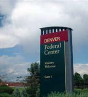
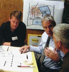
3 Ba c k g r o u n d The Federal Center is a 640-acre secured federal facility operated by the U.S. General Services Administration (GSA). The Federal Center was acquired in 1941 by the U.S. government and is currently used for office, research, and administrative purposes by 26 federal agencies. There are approximately 4.1 million square feet of space in approximately 50 active buildings at the Federal Center, and there are approximately 6,000 on-site employees. The site was annexed by the City of Lakewood in This GSA Master Site Plan for the Federal Center replaces a plan developed in 1997 and addresses new opportunities for site development. An Environmental Impact Statement (EIS), prepared to comply with National Environmental Policy Act (NEPA), evaluated the proposed Master Site Plan alternatives and identified the environmental effects associated with implementing the proposed alternatives. Based on the EIS process and public input, the Final Master Site Plan, and this Comprehensive Plan Amendment, articulates the vision for the Federal Center. A Final EIS (FEIS) accompanies the Final Master Site Plan and contains much of the source and reference documents that support the Final Master Site Plan. A Record of Decision has been prepared that summarizes the Final Master Site Plan and FEIS decisions. GSA sold approximately 65 acres to the City of Lakewood through the federal land disposal process. The land disposal allows for the construction of an inter-modal transit station as part of the Regional Transportation District s (RTD) larger West Corridor Light Rail Transit Line project and the relocation of St. Anthony Central Hospital to the site. The City has since transferred the property to RTD and St. Anthony s Hospital. Also underway are plans to upgrade and expand the infrastructure and utility systems at the Federal Center site. Planning Process GSA s comprehensive planning process to develop a long-range Master Site Plan incorporated communication and outreach to approximately 50 federal, state, and local agencies, as well as community stakeholder groups and members of the general public. The master planning effort has included design charrettes, roundtable committee meetings, community meetings, federal focus groups, federal tenant meetings (on and off site), and numerous stakeholder interviews. The public scoping process included an informal open house workshop, two formal scoping meetings, and two smaller group meetings. These meetings were held at the start of the EIS process as a means to present and discuss the preliminary plan concepts with the public and stakeholders. The input received during scoping was documented and compiled into a scoping report that is available upon request from GSA. U.S. General Services Administration (USA) developed a Master Site Plan that replaces the previously adopted plan and addresses new opportunities for site development. A Final Environmental Impact Statement (FEIS) was prepared to comply with the National Environmental Policy Act (NEPA) and evaluates the proposed Master Site Plan alternatives. The FEIS identifies the environmental effects associated with implementing the proposed alternatives. With the closure of the public comment period on the Environmental Impact Statement (EIS), a Final Master Site Plan was adopted by GSA to articulate the overall vision for the Federal Center. The Final EIS accompanies the Final Master Site Plan. A Record of Decision was adopted that summarizes the Final Master Site Plan and Final EIS decisions. The natural and man-made environmental resources analyzed in the EIS, and summarized in the Record of Decision, include the following: Land Use Socioeconomics Environmental Justice Community Services Public Utilities Transportation Geology and Soils Hazardous Materials Hydrology and Water Quality Vegetation Wildlife Cultural Resources Visual Resources Air Quality Noise/Vibration Federal Center Comprehensive Plan Amendment 1


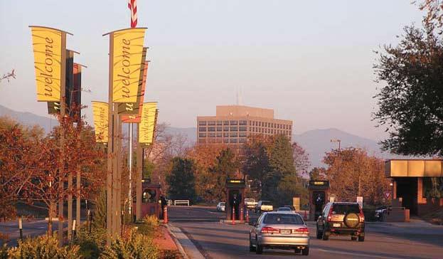
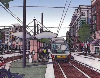
4 Background, continued The Record of Decision summarizes environmental consequences that are more comprehensively described in the Final EIS. Effects on most evaluated environmental resources of implementing the Final Master Site Plan are positive, negligible or temporary. Consequences to some resources require mitigation measures identified in the Final EIS. With implementation of the required mitigation measures, impacts on the environmental resources are not significant. The most extensive mitigation measures necessary to implement the Final Master Site Plan are transportation system improvements, including improvements on the Federal Center and improvements to the arterial street network off-site that serves the Federal Center. The full Record of Decision can be found on the GSA website. Work of the Advisory Committee Once the Master Site Plan was adopted by GSA, the City determined that the plan should be incorporated into the overall Comprehensive Plan in order to complete the inclusion of the Federal Center into the City. The amendment was developed by an advisory committee of City Council and Planning Commission members; representatives of businesses and neighborhoods surrounding the Federal Center; representatives from GSA, RTD and St. Anthony s Hospital; and City staff. The committee then recommended approval of the plan amendment to the Lakewood Planning Commission and City Council. Regional Context The Federal Center property is centrally located in the City of Lakewood; it is within a 15-minute drive to downtown Denver via U.S. Highway 6 (West 6th Avenue) and minutes away from the 470 beltway and Interstate 70 (I-70), the major east-west route through the metropolitan area. The property is bounded on the north by West 6th Avenue, a six-lane major highway; and by major arterial roads on the other three sides: Alameda Avenue on the south, Union Boulevard on the west, and Kipling Street on the east. The Regional Transportation District s (RTD) Cold Springs Park-n-Ride, including approximately 650 parking spaces, is located on the northwest corner of the site. Eight local bus routes, four express routes, three regional routes, and an express bus to Denver International Airport currently serve the facility. As a result of the voter-approved FasTracks initiative, a light rail transit station with several bus bays and 1,000 parking spaces will replace the existing RTD Cold Springs Park-n-Ride. The intermodal station, to be located on the western portion of the site, will be a significant hub for RTD s proposed West Corridor Light Rail Line that will connect Union Station with the Jefferson County Government Center. 2 city of lakewood


5 Land Use Site History Denver Ordnance Plant, 1943 Prior to 1940, the land currently occupied by the Federal Center was used for agriculture and ranching purposes and was known as Downing Ranch. In January 1941, the U.S. Government purchased 1,422 acres of land (including the approximately 640 acres of land now known as the Federal Center campus) for the Denver Ordnance Plant (DOP), a facility constructed for the purpose of the production of small arms ammunition, to be operated by the Remington Company. At its peak, the DOP occupied a site of approximately 3.25 square miles in area, had over 200 buildings with more than 2,400,000 square feet of floor space, 11 miles of railway spur, 15 miles of fencing, 17 miles of roads, six restaurants serving 20,000 meals a day, complete modern police and fire departments, and a fully equipped hospital (DPL 1943). The Federal Center has approximately 4.1 million square feet of rentable space in over 50 active buildings. Although located within Lakewood s city limits, the property retains federal jurisdiction. Except for a few buildings and facilities within the campus, the General Services Administration (GSA) is responsible for the operation and maintenance of the Federal Center s physical assets and natural resources. Facilities not controlled by GSA include the U.S. Post Office at the intersection of Alameda Avenue and Oak Street; the current Regional Transportation District (RTD) Park-n-Ride on the northwest corner of the Federal Center site; and, the U.S. Army Reserve facility on the northeast corner of the property. There is currently no private development on the property. The 6,000 employees located on site represent a range of federal agencies and bureaus, including the, Department of the Interior (U.S. Geological Survey, Bureau of Land Management, Bureau of Reclamation, Minerals Management Services, Office of Surface Mining), U.S. Department of Agriculture, U.S. Department of Health and Human Services (Food and Drug Administration), National Archives and Records Administration, U.S. Environmental Protection Agency, Government Printing Office, U.S. Department of Homeland Security, and the GSA. After World War II, the ammunition plant closed and the buildings were used for office, research, and administration purposes by a number of federal agencies. Many of these buildings continue to be used for such purposes today. Denver Ordnance Plant Security Gate, 1941 Federal Center Comprehensive Plan Amendment 3

6 Planning Goals and Vision The Master Site Plan provides a new long term vision and redevelopment strategy for the Federal Center, including the character and location of new development. As such, the Master Site Plan will serve as a guiding document to ensure that future changes benefit the Federal Center by capitalizing on the availability of transit service and helping to protect the best features of the site, including its premier location and campus setting. In an effort to help realize a new vision for the Federal Center site, the following goals were established at the beginning of the planning process: Safeguard the interests and meet the current and future needs of federal tenants. Maximize the value and appeal of the Federal Center site. Establish a vision for a dynamic, mixed-use center. Capitalize on the premier location and setting to attract new federal and non-federal users. Improvements to the Federal Center s federal tenant campus are intended to retain and attract federal agencies from other metropolitan Denver locations. The objective of the Master Site Plan is to enhance workplace quality-oflife through better commuting access, a broader base of amenities, and a greatly enhanced aesthetic environment. The results of the comprehensive outreach efforts and the involvement of stakeholders helped GSA gain an understanding of the key Master Site Plan issues from a variety of perspectives. The following vision statement and cornerstone principles were developed to express the collective ideas and values that GSA stakeholders, federal tenants, community members, and other partners have for the Federal Center site: VISION STATEMENT This world-class federal campus integrates a mix of uses that complement the larger community. The campus serves as a model for innovative partnerships, enhancing value for taxpayers and the efficiency and longevity of federal operations. In meeting the federal mission, the campus embraces sustainability, design excellence, and greater accessibility for the public. It serves as a prominent and progressive community hub, capitalizing on the availability of public transit and services. The campus reflects a renewed commitment to our collective future. 4 city of lakewood


7 Th e Vision Federal Campus The campus is a place of buildings and open space in concert with the needs of the federal employees and visitors that fosters innovation, public service and agency interaction. An important element of the master plan for the Federal Center is the urban green known as the Quad that along with its surrounding structures creates the heart of the Federal Center. Mix of Uses A cornerstone principle of the master plan for the Federal Center is to integrate the commercial employment uses with the vitality and services of retail, residential, and other supporting land uses. A well organized system of walkable streets with the continuity of trails and bikeways, open space parks and urban greens can create the connection between the transit oriented development districts and less formal campus districts. Sustainability The planning philosophy aims to achieve a nationally recognized sustainable campus environment that embraces all aspects of sustainability including the use of transit; LEED Certified site planning and green architecture; resource management that reduces water usage and integrated stormwater management; energy efficiency and pollution reduction; healthy indoor air; along with the conservation of wildlife and natural resources. Design Excellence GSA s Design Excellence and Urban Livability Program is recognized for the quality of not only buildings but also the public realm of streets, parks and open space. The master plan integrates these program elements and actions to guide the development of the Federal Center. Community Hub The Federal Center is an important destination in the City of Lakewood and the greater metropolitan Denver region. The proposed RTD Intermodal Station, St. Anthony Hospital and public services of Federal agencies will create areas that function as gathering places to service the needs of a variety of users and visitors. Federal Center Comprehensive Plan Amendment 5


8 Land Use Several land use principles were considered in the planning process, including the desire for land use compatibility, the advantages of transit-oriented development, and the preference for a mix of uses, including a federal campus core area. A facilities inventory and analysis was also conducted to determine which existing federal buildings are likely to remain in continued use or have the potential for reuse within the Federal Center. Identifying a federal campus core reflects the desire for an attractive area with appropriate security levels that meets existing and future needs of federal tenants. Other objectives were to ensure compatibility with the surrounding commercial districts and residential neighborhoods, as well as the planned RTD Intermodal Station and St. Anthony Hospital projects. Higher-density transit-oriented development in the vicinity of the planned RTD Intermodal Station is intended to provide amenities that would benefit both the RTD Intermodal Station and the Federal Center such as a complementary mixture of office, research and development, industrial, retail, and potential residential uses. This mix brings increased vitality and market balance to the Federal Center. Co m m u n i t y De s i g n and Character To achieve the vision for the Federal Center, it was essential that the Master Site Plan integrates a mix of uses, is a model for innovative partnerships, and embraces sustainability, design excellence, and greater accessibility for the public. The Master Site Plan was created in response to the local community character and reinforcement of the primary physical characteristics of the site, such as existing land use character and views and consideration of the significant history of the site and its long-standing role in the community. Views from the Federal Center site towards downtown Denver, Green Mountain, and Front Range mountain peaks are an important consideration in the Master Site Plan. Site amenities such as passive and active open space for tenants and members of adjacent neighborhoods are integral to the future of the Federal Center. Resources and issues such as cultural resources, natural greenways and drainages, and sustainability were additional considerations in the development of the Master Site Plan. Tr a n s p o r tat i o n Transportation is a fundamental consideration of the Master Site Plan, not only because of concerns about safety and function, but because connectivity to the planned RTD Intermodal Station is central to the future of the Federal Center. It is essential that the transit station be accessible to pedestrians, bicycles, autos, and regional and local buses. Clear visual and physical connections between the transit station and the surrounding areas are critical to both the federal campus and the existing surrounding community. Traffic studies conducted and analyzed within the context of the Master Site Plan focused on operational and safety issues as well as access and circulation. These traffic studies also examined existing and projected future capacity needs of the road system. Of particular importance is connecting future roadways and infrastructure within the existing hierarchy of streets. Ensuring a sufficient supply of parking on site was also a key objective. 6 city of lakewood


9 Existing Plans and Related Development Projects In conjunction with GSA s federal land disposal action that transferred approximately 65 acres to the City of Lakewood by negotiated sale, Lakewood has annexed the entire Federal Center site into the city limits. An official development plan has been completed and adopted. The land disposal was addressed in an Environmental Assessment, Potential Development of the Western Portion of the Denver Federal Center (GSA 2005a). The Master Site Plan seeks to influence how the two development projects address connections to the Federal Center and the surrounding community, the pedestrian environment, street connections, as well as the preferred orientation and position of the respective buildings. RTD Intermodal Station Current RTD plans for the expansion of the light rail transit system anticipate completion of the West Corridor rail line to Golden in The line will generally follow the alignment of the 13th Street corridor and include an intermodal station in the northwestern portion of the Federal Center. In general, the RTD Intermodal Station will provide increased commuter transportation options and will open a wide array of pedestrian-oriented land use configurations focused around the transit station itself. This transit-oriented development opportunity increases the viability of much denser, higher-value development with a more diverse mix of uses. St. Anthony Hospital The St. Anthony Hospital, relocated from Denver, will be constructed in a two-phase process with expected completion of the first phase by In 2007, St. Anthony estimated that ultimately the new hospital campus will include approximately 380 beds and 150,000 to 200,000 square feet of medical office buildings (figures are approximate). Additional expansion that could include medical offices and other ancillary businesses may also occur over the long term. The construction of the hospital to an area just south of the transit station is expected to further enhance the vitality of the transit-oriented development, particularly for ground-floor retail and medical-related office uses, by increasing ridership levels and improving general pedestrian activity. St. Anthony Hospital Federal Center Comprehensive Plan Amendment 7

10 Elements and Characteristics of the Master Site Plan Key Plan Components The Master Site Plan provides the framework within which land use, community design, environmental, market, transportation, and infrastructure improvements can be made. Key components of the Master Site Plan include the following: A mix of districts including a range of land uses for the Federal Center site including federal activities, research and development, office, lodging, residential, retail, and community/civic; Transit-oriented development for the area immediately adjacent to the proposed RTD Intermodal Station. As the term implies, transit-oriented development involves creating higher-density, pedestrian-friendly districts in proximity to transit. Fundamental to this are three planning considerations: density, directness, and design. Density is a primary consideration in transit-oriented development design because it creates a critical mass close to the station, resulting in an actual increase in transit ridership. Directness refers to the accessibility to transit stations by pedestrians, bicyclists, automobiles, and buses. Design relates to the attractiveness of the buildings and streets near the station, which can greatly influence transit use. A stepped-down density pattern from the north to the south of the Federal Center site, approaching Alameda Avenue. Density is concentrated around the RTD Intermodal Station and the respective campus cores, with less intense development planned adjacent to existing neighborhoods. An additional stepped-down density pattern from the west to east is primarily centered around the mixed-use land uses around the hospital, the proposed intermodal station, and the existing higher density development located along Union Boulevard and becomes less dense and more federally focused moving towards Kipling Street. This is a fundamental principle that helps integrate new uses with the existing development on and off the Federal Center site. Similarly, increased density and building height across the Federal Center site would create a critical mass to establish a vital, attractive heart to the campus. Increasing community recreational amenities, in both active and passive open spaces, to the federal tenants and the general public than what is offered today. An aggressive building demolition plan, with a total of approximately 2.8 million square feet retained relative to the approximate 4.1 million square feet of usable building space that exists today. Preservation and enhancement of natural systems and open space areas to link vegetative areas to help establish connected habitat systems. 8 city of lakewood
11 Description of the Master Site Plan The defining characteristic of the Federal Center Master Site Plan is the central Quad planned for the core of the Federal Center property. The enhanced streetscapes throughout the campus would encourage area workers to walk to and from transit and into adjacent districts. The new, mixed-use center around the Quad would be the heart of the plan and would be woven into the fabric of the surrounding neighborhoods and commercial districts via road and land use connections. The Quad would be surrounded by complementary office buildings, including secure federal buildings, non-secure federal buildings, and research buildings. The Master Site Plan includes a development plan with approximately 3.6 million gross square feet of new development, plus approximately 1400 residential units, organized around two formal open space/park areas that suggest a university campus setting. Taking into account the selected retention and demolition of existing buildings, full build-out of the plan would include approximately 6 million square feet of new and existing developed space and around 1400 residential units (Table 3-1 Land Use Summary). Land uses have been organized in districts that include office, mixed-use, research and development, campus, retail, quad, and open space. The acreage breakdown for each of these districts is found in Table 3-2 Site Plan Summary. The central Quad provides an amenity and compact focal point for the Federal Center. The Quad is planned as an elliptical green located in the center of the Federal Center site and will contain a signature landmark building to serve as an anchor. The distance between the Quad and the transit station, via an urban street, would be equivalent to a 10-minute walk. While currently undeveloped land on the Federal Center property can be developed in the shorter term, currently developed parcels will likely be redeveloped over a longer term. To maintain flexibility, the Master Site Plan provides guidance for both immediate and long-range development projects. It is important to note that all of the buildings and parking locations depicted on the Master Site Plan are conceptual in nature and subject to change during development and future planning. Office Center District The Office Center district is located in the northwestern corner of the Federal Center property, near the Union Boulevard corridor. Excellent visibility along 6th Avenue and a prominent elevation make this an attractive location for office space. Because the metropolitan Denver office market is still recovering from a sharp downturn in 2002 and 2003, some retail development could also occur north of North Avenue. This district is perhaps the most obviously valuable parcel for conventional (i.e., auto-oriented) retail development given its visibility from 6th Avenue. Under conditions of a strong regional office recovery, however, office use may be more appropriate and valuable here because of its proximity to the proposed transit station. Such a scenario would have the added benefit of helping concentrate retail density within the mixed-use core. This district would include approximately 372,000 square feet of existing federal use space in Building 67. In addition, it would include approximately 848 residential units, and approximately 630,000 square feet of new commercial space as follows: +/-400,000 square feet of mid-rise office, +/-200,000 square feet of R&D facility space, and +/-30,000 square feet of first floor retail space. Mixed-Use Core District The Mixed-Use Core district would be the central element of the transit-oriented development, concentrating high-value lodging, housing, office, and ground-floor retail uses on either side of an urban Center Avenue, just east of the transit station. Buildings in this area would average three to four stories in height and would include approximately 72,000 square feet of new retail and 400,000 square feet of mid-rise office space in addition to +/-552 units of residential space and approximately 150, ,000 square feet of hotel lodging/conference space. The lodging market in metropolitan Denver is improving, especially downtown, despite significant additions of upscale rooms to the market. With its central location, the mixed-use core presents an interesting and potentially desirable location for boutiques to mid-sized hotels. A hotel at that location would serve business travelers (drawn by federal users and related businesses), hospital guests/families, and area visitors desiring a location convenient to both downtown and Interstate 70. A vertical building design would be important for visibility, given the interior location. The mixed-use-core could also provide residential opportunities to those who work on the Federal Center site or in surrounding business centers, including the future hospital. Dwelling units in the mixed-use core would offer convenience to transit service as a key feature. Federal Center Comprehensive Plan Amendment 9

12 Retail in the mixed-use core would be located on the ground floor (below offices and residences) and oriented toward the transit station. Although retail tenant site-selection criteria may change over time as transit-oriented development becomes more prevalent, there is currently limited demand for grocery space that includes structured parking. As such, initial tenants are more likely to be specialty and service retailers, with tenant interest moving from west to east over time along Center Avenue, away from the primary northsouth connection of Routt Street. Retail should benefit from excellent pedestrian visibility and an aesthetically appealing environment. The mixed-use core also provides space for office tenants with smaller square-footage requirements who desire a more mixed, urban environment. These may include smaller medical and other health-related offices as well as banking, real estate, and other consumer-oriented financial service providers. Research and Development District The Research and Development (R&D) district is designed specifically to accommodate, within a dedicated area, both federal and non-federal users of flexible quasi-industrial space who may benefit from being in the proximity of Federal Center tenants engaged in complementary industries. The Master Site Plan takes a proactive approach to serving this market sector, anticipating demand above the aggressive market support level of approximately 630,000 square feet. The R&D district itself includes around 623,000 square feet of R&D space. Approximately 190,000 square feet of this space is existing (Building 95). The remainder would be new space located in two- to six-story buildings. Other R&D space would also be included in the Office Center district as described earlier. Federal Quad District The Federal Quad district is located at the heart of the Federal Campus district and the entire Federal Center site. The Quad is an elliptical open space that would be surrounded by several structures used by federal agencies. This park open space would be an amenity for the federal users in the Federal Quad district as well as the Federal Campus district. A circular road surrounding the park serves as the nucleus for transportation circulation and connections throughout the plan. The Federal Quad district includes approximately 255,000 square feet of existing space in Building 41 as well as approximately 300,000 square feet of new federal office space. This district would be very similar to the Federal Campus district in that it would be limited to federal agency uses. It is anticipated that the park would be open to the public, but the Federal Quad district can be secured if the need arises. The market and tenant considerations would be the same as the Federal Campus district. Federal Campus District The Federal Campus district focuses federal agency uses in the eastern portion of the site. This district would be limited to federal uses that would not have mixed-use components and can be secured by perimeter fencing. A portion or the entirety of this district may be within the secured areas based on the needs of the users. This district would include approximately 2 million square feet of existing federal space in buildings that will not be demolished in addition to approximately 1.5 million square feet of new federal space. Real estate development within the Federal Campus district would be determined in large part by the programmatic needs of the federal government. Over the twenty-year horizon, agencies may add or cut programs or otherwise expand or contract their workforce. Agencies may close altogether, or entirely new agencies may appear. These shifts in demand are not predictable, especially in terms of how these changes may be realized in Denver. Tenant retention introduces some market considerations into the equation. Denver is attractive to many in terms of geographical location. To the extent that the Federal Center can become more desirable to tenants (particularly agency decision-makers), the viability of the Federal Center would be enhanced. Improvements to transportation/access, off-site amenities, building/campus configuration, and shared facilities should all serve to increase the attractiveness of the site. To increase the desirability of the Federal Center, the Master Site Plan offers amenities (such as the Quad) and convenience to urban services via proximity to the mixed-use core. 10 city of lakewood

13 Federal Center Comprehensive Plan Amendment 11


14 Neighborhood Retail District The Neighborhood Retail district includes approximately 110,000 square feet of retail space at 7th Street and Alameda Avenue. This district is intended to anticipate development that may potentially increase at this intersection in the future. As 7th Street to North Avenue becomes a viable diagonal route that connects Alameda Avenue to 6th Avenue (via Union Boulevard), this corner would increase in value. The existing post office provides an amenity to the local community and would help to boost overall traffic and activity for a neighborhood-oriented retail development. A grocery anchor would be a logical choice for the site, with a mix of in-line retail rounding out the center. Open Space and Natural Features Three main categories of open space are included in the Master Site Plan, including urban open spaces areas, perimeter open space, and urban drainage and irrigation. These designated areas total approximately 227 acres (or approximately 35.5 percent of the total site). The main focus of the urban open space will be the Central Quad. The Quad is a multi-use space designed for a variety of activities including ceremonies and special events. In addition to the Quad, urban greens including parks, courtyards, and plazas, will be integrated into each of the districts. The Master Site Plan also designates several streets as special green streets that will connect districts to the Intermodal Station and the Federal Quad. These will be designed with streetscape elements intended to enhance the pedestrian experience. The perimeter open space category includes 81.5 acres located around the perimeter of the Federal Center site. Open Space is found along the northern boundary, just south of 6th Avenue, as well as along the east boundary (Kipling Street). These perimeter open space areas would provide a variety of opportunities for stormwater drainage facilities, recreation, storage, or demonstration projects. Wildlife habitat in these areas includes Downing Reservoir and the detention/retention ponds that provide habitat for waterfowl. In addition, large trees in these areas provide nesting and roosting habitat for raptors and other birds. There is also potential for restoration of native grasses in portions of the perimeter open space. 12 city of lakewood

15 Im p l e m e n tat i o n St e p s Implementation of the items listed below will require collaboration between the City of Lakewood, GSA, neighborhood organizations, and business groups to make sure the highest quality development occurs on the Federal Center property. The implementation steps will require consistency between the City and GSA through policies and plans, some of which have already been adopted. Image and Identity Maintain the historic elements within the Federal Center, and promote its history. Provide links to the unique open space elements existing and proposed on the Federal Center property. Integrate the open space system with the City s Community Resources Master Plan and the Bike Master Plan. Encourage openness of the Federal Center campus. The property should be made as friendly as possible to those visiting the public and private uses that will exist on the site. Implement a collaborative review process of new Federal Center development that includes key stakeholders, such as GSA, the City, and adjacent residential and commercial neighborhoods. Encourage the integration of public art. General Land Use Use the Performance (Based) Review Process in the Lakewood Zoning Ordinance to ensure that quality development occurs on the Federal Center. Encourage the use of zoning that considers how different uses interact with each other, rather than segregating uses. Sustainability Follow the Federal Center site-wide Environmental Management System policies with respect to new development and rehabilitation of existing buildings. Support all Federal Center and GSA sustainability programs. Encourage green building programs for redevelopment or new construction on the property. Encourage biodiversity through the use of wildlife corridors. Encourage development that supports clean air and water, wildlife habitat, and scenic vistas. Continue to identify and address environmental remediation issues on the property. Minimize noise and light impacts from new development on the site should be minimized and kept within the site to the greatest extent possible, while still providing for safety. Promote the use of water-wise and xeric landscaping. Encourage the restoration of native grasses in portions of the perimeter open space areas. Residential and Neighborhoods Encourage the development of an identifiable new neighborhood that reflects smart growth principles. Encourage a responsible transition between new neighborhoods on the Federal Center property and existing residential neighborhoods near the site. Integrate the neighborhood commercial area with the Alameda Avenue corridor, and ensure that it reflects the Alameda Cornerstone Plan. Create unique focal points within the various residential and commercial neighborhoods to act as gathering places for residents, employees and visitors. Ensure that local services be within a walkable distance of all residents and employees on the Federal Center. Promote a range of housing choices that will encourage the development of a diverse and inclusive community. Federal Center Comprehensive Plan Amendment 13


16 Federal Center as a Mixed- Use Center Encourage mixed-use development within the Federal Center property. Include the Federal Center property within the City Comprehensive Plan designated Union Corridor Urban Center boundary. Encourage quality infill and redevelopment opportunities within the Federal Center property. Promote a pedestrian-friendly, mixed-use, and walking environment at the Federal Center. Strong pedestrian connections to and from the property to adjacent corridors are encouraged. Encourage a seamless interface with the larger community adjacent to the Federal Center. Economic Development Encourage primary employers to locate on the Federal Center property. Attract industry clusters to create synergy on the property. Welcome and encourage small businesses to locate at the Federal Center property. Transportation Encourage a variety of transportation options, such as walking, biking, and light motorized vehicles, through site design. Encourage the development of a strong multi-modal center at the RTD light rail and bus transfer station site. Allow for access by foot and bike, as well as automobiles. Encourage the development of identifiable, comfortable and convenient pedestrian crossings of major automobile corridors. Ensure future bus, bike, and pedestrian connectivity with other commercial and residential nodes adjacent to or near the Federal Center. Encourage the creation of a continuous east-west and a continuous north-south multi-modal corridor through the Federal Center to provide alternatives to 6th Avenue, Alameda Avenue, and Union Boulevard. Promote the use of structured parking, and the lowering of parking ratios. Provide parking opportunities for all modes of transportation. Parks and Open Space Encourage a variety of park, trail, and open space uses ranging from active to passive use opportunities. Work with GSA to provide connectivity of the open space internally, as well as providing connections to open space outside of the site. 14 city of lakewood

 Scott Connor, Denver Federal Center Lisa Wild, Denver Federal Center St.")

17 Advisory Committee Federal Center Comprehensive Plan Amendment Advisory Committee Overall City Direction Mike Rock, City Manager Community Planning and Development Overall Direction Rebecca P. Clark, Director, Community Planning and Development Roger Wadnal, Manager, Comprehensive Planning and Research Lakewood City Council Karen Kellen, Ward 1 Sue King, Ward 3 Adam Paul, Ward 4 Lakewood Planning Commission Jerry Golley, Ward 4 John Plotkin, Ward 1 Lakewood Neighborhood Representatives Ken Abramovitz, Alameda Homes Homeowners Association Bernie Goldman, Union Square Community Association Jim Halderman, Glennon Heights Homeowners Association U.S. General Services Administration (GSA) Scott Connor, Denver Federal Center Lisa Wild, Denver Federal Center St. Anthony s Hospital Beth Elland Bob Wallace Regional Transportation District (RTD)/Aardex Brian Bulatovic, Aardex Rick Butler, Aardex Bill Sirois, RTD Lakewood Business Community Representatives Diedra Garcia, DRG Construction Steve Hart, First Bank of Lakewood Amy Sherman, West Chamber Kim Mears, West Chamber City of Lakewood Staff Kathy Hodgson, Community Resources Jay Hutchison, Public Works Paul Rice, Community Planning and Development Rob Smetana, Community Planning and Development Printed on recycled paper Federal Center Comprehensive Plan Amendment 15
18 City of Lakewood 480 South Allison Parkway Civic Center North Lakewood, CO
Sheridan Boulevard S TAT I O N A R E A P L A N S H E R I D A N B O U L E VA R D S TAT I O N A R E A P L A N
 Sheridan Boulevard S TAT I O N A R E A P L A N 1 City of Lakewood Adopted November, 2006 S H E R I D A N B O U L E VA R D S TAT I O N A R E A P L A N The Vision The City of Lakewood s overall vision is
Wadsworth Boulevard S TAT I O N A R E A P L A N
 Wadsworth Boulevard S TAT I O N A R E A P L A N City of Lakewood Adopted November, 2006 The Vision The City of Lakewood s overall vision is to transform the area around the light rail station into a mixed-use
Creating Connecting Celebrating. Lamar Street Station Area Plan
 Creating Connecting Celebrating Lamar Street Station Area Plan City of Lakewood Adopted March 2010 Table of Contents Vision 1 Station Area Highlights 2 Lakewood Citizen Participation 3 Reflecting the Comprehensive
CHAPTER 7: Transportation, Mobility and Circulation
 AGLE AREA COMMUNITY Plan CHAPTER 7 CHAPTER 7: Transportation, Mobility and Circulation Transportation, Mobility and Circulation The purpose of the Transportation, Mobility and Circulation Chapter is to
Gold Line Bus Rapid Transit Transit Oriented Development (BRTOD) Helmo Station Area Plan
 Helmo Station Area Plan") Appendix F Gold Line Bus Rapid Transit Transit Oriented Development (BRTOD) Helmo Station Area Plan Introduction and Purpose of the Plan The Gold Line Bus Rapid Transit facility is an eleven-mile dedicated
Appendix F Gold Line Bus Rapid Transit Transit Oriented Development (BRTOD) Helmo Station Area Plan Introduction and Purpose of the Plan The Gold Line Bus Rapid Transit facility is an eleven-mile dedicated
Transportation. Strategies for Action
 Transportation A major priority for the Overlake Neighborhood is to develop a multimodal transportation system. To achieve this system, a balance has to be found among travel, circulation and access needs;
Complete Neighbourhood Guidelines Review Tool
 Complete Neighbourhood Guidelines Review Tool Prepared By: City of Regina Planning Department October 2014 Page 1 of 14 Community Development Review Checklist for Secondary Plans and Concept Plans The
Introduction. Chapter 1. Purpose of the Comprehensive Plan Plan Organization Planning Process & Community Input 1-1
 Chapter 1 Introduction Lakewood 2025: Moving Forward Together Purpose of the Comprehensive Plan Plan Organization Planning Process & Community Input 1-1 Purpose of the Comprehensive Plan The Comprehensive
C. Westerly Creek Village & The Montview Corridor
 C. Westerly Creek Village & The VISION Community Vision When the goals of the city are achieved Westerly Creek Village, a distinctive community defined by Montview Boulevard and Westerly Creek, is a strong
Chapter 1.0 Introduction
 Chapter 1.0 Introduction 1.1 Background The North Metro commuter rail line is part of the RTD FasTracks regional transit system expansion program to build more than 100 miles of rail transit throughout
CHAPTER 1. Ms. Guajardo s Class - Central Elementary CH 1 1
 INTRODUCTION CHAPTER 1 Ms. Guajardo s Class - Central Elementary CH 1 1 1.1 SETTING South Centre City is a linear corridor south of Downtown Escondido paralleling Centre City Parkway and South Escondido
Chapter 4. Linking Land Use with Transportation. Chapter 4
 Chapter 4 Linking Land Use with Transportation Chapter 4 59 Chapter 4 Linking Land Use with Transportation Community Design and Transportation Program Introduction Since the 1950s, the predominant development
Concord Community Reuse Project Goals and Guiding Principles. Overarching Goals (OG)
") Concord Community Reuse Project Goals and Guiding Principles Overarching Goals (OG) No priority is implied by the order of presentation of the goals and guiding principles. Overarching goals for the Concord
Concord Community Reuse Project Goals and Guiding Principles Overarching Goals (OG) No priority is implied by the order of presentation of the goals and guiding principles. Overarching goals for the Concord
Ivywild On The Creek PRELIMINARY CREEK DISTRICT MASTER PLAN
 Ivywild On The Creek PRELIMINARY CREEK DISTRICT MASTER PLAN Introduction: Rejuvenating an extraordinary Creekside neighborhood THE CREEKSIDE DISTRICT The Ivywild On The Creek Neighborhood District Master
Silverdale Regional Center
 Silverdale Regional Center Vision for Silverdale Regional Center The Silverdale Regional Center Plan (Plan) will guide the evolution of the Silverdale Regional Center from a collection of strip malls and
FUTURE LAND USE ELEMENT
 FUTURE LAND USE ELEMENT GOAL I: To create and sustain a great place to live, play, and prosper Objective 1: The City of Ocala shall incorporate the principles and strategies of the Ocala 2035 Vision into
Northwest Rail Corridor and US 36 BRT Development Oriented Transit Analysis 4.4 STATION AREA FINDINGS
 4.4 STATION AREA FINDINGS Each station is different, and each one requires a separate set of recommendations based on the vision for the site. This section outlines an initial TOD strategy and recommendations
greenprint midtown SUSTAINABILITY ACTION PLAN 2012
 greenprint midtown SUSTAINABILITY ACTION PLAN 2012 MIDTOWN ALLIANCE SOUTHFACE ENERGY INSTITUTE RENAISSANCE PLANNING GROUP SUSTAINABLE ATLANTA PERKINS+WILL 2 GREENPRINT MIDTOWN 1. Introduction Sustainability
SAN RAFAEL GENERAL PLAN 2040 INTRODUCTION AND OVERVIEW
 SAN RAFAEL GENERAL PLAN 2040 INTRODUCTION AND OVERVIEW Steering Committee Presentation February 14, 2018 Purpose of General Plan Guide land use and development decisions Coordinate transportation, infrastructure,
Corridor Vision. 1Pursue Minnehaha-Hiawatha Community Works Project. Mission of Hennepin County Community Works Program
 1Pursue Minnehaha-Hiawatha Community Works Project Minnehaha-Hiawatha Community Works is a project within the Hennepin Community Works (HCW) program. The mission of the HCW program is to enhance how the
SECTION ONE: INTRODUCTION. introduction
 introduction 1 INTRODUCTION Since it was first established in 1843 as a trading post for the Hudson s Bay Company, Victoria has evolved into a Provincial capital city that is recognized across Canada and
The Five Components of the McLoughlin Area Plan
 The Five Components of the McLoughlin Area Plan This documents contains the complete language of the five components of the McLoughlin Area Plan: The Vision Statement The Values The Guiding Principles
EXISTING COMPREHENSIVE PLAN
 EXISTING COMPREHENSIVE PLAN Town Center Land Use Element: V. LAND USE POLICIES Town Center Mercer Island's business district vision as described in "Your Mercer Island Citizen-Designed Downtown" was an
Atlanta BeltLine Corridor Environmental Study. Scoping Meeting August 2008
 Atlanta BeltLine Corridor Environmental Study Scoping Meeting August 2008 What Will We Be Discussing Today? Study Overview - How Did We Get Here? - What Is the Study About? - Who Is Involved? - Where Is
Creating Connecting Celebrating Lam.ar Street Station
 Creating Connecting Celebrating Lam.ar Street Station Area Plan City of Lakewood Adopted March 2010 Table of Contents Vision Station Area Highlights Lakewood Citizen Participation Reflecting the Comprehensive
LAND USE OVERVIEW WHAT YOU WILL FIND IN THIS CHAPTER
 LAND USE WHAT YOU WILL FIND IN THIS CHAPTER Information about the City s expected population and employment growth. Description and capacity of existing and future land use designations. Policies that
BROOKLYN PARK / 85TH AVE LRT STATION CDI DEVELOPMENT GUIDELINES DRAFT
 August 2018 Page intentionally left blank The Brooklyn Park Library adjacent to the 85th Ave LRT Station Area. OVERVIEW The Blue Line LRT Extension / Bottineau corridor offers a unique opportunity to leverage
A. WHAT IS A GENERAL PLAN?
 I. Introduction A. WHAT IS A GENERAL PLAN? A general plan is the planning guideline for the future of a city. It contains goals and policies which regulate urban development, the protection of the natural
Town Center (part of the Comprehensive Plan)
") Town Center (part of the Comprehensive Plan) Mercer Island Town Center Looking North (2014) In 1994, a year-long process culminated in a set of design guidelines and code requirements for the Town Center
Town Center (part of the Comprehensive Plan) Mercer Island Town Center Looking North (2014) In 1994, a year-long process culminated in a set of design guidelines and code requirements for the Town Center
Economy Vision Statements: Social Wellbeing Vision Statements: Natural Environment Vision Statements:
 Economy Vision Statements: 1. Our business environment makes us a region of choice for new employers as we encourage entrepreneurship and have a vibrant, diversified and resilient regional economy. 2.
Isabel Neighborhood Plan: Alternatives
 Isabel Neighborhood Plan: Alternatives Presented by: Lori Parks, Associate Planner February 2, 2015 Agenda 1. Background on BART to Livermore 2. Isabel Neighborhood Plan 3. Alternative Scenarios 4. General
AWH REPORT OF THE PLANNING AND DEVELOPMENT DEPARTMENT FOR APPLICATION FOR REZONING ORDINANCE TO PLANNED UNIT DEVELOPMENT
 AWH REPORT OF THE PLANNING AND DEVELOPMENT DEPARTMENT FOR APPLICATION FOR REZONING ORDINANCE TO PLANNED UNIT DEVELOPMENT MAY 8, 2014 The Planning and Development Department hereby forwards to the Planning
This page intentionally blank.
 This page intentionally blank. Parks, Recreation, and Open Space Chapter Relationship to Vision Vision Parks, Recreation and Open Space Chapter Concepts County Government. County government that is accountable
Policies and Code Intent Sections Related to Town Center
 Policies and Code Intent Sections Related to Town Center The Town Center Vision is scattered throughout the Comprehensive Plan, development code and the 1994 Town Center Plan. What follows are sections
DENVER DESIGN DISTRICT GDP
 DENVER DESIGN DISTRICT GDP Urban Design Standards and Guidelines November 17, 2008 Amended February 3, 2016 City and County of Denver CF Property Management, Inc. C/O Denver Design District - Starboard
The University District envisions, in its neighborhood
 Envisioning the University District Link Light Rail in Seattle s neighborhoods CIY OF SEALE CONCEP-LEVEL SAION AREA PLANNING RECOMMENDAION RESOLUION # 30165 EXHIBI L Vision 08.2000 he University District
Subregion 4 Central Avenue-Metro Blue Line Corridor Transit-Oriented Development (TOD) Implementation Project. Community Meeting April 27, 2011
 Implementation Project. Community Meeting April 27, 2011") Subregion 4 Central Avenue-Metro Blue Line Corridor Transit-Oriented Development (TOD) Implementation Project Community Meeting April 27, 2011 Overview Introduction to Subregion 4 TOD Implementation Program
Subregion 4 Central Avenue-Metro Blue Line Corridor Transit-Oriented Development (TOD) Implementation Project Community Meeting April 27, 2011 Overview Introduction to Subregion 4 TOD Implementation Program
CHAPTER 3 VISION, GOALS, & PLANNING PRINCIPLES. City of Greensburg Comprehensive Plan. Introduction. Vision Statement. Growth Management Goals.
 CHAPTER 3 VISION, GOALS, & PLANNING PRINCIPLES Introduction The Greensburg Comprehensive Plan is intended as a working community document. A combination of long and short-term goals, this document is intended
2040 LUP is a part of the Comprehensive Plan and carries the same legal authority. Economic Challenges
 1.1. Guiding Anchorage s Growth Where will new residents settle over the next two decades? Where will people work, shop, and play? Will there be enough room to grow? How will Anchorage look? Will growth
ITEM #8. Regional Smart Growth Program. Regional Smart Growth Program. Presentation Overview. Coast Highway Vision and Stategic Plan.
 Regional Smart Growth Program Economic Development Commission What is Smart Growth? Adopted as part of the Regional Comprehensive Plan (RCP) RCP provides vision for region based on Smart Growth and sustainability
SUBJECT: Waterfront Hotel Planning Study Update TO: Planning and Development Committee FROM: Department of City Building. Recommendation: Purpose:
 Page 1 of Report PB-23-18 SUBJECT: Waterfront Hotel Planning Study Update TO: Planning and Development Committee FROM: Department of City Building Report Number: PB-23-18 Wards Affected: 2 File Numbers:
The transportation system in a community is an
 7 TRANSPORTATION The transportation system in a community is an important factor contributing to the quality of life of the residents. Without a sound transportation system to bring both goods and patrons
4- PA - LD - LIVELY DOWNTOWN. LD - Background
 4- PA - LD - LIVELY DOWNTOWN LD - Background The downtown has been the service centre for the community since the city s inception and the area continues to supply people with their personal services,
CITY COUNCIL AGENDA REPORT
 CITY COUNCIL AGENDA REPORT Subject: COUNCIL MOTION LRT ALIGNMENT REMOVAL FROM THE TRANSPORTATION MASTER PLAN On February 10, 2016 Councillor Hughes provided notice in accordance with Section 23 of Procedure
Right-of-Way Acquisitions and Relocations Technical Memorandum
 Right-of-Way Acquisitions and Relocations Technical Memorandum Southeast Extension Project Lincoln Station to RidgeGate Parkway Prepared for: Federal Transit Administration Prepared by: Denver Regional
Staff Report and Recommendation
 Community Planning and Development Planning Services 201 W. Colfax Ave., Dept. 205 Denver, CO 80202 p: 720.865.2915 f: 720.865.3052 www.denvergov.org/cpd TO: City Council Neighborhoods and Planning Committee
S A C R A M E N T O C O U N T Y JACKSON HIGHWAY & GRANT LINE EAST VISIONING STUDY
 JACKSON HIGHWAY & GRANT LINE EAST S A C R A M E N T O C O U N T Y P L A N N I N G D E P A R T M E N T SUMMARY AND WORKBOOK November 19, 2008 History of the Visioning Study Sacramento County has two growth
iii. Visioning framework
 III. VISION iii. Visioning framework III.1 Overview A vision is a clear and succinct description of what an institution and its community should look like after it successfully implements its goals and
Executive Summary. NY 7 / NY 2 Corridor
 Executive Summary NY 7 / NY 2 Corridor Transportation and Land Use Study December 2005 Prepared for: Town of Colonie Capital District Transportation Committee Prepared by: Introduction: Land use decisions
ELK GROVE GENERAL PLAN VISION
 2-1 CHAPTER 2: 2-2 CREATING OUR The Community Vision for Elk Grove, expressed through a Vision Statement and a series of Supporting Principles, is a declaration of the kind of community that Elk Grove
MEMORANDUM. DATE: March 15, Chairman and Members Community Redevelopment Agency. Leif J. Ahnell, C.P.A., C.G.F.O. Executive Director
 MEMORANDUM DATE: March 15, 2019 TO: FROM: Chairman and Members Community Redevelopment Agency Leif J. Ahnell, C.P.A., C.G.F.O. Executive Director SUBJECT: Camino Square, IDA No. CRP-16-02, located at 171
THAT the attached Terms of Reference for the Thornhill Centre Street Study be approved.
 COMMITTEE OF THE WHOLE AUGUST 18, 2003 THORNHILL CENTRE STREET STUDY PLANNING FILE: 15.92 Recommendation The Commissioner of Planning recommends: THAT the attached Terms of Reference for the Thornhill
2.0 THE PLATINUM TRIANGLE VISION
 2.0 THE PLATINUM TRIANGLE VISION The envisions an exciting future for the area surrounding Angel Stadium of Anaheim, the Honda Center and The Grove of Anaheim. 2.1 Planning Principles In order to further
Queensborough Eastern Neighbourhood Node. Community Open House
 Queensborough Eastern Community Open House The Vision The Queensborough Eastern will become the heart of eastern Queensborough. Through a sensitive mix of viable commercial and residential areas, the neighbourhood
ARLINGTON COUNTY, VIRGINIA
 ARLINGTON COUNTY, VIRGINIA County Board Agenda Item Meeting October 15, 2005 DATE: September 28, 2005 SUBJECT: Request to Advertise the adoption of the 2005 Clarendon Sector Plan C. M. RECOMMENDATION:
Hockessin Community Redevelopment Plan
 Hockessin Community Redevelopment Plan 3.1 Introduction The Community Redevelopment Plan for the Village of Hockessin is the result of the people s vision for a distinct village center that serves as the
Dwelling Units Max 12 dwelling units per acre/min 8 dwelling units per acre. Development Mix 80% non residential/20% residential
 13. OSTEEN LOCAL PLAN Background: The Osteen Local Plan area is located in southwest Volusia County along the SR 415 corridor between Lemon Bluff Road and Acorn Lake Road and includes 3,990 acres. The
Welcome. Walk Around. Talk to Us. Write Down Your Comments
 Welcome This is an information meeting introducing the applications for proposed redevelopment of the Yorkdale Shopping Centre site at 3401 Dufferin Street and 1 Yorkdale Road over the next 20+ years,
LEED-ND 101: Practical Strategies for Achieving Sustainability Goals. Travis Parker Lakewood Planning Director
 LEED-ND 101: Practical Strategies for Achieving Sustainability Goals Travis Parker Lakewood Planning Director Metro Vision Idea Exchange Oct 11, 2012 West Corridor Stations West Corridor Overview West
DRAFT Land Use Chapter
 Stevens Creek Urban Village DRAFT 1 18 17 Land Use Chapter INTRODUCTION This Land Use Chapter describes how the Stevens Creek Urban Village will accommodate the growth that is planned for it in the Envision
Official Plan Review
 Official Plan Review Summary Report - The Built Environment August 2014 Part 1: Introduction Planning for a healthy, prosperous and sustainable community is an important goal for our municipality. From
PINE CURVE REZONING. BACKGROUND Purchased as two parcels in 2001 and 2002
 BACKGROUND Purchased as two parcels in 2001 and 2002 WHAT THE PROJECT IS AND IS NOT A Rezoning establishes the land use standards for Annexed and Zoned Greater Downtown District Historic Center September
SPRINGHILL LAKE TRANSIT VILLAGE
 Greenbelt Metro Area Sector Plan - Subarea Design Policies and Guidelines - Springhill Lake Transit Village 113 SPRINGHILL LAKE TRANSIT VILLAGE Residential Neighborhood and Village Center CONCEPT Springhill
Preliminary Plan Framework: Vision and Goals
 Preliminary Plan Framework: Vision and Goals Draft: May 2015 Introduction Since the Town of Milliken s comprehensive plan was last updated in 2010, the community was heavily impacted by the 2013 flood,
Urban Design Manual PLANNING AROUND RAPID TRANSIT STATIONS (PARTS) Introduction. Station Study Areas
 Introduction. Station Study Areas") 111111 PLANNING AROUND RAPID TRANSIT STATIONS (PARTS) Introduction The ION rapid transit system will link Waterloo, Kitchener and Cambridge through a central transit corridor (CTC). There are a number
111111 PLANNING AROUND RAPID TRANSIT STATIONS (PARTS) Introduction The ION rapid transit system will link Waterloo, Kitchener and Cambridge through a central transit corridor (CTC). There are a number
City of Hermosa Beach Administrative Policy #
 City of Hermosa Beach Administrative Policy # SUBJECT: Living Streets Policy Date: Approved by: City Council Authority: Public Works Department & Community Development Department Mayor, PURPOSE The City
The Master Plan Framework
 The Master Plan Framework The East Harbour Master Plan advances the development of 60 acres of former industrial lands east of the Don River. The Master Plan outlines a vision for a vibrant, transit-oriented
Table of Contents. Elm Avenue Improvement Plan City of Waco, Texas. Introduction 1. Existing Context 1 Figure 1 2.
 Table of Contents Introduction 1 Existing Context 1 Figure 1 2 Plan Guidelines 3 Future Urban Form 4 The West-End 4 Main Street 6 The East-End 7 Figure 2 9 Public Improvement Recommendations 7 General
Official Plan Review: Draft Built Form Policies
 PG.30.1 REPORT FOR ACTION Official Plan Review: Draft Built Form Policies Date: May 15, 2018 To: Planning and Growth Management Committee From: Chief Planner and Executive Director, City Planning Division
Public input has been an important part of the plan development process.
 Lakewood s Comprehensive Plan recognizes that transportation helps shape the community, and that the way the community provides for the safe and efficient movement of people affects the character of the
Robbinsdale LRT Station. CDI Development Guidelines. August Overview
 Robbinsdale LRT Station August 2018 Overview The City of Robbinsdale may have the coolest opportunity site along the 13 mile stretch of the Bottineau LRT corridor / Blue Line extension. Located a block
3. VISION AND GOALS. Vision Statement. Goals, Objectives and Policies
 Vision Statement Queen Creek s interconnected network of parks, trails, open spaces and recreation opportunities provide safe and diverse activities and programs that sustain its unique, small town, equestrian
Plano Tomorrow Vision and Policies
 Plano Tomorrow Vision and Policies PLANO TOMORROW PILLARS The Built Environment The Social Environment The Natural Environment The Economic Environment Land Use and Urban Design Transportation Housing
Glenborough at Easton Land Use Master Plan
 Land Use Framework November 30, 2007 2.0 LAND USE FRAME- WORK 2.1 LAND USE HISTORY and Setting Glenborough at Easton is located on property that was used for mining in the 19th and 20th centuries and rocket
URBAN DESIGN BRIEF URBAN DESIGN BRIEF 721 FRANKLIN BLVD, CAMBRIDGE August 2018
 URBAN DESIGN BRIEF URBAN DESIGN BRIEF 721 FRANKLIN BLVD, CAMBRIDGE August 2018 DESIGN BRIEF CONTENTS PART A 1.0 INTRODUCTION 2.0 DESCRIPTION & ANALYSIS OF SITE CONTEXT 3.0 DESIGN CONSTRAINTS AND OPPORTUNITIES
Sahuarita District & Phase 1 Master Plan. Town Council December 11, 2017
 Sahuarita District & Phase 1 Master Plan Town Council December 11, 2017 Visioning Study Visioning Process Advisory Group Meetings Community Questionnaire Town Center Case Studies Community Analysis The
ELMVALE ACRES SHOPPING CENTRE MASTER PLAN
 ELMVALE ACRES SHOPPING CENTRE MASTER PLAN Contents 1.0 INTRODUCTION... 2 2.0 LOCATION... 2 3.0 EXISTING CONTEXT... 2 4.0 VISION & GUIDING PRINCIPLES... 2 5.0 LAND USE AND BUILT FORM... 4 5.1 St. Laurent
Midtown Greenway Land Use and Development Plan Executive Summary
 Midtown Greenway Land Use and Development Plan Executive Summary Introduction The Midtown Greenway Land Use and Development Plan sets policy direction for land use and development in the Midtown Greenway
Small Area Plan. South Gateway
 Small Area Plan Adopted May 12, 2008 South Gateway Purpose. The South Gateway Small Area Plan defines the City s expectations for the future of the southern entrance to the City at Interstate 85 and Highway
Preliminary Recommendations Tk Takoma/Langley Crossroads Sector Plan
 Preliminary Recommendations Tk Takoma/Langley Crossroads Sector Plan Vision is to achieve a Transit Oriented, pedestrian friendly Community that Celebrates and builds upon the cultural Diversity of the
PUBLIC HEARING. DRAFT Environmental Impact Statement. Matthews Memorial Baptist Church Washington, DC October 18, National Capital Region
 National Capital Region DRAFT Environmental Impact Statement PUBLIC HEARING Matthews Memorial Baptist Church Washington, DC October 18, 2007 Introduction Welcome and team introduction Hearing procedures
1.0 VISION STATEMENT. December 6, PRINCIPLES
 Vision Statement Lincoln Regional Airport 1.0 VISION STATEMENT 1.1 City LOCATION of AND OVERVIEW The Easton Lincoln Place Land Use Master Plan identifies the principles, goals, policies, and standards
 Health Sciences City The available land area, although limited, combined with the unique partnership between the primary institutions and the supporting partnerships of the development interests within
EXHIBIT A. Tax Increment Reinvestment Zone No. 1 (Town Center) First Amended Project Plan 1
 First Amended Project Plan 1") EXHIBIT A Tax Increment Reinvestment Zone No. 1 (Town Center) First Amended Project Plan 1 1 As amended by Resolution No. 2008-02-001(TR1R) of the Tax Increment Reinvestment Zone No.1, and approved to
EXHIBIT A Tax Increment Reinvestment Zone No. 1 (Town Center) First Amended Project Plan 1 1 As amended by Resolution No. 2008-02-001(TR1R) of the Tax Increment Reinvestment Zone No.1, and approved to
Lehigh Acres Land Development Regulations Community Planning Project
 Lehigh Acres Land Development Regulations Planning Effort Summary In July, 2010 Commissioner Frank Mann invited the Lehigh Acres community to start discussing how to achieve their recently adopted community
Plan Overview. Manhattan Area 2035 Reflections and Progress. Chapter 1: Introduction. Background
 Plan Overview The Manhattan Urban Area Comprehensive Plan (the Comprehensive Plan) is a joint planning initiative of the City of Manhattan, Pottawatomie County, and Riley County. The 2014 Comprehensive
Plan Framework Report. Attachment A
 Plan Framework Report Attachment A Uptown-Douglas Corridor Plan - Plan Framework Report Contents Introduction... 1 Planning Process... 3 Project Objectives... 4 Vision... 5 Community Values... 6 Structural
DALY CITY VISIONING PROCESS COMMUNITY WORKSHOP 3 MAY 8, 2008
 DALY CITY VISIONING PROCESS COMMUNITY WORKSHOP 3 MAY 8, 2008 PROCESS General Plan - a statement of the community s values, vision and aspirations for now and into the future... Timeframe LONG TERM - 2030
1.0 Purpose of a Secondary Plan for the Masonville Transit Village
 Report to Planning and Environment Committee To: Chair and Members Planning & Environment Committee From: John M. Fleming Managing Director, Planning and City Planner Subject: Masonville Transit Village
PART 1. Background to the Study. Avenue Study. The Danforth
 The Danforth 1.1/ Study Purpose & Key Municipal Goals 1.2/ The Local Advisory Committee 1.3/ The Project Team 1.4/ Study Process/Summary of Method 1.5/ Summary of Consultation 1.1 Study Purpose and Key
13 THORNHILL YONGE STREET STUDY IMPLEMENTATION CITY OF VAUGHAN OPA 669 AND TOWN OF MARKHAM OPA 154
 13 THORNHILL YONGE STREET STUDY IMPLEMENTATION CITY OF VAUGHAN OPA 669 AND TOWN OF MARKHAM OPA 154 The Planning and Economic Development Committee recommends the adoption of the recommendations contained
Smart Growth Development Checklist
 2004 Smart Growth Development Checklist Smart Growth Development Checklist Corporation of the City of New Westminster Guide and manage growth in a manner which is consistent with the principles of sustainable
Welcome. Comprehensive Plan & Transportation Plan Open House November 7, 2012
 Welcome Comprehensive Plan & Transportation Plan Open House November 7, 2012 Agenda Proposed future land use plan Comprehensive Plan strategies Traffic forecasts Future traffic operations Possible future
38 Queen s University Campus Master Plan Part 1
 38 Queen s University Campus Master Plan Part 1 46 The Campus at the City Scale Chapter 4 The Campus at the City Scale 39 Queen s is an urban University centrally located in Kingston. Decisions made by
CHARLES PUTMAN CHARLES PUTMAN AND ASSOCIATES, INC
 MEMORANDUM CHARLES PUTMAN & ASSOCIATES, INC. LAND DEVELOPMENT CONSULTANTS PLANNING ZONING PERMITTING 4722 NW Boca Raton Boulevard, Suite C-106 Boca Raton, Florida 33431 Phone: 561/994-6411 FAX: 561/994-0447
Seneca Meadows. Block 4 Locate office, technology, and medical development adjacent to I Screen views of garage structures from I-270.
 Seneca Meadows Seneca Meadows has an industrial park in its southern end and a mixed-use employment area planned for the north end. The district benefits from extensive I-270 visibility, stream valley
Urban Planning and Land Use
 Urban Planning and Land Use 701 North 7 th Street, Room 423 Phone: (913) 573-5750 Kansas City, Kansas 66101 Fax: (913) 573-5796 Email: planninginfo@wycokck.org www.wycokck.org/planning To: From: City Planning
TREASURE COAST REGIONAL PLANNING COUNCIL M E M O R A N D U M. To: Council Members AGENDA ITEM 5H
 TREASURE COAST REGIONAL PLANNING COUNCIL M E M O R A N D U M To: Council Members AGENDA ITEM 5H From: Date: Subject: Staff October 17, 2008 Council Meeting Local Government Comprehensive Plan Review Draft
CITY OF CHARLOTTESVILLE, VIRGINIA CITY COUNCIL AGENDA
 CITY OF CHARLOTTESVILLE, VIRGINIA CITY COUNCIL AGENDA Agenda Date: December 16, 2013 Action Required: Adoption of Resolution Presenter: Staff Contacts: Title: James E. Tolbert, AICP, Director of NDS James
Implementation Guide Comprehensive Plan City of Allen
 Implementation Guide 2030 Comprehensive Plan City of Allen DRAFT 2015 Implementation Guide Allen 2030 Comprehensive Plan INTRODUCTION The Comprehensive Plan serves as a guide for the growth and development