Coatesville Station Area Planning Work in Progress Meeting, August 19, 2010 STATION AREA PLANNING WORK IN PROGRESS PRESENTATION
|
|
|
- Ruth Hood
- 5 years ago
- Views:
Transcription

1 COATESVILLE STATION AREA PLANNING WORK IN PROGRESS PRESENTATION
2 Summarize Project Approach and Schedule Discuss What We ve Heard So Far Present Strategies Get Your Feedback On Design Options Tonight s Workshop


3 The Team Pete Sechler Blake Drury Jonathan Mugmon Bob Gibbs Leah Chambers Susie Cartalano
4 The Project Middletown FY Ridership Coatesville , ,389 Plan the Keystone is a study to identify infrastructure investments for the Keystone stations and their surrounding areas with the goal of enhancing the transit service and strengthening the communities served by the Keystone Line. This effort is being done in close collaboration with municipalities along the Keystone Line , , ,705


")


")
5 Weekday Service at Coatesville From Philadelphia (40 44 min) 6:04A 7:09A 10:39A 2:17P 5:29P 6:18P 7:25P 8:59P 11:42P Middletown Coatesville 5:59A 7:20A 5:29P 6:34P To Philadelphia l (54 60 min)
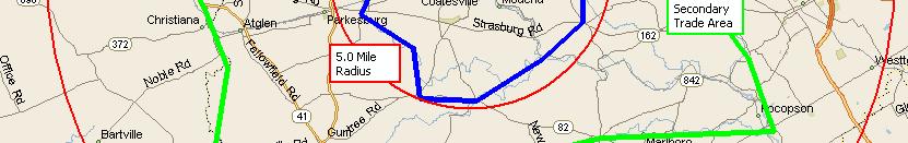
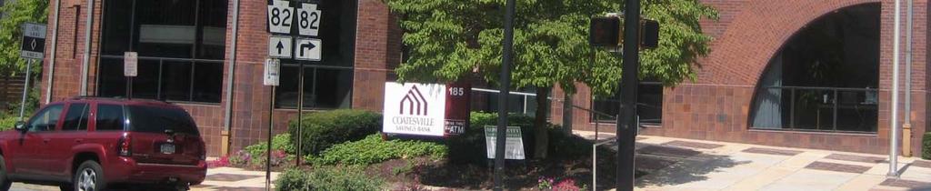
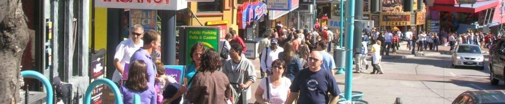
6 Study Area Amtrak 82 Bus 30
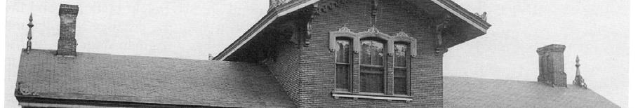
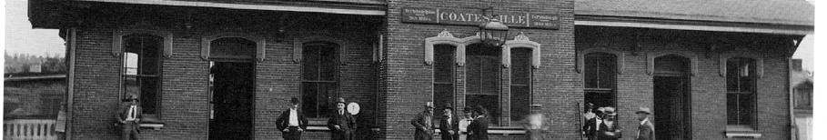
7 Sticky Note Exercise Rail and Transit Access Public Transportation Connection Provide Transportation Options Proximity to other major tourist attractions Central in Chester County Accessibility to shopping centers, food stores, etc. Midpoint shopping and transportation to the east and west Community Sense of place you know you are in Coatesville Small-town Environment A sense of community Proximity to family Nice people Diversity My home Strong spirit of the people Friendly Will to overcome adversity Mutual respect Potential Faith History Historic Buildings Historic Neighborhoods Historical Significance Architecture and Homes Significant historic buildings Location Central Location Schools, Parks and Open Space Parks and open space Scott School Brandywine Creek Community Supports veteran Community Service Scenic views and hills and valleys Walkable Fairly Wide streets that are pedestrian friendly Safety Pedestrian and senior citizen safety Secure parking Affordability Reasonably priced real estate Cleaner side stores Possibility of Tourism Development Improve downtown shopping Steel Mill Local Stores, Services, Restaurants Close to Work People Get town people to buy in to the improvement and the city Tammy Cansler Tony Buck and Paul Johnson Carolyn Johnson
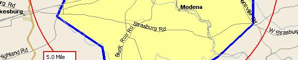
8 Public Transportation will become critical with the energy crisis Property becomes more valuable within 5 miles of station Improve the number of riders in Coatesville Enhance two corridors 3 rd Avenue and E. Chestnut Focus on the character of development The Station isn t convenient Other stations have development Why doesn t Coatesville? Lighting, Lighting, and More Lighting Good access to parking Look at the Olivet Church parking lot as a shared use Pedestrian Bridge Expand the SEPTA system to the west Coatesville becomes center of expanded SEPTA service Need to link all of the community assets Themes We Heard
9 Current Dedicated Funding Station Building - $1.6 million Station Parking Lots - $800,000 Third Avenue Streetscape - $1 million


10 What Have We Heard? Make the Station Functional AMTRAK can increase service to City if the area was better positioned Current platform is on a slight curve, and might need to shift new platform to the east Traffic circulation around station (Fleetwood is oneway) especially if more trips are coming Lots of people hanging out creating a perception of unsafe environment around station Area is messy, loud, and generally unpleasant Need the outlying County for ridership growth Station is difficult to find and inconvenient to access Need to get SEPTA service restored to have better connection with metro area Need better access from Route 82 to station Need to get more parking Need to improve the underpasses Need to improve perception of safety and security Westbound side of station needs to feel connected Level of AMTRAK service need more trains, more frequency Branding and iconic signs to lead the way Stations east of Coatesville perceived to be at capacity can capture ridership with proper facilities


 Need to")


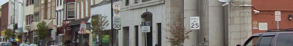
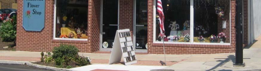
11 What Have We Heard? Improve the Image and Character of Downtown City image is a problem Lots of people hanging out creating a perception of unsafe environment around station Need to address the quality of life issues (trash, abandoned cars, high grass, other code violations, etc) Need to plan for cohesive neighborhoods near the station, not just parking lots City doesn t have Main Street organization and doesn t have any matching grants Opportunity to connect with Riverwalk project in center of town Need to look beyond Coatesville for economic growth City Administration needs to knuckle down on the crime and drug activity Code violations are mind-boggling Need to leverage the local historical resources available from the train station Opportunity to re-establish Main Street organization Need redevelopment presence at 82/30 and at 82 interchange Need other activity drivers in the area


12 What Have We Heard? Develop the Strategic Market Position of Downtown Momentum need get something done to create momentum for other improvements Outside perception of Coatesville needs to improve Opportunity to connect with Riverwalk project in center of town Need to look beyond Coatesville to the outlying County for ridership growth and economic growth AMTRAK line is the throat of regional transit, need better service, more stops Need to get SEPTA service restored to have better connection with metro area Need to leverage the local historical resources available from the train station Need to address the quality of life issues Opportunity to re-establish Main Street organization and have DITA be the Board for Main Street City of Coatesville Authority could be reconstituted as an economic development organization Need redevelopment presence at 82/30 and at 82 interchange Need to get people moving through Downtown Need other activity drivers in the area Coatesville needs a grocery store


 Opportunity")


13 What Have We Heard? Work with Community Partners to Insure the Vision Previous plans failed due to lack of a clear champion, lost interia, and poor leadership City doesn t have Main Street organization Need to plan for cohesive neighborhoods near the station, not just parking lots City Administration needs to knuckle down on the crime and drug activity Code violations are mind-boggling City image is a problem Need to address the quality of life issues (trash, abandoned cars, high grass, other code violations, etc) Opportunity to re-establish Main Street organization and have DITA be the Board for Main Street City of Coatesville Authority could be reconstituted as an economic development organization Outside perception of Coatesville needs to improve. Churches are the primary asset that has held the City together New development must have real effort to engage community folks and include housing opportunities for everyone
14 Make the Station Functional
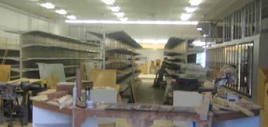
15 Station Area Amtrak Vacant Commercial Church Parking Comfort Care Comfort Care Vacant Residential Shuttered Amtrak Station Vacant Commercial City-owned Land (partially leased to Comfort Care) Attached residential (partially vacant, some to be razed) Church Parking Lot No Off-Street Parking Spaces Fleetwood St 1-way Underpass needs improvement Low-level Platforms No ADA Access
16 Station Option A Commercial Commercial Parking (28) Up/Over Comfort Care Amtrak Parking (30) Comfort Care Parking (86) Retain Comfort Care in place Convert garage to commercial and community use Renovate Amtrak Station for Civic and Commercial Use Parking on fire site Shared lot with Church 144 parking spaces 2-way Fleetwood St New waiting area and elevated pedestrian walkway to cross tracks Rehab 3 rd Avenue walkway underpass
17 Station Option A Up/Over Commercial Parking (30) Amtrak Comfort Care Commercial Parking (86) Parking (28) Comfort Care
18 Station Option B Commercial Commercial Up/Over Residential Redevelopment Amtrak Parking (39) Parking (83) Relocate Comfort Care Convert garage to commercial and community use Renovate Amtrak Station for Civic and Commercial Use Parking on fire site 122 Parking Spaces 2-way Fleetwood St Residential Redevelopment at Fleetwood/3 rd Ave New waiting area and elevated pedestrian walkway to cross tracks Rehab 3 rd Avenue walkway underpass
19 Station Option B Up/Over Residential Redevelopment Amtrak Parking (39) Commercial Commercial Parking (83) Residential Redevelopment
20 Station Option C Commercial Commercial (3 KSF) Commercial Parking (36) Up/Over Amtrak Parking (63) Residential Redevelopment (18 Units) Relocate Comfort Care Convert garage to commercial and community use Renovate Amtrak station for civic and commercial use 99 parking spaces Commercial pad on 3 rd Avenue 2-way Fleetwood St Residential redevelopment on Fleetwood New waiting area and elevated pedestrian walkway to cross tracks Rehab 3 rd Avenue walkway underpass
21 Station Option C Up/Over Amtrak Parking (63) Commercial Commercial Residential Redevelopment (18 Units) Parking (36)
22 Station Option D Commercial Commercial (7 KSF) Up/Over (From Garage) Bus/K+R Parking Garage (210) CC Expansion Comfort Care Residential Redevelopment (18 Units) Expand Comfort Care to the west Garage with retail liner on 3 rd Avenue Renovated Amtrak station includes civic and commercial uses 210 parking spaces 2-way portion of Fleetwood St Residential redevelopment on Fleetwood Elevated pedestrian walkway to cross tracks connects to garage Rehab 3 rd Avenue walkway underpass
23 Station Option E Up/Over (From Garage) Bus/K+R CC Expansion Comfort Care Commercial Commercial (7 KSF) Parking Garage (210) Residential Redevelopment (18 Units)
24 Station Option E Amtrak Commercial Up/Over Parking (13) Parking (68) CC Expansion Comfort Care Residential Redevelopment (18 Units) Expand Comfort Care to the west Convert garage to commercial and community use Renovate Amtrak Station to include civic and commercial use 81 parking spaces 2-way Fleetwood St Residential redevelopment on Fleetwood New elevated pedestrian walkway to cross tracks Rehab 3 rd Avenue walkway underpass
25 Station Option D Up/Over Amtrak Commercial Parking (13) CC Expansion Comfort Care Residential Redevelopment (18 Units) Parking (68)
26 View from Existing Platform
27 View from Existing Platform
28 Existing Fleetwood Street View
29 View from Fleetwood Street
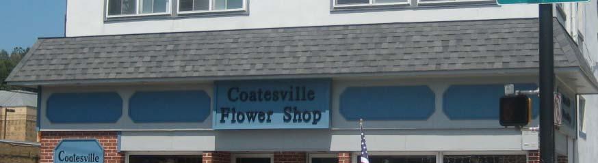
30 Improve the Image and Character of Downtown
31 Fleetwood Street West of 3rd
32 Fleetwood Street West of 3rd
33 3 rd Avenue (South) Walk Travel Travel Walk shy 50 right of way
34 Design Option: 3 rd Avenue (South) Walk Pkg Travel Travel Pkg Walk Trees in bulb outs 50 right of way Trees in Bulb Outs w Potential add l easement w new development
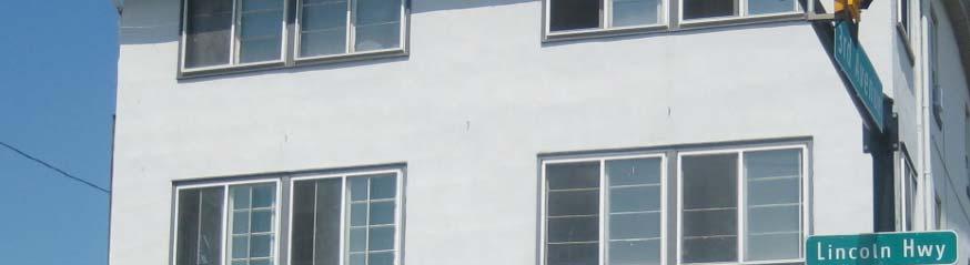
35 3 rd Avenue at Lincoln Highway
36 3 rd Avenue at Lincoln Highway
37 3 rd Avenue (North) 8 Walk 7 Pkg 13 Travel 13 Travel 7 Pkg 8 Walk 56 right of way (40 Cartway)
38 Design Option: 3 rd Avenue (North) 10 Walk 7 Pkg Trees in Bulb outs or in Walk 11 Travel 11 Travel 7 Pkg Trees in Bulb Outs or Walk 10 Walk 56 right of way (narrow Travel Lanes, increase sidewalks, maintain On Street Parking)
39 Fleetwood(West) 7 Walk 7 Pkg 16 Travel One Way 7 Pkg 7 Walk (at Station) 45 right of way (30 Cartway)
40 Design Option A:Fleetwood(West) 7 Walk 6 Pkg 9 Travel 9 Travel 6 Pkg 7 Walk 45 right of way (30 Cartway, Yield Street ) (at Station)
41 Fleetwood(East) 2 Shy 11 Travel 7 Pkg 4 Walk 24 clear
42 Design Option: Fleetwood(East) 10 Travel 10 Travel 4 Walk 30 right of way
43 Chestnut Street 8 Walk 7 Parking 10 Travel 10 Travel 7 Parking 8 Walk 50 right of way
44 Design Option: Chestnut Street 8 Walk 7 Parking 10 Travel 10 Travel 7 Parking 8 Walk 50 right of way Convert to Two Way Condition to Facilitate Business and Transit Access on this Key Address Street
45 Wayfinding
46 Wayfinding
47 Wayfinding
48 Develop the Strategic Market Position of Downtown


49 Retail Market Study Findings


50 Retail Market Study Findings


51 Retail Market Study Findings
52 Retail Market Study Findings
53 Retail Market Study Findings


54 Retail Market Study Findings


55 Retail Market Study Findings
56 Retail Market Study Findings Supportable New Retail & Restaurant Sales $17.6 million $47.6 million
57 Retail Market Study Findings Supportable New Retail & Restaurant Sales $17.6 million $47.6 million 68,000 sq/ft 156,000 sq/ft Stores Stores
58 Retail Market Study Findings Supportable New Retail & Restaurant Sales $17.6 million $47.6 million


59 Retail Market Study Findings


60 Retail Market Study Findings
61 Retail Market Study Findings Supportable Retail Growth: ,000 sf Total Generating up to $47.6 million in sales by 2015 Coatesville, Retail Market Study Coatesville Station Area Planning AECOM /Gibbs Planning Group Work in Progress Meeting, August 19, 2010


62 Implementation Requirements Experienced Leasing Team
63 Retail Market Study Findings
64 Retail Market Study Findings


65 Retail Market Study Findings


66 Retail Market Study Findings Suitable Properties Experienced dleasing Team Market Demand Vibrant Shopping District Vib Effective Government


67 Implementation Requirements Experienced Leasing Team Market Demand
68 Implementation Requirements Experienced Leasing Team Suitable Locations
69 Implementation Requirements Experienced Leasing Team
70 Implementation Requirements Experienced Leasing Team Effective Government
71 Implementation Requirements Experienced Leasing Team Effective Government


72 Retail Market Study Findings Supportable Retail Growth: ,000 sf Total Generating up to $47.6 million in sales by 2015 Coatesville, Retail Market Study Coatesville Station Area Planning AECOM /Gibbs Planning Group Work in Progress Meeting, August 19, 2010
73 Retail Market Study Findings
74 Work with Community Partners to Insure the Vision
75 Projects Phase 1 Phase 2 Phase 3 Phase 4 Station Parking (+/- 100 spaces) 2-way Fleetwood (West of 3 rd Avenue) 2-way Chestnut (Keep On-street Parking) High-Level Platforms Pedestrian Bridge To Platform Station Parking Expansion (Comfort Care Relocates) Lincoln/3rd Redevelopment (RDA) Rehab 3rd Avenue Bridge 3 rd Avenue Infill Hwy. 30/82 Intersection West Fleetwood Redevelopment Lincoln/3rd Redevelopment Station Building Rehab 3 rd Avenue Streetscape
76 QUESTIONS???
Downingtown Station Relocation Plan Site Selection Memo June 12, 2012
 Downingtown Station Relocation Plan Site Selection Memo 06.12.12 June 12, 2012 Background and Overview Downingtown is a borough in Chester County, Pennsylvania located approximately 32 miles west of Philadelphia
INDEPENDENCE BOULEVARD AREA PLAN
 INDEPENDENCE BOULEVARD AREA PLAN Public Meeting October 28, 2008 Tonight s Agenda Introduction 4:00 4:05 Tom Warshauer Presentation 4:05 5:00 Blake Drury Group Exercises 5:00 5:50 All Wrap Up & Next Steps
Windsor Locks Transit-Oriented Development Planning Grant Request. Project Background
 Windsor Locks Transit-Oriented Development Planning Grant Request Project Background Downtown Windsor Locks runs along Main Street in the vicinity of the intersection of Routes 159 and 140. The current
ROBBINSDALE LRT STATION CDI DEVELOPMENT GUIDELINES
 August 2018 OVERVIEW The City of Robbinsdale has a prime-opportunity site in the middle of the 13 mile stretch of the Bottineau LRT corridor / Blue Line extension. Robbinsdale offers a prominent, vital,
Chapter 1: Introduction
 Chapter 1: Introduction The Penn Avenue Community Works Corridor Vision and Implementation Framework presents an integrated communitybased vision and a coordinated, long-term implementation framework for
Status Update (2006 vs. Now) Citizen s Advisory Committee February Plan for Prosperity
 Citizen s Advisory Committee February Plan for Prosperity") Status Update (2006 vs. Now) Citizen s Advisory Committee February 2018 Plan for Prosperity 2000 2017 2000 2017 Gardnerville Population 6,000 5,760 5746 5,500 5,000 5,067 5,550 5,165 5,394 5,412 5,250
Status Update (2006 vs. Now) Citizen s Advisory Committee February 2018 Plan for Prosperity 2000 2017 2000 2017 Gardnerville Population 6,000 5,760 5746 5,500 5,000 5,067 5,550 5,165 5,394 5,412 5,250
Northwest Rail Corridor and US 36 BRT Development Oriented Transit Analysis 4.4 STATION AREA FINDINGS
 4.4 STATION AREA FINDINGS Each station is different, and each one requires a separate set of recommendations based on the vision for the site. This section outlines an initial TOD strategy and recommendations
City of Long Beach. creating vibrant and exciting places
 City of Long Beach creating vibrant and exciting places Land Use Element Urban Design Element Overview of the two draft General Plan elements Discuss areas of change Economic goals of the plans Case study
BRYN MAWR. Tier 2 Characteristics: Location: Lancaster Avenue from Old Lancaster Road on the east to Norwood Avenue on the west
 BRYN MAWR Tier 2 Characteristics: Transit-oriented Mixed use Along Lancaster Avenue Serve township-wide needs Civic space Employment centers Location: Lancaster Avenue from Old Lancaster Road on the east
Long Lost Allies? Walking Advocates & Business District Organizations. Matt Kazinka Lake Street Council. Shaina Brassard Seward Redesign
 Long Lost Allies? Walking Advocates & Business District Organizations Shaina Brassard Seward Redesign Rob Hanson West Broadway Business and Area Coalition Matt Kazinka Lake Street Council Jamie Schumacher
PIKE PINE RENAISSANCE: ACT ONE. October 19, 2017
 PIKE PINE RENAISSANCE: ACT ONE October 19, 2017 WATERFRONT SEATTLE PROGRAM PROJECT INTRODUCTION Pike and Pine streets, between First and Melrose avenues Pedestrian and streetscape improvements Budget:
City of Ennis. Downtown Master Plan Catalyst Projects
 City of Ennis Downtown Master Plan Catalyst Projects Revised Framework Plan REVISED Project Types and Descriptions Project Types A. Visitor Attracting Projects: Projects in this category are intended to
MAIN STREET ECONOMIC DEVELOPMENT STRATEGY
 MAIN STREET ECONOMIC DEVELOPMENT STRATEGY A PATHWAY TO A BETTER POUGHKEEPSIE DRAFT Working Paper #2: Planning Strategies Submitted December 1 st, 2015 to the City of Poughkeepsie LAND USE LAW CENTER PACE
Chapter 4. Linking Land Use with Transportation. Chapter 4
 Chapter 4 Linking Land Use with Transportation Chapter 4 59 Chapter 4 Linking Land Use with Transportation Community Design and Transportation Program Introduction Since the 1950s, the predominant development
Robbinsdale LRT Station. CDI Development Guidelines. August Overview
 Robbinsdale LRT Station August 2018 Overview The City of Robbinsdale may have the coolest opportunity site along the 13 mile stretch of the Bottineau LRT corridor / Blue Line extension. Located a block
CHAPTER 7: Transportation, Mobility and Circulation
 AGLE AREA COMMUNITY Plan CHAPTER 7 CHAPTER 7: Transportation, Mobility and Circulation Transportation, Mobility and Circulation The purpose of the Transportation, Mobility and Circulation Chapter is to
LUNDY S LANE COMMUNITY IMPROVEMENT PLAN STUDY
 PUBLIC INFORMATION MEETING #2 October 12, 2016 LUNDY S LANE COMMUNITY IMPROVEMENT PLAN STUDY AGENDA 5:00 to 5:30pm: Open House 5:30 to 6:15pm: Presentation 6:15 to 7:00pm: Individual paced workshop with
Workshop #3 June 13, 2016
 Downtown Ocoee Master Plan Workshop #3 June 13, 2016 Our Team Our Team and Tonight s Goal Quick Recap: Why a Downtown Plan? How are we developing the plan? How can you still be involved? What s left to
The Lincoln Neighborhood Corridor Plan. The LiNC
 October 1, 2014 Planning Commission Study Session The Lincoln Neighborhood Corridor Plan The LiNC Purpose of Tonight s Meeting Introduction to The LiNC Review of Existing Conditions and Community Identified
MONTGOMERY COUNTY METRO STATION AREA DESIGN CHARRETTE
 MONTGOMERY COUNTY METRO STATION AREA DESIGN CHARRETTE Shady Grove Metro Station Area Charrette Closing Presentation October 25-28, 2000 MONTGOMERY COUNTY, MD M-NCPPC Design Collective, Inc. Architects
Potential Green Infrastructure Strategies May 6, 2015 Workshop
 Potential Green Infrastructure Strategies May 6, 2015 Workshop Background The City of Cortland is developing the Tioughnioga Urban Headwaters Green Infrastructure Action Plan with funding from the National
1 October Dear Citizens of Charlotte and Mecklenburg County,
 1 October 2011 Dear Citizens of Charlotte and Mecklenburg County, As co-chairs of the Center City 2020 Vision Plan Steering Committee, we are proud to present the Center City 2020 Vision Plan, which sets
City of Fort Lauderdale UPTOWN URBAN VILLAGE. Public Workshop December 7, 2016
 Public Workshop December 7, 2016 Workshop Agenda Introductions Project Presentation o o o History Project Scope/Timeline Character of Study Area o o o o Land Use Public Realm/Pedestrian Mobility Multimodal
Nassau County Cultivating Opportunities for Sustainable Development Nassau County Infill Redevelopment Feasibility Study
 Nassau County Cultivating Opportunities for Sustainable Development Nassau County Infill Redevelopment Feasibility Study NY-CT Sustainable Communities Steering Committee Meeting March 14, 2014 Project
JANUARY 19, 2011 CENTRAL AVENUE-METRO BLUE LINE TRANSIT-ORIENTED DEVELOPMENT IMPLEMENTATION PROJECT COMMUNITY FORUM
 CENTRAL AVENUE-METRO BLUE LINE TRANSIT-ORIENTED DEVELOPMENT IMPLEMENTATION PROJECT COMMUNITY FORUM JANUARY 19, 2011 THE MARYLAND-NATIONAL CAPITAL PARK AND PLANNING COMMISSION PRINCE GEORGE S COUNTY PLANNING
Examples of Asset Based Approaches to Development. Economic and Community Development Suffield, CT
 Examples of Asset Based Approaches to Development Presented by: Patrick McMahon, Director of Economic and Community Development Suffield, CT Neighborhood Commercial Development Wilson, CT Issues Elevated
TEMPLE MEDICAL & EDUCATION DISTRICT
 City of Temple, Texas TEMPLE MEDICAL & EDUCATION DISTRICT 1 Description. The City of Temple joined in partnership with key public and private entities to jointly promote education and medical activities
Gold Line Bus Rapid Transit Transit Oriented Development (BRTOD) Helmo Station Area Plan
 Helmo Station Area Plan") Appendix F Gold Line Bus Rapid Transit Transit Oriented Development (BRTOD) Helmo Station Area Plan Introduction and Purpose of the Plan The Gold Line Bus Rapid Transit facility is an eleven-mile dedicated
Appendix F Gold Line Bus Rapid Transit Transit Oriented Development (BRTOD) Helmo Station Area Plan Introduction and Purpose of the Plan The Gold Line Bus Rapid Transit facility is an eleven-mile dedicated
ULI St. Louis Technical Assistance Panel
 ULI St. Louis Technical Assistance Panel ULI St. Louis Technical Assistance Panel Sponsored by: Citizens for Modern Transit in partnership with METRO ULI St. Louis Mission Statement The mission of the
Hopkins. Development Guidelines May Overview. Sponsored by: Blake Road Corridor Collaborative City of Hopkins
 Hopkins Blake Road LRT Station Area Development Guidelines May 2015 Sponsored by: Blake Road Corridor Collaborative City of Hopkins Overview Hopkins is a dynamic community of over 17,000 residents located
A BLUEPRINT FOR BROCKTON A CITY-WIDE COMPREHENSIVE PLAN
 A BLUEPRINT FOR BROCKTON A CITY-WIDE COMPREHENSIVE PLAN Public Meeting October 2016 1 Plan Summary and Discussion Public Meeting May 4 2017 City of Brockton Bill Carpenter, Mayor Department of Planning
Hockessin Community Redevelopment Plan
 Hockessin Community Redevelopment Plan 3.1 Introduction The Community Redevelopment Plan for the Village of Hockessin is the result of the people s vision for a distinct village center that serves as the
Downtown Cleveland Alliance/Tremont
 Cleveland Innerbelt Urban Design Stakeholder Workshops Downtown Cleveland Alliance/Tremont May 4, 2007 2007 Activities: What We re Going To Be Doing. March 8, 2007 Initiate Urban Design Aesthetic Study
Sherri Ferguson. President/CEO Portland Chamber of Commerce. Tennessee Certified Economic Developer Capstone Project
 Sherri Ferguson President/CEO Portland Chamber of Commerce Tennessee Certified Economic Developer Capstone Project Strategic Plan Development for the North Gateway of Portland, Tennessee The New Gateway
Status Report: MD 355 Project
 Status Report: MD 355 Project OCTOBER 2006 M-NCPPC MONTGOMERY COUNTY PLANNING DEPARTMENT Summary of Community Comments, and break to the Results of the MD 355 Participation Session Brookside Gardens -
2030 Comprehensive Plan VISION STATEMENT
 RESOURCE DOCUMENT for Steering Committee Meeting #2 July 12, 2017 2030 Comprehensive Plan VISION STATEMENT Steering Committee from 2008 Established the Lauderdale s Vision as: Creating a livable, lovable
BROOKLYN PARK / 85TH AVE LRT STATION CDI DEVELOPMENT GUIDELINES DRAFT
 August 2018 Page intentionally left blank The Brooklyn Park Library adjacent to the 85th Ave LRT Station Area. OVERVIEW The Blue Line LRT Extension / Bottineau corridor offers a unique opportunity to leverage
Equitable Growth Through TOD Planning
 Equitable Growth Through TOD Planning Community Meeting # 2 November 2017 Goals Objectives Extend investment from downtown Connect neighborhoods physically and economically Enhance places based on local
Corridors. Re-vitalize our Corridors and Gateways
 Corridors Re-vitalize our Corridors and Gateways Artist s rendering from the 287 Strategic Plan, 2015 Corridors are the major throughways of Loveland but they also provide important commercial, community
Town Center (part of the Comprehensive Plan)
") Town Center (part of the Comprehensive Plan) Mercer Island Town Center Looking North (2014) In 1994, a year-long process culminated in a set of design guidelines and code requirements for the Town Center
Town Center (part of the Comprehensive Plan) Mercer Island Town Center Looking North (2014) In 1994, a year-long process culminated in a set of design guidelines and code requirements for the Town Center
Comprehensive Plan & Station Area Zoning
 Village of Tarrytown Comprehensive Plan & Station Area Zoning Public Workshop November 5, 2017 Warner Library WXY architecture + urban design Pace University - Land Use Law Center George M. Janes & Associates
Sewanee Village + Request for Builder/Developer Proposals
 Sewanee Village + Request for Builder/Developer Proposals Contact: Frank X. Gladu Special Assistant to the Vice Chancellor University of the South 735 University Ave Version 3 Sewanee TN 37383 Released:
South Davis County COMMUNITY SPOTLIGHT
 South Davis County COMMUNITY SPOTLIGHT Davis/SLC Community Connector Bus Rapid Transit line connecting SLC & Davis County RTP Phase 1 Project Generate 3,100 average weekday riders Relieve congestion on
BRYN MAWR. Tier 2 Characteristics: Location: Lancaster Avenue from Old Lancaster Road on the east to Norwood Avenue on the west
 BRYN MAWR Tier 2 Characteristics: Transit-oriented Mixed use Along Lancaster Avenue Serve township-wide needs Civic space Employment centers Location: Lancaster Avenue from Old Lancaster Road on the east
WALTER RAND TRANSPORTATION CENTER
 WALTER RAND TRANSPORTATION CENTER PLANNING AND DESIGN STUDY Public Meeting May 25, 2017 TONIGHT S AGENDA Introduction and Welcome Project Objectives The Study Area: WRTC and its Context Circulation Assessment
CONTEXT: the Highway, the River + the Railroads run through us.
 CONTEXT: the Highway, the River + the Railroads run through us. I-25 36 In the past they have divided us, now we have an opportunity to unite us. I-76 I-270 I-76 CSU I-25 LEGEND Cut + Cover River North
Community Open House March 26 th, 2018
 Community Open House March 26 th, 2018 Open House Agenda 1. Overview of Planning Process What we heard 2. Future Land Use Policy 3. Priority Growth Areas 4. Plan Elements Making it happen What is a Comprehensive
Dyersville Downtown Plan. Open House October 24, 2017
 Dyersville Downtown Plan Open House October 24, 2017 What is a Comprehensive Plan? - Vision - Guidance for decisions - Basis for regulations What is a Downtown Plan? - Understand priorities - Identify
THE 355/270 CORRIDOR:
 THE 355/270 CORRIDOR: Strategic Ideas for Sustaining a Livable Work Place Project Summary ACCESS LIFE DESIGN HEALTH WORK Montgomery County Planning Department The Maryland-National Capital Park and Planning
Mary Hills Nature Area. Roadway Lighting. The Minneapolis Clinic of Neurology Courage Kenny Rehabilitation Institute
 PUBLIC REALM IMPROVEMENTS Mary Hills Nature Area Enhanced Programming Glenview Terrace Valley View Roadway Lighting Enhanced Streetscape Trail Lighting / Roadway Lighting Wayfinding Public Art The Minneapolis
City of Villages Parking Strategies. William Anderson, FAICP City Planning & Community Investment San Diego Parking Symposium July 14, 2006
 City of Villages Parking Strategies William Anderson, FAICP City Planning & Community Investment San Diego Parking Symposium July 14, 2006 City of Villages Strategy A hierarchy of walkable, mixed use districts
What We Heard Report: Westmount Architectural Heritage Area Rezoning Drop-in Workshop
 What We Heard Report: Westmount Architectural Heritage Area Rezoning Drop-in Workshop August 2018 What We Heard Report: Westmount Architectural Heritage Area Rezoning Drop-in Workshop Executive Summary
City of Le Sueur DOWNTOWN MASTER PLAN
 City of Le Sueur DOWNTOWN MASTER PLAN City Council Update 9/11/2017 Hoisington Koegler Group Inc. Presentation Agenda 01 Schedule Update / Tonight s Objectives 02 What We ve Heard - Engagement Comments
A Vibrant Downtown. Chapter 5 Cary Public Art Opportunities 31
 A Vibrant Downtown Cary s vision for Downtown is a unique, vibrant, dynamic, pedestrian friendly location; a regional destination and a place to live, work, and recreate, according to the 2001 Town Center
EXISTING COMPREHENSIVE PLAN
 EXISTING COMPREHENSIVE PLAN Town Center Land Use Element: V. LAND USE POLICIES Town Center Mercer Island's business district vision as described in "Your Mercer Island Citizen-Designed Downtown" was an
COURTICE MAIN STREET COMMUNITY IMPROVEMENT PLAN
 COURTICE MAIN STREET COMMUNITY IMPROVEMENT PLAN Public Meeting #1 April 28, 2016 Birdseye view of the study area PIC #1 AGENDA Agenda and Format 6:30 6:50 Registration 6:50 7:45 Introductions, Presentation
Route 1 Corridor Study
 Route 1 Corridor Study Westbrook, Connecticut A Vision for the Connecticut Shoreline Public Informational Meeting July 28, 2015 Lower Connecticut River Valley Council of Governments Fitzgerald & Halliday,
D-O LRT Zoning Discussion. Chapel Hill Boards & Commissions October 16, 2017
 D-O LRT Zoning Discussion Chapel Hill Boards & Commissions October 16, 2017 Update on Overall D-O LRT Station Area Initiative Objectives Design and educate on principles of Good Transit-Oriented Development
City of Hopkins 2012 Mission and Goals
 City of Hopkins 2012 Mission and Goals Mission Statement Partnering with the community to enhance the quality of life by Inspiring Educating Involving Communicating Collaborative with School District Overcoming
TOD 101 CREATING LIVABLE COMMUNITIES WITH TRANSIT
 1 CREATING LIVABLE COMMUNITIES WITH TRANSIT What are transit Centered Communities? Benefits of Partnerships to Support and Implement What You Will Learn Portland s Pearl District Your Trainers Today Catherine
The University District envisions, in its neighborhood
 Envisioning the University District Link Light Rail in Seattle s neighborhoods CIY OF SEALE CONCEP-LEVEL SAION AREA PLANNING RECOMMENDAION RESOLUION # 30165 EXHIBI L Vision 08.2000 he University District
THE NEIGHBORHOOD TODAY
 THE NEIGHBORHOOD TODAY CORE AREA VISION How are we Good Urbanism A Site s DNA thinking about Elements of great Unique elements urban communities embedded in a place the site and design? ELEMENTS LIKE:
Planning Districts INTRODUCTION
 INTRODUCTION To facilitate detailed examination of development prospects for all areas of the community, Delano has been divided into 14 planning districts. The location of these planning districts is
Somers Point Master Plan
 Somers Point Master Plan Progress Report and Public Meeting August 20, 2014 Master Plan Reexamination Municipal Land Use Law require that all municipalities reexamine their master plan every ten years.
Ivywild On The Creek PRELIMINARY CREEK DISTRICT MASTER PLAN
 Ivywild On The Creek PRELIMINARY CREEK DISTRICT MASTER PLAN Introduction: Rejuvenating an extraordinary Creekside neighborhood THE CREEKSIDE DISTRICT The Ivywild On The Creek Neighborhood District Master
495/MetroWest Development Compact Plan Citizen Planner Training Collaborative Conference. March 17, 2012
 495/MetroWest Development Compact Plan Citizen Planner Training Collaborative Conference March 17, 2012 Project Process Local and Regional Priority Areas Growth Scenarios Transportation Investment Categories
West Ocala Vision & Community Plan City Council Work Session. Presented by West Ocala Community Plan Steering Committee
 West Ocala Vision & Community Plan City Council Work Session Presented by West Ocala Community Plan Steering Committee November 29,2011 Ocala 2035 Vision West Ocala Community Vision & Master Plan West
Committee Meeting: Downtown Today & Concept Refinement September 11, 2017
 Committee Meeting: Downtown Today & Concept Refinement September 11, 2017 AGENDA 1. Brief Input Update 2. Comprehensive Plan Principles 3. Downtown Today 4. Concept Updates 5. Future Schedule What is a
Developer s Program. The Station at East 54
 Developer s Program The Station at East 54 Existing Conditions The Station at East 54 is proposed for a 1.12 acre site at the northeast corner of Hamilton Road and Prestwick Road, tucked between the East
NATICK COMPREHENSIVE MASTER PLAN. Natick Center Outreach Meeting. After presentations about the Natick Master Plan process, town staff and
 Meeting Notes After presentations about the Natick 2030+ Master Plan process, town staff and consultants from Crosby, Schlessinger and Smallridge posed questions to the audience. Responses are cataloged
BAYFRONT INDUSTRIAL AREA RENEWAL STRATEGY
 BAYFRONT INDUSTRIAL AREA RENEWAL STRATEGY PIC #2 June 14 th, 2018 BACKGROUND & CONTEXT THE BAYFRONT INDUSTRIAL AREA 1,607 ha. Study Area Once housed over 50% of the City s employment Today home to over
Newton Town Centre. Land Use, Urban Design & Transportation Plan
 Newton Town Centre Land Use, Urban Design & Transportation Plan Public Workshop - June 2-4, 2009 6:15 6:30 Sign-in & conversations Tonight s Agenda 6:30 6:55 Project introduction and summary of previous
Walnut Creek BART Station
 Walnut Creek BART Station Mixed Use Transit Oriented Project Design Review Commission Study Session May 17, 2006 Applicant: Walnut Creek Transit Lifestyles Associates Joint Venture: Transit Village Associates
City of Meriden Harbor Brook Flood Control Project Overview
 City of Meriden Harbor Brook Flood Control Project Overview Updated August 2013 OVERVIEW The center of Meriden, including the HUB site is the low point of the town which is ringed by basalt ridges. Running
1 Adapted from the Statewide Transit-Oriented Development Study by CalTrans, 2006
 APPENDIX C: LAND USE PLANNING FOR ENHANCED RAIL SERVICE 72 BACKGROUND One of the consistent themes heard from localities in the Route 29 corridor Planning Forums was the need for expanding rail service
EXHIBIT A. Tax Increment Reinvestment Zone No. 1 (Town Center) First Amended Project Plan 1
 First Amended Project Plan 1") EXHIBIT A Tax Increment Reinvestment Zone No. 1 (Town Center) First Amended Project Plan 1 1 As amended by Resolution No. 2008-02-001(TR1R) of the Tax Increment Reinvestment Zone No.1, and approved to
EXHIBIT A Tax Increment Reinvestment Zone No. 1 (Town Center) First Amended Project Plan 1 1 As amended by Resolution No. 2008-02-001(TR1R) of the Tax Increment Reinvestment Zone No.1, and approved to
Olde Towne Vision Plan
 Olde Towne Vision Plan Introduction In 2016, the City of Bellevue will complete its move of City offices from Olde Towne Bellevue to its new municipal complex on Wall Street. The City intends to sell its
Streets, Connectivity & Built Environment Working Group August 2, 2017
 Streets, Connectivity & Built Environment Working Group August 2, 2017 DOWNTOWN OAKLAND SPECIFIC PLAN WELCOME Streets, Connectivity & Built Environment Working Group Social Equity Meeting August 2, 2017
About Momentum Midland
 About Momentum Midland Achieving a community s full potential in terms of economic development and quality of life is critically important to its long term sustainability. Core to achieving this is a vibrant
S A C R A M E N T O C O U N T Y JACKSON HIGHWAY & GRANT LINE EAST VISIONING STUDY
 JACKSON HIGHWAY & GRANT LINE EAST S A C R A M E N T O C O U N T Y P L A N N I N G D E P A R T M E N T SUMMARY AND WORKBOOK November 19, 2008 History of the Visioning Study Sacramento County has two growth
NORTH CLAYMONT AREA MASTER PLAN COMMUNITY WORKSHOP #1 FEBRUARY 3, 2016
 NORTH CLAYMONT AREA MASTER PLAN COMMUNITY WORKSHOP #1 FEBRUARY 3, 2016 1. Introduction To the team and to the Plan Planning Partners The Claymont Community WILMAPCO New Castle County Claymont Renaissance
1.3 TRANSIT VISION 2040 FROM VISION TO ACTION THEME 1: PUTTING TRANSIT AT THE CENTRE OF COMMUNITIES. Fully integrate transit with community planning
 TRANSIT VISION 2040 FROM VISION TO ACTION TRANSIT VISION 2040 defines a future in which public transit maximizes its contribution to quality of life with benefits that support a vibrant and equitable society,
DELIVERING ON THE TRANSIT PROMISE
 DELIVERING ON THE TRANSIT PROMISE Dena Belzer October 6, 2015 Presentation Overview 1. Puget Sound As a Transit Region: Putting SeaTac in Context 2. Starting at the Beginning: How Does TOD Work? 3. Strategies
Table of Contents. Elm Avenue Improvement Plan City of Waco, Texas. Introduction 1. Existing Context 1 Figure 1 2.
 Table of Contents Introduction 1 Existing Context 1 Figure 1 2 Plan Guidelines 3 Future Urban Form 4 The West-End 4 Main Street 6 The East-End 7 Figure 2 9 Public Improvement Recommendations 7 General
Loved hearing what others shared and having a dialogue about the possibilities/opportunities
 MEMO To: Dave Efland, Director of Planning & Community Development November 7, 2018 From: Sarah Kelly and Emily Long, planning NEXT Re: Round 1 of Public Engagement, Delaware Together, Comprehensive Plan
Public Meeting Final Recommendations August 8, 2013
 Public Meeting Final Recommendations August 8, 2013 Meeting Agenda 1. Existing Conditions 2. Plan Building Blocks & Process 3. The Plan Policies 4. What we heard 5. Next Steps Existing Conditions Existing
Small Area Plan. South Gateway
 Small Area Plan Adopted May 12, 2008 South Gateway Purpose. The South Gateway Small Area Plan defines the City s expectations for the future of the southern entrance to the City at Interstate 85 and Highway
b r a n c h av e n u e tr a n s it co r r i d o r r e vita lization pl a n a m o d el fo r s u b u r ban retro fit
 b r a n c h av e n u e tr a n s it co r r i d o r r e vita lization pl a n a m o d el fo r s u b u r ban retro fit P R I N C E G EO RG E S CO U NT Y, M D ADO PTED 0 p R O J E C T C AT E G O R Y : U R B
PLAN ELEMENTS WORKSHOP. April 5, 2016
 PLAN ELEMENTS WORKSHOP April 5, 2016 needs more housing. But there is no one-size fits-all solution. Every neighborhood has its own character. In some places, density is not only appropriate it is badly
The Cambie Corridor 2015 Fall workshop series. What we heard WORKSHOP OUTLINE
 The Cambie Corridor 2015 Fall workshop series W 16 AVE Area 5 CAMBIE CORRIDOR Phase 3 What we heard ovember 21, 2015, 9am-noon, 1:30-4:30pm Peretz Centre 89 Participants* WORKSHOP OUTLIE Introductions
Plano Tomorrow Vision and Policies
 Plano Tomorrow Vision and Policies PLANO TOMORROW PILLARS The Built Environment The Social Environment The Natural Environment The Economic Environment Land Use and Urban Design Transportation Housing
8implementation. strategies
 PROGRAM STRATEGIES 8implementation strategies T he implementation actions of this chapter are designed to support and carry out the land use, economic development, transportation, urban design, and program
Elm Street Business District: Streetscape and Signage Plan
 Elm Street Business District: Streetscape and Signage Plan VILLAGE OF WINNETKA DOWNTOWN MASTER PLAN VILLAGE COUNCIL MEETING Final Streetscape & Signage Planning Teska Associates 04 June 2018 WHY WE RE
LEED-ND 101: Practical Strategies for Achieving Sustainability Goals. Travis Parker Lakewood Planning Director
 LEED-ND 101: Practical Strategies for Achieving Sustainability Goals Travis Parker Lakewood Planning Director Metro Vision Idea Exchange Oct 11, 2012 West Corridor Stations West Corridor Overview West
Beaverton City Council: Work Session. SIDEDistrict. May 6, 2014
 BEAVERTON Beaverton City Council: CREEK Work Session SIDEDistrict May 6, 2014 Tonight s Agenda BEAVERTON CREEK SIDE Brief updates Creekside Vision Scenarios & discussion: Redevelopment & Parking Project
Improve Neighborhood Design and Reduce Non Point Source Water Pollution
 HOW TO Planning Guide Improve Neighborhood Design and Reduce Non Point Source Water Pollution This document was funded by a grant from the New Hampshire Coastal Program with funding from the National Oceanic
City of Plattsburgh DRI: Downtown Streetscapes & Riverfront Access. Downtown Streetscape and Riverfront Access Design
 City of Plattsburgh DRI: Downtown Streetscapes & Riverfront Access Welcome Thank you for coming this evening. Agenda PART I - Project Context The Downtown Revitalization Program Our DRI Projects Other
Roanoke Rapids Streetscape Master Plan. City Council Presentation
 SCHEDULE: Stakeholder Meeting/Kick off November,2016 Master Planning Phase (November March 2017) Public Meeting #1 December 13, 2016 Review Meeting with Key Stakeholders Refine Concepts Based on Input
Downtown Elkton Station Area Plan, Elkton, MD. Difficult enough to get support for new starts challenge to fund Houston transit
 Difficult enough to get support for new starts challenge to fund Houston transit More difficult to build Community Support for dense development at station areas Major Concerns: Traffic, Property values,
NJ s Land Use and Transit Policies
 1 NJ s Land Use and Transit Policies NJ TRANSIT created in 1979 to reverse decline of public transportation State Development & Redevelopment Plan adopted (1986) encourages growth in areas where population,