Elfrida Growth Area Study
|
|
|
- Denis Paul
- 5 years ago
- Views:
Transcription


1 Elfrida Growth Area Study Public Information Centre #2 December 6, :00-8:30 pm PLANNING & ECONOMIC DEVELOPMENT DEPARTMENT
")
2 Purpose of the Study The Elfrida Area has been identified as the preferred location to accommodate new growth to 2031 and beyond This area was selected through the City s comprehensive Growth Related Integrated Development Strategy (GRIDS) process.
3 Identification of the Study Area Growth Related Integrated Development Strategy (GRIDS) (2006) Planning process that identified Nodes and Corridors Structure for growth and development for the City of Hamilton Associated Infrastructure Requirements Economic Development Strategy Financial Implications for growth concepts Identified Elfrida lands to accommodate growth to 2031
4 Chronology Rural Hamilton Official Plan Elfrida Study Area Special Policy Area Outlined the process and studies to be carried out to include the lands in the urban boundary Province removed the Special Policy Area Province s decision appealed by City and Landowners Urban Hamilton Official Plan General set of policies for an urban boundary expansion Reference to Elfrida as a future growth area Province removed the reference to Elfrida Province s decision appealed by City and Landowners

5 Chronology No resolution to appeals at this time City preparing an updated Municipal Comprehensive Review and Land Budget Analysis to determine the exact amount of land required to accommodate growth to 2041 Ontario Municipal Board hearing dates have not been scheduled
6 Background Although the Urban Hamilton Official Plan (UHOP) and Rural Hamilton Official Plan (RHOP) relating to the Elfrida lands are under appeal, urban boundary expansion policies are in effect (in the UHOP) Urban boundary expansion policies in the UHOP: Provide guidance and direction for studies required to bring Elfrida into the urban boundary and assign appropriate land uses (Municipal Comprehensive Review, background studies, public consultation, secondary plan)
7 Background Studies Municipal Comprehensive Review Subwatershed Study GRIDS 2 Population and employment forecasts (2041) Land Budget Analysis (supply and demand for residential, commercial & employment land up to 2041) Stormwater, infrastructure, natural heritage system impacts Secondary Plan Detailed policy and land use direction for future growth
8 Scope of the Study Cultural Heritage Assessment Water / Wastewater Servicing Master Plan Agricultural Impact Assessment Natural Heritage Review Archaeological Assessment Transportation Management Plan Secondary Plan Commercial Lands Review Phasing / Staging / Implementation Financial Investment Strategy Urban Design Guidelines PLANNING & ECONOMIC DEVELOPMENT DEPARTMENT
9 Timeline: Secondary Plan February Early Fall 2017 Early Fall 2017 to Early 2018 Early 2018 to Summer 2018 Phase 1 Background Research & Analysis Phase 2 Land Use Scenarios Phase 3 Preferred Land Use Scenario & Secondary Plan Community Working Group 1 Visioning & Design Workshop 1 June 21 & 22, 2017 Community Working Group 2 Public Workshop 2 Review concepts Community Working Group 3 Public Workshop 3 Review preferred land use scenario Pop-Up Consultation Events Small Group Meetings Online Engagement / Project PLANNING & ECONOMIC DEVELOPMENT DEPARTMENT
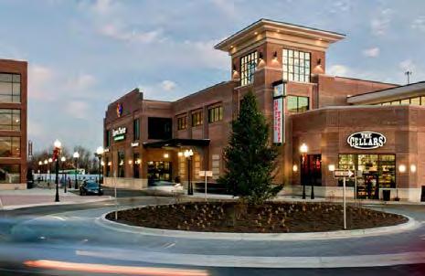
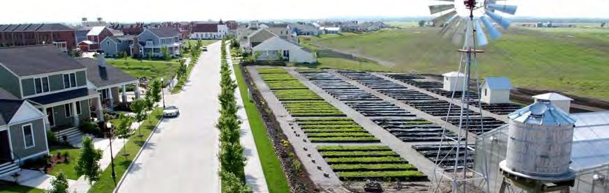
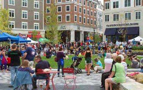
10 Input from Phase 1 Consultation: Vision The Elfrida Growth Area is envisioned to become a complete, transit-supportive, mixed-use community that is compact, wellconnected and both environmentally and economically sustainable, through a longterm strategy that respects the neighbouring land uses PLANNING & ECONOMIC DEVELOPMENT DEPARTMENT
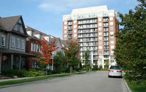
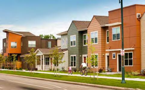
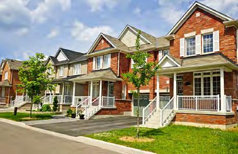
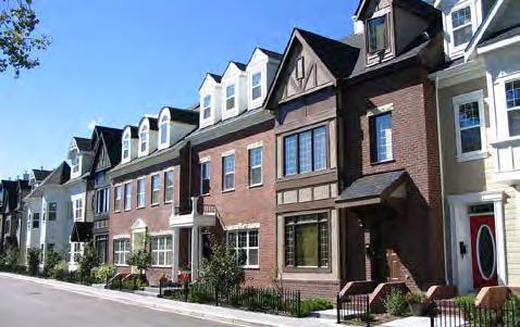
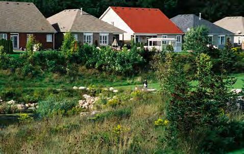
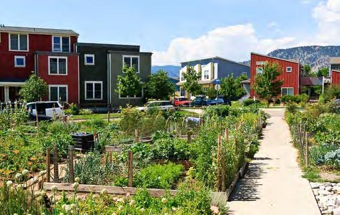
11 Input from Phase 1 Consultation : Principles 1. Develop in an environmentally appropriate manner that protects and restores the natural environment. 2. Encourage the responsible use of resources to ensure long-term sustainability, reduce greenhouse gas emissions, and reduce demands on energy, water, and waste systems. 3. Manage growth over time that is logical, efficient, and cost effective. 4. Ensure a diverse community with a mix and range of land uses to ensure a proper balance of residential, employment, community facilities, and services. 5. Develop a well-designed and connected community of residential neighbourhoods that provide for a range of housing types and choices. PLANNING & ECONOMIC DEVELOPMENT DEPARTMENT
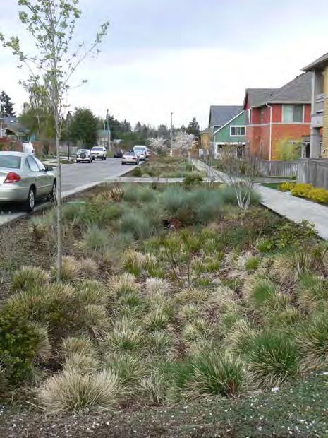
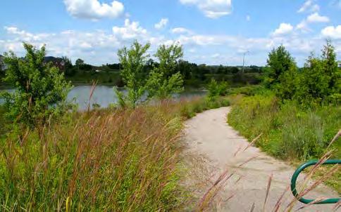
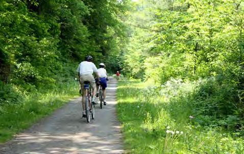
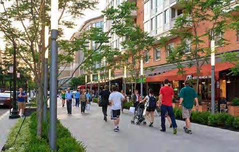
12 Input from Phase 1 Consultation : Principles 6. Ensure an efficient transportation network that includes mobility options, is transit supportive, includes active transportation, walking and cycling, and accommodates vehicles. 7. Provide an interconnected system of streets and pedestrian supportive streetscapes. 8. Provide for a connected and integrated parks, open spaces, and trails system. 9. Use green infrastructure to make use of the absorbing and filtering abilities of plants, trees, and soil to protect water quality, reduce runoff volumes, and recharge groundwater supplies. PLANNING & ECONOMIC DEVELOPMENT DEPARTMENT

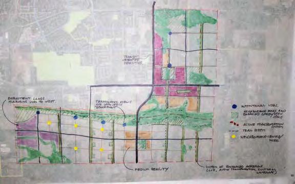
13 Input from Phase 1 Consultation : Concepts PLANNING & ECONOMIC DEVELOPMENT DEPARTMENT

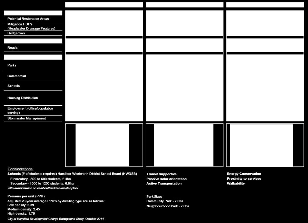
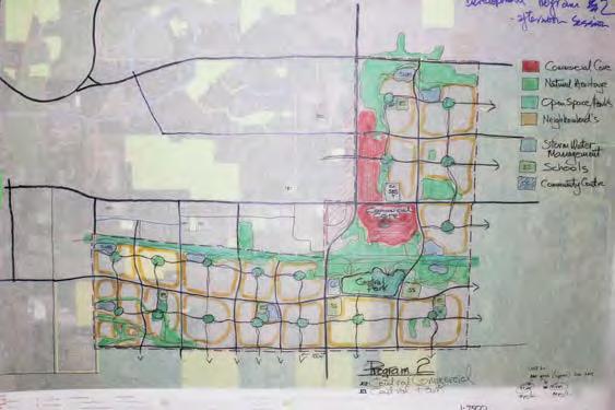
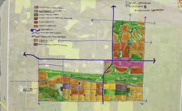
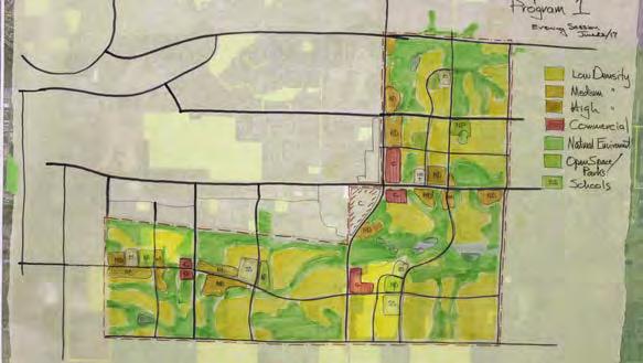
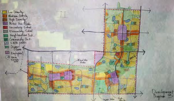
14 Development Program: 3 Concepts


15 Natural Heritage System Concept 2 Central Node Concept 1 Development Pods Concept 3 Nodes & Corridors
16 Roads Concept 2 Central Node Concept 1 Development Pods Concept 3 Nodes & Corridors
17 Mixed Use / Commercial Concept 2 Central Node Concept 1 Development Pods Concept 3 Nodes & Corridors

18 Institutional & Parks Concept 2 Central Node Concept 1 Development Pods Concept 3 Nodes & Corridors

19 Residential Concept 2 Central Node Concept 1 Development Pods Concept 3 Nodes & Corridors
20 Concept 1: Development Pods Natural Heritage System
21 Concept 1: Development Pods Natural Heritage System + Roads

22 Concept 1: Development Pods Natural Heritage System + Roads + Mixed Use / Commercial
23 Concept 1: Development Pods Natural Heritage System + Roads + Mixed Use / Commercial + Institutional & Parks
24 Concept 1: Development Pods Natural Heritage System + Roads + Mixed Use / Commercial + Institutional & Parks + Residential


25 Concept 1: Development Pods

26 Concept 1: Development Pods within the context of existing and planned development
27 Concept 2: Central Node Natural Heritage System
28 Concept 2: Central Node Natural Heritage System + Roads

29 Concept 2: Central Node Natural Heritage System + Roads + Mixed Use / Commercial
30 Concept 2: Central Node Natural Heritage System + Roads + Mixed Use / Commercial + Institutional & Parks

31 Concept 2: Central Node Natural Heritage System + Roads + Mixed Use / Commercial + Institutional & Parks + Residential


32 Concept 2: Central Node
33 Concept 2: Central Node within the context of existing and planned development
34 Concept 3: Nodes & Corridors Natural Heritage System

35 Concept 3: Nodes & Corridors Natural Heritage System + Roads
36 Concept 3: Nodes & Corridors Natural Heritage System + Roads + Mixed Use / Commercial
37 Concept 3: Nodes & Corridors Natural Heritage System + Roads + Mixed Use / Commercial + Institutional & Parks

38 Concept 3: Nodes & Corridors Natural Heritage System + Roads + Mixed Use / Commercial + Institutional & Parks + Residential


39 Concept 3: Nodes & Corridors

40 Concept 3: Nodes & Corridors within the context of existing and planned development
 Concept 1 Concept 2")


41 Development Yields Total People and Jobs (p+j) Concept 1 Concept 2 Concept 3 Gross Land Area ha 1, ha ha 80 p+j combined 72,456 80,027 77,490 Population equivalent to the size of Peterborough or Belleville
42 Inputs to the Evaluation of Concepts Concept 1 Concept 2 Concept 3 Evaluation Inputs Public Community Focus Group City Staff Team Technical Advisory Committee Consulting Team Preferred Land Use Plan PLANNING & ECONOMIC DEVELOPMENT DEPARTMENT
43 Evaluation of Concepts The Concepts shown tonight are schematic illustrations that highlight key relationships of different development patterns. It is anticipated that no one Concept shown tonight will be selected in its entirety. Your comments on the layers of each Concept will help the team identify the best of each Concept to become the preferred concept plan. Comment on the characteristics/layers of the Concepts. Input will become part of the analysis contributing to the project team s preparation of a recommended land use vision for Elfrida. That refined concept shall be the focus of our next public information centre in spring 2018 PLANNING & ECONOMIC DEVELOPMENT DEPARTMENT


44 Evaluation Themes Ensure a compact, complete and healthy community Respond appropriately to long term urban structure implications Develop in an environmentally appropriate manner that protects, restores and enhances the natural environment and its associated features and functions Protect opportunities to farm land PLANNING & ECONOMIC DEVELOPMENT DEPARTMENT


45 Evaluation Themes Conserve cultural heritage Promote a coordinated, efficient and cost effective transportation network Promote coordinated, efficient and cost-effective water, wastewater and stormwater management systems Promote fiscal responsibility PLANNING & ECONOMIC DEVELOPMENT DEPARTMENT

46 Elevated Water Storage Facility and Pumping Station Study for Pressure District 7 The purpose of this Municipal Class Environmental Assessment (EA) study is to select the preferred sites for a new elevated water storage facility and pumping station. This new infrastructure is required to provide water supply for future growth within Pressure District 7 (PD7), and to address security of supply and water system balancing. To meet projected population growth, the elevated water storage facility is required by approximately 2021 and the pumping station by 2027.

47 Overview of the Municipal Class EA Process The Ontario Environmental Assessment Act (EAA) requires that most municipal infrastructure projects follow an approved Class EA process. This study is being conducted in accordance with the approved requirements for a Schedule B project as described in the Municipal Engineers Association s Municipal Class EA document. The study is currently in Phase 2: Alternative Solutions. The results of the evaluation the preferred sites for the elevated water storage facility and pumping station will be presented at a second Public Information Centre (PIC) in Spring/Summer Phase 1: Problem or Opportunity Identify the problem(s) or opportunities Phase 2: Alternative Solutions Identify alternative solutions Inventory natural, cultural and socio-economic environments Identify potential impacts of the alternative solutions and mitigation Evaluate the alternative solutions considering environmental and technical impacts Identify a recommended solution Confirm the preferred solution based on input from the PIC and review agencies Project File Report Prepare Project File Report to describe the activities undertaken through Phases 1 and 2 Notify stakeholders of study completion and the Part II Order provision in the EAA Place Project File Report on public record for review for 30- calendar days Implementation Subject to comments received, proceed to detailed design and construction Notice of Study Commencement and Public Information Centre (PIC) Discretionary PIC December 6, 2017 Mandatory PIC (and Notice of PIC) Spring/Summer 2018 Notice of Study Completion

48 Study Area and Alternative Sites Contains public sector data made available under the City of Hamilton s Open Data License.
49 Next Steps Secondary Plan February Early Fall 2017 Early Fall 2017 to Early 2018 Early 2018 to Summer 2018 Phase 1 Background Research & Analysis Phase 2 Land Use Scenarios Phase 3 Preferred Land Use Scenario & Secondary Plan Community Working Group 1 Visioning & Design Workshop 1 June 21 & 22, 2017 Community Working Group 2 Public Workshop 2 Review concepts Community Working Group 3 Public Workshop 3 Review preferred land use scenario Pop-Up Consultation Events Small Group Meetings Online Engagement / Project PLANNING & ECONOMIC DEVELOPMENT DEPARTMENT
50 Tonight s meeting Table group discussions to provide comments on the three concepts with respect to the location and distribution of the: Natural heritage system Roads Mixed use/commercial uses Institutional uses and parks Residential uses Input will assist the team in identifying the best of each concept to help prepare a preferred land use scenario for the Elfrida Growth Area The preferred land use plan will be prepared considering all inputs on the three concepts.
51 Next Steps Evaluation of the Concepts with inputs from the public consulting team City of Hamilton Technical Advisory Team Community Focus Group Preparation of draft preferred land use scenario Review study progress Contact us: Elfrida Growth Area Study Alissa Mahood, MCIP, RPP Ext Water Storage Facility and Pumping Station Study Elizabeth Panicker, Project Manager Ext
Planning for the Future Urban Area. in north Markham. Update. Development Services Committee. December 9, De Development Services Committee
 Planning for the in north Markham 1 Update De December 9, 2014 Overview - Growth Management Strategy and new Official Plan 2014 Status - Official Plan 2014 and ROPA3 Update - Planning for the Future Urban
Elevated Water Storage Facility and Pumping Station Municipal Class EA for Pressure District 7: PIC # 1 Summary
 Memorandum DATE: March 14, 2018 TO: FROM: CC: OUR REF.#: SUBJECT: Winston Wang, M.A.Sc., P.Eng Project Manager, City of Hamilton Jennifer Whittard, B.E.S., PMP Shelley Kuan, Jessica Mollo WM16-0435 Elevated
Master Environmental Servicing Plan & Secondary Plan
 East Side Lands Stage 2 1 Master Environmental Servicing Plan & Secondary Plan Public Information Centre #1 June 16, 2016 Welcome! Today s Agenda Please sign in at the front desk. 5:30 pm 6:30 pm: Open
NEW REGIONAL OFFICIAL PLAN HIGH LEVEL PROCESS & FRAMEWORK
 NEW REGIONAL OFFICIAL PLAN HIGH LEVEL PROCESS & FRAMEWORK Why A New Official Plan Originally the role of Regionally Planning and content of Regional Official Plan (1970s) primarily focused on protecting
Report to: Development Services Committee Report Date: September 11, 2017
 ~RKHAM Report to: Development Services Committee Report Date: September 11, 2017 SUBJECT: PREPARED BY: Conceptual Master Plan for the Future Urban Area - Community Structure Plan and Key Policy Direction
1.0 Purpose of a Secondary Plan for the Masonville Transit Village
 Report to Planning and Environment Committee To: Chair and Members Planning & Environment Committee From: John M. Fleming Managing Director, Planning and City Planner Subject: Masonville Transit Village
CONSULTING SERVICES FOR THE WHITEBELT VISIONING EXERCISE ADDENDUM TO THE GTA WEST LAND USE STUDY WORK PROGRAM
 CONSULTING SERVICES FOR THE WHITEBELT VISIONING EXERCISE ADDENDUM TO THE GTA WEST LAND USE STUDY 1. Introduction WORK PROGRAM The Town of Caledon is a large, local municipality located in the Greater Toronto
6 Growth Management Challenges and Opportunities
 6 Growth Management Challenges and Opportunities The Town has established a goal of attaining a 50% participation rate with respect to employment opportunities versus residential population. The Town s
Report to: Development Services Committee Report Date: April 24, 2017
 SUBJECT: Cornell Rouge National Urban Park Gateway - Report on Design Charrette and Next Steps PREPARED BY: Lilli Duoba, MES, MCIP, RPP, Manager, Natural Heritage (ext. 7925) REVIEWED BY: Marg Wouters,
Master Environmental Servicing Plan & Secondary Plan
 1 East Side Lands Stage 2 Master Environmental Servicing Plan & Secondary Plan Public Consultation Centre #4 March 20, 2018 Welcome! Today s Agenda Please sign in at the registration table. 6:00 pm 6:30
SUBJECT: Proposed Downtown Mobility Hub Precinct Plan and Proposed Official Plan Policies
 Page 1 of Report PB-81-17 SUBJECT: Proposed Downtown Mobility Hub Precinct Plan and Proposed Official Plan Policies TO: FROM: Committee of the Whole Planning and Building Department Report Number: PB-81-17
Welcome. Walk Around. Talk to Us. Write Down Your Comments
 Welcome This is an information meeting introducing the applications for proposed redevelopment of the Yorkdale Shopping Centre site at 3401 Dufferin Street and 1 Yorkdale Road over the next 20+ years,
SCARBOROUGH SUBWAY EXTENSION. Scarborough Subway Extension. Final Terms of Reference
 Scarborough Subway Extension Final Terms of Reference 1 1.0 Introduction and Background 1.1 Introduction Toronto City Council recently confirmed support for an extension of the Bloor-Danforth Subway from
Chair and Members of the Planning, Public Works and Transportation Committee. Tara Buonpensiero, Senior Planner Policy, MCIP, RPP
 REPORT TO: REPORT FROM: Chair and Members of the Planning, Public Works and Transportation Committee Tara Buonpensiero, Senior Planner Policy, MCIP, RPP DATE: April 9, 2018 REPORT NO.: RE: PLS-2018-0027
St. Clair Avenue West Area Transportation Master Plan
 1 (Between Keele Street and Old Weston Road) Public Information Centre 1 December 2, 2015 2 Welcome Welcome to the first Public Information Centre for the St. Clair Avenue West Area. The panels will present
Planning Services Public Meeting Report
 Planning Services Public Meeting Report If this information is required in an alternate accessible format, please contact the Accessibility Coordinator at 905-623-3379 ext. 2131. Report To: Planning and
Official Plan Review: Draft Built Form Policies
 PG.30.1 REPORT FOR ACTION Official Plan Review: Draft Built Form Policies Date: May 15, 2018 To: Planning and Growth Management Committee From: Chief Planner and Executive Director, City Planning Division
DOMINION BOULEVARD CORRIDOR STUDY AND ECONOMIC DEVELOPMENT STRATEGIC PLAN A MODEL FOR CHESAPEAKE S FUTURE
 DOMINION BOULEVARD CORRIDOR STUDY AND ECONOMIC DEVELOPMENT STRATEGIC PLAN A MODEL FOR CHESAPEAKE S FUTURE Overview I. Draft Plan Process II. Draft Plan Overview a. Market Analysis b. Master Land Use Plan
Public Open House. Overview of the Downtown Plan Official Plan Amendment April 23, 2018
 Public Open House Overview of the Downtown Plan Official Plan Amendment April 23, 2018 1 A 25-Year Plan for Downtown To ensure growth contributes positively to Toronto s Downtown as a great place to live,
COMMUNITY SUSTAINABILITY AND ENVIRONMENTAL MASTER PLAN IMPLEMENTATION UPDATE
 Attachment 1 COMMUNITY SUSTAINABILITY AND ENVIRONMENTAL MASTER PLAN IMPLEMENTATION UPDATE Priorities and Key Initiatives Committee May 2013 Page E-1 How we grow Goal 2: To ensure sustainable development
1 Introduction. Chapter. In this chapter:
 Chapter 1 Introduction In this chapter: 1.1 A Snapshot of the Region 1.2 Towards a Sustainable Region 1.3 The Provincial Context 1.4 Purpose and Organization The Regional Municipality of York Official
MAYFIELD WEST SECONDARY PLAN PHASE 2
 MAYFIELD WEST SECONDARY PLAN PHASE 2 Public Open House #3 February 25, 2010 Draft Preferred Land Use Scenario TOWN OF CALEDON PLANNING & DEVELOPMENT DEPARTMENT Open House Agenda TOWN OF CALEDON 1. Welcome
CDAC. Update: Downtown Dartmouth Update: CDAC July 25 th Motion
 CDAC Update: Downtown Dartmouth Update: CDAC July 25 th Motion 2018-10-24 Downtown Dartmouth Plan Open House October 22, 2018 6:00 pm Open House 6:30 pm Presentation + Q&A 7:20 pm Open House 8:30 pm Close
John M. Fleming Managing Director, Planning and City Planner. Old East Village Dundas Street Corridor Secondary Plan Draft Terms of Reference
 Report to Planning and Environment Committee To: From: Subject: Chair and Members Planning & Environment Committee John M. Fleming Managing Director, Planning and City Planner Old East Village Dundas Street
MOUNT PLEASANT SECONDARY PLAN & VILLAGE BLOCK PLAN. Wednesday, March 5, 2008 Informal Public Open House
 MOUNT PLEASANT SECONDARY PLAN & VILLAGE BLOCK PLAN Wednesday, March 5, 2008 Informal Public Open House 1. Welcome & Introductions 2. Highlights of Provincial Growth Plan 3. Overview and Status Update -
PUBLIC MEETING AND OPEN HOUSE: Don Mills Crossing Phase 2 Celestica Development Applications. February 21, 2017
 PUBLIC MEETING AND OPEN HOUSE: Don Mills Crossing Phase 2 Celestica Development Applications February 21, 2017 PURPOSE OF TONIGHT S MEETING Engage the community on the Don Mills Crossing Study and development
The protection of the agricultural resources of the Province;
 PART II INTRODUCTION An Official Plan is a policy document, which is intended to serve as the basis for making land use decisions and managing change in any municipality in Ontario. According to the Planning
2040 LUP is a part of the Comprehensive Plan and carries the same legal authority. Economic Challenges
 1.1. Guiding Anchorage s Growth Where will new residents settle over the next two decades? Where will people work, shop, and play? Will there be enough room to grow? How will Anchorage look? Will growth
3 Development Process 3.1 Stage One page Stage Two page Stage Three page CENTRAL PICKERING DEVELOPMENT PLAN
 3 Development Process 3.1 Stage One page 24 3.2 Stage Two page 25 3.3 Stage Three page 28 22 CENTRAL PICKERING DEVELOPMENT PLAN The Central Pickering Development Plan establishes the key elements of new
SUBJECT: Waterfront Hotel Planning Study Update TO: Planning and Development Committee FROM: Department of City Building. Recommendation: Purpose:
 Page 1 of Report PB-23-18 SUBJECT: Waterfront Hotel Planning Study Update TO: Planning and Development Committee FROM: Department of City Building Report Number: PB-23-18 Wards Affected: 2 File Numbers:
MAYFIELD WEST SECONDARY PLAN PHASE 2
 MAYFIELD WEST SECONDARY PLAN PHASE 2 Council Information Workshop February 16, 2010 Draft Preferred Land Use Plan TOWN OF CALEDON PLANNING & DEVELOPMENT DEPARTMENT Workshop Agenda TOWN OF CALEDON 1. Welcome
Planning Department. Director of Planning. Manager of Planning. Planning Technician/ Sustainability Coordinator. Planner II/ Heritage Coordinator
 Department Director of Manager of Policy Planner Planner II (2) Planner II/ Heritage Coordinator Technician/ Sustainability Coordinator Technician Administrative Clerk March 2017 Department 2018 Business
Downtown Whitby Action Plan
 Downtown Whitby Action Plan Final Report October 2016 Table of Contents Introduction 1 Public Consultation 2 Walkability 3 Downtown Whitby Walkability Map 4 Vision 5 Goal & Objectives 6 Objective 1 7 Objective
12 AMENDMENT NO. 149, TOWN OF MARKHAM HIGHWAY 404 NORTH SECONDARY PLAN
 12 AMENDMENT NO. 149, TOWN OF MARKHAM HIGHWAY 404 NORTH SECONDARY PLAN The Planning and Economic Development Committee recommends the adoption of the recommendation contained in the following report August
Introduction. Public Information Package. Project website. Overview. Class Environmental Assessment Process
 1 Introduction Public Information Package Baseline Road Extension between Lambs Road and Bennett Road, Bowmanville Schedule B Municipal Class Environmental Assessment November 6, 2017 Overview The purpose
3 TOWN OF WHITCHURCH-STOUFFVILLE OFFICIAL PLAN AMENDMENT NOS. 116 & 117
 3 TOWN OF WHITCHURCH-STOUFFVILLE OFFICIAL PLAN AMENDMENT NOS. 116 & 117 The Planning and Economic Development Committee recommends the adoption of the recommendations contained in the following report,
9 CITY OF VAUGHAN OFFICIAL PLAN AMENDMENT NO BOCA EAST INVESTMENTS LIMITED
 9 CITY OF VAUGHAN OFFICIAL PLAN AMENDMENT NO. 631 - BOCA EAST INVESTMENTS LIMITED The Planning and Economic Development Committee recommends the adoption of the recommendations contained in the following
Rapid Transit Implementation Working Group September 14, 2017
 Rapid Transit Implementation Working Group September 14, 2017 BACKGROUND Council approved the Rapid Transit Master Plan and Updated Business Case on July 25, 2017. Approval of the RTMP confirmed the BRT
PDS June 1, 2016 Page 1. Planning and Development Committee. MEETING DATE: Wednesday, June 01, 2016
 Page 1 REPORT TO: Planning and Development Committee MEETING DATE: Wednesday, June 01, 2016 SUBJECT: ROPA 12: Project Initiation Report Regional Official Plan Amendment (ROPA # 12) Watercourse Policies
CITY OF VAUGHAN EXTRACT FROM COUNCIL MEETING MINUTES OF JUNE 7, 2016
 Item 5, Report No. 26, of the Committee of the Whole (Working Session), which was adopted without amendment by the Council of the City of Vaughan on June 7, 2016. 5 MUNICIPAL CLASS ENVIRONMENTAL ASSESSMENT
Town of Oakville Streetscape Strategy
 Town of Oakville Streetscape Strategy Endorsed by PDC on February 10, 2014 (PD-011-14) Town of Oakville Streetscape Strategy [endorsed by PDC February 10, 2014] 0 Town of Oakville Streetscape Strategy
Appendix 1 Structure plan guidelines
 Appendix 1 Structure plan guidelines This appendix forms part of the regional policy statement [rps]. 1.1. Introduction Structure plans are an important method for establishing the pattern of land use
The Corporation of the TOWN OF MILTON
 Report to: From: Chair & Members of the Administration & Planning Standing Committee W.F. Mann, Director of Planning and Development Date: April 16, 2012 PD 022-12 (Z19/11) Subject: Technical Report Proposed
Waverley West B Secondary Planning Process. Open House South Pointe School April 25, 2018
 averley est B Secondary Planning Process South Pointe School April 25, 2018 averley est B Secondary planning process open house Please review the boards and provide your feedback. 1 The Role of a Secondary
THAT the attached Terms of Reference for the Thornhill Centre Street Study be approved.
 COMMITTEE OF THE WHOLE AUGUST 18, 2003 THORNHILL CENTRE STREET STUDY PLANNING FILE: 15.92 Recommendation The Commissioner of Planning recommends: THAT the attached Terms of Reference for the Thornhill
Scope of Services. River Oaks Boulevard (SH 183) Corridor Master Plan
 Corridor Master Plan") Scope of Services River Oaks Boulevard (SH 183) Corridor Master Plan PROJECT AREA The project area consists of the River Oaks Boulevard (SH 183) corridor bounded by SH 199 at the northern end and the Trinity
Scope of Services River Oaks Boulevard (SH 183) Corridor Master Plan PROJECT AREA The project area consists of the River Oaks Boulevard (SH 183) corridor bounded by SH 199 at the northern end and the Trinity
Cc~tporate Sers~ic:es
 tg * Cc~tporate Sers~ic:es Csrmcil and Adnrirristrativs Services April 26,201 1 ". RE(;lr?N (1;. 1q.1 i Town of Caledon Region of Peel ci E~iliS DEP? Attn: Karen Landry, Director of Attn: Carol Reig, Regional
SUBJECT: Revised proposed new official plan recommended for adoption
 Page 1 of Report PB-04-18 SUBJECT: Revised proposed new official plan recommended for adoption TO: FROM: Planning and Development Committee Department of City Building Report Number: PB-04-18 Wards Affected:
Vaughan Metropolitan Centre (VMC) Black Creek Renewal CLASS ENVIRONMENTAL ASSESSMENT
 Black Creek Renewal CLASS ENVIRONMENTAL ASSESSMENT") PUBLIC INFORMATION CENTRE Vaughan Metropolitan Centre (VMC) Black Creek Renewal Wednesday, May 10, 2017 6:00 p.m. to 8:00 p.m. Add photo Project Management, Environmental Assessment, Stormwater Management
PUBLIC INFORMATION CENTRE Vaughan Metropolitan Centre (VMC) Black Creek Renewal Wednesday, May 10, 2017 6:00 p.m. to 8:00 p.m. Add photo Project Management, Environmental Assessment, Stormwater Management
Streets for People, Place-Making and Prosperity. #TOcompletestreets
 COMPLETE STREETS FOR TORONTO Streets for People, Place-Making and Prosperity COMPLETE STREETS: A NEW APPROACH A Complete Streets design approach considers the needs of all users people who walk, bicycle,
Infrastructure, Development and Enterprise Services. Natural Heritage Action Plan (NHAP) Project Initiation
 Project Initiation") Staff Report To Service Area Committee of the Whole Infrastructure, Development and Enterprise Services Date Monday, March 6, 2017 Subject Natural Heritage Action Plan (NHAP) Project Initiation Report
Staff Report To Service Area Committee of the Whole Infrastructure, Development and Enterprise Services Date Monday, March 6, 2017 Subject Natural Heritage Action Plan (NHAP) Project Initiation Report
Local Growth Planning in North Central Green Line Communities
 2018 April 30 Page 1 of 6 EXECUTIVE SUMMARY This report outlines a high-level scope for local growth planning for north central Green Line communities. The catalyst for this review is the significant investments
WITNESS STATEMENT Of. Ronald Blake. On behalf of the Intervenor The Corporation of the City of Markham
 Filed: 2013-06028 EB-2012-0451 Exhibit L.EGD.COM.2 Page 1 of 7 WITNESS STATEMENT Of Ronald Blake On behalf of the Intervenor The Corporation of the City of Markham In the matter of an application by Enbridge
SUBJECT: GO Station Mobility Hubs Preferred Concepts: Aldershot GO, Burlington GO and Appleby GO. Planning and Development Committee - Public Meeting
 Page 1 of Report PB-76-17 SUBJECT: GO Station Mobility Hubs Preferred Concepts: Aldershot GO, Burlington GO and Appleby GO TO: FROM: Planning and Development Committee - Public Meeting Planning and Building
Official Plan Review
 Official Plan Review Summary Report - The Built Environment August 2014 Part 1: Introduction Planning for a healthy, prosperous and sustainable community is an important goal for our municipality. From
CONTENTS 2.0 A FRAMEWORK FOR SUSTAINABLE GROWTH 2.1 MANAGING SUSTAINABLE GROWTH THE VISION TO GOALS AND OBJECTIVES 2.3 MARKHAM STRUCTURE
 2 A Framework for Sustainable Growth 2.0 A FRAMEWORK FOR SUSTAINABLE GROWTH CONTENTS 2.1 MANAGING SUSTAINABLE GROWTH THE VISION TO 2031 2.2 GOALS AND OBJECTIVES 2.2.1 Protecting the Natural Environment
Welcome to Our Open House
 Welcome to Our Councillor Gerbasi & the Planning, Property, & Development Department welcome you to tonight s open house The open house outlines the proposed Osborne Village Neighbourhood Plan a secondary
Introduction. Chapter 1. Purpose of the Comprehensive Plan Plan Organization Planning Process & Community Input 1-1
 Chapter 1 Introduction Lakewood 2025: Moving Forward Together Purpose of the Comprehensive Plan Plan Organization Planning Process & Community Input 1-1 Purpose of the Comprehensive Plan The Comprehensive
This chapter describes the purpose of the Plan, introduces how the Plan is organized and provides contextual background for the Plan.
 Chapter 1: INTRODUCTION Purpose of a Comprehensive Plan The 2040 Comprehensive Plan establishes Medina s vision as a community and sets goals and objectives which guide future decisions and policies. The
CITY OF VAUGHAN EXTRACT FROM COUNCIL MEETING MINUTES OF NOVEMBER 15, 2016
 Item 11, Report No. 38, of the Committee of the Whole, which was adopted without amendment by the Council of the City of Vaughan on November 15, 2016. Regional Councillor Di Biase declared an interest
South of Eastern Strategic Direction Status Update
 STAFF REPORT ACTION REQUIRED South of Eastern Strategic Direction Status Update Date: July 10, 2014 To: From: Planning and Growth Management Committee Chief Planner and Executive Director, City Planning
City of St. Thomas New Official Plan
 City of St. Thomas New Official Plan Sustainable & Healthy Community Workshop Ann Joyner and Paddy Kennedy Dillon Consulting Limited Work Shop Outline Introduction Presentation Exercise 1 (individual)
Figure 1- Site Plan Concept
 Figure 1- Site Plan Concept Parking will be provided underground on three levels at rate of 1.0 space/ unit; this rate includes all visitors parking. MMM Group has prepared a parking assessment (April,
THE CORPORATION OF THE TOWN OF OAKVILLE BY-LAW NUMBER
 THE CORPORATION OF THE TOWN OF OAKVILLE BY-LAW NUMBER 20012-08530 A by-law to adopt an amendment to the Official Plan of the Oakville Planning Area (Official Plan Amendment 198) Land North of Dundas Street.
URBAN DESIGN ACTION PLAN. Community Design and Environmental Services Committee April 20, 2009
 URBAN DESIGN ACTION PLAN Community Design and Environmental Services Committee April 20, 2009 What is the Urban Design Action Plan? The Action Plan is a guiding document to address how design-thinking
Long Branch Neighbourhood Character Guidelines Final Report
 STAFF REPORT ACTION REQUIRED Long Branch Neighbourhood Character Guidelines Final Report Date: October 26, 2017 To: From: Wards: Reference Number: Etobicoke York Community Council Director, Community Planning,
Municipal Development Plan 2013
 UNIQUELY STONY PLAIN: Municipal Development Plan 2013 Quick Reference Guide What is a Municipal Development Plan (MDP)? The Town s highest-level planning document Sets the long-term vision and key themes
OFFICIAL PLAN UPDATE PLANNING ACT SECTION 26
 OFFICIAL PLAN UPDATE PLANNING ACT SECTION 26 Stakeholders Meeting November 20, 2017 EcoVue Consulting Services Inc. 311 George Street North Suite 200 Peterborough, Ontario K9J 3H3 T 705.876.8340 F 705.742.8343
Commissioners Road West Realignment Environmental Assessment
 City of London Commissioners Road West Realignment Environmental Assessment Public Information Centre No. 2 November 29, 2017 Welcome to the Public Information Centre This 2 nd Public Information Centre
Work Program: Planning for the Development of the North Markham Future Urban Area. Planning Markham s Future. Development Services Committee
 Work Program: Planning for the Development of the North Markham Future Urban Area Planning Markham s Future Development Services Committee October 1, 2013 2 Planning for Future Urban Area Subwatershed
It Takes A Village.. Preserving Rural Character In Standish
 It Takes A Village.. Preserving Rural Character In Standish A Public Workshop Hosted by Conservation and Open Space Plan Committee & Standish Corner Village Implementation Committee June 12, 2008 Desired
Trafalgar Road Corridor Planning Study Open House
 Trafalgar Road Corridor Planning Study Open House June 24, 2013 6:30-8:30 p.m. Oakville & Trafalgar Rooms Overview The Livable Oakville Plan identifies the lands along Trafalgar Road, between the QEW and
Town of Cobourg Heritage Master Plan. Statutory Public Meeting
 Town of Cobourg Heritage Master Plan Statutory Public Meeting April 25 th 2016 Presentation Overview 1. Introduction 2. Project background and schedule overview 3. Review of strategic direction content
Edward R. Sajecki Commissioner of Planning and Building
 Corporate Report Clerk s Files Originator s Files CD.03.POR DATE: TO: FROM: SUBJECT: Chair and Members of Planning and Development Committee Meeting Date: February 27, 2012 Edward R. Sajecki Commissioner
SAN RAFAEL GENERAL PLAN 2040 INTRODUCTION AND OVERVIEW
 SAN RAFAEL GENERAL PLAN 2040 INTRODUCTION AND OVERVIEW Steering Committee Presentation February 14, 2018 Purpose of General Plan Guide land use and development decisions Coordinate transportation, infrastructure,
Gary & Regional Investment Project. October 27, Creating Tomorrow Today Comprehensive Regional Plan - NIRPC
 Creating Tomorrow Today 2040 Comprehensive Regional Plan Gary & Regional Investment Project October 27, 2010 Creating Tomorrow Today - 2040 Comprehensive Regional Plan - NIRPC What is NIRPC? - Northwestern
CITY OF CAMBRIDGE Growth & Intensification Study Secondary Plan Stakeholder Session September 12th, 2016
 CITY OF CAMBRIDGE Growth & Intensification Study Secondary Plan Stakeholder Session September 12th, 2016 Dillon Consulting Limited Watson & Associates Economists Curtis Planning Inc. Tim Welch Consulting
Niagara GO Hub and Transit Stations Study
 Niagara GO Hub and Transit Stations Study Public Open House #2 June 2017 Study Purpose The purpose of this study is to prepare four key deliverables for each station area: 1. Work with Metrolinx to provide
CITY OF VAUGHAN EXTRACT FROM COUNCIL MEETING MINUTES OF JUNE 19, 2018
 CITY OF VAUGHAN EXTRACT FROM COUNCIL MEETING MINUTES OF JUNE 19, 2018 Item 33, Report No. 21, of the Committee of the Whole, which was adopted, as amended, by the Council of the City of Vaughan on June
DRAFT. & Secondary Plan Study. East Side Lands- Stage 2. Planning Rationale Report
 East Side Lands- Stage 2 Master Environmental SERVICING Plan & Secondary Plan Study Planning Rationale Report Draft April 24, 2018 QUALITY MANAGEMENT Issue/Revision First Issue Revision 1 Revision 2 Remarks
CITY COUNCIL AGENDA REPORT
 CITY COUNCIL AGENDA REPORT Subject: COUNCIL MOTION LRT ALIGNMENT REMOVAL FROM THE TRANSPORTATION MASTER PLAN On February 10, 2016 Councillor Hughes provided notice in accordance with Section 23 of Procedure
Transforming Saint John s Urban Heart -
 Transforming Saint John s Urban Heart - How Innovative Community Engagement Inspires a Bold Municipal Plan for a More Sustainable and Compact Saint John 2012 NNECAPA Conference - Brunswick, ME October
NO: R035 COUNCIL DATE: FEBRUARY 24, 2014
 CORPORATE REPORT NO: R035 COUNCIL DATE: FEBRUARY 24, 2014 REGULAR COUNCIL TO: Mayor & Council DATE: February 24, 2014 FROM: General Manager, Planning and Development FILE: 6520-01 SUBJECT: Town Centre
SPECIAL COMMITTEE OF THE WHOLE DECEMBER 9, 2002 BLOCK 57/58 WEST BLOCK PLAN BLOCK PLAN FILE BL.57/58W.99 HUNTINGTON BUSINESS PARK LAND OWNERS
 SPECIAL COMMITTEE OF THE WHOLE DECEMBER 9, 2002 BLOCK 57/58 WEST BLOCK PLAN BLOCK PLAN FILE BL.57/58W.99 HUNTINGTON BUSINESS PARK LAND OWNERS Recommendation The Commissioner of Planning recommends: THAT
Scarborough Waterfront Project
 Scarborough Waterfront Project Public Information Centre #1 Environmental Assessment Terms of Reference September 10, 2014 Agenda Open House Presentation 7:00 to 7:30 pm Presentation 7:30 to 8:15 pm History
WAC #7 3/14/14. Coachella General Plan Update
 WAC #7 3/14/14 Coachella General Plan Update Agenda 2 Introductions Public Draft General Plan Overview and Discussion of Next Steps Implementation and Evaluation Health Element Process Evaluation (discussion)
Humber Bay Shores Precinct Plan Final Report
 STAFF REPORT ACTION REQUIRED Humber Bay Shores Precinct Plan Final Report Date: May 21, 2010 To: From: Wards: Reference Number: Etobicoke York Community Council Director, Community Planning, Etobicoke
2.0 A FRAMEWORK FOR SUSTAINABLE GROWTH CONTENTS
 2-2 A Framework for Sustainable Growth 2.0 A FRAMEWORK FOR SUSTAINABLE GROWTH CONTENTS 2.1 MANAGING SUSTAINABLE GROWTH THE VISION TO 2031 2.2 GOALS AND OBJECTIVES 2.2.1 Protecting the Natural Environment
Portage Parkway Environmental Assessment Public Information Centre No. 1
 City of Vaughan Portage Parkway Environmental Assessment Public Information Centre No. 1 November 25, 2015 Welcome to the Public Information Centre This first Public Information Centre (PIC) introduces
Blueprint Denver Task Force Meeting #
 Blueprint Denver Task Force Meeting #1 6.23.16 1. Welcome and Introductions Your name and affiliation Name 1 thing you love about Denver Name 1 thing you d change about Denver All in 30 seconds! Ready,
MEMORANDUM. Future Urban Area Conceptual Master Plan Cultural Heritage Resources
 MEMORANDUM TO: FROM: Heritage Markham Committee Regan Hutcheson, Manager-Heritage Planning DATE: June 14, 2017 SUBJECT: STUDI / PROJECTS Future Urban Area Conceptual Master Plan Cultural Heritage Resources
1.3 TRANSIT VISION 2040 FROM VISION TO ACTION THEME 1: PUTTING TRANSIT AT THE CENTRE OF COMMUNITIES. Fully integrate transit with community planning
 TRANSIT VISION 2040 FROM VISION TO ACTION TRANSIT VISION 2040 defines a future in which public transit maximizes its contribution to quality of life with benefits that support a vibrant and equitable society,
TORONTO COMPLETE STREETS GUIDELINES
 TORONTO COMPLETE STREETS GUIDELINES Presentation by Fiona Chapman, Manager, Pedestrian Projects Public Realm Section, Transportation Services, City of Toronto June 2017 PURPOSE OF THE PROJECT To develop
NEWMARKET URBAN CENTRES SECONDARY PLAN
 Official Plan Amendment #10 to the Town of Newmarket Official Plan NEWMARKET URBAN CENTRES SECONDARY PLAN CONSOLIDATED WITH OMB APPEALS Adopted by the Council for the Corporation of the Town of Newmarket:
150 Eighth Street Zoning By-law Amendment Application Preliminary Report
 REPORT FOR ACTION 150 Eighth Street Zoning By-law Amendment Application Preliminary Report Date: March 27, 2019 To: Etobicoke York Community Council From: Director, Community Planning, Etobicoke York District
PUBLIC OPEN HOUSE HURONTARIO-MAIN CORRIDOR SECONDARY PLAN
 PUBLIC OPEN HOUSE HURONTARIO-MAIN CORRIDOR SECONDARY PLAN Tuesday, February 28, 2012 6pm 9pm 1 st Floor Atrium, City Hall 2 Wellington Street West, Brampton 1 POLICY FRAMEWORK The 2006 Provincial Growth
Commercial, Retail and Tourism Executive Summary December 2018
 Town of Wasaga Beach Official Plan Review, Retail and Executive Summary December 2018 1 An Official Plan directs where and how to grow The preparation of a new Official Plan for Wasaga Beach is an opportunity
Central Lake Ontario Conservation Conservation Lands Master Plan
 Conservation Lands Master Plan Top 13 Frequently Asked Questions 1. What are conservation lands? Where are these conservation lands located in the Central Lake Ontario Conservation watershed? Conservation
COURTICE MAIN STREET COMMUNITY IMPROVEMENT PLAN
 COURTICE MAIN STREET COMMUNITY IMPROVEMENT PLAN Public Meeting #1 April 28, 2016 Birdseye view of the study area PIC #1 AGENDA Agenda and Format 6:30 6:50 Registration 6:50 7:45 Introductions, Presentation
5 TOWN OF MARKHAM OFFICIAL PLAN AMENDMENT NO. 144 MILLIKEN MAIN STREET SECONDARY PLAN
 5 TOWN OF MARKHAM OFFICIAL PLAN AMENDMENT NO. 144 MILLIKEN MAIN STREET SECONDARY PLAN The Planning and Economic Development Committee recommends the following: 1. The communication from Brendan O Callaghan,