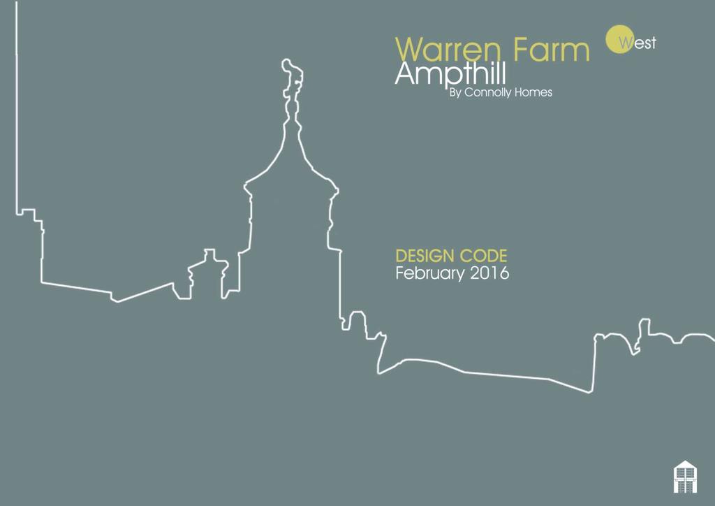
Warren Farm WEST, Ampthill: DESIGN CODE
|
|
|
- Darcy Horton
- 5 years ago
- Views:
Transcription
1 1


2 DEVELOPER ARCHITECT A L A N P A T T E R S O N D E S I G N L L P Registered Office: Manor Farm Court Manor Road, Lower Sundon, Beds, LU3 3NZ Registered Office: Darragh House 112 Craigdarragh Road Helen's Bay County Down BT19 1UB 2
3 CONTENTS 01 INTRODUCTION - The Design Code explained - Planning Background - Approved Masterplan - Design Review: Approved parameters - Design Review: Regulating Plan & Key Features 02 SITE CONTEXT - Overview, Location & Environs - Site Context - Opportunities & Constraints - Local & Regional Character 03 DESIGN STRATEGY - Design Philosophy - Overall Masterplan - Connolly Homes Masterplan 04 DESIGN CODE: Access & Public Realm - Access Strategy & Street Hierarchy - Parking Strategy - Public Realm - Landscape & Open Space Strategy - Play Strategy - Sustainability: Development & Drainage Strategy 05 Design Code: Built Form - Block Principles - Key Design Sequence: Primary - Key Design Sequence: Secondary - Key Design Sequence: Tertiary - Density & Building Heights - Design Sequences: Flitwick Road Entrance - Design Sequences: Boulevard - Design Sequences: Upper & Lower Areas -` Architectural Detailing - Materials Palette - Materials Palette: Contextual Links - Maintenance Strategy: Watercourse - Refuse Strategy - Affordable Housing Distribution 3
4 01 Introduction Introduction This section highlights the purpose and structure of the Design Code, whilst explaining the context of this document within the Planning history of the site. 4
5 The Design Code This Design Code has been created to satisfy condition 5 of the Outline Planning Permission CB/12/01496/OUT, granted on 30 October 2013 This states that a detailed design code shall be submitted to the planning authority for written approval. Purpose and Status of the Design Code The aim of any Design Code is to guide development in a manner that respects the local context of the site. This design code provides site specific design guidance for Warren Farm, Ampthill. This guidance builds upon the design principles established in preceding design guidance documents:- Warren Farm, Ampthill Development Brief - February 2012 Warren Farm, Ampthill Design and Access Statement by Gardner Stewart Architects - April 2012 Principle Aims and Objectives The main aims and objectives of the Design Code are articulated through the following key design principles upon which the Design Code is based. These key principles promote sustainable growth whilst ensuring the creation of a distinctive and sympathetic scheme. They include: Creating a sense of place; A place for people: creating attractive accessible streetscape; Variety of house type & tenure; Managing car parking; and Delivering sustainability Overview of design code contents The key drawing in this Design Code is the Concept Plan: it outlines the overall development concept, establishing the key parameters of development in relation to form and structure, clearly demonstrating the mandatory elements of the proposal. The Design Code will ensure that the details and appearance of any proposed development are acceptable to the local authorities in accordance with Policy DM3 of the Central Bedfordshire (North Area) Core Strategy and Development Management Policies (2009). Framework for Development The basis of the Outline Application is derived and contained within the 2 key documents submitted at approval stage:- Development Brief for Connolly Homes PLC and Denison Investments - February 2012 Design and Access Statement by Gardner Stewart Architects - April 2012 These documents outline the development vision, intentions and set in motion the early collaboration with statutory agencies and utility companies that will augment further the development opportunities on the site The purpose of this document is to: Guide the design and development of Warren Farm, establishing a framework for arranging residential development, streets and spaces. Clearly illustrate the urban design required, and architectural form, massing and materials expected in the development of Warren Farm. Design codes are an effective mechanism for implementing the masterplans, particularly when there is more than one housebuilder involved in the development of a site. CBC, Design in Central Bedfordshire, Placemaking 5
6 01 Planning Background & Context 01 Planning Background and Context The land at Warren Farm, Ampthill was removed from the Green Belt and Safeguarded for future development in the Mid Bedfordshire Local Plan First Review adopted in Originally promoted as two separate parcels accessed off Flitwick Road and Abbey Lane, the land was subsequently allocated as a single site for residential development under Policy HA4 of the Central Bedfordshire (North) Site Allocations DPD in This established the principle of the site being developed for housing. Policy HA4 set out a number of requirements for future proposals for the site, including that a Development Brief be prepared to guide development. A Development Brief was produced setting out clear aims for the scheme, including in respect of design. This was adopted by Central Bedfordshire Council in February An outline planning application for the whole of the Warren Farm site for a development of up to 410 dwellings, together with open space, accesses and surface water retention basin was submitted in April All matters were reserved except means of access. The application was supported by parameters plans and a number of technical documents, including a Design and Access Statement. These established further key principles to be taken into account in the detailed design of the site. Planning permission was granted on 30 October 2013, subject to a number of conditions and a S106 Agreement: Condition 1 requires that the approval of the details of the appearance, landscaping, layout and scale of the development within each area approved as identified in condition 4, and the landscaping adjoining it (herein call the reserved matters ) shall be obtained in writing from the local planning authority before development is commenced within that area. Condition 4 necessitates that prior to the submission of the first reserved matters, an areas plan for the whole application site be submitted and that this indicates a maximum of 6 residential areas, defining the location, extent and number of dwellings in each. Condition 5 requires that prior to the submission of the first reserved matters application for each area, a detailed design code for that area of the development shall be submitted to the local planning authority for written approval. It continues. The detailed design code for each area shall demonstrate how it relates to any adjoining area(s) design code(s); how the objectives of the Design and Access Statement (April 2012) will be met, and shall be in accordance with the drawings and documents referred to in Condition 1 above. The design code for each area shall: a) explain how the code fits in with the Adopted Warren Farm Development Brief (February 2012) and its purpose. b) outline the street network/hierarchy and include cross sections for each street type that outline the various applicable elements within the cross section, including overall range of building line distances(s), set backs/privacy strip(s), cycle lane(s) (if applicable), verge width(s), pavement width(s), any one street parking, bus stops (if applicable) and carriageway width(s). Details of surface material type(s) will also be provided. c) identify and character areas within which the following design principles shall be identified: i) public realm including details of landscaping, public art opportunities, public realm material types (landscape, street furniture etc) and refuse collection. ii) block principles including ranges or plot widths and depths, building lines, frontages and set backs, any on plot or other parking, cycle parking, servicing and storage and collection of waste. iii) boundary treatments including types to front, side and rear boundaries. iv) building types and uses. v) building densities and heights. vi) key gateways, landmark buildings, vistas and frontages. vii) architectural detailing and materials including key roofscape principles, building material types and design details: including signage and lighting (where applicable). viii) environmental and sustainability standards including details of any sustainable urban drainage system ( SUDS ) serving that area. The development of each area shall be carried out in accordance with the approved design code for that area. 6

7 Approved Masterplan Our current masterplan has been closely informed by the approved Masterplan as shown below. The general principles of block structure, retention of existing landscape features and provision of open space have been retained. These elements form the basis upon which the built form of our proposals have been prepared. The detailed aspects of development have been developed in close liaison with planning officers of the Central Bedfordshire Council, and the resultant Masterplan will be the guiding framework behind the development and the content of the Design Code. 01 Image adapted from Design and Access Statement by Gardner Stewart Architects - April

8 Design Review: Response to Approved Parameters 01 The Approved Parameters A number of design parameters have been approved by Central Bedfordshire Council at the outline planning stage. These parameters underpin the content of the Design Code document. The approved design parameters illustrated are: Land Uses including residential, public open space, play areas and flood attenuation Access & Movement including vehicular and pedestrian connections within the site Junction Plan including the agreed junction designs for accesses on Flitwick Road and Abbey Lane. Pre-Application Discussions & Community Consultation Pre-application discussions have taken place with officers from Central Bedfordshire Council between April 2015 and January These discussions have covered all aspects of the design process, including the requirement to discharge condition 5 of the Outline Consent relating to provision of The Design Code. Fundamental to this has been the Public Consultation process, which took the form of an exhibition held on 4th December at Ampthill Town Council Offices. All aspects of the emerging design were presented and the public were given an opportunity to comment on the content of the designs, via feedback and dedicated website. Public comment was collated and passed to Central Bedfordshire Council for their attention. An additional public meeting was held on site on 3rd February 2016 to discuss concerns surrounding the existing Northern Boundary to the site. Comments were taken on board and addressed within the overall masterplan. 8

9 Design Review: Regulating Plan & Key Features 01 The Regulating Plan shown adjacent seeks to outline the design principles and masterplan framework for Warren Farm West. The plan identifies where key elements should be located including; residential development, public open space, key frontages and shows movement routes through the scheme The framework illustrated within the Regulating Plan should be used to guide all future residential proposals and provides a template for future reserved matters proposals and detailed design. 9
10 01 02 Context This section identifies the local character within which the site is located and attempts to contextualise our design proposals within these existing parameters. 10
11 Overview, Location & Environs 02 Land split Integration of Development Parcels The Warren Farm site is to be developed by two separate developers, both of whom have the challenge of providing a successful and cohesive new residential area for Ampthill. The following plan illustrates the separation of eastern and western parcels within the overall lands. Connolly Homes will develop the western portion of lands, which is referred to as Warren Farm West The eastern portion is under the control of Bloor Homes and is referred to as Warren Farm East. The overall Warren Farm Lands are to be developed in two separate parts, however, it is imperative that the overall vision for the scheme remains consistent throughout and ensures that there is no clear distinction between areas that would be to the detriment of the new residential area. Close liaisons between design teams and the Central Bedfordshire Council are ongoing and will continue in order to ensure a cohesive design solution is realised. This approach will ensure that the scheme meets the requirements of the outline planning approval and delivers a sustainable and dynamic new asset to Ampthill. 11

12 02 Image adapted from Thrive Architects, Community Consultation Presentation Document, Dec


13 Warren Farm West: Site Context 02 The Warren Farm site is located at the southern edge of Ampthill, within minute s walk of the town centre. Warren Farm West is accessed via Flitwick Road and will form the western portion of the connecting thoroughfare that continues through Warren Farm East to Abbey Lane. The site is located approximately 3km from Flitwick railway station, with links to Bedford, Luton, London and beyond. The M1 motorway, approximately 8km from the site, provides connections to London and Luton to the south, and Milton Keynes and Northampton to the north. Residential: The site is bounded to the north by residential properties with rear gardens adjacent to the boundary to Flitwick Street, Lammas Way, Fallowfield and Abbey Lane. School: Redborne Upper School and Community College forms the southern boundary to the western site. Woodland: A commercial woodland, comprising a crop of poplar trees with a margin of native species, forms the southern boundary to the eastern site. Around the site at Warren Farm a variety of land uses are evident including residential development, education and community and whilst the former agricultural uses are subsiding, a commercial poplar plantation is located to the south of the site bordering the Greenbelt. 13
14 02 Opportunities & Constraints The site is currently in arable use and generally slopes down gently southwards towards the existing plantation. The site and its wider context present a number of opportunities and constraints for potential development, as highlighted in the adopted Warren Farm Design and Access Statement by Gardner Stewart Architects - April Topographical Considerations: The land does not have any unusually steep or difficult to access areas, the western site falls generally from north-west to south-east at an average gradient of approximately 1 in 36. There is a total change in level of approximately 12m across the site over 430m. The eastern site falls generally from north to south at an average gradient of approximately 1 in 50. There is a total change in level of approximately 5m across the site over 250m. The site is crossed by a drainage ditch/ water course forming a shallow valley. Summary of key Opportunities & Constraints Actions arising from the Outline Applications The following key opportunities There are opportunities for the site to provide: Safe and overlooked new pedestrian links; A series of green open spaces; and Secure boundaries to new and existing properties with adjoining rear gardens Site Boundary and Frontage Considerations: Proposals will include appropriate design responses to the adjoining uses - residential, education, commercial woodland, Tidy Tip and leisure facilities. Existing Landscape Features : A tree-lined drainage ditch/ watercourse crosses the eastern site. The northern boundary of the western site is characterised by a drainage ditch and a belt of trees, which divide the site from the neighbouring rear gardens. The western site also contains a number of individual trees, which should be integrated into the design where possible. 14


15 02 Local & Regional Character An overarching understanding of the local and regional character of the Ampthill and wider Bedfordshire areas is critical to ensure that a suitable, distinctive environment is created, that reflects and builds upon local character. Ampthill is an historic settlement that dates back to the medieval period as a small market town. Since that period, the Town has expanded significantly. The opposing images and study of local character has been informed by the Design and Access Statement by Gardner Stewart Architects - April The purpose of the following study is to illustrate the inherent context within which Warren Farm will lie, and to identify the unique character of Ampthill and environs which will provide the foundations upon which the design proposals for Warren Farm will be constructed. The following will provide the basis for definition of the layout principles, building components, materials and design choices for the scheme at Warren Farm West. Image adapted from Thrive Architects, Community Consultation Presentation Document, Dec

16 Local & Regional Character 02 The local distinctiveness of Ampthill and the surrounding Area Contemporary application of materials to respond to the Traditional Materials of Ampthill is important, and as is illustrated, a wide range of materials are evident within the Local Area. There is evidence of Render, Stone and Brick buildings, with varying tones and textures forming the local character of the area. The Warren Farm West scheme endeavours to reflect existing local materials where possible to ensure the coherent integration of the new residential area into the existing grain of Ampthill. Image adapted from Design and Access Statement by Gardner Stewart Architects - April

17 02 Image adapted from Design and Access Statement by Gardner Stewart Architects - April
18 03 Design Design Strategy Strategy This section presents the evolution of the consented Outline Scheme towards our current proposals. 18
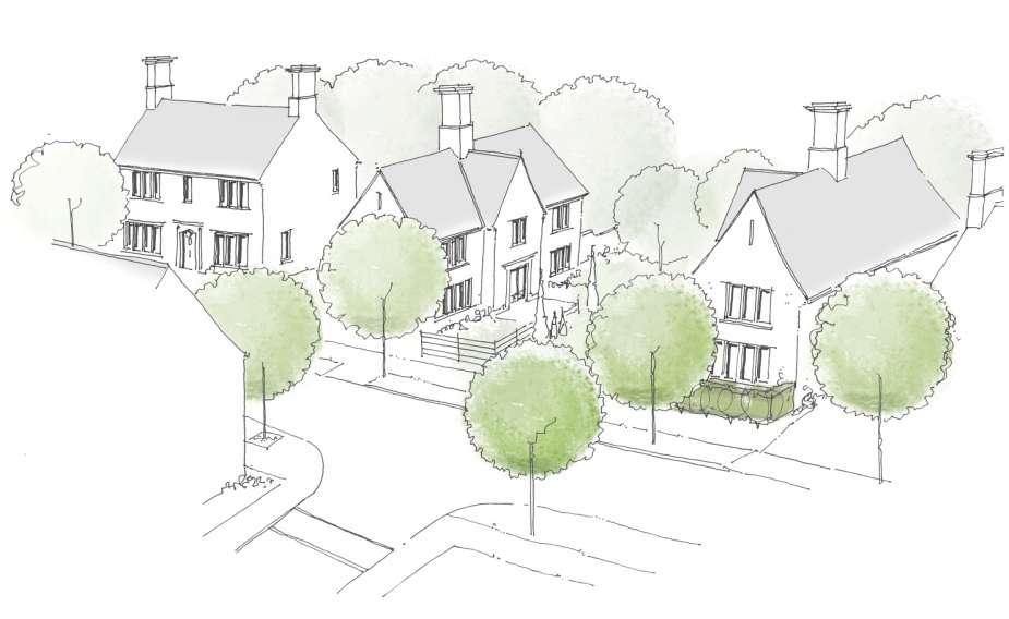
19 03 Design Philosophy THE VISION CONCEPT PRINCIPLES: The main objective of the masterplan is to create an extension to Ampthill that respects the existing town and responds to the surrounding vernacular. The intention is to provide a new neighbourhood which blends closely into the surrounding area and seeks to reinforce local linkages. Warren Farm West will provide a high quality residential development, distinguished by excellent architecture for a range of new homes, set in an attractive, accessible streetscape. The main aims and objectives of the scheme are articulated through the following key design principles upon which the proposals have been based. These key principles promote sustainable growth whilst ensuring the creation of a distinctive and sympathetic scheme. They include: Creating a sense of place; A place for people: creating attractive accessible streetscape; Variety of house type & tenure; Managing car parking; and Delivering sustainability The layout has been conceived to provide a dynamic design response to the existing environment and has been led by the following; to create an attractive townscape incorporate well designed and useable open space enhance the overall amenity MAIN DESIGN PRINCIPLES to respect the existing local environment by considering the interface between the existing housing to the north, west and east and the school and woodlands to the south to create a positive arrival space at Flitwick Road to create open space which benefits new and existing residents alike. to establish and enhance pedestrian linkages to the existing adjacent public amenities such as the School and the Woodlands. Links from Lammas Way to the proposed development are encouraged. Integrating pedestrian networks safely within the development and considering the wider linkage opportunities, and combining with well designed, high quality open space and public realm provision will create environments for people to delight in dwelling. to create an environment that is permeable for pedestrians and cyclists and to create a series of 'incidental' spaces. to establish hierarchy, mark entrances, create focal nodes and understand how the local palette of building materials, components and characteristics can influence the language of the architectural approach: to create a sense of place. to provide a variety of house types & tenure. to ensure that car parking does not dominate the streetscape and provision made is based on the house size as determined by the local authority parking standards and requirements. to create a place that will deliver the principles of sustainable development and help combat and adapt to the threat of climate change, maximising opportunities for energy efficiency, making use of renewable energy and providing recycling facilities. to create a new maintenance corridor to provide suitable accessibility to the existing watercourse to the northern boundary for both new and existing residents. HOUSETYPE MIX / RANGE The design proposes a blended development with a mixed tenure of social, affordable and private housing. The proposed house type mix includes detached, semi-detached, townhouse and apartment units within a varied streetscape, designed with a controlled palette that references local context and establishes a clear hierarchy of development throughout the scheme

20 Illustrative Masterplan: Warren Farm 03 Image adapted from Thrive Architects, Community Consultation Presentation Document, Dec
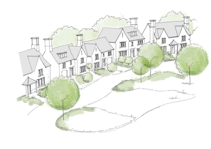
21 03 Connolly Homes Masterplan The Masterplan for Warren Far West has evolved from the approved version presented at Outline Stage. The new masterplan has been designed to reflect a pattern of streets and spaces that is consistent with the contextual analysis of local distinctiveness that has been identified previously. BUILT FORM DESIGN PRINCIPLES The built form of Warren Park West will be determined in response to a set of guiding principles. Create a sense of place; Create a place for people: creating attractive accessible streetscape; BUILT FORM: KEY DESIGN SEQUENCES Architectural interest will be generated by considering the slight variations in design choices and proposals across the Warren Farm site. Different approaches to design, appearance and function will respond subtly to different areas of the site. The scheme has been designed as a subtle and controlled response to the site, where materials palette, choice of colour and textures will be consistent throughout to create a sense of unity of the whole. CONCEPT PRINCIPLES to create an attractive townscape / incorporate well designed and useable open space / enhance the amenity Variety of house type & tenure; MAIN DESIGN PRINCIPLES Managing car parking; and to respect the existing local environment by considering the interface between the Delivering sustainability existing housing to the north, west and east and the school and woodlands to the south These guiding principles build upon previous design guidance in the Design & Access Statement (April 2012) "Warren Farm will provide a high quality residential development, distinguished by excellent architecture for a range of new homes, set in an attractive, accessible streetscape." to create positive arrival spaces at both Flitwick Road and the threshold from Warren Farm East to create open space which benefits new and existing residents alike. On the Western part of the site there is a central 'Green' with several 'Greenways' providing green links throughout the development. to establish and enhance pedestrian linkages with the existing adjacent public amenities such as the School and the Woodlands. Links from Lammas Way to the proposed development are encouraged. to create an environment that is permeable for pedestrians and cyclists and to create a series of 'incidental' spaces to provide access for all. 21


22 Connolly Homes : MASTERPLAN 03 Illustrative Streetscapes: Flitwick Road Entrance Illustrative Streetscapes: The Boulevard Illustrative Streetscapes: Upper & Lower Area 22
23
24 03 04 Design Code: Access & Public Realm This section identifies the development principles as outlined in the conditions of the grant of Outline Planning Permission. 24

25 Access Strategy & Street Hierarchy The provision of adoptable highways is integral to the overall scheme, with well designed streets and thoroughfares providing a significant contribution to the quality of the residential character and ensuring a sustainable, inclusive and safe environment within which residents may prosper. 04 The main vehicular site access points are provided from Flitwick Road and Abbey Lane. There are suitable pedestrian linkages to Lammas Way with enhancement of existing woodland linkages to lands to the south. The scheme proposes to maximise opportunities for movement within and throughout the site. The primary boulevard runs through the centre of the site, linking west-east from Flitwick Road to Abbey Lane. A series of secondary connections branch from the boulevard to create a high level of permeability. The layout has been designed to prioritise the safe movement of pedestrians and cyclists. 25
26 STREET HIERARCHY OVERVIEW STREET TYPOLOGY PRIMARY STREET (BOULEVARD) SUBURBAN ACCESS STREET SHARED SURFACE ACCESS STREET (LANE) COURTYARD PRIVATE DRIVEWAY 04 CHARACTER DESIGN DIMENSIONS A formal tree-lined spine road that acts to connect both development areas and provides vehicular linkage between Flitwick Road and Abbey Lane. Acting as the primary element within both developments, the thoroughfare seeks to manage the transitions between each design sequence. Footpaths separated from the main carriageway to provide a safe pedestrian environment. Carriageway: 6.25m (to accommodate Bus Route) Combined Footpath / Cycleway: Min 3.0m Footpath: Min 2.0m Grass Verge: Min 2.0m to accommodate street landscaping A less formal access route with varied building setback and varied building line. Informal in character, the access street provides character and critical links to more informal accesses from the Boulevard. Footpaths are positioned adjacent to the carriageway and also offset, meandering through the proposed 'Green' area to provide alternative pedestrian environments. 4.8m - 5.5m The carriageway is pinched and widened in areas to provide character to a min 3.7m - 4.1m. Footpath: min 2.0m Grass Verge: Min 2.0m to accommodate landscaping Informal access where people are prioritised over vehicular traffic. Varied building setback and irregular building line. The informal nature of the shared surface access street provides characterful links and loops to areas of the development from the Boulevard and Access Street. 4.8m m The carriageway is pinched and widened in areas to provide character to a min 3.7m - 4.1m No defined footpath Areas surrounded by closely set buildings to provide enclosure and an alternative feel to other areas within the scheme. Proposed as Shared surface streets where pedestrians have priority over vehicles. The built form will be presented closely to the street, behind carefully positioned planting strips and car parking areas. These areas remain wholly informal, with a mix of on street and frontage carparking offset by street trees in grilles. 4.8m - 8.0m The carriageway is pinched and widened in areas to provide character to a min 3.7m - 4.1m No defined footpath Driveways non adoptable with no defined footpath. No through route and very low vehicle speeds proposed. 3.7m - 4.8m Footpath and cycleways to be separate from Private driveways Areas of inset parking provided Parking bays, landscaping and street trees to be incorporated Areas of inset parking provided TARGET SPEED 20 mph max 20 mph max Less than 15 mph Less than 15 mph Less than 15 mph TRAFFIC CALMING BUILDING SET-BACK Design of horizontal road alignment Junction Spacing Raised pedestrian / cycle crossings m with localised dwellings setback approx. 5-8m max Design of horizontal road alignment Junction Spacing Raised pedestrian / cycle crossings Design of horizontal road alignment Junction Spacing Raised pedestrian / cycle crossings Carriageway narrowing Shared surface 4-7m max 1-5m 1-3m 1-3m BUS ROUTE Yes No No No No STREET FURNITURE LANDSCAPE / BOUNDARY TREATMENT Street Seating Lighting Columns Street Signage Predominantly hedging to rear of footpath with regular street tree planting to verge and within dwelling boundaries. Metal railings incorporated. Lighting Columns Lighting Columns Lighting Columns Not adopted highway Irregular tree planting within verge and properties with low hedging and boundary walls Irregular tree planting in property boundaries and street trees in grilles where suitable. Irregular tree planting in property boundaries and street trees in grilles where suitable. Low level boundary planting. Brick walls introduced to provide enclosure. Low level planting / hedging and railings within property boundaries only 26
27 Parking Strategy 04 PARKING STRATEGY OVERVIEW PARKING TYPE PRIVATE COURTYARDS PARKING FORECOURT ALLOCATED ON PLOT VISITOR PARKING CHARACTER Small private courtyards with no 'through' access. Dwellings front onto the area with provision of block paving shared surface. Parking informally integrated into the landscape. In cutilage parking bays to the front of dwellings, located between building line and pavement edge. Spaces located to ensure min. 1.5m separation from front of dwelling to parking bay. Traditional incutilage parking provision with 2-3 spaces per driveway - with or without garages. Public visitor parking provided mainly on-street and within key design sequences. All on-street parking should reflect the character of the area and ensure that there is no domination of the streetscape by parking through over proliferation of vehicles in specific areas. PARKING SPACE DIMENSIONS Standard Bay: 4.8m x 2.4m Perpendicular parking: 4.8m x 2.4m with a minimum 6m manoeuvring area Standard Bay: 4.8m x 2.4m 6m deep reversing provision to allow suitable access to the parking bays Driveways to extend to min 6m in front of garages. Standard Bay: 4.8m x 2.4m Standard Bay: 4.8m x 2.4m Perpendicular parking: 4.8m x 2.4m with a minimum 6m manoeuvring area Parallel Parking: 6m x 2.4m (disabled spaces to have additonal strip of 900mm mm width to one side of bay). Garages: Space to front of Garage should be 6.0m min Parallel Parking: 6m x 2.4m (disabled spaces to have additonal strip of 900mm mm width to one side of bay). SURFACE MATERIAL & SPACE DEMARCATION See Public Realm Materials Palette See Public Realm Materials Palette N/A See Public Realm Materials Palette CYCLE PARKING Short stay parking provided as close as possible to the front of the house and take the form of a suitable stand or wall bar/ring. Ambient lighting provided from street lamps or dedicated lighting to allow cyclists to use the parking at night and dark times of the year. There should be hard surfacing where the cycle stands. Short stay parking provided as close as possible to the front of the house and take the form of a suitable stand or wall bar/ring. Ambient lighting provided from street lamps or dedicated lighting to allow cyclists to use the parking at night and dark times of the year. There should be hard surfacing where the cycle stands. Short stay parking provided as close as possible to the front of the house and take the form of a suitable stand or wall bar/ring. Ambient lighting provided from street lamps or dedicated lighting to allow cyclists to use the parking at night and dark times of the year. There should be hard surfacing where the cycle stands. Short stay parking provided as close as possible to the front of the house and take the form of a suitable stand or wall bar/ring. Ambient lighting provided from street lamps or dedicated lighting to allow cyclists to use the parking at night and dark times of the year. There should be hard surfacing where the cycle stands. Suitable short & long term accessible, secure cycle storage should be provided. 27

28 Public Realm Materials Palette 04 28
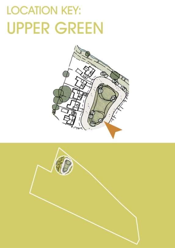
29 Landscape Strategy Concept 04 INTRODUCTION: A Landscape Strategy has been produced in direct response to the approved Design and Access Statement and incorporating findings from subsequent site visit and appraisals. It outlines the principles for landscape design and application to ensure a holistic and consistent approach. The POS areas have been identified as follows: 1. The Entrance 2. The Central Green and LAP 3. The Upper Green 4. The East Green 5. Lammas Way and Eastern Boundary Link Street types have been identified as follows: 6. Boulevard 7. Access Street 8. Shared Surface Access Street 9. Courtyard 10. Feature Node/Cluster There is also a maintenance corridor (11.) along the north boundary. The corridor allows access behind the property boundaries for continued maintenance of the water course that runs along the northern edge of the development. Proposed marginal and aquatic planting will ecologically enhance the stream. A low close board fence topped with trellis will create the boundary between the properties and the corridor. The will help to screen the new development from the existing properties to the north whilst allowing visual permeability into the corridor to allow passive security. OPEN SPACE STRATEGY The strategy is to develop a series of coherent open spaces within the development structure. Spaces will encompass areas of existing landscape features and will generally punctuate the development with inform al and form al recreational facilities. The first space that will be encountered will be the Entrance, on the western boundary. This provides a gateway into the site - a village edge with large frontages and a mounded landscaped open space to provide undulating levels. The edge adjacent to Flitwick Road will include structural tree and screening planting to soften the main access to the developm ent as well as create impact and a lasting legacy for the development. The boulevard will be lined with feature street trees (Hornbeam - Carpinus betulus) creating a rural feel to the development. The Central Green is situated next to the boulevard and will develop an inform al open space which will include a natural play area (LAP) using low key features such as play boulders and mounds. The area will be m axim ised for its play potential as this will be a centre point within the development for children to play and socialise. The Upper Green will provide an urban green feel being a more form al open grassed area defined by large skyline specimen trees that in time will break up the roof pattern of the developm ent and link view s to the existing developments to the north. The East Green will be an urban-like green and together, with the Eastern Boundary link, soften the approach to the Warren Farm East phase and visually linking both developments. While Lamm as Way link will connect the development to the northern existing urban area through to an inform al Public Right of Way. 29

30 The Maintenance Corridor will comprise of the existing stream with a reinforced grass access route and will be enhanced with new aquatic and marginal planting to increase biodiversity. This area will also create a buffer between the existing neighbourhood and the new development. 04 The Courtyards will be sm all parking areas. Planting will be added where possible to soften these hard areas while still m aintaining a secure and open space. Small focal trees will be used to develop some skyline impact to break up the structure of the buildings. All open spaces have been designed to m ake the most of new tree planting. They will offer softening of the streetscape and create a sense of place. The tree species should those trees visible across the roof line of the older developments surrounding the site that puncture the skyline. 30

31 Landscape Strategy Plan 04 31


32 Play Strategy 04 Concept: The aim is to develop an active space and natural play within the development. A successful design for play will respond to the child' s needs rather than controlling and directing. Planting is an essential component in mak ing playgrounds attractive, softer, and can themselves be an opportunity for play as paths weave amongst sensory plants or pass under or through willow structures. Trees offer valuable shade and shelter and they are a long term asset within the green infrastructure. P lanting beds will help divide and break up large playgrounds into smaller and more enclosed spaces. The play value of natural play design is considerably greater. The definition of play has shifted, so instead of defining play in simplistic physical movements - such as running, jumping, sliding, swinging, rock ing etc - play is now understood to be more holistic and much more about learning about the world through use of imagination, role play, discovery, adventure and creative activity. Therefore the natural play approach will create a theatre setting to inspire these possibilities throughout open spaces. P layable spaces will be a combination of natural features including stone boulders, wood and ground modelling with integrated play features which will encourage play activities such as balancing, running, jumping, climbing, crawling and exploring. Rather than being prescriptive equipment, natural features will create opportunities for innovative, exploitative, imaginative and challenging play and allow children of different ages and abilities to play together in different ways along with some traditional play equipment for young children will offer additional value. The Central Green will contain a LA P which will be clear and well defined, leaving no empty spaces that might create antisocial behaviour hot spots. P lay space will be visible from adjacent residences and the street/open space, for passive- policing, and the taller screen planting will be carefully placed to ensure open sight lines and natural surveillance. Seating will also be provided for parents. The play area will include a natural play using low key features such as play boulders and mounds. These features will allow creative and sociable play by creating adventure and exploration through, around and over the features. These elements also create a sculptural effect within the POS developing an aesthetically empathetic approach to the rest of the deve lopment. 32

33 Play Strategy 04 Concept: The Maintenance Corridor has 3 main functions. Its primary function is to allow access to the northern boundary to allow maintenance to the water course that runs along its length. This area is not open to the public and is strictly for access to the stream. The secondary function is to create a softer green boundary between the new development and the existing properties to the north. The maintenance access will be grassed with the stream bank re planted with marginal and aquatic species such as B ogbean (Menyanthes trifoliata), Bur-reed (Sparganium erectum), Flowering rush (B utomus umbellatus), Greater spearwort (Ranunculus lingua) and Water plantain (A lisma plantago -aquatica)to enhance the biodiversity of the boundary. The final function is to screen views into the development. This will be done by installing a close board fence with trellis to the rear of the properties running along the northern boundary. It is important that the fence does not fully screen out the maintenance corridor as this will al low passive security of this space. The corridor will be closed off to the public but security is an important factor to both the development boundaries and to the ex isting properties. To prevent direct views between existing properties and the new houses, strategically placed small scale trees will be planted in the rear gardens of the properties along the northern boundary where there are gaps between the ex isting vegetation along the watercourse. Standard trees such as Silver Birch (Betula pendula) and fruiting trees like Crab A pple ( Malus spp.) and Cherry (P runus spp.). 33
34 Sustainability: Development & Drainage Strategy 04 Key Sustainability Strategies: Optimise site potential (Connectivity): The site sits within a local framework of connectivity and has been designed to provide suitable access for Bus services along the Boulevard. Redborne School is located adjacent to the site and within walking distance to local amenities and services. Orientation: The dwellings have been orientated where possible to provide south facing or oblique facing private amenity to maximize daylight for optimum light, heating, cooling, and shading. Landscaping: Existing trees have been retained where possible, and the central green planned around the retention of two mature trees. This provision aims to increase functionality of spaces through shading, visual amenity and augmentation of localised biodiversity. Sustainable Drainage Strategy: The developers are committed to providing Sustainable Urban Drainage Solutions (SuDS) to serve the scheme. The principles of SuDS will be applied to the key areas of the surface water drainage system for the development where possible in order to reduce surface water flooding, improve water quality and enhance the amenity and biodiversity value of the environment. It is intended that quality drainage processes and management practices will be implemented to ensure that there is no detrimental impact upon the development and surrounding areas. Existing watercourses within the subject lands will form part of the drainage strategy, providing suitable connectivity to an offsite attenuation pond located to the south of the development lands. This strategy will be designed to fulfil the requirements of planning condition 11 of the outline planning consent. Energy Use: Dwellings will be designed to current Standards to ensure suitable levels of thermal efficiency and therefore energy use are achieved. 34
35 05 Design Code: Built Form This section identifies the development principles as outlined in the conditions of the grant of Outline Planning Permission. 35

36 Block Principles 05 Block Structure: The proposals promote the introduction of the block layout, with a clear distinction shown between public and private space. As highlighted in the Central Bedfordshire Council Placemaking Design Guide, the fronts of properties should face onto public space, preferably a street, whilst the private back garden should be private and afforded security by facing other private space. The block structure implemented has been informed by the site constraints and opportunities and should be adhered to in any reserved matters proposal. As highlighted in the adjacent image, our scheme proposes a mix of perimeter block structures and linear frontages to achieve these requirements. These blocks will provide varied streetscapes and ensure the provision of a clear distinction between public and private space. Perimeter Blocks: Characterised by common frontage facing the public realm with private amenity enclosed internally. This maintains a sense of enclosure and continuity of built form. Also includes select courtyard areas. Linear Frontages: Characterised by common frontage facing the public realm, however, implemented in a linear formation along specific boundaries where it is not possible to introduce perimeter block structures. It is important that linear frontages have suitable variations in setbacks and building form to ensure a positive and varied streetscape. 36
37 Key Design Sequences: Primary Sequences 05 Design Sequences 1: Flitwick Road Entrance 2: The Boulevard 3: Upper & Lower Areas The size of the development does not warrant specific character areas, instead the street typologies and frontage typologies are the key driver in achieving a successful development layout. Architectural interest can be generated by considering the slight variations in character across the Warren Farm site. Different approaches to design, appearance and function are required to respond to different sections of the site. Frontages have been designed to relate to each design sequence and street typology, with this relationship being paramount to creating thriving and coherent spaces. Indicative street elevations and sections have been prepared to highlight the design process, and to set out the key criteria for development within each design sequence. These aim to identify a series of different characteristics, including frontage/setback distances, landscaping and boundary treatments. The considered integration of each of the design sequences will result in a blended development with a mixed tenure of social, affordable and private housing. 37

38 Key Design Sequences: Secondary Sequences 05 Open Space Design Sequences: Open Space Pockets of public open space have been introduced to provide green linkages throughout the site. Subject to more detailed landscape analysis at a later stage within the document, the areas of open space are linked through their relationship to the Spine Road. Pedestrian and cycle links are generated between the various pockets, to provide fundamental connectivity within the scheme. 1: Flitwick Road Entrance Contoured open space provided to soften the transition into Warren Farm West from Flitwick Road. 2: Upper Green Dwellings fronting onto an Informal landscaped green. 3: Central Green Existing trees retained and integrated into the scheme to provide a sense of arrival and an immediate sense of maturity. LAP also provided. 4: Lammas Way Supervised open space providing pedestrian access from Lammas Way to the scheme. 5: Lower Green Open space creating a sense of arrival upon entry from Warren Farm East. Dwellings forming boundaries to the south and west with vistas managed upon progression through the scheme. 6: Transition to Warren Farm East Managed open space with dwellings fronting onto the existing watercourse, overlooking the NEAP within Bloor Homes land. 38

39 Key Design Sequences: Secondary Sequences 05 Architectural Feature Areas Design Sequences: Architectural Feature Areas 05 A series of secondary design sequences are proposed that will provide localised areas of interest within the scheme. These will assist with navigation through Warren Farm West by providing architectural features that will be highly legible upon progression through the scheme. This movement through Warren Farm West will be punctuated by a series of spaces that will provide a variety of levels of enclosure at both large and small scale. The formal and highly enclosed space of the courtyard is juxtaposed to the more open and informal enclosure of the Upper Green. The Transition space provides a dynamic sense of arrival that offers a legible and informal sense of enclosure to the watercourse and NEAP within Bloor lands. 01 Courtyard Area 02 Upper Green 03 Transition Spaces 39

40 Key Design Sequences: Tertiary Sequences Landmarks / Key Building Groups 05 Design Sequences: Landmarks / Key Building Groups A: Landmark accessed from the central green. B: Courtyard Space C: Termination of Vista from open space adjacent to Lammas Way D: Termination of Vista accessed from lower green E: Gateway feature providing sense of arrival into Warren Farm West F: Supervised pedestrian access point from Lammas Way DEFINING KEY CORNERS AND GATEWAYS In addition to the implementation of Primary and Secondary design sequences, feature buildings will be located throughout the development, either as single buildings or building groups. The adjacent plan highlights the location of these buildings within the overall development. As a general rule the scale of key buildings should be in proportion to their importance within the streetscape or building group Not every key building needs to be greater in size than its neighbours, but it should be imposing enough to mark it out as more important Features The use of features on buildings such as projecting bay windows, gable features and chimneys can be used to reinforce key building status The feature itself might be used on a relatively simple building to impart key status or act as a focal point, but must read as part of an identifiable whole Detailing Detailing of buildings will be an important consideration within the development as a whole This will be especially important on key buildings, where detail elements are likely to be subject to an increased level of scrutiny. Buildings will turn corners positively so that both elevations seen from the street have windows to them and avoid blank gable ends visible from the public realm. Feature buildings have been positioned in specific locations to terminate key views or at an important gateway location. This will help aid visual legibility throughout the layout and provide variety in the street scene. 40

41 Density & Building Heights 05 Density The density of the development is an important consideration in providing a successful sense of place. The scale of the development would not suggest implementation of wide ranging variations on density across Warren Farm West, however, there are subtle variations in density across the site that will create greater interest and provide a good degree of vitality. Building Heights The variation in building height across the scheme will provide a varied streetscape and promote greater legibility and navigation through the scheme. 41


42 Primary Design Sequence: Flitwick Road Entrance 05 Entrance Sequence to Flitwick Road (Including gateway buildings): Gateway feature to Warren Farm designed to respect and reinforce the existing character of the Flitwick Road. A transitional space between existing residential areas and the new development. Landscape Character Concept: The Flitwick Road entrance aims to provide a landscaped open space to respect the existing building line and to provide a smooth transition of levels between the existing road and Warren Farm. Mounds and native planting will soften and provide glimpsed views into Warren Farm. The entrance set back is interlinked with a series of open spaces throughout the site. Low fences and ornamental hedges will provide privacy and defensive space between the driveway and the front garden of the houses in this area. 42
43 DESIGN SEQUENCES CHARACTERISTICS: FLITWICK ROAD BUILT FORM CRITERIA Built Frontage Character Building heights SPECIFICATION Active frontages aligned to roadway frontage with architectural form to respect the existing building line. A semi continuous frontage is proposed to reflect the rhythm of the existing streetscape along Flitwick Road with landscaped open space to form a threshold to Flitwick Road. Semi-public space transitions to private space around dwellings. Rectangular form with returns / gabled roof / bay protrusions / porch with covered entrance storey to reflect adjacent dwellings. 05 Building Materials Feature Buildings Setback to front Roof Furniture (Dormers / Chimneys) Landscape Character Select facing brick and Monocouche Render System, Colour(s): White, Ivory, Light Grey, Natural Stone / slate effect roofing (O.E.A) / upvc windows and doors. Important corners and gateways should be emphasised with architectural elaboration, for instance:- additional fenestration incorporated in gable-end facades; be defined by modest increases in building height to provide added enclosure to the streetscene, creating a sense of pinch po int at important street entrances; variation in colour or material palette on building facades that address important corners or gateways. 2m 3m setback from shared surface with landscaped topography to assist integration and manage level change. Use of Pitched Roofs and Usable Roofspace Landscaped open space adjacent to Flitwick Road to respect existing building line and to provide a managed transition of leve ls between the existing road and Warren Farm. Ground graded to provide landscaped mounds with associated vegetation provided at low and high level to manage glimpsed vie ws into Warren Farm. The entrance set back represents the commencement of a series of linked landscaped areas located throughout the site. PRIVATE AMENITY Front Gardens Private open space is desirable in order to create a high quality of built environment and this Design Code requires that all dwellings should be provided with adequate open space in the form of front and rear gardens for houses and balconies and communal gardens for apartments. Front gardens are at the threshold of public realm, street and private space and it is important that all houses, except Mews, should be clearly demarcated front garden space. The criteria for the front gardens is as follows: Minimum depth - 1.5m Maximum depth - 3m clear of car parking provision Adjacent front garden to car parking space should not exceed 6m Driveway parking in front of the plot to allow a minimum of 2m from windows to edge of driveway strong definition of the front garden to relate to each of the Design sequences Rear Gardens Rear gardens provide required private amenity space for a variety of uses and should be enclosed and well shielded form adjacent dwellings. The following should be implemented to ensure that the space is fit for purpose for modern living. Minimum length - 11m Minimum width - 5m Minimum area - 55sqm Average area - 100sqm Separate Direct access Clothes drying area Outdoor seating 43
44 recreation space growing food shed space greenhouse tree provision (fruit) gardens to be designed to receive afternoon sun insofar as possible 05 Garden Storage Security PARKING & SERVICES Parking Spaces Garages Bicycle Parking Services Garages to provide suitable storage provision where possible and external stores provided where there are no garages. Passive surveillance to be provided through suitable orientation of dwellings and position of windows. Gates, walls and entry sequences designed to provide suitable physical protection. Dealing with the Car (Parking provision): Garages provided to serve each dwelling. Private off street parking on driveways provided to reduce the visual impact of cars on the street frontage. Visitor parking provided within design of level surface street with turning area provided to ensure suitable accessibility. See parking strategy overview for further information. See parking strategy overview for further information. Drainage, Road Markings, Street Furniture, Provision for services: Drainage channels carefully detailed to integrate with road surface and positioned to avoid demarcation of parking / No road markings and limited signage / Sympathetic street lighting and service provision provided in grassed service strips adjacent to the road surface (agreement required with Council). 44


45 Primary Design Sequences: The Boulevard 05 Boulevard: Primary route through Warren Farm West, providing vehicular, cycle and pedestrian links between the Flitwick Road and Warren Farm East. Landscape Character Concept: The Boulevard aims to tie the development into Warren Farm East. Structural trees along with an integrated pedestrian and cycle lane and a grassed and planted verge will provide a rural feel across the site. The tree line verge along with ornamental planting in the front gardens will soften and enhance the street scene. 45
46 05 46
47 DESIGN SEQUENCES CHARACTERISTICS: BUILT FORM CRITERIA Built Frontage Character THE BOULEVARD SPECIFICATION Northern frontage: Regular plot sizes with exaggerated plot depth to provide gated access to private turning areas to front o f dwellings. Large detached dwellings set back 8m-10m from road edge to create semi-private transitions between road edge and dwelling. Active frontages provided to turn corners. 05 Southern Frontage: Semi continuous frontage with regular plot sizes with front boundaries fronting onto marginal verge of Boulevard. Active frontages aligned to roadway. 5m setback with landscaped verge to soften relationship of dwellings to Boulevard. Building heights Building Materials Feature Buildings Setback to front Roof Furniture (Dormers / Chimneys) Landscape Character PRIVATE AMENITY Front Gardens Building Height: storey to provide varied elevational character and rhythm to streetscape. Select facing brick and Monocouche Render System, Colour(s): White, Ivory, Light Grey, Natural Stone / slate effect roofing (O.E.A) / upvc windows and doors. Important corners and gateways should be emphasised with architectural elaboration, for instance:- additional fenestration incorporated in gable-end facades; be defined by modest increases in building height to provide added enclosure to the streetscene, creating a sense of pinch po int at important street entrances; variation in colour or material palette on building facades that address important corners or gateways. Large detached dwellings set back 8m-10m from road edge to create semi-private transitions between road edge and dwelling. Use of Pitched Roofs and Usable Roofspace Landscaping Character / Green Infrastructure: Marginal verge with integrated pedestrian and cycle links grassed and planted with native tree species. Trees within sight lines are to be clear stemmed up to 2m. Private open space is desirable in order to create a high quality of built environment and this Design Code requires that all dwellings should be provided with adequate open space in the form of front and rear gardens for houses and balconies and communal gardens for apartments. Front gardens are at the threshold of public realm, street and private space and it is important that all houses, except Mews, should be clearly demarcated front garden space. The criteria for the front gardens is as follows: Minimum depth - 1.5m Maximum depth - 3m clear of car parking provision Adjacent front garden to car parking space should not exceed 6m Driveway parking in front of the plot to allow a minimum of 2m from windows to edge of driveway strong definition of the front garden to relate to each of the Design sequences 47
48 Rear Gardens Rear gardens provide required private amenity space for a variety of uses and should be enclosed and well shielded form adjacent dwellings. The following should be implemented to ensure that the space is fit for purpose for modern living. 05 Minimum length - 11m Minimum width - 5m Minimum area - 55sqm Average area - 100sqm Separate Direct access Clothes drying area Outdoor seating recreation space growing food shed space greenhouse tree provision (fruit) gardens to be designed to receive afternoon sun insofar as possible Garden Storage Security PARKING & SERVICES Parking Spaces Garages Bicycle Parking Services Garages to provide suitable storage provision where possible and external stores provided where there are no garages. Passive surveillance to be provided through suitable orientation of dwellings and position of windows. Gates, walls and entry sequences designed to provide suitable physical protection. Dealing with the Car (Parking provision): Garages provided to serve each dwelling. Private off street parking on driveways provided to reduce the visual impact of cars on the street frontage. Visitor parking provided within design of level surface street with turning area provided to ensure suitable accessibility. See parking strategy overview for further information. See parking strategy overview for further information. Drainage, Road Markings, Street Furniture, Provision for services: Drainage channels carefully detailed to integrate with road surface and positioned to avoid demarcation of parking / Clear road markings and signage / Formal street lighting and service provision provided adjacent to the road surface. 48

49 Primary Design Sequences: Upper & Lower Areas 05 Landscape Character: Concept: The Upper Green aims to provide a formal urban green with open grass areas defined with mounding, structural trees and informal seating. The high-end definition of this amenity space will delight the experience of the residents. Ornamental planting in the front gardens, encompassing the upper green, will provide privacy and assist with softening the street scene. The Central Green will create a green space within the centre of the development. It will be defined by existing trees and large skyline specimen trees that in time will break up the roof pattern of the development and link views to the existing developments to the north. The Central Green will encompass a natural play area (LAP), where children and teenagers will be able to enjoy activities and maintain fitness using naturalistic style trim trails, which will include items such as monkey bars. 49
50
51
52 DESIGN SEQUENCES CHARACTERISTICS: UPPER AND LOWER GREENS BUILT FORM CRITERIA SPECIFICATION 05 Built Frontage Character Building heights Building Materials Feature Buildings Setback to front Roof Furniture (Dormers / Chimneys) Landscape Character PRIVATE AMENITY Upper Green: Informal aesthetic within the landscaped setting of the Green. Dwellings clearly separated from the Boulevard with informal semi public / private space and dwellings fronting to open space. Active frontages aligned to level surface lane with 3m 5m setback. Semi-public space transitions to private space around dwellings. Green edge frontage reflecting aesthetic of village fringe. Lower Green: Soft interconnecting links accessing the central green space with staggered layering of frontages. Informal semi public / private space and dwellings fronting to open space. Active frontages aligned to lane with 2m 4m setback. Semi-public space transitions to private space around dwellings. Green edge frontage to open space. Building Height: storey to provide varied elevational character and rhythm to streetscape. Select facing brick and Monocouche Render System, Colour(s): White, Ivory, Light Grey, Natural Stone / slate effect roofing (O.E.A) / upvc windows and doors. Important corners and gateways should be emphasised with architectural elaboration, for instance:- additional fenestration incorporated in gable-end facades; be defined by modest increases in building height to provide added enclosure to the streetscene, creating a sense of pinch po int at important street entrances; variation in colour or material palette on building facades that address important corners or gateways. 2m - 5m setback to incorporate both areas Use of Pitched Roofs and Usable Roofspace Upper Green: Landscaped open space providing threshold between dwellings and the Boulevard. Ground graded with associated vegetation provided at low and high level to edges of landscaped area to provide privacy / screening of the proposed dwellings and suitable amenity space provided within Green area. Lower Green: Landscaped open space providing focal point with glimpsed views to school beyond. Vegetation provided at low and high level to edges of landscaped area to provide privacy / screening of the proposed dwellings and suitable amenity space provided within Green are a. Landscaped links provided between Boulevard and lower green and other localised focal areas. Low and high level planting to leafy links between localised focal areas and pedestrian links landscaped to enhance visual amenity. Small pockets of landscaped areas linked together with additional landscaped connections. Private open space is desirable in order to create a high quality of built environment and this Design Code requires that all dwellings should be provided with adequate open space in the form of front and rear gardens for houses and balconies and communal gardens for apartments
53 Front Gardens Rear Gardens Front gardens are at the threshold of public realm, street and private space and it is important that all houses, except Mews, should be clearly demarcated front garden space. The criteria for the front gardens is as follows: Minimum depth - 1.5m Maximum depth - 3m clear of car parking provision Adjacent front garden to car parking space should not exceed 6m Driveway parking in front of the plot to allow a minimum of 2m from windows to edge of driveway strong definition of the front garden to relate to each of the Design sequences Rear gardens provide required private amenity space for a variety of uses and should be enclosed and well shielded form adjacent dwellings. The following should be implemented to ensure that the space is fit for purpose for modern living. 05 Minimum length - 11m Minimum width - 5m Minimum area - 55sqm Average area - 100sqm Separate Direct access Clothes drying area Outdoor seating recreation space growing food shed space greenhouse tree provision (fruit) gardens to be designed to receive afternoon sun insofar as possible Garden Storage Security PARKING & SERVICES Parking Spaces Garages Bicycle Parking Services Garages to provide suitable storage provision where possible and external stores provided where there are no garages. Passive surveillance to be provided through suitable orientation of dwellings and position of windows. Gates, walls and entry sequences designed to provide suitable physical protection. Dealing with the Car (Parking provision): Garages provided to serve each dwelling. Private off street parking on driveways provided to reduce the visual impact of cars on the street frontage. Visitor parking provided within design of level surface street with turning area provided to ensure suitable accessibility. See parking strategy overview for further information. See parking strategy overview for further information. Drainage, Road Markings, Street Furniture, Provision for services: Drainage channels carefully detailed to integrate with road surface and positioned to avoid demarcation of parking / Clear road markings and signage / Formal street lighting and service provision provided adjacent to the road surface. 53

54 Architectural Detailing: Built Forms & Detailing 05 The design proposes a blended development with a mixed tenure of social, affordable and private housing. The proposed housetype mix includes detached, semi-detached, townhouse and apartment units within a varied streetscape, designed with a controlled palette that references local context and establishes a clear hierarchy of development throughout the scheme. The following building typologies have been identified for use within the Masterplan and aim to reflect the distinctive local character of Ampthill. Detached Houses Semi-detached Houses Cottages Apartments Each typology provides a summary of the proposed built form and information illustrating the architectural detailing. The following details are key in respecting the existing nature of Ampthill: Flitwick Road Entrance Sequence - Decorative timber and render infill to gables - Projecting bargeboards and fascias - Decorative brick detailing - Decorative timber detailing to porches - Decorative chimney pots and caps General Principles - Gabled forms - Clipped Eaves / dry verges - Decorative surrounds to openings - Simple bay details and window fenestration - Simple chimney pots and caps Window and Door Styles Building Forms & Detailing The detailing of the built form will be consistent with traditional forms within the Ampthill Area. The use of chimneys to highlight important feature areas is key, however, they may not be required within courtyards, shared surfaces or secondary streets. Windows and door styles will be of a traditional form and proportion, however, with a contemporary twist. Generally, window fenestration will be reduced to provide clearly legible window openings within the façade of the proposed dwellings. Our proposals seek to reflect the character of the Ampthill area, whilst offering a crisp and well considered window style that provides increased provision of natural light to the dwellings. 54

55 Materials Palette 05 Palettes of materials are classified by zones of development, providing distinction between each of the different design sequences. The scheme proposes the use of a variety of brick selections, tailored to each design sequence, and the introduction of a range of self coloured render finishes to provide subtle variety across the scheme

56 Materials Palette: Contextual Links 05 The design proposals have been developed through careful consideration of the existing character of the Ampthill area, Illustrated as per the adjacent images. 56
57 Maintenance Strategy: Watercourse to Boundary 05 Maintenance Strategy The scheme proposes the introduction of a managed maintenance strip to the rear of the northern boundary of dwellings within the Boulevard. This will be a secure gated corridor to the rear of the dwellings that will provide sufficient access for the watercourse to be maintained when required. Safety and security will be provided through a carefully managed access arrangement which only approved individuals will be able to enter the maintenance corridor to carry out required works. Proposed secured access points are identified by the yellow arrows on the adjacent image. 57

58 Refuse Strategies 05 The development will be designed to ensure that refuse and materials for recycling can be collected in a safe and efficient manner. Furthermore the development can be designed to reduce the visual impact of refuse and recycling containers. The preference is for bins to be kept on each property and collected from the front of each property, however this is not always possible, particularly with apartments. Refuse Collection Rules Areas for storage of wheeled bins and boxes to be provided in the gardens of each property (apartments to be given secured storage areas) It is not acceptable for bins to be wheeled through properties, terrace blocks will therefore either consist of no more than about 5 properties, with shared rear access, or on longer terraces, archways should be provided about every fifth property, again with shared rear access Short areas of adoptable road with suitable turning areas should be provided in front of terraces which have no through route for reversing of refuse vehicle Where properties front a drive or courtyard bin collection points should be provided within walking of an adoptable road Bin collection points should be placed so as not to obstruct pedestrian or vehicle routes and designed to be unobtrusive when not in use Apartment blocks will be provided with storage and collection areas for Euro bins Storage areas will be within 10m of a point that is accessible for a refuse collection vehicle A composting unit should be provided in private gardens. 58
Warren Farm, Ampthill
 1 Welcome The developers of the Warren Farm site, Bloor Homes and Connolly Homes, are holding this exhibition on the emerging Design Codes for the development prior to their formal submission to Central
PHASE III: Reserved Matters Submission
 Statement of Compliance with the outline approval for the proposed residential development of land at: BURGES LANE, WIVELISCOMBE PHASE III: Reserved Matters Submission Foreword Contents: This Statement
Chapter 2: OUTLINE PLANNING APPLICATION PROPOSALS. A New Garden Neighbourhood Matford Barton 17
 Chapter 2: OUTLINE PLANNING APPLICATION PROPOSALS A New Garden Neighbourhood Matford Barton 17 2.1. SUMMARY AND STATUS OF THE PROPOSALS 2.1.1. The parameter plans and associated wording in this chapter
East Bayshore Road Neighbourhood
 East Bayshore Road Neighbourhood Northridge Property Management Urban Design Brief 3195 East Bayshore Road City of Owen Sound January 2016 East Bayshore Road Neighbourhood Northridge Property Management
8.0 Design and Form of Development 43/
 42/ 8.0 Design and Form of Development 43/ Rothwells Farm, Golborne/ Development Statement Figure 7. Site Constraints Key 44/ Site Boundary 360 Bus Route/Stops Existing Trees Underground Water Pipe Sensitive
Urban Design Guidelines
 Urban Design Guidelines These Urban Design Guidelines comprise the Key Design Objectives below, the Roads Design Guidelines overleaf and Neighbourhood Framework Plans. Together with Section 3: Urban Design
Section 4 - Public Realm & Landscape proposals Landscape Masterplan. Section 4 52
 - Public Realm & Landscape proposals Landscape Masterplan 52 Proposed Masterplan - Green Infrastructure Strategy District Park 4.33 Ha to provide Passive and active recreation with a large play area which
Kibworth Harcourt. Introduction. Introduction
 Introduction Introduction Welcome to this public exhibition on the proposals for the delivery of new homes on land at The Kibworths. The purpose of today s exhibition is to give you the opportunity to
4.0 URBAN DESIGN FRAMEWORK. The vision for the future development of the plan area is to:
 4.0 The vision for the future development of the plan area is to: Create a new neighbourhood that focuses on the highly valued natural and aesthetic features of the lands and provides good quality homes,
WELCOME. Land North of STEVENAGE. We would like to thank you for attending our public exhibition today.
 WELCOME We would like to thank you for attending our public exhibition today. The purpose of this event is to share our proposals and hear your thoughts on our ideas. Members of the project team are on
Welcome to our public exhibition
 About our development Welcome to our public exhibition This exhibition gives you the chance to view and comment on our proposals for a new residential development of 165 high-quality homes, along with
Housing Development at Balloonagh Tralee Co Kerry
 Design Statement Housing Development at Balloonagh Tralee Co Kerry Area of site 10,400m2 24 houses-12no 3 bed, 12no 2 bed and 4 single bed apartments total residential area of 2411m2 Open space provided
Nelson Residential Street Frontage Guideline
 DRAFT 22-06-2012 Nelson Residential Street Frontage Guideline June 2012 1317273 Contents and purpose Residential s are important Residential s are much more than corridors which move traffic. Streets allow
Colchester Northern Gateway Master Plan Vision Review Draft. July 2016
 Colchester Northern Gateway Master Plan Vision Review Draft July 2016 Contents Introduction 4 Context 8 Purpose of the Report 8 Strategic Position 9 Overview of the Process 11 2012 Master Plan Vision 12
edge of gas line corridor setback edge of gas line corridor aligned with Schlumberger building 37.0 m AOD 33.0 m AOD max
 7. Heights and Street Frontage: In accordance with the approved heights parameters, heights to along Western Access Road must respond to the existing low density character in this location. Heights are
Next Steps / Development Process. Structure Plan. June submitted to City of Fremantle. Structure Plan. July supported for advertising
 overview What is today about? In July 0, the City of Fremantle resolved that the be advertised for public comment. Today is about: Understanding the history and context of the site Having your say on the
Public Consultation. Land at Monks Farm, North Grove. Welcome
 Welcome Welcome to our public exhibition for development on Land at Monks Farm, orth Grove. Gallagher Estates and Gleeson Strategic Land are preparing an outline planning application for new homes, open
DESIGN & ACCESS STATEMENT
 DESIGN & ACCESS STATEMENT January 2016 Contents Introduction section 1 Section 1 - Introduction Section 2 - Assessment Section 3 - Involvement Section 4 - Evaluation Section 5 - Design Section 6 - Layout
Former Temple Cowley Pools, Oxford TEMPLE COWLEY LIBRARY * ELEVATION SHOWN IS INDICATIVE AND SUBJECT TO FINAL DESIGN AND AGREEMENT.
 OPEN SPACE TEMPLE COWLEY LIBRARY library beyond Proposed apartments Proposed apartments Proposed houses Temple Road * ELEVATION SHOWN IS INDICATIVE AND SUBJECT TO FINAL DESIGN AND AGREEMENT. * Welcome
Chapter 5 Urban Design and Public Realm
 5.1 Introduction Public realm is all areas of the urban fabric to which the public have access. It is where physical interaction takes place between people. It therefore, includes buildings and their design,
Public Consultation 23 January Peel Hall, Warrington Board 1. A message from Satnam... Site history...
 Board 1 A message from Satnam... Thank you for attending today s public consultation about proposals to develop a new residential neighbourhood at. The display boards show why the development is needed
PDP DESIGN & ACCESS STATEMENT
 PDP The Planning & Design Partnership Planning.. Architecture.. Interiors.. Landscape The Chicory Barn Studio, The Old Brickyards, Moor Lane, Stamford Bridge York, The East Riding Of Yorkshire, YO41 1HU.
97 Lea Bridge Road, Leyton, E10 7QL London Borough of Waltham Forest December 2015
 97 Lea Bridge Road, Leyton, E10 7QL London Borough of Waltham Forest December 2015 Public Realm and Landscape Proposals LEA BRIDGE ROAD, WALTHAMSTOW Public Realm & Landscape Proposals BDP(90)RPT001 December
Newcourt Masterplan. November Exeter Local Development Framework
 Newcourt Masterplan November 2010 Exeter Local Development Framework Background The Exeter Core Strategy Proposed Submission sets out the vision, objectives and strategy for the development of Exeter up
Welcome. Land adjacent Sandy Lane WALTHAM CHASE THE PROPOSED SITE
 Land adjacent Sandy Lane WALTHAM CHASE Existing Linden Homes developments Welcome Welcome to Linden Homes Southern s ( Linden ) public exhibition about its proposals for a range of high-quality homes for
vision & process willowburn, tarves community engagement 04/18
 vision & process Historic Conservation area Scotia intend to create a high quality residential development based upon best practice urban design principles. This will include a contemporary reinterpretation
I615. Westgate Precinct
 I615. Westgate Precinct I615.1. Precinct Description The Westgate Precinct is located approximately 18km west of the Auckland city centre. There are seven Sub-precincts in the Westgate Precinct: Sub-precinct
New-Cast Mixed-use Development Proposal King Street West, Newcastle, Ontario
 URBAN DESIGN BRIEF New-Cast Mixed-use Development Proposal King Street West, Newcastle, Ontario TABLE OF CONTENTS: 1.0 Executive Summary 2.0 Creating Vibrant and Sustainable Urban Places: Excerpts from
Story Homes. Land at Thirsk Road, Kirklevington. An Introduction to Story Homes. Our Foundations. Commitment to Consultation.
 Story Homes An Introduction to Story Homes Founded by Fred Story in 1987, Story Homes has a long and successful reputation of building high quality and high specification homes. The family owned business
Welcome to our exhibition
 Welcome to our exhibition housing development A46 Wildmoor Alcester Road Canal Quarter A422 Town Centre housing development Warwickshire-based IM Properties, one of the UK s largest privately owned property
Woodbrook - Shanganagh
 Section 4: Key Sites Framework Strategy Woodbrook - Shanganagh Local Area Plan 2017-2023 4. Site Framework Strategies The Master Plans shall have regard to the thematic objectives under the LAP Development
1. Local Plan Context
 1. Local Plan Context WHY ARE YOU HERE? ABOUT US PLANNING APPLICATION CONSULTATION Stewart Milne Homes are in the process of preparing a detailed planning application for a development of approximately
Boundaries and Fencing
 Boundaries and Fencing Introduction 7.1 The purpose of this chapter of the design code is to establish design principles and parameters to guide the development and erection of site boundaries within the
Design Guidance. Introduction, Approach and Design Principles. Mauritius. November Ministry of Housing and Lands. .. a
 sig evelo r D Mauritius s. Utilities.. Individu a s. er itects.to ls chpers.po e Public. T. h rban D Sc U e me Promot e h ners. A Design Guidance o.h Planne rs n w iticians r l useholde National Development
Section Three, Appendix 16C Medium Density Housing, Design Assessment Criteria (Residential 8A zone)
") APPENDIX 16C MEDIUM DENSITY HOUSING, DESIGN ASSESSMENT CRITERIA (RESIDENTIAL 8A ZONE) PURPOSE OF APPENDIX 16C (RESIDENTIAL 8A ZONE) In the Residential 8A Zone the following are defined as restricted discretionary
APPENDIX 16C MEDIUM DENSITY HOUSING, DESIGN ASSESSMENT CRITERIA (RESIDENTIAL 8A ZONE) PURPOSE OF APPENDIX 16C (RESIDENTIAL 8A ZONE) In the Residential 8A Zone the following are defined as restricted discretionary
CALA HO ME S WELCOME
 WELCOME Welcome to this public consultation event for our proposed residential development of 56 high quality homes on land to the north east of Station Road in Earls Colne. Thank you for taking the time
AND LAND WEST OF EAGLE FARM SOUTH
 L A N D A T Eagle Farm South AND LAND WEST OF EAGLE FARM SOUTH D E S I G N C O D E D E C E M B E R 2 0 1 6 Design Code, December 2016 1 All plans are reproduced from the Ordnance Survey Map with the permission
Reserved Matters application for a site that straddles the boundary between CBC and BBC
 BBC APPLICATION 15/02682/MAR NUMBER CBC APPLICATION CB/15/04294/RM NUMBER LOCATION Wixams Land at former storage depot, Bedford Road, Wilstead Bedfordshire PROPOSAL Reserved Matters Application for Strategic
Place Brief. National Collections Facility (NCF site)
") Place Brief. National Collections Facility (NCF site) Contents 1.0 Purpose 2.0 Location and Proposal 3.0 Vision and Aim 4.0 Placemaking Principles 5.0 Conclusion Plan 1 Location Plan Plan 2 Placemaking
Place Brief. National Collections Facility (NCF site) Contents 1.0 Purpose 2.0 Location and Proposal 3.0 Vision and Aim 4.0 Placemaking Principles 5.0 Conclusion Plan 1 Location Plan Plan 2 Placemaking
10 Proposed Redevelopment, Tewkesbury Road, Cheltenham SCHEME EVOLUTION STARBUCKS
 SCHEME EVOLUTION STARBUCKS The proposed Starbucks Drive Thru alongside the proposed food store provides an appropriate mix of uses, suitable for this location. The proposed store is bespoke, designed specifically
Statement of Community Involvement LAND OFF SOUTHDOWN ROAD HORNDEAN, HAMPSHIRE
 LAND OFF SOUTHDOWN ROAD HORNDEAN, HAMPSHIRE CONTENTS Page 1. Introduction 3 2. Pre-application Discussions 4 3. The Consultation Process 5 4. Consultation Feedback 7 5. Responses to Consultation Feedback
INTRODUCTION. Land south of Bishopswood Lane, Tadley
 0 INTRODUCTION THE SITE Introduction Gladman Developments Ltd. has successfully invested in communities throughout the UK over the past 0 years, developing high quality and sustainable residential, commercial
STATEMENT OF OBJECTION TO THE PROPOSED DEVELOPMENT OF LAND AT CHURCH CLIFF DRIVE FILEY
 STATEMENT OF OBJECTION TO THE PROPOSED DEVELOPMENT OF LAND AT CHURCH CLIFF DRIVE FILEY You will be aware that Scarborough borough council have adopted a new local plan that includes land at Church Cliff
Welcome to our public exhibition
 About Our Scheme Welcome to our public exhibition This exhibition gives you the chance to view and comment upon our emerging proposals for a new residential development of 68 new homes on the site of the
Wide asphalt driveway abutting school property. garage built with incompatible materials, too close to park. incompatible fencing materials
 Wide asphalt driveway abutting school property incompatible fencing materials garage built with incompatible materials, too close to park Lack of plantings as a buffer between private property and open
PUBLIC RIGHT-OF-WAY IN THIS CHAPTER PUBLIC REALM
 PUBLIC RIGHT-OF-WAY This section provides design guidelines for improvements in the public right-of-way. The public right-of-way refers to streets, sidewalks, non-vehicular thoroughfares, parks and greenways
Land at Pirton Fields. South Churchdown, Innsworth Design and Access Statement Addendum
 Land at Pirton Fields South Churchdown, Innsworth Design and Access Statement Addendum February 2017 Revisions Revision Date Description Prepared Approved Document No. 15-45-CR02 - Land at Pirton Fields
Former North Works, Lickey Road, Longbridge, Birmingham
 Committee Date: 14/11/2013 Application Number: 2013/06431/PA Accepted: 27/08/2013 Application Type: Full Planning Target Date: 26/11/2013 Ward: Longbridge Former North Works, Lickey Road, Longbridge, Birmingham
4. MASTERPLAN FRAMEWORK
 6a 6b 4. MASTERPLAN FRAMEWORK 6. Car Parks 6c Car Parks 6a and 6b will provide permanent parking. Area 6a will serve the foodstore with tarmac surfacing within a defined area to the west of the adjacent
DESIGN & ACCESS STATEMENT. REVISION A Residential Development, Neon Social Club, Nairn Street, Jarrow.
 DESIGN & ACCESS STATEMENT. REVISION A Residential Development, Neon Social Club, Nairn Street, Jarrow. The following Design & Access Statement is in support of a Full Planning Application for a residential
SCHEDULE 12 TO THE DESIGN AND DEVELOPMENT OVERLAY GLEN WAVERLEY ACTIVITY CENTRE STRUCTURE PLAN
 DD/MM/YY Proposed C120 SCHEDULE 12 TO THE DESIGN AND DEVELOPMENT OVERLAY Shown on the planning scheme map as DDO12. GLEN WAVERLEY ACTIVITY CENTRE STRUCTURE PLAN 1.0 Design objectives DD/MM/YY Proposed
medium desnity housing
 This section updated September 2013 This part of the Plan sets out the assessment criteria for medium density housing. The criteria are designed to give designers and builders flexibility and to provide
Introduction. Welcome to this consultation regarding the draft redevelopment proposals for the former CeramTec factory on Sidmouth Road, Colyton.
 Introduction Welcome to this consultation regarding the draft redevelopment proposals for the former CeramTec factory on Sidmouth Road, Colyton. We are currently considering options for the mixed-use redevelopment
Derry Green Corporate Business Park
 Town of Milton Derry Green Corporate Business Park Urban Design Guidelines BMI/Pace - June 2010 Draft 3 Prepared by: Brook McIlroy Planning + Urban Design / Pace Architects Suite 300-51 Camden Street Toronto,
LOW DENSITY RESIDENTIAL
 LOW DENSITY RESIDENTIAL Corner lots with coach houses to increase diversity, provide unity to the streetscape and increase eyes on the street. Garages and ancillary units accessed via rear lanes. Parking
Schedule of Planning Applications Committee Date: 23 May Reference: 06/17/0726/F Parish: Hemsby Officer: Mr J Beck Expiry Date:
 Schedule of Planning Applications Committee Date: 23 May 2018 Reference: 06/17/0726/F Parish: Hemsby Officer: Mr J Beck Expiry Date: 22-05-2018 Applicant: Proposal: Site: Mr Gillett Change of use to the
Development of land adjacent to Braggs Farm Lane and Rumbush Lane, Dickens Heath. Welcome. Today s exhibition. The proposal site
 Welcome Welcome to this event to discuss the development of land adjacent to Braggs Farm Lane. is currently in the preliminary stages of designing proposals to sensitively develop this site with high-quality
WELCOME GYPSY LANE. Wider Site Location plan. Proposals for the development of LAND OFF FOXLYDIATE LANE WEBHEATH. Proposals for the development of
 WELCOME The developers are preparing an outline planning application for a residential led development and need the community s views in order to develop the proposals further WHAT IS PROPOSED? A high
II. SINGLE FAMILY RESIDENTIAL
 II. SINGLE FAMILY RESIDENTIAL Castle Rock is made up of numerous individually built houses and subdivision tracts that have been developed during the past century. Some of the tracts are diverse in architectural
MATURE SUBURBS RESIDENTIAL DEVELOPMENT GUIDELINES
 MATURE SUBURBS RESIDENTIAL DEVELOPMENT GUIDELINES DRAFT FEBRUARY 2005 BIRMINGHAM CITY COUNCIL 1 Introduction Mature Suburbs Residential Development Guidelines - Interim Supplementary Planning Advice -
Carterton Construction Ltd is bringing forward plans for up to 85 new family homes and extra care facilities on land east of Burford.
 Welcome Carterton Construction Ltd is bringing forward plans for up to 85 new family homes and extra care facilities on land east of. We are at the early stages of designing our proposals and have a number
A VISION FOR BLAIRGOWRIE
 Welcome to the Westpark Partnership and Lidl UK GmbH Community Presentation. The purpose of this presentation is for you to view and comment upon the revised and updated proposals for the allocated development
Site north of Hattersley Road West (east of Fields Farm Road), Hattersley
, Hattersley") Application Number 17/00982/REM Proposal Site Applicant Recommendation Reason for report Application for the approval of reserved matters (means of access, landscaping, layout, scale and appearance) relating
Application Number 17/00982/REM Proposal Site Applicant Recommendation Reason for report Application for the approval of reserved matters (means of access, landscaping, layout, scale and appearance) relating
Duplex Design Guidelines
 Duplex Design Guidelines Adopted by Council May 29, 2006 Prepared By: Table of Contents 1.0 Application and Intent 1 2.0 Areas of Application 2 3.0 Design Principles 3 4.0 Design Guidelines 4 4.1 Site
Derry City and Strabane District Council Planning Committee Report
 Derry City and Strabane District Council Planning Committee Report COMMITTEE DATE: 23 rd March 2016 APPLICATION No: APPLICATION TYPE: PROPOSAL: LOCATION: APPLICANT: LA11/2015/0395/F Residential Development
Derry City and Strabane District Council Planning Committee Report
 Derry City and Strabane District Council Planning Committee Report COMMITTEE DATE: 29 th November 2017 APPLICATION No: APPLICATION TYPE: PROPOSAL: LOCATION: APPLICANT: AGENT: LA11/2016/0854/O Outline Shared
WELLINGTON HOSPITAL DESIGN GUIDE TABLE OF CONTENTS
 WELLINGTON HOSPITAL DESIGN GUIDE TABLE OF CONTENTS 1.0 Introduction Page 2 The Place of Wellington Hospital 2 The Future of the Hospital 2 2.0 The Intention of the Design Guide 3 3.0 Analysis 4 General
Subdivision Design Criteria. Penihana North GUIDELINES TO THE RULES
 Created September 2013 Penihana North Subdivision Design Criteria GUIDELINES TO THE RULES This part of the Plan sets out the design criteria for subdivision in Penihana North. The criteria will be considered
Complete Neighbourhood Guidelines Review Tool
 Complete Neighbourhood Guidelines Review Tool Prepared By: City of Regina Planning Department October 2014 Page 1 of 14 Community Development Review Checklist for Secondary Plans and Concept Plans The
RIVERSIDE DESIGN CD-1 GUIDELINES. Adopted by City Council August 9, 1983
 $1 City of Vancouver Land Use and Development Policies and Guidelines Community Services, 453 W. 12th Ave Vancouver, BC V5Y 1V4 F 604.873.7344 fax 873.7060 planning@city.vancouver.bc.ca RIVERSIDE DESIGN
KEY MAP DEVELOPMENT PERMIT AREA MAP. Sunnymede North Sub-Area Plan
 Richmond Official Community Plan BROADMOOR AREA SUNNYMEDE NORTH SUB-AREA PLAN Bylaw 7100 Schedule 2.6C SUNNYMEDE NORTH SUB-AREA PLAN SUNNYMEDE NORTH SUB-AREA PLAN SUNNYMEDE NORTH SUB-AREA PLAN KEY MAP
Memorial Business Park Site. Proposed Future Development. Design guidelines. August
 Memorial Business Park Site Proposed Future Development Design guidelines August 2014 www.designenvironment.co.nz 0064 3 358 3040 Contents 1.0 Background 1.1 Introduction 3 1.2 Objectives 4 2.0 Context
RESIDENTIAL ACTIVITY PERFORMANCE STANDARDS
 Preferred Options Consultation Q&A Sheet RESIDENTIAL ACTIVITY PERFORMANCE STANDARDS What are the key goals for managing the design of residential buildings in the Second Generation Plan (2GP)? The key
OVERVIEW PROJECT SUMMARY
 OVERVIEW These five houses on Ridge View Crescent form an important part of the wider Anslemi Ridge development. They are the backdrop to the lake that is the community heart of the nieghbourhood, and
URBAN DESIGN BRIEF. 2136&2148 Trafalgar Road. Town of Oakville
 URBAN DESIGN BRIEF 2136&2148 Trafalgar Road Town of Oakville Prepared By: METROPOLITAN CONSULTING INC For 2500674 Ontario Inc November 2016 TABLE OF CONTENTS Page No. 1.0 Introduction/Description of Subject
Highland Village Green Design Guidelines
 Highland Village Green Design Guidelines Publishing Information Title Highland Village Green Design Guidelins Author The City of Calgary Status DRAFT - Proposed document subject to changes Additional Copies
Background Information
 Background Information view at site entrance THE LONDON BOROUGH OF SUTTON As the strategic local authority the Council is working with a range of partners to take forward various development sites in Hackbridge.
Figure 3-1: Public Realm Plan
 3 Public Realm Figure 3-1: Public Realm Plan 3.1 Public Realm Concept The public realm concept for the Little Mountain site integrates a clear and accessible movement network with public spaces for social
SECTION ONE North East Industrial Zone Design Guide Palmerston North City Council June 2004
 SECTION ONE North East Industrial Zone Design Guide Palmerston North City Council June 2004 young heart easy living 1 Preface Industrial areas are a very important component of the economic well-being
ROCHFORD LOCAL DEVELOPMENT FRAMEWORK: Sustainability Appraisal/ Strategic Environmental Assessment. Rochford Core Strategy Preferred Options Document
 ROCHFORD LOCAL DEVELOPMENT FRAMEWORK: Sustainability Appraisal/ Strategic Environmental Assessment Non Technical Summary Rochford Core Strategy Preferred Options Document October 2008 SUSTAINABILITY APPRAISAL
Housing development on the edge of Forres
 Project Reference Dallas Dhu Details Housing development on the edge of Forres Location Forres, Moray Use Type Housing / Masterplan Client/Developer Sir Alastair Gordon-Cumming, Altyre Estate Lead Designers
WELCOME. North East Haverhill. The Planning Process
 WELCOME North East The site to the North East of, known as Great Wilsey Park, is identified by St Edmundsbury Borough Council in its Core Strategy as capable of delivering a Sustainable Urban Extension.
Welcome to our public exhibition
 About our scheme Welcome to our public exhibition Taylor Wimpey East Anglia intends to submit a detailed planning application for a new residential development of 39 high-quality homes at the B&M Concrete
I539. Smales 2 Precinct
 I539. Smales 2 Precinct I539.1. Precinct Description The Smales 2 Precinct applies to a 4.8 hectare block of land located on the southern side of Northcote Road and fronting Lake Pupuke, Takapuna. The
Welcome. Proposals for land at Smug Oak Lane BRICKET WOOD
 Proposals for land at Smug Oak Lane BRICKET WOOD Previous Linden Homes and Wates Developments scheme Welcome Welcome to Linden Homes and Wates Developments public exhibition. Working together as joint
Section Three, Appendix 17C Multiple Unit Housing Design Assessment Criteria
 APPENDIX 17C MULTIPLE UNIT HOUSING DESIGN ASSESSMENT CRITERIA Purpose of Appendix 17C In the Residential 9 Zone the construction and use of multiple household units located within the Multiple Household
PROPOSED REDEVELOPMENT OF THE GLEN ABBEY GOLF CLUB. STREETSCAPE DESIGN STUDY (excerpt from the Urban Design Brief) TOWN OF OAKVILLE.
 TOWN OF OAKVILLE.") PROPOSED REDEVELOPMENT OF THE GLEN ABBEY GOLF CLUB STREETSCAPE DESIGN STUDY (excerpt from the Urban Design Brief) TOWN OF OAKVILLE OCTOBER, 2016 for 2.4.2 STREETS Streets are the single largest component
PROPOSED REDEVELOPMENT OF THE GLEN ABBEY GOLF CLUB STREETSCAPE DESIGN STUDY (excerpt from the Urban Design Brief) TOWN OF OAKVILLE OCTOBER, 2016 for 2.4.2 STREETS Streets are the single largest component
COURTHOUSE CAMPUS BARNSLEY Executive Summary March 2010
 COURTHOUSE CAMPUS BARNSLEY Executive Summary March 2010 Estell Warren Cartwright Pickard Buro Happold King Sturge BWA Barnsley Metropolitan Borough Council introduction Courthouse Campus is the last major
4 RESIDENTIAL ZONE. 4.1 Background
 4 RESIDENTIAL ZONE 4.1 Background The residential areas within the City are characterised by mainly lowrise dwellings sited on individual allotments. Past architectural styles, settlement patterns and
2.0 Strategic Context 4
 2.0 Strategic Context 4 2.1 The Area Action Plan is a non-statutory plan, which forms a corporate policy document, expressing particular issues and areas of concern while also providing a vision for the
List of Policies. SESPlan. None applicable. Consolidated Scottish Borders Local Plan 2011: POLICY G1 - QUALITY STANDARDS FOR NEW DEVELOPMENT
 List of Policies Local Review Reference: 15/00021/RREF Planning Application Reference: 15/00616/FUL Development Proposal: Installation of 16no solar photovoltaic (PV) panels to roof Location: Raebank,
4 Residential and Urban Living Zones
 4 Residential and Urban Living Zones Refer to Chapters 11 to 20 for additional rules that may apply to these zones. 4.1 OBJECTIVES AND POLICIES Objective Res1 Policy 1 Policy 2 Policy 3 Policy 4 Policy
WHITELEY TOWN COUNCIL NORTH WHITELEY DEVELOPMENT SEPTEMBER 2014
 WHITELEY TOWN COUNCIL NORTH WHITELEY DEVELOPMENT SEPTEMBER 2014 Dear Resident This Special Edition of the Whiteley Voice which has been prepared in conjunction with the North Whiteley Consortium is to
Westwind Developments Ltd. PIONEER LANDS AREA STRUCTURE PLAN - PROPOSED AMENDMENT
 FEBRUARY 2013 TABLE OF CONTENTS 1.0 BACKGROUND... 1 1.1 Amendment... 1 2.0 LOCATION & CONTEXT... 2 2.1 Land Ownership... 2 3.0 POLICY CONTEXT... 3 3.1 Municipal Development Plan... 3 3.2 Capital Region
GREATER CAMBRIDGE CITY DEAL. Urban Design Guidance for Transport Infrastructure Projects
 GREATER CAMBRIDGE CITY DEAL Urban Design Guidance for Transport Infrastructure Projects KEY OBJECTIVES OF CITY DEAL The City Deal aims to help Greater Cambridge maintain and grow its status as a prosperous
DESIGN AND ACCESS STATEMENT Reserved Matters Application
 DESIGN AND ACCESS STATEMENT Reserved Matters Application Submitted to: Newcastle Under Lyme Borough Council Prepared by: Nicol Thomas Architects On behalf of: Kier Living Proposed Residential Development
doyle + o troithigh landscape - architecture
 doyle + o troithigh landscape - architecture REPORT: PROJECT: LANDSCAPE DESIGN REPORT. STUDENT HOUSING DEVELOPMENT AT WESTWOOD HOTEL SITE. DATE: MAY 2018. www.doyle-otroithigh.com Landscape design report,
Chapter 13 Residential Areas: Appendices APPENDIX 1 Residential Areas
 Chapter 13 Residential Areas: Appendices Page 1 Chapter 13 Residential Areas: Appendices APPENDIX 1 Residential Areas Design Code for Intensive Housing INTRODUCTION DESIGN ELEMENTS A NEIGHBOURHOOD DESIGN
WELCOME TO THE NEW WILTON PARK
 WELCOME TO THE NEW WILTON PARK VISION HISTORY OF WILTON PARK TOWARDS A PLANNING APPLICATION Our objective is to create a truly outstanding environment at Wilton Park. At the heart of our proposals is a
PUBLIC REALM STRATEGY
 CONSULTATION DRAFT PUBLIC REALM STRATEGY Trenchard Street & Frogmore Street City Design Group Place Directorate Public Realm Strategy Trenchard Street & Frogmore Street Contents 1. Introduction 2. Understanding