East Harptree Landscape & Character Assessment
|
|
|
- Tiffany Horn
- 5 years ago
- Views:
Transcription


1 East Harptree Landscape & Character Assessment Produced by East Harptree Parish Council in consultation with local residents September 2014
2 Contents The Parish of East Harptree: Objective Introduction and Overview A. Setting and Topography B. Layout C. Spaces D. Green and Natural Features E. Wildlife and Ecology F. Roads, Streets and Other Movement Routes G. Landmarks H. Views Out I. Views In J. Prominent Buildings (Shape and Height) Living in East Harptree Residents views Summary Consultation Chronology Reference Documents


3 The Parish of East Harptree
4 Objective This document has been produced by the Parish Council in consultation with residents at the request of BaNES Council. The aim, using narrative and photographs, is to give the reader a clear understanding of the special character of East Harptree such that when the council are considering matters which affect the village, they will have this document to inform and guide their decisions.
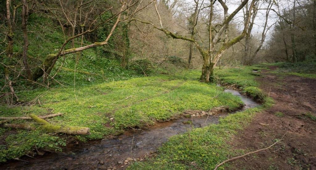
5 Introduction and Overview The parish of East Harptree is situated in an Area of Outstanding Natural Beauty (AONB) on the northern slopes of the Mendip Hills overlooking Chew Valley lake, within the jurisdiction of Bath and North-East Somerset. East Harptree is a peaceful and tranquil RA2 classified village, being away from main roads and surrounded by open farmland. The village has grown organically over the centuries and is steeped in history with many properties dating back to the 19 th century and beyond. There are numerous Grade I and Grade II listed buildings within the village, all of which add to its historic interest. East Harptree draws many visitors from far and wide for its scenic setting, its numerous footpaths and walking trails, registered Sites of Special Scientific Interest (SSSI) and Sites of Nature Conservation Importance (SNCI) with Harptree Combe being a favourite to visit. The recorded population at the time of the 2011 Census was just 644, which helps create a strong sense of community spirit amongst its residents, most of whom actively engage in the various village events held throughout the year.
.")

6 A Setting & Topography The parish comprises one main settlement area and several outlying hamlets. East Harptree is situated within the Mendip Hills Area of Outstanding Natural Beauty (AONB). * 2011 Census Data of East Harptree The parish is situated at the base of the approximately north facing slopes of the Mendip Hills and largely takes a north-south linear form. At the northern end the parish is flat, but slopes increasingly to the southern end where it can be classified as being steep. Most properties in the main village of East Harptree have varying degrees of slope in their gardens.
 to grade 4 (at the southern end) on the Mendip")

7 A Setting & Topography The parish is a rural area, dominated by and surrounded by, small and irregular-shaped fields of varying agricultural classifications ranging from grade 1 (at the northern end of the village) to grade 4 (at the southern end) on the Mendip Hills escarpment. The green spaces within the village add to the peace and tranquillity of this natural and rural setting. Local agricultural practices which add so much to the beauty and character of the area and its surrounds must be maintained, protected and enhanced.

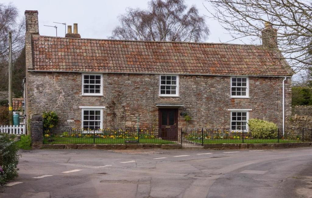
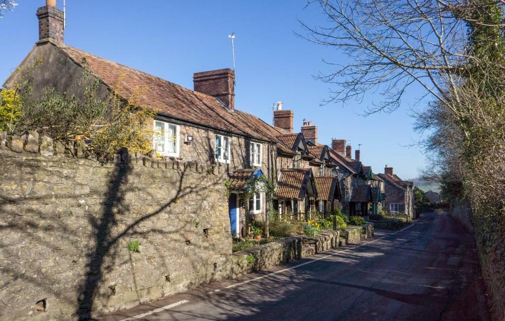
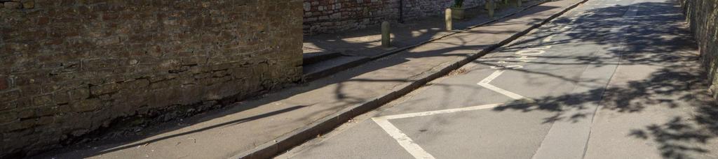
8 B - Layout The village pattern is linear with three medieval parallel north-south roads in the core joining at the northern and southern ends to form single-track entry and exit routes, generally without any pavements. At the north this route crosses the B3114 which forms a clear distinction between the Mendip Hill slopes to the south and the flat plain areas to the north. The formal structure of the roads help to define the centre of the village. The houses and cottages are generally close to the road with narrow plots and stone walls. The houses and walled gardens of Harptree Court dominate the central part of the village, along with the church, school and village hall.


9 C - Spaces The are few gaps between buildings. Where gaps do occur, these open green areas contribute greatly to the character of the village and should be preserved. The flat northern end of the village has a playing field which is regularly used by both the village school and the village community.

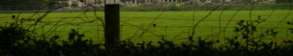
10 D Green and Natural Features There are many fine mature trees, hedges and bushes within the parish. Most fields are enclosed by hedgerows in keeping with the rural character of the parish. The north and eastern fringes of the parish are very open with long sweeping views of open countryside, including views of Chew Valley Lake. The attractive nature of the parish draws many visitors, from far and wide, to enjoy the traditional and unspoilt character of the natural environment and the outstanding views.


11 E Wildlife and Ecology Wildlife is abundant in the area. Buzzards and three species of owls are present. Badgers, foxes, deer, stoats and weasels, field mice, hedgehogs and slowworms and adders are common sightings. Fourteen of the eighteen bat species found in Great Britain can be found within the district of Bath and North-East Somerset, and at least three of those species roost in East Harptree. There are many, mostly deciduous, mature trees, ancient hedgerows, wild flowers including ransoms and native ferns. Frogs, toads and newts are commonplace in the local ponds and waterways.

, and many of the mature trees are protected by Tree Preservation Orders")
12 E Wildlife and Ecology The parish is extremely rich in biodiversity and is subject to a number of environmental designations, including Sites of Special Scientific Interest (SSSI s) and Sites of Nature Conservation Importance (SNCI s), and many of the mature trees are protected by Tree Preservation Orders (TPO s).


13 F - Roads, Streets and Other Movement Routes The roads in the village are narrow, bounded by banks, walls and hedgerows. These roads are generally winding and without pavements.

14 F - Roads, Streets and Other Movement Routes The provision of off-street parking within the curtilage of properties is scarce, leading to the parking of cars on the roads, causing significant obstructions to traffic and farm vehicles and creating difficulties and safety concerns for pedestrians.


15 F - Roads, Streets and Other Movement Routes The village is well served by public footpaths, predominantly across open fields and farmland.
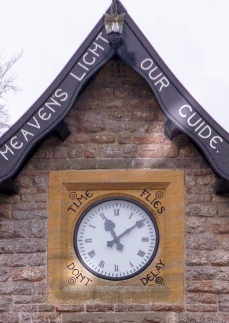
16 G - Landmarks The village of East Harptree has numerous significant landmarks: 1. Harptree Court 2. Eastwood Manor 3. Eastwood Manor Farm Steading 4. Harptree Combe which also contains the remains of Richmont Castle (circa late 11 th century) and a Victorian aqueduct 5. Village Clock Tower 6. St. Laurence Church and Tower with adjacent stone keyhole stiles 7. Victorian village water pumps 8. Victorian School Building 9. Village Theatre / Village Hall 10. K6 Telephone Kiosk 11. Smitham Chimney and Frances Plantation including a lead mine and smelting works 12. Two large Conservation Areas

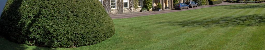
17 G Harptree Court

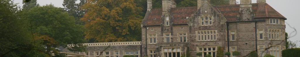
18 G Eastwood Manor


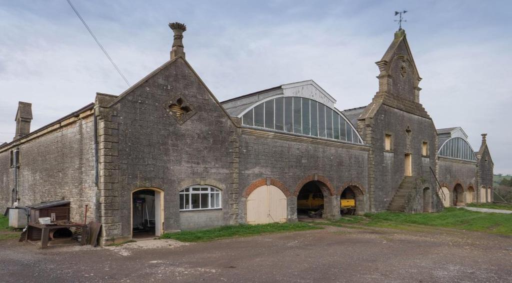
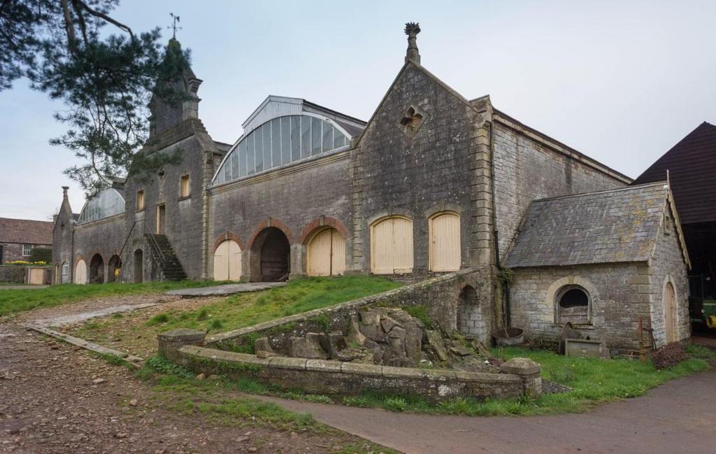
19 G Eastwood Manor Farm Steading


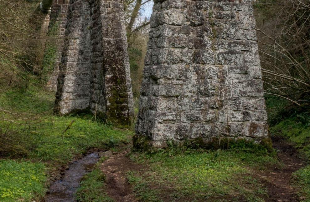
20 G Harptree Combe & Victorian Aqueduct

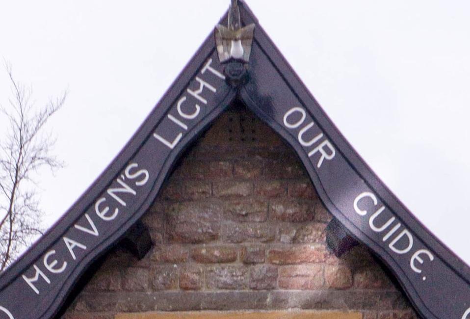
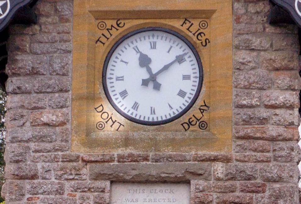
21 G Village Clock Tower


22 G St. Laurence Church and Tower


23 G St. Laurence Church and Tower, depicting two keyhole stiles


24 G Victorian Village Water Pumps


25 G Victorian School Building
HIGH LITTLETON AND HALLATROW COMMUNITY PLACEMAKING PLAN
 HIGH LITTLETON AND HALLATROW COMMUNITY PLACEMAKING PLAN DOCUMENT 3 of 4 SNAPSHOT CHARACTER SUMMARY HALLATROW Context B&NES Landscape type: Area 6 Farrington Gurney Farmland/ Area 12 Cam and Wellow Brook
East Harptree Site EH3 Parker s Mead, Church Lane
 East Harptree Site EH3 Parker s Mead, Church Lane Photograph EH3.1 View looking north towards Chew Valley Lake Photograph EH3.2 Church Lane, adjacent to western site boundary Reference Baseline Information
SETTLEMENT ASSESSMENT PROFORMA
 SETTLEMENT ASSESSMENT PROFORMA Surveyors(s):Clare Sheridan Character Area: Park Estate = Midland Rd, Severn Rd, Festival Rd, Park Rd, Willow Rd, Rylands Rd. Date: Feb Weather: cloudy Look through all the
The analysis of key visual characteristics and attributes that contribute to variations in the
 15.0 CHIGWELL/CHIGWELL ROW 15.1 Overview 15.1.1 Chigwell and Chigwell Row settlements are situated in the south of Epping Forest District, to the south of Abridge and southwest of Stapleford Abbotts. Both
Warwickshire County Council. Upper and Lower Brailes. Landscape Study
 Warwickshire County Council Upper and Lower Brailes Landscape Study Produced by WCC Landscape Architects March 2016 Landscape Assessment of Potential Development Sites within the parish of Brailes 1.0
Environmental and Landscape Mapping
 Environmental and Landscape Mapping In support of the Calveley Neighbourhood Plan November 2016 Project Name and Number: Calveley Neighbourhood Plan 16-025 Document Name and Revision: Environmental and
Neighbourhood Planning Site Assessment Pro-forma and Guide Version 2
 Neighbourhood Planning Site Assessment Pro-forma and Guide Version 2 September 2014 Site HNP 006 Land East of Stanbridge Road and North of Lower Road 1. Background information Site location and use Site
APPENDIX 4. 5 ST AGNES LOCAL LANDSCAPE CHARACTER ASSESSMENT TABLE ST AGNES BEACON
 APPENDIX 4. 5 ST AGNES LOCAL LANDSCAPE CHARACTER ASSESSMENT TABLE ST AGNES BEACON CHARACTER AREA: ST AGNES BEACON DATE OF ASSESSMENT May 2016 Character Attribute Landscape reference guide ST AGNES BEACON
CHAPTER 18 - Strategy Area: Dundry and River Valleys
 This south-eastern part of the Community Forest is a complex area with a wide variety of different landscapes close together, including the Chew Valley, the southern part of the Avon Valley and the eastern
Stanton Drew Parish Neighbourhood Plan Landscape and Environment
 Contents Introduction... 2 Scope of the Document... 2 Our Definition of a View... 2 Proposed Policies... 3 Criteria for a Protected View... 3 Views Assessed... 4 View 1: from cricket ground north towards
ENVIRONMENTAL AND LANDSCAPE MAPPING
 APPENDIX IV : Environmental and Landscape Mapping ENVIRONMENTAL AND LANDSCAPE MAPPING Calveley Neighbourhood Plan November 2016 ENVIRONMENTAL AND LANDSCAPE MAPPING Calveley Neighbourhood Plan Calveley
Toddington Central Bedfordshire Stage 3 Green Belt Study December 2017
 Toddington Central Bedfordshire Stage 3 Green Belt Study December 2017 Site: ALP086 - Middle Lakes, Toddington Site size (ha): 2.83 Site: ALP086 - Middle Lakes, Toddington Site size (ha): 2.83 Site description
8.0 Design and Form of Development 43/
 42/ 8.0 Design and Form of Development 43/ Rothwells Farm, Golborne/ Development Statement Figure 7. Site Constraints Key 44/ Site Boundary 360 Bus Route/Stops Existing Trees Underground Water Pipe Sensitive
National Character Area 70 Melbourne Parklands
 Summary The are a landscape of rolling farmland, parkland and woodland on the northern flanks of the ridge between Burton upon Trent and Swadlincote. The land slopes down to the River Trent, which borders
Site ref: AS06 Site Name or Address: Murreys Court, Agates Lane
 Site ref: AS06 Site Name or Address: Murreys Court, Agates Lane Proposed Land Use: Total Site Area (Ha): Housing 1.85 Ha Description: It is understood that the owner has no plans to dispose of the site
Character Area Summary 6: Canal Zone Stonehouse Town Character Assessment, Bridgend Works from Downton Road
 Character Area Summary 6: Canal Zone An open area, with residential and industrial areas, which has a rural character and a rich historic and natural environment strongly influenced by the Stroudwater
Longhorsley Neighbourhood Plan
 Site Assessment 1. The availability of the site 1.1 Is the land owner willing for their site to be made available for development? 1.2 If yes, do you have any written evidence to back this up? Planning
Welcome. Land adjacent Sandy Lane WALTHAM CHASE THE PROPOSED SITE
 Land adjacent Sandy Lane WALTHAM CHASE Existing Linden Homes developments Welcome Welcome to Linden Homes Southern s ( Linden ) public exhibition about its proposals for a range of high-quality homes for
Stowey Sutton Parish Council. Stowey Sutton Parish Council Placemaking Plan Assets of Community Value June 2014
 Stowey Sutton Parish Council Placemaking Plan Assets of Community Value June 2014 1 2 Contents Identifying natural & built environment assets... 5 Natural & built environment asset: Lovell Mill... 7 Natural
Core Strategy Settlement Classification. 0.61ha. For sale
 Coleford NDP site assessment 15 1 4 MARSHES LORDS HILL SITE ASSESSMENT FORM A: BASELINE INFORMATION Settlement Name Coleford Core Strategy Settlement Classification Town Site Name / Address Gross area
ENVIRONMENTAL INVENTORY
 Hungarton Neighbourhood Plan ENVIRONMENTAL INVENTORY Sites scoring 25/36 or more (70%) are judged to be the most important environmental and community sites and are proposed as Local Green Space. Other
Basic Habitat Survey Tabernacle Gardens, Pembroke
 Basic Habitat Survey Tabernacle Gardens, Pembroke Produced by The Wildlife Trust of South and West Wales Contact Ecologist: Position: Nathan Walton Wildlife Trust Officer Registered Office: Wildlife Trust
Appendix 4 - Character Assessment and Design Code. Character Assessment
 Appendix 4 - Character Assessment and Design Code Character Assessment To gain a deeper understanding of the Parish for the Neighbourhood Plan, a Character Assessment of the parish was carried out with
Alder View. Introduction. Alder View. Harwell. The Vision. The Team. Taylor Wimpey
 Introduction Welcome to the public exhibition for, a development by Taylor Wimpey on the land south of Grove Road,. This exhibition will provide an overview of the development proposals for the site and
Rudy Parish Neighbourhood Plan Steering Group Meeting 6/8/2018. Proposed Green Spaces (Continued from SG meeting of 2/7/18)
") Rudy Parish Neighbourhood Plan Steering Group Meeting 6/8/2018 Proposed Green Spaces (Continued from SG meeting of 2/7/18) NPPF: Green Space Designation The Local Green Space designation will not be appropriate
Rudy Parish Neighbourhood Plan Steering Group Meeting 6/8/2018 Proposed Green Spaces (Continued from SG meeting of 2/7/18) NPPF: Green Space Designation The Local Green Space designation will not be appropriate
tributary farmland tributary farmland
 NORFOLK O R F O L K COAST C O A SAONB T A O NIntegrated B I n t elandscape g r a t e d L Guidance a n d s c a p e G u i d a n c e 1 Integrated landscape character MAP 23a - Landscape Character Type - Tributary
BREEDON NORTHERN LIMITED
 Non Technical Summary CONTENTS 1 INTRODUCTION... 1 2 SITE DESCRIPTION... 1 3 DESCRIPTION OF THE DEVELOPMENT... 6 4 NEED FOR THE DEVELOPMENT... 8 5 KEY ISSUES CONSIDERED IN THE ENVIRONMENTAL IMPACT ASSESSMENT...
The eight-week period for this application expires on 5 October 2006.
 06/01213/FUL CHANGE OF USE FROM AGRICULTURAL LAND TO PRIVATE CAR PARK AND NEW FENCING. AT Land To The South of Perceval Almhouses, Lower Weald, Calverton FOR Calverton Parochial Church Council INTRODUCTION
Landscape Guidelines. Landscape type: Valley Pasture Character areas: Frome Valley Pasture Stour Valley Pasture. Landscape change
 Landscape type: Valley Pasture Character areas: Frome Valley Pasture Stour Valley Pasture The valley pasture landscape type is found along the lower reaches of the Stour and Frome, formed from alluvial
Ashtead Neighbourhood Forum Site Assessment AS03 Lime Tree Lodge, Farm Lane. Site address: Lime Tree Lodge, Farm Lane. Proposed Land Use:
 Site ref: AS03 Site address: Lime Tree Lodge, Farm Lane Proposed Land Use: Total Site Area (Ha): Housing 1.25ha Description The site is located off Farm Lane at the junction with Park Lane. To the north
CORNWALL AND ISLES OF SCILLY LANDSCAPE CHARACTER STUDY
 LCA - East Cornwall and Tamar Moorland Fringe LCA No CA26 JCA Constituent LDUs Total 10: 211, 217U, 233U, 310, 312, 311, 313, 413, 420U, 421U Crown copyright. All rights reserved. Cornwall County Council
Welcome to this exhibition which shows emerging ideas for land owned by University of Bristol at Long Ashton.
 1 Introduction Welcome to this exhibition which shows emerging ideas for land owned by University of Bristol at Long Ashton. The University of Bristol owns a 170 acre site south of Long Ashton village
DESIGN & ACCESS STATEMENT
 DESIGN & ACCESS STATEMENT Land to the South East of the A495, Bronington Erection of 31 Dwellings (27 dwellings and 4 bungalows including 4 Affordable Dwellings), Realignment and Improvements to A495 (including
SITE ASSESSMENT FORM
 Appendix 2 SITE ASSESSMENT FORM 1. Site information Settlement: Colwall Main Village Site name: SITE 1 Part of vacated Colwall school site and adjacent area Site address: Walwyn Road Site area (hectares):
Preliminary Ecological Appraisal
 Preliminary Ecological Appraisal Seminar Outline What is Preliminary Ecological Appraisal (PEA)? What are the main objectives of PEA? Methods of PEA Wildlife legislation and planning policy Examples of
Local Green Space. Site: Land surrounding All Saints Church and the recreation grounds, Earls Barton Site Appraisal: 02/12/13 Site Code: LGS1
 Local Green Space Site: Land surrounding All Saints Church and the recreation grounds, Earls Barton Site Appraisal: 02/12/13 Site Code: LGS1 Original Source es o Existing Local Plan Designation Suggested
Upper Dean Landscape Character Area: A1 Landscape Character Type: River Valley
 Upper Dean Landscape Character Area: A1 Landscape Character Type: River Valley Key characteristics A well wooded river valley landscape Strong human influence with urban development and sections of engineered
CALA HO ME S WELCOME
 WELCOME Welcome to this public consultation event for our proposed residential development of 56 high quality homes on land to the north east of Station Road in Earls Colne. Thank you for taking the time
Ashtead Neighbourhood Forum Site Assessment AS14 Land at The Pines, Farm Lane. Site ref: AS14 Site address: Land at The Pines, Farm Lane
 Site ref: AS14 Site address: Land at The Pines, Farm Lane Proposed Land Use: Total Site Area (Ha): Housing 2.1ha Description: The site is located to the east of Ashtead off Farm Lane and is currently grassed.
INTRODUCTION. Land off Main Road, Great Leighs. Introduction
 01 INTRODUCTION Introduction Gladman Developments Ltd have successfully invested in communities throughout the UK over the past 20 years, developing high quality and sustainable residential scheme. We
Introduction. Welcome to this consultation regarding the draft redevelopment proposals for the former CeramTec factory on Sidmouth Road, Colyton.
 Introduction Welcome to this consultation regarding the draft redevelopment proposals for the former CeramTec factory on Sidmouth Road, Colyton. We are currently considering options for the mixed-use redevelopment
Information about the site we need to take into account
 Site considerations Site Boundary Vehicular access Building with potential Contamination Pedestrian access View corridors to Church tanc e Information about site we need to take into account Site Boundary
Neighbourhood Planning Local Green Spaces
 Neighbourhood Planning Local Green Spaces Introduction... 2 1. Why green space is important... 4 2. Neighbourhood plans and green space... 6 3. Evidence... 8 Statutory designations... 9 Green space audit...
How important is it to use our Neighbourhood Plan to try to find ways of improving the natural environment of the Parish?
 Question 15 Landscape and nature: How important is it to use our Neighbourhood Plan to try to find ways of improving the natural environment of the Parish? If you think it s important, where in the parish
Sunday's Well Proposed Architectural Conservation Area
 1 Sunday's Well Proposed Architectural Conservation Area D A E C B F Old City Gaol Saint Vincent s RC Church Saint Albert s Former Good Shepherd Convent Boundary of Area Sunday's Well is an area located
Test Valley Borough Council. Strategic Housing Land Availability Assessment (SHLAA)
") Test Valley Borough Council Strategic Land Assessment (SHLAA) Appendix 2 Southern Test Valley Sites Where a Change in Policy is Required for Residential Development Final Version as at 1 st April 2014
Test Valley Borough Council Strategic Land Assessment (SHLAA) Appendix 2 Southern Test Valley Sites Where a Change in Policy is Required for Residential Development Final Version as at 1 st April 2014
viii Figure ES1: Recommended changes to Green Belt boundaries in Waverley
 viii Figure ES1: Recommended changes to Green Belt boundaries in Waverley 50 3.4 Elstead (segments W5, W11, W18, W19) 3.4.1 Area of search 51 3.4.2 Assessment against Green Belt criteria Segment W5: land
Proposed Residential Development at Church Stile Farm in Cradley, Herefordshire. Hazel Dormouse Surveys
 Proposed Residential Development at Church Stile Farm in Cradley, Herefordshire A report to: Terra Strategic BSL Strategic Ltd. 2 The Courtyard 707 Warwick Road Solihull B91 3DA By: Udall-Martin Associates
ALLERTHORPE NEIGHBOURHOOD PLAN
 Allerthorpe s Neighbourhood Plan sets out a vision for the Parish for the next 15 years (2018 2033) that builds on and reflects the opinions and views of parish residents. VISION In 2033 Allerthorpe will
Bradleys Both Parish Council
 Bradleys Both Parish Council Bradleys Both Housing Site Assessments April 2015 Contents 1.0 Introduction... 2 2.0 BR001 Health Lea and Land to Rear, Skipton Road... 2 3.0 BR002 Holly Tree House and Land
Daniels Park Master Plan
 Daniels Park Master Plan Prepared for: Douglas County & The City and County of Denver October, 2007 EXHIBIT A Contents Daniels Park Overview 2 Project History & Goals 2-3 Regional Context Map 4 Park Zone
7.1 Area 1: Haslemere Conservation Area
 7.1 Area 1: Haslemere Conservation Area Detailed map of Haslemere Town Conservation Area as of 2006 Crown copyright and database right 2011 Ordnance Survey LA100025451 27 The Conservation Area is characterised
Settlement Boundaries Methodology North Northumberland Coast Neighbourhood Plan (August 2016)
") Introduction This background paper sets out a methodology for the definition of settlement boundaries in the North Northumberland Coast Neighbourhood Plan. The neighbourhood plan is planning positively
Introduction This background paper sets out a methodology for the definition of settlement boundaries in the North Northumberland Coast Neighbourhood Plan. The neighbourhood plan is planning positively
Draft Submission of Chilcompton Parish Council to Mendip Local Plan
 Draft Submission of Chilcompton Parish Council to Mendip Local Plan Note: This is a draft for consultation. The Parish Council urges all villagers and other stakeholders to send comments to: parishclerk@chilcompton.org.
BORRISOKANE SETTLEMENT PLAN
 BORRISOKANE SETTLEMENT PLAN 1.0 General Introduction and Development Context Location Borrisokane is located 15km north of Nenagh on the N52. While the town is primarily residential, it acts as a market
Land to West of Bessel s Way, Blewbury. Contextual Analysis. fluid
 Land to West of Bessel s Way, Blewbury Contextual Analysis fluid Contents fluid - Overview - Growth pattern - Footpath & Road connections - Landscape Character - Amenities - Agriculture - Characteristic
Landscape Guidelines. Landscape type: Wooded Hills Character areas: Landscape change. Planning guidelines
 Landscape type: Wooded Hills Character areas: Axe Valley Hills Wootton Hills Chideock Hills Powerstock Hills Powerstock Woods Landscape change Policy driven farming changes over the last sixty years, resulting
Impact of proposed developments on North Banbury
 Press Release 122 Impact of proposed developments on North Banbury A recently published report Banbury Landscape Sensitivity and Capacity Assessment gives us a better picture of the terrible impact any
Built Up Area Boundary (BUAB)
") Parish Boundary Built Up Area Boundary (BUAB) Potential Sites Map not to scale DWELLING SIZE POLICY Residential developments must provide a mix of dwelling sizes (market and affordable) that reflect the
Parish Boundary Built Up Area Boundary (BUAB) Potential Sites Map not to scale DWELLING SIZE POLICY Residential developments must provide a mix of dwelling sizes (market and affordable) that reflect the
Tandridge Local Plan Assessing the Ecological Suitability of 183 sites considered for development Tandridge District Council, Surrey
 Tandridge Local Plan Assessing the Ecological Suitability of 183 sites considered for development Tandridge District Council, Surrey PLANNING I DESIGN I ENVIRONMENT 1.0 INTRODUCTION TEP conducted Site
Copyright Nigel Deeley and licensed for reuse under this Creative Commons Licence
 1 Copyright Nigel Deeley and licensed for reuse under this Creative Commons Licence Prepared by the Neighbourhood Plan Steering Group on behalf of Garway Parish Council with assistance from 2 Table of
Lower Sensitivity. VS Classification Level 2: Exposed Upland/Plateau
 S04 Moel Hebog Reproduced from the Ordnance Survey map with the permission of Ordnance Survey on behalf of the Controller of Her Majesty s Stationery Office, Crown copyright Licence No. 100023387 Location
Groby Pool and Bradgate Park. Circular walks around Leicestershire. Lin and John
 Groby Pool and Bradgate Park Bradgate House Lin and John A circular walk from Groby Pool via Anstey Village, Bradgate Park and Newtown Linford Village. Duration - 2 ½ to hours 3½ hours Distance - 9¼ kilometres
NON-TECHNICAL SUMMARY
 NON-TECHNICAL SUMMARY THE HIDE, BISHOP AUCKLAND PROPOSED ECO CHALET DEVELOPMENT NON-TECHNICAL SUMMARY 1 Introduction 1.1.1 This non-technical summary for the (ES) prepared in relation to the proposed eco-chalet
DUNSFOLD NEIGHBOURHOOD PLAN Site Selection Policies
 DUNSFOLD NEIGHBOURHOOD PLAN Site Selection Policies The criteria for assessing sites for future housing and business development in Dunsfold are set out below. (Development criteria, covering what it is
White Cottage Cardinal s Green Horseheath Cambridge CB21 4QY
 White Cottage Cardinal s Green Horseheath Cambridge CB21 4QY Step inside White Cottage An attractive detached cottage delightfully situated in secluded gardens of about 1/3 acre with views at the rear
University Park, Worcester Non Technical Summary December 2011
 University Park, Worcester Non Technical Summary December 2011 Introduction UW Wrenbridge LLP, a Joint Venture Company of the University of Worcester and Wrenbridge Land Ltd (the Applicants ) intend to
LETTER OF OBJECTION LAND TO THE SOUTH WEST OF FORGE GARAGE, HIGH STREET, PENSHURST, KENT, TN11 8BU
 Senior Planning Officer Andrew Byrne Sevenoaks District Council Community & Planning Services PO Box 183 Argyle Road Sevenoaks Kent TN13 1GN 04 November 2011 Your Ref: 11/02258/FUL For the attention of
Linby Neighbourhood Plan Masterplan Safeguarded Land Top Wighay Farm March Linby Neighbourhood Development Plan Masterplan 1
 Linby Neighbourhood Plan Masterplan Safeguarded Land Top Wighay Farm March 2017 Linby Neighbourhood Development Plan Masterplan 1 Linby Neighbourhood Development Plan Masterplan 2 Contents: Section 1:
Ashtead Neighbourhood Forum Site Assessment AS07 Old Chalk Pit, Pleasure Pit Road. Site ref: AS07 Site address: Old Chalk Pit, Pleasure Pit Road
 Site ref: AS07 Site address: Old Chalk Pit, Pleasure Pit Road Proposed Land Use: Total Site Area (Ha): Housing 0.7ha Description: The site was formally an old chalk pit that has been partially filled and
Plumpton Parish Neighbourhood Plan. Local Green Spaces and Green Infrastructure
 Plumpton Parish Neighbourhood Plan Local Green Spaces and Green Infrastructure 1. Background The Parish of Plumpton lies within and adjacent to the South Downs National Park. The Plumpton Parish Neighbourhood
Croftamie has a limited range of services and facilities and has close links with neighbouring Drymen.
 CROFTAMIE Croftamie has a limited range of services and facilities and has close links with neighbouring Drymen. Sense of Place Croftamie is a small rural village characterised by a linear low density
A payment of 1080 is due in this instance, for a meeting and follow up written response, and will be made by card over the phone.
 JPPC ref: AG/6002 18 th September 2014 Planning Services Vale of White Horse District Council Benson Lane Crowmarsh Gifford Wallingford OX10 8ED Dear Sir/Madam REQUEST FOR PRE-APPLICATION ADVICE RE: RESIDENTIAL
Blandford Forum Town Council, Blandford St Mary Parish Council and Bryanston Parish Council
 Blandford Forum Town Council, Blandford St Mary Parish Council and Bryanston Parish Council Blandford + Neighbourhood Plan 2 Pre-Submission Plan Consultation (November 2018) Representations submitted on
To secure a Green Belt around Cambridge whose boundaries are clearly defined and which will endure for the plan period and beyond.
 4. GREEN BELT OBJECTIVES GB/a GB/b GB/c GB/d To secure a Green Belt around Cambridge whose boundaries are clearly defined and which will endure for the plan period and beyond. To maintain the purposes
BROADHEMBURY DESIGN STATEMENT
 BROADHEMBURY DESIGN STATEMENT As drawn up by Broadhembury Parish Council during the development of a Parish Plan and adopted at its meeting on 17 th May 2010 BROADHEMBURY DESIGN STATEMENT Contents Introduction
Ashton under Hill Open Gardens Saturday 11 and Sunday 12 June Gardens Open
 Ashton under Hill Open Gardens Saturday 11 and Sunday 12 June 2016 Gardens Open Please also see the village map, available separately on our website. Please note that whilst some of the gardens are accessible
Environment Agency Flood Risk Map for the Village of Bridge
 Environment Agency Flood Risk Map for the Village of Bridge December 2016 21 Objective F. Conserving and Enhancing the Natural Environment The National Planning Policy Framework states that the planning
DALTON PIERCY VILLAGE DESIGN STATEMENT
 DALTON PIERCY VILLAGE DESIGN STATEMENT Published by Dalton Piercy Parish Council 2016 Photography James Burroughs CONTENTS 1. Introduction 2. Dalton Piercy History Ancient Gated Village 3. Dalton Piercy
LandscapeCollective. Dorothy House, Winsley. Landscape and Visual Appraisal. On behalf of Dorothy House Hospice Care.
 Project Ref: LC/00043 Project Number: 00043A Authored by: Stuart Hocking Reviewed by: Stephen Wadsworth Date: August 2016 Document version P:\Landscape Collective\Admin\Templates\LC Report Template Jan
WOLDINGHAM NEIGHBOURHOOD PLAN
 WOLDINGHAM NEIGHBOURHOOD PLAN WOLDINGHAM NEIGHBOURHOOD PLAN Adopted by Tandridge District Council, April 2016 Period of the Plan: to 2031. CONTENTS Part: Page number Part 1: Introduction 5 Part 2: Vision
COURTHOUSE CAMPUS BARNSLEY Executive Summary March 2010
 COURTHOUSE CAMPUS BARNSLEY Executive Summary March 2010 Estell Warren Cartwright Pickard Buro Happold King Sturge BWA Barnsley Metropolitan Borough Council introduction Courthouse Campus is the last major
B - Coalfield River Corridor Landscape Character Type
 B - Coalfield River Corridor Landscape Character Type Landscape Character Type - Coalfield River Corridor The Coalfield River Corridors Landscape Character Type is located in the two converging valleys
Public Consultation. Land at Monks Farm, North Grove. Welcome
 Welcome Welcome to our public exhibition for development on Land at Monks Farm, orth Grove. Gallagher Estates and Gleeson Strategic Land are preparing an outline planning application for new homes, open
 DHA ENVIRONMENT LAND TO THE REAR OF WARDSDOWN HOUSE, FLIMWELL LANDSCAPE AND VISUAL ASSESSMENT JE/11291 Peer Group plc Contents 1 INTRODUCTION AND METHODOLOGY... 4 1.1 General... 4 1.2 Methodology... 4
Conservation Area Designation, amendments and Review
 Conservation Area Designation, amendments and Review Location: No.s 37-49 (odd) Twickenham Road Date Assessed: January 2018 Adjacent Conservation Area Significance: Teddington Lock CA. The Teddington Lock
Billington Parish Green Infrastructure Plan
 Billington Billington Parish Green Infrastructure Plan Methodology Following a presentation to the Annual Parish Meeting, The Greensand Trust was invited to attend the next Parish Council Meeting. The
PONTELAND NEIGHBOURHOOD PLAN LANDSCAPE QUALITY ASSESSMENT
 PONTELAND NEIGHBOURHOOD PLAN LANDSCAPE QUALITY ASSESSMENT UPDATED CONSULTATION ISSUE NOVEMBER 2016 CONTENTS 2 Introduction 2 Methodology 4 Landscape Quality Areas Plan 5 Landscape Quality Area 1 SMALLBURN
Name: Former Ornamental Garden and Trees at 1 Harestone Drive. Site is Grounds of 1 Harestone Drive formerly the Marie Curie Hospice.
 Name: Former Ornamental Garden and Trees at 1 Harestone Drive Location: Site is Grounds of 1 Harestone Drive formerly the Marie Curie Hospice. No.48 Coloured Red on plan. Description. Former site of Harestone
18 South of St Pegas Rd including west of Foxcovert Rd, south of Werrington parkway and east to the Car Dyke
 18 South of St Pegas Rd including west of Foxcovert Rd, south of Werrington parkway and east to the Car Dyke Information reviewed Historical background: SAJ ver2 June 2016 Classification Comments NCA 75
Warwickshire County Council. Wellesbourne & Walton Parish. Landscape Study
 Warwickshire County Council Wellesbourne & Walton Parish Landscape Study Produced by WCC Landscape Architects January 2016 Contents LANDSCAPE ASSESSMENT FOR THE PARISH OF WELLESBOURNE & WALTON 1.0 The
S08 Dyffryn Y Ddwyryd
 S08 Dyffryn Y Ddwyryd Reproduced from the Ordnance Survey map with the permission of Ordnance Survey on behalf of the Controller of Her Majesty s Stationery Office, Crown copyright Licence No. 100023387
Section 6.0: Glencullen Design Guide
 Section 6.0: Glencullen Design Guide The Planning Authority requires that the adherence to each of the above principles will be demonstrated at the Planning Application stage using appropriate visualisation
STATEMENT OF OBJECTION TO THE PROPOSED DEVELOPMENT OF LAND AT CHURCH CLIFF DRIVE FILEY
 STATEMENT OF OBJECTION TO THE PROPOSED DEVELOPMENT OF LAND AT CHURCH CLIFF DRIVE FILEY You will be aware that Scarborough borough council have adopted a new local plan that includes land at Church Cliff
Statement of Community Involvement LAND OFF SOUTHDOWN ROAD HORNDEAN, HAMPSHIRE
 LAND OFF SOUTHDOWN ROAD HORNDEAN, HAMPSHIRE CONTENTS Page 1. Introduction 3 2. Pre-application Discussions 4 3. The Consultation Process 5 4. Consultation Feedback 7 5. Responses to Consultation Feedback
Landscape Character Assessment
 Landscape Character Assessment What Is It? Survey of the county landscapes For what purpose? To analyse and define character Says Who? Planning and Development Act 2000 Applications To provide a basis
Manor Farm, Clapton, Somerset BA3 4EB 535,000
 Manor Farm, Clapton, Somerset BA3 4EB 535,000 17 th Century farmhouse Idyllic location on the Mendip Hills Four bedrooms Bathroom, separate shower room Large sitting/dining room Open plan kitchen/family
Rolling Wooded Pasture Lulworth Wooded Pasture Rempstone Wooded Pasture
 Landscape type: Character areas: Rolling Wooded Pasture Lulworth Wooded Pasture Rempstone Wooded Pasture The rolling wooded pasture landscape type is found around the margins of the Dorset Heaths. Although
Welcome to our Public Consultation
 About our development This exhibition gives you the chance to view and comment on our emerging plans for a proposed residential development located on land to the West of Alwyn Road, Rugby. Welcome to
CLOUGHJORDAN SETTLEMENT PLAN
 CLOUGHJORDAN SETTLEMENT PLAN 1.0 General Introduction and Development Context Location The market town of Cloughjordan lies close to the border with Offaly at the junction of the R490 and R491 Regional