Clovis Urban Greening Plan. Community Workshop #2 Northwest
|
|
|
- Egbert Wilkerson
- 5 years ago
- Views:
Transcription
1 Clovis Urban Greening Plan Community Workshop #2 Northwest Thursday, October 9, 2014
2 WHAT IS AN URBAN GREENING PLAN? A guide to help the City to improve quality of life for residents Identification of needs, opportunities and goals for creating a greener, more environmentally sustainable and livable City Strategies to address identified goals It is a plan and is opportunity-based implementation over time


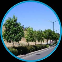
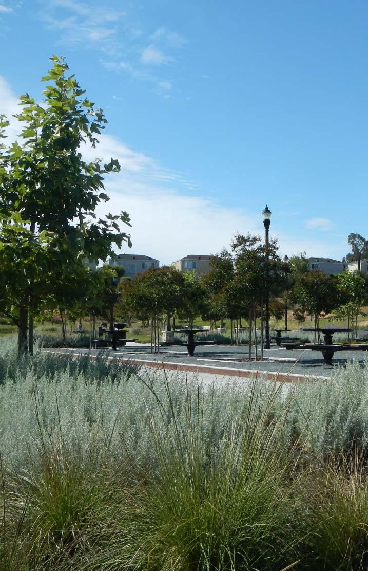
3 WHAT IS AN URBAN GREENING PLAN? Parks, trails and open space Urban forestry and street trees


4 WHAT IS AN URBAN GREENING PLAN? Stormwater Management Water Conservation


5 WHAT IS AN URBAN GREENING PLAN? Improved pedestrian and nonvehicular access Landscape design guidelines and plant palette

6 CITY OF CLOVIS
7 PROCESS TO DATE PLANNING ANALYSIS AND REVIEW TECHNICAL ADVISORY COMMITTEE (TAC) First community workshop * GENERAL PLAN ADOPTION March April May June July August September October ESTABLISHED greening goals and strategies IDENTIFIED greening opportunities DEVELOPED greening tools

8 GREENING GOALS AND STRATEGIES ENVIRONMENTAL CONCERNS WATER AIR QUALITY PUBLIC HEALTH CLIMATE CHANGE COMMUNITY FEEDBACK


9 GREENING GOALS AND STRATEGIES CLIMATE CHANGE COMMUNITY FEEDBACK


10 GREENING GOALS AND STRATEGIES CLIMATE CHANGE COMMUNITY FEEDBACK

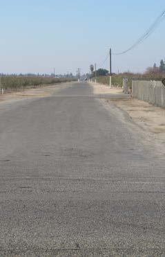
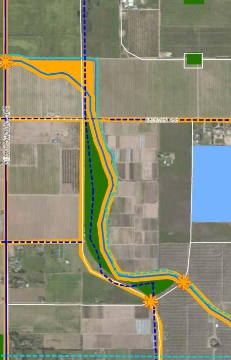
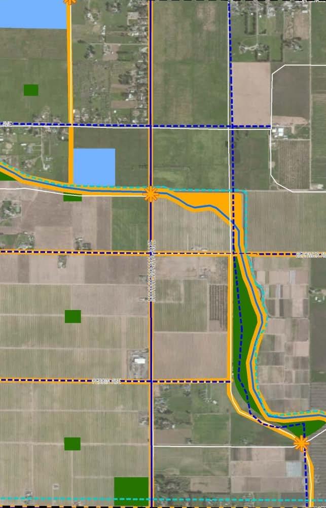
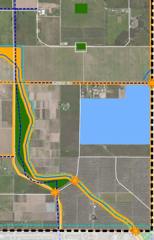
11 GREENING OPPORTUNITIES NEW PARK SPACES regional assets nature parks STREETS bike routes street trees safety improvements IRRIGATION CANALS trail access safety components COMMUNITY FEEDBACK

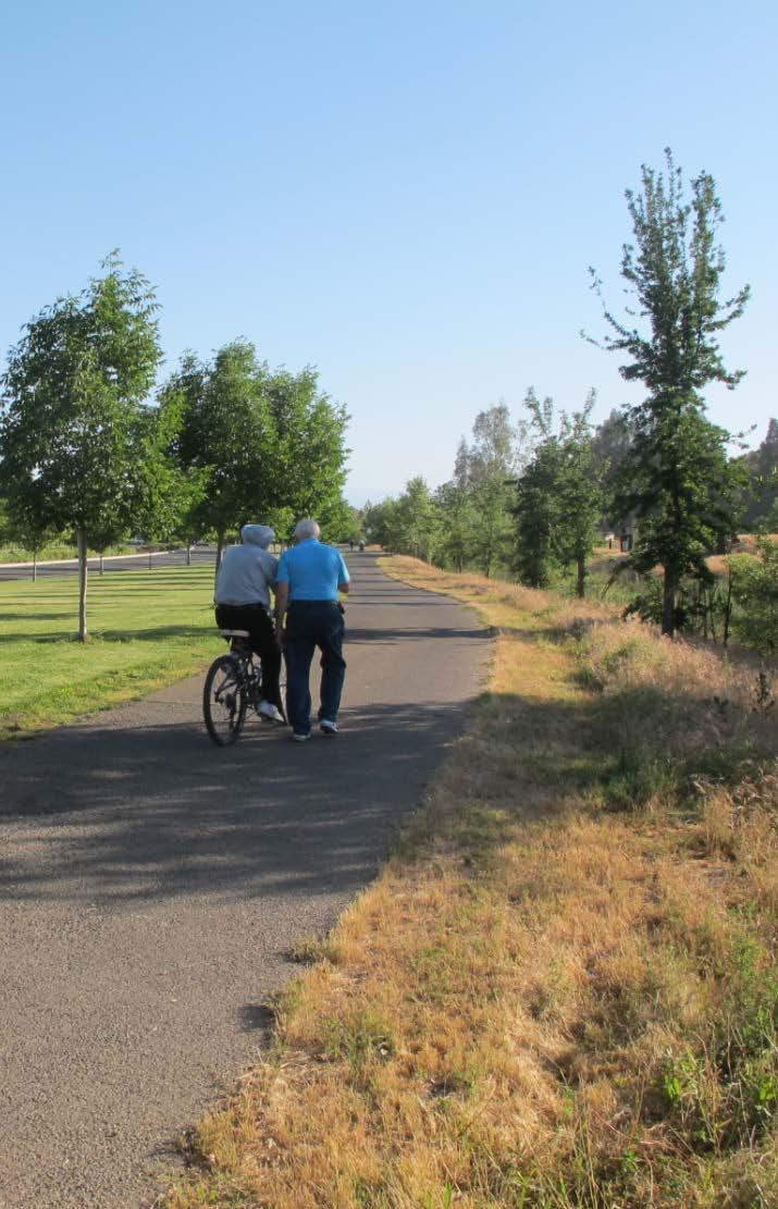
12 GREENING OPPORTUNITIES CIRCULATION ACCESS Bicycle connection between staging area on Shepherd Avenue and Auberry Road Pedestrian passages to new commercial space in southwest corner Safer crossings to pedestrian pathway along Willow Avenue COMMUNITY FEEDBACK


13 GREENING TOOLS COMMUNITY FEEDBACK

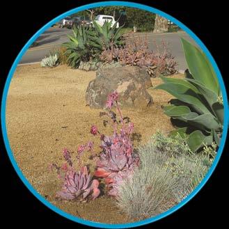
14 GREENING TOOLS PLANT PALETTE Evaluate existing trees, shrubs, and other plantings Get feedback about resident preferences Propose new, appropriate species Drought tolerant Shade providing Non-invasive PLANNING ANALYSIS

15 GREENING TOOLS POLICY REVIEW Landscape maintenance recommendations Low water use incentives and mandates New landscape districts Street tree planting prior to development PLANNING ANALYSIS

16 GREENING TOOLS What policies could look like: PLANNING ANALYSIS today

17 GREENING TOOLS What policies could look like: PLANNING ANALYSIS 5 years

18 GREENING TOOLS What policies could look like: 20 years PLANNING ANALYSIS

19 GREENING TOOLS The GENERAL PLAN provides fairly specific land use planning for the NORTHWEST URBAN CENTER, with policies that require a comprehensive design document to provide additional development and land use guidance. The General Plan also envisions that the comprehensive design document for the Northwest Urban Center will: Use SAN JOAQUIN VALLEY-APPROPRIATE PLANTINGS Capitalize on VIEWS OF OWENS MOUNTAIN AND THE SIERRA NEVADA Achieve COMPACT DEVELOPMENT PATTERNS that integrate a variety of housing types, sizes, and densities at the neighborhood and community level ELIMINATE as feasible the use of SOUND WALLS separating neighborhoods from roads Develop a WELL-CONNECTED GRID SYSTEM of roads PROHIBIT RETAIL LAND USES within a QUARTER MILE of any CLOVIS UNIFIED SCHOOL DISTRICT CAMPUS. PLANNING ANALYSIS


20 GREEN VISION Foothills meet the Orchard Using plants native to the Sierra Nevada and agricultural accents Maintaining open viewsheds to mountains and surrounding agricultural valley International cycling destination Developing high quality bike routes and destinations Academic center Creating shaded corridors with deciduous street trees Building effective pedestrian and non-vehicular infrastructure Specific to NORTHWEST


21 TONIGHT S GOALS PRIORITIZE greening opportunities DEVELOP conceptual design layout CREATE 20-year green vision
22 PRIORITIZE GREENING OPPORTUNITIES
23 PRIORITIZE GREENING OPPORTUNITIES CONSIDERATIONS Who would use it? What would they do there? Would it have active uses (like sports fields and exercise equipment) or passive uses (like walking trails and habitat areas? What would it look like? What amenities would it have? PARKS
?")
 should there be?")
24 PRIORITIZE GREENING OPPORTUNITIES CONSIDERATIONS Who would use the streets (walkers, bikers, drivers, horseback riders, other)? How will the space be divided for the groups? What types of landscape elements (trees and shrubs) should there be? What happens at intersections? STREETS

25 PRIORITIZE GREENING OPPORTUNITIES CONSIDERATIONS Irrigation canals Should it be open? How do you keep people away from the water? Internal paseos Should it be open? Should they be separated from the street? TRAILS
26 PRIORITIZE GREENING OPPORTUNITIES PRIORITIES Which projects are the most valuable? PHASING Which projects do you want to see first?
27 DEVELOP CONCEPTUAL SITE DESIGN PARK STREET TRAIL
28 DEVELOP CONCEPTUAL SITE DESIGN PARK STREET TRAIL


29 CREATE A 20-YEAR VISION What are the guiding principles for the next 20 years? Other Clovis Communities What is the Northwest brand??
30 Clovis Urban Greening Plan Community Workshop #2 Northwest Thursday, October 9, 2014
Clovis Urban Greening Plan
 Clovis Urban Greening Plan Community Workshop #3 Helm Ranch Tuesday, May 12, 2015 WHAT IS AN URBAN GREENING PLAN? A guide to help the City to improve quality of life for residents Identification of needs,
Transportation. Strategies for Action
 Transportation A major priority for the Overlake Neighborhood is to develop a multimodal transportation system. To achieve this system, a balance has to be found among travel, circulation and access needs;
BENJAMIN BANNEKER PARK FRAMEWORK PLAN (PLAN ADOPTION)
") BENJAMIN BANNEKER PARK FRAMEWORK PLAN (PLAN ADOPTION) COUNTY BOARD MEETING DECEMBER 16, 2017 County Board Consideration: Adopt the Benjamin Banneker Park Framework Plan and Design Guidelines Framework
BENJAMIN BANNEKER PARK FRAMEWORK PLAN (PLAN ADOPTION) COUNTY BOARD MEETING DECEMBER 16, 2017 County Board Consideration: Adopt the Benjamin Banneker Park Framework Plan and Design Guidelines Framework
3. VISION AND GOALS. Vision Statement. Goals, Objectives and Policies
 Vision Statement Queen Creek s interconnected network of parks, trails, open spaces and recreation opportunities provide safe and diverse activities and programs that sustain its unique, small town, equestrian
CAL POLY MASTER PLAN UPDATE, March 2015
 Some Key Themes in the General Guiding Principles Academic Mission The plan must foremost advance the University s academic mission and student success. Foresight and Adaptability The plan should take
City of Nogales General Plan
 Open Space, Parks, Recreation and Trails City of Nogales General Plan Residents of Nogales place a high priority in the development of a comprehensive system of open space, parks, recreation and trails
The transportation system in a community is an
 7 TRANSPORTATION The transportation system in a community is an important factor contributing to the quality of life of the residents. Without a sound transportation system to bring both goods and patrons
Introduction. Chapter 1. Purpose of the Comprehensive Plan Plan Organization Planning Process & Community Input 1-1
 Chapter 1 Introduction Lakewood 2025: Moving Forward Together Purpose of the Comprehensive Plan Plan Organization Planning Process & Community Input 1-1 Purpose of the Comprehensive Plan The Comprehensive
Route 1 Corridor Study
 Route 1 Corridor Study Westbrook, Connecticut A Vision for the Connecticut Shoreline Public Informational Meeting July 28, 2015 Lower Connecticut River Valley Council of Governments Fitzgerald & Halliday,
Welcome to the LYNX Blue Line Extension Transit Station Area Plans Public Workshop No. 3. Presentation will begin at 6:00 P.M.
 Welcome to the LYNX Blue Line Extension Transit Station Area Plans Public Workshop No. 3 Presentation will begin at 6:00 P.M. Meeting Agenda Blue Line Extension (BLE) Project Update LYNX Blue Line Extension
TOWN COUNCIL / PLANNING COMMISSION
 Workshop #3 TOWN COUNCIL / PLANNING COMMISSION January 20, 2011 Consultant Team In Attendance Tonight BMS Design Group Nevada City and San Francisco Michael Smiley, AICP, ASLA Partner-in-Charge Nancy L.
5.1 AESTHETICS Environmental Setting Scenic Views FONTANA FORWARD GENERAL PLAN UPDATE DRAFT ENVIRONMENTAL IMPACT REPORT
 5.1 AESTHETICS This section describes the City s scenic resources, and landscape and neighborhood characteristics, and addresses the potential impacts on aesthetic and visual resources associated with
CENTRAL ESTUARY PLAN AVISION FOR OAKLAND S WATERFRONT
 Central Estuary Plan A VISION FOR OAKLAND S WATERFRONT Specific Plan and Environmental Assessment Presentation to the Parks and Recreation Advisory Commission December 9, 2009 This Afternoon s Presentation
RECREATION AND OPEN SPACE ELEMENT GOALS, OBJECTIVES, AND POLICIES
 RECREATION AND OPEN SPACE ELEMENT GOALS, OBJECTIVES, AND POLICIES Goal 7 To provide park facilities, recreation programs, and open space resources that are safe, adequate, and accessible to all City residents,
3.1 community vision. 3.3 required plan elements
 Chapter 3 Community Form 3.1 community vision 3.2 Parks & landscaping concepts 3.3 required plan elements D R A F T 20 Community Form Chapter 3 3.0 Community form 3.1 community vision The Specific Plan
Whitemarsh Comprehensive Plan Update: Housing & Land Use. Public Workshop #3: September 20, 2018
 Whitemarsh Comprehensive Plan Update: Housing & Land Use Public Workshop #3: September 20, 2018 Agenda Welcome Process Recap What We ve Heard The Plan Framework Review of Recommended Actions Land Use Housing
The following principles guide the development of goals and strategies to protect and promote these amenities:
 OPEN SPACE/PARKS/TRAILS/RECREATION GOALS/STRATEGIES Cherry Hills Village is a living environment that offers low density development, open areas, public scenic vistas, public trails and public parks. This
Oroville Area Urban Greening Plan. Joint Meeting of the Oroville Planning, Park, and Arts Commissions October 12, 2015
 Oroville Area Urban Greening Plan Joint Meeting of the Oroville Planning, Park, and Arts Commissions October 12, 2015 Project Team Lead Agency Butte County Department of Development Services Claudia Stuart,
Ten Mile Creek Planning Area
 PLANNING AREA POLICIES TEN MILE CREEK Ten Mile Creek Planning Area Location and Context The Ten Mile Creek Planning Area ( Ten Mile Creek area ) is located south of the current Boise AOCI, generally south
Oroville Area Urban Greening Plan. Second Communitywide Workshop
 Oroville Area Urban Greening Plan Second Communitywide Workshop Monday, November 18, 2013 PROJECT TEAM Lead Agency Butte County Department of Development Services Claudia Stuart, Principal Planner Chris
The bottom urban structure and guidelines City Council Briefing
 The bottom urban structure and guidelines City Council Briefing 4.1.2015 1 Provide information on the studio s community planning and design efforts for The Bottom Review process to date Review plan recommendations
The Vision. Photo provided by The Minervini Group. 46 Vision, Objectives & Strategies
 Vision, Objectives & Strategies The is the public framework and guide for future development of the Grand Traverse Commons. The establishes public polices for infrastructure, the preservation of natural
Executive Summary. NY 7 / NY 2 Corridor
 Executive Summary NY 7 / NY 2 Corridor Transportation and Land Use Study December 2005 Prepared for: Town of Colonie Capital District Transportation Committee Prepared by: Introduction: Land use decisions
Active Transportation Rail to River Corridor
 Active Transportation Rail to River Corridor Community Advisory Committee - Segment A, 2 nd Meeting December 13, 2016 Tonight s Agenda Purpose: Update you on Segment A & get your feedback on design concepts
Making TOD Work in the Heart of Suburban Sprawl
 Making TOD Work in the Heart of Suburban Sprawl Rocky Mountain Land Use Institute March 6, 2009 Speakers Ben Herman, FAICP, Principal Clarion Associates Darcie White, AICP, Principal Clarion Associates
Connecting Master Plans, Asset Management, and CIP s to Bolster Economic Development
 Connecting Master Plans, Asset Management, and CIP s to Bolster Economic Development Presented By Paul Montagno, AICP, Carlisle Wartman Associates And Terry Moultane, AICP, Bay City What We re Covering
INTRODUCING THE BALTIMORE CITY GREEN NETWORK VISION PLAN
 INTRODUCING THE BALTIMORE CITY GREEN NETWORK VISION PLAN GOALS OF THE GREEN NETWORK PLAN Protect and enhance the unique ecological resources of our city Support economic growth and sustainable redevelopment
Applicant Name Phone / Fax / Address City State Zip Code . Property Owner Phone / Fax / Address City State Zip Code
 Master Development Plan Application Community Development Department City of Redmond 411 SW 9 th Street Redmond, Oregon 97756 541-923-7721 541-548-0706 FAX Master Development Plan Fee $38,862.52 File Number
S A C R A M E N T O C O U N T Y JACKSON HIGHWAY & GRANT LINE EAST VISIONING STUDY
 JACKSON HIGHWAY & GRANT LINE EAST S A C R A M E N T O C O U N T Y P L A N N I N G D E P A R T M E N T SUMMARY AND WORKBOOK November 19, 2008 History of the Visioning Study Sacramento County has two growth
SPRINGHILL LAKE TRANSIT VILLAGE
 Greenbelt Metro Area Sector Plan - Subarea Design Policies and Guidelines - Springhill Lake Transit Village 113 SPRINGHILL LAKE TRANSIT VILLAGE Residential Neighborhood and Village Center CONCEPT Springhill
URBAN DESIGN BRIEF URBAN DESIGN BRIEF 721 FRANKLIN BLVD, CAMBRIDGE August 2018
 URBAN DESIGN BRIEF URBAN DESIGN BRIEF 721 FRANKLIN BLVD, CAMBRIDGE August 2018 DESIGN BRIEF CONTENTS PART A 1.0 INTRODUCTION 2.0 DESCRIPTION & ANALYSIS OF SITE CONTEXT 3.0 DESIGN CONSTRAINTS AND OPPORTUNITIES
Office of Greenways & Trails Providing Statewide Leadership and Coordination. Southeast Greenways and Trails Summit October 1-3, 2017
 Office of Greenways & Trails Providing Statewide Leadership and Coordination Southeast Greenways and Trails Summit October 1-3, 2017 1 Office of Greenways and Trails The Office of Greenways and Trails
Welcome to the Oakridge Centre Open House
 Welcome to the Oakridge Centre Open House Why is the City hosting this event? This open house is to inform you of a rezoning application submitted to the City of Vancouver to amend the existing CD-1 (Comprehensive
Seneca Meadows. Block 4 Locate office, technology, and medical development adjacent to I Screen views of garage structures from I-270.
 Seneca Meadows Seneca Meadows has an industrial park in its southern end and a mixed-use employment area planned for the north end. The district benefits from extensive I-270 visibility, stream valley
A. WHAT IS A GENERAL PLAN?
 I. Introduction A. WHAT IS A GENERAL PLAN? A general plan is the planning guideline for the future of a city. It contains goals and policies which regulate urban development, the protection of the natural
KENDALL SQUARE INITIATIVE. Planned Unit Development Special Permit Application - SoMa September 8, 2015
 KENDALL SQUARE INITIATIVE Planned Unit Development Special Permit Application - SoMa September 8, 2015 GENERAL DEVELOPMENT GOALS Kendall Square PUD 2 PRE-ZONING PUBLIC ENGAGEMENT 2008-2009 2010-2012 2013
FUTURE LAND USE ELEMENT
 FUTURE LAND USE ELEMENT GOAL I: To create and sustain a great place to live, play, and prosper Objective 1: The City of Ocala shall incorporate the principles and strategies of the Ocala 2035 Vision into
Secrest Short Cut and Monroe Expressway Small Area Plan AUGUST 29, 2018
 Secrest Short Cut and Monroe Expressway Small Area Plan AUGUST 29, 2018 Background and Process Monroe Expressway will be open by the end of 2018 Union County and Indian Trail identified a need to revisit
Port Credit Local Advisory Panel October 20 th Meeting
 Port Credit Local Advisory Panel October 20 th Meeting Focus Of This Evening s Meeting: 1. Hurontario Main Street Higher Order Transit Study 2. Port Credit Mobility Hub & GO Station Parking Structure Study
Atlanta BeltLine. Subareas 9 & 10. Master Plan Updates. March 26, Washington Park Jamboree 1
 Atlanta BeltLine Subareas 9 & 10 Master Plan Updates March 26, 2018 Washington Park Jamboree 1 22 miles, connecting 45 neighborhoods 22 MILES of transit 46 MILES of streetscapes and complete streets 33
Broadway District Specific Plan. Community Workshop #2 February 23,2016
 Broadway District Specific Plan Community Workshop #2 February 23,2016 1 Agenda Introductions Project Progress Status Upcoming Milestones Emerging Framework Land Use Urban Design Circulation Infrastructure
Comprehensive Plan Advisory Panel Meeting #3
 Comprehensive Plan Advisory Panel Meeting #3 November 7, 2016 Agenda 1. September 19 th Meeting Notes 2. Summary of Focus Areas Charrette 3. Heart of the City Focus Area a. HOC2/Station Areas Concept &
City Council March 27, Parks, Recreation, and Trails Master Plan
 City Council March 27, 2018 Parks, Recreation, and Trails Master Plan Planning Process Develop Goals and Objectives Inventory of Areas and Facilities Needs Assessment And Identification Public Participation
PLACEMAKING & MOBILITY WORKSHOP. January 27, 2016
 PLACEMAKING & MOBILITY WORKSHOP January 27, 2016 Boston needs more housing. But there is no one-size fitsall solution. Every neighborhood has its own character. In some places, density is not only appropriate
Planning Commission Staff Report Agenda Item No. 4 March 7, 2019
 DEPARTMENT OF PUBLIC WORKS AND PLANNING STEEN E. WHITE, DIRECTOR Planning Commission Staff Report Agenda Item No. 4 March 7, 2019 SUBJECT: General Plan Conformity Application Clovis Unified School District
McCowan Precinct Plan Study Background & Deliverables
 1 DRAFT & WITHOUT PREJUDICE McCowan Precinct Plan Study Background & Deliverables In September, 2011, City Planning (Scarborough District) began a study of an area within the Scarborough Centre, identified
LOMA VISTA ROUND 1 - COMMUNITY WORKSHOP AND OPEN HOUSE SUMMARY
 LOMA VISTA ROUND 1 - COMMUNITY WORKSHOP AND OPEN HOUSE SUMMARY Reagan Elementary School, Clovis, CA May 14, 2014 6:30pm-8:30pm SUMMARY On Wednesday, May 14, 2014, staff from the City of Clovis and PlaceWorks
SYRINGA VALLEY SPECIFIC PLAN NARRATIVE
 SYRINGA VALLEY SPECIFIC PLAN NARRATIVE Introduction With this application, Pleasant Valley South LLC ( Pleasant Valley ) seeks the City of Boise s approval of a new Specific Plan Ordinance to be added
Public may provide comments on the GDP within the next two weeks (December 24)
") 25/70 General Development Plan (GDP) Public Meeting Wednesday, December 10, 2014 6:00 8:00 P.M. District 1 Police Station Community Room 1311 W 46th Ave, Denver, CO 80211 Council Woman Montero: This particular
25/70 General Development Plan (GDP) Public Meeting Wednesday, December 10, 2014 6:00 8:00 P.M. District 1 Police Station Community Room 1311 W 46th Ave, Denver, CO 80211 Council Woman Montero: This particular
KENDALL SQUARE INITIATIVE. Planned Unit Development Special Permit Application - SoMa September 8, 2015
 KENDALL SQUARE INITIATIVE Planned Unit Development Special Permit Application - SoMa September 8, 2015 GENERAL DEVELOPMENT GOALS Kendall Square PUD 2 PRE-ZONING PUBLIC ENGAGEMENT 2008-2009 2010-2012 2013
Park Types and Attributes
 02 APPENDIX B APPENDIX B s and s 194 APPENDIX B 04 Size Level of Service Any privately owned park, of any size, is a neighborhood park Primary Service Area - 1/2 mile or within 15 minutes walking distance
UNIVERSITY AVENUE CORRIDOR REDESIGN JULY 10, 2017 KICK-OFF MEETING
 UNIVERSITY AVENUE CORRIDOR REDESIGN JULY 10, 2017 KICK-OFF MEETING COLLABORATIVE COMMUNITY-BASED DESIGN IS THE FOUNDATION TO A SUCCESSFUL PROJECT AGENDA FOR TONIGHT 1 INTRODUCTIONS 2 PROJECT LIMITS & OVERVIEW
Tyvola & Archdale Transit Station Area Plan. June 5, 2008
 Tyvola & Archdale Transit Station Area Plan Second Public Meeting June 5, 2008 Presentation Outline 1. Purpose and Process 2. Station Area Overview 3. Plan Recommendations 4. Comments Received and Proposed
India Basin/Hunters Point Shoreline Community Workshop May 21, 2008
 India Basin/Hunters Point Shoreline Community Workshop May 21, 2008 Workshop Agenda Welcome Process Overview Context & Existing Conditions Presentation of Draft Concepts Land Use and Open Space Priorities
Chapter 1.0 Introduction
 Chapter 1.0 Introduction 1.1 Background The North Metro commuter rail line is part of the RTD FasTracks regional transit system expansion program to build more than 100 miles of rail transit throughout
Urban Greening Plan Proposed Policies and Programs Matrix Existing City Plans and Goals Programs Policies Notes/Comments
 Urban Greening Plan Circulation Plan for Bicyclists and Pedestrians (2007) 1.1 - Develop a coordinated Trail Maintenance Volunteer Program that identifies funding and leverages community efforts and partnerships
Stadium District Masterplan
 Stadium District Masterplan Masterplan (noun): an evolving long-term planning document that establishes the framework and key elements of a site. It reflects a clear vision synthesizing developer goals
Northwest commuter rail station US 36 BRT. Westminster Station
 Northwest commuter rail station Westminster Station US 36 BRT Westminster Center US 36 & Church Ranch Broomfield Flatiron/96 th St. US 36 & McCaslin Table Mesa Boulder Junction 13-month effort that will
Table L-1 Summary Action Strategy. Action Item Timing Status Responsible Agency
 CHAPTER 4: CIRCULATION ELEMENT ISSUE #1: MAJOR THOROUFARES AND TRANSPORTATION ROUTES A balanced transportation system for Fontana is provided that meets the mobility needs of current and future residents
Draft Memorandum #1: Goals and Vision for Revitalization
 Keizer Revitalization Plan Draft Memorandum #1: Goals and Vision for Revitalization Submitted to: City of Keizer April 12, 2018 (revised) Prepared By: Angelo Planning Group and Otak, Inc. Project No. 17482.A
Atlanta BeltLine Corridor Environmental Study. Scoping Meeting August 2008
 Atlanta BeltLine Corridor Environmental Study Scoping Meeting August 2008 What Will We Be Discussing Today? Study Overview - How Did We Get Here? - What Is the Study About? - Who Is Involved? - Where Is
Living in Albemarle County s Urban Places
 Living in Albemarle County s Urban Places ALBEMARLE COUNTY, VIRGINIA A Closer Look at Albemarle s Approach to Managing Growth and Creating Quality Urban Environments www.albemarle.org Page 2 Living in
FOUR MILE RUN VALLEY WORKING GROUP AND CHARGE Adopted April 16, 2016 Amended July 19, 2016
 FOUR MILE RUN VALLEY WORKING GROUP AND CHARGE Adopted April 16, 2016 Amended July 19, 2016 Working Group Charge The Working Group is charged by the County Board to collaborate with staff to provide commission,
Manchester. Vision for Manchester
 Manchester Vision for Manchester The Manchester Community Plan is a statement of the community values and aspirations for the future. This is an effort to recognize what originally attracted visitors in
BUILDING SCALE AND SETBACKS 5 ELEMENTS:... 5 FAÇADES (COMMERCIAL/RESIDENTIAL) 5
 5") VISION STATEMENT 3 UTILIZATION OF THE GUIDELINES 3 IMPLEMENTATION 3 PROCEDURES FOR DESIGN REVIEW 3 LAND USE AND ZONING 4 LAND USE 4 ELEMENTS:... 4 ZONING 4 ELEMENTS:... 4 BUILDING SCALE AND SETBACKS 5
VISION STATEMENT 3 UTILIZATION OF THE GUIDELINES 3 IMPLEMENTATION 3 PROCEDURES FOR DESIGN REVIEW 3 LAND USE AND ZONING 4 LAND USE 4 ELEMENTS:... 4 ZONING 4 ELEMENTS:... 4 BUILDING SCALE AND SETBACKS 5
A larger version of this map is located on the last page of this PDF.
 MAP Committee Input McLoughlin Area Draft Vision Map A larger version of this map is located on the last page of this PDF. 1. The map above is intended to portray a vision for the McLoughlin area. It highlights
Description of Preferred Alternative
 Chapter 2 Description of Preferred Alternative 2.1 Introduction This chapter of the programmatic Sammamish Town Center Sub-area Plan Final EIS provides a more detailed description of the Preferred Alternative
FOUR MILE RUN VALLEY WORKING GROUP AND CHARGE
 FOUR MILE RUN VALLEY WORKING GROUP AND CHARGE Adopted April 16, 2016 Amended July 19, 2016 Overview of Integrated Effort The overall goal of the Four Mile Run Valley (4MRV) initiative is to develop a comprehensive
ORANGE LINE TRANSIT NEIGHBORHOOD PLANS VAN NUYS NEIGHBORHOOD COUNCIL, PLUM COMMITTEE DEPARTMENT OF CITY PLANNING, CITY OF LOS ANGELES
 Photo: Mission Meridian(Moule & Polyzoides) ORANGE LINE TRANSIT NEIGHBORHOOD PLANS VAN NUYS NEIGHBORHOOD COUNCIL, PLUM COMMITTEE DEPARTMENT OF CITY PLANNING, CITY OF LOS ANGELES JULY 18, 2018 Project partially
Community Open House March 26 th, 2018
 Community Open House March 26 th, 2018 Open House Agenda 1. Overview of Planning Process What we heard 2. Future Land Use Policy 3. Priority Growth Areas 4. Plan Elements Making it happen What is a Comprehensive
Elderberry, Pioneer, Junction
 February 15, 2018 Pioneer Road Pioneer Mineral Point Road Elderberry Pleasant View Road Junction Junction Road Agenda Recap of Background Information, Open House #1 Draft Neighborhood Development Plan
REGIONAL ACTIVITY CENTER
 DRAFT REGIONAL ACTIVITY CENTER 70 EAST BENCH MASTER PLAN DRAFT 06 Introduction The East Bench Regional Activity center is comprised of large educational, research, medical, and employment centers. These
CHAPTER 7: Transportation, Mobility and Circulation
 AGLE AREA COMMUNITY Plan CHAPTER 7 CHAPTER 7: Transportation, Mobility and Circulation Transportation, Mobility and Circulation The purpose of the Transportation, Mobility and Circulation Chapter is to
OPEN HOUSE. Future. Neighborhood. Thursday April 27, :30 8:30 PM Refreshments provided Discovery Center, 4444 Hadley Avenue North
 OPEN HOUSE Thursday April 27, 2017 6:30 8:30 PM Refreshments provided Discovery Center, 4444 Hadley Avenue North The City Council has ini ated a planning process to guide future development on 206 acres
Emerson Park Master Plan Update. Public Meeting III August 27, 2014
 Emerson Park Master Plan Update Public Meeting III August 27, 2014 Meeting Agenda: Project Update Presentation of Master Plan Components Discussion and Feedback The Path Forward: Building on the Concept
Denver Moves: Transit Task Force
 Insert transit picture Denver Moves: Transit Task Force Meeting #8 October 5, 2017 1. Welcome & Introductions Opening remarks and housekeeping Task Force and audience introductions Upcoming events and
Sherri Ferguson. President/CEO Portland Chamber of Commerce. Tennessee Certified Economic Developer Capstone Project
 Sherri Ferguson President/CEO Portland Chamber of Commerce Tennessee Certified Economic Developer Capstone Project Strategic Plan Development for the North Gateway of Portland, Tennessee The New Gateway
WELCOME! Landscape Renovation Community Meeting
 WELCOME! Santiago Hills Assessment District (SHAD) Landscape Renovation Community Meeting August 30, 2017 Desired Outcomes Continue to receive community input on the overall landscape renovation Specifically,
Enhance the High Line Canal Projects
 Enhance the High Line Canal Projects Joint Project Proposal for Arapahoe County Open Spaces Funding Partner Sponsors: South Suburban Park and Recreation District City of Centennial City of Littleton October
Plan Framework Report. Attachment A
 Plan Framework Report Attachment A Uptown-Douglas Corridor Plan - Plan Framework Report Contents Introduction... 1 Planning Process... 3 Project Objectives... 4 Vision... 5 Community Values... 6 Structural
Study Area. Capitol Way. Greening America s Capitals 11/13/2014. A Greening America s Capitals Project
 Olympia, WA: Greening Capitol Way Supporting Communities move towards sustainability is a priority for the federal government. A Greening America s Capitals Project Office of Sustainable Communities U.S.
SAN RAFAEL GENERAL PLAN 2040 INTRODUCTION AND OVERVIEW
 SAN RAFAEL GENERAL PLAN 2040 INTRODUCTION AND OVERVIEW Steering Committee Presentation February 14, 2018 Purpose of General Plan Guide land use and development decisions Coordinate transportation, infrastructure,
REVIEW AND EVALUATION OF REGIONAL LAND USE
 REVIEW AND EVALUATION OF REGIONAL LAND USE AND TRANSPORTATION SCENARIOS #220831 Environmental Justice Task Force October 7, 2014 VISION 2050 Process Development of Guiding Vision for Land Use and Transportation
38 Queen s University Campus Master Plan Part 1
 38 Queen s University Campus Master Plan Part 1 46 The Campus at the City Scale Chapter 4 The Campus at the City Scale 39 Queen s is an urban University centrally located in Kingston. Decisions made by
South Davis County COMMUNITY SPOTLIGHT
 South Davis County COMMUNITY SPOTLIGHT Davis/SLC Community Connector Bus Rapid Transit line connecting SLC & Davis County RTP Phase 1 Project Generate 3,100 average weekday riders Relieve congestion on
VIRGINIA DRIVE SPECIAL PLAN
 August 15, 2017 Staff Report to the Municipal Planning Board CASE #GMP2017-10006 & LDC2017-00231 Item # 7 VIRGINIA DRIVE SPECIAL PLAN Location Map Subject Site SUMMARY Applicant City of Orlando, Planning
Future Proposed Development
 Future Proposed Development on and around Link light rail s Capitol Hill Station Meeting September 24, 2012 Tonight s Agenda 6:00 pm Open House 6:30 pm Introductions Richard Conlin, City of Seattle Councilmember/Sound
Riverwalk Dreams compiled by Thomas P. Healy November 16, 2017
 Riverwalk Dreams compiled by Thomas P. Healy November 16, 2017 1986 Ripple Village Plan: A neighborhood plan developed by the City of Indianapolis Department of Metropolitan Development s Division of Planning
Blueprint Denver Task Force Meeting #
 Blueprint Denver Task Force Meeting #1 6.23.16 1. Welcome and Introductions Your name and affiliation Name 1 thing you love about Denver Name 1 thing you d change about Denver All in 30 seconds! Ready,
Concord Community Reuse Project Goals and Guiding Principles. Overarching Goals (OG)
") Concord Community Reuse Project Goals and Guiding Principles Overarching Goals (OG) No priority is implied by the order of presentation of the goals and guiding principles. Overarching goals for the Concord
Concord Community Reuse Project Goals and Guiding Principles Overarching Goals (OG) No priority is implied by the order of presentation of the goals and guiding principles. Overarching goals for the Concord
Downtown Whitby Action Plan
 Downtown Whitby Action Plan Final Report October 2016 Table of Contents Introduction 1 Public Consultation 2 Walkability 3 Downtown Whitby Walkability Map 4 Vision 5 Goal & Objectives 6 Objective 1 7 Objective
Welcome! Far Northeast Area Plan Meeting #3 Council District 11 Town Hall Meeting Resource Fair. Jan. 30, 2018
 Welcome! Far Northeast Area Plan Meeting #3 Council District 11 Town Hall Meeting Resource Fair Jan. 30, 2018 Tonight s Agenda 6:15- Welcome and Councilmember Remarks 6:25- Presentation 6:45- Activities
Welcome. Walk Around. Talk to Us. Write Down Your Comments
 Welcome This is an information meeting introducing the applications for proposed redevelopment of the Yorkdale Shopping Centre site at 3401 Dufferin Street and 1 Yorkdale Road over the next 20+ years,
Rosslyn Highlands Park + Coordinated Open Spaces Plan (Plan Adoption) County Board Meeting September 24, 2016
 County Board Meeting September 24, 2016") Rosslyn Highlands Park + Coordinated Open Spaces Plan (Plan Adoption) County Board Meeting September 24, 2016 BACKGROUND The County Board shall consider adoption of the proposed Rosslyn Highlands Park
Rosslyn Highlands Park + Coordinated Open Spaces Plan (Plan Adoption) County Board Meeting September 24, 2016 BACKGROUND The County Board shall consider adoption of the proposed Rosslyn Highlands Park
BROOKLYN PARK / 85TH AVE LRT STATION CDI DEVELOPMENT GUIDELINES DRAFT
 August 2018 Page intentionally left blank The Brooklyn Park Library adjacent to the 85th Ave LRT Station Area. OVERVIEW The Blue Line LRT Extension / Bottineau corridor offers a unique opportunity to leverage
PARKS AND RECREATION
 PARKS AND RECREATION WHAT YOU WILL FIND IN THIS CHAPTER: Background information on the development of the Park, Recreation, and System Plan (PRSP). General overview of Ellensburg s parks and recreation
WELCOME and introduction
 1 WELCOME and introduction Mobility Hub Locations within Burlington STUDY OVERVIEW STUDY OBJECTIVES The City of Burlington is developing four Area Specific Plans, one for each of Burlington s Mobility
Corridor Vision. 1Pursue Minnehaha-Hiawatha Community Works Project. Mission of Hennepin County Community Works Program
 1Pursue Minnehaha-Hiawatha Community Works Project Minnehaha-Hiawatha Community Works is a project within the Hennepin Community Works (HCW) program. The mission of the HCW program is to enhance how the
Silverdale Regional Center
 Silverdale Regional Center Vision for Silverdale Regional Center The Silverdale Regional Center Plan (Plan) will guide the evolution of the Silverdale Regional Center from a collection of strip malls and
8implementation. strategies
 PROGRAM STRATEGIES 8implementation strategies T he implementation actions of this chapter are designed to support and carry out the land use, economic development, transportation, urban design, and program