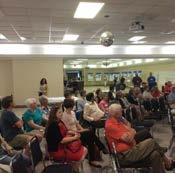
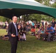
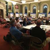
City of Kingston. North King s Town Secondary Plan Open House + Workshop #1 February 28, 2018
|
|
|
- Sylvia Chambers
- 5 years ago
- Views:
Transcription


1 City of Kingston North King s Town Secondary Plan Open House + Workshop #1 February 28,
2 event agenda 30 min Panel Review + Discussion 30 min Presentation + Q&A 75 min Workshop Session 15 min Report Back + Next Steps 2
3 presentation overview 1 Secondary Plan Process 2 Phase 1 Refresh 3 Cultural Heritage 4 Draft Land Use Plan 5 Draft Open Space Framework 6 Multiple Account Evaluation Criteria 3
4 Secondary Plan Process
5 Process Overview Nov. Dec. Jan. Feb. Mar. Apr. May Jun. Jul. Aug. Sept. Oct.- Nov. Land Use Plan Servicing Plan Cultural Heritage Resources Study Transportation Plan UK Modelling Draft Amendment Finance Plan Dec. - Jan. Engagement Events
6 Process Overview Nov. Dec. Jan. Feb. Mar. Apr. May Jun. Jul. Aug. Sept. Oct.- Nov. Land Use Plan Transportation Plan We Servicing Plan UK Modelling are Cultural Heritage Resources here Study Draft Amendment Finance Plan Dec. - Jan. Engagement Events

7 Transportation Plan MOE Guidelines


8 Transportation Plan + MOE Guidelines
9 Phase 1 Refresh
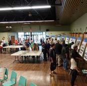
10 Consultation 10


11 Phase 1 Vision + Principles 11
12 Cultural Heritage Study
13 Heritage Study Indigenous Territory + History (10,000 BCE-1600) Area originally composed of forested terraces sloping down to the river shoreline, cut with small creeks Post-glacial Indigenous occupation of the Kingston area Marshland and Belle Island are hunting and fishing grounds 1924
 and Inner Harbour dockyard British military survey and street plan, Loyalist")
, the rest undeveloped farmland 1924 Early Subdivisions")

14 Heritage Study Early European and Loyalist Settlement (1670s-1790s) French fort (Fort Frontenac) and Inner Harbour dockyard British military survey and street plan, Loyalist settlement begins below North Street Southern part of study area laid out in town plots (including grant to Molly Brant), the rest undeveloped farmland 1924 Early Subdivisions and the Military (1790s-1850s) Rideau Canal completed, Inner Harbour dockyard expanded Molly Brant s descendants develop Johnsonville flanking Montreal Street north of North Street
15 Heritage Study
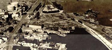
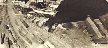
 Industrial Development (1860s-1960s) Anglin Harbour sawmill and wharves (1860s) Davis Dry Dock built (1880s) Kingston Cotton Mill (now")
 LaSalle Causeway opens, plans for expansion of Inner Harbour as Great Lakes terminus City dump develops between mainland and Belle Island (1950s; Belle")
16 Heritage Study Railway and Urban Expansion (1850s-1900) Northern part of study area is farmland until Grand Trunk Railway main line and depot (1856) Outer Station hamlet develops (1860s) Industrial Development (1860s-1960s) Anglin Harbour sawmill and wharves (1860s) Davis Dry Dock built (1880s) Kingston Cotton Mill (now Woollen Mill) built (1880s) Bailey Broom factory, Davis Tannery built (early 1900s) Changes in the 20th Century Schools built (Macdonald, Regiopolis, Robert Meek, 1910s-1920s) LaSalle Causeway opens, plans for expansion of Inner Harbour as Great Lakes terminus City dump develops between mainland and Belle Island (1950s; Belle Park, 1970s)

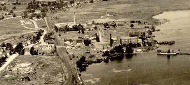
17 Heritage Study 1924
18 Heritage Study Intangible Heritage Intangible Cultural Heritage Secondary Plan is documenting themes of intangible cultural heritage Plan policy may be used to enhance, promote, and protect intangible cultural heritage Intangible cultural heritage includes practices, representations, expressions, knowledge and knowhow that communities recognize as part of their cultural heritage. Passed down from generation to generation, it is constantly recreated by communities in response to their environment, their interaction with nature and their history, providing them with a sense of identity and continuity. - UNESCO, 2011
 is a key theme in NKT s history.")
19 Heritage Study Intangible Heritage Some key themes so far. Indigenous people have lived on this land for thousands of years. Indigenous cultures and cultural practices have a historic and ongoing connection to the land. Industrial activity (tanneries, mills, warehouses, and ship yards) is a key theme in NKT s history. There is a legacy of maritime and water related activities, including ship building, that continues to this day. There is a legacy of commercial activity throughout NKT, particularly along key streets such as Montreal Street, that have served as commercial hubs.
20 Draft Land Use Plan
21 Phase 1 Community Vision Vision and Planning Principles Design Directions + Opportunities Preliminary Market Analysis Secondary Plan Land Use Plan Cultural Heritage Study Transportation Plan Servicing Plan Finance + Implementation Plan 21

22 Phase 1 Design Directions some key inputs for the Draft Land Use Plan


23 Phase 1 Design Directions Plan for compact mixed use intensification around nodes and corridors??? Former rail ROW: proposed WSE or multi use trail, subject to further study. Existing Trails Proposed Trails Public Parks and Open Spaces Wetlands Enhanced Corridors 5 Minute Walking Radii 23


24 Phase 1 Design Directions Cultivate a new hub for entrepreneurial, craft and knowledgebased employment? Former rail ROW: proposed WSE or multi use trail, subject to further study. Existing Trails Proposed Trails Public Parks and Open Spaces Wetlands Enhanced Corridors 5 Minute Walking Radii 24


25 Phase 1 Design Directions Shape character areas to guide appropriate growth and change Division Street Commercial Corridor Industrial Area Patrick St. Neighbourhood Montreal Street Corridor Belle Park Innovation Hub Belle Island McBurney Neighbourhood Park Inner Harbour 25


26 Phase 1 Design Directions Continue to Intensify Division Street and Montreal Street Corridors??? Former rail ROW: proposed WSE or multi use trail, subject to further study. Existing Trails Proposed Trails Public Parks and Open Spaces Wetlands Enhanced Corridors 5 Minute Walking Radii 26


27 Phase 1 Design Directions Create a vibrant industrial employment area, anchored by greater access and connections 27

28 Phase 1 Design Directions Conserve and promote the area s cultural heritage resources 28


29 Draft Land Use Plan + Structure John Counter Boulevard???
30 Draft Land Use Plan New Uses John Counter Boulevard
; 2-6 Storeys (med.")
31 Draft Land Use Plan - Residential Intent: Accommodate residential uses Provide a more diverse range of housing, including townhouses, and apartments of various types Facilitate modest intensification and infill Manage change in established residential areas John Counter Boulevard Height: 1-3 Storeys (low density); 2-6 Storeys (med. density); 6+ Storeys (high density) Target Land Use Ratios: R: % C: 0 20%
32 Draft Land Use Plan Urban Village Intent: Facilitates a wide range of land uses in compact development forms Support intensification and redevelopment John Counter Boulevard Height: 2-6 Storeys Target Land Use Ratios: R: 0 100% C: 0 60% Active frontages: areas where graderelated commercial frontages will be encouraged to create an active pedestrian-oriented retail node Employment Corridor: allows for a mix of employment, commercial, and some residential uses that are compatible with each other
33 Draft Land Use Plan Business Park Industrial Intent: Provide locations for offices, research, and development, advanced manufacturing, fabricating, and assembly Buildings should be attractive, with high-quality architectural treatment and landscaping Commercial uses are only permitted as complementary services and functions, such as restaurants and convenience retail Residential uses are not permitted Height: 1-4 Storeys John Counter Boulevard Target Land Use Ratios: E: % C: 0 25%?
34 Draft Land Use Plan General Industrial Intent: Provide an employment area suitable for manufacturing, wholesale, construction, transportation, storage, communications, and similar uses Commercial uses are only permitted as complementary services and functions, such as restaurants and convenience retail Residential uses are not permitted Height: 1-4 Storeys John Counter Boulevard Target Land Use Ratios: E: % C: 0 20%

35 Draft Land Use Plan Innovation Hub Intent: Accommodate a wide range of uses, including live-work, professional services, craft, light manufacturing, arts and cultural uses, and production production employment uses Allow for some residential development, but balanced with employment and commercial uses John Counter Boulevard Height: 2-6 Storeys Density: 1.25 FSI Target Land Use Ratios: E: 25 50% R: 25 50% C: 25 50%?


36 Draft Land Use Plan Open Spaces Intent: Accommodate a range of open spaces that meet diverse needs for active and passive recreation Includes a range of park spaces, trails, water front areas and other open spaces provide opportunities for rest, recreation, leisure, public gathering, sports, and other activities Also include conservation lands, naturalized areas, and areas of ecological sensitivity, where development opportunities are limited (not shown on map) John Counter Boulevard Environmental Protection Area: provides special policies to conserve natural habitat along the shoreline Harbour Area: provides special policies for harbourfront and water related uses, such as docks and boat launches
37 Draft Open Space Framework


38 Draft Open Space Framework Key Updates Open Space Typologies? Trail Type: Midblock connection? Typologies for Pedestrian- Priority Streets
39 Multiple Account Evaluation Criteria
40 Draft Multiple Account Evaluation Criteria QUANTITATIVE: These are aspects of the movement network in NKT that we can quantify and measure using traffic counts and computer generated models: Level of service (intersections) Congestion (delay) Network connectivity Modal integration Speed of implementation QUALITATIVE: These are qualities of the movement network in NKT that describe its functionality, service, and alignment with the Vision: Flexibility to add capacity over time Consistency with plans Increased transportation choice Improved safety Walkability Supportive of sustainability goals

41 Workshop Session
42 City of Kingston North King s Town Secondary Plan Open House + Workshop #1 February 28,
Preliminary Market Analysis
 Preliminary Market Analysis The preliminary market analysis is used to inform the Vision and opportunities to be explored in the next phase of the secondary plan. It will continue to guide strategies to
Kingston Inner Harbour: A Cultural Heritage Landscape Pilot Study
 Kingston Inner Harbour: A Cultural Heritage Landscape Pilot Study Benjamin L. Holthof A report submitted to the School of Urban and Regional Planning in conformity with the requirements for the degree
How can we improve mobility and access?
 How can we improve mobility and access? North King s Town is located fairly centrally within the city, but there are still multiple opportunities to improve mobility within the study area, including connections
PORT WHITBY COMMUNITY
 PORT WHITBY COMMUNITY SECONDARY PLAN UPDATE COMMUNITY IMPROVEMENT PLAN URBAN DESIGN GUIDELINES September 2015 DRAFT PROPOSED AMENDMENT NUMBER # to the Whitby Official Plan PURPOSE: The intent of this Amendment
Welcome to the. Open House
 Welcome to the 5th Street to Kinsman Road Open House November 14 5:30 7:00 p.m. Please sign in Project Overview In December 2016, City Council adopted SW 5th Street as the preferred alignment to connect
CDAC. Update: Downtown Dartmouth Update: CDAC July 25 th Motion
 CDAC Update: Downtown Dartmouth Update: CDAC July 25 th Motion 2018-10-24 Downtown Dartmouth Plan Open House October 22, 2018 6:00 pm Open House 6:30 pm Presentation + Q&A 7:20 pm Open House 8:30 pm Close
Municipal Development Plan Update Urban Service Area and Hamlets
 ENCLOSURE 1 Municipal Development Plan Update Urban Service Area and Hamlets Priorities Committee January 24, 2017 MUNICIPAL DEVELOPMENT PLAN UPDATE SHAPING OUR FUTURE MDP Update - Agenda MDP Update Public
edmonton.ca/ribbonofgreen #ribbonofgreen
 WHAT IS THE RIBBON OF GREEN? The Ribbon of Green is Edmonton s entire river valley and ravine system. The Ribbon of Green (2018) Project will provide strategic guidance for the southwest and northeast
2136 & 2148 Trafalgar Road Town of Oakville Region of Halton
 PLANNING JUSTIFICATION REPORT 2136 & 2148 Trafalgar Road Town of Oakville Region of Halton Zoning By-Law Amendment Application 2500674 Ontario Inc. November 2016 Table of Contents Page 1.0 Location/Summary
Edward R. Sajecki Commissioner of Planning and Building
 Corporate Report Clerk s Files Originator s Files CD.03.POR DATE: TO: FROM: SUBJECT: Chair and Members of Planning and Development Committee Meeting Date: February 27, 2012 Edward R. Sajecki Commissioner
DOWNTOWN GEORGETOWN PLANNING STUDY
 DOWNTOWN GEORGETOWN PLANNING STUDY Community Workshop #3 Thursday, May 4, 08 The Planning Partnership OVERVIEW OF STUDY, PROCESS & MILESTONES We are here PURPOSE OF THE STUDY To develop a clear vision
TOWN COUNCIL / PLANNING COMMISSION
 Workshop #3 TOWN COUNCIL / PLANNING COMMISSION January 20, 2011 Consultant Team In Attendance Tonight BMS Design Group Nevada City and San Francisco Michael Smiley, AICP, ASLA Partner-in-Charge Nancy L.
WELCOME and introduction
 1 WELCOME and introduction Mobility Hub Locations within Burlington STUDY OVERVIEW STUDY OBJECTIVES The City of Burlington is developing four Area Specific Plans, one for each of Burlington s Mobility
University of Saskatchewan CAMPUS MASTER PLAN. Senate Meeting Preliminary Presentation. April 21, 2018 DIALOG ECS DA WATT
 University of Saskatchewan CAMPUS MASTER PLAN Senate Meeting Preliminary Presentation April 21, 2018 DIALOG ECS DA WATT project process presentation agenda Stakeholder Engagement Project Control phase1
PUBLIC OPEN HOUSE HURONTARIO-MAIN CORRIDOR SECONDARY PLAN
 PUBLIC OPEN HOUSE HURONTARIO-MAIN CORRIDOR SECONDARY PLAN Tuesday, February 28, 2012 6pm 9pm 1 st Floor Atrium, City Hall 2 Wellington Street West, Brampton 1 POLICY FRAMEWORK The 2006 Provincial Growth
ELMVALE ACRES SHOPPING CENTRE MASTER PLAN
 ELMVALE ACRES SHOPPING CENTRE MASTER PLAN Contents 1.0 INTRODUCTION... 2 2.0 LOCATION... 2 3.0 EXISTING CONTEXT... 2 4.0 VISION & GUIDING PRINCIPLES... 2 5.0 LAND USE AND BUILT FORM... 4 5.1 St. Laurent
March 21, 2018 ALCA Meeting. March 21, 2018
 March 21, 2018 ALCA Meeting March 21, 2018 Agenda 1. Process and Timeline 2. Original Submission 3. Revised Submission 4. Next Steps The City of Calgary Role: The City is responsible for capturing and
GO Station Mobility Hubs: Draft Precinct Plans. Committee of the Whole July 12, 2018
 GO Station Mobility Hubs: Draft Precinct Plans Committee of the Whole July 12, 2018 Purpose of this Workshop Present Draft Precinct Plans for the 3 GO Station Mobility Hubs Continue the conversations that
In partnership with: Harbor Corridor Plan Bali Hi Mobile Home Park July 24, 2013
 In partnership with: Harbor Corridor Plan Bali Hi Mobile Home Park July 24, 2013 Project Intro 2-miles of Harbor Boulevard Westminster/17 th Street to just north of Edinger Avenue Many people use the corridor
Trafalgar Road Corridor Planning Study Open House
 Trafalgar Road Corridor Planning Study Open House June 24, 2013 6:30-8:30 p.m. Oakville & Trafalgar Rooms Overview The Livable Oakville Plan identifies the lands along Trafalgar Road, between the QEW and
Mark-up of the effect of the proposed Bronte Village Growth Area OPA No.18 on the text of section 24, Bronte Village, of the Livable Oakville Plan
 Mark-up of the effect of the proposed Bronte Village Growth Area OPA No.18 on the text of section 24, Bronte Village, of the Livable Oakville Plan Notes: This document is provided for information purposes
GOLDEN MILE SECONDARY PLAN. Community Consultation Meeting #3 June 26, 2018
 GOLDEN MILE SECONDARY PLAN Community Consultation Meeting #3 June 26, 2018 Meeting Overview 1. Introduction 2. Principles + Vision 3. Street + Block Alternatives 4. Parks + Open Space Alternatives 5. Land
burlington mobility hubs study Downtown Burlington Mobility Hub
 burlington mobility hubs study Downtown Burlington Mobility Hub Draft Precinct Plan Workbook PIC #3, September 7, 2017 downtown mobility hub objectives City staff and their consultants are proposing an
A. Selma Park, Davis Bay and Wilson Creek
 A. Selma Park, Davis Bay and Wilson Creek This waterfront neighbourhood consists of three separate community areas, linked by Highway 101, but with different character, land use patterns and future potential.
Table 8-4: Road Classification Local Roads, second table, of Chapter 8 Create a Multi-Modal City, be amended by adding the following:
 1 Port Street East Official Plan Amendment APPENDIX 3 Amendments to Mississauga Official Plan Table 8-4: Road Classification Local Roads, second table, of Chapter 8 Create a Multi-Modal City, be amended
CATARAQUI RIVER THIRD CROSSING EA Landscape Analysis Background Report. October 23, Corush Sunderland Wright Limited
 October 23, 2009 Corush Sunderland Wright Limited INTRODUCTION The City of Kingston has initiated an Environmental Assessment (EA) to assess the need for, and the feasibility of, implementing additional
New-Cast Mixed-use Development Proposal King Street West, Newcastle, Ontario
 URBAN DESIGN BRIEF New-Cast Mixed-use Development Proposal King Street West, Newcastle, Ontario TABLE OF CONTENTS: 1.0 Executive Summary 2.0 Creating Vibrant and Sustainable Urban Places: Excerpts from
CONTENTS 2.0 A FRAMEWORK FOR SUSTAINABLE GROWTH 2.1 MANAGING SUSTAINABLE GROWTH THE VISION TO GOALS AND OBJECTIVES 2.3 MARKHAM STRUCTURE
 2 A Framework for Sustainable Growth 2.0 A FRAMEWORK FOR SUSTAINABLE GROWTH CONTENTS 2.1 MANAGING SUSTAINABLE GROWTH THE VISION TO 2031 2.2 GOALS AND OBJECTIVES 2.2.1 Protecting the Natural Environment
YONGE STEELES CORRIDOR SECONDARY PLAN. Young + Wright / IBI Group Architects Dillon Consulting Ltd. GHK International (Canada) Ltd.
 Ltd.") PART A: PREAMBLE 1.0 PURPOSE The purpose of this Secondary Plan is to provide a development framework for intensification of the Yonge/ Steeles corridor including the north side of Steeles Avenue West
PART A: PREAMBLE 1.0 PURPOSE The purpose of this Secondary Plan is to provide a development framework for intensification of the Yonge/ Steeles corridor including the north side of Steeles Avenue West
THE CITY OF VAUGHAN BY-LAW BY-LAW NUMBER A By-law to adopt Amendment Number 1 to the Official Plan of the Vaughan Planning Area.
 THE CITY OF VAUGHAN BY-LAW BY-LAW NUMBER 015-2014 A By-law to adopt Amendment Number 1 to the Official Plan of the Vaughan Planning Area. NOW THEREFORE the Council of the Corporation of the City of Vaughan
Former Rockcliffe Airbase Community Design Plan Guiding Design Vision and Principles December 4, 2013
 APPENDIX 5 - Guiding Design Vision and Principles Former Rockcliffe Airbase Community Design Plan Guiding Design Vision and Principles December 4, 2013 Vision Statement The redevelopment of the former
Hammond Area Plan Process
 Hammond Area Plan Process Public Consultation Components #MyHammond Webpage 3 Public Open House Events & Online Questionnaires #MyHammondTalks Online Questionnaires Community Photo Projects Community Video
2.0 A FRAMEWORK FOR SUSTAINABLE GROWTH CONTENTS
 2-2 A Framework for Sustainable Growth 2.0 A FRAMEWORK FOR SUSTAINABLE GROWTH CONTENTS 2.1 MANAGING SUSTAINABLE GROWTH THE VISION TO 2031 2.2 GOALS AND OBJECTIVES 2.2.1 Protecting the Natural Environment
MOUNT PLEASANT SECONDARY PLAN & VILLAGE BLOCK PLAN. Wednesday, March 5, 2008 Informal Public Open House
 MOUNT PLEASANT SECONDARY PLAN & VILLAGE BLOCK PLAN Wednesday, March 5, 2008 Informal Public Open House 1. Welcome & Introductions 2. Highlights of Provincial Growth Plan 3. Overview and Status Update -
MAYFIELD WEST SECONDARY PLAN PHASE 2
 MAYFIELD WEST SECONDARY PLAN PHASE 2 Public Open House #3 February 25, 2010 Draft Preferred Land Use Scenario TOWN OF CALEDON PLANNING & DEVELOPMENT DEPARTMENT Open House Agenda TOWN OF CALEDON 1. Welcome
PORT UNION VILLAGE COMMUNITY SECONDARY PLAN
 4 PORT UNION VILLAGE COMMUNITY SECONDARY PLAN 4. PORT UNION VILLAGE COMMUNITY SECONDARY PLAN The following policies and principles apply to the area herein referred to as Port Union Village, as outlined
CITY OF VAUGHAN KIRBY GO TRANSIT HUB SUB-STUDY
 WELCOME! Thank you for attending, and welcome to the first of three Public Meetings for the Kirby GO Transit Hub Study. Your feedback is important to us, and will help inform the development of the draft
Historic Yonge Street HCD Study Public Meeting #2
 Historic Yonge Street HCD Study Public Meeting #2 March 26, 2014 Archaeological Services Inc. Philip Goldsmith Architect Agenda: 7:00 p.m. Open House 7:30 p.m. Welcome and Presentation 8:00 p.m. Questions
Tri-County Transportation & Land Use Study. Steering Committee Meeting May 14, 2009
 Tri-County Transportation & Land Use Study Steering Committee Meeting May 14, 2009 Agenda Recap of Study Goals and Objectives Update on CV Land Use Model: Business as Usual (BAU) Growth Scenario Pros vs
[PLANNING RATIONALE] For Site Plan Control and Lifting of Holding Zone By-Law 101 Champagne Avenue. May 23, 2014
![[PLANNING RATIONALE] For Site Plan Control and Lifting of Holding Zone By-Law 101 Champagne Avenue. May 23, 2014](/thumbs/75/71599615.jpg "[PLANNING RATIONALE] For Site Plan Control and Lifting of Holding Zone By-Law 101 Champagne Avenue. May 23, 2014") [PLANNING RATIONALE] For Site Plan Control and Lifting of Holding Zone By-Law 101 Champagne Avenue May 23, 2014 Contents 1.0 Introduction... 2 2.0 Site Context... 2 2.1 Adjacent Uses... 2 Figure 1: Site
[PLANNING RATIONALE] For Site Plan Control and Lifting of Holding Zone By-Law 101 Champagne Avenue May 23, 2014 Contents 1.0 Introduction... 2 2.0 Site Context... 2 2.1 Adjacent Uses... 2 Figure 1: Site
Town Center (part of the Comprehensive Plan)
") Town Center (part of the Comprehensive Plan) Mercer Island Town Center Looking North (2014) In 1994, a year-long process culminated in a set of design guidelines and code requirements for the Town Center
Town Center (part of the Comprehensive Plan) Mercer Island Town Center Looking North (2014) In 1994, a year-long process culminated in a set of design guidelines and code requirements for the Town Center
Planning and Public Consultation Process for the Preparation of a General Land Use Plan for South Port Kells TERMS OF REFERENCE
 APPENDIX "B" Planning and Public Consultation Process for the Preparation of a General Land Use Plan for South Port Kells TERMS OF REFERENCE PURPOSE South Port Kells is located in the northeastern quadrant
Land Use Policies Urban Area. Land Use Policies Urban Area
 8 Land Use Policies Urban Area Land Use Policies Urban Area LAND USE POLICIES URBAN AREA 8.1 MIXED USE INTENSIFICATION AREAS... 8-5 8.1.1 URBAN CENTRES... 8-5 8.1.1(3) DOWNTOWN URBAN CENTRE... 8-9 8.1.1(4)
CHAPTER 5: GUIDING PRINCIPLES
 CHAPTER 5: GUIDING PRINCIPLES The following 10 principles were developed based on public consultation, planning policy and the background analysis conducted during Phase 1. The Guiding Principles significantly
Draft Urban Hamilton Official Plan. Amendment No. XX
 1 of 75 The following text, together with: Draft Appendix A Appendix B Volume 1, Schedule E-1 Urban Land Use Designations Appendix C Volume 1, Appendix A Parks Classification Map Appendix D Volume 1, Appendix
2.0 A FRAMEWORK FOR SUSTAINABLE GROWTH CONTENTS
 2-2 A Framework for Sustainable Growth 2.0 A FRAMEWORK FOR SUSTAINABLE GROWTH CONTENTS 2.1 MANAGING SUSTAINABLE GROWTH THE VISION TO 2031 2.2 GOALS AND OBJECTIVES 2.2.1 Protecting the Natural Environment
Official Plan Review
 Official Plan Review Summary Report - The Built Environment August 2014 Part 1: Introduction Planning for a healthy, prosperous and sustainable community is an important goal for our municipality. From
Agenda. 7 Wright Crescent Urban Design Study. Public Meeting and Urban Design Workshop. 1 INTRODUCTION AND BACKGROUND (City of Kingston)
") Urban Design Study Public Meeting and Urban Design Workshop October 02, 2013 Agenda 1 INTRODUCTION AND BACKGROUND (City of Kingston) 2 URBAN DESIGN STUDY PRESENTATION (Antonio Gomez-Palacio, DIALOG) 3
Urban Design Study Public Meeting and Urban Design Workshop October 02, 2013 Agenda 1 INTRODUCTION AND BACKGROUND (City of Kingston) 2 URBAN DESIGN STUDY PRESENTATION (Antonio Gomez-Palacio, DIALOG) 3
1.0 INTRODUCTION 1.1 TH 14 WEST STUDY AREA Project Description Functional Classification Purpose of the Project
 1.0 INTRODUCTION 1.1 TH 14 WEST STUDY AREA 1.1.1 Project Description The Trunk Highway (TH) 14 West Corridor is a two-lane roadway approximately 22 miles in length. Located in Nicollet County, the corridor
URBAN DESIGN BRIEF URBAN DESIGN BRIEF 721 FRANKLIN BLVD, CAMBRIDGE August 2018
 URBAN DESIGN BRIEF URBAN DESIGN BRIEF 721 FRANKLIN BLVD, CAMBRIDGE August 2018 DESIGN BRIEF CONTENTS PART A 1.0 INTRODUCTION 2.0 DESCRIPTION & ANALYSIS OF SITE CONTEXT 3.0 DESIGN CONSTRAINTS AND OPPORTUNITIES
DOMINION BOULEVARD CORRIDOR STUDY AND ECONOMIC DEVELOPMENT STRATEGIC PLAN A MODEL FOR CHESAPEAKE S FUTURE
 DOMINION BOULEVARD CORRIDOR STUDY AND ECONOMIC DEVELOPMENT STRATEGIC PLAN A MODEL FOR CHESAPEAKE S FUTURE Overview I. Draft Plan Process II. Draft Plan Overview a. Market Analysis b. Master Land Use Plan
COURTICE MAIN STREET COMMUNITY IMPROVEMENT PLAN
 COURTICE MAIN STREET COMMUNITY IMPROVEMENT PLAN Public Meeting #1 April 28, 2016 Birdseye view of the study area PIC #1 AGENDA Agenda and Format 6:30 6:50 Registration 6:50 7:45 Introductions, Presentation
1.0 Purpose of a Secondary Plan for the Masonville Transit Village
 Report to Planning and Environment Committee To: Chair and Members Planning & Environment Committee From: John M. Fleming Managing Director, Planning and City Planner Subject: Masonville Transit Village
Pine Island Road Corridor Master Plan
 RECOMMENDED DEVELOPMENT PLAN Figure 9: Del Prado Village District Conceptual Framework The Conceptual Framework (Figure 8) for development of the Pine Island Corridor is to encourage mixed-use development
AMENDMENT NO.XX TO THE CLARINGTON OFFICIAL PLAN
 AMENDMENT NO.XX TO THE CLARINGTON OFFICIAL PLAN PURPOSE: The purpose of this Amendment is to create a planning framework that will facilitate the development of a transit supportive, pedestrian friendly,
CONTENTS 8.0 LAND USE 8.1 GENERAL LAND USE 8.2 RESIDENTIAL 8.3 MIXED USE 8.4 COMMERCIAL 8.5 EMPLOYMENT LANDS
 8-2 Land Use 8.0 LAND USE CONTENTS 8.1 GENERAL LAND USE 8.1.1 Uses provided for in all Land Use Designations 8.1.2 Uses prohibited in Hazardous Lands, Hazardous Sites and Special Policy Areas 8.1.3 Uses
and Richmond Street West - Official Plan Amendment Application - Preliminary Report
 STAFF REPORT ACTION REQUIRED 822-838 and 860-862 Richmond Street West - Official Plan Amendment Application - Preliminary Report Date: August 14, 2017 To: From: Wards: Reference Number: Toronto and East
Land Use Policies Urban Area. Land Use Policies Urban Area
 8 Land Use Policies Urban Area Land Use Policies Urban Area This page has been left intentionally blank LAND USE POLICIES URBAN AREA 8.1 MIXED USE INTENSIFICATION AREAS... 8-5 8.1.1 URBAN CENTRES... 8-5
GOODY CLANCY WITH KITTELSON & ASSOCIATES RHODESIDE & HARWELL FARR ASSOCIATES W-ZHA
 1 1. Welcome 5 min. 2. Follow-up from 9/22 / Corridor of Light, ground floor uses 20 min. 3. Small on-site open spaces / Overview of types, identities 15 min. 4. Rosslyn Plaza Park / Rosslyn Plaza PDSP
A New Plan For The Calgary Region June calgary.ca call 3-1-1
 A New Plan For The Calgary Region June 2009 calgary.ca call 3-1-1 Introduction Since January 2006, The City of Calgary has been actively participating with the member municipalities of the Calgary Regional
APPENDIX K WINDSOR OFFICIAL PLAN
 CEAA ENVIRONMENTAL ENVIRONMENTAL IMPACT ASSESSMENT AMBASSADOR BRIDGE ENHANCEMENT PROJECT Replacement Span and Plaza Expansion APPENDIX K WINDSOR OFFICIAL PLAN Avalon Consulting Professionals of Ontario,
Gold Line Bus Rapid Transit Transit Oriented Development (BRTOD) Helmo Station Area Plan
 Helmo Station Area Plan") Appendix F Gold Line Bus Rapid Transit Transit Oriented Development (BRTOD) Helmo Station Area Plan Introduction and Purpose of the Plan The Gold Line Bus Rapid Transit facility is an eleven-mile dedicated
Appendix F Gold Line Bus Rapid Transit Transit Oriented Development (BRTOD) Helmo Station Area Plan Introduction and Purpose of the Plan The Gold Line Bus Rapid Transit facility is an eleven-mile dedicated
New Westminster Downtown Parking Strategy Public Open House #1 September 13, 2012
 New Westminster Downtown Parking Strategy Public Open House #1 September 13, 2012 The City is preparing a strategy for parking in Downtown New Westminster. The study team and a group of key stakeholders
WELCOME Mayfield West Secondary Plan (Phase 2) Open House #2: June 25, 2009
 Open House #2: June 25, 2009") WELCOME Mayfield West Secondary Plan (Phase 2) Open House #2: June 25, 2009 Please sign in View the display boards Meet with the project team Presentation of the development scenarios at 7pm THE OPPORTUNITY
WELCOME Mayfield West Secondary Plan (Phase 2) Open House #2: June 25, 2009 Please sign in View the display boards Meet with the project team Presentation of the development scenarios at 7pm THE OPPORTUNITY
LAKEVIEW VILLAGE VISION & MASTERPLAN PRESENTATION TO CITY OF MISSISSAUGA. April 9, 2018
 LAKEVIEW VILLAGE VISION & MASTERPLAN PRESENTATION TO CITY OF MISSISSAUGA April 9, 2018 AGENDA Introduction Vision Plan Comparison The Big Moves Trail Connections Plan Overview Districts Conveyance Comparison
Welcome. Tannery and Waterworks Parks Shoreline Improvements Environmental Assessment. Public Information Centre #1 November 27, pm to 8 pm
 Welcome Tannery and Waterworks Parks Shoreline Improvements, Environmental Assessment Tannery and Waterworks Parks Shoreline Improvements Environmental Assessment #1 6 pm to 8 pm Why We Are Here Tannery
Hamilton Pier 7&8 Public Meeting and Workshop #1
 Hamilton Pier 7&8 Public Meeting and Workshop #1 May 12, 2015 May 01, 2015 Meeting Agenda 6:30 Doors Open 6:30-6:45 Review Boards 6:45-7:10 Introductions and Presentation Study Overview Policy Background
CITY OF VAUGHAN D R A F T YONGE STREET STUDY. June 2008 YOUNG + WRIGHT /IBI GROUP ARCHITECTS DILLON CONSULTING LTD.
 CITY OF VAUGHAN June 2008 YOUNG + WRIGHT /IBI GROUP ARCHITECTS GHK SUSTAINABILITY INTERNATIONAL + LIVABILITY (CANADA) LTD. = COMMUNITY VALUE DILLON CONSULTING LTD. Public Open House Tonight s Meeting WELCOME
Historic Yonge Street HCD Plan Community Consultation October 14, 2015
 Historic Yonge Street HCD Plan Community Consultation October 14, 2015 Archaeological Services Inc. Philip Goldsmith Architect BRAY Heritage Historic Yonge Street HCD Plan Agenda: 6:30 Open House 7:30
Plan Framework Report. Attachment A
 Plan Framework Report Attachment A Uptown-Douglas Corridor Plan - Plan Framework Report Contents Introduction... 1 Planning Process... 3 Project Objectives... 4 Vision... 5 Community Values... 6 Structural
TOWN OF NEW CASTLE - Master Plan Update
 Our Presentation Today (1) Recap the Master Planning Process To Date (2) Present the Outline of the Master Planning Work Plan (3) Present the Calendar for the Master Plan (4) Outline the scope of a Downtown
Leonard s Beach Secondary Plan (Alcona North) Official Plan Amendment
 Official Plan Amendment") Leonard s Beach Secondary Plan (Alcona North) Official Plan Amendment Public Meeting Presentation August 14, 2013 Note: This document is for presentation purposes only. Please see Staff Report DSR-135-13
Leonard s Beach Secondary Plan (Alcona North) Official Plan Amendment Public Meeting Presentation August 14, 2013 Note: This document is for presentation purposes only. Please see Staff Report DSR-135-13
URBAN DESIGN BRIEF. 2136&2148 Trafalgar Road. Town of Oakville
 URBAN DESIGN BRIEF 2136&2148 Trafalgar Road Town of Oakville Prepared By: METROPOLITAN CONSULTING INC For 2500674 Ontario Inc November 2016 TABLE OF CONTENTS Page No. 1.0 Introduction/Description of Subject
Queensborough Eastern Neighbourhood Node. Community Open House
 Queensborough Eastern Community Open House The Vision The Queensborough Eastern will become the heart of eastern Queensborough. Through a sensitive mix of viable commercial and residential areas, the neighbourhood
LANEWAYS 2.0. Laneway opportunities in the West End
 LANEWAYS 2.0 Laneway opportunities in the West End Take the self-guided tour then complete the questionnaire online! Head to our website: vancouver.ca/westendplan Take this self-guided tour and explore
REVIEW AND EVALUATION OF REGIONAL LAND USE
 REVIEW AND EVALUATION OF REGIONAL LAND USE AND TRANSPORTATION SCENARIOS #220831 Environmental Justice Task Force October 7, 2014 VISION 2050 Process Development of Guiding Vision for Land Use and Transportation
SBPO BOARD MEETING MARCH 20, 2018
 SBPO BOARD MEETING MARCH 20, 2018 TODAY'S AGENDA > Booker Middle School Outreach > Property Information > Schedule > Guiding Principles > Three Concepts Booker Middle School Outreach Property Information
Arbour Lake Development Application
 Arbour Lake Development Application This public engagement session is intended to share information about the proposal to develop the Hawkwood Farm, answer questions and collect feedback on various parts
Colchester Northern Gateway Master Plan Vision Review Draft. July 2016
 Colchester Northern Gateway Master Plan Vision Review Draft July 2016 Contents Introduction 4 Context 8 Purpose of the Report 8 Strategic Position 9 Overview of the Process 11 2012 Master Plan Vision 12
PLAN ELEMENTS WORKSHOP. April 5, 2016
 PLAN ELEMENTS WORKSHOP April 5, 2016 needs more housing. But there is no one-size fits-all solution. Every neighborhood has its own character. In some places, density is not only appropriate it is badly
THE GARDEN CITY PLAN. City of St. Catharines Official Plan. City of St. Catharines
 THE GARDEN CITY PLAN City of St. Catharines Official Plan City of St. Catharines August 2010 APPROVAL INFORMATION This Official Plan of the City of St. Catharines Planning Area, known as the Garden City
and services The protection and conservation of environmentally significant and sensitive natural heritage features and functions.
 6. Land Use 6.0 Preamble A healthy and livable city is one in which people can enjoy a vibrant economy and a sustainable healthy environment in safe, caring and diverse neighbourhoods. In order to ensure
FUTURE LAND USE ELEMENT
 FUTURE LAND USE ELEMENT GOAL I: To create and sustain a great place to live, play, and prosper Objective 1: The City of Ocala shall incorporate the principles and strategies of the Ocala 2035 Vision into
Key Concepts of the General Plan
 Key Concepts of the General Plan General Plan Purpose Vision for City s future Standards for City Services Land Use Plan General Plan Purpose San Jose is creating its Blueprint for the Future to become
DRAFT: NOT FINAL DESIGN
 T H E M E S O F S T A K E H O L D E R I N P U T GREEN INFRAST RUCTURE & EDGES STEWARDSHIP THROUGH P ARTNERSHIP AMENITIES & ANCHORS DESTINATION DISTRICT sustainable landscapes & infrastructure that are
6. Bermondsey 6.1. Bermondsey Area Vision
 6. 6.1. Area Vision 6.1.1. is: An inner-london neighbourhood characterised by modest worker ho associated with the historic Rotherhithe docks and local manufacturing industries such as biscuits, jam, vinegar
Overview of Land Use Framework for Victoria Harbourfront. Planning Department February 2011
 Overview of Land Use Framework for Victoria Harbourfront Planning Department February 2011 Background TPB set out Vision Statement for the Victoria Harbour in 1999 To make Victoria Harbour attractive,
AWH REPORT OF THE PLANNING AND DEVELOPMENT DEPARTMENT FOR APPLICATION FOR REZONING ORDINANCE TO PLANNED UNIT DEVELOPMENT
 AWH REPORT OF THE PLANNING AND DEVELOPMENT DEPARTMENT FOR APPLICATION FOR REZONING ORDINANCE TO PLANNED UNIT DEVELOPMENT MAY 8, 2014 The Planning and Development Department hereby forwards to the Planning
INDEPENDENCE BOULEVARD AREA PLAN
 INDEPENDENCE BOULEVARD AREA PLAN Public Meeting October 28, 2008 Tonight s Agenda Introduction 4:00 4:05 Tom Warshauer Presentation 4:05 5:00 Blake Drury Group Exercises 5:00 5:50 All Wrap Up & Next Steps
MAYFIELD WEST SECONDARY PLAN PHASE 2
 MAYFIELD WEST SECONDARY PLAN PHASE 2 Council Information Workshop February 16, 2010 Draft Preferred Land Use Plan TOWN OF CALEDON PLANNING & DEVELOPMENT DEPARTMENT Workshop Agenda TOWN OF CALEDON 1. Welcome
4 Sustainability and Growth Management
 4 Sustainability and Growth Management Introduction Traditionally, has assumed growth and development with limited consideration for the long-term negative social, environmental or economic impacts on
PLANNING RATIONALE FOR 1127, 1128 MILL STREET AND 1125 CLAPP LANE CITY OF OTTAWA
 PLANNING RATIONALE FOR 1127, 1128 MILL STREET AND 1125 CLAPP LANE CITY OF OTTAWA Prepared by: Realty Initiatives and Development On behalf of the Manotick Mill Community Lands Development Corporation March
GATEWAY AREA STRUCTURE PLAN
 CHESTERMERE GATEWAY AREA STRUCTURE PLAN COMMUNITY OPEN HOUSE SEPTEMBER 22 nd, 2015 PLAN AREA ± 512 hectares (± 1,265 acres) GATEWAY LOCATION UNDEVELOPED LANDS PRESENT AGRICULTURAL USE REGIONAL LAND USE
Joint Public Hearing. Preliminary Subregion 5 Master Plan and Proposed Sectional Map Amendment
 Preliminary Subregion 5 Master Plan and Proposed Sectional Map Amendment Joint Public Hearing April 11, 2013 Council Hearing Room Upper Marlboro 7:00 pm His Lordship s Kindness (Clinton) Presentation Overview
NOTE: PLEASE REFER TO CITY PLAN FOR ADDITIONAL CITY-WIDE POLICIES WHICH APPLY TO THIS DISTRICT.
 NOTE: THE POLICIES IN THIS DOCUMENT ARE SPECIFIC TO THE SHERIDAN RESIDENTIAL PLANNING DISTRICT OF, AND MUST BE READ IN CONJUNCTION WITH ALL THE POLICIES OF CITY PLAN PLEASE REFER TO FOR ADDITIONAL CITY-WIDE
URBAN DESIGN BRIEF 181 Burloak Drive, Oakville
 URBAN DESIGN BRIEF 181 Burloak Drive, Oakville February 2017 Our File: 1730B 230-7050 WESTON ROAD / WOODBRIDGE / ONTARIO / L4L 8G7 / T: 905 761 5588/ F: 905 761 5589/WWW.MHBCPLAN.COM TABLE OF CONTENTS
Sustainable Growth. Sustainable Growth
 2 Sustainable Growth Sustainable Growth SUSTAINABLE GROWTH 2.1 COMMUNITY VISION... 2-5 2.2 THE CITY SYSTEM... 2-7 2.2.1 AREAS... 2-7 2.2.2 CITY-WIDE SYSTEMS... 2-8 2.2.3 PROVINCIAL PLAN BOUNDARIES AND
HOROWHENUA DEVELOPMENT PLAN June create a safe crossing for children moving to and from the school and other areas. 7.8 Ohau
 7.8 Ohau create a safe crossing for children moving to and from the school and other areas. Ohau has a traditional village form with a collective of school, church and reserve at the main road intersection.
The lands identified as Residential Areas on Schedule A1, Urban Structure, represent the areas that provide for stable residential communities.
 Livable Oakville Part D: Land Use Designations and Policies 11. RESIDENTIAL 11.1 General The lands identified as Residential Areas on Schedule A1, Urban Structure, represent the areas that provide for
Complete Neighbourhood Guidelines Review Tool
 Complete Neighbourhood Guidelines Review Tool Prepared By: City of Regina Planning Department October 2014 Page 1 of 14 Community Development Review Checklist for Secondary Plans and Concept Plans The