Downtown Area. Draft Vision and Strategies. February 24, 2015 Public Meeting
|
|
|
- Janel Sanders
- 5 years ago
- Views:
Transcription


1 Downtown Area Draft Vision and Strategies February 24, 2015 Public Meeting 1

2 SEA District

3 North Beach Sea and Sky 3

4 Uptown Opportunity Neighborhoods

5 Hillcrest Assist owner-occupants in negotiating fair prices for sale of land (coordinated with parallel efforts for other challenged neighborhoods) Provide new options for residents o New, quality affordable housing choices with connections to community, jobs, schools o Maintain option to remain I-37 Record and publicize community history in Hillcrest and Washington-Coles 5
6 Transportation What strategies will improve SEA District access? Coordinate event holders, City Street Operations, TXDOT, RTA, and law enforcement to manage traffic control create an event services plan Encourage use of Port Avenue and provide clear wayfinding to and from regional roads to parking Offer park + ride shuttles to destinations with dedicated lanes Build new roadway connections Staples Street and Tiger Street (old Harbor Bridge right-of-way) Complete the grid of streets per the RUDAT plan and make them fully walkable to provide choices and options 6

7 Transportation What strategies will improve SEA District access? 7
8 Transportation What opportunities exist with the Harbor Bridge project? Removal of Old Harbor Bridge between the SEA District and Washington-Coles Potential to re-think the I-37 Interchange in the heart of Downtown Leads to better driving and walking connections between Downtown Areas Historic connectivity between Downtown/Uptown and SEA District/Washington Coles would be re-established Eliminates the need for bridges cost for fill/reconstruction would be less than new bridges and have much lower life cycle costs 8

9 Transportation What opportunities exist with the Harbor Bridge project? 9
10 Transportation How to add good transit as an alternative to driving between Downtown areas? Simplify city bus routes/schedules one way and overlapping routes are confusing Shoreline and Chaparral should be the primary corridors with convenient transit strategic stop locations and shelters with information Implement RTA s Shoreline Boulevard circulator route (trolley) connecting the SEA District to the Arts Center and points between Invest in improved ferry service between the Marina, the SEA District, and North Beach 10

11 Transportation How to add good transit as an alternative to driving? 11
12 Transportation How can integrated parking management improve Downtown? There are over 11,000 parking spaces combined in Downtown, and Uptown plus on-street parking Use these resources more efficiently by enabling uses with different peak demand times to share spaces (office vs. housing and hotel) Enable owners of underutilized parking to contract with developments needing parking Improve walkability to enable 1-2 block walk to parking Reduces cost and land area for new development The benefit: Downtown can evolve from a place with expansive surface lots to a continuous, walkable urban environment 12
13 Transportation What are the opportunities to make streets better places to walk and bike? Communities are finding health, safety, and economic value in enhanced streets Corpus Christi should continue its recent investment Key streets such as Leopard Street, Shoreline Boulevard (Lawrence to I-37), and Park and Water Streets can be re-striped with narrower lanes and wider sidewalks to calm traffic and make room for shade trees Beach Avenue and Timon/Surfside Boulevard becomes an attractive gateway to North Beach with improved landscaping, paving, and sidewalks New crosswalks and pedestrian signals are needed at all intersections between Downtown and the waterfront 13

14 Next Steps 14
15 Energy Efficiency and Conservation Block Grant (EECBG) Program: June 2009 December 2009 April 2010 January 2012 Data Collection Phase Preliminary application submitted to Department of Energy Beg DOE for Money Phase Final application submitted $2.5M grant received Implementation Phase (9 projects) Community mobilizes to create a more livable Corpus Christi!
16 Corpus Christi EECBG Program Project 1. Create Energy Efficiency and Conservation Strategy 2. Conduct Energy Audits and Retrofits of Municipal Buildings 3. Develop Strategic Plan for Energy Efficiency Improvements for Water and Wastewater Departments 4. Coordinate Traffic Signal Timing 5. Convert Fleet Vehicles to Compressed Natural Gas 6. Establish Distribution Program for High Efficiency Toilets 7. Expand Rebate Program for Residential Construction Using Natural Gas 8. Purchase Equipment to Use Compressed Nitrogen to Fill Fleet Vehicle Tires 9. Create Integrated Community Sustainability Plan & Implementation Program
17 Integrated Community Sustainability Plan Guiding Principles: Promote infill development Enhance mobility options Make walkability paramount Identify demonstration projects Focus on bite-sized action items Prioritize low-hanging fruit Decisions/recommendations should be data-driven Code* the change we re trying to create * Create development options * Foster residential diversity * Incentivize rather than mandate
18 Integrated Community Sustainability Plan Components/Deliverables: Concept Plans for 9 Destination Nodes Suite of Mobility Concepts, including: o Downtown Transit Circulator o Hike-Bike Trails Concepts o Roundabout Implementation Plan o Road Diet Implementation Plan o Various Corridor Mobility Concepts Master Implementation Matrix Geographic Information Systems (GIS) Database Technical Assistance with Code Reform Turnkey Website: (

19 Destination Nodes: Site Selection and Concept Planning
20 Integrated Community Sustainability Plan Products Mobility Concepts Document introduction: A community can make significant progress toward achieving these objectives by designing and building complete streets streets that accommodate the needs of all users no matter their age or ability and allow for choice in mode of travel.
21 Integrated Community Sustainability Plan Mobility Implementation Update

22 Integrated Community Sustainability Plan Mobility Implementation Update
23 Integrated Community Sustainability Plan Mobility Implementation Update

24 NORTHSIDE NEIGHBORHOODS LIVABILITY PLANNING WORKSHOP February 21, :00 am 1:00 pm
25 Northside Neighborhood Livability Planning Process Summarize Existing Conditions, Culture, History Establish Livability Needs and Ideas WE ARE HERE Identify Resources and Grant Opportunities Establish Near, Mid and Long Term Recommendations Develop Actions / Implementation Methods Spreadsheet Result: Northside Neighborhoods Livability Plan 2

26 Partnering Agencies Partnership for Sustainable Communities 3


27 Broader Partnership FHWA HUD TxDOT Northside Neighborhoods Livability Plan Northside Neighborhoods EPA Metropolitan Planning Organization City of Corpus Christi 4


28 Downtown Development Plan Study Area North Beach New Harbor Bridge alignment Hillcrest Washington-Coles I-37 Uptown Downtown Study area boundary 5


29 Harbor Bridge Proposed Project Mitigation TxDOT and FHWA Commitments to the Neighborhood Implement Recreational Enhancements Implement park mitigation Construct hike & bike trails Noise Mitigation Host Job Fairs Provide Information on Workforce Support Develop Northside Neighborhood Livability Plan Develop Historical Record of neighborhoods Identify neighborhood needs and ideas 6


30 Next Steps and Future Workshops Summarize Existing Conditions, Culture, History Establish Livability Needs and Ideas Identify Resources and Grant Opportunities Spring 2015 Establish Near, Mid and Long Term Recommendations Spring 2015 Develop Actions / Implementation Methods Spreadsheet Summer 2015 Result: Northside Neighborhoods Livability Plan 7
31 MOBILITY CC PROCESS 1
32 MOBILITY CC Annual Cycle FY 2015 New Annual Cycle October 1 1 st Quarter Report January TAC 2 nd Quarter Report April TAC 3 rd Quarter Report July TAC 4 th Quarter Report October TAC Annual Report November TAC / BPS Annual Report December PC Annual Report January CC 2
33 FY 2015 TAC Monitoring and Evaluation-Annual Report Reclassify Streets - Travel Demand Model Resize Streets - Infrastructure Design Manual Unified Development Code - Parking Ordinance Capital Improvements Program-Street Criteria Matrix Transportation Performance Measures - Project / Program/ System Bond Issue Street Projects 3
34 Program Capital Improvements Program RFQ/ RFP System Planning - Engineering Letter Report Project Development- Design & Construction Infrastructure Design Manual Platting Unified Development Code 4
35 Forms Mobility CC Project Checklist + FHWA INVEST Engineering Letter Report Checklist Street Cross Sections Roundabout Feasibility Study Road Diet Feasibility Study Street Criteria Matrix 5
36 Street Criteria Matrix Current -Health & Safety, Vehicular and Pedestrian -Community and Public Image -Physical Condition -Roadway Classification, ADT, and Growth Addendum -Multi-Model Use and Opportunity -Access and Place-Based Connectors 6
37 FHWA INVEST System Planning SP -1 Integrated Planning: Economic Development and Land Use SP-2 Integrated Planning: Natural Environment SP-3 Integrated Planning: Social SP-4 Integrated Planning: Bonus SP-5 Access & Affordability SP-6 Safety Planning SP-7 Multimodal Transportation and Public Health SP-8 Freight and Goods Movement SP-9 Travel Demand Management SP-10 Air Quality SP-11 Energy and Fuels SP-12 Financial Sustainability SP-13 Analysis Methods SP-14 Transportation Systems Management & Operations SP-15 Linking Asset Management and Planning SP-16 Infrastructure Resiliency SP-17 Linking Planning and NEPA 7
38 FHWA INVEST Project Development PD-01 Economic Analysis PD-02 Life Cycle Cost Analyses PD-03 Context Sensitive Project Development PD-04 Highway and Traffic Safety PD-05 Educational Outreach PD-06 Tracking Environmental Commitments PD-07 Habitat Restoration PD-08 Stormwater PD-09 Ecological Connectivity PD-10 Pedestrian Access PD-11 Bicycle Access PD-12 Transit and HOV Access PD-13 Freight Mobility PD-14 ITS for System Operations PD-15 Historical, Archaeological, and Cultural Preservation PD-16 Scenic, Natural, or Recreational Qualities PD-17 Energy Efficiency PD-18 Site Vegetation PD-19 Reduce and Reuse Materials PD-20 Recycle Materials PD-21 Earth Work Balance PD-22 Long Life Pavement Design PD-23 Reduce Energy and Emissions in Pavement Materials PD-24 Contractor Warranty PD-25 Construction Environment Training PD-26 Construction Equipment Emission Reduction PD-27 Construction Noise Mitigation PD-28 Construction Quality Control Plan PD-29 Construction Waste Management 8


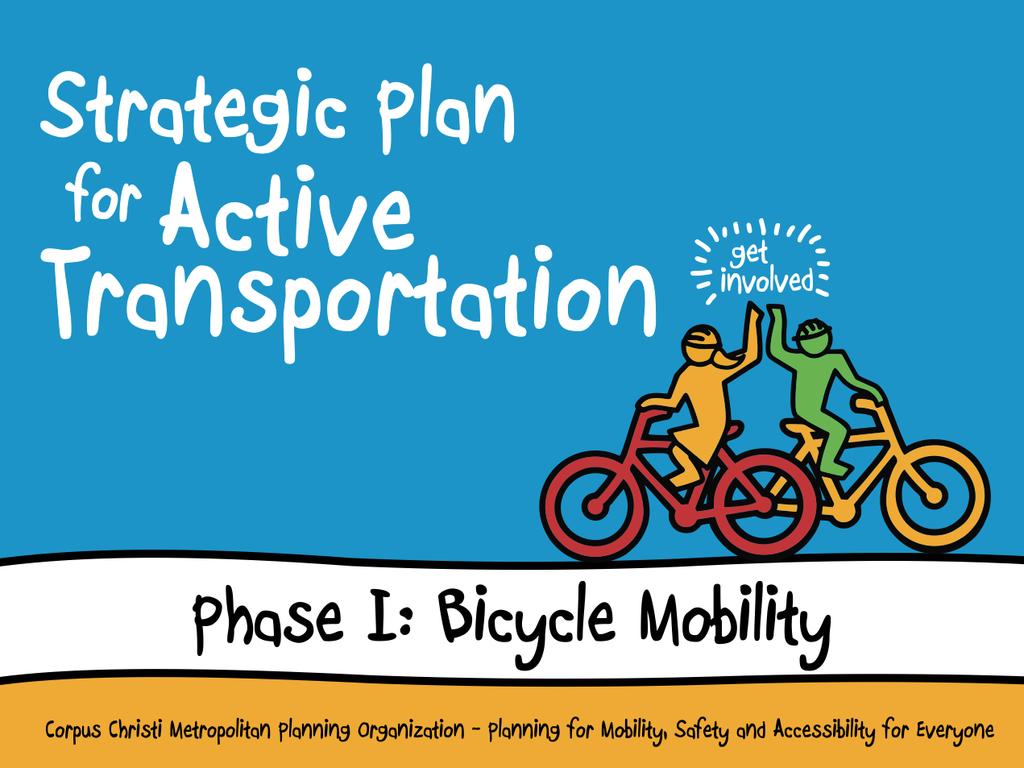
39 Strategic Plan for Active Transportation Phase I Bicycle Mobility Corpus Christi City Council Tuesday, March 10, 2015 Jeff Pollack Transportation Planning Director
40 Anatomy of a Bicycle Mobility Plan 1. Vision, Goals, Objectives, Performance Measures. 2. System Details (where, what, and how). 3. Supporting Infrastructure (racks, wayfinding, bike share). 4. Education, Encouragement, and Enforcement Programs. 5. Policy and Code Reform Programs.
41 Anatomy of a Bicycle Mobility Plan 1. Vision, Goals, Objectives, Performance Measures. 2. System Details (where, what, and how). 3. Supporting Infrastructure (racks, wayfinding, bike share). 4. Education, Encouragement, and Enforcement Programs. 5. Policy and Code Reform Programs.
42 Vision, Goals, Objectives, Metrics Active Transportation Plan Vision (working): The metropolitan area of the Coastal Bend is a place where walking and biking are integral to the community culture and represent viable, safe travel and recreation options for residents and visitors of diverse abilities.
43 Vision, Goals, Objectives, Metrics Phase I Goals (working): 1. Develop of a cohesive, strategic network of bicycle facilities that accommodates a diversity of riders. 2. Enhance bicycle mode share for trips of all types. 3. Promote health and wellness through bicycling. 4. Enhance safety for bicyclists.

44 Schedule (Phase I Bicycle Mobility) = Meeting with Partners/Steering Committee 2015 FEB MAR APR MAY JUN JUL AUG SEPT OCT NOV DEC 2016 JAN FEB MAR Project Scoping Public Involvement / Qualitative Data Collection Quantitative Data Collection Data Analysis / Plan Development Plan Production Dissemination
45 Stakeholders Tier 1: PLAN Users Example: Municipalities, TAC, RTA, DMD. Input Vehicles: Steering Committee, key informant interviews. Tier 2: FACILITY Users Example: Commuters, students, recreational riders. Input Vehicles: Neighborhood meetings, virtual town hall.
46 Support 1. MPO staff time. 2. City of Corpus Christi/partner staff time. 3. Decision maker (plan users) guidance (Steering Committee). 4. Active participation/input by facility users. 5. Potential financial support for discrete consulting tasks (Bicycle facility selection; public involvement).

47 Questions?
Route 1 Corridor Study
 Route 1 Corridor Study Westbrook, Connecticut A Vision for the Connecticut Shoreline Public Informational Meeting July 28, 2015 Lower Connecticut River Valley Council of Governments Fitzgerald & Halliday,
Streets, Connectivity & Built Environment Working Group August 2, 2017
 Streets, Connectivity & Built Environment Working Group August 2, 2017 DOWNTOWN OAKLAND SPECIFIC PLAN WELCOME Streets, Connectivity & Built Environment Working Group Social Equity Meeting August 2, 2017
4/8/2015 Item #10D Page 1
 MEETING DATE: April 8, 2015 PREPARED BY: Christy Villa, Associate Civil Engineer DEPT. DIRECTOR: Glenn Pruim DEPARTMENT: Public Works CITY MANAGER: Larry Watt SUBJECT: NORTH COAST HIGHWAY 101 STREETSCAPE
Implementation Guide Comprehensive Plan City of Allen
 Implementation Guide 2030 Comprehensive Plan City of Allen DRAFT 2015 Implementation Guide Allen 2030 Comprehensive Plan INTRODUCTION The Comprehensive Plan serves as a guide for the growth and development
CHAPTER 7: Transportation, Mobility and Circulation
 AGLE AREA COMMUNITY Plan CHAPTER 7 CHAPTER 7: Transportation, Mobility and Circulation Transportation, Mobility and Circulation The purpose of the Transportation, Mobility and Circulation Chapter is to
Potential Green Infrastructure Strategies May 6, 2015 Workshop
 Potential Green Infrastructure Strategies May 6, 2015 Workshop Background The City of Cortland is developing the Tioughnioga Urban Headwaters Green Infrastructure Action Plan with funding from the National
Welcome to the. Open House
 Welcome to the 5th Street to Kinsman Road Open House November 14 5:30 7:00 p.m. Please sign in Project Overview In December 2016, City Council adopted SW 5th Street as the preferred alignment to connect
38 Queen s University Campus Master Plan Part 1
 38 Queen s University Campus Master Plan Part 1 46 The Campus at the City Scale Chapter 4 The Campus at the City Scale 39 Queen s is an urban University centrally located in Kingston. Decisions made by
1.0 INTRODUCTION 1.1 TH 14 WEST STUDY AREA Project Description Functional Classification Purpose of the Project
 1.0 INTRODUCTION 1.1 TH 14 WEST STUDY AREA 1.1.1 Project Description The Trunk Highway (TH) 14 West Corridor is a two-lane roadway approximately 22 miles in length. Located in Nicollet County, the corridor
Executive Summary. NY 7 / NY 2 Corridor
 Executive Summary NY 7 / NY 2 Corridor Transportation and Land Use Study December 2005 Prepared for: Town of Colonie Capital District Transportation Committee Prepared by: Introduction: Land use decisions
PLAN ELEMENTS WORKSHOP. April 5, 2016
 PLAN ELEMENTS WORKSHOP April 5, 2016 needs more housing. But there is no one-size fits-all solution. Every neighborhood has its own character. In some places, density is not only appropriate it is badly
Preliminary Plan Framework: Vision and Goals
 Preliminary Plan Framework: Vision and Goals Draft: May 2015 Introduction Since the Town of Milliken s comprehensive plan was last updated in 2010, the community was heavily impacted by the 2013 flood,
ITEM #8. Regional Smart Growth Program. Regional Smart Growth Program. Presentation Overview. Coast Highway Vision and Stategic Plan.
 Regional Smart Growth Program Economic Development Commission What is Smart Growth? Adopted as part of the Regional Comprehensive Plan (RCP) RCP provides vision for region based on Smart Growth and sustainability
International Blvd. TOD Plan Public Workshop #1
 International Blvd. TOD Plan Public Workshop #1 Add photos or project images September 21 and 22, 2010 Workshop Purpose Introduce the public to the Project Review and discuss the existing conditions analysis
Street Flooding Mitigation Plan KYOVA Interstate Planning Commission. Presented to AMPO National Conference October 18, 2017
 Street Flooding Mitigation Plan KYOVA Interstate Planning Commission Presented to AMPO National Conference October 18, 2017 Saleem Salameh, Ph.D., P.E., M.ASCE Chet Parsons, AICP CTP Agenda: Background
TRANSPORTATION ELEMENT
 TRANSPORTATION ELEMENT GOAL I: To create and maintain a safe, efficient and aesthetic transportation system that encourages multi-modal transportation and promotes the mobility strategies of the Ocala
TRANSPORTATION ELEMENT GOALS, OBJECTIVES, AND POLICIES
 TRANSPORTATION ELEMENT GOALS, OBJECTIVES, AND POLICIES GOAL 2 The City shall provide a safe, convenient, effective, and energy efficient multimodal transportation system which is coordinated with the Future
Sustainability, Health, Safety, Recreation & Open Space Working Group August 3, 2017
 Sustainability, Health, Safety, Recreation & Open Space Working Group August 3, 2017 DOWNTOWN OAKLAND SPECIFIC PLAN WELCOME Sustainability, Health, Safety, Recreation & Open Space Working Group Social
Southeast Extension to RidgeGate Parkway Scoping Booklet
 Southeast Extension to RidgeGate Parkway Scoping Booklet PUBLIC SCOPING MEETING SCHEDULE Public Scoping Meeting Wednesday, November 2, 2011 6:00pm to 7:30pm City of Lone Tree Recreation Center Willow Room
South Central Connecticut Region Plan of Conservation & Development 2018 Update. Municipal Planners
 South Central Connecticut Region Plan of Conservation & Development 2018 Update Municipal Planners July 28th, 2017 1 Introductions 2 Purpose of Today s Meeting Supplement data analysis with qualitative
New Westminster Downtown Parking Strategy Public Open House #1 September 13, 2012
 New Westminster Downtown Parking Strategy Public Open House #1 September 13, 2012 The City is preparing a strategy for parking in Downtown New Westminster. The study team and a group of key stakeholders
Oroville Area Urban Greening Plan. Joint Meeting of the Oroville Planning, Park, and Arts Commissions October 12, 2015
 Oroville Area Urban Greening Plan Joint Meeting of the Oroville Planning, Park, and Arts Commissions October 12, 2015 Project Team Lead Agency Butte County Department of Development Services Claudia Stuart,
DALY CITY VISIONING PROCESS COMMUNITY WORKSHOP 3 MAY 8, 2008
 DALY CITY VISIONING PROCESS COMMUNITY WORKSHOP 3 MAY 8, 2008 PROCESS General Plan - a statement of the community s values, vision and aspirations for now and into the future... Timeframe LONG TERM - 2030
SBPO BOARD MEETING MARCH 20, 2018
 SBPO BOARD MEETING MARCH 20, 2018 TODAY'S AGENDA > Booker Middle School Outreach > Property Information > Schedule > Guiding Principles > Three Concepts Booker Middle School Outreach Property Information
FHWA INVEST. And the Harbor Bridge Project
 FHWA INVEST And the Harbor Bridge Project FHWA s Sustainable Highways Initiative The Sustainable Highways Initiative supports programs and activities conducted across the Federal Highway Administration
Silverdale Regional Center
 Silverdale Regional Center Vision for Silverdale Regional Center The Silverdale Regional Center Plan (Plan) will guide the evolution of the Silverdale Regional Center from a collection of strip malls and
CHAPTER 3 VISION, GOALS, & PLANNING PRINCIPLES. City of Greensburg Comprehensive Plan. Introduction. Vision Statement. Growth Management Goals.
 CHAPTER 3 VISION, GOALS, & PLANNING PRINCIPLES Introduction The Greensburg Comprehensive Plan is intended as a working community document. A combination of long and short-term goals, this document is intended
Corridor Vision. 1Pursue Minnehaha-Hiawatha Community Works Project. Mission of Hennepin County Community Works Program
 1Pursue Minnehaha-Hiawatha Community Works Project Minnehaha-Hiawatha Community Works is a project within the Hennepin Community Works (HCW) program. The mission of the HCW program is to enhance how the
Implementation. A plan is a list of actions arranged in whatever sequence is thought likely to achieve an objective. John Argenti
 A plan is a list of actions arranged in whatever sequence is thought likely to achieve an objective. John Argenti This Implementation section is structured into a coordinated action program so that elected
TOWN COUNCIL / PLANNING COMMISSION
 Workshop #3 TOWN COUNCIL / PLANNING COMMISSION January 20, 2011 Consultant Team In Attendance Tonight BMS Design Group Nevada City and San Francisco Michael Smiley, AICP, ASLA Partner-in-Charge Nancy L.
In partnership with: Harbor Corridor Plan Bali Hi Mobile Home Park July 24, 2013
 In partnership with: Harbor Corridor Plan Bali Hi Mobile Home Park July 24, 2013 Project Intro 2-miles of Harbor Boulevard Westminster/17 th Street to just north of Edinger Avenue Many people use the corridor
Transportation. Strategies for Action
 Transportation A major priority for the Overlake Neighborhood is to develop a multimodal transportation system. To achieve this system, a balance has to be found among travel, circulation and access needs;
CITY OF UNION CITY MINUTES GENERAL PLAN ADVISORY COMMITTEE
 CITY OF UNION CITY MINUTES GENERAL PLAN ADVISORY COMMITTEE WEDNESDAY, MARCH 4, 2015, 6:30 P.M. IN THE CITY COUNCIL CONFERENCE ROOM OF CITY HALL 34009 ALVARADO-NILES BLVD., UNION CITY, CALIFORNIA Attachment
Railyard Enterprise Project Steering Committee Meeting #4
 Railyard Enterprise Project Steering Committee Meeting #4 Preliminary Review of Alternatives July 9, 2013 Meeting Overview & Purpose Welcome/Introductions/Public Comment Period Meeting Objective: Inform
South Davis County COMMUNITY SPOTLIGHT
 South Davis County COMMUNITY SPOTLIGHT Davis/SLC Community Connector Bus Rapid Transit line connecting SLC & Davis County RTP Phase 1 Project Generate 3,100 average weekday riders Relieve congestion on
MAIN STREET ECONOMIC DEVELOPMENT STRATEGY
 MAIN STREET ECONOMIC DEVELOPMENT STRATEGY A PATHWAY TO A BETTER POUGHKEEPSIE DRAFT Working Paper #2: Planning Strategies Submitted December 1 st, 2015 to the City of Poughkeepsie LAND USE LAW CENTER PACE
FDOT D4 Complete Streets
 FDOT D4 Complete Streets Context Sensitive Solutions Directs that complete street solutions will complement the context of the community. Collaborative approach to decision making, project development,
Plano Tomorrow Vision and Policies
 Plano Tomorrow Vision and Policies PLANO TOMORROW PILLARS The Built Environment The Social Environment The Natural Environment The Economic Environment Land Use and Urban Design Transportation Housing
WELCOME and introduction
 1 WELCOME and introduction Mobility Hub Locations within Burlington STUDY OVERVIEW STUDY OBJECTIVES The City of Burlington is developing four Area Specific Plans, one for each of Burlington s Mobility
Promoting Economic Development Through Upfront SEPA Review: Lessons from South Downtown Tacoma
 Promoting Economic Development Through Upfront SEPA Review: Lessons from South Downtown Tacoma 1 This session will focus on the City of Tacoma s South Downtown Subarea Plan and associated Non-Project SEPA
City of Dallas Complete Streets Program. SAME Infrastructure Forum February 2, 2018
 City of Dallas Complete Streets Program SAME Infrastructure Forum February 2, 2018 Complete Streets Design Manual Adopted by City Council January 27, 2016 JANUARY 27, 2016 2 What are Complete Streets?
TRANSPORTATION AND LAND USE
 CHAPTER 10 TRANSPORTATION AND LAND USE Transportation and land use are intimately linked. The expansion of a highway typically spurs housing, employment growth and land development in the communities that
Pedestrian and Bike Bridge LOGO
 6.2.2 Pedestrian and Bike Bridge The proposed pedestrian and bike crossing re-envisions the existing bridge at Pismo Creek on Cypress Street. The bridge is currently underutilized by vehicular through
D-O LRT Zoning Discussion. Chapel Hill Boards & Commissions October 16, 2017
 D-O LRT Zoning Discussion Chapel Hill Boards & Commissions October 16, 2017 Update on Overall D-O LRT Station Area Initiative Objectives Design and educate on principles of Good Transit-Oriented Development
12/9/2013. HOLLYWOOD/PINES CORRIDOR PROJECT AMPO 2013 Annual Conference October 24, Our Perspective. Broward.
 HOLLYWOOD/PINES CORRIDOR PROJECT AMPO 2013 Annual Conference October 24, 2013 Our Perspective Broward Fort Lauderdale 1 Broward Metropolitan Planning Organization Fort Lauderdale Fort Lauderdale Skyline
Complete Streets in Lancaster County
 Complete Streets in Lancaster County PRESENTED BY: Robert Bini, AICP Director for Transportation Planning November 14, 2017 Lancaster County is a growing county of over 534,000 and the bottom line is...
A BLUEPRINT FOR BROCKTON A CITY-WIDE COMPREHENSIVE PLAN
 A BLUEPRINT FOR BROCKTON A CITY-WIDE COMPREHENSIVE PLAN Public Meeting October 2016 1 Plan Summary and Discussion Public Meeting May 4 2017 City of Brockton Bill Carpenter, Mayor Department of Planning
COMPLETE GREEN STREET CHECKLIST
 COMPLETE GREEN STREET CHECKLIST This document was developed to dissect the structure of an urban street and explore opportunities to make our streets more complete while also integrating green street strategies.
PLANNING ADVISORY BOARD AGENDA OCTOBER
 ! City of Langley PLANNING ADVISORY BOARD AGENDA OCTOBER 1, 2014 3-5pm LANGLEY CITY HALL - 112 2 nd Street, Langley WA 1) Call to Order and Roll Call 2) Approval of the Minutes September 10, 2014 3) Public
Atlanta BeltLine Corridor Environmental Study. Scoping Meeting August 2008
 Atlanta BeltLine Corridor Environmental Study Scoping Meeting August 2008 What Will We Be Discussing Today? Study Overview - How Did We Get Here? - What Is the Study About? - Who Is Involved? - Where Is
2035 General Plan Update and Belmont Village Specific Plan. Joint Study Session with the City Council and Planning Commission April 12, 2016
 2035 General Plan Update and Belmont Village Specific Plan Joint Study with the City Council and Planning Commission April 12, 2016 Agenda 1. Welcome and Introductions 2. General Plan Update Status of
Summary of Public Input & Discussion of Alternatives
 Meeting #4 Summary of Public Input & Discussion of Alternatives May 6 th, 2009 City of Bellingham, Washington April 1 April 15 April 22 May 6 Introduction, Character and Boundary Study Areas Public Realm:
Welcome to the Oakridge Centre Open House
 Welcome to the Oakridge Centre Open House Why is the City hosting this event? This open house is to inform you of a rezoning application submitted to the City of Vancouver to amend the existing CD-1 (Comprehensive
Design Fort Ord. welcome why we are here what happened this week design guidelines: ideas so far 2/12/2015. Regional Urban Design Guidelines (RUDG)
") Design Fort Ord Regional Urban Design Guidelines (RUDG) Welcome Back! Strategic Economics Alta Planning + Design National Charrette Institute Helix Environmental Planning Jeff Speck & Peter Katz Civitas
Design Fort Ord Regional Urban Design Guidelines (RUDG) Welcome Back! Strategic Economics Alta Planning + Design National Charrette Institute Helix Environmental Planning Jeff Speck & Peter Katz Civitas
Atlanta BeltLine. Subareas 9 & 10. Master Plan Updates. March 26, Washington Park Jamboree 1
 Atlanta BeltLine Subareas 9 & 10 Master Plan Updates March 26, 2018 Washington Park Jamboree 1 22 miles, connecting 45 neighborhoods 22 MILES of transit 46 MILES of streetscapes and complete streets 33
PSRC REVIEW REPORT & CERTIFICATION RECOMMENDATION
 PSRC REVIEW REPORT & CERTIFICATION RECOMMENDATION KITSAP COUNTY COUNTYWIDE PLANNING POLICIES July 2, 2012 BACKGROUND A major emphasis of the Washington State Growth Management Act (GMA) is the need to
STEERING COMMITTEE MEETING # 5 SEPTEMBER 18, 2018
 STEERING COMMITTEE MEETING # 5 SEPTEMBER 18, 2018 STEERING COMMITTEE MEETING #5 AGENDA 1. Introduction 2. Market Conditions 3. Preliminary Development Concepts 4. Open Discussion 5. Next Steps PLANNING
Toronto Complete Streets Guidelines Stakeholder Advisory Group #
 Toronto Complete Streets Guidelines Stakeholder Advisory Group #1 2015-03-24 What are Complete Streets? 2 Streets designed with all users in mind: pedestrians/those with disabilities cyclists street car
Planning Commission Report
 Planning Commission Report To: From: Subject: Planning Commission Meeting: January 6, 2016 Agenda Item: 8-B Planning Commission David Martin, Planning & Community Development Director Introduction to the
Welcome. Comprehensive Plan & Transportation Plan Open House November 7, 2012
 Welcome Comprehensive Plan & Transportation Plan Open House November 7, 2012 Agenda Proposed future land use plan Comprehensive Plan strategies Traffic forecasts Future traffic operations Possible future
Maplewood Avenue Downtown Complete Street Project
 Maplewood Avenue Downtown Complete Street Project Second Public Meeting January 24, 2018 Welcome and Introduction of Project Team City Planning and Public Works Staff City of Portsmouth Juliet Walker Planning
DRAFT City of Titusville 2040 Comprehensive Plan Future Land Use, Housing, and Transportation Elements April 16, 2018
 DRAFT City of Titusville 2040 Comprehensive Plan Future Land Use, Housing, and Transportation Elements April 16, 2018 Prepared by Canin Associates for the City of Titusville About the Comprehensive Plan:
SAFETY AND CONNECTIVITY IN A PLANNED COMMUNITY
 DALE CITY TLC SAFETY AND CONNECTIVITY IN A PLANNED COMMUNITY PROJECT KICKOFF MEETING MARCH 7, 2016 AGENDA 1. Introductions 2. Project Overview 3. Discussion 4. Site Visit PROJECT KICKOFF MEETING MARCH
Whitemarsh Comprehensive Plan Update: Housing & Land Use. Public Workshop #3: September 20, 2018
 Whitemarsh Comprehensive Plan Update: Housing & Land Use Public Workshop #3: September 20, 2018 Agenda Welcome Process Recap What We ve Heard The Plan Framework Review of Recommended Actions Land Use Housing
Complete Streets Master Plan for Downtown New Britain CRCOG Transportation Committee Meeting Monday, December 9, 2013
 CRCOG Transportation Committee Meeting Monday, December 9, 2013 Introduction Why the Project was Initiated About Downtown New Britain Master Plan Goals Master Plan Overview Master Plan Study Areas and
Atlanta BeltLine Subarea 3 Master Plan Update
 Atlanta BeltLine Subarea 3 Master Plan Update April 14, 2018 Workshop Meeting 1 22 miles, connecting 45 neighborhoods 22 MILES of transit 46 MILES of streetscapes and complete streets 33 MILES of urban
Public may provide comments on the GDP within the next two weeks (December 24)
") 25/70 General Development Plan (GDP) Public Meeting Wednesday, December 10, 2014 6:00 8:00 P.M. District 1 Police Station Community Room 1311 W 46th Ave, Denver, CO 80211 Council Woman Montero: This particular
25/70 General Development Plan (GDP) Public Meeting Wednesday, December 10, 2014 6:00 8:00 P.M. District 1 Police Station Community Room 1311 W 46th Ave, Denver, CO 80211 Council Woman Montero: This particular
North Fair Oaks Community Plan Summary and Information
 North Fair Oaks Community Plan Summary and Information WHAT IS THE NORTH FAIR OAKS COMMUNITY PLAN? The North Fair Oaks Community Plan is part of the San Mateo County General Plan, and establishes policies
Welcome. Green Line LRT. Beltline Alignment Options. Stay engaged! Follow the Green Line story at calgary.ca/greenline
 Welcome Green Line LRT Beltline Alignment Options Stay engaged! Follow the Green Line story at calgary.ca/greenline Green Line LRT Why are we here? Our Challenge Determine the best alignment in the Beltline.
WAC #7 3/14/14. Coachella General Plan Update
 WAC #7 3/14/14 Coachella General Plan Update Agenda 2 Introductions Public Draft General Plan Overview and Discussion of Next Steps Implementation and Evaluation Health Element Process Evaluation (discussion)
Town of Oakville Streetscape Strategy
 Town of Oakville Streetscape Strategy Endorsed by PDC on February 10, 2014 (PD-011-14) Town of Oakville Streetscape Strategy [endorsed by PDC February 10, 2014] 0 Town of Oakville Streetscape Strategy
Mississippi Skyway Preliminary Engineering Report
 EXECUTIVE SUMMARY Mississippi Skyway Preliminary Engineering Report CITY OF RAMSEY, MINNESOTA DECEMBER 2014 City of RAMSEY EXECUTIVE SUMMARY Project Need and Intent The Mississippi Skyway pedestrian bridge
Making Transit Oriented Development Work For Boonton, NJ
 Making Transit Oriented Development Work For Boonton, NJ Bloustein School of Planning and Public Policy Studio Dan Burton Loannie Dao Webster Slater Brandon Williams Ian Watson Maria Laham Nicola Mammes
Regional Open Space Conservation Plan. Regional Staff Committee January 18, 2018
 Regional Open Space Conservation Plan Regional Staff Committee January 18, 2018 Schedule We are here Task 1 - Stakeholder Input & Work Plan Dev. v z 2016 2017 2018 Oct Nov Dec Jan Feb Mar Apr May Jun Jul
GPA FALL 2017 CONFERENCE
 Change in Doraville Doraville at the beginning of a new era Design Doraville (Comp. Plan) adopted in 2016 Doraville Town Center Masterplan LCI (2005) Downtown Doraville Masterplan LCI (2010) 2014 Adoption
Corridors. Re-vitalize our Corridors and Gateways
 Corridors Re-vitalize our Corridors and Gateways Artist s rendering from the 287 Strategic Plan, 2015 Corridors are the major throughways of Loveland but they also provide important commercial, community
SH 199 Corridor Master Plan. Community Meeting No. 2 May 31, 2017
 Community Meeting No. 2 May 31, 2017 Transportation Projects On or Near SH 199 SH 199 from 0.3 miles south of FM 1886 to south end of Lake Worth bridge Construct freeway mainlanes and frontage roads 10-Year
Tysons Circulator Study: Process and Preliminary Results Summary. March 2012
 Tysons Circulator Study: Process and Preliminary Results Summary March 2012 Background: 1. The Comprehensive Plan for the Tysons Corner Urban Center calls for a System of Circulators in Tysons Corner to:
Learning Objectives. Introduction. Design at an Ecodistrict Scale can Change Washington, DC s Landscape
 Learning Objectives Design at an Ecodistrict Scale can Change Washington, DC s Landscape Presenters Elizabeth Miller, ASLA, National Capital Planning Commission Diane Sullivan, National Capital Planning
12 th Street Connector Alignment Study VISIONING PUBLIC WORKSHOP - JUNE 25, :00PM TO 8:00PM
 12 th Street Connector Alignment Study VISIONING PUBLIC WORKSHOP - JUNE 25, 2018 6:00PM TO 8:00PM Goals for Today s Workshop Agenda: Project Introduction, Purpose, and Goals Existing Conditions Traffic
Gary & Regional Investment Project. October 27, Creating Tomorrow Today Comprehensive Regional Plan - NIRPC
 Creating Tomorrow Today 2040 Comprehensive Regional Plan Gary & Regional Investment Project October 27, 2010 Creating Tomorrow Today - 2040 Comprehensive Regional Plan - NIRPC What is NIRPC? - Northwestern
JANUARY 19, 2011 CENTRAL AVENUE-METRO BLUE LINE TRANSIT-ORIENTED DEVELOPMENT IMPLEMENTATION PROJECT COMMUNITY FORUM
 CENTRAL AVENUE-METRO BLUE LINE TRANSIT-ORIENTED DEVELOPMENT IMPLEMENTATION PROJECT COMMUNITY FORUM JANUARY 19, 2011 THE MARYLAND-NATIONAL CAPITAL PARK AND PLANNING COMMISSION PRINCE GEORGE S COUNTY PLANNING
Status Report: MD 355 Project
 Status Report: MD 355 Project OCTOBER 2006 M-NCPPC MONTGOMERY COUNTY PLANNING DEPARTMENT Summary of Community Comments, and break to the Results of the MD 355 Participation Session Brookside Gardens -
Shift Rapid Transit Public Participation Meeting May 3, 2017
 Shift Rapid Transit Public Participation Meeting May 3, 2017 Shift Rapid Transit Initiative Largest infrastructure project in the city s history. Rapid Transit initiative will transform London s public
TORONTO COMPLETE STREETS GUIDELINES
 TORONTO COMPLETE STREETS GUIDELINES Presentation by Fiona Chapman, Manager, Pedestrian Projects Public Realm Section, Transportation Services, City of Toronto June 2017 PURPOSE OF THE PROJECT To develop
Town Center (part of the Comprehensive Plan)
") Town Center (part of the Comprehensive Plan) Mercer Island Town Center Looking North (2014) In 1994, a year-long process culminated in a set of design guidelines and code requirements for the Town Center
Town Center (part of the Comprehensive Plan) Mercer Island Town Center Looking North (2014) In 1994, a year-long process culminated in a set of design guidelines and code requirements for the Town Center
Manchester. Vision for Manchester
 Manchester Vision for Manchester The Manchester Community Plan is a statement of the community values and aspirations for the future. This is an effort to recognize what originally attracted visitors in
Portage Parkway Environmental Assessment Public Information Centre No. 1
 City of Vaughan Portage Parkway Environmental Assessment Public Information Centre No. 1 November 25, 2015 Welcome to the Public Information Centre This first Public Information Centre (PIC) introduces
Mississippi Drive Corridor Revitalization. A DestinationTransportation Project...
 Mississippi Drive Corridor Revitalization A DestinationTransportation Project... Mississippi Drive Corridor Revitalization Welcome! Tonight s Agenda: Further define the Scope of the Project Discuss the
Elm Street Business District: Streetscape and Signage Plan
 Elm Street Business District: Streetscape and Signage Plan VILLAGE OF WINNETKA DOWNTOWN MASTER PLAN TASK FORCE MTG #1 Teska Associates 30 October 2017 AGENDA 1. Introductions and Walking Tour 2. Past Streetscape
Horizon 2035 Land Use and Transportation Element
 CITY OF SUNNYVALE Horizon 2035 Land Use and Transportation Element City Council Study Session March 7, 2017 Overview General Plan Context Mixed Use Villages Transportation Mode & Parking General Plan Policy
Introduction. Chapter 1. Purpose of the Comprehensive Plan Plan Organization Planning Process & Community Input 1-1
 Chapter 1 Introduction Lakewood 2025: Moving Forward Together Purpose of the Comprehensive Plan Plan Organization Planning Process & Community Input 1-1 Purpose of the Comprehensive Plan The Comprehensive
NASSAU COUNTY TOWN HALL NEW YORK & CONNECTICUT SUSTAINABLE COMMUNITIES. A Unique Bi-State Partnership to Improve Jobs, Housing and Transportation
 NASSAU COUNTY TOWN HALL NEW YORK & CONNECTICUT SUSTAINABLE COMMUNITIES A Unique Bi-State Partnership to Improve Jobs, Housing and Transportation Police Headquarters Auditorium Mineola, NY December 9 th,
California Environmental Quality Act (CEQA) Environmental Review Process
 Environmental Review Process") California Environmental Quality Act (CEQA) Environmental Review Process Los Angeles Union Station Forecourt and Esplanade Improvements constitute a Project Los Angeles County Metropolitan Transportation
California Environmental Quality Act (CEQA) Environmental Review Process Los Angeles Union Station Forecourt and Esplanade Improvements constitute a Project Los Angeles County Metropolitan Transportation
Clovis Urban Greening Plan. Community Workshop #2 Northwest
 Clovis Urban Greening Plan Community Workshop #2 Northwest Thursday, October 9, 2014 WHAT IS AN URBAN GREENING PLAN? A guide to help the City to improve quality of life for residents Identification of
Lynn Waterfront Master Plan
 Lynn Waterfront Master Plan Public Meeting #2 December 10th, 2018 1 Project Schedule Update September 26, 2018 December 10, 2018 Development of the Master Harbor Plan Amendment and Revised Waterfront Master
MASTER PLAN KICK-OFF Open House #1A, April 28, 2015
 "The beginning is the most important part of the work." Plato, The Republic MASTER PLAN KICK-OFF Open House #1A, April 28, 2015 YOUR CAMPUS PLANNING TEAM Campus Planners Landscape Architects Urban Designers
Denver Moves: Transit Task Force
 Insert transit picture Denver Moves: Transit Task Force Meeting #8 October 5, 2017 1. Welcome & Introductions Opening remarks and housekeeping Task Force and audience introductions Upcoming events and
Plan Framework Report. Attachment A
 Plan Framework Report Attachment A Uptown-Douglas Corridor Plan - Plan Framework Report Contents Introduction... 1 Planning Process... 3 Project Objectives... 4 Vision... 5 Community Values... 6 Structural
Office of Greenways & Trails Providing Statewide Leadership and Coordination. Southeast Greenways and Trails Summit October 1-3, 2017
 Office of Greenways & Trails Providing Statewide Leadership and Coordination Southeast Greenways and Trails Summit October 1-3, 2017 1 Office of Greenways and Trails The Office of Greenways and Trails