MEMORIAL DRIVE DESIGN DEVELOPMENT PLAN
|
|
|
- Colin Martin
- 5 years ago
- Views:
Transcription

1


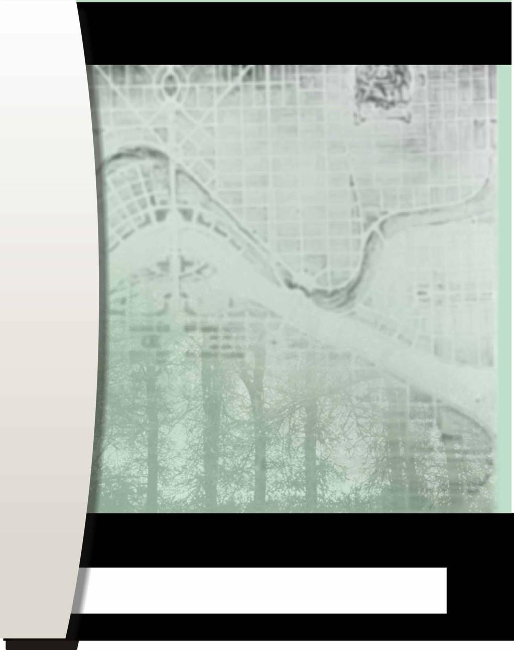
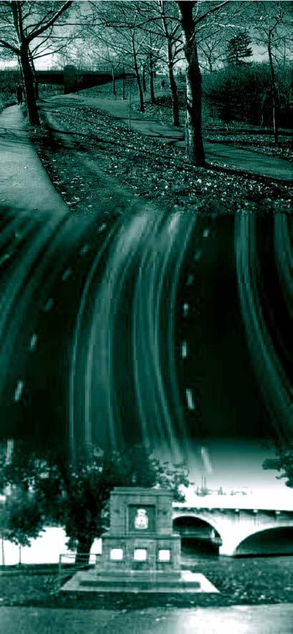
2 DESIGN DEVELOPMENT PLAN prepared for The City of Calgary Parks June 2005 cover images: Glenbow Alberta Archives Thomas Mawson Plan for Calgary c panoramic view of Calgary from Crescent Heights c.1940 Stantec Consulting Ltd. Memorial Drive pathway and trees Memorial Drive carriageway Royal Canadian Legion monument at Louise Crossing
3 EXECUTIVE SUMMARY In September 2004, the City of Calgary Parks Department issued a Request for Proposals for Phase II of the Memorial Drive project The Landscape of Memory. The proposal called for the preparation of a Design Development Plan for Memorial Drive furthering the overall project objective, to protect and enhance the legacy and future character of Memorial Drive defining its role in the City s urban landscape. The Council-approved Vision Statement, established in Phase I of the project, provided the context for preparing the Design Development Plan. The Memorial Drive corridor is both a Major Street in Calgary s road network, and a unique urban landscape that is shaped by an understanding of its social and physical role, and by a deep respect for its commemorative history. Integral to this vision is a landscape that is supportive, safe, accessible and active, and is enriched by a unifying identity, trees and meaningful places to observe individual and collective memory. Vision Statement for Memorial Drive Phase I The study area for Phase II of the project remains approximately 9.5 kilometres long and is located between the intersection of Parkdale Boulevard and Shaganappi Trail and the intersection of Memorial Drive and St. George s Island Zoo access. The work program, as with the Phase I work program, included public participation and observed the principles of the City of Calgary s framework for citizen engagement entitled Engage! The process incorporated the exploration and findings of the consultant design team, stakeholders and the public. A Stakeholder s Workshop was held on November 26th, A Public Open House was conducted on January 22nd, The ideas developed during the plan development process and the information recorded during the workshop and open house events formed the basis for analysis presented in the Design Development Plan Summary and proposal of The Pilot Project. The Design Development Plan and plan process were positively supported at the public Open House and it is recommended that the Phase II report is used for subsequent project work and to guide additional planning and detailed design. Information collected and compiled during Phase II of the project is available on the City of Calgary s website. The circulation and future publishing of this report is subject to Council approval. E.1
4 Table of Contents EXECUTIVE SUMMARY E PROJECT INTRODUCTION Memorial Trees Vision for the Future Phase II - Design Development Plan PLAN PROCESS The CALL Principles Responding to the Call to Commemorate Continuity Accessibility Legibility Legacy Framework Plan and Design Tools Layers Oasis Weaving Rhythm Event Light Design Development Plan DESIGN DEVELOMENT PLAN SUMMARY Participant Comments Drawing Ratings Participation Overview Pattern - The Trees of Memorial Drive Pattern - Pedestrian-Friendly Environment...24 i
5 3.3.3 Pattern - Establish a Distinct Identity for Memorial Drive Corridor Pattern - Establish a High Quality of Landscape Development for the Memorial Drive Corridor Pattern - Degree of Visual Interest and Complexity Pattern - Palette of Materials that is Consistent and Appropriate for the Memorial Drive Corridor Pattern - Establish Consistency in Roadway Treatment Pattern - The Open Spaces of the Memorial Drive Corridor are Fully Accessible to all Calgarians Pattern - Connected Series of Spaces and Experiences Pattern - Children in the Landscape Pattern - Seating/Rest Node Development MOVING THE PLAN FORWARD Implementation Strategy Landscape Foundation Components Landscape Enhancement Components Preliminary Opinion of Probable Cost SUMMARY Operating Costs PROPOSED PILOT PROJECT Commemorative Node Pilot Project...46 APPENDICES APPENDIX A Stakeholder Workshop APPENDIX B Public Open House APPENDIX C Workshop / Open House Display Materials APPENDIX D Participant Comment Matrix APPENDIX E Drawing Rating Matrices APPENDIX F List of Participants APPENDIX G Project Acknowledgements ii
6 List of Figures Project Introduction 1.1 Development of Plan Process Project Process 2.1 Continuity CALL Principle Illustrated 2.2 Accessibility CALL Principle Illustrated 2.3 Legibility CALL Principle Illustrated 2.4 Legacy CALL Principle Illustrated 2.5 Framework Plan 2.6 Design Organizing Tools 2.7 Continuity CALL Principle Applied 2.8 Accessibility CALL Principle Applied 2.9 Legibility CALL Principle Applied 2.10 Legacy CALL Principle Applied 2.11 Final Draft Design Development Plan Design Development Patterns 3.1 Patterns of Trees in the Landscape 3.2 Patterns of Pedestrian- Friendly Environment 3.3 Patterns of Identity 3.4 Patterns of Landscape Development 3.5 Patterns of Visual Interest 3.6 Patterns of Material Palette 3.7 Patterns of Consistent Roadway Treatment 3.8 Patterns of Accessibility 3.9 Patterns of Connected Spaces and Experiences 3.10 Patterns of Children in the Landscape 3.11 Patterns of Seating and Node Development Implementation Strategy Key Plans 4.1 Foundation Landscape Component- River Landscape 4.2 Foundation Landscape Component- Regional Pathway Conflict Improvements 4.3 Foundation Landscape Component- Roadway Landscape 4.4 Foundation Landscape Component- Regional Pathway Landscape 4.5 Enhanced Landscape Component- Roadway Lighting 4.6 Enhanced Landscape Component- Pathway Lighting 4.7 Enhanced Landscape Component- Major Nodes 4.8 Enhanced Landscape Component- Minor Nodes 4.9 Enhanced Landscape Component- Presentation Pavilion 4.10 Enhanced Landscape Component- Tree Planting 4.11 Enhanced Landscape Component- Commemorative Installations 4.12 Enhanced Landscape Component- Site Furnishings 4.13 Enhanced Landscape Component- Signage and Orientation 4.14 Enhanced Landscape Component- Primary Gateways/Portals 4.15 Enhanced Landscape Component- Secondary Gateways 4.16 Enhanced Landscape Component- Pageantry Proposed Pilot Project 5.1 Pilot Project- Axonometric View of Node 5.2 Pilot Project- Plan of Node sc v:\1165\active\ \city_of_calgary\landscape_arch\memorial_drive\phase 2\reports\revised final draft\report_body_master.doc iii
7 1.0 PROJECT INTRODUCTION Memorial Drive is one of Calgary s most cherished corridors in terms of history, location, proximity to the Bow River, and its relationship with both the communities adjacent to the Drive and the larger community of Calgary. 1.1 Memorial Trees The City of Calgary Parks - Request for Proposal Phase I A living tree mirrors the growth and endurance of nature s challenges and in many ways, is reflective of the human life-cycle. After the First World War, a proposal was put forth to plant a tree along Memorial Drive for each fallen soldier of the Great War. The hope was that a living memorial would bring solace to families who did not have graves to visit. A number of groups and individuals came together to implement the proposal and the first tree was planted on Sunnyside Boulevard (now Memorial Drive) by Mayor Adams on May 11, The majority of trees planted were Populus wobbstii more commonly referred to as poplars. This planting program continued through to 1928, with a total of 3,278 trees planted. Metal discs were attached to stands in front of each tree. The discs were inscribed with the year, the donor s name and a tag number. An official record book was started by the 1922 Tree Planting Committee. For many years, the record book was kept by a local service Club. The record book was then sent to the storage archives. The book has not been seen since the 1960 s. Today, as many of the original trees are nearing the end of their life-cycle, City of Calgary Parks has spearheaded the regeneration and revitalization of the Memorial Drive landscape. In 2001, City of Calgary Parks began cloning the original poplars to continue the trees heritage. There are now 1,500 offspring growing in Grand Forks, BC. The purpose behind the Calgary Park s plan is to protect the existing legacy and continue the historic and cultural integrity of Memorial Drive. The plan initially concentrated on improving the aesthetic value of the landscape by introducing and planting a variety of new tree species. A major goal of this project, as part of the larger plan, is to determine means by which this legacy may extend beyond the life of individual trees. 1.2 Vision for the Future The Phase I work program identified defining characteristics of the project site and explored new and traditional ideas to commemorate the legacy of Memorial Drive. A Vision Statement was established through the participation of Calgarians and is considered highly valuable as the litmus test for further stages of the project. This Vision Statement is understood as a measure of the values that Calgarians hold most highly with respect to the future development of the Memorial Drive Corridor. City Council approved the Vision Statement in July The Phase I work program illuminated that the Memorial Drive Corridor is a complex system of physical, cultural, historical, social, and recreational attachments. Calgarians relate to the Memorial Drive Corridor on a number of levels: on a practical level as a transportation and recreational corridor; 1
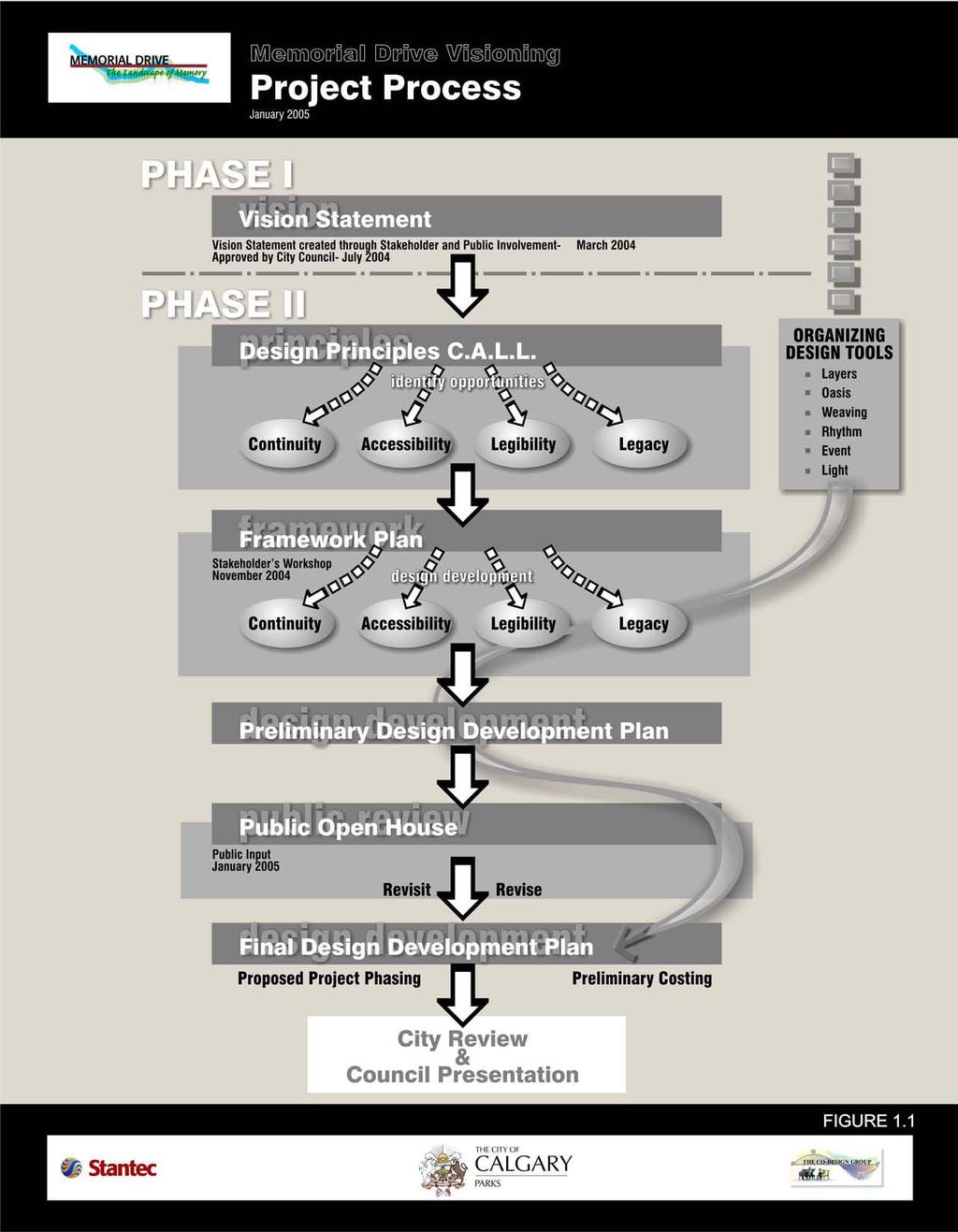
8 on an aesthetic level as a ribbon of green open space through the inner City; and symbolically as a repository of collective civic memory. Particularly important to Calgarians were the symbolic commemorative associations carried by Memorial Drive. The Phase I report identified that these associations are vital to Calgarians comprehension and appreciation of the Corridor. 1.3 Phase II - Design Development Plan Phase II builds upon the work of Phase I with the goal to prepare a Design Development Plan that can guide future planning and design of this unique urban landscape. It was important that the Phase II work program continue to be characterized by a public consultation process that respects the voices of citizens already heard, and find additional ways to enfranchise voices that have yet to be heard. The design of the public consultation process aimed for the creative and collaborative involvement of existing and future users of the corridor, including: City staff, external interest and Community stakeholders and the larger community of Calgarians. The Design Development plan process was regarded as a working and learning opportunity in which stakeholders were actively engaged in the design process. Stakeholders were provided with a palette of design tools to use in the workshop session. Their input helped determine the direction of the Draft Design Development Plan. A framework plan was developed by incorporating key design principles established from the Vision Statement. The purpose of the framework plan was to engage stakeholders in a design process and obtain consensus regarding the preparation of a Development Plan. The results of the workshop culminated in a preliminary Design Development Plan, which was presented at the Public Open House. The following Figure 1.1 outlines the Design Development Plan Process. 2
9
Contact: Alex Taranu ( ) or Karl Walsh ( )
 or Karl Walsh ( )") Date: 09 September 2005 File: Subject: P03.DUDS Downtown Urban Design Vision Study Report Contact: Alex Taranu (905 874 3454) or Karl Walsh (905 874 2331) OVERVIEW Staff has produced an Urban Design Vision
Date: 09 September 2005 File: Subject: P03.DUDS Downtown Urban Design Vision Study Report Contact: Alex Taranu (905 874 3454) or Karl Walsh (905 874 2331) OVERVIEW Staff has produced an Urban Design Vision
City of Farmington. Downtown Plan. Amendment to the 1998 Master Plan Adopted October 11, 2004
 City of Farmington Amendment to the 1998 Master Plan Adopted October 11, 2004 Introduction Planning Background 1 Scope and Components of the Plan Amendment 2 Concept Introduction 3 Plan Concepts 3 Conceptual
DOMINION BOULEVARD CORRIDOR STUDY AND ECONOMIC DEVELOPMENT STRATEGIC PLAN A MODEL FOR CHESAPEAKE S FUTURE
 DOMINION BOULEVARD CORRIDOR STUDY AND ECONOMIC DEVELOPMENT STRATEGIC PLAN A MODEL FOR CHESAPEAKE S FUTURE Overview I. Draft Plan Process II. Draft Plan Overview a. Market Analysis b. Master Land Use Plan
SUBJECT: Waterfront Hotel Planning Study Update TO: Planning and Development Committee FROM: Department of City Building. Recommendation: Purpose:
 Page 1 of Report PB-23-18 SUBJECT: Waterfront Hotel Planning Study Update TO: Planning and Development Committee FROM: Department of City Building Report Number: PB-23-18 Wards Affected: 2 File Numbers:
Public input has been an important part of the plan development process.
 Lakewood s Comprehensive Plan recognizes that transportation helps shape the community, and that the way the community provides for the safe and efficient movement of people affects the character of the
Report to: Development Services Committee Report Date: April 24, 2017
 SUBJECT: Cornell Rouge National Urban Park Gateway - Report on Design Charrette and Next Steps PREPARED BY: Lilli Duoba, MES, MCIP, RPP, Manager, Natural Heritage (ext. 7925) REVIEWED BY: Marg Wouters,
1.0 Purpose of a Secondary Plan for the Masonville Transit Village
 Report to Planning and Environment Committee To: Chair and Members Planning & Environment Committee From: John M. Fleming Managing Director, Planning and City Planner Subject: Masonville Transit Village
ADMINISTRATION RECOMMENDATION(S) 2018 January 25. That Calgary Planning Commission recommend APPROVAL of the proposed Land Use Amendment.
 2018 January 25. That Calgary Planning Commission recommend APPROVAL of the proposed Land Use Amendment.") Page 1 of 9 EXECUTIVE SUMMARY This land use amendment proposes to redesignate a parcel from DC Direct Control District to Multi-Residential Contextual Grade-Oriented (M-CG) District to allow for multi-residential
Page 1 of 9 EXECUTIVE SUMMARY This land use amendment proposes to redesignate a parcel from DC Direct Control District to Multi-Residential Contextual Grade-Oriented (M-CG) District to allow for multi-residential
WELCOME TO THE CHOUTEAU GREENWAY DESIGN, DEVELOPMENT AND CONSTRUCTION WORKING GROUP!
 WELCOME TO THE CHOUTEAU GREENWAY DESIGN, DEVELOPMENT AND CONSTRUCTION WORKING GROUP! Chouteau Greenway Steering Committee and Working Groups Overview Overview January 9, 2019 Chouteau Greenway will transform
Phase 1 : Understanding the Campus Context. Phase 2 : APPROACHES - Alternates & Preferred Plan
 Introduction MASTER PLAN PURPOSE WHY A CAMPUS MASTER PLAN? The purpose of the Master Plan at the University of Illinois at Chicago is to translate UIC s strategic goals and objectives into a compelling
Green Line North Centre City Alignment
 Project overview The Green Line will be an important piece of Calgary's transit network, adding 40 kilometres of track to the existing 59 kilometre LRT system. End-to-end, the line will connect North Pointe
Scope of Services. River Oaks Boulevard (SH 183) Corridor Master Plan
 Corridor Master Plan") Scope of Services River Oaks Boulevard (SH 183) Corridor Master Plan PROJECT AREA The project area consists of the River Oaks Boulevard (SH 183) corridor bounded by SH 199 at the northern end and the Trinity
Scope of Services River Oaks Boulevard (SH 183) Corridor Master Plan PROJECT AREA The project area consists of the River Oaks Boulevard (SH 183) corridor bounded by SH 199 at the northern end and the Trinity
Attachment 1 TOWN OF NEW TECUMSETH. Manual for the Preparation of an Urban Design Report
 Attachment 1 TOWN OF NEW TECUMSETH Manual for the Preparation of an Urban Design Report July 2010 TABLE OF CONTENTS Background, Policy Framework and the Preparation of Urban Design Reports 1. Introduction
Chapter 2: Vision, Goals and Strategies
 Chapter 2: Vision, Goals and Lake Elmo Today & Tomorrow Comprehensive Plan 2040 2 VISION, GOALS & STRATEGIES - DRAFT 4-6-2018 INTRODUCTION Comprehensive Plan Purpose Perhapse the most important objective
Chapter 3 Community Involvement
 Chapter 3 Community Involvement Public involvement has been a vital component of the planning process in the preparation of this master planning document. The purpose of this citizen-led effort was to
V. Vision and Guiding Principles
 V. Vision and Guiding Principles The Master Plan for the Powers Ferry Corridor seeks a foundation in the desires of the community. At times, various elements of the community offered opposing viewpoints,
MOUNT PLEASANT SECONDARY PLAN & VILLAGE BLOCK PLAN. Wednesday, March 5, 2008 Informal Public Open House
 MOUNT PLEASANT SECONDARY PLAN & VILLAGE BLOCK PLAN Wednesday, March 5, 2008 Informal Public Open House 1. Welcome & Introductions 2. Highlights of Provincial Growth Plan 3. Overview and Status Update -
Town Center (part of the Comprehensive Plan)
") Town Center (part of the Comprehensive Plan) Mercer Island Town Center Looking North (2014) In 1994, a year-long process culminated in a set of design guidelines and code requirements for the Town Center
Town Center (part of the Comprehensive Plan) Mercer Island Town Center Looking North (2014) In 1994, a year-long process culminated in a set of design guidelines and code requirements for the Town Center
Sheridan Boulevard S TAT I O N A R E A P L A N S H E R I D A N B O U L E VA R D S TAT I O N A R E A P L A N
 Sheridan Boulevard S TAT I O N A R E A P L A N 1 City of Lakewood Adopted November, 2006 S H E R I D A N B O U L E VA R D S TAT I O N A R E A P L A N The Vision The City of Lakewood s overall vision is
University of Saskatchewan CAMPUS MASTER PLAN. Senate Meeting Preliminary Presentation. April 21, 2018 DIALOG ECS DA WATT
 University of Saskatchewan CAMPUS MASTER PLAN Senate Meeting Preliminary Presentation April 21, 2018 DIALOG ECS DA WATT project process presentation agenda Stakeholder Engagement Project Control phase1
STREETSCAPE MANUAL ONLINE TRAINING SESSION 1: Background
 TRAINING SESSION 1: The Urban Design Streetscape Manual is a reference tool developed to help implement City policy and guide the design, construction and maintenance of streetscape improvements in Toronto.
Denton. A. Downtown Task Force
 2 Public Involvement Early and ongoing public involvement was solicited so that the public had ample opportunity to help direct the DTIP s concepts and implementation strategies. The residents of Denton
hermitage town center
 hermitage town center A Community Vision prepared by Strada for The City of Hermitage and The Mercer County Regional Planning Commission January 2007 table of contents introduction 3 design principles
East Midtown Greenway East 53 rd 61 st Street. Community Board 8 Project Introduction November 16, 2017
 East Midtown Greenway East 53 rd 61 st Street Community Board 8 Project Introduction November 16, 2017 Agenda Overview - Development of the East Midtown Waterfront Esplanade Current East Midtown Greenway
Comprehensive Plan. Faribault, Minnesota. Hoisington Koegler Group Inc. Claybaugh Preservation Architecture Inc. Howard R. Green Company Bonz/REA
 Comprehensive Plan Faribault, Minnesota Adopted by the Faribault City Council July 8, 2003 prepared for: prepared by: Hoisington Koegler Group Inc. Claybaugh Preservation Architecture Inc. Howard R. Green
The Vision. Photo provided by The Minervini Group. 46 Vision, Objectives & Strategies
 Vision, Objectives & Strategies The is the public framework and guide for future development of the Grand Traverse Commons. The establishes public polices for infrastructure, the preservation of natural
TH E U N IVE RSIT Y O F FLO R I DA LANDSCAPE MASTER PLAN REPORT
 TH E U N IVE RSIT Y O F FLO R I DA LANDSCAPE MASTER PLAN REPORT O C T O B E R 2 018 THE UNIVERSITY OF FLORIDA LANDSCAPE MASTER PLAN REPORT OCTOBER 2018 prepared by: CRJA-IBI Group GAI Community Solutions
Lakeview and Port Credit District Policies Review Public Engagement Process
 Lakeview and Port Credit District Policies Review Public Engagement Process Brook McIlroy Planning + Urban Design/PACE Architects MSAi Architects Poulos and Chung Transportation Engineers December 11,
MASTER PLANNING: THE CRITICAL ROLE OF ELECTED LEADERS AND THE PLANNING COMMISSION Planning Michigan Conference
 MASTER PLANNING: THE CRITICAL ROLE OF ELECTED LEADERS AND THE PLANNING COMMISSION 2018 Planning Michigan Conference Today s Presenters: Chris McLeod, AICP, Sterling Heights City Planner Gerald (Jerry)
3. Urban Design in the Central Area
 3. Urban Design in the Central Area The Central Area Planning and Design Group assumes the responsibility to promote high quality urban and architectural design in the Central Area, plan and ensure the
Welcome to Our Open House
 Welcome to Our Councillor Gerbasi & the Planning, Property, & Development Department welcome you to tonight s open house The open house outlines the proposed Osborne Village Neighbourhood Plan a secondary
Bow to Bluff Public Realm Plan Design Update
 Bow to Bluff Public Realm Plan Design Update December 017 Great public spaces encourage people to gather, recreate, explore and discover. Introduction The City of Calgary is planning to improve the corridor
Lehigh Acres Land Development Regulations Community Planning Project
 Lehigh Acres Land Development Regulations Planning Effort Summary In July, 2010 Commissioner Frank Mann invited the Lehigh Acres community to start discussing how to achieve their recently adopted community
Public Art Guidelines And Public Art Donation Program
 Public Art Guidelines And Public Art Donation Program Adopted by City Council Resolution No. 3787 October 12, 2004 Ordinance No. 557 October 26, 2004 Amended by City Council Resolution No. 4411 November
Local Growth Planning in North Central Green Line Communities
 2018 April 30 Page 1 of 6 EXECUTIVE SUMMARY This report outlines a high-level scope for local growth planning for north central Green Line communities. The catalyst for this review is the significant investments
Wadsworth Boulevard S TAT I O N A R E A P L A N
 Wadsworth Boulevard S TAT I O N A R E A P L A N City of Lakewood Adopted November, 2006 The Vision The City of Lakewood s overall vision is to transform the area around the light rail station into a mixed-use
PLAN ELEMENTS WORKSHOP. April 5, 2016
 PLAN ELEMENTS WORKSHOP April 5, 2016 needs more housing. But there is no one-size fits-all solution. Every neighborhood has its own character. In some places, density is not only appropriate it is badly
Fort Wellington National Historic Site
 Fort Wellington National Historic Site DECEMBER 2015 PUBLIC CONSULTATION DOCUMENT Invitation to participate Fort Wellington National Historic Site has begun the process of reviewing its management plan.
Chair and Members of the Planning, Public Works and Transportation Committee. Tara Buonpensiero, Senior Planner Policy, MCIP, RPP
 REPORT TO: REPORT FROM: Chair and Members of the Planning, Public Works and Transportation Committee Tara Buonpensiero, Senior Planner Policy, MCIP, RPP DATE: April 9, 2018 REPORT NO.: RE: PLS-2018-0027
7Page 1 CLEMMONS COMMUNITY COMPASS 1 PLAN OVERVIEW
 1 Plan Overview WHAT IS I THE CLEMMONS COMMUNITY COMPASS? The Clemmons Community Compass is our community s comprehensive plan. It serves as our blueprint and provides direction for the future of the Village
GATEWAY AREA STRUCTURE PLAN
 CHESTERMERE GATEWAY AREA STRUCTURE PLAN COMMUNITY OPEN HOUSE SEPTEMBER 22 nd, 2015 PLAN AREA ± 512 hectares (± 1,265 acres) GATEWAY LOCATION UNDEVELOPED LANDS PRESENT AGRICULTURAL USE REGIONAL LAND USE
PLANNING ADVISORY BOARD AGENDA OCTOBER
 ! City of Langley PLANNING ADVISORY BOARD AGENDA OCTOBER 1, 2014 3-5pm LANGLEY CITY HALL - 112 2 nd Street, Langley WA 1) Call to Order and Roll Call 2) Approval of the Minutes September 10, 2014 3) Public
A. Background Summary of Existing Challenges and Potential Possibilities. 1. Summary of Existing Assets and Potential Opportunities
 A. Background 1 A Main Street Master Plan Study was performed and completed in October of 2007. The study was initiated to review current land uses and development patterns along Main Street, from Parrish
CALGARY: City of Animals Edited by Jim Ellis
 CALGARY: City of Animals Edited by Jim Ellis ISBN 978-1-55238-968-3 THIS BOOK IS AN OPEN ACCESS E-BOOK. It is an electronic version of a book that can be purchased in physical form through any bookseller
THE CORPORATION OF THE TOWNSHIP OF KING REPORT TO COMMITTEE OF THE WHOLE. The Parks, Recreation & Culture Department respectfully submit the following
 KING THE CORPORATION OF THE TOWNSHIP OF KING REPORT TO COMMITTEE OF THE WHOLE Monday November 2, 2015 Parks, Recreation & Culture Department PRC-2015-44 RE: Public Art Policy 1. RECOMMENDATIONS: The Parks,
Town of Peru Comprehensive Plan Executive Summary
 Town of Peru Comprehensive Plan Executive Communities that plan grow by choice, not by chance. A plan makes growth thoughtful, understandable, and predictable. A plan shows that a community is managing
Acknowledgments. City of East Peoria. City of Washington. Aldermen. Commissioners. Staff. Staff. Planning Consultant. David Mingus, Mayor
 City of East Peoria & City of Washington ILLINOIS ROUTE 8-SUNNYLAND CORRIDOR PLAN August 30, 2010 8 GTON WASHIN 8 Acknowledgments City of Washington Gary W. Manier, Mayor Aldermen Bob Brucks, Ward I Jim
SUBJECT: GO Station Mobility Hubs Preferred Concepts: Aldershot GO, Burlington GO and Appleby GO. Planning and Development Committee - Public Meeting
 Page 1 of Report PB-76-17 SUBJECT: GO Station Mobility Hubs Preferred Concepts: Aldershot GO, Burlington GO and Appleby GO TO: FROM: Planning and Development Committee - Public Meeting Planning and Building
GUIDING PRINCIPLES IN THIS CHAPTER
 GUIDING PRINCIPLES The guiding principles and design concepts in this chapter work together with the Chapel Hill 2020 Comprehensive Plan to support new public places that can be enjoyed by all while also
Preparing to Review City-owned Property
 Preparing to Review City-owned Property June 28, 2017 WORKING DRAFT Prepared for: Mayor DeBoer and the Holland City Council Prepared by: Denny Ellens William J. Johnson Soren Wolff Phil Meyer REPORT CONTENTS
WELCOME TO THE CHOUTEAU GREENWAY EQUITY WORKING GROUP!
 WELCOME TO THE CHOUTEAU GREENWAY EQUITY WORKING GROUP! Chouteau Greenway Steering Committee and Working Groups Overview Overview January 9, 2019 Chouteau Greenway will transform St. Louis by connecting
EXECUTIVE SUMMARY DRAFT CHAPTER 1 INTRODUCTION EXECUTIVE SUMMARY
 CHAPTER 1 EXECUTIVE SUMMARY INTRODUCTION Through the joint efforts of the City of Tulsa planning staff and the Land Services division of Indian Nations Council of Governments (INCOG), the Berryhill Land
TORONTO COMPLETE STREETS GUIDELINES
 TORONTO COMPLETE STREETS GUIDELINES Presentation by Fiona Chapman, Manager, Pedestrian Projects Public Realm Section, Transportation Services, City of Toronto June 2017 PURPOSE OF THE PROJECT To develop
Chapter 2: OUTLINE PLANNING APPLICATION PROPOSALS. A New Garden Neighbourhood Matford Barton 17
 Chapter 2: OUTLINE PLANNING APPLICATION PROPOSALS A New Garden Neighbourhood Matford Barton 17 2.1. SUMMARY AND STATUS OF THE PROPOSALS 2.1.1. The parameter plans and associated wording in this chapter
The Chinese University of Hong Kong Campus Master Plan Stage 3 Stakeholders' Engagement Report
 The Chinese University of Hong Kong Campus Master Plan Stage 3 Stakeholders' Engagement Report CONTENTS 1.0 OVERVIEW... 2 2.0 KEY FINDINGS... 3 2.1 Conserving Places of Value... 3 2.2 Places for Academic
Place Brief. National Collections Facility (NCF site)
") Place Brief. National Collections Facility (NCF site) Contents 1.0 Purpose 2.0 Location and Proposal 3.0 Vision and Aim 4.0 Placemaking Principles 5.0 Conclusion Plan 1 Location Plan Plan 2 Placemaking
Place Brief. National Collections Facility (NCF site) Contents 1.0 Purpose 2.0 Location and Proposal 3.0 Vision and Aim 4.0 Placemaking Principles 5.0 Conclusion Plan 1 Location Plan Plan 2 Placemaking
Complete Neighbourhood Guidelines Review Tool
 Complete Neighbourhood Guidelines Review Tool Prepared By: City of Regina Planning Department October 2014 Page 1 of 14 Community Development Review Checklist for Secondary Plans and Concept Plans The
Glenn Highway MP DSR. Landscape Narrative
 Glenn Highway MP 34-42 DSR Landscape Narrative Project Landscape Goals The Glenn Highway MP 34-42 Project extends through a variety of landscape types typical to the Matanuska-Susitna Valley. In general,
The Lower SaLuda Greenway
 The Lower SaLuda Greenway InITIaTIve a FLourIShInG Greenway. a hub For economic GrowTh. a ConneCTIon BeTween CoMMunITIeS. In April 2017 the Michael J. Mungo Foundation and Lexington County commissioned
PUBLIC OPEN HOUSE HURONTARIO-MAIN CORRIDOR SECONDARY PLAN
 PUBLIC OPEN HOUSE HURONTARIO-MAIN CORRIDOR SECONDARY PLAN Tuesday, February 28, 2012 6pm 9pm 1 st Floor Atrium, City Hall 2 Wellington Street West, Brampton 1 POLICY FRAMEWORK The 2006 Provincial Growth
I would like to thank my parents for their unwavering love, patience, and support I would be nowhere without them.
 I would like to thank my parents for their unwavering love, patience, and support I would be nowhere without them. I would also like to thank Professor Ajay Agarwal for his continued encouragement and
Open House Schedule min to Visit Stations, Ask Questions and Contribute Your Thoughts min Presentation
 Open House Schedule 1. 25-30 min to Visit Stations, Ask Questions and Contribute Your Thoughts 2. 25-35 min Presentation 3. 25-45 min to Visit Stations, Ask Questions and Contribute Your Thoughts Draft
Town of Westport. Design Guidelines Development Committee Public Informational Presentation
 Town of Westport Design Guidelines Development Committee Public Informational Presentation 12.18.2018 Introduction / Overview The Town of Westport s Design Guidelines have been developed to guide the appearance,
Nepean Point CONSULTATION REPORT JUNE 2014
 Nepean Point CONSULTATION REPORT JUNE 2014 Workshop: Nepean Point I Project description Objective: With the renewal of Nepean Point, the National Capital Commission (NCC) presented a project to develop
East Bench Master Plan Update
 Community & Economic Development Office of the Director East Bench Master Plan Update To: From: Planning Commission Wayne Mills, Senior Planner Date: November 18, 2015 CC: Re: Nora Shepard, City Planning
WELLINGTON STREET WEST COMMUNITY DESIGN PLAN
 36 3.CDP POLICIES 37 Wellington Street West CDP Vision Statement 38 3.1 Introduction 3.1.1 Purpose The development of buildings and public spaces is influenced by a variety of factors over time. City of
SAN RAFAEL GENERAL PLAN 2040 INTRODUCTION AND OVERVIEW
 SAN RAFAEL GENERAL PLAN 2040 INTRODUCTION AND OVERVIEW Steering Committee Presentation February 14, 2018 Purpose of General Plan Guide land use and development decisions Coordinate transportation, infrastructure,
Edward R. Sajecki Commissioner of Planning and Building
 Corporate Report Clerk s Files Originator s Files CD.03.POR DATE: TO: FROM: SUBJECT: Chair and Members of Planning and Development Committee Meeting Date: February 27, 2012 Edward R. Sajecki Commissioner
PART 1. Background to the Study. Avenue Study. The Danforth
 The Danforth 1.1/ Study Purpose & Key Municipal Goals 1.2/ The Local Advisory Committee 1.3/ The Project Team 1.4/ Study Process/Summary of Method 1.5/ Summary of Consultation 1.1 Study Purpose and Key
Rosslyn Plaza PDSP (SP #422) SPRC Staff Presentation
 SPRC Staff Presentation") Rosslyn Plaza PDSP (SP #422) SPRC Staff Presentation ote Guiding Principles included in this document are taken from the latest working draft of the Guiding Principles dated. The illustrations included
Rosslyn Plaza PDSP (SP #422) SPRC Staff Presentation ote Guiding Principles included in this document are taken from the latest working draft of the Guiding Principles dated. The illustrations included
Chairman and Members of the Planning and Development Committee. Thomas S. Mokrzycki, Commissioner of Planning and Building
 LA.09.TOR (Toronto) DATE: TO: FROM: SUBJECT: Chairman and Members of the Planning and Development Committee Thomas S. Mokrzycki, Commissioner of Planning and Building Central Waterfront Secondary Plan
The protection of the agricultural resources of the Province;
 PART II INTRODUCTION An Official Plan is a policy document, which is intended to serve as the basis for making land use decisions and managing change in any municipality in Ontario. According to the Planning
City of Toronto. Emery Village Transportation Master Plan
 City of Toronto Emery Village Transportation Master Plan May 2009 Emery Village Transportation Master Plan Toronto, ON May 2009 Consulting Inc. 100 York Blvd., Suite 300 Richmond Hill, ON L4B 1J8 Tel:
Urban Planning and Land Use
 Urban Planning and Land Use 701 North 7 th Street, Room 423 Phone: (913) 573-5750 Kansas City, Kansas 66101 Fax: (913) 573-5796 Email: planninginfo@wycokck.org www.wycokck.org/planning To: From: City Planning
18 May 2016 CAMPUS MASTER PLAN UPATE
 18 May 2016 CAMPUS MASTER PLAN UPATE Council of the Deans ( Over view) AGENDA Engagement & What We Heard Focus Elements: 1. Development Framework Plan 2. Campus Mobility 3. Campus Guidelines 4. Wayfinding
CITY OF CHARLOTTESVILLE, VIRGINIA CITY COUNCIL AGENDA
 CITY OF CHARLOTTESVILLE, VIRGINIA CITY COUNCIL AGENDA Agenda Date: December 16, 2013 Action Required: Adoption of Resolution Presenter: Staff Contacts: Title: James E. Tolbert, AICP, Director of NDS James
NORTH SCOTT CORRIDOR. October 13 TH PUBLIC VISIONING MEETING. October 13, Click to edit Master subtitle style WELCOME!
 NORTH SCOTT CORRIDOR October 13 TH WELCOME! AGENDA WELCOME + INTRODUCTIONS PROJECT OVERVIEW + ROLES PLANNING PROCESS + APPROACH SCHEDULE REVIEW CORRIDOR CONTEXT INPUT + DISCUSSION WRAP UP + NEXT STEPS
CHAPTER 8 ISSUES, CONCERNS, CONSTRAINTS AND OPPORTUNITIES
 CHAPTER 8 ISSUES, CONCERNS, CONSTRAINTS AND OPPORTUNITIES Introduction This River Conservation Plan was developed during a time of tremendous activity and effort in planning the transformation of the Delaware
A. WHAT IS A GENERAL PLAN?
 I. Introduction A. WHAT IS A GENERAL PLAN? A general plan is the planning guideline for the future of a city. It contains goals and policies which regulate urban development, the protection of the natural
Workshop 3. City of Burlington Waterfront Hotel Planning Study. September 14, The Planning Partnership
 Workshop 3 City of Burlington Waterfront Hotel Planning Study September 14, 2017 The Planning Partnership The Waterfront Hotel Planning Study 01 The Brant & Lakeshore Planning Study will establish a Strategic
WILBURTON COMMERCIAL AREA
 WILBURTON COMMERCIAL AREA BELLEVUE DOWNTOWN ASSOCIATION L A N D U S E A N D L I VA B I L I T Y C O M M I T T E E B R A D L E Y C A LV E R T, A I C P C O M M U N I T Y D E V E L O P M E N T P R O G R A
PROPOSED URBAN STRUCTURE
 CHAPTER 3 PROPOSED URBAN STRUCTURE PLANNING PARTNERS: CENTURY CITY URBAN DESIGN FRAMEWORK October 2005 13 THE PROPOSED URBAN STRUCTURE The urban design rationale outlined in the previous chapter provides
iii. Visioning framework
 III. VISION iii. Visioning framework III.1 Overview A vision is a clear and succinct description of what an institution and its community should look like after it successfully implements its goals and
DALY CITY VISIONING PROCESS COMMUNITY WORKSHOP 3 MAY 8, 2008
 DALY CITY VISIONING PROCESS COMMUNITY WORKSHOP 3 MAY 8, 2008 PROCESS General Plan - a statement of the community s values, vision and aspirations for now and into the future... Timeframe LONG TERM - 2030
Welcome. Community Consultation Meeting November 28, Review and discuss the Bathurst Quay Neighbourhood Plan Framework
 Welcome Community Consultation Meeting November 28, 2016 Why Are We Here Today? Review and discuss the Bathurst Quay Neighbourhood Plan Framework Review and discuss an Action Plan for Implementation Next
San Francisco General Plan Preservation Element: Objectives 7-9. Historic Preservation Commission August 20, 2014
 San Francisco General Plan Preservation Element: Objectives 7-9 Historic Preservation Commission August 20, 2014 Preservation Element Definition An element of the General Plan that establishes a long-range
URBAN DESIGN BRIEF. 2136&2148 Trafalgar Road. Town of Oakville
 URBAN DESIGN BRIEF 2136&2148 Trafalgar Road Town of Oakville Prepared By: METROPOLITAN CONSULTING INC For 2500674 Ontario Inc November 2016 TABLE OF CONTENTS Page No. 1.0 Introduction/Description of Subject
Rio/29 Small Area Plan. Design Plan & Implementation Framework Open House - January 25, 2018
 Rio/29 Small Area Plan Design Plan & Implementation Framework Open House - January 25, 2018 MEETING PURPOSE PRESENTATION 1. Orient to the updated design plans 2. Introduce implementing options 3. Explain
Status Report: MD 355 Project
 Status Report: MD 355 Project OCTOBER 2006 M-NCPPC MONTGOMERY COUNTY PLANNING DEPARTMENT Summary of Community Comments, and break to the Results of the MD 355 Participation Session Brookside Gardens -
Former Rockcliffe Airbase Community Design Plan Guiding Design Vision and Principles December 4, 2013
 APPENDIX 5 - Guiding Design Vision and Principles Former Rockcliffe Airbase Community Design Plan Guiding Design Vision and Principles December 4, 2013 Vision Statement The redevelopment of the former
THE COMMUNITY-DRIVEN DESIGN PROCESS
 THE COMMUNITY-DRIVEN DESIGN PROCESS A PUBLIC DRIVEN PROCESS STEERING COMMITEE THE COMPREHENSIVE PLAN OPPORTUNITIES AND CONSTRAINTS THE COMMUNITY DRIVEN DESIGN PROCESS A Public Driven Process Beginning
McCowan Precinct Plan Study Background & Deliverables
 1 DRAFT & WITHOUT PREJUDICE McCowan Precinct Plan Study Background & Deliverables In September, 2011, City Planning (Scarborough District) began a study of an area within the Scarborough Centre, identified
Courtice Main Street Study Community Vision Workshop PLANNING SERVICES DEPARTMENT
 Courtice Main Street Study Community Vision Workshop PLANNING SERVICES DEPARTMENT July 22, 2009 Tonight s Meeting 7:00 pm Introduction David Crome, Director of Planning 7:05 Presentation Stasia Bogdan,
TO: Denver Planning Board FROM: Analiese Hock, Senior City Planner DATE: March 13, 2018 RE:
 Community Planning and Development Planning Services 201 W. Colfax Ave., Dept. 205 Denver, CO 80202 p: 720.865.2915 f: 720.865.3052 www.denvergov.org/cpd TO: Denver Planning Board FROM: Analiese Hock,
Hockessin Community Redevelopment Plan
 Hockessin Community Redevelopment Plan 3.1 Introduction The Community Redevelopment Plan for the Village of Hockessin is the result of the people s vision for a distinct village center that serves as the
Introduction. Chapter 1. Purpose of the Comprehensive Plan Plan Organization Planning Process & Community Input 1-1
 Chapter 1 Introduction Lakewood 2025: Moving Forward Together Purpose of the Comprehensive Plan Plan Organization Planning Process & Community Input 1-1 Purpose of the Comprehensive Plan The Comprehensive
3. Endorse the LRT vision in transforming Surrey into Connected-Complete-Livable communities, and more specifically, the official vision statement:
 CORPORATE REPORT NO: R038 COUNCIL DATE: February 20, 2017 REGULAR COUNCIL TO: Mayor & Council DATE: February 16, 2017 FROM: General Manager, Engineering FILE: 8740-01 SUBJECT: Surrey Light Rail Transit
ARLINGTON COUNTY, VIRGINIA
 ARLINGTON COUNTY, VIRGINIA County Board Agenda Item Meeting October 15, 2005 DATE: September 28, 2005 SUBJECT: Request to Advertise the adoption of the 2005 Clarendon Sector Plan C. M. RECOMMENDATION:
edmonton.ca/ribbonofgreen #ribbonofgreen
 WHAT IS THE RIBBON OF GREEN? The Ribbon of Green is Edmonton s entire river valley and ravine system. The Ribbon of Green (2018) Project will provide strategic guidance for the southwest and northeast
3.0 master plan concept
 3.0 master plan concept 3.1 introduction The purpose of the Huron Church Road Master Plan Concept is to provide an overview of the Master Plan design process, identify preliminary streetscape installations