(c) DH-3 - Dixie Highway High Intensity Mixed-Use District (i) DH-3 - Dixie Highway High Intensity Mixed-Use District Use Table.
|
|
|
- Holly Lynch
- 5 years ago
- Views:
Transcription


1 EXHI BI TB
2 EXHIBIT A
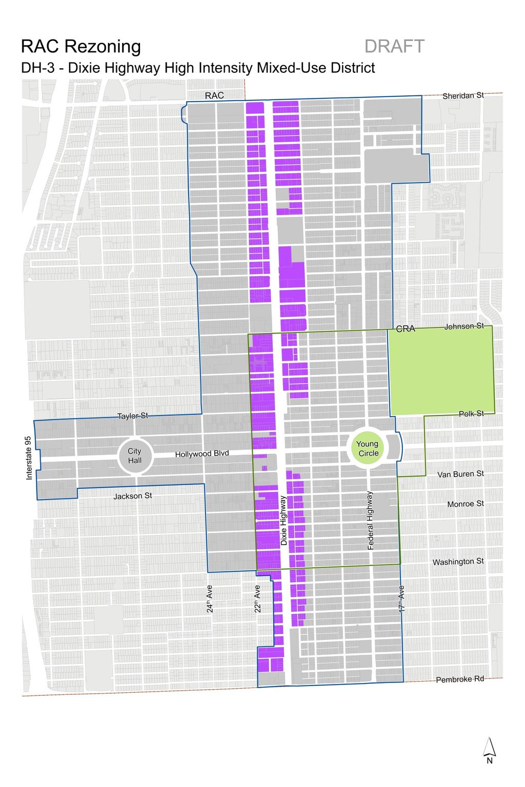
3 (c) DH-3 - Dixie Highway High Intensity Mixed-Use District (i) DH-3 - Dixie Highway High Intensity Mixed-Use District Use Table. DH 3 Dixie Highway High Intensity Mixed Use District Uses Main Permitted Uses Accessory Uses Special Exception Uses Prohibited Uses Adult Educational Facilities 1 Amusement Uses (Indoor and Outdoor) Antique, Consignment, Collectible, and Vintage Store Artisan and Maker Manufacturing and Space Assembly of Premanufactured Parts for Sale on Premises Automotive Rental Automotive Repair Automotive Sales, New and Used Bar, Lounge, or Night Club Bed and Breakfast Inn Cabinet, Furniture, and Upholstery Shop Car Wash 2 Coin Laundry 3 Commercial Uses Contractor Shop and Storage (Indoor) Dry Cleaner Food Processing Funeral Home Hotel Institutional Live Work Microbrewery, Microdistillery, and Microwinery Motel Multi Family Residential, except on the ground floor Automotive Paint or Body Light Manufacturing associated with Retail or Showroom Outdoor produce sales (fresh fruit, vegetable, plant and flower retail sales), accessory to a grocery store, specialty market, or similar use 4 Tattoo, Body Art, or Body Piercing Establishments, associated with an Art Gallery 5 Any use customarily associated with one of the Main Permitted Uses. Day Care Facility Outdoor Storage Schools (K 12) Service Station Adult Entertainment or Adult Related Uses All General and Heavy Manufacturing Uses Bulk Sales, Storage, or Display of Lumber and Building Materials Pawn Shop Psychic Help Uses Uses which produce effects upon contiguous property in the form of noise, odor, vibration, smoke, particulate matter, glare, heat, fire or explosive hazard Any use not listed as a Main Permitted Use 31
4 adjacent to Tyler Street, Dixie Highway and 21 st Avenue Museum, Art Gallery, and Similar Cultural Uses Office Parking Lot and Garages (Commercial) Personal Service Place of Worship, Meeting Hall, and Fraternal Lodge Restaurant Retail (Indoor) Schools (Business, Commercial, or Vocational; Recreational or Cultural; and University) 1 Self Storage Facility Single Family Residential, except on the ground floor adjacent to Dixie Highway and 21 st Avenue Thrift Shop Wholesale and Warehousing 1 Adult Educational Facilities and Schools may require additional review for pedestrian and vehicular circulation, pick up and drop off operations, traffic, etc. Limitations may be imposed in regards to capacity, hours of operation, parking, and circulation. 2 Car Washes shall be fully enclosed and adequately screened; or not visible from pubic rights of way. 3 Coin Laundries shall be fully enclosed and air conditioned. 4 Outdoor produce sales shall provide a plan illustrating the layout, location, and dimensions of the outdoor sales area; shall not interfere or obstruct pedestrian flow; and shall be exempt from screening requirements. 5 Tattoo, Body Art, or Body Piercing Establishments shall be limited to 25 percent of the total gross floor area of the use; and exterior primary signage shall not be permitted. See Section 4.3.J, 4.21, and 4.22 for Additional Use Regulations and Performance Standards. 32
5 (ii) DH-3 - Dixie Highway High Intensity Mixed-Use District Development Regulations Table. DH 3 Dixie Highway High Intensity Mixed Use District Development Regulations MAXIMUM FAR 3.00 MAXIMUM HEIGHT 10 Stories, not to exceed 140 ft. Sites or portions of sites within 100 feet of RS 3, PS 1: 5 Stories, not to exceed 55 ft. Sites or portions of sites within 200 feet of DH 1, DH 2, ND 1: 5 Stories, not to exceed 55 ft. MINIMUM SETBACKS Base Tower Frontage Ground Floor 55 Feet Above 55 Feet Non Residential: 10 ft. Non Residential: 10 ft. All Frontages Residential: 15 ft. Residential: 15 ft. Side Interior Alley 0 ft. When adjacent to RS 3, DH 1, and DH 2: 10 ft. 5 ft. When adjacent to RS 3, DH 1, and DH 2: 20 ft. 0 ft. When adjacent to RS 3: 100 ft. When adjacent to DH 1, and DH 2: 200 ft. 5 ft. When adjacent to RS 3: 100 ft. When adjacent to DH 1, and DH 2: 200 ft. MAXIMUM SETBACKS Frontage Ground Floor Above Ground Floor Dixie Highway 21 st Avenue 30 ft. N/A MINIMUM ACTIVE USES Frontage Ground Floor Above Ground Floor Dixie Highway 60% N/A 21 st Avenue 60% N/A (iii)_ DH-3 - Dixie Highway High Intensity Mixed-Use District Special Requirements. a. For lots which abut Dixie Highway and 21 st Avenue, the tower orientation shall be towards Dixie Highway and 21 st Avenue. b. Where possible, vehicular access shall be located along the eastwest streets. c. Walk-up gardens shall be required for ground floor residential uses and shall have a minimum depth of five (5) feet measured horizontally between the building facade and the public sidewalk. Entrance landings and stairs may encroach the garden space. Garden perimeter fences, walls or other similar structures shall not 33
6 exceed four (4) feet in height. A minimum of 40 percent of the walkup garden area shall be pervious. c. Federal Highway Districts. (1) Federal Highway District Purpose and Character. (a) Encourage higher intensity mixed-use buildings which accommodate a diverse mix of commercial uses, large format or destination retail, and neighborhood commercial to support the residential uses. (b) Orient the highest intensity and ground floor commercial uses towards Federal Highway to enhance the corridor, creating a more urban environment with buildings on the street edge, continuous sidewalks, and active uses which promote pedestrian activity. (c) Improve setback fronting the golf course with landscape and multipurpose or pedestrian paths to enhance the edge condition and create the Hollywood Beach Golf Course Greenway. (d) Encourage the creation of strong urban residential neighborhoods, providing an array of housing types. (e) Provide adequate and compatible transitions to protect the scale of adjacent residential neighborhoods. (f) Encourage building frontages along 17 th Avenue to reinforce the existing character. (2) Federal Highway Districts Use and Development Regulations: (a) FH-1 Federal Highway Low-Medium Intensity Multi-Family District. (i) FH-1 Federal Highway Low-Medium Intensity Multi-Family District Use Table. FH 1 Federal Highway Low Medium Intensity Multi Family District Uses Main Permitted Uses Accessory Uses Special Exception Uses Prohibited Uses Bed and Breakfast Inn Multi Family Residential Single Family Residential Parking Lot accessory to a Main Permitted Use; or adjacent Main Permitted Use Any use customarily associated with one of the Main Permitted Uses. Day Care Facility Place of Worship, Meeting Hall, and Fraternal Lodge Schools (All) Any use not listed as a Main Permitted Use. See Section 4.3.J, 4.21, and 4.22 for Additional Use Regulations and Performance Standards. 34
DRAFT Summary of Proposed Regulations
 DRAFT Summary of Proposed Regulations Character District Dixie Highway Federal Highway North Downtown Parkside Core Dixie Highway Lakes Transition Core North Downtown Parkside Core Core Pembroke Road Sheridan
ARTICLE XVIII C 1 CENTRAL BUSINESS DISTRICT
 ARTICLE XVIII C 1 CENTRAL BUSINESS DISTRICT SECTION 1. INTENT AND PURPOSE OF DISTRICT: The C 1 Central Business District is intended for the purpose of grouping retail merchandising activities into a concentrated
2.18 MU Mixed Use District.
 2.18. Intent - The is established to promote the development of an urban residential environment. The regulations are intended to encourage single family urban residential use and development while allowing
Policies and Code Intent Sections Related to Town Center
 Policies and Code Intent Sections Related to Town Center The Town Center Vision is scattered throughout the Comprehensive Plan, development code and the 1994 Town Center Plan. What follows are sections
CHAPTER SPECIAL PURPOSE AND OVERLAY ZONING DISTRICTS
 Special Purpose and Overlay Zoning Districts 106.28.010 CHAPTER 106.28 - SPECIAL PURPOSE AND OVERLAY ZONING DISTRICTS SPECIAL PURPOSE AND OVERLAY ZONING DISTRICTS Sections: 106.28.010 - Purpose 106.28.020
(DC1) Direct Development Control Provision DC1 Area 4
 Direct Development Control Provision DC1 Area 4") . General Purpose (DC) Direct Development Control Provision DC Area 4 The purpose of this Provision is to provide for an area of commercial office employment and residential development in support of the
. General Purpose (DC) Direct Development Control Provision DC Area 4 The purpose of this Provision is to provide for an area of commercial office employment and residential development in support of the
The Village. Chapter 3. Mixed Use Development Plan SPECIFIC PLAN
 The Village SPECIFIC PLAN Chapter 3 3.1 INTRODUCTION 3.1.1 Purpose This Chapter describes the development regulations applicable to the Mixed-Use and Transit Center Planning Areas. These form-based regulations
Zoning Interface: Districts and Forms for Sioux Falls Zoning Ordinance
 Zoning Interface: Districts and Forms for Sioux Falls Zoning Ordinance For more information about each form, click on the associated link. Single-Family Residential Districts RR Rural Residential RS Single-Family
City of Astoria Development Code ARTICLE 2 USE ZONES R-1: LOW DENSITY RESIDENTIAL ZONE
 ARTICLE 2 R-1 Zone USE ZONES R-1: LOW DENSITY RESIDENTIAL ZONE 2.015. PURPOSE. The purpose of the R-1 Zone is to provide an area of low density single-family dwellings, at an average density of eight (8)
RESIDENTIAL DISTRICTS
 RESIDENTIAL DISTRICTS The residential district standards have been revised to reflect on-the-ground conditions, while continuing to respect the use patterns established within the neighborhoods. This will
Development Review Application Fees
 Development Review Application Fees Application Type Historic District Commission (Requires zoning sign- $10) Certificate of Approval Certification of Non-Conforming Use- Residential Use for the property
CHAPTER 10 GC GENERAL COMMERCIAL DISTRICT
 CHAPTER 10 GC GENERAL COMMERCIAL DISTRICT SECTION 10.01 DESCRIPTION AND PURPOSE A. This District is intended for commercial development of a general nature near areas where greater concentrations of residential
2.11 GC - General Commercial
 2.11 GC - General Commercial Intent - GC: s are established to provide a location for higher volume and higher intensity commercial uses than the NR District. Activities in this District are often large
Section Waterfront Transit-Oriented Development District (WTOD)
") Section 19-37 Waterfront Transit-Oriented Development District (WTOD) (1) Purpose of district -The purpose of the WTOD District is to encourage a pedestrian-friendly, urban mix of public, recreational,
Section 19-37 Waterfront Transit-Oriented Development District (WTOD) (1) Purpose of district -The purpose of the WTOD District is to encourage a pedestrian-friendly, urban mix of public, recreational,
AN ORDINANCE THE COUNCIL OF THE CITY OF PHILADELPHIA HEREBY ORDAINS:
 AN ORDINANCE Amending Title 14 of The Philadelphia Code, entitled Zoning and Planning, by amending Section 14-507, entitled /CDO, Central Delaware Riverfront Overlay District, under certain terms and conditions.
PSec MCN Mahan Corridor Node District
 PSec. 10-269 MCN Mahan Corridor Node District 1. Purpose and Intent 2. Allowable District Location The Mahan Corridor Node (MCN) zoning district is intended to implement the Mahan Gateway Node Map (FLUM)
Eastlake Subarea plan land use comparison
 Eastlake Subarea plan land use comparison PROPOSED FUTURE LAND USE MAP, as presented SECOND ST BIRCH ST THIRD ST to City Council (2016) LAKE AVE Future Plaza 124th / Eastlake Station RTD FIRST ST Parking
Comprehensive Plan Advisory Panel Meeting #3
 Comprehensive Plan Advisory Panel Meeting #3 November 7, 2016 Agenda 1. September 19 th Meeting Notes 2. Summary of Focus Areas Charrette 3. Heart of the City Focus Area a. HOC2/Station Areas Concept &
Zoning Rewrite Implementation Worksession #3. Industrial Zones April 11, 2013
 Zoning Rewrite Implementation Worksession #3 Industrial Zones April 11, 2013 1 Industrial Zones Current I-1 942.19 acres 0.33% Current I-2 757.36 acres 0.27% Current I-3 (floating) 970.29 acres 0.34% Current
chapter DESIGN GUIDELINES NEW RIVER MASTER PLAN REPORT
 chapter DESIGN GUIDELINES NEW RIVER MASTER PLAN REPORT .76 DESIGN GUIDELINES An Overview design guidelines NEW RIVER MASTER PLAN Design Guidelines can transform the image of a city. Specific, design-based
appendix and street interface guidelines
 appendix five: building and street interface guidelines appendix 5 building and street interface guidelines BOULEVARDS Boulevards are generally characterized by higher levels of traffic movement at higher
CHAPTER 21 NC-PUD NEIGHBORHOOD COMMERCIAL PUD DISTRICT
 CHAPTER 21 NC-PUD NEIGHBORHOOD COMMERCIAL PUD DISTRICT Section 21.1. Title and Purpose. The Neighborhood Commercial Planned Unit Development District, designated the, is intended for commercial uses of
EXISTING COMPREHENSIVE PLAN
 EXISTING COMPREHENSIVE PLAN Town Center Land Use Element: V. LAND USE POLICIES Town Center Mercer Island's business district vision as described in "Your Mercer Island Citizen-Designed Downtown" was an
Chapter PEDESTRIAN COMMERCIAL (PC) ZONING DISTRICT
 ZONING DISTRICT") Chapter 11-17 PEDESTRIAN COMMERCIAL (PC) ZONING DISTRICT Sections: 11-17-01 GENERAL PURPOSE 11-17-02 PERMITTED BUILDING TYPES 11-17-03 USES PERMITTED WITH DESIGN REVIEW 11-17-04 USES PERMITTED BY CONDITIONAL
Chapter 11-17 PEDESTRIAN COMMERCIAL (PC) ZONING DISTRICT Sections: 11-17-01 GENERAL PURPOSE 11-17-02 PERMITTED BUILDING TYPES 11-17-03 USES PERMITTED WITH DESIGN REVIEW 11-17-04 USES PERMITTED BY CONDITIONAL
Figure Example of out door dining in the public right-of-way.
 Section 2 Core Area Goal 2.2.1 To maintain and enhance the character of existing streets in the Downtown Area. Character Figure 2.2.1 Example of out door dining in the public right-of-way. A. Provide street
C-2 Zone (Central Commercial)
") C H A P T E R 23 C-2 Zone (Central Commercial) 115 Sections 25-23.1 Purpose 25-23.2 Permitted Uses 25-23.3 Conditional Uses 25-23.4 Uses Expressly Prohibited 25-23.5 Site Plan Review 25-23.6 Development
C H A P T E R 23 C-2 Zone (Central Commercial) 115 Sections 25-23.1 Purpose 25-23.2 Permitted Uses 25-23.3 Conditional Uses 25-23.4 Uses Expressly Prohibited 25-23.5 Site Plan Review 25-23.6 Development
OCEAN BOULEVARD PLANNED DEVELOPMENT DISTRICT (PD-5)
") OCEAN BOULEVARD PLANNED DEVELOPMENT DISTRICT (PD-5) Ordinance History: C-5562, 1982 The intent of the Planned Development Plan is to provide a framework to guide new development in a way that is sensitive
OCEAN BOULEVARD PLANNED DEVELOPMENT DISTRICT (PD-5) Ordinance History: C-5562, 1982 The intent of the Planned Development Plan is to provide a framework to guide new development in a way that is sensitive
Planning Justification Report
 Planning Justification Report Application for Zoning By-law Amendment Prepared for: Sherrill Becker (OK Tire Auto Service) Prepared By: Black, Shoemaker, Robinson & Donaldson Limited June 2015 Sherrill
CHAPTER 4 - LAND USE CLASSIFICATIONS
 CHAPTER 4 - LAND USE CLASSIFICATIONS Four new land use classification categories are established in the Gualala Town Plan: Gualala Village Mixed Use; Gualala Highway Mixed Use; Gualala Planned Development
4. Shape Transitions. 4. Shape Transitions
 4. Shape Transitions 49 Zoning District Policies Overall Intent: Maintain neighborhood character by creating compatible transitions that minimize land use conflicts. Strategy: Define the character of zoning
Design Guidelines for Residential Subdivisions
 Design Guidelines for Residential Subdivisions Development Services 972-466-3225 cityofcarrollton.com This page intentionally left blank. Table of Contents Purpose... 1 Design Objectives... 1 Design Guidelines
Be it enacted by the Town Board of the Town of Guilderland that the following new A (Transit Oriented Development (TOD) District) is adopted:
 District) is adopted:") Local Law No. 4 of 2018 (Adoption of 280-18A (Transit Oriented Development District) Be it enacted by the Town Board of the Town of Guilderland that the following new 280-18A (Transit Oriented Development
Local Law No. 4 of 2018 (Adoption of 280-18A (Transit Oriented Development District) Be it enacted by the Town Board of the Town of Guilderland that the following new 280-18A (Transit Oriented Development
MIXED-USE ZONING DISTRICT DESIGN GUIDELINES
 MIXED-USE ZONING DISTRICT DESIGN GUIDELINES In addition to the development regulations contained in the Mixed-Use Zoning District, design guidelines are presented here to provide an added level of definition
CENTERS AND CORRIDORS
 INITIAL DESIGN STANDARDS AND GUIDELINES for CENTERS AND CORRIDORS City of Spokane Planning Services Third Floor, City Hall 808 W. Spokane Falls Blvd. Spokane, WA 99201-3329 (509) 625-6300 www.spokaneplanning.org
Golden Gate Downtown Center Commercial Overlay District (GGDCCO).
.") Golden Gate Downtown Center Commercial Overlay District (GGDCCO). Golden Gate Downtown Center Commercial Overlay District (GGDCCO): Special conditions for properties in the vicinity of Golden Gate Parkway
Golden Gate Downtown Center Commercial Overlay District (GGDCCO). Golden Gate Downtown Center Commercial Overlay District (GGDCCO): Special conditions for properties in the vicinity of Golden Gate Parkway
Rezoning Petition Pre-Hearing Staff Analysis October 15, 2018
 Rezoning Petition 2017-137 Pre-Hearing Staff Analysis October 15, 2018 REQUEST Current Zoning: R-3 (single family residential) Proposed Zoning: B-2(CD) (general business, conditional) LOCATION Approximately
Antique shops. Aquariums. Art goods and bric-a-brac shops. Artists' studios. Auditoriums. Automobile hire.
 Sec. 62-1482. - General retail commercial, BU-1. The BU-1 general retail commercial zoning classification encompasses land devoted to general retail shopping, offices and personal services to serve the
VILLAGE OF SKOKIE Design Guidelines for Mixed-Use Districts NX Neighborhood Mixed-Use TX Transit Mixed-Use CX Core Mixed-Use
 VILLAGE OF SKOKIE Design Guidelines for Mixed-Use Districts NX Neighborhood Mixed-Use TX Transit Mixed-Use CX Core Mixed-Use TABLE OF CONTENTS CHAPTER 1 SITE DESIGN Purpose 1 CHAPTER 2 SITE DESIGN Streetscape
The Brown Road Innovation Zoning District shall be specified for the areas as designated on the Charter Township of Orion Zoning Map.
 Section 34.00 Preamble The purpose of the Brown Road Innovation Zoning District shall be to encourage the development of property in accordance with the Charter Township of Orion Master Plan in a manner
McDonald s Restaurant - Purcellville Town of Purcellville Special Use Permit Statement of Justification July 24, 2014
 Introduction / Written Statement McDonald s Restaurant - Purcellville McDonald s Corporation is proposing to redevelop the existing McDonald s eating establishment with a drive-through located at 121 N
and services The protection and conservation of environmentally significant and sensitive natural heritage features and functions.
 6. Land Use 6.0 Preamble A healthy and livable city is one in which people can enjoy a vibrant economy and a sustainable healthy environment in safe, caring and diverse neighbourhoods. In order to ensure
BE IT ORDAINED by the Board of Supervisors of Chesterfield County:
 Attachment A AN ORDINANCE TO AMEND THE CODE OF THE COUNTY OF CHESTERFIELD, 1997, AS AMENDED, BY AMENDING AND REENACTING SECTIONS 19.1-52, 19.1-53, 19.1-236, 19.1-247, 19.1-253, 19.1-263, 19.1-341, 19.1-346,
3.0 LAND USE PLAN. 3.1 Regional Location. 3.2 Existing Conditions Existing Uses. Exhibit Regional Location Map
 3.0 LAND USE PLAN 3.1 Regional Location The Anaheim Resort Specific Plan (ARSP) area is located in the City of Anaheim, which is 35 miles southeast of downtown Los Angeles and 7 miles northwest of Santa
CONTENTS 8.0 LAND USE 8.1 GENERAL LAND USE 8.2 RESIDENTIAL 8.3 MIXED USE 8.4 COMMERCIAL 8.5 EMPLOYMENT LANDS
 8-2 Land Use 8.0 LAND USE CONTENTS 8.1 GENERAL LAND USE 8.1.1 Uses provided for in all Land Use Designations 8.1.2 Uses prohibited in Hazardous Lands, Hazardous Sites and Special Policy Areas 8.1.3 Uses
B. Blocks, Buildings and Street Networks
 B. Blocks, Buildings and Street Networks Figure IV.4 A rational block pattern with connected streets Introduction The single most important element in the physical and functional integration of mixed use
US 19 Zoning District & Development Standards. Appendix B of the Community Development Code City of Clearwater, Florida
 US 19 Zoning District & Development Standards Appendix B of the Community Development Code of Clearwater, Florida Adopted: February 2, 2017 (Ord. 8988-17) Amended: December 8, 2017 Amended December 7,
STAFF REPORT SPECIAL USE DISTRICT REZONING
 STAFF REPORT SPECIAL USE DISTRICT REZONING ZONING DOCKET: K-751 PLANNING BOARD: March 13, 2017 PETITIONER: Abigaile Pittman, Agent for Owner OWNERS: Greenwood and Charles, Inc. PROPOSED ZONING AMENDMENT:
R-10 Medium Density Residential. R-8 Medium High Density Residential X X X X
 Accessory uses and structures (Notes 1, 2 and 7) High Adult uses Agricultural Uses (not regulated) (Note 6) Agritourism (Note 29) Alcoholic beverages stores, packaged, for retail sales Alteration, clothing
Bel-Air Lexus Automobile Service Station
 Bel-Air Lexus Automobile Service Station Design Brief 443-447 McArthur Avenue Ottawa April 30, 2015 14-1299-MCA Site Details Application: Site Plan Control Legal Description and Municipal Addresses: 443
ESTABLISH AN EFFICIENT TOWN CENTER
 ESTABLISH AN EFFICIENT TOWN CENTER 4 Overview Lisbon residents are proud of the history of Newent and at the same time recognize its current importance as a centralized location for a variety of municipal
Urban Design Brief. 875 Wellington Road. Proposed One-Storey Fast Food Restaurant and Two-Storey Restaurant. Wellington Harlech Centre Inc.
 Urban Design Brief 875 Wellington Road Proposed One-Storey Fast Food Restaurant and Two-Storey Restaurant Wellington Harlech Centre Inc. Prepared By: (519) 433-7587 info@yorkdev.ca May 3 rd 2013 1 Table
Village of Itasca Business District Table of Uses
 Village of Itasca Business District Table of Uses Table of ermitted and pecial Uses ermitted C Conditional pecial Blank Not ermitted Commercial Uses B-1 B-2 B-3 B-4 B-5 B-6 Accessory uses Amusement establishments
Highland Village Green Design Guidelines
 Highland Village Green Design Guidelines Publishing Information Title Highland Village Green Design Guidelins Author The City of Calgary Status DRAFT - Proposed document subject to changes Additional Copies
CITY OF WAUKEGAN MASTER PLAN AND DESIGN GUIDELINES
 CITY OF WAUKEGAN MASTER PLAN AND DESIGN GUIDELINES Presented to College of Lake County 10/24/13 Master Plan Background 2002 Urban Land Institute 2003 January creation of the plan begins 2003 July city
WEST LOOP DESIGN GUIDELINES CHECKLIST
 WEST LOOP DESIGN GUIDELINES CHECKLIST Section 1.0 General Strategies 1.1 DESIGN EXCELLENCE: ENCOURAGE HIGH QUALITY AND INNOVATIVE DESIGN OF NEW BUILDINGS WITHIN THE WEST LOOP WITHOUT BEING PRESCRIPTIVE
ZONING. 230 Attachment B
 230 Attachment B Village of Croton-on-Hudson Schedule of Uses Please note: All information contained in the zoning schedules is designed to supplement and summarize the information contained in the zoning
STAFF REPORT TO COUNCIL PLANNING AND DEVELOPMENT
 DATE: April 29, 2013 STAFF REPORT TO COUNCIL PLANNING AND DEVELOPMENT 1100 Patricia Boulevard, Prince George, B.C., V2L 3V9 TO: FROM: SUBJECT: MAYOR AND COUNCIL JESSE DILL, PLANNER Development Variance
U.S. Highway 377 North Overlay District. 1. General Purpose and Description
 U.S. Highway 377 North Overlay District 1. General Purpose and Description The purpose of the U.S. Highway 377 North Overlay District is to implement the recommendations within the U.S. Highway 377 North
A Plan Enhancement Process for the Future of Howard Design Studio 2 May 28-30, The Howard Plan
 A Plan Enhancement Process for the Future of Howard Design Studio 2 May 28-30, 2011 The Howard Plan West of Pinecrest Future Land Use Plan Velp Corridor Land Use Analysis & Recommendations Duck Creek /Quarry
Temple Terrace Downtown Overlay District. Division 5
 Temple Terrace Downtown Overlay District Division 5 12.299 - Purpose and intent. The purpose of the Downtown Overlay District (DOD) is to establish architectural, landscaping, design, building, and use
ZONE STANDARDS LIGHT INDUSTRIAL L-I
 ZONE STANDARDS LIGHT INDUSTRIAL L-I 15.1 PURPOSE 15.2 USE TABLE 15.3 DEVELOPMENT STANDARDS 15.4 FENCING 15.5 PERFORMANCE STANDARDS 15.6 PARKING 15.7 LANDSCAPING Chapter 15 Light Industrial Zone 15.1 PURPOSE
ZONE STANDARDS MANUFACTURING M-I
 ZONE STANDARDS MANUFACTURING M-I 16.1 PURPOSE 16.2 USE TABLE 16.3 DEVELOPMENT STANDARDS 16.4 FENCING 16.5 PERFORMANCE STANDARDS 16.6 PARKING 16.7 LANDSCAPING Chapter 16 Manufacturing Zone 16.1 PURPOSE
What Pioneer Grove Will Look Like?
 The City of Deerfield Beach has embarked on a journey to create a new town center within the old heart of Deerfield Beach. The new town center is known as Pioneer Grove. Pioneer Grove will be Everybody
Mill Conversion Overlay District Zoning Bylaw Amendment
 Mill Conversion Overlay District Zoning Bylaw Amendment To see if the Town will vote to amend the Zoning By-Law by adding a new Section 13, Mill Conversion Overlay District, and by amending Sections 2.1,
REPORT OF THE PLANNING AND DEVELOPMENT DEPARTMENT FOR APPLICATION FOR REZONING ORDINANCE TO PLANNED UNIT DEVELOPMENT AUGUST 18, 2016
 REPORT OF THE PLANNING AND DEVELOPMENT DEPARTMENT FOR APPLICATION FOR REZONING ORDINANCE TO PLANNED UNIT DEVELOPMENT AUGUST 18, 2016 AWH The Planning and Development Department hereby forwards to the Planning
FOR SALE 21 acres of Limited Industrial Land 6.4 acres of Commercial Land Baldwin Road West, Monrovia, Maryland 21770
 21 acres of Limited Industrial Land 6.4 acres of Commercial Land, I-70 Frontage and Visibility Established Industrial and Commercial Area PRESENTING LOCATION: Intersection of and Green Valley Road LEGAL:
2.4 COMMERCIAL POLICIES
 2.4 COMMERCIAL POLICIES The major goal of the commercial sector is to create a distinct and viable commercial district that will provide a variety of commercial services to meet the needs of both the local
4030 COMMERCIAL (C AND CM)
") 4030 COMMERCIAL (C AND CM) 4030.10 Intent and Purpose The C and CM districts are intended to permit the range of commercial uses in areas which are appropriate for such uses consistent with the General
4030 COMMERCIAL (C AND CM) 4030.10 Intent and Purpose The C and CM districts are intended to permit the range of commercial uses in areas which are appropriate for such uses consistent with the General
DRAFT. 10% Common Open Space
 % OF CHARLOTTE IS CATEGORIZED AS A. LAND USES : Placeholder map displaying location of Place Type GOALS: Accommodate XX% of future growth. Provide a concentration of primarily commercial and civic activity
BUILDING SCALE AND SETBACKS 5 ELEMENTS:... 5 FAÇADES (COMMERCIAL/RESIDENTIAL) 5
 5") VISION STATEMENT 3 UTILIZATION OF THE GUIDELINES 3 IMPLEMENTATION 3 PROCEDURES FOR DESIGN REVIEW 3 LAND USE AND ZONING 4 LAND USE 4 ELEMENTS:... 4 ZONING 4 ELEMENTS:... 4 BUILDING SCALE AND SETBACKS 5
VISION STATEMENT 3 UTILIZATION OF THE GUIDELINES 3 IMPLEMENTATION 3 PROCEDURES FOR DESIGN REVIEW 3 LAND USE AND ZONING 4 LAND USE 4 ELEMENTS:... 4 ZONING 4 ELEMENTS:... 4 BUILDING SCALE AND SETBACKS 5
Chapter RM MULTI FAMILY BUILDING ZONES
 Chapter 19.17 RM MULTI FAMILY BUILDING ZONES 19.17.010 Established 19.17.020 Primary Permitted Uses 19.17.030 Accessory Permitted Uses 19.17.040 Secondary Permitted Uses 19.17.050 Conditional Property
CHAPTER 20: INSTITUTIONAL USE DEVELOPMENT STANDARDS
 CHAPTER 20: INSTITUTIONAL USE DEVELOPMENT STANDARDS ARTICLE 1: GENERAL INSTITUTIONAL USE STANDARDS 320-01. Application The provisions of this Chapter shall apply to the following uses in any zone: (e)
Chapter 6--Urban Design
 6.1 Introduction... 6-1 6.1.1 Background & Scope... 6-1 6.1.2 Relationship to State Law... 6-2 6.1.3 Relationship to Other General Plan Chapters... 6-2 6.2 Guiding Principles... 6-2 6.3 Urban Design Guidelines...
ARTICLE 6: Special and Planned Development Districts
 ARTICLE 6: Special and Planned Development Districts 6-10 Traditional Neighborhood Development (TND) District 6-10.10 Purpose and Intent The Traditional Neighborhood Development (TND) District provides
1. General Purpose. 3. Uses
 1. General Purpose The purpose of this DC1 Provision is to facilitate the development of a pedestrian friendly Community Commercial Centre that may accommodate a range of commercial, residential, office,
ZONING. 260 Attachment 4. City of Butler. Use Table [Added by Ord. No. 1679; amended by Ord. No. 1692]
![ZONING. 260 Attachment 4. City of Butler. Use Table [Added by Ord. No. 1679; amended by Ord. No. 1692]](/thumbs/95/126270474.jpg "ZONING. 260 Attachment 4. City of Butler. Use Table [Added by Ord. No. 1679; amended by Ord. No. 1692]") 260 Attachment 4 ity of Butler Use Table [Added 11-21-2013 by Ord. No. 1679; amended 8-28-2014 by Ord. No. 1692] Animals Animal hospitals/veterinary Animal shelters Animal kennels, private Animal kennels,
260 Attachment 4 ity of Butler Use Table [Added 11-21-2013 by Ord. No. 1679; amended 8-28-2014 by Ord. No. 1692] Animals Animal hospitals/veterinary Animal shelters Animal kennels, private Animal kennels,
DRAFT FOR COMMENT: EASTLAKE AVENUE PEDESTRIAN DISTRICT OVERLAY ORDINANCE
 DRAFT FOR COMMENT: EASTLAKE AVENUE PEDESTRIAN DISTRICT OVERLAY ORDINANCE Background: One of many actions in the 1998 Eastlake Neighborhood Plan was a proposal for an Eastlake Avenue Pedestrian District
C HAPTER 4 N EIGHBORHOOD R EALM
 C o l d s t r e a m S p e c i f i c l a n C HATER 4 N EIGHBORHOOD R EALM C OLDSTREAM S ECIFIC LAN CHATER 4 - NEIGHBORHOOD R EALM CHATER 4: NEIGHBORHOOD REALM 4.1 UROSE AND INTENT This chapter has been
6 PORT SYDNEY SETTLEMENT AREA
 Section 6 Port Sydney Page 61 6 PORT SYDNEY SETTLEMENT AREA 6.1 Basis and Principles Village of Port Sydney Waterfront Community Existing Services 6.1.1 Port Sydney is an historic settlement that has developed
MIDTOWN MIXED-USE VILLAGE. TECHNICAL DATA SHEET COMPONENT C-1 FOR PUBLIC HEARING - PETITION NUMBER Project No RZ1.1. Issued.
 N MIDTOWN MIXED-USE VILLAGE TECHNICAL DATA SHEET COMPONENT C- FOR PUBLIC HEARING - PETITION NUMBER 04-00 Project No. 496 Issued Revised SCALE: " = 0' N 0 0 0 40 RZ. c GENERAL PROVISIONS: a. SITE LOCATION.
TOP TEN LIST OF COMMUNITY CONCERNS REGARDING PROPOSED AMENDMENTS TO CHAPTER 42
 TOP TEN LIST OF COMMUNITY CONCERNS REGARDING PROPOSED AMENDMENTS TO CHAPTER 42 1. Extend the urban area to Beltway 8 in stages, over say a three-year period, prioritizing development in transit and declining
Metro. Activity Center Design Guidelines. Recommendations For Developing Focused, Mixed-Use Commercial/Residential Centers
 Metro Activity Center Design Guidelines Recommendations For Developing Focused, Mixed-Use Commercial/Residential Centers Metro Activity Centers What is a MAC? Legacy, the adopted guide for the future growth
PLANNING COMMISSION. Agenda Item # 3
 PLANNING COMMISSION Agenda Item # 3 CASE SUMMARY Special Use Permit MEETING: Planning Commission, October 6, 2010 CASE NO: SITE ADDRESS: PROPOSAL: PRESENTED BY: STAFF RECOMMENDATION: SU-4-1010 406 S. 21st
MIXED-USE VILLAGE OVERLAY FLOATING DISTRICT
 MIXED-USE VILLAGE OVERLAY FLOATING DISTRICT Zoning regulations developed by committee to the Planning Board for the Town of DeWitt, NY Issue date: 13 July 2017 revised 3/12/2018, revised 4/26/2018, 5/9/2018
CHAPTER ADDITIONAL REQUIREMENTS IN THE NC, NEIGHBORHOOD COMMERCIAL ZONE
 CITY OF MOSES LAKE MUNICIPAL CODE CHAPTER 18.31 ADDITIONAL REQUIREMENTS IN THE NC, NEIGHBORHOOD COMMERCIAL ZONE Sections: 18.31.010 Purpose 18.31.020 Minimum Lot Area 18.31.030 Setbacks 18.31.040 Maximum
Chapter SAR, SENSITIVE AREA RESORT ZONE
 Moab Municipal Code Chapter 17.32 SAR, SENSITIVE AREA RESORT ZONE Page 1 of 8 Sections: 17.32.010 Objectives and characteristics. 17.32.020 Use regulations. Chapter 17.32 SAR, SENSITIVE AREA RESORT ZONE
SIMPLOT OFFICE BUILDING
 SIMPLOT OFFICE BUILDING 1) Urban Context and conformance with the River Myrtle Masterplan The proposed project is part of a larger development on the block between 9th and 11th, and Myrtle and Front Street.By
CHAPTER 530 SITE PLAN REVIEW
 ARTICLE I. GENERAL PROVISIONS CHAPTER 530 SITE PLAN REVIEW Community Planning and Economic Development Development Services Division 250 South 4 th Street, Room 300 Minneapolis MN 55415-1316 612-673-3000
WESTSIDE SUBWAY EXTENSION PROJECT. Addendum to the Visual and Aesthetic Impacts Technical Report
 PROJECT to the Visual and Aesthetic Impacts Technical Report August 2011 Visual and Aesthetic Impacts Technical Report SUMMARY On October 28, 2010, the Metro Board selected the Westwood/VA Hospital Extension
CHAPTER 2: FUTURE LAND USE CONCEPTS
 CHAPTER 2: FUTURE LAND USE CONCEPTS INTRODUCTION The future land use concepts presented in this chapter are an expression of community support for a viable and vital US 50 Corridor. Land use recommendations
BOULEVARD AND PARKWAY STANDARDS
 88-323 BOULEVARD AND PARKWAY STANDARDS 88-323-01 PURPOSE Considerable public and private investment exists and is expected to occur adjacent to boulevards and parkways within the city. The following standards
Retail stores: automotive-related stores with the parts store being at least 50% of the total square feet.
 142-23. HC Highway Commercial Zone District. A. B. HC District designated. The HC District is established on the properties within the Township as shown on the map and designated on the Zoning Map, as
Community Design Plan
 Gardena General Plan 2006 Authority While the is not a required element of a General Plan, it is included because improving the community appearance and image is paramount to the overall quality of life
Executive Summary. May 2014 Page 1
 Executive Summary The Mediterranean Style Design Standards are provided as an incentive to property owners to encourage and expand the creative use of the various architectural styles in association with
URBAN DESIGN BRIEF NORTHVIEW FUNERAL HOME HIGHBURY AVE N, LONDON, ON
 URBAN DESIGN BRIEF NORTHVIEW FUNERAL HOME - 1490 HIGHBURY AVE N, LONDON, ON 1.1Purpose The intent of the following report is to identify an opportunity for redevelopment of two residential properties within
C-2: HMR OVERLAY DISTRICT: DISTRICT REVIEW MANUAL FOR THE HUALAPAI MOUNTAIN ROAD AREA INTENT AND PURPOSE
 C-2: HMR 14.000 C-2: HMR OVERLAY DISTRICT: DISTRICT REVIEW MANUAL FOR THE HUALAPAI MOUNTAIN ROAD 14.100 INTENT AND PURPOSE This Design Review Manual is established to provide general development, design,
KELLER WILLIAMS COMMERCIAL
 KELLER WILLIAMS COMMERCIAL BALLANTYNE AREA Uptown Land Opportunity +/- 1 acre Charlotte, NC Scott Greene 704.577.7344 scottgreene@kw.com Matthew Hagler 704.408.8867 mhagler@kwcommercial.com Scott Stevens
Sec BC-1 Bradfordville Commercial Auto-Oriented District.
 Sec. 10-6.673. BC-1 Bradfordville Commercial Auto-Oriented District. PERMITTED USES 1. District Intent 2. Principal Uses 3. Accessory Uses The BC-1 district is intended to be located in areas designated
CHAPTER 11 HC HIGHWAY COMMERCIAL DISTRICT
 CHAPTER 11 HC HIGHWAY COMMERCIAL DISTRICT SECTION 11.01 DESCRIPTION AND PURPOSE This District is intended primarily for uses emphasizing highway related service, such as service stations, restaurants,
PINE CURVE REZONING. BACKGROUND Purchased as two parcels in 2001 and 2002
 BACKGROUND Purchased as two parcels in 2001 and 2002 WHAT THE PROJECT IS AND IS NOT A Rezoning establishes the land use standards for Annexed and Zoned Greater Downtown District Historic Center September