3.0 PROJECT DESCRIPTION
|
|
|
- Shawn Phelps
- 5 years ago
- Views:
Transcription
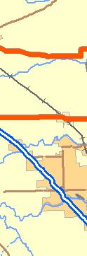
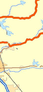
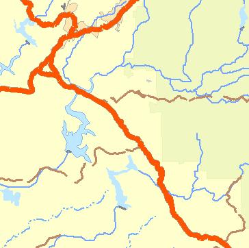
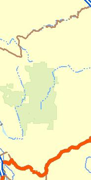
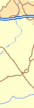
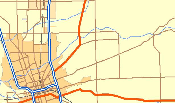
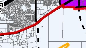
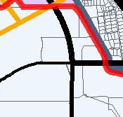
1 3.0 PROJECT DESCRIPTION This section of the Draft Environmental Impact Report (Draft EIR) is the Project Description of the proposed General Plan. The purpose of the Project Description is to describe the project in a way that will be meaningful to the public, reviewing agencies and decision-makers. As described in Section of the State CEQA Guidelines, a complete project description must contain the following information but is not required to supply extensive detail beyond that needed for evaluation and review of the environmental impact: (1) The location and boundaries of the proposed project on a regional and detail map; (2) A statement of objectives sought by the proposed project; (3) A general description of the project s technical, economic and environmental characteristics; and, (4) A statement briefly describing the intended uses of the EIR. For a complete discussion of the CEQA requirements for a project description, please refer to State CEQA Guidelines Section LOCAL AND REGIONAL SETTING PROJECT LOCATION The and its Planning Area are located in Sacramento County in the north central portion of the State of California (see Figure 3.0-1). The is located entirely within the eastern portion of Sacramento County, covering approximately 20,000 acres (see Figure 3.0-2). The Planning Area for the General Plan (referred to hereafter as Planning Area ) consists of the existing incorporated City and a larger study area (approximately 58,190 acres). The Planning Area was selected based on the City limits and surrounding areas that are anticipated to be incorporated into the City in the future. The Planning Area includes the City's Sphere of Influence along Folsom Boulevard between Sunrise Boulevard and Hazel Avenue and Sunrise Boulevard between Folsom Boulevard and White Rock Road. The northern boundary of the Planning Area is the American River, the eastern edge of the Planning Area is the Cosumnes floodplain and the Urban Services Boundary for Sacramento County. The Planning Area ends at Prairie City Road, which is the western boundary of the Folsom Sphere of Influence. The communities of Rosemont and Gold River were included in the Planning Area because of their close proximity to Rancho Cordova and the interaction between these communities and future land uses in the City. The City Council requested that the Planning Area boundary extend west to Watt Avenue (to include Rosemont) and extend south of Jackson Highway by at least one mile to include entire parcels PROJECT SETTING The Planning Area is predominately flat with undulating topography near the Cosumnes River floodplain to the south and the American River to the north. The American River Parkway is located along the northern boundary of the Planning Area. Other waterways include Morrison Creek, Laguna Creek, Elder Creek, Buffalo Creek, Frye Creek, Rebel Hill Ditch and the Folsom South Canal. Southern portions of the Planning Area include one of the largest complexes of vernal pools in California. Approximately 400 acres of vernal pools are preserved as part of the Sunrise-Douglas Community Plan Area (established by Sacramento County prior to incorporation) while another 1,000 acres of vernal pool preserve are proposed as part of the Mather Field Regional Park (proposed by and currently within Sacramento County). Other natural features in the Planning Area include riparian habitat (primarily located along the American River), oak trees and oak woodlands, grasslands, land areas substantially disturbed from historic gold dredging activities (specifically in the northern and eastern portions of the Planning Area). U.S. Highway 50 running east to west passes through the northern portion of the Planning Area, while State Highway 16 passes through the southern portion of the Planning Area. Sunrise March General Plan Draft Environmental Impact Report
2 3.0 PROJECT DESCRIPTION Boulevard, a major thoroughfare running north and south, bisects the Planning Area. Folsom Boulevard, running northeast to southwest, is located in the northern portion of the Planning Area. The Planning Area currently includes but is not limited to land uses such as residential, commercial, office industrial, and agricultural. The majority of developed area is located in the northern portion of the Planning Area with current development planned for the south central portion of the Planning Area in the Sunrise-Douglas Community Plan area. While the northern portion of the Planning Area is developed, vast regions to the south and west are primarily undeveloped. The reader is referred to Section 4.1 (Land Use) for a description of land use and applicable land use plans throughout the Planning Area. Located in the Planning Area, but outside of the existing city limits, is the site of the existing Aerojet/GenCorp operations. This area has been used for rocket testing and development operations since the 1950 s that resulted in soil and groundwater contamination through much of the area. The site has been identified as a Superfund site. Environmental investigations at the site began in 1979 and in 1989, Aerojet, EPA, the Regional Water Quality Control Board (RWQCB) and DTSC signed a Partial Consent Decree to complete a comprehensive Remedial Investigation/ Feasibility Study (RI/FS) and take any necessary removal or abatement actions. Also located within the Planning Area, but outside of current city limits, is the former site of Mather Field Air Force Base. The former air base includes the still operating Mather Field Airport. Because of the required safety zones and the various flight patterns into and around Mather Field, in conjunction with the environmentally sensitive habitat and a proposed regional park site located centrally between Mather Field and Sunrise Boulevard, large portions of the Mather Planning Area will need to remain undeveloped or developed with restricted land uses. 3.2 BACKGROUND OF PLANNING ACTIVITIES ASSOCIATED WITH RANCHO CORDOVA LAND USE PLANS IN PLACE PRIOR TO INCORPORATION When the incorporated in July of 2003, it adopted the Sacramento County General Plan and corresponding land use map. In addition to the Sacramento County General Plan, land uses in the City have also been guided by the Cordova Community Plan, the Sunrise-Douglas Community Plan, the Sunridge Specific Plan and special planning areas (SPAs) associated with specific land areas in the City (e.g., Aerojet), which were adopted prior to incorporation. The reader is referred to Section 4.1 (Land Use) presenting an overview of these documents. INITIATION OF THE DEVELOPMENT OF A NEW GENERAL PLAN FOR THE CITY As a result of incorporation, the City must formulate and adopt a new General Plan that will act as the official policy statement of the City and guide public and private development in the City as well as the preservation of existing natural resources (Government Code Section 65360). The commenced the preparation of a General Plan in May Technical consultants began fieldwork and gathering data in technical disciplines including traffic, noise, history/archaeology/paleontology, and biology. The Rancho Cordova staff conducted an existing land use inventory utilizing aerial photographs and field reconnaissance. General Plan Draft Environmental Impact Report March


3 Chico Legend Rancho Cordova City Limits General Plan Planning Area Boundary Cold Springs Reno Yuba City 5 Davis 99 Sacramento 80 tu 50 South Lake Tahoe Santa Rosa Napa Fairfield 99 Vacaville 80 5 Vallejo 5 Lodi Concord Stockton Yosemite T:\_GIS\Rancho_Cordova\MXD\General_Plan\EIR\fig3.0-1_regional_vicinity.mxd Golden Gate National Rec Area San Francisco--Oakland Source: ESRI, 2005 San Jose Santa Cruz Livermore Modesto Merced Madera Miles Figure Regional Vicinity Map


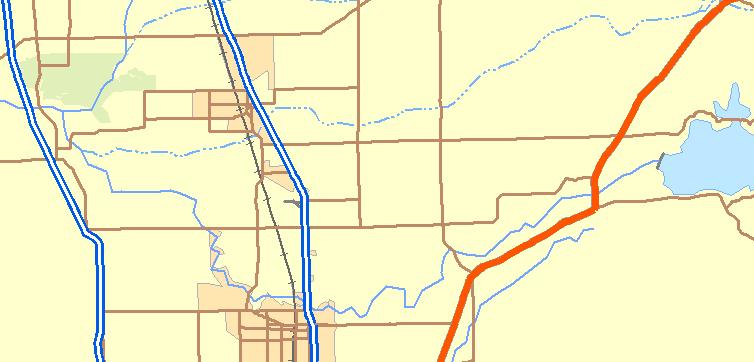
4 Legend Rancho Cordova City Limits General Plan Planning Area Boundary Sacramento County Boundary 99 Auburn State Recrea Folsom Lake State Rec Area Sacramento International tu American River Parkway Cosumnes River Preserve T:\_GIS\Rancho_Cordova\MXD\General_Plan\EIR\fig3.0-2_project_location.mxd d Source: ESRI, 2005 Black Diamond Mines Reg Preser 5 0 Stockton Metropolitan Miles Figure Project Location Map
5 3.0 PROJECT DESCRIPTION Beginning in June 2004, three public visioning workshops were held in different locations throughout the Planning Area. These workshops were held in order to allow the public to impart their desires for the future of Rancho Cordova. The result of the workshop was the development of the Draft Vision Book (dated August 2, 2004). This Vision Book represents the first major product prepared for the Rancho Cordova General Plan, as well as the starting point for the preparation of the detailed General Plan. These Visions were presented to the General Plan Advisory Committee (GPAC) in a series of meetings beginning in September In May of 2005 the Rancho Cordova City Council adopted the Draft Land Use Map Book. The Draft Land Use Map Book reflects an approach that combines specific land use designations in some areas of the City and more general descriptions of land uses in areas planned for future growth. This action by the City Council and subsequent activities by the GPAC in the development of the General Plan policy document are the foundation of the proposed General Plan described below. REQUIREMENT TO ADOPT A GENERAL PLAN California Government Code Section 65300, et seq. establishes the obligation of cities and counties to adopt and implement general plans. The general plan is a comprehensive, longrange, and general document that describes plans for the physical development of a city or county and of any land outside its boundaries that, in the city s or county s judgment, bears relation to its planning. The general plan addresses a broad range of topics, including, at a minimum, the following mandatory elements: land use, circulation, housing, conservation, open space, noise, and safety; further, the city or county can adopt additional optional elements. In addressing these topics, the general plan identifies the goals, objectives, policies, principles, standards, and plan proposals that support the city s or county s vision for the area. The general plan is a long-range document that typically addresses the physical development of an area over a 20-year period. Although the general plan serves as a blueprint for future development and identifies the overall vision for the planning area, it remains general enough to allow for flexibility in the approach taken to achieve the plan s goals. State Planning and Zoning Law (California Government Code Section et seq.) establishes that zoning ordinances, which are laws that commonly define allowable land uses, establish development standards, and provide thresholds for development within a specific zoning district, are required to be consistent with the general plan and any applicable specific plans. When amendments to the general plan are made, corresponding changes in the zoning ordinance may be required within a reasonable time to ensure consistency between the revised land use designations in the general plan (if any) and the permitted uses or development standards of the zoning ordinance (Gov. Code, Section 65860, subd. [c]). 3.3 PROPOSED CITY OF RANCHO CORDOVA GENERAL PLAN The proposed General Plan provides policy direction for land uses within the current City limits, the City s existing sphere of influence, and Planning Areas outside of the City limits within the unincorporated area of Sacramento County. While the City does not have land use authority over land areas outside of the City, the proposed General Plan provides direction on the City s vision of land use should they be annexed to the City. PROJECT OBJECTIVES The following are the overall objectives of the General Plan based on the City of Rancho Cordova Vision Book, Revised Draft Land Use Map Book and the proposed General Plan: March General Plan Draft Environmental Impact Report
6 3.0 PROJECT DESCRIPTION Establish the as a vibrant destination place in the region. Proactively seek beneficial changes in land use and the scope of the City s operations. Obtain measurable fiscal success for the City from the implementation of its General Plan. Plan for a balanced mix and integration of land uses that will make Rancho Cordova a desirable place to live, work and play. Implement a land use strategy for the Planning Area that generally reflects the types of intensity of Sacramento Council of Government s Blueprint Scenario C. Blueprint Scenario C, through a land use plan that intensifies development within Sacramento County s Urban Service Boundary, uses Smart Growth Principles that make efficient use of land use to accommodate anticipated growth, encourages use of non-automobile transportation opportunities (walking, bicycling and transit use), provides residential uses in close proximity to jobs and services and balances land uses. Preserve and minimize impacts to the Planning Area s natural resources in balance with the implementation of Smart Growth Principles. Provide improved transportation and connection through the City by improved roadway facilities, enhanced pedestrian and bicycle facilities and trails and the expansion of various forms of transit throughout the City and Planning Area. COMPONENTS OF THE PROPOSED RANCHO CORDOVA GENERAL PLAN Proposed Land Use Concept for the City General Plan workshops identified the following issues that need to be solved through the development of an effective General Plan: Existing land use is not balanced Rancho Cordova is an employment center with a lack of housing stock and housing choices. Residential, commercial and office uses are separated physically from one another. Mix and distribution of commercial services (retail in particular) is limited. U.S. Highway 50 and Folsom South Canal bisect the community. Land use patterns do not promote accessibility (transit, vehicle and pedestrian). City has a substantial supply of industrial uses and such uses are located near future residential and mixed-use areas. Natural resources need to be integrated into future development in the community through project design. As result of evaluating these issues, the land use concept set forth in the General Plan has been developed based on the following two primary development principles (Smart Growth and Building Blocks): General Plan Draft Environmental Impact Report March
7 3.0 PROJECT DESCRIPTION Smart Growth One of the key tenets of the proposed General Plan is to apply smart growth planning principles to development. Rancho Cordova is striving to change the way development occurs so that it positively improves the image and character of the City. An essential goal of the City and General Plan is to achieve compact, mixed-use development with improved mobility to enhance the quality of life of all residents, employees, and visitors. The General Plan utilizes building blocks (e.g., neighborhoods, villages, districts, and centers) and Smart Growth Principles to achieve this goal. The eight Smart Growth Principles are listed below and described further in the Land Use Element of the proposed General Plan: Provide a variety of Transportation Choices Offer Housing Choices and opportunities Integrate a Mix of Land Uses into New and Existing Development Areas Promote Compact Urban Development Encourage Regeneration/Infill in Existing Developed Areas Create Walkable Neighborhoods Foster Distinctive, Attractive Communities with a Strong Sense of Place and Quality Design Promote Preservation and Integration of Natural Resources with Urban Land Uses The Building Blocks Of The City Neighborhoods, Villages, And Districts The proposed General Plan also sets forth several basic elements for the buildout of the City. These elements are identified as City Building Blocks a system of neighborhoods, villages, and districts served by a range of centers that establish a more walkable, sustainable community. Each building block type is characterized by different levels and intensities of development that contribute to a greater City. These Building Blocks serve as the foundation for all new development/redevelopment and contribute to the overall function and character of the City. Building Blocks are shown on Figure and are summarized below: Neighborhoods and Neighborhood Centers - Neighborhoods are the most basic building block of the City. They are the places where residents live. They are predominately made up of single-family homes, both detached and attached products, but apartment complexes and condominiums are not uncommon. The average density is approximately six to eight units per acre, with both one- and two-story homes and buildings associated with the Neighborhood Centers. Neighborhoods are compact and walkable in design, scaled at approximately 1/3 mile in radius and an average size of about 200 acres. The residential population of the neighborhood building block is approximately 4,000 people. Neighborhoods also include many amenities, such as trails and local parks. Their major feature is the Neighborhood Center, a gathering place for residents. These Centers are usually defined by schools, neighborhood parks, community centers, or small commercial outlets serving local residents (e.g., coffee shops, small markets). March General Plan Draft Environmental Impact Report
8 3.0 PROJECT DESCRIPTION Villages, and Village Center - A cluster of three to four neighborhoods comprise a Village of approximately 750 acres in size. Villages include a mix of housing types, with higher density residential areas in proximity to the Village Center. The Neighborhoods within a Village are connected by a series of trails and pedestrian-friendly streets. With a residential population of between 10,000 and 15,000 persons, this cluster of neighborhoods is supported by a Village Center serving the daily shopping needs of Village residents. Village Centers typically include small and medium size grocery stores, drug stores, restaurants, banks, and other uses that serve the daily shopping needs of local residents. It is the City s intent that Village Centers are sized and distributed to encourage local markets and support services in proximity to every home within the City. Village Centers are smaller, pedestrian-oriented developments, with smaller parking fields and buildings located in proximity to the street. Site visitors can easily move between the different uses and the surrounding residential areas. Village Centers are range in size between five and 15 acres in size with buildings ranging from one to three stories in height. Districts and Town Centers - Districts are made up of three or four Villages, with a corresponding residential population of approximately 45,000 people and are served by a Town Center. Three distinct types of Town Centers are proposed. Local Town Centers. Local Town Centers are the most prevalent and fundamental type of Town Center. They provide most of the retail needs of the District and are designed to supplement Village Centers with more significant retail, service, and entertainment needs for a larger population. Local Town Centers would include general retail uses (e.g., basic clothing stores, book/music stores, dry cleaners) and restaurant. This center type also includes residential uses at densities ranging from 8 to 18 dwelling units per acre target density with most of these residential units above commercial activities. The majority of the buildings (two to four stories in height) within Local Town Centers would have their main entrance opening onto a street or square with the provision of pedestrian circulation a key aspect of the Local Town Center design. Local Town Centers are typically between 15 and 30 acres in size. Regional Town Centers. Regional Town Centers are designed as a much larger developments intended to meet a regional need for shopping, entertainment, and other large destination uses (e.g., sports arena, conference center). These are the strategically located for accessibility, include residential uses at a target density of 20 dwelling units per acre, building heights of two to four stories and range in size from 30 to 80 acres. Transit-Oriented Town Centers. Transit-Oriented Centers are sited along existing or potential Light Rail or Bus Rapid Transit (BRT) alignments at stations for those services. They are multi-story (three to six stories), mixed-use developments that provide new housing opportunities and practical alternatives to vehicle mobility. The highest residential densities in the City are usually located here, with target density of 40 dwelling units per acre. Office uses may also be located at these sites, attracting people to the center from other areas of the City and region. Structured parking is common for this development type. General Plan Draft Environmental Impact Report March


")


9 Legend Estate Residential ( du/acre = minimum half-acre to 2-acre lots) Low Density Residential ( du/acre) Medium Density Residential ( du/acre) High Density Residential ( du/acre) Commercial Mixed Use Village Center Mixed Use Office Mixed Use Light Industry Heavy Industry Mining Public/Quasi-Public Parks and Open Space Natural Resources Local Town Center g Regional Town Center g R Transit Oriented Town Center g T Light Rail Stations! P Proposed/Potential Light Rail Stations Rancho Cordova City Limits General Plan Planning Area Boundary Mather Airport Safety Zones Convention Overlay Planning Areas (see Figure LU-2) Roads Roads Foreseeable After 2030 American River Parkway T:\_GIS\Rancho_Cordova\MXD\General_Plan\EIR\fig3.0-3_GP_map.mxd Source:, Miles Figure Draft General Plan Land Use Map
10 3.0 PROJECT DESCRIPTION ELEMENTS OF THE PROPOSED RANCHO CORDOVA GENERAL PLAN General Plan Elements The proposed General Plan consists of 12 policy elements and one implementation element. Each of 12 policy elements identify goals and associated policies with the general intent to assist and promote the furtherance of the ideas and desires established in the Rancho Cordova Vision Book for the City. A brief description of each element, and goals and policies for each element are provided below. Land Use Element The purpose of the Land Use Element is to describe existing and future land use activity in the City. The Element identifies the distribution, location, and intensity of all land use types throughout the City and the Planning Area. Urban Design Element The Urban Design Element is an optional element that provides policies and design concepts regarding the form and character of new private development (and public improvements), along with focused plans for areas of the City in need of special design attention. Economic Development Element This Element is an optional element included in the General Plan for the purpose of continuing to improve the City s prosperity, maintain competitiveness, ensure accessibility to its assets, make sure the market is aware of the City s opportunities, and set fair and equitable rules for development. Housing Element The Housing Element is a comprehensive statement by the of its current and future housing needs at all income levels. The element provides policies related to the provision of housing for all income levels as well as provisions that are state-mandated. Circulation Element The Circulation Element identifies the components of the Planning Area circulation system and their general location and role within the community. This includes policies for all types of transportation in the City and Planning Area: vehicles, transit (light rail and other forms of transit opportunities), bicycles and pedestrians. The element also includes level of service standards. Figure illustrates the General Plan Roadway System Map that shows proposed roadway and intersection improvements within the City and the Planning Area and delineates improvements that are proposed to be in place after the year Figure shows the proposed General Plan Bikeway and Trails Map, while Figure illustrates the General Plan Transit System Map. Open Space, Parks and Trails Element This Element provides goals, policies, and actions intended to achieve the City s vision for open spaces that are accessible to the community. The Element also considers the relationship of open space mitigation lands adjacent to urban lands. March General Plan Draft Environmental Impact Report
11 3.0 PROJECT DESCRIPTION Infrastructure, Services, and Finance Element The Infrastructure, Services, and Finance Element is an optional element that works in combination with the Land Use Element to identify feasible funding options that will ensure the provision of infrastructure and public services in a timely manner to accommodate the development and associated land uses proposed under the General Plan. Natural Resources Element The management and protection of the many biological resources, creek corridors, storm drainage, hydrology, water supply and quality, geology and mineral resources, agriculture, and the consumption of energy are the focus of the Natural Resources Element. This Element represents the mandatory conservation element of the General Plan. Cultural and Historic Resources Element This optional Element seeks to identify and protect areas, sites, and buildings having architectural, historical or cultural significance. The Element provides goals, policies and actions designed to foster preservation of historic resources in the City and Planning Area. Safety Element The Safety Element discusses the human and natural safety concerns in the City and Planning Area. The Safety Element works in conjunction with the Infrastructure, Services and Finance Element and the Land Use Element. Air Quality Element This optional Element provides goals, policies, and actions to improve air quality in the region. This Element emphasizes the significance that land use patterns and resulting transportation behavior have on air quality. Noise Element This Element defines acceptable noise levels for representative types of land use (residential, office, industrial, etc.) of the City and Planning Area and how those levels will be achieved. Land Use Map The proposed General Plan includes the Land Use Map that combines specific land use designations in some areas of the City and more general descriptions of land uses in special areas planned for future growth referred to as Planning Areas, which are described in more detail below. Figure shows the General Plan Land Use Map. Figures through include actual land use plans and conceptual land use plans for 15 of the City s Planning Areas. A detailed Specific Plan is currently being prepared for the 16 th Planning Area, the Folsom Boulevard Planning Area. The Folsom Boulevard Specific Plan will include policy, regulatory, and financial mechanisms for change. The Folsom Boulevard Specific Plan will be completed after the Rancho Cordova General Plan is adopted. Table summarizes the proposed buildout projections of the proposed General Plan Planning Area under the General Plan Land Use Map. Table summarizes buildout of the proposed General Plan by land use type. General Plan Draft Environmental Impact Report March
12 3.0 PROJECT DESCRIPTION TABLE SUMMARY OF EXISTING AND GENERAL PLAN BUILDOUT CONDITIONS Land Uses City Only Entire Planning Area Existing Year 2030 Buildout Existing Year 2030 Buildout Residential Units 22,443 75,957 75,923 41, , ,241 Population 54, , , , , ,568 Total Employment1 47,679 89, ,878 94, , ,021 Commercial 7,075 10,603 11,529 15,026 21,123 23,942 Office 25,534 69,573 78,597 45, , ,355 Industrial 10,886 9,129 8,297 26,864 16,968 24,381 Total Square Footage2 18,743,319 32,791,241 35,084,629 40,717,601 56,139,386 71,209,788 Commercial 3,537,443 5,300,372 5,764,627 7,513,133 10,560,826 11,971,169 Office 7,491,663 19,132,151 21,614,312 13,551,611 29,801,078 36,397,637 Industrial 7,714,213 8,358,718 7,705,690 19,652,857 15,777,482 22,840,982 Source: PLACE3S Land Use Model Note: Buildout projections under the Entire Planning Area include the City. 1 Total employment also includes jobs that are not included under commercial, office and industrial, such as public school employment. 2 Total Square Footage totals only include commercial, office and industrial and do not include other square footage from other uses, such as public and quasi-public uses (e.g., schools and churches). TABLE PROPOSED GENERAL PLAN LAND USE DESIGNATION ACREAGES Acreages Land Use City Only Entire Planning Area Public/Quasi-Public 1,138 4,992 Parks and Open Space 2,392 4,202 Natural Resources 1,864 11,115 Rural Residential 0 1,135 Estate Residential 630 4,579 Low Density Residential 6,156 16,936 Medium Density Residential 3,423 3,689 High Density Residential Residential Mixed Use Office Mixed Use 1,788 2,906 Commercial Mixed Use Village Center Local Town Center March General Plan Draft Environmental Impact Report
13 3.0 PROJECT DESCRIPTION Land Use City Only Acreages Entire Planning Area Regional Town Center Transit Oriented Town Center Light Industrial 961 3,901 Heavy Industrial 224 1,142 Surface Mining TOTAL 20,006 58,189 Source: PLACE 3 S Land Use Model Note: Totals do not include rights-of-way As part of the development of the proposed land use mix set forth in the General Plan, the City conducted fiscal and retail/office market demand analyses for the Planning Area (referred to hereafter as the General Plan Pro-Forma or Proforma ) to determine if the land use mix, location of uses and intensities proposed in the Draft General Plan Land Use Map adopted in May 2005 would be supportable given projected demands for retail and office uses at buildout. In addition, the Proforma also analyzed revenues and expenditures for future development, capital improvements and needs for the City to accommodate growth and how the rate and form of growth would impact the fiscal viability of the City. The results of the Proforma analysis were used to refine the General Plan Land Use Map to its current proposed form, in terms of total development potential and intensities (as described in this Draft EIR). General Plan Planning Areas A total of sixteen individual General Plan Planning Areas are proposed as part of the General Plan. Land uses within these Planning Areas are described in the General Plan and are mapped with either land use plans or conceptual land use plans (see Figures through ). Those Planning Areas that are currently not within the existing boundaries of the City are identified as conceptual land plans. Each of the Planning Areas is listed below in Table 3.0-3, along with a reference to the corresponding figure and a summary of the ultimate build out assumptions. Aerojet Planning Area Conceptual Land Plan - see Figure Countryside/Lincoln Village Planning Area Land Plan - see Figure Downtown Planning Area Conceptual Land Plan - see Figure East Planning Area Conceptual Land Plan - see Figure Folsom Boulevard Planning Area A Specific Plan is currently being prepared for this area. Glenborough Planning Area Conceptual Land Plan - see Figure Grant Line North Planning Area Conceptual Land Plan - see Figure Grant Line South Planning Area Conceptual Land Plan - see Figure Grant Line West Planning Area Conceptual Land Plan - see Figure General Plan Draft Environmental Impact Report March
14 3.0 PROJECT DESCRIPTION Jackson Planning Area Conceptual Land Plan - see Figure Mather Planning Area Conceptual Land Plan - see Figure Rio del Oro Planning Area Conceptual Land Plan - see Figure Suncreek/Preserve Planning Area Conceptual Land Plan - see Figure Sunrise Boulevard North Planning Area Land Plan - see Figure Sunrise Boulevard South Planning Area Land Plan - see Figure Westborough Planning Area Conceptual Land Plan - see Figure In addition to the Planning Areas, the General Plan also designates a Convention Overlay area that is intended to foster and support a convention center at the intersection of Sunrise Boulevard and Folsom Boulevard, including hotels, restaurants, and meeting spaces (see Figure 3.0-3). Subsequent detailed and refined planning (e.g., specific plans) will be required for these planning areas in order to allow substantial development and/or expansion of existing development to proceed. Subsequent development for these Planning Areas will need to demonstrate consistency with the General Plan and the associated Planning Area conceptual land use maps in order to be determined by the City as substantially consistent with the General Plan and programmatically addressed in the environmental analysis provided in this General Plan DRAFT EIR. March General Plan Draft Environmental Impact Report
15 3.0 PROJECT DESCRIPTION TABLE SUMMARY OF BUILDOUT CONDITIONS BY PLANNING AREA Planning Area Dwellin g Units Population Employment Total Employment 1 Commercial Office Industrial Square Footage Total Square Footage 2 Commercial Office Industrial Aerojet 0 0 4, ,078 2,491 2,930, ,537 2,359,421 Countryside/ Lincoln Village 3,558 8,694 5, , ,729, ,179 1,341, ,339 Downtown 2,986 6,479 16,000 2,045 13, ,823,373 1,022,717 3,800,656 0 East 10,390 27,781 5,644 1,328 2, ,776, , , ,738 Folsom Blvd 10,476 22,936 26,704 4,497 21, ,869,137 2,248,631 5,871, ,400 Glenborough 4,434 10,344 9,747 3,971 5, ,514,669 1,985,370 1,523,859 5,440 Grant Line North 6,916 16,601 3, , ,040, , ,548 0 Grant Line South 3,667 9,816 3, , , , ,237 0 Grant Line West 3,393 9,043 1,747 1, , , ,684 0 Jackson 5,806 15,457 10, ,834 3,156 5,148, ,424 1,879,425 3,063,760 Mather 1,982 5,175 15, ,011 3,449 5,405,896 98,638 2,202,951 3,104,307 Rio del Oro 11,366 27,987 12,067 2,425 6,422 2,393 5,132,642 1,212,657 1,766,146 2,153,839 Suncreek/ Preserve Sunrise Blvd North Sunrise Blvd South 9,263 21,236 1, , , , ,367 1, , , , , ,436 1,045 8,004 5,387 7,809, ,440 2,201,125 5,086,151 Westborough 6,078 15,714 5,521 1,701 3, ,968, , , ,029 Source: PLACE 3 S Land Use Model 1 Total employment also includes jobs that are not included under commercial, office and industrial, such as public school employment. 2 Total Square Footage totals only include commercial, office and industrial and do not include square footage from other uses, such as public and quasi-public uses (e.g., schools and churches). General Plan Draft Environmental Impact Report March


16 T:\Rancho Cordova\General Plan EIR\AI Files\Figure ai, February 2006 Source: AirPhoto USA, 2004 Figure Aerojet Planning Area

17 T:\Rancho Cordova\General Plan EIR\AI Files\Figure ai, February 2006 Source: AirPhoto USA, 2004 Figure Countryside/Lincoln Village Planning Area

18 T:\Rancho Cordova\General Plan EIR\AI Files\Figure ai, February 2006 Source: AirPhoto USA, 2004 Figure Downtown Planning Area

19 T:\Rancho Cordova\General Plan EIR\AI Files\Figure ai, February 2006 Source: AirPhoto USA, 2004 Figure East Planning Area

20 T:\Rancho Cordova\General Plan EIR\AI Files\Figure ai, February 2006 Source: AirPhoto USA, 2004 Figure Glenborough Planning Area

21 T:\Rancho Cordova\General Plan EIR\AI Files\Figure ai, February 2006 Source: AirPhoto USA, 2004 Figure Grant Line North Planning Area

22 T:\Rancho Cordova\General Plan EIR\AI Files\Figure ai, February 2006 Source: AirPhoto USA, 2004 Figure Grant Line South Planning Area

23 T:\Rancho Cordova\General Plan EIR\AI Files\Figure ai, February 2006 Source: AirPhoto USA, 2004 Figure Grant Line West Planning Area
24 T:\Rancho Cordova\General Plan EIR\AI Files\Figure ai, February 2006 Source: AirPhoto USA, 2004 Figure Jackson Planning Area

25 T:\Rancho Cordova\General Plan EIR\AI Files\Figure ai, February 2006 Source: AirPhoto USA, 2004 Figure Jackson Planning Area

26 T:\Rancho Cordova\General Plan EIR\AI Files\Figure ai, February 2006 Source: AirPhoto USA, 2004 Figure Mather Planning Area

27 T:\Rancho Cordova\General Plan EIR\AI Files\Figure ai, February 2006 Source: AirPhoto USA, 2004 Figure Rio del Oro Planning Area

28 T:\Rancho Cordova\General Plan EIR\AI Files\Figure ai, February 2006 Source: AirPhoto USA, 2004 Figure Suncreek/Preserve Planning Area

29 T:\Rancho Cordova\General Plan EIR\AI Files\Figure ai, February 2006 Source: AirPhoto USA, 2004 Figure Sunrise Boulevard North Planning Area

30 T:\Rancho Cordova\General Plan EIR\AI Files\Figure ai, February 2006 Source: AirPhoto USA, 2004 Figure Sunrise Boulevard South Planning Area

31 T:\Rancho Cordova\General Plan EIR\AI Files\Figure ai, February 2006 Source: AirPhoto USA, 2004 Figure Westborough Planning Area
32 Legend Interchange Improvements Tier 1 Intersection Improvements (Grade Separation/Flyovers) White Rock Road Tier 2 Intersection Improvements (At-Grade Enhancements) Grade Separated Crossing 2 Lanes 4 Lanes 6 Lanes 6 Lane Expressway 6 Lanes with Special Treatment Rancho Cordova City Limits General Plan Planning Area I½ Douglas Road NOTE:-Dashed facilities foreseeable after Number of lanes on facilities outside of city limits are recommendations and are presented for discussionary purposes only -Ped/Bike under/over crossings should be provided across facilities that are six or more lanes T:\_GIS\Rancho_Cordova\MXD\General_Plan\EIR\fig3.0-19_roadway_system.mxd Source: Fehr & Peers, 2005; AirPhoto USA, 2005 Excelsior Road Jackson Hwy Eagles Nest Road Sunrise Blvd Miles Figure Roadway System Map


33 MAYHEW RD Legend Grade Separated Crossing Off Street Trail Class II Bike Lane Urban Bike Path Special Treatment Facility Rivers and Streams Public School Public Park Library Major Retail Area Open Space/Wetland Preserve Rancho Cordova City Limits General Plan Planning Area ROUTIER RD FOLSOM BLVD HWY 50 COLOMA RD GOLD COUNT RY BLVD WHITE ROCK RD HWY 50 WHITE ROCK RD WATT AVE MATHER BLVD BRADSHAW RD EXCELSIOR RD DOUGLAS RD JACKSON RD EXCELSIOR RD EAGLES NEST RD SUNRISE BLVD KIEFER BLVD T:\_GIS\Rancho_Cordova\MXD\General_Plan\EIR\fig3.0-20_bikeway_trails.mxd Source: AirPhoto USA, 2004 GRANT LINE RD Miles Figure Draft City Trails and Bikeways Plan
34 Legend!( LRP Proposed Light-Rail Stop!( LRS Existing Light-Rail Stop ) LRS ¹º»¼ Existing Light-Rail Stop with Park and Ride Potential Locations for Light-Rail Grade-Separations Connection with Flexible Alignment Existing/Planned Light-Rail Alignment Conceptual BRT Routes Existing RT Lines Potential Enhanced Transit Corridor Potential Transit Corridors Rancho Cordova City Limits General Plan Planning Area NOTE: Treatment to facilities outside the city limits are recommendations and are shown for discussionary purposes only. LR L!( R S ¹º»¼!(R L S ) LRS!( LR P ¹º»¼!( LRS ) LRS ¹º»¼!( LRP ) LRS ¹º»¼ ¹º»¼!(P ¹º»¼ ) LRS T:\_GIS\Rancho_Cordova\MXD\General_Plan\EIR\fig3.0-21_transit.mxd Source: SACOG, 2004; AirPhoto USA, Miles Figure Transit System Map
35 3.0 PROJECT DESCRIPTION 3.4 INTENDED USE OF THE EIR AND APPROVAL PROCESS This EIR may be used for the following direct and indirect actions regarding the Planning Area: INTENDED USE OF THE EIR This EIR provides a programmatic environmental review of implementation of the General Plan. Subsequent activities under the General Plan would utilize this EIR as the basis in determining whether the later activity may have any significant effects, to focus the environmental review of the subsequent activity, and the conclusions of this EIR can be incorporated where factors apply to the program as a whole. Following adoption of the General Plan and certification of the EIR by the City Council, all subsequent activities and development within the City will be guided by the goals and policies set forth in the new General Plan. The City Council is anticipated to conduct the following subsequent activities to implement the General Plan: The City would initiate a comprehensive amendment of the Zoning Ordinance to achieve consistency with the adopted General Plan. The Zoning Ordinance would further define land use designations and the performance standards applicable to the land use designations. The Zoning Ordinance would establish the land use entitlement process applicable to the land use designations. The City would adopt financing programs or fee programs for public infrastructure. The City would plan, finance and construct public infrastructure projects or consider private development requests for infrastructure projects such as roadway improvements consistent with the General Plan Roadway System Map, construction of parks, trails, infrastructure improvements (e.g., water distribution and treatment facilities, wastewater facilities, drainage improvements), other capital improvements (e.g., construction of a new City Hall and civic center) natural resource preservation and/or restoration, and redevelopment and/or revitalization efforts of the City and Community Redevelopment Agency of the. The City may conduct or consider further focused planning studies. The City would consider approval of various private development entitlement requests (e.g., specific plans, master plans, tentative subdivision maps, design review, use permits) that are consistent with the General Plan and its Land Use Map. The City has already initiated some of the above activities. These activities include the adoption the Design Guidelines, adoption of a traffic impact fee program to support planned roadway improvements identified on the General Plan Roadway System Map, initiation of the development of the Redevelopment Plan and other associated transportation and planning activities. March General Plan Draft Environmental Impact Report
36 3.0 PROJECT DESCRIPTION CITY OF RANCHO CORDOVA CERTIFICATION OF THE EIR The General Plan will be presented to the Planning Commission for review, comment and recommendations. The City Council, as the City s legislative body, is the approving authority for the City of Rancho Cordova General Plan. In order to approve the General Plan, the City Council would have to take the following actions: Certification of the General Plan EIR. Adoption of required findings for the above actions, including required findings under the State CEQA Guidelines, Sections 15090, and Adoption of the General Plan. OTHER GOVERNMENTAL AGENCY APPROVALS Additional subsequent approvals and permits that may be required from local, regional, state and federal agencies in the processing of subsequent development permits include, but are not limited to, the following: Sacramento County Local Agency Formation Commission (LAFCo) approval of future requests to annex land into the City would require approval of LAFCo. LAFCo must also approve the formation, reorganization, incorporation, or consolidation of special districts that provide services within the City. Sacramento Metropolitan Air Quality Management District (SMAQMD) approval of dust control plans and other permits for subsequent projects. California Department of Transportation (Caltrans) approval of improvements and/or funding for future improvements on U.S. Highway 50 or State Route 16. Extension of service and/or expansion of infrastructure facilities by area service districts (Sacramento County Water Agency, Sacramento Metropolitan Utility District, Pacific Gas & Electric, County Sanitation District-1, Sacramento Metropolitan Fire District, Folsom Cordova Unified School District, Elk Grove Unified School District, Sacramento City Unified School District). State Office of Historic Preservation (SHPO) consultation for impacts to historic or cultural resources. California Department of Fish and Game approval of potential future streambed alteration agreements, pursuant to the Fish and Game Code. Approval of any future potential take of state-listed wildlife and plant species covered under the California Endangered Species Act. Central Valley Regional Water Quality Control Board (RWQCB) and State Water Resources Control Board (SWRCB) review and/or approval of any activity impacting Planning Area water features, pursuant to the California Clean Water Act and RWQCB standards. General Plan Draft Environmental Impact Report March
37 3.0 PROJECT DESCRIPTION U.S. Army Corps of Engineers (COE) approval of any future wetland fill activities, pursuant to the federal Clean Water Act. U.S. Fish and Wildlife Service (USFWS) approvals involving any future potential take of federally listed wildlife and plant species and their habitats covered under the federal Endangered Species Act. U.S. Environmental Protection Agency (USEPA) concurrence with Section 404 of the Clean Water Act permit. March General Plan Draft Environmental Impact Report
Glenborough at Easton Land Use Master Plan
 Vision Statement Sunrise Blvd. Hazel Ave. Prairie City Rd. Gencorp Property Lincoln Regional Airport 1.0 VISION STATEMENT The identifies City of the principles, goals, policies, and standards Lincoln that
Department of Community Development. Planning and Environmental Review Division Revised Notice of Preparation
 Department of Community Development Michael J. Penrose, Acting Director Divisions Building Permits & Inspection Code Enforcement County Engineering Economic Development & Marketing Planning & Environmental
2.0 PROJECT DESCRIPTION
 2.0 PROJECT DESCRIPTION 2.1 PROJECT LOCATION The proposed Arboretum project (hereafter referred to as the proposed project ) is located on 1,349 acres within the Grant Line North Planning Area of the City
1.0 VISION STATEMENT. December 6, PRINCIPLES
 Vision Statement Lincoln Regional Airport 1.0 VISION STATEMENT 1.1 City LOCATION of AND OVERVIEW The Easton Lincoln Place Land Use Master Plan identifies the principles, goals, policies, and standards
Easton. Smart Growth Through Innovation. Easton
 Hazel Ave. Sunrise Blvd. Prairie City Rd. Smart Growth Through Innovation offers a unique opportunity to meet the region s future need for jobs and housing. It embodies smart growth principles advocated
NEWBRIDGE SPECIFIC PLAN PROJECT DESCRIPTION SEPTEMBER 24, 2012
 PROJECT DESCRIPTION SEPTEMBER 24, 2012 Project Location The NewBridge Specific Plan project area consists of 1,095.3 acres south of Mather Airport between Kiefer Boulevard and Jackson Road, west of Sunrise
COUNTY OF SACRAMENTO CALIFORNIA PLANNING COMMISSION REPORT
 COUNTY OF SACRAMENTO CALIFORNIA PLANNING COMMISSION REPORT TO: FROM: SUBJECT: COUNTY PLANNING COMMISSION DEPARTMENT OF COMMUNITY DEVELOPMENT GROWTH AREA PLANS UPDATE CONTACT: Cindy Storelli, Principal
4.0 INTRODUCTION TO THE ENVIRONMENTAL ANALYSIS AND ASSUMPTIONS USED
 The following is an introduction to the environmental analysis of project-specific and cumulative impacts and general assumptions used in the analysis. The reader is referred to the individual technical
Jackson Highway Master Plans
 Jackson Highway Master Plans West Jackson Highway Master Plan (PLNP2008-00240) Jackson Township Specific Plan (PLNP2011-00095) NewBridge Specific Plan (PLNP2010-00081) Mather South Community Master Plan
3.0 PROJECT DESCRIPTION
 3.0 PROJECT DESCRIPTION 3.1 BACKGROUND Under California law (Government Code Section 65300 et seq.), every city and county is required to have a general plan. The general plan is to be comprehensive and
4.1 LAND USE AND PLANNING EXISTING CONDITIONS REGULATORY BACKGROUND LAND USES IN THE PLAN AREA SURROUNDING LAND USES
 4.1 LAND USE AND PLANNING This section includes a description of the existing land use plans that apply to the Plan area and a description of existing land uses in the vicinity. It also includes an analysis
Secrest Short Cut and Monroe Expressway Small Area Plan AUGUST 29, 2018
 Secrest Short Cut and Monroe Expressway Small Area Plan AUGUST 29, 2018 Background and Process Monroe Expressway will be open by the end of 2018 Union County and Indian Trail identified a need to revisit
Land Use element LAND USE POLICY AREAS ESTATE AND RURAL RESIDENTIAL AREAS/RURAL SHELDON AREA OLD TOWN ELK GROVE
 Land Use element Land Use is often considered the heart of the General Plan. The statement of future land uses describes how the City believes it should develop in the future where housing, shopping, open
SAN RAFAEL GENERAL PLAN 2040 INTRODUCTION AND OVERVIEW
 SAN RAFAEL GENERAL PLAN 2040 INTRODUCTION AND OVERVIEW Steering Committee Presentation February 14, 2018 Purpose of General Plan Guide land use and development decisions Coordinate transportation, infrastructure,
DEPARTMENT OF COMMUNITY DEVELOPMENT Planning and Environmental Review Division DRAFT NOTICE OF PREPARATION
 Department of Community Development Lori A. Moss, Director Divisions Building Permits & Inspection Code Enforcement County Engineering Economic Development & Marketing Planning & Environmental Review [CLICK
Staff Report and Recommendation
 Community Planning and Development Planning Services 201 W. Colfax Ave., Dept. 205 Denver, CO 80202 p: 720.865.2915 f: 720.865.3052 www.denvergov.org/cpd TO: City Council Neighborhoods and Planning Committee
Gold Line Bus Rapid Transit Transit Oriented Development (BRTOD) Helmo Station Area Plan
 Helmo Station Area Plan") Appendix F Gold Line Bus Rapid Transit Transit Oriented Development (BRTOD) Helmo Station Area Plan Introduction and Purpose of the Plan The Gold Line Bus Rapid Transit facility is an eleven-mile dedicated
Appendix F Gold Line Bus Rapid Transit Transit Oriented Development (BRTOD) Helmo Station Area Plan Introduction and Purpose of the Plan The Gold Line Bus Rapid Transit facility is an eleven-mile dedicated
APPENDIX C SPECIAL PLANNING AREAS
 SPECIAL PLANNING AREAS There are five Special Planning Areas (SPAs) on the Land Use Diagram (Figure LU-2). The SPAs are areas with significant new growth potential that require more detailed subsequent
The transportation system in a community is an
 7 TRANSPORTATION The transportation system in a community is an important factor contributing to the quality of life of the residents. Without a sound transportation system to bring both goods and patrons
Glenborough at Easton Land Use Master Plan
 Land Use Framework November 30, 2007 2.0 LAND USE FRAME- WORK 2.1 LAND USE HISTORY and Setting Glenborough at Easton is located on property that was used for mining in the 19th and 20th centuries and rocket
A. WHAT IS A GENERAL PLAN?
 I. Introduction A. WHAT IS A GENERAL PLAN? A general plan is the planning guideline for the future of a city. It contains goals and policies which regulate urban development, the protection of the natural
3.10 LAND USE SETTING PROJECT SITE EXISTING LAND USE DESIGNATIONS AND ZONING. General Plan Land Use Designations.
 This section of the Draft EIR addresses the existing land uses on and adjacent to the project site and discusses the potential impacts of the proposed project on existing land uses. Key issues addressed
CHAPTER 1. Ms. Guajardo s Class - Central Elementary CH 1 1
 INTRODUCTION CHAPTER 1 Ms. Guajardo s Class - Central Elementary CH 1 1 1.1 SETTING South Centre City is a linear corridor south of Downtown Escondido paralleling Centre City Parkway and South Escondido
CHAPTER 7: Transportation, Mobility and Circulation
 AGLE AREA COMMUNITY Plan CHAPTER 7 CHAPTER 7: Transportation, Mobility and Circulation Transportation, Mobility and Circulation The purpose of the Transportation, Mobility and Circulation Chapter is to
Glenborough at Easton Land Use Master Plan
 Implementation 114 9.0 IMPLEMENTATION 9.1 OVERVIEW This chapter summarizes the administrative procedures necessary to implement the proposed land use plan, infrastructure improvements, development standards,
AWH REPORT OF THE PLANNING AND DEVELOPMENT DEPARTMENT FOR APPLICATION FOR REZONING ORDINANCE TO PLANNED UNIT DEVELOPMENT
 AWH REPORT OF THE PLANNING AND DEVELOPMENT DEPARTMENT FOR APPLICATION FOR REZONING ORDINANCE TO PLANNED UNIT DEVELOPMENT MAY 8, 2014 The Planning and Development Department hereby forwards to the Planning
Land Use Element. policy areas are discussed in this Element:
 Land Use Element Land Use is often considered the heart of the General Plan. The statement of future land uses describes how the City believes it should develop in the future where housing, shopping, open
Ten Mile Creek Planning Area
 PLANNING AREA POLICIES TEN MILE CREEK Ten Mile Creek Planning Area Location and Context The Ten Mile Creek Planning Area ( Ten Mile Creek area ) is located south of the current Boise AOCI, generally south
GENERAL PLAN AND ENVIRONMENTAL IMPACT REPORT
 City of Menifee HEARING DRAFT GENERAL PLAN AND ENVIRONMENTAL IMPACT REPORT City Council November 2013 PURPOSE OF MEETING Overview of GP Process Overview of required and optional GP elements Receive direction
SOUTH NATOMAS COMMUNITY PLAN
 SOUTH NATOMAS Community Plan Part Three : COMMUNITY PLAN AREAS AND SPECIAL STUDY AREAS SACRAMENTO 2030 GENERAL PLAN Contents Community Location... 3-SN-3 Community Vision... 3-SN-4 Community Profile...
Joint Study Session of the Sutter County. March 2, 2009
 Joint Study Session of the Sutter County Board of Supervisors and Planning Commission March 2, 2009 CURRENT APPLICATION General Plan Amendment Specific Plan Specific Plan Appendices Utility Plans Transit/AQ
Chapter 1.0 Introduction
 Chapter 1.0 Introduction 1.1 Background The North Metro commuter rail line is part of the RTD FasTracks regional transit system expansion program to build more than 100 miles of rail transit throughout
Natomas Vision Plan and PLNP
 Natomas Vision Plan 20030171 and PLNP2014-00172 Department of Community Development Planning and Environmental Review Leighann Moffitt Sub-Agenda 1. Staff Presentation Leighann Moffitt, County Planning
S A C R A M E N T O C O U N T Y JACKSON HIGHWAY & GRANT LINE EAST VISIONING STUDY
 JACKSON HIGHWAY & GRANT LINE EAST S A C R A M E N T O C O U N T Y P L A N N I N G D E P A R T M E N T SUMMARY AND WORKBOOK November 19, 2008 History of the Visioning Study Sacramento County has two growth
Community Feedback and Recommendations. FAQ Section. 2. Will there be enough open space for the amount of new people proposed to live in the area?
 Community Feedback and Recommendations How long do we have to respond to the documents? Response: Comments must be received by October 1st Open Space FAQ Section 1. Where will the open space and/or parks
DRAFT Land Use Chapter
 Stevens Creek Urban Village DRAFT 1 18 17 Land Use Chapter INTRODUCTION This Land Use Chapter describes how the Stevens Creek Urban Village will accommodate the growth that is planned for it in the Envision
NOTICE OF PREPARATION
 NOTICE OF PREPARATION DATE: April 6, 2017 TO: FROM: Responsible Agencies Trustee Agencies Local and Public Agencies Interested Parties Contact: Brent Cooper, AICP, Community Development Director 4381 Broadway
Appendix PD-1. Mather South Community Master Plan
 Appendix PD-1 Mather South Community Master Plan DRAFT Diverse Housing Environmental Education Campus Healthy Lifestyle, Active Recreation Natural Resources In the Community Mather South Community Master
3. Project Description
 3.1 PROJECT LOCATION The Platinum Triangle (herein after also referred to as the Project Area ) is located at the confluence of the Interstate 5 (I-5 Freeway) and the State Route 57 (SR-57 Freeway), in
4.0 ENVIRONMENTAL SETTING, IMPACTS AND MITIGATION MEASURES
 4.0 ENVIRONMENTAL SETTING, IMPACTS AND MITIGATION MEASURES 4.1 LAND USE This section describes the existing land uses in the City of Rancho Cordova Redevelopment Project Area (Project Area), characterizes
4. ENVIRONMENTAL IMPACT ANALYSIS 7. LAND USE AND PLANNING
 4. ENVIRONMENTAL IMPACT ANALYSIS 7. LAND USE AND PLANNING 4.7.1 INTRODUCTION The following analysis discusses the consistency of the Proposed Project with the corresponding land use and zoning designations
TOWN COUNCIL / PLANNING COMMISSION
 Workshop #3 TOWN COUNCIL / PLANNING COMMISSION January 20, 2011 Consultant Team In Attendance Tonight BMS Design Group Nevada City and San Francisco Michael Smiley, AICP, ASLA Partner-in-Charge Nancy L.
Northwest Rail Corridor and US 36 BRT Development Oriented Transit Analysis 4.4 STATION AREA FINDINGS
 4.4 STATION AREA FINDINGS Each station is different, and each one requires a separate set of recommendations based on the vision for the site. This section outlines an initial TOD strategy and recommendations
DEPARTMENT OF COMMUNITY DEVELOPMENT Planning and Environmental Review Division NOTICE OF PREPARATION
 Department of Community Development Lori A. Moss, Director Divisions Building Permits & Inspection Code Enforcement County Engineering Economic Development & Marketing Planning & Environmental Review SEPTEMBER
DISCUSSION ON VACAVILLE S2 INVESTORS PROPERTY IN URBAN RESERVE
 Agenda Item No. 9C April 25, 2017 TO: FROM: SUBJECT: Honorable Mayor and City Council Attention: Jeremy Craig, Interim City Manager Barton Brierley, AICP, Community Development Director (Staff Contact:
3. VISION AND GOALS. Vision Statement. Goals, Objectives and Policies
 Vision Statement Queen Creek s interconnected network of parks, trails, open spaces and recreation opportunities provide safe and diverse activities and programs that sustain its unique, small town, equestrian
3.0 URBAN DESIGN. December 6, OVERVIEW
 Urban Design 3.0 URBAN DESIGN December 6, 2007 3.1 OVERVIEW The highly urban character of Easton Place is defined by the overall design of the community. The following sections provide an overview of the
RESOLUTION NO. R Refining the route, profile and stations for the Downtown Redmond Link Extension
 RESOLUTION NO. R2018-32 Refining the route, profile and stations for the Downtown Redmond Link Extension MEETING: DATE: TYPE OF ACTION: STAFF CONTACT: Capital Committee Board PROPOSED ACTION 09/13/2018
CITY OF TARPON SPRINGS DCA#11-1AR
 Agenda Item #3.H.2 05/09/11 TAMPA BAY REGIONAL PLANNING COUNCIL LOCAL GOVERNMENT COMPREHENSIVE PLAN ADOPTED AMENDMENT REPORT CITY OF TARPON SPRINGS DCA#11-1AR 1 ADOPTED WITH THE FOLLOWING CHANGES: Ordinance
1.0 Introduction. Purpose and Basis for Updating the TMP. Introduction 1
 1.0 Introduction The Town of Castle Rock is situated between the metropolitan areas of Denver and Colorado Springs, amidst a unique terrain of rolling hills, mesas, ravines, and waterways. Like many Front
Table of Contents SASD SEWER SYSTEM CAPACITY PLAN 2010 UPDATE EXECUTIVE SUMMARY
 SASD SEWER SYSTEM CAPACITY PLAN 2010 UPDATE EXECUTIVE SUMMARY Table of Contents 1. Objectives and Scope...1 2. Land Use Update...1 Study Area...1 Planning Updates...2 Land Use Map and Projections...2 3.
BROOKHILL NEIGHBORHOOD MODEL ZONING MAP AMENDMENT PREFACE TO APPLICATION
 BROOKHILL NEIGHBORHOOD MODEL ZONING MAP AMENDMENT PREFACE TO APPLICATION June 15, 2015 Revised: August 1, 2016 I. VISION Brookhill is a proposed community based upon the principles of Albemarle County
CHAPTER 3 VISION, GOALS, & PLANNING PRINCIPLES. City of Greensburg Comprehensive Plan. Introduction. Vision Statement. Growth Management Goals.
 CHAPTER 3 VISION, GOALS, & PLANNING PRINCIPLES Introduction The Greensburg Comprehensive Plan is intended as a working community document. A combination of long and short-term goals, this document is intended
NOTICE OF PREPARATION
 NOTICE OF PREPARATION DATE: January 6, 2016 TO: LEAD AGENCY: Responsible Agencies, Organizations, and Interested Parties Contact: Tyler Barrington, Principal Planner Planning Department Community Development
COMMUNITY DEVELOPMENT SERVICES PLANNING AND BUILDING DEPARTMENT PLACERVILLE OFFICE:
 COMMUNITY DEVELOPMENT SERVICES PLANNING AND BUILDING DEPARTMENT http://www.edcgov.us/devservices/ PLACERVILLE OFFICE: LAKE TAHOE OFFICE: 2850 Fair Lane Court, Placerville, CA 95667 924 B Emerald Bay Rd.
City of Farmington. Downtown Plan. Amendment to the 1998 Master Plan Adopted October 11, 2004
 City of Farmington Amendment to the 1998 Master Plan Adopted October 11, 2004 Introduction Planning Background 1 Scope and Components of the Plan Amendment 2 Concept Introduction 3 Plan Concepts 3 Conceptual
2040 LUP is a part of the Comprehensive Plan and carries the same legal authority. Economic Challenges
 1.1. Guiding Anchorage s Growth Where will new residents settle over the next two decades? Where will people work, shop, and play? Will there be enough room to grow? How will Anchorage look? Will growth
EXECUTIVE SUMMARY DRAFT CHAPTER 1 INTRODUCTION EXECUTIVE SUMMARY
 CHAPTER 1 EXECUTIVE SUMMARY INTRODUCTION Through the joint efforts of the City of Tulsa planning staff and the Land Services division of Indian Nations Council of Governments (INCOG), the Berryhill Land
1. INTRODUCTION COMMUNITY PLAN OVERVIEW PURPOSE. A Community Plan serves as. a blueprint for future growth. and development within a
 1. INTRODUCTION COMMUNITY PLAN OVERVIEW PURPOSE The Bellevue Community Plan (BCP or Plan) provides policy direction to the decision making process for development within a defined geographic portion of
Implementation Guide Comprehensive Plan City of Allen
 Implementation Guide 2030 Comprehensive Plan City of Allen DRAFT 2015 Implementation Guide Allen 2030 Comprehensive Plan INTRODUCTION The Comprehensive Plan serves as a guide for the growth and development
COUNTY OF SACRAMENTO CALIFORNIA
 COUNTY OF SACRAMENTO CALIFORNIA For the Agenda of: December 11, 2012 Timed: 10:15 a.m. To: From: Subject: Supervisorial District: Contact: Board of Supervisors Department of Community Development PLNP2010-00081
Parks, Trails, and Open space Element
 Parks, Trails, and Open space Element Parks, Trails, and Open Space element Parks, Recreation, and Open Space are important components of the quality of life desired by the residents of Elk Grove. This
Visioning Statement and Guiding Principles
 Visioning Statement and Guiding Principles Planning for the Future The General Plan The General Plan represents Woodland's shared vision of the future and defines a path to lead the community toward its
CITY OF COLWICH COMPREHENSIVE PLAN LAND USE LAND USE 1
 LAND USE LAND USE 1 WHAT YOU WILL FIND IN THIS CHAPTER: Discussion of today s conditions and tomorrow s projections Discussion of challenges and opportunities Discussion of the environmental quality goals,
SECTION IV: DEVELOPMENT CONCEPT
 80 SECTION IV: DEVELOPMENT CONCEPT Section IV: DEVELOPMENT CONEPT This section provides an overall understanding and rationale for what is envisioned in The Preserve, the intended quality and character
Authority of the General Plan
 Authority of the General Plan This La Habra Heights General Plan will serve as the blueprint for future planning and development in the City. This General Plan describes the City s vision for the future
POCKET COMMUNITY PLAN
 POCKET COMMUNITY PLAN Part Three : COMMUNITY PLAN AREAS AND SPECIAL STUDY AREAS CONTENTS Community Location... 3-P-3 Community Vision... 3-P-4 Community Profile... 3-P-4 Community Issues... 3-P-6 Land
Right-of-Way Acquisitions and Relocations Technical Memorandum
 Right-of-Way Acquisitions and Relocations Technical Memorandum Southeast Extension Project Lincoln Station to RidgeGate Parkway Prepared for: Federal Transit Administration Prepared by: Denver Regional
EXHIBIT A. Tax Increment Reinvestment Zone No. 1 (Town Center) First Amended Project Plan 1
 First Amended Project Plan 1") EXHIBIT A Tax Increment Reinvestment Zone No. 1 (Town Center) First Amended Project Plan 1 1 As amended by Resolution No. 2008-02-001(TR1R) of the Tax Increment Reinvestment Zone No.1, and approved to
EXHIBIT A Tax Increment Reinvestment Zone No. 1 (Town Center) First Amended Project Plan 1 1 As amended by Resolution No. 2008-02-001(TR1R) of the Tax Increment Reinvestment Zone No.1, and approved to
MALL REVITALIZATION CASE STUDIES
 MALL REVITALIZATION CASE STUDIES DECEMBER 9, 2012 MALL REVITALIZATION OVERVIEW Introduction Sample Case Studies prepared for Lacey Woodland District Steering Committee as it considers strategies to revitalize
COLVER ROAD INDUSTRIAL CONCEPT PLAN
 COLVER ROAD INDUSTRIAL CONCEPT PLAN A CONCEPTUAL LAND USE AND TRANSPORTATION PLAN FOR TA-4 AN URBAN RESERVE AREA OF THE CITY TALENT City of Talent Adopted by City Council Resolution No., June, 2015 PART
INTRODUCTION. 1.1 What is a General Plan? 1.2 Requirements for a General Plan. 1.3 Introduction to Monterey County
 1.1 What is a General Plan? INTRODUCTION California state law requires each city and county to adopt a comprehensive, long-term general plan for the physical development of the county or city, and any
Planning Commission Staff Report June 5, 2008
 Owner/Applicant Taylor Village Sacramento Investments Partners, LP c/o Kim Whitney 1792 Tribute Road #270 Sacramento, CA 95815 Staff Recommendation Planning Commission Staff Report Project: File: Request:
PSRC REVIEW REPORT & CERTIFICATION RECOMMENDATION
 PSRC REVIEW REPORT & CERTIFICATION RECOMMENDATION KITSAP COUNTY COUNTYWIDE PLANNING POLICIES July 2, 2012 BACKGROUND A major emphasis of the Washington State Growth Management Act (GMA) is the need to
Town Center (part of the Comprehensive Plan)
") Town Center (part of the Comprehensive Plan) Mercer Island Town Center Looking North (2014) In 1994, a year-long process culminated in a set of design guidelines and code requirements for the Town Center
Town Center (part of the Comprehensive Plan) Mercer Island Town Center Looking North (2014) In 1994, a year-long process culminated in a set of design guidelines and code requirements for the Town Center
2. Form and Character. 2.1 Introduction. 2.2 The Downtown Addition Plan. 2.1 Introduction
 2.1 Introduction 2.1 Introduction This section of the Specific Plan describes and illustrates the desired form, character and uses of the Downtown Addition and explains the underlying design principles.
South Davis County COMMUNITY SPOTLIGHT
 South Davis County COMMUNITY SPOTLIGHT Davis/SLC Community Connector Bus Rapid Transit line connecting SLC & Davis County RTP Phase 1 Project Generate 3,100 average weekday riders Relieve congestion on
SYRINGA VALLEY SPECIFIC PLAN NARRATIVE
 SYRINGA VALLEY SPECIFIC PLAN NARRATIVE Introduction With this application, Pleasant Valley South LLC ( Pleasant Valley ) seeks the City of Boise s approval of a new Specific Plan Ordinance to be added
III. PROJECT DESCRIPTION
 III. PROJECT DESCRIPTION A. PROJECT LOCATION Regional Setting The project site is located in the southeast quadrant of the City of Chico in Butte County, California and is comprised of four parcels totaling
4.1.3 LAND USE CATEGORIES
 4.1.3 LAND USE CATEGORIES a. City Center District The City Center District incorporates the existing character and mix of uses in downtown Belmont to encourage redevelopment and new development in keeping
N Watt Avenue Corridor Plan. STOREFRONT WORKSHOP May 15-17, 2007
 N Watt Avenue Corridor Plan STOREFRONT WORKSHOP May 15-17, 2007 Workshop Overview May 15 12 & 2 pm General Overview/3D Modeling 4 pm Special Topic: Market Study 6 pm Special Topic: McClellan May 16 12
Isabel Neighborhood Plan: Alternatives
 Isabel Neighborhood Plan: Alternatives Presented by: Lori Parks, Associate Planner February 2, 2015 Agenda 1. Background on BART to Livermore 2. Isabel Neighborhood Plan 3. Alternative Scenarios 4. General
MEMORANDUM HONORABLE MAYOR AND CITY COUNCIL MEMBERS. SHERI REPP LOADSMAN, DEPUTY CITY MANAGER/ PLANNING & BUILDING DIRECTOR /s/
 MEMORANDUM Agenda Item #: 13 Meeting Date: 9/12/17 TO: THRU: FROM: SUBJECT: HONORABLE MAYOR AND CITY COUNCIL MEMBERS ANTON DAHLERBRUCH, CITY MANAGER /s/ SHERI REPP LOADSMAN, DEPUTY CITY MANAGER/ PLANNING
GENERAL LAND USE PLAN ELEMENT
 CITY OF Prepared by City of Medford Planning Department 200 South Ivy Street Medford, Oregon 97501 plnmed@ci.medford.or.us James E. Huber, AICP, Planning Director COMPREHENSIVE PLANNING SECTION John Adam,
Selected Area Study. Vision Plan Draft
 East Polk County Selected Area Study Draft 10.30.08 Contents Guiding Principles...4 Context Conclusions...5 Current Context...8 Scenarios...9 Scenario: Status Quo...10 Scenario: Connected & Directed Growth...12
This chapter describes the purpose of the Plan, introduces how the Plan is organized and provides contextual background for the Plan.
 Chapter 1: INTRODUCTION Purpose of a Comprehensive Plan The 2040 Comprehensive Plan establishes Medina s vision as a community and sets goals and objectives which guide future decisions and policies. The
Fair Oaks COMMUNITy. Date: September 19, 2006 Time: 6:00-9:00 pm Location: Fair Oaks Presbyterian Church
 Date: September 9, 200 Time: :00-9:00 pm Location: Fair Oaks Presbyterian Church On September 9th, approximately 5 stakeholders gathered to discuss the future of the Fair Oaks area and Sacramento County.
Chapter 2: Vision, Goals and Strategies
 Chapter 2: Vision, Goals and Lake Elmo Today & Tomorrow Comprehensive Plan 2040 2 VISION, GOALS & STRATEGIES - DRAFT 4-6-2018 INTRODUCTION Comprehensive Plan Purpose Perhapse the most important objective
Land Use Amendment in Southwood (Ward 11) at and Elbow Drive SW, LOC
 at and Elbow Drive SW, LOC") 2018 November 15 Page 1 of 10 EXECUTIVE SUMMARY This land use amendment application was submitted by Rick Balbi Architect on 2017 August 31 on behalf of Sable Developments Ltd, and with authorization from
2018 November 15 Page 1 of 10 EXECUTIVE SUMMARY This land use amendment application was submitted by Rick Balbi Architect on 2017 August 31 on behalf of Sable Developments Ltd, and with authorization from
DOMINION BOULEVARD CORRIDOR STUDY AND ECONOMIC DEVELOPMENT STRATEGIC PLAN A MODEL FOR CHESAPEAKE S FUTURE
 DOMINION BOULEVARD CORRIDOR STUDY AND ECONOMIC DEVELOPMENT STRATEGIC PLAN A MODEL FOR CHESAPEAKE S FUTURE Overview I. Draft Plan Process II. Draft Plan Overview a. Market Analysis b. Master Land Use Plan
CHUGIAK-EAGLE RIVER SITE-SPECIFIC LAND USE PLAN
 CHUGIAK-EAGLE RIVER SITE-SPECIFIC LAND USE PLAN JUNE 2010 Final Prepared for The Heritage Land Bank, Municipality of Anchorage by Agnew: :Beck Consulting www.agnewbeck.com 907.222.5424 Chugiak-Eagle River
CHAPTER 2 SUMMARY 1. PROJECT SUMMARY DATA
 CHAPTER 2 SUMMARY This is an Initial Study format used to determine, pursuant to CEQA Guidelines Section 15177, whether a project 1) is within the scope of a Master EIR (MEIR), 2) may result in additional
Southeast Policy Area Community Plan
 Southeast Policy Area Community Plan In November 2003, the City Council adopted the General Plan for the City of Elk Grove. The General Plan is the City s overarching policy document indicating how the
Today Land & People. Northeast Nampa Gateway District. Employment. Land Use Characteristics. Demographics. Current Zoning
 Today Land & People Employment Major employers include Saint Alphonsus, the College of Western Idaho, the Auto Mall, Sorrento Lactalis and Walmart. 3,004 jobs in 2010 (COMPASS-CIM 2040 TAZ data) 4,345
Introduction T. This Background Report does not include goals, policies, or programs
 T his Background Report is an integral part of the Elk Grove General Plan. Its purpose is to provide the public, the City s decision-makers, and other agencies with a compendium of information about Elk
Mark-up of the effect of the proposed Bronte Village Growth Area OPA No.18 on the text of section 24, Bronte Village, of the Livable Oakville Plan
 Mark-up of the effect of the proposed Bronte Village Growth Area OPA No.18 on the text of section 24, Bronte Village, of the Livable Oakville Plan Notes: This document is provided for information purposes
Description of Preferred Alternative
 Chapter 2 Description of Preferred Alternative 2.1 Introduction This chapter of the programmatic Sammamish Town Center Sub-area Plan Final EIS provides a more detailed description of the Preferred Alternative
MAYFIELD WEST SECONDARY PLAN PHASE 2
 MAYFIELD WEST SECONDARY PLAN PHASE 2 Public Open House #3 February 25, 2010 Draft Preferred Land Use Scenario TOWN OF CALEDON PLANNING & DEVELOPMENT DEPARTMENT Open House Agenda TOWN OF CALEDON 1. Welcome
Appendix A: Notice of Preparation and Responses
 City of American Canyon Broadway District Specific Plan Draft EIR Appendix A: Notice of Preparation and Responses FirstCarbon Solutions \\10.200.1.5\adec\Publications\Client (PN JN)\3148\31480009\EIR\2
IMPLEMENTING SOMERSET COUNTY S INVESTMENT FRAMEWORK
 IMPLEMENTING SOMERSET COUNTY S INVESTMENT FRAMEWORK SMART CONSERVATION THROUGH SMART GROWTH NJ LAND CONSERVATION RALLY March 22, 2014 Laurette Kratina, PP, AICP, Supervising Planner Somerset County Planning