include playgrounds, sports fields, community gardens and picnic areas.
|
|
|
- Whitney Young
- 5 years ago
- Views:
Transcription

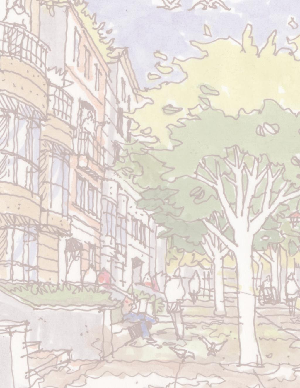
1 DEVELOPMENT PLAN OPEN SPACE SYSTEM OPEN SPACE SYSTEM The neighborhood provides for a range of open space types. The Village Square is an important open space in the neighborhood. It serves as a gathering and meeting space for neighborhood residents and visitors alike. Community-oriented spaces include landscaped areas such as pocket parks, the Elementary School Park, greenways, and the Transit Green. The activities and uses within these spaces include playgrounds, sports fields, community gardens and picnic areas. Naturalized community open spaces include the buffer areas along SR 113 and agriculture field edges, as well as some greenways. These areas consist of a more natural and informal landscape, such as screening vegetation, surface drainage swales, and pathways. The Recreation Fields along Hutchison Drive provide large sports fields for UC Davis students, as well as neighborhood and City residents. The Recreation Fields also provide additional drainage retention area during large storms. A large habitat area with drainage ponds is located along Russell Boulevard. This expansive open space area serves as a retention and percolation pond and habitat area for birds and animals. It also creates a buffer to the surrounding area and provides for expansive views to the south and west. 18 UC DAVIS NEIGHBORHOOD MASTER PLAN

2 DEVELOPMENT PLAN TRANSPORTATION & CIRCULATION SYSTEM TRANSPORTATION & CIRCULATION SYSTEM The transportation and circulation system focuses on the pedestrian and bicycle network, as well as the major transit connection provided along the Transit Green, which is within a fiveminute walk of all points in the neighborhood. Autos are limited to neighborhood streets, alleyways and a few major roadways. The primary objective is to provide safe, efficient and convenient access and circulation for all modes of transportation. The bicycle and pedestrian system links sites throughout the neighborhood via a network of lanes and pathways. A bicycle bridge connects directly across SR 113 to the Central Campus. Bicycle and pedestrian facilities also connect to the campus core along Hutchison Drive. The street circulation system is organized as a traditional street grid, with a few special arterial and collector streets to carry higher volumes of traffic. Traffic calming measures are built into the circulation system, including grade-separated bicycle underpasses along major bicycle routes and the possible use of traffic circles or roundabouts at key entries along the "Main Street. The streets are designed to be pedestrian-oriented and slow, with narrow street sections, bicycle lanes, use of large canopy street trees, small building setbacks, and parking in the rear of houses off of alleyways. There is no vehicle connection to Russell Boulevard, other than for bicycles and emergency access at Arthur and Eisenhower intersections. UC DAVIS NEIGHBORHOOD MASTER PLAN 19

3 DEVELOPMENT PLAN ENVIRONMENTAL SYSTEMS ENVIRONMENTAL SYSTEMS The neighborhood s site design is linked to several key environmental design principles and practices. At both the site and building scales, environmental design is primarily related to four key areas: solar access, cooling winds, on-site drainage, and transportation. Design features at the building scale are outlined in Chapter 5, Typical Design Characteristics. The neighborhood s street grid and buildings are oriented to maximize solar access and daylighting during winter months and mitigate heat gain during summer months. This orientation also allows structures to utilize solar panels for power generation. The site design takes advantage of the prevailing Delta breeze winds in the summertime, which provide natural afternoon and evening cooling during summer. Drainage swales use existing topography to channel rainwater into ponds at the northern edge of the neighborhood, allowing for groundwater percolation and habitat areas. All housing is located within a fiveminute walk of the Transit Green and transit line, helping to reduce automobile use in this transit-oriented neighborhood. An integrated bicycle network links the neighborhood to the city and the campus. 20 UC DAVIS NEIGHBORHOOD MASTER PLAN

4 DEVELOPMENT PLAN INFRASTRUCTURE SYSTEMS INFRASTRUCTURE SYSTEMS Several primary utility corridors form the backbone of the neighborhood s infrastructure systems. Three key onsite systems include domestic water, sanitary water, and storm drainage. Water for residences, educational facilities, commercial/service areas, civic uses and irrigation is supplied through the University s domestic water system. This water is pumped through pipes under major roadways. Wastewater from buildings is collected along the primary utility corridors and pumped into the UC Davis sanitary sewer system. This system includes sewer main lines and pumping facilities that channel neighborhood wastewater to the Wastewater Treatment Plant (WWTP) on the South Campus. Treated wastewater is discharged to the South Fork of Putah Creek, or recycled for secondary uses on the Central Campus. Stormwater is captured on-site and directed into nearby drains and drainage swales. The water is then channeled to the ponds at the northern end of the neighborhood, where it percolates into the ground or evaporates. During large rain events and wet periods, excess water is collected and pumped south to Putah Creek. For more information on infrastructure systems, including electrical power, natural gas, communications and solid waste, refer to the 2003 LRDP and 2003 LRDP Environmental Impact Report. UC DAVIS NEIGHBORHOOD MASTER PLAN 21
5
OPEN SPACE TYPES. SIZE 8 acres. SIZE 20 acres. SIZE 1 acre
 TYPICAL CHARACTERISTICS OPEN SPACE TYPES OPEN SPACE TYPES The neighborhood contains an extensive variety of open space types. Most of these spaces incorporate multiple uses and activities, so that each
Neighborhood Districts
 NEIGHBORHOOD DISTRICTS SEVEN MAIN DISTRICTS Neighborhood Districts While the Development Plan provides a broad-scale overview of the neighborhood, this section focuses on uses and relationships at the
9 th Street Sub Area Plan
 9 th Street Sub Area Plan In the 1990 s, when the Township prepared the last Master Plan, the 9 th Street corridor was studied as part of a larger 9 th Street Focus Area that included the West Main Street
BROOKHILL NEIGHBORHOOD MODEL ZONING MAP AMENDMENT PREFACE TO APPLICATION
 BROOKHILL NEIGHBORHOOD MODEL ZONING MAP AMENDMENT PREFACE TO APPLICATION June 15, 2015 Revised: August 1, 2016 I. VISION Brookhill is a proposed community based upon the principles of Albemarle County
UBC URBAN STUDIO, FALL 2002 PEDESTRIAN ORIENTED
 SECTION B PEDESTRIAN ORIENTED PATTERN: CITY OF VANCOUVER B.1 Vision Overview Regional Framework Energy 50% of all energy used within the Region to be produced by the Region. Energy production methods to
Transportation. Strategies for Action
 Transportation A major priority for the Overlake Neighborhood is to develop a multimodal transportation system. To achieve this system, a balance has to be found among travel, circulation and access needs;
City of Yelm. Tahoma Terra Final Master Plan Development Guidelines. Table of Contents
 City of Yelm Tahoma Terra Final Master Plan Development Guidelines Table of Contents Table of Contents... 1 Purpose... 2 Low Density Residential (R4-6)... 3 Moderate Density Residential (R6-10)... 5 Neighborhood
SANDPOINT/LAURELHURST. <Study Area>
 SANDPOINT/LAURELHURST Team Leaders: Kari Olson, Jason Morse Student Team Leaders: Tim Shuck, Terry Shaver. Team Members: Lynda Betts, Thomas Hargrave, Lolly Kunkler, Diana Kincaid, Edith Sze
The West Vaughan Employment Area Secondary Plan Policies
 Part 2: The West Vaughan Employment Area Secondary Plan Policies 2.1 General Policies It is the policy of Council: 2.1.1. That the West Vaughan Employment Area (the WVEA), identified on Schedule 1, will
SQUAMISH 2010 AND BEYOND COMMUNITY VISION
 Our plan has been imagined and created to be both pragmatic and visionary. At the core of the strategy is a consideration of the highway s role and its impact on the community. First and foremost in creating
Toronto Complete Streets Guidelines
 Toronto Complete Streets Guidelines 108 110 7.1 Green Infrastructure Design Principles 112 7.2 Context-Sensitive Green Streets 114 7.3 Key Green Street Elements Green infrastructure refers to natural and
Gold Line Bus Rapid Transit Transit Oriented Development (BRTOD) Helmo Station Area Plan
 Helmo Station Area Plan") Appendix F Gold Line Bus Rapid Transit Transit Oriented Development (BRTOD) Helmo Station Area Plan Introduction and Purpose of the Plan The Gold Line Bus Rapid Transit facility is an eleven-mile dedicated
Appendix F Gold Line Bus Rapid Transit Transit Oriented Development (BRTOD) Helmo Station Area Plan Introduction and Purpose of the Plan The Gold Line Bus Rapid Transit facility is an eleven-mile dedicated
Description of Preferred Alternative
 Chapter 2 Description of Preferred Alternative 2.1 Introduction This chapter of the programmatic Sammamish Town Center Sub-area Plan Final EIS provides a more detailed description of the Preferred Alternative
Responses to Comments Received on the Notice of Preparation
 Received on the Notice of Preparation APPENDIX A RESPONSES TO COMMENTS RECEIVED ON THE NOTICE OF PREPARATION The Notice of Preparation and Draft Initial Study for the proposed 2003 LRDP were circulated
Green Infrastructure and Low-Impact Development Technologies
 Green Infrastructure and Low-Impact Development Technologies The guiding principles of these technologies is to manage stormwater at their sources using natural means, and establish conditions so that
Neighborhood One. Location. Existing Land Use
 Neighborhood One Location Neighborhood One is bounded by Route 29 North on the east, Hydraulic Road on the south, (and a small area to the south of Hydraulic Road), the South Fork Rivanna River reservoir
ATTACHMENT A. SILVERDALE DESIGN STANDARDS Amendments to the Waaga Way Town Center Chapter
 ATTACHMENT A SILVERDALE DESIGN STANDARDS Amendments to the Waaga Way Town Center Chapter Chapter 10. Waaga Way Town Center 10.1 Physical Identity Elements & Opportunities The Waaga Way Town Center includes
OP Council Resolution June 16, Planning and Development Services
 OP-08-01 Council Resolution June 16, 2008 Planning and Development Services Kingsgate Landing Outline Plan Table of Contents 1.0 Introduction 1 1.1 Purpose of Plan 1 1.2 Plan Area Location 1 1.3 Ownership
3.11 LAND USE AND PLANNING
 3.11 LAND USE AND PLANNING This section evaluates the potential environmental impacts that could result from conflicts with land use plans and policies from buildout of the 2018 LRDP. A description of
SHEFFIELD PARK Paulding County, GA DRI #588
 SHEFFIELD PARK Paulding County, GA DRI #588 Supplemental Information for RDC s DRI (Form 2) Review August 16, 2004 Prepared for: Mr. David Howerin Coosa Valley RDC 1 Jackson Hill Drive Rome, GA 30161 P.O.
Community Design Guidelines. Port Wallace DRAFT
 Community Design Guidelines Port Wallace DRAFT Energy 1 2 3 Nature Movement Connections Built Form DRAFT Layout Energy 1 Nature Community Design Guidelines GREAT COMMUNITIES PROTECT, CELEBRATE, AND CONSERVE
Cornwall Park Neighborhood Plan
 [1] Cornwall Park Neighborhood Plan As adopted by Ordinance No. 8868 and amended by Ordinance Nos. 8946, 9200, 9201, 9233, 9301, 9305, 9749, 9787, 9764, 10502 and 10738, 2000-12-094, 2004-12-087, 2004-12-091,
Applicant Name Phone / Fax / Address City State Zip Code . Property Owner Phone / Fax / Address City State Zip Code
 Master Development Plan Application Community Development Department City of Redmond 411 SW 9 th Street Redmond, Oregon 97756 541-923-7721 541-548-0706 FAX Master Development Plan Fee $38,862.52 File Number
FRUITVALE TRANSIT VILLAGE (Phase 2) Residential Project
 Residential Project") FRUITVALE TRANSIT VILLAGE (Phase 2) Residential Project DEVELOPER: SIGNATURE PROPERTIES ARCHITECT: HKIT ARCHITECTS April 23, 2010 TABLE OF CONTENTS 3 Vision 4 Description of Site 5 Guiding Concepts 6
FRUITVALE TRANSIT VILLAGE (Phase 2) Residential Project DEVELOPER: SIGNATURE PROPERTIES ARCHITECT: HKIT ARCHITECTS April 23, 2010 TABLE OF CONTENTS 3 Vision 4 Description of Site 5 Guiding Concepts 6
Subarea 4 Indian Creek. Vision The combination of park networks and transportation amenities make Subarea 4 the greenest hub in the Corridor.
 indian creek 180 extends south from 101st Street to I-435. The I-435 and Metcalf intersection is one of the primary intersections in the Kansas City Metro Area. The area includes several residential neighborhoods
TABLE OF CONTENTS 1.0 INTRODUCTION GENERAL OBJECTIVES LAND USE DESIGNATIONS, OBJECTIVES AND POLICIES 4
 Schedule I- Redstone Golf Course Resort Area Sector Plan 1 TABLE OF CONTENTS 1.0 INTRODUCTION 3 2.0 GENERAL OBJECTIVES 3 3.0 LAND USE DESIGNATIONS, OBJECTIVES AND POLICIES 4 4.0 TRANSPORTATION AND ROAD
Ten Mile Creek Planning Area
 PLANNING AREA POLICIES TEN MILE CREEK Ten Mile Creek Planning Area Location and Context The Ten Mile Creek Planning Area ( Ten Mile Creek area ) is located south of the current Boise AOCI, generally south
C. Westerly Creek Village & The Montview Corridor
 C. Westerly Creek Village & The VISION Community Vision When the goals of the city are achieved Westerly Creek Village, a distinctive community defined by Montview Boulevard and Westerly Creek, is a strong
North Oakville East Parks Facilities Distribution Plan. November, 2009
 North Oakville East November, 2009 POLICY CONTEXT 1) Purpose a) The purpose of this document is to be a guide for the location, configuration, design and development of the parks system for the North Oakville
Glenborough at Easton Land Use Master Plan
 Land Use Framework November 30, 2007 2.0 LAND USE FRAME- WORK 2.1 LAND USE HISTORY and Setting Glenborough at Easton is located on property that was used for mining in the 19th and 20th centuries and rocket
UNIVERSITY OF ARKANSAS FOR MEDICAL SCIENCES
 HEALTHY INNOVATIONS A Sustainable Business Village Master Plan Concept SUSTAINABILITY - the linking of economic vitality; ecological integrity, and social well-being within a unified conceptual framework
Drexel, Barrell & Co.
 Drexel, Barrell & Co. June 18, 2018 Engineers/Surveyors Boulder Colorado Springs Greeley 3 South 7 th Street Colorado Springs, Colorado 80905-1501 719 260-0887 719 260-8352 Fax El Paso County Planning
Chapter 4 - Master Plan
 MAUKA / EAST NORTH SOUTH CAMPUS Illustrative Plan MAKAI / WEST 39 Open Space Network & Parks Open space trails Armory Park in Lahaina Waipuilani Gulch Open space is essential to a healthy community. Successfully
The Connaught Eco Neighbourhood Project. Public Meeting Tuesday, May 22, 2012
 The Connaught Eco Neighbourhood Project Public Meeting Tuesday, May 22, 2012 1 Background 2 Parc de voisinage POB Rivermead Phase I A residential vocation under the master plan A question of integration
Smart Growth Development Checklist
 2004 Smart Growth Development Checklist Smart Growth Development Checklist Corporation of the City of New Westminster Guide and manage growth in a manner which is consistent with the principles of sustainable
FORMER CANADIAN FORCES BASE (CFB) ROCKCLIFFE SECONDARY PLAN. Official Plan Amendment XX to the Official Plan for the City of Ottawa
 ROCKCLIFFE SECONDARY PLAN. Official Plan Amendment XX to the Official Plan for the City of Ottawa") FORMER CANADIAN FORCES BASE (CFB) ROCKCLIFFE SECONDARY PLAN Official Plan Amendment XX to the Official Plan for the City of Ottawa 1 INDEX THE STATEMENT OF COMPONENTS PART A THE PREAMBLE PAGE Purpose...
FORMER CANADIAN FORCES BASE (CFB) ROCKCLIFFE SECONDARY PLAN Official Plan Amendment XX to the Official Plan for the City of Ottawa 1 INDEX THE STATEMENT OF COMPONENTS PART A THE PREAMBLE PAGE Purpose...
Mariposa Lakes. Planned Community. Project Overview. Stockton, CA
 Planned Community Stockton, CA Project Overview March 2007 Summary of Proposed Community is a master-planned community proposed for development on approximately 3,810 acres in southeast Stockton. In 2004,
Date: April 10, 2017 City Council Work Session April 24, 2017: Status Report on the Comprehensive Plan Update and Transportation Master Plan
 AGENDA REPORT To: From: By: Honorable Mayor and City Council Members Warren Hutmacher, City Manager Sharon Ebert, Director Community Development Date: April 10, 2017 Agenda: City Council Work Session April
Drexel, Barrell & Co.
 Drexel, Barrell & Co. December 21, 2018 Engineers/Surveyors Boulder Colorado Springs Greeley 3 South 7 th Street Colorado Springs, Colorado 80905-1501 719 260-0887 719 260-8352 Fax El Paso County Planning
FUNDAMENTAL BUILDING BLOCKS
 FUNDAMENTAL BUILDING BLOCKS THE WEB OF GIBSONS - EXISTING Lacks Community Structure and Support Circulation, surface water flow and buildings are disjointed from the community Social neighbourhoods are
COMPLETE GREEN STREET CHECKLIST
 COMPLETE GREEN STREET CHECKLIST This document was developed to dissect the structure of an urban street and explore opportunities to make our streets more complete while also integrating green street strategies.
CONTENTS 8.0 LAND USE 8.1 GENERAL LAND USE 8.2 RESIDENTIAL 8.3 MIXED USE 8.4 COMMERCIAL 8.5 EMPLOYMENT LANDS
 8-2 Land Use 8.0 LAND USE CONTENTS 8.1 GENERAL LAND USE 8.1.1 Uses provided for in all Land Use Designations 8.1.2 Uses prohibited in Hazardous Lands, Hazardous Sites and Special Policy Areas 8.1.3 Uses
Complete Neighbourhood Guidelines Review Tool
 Complete Neighbourhood Guidelines Review Tool Prepared By: City of Regina Planning Department October 2014 Page 1 of 14 Community Development Review Checklist for Secondary Plans and Concept Plans The
for Master Planned Development Framework Design Standards & Guidelines
 B L A C K D I A M O N D DE S I G N G U I D E L I N E S for Master Planned Development Framework Design Standards & Adopted June 18, 2009 Introduction and Purpose The Master Planned Development (MPD) Framework
Design Specifications & Requirements Manual
 11 PARKS & OPEN SPACES 11.1 DEFINITIONS... 1 11.1.1 Neighbourhood Parks... 1 11.1.2 District Parks... 1 11.1.3. Sport Parks... 1 11.1.4 Urban Parks... 1 11.1.5 Civic Spaces... 1 11.1.6 Open Space System...
4 CIRCULATION AND TRANSPORTATION
 4 CIRCULATION AND TRANSPORTATION 4.1 INTRODUCTION One of the central concepts of the Hecker Pass Specific Plan is to maintain the rural character and scenic qualities of the area. The transportation and
Westbound: A One-day Exploration of Growth
 Westbound: A One-day Exploration of Growth Frog Pond Area 2018 UGB Expansion Proposal June 13, 2018 Growing Out: UGB Asks Four cities submitted proposals to expand greater Portland s urban footprint by
Design Specifications & Requirements Manual
 11 PARKS & OPEN SPACES 11.1 DEFINITIONS... 1 11.1.1 Neighbourhood Parks... 1 11.1.2 District Parks... 1 11.1.3. Sport Parks... 1 11.1.4 Urban Parks... 1 11.1.5 Civic Spaces... 1 11.1.6 Open Space System...
4 C OMMUNITY D ISTRICTS
 4 C OMMUNITY D ISTRICTS N ew development in the Area will include many different types of land uses, including a destination retail area that attracts people from all over the region; recreation opportunities
EXISTING PLANS Harriet Festing Center for Neighborhood Technology Midlothian Community Meeting March 12, 2015
 EXISTING PLANS Harriet Festing Center for Neighborhood Technology Midlothian Community Meeting March 12, 2015 BENEFITS Bring economic, community + environmental benefits Enhance property values Use
Section4 Design Vision & Implementation Plan
 Section4 Design Vision & Implementation Plan W Woodschurch Rd 4.1 Design Focus Areas The Framework Plan is simply the starting point for directing the design and implementation of a wide range of transportation
Queensborough Eastern Neighbourhood Node. Community Open House
 Queensborough Eastern Community Open House The Vision The Queensborough Eastern will become the heart of eastern Queensborough. Through a sensitive mix of viable commercial and residential areas, the neighbourhood
Potential Green Infrastructure Strategies May 6, 2015 Workshop
 Potential Green Infrastructure Strategies May 6, 2015 Workshop Background The City of Cortland is developing the Tioughnioga Urban Headwaters Green Infrastructure Action Plan with funding from the National
City of Redmond. Urban Holding Area Master Planning Requirements and Approval Process
 City of Redmond Urban Holding Area Master Planning Requirements and Approval Process June 21, 2006 City of Redmond: Urban Holding Area Master Planning Requirements and Approval Process Table of Contents
Climate Smart Communities Green Infrastructure Case Studies
 New York State Water Resources Institute Climate Smart Communities Green Infrastructure Case Studies Emily Vail Hudson River Estuary Program NYS Department of Environmental Conservation Cornell University
Pine Island Road Corridor Master Plan
 RECOMMENDED DEVELOPMENT PLAN Figure 9: Del Prado Village District Conceptual Framework The Conceptual Framework (Figure 8) for development of the Pine Island Corridor is to encourage mixed-use development
City of Heath. Town Center Concept
 In the give-and-take of getting projects designed, financed, and approved, the famous refrain from the film Field of Dreams is heard often: if you build it, they will come. From the perspective of the
3.1 community vision. 3.3 required plan elements
 Chapter 3 Community Form 3.1 community vision 3.2 Parks & landscaping concepts 3.3 required plan elements D R A F T 20 Community Form Chapter 3 3.0 Community form 3.1 community vision The Specific Plan
WASHINGTON COUNTY OREGON
 WASHINGTON COUNTY OREGON July 9, 2009 Revisions to Chapter 2 of the Bethany Community Plan The North Bethany Subarea Plan Exhibit pages 7 and 8 The sections for the Core and Flexible Streets were amended
CHAPTER 8. Mrs. Zimman s Class - Central Elementary
 SUSTAINABILITY CHAPTER 8 Mrs. Zimman s Class - Central Elementary 8.1 OVERVIEW Green infrastructure also known as low impact development (LID) and environmental or sustainable site design is an environmentally
Outline Plan in Belvedere (Ward 9) at Street SE, LOC (OP)
 at Street SE, LOC (OP)") 2018 October 04 Page 1 of 12 EXECUTIVE SUMMARY This outline plan application was submitted by B&A Planning Group on 2016 July 15, on behalf of Tristar Communities Inc. for 50.14 hectares (123.89 acres)
2018 October 04 Page 1 of 12 EXECUTIVE SUMMARY This outline plan application was submitted by B&A Planning Group on 2016 July 15, on behalf of Tristar Communities Inc. for 50.14 hectares (123.89 acres)
City of Tacoma Planning and Development Services
 Agenda Item D-3 City of Tacoma Planning and Development Services To: Planning Commission From: Stephen Atkinson, Associate Planner, Planning Services Division Subject: Land Use Designations - Phase 2 Meeting
BURTON STATION STRATEGIC GROWTH AREA PLAN UPDATE PUBLIC MEETING 3/26/18
 BURTON STATION STRATEGIC GROWTH AREA PLAN UPDATE PUBLIC MEETING 3/26/18 1 WHERE WE ARE? 2 PRIMARY OBJECTIVES OF THE PLAN UPDATE 1. Update the land use designation for Burton Station Village to reflect
5.1 Site Plan Guidelines
 5. Community Core Guidelines Development of the Community Core will take place by plan of subdivision and site plan approval. It will occur in a phased manner that will reflect the timing of residential
Major Subdivision Sketch Plan Checklist
 This checklist provides specific requirements that are apart of the Sketch process. The entire process is described by the Huntersville Subdivision Review Process which details all the submittal and resubmittal
CHAPTER 3 VISION, GOALS, & PLANNING PRINCIPLES. City of Greensburg Comprehensive Plan. Introduction. Vision Statement. Growth Management Goals.
 CHAPTER 3 VISION, GOALS, & PLANNING PRINCIPLES Introduction The Greensburg Comprehensive Plan is intended as a working community document. A combination of long and short-term goals, this document is intended
39 WALLACEVILLE STRUCTURE PLAN
 39 WALLACEVILLE STRUCTURE PLAN PRECINCT DESCRIPTIONS, INTENTIONS AND OUTCOMES Wallaceville Living Precinct Area A At approximately 13.4ha, this precinct is the largest precinct and the precinct provides
Little Mountain UDP Presentation
 Summary of UDP Evaluation of Dec 2015 Plan Dec 2015 Site Plan Transitional edges work well Central spine and permeability are strong Tree retention is good Establish Big Idea Sameness of built form contributes
RESOLUTION NO R
 e e RESOLUTION NO R04 0054 BE IT RESOLVED by the Mayor and City Council ofthe City ofpapillion that The Papillion Comprehensive Plan is hereby amended to incorporate the Option A Future Land Use Map Transportation
Metro. Activity Center Design Guidelines. Recommendations For Developing Focused, Mixed-Use Commercial/Residential Centers
 Metro Activity Center Design Guidelines Recommendations For Developing Focused, Mixed-Use Commercial/Residential Centers Metro Activity Centers What is a MAC? Legacy, the adopted guide for the future growth
USF System Campus Master Plan Updates Goals, Objectives and Policies
 2015-2025 USF System Campus Master Plan Updates Goals, Objectives and Policies Tampa Goals, Objectives, and Policies Table of Contents Executive Summary 2015 2025 USF Campus Master Plan Update Introduction
Hockessin Community Redevelopment Plan
 Hockessin Community Redevelopment Plan 3.1 Introduction The Community Redevelopment Plan for the Village of Hockessin is the result of the people s vision for a distinct village center that serves as the
Preliminary Recommendations Tk Takoma/Langley Crossroads Sector Plan
 Preliminary Recommendations Tk Takoma/Langley Crossroads Sector Plan Vision is to achieve a Transit Oriented, pedestrian friendly Community that Celebrates and builds upon the cultural Diversity of the
PINE CURVE REZONING. Property does not meet criteria for open space preservation and is not a candidate for a park
 PINE CURVE REZONING BACKGROUND Purchased as two parcels in 2001 and 2002 Annexed and Zoned Greater Downtown District Historic Center September 25, 2002 and October 7, 2002 WHAT THE PROJECT IS AND IS NOT
Technical Appendix C, Key Goals, Policies and Implementing Actions of the Merced Vision 2030 General Plan, including related BCP Policies
 Technical Appendix C, Key Goals, Policies and Implementing Actions of the Merced Vision 2030 General Plan, including related BCP Policies Contents C.1 Overview of Policy Arrangement C.2 Urban Design (Vision
SPRINGHILL LAKE TRANSIT VILLAGE
 Greenbelt Metro Area Sector Plan - Subarea Design Policies and Guidelines - Springhill Lake Transit Village 113 SPRINGHILL LAKE TRANSIT VILLAGE Residential Neighborhood and Village Center CONCEPT Springhill
ITEM #8. Regional Smart Growth Program. Regional Smart Growth Program. Presentation Overview. Coast Highway Vision and Stategic Plan.
 Regional Smart Growth Program Economic Development Commission What is Smart Growth? Adopted as part of the Regional Comprehensive Plan (RCP) RCP provides vision for region based on Smart Growth and sustainability
Planning Board Briefing
 Planning Board Briefing Why Now? The Sector Plan Implementation Chapter States: Before Stage 1 begins, the following must occur: Approval of the Sectional Map Amendment. Approval of the Greater Lyttonsville
CHAPTER 7: VISION AND ACTION STATEMENTS. Noble 2025 Vision Statement
 CHAPTER 7: VISION AND ACTION STATEMENTS This chapter presents the vision, policy and action statements that transform the comprehensive planning study, an analysis of Noble s past, future trends and community
Figure 3-1: Public Realm Plan
 3 Public Realm Figure 3-1: Public Realm Plan 3.1 Public Realm Concept The public realm concept for the Little Mountain site integrates a clear and accessible movement network with public spaces for social
Chapter 5: Natural Resources and Environment
 NATURAL RESOURCES AND ENVIRONMENT 5-1 5 Chapter 5: Natural Resources and Environment BACKGROUND AND INTENT Urban expansion represents the greatest risk for the future degradation of existing natural areas,
2010 Campus Master Plan Update - USF TAMPA Campus Master Plan Update USF TAMPA
 2010 Campus Master Plan Update USF TAMPA Purpose of the Update: Required by the Board of Governors Provides a framework for planned growth in a context of sustainability Master Plan Update Approval Process
4.1.3 LAND USE CATEGORIES
 4.1.3 LAND USE CATEGORIES a. City Center District The City Center District incorporates the existing character and mix of uses in downtown Belmont to encourage redevelopment and new development in keeping
Leduc Industrial Outline Plan SE W4
 Leduc Industrial Outline Plan SE 1-50-25-W4 Within the North Leduc Industrial ASP Prepared for: Leduc Energy Park Ltd. Prepared by: Stantec Consulting Ltd. File No. 1161 104655 V5 Table of Contents 1.0
4. Parks, Open Space and Urban Forest
 4. Parks, Open Space and Urban Forest Goals 1. Enhance parks as public gathering places for the neighbourhood 2. Refresh park facilities to attract diverse ages and activities 3. Improve waterfront access
TABLE OF CONTENTS. Tables Table UC Davis Park and Open Space Resources
 TABLE OF CONTENTS 4.13 Recreation... 4.13-1 4.13.1 Environmental Setting... 4.13-1 4.13.2 Impacts and Mitigation Measures... 4.13-4 4.13.3 References... 4.13-8 Tables Table 4.13-1 UC Davis Park and Open
Better Cycling. The City will update the cycling master plan (London ON Bikes) based on the approved BRT network.
 based on the approved BRT network.") Better Cycling Dedicated bike facilities will be constructed along BRT corridors where space is available. Nearby bike routes will also be upgraded to ensure a complete network is available for cyclists.
Better Cycling Dedicated bike facilities will be constructed along BRT corridors where space is available. Nearby bike routes will also be upgraded to ensure a complete network is available for cyclists.
Landscaping and Landscape Architecture
 A. General Overview This planning and landscape section has been prep ared to provide Property Owners, Architects, Contractors, and Builders/Developers with important information related to the development
SUBDIVISON & ZONING BY-LAW AMENDMENT
 RICHMOND WEST SUBDIVISON & ZONING BY-LAW AMENDMENT FEBRUARY 2013 APPLICATION INFORMATION Applications: Proposed Plan of Subdivision and Zoning By Law Amendment. Site Address: 6335 and 6350 Perth Street.
... the real city lives on... Character Area 5: LOWER WASHINGTON
 ... the real city lives on... Character Area 5: LOWER WASHINGTON 89 Boundaries This area is bordered by the extension of Fair Way to the north, the Napa River to the south, Gerard Street/Fire Station parking
HAZARD MITIGATION GOALS AND OBJECTIVES
 SEWRPC Community Assistance Planning Report No. 282, 2nd Edition CITY OF MILWAUKEE ALL HAZARDS MITIGATION PLAN UPDATE Chapter IV HAZARD MITIGATION GOALS AND OBJECTIVES [NOTE: Throughout this plan update
Chapter 5: Recreation
 Chapter 5: Recreation Introduction and Setting Recreational opportunities within Nevada County are varied, ranging from public parks with intensively used active recreational facilities, to vast tracts
ELMVALE ACRES SHOPPING CENTRE MASTER PLAN
 ELMVALE ACRES SHOPPING CENTRE MASTER PLAN Contents 1.0 INTRODUCTION... 2 2.0 LOCATION... 2 3.0 EXISTING CONTEXT... 2 4.0 VISION & GUIDING PRINCIPLES... 2 5.0 LAND USE AND BUILT FORM... 4 5.1 St. Laurent
Billing Code: DEPARTMENT OF HOUSING AND URBAN DEVELOPMENT [Docket No. FR-6072-N-01]
![Billing Code: DEPARTMENT OF HOUSING AND URBAN DEVELOPMENT [Docket No. FR-6072-N-01]](/thumbs/91/107309814.jpg "Billing Code: DEPARTMENT OF HOUSING AND URBAN DEVELOPMENT [Docket No. FR-6072-N-01]") This document is scheduled to be published in the Federal Register on 12/18/2017 and available online at https://federalregister.gov/d/2017-27194, and on FDsys.gov Billing Code: 4210-67 DEPARTMENT OF HOUSING
This document is scheduled to be published in the Federal Register on 12/18/2017 and available online at https://federalregister.gov/d/2017-27194, and on FDsys.gov Billing Code: 4210-67 DEPARTMENT OF HOUSING
 Health Sciences City The available land area, although limited, combined with the unique partnership between the primary institutions and the supporting partnerships of the development interests within
PINE CURVE REZONING. BACKGROUND Purchased as two parcels in 2001 and 2002
 BACKGROUND Purchased as two parcels in 2001 and 2002 WHAT THE PROJECT IS AND IS NOT A Rezoning establishes the land use standards for Annexed and Zoned Greater Downtown District Historic Center September
Surrey Ecosystem Management Study
 Surrey Ecosystem Management Study Green Infrastructure Network Opportunities Public Open House & Information Session June 24 th, 2010 EMS Process Ecological Inventory Ecological Assessment Management Policy
DRAFT. 10% Common Open Space
 % OF CHARLOTTE IS CATEGORIZED AS A. LAND USES : Placeholder map displaying location of Place Type GOALS: Accommodate XX% of future growth. Provide a concentration of primarily commercial and civic activity
THE CITY OF WINNIPEG BY-LAW NO. 48/2014
 THE CITY OF WINNIPEG BY-LAW NO. 48/2014 A By-law of THE CITY OF WINNIPEG to adopt a secondary plan for Precinct K of the Complete Communities Direction Strategy By-law No. 68/2010. THE CITY OF WINNIPEG,
Sustainable Stormwater Management through Green Infrastructure. Jersey City Public School #5
 Green Infrastructure Site Evaluation Friday, October 25 th, 2013 Sustainable Stormwater Management through Green Infrastructure Jersey City Public School #5 FORMAT: (15 minutes) An Introduction to Stormwater