Technical Appendix L, University Community Plan Town Center
|
|
|
- Abigail Jade Garrison
- 5 years ago
- Views:
Transcription
1 Technical Appendix L, University Community Plan Town Center Table of Contents L.1 Executive Summary L.2 Merced County University Community Plan, 2004 Findings L.2.1 Visioning L.2.2 UCP Goals, Objectives and Policies L.3 UC Merced Tomorrow, Long Range Development Plan UC Merced, 2009 Findings L.3.1 Overview L.3.2 Key Statements L.3.3 UCM Circulation L.4 UC Merced and University Community Project Draft EIS/EIR, 2008 Findings L.4.1 Project Description L.4.2 Table of Major Land Uses L.5 Technical Memorandum Findings L.5.1 Key Statements from Applicable Documents L.5.2 Essential Character of the Town Center L.5.3 Unique Traits of the Town Center L.5.4 Change in Town Center/Business Center Land Uses and Acres L-1
2 L.1 Executive Summary The paper describes the planned use and function of the Town Center planned to be sited immediately south of UC Merced in the University Community Plan (UCP). Identification of this center will be used to differentiate it from any center that is proposed adjacent to western boundary of UC Merced in the Bellevue Community Plan. The Town Center is described in these three planning documents: 2009 UCM LRDP 2004 University Community Plan 2008 EIR/EIS for UCM Phase 2020 and the University Community While the size and location of the Town Center varies between the 2004 and 2008 planning documents, its function and purpose is has not. Section L.5.1 includes a list of key description statements taken from the documents assessed in this report. A composite description is provided in Section L.5.2, combining the statements from the various planning documents, and highlighting the essential descriptors of the Town Center. Unique traits of the Town Center are described in Section L.5.3, along with suggested consideration of compatible (not- competitive) uses in the Bellevue Community Plan. L-2
3 L.2 Merced County University Community Plan (2004), Findings L.2.1 Visioning Per visioning statement of the Merced County UCP, the fundamental organizing principle of the University Community is the establishment of a high density mixed- use Town Center abutted by and integrated with a number of distinct Residential Villages The concentration and intermixing of uses within the Town Center will promote pedestrian and transit use and establish it as the heart of the community Libraries, performing arts venues, art galleries, and other cultural facilities are located are planned to be located in the Town Center The Town Center Specific Plan shall be prepared in consultation with UC Merced to ensure the UCP s objectives for the interface and sharing of uses and continuity of streets, sidewalks/pedestrian paths, bikeways, infrastructure, open space amenities, and other elements are achieved L.2.2 UCP Goals, Objectives, and Policies Key goal, objective and policy statements are listed from the UCP: LU 3.2 Policy A business center shall be developed adjacent and relate to the Town Center and UC Merced campus LU 3.4 Policy Locate the highest development densities within and adjacent to the Town Center and primary transit corridors and stations to support community activity and transit use. Encourage the development of housing that is suitable and affordable for UC Merced students, faculty, and staff in proximity and adjacent to the Town Center LU 4.4 Policy The development allocations among the Town Center and each Residential Village shown in Table 2 (see NOTE below) may vary to reflect the number of Villages to be developed or otherwise transferred among the five sub- areas provided that the cumulative amount of development in the Community is not exceeded, nor reduced to a L-3

4 Bellevue Community Plan, Technical Appendix L: University Community Plan Town Center level that jeopardizes the ability to fund Community infrastructure, public services, and environmental mitigation.1-27 NOTE: The data from Table 2 (below), referenced in the paragraph above, is also presented in column 2 titled 2004 UCP of this Technical Memorandum (section L.5.4). L-4
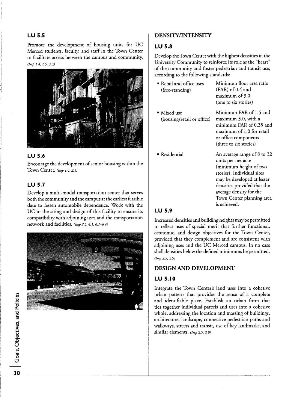
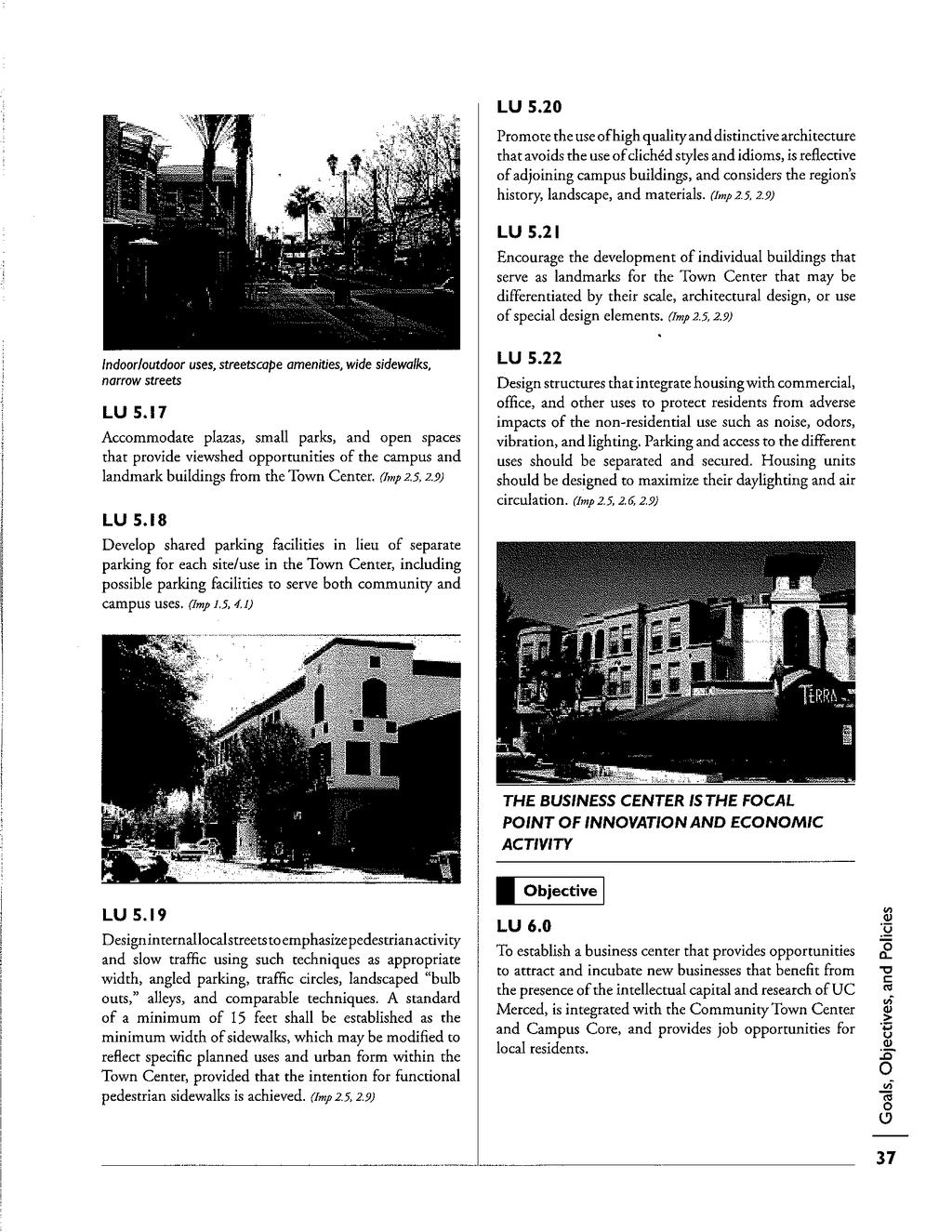
5 LU Objective 6.0 To establish a business center that provides opportunities to attract and incubate new businesses that benefit from the presence of the intellectual capital and research of UC Merced, is integrated with the Community Town Center and Campus Core, and provides job opportunities for local residents Economic Development Objective 2.0 Community identity will be established through creation of a town center within the University Community that physically links the Campus to the Community. Creating a vibrant town center requires that it be active and lively into the evening hours. Cafes, bookstores, and restaurants with extended hours can be attracted to the town center to draw students and professionals alike and offer a welcome setting for studying and socializing if retail, service, and entertainment businesses are concentrated in one village center near the edge of the campus in the early phases of development. High density residential can also contribute to the success of the town center, providing customers within walking distance Cultural Facilities & Public Use Policies PLC 5.5 Promote the development of cultural facilities in the Town Center, as the first priority locations, with possible facilities in the Residential Village Centers PS 1.2 Identify sites for police facility location(s) in subsequent Specific Plans for development in the University Community, based on need, phasing, and timing. The Town Center would be a priority candidate site PHS 1.2 Locate any health care facilities that are developed in the Community in the Town Center and, secondarily, in the Residential Village Centers to maximize access by local residents and interface with other public uses PHS 2.2 Locate social provider facilities in the Town Center and, secondarily, in the Residential Village Centers to maximize access by local residents and interface with other public facilities L-5
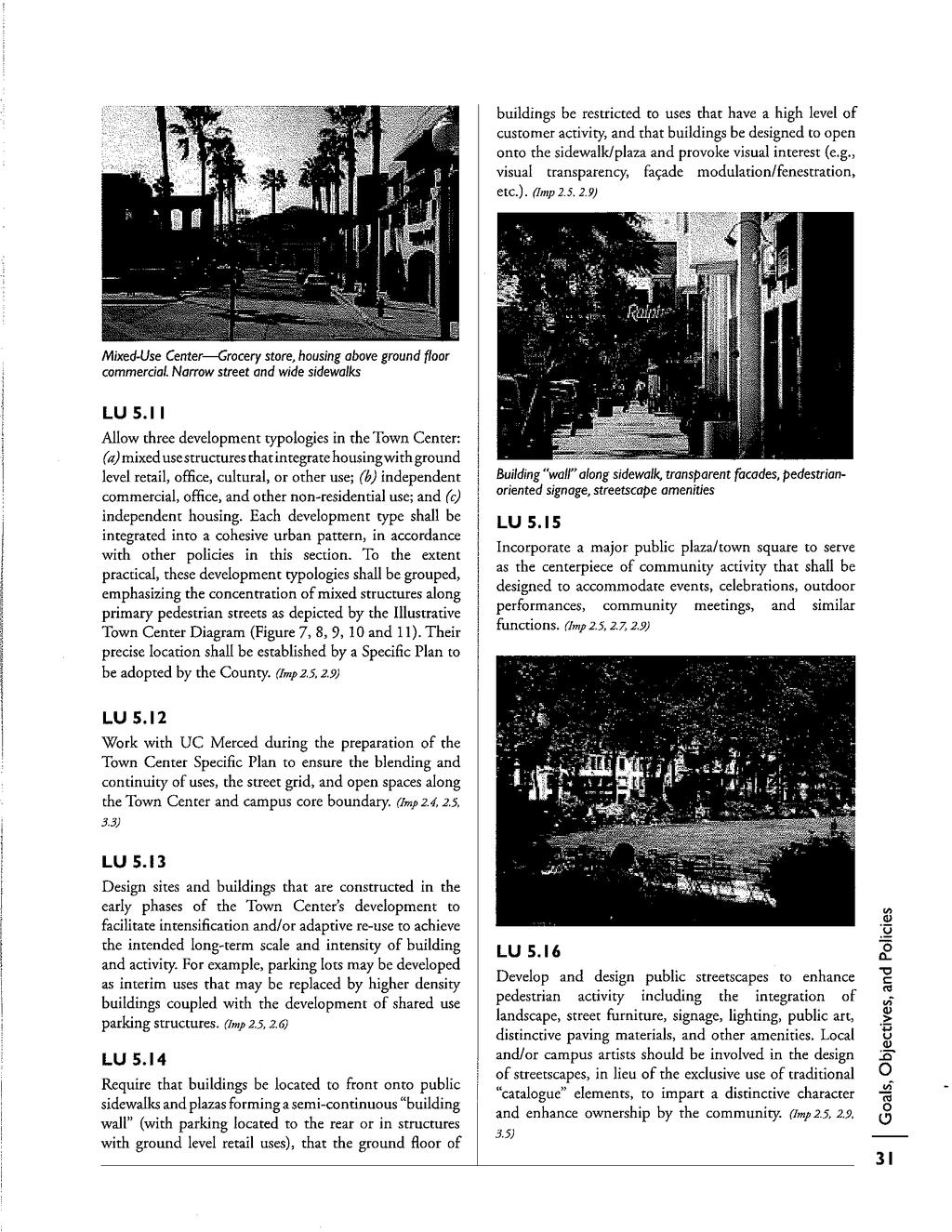
6 Land Use Objective 5.0 To develop the University Community Town Center as the symbolic and functional center of the University Community that is directly linked and shares uses with the University campus core and linked to surrounding Residential Villages NOTE: Land Use Policies LU 5.1 to LU 22 are provided in their entirely on the following four pages. Note: LU 5.11: Allow three development typologies in the Town Center: (a) mixed use structures that integrate housing with ground level retail, office, cultural, or other use; (b) independent commercial, office, and other non- residential use; and (c) independent housing. Each development type shall be integrated into a cohesive urban pattern, in accordance with other policies in this section. To the extent practical, these development typologies shall be grouped, emphasizing the concentration of mixed structures along primary pedestrian streets as depicted by the Illustrative Town Center Diagram (Figure 7, 8, 9, 10 and 11). Their precise location shall be established by a Specific Plan to be adopted by the County L-6
7 L-7
8 L-8
9 L-9
10 L-10

11 University Community Plan Town Center/ Business Center L-11
12 L-12
13 L.3 UC Merced Tomorrow, Long Range Development Plan UC Merced (2009) Findings L.3.1 Overview Subsequent to the adoption of the 2004 Merced County UCP, the UC Merced Campus shifted south into lands originally planned for the UCP, and along with it, the planned location of the Town Center. As with the 2004 UCP, the Town Center is still placed immediately adjacent along the southern edge of UC Merced. The Communities/Land Use Policies COM_3 policy is a good summary of the relationship between UC Merced and the Town Center in the UCP, and states: Integrate campus land use patterns, transportation and circulation systems, and open space systems with those of the adjoining community, particularly in the area of the Town Center Three other statements in the LRDMP mention the UCP Town Center: L.3.2 Key Statements COM- 9: Locate uses that will attract community participation, such as performance, arts and spectator sports, near or adjacent to the Town Center to assure ease of access for the Merced community, and coordinate with the community in support of facilities that may be of joint use, such as conference centers Main Street 2.0 is a mixed- use street featuring student housing above campus functions. It links North Campus and Central Campus to the University Community s Town Center. At the north are student union and student affairs buildings, and on the south is the sports complex, and the west end of the Town and Gown District MOB- 12: Provide high- frequency, safe and convenient transit services that seamlessly connect major activity centers on campus and in the neighboring University Community. Primary transit destinations would include the campus core, the Town Center, the Gateway District, outlying commuter parking facilities, and key locations within on- campus and off- campus housing areas. Each building in the campus core should be within a 5 minute walk of a transit stop L-13

14 Bellevue Community Plan, Technical Appendix L: University Community Plan Town Center L.3.3 UCM Circulation L-14
")
15 Community Collector (Town and Gown District) L-15
16 L.4 UC Merced and University Community Project Draft EIS/EIR (2008) Findings L.4.1 Project Description The project description included in the 2008 EIS/EIS for the UC Merced and University Community Project, address the Town Center and adjacent Gateway District, as follows: Town Center The UCP, as previously adopted, proposed the development of a 120- acre mixed- use Town Center in the northernmost portion of the University Community area as a transition into the campus. In the view of the University, the land use plan for Community North continues and advances this concept. A Town Center would be built on about 120 acres in the north- central portion of Community North, directly adjacent to and south of the Academic Core of the campus. This Town Center would include commercial office, general commercial, mixed- use commercial, mixed- use residential, medium- density residential space, entertainment venues, parks, performing arts facilities, and parking (both distributed and structured). Approximately 862,500 square feet of commercial and office space and about 3,270 parking spaces in lots and parking structures are planned for the Town Center. The development of buildings and sites with a mix of uses, such as the vertical integration of housing with retail, office, or other uses would be encouraged. Residential development in the Town Center would consist of 1,418 units in a combination of single- family townhouse/rowhouse units, multi- family units located in mixed- use buildings with emphasis on occupancy by the campus- related uses and residents Gateway District The UCP, as previously adopted, included 22 acres of land for the development of 400,000 square feet of research and development (R&D) space. The revised land use plan for Community North provides about 100 acres in the northwestern portion of Community North for the development of the Gateway District, which would focus on R&D and would be adjacent to similar R&D land uses on the campus. This area would be developed with approximately 2.3 million square feet of building space that would house research laboratories and industrial R&D University Community Town Center The Town Center district would be located in Community North, and would serve as the downtown for the campus and the community. This district would include mixed- L-16
17 use commercial and residential activities, cultural facilities, and parking. The Town Center Commercial Mixed Use (TC- 1), Residential Mixed- Use (TC- 2), and Residential Townhouse/Rowhouse (TC- 3) blocks are proposed for this District. L-17
18 L.4.2 Table of Major Land Uses Along with the change in acreage to the Campus and the University Community, the EIR/EIS project description included changes in land use; these changes are described in Table below. L-18
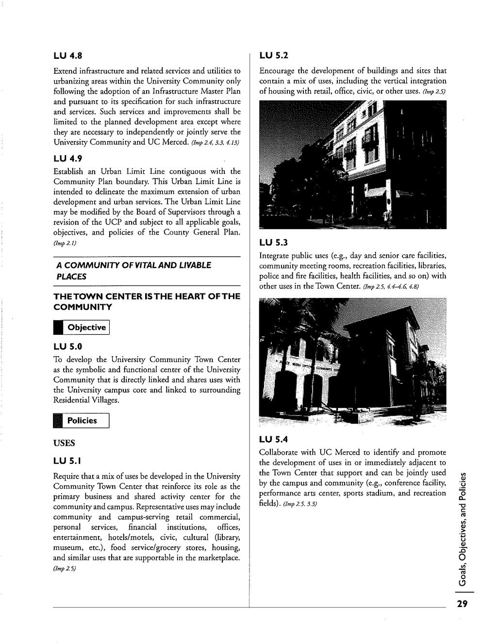
19 L.5 Technical Memorandum Findings L.5.1 Key Statements from Applicable Documents While the size and location of the Town Center and land uses vary between the 2004 and 2008 planning documents (see table in Section L.5.4), its function and purpose has not, and is described in the following key statements from the documents assessed in this report. Merced County University Community Plan, 2004 Require that a mix of uses be developed in the University Community Town Center that reinforce its role as the primary business and shared activity center for the community and campus. Representative uses may include community and campus- serving retail commercial, personal services, financial institutions, offices, entertainment, hotels/motels, civic, cultural (library, museum, etc.), food service/grocery stores, housing. Collaborate with UC Merced to identify and promote the development of uses in or immediately adjacent to the Town Center that support and can be jointly used by the campus and community (e.g., conference facility, performance arts center, sports stadium, and recreation fields). A business center shall be developed adjacent and relate to the Town Center and UC Merced campus Encourage the development of buildings and sites that contain a mix of uses, including the vertical integration of housing with retail, office, civic, or other uses. The concentration and intermixing of uses within the Town Center will promote pedestrian and transit use and establish it as the heart of the community. Develop the Town Center with the highest densities in the University Community to reinforce its role as the heart of the community and foster pedestrian and transit use. Require that buildings be located to front onto public sidewalks and plazas forming a semi- continuous building wall (with parking located to the rear or in structures with ground level retail uses), that the ground floor of buildings be restricted to uses that have a high level of customer activity, and that buildings be designed to open onto the sidewalk/plaza and provoke visual interest (e.g., visual transparency, façade modulation/fenestration, etc.). L-19
20 UC Merced Tomorrow, Long Range Development Plan UC Merced, 2009 Integrate campus land use patterns, transportation and circulation systems, and open space systems with those of the adjoining community, particularly in the area of the Town Center. Locate uses that will attract community participation, such as performance, arts and spectator sports, near or adjacent to the Town Center to assure ease of access for the Merced community, and coordinate with the community in support of facilities that may be of joint use, such as conference centers. UC Merced and University Community Project Draft EIS/EIR, 2008 A Town Center would be built on about 120 acres in the north- central portion of Community North, directly adjacent to and south of the Academic Core of the campus. This Town Center would include commercial office, general commercial, mixed- use commercial, mixed- use residential, medium- density residential space, entertainment venues, parks, performing arts facilities, and parking (both distributed and structured). The development of buildings and sites with a mix of uses, such as the vertical integration of housing with retail, office, or other uses would be encouraged. The Town Center district would be located in Community North, and would serve as the downtown for the campus and the community. This district would include mixed- use commercial and residential activities, cultural facilities, and parking. L-20
21 L.5.2 Essential Character of the Town Center Based on the key statements above, City Staff has prepared a single description of the UCP Town Center: The Town Center district would be located in Community North, and would serve as the downtown for the campus and the community. Integrate campus land use patterns, transportation and circulation systems, and open space systems with those of the adjoining community. The Town Center would be developed with the highest densities in the University Community to reinforce its role as the heart of the community. The Town Center would include commercial office, general commercial, mixed- use commercial/retail, mixed- use residential, medium- density residential space, entertainment venues, parks, and parking (both distributed and structured). Representative uses may include community and campus- serving retail commercial, personal services, financial institutions, offices, entertainment, hotels/motels, civic, cultural (library, museum, etc.), food service/grocery stores, housing. Collaborate with UC Merced to identify and promote the development of uses in or immediately adjacent to the Town Center that support and can be jointly used by the campus and community (e.g., conference facility, performance arts center, sports stadium, and recreation fields). A business center shall be developed adjacent and relate to the Town Center and UC Merced campus To foster pedestrian and transit use, in concert with high densities, Town Center buildings would be require to front onto public sidewalks and plazas forming a semi- continuous building wall (with parking located to the rear or in structures with ground level retail uses), that the ground floor of buildings be restricted to uses that have a high level of customer activity, and that buildings be designed to open onto the sidewalk/plaza and provoke visual interest (e.g., visual transparency, façade modulation/fenestration, etc.). L-21
22 L.5.3 Unique Traits of the Town Center Due to proximity and ability to craft a circulation and land use network that joins the campus with the future UCP Community, the Town Center would become the downtown for both the campus and the community, thereby, becoming a major center in the area. The project s Town and Gown District is knitted together by a right- of- way designed specifically for pedestrians, though vehicles can pass through safely. The proximity and connectedness of the UCM campus and the University Community forms a fertile location that supports the growth of uses which and can be shared the campus and community (e.g., conference facility, performance arts center, sports stadium, and recreation fields). While not unique, the adjacency of the business center/research and development park compounds the size and strength of this center. The Bellevue Community Plan lacks adjacency to the UC Merced academic core, and the associated vitality it could bring to a downtown setting. The campus parkway (extended) right- of- way and the UCM Gateway District, more of a district than a center, separates the campus from future development in the Bellevue Community Plan. Uses that supplement and support the Gateway District, and are less supportive of a downtown setting, should be considered to be placed along the eastern edge of the Bellevue Community Plan. While a center may be located here, the size and character need to be distinct from the Town Center in the UCP. Technical Memorandum K describes the Gateway District is greater detail. L-22
23 L.5.4 Acres Changes in Town Center/Business Center Land Uses and Town Center/Business Center Land Use Types and Acres Land Uses 2004 UCP 2008 EIS/EIR Change Residential Single Family Acres Units ,418 Multi Family Acres Units Mixed Use Total Acres Retail (sq. ft.) 305, , ,000 Office (sq. ft.) 130, , ,920 Housing Units Retail Acres 5 8 Square Feet 61, , ,200 Office Acres 16 5 Square Feet 593, , ,620 Research and Development Acres Square Feet 400,000 2,308,300 +1,908,300 Schools Acres 0 0 Square Feet 0 0 Parks and Open Space Acres Shared Parking Acres Total Development Acres The data in the 2008 EIS/EIR column includes the Gateway Research and Development uses. L-23
24 Bibliography of Appendix L 1. Merced County University Community Plan, UC Merced Tomorrow, Long Range Development Plan UC Merced, UC Merced and University Community Project Draft EIS/EIR, 2008 L-24
Policies and Code Intent Sections Related to Town Center
 Policies and Code Intent Sections Related to Town Center The Town Center Vision is scattered throughout the Comprehensive Plan, development code and the 1994 Town Center Plan. What follows are sections
4- PA - LD - LIVELY DOWNTOWN. LD - Background
 4- PA - LD - LIVELY DOWNTOWN LD - Background The downtown has been the service centre for the community since the city s inception and the area continues to supply people with their personal services,
EXISTING COMPREHENSIVE PLAN
 EXISTING COMPREHENSIVE PLAN Town Center Land Use Element: V. LAND USE POLICIES Town Center Mercer Island's business district vision as described in "Your Mercer Island Citizen-Designed Downtown" was an
The University District envisions, in its neighborhood
 Envisioning the University District Link Light Rail in Seattle s neighborhoods CIY OF SEALE CONCEP-LEVEL SAION AREA PLANNING RECOMMENDAION RESOLUION # 30165 EXHIBI L Vision 08.2000 he University District
Concord Community Reuse Project Goals and Guiding Principles. Overarching Goals (OG)
") Concord Community Reuse Project Goals and Guiding Principles Overarching Goals (OG) No priority is implied by the order of presentation of the goals and guiding principles. Overarching goals for the Concord
Concord Community Reuse Project Goals and Guiding Principles Overarching Goals (OG) No priority is implied by the order of presentation of the goals and guiding principles. Overarching goals for the Concord
Neighborhood Districts
 NEIGHBORHOOD DISTRICTS SEVEN MAIN DISTRICTS Neighborhood Districts While the Development Plan provides a broad-scale overview of the neighborhood, this section focuses on uses and relationships at the
PINE CURVE REZONING. BACKGROUND Purchased as two parcels in 2001 and 2002
 BACKGROUND Purchased as two parcels in 2001 and 2002 WHAT THE PROJECT IS AND IS NOT A Rezoning establishes the land use standards for Annexed and Zoned Greater Downtown District Historic Center September
Developer s Program. The Station at East 54
 Developer s Program The Station at East 54 Existing Conditions The Station at East 54 is proposed for a 1.12 acre site at the northeast corner of Hamilton Road and Prestwick Road, tucked between the East
THE 355/270 CORRIDOR:
 THE 355/270 CORRIDOR: Strategic Ideas for Sustaining a Livable Work Place Project Summary ACCESS LIFE DESIGN HEALTH WORK Montgomery County Planning Department The Maryland-National Capital Park and Planning
CITY OF UNION CITY MINUTES GENERAL PLAN ADVISORY COMMITTEE
 CITY OF UNION CITY MINUTES GENERAL PLAN ADVISORY COMMITTEE WEDNESDAY, MARCH 4, 2015, 6:30 P.M. IN THE CITY COUNCIL CONFERENCE ROOM OF CITY HALL 34009 ALVARADO-NILES BLVD., UNION CITY, CALIFORNIA Attachment
Town Center (part of the Comprehensive Plan)
") Town Center (part of the Comprehensive Plan) Mercer Island Town Center Looking North (2014) In 1994, a year-long process culminated in a set of design guidelines and code requirements for the Town Center
Town Center (part of the Comprehensive Plan) Mercer Island Town Center Looking North (2014) In 1994, a year-long process culminated in a set of design guidelines and code requirements for the Town Center
The transportation system in a community is an
 7 TRANSPORTATION The transportation system in a community is an important factor contributing to the quality of life of the residents. Without a sound transportation system to bring both goods and patrons
UNIVERSITY TOWN NEIGHBOURHOODS 5.5 HOUSING MELBOURNE CAMPUS MASTER PLAN 2014
 5.5 169 EXISTING CONDITIONS & VISION NEIGHBOURHOOD VISION The provision of on-campus housing into the future will continue to be an important element of the La Trobe University experience. A long-term
ARLINGTON COUNTY, VIRGINIA
 ARLINGTON COUNTY, VIRGINIA County Board Agenda Item Meeting October 15, 2005 DATE: September 28, 2005 SUBJECT: Request to Advertise the adoption of the 2005 Clarendon Sector Plan C. M. RECOMMENDATION:
Comprehensive Plan ADOPTED APRIL 2014
 Comprehensive Plan ADOPTED APRIL 2014 8 8. Outstanding Recreational & Cultural Opportunities We are proud of our community s parks and recreation system. Our community will ensure that the legacy of our
Technical Appendix A of the BCP, BCP Consistency with City s General Plan
 Technical Appendix A of the BCP, BCP Consistency with City s General Plan Table of Contents A.1 Consistency Overview A.1.1 Purpose and Utility A.1.2 Consistency with the City s Guiding Principles for Community
PINE CURVE REZONING. Property does not meet criteria for open space preservation and is not a candidate for a park
 PINE CURVE REZONING BACKGROUND Purchased as two parcels in 2001 and 2002 Annexed and Zoned Greater Downtown District Historic Center September 25, 2002 and October 7, 2002 WHAT THE PROJECT IS AND IS NOT
4 C OMMUNITY D ISTRICTS
 4 C OMMUNITY D ISTRICTS N ew development in the Area will include many different types of land uses, including a destination retail area that attracts people from all over the region; recreation opportunities
CITY OF PUYALLUP. Background. Development Services
 CITY OF PUYALLUP Development Services 333 South Meridian Puyallup WA 98371 To: City Council From: Katie Baker, AICP, Planning Division Re: South Hill Neighborhood Plan Adoption Date: (Meeting date: February
OVERVIEW OF PLANS FOR THE JEFFERSON COUNTY COUNTRYSIDE FARM In the Context of Quality Place Characteristics
 OVERVIEW OF PLANS FOR THE JEFFERSON COUNTY COUNTRYSIDE FARM In the Context of Quality Place Characteristics By Steve Grabow, Professor and Community Development Educator University of Wisconsin-Extension,
UAA School of Engineering Parking Garage Master Plan Amendment. 1. Purpose
 UAA School of Engineering Parking Garage Master Plan Amendment 1. Purpose Since the UAA campus master plan was drafted in 2003, adopted in 2004, and amended in 2009 a number of significant changes regarding
CENTRAL ESTUARY PLAN AVISION FOR OAKLAND S WATERFRONT
 Central Estuary Plan A VISION FOR OAKLAND S WATERFRONT Specific Plan and Environmental Assessment Presentation to the Parks and Recreation Advisory Commission December 9, 2009 This Afternoon s Presentation
Technical Appendix A, BCP Consistency with City s General Plan
 Technical Appendix A, BCP Consistency with City s General Plan Table of Contents A.1 Consistency Overview A.1.1 Purpose and Utility A.1.2 Consistency with the City s Guiding Principles for Community Plans
Mark-up of the effect of the proposed Bronte Village Growth Area OPA No.18 on the text of section 24, Bronte Village, of the Livable Oakville Plan
 Mark-up of the effect of the proposed Bronte Village Growth Area OPA No.18 on the text of section 24, Bronte Village, of the Livable Oakville Plan Notes: This document is provided for information purposes
Public Art Plan. We have elected to submit Public Art Plans before or concurrently with the CSP Submittal per the FDP Manual
 Public Art Plan The intent of the Horizon Uptown Public Arts Program is to create great places that engage the community and leverage the neighborhood development and economic vitality. The Horizon Uptown
4.0 Future Land Use Element
 4.0 The Florida Agricultural and Mechanical University (FAMU) represents existing and proposed development patterns within the campus boundaries to be coordinated and not conflict with the adjacent areas
Academics Efficient use of space will be used to enhance investments in new pedagogies such as active learning classrooms.
 Goals and Assumptions Physical Planning Goals and Objectives The guiding principles of this Master Plan were developed in consultation with various constituencies that make up the NMSU community and were
REGIONAL ACTIVITY CENTER
 DRAFT REGIONAL ACTIVITY CENTER 70 EAST BENCH MASTER PLAN DRAFT 06 Introduction The East Bench Regional Activity center is comprised of large educational, research, medical, and employment centers. These
1.0 VISION STATEMENT. December 6, PRINCIPLES
 Vision Statement Lincoln Regional Airport 1.0 VISION STATEMENT 1.1 City LOCATION of AND OVERVIEW The Easton Lincoln Place Land Use Master Plan identifies the principles, goals, policies, and standards
FRUITVALE TRANSIT VILLAGE (Phase 2) Residential Project
 Residential Project") FRUITVALE TRANSIT VILLAGE (Phase 2) Residential Project DEVELOPER: SIGNATURE PROPERTIES ARCHITECT: HKIT ARCHITECTS April 23, 2010 TABLE OF CONTENTS 3 Vision 4 Description of Site 5 Guiding Concepts 6
FRUITVALE TRANSIT VILLAGE (Phase 2) Residential Project DEVELOPER: SIGNATURE PROPERTIES ARCHITECT: HKIT ARCHITECTS April 23, 2010 TABLE OF CONTENTS 3 Vision 4 Description of Site 5 Guiding Concepts 6
Bourne Downtown Site Planning
 Prepared for: The Town of Bourne, MA In Cooperation with: Bourne Financial Development Corporation Prepared by:, Inc. June 24, 2009 Table of Contents Introduction and Summary... 1 Site Existing Conditions...
North Downtown Specific Plan MEMORANDUM
 North Downtown Specific Plan MEMORANDUM MEETING DATE: November 13, 2017 TO: Members of the North Downtown Specific Plan Advisory Committee FROM: Jeanine Cavalli, Senior Planner SUBJECT: Materials for the
Courthouse Square Planning & Urban Design Study. Courthouse Square Working Group #13 October 15, 2014
 Courthouse Square Planning & Urban Design Study Courthouse Square Working Group #13 October 15, 2014 1 Courthouse Square Process Working Group Community Courthouse Square Advisory Groups & Civic Associations
CITY OF COLWICH COMPREHENSIVE PLAN LAND USE LAND USE 1
 LAND USE LAND USE 1 WHAT YOU WILL FIND IN THIS CHAPTER: Discussion of today s conditions and tomorrow s projections Discussion of challenges and opportunities Discussion of the environmental quality goals,
RESIDENTIAL DISTRICTS
 RESIDENTIAL DISTRICTS The residential district standards have been revised to reflect on-the-ground conditions, while continuing to respect the use patterns established within the neighborhoods. This will
MAYFIELD WEST SECONDARY PLAN PHASE 2
 MAYFIELD WEST SECONDARY PLAN PHASE 2 Public Open House #3 February 25, 2010 Draft Preferred Land Use Scenario TOWN OF CALEDON PLANNING & DEVELOPMENT DEPARTMENT Open House Agenda TOWN OF CALEDON 1. Welcome
New-Cast Mixed-use Development Proposal King Street West, Newcastle, Ontario
 URBAN DESIGN BRIEF New-Cast Mixed-use Development Proposal King Street West, Newcastle, Ontario TABLE OF CONTENTS: 1.0 Executive Summary 2.0 Creating Vibrant and Sustainable Urban Places: Excerpts from
iii. Visioning framework
 III. VISION iii. Visioning framework III.1 Overview A vision is a clear and succinct description of what an institution and its community should look like after it successfully implements its goals and
Phase 1 : Understanding the Campus Context. Phase 2 : APPROACHES - Alternates & Preferred Plan
 Introduction MASTER PLAN PURPOSE WHY A CAMPUS MASTER PLAN? The purpose of the Master Plan at the University of Illinois at Chicago is to translate UIC s strategic goals and objectives into a compelling
City of Farmington. Downtown Plan. Amendment to the 1998 Master Plan Adopted October 11, 2004
 City of Farmington Amendment to the 1998 Master Plan Adopted October 11, 2004 Introduction Planning Background 1 Scope and Components of the Plan Amendment 2 Concept Introduction 3 Plan Concepts 3 Conceptual
Port Lavaca Future Land Use
 Port Lavaca Future Land Use Introduction The City of Port Lavaca is beginning to see sustained growth, after many years of relative stable population. New single family homes, apartments, and businesses
3. VISION AND GOALS. Vision Statement. Goals, Objectives and Policies
 Vision Statement Queen Creek s interconnected network of parks, trails, open spaces and recreation opportunities provide safe and diverse activities and programs that sustain its unique, small town, equestrian
4.1.3 LAND USE CATEGORIES
 4.1.3 LAND USE CATEGORIES a. City Center District The City Center District incorporates the existing character and mix of uses in downtown Belmont to encourage redevelopment and new development in keeping
ELK GROVE GENERAL PLAN VISION
 2-1 CHAPTER 2: 2-2 CREATING OUR The Community Vision for Elk Grove, expressed through a Vision Statement and a series of Supporting Principles, is a declaration of the kind of community that Elk Grove
SECTION IV: DEVELOPMENT CONCEPT
 80 SECTION IV: DEVELOPMENT CONCEPT Section IV: DEVELOPMENT CONEPT This section provides an overall understanding and rationale for what is envisioned in The Preserve, the intended quality and character
1 October Dear Citizens of Charlotte and Mecklenburg County,
 1 October 2011 Dear Citizens of Charlotte and Mecklenburg County, As co-chairs of the Center City 2020 Vision Plan Steering Committee, we are proud to present the Center City 2020 Vision Plan, which sets
2.0 THE PLATINUM TRIANGLE VISION
 2.0 THE PLATINUM TRIANGLE VISION The envisions an exciting future for the area surrounding Angel Stadium of Anaheim, the Honda Center and The Grove of Anaheim. 2.1 Planning Principles In order to further
Chapter 2: Vision, Goals and Strategies
 Chapter 2: Vision, Goals and Lake Elmo Today & Tomorrow Comprehensive Plan 2040 2 VISION, GOALS & STRATEGIES - DRAFT 4-6-2018 INTRODUCTION Comprehensive Plan Purpose Perhapse the most important objective
CAL POLY MASTER PLAN UPDATE, March 2015
 Some Key Themes in the General Guiding Principles Academic Mission The plan must foremost advance the University s academic mission and student success. Foresight and Adaptability The plan should take
BROOKHILL NEIGHBORHOOD MODEL ZONING MAP AMENDMENT PREFACE TO APPLICATION
 BROOKHILL NEIGHBORHOOD MODEL ZONING MAP AMENDMENT PREFACE TO APPLICATION June 15, 2015 Revised: August 1, 2016 I. VISION Brookhill is a proposed community based upon the principles of Albemarle County
HISTORIC TOWN CENTER MASTER PLAN CITY COUNCIL PRESENTATION APRIL 3, 2012
 HISTORIC TOWN CENTER MASTER PLAN CITY COUNCIL PRESENTATION APRIL 3, 2012 REQUESTED CITY COUNCIL ACTIONS Certification of the Final Program Environmental Impact Report (PEIR); and, Approval of General Plan
EXHIBIT A. Tax Increment Reinvestment Zone No. 1 (Town Center) First Amended Project Plan 1
 First Amended Project Plan 1") EXHIBIT A Tax Increment Reinvestment Zone No. 1 (Town Center) First Amended Project Plan 1 1 As amended by Resolution No. 2008-02-001(TR1R) of the Tax Increment Reinvestment Zone No.1, and approved to
EXHIBIT A Tax Increment Reinvestment Zone No. 1 (Town Center) First Amended Project Plan 1 1 As amended by Resolution No. 2008-02-001(TR1R) of the Tax Increment Reinvestment Zone No.1, and approved to
CHARLES PUTMAN CHARLES PUTMAN AND ASSOCIATES, INC
 MEMORANDUM CHARLES PUTMAN & ASSOCIATES, INC. LAND DEVELOPMENT CONSULTANTS PLANNING ZONING PERMITTING 4722 NW Boca Raton Boulevard, Suite C-106 Boca Raton, Florida 33431 Phone: 561/994-6411 FAX: 561/994-0447
The West Vaughan Employment Area Secondary Plan Policies
 Part 2: The West Vaughan Employment Area Secondary Plan Policies 2.1 General Policies It is the policy of Council: 2.1.1. That the West Vaughan Employment Area (the WVEA), identified on Schedule 1, will
6. DOWNTOWN. The Downtown Element focuses on supporting and expanding the vitality and enhancement of Downtown Chico as the City s central core.
 VISION In 2030, Downtown Chico is the heart of the community and the center of cultural activity. Engaging and active at the street level, it is a multi-story, mixed-use hub, with specialty retail, restaurants,
Broadway District Specific Plan. Community Workshop #2 February 23,2016
 Broadway District Specific Plan Community Workshop #2 February 23,2016 1 Agenda Introductions Project Progress Status Upcoming Milestones Emerging Framework Land Use Urban Design Circulation Infrastructure
Draft Cary Community Plan Review Part 3: Shop, Engage, Serve, Special Area Plans, Other Updates. October 27, 2015 Police Department Training Room
 Draft Cary Community Plan Review Part 3: Shop, Engage, Serve, Special Area Plans, Other Updates Committee for the Future October 27, 2015 Police Department Training Room AGENDA 1. Welcome and Call to Order
Presentation of the Staff Draft. July 17, 2014 SSRVP Team, Area 3
 Presentation of the Staff Draft July 17, 2014 SSRVP Team, Area 3 Presentation Overview Introduction Plan Framework Plan Recommendations Implementation Next Steps and Request for Public Hearing on September
Visioning Statement and Guiding Principles
 Visioning Statement and Guiding Principles Planning for the Future The General Plan The General Plan represents Woodland's shared vision of the future and defines a path to lead the community toward its
City of Heath. Town Center Concept
 In the give-and-take of getting projects designed, financed, and approved, the famous refrain from the film Field of Dreams is heard often: if you build it, they will come. From the perspective of the
CONTEXT: the Highway, the River + the Railroads run through us.
 CONTEXT: the Highway, the River + the Railroads run through us. I-25 36 In the past they have divided us, now we have an opportunity to unite us. I-76 I-270 I-76 CSU I-25 LEGEND Cut + Cover River North
TOWN COUNCIL / PLANNING COMMISSION
 Workshop #3 TOWN COUNCIL / PLANNING COMMISSION January 20, 2011 Consultant Team In Attendance Tonight BMS Design Group Nevada City and San Francisco Michael Smiley, AICP, ASLA Partner-in-Charge Nancy L.
Heart of the Triad A Dynamic Plan for the Future. Steering and Technical Meeting April 27, 2006
 Heart of the Triad A Dynamic Plan for the Future Steering and Technical Meeting April 27, 2006 The Week in Review Specific Group Findings There Was Uniform Agreement the Time Was Right Growth is Imminent
City of Pasadena General Plan
 City of Pasadena General Plan DRAFT LAND USE ELEMENT January 22, 2015 City of Pasadena General Plan Draft Land Use Element Table of Contents Section 1: Land Use Element Goals and Policies Guiding Principles...
Today Land & People. Northeast Nampa Gateway District. Employment. Land Use Characteristics. Demographics. Current Zoning
 Today Land & People Employment Major employers include Saint Alphonsus, the College of Western Idaho, the Auto Mall, Sorrento Lactalis and Walmart. 3,004 jobs in 2010 (COMPASS-CIM 2040 TAZ data) 4,345
BROOKLYN PARK / 85TH AVE LRT STATION CDI DEVELOPMENT GUIDELINES DRAFT
 August 2018 Page intentionally left blank The Brooklyn Park Library adjacent to the 85th Ave LRT Station Area. OVERVIEW The Blue Line LRT Extension / Bottineau corridor offers a unique opportunity to leverage
Danvers High Street I-1 District Study
 Danvers High Street I-1 District Study Presentation of Final Recommendations Planning Board Presentation June 26 th, 2018 1 Introductions Metropolitan Area Planning Council Sam Cleaves AICP, Principal
Derry Green Corporate Business Park
 Town of Milton Derry Green Corporate Business Park Urban Design Guidelines BMI/Pace - June 2010 Draft 3 Prepared by: Brook McIlroy Planning + Urban Design / Pace Architects Suite 300-51 Camden Street Toronto,
UNIVERSITY OF KENTUCKY 2012 Campus Plan Update. Ross Tarrant Architects
 UNIVERSITY OF KENTUCKY 2012 Campus Plan Update AGENDA TEAM 1 2 3 4 5 ENGAGEMENT PUBLIC INPUT PROCESS GOALS AND OBJECTIVES PLANNING PROCESS AND SCHEDULE TOPICS AND DISCUSSION Team SASAKI UNIVERSITY OF PENNSYLVANIA
PORT WHITBY COMMUNITY
 PORT WHITBY COMMUNITY SECONDARY PLAN UPDATE COMMUNITY IMPROVEMENT PLAN URBAN DESIGN GUIDELINES September 2015 DRAFT PROPOSED AMENDMENT NUMBER # to the Whitby Official Plan PURPOSE: The intent of this Amendment
DOWNTOWN CHAPEL HILL SMALL AREA PLAN
 DOWNTOWN CHAPEL HILL SMALL AREA PLAN A Component of the Chapel Hill Comprehensive Plan With DOWNTOWN DESIGN GUIDELINES Adopted March 27, 2000 TABLE OF CONTENTS SECTION PAGE 1. Vision Statement.. 5 2. Goals
ELMVALE ACRES SHOPPING CENTRE MASTER PLAN
 ELMVALE ACRES SHOPPING CENTRE MASTER PLAN Contents 1.0 INTRODUCTION... 2 2.0 LOCATION... 2 3.0 EXISTING CONTEXT... 2 4.0 VISION & GUIDING PRINCIPLES... 2 5.0 LAND USE AND BUILT FORM... 4 5.1 St. Laurent
Preliminary Plan Framework: Vision and Goals
 Preliminary Plan Framework: Vision and Goals Draft: May 2015 Introduction Since the Town of Milliken s comprehensive plan was last updated in 2010, the community was heavily impacted by the 2013 flood,
12 February CAMPUS MASTER PLAN UPDATE Focus Group - Wayfinding & Signage
 12 February 2016 CAMPUS MASTER PLAN UPDATE Focus Group - Wayfinding & Signage AGENDA Introductions Planning Scope The 2004 Campus Plan Observations SWOT Exercise Analysis Goals and Advice Questions & Discussion
CITY OF MERCER ISLAND DESIGN COMMISSION STAFF REPORT
 CITY OF MERCER ISLAND DESIGN COMMISSION STAFF REPORT Agenda Item: 2 March 9, 2011 Project: Description: Applicant: DSR11-004 The applicant is requesting approval to replace the existing exterior wood framed
Status Report: MD 355 Project
 Status Report: MD 355 Project OCTOBER 2006 M-NCPPC MONTGOMERY COUNTY PLANNING DEPARTMENT Summary of Community Comments, and break to the Results of the MD 355 Participation Session Brookside Gardens -
CHAPTER 7: VISION AND ACTION STATEMENTS. Noble 2025 Vision Statement
 CHAPTER 7: VISION AND ACTION STATEMENTS This chapter presents the vision, policy and action statements that transform the comprehensive planning study, an analysis of Noble s past, future trends and community
Silverdale Regional Center
 Silverdale Regional Center Vision for Silverdale Regional Center The Silverdale Regional Center Plan (Plan) will guide the evolution of the Silverdale Regional Center from a collection of strip malls and
University of Saskatchewan CAMPUS MASTER PLAN. Senate Meeting Preliminary Presentation. April 21, 2018 DIALOG ECS DA WATT
 University of Saskatchewan CAMPUS MASTER PLAN Senate Meeting Preliminary Presentation April 21, 2018 DIALOG ECS DA WATT project process presentation agenda Stakeholder Engagement Project Control phase1
DRAFT ROOSEVELT ROAD. District Recommendations. Figure 5.23 The Roosevelt Road Corridor
 CHAPTER 5 Figure 5.23 The Road Corridor Road will develop as a mixed-use corridor, emphasizing regional retail, west of the river and mixed-use development east of the river. KEY RECOMMENDATIONS 1. High
Plano Tomorrow Vision and Policies
 Plano Tomorrow Vision and Policies PLANO TOMORROW PILLARS The Built Environment The Social Environment The Natural Environment The Economic Environment Land Use and Urban Design Transportation Housing
NORTH LAKE SPECIFIC PLAN AREA
 NORTH LAKE SPECIFIC PLAN AREA June 21, 2018 WELCOME Workshop Agenda Introduction Provide information about the program and introduce the team Background Information Share information about the North Lake
Mix of Uses Guide for Transit-Oriented Development MIX OF USES
 MIX OF USES Creating a Destination Magnet A diversity of uses such as retail, housing, offices, civic and entertainment within the TOD creates a destination magnet for transit users and TOD neighbors.
Joint Study Session of the Sutter County. March 2, 2009
 Joint Study Session of the Sutter County Board of Supervisors and Planning Commission March 2, 2009 CURRENT APPLICATION General Plan Amendment Specific Plan Specific Plan Appendices Utility Plans Transit/AQ
VISION, GOALS & CONCEPT DIAGRAM 2.0
 CHAPTER 2.0 2.1 Vision Creation Process 2.2 City Center Vision Statement, Goals and Objectives 2.3 Individual Zone Visions 2.4 Steps in City Building 2.5 Urban Form Concept Diagram for City Center VISION,
NEIGHBORHOOD 3: UNIVERSITY EDGE
 NEIGHBORHOOD 3: UNIVERSITY EDGE Aerial View of North Indiana Avenue EXISTING CHARACTER The University Edge neighborhood represents the primary town/gown interface between the campus and the city of Bloomington,
Cumberland Region Tomorrow is a private, non-profit, citizen based regional organization working with Greater Nashville Regional Council
 Cumberland Region Tomorrow is a private, non-profit, citizen based regional organization working with Greater Nashville Regional Council and others in the public and private sectors, dedicated to planning
As is referenced in the site analysis, the current site access is along Loggers Lane and on to Galbraith Avenue.
 4.12 Archaeological Assessment The land above sea level at the Oceanfront was created over the last 100 years by the fill from dredging of the Mamquam Blind Channel, the Cattermole Slough and the Squamish
A BLUEPRINT FOR BROCKTON A CITY-WIDE COMPREHENSIVE PLAN
 A BLUEPRINT FOR BROCKTON A CITY-WIDE COMPREHENSIVE PLAN Public Meeting October 2016 1 Plan Summary and Discussion Public Meeting May 4 2017 City of Brockton Bill Carpenter, Mayor Department of Planning
Technical Appendix C, Key Goals, Policies and Implementing Actions of the Merced Vision 2030 General Plan, including related BCP Policies
 Technical Appendix C, Key Goals, Policies and Implementing Actions of the Merced Vision 2030 General Plan, including related BCP Policies Contents C.1 Overview of Policy Arrangement C.2 Urban Design (Vision
CITY OF RENO APRIL Progressive Urban Management Associates (P.U.M.A.) in association with. Economic and Planning Systems (EPS)
 in association with. Economic and Planning Systems (EPS)") CITY OF RENO APRIL 2017 City of Reno, Nevada Prepared By Progressive Urban Management Associates (P.U.M.A.) in association with Economic and Planning Systems (EPS) EXECUTIVE SUMMARY The City of Reno Downtown
CITY OF RENO APRIL 2017 City of Reno, Nevada Prepared By Progressive Urban Management Associates (P.U.M.A.) in association with Economic and Planning Systems (EPS) EXECUTIVE SUMMARY The City of Reno Downtown
D-O LRT Zoning Discussion. Chapel Hill Boards & Commissions October 16, 2017
 D-O LRT Zoning Discussion Chapel Hill Boards & Commissions October 16, 2017 Update on Overall D-O LRT Station Area Initiative Objectives Design and educate on principles of Good Transit-Oriented Development
 Health Sciences City The available land area, although limited, combined with the unique partnership between the primary institutions and the supporting partnerships of the development interests within
Community Assistantship Program. Milaca Downtown Revitalization
 Community Assistantship Program Milaca Downtown Revitalization Prepared in partnership with City of Milaca Prepared by Zachary Jorgensen Research Assistant University of Minnesota December, 2009 CAP Report
11 February CAMPUS MASTER PLAN UPDATE Focus Group - Design Guidelines
 11 February 2016 CAMPUS MASTER PLAN UPDATE Focus Group - Design Guidelines AGENDA Introductions Planning Scope The 2004 Campus Plan Observations Design Guidelines - 2004 Plan SWOT Exercise Analysis Goals
LAND USE OVERVIEW WHAT YOU WILL FIND IN THIS CHAPTER
 LAND USE WHAT YOU WILL FIND IN THIS CHAPTER Information about the City s expected population and employment growth. Description and capacity of existing and future land use designations. Policies that
1. INTRODUCTION COMMUNITY PLAN OVERVIEW PURPOSE. A Community Plan serves as. a blueprint for future growth. and development within a
 1. INTRODUCTION COMMUNITY PLAN OVERVIEW PURPOSE The Bellevue Community Plan (BCP or Plan) provides policy direction to the decision making process for development within a defined geographic portion of
Colchester Northern Gateway Master Plan Vision Review Draft. July 2016
 Colchester Northern Gateway Master Plan Vision Review Draft July 2016 Contents Introduction 4 Context 8 Purpose of the Report 8 Strategic Position 9 Overview of the Process 11 2012 Master Plan Vision 12
Institutional Overlay Zone (IOZ) Regulatory Framework
 Regulatory Framework") Institutional Overlay Zone (IOZ) Regulatory Framework Approved by Portland City Council November 20, 2017 APPLICABILITY All development proposed by Maine Medical Center (MMC) within the boundary of the
Institutional Overlay Zone (IOZ) Regulatory Framework Approved by Portland City Council November 20, 2017 APPLICABILITY All development proposed by Maine Medical Center (MMC) within the boundary of the
DENVER DESIGN DISTRICT GDP
 DENVER DESIGN DISTRICT GDP Urban Design Standards and Guidelines November 17, 2008 Amended February 3, 2016 City and County of Denver CF Property Management, Inc. C/O Denver Design District - Starboard