Planning Statement. November On behalf of Barton Oxford LLP
|
|
|
- Evan Johns
- 5 years ago
- Views:
Transcription

1 Planning Statement November 2014 On behalf of Barton Oxford LLP
2

3 Design + Planning Barton Oxford LLP November 2014 Barton Park, Oxford Planning Statement In support of Reserved Matters Application, pursuant to Outline Planning Permission 13/01383/OUT dated 18 October 2013.
4 Prepared and Checked by: Jon Sheldon Senior Planner Approved by:... Paul Comerford Director Rev No Comments Checked by Approved by Date 1 Final draft JS PC 19/11/14 2. Final JS PC 17/11/14 MidCity Place, 71 High Holborn; London WC1V 6QS Telephone: Website: This document has been prepared by AECOM Limited for the sole use of our client (the Client ) and in accordance with generally accepted consultancy principles, the budget for fees and the terms of reference agreed between AECOM Limited and the Client. Any information provided by third parties and referred to herein has not been checked or verified by AECOM Limited, unless otherwise expressly stated in the document. No third party may rely upon this document without the prior and express written agreement of AECOM Limited.
5 Table of Contents 1. Introduction Reserved Matters Application Contents The Proposed Development Planning History, Outline Planning Approval and Planning Policy Context Planning Considerations Consultation and Engagement Summary and Conclusions Appendices... 39
6 Barton Oxford LLP In support of Reserved Matters Application, pursuant to Outline Planning Permission 13/01383/OUT 4 1. Introduction 1.1 This Planning Statement has been prepared on behalf of Barton Oxford LLP ( the Applicant ) to accompany the suite of information submitted for the Reserved Matters Application (RMA) for Land to the West of Barton, Oxford (the Application Site ). It provides a summary of the Reserved Matters Planning Application made by the Applicant for the enabling infrastructure for the Approved Development (LPA Ref: 13/01383/OUT), including details of utilities, drainage, earthworks, the primary street and the linear park. The Development 1.2 The Development known as Barton Park represents a once in a generation opportunity to deliver a wide range of much needed housing in the City of Oxford and help contribute to the regeneration of Barton and surrounding parts of north Oxford. The residential development will be well linked to surrounding communities and has a focus on delivering quality homes, services and community facilities that can provide the foundation for a mixed and vibrant community. 1.3 Outline planning permission (See Appendix A) was granted for the Approved Development in October 2013 (your ref: 13/01383/OUT), namely: Outline application (seeking means of access) for the erection of: A maximum of 885 residential units (Class C3); a maximum of 2,500 sqm gross Class A1, A2, A3, A4 and A5 uses (with a maximum of 2,000 sqm gross foodstore Class A1); a maximum of 50 extra care housing units; a maximum of 7,350 sqm GEA hotel (Class C1); a maximum of 3,000 sqm GEA Class D1, D2 floorspace (community hub and primary school); in development blocks ranging from 2 to 5 storeys with associated cycle and car parking, landscaping, public realm works, interim works and associated highway works. (Additional information - Landscape and Cultural Heritage Statement) Overview of this Reserved Matters Application 1.4 The Barton Park site sits to the east of Oxford City Centre, to the west of Barton and to the north-east of Northway and the A40. It is presently used predominantly for agriculture, with recreational sports pitches on the west of the site adjoining Barton Village Road. The Application Site comprises 38 Ha, in total. 1.5 In summary, this Reserved Matters Application comprises: Access and Roadworks Details of landscaping treatments for the approved A40 Junction. The Primary Street with all associated services. Green Infrastructure Construction of the Linear Park adjacent to Bayswater Brook Construction of Greenways Phased Surface Water Drainage Creation of Attenuation Features (ponds) in the Linear Park Creation of swales within the Greenways
7 Barton Oxford LLP In support of Reserved Matters Application, pursuant to Outline Planning Permission 13/01383/OUT 5 Installation of underground water storage tanks Scheme of Enabling Infrastructure Works Pursuant to Condition 4, a Scheme of Enabling Infrastructure Works is submitted for approval which sets out: Utilities Infrastructure and Services o Services and utilities provision in connection with enabling works and primary infrastructure. Drainage and Attenuation o Cross-reference to the Site-Wide Surface Water and Foul Water Drainage Schemes. Earthworks o The scheme of enabling earthworks addressed within this application. Roadworks o Details of temporary construction accesses. 1.6 Approved Boundary Plan (ref /LEG/004) shows the extent of this Reserved Matters Application (See Appendix B) and Approved Land Ownership (ref /LEG/003) is appended for reference (See Appendix C). 1.7 In summary, this Reserved Matters Application seeks approval for: Pursuant to Condition 3 of Outline Planning Permission 13/01383/OUT dated 18 October 2013, Reserved Matters Approval is sought for: a) the primary street including street furniture, on-street parking, street lighting, surface water drainage swales, associated landscaping and surface finishes. b) the formation and finishes of green infrastructure namely the Linear Park and greenways, including hard and soft landscaping, footpaths and cycle paths and ecological enhancements. c) the landscaping details for the approved A40 junction. Pursuant to Condition 4 of Outline Planning Permission 13/01383/OUT dated 18 October 2013, a Scheme of Enabling Infrastructure Works is submitted for approval including buried services and utilities, foul and surface water drainage, the creation and enhancement of new and existing water channels and ponds and associated sustainable urban drainage systems. Pursuant to Condition 11 of Outline Planning Permission 13/01383/OUT dated 18 October 2013, a tree protection plan is submitted for approval in accordance with BS5837 (2012) Pursuant to Condition 25 of Outline Planning Permission 13/01383/OUT dated 18 October 2013, details of the Phased Surface Water Drainage Scheme are submitted for approval including the creation of attenuation ponds, swales and the installation of underground storage tanks.
8 Barton Oxford LLP In support of Reserved Matters Application, pursuant to Outline Planning Permission 13/01383/OUT 6 Purpose of the Document 1.8 This Planning Statement describes the nature of the Reserved Matters Application, including an explanation of the information submitted with the Application and an evaluation of the proposals against the details approved as part of the Outline Planning Permission (your ref: 13/01383/OUT). 1.9 Setting out the planning history and policy context in which the application is submitted, the Planning Statement clarifies the structure of the application by providing a schedule of the various documents and drawings being submitted in support of the application and provides a reference document for a number of Conditions pursuant to the Outline Planning Permission to be discharged, in parallel The Planning Statement also includes information on the Stakeholder and Community consultation which has been undertaken in the preparation of the application and sets out how the ongoing pre-application discussions with the Local Authority have informed the evolution of the scheme. Structure of the Document 1.11 The Planning Statement is structured as follows: Chapter 2 sets out the material submitted in support of this Reserved Matters Application. Chapter 3 sets out the detailed description of the Reserved Matters, and the wider development. Chapter 4 summarises the planning policy context and the response to these policy provisions within this application. Chapter 5 provides a summary of the key planning considerations in relation to the site. Chapter 6 outlines the consultation and engagement which has been undertaken in the preparation of the application, which is set out in detail within the accompanying Statement of Community Involvement. Chapter 7 provides a summary of the Proposed Development and Planning Statement.
9 Barton Oxford LLP In support of Reserved Matters Application, pursuant to Outline Planning Permission 13/01383/OUT 7 2. Reserved Matters Application Contents Overview of the submission 2.1 This Planning Statement is one of a suite of documents submitted in support of the Reserved Matters Application. The Planning Statement should be read in conjunction with the accompanying Application Forms, Application Drawings and supporting documentation. Documents and Drawings EIA Screening Letter 2.2 An Environmental Statement was submitted in support of the original outline planning application (your ref: 13/01383/OUT). A request for a screening opinion for this reserved matters application under the Town and Country Planning (Environmental Impact Assessment) Regulations 2011 was submitted to Oxford City Council on 18 March A Screening Opinion dated 8 April 2014 (attached as Appendix D) concluded that this is EIA development but the Council are unable to confirm whether supplementary information to the original Environment Statement is required, until formal receipt and initial consideration of the Reserved Matters Application and supporting material. 2.4 The Reserved Matters Application is consistent with the formal screening opinion request submitted in March It is not considered that the Reserved Matters Application gives rise to any issues which require further supplementary information to the original Environment Statement. More particularly: The assessment of in-combination cumulative effects in the Environmental Statement remains valid - It is noted that the Westgate Centre has received outline planning consent dated 16 October 2014 (LPA Ref: 13/02557/OUT), the Westgate Centre has had an outline consent for redevelopment since 2007, which was then renewed in 2010, but the scheme did not come forward. The original 2007/2010 scheme was factored into the cumulative impacts assessment within the Environment Statement; an assessment of the 2007/2010 scheme against the 2014 indicates that there is very little material difference in the schemes, but a switch in the mix of uses towards assembly and leisure (Class D2) and food/drink uses (Class A3, A4, A5). There has been no change to the cumulative assessment of effect interaction within the Approved Development, taking into consideration the impact of any Section 106 obligations which were not within the proposed Heads of Terms taken into account within the original Environmental Statement. As part of the EIA, a foul water impact study was completed by Thames Water which identified that foul water sewer flooding during storm events may be possible in the Northway area if appropriate mitigation measures were not incorporated within the proposed development. Barton Oxford LLP have worked closely with Thames Water to design a proposed solution which will mitigate the impacts of the approved development and this is set out within the Foul Water Strategy, which is separately submitted for approval under Condition 26. The proposed solution complies with the mitigation requirements of the Environmental Statement.
10 Barton Oxford LLP In support of Reserved Matters Application, pursuant to Outline Planning Permission 13/01383/OUT 8 Documents 2.5 The planning application documents submitted for approval are as follows: Table 1.1 Application Documents Ref Application Document Details 1.0 Application Forms and Certificates 1.1 Planning Application Form Statutory Planning Application Form 1.2 Community Infrastructure Levy (CIL) Form Statutory CIL Liability Form 1.3 Planning Application Fee Statutory Planning Application Fee 2.0 Plans for Approval 2.1 Junction & Landscaping Plans 2.2 Primary Street Layouts 2.3 Linear Park & Greenways 2.4 Tree Removals & Retentions 3.0 Supporting Technical Documents 3.1 Planning Statement 3.2 Design & Access Statement Detailed Plans relating to the appearance and hard and soft landscaping of the Approved A40 Junction are submitted for approval. Detailed Plans and Sections relating to the appearance, layout, hard and soft landscaping of the Primary Street, including Commercial and Community Hub Squares. Details of the Linear Park and Greenways, including hard and soft landscaping, appearance and layout. Full details of trees to be removed and retained across the Site during the Enabling Infrastructure phase. This statement sets out how the proposed development accords with national and local planning policy. The Design & Access Statement sets out the collaborative design development process rationale behind the Primary Street and Linear Park, the proposals themselves and compliance with the approved Design Code and Parameter Plans. 3.3 Movement Strategy 3.4 Statement of Community Involvement Technical supporting document which supports the proposed Primary Street including parking provision and swept path analysis. An accompanying Statement of Community Involvement (SCI) sets out the consultation which has been undertaken in the preparation of these detailed proposals and how the feedback has helped shape the proposals. 3.5 Scheme of Enabling Infrastructure Works A Scheme of Enabling Infrastructure Works sets out the enabling works across the site to prepare the site for mixed-use development including: - Utilities;
11 Barton Oxford LLP In support of Reserved Matters Application, pursuant to Outline Planning Permission 13/01383/OUT 9 Ref Application Document Details - Earthworks; - Drainage/attenuation; - Roadworks. 3.6 Arboricultural Impact Assessment Considers the impact of the Reserved Matters Application on the existing trees on-site. 3.7 Arboricultural Method Statement Sets out the methods of tree protection to be employed during the Reserved Matters Application. 3.8 Phased Surface Water Drainage Scheme Details of the elements of the site-wide Surface Water Drainage Scheme to be delivered as part of the first phase of Enabling infrastructure are set out for approval, including the attenuation ponds, swales and underground water storage tanks. Drawings 2.6 The table below shows the drawings which are submitted with this application for approval. Drawing No: Description: G-LA-RM1-001 Primary Street GA 1 of G-LA-RM1-002 Primary Street GA 2 of G-LA-RM1-003 Primary Street GA 3 of G-LA-RM1-004 Primary Street Hard Tree Pit Detail G-LA-RM1-005 Primary Street Hard Linked Tree Pit Detail G-LA-RM1-006 Primary Street Soft Tree Pit Detail G-LA-RM1-007 Primary Street Hardworks Detail G-LA-RM1-008 Primary Street Hardworks Detail G-LA-RM1-009 Primary Street Hardworks Detail G-LA-RM1-010 Primary Street Hardworks Detail G-LA-RM1-011 Primary Street Hardworks Detail G-LA-RM1-012 Primary Street Hardworks Detail G-LA-RM1-013 Primary Street Hardworks Detail G-LA-RM1-014 Linear Park GA 1 of G-LA-RM1-015 Linear Park GA 2 of G-LA-RM1-016 Linear Park GA 3 of G-LA-RM1-017 Greenways GA 1 of G-LA-RM1-018 Greenways GA 2 of 2
12 Barton Oxford LLP In support of Reserved Matters Application, pursuant to Outline Planning Permission 13/01383/OUT G-LA-RM G-LA-RM G-LA-RM G-LA-RM G-LA-RM G-LA-RM G-LA-RM G-LA-RM G-LA-RM D SK SK SK D-024 Planting Plan Schedules Typical Soft Tree Pit Detail Linear Park Cross sections A - D Linear Park Cross sections E- H Greenways Cross sections I - K Primary St GA - Commercial Square Primary St GA - Community Square Street Furniture Primary St Greenway crossing Surface Water Drainage for Enabling Works Infrastructure Pond 2a, 2b, 2c layout and Cross-Sections Pond 3 Layout and Cross-Section Longsection of Cellular Storage below School Site Spine Road Drainage Layout Conditions 2.7 There are a number of Conditions on the Outline Planning Permission which require compliance within subsequent Reserved Matter Applications. Please refer to the Outline consent in Appendix A for full condition wording. Condition Further Information on Compliance 1 Time Limits for Commencement The development will commence before 18 th October Approved Plans & Documents The proposal is in compliance with the following Approved Plans and Documents: 1. Application Boundary Plan /LEG/ Land Ownership /LEG/ Access junction A /GA/08 Rev B. 4. Access to Barton Village Road GA-01 Rev B. 5. Access to Harolde Close GA-02 Rev A. 6. Parameter Plans:- - Parameter Plan 1 - Building Zone /PP/Plan 1 Rev J. - Parameter Plan 2 - Land Use /PP/Plan 2 rev H. - Parameter Plan 3 - Open space and landscape /PP/Plan 3 rev J. - Parameter Plan 4 - Movement and Access /PP/Plan 4 Rev I. - Parameter Plan 5 - Density /PP/Plan 5 rev H. - Parameter Plan 6 - Building Heights /PP/plan 6/01 Rev K. 7. Development Specification 8. Design Code Version 1, October 2013 It should be noted that Approved Plan 1549/GA/Rev B is the subject of a nonmaterial amendment application to omit a splitter island to the approved Access Junction to the A40. It should be noted that where elements are not in compliance with the Approved Design Code and have been the subject of improvements agreed with Oxford City Council these are set out in the accompanying Design & Access Statement, along with a reasoned justification.
13 Barton Oxford LLP In support of Reserved Matters Application, pursuant to Outline Planning Permission 13/01383/OUT 11 Condition Further Information on Compliance This is the first Reserved matters Application relating to the layout, scale, 3 Reserved Matters Application appearance and landscaping for the Linear Park, Primary Street and approved A40 Junction. 4 Scheme of Enabling Infrastructure Works Scheme of Enabling Infrastructure Works is submitted for approval 5 Phasing of Development A Phasing Strategy has been submitted for approval on 29 September 2014 (LPA Ref: 13/01383/CND) 6 - Materials Details of materials are submitted for approval. A condition requiring approval of samples is likely to be attached to the Reserved Matters Approval. 7 - Design Code Review Not Applicable within this Application. 8 Restrict Non-Food Sale Not Applicable within this Application. 9 Landscaping and Public Realm Hard and soft landscaping treatments are indicated on the drawings for approval for the Primary Street, A40 Junction and Linear Park. A Landscape Management Plan is required prior to first occupation of the 10 Landscape Implementation residential units. Management arrangements for the proposed Linear Park and public squares will be confirmed in due course, pursuant to the requirements of this condition. 11 Tree Protection Plan A Tree Protection Plan and Method Statement is submitted for approval. 12 Landscape Management Plan Not Applicable within this Application. 13 Sports Pitches Not Applicable within this Application. 14 Withdrawal of Permitted Development Rights Not Applicable within this Application. 15 Lifetime Homes Standards Not Applicable within this Application. 16 Car Parking Standards Car Parking provision along the primary street complies with this condition. Further detail is set out within the Movement Strategy. 17 Cycle Parking Standards Cycle Parking provision along the primary street complies with this condition. Further detail is set out within the Movement Strategy. 18 Servicing and Deliveries Not Applicable within this Application. The position of the vehicular access from the A40 to all parts of the development 19 - Access is in compliance with that which was approved. There has been a slight amendment with the omission of a splitter island. 20 Highways: Travel Plan Not Applicable within this Application. 21 Public Transport Provision Not Applicable within this Application. 22 Construction Environmental Management Plan A Construction Environmental Management Plan is being submitted separately, see Paragraph 2.8 below.
14 Barton Oxford LLP In support of Reserved Matters Application, pursuant to Outline Planning Permission 13/01383/OUT 12 Condition Further Information on Compliance 23 Sustainability and Energy Strategy Future reserved matters applications will set out compliance with energy policy provisions as part of proposals for built development. 24 Site Wide Surface Water Drainage A Site Wide Surface Water Drainage Scheme is being submitted in parallel, see Paragraph 2.8 below. A scheme setting out those elements of the Site Wide Surface Water drainage 25 Phased Surface Water Drainage Scheme being delivered within the enabling infrastructure phase have been set Scheme out for approval, see Paragraph 2.8 below. A Foul Water Drainage Scheme is being submitted in parallel, see Paragraph Foul Water Drainage Scheme below. The new trunk sewer will be underneath the Primary Street Flooding The Surface Water arrangements are compliant with the measures within the Flood Risk Assessment. 28 Ground Contamination & Remediation A ground Contamination & Remediation Strategy is being submitted in parallel, see Paragraph 2.8 below. 29 Air Quality: Monitoring BOLLP are currently engaged in discussions on this matter to bring this forward for approval. 30 Piling Not Applicable within this Application. 31 Petrol/Oil Interceptors Not Applicable within this Application. 32 Noise Attenuation Not Applicable within this Application. 33 Mechanical Plant Not Applicable within this Application. 34 Cooking Smells Not Applicable within this Application. 35 Protection of Sidlings Copse BOLLP are currently engaged in discussions on this matter to bring this forward for approval. 36 Grassland Mitigation BOLLP are currently engaged in discussions on this matter to bring this forward for approval. 37 Training and Employment Strategy BOLLP will be preparing a Training and Employment Strategy, together with the Contractor, Phase 1 developer and input from community organisations. 38 Repeat Ecological Surveys Ecological Mitigation and Management Strategy (EMMS) is being submitted in parallel which updates the ecology surveys. See Paragraph 2.8 below. Ecological Mitigation and Management Strategy (EMMS) is being submitted in 39 Habitat creation parallel, as well as proposed methods to increase biodiversity within the Linear Park. See Paragraph 2.8 below. BOLLP are currently discussing archaeology investigations with David Radford at 40 Archaeology Oxford City Council and formal submission of arrangements will be undertaken shortly.
15 Barton Oxford LLP In support of Reserved Matters Application, pursuant to Outline Planning Permission 13/01383/OUT 13 Condition 41 Linear Park Further Information on Compliance This Reserved Matters Application includes planting and hard landscaping treatments for the Linear Park. Further boundary treatments will be confirmed when adjoining residential development comes forward with their proposals.
16 Barton Oxford LLP In support of Reserved Matters Application, pursuant to Outline Planning Permission 13/01383/OUT A number of Conditions pursuant to the Outline Planning Permission are being submitted in parallel to this submission of Reserved Matters Application for enabling infrastructure, and these are summarised in the table below: Condition 22 - Construction Environmental Management Plan Further Information A site-wide Construction Environmental Management Plan (CEMP) has been prepared and will be submitted to set out how the Construction process will be managed, and the impacts upon the wider environment and community, minimised as far as possible Site Wide Surface Water Drainage. A detailed site-wide Surface Water Drainage Scheme is submitted for approval in parallel, to comply with the parameters set out in Condition Foul Water Drainage Scheme 28 - Ground Contamination and Remediation Repeat Ecological Surveys & 39 Habitat Creation A foul water strategy which demonstrates that sufficient capacity exists to cater for the needs of the developments is submitted for approval in parallel with this application. This will include a trunk sewer below the primary street. A scheme to deal with any identified contamination risks is submitted for approval in parallel with this application. Repeat ecological surveys have been conducted and measures to encourage and protect wildlife are submitted for approval in parallel with this application, in an Ecological Mitigation and Management Strategy (EMMS)
17 Barton Oxford LLP In support of Reserved Matters Application, pursuant to Outline Planning Permission 13/01383/OUT The Proposed Development Introduction 3.1 This section sets out the description of development to which this Reserved Matters Application relates, as well as the development context for proposals. Location and Context 3.2 The Site (excluding highways land) comprises in the order of 38 hectares of predominantly low grade agricultural land located in north-east Oxford. The site is situated to the north of the A40 dual carriageway, which forms the southern boundary of the site. The site is separated from surrounding neighbourhoods by the A40, with the exception of Barton, which lies immediately to the east of the site. Other nearby neighbourhoods includes Old Headington to the south, Headington (including the John Radcliffe Hospital) to the south-east and south, and Northway to the south-west. The Bayswater Brook forms the northern boundary of the site, beyond which is open countryside. The northern site boundary is also the administrative boundary of the City Council, with land to the north being under jurisdiction of South Oxfordshire District Council. 3.3 The site consists mainly of fields separated by tall, unmanaged hedgerows, trees and ditches. A number of drainage ditches run from the south of the site to the Bayswater Brook. The site also incorporates Barton Village Recreation Ground, which comprises grass football pitches (one full size, one junior size); children s play area, changing pavilion and associated parking, and is located in the north-east corner of the site. Approximately 4 hectares of allotments are located to the south of the Recreation Ground, 2.5 hectares of which are leased to the allotment association and are in active use, with the remainder being uncultivated. The Barton Village Nature Park is located in the far south-east corner of the site, which serves as recreational open space. The Headington Primary Substation, owned by Scottish and Southern Energy (SSE), is located in the centre of the site. The site is traversed by existing public footpaths, including one running east-west alongside the Bayswater Brook and another running north-south past adjacent to the primary substation. 3.4 In terms of its topography, the site is located on the slope of Bayswater Brook valley and is characterised by a gradient sloping downwards from south to north. The highest ground is located in south-east corner of the site at the Barton Village Nature Park and the allotments. From this point, the site slopes downwards towards the Recreation Ground and the primary substation to the north and west. Outline Planning Permission 3.5 The site has an outline planning consent for the following, granted in October 2013 (LPA Ref: 13/01383/OUT) Outline application (seeking means of access) for the erection of: A maximum of 885 residential units (Class C3); a maximum of 2,500 sqm gross Class A1, A2, A3, A4 and A5 uses (with a maximum of 2,000 sqm gross foodstore Class A1); a maximum of 50 extra care housing units; a maximum of 7,350 sqm GEA hotel (Class C1); a maximum of 3,000 sqm GEA Class D1, D2 floorspace (community hub and primary school); in development blocks ranging from 2 to 5 storeys with associated cycle and car parking, landscaping, public
18 Barton Oxford LLP In support of Reserved Matters Application, pursuant to Outline Planning Permission 13/01383/OUT 16 realm works, interim works and associated highway works. (Additional information - Landscape and Cultural Heritage Statement). 3.6 The Planning Application sought outline planning permission, with details of appearance, landscaping, layout and scale reserved within the parameters set out in the approved Parameter Plans, accompanying written reports and the Environmental Statement. 3.7 Details of new accesses with the A40 Northern Bypass Road, Barton Village Road and Harolde Close were approved. Reserved Matters Application 3.8 This first detailed Reserved Matters Application sets out the first phase of site-wide enabling infrastructure including: Creation of the Primary Street, including new public realm, squares, footpaths, street furniture and landscaping; Creation of the Linear Park, Greenways and ponds across the site; Service and utilities provision; Delivery of the Surface Water and Foul Water schemes, including the creation of the attenuation ponds, swales, new sewer and underground water storage tanks; Tree removals and protection; Earthworks.
19 Barton Oxford LLP In support of Reserved Matters Application, pursuant to Outline Planning Permission 13/01383/OUT Planning History, Outline Planning Approval and Planning Policy Context Planning History 4.1 The Application Site was designated as safeguarded land through the 1997 Oxford Local Plan and Policy NE.3 of the Oxford Local Plan , which recognised the site as an area that was not allocated for development, but would instead be kept free to fulfil its purpose of meeting possible longer-term development needs. 4.2 With the progression of the Core Strategy, the Application Site was then brought forward through Policy CS7 as an allocated development site in order to accommodate a large proportion of the identified level of housing need required for Oxford. The application site and surrounding area are now the subject of the adopted (Barton Area Action Plan (December 2012). 4.3 Outline planning permission was granted for up to 885 new homes, 2,500 sq.m of retail floorspace (Class A1- A5), a maximum of 50 extra care housing units, a maximum of 7,350sq.m of Hotel (Class C1), a maximum of 3000 sq.m of Class D1, D2 floorspace (community hub and primary school) with associated parking, landscaping and highway works in October The Design Code approved pursuant to the outline planning permission was evolved through an iterative design process that was informed by a comprehensive public consultation and stakeholder engagement exercise which commenced in February This led to the development of the site principles, parameters and illustrative masterplan, which formed the basis of the approved Outline Planning Application. 4.5 Outline planning permission was granted for the Approved Development in October 2013 (LPA ref: 13/01383/OUT) for: Outline application (seeking means of access) for the erection of: A maximum of 885 residential units (Class C3); a maximum of 2,500 sqm gross Class A1, A2, A3, A4 and A5 uses (with a maximum of 2,000 sqm gross foodstore Class A1); a maximum of 50 extra care housing units; a maximum of 7,350 sqm GEA hotel (Class C1); a maximum of 3,000 sqm GEA Class D1, D2 floorspace (community hub and primary school); in development blocks ranging from 2 to 5 storeys with associated cycle and car parking, landscaping, public realm works, interim works and associated highway works. (Additional information - Landscape and Cultural Heritage Statement) 4.6 Subsequent to the granting of Outline Planning Permission, the removal of a number of trees outside ecologically sensitive period was agreed. Copies of that correspondence are attached in Appendix D. Development Parameters 4.7 The Outline Planning Application sets out the basis for the structure and character of the proposed development through a series of approved Parameter Plans. These define the scope of future applications for this, and other, Reserved Matters Applications, notably: Parameter Plan 01 Building Zone; Parameter Plan 02 Land Use;
20 Barton Oxford LLP In support of Reserved Matters Application, pursuant to Outline Planning Permission 13/01383/OUT 18 Parameter Plan 03 Open Land and Landscaping; Parameter Plan 04 Movement and Access; Parameter Plan 05 Density; and Parameter Plan 06 Building Height and Scale. 4.8 The accompanying Design & Access Statement sets out the relationship between the proposals within this Reserved Matters Application and the approved Parameter Plans and Design Code. Planning Policy Context 4.9 This section summarises the planning policy which is relevant to the Reserved Matters Application, providing the context within which the proposals have evolved The policy context for this Reserved Matters Application comprises a wide range of national, regional and local policy documents and guidance. These are summarised below under the following headings: - National Planning Policy - Regional Policy - Local Plan Policy - Supplementary Planning Guidance 4.11 To assist the policy has been grouped across themes and a response provided for each theme addressed by this application. The themes are as follows; Design Transport Healthy Communities Water Resources Ecology Delivery The National Planning Policy Framework (NPPF) 4.12 The National Planning Policy Framework (NPPF) was published in March 2012 and replaces the previous suite of Planning Policy Statements, Planning Policy Guidance notes and some Circulars. The NPPF sets out
21 Barton Oxford LLP In support of Reserved Matters Application, pursuant to Outline Planning Permission 13/01383/OUT 19 the Government s economic, environmental and social planning policies for England and articulates the Government s vision of sustainable development The overarching policy is the presumption in favour of sustainable development. The NPPF sets out the three 'pillars' for the planning system in order for it to deliver sustainable development: planning for prosperity (an economic role), planning for people (a social role) and planning for places (an environmental role). The presumption is central to delivering these ambitions, by creating a positive, pro-development framework, which for decision-taking is as follows: approving development proposals that accord with the development plan without delay; and where the development plan is absent, silent or relevant policies are out of date, granting permission unless: any adverse impacts of doing so would significantly and demonstrably outweigh the benefits, when assessed against the policies in this Framework taken as a whole; or specific policies in this Framework indicate development should be restricted There are a number of other applicable policies contained within the NPPF which have helped to shape the Approved Development which are addressed in the following policy assessment and response The Core Strategy 4.15 Oxford City Council s Core Strategy was adopted in March The adopted Core Strategy sets out a spatial vision, strategic objectives and policy framework to guide development in Oxford over the next 20 years. In terms of delivering the site, paragraph of the Core Strategy sets out a commitment to preparing an Area Action Plan (AAP) for Barton. The Barton AAP was key to defining the scope of the outline planning approval. Barton Area Action Plan (AAP) 4.16 Oxford City Council formally adopted the Barton AAP on 17 th December The AAP does not replace any extant policies in the Local Plan and Core Strategy. The adopted AAP provided a framework within which the outline application proposals were developed including keys elements such as the proposed mix of uses; their layout and design; housing size, type and tenure, as well as proposals for supporting green, social and transport infrastructure The AAP is the key policy document against which the Approved Development has been assessed. The Approved Development has evolved to ensure that it fully accords with the Council s requirements, objectives and aspirations for the site as detailed at each stage of the AAP s development The AAP contains the following five overarching objectives for the site, stating that development at Barton should: 1. Deliver a strong and balanced community
22 Barton Oxford LLP In support of Reserved Matters Application, pursuant to Outline Planning Permission 13/01383/OUT Bring wider regeneration of neighbouring estates 3. Improve accessibility and integration 4. Encourage a low-carbon lifestyle 5. Introduce design that is responsive and innovative 4.19 The Spatial Vision for the Site outlines the desire to integrate the Approved Development with the neighbouring communities. In particular reference to this Reserved Matters Application for the Primary Street and Linear Park this includes physical connections to existing footpaths and linkages to existing areas of public open space including Play Barton. The Oxford Local Plan 4.20 The Oxford Local Plan contains a number of policies that are saved and relevant to this application.
23 Barton Oxford LLP In support of Reserved Matters Application, pursuant to Outline Planning Permission 13/01383/OUT 21 Design Policy Provision 4.21 The NPPF confirms that the Government attaches great importance to the design of the built environment. Paragraph 58 sets out high level principles for design, stating that decisions should aim to ensure developments: - function well and add to the overall quality of the area over the lifetime of the development; - establish a strong sense of place; - optimise the potential of the site to accommodate development; - respond to local character and history; - create safe and accessible environments; and - are visually attractive by virtue of their architecture and landscaping Paragraph 66 of the NPPF expects that applicants will work closely with those directly affected by their proposals to evolve designs that take account of the views of the community. Proposals that can demonstrate this in developing the design of the new development should be looked on more favourably. - Policy CS18 of the Core Strategy - Urban Design, Townscape Character and the Historic Environment states that permission will only be granted for development that demonstrates high-quality urban design, including creating a strong sense of place and being easy to understand and move through. - Policy CS19 Community Safety requires that new developments promote safe and attractive environments, which reduce the opportunity for crime and the fear of crime. Development should also meet the principles of Secured by Design. - Within the Barton Area Action Plan policy BA13 Design states that a site-wide Design Code setting out design principles for the whole of the strategic development site must be prepared for agreement by the LPA in advance of any outline planning application. All reserved matters applications will need to include a design statement to demonstrate compliance with the approved illustrative Masterplan, the parameter plans and site-wide Design Code. - BA10 Local Centre required the provision of a local centre providing facilities including a primary school, community and recreation uses and retail units, together with housing. The Local Centre should be wellserved by public transport, will front on to the primary street, and there will be no direct vehicular access between the centre and the ring road. BA11 Community Hub required a new multi-purpose hub to include a primary school and scope for a range of social and community uses of the buildings and outside space, including playing pitches. The community hub should be well served by footpaths and cycle routes and accessible for public transport Following the adoption of the Core Strategy, a number of policies contained with the Oxford Local Plan were replaced. Nevertheless, the majority of Local Plan policies remain saved until such time as they
24 Barton Oxford LLP In support of Reserved Matters Application, pursuant to Outline Planning Permission 13/01383/OUT 22 are replaced by policies contained in emerging Development Plan Documents. These saved policies continue to form part of the Council s Statutory Development Plan for the assessment of planning applications. CP.1 Development Proposals sets out the standards for design, materials, access, open space and landscape requirements to which all developments must adhere. CP.9 Creating Successful New Places requires that development proposals be designed to create a successful living and working environment and achieve high quality public spaces. CP.10 Siting of Development to Meet Functional Needs outlines the key development requirements in relation to access, circulation, outdoor needs, streetscape and building orientation. TR.3 Car-Parking Standards states that planning permission will only be granted for development that provides an appropriate level of car parking spaces no greater than the maximum car parking standards contained in Appendix 3 of the Local Plan. TR.4 Pedestrian and Cycle Facilities requires the provision of good access and facilities for pedestrians and cyclists, in compliance with the minimum cycle parking standards contained in Appendix 4 of the Local Plan The Planning Practice Guidance (PPG) is an online resource to provide additional guidance to the application of the NPPF, and was launched in March 2014, and is regularly updated: 4.25 The PPG restates that good design is an integral part of sustainable design and achieving good design is about creating places, buildings, or spaces that work well for everyone, look good, last well and will adapt to the needs of future generations Good design can help deliver a number of wider planning objectives and the following should be considered in the determination of applications: Local character Safe, connected and efficient streets A network of greenspaces (including parks) and public places Crime prevention Security measures Access and inclusion Efficient use of natural resources Cohesive & vibrant neighbourhoods.
25 Barton Oxford LLP In support of Reserved Matters Application, pursuant to Outline Planning Permission 13/01383/OUT 23 Well-designed places should: Be functional; Support mixed uses and tenures; Include successful public spaces; Be adaptable and resilient; Have a distinctive character; Be attractive; and Encourage ease of movement Policy Response Design Principles This Reserved Matters Application has been prepared and detailed with reference to the approved Design Code and parameter plans of the outline planning application and this is demonstrated within the Design & Access Statement through an analysis of compliance with these approved documents. The Design Code will ensure that as this important scheme develops, it continues to meet high standards of design quality through the buildings themselves, as well as the surrounding urban and open spaces. Where design development improvements to the scheme set out in this application have been agreed with stakeholders this is clearly set out, along with the rationale for doing so together with a justification for the alternative approach for example the inclusion of on-plot parking on the eastern section of the Primary Street instead of on-street. The Design & Access Statement submitted as part of this application sets out the design development of the proposals and how they have been shaped by stakeholder engagement. Two meetings have been held with the Oxford Design Review Panel (ODRP) and focussed community engagement has helped shape the proposals. The details of this engagement and the design response, is set out within the Design & Access Statement and the Statement of Community Involvement. The site layout has been designed around the concept of a main street which provides a clear linkage between the community facilities, including the retail area, community hub incorporating a primary school, allotments, recreational open space and play facilities. The objective is to create a high quality primary street and linear park as focal elements for the site. The primary street has a number of public spaces where the community can converge in high quality surroundings. The residential units will be accessible from the Primary Street, shaped around a series of smaller scale streets, which are easily legible. The higher density development is focused along the primary street and around the commercial square to the west of the site which will establish a key character of the development in response to the approved design guide. The
26 Barton Oxford LLP In support of Reserved Matters Application, pursuant to Outline Planning Permission 13/01383/OUT 24 retention of hedgerows and green spaces together with on-street car parking restrictions will create a pleasant environment in which to live. The proposals for the Linear Park have been shaped with the input from the local community of all ages to help create an attractive and enjoyable place for all in Barton and North Oxford. The Primary Street The Primary Street will provide a clear route through the site from the A40 junction to Barton Village Road and connect the community hub with the playing fields and the commercial square. The primary street will be a 20mph environment throughout its length. The Approved Development consists of a mixed use commercial centre on the western part of the site (to the south of the Primary Street) with a community hub on the eastern side of the site (to the north of the Primary Street) and is indicated on Approved Parameter Plan 2 Land Use. Both of these centres will front onto the Primary Street to create two civic squares (Commercial Square and Community Hub Square) to help create a sense of place and provide distinctive elements of the proposals. The squares will benefit from high quality public realm including mature planting and selected trees uplit to enhance the environment. Bus Stops are located within these squares to promote access for public transport; alongside this are car charging points, cycle stands and oasis rest areas, including benches, to help encourage sustainable travel choices. As the built phases are delivered, creating secondary routes, these squares will see a convergence of cycling and pedestrian routes running through the site as set out in the Design and Access Statement. These squares have been designed in line with the approved Design Code. The proposed primary street provides a legible access route, from west to east, through the centre of the development. The approved parameter plans indicate that higher density residential development of up to 3 storeys will be located along this route and adjacent to the A40 in order to provide a clear presence and boundary to the site. Apartment buildings of up to 5 storeys are proposed at the access junction with the A40 at the western end of the site, providing a prominent gateway entrance. The key community facilities are easily accessible from the Primary Street. The lower density residential development is located around smaller scale streets, which are interlinked to enable continuous circulation and encourage slower traffic speeds. The approved Design Code provides further principles for the detailed design of secondary and tertiary streets to access individual development plots. The buildings will be orientated along the Primary Street in order to ensure adequate natural surveillance of public open spaces and avoid the creation of secluded areas. The Linear Park The new park has been designed to provide a range of high quality and attractive environments for play, relaxation and engaging with nature. At the eastern end of the park the focus is formal recreation with a variety of playing pitches for the community, including a new synthetic turf pitch. Importantly, the park will link with Play Barton. Moving Westwards the park contains ponds with bridges and viewing/dipping platforms to allow engagement with the water and a marginal planting to enhance the environment created, add interest and provide ecological benefits for wildlife. Gabions will also provide places to sit by the waterside.
27 Barton Oxford LLP In support of Reserved Matters Application, pursuant to Outline Planning Permission 13/01383/OUT 25 In response to consultation routes to promote access to Bayswater Brook are incorporated into the park. At its Western end the park is more naturalistic with a Boardwalk proposed to promote access and enjoyment of this more wooded environment that seeks to make best use of existing trees and coppices. As set out in the Design and Access Statement the park has been designed through Secure by Design Principles and in consultation with Oxford City Council. The Civic Squares The Commercial and Community Hub Squares have been designed to provide key focal points for Barton Park. Their design has been developed in conjunction with the Oxford Design Review Panel and this design development is set out in the Design and Access Statement. Both benefit from significant and generous landscaping and a public realm that will encourage these spaces to be well used and function as pleasant places to meet and be at the heart of the community. Both civic squares are designed to make a significant contribution to the distinctive character of Barton Park. Promoting pedestrian and cycle movement Pedestrian footpaths and pavements are provided along the Primary Street and Linear Park to enable safe and direct access between residential and public areas of the site. This includes a riverside walk along the northern boundary of the Linear Park. There will be direct pedestrian linkages between the Development Site and neighbouring Barton and Northway. Secure cycle parking facilities will be provided within both the residential areas (at a rate of 2 per dwelling (Houses and Flats up to 2 bedrooms) and 3 per dwelling (Houses and Flats up to 3 bedrooms) and at the community facilities, in compliance with the standards outlined in Appendix 4 of the Local Plan and Condition 17 of the Outline Consent. The car parking within the site has been minimised, in accordance with Local Plan policy, in order to encourage increased use of sustainable modes of transport, including cycling and buses. As agreed at Outline Stage, the Approved Development will provide a parking ratio of 1.69 (885 units with 1503 spaces (1256 allocated, 247 unallocated for residents) plus 149 visitor spaces off-street residential parking for vehicles, together with 90 customer car parking spaces at the retail centre. This complies with the maximum parking standards contained in Appendix 3 of the Local Plan, as secured under Condition 16 of the Outline Consent. There will also be parking controls in place to minimise levels of on-street parking. The Primary Street provides for 121 spaces including those in the commercial and community hub squares.
28 Barton Oxford LLP In support of Reserved Matters Application, pursuant to Outline Planning Permission 13/01383/OUT 26 Transport Policy Provision 4.27 Paragraph 32 of the NPPF states that plans and development decisions should take account of whether: - The opportunities for sustainable transport modes have been taken up; - Safe and suitable access to the site can be achieved for all people; and - Improvements can be undertaken within the transport network that cost effectively limits the significant impacts of the development Paragraph 35 states that developments should be located and designed where practical to protect and exploit opportunities for the use of sustainable transport modes Paragraphs 37 and 38 of the NPPF note that planning policies should aim for a balance of land uses within their area so that people can be encouraged to minimise journey lengths and that for larger scale residential developments in particular, planning policies should promote a mix of uses in order to provide opportunities to undertake day-to-day activities including work on site. Where practical, particularly within large-scale developments, key facilities such as primary schools and local shops should be located within walking distance of most properties Oxfordshire s third Local Transport Plan covers the period 2011 to The key policies of relevance to this application are as follows: - Policy OX4 Walking Strategy states that Oxfordshire County Council will improve the pedestrian environment to encourage people to walk to their destination, or be willing to walk further as part of a journey that is made mainly by public transport. - Policy OX5 Cycling Strategy states that Oxfordshire County Council will improve the environment for cycling to encourage more people to cycle, particularly for journeys to work and education - Policies OX6 and OX7 Bus Strategy state that Oxfordshire County Council will improve bus service and carry out infrastructure improvements and traffic management measures to encourage people to choose public transport over car travel. Core Strategy - Policy CS13 Supporting Access to New Development required the submission of a Transport Assessment and comprehensive Travel Plan. The application must prioritise access by walking, cycling and public transport. This policy also promotes the integration of the new development at Barton with the existing community and wider city, potentially including a new bus, cycle and pedestrian link across the A40. Policy CS13 states that the City Council will work with delivery partners to integrate new development at Barton with the existing urban fabric of the city, which could potentially include a new bus, cycle and pedestrian connection across the A40.
29 Barton Oxford LLP In support of Reserved Matters Application, pursuant to Outline Planning Permission 13/01383/OUT 27 Barton Area Action Plan - BA1 Transforming the Ring-Road requires that traffic management and safety measures are put in place to reduce traffic speeds, the layout of homes along the ring-road frontage will be considered to facilitate integration and secure good quality living conditions, and the central reservation landscaping should be managed to facilitate safe movement and access. - BA5 Sustainable Travel requires the street layout and design of the site and the location of the local centre be planned to encourage people to walk, cycle and travel by public transport. The amount of car parking will be restricted to a level which reflects the sustainable location of the development. - BA6 Vehicle Access states that the primary vehicle access will be a new signal-controlled junction or roundabout on the A40 towards the western end of the development site. This will incorporate bus/emergency vehicle only movements between the ring-road and Northway. A further vehicle access point should be provided from Fettiplace Road and Barton Village Road. A primary street with low vehicle speeds will link the new junction and Fettiplace Road. - BA7 Pedestrian and Cycle Links states that new direct, safe and attractive cycle and pedestrian links will be provided as part of the strategic development including a crossing of the A40 ring-road, enhancement of the existing crossing between Barton and Headington, links between the new development and existing rights of way to the surrounding countryside, prioritising walking and cycling routes within development and a street network that is designed to fully cycle and pedestrian friendly. Policy Response Sustainable Travel A Transport Assessment and Travel Plan were prepared in support of the original outline application. These identified means to reduce reliance on the private car in favour of walking, cycling and public transport. The Design & Access Statement has been prepared to demonstrate how the design of the Primary Street has been developed to help encourage sustainable modes of transport. The Reserved Matters Application seeks to maximise the use of sustainable transport modes through a combination of methods including minimising on-street car parking, integrating new and existing bus routes and incorporating car charging points, cycle routes and cycle storage facilities throughout the site. Linkages The layout of the site itself has been designed around retaining existing public footpaths and creating new safe and secure footpaths through the site; linking proposed and existing residential areas with existing and proposed community facilities and recreational open spaces. The intention is for the existing bus and cycle routes to be extended within the development. A bus and emergency service vehicle only access through
30 Barton Oxford LLP In support of Reserved Matters Application, pursuant to Outline Planning Permission 13/01383/OUT 28 Northway is to be provided as part of the junction on the A40. The Reserved Matters Application incorporates the inclusion of landscaping details for the signal controlled junction providing access to the Site from the A40 Northern Bypass road, including pedestrian and cycle crossings and a wide central bay within the carriageway. A changed road traffic environment The speed limit on this road will also be reduced to 50 mph (subject to Traffic Regulation Order procedures). A detailed layout of the A40 Junction was agreed at Outline Stage, minor revisions to which are the subject of an application for a non-material amendment (S96A) including the removal of one splitter island and minor amendments to the crossing arrangements for pedestrians and cyclists. Details of the hard and soft landscaping to the A40 junction are submitted for approval, and illustrate how the junction will be integrated into the Primary Street and wider development through a consistent palette of materials and planting arrangements. Encouraging Walking, Cycling and Journeys by Bus The Primary Street provides for a series of pedestrian and cycle routes along its length, and also includes cycle stands and public squares to help create an interactive public realm. The Primary Street directly links the proposed residential areas with the key community facilities including the retail centre, primary school, the park and sports facilities. The Linear Park has been designed to allow for clearly defined walking/cycling routes from the Primary Street and wider Barton. As the residential phases are developed these will create secondary and tertiary streets in line with the approved Design Code to complete this pedestrian and cycling network. The pedestrian footpaths along the Primary Street are well-lit and with good natural surveillance to encourage residents to walk between their homes and facilities in the community hub, including the proposed primary school, playing fields, and allotments and shopping area. The Reserved Matters Application helps support the Council s cycling strategy by incorporating a series of cycle routes along the Primary Street and Linear Park which will link with the community hub and commercial centre together with existing routes outside the development site. The A40 junction also includes the provision of a safe cycle crossing. The Proposed Development will support the Council s bus strategy by incorporating the extension of existing bus routes into the development site, via Barton and Northway. These will enable sustainable access to the community facilities by residents in neighbouring areas, and allow residents of the site to access the wider City by public transport including providing access to the John Radcliffe Hospital. Additionally as part of the Section 106, pursuant to the original outline planning consent, bus service improvements will be funded together with funding for enhancements to existing pedestrian routes including the Barton underpass. Travel Plans with future Reserved Matters Applications will set out how alternatives to car transport will be promoted within the development.
31 Barton Oxford LLP In support of Reserved Matters Application, pursuant to Outline Planning Permission 13/01383/OUT 29 Existing consent and Parameter Plan compliance Detailed junction layouts for the A40, Barton Village Road and Harolde Place for access to/from the Site were approved at Outline Stage. In accordance with the requirements of Policy BA6, the key access is via a four arm signal controlled junction with the A40 and Foxwell Drive to the west of the site. The access to Northway via Foxwell Drive will be a dedicated access for bus and emergency service vehicles only. There will also be two additional access points from Barton Village Road. The proposed Primary Street links the junction with the A40 at the west of the site to Fettiplace Road to the east. As set out in the Design & Access Statement this corresponds to the approved Parameter Plan 4 (Movement and Access) and the details of the approved Design Code. Parking Car parking within the development is provided at an appropriate level to ensure adequate (but not maximum) provision in order that cars do not have to resort to parking on kerbs and other spaces. On-street parking will be controlled through a Restricted Parking Zone (RPZ) in order to encourage use of the available sustainable transport options. Further detail setting out how the primary street has been designed to accommodate the appropriate number of parking spaces and how the balance of spaces will enable the effective working of the community hub square is set out within the Design & Access Statement and Movement Strategy submitted as part of this application.
32 Barton Oxford LLP In support of Reserved Matters Application, pursuant to Outline Planning Permission 13/01383/OUT 30 Healthy Communities Policy Provision 4.31 Paragraph 69 of the NPPF states that planning should facilitate social interaction and the creation of healthy, inclusive communities. Specifically, planning policies and decisions should aim to achieve places which promote opportunities for meetings between members of the community, who might not otherwise come into contact with each other, and safe and accessible environments and developments The NPPF seeks to deliver the social, recreational and cultural facilities which local communities need Accordingly, paragraph 70 states that planning policies and decisions should: plan positively for the provision and use of shared space, community facilities and other local services; ensure that established shops, facilities and services are able to develop and modernise in a way that is sustainable, and retained for the benefit of the community; and ensure an integrated approach to considering the location of housing, economic uses and community facilities and services In Policy CS3 of the Core Strategy, both Barton and Northway are identified as regeneration areas. Within identified regeneration areas, the Core Strategy suggests development should contribute to improving health and social inclusion, reducing physical isolation, improving education and skills as well as improving opportunities for training and employment Within the Barton Area Action Plan policy BA4 Public Open Space requires the creation of public open space which is at least 10% of the size of the strategic development site, including the linear park along Bayswater Brook which is well-linked to the new development. Biodiversity should also be enhanced. This policy requires the submission and implementation of a comprehensive management and maintenance plan for the linear park and other open space. Policy Response Community facilities Through the provision of community sports and social facilities; a new Linear Park that will link to Play Barton and a new community hub which includes a primary school, the Approved Development will meet the aspirations of Policy CS3. These areas and facilities have been designed in order that they will be accessible and available for use by residents of neighbouring Barton and Northway, thereby assisting the regeneration of these areas without compromising the vitality and viability of nearby centres, such as that at Underhill Circus. The future provision of community space within the proposed Community Hub can provide
33 Barton Oxford LLP In support of Reserved Matters Application, pursuant to Outline Planning Permission 13/01383/OUT 31 the foundation for learning and outreach services for residents of both Barton and Northway. A new park for Barton The Reserved Matters Application includes the details the Linear Park and footpath which runs along Bayswater Brook in the north of the site. The Linear Park alone comprises some 3.83 ha, equating to 10% of the Site area. This park will be well-connected with the proposed residential areas through a series of footpath linkages, as well as adjacent residential areas. Both the community hub and commercial squares and wider public realm have been designed to focus on social interaction and links to the park which will help to create a healthy, safe, enjoyable and pleasant environment for people to live, work, learn and visit. Future Reserved Matters Applications will deal with detailed proposals relating to new and replacement sports facilities, following close liaison with existing users and the local community. Detailed plans are submitted for approval, as well as a Design & Access Statement and Statement of Community involvement which set out how the Linear Park has been designed and how the views and ideas of community have influenced and been integrated into the proposed design. The long-term management and maintenance of the Park is secured through the Section 106 legal agreement. The management and maintenance of subsequent areas of open space elsewhere within the Site will be addressed under Condition12 which requires a Landscape Management Plan prior to the occupation of each phase. Training and Employment The LLP are committed to supporting measures to provide opportunities for local people to benefit from job creation and training through a Training and Employment Strategy (Condition 37) and provisions within the Section 106 Legal Agreement. The LLP will seek to work with partners to develop and agree a strategy with Oxford City Council to achieve this, including existing Community organisations and with contractors and plot developers for the site.
34 Barton Oxford LLP In support of Reserved Matters Application, pursuant to Outline Planning Permission 13/01383/OUT 32 Water Resources / Flood Risk Policy Provisions 4.36 Paragraph 103 of the NPPF requires that when determining planning applications, local planning authorities should ensure that development is not at risk of flooding or increases flood risk elsewhere. They should only consider development appropriate in areas at risk of flooding where a flood risk assessment demonstrates that the most vulnerable development is located in areas of lowest flood risk, and development is appropriately flood resilient and resistant Within the Barton Area Action Plan the following policies are key provisions; - BA16 Surface Water Drainage requires the site to be designed as a Sustainable Urban Drainage System. - BA17 Water Supply and Wastewater Drainage requires the submission of an on-site and off-site water network supply and drainage strategy to ensure appropriate upgrades are in place ahead of occupation of the development. Policy Response A Flood Risk Assessment accompanied the original outline planning application to demonstrate that the development would not increase flood risk within the Site or elsewhere. The proposed Reserved Matters Application is in line with the approved WSP Flood Risk Assessment May 2013 (FRA) as required under Condition 27 of the Outline Planning Consent. Additionally this Reserved Matters Applications proposes a number of key features (Condition 25) to enable the delivery of the Site Wide Surface Water Strategy (Condition 24) including the creation of swales, below ground storage provision and attenuation ponds. Condition 24 sets out the requirement for a Site Wide Surface Water Drainage Scheme, with the delivery secured through Condition 25 to ensure the scheme is implemented across each phase of the development. Approvals of details are submitted for Condition 25 within this application, together with Condition 24 for consideration alongside this Reserved Matters Application, and are cross-referenced within the Scheme of Enabling Infrastructure Works, notably the creation of the attenuation ponds which interrelates with the detailed design of the Linear Park, and the swales which run along the Greenways. A Foul Water Drainage Scheme has been produced alongside this Reserved Matters Application to address Condition 26 of the Outline Planning Permission. A new trunk sewer with storage capacity will be installed under the proposed Primary Street.
35 Barton Oxford LLP In support of Reserved Matters Application, pursuant to Outline Planning Permission 13/01383/OUT 33 Ecology Policy Provisions 4.38 Paragraph 118 of the NPPF states that when determining planning applications local planning authorities should aim to conserve and enhance biodiversity by applying a series of principles, including avoiding, mitigating or compensating for significant harm caused by a development, and encouraging opportunities to incorporate biodiversity in and around developments. Additional policy is provided with the Core Strategy and the Oxford Local Plan as follows; - Core Strategy Policy CS12 Biodiversity requires that developments protect, and where possible enhance, Oxford s biodiversity. - Oxford Local Plan Policy NE.6 Oxford s Watercourses requires that waterside development proposals complement and enhance the waterside setting, and protect or, where appropriate, create wildlife habitats and public access along the watercourse. - Oxford Local Plan Policy NE.15 Loss of Trees and Hedgerows states that planning permission will not be granted for development proposals which include the removal of trees, hedgerows and other valuable landscape features where this would have a significant adverse impact upon public amenity or economic interest. Policy Response The Ecological Mitigation and Management Strategy (EMMS) submitted alongside this RMA and pursuant to Conditions 38 and 39 of the outline planning permission, sets out the principles for the future ecological management of the site. The management approach seeks to ensure that both retained and newly created habitat is managed longer term to benefit biodiversity on site. Key mitigation measures include: Retaining the most valuable bat foraging/commuting habitat and retaining trees offering highest potential for roosting bats, where possible. In addition, lighting within the Linear Park will be carefully managed to ensure the habitat remains suitable for a range of bat species, and is connected to landscape features such as the Bayswater Brook; Where possible, habitats of value (i.e. trees, hedgerows and Bayswater Brook) are retained and protected to maintain suitable nesting opportunities for birds. In addition, works will be completed with due regard to seasonal timing and pre-commencement checks to prevent disturbance of active nests; Although grassland on site will be lost, provision is being made to replace it off-site in line with Condition 36 which will be submitted following this application. Minimising disturbance to the Bayswater Brook during the operational phase to mitigate
36 Barton Oxford LLP In support of Reserved Matters Application, pursuant to Outline Planning Permission 13/01383/OUT 34 effects on otters through appropriate positioning of recreational access and no use of after dark lighting in this area; and Protection measures for Sidlings Copse will be submitted as required under Condition 35. Measures are also being incorporated within the Linear Park including: Habitats associated with grassland hedgerows and trees to be actively managed during the operational phase to benefit biodiversity; Provision of additional bat roost opportunities; Extending and enhancing habitat suitable for water voles (i.e. along Bayswater Brook) which would mean that should this species return to the area there will be an increased habitat resource available; Newly created habitat will include native shrub and tree planting including fruit trees and communal areas will be managed to benefit biodiversity, providing additional suitable habitat for nesting birds; Creation of wetland habitat within the linear park will be actively managed to benefit biodiversity and a variety species. The Bayswater Brook, which runs along the northern boundary of the Application Site, and the surrounding flood plain, will be preserved and enhanced to provide a riverside walk with provision of improved habitats for wildlife. An Ecological Management and Mitigation Strategy (EMMS) will be submitted pursuant to Conditions 38 and 39 of the Outline Consent. Being agricultural land, the site currently contains a number of trees and hedgerows. As many of these as possible will be retained on the site, forming boundaries between different land uses and dwelling types. The Arboricultural Impact Assessment submitted as part of this application sets out where a limited number of additional trees to those consented at outline stage require removal. There will be a net increase in tree cover at Barton Park as a result of the proposals. Further detail is set out within the accompanying Arboricultural Impact Assessment and Tree Protection Plans (within the Arboricultural Method Statement), submitted pursuant to Condition 11 of the Outline Consent within this application.
37 Barton Oxford LLP In support of Reserved Matters Application, pursuant to Outline Planning Permission 13/01383/OUT 35 Delivery 4.39 Barton Area Action Plan Policy BA14 Delivery outlines the key principles for the delivery of the development, including the requirement for submission of a phasing strategy and payment of section 106 contributions A Site-wide Phasing Strategy has been submitted to the Council for approval, pursuant to Condition 5 of the Outline Planning Permission. The agreed Section 106 provides for the delivery of a number of key elements of on-site infrastructure including the Affordable Housing, Primary School and highways contributions This Reserved Matters Application will deliver on-site highways and transport infrastructure, the landscaping detail of the A40 Junction, pedestrian and cycling links, layout to allow for the provision for public transport, in tandem with the burying of the existing power lines within this Enabling Infrastructure phase, before the built development commences. The proposed phasing will see the principal surface water drainage features delivered early in the scheme construction ensuring that storage volumes will be overprovided for in initial years. Policy References: National Policy: National Planning Policy Framework (2012): Planning Practice Guidance (2014): Regional Policy: Oxfordshire Local Transport Plan : Local Policy: Core Strategy, Oxford City Council (2011): Barton Area Action Plan (AAP), Oxford City Council (2012): Saved Local Plan, Oxford City Council (2005, saved 2008):
38 Barton Oxford LLP In support of Reserved Matters Application, pursuant to Outline Planning Permission 13/01383/OUT Planning Considerations 5.1 This Reserved Matters Application, and accompanying material seeking the discharge of a number of conditions pursuant to the outline consent, consolidates the first phase of enabling infrastructure to prepare the Site at Barton Park for the delivery of much-needed new homes, including affordable homes, within the City of Oxford. 5.2 This will allow for the timely implementation of vital infrastructure including accesses, utilities, earthworks, foul drainage and surface water drainage ahead of the first built phases of development to establish an orderly form of development and ensure the impact of new development is minimised upon the locality. 5.3 The landscaping at the A40 junction will provide the key gateway to this critical development for Oxford and the Primary Street and civic squares will set a high quality tone for the new community that will come forward around it. 5.4 The creation of the Linear Park will serve both the new and existing residents at Barton and provide a link to the existing recreational space at Play Barton. The Park will open up the site for everyone to enjoy, enhance the setting of the existing asset of Bayswater Brook. The long-term management and protection of this new community asset is the subject of ongoing work by the Barton Oxford LLP. 5.5 Barton Oxford LLP will be making subsequent Reserved Matters Applications for new and replacement sports pitches, the improvements to the allotments and the community garden following detailed discussions with key stakeholders. 5.6 The detailed proposals for commercial uses and the community hub/primary school will be prepared separately. Plot developers will come forward with their proposals for the residential developments. The first phase is expected to be consulted upon in early 2015, with the ambition of a Reserved Matters Application to be submitted in mid-2015.
39 Barton Oxford LLP In support of Reserved Matters Application, pursuant to Outline Planning Permission 13/01383/OUT Consultation and Engagement 6.1 The accompanying Statement of Community Involvement (SCI) sets out the community engagement and stakeholder consultation undertaken to inform the proposals forming this submission. 6.2 Consultation has included: Pre-application discussions with Officers at Oxford City Council and Oxfordshire County Council; Member Briefings in March 2014 and July 2014; and A workshop and full review with the Oxford Design Review Panel in April 2014 and May Community Engagement including: Public consultation events at Barton Neighbourhood Centre and Northway Community Centre in April 2014; Meeting with the local youth group Thrive; Meeting with the school council at Bayards Hill Primary School; Posters and questionnaires on display at Cheney Secondary School in Headington and at the Barton Leisure Centre; and Exhibition material and response forms placed onto the Barton Park website. 6.4 The SCI summarises the comments received and the Design & Access Statement sets out how this feedback has influenced the submitted proposed development and how the design has evolved to respond to the views expressed.
40 Barton Oxford LLP In support of Reserved Matters Application, pursuant to Outline Planning Permission 13/01383/OUT Summary and Conclusions 7.1 This Planning Statement has been prepared in support of the Reserved Matters Application submitted by Barton Oxford LLP for the initial phase of site-wide enabling infrastructure on land at Barton, pursuant to outline planning approval for the Barton Park development. 7.2 The Reserved Matters Application comprises the Primary Street, Linear Park, Greenways and associated infrastructure to help deliver the Approved Development at Barton Park including up to 885 new homes. The proposals have been designed to accord with the Parameter Plans and Design Code approved as part of the original Outline Planning Application, as well as national, regional and local planning policy objectives to help meet Oxford City Council s requirements to create a high quality, inclusive development which promotes efficient use of land and incorporates a range of land uses to form a complete neighbourhood.
41 Barton Oxford LLP In support of Reserved Matters Application, pursuant to Outline Planning Permission 13/01383/OUT 39 Appendices
42 Barton Oxford LLP In support of Reserved Matters Application, pursuant to Outline Planning Permission 13/01383/OUT 40 Appendix A - Outline Planning Permission 13/01383/OUT dated 18 October 2013

; a maximum of 50 extra care housing units; a maximum of 7,350 sqm GEA hotel (Class C1); a")
43 City Development Planning Control and Conservation St Aldate s Chambers St Aldate s Oxford OX1 1DS E: planning@oxford.gov.uk F: Central Number On Behalf of: Barton Oxford LLP C/o AECOM Mr Paul Comerford Midcity Place 71 High Holborn London WC1V 6QS APPLICATION FOR PLANNING PERMISSION Town and Country Planning Act 1990 DECISION DATE: 18th October 2013 PROPOSAL: Outline application (seeking means of access) for the erection of: A maximum of 885 residential units (Class C3); a maximum of 2,500 sqm gross Class A1, A2, A3, A4 and A5 uses (with a maximum of 2,000 sqm gross foodstore Class A1); a maximum of 50 extra care housing units; a maximum of 7,350 sqm GEA hotel (Class C1); a maximum of 3,000 sqm GEA Class D1, D2 floorspace (community hub and primary school); in development blocks ranging from 2 to 5 storeys with associated cycle and car parking, landscaping, public realm works, interim works and associated highway works. (Additional information - Landscape and Cultural Heritage Statement) AT: Land West Of Barton North Of A40 And South Of Bayswater Brook Northern By-Pass Road Wolvercote NOTICE OF GRANT OF OUTLINE PLANNING PERMISSION 13/01383/OUT Following consideration of the application in respect of the proposal outlined above, it was resolved to GRANT OUTLINE PLANNING PERMISSION for the following reasons:- 1 The Council considers that the proposal accords with the policies of the development plan as summarised below. It has taken into consideration all other material matters, including matters raised in response to consultation and publicity. Any material harm that the development would otherwise give rise to can be offset by the conditions imposed. 2 The proposed development is submitted in outline only but with substantial supporting information to demonstrate that the proposed development would possess a scale and appearance that is appropriate to the site and its setting without resulting in unacceptable
44 harm to nearby residential areas or other interests of acknowledged importance, whilst providing much needed good quality affordable and market housing at a sustainable location. The proposals also provide for a new primary school with facilities shared with the local community, plus additional facilities for secondary education and a new commercial centre to complement existing facilities, all in accordance with the adopted policies of the Oxford Local Plan 2001 to 2016, the Oxford Core Strategy 2026, Oxford Sites and Housing Plan 2011 to 2026 and Barton Area Action Plan Accompanying the planning application is an Environmental Statement submitted under the provisions of the Town and Country Planning (Environmental Impact Assessment) Regulations 2011.The Environmental Statement has been taken fully into account in assessing the planning application. 3 Officers have taken into account the comments made by statutory bodies, interested parties and private individuals, and note also the contents of the three petitions submitted. All are fully acknowledged. However Officers have concluded for the reasons set out in this report that the objections do not amount, individually or collectively, to reasons for refusal of the outline planning application, and that the issues that have been raised can be adequately addressed by the imposition of a range of planning conditions which would fix, amongst other matters, a series of Parameter Plans and a detailed Design Code, and by the completion of an accompanying legal agreement. subject to following conditions, which have been imposed for the reasons stated:- CONDITIONS: 1 Time Limits for Commencement. The development hereby permitted shall be begun either before the expiration of 5 years from the date of this outline permission or from the expiration of 2 years from the date of approval of the last reserved matters to be approved, whichever is the later. Reason: In accordance with Section 92(20) of the Town and Country Planning act Approved Plans and Documents. The development hereby permitted shall be carried out in accordance with the following approved documents and drawings:- 1. Application Boundary Plan /LEG/ Land Ownership /LEG/ Access junction A /GA/08 Rev B. 4. Access to Barton Village Road GA-01 Rev B. 5. Access to Harolde Close GA-02 Rev A. 6. Parameter Plans:- - Parameter Plan 1 - Building Zone /PP/Plan 1 Rev J. - Parameter Plan 2 - Land Use /PP/Plan 2 rev H. - Parameter Plan 3 - Open space and landscape /PP/Plan 3 rev J. - Parameter Plan 4 - Movement and Access /PP/Plan 4 Rev I. - Parameter Plan 5 - Density /PP/Plan 5 rev H. - Parameter Plan 6 - Building Heights /PP/plan 6/01 Rev K. 7. Development Specification 8. Design Code Version 1, October 2013 All reserved matters applications will need to confirm compliance with the above documents and plans or in accordance with any minor modification agreed in writing beforehand by the local planning authority.
45 Reason: For the avoidance of doubt and to ensure the development accords with the outline planning permission and in accordance with policy BA 13 of the adopted Barton Area Action Plan Reserved Matters Applications. Prior to the commencement of development of any phase, except for enabling infrastructure works, full detailed drawings of the following matters must be submitted to and approved in writing by the local planning authority. The development shall be carried out only in accordance with such details: (i): layout; (ii): scale; (iii): appearance; and (iv): landscaping. Reason: To comply with Section 51 of the Planning and Compulsory Purchase Act Scheme of Enabling Infrastructure Works. Prior to the commencement of development a scheme(s) of enabling infrastructure works shall be submitted and approved in writing by the Local Planning Authority. This shall include; - Utility services; - Earthworks; - Drainage / attenuation; - Roadworks. The enabling works shall be carried out only as approved. Reason: To avoid doubt and to ensure the timely implementation of the proposed development. 5 Phasing of Development. No development shall commence, including enabling infrastructure works, until and unless a site wide phasing and implementation plan will be submitted to and approved in writing by the local planning authority. Amendments to the phasing and implementation plan shall be subject to obtaining prior written approval from the local planning authority. Reason: To ensure an orderly form of development at all times, in accordance with policies CP1, CP19 and CP21 of the adopted Oxford Local Plan 2001 to Materials. Prior to the commencement of each reserved matters application or such other time as previously agreed in writing details of the proposed materials to be utilised within the reserved matters application to which it relates shall be submitted to the local planning authority and samples made available for inspection on site, to include; - Brick types - Paving - Roof materials - Rainwater goods - Doors - Windows Only the materials as subsequently approved shall be utilised unless otherwise agreed in writing beforehand by the local planning authority. Reason: In the interests of the visual amenities of the development in accordance with policies CP1 and CP8 of the adopted Oxford Local Plan 2001 to 2016.
46 7 Design Code Review. The approved Design Code may be subject to review from time-to-time by agreement in writing of the local planning authority in consultation with the local highway authority but not prior to the 150th unit occupation or two years after commencement whichever is the sooner, unless also agreed in writing by the local planning authority. The review will be upon the request of either the local planning authority or the Barton LLP. Reserved matters applications made subsequent to the Design Code review shall be in compliance with the updated code. Reason: To avoid doubt and in the interests of the residential and visual amenities of the development, in accordance with policies CP1, CP6, CP8, CP9, CP10, CP11 and CP13 of the adopted Oxford Local Plan 2001 to 2016, policy CS18 of the adopted Oxford Core Strategy 2016 and policy HP9 of the adopted Oxford Sites and Housing Plan Restrict Non - Food Sales at Supermarket. Not more than 15% of the net sales area of the permitted supermarket shall be used for nonfood sales. Reason: To ensure that the supermarket serves local needs in accordance with Policy BA10 of the adopted Oxford Barton Area Action Plan Landscaping and Public Realm. Prior to the commencement of each reserved matters application, except enabling infrastructure works, or such later period as previously agreed in writing, a landscape plan shall be submitted to and approved in writing by the local planning authority for that reserved matters application. The plan shall show in detail all proposed tree and shrub planting, treatment of paved areas, tree pit details, details of street furniture and areas to be grassed or finished in a similar manner. Reason: In the interests of visual appearance of the conservation areas which lie adjacent to the development, in accordance with policies CP1, CP11, NE15 and NE16 of the adopted Oxford Local Plan 2001 to Landscape Implementation. The landscaping proposals as approved by the local planning authority shall be carried out in the first planting season following substantial completion of the phase or sub phase of development if this is after 1st April. All planting which fails to be established within three years shall be replaced. Reason: In the interests of visual amenity in accordance with policies CP1 and CP11 of the adopted Oxford Local Plan 2001 to Tree Protection Plan. Prior to the commencement of each reserved matters application including enabling works, a tree protection plan shall be submitted to and approved in writing by the local planning authority in accordance with BS 5837 (2012). Approved protection measures, including fencing shall be maintained during the course of development operations where such works would have an effect on those trees. Any tree(s) removed without consent or dying or being severely damaged or becoming seriously diseased during the period of development operations shall be replaced in the next planting season with tree( s) of such size and species as shall have been previously agreed in writing by the local planning authority. Reason: In the interests of the safety and well being of existing trees on the application site, in accordance with policies CP1, CP11, NE15 and NE16 of the adopted Oxford Local Plan
47 2001 to Landscape Management Plan. Prior to the first occupation within each reserved matters application, or such other later period as previously agreed in writing, a landscape management plan including long term design objectives, management responsibilities and maintenance schedules for landscaped areas within each reserved matters application, (other than private domestic gardens), shall be submitted to, and approved in writing by, the local planning authority. The landscape management plan shall be implemented only as approved. Reason: In the interests of amenity and the appearance of the area in accordance with policies CP1and CP11 of the adopted Oxford Local Plan 2001 to Sports Pitches. Prior to the redevelopment of the existing adult football pitch, a scheme to protect and ensure the continuity of sports facility provision for existing users shall be submitted to and approved in writing by the Local Planning Authority. The scheme shall include a timetable for implementation and ensure that alternative facilities are made available and are as accessible and at least equivalent in terms of size, usefulness, attractiveness and quality. The approved scheme shall be complied with in full throughout the carrying out of the development.the sports pitches to serve the development shall be provided to the following dimensions accordingly, unless otherwise agreed in writing beforehand by the local planning authority: - The adult playing pitch shall be provided to a minimum dimension of 100 metres by 64 metres excluding run - off. - The Multi Use Games Area (MUGA) shall be provided to a minimum dimension of 39 metres by 26 metres. - The Junior Pitch (3G Synthetic pitch) shall be provided to a minimum dimension of 78 metres by 52 metres including run - off. - The replacement pavilion shall be provided to a minimum floor area of 300 sq m. Reason: To provide adequate replacement and new sporting facilities in accordance with policy BA2 of the adopted Barton Area Action Plan Withdrawal of Permitted Development Rights. Notwithstanding the provisions of the Town and Country Planning (General Permitted Development) Order 1995 as amended (or any Order revoking or re-enacting that Order) (with or without modification) no development falling within the following Classes of the Order shall be carried out without the prior written approval of the local planning authority:- - Schedule 2, Part 1, Classes A, B, C, D, E, F, G, J, H and K. - Schedule 2, Part 2, Classes A, B and C. - Schedule 2, Part 32, Class A. - Schedule 2, Part 40, Class A, B, C, D, E, F, G, H and I. - Schedule 2, Part 43, Class A, B, C, D, E and F. Reason: To comply with the approved Design Code in the interests of residential and visual amenities of the development, and in accordance with policies CP1, CP6, CP8, CP9, CP10, CP11 and CP13 of the adopted Oxford Local Plan 2001 to 2016; policy CS18 of the adopted Oxford Core Strategy 2026; policy HP9 of the adopted Oxford Sites and Housing Plan 2013 and policy BA13 of the adopted Barton Area Action Plan Lifetime Homes Standards. All residential units will be built to Lifetime Homes standards unless it can demonstrated or justified to the local planning authority that meeting these standards is not achievable. Reason: To ensure compliance with the requirements of policy HP2 of the adopted Oxford
48 Sites and Housing Plan 2011 to Car Parking Standards. The car parking to serve the development shall be provided taking into account the Transport Assessment as submitted and the adopted Oxford Sites and Housing Plan 2013 unless otherwise agreed in writing by the local planning authority. No dwelling or other buildings and uses shall be occupied or implemented until car parking space (s) to serve them have been provided accordingly. All car parking shall be retained at all times thereafter, unless otherwise agreed in writing beforehand by the local planning authority. Reason: To ensure appropriate levels of car parking are available at all times to serve the development, in accordance with policy TR3 and Appendix 3 of the adopted Oxford Local Plan 2001 to 2016 and policy HP16 and Appendix 8 of the adopted Oxford Sites and Housing Plan Cycle Parking Standards. The cycle parking to serve the development shall be provided in accordance with the standards laid down in policy TR4 and Appendix 4 of the adopted Oxford Local Plan in relation to non-residential uses, and policy HP15 of the Sites and Housing Plan 2013 for residential properties. The cycle parking related to a phase or sub phase shall be provided in covered, secure conditions wherever possible and retained at all times thereafter, unless otherwise agreed in writing beforehand by the local planning authority. No dwelling or other buildings and uses shall be occupied or implemented until appropriate cycle parking has been provided accordingly. Reason: To ensure appropriate levels of cycle parking are available at all times to serve the development, in accordance with policy TR4 and Appendix 4 of the adopted Oxford Local Plan 2001 to 2016 and policy HP15 8 of the adopted Oxford Sites and Housing Plan Servicing and Deliveries. Prior to the commencement of the non-residential development reserved matters application to which it relates, or such other period as otherwise agreed in writing beforehand by the local planning authority, details of delivery times and servicing arrangements for all non - residential elements of the development shall be submitted to and approved in writing by the local planning authority. There shall be no variation to the approved details without the prior written approval of the local planning authority. No deliveries shall take place outside the hours of 6.30am to 11pm unless otherwise agreed in writing with the local planning authority. Reason: In the interests of the residential amenities of neighbouring occupiers in accordance with policies CP1, CP6, CP8, CP9, CP10, CP11 and CP13 of the adopted Oxford Local Plan 2001 to 2016, policy CS18 of the adopted Oxford Core Strategy 2016 and policy HP9 of the adopted Oxford Sites and Housing Plan Access. Vehicular access, either direct or indirect, from the A40 to all parts of the development hereby permitted shall only be provided by one new permanent access junction from the A40 in accordance with approved plan 1549/GA/08 REV B. Reason: In the interests and highway safety and in accordance with policy BA6 of the adopted Barton Area Action Plan Highways: Travel Plan. Prior to the first occupation of a residential unit within a phase, a Travel Plan shall be submitted to and approved in writing by the local panning authority in consultation with the local highway authority. The Travel Plan shall be in accordance with the Framework Travel
49 Plan, unless otherwise agreed in writing by the local planning authority submitted as part of the planning application and shall include details of the means of regulating the use of private cars at the development in favour of other modes of transport and the means of its implementation and methods of monitoring. The approved requirements shall be put in place prior to first occupation of the relevant phase. There shall be no variation to the details agreed without the prior written approval of the local planning authority. Separate Travel Plans shall be submitted with reserved matters applications for the non-residential elements of the development; the primary school and foodstore / hotel and shall encompass the same principles in favour of non car modes of transport. Reason. To limit the number of journeys by the private motor car and reduce the pressure for car parking in the locality, in accordance with policies CP1, TR2, TR3 and TR12 of the adopted Oxford Local Plan 2001to Public Transport Provision. In the event that the land within the application boundary required to construct access to Foxwell Drive, (Proposed Access Junction to A40 - approved drawing 1549/GA/08 REV B), is registered as a town green, then details of alternative public transport serving the site shall be submitted to and agreed by the local planning authority in consultation with the local highway authority. Reason: To ensure that adequate public transport is provided for future residents of the site, in accordance with policy TR7 of the adopted Oxford Local Plan 2001 to Construction Environmental Management Plan. Prior to the commencement of enabling works a site- wide Construction Environmental Management Plan (including a Construction Travel Plan) shall be submitted to and approved in writing by the Local Planning Authority. The plan shall include the following matters; - signage for construction traffic, pedestrians and other users of the site; - controls on arrival and departure times for construction vehicles; - piling methods (if employed); - earthworks; - - hoardings to the site, including future development plots on adjacent land; - noise limits; - hours of working; - vibration; - control of emissions; - waste management and disposal, and material re use; - prevention of mud / debris being deposited on public highway; - protection of 8m buffer zone to Bayswater Brook; - materials storage; and hazardous material storage and removal. The approved Construction Environmental Management Plan shall be implemented accordingly. Reason: In the interests of the residential amenities of neighbouring occupiers, in accordance with policies CP1, CP19 and CP21 of the adopted Oxford Local Plan 2001 to Sustainability and Energy Strategy. Upon submission of each reserved matters application to which it relates, or such other period as otherwise agreed in writing beforehand by the local planning authority, details of the compliance with the Energy Strategy and NRIA as submitted with the planning application documents shall be submitted to and approved in writing by the local planning authority. The features as approved shall be incorporated into the development prior to its first occupation. The strategy shall demonstrate that across the totality of the development the overall target
50 of 20% of energy requirements will be delivered through on-site renewable or low-carbon energy sources. Each subsequent reserved matters application will be required to update this strategy and identify its renewable energy contribution, set against the site wide cumulative contribution. Reason: In the interests of sustainability, in accordance with policy CS.9 of the adopted Oxford Core Strategy Site Wide Surface Water Drainage. No phase of the development shall take place until such time as a detailed site wide surface water drainage scheme shall be submitted to and approved in writing by the local planning authority in consultation with Oxfordshire County Council and Environment Agency unless otherwise agreed in writing beforehand by the local planning authority, The surface water management scheme shall be based on sustainable drainage principles and an assessment of the hydrological and hydro-geological context of the development, as set out by the WSP Flood Risk Assessment (FRA) (ref: T30514 FRA, dated May 2013), WSP Surface Water and Design Statement (ref: T30514 SW, dated May 2013) and SuDS Statement (dated May 2013) and incorporating a range of source control, local and regional sustainable drainage features has been submitted to and approved in writing by the Local Planning Authority. The scheme shall subsequently be implemented in accordance with the approved details before the development is completed and shall include: - Limiting of the rates and volumes of surface water runoff to the QBar rates detailed in table 3.3 of the FRA - Detailed surface water calculations for all rainfall events up to and including the 1 in 100 year plus 30% for climate change. - Details to confirm that surface water runoff from the site is not discharged into on-site watercourses which are critical in draining off-site catchments - Details of how any contamination and groundwater risks will be mitigated. The scheme shall be fully implemented and subsequently maintained, in accordance with the timing / phasing arrangements embodied within the scheme or within any other period as may subsequently be agreed, in writing, by the local planning authority. Reason: In accordance with policy CS11 of the adopted Oxford Core Strategy Phased Surface Water Drainage Scheme. Prior to the commencement of any phase of development, except for enabling works, details of the Surface Water Drainage System for that phase shall be submitted to and approved in writing by the local planning authority in consultation with Oxfordshire County Council and Environment Agency. The water drainage system as approved shall be in accordance with the agreed Site Wide Surface Water Scheme (above) and include details of the design, location and capacity of all such sustainable drainage features. Reason: In accordance with policy CS11 of the adopted Oxford Core Strategy Foul Water Drainage Scheme. Prior to the commencement of enabling infrastructure works relating to drainage, a foul water strategy which demonstrates that sufficient capacity exists to cater for the needs of the development shall be submitted to and approved in writing by the local planning authority in consultation with Thames Water Utilities or its successor as sewage undertaker. With each reserved matters application details of the foul drainage system proposed for each phase or sub phase of development shall be submitted to and approved in writing by the local planning authority in conjunction with the sewage undertaker. No discharge of foul water shall take place into the public system until construction of the system has been completed as approved. The drainage scheme shall be maintained and managed at all times until adopted
51 by the appropriate organisation unless otherwise agreed in writing beforehand by the local planning authority. Reason: In accordance with policy NE14 of the adopted Oxford Local Plan 2001 to Flooding. The development permitted by this planning permission shall only be carried out in accordance with the approved WSP Flood Risk Assessment (FRA) (ref: T30514 FRA, dated May 2013), WSP Surface Water and Design Statement (ref: T30514 SW, dated May 2013) and SuDS Statement (dated May 2013) the following mitigation measures detailed within the Flood Risk Assessment: - There shall be no built development in the 1 in 100 year plus climate change flood extent. - Finished floor levels in the northern part of the site to be set no lower than 450mm above the 1 in 100 year plus climate change flood level for that location. - Surface water catchment control features to be located outside the 1 in 100 year plus climate change flood extent. - At the detailed design stage surface water outfalls and storage arrangements shall be hydraulically tested against the fluvial 1in 100 year plus climate change flood. - The mitigation measures related to each phase or sub phase shall be fully implemented prior to occupation and subsequently in accordance with the timing / phasing arrangements embodied within the scheme, or within any other period as may subsequently be agreed in writing by the local planning authority in consultation withn the Environment Agency. Reason: To reduce the risk of flooding to the proposed development and future occupants, in accordance with policy CS11 of the adopted Oxford Core Strategy Ground Contamination and Remediation. Prior to each phase of development approved by this planning permission no development (or such other date or stage in development as may be agreed in writing with the local planning authority), shall take place until a scheme that includes the following components to deal with the risks associated with contamination of the site shall each be submitted to and approved, in writing, by the local planning authority: 1) A site investigation scheme, based on (Phase 1, Ground condition Report, Peter Brett Associates, June 2009, ) to provide information for a detailed assessment of the risk to all receptors that may be affected, including those off site. 2) The results of the site investigation and detailed risk assessment referred to in (1) and, based on these, an options appraisal and remediation strategy giving full details of the remediation measures required and how they are to be undertaken. 3) A verification plan providing details of the data that will be collected in order to demonstrate that the works set out in the remediation strategy in (2) are complete and identifying any requirements for longer-term monitoring of pollutant linkages, maintenance and arrangements for contingency action. There shall be no variation to these requirements without the prior written approval of the local planning authority, and the scheme shall be implemented only as approved. Reason: As previous activities at the site may have resulted in contamination of the land, and in order to ensure the development does not contaminate controlled waters, in accordance with policy CP22 of the adopted Oxford Local Plan 2001 tio Air Quality: Monitoring. Prior to the commencement of the development, or such other time as previously agreed in writing, details of an air quality monitoring programme shall be submitted to and approved in writing by the local planning authority. The programme shall include air quality monitoring at
52 agreed locations in or adjacent to the development which shall be undertaken following the occupation of the 300th, 550th and 800th residential units, with the results of the monitoring submitted to the local planning authority within 2 months of its compilation. Reason: As the development may give rise to increases in air pollutants, in accordance with policy CP23 of the adopted Oxford Local Plan 2001 to Piling. There shall be no use of piling or other foundation designs using penetrative methods without the prior written approval of the local planning authority, other than for those parts of the site where it has been demonstrated to the local planning authority beforehand that there is no resultant unacceptable risk to groundwater. Reason: To prevent unauthorised piling through contaminated ground, in accordance with policies NE12 and NE13 of the adopted Oxford Local Plan 2001 to Petrol / Oil Interceptors. Prior to the commencement of the reserved matters application to which it relates, or such other period as otherwise agreed in writing beforehand by the local planning authority, a scheme to prevent petrol / oil entering into the ground from surface areas used by vehicular traffic shall be submitted to and approved in writing by the local planning authority. The details as approved shall be implemented prior to the first occupation of that phase or sub phase of development to which it relates and shall be retained at all times thereafter unless otherwise agreed in writing beforehand by the local planning authority. Reason: To prevent oil polluted discharges entering local watercourses, in accordance with policies NE.12 and NE.13 of the adopted Oxford Local Plan 2001 to Noise Attenuation. Prior to the commencement of the reserved matters application for affected residential units adjacent to the A40 or electricity substation, or such other period as otherwise agreed beforehand by the local planning authority, a scheme of mitigation measures required for the affected units shall be provided to meet the noise levels set within the Environmental Statement accompanying the planning application shall be submitted to and approved in writing by the Local Planning Authority: db LAeq, 8hr (bedrooms) within all residential units db LAeq, 16hr (living rooms) within all residential units. The approved measures shall also seek to mitigate as far as practicable noise emitted from the sub station where its tonal character would impair the amenities of neighbouring occupiers. The measures as approved shall be fully incorporated into the affected accommodation prior to its first occupation and retained at all times thereafter. Reason: To safeguard the amenities of the occupiers of the proposed development, in accordance with policies CP19 and HS19 of the adopted Oxford Local Plan 2001 to Mechanical Plant. Prior to the commencement of the reserved matters application to which it relates, or such other period as otherwise agreed in writing beforehand by the local planning authority, details of the proposed mechanical plant to serve non-residential elements of the development including anticipated sound attenuation measures shall be submitted to and approved in writing by the local planning authority. The details as approved shall be incorporated into the development prior to the first occupation of the accommodation to which it relates or is affected and retained at all times thereafter unless otherwise agreed in writing beforehand by the local planning authority.
53 Reason: In the interests of amenity, in accordance with policy CP19 of the adopted Oxford Local Plan 2001 to Cooking Smells. Prior to the commencement of the reserved matters application to which it relates, or such other period as otherwise agreed beforehand by the local planning authority, a scheme for treating cooking fumes and odours from non residential elements of the development before their emission to the atmosphere so as to render them innocuous shall be submitted to and approved in writing by the local planning authority. Any such works that form part of the scheme shall be completed before the development to which it relates is occupied and should include the use of grease filters and other specialist filtering and deodorising equipment that will be serviced and maintained according to the manufacturers recommendations. Reason: In the interests of residential amenity, in accordance with policies CP19 and HS19 of the adopted Oxford Local Plan 2001 to Protection of Sidlings Copse. Prior to the occupation of the development, (except for enabling infrastructure works), or such other time as agreed in writing beforehand, details of the measures to protect the Sidlings Copse and College Pond Site of Special Scientific Interest (SSSI) from damage and to maintain its nature conservation value, together with details of its future management regime, shall be submitted to and approved in writing by the local planning authority in consultation with Christ Church and the Berkshire, Buckinghamshire and Oxfordshire Wildlife Trust and implemented prior to the first occupation of the development, unless otherwise agreed in writing by the Local Planning Authority. There shall be no variation to the approved details without the further prior written approval of the local planning authority. Reason: In the interests of the biodiversity of the Site of Special Scientific Interest, in accordance with policy CS12 of the adopted Oxford Core Strategy Grassland Mitigation. Prior to the commencement of the development except for enabling infrastructure works, or such other time as agreed in writing beforehand, details of the replacement lowland grassland to be created in compensation for that lost on the application site together with details of its future management regime in compliance with the "Pilot Biodiversity Offset Mechanism" or its future equivalent shall be submitted to and approved in writing by the local planning authority. The submitted details shall include an implementation strategy to ensure that the lowland grassland is provided and implemented as approved. There shall be no variation to the approved details without the further prior written approval of the local planning authority. Reason: In the interests of biodiversity, in accordance with policy CS12 of the adopted Oxford Core Strategy Training and Employment Strategy. Prior to the commencement of the development, (except for enabling infrastructure works), a scheme to promote local training and employment as part of the implementation and operation of the development shall be submitted to and agreed in writing by the local planning authority. The scheme as approved shall be implemented and monitored in accordance with details which shall also have been submitted and agreed in writing by the local planning authority prior to the commencement of the development. Reason: To promote opportunities for local training and employment, in accordance with the principles embodied in policy EC8 of the adopted Oxford Local Plan 2001 to 2016.
54 38 Repeat Ecological Surveys. Notwithstanding the baseline ecological survey data submitted with the outline planning application, if the development permitted or any works of demolition are scheduled to take place more than 1 calendar year following that survey, then a walkover survey shall be completed by a suitably qualified ecologist to verify baseline conditions for that phase. Following the walkover survey, a phase specific remediation strategy (i.e. ecological mitigation and management strategy) shall be submitted to and agreed in writing by the local planning authority. The development shall only be undertaken in accordance with the approved remediation strategy. Reason: To ensure the wellbeing of wildlife which may exist on the site, in accordance with policy NE.21 of the adopted Oxford Local Plan 2001 to Habitat Creation. Prior to the commencement of the reserved matters application to which it relates, or such other period as otherwise agreed beforehand by the local planning authority, details of measures to encourage wildlife and biodiversity in accordance with the environmental mitigation and management strategy and a timetable for its implementation shall be submitted to and approved in writing by the local planning authority. Such measures as approved shall be implemented prior to the first occupation of the phase of development to which it relates unless otherwise agreed in writing beforehand by the local planning authority. Reason: In the interests of wildlife conservation and promotion, in accordance with policy HE23 of the adopted Oxford Local Plan 2001 to Archaeology. Prior to the commencement of the development or such other period as otherwise agreed in writing beforehand by the local planning authority, the developer shall: - carry out an archaeological evaluation of the site in accordance with a written scheme of investigation approved in writing by the local planning authority; and - secure the implementation of a scheme of mitigation of any archaeological impact which may be achieved by redesign or by archaeological recording action in accordance with a supplementary written scheme of investigation to be approved by the local planning authority. Reason: As the development may have a damaging effect on known or suspected elements of the historic environment of the people of Oxford and their visitors, in accordance with policy HE2 of the adopted Oxford Local Plan 2001 to Linear Park. Prior to commencement of any phase of development adjacent to the proposed linear park, details for the design and landscaping of that part of the park shall be submitted to and approved in writing by the local planning authority in consultation wuith Oxfordshire County Council where the works involved affect a public right of way. The submitted details shall include:- - proposed planting scheme indicating the extent and layout of an 8m wide buffer zone to the Bayswater Brook; and - proposed footpaths, fencing, lighting details etc. The approved details shall be implemented prior to the first occupation of the phase or development to which it relates and shall be retained at all times thereafter, unless otherwise agreed in writing beforehand by the local planning authority, Reason: To ensure the timely provision of open space to serve residential development; to conserve and enhance the natural and local environment by minimising impacts on
55 biodiversity; and provide net gains in biodiversity where possible, in accordance with policy CS12 of the adopted Oxford Core Strategy INFORMATIVES :- 1 Site wide phases of development and construction sub phases (including detailed phases), shall be defined and agreed as part of the Site Wide Phasing and Implementation Plan required by condition no. 5 above. Reserved matters planning applications may be submitted for any phase or sub phase of development as defined within the Phasing Plan. A sub phase could, for example, comprise of a single dwelling. 2 To avoid doubt the reserved matters applications to be submitted pursuant to this outline permission shall include the following: - boundary treatments; - lighting; and - ecological enhancement measures. 3 In this permission "prior to commencement" shall mean commencement of approved works pursuant to that reserved matters application.. 4 In this permission "enabling works" shall exclude the following which do not require planning permission to be obtained: - site clearance; - undergrounding of cables; - diversion and laying of services in connection with works for construction purposes; - landscape maintenance measures; - construction access; - site investigations; - the erection of temporary means of enclosure; - ecological management measures. 5 The Design Code Review if undertaken shall seek to address solutions where the development is not delivering high quality environments in urban design, movement and architectural terms. 6 A grass pitch shall be provided as part of the primary school with the provision for joint use with the community. The pitch shall be laid in accordance in line with the requirements of the local education authority and Sport England guidelines. 7 In addition to the noise attenuation measures required by condition to this permission, a daytime external noise level for gardens and external areas of 55 LAeq 16hr will be sought wherever possible. 8 The design of floodlighting scheme for the synthetic turf pitch shall have regard to the "Football Association Guide to Floodlighting". 9 The design of the Multi Use Games area (MUGA) shall have regard to "Artificial Surfaces for Outdoor Sport" updated guidance 2012, and "Artificial Sports Lighting", updated guidance The design of the proposed sports pavilion shall have regard to guidance published by Sport England, "Pavilions and Clubhouses". 11 The synthetic turf pitch construction and maintenance arrangements shall have regard to the "Football Association Guide to 3G Football Turf Pitch Design Principles and Layouts".
56 12 Oxford City Council strongly encourages that when this permission is implemented, all building works and the management of the development site are carried out in accordance with the Code of Considerate Practice promoted by the Considerate Contractors scheme. Details of the scheme are available from Considerate Contractors Scheme PO Box 75 Ware Hertfordshire SG12 9UY All wild birds, nests, eggs and young are protected under the Wildlife & Countryside Act 1981 (as amended). The grant of planning permission does not override the above Act. All applicants and sub-contractors are reminded that persons undertaking site clearance, hedgerow removal, demolition works etc. between March and August may risk committing an offence under the above Act and may be liable to prosecution if birds are known or suspected to be nesting. The Council will pass complaints received about such work to the appropriate authorities for investigation. The City Council advises that such work should be scheduled for the period 1 September-28 February wherever possible. Otherwise, a qualified ecologist should make a careful check before work begins. 14 The applicant is kindly requested to give the Council's Tree Officer 14 days prior notice in writing of any approved tree works that are to be undertaken as part of this development. This will enable the Council to inform local Councillors about imminent tree works, who can then answer enquiries from members of the public. Tree works, in particular tree felling associated with development, are often controversial and this information is requested because it will assist in reducing the potential for conflict when tree works are taking place. 15 The Council has worked positively and proactively with the applicant(s) and their agent(s), including providing pre-application advice, discussions during the course of determination of the application with the opportunity to submit amended proposals where appropriate in order to implement planning policy objectives, secure sustainable development and satisfy the requirements of the National Planning Policy Framework and policy MP1 of the adopted Sites and Housing Plan To avoid doubt public art shall mean works of adornment or decoration to the development or its surroundings, whether freestanding or otherwise, which can be viewed and enjoyed by the public at large. PLEASE NOTE All local plan policies and proposals which are relevant to this decision are specified in the list below which forms part of this decision notice. CP1 - Oxford Local Plan Development Proposals - Sets out key criteria expected from new development. CP9 - Oxford Local Plan
57 Creating Successful New Places - Sets out criteria required from development to create a successful public realm. CP5 - Oxford Local Plan Mixed-Use Developments - Requires development to maintain or enhance the mix of uses in a particular area CP6 - Oxford Local Plan Efficient Use of Land and Density - Requires development to make maximum and appropriate use of land. CP8 - Oxford Local Plan Designing Development to Relate to its Context - Sets out criteria required from development to demonstrate that it will respect the local context. CP10 - Oxford Local Plan Siting of Development to Meet its Functional Needs - Sets out criteria required from development to ensure functional needs are met. CP11 - Oxford Local Plan Landscape Design - Requires development to incorporate appropriate hard and soft landscaping. CP13 - Oxford Local Plan Accessibility - Requires development to make reasonable provision for access by all members of the community. CP14 - Oxford Local Plan Public Art - Seeks the provision of public art in association with major development. CP17 - Oxford Local Plan Recycled Materials - Requires the use of recycled or reclaimed materials in developments above a certain threshold. CP18 - Oxford Local Plan Natural Resource Impact Analysis - Requires the submission of an NRIA in association with developments above a certain threshold. CP20 - Oxford Local Plan Lighting - Prevents development that would result in unacceptable levels of light pollution and light spillage. CP21 - Oxford Local Plan Noise - Sets out considerations that apply to developments that cause noise, and developments that are sensitive to noise. CP22 - Oxford Local Plan Contaminated Land - Sets out the considerations that apply to development on or near to former landfill sites or other contaminated land. CP23 - Oxford Local Plan Air Quality Management Areas - Prevents development that would have a net adverse impact on air quality in the AQMA or in other areas of poor air quality. TR1 - Oxford Local Plan
58 Transport Assessments - Sets out when a transport assessment will be required as part of development proposals. TR2 - Oxford Local Plan Travel Plans - Sets out when a travel plan will be required as part of development proposals. TR3 - Oxford Local Plan Car Parking Standards - Sets maximum car parking standards and identifies the Transport Central Area and Transport District Areas. TR4 - Oxford Local Plan Pedestrian and Cycle Facilities - Seeks to secure pedestrian and cycle facilities as part of development proposals. Sets cycle parking standards. TR5 - Oxford Local Plan Pedestrian and Cycle Routes - Lists proposed improvements to pedestrian and cycle routes. TR7 - Oxford Local Plan Bus Service and Bus Priority - Supports improvements to bus services and lists key routes for bus priority improvements. TR13 - Oxford Local Plan Controlled Parking Zones - Supports the implementation or extension of Controlled Parking Zones through, where appropriate, S106 agreements. TR14 - Oxford Local Plan Servicing Arrangements - Sets out criteria for servicing arrangements in commercial developments. NE4 - Oxford Local Plan Loss of Agricultural Land - Sets out a sequential approach to development on agricultural land. NE6 - Oxford Local Plan Oxford's Watercourses - Seeks to ensure that waterside development proposals compliment and enhance the waterside setting. NE11 - Oxford Local Plan Land Drainage and River Engineering Works - Seeks to protect the flora and fauna of Oxford s flood meadows and other wetland habitats, particularly from culverting. NE12 - Oxford Local Plan Groundwater Flow - Seeks to prevent adverse impacts on groundwater flow. NE13 - Oxford Local Plan Water Quality - Seeks to maintain surface and groundwater quality. NE14 - Oxford Local Plan Water and Sewerage Infrastructure - Seeks to ensure that sufficient water and sewerage capacity exists in time to serve new development NE15 - Oxford Local Plan Loss of Trees and Hedgerows - Protects trees and hedgerows if their loss would have a significant impact on public amenity or ecological interest. NE20 - Oxford Local Plan
59 Wildlife Corridors - Sets out policy approach to designated Wildlife Corridors. NE21 - Oxford Local Plan Species Protection - Protects plant and animal species for which there is a statutory duty to protect under other legislation. NE22 - Oxford Local Plan Independent Assessment - Requires ecological assessment of development proposals that might affect designated sites or protected species. NE23 - Oxford Local Plan Habitat Creation in New Developments - Supports the creation of new habitats or habitat enhancement as part of development proposals. HE2 - Oxford Local Plan Archaeology - Identifies the City Centre Archaeological Area and sets out approach to the investigation, recording and conservation of archaeological deposits. HE7 - Oxford Local Plan Conservation Areas - Identifies Conservation Areas and sets out approach to development within Conservation Areas. CS1_ - Core Strategy Hierachy of Centres - Sets out the hierarchy and role of different types of centres. CS3_ - Core Strategy Regeneration Areas - Identifies priority regeneration areas and sets out the approach to regeneration in those areas. CS7_ - Core Strategy Land at Barton - Allocates land at Barton as a strategic location for predominantly housing development. CS9_ - Core Strategy Energy and Natural Resources - Requires development to demonstrate how sustainable design and construction methods will be incorporated. CS10_ - Core Strategy Waste and Recycling - Requires development to have regard to the waste management hierarchy. CS11_ - Core Strategy Flooding - Sets out approach to development in the flood plain and other flood zones, and to reducing flood risk from all development. CS12_ - Core Strategy Biodiversity - Requires development to maintain and where appropriate enhance biodiversity. CS13_ - Core Strategy Supporting access to new development - Requires development to prioritise access by walking, cycling and public transport, and sets out approach to access at the strategic locations. CS14_ - Core Strategy Supporting city-wide movement - Promotes improvements in access to and between the city and district centres, and other key destinations.
60 CS15_ - Core Strategy Primary Healthcare - Sets out approach to the provision of primary healthcare facilities. CS16_ - Core Strategy Access to education - Sets out approach to the provision of education facilities. CS17_ - Core Strategy Infrastructure and developer contributions - Sets out approach to the provision of infrastructure improvements and developer contributions. CS18_ - Core Strategy Urban design, townscape character and the historic environment - Sets out urban design principles and requires development to respect Oxford s unique townscape and historic environment. CS19_ - Core Strategy Community safety - Requires development to promote safe and attractive environments that reduce the opportunity for crime and fear of crime. CS20_ - Core Strategy Cultural and community development - Sets out approach to the retention of cultural and community facilities, and the provision of new facilities. CS21_ - Core Strategy Green spaces, leisure and sport - Policy seeking the maintenance of an average of 5.75 ha of publicly accessible green space per 1000 population. CS22_ - Core Strategy Level of housing growth - Sets out the amount of housing to be provided over the plan period. CS23_ - Core Strategy Mix of housing - Seeks to achieve a balanced mix of housing within each site and across the city. CS24_ - Core Strategy Affordable housing - Sets out approach towards the provision of affordable housing from residential development on qualifying sites and from some commercial development. CS31_ - Core Strategy Retail - Defines the retail hierarchy and sets out approach to retail development. HP2_ - Sites and Housing Plan Accessible and Adaptable Homes - Policy requiring new dwellings to meet Lifetime Homes standards and provide a percentage of wheelchair accessible dwellings HP12_ - Sites and Housing Plan Indoor Space - Policy setting out minimum internal space requirements and related criteria for residential dwellings HP13_ - Sites and Housing Plan Outdoor Space - Policy setting out criteria for appropriate levels of outdoor space in residential developments, and requiring adequate provision for the safe, discrete and conveniently accessible storage of refuse and recycling HP14_ - Sites and Housing Plan
61 Privacy and Daylight - Policy setting out criteria for assessing whether residential development provides an appropriate degree of privacy and daylight for the occupants of both existing and new homes HP15_ - Sites and Housing Plan Residential cycle parking - Policy setting out minimum standards for cycle parking in residential developments HP16_ - Sites and Housing Plan Residential car parking - Policy setting out maximum standards for car parking in residential developments MP1 - Barton AAP - Submission Document Policy requiring the Council to work positively and proactively with the applicant/agent. HP3_ - Sites and Housing Plan Affordable Homes from Large Housng Sites - Policy setting out the City Council s approach to affordable housing provision and contributions from residential development on sites with a capacity of 10 or more dwellings, or which have an area of 0.25 hectares or greater HP11_ - Sites and Housing Plan Low Carbon Homes - Policy requiring qualifying developments to provide 20% of their energy needs from on-site renewable or low carbon technologies, and requiring an energy statement from all development proposals to show how energy efficiencies have been incorporated HP12_ - Sites and Housing Plan Indoor Space - Policy setting out minimum internal space requirements and related criteria for residential dwellings BA1_ - Barton AAP - Submission Document Transforming the ring-road - Policy to ensure that appropriate traffic management measures are put in place deliver a 40mph zone fronting the development. BA2_ - Barton AAP - Submission Document Recreation ground - Policy to ensure that the recreation ground and sports pitches are maintained and there is no net loss of this type of space. BA3_ - Barton AAP - Submission Document Allotments - Policy to ensure that an area of allotments is maintained on site. BA4_ - Barton AAP - Submission Document Linear Park - Policy to ensure that at least 10% of the Strategic Development Site will be public open space which will take the form of a linear park along Bayswater Brook. BA5_ - Barton AAP - Submission Document Sustainable travel - Policy to ensure that the design and layout of the development and location of the local centre is planned to encourage people to walk, cycle and travel by public transport. Policy also requires a Strategic Transport Assessment and comprehensive travel plan for the site. BA6_ - Barton AAP - Submission Document Vehicle access - Policy specifying the type and location of primary and secondary vehicle accesses to the development site. BA7_ - Barton AAP - Submission Document
62 Pedestrian and cycle links - Policy specifying the locations of pedestrian and cycle links into/ out of, and within the development site. BA8_ - Barton AAP - Submission Document Housing Mix - Policy setting out the preferred mix of housing types for the new development. BA9_ - Barton AAP - Submission Document Affordable Housing - Policy setting the required level of affordable housing to be provided as part of the development. BA10_ - Barton AAP - Submission Document Local Centre - Policy setting the broad location and maximum level of retail floorspace of the proposed local centre. BA11_ - Barton AAP - Submission Document Community hub - Policy detailing the amount of land needed and the broad location within the development site for a new community hub. BA12_ - Barton AAP - Submission Document Energy efficiency - Policy setting the energy efficiency requirements and specifications which the development must be built to. BA13_ - Barton AAP - Submission Document Design - Policy requiring that a design code must be prepared approved by the local planning authority in advance of any outline planning application. The policy also sets out a list of principles which the design code will reflect. BA14_ - Barton AAP - Submission Document Delivery - Policy setting out how the planning contributions (Section 106 and Community Infrastructure Levy) will be should be collected and also that a phasing strategy must be submitted with the planning application. BA15_ - Barton AAP - Submission Document Flooding - Policy requiring a flood risk assessment be carried for the site and that any development permitted does not lead to an increase in flood risk elsewhere. BA16_ - Barton AAP - Submission Document Surface water drainage - Policy ensuring that Sustainable Drainage Systems are used to reduce overall surface-water runoff volumes leaving the site and to improve water quality. BA17_ - Barton AAP - Submission Document Water supply and waste water drainage - Policy requiring a water network supply and drainage strategy be produced ahead of occupation of the development. BA18_ - Barton AAP - Submission Document Land remediation - Policy requiring appropriate land remediation works to be carried out (where necessary) prior to commencement of development. BA19_ - Barton AAP - Submission Document Sidlings Copse and College Pond SSSI - Policy requiring that a mitigation plan be submitted and agreed prior to the determination of planning consent. BA20_ - Barton AAP - Submission Document Linking local people to economic opportunities - Policy setting out how local people and business
63 should benefit from the proposed development. APPROVED PLANS Reference Version Description Number /LEG/004 A Site plans /LEG/003 B Site plans 1549/GA/08 B Plans - Proposed 1549/GA/01 B Plans - Proposed 1549/GA/02 A Plans - Proposed MICHAEL CROFTON - BRIGGS Head of City Development Please note that this notice does not relieve the applicant from the need to ensure compliance with the appropriate provisions of the Building Act 1984 and the Building Regulations Any planning application which involves alterations to the kerb and construction of a vehicle crossing in th highway (including the footway and/or verge) will require a separate written application to be made to the Director of City Works, Cowley Marsh Depot, Marsh Road, Cowley, Oxford OX4 2HH. IT IS IMPORTANT THAT YOU SHOULD READ THE NOTES ACCOMPANYING THIS NOTICE
64 GUIDANCE NOTES FOR APPLICANTS WHERE AN APPLICATION HAS BEEN APPROVED 1. APPLICATIONS FOR PLANNING PERMISSION, APPROVAL OF RESERVED MATTERS, LISTED BUILDING CONSENT OR CONSERVATION AREA CONSENT. If you object to the Local Planning Authority s decision to grant permission, approval or consent subject to conditions, you may appeal to the Secretary of State for the Environment under Section 78 of the Town and Country Planning Act 1990 within 6 months of the date of this notice. With regard to approved applications concerning listed buildings in a conservation area, you may appeal under Section 20 of the Planning (Listed Buildings and Conservation Areas) Act 1990 and Regulation 8 of the Planning (Listed Buildings and Conservation Areas) Regulations Please make your appeal using a form from The Planning Inspectorate, Customer Support Unit, Room 3/15 Eagle Wing, Temple Quay House, 2 The Square, Temple Quay, Bristol, BS1 6PN (Tel ) The Secretary of State may allow a longer period for you to give notice of appeal, but will normally only do so if there are special circumstances that excuse the delay in giving notice of appeal. The Secretary of State need not consider an appeal if it appears that the Local Planning Authority could have granted permission for the proposed development only subject to the conditions it imposed, bearing in mind the statutory requirements, the development order, and any directions given under the order. In practice, the Secretary of State does not refuse to consider appeals solely because the Local Planning Authority made its decision on the grounds of a direction that he or she had given. It may be that planning permission, conservation area consent or listed building consent is granted subject to conditions, whether by the Local Planning Authority or by the Secretary of State for the Environment; but you, as the landowner, claim that the land is no longer fit for reasonably beneficial use in its existing state and you cannot make it fit for such use by carrying out the permitted development. If so, you may serve a purchase notice on Oxford City Council requiring the Council to buy your interest in the land. You can do this under Section 137 of the Town and Country Planning Act 1980 or Section 32 of the Planning (Listed Buildings and Conservation Areas) Act 1990 and Regulation 9 of the Planning (Listed Buildings and Conservation Areas) Regulations 1990 in respect of listed buildings and buildings in conservation areas. You may claim compensation against the Local Planning Authority if the Secretary of State has refused or granted permission subject to conditions, either on appeal or when the application was referred to her or him. Compensation is payable in the circumstances set out in: (a) Section 114 and Part II of Schedule 3 of the Town and Country Planning Act 1990; or (b) Section 27 of the Planning (Listed Buildings and Conservation Areas) Act 1990 and Regulation 9 of the Planning (Listed Buildings and Conservation Areas) Regulations 1990 in respect of listed buildings. 2. ADDITIONAL NOTES ON LISTED BUILDING CONSENT 1 If you wish to modify the development referred to in your application or to vary it in any way, you must make another application. 2 This notice refers only to the grant of listed building consent and does not entitle you to assume that the City Council has granted its consent for all purposes: (a) If you have applied for planning permission under Section 57(1) of the Town and Country Planning Act 1990, we will send you a separate notice of decision; (b) We will send you a separate notice about plans you have submitted under the Building Regulations 2000; (c) If the development for which listed building consent has been granted includes putting up a building for which you have to submit plans under the Building Regulations 2000, you should not do any work connected with erecting that building until you have satisfied yourself that you have complied with Section 219 of the Highways Act 1980 or that they do not apply to this building. 3 Even if you have gained listed building consent, you must comply with any restrictive covenants that affect the land referred to in the application. 3. APPLICATION FOR CONSENT TO DISPLAY ADVERTISEMENTS If the applicant is aggrieved by the decision of the Local Planning Authority to grant consent, subject to conditions, he or she may appeal to the Secretary of State for the Environment in accordance with Regulation 17 and Part 3 of Schedule 4 of the Town and Country Planning (Control of Advertisements) (England) Regulations 2007 within eight weeks of the receipt of this notice. (Appeals must be made on a form which obtainable from The Planning Inspectorate, Customer Support Unit, Room 3/15 Eagle Wing, Temple Quay House, 2 The Square, Temple Quay, Bristol, BS1 6PN (Tel )
65 Barton Oxford LLP In support of Reserved Matters Application, pursuant to Outline Planning Permission 13/01383/OUT 41 Appendix B - Approved Application Boundary Plan /LEG/004
66 Key Application boundary (38.03 ha) Notes/Revisions Barton Oxford LLP Application boundary plan Final Revision: /LEG/004 A Date issued: For planning 1:5000@A3 May 2013 Drawn by: Checked by: SWD RB Based upon the 2012 Ordnance Survey Mastermap vector data with the permission of the Ordnance Survey on behalf of Her Majesty's Stationery Office, Crown copyright. Terence O'Rourke Ltd. Licence No. AL & Terence O Rourke Ltd 2013 Do not scale from this drawing London 3 Whitcomb Street London WC2H 7HA 0m 0 50m 500m 100m 150m 200m 250m Bournemouth Everdene House Deansleigh Road Bournemouth BH7 7DU enquiries@torltd.co.uk
67 Barton Oxford LLP In support of Reserved Matters Application, pursuant to Outline Planning Permission 13/01383/OUT 42 Appendix C - Approved Land Ownership Plan /LEG/003
68 Key Land ownership (32.19 ha) Notes/Revisions Barton Oxford LLP Land ownership plan Final Revision: /LEG/003 B Date issued: For planning 1:5000@A3 May 2013 Drawn by: Checked by: SWD RB Based upon the 2012 Ordnance Survey Mastermap vector data with the permission of the Ordnance Survey on behalf of Her Majesty's Stationery Office, Crown copyright. Terence O'Rourke Ltd. Licence No. AL & Terence O Rourke Ltd 2013 Do not scale from this drawing London 3 Whitcomb Street London WC2H 7HA 0m 0 50m 500m 100m 150m 200m 250m Bournemouth Everdene House Deansleigh Road Bournemouth BH7 7DU enquiries@torltd.co.uk
69 Barton Oxford LLP In support of Reserved Matters Application, pursuant to Outline Planning Permission 13/01383/OUT 43 Appendix D - Oxford City Council - Screening Opinion dated 8 April 2014


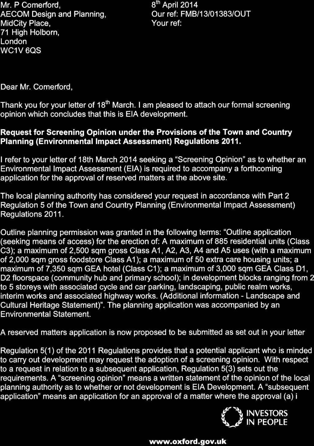

70
71
Chapter 2: OUTLINE PLANNING APPLICATION PROPOSALS. A New Garden Neighbourhood Matford Barton 17
 Chapter 2: OUTLINE PLANNING APPLICATION PROPOSALS A New Garden Neighbourhood Matford Barton 17 2.1. SUMMARY AND STATUS OF THE PROPOSALS 2.1.1. The parameter plans and associated wording in this chapter
Newcourt Masterplan. November Exeter Local Development Framework
 Newcourt Masterplan November 2010 Exeter Local Development Framework Background The Exeter Core Strategy Proposed Submission sets out the vision, objectives and strategy for the development of Exeter up
Public Consultation. Land at Monks Farm, North Grove. Welcome
 Welcome Welcome to our public exhibition for development on Land at Monks Farm, orth Grove. Gallagher Estates and Gleeson Strategic Land are preparing an outline planning application for new homes, open
PHASE III: Reserved Matters Submission
 Statement of Compliance with the outline approval for the proposed residential development of land at: BURGES LANE, WIVELISCOMBE PHASE III: Reserved Matters Submission Foreword Contents: This Statement
WHITELEY TOWN COUNCIL NORTH WHITELEY DEVELOPMENT SEPTEMBER 2014
 WHITELEY TOWN COUNCIL NORTH WHITELEY DEVELOPMENT SEPTEMBER 2014 Dear Resident This Special Edition of the Whiteley Voice which has been prepared in conjunction with the North Whiteley Consortium is to
Description Details submitted pursuant to discharge of condition 5 (Design Code) attached to planning permission 13/01729/OUT.
 attached to planning permission 13/01729/OUT.") ITEM 9 Application Number: 18/00266/DISCON Description Details submitted pursuant to discharge of condition 5 (Design Code) attached to planning permission 13/01729/OUT. AT The Point, 602 Midsummer Boulevard,
ITEM 9 Application Number: 18/00266/DISCON Description Details submitted pursuant to discharge of condition 5 (Design Code) attached to planning permission 13/01729/OUT. AT The Point, 602 Midsummer Boulevard,
Reserved Matters application for a site that straddles the boundary between CBC and BBC
 BBC APPLICATION 15/02682/MAR NUMBER CBC APPLICATION CB/15/04294/RM NUMBER LOCATION Wixams Land at former storage depot, Bedford Road, Wilstead Bedfordshire PROPOSAL Reserved Matters Application for Strategic
Statement of Community Involvement LAND OFF SOUTHDOWN ROAD HORNDEAN, HAMPSHIRE
 LAND OFF SOUTHDOWN ROAD HORNDEAN, HAMPSHIRE CONTENTS Page 1. Introduction 3 2. Pre-application Discussions 4 3. The Consultation Process 5 4. Consultation Feedback 7 5. Responses to Consultation Feedback
3.1 The hybrid planning application proposes the following description of development:
 CHAPTER 3: PROPOSED DEVELOPMENT 3.1 The hybrid planning application proposes the following description of development: Hybrid (part-outline/part-full) planning application for a single composite development
Oxford OX1 1DS. AT: Land West Of Barton North Of A40 And South Of Bayswater Brook Northern By-Pass Road Wolvercote
 City Development Planning Control and Conservation St Aldate s Chambers 109 113 St Aldate s Oxford OX1 1DS E: planning@oxford.gov.uk F: 01865 252144 Central Number 01865 249811 On Behalf of: Barton Oxford
INTRODUCTION NORTH HEYBRIDGE GARDEN SUBURB
 INTRODUCTION This event is being hosted by the promoters of the proposed North Heybridge Garden Suburb who are working with Maldon District Council and other key stakeholders on the preparation of a comprehensive
It is recommended that the Committee resolve to APPROVE the application and grant planning permission subject to the following conditions:
 LOCATION: Phase 2A Millbrook Park (Site of Former Inglis Barracks), Mill Hill East, London, NW7 1PZ REFERENCE: H/04606/12 Received: 04 December 2012 Accepted: 17 December 2012 WARD: Mill Hill Expiry: 18
Former North Works, Lickey Road, Longbridge, Birmingham
 Committee Date: 14/11/2013 Application Number: 2013/06431/PA Accepted: 27/08/2013 Application Type: Full Planning Target Date: 26/11/2013 Ward: Longbridge Former North Works, Lickey Road, Longbridge, Birmingham
Welcome to our public exhibition
 About our development Welcome to our public exhibition This exhibition gives you the chance to view and comment on our proposals for a new residential development of 165 high-quality homes, along with
PLANNING STATEMENT. Market House Market Place Kingston upon Thames KT1 1JS
 PLANNING STATEMENT To support planning and listed building consent applications for change of use from Class A1 shop and Class A3 cafe to Class A3 restaurant at: Market House Market Place Kingston upon
Land at Rampton Road. Cottenham
 Land at Rampton Road Cottenham Introduction TEP is preparing an outline planning application for 54 dwellings on 6.9 hectares of land adjacent to Rampton Road, Cottenham on behalf of the owners Cambridgeshire
Longbridge Town Centre Phase 2 Planning Application
 Longbridge Town Centre Phase 2 Planning Application Non-Technical Summary of the Environmental Statement December 2013 Introduction A full application for Planning Permission has been submitted to Birmingham
Neighbourhood Planning Local Green Spaces
 Neighbourhood Planning Local Green Spaces Introduction... 2 1. Why green space is important... 4 2. Neighbourhood plans and green space... 6 3. Evidence... 8 Statutory designations... 9 Green space audit...
Parish of Repton NEIGHBOURHOOD DEVELOPMENT PLAN
 Parish of Repton NEIGHBOURHOOD DEVELOPMENT PLAN BASIC CONDITIONS STATEMENT December 2018 CEF 4 Legal Requirements This statement has been produced by the NDP Working Group on behalf of Repton Parish Council
WELCOME GYPSY LANE. Wider Site Location plan. Proposals for the development of LAND OFF FOXLYDIATE LANE WEBHEATH. Proposals for the development of
 WELCOME The developers are preparing an outline planning application for a residential led development and need the community s views in order to develop the proposals further WHAT IS PROPOSED? A high
SOUTH CAMBRIDGESHIRE DISTRICT COUNCIL. REPORT TO: Planning Committee 1 April 2015 Planning and New Communities Director
 SOUTH CAMBRIDGESHIRE DISTRICT COUNCIL REPORT TO: Planning Committee 1 April 2015 AUTHOR/S: Planning and New Communities Director Application Number: Parish(es): Proposal: Site address: Applicant(s): Recommendation:
Kibworth Harcourt. Introduction. Introduction
 Introduction Introduction Welcome to this public exhibition on the proposals for the delivery of new homes on land at The Kibworths. The purpose of today s exhibition is to give you the opportunity to
Schedule of Planning Applications Committee Date: 23 May Reference: 06/17/0726/F Parish: Hemsby Officer: Mr J Beck Expiry Date:
 Schedule of Planning Applications Committee Date: 23 May 2018 Reference: 06/17/0726/F Parish: Hemsby Officer: Mr J Beck Expiry Date: 22-05-2018 Applicant: Proposal: Site: Mr Gillett Change of use to the
University Park, Worcester Non Technical Summary December 2011
 University Park, Worcester Non Technical Summary December 2011 Introduction UW Wrenbridge LLP, a Joint Venture Company of the University of Worcester and Wrenbridge Land Ltd (the Applicants ) intend to
WELCOME. Land North of STEVENAGE. We would like to thank you for attending our public exhibition today.
 WELCOME We would like to thank you for attending our public exhibition today. The purpose of this event is to share our proposals and hear your thoughts on our ideas. Members of the project team are on
HS2 Interchange Station Design
 Working on behalf of HS2 Interchange Station Design October 2018 www.hs2.org.uk 1 Interchange Station, Solihull Introduction In February 2018, HS2 Ltd appointed Arup to take forward the design of Interchange
ROCHFORD LOCAL DEVELOPMENT FRAMEWORK: Sustainability Appraisal/ Strategic Environmental Assessment. Rochford Core Strategy Preferred Options Document
 ROCHFORD LOCAL DEVELOPMENT FRAMEWORK: Sustainability Appraisal/ Strategic Environmental Assessment Non Technical Summary Rochford Core Strategy Preferred Options Document October 2008 SUSTAINABILITY APPRAISAL
WELCOME TO THE NEW WILTON PARK
 WELCOME TO THE NEW WILTON PARK VISION HISTORY OF WILTON PARK TOWARDS A PLANNING APPLICATION Our objective is to create a truly outstanding environment at Wilton Park. At the heart of our proposals is a
1 The development hereby permitted shall be carried out in accordance with the following approved plans:
 Location 59 Greenway Close London N20 8ES Reference: 16/00011/HSE Received: 30th December 2015 Accepted: 7th January 2016 Ward: Totteridge Expiry 3rd March 2016 Applicant: Mr Ankit Shah Proposal: Part
Case Officer: Sarah Kay File No: CHE/14/00515/REM Tel. No: (01246) Plot No: 2/6132 Ctte Date: 15 th September 2014 ITEM 1
 Plot No: 2/6132 Ctte Date: 15 th September 2014 ITEM 1") Case Officer: Sarah Kay File No: CHE/14/00515/REM Tel. No: (01246) 345786 Plot No: 2/6132 Ctte Date: 15 th September 2014 ITEM 1 APPROVAL OF RESERVED MATTERS FROM APPLICATION CHE/12/00234/OUT (1) LAYOUT,
Case Officer: Sarah Kay File No: CHE/14/00515/REM Tel. No: (01246) 345786 Plot No: 2/6132 Ctte Date: 15 th September 2014 ITEM 1 APPROVAL OF RESERVED MATTERS FROM APPLICATION CHE/12/00234/OUT (1) LAYOUT,
Stantonbury Neighbourhood Plan
 Stantonbury Neighbourhood Plan 2018-2031 Basic Conditions Statement October 2018 Intentionally blank 1.0 Basic Conditions Statement Introduction 1.1 This statement has been prepared by Stantonbury Parish
UTT/16/1466/DFO GREAT DUNMOW MAJOR
 UTT/16/1466/DFO GREAT DUNMOW MAJOR PROPOSAL: LOCATION: APPLICANT: AGENT: Reserved matters approval for the accesses to the site and principal roads within the site including spine road following outline
Peter Brett Associates LLP (PBA) act on behalf of db symmetry ltd in respect of the proposed symmetry park, Kettering development (the Site).
 act on behalf of db symmetry ltd in respect of the proposed symmetry park, Kettering development (the Site).") Our ref: 30062 2 nd August 2017 Kettering Borough Council Planning Department Municipal Offices Bowling Green Rd Kettering NN15 7QX 61 Oxford Street Manchester M1 6EQ T: +44 (0)161 245 8900 E: manchester@peterbrett.com
Our ref: 30062 2 nd August 2017 Kettering Borough Council Planning Department Municipal Offices Bowling Green Rd Kettering NN15 7QX 61 Oxford Street Manchester M1 6EQ T: +44 (0)161 245 8900 E: manchester@peterbrett.com
LAND EAST OF MILL LANE, SHERBURN VILLAGE PLANNING STATEMENT
 LAND EAST OF MILL LANE, SHERBURN VILLAGE PLANNING STATEMENT On behalf of The Church Commissioners for England Land East of Mill Lane, Sherburn Village Planning Statement On Behalf of The Church Commissioners
Application Guide. Should you have any questions on the Outline Application please contact:
 Application Guide Application Guide This guide describes the structure of the Outline Application, explains the different documents that have been submitted with it and identifies what will happen next.
Welcome to our exhibition
 Welcome to our exhibition housing development A46 Wildmoor Alcester Road Canal Quarter A422 Town Centre housing development Warwickshire-based IM Properties, one of the UK s largest privately owned property
Welcome to our exhibition
 Welcome to our exhibition The Homes & Communities Agency (HCA) welcomes you to this public exhibition explaining our proposals for the redevelopment of the former Lea Castle Hospital site. About the Homes
LAND AT WEST YELLAND. Environmental Statement Non-Technical Summary Welbeck Strategic Land LLP
 LAND AT WEST YELLAND Environmental Statement Non-Technical Summary Welbeck Strategic Land LLP May 2014 Quality Management Issue/revision Issue 1 Revision 1 Revision 2 Revision 3 Remarks Draft FINAL Date
WELCOME. North East Haverhill. The Planning Process
 WELCOME North East The site to the North East of, known as Great Wilsey Park, is identified by St Edmundsbury Borough Council in its Core Strategy as capable of delivering a Sustainable Urban Extension.
Rochford District Council Allocations Development Plan Document: Discussion and Consultation Document Sustainability Appraisal
 Option SWH1 Balanced Communities Option SWH1 1 To ensure the delivery of high quality sustainable communities where people want to live and work Will it ensure the phasing of infrastructure, including
Development of land adjacent to Braggs Farm Lane and Rumbush Lane, Dickens Heath. Welcome. Today s exhibition. The proposal site
 Welcome Welcome to this event to discuss the development of land adjacent to Braggs Farm Lane. is currently in the preliminary stages of designing proposals to sensitively develop this site with high-quality
CA//16/00504/FUL. Canterbury City Council Military Road Canterbury Kent CT1 1YW. Crown copyright and database rights 2016 Ordnance Survey
 O Scale 1:1,250 Map Dated: 09/05/2016 CA//16/00504/FUL Crown copyright and database rights 2016 Ordnance Survey 100019614 Canterbury City Council Military Road Canterbury Kent CT1 1YW AGENDA ITEM NO 13
Sustainability Statement. Whitby Business Park Area Action Plan
 Sustainability Statement Whitby Business Park Area Action Plan November 2014 Contents Page 1. Introduction 1 2. Scoping 3 3. Sustainability Appraisal of Options 6 4. Assessment of Draft Area Action Plan
Mid Suffolk District Council Planning Control Department 131 High Street Needham Market IP6 8DL
 Mid Suffolk District Council Planning Control Department 131 High Street Needham Market IP6 8DL OUTLINE PLANNING PERMISSION Town and Country Planning Act 1990 THE TOWN AND COUNTRY PLANNING (DEVELOPMENT
Welcome to our Public Consultation
 About our development This exhibition gives you the chance to view and comment on our emerging plans for a proposed residential development located on land to the West of Alwyn Road, Rugby. Welcome to
South Worcestershire Development Plan. South Worcestershire Design Guide Supplementary Planning Document
 South Worcestershire Development Plan South Worcestershire Design Guide Supplementary Planning Document Statement of Consultation: Early Engagement Scoping Paper February 2017 1. Introduction 1.1 This
Perth and Kinross Council Development Management Committee 8 June Pre-Application Report by Development Quality Manager
 Perth and Kinross Council Development Management Committee 8 June 2016 5(3)(i) 16/259 Pre-Application Report by Development Quality Manager Residential development at St Martins Road, Land 120 metres West
Derry City and Strabane District Council Planning Committee Report
 Derry City and Strabane District Council Planning Committee Report COMMITTEE DATE: 23 rd March 2016 APPLICATION No: APPLICATION TYPE: PROPOSAL: LOCATION: APPLICANT: LA11/2015/0395/F Residential Development
Departure from the Development Plan. Town Council objection to a major application. DETERMINE
 Item No. 9 APPLICATION NUMBER CB/17/01642/OUT LOCATION Land rear of 43 to 91 Silver Birch Avenue South of Alder Green and Aspen Gardens, Aspen Gardens, Stotfold PROPOSAL Outline application for up to 95
Great Easton Neighbourhood Plan Statement of Basic Conditions
 Great Easton Neighbourhood Plan 2017-2031 Statement of Basic Conditions OCTOBER 2016 GREAT EASTON PARISH COUNCIL Contents 1.0 Introduction....Page 2 2.0 Summary of Submission Documents and Supporting Evidence..
Persimmon Homes Thames Valley Date received: 2 nd April week date(major): 2 nd July 2014 Ward: Nascot
: 2 nd July 2014 Ward: Nascot") PART A Report of: DEVELOPMENT MANAGEMENT SECTION HEAD Date of Committee: 26 th June 2014 Site address: Rounton, 28, Nascot Wood Road Reference Number: 14/00497/REM Description of Development: Reserved
PART A Report of: DEVELOPMENT MANAGEMENT SECTION HEAD Date of Committee: 26 th June 2014 Site address: Rounton, 28, Nascot Wood Road Reference Number: 14/00497/REM Description of Development: Reserved
Land North of Hall Road, Rochford. Rochford District Council. Planning Application Index. Prepared on behalf of Bellway Homes Ltd
 Land North of Hall Road, Rochford Rochford District Council Planning Application Index Prepared on behalf of Bellway Homes Ltd April 2010 Land North of Hall Road, Rochford Rochford District Council Scope
Planning and Sustainability Statement
 Land adjacent to Manor Farm, Catterick Village Pallett Hill Sand and Gravel Co Ltd Proposed 10 new dwellings, (6 No market dwellings and 4 No affordable dwellings) with access, associated car parking and
DESIGN & ACCESS STATEMENT
 DESIGN & ACCESS STATEMENT January 2016 Contents Introduction section 1 Section 1 - Introduction Section 2 - Assessment Section 3 - Involvement Section 4 - Evaluation Section 5 - Design Section 6 - Layout
Cranfield University Masterplan
 Central Bedfordshire Council EXECUTIVE Tuesday, 5 December 2017 Cranfield University Masterplan Report of: Cllr Nigel Young, Executive Member for Regeneration, (nigel.young@centralbedfordshire.gov.uk )
DEVELOPMENT MANAGEMENT REPORT
 ITEM A08-1 DEVELOPMENT MANAGEMENT REPORT TO: BY: DATE: DEVELOPMENT: SITE: WARD: APPLICATION: APPLICANT: Development Management Committee Development Manager Proposed live/work unit in connection with existing
Date: TOWN AND COUNTRY PLANNING (ENVIRONMENTAL IMPACT ASSESSMENT) REGULATIONS 2011: REGULATION 13 SCOPING OPINION
 REGULATIONS 2011: REGULATION 13 SCOPING OPINION") PLANNING & BUILDING CONTROL Tracy Harvey Head of Planning & Building Control Rob Wells Savills Innovation Court 121 Edmund Street Birmingham B3 2HJ Our Ref: 5/16/3441 E-mail: Date: planning@stalbans.gov.uk
PLANNING & BUILDING CONTROL Tracy Harvey Head of Planning & Building Control Rob Wells Savills Innovation Court 121 Edmund Street Birmingham B3 2HJ Our Ref: 5/16/3441 E-mail: Date: planning@stalbans.gov.uk
Site north of Hattersley Road West (east of Fields Farm Road), Hattersley
, Hattersley") Application Number 17/00982/REM Proposal Site Applicant Recommendation Reason for report Application for the approval of reserved matters (means of access, landscaping, layout, scale and appearance) relating
Application Number 17/00982/REM Proposal Site Applicant Recommendation Reason for report Application for the approval of reserved matters (means of access, landscaping, layout, scale and appearance) relating
17A. Wind Microclimate
 17A. Wind Microclimate 17A.1 Introduction 17A.1.1 17A.1.2 17A.1.3 17A.1.4 This Chapter, which has been prepared by Waterman and BMT, provides further information with regard to the potential wind microclimate
Poolbeg West SDZ Draft Planning Scheme
 Poolbeg West SDZ Draft Planning Scheme Introduction/vision Housing Community Economy/Employment Movement/transport Infrastructure green infrastructure /open space Land-use and phasing Public Realm Urban
Planning Committee 04/02/2015 Schedule Item 6. Smith Farm Estate, Old Bridge Close, Northolt, UB5 6UA.
 Planning Committee 04/02/2015 Schedule Item 6 Ref: Address: Ward: Proposal: PP/2014/5145 Smith Farm Estate, Old Bridge Close, Northolt, UB5 6UA. Greenford Broadway Installation of sports pitch, reconstruction
Phase 4B, Millbrook Park, Frith Lane, London, NW7 1HA
 LOCATION: Phase 4B, Millbrook Park, Frith Lane, London, NW7 1HA REFERENCE: 16/3111/RMA Received: 03 May 2016 Accepted: 12 May 2016 WARD(S): Mill Hill Expiry: 11 August 2016 Final Revisions: APPLICANT:
SOUTH CAMBRIDGESHIRE DISTRICT COUNCIL. Executive Director (Operational Services) Corporate Manager (Planning and New Communities)
 Corporate Manager (Planning and New Communities)") SOUTH CAMBRIDGESHIRE DISTRICT COUNCIL REPORT TO: Planning Committee 12 January 2011 AUTHOR/S: Executive Director (Operational Services) Corporate Manager (Planning and New Communities) Notes: S/1848/10
SOUTH CAMBRIDGESHIRE DISTRICT COUNCIL REPORT TO: Planning Committee 12 January 2011 AUTHOR/S: Executive Director (Operational Services) Corporate Manager (Planning and New Communities) Notes: S/1848/10
Welcome. Site/11/04. Site/11/03. Proposed Site. 11,400 new homes needed in east Cambs
 Welcome Welcome to our consultation on our proposals for new homes on land north east of Soham Road, Fordham. Members of the project team are available to answer any questions you have and listen to feedback.
BRIDGE OF DON MASTERPLAN & PLANNING SUMMARY
 BRIDGE OF DON MASTERPLAN & PLANNING SUMMARY SITE LOCATION The site of the existing AECC lies in an area of predominately residential and business use in Bridge of Don and extends approximately 50 acres.
1.0 Purpose of a Secondary Plan for the Masonville Transit Village
 Report to Planning and Environment Committee To: Chair and Members Planning & Environment Committee From: John M. Fleming Managing Director, Planning and City Planner Subject: Masonville Transit Village
Derry City and Strabane District Council Planning Committee Report. Amended layout from approval A/2004/0462/F with reduction from 166 units
 Derry City and Strabane District Council Planning Committee Report COMMITTEE DATE: 1 st February 2017 APPLICATION No: APPLICATION TYPE: PROPOSAL: LOCATION: APPLICANT: AGENT: Full Planning application Amended
49 Broughton Avenue London N3 3EN
 Location 49 Broughton Avenue London N3 3EN Reference: 17/3448/RCU Received: 30th May 2017 Accepted: 1st June 2017 Ward: Finchley Church End Expiry 27th July 2017 Applicant: Mr P Atwal Proposal: Erection
VILLAGE HEIGHTS, GREENHITHE PLANNING STATEMENT OUTLINE PLANNING APPLICATION DESIGN LED MIXED USE DEVELOPMENT
 VILLAGE HEIGHTS, GREENHITHE OUTLINE PLANNING APPLICATION DESIGN LED MIXED USE DEVELOPMENT PLANNING STATEMENT JULY 2014 Executive Summary This planning statement supports an outline planning permission
OKEFORD FITZPAINE NEIGHBOURHOOD PLAN
 OKEFORD FITZPAINE NEIGHBOURHOOD PLAN Dear Parishioner, The Neighbourhood Plan Project Team have prepared this leaflet to summarise the full Neighbourhood Plan document. It provides a summary of the Vision,
Ebbsfleet Development Corporation
 Title of Paper Planning and Housing Delivery Report September 2018 Presented by Sub-Committee Mark Pullin, Chief Planning Officer Planning Committee Purpose of Paper and Executive Summary This paper provides
I615. Westgate Precinct
 I615. Westgate Precinct I615.1. Precinct Description The Westgate Precinct is located approximately 18km west of the Auckland city centre. There are seven Sub-precincts in the Westgate Precinct: Sub-precinct
Outline planning permission including means of access (all other matters reserved) for the erection of 14 new dwellings
 for the erection of 14 new dwellings") APP 02 Application Number: 16/01630/OUT Major Outline planning permission including means of access (all other matters reserved) for the erection of 14 new dwellings AT Land East of Castle Road And North
APP 02 Application Number: 16/01630/OUT Major Outline planning permission including means of access (all other matters reserved) for the erection of 14 new dwellings AT Land East of Castle Road And North
Settlement Boundaries Methodology North Northumberland Coast Neighbourhood Plan (August 2016)
") Introduction This background paper sets out a methodology for the definition of settlement boundaries in the North Northumberland Coast Neighbourhood Plan. The neighbourhood plan is planning positively
Introduction This background paper sets out a methodology for the definition of settlement boundaries in the North Northumberland Coast Neighbourhood Plan. The neighbourhood plan is planning positively
Story Homes. Land at Thirsk Road, Kirklevington. An Introduction to Story Homes. Our Foundations. Commitment to Consultation.
 Story Homes An Introduction to Story Homes Founded by Fred Story in 1987, Story Homes has a long and successful reputation of building high quality and high specification homes. The family owned business
Basic Conditions Statement Exmouth Neighbourhood Plan
 Exmouth Neighbourhood Plan 2018-2031. On behalf Exmouth Neighbourhood Plan Steering Group July 2018 Table of Contents 1. Introduction... 4 2. Legal Requirements... 5 3. Why there is a need for a Neighbourhood
Carterton Construction Ltd is bringing forward plans for up to 85 new family homes and extra care facilities on land east of Burford.
 Welcome Carterton Construction Ltd is bringing forward plans for up to 85 new family homes and extra care facilities on land east of. We are at the early stages of designing our proposals and have a number
Welcome. Proposals for land at Smug Oak Lane BRICKET WOOD
 Proposals for land at Smug Oak Lane BRICKET WOOD Previous Linden Homes and Wates Developments scheme Welcome Welcome to Linden Homes and Wates Developments public exhibition. Working together as joint
SOUTH CAMBRIDGESHIRE DISTRICT COUNCIL. Planning and New Communities Director
 SOUTH CAMBRIDGESHIRE DISTRICT COUNCIL REPORT TO: Planning Committee 9 January 2013 AUTHOR/S: Planning and New Communities Director S/2270/12/FL FEN DRAYTON 850m long flood defence embankment ranging in
Colchester Northern Gateway Master Plan Vision Review Draft. July 2016
 Colchester Northern Gateway Master Plan Vision Review Draft July 2016 Contents Introduction 4 Context 8 Purpose of the Report 8 Strategic Position 9 Overview of the Process 11 2012 Master Plan Vision 12
Grantham Southern Quadrant Link Road Environmental Statement
 Grantham Southern Quadrant Link Road Environmental Statement Non Technical Summary Introduction Lincolnshire County Council (LCC) is submitting a planning application for the proposed implementation of
1 The development hereby permitted shall be carried out in accordance with the following approved plans:
 Location The Avenue Tennis Club The Avenue London N3 2LE Reference: 16/6509/FUL Received: 10th October 2016 Accepted: 10th October 2016 Ward: Finchley Church End Expiry 5th December 2016 Applicant: Mrs
The Place Solar Farm
 The Place Solar Farm Environmental Statement Non-Technical Summary 28 August 2014 Produced for Prepared by St John s House Queen Street, Manchester M2 5JB Contents Contents... 2 1 Introduction... 3 1.1
GREENWICH PENINSULA CABLE CAR AREA MASTERPLAN ENVIRONMENTAL STATEMENT NON-TECHNICAL SUMMARY. 24 December 2010
 GREENWICH PENINSULA CABLE CAR AREA MASTERPLAN ENVIRONMENTAL STATEMENT NON-TECHNICAL SUMMARY 24 December 2010 Our Ref: DT/JLL0509 Appeal Ref (optional): RPS 1 st Floor West Cottons Centre Cottons Lane London
Welcome to our public exhibition
 About Our Scheme Welcome to our public exhibition This exhibition gives you the chance to view and comment upon our emerging proposals for a new residential development of 68 new homes on the site of the
Replacement Golf Course Facilities and Residential Development, Churston. Environmental Statement Non-Technical Summary
 Replacement Golf Course Facilities and Residential Development, Churston Environmental Statement Non-Technical Summary July 2011 Reproduced from the Ordnance Survey s map with the permission of the Controller
A new park will be delivered as part of the Elephant Park regeneration.
 A new park will be delivered as part of the Elephant Park regeneration. The exhibition boards presented here introduce the first phase of the new park that is scheduled to open in spring 2017 that has
Meridian Water Phase 1 Application
 Meridian Water Phase 1 Application MW11 Environmental Statement Non-Technical Summary London Borough of Enfield March 2016 Contents 1 Introduction 1 2 The proposed development 2 3 Evolution of the proposed
HARDWICK GREEN, King s Lynn. Welcome to our Exhibition. What are your views? Introduction to the site and proposals. About us
 HARDWICK GREE, King s Lynn Welcome to our Exhibition Welcome to our exhibition, which is being held to provide you with the opportunity to understand and comment upon our proposals for new residential
3 Abbey View Mill Hill London NW7 4PB
 Location 3 Abbey View Mill Hill London NW7 4PB Reference: 15/03203/HSE Received: 26th May 2015 Accepted: 16th June 2015 Ward: Mill Hill Expiry 11th August 2015 Applicant: Proposal: Mr Richard Benson Alterations
Perth and Kinross Council Development Management Committee 20 February 2013 Report of Handling by Development Quality Manager
 Perth and Kinross Council Development Management Committee 20 February 2013 Report of Handling by Development Quality Manager 4(4)(iii) 13/81 Erection of sports hall, associated changing facilities, offices
1. Welcome. Background
 1. Welcome The purpose of this exhibition is to provide you with an update on progress on the Kilnwood Vale Scheme. In order to improve the scheme and deliver key facilities earlier in the development,
CENTRAL BEDFORDSHIRE COMMITTED TO WORKING TOGETHER WITH LOCAL COMMUNITIES
 WELCOME Thank you for coming to our consultation event to find out more about our emerging proposals for Hayfield Park, a residential development jointly promoted by the Hayfield Consortium: Martin Grant
Proposed Student Accommodation Development
 Statement of Response to the Notice of Pre- Application Consultation Opinion Former "Matts of Cabra" public house and lands to the rear, Fassaugh Avenue, Cabra, Dublin 7 Proposed Student Accommodation
Plumpton Neighbourhood Development Plan Revised Pre Submission Document - Regulation 14 Consultation
 REPRESENTATIONS... Plumpton Parish Council Plumpton Neighbourhood Development Plan Revised Pre Submission Document - Regulation 14 Consultation Representations submitted on behalf of: Cala Homes (South
Test Valley Borough Council Southern Area Planning Committee 8 January 2019
 ITEM 11 APPLICATION NO. 18/02218/FULLS APPLICATION TYPE FULL APPLICATION - SOUTH REGISTERED 23.08.2018 APPLICANT Rugby Football Union SITE The Trojans Club, Stoneham Lane, Eastleigh, SO50 9HT, CHILWORTH
Site off Hattersley Road West (bound by Hattersley Road West to the north west and Sandy Bank Avenue to the south and west), Hattersley
, Hattersley") Application Number 17/00984/REM Proposal Site Applicant Recommendation Reason for report Application for the approval of reserved matters (means of access, landscaping, layout, scale and appearance) relating
Application Number 17/00984/REM Proposal Site Applicant Recommendation Reason for report Application for the approval of reserved matters (means of access, landscaping, layout, scale and appearance) relating
WINCHESTER TOWN 3.1 LOCATION, CHARACTERISTICS & SETTING
 WINCHESTER TOWN 3.1 LOCATION, CHARACTERISTICS & SETTING 3.1.1 The area referred to by the City Council, as Winchester Town, consists of the Winchester Wards plus the adjoining built up areas of Badger
Planning Statement Blythe Valley Park Plot F5. March 2017
 Planning Statement Blythe Valley Park Plot F5 March 2017 Contents 1. Introduction 1 2. Site Location and Description 4 3. Stakeholder Engagement 6 4. Reserved Matters 7 5. Summary and Conclusions 10 Appendix
2. The application, which is a full plans application, is for a commercial development comprising B1, D1, D2 and A3 uses.
 Former Taff Vale Shopping Centre, Taff Street, Pontypridd, CF37 4TR PLANNING APPLICATION SUPPORTING STATEMENT May 2017 Ref.11431/1 INTRODUCTION AND APPLICATION CONTEXT 1. This planning application statement