ASPEN HILL Minor Master Plan Amendment
|
|
|
- Claud Holland
- 5 years ago
- Views:
Transcription


1 ASPEN HILL Minor Master Plan Amendment Project Briefing Planning Board Agenda Item #7 Andrea Gilles, Area 2 June 5, 2014
2 Briefing Purpose 1. Follow-up evaluation on Mixed-Use land use in the Minor Amendment area 2. Update on Traffic Impact Analysis 3. Review Preliminary Minor Amendment Recommendations Land Use and Zoning Design Transportation and Circulation
3 Process to Date December 3, 2013 Kick-off Community Meeting January 23, 2014 Scope of Work to Planning Board March 2014 Market Analysis Complete April 1, 2014 Community Meeting #2 April 9, 2014 Aspen Hill Civic Association Meeting April 23, 2014 Meeting with Northgate Plaza Business Owners April 24, 2014 Staff Briefing to Planning Board Aspen Hill Homeowners Meeting May 13, 2014 Community Meeting #3 June 5, 2014 Staff Briefing to Planning Board


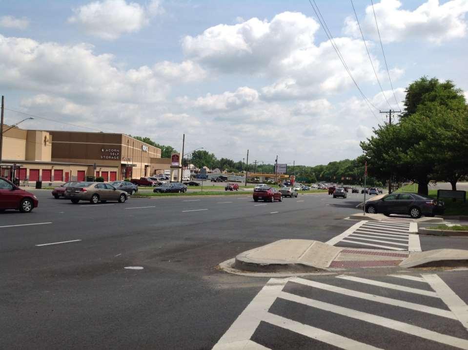
4 Minor Amendment Area Approximately 14 acres Vacant office; gas stations; professional offices; parking; Dunkin Donuts
5 Amendment Goals Encourage quality redevelopment and design within the suburban context Address traffic impacts on Aspen Hill Rd & Connecticut Ave Address pedestrian/bicycle circulation & safety Encourage interconnectivity (vehicle & pedestrian) between properties Recommend appropriate transitions to residential neighborhoods Recommend land use and flexible zoning that allows a mix of compatible uses responsive to market changes Provide momentum for the large-area Aspen Hill Master Plan update

6 Aspen Hill and the General Plan Aspen Hill Minor Master Plan Location
7 Follow-up Analysis: Mixed-Use Purpose At the April 24 meeting, Planning Board requested that Staff evaluate the potential for mixed-use development in the Subject area Approach Reviewed characteristics of successful mixed-use developments Analyzed current feasibility of mixed-use/vertical development for the subject area Lessons learned: Glenmont
8 What does Mixed-Use mean? Building height
9 Definition of Mixed-Use A mixed-use development is a real estate project with planned integration of some combination of retail, office, residential, hotel, recreation or other functions. It is pedestrian oriented and contains elements of a live-work-play environment. It maximizes space usage, has amenities and architectural expression and tends to mitigate traffic and sprawl Conference on Mixed-Use Development (Industry wide definition created by the International Council of Shopping Centers (ICSC), the National Association of Industrial and Office Properties (NAIOP), the Building Owners and Managers Association (BOMA), and the National Multi Housing Council)
10 Mixed-Use Development Characteristics 1. Developed as integrated projects 2. Located in existing mixed-use environments 3. Strong pedestrian orientation 4. Good access to transportation systems 5. Sufficient property size 6. Near major attractions 7. Located in jurisdictions supportive of mixed-use Urban Land Institute Mixed Use Development Handbook, 2 nd Ed., NAIOP Mixed-Use Development: A Review of Professional Literature, Zoning regulations in jurisdictions across the United States


 Mixed-use: Reston Town")
11 Mixed-Use Development Characteristics Feature 1: Developed as integrated projects Physically and functionally integrated Synergy and demand between uses Interconnected sidewalks and public streets Conforms to a coherent plan (i.e. placemaking ) Mixed-use: Reston Town Center, Reston, VA Multi-use: Edgewood Retail District, Atlanta, GA


12 Mixed-Use Development Characteristics Feature 2: Located in existing mixed-use environments Extension of urban fabric and context Can leverage existing consumer market Vertical development easier in urban context Urban mixed-use: CityVista, DC Suburban mixed-use: Mall at Prince George s

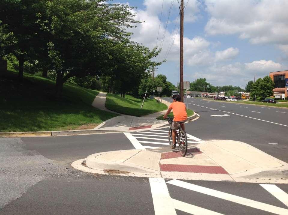
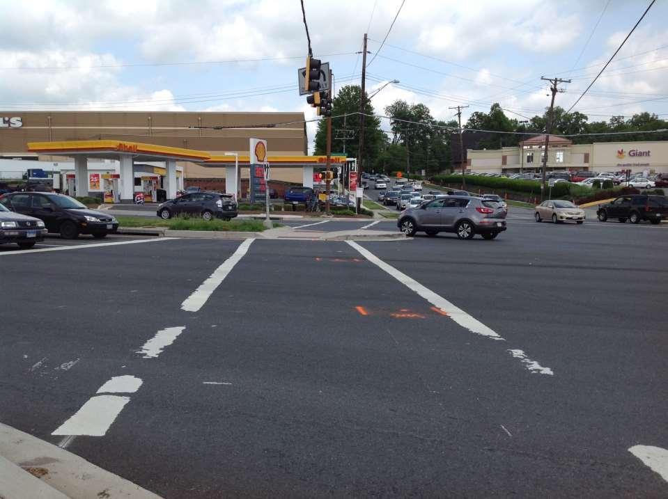
13 Mixed-Use Development Characteristics Feature 3: Strong pedestrian orientation Pedestrian activity is key to success Well designed pedestrian infrastructure Connections to external surroundings Destinations and activities to encourage walking Existing: Connecticut Ave/Aspen Hill Road Shared-use path, landscape separates street & sidewalk
: 0.25 Miles Glenmont Metro: 2.0 Miles City of Rockville: 2.0 Miles ICC: 2.5 miles Twinbrook Metro: 2.")
14 Mixed-Use Development Characteristics Feature 4: Good access to transportation systems Served by various forms of transit Easy access to freeways and existing travel patterns Numerous ways to get in/out Good visibility and exposure B M M M Minor Amendment Area BRT (proposed): 0.25 Miles Glenmont Metro: 2.0 Miles City of Rockville: 2.0 Miles ICC: 2.5 miles Twinbrook Metro: 2.5 Miles Wheaton Metro: 3.5 Miles CITY OF ROCKVILLE Twinbrook White Flint BRT Station (proposed) Bel Pre Rd Glenmont Wheaton
15 Mixed-Use Development Characteristics Feature 5: Sufficient property size Urban: Allow for higher-density development Suburban: Large enough to create context Rockville Town Square Size of Mixed-Use Developments (Washington Metro Region) Bethesda Row Village at Shirlington Merrifield Town Square Reston Town Square Washingtonian Center 12 Acres 14 Acres 24 Acres 31 Acres 85 Acres 120 Acres Build on Context Create Context


16 Mixed-Use Development Characteristics Feature 6: Near major attractions High volume of foot traffic Examples include: Waterfronts Convention centers Sports venues Rio Washingtonian - Lake DC Chinatown Sports Arena Inner Harbor - Waterfront
17 Mixed-Use Development Characteristics Feature 7: Located in jurisdictions supportive of mixed-use Flexible or mixed-use zoning Development approvals/rezoning possible within a reasonable amount of time/effort Availability of economic incentives or public/private partnerships for mixed-use development
18 How does Subject Area Compare? Subject area conditions Today Criteria Rating 1. Developed as integrated projects N/A 2. Located in existing mixed-use environments Below Average 3. Strong pedestrian orientation Below Average 4. Good access to transportation systems Below Average 5. Sufficient property size Average 6. Near major attractions Poor 7. Located in jurisdictions supportive of mixed-use Excellent Ratings Scale Poor Below Average Average Above Average Excellent
19 Fostering Mixed-Use Conditions Subject area currently suitable for multi-use development Mixed-use development may be feasible as surrounding environment and market evolves Important to assess the feasibility/vision of mixed-use corridor development in the forthcoming Aspen Hill Sector Plan Establish pedestrian, bicycle, and transit infrastructure New catalysts that can help encourage revitalization May require public sector investments/partnerships to realize mixed-use development
 High cost of structured parking Public-Private venture (PPV) was preferred approach Easier land assembly Ensure community")
20 Lessons Learned: Glenmont Town Center W-ZHA (an economic advisory firm) was engaged to evaluate feasibility of redeveloping the Glenmont Shopping Center into a Town Center Key Findings Investor gap subsidies required Market rents insufficient (principally residential) High cost of structured parking Public-Private venture (PPV) was preferred approach Easier land assembly Ensure community vision

21 Connectivity and Traffic Impact
22 Trip Generation Existing Vacant Office (Vitro/BAE) Redevelopment Scenarios Peak Hour C-O Reuse Exist. Bldg. 268k SF 1.26 FAR Office * Residential Retail *** Max EOF Build-out 320k SF 1.5 FAR ** Max CRT Multi-Fam. 349 Units 1.0 FAR Max CRT Build-out 218k SF 0.50 FAR Proposed Big Box 120k SF 0.27 FAR Max SF w/ Accept. CLVs 170k SF 0.39 FAR AM PM
23 Intersection Congestion Critical Lane Volume (CLV) Comparison Intersection Georgia Ave & Connecticut Ave Connecticut Ave & Aspen Hill Rd Georgia Ave & Aspen Hill Rd Peak Hour Existing Currently Vacant No Build * Remains Vacant EOF Reuse Exist. Bldg. 268k SF 1.26 FAR Office ** Residential Retail Max EOF Build-out 320k SF 1.5 FAR *** Max CRT M-F 349 Units 1.0 FAR Max CRT Build-out 218k SF 0.50 FAR Proposed Big Box 120k SF 0.27 FAR AM PM AM PM AM PM Max SF w/ Accept. CLVs 170k SF 0.39 FAR 1

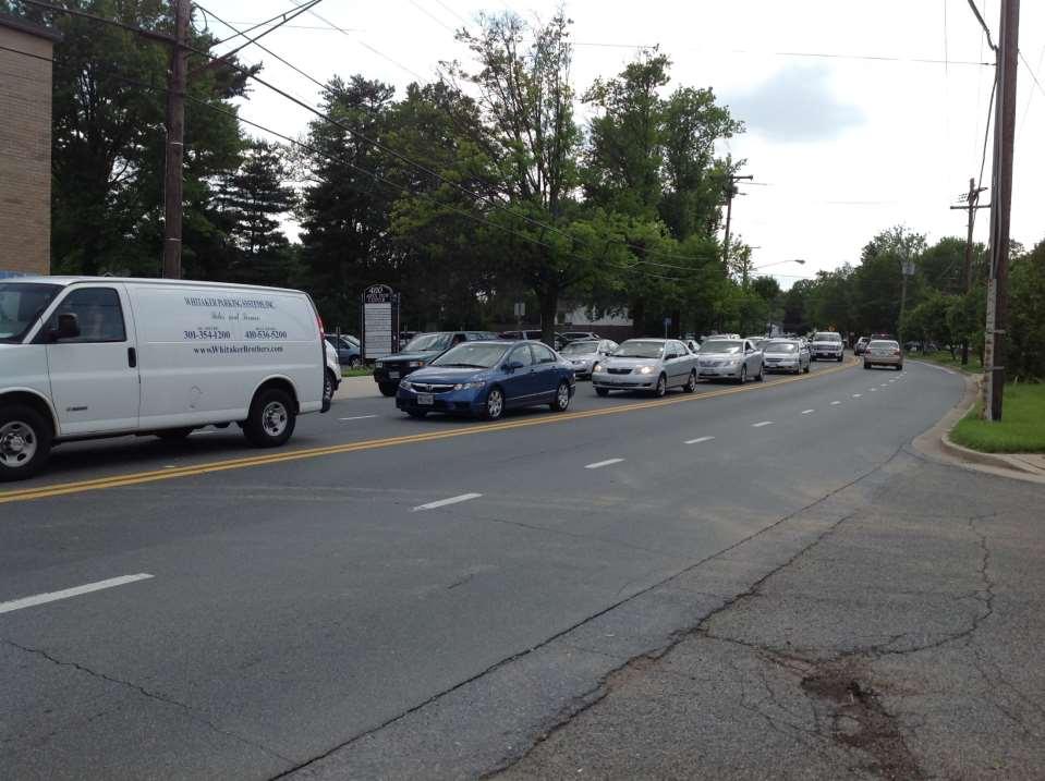
24 May 13 Community Meeting The area is challenging for pedestrians; Traffic in the area, particularly along Aspen Hill Road, is already excessive and impacts will be greater than what is reflected by Staff s trip generation analysis; This area should not be rezoned ahead of the large area master plan update; Could a CRN Zone be considered for the amendment properties on which Staff is preliminarily recommending a CRT Zone?
25 Preliminary Recommendations Land Use and Zoning Design Transportation and Circulation


26 Current Conditions Existing Land Use Conversion Zones
27 Preliminary Zoning Recommendations


28 Land Uses and CRT Example Menu of Uses Permitted in CRT Retail Combination Retail* Office Townhomes Senior Living* Restaurant Apartments Mixed Use *Special Exception/Conditional Use or Limited Use which requires additional review

 Family and group daycare")
29 Land Uses and EOF Example Menu of Uses Permitted in EOF Medical or dental clinics Medical or dental laboratory Office Retail* (limited percentage of development) Restaurant Residential* (limited percentage of development) Family and group daycare centers Health club
30 Land Use and Zoning Comparisons ZONE LAND USE CRN CRT EOF Townhouse Living P P L Multi-Unit Living P P L Independent Living Facility Seniors or Persons with Disabilities L L Restaurant L P P Clinic (More than 4 Medical Practitioners L P P Medical, Dental Laboratory P P Research and Development P L Combination Retail C Retail/Service Establishment (Up to 5,000 SF) P P L (5,001-15,000 SF) L P L (15,001-50,000 SF) L P L (50,001-85,000 SF) L (85, ,000 SF) L (120,001 SF and Over) L Key: P = Permitted Use L = Limited Use C = Conditional Use Blank = Not Allowed

31 Preliminary Zoning Recommendations


32 Design Criteria

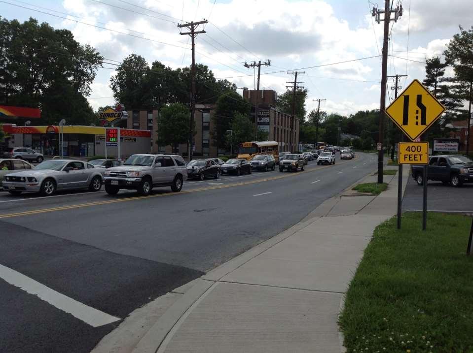
33 Traffic Impact and Circulation Direct traffic onto Connecticut Ave (subject to SHA approval) rather than neighborhood streets Reduce impacts from queuing on Aspen Hill Road Affirm recommendations from the MCDOT/SHA Pedestrian Road Safety Audit, 2011 Affirm the proposed Shared Use Path on Connecticut Ave Recommend Traffic Signal Warrant Analysis
34
35
36
37
38

39 Pedestrian Circulation and Safety

40 Pedestrian Circulation and Safety
41 Project Timeline and Next Steps Community Meeting #1 Dec 3, 2013 Scope of Work to Planning Board Jan 23, 2014 Initial Staff Recommendations Feb - Mar 2014 Community Meeting #2 April 1, 2014 Staff Briefing to Planning Board April 24, 2014 Community Meeting #3 May, 13, 2014 Staff Briefing to Planning Board June 5, 2014 Staff Draft Plan to Planning Board July 10, 2014 Planning Board Public Hearing Sept 11, 2014 Planning Board Work Sessions Sept - Oct 2014 Planning Board Draft Plan Oct - Nov 2014 County Executive Plan Review Nov - Dec 2014 County Council Public Hearing Jan 2015 Approved Plan Mar 2015
ASPEN HILL Minor Master Plan Amendment
 ASPEN HILL Minor Master Plan Amendment Worksession #3 Planning Board Agenda Item #5 MONTGOMERY COUNTY PLANNING DEPARTMENT Maryland-National Capital Park and Planning Commission Area 2 Planning November
Rock Spring Master Plan Community Meeting #6: Land Use + Transportation Forecasts
 Rock Spring Master Plan Community Meeting #6: Land Use + Transportation Forecasts May 23, 2016 Ι Walter Johnson High School Andrea Gilles, andrea.gilles@montgomeryplanning.org Ι www.montgomeryplanning.org/community/rockspring/
Downtown Elkton Station Area Plan, Elkton, MD. Difficult enough to get support for new starts challenge to fund Houston transit
 Difficult enough to get support for new starts challenge to fund Houston transit More difficult to build Community Support for dense development at station areas Major Concerns: Traffic, Property values,
Community Meeting November 18, 2015
 Top Concerns We ve Heard Use of Urban Road Code Total number of units and effect on schools and transportation Land swaps with Parks Department: how do these benefit the community? Zoning classifications:
Status Report: MD 355 Project
 Status Report: MD 355 Project OCTOBER 2006 M-NCPPC MONTGOMERY COUNTY PLANNING DEPARTMENT Summary of Community Comments, and break to the Results of the MD 355 Participation Session Brookside Gardens -
TOWN COUNCIL / PLANNING COMMISSION
 Workshop #3 TOWN COUNCIL / PLANNING COMMISSION January 20, 2011 Consultant Team In Attendance Tonight BMS Design Group Nevada City and San Francisco Michael Smiley, AICP, ASLA Partner-in-Charge Nancy L.
Beaverton City Council: Work Session. SIDEDistrict. May 6, 2014
 BEAVERTON Beaverton City Council: CREEK Work Session SIDEDistrict May 6, 2014 Tonight s Agenda BEAVERTON CREEK SIDE Brief updates Creekside Vision Scenarios & discussion: Redevelopment & Parking Project
MALL REVITALIZATION CASE STUDIES
 MALL REVITALIZATION CASE STUDIES DECEMBER 9, 2012 MALL REVITALIZATION OVERVIEW Introduction Sample Case Studies prepared for Lacey Woodland District Steering Committee as it considers strategies to revitalize
S C O P E O F W O R K A P R I L
 white flint 2 sector plan S C O P E O F W O R K A P R I L 2 0 1 2 MONTGOMERY COUNTY PLANNING DEPARTMENT M-NCPPC MontgomeryPlanning.org 1 white flint 2 sector plan Scope of Work abstract This scope of work
THE 355/270 CORRIDOR:
 THE 355/270 CORRIDOR: Strategic Ideas for Sustaining a Livable Work Place Project Summary ACCESS LIFE DESIGN HEALTH WORK Montgomery County Planning Department The Maryland-National Capital Park and Planning
master plan of highways bus rapid transit amendment
 Scope of Work master plan of highways bus rapid transit amendment September 2011 Montgomery County Planning Department M-NCPPC MontgomeryPlanning.org 1 Scope of Work master plan of highways bus rapid transit
CONTENTS BACKGROUND AND CONTEXT... 3 Plan Area... 3 History... 3 Previous Planning Initiatives... 4 PLANNING FRAMEWORK... 5 Countywide Transit
 CONTENTS BACKGROUND AND CONTEXT... 3 Plan Area... 3 History... 3 Previous Planning Initiatives... 4 PLANNING FRAMEWORK... 5 Countywide Transit Corridors Functional Master Plan... 5 Veirs Mill Road Bus
Preliminary Recommendations Tk Takoma/Langley Crossroads Sector Plan
 Preliminary Recommendations Tk Takoma/Langley Crossroads Sector Plan Vision is to achieve a Transit Oriented, pedestrian friendly Community that Celebrates and builds upon the cultural Diversity of the
At first Work Session on October 22, At second Work Session on November 19, At third Work Session on December 3, 2015
 At first Work Session on October 22, 2015 Staff Reviewed Infrastructure: Transportation Capacity School Capacity Willett Branch Proposed Staging Language At second Work Session on November 19, 2015 Land
PLAN ELEMENTS WORKSHOP. April 5, 2016
 PLAN ELEMENTS WORKSHOP April 5, 2016 needs more housing. But there is no one-size fits-all solution. Every neighborhood has its own character. In some places, density is not only appropriate it is badly
GPA FALL 2017 CONFERENCE
 Change in Doraville Doraville at the beginning of a new era Design Doraville (Comp. Plan) adopted in 2016 Doraville Town Center Masterplan LCI (2005) Downtown Doraville Masterplan LCI (2010) 2014 Adoption
FUNDING CORRIDOR REVITALIZATION
 FUNDING CORRIDOR REVITALIZATION Integrated corridor planning for the 21 st Century America Planning Association Annual Conference Atlanta, GA April 27, 2014 Mariia Zimmerman, MZ Strategies, LLC mariia@mzstrategies.com
Making TOD Work in the Heart of Suburban Sprawl
 Making TOD Work in the Heart of Suburban Sprawl Rocky Mountain Land Use Institute March 6, 2009 Speakers Ben Herman, FAICP, Principal Clarion Associates Darcie White, AICP, Principal Clarion Associates
International Blvd. TOD Plan Public Workshop #1
 International Blvd. TOD Plan Public Workshop #1 Add photos or project images September 21 and 22, 2010 Workshop Purpose Introduce the public to the Project Review and discuss the existing conditions analysis
SPRINGHILL LAKE TRANSIT VILLAGE
 Greenbelt Metro Area Sector Plan - Subarea Design Policies and Guidelines - Springhill Lake Transit Village 113 SPRINGHILL LAKE TRANSIT VILLAGE Residential Neighborhood and Village Center CONCEPT Springhill
INDEPENDENCE BOULEVARD AREA PLAN
 INDEPENDENCE BOULEVARD AREA PLAN Public Meeting October 28, 2008 Tonight s Agenda Introduction 4:00 4:05 Tom Warshauer Presentation 4:05 5:00 Blake Drury Group Exercises 5:00 5:50 All Wrap Up & Next Steps
STEERING COMMITTEE MEETING # 5 SEPTEMBER 18, 2018
 STEERING COMMITTEE MEETING # 5 SEPTEMBER 18, 2018 STEERING COMMITTEE MEETING #5 AGENDA 1. Introduction 2. Market Conditions 3. Preliminary Development Concepts 4. Open Discussion 5. Next Steps PLANNING
MONTGOMERY COUNTY METRO STATION AREA DESIGN CHARRETTE
 MONTGOMERY COUNTY METRO STATION AREA DESIGN CHARRETTE Shady Grove Metro Station Area Charrette Closing Presentation October 25-28, 2000 MONTGOMERY COUNTY, MD M-NCPPC Design Collective, Inc. Architects
Kensington Center. Public Meeting # Transit-Oriented Development, Town of Berlin, CT
 Kensington Center Public Meeting #1 10.27.16 Transit-Oriented Development, Town of Berlin, CT CivicMoxie 2016 What is Transit-Oriented Development Definition: Transit-Oriented Development (TOD) = is an
The Village of Shirlington
 The Village of Shirlington Suburban Smart Growth Without Rail Transit July 2018 Agenda History (1940 to present) Attributes and Outcomes Lessons Learned Setting the Stage Arlington County Arlington is
burtonsville commercial crossroads neighborhood planning study
 Sector Plan burtonsville commercial crossroads neighborhood planning study Scope of Work Abstract This Scope of Work examines community issues in the Burtonsville Crossroads at US 29 and MD 198, outlines
PINE CURVE REZONING. Property does not meet criteria for open space preservation and is not a candidate for a park
 PINE CURVE REZONING BACKGROUND Purchased as two parcels in 2001 and 2002 Annexed and Zoned Greater Downtown District Historic Center September 25, 2002 and October 7, 2002 WHAT THE PROJECT IS AND IS NOT
Murphy Crossing Site Redevelopment Community Engagement Meeting September 19, 2016
 Murphy Crossing Site Redevelopment Community Engagement Meeting September 19, 2016 SUMMARY 1 EXECUTIVE SUMMARY STATEMENT OF PURPOSE ABI has conducted a detailed study of 1. Market potential 2. Building
Rio/29 Small Area Plan. Design Plan & Implementation Framework Open House - January 25, 2018
 Rio/29 Small Area Plan Design Plan & Implementation Framework Open House - January 25, 2018 MEETING PURPOSE PRESENTATION 1. Orient to the updated design plans 2. Introduce implementing options 3. Explain
Silver Line CPAM UPDATE. Transportation and Land Use Committee October 14, 2016
 Silver Line CPAM UPDATE Transportation and Land Use Committee October 14, 2016 Purpose Recap Project History and Map Changes Provide Overview of CPAM Components Discuss Transportation Impacts Discuss Fiscal
Cobb County Design Guidelines Mableton Parkway & Veterans Memorial Highway Community Design Workshop January 12, 2017
 Community Design Workshop January 12, 2017 Agenda Opening Remarks / Introductions Scope of Work Existing Conditions Key Issues / Opportunities VPS Summary Draft Vision & Goal Statement Implementation Concepts
Citizen Comment Staff Response Staff Recommended Revision Planning Committee
 Citizen Comment Staff Response Staff Recommended Revision Planning Committee Area No. 1: Owner desires retail land uses. Area No. 1a: Owner of two small parcels adjacent to Area No. 1 desires retail land
Learning Objectives. Introduction. Design at an Ecodistrict Scale can Change Washington, DC s Landscape
 Learning Objectives Design at an Ecodistrict Scale can Change Washington, DC s Landscape Presenters Elizabeth Miller, ASLA, National Capital Planning Commission Diane Sullivan, National Capital Planning
TOD 101 CREATING LIVABLE COMMUNITIES WITH TRANSIT
 1 CREATING LIVABLE COMMUNITIES WITH TRANSIT What are transit Centered Communities? Benefits of Partnerships to Support and Implement What You Will Learn Portland s Pearl District Your Trainers Today Catherine
Urban Planning and Land Use
 Urban Planning and Land Use 701 North 7 th Street, Room 423 Phone: (913) 573-5750 Kansas City, Kansas 66101 Fax: (913) 573-5796 Email: planninginfo@wycokck.org www.wycokck.org/planning To: From: City Planning
Concord Community Reuse Project Goals and Guiding Principles. Overarching Goals (OG)
") Concord Community Reuse Project Goals and Guiding Principles Overarching Goals (OG) No priority is implied by the order of presentation of the goals and guiding principles. Overarching goals for the Concord
Concord Community Reuse Project Goals and Guiding Principles Overarching Goals (OG) No priority is implied by the order of presentation of the goals and guiding principles. Overarching goals for the Concord
NorthPoint, Inc. Community-Based Development Concept
 NorthPoint, Inc. Community-Based Development Concept 6.0.01 EXECUTIVE SUMMARY The NorthPoint Community Board Development concept is a community development strategy. It leverages NorthPoint s mission,
Pine Island Road Corridor Master Plan
 RECOMMENDED DEVELOPMENT PLAN Figure 9: Del Prado Village District Conceptual Framework The Conceptual Framework (Figure 8) for development of the Pine Island Corridor is to encourage mixed-use development
Executive Summary. NY 7 / NY 2 Corridor
 Executive Summary NY 7 / NY 2 Corridor Transportation and Land Use Study December 2005 Prepared for: Town of Colonie Capital District Transportation Committee Prepared by: Introduction: Land use decisions
Hillsborough County MPO Transit Study. Citizens Team Workshop Wednesday, February 28 th, 2006 Hillsborough Community College - Brandon
 Hillsborough County MPO Transit Study Citizens Team Workshop Wednesday, February 28 th, 2006 Hillsborough Community College - Brandon What is the MPO Transit Study? An effort to look at the full range
Prince George s County Economic Development Corporation David Iannucci President & CEO
 Prince George s County Economic Development Corporation David Iannucci President & CEO WBC REGIONAL ECONOMIC DEVELOPMENT FORUM THE FUTURE OF PRINCE GEORGE S COUNTY Wednesday, March 6, 2019 Why Prince George
MONTGOMERY COUNTY PLANNING DEPARTMENT
 MONTGOMERY COUNTY PLANNING DEPARTMENT THE MARYLAND-NATIONAL CAPITAL PARK AND PLANNING COMMISSION MCPB Item No.: Date: 5-03-18 Pike and Rose, Phase I: Site Plan Amendment No. 82012002D Rhoda Hersson-Ringskog,
Economic Development & Housing Council Committee Comprehensive Plan Update September 20, 2005
 1 Economic Development & Housing Council Committee Comprehensive Plan Update September 20, 2005 Purpose To update the Committee on the ForwardDallas! Plan, including: Status Anticipated Products Public
DRAFT PLAN PRESENTATION
 DRAFT PLAN PRESENTATION 1.23.2018 AGENDA Process Project Schedule Results from Visioning Workshop Draft Plan Highlights Concept Plans Feedback Next Steps PROJECT SCHEDULE KICK-OFF WORKSHOP August 29 th
This Review Is Divided Into Two Phases:
 Semiahmoo Town Centre Review The purpose of this review: To review the Semiahmoo Town Centre Concept Plan, originally approved in 1993, to ensure that this centre will continue to serve the needs of South
Sahuarita District & Phase 1 Master Plan. Town Council December 11, 2017
 Sahuarita District & Phase 1 Master Plan Town Council December 11, 2017 Visioning Study Visioning Process Advisory Group Meetings Community Questionnaire Town Center Case Studies Community Analysis The
CHAPTER 3 VISION, GOALS, & PLANNING PRINCIPLES. City of Greensburg Comprehensive Plan. Introduction. Vision Statement. Growth Management Goals.
 CHAPTER 3 VISION, GOALS, & PLANNING PRINCIPLES Introduction The Greensburg Comprehensive Plan is intended as a working community document. A combination of long and short-term goals, this document is intended
Public Meeting: July 11, 2016
 Public Meeting: July 11, 2016 MONTGOMERY COUNTY PLANNING DEPARTMENT Maryland-National Capital Park and Planning Commission Tonight s Agenda Preliminary Recommendations Background and Context 2009 Twinbrook
Bethesda Downtown Plan
 Bethesda Downtown Plan Planning Board Update Connecticut Avenue Location Economic Sustainability Social Environmental Scope Coming Soon! Team Listening, Twitter Outreach We Are Here Engagement Challenge
Atlanta BeltLine Subarea 3 Master Plan Update
 Atlanta BeltLine Subarea 3 Master Plan Update April 14, 2018 Workshop Meeting 1 22 miles, connecting 45 neighborhoods 22 MILES of transit 46 MILES of streetscapes and complete streets 33 MILES of urban
Gold Line Bus Rapid Transit Transit Oriented Development (BRTOD) Helmo Station Area Plan
 Helmo Station Area Plan") Appendix F Gold Line Bus Rapid Transit Transit Oriented Development (BRTOD) Helmo Station Area Plan Introduction and Purpose of the Plan The Gold Line Bus Rapid Transit facility is an eleven-mile dedicated
Appendix F Gold Line Bus Rapid Transit Transit Oriented Development (BRTOD) Helmo Station Area Plan Introduction and Purpose of the Plan The Gold Line Bus Rapid Transit facility is an eleven-mile dedicated
Mini Technical Assistance Panel. Rock Spring Park
 Mini Technical Assistance Panel Rock Spring Park May 22, 2013 The Team Jason Bonnet, Forest City Washington Matthew Flis, Town of Vienna William Herbig, National Capital Planning Commission Sophie Lambert,
Public Open House. YWCA, 87 Elm Street December 2nd, 2017, 10 a.m. 2 p.m.
 Public Open House YWCA, 87 Elm Street December 2nd, 2017, 10 a.m. 2 p.m. 1 A 25-Year Downtown Plan A blueprint for future growth and infrastructure in the heart of Toronto Ensuring growth contributes positively
Planning Board Briefing
 Planning Board Briefing Why Now? The Sector Plan Implementation Chapter States: Before Stage 1 begins, the following must occur: Approval of the Sectional Map Amendment. Approval of the Greater Lyttonsville
SOUTH FLORIDA TOD GRANT UPDATE
 Palm Beach Transportation Planning Agency October 2018 SOUTH FLORIDA TOD GRANT UPDATE Presented by Treasure Coast Regional Planning Council in partnership with SFRTA & SFRPC What is Transit Oriented Development
PART 1. Background to the Study. Avenue Study. The Danforth
 The Danforth 1.1/ Study Purpose & Key Municipal Goals 1.2/ The Local Advisory Committee 1.3/ The Project Team 1.4/ Study Process/Summary of Method 1.5/ Summary of Consultation 1.1 Study Purpose and Key
white flint 2 sector plan
 white flint 2 sector plan Public Hearing Draft NOVEMBER 2016 MONTGOMERY COUNTY PLANNING DEPARTMENT M-NCPPC MontgomeryPlanning.org White Flint 2 Sector Plan Public Hearing Draft Abstract This Plan contains
Rock Spring Master Plan Community Meeting #8: Preliminary Recommendations
 Rock Spring Master Plan Community Meeting #8: Preliminary Recommendations July 18, 2016 Ι Walter Johnson High School Andrea Gilles, andrea.gilles@montgomeryplanning.org Ι www.montgomeryplanning.org/community/rockspring/
Sub Area 2: Downtown Overland Park
 Downtown 132 2.12 encompasses over 600 acres and extends between 71st Street and 87 th Street including Downtown Overland Park. The area is home to several individual historic sites and structures, including
PRINCE GEORGE S PLAZA TRANSIT DISTRICT DEVELOPMENT PLAN AND TRANSIT DISTRICT OVERLAY ZONE UPDATE
 PRINCE GEORGE S PLAZA TRANSIT DISTRICT DEVELOPMENT PLAN AND TRANSIT DISTRICT OVERLAY ZONE UPDATE UNIVERSITY PARK TOWN LISTENING SESSION JUNE 12, 2014 Prince George s County Planning Department The Maryland-National
BRYN MAWR. Tier 2 Characteristics: Location: Lancaster Avenue from Old Lancaster Road on the east to Norwood Avenue on the west
 BRYN MAWR Tier 2 Characteristics: Transit-oriented Mixed use Along Lancaster Avenue Serve township-wide needs Civic space Employment centers Location: Lancaster Avenue from Old Lancaster Road on the east
NORTH LAKE SPECIFIC PLAN AREA
 NORTH LAKE SPECIFIC PLAN AREA June 21, 2018 WELCOME Workshop Agenda Introduction Provide information about the program and introduce the team Background Information Share information about the North Lake
Kenilworth Avenue and Town of Cheverly Industrial Study Briefing
 Kenilworth Avenue and Town of Cheverly Industrial Study Briefing The Maryland-National Capital Park and Planning Commission Prince George s County Planning Department www.pgplanning.org Vanasse Hangen
Streets, Connectivity & Built Environment Working Group August 2, 2017
 Streets, Connectivity & Built Environment Working Group August 2, 2017 DOWNTOWN OAKLAND SPECIFIC PLAN WELCOME Streets, Connectivity & Built Environment Working Group Social Equity Meeting August 2, 2017
2035 General Plan Update and Belmont Village Specific Plan. Joint Study Session with the City Council and Planning Commission April 12, 2016
 2035 General Plan Update and Belmont Village Specific Plan Joint Study with the City Council and Planning Commission April 12, 2016 Agenda 1. Welcome and Introductions 2. General Plan Update Status of
Subregion 4 Central Avenue-Metro Blue Line Corridor Transit-Oriented Development (TOD) Implementation Project. Community Meeting April 27, 2011
 Implementation Project. Community Meeting April 27, 2011") Subregion 4 Central Avenue-Metro Blue Line Corridor Transit-Oriented Development (TOD) Implementation Project Community Meeting April 27, 2011 Overview Introduction to Subregion 4 TOD Implementation Program
Subregion 4 Central Avenue-Metro Blue Line Corridor Transit-Oriented Development (TOD) Implementation Project Community Meeting April 27, 2011 Overview Introduction to Subregion 4 TOD Implementation Program
NASSAU COUNTY TOWN HALL NEW YORK & CONNECTICUT SUSTAINABLE COMMUNITIES. A Unique Bi-State Partnership to Improve Jobs, Housing and Transportation
 NASSAU COUNTY TOWN HALL NEW YORK & CONNECTICUT SUSTAINABLE COMMUNITIES A Unique Bi-State Partnership to Improve Jobs, Housing and Transportation Police Headquarters Auditorium Mineola, NY December 9 th,
DRAFT. October Wheaton. Design Guidelines
 October 2011 DRAFT Wheaton Design Guidelines 2 Draft - Design Guidelines - Wheaton Sector Plan Contents 04 Section 1: Introduction 06 Section 2: Context 08 Section 3: Design Guidelines 09 Goal 1: Create
California Environmental Quality Act (CEQA) Environmental Review Process
 Environmental Review Process") California Environmental Quality Act (CEQA) Environmental Review Process Los Angeles Union Station Forecourt and Esplanade Improvements constitute a Project Los Angeles County Metropolitan Transportation
California Environmental Quality Act (CEQA) Environmental Review Process Los Angeles Union Station Forecourt and Esplanade Improvements constitute a Project Los Angeles County Metropolitan Transportation
8implementation. strategies
 PROGRAM STRATEGIES 8implementation strategies T he implementation actions of this chapter are designed to support and carry out the land use, economic development, transportation, urban design, and program
South Norfolk Municipal Facilities Study
 South Norfolk Municipal Facilities Study City of Chesapeake, VA P r e s e n t e d b y H B A A r c h i t e c t u r e & I n t e r i o r D e s i g n, I n c. 1 Purpose of the Study (Phase I) Identify potential
Draft Cary Community Plan Review Part 3: Shop, Engage, Serve, Special Area Plans, Other Updates. October 27, 2015 Police Department Training Room
 Draft Cary Community Plan Review Part 3: Shop, Engage, Serve, Special Area Plans, Other Updates Committee for the Future October 27, 2015 Police Department Training Room AGENDA 1. Welcome and Call to Order
City of Heath. Town Center Concept
 In the give-and-take of getting projects designed, financed, and approved, the famous refrain from the film Field of Dreams is heard often: if you build it, they will come. From the perspective of the
Clarksburg Master Plan Concept and the Clarksburg Town Center. Planning Regulating Building
 Master Plan Concept and the Town Center Planning Regulating Building Overview with CTC PHED T&E Dec 12, 2011 outline Location Master Plan Concept Staging Approved Preliminary Plans Infrastructure Town
Newton Town Centre. Land Use, Urban Design & Transportation Plan
 Newton Town Centre Land Use, Urban Design & Transportation Plan Public Workshop - June 2-4, 2009 6:15 6:30 Sign-in & conversations Tonight s Agenda 6:30 6:55 Project introduction and summary of previous
Joint Public Hearing. Preliminary Subregion 5 Master Plan and Proposed Sectional Map Amendment
 Preliminary Subregion 5 Master Plan and Proposed Sectional Map Amendment Joint Public Hearing April 11, 2013 Council Hearing Room Upper Marlboro 7:00 pm His Lordship s Kindness (Clinton) Presentation Overview
Equitable Growth Through TOD Planning
 Equitable Growth Through TOD Planning Community Meeting # 2 November 2017 Goals Objectives Extend investment from downtown Connect neighborhoods physically and economically Enhance places based on local
JANUARY 19, 2011 CENTRAL AVENUE-METRO BLUE LINE TRANSIT-ORIENTED DEVELOPMENT IMPLEMENTATION PROJECT COMMUNITY FORUM
 CENTRAL AVENUE-METRO BLUE LINE TRANSIT-ORIENTED DEVELOPMENT IMPLEMENTATION PROJECT COMMUNITY FORUM JANUARY 19, 2011 THE MARYLAND-NATIONAL CAPITAL PARK AND PLANNING COMMISSION PRINCE GEORGE S COUNTY PLANNING
open public hearing and allow public comment request to continue LPA public hearing to January 16, 2014 at 10:30 am
 TODAY S AGENDA Work Session LPA Transmittal Public Hearing open public hearing and allow public comment request to continue LPA public hearing to January 16, 2014 at 10:30 am staff will issue a recommendation
Route 1 Corridor Study
 Route 1 Corridor Study Westbrook, Connecticut A Vision for the Connecticut Shoreline Public Informational Meeting July 28, 2015 Lower Connecticut River Valley Council of Governments Fitzgerald & Halliday,
In partnership with: Harbor Corridor Plan Bali Hi Mobile Home Park July 24, 2013
 In partnership with: Harbor Corridor Plan Bali Hi Mobile Home Park July 24, 2013 Project Intro 2-miles of Harbor Boulevard Westminster/17 th Street to just north of Edinger Avenue Many people use the corridor
Chapter 4. Linking Land Use with Transportation. Chapter 4
 Chapter 4 Linking Land Use with Transportation Chapter 4 59 Chapter 4 Linking Land Use with Transportation Community Design and Transportation Program Introduction Since the 1950s, the predominant development
I-84 Hartford Project Open Planning Studio #12. April 25, 2017
 I-84 Hartford Project Open Planning Studio #12 April 25, 2017 Meeting Agenda 1. I-84 Hartford Project alternatives update 2. Multimodal station area planning 3. I-84 / I-91 Interchange Study coordination
4.1.3 LAND USE CATEGORIES
 4.1.3 LAND USE CATEGORIES a. City Center District The City Center District incorporates the existing character and mix of uses in downtown Belmont to encourage redevelopment and new development in keeping
Northwest Rail Corridor and US 36 BRT Development Oriented Transit Analysis 4.4 STATION AREA FINDINGS
 4.4 STATION AREA FINDINGS Each station is different, and each one requires a separate set of recommendations based on the vision for the site. This section outlines an initial TOD strategy and recommendations
Union Station, Los Angeles Dec. 4-9, 2011
 Union Station, Los Angeles Dec. 4-9, 2011 About the Urban Land Institute The mission of the Urban Land Institute is to provide leadership in the responsible use of land and in creating and sustaining thriving
Summary of Public Input & Discussion of Alternatives
 Meeting #4 Summary of Public Input & Discussion of Alternatives May 6 th, 2009 City of Bellingham, Washington April 1 April 15 April 22 May 6 Introduction, Character and Boundary Study Areas Public Realm:
DRAFT. Urban Development Areas Fairfax County. UDA Needs Profile: Tysons Corner 13% Location Characteristics. Socio-Economic Characteristics
 14 Urban Development Areas Fairfax County UDA Needs Profile: Tysons Corner Tysons Corner is located in Fairfax County, surrounded by the town of McLean to the east and Vienna on the west along I-495, the
Lambeth Main Street Streetscape Improvements
 Lambeth Main Street Streetscape Improvements Open House October 5th, 2017 Agenda 1. Introduction 2. Project Background 3. Context 4. Project Objectives 5. Design Principles & Approach 6. Streetscape Design
U T D N o r t h C a m p u s T O D and D o w n t o w n D e n t o n T O D
 U n i v e r s i t y o f T e x a s a t D a l l a s C i t y o f R i c h a r d s o n U T D N o r t h C a m p u s T O D and D o w n t o w n D e n t o n T O D Rick Leisner, AICP Assistant Director of Development
QUINCE ORCHARD/FIRSTFIELD CORRIDOR CITY OF GAITHERSBURG MTAP 2017
 QUINCE ORCHARD/FIRSTFIELD CORRIDOR CITY OF GAITHERSBURG MTAP 2017 ULI LEADERSHIP INSTITUTE 2017 The Team Allison Davis, WMATA Daniel Park, Rodgers Consulting Debbie Albert, Arlington County Harry Ross,
TO: Denver Planning Board FROM: Analiese Hock, Senior City Planner DATE: March 13, 2018 RE:
 Community Planning and Development Planning Services 201 W. Colfax Ave., Dept. 205 Denver, CO 80202 p: 720.865.2915 f: 720.865.3052 www.denvergov.org/cpd TO: Denver Planning Board FROM: Analiese Hock,
Ivywild On The Creek PRELIMINARY CREEK DISTRICT MASTER PLAN
 Ivywild On The Creek PRELIMINARY CREEK DISTRICT MASTER PLAN Introduction: Rejuvenating an extraordinary Creekside neighborhood THE CREEKSIDE DISTRICT The Ivywild On The Creek Neighborhood District Master
1.0 INTRODUCTION 1.1 TH 14 WEST STUDY AREA Project Description Functional Classification Purpose of the Project
 1.0 INTRODUCTION 1.1 TH 14 WEST STUDY AREA 1.1.1 Project Description The Trunk Highway (TH) 14 West Corridor is a two-lane roadway approximately 22 miles in length. Located in Nicollet County, the corridor
Presentation of the Staff Draft. July 17, 2014 SSRVP Team, Area 3
 Presentation of the Staff Draft July 17, 2014 SSRVP Team, Area 3 Presentation Overview Introduction Plan Framework Plan Recommendations Implementation Next Steps and Request for Public Hearing on September
FROM METRO STATIONS TO GREAT URBAN PLACES
 FROM METRO STATIONS TO GREAT URBAN PLACES New Downtowns for Prince George s County 2016 Rail~Volution Conference San Francisco CA BRIEF HISTORY OF WASHINGTON METRO SYSTEM Washington regional Metro System
Atlanta BeltLine Corridor Environmental Study. Scoping Meeting August 2008
 Atlanta BeltLine Corridor Environmental Study Scoping Meeting August 2008 What Will We Be Discussing Today? Study Overview - How Did We Get Here? - What Is the Study About? - Who Is Involved? - Where Is
NORTH CLAYMONT AREA MASTER PLAN COMMUNITY WORKSHOP #1 FEBRUARY 3, 2016
 NORTH CLAYMONT AREA MASTER PLAN COMMUNITY WORKSHOP #1 FEBRUARY 3, 2016 1. Introduction To the team and to the Plan Planning Partners The Claymont Community WILMAPCO New Castle County Claymont Renaissance
BROOKHILL NEIGHBORHOOD MODEL ZONING MAP AMENDMENT PREFACE TO APPLICATION
 BROOKHILL NEIGHBORHOOD MODEL ZONING MAP AMENDMENT PREFACE TO APPLICATION June 15, 2015 Revised: August 1, 2016 I. VISION Brookhill is a proposed community based upon the principles of Albemarle County
Create Policy Options Draft Plan Plan Approval. Public Consultation Events. Phase 2
 Background Grandview-Woodland Community Plan In the spring of 2012, the City of Vancouver embarked on a comprehensive community planning program in the Grandview-Woodland neighbourhood. The process has