Westwind Developments Ltd. PIONEER LANDS AREA STRUCTURE PLAN - PROPOSED AMENDMENT
|
|
|
- Stuart Small
- 5 years ago
- Views:
Transcription
1 FEBRUARY 2013
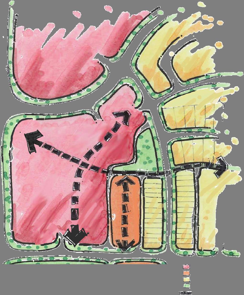
2 TABLE OF CONTENTS 1.0 BACKGROUND Amendment LOCATION & CONTEXT Land Ownership POLICY CONTEXT Municipal Development Plan Capital Region Growth Plan The City of Spruce Grove Parks & Open Space Master Plan The City of Spruce Grove Land Use Bylaw No. C DEVELOPMENT CONCEPT Vision Land Use Concept Residential Commercial Westwind Village Open Space SERVICING PHASING IMPLEMENTATION February 2013 Page i.
3 1.0 BACKGROUND The Pioneer Lands Area Structure Plan (ASP) was originally approved in February 2009 as Bylaw No. C to guide development in the north portion of the annexation lands. An amendment to the ASP was approved on November 14, 2011 as Bylaw C This amendment defined the concept plan and design guidelines for the Gateway Lands. The approved Development Concept for the Pioneer Lands ASP is included as Exhibit Amendment This proposed amendment to the Pioneer Lands ASP continues to follow the vision and principles as presented in the approved ASP Bylaw The primary purpose of this amendment is to perform a graphic update to the approved Development concept as a result of more detailed review of the land uses. A secondary purpose is to update the naming of neighbourhood areas to be consistent with the marketing intentions for the Pioneer Lands and promoting a sense of place and belonging for residents. The neighbourhood names have been added to Exhibit 3 Land Use Concept. Westwind replaces Gateway Lands, and Westwind Village replaces mixed-use urban village in the exhibits and following text of the Report. Proposed amendments to the Pioneer Lands ASP include: a reconfiguration of the Westwind Village open space; redesignation of mixed-use to commercial and residential uses; reduction in the size of the commercial site on Pioneer Road with redesignation of the north half to medium to high density residential; and update of servicing Exhibit 7 to show existing services. The proposed updates to this ASP do not change the vision and guidelines approved in the previous amendment. February 2013
4
5 2.0 LOCATION & CONTEXT The proposed amendments to the Pioneer Lands Area Structure Plan affect the land uses in Westwind Village and the commercial site on Pioneer Road. Neighbourhood names have been added to the ASP to define areas of development, including Westwind, Westwind Village, Kenton, Greenbury and Prescott. Westwind consists of the commercial portions of the area formerly referred to as Gateway Lands along Highway 16 and Century Road. Westwind Village is an area of integrated Residential and commercial uses located within Westwind and outlined in Exhibit 3 Development Concept. Kenton is the residential portion of the Gateway Lands, located adjacent to Westwind. Kenton and Westwind are undergoing development simultaneously and are connected through pedestrian greenways, roadways and a central park site. The two areas interface along a north/south collector road on the east side of Westwind Village. Greenbury began development north of Grove Drive and east of Jubilee Park and continues to develop with several stages currently under construction. There are a mix of single-detached, semidetached and townhouses built today, which were developed under the Greenbury Mixed Residential (GMR) District. The GMR district was the basis for the recently adopted new Land Use Bylaw. Greenbury continues to be a benchmark for sustainable design and innovation in land development for the region. Prescott is located north of Grove Drive and east of Pioneer Road. The first stage of redistricting was approved by Council in 2012 marking the first residential neighbourhood in Spruce Grove to be developed east of Pioneer Road. 2.1 Land Ownership IBI Group is applying for this amendment to the Pioneer Lands ASP on behalf of the participating owners and private developers of the subject lands. February 2013 Page 2
6 3.0 POLICY CONTEXT This proposed ASP amendment describes the land uses, density of development, location of major roads and utilities and the proposed sequence of development in accordance with the City of Spruce Grove Area Structure Plan Guidelines. The ASP amendment adheres to the guidelines of the following bylaws and policies. 3.1 Municipal Development Plan The City s Municipal Development Plan Your Bright Future was approved as Bylaw C on July 12, This amendment continues to follow the goals, objectives and policies of the MDP as described in the previous amendment. Below are updates to the MDP policies from the previous amendment Include a community level gathering place, medium to high density residential development, and a regional park-and-ride for transit in Gateway Lands. The Westwind Village Park site is reconfigured to include more frontage on the collector road, creating a more inviting space to act as a central meeting place for the residential and commercial uses. Where feasible, this park site will provide opportunities to retain a portion of the existing tree stand and for residents to gather in usable park space. This new configuration will give better opportunity for commercial uses to address the park with the possibility of patios or plazas. Westwind Village continues to be planned as a horizontal mix of commercial and residential uses that are complimentary to each other and integrated through designated pedestrian walkways and open space. A redistricting application has been submitted for the residential site to be R2 (Medium to High Density Residential) district and is circulating concurrently with this proposed ASP amendment. The remaining residential lands in Kenton shall continue to be developed as low to medium density residential uses, consistent with the R1 district in the Land Use Bylaw. There are no further details on a new transit facility, but the Westwind area continues to be a logical place for Spruce Grove Transit to install a transit facility to service the area and provide a major link to the regional transit system connecting to the City of Edmonton. Policies Promote appropriate increases to residential densities to support commercial development at a neighbourhood and city-wide level. The MDP states in that residential densities will be split into Level 1 and Level 2. Level 1 residential provides opportunities for a mix of street oriented townhouses, duplex, and single-family homes. This policy has been implemented through the adoption of the R1 district in the Land Use Bylaw. Applying broader land use categories allows greater flexibility in types of housing to be developed. The net residential density will meet or exceed the minimum requirements set by the Capital Region Board. February 2013 Page 3
7 Objective Provide opportunities for mixed use development to occur in the City Centre and the Urban Village and for integrated land use development to occur in Gateway Lands as identified on Figure 8: Future Land Use. The mixed residential housing forms of the R1 district provide opportunities for higher density than conventional low density residential districts and will access commercial uses through designated pedestrian routes with marked and signed crossings of roadways. An R2 medium to high density residential site is proposed to be well connected and integrated within Westwind Village. This residential site would be complementary providing a supply of consumers, neighbours and potential employees for the commercial uses. Westwind Village shall provide integrated land uses through horizontal integration of residential, open space and commercial uses. This shall be achieved through the provision of pedestrian connections and through implementation of the Westwind Village design guidelines described in the approved ASP. Policies Apply high standards of community design to increase the pedestrian orientation and enhance the overall aesthetics of mixed use areas and integrated land use development areas, including: building orientation and presentation on the site; scale of buildings; site signage; site landscaping; site lighting; development relationship to the street; building facades; sidewalks/trail connections; informal seating areas; parking areas; and bus stops and/or hubs. The Pioneer Lands ASP contains design guidelines that deal with the items listed above to help achieve integration of commercial and residential land uses. 3.2 Capital Region Growth Plan This amendment maintains the population and employment projections of the Capital Region Growth Plan. The overall neighbourhood projections maintain a minimum 25 units per net residential hectare. 3.3 The City of Spruce Grove Parks & Open Space Master Plan The City of Spruce Grove Parks and Open Space Master Plan was approved by Council on March 26, This document guides the development of parks, open space and recreation facilities in the City of Spruce Grove. This proposed amendment continues to follow the principles of the Open Space Master Plan. February 2013 Page 4
8 3.4 The City of Spruce Grove Land Use Bylaw No. C The City of Spruce Grove Land Use Bylaw C was replaced by a new Land Use Bylaw effective January 1, The current district for the amendment area is UR Urban Reserve. Districting for this area will use the new residential and commercial districts adopted in the new Land Use Bylaw. An application to redistrict and subdivide a medium to high density site within Westwind Village has been submitted concurrently with this proposed amendment to the ASP. February 2013 Page 5
9 4.0 DEVELOPMENT CONCEPT 4.1 Vision The vision for Gateway Lands as described in the Pioneer Lands ASP is of a regional commercial center providing opportunities for shopping and employment, while integrating with a compact residential community creating vibrant streetscapes with convenient links to open space amenities. This amendment maintains this vision. 4.2 Land Use Concept The proposed Land Use Concept for the amendment area is presented as Exhibit 3 and the proposed Land Use and Population Statistics are presented as Exhibit 4. The following provides a description and rationale for the land use amendments proposed for the Pioneer Lands ASP RESIDENTIAL Proposed residential development comprises approximately 56% of the Gross Developable Area (GDA), with a planned yield of 4,366 units and a population of 12,751 residents. The overall mix of residential densities shall yield approximately 27.7 units per net residential hectare. The residential land uses for this amendment reflect the MDP policy that states residential densities are split into two categories, Level 1 and Level 2. These categories are reflected in the new Land Use Bylaw which include R1 (low to medium density) and R2 (medium to high density residential). This amendment proposes to add a medium to high density residential site in the southeast adjacent to Pioneer Road and the future commercial site. This location is appropriate for medium to high density uses due to its proximity to the arterial roads, ample open space opportunities, and to help support the future commercial site. The Area Structure Plan, when fully developed, is projected to provide approximately: 3,674 Low to Medium Density Units; 692 Medium to High Density Residential Units. Where appropriate, housing along major collector roads will be oriented to address the street through the use of rear lanes. The intent is to create streetscapes that are inviting for pedestrians and motorists alike, creating a vibrant atmosphere. This street-orientation provides visual interest for street users and surveillance by neighbours. Stage 1 of the development was approved as street-oriented laned housing and is currently under construction COMMERCIAL This amendment does not affect the type or scale of commercial uses described in the approved ASP. The commercial area along the north boundary of the neighbourhood is planned to act as a February 2013 Page 6
10
11 Exhibit 4 Pioneer Lands ASP Amendment - Proposed Land Use Statistics Land Use GDA (ha) % of GDA Units/ha Units Pop/Unit Pop. Low to Medium Density Residential % , ,021 Medium to High Density Residential % ,730 Total Residential % ,366 12,751 Westwind Commercial % Neighbourhood Commercial % Parks and Recreation (MR)* % Stormwater Management Facilities % Local Roads % Collector Roads % Total Non Residential % Net Developable Area % Pipeline 1.24 Arterial Road (Grove Drive) 3.15 Total Area *The MR in Gateway Lands portion of the ASP was dedicated with the original subdivision. The 10% MR required for the remaining GDA in Pioneer Lands is 22 ha.
12 regional destination point for consumers providing access to a variety of commercial and business uses. The high visibility of the commercial lots along Highway 16 will help boost Spruce Grove s regional appeal as a business and shopping destination. The area will act as a major employment node, reducing commute times for people living in Spruce Grove that may have alternatively driven to surrounding communities for work. The first stage of commercial lands located on Century Road has been redistricted to C2 Vehicle Oriented Commercial district as the first phase of commercial development in Westwind. This site will provide opportunities for retail and services to local residents. The commercial area will be well connected by the neighbourhood walkway system providing designated convenient linkages for pedestrians and cyclists. As shown in Exhibit 5 Westwind Village, there are opportunities for access to the site from all sides, creating an open and inviting atmosphere. Another amendment to commercial uses is proposed for the future site on Pioneer Road. Through experiences with the development of other neighbourhood commercial sites, it is determined that the size of the commercial site on Pioneer Road is too large. This amendment proposes reducing the size of the site from 1.6 ha to 0.7 ha, which is more appropriate to the scale of neighbourhood commercial development anticipated for this area WESTWIND VILLAGE Westwind Village measures approximately 4 hectares and accommodates a horizontal mix of retail and residential uses. An updated conceptual plan for the area is included as Exhibit 5 Westwind Village Concept, showing general pedestrian connections and orientation of uses Integration & Connectivity Opportunities to provide convenient connectivity for residents of Kenton remain a priority for the plan with greenway connection to the east from a central open space park. With horizontal integrated uses, commercial and residential buildings are located separately, but in close proximity to one another. This arrangement of uses is desirable to reduce the potential for conflicts between users, such as, parking access and loading zones, while providing residents access to retail within a short walking distance and supplying retailers with a local supply of consumers and employees. In Westwind, a complimentary relationship between retail and residential uses will create opportunities to work and live within a compact community. The location of Westwind Village allows for connection to the community walkway system allowing for seamless integration with the surrounding residential communities of Kenton and Spruce Village. Westwind Village shall be designed to encourage pedestrian interaction along efficient pedestrian walkways and connections, helping to create a vibrant street life. Detailed design of the site shall be presented in a development permit application. The mix of uses within a compact area helps to ensure the continuous use of public spaces throughout the day. While many residents are away at work during the day, consumers and employees will continue to frequent public spaces. This shall create a continuous passive surveillance system and promote a sense of security and belonging among residents. February 2013 Page 7


13
14 Streetscape Westwind Village will have a pedestrian scale street presence with opportunities to access walkways into the site from all sides. The streetscape will be enhanced through application of a unifying theme and implementation of architectural design guidelines. Specific size, shape, and orientation of residential and commercial buildings will be determined at development permit. The vehicular accesses to the site were reviewed with a Traffic Impact Assessment performed by Bunt Engineering and was submitted to City administration under separate cover. The access locations recommended under this study are shown on Exhibit 5. It was determined that the north access to the site is limited to right-in/right-out. In order to provide sufficient vehicle access to the commercial, the north residential mixed-use site was removed and the commercial site was expanded, providing an all-directional access to the east onto the adjacent collector roadway. The northeast corner of the site is better suited to commercial uses due to its high visibility and exposure to the main collector road Urban Design High quality urban design in Pioneer Lands shall continue to be addressed through the provision of connected walkways, preservation of treed areas within public open space and/or private yards, visually interesting streetscapes, and the integration of stormwater management facilities and public open spaces into the community. The following table lists urban design concepts and how they will be applied to Westwind Village. These were approved with Bylaw C Proposed adjustments to the guidelines for this amendment are shown in red. Urban Village Design Guidelines Concept Guideline Application within Gateway 1. Connectivity 1.1 Provide convenient links for pedestrians, cyclists, motorists, and transit users between neighbourhood focal points and amenities Provide accesses around the perimeter of the urban village with clear distinction between internal roads and walkways Provide several opportunities for pedestrian and vehicular access to the site at regular intervals from the surrounding roadways Provide connections from the community and to/from neighbourhood amenities and focal points with greenways, multi-use trails, or sidewalks. 2. Integration 2.1 Integrate the internal uses in a complementary fashion An internal main street will be developed where commercial and residential February 2013 Page 8
15 Concept Guideline Application within Gateway uses will interface Connections between residential and commercial uses will be accommodated through marked pedestrian crossings Orient buildings to maximize active use of the public spaces, such as locating outdoor patios for restaurants and cafes near main thoroughfares. 2.2 Integrate commercial and mixed residential uses with the surrounding community The surrounding community will have strong multi-use trail linkages and greenways providing attractive and convenient links between neighbourhood amenities and focal points Incorporate 360 degree facades for retail where access is provided from internal parking areas and buildings address the public street Opportunities for reverse housing where houses front onto greenways will be explored at more detailed levels of planning Multi-use linkages are provided through linear ponds, linear greenways, and in some cases along major street linkages to connect neighbourhood amenities, such as, the Gateway Westwind commercial area, the mixed use urban Westwind Village, Jubilee Park, future potential school sites, and open space opportunities. 3. Sense of Place 3.1 Use appropriate signage to clearly identify uses within the urban Westwind Village Integrate signage into the architecture of buildings Use signage that is clearly visible at pedestrian and February 2013 Page 9
16 Concept Guideline Application within Gateway vehicular scale Place signage perpendicular to shop fronts at a pedestrian scale Avoid visual clutter from signs Use entry features to give names to areas. 3.2 Apply a unique architectural theme for the urban Westwind Village to enhance a sense of place An architectural and landscape theme for the mixed use urban Westwind Village will be described and implemented through architectural design guidelines. 4. Arrangement of Internal Uses 4.1 Reduce the impacts of incompatible uses Landmarks shall be located at strategic points on the site to enhance local place making Arrange and buffer residential areas and public gathering spaces from high traffic areas and incompatible uses to reduce the impact of noise and visual irritants Orient commercial loading zones away from residential uses, outdoor patios and public open spaces Use landscape and fencing to screen waste disposal and storage areas from sight lines of residential areas and pedestrian walkways Use buffers or specialized technical applications, such as, double glazed windows to reduce noise levels where optimal layout of noise sources cannot be achieved In horizontal mixed integrated land use February 2013 Page 10
17 Concept Guideline Application within Gateway developments, residential and commercial uses will be separated by internal circulation systems and/or landscape features Separate parking areas and accesses for residential and commercial uses will be provided Where applicable, arrange residential uses to back on to the north collector road, which will accommodate high levels of commercial and neighbourhood traffic. 5. Parking 5.1 Parking areas are designed to be efficient, unobtrusive and complementary to surrounding uses Commercial and residential uses will have separate parking areas Commercial and residential uses will have separate accesses to parking areas Designated pedestrian links from parking areas to residential or commercial buildings will be provided Parking lot promenades will be strategically located and enhanced with landscaping to provide convenient links to commercial uses. 6. Streetscape 6.1 Arrange buildings to provide an attractive and secure urban environment for pedestrians Where appropriate, orient buildings to front onto the collector and local roads Provide higher density street- oriented residential product along the collector roads with vehicle access from back lanes Plan for higher density residential within and adjacent to the mixed-use urban Westwind Village. February 2013 Page 11
18 Concept Guideline Application within Gateway Explore options for innovative housing and architecture to provide visual interest to pedestrians and motorists Provide ground floor facades that are rich in detail and provide interest for pedestrians Provide a variety of facades for residential units fronting onto the street Arrange landscaping in an attractive and complementary manner Provide outdoor seating where appropriate Provide adequate lighting using efficient technologies to illuminate dark areas creating an inviting atmosphere Clearly identify primary entrances through the use of canopies, awnings, porches, architectural features, display windows, signage, planters and other design features Design entrances to be well-lit at night with clear address numbering. 7. Sustainability 7.1 Encourage a sustainable and environmentally friendly community through the use of environmentally friendly technologies and sustainable design Explore the use of environmentally friendly technologies for lighting, construction materials, landscaping, water usage, and stormwater drainage Where possible, orient buildings and windows to take advantage of winter sun and summer shade through passive solar design Design buildings with February 2013 Page 12
19 4.2.4 OPEN SPACE Concept Guideline Application within Gateway flexibility to change uses adapting to market trends Provide a range of services and residential forms to accommodate different age groups and allow for residents to remain in Pioneer Lands throughout different stages of their life cycle Minimize waste during construction activities Incorporate existing vegetation into site design. The parcels of land in Westwind and Kenton have already paid the 10% of Gross Developable Area Municipal Reserve dedication with the original subdivision of the lands. The linear greenway was included with the Stage 1 subdivision of Kenton, promoting a strong pedestrian connection from residential areas to Westwind Village. Where possible, existing trees have been retained in the private back-of-lots of Stage 1 and shall be retained within future park spaces creating natural settings with mature trees. The Westwind Village park space is reconfigured with more frontage along the collector road. This orientation should provide more accessibility for pedestrians to the commercial site and may provide more opportunities for patios or plazas adjacent to future retail establishments. Exhibit 6 - Transportation, Parks, & Open Space shows the amended park site. Overall, the amount of park to be dedicated as Municipal Reserve in the ASP is 22.5 ha, accounting for 10% of the Gross Developable Area. The amount of park space planned for Gateway Lands is 0.80 ha. This is included in the 10% overall land dedication for Pioneer Lands ASP. February 2013 Page 13
20
21 5.0 SERVICING The servicing concepts are graphically presented in Exhibit 7. It has been updated to show where services have been installed as part of construction activities. 6.0 PHASING Stage 1 of Kenton began construction in Fall The Phasing Plan is included as Exhibit 8 and is unchanged by this amendment. 7.0 IMPLEMENTATION The proposed plan will be implemented through applications for redistricting and subdivision as per the City of Spruce Grove standards. A residential redistricting application for Stage 2 Kenton and for the R2 site in Westwind Village, are submitted under separate cover. J:\31778_Westwd2ComPL\10.0 Reports\ASP\Proposed\PTR _pioneer-lands-proposed-ASP_ doc\ \BCD February 2013 Page 14
22
23
THE CITY OF SPRUCE GROVE BYLAW C PIONEER LANDS AREA STRUCTURE PLAN AMENDMENT
 THE CITY OF SPRUCE GROVE BYLAW C-797-11 PIONEER LANDS AREA STRUCTURE PLAN AMENDMENT WHEREAS, pursuant to the Municipal Government Act, R.S.A., 2000, c.m-26, a municipality shall adopt Area Structure Plans
THE CITY OF SPRUCE GROVE BYLAW C PIONEER LANDS AREA STRUCTURE PLAN AMENDMENT
 THE CITY OF SPRUCE GROVE BYLAW C-932-15 PIONEER LANDS AREA STRUCTURE PLAN AMENDMENT WHEREAS, pursuant to the Municipal Government Act, R.S.A. 2000, c. M-26, including amendments, a municipality may adopt
URBAN DESIGN BRIEF URBAN DESIGN BRIEF 721 FRANKLIN BLVD, CAMBRIDGE August 2018
 URBAN DESIGN BRIEF URBAN DESIGN BRIEF 721 FRANKLIN BLVD, CAMBRIDGE August 2018 DESIGN BRIEF CONTENTS PART A 1.0 INTRODUCTION 2.0 DESCRIPTION & ANALYSIS OF SITE CONTEXT 3.0 DESIGN CONSTRAINTS AND OPPORTUNITIES
Complete Neighbourhood Guidelines Review Tool
 Complete Neighbourhood Guidelines Review Tool Prepared By: City of Regina Planning Department October 2014 Page 1 of 14 Community Development Review Checklist for Secondary Plans and Concept Plans The
Chappelle Neighbourhood Area Structure Plan
 Chappelle Neighbourhood Area Structure Plan Office Consolidation September 2017 Prepared by: City Planning Urban Form and Corporate Strategic Development City of Edmonton Bylaw 14779 was adopted by Council
East Bayshore Road Neighbourhood
 East Bayshore Road Neighbourhood Northridge Property Management Urban Design Brief 3195 East Bayshore Road City of Owen Sound January 2016 East Bayshore Road Neighbourhood Northridge Property Management
Bylaw No. B-03/2011 Adopted by Airdrie City Council February 21, 2012
 COOPER S CROSSING STAGE 4 Neighbourhood Structure Plan City of Airdrie WESTMARK HOLDINGS LTD. Bylaw No. B-03/2011 Adopted by Airdrie City Council February 21, 2012 CONSULTANTS: LAND USE PLANNING: Southwell
North Oakville East Parks Facilities Distribution Plan. November, 2009
 North Oakville East November, 2009 POLICY CONTEXT 1) Purpose a) The purpose of this document is to be a guide for the location, configuration, design and development of the parks system for the North Oakville
FORMER CANADIAN FORCES BASE (CFB) ROCKCLIFFE SECONDARY PLAN. Official Plan Amendment XX to the Official Plan for the City of Ottawa
 ROCKCLIFFE SECONDARY PLAN. Official Plan Amendment XX to the Official Plan for the City of Ottawa") FORMER CANADIAN FORCES BASE (CFB) ROCKCLIFFE SECONDARY PLAN Official Plan Amendment XX to the Official Plan for the City of Ottawa 1 INDEX THE STATEMENT OF COMPONENTS PART A THE PREAMBLE PAGE Purpose...
FORMER CANADIAN FORCES BASE (CFB) ROCKCLIFFE SECONDARY PLAN Official Plan Amendment XX to the Official Plan for the City of Ottawa 1 INDEX THE STATEMENT OF COMPONENTS PART A THE PREAMBLE PAGE Purpose...
Cit of Kitchener Ur 6 an Design Manual PARTA. Desi n for _--::
 Cit of Kitchener Ur 6 an Design Manual Date PARTA Year ) Desi n for k Nodes Corridors _--:: Section Page 01 of 12 2 INTRODUCTION Purpose & Application Nodes and Corridors have been identified as key intensification
5.1 Site Plan Guidelines
 5. Community Core Guidelines Development of the Community Core will take place by plan of subdivision and site plan approval. It will occur in a phased manner that will reflect the timing of residential
Urban Design Brief Proposed Residential Development 5219 Upper Middle Road City of Burlington
 Urban Design Brief Proposed Residential Development 5219 Upper Middle Road City of Burlington Prepared by Weston Consulting Prepared for BLOOMFIELD DEVELOPMENT INC. Date: March 2017 Table of Contents 1.
Outline Plan in Belvedere (Ward 9) at Street SE, LOC (OP)
 at Street SE, LOC (OP)") 2018 October 04 Page 1 of 12 EXECUTIVE SUMMARY This outline plan application was submitted by B&A Planning Group on 2016 July 15, on behalf of Tristar Communities Inc. for 50.14 hectares (123.89 acres)
2018 October 04 Page 1 of 12 EXECUTIVE SUMMARY This outline plan application was submitted by B&A Planning Group on 2016 July 15, on behalf of Tristar Communities Inc. for 50.14 hectares (123.89 acres)
GATEWAY AREA STRUCTURE PLAN
 CHESTERMERE GATEWAY AREA STRUCTURE PLAN COMMUNITY OPEN HOUSE SEPTEMBER 22 nd, 2015 PLAN AREA ± 512 hectares (± 1,265 acres) GATEWAY LOCATION UNDEVELOPED LANDS PRESENT AGRICULTURAL USE REGIONAL LAND USE
Lehigh Acres Land Development Regulations Community Planning Project
 Lehigh Acres Land Development Regulations Planning Effort Summary In July, 2010 Commissioner Frank Mann invited the Lehigh Acres community to start discussing how to achieve their recently adopted community
Gateway commercial MIXED USE MASTER SITE PLAN. CITILAND AIrDRIE GATEWAY VENTURE INC. airdrie GATEWAY COMMERCE CENTRE. airdrie, ALBERTA FEBRUARY 2012
 Gateway commercial MIXED USE MASTER SITE PLAN 1914 CENTRE STREET NORTH CALGARY, AB CANADA T2E 2S8 T. 403.264.7177 F. 403.264-7175 WWW.CITILAND.CA CITILAND AIrDRIE GATEWAY VENTURE INC. airdrie GATEWAY COMMERCE
Urban Design Brief December 23, 2015 Southside Construction Group Official Plan & Zoning By-Law Amendment
 Urban Design Brief Proposed Official Plan & Zoning By-Law Amendment 3244, 3263 and 3274 Wonderland Road South Southside Group December 23, 2015 TABLE OF CONTENTS Page No. INTRODUCTION... 1 SECTION 1 LAND
Regency Developments. Urban Design Brief. Holyrood DC2 Rezoning
 Regency Developments Urban Design Brief Holyrood DC2 Rezoning Stantec Consulting Ltd. 7-31-2017 1. Overview Regency Developments intends to rezone the lands located at 8510 and 8511 93 Avenue, within the
DRAFT Northeast Quadrant of Kipling Avenue and Highway 7 DRAFT AUGUST 29, Goals Land Use. The goals of this Plan are to:
 AUGUST 29, 2017 12.15 Northeast Quadrant of Kipling Avenue and Highway 7 12.15.1 Goals 12.15.2 Land Use The goals of this Plan are to: 12.15.2.1 General Provisions: a) Ensure the development of a compact
URBAN DESIGN BRIEF. 2136&2148 Trafalgar Road. Town of Oakville
 URBAN DESIGN BRIEF 2136&2148 Trafalgar Road Town of Oakville Prepared By: METROPOLITAN CONSULTING INC For 2500674 Ontario Inc November 2016 TABLE OF CONTENTS Page No. 1.0 Introduction/Description of Subject
CONTENTS 8.0 LAND USE 8.1 GENERAL LAND USE 8.2 RESIDENTIAL 8.3 MIXED USE 8.4 COMMERCIAL 8.5 EMPLOYMENT LANDS
 8-2 Land Use 8.0 LAND USE CONTENTS 8.1 GENERAL LAND USE 8.1.1 Uses provided for in all Land Use Designations 8.1.2 Uses prohibited in Hazardous Lands, Hazardous Sites and Special Policy Areas 8.1.3 Uses
Clairtrell Area Context Plan
 Clairtrell Area Context Plan March 2005 Urban Development Services City Planning Contents 1. Introduction... 4 2. Development Structure... 6 2.1 Streets... 7 2.1.1 Sheppard Avenue and Bayview Avenue...
Urban Design Brief Fanshawe Park Road. Competition Toyota
 Urban Design Brief 1300 Fanshawe Park Road Competition Toyota May 2, 2014 TABLE OF CONTENTS Page No. INTRODUCTION... 1 SECTION 1 LAND USE PLANNING CONTEXT... 1 1.1 The Subject Lands... 1 1.2 The Proposal...
City of Grande Prairie Development Services Department
 City of Grande Prairie Development Services Department ROYAL OAKS NORTH OUTLINE PLAN OP-07-03 NW 35-71-6 W6M May 7, 2007 Royal Oaks North Outline Plan TABLE OF CONTENTS 1.0 INTRODUCTION........ 3 1.1 Purpose
OP Council Resolution June 16, Planning and Development Services
 OP-08-01 Council Resolution June 16, 2008 Planning and Development Services Kingsgate Landing Outline Plan Table of Contents 1.0 Introduction 1 1.1 Purpose of Plan 1 1.2 Plan Area Location 1 1.3 Ownership
Urban Design Brief. Watson Parkway North & Watson Road North Guelph, Ontario. Prepared by Coletara Development
 Urban Design Brief Watson Parkway North & Watson Road North Guelph, Ontario Prepared by Coletara Development December, 2013 Urban Design Brief, Coletara Development 1 Introduction This Urban Design Brief
Municipal Development Plan. Summer Village of ROCHON SANDS. Bylaw #241-18
 Municipal Development Plan Summer Village of ROCHON SANDS Bylaw #241-18 TABLE OF CONTENTS PART ONE: BACKGROUND AND PURPOSE 3 SECTION 1: BACKGROUND 3 SECTION 2: GOALS AND POLICIES 3 PART TWO: PHYSICAL ENVIRONMENT
Stewart Greens Neighbourhood Structure Plan
 Stewart Greens Neighbourhood Structure Plan Office Consolidation June 2017 Prepared by: Planning and Policy Services Branch Planning and Development Department City of Edmonton Bylaw 14674, as amended,
ELMVALE ACRES SHOPPING CENTRE MASTER PLAN
 ELMVALE ACRES SHOPPING CENTRE MASTER PLAN Contents 1.0 INTRODUCTION... 2 2.0 LOCATION... 2 3.0 EXISTING CONTEXT... 2 4.0 VISION & GUIDING PRINCIPLES... 2 5.0 LAND USE AND BUILT FORM... 4 5.1 St. Laurent
Community Design Guidelines. Port Wallace DRAFT
 Community Design Guidelines Port Wallace DRAFT Energy 1 2 3 Nature Movement Connections Built Form DRAFT Layout Energy 1 Nature Community Design Guidelines GREAT COMMUNITIES PROTECT, CELEBRATE, AND CONSERVE
Sierra Springs Regional Commercial Master Site Plan Airdrie, Alberta Hopewell Development Corporation Project No May 26, 2010
 Sierra Springs Regional Commercial Master Site Plan Airdrie, Alberta Hopewell Development Corporation Project No. 205-077 May 26, 2010 TABLE OF CONTENTS Purpose... 2 Master Site Plan Guidelines... 3 Overall
4.0 Design Guidelines For The Village Centre. South fields Community Architectural Design Guidelines Town of Caledon
 4.0 Design Guidelines For The Village Centre 4.0 Design Guidelines for the Village Centre The Village Centre is the focal point of the entire South Fields Community and is designed as a traditional commercial
*** DRAFT 2 FOR PUBLIC REVIEW ***
 6.7 The area is generally bounded by the Red Hill Valley Parkway to the west, Lake Avenue to the east, the Queen Elizabeth Way (QEW) to the north, and by the properties just south of Queenston Road to
URBAN DESIGN BRIEF 305, 309, & 315 SOUTHDALE ROAD WEST LONDON ONTARIO
 URBAN DESIGN BRIEF 305, 309, & 315 SOUTHDALE ROAD WEST LONDON ONTARIO CARVEST PROPERTIES LTD. December 2013 Section 1 - Land Use Planning Context 1.1 Subject Lands The subject lands are located immediately
URBAN DESIGN BRIEF. Saginaw Subdivision 124 SAGINAW PARKWAY, CAMBRIDGE OCTOBER 2015 OUR FILE 1422A
 URBAN DESIGN BRIEF Saginaw Subdivision 124 SAGINAW PARKWAY, CAMBRIDGE OCTOBER 2015 OUR FILE 1422A Contents 1.0 INTRODUCTION AND SITE DESCRIPTION... 1 2.0 MUNICIPAL DESIGN DIRECTION... 7 3.0 MASTER CONCEPT
Central and East Neighbourhoods - Hermitage Outline Plan
 Central and East Neighbourhoods - Hermitage Outline Plan Office Consolidation September 2013 Prepared by: Planning and Policy Services Branch Planning and Development Department City of Edmonton The Central
1.4 TRANSIT VISION 2040 FROM VISION TO ACTION THEME 1: PUTTING TRANSIT AT THE CENTRE OF COMMUNITIES. Fully integrate transit with community design
 TRANSIT VISION 2040 FROM VISION TO ACTION TRANSIT VISION 2040 defines a future in which public transit maximizes its contribution to quality of life with benefits that support a vibrant and equitable society,
Bylaw C-1262 Adopted February 6, Planning and Development Department
 Bylaw C-1262 Adopted February 6, 2012 Planning and Development Department CITY OF GRANDE PRAIRIE BYLAW C-1262 A Bylaw to adopt the Brookfield Neighbourhood Outline Plan THE MUNICIPAL COUNCIL OF THE CITY
McCowan Precinct Plan Study Background & Deliverables
 1 DRAFT & WITHOUT PREJUDICE McCowan Precinct Plan Study Background & Deliverables In September, 2011, City Planning (Scarborough District) began a study of an area within the Scarborough Centre, identified
Mixed Use Centres Development Permit Guidelines
 1 Mixed Use Centres Development Permit Guidelines Area Commercial or Mixed Use development occurring in City Centre, Urban Centre, Neighbourhood Centre, or Institutional Complex land use designations is
ADMINISTRATION RECOMMENDATION 2016 November 03. That Calgary Planning Commission recommends APPROVAL of the proposed Land Use Amendment.
 Page 1 of 12 EXECUTIVE SUMMARY This Land Use Amendment application covers an area of 75.76 hectares ± (187.20 acres ±) located in northeast Calgary, bound by Stoney Trail NE to the north, 128 Avenue NE
Bylaw C-1186 Adopted November 5, Planning and Development Services
 Bylaw C-1186 Adopted November 5, 2007 Planning and Development Services CITY OF GRANDE PRAIRIE OFFICE CONSOLIDATION BYLAW C-1186 A Bylaw to adopt the Westgate Area Structure Plan (As Amended by Bylaw C-1186-1,
Bel-Air Lexus Automobile Service Station
 Bel-Air Lexus Automobile Service Station Design Brief 443-447 McArthur Avenue Ottawa April 30, 2015 14-1299-MCA Site Details Application: Site Plan Control Legal Description and Municipal Addresses: 443
FUTURE LAND USE ELEMENT
 FUTURE LAND USE ELEMENT GOAL I: To create and sustain a great place to live, play, and prosper Objective 1: The City of Ocala shall incorporate the principles and strategies of the Ocala 2035 Vision into
URBAN DESIGN BRIEF 181 Burloak Drive, Oakville
 URBAN DESIGN BRIEF 181 Burloak Drive, Oakville February 2017 Our File: 1730B 230-7050 WESTON ROAD / WOODBRIDGE / ONTARIO / L4L 8G7 / T: 905 761 5588/ F: 905 761 5589/WWW.MHBCPLAN.COM TABLE OF CONTENTS
Gold Line Bus Rapid Transit Transit Oriented Development (BRTOD) Helmo Station Area Plan
 Helmo Station Area Plan") Appendix F Gold Line Bus Rapid Transit Transit Oriented Development (BRTOD) Helmo Station Area Plan Introduction and Purpose of the Plan The Gold Line Bus Rapid Transit facility is an eleven-mile dedicated
Appendix F Gold Line Bus Rapid Transit Transit Oriented Development (BRTOD) Helmo Station Area Plan Introduction and Purpose of the Plan The Gold Line Bus Rapid Transit facility is an eleven-mile dedicated
URBAN DESIGN BRIEF REPORT
 URBAN DESIGN BRIEF REPORT PREPARED FOR 2568401 ONTARIO INC NEW GASBAR, CONVENIENCE STORE & CARWASH DEVELOPMENT @ 1509 FANSHAWE PARK ROAD WEST LONDON, ONTARIO GAMA ENGINEERING INC. PROJECT NUMBER 1669 PREPARED
Appendix C: Interim Mixed-Use Evaluation Criteria
 Appendix C: Interim Mixed-Use Evaluation Criteria C-1 Appendix C: Interim Mixed-Use Evaluation Criteria PURPOSE: The implementation of numerous policies contained within the Master Plan hinges on the creation
Corridor Transformation Strategy
 Corridor Transformation Strategy County Road 22 Special Planning Area Design Guidelines January 2012 D14-06017 Corridor Transformation Strategy County Road 22 Special Planning Area Corridor Design Guidelines
lot flankage Y street 16m 6m landscape strip for large site 3m landscape strip for small medium site
 Commercial General Commercial Objectives Create developments compatible with adjacent land uses in scale, function and character Define a consistent and attractive street edge with quality landscaping,
Urban Design Manual PLANNING AROUND RAPID TRANSIT STATIONS (PARTS) Introduction. Station Study Areas
 Introduction. Station Study Areas") 111111 PLANNING AROUND RAPID TRANSIT STATIONS (PARTS) Introduction The ION rapid transit system will link Waterloo, Kitchener and Cambridge through a central transit corridor (CTC). There are a number
111111 PLANNING AROUND RAPID TRANSIT STATIONS (PARTS) Introduction The ION rapid transit system will link Waterloo, Kitchener and Cambridge through a central transit corridor (CTC). There are a number
Queensborough Eastern Neighbourhood Node. Community Open House
 Queensborough Eastern Community Open House The Vision The Queensborough Eastern will become the heart of eastern Queensborough. Through a sensitive mix of viable commercial and residential areas, the neighbourhood
URBAN DESIGN BRIEF Gordon Street City of Guelph. Prepared on behalf of Ontario Inc. March 25, Project No. 1507
 URBAN DESIGN BRIEF 1131 Gordon Street City of Guelph Prepared on behalf of 1876698 Ontario Inc. March 25, 2016 Project No. 1507 423 Woolwich Street, Suite 201, Guelph, Ontario, N1H 3X3 Phone (519) 836-7526
City of Grande Prairie Development Services Department KENNEDY DEVELOPMENTS LTD. OUTLINE PLAN OP-09-01
 City of Grande Prairie Development Services Department KENNEDY DEVELOPMENTS LTD. OUTLINE PLAN OP-09-01 July 27, 2009 TABLE OF CONTENTS 1.0 Introduction... 1 1.1 Plan Area Location & Context... 1 1.2 Ownership
(DC1) Direct Development Control Provision DC1 Area 4
 Direct Development Control Provision DC1 Area 4") . General Purpose (DC) Direct Development Control Provision DC Area 4 The purpose of this Provision is to provide for an area of commercial office employment and residential development in support of the
. General Purpose (DC) Direct Development Control Provision DC Area 4 The purpose of this Provision is to provide for an area of commercial office employment and residential development in support of the
ARTICLE 6: Special and Planned Development Districts
 ARTICLE 6: Special and Planned Development Districts 6-10 Traditional Neighborhood Development (TND) District 6-10.10 Purpose and Intent The Traditional Neighborhood Development (TND) District provides
The West Vaughan Employment Area Secondary Plan Policies
 Part 2: The West Vaughan Employment Area Secondary Plan Policies 2.1 General Policies It is the policy of Council: 2.1.1. That the West Vaughan Employment Area (the WVEA), identified on Schedule 1, will
Behnke Ranch Property, Pasco County: Master Plan Development Approach
 February 24, 2014 , Pasco County: Master Plan Development Approach Location & Program The (Legacy PUD) is located in southwest Pasco County along State Road 54 approximately 1.5 miles west of the Suncoast
Red Fox Commercial Outline Plan
 Red Fox Commercial Outline Plan City of Cold Lake, Alberta Prepared by Durrance Projects Ltd and Ross W. Sharp & Associates Ltd October 2014 Rupert 1 Table of Contents 1. PURPOSE...3 1.1. Location...4
LAND USE AMENDMENT CORNERSTONE (WARD 3) COUNTRY HILLS BOULEVARD AND STONEY TRAIL NE BYLAW 9D2017
 COUNTRY HILLS BOULEVARD AND STONEY TRAIL NE BYLAW 9D2017") Page 1 of 12 EXECUTIVE SUMMARY This Land Use Amendment application covers an area of 54.92 hectares ± (135.71 acres ±) located in northeast Calgary, bound by Country Hills Boulevard NE to the north and
Page 1 of 12 EXECUTIVE SUMMARY This Land Use Amendment application covers an area of 54.92 hectares ± (135.71 acres ±) located in northeast Calgary, bound by Country Hills Boulevard NE to the north and
Wide asphalt driveway abutting school property. garage built with incompatible materials, too close to park. incompatible fencing materials
 Wide asphalt driveway abutting school property incompatible fencing materials garage built with incompatible materials, too close to park Lack of plantings as a buffer between private property and open
PORT WHITBY COMMUNITY
 PORT WHITBY COMMUNITY SECONDARY PLAN UPDATE COMMUNITY IMPROVEMENT PLAN URBAN DESIGN GUIDELINES September 2015 DRAFT PROPOSED AMENDMENT NUMBER # to the Whitby Official Plan PURPOSE: The intent of this Amendment
Memorial Business Park Site. Proposed Future Development. Design guidelines. August
 Memorial Business Park Site Proposed Future Development Design guidelines August 2014 www.designenvironment.co.nz 0064 3 358 3040 Contents 1.0 Background 1.1 Introduction 3 1.2 Objectives 4 2.0 Context
4. INDUSTRIAL 53 CASTLE ROCK DESIGN
 4. INDUSTRIAL 53 CASTLE ROCK DESIGN CASTLE ROCK DESIGN 54 4. INDUSTRIAL Overview Well-designed and attractive industrial centers are the product of blending economic realities with both functional and
Land Use Amendment in Southwood (Ward 11) at and Elbow Drive SW, LOC
 at and Elbow Drive SW, LOC") 2018 November 15 Page 1 of 10 EXECUTIVE SUMMARY This land use amendment application was submitted by Rick Balbi Architect on 2017 August 31 on behalf of Sable Developments Ltd, and with authorization from
2018 November 15 Page 1 of 10 EXECUTIVE SUMMARY This land use amendment application was submitted by Rick Balbi Architect on 2017 August 31 on behalf of Sable Developments Ltd, and with authorization from
Welcome. Walk Around. Talk to Us. Write Down Your Comments
 Welcome This is an information meeting introducing the applications for proposed redevelopment of the Yorkdale Shopping Centre site at 3401 Dufferin Street and 1 Yorkdale Road over the next 20+ years,
B. Blocks, Buildings and Street Networks
 B. Blocks, Buildings and Street Networks Figure IV.4 A rational block pattern with connected streets Introduction The single most important element in the physical and functional integration of mixed use
Figure 3-1: Public Realm Plan
 3 Public Realm Figure 3-1: Public Realm Plan 3.1 Public Realm Concept The public realm concept for the Little Mountain site integrates a clear and accessible movement network with public spaces for social
Tel: (705) Fax: (705)
 Fax: (705)") 521 and 525 Essa Road City of Barrie Tel: (705) 812-3281 Fax: (705) 812-3438 Email: INFO@IPSCONSULTINGINC.com 1 5 0 D U N L O P S T R E E T E A S T, S U I T E 2 0 1, B A R R I E O N T A R I O L 4 M 1 B
521 and 525 Essa Road City of Barrie Tel: (705) 812-3281 Fax: (705) 812-3438 Email: INFO@IPSCONSULTINGINC.com 1 5 0 D U N L O P S T R E E T E A S T, S U I T E 2 0 1, B A R R I E O N T A R I O L 4 M 1 B
Courthouse Square Planning & Urban Design Study. Courthouse Square Working Group #13 October 15, 2014
 Courthouse Square Planning & Urban Design Study Courthouse Square Working Group #13 October 15, 2014 1 Courthouse Square Process Working Group Community Courthouse Square Advisory Groups & Civic Associations
PUBLIC RIGHT-OF-WAY IN THIS CHAPTER PUBLIC REALM
 PUBLIC RIGHT-OF-WAY This section provides design guidelines for improvements in the public right-of-way. The public right-of-way refers to streets, sidewalks, non-vehicular thoroughfares, parks and greenways
CITY OF KEIZER MASTER PLAN APPLICATION & INFORMATION SHEET
 CITY OF KEIZER MASTER PLAN APPLICATION & INFORMATION SHEET PRE-APPLICATION CONFERENCE Prior to the actual filing of a Master Plan application, it is strongly recommended that the applicant contact Planning
S o u t h C e n t r a l O u t l i n e P l a n. Leduc Business Park. North Leduc Industrial Area Structure Plan C it y of Led u c.
 Leduc Business Park North Leduc Industrial Area Structure Plan C it y of Led u c Prepared for Farm Air Properties Inc. January, 2007 Table of Contents Page Number 1.0 Purpose of Plan and Definition of
URBAN DESIGN BRIEF New Street Burlington, ON
 3225-3237 New Street Burlington, ON MARCH 2017 Prepared for: Royal Living Development Group Inc. Prepared by: adesso design inc. 218 Locke Street South, 2nd Floor Hamilton, ON L8P 4B4 t. 905.526.8876 3225-3237
Community Information Meeting
 Queensborough Eastern Community Information Meeting July 24, 2014 Cameron Chalmers, MCIP, RPP Platform Properties Meeting Format Purpose Format The purpose of the meeting is to invite the community to
The transportation system in a community is an
 7 TRANSPORTATION The transportation system in a community is an important factor contributing to the quality of life of the residents. Without a sound transportation system to bring both goods and patrons
AWH REPORT OF THE PLANNING AND DEVELOPMENT DEPARTMENT FOR APPLICATION FOR REZONING ORDINANCE TO PLANNED UNIT DEVELOPMENT
 AWH REPORT OF THE PLANNING AND DEVELOPMENT DEPARTMENT FOR APPLICATION FOR REZONING ORDINANCE TO PLANNED UNIT DEVELOPMENT MAY 8, 2014 The Planning and Development Department hereby forwards to the Planning
B L A C K D I A M O N D D E S I G N G U I D E L I N E S for Multi-family Development
 B L A C K D I A M O N D D E S I G N G U I D E L I N E S for Multi-family Development Adopted June 18, 2009 This section of the Design and focuses on site planning and design guidance for new multi-family
THE CITY OF WINNIPEG BY-LAW NO. 4/2013. A By-law of THE CITY OF WINNIPEG to adopt a Secondary Plan for the Waverley West Southwest Neighbourhood.
 THE CITY OF WINNIPEG BY-LAW NO. 4/2013 A By-law of THE CITY OF WINNIPEG to adopt a Secondary Plan for the Waverley West Southwest Neighbourhood. THE CITY OF WINNIPEG, in Council assembled, enacts as follows:
FLORIN ROAD CORRIDOR Site Plan and Design Review Guidelines Checklist
 FLORIN ROAD CORRIDOR Site Plan and Design Review Guidelines Checklist Applicant s Name: Project Address: Phone: Email: Applicant shall fill out the design guidelines checklist for all guidelines applicable
VILLAGE OF SKOKIE Design Guidelines for Mixed-Use Districts NX Neighborhood Mixed-Use TX Transit Mixed-Use CX Core Mixed-Use
 VILLAGE OF SKOKIE Design Guidelines for Mixed-Use Districts NX Neighborhood Mixed-Use TX Transit Mixed-Use CX Core Mixed-Use TABLE OF CONTENTS CHAPTER 1 SITE DESIGN Purpose 1 CHAPTER 2 SITE DESIGN Streetscape
[PLANNING RATIONALE] For Site Plan Control and Lifting of Holding Zone By-Law 101 Champagne Avenue. May 23, 2014
![[PLANNING RATIONALE] For Site Plan Control and Lifting of Holding Zone By-Law 101 Champagne Avenue. May 23, 2014](/thumbs/75/71599615.jpg "[PLANNING RATIONALE] For Site Plan Control and Lifting of Holding Zone By-Law 101 Champagne Avenue. May 23, 2014") [PLANNING RATIONALE] For Site Plan Control and Lifting of Holding Zone By-Law 101 Champagne Avenue May 23, 2014 Contents 1.0 Introduction... 2 2.0 Site Context... 2 2.1 Adjacent Uses... 2 Figure 1: Site
[PLANNING RATIONALE] For Site Plan Control and Lifting of Holding Zone By-Law 101 Champagne Avenue May 23, 2014 Contents 1.0 Introduction... 2 2.0 Site Context... 2 2.1 Adjacent Uses... 2 Figure 1: Site
LAND USE AMENDMENT CORNERSTONE (WARD 3) 60 STREET NE AND COUNTRY HILLS BOULEVARD NE MAP 26NE BYLAW 22D2017
 60 STREET NE AND COUNTRY HILLS BOULEVARD NE MAP 26NE BYLAW 22D2017") Page 1 of 14 EXECUTIVE SUMMARY This Land Use Amendment application covers an area of 43.76 hectares ± (108.14 acres ±) located in northeast Calgary, bound by Country Hills Boulevard NE to the south and
Page 1 of 14 EXECUTIVE SUMMARY This Land Use Amendment application covers an area of 43.76 hectares ± (108.14 acres ±) located in northeast Calgary, bound by Country Hills Boulevard NE to the south and
4.9 Mendocino Avenue Corridor Plan Design Guidelines
 4.9 Mendocino Avenue Corridor Plan Design Guidelines The Mendocino Avenue Corridor Plan addresses the area between College Avenue and Steele Lane. Mendocino Avenue is a busy arterial that runs parallel
Lambeth Main Street Streetscape Improvements
 Lambeth Main Street Streetscape Improvements Open House October 5th, 2017 Agenda 1. Introduction 2. Project Background 3. Context 4. Project Objectives 5. Design Principles & Approach 6. Streetscape Design
THE CITY OF WINNIPEG BY-LAW NO. 97/2014
 THE CITY OF WINNIPEG BY-LAW NO. 97/2014 A By-law of THE CITY OF WINNIPEG to adopt a secondary plan for Precinct E of the Complete Communities Direction Strategy By-law No. 68/2010. THE CITY OF WINNIPEG,
COMMUNITY DESIGN. GOAL: Create livable and attractive communities. Intent
 COMMUNITY DESIGN Intent An attractive, well-designed County will attract quality development, instill civic pride, improve the visual character of the community, and create a strong, positive image for
BESSARION-LESLIE CONTEXT PLAN
 Development in the Bessarion-Leslie area will be consistent with the following urban design guidelines. They provide a framework for development in the area and are to be read in conjunction with the urban
appendix and street interface guidelines
 appendix five: building and street interface guidelines appendix 5 building and street interface guidelines BOULEVARDS Boulevards are generally characterized by higher levels of traffic movement at higher
Urban Design Manual 2.0 DRIVE-THROUGH FACILITIES. Background. Urban Design Challenges
 222221 2.0 DRIVE-THROUGH FACILITIES Background In recent years, drive-through facilities have grown significantly in popularity with drive-through restaurants, in particular, being established on numerous
II. SINGLE FAMILY RESIDENTIAL
 II. SINGLE FAMILY RESIDENTIAL Castle Rock is made up of numerous individually built houses and subdivision tracts that have been developed during the past century. Some of the tracts are diverse in architectural
Commercial Node Plan Devine Street/Jackson Blvd. COLUMBIA, SC
 Commercial Node Plan Devine Street/Jackson Blvd. COLUMBIA, SC 9.17.13 AGENDA 1 Introductions 2 Project Update 3 Concepts 4 Recommendations 5 Next Steps Introductions Project Update Process 5-Phase Process
The Corporation of the TOWN OF MILTON
 Report to: From: Chair & Members of the Administration & Planning Standing Committee W.F. Mann, Director of Planning and Development Date: April 16, 2012 PD 022-12 (Z19/11) Subject: Technical Report Proposed
Planning Board Briefing
 Planning Board Briefing Why Now? The Sector Plan Implementation Chapter States: Before Stage 1 begins, the following must occur: Approval of the Sectional Map Amendment. Approval of the Greater Lyttonsville
Design Specifications & Requirements Manual
 11 PARKS & OPEN SPACES 11.1 DEFINITIONS... 1 11.1.1 Neighbourhood Parks... 1 11.1.2 District Parks... 1 11.1.3. Sport Parks... 1 11.1.4 Urban Parks... 1 11.1.5 Civic Spaces... 1 11.1.6 Open Space System...
1. General Purpose. 3. Uses
 1. General Purpose The purpose of this DC1 Provision is to facilitate the development of a pedestrian friendly Community Commercial Centre that may accommodate a range of commercial, residential, office,
LUNDY S LANE COMMUNITY IMPROVEMENT PLAN STUDY
 PUBLIC INFORMATION MEETING #2 October 12, 2016 LUNDY S LANE COMMUNITY IMPROVEMENT PLAN STUDY AGENDA 5:00 to 5:30pm: Open House 5:30 to 6:15pm: Presentation 6:15 to 7:00pm: Individual paced workshop with
CHAPTER 3. Design Standards for Business, Commercial, Industrial, Recreational and Institutional Uses
 CHAPTER 3 Design Standards for Business, Commercial, Section Number Title Ordinance Number Date of Ordinance 16-3-1 Applicability 2006-11 2008-04 07-01-08 16-3-2 Uniform Standards for Architectural Design
6.0 Land Use Policies for Rural Settlements. 6.1 Rural Settlement Strategy
 6.0 Land Use Policies for Rural Settlements 6.1 Rural Settlement Strategy INTRODUCTION AMENDMENT NO. 131 PURPOSE Designated rural settlements comprise Rural Clusters, Villages and Serviced Villages as
Town Center (part of the Comprehensive Plan)
") Town Center (part of the Comprehensive Plan) Mercer Island Town Center Looking North (2014) In 1994, a year-long process culminated in a set of design guidelines and code requirements for the Town Center
Town Center (part of the Comprehensive Plan) Mercer Island Town Center Looking North (2014) In 1994, a year-long process culminated in a set of design guidelines and code requirements for the Town Center