What. - Civic anchors including a park and an updated library branch
|
|
|
- Jonah Hampton
- 5 years ago
- Views:
Transcription
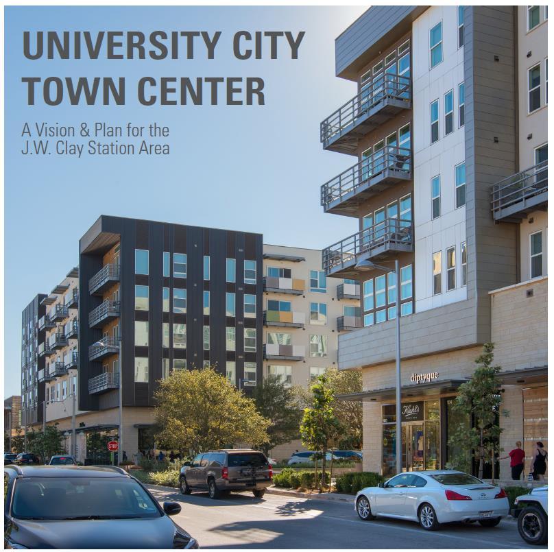

1 SUMMARY

2 What Master Plan aimed at delivering - A walkable, mixed-use downtown in the heart of University City anchored by UNC Charlotte and University Research Park - Civic anchors including a park and an updated library branch - A college Main Street to build identity for one of NC s largest public education institution - A suburb that connects people to nature, a variety of housing, shopping, transit, entertainment and education options

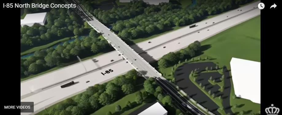
3 Where North Tryon St. and W. T. Harris Blvd. - An area spanning the Shoppes at University Place, Mallard Point Shopping Center, the J. W. Clay Light Rail Station and CHS University - Charlotte s 2 nd largest employment center - High traffic volume (94k AADT) - Booming university - High volume hospital - Connected to the University Research Park by a bridge over I-85 in 2022

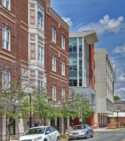
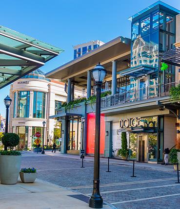
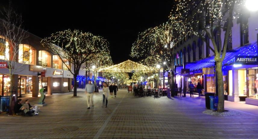
4 Why University City has no city. It was built as a. - Car friendly retail destination with - Large box stores and excess parking It needs. - A place to gather, celebrate and enjoy public life, and - A classic college main street, where students, alumni and visitors make and relive memories - A walkable place for people

5 When Now - Light rail delivers in 2018, offering a 20 minute train ride to Uptown 110 times a day - Low vacancy and rent growth in office space and apartments - In a survey of 1,200 Mecklenburg County residents, the most important asset to a home, behind safety, was walkability - UNC Charlotte accounts for 41% of total system growth, with current enrollment at 29,000 students

6 How Imagination & Collaboration
7 About the site LIGHT RAIL STATION - 11,000 square feet of ground floor retail space parking deck trains per day - Across from UNC Charlotte s future conference center UNBALANCED MIXED USE - Big boxes and outparcel retail dominate the XX acre site - Complemented by XX condos, the Hilton and a small office building, recently renovated to Class A space CENTRAL WATER FEATURE - XXXXX Largest - Provides views etc

8 U City Market FORMER - Big box s at height of success - Limited competition and rooftops - Convenience, auto-centric economy PRESENT - Transit = Paradigm shift - Potential for a connected, convenient suburb - High income households - Demand for walkability - Demand for family housing - Interest in local retail that compliments traditional shopping

9 Site Ownership IDEAL - Limited ownership - Large tracts - Parallel reinvestment/ redevelopment
 - The 26-mile Cross Charlotte")
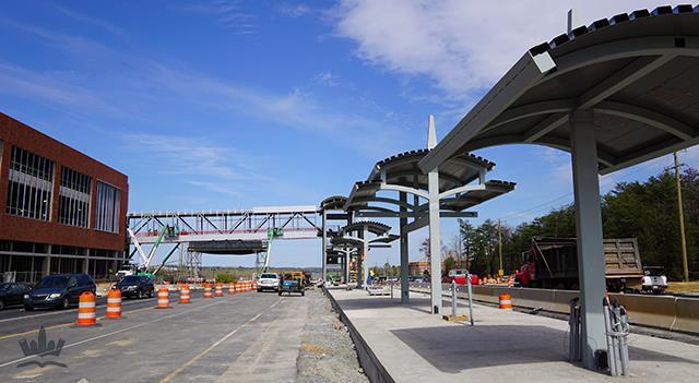
10 Bike Ped Amenities EXPANDING - Multi use paths on J.W. Clay - Bike-ped access on the north bridge (delivering 2022 over I-85) - The 26-mile Cross Charlotte Trail will connect to U City s 14-mile network by 2025

11 Regional Open Space CONNECTED and GROWING - Links with a regional open space network including the Cross Charlotte Trail, Mallard Creek Greenway, Toby Creek Greenway, Barton Creek Greenway - Significant existing greenway miles - The lake offers an amenity that might is not fully leveraged

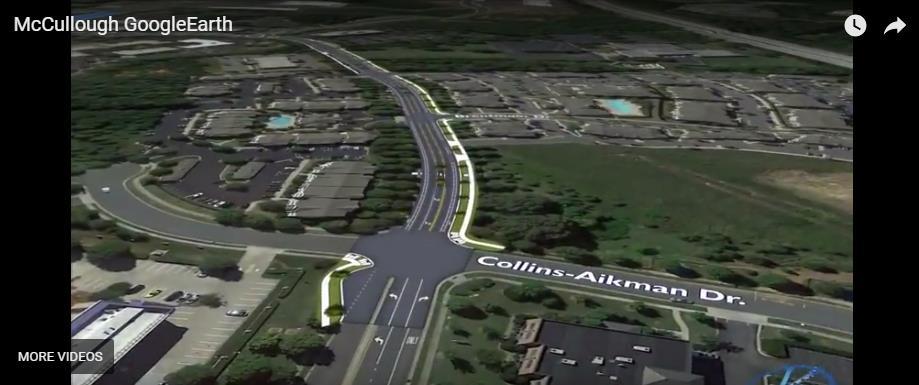
12 Connectivity HIGH VOLUME and EVOLVING - Current streets carry 94,000 cars daily - Busiest Intersection in NC - Connector streets are being adapted to carry other modes - Blue Line 15,000 riders in ,000 riders in ,000 riders by Uptown Charlotte and Concord within 20 minutes
13 Neighbors MEDS & EDS, ENTERTAINMENT, BUSINESS University Research Park Education - UNC Charlotte - 28,000 students Meds bed hospital - Highest volume ER - Capacity for medical office Wells Fargo CIC Innovation Park 10 Minute 5 Minute Carolinas Medical Center JW Clay Lightrail Station UNC CLT Hotel / Conf Center UNC Charlotte Business - University Research Park - Innovation Park McCullough Lightrail Station Tourist Magnets - 16,000 Seat Amphitheater, Charlotte Motor Speedway - Concord Mills & IKEA
14 Process STAKEHOLDER COLLABORATION - University City residents via the University City Area Plan - 1,200 Mecklenburg County residents - UNC Charlotte - Casto Lifestyle Centers - Tricor - Hilton Hotel - AEGON - Carolinas Health Care - UNC Charlotte students and administrators - City of Charlotte - Mecklenburg County UNC Charlotte


15 Process SURVEY - 1,200 evenly distributed responses from across Mecklenburg County - Questions related to area perception, housing preferences, shopping preferences - Corroborated traditional retail / residential market analysis MARKET STUDY - Performed by the Chesapeake Group - Market Gap analysis - Cluster Analysis Wells Fargo CIC Innovation Park University Research Park McCullough Lightrail Station 10 Minute 5 Minute Carolinas Medical Center JW Clay Lightrail Station UNC CLT Hotel / Conf Center UNC Charlotte DENSITY STUDY IMPROVE CIRCULATION PATTERNS


16 Density Study Surface Parked Development in South End - 31 units an acre Deck Parked Development in South End - 53 units an acre Higher Density Housing: Transform Suburban to Urban Structured parking is an investment that will pay dividends well into the future

17 Concept Planning - Broad mix of uses can be created - A new park and promenade along the western edge of the lake can pull visitors deeper into the development - Prominade shopping street creates pedestrian movement which can activate retail - A core for University City will create the catalyst for the surrounding properties


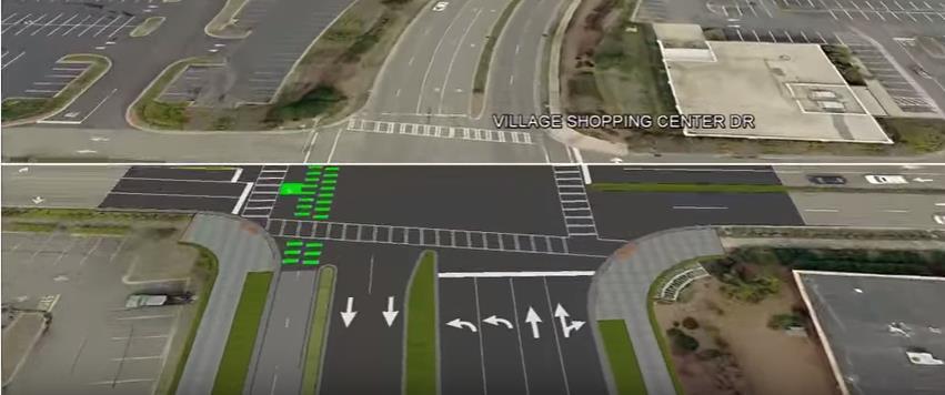
18 Circulation Improvements TRANSFORM SUBURBAN to URBAN - Transform existing major street patterns and cross sections - Create pedestrian stroll street using the existing promenade that goes across the lake - Connect greenways to site - Establish an urban street network of complete streets within the large parking areas. Future J.W. Clay Street Section

19 Draft Plan Primary Use Green = Trees and open space Orange = Residential Red = Ground Floor Retail Brown = Office Purple = Civic space / Use
20 A STREETS Focus of Retail and Life
21 B STREETS Flexibility of Uses

22 ARTERIALS High Traffic Volume

23 Establish Design Guidelines
24 Final Plan


25 Final Plan: Primary Uses Uses


26 Final Plan: Block Structure

27 Final Plan: Circulation Primary Uses


28 Final Plan: Connectivity


29 Final Plan: Community Assets


30 Final Plan: Community Assets

31 Final Plan

32 Final Plan

33
Mallard Creek Church Rd & Hwy 29 N Tryon St & E Mallard Creek Church Rd
 100' Outparcel for Sale Mallard Creek Church Rd & Hwy N 1 million SF of office space approved (to be developed by Lincoln Harris) (ADT,000) (ADT 30,000) EAST CHURCH ROAD Kirk Farm Park U.S. HIGHWAY (A.K.A.
MALL REVITALIZATION CASE STUDIES
 MALL REVITALIZATION CASE STUDIES DECEMBER 9, 2012 MALL REVITALIZATION OVERVIEW Introduction Sample Case Studies prepared for Lacey Woodland District Steering Committee as it considers strategies to revitalize
Robbinsdale LRT Station. CDI Development Guidelines. August Overview
 Robbinsdale LRT Station August 2018 Overview The City of Robbinsdale may have the coolest opportunity site along the 13 mile stretch of the Bottineau LRT corridor / Blue Line extension. Located a block
Small Area Plan. South Gateway
 Small Area Plan Adopted May 12, 2008 South Gateway Purpose. The South Gateway Small Area Plan defines the City s expectations for the future of the southern entrance to the City at Interstate 85 and Highway
UNIVERSITY CITY AREA PLAN. Volume Two: Implementation Plan
 UNIVERSITY CITY AREA PLAN Volume Two: Implementation Plan Transforming the University City MSD into the vibrant, people-oriented place envisioned in the University City Plan will occur incrementally through
Additional information about land use types is given in Chapter 5. Design guidelines for Centers and Neighborhoods are given in Chapter 7.
 4. Place Types Introduction In Albemarle County s Development Areas, the Neighborhood is the fundamental unit of community planning. The County s Neighborhood Model, an adopted part of the Comprehensive
REGIONAL ACTIVITY CENTER
 DRAFT REGIONAL ACTIVITY CENTER 70 EAST BENCH MASTER PLAN DRAFT 06 Introduction The East Bench Regional Activity center is comprised of large educational, research, medical, and employment centers. These
Ivywild On The Creek PRELIMINARY CREEK DISTRICT MASTER PLAN
 Ivywild On The Creek PRELIMINARY CREEK DISTRICT MASTER PLAN Introduction: Rejuvenating an extraordinary Creekside neighborhood THE CREEKSIDE DISTRICT The Ivywild On The Creek Neighborhood District Master
1 October Dear Citizens of Charlotte and Mecklenburg County,
 1 October 2011 Dear Citizens of Charlotte and Mecklenburg County, As co-chairs of the Center City 2020 Vision Plan Steering Committee, we are proud to present the Center City 2020 Vision Plan, which sets
4 C OMMUNITY D ISTRICTS
 4 C OMMUNITY D ISTRICTS N ew development in the Area will include many different types of land uses, including a destination retail area that attracts people from all over the region; recreation opportunities
University City Area Plan
 University City Area Plan Economic Development & Planning Committee June 6, 2007 Purpose of the Meeting Provide an overview of the plan Set a date for public comment with City Council Mallard Creek Church
ROBBINSDALE LRT STATION CDI DEVELOPMENT GUIDELINES
 August 2018 OVERVIEW The City of Robbinsdale has a prime-opportunity site in the middle of the 13 mile stretch of the Bottineau LRT corridor / Blue Line extension. Robbinsdale offers a prominent, vital,
DRAFT ROOSEVELT ROAD. District Recommendations. Figure 5.23 The Roosevelt Road Corridor
 CHAPTER 5 Figure 5.23 The Road Corridor Road will develop as a mixed-use corridor, emphasizing regional retail, west of the river and mixed-use development east of the river. KEY RECOMMENDATIONS 1. High
Visioning Statement and Guiding Principles
 Visioning Statement and Guiding Principles Planning for the Future The General Plan The General Plan represents Woodland's shared vision of the future and defines a path to lead the community toward its
Committee Meeting: Downtown Today & Concept Refinement September 11, 2017
 Committee Meeting: Downtown Today & Concept Refinement September 11, 2017 AGENDA 1. Brief Input Update 2. Comprehensive Plan Principles 3. Downtown Today 4. Concept Updates 5. Future Schedule What is a
INDEPENDENCE BOULEVARD AREA PLAN
 INDEPENDENCE BOULEVARD AREA PLAN Public Meeting October 28, 2008 Tonight s Agenda Introduction 4:00 4:05 Tom Warshauer Presentation 4:05 5:00 Blake Drury Group Exercises 5:00 5:50 All Wrap Up & Next Steps
TOD 203 CORRIDOR PLANNING and TOD
 2 CORRIDOR PLANNING and Scales of What You Will Learn The Transit Corridor Types of Corridors Objectives and Strategies for Transit and at the Corridor Level Main Street Corridor Planning and Your Trainers
Mix of Uses Guide for Transit-Oriented Development MIX OF USES
 MIX OF USES Creating a Destination Magnet A diversity of uses such as retail, housing, offices, civic and entertainment within the TOD creates a destination magnet for transit users and TOD neighbors.
The Need to Develop a Transit Ready Community
 Evaluation & Appraisal Report (EAR) Major Issue # 6 The Need to Develop a Transit Ready Community July 3, 2007 EAR Major Issue # 6 Transit Ready Existing Comp Plan policies apply only to Indiantown Road:
This Review Is Divided Into Two Phases:
 Semiahmoo Town Centre Review The purpose of this review: To review the Semiahmoo Town Centre Concept Plan, originally approved in 1993, to ensure that this centre will continue to serve the needs of South
Corridor Vision. 1Pursue Minnehaha-Hiawatha Community Works Project. Mission of Hennepin County Community Works Program
 1Pursue Minnehaha-Hiawatha Community Works Project Minnehaha-Hiawatha Community Works is a project within the Hennepin Community Works (HCW) program. The mission of the HCW program is to enhance how the
Developer s Program. The Station at East 54
 Developer s Program The Station at East 54 Existing Conditions The Station at East 54 is proposed for a 1.12 acre site at the northeast corner of Hamilton Road and Prestwick Road, tucked between the East
Northwest commuter rail station US 36 BRT. Westminster Station
 Northwest commuter rail station Westminster Station US 36 BRT Westminster Center US 36 & Church Ranch Broomfield Flatiron/96 th St. US 36 & McCaslin Table Mesa Boulder Junction 13-month effort that will
3.1 community vision. 3.3 required plan elements
 Chapter 3 Community Form 3.1 community vision 3.2 Parks & landscaping concepts 3.3 required plan elements D R A F T 20 Community Form Chapter 3 3.0 Community form 3.1 community vision The Specific Plan
The University District envisions, in its neighborhood
 Envisioning the University District Link Light Rail in Seattle s neighborhoods CIY OF SEALE CONCEP-LEVEL SAION AREA PLANNING RECOMMENDAION RESOLUION # 30165 EXHIBI L Vision 08.2000 he University District
12/9/2013. HOLLYWOOD/PINES CORRIDOR PROJECT AMPO 2013 Annual Conference October 24, Our Perspective. Broward.
 HOLLYWOOD/PINES CORRIDOR PROJECT AMPO 2013 Annual Conference October 24, 2013 Our Perspective Broward Fort Lauderdale 1 Broward Metropolitan Planning Organization Fort Lauderdale Fort Lauderdale Skyline
Seneca Meadows. Block 4 Locate office, technology, and medical development adjacent to I Screen views of garage structures from I-270.
 Seneca Meadows Seneca Meadows has an industrial park in its southern end and a mixed-use employment area planned for the north end. The district benefits from extensive I-270 visibility, stream valley
BROOKLYN PARK / 85TH AVE LRT STATION CDI DEVELOPMENT GUIDELINES DRAFT
 August 2018 Page intentionally left blank The Brooklyn Park Library adjacent to the 85th Ave LRT Station Area. OVERVIEW The Blue Line LRT Extension / Bottineau corridor offers a unique opportunity to leverage
Taming Tysons Corner Transforming the Quintessential Edge City
 Taming Tysons Corner Transforming the Quintessential Edge City Transit is the greatest catalyst for change at Tysons, but how do we take advantage of this billion-dollar investment? If transit is built
DOWNTOWN RESIDENTIAL DISTRICT DEVELOPMENT OPPORTUNITES
 DOWNTOWN RESIDENTIAL DISTRICT DEVELOPMENT OPPORTUNITES Out of all the areas in Downtown Painesville, this district provides the greatest opportunity for change with the vacation of Lake East Hospital.
FUNDING CORRIDOR REVITALIZATION
 FUNDING CORRIDOR REVITALIZATION Integrated corridor planning for the 21 st Century America Planning Association Annual Conference Atlanta, GA April 27, 2014 Mariia Zimmerman, MZ Strategies, LLC mariia@mzstrategies.com
Stockton Waterfront Master Plan. Waterfront Master Plan
 Stockton Waterfront Master Plan Presentation Objectives Process update Planning observations Planning Goals Planning Principles Review of planning activities Summary and next steps Planning Activities
CHAPTER 7: Transportation, Mobility and Circulation
 AGLE AREA COMMUNITY Plan CHAPTER 7 CHAPTER 7: Transportation, Mobility and Circulation Transportation, Mobility and Circulation The purpose of the Transportation, Mobility and Circulation Chapter is to
THE 355/270 CORRIDOR:
 THE 355/270 CORRIDOR: Strategic Ideas for Sustaining a Livable Work Place Project Summary ACCESS LIFE DESIGN HEALTH WORK Montgomery County Planning Department The Maryland-National Capital Park and Planning
a new urban landscape class a office & retail district murfreesboro, tennessee
 a new urban landscape class a office & retail district murfreesboro, tennessee Fountains at Gateway Is Open For Business Fountains at Gateway is a new 31-acre Class A multitenant office and retail development
Rio/29 Small Area Plan. Design Plan & Implementation Framework Open House - January 25, 2018
 Rio/29 Small Area Plan Design Plan & Implementation Framework Open House - January 25, 2018 MEETING PURPOSE PRESENTATION 1. Orient to the updated design plans 2. Introduce implementing options 3. Explain
City of Farmington. Downtown Plan. Amendment to the 1998 Master Plan Adopted October 11, 2004
 City of Farmington Amendment to the 1998 Master Plan Adopted October 11, 2004 Introduction Planning Background 1 Scope and Components of the Plan Amendment 2 Concept Introduction 3 Plan Concepts 3 Conceptual
DELIVERING ON THE TRANSIT PROMISE
 DELIVERING ON THE TRANSIT PROMISE Dena Belzer October 6, 2015 Presentation Overview 1. Puget Sound As a Transit Region: Putting SeaTac in Context 2. Starting at the Beginning: How Does TOD Work? 3. Strategies
Creating Quality Places: Successful Communities by Design
 Creating Quality Places: Successful Communities by Design Communities across the metropolitan Kansas City area are growing. Our challenge is to shape future development in ways that will maintain and enhance
 Health Sciences City The available land area, although limited, combined with the unique partnership between the primary institutions and the supporting partnerships of the development interests within
A Dynamic Downtown requires Dynamic Planning
 A Dynamic Downtown requires Dynamic Planning DOWNTOWN WINSTON -SALEM: 15 YEARS OF TRANSFORMATION OCTOBER 17, 2014 A.PAUL NORBY, FAICP JASON THIEL ADAM SEBASTIAN, AIA What Has Happened So Far To Make Downtown
V. Gateways GATEWAYS / V-1
 V. GATEWAYS / V-1 Many of Chesapeake s gateways are located on highways and call for bold and attractive designs that motorists can understand, appreciate, and enjoy. can also take the form of natural
Concord Community Reuse Project Goals and Guiding Principles. Overarching Goals (OG)
") Concord Community Reuse Project Goals and Guiding Principles Overarching Goals (OG) No priority is implied by the order of presentation of the goals and guiding principles. Overarching goals for the Concord
Concord Community Reuse Project Goals and Guiding Principles Overarching Goals (OG) No priority is implied by the order of presentation of the goals and guiding principles. Overarching goals for the Concord
Design Charrettes Description of Winning Designs
 Design Charrettes Description of Winning Designs I. Introduction Community and business leaders were invited to participate in a Station Design Charrette hosted by the Pinellas Metropolitan Planning Organization
Downtown Elkton Station Area Plan, Elkton, MD. Difficult enough to get support for new starts challenge to fund Houston transit
 Difficult enough to get support for new starts challenge to fund Houston transit More difficult to build Community Support for dense development at station areas Major Concerns: Traffic, Property values,
Corridor Background. Defining the Corridor Study Area. Lake Street. 38th Street. 46th Street
 1 Corridor Background Defining the Corridor Study Area Minnehaha Avenue (CSAH 48) and Hiawatha Avenue (MN 55) are parallel diagonal roadways, approximately three blocks apart, that provide two direct arterial
BRYN MAWR. Tier 2 Characteristics: Location: Lancaster Avenue from Old Lancaster Road on the east to Norwood Avenue on the west
 BRYN MAWR Tier 2 Characteristics: Transit-oriented Mixed use Along Lancaster Avenue Serve township-wide needs Civic space Employment centers Location: Lancaster Avenue from Old Lancaster Road on the east
A Neighborhood (Residential, Employment, or Mixed Use) has two components: a Center and a walkable area surrounding the Center.
 has two components: a Center and a walkable area surrounding the Center.") 6INFO SHEET There are two Place Types in the Neighborhood Model: Places organized around a Center, called Neighborhoods, and Places without a Center, called Districts. The Neighborhood Model focuses on
6INFO SHEET There are two Place Types in the Neighborhood Model: Places organized around a Center, called Neighborhoods, and Places without a Center, called Districts. The Neighborhood Model focuses on
A Plan for the Heart of the Region: Tukwila, WA
 : Tukwila, WA 1 The Plan orchestrates the Restructuring of a 1,000-acre Regional Shopping Area into a Social and Symbolic for the Region. REGIONAL CONTEXT Downtown Seattle (Metropolitan ) 20 miles Bellevue
SOUTH FLORIDA TOD GRANT UPDATE
 Palm Beach Transportation Planning Agency October 2018 SOUTH FLORIDA TOD GRANT UPDATE Presented by Treasure Coast Regional Planning Council in partnership with SFRTA & SFRPC What is Transit Oriented Development
CHAPTER 3 VISION, GOALS, & PLANNING PRINCIPLES. City of Greensburg Comprehensive Plan. Introduction. Vision Statement. Growth Management Goals.
 CHAPTER 3 VISION, GOALS, & PLANNING PRINCIPLES Introduction The Greensburg Comprehensive Plan is intended as a working community document. A combination of long and short-term goals, this document is intended
WELCOME! TO THE DOWNTOWN MASTER PLAN OPEN HOUSE
 PUBLIC OPEN HOUSE MARCH 21, 2017 WELCOME! TO THE DOWNTOWN MASTER PLAN OPEN HOUSE We ve already started talking with people about Downtown s opportunities PEDS Meeting Hosts Downtown Transportation Plan
East Bench Master Plan Update
 Community & Economic Development Office of the Director East Bench Master Plan Update To: From: Planning Commission Wayne Mills, Senior Planner Date: November 18, 2015 CC: Re: Nora Shepard, City Planning
Town Center. Block 5 Existing multifamily residential units are expected to remain.
 Area Guidelines Germantown s districts should be developed as distinct communities with unique features that are supported through the guidelines. The guidelines not only help distinguish these districts
treet Alley 23rd Street FOR SALE 2419 and Street, PRIME CENTRAL CORE OPPORTUNITY Sacramento, CA 95815
 FOR SALE 2419 and 2421 23 Street, Street McCulley Brothers Complete Automotive Repair Google rdmaps 95815 plete Automotive Repair PRIME CENTRAL CORE OPPORTUNITY X Street Broadway S treet ing nald s pa
a vibrant office and retail development enters the gateway to rutherford county
 a vibrant office and retail development enters the gateway to rutherford county PF UP Introducing Fountains at Gateway in Rutherford County Fountains at Gateway is a new 31-acre Class A multi-tenant office
Chapter 4. Linking Land Use with Transportation. Chapter 4
 Chapter 4 Linking Land Use with Transportation Chapter 4 59 Chapter 4 Linking Land Use with Transportation Community Design and Transportation Program Introduction Since the 1950s, the predominant development
Create a connected ecological network. Connect districts with transit. Let the centre define the community
 District A - D Southeast False Creek A 1 A 2 A 3 A 4 Create a connected ecological network Connect districts with transit Let the centre define the community Provide a variety of affordable housing types
4- PA - LD - LIVELY DOWNTOWN. LD - Background
 4- PA - LD - LIVELY DOWNTOWN LD - Background The downtown has been the service centre for the community since the city s inception and the area continues to supply people with their personal services,
Create Policy Options Draft Plan Plan Approval. Public Consultation Events. Phase 2
 Background Grandview-Woodland Community Plan In the spring of 2012, the City of Vancouver embarked on a comprehensive community planning program in the Grandview-Woodland neighbourhood. The process has
5 Land Use Element49
 5 Land Use Element 49 City of Forney - Comprehensive Plan Land Use Introduction Forney s Comprehensive Plan is a guide for physical and economic development in the City of Forney over the next 20-years.
Today Land & People. Northeast Nampa Gateway District. Employment. Land Use Characteristics. Demographics. Current Zoning
 Today Land & People Employment Major employers include Saint Alphonsus, the College of Western Idaho, the Auto Mall, Sorrento Lactalis and Walmart. 3,004 jobs in 2010 (COMPASS-CIM 2040 TAZ data) 4,345
Market Demand and Land Use
 Market Demand and Land Use Summary 57 Challenges 60-61 Guiding Principles 62 Strategy and Implementation 63-69 Establish a mix of uses that contribute to a vibrant downtown. 58 Summary Historically, downtown
hermitage town center
 hermitage town center A Community Vision prepared by Strada for The City of Hermitage and The Mercer County Regional Planning Commission January 2007 table of contents introduction 3 design principles
Lehigh Acres Land Development Regulations Community Planning Project
 Lehigh Acres Land Development Regulations Planning Effort Summary In July, 2010 Commissioner Frank Mann invited the Lehigh Acres community to start discussing how to achieve their recently adopted community
EXISTING COMPREHENSIVE PLAN
 EXISTING COMPREHENSIVE PLAN Town Center Land Use Element: V. LAND USE POLICIES Town Center Mercer Island's business district vision as described in "Your Mercer Island Citizen-Designed Downtown" was an
TEMPLE MEDICAL & EDUCATION DISTRICT
 City of Temple, Texas TEMPLE MEDICAL & EDUCATION DISTRICT 1 Description. The City of Temple joined in partnership with key public and private entities to jointly promote education and medical activities
GPA FALL 2017 CONFERENCE
 Change in Doraville Doraville at the beginning of a new era Design Doraville (Comp. Plan) adopted in 2016 Doraville Town Center Masterplan LCI (2005) Downtown Doraville Masterplan LCI (2010) 2014 Adoption
[PLANNING RATIONALE] For Site Plan Control and Lifting of Holding Zone By-Law 101 Champagne Avenue. May 23, 2014
![[PLANNING RATIONALE] For Site Plan Control and Lifting of Holding Zone By-Law 101 Champagne Avenue. May 23, 2014](/thumbs/75/71599615.jpg "[PLANNING RATIONALE] For Site Plan Control and Lifting of Holding Zone By-Law 101 Champagne Avenue. May 23, 2014") [PLANNING RATIONALE] For Site Plan Control and Lifting of Holding Zone By-Law 101 Champagne Avenue May 23, 2014 Contents 1.0 Introduction... 2 2.0 Site Context... 2 2.1 Adjacent Uses... 2 Figure 1: Site
[PLANNING RATIONALE] For Site Plan Control and Lifting of Holding Zone By-Law 101 Champagne Avenue May 23, 2014 Contents 1.0 Introduction... 2 2.0 Site Context... 2 2.1 Adjacent Uses... 2 Figure 1: Site
Volume 4: Adopted Plans and Policies
 121 Volume 4: JW Clay Blvd/UNC Charlotte UNC Charlotte Main McCullough University City Blvd 122 Policies in Place to Guide Development Since the 1980s, Charlotte has been one of the nation s fastest growing
DALY CITY VISIONING PROCESS COMMUNITY WORKSHOP 3 MAY 8, 2008
 DALY CITY VISIONING PROCESS COMMUNITY WORKSHOP 3 MAY 8, 2008 PROCESS General Plan - a statement of the community s values, vision and aspirations for now and into the future... Timeframe LONG TERM - 2030
Blue Line LRT Extension
 v e Noble Pkwy Noble Pkwy Xerxes Ave N Shingle Creek Penn Ave N Penn Ave N Fremont Ave N Lyndale Ave N S Washington Ave University Ave NE Blue Line LRT Extension LIGHT RAIL PLATFORM AND STATION DESIGN
a new urban landscape class a office & retail district murfreesboro, tennessee
 a new urban landscape class a office & retail district murfreesboro, tennessee Fountains at Gateway Is Open For Business Fountains at Gateway is a new 31-acre Class A multitenant office and retail development
Lower Merion Commercial Districts Issues and Characteristics Handbook November 2013
 Lower Merion Commercial Districts Issues and Characteristics Handbook November 2013 DRAFT TOWNSHIP-WIDE VISION: To maintain and enhance commercial areas to complement the surrounding high-quality residential
1.0 VISION STATEMENT. December 6, PRINCIPLES
 Vision Statement Lincoln Regional Airport 1.0 VISION STATEMENT 1.1 City LOCATION of AND OVERVIEW The Easton Lincoln Place Land Use Master Plan identifies the principles, goals, policies, and standards
12600 S Existing Conditions
 STUDY AREA BOUNDARY Study Area Boundary Study Area Context The District Riverton Meadows Vista Station Mountain View Village Market Center 2 Mile Radius 12600 S Existing Conditions 12600 S is a river of
FOR SALE Roosevelt Way Seattle, WA Features. Michael Todd
 FOR SALE FOR MORE INFORMATION PLEASE CONTACT: 5048 Roosevelt Way Seattle, WA 98105 Features mtodd@ westlakeassociates.com PRICE: $1,795,000 UNITS: 3 SIZE: 6,450 SF ZONE: NC2 40 CAP: 4.5 GRM: 18.1 + Transit
Wasatch CHOICE for 2040
 Wasatch CHOICE for 2040 Economic Opportunities We Can Choose a Better Future We enjoy an unparalleled quality of life along the Wasatch Front. People from all over the world are drawn to our stunning scenery,
Plano Tomorrow Vision and Policies
 Plano Tomorrow Vision and Policies PLANO TOMORROW PILLARS The Built Environment The Social Environment The Natural Environment The Economic Environment Land Use and Urban Design Transportation Housing
The "Town Center" Model of Suburban Placemaking: Opportunities and Challenges
 The "Town Center" Model of Suburban Placemaking: Opportunities and Challenges Dr. Tim Chapin Department of Urban & Regional Planning Florida State University What Are Town Center Communities? Town Center
PINE CURVE REZONING. Property does not meet criteria for open space preservation and is not a candidate for a park
 PINE CURVE REZONING BACKGROUND Purchased as two parcels in 2001 and 2002 Annexed and Zoned Greater Downtown District Historic Center September 25, 2002 and October 7, 2002 WHAT THE PROJECT IS AND IS NOT
TOWN COUNCIL / PLANNING COMMISSION
 Workshop #3 TOWN COUNCIL / PLANNING COMMISSION January 20, 2011 Consultant Team In Attendance Tonight BMS Design Group Nevada City and San Francisco Michael Smiley, AICP, ASLA Partner-in-Charge Nancy L.
Available. Mooresville Town Square. Retail For Lease. At the corner of Brawley School Rd and Williamson Rd. Outparcels For Lease or Sale
 J osh Beaver The Nichols Company 704.373.9797 (Office) 704.373.9798 (Fax) Josh@thenicholscompany.com www.thenicholscompany.com 600 Queens Rd, Charlotte, NC 28207 Available Retail For Lease Outparcels For
Shared Principles and Emerging Plan Directions
 Shared Principles and Emerging Plan Directions Introduction Since the Fairfield Neighbourhood planning process launched in June 2016, we have heard from many residents, businesses, groups and other people
ORANGE COUNTY IMPLEMENTING THE FOUR C s
 ORANGE COUNTY IMPLEMENTING THE FOUR C s East Central Florida Corridor Task Force O R A N G E COUN TY P LA N N I N G DIVISION C O M M U N I T Y, E N V I R O N M E N T A L A N D D E V E L O P M E N T S E
What is a Greenway? Active Transportation. Linear Public Park. Recreation. Health and Fitness. Desirable Amenity. Access to destinations
 What is a Greenway? Active Transportation Linear Public Park Recreation Health and Fitness Desirable Amenity Access to destinations Creates a Sense of Community County standard is a 10 wide asphalt trail
This is the East Carolina University Comprehensive Facilities Master Plan Final Draft Plan Review. This workbook reviews the campus draft master plan
 This is the East Carolina University Comprehensive Facilities Master Plan Final Draft Plan Review. This workbook reviews the campus draft master plan first presented on campus on June 29 and June 30, 2011.
Kensington Center. Public Meeting # Transit-Oriented Development, Town of Berlin, CT
 Kensington Center Public Meeting #1 10.27.16 Transit-Oriented Development, Town of Berlin, CT CivicMoxie 2016 What is Transit-Oriented Development Definition: Transit-Oriented Development (TOD) = is an
The Lower SaLuda Greenway
 The Lower SaLuda Greenway InITIaTIve a FLourIShInG Greenway. a hub For economic GrowTh. a ConneCTIon BeTween CoMMunITIeS. In April 2017 the Michael J. Mungo Foundation and Lexington County commissioned
Neighborhood Districts
 NEIGHBORHOOD DISTRICTS SEVEN MAIN DISTRICTS Neighborhood Districts While the Development Plan provides a broad-scale overview of the neighborhood, this section focuses on uses and relationships at the
RE-Imagining the Downtown Colorado Springs Master Plan
 RE-Imagining the Downtown Colorado Springs Master Plan 2016 APA Colorado State Conference October 25, 2016 Overview 8:00 Welcome, Introductions, and Overview 8:15 Downtown s Planning History 8:30 A Market
HE VISION. Building a Better Connected Place
 HE VISION Building a Better Connected Place WALK INTO THE FUTURE. Life in Cranberry, 2030 Here s what our residents told us they wanted to see in their community by 2030: The Cranberry of 2030 is a place
APPENDICES DESIGNING PUBLIC SPACES - ENERGIZED PUBLIC SPACES DESIGN GUIDELINES WORKING DRAFT DECEMBER 2018 A1
 APPENDICES DESIGNING PUBLIC SPACES - ENERGIZED PUBLIC SPACES DESIGN GUIDELINES WORKING DRAFT DECEMBER 2018 A1 App.1 Case Studies by Park Types The upcoming (in-progress) online library will house several
Land Use. Hardware Street Vendor Mixed-Use
 Land Use Definition Land Use is the way a piece of real estate is utilized. Existing, proposed, and adopted land uses all play a role in the planning process. Once a land use plan is adopted, the next
THE NEIGHBORHOOD TODAY
 THE NEIGHBORHOOD TODAY CORE AREA VISION How are we Good Urbanism A Site s DNA thinking about Elements of great Unique elements urban communities embedded in a place the site and design? ELEMENTS LIKE:
b r a n c h av e n u e tr a n s it co r r i d o r r e vita lization pl a n a m o d el fo r s u b u r ban retro fit
 b r a n c h av e n u e tr a n s it co r r i d o r r e vita lization pl a n a m o d el fo r s u b u r ban retro fit P R I N C E G EO RG E S CO U NT Y, M D ADO PTED 0 p R O J E C T C AT E G O R Y : U R B
Plan Framework Report. Attachment A
 Plan Framework Report Attachment A Uptown-Douglas Corridor Plan - Plan Framework Report Contents Introduction... 1 Planning Process... 3 Project Objectives... 4 Vision... 5 Community Values... 6 Structural
PROGRAM: A mixed-use (retail, residential, commercial) infill project encompassing two blocks and nearly 20 acres of downtown Salt Lake City.
 infill project encompassing two blocks and nearly 20 acres of downtown Salt Lake City.") PROGRAM: A mixed-use (retail, residential, commercial) infill project encompassing two blocks and nearly 20 acres of downtown Salt Lake City. Upon completion in 2012, the site will feature more than 650
PROGRAM: A mixed-use (retail, residential, commercial) infill project encompassing two blocks and nearly 20 acres of downtown Salt Lake City. Upon completion in 2012, the site will feature more than 650
C. Westerly Creek Village & The Montview Corridor
 C. Westerly Creek Village & The VISION Community Vision When the goals of the city are achieved Westerly Creek Village, a distinctive community defined by Montview Boulevard and Westerly Creek, is a strong