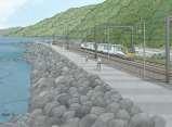
SH1 - Causeway, Auckland, 2014 (Source: NZ Transport Agency)
|
|
|
- Shona Bertina Townsend
- 5 years ago
- Views:
Transcription

1 SH1 - Causeway, Auckland, 2014 (Source: NZ Transport Agency)
2
3
4 Coastal effects assessment guide
5

6 Environmental and social responsibility policy State highway environmental plan Transport Agency statement of intent
7 Coastal effects assessment guideline for transportation infrastructure

8 Image source: NZ Transport Agency Coastal effects assessment guideline for transportation infrastructure
 Coastal effects assessment")
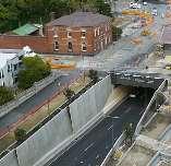
9 SH1 near Wellington, (Source: NZ Transport Agency) Coastal effects assessment guideline for transportation infrastructure
10
11 Coastal effects screen Coastal effects screen Screen

12 Coastal effects screen Coastal effects screen Auckland, Feb (Source: Peter Mitchell, Auckland Motorway Alliance)
13 Coastal effects screen
14 Coastal effects screen
15 purpose

16 Coastal effects screen SH16 Causeway Te Atatu to Pt Chevalier, Auckland, Jan 2011: (Source: Peter Mitchell, Auckland Motorway Alliance)
17 Preparing for climate change Preparing for coastal change State highway environmental and social responsibility environmental plan Environment and social responsibility (ESR) screen State highway environmental and social responsibility (ESR) standard Coastal effects screen
18 Coastal effects screen
19 Risk level = likelihood x consequence standard Z/44 risk management Minimum Coastal effects screen Coastal effects screen


20 SH1 Esmonde Road to Northcote, Auckland. Jan (Source: Peter Mitchell, Auckland Motorway Alliance)
21 Coastal effects screen For an identified coastal environmental effect, what is the likelihood the effect will occur? Coastal effects screen
22 Coastal effects screen For an identified coastal environmental effect, what is the consequence that may result from the effect?
23 Coastal effects screen Coastal effects screen
24 Coastal effects screen Coastal effects screen Coastal effects screen Coastal effects screen Coastal effects screen
 Coastal effects assessment")
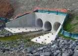
25 SH6, Nelson, (Source: NZ Transport Agency) Coastal effects assessment guideline for transportation infrastructure
26 The proposed Auckland unitary plan, notified 30 September New Zealand Coastal Policy Statement Land Transport Management Act Minimum standard Z/44 risk management, version 3. Statement of intent Resource Management Act. Environmental plan, version 2
27

28
29

30

31


32
33

34
35
36
37
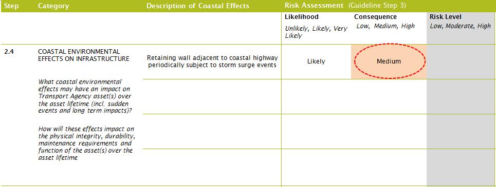
38 Unlikely, likely, very likely Low, medium, high Low, moderate, high ** Insert additional rows for steps 2.4 and 2.5 as required.
39
40

 linking Wellington City with the Hutt Valley.")
41 Ngauranga to Petone shared path case study COASTAL EFFECTS ASSESSMENT GUIDE September 2016 The Petone to Ngauranga project will provide 4.2km of safe walking and cycling infrastructure along the coastal section of the Wellington Harbour, linking Wellington and the Hutt Valley. The project will act as a catalyst to increase walking and cycling facilities along a total length of 10.5km. The project will also improve transport resilience along this critical transport corridor. The project is located along a busy section of State Highway 2 (SH2) linking Wellington City with the Hutt Valley. The transport corridor includes two north bound lanes and two south bound lanes on SH2. Adjacent to the state highway on the seaside are two railway tracks from the Hutt Valley line. The corridor runs along coast line and is partially located on reclaimed land. An existing cycleway is running partially on the shoulder of the southbound lane of SH2 and along a separated path between the railway line and SH2. Over the recent years there has been increasing public pressure to improve the track, which can only be used by southbound cyclist and is deemed to be unsafe by many cyclists. Currently at the detailed business case stage (July 2015), the project is evaluating two alternative design options for a pathway allowing both walking and cycling. The preferred option is to construct a 3m shared pathway on the seaside of the railway line adjacent to SH2 between Ngauranga and Petone. This will require the reclamation of a 5m platform along the coastline. The alternative option is to construct a pedestrian pathway between the existing rail and road corridors. This will include enhancing the existing pathway and constructing a new section to separate the pathway from the highway along the whole corridor. This option does not involve any new reclamation, but requires some improvements of the existing sea wall. The existing cycle lane and walkway Coastal effects assessment The case study examines the application of a guide to assess the coastal effects on the preferred option as outlined above. The guide puts in place several considerations needed to understand the resilience of the preferred option. The guide allows decision making to be recorded and provide evidence that predicted effects associated with the proposed option meet the engineering needs and statutory approval requirements.
42 2 NZ Transport Agency Ngauranga to Petone shared path September 2016 Resilience Resilience is considered the ultimate objective in the context of hazard mitigation. Treasury defines resilience as: The concept of resilience is wider than natural disasters and covers the capacity of public, private and civic sectors to withstand disruption, absorb disturbance, act effectively in a crisis, adapt to changing conditions, including climate change, and grow over time. Wellington is known for its wild weather and has its fair share of natural hazards, including recent storm and rain events and earthquakes. In a number of these events the Wellington to Petone transport corridor has been impacted leading to closure of rail and vehicle transport. Widening the transport corridor by creating a platform through reclamations has the potential to improve the resilience of the corridor to withstand environmental hazards such as storm surges and sea level rises, and to improve access to the railway line for maintenance and repair. Cross-section of the transport corridor indicating the 5m platform Existing coastline Cliff SH2 Shared path Rail corridor Sea 5m reclamation (harbourside) with a new 3m wide shared path provided on the eastern side of the railway, existing shared path used as service lane. Main environmental effects The coastal effects assessment has been applied in a workshop involving the Transport Agency project manager and Environment and Urban Design team, as well as a resilience expert from AECOM and an ecologist from Boffa Miskell. The environmental impacts were assessed following the coastal assessment guide assigning specific risk categories to the individual impacts areas. Both AECOM and Boffa Miskell had also prepared preliminary assessment reports on resilience and ecological impacts along the coastal section of the project guiding the coastal effects assessment. The environmental impacts of the reclamation and sea wall construction identified as having a high risk are: effects on bird life occupation and behaviour during construction work ecological changes in intertidal and sub-tidal environments, including loss of habitat moderate degradation of water quality (turbidity) through sediment discharge (earthworks) and sea floor disturbance. The following specific environmental effects on the reclamation and sea wall have been identified as the proposed platform: Predicted increase in sea levels, storm surges and tidal effects). Wind effects, especially in combination of marine conditions (storm surge and tidal effects). Earthquakes and landslips/washouts that could dislocate the transport corridor. Overall, impacts from natural environment on the Transport Agency asset have higher risk levels associated with them than impacts from Transport Agency structure on the natural environment. From the assessment the coastal effects that ranked high have now been considered in terms of mitigation processes that can be applied. This strengthens arguments for construction processes and mitigation options needed in design and consent processes.
43 3 NZ Transport Agency Ngauranga to Petone shared path September 2016 Main projects objectives and risks The main objectives for this project are: to provide safe walking and cycling infrastructure linking Wellington and Hutt Valley to improve transport resilience through providing a walking and cycling facility and enhance maintenance and repair access on the railway line. The main project risks are: Impact from storm surges and climate change on the reclamation (new and existing), the sea wall and ultimately the transport corridor. Consenting delays and extra costs for a construction of a wider platform from the proposed reclamation. Project engineering costs. CATEGORY DESCRIPTION OF COASTAL EFFECTS RISK ASSESSMENT RISK MITIGATION/ COMMENT LIKELIHOOD CONSEQUENCE RISK LEVEL Marine conditions (cumulative assessment of wave run-up/ set-up, sea level rise, storm surge, tidal effects, datum adjustment and wind effects from storms) Likely High High Mitigate by designing platform at RL 4.3, 0.5m above current RL of 4.4. This RL 4.9 is for a 1:100 return period. The current 4.4 already had some protection built into it. Inland flooding Likely Medium Moderate Risk may be increased if occurring in combination with adverse marine conditions (assessment is not based on proper modelling of inland flooding). NEGATIVE ENVIRONMENTAL IMPACTS ON TRANSPORT AGENCY ASSET Salt water erosion Likely Low Low Wind effects (including climate change impacts) Very likely Medium High Design mitigation through innovation, eg where we place structures and embed them into ground, lighting poles that fail safe etc Earthquake Very likely High High Design up to the appropriate design code. Widening the corridor will also increase response time to impacts on rail corridor improving resilience of the transport corridor and ability to respond quickly. Landslip Likely High High Widening the corridor will reduce the consequences and impacts from landslip/coastal erosion on the rail corridor.
44 4 NZ Transport Agency Ngauranga to Petone shared path September 2016 CATEGORY DESCRIPTION OF COASTAL EFFECTS RISK ASSESSMENT LIKELIHOOD CONSEQUENCE RISK LEVEL RISK MITIGATION/ COMMENT Ecological impacts on birdlife Likely High High Mitigate impacts by avoiding construction work during breeding season and through provision of replacing habitats. Ecological impacts on terrestrial vegetation Very likely Low Low There is potential to replace and enhance terrestrial vegetation as result of this project. Noting aesthetic value of terrestrial vegetation. NEGATIVE IMPACTS OF TRANSPORT AGENCY ASSET ON COASTAL AND MARINE ENVIRONMENT Ecological impacts on intertidal and sub-tidal environment (consider loss of seabed) Likely High High Replacement of water volume (through reclamation) Modification of natural water flows Likely Low Low Unlikely Low Low Mitigate by offsetting permanent loss of habitat elsewhere in the Wellington harbour and planting coastal fringe vegetation. Potentially mitigate by removing unneeded reclamation elsewhere in the Wellington harbour. Exacerbate coastal erosion in adjoining areas Physical disturbance of seabed and water quality during construction Unlikely Low Low Very likely Low Moderate Mitigate by integrating design into existing coast. Temporary disturbance so low risk. Light pollution Unlikely Low Low Mitigate by designing lighting in a way that reduces light spill (dark sky approved lighting). Low ecological risk. Impact on wave run-up and set-up Very likely Low Low POSITIVE IMPACTS OF TRANSPORT AGENCY ASSET ON COASTAL AND MARINE ENVIRONMENT Improvement to ecological environment (flora) Positive effects on visual amenity (*social effects) Very likely Very likely High (positive) High (positive) High (positive) High (positive) Opportunities to enhance coastal (terrestrial) flora. Marine environment may be improved through treatment of run-off. Minimising coastal erosion on reclaimed coast Remediating potential existing hazardous substances from coastal and marine environment? (tbc) Unlikely Low Low Unlikely Low Low No significant coastal erosion at the moment (reclamation unlikely to negatively impact on erosion). Sea wall will be designed to improve withstanding Potential hazardous material may be locked in through reclamation and sea wall.

45 5 NZ Transport Agency Ngauranga to Petone shared path September 2016 CATEGORY CONSENTING IMPACTS DESCRIPTION OF COASTAL EFFECTS RISK ASSESSMENT RISK MITIGATION/ COMMENT LIKELIHOOD CONSEQUENCE Reclamation platform Very likely High High Discharge of sediment during construction Very likely High High Hydro dynamic modelling mitigation Noise during construction Very likely Low Low Temporary disturbance. Very likely High High Opportunities to vary coastline if costs allow. More varied coastline RISK LEVEL Lessons learnt Impacts from climate change are potentially significant (including cumulative) and need consideration in the project design. A larger platform will provide more protection and higher levels of resilience. No changes to the current transport corridor and seawall will leave the transport corridor under significant risk of future disruption, limiting resilience. The project team identified that the proposal can have a significant positive impacts on the ecological environment (flora), visual amenity, and social aspects of enhanced access. CONTACT DETAILS For further information on the Transport Agency s resource efficiency objectives or if you have a great example to share please visit the resource efficiency space on HIP or contact environment@nzta.govt.nz
Assessment of Landscape, Visual and Natural Character Effects
 Assessment of Landscape, Visual and Natural Character Effects Consent Footprint Amendments Mangamaunu Half Moon Bay Okiwi Bay South Report prepared for: New Zealand Transport Agency and KiwiRail Holdings
Section 6A 6A Purpose of the Natural Features and Landscapes Provisions
 Section 6A 6A Purpose of the Natural Features and Landscapes Provisions This Chapter addresses the protection and management of natural features and landscapes within the City. The City has a number of
SH20 Manukau Harbour Crossing Project Notice of Requirement Auckland City Council
 19 May 2006 (Updated 28 August 2006) Notice of Requirement Dated 19 May 2006: Updated 28 August 2006 Notice of Requirement Dated 19 May 2006: Updated 28 August 2006 Page i Form 18 Notice of Requirement
E15. Vegetation management and biodiversity
 E15. management and biodiversity E15.1. Background contributes to a range of ecosystem services such as erosion and sediment control, reducing stormwater flows, protecting or enhancing water quality, amenity
D10. Outstanding Natural Features Overlay and Outstanding Natural Landscapes Overlay
 D10. Outstanding Natural Features Overlay and Outstanding Natural Landscapes Overlay D10.1. Background These provisions give effect to Policy 15(a) of the New Zealand Coastal Policy Statement 2010, and
Queensland Coastal Plan. Presented by John Lane Director Environment Planning
 Queensland Coastal Plan Presented by John Lane Director Environment Planning Queensland Coastal Plan - Status Released 7 April 2011, but NOT YET IN EFFECT Formatting & operational amendments required Yet
University Park, Worcester Non Technical Summary December 2011
 University Park, Worcester Non Technical Summary December 2011 Introduction UW Wrenbridge LLP, a Joint Venture Company of the University of Worcester and Wrenbridge Land Ltd (the Applicants ) intend to
Coast Protection, Development and Coastal Biodiversity. Brian Caton Member CEMAC, AMLR NRM Former Chair & Member, Coast Protection Board
 Coast Protection, Development and Coastal Biodiversity Brian Caton Member CEMAC, AMLR NRM Former Chair & Member, Coast Protection Board Saltmarsh: an extensive problem for Biodiversity and Planning Law
I209 Quay Park Precinct
 I209. Quay Park I209.1. Precinct description The Quay Park Precinct is located on reclaimed land at the eastern end of the city centre and along the City Centre waterfront. It is dissected to the east
I604. Hobsonville Marina Precinct
 I604. Hobsonville Marina Precinct I604.1. Precinct description Hobsonville Marina Precinct is located at Clearwater Cove, Hobsonville in Auckland s upper Waitemata Harbour. The precinct includes the coastal
Section 12C Subdivision in the Rural Residential Zone
 Section 12C 12C Subdivision in the Rural Residential Zone The Rural Residential Zone provides part of the range of residential opportunities within the City. Land zoned rural residential is considered
Transmission Gully Project - Urban & Landscape Design Framework
 Technical Report 23 Transmission Gully Project - Urban & Landscape Design Framework August 2011 This document was prepared by LANDSCAPE ARCHITECTURE URBAN DESIGN with inputs from Opus, Holmes Consulting,
D10. Outstanding Natural Features Overlay and Outstanding Natural Landscapes Overlay
 D10. Outstanding Natural Features Overlay and Outstanding Natural Landscapes Overlay D10.1. Background These provisions give effect to Policy 15(a) of the New Zealand Coastal Policy Statement 2010, and
13 FUTURE DEVELOPMENT AND STRUCTURE PLANS
 13 FUTURE DEVELOPMENT AND STRUCTURE PLANS Contents 13.1 Introduction 13.2 Resource Management Issues 13.3 Objectives 13.4 Policies 13.5 Strategy 13.6 Implementation 13.6.1 District Plan Regulatory Methods
I615. Westgate Precinct
 I615. Westgate Precinct I615.1. Precinct Description The Westgate Precinct is located approximately 18km west of the Auckland city centre. There are seven Sub-precincts in the Westgate Precinct: Sub-precinct
The Moors at Arne Project, Managing Coastal Change
 General Questions What are we doing? The Environment Agency, RSPB and Natural England are working together to adapt approximately 150ha of The Moors at Arne into a diverse wetland habitat. With the sea
Building and Public Space Design Guidelines
 AMERICA'S CUP WYNYARD HOBSON Building and Public Space Design Guidelines INTRODUCTION 10 April 2018 The 36 th America s Cup in Auckland requires the construction of new wharf and breakwater structures.
H7 Open Space zones. (a) provide for the needs of the wider community as well as the needs of the community in which they are located;
 provide for the needs of the wider community as well as the needs of the community in which they are located;") H7. Open Space zones H7.1. Background The majority of land zoned as open space is vested in the Council or is owned by the Crown. However some areas zoned open space are privately owned. While the open
H7. Open Space zones H7.1. Background The majority of land zoned as open space is vested in the Council or is owned by the Crown. However some areas zoned open space are privately owned. While the open
ENVIRONMENTAL ISSUES and TEN-T PROJECTS Key elements for a sustainable network development
 ENVIRONMENTAL ISSUES and TEN-T PROJECTS Key elements for a sustainable network development TEN-T Project Management Workshop 2010 George Kremlis DG ENV B4, European Commission 13 January 2010 Environmental
Tāhuhu whakaruruhau ā-taone The sheltering ridge pole
 B2. Tāhuhu whakaruruhau ā-taone - Urban growth and form B2.1. Issues Tāhuhu whakaruruhau ā-taone The sheltering ridge pole Auckland s growing population increases demand for housing, employment, business,
PETERHEAD PORT AUTHORITY ENVIRONMENTAL STATEMENT. Non-Technical Document
 PETERHEAD PORT AUTHORITY ENVIRONMENTAL STATEMENT Document No 5357/04 Rev FINAL Issued January 2015 West Pier Peterhead Aberdeen AB42 1DW Niras Fraenkel Ltd Merlin House Mossland Road Hillington Park Glasgow
AOTEA SUPERMARKET ZONE. Zone Introduction
 C18 AOTEA SUPERMARKET ZONE Zone Introduction C18.1 Objective This zone identifies a specific area in Aotea for a stand alone supermarket. The zone is site specific and has a range of objectives, policies
SHORELINE, FLOOD AND COASTAL DEFENCE MANAGEMENT PLANS
 These plans may provide opportunities as well as concern for recreational boating. They are currently being revised and consulted on. This document explains how we can engage in the process. Shoreline,
Plan Modification to Chapter B2 of the Auckland Unitary Plan(AUP) Operative in part (15 November 2016)
 Operative in part (15 November 2016)") UNITARY PLAN UPDATE REQUEST MEMORANDUM TO FROM Phill Reid Linley Wilkinson DATE 25 September 2018 SUBJECT Plan Modification to Chapter B2 of the Auckland Unitary Plan(AUP) Operative in part (15 November
UNITARY PLAN UPDATE REQUEST MEMORANDUM TO FROM Phill Reid Linley Wilkinson DATE 25 September 2018 SUBJECT Plan Modification to Chapter B2 of the Auckland Unitary Plan(AUP) Operative in part (15 November
The Salt Marsh Advancement Zone Assessment of Connecticut
 The Salt Marsh Advancement Zone Assessment of Connecticut Front cover image: Salt marsh advancement zones in Stratford, CT from the Comprehensive Map Book of Stratford, CT. Table of Contents Introduction...
PART C DESCRIPTION OF THE PROJECT
 PART C DESCRIPTION OF THE PROJECT 6.0 Description of the Project Overview This section includes the Project Description which provides the basis for the assessment of effects on the environment in Part
Chapter 3: Natural Environment. Proposed Waikato District Plan Stage 1. (Notified version)
") Chapter 3: Natural Environment Proposed Waikato District Plan Stage 1 Page 2 of 7 Contents Chapter 3: Natural Environment... 3 3.1 Indigenous Vegetation and Habitats... 3 3.1.1 Objective Biodiversity and
Chapter 3: Natural Environment Proposed Waikato District Plan Stage 1 Page 2 of 7 Contents Chapter 3: Natural Environment... 3 3.1 Indigenous Vegetation and Habitats... 3 3.1.1 Objective Biodiversity and
LANDSCAPE GUIDELINES. Countryside & Coastal Countryside Environments. Landscape, Natural Character & Amenity Values Guide
 Landscape, Natural Character & Amenity Values Guide Copyright WDC 2009 Version A2 18May09 Environmental Services Group Publication Countryside & Coastal Countryside Environments START HERE Quality Land
Longbridge Town Centre Phase 2 Planning Application
 Longbridge Town Centre Phase 2 Planning Application Non-Technical Summary of the Environmental Statement December 2013 Introduction A full application for Planning Permission has been submitted to Birmingham
Sandwich Town Tidal Defences Environmental Statement Non Technical Summary
 Sandwich Town Tidal Defences Environmental Statement Non Technical Summary Environment Agency Introduction The Environment Agency is proposing to construct a scheme to reduce the risk of tidal flooding
SH1 link to Matakana Road
 Future transport network for Warkworth Warkworth is expected to grow to a substantial satellite town of more than 20,000 people over the next few decades. To meet this anticipated growth, around 1,000
Billing Code: DEPARTMENT OF HOUSING AND URBAN DEVELOPMENT [Docket No. FR-6072-N-01]
![Billing Code: DEPARTMENT OF HOUSING AND URBAN DEVELOPMENT [Docket No. FR-6072-N-01]](/thumbs/91/107309814.jpg "Billing Code: DEPARTMENT OF HOUSING AND URBAN DEVELOPMENT [Docket No. FR-6072-N-01]") This document is scheduled to be published in the Federal Register on 12/18/2017 and available online at https://federalregister.gov/d/2017-27194, and on FDsys.gov Billing Code: 4210-67 DEPARTMENT OF HOUSING
This document is scheduled to be published in the Federal Register on 12/18/2017 and available online at https://federalregister.gov/d/2017-27194, and on FDsys.gov Billing Code: 4210-67 DEPARTMENT OF HOUSING
WELLINGTON CITY DISTRICT PLAN
 Section 32 Report WELLINGTON CITY DISTRICT PLAN PROPOSED DISTRICT PLAN CHANGE 54 REZONING 178 AND 180 OWHIRO BAY PARADE 1 Introduction Before a Proposed District Plan change is publicly notified the Council
3.1 This evidence is based on the landscape and visual impact assessment included in Chapter 10 and Appendix I of the EIS.
 LANDSCAPE & VISUAL 1 QUALIFICATIONS AND EXPERIENCE 1.1 My name is Raymond Holbeach and I am a Regional Director for RPS Planning & Environment with full responsibility for management of the RPS Belfast
Proposed Southland District Plan 2012 Appeal Version October 2016
 S e c t i o n 3. 5 - F i o r d l a n d / R a k i u r a Z o n e The Fiordland/Rakiura Zone encompasses the Fiordland and Rakiura National Parks and part of Mt Aspiring National Park. It also includes areas
Appendix 1 Structure plan guidelines
 Appendix 1 Structure plan guidelines This appendix forms part of the regional policy statement [rps]. 1.1. Introduction Structure plans are an important method for establishing the pattern of land use
I541. Te Arai North Precinct
 I541. Te Arai North Precinct I541.1. Precinct Description The Te Arai North Precinct contains approximately 616ha of coastal land north of Te Arai Point, generally known as Mangawhai North Forest. The
CA.1 Coastal Area. Index. CA.1.1 Description and Expectations
 Index.1.2.3.4 CA.2 CA.2.1 CA.2.2 CA.2.3 CA.3 CA.3.1 CA.3.2 CA.3.1 CA.4 CA.4.1 CA.4.2 CA.4.3 CA.4.4 CA.5 CA.5.1 CA.5.2 Description and Expectations Objectives Policies Guidance Note Landuse Eligibility
1 INTRODUCTION TO NATURAL ENVIRONMENT
 Kāpiti Coast District Plan Review Section 32 Analysis Summary Report 1 INTRODUCTION TO NATURAL ENVIRONMENT Diverse landscapes, plants and animals make up the natural environment of the District. Much has
Local rain-driven flooding (surface and ground water) Upstream rain-driven flooding (rivers) Tidal or storm surge-driven flooding (coast)
 Upstream rain-driven flooding (rivers) Tidal or storm surge-driven flooding (coast)") Adapting cities to floods Kristina Hill, PhD University of Virginia School of Architecture Hamburg, Germany What kinds of floods? 1 2 3 Local rain-driven flooding (surface and ground water) Upstream rain-driven
Adapting cities to floods Kristina Hill, PhD University of Virginia School of Architecture Hamburg, Germany What kinds of floods? 1 2 3 Local rain-driven flooding (surface and ground water) Upstream rain-driven
SECTION 7A: WHAKARONGO RESIDENTIAL AREA
 SECTION 7A: WHAKARONGO RESIDENTIAL AREA CONTENTS 7A.1 Introduction 1 7A.2 Resource Management Issues 1 7A.3 Objectives and Policies 1 7A.4 Methods 4 7A.5 Residential Zone 4 7A.5.1 Rules: Controlled Activities
Grantham Southern Quadrant Link Road Environmental Statement
 Grantham Southern Quadrant Link Road Environmental Statement Non Technical Summary Introduction Lincolnshire County Council (LCC) is submitting a planning application for the proposed implementation of
Thank you for coming. We want to hear your views on proposed improvements to the A1 between junction 65 (Birtley) and junction 67 (Coal House).
 and junction 67 (Coal House).") Welcome Thank you for coming. We want to hear your views on proposed improvements to the between junction 65 (Birtley) and junction 67 (Coal House). This is your opportunity to provide comments on our
Welcome Thank you for coming. We want to hear your views on proposed improvements to the between junction 65 (Birtley) and junction 67 (Coal House). This is your opportunity to provide comments on our
PART 3 - RESOURCE MANAGEMENT
 CONTENTS... PAGE 3.1 INTRODUCTION... 3 3.2 NATURAL AND PHYSICAL ENVIRONMENT... 3 3.3 URBAN SUSTAINABLE MANAGEMENT... 5 3.4 RESOURCE MANAGEMENT ISSUES... 5 3.5 RESOURCE MANAGEMENT OBJECTIVES AND POLICIES...
3 Urban Design and the State Highway Network
 NZ Transport Agency Page 1 of 14 Urban Design Professional Services Guide 1 Introduction This is a professional services guide on urban design, which provides direction to the NZ Transport Agency (NZTA)
Circular L8/08 2 September Water Services Investment and Rural Water Programmes Protection of Natural Heritage and National Monuments
 Circular L8/08 2 September 2008 Water Services Investment and Rural Water Programmes Protection of Natural Heritage and National Monuments 1. The purpose of this Circular is to provide local authorities
Environmental Impact Assessment (EIA) Training Session
 Training Session") Die Deutsche Gesellschaft für Internationale Zusammenarbeit (GIZ) GmbH Environmental Impact Assessment (EIA) Training Session By: Nedal Al Ouran (Ph.D.) AMMAN- November 6, 2013 Outline 1. Introduction
Die Deutsche Gesellschaft für Internationale Zusammenarbeit (GIZ) GmbH Environmental Impact Assessment (EIA) Training Session By: Nedal Al Ouran (Ph.D.) AMMAN- November 6, 2013 Outline 1. Introduction
GIBBSTON CHARACTER ZONE. QLDC PROPOSED DISTRICT PLAN [PART FOUR] AUGUST gibbston character zone
![GIBBSTON CHARACTER ZONE. QLDC PROPOSED DISTRICT PLAN [PART FOUR] AUGUST gibbston character zone](/thumbs/75/72573993.jpg "GIBBSTON CHARACTER ZONE. QLDC PROPOSED DISTRICT PLAN [PART FOUR] AUGUST gibbston character zone") 23 GIBBSTON CHARACTER ZONE QLDC PROPOSED DISTRICT PLAN [PART FOUR] AUGUST 2015 23 gibbston character zone QLDC PROPOSED DISTRICT PLAN [PART FOUR] AUGUST 2015 23 gibbston character zone 23.1 Zone Purpose
23 GIBBSTON CHARACTER ZONE QLDC PROPOSED DISTRICT PLAN [PART FOUR] AUGUST 2015 23 gibbston character zone QLDC PROPOSED DISTRICT PLAN [PART FOUR] AUGUST 2015 23 gibbston character zone 23.1 Zone Purpose
ROCHFORD LOCAL DEVELOPMENT FRAMEWORK: Sustainability Appraisal/ Strategic Environmental Assessment. Rochford Core Strategy Preferred Options Document
 ROCHFORD LOCAL DEVELOPMENT FRAMEWORK: Sustainability Appraisal/ Strategic Environmental Assessment Non Technical Summary Rochford Core Strategy Preferred Options Document October 2008 SUSTAINABILITY APPRAISAL
I403 Beachlands 1 Precinct
 I403. Beachlands 1 I403.1. Precinct Description Beachlands is a rural and coastal village located on the eastern side of Auckland, adjoining the Tamaki Strait coastline. The original Beachlands village
Outline. + Standards processes + Objectives + Key transport changes + Submission feedback + The proposed Standard
 Outline + Standards processes + Objectives + Key transport changes + Submission feedback + The proposed Standard NZS 4404 What is it? A standard for New Zealand Subdivision and development design What
REPORT. Thames Coromandel District Council. Buffalo Beach Trial Groyne. Resource Consent Application and Assessment of Effects on the Environment
 REPORT Resource Consent Application and Assessment of Effects on the Environment Report prepared for: Report prepared by: Tonkin & Taylor Ltd Distribution: Tonkin & Taylor Ltd (FILE) Waikato Regional Council
3. Highway Landscaping Assessment
 Guidelines for Highway Landscaping 3-1 3. Highway Landscaping Assessment 3.1 Introduction This section outlines the steps necessary to assess the highway landscaping component of a state highway construction
FANSHAWE PARK ROAD/RICHMOND STREET INTERSECTION IMPROVEMENTS. PUBLIC INFORMATION CENTRE 2 June 16, 2016
 FANSHAWE PARK ROAD/RICHMOND STREET INTERSECTION IMPROVEMENTS Municipal Class Environmental Assessment PUBLIC INFORMATION CENTRE 2 June 16, 2016 ACCESSIBILITY Under the Accessibility Standards 2015 for
Appendix 18F: Tauriko Business Estate Services Strategy Statement and Sequencing Schedule
 Appendix 18F: Tauriko Business Estate Services Strategy Statement and Sequencing Schedule This statement describes key proposals for the development of infrastructure at Tauriko Business Estate. Appendix
Review of Environmental Factors Addendum. Green Square Stormwater Drain Shea s Creek Channel Corridor Restoration
 Review of Environmental Factors Addendum Green Square Stormwater Drain Shea s Creek Channel Corridor Restoration November 2016 Sydney Water Corporation (2014). Commercial in Confidence. All rights reserved.
I539. Smales 2 Precinct
 I539. Smales 2 Precinct I539.1. Precinct Description The Smales 2 Precinct applies to a 4.8 hectare block of land located on the southern side of Northcote Road and fronting Lake Pupuke, Takapuna. The
I404 Beachlands 2 Precinct
 I404. Beachlands 2 I404.1. Precinct Description The Beachlands 2 precinct covers approximately 6 hectares of land at the corner of Beachlands and Whitford Maraetai Roads. Its purpose is to provide for
QUEENSTOWN LAKES DISTRICT COUNCIL SUBDIVISION DESIGN GUIDELINES
 Attachment C: Draft QLDC Subdivision Design Guidelines QUEENSTOWN LAKES DISTRICT COUNCIL DESIGN GUIDELINES A DESIGN GUIDE FOR AND DEVELOPMENT IN THE URBAN ZONES QUEENSTOWN OFFICE 10 Gorge Road Queenstown
Summary of strategic directions
 Summary of strategic directions The overall project has complexities of land use within the green wedge and industrial zones. Also, the local councils strategic vision is to develop more integrated open
Presented by: Remy Norbert DUHUZE Director/ER&PC REMA
 Presented by: Remy Norbert DUHUZE Director/ER&PC REMA 1 Presentation Outline What is Environment, Social and Economic Impact Assessment? Objectives and Principles of EIA EIA background & regulations Stakeholders
St. Clair Avenue West Area Transportation Master Plan
 1 (Between Keele Street and Old Weston Road) Public Information Centre 1 December 2, 2015 2 Welcome Welcome to the first Public Information Centre for the St. Clair Avenue West Area. The panels will present
I611. Swanson North Precinct
 I611. Swanson North Precinct I611.1. Precinct Description Swanson North is located in the north eastern foothills of the Waitakere Ranges. It is outside the Waitakere Ranges Heritage Area Act and the Waitakere
Building Ecological Solutions to Coastal Community Hazards: Guidance and NJ Coastal Community Assistance
 Building Ecological Solutions to Coastal Community Hazards: Guidance and NJ Coastal Community Assistance Stacy Small-Lorenz National Wildlife Federation Restore America s Estuaries Summit New Orleans,
Section 12B 12B Subdivision in Residential Zones
 Section 12B 12B Subdivision in Residential Zones The Residential Zones provide for a range of infill and greenfield living opportunities across the City for the community to accommodate current and future
PINEWOODS HOLIDAY PARK: HORSE PADDOCK. Non-Technical Summary
 PINEWOODS HOLIDAY PARK: HORSE PADDOCK June 2014 1 Introduction 1.1 The existing Pinewoods Holiday Park is located approximately 1 km to the north of Wells-nextthe-Sea on the north Norfolk coast. Pinewoods
ROAD AND CAR PARK DESIGN GUIDELINES
 3.2 ROAD AND CAR PARK DESIGN GUIDELINES PIHA AREA DESIGN GUIDELINES AUCKLAND REGIONAL COUNCIL 37 Existing Road and Car Park Photos: North Piha carpark Anawhata carpark Winstone Track carpark off Piha Road
Meridian Water Phase 1 Application
 Meridian Water Phase 1 Application MW11 Environmental Statement Non-Technical Summary London Borough of Enfield March 2016 Contents 1 Introduction 1 2 The proposed development 2 3 Evolution of the proposed
Appendix A. Planning Processes. Introduction
 1 Planning Processes Introduction This appendix outlines a number of planning processes which are used in the Auckland Region to support the effective management of development in the region s rural and
Section 32 report: Natural heritage for the Proposed Natural Resources Plan for the Wellington Region
 Section 32 report: Natural heritage for the Proposed Natural Resources Plan for the Wellington Region Issues and Evaluation Report Section 32 report: Natural heritage for the Proposed Natural Resources
RE: QUEENSLAND GOVERNMENT PLANNING POLICY REVIEW
 Planning Group Department of Infrastructure, Local Government and Planning PO Box 15009 CITY EAST QLD 4002 Via email: planningpolicy@dilgp.qld.gov.au 9 February 2017 Dear Sir/ Madam, RE: QUEENSLAND GOVERNMENT
Environmental Impact Assessment
 Environmental Impact Assessment Environmental impact assessment (EIA) is the process of systematically drawing together an assessment of the likely significant environmental effects of a development project.
A CONCEPTUAL PROPOSAL BY THE UMDLOTI FORUM Representing the Umdloti Ratepayers and Residents Association and the emdloti UIP
 A CONCEPTUAL PROPOSAL BY THE UMDLOTI FORUM Representing the Umdloti Ratepayers and Residents Association and the emdloti UIP PRESENTATION STRUCTURE 1.0 Overview of Umdloti 2.0 Current challenges in Umdloti
Adelaide Street / Canadian Pacific Railway (CPR) Grade Separation Class Environmental Assessment. Public Information Centre 3
 Grade Separation Class Environmental Assessment. Public Information Centre 3") 1 Adelaide Street / Canadian Pacific Railway (CPR) Grade Separation Study Process and Purpose of PIC 3 2 Study Commencement February 2016 Phase 1: Problem and Opportunity Identify problems and opportunities
1 Adelaide Street / Canadian Pacific Railway (CPR) Grade Separation Study Process and Purpose of PIC 3 2 Study Commencement February 2016 Phase 1: Problem and Opportunity Identify problems and opportunities
WELCOME! 8 8:30 6: TH STREET IMPROVEMENTS. Open House. Presentation & Q&A
 WELCOME! 168 TH STREET IMPROVEMENTS 6:30 Open House 7 8 Presentation & Q&A 8 8:30 Open House WELCOME Todd Pfitzer City of Omaha Engineer Bob Stubbe City of Omaha Public Works Director Jon Meyer Project
Welcome to the Public Consultation Exhibition
 Welcome to the Public Consultation Exhibition Today is your opportunity to: Speak to the team Learn more about the project Leave feedback on the plans The Secretary of State for Transport has recognised
Preliminary Design Summary Report
 Attachment 1 to Report 18.250 RiverLink Preliminary Design Summary Report Prepared for the Hutt Valley Flood Management Subcommittee Issue No. Date Prepared by Reviewed by Approved for Issue 1 DRAFT 2
GLEN ROAD PEDESTRIAN BRIDGE ENVIRONMENTAL ASSESSMENT STUDY PUBLIC INFORMATION CENTRE #2 OCTOBER 24, 2017
 GLEN ROAD PEDESTRIAN BRIDGE ENVIRONMENTAL ASSESSMENT STUDY PUBLIC INFORMATION CENTRE #2 OCTOBER 24, 2017 Glen Road Pedestrian Bridge Class Environmental Assessment 1 WELCOME! Welcome to the second Public
Purpose of Open House #3
 Public Meeting #3 May 9, 2009 MVVA Team Purpose of Open House #3 The main purpose of this Open House is to present and seek input on the: Evaluation of transportation and infrastructure design alternatives
PART 5 - NATURAL AND PHYSICAL ENVIRONMENT
 CONTENTS...PAGE 5.1 INTRODUCTION...3 5.2 NATURAL RESOURCES...4 5.3 PHYSICAL RESOURCES...4 5.4 COASTAL ENVIRONMENT...4 5.5 HERITAGE FEATURES...4 5.6 HAZARDS...4 5.7 SUMMARY...4 ISTHMUS SECTION - OPERATIVE
Public Meeting #3 May 9, 2009 MVVA Team
 Public Meeting #3 May 9, 2009 MVVA Team Welcome to the third Public Meeting for the Lower Don Lands Municipal Class Environmental Assessment (EA) Infrastructure Master Plan and Keating Channel Precinct
Coastal Erosion Protection Strategies Private Works on Public Land
 Coastal Erosion Protection Strategies Private Works on Public Land Arron Broom Coastal Policy Planner Coastal Management Branch, SA DEW Delegate for the Coast Protection Board 2016 Storm Events SA experienced
open space environment
 This section updated August 09 GUIDELINE TO THE RULES The Open Space Environment Rules apply to activities on sites within the Open Space Environment as shown on the Human Environments Maps. Most of the
Legal implications of failing to
 Legal implications of failing to plan for sea level rise Gavin Leydon, Partner 30 April 2010 Outline Relevance to local l government & developers assessment & policy Developments in case law Climate change
Ashbridges Bay Erosion and Sediment Control Project
 Ashbridges Bay Erosion and Sediment Control Project Project Brief Overview Toronto and Region Conservation Authority, in partnership with the City of Toronto, intends to carry out remedial erosion control
SH20 WESTERN RING ROUTE OPEN SPACE REPORT
 D R A F T May 2010 SH20 WESTERN RING ROUTE OPEN SPACE REPORT May 2010, Page 1 This report has been prepared for the benefit of the New Zealand Transport Agency (NZTA). No liability is accepted by this
GEOMETRIC IMPROVEMENTS AND WATERMAIN LOOPING MUNICIPAL CLASS ENVIRONMENTAL ASSESSMENT
 GEOMETRIC IMPROVEMENTS AND WATERMAIN LOOPING MUNICIPAL CLASS ENVIRONMENTAL ASSESSMENT Veterans Way (previously Powerline Road) and Klondike Park Road Wasaga Beach Welcome Please sign in Take a comment
Evidence-based Assessment of Natural Character
 Evidence-based Assessment of Natural Character RMLA Waikato Branch 07 Sept 2016 Michael Steven Landscape Architect/Landscape Planner Pohara, Golden Bay 1 The key issue. The adequacy of landscape & natural
PART 5B - COASTAL CONTENTS...PAGE
 PART 5B - COASTAL CONTENTS...PAGE 5B.1 CONTENT AND STRUCTURE...3 5B.2 STATUTORY CONTEXT...3 5B.3 RESOURCE MANAGEMENT ISSUES...4 5B.4 RESOURCE MANAGEMENT OBJECTIVES AND POLICIES...6 5B.5 RESOURCE MANAGEMENT
Severn Estuary Shoreline Management Plan What does it mean for planning in North Somerset?
 Severn Estuary Shoreline Management Plan What does it mean for planning in North Somerset? Coastal planning The National Planning Policy Framework sets out the Government s planning policies for England.
30% Design Technical Report
 NAPLES BEACH RESTORATION AND WATER QUALITY IMPROVEMENT PROJECT Outfalls 3, 4, 5 & 6 May 2016 Erickson Consulting Engineers, Inc. www.ericksonconsultingengineers.com Outfall 6 www.stantec.com Naples Beach
1. Assessment of Environmental Effects
 1. Assessment of Environmental Effects Table of Contents 1. Introduction and Overview 1 2. Statutory Assessment 3 3. Site Description 5 4. Proposal Description 7 5. Assessment of Effects on the Environment
Strategic Environmental Assessment Screening Report. Dublin Port Masterplan Review 2017
 Strategic Environmental Assessment Screening Report Dublin Port Masterplan Review 2017 Table of Contents 1 Introduction... 1 2 Purpose of the Masterplan... 2 3 Task 1.1 Pre-Screening Check... 5 4 Task
subdivision GUIDELINES TO THE RULES
 This section updated September 2013 GUIDELINES TO THE RULES This part of the Plan contains rules relating to the of land. Other rules in the Plan also need to be referred to, including the following: The
Northeast Anthony Henday Drive Manning Freeway to Whitemud Drive Welcome to this Construction Information Session
 Manning Freeway to Whitemud Drive Welcome to this Construction Information Session Purpose To inform interested residents and businesses about the plans accommodation. Background: The Government of Alberta
Ōtaki to north of Levin expressway
 Constraint maps Introduction Roads of national significance Wellington Northern Corridor Ōtaki to north of expressway Seven maps showing areas of constraint have been prepared as background information
Rannoch 132 / 33 kv Substation Extension
 Who we are Scottish and Southern Energy Power Distribution is part of the SSE plc group of companies. We own, maintain and invest in the networks in the north of Scotland the electricity transmission network
Lincoln Road Corridor Improvements. Notice of Requirement to Auckland Council from Auckland Transport. Assessment of Effects on the Environment (AEE)
") Lincoln Road Corridor Improvements Notice of Requirement to Auckland Council from Auckland Transport Assessment of Effects on the Environment (AEE) 1 Assessment of Effects on the Environment prepared by:
Lincoln Road Corridor Improvements Notice of Requirement to Auckland Council from Auckland Transport Assessment of Effects on the Environment (AEE) 1 Assessment of Effects on the Environment prepared by:
B4. Te tiaki taonga tuku iho - Natural heritage
 B4. Te tiaki taonga tuku iho - Natural heritage Tuia I runga, tuia i raro, tuia ki te waonui a Tiriwa Bind the life forces of heaven and earth to the great realm of Tiriwa B4.1. Issues Auckland s distinctive
Smart Growth Development Checklist
 2004 Smart Growth Development Checklist Smart Growth Development Checklist Corporation of the City of New Westminster Guide and manage growth in a manner which is consistent with the principles of sustainable