GREEN INFRASTRUCTURE FEASIBILITY STUDY GARFIELD
|
|
|
- Oliver Spencer
- 5 years ago
- Views:
Transcription

1 GREEN INFRASTRUCTURE FEASIBILITY STUDY GARFIELD
2 ACKNOWLEDGEMENTS This document has been prepared by the Rutgers Cooperative Extension Water Resources Program, with funding and direction from the Passaic Valley Sewerage Commission and the New Jersey Agricultural Experiment Station, to highlight green infrastructure opportunities within the City of Garfield. 2 We would like to thank the Passaic Valley Sewerage Commission, the New Jersey Agricultural Experiment Station, and the City of Garfield for their input and support in creating this document.
3 TABLE OF CONTENTS Glossary of Terms Introduction Green Infrastructure Practices Green Infrastructure in Garfield Appendix A: Community Engagement & Education Appendix B: Maintenance Procedures 3
4 GLOSSARY OF GREEN INFRASTRUCTURE TERMINOLOGY 1 BEST MANAGMENT PRACTICE (BMP) Activities or structural improvements that help reduce the quantity and improve the quality of stormwater runoff 4 2 COMBINED SEWER OVERFLOW (CSO) During wet weather events, stormwater flows can exceed the capacity of the combined sewer system and/or the sewage treatment plant causing an overflow of a slurry of untreated wastewater and stormwater to local waterways. 3 COMBINED SEWER SYSTEM (CSS) A wastewater collection system designed to carry sanitary sewage (consisting of domestic, commercial, and industrial wastewater) and stormwater (surface drainage from rainfall or snowmelt) in a single pipe to a treatment facility 4 CONNECTED IMPERVIOUS SURFACE When stormwater runoff flows directly from an impervious surface to a local waterway or a sewer system, the impervious surface is considered connected or directly connected. 5 DISCONNECTED IMPERVIOUS SURFACE When stormwater runoff flows from an impervious surface onto a pervious surface or into a green infrastructure practice prior to entering a local waterway or a sewer system, the impervious surface is considered disconnected.
5 6 GREEN INFRASTRUCTURE PRACTICE A stormwater management practice that captures, filters, absorbs, and/or reuses stormwater to help restore the natural water cycle by reducing stormwater runoff, promoting infiltration, and/or enhancing evapotranspiration 7 IMPERVIOUS COVER ASSESSMENT (ICA) Readily available land use/land cover data from the New Jersey geographic information system (GIS) database are used to determine the percentage of impervious cover in municipalities by subwatershed. The ICA includes calculations of stormwater runoff volumes associated with impervious surfaces. 8 IMPERVIOUS COVER REDUCTION ACTION PLAN (RAP) A plan that identifies opportunities to retrofit specific sites with green infrastructure practices to reduce the impacts of stormwater runoff from impervious surfaces 5 9 IMPERVIOUS SURFACE Any surface that has been covered with a layer of material so that it is highly resistant to infiltration by water (e.g, paved roadways, paved parking areas, and building roofs) 10 LONG-TERM CONTROL PLAN (LTCP) A systemwide evaluation of the sewage infrastructure and the hydraulic relationship between sewers, precipitation, treatment capacity, and overflows; it identifies measures needed to eliminate or reduce the occurrence of CSOs 11 LOW IMPACT DEVELOPMENT (LID) A land planning and engineering design approach that emphasizes conservation and use of on-site natural features to manage stormwater runoff and protect water quality
6 12 MUNICIPAL SEPARATE STORM SEWER SYSTEM (MS4) A conveyance or system of conveyances (including roads with drainage systems, municipal streets, catch basins, curbs, gutters, ditches, man-made channels, or storm drains) that transports stormwater runoff to local waterways or stormwater facilities such as a detention basin 6 13 NONPOINT SOURCE (NPS) POLLUTION Nonpoint source pollution is also called people pollution. It is the pollution that comes from our everyday lives. It is the fertilizers that wash off farms and lawns. It is the pet waste that washes into streams. It is the sediment (or soil) that erodes from the land into local waterways. It is the oil and grease that comes from parking lots. Finally, it is the pollutants such as nitrogen, phosphorus, and heavy metals that settle out of the atmosphere onto our roads and rooftops. When it rains, stormwater runoff carries nonpoint source pollution and may ultimately wash it into waterways. 14 PERVIOUS SURFACE Any surface that allows water to pass through it (e.g., lawn area) 15 STORMWATER RUNOFF The water from rain or melting snows that can become runoff flowing over the ground surface and returning to lakes and streams

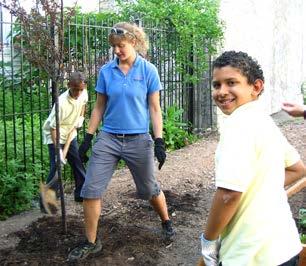
7 INTRODUCTION In 2013, the Passaic Valley Sewerage Commission (PVSC) began a new initiative to assist the 48 municipalities within its jurisdiction to manage flooding and eliminate combined sewer overflows. With municipalities spread across five counties, PVSC is dedicated to leading efforts throughout the PVSC Sewerage District by using green infrastructure to intercept stormwater runoff, reduce combined sewer overflows (CSOs), manage existing water infrastructure, and minimize frequent flooding events. To help with this effort, PVSC has entered into a partnership with the Rutgers Cooperative Extension (RCE) Water Resources Program. By using cost-effective green infrastructure practices, Garfield can begin to reduce the negative impacts of stormwater runoff and decrease the pressure on local infrastructure and waterways. This feasibility study is intended to be used as a guide for the community of Garfield to begin implementing green infrastructure practices while demonstrating to residents and local leaders the benefits of and opportunities for better managing stormwater runoff. 7 For Garfield, potential green infrastructure projects have been identified. Each project has been classified as a mitigation opportunity for recharge potential, total suspended solids removal, and stormwater peak reduction. For each each proposed green infrastructure practice, detailed green infrastructure information sheets provide an estimate of gallons of stormwater captured and treated per year. Additionally, concept designs for three of the potential green infrastructure projects have been developed. These concept designs provide an aerial photograph of the site and details of the proposed green infrastructure practices. Lastly, Appendix A of this document offers information about community engagement opportunities related to green infrastructure, while Appendix B provides maintenance guidelines for green infrastructure practices. Rutgers University professor, Tobiah Horton, reviews a rain garden design with a homeowner.


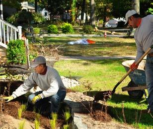
8 A community garden that harvests and recycles rainwater 8 WHAT IS GREEN INFRASTRUCTURE? Green infrastructure is an approach to stormwater management that is cost-effective, sustainable, and environmentally friendly. Green infrastructure projects capture, filter, absorb, and reuse stormwater to maintain or mimic natural systems and to treat runoff as a resource. As a general principle, green infrastructure practices use soil and vegetation to recycle stormwater runoff through infiltration and evapotranspiration. When used as components of a stormwater management system, green infrastructure practices such as bioretention, green roofs, porous pavement, rain gardens, and vegetated swales can produce a variety of environmental benefits. In addition to effectively retaining and infiltrating rainfall, these technologies can simultaneously help filter air pollutants, reduce energy demands, mitigate urban heat islands, and sequester carbon while also providing communities with aesthetic and natural resource benefits (USEPA, 2013). Rain barrel workshop participants A rain garden after planting


.")
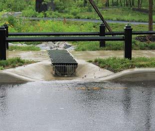
9 WHAT IS STORMWATER? When rainfall hits the ground, it can soak into the ground or flow across the surface. When rainfall flows across a surface, it is called stormwater runoff. Pervious surfaces allow stormwater to readily soak into the soil and recharge groundwater. An impervious surface can be any material that has been placed over soil that prevents water from soaking into the ground. Impervious surfaces include paved roadways, parking lots, sidewalks, and rooftops. As impervious areas increase, so does the amount of stormwater runoff. New Jersey has many problems due to stormwater runoff from impervious surfaces, including: POLLUTION: According to the 2010 New Jersey Water Quality Assessment Report, 90% of the assessed waters in New Jersey are impaired. Urban-related stormwater runoff is listed as the most probable source of impairment (USEPA, 2013). As stormwater flows over the ground, it picks up pollutants, including animal waste, excess fertilizers, pesticides, and other toxic substances. These pollutants are carried to waterways. FLOODING: Over the past decade, the state has seen an increase in flooding. Communities around the state have been affected by these floods. The amount of damage caused also has increased greatly with this trend, costing billions of dollars over this time span. EROSION: Increased stormwater runoff causes an increase in stream velocity. The increased velocity after storm events erodes stream banks and shorelines, degrading water quality. This erosion can damage local roads and bridges and cause harm to wildlife. Stormwater catch basin Purple cone flower Pervious pavers To protect and repair our waterways, reduce flooding, and stop erosion, stormwater runoff has to be better managed. Impervious surfaces need to be disconnected with green infrastructure to prevent stormwater runoff from flowing directly into New Jersey s waterways. Disconnection redirects runoff from paving and rooftops to pervious areas in the landscape. 9
.")

10 WHY ARE IMPERVIOUS SURFACES IMPORTANT? The primary cause of the pollution, flooding, and erosion problems is the quantity of impervious surfaces draining directly to local waterways. New Jersey is one of the most developed states in the country. Currently, the state has the highest percent of impervious cover in the country at 12.1% of its total area (Nowak & Greenfield, 2012). Many of these impervious surfaces are directly connected to local waterways (i.e., every drop of rain that lands on these impervious surfaces ends up in a local river, lake, or bay without any chance of being treated or soaking into the ground). 10 The literature suggests a link between impervious cover and stream ecosystem impairment starting at approximately 10% impervious surface cover (Schueler, 1994; Arnold and Gibbons, 1996; May et al., 1997). Impervious cover may be linked to the quality of lakes, reservoirs, estuaries, and aquifers (Caraco et al., 1998), and the amount of impervious cover in a watershed can be used to project the current and future quality of streams. Based on the scientific literature, Caraco et al. (1998) classified urbanizing streams into the following three categories: sensitive streams, impacted streams, and non-supporting streams. Sensitive steams typically have a watershed impervious surface cover from 0-10%. Impacted streams have a watershed impervious cover ranging from 11-25% and typically show clear signs of degradation from urbanization. Non-supporting streams have a watershed impervious cover of greater than 25%; at this high level of impervious cover, streams are simply conduits for stormwater flow and no longer support a diverse stream community.


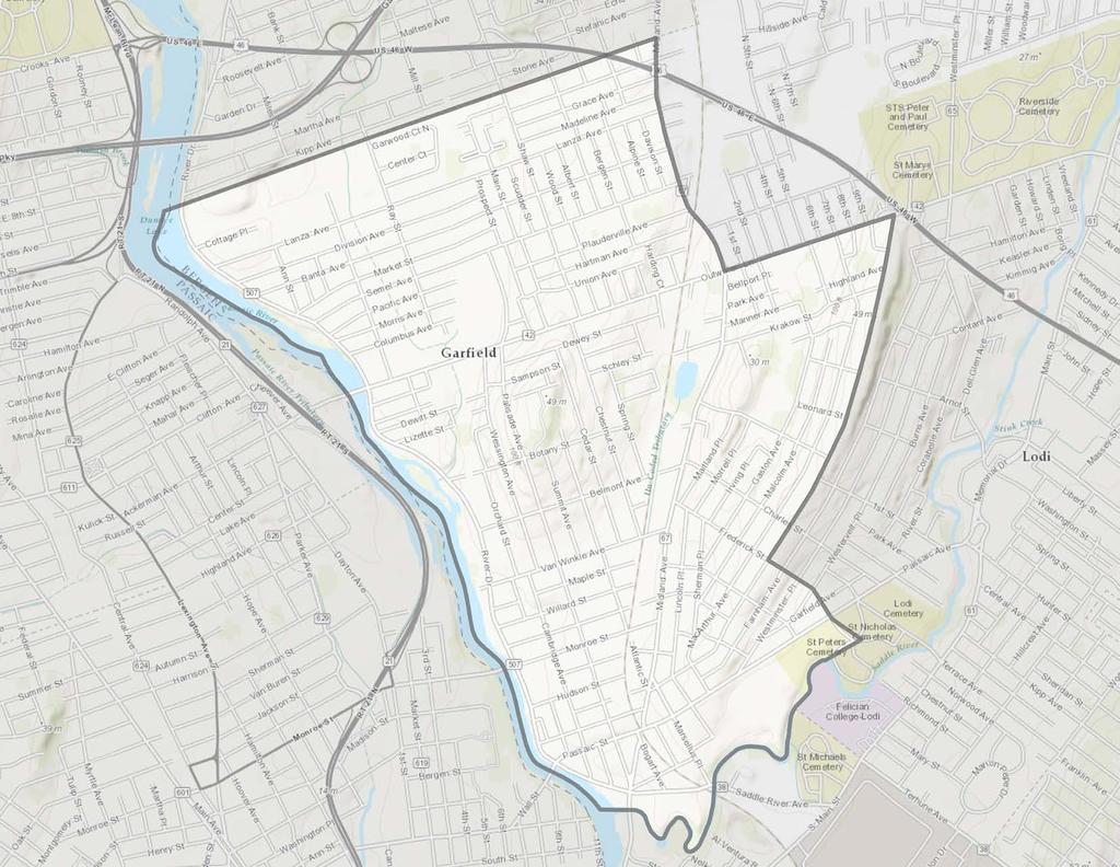
11 11 GARFIELD Garfield is a city located in Bergen County along the Passaic River west of the Hackensack meadowlands. The city covers an area totaling about two square miles and has a population of 30,478 according to the 2010 US Census. Garfield shares its northern border with the communities of Elmwood Park and Saddle Brook. To the east is the community of Lodi. Wallington is located to the south, and the Passaic County communities of Passaic and Clifton are to the west. In the event of a heavy storm, much of the town s runoff travels into nearby waterbodies untreated. By evaluating the feasibility of green infrastructure, Garfield can identify cost-effective ways to help mitigate water quality and local flooding issues.
.")

12 LAND USE IN GARFIELD Garfield is dominated by urban land uses. A total of 94.0% of the municipality s land use is classified as urban. Of the urban land in Garfield, high density residential is the dominant land use (>50%). Urban land uses tend to have a high percentage of impervious surfaces. GARFIELD LAND USE GARFIELD LAND USE Water 3.6% Barren Land 1.4% Forest 1.0% 12 Urban 94.0% GARFIELD URBAN LAND USE Recreational Land 6.7% Mixed Urban 4.8% Medium Density Residential 8.4% Transportation/ Infrastructure 1.5% Commercial 16.3% Industrial 5.9% High Density Residential 56.3%
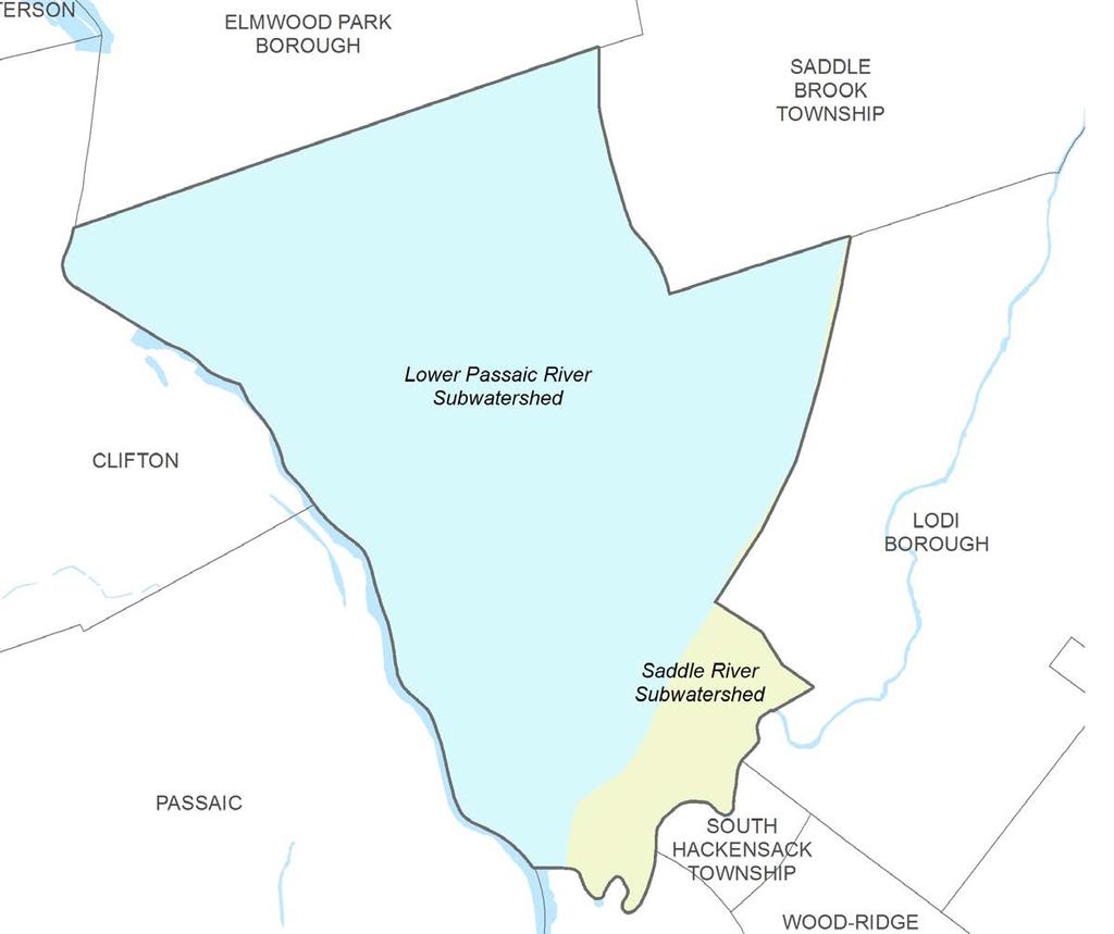
13 GARFIELD SUBWATERSHEDS 13


14 IMPERVIOUS COVER ANALYSIS The first step to reducing the impacts from impervious surfaces is to conduct an impervious cover assessment. This assessment can be completed on different scales: individual lot, municipality, or watershed. Impervious surfaces need to be identified for stormwater management. 14 The New Jersey Department of Environmental Protection s (NJDEP) 2007 land use/land cover geographical information system (GIS) data layer categorizes Garfield into many unique land use areas, assigning a percent impervious cover for each delineated area. These impervious cover values are used to estimate the impervious coverage for Garfield. Based upon the 2007 NJDEP land use/land cover data, approximately 49% of Garfield has impervious cover. Water resources are typically managed on a watershed/ subwatershed basis; therefore an impervious cover analysis has been performed for each subwatershed within Garfield (Table 1). On a subwatershed basis, impervious cover ranges from 49% in the Lower Passaic River subwatershed to 50% in the Saddle River subwatershed. Evaluating impervious cover on a subwatershed basis allows the municipality to focus impervious cover reduction or disconnection efforts in the subwatersheds where frequent flooding occurs. Connected downspout Reservoir
15 TABLE 1. IMPERVIOUS COVER ANALYSIS BY SUBWATERSHED FOR GARFIELD Subwatershed Total Area Land Use Area Water Area Impervious Cover (ac) (ac) (ac) (ac) (%) Lower Passaic River 1,282 1, % Saddle River % Total 1,402 1, % In developed landscapes, stormwater runoff from parking lots, driveways, sidewalks, and rooftops flows to drainage pipes that feed the sewer system. The cumulative effect of these impervious surfaces and thousands of connected downspouts reduces the amount of water that can infiltrate into soils and greatly increases the volume and rate of runoff that flows to waterways. TABLE 2. STORMWATER RUNOFF VOLUMES FROM IMPERVIOUS SURFACES BY SUBWATERSHED IN GARFIELD Subwatershed Total Runoff Volume for the 1.25" NJ Water Quality Storm (Mgal) Total Runoff Volume for the NJ Annual Rainfall of 44" (Mgal) Total Runoff Volume for the 2-year Design Storm (3.3") (Mgal) Total Runoff Volume for the 10-year Design Storm (5.1") (Mgal) Total Runoff Volume for the 100 Year Design Storm (8.4") (Mgal) Lower Passaic River Saddle River Total Stormwater runoff volumes (specific to Garfield, Bergen County) associated with impervious surfaces have been calculated for the following storms: the New Jersey water quality design storm of 1.25 inches of rain, an annual rainfall of 44 inches, the 2-year design storm (3.3 inches of rain), the 10-year design storm (5.1 inches of rain), and the 100-year design storm (8.4 inches of rain). These runoff volumes are summarized in Table 2. A substantial amount of rainwater drains from impervious surfaces in Garfield. For example, if the stormwater runoff from one water quality storm (1.25 inches of rain) in the Lower Passaic River subwatershed was harvested and purified, it could supply water to 188 homes for a year (assuming 300 gallons per day per home). 15


16 WHAT CAN WE DO ABOUT IMPERVIOUS SURFACES? Once impervious surfaces have been identified, there are three steps to better manage these surfaces through green infrastructure practices. 1 Eliminate surfaces that are not necessary. One method to reduce impervious cover is to depave. Depaving is the act of removing paved impervious surfaces and replacing them with pervious soil and vegetation that will allow for the infiltration of rainwater. Depaving leads to the recreation of natural areas that will help reduce flooding, increase wildlife habitat, and positively enhance water quality as well as beautify neighborhoods Reduce or convert impervious surfaces. There may be surfaces that are required to be hardened, such as roadways or parking lots, but could be made smaller and still be functional. A parking lot that has two-way cart ways could be converted to one-way cart ways. There also are permeable paving materials such as porous asphalt, pervious concrete, or permeable paving stones that could be substituted for impermeable paving materials. 3 Disconnect impervious surfaces from flowing directly to local waterways. There are many ways to capture, treat, and infiltrate stormwater runoff from impervious surfaces. Opportunities also exist to harvest rainwater for non-potable uses like watering gardens.

17 17
18 18
19 GREEN INFRASTRUCTURE PRACTICES 19


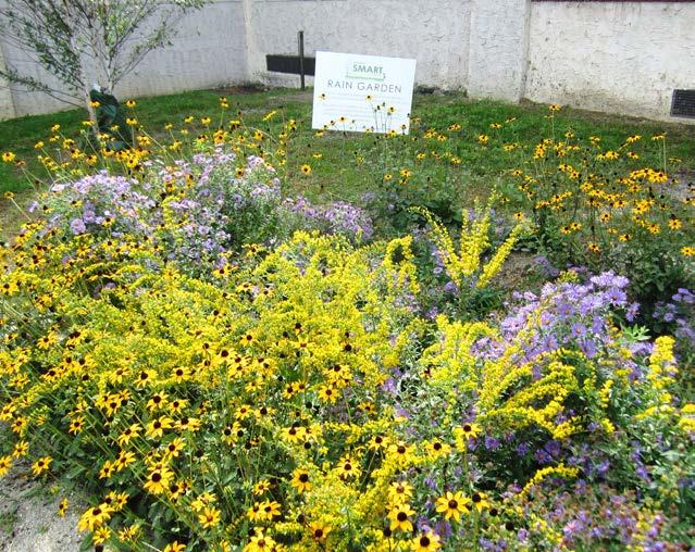
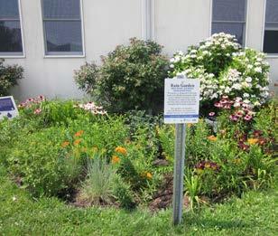
20 BIORETENTION SYSTEMS A rain garden, or bioretention system, is a landscaped, shallow depression that captures, filters, and infiltrates stormwater runoff. The rain garden removes nonpoint source pollutants from stormwater runoff while recharging groundwater. A rain garden serves as a functional system to capture, filter, and infiltrate stormwater runoff at the source while being aesthetically pleasing. Rain gardens are an important tool for communities and neighborhoods to create diverse, attractive landscapes while protecting the health of the natural environment. Rain gardens can also be installed in areas that do not infiltrate by incorporating an underdrain system. Rain gardens can be implemented throughout communitites to begin the process of re-establishing the natural function of the land. Rain gardens offer one of the quickest and easiest methods to reduce runoff and help protect our water resources. Beyond the aesthetic and ecological benefits, rain gardens encourage environmental stewardship and community pride. 20

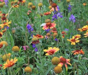
21 NATIVE PLANTS A rain garden is planted with a variety of grasses, wildflowers, and woody plants that are adapted to the soil, precipitation, climate, and other site conditions DRAINAGE AREA This is the area of impervious surface that is captured in the rain garden system. BERM The berm is constructed as a barrier to control, slow down, and contain stormwater. 21 PONDING AREA The ponding area is the lowest, deepest visible area of the garden. When designed correctly, this area should drain within 24 hours. INLET This is the area where stormwater enters. The inlet is often lined with stone to slow water flow and prevent erosion. CURB CUT This curb cut and concrete flow pad are designed to help redirect stormwater runoff to the rain garden system and out of the storm drain.


22 BIOSWALES Bioswales are landscape features that convey stormwater from one location to another while removing pollutants and allowing water to infiltrate. Bioswales are often designed for larger scale sites where water needs time to move and slowly infiltrate into the groundwater. Much like the rain garden systems, bioswales can also be designed with an underdrain pipe that allows excess water to discharge to the nearest catch basin or existing stormwater system. 22

23 NATIVE PLANTS A bioswale is planted with a variety of grasses, wildflowers, and woody plants that are adapted to the soil, precipitation, climate, and other site conditions. The vegetation helps filter stormwater runoff as it moves through the system. CONVEYANCE Unlike other systems, the bioswale is designed to move water through a vegetative channel as it slowly infiltrates into the ground. 23 SLOPE The slope is designed at a maximum of 3:1. These slopes often require erosion control blankets INLET This is the area where stormwater enters. The inlet is often lined with stone to slow water flow and prevent erosion.


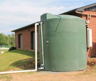
24 RAINWATER HARVESTING SYSTEMS These systems capture rainwater, mainly from rooftops, in cisterns or rain barrels. The water can then be used for watering gardens, washing vehicles, or for other non-potable uses. 24 Rainwater harvesting systems come in all shapes and sizes. These systems are good for harvesting rainwater in the spring, summer, and fall but must be winterized during the colder months. Cisterns are winterized, and then their water source is redirected from the cistern back to the original discharge area.

25 DRAINAGE AREA This is the area of impervious surface that is captured in the rainwater harvesting system. In this case, it is a structure rooftop. OVERFLOW This mechanism is designed to act as a discharge for the water when the cistern is full or when it is winterized. FIRST FLUSH DIVERTER This mechanism is installed to by-pass the first several gallons of runoff which tend to be the dirtiest water before it enters the tank. GUTTER This captures runoff from the rooftop and diverts it to the rainwater harvesting system. CISTERN TANK This tank is designed in different sizes to accommodate the runoff from a designated drainage area. SPIGOT A spigot is installed near the base of the cistern tank to allow water to be removed for use without an electronic pump system. SEDIMENT Sediment and other pollutants that enter the tank will settle to the bottom. 25


26 PERMEABLE PAVEMENTS These surfaces include pervious concrete, porous asphalt, interlocking concrete pavers, and grid pavers. Pervious concrete and porous asphalt are the most common of the permeable surfaces. They are similar to regular concrete and asphalt but without the fine materials. This allows water to quickly pass through the material into an underlying layered system of stone that holds the water, allowing it to infiltrate into the underlying uncompacted soil. They have an underlying stone layer to store stormwater runoff and allow it to slowly seep into the ground. By installing an underdrain system, these systems can be used in areas where infiltration is limited. The permeable pavement system will still filter pollutants and provide storage but will not infiltrate the runoff. 26 pavement photo

27 POROUS ASPHALT It is common to design porous asphalt in the parking stalls of a parking lot. This saves money and reduces wear. DRAINAGE AREA The drainage area of the porous asphalt system is the conventional asphalt cartway and the porous asphalt in the parking spaces. Runoff from the conventional asphalt flows into the porous asphalt parking spaces. UNDERDRAIN Systems with low infiltration rates due to soil composition are often designed with an underdrain system to discharge the water. ASPHALT This system is often designed with conventional asphalt in areas of high traffic to prevent any damage to the system. SUBGRADE Porous pavements are unique because of their subgrade structure. This structure includes a layer of choker course, filter course, and soil. 27


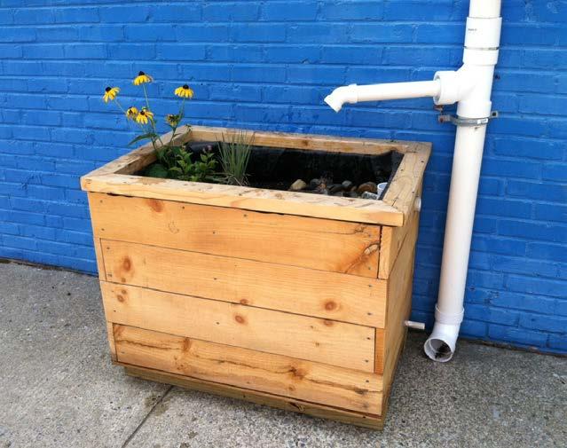
28 DOWNSPOUT PLANTER BOXES Downspout planter boxes are wooden or concrete boxes with plants installed at the base of the downspout that provide an opportunity to beneficially reuse rooftop runoff. Although small, these systems have some capacity to store rooftop runoff during rainfall events and release it slowly back into the storm sewer system through an overflow. 28 Most often, downspout planter boxes are a reliable green infrastructure practice used to provide some rainfall storage and aesthetic value for property.

29 PLANTER BOXES The downspout planter box can be wooden or concrete. However, all boxes must be reinforced to hold soil, stone, and the quantity of rainfall it is designed to store. NATIVE PLANTS A downspout planter is planted with a variety of grasses, wildflowers, and woody plants that are adapted to the soil, precipitation, climate, and other site conditions. DOWNSPOUT The downspout is the main source of water for the downspout planter. 29 SUBGRADE The system is designed to overflow using a perforated pipe located at the bottom of the downspout planter box. CONNECTION The system is designed to overflow into adjacent boxes using a connecting pipe that is sealed with silicon. OVERFLOW The overflow is the point where water discharges from the downspout planter.


30 STORMWATER PLANTERS 30 Stormwater planters are vegetated structures that are built into the sidewalk to intercept stormwater runoff from the roadway or sidewalk. Stormwater planters, like rain gardens, are a type of bioretention system. This means many of these planters are designed to allow the water to infiltrate into the ground. However, some are designed simply to filter the water and convey it back into the storm sewer system via an underdrain system.

31 NATIVE PLANTS A stormwater planter is planted with a variety of grasses, wildflowers, and woody plants that are adapted to the soil, precipitation, climate, and other site conditions. CURB CUT This curb cut and concrete flow pad are designed to help redirect stormwater runoff to the rain garden system and out of the storm drain. INLET This is the area where stormwater enters. The inlet is often lined with stone to slow water flow and prevent erosion. 31 CONCRETE WALL Concrete walls are installed to match the existing curb. These walls create the frame for the stormwater planter and continue to function as a curb. SUBGRADE Stormwater planter systems are unique because of their subgrade structure. This structure is layered with bioretention media, choker course, compact aggregate, and soil separation fabric.


32 TREE FILTER BOXES Tree filter boxes can be pre-manufactured concrete boxes or enhanced tree pits that contain a special soil mix and are planted with a tree or shrub. They filter stormwater runoff but provide little storage capacity. They are typically designed to quickly filter stormwater and then discharge it to the local storm sewer system. 32 Often tree filter boxes are incorporated into streetscape systems that include an underlying stormwater system which connects several boxes (as shown on the next page). This is also coupled with pervious concrete to increase the storage capacity for rainwater into the system.

33 PERVIOUS CONCRETE Pervious concrete is installed to act as an additional storage system to increase the stormwater capacity treated by the system. 33 UNDERDRAIN Systems with low infiltration rates due to soil composition are often designed with an underdrain system to discharge the water. ASPHALT This system is often designed with conventional asphalt in areas of high traffic to prevent any damage to the system.
34 34
35 GREEN INFRASTRUCTURE IN GARFIELD 35

36 36 TABLE 1. AERIAL LOADING COEFFICIENTS Land Cover Total Phosphorus (lbs/acre/yr) Total Nitrogen (lbs/acre/yr) Total Suspended Solids (lbs/acre/yr) High, Medium Density Residential Low Density, Rural Residential Commercial Industrial Urban, Mixed Urban, Other Urban Agriculture Forest, Water, Wetlands SITE SELECTION & METHODOLOGY A collection of sites have been identified in Garfield based on site visibility, feasibility, cost-effectiveness, and potential partnerships. The RCE Water Resources Program uses a look here first method to identify the most accessible and visible sites. These sites include: schools, churches, libraries, municipal buildings, public works, firehouses, post officies, social clubs such as the Elks or Moose lodge, and parks/recreational fields. These sites often have large amounts of impervious cover and typically are relatively easy to engage in implementing green infrastructure practices. Sites are selected based on their feasibility or the ability to get the project in the ground. This criteria is based on property ownership and ability to do maintanence. In addition, potential partnerships related to the site help in making a project feasible. Initially, aerial imagery was used to identify potential project sites that contain extensive impervious cover. Field visits were then conducted at each of these potential project sites to determine if a viable option exists to reduce impervious cover or to disconnect impervious surfaces from draining directly to the local waterway or storm sewer system. During the site visit, appropriate green infrastructure practices for the site were determined. For each potential project site, specific aerial loading coefficients for commercial land use were used to determine the annual runoff loads for total phosphorus (TP), total nitrogen (TN), and total suspended solids (TSS) from impervious surfaces (Table 1). These are the same aerial loading coefficients that NJDEP uses to develop total maximum daily loads (TMDLs) for impaired waterways of the state. The percentage of impervious cover for each site was extracted from the 2007 NJDEP land use/land cover database.


37 For impervious areas, runoff volumes were determined for the water quality design storm (1.25 inches of rain over twohours) and for the annual rainfall total of 44 inches. Preliminary soil assessments were conducted for each potential project site identified in Garfield using the United States Department of Agriculture Natural Resources Conservation Service Web Soil Survey, which utilizes regional and statewide soil data to predict soil types in an area. For each potential project site, drainage areas were determined for each of the green infrastructure practices proposed at the site. These green infrastructure practices were designed to manage the 2-year design storm, enabling these practices to capture 95% of the annual rainfall. Runoff volumes were calculated for each proposed green infrastructure practice. The reduction in TSS loading was calculated for each drainage area for each proposed green infrastructure practice using the aerial loading coefficients in Table 1. The maximum volume reduction in stormwater runoff for each green infrastructure practice for a storm was determined by calculating the volume of runoff captured from the 2-year design storm. For each green infrastructure practice, peak discharge reduction potential was determined through hydrologic modeling in HydroCAD. For each green infrastructure practice, a cost estimate is provided. These costs are based upon the square footage of the green infrastructure practice and the real cost of green infrastructure practice implementation in New Jersey. 37
38 POTENTIAL PROJECT SITES WITHIN STUDY AREA Site Name Address Page # 1 Senior Center & Recreation Department * 474 Midland Avenue, Garfield, NJ th Century Park 75 Elizabeth Street, Garfield, NJ Garfield Fire Station No Gaston Avenue, Garfield, NJ Friendship Baptist Church 152 Gaston Avenue, Garfield, NJ Abraham Lincoln School * 111 Palisade Avenue, Garfield, NJ Garfield Fire Station No. 2 * 72 Belmont Avenue, Garfield, NJ Woodrow Wilson Elementary School 212 Outwater Lane, Garfield, NJ Washington Irving School 2 Madonna Place, Garfield, NJ Garfield Town Hall 111 Outwater Lane, Garfield, NJ Garfield Elks Lodge Lanza Avenue, Garfield, NJ * Contains a concept design

39 39 Legend Project Sites Garfield Waterbodies

40 92 Hathaway Street, Garfield, NJ pervious pavement 40 drainage area property line 2012 Aerial: NJOIT, OGIS N 0' 30' 60' SENIOR CENTER & RECREATION DEPARTMENT 474 Midland Avenue Garfield, NJ 07039

 % sq. ft. TP TN TSS Runoff Volume from Impervious Cover (Mgal) From the 1.")
 TSS Removal Potential (lbs/yr) Maximum Volume Reduction Potential (gal/storm) Peak")
41 Stormwater is currently draining from east to west across the site. Parking spaces in the adjacent parking lot can be converted to porous asphalt to capture and treat stormwater runoff. A preliminary soil assessment suggests that more soil testing would be required before determining the soil s suitability for green infrastructure. 41 Impervious Cover Existing Loads from Impervious Cover (lbs/yr) % sq. ft. TP TN TSS Runoff Volume from Impervious Cover (Mgal) From the 1.25" Water Quality Storm For an Annual Rainfall of 44" 90 57, Recommended Infrastructure Practices Recharge Potential (Mgal/yr) TSS Removal Potential (lbs/yr) Maximum Volume Reduction Potential (gal/storm) Peak Discharge Reduction Potential (cu. ft./second) Estimated Size (sq. ft.) Estimated Cost Pervious pavement , ,370 $259,250 SENIOR CENTER & RECREATION DEPARTMENT 474 Midland Avenue Garfield, NJ 07039

42 CURRENT CONDITION 42 SENIOR CENTER & RECREATION DEPARTMENT 474 Midland Avenue Garfield, NJ 07039

43 CONCEPT DESIGN 43 SENIOR CENTER & RECREATION DEPARTMENT 474 Midland Avenue Garfield, NJ 07039

44 pervious pavement 44 drainage area property line 2012 Aerial: NJOIT, OGIS N 0' 20' 40' 20TH CENTURY PARK 75 Elizabeth Street Garfield, NJ 07038

 % sq. ft. TP TN TSS Runoff Volume from Impervious Cover (Mgal) From the 1.")
 TSS Removal Potential (lbs/yr) Maximum Volume Reduction Potential (gal/storm)")
45 Stormwater is currently draining from east to west across the site. Parking spaces in the adjacent parking lot can be converted to porous asphalt to capture and treat stormwater runoff. A preliminary soil assessment suggests that the soils have suitable drainage characteristics for green infrastructure. 45 Impervious Cover Existing Loads from Impervious Cover (lbs/yr) % sq. ft. TP TN TSS Runoff Volume from Impervious Cover (Mgal) From the 1.25" Water Quality Storm For an Annual Rainfall of 44" 9 22, Recommended Infrastructure Practices Recharge Potential (Mgal/yr) TSS Removal Potential (lbs/yr) Maximum Volume Reduction Potential (gal/storm) Peak Discharge Reduction Potential (cu. ft./second) Estimated Size (sq. ft.) Estimated Cost Pervious pavements , ,450 $161,250 20TH CENTURY PARK 75 Elizabeth Street Garfield, NJ 07038

46 92 Hathaway Street, Garfield, NJ pervious pavement 46 drainage area property line 2012 Aerial: NJOIT, OGIS N 0' 20' 40' GARFIELD FIRE STATION NO Gaston Avenue Garfield, NJ 07037

 % sq. ft. TP TN TSS Runoff Volume from Impervious Cover (Mgal) From the 1.")
 TSS Removal Potential (lbs/yr) Maximum Volume Reduction Potential (gal/storm) Peak")
47 Stormwater is currently draining across the site to nearby catch basins. Parking spaces in the adjacent parking lot can be converted to porous asphalt to capture and treat stormwater runoff. A preliminary soil assessment suggests that more soil testing would be required before determining the soil s suitability for green infrastructure. 47 Impervious Cover Existing Loads from Impervious Cover (lbs/yr) % sq. ft. TP TN TSS Runoff Volume from Impervious Cover (Mgal) From the 1.25" Water Quality Storm For an Annual Rainfall of 44" 32 51, Recommended Infrastructure Practices Recharge Potential (Mgal/yr) TSS Removal Potential (lbs/yr) Maximum Volume Reduction Potential (gal/storm) Peak Discharge Reduction Potential (cu. ft./second) Estimated Size (sq. ft.) Estimated Cost Pervious pavement , ,120 $128,000 GARFIELD FIRE STATION NO Gaston Avenue Garfield, NJ 07037

48 rain garden 48 drainage area property line 2012 Aerial: NJOIT, OGIS N 0' 10' 20' FRIENDSHIP BAPTIST CHURCH 152 Gaston Avenue Garfield, NJ 07036

 % sq. ft. TP TN TSS Runoff Volume from Impervious Cover (Mgal) From the 1.")
 TSS Removal Potential (lbs/yr) Maximum Volume Reduction Potential (gal/storm) Peak")
49 Stormwater is currently draining from east to west across the site. Building downspouts can be disconnected and directed into a rain garden. Installing a rain garden in the lawn adjacent to the building can capture, treat, and infiltrate roof runoff. A preliminary soil assessment suggests that the soils have suitable drainage characteristics for green infrastructure. 49 Impervious Cover Existing Loads from Impervious Cover (lbs/yr) % sq. ft. TP TN TSS Runoff Volume from Impervious Cover (Mgal) From the 1.25" Water Quality Storm For an Annual Rainfall of 44" 40 4, Recommended Infrastructure Practices Recharge Potential (Mgal/yr) TSS Removal Potential (lbs/yr) Maximum Volume Reduction Potential (gal/storm) Peak Discharge Reduction Potential (cu. ft./second) Estimated Size (sq. ft.) Estimated Cost Rain garden , $750 FRIENDSHIP BAPTIST CHURCH 152 Gaston Avenue Garfield, NJ 07036

50 92 Hathaway Street, Garfield, NJ disconnected downspouts 50 pervious pavement rain gardens drainage area property line 2012 Aerial: NJOIT, OGIS N 0' 30' 60' ABRAHAM LINCOLN SCHOOL 111 Palisade Avenue Garfield, NJ 07034

 % sq. ft. TP TN TSS Runoff Volume from Impervious Cover (Mgal) From the 1.")
 TSS Removal Potential (lbs/yr) Maximum Volume Reduction Potential (gal/storm) Peak Discharge Reduction Potential (cu. ft.")
51 Stormwater is currently draining across the site to nearby catch basins. Parking spaces in the adjacent parking lot can be converted to porous asphalt to capture and treat stormwater runoff. Building downspouts can be disconnected and directed into rain gardens. Installing rain gardens in the lawn adjacent to the building can capture, treat, and infiltrate roof runoff. A preliminary soil assessment suggests that more soil testing would be required before determining the soil s suitability for green infrastructure. 51 Impervious Cover Existing Loads from Impervious Cover (lbs/yr) % sq. ft. TP TN TSS Runoff Volume from Impervious Cover (Mgal) From the 1.25" Water Quality Storm For an Annual Rainfall of 44" 85 73, Recommended Infrastructure Practices Recharge Potential (Mgal/yr) TSS Removal Potential (lbs/yr) Maximum Volume Reduction Potential (gal/storm) Peak Discharge Reduction Potential (cu. ft./second) Estimated Size (sq. ft.) Estimated Cost Disconnection $1,000 Rain gardens , ,620 $8,100 Pervious pavement , ,615 $240,375 ABRAHAM LINCOLN SCHOOL 111 Palisade Avenue Garfield, NJ 07034
52 CURRENT CONDITION 52 ABRAHAM LINCOLN SCHOOL 111 Palisade Avenue Garfield, NJ 07034

53 CONCEPT DESIGN 53 ABRAHAM LINCOLN SCHOOL 111 Palisade Avenue Garfield, NJ 07034

54 disconnected downspout 54 cistern drainage area property line 2012 Aerial: NJOIT, OGIS N 0' 10' 20' GARFIELD FIRE STATION NO Belmont Avenue Garfield, NJ 07032

 % sq. ft. TP TN TSS Runoff Volume from Impervious Cover (Mgal) From the 1.")
 TSS Removal Potential (lbs/yr) Maximum Volume Reduction Potential (gal/storm) Peak")
55 Stormwater is currently draining from the roof to the local storm sewer system via connected downspouts. A cistern connected to the building downspouts can capture water, allowing it to be used for watering plants and washing vehicles. A preliminary soil assessment suggests that the soils have suitable drainage characteristics for green infrastructure. 55 Impervious Cover Existing Loads from Impervious Cover (lbs/yr) % sq. ft. TP TN TSS Runoff Volume from Impervious Cover (Mgal) From the 1.25" Water Quality Storm For an Annual Rainfall of 44" 65 7, Recommended Infrastructure Practices Recharge Potential (Mgal/yr) TSS Removal Potential (lbs/yr) Maximum Volume Reduction Potential (gal/storm) Peak Discharge Reduction Potential (cu. ft./second) Estimated Size (sq. ft.) Estimated Cost Disconnection $500 Cistern , ,000 $4,000 GARFIELD FIRE STATION NO Belmont Avenue Garfield, NJ 07032

56 CURRENT CONDITION 56 GARFIELD FIRE STATION NO. 2 ABRAHAM LINCOLN SCHOOL 72 Belmont Avenue Garfield, NJ Palisade Avenue Garfield, NJ 07034

57 CONCEPT DESIGN 57 GARFIELD FIRE STATION NO. 2 ABRAHAM LINCOLN SCHOOL 72 Belmont Avenue Garfield, NJ Palisade Avenue Garfield, NJ 07034

58 92 Hathaway Street, Garfield, NJ pervious pavement 58 rain gardens drainage area property line 2012 Aerial: NJOIT, OGIS N 0' 20' 40' WOODROW WILSON ELEMENTARY SCHOOL 212 Outwater Lane Garfield, NJ 07030


59 Stormwater is currently draining across the site to nearby catchbasins. The adjacent basketball court can be converted to porous asphalt to capture and treat stormwater runoff. Installing rain gardens in the lawn adjacent to the building can capture, treat, and infiltrate roof runoff. A preliminary soil assessment suggests that the soils have suitable drainage characteristics for green infrastructure. 59 Impervious Cover Existing Loads from Impervious Cover (lbs/yr) % sq. ft. TP TN TSS Runoff Volume from Impervious Cover (Mgal) From the 1.25" Water Quality Storm For an Annual Rainfall of 44" 52 48, Recommended Infrastructure Practices Recharge Potential (Mgal/yr) TSS Removal Potential (lbs/yr) Maximum Volume Reduction Potential (gal/storm) Peak Discharge Reduction Potential (cu. ft./second) Estimated Size (sq. ft.) Estimated Cost Rain gardens , ,250 $6,250 Pervious pavement , ,800 $70,000 WOODROW WILSON ELEMENTARY SCHOOL 212 Outwater Lane Garfield, NJ 07030

60 downspout disconnection 60 pervious pavement cistern drainage area property line 2012 Aerial: NJOIT, OGIS N 0' 20' 40' WASHINGTON IRVING SCHOOL 2 Madonna Place Garfield, NJ 07027

 % sq.")
 TSS Removal Potential (lbs/yr) Maximum Volume Reduction Potential (gal/storm) Peak Discharge Reduction Potential (cu. ft.")
61 Stormwater is currently draining across the site to nearby catchbasins. Building downspouts can be disconnected and directed into a cistern. A cistern connected to the building downspouts can capture water, allowing it to be used for watering plants and washing vehicles. Parking spaces in the adjacent parking lot can be converted to porous asphalt to capture and treat stormwater runoff. A preliminary soil assessment suggests that the soils have suitable drainage characteristics for green infrastructure. 61 Impervious Cover Existing Loads from Impervious Cover (lbs/yr) % sq. ft. TP TN TSS Runoff Volume from Impervious Cover (Mgal) From the 1.25" Water Quality Storm For an Annual Rainfall of 44" 95 50, Recommended Infrastructure Practices Recharge Potential (Mgal/yr) TSS Removal Potential (lbs/yr) Maximum Volume Reduction Potential (gal/storm) Peak Discharge Reduction Potential (cu. ft./second) Estimated Size (sq. ft.) Estimated Cost Disconnection $500 Pervious pavement , ,565 $114,125 Cistern , ,000 $4,000 WASHINGTON IRVING SCHOOL 2 Madonna Place Garfield, NJ 07027

62 disconnected downspout 62 pervious pavement cistern drainage area property line 2012 Aerial: NJOIT, OGIS N 0' 30' 60' GARFIELD TOWN HALL 111 Outwater Lane Garfield, NJ 07026


63 Stormwater is currently draining from north to south across the site. Parking spaces in the adjacent parking lot can be converted to porous asphalt to capture and treat stormwater runoff. A cistern connected to the building downspouts can capture water, allowing it to be used for watering plants and washing vehicles. A preliminary soil assessment suggests that more soil testing would be required before determining the soil s suitability for green infrastructure. 63 Impervious Cover Existing Loads from Impervious Cover (lbs/yr) % sq. ft. TP TN TSS Runoff Volume from Impervious Cover (Mgal) From the 1.25" Water Quality Storm For an Annual Rainfall of 44" 75 55, Recommended Infrastructure Practices Recharge Potential (Mgal/yr) TSS Removal Potential (lbs/yr) Maximum Volume Reduction Potential (gal/storm) Peak Discharge Reduction Potential (cu. ft./second) Estimated Size (sq. ft.) Estimated Cost Disconnection $500 Pervious pavement , ,070 $376,750 Cistern , ,000 $2,000 GARFIELD TOWN HALL 111 Outwater Lane Garfield, NJ 07026

64 disconnected downspout 64 pervious pavement downspout planter boxes cistern drainage area property line 2012 Aerial: NJOIT, OGIS N 0' 10' 20' GARFIELD ELKS LODGE Lanza Avenue Garfield, NJ 07026


65 Stormwater is currently draining across the site to nearby catch basins. Parking spaces in the adjacent parking lot can be converted to porous asphalt to capture and treat stormwater runoff. Downspout planter boxes connected to the building downspouts will slow and treat stormwater runoff. A preliminary soil assessment suggests that more soil testing would be required before determining the soil s suitability for green infrastructure. 65 Impervious Cover Existing Loads from Impervious Cover (lbs/yr) % sq. ft. TP TN TSS Runoff Volume from Impervious Cover (Mgal) From the 1.25" Water Quality Storm For an Annual Rainfall of 44" 45 6, Recommended Infrastructure Practices Recharge Potential (Mgal/yr) TSS Removal Potential (lbs/yr) Maximum Volume Reduction Potential (gal/storm) Peak Discharge Reduction Potential (cu. ft./second) Estimated Size (sq. ft.) Estimated Cost Disconnection $500 Pervious pavement , ,050 $76,250 Planter boxes $3,000 Cistern , ,000 $2,000 GARFIELD ELKS LODGE Lanza Avenue Garfield, NJ 07026

66 66
67 APPENDIX A: COMMUNITY ENGAGEMENT & EDUCATION 67


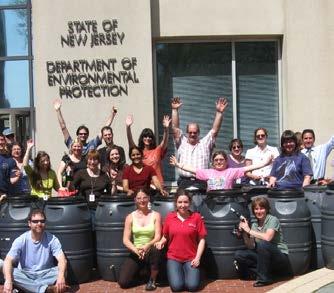
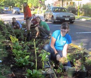
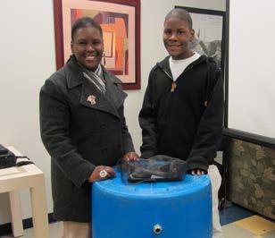
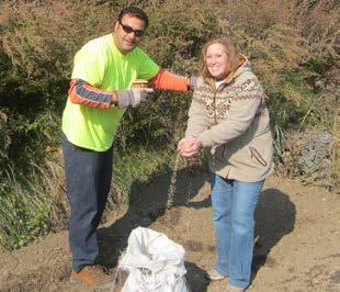
68 BUILD A RAIN BARREL WORKSHOP 68 With the Build a Rain Barrel Workshop, community members participate in a short presentation on stormwater management and water conservation and then learn how to build their own rain barrel. Workshop participants work with trained experts to convert 55 gallon plastic food-grade drums into rain barrels. They are able to take an active role in recycling rainwater by installing a rain barrel at their house! Harvesting rainwater has many benefits including saving water, saving money, and preventing basement flooding. By collecting rainwater, homeowners are helping to reduce flooding and pollution in local waterways. When rainwater flows across hard surfaces like rooftops, driveways, roadways, parking lots, and compacted lawns, it carries pollution to our local waterways. Harvesting the rainwater in a rain barrel is just one of the ways homeowners can reduce the amount of rainwater draining from their property and help reduce neighborhood flooding problems.


, and social studies (6.3) are addressed.")
69 STORMWATER MANAGEMENT IN YOUR SCHOOLYARD The Stormwater Management in Your Schoolyard program provides educational lectures, hands-on activities, and community-level outreach for students on the topics of water quality issues and stormwater management practices such as rain gardens and rain barrels. Program objectives include the exploration of various aspects of the natural environment on school grounds, the detailed documentation of findings related to these explorations, and the communication of these findings to the school community. As part of this program, several New Jersey State Core Curriculum Content Standards for science (5.1, 5.3, and 5.4), 21st-century life and careers (9.1, 9.3, and 9.4), and social studies (6.3) are addressed. Every school is unique in its need for stormwater management, so each school s Stormwater Management in Your Schoolyard program can be delivered in a variety of ways. This program can be tailored for grades K-8 or 9-12 and can be offered to meet a variety of schedules. 69
70 70
71 APPENDIX B: MAINTENANCE PROCEDURES 71


72 MAINTAINING GARFIELD S GREEN INFRASTRUCTURE SYSTEMS 1 Rain Garden Stormwater Planter Tree Filter Box 72 2 Rain Barrel Cistern 3 Porous Asphalt Underground Detention

 73 Annually Mulch in the spring to retain a 3-inch mulch layer in")

73 RAIN GARDEN / STORMWATER PLANTER / TREE FILTER BOX Weekly Water Weed Inspect for invasive plants, plant health, excessive sediment, and movement of sediment within the rain garden Observe the rain garden during rain events and note any successes (Example of success: stormwater runoff picks up oil and grease from the parking lot, flows through a curb cut, and into a rain garden; the rain garden traps the nonpoint source pollutants before they reach the nearby waterway) 73 Annually Mulch in the spring to retain a 3-inch mulch layer in the garden Prune during dormant season to improve plant health Remove sediment Plant Test the soil (every 3 years) Harvest plants to use in other parts of the landscape Clean debris from gutters connected to rain garden Replace materials (such as river rock and landscape fabric) where needed
 74 CISTERN In the fall prepare your cistern for the winter by diverting flow so no water can")

74 RAIN BARREL Keep screen on top and a garden hose attached to the overflow to prevent mosquitoes; change screen every two years Remove debris from screen after storms Disconnect the barrel in winter; store inside or outside with a cover Clean out with long brush and water/dilute bleach solution (~3%) 74 CISTERN In the fall prepare your cistern for the winter by diverting flow so no water can enter and freeze within the barrel Weekly check: Check for leaks, clogs and other obstructions, holes and vent openings where animals, insects, and rodents may enter; repair leaks with sealant; drain the first flush diverter/ roof washer after every rainfall event Monthly check: Check roof and roof catchments to make sure no debris is entering the gutter and downspout directed into the cistern; keep the roof, gutters, and leader inlets clear of leaves; inspect the first flush filter and all of its attachments and make any necessary replacements; inspect cistern cover, screen, overflow pipe, sediment trap and other accessories and make any necessary replacements


75 POROUS ASPHALT Materials cost is ~20-25% more than traditional asphalt Long-term maintenance is required by routine quarterly vacuum sweeping Sweeping cost may be off-set by reduced deicing costs Asphalt repairs can be made with standard asphalt not to exceed 10% of surface area Concrete repairs can be made with standard concrete not to exceed 10% of the surface area UNDERGROUND DETENTION Periodic inspections of the inlet and outlet areas to ensure correct operation of system Clean materials trapped on grates protecting catch basins and inlet area monthly Primary maintenance concerns are removal of floatables that become trapped and removal of accumulating sediments within the system; this should be done at least on an annual basis Proprietary traps and filters associated with stormwater storage units should be maintained as recommended by the manufacturer Any structural repairs required to inlet and outlet areas should be addressed in a timely manner on an as needed basis Local authorities may require annual inspection or require that they carry out inspections and maintenance 75
76
Draft Impervious Cover Reduction Action Plan for West New York, Hudson County, New Jersey
 Draft Impervious Cover Reduction Action Plan for West New York, Hudson County, New Jersey Prepared for the Town of West New York by the Rutgers Cooperative Extension Water Resources Program March 29, 2017
GREEN INFRASTRUCTURE FEASIBILITY STUDY GLOUCESTER CITY
 GREEN INFRASTRUCTURE FEASIBILITY STUDY GLOUCESTER CITY ACKNOWLEDGEMENTS This document has been prepared by the Rutgers Cooperative Extension Water Resources Program with funding provided by Surdna Foundation
Draft Impervious Cover Reduction Action Plan for West Long Branch Borough, Monmouth County, New Jersey
 Draft Impervious Cover Reduction Action Plan for West Long Branch Borough, Monmouth County, New Jersey Prepared for West Long Branch Borough by the Rutgers Cooperative Extension Water Resources Program
Draft. Impervious Cover Reduction Action Plan for Dunellen Borough, Middlesex County, New Jersey
 Draft Impervious Cover Reduction Action Plan for Dunellen Borough, Middlesex County, New Jersey Prepared for Dunellen Borough by the Rutgers Cooperative Extension Water Resources Program September 22,
Impervious Cover Reduction Action Plan for City of Vineland, Cumberland County, New Jersey
 Impervious Cover Reduction Action Plan for City of Vineland, Cumberland County, New Jersey Prepared for the City of Vineland by the Rutgers Cooperative Extension Water Resources Program May 23, 2016 Table
Impervious Cover Reduction Action Plan for Hampton Township, Sussex County, New Jersey
 Impervious Cover Reduction Action Plan for Hampton Township, Sussex County, New Jersey Prepared for Hampton Township by the Rutgers Cooperative Extension Water Resources Program November 8, 2016 Table
Draft Impervious Cover Reduction Action Plan for Newark, Essex County, New Jersey Volume 2
 Draft Impervious Cover Reduction Action Plan for Newark, Essex County, New Jersey Volume 2 Prepared for the City of Newark by the Rutgers Cooperative Extension Water Resources Program April 16, 2018 Table
Final Impervious Cover Assessment for Upper Deerfield Township, Cumberland County, New Jersey
 Final Impervious Cover Assessment for Upper Deerfield Township, Cumberland County, New Jersey Prepared for Upper Deerfield Township by the Rutgers Cooperative Extension Water Resources Program September
Draft Impervious Cover Assessment for West New York, Hudson County, New Jersey
 Draft Impervious Cover Assessment for West New York, Hudson County, New Jersey Prepared for the Town of West New York by the Rutgers Cooperative Extension Water Resources Program March 30, 2017 Introduction
Draft. Impervious Cover Reduction Action Plan for Fair Haven, Monmouth County, New Jersey
 Draft Impervious Cover Reduction Action Plan for Fair Haven, Monmouth County, New Jersey Prepared for Fair Haven by the Rutgers Cooperative Extension Water Resources Program June 10, 2016 Table of Contents
Draft Impervious Cover Assessment for North Plainfield Borough, Somerset County, New Jersey
 Draft Impervious Cover Assessment for North Plainfield Borough, Somerset County, New Jersey Prepared for North Plainfield Borough by the Rutgers Cooperative Extension Water Resources Program February 4,
Draft Impervious Cover Assessment for Fair Haven Borough, Monmouth County, New Jersey
 Draft Impervious Cover Assessment for Fair Haven Borough, Monmouth County, New Jersey Prepared for Fair Haven Borough by the Rutgers Cooperative Extension Water Resources Program March 15, 2016 Introduction
Impervious Cover Assessment for Salem City, Salem County, New Jersey
 Impervious Cover Assessment for Salem City, Salem County, New Jersey Prepared for Salem City by the Rutgers Cooperative Extension Water Resources Program August 10, 2016 Introduction Pervious and impervious
Draft Impervious Cover Reduction Action Plan for Newark, Essex County, New Jersey Volume 3
 Draft Impervious Cover Reduction Action Plan for Newark, Essex County, New Jersey Volume 3 Prepared for the City of Newark by the Rutgers Cooperative Extension Water Resources Program April 16, 2018 Table
Draft Impervious Cover Assessment for Mountainside Borough, Union County, New Jersey
 Draft Impervious Cover Assessment for Mountainside Borough, Union County, New Jersey Prepared for Mountainside Borough by the Rutgers Cooperative Extension Water Resources Program February 5, 2015 Introduction
Impervious Cover Assessment for Netcong Borough, Morris County, New Jersey
 Impervious Cover Assessment for Netcong Borough, Morris County, New Jersey Prepared for Netcong Borough by the Rutgers Cooperative Extension Water Resources Program August 12, 2016 Introduction Pervious
Draft Impervious Cover Reduction Action Plan for Newark, Essex County, New Jersey Volume 1
 Draft Impervious Cover Reduction Action Plan for Newark, Essex County, New Jersey Volume 1 Prepared for the City of Newark by the Rutgers Cooperative Extension Water Resources Program April 16, 2018 Table
Impervious Cover Assessment for Berlin Township, Camden County, New Jersey
 Impervious Cover Assessment for Berlin Township, Camden County, New Jersey Prepared for Berlin Township by the Rutgers Cooperative Extension Water Resources Program September 28, 2016 Introduction Pervious
Impervious Cover Assessment for Edison Township, Middlesex County, New Jersey
 Impervious Cover Assessment for Edison Township, Middlesex County, New Jersey Prepared for Edison Township by the Rutgers Cooperative Extension Water Resources Program February 1, 2015 Introduction Pervious
Draft Impervious Cover Assessment for Branchburg Township, Somerset County, New Jersey
 Draft Impervious Cover Assessment for Branchburg Township, Somerset County, New Jersey Prepared for Branchburg Township by the Rutgers Cooperative Extension Water Resources Program February 4, 2015 Introduction
Impervious Cover Assessment for Byram Township, Sussex County, New Jersey
 Impervious Cover Assessment for Byram Township, Sussex County, New Jersey Prepared for Byram Township by the Rutgers Cooperative Extension Water Resources Program December 9, 2016 *Funding provided by:
Draft Impervious Cover Assessment for East Amwell Township, Hunterdon County, New Jersey
 Draft Impervious Cover Assessment for East Amwell Township, Hunterdon County, New Jersey Prepared for East Amwell Township by the Rutgers Cooperative Extension Water Resources Program February 2, 2015
Impervious Cover Assessment and Reduction Action Plan for Woodstown, New Jersey
 Impervious Cover Assessment and Reduction Action Plan for Woodstown, New Jersey Christopher C. Obropta, Ph.D., P.E. obropta@envsci.rutgers.edu www.water.rutgers.edu March 24, 2015 Rutgers Cooperative Extension
Impervious Cover Assessment for Upper Deerfield Township, Cumberland County, New Jersey
 Impervious Cover Assessment for Upper Deerfield Township, Cumberland County, New Jersey Prepared for Upper Deerfield Township by the Rutgers Cooperative Extension Water Resources Program September 23,
GREEN INFRASTRUCTURE FEASIBILITY STUDY HARRISON
 GREEN INFRASTRUCTURE FEASIBILITY STUDY HARRISON ACKNOWLEDGEMENTS Designed to highlight green infrastructure opportunities within the Town of Harrison, this document has been prepared by the Rutgers Cooperative
Draft Impervious Cover Assessment for Woodbridge Township, Middlesex County, New Jersey
 Draft Impervious Cover Assessment for Woodbridge Township, Middlesex County, New Jersey Prepared for Woodbridge Township by the Rutgers Cooperative Extension Water Resources Program February 2, 2015 Introduction
GREEN INFRASTRUCTURE FEASIBILITY STUDY LITTLE FALLS
 GREEN INFRASTRUCTURE FEASIBILITY STUDY LITTLE FALLS ACKNOWLEDGEMENTS This document has been prepared by the Rutgers Cooperative Extension Water Resources Program with funding and direction provided by
Draft Impervious Cover Assessment for Millstone Township, Monmouth County, New Jersey
 Draft Impervious Cover Assessment for Millstone Township, Monmouth County, New Jersey Prepared for Millstone Township by the Rutgers Cooperative Extension Water Resources Program February 4, 2015 Introduction
INTRODUCTION TO GREEN INFRASTRUCTURE HOW WE CAN PROTECT OUR COMMUNITIES AND OUR WATERS Maywood Public Library Bergen County, New Jersey
 INTRODUCTION TO GREEN INFRASTRUCTURE HOW WE CAN PROTECT OUR COMMUNITIES AND OUR WATERS Maywood Public Library Bergen County, New Jersey Jeremiah D. Bergstrom, LLA, ASLA Rutgers Cooperative Extension Water
Planning, Design, and Construction of Green Infrastructure.
 Planning, Design, and Construction of Green Infrastructure www.water.rutgers.edu What is Green Infrastructure? an approach to stormwater management that is costeffective, sustainable, and environmentally
Sustainable Stormwater Management through Green Infrastructure. Jersey City Public School #5
 Green Infrastructure Site Evaluation Friday, October 25 th, 2013 Sustainable Stormwater Management through Green Infrastructure Jersey City Public School #5 FORMAT: (15 minutes) An Introduction to Stormwater
Green Infrastructure Overview
 Green Infrastructure Overview Christopher C. Obropta, Ph.D., P.E. obropta@envsci.rutgers.edu Jeremiah Bergstrom, LLA, ASLA jbergstrom@envsci.rutgers.edu February 26, 2016 Water Resources Program NJDEP
Homeowners Guide to Stormwater BMP Maintenance
 Homeowners Guide to Stormwater BMP Maintenance What You Need to Know to Take Care of Your Property Rain Barrel Dry Well Rain Garden Pervious Asphalt Porous Pavers City of El Monte Stormwater BMP Management
Appendices: Glossary. General Terms. Specific Terms. Low Impact Development Approaches Handbook
 67 67 General Terms Specific Terms 66 Low Impact Development Approaches Handbook The vocabulary of low impact development is evolving, and many terms are used interchangeably and to describe the same or
Green Infrastructure and Low-Impact Development Technologies
 Green Infrastructure and Low-Impact Development Technologies The guiding principles of these technologies is to manage stormwater at their sources using natural means, and establish conditions so that
Green Infrastructure & Low Impact Development
 Green Infrastructure & Low Impact Development CITY OF COVINGTON STORMWATER MANAGEMENT WHAT IS GREEN INFRASTRUCTURE? Green infrastructure uses vegetation, soils and natural processes to manage water and
Stormwater Runoff and the District of Columbia RiverSmart Homes Defined:
 Stormwater Runoff and the District of Columbia Stormwater runoff is rainwater that flows off impervious surfaces such as rooftops, driveways, roads, sidewalks and sometimes even lawns. Stormwater runoff
What is stormwater runoff? Why is it a problem? Available Financial Incentives for Stormwater BMP s Downspout Disconnection - up to $20
 What is stormwater runoff? Stormwater is any form of natural precipitation (including ice and snow melt) that flows across undeveloped or developed land. In a natural setting, a majority of the water seeps
5. LOW IMPACT DEVELOPMENT DESIGN STANDARDS
 5. LOW IMPACT DEVELOPMENT DESIGN STANDARDS Low Impact Development (LID) requires a shift in stormwater management away from conveying runoff to a small number of downstream points through hydraulically
Post Construction BMPs
 Post Construction BMPs Why are Post Construction BMPs important? With increased development brings the increase of impervious cover Parking lots, rooftops, driveways Storm water runoff volume increases
City of Petersburg, Virginia Stormwater Utility Program Residential Fee Credit Manual (Revised March 2014)
") City of Petersburg, Virginia Stormwater Utility Program Residential Fee Credit Manual (Revised March 2014) DEPARTMENT OF PUBLIC WORKS City Hall Annex- 103 West Tabb Street Petersburg, VA 23803 (804) 733
City of Petersburg, Virginia Stormwater Utility Program Residential Fee Credit Manual (Revised March 2014) DEPARTMENT OF PUBLIC WORKS City Hall Annex- 103 West Tabb Street Petersburg, VA 23803 (804) 733
SIMPLIFIED APPROACH TO STORMWATER MANAGEMENT FOR SMALL PROJECTS
 SIMPLIFIED APPROACH TO STORMWATER MANAGEMENT FOR SMALL PROJECTS Introduction As required by federal and state law, the Borough of Swarthmore has adopted regulations that affect stormwater runoff and surface
Introduction to Low Impact Development. Fred Milch. East Central Florida Regional Planning Council
 Introduction to Low Impact Development Fred Milch East Central Florida Regional Planning Council Low Impact Development (LID) Low impact development (LID) is a term used to describe a land planning and
Creating Tools for Urban and Suburban Communities to Reduce Flooding and Improve Water Quality in New Jersey
 Creating Tools for Urban and Suburban Communities to Reduce Flooding and Improve Water Quality in New Jersey Christopher C. Obropta, Ph.D., P.E. obropta@envsci.rutgers.edu www.water.rutgers.edu October
Stormwater Management Techniques WMPF LAND USE TRAINING INSTITUTE MARCH 14, 2018
 Stormwater Management Techniques WMPF LAND USE TRAINING INSTITUTE MARCH 14, 2018 Potential Impacts of New Development Urban development can significantly increase stormwater runoff Water quality considerations
Putting a LID on Stormwater Pollution. Michele Loudenback, RPES Stormwater Enforcement Water Quality Division
 Putting a LID on Stormwater Pollution Michele Loudenback, RPES Stormwater Enforcement Water Quality Division Outline Brief Regulatory History Conventional vs. Green Practices LID/GI Controls in Use Clean
Slow it, Spread it, Sink it using Green Stormwater Infrastructure
 Milly Archer Water Resources Coordinator Becky Tharp Green Infrastructure Collaborative Slow it, Spread it, Sink it using Green Stormwater Infrastructure Overview Defining LID and GSI Hydrology and impacts
Lesson 2: Stormwater Best Management Practices (BMPs)
") Lesson 2: Stormwater Best Management Practices (BMPs) Environmental Stewards Class Christopher C. Obropta, Ph.D., P.E. Extension Specialist in Water Resources 732-932-9800 ext. 6209 obropta@envsci.rutgers.edu
Lesson 2: Stormwater Best Management Practices (BMPs) Environmental Stewards Class Christopher C. Obropta, Ph.D., P.E. Extension Specialist in Water Resources 732-932-9800 ext. 6209 obropta@envsci.rutgers.edu
92 Minnesota Stormwater Manual
 92 Minnesota Stormwater Manual E. Landscaping Many of the previous practices could also be included in a general category that stresses the importance of stable landscapes with native vegetation. In many
Impervious Cover Project for Climate Resilience in New Jersey
 Impervious Cover Project for Climate Resilience in New Jersey Christopher C. Obropta, Ph.D., P.E. obropta@envsci.rutgers.edu www.water.rutgers.edu February 26, 2016 Rutgers Cooperative Extension Rutgers
STORMWATER TOOL. Rain Garden
 Rain Garden What is a Rain Garden? A rain garden is a shallow, planted depression that absorbs the water that flows from your roof or any hard surface, allowing it to drain directly into the soil. Rain
4. CONCEPT PLAN DEVELOPMENT
 4. CONCEPT PLAN DEVELOPMENT Concept Plan Step 1: Identify Site Constraints and Opportunities Review the existing site to identify constraints and opportunities for GI Practices to meet the RRv. Constraints
Use of Best Management Practices
 Use of Best Management Practices Presented at the ANJEC Flood Hazard Workshop Bordentown, NJ March 13, 2008 Stormwater BMPs "a technique, measure or structural control that is used for a given set of conditions
APPENDIX A. Proposed Guidance and LID checklists for UConn and Town of Mansfield
 APPENDIX A. Proposed Guidance and LID checklists for UConn and Town of Mansfield 22 Guidance Document for Low Impact Development Best Management Practices for UConn June, 2011 In 2007, the Connecticut
LOUISIANA STATE UNIVERSITY COMPREHENSIVE & STRATEGIC CAMPUS MASTER PLAN. APPENDIX G - Stormwater Study Findings & Stormwater Solutions
 LOUISIANA STATE UNIVERSITY COMPREHENSIVE & STRATEGIC CAMPUS MASTER PLAN APPENDIX G - Stormwater Study Findings & Stormwater Solutions LSU: MP Narrative July 2017 3.5 Open Space Existing Conditions The
Maintaining Your Neighborhood Stormwater Facilities How to identify stormwater facilities and keep them working
 Maintaining Your Neighborhood Stormwater Facilities How to identify stormwater facilities and keep them working Photo to go here Table of Contents Getting to know your Stormwater Facilities..3 Fences and
Stormwater Prevention and Control
 Stormwater Prevention and Control Principles of Stormwater Management Stormwater Fact Sheet No. 4 This fact sheet is No. 4 of a eight-part series focused on stormwater runoff problems and control strategies.
John F. Kennedy STEM High School Green Infrastructure Information Sheet
 John F. Kennedy STEM High School Green Infrastructure Information Sheet Location: 127 Preakness Avenue Paterson, NJ 07522 Ward: 2 Green Infrastructure Description: Bioswale and bioretention system series
Stormwater Low Impact Development - A Natural Solution
 Stormwater Low Impact Development - A Natural Solution Sarah U Ren Program Director The Watershed Center of Grand Traverse Bay 231-935-1514, suren@gtbay.org Our Mission: The Watershed Center advocates
Beyond Rain Gardens Advancing the Use of Compost for Green Infrastructure, Low Impact Development, & Stormwater Management
 Beyond Rain Gardens Advancing the Use of Compost for Green Infrastructure, Low Impact Development, & Stormwater Management VORS 2018 Stormwater Management Session 2 Stormwater Management, Green Infrastructure,
Green Infrastructure Recommendations For Parks and Public Spaces
 Green Infrastructure Recommendations For Parks and Public Spaces Issued by the Jersey Water Works Green Infrastructure Committee And Prepared by Meliora Design This document recommends ways to integrate
Managing Stormwater Runoff with Green Infrastructure "Enhancing Community Resiliency to the Changing Climate"
 Managing Stormwater Runoff with Green Infrastructure "Enhancing Community Resiliency to the Changing Climate" Presented at Stormwater Management on the Whale Pond Brook Watershed Meeting Christopher C.
FACT SHEET: Pervious Pavement with Infiltration
 FACT SHEET: Pervious Pavement with Infiltration DESCRIPTION Pervious pavement is a Green Infrastructure (GI) technique that combines stormwater infiltration, storage, and structural pavement consisting
Inspection and Maintenance of Stormwater Best Management Practices
 FAC T S H E E T Inspection and Maintenance of Stormwater Best Management Practices is a general term that refers to vegetated stormwater best management practices (BMPs) that temporarily store rainwater
Keele Campus Storm Drainage. Presented by Mark Hagesteijn September 24, 2013
 Keele Campus Storm Drainage Presented by Mark Hagesteijn September 24, 2013 1 Presentation Overview Urbanization Impact on the Hydrologic Cycle Why Do We Manage Stormwater? Typical Stormwater Management
Appendix D - Technical Design Criteria for BMPs
 Appendix D - Technical Design Criteria for BMPs City of Wayzata Page 3 On-site infiltration features Definitions and Scope: Infiltration facilities are constructed basins or depressions located in permeable
4.5 City of Indianapolis Stormwater Green Infrastructure Guidance: Bioretention (rain gardens) Bioretention Fact Sheet Bioretention Technical Design
 Bioretention Fact Sheet Bioretention Technical Design") 4.5 City of Indianapolis Stormwater Green Infrastructure Guidance: Bioretention (rain gardens) Bioretention Fact Sheet Bioretention Technical Design Specification Bioretention O & M Manual Draft Green
4.5 City of Indianapolis Stormwater Green Infrastructure Guidance: Bioretention (rain gardens) Bioretention Fact Sheet Bioretention Technical Design Specification Bioretention O & M Manual Draft Green
HEALTH SCIENCES BUILDING REDEVELOPMENT PROJECT
 INTRODUCTION In recent years, the University of Cincinnati (University) has demonstrated a commitment to identifying and implementing sustainable goals and objectives throughout University s Uptown Campuses.
Alpine Borough, Bergen County, NJ
 Alpine Borough, Bergen County, NJ Figure A-1: Proposed project areas in Alpine Borough. 99 DB1 DEMAREST BORO b c a CB1 ALPINE BORO CRESSKILL BORO Legend PROJECT SITES 0 385 770 1,540 2,310 3,080 TB3 Feet
Low Impact Development. Charlene LeBleu Auburn University Landscape Architecture (334)
") Low Impact Development Charlene LeBleu Auburn University Landscape Architecture leblecm@auburn.edu (334) 844-0192 What is Low Impact Development? Infiltrate Filter Store Evaporate Detain An innovative
Low Impact Development Charlene LeBleu Auburn University Landscape Architecture leblecm@auburn.edu (334) 844-0192 What is Low Impact Development? Infiltrate Filter Store Evaporate Detain An innovative
LID. Low Impact Development: Protecting Oregon s waters as we grow
 LID Low Impact Development: Protecting Oregon s waters as we grow LID Low Impact Development (LID) is an approach to land development that preserves natural resources and mimics natural systems for managing
Case Study: Dallas Green Infrastructure for Stormwater
 Case Study: Dallas Green Infrastructure for Stormwater Extension and Research Sandhya Mohan Fouad H. Jaber, PhD Biological and Agricultural Engineering Texas Agrilife, Texas A&M University System Urban
Maintaining Your Neighborhood Stormwater Facilities
 Maintaining Your Neighborhood Stormwater Facilities How to identify stormwater facilities and keep them working Layout by the Thurston County Storm and Surface Water Utility with thanks to the Delaware
Attachment 2: Permeable Pavement Design Guidelines
 Attachment 2: Permeable Pavement Design Guidelines Design of permeable pavement systems is critical if they are to function properly and efficiently. The area and shape are dependent on the site design,
County of Prince Edward. Stormwater Management Plan. Agreement in lieu of a Stormwater Management Plan
 County of Prince Edward Stormwater Management Program Date: E-Permitting Number: This stormwater management plan (Agreement) is hereby submitted by the Owner to specify the methods that will be implemented
Worksheet #14 Water Runoff Management
 Water Runoff Management Use this worksheet to assess how well your property minimizes the potential for water runoff and property damage.. Why should you be concerned? What can you do? Rural runoff, also
From and
 GREEN INFRASTRUCTURE IN PROVIDENCE, RI The Box Office From http://web.uri.edu/riss/the-box-office/ and http://www.morrisbeacon.com/media/portfolioprojects/implementation/box-office/box%20office.pdf: At
Small Town Sustainable Stormwater Solutions
 Small Town Sustainable Stormwater Solutions Kathryn Hamilton, RLA, ASLA Westmoreland Conservation District PA/DE ASLA Annual Meeting April 8-9, 8 2011 Urban, Industrial, Residential, Agricultural Flooding,
Climate Smart Communities Green Infrastructure Case Studies
 New York State Water Resources Institute Climate Smart Communities Green Infrastructure Case Studies Emily Vail Hudson River Estuary Program NYS Department of Environmental Conservation Cornell University
CHAPTER 11 SITE DESIGN AND LOW IMPACT DEVELOPMENT
 CHAPTER 11 SITE DESIGN AND LOW IMPACT DEVELOPMENT Source: City of Bend Chapter Organization 11.1 Purpose... 11-1 11.2 Applicability... 11-1 11.3 Low Impact Development Overview... 11-2 11.3.1 Key Strategies...
Sustainable Stormwater Retrofit Best Practices
 Sustainable Stormwater Retrofit Best Practices Presenter Zach Sample, PE Stormwater Products Manager XP Solutions XP Solutions has a long history of Providing original, high-performing software solutions
Structural Stormwater Best Management Practices
 Structural Stormwater Best Management Practices for Small Commercial and Residential Applications Timothy Bruno Watershed Manager PA Department of Environmental Protection What are STRUCTURAL BMPs? Physical
Urban Water Management and Soils (ESRM 311 & SEFS 507)
") Urban Water Management and Soils (ESRM 311 & SEFS 507) Cougar Mtn Regional Wildland Park & Lakemont Blvd, Bellevue WA Lecture Today Some Urban Water management terms Examples of water management in urban
Urban Water Management and Soils (ESRM 311 & SEFS 507) Cougar Mtn Regional Wildland Park & Lakemont Blvd, Bellevue WA Lecture Today Some Urban Water management terms Examples of water management in urban
2
 1 2 3 The water used for watering landscapes accounts for a significant percentage of total water demand. Every year, Aurora citizens use about 40% of their potable water for irrigating lawns and gardens.
RAIN GARDEN ILLINOIS URBAN MANUAL PRACTICE STANDARD. (feet) CODE 897 DEFINITION
 CODE 897 DEFINITION") ILLINOIS URBAN MANUAL PRACTICE STANDARD RAIN GARDEN (feet) CODE 897 Source: Kendall County Soil and Water Conservation District DEFINITION Rain gardens are small, shallow, flat bottomed depressions constructed
ILLINOIS URBAN MANUAL PRACTICE STANDARD RAIN GARDEN (feet) CODE 897 Source: Kendall County Soil and Water Conservation District DEFINITION Rain gardens are small, shallow, flat bottomed depressions constructed
Urban Watershed Mentors
 Urban Watershed Mentors Bureau of Environmental Services Josh Robben Urban Stormwater background Stormwater retrofits Site assessment Design considerations Maintenance considerations Resources/programs
Green City, Clean Waters
 Green City, Clean Waters Green Infrastructure Maintenance Manual Consent Order & Agreement Deliverable VIII City of Philadelphia Combined Sewer Overflow Long Term Control Plan Update Submitted to The Commonwealth
BE WATER WISE. Managing Your Onlot Stormwater. Sept. 23, 2006 Watershed Weekend
 BE WATER WISE Managing Your Onlot Stormwater Sept. 23, 2006 Watershed Weekend 2006 1 All water resources are interrelated through the Hydrologic Cycle Sept. 23, 2006 Watershed Weekend 2006 2 What is Storm
Tips for Maintaining and Enhancing Stormwater Management Areas
 4 4 N. Second Street, Denton, Md. 21629 (410) 479-3625 (410) 479-3534 fax www.dentonmaryland.com Tips for Maintaining and Enhancing Stormwater Management Areas Information provided by the Town of Denton
Kittson Parkway / Watershed Park Parking Lot
 Kittson Parkway / Watershed Park Parking Lot Date Constructed: Summer 2005 Site Location / Description: Kittson Parkway, North Delta, British Columbia. Permeable parking lot adjacent to Watershed Park;
Evaluating Low Impact Development Practices for Stormwater Management on an Industrial Site in Mississippi
 Evaluating Low Impact Development Practices for Stormwater Management on an Industrial Site in Mississippi Dennis S. Painter, Tennessee Valley Authority, Nashville, Tennessee Donald Becker, Tennessee Valley
Going Green with the NYS Stormwater Design Standards
 Going Green with the NYS Stormwater Design Standards Shohreh Karimipour, P.E. NYSDEC History of Stormwater Management Ancient Greek Cisterns Water Cistern Systems in Greece from Minoan to Hellenistic Period,
12/31/2014 County of Mendocino s Low Impact Design Standards Manual v1.0 A P P E N D I X 8. Site Design Measures. 32 P a g e
 12/31/2014 County of Mendocino s Low Impact Design Standards Manual v1.0 A P P E N D I X 8 Site Design Measures 32 P a g e Rooftop and Impervious Area Disconnection (Self-retaining areas) Description Disconnection
2016 WORKSHOP LVR Field Trip
 2016 WORKSHOP LVR Field Trip ***Note*** Many of the sites on this tour were NOT related to, or funded by, the DGLVR program. They are being shown to encourage discussion about the kinds of projects that
A couple of hours to pull weeds and fertilize with compost
 2. A NATURAL LAWN Reducing Your Use of Weed Killers and Fertilizers on Your Lawn WHY ACT? If you have a lawn, you may be using weed killers and fertilizers to keep it green and weed-free. Unfortunately,
HIGHLAND LAKES WATERSHED ORDINANCE WATER QUALITY MANAGEMENT TECHNICAL MANUAL
 Effective July 1, 2007 HIGHLAND LAKES WATERSHED ORDINANCE WATER QUALITY MANAGEMENT TECHNICAL MANUAL EFFECTIVE JULY 1, 2007 FIFTH EDITION Lower Colorado River Authority TABLE OF CONTENTS DESIGN SPREADHEET
Raingardens. Conserving and Protecting Water L
 L-5482 08-08 Raingardens Justin Mechell, Extension Assistant, and Bruce Lesikar, Extension Program Leader for Biological and Agricultural Engineering,The Texas A&M University System A raingarden is an
COMMUNITY DEVELOPMENT DEPARTMENT POLICY DRAINAGE FOR RESIDENTIAL PROJECTS WITH ONE OR TWO UNITS REVISED JANUARY 4, 2018
 COMMUNITY DEVELOPMENT DEPARTMENT POLICY DRAINAGE FOR RESIDENTIAL PROJECTS WITH ONE OR TWO UNITS REVISED JANUARY 4, 2018 A. California Residential Code Requirement - Construction plans shall indicate how
RAIN GARDENS. Task: PART 1 (60 minutes) Student Directions: Steps you will be following: Directions for beginning: Source Information:
 Student Directions: Steps you will be following: Directions for beginning: Source Information:") PART 1 (60 minutes) Student Directions: Your assignment: Steps you will be following: Your neighborhood council is researching the benefits of installing rain gardens in your community. You will read two
PART 1 (60 minutes) Student Directions: Your assignment: Steps you will be following: Your neighborhood council is researching the benefits of installing rain gardens in your community. You will read two
Camden SMART Initiative Stormwater Management and Resource Training
 Camden SMART Initiative Stormwater Management and Resource Training www.camdensmart.com Camden s Struggle with Stormwater 1 The City of Camden is served by a combined sewer system, which uses the same