eastsussex.gov.uk Guide to Sustainable Drainage Systems in East Sussex
|
|
|
- Delilah McCarthy
- 6 years ago
- Views:
Transcription


1 eastsussex.gov.uk Guide to Sustainable Drainage Systems in East Sussex June 2015
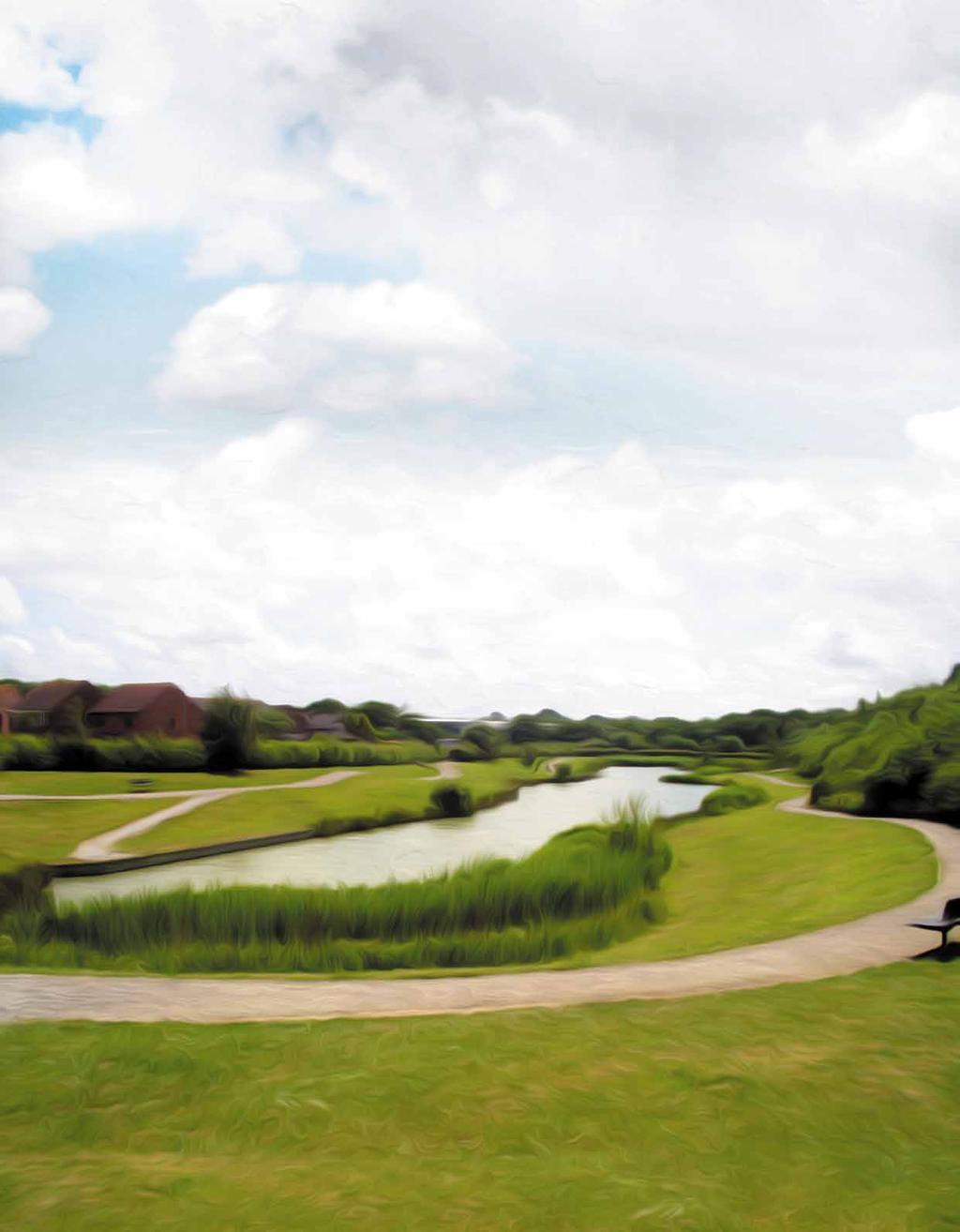
2 Contents 1. Introduction SuDS and the East Sussex Environment SuDS Delivery SuDS Approval Process Appendix A: Key Legislation, Policy and Guidance Appendix B: Guidance documents Cover photography Balancing pond at Grovelands Farm, Hailsham, East Sussex (Original source: Revai Kinsella, East Sussex County Council) Section divider photography 1. Introduction Swale at Ore Valley, Hastings, East Sussex. (Original source: Les Norman, Environment Agency) 2. SuDS and the East Sussex environment Wetland at Hellingly hospital, East Sussex (Original source: Revai Kinsella, East Sussex County Council) 3. SuDS Delivery Wetland at Camber, East Sussex (Original source: Nick Botting, Romney Marshes Area Internal Drainage District) 4. SuDS Approval Process Swale at Elvetham Heath, Hampshire (Original source: A. Appendix A: Key Legislation, Policy and Guidance Pond at Welbury Farm, Hailsham, East Sussex (Original source: Revai Kinsella, East Sussex County Council) B. Appendix B: Guidance documents Detention basin at Welbury Farm, Hailsham, East Sussex (Original source: Revai Kinsella, East Sussex County Council) 2
3 Guide to Sustainable Drainage Systems in East Sussex About the Guide Who is this guide for? This guide is aimed at applicants, architects, developers and planners who want to design and put in place sustainable drainage systems (SuDS) in East Sussex. What will this guide tell you? This guide explains what SuDS are, why they are important and the process of designing and implementing SuDS within the East Sussex environment. It also sets out the drainage approval process and its requirements in relation to SuDS. In addition, the multiple benefits of SuDS to developers, residents and the environment of East Sussex are highlighted. Why do you need to read this guide? The National Planning Policy Framework (NPPF) states that when determining planning applications, local planning authorities (LPAs) should ensure that flood risk is not increased elsewhere. Furthermore LPAs should utilise opportunities offered by new development to reduce the causes and impacts of flooding. SuDS are one way of managing flood risk associated with new developments. With this in mind, this guide will help developers wishing to include SuDS as part of minor as well as major development. Through the Secretary of State for Communities and Local Government s ministerial statement of 18 December 2014, the government expects SuDS to be delivered wherever appropriate as part of major development (as defined by The Town and Country Planning (Development Management Procedure) (England) Order 2015). East Sussex County Council (ESCC) as the lead local flood authority (LLFA) is a statutory consultee to the planning system on drainage matters. The judgement of what is reasonably practicable should be referenced to planning practice guide (PPG) and nonstatutory technical standards for the design, maintenance and operation of SuDS. What is contained in this guide? There are four sections to the guide: 1. Introduction: This section sets out the background behind the guide, a brief overview of SuDS, the benefits they can provide and the different roles in the SuDS delivery process. 2. SuDS and the East Sussex environment: This section includes information about the environment in East Sussex to help SuDS be designed appropriately. 3. SuDS delivery: This section sets out the main items to consider when designing and putting in place SuDS in East Sussex. 4. SuDS approval process: This section explains how the application and approval process will work, what is needed to get approval and how SuDS approval works with the planning process. 3


4 Guide to Sustainable Drainage Systems in East Sussex 4


5 1 Introduction 5
6 Introduction Why do we need SuDS in East Sussex? Over time, the area of impermeable surfaces in the towns and villages of East Sussex has increased as a result of development. This prevents rain water from soaking into the ground and contributes to surface water running off speedily to ditches, rivers and sewer networks. In the same way, traditional drainage methods are designed to convey water to receiving watercourses quickly. This has the following consequences: An increase in both the amount of water that enters drainage systems and rivers and the speed of the area s response to storms. This puts pressure on the (often old) drainage infrastructure to perform effectively, and consequently surface water flooding can happen. Pollutants are washed from these hard surfaces and are concentrated where water flows combine. These are eventually discharged into watercourses or coastal waters, resulting in poor water quality. The reduction of green spaces also harms our environment and wildlife habitats. Current climate change predictions show that whilst the overall trend is towards a more drought prone south east of England, the increased energy in weather systems (such as temperature, moisture, clouds, precipitation, wind speed, air pressure, and wind direction) will lead to more unpredictable and extreme weather events, such as heavy summer rainfall. This means that many of our communities will have an increased risk of flooding, and it is essential that new development does not add to that risk. The population of the county is set to grow by some 4%, (to 553,300) by 2027, and we can expect that there will be more development to meet the demand for housing and employment. It is in the interest of planners, developers, local communities, businesses, the County Council, the Environment Agency and utility providers (to name but a few) to make sure that development pressures in the county do not lead to an increase in flood risk. What are SuDS? SuDS are the most effective way to manage rainfall where it falls. They are made up of interconnected features that surface water flows through. Each feature reduces pollution, flow rates, the volume of water and improves water quality. In this way, SuDS can be used to manage the environmental risks caused by surface water run-off from new and existing development and, in many cases, can be designed to enhance the environment into which they are placed. SuDS mimic natural catchment processes by 1 : allowing water to soak into the ground (infiltration); storing water and releasing it slowly (attenuation); slowly transporting (conveying) water on the surface; filtering out pollutants; allowing sediments to settle out by controlling the flow of the water; forming attractive environments that provide pleasant, open spaces and valuable wildlife habitats. SuDS are designed with three main objectives in mind, which are: to control the quantity and rate of surface water run-off from a development; to improve the quality of the surface water run-off; to contribute to the nature conservation, landscape and amenity value of the development site and its surroundings
7 Introduction The SuDS treatment train The SuDS treatment train (sometimes called the management train) sets out the order in which SuDS features should be delivered to best mimic natural drainage processes, and so is an important concept for SuDS designers to follow. The treatment train is illustrated in the figure below. 1. Prevention Good housekeeping and site design to reduce and manage runoff and pollution (e.g. land use planning, reduction of paved surfaces). 2. Source control Runoff managed as close as possible to prevent migration of pollution (e.g. using green roofs, rainwater harvesting, permeable paving, filter strips). 3. Site control Runoff managed in a network across a site using a series of SuDS features in sequence. By providing several SuDS in a series, treatment is enhanced. By slowing down water, sediment will settle out, and by passing water through a variety of features, different treatment mechanisms will be used (e.g. vegetation or gravel filtration). 4. Regional control Downstream management of runoff for a whole site/catchment (e.g. retention ponds, wetlands). Source: Adapted from CIRIA C687: Planning for SuDS making it happen 7


8 Guide Introduction to Sustainable Drainage Systems in East Sussex Bedrock Superficial deposits Groundwater 1. Swales and filter trenches 2. Storage of water for re-use for example rainwater harvesting 3. Storage of water in ponds 4. Infiltration basins and soakaways 5. SuDS improve the quality of water in rivers and decreases the peak discharge 6. Green roofs 7. Permeable paving 8


 SuDS manual details several techniques that can be used in the 1 3 5 7")
9 Guide to Sustainable Drainage Systems in Introduction East Sussex SuDS techniques The treatment train can comprise of several SuDS techniques, depending on the development site. This illustration demonstrates some techniques that can form part of the treatment train. For further guidance, the Construction Industry Research and Information Association s (CIRIA) SuDS manual details several techniques that can be used in the treatment train Source: Adapted from the British Geological Survey website 9
10 Introduction The benefits of SuDS As described in the regional SuDS guide Water.People.Places. (WPP), prepared by the south east lead local flood authorities, well-designed SuDS are multi-functional. Their inclusion as part of an urban-design toolkit and keeping water management above ground means that SuDS can be used to improve the surrounding environment and provide a host of additional benefits. The following table summarises those benefits identified in WPP. Table 1.1: Benefits of SuDS Attenuation Storing and slowly releasing surface water runoff is one of the primary benefits that SuDS offer. The storage may be in plants, soil or constructed spaces and release may be through infiltration, plant up-take or controlled discharge. Water treatment Pollution typically found in runoff can be harmful to watercourses, groundwater and coastal waters. The soils, gravels, and vegetation present in many forms of SuDS act as filters, removing pollutants, and returning cleansed water to the natural environment. Infiltration SuDS can be used to first cleanse rainwater runoff and then to promote infiltration into the ground to replenish groundwater, in so doing capturing water which would otherwise have been prevented from soaking into the ground by impermeable development. Water reuse Many SuDS features can be used locally to capture, treat and manage water for re-supply of cleansed water to buildings or landscapes. Rainwater harvesting can be installed at a range of scales and re-using rainwater, for non-drinking (non-potable) purposes such as watering land and toilet flushing, will help reduce potable water demand. Biodiversity and Habitat SuDS can be designed to include a range of natural processes for managing and filtering surface water runoff. The inclusion of plants, trees, and other vegetation will often help to slow and store water while providing filtration. These features can also be designed to support local biodiversity aims. For instance, SuDS treatment trains can be used to develop ecological corridors as well. Amenity SuDS that integrate greenery or water features can improve the visual character of a development and in doing so they can also increase a property s value. Access to green space, views of a high quality public realm and street trees have all been shown to increase the resale value of properties. Education Open space SuDS present an opportunity to educate and engage communities in water management and to stimulate a greater appreciation and respect for urban (city or town) water. If schools and colleges incorporate SuDS on their premises they can be viewed as a valuable learning opportunity for children and students. Designing green and public space with SuDS that work well when both wet and dry can provide a valuable community recreational space as well as important environmental infrastructure. SuDS can also contribute to development targets for open space where they are designed to be multi-functional. 10
11 Introduction Who benefits from SuDS? Although there are challenges to implementing SuDS, everyone in the community can benefit from them. Examples of these benefits are outlined below. Home owners If surface water is not discharged to sewers, householders can receive a reduction in their bills from the local Water and Sewerage Company, for East Sussex this is Southern Water. For many households, water metered bills can also be reduced by making more efficient use of rainwater. Rainwater harvesting can be installed at a range of scales and re-using rainwater for non-potable purposes such as garden watering and toilet flushing will help reduce potable (drinking) water demand. Developers Rising utility bills for energy and water have made house buyers more aware of the operational costs of properties. SuDS often provide an attractive economical feature for buyers and in turn can help to drive desirability and demand for properties in specific developments. Development that integrates SuDS using greenery or water features can improve the visual character of the site and in doing so can increase income from higher property values. Access to green space, views of high quality public realm and street trees have all been shown to increase the re-sale value of properties. Views of green space and water have been shown to increase commercial rents between 15 and 35% (WPP, page 10). Flood risk management authorities SuDS can be a means of managing flood risk to communities. This is done through a design which considers flood risk and safely manages surface water flows when the capacity of drainage system is exceeded. Water companies Many SuDS features can be used to capture, treat and manage water for re-supply of cleansed water to buildings or landscapes. Companies that manage wastewater networks may benefit from the separation of surface water from polluted water flows, as this would reduce the risk of foul sewer overloading and flooding. Where separation is not possible, attenuation can be put in place as part of a SuDS scheme and this also reduces the risk of sewer overloading and flooding. Wildlife SuDS can be designed to have significant wildlife benefits. They can be designed to provide shelter and a place for invertebrates, amphibians, reptiles, birds and mammals to forage and breed. Although SuDS are typically low nutrient systems, reedbeds can be incorporated to provide wildlife value and diversity. Tourists and visitors When designed with their environmental and landscaping setting in mind, SuDS can create attractive places which are rich in character and wildlife. Such places provide a pleasant environment for people to enjoy. 11
12 Introduction Who are the stakeholders for SuDS in East Sussex? Table 1.2: SuDS stakeholders and their roles Stakeholder Organisation Role Lead Local Flood Authority (LLFA) Planning Authority Highway Authority East Sussex County Council (ESCC) East Sussex County Council; Lewes District Council; Eastbourne Borough Council; Wealden District Council; Hastings Borough Council; Rother District Council; and South Downs National Park Authority (SDNPA) East Sussex County Council ESCC is the LLFA as defined by the Flood and Water Management Act As the LLFA, ESCC has a strategic role in the management of local flood risk with the following responsibilities, among others: developing, maintaining and implementing a local flood risk management strategy, investigating flood incidents, to the extent it considers necessary and appropriate, consenting works on ordinary watercourses, designating structures and features that have a significant impact on flood risk, and maintaining a register of assets that have a significant impact on flood risk. ESCC as the LLFA is a statutory consultee of the planning system on surface water drainage and local flood risk. The seven planning authorities in East Sussex are responsible for planning and managing development within their respective administrative areas. They develop Local Plans which set out the preferred planning policies and development sites within their areas. As part of the development management process, they determine planning applications which will include flood risk and surface water drainage considerations. District and borough councils are also responsible for building control within their districts and enforcing Building Regulations. East Sussex County Council as a planning authority is responsible for waste and minerals development and all county council development such as roads, schools and libraries. SDNPA has delegated its planning responsibilities to Lewes District Council within Lewes district and East Sussex County Council on waste and minerals development and county council development within the national park area in East Sussex. SDNPA deals in-house with applications in Wealden District and Eastbourne Borough. Districts and boroughs are also coastal protection authorities with operational powers to protecting the coast against erosion. They produce policy statements outlining their priorities for flood and coastal defence. As the Highway Authority, East Sussex County Council is responsible for managing works on the public highway, and maintaining the public highway. It is also responsible for regulating the activities of developers on the public highway and adopting, through section 38 agreements, new highways offered for adoption by the developer. Highways England is responsible for all the trunk roads within the county such as the A21, A259, A26 and A27 12
13 Introduction Stakeholder Organisation Role Environmental Regulator Sewerage Undertaker Internal Drainage Boards (IDB) Conservation Organisations Environment Agency (EA); Solent and South Downs area office; and Kent and South London area office Southern Water Upper Medway IDB; Romney Marshes IDB; and Environment Agency for Internal Drainage Districts (IDD) covering the River Ouse, Pevensey Levels and River Cuckmere* Natural England; South Downs National Park Authority and High Weald Joint Advisory Committee; and Local Nature Partnerships The EA has a strategic overview over all forms of flooding. It also has an operational role on flood and coastal risk management, which is limited to main rivers, the sea and reservoirs. As such, the EA is responsible for regulating activities affecting main rivers and the sea and tidal defences. This includes supporting planning authorities on flood risk matters. Under the Water Framework Directive, the EA is responsible for protecting and enhancing the water environment, including groundwater. As such, it regulates all activities affecting the water quality of controlled water bodies. Southern Water as the sewerage undertaker is responsible for the maintenance and regulation of activities affecting public sewers. Any drainage system discharging into the public sewer, directly or indirectly, needs to be agreed to by Southern Water. As such, Southern Water should be consulted at the earliest stage to secure outfalls before a master plan is fixed. IDBs are responsible for managing water levels in IDD areas for land drainage, flood risk management, irrigation and environmental benefit. They regulate any activities that will have an impact on land drainage within their districts. As such, IDBs should be consulted at the earliest stage on all drainage proposals within their catchments. Natural England is responsible for enhancing biodiversity, landscape and wildlife in rural, urban, coastal and marine areas. It has powers to manage activities that affect areas designated for environmental conservation purposes such as Special Sites of Scientific Interest (SSSI), Special Areas of Conservation (SACs), Ramsar sites and Special Protection Areas (SPAs). SDNPA has statutory responsibilities to conserve and enhance the natural beauty, wildlife and cultural heritage within the national park. The High Weald Joint Advisory Committee is a partnership between 15 local authorities within the High Weald Area of Outstanding Natural Beauty (AONB), Natural England and community organisations. The committee produced a High Weald AONB Management Plan which sets out the long term objectives for conserving the High Weald. * Environment Agency IDDs are currently under review and are most likely to be replaced by independent IDBs 13
 are partnerships of a broad range of local organisations, businesses and people who aim to help bring about improvements in their local")
14 Introduction Stakeholder Organisation Role Conservation Organisations Developers Public and Communities Natural England; South Downs National Park Authority and High Weald Joint Advisory Committee; and Local Nature Partnerships Local Nature Partnerships (LNPs) are partnerships of a broad range of local organisations, businesses and people who aim to help bring about improvements in their local natural environment. They work strategically to make sure that its value and the value of services it provides to the economy and the people who live there, is taken into account in local decisions such as planning and development. Developers set the vision for a development from the time they acquire the site. They generally provide the leadership during the delivery of a development. As such, they are responsible for the delivery of a surface water management plan which maximises SuDS benefits on their development. Communities are the ultimate users of surface water drainage systems. Drainage designs that consider the community around them will create enjoyable and sustainable places for the community. * Environment Agency IDDs are currently under review and are most likely to be replaced by independent IDBs Most of these SuDS stakeholders have produced policy and guidance documents specific to East Sussex that need to be taken into consideration during SuDS design and implementation. Table 3A.1 (Section 3) lists some of the information available from the stakeholders. Pond at Valley Park, Rye, East Sussex (Source: Nick Botting, Romney Marshes Area Internal Drainage Board) 14
15 Introduction Who should be involved in designing SuDS? To deliver the benefits SuDS can provide it is vital that the design team uses the expertise required for the development site and proposal. An ideal design team will vary from project to project dependent on site characteristics, but could include those set out in the figure below. Archaeologists Drainage Engineers Landscape Architects Urban Designers Highway Engineers Developers Geotechnical Engineers SuDS DESIGN TEAM Ecologists Architects Planners If SuDS are to be successfully integrated within development proposals it is essential that the design team has expertise in landscaping, ecology, urban design and planning. Although a drainage engineer must be included in the design team, input from experts in these other fields at the right stage will add significant value to the SuDS selection and design process. Although this guide provides information about the many design tasks and issues to be considered as part of a SuDS design, it is important to be aware that some will be relevant for larger developments and fewer SuDs may be necessary for smaller developments. The designer must determine what is relevant while considering the overall SuDS design standards to be met. Whether SuDS are designed for a small development of a few houses or a large multi-unit development, they need to take account of the local environment, local policies, planning practice guidance and the non-statutory technical standards for SuDS. They should also attempt to include as many of the benefits listed in table 1.1. SuDS should be designed to last, even when they will not be adopted. This requires the production of operation and maintenance plans which have been clearly communicated and can be easily understood by property owners and asset managers. It is important that this guide is consulted at an early stage of SuDS design so that the key messages relevant to SuDS in East Sussex are known and the importance of early engagement of SuDS stakeholders and consideration of SuDS from the very start are realised. 15


16 16


17 2 SuDS and the East Sussex Environment 17


18 SuDS and the East Sussex Environment General overview East Sussex needs to accommodate more houses, provide more employment floor space and ensure that the necessary infrastructure is in place to support new growth over the coming decades. To ensure growth and development do not increase the overall level of flood risk within the county, or decrease the quality of inland and coastal waters, drainage design must complement the environment. The geological, hydrological, topographical, and archaeological features of East Sussex have a direct bearing on the design of SuDS, as do the requirements of nature conservation and ecology. Geology SuDS that allow water to soak or infiltrate into the ground rely on the subsurface to accept and store surface water. Ground conditions are therefore important to decide where infiltration-based SuDS can be located. The physical and hydro-geological properties of the ground determine how easily water will soak into the ground, and whether or not the use of infiltration SuDS will have an effect on ground stability and water quality. The map below shows the geology of the county, but SuDS designers should always undertake site investigations to understand the geology and permeablity of soils within a specific site. 18

19 SuDS and the East Sussex Environment The following map takes the geology map a stage further, and sets out the appropriateness of infiltration SuDS within the county. However, in the wrong location infiltration can lead to ground stability problems. The following map indicates areas of ground instability, where the use of infiltration drainage will need to be more carefully considered. The ground stability score noted on the map is defined in terms of the potential for geo-hazard. Therefore, when designing and constructing SuDS in an area with a high score, developers must understand the risks and take appropriate steps to avoid them. 19
20 SuDS and the East Sussex Environment Groundwater When planning SuDS it is important to be aware of how close Environment Agency Source Protection Zones (SPZs) are to the site. These are areas around groundwater sources, such as wells, boreholes and springs used for public drinking water supply. Maps of the location of these zones can be viewed by visiting the Environment Agency pages on the government website ( These zones show the risk of contamination to water resources from any activities including SuDS. The closer the activity is to the source, the greater the risk. The level of hazard and the SPZ the site is located in will help to define the number of SuDS treatment stages required in the design. High groundwater can limit the effectiveness of infiltration SuDS techniques. Therefore a better understanding of potential groundwater levels at a development site is needed. The map below shows the potential groundwater levels in East Sussex. If groundwater is shown to be within 3 metres of the surface on the map below, groundwater monitoring will need to be carried out as part of a drainage feasibility assessment. Engagement with East Sussex County Council and the Environment Agency should be made at an early stage, in order to agree the requirements for groundwater monitoring and the appropriateness of the drainage arrangements being proposed. In some cases monitoring may need to continue through the construction phase, to confirm that there are no negative effects arising from the development. 20

21 SuDS and the East Sussex Environment Topography As well as geology, SuDS design demands consideration of topography. Flat sites will prevent the effective conveyance of water over any distance, so managing surface water as close to the source as possible is an important design consideration. Increased runoff velocity on steep sites will need to be reduced. Staged storage and creating terraced platforms for SuDS features may be necessary to reduce flow velocities. Considering topography at the outset is essential in arriving at an effective SuDS solution. East Sussex has a diverse topography which can be attributed to its geology. The plan below shows this diversity and demonstrates the location of the flat, lowland (Ouse and Cuckmere Rivers, Pevensey Levels, and Romney Marshes) and the more elevated sloping land (The South Downs and High Weald). Landscape and ecology Leading on from geology and topography, the landscape of East Sussex is rich, diverse and nationally significant. The South Downs National Park and the High Weald Area of Outstanding Natural Beauty form two thirds of the county s area. The rest of the county consists of many areas of varied, attractive landscapes valued for their ecological, cultural significance, and geological and/or geomorphological interest. Details of local Landscape Character Assessments is available from and National Landscape Character Assessments (NCAs) can be found from the Natural England page on the government website ( The South Downs portion of East Sussex has its own integrated landscape character assessment available from NCAs provide the background information for more detailed local Landscape Character Assessments. 21
22 SuDS and the East Sussex Environment East Sussex is split into five NCAs each with its own varying landscape and townscape character: The South Downs, Pevensey Levels, High Weald, Low Weald and Romney Marshes. An objective of planning policy in East Sussex is to ensure that development does not negatively affect the character of the landscape or townscape and provides net gains in biodiversity where possible. Developers must consider the character of the site s environment, ensuring proposed development suits the nature of the existing site and surroundings. So it is important that design teams have an understanding that SuDS features can have on the overall character and appearance of a development proposal. Consideration must be given to the impact of the development on the ecology of the county. There are many important habitats in East Sussex and proposals should not lead to their decline. In some locations development proposals may have the potential to negatively affect the status of a water body, under the Water Framework Directive. However, carefully designed SuDS will avoid these problems. The county is characterised by a variety of environmental and landscape designations including Areas of Outstanding Natural Beauty (AONB) and the National Park. These areas are designated for the purpose of conserving and enhancing their natural beauty, including vegetation. Consequently, native species need to be taken into account when undertaking planting design and selecting plant species as part of a development. The map below of East Sussex shows the categories of landscape, including special protective areas (SPA), areas of natural beauty (AONB) and the South Downs National Park. There may be restrictions on the type of SuDS that can be used in these areas, and it is important that these are investigated on a site specific basis, for every new development. 22
23 SuDS and the East Sussex Environment Flood risk Flood risk is something which must be considered in the design of SuDS. Strategic Flood Risk Assessments (SFRAs) have been prepared by the local planning and county planning authorities, to support their development plans. These must be reviewed during SuDS appraisal stage, as they provide broad information on flood risk (level 1) and greater detail (level 2) on individual development sites. The main flood risk types are fluvial, coastal, surface water and groundwater. Details on coastal and fluvial flood risk can be found on the Environment Agency pages on the government website ( National planning policy sets out strict criteria, which explains when development is acceptable in floodplains for rivers. While SuDS can be used in these locations to manage everyday rainfall, they will be overwhelmed during high rainfall or flood events, and this must be factored into their design. Surface water flood risk is a key consideration for SuDS selection. High intensity rainfall which results in significant runoff that is unable to drain into the ground effectively is very common. This usually is the result of the combination of new development using existing and insufficient drainage systems, significant changes in weather patterns and the increasing vulnerability of receptors. At the initial design stage, it is important to know if the site is in, or upstream of, local surface water flood risk areas as there may be extra surface water runoff restrictions. This may influence the placement or design criteria for SuDS. The map of surface water flood risk is also available from the Environment Agency pages on the government website. The County Council (as Lead Local Flood Authority) may have information about surface water issues in certain areas, as does Southern Water. 23


24 SuDS and the East Sussex Environment Flooding from groundwater rising above the surface often happens in low-lying areas, close to hills, which are underlain by permeable rocks. This typically happens after long periods of extensive and significant rainfall. The map below shows the areas which are most susceptible to groundwater flooding, and can be closely linked with the floodplains of the county s rivers and low lying coast, and the base of the chalk downland. For example, at the base of the South Downs, emerging or seasonal springs appear. In such areas SuDS should be designed to take account of the particular ground conditions, and may need to be situated on the surface or at shallow depth. Infiltration is not a suitable technique in this instance. Archaeology East Sussex is rich in archaeological remains. This may preclude the use of some SuDS measures due to the need to preserve archaeological remains. When preservation is not possible, archaeological remains should be recorded before they are lost or destroyed. The county s known archaeological and historic sites are mapped and described in a database called the East Sussex Historic Late 18th/early 19th century brick-lined culvert, Lewes (Source: Archaeology South-East, a division of The Centre for Applied Archaeology, University College London Dan Swift 2008) 24

25 SuDS and the East Sussex Environment Environment Record (HER). The HER database is available online A map of key archaeological areas is provided below. Developers must ensure they are aware of these areas and consider the impact SuDS may have on archaeological features. Evidence of early prehistoric activity, surviving as flint scatters. Site found as a result of construction activities cutting a drainage ditch. Link Road construction site, East Sussex (Source: Casper Johnson, East Sussex County Council) 25


26 Guide to Sustainable Drainage Systems in East Sussex 26


27 3 SuDS Delivery 27
28 SuDS Delivery SuDS Delivery The SuDS delivery stages set out in the flow chart on pages should be followed to reduce delays in determining planning applications. These stages are in line with the guidance and recommendations in the following documents which should be considered when planning a site layout: Planning practice guidance Non-statutory technical standards for the design, maintenance and operation of SuDS (Defra) Planning for SuDS making it happen (CIRIA C687) The SUDS Manual (CIRIA C697) Site handbook for the construction of SuDS (CIRIA C698) Water. People. Places. A Guide for Master Planning Sustainable Drainage into Developments (Lead Local Flood Authorities of South East England, September 2013) BS 8582:2013 Code of practice for surface water management for development sites (BSi Standard Publication, November 2013) Rainfall runoff management for developments (Environment Agency/Defra, October 2013) Check the CIRIA or Susdrain website for the latest version of the SuDS Manual: Using this section of the guide Developers should follow the guidance in this section for each of the SuDS delivery stages. A full understanding of this guidance is recommended to make sure that crucial stages are not missed, as is an understanding of the East Sussex SuDS principles for each delivery stage. Water. People. Places sets out SuDS delivery stages A to E in greater detail, and we recommend that you read this guidance about the master-planning process, as well as this guide. This guide has summarised some of the detail in stages A to E so that it can be used as a stand-alone document. Each SuDS delivery stage is split into three sub-sections: 1. East Sussex SuDS principles; 2. what should to be done; and 3. what is required in East Sussex. General SuDS guidance Appendix B provides a list of existing guidance and industry standards relevant to each SuDS delivery stage. It is not the aim of this guide to repeat information that is already publicly available. 28


29 SuDS Delivery Swale at Valley Park, Rye, East Sussex (Source: Richard Wilson, Rother District Council) Water Butt, Warwick, Warwickshire (Source: Tom Schindl, East Sussex County Council) 29
30 SuDS Delivery SuDS delivery stages A B Prepare: aims and objectives and outline business case Define: context appraisal, spatial framework, assemble team Stages A to E: Master planning and concept design These stages are described in detail in Water. People. Places. Key tasks: Consult with the SuDS Stakeholders, discuss the conceptual design proposals with the local planning authority and East Sussex County Council and prepare a conceptual design proposal including adoption arrangements. Output: Conceptual design layout and preliminary design statement. C Initial testing D Preferred strategy E Design refinement and concept design Continues to Stage F on the next page. 30
31 SuDS Delivery F G H I J Outline drainage design Detailed drainage design Construction Adoption Operation and maintenance Stage F: Outline design Outline design requirements are set out in The SuDS Manual (CIRIA C697), this guide and the industry guidance document to the non-statutory technical standards for the design, maintenance and operation of SuDS. Key tasks: Confirm outline design standards (criteria), flow routes, approximate storage requirements and adoption arrangements. Carry out ground investigations and surveys where applicable. Output: Outline surface water drainage strategy to support an outline planning application. Refer to Table 3F.1. Stage G: Detailed design Detailed design requirements are set out in this guide and the industry guidance document to the non-statutory technical standards for the design, maintenance and operation of SuDS. A full planning application or reserved matters application is submitted to the LPA at this stage. Key tasks: detailed design drawings and calculations, scheme health and safety risk assessment, design checks for SuDS components, maintenance plan and guiding principles for the construction of the system. Output: Drainage statement on the detailed design and layout to support a detailed planning application. Refer to Table 3G.1. Stage H and I: Construction and adoption Requirements are set out in this guide and the industry guidance document to the non-statutory technical standards for the design, maintenance and operation of SuDS. Key tasks: Construct the approved drainage scheme, site supervision and good record keeping. Incorporate pollution control measures to SuDS features and receiving water bodies. Output: Inspection and adoption portfolio. Refer to Table 3I.1. Stage J: Operation and maintenance Requirements are set out in this guide and the industry guidance document to the non-statutory technical standards for the design, maintenance and operation of SuDS. Key tasks: Consider operation and maintenance throughout the design and construction process. Produce a Management Plan. Raise awareness of the SuDS scheme s purpose. Output: Owner s manual, Management Plan. Sign boards introducing purpose of SuDS scheme. 31
32 SuDS Delivery A Prepare: aims and objectives and outline business case Delivery stage A: East Sussex SuDS principles Plan for SuDS and engage with the key stakeholders early in the process Drainage must be considered at the earliest stages of site selection and SuDS should be integrated into the development, creating multi-functional spaces and reducing impermeable areas, wherever possible. Effective early engagement with stakeholders is vital to the successful delivery of multi-functional SuDS. Successful designs need to consider local policy and guidance documents developed by stakeholders from the very beginning to make sure that applications can be processed efficiently. What should be done The first stage of SuDS master planning involves documenting the aims and objectives for the site. This will include water management, the consideration of likely synergies available, and some of the challenges that can be faced. Consideration at this stage should include the following: Identify the relevant sustainability targets for water management such as water recycling needs where SuDS can facilitate rainwater harvesting. Local SuDS and flood risk policy requirements. Impact of the development on flood risk, including the wider catchment. The opportunity for green space and public space requirements where SuDS could be used as a multi-functional amenity feature. Any opportunities to enhance existing habitat and landscape and to maximise biodiversity. Local planning requirements. Identify the stakeholders that will be involved in the adoption and maintenance of SuDS. The change in permeability of the site which will determine water storage requirements. Risk of runoff quality and level of contamination, which will determine the level of water treatment needed through SuDS. Early engagement with stakeholders such as the local authorities, the EA, IDBs and Southern Water. All these should be considered at the earliest stage of site design to make sure an efficient SuDS strategy is likely to be acceptable to the planning authority and the lead local flood authority or the organisation which will take on the maintenance of the drainage system. What is required in East Sussex At this stage, it is crucial that the developer identifies all the stakeholders who need to be involved in the planning and design of the SuDS. Table 1 in Section 1 lists the stakeholders and their role. In addition, it is important to know what information is available from each stakeholder. 32
33 SuDS Delivery Table 3A.1 below lists the relevant information held by each stakeholder, described in more detail in Appendix A. A good understanding of the East Sussex environment which is summarised in Section 2, will assist in developing an acceptable SuDS delivery plan. Table 3A.1: Information available from SuDS stakeholder SuDS stakeholder East Sussex County Council (LLFA) East Sussex County Council (Planning) Lewes District Council Eastbourne Borough Council Rother District Council Wealden District Council Hastings Borough Council East Sussex County Council (Highways Authority) Environment Agency Southern Water Internal Drainage Boards Natural England High Weald Joint Advisory Committee Sussex Biodiversity Record Centre South Downs National Park Authority Available local information Local Flood Risk Management Strategy. Preliminary Flood Risk Assessment. Surface water management plans. Water. People. Places. Strategic flood risk assessments. Local plans setting out the planning policy for each administrative area. Local contamination areas. Local critical drainage areas, where available. ESCC Local Design Guide for Residential Development. Highway construction specification for developers. Catchment flood management plans. Groundwater source protection zones. Flood maps (including fluvial, surface water and coastal flood maps). River basin management plans. Flood Risk Management plans (FRMP)*. Guidance notes for form: S104 Public sewers adoption of a public sewer. Guidance notes for form: S106 Connection to the public sewerage system guidance notes and technical specification. Romney Marshes Area Internal Drainage Board Byelaws and policy statement on flood protection and water level management. Upper Medway Area Internal Drainage Board Byelaws and policy statement on flood protection and water level management. National landscape character assessments: The South Downs, Pevensey Levels, High Weald, Low Weald and Romney Marshes. Natural England can provide maps of statutory sites and ancient woodland. The High Weald AONB Management Plan. Non-statutory sites and local biodiversity records South Downs Integrated Landscape Character Assessment. National Park Local Plan. Water Cycle Study (underway). Strategic Flood Risk Assessment (underway) * the FRMPs covering East Sussex will be completed by December
34 SuDS Delivery B Define: context appraisal, spatial framework, assemble team Delivery stage B: East Sussex SuDS principles Integrate SuDS into the site layout and assemble a team with the right skills Evidence shows that considering and integrating SuDS into the site layout at the early stages of planning improve chances of securing drainage approval. Assembling a master planning team with the relevant skills will reduce the risk of abortive work associated with reworking a site layout to include SuDS. What should be done Each site will have its own SuDS opportunities and constraints. Once the initial preparation stage is completed these opportunities and constraints should be defined taking account of the following: Examine the existing topography to identify natural flow paths and areas at the lowest points where water will naturally gather. Note any substantial changes to topography through development. Identify discharge points, considering water re-use, infiltration, discharge to water body, discharge to a surface water runoff drain, and discharge to a combined drain (sometimes there are multiple discharge types). Identify stakeholders that will need to be involved, dependent on discharge destination/points. Produce a SuDS opportunities and constraints plan which identifies the potential benefits including wider social/environmental benefits. Assemble the master planning team with the right skills required to deliver SuDS. What is required in East Sussex Early consultation with the local planning authority and LLFA to agree the principles of the surface water drainage strategy is recommended. Existing and proposed drainage outfall points need to be agreed with the relevant stakeholder before fixing the site layout. Table 3B.1 lists the relevant stakeholders for each runoff destination. Table 3B.1: Stakeholders who need to agree drainage outfalls Runoff destinations Ground (infiltration) Main river Ordinary watercourse Ordinary watercourse in IDB area Public sewer Highway drain Stakeholder Environment Agency and ESCC as LLFA Environment Agency ESCC as LLFA Upper Medway IDB, Romney Marshes IDB or the Environment Agency (IDD areas) Southern Water ESCC as Highway Authority 34
35 SuDS Delivery C Initial testing Delivery stage C: East Sussex SuDS principles Manage water on the surface and explore all SuDS benefits Above ground SuDS (including swales, ponds and basins) should be used wherever possible. These provide an opportunity to deliver all the other added benefits of SuDS, and are most likely to offer communities the opportunity to take ownership of their success. Include as many SuDS benefits into the drainage strategy as you can, as this will help to make it more acceptable to LLFA, the local planning authority and the stakeholders. What should be done The initial design phase begins with an examination of the relationship between the area to be developed and water objectives. The site layout will influence runoff rates, pollution risk, flood risk and determine the availability of opportunities for the introduction of SuDS for amenity and biodiversity benefits. Initial design considerations will include: Identification of drainage sub-catchments (where suitable). The required number of treatment stages. All rainwater that falls on the site should generally be passed through at least two SuDS treatment stages to improve water quality before it is infiltrated into the ground or discharged off site. Calculation of pre-development and post-development runoff to determine the storage volumes needed and roughly size significant drainage structures. Conveyance paths. Natural flow paths and man-made connection routes (roads, green corridors) should be examined to create a structuring grid for surface water conveyance to storage areas and discharge points. Identification of green space and public space locations, in consideration of the above. Production of an outline water management plan showing the location of SuDS conveyance paths, storage and treatment areas. Discussion of the outline water management plan with the relevant stakeholders and consider the suitable SuDS for the site. Consideration offsite impacts of any drainage solutions. What is required in East Sussex It is important that the practicality of introducing infiltration SuDS on the site is considered at this stage. The British Geological Survey has data showing infiltration potential in East Sussex, which is illustrated in Section 2. If infiltration SuDS are proposed, it is recommended that a site investigation including soakage tests and groundwater monitoring is carried out to confirm infiltration is practical. Existing contamination should be assessed to reduce the risk of polluting water bodies. Local planning policies on open space and green infrastructure requirements should be reviewed, considering opportunities to integrate SuDS into these spaces. 35
36 SuDS Delivery D E Preferred strategy Design refinement/concept design Delivery stages D and E: East Sussex SuDS principles Produce a SuDS Concept Plan Producing a SuDS Concept Plan is the final stage of master planning. A flexible and adaptable concept plan is instrumental to creating outline SuDS design for the development site. It is recommended that a SuDS Concept Plan is created for all development sites. What should be done The final stages of master planning will result in the production of a concept design which confirms that SuDS have been considered and fully integrated within the site layout. The following need to be completed as part of this stage: Produce a preferred SuDS strategy. This involves allocating areas of the site which are categorised into blocks (such as buildings and paved areas), streets and open spaces and considering the most suitable SuDS features for these areas and how they link together to provide the required benefits and meet the treatment train requirements. Produce a SuDS Concept Plan. At this stage the SuDS features should be sized, taking into account factors such as roof type, building surround, building uses and water demand. If applicable, the final master plan will include a SuDS brief which should show that the benefits and site conditions are recognised. This will form the basis for further design at the plot scale. A selection of SuDS options could be presented, if it is desired to allow more flexibility at detailed design stage. What is required in East Sussex It is important to consult all the relevant stakeholders and have their agreement to the principle of the surface water drainage strategy. On large multi-phased developments, it is recommended that a Drainage Design Code for the overall site be produced to allow the strategy concepts to be carried forward to plot level design. 36
37 SuDS Delivery F Outline drainage design Delivery stage F: East Sussex SuDS principles Complete detailed investigations, consider maintenance and the whole life costs of SuDS Detailed surveys to provide information on ground levels, ground conditions, and contamination should be undertaken at this stage, if they had not been carried out during the earlier stages. The source, pathway, receptor model should be used in the production and refinement of the SuDS Concept Plan. Construction, operations and maintenance issues should be given consideration during the refinement of the SuDS Concept Plan. This should also take into account the whole life cost of the proposed SuDS strategy, including initial and replacement capital costs. The relevant stakeholders should have been consulted and agree to the principle of the SuDS strategy. What should be done The outline drainage design is more detailed than the Concept Plan and includes the number and types of SuDS components that are proposed to drain each part of the development. Design items and tasks to be considered and completed during outline design include: Demonstrate that SuDS have been designed to integrate with the green infrastructure serving the development, providing multi-functional spaces. Complete the necessary site investigations such as topographical survey, ground conditions including soakage tests and groundwater monitoring and an assessment of ground stability together with potential for ground contamination. Make sure that the runoff destinations chosen are in line with planning practice guide and the non-statutory technical standards for the design, maintenance and operation of SuDS and have been agreed to by the relevant stakeholders. Demonstrate a full understanding of the hydraulic performance of the drainage strategy as a whole, including the features linking different SuDS features, taking into account climate change and possible future changes in impermeable area. Provide a mechanism for managing exceedance flows safely. Assess the flood risk within the development site and the impacts off site during the lifetime of the development. Consider and understand the whole life costs of proposed solutions to allow informed discussions with organisations which will be responsible for maintaining the drainage systems. Consider the management of drainage during construction and its impact to the proposed SuDS. Continue liaising with the relevant stakeholders and secure their approval to the proposed drainage system. 37

38 SuDS Delivery What is required in East Sussex Revisions to the SuDS Manual, available on the susdrain website, have a series of priority checklists and frameworks on the planning, design, construction and maintenance of SuDS. It is strongly recommended that these checklists and frameworks are consulted and completed during outline planning, especially the following: SuDS planning and design process (RP992/15) Health and safety principles (RP992/17) Scheme design assessment (RP992/18) Infiltration assessment (RP992/19) Table 3F.1 opposite sets out the information recommended for submission to the local planning authority as part of an outline planning application. A Design Code for the whole site would be required on multi-phased developments to make sure the concepts of the drainage strategy are carried forward to plot level design. Balancing pond at Grovelands Farm, Hailsham, East Sussex (Source: Revai Kinsella, East Sussex County Council) 38
39 SuDS Delivery Table 3F.1: Outline design checklist Item Description Format Existing drainage Drainage layout plan SuDS/Drainage strategy Site investigations SuDS benefits Discharge and volumes Climate change and urban creep Landscape Conveyance routes Excess flows Stakeholder consultation Offsite impacts Drainage design code (for multi-phased developments only) Details of existing drainage arrangements on site, including catchment areas, contours (or site levels) and any drainage systems to which the site drains. A site plan showing the location of SuDS features, conveyance paths, discharge points, storage and treatment areas. Evidence demonstrating compliance with Planning Practice Guide on SuDS and the non-statutory technical standards such as runoff destination hierarchy, maintenance and management of runoff on the surface wherever possible. Site investigations such as topographic survey and ground investigations, including groundwater monitoring. Infiltration (soakage) tests at the location of each proposed infiltration SuDS feature. Soakage tests should be in accordance with BRE365. Demonstrate how the SuDS benefits described in Section 1 of this report and Water. People. Places have been incorporated into the design, to create multi-functional SuDS features, including how biodiversity can be compensated and/or enhanced. Calculations showing the pre-development runoff rates and volumes, and post-development runoff rates together with the size drainage structures. Demonstrate consideration of likely impacts of climate change and likely changes in impermeable area within the development over its lifetime 1. Demonstrate how SuDS have been designed to integrate with the beautiful landscape of East Sussex and to link with green infrastructure. Show how runoff would be conveyed between different SuDS features safely. Show how flows in excess of the design event will be managed safely, including the relevant calculations. Records of correspondence with the relevant stakeholders and regulatory authorities to demonstrate approval has been agreed in principal. An assessment of offsite impacts, demonstrating how they have been managed. Details of how the principles of the drainage strategy for the whole site will be retained for each phase or plot. Drawing (s) full size paper copy or pdf Drawing(s) Drawing(s), report or statement Drawing(s), test results and interpretive report report or statement Calculations Calculations and statement Drawing(s), report, statement Drawing(s), report, statement Drawing(s), report, statement Letters, s, telephone records Report, statement Report or statement 1 BS 8582:2013 recommends a 10% increase in impermeable area to take into account urban creep. 39
40 SuDS Delivery G Detailed drainage design Delivery stage G: East Sussex SuDS principles Functional, accessible and pollution free designs A drainage design which complies with the non-statutory technical standards for SuDS and planning practice guidance is submitted at this stage. Drainage design should be of sufficient detail to prove that it will remain functional throughout the lifetime of the development. Use of pumping stations should be avoided, wherever possible. All parts of the drainage system should be designed to be accessible at all times and location in private property should be avoided, wherever possible. Placing pollution control measures before SuDS features is vital to a good drainage design, as is the accessibility of these and all control structures on the system. Remember appropriate skills within the team throughout the design process is key to the success of a SuDS design. What should be done The non-statutory technical standards for the design, maintenance and operation of SuDS and associated industry guidance set out the requirements for design, construction and maintenance. As such, these requirements are the primary criteria on which drainage designs will be considered. Reference to other industry guidance and codes of practice such as the SuDS Manual would contribute towards the most appropriate design for a development. Issues that are considered during this stage of design, of particular importance in East Sussex, are outlined below: Planning policy, conservation and landscape East Sussex has a diverse beautiful landscape, of which two thirds is designated. The county has a range of sites of international, national and local importance for biodiversity. SuDS designs should not detract from the qualities of the landscape, but enhance it wherever practicable. They should also enhance, link or recreate habitats wherever possible, while delivering their primary function of managing surface water runoff. Relevant planning policy requirements should be used to guide the design. Drainage patterns and overland flow routes It is vital to understand the drainage patterns of the development site and adjoining land. This will allow their integration into the design, allowing offsite surface water flow routes to pass through the development without risk to property for the lifetime of the development. Runoff rates, volumes and exceedance As required by the non-statutory technical standards for SuDS, runoff rates and volumes should not exceed the existing rates before the development. However, some parts of the county have been identified as flood hotspots in surface water management plans and the Environment Agency s catchment flood management plans. In such areas, it is advisable to limit runoff to less than existing rates. In addition, the drainage system should be able to manage multiple consecutive storms by making sure that they can empty within 48 hours. It is not always possible to design for every rainfall storm; the capacity of the drainage 40

41 SuDS Delivery system will be exceeded during some storms. Therefore it is important that drainage design takes this into consideration by providing ways to manage excess flows safely. Ground investigations, infiltration and groundwater Findings of a detailed ground investigation should underpin the SuDS design. Where infiltration is proposed, infiltration tests in accordance with BRE365 should be carried out at the location and to the same depth of the proposed infiltration system. Groundwater should be monitored and taken into account in the design to ensure storage of structures is not lost to groundwater. Flotation of underground systems should be taken into consideration where there is high groundwater. Maintenance and pollution control Maintenance should be taken into account during the design especially access arrangements, safety of operatives and maintenance frequency. It is advisable to submit a maintenance plan with the drainage application. SuDS features such as soakaways and cellular systems should have an accessible pollution control measure upstream. Construction and safety It is essential to consider the construction sequence together with the construction method. This allows measures of pollution control during construction to be taken into account during the design stage. This will ensure that SuDS will be constructed and function as designed. The safety and welfare of everyone who will use or operate the system is of paramount importance. Approvals and adoption There are several organisations responsible for drainage assets in East Sussex. When a proposed drainage system connects to an asset or land which is the responsibility of a third party, it is essential that their approval is sought before drainage designs are progressed to detail design. Submission of documents confirming approvals aids the application process. Easements for maintenance must be considered. Frant Church of England Primary School green roof, East Sussex (Source: Courtesy of W Stirland Ltd) 41
42 SuDS Delivery What is required in East Sussex The SuDS Manual s update checklist should be used during the detailed design stage. Nonetheless, Table 3G.1 below lists the information that should be submitted with a detailed drainage design. Please note that the list is not exhaustive, as SuDS design is dependent on a site s characteristics. Table 3G.1: Detail design checklist Application checklist item Output Format Site location plan (minimum scale 1/2500). Topographical survey of the site, including cross sections of any adjacent watercourse for an appropriate distance upstream and downstream of the proposed discharge location. Details of existing site layout, drainage patterns, catchment areas and public sewers or any drainage system (including size, cover levels and invert levels) to which the site drains. Ground investigation with details of the ground conditions, contamination and geohazard potential (such as soil stability). This should include infiltration tests and groundwater monitoring results, where required. Detailed site layout and drainage layout plan at an identified scale (minimum scale 1/500), showing the proposed drainage system, the catchment areas and referenced drainage features. Long sections and cross sections of the proposed drainage system, showing finished levels, cover levels, invert levels, gradients and referenced drainage features. Hydraulic calculations, for both before and after development scenarios. The hydraulic calculations should have the same reference for drainage features as the submitted drainage layout plan. All assumptions and the design criteria for the site should be included together with emptying times of the system. Details of how exceedance events will be managed, including areas of the site that will be allowed to flood and conveyance of flood waters. Suitable construction details and connections, including all flow control devices and connections to another drainage system such as watercourse, public sewer and highway drains. Confirmation of discharge location, consents, capacity along with agreements from the relevant organisations. Construction method statement and programme, including phasing and maintenance during construction. Details of managing runoff during construction should be included along with required offsite works, diversions, erosion control and necessary consents periods. Drawing Drawing(s) Drawing(s) and summary report Report, including test results Drawing(s) Drawing(s) Calculations Drawing(s) and summary report Drawing(s) Report Report and drawing (s) Full size paper copy or PDF Full size paper copy or PDF Full size paper copy or PDF Full size paper copy or PDF Full size paper copy or PDF Full size paper copy or PDF Hand calculations, model outputs (paper or pdf). Actual Micro Drainage model might be required on complex systems. Full size paper copy or PDF Full size paper copy or PDF Full size paper copy and/or PDF Full size paper copy and/or PDF 42

43 SuDS Delivery Application checklist item Output Format A plan showing the easements required for maintaining the drainage system and evidence that these easements have been or will be granted to the adopting organisation. Vehicle access might be required in some cases. Details of proposed foul drainage arrangements, including confirmation of clashes checks to ensure the surface water drainage system will not need re-design to accommodate foul drainage. Landscape planting scheme, if vegetated SuDS are proposed. A management plan for the whole drainage system. Drainage Design Code for large multi-phased developments summary of how the drainage design has adhered to the principles within the drainage design code developed during outline planning. Drawing(s) and report Drawing(s) and report Drawing(s) and report Report Report Full size paper copy or PDF Full size paper copy or PDF Full size paper copy or PDF Full size paper copy or PDF Full size paper copy or PDF SuDS construction site (Source: 43
44 SuDS Delivery H Construction Delivery stage H: East Sussex SuDS principles Appropriate skills, inspections and record keeping, and pollution control Evidence from other authorities implementing SuDS demonstrates that a good design will fail if it is not constructed properly. Engaging site staff to ensure they are aware of how the SuDS scheme operates, design requirements and impacts of their actions on its future performance is vital. Construction planning is vital to the successful implementation of SuDS. Method statements should show that erosion, pollution and sediment control measures and programmed inspections have been considered, ensuring SuDS performance is not compromised by construction. Inspections and good communication between the contractor and the designer will make sure that SuDS will function as designed. What should be done The non-statutory technical standards for the design, maintenance and operation of SuDS (S11 to S14) set out the requirements during construction, which includes protecting the structural integrity of any existing drainage system the new SuDS scheme will connect to. Standards S13 and S14 require the following: The mode of construction of any communication with an existing sewer or drainage system must be such that the making of the communication would not be prejudicial to the structural integrity and functionality of the sewerage or drainage system. Damage to the drainage system resulting from associated construction activities must be minimised and must be rectified before the drainage system is considered to be completed. These requirements are applicable to every development, regardless of the requirement for SuDS. The industry guidance to the non-statutory technical standards for the design, maintenance and operation of SuDS provides more information on fulfilling these requirements. This document is yet to be published. The SuDS Manual and Site Handbook for Construction detail issues that need to be addressed during the construction of SuDS. Those of particular importance to East Sussex have been summarised below: Programme care should be taken to ensure that the construction sequence does not result in damage or build-up of silt from construction operations, compromising the performance or structural integrity of the final system. Pollution and sediment control construction runoff tends to be heavily laden with silt which will clog infiltration systems, build-up in storage systems and pollute receiving water bodies. As such, it should not drain into SuDS features unless it has been allowed for in the design. Access and storage areas there should be no stockpiling on permeable surfaces. Permeable surfaces should be constructed at the end of the development programme, unless adequate measures to prevent clogging or blinding of the system are in place. 44

45 SuDS Delivery Skills and understanding the contractor and his teams should have a good understanding of the purpose and operation of the SuDS scheme along with the impacts of their actions on its performance. Protection of infiltration systems the primary risks to the performance of infiltration systems come from compaction and becoming blocked with silt. Due to potential contamination issues, the use of hard-core for structural purposes must be informed by an assessment of contamination risk. Landscaping the construction team should have an understanding of all aspects of vegetation. Seasonal variations, planting requirements, establishment of vegetation and the need for erosion control should be taken into account. Erosion control vegetated systems must be fully established before runoff is allowed to flow through them. Specifications designers should highlight particular issues that are likely to impact the operation and performance of the SuDS scheme. Inspections good record keeping of all inspections is recommended even if the scheme will not be handed over for adoption. The adopting organisation will need to be satisfied that the scheme has been constructed as designed. The contractor and developer are responsible for supervision on all site operations. Responsibility for site supervision includes making sure that the necessary tests have been carried out and the results recorded. These include the following: compaction testing of sub-grade material, which is the layer used below permeable paving independent test results from manufacturers of cellular storage structures testing of geo-cellular structures and overlying construction where very shallow cover depths are proposed, heavy loads are to be applied or unusual configurations are proposed leak testing of storage structures testing for venting and harmful vapours whenever access to an oil separator is required Retrofit green roof on Five Ashes furniture shop, Fives Ashes, East Sussex (Source: Nick Claxton, East Sussex County Council) 45
46 SuDS Delivery What is required in East Sussex Subject to the setting of planning conditions and the requirements of the adopting organisation, the following may be required. Table 3H.1: SuDS construction requirements Item Description Format Construction programme / phasing plan Erosion control strategy The construction programme should take into account of erosion, sediment and pollution control measures along with inspections. Particular attention should be given to site access, storage of material, site drainage during construction and the protection of landscaped and infiltration areas from erosion or over-compaction. An erosion control strategy should be provided. It needs to address the following, choosing the appropriate erosion control measure: limits of clearing and grading, define layout of buildings and roads, determine temporary and permanent drainage features, determine the extent of any temporary or permanent watercourse or drainage channel diversions, determine the boundaries of drainage catchments and select sediment controls, determine phasing of construction, identify locations of topsoil stockpiles and material storage areas, and identify locations of temporary roads and vehicle movements. Report incorporating Gantt chart and drawings Report incorporating drawings Environmental management plan (pollution control) An environmental management plan should be provided, identifying the potential sources of pollution and measures to manage the pollution risk, paying particular attention to controlled water bodies and the aquatic environment. The following sources need to be addressed: location of foul drainage disposal routes and surface water systems, requirements for construction and discharge licenses, location of spillage kits and action plan in the event of environmental incidents, including telephone numbers of contacts, and site layout which takes into account location of potentially environmentally hazardous material stockpiles. Report incorporating drawings Method Statements Construction method statement should provide guidance to contractor and sub-contractor s teams on the construction standards for each individual component, emphasising the differences from traditional construction activities. Teams should understand the purpose and intended operation of the SuDS scheme. The method statement should also state the how information will be shared with the construction teams. Report 46

47 SuDS Delivery Item Description Format Inspection Health and safety Validation report Inspection sequence should be provided and agreed with the adopting body, which may require inspections to be carried out at critical stages such as: pre-excavations to ensure adequate management of runoff, excavations for ponds, basins, infiltration devices and swales, laying of drainage pipes, including testing, testing during placement of earthworks and filter materials, before planting of vegetated SuDS features, and completed planting. Health and safety file should be prepared. Requirements of the construction design and management regulations should be met before work starts. A validation report might be required. This should discuss inspections carried out, reasons for any variations from the original design and non-compliances which were identified, along with how they were corrected. As a rule, construction variations should be approved by the local planning authority in writing, following the submission of amended drawings or calculations. Report and record with photos Report with photos and drawings Peacehaven wastewater treatment works (Southern Water) green roof, East Sussex (Source: Photo taken by Ciaran McCrickard, courtesy of Southern Water) 47
48 SuDS Delivery I Adoption Delivery stage I: East Sussex SuDS principles Evidence of successful construction, as built drawings and maintenance period The success of a SuDS scheme is dependent on its continued effective operation over its design life. Therefore, before the adopting body takes responsibility of a newly constructed scheme, evidence that the scheme will function as designed should be provided. A minimum of a one year maintenance period before adoption will ensure SuDS function properly, vegetation has been fully established and any remedial work is effective. A CCTV Survey may be required for underground systems both before the start of the maintenance period and at the end. Easement agreements which will allow the adopting body access for future maintenance should also be completed at this stage. As built drawings will need to be submitted to the adopting body. Copies of as built drawings must be supplied to the lead local flood authority along with CCTV or any other survey supporting the drainage design. What should be done The adoption process may vary depending upon the adopting body, however the adopting body should be identified at the earliest stage in the design process and its requirements for adoption identified and agreed. The central focus of the adoption stage is proving that the SuDS scheme has been constructed as designed, to the approved specification, confirming the scheme will function as intended. Essential criteria for a successful and smooth adoption process are: Maintenance period the adopting organisation may require the developer to maintain the drainage system for an agreed period, a minimum of one year, to allow any problems to be identified and corrected. This will help the system to operate as intended over its lifetime. As built georeferenced drawings, calculations and survey these should provide the adopting body and the LLFA with enough detail on the drainage assets. A CCTV survey maybe required for underground drainage features. These should be in GIS format to allow the LLFA to add the new scheme onto the Asset Register. Easement agreements and any other legal agreement the adopting body may not own the land but will require access for maintenance to all drainage features offered for adoption. These agreements need to be in place before an application for adoption is submitted. Records of inspections and verification plus test results the developer should ensure that site supervision is carried out by the designer during constructions. Records of installations and inspections, which include photos and correction of defects, should be maintained. The necessary tests for any installations should be carried out and records kept. Specification of materials used in construction should also be provided. Maintenance plan this will allow everyone involved in the operation of the new scheme to understand how it functions and its maintenance requirements to ensure it operates as 48
.")
49 SuDS Delivery intended for its lifetime. This should include operation and maintenance documentation for any mechanical equipment in the scheme. If the scheme provides for additional benefits such as biodiversity and environmental mitigation, the maintenance plan should also describe how these will be managed (see delivery stage J opposite). Health and safety file the file should be prepared in accordance with Construction Design and Management regulations. This will assist the adopting body when carrying out future construction or maintenance works on the adopted scheme. Careful consideration of these criteria allows a smooth handover process and discharge of conditions. What is required in East Sussex The adoption handover checklist in the update of the CIRIA SuDS Manual should be used to assist the developer of the information needed by the adopting organisation. The manual checklists can be found at Construction of SuDs system at Sovereign Harbour Innovation Park, Eastbourne, East Sussex (Source: Courtesy of Sea Change Sussex) 49
50 SuDS Delivery J Operation and maintenance Delivery stage J: East Sussex SuDS principles Operation and maintenance should have been considered throughout the design and construction process Drainage schemes should be operated and maintained as intended, in line with the design and management plan agreed by the planning authority at planning application stage for the lifetime of the development. Ineffective and poorly maintained SuDS and other drainage schemes will increase flood risk to people and property. Ease of access for inspection and maintenance, along with the health and safety of those using the system, should be considered during the first stages of planning and design. The LLFA should be provided with geo-referenced as built drawings and surveys for inclusion in the Asset Register. What should be done Operation and maintenance requirements for drainage systems should be taken into account throughout the design and construction process. For those systems formally adopted by any adopting organisation, the maintenance requirements would have been covered during the adoption process. However, the following should be considered for private or unadopted systems: Owner s manual this should be in place, incorporating a management plan for the SuDS or other drainage schemes. Advice on what this should cover is available in the SuDS Manual and the susdrain website ( Where proprietary systems, including geo-cellular structures and permeable paving, have been installed, manufacturers should inform the maintenance plan. Sign boards and information packs those involved in the operation of SuDS and drainage schemes need to have an understanding of the purpose for the system. Homeowners also need to understand the purpose of SuDS on the properties, together with maintenance requirements. Sign boards are a useful way of explaining the purpose of SuDS systems to people, to give them an opportunity to take ownership of those schemes in their communities. Sign boards can also be used in those areas where ground levels should not be altered or stockpiling avoided. Accessibility, flood risk and health & safety these would have been considered during the design and construction process. Making changes to any of the drainage features could compromise the accessibility of the system, together with increasing flood risk or safety implications of the whole drainage systems. All those with a role in the operation and management of a drainage system should be made aware of its layout and function. This could include the public, utility companies and homeowners. This will ensure their scheme will not be compromised. What is required in East Sussex The operation and maintenance of SuDS and drainage systems, adopted and unadopted, should be in accordance with the non-statutory technical standards for the design, maintenance and operation 50

 of the Flood and Water Management Act 2010.")
51 SuDS Delivery of SuDS. The LLFA is required to include drainage systems which affect flood risk on the Asset Register. Consequently, East Sussex County Council as the LLFA will need details to be submitted to them when construction has been completed. The table below summarises the requirements, which will allow the County Council to meet its statutory obligations. The LLFA may designate elements of the approved system under Section 30 (Schedule 1) of the Flood and Water Management Act As a consequence alterations to that system will require permission from the LLFA. This is to make sure alterations will not increase flood risk to people and property. Table 3J.1: SuDS operation and maintenance requirements Item Description Format SuDS overview and management statement As built drawings Maintenance plan Waste management and pollution control Objective of the scheme, function and operation of each drainage feature and their location shown on a plan. This should set out the management objectives for the site, giving consideration to how SuDS will perform and develop over time to ensure they continue to operate as intended through the lifetime of the development they are serving. As built drawings, incorporating the all the details of each drainage feature including inlets, outlets and control structures. Photos of each feature taken on completion of the construction process should be included. This should include details of who is responsible for the management of the drainage system and their contact details, to allow the LLFA and LPA to contact them if there are future issues with the systems. Confirm that access arrangements are in place for all maintenance activities. The plan should confirm that those responsible for the maintenance of the system are aware that they might require LLFA and LPA agreement before altering any part of the approved drainage system. Maintenance activities sometimes generate waste that could be harmful to the environment. Any maintenance plan produced should consider the waste management and incorporate any pollution control to ensure maintenance activities will not be harmful to the environment. Report and drawings Georeferenced CAD and GIS files Report with drawings, if required Report with drawings, if required Interpretation board, Birmingham (Source: Sustainable Urban Drainage Systems Network, University of Abertay Dundee) Interpretation board, Australia (Source: DSA Environmental and Design). 51


52 52


53 4 SuDS Approval Process 53
54 SuDS Approval Process SuDS and the planning process This section of the guide has been prepared in advance of proposed changes taking effect and will be updated as experience with the new system grows. The Government announced its intention to deliver SuDS through the planning system on 18 December The drainage aspects (including maintenance) of new development will be addressed by planning authorities as part of the determination of planning applications. This started in April 2015 and involved changes: whereby SuDS should be provided for major development unless demonstrated to be inappropriate, and to the Development Management Procedure Order 2015 designating the County Council (the lead local flood authority) a statutory consultee to the planning system. As a statutory consultee to the planning system, the Government expects the lead local flood authority to provide technical advice on the surface water drainage aspects of development proposals once they have been submitted to the local planning authority. The LLFA will have three weeks to comment upon a planning application and its views will be taken into account as the local planning authority (LPA) determines each case. The LLFA will not currently be consulted on all planning applications, a threshold of major development will be applied*. There will be no statutory requirement to consult the LLFA on proposals on minor developments below this threshold, although the LPAs and the LLFA can come to agreement on the provision of advice in areas where drainage is of concern. The Government has made it clear that LLFAs should make effective use of locally specific standing advice to guide and inform developers as they draw up their proposals. Alongside this guide the following is considered by East Sussex County Council (ESCC) as the LLFA to be locally specific standing advice for East Sussex: Water People Places A guide for master planning sustainable drainage into developments. SuDS web tool for small scale development to be launched on ESCC s website in summer ESCC is about to review its Local Flood Risk Management Strategy to accommodate these changes. The flow chart on pages sets out the key stages in the planning application process, where the SuDS delivery stages sit within that process and where the LLFA is required to be involved. Maintenance Effective maintenance of approved drainage systems must be guaranteed for the lifetime of the development if they are to work, and prevent a flood risk on site or elsewhere. The strengthening of the planning system includes the use of stricter conditions to ensure that a body is identified and charged with ongoing maintenance of drainage systems. With this in mind, the LLFA is likely to request that a sustainable management body and funding capable of maintaining drainage assets for the lifetime of the development are established. Furthermore, a developer will need to demonstrate that proposed SuDS can be operated and maintained in an economically proportionate manner. * As defined in the Development Management Procedure Order

55 SuDS Approval Process Pre-application advice With major development, LPAs have to consult the LLFA on surface water drainage. LPAs may also find it helpful to agree with the LLFA the circumstances and locations whereby advice should be sought on other applications. Where there are possibilities of significant flood risk, LPAs should involve LLFAs in early discussions on the development. The LLFA is willing to advise developers prior to submission but this will be subject to pre-application charges that will be posted on the ESCC website. In addition to consulting the LLFA at the earliest opportunity, the applicant should consult other stakeholders who are likely to be affected by the drainage design. Early consultation will allow drainage outfalls to be agreed, all constraints to be taken into account and SuDS to integrate with the site layout. Details of the stakeholders in East Sussex that may need to be consulted are in section 4 of this guide. Pre-application discussions SuDS must be considered from the earliest stage of development planning, including consulting with stakeholders. This enables drainage to be accommodated into the site layout, minimising the overall cost of SuDS. It is vital that all relevant SuDS stakeholders are consulted as early as possible to allow SuDS design to take into account discharge constraints, identify the most appropriate SuDS to use and size SuDS elements to fit within the site layout. Green roof on Pizza Express, Uckfield, East Sussex (Source: Nick Claxton, East Sussex County Council) 55
56 SuDS Approval Process The planning process and SuDS approval Planning Process outline planning SuDS delivery stage Pre-application planning consultation Pre-application consultation with LLFA and other relevant stafkeholders SuDS delivery stages A to F Outcome recorded Outline planning application prepared Outline drainage design / strategy prepared SuDS delivery stages A to F Outline planning application submitted Refer to Table 3F.1 for the drainage checklist Application validated by LPA 8 or 13 or 16 weeks LPA publishes and consults on application LLFA consulted on surface water drainage matters 21 days response Planning application granted with conditions or refused LPA notifies developer 56
57 SuDS Approval Process Planning Process full or reserved matters SuDS delivery stage Pre-application planning consultation Pre-application consultation with LLFA and other relevant stafkeholders SuDS delivery stages A to F Outcome recorded Preferred development option or Reserved matters application prepared Detailed drainage design / statement prepared SuDS delivery stage G Full planning application or reserved matters application submitted Refer to Table 3G.1 for the drainage checklist Application validated by LPA 8 or 13 or 16 weeks LPA publishes and consults on application LLFA consulted on surface water drainage matters 21 days response Planning application granted with conditions or refused LPA notifies developer 57


58 Guide to Sustainable Drainage Systems in East Sussex 58


59 A Appendix A: Key Legislation, Policy and Guidance 59
60 Appendix A: Key Legislation, Policy and Guidance Key Legislation, Policy and Guidance Although the consideration of SuDS in East Sussex will be guided by the non statutory technical standards for SuDS and this guide, there are other legislative and policy drivers which must be considered when deciding whether SuDS is necessary. Water.People.Places. Seven upper tier authorities in the south east of England (the SE7), prepared a SuDS master planning guide for developers to use as part of the initial SuDS planning and design process. This guide deals with items such as designing SuDS to deliver multiple benefits, how to address common site conditions, and establishes the principles of the SuDS master planning process. The National Planning Policy Framework (NPPF) states that development should give priority to the use of sustainable drainage systems (para 103) and emphasises the role of new development in reducing the causes and impacts of flooding (para 100). The NPPF informs both local plan policy and the determination of planning applications must take account of the national need to avoid and manage flood risk. The Written Ministerial Statement on Sustainable Drainage Systems (18 December 2014) clarified this requirement:...we expect local planning policies and decisions on planning applications relating to major development to ensure that sustainable drainage systems for the management of runoff are put in place, unless demonstrated to be inappropriate. Local Plans in line with requirements of national policy on flood risk, local plans set out policies governing the management of flood risk as part of new development, and allocate land for development based upon the consideration of a number of factors including flooding. Key to allocation of sites for development is the Strategic Flood Risk Assessment which is intended to provide a high level assessment of the risk of all forms of flooding to potential development sites. The East Sussex Local Flood Risk Management Strategy published by East Sussex County Council sets out the County Council s approach to limiting the impacts of local flooding across the county. In light of its new role as a statutory consultee on drainage matters, the County Council has embarked on a review of the strategy to provide spatial information on areas of drainage concern in East Sussex. Surface Water Management Plans providing a high level review of surface water risk in the majority of East Sussex towns have been prepared and will be made available on the County Council s website. The Water Framework Directive 2000/60/EC established a renewed emphasis on water quality. Looking at both chemical and biological indicators, the WFD introduced the objective of no overall deterioration in the quality of water bodies. The requirements of the WFD are expressed in the South East River Basin Management Plan published by the Environment Agency (EA). This plan sets down quality targets for local rivers and their catchments and encourages the enhanced use of SuDS. Environment Agency Catchment Flood Management Plans (CFMPs) are also available and give an overview of flood risks across each river catchment in East Sussex. 60
")
61 Guide to Sustainable Drainage Systems in East Sussex Wetland at Hellingly hospital, East Sussex (Source: Helena Wicks, East Sussex County Council) 61


62 62


63 B Appendix B: Guidance documents 63
64 Appendix B: Guidance documents A Prepare: aims and objectives and outline business case Some of key guidance documents available that will assist with understanding and addressing the preparation of the items in this delivery stage are: Maximising the Ecological Benefits of Sustainable Drainage Schemes (HR Wallingford, 2003). Planning for SuDS making it happen (CIRIA C687). Water Sensitive Urban Design in the UK ideas for built environment practitioners (CIRIA C723). Creating water sensitive places scoping the potential for Water Sensitive Urban Design in the UK (CIRIA C724). Guidance on water cycle management for new developments (WaND) (CIRIA C690). Code for Sustainable Homes (DCLG). B Define: context appraisal, spatial framework, assemble team Topographic information in the form of Light Detection And Ranging (LiDAR) data available from the Environment Agency and other providers can be used at this stage. However, carrying a site specific topographical survey should be considered as it will have more detail about the site. For information on defining the appropriate discharge points to deal with site constraints, refer to: The section in Water.People.Places entitled Designing SuDS to Respond to Common Site Conditions. CIRIA SuDS Manual CIRIA C697. The British Geological Survey has data and information on ground conditions, including ground stability and infiltration constraints and groundwater levels. C Initial testing Sections 5 and 11 of BS 8582:2013 Code of practice for surface water management for development sites are relevant to this stage of the design. HR Wallingford s UK SuDS Tools website has a range of tools which can assist with the initial stages of the design process, some of these tools are: Greenfield runoff estimation. Stormwater storage analysis. Site evaluation for SuDS. Rainwater harvesting tank sizing. Infiltration design. Water quality SuDS calculator. SuDS cost calculator. Joint probability analysis. 64
65 Appendix B: Guidance documents The Environment Agency commissioned research produced a guide to advise regulators, developers and local authorities on the requirements for storm water drainage design for new developments. This guide is Rainfall runoff management for developments, Report SC030219, October The following guidance documents will be able to assist with the appropriate locations, and options for providing SuDS benefits in green spaces: Delivering biodiversity benefits through green infrastructure (CIRIA C711). The benefits of large species trees in urban landscapes: a costing, design and management guide (CIRIA C712). Trees in the Townscape: A Guide for Decision Makers, Trees & Design Action Group. SuDS: maximising the potential for people and wildlife, RSPB & WWT, D E Preferred strategy Design refinement/concept design The CIRIA SuDS Manual provides valuable guidance on the selection of the most appropriate SuDS options. Checklists to the SuDS Manual update, SuDS planning and design process (RP992/15), provides guidance on the design process and information requirements. Examples of good SuDS design can be found in the case studies section of the community for sustainable drainage website, F Outline drainage design The following documents are essential reference during this stage of design: CIRIA SuDS Manual, especially Chapters 3, 4, 5, 6 and 25. BS 8582: 2013 Code of practice for surface water management for development sites, especially Sections 4 and 5. Non-statutory technical standards for SuDS (available on and the accompanying industry guidance (yet to be published). Other guidance documents relevant to outline design are: Designing for Exceedance in Urban Drainage (CIRIA C635). Sewers For Adoption, Version 7, WRc. Sustainable Drainage Systems Hydraulic, structural and water quality advice (CIRIA). 65
66 Appendix B: Guidance documents Creating water sensitive places scoping the potential for Water Sensitive Urban Design in the UK (C724). Water Sensitive Urban Design in the UK ideas for built environment practitioners (C723). Guidance on water cycle management for new developments (WaND) (C690). Report I56 infiltration Design (CIRIA). Sustainable water management in schools (W012). SUDS Do s and don ts guide (SEPA, 2006). Whole Life Costing for SuDS (SR 627, HR Wallingford, 2004). The Operation and Maintenance of Sustainable Drainage Systems (and Associated Costs) (SR 626, HR Wallingford, 2004). G Detailed drainage design Community for Sustainability Website, contains a large amount of SuDS guidance information and some good case studies demonstrating completed SuDS schemes. Additional guidance documents which can assist with detailed design that have not been mentioned in the previous sections are: SUDS for roads whole life cost and whole Life carbon toolkit (SCOTS and the SUDS Working Party, 2012). SUDS advice note brownfield sites (SEPA, 2003). Guidance on the permeable surfacing of front gardens (DCLG, 2008). Guidance on green roofs/living roofs (Livingroofs.org). Planning with Paving (Interpave, 2012 ). Understanding permeable paving: Guidance for designers, developers, planners and local authorities. Edition 4 (Interpave, 2012). Permeable paving for adoption (Interpave, 2010). Guidance for proprietary sustainable drainage systems and components (British Water, 2011). Rain garden guide (Raingardens.info, 2012). Green roof toolkit (Environment Agency, 2009). SuDS Manual update, components checklists (CIRIA RP992/24 to RP992/31). H Construction The construction of SuDS in general uses standard civil engineering construction and landscaping operations, such as excavation, filling, grading, top soiling, seeding, planting etc. These operations 66
67 Appendix B: Guidance documents are specified in various standard construction documents, such as the Civil Engineering Specification for the Water Industry, 7th Edition (WRc), Sewers for Adoption (WRc) and the National Building Specification (NBS). More information and guidance on the construction of SuDS is available from the following: SuDS Manual update checklists: Guidance on Construction Method Statements (RP992/22) and SuDS Construction specification clauses (RP992/16). Chapter 21 of The SuDS Manual (CIRIA C697). Site handbook for the construction of SuDS (CIRIA C698, 2007). Pollution Prevention Guidance Note 5: Works and maintenance in or near water (Environment Agency). Control of water pollution from construction sites guide to good practice (CIRIA C532, 2001). Control of water pollution from construction sites: guide to good practice on site, SPI56 (CIRIA, 2002). Control of water pollution from linear construction projects, Technical Guidance (CIRIA 2006). Control of water pollution from linear construction projects, Site guide (CIRIA C649, 2006). I Adoption As part of the update of the CIRIA SuDS Manual a series of priority checklists, which include one on adoption titled Adoption handover checklist (RP992/20). This guidance and checklist, together with an adoption organisation s own guide should be referred to when considering adoption of the drainage system. J Operation and maintenance The following documents provide guidance on operation and maintenance considerations: SuDS Manual update checklists: Guidance on the maintenance plan (RP992/21) and Example of a SuDS maintenance plan (RP992/23). SuDS Interim Code of Practice (NSWG, 2004). Model Agreements for SuDS (CIRIA, 2004). The SUDS Manual, Chapter 22 and maintenance sections of each SuDS component chapter (CIRIA C697). SR 626: Operation and maintenance of sustainable drainage infrastructure (HR Wallingford, 2004). SR 627: Whole Life Costing for Sustainable Drainage (HR Wallingford, 2004). 67
68
Lead Local Flood Authority SuDS Policy Statement
 Lead Local Flood Authority SuDS Policy Statement Meeting Sustainable Drainage System Standards in Hertfordshire Addendum to the Local Flood Risk Management Strategy for Hertfordshire March 2015 Contents
An Introduction to Sustainable Drainage
 An Introduction to Sustainable Drainage Systems (SuDS) This resource has been produced by Newground who work in partnership with the Environment Agency Last reviewed: Nov 2018 For more information visit:
Policy DM19: Development and Nature Conservation
 Avonmouth Wetland Habitat Project October 2010 and December 2011 (the Cresswell study). Policy Links Bristol Local Plan Core Strategy Lead Policy BCS4: Avonmouth and Bristol Port BCS9: Green Infrastructure
Water Cycle ARC-452 DESIGN VI: INTEGRATION A5 ENVIRONMENTAL SYSTEM BURGENER SIMON YANGCHUAN SUN
 Water Cycle ARC-452 DESIGN VI: INTEGRATION A5 ENVIRONMENTAL SYSTEM BURGENER SIMON YANGCHUAN SUN Table of Content Overview Protect and Conserve Water Sustainable Drainage System Green Roof Green Wall Rain
SHORELINE, FLOOD AND COASTAL DEFENCE MANAGEMENT PLANS
 These plans may provide opportunities as well as concern for recreational boating. They are currently being revised and consulted on. This document explains how we can engage in the process. Shoreline,
Promoting SuDS & Green Infrastructure
 Promoting SuDS & Green Infrastructure Engineering Nature s Way Engineering Nature s Way is about : Using the most appropriate techniques to mimic the natural paths and processes of surface water, from
Green Streets and Water
 Green Streets and Water Creating liveable sustainable streets through new design and adaptation An exploration of SUDS and landscape issues Illman Young Landscape Design A landscape and environmental practice
Site Assessment Technical Document Appendix A: Glossary
 Central Bedfordshire Council www.centralbedfordshire.gov.uk Site Assessment Technical Document Appendix A: Glossary July 2017 1.1.11-1 - ii Appendix A: Glossary Term Agricultural Land Classification AONB
Olympic Park, London. SuDS used. 1. Location. 2. Description. Case study
 Olympic Park, London SuDS used Porous asphalt strips Wetlands Swales Filter strips Filter drains Balancing ponds Rainwater harvesting 1. Location Olympic Park, Stratford, East London, E20 2ST. 2. Description
Green Roofs and Stormwater Management Virginia Stovin
 Green Roofs and Stormwater Management Virginia Stovin Department of Civil and Structural Engineering Pennine Water Group University of Sheffield Outline Urban stormwater management Conventional solutions,
Green Infrastructure planning must be evidence led, thus the importance of this stage in collating your information and responses.
 Green Infrastructure Consultation Proforma Recipients: Andy Maginnis (Countryside Services) regarding access, recreation and tourism Ed Dursley (Transport) regarding access and movement Steve Bloomfield
Post Construction BMPs
 Post Construction BMPs Why are Post Construction BMPs important? With increased development brings the increase of impervious cover Parking lots, rooftops, driveways Storm water runoff volume increases
SUDS: Innovation or a Tried and Tested Practice?
 SUDS: Innovation or a Tried and Tested Practice? Anthony Kirby Entered in ICE Papers Competition 2003 Winner of James Forrest Medal in Nov 2004 1 Scope of Presentation SUDS principles SUDS overview SUDS:
Water Sensitive Urban Design Site Development Guidelines and Practice Notes. Appendix
 Water Sensitive Urban Design Site Development Guidelines and Practice Notes Appendix 108 Appendix A Water sensitive developments involve simple design and management practices that take natural site features
DEALING WITH STORM WATER MANAGEMENT
 December 2012 DEALING WITH STORM WATER MANAGEMENT This fact sheet provides information on the guiding principles of storm water management practices, explains the difference between structural and non-structural
Sustainable Urban Drainage Systems (SuDs)
") Sustainable Urban Drainage Systems (SuDs) Brendan Colgan, Chartered Engineer Hydrological Cycle - managing the entire cycle is the goal Disruption of the Hydrological Cycle Why use SuDS? G Traditional
Sustainable Urban Drainage Systems (SuDs) Brendan Colgan, Chartered Engineer Hydrological Cycle - managing the entire cycle is the goal Disruption of the Hydrological Cycle Why use SuDS? G Traditional
Retrofitting SuDS. Virginia Stovin. Department of Civil and Structural Engineering Pennine Water Group University of Sheffield.
 Retrofitting SuDS Virginia Stovin Department of Civil and Structural Engineering Pennine Water Group University of Sheffield Outline Urban stormwater management Conventional approach, problems and costs
Plumpton Neighbourhood Development Plan Revised Pre Submission Document - Regulation 14 Consultation
 REPRESENTATIONS... Plumpton Parish Council Plumpton Neighbourhood Development Plan Revised Pre Submission Document - Regulation 14 Consultation Representations submitted on behalf of: Cala Homes (South
Appendix 1 Structure plan guidelines
 Appendix 1 Structure plan guidelines This appendix forms part of the regional policy statement [rps]. 1.1. Introduction Structure plans are an important method for establishing the pattern of land use
Cotswolds AONB Landscape Strategy and Guidelines. June 2016
 Cotswolds AONB Landscape Strategy and Guidelines June 2016 Cotswolds AONB Landscape Strategy and Guidelines Introduction The evolution of the landscape of the Cotswolds AONB is a result of the interaction
Why we need the Counters Creek storm relief sewer
 Counters Creek storm relief sewer Why we need the Counters Creek storm relief sewer The problem The sewer network we operate today has been much improved and vastly extended over the years and remains
Appendix A. Planning Processes. Introduction
 1 Planning Processes Introduction This appendix outlines a number of planning processes which are used in the Auckland Region to support the effective management of development in the region s rural and
building with nature - a new benchmark for green infrastructure
 building with nature - a new benchmark for green infrastructure Danielle Sinnett, Gemma Jerome, Sarah Burgess, Nick Smith and Roger Mortlock outline the aims, development and proposed operation of Building
Welcome. Site/11/04. Site/11/03. Proposed Site. 11,400 new homes needed in east Cambs
 Welcome Welcome to our consultation on our proposals for new homes on land north east of Soham Road, Fordham. Members of the project team are available to answer any questions you have and listen to feedback.
Cambrian North Basin, Llanelli
 Cambrian North Basin, Llanelli SuDS used Detention Basin Benefits Reducing combined sewer overflow pollution events. Biodiversity and habitat creation. Amenity value through benches and linking cycle paths.
Appendices: Glossary. General Terms. Specific Terms. Low Impact Development Approaches Handbook
 67 67 General Terms Specific Terms 66 Low Impact Development Approaches Handbook The vocabulary of low impact development is evolving, and many terms are used interchangeably and to describe the same or
How You Can Help With Flood Management
 How You Can Help With Flood Management Why do we need Flood management? Increasing numbers of flood events cause catastrophic damage to life and property. Many people think that all flooding comes from
The Moors at Arne Project, Managing Coastal Change
 General Questions What are we doing? The Environment Agency, RSPB and Natural England are working together to adapt approximately 150ha of The Moors at Arne into a diverse wetland habitat. With the sea
Renfrew Close, London
 Renfrew Close, London SuDS used Rain gardens Shallow rainwater conveyance channel Shallow detention basin Conveyance channels Benefits 1. Location Effective reduction in flood risk. Creation of attractive,
Ipswich Issues and Options for the Ipswich Local Plan Review, August 2017, Public Consultation
 Ipswich Issues and Options for the Ipswich Local Plan Review, August 2017, Public Consultation Having reviewed the issues and options documents, the Society has made the following response: Part 1 Strategic
St Andrews Park, Uxbridge
 St Andrews Park, Uxbridge SuDS used Permeable Paving Swale Detention Basins Benefits Source and Regional Controls Aesthetic for residents 1. Location St Andrews Park, Uxbridge 2. Description The 44 hectare
Sustainable Urban Drainage Systems (SuDS): Design and Implementation
: Design and Implementation") Sustainable Urban Drainage Systems (SuDS): Design and Implementation Climate Northern Ireland in collaboration with Institution of Civil Engineers and Business in the Community/Arena Network Thursday 5th
Sustainable Urban Drainage Systems (SuDS): Design and Implementation Climate Northern Ireland in collaboration with Institution of Civil Engineers and Business in the Community/Arena Network Thursday 5th
APPENDIX A SIMPLIFIED APPROACH TO STORMWATER MANAGEMENT FOR SMALL PROJECTS. In West Sadsbury Township, Chester County, Pennsylvania
 APPENDIX A SIMPLIFIED APPROACH TO STORMWATER MANAGEMENT FOR SMALL PROJECTS In West Sadsbury Township, Chester County, Pennsylvania TABLE OF CONTENTS I. Introduction 3 II. Importance of Stormwater Management
Implementing sustainable water strategy through development industry engagement
 Implementing sustainable water strategy through development industry engagement Ian Director, Organica Engineering, Melbourne, Australia E-mail: iadams@organicaeng.com.au Edward Cotter Sustainability Leader,
When planning stormwater management facilities, the following principles shall be applied where possible.
 2.0 Principles When planning stormwater management facilities, the following principles shall be applied where possible. 2.0.1 Drainage is a regional phenomenon that does not respect the boundaries between
Sewer Flooding Alleviation in the Counters Creek Catchment
 Sewer Flooding Alleviation in the Counters Creek Catchment London Borough of Hammersmith and Fulham Monday, 6 June 2011 at 7.00pm The Small Hall, Hammersmith Town Hall, King Street, W6 9JU Agenda for this
Introductory Briefing: Transport
 Sustainable drainage systems (SuDS) - Changes for highways managers 19 May 2011 Introductory Briefing: Transport Phil Chatfield - Welsh Assembly Government SuDS a new role Presentation overview Background
The Hadean-Creation studio.
 Residential Designing Spring 2016 The Hadean-Creation studio. We provide sustainable and ethical responses to the client s brief by adding value and empowering a sense of pride and ownership. Hadean-Creation
Toronto Complete Streets Guidelines
 Toronto Complete Streets Guidelines 108 110 7.1 Green Infrastructure Design Principles 112 7.2 Context-Sensitive Green Streets 114 7.3 Key Green Street Elements Green infrastructure refers to natural and
Leduc Industrial Outline Plan SE W4
 Leduc Industrial Outline Plan SE 1-50-25-W4 Within the North Leduc Industrial ASP Prepared for: Leduc Energy Park Ltd. Prepared by: Stantec Consulting Ltd. File No. 1161 104655 V5 Table of Contents 1.0
MAKING SENSE OF PLACE
 MAKING SENSE OF PLACE Landscape Character Assessment Summary Guidance for England and Scotland MAKING SENSE OF PLACE People can welcome development if it is well designed and contributes to quality of
Urban Green Space Management (Horticulture) FdSc Course outline
 FdSc Course outline") Urban Green Space Management (Horticulture) FdSc Course outline Module Outline Year 1 Module 1: Plant Development and Knowledge (20 credits) Develop applied knowledge and skills based on the principles
Urban Green Space Management (Horticulture) FdSc Course outline Module Outline Year 1 Module 1: Plant Development and Knowledge (20 credits) Develop applied knowledge and skills based on the principles
ROCHFORD LOCAL DEVELOPMENT FRAMEWORK: Sustainability Appraisal/ Strategic Environmental Assessment. Rochford Core Strategy Preferred Options Document
 ROCHFORD LOCAL DEVELOPMENT FRAMEWORK: Sustainability Appraisal/ Strategic Environmental Assessment Non Technical Summary Rochford Core Strategy Preferred Options Document October 2008 SUSTAINABILITY APPRAISAL
Rochford District Council Allocations Development Plan Document: Discussion and Consultation Document Sustainability Appraisal
 Option SWH1 Balanced Communities Option SWH1 1 To ensure the delivery of high quality sustainable communities where people want to live and work Will it ensure the phasing of infrastructure, including
5. LOW IMPACT DEVELOPMENT DESIGN STANDARDS
 5. LOW IMPACT DEVELOPMENT DESIGN STANDARDS Low Impact Development (LID) requires a shift in stormwater management away from conveying runoff to a small number of downstream points through hydraulically
Sustainability Statement. Whitby Business Park Area Action Plan
 Sustainability Statement Whitby Business Park Area Action Plan November 2014 Contents Page 1. Introduction 1 2. Scoping 3 3. Sustainability Appraisal of Options 6 4. Assessment of Draft Area Action Plan
The checklist can be used for a single filter strip or groups of filter strips with the same characteristics.
 Objectives This checklist can be used by the organisation approving the drainage scheme (drainage approving body) to help assess submissions for drainage approval. This checklist is aimed at providing
SOUTH CAMBRIDGESHIRE DISTRICT COUNCIL. Planning and New Communities Director
 SOUTH CAMBRIDGESHIRE DISTRICT COUNCIL REPORT TO: Planning Committee 9 January 2013 AUTHOR/S: Planning and New Communities Director S/2270/12/FL FEN DRAYTON 850m long flood defence embankment ranging in
Interim Advice Note 76 / 06 ASSESSMENT PART 1 AIMS AND OBJECTIVES OF ENVIRONMENTAL ASSESSMENT. Contents
 Interim Advice Note 76 / 06 VOLUME 11 SECTION 1: ENVIRONMENTAL ASSESSMENT INTRODUCTION PART 1 AIMS AND OBJECTIVES OF ENVIRONMENTAL ASSESSMENT Contents 1. Introduction and Application 2. Aims and Objectives
Yorkshire Sculpture Park Historic Landscape Management Plan. Volume I. July 2010
 Yorkshire Sculpture Park Historic Landscape Management Plan Volume I July 2010 T: 01904 691630 www.landscapeagency.co.uk enquiries@landscapeagency.co.uk Contents 3 Volume I Historic Landscape Management
Statement of Community Involvement LAND OFF SOUTHDOWN ROAD HORNDEAN, HAMPSHIRE
 LAND OFF SOUTHDOWN ROAD HORNDEAN, HAMPSHIRE CONTENTS Page 1. Introduction 3 2. Pre-application Discussions 4 3. The Consultation Process 5 4. Consultation Feedback 7 5. Responses to Consultation Feedback
Alma Road Rain Gardens, London
 Alma Road Rain Gardens, London SuDS used Rain gardens Permeable paving Tree planting Benefits 1. Location Reduction in flooding from intense rainfall. Reduced surface water pollution to receiving water
Suffolk Coastal Local Plan Review Issues and Options, August 2017, Public Consultation
 Suffolk Coastal Local Plan Review Issues and Options, August 2017, Public Consultation Having reviewed the issues and options documents, the Society has made the following response: Part 1 - Strategic
The Development of Urban Planning and Landscaping for Sustainable Drainage Systems
 The Development of Urban Planning and Landscaping for Sustainable Drainage Systems Professor Carolyn Roberts The Knowledge Transfer Network, Oxford United Kingdom July 2007 The largest UK civil emergency
3. Neighbourhood Plans and Strategic Environmental Assessment
 1. Introduction This report sets out a draft Screening Determination for the Preston Parish Council s Neighbourhood Plan and has been prepared by rth Hertfordshire District Council. The purpose of the
Wildlife and Planning Guidance: Neighbourhood Plans
 Wildlife and Planning Guidance: Neighbourhood Plans This Leaflet is one of a series of 4 Wildlife and Planning Guidance Leaflets and is intended to provide useful information to assist you to campaign
Neighbourhood Planning Local Green Spaces
 Neighbourhood Planning Local Green Spaces Introduction... 2 1. Why green space is important... 4 2. Neighbourhood plans and green space... 6 3. Evidence... 8 Statutory designations... 9 Green space audit...
Chapter 3 Site Planning and Low Impact Development
 CHAPTER 3 Site Planning and Low Impact Development Chapter 3 Site Planning and Low Impact Development 3.0 Introduction The City of Charleston requires that major residential, large commercial (>1 acre),
Elderberry Walk. Developer HAB Housing
 Case studies Elderberry Walk Developer HAB Housing Development of 161 new homes on the former Dunmail Primary School site, focused around a central green street, with retained trees, new multifunctional
ST. MARY S SOIL CONSERVATION DISTRICT (SMSCD) AND DPW&T CONCEPT EROSION AND SEDIMENT CONTROL AND STORMWATER MANAGEMENT GUIDELINES AND CHECKLIST
 AND DPW&T CONCEPT EROSION AND SEDIMENT CONTROL AND STORMWATER MANAGEMENT GUIDELINES AND CHECKLIST") St. Mary s Soil Conservation District 26737 Radio Station Way, Suite B Leonardtown, MD 20650 Phone: 301-475-8402 ext. 3 Fax: 301-475-8391 www.stmarysscd.com St. Mary s County Government Department of Public
St. Mary s Soil Conservation District 26737 Radio Station Way, Suite B Leonardtown, MD 20650 Phone: 301-475-8402 ext. 3 Fax: 301-475-8391 www.stmarysscd.com St. Mary s County Government Department of Public
Schedule of Planning Applications Committee Date: 23 May Reference: 06/17/0726/F Parish: Hemsby Officer: Mr J Beck Expiry Date:
 Schedule of Planning Applications Committee Date: 23 May 2018 Reference: 06/17/0726/F Parish: Hemsby Officer: Mr J Beck Expiry Date: 22-05-2018 Applicant: Proposal: Site: Mr Gillett Change of use to the
Suffolk Coast & Heaths AONB Boundary Variation Project
 Suffolk Coast & Heaths AONB Boundary Variation Project 24 September 2014, David Vose, Jonathan Dix Background The project to formally consider a variation to the boundary of the SC&H AONB boundary www.naturalengland.org.uk
12 TH ANNUAL CHILTERNS AONB PLANNING CONFERENCE ENGLISH HERITAGE: HISTORIC ENVIRONMENT GOOD PRACTICE ADVICE
 12 TH ANNUAL CHILTERNS AONB PLANNING CONFERENCE ENGLISH HERITAGE: HISTORIC ENVIRONMENT GOOD PRACTICE ADVICE MARTIN SMALL HISTORIC ENVIRONMENT PLANNING ADVISER ENGLISH HERITAGE Policy ENGLISH HERITAGE GOOD
Wildlife and Planning Guidance: Local Plans
 Wildlife and Planning Guidance: Local Plans This Leaflet is one of a series of 4 Wildlife and Planning Guidance Leaflets and is intended to provide useful information to assist you to campaign effectively
Manor Ponds, Sheffield
 Manor Ponds, Sheffield SuDS used Ponds Basins Benefits 1. Location Substantial improvement in amenity and biodiversity value. Effective stormwater treatment. Engagement/educational opportunity for all
SuDS Design Guidance for Hertfordshire. March 2015
 SuDS Design Guidance for Hertfordshire March 2015 V2. Publication date 1 st April 2015 Contents 1. Introduction... 1 1.1 SuDS design guidance for Hertfordshire... 2 1.2 Guidance structure... 2 2. Context...
THREE-STEP DESIGN PROCESS FOR OPEN SPACE SUBDIVISIONS
 00216106.DOC NMA/RRK 1/30/14 THREE-STEP DESIGN PROCESS FOR OPEN SPACE SUBDIVISIONS Open space subdivisions, sometimes called cluster developments, maintain a significant portion of a development site in
Planning Policy and Land Use: Hosted by Dearne Valley Green Heart NIA and Barnsley MBC - March 2013
 Planning Policy and Land Use: Hosted by Dearne Valley Green Heart NIA and Barnsley MBC - March 2013 The Second Nature Improvement Area Best Practice Network Event Barnsley Metropolitan Borough Councillor
Grantham Southern Quadrant Link Road Environmental Statement
 Grantham Southern Quadrant Link Road Environmental Statement Non Technical Summary Introduction Lincolnshire County Council (LCC) is submitting a planning application for the proposed implementation of
Statutory and Non-Statutory Designated Sites and Ecology
 Statutory and Non-Statutory Designated Sites and Ecology The National Planning Policy Framework considers the conservation and enhancement of the natural environment in chapter 11 paragraphs 109-119, where
South Worcestershire Development Plan. South Worcestershire Design Guide Supplementary Planning Document
 South Worcestershire Development Plan South Worcestershire Design Guide Supplementary Planning Document Statement of Consultation: Early Engagement Scoping Paper February 2017 1. Introduction 1.1 This
LAND EAST OF SUDBURY ROAD, HALSTEAD PUBLIC CONSULTATION. Proposed Residential Development
 LAND EAST OF SUDBURY ROAD, HALSTEAD PUBLIC CONSULTATION Proposed Residential Development YOUR VIEW MATTERS TO US PROPOSED RESIDENTIAL DEVELOPMENT AREA Thank you for taking the time to read this information
elbridge Core Strategy
 C elbridge Core Strategy Celbridge is designated as a Moderate Growth Town in the RPGs. The County Development Plan reinforces this designation in its settlement strategy. Moderate Growth Towns within
Opportunistic approaches to incorporating multi-functioning SuDS into housing redevelopments
 Opportunistic approaches to incorporating multi-functioning SuDS into housing redevelopments Making Sustainable Drainage Schemes (SuDS) work for everyone 28th February 2018 Roger Nowell SuDS Lead Officer
7 Scoping and Introduction to the Assessments
 7 Scoping and Introduction to the Assessments 7.1 Scope of the assessments 7.1.1 Rule 8 of the TWR makes provision for an applicant to request a scoping opinion from the SoS indicating the information
LAND AT WEST YELLAND. Environmental Statement Non-Technical Summary Welbeck Strategic Land LLP
 LAND AT WEST YELLAND Environmental Statement Non-Technical Summary Welbeck Strategic Land LLP May 2014 Quality Management Issue/revision Issue 1 Revision 1 Revision 2 Revision 3 Remarks Draft FINAL Date
STORMWATER GREEN INFRASTRUCTURE AND PLANNING/ZONING BOARDS
 STORMWATER GREEN INFRASTRUCTURE AND PLANNING/ZONING BOARDS Source: Center for Watershed Protection, 2007 Southern Tier Central Regional Planning & Development Board Chemung County Stormwater Team OUTLINE
WELCOME. Land North of STEVENAGE. We would like to thank you for attending our public exhibition today.
 WELCOME We would like to thank you for attending our public exhibition today. The purpose of this event is to share our proposals and hear your thoughts on our ideas. Members of the project team are on
HARDWICK GREEN, King s Lynn. Welcome to our Exhibition. What are your views? Introduction to the site and proposals. About us
 HARDWICK GREE, King s Lynn Welcome to our Exhibition Welcome to our exhibition, which is being held to provide you with the opportunity to understand and comment upon our proposals for new residential
DUNSFOLD NEIGHBOURHOOD PLAN Site Selection Policies
 DUNSFOLD NEIGHBOURHOOD PLAN Site Selection Policies The criteria for assessing sites for future housing and business development in Dunsfold are set out below. (Development criteria, covering what it is
Appendix E: Illustrative Green Infrastructure Examples
 Appendix E: Illustrative Green Infrastructure Examples Integrating LID into San Francisco s Urban Landscape Figure E. High-density Residential Figure E. Low-density Residential Figure E. Mixed Use 7 Figure
Settlement Boundaries Methodology North Northumberland Coast Neighbourhood Plan (August 2016)
") Introduction This background paper sets out a methodology for the definition of settlement boundaries in the North Northumberland Coast Neighbourhood Plan. The neighbourhood plan is planning positively
Introduction This background paper sets out a methodology for the definition of settlement boundaries in the North Northumberland Coast Neighbourhood Plan. The neighbourhood plan is planning positively
Parish of Repton NEIGHBOURHOOD DEVELOPMENT PLAN
 Parish of Repton NEIGHBOURHOOD DEVELOPMENT PLAN BASIC CONDITIONS STATEMENT December 2018 CEF 4 Legal Requirements This statement has been produced by the NDP Working Group on behalf of Repton Parish Council
Circular L8/08 2 September Water Services Investment and Rural Water Programmes Protection of Natural Heritage and National Monuments
 Circular L8/08 2 September 2008 Water Services Investment and Rural Water Programmes Protection of Natural Heritage and National Monuments 1. The purpose of this Circular is to provide local authorities
MANUAL OF DESIGN, INSTALLATION, AND MAINTENANCE REQUIREMENTS FOR STORMWATER MANAGEMENT PLANS
 MANUAL OF DESIGN, INSTALLATION, AND MAINTENANCE REQUIREMENTS FOR STORMWATER MANAGEMENT PLANS May 2007 SECTION 1 Responsibility of Applicant TABLE OF CONTENTS A. Stormwater Management Plan Required Information
University Park, Worcester Non Technical Summary December 2011
 University Park, Worcester Non Technical Summary December 2011 Introduction UW Wrenbridge LLP, a Joint Venture Company of the University of Worcester and Wrenbridge Land Ltd (the Applicants ) intend to
Natural Environment White Paper & new partnerships to deliver green infrastructure. Henry Smith, Project and Policy Assistant, TCPA
 Natural Environment White Paper & new partnerships to deliver green infrastructure Henry Smith, Project and Policy Assistant, TCPA Presentation outline 1) Green Infrastructure introduction The TCPA s work
A Guide to SuDS in the Urban Landscape
 A Guide to SuDS in the Urban Landscape Authors: Prof Richard Ashley Sheffield University EcoFutures Sue Illman Illman Young Alex Stephenson Hydro International Link to authors biographies. Acknowledgements:
Sustainable Drainage Systems
 Sustainable Drainage Systems Meyrick Brentnall Principal Planning Officer November 2010 SUDS Guidance in Gloucester - a Story RAF Quedgeley - the application The negotiations What actually happened on
CALA HO ME S WELCOME
 WELCOME Welcome to this public consultation event for our proposed residential development of 56 high quality homes on land to the north east of Station Road in Earls Colne. Thank you for taking the time
Development of land adjacent to Braggs Farm Lane and Rumbush Lane, Dickens Heath. Welcome. Today s exhibition. The proposal site
 Welcome Welcome to this event to discuss the development of land adjacent to Braggs Farm Lane. is currently in the preliminary stages of designing proposals to sensitively develop this site with high-quality
NON-TECHNICAL SUMMARY
 Proposed Sand and Gravel Extraction and Associated Processing Operations with Restoration to a Mixture of Agriculture and Nature Conservation including Areas of Shallow Water at Hedgeley, Northumberland
INTRODUCTION. Land south of Bishopswood Lane, Tadley
 0 INTRODUCTION THE SITE Introduction Gladman Developments Ltd. has successfully invested in communities throughout the UK over the past 0 years, developing high quality and sustainable residential, commercial
Springhill Cohousing Development, Springfield Road, Stroud, Gloucestershire
 Springhill Cohousing Development, Springfield Road, Stroud, Gloucestershire SuDS used Swales Permeable paving Sub-base replacement geocellular storage Rill surface channel collection and conveyance Pond
HS2 Hybrid Bill Petitioning. Summary of SMBC Asks 23/09/13. Background
 Summary of SMBC Asks 23/09/13 Background The Council has a developed a significant number of asks and propositions for consideration by HS2 Ltd and Government throughout further development of the HS2
Strategic Environmental Assessment Screening Report. Dublin Port Masterplan Review 2017
 Strategic Environmental Assessment Screening Report Dublin Port Masterplan Review 2017 Table of Contents 1 Introduction... 1 2 Purpose of the Masterplan... 2 3 Task 1.1 Pre-Screening Check... 5 4 Task
Chapter 4 - Preparation of Stormwater Site Plans
 Chapter 4 - Preparation of Stormwater Site Plans The Stormwater Site Plan is the comprehensive report containing all of the technical information and analysis necessary for the City to evaluate a proposed
COMMUNITY SUSTAINABILITY AND ENVIRONMENTAL MASTER PLAN IMPLEMENTATION UPDATE
 Attachment 1 COMMUNITY SUSTAINABILITY AND ENVIRONMENTAL MASTER PLAN IMPLEMENTATION UPDATE Priorities and Key Initiatives Committee May 2013 Page E-1 How we grow Goal 2: To ensure sustainable development
Plan Modification to Chapter B2 of the Auckland Unitary Plan(AUP) Operative in part (15 November 2016)
 Operative in part (15 November 2016)") UNITARY PLAN UPDATE REQUEST MEMORANDUM TO FROM Phill Reid Linley Wilkinson DATE 25 September 2018 SUBJECT Plan Modification to Chapter B2 of the Auckland Unitary Plan(AUP) Operative in part (15 November
UNITARY PLAN UPDATE REQUEST MEMORANDUM TO FROM Phill Reid Linley Wilkinson DATE 25 September 2018 SUBJECT Plan Modification to Chapter B2 of the Auckland Unitary Plan(AUP) Operative in part (15 November
USF System Campus Master Plan Updates Goals, Objectives and Policies
 2015-2025 USF System Campus Master Plan Updates Goals, Objectives and Policies Tampa Goals, Objectives, and Policies Table of Contents Executive Summary 2015 2025 USF Campus Master Plan Update Introduction