Greenbank, Fraserburgh AB43 7AB
|
|
|
- Margaret Mosley
- 5 years ago
- Views:
Transcription

1 Greenbank, Fraserburgh AB43 7AB 10 November 2010
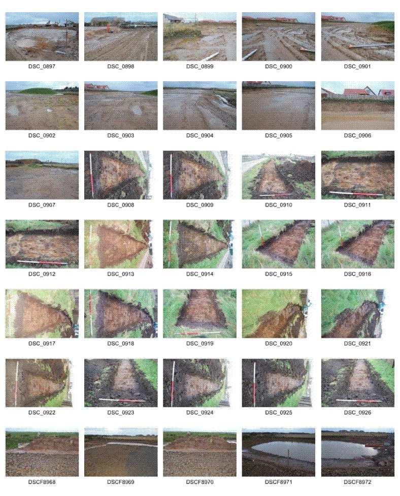
2 Greenbank, Fraserburgh, AB43 7AB SUMMARY attended the site at Greenbank, Fraserburgh, AB43 7AB on 9 November An archaeological evaluation was carried out on a small area (40 x 10m) where topsoil remained undisturbed; the rest of the site had been stripped of topsoil earlier in the year and building had commenced. The remainder of the site was walked over to determine if any archaeological deposits were visible. No archaeological remains were identified and no finds recovered. CONTNTS 1 Introduction 3 2 Archaeological background 4 3 The archaeological evaluation 5 4 Archive 9 5 References 9 Appendix 1 Photographs 10 ILLUSTRATIONS Cover Trench 1 facing Ill 1 Location plan 3 Ill 2 Site outline showing area available for evaluation 4 Ill 3 Location of Trenches 1 and 2 5 Ill 4 Trench 1 facing S 5 Ill 5 Trench 2 facing 6 Ill 6 Building plots 7-10 where building has already commenced 7 Ill 7 House platforms created (Plots 20-22); facing N 7 Ill 8 side of site with topsoil stripped 8 Ill 9 section of site showing scarping of natural subsoil 8 2

3 1 INTRODUCTION Claymore Homes Ltd (contact Steven Rollo) received planning permission from Aberdeenshire Council Planning (APP/2009/1462) for the construction of 57 homes on 26/1/2010 with an archaeology condition. The field evaluation was carried out in the context of Scottish Planning Policy (SPP) Planning Advice Note 42 (PAN 42) and Scottish Historic nvironment Policy (SHP), which state that archaeological remains should be regarded as part of the environment to be protected and managed. The site is 340m N-S and 200m -W and is located on former arable land at 35-40m OD. attended the site at Greenbank, Fraserburgh, AB43 7AB (NJ ) on 9 November Most of the site had already been stripped of topsoil and prepared for building, some foundations had been sunk and building started. An archaeological evaluation was carried out on a small area (40 x 10m) where topsoil remained undisturbed and the rest of the site was walked. Ill 1 Location plan (Contains Ordnance Survey data Crown copyright and database right 2010) 3
 on the N boundary of the site and Pitblae Croft (Aberdeenshire SMR NJ96N70; Ill 4) just outwith the site to the south.")
4 2 ARCHAOLOGICAL BACKGROUND There have been no archaeological interventions in the area of the current development site. There is a documentary reference to Greenbank Well (NMRS NJ96N0055; Ill 4) on the N boundary of the site and Pitblae Croft (Aberdeenshire SMR NJ96N70; Ill 4) just outwith the site to the south. Several finds have been recorded in the vicinity including two flint spearheads (NJ96S 5, NJ96N 4), two flint arrowheads (NJ96N 3, 4) and a cinerary urn (NJ96N 5). A possible cairn and cist was located at Wester Cardno (NJ96S 2), one at Roadside (NJ96N 5) and one at Cairn Hill (NJ96N 23). At Wester Cardno (NJ ) a stone cist was found in 1848 containing a 'skull and other bones of a man' (OSNB 33, 20). At Roadside a cairn was removed in 1808 which contained slight traces of human remains and an urn which crumbled to pieces on removal (ONB 33, 11). Cairn Hill (NJ ) is a small hill feature and possible site of a cairn (ONB 33, 54). Two documentary springs or wells were located at Broomhead ('The Mourning Well' and 'The College Well') (NJ96S 3, 4). The Mourning Well (NJ ) was a well 'visited by people from all parts of the north, where the superstitious practice of leaving some trifle after drinking the waters' (NSA 1845, 12, 251; ONB 33, 63). It was filled in before Several farmsteads survive in the area including Watermill Cottages, Broomhead, Chapeltown, Mains of Cardno, Greenbank and Broomhead. Ill 2 Site outline showing area available for evaluation (Claymore Homes) 4


5 3 TH ARCHAOLOGICAL VALUATION Topsoil remained in situ in an area 40 x 10m. Two trenches (Trenches 1, 2; Ill 3) 35m long and 1.2m wide were excavated with a tracked machine and ditching bucket on 9 November The subsoil was rusty brown sandy gravel with occasional large boulders. The topsoil was 15-20cm deep and was well-drained loam. The area has been extensively ploughed in the recent past and no archaeological features or finds were identified. Ill 3 Location of Trenches 1 and 2 (Claymore Homes) Ill 4 Trench 1 facing S 5

6 Ill 5 Trench 2 facing The remainder of the development site was walked and photographed. Much of the area had already been made up with house platforms and service trenches being dug. No remains of Greenbank well were identified. No archaeological features were identified and no finds recovered. 6

; facing N")
7 Ill 6 Building plots 7-10 where building has already commenced; facing N Ill 7 House platforms created (Plots 20-22); facing N 7


8 Ill 8 side of site with topsoil stripped showing well-established bund Ill 9 section of site showing scarping of natural subsoil 8
9 4 ARCHIV The site archive will be lodged with RCAHMS. 5 RFRNCS Ordnance Survey (Name Book) Object Name Books of the Ordnance Survey. 45 View Terrace Aberdeen AB25 2RS cameronarch@btinternet.com Company registration no (Scotland) VAT registration no

10 APPNDIX 1 PHOTOGRAPHS 10
11 11
12 12
13 Photo no Description DCS_0863 Trench 1 DCS_0864 Building plots 7-10 DCS_0865 Building plots DCS_0866 Plot 23 DCS_0867 Plot 25 DCS_0868 xisting Greenbank House DCS_0869 Plot 28 area DCS_0870 Plot 29 DCS_0871 Road between plots 30 and 57 DCS_0872 Services Plot 57 DCS_0873 House plots prepared for building DCS_0874 House plots prepared for building DCS_0875 SW corner of site DCS_0876 Services Plots DCS_0877 Services N of Plot 38/39 DCS_0878 Services Plots showing existing house at S of site DCS_0879 Plots 40/41 DCS_0880 S edge of site showing small section cut through topsoil DCS_0881 Plots 40/41 DCS_0882 Bund of topsoil(left) DCS_0883 Plots 40/41 DCS_0884 Looking towards plots DCS_0885 Plot 54 DCS_0886 Plot 54 DCS_0887 Topsoil bund (right) DCS_0888 Subsoil bund DCS_0889 Subsoil bund DCS_0890 Area of plots DCS_0891 Area of plots 25-28/29 showing Greenbank House DCS_0892 Area of plots DCS_0893 Section through natural Plots DCS_0895 Plot 28 with Greenbank House DCS_0896 Plot 28 with Greenbank House (left) and area of evaluation (centre) DCS_0897 Plot 28 area DCS_0898 Plot 29 with Greenbank House DCS_0899 Plots 50/53 DCS_0900 Plots at edge of site showing section cut through natural subsoil DCS_0901 Plots 45/47 DCS_0902 From Plot 50 showing topsoil bund indicating area stripped earlier this year DCS_0903 From Plot 53 DCS_0904 From Plot 53 DCS_0905 From Plot 53 DCS_0906 Section through subsoil edge of site, plot 47 Facing N S S W W S W SW S S S S S S S N N NN N W SW S SW S SS S 13
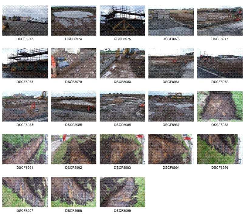
14 DCS_0907 Plot 42 area DCS_0908 Trench 1 DCS_0911 Trench 1 DCS_0914 Trench 1 DCS_0915 Trench 2 S end DCS_0918 Trench 2 DCS_0921 Trench 2 DCS_0925 Trench 2 DCS_0926 Trench 2 DSCF8968 Subsoil adjacent to SUDS pond DSCF8969 SUDS pond DSCF8970 Subsoil adjacent to SUDS pond DSCF8971 SUDS pond DSCF8972 SUDS pond DSCF8974 SUDS pond DSCF8975 Plot 7/8 under construction DSCF8979 Drainage plot 9/10 DSCF8980 Foundations plot 9/10 DSCF8981 House platforms Plots DSCF8982 Plots 12/23 DSCF8983 Foundations plots 9/10 DSCF8985 House platforms Plots DSCF8986 House platforms Plots DSCF8987 Plots 7/8 under construction (background), 9/10 foundations (centre) SW S SW W S S W W N N N SW N N SW N N N 14
MONITORING REPORT: No. 276
 MONITORING REPORT: No. 276 Between 51 and 53 Castor Bay Road Lurgan Co. Armagh AE/13/214 Dermot Redmond Site Specific Information Site Name: Between 51 and 53 Castor Bay Road, Lurgan, Co. Armagh Townland:
MONITORING REPORT: No. 289
 MONITORING REPORT: No. 289 21 Ballynarrig Road Ballydarrog Co. Derry AE/14/213E Dermot Redmond Site Specific Information Site Name: 21 Ballynarrig Road, Limavady Townland: Ballydarrog SMR No. : LDY 016:004
Chitty Farmhouse Extension, Wall Lane, Silchester, Hampshire
 Chitty Farmhouse Extension, Wall Lane, Silchester, Hampshire An Archaeological Watching Brief For In Touch by Andrew Mundin Thames Valley Archaeological Services Ltd Site Code CFS 08/52 May 2008 Summary
Archaeological Investigation in advance of Development at 2 Palace Cottages, Charing Palace, Charing, Kent
 Archaeological Investigation in advance of Development at 2 Palace Cottages, Charing Palace, Charing, Kent Site Code CHAR-EV-14 NGR 95412 49439 Date of Report 18/12/2014 Swale and Thames Archaeological
MONITORING REPORT: No. 283
 MONITORING REPORT: No. 283 Dunluce Castle Visitor Centre Option Site D Magheracross Co. Antrim AE/14/109E Dermot Redmond List of Contents Site Specific Information 1 Account of the Monitoring 2 Discussion
ARCHAEOLOGICAL S E R V I C E S. Hurley Manor, High Street, Hurley, Berkshire. Archaeological Evaluation. by James McNicoll-Norbury
 T H A M E S V A L L E Y ARCHAEOLOGICAL S E R V I C E S Hurley Manor, High Street, Hurley, Berkshire Archaeological Evaluation by James McNicoll-Norbury Site Code: HMH14/51 (SU 8252 8378) Hurley Manor,
Archaeological evaluation: land to the rear of Clare Road, Braintree, Essex
 Archaeological evaluation: land to the rear of 41-45 Clare Road, Braintree, Essex March 2014 commissioned by Mr Mark Plummer report prepared by Ben Holloway and Howard Brooks Planning reference: 13/000585/FUL,
Land at Downsview Avenue, Storrington, West Sussex
 Land at Downsview Avenue, Storrington, West Sussex An Archaeological Evaluation for Bellwinch Homes Limited by Andy Taylor Thames Valley Archaeological Services Ltd Site Code DAS 04/21 March 2004 Summary
Archaeological evaluation at Willowdene, Chelmsford Road, Felsted, Essex
 Archaeological evaluation at Willowdene, Chelmsford Road, Felsted, Essex August 2013 report prepared by Ben Holloway on behalf of Mr Anthony McGurren Planning reference: UTT/13/0235 CAT project ref.: 13/07g
Glue Pot Farm, Edwards Lane, Bramfield, Suffolk. BMF 024
 Glue Pot Farm, Edwards Lane, Bramfield, Suffolk. BMF 024 Archaeological Evaluation Report SCCAS Report No. 2013/107 Client: Keith Frost Architectural Design Services Author: Linzi Everett August 2013 SCCAS
Pinnocks Wood Equestrian Centre, Burchett s Green, Maidenhead, Berkshire
 Pinnocks Wood Equestrian Centre, Burchett s Green, Maidenhead, Berkshire An Archaeological Watching Brief For Mr David Eyles by Andrew Mundin Thames Valley Archaeological Services Ltd Site Code POB 08/69
Monitoring Report No. 166
 Monitoring Report No. 166 No. 2a Loughadian Road Poyntzpass County Down AE/08/189 Nick Beer Site Specific Information Site Address: 2a Loughadian Road, Poyntzpass. Townland: Loughadian SMR No.: DOW 033:034
Monitoring of invasive groundworks ahead of the installation of a septic tank at 16a, 16b and 16c Donegore Hill Muckamore County Antrim
 Monitoring Report No. 177 Monitoring of invasive groundworks ahead of the installation of a septic tank at 16a, 16b and 16c Donegore Hill Muckamore County Antrim LICENCE NO.: AE/09/48 Brian Sloan 1 Site
Archaeological Monitoring of Land at 29 Royal Pier Road, Gravesend, Kent
 Archaeological Monitoring of Land at 29 Royal Pier Road, Gravesend, Kent Site Code ROY/WB/15 Report for Dr Maxted Date of report 06/10/2015 SWAT ARCHAEOLOGY Swale and Thames Archaeological Survey Company
CASE STUDY 5. MORVICH FARM, ROGART SUTHERLAND Regenerating woodland in a historic landscape. Situation
 MORVICH FARM, ROGART SUTHERLAND Regenerating woodland in a historic landscape Flint tools found during a field walking survey. Situation Morvich Farm is situated on land raising steeply from the valley
Garage Site, Foots Cray High Street, Sidcup, Kent, London Borough of Bexley
 Garage Site, Foots Cray High Street, Sidcup, Kent, London Borough of Bexley An Archaeological Evaluation for Mizen Design Build by Andy Taylor Thames Valley Archaeological Services Ltd FOC 07 September
Gryme s Dyke, Stanway Green
 Gryme s Dyke, Stanway Green A short assessment of the archaeological impact of contractor s groundworks at the southern end of the Gryme s Dyke Middle earthwork February 2000 Archive report on behalf of
Meales Farm, Sulhamstead, West Berkshire
 Meales Farm, Sulhamstead, West Berkshire An Archaeological Watching Brief For Mr. Robert Astor by Steve Ford Thames Valley Archaeological Services Ltd Site Code CHH02/29 May 2002 Summary Site name: Meales
New horse training area, Manor Farm, Great Kimble, Buckinghamshire
 New horse training area, Manor Farm, Great Kimble, Buckinghamshire An Archaeological Watching Brief For Redwing Structures (Marlow) Limited by Andy Taylor Thames Valley Archaeological Services Ltd Site
Monitoring Report No. 168
 Monitoring Report No. 168 Loughgall Presbyterian Church Cloven Eden Loughgall County Armagh AE/08/203 Nick Beer Site Specific Information Site Address: Loughgall Presbyterian Church, 100 Cloven Eden Road,
Archaeological Evaluation and Assessment of Land at Minnis Beeches, Canterbury Road, Swingfield, Dover, Kent
 Archaeological Evaluation and Assessment of Land at Minnis Beeches, Canterbury Road, Swingfield, Dover, Kent NGR: TQ 6307 1545 Site Code: MB-EV-10 (Planning Consent Y10/0311/SH) Report for Thorndene Ltd.
Land adjacent to Dingle Dock, Front Street, East Garston
 Land adjacent to Dingle Dock, Front Street, East Garston An Archaeological Watching Brief for Dr J Davies by Jo Pine Thames Valley Archaeological Services Site Code DEG99/82 January 2000 Summary Site name:
Ivol Buildings, Woodcote Road, South Stoke, Oxfordshire
 Ivol Buildings, Woodcote Road, South Stoke, Oxfordshire An Archaeological Watching Brief For Christ Church, Oxford by Pamela Jenkins Thames Valley Archaeological Services Ltd Site Code IBSS 04/03 March
Archaeological evaluation on land at Mersea Fleet Way, Chelmer Road, Braintree, Essex, CM7 3PZ
 Archaeological evaluation on land at Mersea Fleet Way, Chelmer Road, Braintree, Essex, CM7 3PZ by Laura Pooley figures by Ben Holloway and Emma Holloway fieldwork by Ben Holloway, Robin Mathieson, Nigel
ARCHAEOLOGICAL S E R V I C E S. Land north of Orchard Close, Hallow, Worcestershire. Archaeological Evaluation. by Kyle Beaverstock
 T H A M E S V A L L E Y ARCHAEOLOGICAL S E R V I C E S Land north of Orchard Close, Hallow, Worcestershire Archaeological Evaluation by Kyle Beaverstock Site Code: OCW15/224 (SO 8285 5848) Land north of
Archaeological evaluation at Redbank, Bury Water Lane, Newport, Essex, CB11 3TZ
 Archaeological evaluation at Redbank, Bury Water Lane, Newport, Essex, CB11 3TZ March 2017 by Laura Pooley figures by Ben Holloway and Emma Holloway fieldwork by Ben Holloway with Harvey Furniss and Elliott
Centre for Archaeological Fieldwork Evaluation/Monitoring Report No Monitoring Report No. 201
 Monitoring Report No. 201 Land adjacent to 58 Drumreagh Road Drumreagh Ballygowan Co. Down LICENCE NO.: AE/10/91E BRIAN SLOAN 1 Site Specific Information Site Name: Land adjacent to 58 Drumreagh Road,
Newcombe House & Kensington Church Street
 Newcombe House & Kensington Church Street Archaeological Evaluation September 2017 Summary Site name: Newcombe House, Kensington Church Street, Notting Hill, London Grid reference: TQ 25318 80372 Site
Evaluation/monitoring Report No. 241 KING S CASTLE NURSING HOME ARDGLASS CO. DOWN AE/12/19 SARAH GORMLEY
 Evaluation/monitoring Report No. 241 KING S CASTLE NURSING HOME ARDGLASS CO. DOWN AE/12/19 SARAH GORMLEY 1 Site Specific Information Site Name: Townland: King s Castle Ardglass SMR No. : DOW 045:024 Status:
Centre for Archaeological Fieldwork, School of Archaeology and Palaeoecology, Queen s University Belfast.
 Centre for Archaeological Fieldwork, School of Archaeology and Palaeoecology, Queen s University Belfast. Monitoring Report No. 04 Duneight Motte and Bailey, May 2004. On behalf of Monitoring Report: Duneight
An Archaeological Evaluation at Granta Cottages, Newmarket Road, Great Chesterford, Essex. August 2015
 An Archaeological Evaluation at Granta Cottages, Newmarket Road, Great Chesterford, Essex August 2015 by Pip Parmenter and Ben Holloway on behalf of Mr G Elmer and Mrs L King CAT project ref.: 15/06a NGR:
PROPOSED DEVELOPMENT AT BRITANNIA PARK, BANGOR
 PROPOSED DEVELOPMENT AT BRITANNIA PARK, BANGOR ARCHAEOLOGICAL MITIGATION WORK Report No. 446 [08] [04] [06] [08] [06] [04] Prepared for Watkins Jones Construction March 2002 By J. Kenney Ymddiriedolaeth
9 Archaeology & Cultural Heritage
 High Clachaig Wind Farm Scoping Report Page 56 9 Archaeology & Cultural Heritage 9.1 Introduction Cultural heritage in this context means the above- and below-ground archaeological resources, built heritage,
Archaeological Evaluation and Assessment of Land at Kent Cottage, 19 Chapel Street, Hythe, Kent
 Archaeological Evaluation and Assessment of Land at Kent Cottage, 19 Chapel Street, Hythe, Kent Planning Application Y13/0463/SH Date of Report: 29/04/2015 Report for Marc Carney SWAT. ARCHAEOLOGY Swale
ARCHAEOLOGICAL EVALUATION AT THE FORMER WATTON GARDEN CENTRE, NORWICH ROAD, WATTON, NORFOLK OCTOBER 2003 (Accession number WAT)
") NORTHAMPTONSHIRE ARCHAEOLOGY NORTHAMPTONSHIRE COUNTY COUNCIL NOVEMBER 2003 (Planning Application No: 3PL/1997/048/0 ARCHAEOLOGICAL EVALUATION AT THE FORMER WATTON GARDEN CENTRE, NORWICH ROAD, WATTON, NORFOLK
NORTHAMPTONSHIRE ARCHAEOLOGY NORTHAMPTONSHIRE COUNTY COUNCIL NOVEMBER 2003 (Planning Application No: 3PL/1997/048/0 ARCHAEOLOGICAL EVALUATION AT THE FORMER WATTON GARDEN CENTRE, NORWICH ROAD, WATTON, NORFOLK
REPORT ON THE EXCAVATIONS AT FYVIE CASTLE, FYC/10/1 (CA ) FYC/11/1 (CA )
 FYC/11/1 (CA )") REPORT ON THE EXCAVATIONS AT FYVIE CASTLE, FYC/10/1 (CA014-2010) FYC/11/1 (CA040-2011) Contents 1 INTRODUCTION... 5 1.1 Previous research into the immediate Castle environs... 6 1.2 The Castle Environs
REPORT ON THE EXCAVATIONS AT FYVIE CASTLE, FYC/10/1 (CA014-2010) FYC/11/1 (CA040-2011) Contents 1 INTRODUCTION... 5 1.1 Previous research into the immediate Castle environs... 6 1.2 The Castle Environs
WRITTEN SCHEME OF INVESTIGATION
 CANAL COLLEGE 2, ROSEBANK DISTILLERY: WRITTEN SCHEME OF INVESTIGATION 1 2 Contents Background... 4 Introduction... 5 Historical Notes... 6 Methodology... 7 Staff... 9 Products... 9 Timetable... 9 Bibliography...
Appletree, Thames Street, Sonning Berkshire
 Appletree, Thames Street, Sonning Berkshire An Archaeological Watching Brief for Mr and Mrs A Popham by Sian Anthony Thames Valley Archaeological Services Ltd Site Code ATS 02/83 October 2002 Summary Site
Evaluation/Monitoring Report No. 243
 60m NORTH OF 64 BALLYGROOBANY ROAD BALLYNAHINCH RICHHILL COUNTY ARMAGH LICENCE NO.: AE/12/91E NAOMI CARVER 1 Site Specific Information Site Name: site 60m north of 64 Ballygroobany Road, Ballynahinch,
AGRICULTURAL LAND CLASSIFICATION
 AGRICULTURAL LAND CLASSIFICATION STAINSBY HALL, MIDDLESBROUGH PROPOSED GOLF COURSE ADAS December 1990 Leeds Regional Office 2FCS 5100 CONTENTS 1. INTRODUCTION AND GENERAL SITE CHARACTERISTICS 2. AGRICULTURAL
Archaeological monitoring at Clintons, Bury Green, Little Hadham, Hertfordshire April 2008
 Archaeological monitoring at Clintons, Bury Green, Little Hadham, Hertfordshire April 2008 report prepared by Ben Holloway on behalf of Charles Britton Equestrian Construction CAT project ref.: 08/3b NGR:
The entire site supports grass on which sheep had been grazing recently.
 PHYSICAL CHARACTERISTICS REPORT FOR LAND AT HORSEHAY A^ Agricultural Land Classification of approximately 14 hectares of land to the southwest of Horsehay was undertaken in November 1989. The site lies
Archaeological evaluation at Stables, Hatch Farm, Fen Lane, Bulphan, Essex, RM14 3RL
 Archaeological evaluation at Stables, Hatch Farm, Fen Lane, Bulphan, Essex, RM14 3RL November-December 2016 by Laura Pooley figures by Ben Holloway and Emma Holloway fieldwork by Ben Holloway and Alec
Northbury Farm, Castle End Road, Ruscombe, Berkshire
 Northbury Farm, Castle End Road, Ruscombe, Berkshire An Archaeological Watching Brief For Sir Colin and Lady Southgate by Danielle Milbank Thames Valley Archaeological Services Ltd Site Code NFR 07/120
MAFF I^inistry of IfiriEE Agriculture Fisheries and Food
 MAFF I^inistry of IfiriEE Agriculture Fisheries and Food AGRICULTURAL LAND CLASSIFICATION BROOMY HOLM FARM, EDMONDSLEY, CO DURHAM PROPOSED GOLF COURSE DECEMBER 1993 ADAS Leeds Statutory Group JobNo:- 168/93
New Media Building, Goldsmiths College, New Cross, London Borough of Lewisham
 New Media Building, Goldsmiths College, New Cross, London Borough of Lewisham An Archaeological Evaluation for Willmott Dixon Construction by Andy Taylor Thames Valley Archaeological Services Ltd Site
Windsor Berkshire. Archaeological Watching Brief. King Edward VII Car Park Extension. Archaeological Watching Brief Report
 King Edward VII Car Park Extension Windsor Berkshire Archaeological Watching Brief Report March 202 Client: Royal Borough of Windsor and Maidenhead Issue No: OA Job No: 5242 NGR: SU 972 779 Archaeological
Interim Statement on Archaeological Evaluation on land immediately to the east of the Manor Lodge, Manor Lane, Sheffield, South Yorkshire
 Archaeological Research & Consultancy at the University of Sheffield Research School of Archaeology West Court 2 Mappin Street Sheffield S1 4DT Phone 0114 2225106 Fax 0114 2797158 Interim Statement 1107.2
Archaeological Monitoring of Land to the rear of The Ridges, Valley Drive, Gravesend, Kent
 Archaeological Monitoring of Land to the rear of The Ridges, Valley Drive, Gravesend, Kent NGR: 566215 170479 Site Code RIDGE/WB/14 Report for Mr Sall Date of report 27/03/2014 SWAT ARCHAEOLOGY Swale and
Archaeological trial-trenching evaluation: New Hall School, The Avenue, Boreham, Essex. July 2015
 Archaeological trial-trenching evaluation: New Hall School, The Avenue, Boreham, Essex report prepared by Ben Holloway on behalf of New Hall School Planning reference: 14/01846/FUL CAT project ref.: 15/04i
New Swimming Pool,West Meon House, West Meon, Hampshire
 New Swimming Pool,West Meon House, West Meon, Hampshire An Archaeological watching brief and building recording for Mr and Mrs Younger by Danielle Milbank Thames Valley Archaeological Services Ltd Site
ARCHAEOLOGICAL S E R V I C E S. Manor Farm, Launton, Bicester, Oxfordshire. Archaeological Watching Brief. by Aiji Castle. Site Code: LBO13/220
 T H A M E S V A L L E Y ARCHAEOLOGICAL S E R V I C E S Manor Farm, Launton, Bicester, Oxfordshire Archaeological Watching Brief by Aiji Castle Site Code: LBO13/220 (SP 6035 2285) Manor Farm, Launton, Bicester,
Archaeological monitoring and recording: 20 Irvine Road, Colchester, Essex, CO3 0TR. July 2015
 Archaeological monitoring and recording: 20 Irvine Road, Colchester, Essex, CO3 0TR July 2015 by Pip Parmenter and Chris Lister on behalf of Ms Claire Murphy CAT project ref.: 15/03m NGR: TL 9819 2426
Archaeological trial-trenching evaluation: Peldon Village Hall, Church Road, Peldon, Essex, CO5 7PT
 Archaeological trial-trenching evaluation: Peldon Village Hall, Church Road, Peldon, Essex, CO5 7PT December 2015 report prepared by Ben Holloway and Howard Brooks on behalf of Peldon Parish Council Planning
STATEMENT OF PHYSICAL CHARACTERISTICS AND AGRICULTURAL LAND CLASSIFICATION WITTON PARK, COUNTY DURHAM PROPOSED QUARRY EXTENSION DECEMBER 1992

Epsom Water Works, East Street, Epsom, Surrey
 Epsom Water Works, East Street, Epsom, Surrey An Archaeological Desk-Based Assessment for St James Homes Ltd by Steve Ford Thames Valley Archaeological Services Site Code ESE99/85 December 1999 Epsom Water
Perth and Kinross Council Development Management Committee 20 February 2013 Report of Handling by Development Quality Manager
 Perth and Kinross Council Development Management Committee 20 February 2013 Report of Handling by Development Quality Manager 4(4)(iii) 13/81 Erection of sports hall, associated changing facilities, offices
AGRICULTURAL LAND CLASSIFICATION AND SOIL PHYSICAL CHARACTERISTICS BIRCH PIT, NEAR COLCHESTER ESSEX
 AGRICULTURAL LAND CLASSIFICATION AND SOIL PHYSICAL CHARACTERISTICS BIRCH PIT, NEAR COLCHESTER ESSEX AGRICULTURAL LAND CLASSIFICATION AND SOIL PHYSICAL CHARACTERISTICS SEMI-DETAILED SURVEY BIRCH PIT, NEAR
Archaeological Conservation Works at Murrooghkilly Cairn, Co. Clare.
 Funding Reference No.: LIFE11/922 ITM: 516541/710578 Licence No.: 17E0498 RMP: CL002-001--- ÆGIS Reference: 89-20b Archaeological Conservation Works at Murrooghkilly Cairn, Co. Clare. Licence holder: F.
NON-TECHNICAL SUMMARY
 Proposed Sand and Gravel Extraction and Associated Processing Operations with Restoration to a Mixture of Agriculture and Nature Conservation including Areas of Shallow Water at Hedgeley, Northumberland
`Code 2 - Accepted with comments
 AE For Continuation Refer To CT-- A AE AE AE Realigned airfield Stopped Up AE Electricity substation Land drainage area Ecological mitigation pond Balancing pond South District Replacement floodplain storage
Examination of South Cambridgeshire Local Plan
 Matter SC6A - Policy SS/5 Waterbeach New Town Historic England( formerly English Heritage) 874 Rep Nos 59748, 60250, 60253 Examination of South Cambridgeshire Local Plan Historic England, Hearing Statement
Historic England Advice Report 26 August 2016
 Case Name: Kingsland Castle Case Number: 1435892 Background Historic England has been asked to review the scheduling for Kingsland Castle. The land on which the monument lies is understood to be for sale.
Archaeological monitoring and recording at 20 St Peter's Road, West Mersea, Essex, CO5 8LJ
 Archaeological monitoring and recording at 20 St Peter's Road, West Mersea, Essex, CO5 8LJ November 2016 by Laura Pooley figures by Ben Holloway and Emma Holloway fieldwork by Ben Holloway on behalf of
Downton Manor, Downton, near Lymington, Hampshire
 Downton Manor, Downton, near Lymington, Hampshire An Archaeological Evaluation for New Milton Sand and Gravel by Sian Anthony Thames Valley Archaeological Services Ltd Site Code DMD03/20 May 2003 Summary
volume 11 environmental assessment section 2 environmental impact assessment Part 4 ha 204/08 scoping of environmental impact assessments
 DESIGN MANUAL FOR ROADS AND BRIDGES volume 11 environmental assessment section 2 environmental impact assessment Part 4 ha 204/08 scoping of environmental impact assessments SUMMARY This Advice Note provides
MAFF Ministry of iflmll Agriculture Fisheries and Food
 m MAFF Ministry of iflmll Agriculture Fisheries and Food AGRICULTURAL LAND CLASSIFICATION EAST YORKSHIRE BOROUGH LOCAL PLAN (SITES AROUND DRIFFIELD) FEBRUARY 1995 ADAS Job No:- 47-54/95 Leeds Statutory
Archaeological Watching Brief
 Barrack Block Drainage Hampton Court Palace Archaeological Watching Brief Report May 2012 Client: Historic Royal Palces Issue No: 1 OA Job No: 5329 NGR: TQ 15485 168587 Archaeological Watching Brief Archaeological
Bridge House, Ham Island, Old Windsor, Berkshire
 Bridge House, Ham Island, Old Windsor, Berkshire An Archaeological Watching Brief for Mr A Chadwick by Alan Ford Thames Valley Archaeological Services Site Code BHHI98/55 August 1998 Bridge House, Ham
Merrowdene, Earleydene, Sunninghill, Berkshire
 Merrowdene, Earleydene, Sunninghill, Berkshire An Archaeological Watching Brief For Mr and Mrs Jackson by Andy Taylor Thames Valley Archaeological Services Ltd Site Code MES 05/88 January 2006 Summary
Archaeological monitoring and recording at 54 Wellesley Road, Colchester, Essex, CO3 3HF
 Archaeological monitoring and recording at 54 Wellesley Road, Colchester, Essex, CO3 3HF October 2015 by Laura Pooley on behalf of Mr Wright Planning reference: 145409 CAT project ref.: 14/12d NGR: TL
How we find the sites
 How we find the sites Many of the archaeological sites mapped by aerial archaeologists have been levelled by ploughing and are identified from the photos as cropmarks or soilmarks. Archaeological sites
PHYSICAL CHAtlACTERISTICS REPORT FOR THE PROPOSED SAND AND GRAVEL SITE AT MANOR FARM, UFFINGTON
 PHYSICAL CHAtlACTERISTICS REPORT FOR THE PROPOSED SAND AND GRAVEL SITE AT MANOR FARM, UFFINGTON Introduction Following the" request for detailed information on the physical characteristics of soil at Manor
Consent of copyright owner required for any other use. For inspection purposes only. APPENDIX 2.iO.l. EPA Export :15:52:22
 APPENDIX 2.iO.l 4,. EPA Export 25-07-2013:15:52:22 Appendix i.ll.1 Recorded Archaeological Sites and Monuments The recorded archaeological sites within 1.5km of the proposed development are listed
69 DRUMLOUGH ROAD, DRUMGATH, COUNTY DOWN
 MONITORING REPORT NO. 223 69 DRUMLOUGH ROAD, DRUMGATH, COUNTY DOWN LICENCE NO. EMILY MURRAY Report Date: 13 th April 2011 Site Specific Information Site name: Townland: SMR No. : Grid ref.: County: Excavation
ARCHAEOLOGICAL S E R V I C E S. Becks, Park Lane, North Newington, Banbury, Oxfordshire. Archaeological Watching Brief.
 T H A M E S V A L L E Y ARCHAEOLOGICAL S E R V I C E S Becks, Park Lane, North Newington, Banbury, Oxfordshire Archaeological Watching Brief by Andy Mundin Site Code: BPN16/105 (SP 4207 3978) Becks, Park
EVALUATION REPORT No. 300
 EVALUATION REPORT No. 300 Southwest of 2A Cloughey Road, Portaferry, Co. Down Licence No.: AE/135/85E Sapphire Mussen Report Date: 14 th May 2015 Site Specific Information Site Name: [Southwest of 2a]
Archaeological trial-trenching evaluation: land adjacent to Hillingdon House, Purdis Farm Lane, Ipswich, Suffolk
 Archaeological trial-trenching evaluation: land adjacent to Hillingdon House, Purdis Farm Lane, Ipswich, Suffolk October 2015 report prepared by Ben Holloway with contributions by Howard Brooks, Emma Holloway
Archaeological monitoring and recording at 24 St Peter's Road, West Mersea, Essex, CO5 8LJ
 Archaeological monitoring and recording at 24 St Peter's Road, West Mersea, Essex, CO5 8LJ April 2017 by Dr Elliott Hicks figures by S Carter fieldwork by Adam Wightman on behalf of Brett Lord NGR: TM
Archaeological Watching Brief Report
 New Playing Fields and Athletics Track Stowe School Buckinghamshire Archaeological Watching Brief o a July 2009 client logo Client: Stowe School Issue N o : 1 OA Job N o : 4167 NGR: SP 679 380 Archaeological
AGRICULTURAL LAND CLASSIFICATION
 AGRICULTURAL LAND CLASSIFICATION GOOLE/HOOK LOCAL PLAN SITES SURVEYED FOR BOOTHFERRY BOROUGH COUNCIL'S INDUSTRIAL LAND SUITABILITY STUDY ADAS February 1991 Leeds Regional Office 2FCS 5205 CONTENTS 1. Introduction
YENNADON QUARRY, DOUSLAND, YELVERTON, DEVON, PL20 6NA EXTRACTIVE MATERIALS MANAGEMENT STATEMENT. For YENNADON STONE LTD
 YENNADON QUARRY, DOUSLAND, YELVERTON, DEVON, PL20 6NA EXTRACTIVE MATERIALS MANAGEMENT STATEMENT For YENNADON STONE LTD 27 th November 2013 Job No: 7397/EMMS Report Status: Project Number: Final 7397/EMMS
Dear Ms Blewett. By to: Longmore House Salisbury Place Edinburgh EH9 1SH
 By email to: Jo.Blewett@transport.gov.uk Ms Jo Blewett A9 Dualling Team Transport Scotland Buchanan House 58 Port Dundas Road Glasgow G4 0HF Longmore House Salisbury Place Edinburgh EH9 1SH Adele.Shaw@hes.scot
Perth and Kinross Council Development Management Committee 8 June Pre-Application Report by Development Quality Manager
 Perth and Kinross Council Development Management Committee 8 June 2016 5(3)(i) 16/259 Pre-Application Report by Development Quality Manager Residential development at St Martins Road, Land 120 metres West
Archaeological monitoring and recording at Priory Street Car Park, Colchester, Essex, CO1 1QA
 Archaeological monitoring and recording at Priory Street Car Park, Colchester, Essex, CO1 1QA October-November 2016 by Laura Pooley figures by Chris Lister and Emma Holloway fieldwork by Sarah Carter,
Environmental Assessment for a New Landfill Footprint at the West Carleton Environmental Centre
 Waste Management of Canada Corporation Environmental Assessment for a New Landfill Footprint at the West Carleton Environmental Centre ARCHEOLOGY DETAILED IMPACT ASSESSMENT Prepared by: Archeoworks Inc.
What is fieldwalking?
 Cambridge Archaeology Field Group May 2012 What is fieldwalking? Archaeological fieldwalking (or Surface Artefact Collection as it is sometimes known) is the systematic recovery and recording of artefacts
AGRICULTURAL LAND CLASSIFICATION GREAT GRIMSBY LOCAL PLAN SITE AG 2. GREAT COATES AUGUST 1993
 AGRICULTURAL LAND CLASSIFICATION GREAT GRIMSBY LOCAL PLAN SITE AG 2. GREAT COATES AUGUST 1993 ADAS Job No:- 131/93 Leeds Statutory Group MAFF Ref- EL 51/5 SUMMARY An Agricultural Land Classification survey
AGRICULTURAL LAND CLASSIFICATION SEMI-DETAILED SURVEY EGG FARM KINGS LANGLEY HERTFORDSHIRE
 AGRICULTURAL LAND CLASSIFICATION SEMI-DETAILED SURVEY EGG FARM KINGS LANGLEY HERTFORDSHIRE AGRICULTURAL LAND CLASSIFICATION SEMI-DETAILED SURVEY EGG FARM, KINGS LANGLEY, HERTFORDSHIRE 1. BACKGROUND 1.1
AGRICULTURAL LAND CLASSIFICATION AND SOIL PHYSICAL CHARACTERISTICS LAND NEAR SHIRE HILL FARM SAFFRON WALDEN ESSEX
 AGRICULTURAL LAND CLASSIFICATION AND SOIL PHYSICAL CHARACTERISTICS LAND NEAR SHIRE HILL FARM SAFFRON WALDEN ESSEX AGRICULTURAL LAND CLASSIFICATION (ALC) AND SOIL PHYSICAL CHARACTERISTICS LAND NEAR SHIRE
MAFF Ministry of Ifinil Agriculture Rsheries and Food
 MAFF Ministry of Ifinil Agriculture Rsheries and Food STATEMENT OF PHYSICAL CHARACTERISTICS AND AGRICULTURAL LAND CLASSIFICATION SHILBOTTLE COLLIERY RECLAMATION SCHEME NORTHUMBERLAND DECEMBER 1994 ADAS
Goldings, 67 High Street, Newmarket NKT 076
 ARCHAEOLOGICAL MONITORING REPORT Goldings, 67 High Street, Newmarket NKT 076 A REPORT ON THE ARCHAEOLOGICAL MONITORING, 2004 (Planning app. no. F/2003/0899/FUL) John Craven Field Team Suffolk C.C. Archaeological
Ouseburn flood storage feature: Number 1 Site Name: The Callerton nature reserve
 Appendix 1 OUSEBURN RUNOFF ATTENUATION FEATURES Location Map flood storage feature: Number 1 Site Name: The Callerton nature reserve Farmer name: Unknown OS Grid Ref: NZ172683 Location description: South
Ponds of Historical Interest
 Frequently Asked Questions Ponds of Historical Interest We have a pond that may be of Historic Interest how do we go about researching and restoring it? Box 1. Some historical and cultural uses of ponds
Archaeological evaluation at New Hall School, The Avenue, Boreham, Chelmsford, Essex, CM3 3HS
 Archaeological evaluation at New Hall School, The Avenue, Boreham, Chelmsford, Essex, CM3 3HS December 2016 by Laura Pooley with contributions by Stephen Benfield figures by Ben Holloway and Emma Holloway
6A St John s Road, Wallingford Oxfordshire
 6A St John s Road, Wallingford Oxfordshire An Archaeological Evaluation Stage 2 for Spearcliff Estates Ltd by Steve Ford Thames Valley Archaeological Services Ltd Site SJW03/116 January 2004 Summary Site
Malden Green Farm, Worcester Park, Surrey, Royal Borough of Kingston
 Malden Green Farm, Worcester Park, Surrey, Royal Borough of Kingston An Archaeological Evaluation and Desk-Based Assessment for Bewley Homes by Steve Ford Thames Valley Archaeological Services Site Code
FOR SALE RESIDENTIAL DEVELOPMENT OPPORTUNITY BLAIRTUMMOCK EASTERHOUSE
 FOR SALE RESIDENTIAL DEVELOPMENT OPPORTUNITY BLAIRTUMMOCK EASTERHOUSE RESIDENTIAL DEVELOPMENT SITE Land at Blairtummock, Easterhouse Residential Development Opportunity Site area of 5.71 hectares (14.11
CAIRNGORMS NATIONAL PARK AUTHORITY
 DEVELOPMENT PROPOSED: Removal of Gravel Embankments at Allt an t-slugain, Invercauld Estate, Braemar REFERENCE: 2016/0082/DET APPLICANT: Scottish Natural Heritage DATE CALLED-IN: 5 th April 2016 RECOMMENDATION:
PLANNING AND BUILDING STANDARDS COMMITTEE 3 JUNE 2013 APPLICATION FOR PLANNING PERMISSION
 PLANNING AND BUILDING STANDARDS COMMITTEE 3 JUNE 2013 APPLICATION FOR PLANNING PERMISSION ITEM: REFERENCE NUMBER:13/00204/MIN OFFICER: Dorothy Amyes WARD: Tweeddale West PROPOSAL: Variation of condition