Office Consolidation 2013 April
|
|
|
- Alexia Williamson
- 6 years ago
- Views:
Transcription


1 Office Consolidation 2013 April The City of Calgary Municipal Development Plan Adopted by Council September 2009 calgary.ca call 3-1-1
2 NOTE: This office consolidation includes the following amending Bylaws. Amendment Bylaw Date Description 1 5P February 22 a) Add text to Section 2.3.5(b) and renumber accordingly. Amended portions of the text are printed in italics and the specific amending Bylaw is noted. Persons making use of this consolidation are reminded that it has no legislative sanction, and that amendments have been embodied for ease of reference only. The official Bylaw and amendments thereto are available from City Clerk and should be consulted when interpreting and applying this Bylaw. TITLE: AUTHOR: STATUS: PRINTING DATE: ADDITIONAL COPIES: PUBLISHING INFORMATION MUNICIPAL DEVELOPMENT PLAN THE CITY OF CALGARY ADOPTED BY CALGARY CITY COUNCIL SEPTEMBER BYLAW 24P2009 EFFECTIVE 2010 APRIL APRIL THE CITY OF CALGARY RECORDS & INFORMATION MANAGEMENT (RIM) DEVELOPMENT & BUSINESS APPROVALS P.O. BOX 2100, STN "M", #8115 CALGARY, ALBERTA T2P 2M5 PHONE: OR OUTSIDE OF CALGARY fax: WEB: 2 5P January 10 a) Delete and replace Map 1 entitled Urban Structure. b) Delete and replace Map 2 entitled Growth and Change. c) Delete and replace Map 3 entitled Primary Transit Network. d) Delete and replace Map 4 entitled Road and Street Network. e) Delete and replace Map 5 entitled Natural Areas and Open Spaces. f) Delete and replace Map 6 entitled Jurisdictional and Major Development Influences. g) Delete and replace Municipal Figure 2-5 entitled Watershed Management. h) Delete and replace Figure 2-6 entitled Energy Intensity Map. i) Delete and replace Figure 4-1 entitled Calgary Retail Sectors and Regional Retail Distribution, by Type. 3 6P January 10 a) Delete and replace policy 2.3.5(b) in Section P April 9 a) Delete and replace Map 6 entitled Jurisdictional and Major Development Influences and replace with the revised Map 6 entitled Jurisdictional Areas and add Map 7 entitled Major Development Influences. b) Delete and replace the third and fourth paragraphs in Section Alignment in the Region. c) Delete all references to the Municipal District of Rocky View and M.D. of Rocky View and replace with Rocky View County. 5 16P June 11 (a) Delete and replace Map 2 entitled Growth and Change. 6 8P March 18 (a) Delete and replace Map 2 entitled Growth and Change. 7 11P April 8 (a) Delete and replace policy text (f) under Section 2.4.3, Please note that the Municipal Develpoment Plan may be amended from time to time. The entire document, which is as up to date as possible, and amending pages can be downloaded online for printing.
3 Table of Contents Part 1 Role and scope of the Municipal Development Plan Introduction building on the foundations of Go Plan and The Calgary Plan Organization of the MDP Alignment of the MDP Municipal Government Act Alignment in the Calgary Region Alignment with other City policies and principles Implementing the MDP Guiding strategic decisions of The City Facilitating private sector investment Supporting community based initiatives Local Area Plans Outline plan and subdivision processes Land use amendment applications Development permit applications Urban design On-going MDP sustainment Review of the MDP Amending the MDP Interpreting the MDP Part 2 City-wide policies A prosperous economy Creating a city attractive to people Creating a city attractive to business Ensuring a sustainable economy Ensuring sustainable municipal finances Shaping a more compact urban form Vibrant, transit-supportive, mixed-use Activity Centres and Corridors A transit-supportive land use framework A vibrant Centre City Complete communities Strong residential neighbourhoods Creating great communities Housing Respecting and enhancing neighbourhood character Heritage and public art Parks, open spaces and outdoor recreation Municipal, school and environmental reserves Community services and facilities Foster community dialogue and participation in community planning Urban design Creating a beautiful city Built form Enhancing the public realm Connecting the city Transportation choice Transit Complete Streets Local transportation connectivity greening the city Green infrastructure Land The City of Calgary Municipal Development Plan September 2009 TOC THE CITY OF CALGARY MuniCIpal Development Plan i
4 The City of Calgary Municipal Development Plan TOC September Water Ecological networks Energy Waste Part 3 Typologies for Calgary s future urban structure Introduction Local Area Plans Centre City Centre City Activity Centres General Activity Centre policies Major Activity Centres Community Activity Centres Neighbourhood Activity Centres Corridors General Corridor policies Urban Corridors Neighbourhood Corridors Developed Residential Areas General Developed Residential Area Policies Inner City Area Established Areas Developing Residential Communities Planned Greenfield Communities Future Greenfield Area Industrial Areas Standard Industrial Area Industrial-Employee Intensive Greenfield Industrial Area Part 4 Specific use policies Retail Retail structure Retail categories Protection of sand and gravel resources MGA-mandated policies Sour gas policies Agricultural operations Airport Vicinity Protection Area (AVPA) Part 5 Framework for growth and change Introduction A strategic framework for growth and change Strong relationships Strategic decisions Planned land supply Support intensification of Developed Areas Linking land use to municipal financial and infrastructure capacity Integrated decision-making Public accountability Monitoring and reporting Part 6 Glossary Part 7 Maps Urban Structure 2 Growth and Change 3 Primary Transit Network 4 Road and Street Network 5 Natural Areas and Open Spaces 6 Jurisdictional and Major Development Influences ii THE CITY OF CALGARY MuniCIpal Development Plan


5 Part One Role and scope of the Municipal Development Plan
6 Part 1 Role and scope of the Municipal Development Plan Part 1 Role and scope of the Municipal Development Plan 1.1 Introduction building on the foundations of Go Plan and The Calgary Plan In 2007, City Council approved Terms of Reference for an Integrated Land Use and Mobility Plan to review and update the Calgary Municipal Development Plan (MDP) and the Calgary Transportation Plan (CTP) with a mission to build a more sustainable city. Sustainability is not new to The City s long-range planning. The MDP and CTP build upon the work of Calgary s previous transportation plan (The Go Plan -1995), which recognized the need to better link transportation and land use planning issues into long range planning for Calgary. A major emphasis of the Go Plan was to optimize the use of existing road and transit infrastructure by incenting land use and travel behavioural changes. The Calgary Plan (1998), was a compilation of existing City policies that incorporated relevant direction from the Go Plan into land use and growth management policies. However, The Calgary Plan did introduce the principles of sustainable development into the statutory planning framework and included policy direction to integrate social, environmental and economic objectives into a co ordinated decision-making process. These previous policy documents have been expanded upon in the MDP and CTP. They start by setting a longterm 60-year strategy of a more sustainable city form for Calgary and the transportation networks needed to serve it. This is supported by a 30 year plan for managing growth and change, public investment and land use approval decisions. Finally, short-term, ten year, corporate decision-making, business planning, implementation and accountabilities are aligned to the strategies and plan to support Calgary s move to being a more sustainable city. 1.1 September THE CITY OF CALGARY Municipal Development Plan
7 1.2 Organization of the MDP The MDP is organized as follows: Part 1 Role and scope of the MDP Alignment of the MDP with provincial legislation, the Calgary Metropolitan Plan and other City policies. Implementation of the MDP: -- How the MDP is to be implemented through various planning processes. -- The City s duty to regularly review the MDP. -- Amending the MDP. Part 2 City-wide policies Broad, city-wide land use and mobility Goals and Objectives and comprehensive policies addressing: -- Creating a prosperous economy. -- Shaping a more compact urban form. -- Creating great communities. -- Urban design. -- Connecting the city. -- Greening the city. Part 3 Typologies for Calgary s future urban structure Land use, mobility and design policies pertaining to specific geographic areas of the city. Part 4 Specific-use policies Policies relating to specific land use issues, or development processes. Other policy and content areas required by the Municipal Government Act (MGA). Part 5 A strategic framework for growth and change Polices to manage growth and change and direct implementation and public investment decisions by The City. Appendices Glossary definition and interpretation of terms used in the MDP. Maps supporting and aiding in the interpretation of the policies of the MDP. Part 1 Role and scope of the Municipal Development Plan September THE CITY OF CALGARY Municipal Development Plan 1-3
8 1.3 Alignment of the MDP Other environmental, social or economic matters that relate to the growth and development of the city. Part 1 Role and scope of the Municipal Development Plan 1.3 September Municipal Government Act The MDP is a statutory plan, prepared and adopted by bylaw, in accordance with Section 632 of the MGA. As required by the MGA, the MDP must address: Future land use within the city. The manner of and the proposals for future development. The co-ordination of land use, future growth patterns and other infrastructure with adjacent communities. The provision of the required transportation system within the city and in relation to adjacent municipalities. The provision of municipal services and facilities. Policies compatible with the subdivision and development regulations to provide guidance on the type and location of land uses adjacent to sour gas facilities. Policies respecting the provision of municipal and school reserves. Policies respecting the protection of agricultural operations within the city. The MGA allows a municipal development plan to address other matters relating to the physical, social, environmental and economic development of the city. The MDP addresses these matters as they relate to the integrated land use patterns and mobility networks of The City. Such areas include: Proposals for the financing and programming of municipal infrastructure. Co-ordination of municipal programs Alignment in the Calgary Region The Provincial Land Use Framework requires that local municipal development plans align with regional plans for their respective river basins. The city lies within the area of the South Saskatchewan River Regional Plan (proposed for 2010), and more specifically the Calgary metropolitan area shown in Figure 1-1. The MDP aligns with the aspirations of the Calgary Regional Partnership and the policies provided in the draft Calgary Metropolitan Plan (CMP). Supporting the growth directions of the CMP is a key policy in the MDP. The City will ensure that the MDP is reviewed regularly and remains current with the CMP. Further issues of regional alignment may be determined through the joint preparation of Intermunicipal Development Plans (IDPs) for common boundary areas with regional neighbours (Rocky View County, the M.D. of Foothills and the Town of Chestermere). IDPs will be jointly defined and prepared in accordance with the MGA and include objectives specific to the needs of a defined IDP area, including administrative processes, infrastructure and transportation planning, land use interface issues, transition and interface of land uses between Calgary and developments in neighbouring municipalities, protection of growth areas and provisions for annexation. Regional alignment with Rocky View County is administered through the Rocky View/Calgary Intermunicipal Development Plan (City of Calgary Bylaw 14P2011). This IDP was developed in accordance with the MGA and is designed to identify an area of mutual interest, to minimize land use conflicts across municipal borders, provide opportunities for collaboration and communication, and outline processes 1-4 THE CITY OF CALGARY Municipal Development Plan
9 Banff National Park Banff Canmore Ghost River Clearwater County Don Getty Wildland Bow Valley Wildland CRP Members CRP - outline boundary Towns and Villages MD of Bighorn MD of Foothils MD of Rocky View Wheatland County Tsuu T'ina Nation Municipal District of Bighorn Nakoda Nation (Stoney) I.R. Bow Valley P.P. Kananaskis Municipal District of Rocky View Redwood Meadows Mountain View County Cochrane Tsuu T'ina Nation I.R. Black Diamond Turner Valley Eden Valley I.R. Figure 1-1: Calgary Metropolitan Plan area Source: Calgary Regional Partnership, 2009 Crossfield for the resolution of issues that may arise within the area identified in the IDP. City of Calgary Map 6, Jurisdictional Areas, identifies future growth areas for The City of Calgary. Identified future growth areas may be subject to change corresponding to the originating IDPs from which they are derived. These growth areas are intended to only signal the starting point for future annexation discussions with adjacent municipalities, which typically would occur to meet the requirements of MDP policy (b). Bylaw 11P2012 CALGARY REGIONAL PARTNERSHIP (CRP) MEMBER COMMUNITIES Okotoks Longview Airdrie High River Irricana Chestermere Beiseker Municipal District of Foothills Kneehill County Strathmore Nanton Willow Creek Rockyford Standard Siksika I.R. Vulcan County Drumheller Wheatland County Hussar Alignment with other City policies and principles In January of 2007, City Council adopted the Sustainability Principles for Land Use and Mobility. The Principles were derived from current City of Calgary policy direction, well recognized Smart Growth principles, and the direction of the Long Range Urban Sustainability Plan for Calgary (imaginecalgary). Part 1 Role and scope of the Municipal Development Plan September THE CITY OF CALGARY Municipal Development Plan 1-5
10 Part 1 Role and scope of the Municipal Development Plan 1.3 September 2009 The Sustainability Principles for Land Use and Mobility are: 1. Create a range of housing opportunities and choices. 2. Create walkable environments. 3. Foster distinctive, attractive communities with a strong sense of place. 4. Provide a variety of transportation options. 5. Preserve open space, agricultural land, natural beauty and critical environmental areas. 6. Mix land uses. 7. Strategically direct and manage redevelopment opportunities within existing areas. 8. Support compact development. 9. Connect people, goods and services locally, regionally and globally. 10. Provide transportation services in a safe, effective, affordable and efficient manner that ensures reasonable accessibility to all areas of the city for all citizens. 11. Utilize green infrastructure and buildings. In November of 2008, City Council approved the Key Directions for Land Use and Mobility, for use in the development of the MDP and CTP. The Key Directions represent the strategic moves that need to be accomplished in order to guide Calgary towards the imaginecalgary vision and the Sustainability Principles for Land Use and Mobility. The Key Directions for Land Use and Mobility are: 1. Achieve a balance of growth between established and greenfield communities. 2. Provide more choice within complete communities. 3. Direct land use change within a framework of nodes and corridors. 4. Link land use decisions to transit. 5. Increase mobility choices. 6. Develop a Primary Transit Network. 7. Create complete streets. 8. Optimize infrastructure. The City has other Council policies that establish strategic direction in matters relating to social, environmental, economic and fiscal service delivery and management. These include Fair Calgary, the Environmental Policy, the Open Space Plan, Calgary Economic Development Strategy and the Long-Range Financial Plan. The MDP has been prepared in context with these policies to ensure that where environmental, social and economic policies impact, or are impacted by, land use and transportation decisions, relevant policies are included within the statutory framework of the MDP. In some cases reference is made to these other policies within the discussion portion of the MDP to provide a broader context for the policies and actions that follow, or to provide reference for implementers to seek information from more detailed policies. 1-6 THE CITY OF CALGARY Municipal Development Plan
11 1.4 Implementing the MDP Local Area Plans The MDP becomes effective following Third Reading by Council on the date set by Council in the bylaw. The MDP will be implemented through a variety of means and processes, to achieve the plan objectives. These processes are described below. In addition, an implementation plan will be prepared outlining actions required by The City to implement the MDP, including the timing and outlining resource requirements. The implementation plan will be updated with each three year business cycle to maintain alignment with the growth and timing objectives contained in the MDP Guiding strategic decisions of The City The MDP provides strategic direction to support corporate decisions around managing growth and change, prioritizing corporate initiatives and public investment. The MDP also helps to direct co-ordination between departments and business units to align directions and work programs to achieve the objectives of the MDP Facilitating private sector investment Buy-in and investment by the private sector market is critical to achieving the vision of the MDP. The MDP provides the vision for growth and change in the city and direction and certainty to both business and communities, to support private sector investment to build housing, commercial and industrial developments Supporting community based initiatives The MDP can help provide city-wide context to support community based planning initiatives. It can also provide guidance on smaller more locally scaled initiatives that support neighbourhood and community development. The City provides a range of policy plans for local geographic areas, communities and neighbourhoods. The MDP policies inform these Local Area Plans by providing a city-wide level of direction on land use, urban form and transportation that is interpreted and applied within a local planning context. Local Area Plans include two categories: statutory and non-statutory. Statutory plans are those prepared in alignment with the regulations of the MGA. They are usually prepared at a community scale and include Area Redevelopment Plans (ARP) and Area Structure Plans (ASP). ARPs direct the redevelopment, preservation or rehabilitation of existing lands and buildings, generally within developed communities. ASPs direct the future land use patterns, transportation and utility networks and sequence of development in new communities. The MGA requires that all ASPs and ARPs must be consistent with the MDP. ARPs and ASPs in existence prior to approval of the MDP are recognized by the MDP as policies providing specific direction relative to the local context. Future reviews of, and amendments to, those ARPs and ASPs will be required to align with the policies of the MDP. Non-statutory Local Area Plans are also prepared for specific areas of the city, and include plans that apply to future growth corridors, watershed basins, areas of interest across multiple-communities or small redevelopment sites within one community. The City prepares these plans in a similar manner to its statutory plans, including depth of detail, public engagement and processes for plan approval. The non-statutory plans are approved by resolution of Council, following a public hearing. Such plans may include but are not limited to: Regional Context Studies. Community studies or community design briefs. Part 1 Role and scope of the Municipal Development Plan September THE CITY OF CALGARY Municipal Development Plan 1-7
12 Part 1 Role and scope of the Municipal Development Plan 1.4 September 2009 Station area plans Comprehensive plans for transitoriented development. Corridor land use studies Comprehensive redevelopment plans for major streets. Open space and park plans. These non-statutory Local Area Plans form an important part of The City s overall planning policy direction and will also be consistent with the MDP and with relevant ASPs and ARPs. Where Local Area Plans do not exist for a community, or where the Local Area Plan does not provide significant policy direction to inform decision-makers, the MDP, as well as relevant transportation policies and guidelines of the CTP, should be considered to inform community planning solutions Outline plan and subdivision processes The City undertakes detailed planning and design of new communities, or the redevelopment of large areas of existing communities, through the outline plan and subdivision process. This involves design details such as the preservation of environmental areas, open space locations and reserve dedications, development patterns, land use mixes and local street networks Land use amendment applications Not all areas experiencing development pressures have the benefit of a Local Area Plan to provide guidance to a local community or specific application. In such cases, the MDP should be used to provide guidance on the application of an appropriate Land Use District, or identify appropriate land uses. In areas where an approved ASP or ARP is in effect when making land use decisions, the specific policies and design guidelines of that plan will continue to provide direction. In cases where the ASP or ARP is silent, or does not provide sufficient detail on land use, development or design issues, the MDP should be used to provide guidance on the appropriate land use districts, as deemed appropriate by the Approving Authority Development permit applications The MDP can provide direction and context to support the Approving Authority when making decisions on development permit applications. The MDP policies may be used, as applicable, to guide the use of discretion on land use or design for development permit applications made after approval of the MDP. The MDP also provides guidance within areas identified for long term urban intensification and the appropriateness for temporary uses Urban design Urban design policies in Part 2 set out the overall urban design vision for Calgary. The policies and guidelines are intended to inform a level of decision-making including Local Area Planning, outline plans, land use amendments and development permits. They are also relevant to city initiated design projects for public realm improvements, street corridors, open space plans, and transit station area planning On-going MDP sustainment Administration is resourced to provide on-going support to internal and external implementers around interpretation and application of the policies, thresholds and targets of the MDP. The MDP is a living document that The City will keep current by reviewing it regularly, updating and amending it. Administration will also monitor implementation of the MDP and bring forward amendments from time to time to clarify interpretation issues, policy gaps, implementation processes and corporate decisions. 1-8 THE CITY OF CALGARY Municipal Development Plan
13 Parts 2, 3 and 4 of the MDP have been organized such that future policies can be incorporated into the MDP. Map 1 (Urban Structure) and Map 2 (Growth and Change) will be updated in conjunction with corporate decisions to direct growth and public investment, as defined in Part 5. Amendments to the MDP will be undertaken in accordance with Section 1.6. Part 1 Role and scope of the Municipal Development Plan September THE CITY OF CALGARY Municipal Development Plan 1-9
14 1.5 Review of the MDP Part 1 Role and scope of the Municipal Development Plan A major review of the MDP should be undertaken every 10 years to ensure that the goals, policy directions, processes, actions, and Core Indicators for Land Use and Mobility consider such factors as current growth forecasts, market trends, overall city and community values and The City s financial capacity. 1.5 September THE CITY OF CALGARY Municipal Development Plan
15 1.6 Amending the MDP Any changes to the MDP will require a bylaw amendment and public hearing. Opportunities for broader public and stakeholder engagement may be desirable, depending upon the nature of the proposed MDP amendment, potential impacts or anticipated level of public interest generated by the change. Administration will assess and develop appropriate engagement processes for each future MDP amendment. Part 1 Role and scope of the Municipal Development Plan September THE CITY OF CALGARY Municipal Development Plan 1-11
16 Part 1 Role and scope of the Municipal Development Plan 1.7 September Interpreting the MDP The policies of the MDP are written to provide direction to multiple aspects of Calgary s land use planning, development and growth management framework. Within the MDP, The City is used to describe The City of Calgary as a municipal government, or corporation, whereas, the city and Calgary are used to describe the physical area of the municipality. Most policies are written in the active tense, as deliberate statements or plans indicative of the direction that The City is proposing for future development or desired outcomes. In some of these policies, the word should is explicitly used to further clarify the directional nature of the statement (e.g., policies regarding threshold densities of people and/or jobs in Part 3 Typologies). Policies that use active tense or should are to be applied in all situations, unless it can be clearly demonstrated to the satisfaction of The City that the policy is not reasonable, practical or feasible in a given situation. Proposed alternatives must be to the satisfaction of The City with regards to design and performance standards. In some cases, policies are written to apply to all situations, without exception, usually in relation to a statement of action, legislative direction or situations where a desired result is required. The words require, must, will or shall are used within these policy statements. The MDP provides a long-term strategy for the future growth of the city. It puts into place a plan and policies that will work towards achieving that strategy over time. No representation is made herein that any particular site is suitable for a particular purpose as shown on maps or implied through policies of the MDP. Site conditions or constraints, including environmental contamination, must be assessed on a case by case basis as part of subsequent development stages. Implementation, actions and programs identified within the MDP will need to be reviewed within the priorities and municipal financial capacities of current and future City Councils. The MDP also contains several indicators and associated targets. These city-wide indicators and targets, as identified in Sections and 5.3, are intended to track overall progress towards achieving the goals and objectives of the MDP and CTP. The targets are not intended to be applied to the performance of individual Local Area Plans and land use applications THE CITY OF CALGARY Municipal Development Plan


17 Part Two City-wide policies
18 Part 2 City-wide policies Part 2 City-wide policies The city-wide policies presented in this section are the The section is organized to align the MDP goals, integrated land use and mobility policies of the MDP. objectives and policies within the overall context of They are the policies that guide growth and change the decision-making framework (Figure 2-1) that links across the city as a whole and speak to the kind of city the vision of imaginecalgary through to actions that Calgarians want for the future. The policies also have will be required to implement the plan. This framework relevance and provide direction across many specific ensures that the MDP is aligned with the long-term scales of planning in the city, (e.g. Local Area Plans, community vision for the city, as well as the actions and outline plans, land use amendments and development indicators. Each serves a purpose within the MDP and permits). provides different degrees of direction to implementers and decision makers. Vision Principles Goals 2.0 Indicators and Targets Strategies September 2009 Figure 2-1: Decision-support framework 2-2 THE CITY OF CALGARY MUNICIPAL DEVELOPMENT PLAN
19 2.1 A prosperous economy Business, building and other support services Health and wellness Goal Build a globally competitive city that supports a vibrant, diverse and adaptable local economy, maintains a sustainable municipal financial system and does not compromise the quality of life for current and future Calgarians. Supports Key Direction #1: Achieve a balance of growth between established and greenfield communities. Key Direction #2: Provide more choice within complete communities. Key Direction #4: Link land use decisions to transit. Key Direction #5: Increase mobility choices. Key Direction #8: Optimize infrastructure. International trade flows and concentration of population and employment in urban centres have played pivotal roles in globalizing the world economy. Competition for investment, labour and resources extends beyond regional and national boundaries and occurs between world cities. The Calgary Economic Region (CER) is but one player in the global marketplace. The driving force behind Calgary s economic growth over the past half century has been the energy industry and Calgary will continue to be Canada s energy capital, focusing on both renewable and non-renewable energy resources. However, Calgary s economy has also recently diversified with significant local representation in the following sectors: Professional scientific and technical services Finance, insurance, real estate and leasing Research and learning Information and communication technologies Transportation and logistics Manufacturing (with value added) Environmental technologies Creative industries Tourism The Calgary Economic Development Strategy, approved by City Council in 2008, identifies these sectors as the key drivers that will continue to support business investment and job creation in Calgary over the long term and attract international in-migration, population growth and demand for housing, services and mobility. In the shorter term, Calgary s population is expected to experience a significant demographic shift with the labour force comprising more elderly persons and relatively fewer young people. This will impact businesses ability to attract and retain employees. It will also impact local housing needs, travel patterns and service delivery to the community, all of which may result in rising costs incurred by The City. To the extent that western Canadians get this [density supported by public transit] right we will be ahead of our international competitors; to the extent that we get it wrong, we will fall behind in the race to sustain economic prosperity and the quality of life to which it contributes. Source: Canada West Foundation, March 2009 Part 2 City-wide policies September THE CITY OF CALGARY MUNICIPAL DEVELOPMENT PLAN 2-3
20 Part 2 City-wide policies 2.1 A prosperous city and sustainable urban growth Responsible governments plan for long-term sustainability of the local economy. They serve current and future generations within the constraints of limited resources. Creating a competitive and enduring city means ensuring that the urban economy and urban form: Are resilient and adaptable to future economic cycles and unanticipated shocks. Support the financial strengths of the municipality. Preserve a good quality of life for citizens. Respect the region s natural environment. Planning for the future growth, maintenance and the type of built environment of the city have significant long term implications for public spending. Therefore, the urban form and how, and where, Calgary grows become significant components of The City s overall economic policy. Key economic principles that will inform the future framework for growth and change in the city are: 1. People are the greatest asset of a city. Calgary needs to: Maintain an educated and diverse labour force. Keep the labour force healthy and safe. An environment where the local economy s global competitiveness is enhanced. Efficient and cost-effective mobility linkages between business centres. High-quality business locations. 3. The inter-dynamics of the three orders of government (municipal, provincial and federal) impact The City, its cash flow and the quality of life of Calgarians. Calgary needs to: Influence regional, provincial and national economic policy decisions that impact cities. Enhance and promote its competitive advantages in environmental protection and sustainability regionally, nationally and globally. 4. A municipal government provides services efficiently and equitably in a way that does not compromise the quality of life for future generations. The City needs to: Maintain sustainable finances and reduce timing between public infrastructure investment and resulting revenues. Provide and maintain affordable, efficient and environmentally balanced infrastructure, services and facilities. Provide a good quality of life for citizens. September 2009 Attract newcomers (both people and business). 2. A vibrant economy attracts business investment. Calgary needs to create: An environment where the local economy can be reasonably resilient and adaptable to economic cycles and emerging global trends. 2-4 THE CITY OF CALGARY MUNICIPAL DEVELOPMENT PLAN
21 2.1.1 Creating a city attractive to people Objective Create a city that provides a good quality of life for its citizens; attracts and retains an educated, creative and diversified workforce; and has the financial capacity to support existing and future generations. The long-term economic health of the city is vital when creating communities where residents and newcomers want to live and work. Equally important is ensuring that existing and future citizens have a good quality of life and will want to remain in the city. Policies a. Provide safe and healthy communities with a variety of housing choices, employment opportunities, local retail and services and mobility options. b. Ensure impacts on overall housing affordability are considered as part of planning decisions. c. Provide greater housing choices in locations close to job markets and in areas well served by the Primary Transit Network. d. Provide mobility networks to connect citizens with major employment areas, places of learning and cultural and recreational destinations. e. Ensure opportunities for life-long learning by supporting institutions offering post-secondary education, job training and skill development. f. Design community and urban infrastructure that incorporates new technologies to allow home and community-based learning. g. Facilitate the availability of competitively priced, easily serviceable and developable land for residential purposes, including opportunities for brownfield development Creating a city attractive to business Objective Create a globally competitive city that protects and enhances the key drivers of the local economy and supports on-going business investment and expansion while attracting a growing workforce. It is beyond the ability of The City to mandate when and how businesses in the sectors outlined above locate or expand. However, The City can enact public policy to ensure that adequate locations for office, institutional, retail and industrial development are protected in strategic and accessible areas that will meet the future needs of these businesses. Policies Supporting business and investment a. Attract and retain suitable business and industry in Calgary by fostering economic diversification and providing a climate that supports and enhances economic activity. b. Protect the integrity of viable employment and retail areas by supporting the retention and growth of existing businesses. c. Promote Downtown Calgary as the location of choice for corporate head offices and supporting businesses. d. Provide locations for office growth outside of the Downtown in areas well connected by public transit. e. Remain open to innovation and provide flexibility to accommodate the changing needs of business. Part 2 City-wide policies September THE CITY OF CALGARY MUNICIPAL DEVELOPMENT PLAN 2-5
22 Part 2 City-wide policies 2.1 September 2009 f. Create and maintain clear policy direction, application procedures and development standards to reduce uncertainties and risks to the economy. Supporting healthcare and learning institutions g. Incorporate the long-term growth needs of existing healthcare and learning institutions within the land use framework and transportation networks of the city. h. Provide a land use framework to help attract highly specialized businesses in the areas of healthcare, education and research and development. i. Link existing healthcare and learning institutions to the Primary Transit Network. j. Support and facilitate new healthcare and learning institutions to locate in areas served by the existing Primary Transit Network. Supporting the transportation and logistics industry k. Recognize the role of the Calgary International Airport as a global logistics centre while ensuring city-wide access is retained for public transit, passenger vehicles and goods movement. l. Identify railroad inter-modal sites as strategic destinations within the regional logistics network and plan for supporting land uses that benefit from proximity to these facilities. m. Recognize the access needs of the logistics industry by locating warehouses and local distribution centres in areas that provide direct roadway connections to the goods movement corridors. Supporting manufacturing and industrial businesses n. Ensure the availability of competitively priced, easily serviceable and developable land for industrial purposes; including providing opportunities for brownfield redevelopment. o. Protect appropriately located industrial areas from undue encroachment by residential development in cases where the nature of that industrial activity requires separation from residential uses Ensuring a sustainable economy Objective Support the sustainable growth and environmental integrity of Calgary and the Calgary Region. Co-ordinating efforts between senior governments and municipalities is necessary to ensure efficient and aligned service delivery and to preserve the economic and environmental integrity of the Calgary Region. As the environment and economy are inextricably linked, land use and mobility choices that affect the economy and growth of the city must take into account the impacts on the natural environment. Climate (greenhouse gas, water, etc.), land (natural areas, biodiversity) and energy issues are linked to the economy and cannot be addressed by one municipality alone. In the case of Green House Gas (GHG) emission reductions, Calgary may need financial assistance to implement a full set of successful initiatives. Co-operation among all orders of government will be needed to protect the environment and thus the economic well-being of the Calgary Region. Policies a. Work with external partners, and the federal and provincial governments to ensure environmental and economic sustainability are considered in decisions affecting the region. 2-6 THE CITY OF CALGARY MUNICIPAL DEVELOPMENT PLAN
23 2.1.4 Ensuring sustainable municipal finances Objective The City will ensure that it has the long-term financial capability to support the city being created. e. Work with other levels of government to secure sustainable sources of municipal funding for both the capital and operational needs of The City. Sustainable municipal finances depend upon the ability of the local economy to support a healthy population and the quality of life in the local area. The ability to continue to meet citizen and business demand for services is, in turn, dependent on a municipality s financial ability to provide and maintain that infrastructure. Prudent planning and use of municipal infrastructure can help the growth cycle continue while minimizing the financial costs. As the level of government that delivers day-today services to citizens and businesses, municipalities are strategically placed to provide the majority of public services in the most efficient manner possible. Alignment in service delivery is achieved through co-ordination with federal and provincial governments and neighbouring municipalities. Co-ordination with other organizations providing health, education and social services through their own infrastructure will also assist in maintaining the growth cycle at minimum costs. Policies a. Optimize the use of existing infrastructure and services. b. Manage assets wisely and provide infrastructure that is affordable and cost-effective over the long-term life cycle of the asset. c. Make planning and capital investment decisions within a corporate strategic framework that identifies infrastructure requirements and financial consequences to The City (see also Part 5). d. Accommodate growth while avoiding premature investment in municipal infrastructure. Part 2 City-wide policies September THE CITY OF CALGARY MUNICIPAL DEVELOPMENT PLAN 2-7
24 Part 2 City-wide policies 2.2 Shaping a more compact urban form Goal Direct future growth of the city in a way that fosters a more compact efficient use of land, creates complete communities, allows for greater mobility choices and enhances vitality and character in local neighbourhoods. Supports Key Direction #1: Achieve a balance of growth between established and greenfield communities. Key Direction #2: Provide more choice within complete communities. Key Direction #3: Direct land use change within a framework of nodes and corridors. Key Direction #4: Link land use decisions to transit. Key Direction #5: Increase mobility choices. Key Direction #7: Create complete streets. Key Direction #8: Optimize infrastructure. Developing Areas Areas of the city that are still under development, or being planned for future development. They include new residential communities, commercial areas and industrial subdivisions. Developed Areas Areas of the city that have already been built out. They include residential communities, commercial areas and industrial/business parks. This section describes the vision for a long-term pattern of growth and development in Calgary over the next 60 years (as shown on Map 1, Urban Structure), and provides policies that will start to create that form of city over the next 30 years. The critical issues of creating a more compact urban form and reducing the rate of outward growth are addressed in this section. These include: Developing a future land use framework that will support transit. Creating a vibrant Centre City. Providing complete communities. Directing growth to strategic areas that can support neighbourhood and economic vitality. 2.2 Reinforcing the character, quality and stability of neighbourhoods. Balancing growth between Developed and Developing Areas of the city. September 2009 The objectives and policies below represent the citywide land use framework for creating an urban structure for the city that is livable, healthy and prosperous, and will remain so for future generations. 2-8 THE CITY OF CALGARY MUNICIPAL DEVELOPMENT PLAN
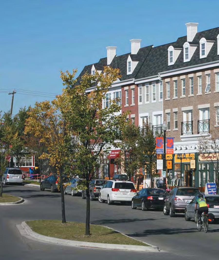
25 2.2.1 Vibrant, transit-supportive, mixed-use Activity Centres and Corridors Objective Build and diversify urban activities in Activity Centres and Corridors. What is the Primary Transit Network? It is a permanent network of high-frequency transit services, regardless of mode, that operates every 10 minutes or better, 15 hours a day, seven days a week. The MDP proposes a more compact urban form for Calgary by locating a portion of new housing and jobs within higher intensity, mixed-use areas that are wellconnected to the Primary Transit Network. Such areas define the strategic locations where high-quality transit and a diversity of commercial, residential and service uses currently exist, or where they could be developed over the long term. These locations have the capacity to support future residential and employment intensification in concert with the provision of high-quality urban environments and cohesive community development. Focusing most intensification to defined areas provides more certainty to the development and building industries and makes redevelopment more predictable for existing communities by lessening the impact on stable, low-density areas. Activity Centres and Corridors will increasingly act as priority locations for: Accessible, safe and convenient public transit hubs along the Primary Transit Network. A greater variety of housing choices within or near existing residential communities. Higher density residential and employment concentrations outside of the Centre City. Local opportunities for employment and daily retail and service needs. Walkable destinations and local gathering places for adjacent communities. Activity Centres Areas identified for future Activity Centres generally have a low-density built form today and an existing employment character to build upon. Their parcel size, location and built form provide the potential for comprehensive, higher-intensity development that can be integrated with the Primary Transit Network as well as with adjacent communities. Activity Centres are classified into three types: Major Activity Centres (MAC) Major Activity Centres are areas of high job and population growth located in strategic areas central to larger residential catchment areas and linked city-wide by the Primary Transit Network. Community Activity Centres (CAC) Community Activity Centres are areas of moderate job and population growth convenient to one or more communities and supported by the Primary Transit Network. Neighbourhood Activity Centres (NAC) Neighbourhood Activity Centres are smaller mixed-use areas within neighbourhood districts that are appropriate locations for local job and population intensification, in scale with neighbourhood context. This hierarchy recognizes that all local contexts are not the same and that varying scales of development opportunity, mix of uses and levels of transit service will be needed to achieve city-wide objectives in a manner sensitive to local communities. Specific land Part 2 City-wide policies September THE CITY OF CALGARY MUNICIPAL DEVELOPMENT PLAN 2-9
26 use, transportation and urban design policies and implementation strategies for each Activity Centre are provided in Part 3 of the MDP. iii. Achieves the residential and employment intensity thresholds of the applicable Activity Centre and Corridor contained in Part 3 of the MDP; Part 2 City-wide policies 2.2 September 2009 Corridors Development opportunities within Corridors relate to their existing role as retail streets and their potential to become places for urban intensification along the Primary Transit Network. The existing block layouts, business types and varied ownership patterns means planning and development may transform incrementally. Corridors are classified into two types: Urban Corridor Neighbourhood Corridor The Corridor hierarchy recognizes that all local contexts are not the same and that varying scales of development, the classification of road type, existing uses and levels of transit service will be needed to achieve city-wide objectives in a manner sensitive to local communities. Specific land use, transportation and urban design policies and implementation strategies for Corridors are provided in Part 3 of the MDP. Policies Activity Centres and Corridors a. Direct a greater share of new growth to the Activity Centres and Corridors identified on Map 1, in a manner that: i. Provides compact, mixed-use, high-quality urban development; ii. Concentrates jobs and people in areas well served by primary transit service, located close to transit stations and stops; iv. Concentrates urban development in a built form that helps to optimize existing public investment, municipal infrastructure and facilities; v. Provides a mix of employment, residential, retail and service uses that support the needs of adjacent communities; vi. Supports a range of housing opportunities in terms of type, tenure, unit size and affordability; and, vii. Creates an urban environment and streets that promote walkability and local connectivity. b. Plan the development of Activity Centres and Corridors appropriate to the local context by: i. Maintaining compatibility, avoiding dramatic contrast in height and scale with low density residential areas through limits on allowable heights and bulk of new development; ii. Creating transitions in development intensity between low density residential areas and more intensive multi-unit residential or commercial areas; iii. Locating the tallest buildings and highest densities closest to transit stops and stations, and stepping down heights and densities away from transit; iv. Massing new development to frame adjacent streets in a way that respects the existing scale of the street; v. Limiting the impacts of shadowing on neighbouring streets, parks and properties; and, 2-10 THE CITY OF CALGARY MUNICIPAL DEVELOPMENT PLAN
27 vi. Providing public systems, including connecting pathways, that facilitate direct, convenient, comfortable and safe pedestrian movement to transit, recreational uses and other services. c. Co-ordinate planning and public investment decisions to support the development of a greater variety of medium and higher density housing forms in Activity Centres and Corridors. d. Support Activity Centres and Corridors as locations for the growth and intensification of major employment uses (including post-secondary and medical institutions) by linking them to the Primary Transit Network. e. Identify the appropriate jobs and population ratio and planning area boundaries for Activity Centres and Corridors through the Local Area Planning process. f. Identify appropriate locations and scales of Activity Centres and Corridors required to support urbanization of the Future Greenfield areas through future Regional Context Study processes. Part 2 City-wide policies September THE CITY OF CALGARY MUNICIPAL DEVELOPMENT PLAN 2-11
28 2.2.2 A transit-supportive land use framework Objective Establish a land use framework that optimizes population and job growth within walking distance of transit. Transit-oriented development (TOD) TOD is a strategy that promotes higher density, mixed use development within walking distance of a public transit station. Density Part 2 City-wide policies The type and quality of transit service that can be economically supported in a community is determined almost exclusively from the land use characteristics of the area. There are four key land use elements that are critical to supporting quality transit service. These elements are: Density The intensity of people living or working in the area Diversity Mixing land uses Design Creating a quality pedestrian environment (see also Section 2.4 Urban design) Distance Locating the right uses close to transit The successful integration of these elements within a local planning context will determine the ultimate success of encouraging transit ridership. To be cost-effective, transit must reach a sufficiently sized pool of potential riders. Development of population and jobs above minimum density levels is essential, as this affects the quality (frequency of service), range (service choices) and duration (hours of operation) of transit service that can be provided in an area. Minimum thresholds of 100 people or jobs per gross developable hectare are needed within walking distance of a transit network (approximately 400 metres) to support service levels of 10 minutes or less over extended periods of the day. Where higher orders of employment or residential intensification are desired in MACs or Urban Corridors to support numerous routes of the Primary Transit Network, minimum thresholds of 200 people or jobs per gross developable hectare should be achieved within walking distance of the transit stop or station. What does an Intensity Threshold look like? 2.2 What might the minimum target of 200 jobs and population per hectare (pph), look like on the ground? To illustrate this, three different options are provided: one where there is a balance (50/50 split) between jobs and population; one where there are more jobs than population (75/25 split); and one where there are fewer jobs than population (25/75 split). The appropriate split for each Major Activity Centre (MAC) or Urban Corridor will be determined through a Local Area Plan. Assumptions have been made on residential occupancy rate (two people per unit) and floor space per employee (30 sq. m). September 2009 Jobs Balanced 100 (3000 sq.m. of office) Job Focused 150 (4500 sq.m. of office) Population Focused 50 (1500 sq.m. of office) Possible Job Form Low and Mid-rise office Mid-rise office Low rise office, retail Population 100 pph 50 uph 50 pph 25 uph 150 pph 75 uph Possible Housing Form Townhouses, stacked townhouses Semi-detached Townhouse Stacked townhouse, low-rise to high-rise apartments 2-12 THE CITY OF CALGARY MUNICIPAL DEVELOPMENT PLAN
29 How do minimum intensity thresholds compare to density? Dwellings per Ha Dwellings per Ac Population Intensity Assuming 2.5 Assuming 1.5 Assuming 2.5 Assuming 1.5 (Population/Ha) persons per unit persons per unit persons per unit persons per unit Table 2-1: Comparison of population intensity to housing density Diversity Distance A diversity of land uses within transit areas is needed People are most likely to use public transit if it is to create local destinations that attract transit riders accessible and convenient to their travel needs. Higher as well as provide walkable destinations for residents density development should be focused closest to and employees. Generally, a broad variety of residential transit, within a distance that a rider is most likely to and employment uses should be provided, supported walk. This is typically a five minute walk, focussed within by local retail, service, recreation and amenity uses. a 400 metre distance. A compact urban form focused Diversity can also include a mix of uses and intensities around transit will promote greater mobility choices. between different transit areas, to promote counter-flow Local Area Plans will determine areas appropriate for transit travel during peak commuter periods as well as intensification. support off-peak ridership. This also means providing more employment uses within Activity Centres outside of Policies the Centre City and a broader mix of residential, cultural Transit-supportive density and uses and entertainment uses in the Centre City and at larger transit hubs within more established areas of the city. a. Locate transit-supportive land uses, including higherdensity residential and employment developments, Design within Activity Centres and Corridors supported by All transit trips begin and end with a pedestrian. Creating the Primary Transit Network. a strong pedestrian environment within transit areas is b. Increase development densities in proximity of the essential to promote walkability. Design should include Primary Transit Network by targeting residential and features that create a direct, convenient and safe employment intensities within 400 metres of transit pedestrian system that is integrated with transit service. stops, in areas deemed appropriate through the Local Design must also recognize local context and create Area Planning process and in accordance with the urban environments that support and integrate new Typology thresholds identified in Part 3. development with existing communities. c. Locate land uses that will generate counter-flow transit ridership during peak-hour commuting times and support non-peak hour ridership. Part 2 City-wide policies September THE CITY OF CALGARY MUNICIPAL DEVELOPMENT PLAN 2-13
30 d. Underutilized commercial and brownfield sites accessible to the Primary Transit Network should be redeveloped over time, where feasible, as mixed-use and/or employment intensive sites. Design to encourage transit use policy to recognize the Centre City s role within the overall urban structure of the city. Policies Centre City Part 2 City-wide policies e. Ensure that the design and mix of land uses surrounding transit stops and stations support transit and emphasize a pedestrian oriented environment. f. Manage vehicle traffic within transit station areas and reduce conflicts between pedestrians and vehicles. g. Develop new mobility management strategies that will reduce the demand for vehicle access and parking A vibrant Centre City Objective Create a liveable, vibrant and diverse Centre City. a. Reinforce the Downtown s position as Calgary s principal business centre, premier urban living environment and centre for the arts, culture, recreation, tourism and entertainment. b. Support the development of distinct, vibrant, mixed-use neighbourhoods in the Centre City, well connected and easily accessible to the Downtown and to one another Complete communities Objective Foster distinctive, complete communities with a strong sense of place. 2.2 September 2009 The Centre City forms a prominent image of Calgary as an energy and business centre, serving as a focal point for office workers, residents and visitors. This image of the city will be reinforced through ongoing enhancement of the Centre City as a livable, thriving and caring place. The Centre City is expected to undergo significant growth in both residential and employment populations, and will serve as a model of how to achieve high-density residential and employment areas while ensuring an attractive environment and high quality of life. The Centre City Plan promotes the Downtown as the strong commercial core well-served by transit, supported and connected by walkable, mixed-use neighbourhoods, and Stampede Park. This plan supports the vision of meeting the needs of a series of unique neighbourhoods while continuing to retain and enhance the vital role that the Downtown and its surrounding neighbourhoods play in the entire city. The MDP provides high-level supporting Calgary s strategy for creating a sustainable city builds on the foundation of accommodating future growth within mixed-use communities of varied intensities at appropriate locations throughout the city. These communities are supported by a well-designed and compact urban form that is respectful of adjacent communities and provides appropriate transition to adjacent development. The MDP promotes a city where new growth is leveraged to build more complete communities. This means supporting completeness in planning for communities, as well as the timely completion or buildout of those communities. Complete communities are vibrant, green and safe places, where people of varying ages, incomes, interests and lifestyles feel comfortable and can choose between a variety of building types and locations in which to live, and where daily needs can be met. This strategy supports diversity to ensure 2-14 THE CITY OF CALGARY MUNICIPAL DEVELOPMENT PLAN
31 a range of community retail and services, elementary schools, recreation facilities and community associations are more viable and accessible. The diversity within complete communities generates more choice, so that residents have the opportunity to live and remain in their own neighbourhood as their housing needs change over their lifetime. There are choices for businesses to locate across the city in communities or in a variety of employment areas accessible to local residential concentrations and quality transit service. Policies Complete communities a. Support the development of complete communities to ensure a compact and well-designed urban form that efficiently utilizes land and infrastructure, provides housing choices at transit-supportive densities, local services and employment and promotes mobility options. b. Communities should be planned according to the following criteria for complete communities and provide: i. A range of housing choices, covering a mix of built forms and ownership tenures, at densities that support transit viability, local commercial and other services; ii. Diversified employment opportunities that are integrated into the community or easily accessible by a number of modes of travel; iii. Neighbourhood stores, services and public facilities that meet day-to-day needs, within walking distance for most residents; iv. Public transit that is supported by good service and ease of access; v. Distinctive, attractive neighbourhoods that feature architectural and natural elements that contribute to a local identity and strong sense of place; vi. Public spaces, parks and recreation facilities that provide access to nature, cultural events and social gathering areas, and support sports, relaxation and outdoor activities; vii. Spaces for community gardens and local food production; viii. Local schools, social infrastructure, places of worship and community services; ix. A connected street and mobility network that promotes comfortable, safe and universallyaccessible travel; x. A healthy natural environment with street trees and greenery, connections to the city s open space system and an integration of local natural systems with an urban development pattern that respects the natural function of the landscape; xi. Public infrastructure and services that are provided in a timely fashion and sustained over the long term by stable community populations; and, xii. Green infrastructure and energy-efficient community design and site planning (see Section 2.6). Jobs/housing balance c. Promote a greater balance of residential and employment within communities and across the city by: i. Increasing residential housing opportunities in areas close to existing employment concentrations; Part 2 City-wide policies September THE CITY OF CALGARY MUNICIPAL DEVELOPMENT PLAN 2-15
32 Part 2 City-wide policies 2.2 September 2009 ii. Increasing employment opportunities in areas close to existing residential concentrations; and, iii. Creating better mobility linkages between existing concentrations of residential and employment populations. d. Locate and plan new communities to ensure adequate access to employment opportunities within the hierarchy of activity centre and/or corridor areas located to serve the new growth areas Strong residential neighbourhoods Objective Reinforce the stability of Calgary s neighbourhoods and ensure housing quality and vitality of its residential areas. Residential communities are not static. They will evolve over time as demographics shift and buildings age, offering an opportunity to review and accommodate changing community needs. Understanding this community dynamic can help develop plans and strategies to stabilize local population fluctuations, support predictability for the market, guide public reinvestment and ensure long-term viability of local services and facilities. Outside of the major focus of the Activity Centre and Corridor areas, low to moderate density infill development can be accommodated to support the efficient use of land, infrastructure and services as well as enhance housing choice and affordability. In many cases, public infrastructure and transit service are already in place to support redevelopment. Calgary s older residential areas present some of the best Defining Community and Neighbourhood The terms Community and Neighbourhood are both used within the MDP. The term Community is typically used to describe a geographic area of between 5,000 and 20,000 residents, that was planned comprehensively and developed over a period of time. The boundaries of a community are usually used to delineate community associations and statistical data collection boundaries. This term also emphasizes the bonds that link residents to each other and to the neighbourhood they call home, or to a group with which they share a common interest. The term Neighbourhood is used to describe a distinct part of a larger community, containing up to 5,000 people. A neighbourhood is typically considered as an area within walking distance of a local commercial area, school, park, transit station, etc. As compact, pedestrian friendly and mixed use areas, the neighbourhood becomes the building block from which enduring settlements are formed. opportunities to accommodate infill development, increasing the range of housing for families and individuals within areas that take advantage of existing infrastructure, transit and existing amenities such as local retail, schools, parks and community services. Intensification should be accommodated within existing communities in a sensitive manner. In commercial areas, infill and redevelopment can create more cohesive and vibrant neighbourhoods. Integrating new development with existing buildings can enhance or fill in gaps in the street wall to improve the vitality, appearance and security of streets and public spaces. The City promotes infilling that is sensitive, compatible and complementary to the existing physical patterns and character of neighbourhoods THE CITY OF CALGARY MUNICIPAL DEVELOPMENT PLAN
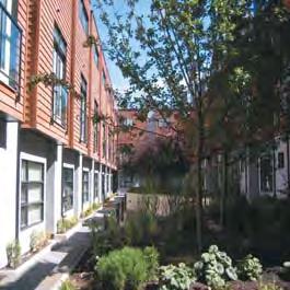
33 Policies Neighbourhood infill and redevelopment a. Encourage growth and change in low-density neighbourhoods through development and redevelopment that is similar in scale and built form and increases the mix of housing types such as accessory suites, semi-detached, townhouses, cottage housing, row or other ground-oriented housing. b. Support development and redevelopment that provides a broader range of housing choice in local communities to help stabilize population declines and support the demographic needs of communities. c. Encourage higher residential densities in areas of the community that are more extensively served by existing infrastructure, public facilities and transit, appropriate to the specific conditions and character of the neighbourhood. d. Encourage redevelopment that incorporates green infrastructure solutions and shared energy efficiencies (See Section 2.6). Large redevelopment sites e. In Developed Areas, require comprehensive plans when large sites (greater than 1.0 hectare in size) become available for redevelopment. To the greatest extent possible, new development should be integrated into the fabric of the surrounding communities. Part 2 City-wide policies September THE CITY OF CALGARY MUNICIPAL DEVELOPMENT PLAN 2-17
34 Part 2 City-wide policies 2.3 September Creating great communities Goal Create great communities by maintaining quality living and working environments, improving housing diversity and choice, enhancing community character and distinctiveness and providing vibrant public places. Supports Key Direction #2: Provide more choice within complete communities. Key Direction #3: Direct land use change within a framework of nodes and corridors. Key Direction #4: Link land use decisions to transit. Key Direction #5: Increase mobility choices. Key Direction #7: Create complete streets. Key Direction #8: Optimize infrastructure. This section sets out a framework of policies that focuses on housing, the quality of the physical environment and the amenities and services required for day-to-day, neighbourhood-focused living. Forecasts indicate that there will be large changes in the coming decades, not only in the total numbers but also in the make-up of Calgary s population profile. Older citizens will make up an increasingly larger proportion of the population and Calgary will become more ethnically diverse. Future citizens will need different housing types, in different locations and configurations. Future growth will also bring clear challenges to providing affordable and quality housing, community services and wider mobility choices for an increasingly diverse population. In addition to meeting housing demands, The City will strive to maintain strong communities. This means that future growth does not undermine what Calgarians value most in their neighbourhoods, communities and city as a whole. This includes the built and natural heritage, access to safe and attractive parks and public spaces and overall liveability. Preserving the best qualities in Calgary s neighbourhoods and supplementing them with new, sustainable development is a key piece of Calgary s future growth strategy. Local context, a diversity of land uses and variation in building densities and scales all have significant implications for neighbourhood liveability and investment in public infrastructure and programs. The concept of great communities emphasizes these elements and the bonds that link Calgarians to their communities. Policies in this section are aimed at promoting individual and community health and promoting a good quality of life by: Nurturing vibrant, active, healthy, safe and caring communities. Pursuing economic and housing diversification in order to make Calgary a city of variety and choice. Recognizing and building upon existing neighbourhood character, heritage and cultural identity. Providing quality public spaces, parks and other local amenities and leisure, cultural and recreation activities to all Calgarians. Designing communities for social cohesion and health and wellness. Providing citizens with opportunities to become involved in decision-making processes and effectively engaged in shaping their local communities. Policies are also provided on a number of social issues that can have direct links to the built form of a city, including public safety, affordable housing and social inclusion THE CITY OF CALGARY MUNICIPAL DEVELOPMENT PLAN
35 2.3.1 Housing Objective Ensure a choice of housing forms, tenures and affordability to accommodate the needs of current and future Calgarians and create sustainable local communities. Access to adequate and affordable housing is a fundamental component of the quality of life in a city. Factors influencing access include price, supply and the distribution of a variety of housing types. The housing market and different levels of government play vital roles in ensuring that housing choice exists for a range of needs and income levels. The City will ensure that the residential planning framework supports the delivery of housing supply in a range of types and tenures to meet current and future community needs, preferences and financial capabilities. Through setting public land use and transportation policy, The City exercises significant influence over how and where future housing is provided. Housing policy is addressed on four levels: Increasing housing choice across the city. Accommodating a mix of dwelling types to meet a full range of housing needs in all communities. Facilitating conditions to enable citizens from a wide economic and demographic spectrum to live within a community. Minimizing the impact of public decisions on the cost of housing and household mobility. Neighbourhoods that accommodate a broad range of housing types can be less vulnerable to the consequences of community life cycling (i.e., population gain, peaking, population decline, levelling off). A population base that is relatively stable over the long term helps to ensure that community facilities (e.g., schools, retail and recreational facilities, community associations) and public services (e.g., personal and community services, medical services) are maintained and fully utilized. A limited range of housing choices can result in some residents leaving their community if their housing needs can no longer be met. Given Calgary s projected demographic changes, this becomes increasingly likely as people age or household composition changes and residents are no longer able, or wish to maintain a single-detached home. Existing communities that have the capability to add new housing units and compensate for declining populations tend to retain or regain their vitality, as evidenced in Calgary s inner-city communities. As well, new communities that are planned and built from the outset to include a wider variety of housing choices may avoid future population swings and ensure long term stability. Policies Housing diversity and choice a. Provide for a wide range of housing types, tenures (rental and ownership) and densities to create diverse neighbourhoods that include: i. A mix of housing types and tenures, including single detached, ground-oriented (e.g., duplexes, row houses, attached housing, accessory dwelling units and secondary suites), medium- and higherdensity and mixed-use residential developments; and, ii. A range of housing choices, in terms of the mix of housing sizes and types to meet affordability, accessibility, life cycle and lifestyle needs of different groups. Part 2 City-wide policies September THE CITY OF CALGARY MUNICIPAL DEVELOPMENT PLAN 2-19
36 b. Promote a broader range of housing choice for all ages, income groups, family types and lifestyles by: i. Encouraging housing opportunities for low- and moderate-income households in all communities; ii. Affordable housing to locate in all areas of the city, with a focus on locations served by the Primary Transit Network and appropriate services, while avoiding an over-concentration of affordable housing in any one area; Part 2 City-wide policies 2.3 September 2009 ii. Promoting innovative housing types, such as co-housing, live/work and cottage and carriage housing and accessory dwelling units, as alternative means of accommodating residential growth and providing affordable housing options; and, iii. Including supportive land use policies and development strategies in Local Area Plans that encourage the provision of a broader range of housing affordable to all income levels. c. Ensure a sufficient land supply for residential development in Developed and Developing Areas to accommodate Calgary s share of regional household growth (see Part 5 of the MDP). d. Promote methods to efficiently use or adapt the city s existing housing stock to enable changing households to remain in the same home or neighbourhood for many years. Strategies may include allowing accessory units in low-density areas and other methods determined through community planning processes. Increased opportunities for affordable housing e. Recognize and encourage affordable housing as an integral part of complete communities. f. Create affordable housing by encouraging: i. A varied community composition by providing opportunities for small-scale affordable housing to locate in all areas of the city; iii. Affordable housing serving families to locate in areas close to parks, schools, recreation facilities and commercial nodes; iv. New development and redevelopment to incorporate affordable housing that is visually indistinguishable from market housing; v. Affordable housing units of different sizes and types within market residential developments; vi. The provision of an adequate supply of rental accommodation across the city that is affordable to low-and moderate-income households; and, vii. Partnerships with developers, other orders of government and non-governmental agencies to pursue measures to ensure construction of affordable housing in multi-unit development projects, in new communities and within redevelopment areas. Special care facilities g. Accommodate special care facilities within residential and mixed-use communities to provide for a broad range of specialized accommodation and care in order to meet a diverse array of city-wide and community needs, including nursing homes, adult group homes, youth care facilities, rehabilitative homes and transitional facilities. h. Special care facilities should be small scale in nature and dispersed throughout the city, in a form that fits with local neighbourhood character THE CITY OF CALGARY MUNICIPAL DEVELOPMENT PLAN
37 i. Discourage an over concentration of facilities serving one type of need in any community. Child care services j. Recognize child care services as an integral part of complete communities and accommodate these services as appropriate within residential communities and workplace contexts Respecting and enhancing neighbourhood character Objective Respect and enhance neighbourhood character and vitality. The sense of place inherent in Calgary s neighbourhoods is a function of their history, built form, landscape, visual qualities and people. Together, the interaction of these factors defines the distinctive identity and local character of a neighbourhood. The prospect of a more significant portion of future growth being directed to the Developed Areas of the city requires a heightened focus on higher quality standards of urban design and construction that ensures that development builds upon and adds value to the existing character of communities. Activity Centres and Corridors and other comprehensive redevelopments provide some of the greatest opportunity for positive change. However, significant change can impact adjacent low density residential neighbourhoods. Attention must be paid to ensuring that appropriate local context is considered when planning for intensification and redevelopment. Policies a. Respect the existing character of low-density residential areas, while still allowing for innovative and creative designs that foster distinctiveness. b. Ensure an appropriate transition of development intensity, uses and built form between low-density residential areas and more intensive multi-residential or commercial areas. c. Ensure infill development complements the established character of the area and does not create dramatic contrasts in the physical development pattern. d. Ensure that the preparation of Local Area Plans includes community engagement early in the decision making process that identifies and addresses local character, community needs and appropriate development transitions with existing neighbourhoods. Part 2 City-wide policies September THE CITY OF CALGARY MUNICIPAL DEVELOPMENT PLAN 2-21
38 Part 2 City-wide policies Heritage and public art Objective Protect historic resources and promote public art. Historic preservation is part of good city building and community identity. Heritage buildings and historic districts serve to enhance our perspective, understanding and awareness of our past and help to build a sense of identity and pride in our local communities. Preserving historic buildings maintains a human scale of structure and detail that isn t often achieved in new development. These buildings generally provide a rich range of detail and texture and a diverse and attractive pedestrian environment. Historic preservation also provides tremendous economic and environmental benefits. The reuse of existing structures has significant energy savings. Furthermore, historic structures and districts can stimulate commercial activity and increase tourism activity and spending. The Alberta Historical Resources Act defines a historic resource as: any work of nature or of humans that is primarily of value for its paleontological, archaeological, prehistoric, historic, cultural, natural, scientific or aesthetic interest including, but not limited to, a paleontological, archaeological, pre-historic, historic or natural site, structure or object. Policies Heritage a. The City will identify and help to protect and manage Calgary s historic resources. b. Ensure that the protection and enhancement of historic assets in Calgary is based on an understanding of their special character and form part of the wider design and urban development agenda. c. Identify districts, public spaces and buildings of special historic quality and character, and adopt policies for their protection and enhancement. 2.3 The Calgary Heritage Strategy identifies the following key principles: Values: Historic preservation is about values. We preserve historic resources because they have value to our community aesthetic, historic, scientific, economic, cultural, social, natural or spiritual qualities that make a place important or significant for past, present or future generations. d. Encourage owners to conserve and/or enhance Calgary s historic resources, including historic structures, streetscapes, landmarks and viewpoints, parks and gardens, landscapes, topographical and natural features, archaeological sites and artifacts. e. The City will be a leader in preserving and enlivening historic resources using all tools and mechanisms currently available to a municipality. September 2009 Alignment: To be most effective, historic preservation efforts must be integrated and aligned with overall community and City goals, planning principles, practices and process across all stakeholder groups. f. The City will be a role model for the creative use and adaptive reuse of City-owned heritage buildings, including excellence in maintenance and restoration. g. Incorporate local history interpretive elements in public realm improvements in communities and historic districts THE CITY OF CALGARY MUNICIPAL DEVELOPMENT PLAN
39 Public art Public art: h. Integrate works of art within the public realm, particularly when designing new public buildings infrastructure and public spaces. i. Encourage private developments to incorporate public art Parks, open spaces and outdoor recreation Objective Create quality public parks, open spaces and other community amenities, and make leisure and recreation activities available to all Calgarians. Parks and open spaces are special places within the urban environment. These spaces enrich the fabric of our city and provide a unifying framework across neighbourhoods and communities, a means of orientation and special places for gathering, relaxing or active recreation. Calgary is a city recognized for its vast network of open spaces, consisting of parks, natural corridors, pathways and trail systems that serve many functions. The City will strengthen the connection between its natural areas, public parks and communities to enhance opportunities for outdoor recreation, retain Calgary s natural and cultural heritage and conserve biodiversity and important environmental systems. Together, these promote overall community health and quality of life for all Calgarians. Calgary s most prominent natural open spaces occur on its ridges and hilltops and along its creeks and riverfronts within the river valley system. The City is committed to protecting the value and quality of these assets and will strive to sustain them while ensuring they remain accessible for the enjoyment and outdoor pursuits of all. Public art is an important component of a healthy and interesting place, contributes to the economy and inspires individual creativity. The City of Calgary Public Art Policy ensures that our visual environment and identity is as intentional, deliberate and carefully considered as other infrastructure systems. In addition to these natural areas, The City provides quality public parks, open spaces and other community amenities by: Protecting, conserving and restoring environmentally significant areas, and providing a sustainable, connected and diverse open space system that represents the natural ecosystem of Calgary the region. Protecting, conserving and enhancing urban parks and opens spaces. Providing a healthy, well-managed urban forest and natural environment areas. Maintaining and improving the quality and distribution of, and public access to, recreation and cultural facilities, open space, parks and natural areas. Providing a safe, attractive and comfortable environment through quality landscaping. Protecting and promoting an integrated, openspace network to better connect communities. In the communities of Bowness and Montgomery, the multi-use pathway route is not to cross over privately owned land. Providing high-quality open space and neighbourhood, community, regional and city-wide recreation opportunities to service new development or redeveloped areas. Fully serving Calgarians with a comprehensive range of community services and programs. Part 2 City-wide policies September THE CITY OF CALGARY MUNICIPAL DEVELOPMENT PLAN 2-23
40 Part 2 City-wide policies 2.3 September 2009 Creating and sustaining healthy communities requires promoting active living through the provision of a wide range of accessible recreational programs, services, facilities and amenities. Many types of recreation are provided to serve all age groups and interests. The need for new types of parks may be more critical in some areas of the city due to denser development patterns. The important role that community associations, social recreation groups and civic partners play in providing and maintaining community facilities and programs is also acknowledged. Policies A high-quality public park system a. Provide a high-quality park and open-space system to meet the varying needs of Calgarians. b. Create a comprehensive and connected park, pathway and open-space system that links neighbourhoods, public parks, plazas and squares and the river valleys. c. Maintain and enhance the riverfront as an active, liveable, pedestrian/bicycle-oriented amenity. d. Protect and improve scenic landscapes that enhance the amenity and character of Calgary s river valley park system, other waterways and wetlands, natural tree stands and prominent escarpments. e. Protect and promote large-scale landscaped and open-space areas that define neighbourhoods and local topography and enhance Calgary s river valley park system. f. Protect the basic function of city parks and public open spaces, and prevent parkland conversion to other uses. Land use, location and design g. Provide neighbourhood parks within a five-minute walk of all residents. h. Ensure sufficient community open space provision in Inner City and Established Areas by maintaining a minimum of 2.0 hectares of open space per 1,000 residents. Calculations should be applied to logical community clusters where parks and recreation amenities are accessible and shared between communities. Community open space includes areas dedicated for schools; community centres; playfields; outdoor performance spaces; community gardens; and habitat areas that offer public amenity. i. Plans for new communities should include a hierarchy of parks and public spaces interconnected to adjacent neighbourhoods by pathways and complete streets. j. Plan land uses adjacent to public parks that are supportive and enhance the vitality of both existing and new open spaces. k. New development adjacent to the public pathway system should maintain existing connections to pathways or provide new linkages. l. Encourage higher quality parks near high-density residential buildings to act as a local amenity and places for community gathering, with greater focus on site design qualities than the quantity of park space. m. Design parks, facilities and recreational centres in a way that is compatible with nearby residential and commercial uses. n. Locate and design public gathering areas within parks and public open spaces to optimize sun exposure during midday hours THE CITY OF CALGARY MUNICIPAL DEVELOPMENT PLAN
41 Inclusive, accessible, safe parks o. Ensure that all public parks, open spaces and amenities are fully accessible and promote public safety. w. Encourage the provision of outdoor recreational space in private developments, including private schools, institutions, campuses and business parks. p. Ensure public access is maintained or improved to major water bodies, including the Bow and Elbow Rivers and Nose Creek, where appropriate access can be acquired and maintained across public lands or from public roads and pathways. q. Ensure that all parks, open spaces and amenities are located and designed in accordance with principles of universal access and barrier-free design. r. Support the design and redesign of parks, recreation and cultural facilities to reflect changing user needs and preferences. s. Design parks and open spaces to provide opportunities for cultural enjoyment and artistic pursuits. Outdoor recreation t. Develop and maintain open spaces, parks, recreational, sport and cultural facilities to provide for active recreation and passive recreational needs that are appropriate for all age groups and abilities. u. Support linear parks and linkages, where appropriate, to promote connectivity and facilitate walking and cycling. v. Recognize the role of complete streets and the sidewalk system as another means to provide amenity and recreation opportunities, particularly in dense neighbourhoods such as the Centre City, Activity Centres and Corridors, where additional land for traditional park space is more difficult to assemble. Part 2 City-wide policies September THE CITY OF CALGARY MUNICIPAL DEVELOPMENT PLAN 2-25
42 Part 2 City-wide policies 2.3 September Municipal, school and environmental reserves The MGA requires a municipal development plan to include policies respecting the provision for reserve lands, including municipal reserves (MR), school reserves (SR) or municipal and school reserves (MSR). These policies include, but are not limited to, the need for, amount of, and allocation of those reserves and the identification of school requirements in consultation with affected school authorities. The subdivision authority may require certain lands, such as natural drainage courses; lands that are prone to flooding; unstable lands; and strips of land adjacent lakes, streams or other water bodies to be provided as environmental reserves (ER), subject to the provisions of the MGA. Policies Municipal and school reserves a. Require that 10 per cent of lands that are the subject of a proposed subdivision be dedicated for the purpose of providing municipal reserve (MR), school reserve (SR) and/or municipal and school reserve (MSR), in accordance with the provisions of the MGA. b. Notwithstanding Policy 2.3.5(a) above, in the case of a strata (volumetric) subdivision of a portion of a building, the Subdivision Authority may consider reducing or eliminating the dedication of reserves or reducing or eliminating the payment of reserve cash-in-lieu, where the following condition is met to the satisfaction of the Subdivision Authority: the redevelopment site consists of a number of small parcels created on a prior subdivision that are required to be consolidated into a single parcel to meet the Alberta Building Code requirements for the building which is to be subsequently subdivided into strata lots. Where the Subdivision Authority does not require reserve to be dedicated as land or provided as money-in place of land, a deferred caveat should be registered against the Certificate of Title of the parcel(s) to the satisfaction of the Subdivision Authority. Bylaw 6P2012, 5P2010 c. Enable dedication of reserves to occur in the form of reserve land, money in lieu or, if warranted, filing a deferred reserve caveat against the title of the lands being subdivided. The means of reserve dedication will be determined by the Subdivision Authority upon the advice of the Joint Use Co-ordinating Committee. d. Prioritize the location and allocation of municipal reserve, school reserve, municipal/school reserve land as follows: i. Neighbourhood needs elementary schools, elementary/junior high schools and neighbourhood parks. ii. Community needs junior high schools, community associations, open space linkages and priority environmentally significant lands. iii. Regional needs high schools, pools, arenas, athletic parks and other recreational facilities. e. Support the dedication of additional municipal reserves where the density of land being subdivided is equal to or more than 30 units per hectare, subject to the limitations of the MGA and the discretion of the Approving Authority. f. Additional reserve land purchased by The City or the school authorities through the use of the Joint Use Reserve Fund should not be considered to comprise part of the landowner s dedication at the time of subdivision. Environmental reserves g. At the time of subdivision, Environmental Reserves (ER) should be provided in accordance with the MGA THE CITY OF CALGARY MUNICIPAL DEVELOPMENT PLAN
43 2.3.6 Community services and facilities Objective Provide for a full range of community services and facilities. Community services and facilities include community and recreation centres, arenas, community health clinics, community gardens and publicly funded schools and libraries. They are located across the city within both communities and neighbourhoods (as defined in Section 2.2.5). Providing opportunities for a full range of community services and facilities is the shared responsibility of The City and public agencies, with the participation of the development industry. The presence of local schools is a positive addition to neighbourhood life and an essential component of complete communities. Recreation, which includes sport, arts and culture, physical and leisure activities also plays a key role in fostering active and vibrant neighbourhoods. The principles below represent characteristics of recreation services and community facilities used by The City to achieve active and vibrant neighbourhoods: Integrated and proactive Plan for the integration of new facilities, and balance development with redevelopment while satisfying future recreation and facility trends. Multi-purpose New and redeveloped/re-purposed recreation facilities will be designed with components that respond to diverse needs, interests, levels of ability and skill level. Grouping Group recreation facilities with other community services as appropriate. Flexible Ensure, to the degree possible, that facilities are flexible in design, with opportunities to accommodate as wide a range of uses as possible, and to be able to convert them to other uses in the future. Adaptable Strive to build and re-purpose facilities that will accommodate a range of sporting activities and artistic skills. Policies Community services and facilities a. Maintain sites with existing public facilities and promote their reuse for new or expanded community services and recreational and educational facilities to meet changing community needs. b. Ensure that recreation services and facilities are located conveniently to catchment areas of the users and are designed in accordance with the principles of universal design. c. Optimize the availability of community facilities, including areas for public engagement, personal growth, health and learning. d. Promote the optimum location of community services and facilities, including emergency services/protective services, recreational and educational facilities to meet community needs. e. Locate community services and facilities in a manner that integrates with the open space system. Part 2 City-wide policies September THE CITY OF CALGARY MUNICIPAL DEVELOPMENT PLAN 2-27
44 2.3.7 Foster community dialogue and participation in community planning Objective Promote community education and engagement. All Calgarians should be provided with opportunities to participate in shaping the future of their community. This Part 2 City-wide policies means encouraging on-going education, engagement strategies and collaborative neighbourhood planning processes that consider MDP strategies and local community-based aspirations. Community planning is a way to engage, in a meaningful way, local residents and businesses in the future of their community and to provide a local interpretation and implementation of the MDP policies. Community planning initiatives should follow The City s engage! Policy. Policies Community participation a. Recognize that community planning processes are critical implementation tools for refining and realizing the vision of the MDP. b. Work with the broad public and local community groups in planning for the future of local 2.3 neighbourhoods. c. Provide for effective community consultation and participation in projects of significance to The City and local communities. September 2009 d. Local planning studies will ensure the necessary resources and timeframes to undertake community planning projects in a manner that is responsible, thorough, transparent and includes participatory community planning and consultation THE CITY OF CALGARY MUNICIPAL DEVELOPMENT PLAN
45 2.4 Urban design Urban design involves: The art of making places that are attractive, Goal Make Calgary a livable, attractive, memorable and functional city by recognizing its unique setting and dynamic urban character and creating a legacy of quality public and private developments for future generations. Supports Key Direction #2: Provide more choice within complete communities. Key Direction #3: Direct land use change within a framework of nodes and corridors. Key Direction #5: Increase mobility choices. Key Direction #7: Create complete streets. Calgary is one of the most dynamic and fastest growing urban centres in Canada providing the opportunity to compete for business and workforce population globally. To compete on an international level, cities everywhere are recognizing the importance of the combination of physical characteristics and public amenities, which contribute to their image as attractive urban places. Urban design brings together the many elements and areas of expertise involved in great place-making, including land use planning, transportation planning, architecture, landscape design, engineering and development economics. The effective co-ordination of all of these city-making pursuits, through the instrument of urban design concepts and principles, will result in the creation of distinctive and cherished places. memorable and functional for the people who use them. The arrangement, shaping, appearance and functionality of urban public space. The complete collaboration and co-ordination of all related disciplines, including land use planning, transportation planning, architecture, engineering and landscape design, to achieve striking and effective results Creating a beautiful city Objective Make Calgary a more beautiful, memorable city with a commitment to excellence in urban design. Cities are made up of collections of great buildings and memorable spaces within and/or between the buildings where people live, work, play and visit. It is this collection the built environment and its architecture and public spaces that influences each individual s image of the city. The city can be planned and designed in a way that promotes the creation of civic beauty through a potent combination of architectural interest, material and spatial richness and visual variety. It is the resulting beauty of this combination, together with the legibility and complexity of the pattern, arrangement and scale of the streets spaces and buildings, that has a direct and daily impact on the quality of people s lives. Memorable places are the special spaces that have a major role in defining and enhancing the image of the city, the legibility of the physical structure and the enjoyment of residents and visitors. Calgary has Part 2 City-wide policies September THE CITY OF CALGARY MUNICIPAL DEVELOPMENT PLAN 2-29
46 Part 2 City-wide policies 2.4 September 2009 Urban Design Elements Thirteen Urban Design Elements are important to the creation of good urban design: 1. Creativity and innovation 2. Context and appropriateness 3. Connectivity and continuity 4. Functional and aesthetic integration 5. Legibility and accessibility 6. Enclosure and human scale 7. Comfort and safety 8. Quality and durability 9. Vitality and animation 10. Flexibility and adaptability 11. Diversity and variety 12. Sustainability and accountability 13. Wayfinding & orientation a unique natural setting. Its location, proximity to the Rockies, riverfronts, escarpments, ridgelines and other natural features are memorable, act as landmarks and are special for the value they add to the passive and recreational open space system. Calgary also has certain buildings, public places, artworks and structures such as bridges that act as landmarks. These natural and cultural landmarks provide city reference points that contribute to wayfinding, sense of place and city identity. Enhancing Calgary s unique natural and constructed assets through the appropriate design of our built form and mobility networks can strengthen the prominence of these resources and contribute to making Calgary a more beautiful city. Policies Civic image a. Locate and design significant sites and public buildings to promote their civic importance and, where appropriate, integrate open space that is designed to enhance the quality of the setting and support a variety of public functions. b. Preserve, enhance and feature important elements of significant architectural, topographical, landscape, scenic, ecological, recreational or cultural interest. Views and vistas c. Identify, preserve and enhance scenic routes and principal views of important natural or constructed features. Gateways d. Celebrate entranceways and gateways at major entry points to the city, the Centre City and communities through the use of distinctive urban design features, lighting, enhanced vegetation and landscaping, and public art features. Urban design excellence e. Promote excellence, creativity and innovation in architecture, landscape, site and overall community design and sustainability in design. Landscaping f. Encourage the use of landscaping approaches and design techniques to define public spaces, screen parking areas and adjacent building forms and direct pedestrian movement. g. Promote and protect trees in street corridors as a means to support pedestrian and amenity areas in commercial districts, soften industrial developments and enhance the attractiveness of residential communities THE CITY OF CALGARY MUNICIPAL DEVELOPMENT PLAN
47 2.4.2 Built form Objective Promote site and building design that contributes to high quality living environments and attractive, walkable, diverse neighbourhoods and communities. The City recognizes the importance of excellent urban design in the creation of great communities and neighbourhoods. The built form plays a critical role in defining the character and visual qualities of an area. To promote well-designed buildings, streetscape quality and attractive public spaces that reinforce or build unique neighbourhood character, community planning must include a consistent, design-led approach which: Creates a sense of place with unique neighbourhood character. Promotes design solutions that contribute to highquality living environments. Provides well-connected, pedestrian-friendly and transit-supportive networks. Conserves, protects and integrates existing natural, cultural and heritage resources. Promotes community safety. Two issues of particular importance to community design are tall buildings and the redevelopment of large sites within existing communities. A tall building is generally defined as a building whose height is greater than the width of the right-of-way of the street that it fronts. Well designed tall buildings can make a positive contribution to the city and create an interesting skyline. Tall buildings can also act as landmarks which, when appropriately located and designed, can contribute to orientation and way finding within urban areas. Tall buildings, by their nature, can have greater impacts on a larger area than small buildings and, thus, they have a larger civic responsibility and require additional built form principles to be applied to their design. Policies Site and building design a. Promote high quality standards of urban design and construction that ensures that development builds upon and adds value to the existing character of communities. b. The ground and lower levels of developments should demonstrate a strong relationship to the human scale and contribute positively to the public realm and street. c. Encourage the development of low and midrise buildings to achieve the desired intensity of development. d. In Developed Areas, require comprehensive plans when large sites (greater than 1.0 hectare in size) become available for redevelopment. To the greatest extent possible, new development should be integrated into the fabric of the surrounding communities. e. Tall buildings are appropriate in the Centre City, Major Activity Centres, or Community Activity Centres and Urban Corridors where deemed appropriate through a Local Area Plan. f. Plans and designs for tall buildings should ensure that they are: i. Sited and architecturally designed to contribute positively to the skyline of the city; ii. Designed with pedestrian scale at the base and a prominent roofline; iii. Integrated with adjacent areas by stepping down to lower-scale buildings and neighbourhoods; and, Part 2 City-wide policies September THE CITY OF CALGARY MUNICIPAL DEVELOPMENT PLAN 2-31
48 Part 2 City-wide policies iv. Considerate of the shadow impacts on adjacent residential areas and parks and open spaces Enhancing the public realm Objective Enhance the public realm and promote pedestrian use through the coherent and collaborative design of streets, building interfaces and public spaces. The public realm is made up of publicly accessible space both between and within buildings. The public realm includes streets and squares, special places, linkages, interfaces and pedestrian zones which are fundamental to the creation of a functional, visually attractive and safe environment for people. Pedestrians, bicycles and cars all contribute to lively and interesting streets. Good urban design will encourage and facilitate their co-existence, with pedestrian use given strong emphasis and careful consideration. d. Promote a higher degree of attention to the architectural design and detailing of building edges in areas of interface with heavy pedestrian traffic, notably commercial streets such as Urban and Neighbourhood Boulevards (see CTP Section 3.7 Complete streets). e. Consider seasonal factors when designing the public realm. f. The design of buildings, open spaces, pathways and parking areas should adhere to the principles of Crime Prevention Through Environmental Design (CPTED) while ensuring light spill into adjacent property or the surrounding environment is minimized. A reduction in light spill should be achieved by minimizing the intensity of light sources and directing light only to where it is needed. Bylaw 11P2013 g. Transit stations should be designed as vibrant, mixeduse areas incorporating public gathering areas and public art. Policies 2.4 a. Design streets and sidewalks to encourage pedestrian comfort, safety and linkages between neighbourhoods, open spaces and adjacent land uses. b. Safe pedestrian connections, transit shelters, bicycle parking, benches and clear wayfinding signage September 2009 should be provided to facilitate all travel modes. c. Provide sufficient and uniform sidewalk width to allow for comfortable and safe pedestrian traffic, the planting of trees and additional landscaping and wayfinding elements. Sidewalks should enhance the visual character of streets, with landscaping and buffer planting used to reduce the impacts of vehicle traffic THE CITY OF CALGARY MUNICIPAL DEVELOPMENT PLAN
49 2.5 Connecting the city Goal Develop an integrated, multi-modal transportation system that supports land use, provides increased mobility choices for citizens, promotes vibrant, connected communities, protects the natural environment and supports a prosperous, and competitive economy. Supports Key Direction #3: Direct land use change within a framework of nodes and corridors. Key Direction #4: Link land use decisions to transit. Key Direction #5: Increase mobility choices. Key Direction #6: Develop a Primary Transit Network. Key Direction #7: Create complete streets. The design of the transportation system has a significant impact on the urban form of the city. It contributes to the shape of our communities and employment centres and determines how we are able to move around these places. As a result, the transportation system must perform a wide variety of roles and consider the local context. It must provide more mobility choice for Calgarians through walking, cycling, transit, high occupancy vehicles, single-occupant vehicles, commercial vehicles and emergency services. This section provides a brief overview of the strategic changes for transportation in Calgary that will support the development of more complete communities and a more compact city, including: Transportation choice Transit networks Complete streets Comprehensive transportation policies for Calgary are provided in the Calgary Transportation Plan (CTP). The CTP provides relevant transportation policies, design guidelines and operational procedures that are closely linked with the MDP policies. Specific mobility policies are included in Part 3 of the MDP and are linked to specific land use Typologies Transportation choice Objective Maintain automobile, commercial goods and emergency vehicle mobility in Calgary while placing increased emphasis on sustainable modes of transportation (walking, cycling and transit). A more sustainable city requires an integrated transportation system that supports a compact urban form. Bringing jobs, housing services and amenities closer together encourages non-automobile modes of travel, providing more choice to Calgarians. In most cases, it will not be practical to accommodate all modes of travel equally in every part of the Calgary. More sustainable modes of transportation should be emphasized where they can provide convenient and realistic travel choices. The Transportation Sustainability Triangle shows the relative sustainability of each transportation mode, with walking being the most sustainable. Private vehicles will continue to be the most common travel choice, accounting for half to two-thirds of all trips in the future. This will be particularly true in outlying areas of the city where most destinations are too far to reach by walking and cycling, and where transit service is not as frequent or efficient. Transportation networks will be designed to manage the demand for vehicle use, Part 2 City-wide policies September Local transportation connectivity THE CITY OF CALGARY MUNICIPAL DEVELOPMENT PLAN 2-33

50 Part 2 City-wide policies Figure 2-2: The Transportation Sustainability Triangle 2.5 September 2009 and will be optimized using a wide range of tools and new technologies. Increased walking and cycling activity will occur primarily in the various Activity Centres and Corridors located across the city. Homes, jobs, services and amenities will be located in close proximity to each other in these locations. Therefore, the needs of pedestrians and cyclists should be given the highest priority in Activity Centres and Corridors. Transit service will offer the most convenient choices to people travelling between Activity Centres, and along the Corridors that connect them. Priority measures will enhance the reliability of transit services within and between these strategic locations, making transit competitive and an attractive option to private automobiles. The city is a major hub for goods movement in western Canada and the movement of goods and services by air, rail and truck plays an important role in the Calgary economy. The City must consider the needs of goods and services movement with emphasis on access to industrial areas, the airport and intermodal rail facilities. The needs of emergency services must also be considered carefully in all parts of the city. Policies a. Priorities for different transportation modes in each Typology must be assessed in accordance with Council approved policies and plans, including the CTP. b. Include more sustainable forms of transportation to support the needs of land use and development. c. Respect the needs of businesses and the impact on local communities in the planning, design and maintenance of goods and service movement in the city THE CITY OF CALGARY MUNICIPAL DEVELOPMENT PLAN
51 2.5.2 Transit Regional transit Objective Provide a safe, accessible, customer focused public transit service that is capable of becoming the preferred mobility choice of Calgarians. Base Transit Service will continue to provide good coverage and a basic level of service to all areas of the city. In addition, a well connected Primary Transit Network will link major city-wide destinations and connect Activity Centres and Corridors. Providing a Primary Transit Network, integrated with a high quality urban environment and multi-modal transportation corridors, will offer a high degree of mobility, with an attractive service offering reduced travel times, accessibility, comfort and safety. The elements of Calgary s new transit system strategy can be summarized as follows: Base Transit Service The Base Transit Service focuses on community level service with strong connections and convenient transfers to the Primary Transit Network. Areas served by the Base Transit Service will have a sufficient intensity of population and employment to achieve Council approved minimum performance policies for transit service. Primary Transit Network The Primary Transit Network, illustrated in Map 3, comprises a permanent network of high-frequency transit services that will include LRT, Bus Rapid Transit (BRT), streetcars/trams and frequent bus service that will operate every ten minutes or less over an extended time period, seven days a week. Primary Transit will provide for direct travel and seamless connections between transit services and regional transit connections and incorporate the highest standards with regard to level of service, operating speed, connectivity and amenities. The City will work with the Calgary Regional Partnership to proactively plan regional transit services. The short term regional transit goal is to implement an integrated, regional Bus Rapid Transit (BRT) service that would provide two-way service between key destinations within Calgary and adjacent communities. The long term goal is to provide regional commuter rail service in selected corridors to connect regional growth corridors and nodes. Linking transit and land use Providing transit-supportive land uses in close proximity to transit service is critical to attracting ridership and making it a viable and efficient travel choice. Mixing jobs and housing and incorporating appropriate intensities within these transit hubs will be essential in meeting the required population and job thresholds, supported by 10 minute transit service levels. Additional information on transit can be found in the CTP and Part 3 Typologies of the MDP. Policies a. Integrate land use planning with transit investments and service delivery to meet the objectives of both the CTP and MDP. Part 2 City-wide policies September THE CITY OF CALGARY MUNICIPAL DEVELOPMENT PLAN 2-35

52 Part 2 City-wide policies 2.5 September 2009 Figure 2-3: Complete Street zones Complete Streets Objective Increase the attractiveness, convenience and safety of all modes of transportation by creating a new selection of multi-modal streets that emphasize different modes of transportation, incorporate elements of green infrastructure and function in the context of surrounding land uses. Complete Streets allow people to move by foot, bike, bus or car; provide places to live, work, shop and play, and support the natural environment and the economy. The main function of roads and streets is to provide a connection between the origin (where we are) and destination (where we want to go). Applying the Transportation Sustainability Triangle means the development of multi-modal corridors that focus on all modes of transportation. Complete Streets also accommodate the movement of emergency services vehicles. Not every street in Calgary will be able to meet the needs of all users. Different types of streets have different functions that should fit into the community context. The Road and Street Palette A new Road and Street Palette has been developed to differentiate between more traditional roads, which primarily serve long-distance vehicle trips and do not interact with adjacent land uses, and streets, which serve a broader range of transportation modes and do interact better with adjacent land uses. Both streets and roads should provide mobility for a wide range of users, facilitate the movement for goods and services to support the economy and incorporate the elements of green infrastructure to enhance the environment. However, unlike streets, roads do not contribute to place-making since their primary role is the movement of people and goods over long distances at higher speeds. The Complete Streets section of the CTP and Map 4 of the MDP provide more information on Complete Streets and their functions. Traditionally, the elements within the right-of-way (e.g., travel lanes, medians, sidewalks, underground utilities, streetlights) have been the main focus of transportation 2-36 THE CITY OF CALGARY MUNICIPAL DEVELOPMENT PLAN
53 planning and design. However, the right-of-way is only part of the overall Complete Street. Complete Streets include not only transportation and utility components but also green infrastructure and public realm elements. How each of these elements is combined depends on the surrounding land use context and the transportation mode priorities. Adjacent land uses might range from parks and green space to intense corridor development with a mix of commercial and residential buildings. Complete Streets consist of horizontal and vertical zones, as shown in Figure 2-3. The quality of the public realm in streets located in Urban and Neighbourhood Corridors is a very important design consideration. The urban design and public realm policies contained in Section 2.4 should be followed when designing Complete Streets to function in the context of the surrounding environment. The CTP also specifies several special street types to support these land uses. Additional information on Complete Streets, along with policies and design guidelines, can be found in Part 3 of the CTP. Policies a. Ensure that land use strategies complement the Complete Street policies contained in Part 3 of the CTP Local transportation connectivity Objective Create better connectivity in future communities and Activity Centres for walking, cycling, and street networks, while also increasing access and reducing response times for emergency services. Connectivity describes the different route choices available to get from one place to another. In order for walking, cycling and transit to become viable alternatives to vehicle use, destinations must be located conveniently closer together and be more directly accessible to one another. Research shows that increased connectivity has a number of benefits, including: Enhancing public safety by reducing response times for emergency services. Improving the health of Calgarians by making walking and cycling viable options for travelling to work or other daily needs. Improving accessibility to the regional street system and reducing delays for motorists entering or leaving developments. Reducing walking distances to transit stops and improving routing for City services such as Calgary Transit and Waste & Recycling Services. Building communities that have the ability to adapt over time. Increasing social interaction between residents. Part 2 City-wide policies September THE CITY OF CALGARY MUNICIPAL DEVELOPMENT PLAN 2-37
54 Part 2 City-wide policies Effective design of local transportation networks, in Calgary and other North American cities, has shown that the land requirements for transportation infrastructure can be minimized using a variety of different street networks, while enhancing connectivity relative to recent curvilinear designs. Within future residential communities, concerns about traffic on residential streets can also be mitigated through the proper design of streets to manage the flow of traffic and discourage undesirable driver behaviour. Local transportation connectivity policies are included in Part 3 Typologies for Major Activity Centres, Community Activity Centres and Future Greenfields. Additional information on local transportation connectivity, along with policies and detailed guidelines to assess connectivity, can be found in Part 3 of the CTP. Policies a. Local transportation connectivity in Major Activity Centres, Community Activity Centres and Future Greenfield developments must be assessed according to the connectivity policies contained in the CTP. 2.5 September THE CITY OF CALGARY MUNICIPAL DEVELOPMENT PLAN
55 2.6 Greening the city Goal Conserve, protect and restore the natural environment. Supports strategies for protecting watersheds, habitats and biodiversity and to establish ecological networks that benefit the region as a whole. The MDP provides an opportunity to incorporate environmental objectives into land use, urban form and transportation planning to help to reduce impacts on the environment in areas such as: Key Direction #1: Achieve a balance of growth between established and greenfield communities. Key Direction #2: Provide more choice within complete communities. Key Direction #3: Direct land use change within a framework of nodes and corridors. Key Direction #5: Increase mobility choices. Key Direction #7: Create complete streets. Key Direction #8: Optimize infrastructure. Over the last one hundred years, Calgary has developed within prairie landscape rich with wildlife habitat and species, as well as natural vegetation, blue skies, warm Chinooks, and beautiful river valleys. Calgary has since evolved into an urban centre that has grown into and around these natural areas, but faces environmental challenges as a result of how it has grown and developed. It is clear that Calgarians want a healthy natural environment and aspire to a lifestyle that will reduce their ecological footprint. They want to manage and protect the air, water, land and biodiversity to benefit themselves and future generations. Environmental stewardship is a shared responsibility of government, business, communities and individual Calgarians. The City of Calgary is committed to leading and inspiring actions to reduce Calgary s ecological footprint and to conserve, protect and enhance the environment locally and regionally. The City recognizes the need to partner with adjacent municipalities and regional neighbours to develop Protecting environmentally-sensitive areas that conserve biodiversity and contribute to people s quality of life, the quality of communities and the quality of ecological systems. Creating a more compact urban form that uses less land and, therefore, reduces habitat loss and fragmentation and adverse impacts on wildlife, vegetation and water quality and quantity. Reducing the amount of effective impervious areas by incorporating site level and neighbourhood level stormwater source control practices. Creating mixed-use developments that provide opportunities for more local travel choices by walking, cycling and transit. Facilitating energy-efficient buildings and creating opportunities for renewable energy generation that reduces dependence on fossil fuels. Policies a. All land use and transportation planning and development should seek to conserve and protect ecosystems by: i. Recognizing the interconnectedness of air, land, water, climate, ecosystems habitat and people; ii. Reducing Calgary s ecological footprint by using resources efficiently; Part 2 City-wide policies September THE CITY OF CALGARY MUNICIPAL DEVELOPMENT PLAN 2-39

56 Part 2 City-wide policies iii. Considering and managing the cumulative impacts of development; iv. Protecting, conserving and enhancing water quality and quantity; v. Establishing, protecting and restoring native habitat and areas of biodiversity locally and regionally; vi. Supporting air quality that is not harmful to human health and the environment; vii. Reducing the demand for non-renewable resources; viii. Minimizing waste; and, ix. Promoting innovative technologies and processes to achieve environmental goals Green infrastructure Green infrastructure requires a strategic approach to conservation and growth management. For green infrastructure to be fully integrated throughout the city, it must become part of the underlying framework that is used to guide future development patterns. The location and design of parks and open spaces are often considered secondary to traditional utility and road infrastructure, which is planned strategically well in advance of development. Green infrastructure elevates the ecological services that these green spaces provide to the same level as traditional forms of infrastructure. Objective Connect green infrastructure throughout the urban fabric. Green infrastructure is an interconnected network of 2.6 September 2009 natural green and engineered green elements that provide ecological services (e.g., water filtration, air filtration and food production) in urban environments. Natural green elements include trees, wetlands and riparian areas and natural open spaces. Engineered green elements include infrastructure (such as green buildings and green roadways) designed to mimic ecological functions or to reduce impacts on ecological systems. Figure 2-4 below shows the range of green infrastructure elements. Integrating green infrastructure into the urban fabric Source: Design Centre for Sustainability, SALA, UBC 2-40 THE CITY OF CALGARY MUNICIPAL DEVELOPMENT PLAN
57 Policies a. Land use planning and development, urban design and transportation planning processes should incorporate the principles of green infrastructure, which seek to: i. Support the ecosystem first conserving the natural green elements is the priority; b. Identify and protect strategic parcels, blocks, and corridors that increase ecosystem connectivity, provide opportunities for source control of stormwater infiltration, promote food production and composting, and encourage play and learning. c. Facilitate the development of eco-industrial/business parks. ii. Use resources efficiently; iii. Mimic nature through engineered green systems to reduce the impact on the ecosystem; and, iv. Improve the aesthetic (visual) quality and sense of place of all communities and landscapes. Natural open space and waterways Wetlands and Riparian Areas Urban Forests Naturall green ellements Urban agriculture and community gardens Constructed Wetlands d. Integrate green infrastructure horizontally (e.g., parks, roads) and vertically (e.g., buildings) to maximize the provision of ecological services. Recycling depots, community centers, and street trees Green roadways and permeable pavements Green Buildings Eco-industrial parks and Energy e ciency Engineered green ellements Figure 2-4: Green infrastructure is an interconnected network of natural and engineered green elements Part 2 City-wide policies September THE CITY OF CALGARY MUNICIPAL DEVELOPMENT PLAN 2-41
58 2.6.2 Land Objective Minimize the amount of land that is taken from undeveloped areas and placed in permanent use for residential, commercial, industrial, transportation or utility corridors. Policies a. Reduce the disruption and fragmentation of natural habitats. b. Designs for new communities should seek to retain greater amounts of undisturbed land in order to promote biodiversity and improve water quality. Part 2 City-wide policies In order to minimize the land required for development, it is necessary to create a more compact urban form. Creating a more compact urban form has some of the most direct benefits on the natural environment, including: Reduced disruption and fragmentation of habitat. Reduced impervious surfaces that lead to improved water quality. Brownfield redevelopment, which can manage contaminated sites and reduce soil and water pollution and improve community health. c. Encourage the remediation and redevelopment of brownfield sites. d. Address critical ecological characteristics such as steep slopes and permeable soils as part of optimal site design. 2.6 In general, compact development minimizes the conversion of open land to urbanized uses and maximizes retained natural habitat. Compact development also has indirect benefits such as reduced trip lengths and increased choice of travel mode (see also Part 2 MDP). September THE CITY OF CALGARY MUNICIPAL DEVELOPMENT PLAN

. With an increase in hydrological system.")

59 2.6.3 Water Increase water pollution (sediment, nutrients, bacteria, toxins, heavy metals, etc.). Objective Protect, conserve and enhance water quality and quantity by creating a Increase water acidity. land use and transportation framework Raise water temperatures. that protects the watershed. Calgary is situated within six watersheds, including the Bow River, the Elbow River, Nose Creek, Fish Water is a basic human need, critical for survival. Our Creek, Pine Creek and the Shepard Wetland/Western rivers and creeks are the most visible part of a complex Headworks Canal (see Figure 2-5). With an increase in hydrological system. However, rivers are far more than severe weather patterns, including floods and droughts, the waters within their banks - they are the hearts of decreasing freshwater resources and increasing land use freshwater systems called watersheds that include all changes, Calgary is becoming increasingly vulnerable to lands that drain to the rivers, as well as groundwater, climatic changes. springs, wetlands, ponds, streams and lakes within those lands. Watersheds reflect both the natural characteristics of their geography and the impacts of human activities within them. The City recognizes its location within the regional watersheds and the decisions made in Calgary may have impacts on regional water quality. Watersheds in the Calgary Region are being rapidly developed for residential and industrial purposes. Development alters the balance and quality of water by: Change hydrology and flow patterns. Increase runoff from precipitation and Impervious Land as Indicator of Ecological Health reduce groundwater recharge. Part 2 City-wide policies September THE CITY OF CALGARY MUNICIPAL DEVELOPMENT PLAN 2-43
60 t Nose Creek Bow River Shepard & WH Canal Part 2 City-wide policies Elbow River Fish Creek Pine Creek Watersheds in Calgary Region 2.6 Bow River Elbow River Fish Creek Nose Creek; West Nose Creek Pine Creek Shepard Wetland; WH Canal Developed Lands City Limits X:\39_Plan_it_calgary\Business_Tech_Serv\gis\Maps_Plan\Document_Maps\MDP\Sketches\WatershedsCalgaryRegion.mxd Kilometers Approved: 24P2009 Amended: 5P2012 September 2009 Figure 2-5: Watershed Management Watershed Management The Government of Alberta and other authorities have taken action to improve the quality and quantity of water in Alberta through the development of watershed management plans. The City of Calgary has been instrumental in working with its regional partners to create watershed management plans that will ensure the protection of our water resources. A watershed management plan considers water quantity, water quality, aquatic ecosystems and riparian areas, as well as a variety of land use issues that impact water. Watershed management plans require water and land use managers to work together to ensure healthy watersheds THE CITY OF CALGARY MUNICIPAL DEVELOPMENT PLAN
61 Policies a. Recognize the importance of ground and surface water in supporting life and the prosperity of Calgarians and downstream municipalities. iv. Reducing the mean impervious cover by reducing the land required for vehicles, including parking lots, driveways, streets and directing runoff from impervious areas using appropriate stormwater source control best management practices; b. Protect and integrate critical ecological areas such as wetlands, floodplains and riparian corridors into development areas. c. Create watershed overlay maps to achieve water quality and quantity objectives and integrate the principles and policies of relevant watershed management plans into Local Area Plans. d. Incorporate the principles of green infrastructure into community, road and street design (see Part 3 CTP). e. Decrease impervious surfaces by minimizing development on undisturbed and agricultural lands. f. Encourage the reduction of overall land disturbance and impervious surfaces associated with development (including existing riparian areas and wetlands) by: i. Preserving large, contiguous areas of absorbent open space within the city to maintain water quality; ii. Promoting site-level techniques such as low impact development to prevent, treat and store runoff and associated pollutants; iii. Using natural features (drainage and vegetation patterns) to increase onsite infiltration and minimize runoff; v. Designing to include pervious surfaces that allow the hydrologic cycle to continue close to its pre-development state, so that resulting flow duration curves do not impact fluvial morphology of streams or water balance of wetlands, aquifers are recharged and runoff pollutant loadings are prevented; vi. Developing stormwater plans to include stormwater source control practices, low-impact development strategies and technologies, postdevelopment maintenance plans and setbacks to allow for infiltration and appropriate runoff timing; and, vii. Ensuring that approval standards are linked to water quality and quantity objectives of water management plans. g. Promote water conservation initiatives, including on-site stormwater and wastewater reuse and treatment. h. Encourage the design of public and private landscaping to reduce the need for water, and promote practices and vegetation choices that promote water conservation. i. Increase the tree canopy to achieve water quality benefits by reducing evaporation and promoting infiltration. Part 2 City-wide policies September THE CITY OF CALGARY MUNICIPAL DEVELOPMENT PLAN 2-45

62 Part 2 City-wide policies Ecological networks Objective Maintain biodiversity and landscape diversity, integrating and connecting ecological networks throughout the city. An ecological network is a network of natural areas and open space providing the conditions necessary for ecosystems and species populations to survive in a human-dominated landscape. This network is one of the defining features that establish Calgary s character, sense of place and quality of life. The components of the network include the river valley system, natural environment parks, regional and neighbourhood parks, pathways, linear parks, school sites, community gardens and urban plazas. These provide a haven for many plant and animal species. The real power of natural areas and open spaces and their ability to significantly improve the quality of life in communities lies in viewing and applying them as a system, rather than in individual components, that responds to the social needs (often recreational) of the city s population. Open spaces can be viewed as a structural pattern of landscape elements. These elements, patches and corridors, join together to form a matrix. The overall pattern determines flows and movements of species in and through the landscape. A functioning ecosystem conserves biodiversity and contributes to the cleaning and production of air, land and water. These benefits can be retained by systematically acquiring land for the primary purpose of protecting beneficial ecosystem functions. Map 5 presents the Parks and Open Space System in Calgary. This map is supported by a range of City policies, principles and strategies including the Wetlands Policy, Urban Parks Master Plan and Open Space Plan. 2.6 September 2009 Ecological networks are networks of natural areas and open space Source: Design Centre for Sustainability, SALA, UBC 2-46 THE CITY OF CALGARY MUNICIPAL DEVELOPMENT PLAN
63 The open space typology (Table 2-2) categorizes open spaces based upon physical similarities. These categories serve as an evaluation framework to determine the value of the ecological network and the associated sensitivities that should be considered prior to any development/activities occurring. Policies Ecological protection a. Give the highest priority to the protection of environmentally-significant areas in the allocation of land use. Open space typology definitions Patch A patch is a relatively homogeneous non linear area that differs from its surroundings. Patches have several important functions, including settlement, resource, and habitat. Corridor A corridor is a strip of a particular type that differs from the adjacent land on both sides. Corridors have several important functions, including conduit, barrier and habitat. Matrix The matrix consists of a background ecological system, with a high degree of connectivity. For example, a forested landscape (matrix) with fewer gaps in forest cover (open patches) will have higher connectivity. A primary function of Calgary s open space system is to protect ecosystems. In addition to the many social and environmental benefits of healthy ecosystems, the ecological services provided by the open space system should be viewed as an integral part of the city s services contributing to the cleaning and production of air, land and water, and providing biodiversity. The open space typology guides studies and analyses (e.g., biophysical analysis, wetland evaluation) which are used as input into Local Area Plans. b. Protect biodiversity within river valleys, ravines, coulees and wetlands. c. Ensure that the protection of significant habitats (sensitive ecological areas/unique environmental features) within the city s parks and open space system takes precedence over other uses. d. Protect unique environmental features such as mature streetscapes, rivers and escarpments. e. Establish setback zones of 18m (60 feet) from the top of an escarpment in any new development or redevelopment area. Connecting nature f. Create an interconnected open space system within and between watersheds to ensure that the ecological integrity of open spaces and parks are recognized and protected as the most critical element of Calgary s green infrastructure. g. Align land uses and landscape elements to increase functional connectivity. h. Utilize the Open Space Typology (Table 2-2 ) to guide planning and design for Calgary s open spaces and Local Area Plans. i. Plan and support natural areas and parks to help shape the urban form and buffer incompatible uses by: Part 2 City-wide policies September THE CITY OF CALGARY MUNICIPAL DEVELOPMENT PLAN 2-47
64 Open Space Type Type Classification Type Expression Type Amenity (Examples) Function Value Opportunity Scale Part 2 City-wide policies 2.6 September 2009 Calgary s Open Space Patch Natural patch Wetlands Remnant forests Remnant forests Natural slopes Corridor Disturbed patch Natural corridor Disturbed corridor Priddis Wetland Griffith Woods Park Nose Hill Park Paskapoo Slopes Individual well-being Community well-being Biodiversity Storm-water management Air conditioning Capped landfills Playfields Individual well-being Community well-being Brownfields Storm ponds Modified slopes Graded fields River Valleys Creek Coulee Creek Linear Wetland Complexes Boulevards Roads Alleyways Irrigation cannal Utility-rights-of-way Southland Off-leash Park Fort Calgary Elliston Park McHugh Bluff Natural Playfields Queens Park Cemetery Fox Hollow Golf Course Prince s Island Park Shouldice Park McHugh Bluff Natural Park Edworthy Park Elbow Park Heritage Park Weaselhead Flats Proposed Calgary Science Centre Confluence Park Proposed Forest Lawn Creek Park Sheppard Slough Education Centre Regional pathway Storm-water management Air conditioning Individual well-being Community well-being Biodiversity Storm-water management Air conditioning Individual well-being Community well-being Storm-water management Air conditioning Matrix Topography Plain Prairie and floodplains Urban form Undulating East/South Calgary Utility access toporaphy Public safety and access Rolling West Calgary topography Hummocks Northwest Calgary - hills and small lakes Steep slope Escarpments and slopes Terrace Watercourses Rivers and creeks River valleys, coulees and ravines Eco region Grassland Natural Region Foothills Fescue Parkland Natural Region Foothills Parkland Parkland Natural Region Central Parkland Utility access Public safety and access Table 2-2: Calgary s Open Space Typology Distinct flora and associated fauna Urban form Utility access Public safety and access City-wide/ Community City-wide/ Community City-wide/ Community 2-48 THE CITY OF CALGARY MUNICIPAL DEVELOPMENT PLAN

65 i. Integrating natural features of the surrounding landscape into the design of urban development (including sites) to maintain a high degree of interconnectivity and permeability; ii. Strategically protecting areas adjacent to water bodies to safeguard fresh water resources; iii. Allowing for the modification of natural areas to increase their capacity to buffer more sensitive ecological areas such as water courses; iv. Locating and designing parks and open spaces to connect with green streets, green alleys and lane initiatives (see CTP for details regarding the inclusion of green infrastructure in complete streets); and, v. Developing partnerships between The City and Calgary s school boards to facilitate the greening of school yards and the proper design and redevelopment of recreational and athletic fields for all levels of play. Regional partnerships j. Build partnerships with neighbouring municipalities to work towards an integrated regional open space system. k. Consider watershed management plans as a foundational tool for regional open space planning. Biodiversity l. Monitor and manage invasive species that pose a threat to biodiversity and undermine an area s ability to protect water resources. m. Manage natural areas and open spaces primarily to conserve and promote native biodiversity. n. Ensure the systematic conservation of land and water to reduce habitat fragmentation and ensure wildlife and fisheries connectivity. o. Re-establish open space connections, where feasible, to link important habitat areas within the city and region. Bioswales (bio-infiltration areas) promote absorption and infiltration of stormwater runoff in urban areas Source: Design Centre for Sustainability, SALA, UBC Part 2 City-wide policies September THE CITY OF CALGARY MUNICIPAL DEVELOPMENT PLAN 2-49
66 Protecting aquatic and riparian habitats p. Ensure no net loss principles of significant wetland habitat and preserve existing wetlands as a priority over reconstruction. q. Protect aquatic habitats through preservation, restoration and creation of wetland bank sites. i. City-wide street connectivity that integrates (as opposed to separating) stream corridors into the community; ii. Waterway constraints (stream corridor considerations and riparian areas); iii. Location and design of stream channel crossings; Part 2 City-wide policies 2.6 September 2009 r. Protect riparian areas to meet habitat, water quality and public access through environmental reserve dedications and design alternatives. s. Encourage and enable protection of source water and groundwater recharge areas. River valleys and crossings t. The impacts of urban development on the environmental integrity (health and aesthetic value) of the river and creek valleys should be mitigated by: i. Protecting and enhancing escarpments for open space, public views and setbacks for private property; ii. Preserving and restoring the riparian zones of our river systems; iii. Ensuring public access along significant escarpment and riparian areas; and, iv. Making environmental protection and passive recreational use the priority for river valley parks. u. Any consideration for river valley and watercourse crossings (for transportation and infrastructure purposes) should always be determined within the wider context of urban need and treated with the utmost environmental sensitivity. Factors to be considered when planning, designing and constructing these crossings include: iv. Minimizing impacts on adjacent communities and parks; and, v. Incorporating river crossing design principles (See CTP Appendix B). Urban forestry v. Protect and improve the parks and green spaces within the city, as shown in Map 5. w. Promote the provision and maintenance of a healthy, viable urban forest in all areas of Calgary by protecting and increasing the existing urban forest. x. Local Area Plans should outline the target tree canopy in the study area and follow the Parks Urban Forestry Strategic Plan guidelines for tree planting intentions and opportunities. y. Ensure tree sustainability through tree planting plans and development phasing to create the greatest benefit for the site and the community. z. Ensure the greening of the city as a system of linked green spaces through: i. An increase in the retention and planting of trees, bushes and shrubs on public and private land, particularly in areas lacking in this regard and those that are paved; and, 2-50 THE CITY OF CALGARY MUNICIPAL DEVELOPMENT PLAN
67 The urban forest benefits the environment by: Reducing particulate and gaseous air pollution. Providing fresh air through CO2 consumption and O2 production. Cooling the air through a natural air conditioning effect. Intercepting rainfall by reducing stormwater runoff and improving water quality. Reducing soil erosion by trapping and slowing stormwater runoff. Providing wildlife habitat. Reducing noise pollution by acting as a sound barrier. Changing the scale of a street corridor to a more human dimension. Add to the street s sense of place. Create physical barriers, directing foot traffic or screening views. ii. Encouraging the planting of trees and green spaces as part of new developments, in front yards, backyards, rooftops, courtyards and plazas, etc. aa. Further develop tree protection and planting measures to: i. Ensure maximum conservation of existing trees in the site design and layout of new buildings; and, ii. Protect trees and roots during street and building work, and the long-term viability of trees. Part 2 City-wide policies September THE CITY OF CALGARY MUNICIPAL DEVELOPMENT PLAN 2-51

68 City-wide policies Part 2 September Figure 2-6: Energy Intensity Map T H E C I T Y O F C A L G A R Y M U N I C I PA L D E V E L O P M E N T P L A N
69 The Energy Intensity Map (Figure 2-6) illustrates the ultra high-effi ciency improvements in the Calgary built environment in years, based on the Urban Structure Map. In 30 years there is a 33 per cent reduction in average amount of gigajoules per hectare (GJ/ha) for all land uses, from today s usage as usual, to ultra-high efficiency. The GJ/ha metric assesses the appropriateness of land uses and the built form from an energy consumption perspective. The measure estimates the amount of space heating and cooling, hot water and electricity that would be consumed annually per hectare at full build out by Continuing to organize land uses and develop buildings in the same manner as we do today, will result in a net increase in GJs of 45 million/yr and GHG emissions of 6,753 kt of GHG emissions. Improvements in the built environment can lead to a 33 percent reduction in the average amount of GJ/ha for all land uses and a decrease of 4189 kt of GHG emissions Energy Objective Reduce the demand for non-renewable energy resources. The impact of fossil fuel use on the environment is well documented. Climate change, air and water pollution all result from our dependence on these non-renewable energy sources. As Calgary expands, so do its energy requirements. Tackling the energy challenge will be important to the city s future prosperity. Across Canada, an increasing number of municipalities are engaged in the process of sustainable energy planning. The approach taken by each community is varied, but what is becoming evident is the importance of inter connecting urban form, land use and transportation, with an understanding of energy consumption and supply issues. Energy planning is therefore connected at the regional, community and building scales. Energy use is the largest portion of Calgary s ecological footprint, accounting for 56 per cent of the calculation. Energy consumption in Calgary has increased for all energy types. These energy types include gasoline (transportation energy), electricity (for homes/buildings) and natural gas (for heating, manufacturing, cooking and recreation) to name a few. Changing our built form homes, roads, offices structures, power plants, dams and transportation will provide an opportunity to reduce our consumption of energy. The following priorities should be considered in the integration of energy into land use and buildings: Efficient energy use. Reduce greenhouse gas emissions. Reduce fossil fuel use when possible. Allow successful solutions to emerge. Remove barriers and allow renewable energy sources and distributed generation to flourish. Energy and land use influence each other directly and indirectly. The most common areas of impact focus on the following: Mixing residential, commercial, industrial and recreational uses of land, which decreases energy consumption by decreasing transportation demand and, in some instances, increases the feasibility of district heating. Higher densities supportive of higher energy intensities. Orientation and stacking of buildings. Minimizing penetration of solar radiation into structures during warm periods of the year and maximizing it during cold periods. Energy efficiency in all building types. Part 2 City-wide policies September THE CITY OF CALGARY MUNICIPAL DEVELOPMENT PLAN 2-53
70 Creating more energy-efficient buildings and incorporating renewable energy sources both play a major role in determining the overall sustainability of the building. As with community design, greater energy efficiency of buildings can be influenced through land use and development processes. Part 2 City-wide policies Policies Deciduous vegetation should be used to block the high summer sun and reduce the chance of overheating. In the winter the low sun will be able to penetrate through the branches and increase solar gain. Taller buildings should be located to the north of a site to maximise solar access. Energy and land use Impact of height and aspect on solar gain a. Co-ordinate sustainable energy planning at all scales of development in the city by: i. Promoting urban forms and infrastructure that Solar gain is affected by vegetation and building height support alternative and renewable energy production and reduced energy consumption; ii. Ensuring that energy efficiency is part of the d. Eliminate barriers to energy efficient design practices. e. Encourage the design of buildings to be more design considerations for Local Area Plans and adaptable over time for a variety of uses and to subdivisions; reduce energy costs related to demolition and waste disposal. iii. Maximizing opportunities for renewable energy sources and systems; f. Encourage the conversion and reuse of existing buildings. iv. Minimizing the physical separation between building uses and encourage development 2.6 g. Promote mixed-use buildings to even out heat and densities that support alternative energy sources power demand, increasing the viability for on-site such as district energy systems; and, energy supply. v. Promoting residential building orientations and h. Support The City of Calgary s Sustainable Building street design patterns that maximize passive solar Policy to inform, support and promote sustainable gain. building practices and benefits inside and outside the Corporation. September 2009 Energy and buildings 2-54 i. Collaborate with partners and agencies in the b. Promote energy-efficient building design and practices for all building types. c. Strongly encourage the use of energy design and management systems such as LEED, Built Green, Go Green (or an equivalent rating system) to encourage energy efficiency in buildings. T H E C I T Y O F C A L G A R Y M U N I C I PA L D E V E L O P M E N T P L A N transportation, energy industry and development and building fields to integrate energy efficiency into the planning, design and construction of buildings and neighbourhoods. j. Encourage the incorporation of micro energy systems, solar panels or similar.
71 2.6.6 Waste Objective Support The City s goals for waste reduction. d. Encourage the adaptation and reuse of older buildings for a variety of purposes, to reduce waste generated through building demolition. The City s 80/20 by 2020 Waste Diversion Goal states that by the year 2020 Calgary will be recycling 80 percent of its waste and the remaining 20 percent will be going to landfills. Today, the numbers are reversed, with 80 percent of waste going to landfills. The successful implementation of this Council goal will have a profound impact on the amount of waste going to The City s landfill sites. Policies a. Encourage development that incorporates sustainable planning and building practices by: i. Encouraging the use of design practices that reduce construction waste in both Developing and Developed areas; ii. Utilizing best practices for building deconstruction with emphasis on recycling materials and material reuse; and, iii. Considering access points for the removal of waste and recycling friendly design elements in neighbourhoods, commercial and industrial areas. b. Protect the operational needs of landfill and recycling facilities by reducing conflicts with incompatible uses by locating uses such as commercial, industrial and recreational between waste management facilities and incompatible uses (e.g., residential). c. Encourage the use of landscaping practices that directly target the minimization of yard and garden waste. Part 2 City-wide policies September THE CITY OF CALGARY MUNICIPAL DEVELOPMENT PLAN 2-55
72

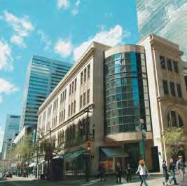
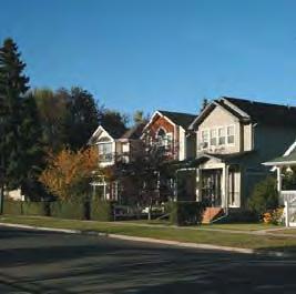
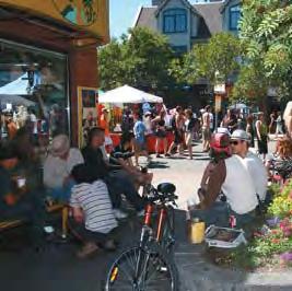
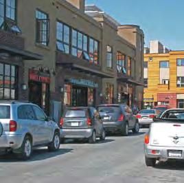
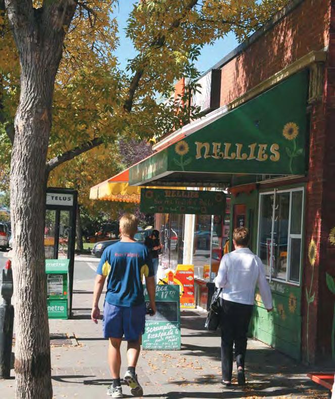
73 Part Three Typologies for Calgary s future urban structure
74 Part 3 Typologies for Calgary s future urban structure 3.1 Introduction Industrial Areas Part 3 Typologies for Calgary s future urban structure 3.1 September 2009 Calgary consists of distinct geographic and functional areas that share common attributes with other areas across the city. Similar land use patterns, road layout, age of the building and the stage within a community life cycle help to define an area in terms of its development form and how it functions. They also provide determinants of how the area might change and transform in the future. These broad geographic areas, defined as Typologies are shown on the Urban Structure Map (Map 1) and form the organization of this section. Typology-based policies supplement other policies contained elsewhere in the MDP by providing interpretation of broad, city-wide policies within the context of a specific area to help provide guidance to planning and development processes. The Typologies are: Centre City (including Downtown) Activity Centres Major Activity Centre Community Activity Centre Neighbourhood Activity Centre Corridors Urban Corridor Neighbourhood Corridor Developed Residential Areas Inner City Established Developing Residential Areas Planned Greenfield Future Greenfield Standard Industrial Industrial Employee Intensive Industrial Greenfield Local Area Plans Some Typologies require a level of detailed investigation to clearly understand the local opportunities, constraints and impacts of the respective policies. In those cases, a Local Area Plan should be prepared. Policies a. A Local Area Plan should include, but not be limited to the following: i. Definition of the study area; ii. Public engagement to identify local character and community needs; iii. Assessment of parks, community facilities and service capacities; iv. Assessment of infrastructure conditions and capacities; v. Locations for intensification, transition and conservation; vi. Land use diversity and development densities; vii. Identification of the anticipated jobs and population for the total area and by Typology; viii. Street types and locations, in accordance with the Complete Streets policies of the CTP; ix. Development phasing, staging and public investment; x. Other policies or context-specific guidelines as deemed appropriate; and, xi. Impacts of land uses and densities and the need for transition and interface with development in adjacent municipalities. 3-2 THE CITY OF CALGARY MUNICIPAL DEVELOPMENT PLAN
75 3.2 Centre City communities, Activity Centres and Corridors beyond its boundaries. Centre City is the business and cultural heart of the city, the pre-eminent mixed-use area. The Centre City fulfills many functions. It has the largest employment concentration and is the location of highest density office developments; it offers the broadest variety of cultural activities and is an important high-density, mixed-use residential community. The Centre City is made up of diverse and unique neighbourhoods focused around the Downtown and includes Stampede Park. The Centre City is well connected with the rest of the city by multiple routes of the Primary Transit Network and high-quality pedestrian connections within and beyond its boundaries Centre City Land use policies a. Reinforce the Centre City as the focus of business, employment, cultural, recreation, retail and highdensity housing within Calgary. This will be achieved by: i. Supporting the Downtown district as the location of choice for business and the largest employment centre in the city; ii. Developing high-density residential and support services; iii. Encouraging a greater mix of cultural, recreation and leisure activities; iv. Investing in the development of the Primary Transit Network; and, v. Providing high-quality pedestrian and cycling connections within the Centre City and to b. Plan to accommodate at least 232,000 jobs and 70,000 residents in the Centre City over the next 60 years. Individual neighbourhood densities will vary depending on their local context. c. Preserve existing public lands in the Centre City for civic and cultural facilities such as parks, museums, libraries and any other creative venues that will enliven it as a destination for residents, employees and visitors. d. Support the location of major educational institutions and related uses in areas of the Centre City well served by the Primary Transit Network. Mobility policies e. Transportation planning and investment decisions in Centre City should align with the Centre City Mobility Plan. Public realm policies f. The Centre City Plan will guide public realm improvements in the Centre City. Part 3 Typologies for Calgary s future urban structure September THE CITY OF CALGARY MUNICIPAL DEVELOPMENT PLAN 3-3
76 Part 3 Typologies for Calgary s future urban structure 3.3 September Activity Centres Accommodating future urban growth within transitsupportive, mixed-use Activity Centres is a fundamental strategy for linking land use and transit. Currently, Calgary s primary Activity Centre is the Downtown. Recognizing that the Downtown and the even larger Centre City will reach their capacity over time, it is necessary to identify and plan for other strategic areas that will support long-term employment and population growth in locations and at intensities that will support the Primary Transit Network. Three scales of Activity Centres are identified based on level and type of transit service, the expected level of intensity (density of jobs and population) and their citywide location and local context. The three Activity Centre types identified from largest to smallest are: Major Activity Centres Major Activity Centres (MAC) are located strategically across the city to provide a major mixed-use destination central to larger residential or business catchment areas. They are located along one or more of the proposed Primary Transit Network routes, and contain one or more transit stations or stops. The MAC builds upon existing concentrations of jobs and/or population and has a sufficient land area to provide a high number of jobs and population to support the highest levels of transit service. MACs will have the highest density and building heights outside of Centre City, with the broadest range of land uses. Community Activity Centres Community Activity Centres (CAC) are located central to a number of residential communities or business areas, on a moderately sized land base, often on current shopping centre sites or around a specific employment area. CACs may be located at transit stations or stops on the Primary Transit Network. The smaller land base, or location relative to communities and transportation networks, may limit intensification opportunities, although they could add sufficient residential and employment uses to support higher levels of transit service. CACs will accommodate a broad mix of uses but, generally, at lower intensity levels than the MACs. Neighbourhood Activity Centres Neighbourhood Activity Centres (NAC) exist primarily within the developed areas of the city (1950s to 1990s communities) in the form of smaller commercial sites, strip malls or redeveloping public facilities. They are located central to a small residential catchment area and provide walkable destinations for local communities. NACs are typically served by a base level of transit service, though some may be located along the Primary Transit Network. NACs are appropriate sites to accommodate moderate intensification over time, with uses and development scales appropriate to the local context and community needs. NACs will also be an important part of new community designs. They will be locations for medium density housing (e.g., groundoriented to medium density apartments), local retail and services, community facilities and integrated transit stops. MACs and CACs are identified on Map 1. However, others, especially in the greenfield areas, could be located and defined as part of a Regional Context Study process and an MDP amendment to Map 1. The intensity for each Activity Centre, level of transit service and typical land uses are shown in Table General Activity Centre policies The following policies apply to all scales of Activity Centres and are general in nature. Policies that are unique to specific activity centre types (MAC, CAC and NAC) are included below in this Section. 3-4 THE CITY OF CALGARY MUNICIPAL DEVELOPMENT PLAN
77 Activity Centre Land use policies Intensity (jobs and population per gross developable hectare)* a. Activity Centres should be locations for a mix of medium and higher density employment and residential uses. b. Uses such as retail, recreation facilities, sport, cultural facilities, open space and community and protective services that support concentrations of jobs and population are encouraged. c. The scale of retail appropriate to each Activity Centre should be determined in consideration of the retail policies in Part 4 of the MDP. d. Within mixed-use areas, encourage retail and service uses at grade, with residential and office uses on upper floors. e. Where a site fronts more than one street, public entrances should be located on the street with the greatest pedestrian activity, on both street fronts, or, in the case of a corner site, the entrance may be placed on the corner. Transit Service Major 200 (minimum) One or more Primary Transit stations f. Larger buildings should be designed to reduce their apparent size by the recession of upper floors to harmonize with the lower scale of the surrounding neighbourhood. g. City-owned land within an Activity Centre should be developed to support the land use and development objectives of that Activity Centre. h. Appropriate transition of building scale between the Activity Centre and adjacent areas should be provided. These transitions should be sensitive to the scale, form and character of surrounding areas. Mobility policies Typical Key Uses One or more major institutional uses, business and employment, high and medium density residential, retail and supporting services Community 150 (minimum) Primary Transit Station Institutional use (opt), retail centre, medium and high density residential, business and employment Neighbourhood 100 (minimum) Primary Transit station or Transit stop Local retail and local services, medium density residential * Intensities for each specific Activity Centre will be determined through Local Area Plans in consideration of land available for development, community context, and the opportunities to optimize infrastructure and public investment. Table 3-1: Summary of Activity Centre Characteristics i. Pedestrian environments should be the priority design element, focusing on pedestrian convenience, safety, comfort and enjoyment. j. Create an internal street network that is interconnected, multi-modal and recognizes the needs of all users, in accordance with the Local Transportation Connectivity policies of the CTP. Part 3 Typologies for Calgary s future urban structure September THE CITY OF CALGARY MUNICIPAL DEVELOPMENT PLAN 3-5

78 Part 3 Typologies for Calgary s future urban structure 3.3 September 2009 Possible Major Activity Centre image Source: Urban Advantage images k. Facilitate movement, loading and unloading of delivery vehicles throughout the Activity Centre. l. Transit facility designs should accommodate efficient transit access, comfortable passenger waiting areas and safe, direct and unobstructed routes for pedestrians and cyclists. m. When designing new streets or retrofitting existing streets, use the Complete Streets policies and guidelines of the CTP. n. Establish connections between the Activity Centre and the surrounding communities to encourage pedestrian and cyclist movement. o. Parking impacts on surrounding residential areas should be limited by providing a mix of short-stay and longer-stay parking for different users, bicycle parking and on-street parking. p. Convenient and high quality parking locations should be provided for bicycles, carpool and car-sharing vehicles, and vehicles with environmental benefits. Public realm policies q. Design transit facilities as public places that are a focal point within the Activity Centre. r. Urban design should be used to ensure that the intensification of land use occurs in a sensitive manner and that new buildings contribute to a pedestrian-friendly streetscape with the following characteristics: i. Reduced building setbacks from public sidewalks; and, ii. Where appropriate, existing setbacks should be used to enhance the pedestrian interface (e.g., street furniture, landscaping, street trees, pedestrian level street lighting, wide sidewalks, etc.). s. In addition to the Urban Design policies contained in Part 2.4 of the MDP, apply the following design policies to the Activity Centre: i. Establish a local identity for each Activity Centre; and, ii. Provide social spaces that provide for a comfortable and interesting public realm. 3-6 THE CITY OF CALGARY MUNICIPAL DEVELOPMENT PLAN
79 3.3.2 Major Activity Centres Major Activity Centres (MACs) provide for the highest concentration of jobs and population outside of the Centre City area. In addition to achieving higher concentrations of jobs and population, the design and character of the MACs must also create a high-quality environment that features amenities for a comfortable street environment. Land use policies a. The MACs are those shown on Map 1. b. Local Area Plans for a MAC should provide a land use framework to achieve a minimum intensity threshold of 200 jobs and population per gross developable hectare. Individual MAC densities and the approximate jobs and population distributions will be established through a Local Area Plan. c. Future MACs in Future Greenfield areas will be identified through the Regional Context Study process and located to align with the Primary Transit Network and major road system. Specific land use and open space patterns, local mobility networks and urban design details should be developed through an ASP that includes the entire area of the future MAC. d. MACs should be developed to function as an urban centre for a sub-region of the city and provide opportunities for people to work, live, shop, recreate, be entertained and meet their daily needs. e. Each MAC should provide locations for high intensity jobs as part of institutional growth and/or mixed-use business centres. f. Each MAC should contain a broad range of medium and high density housing opportunities and a mix of housing tenure and affordability levels to accommodate a diverse range and age of population. g. Large format retail that provides services to residents and employees within the MAC and surrounding communities, should be located at the edge of a MAC and designed with an appropriate pedestrian-friendly design. h. Open spaces that provide for a wide variety of activities within a medium to high density environment are encouraged. This will include the creation of public plazas and key gathering areas. Large sports fields may be appropriate, although they should be located at the edges of the MAC. Mobility policies i. Vehicle parking should be located, accessed and designed so as to minimize impacts on transit and pedestrian areas within the MAC. Smaller surface parking lots may be accommodated at peripheral locations away from the transit facility and pedestrian precincts, or located at the rear of buildings. Vehicle parking should ultimately be contained within structured facilities or underground. Part 3 Typologies for Calgary s future urban structure September THE CITY OF CALGARY MUNICIPAL DEVELOPMENT PLAN 3-7

80 Part 3 Typologies for Calgary s future urban structure 3.3 September Community Activity Centres Community Activity Centres (CACs) provide for a concentration of jobs and population in strategic locations throughout the city, and represent a local destination for multiple communities. They provide an opportunity to accommodate significant numbers of workers and residents in centres that are well served by public transit. The design and character of each CAC must ensure a high-quality environment that features amenities to create a comfortable environment that accommodates pedestrians and cyclists and makes the CAC a desirable place for workers, residents and businesses to locate. Because CACs are often located at existing retail sites, retail is an important element to be retained. CACs are also appropriate within new greenfield areas to provide convenient locations for a range of higher density housing types, local employment and retail services to new communities, in an area well served by the Primary Transit Network. Land use policies a. The CACs are those shown on Map 1. b. Local Area Plans for a CAC should provide a land use framework to achieve a minimum intensity threshold of 150 jobs and population per gross developable Possible Community Activity Centre Illustration Source: Design Centre for Sustainability, SALA, UBC hectare. Individual CAC densities and the appropriate job and population distributions will be established through a Local Area Plan. c. Future CACs in Future Greenfield areas will be identified through the Regional Context Study process and located to align with the Primary Transit Network and major road system. Specific land use and open space patterns, local mobility networks and urban design details should be developed through an ASP that includes the entire area of the future CAC. d. Recognize that most CACs are existing commercial developments and should continue to provide a significant level of retail service. e. CACs should contain a broad range of groundoriented and medium to high density apartment housing and a mix of housing tenure and affordability levels to accommodate a diverse range of the population. Mobility policies f. Support the development of CACs with timely investment in the Primary Transit Network. g. Facilitate the circulation of transit into the centre of each CAC, providing connections to the Primary Transit Network and surrounding communities. h. Vehicle parking should be located, accessed and designed so as to minimize impacts on transit and pedestrian areas within the CAC. Smaller surface parking lots may be accommodated at peripheral locations away from the transit facility and pedestrian precincts, or located at the rear of buildings. Vehicle parking should ultimately be contained within structured facilities or underground. 3-8 THE CITY OF CALGARY MUNICIPAL DEVELOPMENT PLAN
81 3.3.4 Neighbourhood Activity Centres The Neighbourhood Activity Centre (NAC) is a neighbourhood-scale centre providing opportunities for residential intensification and local jobs, retail, services and civic activities. NACs exist either in older residential communities or within new communities. Within the Developed Areas, a NAC typically would develop on those smaller commercial sites that are not identified as either MACs or CACs on Map 1. Smaller commercial sites located throughout established areas have the potential to provide a diverse mix of uses that fit with the scale and character of the surrounding neighbourhood. Because many residential communities where NACs exist do not have potential for significant intensification, smaller commercial sites provide a good opportunity for moderate mixed-use intensification and new housing forms not available within the community. In new communities, there would be similar opportunities for NACs, which should be planned at the outset through the ASP process. Land use policies a. Development of NACs should achieve a minimum intensity threshold of 100 jobs and population per gross developable hectare. Specific NAC intensities will be established based upon the local context, site size and available infrastructure, as determined through a Local Area Plan, land use amendment or comprehensive development permit process. b. NACs should contain a broad range of groundoriented and low-density apartment housing and a mix of housing tenure and affordability to accommodate a diverse range of the population. c. NACs should include a mix of uses and retain retail services for the local community. d. Encourage the creation of a public gathering space within each NAC. e. Auto-oriented uses and designs that generate high volumes of traffic, consume large amounts of land in a low density form, require extensive surface parking, and create negative impacts for pedestrian travel and access should be discouraged. Mobility policies f. Where a NAC is in close proximity to a MAC or CAC and a street connection exists between them, ensure there is good pedestrian and cyclist infrastructure within that street. g. To slow vehicular traffic and enhance the pedestrian environment, consider measures such as trafficcalming and off-peak parking on the street. Part 3 Typologies for Calgary s future urban structure September THE CITY OF CALGARY MUNICIPAL DEVELOPMENT PLAN 3-9
82 3.4 Corridors General Corridor policies Part 3 Typologies for Calgary s future urban structure Corridors share many of the same attributes as Activity Centres, but are linear in nature, and oriented along a street served by the Primary Transit Network. Corridor development has historically formed along street car lines and then auto-oriented roadways. That same rightof-way now provides the opportunity to re-integrate adjacent land uses within a transit oriented street framework. Since Corridors provide for the mobility needs of local and regional automobile commuters and border multiple residential communities, the land use and transportation system should be designed to include many different travel modes. Two scales of Corridors are identified, with specific policies to each: Urban Corridors Neighbourhood Corridors The following policies apply to all Corridors and are general in nature. Policies that are unique to specific corridor type (Urban or Neighbourhood Corridor) are provided below. Land use policies a. Corridors should provide for a broad mix of residential, employment and retail uses. b. The highest densities and tallest buildings on the Corridor should be concentrated into nodes that occur at the intersections of the Corridor with other major transit streets. Between the nodes, lower scales of commercial, residential and mixed-use development are appropriate. c. Commercial development along the Corridor should be oriented to the transit street and public sidewalk. d. Develop an active street environment by encouraging retail and service uses at-grade with residential and office uses on upper floors. 3.4 Corridor Intensity (jobs and population per hectare* Transit Service Typical Key Uses Street Type (See CTP) September 2009 Urban 200 (minimum) Located on Primary Transit Network Neighbourhood 100 (minimum) Located on Primary Transit Network Retail, Office, Mixed-use buildings, medium and high density residential Low to medium density residential, retail, mixeduse buildings Urban Boulevard, support for multiple modes Neighbourhood Boulevard, support for multiple modes * Intensities for each specific Corridor will be determined through Local Area Plans in consideration of land available for development, community context, and the opportunities to optimize infrastructure and public investment. Table 3-2: Summary of Corridor Characteristics 3-10 THE CITY OF CALGARY MUNICIPAL DEVELOPMENT PLAN
83 e. Recognizing that the Corridor is pedestrian and transit oriented, large format retail should support a good pedestrian frontage along the transit street and public sidewalk by: i. Locating buildings close to the transit street and sidewalk; and, ii. Creating active building frontages by incorporating smaller retail units, public accesses and display areas visible to the sidewalk. f. On corner sites, buildings should be placed adjacent to streets wherever possible to create defined street edges. g. Retail buildings should provide front-door openings facing the transit street and principal public areas. h. Appropriate transition of building scale between developments in the Corridor and adjacent areas should be provided. These transitions should be sensitive to the scale, form and character of the surrounding buildings and uses. Mobility policies i. When designing new streets or retrofitting existing streets within the Corridor, use the Complete Streets policies and guidelines in the CTP. j. Make pedestrian connections to the Corridor from adjacent communities. These connections should occur primarily within streets that will facilitate good pedestrian and cyclist movement. k. The impact on surrounding residential areas should be limited by providing a mix of short-stay and longer-stay parking for different users, bicycle parking and on-street parking. l. Pedestrians and cyclists should be given the highest priority in the planning, design, operation and maintenance of transportation infrastructure in Corridors. m. A strong pedestrian environment should be created along the transit corridor by discouraging on-site parking in front of the building and providing parking alternatives on street, and to the side and rear of buildings. n. Priority and high-quality parking locations should be provided for bicycles, carpool and car-sharing vehicles, and vehicles with low environmental impacts. o. Driveway access to parcels fronting onto Corridors should be consolidated and new accesses minimized to provide a continuous building façade and safer pedestrian zone. p. Site layout, vehicular circulation and loading zones should be planned to minimize the impact of vehicles on the pedestrian realm. Part 3 Typologies for Calgary s future urban structure September THE CITY OF CALGARY MUNICIPAL DEVELOPMENT PLAN 3-11

84 Part 3 Typologies for Calgary s future urban structure 3.4 Typical Corridor Cross Section Source: Design Centre for Sustainability, SALA, UBC Public realm policies q. Create a human-scale environment along the Corridor by generally encouraging a maximum of a 1:2 building height to right-of-way width ratio. Additional height should be considered through the Local Area Plan. r. For Corridors that run east-west, building heights should be designed to allow solar penetration through the block and reduce shadows cast onto public sidewalks on the north side of the street. Where practical, encourage taller buildings to locate on the north side of the corridor. s. For Corridors that run east-west, south facing public open spaces and plazas should be incorporated in the buildings fronting the north side of the Corridor. t. Public investment in key elements of the public realm should be provided to support intensification along Corridors. u. Urban design should be used to ensure that the intensification of land use occurs in a sensitive manner and that new buildings contribute to a pedestrian-friendly streetscape with the following characteristics: i. Reduced building setbacks from public sidewalks; and ii. Where appropriate, existing setbacks should be used to enhance the pedestrian interface (e.g., street furniture, landscaping, street trees, pedestrian level street lighting, wider sidewalks, etc.). September THE CITY OF CALGARY MUNICIPAL DEVELOPMENT PLAN

85 3.4.2 Urban Corridors Urban Corridors provide for a high level of residential and employment intensification along an Urban Boulevard street type, as defined in the CTP. The Urban Boulevard is a multi-modal street with a strong focus on walking, cycling and transit, though it continues to accommodate moderately high traffic volume. Urban Corridors emphasize a walkable pedestrian environment fronted by a mix of higher intensity residential and business uses. Land use policies a. The Urban Corridors are those shown on Map 1. b. Additional Urban Corridors may develop over time as the role and function of some streets change. New Urban Corridors will be identified through an amendment to the MDP. c. Local Area Plans for an Urban Corridor should provide a land use framework to achieve a minimum intensity threshold of 200 jobs and population per gross developable hectare. Individual Urban Corridor densities and appropriate job and population distributions will be established through a Local Area Plan. Typical Urban Corridor Source: Urban Advantage images d. The Local Area Plan study area for an Urban Corridor should include all land fronting directly onto the Urban Boulevard, and extend back at least one block on either side, potentially extending along intersecting streets. The highest development densities are to be located on lands directly fronting onto the Urban Boulevard, stepping down to provide transition with lower scale buildings, as defined in Part 3 - Typologies for Calgary s future urban structure. e. The Urban Corridor should contain a broad range of employment, commercial and retail uses as well as housing (form, tenure, and affordability) to accommodate a diverse range of the population. Apartments, mixed-use developments and groundoriented housing are encouraged. Mobility policies f. Provide transit service along the Urban Corridor via the Primary Transit Network. Development adjacent to transit stops should locate entrances and provide features that make it safe and convenient for transit users. g. The Urban Corridor should generally coincide with the Urban Boulevard street type as defined in the CTP. Part 3 Typologies for Calgary s future urban structure September THE CITY OF CALGARY MUNICIPAL DEVELOPMENT PLAN 3-13

86 3.4.3 Neighbourhood Corridors Land use policies Part 3 Typologies for Calgary s future urban structure Neighbourhood Corridors typically are located along Primary Transit Network within the Inner City and have a strong historical connection to the communities they abut. They are the main streets for one or more communities, providing a strong social function and typically support a mix of uses within a pedestrianfriendly environment. Some areas have a more regional draw because of the unique uses present or the quality of the environment, while others serve a more local population base. Neighbourhood Corridors provide the opportunity for moderate levels of intensification of both jobs and population over time. To support this increased activity, the Neighbourhood Corridor should be served by the Primary Transit Network. Neighbourhood Corridors are also appropriate in greenfield communities as places to focus different housing types and densities and create local destinations adjacent to transit streets. a. The Neighbourhood Corridors are those shown on Map 1. b. Opportunities for additional Neighbourhood Corridors will be identified through an amendment to Map 1. c. Local Area Plans for a Neighbourhood Corridor should provide a land use framework to achieve a minimum intensity threshold of 100 jobs and population per gross developable hectare. Individual Neighbourhood Corridor densities and the appropriate job and population distributions will be established through a Local Area Plan. d. For Neighbourhood Corridors that have no Local Area Plans, areas for intensification should include those parcels that front directly onto the proposed Neighbourhood Boulevard (as defined in the CTP). 3.4 September 2009 Typical Neighbourhood Corridor Source: Urban Advantage images 3-14 THE CITY OF CALGARY MUNICIPAL DEVELOPMENT PLAN
87 e. Encourage ground-oriented housing, low-scale apart- ments and mixed-use retail buildings within the Neighbourhood Corridor, with the highest densities occurring in close proximity to transit stops and in locations where they merge with Activity Centres or Urban Corridors. f. An appropriate transition between the Neighbourhood Corridor and the adjacent residential areas is required. Transition should generally occur at a rear lane or public street. These transitions should be sensitive to the scale, form and character of surrounding areas, while still creating opportunities to enhance the connectivity with the community. g. Auto-oriented uses and designs that generate high volumes of traffic, consume large amounts of land in a low density form, require extensive surface parking, and create negative impacts for pedestrian travel and access should be discouraged. Mobility policies h. The Neighbourhood Corridor should generally coincide with a Neighbourhood Boulevard street type. Part 3 Typologies for Calgary s future urban structure September THE CITY OF CALGARY MUNICIPAL DEVELOPMENT PLAN 3-15
88 Part 3 Typologies for Calgary s future urban structure 3.5 Developed Residential Areas Developed Residential Areas defined on Map 1 include those communities that have been built out and are at various stages of their life cycle, either as stable residential communities or those experiencing moderate redevelopment activity. Two types of Developed Residential Areas are identified Inner City Area and Established Areas General Developed Residential Area Policies The following policies apply to all Developed Residential Areas and are general in nature. Policies that are unique to the Inner City Area and the Established Area follow after this section. Land use policies a. Recognize the predominantly low density, residential nature of Developed Residential Areas and support retention of housing stock, or moderate intensification in a form and nature that respects the scale and character of the neighbourhood. Mobility policies d. For multi-family housing, encourage parking that is well integrated into the residential environment (e.g., consider landscape buffering, smaller lots). e. When designing new streets or retrofitting existing streets, use the Complete Streets policies in the CTP. f. Ensure that high-quality pedestrian and cyclist connections and facilities are provided from the Developed Residential Area and linked to adjacent areas of higher intensity development (i.e., Neighbourhood Corridors and Neighbourhood Activity Centres). g. Areas beyond the Primary Transit Network will be served with Base Transit Service, with opportunities for enhancing frequency of service as required. 3.5 b. Redevelopment within predominantly multi-family areas should be compatible with the established pattern of development and will consider the following elements: September 2009 i. Appropriate transitions between adjacent areas; and, ii. A variety of multi-family housing types to meet the diverse needs of present and future populations. c. Redevelopment should support the revitalization of local communities by adding population and a mix of commercial and service uses THE CITY OF CALGARY MUNICIPAL DEVELOPMENT PLAN
89 3.5.2 Inner City Area Land use policies The Inner City Area comprises residential communities that were primarily subdivided and developed prior to the 1950s. Key features of these areas are a grid road network, older housing stock in the form of low to moderate housing densities and a finer mix of land uses along many of the edge streets. The Inner City Area has undergone redevelopment in recent years. Much of this intensification has taken place along busier roads and as low density infilling within lower density areas. Intensification and change will continue to occur within the Inner City Area; however, it is important to maintain stable family neighbourhoods. Typical Inner City Area Development Pattern a. Sites within the Inner City Area may intensify, particularly in transition zones adjacent to areas designated for higher density (i.e., Neighbourhood Corridor), or if the intensification is consistent and compatible with the existing character of the neighbourhood. Transition zones should be identified through a subsequent planning study. b. A range of intensification strategies should be employed to modestly intensify the Inner City Area, from parcel-by-parcel intensification to larger more comprehensive approaches at the block level or larger area. c. Maintain and expand, where warranted by increased population, local commercial development that provides retail and service uses in close proximity to residents, especially in the highest density locations. d. Buildings should maximize front door access to the street and principal public areas to encourage pedestrian activity. e. Encourage at-grade retail to provide continuous, active, transparent edges to all streets and public spaces. Mobility policies f. Transit stops should be easily accessible and, where possible, integrated with adjacent multi-family residential or retail buildings. Part 3 Typologies for Calgary s future urban structure September THE CITY OF CALGARY MUNICIPAL DEVELOPMENT PLAN 3-17
90 3.5.3 Established Areas Mobility policies Part 3 Typologies for Calgary s future urban structure The Established Area comprises residential communities that were planned and developed between the 1950s and 1990s. They are primarily residential communities containing a mix of low- and medium-density housing with support retail in relatively close proximity. The road network is a blend of modified-grid and curvilinear. These are stable residential communities with limited redevelopment potential over the next 30 years. Populations have declined from their peak and housing stock is generally in good condition. Land use policies a. Encourage modest redevelopment of Established Areas. b. Redevelopment opportunities should be focused on the Neighbourhood Activity Centres, though changes to other sites may provide opportunities for redevelopment over time. c. New developments in Established Areas should incorporate appropriate densities, a mix of land uses and a pedestrian-friendly environment to support an enhanced Base or Primary Transit Network. d. Provide opportunities to increase pedestrian, cycling and emergency services connectivity when redevelopment occurs where community support exists. e. Transit stops should be easily accessible and, where possible, integrated with adjacent multi-family residential or retail buildings. Typical Established Area Pattern 3.5 September THE CITY OF CALGARY MUNICIPAL DEVELOPMENT PLAN
91 3.6 Developing Residential Communities Developing Residential Areas include those communities that have an ASP completed and are in the process of developing and future growth areas that have not had an ASP approved. Two types of Developing Residential Areas are identified Planned Greenfield Communities and Future Greenfield Communities Planned Greenfield Communities Planned Greenfield Areas comprise residential communities that have been planned since the 1990s and are still being developed. Many of these communities were subject to the Sustainable Suburbs Study that was created in the mid-1990s and proposed greater community densities and mix of residential and commercial uses than communities built in the 1970s and 1980s. Typically, they are characterized as relatively low-density residential neighbourhoods containing single-family housing, smaller pockets of multi-family and locally-oriented retail in the form of strip developments located at the edges of communities. The road network is curvilinear, with a hierarchical streets system, including major collectors that circulate through a community with local crescents, p-loops and culsde-sac feeding off of it. Transit service to most areas is provided from the internal collector roadway. Land use policies a. The ASPs for Planned Greenfield Areas, in existence prior to adoption of the MDP, are recognized as appropriate policies to provide specific direction for development of the local community. Future reviews of, and amendments to, ASPs will be required to align with the policies of the MDP. Typical Planned Greenfield Pattern Part 3 Typologies for Calgary s future urban structure September THE CITY OF CALGARY MUNICIPAL DEVELOPMENT PLAN 3-19

92 3.6.2 Future Greenfield Area Land use policies Part 3 Typologies for Calgary s future urban structure Future Greenfield Areas are those large land areas in the city identified for future urban development that do not have an approved ASP in place. Planning for these areas should identify Activity Centres and/or Corridors that provide for a variety of housing types, opportunities for daily needs within walking distance to residential communities, and centres for transit access. Supporting the land use pattern is a street network that connects residents, jobs and commercial services through direct automobile, transit, bicycle, and pedestrian routes. The overall community design should integrate natural area protection within the open space and green infrastructure systems. a. Future Greenfield Areas should: i. Be protected for future urban development by restricting premature subdivision and development on parcels; ii. Retain environmentally significant natural areas, water courses and tree stands; iii. Allow for a limited range of uses that will not compromise the developability of the land for urban purposes; and, iv. Allow for local food production. b. Plans for new communities in Future Greenfield Areas will be established through an Area Structure Plan 3.6 September 2009 Possible Future Greenfield Area (Residential) Source: Design Centre for Sustainability, SALA, UBC 3-20 THE CITY OF CALGARY MUNICIPAL DEVELOPMENT PLAN
93 (ASP), following completion of a Regional Context Study (RCS). c. ASPs for new communities in Future Greenfield Areas will achieve a minimum intensity threshold of 60 people and jobs per gross developable hectare. This community intensity level includes NACs, CACs, Urban Corridors and Neighbourhood Corridors, as identified in the ASP. ASPs must also demonstrate how a target density of 70 people and jobs per gross developable hectare can be achieved over the life of the plan. In addition to the intensity threshold, other factors should be considered in the development of an ASP. These include: i. minimum residential density in conformity with the Calgary Metropolitan Plan; ii. land use diversity; iii. residential diversity; iv. accessibility to the Primary Transit Network; v. street and walk/cycle connectivity; vi. ecological networks and green infrastructure; and, vii. mix of local and regional retail. d. New communities should be organized to include the following: i. A number of distinct neighbourhoods that are defined by a 400-metre or five-minute walking distance from a NAC or Neighbourhood Corridor; ii. A physical combination of public realm and related built form that establishes a heart or focus for the community; iii. A NAC or Neighbourhood Corridor to serve each neighbourhood that contains multi-family housing and an enhanced transit stop, and may contain local employment, retail services or a school; iv. A CAC may be provided to serve the needs of one or more communities. The location and scale of the CAC will be determined through the RCS and ASP processes; and, v. Retail developments should be planned in accordance with the retail policies contained within Part 4. e. NACs or Neighbourhood Corridors should be identified through the ASP process and appropriately separated from higher order Activity Centres or Corridors. f. Encourage the concentration of residential density in areas adjacent to open space, parks, wetlands and sports fields, especially where the area is served by transit, services and other community amenities. These locations should be identified through the ASP process. g. Create a hierarchy of recreation facilities and parks and open spaces that accommodate as many recreation functions as possible, appealing to a range of users, age groups and abilities (See Section 2.3). h. New communities and neighbourhoods should be designed and have a built form that allows for adaptation, which can evolve and be reused over time. Mobility policies i. Create a street network that is interconnected, multi-modal, and balances the needs of all users, in accordance with the Local Transportation Connectivity policies of the CTP. Part 3 Typologies for Calgary s future urban structure September THE CITY OF CALGARY MUNICIPAL DEVELOPMENT PLAN 3-21
94 j. When designing new streets or retrofitting existing streets, use the Complete Streets policies in the CTP. Part 3 Typologies for Calgary s future urban structure k. Facilitate the movement of cyclists by providing direct connections to the Primary Cycling Network. l. Existing rural road rights-of-way in Future Greenfield Areas should be protected for potential incorporation into the future transportation network, as required. Public realm policies m. Activity Centres should contain locally-focused open spaces, which can include community and city-wide services and amenities such as schools, community association facilities, civic buildings, transit and recreation facilities. n. Watercourses, significant wetlands and other key natural features should be prioritized for protection and integrated into the public open space and green infrastructure networks. o. Parks and recreation facilities, sport and cultural facilities should be located throughout the community in walkable proximity to all residences and designed to provide for flexibility of recreation uses over the lifecycle of the community. 3.6 September THE CITY OF CALGARY MUNICIPAL DEVELOPMENT PLAN
95 3.7 Industrial Areas Industrial areas provide for a broad variety of industrial uses and intensities that support business in Calgary. Industrial areas must offer flexibility to support this variety of uses both those that currently exist as well as uses that may arrive in the future. At the same time, industrial areas must remain predominantly industrial and resist the encroachment of non-industrial uses into them, including residential, office and retail. Three types of industrial types are identified Standard Industrial, Industrial Employee Intensive and Greenfield Industrial. The Standard Industrial Area policies provide a base layer of policy that will apply to all industrial areas throughout Calgary. Additional policy for industrial areas is contained within the Industrial Employee Intensive and the Industrial Greenfield sections Standard Industrial Area The Standard Industrial Area consists of existing planned industrial areas that contain a mix of industrial uses at varying intensities. These areas continue to offer a broad variety of industrial uses and as the area redevelops, the industrial character should be maintained. Land use policies a. Industrial uses should continue to be the primary use. b. Allow for the development and retention of a broad range of industrial uses and a variety of industrial parcel sizes. c. Uses that support the industrial function of this area and cater to the day-to-day needs of area businesses and their employees may be supported. d. Discourage stand-alone office uses and regional retail developments in industrial areas. e. Regional or city-wide recreation and sport facilities may be provided in industrial areas to meet the extensive land needs of city-wide recreation and sport programs. These facilities should be designed and located to be accessible to transit routes, cycling routes and pathways. f. Portions of the Standard Industrial Areas may be appropriate for redevelopment as non-industrial or mixed-residential business areas, given their proximity to existing communities and the Primary Transit Network. Any proposal for such a change will require an amendment to relevant Local Area Plans or, if there is no Local Area Plan, an amendment to the MDP to indicate the area is no longer required for Standard Industrial Area purposes. g. Encourage the development of eco-industrial/ business parks, characterized by: i. Water flows designed to conserve resources and on-site stormwater management that cascades water through uses at different quality levels; ii. Businesses that utilize clean production methods; iii. Businesses that have reduced energy needs and consumption; iv. Maximum energy efficiency through facility design or rehabilitation, co-generation, energy cascading and other means; and, v. Best environmental practices in materials selection and building technology. These include recycling or reuse of materials and consideration of life cycle environmental implications of materials and technologies. Part 3 Typologies for Calgary s future urban structure September THE CITY OF CALGARY MUNICIPAL DEVELOPMENT PLAN 3-23
96 Mobility policies Public realm policies Part 3 Typologies for Calgary s future urban structure h. The road network should support the efficient movement of trucks, goods and services throughout the Standard Industrial Area. i. Street networks should be designed to allow Base Transit Service and provide sufficient coverage to support the access needs of area businesses and their employees. j. Convenient connections and accessibility should be achieved within industrial areas, as per the Local Transportation Connectivity policies in the CTP. k. Streets that provide direct connections to transit services should provide facilities and amenities for pedestrians, cyclists and transit. l. When designing new streets or retrofitting existing streets, use the Complete Streets policies in the CTP. m. New intermodal sites and warehousing facilities should develop within 1600 metres of the Strategic Goods Movement Network (see the CTP). n. Protect the integrity of primary goods movement corridors by limiting direct access from truck routes to adjacent properties. q. In cases where the Standard Industrial Area interfaces with other types of land uses and public rights-ofway, provide street trees, landscaping, fencing and architectural elements for sites that are highly visible to the public from skeletal roads, and along the city s major entranceways. r. Development or redevelopment of industrial sites should provide for good walking environments within the site and to adjacent public sidewalks and transit stops. s. Public open space should be provided throughout the Standard Industrial Area to provide recreational opportunities for area employees. 3.7 o. Sidewalks shall be provided to connect to transit stops to major businesses in the surrounding industrial areas. September 2009 p. Transit waiting facilities should be provided in public rights-of-way or, where possible, integrated with adjacent industrial or commercial developments THE CITY OF CALGARY MUNICIPAL DEVELOPMENT PLAN
97 3.7.2 Industrial-Employee Intensive Public realm policies The Industrial-Employee Intensive Area is intended for manufacturing, warehousing and mixed industrial/office developments that have high labour concentrations and require access to the Primary Transit Network. They can be new business parks locating in newly planned areas (i.e., Greenfield Industrial typology), or they could also occur as part of redevelopment and intensification of the Standard Industrial Areas, at transit stops and along Corridors served by the Primary Transit Network. Land use policies a. Industrial-Employee Intensive Areas should achieve a minimum intensity threshold of 100 jobs per gross developable hectare. b. Industrial-Employee Intensive Area should contain predominantly industrial uses. Other uses that support the industrial function may be allowed. Specific rules for the amount of support uses should be determined as part of the policy planning process and land use application process. Mobility policies c. Ensure that the Industrial-Employee Intensive Area is served by the Primary Transit Network. d. Streets that provide direct connections to higher order transit services should provide amenities for pedestrians, cyclists and transit. e. Roads and streets within Industrial-Employee Intensive Areas should provide for the efficient movement of goods. f. When designing new streets or retrofitting existing streets, use the Complete Streets policies in the CTP. g. Sidewalks should be provided along all streets to connect businesses with the Primary Transit Network. h. Encourage forms of accessible public or private open space to create amenities and local destinations in conjunction with transit stations, higher intensity uses and the local retail/service areas. Part 3 Typologies for Calgary s future urban structure September THE CITY OF CALGARY MUNICIPAL DEVELOPMENT PLAN 3-25
98 Part 3 Typologies for Calgary s future urban structure 3.7 September Greenfield Industrial Area Greenfield Industrial Areas are future industrial areas located at the edge of the city. These areas provide land for future industrial growth. Land use policies a. Plans for industrial development in Greenfield Industrial Areas will be established through an Area Structure Plan (ASP), following completion of the RCS. b. Ensure that the primary function of Greenfield Industrial Areas is for a broad range of standard industrial activities and industry-related commercial functions including: i. Value-added manufacturing, advanced technology industries, warehouse and distribution activities; and, ii. Employee intensive industrial uses in locations where the Primary Transit Network is provided within or adjacent to new industrial areas. c. Greenfield Industrial Areas should be located to provide sufficient separation from adjacent nonindustrial uses or include special conditions that reduce the potential for conflict. Mobility policies d. The road network should support the efficient movement of trucks, goods and services throughout the Standard Industrial Area. e. Street networks should be designed to allow Base Transit Service and provide sufficient coverage to support the access needs of area businesses and their employees. f. Convenient connections and accessibility should be achieved within industrial areas, as per the Local Transportation Connectivity policies in the CTP. g. Streets that provide direct connections to transit services should provide facilities and amenities for pedestrians, cyclists and transit. h. When designing new streets or retrofitting existing streets, use the Complete Streets policies in the CTP. i. New intermodal sites and warehousing facilities should develop within 1600 metres of the Strategic Goods Movement Network (see the CTP). j. Protect the integrity of primary goods movement corridors by limiting direct access from truck routes to adjacent properties. k. Sidewalks should be provided to connect transit stops to major businesses in the surrounding industrial areas. l. Transit waiting facilities should be provided in public rights-of-way or, where possible, integrated with adjacent industrial or commercial developments THE CITY OF CALGARY MUNICIPAL DEVELOPMENT PLAN


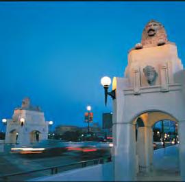

99 Part Four Specifi c use policies
100 Part 4 Specific use policies 4.1 Retail Policies Part 4 Specifi c use policies 4.1 September 2009 Retail development serves numerous purposes. It provides local and regional goods and services, supports employment areas, provides employment, contributes to the health and vitality of the local economy and provides opportunities to integrate transit into the design of concentrated centres of activity. Retail developments also play a special role in providing publicly accessible spaces and in shaping unique public gathering destinations across the city. These combined factors suggest there is a significant public interest in the location and urban design of retail development Retail structure The retail landscape in Calgary has evolved over the years to include a wide variety of locations and scales. There are older patterns of development that have formed over many decades, and there are patterns and retail formats that have emerged more recently. Providing direction for this diversity of retail requires an approach that respects the current retail landscape as well as the desire to ensure that future retail developments are better aligned with the overall integrated land use and transportation strategies of the MDP. The retail structure emphasizes the role and function of the various retail scales and their importance in providing retail service at the local and city-wide level. This categorization places less emphasis on the built form, which is often subject to shorter term, trend based designs. By utilizing this approach, it is simpler to categorize and monitor changes in retail over time. It also provides a framework for planning future retail developments in Calgary. a. Retail development is categorized into six groups that define its role and function within Calgary. The size of the retail centre should not be defined by an individual retail development, but rather by all retail developments within the immediate vicinity. The six retail categories are: i. Regional a. Super Regional Retail Centre b. Regional Retail Centre 1 c. Regional Retail Centre 2 ii. Local a. Community Retail Centre 1 b. Community Retail Centre 2 c. Neighbourhood Retail Centre b. The nine retail sectors (see Figure 4-1) should be used to monitor the distribution of retail throughout the city. c. Within each of the nine retail sectors, the distribution between Regional and Local retail should be approximately 45 per cent Regional and 55 per cent Local within each of the nine retail sectors (see Figure 4-1). 4-2 THE CITY OF CALGARY MUNICIPAL DEVELOPMENT PLAN
101 NORTH t NORTH WEST WEST Existing Regional Retail Distribution, by Type Ä Super Regional Retail Centre Regional Retail Centre 1 Regional Retail Centre 2 Retail Sector Boundary Approved: 24P2009 Amended: 5P2012!! CENTRAL NORTH! CENTRAL CENTRAL SOUTH!! SOUTH Figure 4-1: Calgary retail sectors and regional retail distribution, by type EAST SOUTHEAST Part 4 Specific use policies September THE CITY OF CALGARY MUNICIPAL DEVELOPMENT PLAN 4-3
102 4.1.2 Retail categories The following table provides the framework for retail categories to determine the appropriate type and distribution of retail: Part 4 Specifi c use policies Retail Centre Category Approximate Size (sq. m.) Location Criteria Suggested Proportion of Retail in Sector (percent) Super Regional Retail Larger than 93,000 Key city gateway locations 20 Regional Retail 1 46,500 to 93,000 Serving a retail sector 20 Regional Retail 2 9,300 to 46,500 Serving a retail sector 5 Community Retail 1 Approx. 9,300 Serving multiple communities 20 Community Retail 2 Less than 9,300 Serving one or more communities Neighbourhood Retail Less than 1,900 Serving a sub-area of a community Table 4-1: Framework for retail categories 4.1 September 2009 Policies City-wide retail a. Redevelopment, improvements and expansion of existing retail areas should be a priority. b. The creation of new or the redevelopment of existing community and neighbourhood retail centres to serve community needs should be a priority. c. The city should strive to achieve an appropriate mix of retail types within each of the nine retail sectors (see Table 4-1: Framework for retail categories). d. A retail area should conform to the policies of the relevant Typology area, as defined in Part 3-Typologies for Calgary s future urban structure. e. Create and retain viable local retail and mixed-use areas that encourage business creation, residential development and community services; while maintaining compatibility with the neighbourhoodoriented character of the retail. f. Support the development and maintenance of areas with a wide range of character and function that provide for the employment, service, retail and housing needs of Calgary s existing and future population. g. Support comprehensively planned retail developments at all scales to provide for high quality public systems (e.g., sidewalks, pathways, open spaces) and designed to allow for intensification to accommodate residential uses. 4-4 THE CITY OF CALGARY MUNICIPAL DEVELOPMENT PLAN
103 h. Facilitate the development of retail areas within communities, by providing: i. A full mix of uses to be developed over time; ii. Active ground floor uses; iii. Conveniently located, safe and accessible pedestrian linkages that connect retail entrances with internal and public pedestrian networks and transit stops; and, iv. Enhanced public realm pedestrian linkages and gathering spaces on site. Established retail areas i. Retail should be included as part of the mixed-use at Activity Centres and along Corridors. j. Redevelopment of older shopping centres and commercial strips should include mixed use developments that create greater residential and employment variety while retaining a retail function. Greenfield retail areas k. Regional retail centres should be identified through a Regional Context Study. The location, scale and size of these sites will further be refined through a subsequent Area Structure Plan process. l. Regional Retail centres should provide for: i. Direct on-site linkages and amenities for pedestrians; and, ii. Reduced visual and environmental impact of large parking lots. m. New Regional Retail centres should be evaluated in terms of their impact on the city as a whole and their immediate surroundings, based on the following criteria: i. Consistency with the growth strategy of the MDP; ii. Compatibility with Local Area Plans and the location relative to Activity Centres and Corridors; and, iii. The physical impact of the centre with regard to: a. Integration with transit networks to serve retail centres; b. The ability of the street system to handle the associated traffic volumes; c. The need for other possible public expenditures; d. Integration with surrounding community development; and, e. The quality of the site development, including the landscaping, parking, access, pedestrian and vehicular circulation. n. The location of community and neighbourhood retail centres should be identified through the Area Structure Plan process, and located and appropriately separated from other larger retail centres to support viability of the local retail. As a general guide, local retail developments should be: i. Located to support integrated residential development, or to serve adjacent higher density residential areas of the community; and, ii. Supported by a convenient pedestrian network that provides direct access to the retail site. o. Retail sites should be planned around transit stops or stations and should provide good accessibility by a variety of modes to provide connections to surrounding neighbourhoods and developments. Part 4 Specifi c use policies September THE CITY OF CALGARY MUNICIPAL DEVELOPMENT PLAN 4-5
104 Part 4 Specifi c use policies 4.2 Protection of sand and gravel resources The City recognizes the strategic importance of retaining local sources of building materials within a sustainable city to minimize the need to import resources into the city. The MDP provides policies respecting the protection of sand and gravel sources from premature urban development, as well as direction for protecting existing sand and gravel extraction operations and mitigating conflicts with adjacent urban uses. Policies a. Protect existing and future aggregate sources from premature use for urban development, and ensure appropriate mitigative measures to protect and facilitate aggregate extraction. b. Allow the continuation of existing sand and gravel extraction operations in accordance with the conditions of the necessary permits. c. Support the recycling of concrete, pavement and stone in locations that minimize nuisance impacts of dust, noise, odours and truck traffic on surrounding urban development. d. Routes for truck access and egress to the site should be indentified and located to minimize nuisance impacts. 4.2 September THE CITY OF CALGARY MUNICIPAL DEVELOPMENT PLAN
105 4.3 MGA-mandated policies needs. Part 3 of the CTP also supports these policies and provides direction for emergency evacuation routes. This section provides policies for the land use and development adjacent to sour gas facilities, protection of agricultural operations, and development in the vicinity of the airport. Map 6 identifies areas of the city where some of these constraints apply Sour gas policies There are a number of issues pertaining to sour gas operations within Calgary s boundaries and adjacent municipalities that need to be considered within the MDP. One is ensuring that the minimum requirements of the MGA are included. Another is recognizing that parts of Calgary s long-term growth areas lie within, or adjacent to, active sour gas fields. These fields and the facilities may have decades of life left in them, and sour gas may not be extracted as quickly as desirable. Sour gas facilities could impact Calgary s future urban growth corridors and efficient community design and operations by leaving large areas of serviced land undevelopable, as well as the safety of the general public and emergency responders in the event of an accident. The policies of the MDP provide municipal direction to guide the planning and development processes that deal with the locating of types of land uses in relation to sour gas facilities. The MDP also addresses compatibility issues between urban growth and sour gas facilities by minimizing nuisance impacts from dust, noise and truck traffic on residential communities. The MDP policies are intended to be applied in concert with other administrative policies and procedures for dealing with on-going issues around oil and gas activities and applications, including maintaining public safety and emergency response and working pro-actively with the industry to address public notification and information Policies a. Support in principle the accelerated resource extraction in areas with little or no existing urban development to allow for orderly and safe city development; however, each situation will be evaluated on its merits. b. The City will apply appropriate safety setbacks as determined by the Energy Resources and Conservation Board (ERCB). c. Residential uses, permanent overnight accommodations and public facilities shall not be developed in the vicinity of sour gas operations, unless located outside setbacks established by the ERCB. d. Industrial, commercial or other non-residential uses may be developed adjacent to sour gas facilities, subject to any setbacks as determined by the ERCB. e. Reserve the right to apply The City s own setback regarding nuisance factors for sour gas facilities. f. In determining appropriate locations and timing of growth within Long-term Growth Areas, Regional Context Studies should identify the location of active and future sour gas operations and facilities, the projected life span of those operations and the impact of the facilities and safety setbacks on the cost effective design of future urban communities, as well as potential impacts on Emergency Planning Zones, evacuation route planning and Calgary s emergency responders. Part 4 Specifi c use policies September THE CITY OF CALGARY MUNICIPAL DEVELOPMENT PLAN 4-7
106 4.3.2 Agricultural operations Airport Vicinity Protection Area (AVPA) Part 4 Specifi c use policies The MGA directs that a municipal development plan must contain policies respecting the protection of agricultural operations within its boundaries. The City recognizes that agriculture is a viable use of land prior to urban development. It supports its continuation by allowing extensive agriculture as a Permitted Use in the Land Use Bylaw and restricts the fragmentation of agricultural land until needed for urban development. The City also supports the use of such lands for the long term food security of the city. Policies a. Protect existing agricultural operations by maintaining appropriate definitions and land use designations in the Land Use Bylaw. b. Prevent the premature fragmentation of agricultural land. The Calgary International AVPA Regulation defines lands within the city that are subject to the AVPA, as well as Noise Exposure Forecast (NEF) contour lines. These impose varying degrees of land use, development and building restrictions on affected parcels of land. Policies a. Enforce land use, development and building regulations within municipal areas impacted by airport operations. b. Incorporate relevant land use, development and building regulations into Local Area Plans for areas impacted by the airport operations. c. Notify the Calgary International Airport at the outset of land use planning studies or development applications for lands within the AVPA. c. Review proposals for subdivision or land use changes within the context of The City s growth management activities, ASPs and development permit application processes. 4.3 September THE CITY OF CALGARY MUNICIPAL DEVELOPMENT PLAN


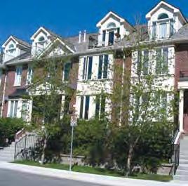
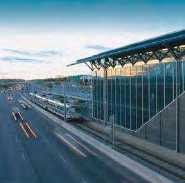
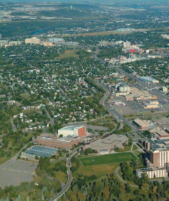
107 Part Five Framework for growth and change
108 Part 5 Framework for growth and change Part 5 Framework for growth and change 5.1 September 2009 Goal As stewards of the land within its jurisdiction, the City of Calgary will provide leadership on growth and change within a strategic framework that achieves the best possible social, environmental and economic outcomes while operating within The City s financial capacity. The City will work with key stakeholders to achieve this goal. 5.1 Introduction The City of Calgary provides leadership on growth and change to ensure the best possible social, environmental and economic outcomes for the citizens of the city both now and in the future. The City must also ensure that growth and change occurs within its financial capacity as the cost of supplying and maintaining infrastructure and services is a considerable demand on the budget of the Corporation. In addition, The City must ensure that growth occurs within the legislative and regulatory framework of other orders of government. In particular, the Alberta Land Use Framework and the Calgary Metropolitan Plan will provide direction on how the city grows and interacts within a regional and provincial context. Section 5.2 presents a Strategic Framework for Growth and Change designed to facilitate Calgary s development patterns in a way that meets these challenges. The Framework is comprised of eight objectives, each with specific policies. 5-2 THE CITY OF CALGARY MUNICIPAL DEVELOPMENT PLAN
109 5.2 A strategic framework for growth and change In order to strengthen The City s approach to managing growth, a Strategic Framework for Growth and Change has been developed (Figure 5-1). In practice, the Framework will ensure that policy, strategy and resources for growth are better aligned to facilitate Calgary s supply of planned and serviced lands and achieve the objectives of the Calgary Metropolitan Plan (CMP), the Municipal Development Plan (MDP) and the Calgary Transportation Plan (CTP). The Strategic Framework indicates the role of the provincial government which provides legislative direction for land use and transportation planning through the Municipal Government Act, the City Transportation Act and the Alberta Land Use Framework. The MDP and CTP, in turn, provide policy direction for an integrated growth and change strategic process for The City of Calgary. This ongoing process will be led by senior management through the General Managers Strategic Growth Committee (GMSGC) and Directors Sub-Committee. When setting planning and investment priorities the GMSGC will consider the following inputs; the policy direction of the MDP and CTP, the MDP and CTP performance monitoring, the Monitoring Growth and Change Series (land supply and demand information), Regional Context Studies and information on The City s infrastructure and fiscal capacity for growth. Part 5 Framework for growth and change September THE CITY OF CALGARY MUNICIPAL DEVELOPMENT PLAN 5-3
110 Part 5 Framework for growth and change 5.2 September 2009 Figure 5-1: A Strategic Framework for Growth and Change *South Saskatchewan Regional Plan and Calgary Metropolitan Plan are not approved. 5-4 THE CITY OF CALGARY MUNICIPAL DEVELOPMENT PLAN
111 5.2.1 Strong relationships Objective Maintain strong relationships with municipal neighbours, regional partners and key stakeholders within Calgary, to ensure that growth and change decisions reflect provincial and regional policies and the direction of the MDP and CTP. In order to achieve a good quality of life of for all people in the Calgary region, and to support the long-term health of our regional communities, The City of Calgary is committed to maintaining strong relationships with our municipal neighbours and regional partners. The City also supports strong relationships with key stakeholders within Calgary to ensure that the growth and change of our city benefits all citizens, now and into the future. Policies a. Continue to consult and work with inter-municipal and regional partners to ensure the best possible outcomes to issues of mutual interest within the framework of the draft Calgary Metropolitan Plan. b. Continue to consult and work with the development and building industries regarding matters of municipal process and policy in order to ensure mutual understanding and to support shared goals and objectives. c. Continue to consult and work with other stakeholders (including community associations and citizens and industry groups) regarding matters of municipal process and policy to ensure mutual understanding and to support shared goals and objectives Strategic decisions Objective Maintain Calgary s ability to grow over the long term by ensuring that growth and change decisions facilitate a land supply that aligns with the direction of the draft CMP, MDP and CTP. The MDP and CTP are aligned with the policy directions of the Alberta Land Use Framework and the draft Calgary Metropolitan Plan. The MDP and CTP contain a 60 year perspective that provides policies for Calgary to: guide where growth occurs; define the patterns of growth; and define the city s transportation networks. The policies of the MDP provide the primary source of direction for strategic growth and change decisions and should remain the primary source until a formal review of MDP is complete. A 10-year review cycle will provide policy certainty for three complete City business and budget cycles, while providing a clear long-term direction for development. Policies a. Continue to protect and manage Calgary s long-term growth requirements through the policies of the draft Calgary Metropolitan Plan and through Inter-municipal Development Plans with adjacent neighbours. b. Maintain within The City s jurisdiction at least a 30-year supply of developable land for all uses. c. Endeavour to accommodate 50 per cent of Calgary s future population growth over the next 60 to 70 years within Developed Areas of the city. d. Endeavour to accommodate 33 per cent of Calgary s future population growth within Developed Residential Areas of the city by Part 5 Framework for growth and change September THE CITY OF CALGARY MUNICIPAL DEVELOPMENT PLAN 5-5
112 Part 5 Framework for growth and change 5.2 September 2009 e. City planning and investment decisions must support the policy and growth directions of the Calgary Metropolitan Plan, the Municipal Development Plan and the Calgary Transportation Plan Planned land supply Objective Broaden The City s practice for determining planned land supply and maintain The City s practice for serviced land supply. The City s practice is to maintain up to a 15-year planned land supply (i.e., land with approved policy plans in place) and up to five years of serviced suburban land (i.e., land with infrastructure in place). Both of these practices ensure that an adequate supply of land is in place to meet the growth needs of the city. Information on land supply and demand is produced regularly through The City s Monitoring Growth and Change Series. To ensure information regarding Calgary s planned land supply is comprehensive and includes land in both the Greenfield and Developed Areas, it is necessary to develop a methodology to inventory land supply within the Developed Areas. It is also necessary to enhance commercial, retail and office land supply information. Comprehensive information will facilitate better decisions regarding city-wide growth and change. Policies a. Endeavour to maintain up to a 15 year planned land supply to support a healthy, competitive land market throughout the city. b. Endeavour to maintain 3-5 years of serviced suburban land Support intensification of Developed Areas Objective Support the strategic intensification of Developed Areas with a variety of processes and investments. The City must take an active role in supporting the strategic intensification of Developed Areas. The City will undertake a review of how intensification of Developed Areas can be facilitated through The City s planning processes and investment decisions. This will require: continued attention to process improvements for development applications; a pro-active approach to community outreach and engagement; and the implementation of a wide array of planning and urban design initiatives in order to support intensification. The City will provide leadership by sequencing and co-ordinating its infrastructure investment priorities to support intensification. It will also provide leadership through demonstration projects that will serve as models for the changes in urban form required to achieve the goals of the MDP The City will work with the development and building industries and communities to facilitate intensification initiatives that support the direction of the MDP and CTP. Policies a. Provide a wide choice of housing type and location by prioritizing and facilitating growth and redevelopment in existing communities in a variety of locations throughout the city. b. The City will provide leadership on intensification through its investment in infrastructure and the public realm and through demonstration projects that model the changes required in housing and development forms. 5-6 THE CITY OF CALGARY MUNICIPAL DEVELOPMENT PLAN
113 c. The City will consult with communities and the development and building industry to facilitate intensification initiatives Linking land use to municipal financial and infrastructure capacity Objective Ensure decision-making on growth and change incorporates The City s financial and infrastructure capacities. The City will face significant capital and operating shortfalls over the next 10-year period if it continues to provide the same services, in the same way, with the same revenue. Much of this shortfall is driven by the choices around when, where and how we grow. It will be necessary to improve decision making by incorporating the implications of capital and operating expenditures into growth decisions, including Regional Context Studies and all Local Area Plans. As the land use approving authority, The City has an obligation to provide essential infrastructure when it grants land use approvals for new developments, including core services such as water, wastewater, roads and fire and police services. The City is also responsible to its current and future citizens for ensuring the provision of complete community infrastructure including transit, libraries, parks and recreation facilities. Provision of infrastructure and the associated operating and maintenance costs require substantial ongoing investment. In order to incorporate financial and infrastructure capacity into decision-making on growth and change, the information inputs will have to be enhanced. For example, a life-cycle costing methodology for infrastructure may be required. Policies a. Municipal capacity to finance growth shall be a priority consideration in growth and change decisions including Regional Context Studies, Local Area Plans and major land use applications. b. Municipal capital investment in infrastructure (including new and maintenance/refurbished) should be prioritized in the following manner: i. Support intensification of Developed Areas of the city; ii. Expedite the completion of communities in Planned Greenfield Areas; and, iii. Supporting the development of Future Greenfield Areas. c. Align The City s capital planning programs, such as the Transportation Infrastructure Investment Program, the Emergency Response Infrastructure Investment Program, the Culture, Parks and Recreation Infrastructure Investment Program, etc., to support the direction of the MDP and CTP. Part 5 Framework for growth and change September THE CITY OF CALGARY MUNICIPAL DEVELOPMENT PLAN 5-7
114 5.2.6 Integrated decision-making Objective Make decisions regarding growth and change in an interdepartmental and integrated manner. Policies a. Recommendations to proceed with the preparation of a Local Area Plan shall be based on but not limited to the following criteria: Part 5 Framework for growth and change 5.2 September 2009 Decisions on land supply must take into consideration the financial and infrastructure implications for The City. The MDP proposes a strategic decision-making process with a mandate to integrate corporate information and rely on an inter-departmental management structure. Policies a. Make land use planning decisions and investment decisions within a strategic, inter-departmental process Public accountability Objective Provide a public accountability structure for making growth and change decisions and for communicating progress toward the direction of the MDP and CTP. City Council is accountable for growth and change decision-making. In order to enhance that accountability, a Growth and Change Map (Map 2) is included in the MDP. This map will describe the areas where growth and development are being planned through Local Area Plans. When Council provides direction to proceed with Local Area Plans, amendments will be required to Map 2. Communicating with the public regarding progress toward the direction of the MDP and CTP will also be achieved by monitoring the Core Indicators (Figure 5-2) and reporting to Calgarians. i. Advancing the objectives of the MDP, CTP and other corporate strategic initiatives; ii. An assessment of The City s financial capacity; iii. An assessment of the City s infrastructure; iv. A demonstrated need for planned land within the city; v. Consideration of the operating and life-cycle costs to The City in supplying and maintaining infrastructure; vi. The City s ability to provide efficient and costeffective utility servicing; vii. Opportunities for land use that supports Primary Transit Network; viii. Landowner interest; and, ix. Community interest. b. City Council shall make the decision to begin preparation of a Local Area Plan by amending the Growth and Change Map of the MDP (Map 2). c. Upon adoption of a new Local Area Plan, all relevant maps in both the MDP and CTP must be updated. 5-8 THE CITY OF CALGARY MUNICIPAL DEVELOPMENT PLAN
115 5.3 Monitoring and reporting Objective Provide a basis for effective strategic decision making by monitoring and reporting on the progress made towards achieving the goals and objectives of the MDP. The MDP and CTP are not static documents. They establish strategic policy directions but periodic progress checks must be undertaken to review whether progress is being made. To evaluate progress toward the policy direction of the MDP and CTP, a broad spectrum of indicators and targets has been developed. The Core Indicators for Land Use and Mobility can be found in Figure 5-2. These indicators are proxy measures for the social, environmental and economic performance of the MDP and CTP. They are intended to track the overall progress towards achieving the goals and objectives of the MDP and CTP. However, these indicators and targets are not intended to be applied to individual Local Area Plans and land use applications. It is important to note that no one or two measures in isolation indicate progress. The full set of indicators should be measured and reported in order to provide a comprehensive picture. Each of the indicators is accompanied by a target. The targets provide a desired performance outcome for an indicator over a specified period of time. The targets were based on benchmarking of other cities and through engagement with stakeholders. The targets represent a direction that The City wishes to achieve through its planning and investment processes and through collaborative work with other orders of government, the public and stakeholders. A monitoring and reporting program will be developed for the Core Indicators for Land Use and Mobility as part of the MDP/CTP implementation program. A regular cycle of reporting on the Core Indicators will provide performance information to Council, Administration and the public. Reporting will be conducted in advance of each 3-year City business planning cycle and will assist in developing investment strategies and strategic growth decisions. The reporting process will also help ensure that implementation strategies and corporate processes are aligned with the long term goals of the MDP and CTP. In addition to evaluating progress towards the targets contained in this section, additional reports will look at current growth forecasts, market trends and The City s financial capacity. A major review of the Core Indicators for Land Use and Mobility should occur on a ten year basis as part of the MDP policy review process (which will assess whether the policy direction remains appropriate or requires adjusting). Each metric and target will be evaluated to ensure that they align with the updated vision and policies of the MDP and CTP. Policies a. The City will measure the Core Indicators for Land Use and Mobility on a continuous basis and report to Council, Administration and the public on the progress towards the targets prior to each business planning cycle. Part 5 Framework for growth and change September THE CITY OF CALGARY MUNICIPAL DEVELOPMENT PLAN 5-9
116 Part 5 Framework for growth and change 5.3 September 2009 # Core Indicators Metric Baseline 1 Urban Expansion Per cent of population growth accommodated within developed area (2005 boundary area) In 2005, the developed area of the city was losing 5% of population to greenfi eld area. 2 Density People per hectare In 2005, Calgary had a population density of 20 people per hectare. Jobs per hectare In 2005, Calgary had employment density of 11 jobs per hectare. 3 Population / Jobs Balance Population/Jobs East/West ratio Population/Jobs North/South ratio In 2005, the population/ jobs East/ West ratio was 2.7. In 2005, the population/ jobs North/ South ratio was Mix Land use Land Use Diversity Index In 2008, land use mix diversity index was Residential Mix Residential Diversity Index In 2008, residential diversity index was Road and Street Infrastructure 7 Accessibility to Primary Transit Network Roads to Streets ratio 0.72 (42% Roads and 58% Streets) Per cent of population within 400m of Primary Transit Network Per cent of jobs within 400m of Primary Transit Network 8 Transit Service Annual transit service hours per capita 9 Goods Access Per cent of intermodal and warehousing facilities within 1600m (actual) of Primary Goods Movement Network 10 Transportation Mode Split 11 Accessibility to Daily Needs Walking and Cycling Mode Split (all purpose trips, 24 hours, city-wide) Transit Mode Split (all purpose trips, 24 hours, city-wide) Auto Mode Split (all purpose trips, 24 hours, city-wide) Per cent of population within Major and Community Activity Centres, and 600m of Urban and Neighbourhood Corridors LRT is the only transit service approaching Primary Transit levels of service in Calgary today. LRT is the only transit service approaching Primary Transit levels of service in Calgary today. Currently, 2.2 transit service hours are provided for each resident in Calgary annually. Currently, 73% of intermodal and warehousing facilities are located within 1600m of Primary Goods Movement Network. In 2005, walk and bike trips contributed to 14% of all trips made. In 2005, 9% of all trips were made by transit. In 2005, 77% of all trips were made by car. In 2006, 18% of all population was located within Major and Community Activity Centres, and 600m of Urban and Neighbourhood Corridors. 60-year Target 50% (36%Roads and 64% Streets) 45% 67% % 20% - 25% 15% - 20% 65% - 55% 12 Watershed Health Per cent of impervious surface In 1998, 32% of land cover was 10% - 20% impervious (made up of roadways, parking and buildings). 13 Urban forest Per cent of tree canopy Canopy cover was 7% in % - 20% 14 District Energy Per cent of land area with densities supportive of district energy systems In 2005, only 0.3% of land area had densities supportive of district energy systems. 30% 1.7% Figure 5-2: Core Indicators for Land Use and Mobility 5-10 THE CITY OF CALGARY MUNICIPAL DEVELOPMENT PLAN

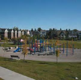
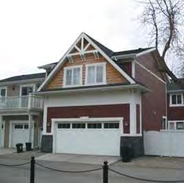
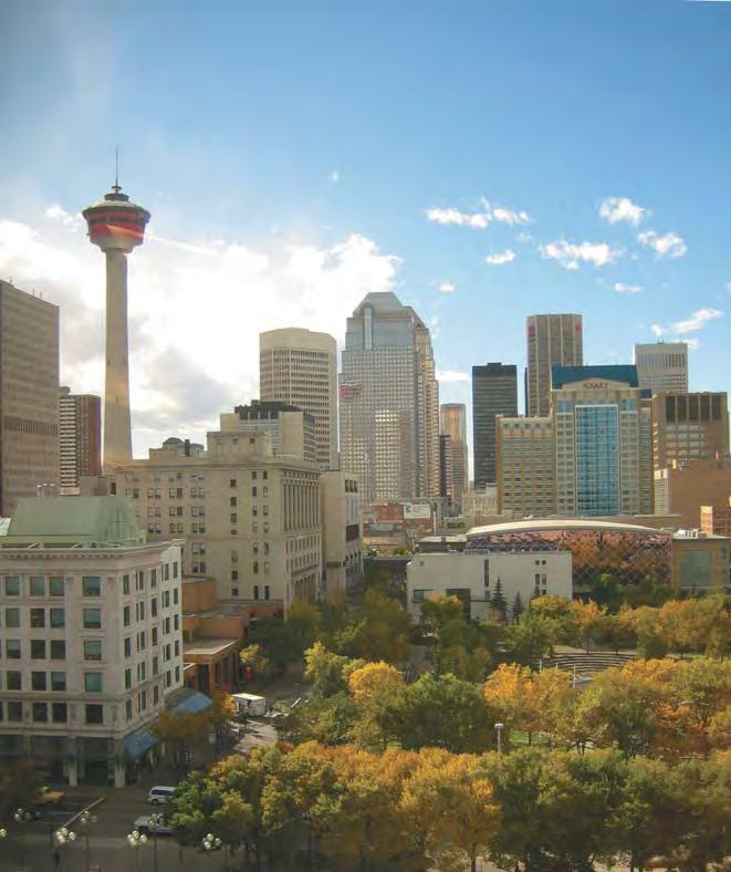
117 Part Six Glossary
118 Part 6 Glossary Part 6 Glossary action A specific task to help achieve an objective or implement a policy. active modes Non-motorized travel, primarily walking and cycling, but which also includes rollerblading and movements with mobility devices. affordable housing Housing that meets the needs of households earning 65 per cent or less of the median household income in Calgary that are spending 30 per cent or more of their gross annual household income on shelter. amenity space Common or private, indoor or outdoor space provided on-site and designed for active or passive recreational use. Base Transit Service A network of feeder, crosstown, circulator and shuttle services whose primary function is to provide comprehensive community coverage to complement and augment the Primary Transit Network. The minimum level of service for the Base Transit Network is every 30 minutes. benchmarking A standardized method for collecting and reporting critical operational data in a way that enables relevant comparisons among the performances of different organizations or programmes, usually with a view to establishing good practice, diagnosing problems in performance and identifying areas of strength. Benchmarking gives the organization (or the programme) the external references and best practices on which to base its evaluation and to design its working processes. 6.0 September 2009 Area Redevelopment Plan (ARP) A statutory plan as defined by the Municipal Government Act, that directs the redevelopment, preservations or rehabilitation of existing lands and buildings, generally within existing areas of the city. Area Structure Plan (ASP) A statutory plan as defined by the Municipal Government Act, that directs the future land use patterns, transportation and utility networks and sequence of development in new communities. Arterial Street Arterial Streets provide a high-quality environment for all modes of transportation. These streets are not destinations themselves, but provide reasonably direct connections between multiple communities and major destinations. They have varying degrees of interaction with adjacent land uses but, on average, allow for greater connectivity than through roads. brownfield site A brownfield site is an abandoned, vacant, derelict or underutilized property where past actions have resulted in real or perceived contamination and where there is an active potential for redevelopment. Brownfield sites include parcels of all sizes from corner gas stations to large areas encompassing many properties. built environment, or built form The engineered surroundings that provide the setting for human activity and includes buildings, streets and structures (including infrastructure). Bus Rapid Transit (BRT) A type of limited stop bus service that relies on technology to speed up the service. It can operate on exclusive transit ways, high occupancy vehicle lanes and any type of road or street. A BRT line combines intelligent transportation systems technology, priority for transit, rapid and convenient fare collection and integration with land use policy, in order to upgrade bus system performance substantially. 6-2 THE CITY OF CALGARY MUNICIPAL DEVELOPMENT PLAN
119 Calgary Region The geographic area encompassing Calgary and other municipal jurisdictions, all of which comprise the Calgary Regional Partnership. Calgary Regional Partnership An association of municipalities in the Calgary Region from Crossfield in the north to Nanton in the south, and from Banff in the west, to Wheatland County in the east, with Calgary at its Centre. canopy cover The area within the boundaries of Calgary covered by tree and forest foliage. capacity The volume of vehicles a roadway was designed to carry in a unit of time, such as an hour. Can also be applied to transit or bicycle/pedestrian pathways. cascading energy Energy cascading is using residual heat in liquids or steam from a primary process to provide heating or cooling to a later process. For example, excess steam from a power plant or refinery may be used in a food processing plant or greenhouse. co-generation The capturing and using of otherwise wasted heat from the electrical generating process. compact urban form A land-use pattern that encourages efficient use of land, walkable neighbourhoods, mixed land uses (residential, retail, workplace and institutional all within one neighbourhood), proximity to transit and reduced need for infrastructure. complete community A community that is fully developed and meets the needs of local residents through an entire lifetime. Complete communities include a full range of housing, commerce, recreational, institutional and public spaces. A complete community provides a physical and social environment where residents and visitors can live, learn, work and play. complete street A street designed and operated to enable safe, attractive and comfortable access and travel for all users, including pedestrians, cyclists and public transit and private vehicle users. A complete street incorporates green infrastructure and optimize public space and aesthetics wherever possible. The degree to which any one street supports different modes of transportation, green infrastructure or public space varies depending on surrounding context and role of the street. congestion A condition lasting 15 minutes or longer where travel demand exceeds the design capacity of a transportation facility. connectivity The directness of links and the density of connections in a path or road network. A connected transportation system allows for more direct travel between destinations, offers more route options and makes active transportation more feasible. connectivity index A value calculated as the number of links divided by the number of nodes in a given area (such as a community or Activity Centre). The higher the value, the easier it is to travel directly from one place to another. Two different indices are specified in this plan one for active modes and another for streets. core indicators The most significant measures to provide an overall picture of our progress toward achievement of the key directions for land use and mobility. Part 6 Glossary September THE CITY OF CALGARY MUNICIPAL DEVELOPMENT PLAN 6-3
120 Part 6 Glossary Crime Prevention Through Environmental Design (CPTED) The proper design and effective use of the built environment, which may lead to a reduction in the fear and incidence of crime and an improvement in quality of life. cycle-track Dedicated space for bicycles built into street right-ofways. They are separated physically from both vehicle travel lanes and sidewalks to improve safety and efficiency for all modes of transportation. density A measure of the number of dwelling units on a parcel of land, expressed in units per hectare or in units per parcel. design indicators Design indicators are criteria for measuring progress towards sustainability, with a focus on the issues relating to the interaction and design of land use and transportation systems (e.g., proximity of population and jobs to convenient transit). Effective design issues should be measured easily and reliably, be simple and easy to understand, and can be used to drive future decision-making processes related to land use and transportation. conditions necessary for ecosystems and species populations to survive in a human-dominated landscape. ecosystem A dynamic system of plants, animals and other organisms, together with the non-living components of the environment, that functions as an interdependent unit. entranceways or gateways Important transportation connections either to enter the city or to signify entrance into a specific part of the city. Well-designed entrances welcome people and provide a sense of arrival to an important place. Environmentally Significant Area (ESA) A natural area site that has been inventoried prior to potential development and which, because of its features or characteristics, is significant to Calgary from an environmental perspective and has the potential to remain viable in an urban environment. A site is listed as an Environmentally Significant Area on the basis of meeting one or all of the criteria listed in Appendix C of The City of Calgary Parks Open Space Plan. escarpment A steep slope formed by the erosive action of water, and normally adjacent to a watercourse. 6.0 September 2009 diversity An environment that offers a variety of experiences to patrons. Mix of land uses, architecture, street design and landscaping can all contribute to providing variety. ecological integrity A condition where the structure and function of an ecosystem are unimpaired by stresses induced by human activity and that condition is likely to persist. ecological network A network of ecological components (core areas, corridors and buffer zones) which provides the physical Floor Area Ratio (FAR) The quotient of the total gross floor area of a building on a parcel divided by the gross site area of the parcel. FAR is one of the measures to direct the size and massing of a building in relation to the area of the parcel of land it occupies. goal A desirable condition to be achieved a sought-after end state that is not quantifiable or time-dependent. Provides context for corresponding objectives and policies. 6-4 THE CITY OF CALGARY MUNICIPAL DEVELOPMENT PLAN
121 goods movement The transportation of goods, usually freight, by road, rail and/or air. Lighter service vehicles may also be included. green infrastructure An interconnected network of natural green and engineered green elements applicable at multiple scales in the land use and mobility framework. Natural green elements include the conservation and integration of traditional green elements such as trees, wetlands, riparian areas and parks. Engineered green elements include systems and technologies designed to mimic ecological functions or to reduce impacts on ecological systems. Examples include green alleys, green buildings and green roadways and bridges. greyfield An outdated, vacant or failing commercial or institutional site. The term grey refers to the large area of concrete and asphalt that typically accompanies retail sites. habitat fragmentation Fragmentation occurs when a large region of habitat has been broken down, or fragmented, into a collection of smaller patches of habitat. Fragmentation typically occurs when land is converted from one type of habitat to another. High Occupancy Vehicle (HOV) lane A roadway lane designated for use by transit vehicles and carpools with at least two to three people. The highest service HOV lane is a reserved transit lane. hydrology The study of the movement, distribution and quality of water throughout the Earth; hydrology thus addresses both the hydrologic cycle and water resources. impervious surfaces Mainly artificial structures, such as building roofs, road pavements, sidewalks and parking lots that cannot be easily penetrated by water, thereby resulting in runoff. indicator A variable that is representative of progress towards the achievement of an objective, policy or action. Industrial Arterial Streets located in industrial areas. Their first priority is the efficient movement of heavy trucks but, as streets, they still accommodate all modes of transportation. infrastructure The technical structures that support a society, including roads, transit, water supply, sewers, power grid, telecommunications, etc. intensification The development of a property, site or area at a higher density than currently exists. Intensification can be achieved through redevelopment, development of vacant/underutilized lots, the conversion of existing buildings, or through infill development in previously developed areas. intensity A measure of the concentration of people and jobs within a given area calculated by totalling the number of people either living or working in a given area. intermodal facilities Places that accommodate connections between transportation modes. Typically refers to break of bulk locations between rail and air and truck jobs/housing (population/jobs) balance A measure of the relationship between the number of residents and the number of jobs in a specific area. The commonly used metric of this balance is simply the number of residents divided by the number of jobs in that community. Land Use Bylaw (LUB) The City of Calgary Land Use Bylaw 1P2007. Part 6 Glossary September THE CITY OF CALGARY MUNICIPAL DEVELOPMENT PLAN 6-5
122 Part 6 Glossary 6.0 September 2009 land use diversity An indicator used to describe the mix of different land uses within a given community or planning area, expressed in terms of the mix of land use districts. legibility The degree to which users of a space are able to perceive and understand its layout and function readily. life cycle cost The sum of all recurring and one-time (non-recurring) costs over the full life span or a specified period of a good, service, structure or system. It includes purchase price, installation cost, operating costs, maintenance and upgrade costs and remaining (residual or salvage) value at the end of ownership or of its useful life. Light Rail Transit (LRT) Electrically-powered rail cars, operating in sets of three to five cars per train on protected rights-of-way, adjacent to or in the medians of roadways or rail rights-of-way. Generally at grade, with some sections operating in mixed traffic and/or tunnels or on elevated bridge structures. linkages Linear systems that connect places and built form. Linkages allow for the movement of people and goods within the urban fabric. logistics The management of the flow of goods, information and other resources, including energy and people, between the point of origin and the point of consumption in order to meet the requirements of consumers. low impact development (LID) An approach to land development that uses various land planning and design practices and technologies to simultaneously conserve and protect natural resource systems and reduce infrastructure costs. metric A standard measure to assess performance in a particular area. mixed-use development The development of land, a building or a structure with two or more different uses, such as residential, office and retail. Mixed-use can occur vertically within a building, or horizontally on a site. Mobility Assessment Plan (MAP) Framework for assessing the multi-modal transportation impacts of new developments. Replaces Transportation Impact Assessment (TIA). mode split or modal split The proportion of total person trips using each of the various modes of transportation. The proportion using any one mode is its modal share. native biodiversity Species of flora and fauna that are indigenous to a specific area. Neighbourhood Boulevard These streets form the backbone of Neighbourhood Corridors and Activity Centres. Pedestrians are given the highest priority on these streets, which are fully integrated with adjacent land uses and provide the highest level of connectivity of all street types. Similar to Urban Boulevards, high quality urban design and green infrastructure strategies are incorporated into Neighbourhood Boulevards. objective An expression of a desired outcome or more specific way to achieve a goal. park and ride lots Parking lots located at LRT stations or bus stops that allow automobile users to park their private vehicles, 6-6 THE CITY OF CALGARY MUNICIPAL DEVELOPMENT PLAN
123 access and transfer to and from public transportation service in a convenient manner. parkway A street that focuses on integration with natural areas. Natural vegetation and new forms of stormwater management would be integrated with the street. Adjacent land uses would include large natural parks, waterways or special public institutions. pedestrian-oriented or pedestrian-friendly An environment designed to make travel on foot safe, convenient, attractive and comfortable for various ages and abilities. Considerations include directness of the route, interest along the route, safety, amount of street activity, separation of pedestrians and traffic, street furniture, surface material, sidewalk width, prevailing wind direction, intersection treatment, curb cuts, ramps and landscaping. pedestrian-scale/human-scale Refers to the scale (height/proportions) and comfort level that the street level and lower stories of a building provide for pedestrians as they walk alongside a building or buildings. performance indicator See indicator. performance measurement See metric. policy A deliberate statement or plan to achieve an objective. Policies are instructive, directional and positive, but not limited to a single course of action when some other course could achieve the same result. Primary Cycling Network A network of on-street cycling facilities, pathways and cycle tracks that connects major destinations such as Activity Centres, mixed-use Corridors and major institutions. Primary Transit Network A permanent network of high-frequency transit services, regardless of mode, that operates every 10 minutes or better, 15 hours a day, seven days a week. primary transit threshold A minimum intensity of people or jobs per gross developable hectare that is required within walking distance of a transit station or stop to support service levels of the Primary Transit Network. prominent sites Sites which by their location and relationship to the urban and geographical form have a strong visual impact. Prominent sites include those that terminate a street, are on a street corner, frame or adjoin a public park or open space or are located on a ridgeline or other highly visible location. public realm The space around, between and within buildings that are publicly accessible, including streets, squares, parks and open spaces. These areas and settings support or facilitate public life and social interaction. public utility Areas that provide space for large scale public utilities such as landfills and water treatment facilities. redevelopment The creation of new units, uses or lots on previously developed land in existing communities. residential diversity An indicator used to describe the mix of residential types in an area, expressed in terms of the mix by residential land use district area, or by mix of housing unit types. Part 6 Glossary September THE CITY OF CALGARY MUNICIPAL DEVELOPMENT PLAN 6-7
124 Part 6 Glossary 6.0 September 2009 right-of-way (ROW) Publicly-owned land containing roads and streets and/ or utilities. riparian areas Riparian areas are those areas where the plants and soils are strongly influenced by the presence of water. They are transitional lands between aquatic ecosystems (wetlands, rivers, streams or lakes) and terrestrial ecosystems. riparian corridor A riparian corridor is the interface between land and a stream. Road and Street Palette A functional classification system that differentiates between traditional Skeletal Roads, which primarily serve long-distance trips and do not interact with adjacent land uses, and Streets, which serve a broader range of transportation modes and do interact with adjacent land uses. secondary indicator A potentially more detailed or finely focused indicator, several of which, when combined, may support a core indicator. sense of place A strong identity and character that is felt by local inhabitants and visitors. Factors that help to create a strong sense of place include natural and cultural features, built form and architecture, mobility to and within the place and the people who frequent that place. Areas with a good sense of place often have elements that are appealing to the five senses (sight, smell, touch, taste, sound) and generally encourage people to linger longer and enjoy the atmosphere. Skeletal Road Skeletal Roads have an emphasis on moving vehicular traffic over long distances. They typically operate at high speeds and have little direct interaction with adjacent land uses. Ideally, they should form a skeletal grid across the city with approximately three to five kilometre spacing. stream corridor Generally consists of the stream channel, floodplain, and transitional upland fringe streetcars Urban rail vehicles operating a low speeds (e.g., 10 to 25 kph) in mixed traffic, with closely spaced stops (e.g., every 200 metres). streetscape All the elements that make up the physical environment of a street and define its character. This includes paving, trees and vegetation, lighting, building type, style setback, pedestrian, cycle and transit amenities, street furniture, etc. sustainability Meeting the needs of the present without compromising the ability of future generations to meet their own needs. It includes environmental, economic and social sustainability. Sustainability is defined by the 11 Sustainability Principles for Land Use and Mobility, approved by Calgary City Council on Jan. 8, target A desired performance outcome for an indicator over a specified time period. Transit Hub A place of connectivity where different modes of transportation (walking, cycling, bus and rail transit) come together seamlessly and where there is an attractive, intense and diverse concentration of housing, employment, shopping and other amenities around a major transit station. 6-8 THE CITY OF CALGARY MUNICIPAL DEVELOPMENT PLAN
125 Transit-Oriented Development (TOD) A compact, mixed-use community within walking distance of a transit stop, that mixes residential, retail, office, open space and public uses in a way that makes it convenient to travel on foot or by public transportation instead of by car. transit-oriented, transit-friendly or transit-supportive The elements of urban form and design that make transit more accessible and efficient. These range from land use elements, (e.g., locating higher intensity housing and commercial uses along transit routes) to design (e.g., street layout that allows efficient bus routing). It also encompasses pedestrian-friendly features, as most transit riders begin and end their rides as pedestrians. transit priority measures Strategies that improve transit operating speeds and transit travel time reliability in mixed traffic, such as traffic signal priority or queue jumps. universal design Universal design is the design of products and environments to be usable by all people, to the greatest extent possible, without the need for adaptation or specialized design. Urban Boulevard A street type that forms the backbone of Urban Corridors and Activity Centres. It gives the highest priority to walking, cycling and transit but accommodates reasonably high volumes of vehicular traffic. Urban Boulevards are fully integrated with adjacent land uses and provide high levels of connectivity to surrounding communities and destinations. High quality urban design and green infrastructure are also critical components of Urban Boulevards. urban forest All the trees and associated vegetative understory in the city, including trees and shrubs intentionally planted, naturally occurring or accidentally seeded within the city limits. walkable See pedestrian-oriented. watershed Watersheds include groundwater, springs, wetlands, ponds, streams and lakes as well as all land that drains into these linked aquatic systems. Watersheds reflect both the natural characteristics of their geography and the impacts of human activities within them. wayfinding A term used to describe how people respond to the built environment to orient themselves. Elements that contribute to wayfinding include reference points such as signage, natural areas or parks, landmark buildings, bridges, distinctive lighting, public art, etc. wetlands A (Calgary) wetland is a waterbody and its bed and shores, that is naturally occurring or disturbed and is located within the Foothills Fescue and Foothills Parkland Natural Regions within the city of Calgary (as per the Wetland Conservation Plan). Part 6 Glossary September THE CITY OF CALGARY MUNICIPAL DEVELOPMENT PLAN 6-9
126

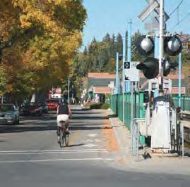
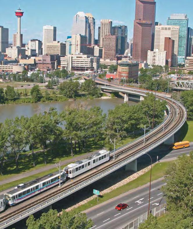
127 Part Seven Maps
Official Plan Review
 Official Plan Review Summary Report - The Built Environment August 2014 Part 1: Introduction Planning for a healthy, prosperous and sustainable community is an important goal for our municipality. From
Building great communities:
 Building great communities: The City of Calgary Land Use Planning & Policy Transportation Planning Partners in Planning Session Saturday April 05, 2014 Presentation Objectives Overview of the overall direction
Municipal Development Plan 2013
 UNIQUELY STONY PLAIN: Municipal Development Plan 2013 Quick Reference Guide What is a Municipal Development Plan (MDP)? The Town s highest-level planning document Sets the long-term vision and key themes
CITY CLERK. Parkland Acquisition Strategic Directions Report (All Wards)
") CITY CLERK Clause embodied in Report No. 10 of the, as adopted by the Council of the City of Toronto at its meeting held on November 6, 7 and 8, 2001. 10 Parkland Acquisition Strategic Directions Report
CITY CLERK Clause embodied in Report No. 10 of the, as adopted by the Council of the City of Toronto at its meeting held on November 6, 7 and 8, 2001. 10 Parkland Acquisition Strategic Directions Report
1 Introduction. Chapter. In this chapter:
 Chapter 1 Introduction In this chapter: 1.1 A Snapshot of the Region 1.2 Towards a Sustainable Region 1.3 The Provincial Context 1.4 Purpose and Organization The Regional Municipality of York Official
1.0 PLANNING MARKHAM S FUTURE CONTENTS
 1-1 Planning Markham s Future 1.0 PLANNING MARKHAM S FUTURE CONTENTS 1.1 THE PURPOSE OF THE OFFICIAL PLAN 1.2 THE MARKHAM CONTEXT 1.3 THE REGULATORY CONTEXT 1.3.1 Province of Ontario 1.3.2 York Region
The protection of the agricultural resources of the Province;
 PART II INTRODUCTION An Official Plan is a policy document, which is intended to serve as the basis for making land use decisions and managing change in any municipality in Ontario. According to the Planning
LAND USE AMENDMENT CORNERSTONE (WARD 3) 60 STREET NE AND COUNTRY HILLS BOULEVARD NE MAP 26NE BYLAW 22D2017
 60 STREET NE AND COUNTRY HILLS BOULEVARD NE MAP 26NE BYLAW 22D2017") Page 1 of 14 EXECUTIVE SUMMARY This Land Use Amendment application covers an area of 43.76 hectares ± (108.14 acres ±) located in northeast Calgary, bound by Country Hills Boulevard NE to the south and
Page 1 of 14 EXECUTIVE SUMMARY This Land Use Amendment application covers an area of 43.76 hectares ± (108.14 acres ±) located in northeast Calgary, bound by Country Hills Boulevard NE to the south and
CITY COUNCIL AGENDA REPORT
 CITY COUNCIL AGENDA REPORT Subject: COUNCIL MOTION LRT ALIGNMENT REMOVAL FROM THE TRANSPORTATION MASTER PLAN On February 10, 2016 Councillor Hughes provided notice in accordance with Section 23 of Procedure
Tāhuhu whakaruruhau ā-taone The sheltering ridge pole
 B2. Tāhuhu whakaruruhau ā-taone - Urban growth and form B2.1. Issues Tāhuhu whakaruruhau ā-taone The sheltering ridge pole Auckland s growing population increases demand for housing, employment, business,
Welcome to the Oakridge Centre Open House
 Welcome to the Oakridge Centre Open House Why is the City hosting this event? This open house is to inform you of a rezoning application submitted to the City of Vancouver to amend the existing CD-1 (Comprehensive
Town of Oakville Streetscape Strategy
 Town of Oakville Streetscape Strategy Endorsed by PDC on February 10, 2014 (PD-011-14) Town of Oakville Streetscape Strategy [endorsed by PDC February 10, 2014] 0 Town of Oakville Streetscape Strategy
Plan Modification to Chapter B2 of the Auckland Unitary Plan(AUP) Operative in part (15 November 2016)
 Operative in part (15 November 2016)") UNITARY PLAN UPDATE REQUEST MEMORANDUM TO FROM Phill Reid Linley Wilkinson DATE 25 September 2018 SUBJECT Plan Modification to Chapter B2 of the Auckland Unitary Plan(AUP) Operative in part (15 November
UNITARY PLAN UPDATE REQUEST MEMORANDUM TO FROM Phill Reid Linley Wilkinson DATE 25 September 2018 SUBJECT Plan Modification to Chapter B2 of the Auckland Unitary Plan(AUP) Operative in part (15 November
A Growing Community Rural Settlement Areas
 Town of Huntsville Official Plan Review - POLICY BACKGROUND PAPER A Growing Community Rural Settlement Areas BACKGROUND: In addition to the fully municipally-serviced Urban Settlement Area and the Hidden
2040 LUP is a part of the Comprehensive Plan and carries the same legal authority. Economic Challenges
 1.1. Guiding Anchorage s Growth Where will new residents settle over the next two decades? Where will people work, shop, and play? Will there be enough room to grow? How will Anchorage look? Will growth
Town of Devon. Municipal Development Plan
 Municipal Development Plan September 2017 ISL Engineering and Land Services Ltd. is an award-winning full-service consulting firm dedicated to working with all levels of government and the private sector
9 CITY OF VAUGHAN OFFICIAL PLAN AMENDMENT NO BOCA EAST INVESTMENTS LIMITED
 9 CITY OF VAUGHAN OFFICIAL PLAN AMENDMENT NO. 631 - BOCA EAST INVESTMENTS LIMITED The Planning and Economic Development Committee recommends the adoption of the recommendations contained in the following
Calgary Metropolitan Plan
 Calgary Metropolitan Plan Calgary Regional Partnership phone: 403-851-2509 email: info@calgaryregion.ca www.calgaryregion.ca MAY 2014 WATER IS ESSENTIAL FOR OUR SURVIVAL 1 Water is essential We are fortunate
THE GARDEN CITY PLAN. City of St. Catharines Official Plan. City of St. Catharines
 THE GARDEN CITY PLAN City of St. Catharines Official Plan City of St. Catharines August 2010 APPROVAL INFORMATION This Official Plan of the City of St. Catharines Planning Area, known as the Garden City
ADMINISTRATION RECOMMENDATION 2016 November 03. That Calgary Planning Commission recommends APPROVAL of the proposed Land Use Amendment.
 Page 1 of 12 EXECUTIVE SUMMARY This Land Use Amendment application covers an area of 75.76 hectares ± (187.20 acres ±) located in northeast Calgary, bound by Stoney Trail NE to the north, 128 Avenue NE
6 Growth Management Challenges and Opportunities
 6 Growth Management Challenges and Opportunities The Town has established a goal of attaining a 50% participation rate with respect to employment opportunities versus residential population. The Town s
CITY OF COLWICH COMPREHENSIVE PLAN LAND USE LAND USE 1
 LAND USE LAND USE 1 WHAT YOU WILL FIND IN THIS CHAPTER: Discussion of today s conditions and tomorrow s projections Discussion of challenges and opportunities Discussion of the environmental quality goals,
SUBJECT: Waterfront Hotel Planning Study Update TO: Planning and Development Committee FROM: Department of City Building. Recommendation: Purpose:
 Page 1 of Report PB-23-18 SUBJECT: Waterfront Hotel Planning Study Update TO: Planning and Development Committee FROM: Department of City Building Report Number: PB-23-18 Wards Affected: 2 File Numbers:
Edward R. Sajecki Commissioner of Planning and Building
 Corporate Report Clerk s Files Originator s Files CD.03.POR DATE: TO: FROM: SUBJECT: Chair and Members of Planning and Development Committee Meeting Date: February 27, 2012 Edward R. Sajecki Commissioner
NEW REGIONAL OFFICIAL PLAN HIGH LEVEL PROCESS & FRAMEWORK
 NEW REGIONAL OFFICIAL PLAN HIGH LEVEL PROCESS & FRAMEWORK Why A New Official Plan Originally the role of Regionally Planning and content of Regional Official Plan (1970s) primarily focused on protecting
Local Growth Planning in North Central Green Line Communities
 2018 April 30 Page 1 of 6 EXECUTIVE SUMMARY This report outlines a high-level scope for local growth planning for north central Green Line communities. The catalyst for this review is the significant investments
Plano Tomorrow Vision and Policies
 Plano Tomorrow Vision and Policies PLANO TOMORROW PILLARS The Built Environment The Social Environment The Natural Environment The Economic Environment Land Use and Urban Design Transportation Housing
SECTION ONE: INTRODUCTION. introduction
 introduction 1 INTRODUCTION Since it was first established in 1843 as a trading post for the Hudson s Bay Company, Victoria has evolved into a Provincial capital city that is recognized across Canada and
PSRC REVIEW REPORT & CERTIFICATION RECOMMENDATION
 PSRC REVIEW REPORT & CERTIFICATION RECOMMENDATION KITSAP COUNTY COUNTYWIDE PLANNING POLICIES July 2, 2012 BACKGROUND A major emphasis of the Washington State Growth Management Act (GMA) is the need to
LAND USE AMENDMENT CORNERSTONE (WARD 3) COUNTRY HILLS BOULEVARD AND STONEY TRAIL NE BYLAW 9D2017
 COUNTRY HILLS BOULEVARD AND STONEY TRAIL NE BYLAW 9D2017") Page 1 of 12 EXECUTIVE SUMMARY This Land Use Amendment application covers an area of 54.92 hectares ± (135.71 acres ±) located in northeast Calgary, bound by Country Hills Boulevard NE to the north and
Page 1 of 12 EXECUTIVE SUMMARY This Land Use Amendment application covers an area of 54.92 hectares ± (135.71 acres ±) located in northeast Calgary, bound by Country Hills Boulevard NE to the north and
Sustainable Growth. Sustainable Growth
 2 Sustainable Growth Sustainable Growth SUSTAINABLE GROWTH 2.1 COMMUNITY VISION... 2-5 2.2 THE CITY SYSTEM... 2-7 2.2.1 AREAS... 2-7 2.2.2 CITY-WIDE SYSTEMS... 2-8 2.2.3 PROVINCIAL PLAN BOUNDARIES AND
The Way We Grow. Draft Municipal Development Plan. Reference Consolidation of approved and proposed amendments to draft Bylaw
 Attachment 1 Appendix 1 The Way We Grow Draft Municipal Development Plan Reference Consolidation of approved and proposed amendments to draft Bylaw 15100 October 23, 2009 Prepared by the Planning & Development
section 3: Vision, Values and Goals
 Vision, Values and Goals 3 2041 Vision: Victoria is an urban sustainability leader inspiring innovation, pride and progress towards greater ecological integrity, livability, economic vitality, and community
Land Use Amendment in Southwood (Ward 11) at and Elbow Drive SW, LOC
 at and Elbow Drive SW, LOC") 2018 November 15 Page 1 of 10 EXECUTIVE SUMMARY This land use amendment application was submitted by Rick Balbi Architect on 2017 August 31 on behalf of Sable Developments Ltd, and with authorization from
2018 November 15 Page 1 of 10 EXECUTIVE SUMMARY This land use amendment application was submitted by Rick Balbi Architect on 2017 August 31 on behalf of Sable Developments Ltd, and with authorization from
and services The protection and conservation of environmentally significant and sensitive natural heritage features and functions.
 6. Land Use 6.0 Preamble A healthy and livable city is one in which people can enjoy a vibrant economy and a sustainable healthy environment in safe, caring and diverse neighbourhoods. In order to ensure
This page has been intentionally left blank.
 This page has been intentionally left blank. Chapter 3 3-2 3. Employment 3.A Niagara Economic Gateway 3.A.1 General The Niagara Economic Gateway comprises: a) The Gateway Economic Zone which includes all
Preliminary Plan Framework: Vision and Goals
 Preliminary Plan Framework: Vision and Goals Draft: May 2015 Introduction Since the Town of Milliken s comprehensive plan was last updated in 2010, the community was heavily impacted by the 2013 flood,
Visioning Statement and Guiding Principles
 Visioning Statement and Guiding Principles Planning for the Future The General Plan The General Plan represents Woodland's shared vision of the future and defines a path to lead the community toward its
SECTION E. Realizing the Plan
 SECTION E Realizing the Plan 60 DESIGN REGINA - OFFICIAL COMMUNITY PLAN SECTION E Realizing the Plan Design Regina has been an ambitious plan-making exercise, with a high level of community, stakeholder,
The Corporation of the Town of Milton
 Report To: From: Council Barbara Koopmans, Commissioner, Planning and Development Date: May 7, 2018 Report No: Subject: Making it Possible Positioning the Town s Strategy for Growth and Economic Development
Purpose of the Master Plan
 Purpose of the Master Plan 4 Master Plan Purpose The Master Plan is a policy framework for decisions that affect the physical, social and economic environment of the Town. The Parker 2035: Master Plan
THE TOWN OF WASAGA BEACH
 THE TOWN OF WASAGA BEACH Downtown Development Master Plan Committee of the Whole Presentation January 26 th 2017 Uses within this designation should reflect a dependence on tourism as opposed to the permanent
A New Plan For The Calgary Region June calgary.ca call 3-1-1
 A New Plan For The Calgary Region June 2009 calgary.ca call 3-1-1 Introduction Since January 2006, The City of Calgary has been actively participating with the member municipalities of the Calgary Regional
CHAPTER 12 IMPLEMENTATION
 CHAPTER 12 IMPLEMENTATION The 2010 Town of Denton Comprehensive Plan is intended to capture a vision of the future of Denton. As such, it provides a basis for a wide variety of public and private actions
CITY OF LANGLEY OFFICIAL COMMUNITY PLAN BYLAW, 2005, NO APPENDIX II - REGIONAL CONTEXT MAP
 CITY OF LANGLEY OFFICIAL COMMUNITY PLAN BYLAW, 2005, NO. 2600 APPENDIX II - REGIONAL CONTEXT MAP ± Legend Agricultural Mixed Employment Industrial Conservation & Recreation Regional City Centre Urban Containment
Purpose of the Master Plan
 Purpose of the Master Plan 4 Master Plan Purpose The Master Plan is a policy framework for decisions that affect the physical, social and economic environment of the Town. The Parker 2035: Master Plan
Official Plan Review: Draft Built Form Policies
 PG.30.1 REPORT FOR ACTION Official Plan Review: Draft Built Form Policies Date: May 15, 2018 To: Planning and Growth Management Committee From: Chief Planner and Executive Director, City Planning Division
TOWN OF BRUDERHEIM Report to the capital region board
 TOWN OF BRUDERHEIM Report to the capital region board Introduction to the Town of Bruderheim Municipal Development Plan amendment and Relation to the CRB Evaluation Criteria 02 march 2017 1 Introduction
1.0 Purpose of a Secondary Plan for the Masonville Transit Village
 Report to Planning and Environment Committee To: Chair and Members Planning & Environment Committee From: John M. Fleming Managing Director, Planning and City Planner Subject: Masonville Transit Village
4 Sustainability and Growth Management
 4 Sustainability and Growth Management Introduction Traditionally, has assumed growth and development with limited consideration for the long-term negative social, environmental or economic impacts on
Municipal Development Plan Update Urban Service Area and Hamlets
 ENCLOSURE 1 Municipal Development Plan Update Urban Service Area and Hamlets Priorities Committee January 24, 2017 MUNICIPAL DEVELOPMENT PLAN UPDATE SHAPING OUR FUTURE MDP Update - Agenda MDP Update Public
EDMONTON: Changing the Way We Grow and the Way We Move
 EDMONTON: Changing the Way We Grow and the Way We Move Rhonda, Toohey, P.Eng. Transportation Department City of Edmonton Paper prepared for presentation at the Sustainable Urban Transportation Session
South District What we heard
 What we heard Vision to 2056 and Priorities Governance and implementation Infrastructure and funding Feedback supported: The vision for a metropolis of three cities, but emphasised the importance of infrastructure
St. Lawrence Neighbourhood Focused Area - Official Plan Amendment Status Report
 STAFF REPORT ACTION REQUIRED St. Lawrence Neighbourhood Focused Area - Official Plan Amendment Status Report Date: May 21, 2015 To: From: Wards: Reference Number: Toronto and East York Community Council
SAN RAFAEL GENERAL PLAN 2040 INTRODUCTION AND OVERVIEW
 SAN RAFAEL GENERAL PLAN 2040 INTRODUCTION AND OVERVIEW Steering Committee Presentation February 14, 2018 Purpose of General Plan Guide land use and development decisions Coordinate transportation, infrastructure,
CHAPTER 1. Ms. Guajardo s Class - Central Elementary CH 1 1
 INTRODUCTION CHAPTER 1 Ms. Guajardo s Class - Central Elementary CH 1 1 1.1 SETTING South Centre City is a linear corridor south of Downtown Escondido paralleling Centre City Parkway and South Escondido
Western City District What we heard
 What we heard Vision to 2056 and Priorities Governance and implementation Infrastructure and funding The protection of the natural landscape including biodiversity and the Metropolitan Rural Area for food
Municipal Development Plan. Summer Village of ROCHON SANDS. Bylaw #241-18
 Municipal Development Plan Summer Village of ROCHON SANDS Bylaw #241-18 TABLE OF CONTENTS PART ONE: BACKGROUND AND PURPOSE 3 SECTION 1: BACKGROUND 3 SECTION 2: GOALS AND POLICIES 3 PART TWO: PHYSICAL ENVIRONMENT
A. WHAT IS A GENERAL PLAN?
 I. Introduction A. WHAT IS A GENERAL PLAN? A general plan is the planning guideline for the future of a city. It contains goals and policies which regulate urban development, the protection of the natural
CITY OF CHARLOTTESVILLE, VIRGINIA CITY COUNCIL AGENDA
 CITY OF CHARLOTTESVILLE, VIRGINIA CITY COUNCIL AGENDA Agenda Date: December 16, 2013 Action Required: Adoption of Resolution Presenter: Staff Contacts: Title: James E. Tolbert, AICP, Director of NDS James
A COMMUNITY VISION. For the County of Brant
 A COMMUNITY VISION For the County of Brant May 2013 THE COMMUNITY VISIONING PROCESS In 2011, the Council of the County of Brant approved the undertaking of a Community Visioning exercise. The Community
Evaluation Criteria. Detailed Evaluation Criteria
 Evaluation Criteria Detailed Evaluation Criteria Community Well-being A safe and socially inclusive service that improves access to key community destinations and provides transportation choices for Calgarians.
South Central Connecticut Region Plan of Conservation & Development 2018 Update. Municipal Planners
 South Central Connecticut Region Plan of Conservation & Development 2018 Update Municipal Planners July 28th, 2017 1 Introductions 2 Purpose of Today s Meeting Supplement data analysis with qualitative
Report to: Development Services Committee Report Date: September 11, 2017
 ~RKHAM Report to: Development Services Committee Report Date: September 11, 2017 SUBJECT: PREPARED BY: Conceptual Master Plan for the Future Urban Area - Community Structure Plan and Key Policy Direction
1.3 TRANSIT VISION 2040 FROM VISION TO ACTION THEME 1: PUTTING TRANSIT AT THE CENTRE OF COMMUNITIES. Fully integrate transit with community planning
 TRANSIT VISION 2040 FROM VISION TO ACTION TRANSIT VISION 2040 defines a future in which public transit maximizes its contribution to quality of life with benefits that support a vibrant and equitable society,
DRAFT GREATER SYDNEY REGION PLAN OBJECTIVES, STRATEGIES AND ACTIONS
 Greater Sydney Commission DRAFT GREATER SYDNEY REGION PLAN OBJECTIVES, STRATEGIES AND ACTIONS Issued: 26 OCTOBER 2017 Version: 1 Subject: Greater Sydney Region and District Plans This information note
Niagara Region Official Plan. Table of Contents
 Niagara Region Official Plan Table of Contents This page has been intentionally left blank. Table of Contents ii Niagara Region Official Plan Niagara Region Official Plan - Table of Contents Chapter 1
Plan Overview. Manhattan Area 2035 Reflections and Progress. Chapter 1: Introduction. Background
 Plan Overview The Manhattan Urban Area Comprehensive Plan (the Comprehensive Plan) is a joint planning initiative of the City of Manhattan, Pottawatomie County, and Riley County. The 2014 Comprehensive
2.0 A FRAMEWORK FOR SUSTAINABLE GROWTH CONTENTS
 2-2 A Framework for Sustainable Growth 2.0 A FRAMEWORK FOR SUSTAINABLE GROWTH CONTENTS 2.1 MANAGING SUSTAINABLE GROWTH THE VISION TO 2031 2.2 GOALS AND OBJECTIVES 2.2.1 Protecting the Natural Environment
The Five Components of the McLoughlin Area Plan
 The Five Components of the McLoughlin Area Plan This documents contains the complete language of the five components of the McLoughlin Area Plan: The Vision Statement The Values The Guiding Principles
SUBJECT: Revised proposed new official plan recommended for adoption
 Page 1 of Report PB-04-18 SUBJECT: Revised proposed new official plan recommended for adoption TO: FROM: Planning and Development Committee Department of City Building Report Number: PB-04-18 Wards Affected:
City of Calgary and MD of Foothills Intermunicipal Development Plan
 City of Calgary and MD of Foothills Intermunicipal Development Plan Information Package for Public Open House #3 March 2, 2016 at the DeWinton Community Hall 3-8pm This information package is being provided
Section 1 Introduction
 Section 1 Section 1,, describes the role of the Official Plan. The Official Plan is one of five growth management plans that was completed under the umbrella of Ottawa 20/20. 1.1 The Role of the Official
Transforming Saint John s Urban Heart -
 Transforming Saint John s Urban Heart - How Innovative Community Engagement Inspires a Bold Municipal Plan for a More Sustainable and Compact Saint John 2012 NNECAPA Conference - Brunswick, ME October
Table of Contents PART 1 FRAMEWORK... 1
 Table of Contents PART 1 FRAMEWORK... 1 1.0 PURPOSE... 1 1.1 MUNICIPAL GOVERNMENT ACT... 1 1.2 REGIONAL & MUNICIPAL POLICIES... 2 1.3 COMMUNITY CONTEXT... 6 PART 2 VISION... 8 2.1 SUSTAINABILITY... 8 2.2
Urban Planning and Land Use
 Urban Planning and Land Use 701 North 7 th Street, Room 423 Phone: (913) 573-5750 Kansas City, Kansas 66101 Fax: (913) 573-5796 Email: planninginfo@wycokck.org www.wycokck.org/planning To: From: City Planning
LAND USE AMENDMENT DOWNTOWN COMMERCIAL CORE (WARD 7) MACLEOD TRAIL SE AND 5 AVENUE SE BYLAW 254D2017
 MACLEOD TRAIL SE AND 5 AVENUE SE BYLAW 254D2017") Page 1 of 10 EXECUTIVE SUMMARY This Land Use Amendment application seeks to redesignate a full downtown block (currently the YWCA site) from a Direct Control based on the CM-2 District (Land Use Bylaw
Page 1 of 10 EXECUTIVE SUMMARY This Land Use Amendment application seeks to redesignate a full downtown block (currently the YWCA site) from a Direct Control based on the CM-2 District (Land Use Bylaw
Create Policy Options Draft Plan Plan Approval. Public Consultation Events. Phase 2
 Background Grandview-Woodland Community Plan In the spring of 2012, the City of Vancouver embarked on a comprehensive community planning program in the Grandview-Woodland neighbourhood. The process has
THE CORPORATION OF THE TOWN OF OAKVILLE BY-LAW NUMBER
 THE CORPORATION OF THE TOWN OF OAKVILLE BY-LAW NUMBER 2017-120 A by-law to adopt an amendment to the Livable Oakville Plan, Official Plan Amendment Number 20 (Downtown Oakville Growth Area) WHEREAS the
Urban Design Manual PLANNING AROUND RAPID TRANSIT STATIONS (PARTS) Introduction. Station Study Areas
 Introduction. Station Study Areas") 111111 PLANNING AROUND RAPID TRANSIT STATIONS (PARTS) Introduction The ION rapid transit system will link Waterloo, Kitchener and Cambridge through a central transit corridor (CTC). There are a number
111111 PLANNING AROUND RAPID TRANSIT STATIONS (PARTS) Introduction The ION rapid transit system will link Waterloo, Kitchener and Cambridge through a central transit corridor (CTC). There are a number
JASPER PLACE. Area Redevelopment Plan
 JASPER PLACE Area Redevelopment Plan Executive Summary Jasper Place is an established community where people live, work and play. The Jasper Place Area Redevelopment Plan (ARP) provides a tool to help
CITY OF PUYALLUP. Background. Development Services
 CITY OF PUYALLUP Development Services 333 South Meridian Puyallup WA 98371 To: City Council From: Katie Baker, AICP, Planning Division Re: South Hill Neighborhood Plan Adoption Date: (Meeting date: February
SECTION D. Citywide Policies
 SECTION D Citywide Policies 24 25 PART A - CITYWIDE PLAN - CITYWIDE POLICIES SECTION D Citywide Policies THIS SECTION PROVIDES POLICY DIRECTION BY TOPIC AREA: D1: Regional Context D2: Environment D3: Transportation
Public Open House. Overview of the Downtown Plan Official Plan Amendment April 23, 2018
 Public Open House Overview of the Downtown Plan Official Plan Amendment April 23, 2018 1 A 25-Year Plan for Downtown To ensure growth contributes positively to Toronto s Downtown as a great place to live,
CONTENTS 2.0 A FRAMEWORK FOR SUSTAINABLE GROWTH 2.1 MANAGING SUSTAINABLE GROWTH THE VISION TO GOALS AND OBJECTIVES 2.3 MARKHAM STRUCTURE
 2 A Framework for Sustainable Growth 2.0 A FRAMEWORK FOR SUSTAINABLE GROWTH CONTENTS 2.1 MANAGING SUSTAINABLE GROWTH THE VISION TO 2031 2.2 GOALS AND OBJECTIVES 2.2.1 Protecting the Natural Environment
ROCHFORD LOCAL DEVELOPMENT FRAMEWORK: Sustainability Appraisal/ Strategic Environmental Assessment. Rochford Core Strategy Preferred Options Document
 ROCHFORD LOCAL DEVELOPMENT FRAMEWORK: Sustainability Appraisal/ Strategic Environmental Assessment Non Technical Summary Rochford Core Strategy Preferred Options Document October 2008 SUSTAINABILITY APPRAISAL
POLICY AMENDMENT AND LAND USE AMENDMENT TUXEDO PARK (WARD 9) CENTRE STREET N AND 26 AVENUE NE BYLAWS 36P2017 AND 234D2017
 CENTRE STREET N AND 26 AVENUE NE BYLAWS 36P2017 AND 234D2017") Page 1 of 11 EXECUTIVE SUMMARY This application proposes to redesignate a single parcel of land in the Community of Tuxedo Park from Commercial Corridor 2 (C-COR2 f1h10) District to Mixed Use Active Frontage
Page 1 of 11 EXECUTIVE SUMMARY This application proposes to redesignate a single parcel of land in the Community of Tuxedo Park from Commercial Corridor 2 (C-COR2 f1h10) District to Mixed Use Active Frontage
NORTHERN LANDS NORTHERN LEADERSHIP
 NORTHERN LANDS NORTHERN LEADERSHIP The GNWT Land Use and Sustainability Framework Our Lands, Our Interests, Our Future ii Land is Life MESSAGE FROM THE PREMIER Land is life. It is the link to our past.
The Proposed Auckland Unitary Plan (notified 30 September 2013)
") 3 Business zones Introduction There are 10 business zones in the Unitary Plan: City Centre Metropolitan Centre Town Centre Local Centre Neighbourhood Centre Mixed Use General Business Business Park Light
3 Business zones Introduction There are 10 business zones in the Unitary Plan: City Centre Metropolitan Centre Town Centre Local Centre Neighbourhood Centre Mixed Use General Business Business Park Light
City of St. Thomas New Official Plan
 City of St. Thomas New Official Plan Sustainable & Healthy Community Workshop Ann Joyner and Paddy Kennedy Dillon Consulting Limited Work Shop Outline Introduction Presentation Exercise 1 (individual)
6. REGIONAL AND COMMUNITY FACILITIES DESIGNATIONS 6.1. OBJECTIVES FOR REGIONAL AND COMMUNITY FACILITIES LAND USE DESIGNATIONS
 6. REGIONAL AND COMMUNITY FACILITIES DESIGNATIONS INTRODUCTION The Regional and land use designations provide the primary locations for uses which satisfy the health, education and other service needs
Stakeholder Recommendations Voting Results
 Stakeholder Recommendations Voting Results Public Input Yes No Abstain Total Count 1. On the matters that are of the highest importance to the community, strengthen the related policy statements through
Appendix A. Planning Processes. Introduction
 1 Planning Processes Introduction This appendix outlines a number of planning processes which are used in the Auckland Region to support the effective management of development in the region s rural and
Economy Vision Statements: Social Wellbeing Vision Statements: Natural Environment Vision Statements:
 Economy Vision Statements: 1. Our business environment makes us a region of choice for new employers as we encourage entrepreneurship and have a vibrant, diversified and resilient regional economy. 2.
Streets for People, Place-Making and Prosperity. #TOcompletestreets
 COMPLETE STREETS FOR TORONTO Streets for People, Place-Making and Prosperity COMPLETE STREETS: A NEW APPROACH A Complete Streets design approach considers the needs of all users people who walk, bicycle,
3. Endorse the LRT vision in transforming Surrey into Connected-Complete-Livable communities, and more specifically, the official vision statement:
 CORPORATE REPORT NO: R038 COUNCIL DATE: February 20, 2017 REGULAR COUNCIL TO: Mayor & Council DATE: February 16, 2017 FROM: General Manager, Engineering FILE: 8740-01 SUBJECT: Surrey Light Rail Transit
OUR GREATER SYDNEY A metropolis of three cities. OVERVIEW. connecting people. DRAFT Greater Sydney Region Plan
 OUR GREATER SYDNEY 2056. A metropolis of three cities. OVERVIEW. connecting people. DRAFT Greater Sydney Region Plan October 2017 This document is an overview of the draft Greater Sydney Region Plan. To
TOWN OF INNISFIL SPECIAL COUNCIL AGENDA OUR JOBS INNISFIL HEIGHTS WORKSHOP WEDNESDAY JANUARY 20, :30 P.M.
 January 13, 2016 TOWN OF INNISFIL SPECIAL COUNCIL AGENDA INNISFIL HEIGHTS WORKSHOP WEDNESDAY JANUARY 20, 2016 5:30 P.M. PLEASE REMEMBER TO TURN OFF CELL PHONES 1. OPENING OF MEETING BY THE MAYOR Opening
Chapter 2: Vision, Goals and Strategies
 Chapter 2: Vision, Goals and Lake Elmo Today & Tomorrow Comprehensive Plan 2040 2 VISION, GOALS & STRATEGIES - DRAFT 4-6-2018 INTRODUCTION Comprehensive Plan Purpose Perhapse the most important objective
New Official Plan Quest November 2013
 City of Markham New Official Plan Quest November 2013 Building Markham s Future Together - 6 Key Strategic Priorities 1. Growth - Managing our Growth 2. Transportation/Transit - Improving transportation