NJIT. New Jersey Institute of Technology LANDSCAPE MASTER PLAN
|
|
|
- Peregrine Stevenson
- 6 years ago
- Views:
Transcription
1 NJIT New Jersey Institute of Technology LANDSCAPE MASTER PLAN January 2005
2 TABLE OF CONTENTS Introduction 1 Goals and Strategies 2 Campus Map Inventory and Analysis 4 Context 5 Land Use 6 Vehicular Circulation 7 Pedestrian Circulation 8 Vegetation 9 Circulation Analysis 10 Space Analysis 11 Landscape Concepts 12 Landscape Concept Diagram 13 Open Space 14 People Places 15 Pedestrian Movement 16 Edges/Gateways 17 Landscape Design 18 Landscape Master Plan 19 Eberhardt Hall Perspective 20 Eberhardt Hall 21 The Green Perspective 22 South Green 23 North Green 24 Central Ave. Building Plaza 25 and North Entry Typical Summit Promenade 26 Summit Quad 27 Typical Bleeker Promenade 28 Technology Plaza 29 York Environmental Plaza 30 Weston Plaza 31 South Residential Courtyard 32 North Residential Courtyard 33 Gateway 34 Campus Center Service Area 35 Phasing Diagram 36 Site Furnishings 37 Plant Material - Type I 38 Plant Material - Type II 39 Summary 40 NJIT - LANDSCAPE MASTER PLAN
3 INTRODUCTION The recent construction of the East Building and the renovation of the Campus Center redefined NJIT s campus core. The impact of these buildings on campus encouraged the Institute to examine its open spaces and the role of the landscape in campus life. The need for a Landscape Master Plan was a result of this examination. The New York City based landscape architecture firm Thomas Balsley Associates (TBA) was selected to create a Landscape Master Plan to inventory and analyze the existing landscape and develop new ideas for the future. Working closely with the Institute s staff and with the assistance of Gwathmey Siegel, architects for the East Building and Campus Center, TBA s Landscape Master Plan will provide a framework for future building and landscape development on campus. NJIT - LANDSCAPE MASTER PLAN 1
4 GOALS AND STRATEGIES Goals and Strategies The goal of the Landscape Master Plan is to develop guidelines for future facility decisionmaking. It will identify campus areas requiring improvement, provide a phasing strategy to logically implement these areas, define campus standards for construction materials, and recommend site furnishing and plantings. Though this document will reflect the current thinking of the Institute s administration, it should be revisited at least every 5 years or if there are significant changes to the long term goals of the campus. The 'vision' set forth in this Master Plan will be fully grounded in the physical realities, maintenance concerns and budgetary conditions set forth by the Institute ensuring that this Landscape Master Plan be achievable. Process Developing the Landscape Master Plan consists of a series of steps each building on the previous. We begin with the close examination and understanding of the existing conditions of the campus (inventory), then, we observe use patterns and their intuitive nature as they reveal themselves (analysis) and consider the Institutes development goals to create the basis and framework for all feasible future development (concepts). Only from this groundwork, can appropriate designs be created (design). This document traces the process accordingly. NJIT - LANDSCAPE MASTER PLAN 2

5 CAMPUS MAP 2004 NJIT - LANDSCAPE MASTER PLAN 3
6 INVENTORY AND ANALYSIS Inventory The inventory examines the existing physical features on the campus. The inventory maps such items as land use, building types and circulation routes. This information provides the basic understanding of the physical nature of the campus and sets the groundwork for future design. Analysis Analysis is the subjective interpretation of factors and relationships as disclosed in the inventory process. The analysis will define issues related to the character of open spaces and use patterns allowing recognition of areas of conflict or underuse. NJIT - LANDSCAPE MASTER PLAN 4


7 New Jersey Institute of Technology (NJIT) is a 45-acre campus located in the University Heights section of Newark. The campus is a short distance west of Newark's Downtown District and ten miles from Manhattan. The campus is easily accessible from several major highways and by local subway from Penn Station, Newark. INVENTORY AND ANALYSIS CONTEXT NJIT shares the Heights with several other institutions including: Rutgers-Newark to the east, Essex County College and Essex County Courthouse to the south and the University Heights Science Park to the west. In addition, the Seton Law School is located nearby. downtown Newark. Campus facilities are generally concentrated within the boundaries of: Dr. Martin Luther King Boulevard to the east, Raymond Boulevard south, Lock Street west, and Central Avenue to the north. Warren Street running east-west divides the southern third of campus. NJIT - LANDSCAPE MASTER PLAN 5


8 Use zones or campus precincts are evident but not required on this campus which is easily traversed from one end to another. The diagram highlights some existing relationships. Parking, appropriately, is assigned to the perimeter of the campus. Student activity uses are centrally located with classrooms scattered throughout. Outdoor athletic activities are the clustered around the Fleisher Athletic Center. There are two pairs of residential units at opposite ends of the campus. Central High School intrudes into the campus, interrupting the connection of campus activities along Summit Street. INVENTORY AND ANALYSIS LAND USE NJIT - LANDSCAPE MASTER PLAN 6


9 Vehicular circulation and roadways define the campus boundaries and create physical barriers dividing portions of the campus. Bleeker Street separates the north end from the main campus. Warren Street separates the south end, and Summit Street splits the campus east and west. The elimination of Bleeker Street through The Green will create a more cohesive campus and a stronger sense of place. INVENTORY AND ANALYSIS VEHICULAR CIRCULATION Parking is located on the perimeter of campus with the exception of a small lot between the ECE building, Tiernan and Faculty Memorial Hall. Access to these lots are from the city streets, which helps limit pedestrian vehicular conflicts. NJIT - LANDSCAPE MASTER PLAN 7


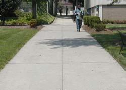
10 The success of campus life is dependent on the ease of pedestrian movement and the elimination or reduction of pedestrian-vehicular conflict. Circulation patterns should respect students 'desire lines' as they move through the campus. The main north-south axis is along Summit Street. The street facilitates movement from the parking deck on the southern end of Summit to the new Campus Center on the north with various classroom buildings on either side of the street along the way. A minor axis exists on the west side of The Green connecting the surface parking lot (south) to the residence halls and classroom buildings (north). The east-west movements are less defined and more informal due to the shortened distance. The Green allows for free pedestrian movement and the paved walkways serve most movements around and through The Green. INVENTORY AND ANALYSIS PEDESTRIAN CIRCULATION NJIT - LANDSCAPE MASTER PLAN 8


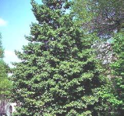
11 Campus vegetation is primarily comprised of large areas of lawn, little shrubbery and peripheral street tree planting. Mature trees enhance the entry landscape of Eberhardt Hall and a mix of evergreen and deciduous trees fill the South Green. Summit Street has a rhythm of street trees that define its western edge. There is little use of trees as an architectural device to either create space or frame vistas, processional ways or ceremonial areas. INVENTORY AND ANALYSIS VEGETATION NJIT - LANDSCAPE MASTER PLAN 9


12 The overlay of the pedestrian and circulation diagrams identifies the hierarchy of pedestrian travel through the campus and shows the areas of pedestrian/vehicular conflicts at the various crossings of Warren and at the intersection of Bleeker and Summit. The diagram assumes the vehicular closing of Summit Street from Warren to Bleeker and Bleeker from Summit to Lock Street for use by pedestrians only with access available to emergency vehicles. Hierarchy of pedestrian circulation will help inform landscape design in defining active zones, trip origins and destinations. INVENTORY AND ANALYSIS CIRCULATION ANALYSIS NJIT - LANDSCAPE MASTER PLAN 10


13 The space analysis attempts to quantify the nonphysical aspects of the campus open spaces by understanding user patterns and perceptions. From this, the hierarchy and character of the open spaces becomes defined. The Green as a landscaped space must be recognized as not only the physical core of the campus, but as the primary outdoor open space. Each open space plays a role in the experience of the users. This experience must be undetstood in order to fully inform future developement on the campus spaces. INVENTORY AND ANALYSIS SPACE ANALYSIS NJIT - LANDSCAPE MASTER PLAN 11
14 LANDSCAPE CONCEPTS The Landscape Concept Diagram is a developed form of the information obtained from the inventory and analysis. The plan categorizes various landscape zone types on the campus that have similar uses or program. Site organization and hierarchical relationships are established which will guide the design of these areas and help define the type of paving, planting, lighting and site furnishings. NJIT - LANDSCAPE MASTER PLAN 12

15 LANDSCAPE CONCEPTS LANDSCAPE CONCEPT DIAGRAM NJIT - LANDSCAPE MASTER PLAN 13


16 Open active lawn areas are crucial to a campus setting. They should be near highactivity areas and residence halls to be easily accessible for activities such as ROTC drill, volleyball, frisbie or ball toss. These spaces are characterized by an open lawn area, accessed and defined by perimeter pathways, trees, lights and benches. LANDSCAPE CONCEPTS OPEN SPACE The Green is the essence and heart of the campus. The Green provides a flexible open space that encourages a variety of activities. Though it extends from Faculty Memorial Hall to Bleeker Street, it is really composed of two distinct spaces, defined by topography and trees. The southern, upper portion, though connected visually to the lower space, should be developed into a passive open lawn area with treed edges that would allow quiet activities adjacent to the classroom buildings. As presently configured, the sloping lawn east of Eberhardt is a lost space on campus. If properly connected to the main part of campus, it could provide a sloping lawn with views toward downtown Newark and New York City: a perfect place for reading and quiet study groups. NJIT - LANDSCAPE MASTER PLAN 14


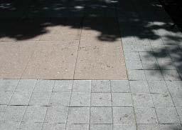
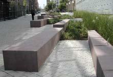
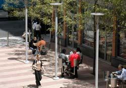
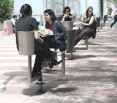
17 The plaza is primarily a hardscape space outside busy pedestrian centers. The paved areas allow for free pedestrian circulation and gatherings of large numbers of students. LANDSCAPE CONCEPTS PEOPLE PLACES These spaces will be defined by concrete pavers and will incorporate benches, tables, chairs, and other site furnishings for users who wish to congregate, sit or eat outside the dining areas. These spaces can also be designed to incorporate unique landscape features that further define their special nature within the campus. NJIT - LANDSCAPE MASTER PLAN 15


18 Transforming Summit Street and Bleeker Street into pedestrian only paths will create safe pedestrian corridors along major circulation axis. With this transformation, primary circulation routes are accommodated and iconic campus spaces are defined. LANDSCAPE CONCEPTS PEDESTRIAN MOVEMENT East-west pedestrian paths are located primarily between buildings and provide connections to larger open spaces. These pass-thru zones should encourage movement and are not designed for lingering. NJIT - LANDSCAPE MASTER PLAN 16


19 Local streets define the campus boundaries with the majority of the public viewing the site as passing motorists. The buildings on campus have an appropriate inward orientation, but present their backs to the public. Lubetkin Field is enclosed by fencing but allows views into the campus. LANDSCAPE CONCEPTS EDGES/GATEWAYS There are many opportunities to create gateways for the campus. At present there is only one major gateway and that is centered on Central Street. Our plan proposes gateway signage and campus identity at the four major campus corners to strengthen the Institute s presence and project a compelling, cohesive public image. NJIT - LANDSCAPE MASTER PLAN 17
20 LANDSCAPE DESIGN The Overall Illustrative Plan develops conceptual ideas to produce specific recommendations for the campus. It creates a cohesive vision while celebrating the uniqueness and character of the individual spaces. A language of forms, colors, materials and plantings is defined and utilized throughout the campus. NJIT - LANDSCAPE MASTER PLAN 18

21 LANDSCAPE DESIGN LANDSCAPE MASTER PLAN NJIT - LANDSCAPE MASTER PLAN 19

22 LANDSCAPE DESIGN EBERHARDT HALL PERSPECTIVE NJIT - LANDSCAPE MASTER PLAN 20


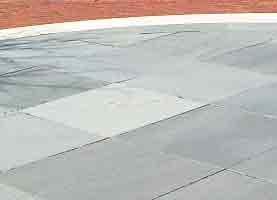
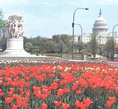
23 LANDSCAPE DESIGN The soon to be renovated, grand old building defines the historic tradition of NJIT. By thinning the mature trees in the front yard, Eberhardt s grandeur will again be visible from the campus approaches to the east. The front yard will be transformed into a formal forecourt by removing the parking lot and creating a terraced green. Flowering trees frame the building and a new bluestone forecourt is placed between the Hall and the green to host various events. The path to the west entry is softened by planting and announced by bluestone paving. A marker will be placed near the intersection of Bleeker and MLK Boulevard for campus identity. NJIT - LANDSCAPE MASTER PLAN 21

24 LANDSCAPE DESIGN THE GREEN PERSPECTIVE NJIT - LANDSCAPE MASTER PLAN 22


25 LANDSCAPE DESIGN SOUTH GREEN The South Green, North Green and Central Avenue Building Plaza and North Entry combine to create the major open space of the campus. The South Green provides a large curbed lawn area suitable for the Institute's ceremonial use as well as for active and passive student recreation. Canopy tree planting with benches and light poles frame the lawn to the south and west, while a sweep of tiered planters cascade to the area below. The sweeping forms of the tiered planters carry through to the North Green and create a seamless continuity between all spaces. Precast concrete pavers create a cadence of bands that morph into garden panels, precast benches and specimen tree plantings as one travels north. NJIT - LANDSCAPE MASTER PLAN 23


26 LANDSCAPE DESIGN NORTH GREEN The elevation change between the north and south green provides a natural separation of these two spaces. Taking advantage of this, the proposed design incorporates a tiered lawn seating that overlooks a large, performance-oriented paved plaza. This plaza resides at a central point in The Green landscape while accommodating the desired pedestrian movements through this active part of campus. A variety of seating opportunities enhance the use of the plaza. Taking a cue from the circular geometry of the Campus Center the 'sweep' continues in the form of raised planted gardens and a wave of ornamental grass plantings on the far northeast. The large lawn provides active/passive recreation potential for students, and ceremonial use for campus events. NJIT - LANDSCAPE MASTER PLAN 24


27 The South and North Greens culminate in the circular raised platform at the Central Avenue Building. Formerly a sunken plaza, the space has been lifted to create a more dynamic form and a better-used amenity. Steps climb to the platform level, a circular bosque of trees creates a canopy over bench seating and a garden rims the north edge. LANDSCAPE DESIGN CENTRAL AVE. BUILDING PLAZA AND NORTH ENTRY Mature trees at the Mechanical Engineering Building have been retained. Classic bench seating and a carpet of groundcover cleanly define the area. Views from the North Gate into the Green now show an elegant, sinuous landscape articulated with compelling forms and colors. NJIT - LANDSCAPE MASTER PLAN 25


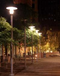
28 LANDSCAPE DESIGN TYPICAL SUMMIT PROMENADE The new Summit promenade transforms a vehicular roadbed to pedestrian use creating a major north-south campus path. Colorful garden beds located in the center of the roadbed separate flanking pathways located inside the existing zelkova tree line. The concrete pathways will be sized to allow for emergency and service vehicle access. The zone within the tree line, outside the pathways will contain rows of lights and benches facing the promenade. Spaces along the buildings will be planted. Diagonal pathways of precast pavers crisscross the center planters allowing free pedestrian movement to either side of the promenade. NJIT - LANDSCAPE MASTER PLAN 26


29 One of the elements of the new Summit Promenade is Summit Quad. Recognizing the vast number of students that will travel through this area, a multifaceted design response is required. Summit Quad provides a passive recreation lawn, café tables and chairs, sculptural precast concrete bench seating, traditional bench seating under tree canopy and a circular garden of seasonal color. The Carillon at the far north end of the Quad creates a focal point for the interstitial space at the Campus Center and provides for what will likely become the designated meeting spot on campus. LANDSCAPE DESIGN SUMMIT QUAD NJIT - LANDSCAPE MASTER PLAN 27


30 LANDSCAPE DESIGN TYPICAL BLEEKER PROMENADE The closing of Bleeker Street to vehicular traffic will transform the roadway into a pedestrian promenade. The Green will no longer be bisected and will be able to extend to the Central Avenue building, unifying the central core of the campus. The centered single pathway will collect east-west pedestrian traffic and be lined with lawn and benches with shrub and tree beds extending to the adjacent building. NJIT - LANDSCAPE MASTER PLAN 28


31 The greening of Technology Plaza, presently an existing parking lot framed by the ECE building to the east, Faculty Memorial Hall to the north and Tiernan Hall to the west, recaptures a multifaceted open space for the Institute. The space provides a new entry to the campus along Warren announced by campus ID along the sidewalk. The plaza will create an important, direct pedestrian connection between the parking lot/future building site to the north with The Green, through Tiernan Hall. LANDSCAPE DESIGN TECHNOLOGY PLAZA The Plaza s alternating precast concrete paver banding creates a pedestrian gathering space furnished with café tables and chairs. Groves and allees of canopy and flowering trees frame the open space, and a passive recreation lawn provides a soft alternative for students. An iconic sculpture set in a colorful garden bed provides a visual focus for the surrounding spaces as well as creating a visual beacon from other campus areas. NJIT - LANDSCAPE MASTER PLAN 29


32 Taking an opportunity to reduce the double loaded parking area and oversized parking aisles between York Center and the Parking Deck, this recovered area strives to create a unique laboratory for environmental studies. LANDSCAPE DESIGN YORK ENVIRONMENTAL GARDEN The design suggests narrowing the on-grade parking to one parking aisle and its circulation space. The area captured will provide a planted strip to soften the edge against the Parking Deck on the south and be used to create an environmental garden against the York Center. Working with the steep east-west gradient the garden is design to create a filtration landscape that flows through various phytoremedial plant species resulting in a clean water basin at the east. Viewing boardwalks bridge the garden laboratory and a gated garden wall secures the area. NJIT - LANDSCAPE MASTER PLAN 30


33 The new plaza maintains the lawn spill out space for ground level meeting room for Weston Hall and adds cafe tables and chairs for seating. Stairs still connect to Warren Street and a linear garden creates a colorful buffer between this plaza and the anticipated entry of the future building to the west. LANDSCAPE DESIGN WESTON PLAZA NJIT - LANDSCAPE MASTER PLAN 31


34 The plan proposes to breathe new life into this space by providing for multiple potential uses. Here active and passive recreation merge to create an environment that offers peaceful areas for study and quiet such as shade gardens, bosques of trees and passive lawns for sunning. These areas are located closest to the buildings. LANDSCAPE DESIGN SOUTH RESIDENTIAL COURTYARD The essence of the semicircular lawn is retained with the addition of a new volleyball court directly in the center of the lawn creating the opportunity for active recreation within the residential quad. Diagonal pathways score the semicircle, creating direct links to previously underused areas of the landscape and create a geometry for smaller garden areas to frame the active lawn. Two plazas border the entry to Laurel Hall. Furnished with café tables and chairs, precast paver patterns enhance the special nature of the plazas and link them to the passive recreation enclaves on both sides of the quad. NJIT - LANDSCAPE MASTER PLAN 32


35 The space between Redwood and Cypress Halls has been redesigned to adapt to the various needs of the resident students. More light has been allowed into the courtyard by the removing some of the canopy trees that had created a dark, humid environment. LANDSCAPE DESIGN NORTH RESIDENTIAL COURTYARD New plaza areas are edged with colorful flowering trees to create a sense of vitality and intimacy. Circulation routes are paved with concrete. Café seating is provided in two open plaza areas near the building entries, defined by precast paving. A centralized curbed lawn provides a soft surface for sunning, etc. Bench seating is located along the walkways, plazas and lawn for seating options throughout the courtyard. A large circular garden adds seasonal color throughout the year. NJIT - LANDSCAPE MASTER PLAN 33

36 The boundaries of the campus should be identified to announce and create a definable entity within the community. Campus identification can take many forms and serve a multitude of uses including wayfinding, security devices and interactive displays. LANDSCAPE DESIGN GATEWAY Distinctive, iconic elements will define the campus corners and become the most identifiable symbol of the Institute for the general public. NJIT - LANDSCAPE MASTER PLAN 34


37 The design seeks to create a safer, more pleasant pedestrian environment while preserving the necessary service-related functionality of the space. Conflicts between truck movements and pedestrian traffic cannot be avoided. It is the intent to minimize these conflicts. By bringing trucks through the parking lot, conflicts at the Bleeker Promenade occur only during truck backing in and pulling out. The extended Academic Plaza to the north controls pedestrian movement through the service area. The service area will be paved with cobblestone to further deter pedestrian movement.. LANDSCAPE DESIGN CAMPUS CENTER SERVICE AREA Traffic calming devices, such as narrowing the neck of Summit Street, changing pavements to visually and palpably define pedestrian crossings, setting bollards to inhibit pedestrian/vehicular conflicts, signage and the strategic use of planting conspire to create a safe pleasant environment. NJIT - LANDSCAPE MASTER PLAN 35

38 PHASE PROJECT I Eberhardt Hall LANDSCAPE DESIGN PHASING DIAGRAM South Green/ Volleyball Court II III IV V VI VII VIII IX Central Ave Bldg. Plaza Campus Center Service Area Bleeker Street Summit / New Street Campus ID / Gateway Technology Plaza S. Residential Courtyard N. Residential Courtyard York Center Colton Hall Guttenberg Corner Streetscape Completed Projects NJIT - LANDSCAPE MASTER PLAN 36


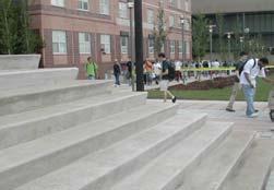
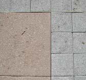
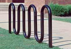
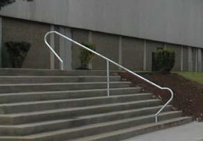


39 LANDSCAPE DESIGN SITE FURNISHINGS PAVING SITE FURNISHINGS FENCE, HANDRAILS AND BOLLARDS CONCRETE STAIR AND PRECAST WALLS LIGHTING NJIT - LANDSCAPE MASTER PLAN 37


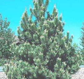
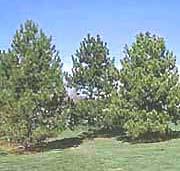
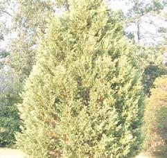
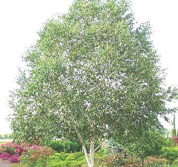
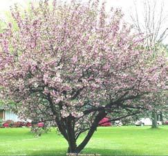
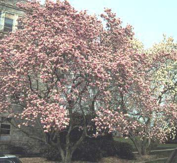
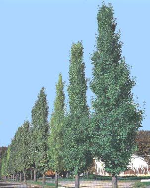

40 LANDSCAPE DESIGN PLANT MATERIAL - TYPE I TREES EVERGREEN TREES ORNAMENTAL TREES NJIT - LANDSCAPE MASTER PLAN 38


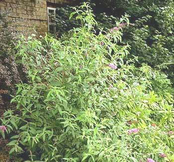
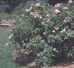
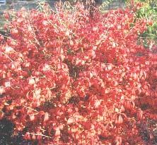
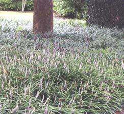
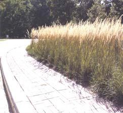
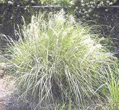
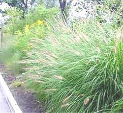
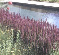
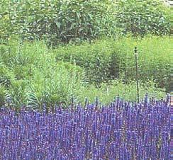
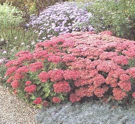

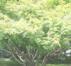
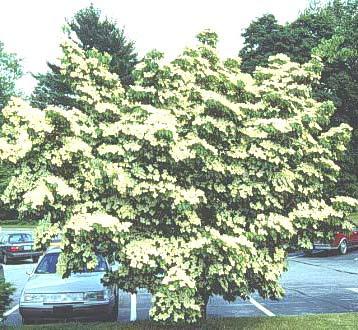
41 LANDSCAPE DESIGN PLANT MATERIAL - TYPE II EVERGREEN SHRUBS DECIDUOUS SHRUBS GROUND COVER AND GRASSES FLOWERS NJIT - LANDSCAPE MASTER PLAN 39
42 SUMMARY The development of this Landscape Master Plan has been an extremely successful effort through which NJIT and Thomas Balsley Associates have collaborated to create a new and exciting campus environment. This document sets forth guidelines for site work on campus that will ensure rational, effective and cohesive implementation of all future phases. NJIT - LANDSCAPE MASTER PLAN 40
EXISTING CONDITIONS 41. Existing Conditions
 EXISTING CONDITIONS 41 Existing Conditions The Existing Analysis phase of the planning process involved a study of the existing conditions on the campus in order to identify key planning issues to be addressed
PUBLIC RIGHT-OF-WAY IN THIS CHAPTER PUBLIC REALM
 PUBLIC RIGHT-OF-WAY This section provides design guidelines for improvements in the public right-of-way. The public right-of-way refers to streets, sidewalks, non-vehicular thoroughfares, parks and greenways
EXISTING VEHICULAR & PEDESTRIAN CIRCULATION
 46 EXISTING CONDITIONS EXISTING VEHICULAR & PEDESTRIAN CIRCULATION Vehicular and pedestrian circulation patterns are illustrated on this graphic. Campus entry points and major vehicular circulation routes
VEHICULAR AND PEDESTRIAN CIRCULATION
 This perspective sketch communicates the intended character and quality of a proposed streetscape design. Locate benches near a major intersection where people tend to gather. Seating and lighting provide
Preci nct P l ans Figure 56 Campus Aerial Photo, 2008 CAL STATE EAST BAY, HAYWARD CAMPUS MASTER PLAN
 9 Precinct Plans This section contains a detailed discussion of the planning and design concepts for specific areas or precincts of the Cal State East Bay Hayward campus. The Precinct Plans pertain to
Table of Contents. Elm Avenue Improvement Plan City of Waco, Texas. Introduction 1. Existing Context 1 Figure 1 2.
 Table of Contents Introduction 1 Existing Context 1 Figure 1 2 Plan Guidelines 3 Future Urban Form 4 The West-End 4 Main Street 6 The East-End 7 Figure 2 9 Public Improvement Recommendations 7 General
ATTACHMENT A. SILVERDALE DESIGN STANDARDS Amendments to the Waaga Way Town Center Chapter
 ATTACHMENT A SILVERDALE DESIGN STANDARDS Amendments to the Waaga Way Town Center Chapter Chapter 10. Waaga Way Town Center 10.1 Physical Identity Elements & Opportunities The Waaga Way Town Center includes
UNIVERSITY OF DENVER. APPENDIX G Open Space Typologies
 UNIVERSITY OF DENVER APPENDIX G Open Space Typologies Open Space Typology The range of open space types found on college campuses extends from large, open fields to intimate enclaves. The importance of
5.0 P A R K R E C O M M E N D A T I O N S
 5.0 P A R K R E C O M M E N D A T I O N S 5.1 Confederation Park The analysis of Confederation Park recognizes that it, along with City Hall, is the symbolic heart of Kingston. While the existing layout
V. Gateways GATEWAYS / V-1
 V. GATEWAYS / V-1 Many of Chesapeake s gateways are located on highways and call for bold and attractive designs that motorists can understand, appreciate, and enjoy. can also take the form of natural
The open space system should provide connective elements, relate to natural resources, and enhance the suburban character of the landscape..
 The open space system should provide connective elements, relate to natural resources, and enhance the suburban character of the landscape.. Mixed-use and infill development should maintain or enhance
ELEMENT 16 - LANDSCAPE DESIGN GUIDELINES ELEMENT
 16 ELEMENT 16 - LANDSCAPE DESIGN GUIDELINES ELEMENT Goal 1 To establish an overall landscape character that provides: A pedestrian friendly environment that provides ample tree canopy and shade. An overall
AIRPORT BUSINESS PARK
 PIER MAC PETROLEUM INSTALLATION LTD. AIRPORT BUSINESS PARK DEVELOPMENT APPLICATIONS March 2003 4.1 Airport Business Park Development Permit Area 4.1.1 Justification/Design Concept The design concept envisioned
The Vision. Photo provided by The Minervini Group. 46 Vision, Objectives & Strategies
 Vision, Objectives & Strategies The is the public framework and guide for future development of the Grand Traverse Commons. The establishes public polices for infrastructure, the preservation of natural
FLORIN ROAD CORRIDOR Site Plan and Design Review Guidelines Checklist
 FLORIN ROAD CORRIDOR Site Plan and Design Review Guidelines Checklist Applicant s Name: Project Address: Phone: Email: Applicant shall fill out the design guidelines checklist for all guidelines applicable
Pedestrian and Bike Bridge LOGO
 6.2.2 Pedestrian and Bike Bridge The proposed pedestrian and bike crossing re-envisions the existing bridge at Pismo Creek on Cypress Street. The bridge is currently underutilized by vehicular through
lakeway mixed use tract open space plan
 LEGEND:. UNDISTURBED NATURAL AREA. ENTRY STATEMENT BUILT INTO HILLSIDE. R.O.W. PLANTING (STREET TREES/LIGHTS). HEB ENTRY DRIVE 5. BIO-FILTRATION IN MEDIAN 6. MAIN ENTRY @ MAIN STREET. EXISTING TREES TO
Westwind Developments Ltd. PIONEER LANDS AREA STRUCTURE PLAN - PROPOSED AMENDMENT
 FEBRUARY 2013 TABLE OF CONTENTS 1.0 BACKGROUND... 1 1.1 Amendment... 1 2.0 LOCATION & CONTEXT... 2 2.1 Land Ownership... 2 3.0 POLICY CONTEXT... 3 3.1 Municipal Development Plan... 3 3.2 Capital Region
KEY MAP DEVELOPMENT PERMIT AREA MAP. Sunnymede North Sub-Area Plan
 Richmond Official Community Plan BROADMOOR AREA SUNNYMEDE NORTH SUB-AREA PLAN Bylaw 7100 Schedule 2.6C SUNNYMEDE NORTH SUB-AREA PLAN SUNNYMEDE NORTH SUB-AREA PLAN SUNNYMEDE NORTH SUB-AREA PLAN KEY MAP
R STREET CORRIDOR NEIGHBORHOOD Site Plan and Design Review Supplemental Guidelines Checklist
 R STREET CORRIDOR NEIGHBORHOOD Site Plan and Design Review Supplemental Guidelines Checklist Applicant s Name: Project Address: Phone: Email: Applicant shall fill out the design guidelines checklist for
C a m p u s I d e n t i t y
 Campus Identity Campus Identity a) Landscape Guidelines i. Materials ii. Components iii. Composition b) Wayfinding i) Entrance Features ii) Vehicular iii) Pedestrian c) Focus Areas i) Green Spine ii) Warriner
LANGAN LANDSCAPE ARCHITECTURE + PLANNING FOR COLLEGES & UNIVERSITIES
 LANGAN LANDSCAPE ARCHITECTURE + PLANNING FOR COLLEGES & UNIVERSITIES CONTACT Philadelphia Pennsylvania 1818 Market Street Suite 3300 Philadelphia PA 19103 215.845.8900 215.845.8901 ST. JOSEPH'S UNIVERSITY
THE LANDMARK PROJECT: ST. GEORGE CAMPUS BEFORE AND AFTER
 THE LANDMARK PROJECT: ST. GEORGE CAMPUS BEFORE AND AFTER The Landmark Project will reimagine the historic core of the St. George campus by creating dynamic, open spaces where students, faculty and the
RZC Public View Corridors and Gateways
 RZC 21.42 Public View Corridors and Gateways 21.42.010 Purpose 21.42.020 Scope and Authority 21.42.030 Administration 21.42.040 Gateways Design 21.42.050 Unidentified Public Views 21.42.060 Identification
Planning Board Briefing
 Planning Board Briefing Why Now? The Sector Plan Implementation Chapter States: Before Stage 1 begins, the following must occur: Approval of the Sectional Map Amendment. Approval of the Greater Lyttonsville
There are five comprehensive goals that inform the Urban Design element at FIU. They are:
 3.0 URBAN DESIGN ELEMENT This Comprehensive Master Plan Update reflects the University s commitment to the refinement and extension of the base concepts earlier master planning efforts have created. FIU
U n i v e r s i t y o f S o u t h C a r o l i n a A i k e n. Land Plan Study
 U n i v e r s i t y o f S o u t h a r o l i n a A i k e n Land Plan Study 06.27.2008 Goals ampus Growth Develop a Land Plan that allows for the orderly expansion of the campus over the next ten years and
Figure 3-1: Public Realm Plan
 3 Public Realm Figure 3-1: Public Realm Plan 3.1 Public Realm Concept The public realm concept for the Little Mountain site integrates a clear and accessible movement network with public spaces for social
DEVELOPMENT CONTROLS MEDICAL DISTRICT
 6.01. GENERAL DESIGN GUIDELINES A. Site Planning B. Architectural Design C. Medical Facility Signage & Lighting D. Exhibit 48. ARCHITECTURAL DESIGN CONCEPTS 6.02. MEDICAL FACILITY STANDARDS & GUIDELINES
CAMPUS MASTER PLAN UPDATE
 13 April 2016 CAMPUS MASTER PLAN UPDATE Focus Group Landscape AGENDA What We Heard Review of Campus Observations & Analysis Campus Framework & Open Space Network Table-Top Exercise Landscape Guideline
Neighborhood Districts
 NEIGHBORHOOD DISTRICTS SEVEN MAIN DISTRICTS Neighborhood Districts While the Development Plan provides a broad-scale overview of the neighborhood, this section focuses on uses and relationships at the
CHAPTER 7 I NDUSTRIAL
 CHAPTER 7 I NDUSTRIAL PURPOSE... 7:1 ORGANIZATION... 7:1 APPLICABILITY AND USE TYPES... 7:1 Light Industrial Development... 7:2 Heavy Industrial Development... 7:3 SITE DESIGN... 7:4 Circulation... 7:6
38 Queen s University Campus Master Plan Part 1
 38 Queen s University Campus Master Plan Part 1 46 The Campus at the City Scale Chapter 4 The Campus at the City Scale 39 Queen s is an urban University centrally located in Kingston. Decisions made by
TEMPLE MEDICAL & EDUCATION DISTRICT
 City of Temple, Texas TEMPLE MEDICAL & EDUCATION DISTRICT 1 Description. The City of Temple joined in partnership with key public and private entities to jointly promote education and medical activities
REPORT TO BOARD ON PREFERENCES tbp/architecture CCSF Facilities Master Plan, October 23, 2016
 PURPOSE The purpose of this report is to update the Board on the Facilities Master Plan initiative. PROCESS The Board conducted a Study Session about Phase 1 Needs on August 18, 2016. Since that time,
open house 3 CITY OF SALEM Downtown Streetscape Plan
 open house 3 Streetscape concepts CITY OF SALEM Downtown Streetscape Plan analysis concepts we are here refined concepts & document Feb 13th 1 2 3 apr 18th KICKOFF OPEN HOUSE Streetscape Work Group Walking
3.13. Development Guidelines
 3.3 Landscaping Elements Landscaping should be used to frame and soften structures, define site functions, enhance the quality of the environment, and screen undesirable views. Safety, environmental impacts,
section five BEAUTIFICATION PLAN
 section five BEAUTIFICATION PLAN BEAUTIFICATION PLAN Section Five Beautification Plan The goal of the Beautification Plan is to improve the Route 8-Sunnyland Corridor in terms of aesthetics and to create
TURN TO THE RIVER CITY PLAZA LANDSCAPE DESIGN CONCEPT May 25, 2016
 Turn to the River is a multi-year project of Art Spaces - Wabash Valley Outdoor Sculpture Collection, Inc. to connect downtown Terre Haute with the Wabash River through public art and design. The four-square
Design Considerations
 Essential to the development of a successful Master Plan for the Park Complex is input from the community that the park will serve. The community outreach component of the planning process included numerous
Town Center. Block 5 Existing multifamily residential units are expected to remain.
 Area Guidelines Germantown s districts should be developed as distinct communities with unique features that are supported through the guidelines. The guidelines not only help distinguish these districts
400 West Georgia Street Urban Design Panel. Public Realm
 400 West Georgia Street Urban Design Panel Public Realm Public Benefits The main benefit in regards to the proposed development at 400 West Georgia Street will be to increase density of Commercial Office
Part C. Main Campus Plan Frameworks PAGE 59 UNIVERSITY OF REGINA / CAMPUS MASTER PLAN 2011
 Part C Main Campus Plan Frameworks UNIVERSITY OF REGINA / CAMPUS MASTER PLAN 2011 PAGE 59 Figure C-1. Open Space Framework Plan PAGE 60 PREPARED BY / DIALOG Figure C-2. The Dr. Lloyd Barber Academic Green
Community Design Plan
 Gardena General Plan 2006 Authority While the is not a required element of a General Plan, it is included because improving the community appearance and image is paramount to the overall quality of life
Allegretti Architects & Andrews University
 1 Allegretti Architects & Andrews University Western Michigan University Arts Plaza Design Charrette Team Members: John W. Allegretti, FAIA Carey Carscallen, Director of Architecture, Andrews University
City of Farmington. Downtown Plan. Amendment to the 1998 Master Plan Adopted October 11, 2004
 City of Farmington Amendment to the 1998 Master Plan Adopted October 11, 2004 Introduction Planning Background 1 Scope and Components of the Plan Amendment 2 Concept Introduction 3 Plan Concepts 3 Conceptual
Landscape and Streetscape Design 2.5
 Landscape and Streetscape Design 2.5 2.5.1 Goals 2.5.2 Planting 2.5.3 Sidewalks and Pavement 2.5.4 Furnishings 2.5.5 Walls 2.5.6 Lighting 2.5.7 Stormwater 2.5.8 Street Cross Sections 2.5 LANDSCAPE AND
Worthington Scranton. Campus Exterior Architectural Plan
 Contents Introduction and Purpose Existing Conditions Inventory s Introduction and purpose The stated mission, vision and strategic goals of Penn State clearly define the University s responsibility to
Phase 1 : Understanding the Campus Context. Phase 2 : APPROACHES - Alternates & Preferred Plan
 Introduction MASTER PLAN PURPOSE WHY A CAMPUS MASTER PLAN? The purpose of the Master Plan at the University of Illinois at Chicago is to translate UIC s strategic goals and objectives into a compelling
WESTERN ILLINOIS UNIVERSITY
 WESTERN ILLINOIS UNIVERSITY Quad Cities Riverfront Campus Master Plan March 1, 2006 Preliminary Master Plan Total Site Build Out Western Illinois University Quad Cities Municipal Park Mississippi River
Community Mixed Use Zone Districts (CMU)
") 18.28.500 Community Mixed Use Zone Districts (CMU) The Community Mixed Use Zone Districts (CMU) are intended to help implement the land use goals and strategies found in the Golden Vision 2030 values,
18.28.500 Community Mixed Use Zone Districts (CMU) The Community Mixed Use Zone Districts (CMU) are intended to help implement the land use goals and strategies found in the Golden Vision 2030 values,
Design Guidelines. Roosevelt. Mike Podowski DPD Design Guidelines Ordinance ATT 13 August 13, 2012 Version #1
 Roosevelt Design Guidelines The Roosevelt Neighborhood Design Guidelines apply within the Neighborhood Boundary. Map 1 2 Map 2 3 Map 3 4 CS1 Natural Systems and Site Features Citywide Guideline: Use natural
EcoVerde MADISON TO DOWNTOWN TO BEACH. Legend Highway Major Connection Major Street Local Street Proposed Access. Response to Tropicana Field RFP
 EcoVerde TO BEACH 275 16th Street North 16th Street South 13th Street North 13th Street South 11th Street North 11th Street South 1st Avenue North Central Avenue 1st Avenue South TO DOWNTOWN 2nd Avenue
PROPOSED SITE IMPROVEMENTS
 PROPOSED SITE IMPROVEMETS This section is an excerpt from the San José City College Landscape Study - for use in reference to the Campus Facilities Committee Presentation, April, 0. B A D I H M H D K L
Sheridan Boulevard S TAT I O N A R E A P L A N S H E R I D A N B O U L E VA R D S TAT I O N A R E A P L A N
 Sheridan Boulevard S TAT I O N A R E A P L A N 1 City of Lakewood Adopted November, 2006 S H E R I D A N B O U L E VA R D S TAT I O N A R E A P L A N The Vision The City of Lakewood s overall vision is
CHAPTER 3. Design Standards for Business, Commercial, Industrial, Recreational and Institutional Uses
 CHAPTER 3 Design Standards for Business, Commercial, Section Number Title Ordinance Number Date of Ordinance 16-3-1 Applicability 2006-11 2008-04 07-01-08 16-3-2 Uniform Standards for Architectural Design
CAMPUS MASTER PLAN DRAFT PLAN UPDATE JANUARY
 NEW MEXICO HIGHLANDS UNIVERSITY CAMPUS MASTER PLAN DRAFT PLAN UPDATE JANUARY 27 2010 MASTER PLANNING GOALS TO BALANCE THE STRATEGIC GOALS OF THE UNIVERSITY WITH THE PHYSICAL CAMPUS through the assessment
SOUTH UNIVERSITY Street Design Alternatives in Progress
 1 Alternatives in Progress 2016.01.20 Meeting Agenda 2 1. Progress & Schedule 2. Utilizing the Street Design Manual 3. Site Characteristics and Input Received 4. Street Geometry What can we accomplish
BRADENTON RIVERWALK EXPANSION MASTER PLAN
 BRADENTON RIVERWALK EXPANSION MASTER PLAN INTRODUCTION & AGENDA Process Update Community Engagement Summary Center for Active Design (CfAD) Recommendations Context and Existing Conditions Master Plan Alternatives
campus master plan VIRGINIA STATE UNIVERSITY
 campus master plan VIRGINIA STATE UNIVERSITY agenda 01 INTRODUCTION & GENERAL OVERVIEW 02 03 04 LAND USE CONCEPT PROGRAM ACCOMMODATION MAXIMIZE EXISTING INFRASTRUCTURE SUMMARY AND NEXT 05 STEPS agenda
ELMVALE ACRES SHOPPING CENTRE MASTER PLAN
 ELMVALE ACRES SHOPPING CENTRE MASTER PLAN Contents 1.0 INTRODUCTION... 2 2.0 LOCATION... 2 3.0 EXISTING CONTEXT... 2 4.0 VISION & GUIDING PRINCIPLES... 2 5.0 LAND USE AND BUILT FORM... 4 5.1 St. Laurent
DESIGN GUIDELINES. Seattle Children s Major Institution Master Plan. Approved May 7, 2010
 Approved May 7, 2010 Contact: Todd Johnson, todd.johnson@seattlechildrens.org, (206)987-5259 A. MASTER PLAN... 3 A1.0 Context... 3 A1.1 Purpose of Design Guidelines... 3 A1.2 Design Guidelines... 4 B....
FRUITVALE TRANSIT VILLAGE (Phase 2) Residential Project
 Residential Project") FRUITVALE TRANSIT VILLAGE (Phase 2) Residential Project DEVELOPER: SIGNATURE PROPERTIES ARCHITECT: HKIT ARCHITECTS April 23, 2010 TABLE OF CONTENTS 3 Vision 4 Description of Site 5 Guiding Concepts 6
FRUITVALE TRANSIT VILLAGE (Phase 2) Residential Project DEVELOPER: SIGNATURE PROPERTIES ARCHITECT: HKIT ARCHITECTS April 23, 2010 TABLE OF CONTENTS 3 Vision 4 Description of Site 5 Guiding Concepts 6
03 HIGH PRIORITY SITES
 03 HIGH PRIORITY SITES HOWARD PARK Howard Park is one of South Bend s largest riverfront parks, hosting nearly acres. Howard Park has a very passive landscape with a recreation building, ice skating rink,
Campus Master Plan Description Section 6 Storm water management and people places at campus buildings. Section 6 Campus MP Description
 Campus Master Plan Description Section 6 Storm water management and people places at campus buildings Section 6 Campus MP Description THIS PAGE INTENTIONALLY LEFT BLANK. appendix The following provides
3.0 master plan concept
 3.0 master plan concept 3.1 introduction The purpose of the Huron Church Road Master Plan Concept is to provide an overview of the Master Plan design process, identify preliminary streetscape installations
18 May 2016 CAMPUS MASTER PLAN UPATE
 18 May 2016 CAMPUS MASTER PLAN UPATE Council of the Deans ( Over view) AGENDA Engagement & What We Heard Focus Elements: 1. Development Framework Plan 2. Campus Mobility 3. Campus Guidelines 4. Wayfinding
Policies and Code Intent Sections Related to Town Center
 Policies and Code Intent Sections Related to Town Center The Town Center Vision is scattered throughout the Comprehensive Plan, development code and the 1994 Town Center Plan. What follows are sections
7-PARKS, OPEN SPACE & PUBLIC ART
 7-s, Open Space & Public Art 7-PARKS, OPEN SPACE & PUBLIC ART This chapter provides recommendations for the expansion of new parks, plazas and open space that serve the many user groups targeted for downtown.
JACKsON STREET PIER CONCEPTUAL DESIGN PACKAGE SEPTEMBER 21, 2017
 JACKsON STREET PIER CONCEPTUAL DESIGN PACKAGE SEPTEMBER 21, 2017 JACKsON STREET PIER Process outline DESIGN PROCESS OVERVIEW: Sandusky s Jackson Street Pier Conceptual Design process included input from
Cleveland Park Streetscape and Drainage Improvement Project 1
 Cleveland Park Streetscape and Drainage Improvement Project 1 Urban Context Washington, D.C. Connecticut Avenue Cleveland Park Streetscape and Drainage Improvement Project 2 Neighborhood Context Contributing
District Facilities Master Plan
 W o r k s h o p B o a r d District Facilities Master Plan February 29, 2012 BACKGROUND + CONTEXT ANALYSIS OPTIONS RECOMMENDATIONS NEXT STEPS DFMP AGENDA BACKGROUND + CONTEXT ANALYSIS OPTIONS RECOMMENDATIONS
Landscape Site Plan BLOCK D BLOCK A BLOCK C BLOCK B DEC 2009 L A N E W AY ARBUTUS 2 MEWS ARBUTUS STREET YEW STREET EXTENSION LEGEND
 Landscape Site Plan Green Edges Arbutus Mews Public Square Urban Garden Courts Green Roofs City Homes Private Patios Private Roof Terraces Urban Agriculture Plots BLOCK D BLOCK C YEW STREET EXTENSION L
Jewel. Platte. of the. Plattsmouth Main Street Landscape Architecture by HDR
 Jewel of the Platte Plattsmouth Main Street Landscape Architecture by HDR Plattsmouth, Nebraska is a historic community of 6,500 residents located along the west bank of the Missouri River, just south
TH E U N IVE RSIT Y O F FLO R I DA LANDSCAPE MASTER PLAN REPORT
 TH E U N IVE RSIT Y O F FLO R I DA LANDSCAPE MASTER PLAN REPORT O C T O B E R 2 018 THE UNIVERSITY OF FLORIDA LANDSCAPE MASTER PLAN REPORT OCTOBER 2018 prepared by: CRJA-IBI Group GAI Community Solutions
Throughout. square. (Crystal City Vision Plan 2050)
") 1: Terms related to the PSMP document 1 public space (see also public realm, civic space) An open space designated on the regulating plan, accessible to all, including Plazas, Mini Parks, and Neighborhoods
1: Terms related to the PSMP document 1 public space (see also public realm, civic space) An open space designated on the regulating plan, accessible to all, including Plazas, Mini Parks, and Neighborhoods
B L A C K D I A M O N D D E S I G N G U I D E L I N E S for Multi-family Development
 B L A C K D I A M O N D D E S I G N G U I D E L I N E S for Multi-family Development Adopted June 18, 2009 This section of the Design and focuses on site planning and design guidance for new multi-family
4. INDUSTRIAL 53 CASTLE ROCK DESIGN
 4. INDUSTRIAL 53 CASTLE ROCK DESIGN CASTLE ROCK DESIGN 54 4. INDUSTRIAL Overview Well-designed and attractive industrial centers are the product of blending economic realities with both functional and
4.9 Mendocino Avenue Corridor Plan Design Guidelines
 4.9 Mendocino Avenue Corridor Plan Design Guidelines The Mendocino Avenue Corridor Plan addresses the area between College Avenue and Steele Lane. Mendocino Avenue is a busy arterial that runs parallel
DRAFT. October Wheaton. Design Guidelines
 October 2011 DRAFT Wheaton Design Guidelines 2 Draft - Design Guidelines - Wheaton Sector Plan Contents 04 Section 1: Introduction 06 Section 2: Context 08 Section 3: Design Guidelines 09 Goal 1: Create
St. Elizabeths Hospital/West Campus Landscape Character-Defining Features
 The following list of landscape character-defining features is taken directly from Chapter VII of the 2007 St. Elizabeths West Campus Cultural Landscape Report by Heritage Landscapes and Robinson & Associates,
PROJECT SITE The Proposed Project includes the Allen and Pike Street malls between Delancey and South Streets (see Figure 2C-1).
.") Chapter 2, Section C: A. INTRODUCTION This chapter considers the potential of the proposed Reconstruction of the Allen and Pike Street Malls project to affect the urban design characteristics and visual
Chapter 2, Section C: A. INTRODUCTION This chapter considers the potential of the proposed Reconstruction of the Allen and Pike Street Malls project to affect the urban design characteristics and visual
GREENING THE BOULEVARD Master Plan Concepts for Venice Boulevard between Lincoln and Sawtelle
 GREENING THE BOULEVARD Katherine Spitz Associates Inc. 4212½ Glencoe Avenue Marina Del Rey, CA 90292 310 574 4460 Fax 574 4462 January 2008 Table of Contents Overview Proposed Design Improvements Illustration
iii. Visioning framework
 III. VISION iii. Visioning framework III.1 Overview A vision is a clear and succinct description of what an institution and its community should look like after it successfully implements its goals and
CHAPTER 12 DESIGN GUIDELINES FOR PUBLIC IMPROVEMENTS
 CHAPTER 12 DESIGN GUIDELINES FOR PUBLIC IMPROVEMENTS Introduction This chapter provides design guidelines for public sector improvements in the downtown. This includes streetscape design, as well as the
public review draft Key objectives for this chapter are:
 5 - parks & open space Providing a rich collection of outdoor places for informal gathering and recreation, as well as planned promotional activities and community events, is a key concept for Midtown.
Wadsworth Boulevard S TAT I O N A R E A P L A N
 Wadsworth Boulevard S TAT I O N A R E A P L A N City of Lakewood Adopted November, 2006 The Vision The City of Lakewood s overall vision is to transform the area around the light rail station into a mixed-use
Figure Example of out door dining in the public right-of-way.
 Section 2 Core Area Goal 2.2.1 To maintain and enhance the character of existing streets in the Downtown Area. Character Figure 2.2.1 Example of out door dining in the public right-of-way. A. Provide street
C AMPUS MASTER PLAN THE C AMPUS PLAN
 THE CAMPUS PLAN. the campus plan The Middlebury Campus Master Plan is intended as a framework within which carefully balanced, incremental decisions may be judiciously made within a long-term vision. It
Subcampus Recommendations
 T he campus is is comprised of three major areas. These subcampus areas are known as WestCampus, South Campus, Campus Oakland and Drive East Campus. and Future East growth Campus. requires a Future careful
DRAFT. 10% Common Open Space
 % OF CHARLOTTE IS CATEGORIZED AS A. LAND USES : Placeholder map displaying location of Place Type GOALS: Accommodate XX% of future growth. Provide a concentration of primarily commercial and civic activity
THE NEIGHBORHOOD TODAY
 THE NEIGHBORHOOD TODAY CORE AREA VISION How are we Good Urbanism A Site s DNA thinking about Elements of great Unique elements urban communities embedded in a place the site and design? ELEMENTS LIKE:
Courthouse Square Planning & Urban Design Study. Courthouse Square Working Group #13 October 15, 2014
 Courthouse Square Planning & Urban Design Study Courthouse Square Working Group #13 October 15, 2014 1 Courthouse Square Process Working Group Community Courthouse Square Advisory Groups & Civic Associations
Buildings may be set back to create small plazas provided that these setbacks do not substantially disrupt the street wall s continuity.
 6-22 Community Design Street Walls and Street-front Setbacks The siting of buildings will play a critical role in establishing the character and sense of place for the District. Siting buildings at the
THE CIVIC DISTRICT DEVELOPMENT OPPORTUNITIES
 1 THE CIVIC DISTRICT DEVELOPMENT OPPORTUNITIES The Civic District is the physical and emotional heart of the downtown. It is also a major gateway into the central core, establishing the image and identity
Mixed Use Centres Development Permit Guidelines
 1 Mixed Use Centres Development Permit Guidelines Area Commercial or Mixed Use development occurring in City Centre, Urban Centre, Neighbourhood Centre, or Institutional Complex land use designations is
RA1.01. Project Description:
 Project Description: Designed around a philosophy of "healthy building for healthy bodies," the University s recreation center inspires personal health and wellness. As the University s campus continues
NEIGHBORHOOD 7: FEE LANE AREA. Aerial View of Briscoe and McNutt Dormitories
 NEIGHBORHOOD 7: FEE LANE AREA Aerial View of Briscoe and McNutt Dormitories Fee Lane Area Map Briscoe Dormitory 278 neighborhoods NEIGHBORHOOD 7: FEE LANE AREA EXISTING CHARACTER The Fee Lane Area neighborhood
Clairtrell Area Context Plan
 Clairtrell Area Context Plan March 2005 Urban Development Services City Planning Contents 1. Introduction... 4 2. Development Structure... 6 2.1 Streets... 7 2.1.1 Sheppard Avenue and Bayview Avenue...
SECTION TWO: Urban Design Concepts
 SECTION TWO: Urban Design Concepts The Gardnerville Plan for Prosperity shapes economic opportunities presented by regional growth. The Urban Design Concepts provide policies and concepts for land use,