All London Green Grid. Wandle Valley. 8Area Framework
|
|
|
- Emory Phillips
- 5 years ago
- Views:
Transcription

1 All London Green Grid Wandle Valley 8Area Framework
2 Contents 1 Foreword and Introduction 2 All London Green Grid Vision and Methodology 3 ALGG Framework Plan 4 ALGG Area Frameworks 5 ALGG Governance 6 Area Strategy 8 Area Description 9 Strategic Context 10 Vision 12 Objectives 14 Opportunities 16 Project Identification 18 Project Update 20 Clusters 22 Projects Map 24 Rolling Projects List 30 Priority Projects 32 Project Details 48 Forward Strategy 50 Recommendations 52 Design Guide 53 Brand Identity 54 Materials Palette 56 Baseline Description 58 ALGG SPG Chapter 5 GGA08 Links 60 Group Membership Note: This area framework should be read in tandem with All London Green Grid SPG Chapter 5 for GGA08 which contains statements in respect of Area Description, Strategic Corridors, Links and Opportunities. The ALGG SPG document is guidance that is supplementary to London Plan policies. While it does not have the same formal development plan status as these policies, it has been formally adopted by the Mayor as supplementary guidance under his powers under the Greater London Authority Act 1999 (as amended). Adoption followed a period of public consultation, and a summary of the comments received and the responses of the Mayor to those comments is available on the Greater London Authority website. It will therefore be a material consideration in drawing up development plan documents and in taking planning decisions. The All London Green Grid SPG was developed in parallel with the area frameworks. It can be found at the following link:

3 Foreword The Wandle Valley Regional Park Trust has been established to provide the vision, leadership, coordination, and resources to create a new regional park along the River Wandle over the next 10 years. Our exceptional network of green spaces rich in history will help residents and visitors to escape the pressures of city life, get closer to nature, and to be more active. The park will create a high quality environment that helps bring jobs, growth and prosperity to the Wandle Valley. Identified in the Mayor s London Plan, the proposed Wandle Valley Regional Park has started to grow towards realisation, with high level support from the four local authorities along the Wandle, many partner organisations from the community and voluntary sector, and from the Greater London Authority (GLA) to whom we owe thanks for the funding to update this Area Framework for the All London Green Grid. The partners who are members of the Trust and who sit on the Regional Park Board have signed up to a common vision that binds us together. our shared vision is for an innovative, sustainable and high quality regional park in the Wandle Valley that is easily accessible, with a rich and thriving biodiversity, offering recreational, landscape, heritage, cultural and resource management benefits in which local people and businesses can take pride and ownership. The River Wandle is at the heart of the development of the regional park. Increasing awareness of all aspects of our environment, reflected in changes in government and local authority policies, has extended the reach of the regional park project to enhancing the whole river valley. We are keenly aware of the contribution the River Wandle can make to our lives, whether through sport, recreation, business or improving important wildlife habitats. I am delighted that the partners asked me to the Chair the Trust during its formative period and that this role has been given me the opportunity to lead on the refresh of the Area Framework for the Wandle Valley. I know that it will make a significant contribution in moving the development of the regional park forward because the vision we are working to is so close to the Mayor s vision for green infrastructure set out within the All London Green Grid. The production of this Area Framework has identified a range of projects led by different partner organisations, unites them in a single document, and shows clear evidence of what each project can contribute. Consequently we have been able to identify strategic opportunities for positive change in the Wandle Valley, and have moved the regional park a step closer to emerging as a major new recreational and natural space for London. Nic Durston, Chairman, Wandle Valley Regional Park Trust 1
4 Introduction All London Green Grid Vision and Methodology Introduction The various and unique landscapes of London are recognised as an asset that can reinforce character, identity and environmental resilience. Delivered alongside existing infrastructure such as transport, utilities and schools an enhanced network of open spaces and green infrastructure can serve to shape and support new and existing communities, respond to the challenges of climate change, support economic development and deliver an improved quality of life. The All London Green Grid is being developed to provide a strategic interlinked network of high quality green infrastructure and open spaces that connect with town centre s, public transport nodes, the countryside in the urban fringe, the Thames and major employment and residential areas. This approach has been extremely successful in accelerating delivery of green infrastructure in East London through the East London Green Grid (ELGG). Policy 2.18 of the London Plan (July 2011), promotes the provision of an integrated green infrastructure network and supports the extension of the Green Grid to the whole of London. The ALGG objectives are to: adapt to climate change and promote urban greening increase access to open space increase access to nature, and to conserve and enhance biodiversity improve sustainable travel connections promote healthy living conserve and enhance heritage features and landscape character enhance distinctive destinations and boost the visitor economy promote sustainable design, management and maintenance enhance green space and green infrastructure sector skills promote sustainable food production improve air quality and soundscapes improve the quality of and access to the Greenbelt and the urban fringe conserve and enhance the Thames and its tributaries riverside spaces Area Frameworks Area Frameworks help to support the delivery of the All London Green Grid objectives. By identifying how the All London Green Grid can be delivered at the landscape scale and across administrative boundaries. To achieve this they; establish a comprehensive baseline understanding of each area define a vision, area objectives and strategic opportunities for each area ensure that sub-regional and strategic projects interface with Borough level planning, regeneration, transport and open space strategies and processes identify the resources required and form bidding strategies to deliver the funding for strategic projects consolidate resources, coordinate efforts and facilitate partnership working support the preparation of Delivery Strategies address the recommendations of the Drain London research project and ensure that the possible flood and surface water management opportunities are incorporated within the ALGG. ALGG Area Frameworks expand on the implementation points and strategic opportunities identified in the All London Green Grid Supplementary Planning Guidance to the London Plan. Subject to boroughs agreement ALGG Area Frameworks can also form part of Local Development Plans, Development Plan Documents and or Joint Area Action Plans. Partnership Working Strong and open working relationships with many partners is key to delivering the All London Green Grid. By setting out strategic objectives and opportunities at the sub-regional level, the Area Frameworks help to encourage and facilitate existing and new partnerships that involve regional and local government; government agencies; regeneration and environmental organisations; private green space managers; and the green space jobs and skills sector. The Green Grid process includes the formation of Area groups, to implement the Green Grid vision, objectives and projects, at the landscape scale. By utilising and expanding existing structures and forming new groups where they do not exist already, 11 ALGG area groups have been established across London. A London-wide Project Board and a Working Group provides the strategic management structure for the ALGG project. 2

5 Introduction ALGG Framework Plan The map above illustrates the strategic Framework Plan for the All London Green Grid SPG to the London Plan. The composite drawing illustrates open space typologies, open space deficiency and primary transport corridors. It identifies strategic opportunities for the Green Grid area. Map derived from GiGL data Crown Copyright and database right Ordnance Survey Strategic Corridors Strategic Links Metropolitan Park Opportunities Regional Park Opportunities Regional Parks Metropolitan Parks District Parks Local Park and Open Spaces Small Open Spaces - Pocket Parks Other / Private Open Spaces Strategic Walking Routes Strategic Cycling Routes 3
6 Introduction ALGG Area Frameworks London Plan Policy 2.18 All London Green Grid Supplementary Planning Guidance ALGG vision, Strategic objectives, Rationale, Recommendations Companion Document Delivery Plan Development Frameworks London Plan OAPFs Borough LDF / AAPs Infrastructure Plans Open Space Strategies ALGG Area Frameworks Lea Valley and Finchley Ridge Epping Forest and Roding Valley Thames Chase Beam and Ingerbourne Now absorbed in Areas 2 and 3 River Cray and Southern Marshes South East London Green Chain Plus London s Downlands Wandle Valley Arcadian Thames River Colne and Crane Brent Valley and Barnet Plateau Central London investment frameworks Major capital programmes Major funding bids update and extend new Area Frameworks Section 1 Area Strategy Section 2 Project Identification Section 3 Priority Projects Section 4 Forward Strategy This section examines the context and baseline conditions, to propose a vision, area objectives and a set of area strategic opportunities in line with the ALGG SPG. Together these form a framework for future change, project development and evaluation. A schedule of project suggestions for consideration by the area group, design advisor and working group. Including interventions to be delivered through development, and those requiring site acquisition. Each project is mapped and described in a rolling project list. The results of the area s project review and assessment, identifying the projects which best deliver the strategic objectives, as well as those which are feasible and deliverable - thereby constituting a set of priority projects for delivery. The area chair and design advisor sum up the area s delivery of the Green Grid vision and identify any gaps, outlining the next steps in order to progress delivery. They give their aspirations, and recommendations, including future governance options. 4
7 Introduction ALGG Governance 10B A The SPG proposes that London be divided into eleven Green Grid Areas as illustrated above. The formation of ALGG Area steering groups will bring together the London boroughs, representatives of partner agencies and other stakeholders to develop and implement the Green Grid vision, objectives and projects, area by area. Map derived from GiGL data Crown Copyright and database right Ordnance Survey Lea Valley and Finchley Ridge Epping Forest and River Roding Thames Chase, Beam and Ingrebourne Is now absorbed in Area 2 and 3 River Cray and Southern Marshes South East London Green Chain Plus London s Downlands Wandle Valley Arcadian Thames River Colne and Crane Brent Valley and Barnet Plateau Central London 5
8 Beddington Park 6

9 Area Strategy This section examines the local and strategic context to establish a distinct vision and set of objectives for the Wandle Valley and the proposed Wandle Valley Regional Park. These have been developed to establish a framework for future change, project development, evaluation and prioritisation. 7
10 Area Strategy Area Description The River Wandle emerges through the chalk strata of the North Downs and joins the River Thames nearly 20 miles to the North, just three miles from the centre of London. It is a River that has changed with the development of London and its people; a chalk stream whose valley has become home to millions of people in urbanised South London. The last two centuries have seen dramatic change in the Wandle Valley - catalysed by the development of the Valley as a significant industrial centre, and the wider process of urbanisation. This process has transformed the river and its immediate surroundings - modifying the natural course and flow of the river. Much of the river is today characterised by a backland quality, and is somewhat hidden within its urban environment - lying to the rear of houses, behind industrial estates; covered over, contained, difficult to access, and poorly connected to the neighbourhoods that surround it. Wandsworth FLOOD RISK TheThames Lambeth Yet the value of the River and the Valley s open spaces persist and endure - spaces which are rich in landscape quality, biodiversity, history and activity. The banks of the river offer valuable opportunities for cycling, walking and fishing. The Wandle Trail, an established footpath and cycleway, follows the course of the River wherever access is possible. In places along the River there are natural banks, wet woodlands, large commons and water meadows, all rich in biodiversity, and supporting diverse activities. Many of these open spaces are the legacy of the role the Valley has taken in the development of recreational sport in the 20th century, with extensive playing fields in both private club and local authority ownership. The area also has a rich architectural and industrial heritage - including significant industrial sites, and grander landscapes of country estates. The Wandle Valley Merton CAPITAL RING Croydon Some of these open spaces are not as well maintained or presented as they might be - but all have the potential to form part of a high quality network of linked spaces. Whilst past industrialisation and urbanisation had little regard to the natural and ecological value of the River, there is a growing realisation and appreciation of the value of the Wandle Valley as a strategic resource for the city. The protection and restoration of its natural qualities, alongside the enrichment of its diverse visitor offer, will play an important role in making a vital and vibrant piece of green infrastructure. Sutton 8
11 Area Strategy Strategic Context The Wandle Valley is home to a significant amount of industrial and employment space - a presence which builds upon the history of the water mills developed along the river. This land continues to play an important role in London s industrial capacity, with much of it designated as Strategic Industrial Land. Clapham High Street Ruskin Park Clapham Junction Wandsworth Park Putney Denmark Hill Loughborough Junction Putney Bridge Clapham High Street Clapham Common Wandsworth Town East Putney Clapham Common Wandsworth Major regeneration projects also offer the opportunity to rethink the integration of the River Valley with its surrounding urban fabric: The Ram Brewery redevelopment in Wandsworth is a significant town centre regeneration project offering the opportunity to improve river access and ecology. In Merton, the Council is working on a series of public realm initiatives which will transform the centre of Colliers Wood and its relationship to the Wandle Valley. Proposals for the sustainable regeneration of Hackbridge (Sutton) will help to transform the urban fabric bordering the river. A number of projects offer the potential to establish an improved connection between the Wandle Valley and Croydon Town Centre. Putney Heath Brockwell Park King George s Park Wandsworth Common Wandsworth Common Lambeth Southfields Balham Earlsfield Tulse Hill Streatham Hill Garrat Green Tooting Bec Wimbledon Park West Norwood Cemetery Tooting Bec Common Wimbledon Park West Norwood Wimbledon Common Tooting Broadway Norwood Park Streatham Streatham Common Haydons Road Wandle Meadow Nature Park Wimbledon Wandle Park CA PIT AL RIN G Streatham Common Tooting Colliers Wood South Wimbledon Merton Raynes Park Cannon Hill Common Nursery Rd PF Dundonald rec Wimbledon Chase Merton Park South Merton WANDLE TRAIL Modern industry has tended, however, to turn its back on the river valley - resulting in riverside spaces which are poorly maintained and difficult to access. Yet this isolation has also served to protect these spaces, making them tranquil and natural in aspect. An important future challenge for the Wandle Valley is to create a better relationship between industrial areas and the green space network which it borders upon; working with landowners to allow greater access between or through industrial sites, improving permeability for pedestrians, cyclists and adjacent communities. Herne Hill Clapham South Norbury Streatham Park Cemetery Pollard Hill O/S Morden Morden Hall Park Thornton Heath Mitcham Common Morden South Morden Cemetery Norbury Park Figges Marsh Mitcham Junction Morden Park Mitcham Golf Course Poulter Park St. Helier Croydon St Helier Open Space West Croydon Cemetery Metropolitan Open Land Hackbridge Rosehill Rec Green Belt Sutton London Thames Gateway Carshalton Waddon Town Centres West Sutton Carshalton Beeches Locally Significant Industrial Sites Wallington Mellows Park Stanley Park Roundshaw Park ON ND LO OP LO Borough tree lined streets Haling Park Cheam Borough walking, cycling, bridleway Borough green space connections Carshalton Park Sutton Nonsuch Park East Croydon South Croydon Strategic Housing Land Availability Strategic Industrial Land Wandle Park Beddington Park Sutton Common Sanderstead Purley Oaks Belmont Map derived from GiGL data Crown Copyright and database right Ordnance Survey
12 Area Strategy Vision A strategic landscape for London... The River Wandle and its associated landscapes offer huge potential as a strategic landscape resource for London. At present, the Valley s landscapes are - despite their inherent qualities - somewhat fragmented and undervalued. Whilst the River itself offers continuity as a linear thread along the Valley, the open spaces along it are fragmented and often poorly maintained. Yet there is potential to build upon what is already special about the Wandle Valley - strengthening the unique story of the River and the places along it, the quality and biodiversity of its landscapes, and its connection to the diverse communities within the Valley. Supported by careful interventions, projects and initiatives, the Valley can grow into the centre of a vital and vibrant part of London s open space infrastructure - a place which is rich in landscape quality, history, and biodiversity, and which is supported by a coherent spatial structure and a network of visitor infrastructure. Until recently, the spatial and political fragmentation of the Valley s open spaces - impacted by urban infrastructure and industry, and spanning across four London Boroughs plus additional land-ownerships - have represented a barrier to the realisation of this vision. It is within this context that the notion of a Regional Park for the Wandle Valley has been developed - as a vehicle to help realise and maximise the potential of the Valley as a strategically planned and managed green infrastructure network.... with a coherent / singular identity... A Regional Park within the Wandle Valley offers potential to: provide coherent governance and oversight to the rich mix of landscapes within the Valley help provide a stronger identity and raise profile, supporting fundraising initiatives and the development of the Valley as a visitor destination establish a coherent approach to the maintenance and management of open spaces within the Valley offer greater support and protection to the Valley s landscapes through the development of appropriate planning policies. The realisation of these strategic benefits - and Mayoral support for the development of new Regional Parks within London - has underpinned significant work over recent years to move towards the creation of a Regional Park in the Wandle Valley. A Vision for the Wandle Valley Regional Park concept was outlined in a 2008 publication which was the result of an EU funded SAUL Project, and has generated significant momentum in the following years. Within this document, partners defined a vision for the Regional Park which is complementary to the objectives of the wider All London Green Grid: Our shared vision is for an innovative, sustainable and high quality Regional Park in the Wandle Valley that is easily accessible, with a rich and thriving biodiversity, offering recreational, landscape, heritage, cultural and resource management benefits in which local people and businesses can take pride and ownership.... and a rich mix of qualities Supported by the development of a Regional Park, the landscapes of the Wandle Valley can be strengthened and enriched - a truly multifunctional network which is capable of delivering a wide range of environmental and quality of life benefits for local communities. The natural environment of the valley will be rich in biodiversity, with a healthy and thriving River at its centre. The planting of native trees, work to de-canalise the river, and the restoration and maintenance of natural habitats will improve the quality of the existing network of spaces, whilst rediscovering the natural signature of the Valley. The unique heritage and culture of the Wandle Valley will be a central part of this landscape. Restoring and interpreting the Valley s rich heritage assets - including watermills, ancient watercress beds, historic landscapes and structures - can help to contribute to its development as a distinctive visitor destination at a regional scale. The Wandle Valley will also continue to offer a vibrant mix of leisure activities that can attract visitors and local residents alike. At the same time, the Wandle Valley will be strongly rooted in its local communities and the neighbourhoods which surround it - engaging people through activities and volunteering opportunities. Providing effective and sustainable transport links into the Valley will be integral to its success - with improved public transport links, better cycling and walking routes, and the removal of physical barriers. Above all, the Wandle Valley must retain its distinctive qualities, but ensure that they can be appreciated by a wider audience - a special place that becomes woven into the fabric of people s lives. 10
13 Area Strategy Vision Wandsworth River Restoration TheThames Lambeth Governance Arrangements The vision for a Regional Park within the Wandle Valley is being developed by the Wandle Valley Regional Park Trust - a body set up to provide the vision, leadership, coordination and resources required to create a regional park along the River Wandle over the next 10 years. A Governance Study was undertaken in 2010 to identify a recommended form of organisation to take forward the 2008 Vision for the Wandle Valley Regional Park. Emerging as the outcome of this process, the Trust was constituted as a Limited Company in 2012 and became a charity in July The Trust has been set up to take forward the vision for the new Regional Park and to translate this wider, ambitious and longer-term statement of intent into a more tangible proposition that will attract the interest of politicians, funders and the public. t h e w a n d l e t r a i l Merton w Sport Wildlife v Green Links Sustainable Neighbourhoods Croydon The structure of the Trust builds upon the interim governance arrangements of the partnership - and is now led by a Board of 16 directors nominated by 11 partner organisations from the public, community and private sectors. The Trust will generally not seek to acquire and hold any assets, although in the future there may be exceptions to this where the business case can be made. Instead, it will work with, and through, existing green space owners and managers to deliver the regional park through advocacy, collaborative fundraising and partnership working. The emerging structure of the Trust and its delivery model is described below: Nature r Industry WANDLE VALLEY REGIONAL PARK TRUST BOARD Sutton Leisure p COMMITTEES with delegated powers to make decisions on the Board s behalf. WORKING GROUPS with delivery partner representation + a focus on advising on and supporting the delivery of thematic work programmes. WANDLE VALLEY FORUM resident led network of community groups with professional / partner support DELEGATION DELIVERY ACCOUNTABILITY LANDSCAPE + BIODIVERSITY HERITAGE + CULTURE TRANSPORT + ACCESS GREEN SPACE MANAGEMENT SPORT + PHYSICAL ACTIVITY 11
14 Area Strategy Objectives Increase access to open space, the Green Belt and the urban fringe To improve the quantity and quality of open space within the Wandle Valley and to enable people to access it more easily. This can be achieved by; Improving the quality of existing open space through improved management and maintenance regimes - to shared standards throughout the future WVRP area - and through capital investment. Increasing the amount of publicly accessible open space within the Wandle Valley and surrounding areas by opening up areas currently closed to the public and linking existing open spaces with green corridors. The creation of new public open space through development policies. Improving physical connections and removing barriers to access to the open spaces along, across and into the river valley, creating gateways into the regional park, by creating access routes through and around industrial estates and housing developments, and improving routes across barriers such as busy roads and train tracks. Improving signage and wayfinding to enable access to and movement within the valley. Conserve landscape and the natural environment and increase access to nature To improve and manage existing natural environment, create new habitats, and improve visual and physical access to nature for visitors and local residents through; Better identifying and protecting existing natural resources within the valley. Reconnecting natural habitats by creating and managing wildlife corridors along the river and between green spaces of high biodiversity value. Expanding the existing natural resource by re-introducing some of the lost natural character of the valley; de-canalising and naturalising river banks, weir removal and the facilitation of natural species movement, habitat creation, species re-introduction, and improved management regimes of areas of the river and its surrounding landscapes. Developing public facilities and activities which encourage public understanding and engagement with the natural resources of the Wandle Valley. Adapting to climate change To utilise the open space network to help minimise flood risk and reduce the impact of the heat island effect through; Increasing flood storage capacity through increased open space provision within the flood zone, and the de-canalisation of sections of the river. Reducing water run off by promoting the installation of green roofs and sustainable urban drainage through development policies, and by developing tree lined streets and routes into the valley. Changing management regimes of amenity open space to cope with increased drought conditions and create greater areas of tree cover, and natural plantscapes to provide shade and combat the heat island effect. Making sustainable travel connections To improve connections into and between open?? space? within the area, helping to make the Wandle Valley into an integrated network of green space which is easy and enjoyable to access and to move around; Improving connections between public transport and open spaces along the Valley, to enable greater numbers to access the open spaces within the future Regional Park and surrounding area. Improving the network of cycle routes used by visitors and commuters within the Wandle Valley to improve access and promote sustainable transport. Building upon and expanding existing walking routes and trails to and along the valley including the ambition for the Wandle Trail to be recognised as a strategic walking route for London. Improved pedestrian and cycling connections through and around largescale industrial estates which currently act as a significant barrier to access. 12
15 Area Strategy Objectives? Enhancing distinctive visitor destinations and boosting the visitor economy To build upon the unique identity and heritage of the Wandle Valley with the particular mix of natural landscape and industrial history which makes up much of its character; Developing the visitor offer across the Wandle Valley as an integral part of the creation of the Regional Park - making the Wandle a place that people from across London and beyond will recognise and travel to for a day out. Improving existing visitor facilities, amenities and heritage features - which include water mills, city farms, historic houses and associated landscapes, nature reserves and many more - and improving their associated branding and publicity, so they together contribute strongly to the Regional Park offer. Work with existing local organisations to encourage local people to access the landscape and heritage, by maximising the use of current facilities and introducing new activities within the existing open space network. Offering activities such as festivals, annual Wandle Valley branded events, and open days to encourage a sense of place, ownership and shared local identity. Promote healthy living To ensure that the green space network within the area supports the development of healthy communities around it through; Improving existing and creating new playspace, and sports facilities and measured routes within the open space network to encourage local residents of all ages and backgrounds to make more regular use of the Wandle Valley for healthy activity. Improving the access to the Wandle Valley for healthy recreational opportunities in partnership with local health providers, including led walks, activity programmes from leisure centres, conservation projects and gardening for fitness, cycle training and outdoor rehabilitation programmes. Maximising the opportunity for the Wandle to become a focal point for sustainable urban neighbourhoods with opportunities for people to learn about sustainable living options. Promote sustainable food production To build upon the existing presence and previous heritage of productive landscapes within the Wandle Valley; Improving the quality and facilities of existing allotments sites in the Wandle Valley. Creating new food growing opportunities, allotment sites and community gardens within the open space network. Looking for opportunities to extend the provision by exploring possibilities for creating other productive landscapes including coppicing, fish ponds, watercress beds and other traditional land-based activities. Promote green skills and sustainable design, management and maintenance The creation of the regional park for the Wandle Valley would help to enable the improved management and maintenance of open spaces within the area, and the delivery of projects to transform the quality of its landscapes and their accessibility - helping to make the Wandle Valley into a resource and destination at a regional scale. The successful development of a regional park will also include: Continued partnership working between the local authorities, other landowners, community organisations, charities and statutory bodies, facilitated by the establishment of the Wandle Valley Regional Park Trust. The continued involvement of the community and voluntary organisations in the decision making processes through developing the capacity of the Wandle Valley Forum. Coordinated delivery of Green Grid projects and wider programmes with social and economic benefits, including a collaborative approach to fundraising between the partners. Promoting creation of effective, high quality green infrastructure in new developments by working in partnership with local government and developers. 13
16 Area Strategy Opportunities A number of strategic opportunities have been identified within the Wandle Valley Green Grid area. These are significant opportunities - rooted in real or aspirational projects which are spatially specific - which have the potential to deliver the Area Vision and Objectives described on previous pages To develop a framework for the creation of a new Regional Park - as a vehicle to improve the management, funding and identity of open space within the Wandle Valley. To improve the ecological and environmental value of the River Wandle through restoration projects, habitat enhancement and species re-introduction, and projects which seek to mitigate flood risk. 14
17 Area Strategy Opportunities To create a strategic multi-functional green space for people and wildlife at Beddington Farmlands through the restoration of land used for gravel extraction and landfill tipping, linking Beddington Park with Mitcham Common. To create a District Park through the unification of Poulter Park, Revesby Wood, Middleton Open Space, St Helier Open Space, and Rose Hill Park. To create improved cycle and pedestrian connections to the Wandle Valley and Wandle Trail from the surrounding areas - through significant open spaces such as the proposed District Park, and a suite of projects connecting the River Wandle to Croydon Town Centre. To develop an exemplar sustainable neighbourhood at Hackbridge based on the Neighbourhood Plan - with low carbon development closely integrated with the River Wandle through improved cycle and pedestrian connections, and river restoration projects. To develop a mutually beneficial relationship between the open space network and industrial space within the Wandle Valley - from facilitating access improvements through to nurturing a unique sense of place which can help to enliven and enrich the identity of the Regional Park. To capitalise on the area s abundance of heritage assets including Merton Priory, Merton Abbey Mills, Beddington Park, watermills and mill races to develop the Regional Park as a landscape rich in historical interest and character. 15

18 Viridor waste site at Beddington Farmlands 16

19 Project Identification This section details all WVGG project suggestions: public authority projects, interventions delivered through development, and site acquisitions. Each project is mapped, described within a rolling project list and assessed against this area s strategic opportunities 17


20 Project Identification Project Update Since the completion of the draft Wandle Valley Area Framework in 2010, substantial progress has been made in the development of the open space network in the Wandle Valley area. These pages present an update of a selection of projects which have developed significantly over the past four years ( ) - a record of progress and transformation which helps to foreground the value of the Green Grid process in supporting and initiating significant improvements to the open space network, and the significant local partnership working which already exists within the Wandle Valley. Below: Wandle Park as it was before the HLF-funded project. Right: work in progress, and completed (below right) Wandle Park Wandle Park lies on the Wandle Trail, which traces the route of the River Wandle from the river s origins in Croydon to Wandsworth - but the river itself was buried in 1967 in a culvert running underneath the park. The park has recently re-opened following a major project completed in June The project received significant funding from the Heritage Lottery Fund alongside additional funding from the Mayor of London, Environment Agency and LB Croydon. The project has de-culverted the river within the park - enhancing biodiversity, flood storage and providing cooling to reduce the urban heat island effect. The project also includes enhancement of the sports provision - with provision of a new skatepark, playspace and outdoor gym. Changing facilities are also being improved - with the existing park pavilion to be eco-retrofitted (completed in 2013). A further phase of works - making a new entrance to the park that connects it to Croydon s tram network - is due for completion in March Wandle Catchment Plan The Wandle Trust has completed work on the preparation of a River Wandle Catchment Plan to direct and co-ordinate strategic responses to the sustainable future of the River at a whole-catchment scale. The outcome of the Catchment Plan is two-fold. Firstly, a Vision describes the overall vision and objectives for the future of the River Wandle. Secondly, an accompanying Action Plan provides details on what will need to be done to achieve the overall aims to improve the river, now and for the future. The Action Plan will guide the many organisations working in the Wandle Valley over forthcoming years. Above: The Wandle Catchment Plan - Vision 18


21 8.3.02/04 Morden Hall - Heart of the Park The Heart of the Park project at Morden Hall Park has renovated the 19th century stable yard to become a key destination for visitors, and a centre for sustainable building renovation and green living. The remaining waterwheel has been conserved, and a micro-hydro turbine installed in the River Wandle as it flows through the park. The project has also delivered a programme of HLF-funded community engagement activities and events Morden Hall Park - Play Area Creation of a natural play area for children. The concept for the space is inspired by the insects that inhabit the meadow and woodland, bringing children into contact with them and immersing them in a play world where they can imagine life from an insect s perspective. The project was completed with funding from Veolia Environmental Trust and SITA Trust House Sparrow Project Part of a 3-year project managed by RSPB and funded by SITA to plant and maintain meadows to encourage sparrows in the area. The project increased insect and seed biomass for the house sparrow, which is a significantly declining species. The habitat enhancement will contribute towards meeting the targets in Sutton s Biodiversity Action Plan, and those within London s House Sparrow Species Action Plan C_Change Completed in September 2012, the C_Change project sought to mobilise behaviour change and to demonstrate practical open space responses to climate change adaptation and mitigation. The community engagement programme succeeded in engaging a wide spectrum of the community in climate change issues through 75 outreach events and 344 home visits, with the following outputs: 100 tonnes of CO2, 6,670,395 litres of water, and 30,200 saved annually 10 local residents and climate change champions engaged to outreach to communities the creation of a community food growing space in Merton Intergenerational Centre. Through a parallel programe of policy-level collboaration, 15 partners were engaged in a climate change round table which explored subjects including: London Plan priorities for climate change adaptation and mitigation; planning for climate change in the context of the All London Green Grid; identifying key risks and challenges for the region, and; prioritising actions for the future Wandle Valley Regional Park Tooting Bec Playground The development of a natural play space within boundary of the existing conventional play space. In addition to the improvements to the recreational amenity for children, the natural play space supports the local habitat for wildlife and plants. Delivery was completed in Sep Croydon Connect 2 The core route of Croydon Connect 2 - a project to improving pedestrian and cycle links between Wandle Park, Lloyd Park and South Norwood Country Park, via Croydon town Centre - was completed in May Feasibility work is now being conducted on the extension to South Norwood Country Park and route from Wandle Park - Waddon Marsh tramstop. 19
22 Project Identification Clusters The figure on the right shows an overview of the entire project mapping for the Wandle Valley Green Grid Area and identifies seven character areas defined to better understand the different contexts within which the projects identified over the following pages are operating. The character areas recognise that thematic contexts of scale and landscape often cut across lines of project ownerships or borough boundaries. The character areas inform the development of project clusters - grouping projects that are either related in terms of geographic proximity, landscape character or where one cluster becomes the parent project of a number of smaller projects. Projects within clusters can be implemented independently, but have an overarching strategy or relationship that should deliver an interconnected vision. WANDSWORTH 8.1 North Wandle 8.2 Commons + LAMBETH The identified clusters - which structure the project mapping that follows - are listed below and described on the opposite page: 8.1 North Wandle 8.2 Commons South Wandle 8.4 Beddington + Mitcham 8.5 Wandle Links 8.6 Norbury Brook 8.7 North Downs In addition, there are a number of projects or initiatives which encompass the whole of the Wandle Valley, or span across multiple project clusters. These Wandle-wide projects are identified in the rolling projects list with the prefix 8.0. MERTON 8.3 South Wandle 8.4 Beddington / Mitcham Country Park 8.6 Norbury Brook CROYDON 8.5 Wandle Links SUTTON 8.7 North Downs Map derived from GiGL data Crown Copyright and database right Ordnance Survey


23 Project Identification Clusters 8.1 North Wandle The north section of the Wandle threads together a rhythm of river valley green spaces interspersed with industrial sites. Rail crossings divide the valley into a series of communities consisting primarily of prewar terraces. As the Wandle meets the Thames, new residential developments are replacing industrial sites. Key projects aim to improve accesibility to and along the river, and substantial transformation is proposed at Colliers Wood. 8.2 Commons + This east-west sequence of green spaces crossing the north-south axis of the Wandle are linked by the London Loop. The principle green spaces are enhanced by a diversity of other spaces and activities including cemeteries, golf clubs and sport centres. These green agglomerations, serving the surrounding communities of prewar terraces, could offer important connections to the Wandle Valley as part of the wider open space network. 8.3 South Wandle The south section of the Wandle forms a near continuous green corridor between more substantial parklands. As with the north section of the river, these are interlaced with a sequence of industrial sites. River restoration projects are planned to improve ecology. A major sustainable regeneration project is planned for Hackbridge, with the potential to transform the facilities and the fabric of the neighbourhood bordering the river. 8.4 Beddington + Mitcham The long-term project at Beddington Farmlands to restore operational land into a strategic multi-functional green space for people and wildlife will, by linking Beddington Park to Mitcham Common, form a major new Green Grid area at the heart of the Wandle Valley. This project represents the most significant area of new parkland planned within the Valley. A major sustainable regeneration project is planned for the adjoining Hackbridge local centre. 8.5 Wandle Links Croydon Metropolitan Centre is currently relatively disconnected from the WVRP area by industrial land, infrastructure, and poor cycle and pedestrian links. The Wandle Links cluster consists of a series of projects that will establish strong connections to the Wandle Valley, and extend green infrastructure into and beyond the heart of Croydon. 8.6 Norbury Brook The Norbury Brook joins the river Wandle via the River Graveney at south Wimbledon. Within the area s network of terraced housing, much of the brook is canalised and inaccessible. The renovation of green spaces in the area seeks to improve community facilities and ecology with the naturalisation of the brook as a potential focal point. 8.7 North Downs The North Downs sit on the rising land that defines the South edge of the Wandle Valley. The A23 cuts it into the two equal halves of Roundshaw Park and Purley Way Playing Fields. Schools, allotments and sports grounds nestle around. Edges are defined by industry to the north, postwar housing and flats to the west, and semi-detached residential properties to east and south. Aerial Photography: Microsoft Corporation, Collins Bartholomew LTD, 2010 NAVTEQ 21

24 Project Identification Projects Map Identified projects The Wandle Valley Framework is composed of a number of projects of various types including: open space improvements, open space creation, new access points to open spaces, habitat or riverine improvements, feasibility studies, and promotion projects. The following map illustrates the disposition of the projects in the framework area. This is followed by the rolling projects list, which provides a description of each project alongside delivery arrangements. Project Mapping Open space projects Priority project Completed project Linking projects Priority link Buildings and structures Regional park study Project code Related open space 22

25 Map derived from GiGL data Crown Copyright and database right Ordnance Survey
26 Project Identification Rolling Projects List Project number Project name Borough / Locality Project description Next Steps Project owner 8.0 WANDLE WIDE PROJECTS C_Change Wandle wide The C-Change project aims to facilitate changes in behaviour, land use and policy to help climate proof our cities. The project sought to mobilise behaviour change and to demonstrate practical open space responses to climate change adaptation and mitigation via two interrelated projects in the Wandle: Community engagement and behaviour change Groundwork s Green Doctors helped provide home energy advice to support households to reduce CO2 emissions by 20% - alongside volunteer Climate Change Champions. The creation of an edible garden at the Acacia Intergenerational Centre has provided a unique community space for growing, harvesting and cooking food and for learning about sustainable living. Climate-proofing the Wandle Valley Regional Park Spatial Plan This project engaged land managers, planners and communities in identifying the potential social, economic Wandle Valley Landscape Character Wandle wide Delivery was completed in Sep Match funding was secured from Mayor's Low Carbon Zone. and environmental impacts of climate change and exploring a range of responses wihtin the Wandle Valley. Natural England led project to assess the landscape character of the Wandle Valley and express this through An update / refresh of the Landscape Character its natural signature. This project contributes to enhancing distinctive local destinations through the document was completed in Dec 2012, including guidance given in the document on conserving and enhancing the landscape character of the Wandle Valley character area assessments. through projects and landscape management. Associated Programmes / Partner Organisations Total cost Funding in place Groundwork London Wandle Low Carbon Zone 350, ,000 8 Natural England 25,000 25,000 8 Stage River Wandle Clean Ups: Habitat and Water Quality Enhancement Wandle Trail Improvement Programme Wandsworth, River cleanup events to remove litter from instream and the banks with community volunteers. Removes Merton, Sutton, rubbish which collects silt, allowing the reinstatment of the natural river bed and river processes; removes Croydon potentially contaminating substances. Wandle wide A package of projects along the Wandle Trail designed to improve the quality of and access to the Trail by addressing specific issues through a series of interventions, including resurfacing, signage and feasibility work for more complex problems over the course of a 3-year programme. This initiative is ongoing - and has been taking place since the mid-1990s. Currently occurs once a month, rotating between boroughs. Wandle Trust A Wandle Trail Feasibility Report was completed in Sustrans November 2012 identifying a suite of potential project interventions. A three year programme of works for 2013/14 onwards has been compiled, and will be submitted in the form of three annual bids to the TfL Greenways fund. It's a Wandleful Life! volunteers Big Green Fund Groundwork Access to Nature Project Big Green Fund Connect 2 WVRP Trust LB Wandsworth, Merton, Sutton + Croydon Approx: 6k pa + 15k volunteer time No 6 Approx. 1m 490,000 across all four across boroughs Wandsworth, Merton and Sutton for 2013/14 2 / Wandle River Restoration Action Wandle wide It's A Wandleful Life Merton, Wansdworth and Sutton Establishment of Additional WVRP Working Groups Croydon, Sutton, Merton, Wandsworth Restoring natural process on the river to enhance wildlife and make the river more resilient to pressures, e.g. climate change. The programme involves a range of river enhancement activities including habitat improvements, weir removal, hydromorphological diversity enhancement including the instatement of lowflow channels, the removal of concrete and artificial structures, re-naturalising banks and restoring vegetation as well as enhancing fish passage. A Volunteer Programme for the Wandle, providing a structure to get involved in volunteering along the natural spaces along the Wandle. A menu of volunteer activities and training opportunites help to enhance the river, learn skills and have fun along the way. Transport & Connectivity, Heritage & Culture, Sport and Physical Activity, Regeneration & Economy working groups would assist in taking forward project ideas and fundraising for implementation. Wandle Valley Festival Wandle wide Ambition to secure a sustainable annual festival for the valley, including seking funding for development and coordination post. Strong linkages with Living Wandle. Restoring the River Wandle Wandle wide Project deleted - absorbed within River Wandle Catchment Plan and its Catchment River Wandle Vision and Croydon, A plan to detail what is needed to improve the ecological state of the River Wandle, taking a catchment Catchment Plan Sutton, Merton, approach. (The area involved focuses on the whole length of the River Wandle and its tributaries, including Wandsworth its winterbourne streams and wetlands within the catchment area, extending into the North Downs and so offering the opportunity to link up with the Downlands Green Grid.) The vision identifies an aspirational state for the river and the catchment plan will identify work that is needed to attain this based on evidence-based scientific approach. Extensive consultation has been undertaken amongst stakeholders including 27 workshops for the community to ensure widespread buy-in and usefulness to multiple organisations. This project has been led by the Wandle Trust with extensive involvement of partner organisations including the Environment Agency. Pollution Monitoring Wandle wide A Pollution Assessment Volunteer scheme for response to Category 3 incidents. This pilot programme involves training volunteers to recognise and report pollution which is fed into the Environment Agency as part of their pollution response. The pilot runs during 2013 before roll out to other urban rivers. Riverfly Monitoring Wandle wide Kick sample monitoring of invertebrates providing a proxy for water quality, providing an alert if an unknown pollution incident has occurred and evidence of the impact of pollution. Part of the national Anglers Monitoring Initiative. Twelve sites along the Wandle are monitored each month by volunteers, predominantly anglers. The initiative began in October Flood Modelling Wandle wide Upskilling Wandle Trust staff to undertake flood modelling of project proposals. Assessment and implementation of software and training needs. Identification of projects for modelling. Removal and Management of Invasive Non-Native Species Wandle wide Removal and Management: Community volunteer days to remove Himalayan balsam and Floating Pennywort from the Wandle. Mapping of all INNS in the catchment. Training and Management: PA 1/6 licence undertaken to be permitted to treat INNS with pesticides where needed. Greenways + Quietways Wandle wide A collection of projects that seek to create a network of attractive and functional routes for both walkers and cyclists, and aims to improve access to and through green space across London by providing more direct routes and local links. The network includes the National Cycle Network, Connect2 routes, and other established local routes alongside longer term aspirations. Delivery at a range of sites along the river Wandle Trust Catchment Plan Living Wandle Landscape Partnership Scheme It s a Wandleful Life! Volunteers Ongoing initiative Wandle Trust Groundwork London WVRP working group Wandle Valley Festival The Catchment Vision has now been published, Wandle Trust and work on the Action Plan is nearing completion. Wandle Trust Wandle Piscators (This project follows the development of guidance Wandle Trust on the management of INNS within the Wandle by the Landscape + Biodiversity Group) Sustrans is working with LB Croydon in 2013/14 to build an extension to the Connect2 route by constructing a widened cycle path between Wandle Park and Waddon Marsh tram stops. A feasibility study for a greenway linking Wandle Park and Orpington High Street is also being conducted by Sustrans in 2013/14. A strategy for the delivery of several Quietway routes is currently being developed for by TfL. Living Wandle Project Wandle wide England's first urban Landscape Partnership Scheme funded by the HLF which involves a range of projects to enhance the natural and built environment of the Wandle whilst engaging and involving local volunteers.the over-arching aim of this scheme is to revitalise the Wandle as an identifiable, high quality asset to the communities of south London, through engagement with the natural and built heritage of the river. The project has links to a wider range of projects and programmes being led by the Living Wandle partners - LB Wandworth, LB Merton, LB Croydon,WVRPT, London Wildlife Trust, Groundwork London, National Trust, Wandle Trust, Environment Agency, Wandle Valley Festival. Organise celebration, appoint delivery team, establish office with WVRPT, and commence delivery of year one projects Wandle Valley Regional Park Trust Board, Landscape + Biodiversity Group Environment Agency It's a Wandleful Life! Volunteers Wandle Trust Catchment Plan 10,000-1 million 30,000 plus volunteer time TBC 25,000 50k (vision + action plan) Cost of individual projects recorded elswhere. Partial 6 20k Yes 6 <5k pa Yes 6 Wandle Trust Catchment Plan Living Wandle <25k Yes 6 Catchment Plan 10-50k Yes 6 Natural England Landscape + Biodiversity Group Environment Agency Sustrans London Boroughs TBC 70,000 for 2 / 6 Connect 2 extension and 12,000 for Croydon to Orpington feasibility LB Wandsworth (Jerry Birtles) Cathment Plan, Big Green Fund plus the Living Wandle Partners (see project description) 2.6m 1.92m HLF grant NORTH WANDLE Wandle half-tide weir removal LB Wandsworth Removal of the Wandle half-tide weir to re-establish the Wandle tidal creek to a more natural functioning. This will provide inter-tidal habitat creation and restoration, opportunities for which are particularly rare in London. Increasing access to nature; improving resilience to climate change, enhancing distinctive local destinations Weir "gates" have been removed. The next steps include a silt survey to determine the volume and any contamination issues concerning the silt build up behind the weir structure. Once this is determined, accurate costings for removal of silt and weir structures can be devised and work programmed accordingly. LB Wandsworth (Dave Clark / Steve Kempster / Valerie Selby) Catchment Plan Estimated total cost = L 500,000 2 / 6 24 Complete Priority * Project stage: 0 = notional, 1 = scoping /briefing, 2 = feasibility study, 3 = outline designs, 4 = detailed designs, 5 = tender, 6 = implementation, 7 = management plans, 8 = complete ** At time of print project owner names are the current principal contacts
27 Project Identification Rolling Projects List Project number Project name Borough / Locality Ram Brewery LB Wandsworth Project description Next Steps Project owner Proposal for redevelopment of the Ram Brewery which will provide 1 ha of high quality public realm, which incorporates a series of public open squares adjacent to the refurbished listed brewery buildings and riverside walkways. The development will also deliver significant benefits including improved flood defences, creation and improvement of tidal habitat through the creation of intertidal terraces, and additional new habitat creation and biodiversity enhancements. A new riverside walkway with three pedestrian bridges to create walkways will provide connectivity to upstream and downstream parts of the river, continuing the Wandle Trail. Following refusal of a previous application by the Secretary of State, a revised application has been re-submitted. The application will be reported to Planning Applications Committee. LB Wandsworth (Dave Clark) / Environment Agency (Ruth Hanniffy) Associated Programmes / Partner Organisations Total cost Funding in place Stage King George's Park management plan LB Wandsworth Earlsfield Missing Link LB Wandsworth, LB Merton Thames Water site - LB Merton conversion to park (Thames Water Colliers Wood. Bygrove Road Tanks) The creation of a Management Plan for King George s Park to identify future landscape and facility Tendering to consultants for consulting on and enhancements. The Management Plan would identify landscape enhancements, including; river restoration; writing the plan. Plan completion and creating improvement in public access to the nature and habitats associated with the River Wandle; creation implementation. of additional allotment space; improvement of sports provision, with improved tennis courts and associated changing rooms; additional play provision and improvements to walking and cycling links to, through and within the park. This scheme will address a major barrier to the continuity of the Wandle Trail, part of the National Cycle Network. At present, travelling north from Plough Lane, the Trail follows the alignment of the river until Summerley Street. At this point access to the river is restricted by development. Pedestrian and cyclists are forced to continue to Garratt Lane, before linking into Penwith Road and following residential roads to King George's Park. This is particularly challenging for younger and less confident cyclists, Garratt Lane is busy and narrows underneath the railway bridge adjacent to the station entrance. While the station does provide access to the Trail, a new link along the river would continue the quiet and traffic free nature of much of the route. The scheme would increase access to the river and surrounding nature, and improve sustainable travel connections. A range of designs have previously been developed - including an elevated pedestrian and cycle path over the river, for which overview designs have been completed. These have been rejected by the Environment Agency for a number of reasons, primarily encroachment of the buffer zone around the river, and the knock-on effect to water storage capacity in the event of flooding. Funding has now been secured for a detailed feasibility study in 2013/14 to allow a principle design option to be established and agreed with necessary landowners. The former Thames Water storm tanks are remnants of the Wandle Valley Sewage works. The northern half Remediation of site needed. The site remains in of the site is now Wandle Valley Nature Park, however the concrete tanks remain next to the Wandle at the ownership of Thames Water. The site is Bygrove Rd. There is scope to reinterpret the industrial landscape as part of the WVGG (like the former dock designated MOL and flood plain. Wandle Valley in Thames Barrier Park). The tanks could accomodate games courts, climbing walls, a cafe, skate park and Regional Park Trust and LBM need to seek open up access to the east side of the Wandle into Wandle Park which is currently restricted. funding and Thames Water's agreement to redevelop the site for community use. LB Wandsworth (Valerie Selby) Sustrans (Rebecca Jones) LB Merton (Sustainable Communities Division) TfL Greenways LB Wandsworth Wandle Trail < 50k 50k 7 1m - 2.5m None ( 7k secured for feasibility study) Unknown N Colliers Wood Regeneration LB Merton Colliers Wood is designated as one of the GLA's Area for Intensification and has recently been re-designated LDF Core Strategy adoption (Feb 2011) LDF Sites LB Merton in Merton's LDF as a District Centre. The Council is now challenged with turning 3 out of town retail & Policies DPD (2013) Potential Masterplan for (futuremerton team) destinations into one coherent town centre that will provide new jobs and housing. Colliers Wood has a rich Colliers Wood and South Wimbledon, in heritage with Merton Abbey Mills and Merton Priory. The Council wish to promote the heritage of the River partnership with the GLA to commence early Wandle through future development and public realm projects. LBM aim to position Colliers Wood as the new town at the Heart of the Wandle Valley Park. The first step in transforming Colliers Wood is redeveloping the Colliers Wood Tower which commenced in March Connecting Colliers Wood LB Merton Following the 2011 riots, which affected many of the Colliers Wood shopping parks, LBM secured 1.6m investment from the Mayors Regeneration Fund. The funds will go towards a coordinated programme of public realm and streetscape upgrades between Colliers Wood Station and Merton Abbey Mills. Delivered in partnership with TfL, the project will include redesigned road junctions with cycle and pedestrian priority, a new homezone shared space to connect Colliers Wood Station to Wandle Park, a Cycle Hub, renewed streetscape, enhancements to surfaces and lighting adjacent to the River Wande and the creation of a major new public space; Christhcurch Place, as part of the tower developmnent. LBM are also targeting its Economic Development Funds towards improving business premises and promoting start-ups in the area. Design and consult on outline schemes by November 2013, for 2014/15 implementation. LB Merton (futuremerton team) Wandle Valley Pylons LB Merton The presence of Pylons in the Merton stretch of the Valley are considered a blight on the environment and Feasibility study required - to include exploration of LB Merton also hinder development and regeneration activity in Colliers Wood. (GLA support would assist as part of delivering the development opportunities in the Area for Intensification) The Pylons may not need to be tunnelled (like Olympic Park), but could be buried in a cut-cover method under the riverside path (as is done on the Regents Canal / Limehouse Cut / Grand Union Canal / Lee Navigation). potential for renewable energy generation from heat/water. (futuremerton Team) Wimbledon to Sutton Greenway LB Merton & LB Sutton Garratt Park Improvements LB Wandsworth Garratt Park Allotments LB Wandsworth Wandle Trail Re-Routing - Neville Gill Close LB Wandsworth This pedestrian and cycle route connects two of south London major town centres, and numerous green spaces. The route follows the rail side path between Wimbledon and Raynes park before heading south through a number of green spaces, including Morden Park and connecting into residential roads around Sutton town centre. TfL Greenways funding has already provided new or upgraded paths within Joseph Hood Recreation Ground, Morden Park, Elm Road Rec Ground, Glenthorne Gardens and Rosehill Recreation Ground. Improvements to a number of junctions and signing is required for the length of the route. Signing was completed between Wimbledon and Rosehill Park in Feasibility and long term planning to open up access to the River Wandle - subject to change of use of adjoining land and buildings. Community engagement in devising an improvement plan for existing park to include understanding potential of exisiting features. The aim of the project is to improve infrastructure including resurfacing paths, and replacing the "trading shed". There are also a few small pockets of land within the allotment site which would make useful demostration gardening areas to allow allotment plot owners to share expertise and skills. If these elements were implemented occasional access to the river Wandle could be permitted through this site which is otherwsie inaccessible to the general public. Proposal to re-route the Wandle Trail along Neville Gill Close, to replace the section of the Trail which runs down Garratt Lane (a busy and intimidating road for some cyclists). To enable this route, work is required to the one-way Wandsworth High Street to facilitate eastbound movement for cyclists. Wier Road to Plough Lane LB Merton Overgrown vegetation will be cut back through a series of volunteer work days that will be held along this section of path. Following this the route will be widened and resurfaced to provide a smoother route through this section. Bewley Street 'Bridge to Nowhere' Wandle Trail Improvements - Windsor Avenue to Morden Hall Park LB Merton Priority Greenway Links to Wandle Trail not Sustrans (Rebecca currently implemented - Thames Path east and Jones) west / link to Mitcham Common and tram side path / St Helier open space / Avenue Verte link to south and NCR20 / parallel route between Wimbledon and Sutton. There is an aspiration to sign the route to Sutton station but major improvements are required between Rosehill Park and the station before this can be done. Identify & secure funding. Commission community LB Wandsworth engagement in a "planning for real" exercise to (Valerie Selby) gather aspirations and deliver those agreed as being appropriate and affordable. Identify funding stream. Ascertain whether planning permission is required for the shed. Write tender brief and comission works The progress of the project is subject to the outcome of developments planned in the area and will be the subject of a funding bid to TfL following agreement with LB Wandsworth. An ecological survey will be carried out to determine the timescale of the works and any constraints on site. The project will be delivered in the financial year 2013/14 following a successful TfL Greenways application. Completion of bridge across the River Wandle by constructing a ramp from the incomplete bridge. This will The project will be delivered in the financial year link the neighbourhoods in the west to the Wandle Valley Nature Park. The bridge was partly built as part of a 2013/14 following a successful TfL Greenways Section 106 agreement for a housing development on Bewley Street - but was left incomplete by the application. developer. Resurfacing of the Wandle Trail. The existing path often has large shallow puddles dues to extensive use and erosiion during wet weather. The path will be resurfaced in line with the emerging Greenways Design Guide. Merton Priory Chapter House LB Merton New visitor and interpretation centre for the archaeological remains of Merton Priory Chapter House. The remains - within the undercroft of the A24 / Merantun Way - are of national and international significance. Detailed designs have been submitted. Match funding has been secured, and HLF funding is due to be confirmed in June EDF Weir Fish Passage LB Project to facilitate fish passage at EDF weir to contact habitat at Ram Brewery. Pre-feasibility completed. Wandsworth Trewint Street Weir LB Wandsworth 8.2 COMMONS + LB Wandsworth (Valerie Selby) Sustrans (Rebecca Jones) Sustrans (Rebecca Jones) and LB Merton Sustrans (Rebecca Jones) and LB Merton The project is planned for delivery in the financial Sustrans (Rebecca year 2014/15 and will be the subject of a funding Jones) bid to TfL. Subject to HLF funding, the visitor centre should LB Merton be in planning in and operational in (futuremerton team) 15 and Merton Priory Trust Environment Agency (David Webb) Masterplan production (Area Action Plan or London Plan SPD) c 100,000. N 2 Living Wandle 1,600,000 Y 3 Feasability (S), Implementatio n (XL-XXL) TfL Greenways, LB Sutton CRISP study To date 6 estimated approx 540k total cost of spent on route 1.04m since 2006/7. 50k secured for Wimbledon to Raynes Park Rail side path in 2010/ K 1 TfL Greenways Wandle Trail TfL Greenways Wandle Trail LB Merton TfL Greenway Wandle Trail LB Merton TfL Greenways Wandle Trail < 20k 2 25k None 1 141, , , , ,000 None 1 Living Wandle 600, ,000 (LBM/MPT) 200,000 (HLF tbc) Design and installation of fish passage easements on Trewint Street weir. Wandle Trust Catchment Plan 5-10k Wandsworth Common Management Plan LB Wandsworth The aim of the project is to develop and agree a clear and realistic framework for maintaining, managing and improving the Common, taking local people's views into account in developing policies and practices. The management plan will provide a coordinated approach to the management of the Common and a clear vision for the future. Identify funding stream. Completion of brief, tendering to consultants and completion of plan. LB Wandsworth (Valerie Selby) < 50k 1 Complete Priority * Project stage: 0 = notional, 1 = scoping /briefing, 2 = feasibility study, 3 = outline designs, 4 = detailed designs, 5 = tender, 6 = implementation, 7 = management plans, 8 = complete ** At time of print project owner names are the current principal contacts 25
28 Project Identification Rolling Projects List Project number Project name Tooting Bec Common Management Plan Borough / Locality LB Wandsworth Tooting Bec playground LB Wandsworth Project description Next Steps Project owner The aim of the project is to develop and agree a clear and realistic framework for maintaining, managing and Completion of brief. Secure funding as part of a LB Wandsworth improving the Common, taking local people's views into account in developing policies and practices. The wider bid to HLF Heritage grant fund. Tendering to (Valerie Selby) management plan will provide a coordinated approach to the management of the Common and a clear vision consultants for consulting on and writing the plan. for the future. Plan completion and implementation. The development of a natural play space within boundary of the exisiting conventional play space. This will Project completed LB Wandsworth provide children and young people with a challeging and ever evolving place to play where the majority of (Jenny Hoyle / Jo play features will be created using natural materials. The play space will enhance the common and aims to Robinson) support the local habitat for wildlife and plants Tooting Common HLF Heritage Lottery Fund bid. Submission to include restoration of heritage features on the common including Woodfield pavilion; lido; recreational routes including drainage issues; biodiversity improvements; public participation and activity programme; 8.3 SOUTH WANDLE Associated Programmes / Partner Organisations Total cost Funding in place Stage < 50k 1 288, , Wandle Valley Low Carbon Zone - Groundwork LB Merton LB Merton leading a carbon reduction programme with retro-fitting and community engagement and behavioural change programmes including Groundwork s Green Doctor programme, in partnership with Sustainable Merton. The project ran from achieving a 18% reduction in the neighbourhood's carbon emissions. Project Complete: report available at LB Merton 500, , Heart of The Park LB Merton The Heart of the Park project at Morden Hall Park will renovate the 19th century stable yard to become the heart of the park and acentre for sustainable building renovation and green living. The project will also Project complete - the stable-yard received an 'Excellent' rating from BREEAM, the world s conserve the remaining waterwheel and install a micro-hydro turbine in the river Wandle which flows through foremost environmental rating syste. the park. In addition, the project will deliver a programme of HLF-funded community engagement activities, events and new volunteer opportunities, led by a Community Projects Manager. The project was delivered as part of the Livinggreen.eu project, which is part-financed by the European Union through INTERREG IVB. National Trust 2.5 million 2.1 million Morden Town Centre + 'Morden Green Mile' LB Merton LB Merton has set up a project called more Morden to regenerate Morden Town Centre. Central to this is changing the way traffic moves through the town centre. In our vision consultation, residents cherished Morden's green spaces, but disliked the barren, noisy and over-wide road that runs through the town centre (part of the TLRN / TFL). The Morden Green Mile is a project which will use tree planting to create a green urban boulevard on London Road, acting as a green link between Morden Hall Park and Morden Park. Development viability and delivery assessment underway for Morden Station; the catalyst site for Morden's regeneration. A Planning Brief for the station site will be published early A masterplan for the wider town centre will be prepared for 2015/16 LB Merton Station Viability 60,000. Masterplan 80,000 Station 3 Viability 60,000. Masterplan 80,000. LBM Capital for match 3m Morden Hall Park - Play Area LB Merton Creation of a natural play area for children. The concept for the space is inspired by the insects that inhabit the meadow and woodland, bringing children into contact with them and giving them an understanding of how they live by immersing them in a Lilliputian play world where they can imagine life from an insect s perspective. Morden Hall Park - Invasive species removal Morden Hall Park - Improved paths Morden Hall Park - Wetland boardwalks LB Merton LB Merton LB Merton Project to remove invasive species from Morden Hall Park and other river properties owned by the NT. The initiative involves 3 working parties from the fishing club and monthly volunteer groups (April to October), as well as the big pull in Watermeads in June. The project aims to increase access to nature, enhance distinctive local destinations, promote healthy living and contribute to green skills or training. Two miles of multi-use paths have been installed, completing a figure-of-eight around the park Project to reconnect the north and south sides of the park via a raised Boardwalk through the Wetlands. Morden Hall Park has 125 acres of grounds, including rose gardens, parkland, and historic buildings. There are many paths for visitors, but currently it is not possible to do a circular walk round the Park. The boardwalk will create a 2.5 mile circular trail around the park, allowing visitors access to get close to nature with viewing platforms and dipping areas. The project will: Create improved yet controlled access to the wetland area: the height of the Boardwalk will enable visitors to see deep into the Wetlands area, and the flow of water under the Boardwalk will bring birds literally under the feet of visitors. Create a teaching area in the wetland area which will be more accessible to schools on the South side of the park including a site for safe and responsible pond dipping activities Provide opportunities for local school children to get involved in the design and interpretation of the board walk Project completed with funding from Veolia Environmental Trust and SITA Trust. National Trust 144K 8 Ongoing initiative National Trust Living Wandle National Trust Living Wandle 320, Morden Hall River Restoration LB Merton Restore more natural channel with range of in channel features and backwaters, also new small side channel to avoid garden area which will become formalised. Full river restoration. London Wildlife Trust (Alex Draper / Claire Shahbazian) 46, Ravensbury Park, Backchannel River Restoration LB Merton Building on a completed weir removal project (detailed alongside), this involves enhancing the habitat of the backwater for wildlife and to provide a fish refuge and bypass for Ravensbury Mill weir. The project involves enhancing the hydromorphology of the channel, tree thinning, the introduction of woody debris, the removal of toeboarding and softening banks and the introduction of macrophytes. Continued delivery and link with Living Wandle and Big Green Fund projects. The removal of a redundant weir blocking fish passage and limiting the hydromorphology and wildlife of the back channel was completed in Wandle Trust Catchment Plan Big Green Fund Wandle Piscators 30k Cost of completed weir removal - 20k Yes Ravensbury Park, Bank softening (Main channel) LB Merton Restoration of main channel within Ravensbury Park. The aims of the project are: To enhance the ecological value of the Wandle by undertaking bank naturalisation and enhancements, such as toe board removal, bank reprofiling, back water creation and installing planted coir rolls. This will enhance the in stream ecology and provide potential habitat for water voles. Deliver project. LB Merton Environment Agency Catchment Plan Catchment Restoration Fund Living Wandle HLF 30,000 Yes Ravensbury Park spawning LB Merton Tree thinning, weed planting plus flow deflectors now being installed to improve spawning habitat for barbel, Part of the wider Mayor's Big Green Fund Wandle Piscators Wandle Trust 2k 6 maximisation project chub, dace and trout. programme. Poulter Park - riverside path LB Sutton Improvements to the footpath along the River Wandle - enabling its use as a cycle route as part of the Prior to implementation, feasibility work is required Sustrans (Rebecca TfL Greenways 165,610 12,110 3 upgrade / cycle route Wandle Trail. The Borough has been working with Sustrans and this route is also identified as a Greenways to evaluate the impact of the widening of the path Jones) Wandle Trail Route and an aspirational alignment of National Cycle Network Route 20. on wildlife, and to ensure it does not jeopardise the LB Sutton potential presence of water voles in the river. The feasibility work is due for delivery in the financial year 2013/14 following a successful TfL Greenways application. If an alignment can be agreed then path improvements will take place in 2014/15. Poulter Park - BMX track LB Sutton BMX track to be installed. Funded from public realm 20k in total Complete LB Sutton (Maura 20k 20k 8 Collyer) Poulter Park River Restoration LB Sutton Project deleted - captured by projects and above. St Helier Open Space - new N-S paths St Helier Open Space - completed links LB Sutton LB Sutton Project deleted Removal of Pylons LB Sutton Project deleted Rosehill Rec - All-weather pitch District Park Plan - Uniting of 4 parks Sutton Common Park - Recent investment inc. tennis courts, playground, paths etc Work in St Helier and Poulter to link the series of green spaces as an effective green chain through investment in paths and associated amenties (including skateboard park) - undertaken by Groundwork Merton 4-5 years ago. Complete Priority LB Sutton (Bill Wyatt) 400k LB Sutton Redevelopment of the existing all weather pitch with a funding leasee Seeking approval from committee to re-tender LB Sutton (Dominic Aslangul) LB Sutton Ambition for a series of parks - Poulter Park, Revesby Wood, Middleton Open Space, St Helier Open Space, LB Sutton do not currently have the resources to LB Sutton (Bill Wyatt) Big Green Fund and Rose Hill Park - to become a District Park with a single management plan, as set out in LB Sutton's progress this / do the management plan. Open Space Strategy. LB Sutton A programme of investment including new wildlife pond, refurbishing the tennis court, playground and Complete bowling green pavilion, upgrade to footpath through centre of park upgraded, securing park with new railings, new signage at entrances. LB Sutton (Dominic Aslangul) 300k 0 172, ,400 8 * Project stage: 0 = notional, 1 = scoping /briefing, 2 = feasibility study, 3 = outline designs, 4 = detailed designs, 5 = tender, 6 = implementation, 7 = management plans, 8 = complete ** At time of print project owner names are the current principal contacts
29 Project Identification Rolling Projects List Project number Project name Sutton Common Park Wet Grassland Borough / Locality LB Sutton Project description Next Steps Project owner Sutton Common Paddock was managed as amenity grassland for informal recreation - but the site is waterlogged for large parts of the year and the value of the site for biodiversity and public use is limited. The project aimed to improve the biodiversity on site by creating a wet meadow area and a willow / alder area. The wider project aims to improve access to Sutton Common Paddock via a formal gravel path. The originally planned work has been completed but will need re-seeding in 2013 and further work is needed to improve species richness. LB Sutton (Hendryk Jurk) Associated Programmes / Partner Organisations Maynooth Gardens LB Sutton Invasive weed removal and access Identify resources to develop further. Capital cost LB Sutton (Hendryk will not be high, but public consultation is probably Jurk) necessary. Wandle Gateway Project LB Sutton LB Sutton working with Global to Local and local partners to deliver improvements in access/interpretation of Complete LB Sutton (Bill Wyatt) Global to Local and Viridor the River Wandle in LB Sutton. Also proposing branding/logos for WVRP. Landfill Tax Credits Wandle Valley Wetland _ LB Sutton Watervole habitat creation and access improvements Wandle Valley Wetlands River Restoration Watercress Park - Parcour course Durand Close River Restoration LB Sutton Two nature reserves - Spencer Road Wetland and Wandle Valley Wetland - have been earmarked for water vole project. (Spencer Road is now finished.) Both nature reserves are currently inaccessible to the public and therefore represent potential undisturbed water vole release sites. Access will depend on available revenue funding. Spencer Road wetland leased to LWT at present. Wandle Valley Wetland leased to LBS, and fenced in to stop fly tipping. If long term maintenance budget is found they could be opened to the public. The Wandle in this location has sections of good marginal vegetation with other sections which remain overshaded and degraded with toe boarding. The Wandle Valley Wetlands are a section of land on the bed of the river which could be enhanced with the creation of interlinked wetland areas, acting as backwaters to the Wandle. This would have multiple benefits, particularly with regard to fisheries in times of poor water quality and would create additional habitat to support water voles. River bank enhancements; backwater creation; tree works. Identify resources to develop further. LB Sutton (Hendryk Funding for the new boardwalk and entrance Jurk) improvements has been secured from the Mayor's Big Green Fund. (Ongoing riparian habitat management - including tree works, reedbed management etc.) has been undertaken by LB Sutton in this location since the 1990s) Environment Agency (David Webb) LB Sutton Installation of a Parcour (Street Running) Course at Watercress Park Complete LB Sutton (Bill Wyatt / Maura Collyer) LB Sutton The bank is currently degraded, base and in poor condition. Some sections are also toe-boarded and overshaded. Some work has been undertaken by the Wandle Environment Agency The section could be improved to increase habitat diversity and the quality of the river corridor. This Piscators. (David Webb) is of particular relevance to support future populations of water voles along the river. Riverbank enhancements and naturalisation. Sutton Biodiversity Action Plan Big Green Fund Total cost Funding in place Stage 4,000 2,000 8 < 50k none 8 300k 8 TBC 83,000 (funding from Big Green Fund) Catchment Plan 0 50,000 50,000 8 Hackbridge Bank Softening LB Sutton Installation of coir rolls to soften concrete banks, plus flow deflectors. n/a - completed March Wandle Trust Wandle Catchment Plan < 5k Yes 8 Hackbridge River Restoration LB Sutton Restoration over : notching or removal of four weirs to improve fish passage; river narrowing; low flow channel creation; spawning gravel introduction; marginal wetland creation and a backwater pond formed. This will create a more natural chalk stream habitat over 1.5km of river, help mitigate the effects of climate change, and move the river towards Good Ecological Potential under the EU Water Framework Directive. Hackbridge Sustainable Neighbourhood LB Sutton Hackbridge is being regenerated as a district centre and sustainable neighbourhood, incorporating Sutton Council s One Planet Living (sustainability / climate change mitigation) principles. The Hackbridge Regeneration Programme comprises 55 individual projects, including improvements to cycle and walking networks, the creation of additional public open spaces, and enhancements to the public realm. The proposals take account of the need/opportunities for implementing climate change adaptation measures along the River Wandle. Over 1.2 million is being spent through an OLF project on the centre of Hackbridge, with a particular focus on east/west movements between the River Wandle and access to the Wandle Valley Regional Park. Final design and delivery by Wandle Trust Wandle Catchment Plan Catchment Restoration Fund, Wandle Trust Hackbridge Sustainable Neighbourhood Environment Agency Deliver the Outer London Fund Public Realm improvements by March Submit a bid to the GLA for Pocket Park Funding to implement improvements to Mile Road. Approx 5m 240,000 via Catchment Restoration Fund Hackbridge Low Carbon zone - LB Sutton Project deleted - absorbed within Hackbridge Sustainable Neighbourhood Butterhill to Sheply Mill River Restoration LB Sutton Project links in with other projects on the Carshalton arm and will involve the removal of an obsolete weir, creation of gravel ramps, and in-stream and bank habitat creation and diversification Wandle Trust Catchment Plan 26,000 TBC Butterhill to the Grove, Carshalton River Restoration Ecology Centre Grounds Improvement LB Sutton LB Sutton Previously deculverted and restored stretch of the Wandle (1990s) isolated by the weir at Butter Hill Mill. Small scale interventions, monitoring and Lowering/notching of three weirs; practical visit from the Wild Trout Trust to train volunteers in simple maintenance. Tie in with other Carshalton arm restoration techniques; introduction of woody debris to encourage hydromorphological diversity; introduction improvements; revision of fish pass at Butter Hill of winter overhead cover for fish; habitat for invertebrates. Installation of a fish pass at Butter Hill Mill weir. Weir (Environment Agency). Aspirational need 15,000 to construct demonstration gardens and items to help with education on organic Funding bid and wildlife gardening. Projects include creation of compost bays and material storage area for grounds maintenance. Wandle Trust LB Sutton (Hendryk Jurk) Catchment Plan Environment Agency Sutton Biodiversity Action Plan 30,000 plus Partly 2 / 6 volunteer time 15,000 none Habitat Honeywood LB Sutton A project to refurbish Honeywood Museum by Carshalton Ponds, helping to establish a significant visitor destination. Since re-opening at the end of May 2012, visitor figures have more than doubled from 9,176 in 2009/10 to just under 20,000 in the first year of opening. Further activities are in progress and there will also be a bid for funding for the Honeywood Gardens. LB Sutton (Jane Allen) 515, Carshalton House - St Philomenas School Lake restoration LB Sutton Aspirational plans to restore the lake in the grounds of the Carshalton House (St Philomenas School), an original source of the River Wandle. Feasibility study needed. No resources currently available to develop LB Sutton (Hendryk further, funding for feasibility study to be identified Jurk) Sutton Biodiversity Action Plan 250k - 1m none Hackbridge Sustainable Travel Connections Spencer Road Wetlands Access Morden Hall Park - Bridge Improvements LB Sutton Project deleted - absorbed within Hackbridge Sustainable Neighbourhood Spencer Road This project will improve access to a Local Nature Reserve with a unique mixture of high quality wetland Wetlands habitats. New boardwalk will allow the site to be used as educational resource for local community and Nature schools. Reserve LB Merton New bridges within Mordern Hall Park to replace the existing bridges which form part of the Wandle Trail. The existing bridges within Morden Hall Park are too narrow for cyclists and pedestrians to pass. London Wildlife Trust (Petra Sovic Davies) Ecology study / design development. The project Sustrans (Rebecca is planned for delivery in the financial year 2014/15 Jones) subject to agreement with the National Trust and will be the subject of a funding bid to TfL. TfL Greenways Wandle Trail TBC None Morden Hall Park - Habitat enhancement + river restoration Wandle Trail Re-Routing - The Grove Goat Bridge - River Restoration Carshalton Waterbody Restoration LB Merton LB Sutton A programme of habitat enhancement, creations, hydromorphology improvements and bank naturalisation (Work completed by National Trust in 2012: pond within Morden Hall Park, including: de-silint and re-connection to the river to form 5 yearly rotational cut and scrape management of wetland area to create a mosaic of successional habitat good fish nursery habitat and online refuge.) installation of 3 flow detectors and woven willow to restore eroding banks and create habitat Proposal to re-route the Wandle Trail through the Grove, allowing the Trail to avoid the busy Butter Hill. Although the paths in the park are wide enough to accommodate cycling, feasibility work will be required to evaluate options for the exact route and the improvements which are required. LB Sutton Feasibility study for wier removal. Flood risk modelling and assessment of habitat impact on local wetlands - with design optons for river restoration sensitive to the wetlands. Particular investigation into ensuring water levels at the upstream wetlands are unaffected. Feasibility work and consultation will be undertaken in 2013/14 following a successful TfL Greenways funding bid. The intention is to implement the works in 2014/15. The feasibility study is due for completion by March Continued modelling. River restoration to improve the Carshalton Waterbody arm of the River Wandle to Good Ecological Potential Final design and delivery by as required under the EU Water Framework Directive.The Carshalton Waterbody has a good chance of becoming one of the only rivers in London to reach this status by 2015 as a result of this project. Restoration will include river narrowing; low flow channel creation; spawning gravel introduction; improvement of a fish pass; marginal planting and the installation of three hydrodynamic silt traps. This will create a more natural chalk stream habitat, improve water quality, and help mitigate the effects of climate change. National Trust Sustrans (Rebecca Jones) Wandle Trust Wandle Trust (Tim Longshaft) Catchment Plan TfL Greenways Wandle Trail Catchment Plan Environment Agency Catchment Restoration Fund, Big Green Fund Catchment Plan Cathment Restoration Fund 66,000 12, k Yes 6 160, ,000 via Catchment Restoration Fund Carshalton - Water Quality LB Sutton Project to improve water quality within the Carshalton arm of the River Wandle. Identification of silt and road run off inputs, identify plan and implement. Carshalton - Wild Brown Trout LB Sutton Assessment of requirements and procedures for reintroduction of urban adapted wild brown trout with a Re-introduction future population being introduced. Part of wider project above. Culvers Lodge, Hackbridge LB Sutton Explore options to conserve and create new sustainable uses for Culvers Lodge in Hackbridge. Potential uses include home and base for Beddington Farmlands ranger, base for Wandle Green Team, and other compatible community related uses. Project commenced October Ongoing. Wandle Trust Catchment Plan 5-10k 2 Project commenced October Ongoing. Wandle Trust Catchment Plan 5-10k 2 Feasibility study including funding options. LB Sutton / WVRP Trust Big Green Fund Beddington Farmlands k No 1 Complete Priority * Project stage: 0 = notional, 1 = scoping /briefing, 2 = feasibility study, 3 = outline designs, 4 = detailed designs, 5 = tender, 6 = implementation, 7 = management plans, 8 = complete ** At time of print project owner names are the current principal contacts 27
30 Project Identification Rolling Projects List Project number Project name Wandle Valley Big Green Project Borough / Locality LB Sutton Project description Next Steps Project owner A suite of projects to deliver transformational improvements to Poulter Park and Watermeads. The project will Delivery of project following successful bid to the deliver a number of individual projects (as listed above), and represents the first stage towards the longer Mayor s Big Green Fund. term ambition to create a District Park within this area. Key aspects of the project include: Opening Watermeads Nature Reserve to the general public. Delivery of over 4km of new and improved paths, and eight new Wandle gateways. A new route for the Wandle Trail as part of Sustrans Greenway work. Improvements to acccess for workers from the adjacent Willow Lane industrial estate. Establishment of the Wandle Green Team by Groundwork London/ New wetland habitats at Watermeads and Poulter Park. WVRP Trust (with LB Sutton as accountable body) Associated Programmes / Partner Organisations GLA Big Green Fund) LB Sutton, LB Merton, Sustrans, London Wildlife Trust, Groundwork London, National Trust, Wandle Trust, Environment Agency, Willow Lane Industrial Estate BID, Wandle Valley Forum. Total cost Funding in place 883,000 Most funding is secured. 325,000 unsecured Stage prev prev prev prev prev prev Water for Wildlife on the Wandle A Wild Future for the Wandle (Upper Wandle) A Wild Future for the Wandle (Upper Wandle) Poulter Park to Spencer Park - River Enhancements A Water Vole Reintroduction Feasibility Study for the River Wandle Upper Wandle Wild Brown Trout reintroduction project Water for Wildlife on the Wandle: Water Vole Reintroduction Project 8.4 BEDDINGTON / MITCHAM South Wandle Several sections of the Wandle in this stretch are in good ecological condition but remain fragmented and (Wandle Park isolated from one another as a result of weirs, sluices, culverts and other barriers to wildlife movement such to Morden Hall as areas of ecological degradation. Park) South Wandle Project to provide wider support and create a context for habitat enhancement projects by identifying and (Wandle Park mapping existing target species and habitats within the Wandle Valley; engaging local community through to Morden Hall surveying training and citizen science; identifying opportunities for further improvements. Park) South Wandle A first phase of this project focussed on habitat enhancements: tree works on river banks, in-stream (Wandle Park deflectors, barrier mitigation and control of invasive species in wider Poulter Park area; tree work and to Morden Hall backwater creation at Wilderness Island Nature Reserve. In addition, the project provided training and Park) support for local conservation volunteers in surveying and monitoring. Poulter Park to Spencer Park South Wandle (Wandle Park to Morden Hall Park) Environment Agency, LB Sutton, LWT and Wandle Trust working on hard bank removal, in-channel enhancements, new access. A study to assess the potential of the River Wandle between Wandle Park in Croydon and Morden Hall Park in Merton to support a self-sustaining population of water vole. The feasibility study 1. identified habitat patches which are currently suitable for water vole, 2. determined if there was sufficient interconnected habitat to support a self-sustaining water vole population and 3. identified priority areas for habitat restoration / creation. Habitat assessment for water vole reintroduction is ongoing. This project will provide background information for development of future habitat enhancement and restoration projects within the Wandle Valley area. Habitat enhancement work is completed in April Future projects will aim to reconnect enhanced areas. Some inchannel works have been completed. Further works are proposed as part of the Big Green Fund application. LB Sutton Reintroduction of urban adapted wild brown trout Restoring habitate; identifying donor rivers; sourcing brown trout from donor rivers South Wandle (Wandle Park to Morden Hall Park) This project will set the work at Wilderness Island (VET funded project above) in context and identify, map and assess green and blue spaces to identify the connectivity and gaps between habitats, and review and revise the London water vole SAP. Carry out feasibility for reintroduction of water vole to parts of the Wandle by including backwater creation and wetland restoration to create a high quality habitat for water voles. The feasibility report will identify activities and steps necessary for successful reintroduction of water voles. Further work to improve habitats for future vole releases is included within the Big Green Fund project. London Wildlife Trust (Claire Shahbazian) 5000 plus Yes 8 volunteer time London Wildlife Trust Catchment Plan (Petra Sovic Davies) London Wildlife Trust (Claire Shahbazian, Petra Sovic Davies) EA / LB Sutton / LWT / Wandle Trust Catchment Plan London Wildlife Trust Catchment Plan Big Green Fund plus yes 8 volunteer time Big Green Fund plus yes, full volunteer time Wandle Trust The Wild Trout Trust < 50k 6 London Wildlife Trust Big Green Fund ,000 1 (Petra Sovic Davies) Mitcham Common - Habitat projects LB Merton A suite of habitat-related projects on Mitcham Common: a - Creation of an additional 2ha of heathland (a regional priority habitat) b - Project to desilt One Island Pond and use some of the silt to create a reedbed. The pond is an important recreational (fishing), amenity and biodiversity resource - but is gradually filling with silt and losing both biodiversity and recreational value. c - Restoration of a ditch that feeds off the Beddington Carrier and plant a woodland on the adjoining parcel of land. d - Replacement of existing dilapidated byelaw signs on Mitcham Common with re-designed and updated signage. e - Upgrading of paths / landscape quality. The paths on this parcel are well used, given that they are the main pedestrian route for both school children and adults wanting to travel to local schools and transport links, however they are in poor condition. Beddington Farmlands LB Sutton At 90 ha Beddington Farmlands will make up a significant part of the Wandle Valley Regional Park. The site, owned by Thames Water, is being progressively restored following sand and gravel extraction and landfill tipping operations over a year period and will be developed into a nature reserve and will provide areas of public access and informal recreation. The reserve will contain two lakes (designed to provide strategic flood alleviation), reedbeds, meadows and areas of wet grassland and acidic grassland. This site will provide access to nature and open space for local people, and the plan also includes large areas of restricted public access to provide habitat for target species such as wading birds, breeding reed bed species, tree sparrows and bats. The future management and maintenance of the nature reserve will be carried through a Trust, to be established with funds of approximately 1.84m secured through the S106 agreement. A Conservation Access & Management Committee (CAMC) will be established as the management body. Beddington Park Cycling Project LB Sutton The S106 has been agreed and public consultation is being planned to agree the CAMC constitution. The constitution will be agreed in October An Access Study is being finalised to look at the most suitable public access points to the Farmlands in order to facilitate maximum public access. LB Merton (Martin Boyle) LB Sutton (Hendryk Jurk) This project aims to enable cyclists with disabilities to get mobile. Originally the plan was to locate this in We are keen to explore future opportunities to run Eco Local Beddington Park however there were obstacles around the cost and location of suitable storage facilities for a cycle scheme in Beddington Park (and any other high value items such as adapted cycles. This has now been developed at Sutton Arena. We now have a nearby suitable locations) if some of the logistical fleet of approximately 50+ cycles, many of which are specially adapted for use by people with disabilities. issues with storage can be economically solved. This work is funded from a variety of sources, including London Borough of Sutton and Sports England as well as from Eco Local s social enterprise income. Complete LB Sutton (Scott Grange Park Funell) Grange Playground LB Sutton Installation of adventure type playground with an emphasis on inclusion at the Grange playcentre in the Beddington Park Regeneration LB Sutton At 58ha, Beddington Park is the largest public open space in the Borough and is Sutton s only Metropolitan Site (as identified in the Sutton Open Space Strategy). Together with the Beddington Farmlands Site it will represent the majority of the land area within the Wandle Valley Regional Park. The significant historical context of the park is currently not being capitalised upon. LBS is applying to the Heritage Lottery Fund for funding to develop a project that aims to make a long-lasting difference to community, heritage and people. The Council is working closely with local groups and individuals, in particular the Friends of Beddington Park, to agree a list of proposals and develop the bid. The initial scope of work amounts to around 3million and it is expected that, although the detail of the proposals will change as a result of the consultation, we will still be applying for a similar amount. Elms pond Ornamental Lake and Fountain Renovation LB Sutton Works to the ornamental Lake at Elms Pond including; repair to the fibre glass liner, new pumps, new circulatory system, new fountain, new filters, new control equipment. To submit the HLF application. To continue to work with Partners to look at ways of securing benefits and improvements to the Park. LB Sutton / Friends of Beddington Park Each of the 5 projects will cost under 50K None Approx 5m Yes 7 90,000 90, m none 1 Complete LB Sutton (Bill Wyatt) 60,000 8 Westcroft Leisure Centre refurb. LB Sutton Multi million pound refurbishment and modernisation of the council's Westcroft leisure centre. Promoting healthy living. Complete LB Sutton (Sarah Groom) 8m No 8 Beddington Park Churchyard LB Sutton Restoration of 18th Century flint wall around the Churchyard. LB Sutton (Bill Wyatt) 90,000 8 Flint Wall Beddington Park Churchyard LB Sutton Churchyard Lych gate restored. With 60,000 English Heritage Grant matched with 70,000 Council Capital LB Sutton (Bill Wyatt) 130,000 8 Lychgate Wildflower project LB Sutton Part of the house sparrow project below - 5 sites in total - Rosehill Park East, Perretts Field, Beddington Funding bid LB Sutton (Hendryk Park, St Helier Open Space, and Cheam Park and Recreation Ground. Purpose is to create meadows that Jurk) support leisure activities and wildlife, using findings from the House Sparrow project. House Sparrow Project LB Sutton Part of a wider 3-year project managed by RSPB, funded by SITA, to plant and maintain meadows to Complete. The data gathered by this project will be LB Sutton (Dominic 0 as labour 8 encourage sparrows in the area. The goal of the project was to measure the effects of manipulating used to shape conservation management plans to Aslangul) and material management of urban green space to increase insect and seed biomass for the house sparrow, a enhance biodiversity and habitats elsewhere in costs covered significantly declining species. Sutton. by SITA Carew Manor Wetland LB Sutton Access improvements and interpretation. This includes creation of a new gateway, footpath, site interpretation and bramble removal. It is anticipated to make the site accessible for outdoor education. Funding bid - 10,000 needed. LB Sutton (Hendryk Jurk) Sutton Biodiversity Action Plan 10,000 none Tramside walking & cycling Route LB Croydon - LB Merton Improvement and installation of shared-use route between Wandle Park and Mitcham Junction, led by Boroughs, TfL and Sustrans. Feasibility work to determine cost of connection from end of Connect2 route to Mitcham junction. Cross Borough, TfL, Sustrans. 1m - 2m 1 28 Complete Priority * Project stage: 0 = notional, 1 = scoping /briefing, 2 = feasibility study, 3 = outline designs, 4 = detailed designs, 5 = tender, 6 = implementation, 7 = management plans, 8 = complete ** At time of print project owner names are the current principal contacts
31 Project Identification Rolling Projects List Project number Project name Beddington / Croydon Fish Passage Borough / Locality LB Sutton LB Croydon Project description Next Steps Project owner Feasibility study for fish passage options on the Beddington arm of the river. Silt quality and quantity of Beddington Park lake undertake. Design of fish pass carried out for Shepley Mill. Associated Programmes / Partner Organisations Total cost Funding in place Wandle Trust Wandle Catchment Plan 5-10k Yes 6 Stage Beddington Sustainable Neighbourhood 8.5 WANDLE LINKS LB Sutton Beddington is a crucial area for regeneration given its relationship to the future Regional Park. With a total portfolio of 37 projects the Beddingon Programme will deliver a variety of physical, economic and social benefits for residents as well as future visitors to the Regional Park. Key projects include improvements to Beddington Lane and the identification and implementation of entrances to the Beddington Farmlands from Beddington Lane to facilitate access for communities lying to the east. In addition a comprehensive environmental enforcement programme will be undertaken along with environmental improvements to ensure that there are significant improvement to the environmental quality of the area. Sutton Council has identified the prioritization of the implementation of 25 Projects in the 2013/14 financial year across the Beddington & Hackbridge Neighbourhood. LB Sutton (Sally Blomfield) New South Quarter - Croydon River Restoration LB Croydon Planning obligation with the developers to restore the Wandle through the site. Deculverting; bank naturalisation; introduction of pools and riffles. First phase on site complete by Tim Barnard Associates River restoration between Wandle Park and Waddon Ponds with enhancement to the Wandle Trail LB Croydon The project will involving deculverting the River Wandle thereby linking up Waddon Ponds to the planned Progress planning applications for the site. First deculverted section of the River Wandle in Wandle Park. Public access will be provided with pathways along phase implementation of the New South Quarter the new deculverted section of the river. This work will be implemented as part of a planning condition for Deculverting by Barratt Homes scheduled for future developments. A pre-planning application has been submitted for the area. March 2013 (First Phase). LB Croydon (Ruth Coulson) Environment Agency Waddon Ponds LB Croydon Waddon Ponds is well used by the local residents who take much enjoyment from walking around the park, using the playground or watching/ feeding the wildfowl. However due to the high population of wildfowl, the banks show significant deterioration. In order to sustain and enhance the biodiversity of the ponds, zonal recognition ie., ecology, breeding (wildfowl & fish) etc. needs to be identified. Installation of platforms will enable sympathetically managed access to the water. A review of the ornamental planting needs to be Parks to be Proud Of' Scheme (Phase 1) completed June 12. Phase 2 (to complete circuit around park, including introduction of bridge across large pond) will be realised once funding is in place. Restoration works to remaining ponds LB Croydon (Helen Lomasney) carried out in order to reflect the character of the ponds. The addition of 'natural play' would complement the awaiting outcome of HLF Bid submitted by the current play area and would provide an introduction to nature conservation through 'play'. Living Wandle Landscape Partnership Team. Living Wandle HLF Catchment Plan LBC 'Parks to be Proud Of' Programme 150k 60k Wandle Park LB Croydon Wandle Park is well-used and well-loved by local residents for its green open space, mature trees, circular River and lake restoration plus additional facilities LB Croydon (Tom promenade, football pitches, skatepark and dedicated park ranger. The park lies on the Wandle Trail, which (skatepark, playspace and outdoor gym) Sweeney) traces the route of the River Wandle from the river s origins in Croydon to Wandsworth - but the river itself completed June New entrance across the was buried in 1967 in a culvert running underneath the park. A key ambition of the project is to de-culvert the Wandle Park tramstop - anticipated opening March river within the park - enhancing biodiversity, flood storage and providing cooling to reduce the urban heat island effect. To attract new users to the park, the project will take advantage of the park s proximity to the Refurbishment of Pavilion to be completed tramline that runs between Croydon and Wimbledon. By adding a new entrance to the park, the new community housed in the adjacent residential development will be connected to the park, and wider connections will also be enabled - allowing use of the park as a cut-through from the retail centre in the North West of the park to Croydon town centre. The project also includes enhancement of the sports provision and changing facilities - with the existing park pavilion to be eco-retrofitted. Regeneration of Wellesley Road and Park Lane LB Croydon A major public realm project in Croydon town centre. Key project objectives are: - To enliven the Wellesley Road / Park Lane area with new uses and activities. - Making sustainable travel connections and promoting healthy lifestyles. - A network of high quality public spaces - increasing accessibility to open space. - Improving the perception of Croydon as a place with unique character and identity. The physical regeneration consists of the following phases: 1. Reconfiguration of the Park Lane gyratory. 2. Transformation of the dual carriageway to include a dedicated public transport corridor, cycle routes, at grade pedestrian crossings and recreational spaces. 3. Upgrading public transport facilities, better bus interchange and waiting facilities. 4. A suite of smaller public realm interventions. 5. Integration and development of the public realm network creating well connected urban living rooms in the areas adjacent to the main corridor. Park Lane gyratory work completed. LB Croydon (Tom Lansdowne Road, Bedford Park and Popular Walk Sweeney / Clive crossings - works to start Future works will Kershaw) arise from the Westfield / Hammerson redevelopment of Whitgift Centre. Catchment Plan 4m 4m 8 LBC 'Parks to be Proud Of' Programme Connect 2 TfL / GLA > 10m GAF: 850,000 LBC Capital 1.2m Recovering Plan 2.8m LDA: 50,000 Connect 2: 500, Croydon Connect 2 LB Croydon Croydon Park Links Improving pedestrian and cycle links between Wandle Park, Lloyd Park and South Norwood Country Park, via Croydon town Centre. Partnership project between Sustrans and LB Croydon. Improved crossings of Park Lane and Barclay Road key aim of the project. Wandle Trail - Signage from LB Sutton Church Road to East Croydon LB Croydon 8.6 NORBURY BROOK This section of the Wandle Trail is currently only signed as LCN+ route 75, so the Wandle Trail logo needs to be incorporated to assist wayfinding. This will require around 100 signs. Core route was completed by May Sustrans (Bryn Feasibility work being conducted on extension to Lockwood) / LB South Norwood Country Park and route from Croydon (Tom Wandle Park - Waddon Marsh tramstop. Park Hill Sweeney) Recreation Ground - Lloyd Park greenway both anticipated March The project is planned for delivery in the financial year 2014/15 and will be the subject of a funding bid to TfL. Sustrans (Rebecca Jones) Croydon Greenways Programme TfL Greenways Wandle Trail 6m 3.9m 8 12,750 None Norbury Park LB Croydon Norbury Park is a large urban park that has a rather lack-lustre image. The demise of organised sport in the park has left a green desert with recreational and play facilities on offer near the park entrances. The Norbury Brook, a tributary of the River Wandle, runs through the park in a concrete culvert and channel. Norbury Brook is therefore disconnected from both the wider environment and the local community and is currently of low habitat value. LB Croydon s Parks to be Proud Of initiative has enabled initial invesment in the Park. Thornton Heath Recreation Ground 8.7 NORTH DOWNS LB Croydon The park was one of the first public parks in Croydon, purchased to meet the needs of the rapidly growing population. The park is surrounded on three boundaries by terrace housing and the Norbury Brook which runs in an open culvert. The project aims to refurbish the old sports pavilion to become a hub for the local community to use. The existing multi use games courts would be refenced and facilities enhanced with an outdoor gym and cricket wicket. The two main entrances into the site would be widened to enable events to be held in the park. Part of the site will be managed as a wild flower meadow from 2010 to enhance access to nature and provide natural play opportunities. The existing sports facilities will be enhanced with an outdoor gym, cricket wicket, Fartlek trail and football pitches. There is an opportunity for the community to develop the old garden area using the refurbished pavilion as a base. The 'Parks to be Proud Of' is due for completion in Funding to be sought for full feasibility study, detailed design and associated costings for river restoration works and associated improvements. Parks to Be Proud Of scheme has been completed. LBC will not be seeking further funding for improvements. LB Croydon (Mary Ann Winterman / Helen Lomasney) LB Croydon (Mary Ann Winterman / Pauline Scott Garrett) 2m TBC approx k 495, ,000 via 'Parks to be Proud of' Roundshaw Park - Woodland improvements Roundshaw Park improvements LB Sutton 10,000 donation from UPS to improve woodlands in Roundshaw woods and open grassland. Improvements have been carried out but more work is needed. Further funding needed. LB Sutton (Hendryk Jurk) LB Sutton Refurbishment of playground, tennis courts and pavilion, with new basketball court installed. Complete LB Sutton (Maura Collyer) 10,000 yes 7 120, Complete Priority * Project stage: 0 = notional, 1 = scoping /briefing, 2 = feasibility study, 3 = outline designs, 4 = detailed designs, 5 = tender, 6 = implementation, 7 = management plans, 8 = complete ** At time of print project owner names are the current principal contacts 29

32 Allotments on the River Wandle in Wandsworth 30

33 Priority Projects This section identifies a selection of priority projects to deliver area objectives and opportunities 31


34 Priority Projects Project Details Associated Projects: Restoration of the River Wandle Partners / Supportive Organisations / Funders: LB Wandsworth. Environment Agency Governance: LB Wandsworth with support from Environment Agency and Port of London Authority Land Ownership: LB Wandsworth Planning Issues / Designations: Agreement will be required from LB Wandsworth, EA, Port of London Authority Location: TQ Size: 120 m Project Type: Biodiversity, Enhancement, Habitat Restoration Delivery / Budget / Process Status: Funding in place so far 350k. 100k from Environment Agency & 250,000 WBC via S106 agreement. Long Term Management Scenarios: Following removal of the weir, no further management will be needed Next Steps: Weir gates have been removed. A silt survey is underway to determine the volume of silt build-up and any contamination issues in the silt build-up behind the weir structure. Once these issues are determined, accurate costings for removal of silt and weir structures can be devised and work programmed accordingly Wandle Half-tide Weir Removal Removal of the Wandle half-tide weir to re-establish the Wandle tidal creek to a more natural functioning. This will provide inter-tidal habitat creation and restoration, opportunities for which are particularly rare in London. The project will achieve objectives of increasing access to nature; improving resilience to climate change, enhancing distinctive local destinations. Currently the weir causes a back up of silt limiting the ability of the river ecosystem to function properly. The back-up results in impeded light levels and the burial of the natural gravelly bottom of the river beneath a deep layer of silt; damaging fish spawning grounds and reducing habitat for invertebrates. The removal of the weir and the silt which has backed up behind it would enable the natural tidal effects to be returned to the river mouth. This would result in continued natural scouring of debris from the area, restoring the gravel bottom to the river and providing improved feeding grounds for wading birds. Fish spawning grounds would also be improved in quality. This is an opportunity unique in London to restore natural fluvial processes to a key river in a location which is fully accessible to the public, and will also seek to showcase how biodiversity can support the regeneration of an formerly industrialised area. 32


35 Priority Projects Project Details Associated Projects: Restoration of the River Wandle Partners / Supportive Organisations / Funders: Delivery through the planning process Governance: LB Wandsworth Land Ownership: LB Wandsworth Location: TQ Size: 2 Hectares Planning Issues / Designations: - Process Status: - Budget Status: - Next Steps: Following refusal of a previous application by the Secretary of State, it is anticipated that a revised planning application will be received during Ram Brewery Redevelopment Redevelopment of the Ram Brewery - opening up the site to public access for the first time in over 150 years. The development will provide 1ha of high quality public realm, including a series of open spaces adjacent to the refurbished brewery buildings and riverside walkways. It will also deliver significant benefits in terms of flood risk management, ecological habitat and riverside recreation: 400 metres of replaced and refurbished flood defences, along with new access space for flood defence maintenance; retreated flood defence line along the river corridor to create space for intertidal terracing used for wildlife habitat improvement; reducing the height of the river wall level to reduce risk of flooding from the Wandle to the surrounding area given that upstream Wandle floodwater would go round Southside rather than under it; sustainable drainage infrastructure to decrease flows to the currently overloaded sewer systems; creation and improvement of tidal habitat through the creation of intertidal terraces; new habitat creation and biodiversity enhancement landscaping, including roof gardens and nesting boxes - approximately 1140 square metres of brown roofs for ecological benefit across the site a new riverside walkway with three pedestrian bridges to create walkways and connectivity to upstream and downstream parts of the river, continuing the Wandle Trail 33


36 Priority Projects Project Details Associated Projects: Wandle River Restoration Partners / Supportive Organisations / Funders: 50k secured through S106 for Westfield House site Governance: LB Wandsworth Land Ownership: LB Wandsworth Location: TQ Size: 24 Hectares Project Type: Park Improvements Planning Issues / Designations: Process Status: Brief completed. Tendering to consultants to lead consultation and preparation of the management plan. Budget Status: 50k secured through S106 for Westfield House site for management plan preparation 150k allocated through S106 for Westfield House site for implementation of some Improvements Salmon s Brook flows under the A10 at Bury Street King George s Park The creation of a Management Plan for King George s Park to identify future landscape and facility enhancements. At present King George s Park is divided into sections with different landscape characters, including large amenity sports fields, an ornamental lake, play areas, a bowling green and tennis court. The River Wandle flows through the Park but is segregated from view by high railings and steep banks. The Management Plan would aim to identify a range of landscape enhancements including; river restoration creating improvement in public access to the nature and habitats associated with the River Wandle creation of additional allotment space improvement of sports provision, with improved tennis courts and associated changing rooms additional play provision improvements to walking and cycling links to, through and within the park. The improvements identified in the Management Plan could contribute to all of the Green Grid Strategic objectives in a major area of open space in a town centre. It already provides access to open space, nature, sustainable travel, food production and healthy living, as well as acting as a distinctive local destination. 34
 Living Wandle Partners / Supportive Organisations / Funders: GLA, TfL Governance: LB Merton (futuremerton team) Land Ownership: Various Location: TQ 2669 7024 Size: - Project Type: Masterplan /")

37 Priority Projects Project Details Associated Projects: Colliers Wood Regeneration (8.1.06) Living Wandle Partners / Supportive Organisations / Funders: GLA, TfL Governance: LB Merton (futuremerton team) Land Ownership: Various Location: TQ Size: - Project Type: Masterplan / Public Realm Planning Issues / Designations: - Delivery Status / Next Steps: Design and consult on outline schemes by November 2013, for 2014/15 implementation. Potential Masterplan for Colliers Wood and South Wimbledon, in partnership with the GLA to commence early Budget Status: 1.6m funding secured for delivery Connecting Colliers Wood Colliers Wood is designated as one of the GLA s Area for Intensification and has recently been redesignated in Merton s LDF as a District Centre. The Council is aiming to turn 3 out of town retail destinations into one coherent town centre that will provide new jobs and housing. Colliers Wood has a rich heritage with Merton Abbey Mills and Merton Priory. The Council wish to promote the heritage of the River Wandle through future development and public realm projects - positioning Colliers Wood as the new town at the Heart of the Wandle Valley Park. Following the 2011 riots, which affected many of the Colliers Wood shopping parks, LBM secured 1.6m investment from the Mayors Regeneration Fund. The funds will go towards a coordinated programme of public realm and streetscape upgrades between Colliers Wood Station and Merton Abbey Mills. Delivered in partnership with TfL, the project will include: redesigned road junctions with cycle and pedestrian priority, and renewed streetscape a new homezone shared space to connect Colliers Wood Station to Wandle Park new boundary treatment / entrance to Wandle Park as part of the Wandle Gateways programme enhancements to surfaces and lighting adjacent to the River Wande the creation of a major new public space (Christchurch Place), as part of the tower development. 35
 + Ravensbury Park Spawning Project (8.3.11) Partner / Supportive organisations / funders: Environment Agency, Friends of Ravensbury Park, Wandle Trust, and London Wildlife Trust.")
.")
38 Priority Projects Project Details Associated Projects: Ravensbury Park, Backchannel River Restoration (8.3.09) + Ravensbury Park Spawning Project (8.3.11) Partner / Supportive organisations / funders: Environment Agency, Friends of Ravensbury Park, Wandle Trust, and London Wildlife Trust. Governance: LB Merton Land Ownership: - Location: TQ Size: 1km Project Status: An initial phase of work to the Backchannel was completed in June Budget Status: Project has received funding via the successful applications to the HLF (Living Wandle). Next Steps: Develop ideas with Friends of Ravensbury Park, Wandle Trust,Environment Agency and London Wildlife Trust Project Feasibility: - Aerial perspective of the Olympic Park Edaw and Smoothe Ravensbury Park River Restoration Restoration of the main channel within Ravensbury Park. The aims of the project are: To enhance the ecological value of the Wandle by undertaking bank naturalisation and enhancements., such as toe board removal, bank reprofiling, back water creation and installing planted coir rolls. This will enhance the in stream ecology and provide potential habitat for water voles. The project is being led by the LB Merton, with ideas being developed in collaboration with Environment Agency, Friends of Ravensbury Park, Wandle Trust, and London Wildlife Trust. A related project - led by the Wandle Trust - is being developed concurrently for the restoration of the backchannel within the park: improving instream habitat through weed planting, coir rolls, flow deflector and tree thinning. This project aims to improve the spawning habitat for barbel, chub, dace and trout. 36


39 Priority Projects Project Details Ravensbury Park 7d 7a 5b London Rd Riverside Drive 7c Watermeads Nature Reserve 7c N Location Plan Poulter Park Associated Projects: Ravensbury Park: Backchannel river restoration Ravensbury Park: Bank softening Ravensbury Park: Spawning maximisation project Poulter Park: Riverside path upgrade / cycle route Poulter Park: River restoration District Park plan (Phase 1) Wandle Gateway project (Phase 2) Wandle Valley Wetland (Spencer Road access improvements) /08/12/13 Wandle River Action projects Water vole reintroduction Greenways / Wandle Trail Bishopsford Rd Peterborough Rd The Hub Community Sports Facility Tooting & Mitcham United 5b 5a Bishopsford House (Private Flats) 1d 7b 3a 4a 3c 3b Willow Lane Business Improvement District (BID) Partners / Supportive Organisations / Funders: GLA (Mayor s Big Green Fund) LB Sutton, LB Merton, Sustrans, London Wildlife Trust, Groundwork London, National Trust, Wandle Trust, Environment Agency, Willow Lane Industrial Estate BID, Wandle Valley Forum. Land Ownership: The land within the core project area comprises 3 distinct ownerships: LB Sutton (Poulter Park + Spencer Road Wetlands*) National Trust (Watermeads Nature Reserve) Tooting + Mitcham United (The Hub) 1d Mitcham Rugby Club 1e 2a 7a Eagle Trading Estate *Spencer Road Wetlands is managed by London Wildlife Trust. Location: 1a 7c Size: 41 ha Poulter Park 7a Project Type: Planning Issues / Designations: 1c Process Status: 1b Budget Status: Total cost = 883,000 Grant of 390,000 secured from the Mayor s Big Green Fund. Middleton Rd Wandle Valley Big Green Fund A suite of projects - unified through a successful bid to the Mayor s Big Green Fund - to deliver transformational improvements to Poulter Park and Watermeads. The project will deliver a number of individual projects (as listed above), and represents the first stage towards the longer term ambition to create a District Park within this area. Key aspects of the project include: Opening Watermeads Nature Reserve to the general public. Delivery of over 4km of new and improved paths, and eight new Wandle gateways - improving access and welcome for visitors. A new route for the Wandle Trail as part of Sustrans Greenway work. Improvements to acccess for workers from the adjacent Willow Lane industrial estate. (The estate, which employs 2,300 people, is now managed as a Business Improvement District.) Establishment of the Wandle Green Team by Groundwork London - as landscape contractor and to support ongoing grounds maintenance. New wetland habitats at Watermeads and Poulter Park which will be suitable for re-introducing water voles (under the London Wildlife Trust s Water Voles project). Access improvements to Spencer Road Wetlands as a satellite site. 37


40 Priority Projects Project Details Associated Projects: Beddington Park Regeneration Partner/ Supportive organisations / funders: LB Sutton / Viridor Governance: LB Sutton Project Manager: Hendryk Jurk Land Ownership: Thames Water Ltd Location: TQ Size: 92 Hectares Project type: Land Restoration / Nature Reserve Project Status: Progressive restoration/aftercare on-going, transfer of Phase 1 to LB Sutton 2015/6 Budget Status: 1.8m secured via S106, further funding required in long term Delivery Agency / Long-Term Management: Viridor to deliver restoration work and development of nature reserve. The future management and maintenance of the nature reserve will be carried through a Trust, to be established with funds of approximately 1.84m secured through the S106 agreement. A Conservation Access & Management Committee (CAMC) will be established as the management body. Next Steps: The S106 has been agreed and public consultation is being planned to agree the CAMC constitution. The constitution will be agreed in October An Access Study is being finalised to look at the most suitable public access points to the Farmlands in order to facilitate maximum public access Beddington Farmlands Beddington Farmlands, owned by Thames Water, is being progressively restored following sand and gravel extraction and landfill tipping operations over a year period and will be developed into a nature reserve, providing areas of public access and informal recreation. At 90 ha, this new public landscape will make up a significant part of the future Wandle Valley Regional Park. The agreed restoration plan and the conservation management plan outline the restoration of the whole Beddington Farmlands landfill site as a nature reserve. The reserve will contain two lakes, reedbeds, meadows and areas of wet grassland and acidic grassland. This site will provide access to nature and open space for local people and the plan also includes large areas of restricted public access to provide habitat for target species such as wading birds, breeding reed bed species, tree sparrows and bats. The lakes have been designed to provide strategic flood alleviation. A number of bird hides will be provided. All existing ecological, heritage and archaeological features of importance will be protected or enhanced, with improved signage/interpretation. 38


41 Priority Projects Project Details Associated Projects: Beddington Farmlands Partner / Supportive organisations / funders: Partnership between LB Sutton and Friends of Beddington Park Governance: Location: Size: 58ha Project Status: The project is currently being scoped and funding sought via an application to the Heritage Lottery Fund. Budget Status: The initial scope of work amounts to around 3million and it is expected that, although the detail of the proposals will change as a result of consultation, the scale of the project will remain similar. Next Steps: LBS are supporting the Friends group to work with other stakeholders to explore the themes further and develop a list of proposed work and activities. This will be used to complete the application to the HLF, to be submitted in February LBS will continue to work with Partners to look at ways of securing benefits and improvements to the Park Beddington Park Regeneration At 58ha, Beddington Park is the largest public open space in the Borough and is Sutton s only Metropolitan Site (as identified in the Sutton Open Space Strategy). Together with the Beddington Farmlands Site it will represent the majority of the land area within the Wandle Valley Regional Park. The significant historical context of the park is currently not being capitalised upon. LBS is applying to the Heritage Lottery Fund for funding to develop a project that aims to make a long-lasting difference to community, heritage and people. The Council is working closely with local groups and individuals, in particular the Friends of Beddington Park, to agree a list of proposals and develop the bid. Key themes have been identified as a focus include: Lake and waterways: These are significant features of the Park and its heritage. Identified options will be explored in the development phase of the bid History: Historical information boards and activities such as history walks in the Park. Wildlife: The heritage of the Park includes its wildlife and local park users are very passionate about protecting it and learning more about it. Activites + events: a long list of ideas for activities and events that could be developed in the Park, including growing vegetables; organising foraging activities; cycle hire; and musical events. Practical issues: A range of measures to make the Park easy to use and access have been identified. Some of these will be included in the bid and others will be addressed in other areas of work. 39
 Partner/ Supportive organisations / funders: Bioregional, GLA, Wandle Trust Land Ownership: LB Sutton /")


. Graded mound over the Greenway 8.3.")
42 Priority Projects Project Details Key Green Link: River Wandle to Beddington Farmlands Improved Local Centre Associated Projects: Hackbridge River Restoration Governance: LB Sutton (Project Manager: Sally Blomfield) Partner/ Supportive organisations / funders: Bioregional, GLA, Wandle Trust Land Ownership: LB Sutton / Various Location: TQ Above: Image of the strategic context for the OLF-funded project for improvements to the centre of Hackbridge. The Green Hack Bridge Felnex Development Site Hackbridge Station Railway Bridge Size: 150 Hectares Planning issues / designations: - Project type: Regeneration + River Restoration Budget Status: 1.2m of funding is in place for a first phase of public realm projects (OLF funding). The Wandle Trust has obtained 240,000 for river restoration from Defra via the Catchment Restoration Fund for EU Water Framework Directive delivery. Work will be delivered by Delivery Agency: LB Sutton, Landowners, Developers Next Steps: - Deliver the Outer London Fund Public Realm improvements by March Submit a bid to the GLA for Pocket Park Funding to implement improvements to Mile Road - Implement the River Restoration Scheme (by 2015). Graded mound over the Greenway Hackbridge Sustainable Neighbourhood Hackbridge is being developed and regenerated as a district centre and sustainable neighbourhood, incorporating Sutton Council s One Planet Living (sustainability/climate change mitigation) principles. The Hackbridge Regeneration Programme comprises 55 individual projects, including improvements to cycle and walking networks, the creation of additional public open spaces, and enhancements to the public realm - all set within the context of broader sustainable regeneration initiatives including zero carbon standards. The work is being developed through a Neighbourhood Plan and an established Neighbourhood Forum - with Hackbridge identified as one of 17 such pilot projects. The proposals take account of the need/opportunities for implementing climate change adaptation measures along the River Wandle. Over 1.2 million is being spent through an OLF project on the centre of Hackbridge, with a particular focus on east/west movements between the River Wandle and access to the Wandle Valley Regional Park. The broader regeneration programme is being developed in tandem with proposals for river restoration within Hackbridge, including removal of four weirs to improve fish passage; river narrowing; low flow channel creation; spawning gravel introduction; marginal wetland creation and the formation of a backwater pond. 40


43 Priority Projects Project Details Associated Projects: Bedddington Farmlands Beddington Park Regeneration Governance: LB Sutton (Project Manager: Sally Blomfield) Land Ownership: LB Sutton / Various Project type: Regeneration / Planning Framework Project Status: The programme known as Better for Beddington was launched in May 2013 at an event hosted at the historical Carew Manor in Beddington Park, and attended by over 80 guests including local residents and members of local community groups, local businesses and LBS staff. Next Steps: Sutton Council has identified the prioritization of the implementation of 25 Projects in the 2013/14 financial year across the Beddington & Hackbridge Neighbourhood Beddington Sustainable Neighbourhood Beddington is a crucial area for regeneration given its relationship to the future Regional Park. Whilst the area has historically been associated with waste and recycling activities, it is also home to Beddington Park and the Grange; Guy Road Recreation Ground; the Beddington Farmlands Site, which is to be restored as open parkland; and much of the Beddington arm of the River Wandle and its associated open spaces. As such, the work being delivered as part of the development of the Beddington Sustainable Neighbourhood presents significant opportunities to support the development of the green grid network of the Wandle Valley Regional Park. With a total portfolio of 37 projects the Beddington Programme will deliver a variety of physical, economic and social benefits for residents as well as future visitors to the Regional Park. Key projects include improvements to Beddington Lane and the identification and implementation of entrances to the Beddington Farmlands from Beddington Lane to facilitate access for communities lying to the east. In addition a comprehensive environmental enforcement and improvement programme will be undertaken to ensure that there are significant improvement to the environmental quality of the area. The Beddington community has applied to be identified as a Neighbourhood Forum under the provisions of the Localism Act. The Neighbourhood Boundary covers Beddington Park and Beddington Farmlands and therefore the Forum s proposals will inform other WVGG projects. 41


44 Priority Projects Project Details Associated Projects: Parks to be Proud of (LB Croydon) Partner/ Supportive organisations / funders: Environment Agency Governance: LB Croydon Land Ownership: LB Croydon Location: TQ Size: 11.5 hectares, with 320m of river restoration Planning issues / designations: - Project type: Park renovation Budget Status: Secured funds through Parks to be Proud Of - Croydon Council - estimated at k, Resources required for river restoration project are estimated to be approx. 220k Next Steps: Funding to be sought for full feasibility study, detailed design and associated costings for river restoration works and associated improvements. Project Feasibility Assessment: Parks to be Proud Of - delivery by Norbury Park Norbury Park is a large urban park that has a rather lack-lustre image. The demise of organised sport in the park has left a green desert with recreational and play facilities on offer near the park entrances. The Norbury Brook, a tributary of the River Wandle, runs through the park in a concrete culvert and channel. Norbury Brook is therefore disconnected from both the wider environment and the local community and is currently of low habitat value. The river restoration and associated works will increase access to nature where there is currently a mapped deficiency (GLA), whilst visitor numbers and the quality of the experience can be expected to increase (similar schemes in Greater London report an 78% increase in visitor numbers). There are opportunities for increased flood storage capacity and for improoving the connectivity for pedestrians and cyclists to Norbury Station. Significant earthworks and improvements will enhance the morphological quality of the park, creating a distinctive local destination. LB Croydon s Parks to be Proud Of initiative has enabled initial invesment in the Park, but funding is required to progress the river restoration works. 42


45 Priority Projects Project Details Associated Projects: Croydon Connect 2 Croydon Metropolitan Centre masterplans Partner / Supportive organisations / funders: London Borough of Croydon in partnership with TfL and LDA Governance: LB Croydon, Transport for London Land Ownership: LB Croydon Location: TQ Size: 12.3 Hectares Project Status: Park Lane Gyratory work completed. Lansdowne Road, Bedford Park and Popular Walk crossings - works to start Future works will arise from the Westfield / Hammerson redevelopment of Whitgift Centre. Budget Status: Anticipated cost of full project exceeds 10m Funding secured to date: GAF: 850,000 LBC Capital 1.2m Recovering Plan 2.8m LDA: 50,000 Connect 2: 500,000 Graded mound over the Greenway Regeneration of Wellesley Road + Park Lane A major public realm project in the heart of Croydon town centre. Key project objectives are: - To enliven the Wellesley Road / Park Lane area with new uses and activities. - Improving environmental performance with a special focus on public transport, walking and cycling - making sustainable travel connections and promoting healthy lifestyles. - Creation of a network of high quality public spaces which set the standard for future street improvement projects in the Borough, and increase accessibility to open space and natural areas. - Improving the perception of Croydon as an attractive place with unique character and identity. The physical regeneration consists of the following phases: 1. Reconfiguration of the Park Lane gyratory to improve traffic priority, creating a street and a city square. 2. Transformation of the dual carriageway to include a dedicated public transport corridor, cycle routes, at grade pedestrian crossings and various other facilities including recreational spaces. 3. Upgrading public transport facilities, better bus interchange and waiting facilities. 4. A suite of smaller public realm interventions at different points along the project area. 5. Integration and development of the public realm network creating well connected urban living rooms in the areas adjacent to the main corridor. 43
, Transport for London (Tramlink) Land Ownership: - Location: TQ 3246 6583 Budget Status: Project cost estimated at 1m - 2m. No funding is currently in place.")

46 Priority Projects Project Details Associated Projects: Greenways, Croydon Connect 2 Partner / Supportive organisations / funders: TfL, Sustrans Governance: Cross Borough (LB Merton, LB Sutton, LB Croydon), Transport for London (Tramlink) Land Ownership: - Location: TQ Budget Status: Project cost estimated at 1m - 2m. No funding is currently in place. Anticipated funding sources: Cross Borough Sec 106, TfL Next Steps: Feasibility work to determine cost of connection from end of Connect2 route to Mitcham junction Project Feasibility Assessment: Feasibility study carried out by Sustrans / Transport for London SE Greenways and SW Greenways Graded mound over the Greenway Tramside Walking & Cycling Route Improvement and installation of shared-use route between Wandle Park and Mitcham Junction, led by Boroughs, TfL and Sustrans. The proposed alignment was initially picked up in the SW Greenways feasibility study in 2006/7 The section within LB Croydon has been progressed as part of the Connect2 scheme. No more feasibility work has been done at this stage on extending the route beyond the end of the Connect2 projecs, but the project has great potential to improve the walking and cycling network in this area and to support the development of an integrated open space network. 44
 Land Ownership: Various Location: Wandle-wide - from Wandsworth Delta to East Croydon Size: 12 miles Project Type: Planning Issues / Designations: Process Status: A")
47 Priority Projects Project Details Associated Projects: Partners / Supportive Organisations / Funders: Transport for London (Greenways programme) WVRP Transport + Access Group Governance: Project Owner: Sustrans (Rebecca Jones) Land Ownership: Various Location: Wandle-wide - from Wandsworth Delta to East Croydon Size: 12 miles Project Type: Planning Issues / Designations: Process Status: A Wandle Trail Feasibility Report was completed in November 2012 identifying a suite of potential project interventions. A three year programme of works for 2013/14 onwards has been compiled, and will be submitted in the form of three annual bids to the TfL Greenways fund. Budget Status: 490,000 of funding has been secured for the 2013/14 programme of works Wandle Trail (Greenway) The Wandle Trail is a 12-mile shared walking and cycling route that follows the River and NCN route 20 for much of its length. The Trail begins at the Wandsworth Delta, just south of the Thames, and ends in Croydon at East Croydon. It links numerous parks - including King George s Park, Morden Hall Park, Ravensbury Park and Beddington Park - and will provide the spine of the future Regional Park. Recent work on the Wandle Trail has been progressed under the umbrella London Greenways programme by Sustrans - a collection of projects that seek to create a network of attractive and functional routes for both walkers and cyclists, and aims to improve access to and through green space across London. In 2012, Transport for London commissioned Sustrans to carry out a feasibility study along the Trail to identify issues along the route and proposed soltuions to how they may be addressed. The outcome of this study - undertaken in consultation with local stakeholder organisations - was a series of proposed project interventions, ranging in scale from small-scale / localised signage improvements, through to major works such as the completion of a new bridge across the River. The overall aim of the project is to support the role of the Wandle Trail as a central component of the wider Regional Park, and as a key sustainable travel connection for South-West London. The Feasibility Study identified a three year programme of proposed works for 2013/14 onwards. 45
48 Priority Projects Project Details Vision Aims HABITAT + WILDLIFE: The river supports a mosaic of habitats with high biodiversity. WATER: Plentiful and clean, and varied in its flow speeds, widths and depths. ACCESS: Sympathetically managed pathways along the whole river. ENGAGEMENT: Everyone in the catchment aware of the river and knowing how their actions can affect it. Councils, businesses, government agencies and public working together to improve the river. Associated Projects: Numerous individual projects within the Action Plan - see Rolling Projects list for details. Partners / Supportive Organisations / Funders: 56 different organisations and interest groups were involved in consultation in the preparation of the Catchment Plan. In total, 428 people of all ages participated in 27 workshops across the 4 Wandle boroughs, and 99 online questionnaires were completed. Governance: Wandle Trust supported by a Steering Group Land Ownership: various Location: Wandle-wide Size: Project Type: Area-Wide Strategy + Delivery Framework Planning Issues / Designations: n/a Process Status: The Catchment Vision has now been published, and work on the Action Plan is now underway. Budget Status: Wandle Catchment Plan The Wandle Trust is leading the preparation of a River Wandle Catchment Plan to direct and co-ordinate strategic responses to the sustainable future of the River at a whole-catchment scale. Much of the river is rich in wildlife and pleasant for people but there are also many parts of the river that suffer from neglect, pollution, and reduced natural habitat that comes from being modified by features such as concrete banks and sluices. The Catchment Plan aims to provide a strategic response to these issues to direct future action - drawing upon an extensive consultation process which has combined grassroots community engagement with intensive meetings with scientific experts from many organisations who have contributed their knowledge of fisheries, hydromorphology and other related fields. The outcome of the Catchment Plan is two-fold. Firstly, a Vision describes the overall vision and objectives of the Trust and its partners for the future of the River Wandle. Secondly, an accompanying Action Plan provides details on what will need to be done to achieve the overall aims to improve the river, now and for the future. The Action Plan is intended to guide the many organisations working in the Wandle Valley over forthcoming years. Many of the individual projects identified within the Catchment Plan have been included within this Area Framework document. 46
49 47

50 Wandle Meadows Nature Park 48

51 Forward Strategy This section concludes the Area Framework with a series of recommendations for further action, including funding and governance arrangements 49
52 Forward Strategy Recommendations The Wandle Valley Regional Park - Next Steps This Wandle Valley Area Framework supports the development of the Wandle Valley Regional Park and promotes the wider development of a green infrastructure in the Wandle Valley. The WVRP will form the heart of the wider green infrastructure. There has long been the aspiration to have the Wandle Valley recognised as a vital resource for the residents of South-West London, and this was accelerated by the identification of the Wandle Valley as a potential new Regional Park for capital in the Mayor s London Plan (2011). The Wandle Valley has a long history of organisations and individuals across the public, private and voluntary sectors working in partnership. The creation of the Regional Park offers a unique opportunity to consolidate these partnerships and to provide an implementation framework to ensure a more co-coordinated approach to strategic planning and project delivery. A broadly based partnership will be crucial to ensuring that the Regional Park is integrated into the wider regeneration of the Valley, embedding its principles into plans, strategies and projects. Following completion of a Governance Study in July 2011, the partners agreed to establish the Wandle Valley Regional Park Trust to provide the vision, leadership, coordination, and resources to create the new Regional Park over the next decade. The Trust evolved successfully from a shadow organisation - still in effect governed by the four London Boroughs in April into a Limited Company with broad partner membership that was registered in July 2012 and became a charity in July The Wandle Valley Regional Park Trust inherits an impressive legacy of cooperation and delivery on the ground, and its first Business Plan ( ) respects and reflects all the good work that has gone before. Much of this legacy is captured in the Wandle Valley Regional Park A Vision for the Future (2008), which remains a useful and relevant reference document. The Trust has been set up to take forward the vision for the new Regional Park and to translate this wider, ambitious and longer-term statement of intent into a more tangible proposition that will attract the interest of politicians, funders and the public. The four Wandle Boroughs have made a commitment to challenging the Lee Valley Regional Park Authority (LVRPA) precept and the Trust s mission makes reference to the potential for any repatriated funding from LVRPA to be ring-fenced for their local Regional Park. In comparison to Lee Valley, the Wandle partners are not setting out to create a new park authority like LVRPA - a product of 1960s planning and legislation. The establishment of the Trust is an expression of commitment to a contemporary and more inclusive partnership model, where delivery on the ground is secured through working through other bodies rather than the lead organisation doing (more or less) everything itself. The Trust s Business Plan creates the framework for the partners to start developing the means whereby this model will work in practice. A significant amount of work remains to be done to develop the Regional Park, including the development of overall Management Plan that all of the partners can sign up to. Partners must start to think in a strategic way to support the creation of an integrated network of spaces and destinations, rather than managing a mosaic of individual spaces whilst they continue to work collaboratively to progress individual Green Grid projects that support the overall aspirations of the Regional Park. Regional Park Management Plan In the medium term, a Regional Park Management Plan must be produced for all of the public open space, leisure facilities and sustainable transport routes of the Regional Park. The plan must include a space-byspace analysis of current maintenance standards and practices, infrastructure improvement requirements and overall gaps in the standards of provision. The plan should propose a series of management and maintenance standards that the landowners can sign up to, and integrate into their future management regimes and contracts. Standards proposed should be appropriate to attract visitors to the Park as a destination, sustainable and fit for purpose. The plan should embrace the proposed Regional Park Design Guide and the new branding -, that working together will contribute to making the park an attractive and unified place to visit - creating a Regional Park that users will recognise and begin to associate the network of open spaces working together as a unified whole. In the Management Plan, costed options must be included with a timetabled Action Plan for implementation. 50
53 Stakeholder and Community Engagement A key principle shared by the partners has always been community engagement. The Groundwork led SAUL project that developed the 2008 Vision was centred on involving members of the wider community in articulating their aspirations for the Regional Park. Through that process, the Wandle Forum (now the Wandle Valley Forum) was established to ensure that community organisations were represented in the decision making process of any future governance structure for the Regional Park. The Regional Park Trust recognises the importance of the local and regional communities in the future development and management of the Regional Park and projects will be developed to support stakeholder engagement - especially in harder to reach communities. A key part of the development process is to support the Wandle Valley Forum to evolve and grow into the representative organisation for communities throughout the valley. Project Delivery A barrier to project delivery at present is lack of resources within local authorities, and also other partners, to develop projects to a stage where funding could be sought and implementation initiated. Officers time is stretched to capacity managing open space, leisure and transport provision. Further resources need to be identified to develop outline projects ideas into detailed and deliverable realities. Despite this, the partners have been progressing the development and delivery of projects through external funding and some of the fruits of this have been summarised earlier in this document - highlighting the main achievements over the past three years. In addition, there has been significant progress with Heritage Lottery Fund s Landscape Partnerships programme where the two stage bidding process for Living Wandle has resulted in a 1.92m grant towards a 2.5m four year programme. Funding has also been secured from the Mayor s Big Green Fund for Green Grid improvements with a focus on Watermeads and Poulter Park, and also from Transport for London towards the three-year investment programme for the Wandle Trail. The Trust has agreed to support fundraising for and employment of a Regional Park Development Officer who would work across the Wandle Valley to support partners to progress projects to implementation stage. Well researched and developed projects - which have already been the subject of some engagement and consultation - are more eligible for funding grants from other bodies, so there is a business case for supporting an invest to gain policy on project development. Resources are also needed for grant applications, which are beyond the time capacity of most of the project partners. To this end the Trust has set up a Fundraising Group comprising all the main fundraising officers within the partnership to prioritise needs, share resources and coordinate effort. The Trust has also made a commitment to establishing a project management culture and systems into delivery planning. To start this process, there is scope to introduce a simple project start up system (based on a simple mandate proforma), in order that any new work will not be started without more effective planning and consideration of aims, resource needs (staff and finance), interfaces, communications and risks (etc). Programme Management The projects identified in this Area Framework document are diverse, spanning a range of objective areas, and complex in their needs for funding and development. The projects include those that are deliverable in the shorter term (i.e. over the next 12 months) as well as those that will not be delivered for more than a decade. The projects schedule provides the foundations for the development of a project implementation system that will assist in the prioritisation of existing and new projects, the identification of beneficial outputs and impacts, and how they are likely to meet the needs and criteria of potential funders. The Trust and Regional Park Board will work through its members and also the Wandle Working Groups to review and prioritise needs and oversee the ongoing progress review of Area Framework implementation against the objectives set out in this document and timetable for delivery. Achievements and successes should be identified and widely celebrated in order to build momentum and support future fundraising. Key recommendations for the advancement of the WVRP include: Establish the Regional Park Trust as a credible, representative lead organisation, with sustainable funding Identify a funding framework through collaboration between the partners and leadership by the Trust Use the new Wandle Valley brand to support the shared identity of the green and open spaces Support the development of the Wandle Valley Forum to ensure community engagement Prepare an overarching management plan, including agreed and consistent maintenance standards Develop project and programme management capacity and systems to improve the efficiency and effectiveness of regional park delivery 51


54 4 Forward Strategy Design Guide Introduction The development of a strong and coherent identity can play an important role in strengthening the profile of the Wandle Valley as a destination, and the coherence of the landscape on the ground. In October 2012, the Wandle Valley Regional Park Trust agreed to support the principle and development of a common set of standards for design, management and branding for the Wandle Trail - with the intention that this should be adopted by the four constituent Boroughs and other key landowners. Following this decision, the Trust commissioned a number of inter-related pieces of work to support the development of these standards: The development of a new brand identity for the Regional Park. The development of a common materials palette for Regional Park - focussing specifically on the Greenways. The development of outline design proposals for a number of new / improved gateways to the Regional Park, as part of the Living Wandle landscape partnership programme. Work on these studies has proceeded in parallel with the preparation of this Area Framework, and the detail of their final outputs is still ongoing. A summary of this work and the emerging recommendations is presented alongside. Although the proposals have the broad support of key stakeholder organisations within the area, they have not been formally adopted and a process for their implementation is still to be identified. However, these represent important steps forward in the development of a coherent identity for the emerging Regional Park. Further work to provide a robust and comprehensive design guide, adopted by relevant organisations, and an accompanying delivery strategy, is a key recommendation for future work. 52 Surfacing: park or green corridor (proposed) Physical characteristics: Bound surface (unless specific conditions prohibit) Smooth surface free of steps & undulations Designed & constructed to drain freely Existing historic paving to be retained Style: Natural aggregate with clear binder Buff-to-grey in colour Edging to vary depending on context Natural stone / in-situ concrete detailing at gateways Layout: Clear, unobstructed, good sight lines inuity maintained across obstructions ared use): 3m s limited to juncts BRAND CONCEPT Wandle Greenways Materials palette Graphic elements in the landscape Principles: Presentation: 24/04/13 Furniture (proposed) Physical characteristics: Style: Resin bonded aggregate, concrete in-lay strip, and exposed aggregate detailing Layout: April 2013 April 2013 Decorative planting (proposed) Design Inspiration taken from William Morris Wandle Chintz Soft, neutral background with layers of high impact foreground planting interwoven An overview of ongoing work to establish a coherent approach to identity for the Wandle Valley Regional Park. Vegecol clear vegetable binder Heritage retained & cleverly detailed a comprehensive design guide for the Regional Park, including wayfinding + signage To embed art or designed graphic elements into the landscape which highlight and remind visitors of the parks industrial past, in particular links to the textile industry and William Morris. Ensure these elements are part of the existing fabric and structure of the park, providing function as well as beauty, and not adding new visual or physical clutter. Timber and/or steel construction Fixed to reduce the risk of vandalism and so that furniture sits flush with adjacent surfacing Easy to clean and allow easy access to adjacent surfaces for cleaning Simple, elegant, robust timber and/or steel construction with minimal ornamentation Robust timber & steel construction with timber left to silver naturally Timber allowed to silver naturally Seating & assoc. bins to be located where visibility of surrounding area is good and the outlook attractive Seating locations within an area should be chosen to provide a variety of sun and shade Seating located to enable wheelchair users to pull up next to them (on hard standing) without obstructing passage of others Simple Sheffield-type cycle stands Simple, unobtrusive black railings Use a variety of flower forms found in nature: buttons, spires, umbels etc. To use colour, pattern and processes found in the Morris textiles as inspiration for design without slavish reproductions of the originals. Surfacing Composition: To suit the character of the local landscape: Native wildflower To consider drawing on the links between historical textile dyeing with vegetable dyes and plants found in the park, textile printing and the graphic devices used for wayfinding and signage in the park and textile stitching and threads and the thread of the river and its green spaces. Non-native high impact wildflower Mixed perennial with shrub elements (e.g. wild rose allowed to ramble through the planting scheme) Use perennials that hold form during winter To consider these elements as rich jewels to be discovered in an otherwise natural, low key and informal environment. Located such that the unobstructed path width is no less than 1.5m (pedestrian only) or 3m (shared use) Layout: 1 2 Materials Palette 1a - Greenways 1b - Gateways Furniture Restricted use to gateways to Greenways Wandle Valley Regional Park Design Guide + Brand Identity Decorative Planting future work Graphic Elements April 2013 Gateways exact relationship still to be defined / agreed 4.3 Concept plan (with indicative layout) no. 4 no. 3 April 2013 Brand Identity no. 2 no. 1 WANDLE GATEWAYS GROUNDWORK LONDON


55 Forward Strategy Design Guide Brand Identity The work on brand identity was undertaken in order to help develop a more unique and distinctive brand for the Wandle Valley, helping to support the wider ambitions of the Regional Park and the communications strategy of the Trust. The new branding - which was adopted by the Trust Board in July will replace the existing interim logo / brand which has been used in recent years, and will inform the future development of a comprehensive design guide. The proposals are inspired by the Wandle Chintz fabric pattern - designed and fabricated by William Morris. The logo represents a modern re-interpretation of the Chintz - formed from representations of the flora, fauna and activities of the Valley. Next Steps Further work is needed to refine and consolidate the new brand identity for the Regional Park, including confirmation of a preferred logo, development of an associated strapline, and integration with the Wandle Valley Regional Park website. Additional work is also needed to consider how the brand identity should be integrated within the physical landscape of the Valley. A separate study to define and agree an approach to signage and wayfinding within the Valley - addressing questions such as its integration with existing signage - is likely to be needed to ensure a coherent and elegant approach to its use within the Park. Reed Canary Grass Ryegrass Oat Grass Garden Angelica Spanish Bluebell Harts Tongue Fern Cleavers Willow Sycamore Black Poplar Creeping Cinquefoil Dogwood Michaelmas Daisy English Oak Pendulous Sedge Cornflower Horse Chestnut Laburnum Ground Ivy Yarrow Lesser Burdock Creeping Thistle Tulip Trees St. John s Wort OPTIONS Green Alkanet Ragged Robin Green English Oak Foxglove Male Fern Gingko Mulberry Leaf Ivy Wandle Chintz by William Morris - inspiration for the new logo Flora of the Wandle Valley - incorporated within the logos below. Options for the final brand logo under consideration. (Credit: Barker Langham) LIVING WANDLE! 53

.")
56 Forward Strategy Design Guide Materials Palette / Design Guidance Creating a Wandle Specific Identity: The area of the future Regional Park encompasses land within multiple ownerships, different management regimes, a diverse range of landscape characters, and distinct local identities. The area spans four London Boroughs, and incorporates areas of land in owernship of other organisations - including land owned by the National Trust at Morden Hall Park, and Mitcham Common, (managed and regulated by the Mitcham Common Conservators). Three of the four boroughs already have design guides for their public realm in place, and all are in the process of developing or implementing public realm standards covering items such as paving and furniture. The challenge for the Regional Park is therefore to develop its own unique identity, but one which is also responsive to the challenges of working within this context: Able to be overlaid on existing infrastructure. Responsive to local differences in landscape character, use and identity. Complementary to the adjacent / existing palette of materials within each Borough and location. Suited to phased delivery - given the extensive geography of the area, and the reality that its implementation will be over future years and decades. Aiding identification and wayfinding within the Park. Note: The guidance presented alongside represents work-in-progress / draft proposals which have not yet been adopted by the Wandle Valley Regional Park Trust Board. It is anticipated that further work will be undertaken to refine and agree the proposed material palette and associated guidance. Surfacing A simple palette of surfacing materials and standard details is proposed. Whilst the ambition is to introduce a coherent overall character, it is anticipated that the surfacing will vary to take account of: (i) the quality and character of existing paving (ii) the changing local character of the Greenway, and (iii) localised soil and hydrogeological conditions. Park / Green Corridor All surfacing is to have a natural buff-to-grey coloured aggregate finish. Where the Greenway runs through a park or green corridor it is proposed that bound surfacing is used. Where experience suggests that soil or hydrogeological conditions would cause significant repeat damage to a bound surface, a self-binding aggregate could be used instead. Edging should match the character of the space: Concrete pin kerb or timber edging should be used where the greenway surfacing borders another hard surface or ground level planting beds. In spaces with naturalised vegetation to either side, or within a large open space, edging should be omitted and the path edge allowed to deteriorate gradually, to blend with adjacent vegetation. In more formal/structured park environments the use of edging should follow the style adopted in the rest of the park. At thresholds between an off-street Greenway and the road/pavement itself, specific gateway detailing will apply. Furniture Furniture used along the Greenways should: be simple, elegant and robust; be fixed to reduce the risk of vandalism (e.g. root fixing or anti-tamper bolts) and so that it is flush with adjacent surfacing; be easy to clean and also allow easy access to adjacent surfaces for cleaning; and be located so that the target unobstructed widths for pedestrian only and shared use paths are maintained. A palette of robust steel and timber furniture with simple styling is proposed. In line with the design standards and guidelines above, it is recommended that heritage furniture be retained and where necessary refurbished. 54


57 Decorative Planting For much of the length of Regional Park Greenways the dominant vegetation will be that typical of urban parkland or riverside environments. However, at entrances to Greenways it may be appropriate to introduce an element of decorative planting. Planting schemes in such situations often revert to the use of annual bedding or mono-specific block planting of shrubs. Neither is considered appropriate within the Regional Park context. The textile prints of William Morris, such as the Wandle Chintz, might provide valuable inspiration for small scale planting schemes that both draw from the natural environment and maintain visual impact. In line with this approach, decorative planting should: include a soft and neutral background with layers of high impact foreground planting masked by semi transparent screening plants; and use a variety of flower forms found in nature, including spires, umbels, buttons etc. There are a variety of planting techniques which could provide the desired effect depending on the character of the particular location. These include: - native wildflower meadow - non-native wildflower-type mixes - mixed herbaceous perennial and shrub planting Graphic Elements There are many opportunities within the landscape to embed graphic elements that would aid identification of Regional Park Greenways and way finding along them, without introducing additional clutter. The following aims for the use of graphic elements in the landscape have been developed: To support the role of traditional signage rather than to replace it. To embed designed graphic elements into the landscape which highlight the unique qualities of the area, including its industrial past. Ensure these elements are integral to the fabric and structure of the park, providing function as well as beauty, and avoiding visual or physical clutter. The proposed material palette, in addition to existing surfaces within the Regional Park, provide an array of opportunities for the introduction of graphic elements within the landscape. Some example techniques used in parks in the UK and overseas are provided below. Design development work - perhaps exploring the relationship of such ingredients to the emerging Regional Park brand - is required to develop these proposals and to ensure commonality within the area. Gateways Work on Wandle Gateways - undertaken to support the Living Wandle HLF application - aimed to develop a cohesive approach to improving key points of arrival into the Regional Park, illustrated through a series of specific case studies. Recommendations include: Highways Crossings & Interfaces A combination of mixed grey and buff stone setts should be used for detailing. Surface signage (e.g. cycle symbol) should be achieved by the use of etched concrete slabs with exposed aggregate, or similar. Where there is a dedicated on-pavement cycle track leading to the crossing point, a contrasting surface to the adjacent pavement be used (in line with London Cycle Design Standards). This surface should be a bound surface as used elsewhere. Surfacing of controlled crossings should be in line with the local authority / TfL s own standards, including the use of tactile paving. For uncontrolled crossings, a resin bonded buff-togrey aggregate finish should be used to improve legibility and visibility of the Wandle Trail. Wayfinding Opportunities Exploring opportuniteis to support Regional Park identification and wayfinding through low-cost, light touch graphic interventions on existing surfaces, as illustrated below. 55
58 Appendices Baseline Description Accessible Open Space This map shows the distribution of open space in the Wandle Valley area with typologies set out according to the London Plan. The area is characterised by an approximately even distribution of open spaces, including several commons. In terms of quantity and distribution of open space, these are not heavily focussed around the River Wandle itself - but the river does act as an occasionally fragmented green spine, connecting the four boroughs to the River Thames. Managing Climate Change The Wandle Valley is subject to flood risk: tidal to the north due to the Thames, and fluvial to the south. Projects and initiatives should therefore address the issues of water and flood management and risk reduction, taking account of the potential impact of climate change upon the projected flood risks. Regional, Metropolitan, District and local composite open space deficiency plan Following on from the open space typology map, the areas of deficiency to open space are unsurprising. Whilst Merton has reasonable provision across the majority of the borough, some communities in Sutton and Wandsworth are disconnected from the green infrastructure. Croydon Metropolitan Centre is particularly deficient in access to open space. Projects should focus on those communities suffering from open space deficiency, and seek to improve open spaces in these areas and provide connections to the wider parks network. Regional Parks Metropolitan Parks District Parks Strategic Housing Land Availability Local Parks And Open Spaces Small Open Spaces Brownfield Land Database Indicative Fluvial Flooding + Overlaid Deficiency in Access to Public Open Space Pocket Parks Other / Private Open Spaces Indicative Tidal Flooding Open space Map derived from GiGL data Crown Copyright and database right Ordnance Survey


59 Appendices Baseline Description Access to Nature Proposals and projects within the Wandle Valley Area should seek to alleviate the deficiencies in access to nature suffered by some neighbouring communities as shown in this mapping. This could be achieved through increasing the environmental value and biodiversity of existing and new green space, and forming accessible links into the green corridor and local parks network from these areas of deficiency. Ecological and Landscape zones The areas immediately around the River Wandle are predominantly areas of flood plain soils this fluvial swathe cuts through a wide expanse of low level gravels that define the valley with the rising topography of clays to the east and west and Chalk soils to the south. Making Connections The maps below illustrate the Open Space Policies and Strategies currently in place across the four constituent Boroughs these form an existing strategic context defined at borough level, across which this Area Framework will operate in order to direct projects towards delivery of the ALGG Strategic Objectives defined for the whole Wandle Valley Area. SSSI SE England SINC Metropolitan SINC Borough 1 SINC Borough 2 SINC Local Deficiency in Access to Nature Sites to Reduce Areas of Deficiency Chalk Solid Gravel and Sandy hiltops Clays Loams Low level Gravel Flood PLain soils 57

60 Appendices All London Green Grid SPG Chapter 5 GGA08 Links This Appendix is an unabridged copy of the relevant links for GGA 08, the ALGG SPG was published on 16 March Strategic Corridors Strategic Links Metropolitan Park Opportunities Regional Park Opportunities Regional Parks Metropolitan Parks District Parks Local Parks and Open Spaces Small Open Spaces - Pocket Parks Other / Private Open Spaces Strategic Walking Routes Strategic Cycling Routes Map derived from GiGL data Crown Copyright and database right Ordnance Survey
61 Appendices All London Green Grid SPG Chapter 5 GGA08 Links The Wimbledon Common Link runs via the Capital Ring strategic walk to the west connecting to the large open spaces of Wimbledon Park, Wimbledon Common and Richmond Park. The Wandle the Graveney/Norbury Brook Link runs through residential areas. It is often canalised or inaccessible until it reaches Norbury Park, where it goes on to link with open spaces in Thornton Heath. The Tramside Link follows the rail route and connects Croydon town centre, through Wandle Park and Mitcham Common to Poulter Park. The Croydon Link connects the Wandle Valley via Croydon town centre to Hayes Common. The western section is largely built up in character, incorporating small public spaces such as Wandle Park and Park Hill. As it goes eastwards the link becomes greener in character as it passes through playing fields and golf courses. There are larger public open spaces in this section, including Lloyd Park, Addington Hills, Kennel Wood and Spring Park. The Roundshaw-Wallington Link comprises the open spaces around the Roundshaw estate, Mellows Park and Bandon Hill cemetery. There is currently no clear connection with the Wandle River. The Sutton Link connects to the open spaces at Carshalton through a largely residential area. It then connects Sutton town centre to Nonsuch Park in the west. The Sutton to Banstead Downs Link runs through the urban area from the town centre into the open land in the Green Belt and on into Surrey. The Morden Park Link extends to the west from the Wandle Valley and connects to Morden Park and to sports grounds and Beverley Brook beyond. Another branch of the Link runs from Watermeads through the St. Helier Open Space and residential areas to the southern edge of the park. The Wandsworth Common Link heads east following the Capital ring strategic walk and passes through cemeteries and sports grounds within residential areas to Wandsworth Common. It then extends to Tooting Common and Streatham Common to link with Crystal Palace Park, again passing through largely residential areas. The Mitcham Link connects Beddington Park going northwards through the new country park at Beddington Farmlands to Mitcham Common. It continues north, linking smaller green spaces including Streatham Park Cemetery, Figge s Marsh through the urban area to Tooting Common. 59
62 Appendices Group Membership Design advisor 5th Studio 5th Studio is an award-winning design practice whose work spans across the fields of architecture, urbanism and landscape. 5th Studio have extensive experience of working at a strategic scale within complex urban landscapes. Work within London includes a suite of projects within the Lea Valley, a public realm strategy for Park Royal, and work exploring the urban integration of Crossrail. See for further information. Area Group Wandle Valley Regional Park Board Working Group - Members Tom Sweeney Helen Lomansey David Webb Katrina Baker Alister Hayes Petra Davies Doug Napier Paul McGarry Nic Durston Edward Ikin Jane Wilson Rebecca Jones Sally Blomfield Christina Moore Valerie Selby Bruce St Julian-Bown Bella Davies Claire Bedford Croydon Council Croydon Council Environment Agency Groundwork London Wildlife Trust London Wildlife Trust Merton Council Merton Council National Trust National Trust Natural England Sustrans Sutton Council Sutton Council Wandsworth Council Wandle Valley Forum Wandle Trust Wandle Trust Glossary of terms ALGG All London Green Grid EA Environment Agency ELGG East London Green Grid EU European Union GAF Growth Area Funding GI Green Infrastructure GLA Greater London Authority HLF Heritage Lottery Fund LDA London Development Agency LDF Local development framework LWT London Wildlife Trust NE Natural England NT National Trust SAUL Sustainable and accessible urban landscapes S106 Section 106 Agreement for planning gain TfL Transport for London WVRP Wandle Valley Regional Park 60
63 Authors: 5th Studio and the Wandle Valley Regional Park Board in dialogue with stakeholder representatives. Notes: This production of this area framework has been supported by C-Change, a project funded by the ERDF (European Regional Development Fund) INTERREG IVB Programme for North West Europe. Printed: October 2013
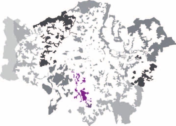
64
Taking forward the All London Green Grid
 Taking forward the All London Green Grid Foreword Earlier this year, the Mayor published the All London Green Grid Supplementary Planning Guidance to the London Plan which set the vision, and framework,
Scottish Natural Heritage. Better places for people and nature
 Scottish Natural Heritage Better places for people and nature Contents Summary... 3 SNH approach... 5 Place-making in policy and practice... 6 Developing the contribution of the natural heritage to place-making...
Cotswolds AONB Landscape Strategy and Guidelines. June 2016
 Cotswolds AONB Landscape Strategy and Guidelines June 2016 Cotswolds AONB Landscape Strategy and Guidelines Introduction The evolution of the landscape of the Cotswolds AONB is a result of the interaction
The Duke s River: Revitalising the link between the River Crane and the River Thames
 The Duke s River: Revitalising the link between the River Crane and the River Thames The project The eastern section of the Duke of Northumberland s River runs for approximately four kilometres, from where
10.0 Open Space and Public Realm
 10.0 Open Space and Public Realm 10.0 Open Space and Public Realm The Public Open Space System is comprised of: outdoor spaces available for public use that are either publicly owned (e.g., parks and
Response to the London Bridge Area Vision and Site Allocations within the New Southwark Plan
 1 Melior Place London SE1 3SZ 020 7407 4701 teamlondonbridge.co.uk info@teamlondonbridge.co.uk 28 April 2017 Response to the London Bridge Area Vision and Site Allocations within the New Southwark Plan
ROCHFORD LOCAL DEVELOPMENT FRAMEWORK: Sustainability Appraisal/ Strategic Environmental Assessment. Rochford Core Strategy Preferred Options Document
 ROCHFORD LOCAL DEVELOPMENT FRAMEWORK: Sustainability Appraisal/ Strategic Environmental Assessment Non Technical Summary Rochford Core Strategy Preferred Options Document October 2008 SUSTAINABILITY APPRAISAL
Policy and Resources Committee 10 th October Green Infrastructure Supplementary Planning Document (SPD) Summary. Title
 Summary. Title") Policy and Resources Committee 10 th October 2017 Title Report of Wards Status Urgent Key Enclosures Officer Contact Details Green Infrastructure Supplementary Planning Document (SPD) Deputy Chief Executive
Policy and Resources Committee 10 th October 2017 Title Report of Wards Status Urgent Key Enclosures Officer Contact Details Green Infrastructure Supplementary Planning Document (SPD) Deputy Chief Executive
OUR AREA SECTION 02 I NEXT PAGE. 2.1 This section sets the scene in regard to the role of the Legacy Corporation and the baseline
 7 ADOPTED LOCAL PLAN SECTION 02 2.1 This section sets the scene in regard to the role of the Legacy Corporation and the baseline position of the Local Plan. It sets out the historical context and current
Neighbourhood Planning Local Green Spaces
 Neighbourhood Planning Local Green Spaces Introduction... 2 1. Why green space is important... 4 2. Neighbourhood plans and green space... 6 3. Evidence... 8 Statutory designations... 9 Green space audit...
Western City District What we heard
 What we heard Vision to 2056 and Priorities Governance and implementation Infrastructure and funding The protection of the natural landscape including biodiversity and the Metropolitan Rural Area for food
Chapter 03 Planning framework
 Vauxhall Nine Elms Battersea Opportunity Area Planning Framework Chapter 03 Planning framework Mayor of London 25 preferred option - 16,000 residential units 20,000-25,000 jobs northern line extension
PUBLIC REALM STRATEGY
 CONSULTATION DRAFT PUBLIC REALM STRATEGY Trenchard Street & Frogmore Street City Design Group Place Directorate Public Realm Strategy Trenchard Street & Frogmore Street Contents 1. Introduction 2. Understanding
Background Information
 Background Information view at site entrance THE LONDON BOROUGH OF SUTTON As the strategic local authority the Council is working with a range of partners to take forward various development sites in Hackbridge.
LITTLE FRANCE PARK, EDINBURGH
 LITTLE FRANCE PARK, EDINBURGH INTEGRATING ACTIVE TRAVEL ROUTES WITHIN A MASTERPLAN FROM THE OUTSET Location: Implemented: Edinburgh, Scotland 2016 - ongoing CASE STUDY The Little France Park cycling and
Plan Modification to Chapter B2 of the Auckland Unitary Plan(AUP) Operative in part (15 November 2016)
 Operative in part (15 November 2016)") UNITARY PLAN UPDATE REQUEST MEMORANDUM TO FROM Phill Reid Linley Wilkinson DATE 25 September 2018 SUBJECT Plan Modification to Chapter B2 of the Auckland Unitary Plan(AUP) Operative in part (15 November
UNITARY PLAN UPDATE REQUEST MEMORANDUM TO FROM Phill Reid Linley Wilkinson DATE 25 September 2018 SUBJECT Plan Modification to Chapter B2 of the Auckland Unitary Plan(AUP) Operative in part (15 November
Landscape Partnership Scheme Summary
 Landscape Partnership Scheme Summary 2016 VISION LANDSCAPE PARTNERSHIP SCHEME SUMMARY 2 Aerial view of Aveley Forest Vision Adopted by the Partnership in 2014, the vision of the Land of the Fanns is The
Our City Centre is a vibrant, creative and welcoming destination, with a modern business, cultural, shopping, leisure and residential offer
 3. Sheffield in 2034 Our City sits at the heart of a strong, distinctive and internationally successful City Region economy which supports innovation and enterprise Our City Centre is a vibrant, creative
8.0 Design and Form of Development 43/
 42/ 8.0 Design and Form of Development 43/ Rothwells Farm, Golborne/ Development Statement Figure 7. Site Constraints Key 44/ Site Boundary 360 Bus Route/Stops Existing Trees Underground Water Pipe Sensitive
Appendix A. Planning Processes. Introduction
 1 Planning Processes Introduction This appendix outlines a number of planning processes which are used in the Auckland Region to support the effective management of development in the region s rural and
Horwood Map of London, Westminster & Southwark First edition
 Barratt London is developing plans in tandem with Southwark Council and TfL to transform the southern end of Blackfriars Road. The residential-led, mixed-use scheme will deliver new private and affordable
Welcome. /The Design Companion 4. /Planning London 7. /Getting Homes Built 8. /Transport & Streets 10. /Tech & The City 12
 Welcome With the draft publication of the London Plan and the Mayor s Transport Strategy (MTS) this year s events programme will examine both documents in detail with a wide range of seminars, debates
1 Introduction. Chapter. In this chapter:
 Chapter 1 Introduction In this chapter: 1.1 A Snapshot of the Region 1.2 Towards a Sustainable Region 1.3 The Provincial Context 1.4 Purpose and Organization The Regional Municipality of York Official
UDF PLANS AND GUIDELINES
 UDF PLANS AND GUIDELINES 5 Land Use Land Use Development Plan Plan no. 3 Land Use Development Mixed Use Retail / Leisure Residential Civic and Institutional Proposed Zoning Table Development Edges Plan
Darlington Healthy New Town Hilary Hall Project Manager, HNT
 Bringing a healthy life to communities, bringing healthy communities to life Darlington Healthy New Town Hilary Hall Project Manager, HNT The Healthy New Towns programme has three key aims: 1. To shape
Hackbridge & Beddington Corner Neighbourhood Plan. Appendices
 Hackbridge & Beddington Corner Neighbourhood Plan Appendices Appendix 2 EVIDENCE BASE, GUIDANCE AND BIBLIOGRAPHY A number of documents, reports, studies and demographic / statistical data have been used
elbridge Core Strategy
 C elbridge Core Strategy Celbridge is designated as a Moderate Growth Town in the RPGs. The County Development Plan reinforces this designation in its settlement strategy. Moderate Growth Towns within
WELCOME GYPSY LANE. Wider Site Location plan. Proposals for the development of LAND OFF FOXLYDIATE LANE WEBHEATH. Proposals for the development of
 WELCOME The developers are preparing an outline planning application for a residential led development and need the community s views in order to develop the proposals further WHAT IS PROPOSED? A high
COMMUNITY GROWN FOOD IN WALES
 COMMUNITY GROWN FOOD IN WALES 2012 1 EXECUTIVE SUMMARY This executive summary provides an overview of research carried out by the WRO between July 2010 and December 2011 to investigate activities relating
Tāhuhu whakaruruhau ā-taone The sheltering ridge pole
 B2. Tāhuhu whakaruruhau ā-taone - Urban growth and form B2.1. Issues Tāhuhu whakaruruhau ā-taone The sheltering ridge pole Auckland s growing population increases demand for housing, employment, business,
North Fair Oaks Community Plan Summary and Information
 North Fair Oaks Community Plan Summary and Information WHAT IS THE NORTH FAIR OAKS COMMUNITY PLAN? The North Fair Oaks Community Plan is part of the San Mateo County General Plan, and establishes policies
March General enquiries: Web site:
 REDEVELOPMENT OF WILSON HOSPITAL FOR MITCHAM LOCAL CARE CENTRE Community Planning & Design Brief for Merton Clinical Commissioning Group and London Borough of Merton March 2016 1. Mitcham Cricket Green
Place Brief. National Collections Facility (NCF site)
") Place Brief. National Collections Facility (NCF site) Contents 1.0 Purpose 2.0 Location and Proposal 3.0 Vision and Aim 4.0 Placemaking Principles 5.0 Conclusion Plan 1 Location Plan Plan 2 Placemaking
Place Brief. National Collections Facility (NCF site) Contents 1.0 Purpose 2.0 Location and Proposal 3.0 Vision and Aim 4.0 Placemaking Principles 5.0 Conclusion Plan 1 Location Plan Plan 2 Placemaking
Rochford District Council Allocations Development Plan Document: Discussion and Consultation Document Sustainability Appraisal
 Option SWH1 Balanced Communities Option SWH1 1 To ensure the delivery of high quality sustainable communities where people want to live and work Will it ensure the phasing of infrastructure, including
Landscape and Heritage A Park landscape that embraces the physical, cultural and social heritage of the area
 80 Park Development Framework Our Aim for Landscape and Heritage A Park landscape that embraces the physical, cultural and social heritage of the area Why do we think it is important? The landscapes of
NATURAL AND BUILT ENVIRONMENT BACKGROUND PAPER
 NATURAL AND BUILT ENVIRONMENT BACKGROUND PAPER OCTOBER 2018 CONTENTS 1. Introduction 2 2. Legislative and policy context 2 3. Evidence Base 3 4. Key changes 8 4.1 Strategic Policy 8 4.2 The waterway environments
Norwich (United Kingdom), 9-10 September 2004
, 9-10 September 2004") THE CONGRESS OF LOCAL AND REGIONAL AUTHORITIES Council of Europe F 67075 Strasbourg Cedex Tel : +33 (0)3 88 41 20 00 Fax : +33 (0)3 88 41 27 51/ 37 47 http://www.coe.int/cplre COLLOQUIES, SEMINARS, FORUMS
THE CONGRESS OF LOCAL AND REGIONAL AUTHORITIES Council of Europe F 67075 Strasbourg Cedex Tel : +33 (0)3 88 41 20 00 Fax : +33 (0)3 88 41 27 51/ 37 47 http://www.coe.int/cplre COLLOQUIES, SEMINARS, FORUMS
Letcombe Brook Project Officer
 Letcombe Brook Project Officer Job Description Responsible to: Responsible for: Purpose of post: Key Committees: Chairman and Trustees of Letcombe Brook Project. Project volunteers and any relevant personnel
All London Green Grid
 All London Green Grid Review of Implementation CPRE London & Neighbourhoods Green JULY 2014 Contents Section 2: Executive Summary... 2 Section 2: Background... 4 Section 3: London Borough ALGG Policy Commitment...
Landscape and Heritage
 86 Park Development Framework Our Aim for A Park landscape that embraces the physical, cultural and social heritage of the area Why do we think it is important? The landscape provides a setting for every
Public Consultation. Land at Monks Farm, North Grove. Welcome
 Welcome Welcome to our public exhibition for development on Land at Monks Farm, orth Grove. Gallagher Estates and Gleeson Strategic Land are preparing an outline planning application for new homes, open
2.0 Strategic Context 4
 2.0 Strategic Context 4 2.1 The Area Action Plan is a non-statutory plan, which forms a corporate policy document, expressing particular issues and areas of concern while also providing a vision for the
CITY CLERK. Parkland Acquisition Strategic Directions Report (All Wards)
") CITY CLERK Clause embodied in Report No. 10 of the, as adopted by the Council of the City of Toronto at its meeting held on November 6, 7 and 8, 2001. 10 Parkland Acquisition Strategic Directions Report
CITY CLERK Clause embodied in Report No. 10 of the, as adopted by the Council of the City of Toronto at its meeting held on November 6, 7 and 8, 2001. 10 Parkland Acquisition Strategic Directions Report
Ebbsfleet Development Corporation Corporate Plan
 Ebbsfleet Development Corporation Corporate Plan 2016-2021 1 Ministerial Foreword In 2014, the Chancellor announced his intention to promote a Garden City at Ebbsfleet, and to create an Urban Development
Town of Cobourg Heritage Master Plan. Statutory Public Meeting
 Town of Cobourg Heritage Master Plan Statutory Public Meeting April 25 th 2016 Presentation Overview 1. Introduction 2. Project background and schedule overview 3. Review of strategic direction content
Scotland s 2020 Biodiversity Challenge: Loch Lomond & The Trossachs National Park Authority Delivery Agreement
 Scotland s 2020 Biodiversity Challenge: Loch Lomond & The Trossachs National Park Authority Delivery Agreement Scotland s National Parks Both of Scotland s National Park Authorities contribute to the Scottish
WINCHESTER TOWN 3.1 LOCATION, CHARACTERISTICS & SETTING
 WINCHESTER TOWN 3.1 LOCATION, CHARACTERISTICS & SETTING 3.1.1 The area referred to by the City Council, as Winchester Town, consists of the Winchester Wards plus the adjoining built up areas of Badger
Chalk, Cherries and Chairs Central Chilterns Landscape Partnership Scheme LANDSCAPE PARTNERSHIP DEVELOPMENT OFFICER JOB INFORMATION PACK
 Chalk, Cherries and Chairs Central Chilterns Landscape Partnership Scheme LANDSCAPE PARTNERSHIP DEVELOPMENT OFFICER JOB INFORMATION PACK How to apply Please complete our application form, together with
WELCOME TO THE CHOUTEAU GREENWAY DESIGN, DEVELOPMENT AND CONSTRUCTION WORKING GROUP!
 WELCOME TO THE CHOUTEAU GREENWAY DESIGN, DEVELOPMENT AND CONSTRUCTION WORKING GROUP! Chouteau Greenway Steering Committee and Working Groups Overview Overview January 9, 2019 Chouteau Greenway will transform
BEDFORD BOROUGH COUNCIL PLAN IMPLEMENTATION MONITORING REPORT
 BEDFORD BOROUGH COUNCIL PLAN IMPLEMENTATION MONITORING REPORT 2017-18 Summary 1 Progress on local development documents 1 Local development documents adopted in the monitoring period 1st April 2017 31st
(Y)OUR BROOMIELAW SUMMARY DOCUMENT
OUR BROOMIELAW SUMMARY DOCUMENT") (Y)OUR BROOMIELAW SUMMARY DOCUMENT Glasgow City Centre District Regeneration Frameworks Broomielaw District August 2018 Broomielaw District Regeneration Framework as defined in Glasgow City Centre Strategy
(Y)OUR BROOMIELAW SUMMARY DOCUMENT Glasgow City Centre District Regeneration Frameworks Broomielaw District August 2018 Broomielaw District Regeneration Framework as defined in Glasgow City Centre Strategy
By to: 30 March Thank you for the opportunity to respond to this important consultation.
 70 Cowcross Street London EC1M 6EJ Tel: 0207 253 0300 Fax: 0207 490 3001 office@cprelondon.org.uk www.cprelondon.org.uk Environment, Housing & Regeneration London Borough of Sutton 24 Denmark Road Carshalton
97 Lea Bridge Road, Leyton, E10 7QL London Borough of Waltham Forest December 2015
 97 Lea Bridge Road, Leyton, E10 7QL London Borough of Waltham Forest December 2015 Public Realm and Landscape Proposals LEA BRIDGE ROAD, WALTHAMSTOW Public Realm & Landscape Proposals BDP(90)RPT001 December
Natural Environment White Paper & new partnerships to deliver green infrastructure. Henry Smith, Project and Policy Assistant, TCPA
 Natural Environment White Paper & new partnerships to deliver green infrastructure Henry Smith, Project and Policy Assistant, TCPA Presentation outline 1) Green Infrastructure introduction The TCPA s work
building activity into new devevelopment
 active design case study essex design guide: building activity into new devevelopment active design principles in action: 1. ACTIVITY FOR ALL 2. WALKABLE COMMUNITIES 3. CONNECTED WALKING & CYCLING ROUTES
OUR DESIGN APPROACH TO THE NATURAL ENVIRONMENT JANUARY 2018
 OUR DESIGN APPROACH TO THE NATURAL ENVIRONMENT JANUARY 2018 Contents Contents Page 1. Introduction... 4 1.1 Purpose and structure of the document.... 4 2. Natural environment policy context... 5 2.1 Overview...
Development of green infrastructure in EU regions Nature-based solutions delivering multiple benefits
 Development of green infrastructure in EU regions Nature-based solutions delivering multiple benefits A Policy Brief from the Policy Learning Platform on Environment Introduction What is green infrastructure?
Enhancing Ecosystems and Biodiversity. Paul Nolan, Green Infrastructure: Planning for the Liverpool City Region
 Enhancing Ecosystems and Biodiversity Paul Nolan, Green Infrastructure: Planning for the Liverpool City Region Supposing we thought differently Amenity to Necessity Green Space to Green Infrastructure
Euston Area Plan - Examination: Statement in response to the Inspector s Matters, Issues and Questions
 1 Euston Area Plan - Examination: Statement in response to the Inspector s Matters, Issues and Questions Sydney and London Properties Limited June 2014 2 3 This document is the Statement in response to
Elderberry Walk. Developer HAB Housing
 Case studies Elderberry Walk Developer HAB Housing Development of 161 new homes on the former Dunmail Primary School site, focused around a central green street, with retained trees, new multifunctional
Draft Eastern District Plan
 Draft Eastern District Plan Submission_id: 31238 Date of Lodgment: 13 Dec 2017 Origin of Submission: Online Organisation name: Turrulla Gardens Pty Ltd C/- Mecone Organisation type: Industry First name:
Great Easton Neighbourhood Plan Statement of Basic Conditions
 Great Easton Neighbourhood Plan 2017-2031 Statement of Basic Conditions OCTOBER 2016 GREAT EASTON PARISH COUNCIL Contents 1.0 Introduction....Page 2 2.0 Summary of Submission Documents and Supporting Evidence..
SUB AREA 3 CENTRAL STRATFORD AND SOUTHERN QUEEN ELIZABETH OLYMPIC PARK
 191 ADOPTED LOCAL PLAN: THE SUB AREAS SUB AREA 3 CENTRAL STRATFORD AND SOUTHERN QUEEN ELIZABETH OLYMPIC PARK SECTION 12 Vision VISION Central Stratford and Southern Queen Elizabeth Olympic Park will become
HS2 Hybrid Bill Petitioning. Summary of SMBC Asks 23/09/13. Background
 Summary of SMBC Asks 23/09/13 Background The Council has a developed a significant number of asks and propositions for consideration by HS2 Ltd and Government throughout further development of the HS2
Slough International Freight Exchange Proposals, Colnbrook+
 Welcome Welcome to this exhibition, which is being held in connection with our proposals for a new freight exchange facility on land to the north of the A4. Please take this opportunity to look at the
Summary of Action Strategies
 Strategic Action Plan 6 Summary of Action Strategies Action Strategy Categories: 1. Organization and Management 2. Implementation 3. Marketing and Promotion This chapter summarizes all of the action strategies
Our collaborative vision for a. Wisbech Garden Town....a place of great expectations
 ur collaborative vision for a Wisbech Garden Town...a place of great expectations ur heritage and our long-term transformational vision As part of the Wisbech 2020 Vision evolution and collaborative approach,
Making the case for Sustainable Transport Project Potential
 Making the case for Sustainable Transport Project Potential The Structural Investment Fund (SIF) Strategy for Greater Lincolnshire identifies the barriers to growth identified by having poor transport
The Charter of European Planning BARCELONA 2013
 The Charter of European Planning BARCELONA 2013 The Vision for Cities and Regions Territoires of Europe in the 21st Century ECTP-CEU (The European Council of Spatial Planners Le Conseil Européen des Urbanistes)
Section 1 Introduction
 Section 1 Section 1,, describes the role of the Official Plan. The Official Plan is one of five growth management plans that was completed under the umbrella of Ottawa 20/20. 1.1 The Role of the Official
Managing our Landscapes Conversations for Change
 Managing our Landscapes Conversations for Change Frequently Asked Questions The new State Government is committed to a significant reform program that will change the way natural resources are managed.
Hobart A Strategic Framework
 Hobart 2025 A Strategic Framework Adopted by the Hobart City Council 15 October 2007 Table of Contents Introduction...2 Vision and Future Directions...3 FD1 Offers opportunities for all ages and a city
Newcourt Masterplan. November Exeter Local Development Framework
 Newcourt Masterplan November 2010 Exeter Local Development Framework Background The Exeter Core Strategy Proposed Submission sets out the vision, objectives and strategy for the development of Exeter up
Welcome to the Oakridge Centre Open House
 Welcome to the Oakridge Centre Open House Why is the City hosting this event? This open house is to inform you of a rezoning application submitted to the City of Vancouver to amend the existing CD-1 (Comprehensive
Key Principles. 290 Phasing Principles and Programme
 4 Phasing principles and programme 4c The aims of the phasing strategy are to satisfy planning policy requirements and create a sustainable, strong and healthy new community where, from the outset, people
building with nature - a new benchmark for green infrastructure
 building with nature - a new benchmark for green infrastructure Danielle Sinnett, Gemma Jerome, Sarah Burgess, Nick Smith and Roger Mortlock outline the aims, development and proposed operation of Building
Brockholes Wetland and Woodland Nature Reserve, Preston Lancashire
 Newlands Brockholes Wetland and Woodland Nature Reserve, Preston Lancashire Nature s Gateway to Lancashire NEWLANDS Brockholes: site profile Brockholes Wetland and Woodland Nature Reserve project area
Colchester Northern Gateway Master Plan Vision Review Draft. July 2016
 Colchester Northern Gateway Master Plan Vision Review Draft July 2016 Contents Introduction 4 Context 8 Purpose of the Report 8 Strategic Position 9 Overview of the Process 11 2012 Master Plan Vision 12
3. Neighbourhood Plans and Strategic Environmental Assessment
 1. Introduction This report sets out a draft Screening Determination for the Preston Parish Council s Neighbourhood Plan and has been prepared by rth Hertfordshire District Council. The purpose of the
Upper Dean Landscape Character Area: A1 Landscape Character Type: River Valley
 Upper Dean Landscape Character Area: A1 Landscape Character Type: River Valley Key characteristics A well wooded river valley landscape Strong human influence with urban development and sections of engineered
Published in March 2005 by the. Ministry for the Environment. PO Box , Wellington, New Zealand ISBN: X.
 Action Pack Published in March 2005 by the Ministry for the Environment Manatū Mō Te Taiao PO Box 10-362, Wellington, New Zealand ISBN: 0-478-18994-X ME number: 580 This document is available on the Ministry
Clearwater Photography UK
 1 Tackling Pollution in London s Rivers November 2017 Clearwater Photography UK 2 Within the Greater London Authority boundary there are 39 rivers, of which, so far, only one has been classified as achieving
The Five Components of the McLoughlin Area Plan
 The Five Components of the McLoughlin Area Plan This documents contains the complete language of the five components of the McLoughlin Area Plan: The Vision Statement The Values The Guiding Principles
1.3 The following table presents a Statement of Compliance demonstrating how the Standish Neighbourhood Plan meets those requirements.
 1. Introduction 1.1 This Basic Condition Statement was prepared to accompany the draft Standish Neighbourhood Plan (2018). 1.2 Paragraph 8 of Schedule 4B of the Town and Country Planning Act 1990 requires
North District What we heard
 What we heard Vision to 2056 and Priorities Governance and implementation Infrastructure and funding The vision for a metropolis of three cities, and the 30 minute city. Feedback emphasised: That for the
Richard Lemon Spatial Project Manager. Biodiversity and Green Infrastructure
 Richard Lemon Spatial Project Manager Biodiversity and Green Infrastructure A key concept: Multifunctionality Combining different functions on the same piece of land multi-functional green space, new
Wildlife and Planning Guidance: Neighbourhood Plans
 Wildlife and Planning Guidance: Neighbourhood Plans This Leaflet is one of a series of 4 Wildlife and Planning Guidance Leaflets and is intended to provide useful information to assist you to campaign
5. Bankside and The Borough 5.1. Bankside and The Borough Area Vision
 5. 5.1. Area Vision 5.1.1. are: A globally significant central London business district which is home to international business headquarters; At the heart of the commercial and cultural life of the capital
South Worcestershire Development Plan. South Worcestershire Design Guide Supplementary Planning Document
 South Worcestershire Development Plan South Worcestershire Design Guide Supplementary Planning Document Statement of Consultation: Early Engagement Scoping Paper February 2017 1. Introduction 1.1 This
FOR SALE RESIDENTIAL DEVELOPMENT OPPORTUNITY BLAIRTUMMOCK EASTERHOUSE
 FOR SALE RESIDENTIAL DEVELOPMENT OPPORTUNITY BLAIRTUMMOCK EASTERHOUSE RESIDENTIAL DEVELOPMENT SITE Land at Blairtummock, Easterhouse Residential Development Opportunity Site area of 5.71 hectares (14.11
Draft Western District Plan
 Powered by TCPDF (www.tcpdf.org) Draft Western District Plan Submission_id: 31440 Date of Lodgment: 15 Dec 2017 Origin of Submission: Online Organisation name: Goodman Property Services Australia Pty Ltd
Woodbrook - Shanganagh
 Section 4: Key Sites Framework Strategy Woodbrook - Shanganagh Local Area Plan 2017-2023 4. Site Framework Strategies The Master Plans shall have regard to the thematic objectives under the LAP Development
Study of the Economic Value of Northern
 Study of the Economic Value of Northern Ireland s Historic Environment Summary Report on behalf of: Department of the Environment June 2012 eftec and RSM McClure Watters i May 2012 1 Introduction to the
LANDSCAPE INSTITUTE CORPORATE STRATEGY ISSUED 3RD APRIL Landscape Institute 107 Grays Inn Road London WC1X 8TZ United Kingdom
 LANDSCAPE INSTITUTE CORPORATE STRATEGY ISSUED 3RD APRIL 2018 Landscape Institute 107 Grays Inn Road London WC1X 8TZ United Kingdom MISSION The Landscape Institute (LI) aims to lead and inspire the landscape
Herne Hill and North Dulwich Herne Hill and North Dulwich Area Vision Map
 Area Vision Map East Dulwich station Greendale Playing Fields Green Dale Sunray Gardens North Dulwich station Herne Hill station Herne Hill Velodrome NSP50 Edward Alleyn Club Key: NSP Site Allocations
Rotherhithe Rotherhithe Area Vision Map
 Area Vision Map CWAAP1 Improved pedestrian and cycle links to the wider area Improved link from town centre to River Thames and docks CWAAP2 Brunel Museum NSP79 CWAAP3 Proposed Thames Crossing Station
Ebbsfleet Development Corporation
 Title of Paper Planning and Housing Delivery Report September 2018 Presented by Sub-Committee Mark Pullin, Chief Planning Officer Planning Committee Purpose of Paper and Executive Summary This paper provides
INTRODUCTION. Land south of Bishopswood Lane, Tadley
 0 INTRODUCTION THE SITE Introduction Gladman Developments Ltd. has successfully invested in communities throughout the UK over the past 0 years, developing high quality and sustainable residential, commercial
Western Sydney Parklands Australia s Largest Urban Park
 Western Sydney Parklands Australia s Largest Urban Park 37 WLA 1 MAGAZINE 21 38 WESTERN SYDNEY PARKLANDS AUSTRALIA S LARGEST URBAN PARK Large urban parks have dual roles to play in meeting the demands
Park Development Framework Area Proposals. Context to Area 2 Ruckholt Road to Coppermill Lane
 Park Development Framework Area Proposals Context to Area 2 Ruckholt Road to Coppermill Lane The defining feature of this area is the broad expanse of marshlands. These provide the context for a diverse