GUILDFORD BOROUGH GREEN BELT AND COUNTRYSIDE STUDY
|
|
|
- Edward Martin
- 5 years ago
- Views:
Transcription


1 GUILDFORD BOROUGH GREEN BELT AND COUNTRYSIDE STUDY Volume V On behalf of Guildford Borough Council PPG Ref : BNL.0287 April 2014 COPYRIGHT The conents of this document must not be copied or reproduced in whole or in part without the written consent of Pegasus Planning Group Ltd Crown copyright. All rights reserved. Licence number
 667376 PPG Ref: BNL.")
2 GUILDFORD BOROUGH GREEN BELT AND COUNTRYSIDE STUDY On behalf of Guildford Borough Council Volume V Pegasus Group Abbey House Grenville Place Bracknell Berks RG12 1BP Telephone: (01344) Facsimile: (01344) PPG Ref: BNL.0287 Date: April 2014 COPYRIGHT The contents of this document must not be copied or reproduced in whole or in part without the written consent of Pegasus Group Ltd
3 VOLUME V Page No: 16. INTRODUCTION POTENTIAL EXPANSION OF SETTLEMENTS LOCATED IN ADJOINING BOROUGHS WITHIN GUILDFORD BOROUGH POTENTIAL EXPANSION OF VILLAGES LOCATED WITHIN OR BORDERING THE SURREY HILLS AREA OF OUTSTANDING NATURAL BEAUTY (AONB) FURTHER CONSIDERATION OF THE COUNTRYSIDE BEYOND THE GREEN BELT (CBGB) RELATING TO LAND ADJOINING ASH AND TONGHAM POTENTIAL EXPANSION OR REDEVELOPMENT OF MAJOR PREVIOUSLY DEVELOPED SITES ACROSS GUILDFORD BOROUGH POTENTIAL MAJOR EXPANSION OF THOSE VILLAGES WITHIN GUILDFORD BOROUGH RANKED HIGHEST IN GBC S SETTLEMENT HIERARCHY POTENTIAL CREATION OF A NEW SETTLEMENT AT WISLEY AIRFIELD ESTIMATED RESIDENTIAL DEVELOPMENT CAPACITIES SUMMARY CONCLUSIONS 29 VOLUME V APPENDICES 51 Appendix IX: Potential Development Areas (PDAs) surrounding urban areas and villages map (updated Volume V) 52 Appendix X: Potential expansion and redevelopment of major previously developed sites and villages insetting map 53 Appendix XI: Potential major expansion of villages and insetting map 54 Appendix XII: GBC Settlement Hierarchy 55 Appendix XIII: Sustainability schedules and mapping for land adjoining villages on the boundary of Guildford Borough 56 Appendix XIV: Sustainability schedules and mapping for villages within the Surrey Hills AONB 57 Appendix XV: Sustainability schedules and mapping for land parcels within CBGB 58 Appendix XVI: Sustainability schedules and mapping for the major expansion of villages across the borough 59 Appendix XVII: Key for environmental designations and local plans mapping 60 GUILDFORD BOROUGH GREEN BELT AND COUNTRYSIDE STUDY
4 16. INTRODUCTION 16.1 Following the publication of Volumes I to IV of the Green Belt and Countryside Study in July 2013, Guildford Borough Council (GBC) commissioned Pegasus Group to undertake a further Volume V of the Study in September The instruction of Volume V was to further consider a number of issues within the designated Green Belt and the Countryside Beyond the Green Belt (CBGB) that had not been assessed within the previous Volumes I to IV The Study undertaken within Volume V is intended to supplement the previous findings of Volumes I to IV with the following additional issues addressed within separate sections: Section 17 - The potential expansion of settlements located in adjoining Boroughs within Guildford Borough Section 18 - The potential expansion of villages located within or bordering the Surrey Hills Area of Outstanding Natural Beauty (AONB) in particular Chilworth, Gomshall, Shalford and Shere which were proposed for insetting within Volume IV Section 19 - Further consideration of the Countryside beyond the Green Belt (CBGB) relating to land adjoining Ash and Tongham Section 20 - The potential expansion or redevelopment of major previously developed sites at various locations across Guildford Borough Section 21 - The potential major expansion of villages within Guildford ranked highest in GBC s Settlement Hierarchy Section 22 -The potential creation of a new settlement at Wisley Airfield to the north east of Guildford Borough 16.4 The estimated residential development capacities for Volume V Sections 17 to 22 have been provided within Section 23 and the summary conclusions are detailed within Section 24. GUILDFORD BOROUGH GREEN BELT AND COUNTRYSIDE STUDY 1
5 17. POTENTIAL EXPANSION OF SETTLEMENTS LOCATED IN ADJOINING BOROUGHS WITHIN GUILDFORD BOROUGH 17.1 This section of the Study details the methodology for the potential expansion of settlements located in adjoining boroughs within Guildford Borough, providing a focussed review of the following settlements: Bramley Farncombe Godalming Old Woking 17.2 Bramley, Farncombe and Godalming are located within Waverley District and Old Woking is located within Woking District on the boundary of the Guildford Borough administrative area. This section applies the methodology used within Volume III, which identified land for potential development within the surroundings of villages across the Borough and includes the following assessment stages: Stage 1: Assessing the environmental capacity of the land parcels surrounding villages within adjoining boroughs and the identification of PDAs considering the Green Belt purposes; and Stage 2: Assessing the sustainability credentials of the identified PDAs surrounding villages in adjoining boroughs within Guildford Borough The detailed methodology for Stages 1 and 2 for this section are contained within Volume III paragraphs 10.2 to The findings for the potential expansion of settlements located in adjoining boroughs within Guildford Borough are provided on the following schedules and informed by the environmental constraints and walking distance plans in Appendix XIII: GUILDFORD BOROUGH GREEN BELT AND COUNTRYSIDE STUDY 2
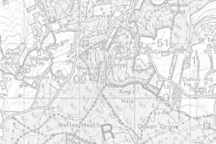
6 18. POTENTIAL EXPANSION OF VILLAGES LOCATED WITHIN OR BORDERING THE SURREY HILLS AREA OF OUTSTANDING NATURAL BEAUTY (AONB) 18.1 Previous Volumes of the Study have not considered the potential expansion of villages located within or bordering the Surrey Hills Area of Outstanding Natural Beauty (AONB). This is an area that the Council have requested is explored further with the focus directed towards those settlements within or adjoining the AONB that were recommended for insetting within Volume IV. These were: Chilworth Gomshall Shalford Shere 18.2 Chilworth and Shalford are located on the boundary of the Surrey Hills AONB and the villages of Gomshall and Shere are located within the AONB. As such, this section recognises that any PDAs considered major development brought forward within the AONB would have to constitute exceptional circumstances and be in the public interest, as advised within NPPF paragraph Precisely what constitutes a major development in this context is not clear. The AONB Boards approach has been to suggest more than 10 dwellings represents major development but this has not always been supported in decision making. As an example in 2013, the Secretary of State concluded that a scheme for 39 dwellings in the Cotswold AONB did not constitute major development when granting planning permission for it. Some Councils have advised that the definition is affected by many factors such as location, scale, context and design, implying that a scheme for x number of dwellings in one situation will be classed as major development, but an application for the same number of dwellings in a different situation will not be Whether exceptional circumstances exist will depend not only on the site specific circumstances, but the wider background also. For example, if it is established that insufficient alternative appropriate locations can come forward to provide for the necessary level of housing for the borough, then it is possible that exceptional circumstances will exist subject to the assessment of other considerations put forward in paragraph 116 of the NPPF It is not within the remit of this Study to assess whether exceptional circumstances exist to enable major development, and there is clearly some uncertainty over what GUILDFORD BOROUGH GREEN BELT AND COUNTRYSIDE STUDY 3
7 should be classed as major development in such instances. As a result, any PDAs that are identified in this Study within the AONB would require closer scrutiny by the Council prior to any allocation being made. This would take account of the latest information at the time before conclusions can be drawn on, firstly whether exceptional circumstances need to be demonstrated, and secondly if they can be Notwithstanding the environmental constraints posed by the Surrey Hills AONB, this section also applies the methodology used within Volume III, Land Surrounding the Villages across the borough (Stages 1 and 2) as outlined above and detailed within Volume III paragraphs 10.2 to It should be noted that Potential Development Areas (PDAs) have been previously identified within Volume III at Shalford E56-A and Chilworth E51-B located outside of the AONB. The PDA previously identified at E52-A has been omitted from the Study due to the location of the conservation area to the north east of Chilworth near the Tillingbourne Gunpowder works. These PDAs are further detailed within Volume III of the Study The findings for the potential expansion of villages located within and bordering the Surrey Hills AONB are provided on the following schedules: GUILDFORD BOROUGH GREEN BELT AND COUNTRYSIDE STUDY 4
8 19. FURTHER CONSIDERATION OF THE COUNTRYSIDE BEYOND THE GREEN BELT (CBGB) RELATING TO LAND ADJOINING ASH AND TONGHAM 19.1 Volume II of the Study included a review of the environmental capacity and sustainability criteria associated with the land parcels surrounding Ash and Tongham including K2, K5, K6, K7, K8 and K9 within Countryside beyond the Green Belt (CBGB) local plan areas. Volume V of the Study provides a further detailed review of the remaining land parcels K1, K3, K4 and K10 also located within CBGB within the surroundings of Ash, Ash Vale, Tongham and the Blackwater Valley near the Rushmoor District administrative boundary to the west of Guildford Borough Within Volume II it was considered appropriate to assess the CBGB within the surroundings of Ash and Tongham in accordance with the same methodology used for the assessment of the Green Belt adjoining urban areas However, this resulted in some of the land parcels adjoining Ash and Tongham that scored highly in terms of Green Belt purposes, not being assessed on environmental or sustainability grounds. Given that such land parcels are not actually within the Green Belt, and to ensure a thorough review of all non-green Belt land is undertaken before Green Belt sites need to be allocated for development, the Council requested further assessment of those CBGB land parcels that were not assessed in detail within Volume II Therefore, a further detailed review of CBGB land parcels K1, K3, K4 and K10 has now been undertaken to determine any further potential for PDAs within these CBGB land parcels. If the review of land parcels K1, K3, K4 and K10 identifies PDAs, a comparison can then be made with those land parcels identified for expansion to urban areas within Volume II This section applies the following stages based upon the Volume II assessments described within paragraphs 7.15 to 7.50: Stage 1: Assessing the environmental capacity constraints of the land parcel to accommodate appropriate development, and if capacity is found; Stage 2: Assessing the sustainability credentials of the PDAs within land parcels of CBGB areas The findings for the further consideration of the Countryside beyond the Green Belt (CBGB) are provided on the following schedules: GUILDFORD BOROUGH GREEN BELT AND COUNTRYSIDE STUDY 5
9 20. POTENTIAL EXPANSION OR REDEVELOPMENT OF MAJOR PREVIOUSLY DEVELOPED SITES ACROSS GUILDFORD BOROUGH 20.1 This section details the methodology for the review of the major previously developed sites at various locations across Guildford Borough, these being: Bisley Camp BTRE Vokes, Normandy The University of Law, Guildford HM Prison, Send Keogh Barracks Merrist Wood College Mount Browne Police Headquarters Peasmarsh Industrial Estate Pirbright Barracks Pirbright Institute RHS Wisley 20.2 GBC wish to consider whether these major previously developed sites within the borough offer the potential for redevelopment or expansion, in order to assist with the borough s future growth. The methodology for this section consists of three main stages to assess whether the sites should be inset from the Green Belt and their potential for redevelopment or expansion in Green Belt terms: Stage 1: Does the major previously developed site possess open character, justifying its retention within the Green Belt, and resistance of notable future redevelopment or expansion? Stage 2: If the site does not contribute to the openness of the wider Green Belt - Do environmental constraints preclude or restrict the potential redevelopment or expansion of the major previously developed site? Stage 3: If the site does not contribute to the openness of the wider Green Belt and if environmental constraints do not preclude or restrict potential redevelopment and/or expansion - Does the major previously developed site and potential expansion exhibit defensible boundaries that would allow for insetting in accordance with the NPPF, taking account of Green Belt purposes 2 and 4? 20.3 This section of the Study does not explore the desire or likelihood of the current occupiers of the major previously developed sites to relocate or redevelop their GUILDFORD BOROUGH GREEN BELT AND COUNTRYSIDE STUDY 6
10 existing premises, and as a result the following comments are not intended to reflect any intentions that existing occupiers may have. Stage 1: Does the major previously developed site possess open character, justifying its retention within the Green Belt, and resistance of notable future redevelopment or expansion? 20.4 When assessing the appropriateness of the expansion or redevelopment of the major previously developed sites, it is considered necessary to assess whether the identified previously sites should remain washed over or be inset within the Green Belt. Paragraph 85 of the NPPF advises that when defining Green Belt boundaries, local authorities should not include land which it is unnecessary to keep permanently open, and if the major previously developed sites are of sufficient scale and do not possess an open character, it may not be necessary, or even possible, to keep them permanently open Paragraph 86 of the NPPF refers to villages within the Green Belt only being included within the Green Belt if the open character of the village makes an important contribution to the openness of the Green Belt. Whilst recognising that the major developed sites are not villages, it is considered reasonable to adopt a similar approach towards their potential for inclusion or insetting within the Green Belt. This approach is similar to that established within Section 13 of Volume IV As with the insetting of villages within Volume IV, if the major previously developed sites contribute little to the openness of the Green Belt at present, then it is unlikely to be necessary to keep the site within the Green Belt, and insetting would be justified and necessary in accordance with the NPPF The insetting of the major previously developed sites within the Green Belt would result in less policy restraint towards their growth and redevelopment proposals, albeit there would still be a need to adhere to other relevant planning policies and guidance controlling the development of such sites away from the urban areas If a major previously developed site is not considered appropriate for insetting and should remain washed over within the Green Belt it would imply that the open character of the site makes an important contribution to the openness of the Green Belt. This would in turn imply that there is limited opportunity to redevelop, or expand the site, without detracting from the openness of the Green Belt. Redevelopment GUILDFORD BOROUGH GREEN BELT AND COUNTRYSIDE STUDY 7
11 proposals would therefore need to be assessed in the light of paragraph 89 (last bullet point) of the NPPF, which allows such redevelopment, subject to it not having a greater impact on the openness of the Green Belt, and the purposes of including land within it, than the existing development In order to assess whether the major previously developed sites should be inset from the Green Belt, the proportion of the site that has been built upon will be calculated to help inform whether the site displays an open character. A potential Green Belt insetting boundary would be indicated if the site does not generally display open character that contributes to the wider Green Belt. This potential Green Belt insetting boundary would not necessarily follow the curtilage of buildings or development footprint within the site as these would need to conform with the Green Belt boundary principles and the formation of permanent defensible boundaries, as explained within the NPPF. The resulting appropriate boundary may therefore allow for the expansion or redevelopment within the site up to the identified insetting boundary In addition to calculating the percentage of built coverage or development footprint of the site, consideration will also be given to its appearance and the site area when assessing the presence or absence of open character. There are inevitably lots of developments, including farm buildings and small hamlets that offer a notable element of development within the Green Belt but do not justify removal from it. As a result, sites will need to be of sufficient scale to justify being inset from the Green Belt. Such calculations are not conclusive with regards to the presence or absence of open character at each of the major previously developed sites, however, these provide an indication of openness supported by observations from site surveys. Stage 2: If the site does not contribute to the openness of the wider Green Belt - Do environmental constraints preclude or restrict the potential redevelopment and/or expansion of the major previously developed site? Following a review of the major previously developed sites in terms of open character, those sites considered not to contribute to the openness of the wider Green Belt are further reviewed in terms of environmental constraints and the potential for expansion or redevelopment. Those major previously developed sites that are considered to contribute to the openness of the wider Green Belt are not further reviewed within Stages 2 or 3 and are not recommended for potential insetting within the Green Belt. GUILDFORD BOROUGH GREEN BELT AND COUNTRYSIDE STUDY 8
12 20.12 The environmental constraints are assessed in accordance with the Volume II and III methodologies with environmental designations and local plan policies identified and mapped for each major previously developed site considered suitable for insetting. The environmental constraints are listed within Volume II, Section 7, Table If a major previously developed site is constrained to such an extent by the Stage 2 environmental designations, local plan policies or physical constraints, that it is unlikely to be developed beyond the existing footprint, then it will still be appropriate to inset the site from the Green Belt (due to it being unnecessary to keep it permanently open). However, it will not be appropriate to identify any associated expansion areas for the site in these cases. Instead a new boundary will be drawn tightly around the existing buildings and development footprint, assuming they are likely to be defensible and permanent, within the Stage 3 assessment in accordance with paragraph 85 of the NPPF. Stage 3: If the site does not contribute to the openness of the wider Green Belt and if environmental constraints do not preclude or restrict potential redevelopment or expansion - Does the major previously developed site and potential expansion exhibit defensible boundaries that would allow for insetting in accordance with the NPPF, taking account of Green Belt purposes 1, 2 and 4? If the site does not possess open character and is not environmentally constrained, consideration is given to expansion areas, if this does not significantly detract from the purposes of the Green Belt in Stage 3, and if an appropriate Green Belt insetting boundary can be aligned around the particular expansion area With regards to the purposes of the Green Belt, it is acknowledged that the expansion of any major previously developed site would likely result in the encroachment of development in the countryside (Purpose 3) and would not encourage the recycling of urban land (Purpose 5). With regards to the prevention of urban sprawl of large built up areas (Purpose 1), it is considered that the two barracks sites are the only sites of sufficient scale to be classed as such. This leaves two of the five Green Belt purposes, as set out within paragraph 80 of the NPPF, which have the potential to score differently between the major previously developed sites. These are: To prevent neighbouring towns merging into one another (Purpose 2); and GUILDFORD BOROUGH GREEN BELT AND COUNTRYSIDE STUDY 9
13 To preserve the setting and special character of historic towns (Purpose 4) The impact of any potential expansion or redevelopment upon Green Belt Purposes 2 and 4 is therefore reviewed in Stage 3. If it is considered likely that an expansion will clearly result in the merging of settlements, or have an adverse impact upon the settings and special character of historic towns, then the expansion area will be discounted from further consideration within the Study. A potential Green Belt insetting boundary would be indicated for the major previously developed site if the principles of paragraph 85 of the NPPF could be accommodated, in particular the need to follow physical features that are recognisable and likely to be permanent The findings for the potential expansion or redevelopment of the major previously developed sites across Guildford Borough are provided on the following schedules and mapping: GUILDFORD BOROUGH GREEN BELT AND COUNTRYSIDE STUDY 10
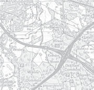
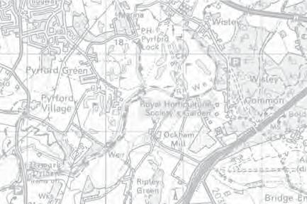
14 21. POTENTIAL MAJOR EXPANSION OF THOSE VILLAGES WITHIN GUILDFORD BOROUGH RANKED HIGHEST IN GBC S SETTLEMENT HIERARCHY 21.1 This section reviews the potential major expansion of villages within Guildford Borough ranked highest in sustainability terms within the GBCs Settlement Hierarchy (Appendix XII). The villages that have been assessed for potential major expansion therefore include: Chilworth East Horsley Fairlands Normandy and Flexford Pirbright Ripley Send Send Marsh and Burntcommon Shalford Wood Street Village 21.2 Volumes II and III of the Study sought to identity the locations of Potential Development Areas (PDAs) adjoining the urban areas of Guildford, Ash and Tongham and for the villages across the borough that are not located within the Surrey Hills Area of Outstanding Natural Beauty (AONB). As a further requirement of Volume V, GBC have requested that further consideration be given to the potential major expansion of villages that were ranked highest within GBCs Settlement Hierarchy defined as a semi-urban village (Category 2) or a large village (Category 3) If Potential Major Development Areas (PMDAs) are found this would then enable an alternative or additional option in addressing the Council s future growth requirements within the borough. The introduction of major expansions and entirely new settlements alongside existing villages and towns has contributed greatly to accommodate the growth of the Country during the last Century and beyond. Such an approach has received renewed impetus and interest following the inclusion of paragraph 52 within the NPPF which reads as follows: The supply of new homes can sometimes be best achieved by planning for large scale development, such as new settlements or extensions to existing GUILDFORD BOROUGH GREEN BELT AND COUNTRYSIDE STUDY 11
15 villages and towns that follow the principles of Garden Cities. Working with the support of their communities, local planning authorities should consider whether such opportunities provide the best way of achieving sustainable development. In doing so, they should consider whether it is appropriate to establish Green Belt around or adjoining any such new development The subsequent success of major expansions to existing villages or new settlements will depend upon many factors including the precise uses to be incorporated, the overall layout of such developments, and detailed settlement design. None of these matters require further consideration as part of this Study, and will be subject to specific design briefs to be prepared, and consulted on, in advance of any planning applications being submitted. It is, however, necessary for this Study to give consideration to the likely scale of any new village expansion, the population growth and land take requirements, environmental constraints, sustainability considerations and the overall effect of the village expansion on the purposes and openness of the Green Belt. Such an approach will help ensure the requirements of paragraph 52 of the NPPF are achieved In order to identify approximate land take or coverage areas necessary to enable a sustainable development for such a major village expansion or new settlement, consideration will need to be given to the potential for population growth, the number and density of dwellings to be introduced, the type and scale of facilities serving the existing and potential community, and the amount of open space to be provided. In order to give guidance on such matters and to provide further background on the topic, a number of relevant settlement guidance documents are considered below. Published Guidance on Settlement Expansion 21.6 This section considers the following guidance with regards to the identification of Potential Major Developments Areas (PMDAs) within the surroundings of villages and new settlements: Best Practice in Urban Extensions and New Settlements TCPA, 2007 PPS: Eco Towns a supplement to PPS1 The Rural Challenge The Rural Coalition, 2010 Urban Design Compendium (2) English Partnerships, Housing Corporation GUILDFORD BOROUGH GREEN BELT AND COUNTRYSIDE STUDY 12
16 Creating Garden Cities and Suburbs Today TCPA, Whilst only one of these guidance documents was published following the release of the NPPF in March 2012, they are all considered to give careful consideration to the requirements of sustainable development, and justify consideration in preparing the methodology for the identification of major village expansions and new settlements across Guildford Borough. Best Practice in Urban Extensions and New Settlements TCPA, While setting out the historical background to such forms of development, the guidance refers to previously used definitions of any new settlement that is a freestanding settlement, promoted by private and/or public sector interest, where the completed new development of whatever size constitutes 50% or more of the total size of the settlement, measured in terms of population/dwellings When commenting on the lessons learnt with regards to the provision of new settlements, the following factors are considered to be important: The need to provide the widest selection of housing tenures; The vital importance of ensuring that there is ample open ground; The essential requirement to incorporate communal buildings and facilities to match the scale of the settlement; and To ensure that transport serves rather than dictates the form of settlement, to allow organic growth which is sustainable and served by a variety of good quality public transport modes The guidance refers to a number of case studies, including one at Dickens Heath, Solihull which is considered relevant due to its mid-size village scale and Green Belt location. The case study referred to 1,672 dwellings being introduced to the village of Dickens Heath, which when completed will result in a population of approximately 4,000. The village expansion resulted in convenience shops, community facilities and a new primary school being introduced, with the study advising that these have been built The Dickens Heath case study concludes that a sense of community cohesion has been established, as borne out in the range of retail, restaurant and commercial uses GUILDFORD BOROUGH GREEN BELT AND COUNTRYSIDE STUDY 13
17 in the village centre. It highlights that there are issues to be resolved related to car parking and the inadequate provision of public transportation. Discussions with the Planning Officers at Solihull Council have confirmed that the expansion of the village is now almost complete and that the proposed range of community facilities are all in operation The Dickens Heath case study shows that securing public transport links will be a major factor in ensuring that such places involving a new or expanded smaller settlement that relies upon a larger neighbour for high level functions will be able to advance the cause of reduced carbon emissions The Dickens Heath case study also refers to the new settlements needing to be of a sufficient size to be regarded as a sustainable community. Reference is made to such a place needing to be large enough to support a secondary school, with the number of homes being at least 4,000. However, this does appear to conflict with the findings of the Dickens Heath case study, which provides a successful example of a new small scale settlement based on a resulting population of approximately 4,000. PPS: Eco Towns A Supplement to PPS The above document was prepared to assist Local Authorities in the preparation of Local Development Documents and in determining planning applications for eco town proposals. The standards set out within this statement were intended to ensure Eco Towns were examples of good practice, although the subsequent take up and approval of such projects was notably less than initially envisaged, possibly due to the standards required. Whilst not directly applicable to potential new settlements and expansions within Guildford Borough, some of the content is considered helpful for the identification of future allocations The PPS makes reference to the locations for Eco Towns needing to be able to provide for a minimum of 5,000 homes in order to exploit the objectives for Eco Towns. This included taking advantage of significant economies of scale and increases in land value to deliver new technology and infrastructure The PPS also refers to locations for Eco Towns offering capacity for public transport links and other sustainable access to higher order centres and for consideration to be given to the proximity to existing and planned employment opportunities. With regards to the latter, job creation in the Eco Town itself is supported, with the GUILDFORD BOROUGH GREEN BELT AND COUNTRYSIDE STUDY 14
18 suggestion that one employment opportunity should be easily reached by walking, cycling, and/or public transport, for each new dwelling introduced Housing is encouraged to be within a ten minute walk of a frequent public transport service and other neighbourhood services, whilst specific reference is made to there being a maximum walking distance of 800 metres to the nearest primary school. The Rural Challenge - The Rural Coalition, The above document covers many issues relating to rural communities. Whilst not focussing upon the issue of major village expansions, it does contain some comments of relevance Reference is made to the Eco Towns PPS, with the suggestion that this should be transformed into a code for development of sustainable communities, applicable to all types of growth and not just a handful of standalone new Eco Towns. Reference is made to a meaningful sustainable community featuring housing, community facilities, transport links, private gardens and community green spaces as well as spaces for local businesses The report advises that only if people in rural communities have ready access to local schools, local jobs, local shops and pubs and homes which are affordable will they and their children thrive, and will the nation meet its environmental and economic needs. Urban Design Compendium (2) - English Partnerships, Housing Corporation The above document refers to many elements of design and includes reference to mixed use areas, some of the content of which is helpful in assessing the likely necessary scale of development in order for it to offer such mixed use provision. Reference is made to efforts to re-vitalise the village centre at Tarporley in Cheshire, which had suffered a decline in the quality and number of amenities in the village during the 1980s and 90s. The success of revitalising the village centre through associated new developments across the village has helped sustain original facilities and attract new ones, making it one of the most desirable locations to live in Cheshire. The village has a population of just under 3, The Urban Design Compendium (2) includes a table on page 82 that sets out the thresholds for viability for a number of key facilities as shown below: GUILDFORD BOROUGH GREEN BELT AND COUNTRYSIDE STUDY 15
19 Uses & Facilities Education Nursery School Primary School (two-form entry) Health and Community Doctors Surgery Pharmacy Community Centre Retail Neighbourhood Centre Local Centre Pub Post Office Sport or Leisure Centre Illustrative Catchments (Population) 2,000 4,000 4,000 5,000 4,000 6,000 5,000 24,000 Indicative Site Area (ha) * (*Subsequent guidance on school development suggests a site of 2-3ha is likely to be required) The Urban Design Compendium (2) refers to the need for convenience shops and services to be within a five to ten minute walk (400 to 800 metres) of the population with the following key messages in terms of mixed use areas: The mix of uses is required to make successful places; The mix of uses will attract a mix of users to contribute to vitality and Buildings and streets must be adaptable When commenting upon density, the Urban Design Compendium (2) advises that higher densities can help create successful places by supporting local businesses, services and facilities and that higher density should not automatically mean building tall, because good design can enable high densities to be achieved through a range of building and layout types. Creating Garden Cities & Suburbs Today TCPA, 2012 GUILDFORD BOROUGH GREEN BELT AND COUNTRYSIDE STUDY 16
20 21.25 The purpose of this report is to highlight ways in which sustainable new communities can be delivered through Garden City principles. This followed reference to such principles in the NPPF published slightly earlier in The Garden City principles that might influence the location, scale and layout of a new settlement or expansion includes: A strong local jobs offer in the Garden City itself with a variety of employment opportunities within easy commuting distance of homes; Generous green space linked to the wider natural environment; Opportunities for residents to grow their own food; Access to strong local cultural, recreational and shopping facilities in walkable neighbourhoods; and Integrated and accessible transport systems The case for new Garden Cities, suburbs or villages is put forward in three parts: First, large scale new communities are an important part of the portfolio of solutions that will be essential in tackling today s acute housing shortage; Secondly, well planned communities provide an opportunity to provide high quality sustainable places, allowing the highest sustainability standards, economies of scale, and better use of infrastructure; and Thirdly, experience from the Garden Cities and New Towns shows that large scale new developments can be good for business and society When referring to the potential size of new settlements, reference is made to Ebenezer Howard s vision of Garden Cities accommodating around 30,000 people or 10 15,000 homes. It is however confirmed that Garden City principles can be applied to smaller developments, such as Garden Suburbs and model villages. The report advises that: Ultimately, in the context of localism it will be for local authorities, developers and communities to work together to decide on the most suitable location and the size needed to provide a sustainable community that creates jobs, meets local housing need, and finances and supports the necessary hard and soft infrastructure required to enable a community to thrive. GUILDFORD BOROUGH GREEN BELT AND COUNTRYSIDE STUDY 17
21 21.28 When commenting on the supporting infrastructure, the report refers to the local transport network being of particular importance. Reference is also made to at least 40% of a new community s total area being allocated green space, of which at least half should be public and should consist of a network of well-managed, high quality green open spaces linked to the wider countryside. Summary of Published Documents Whilst the documents referred to above have approached the issue of new and expanded settlements from slightly different directions, there are considered to be a number of relevant general findings that consideration should be given to within the Study. In order to represent a sustainable development, as required by the NPPF, large expansions to existing villages, or an entirely new village, should result in a settlement that benefits from: A mix of uses, including residential, employment, community and retail; A critical mass of population to support the above uses, likely to be at least 4,000; A significant proportion of open space (40%); and Connections to the wider public transport network. Methodology The methodology for testing the appropriateness of the major expansion of villages applies the following stages or sieving process based upon the NPPF sustainable development criteria identified above, alongside consideration of the impacts upon the purposes and openness of the Green Belt: Stage 1: Based upon the land take requirement, does the environmental capacity allow for a major expansion of the village that would enable a critical mass population of at least 4000 being achieved, which is considered to be required to achieve Garden City principles as referred to in the NPPF? Stage 2: If capacity is demonstrated in Stage 1, what are the existing and potential sustainability credentials and does the Potential Major Development Area (PMDA) achieve at least two of the three sustainable development considerations below? GUILDFORD BOROUGH GREEN BELT AND COUNTRYSIDE STUDY 18
22 Will the village expansion provide opportunities for good public transport connections to the wider settlements within Guildford Borough and beyond? Will the village expansion result in a village with a mix of uses, including residential, employment, community and retail? Will the village expansion provide the opportunity for new facilities within the particular settlement, thereby enhancing the existing sustainability credentials of the settlement? Stage 3: If capacity is demonstrated within Stages 1 and 2 does the Potential Major Development Area (PMDA) exhibit defensible boundaries that would allow for the insetting of the village expansion in accordance with the NPPF? What impact would development of the PMDA have upon the purposes and openness of the Green Belt across the borough? Stage 4: In summary, would it be appropriate to recommend a major expansion within the surroundings of the particular village given the guidance on large scale development and the Green Belt within the NPPF? This section of the Study does not explore the desire, likelihood or intention of the current landowners surrounding the villages to develop any of the identified PMDA sites identified within Guildford Borough. The Council will need to explore the availability of such sites prior to any recommended allocation being made for development Further details regarding Stages 1 to 4 of the major village expansion methodology are outlined below: Stage 1: Based upon the land take requirement, does the environmental capacity allow for a major expansion of the village that would enable a critical mass population of at least 4000 being achieved, which is considered to be required to achieve Garden City principles as referred to in the NPPF? The ability of a particular village to accommodate major expansion in terms of land take and environmental capacity is assessed within Stage 1. The current population of each village has been identified from the GBC Settlement Hierarchy within Appendix XII to determine the population target requirement of 4000 or the critical mass for sustainable development. GUILDFORD BOROUGH GREEN BELT AND COUNTRYSIDE STUDY 19
23 21.34 The village expansion land take is calculated within Stage 1 based upon the population growth and mixed use sustainable development requirements. As part of Stage 1 and assessing how much land is likely to be necessary to accommodate a sustainable community in the region of 4,000 population, the following assumptions have been made: Residential development should make up approximately 50% of the land take area of the identified PMDA. The residential land take would be calculated on the basis of 30 dwellings per hectare with an average household size of 2.4 people to determine the population growth at the village; Open space should make up approximately 40% of the land take area in accordance with new settlement guidelines. This can include Suitable Alternative Natural Greenspace (SANG) and public open space within the PMDA; and Village infrastructure such as roads and attenuation ponds together with other additional facilities including employment and a local centre with shops, food and drink outlets, primary school and nursery, would make up approximately 10% of the land take area depending on which facilities are applicable to the major expansion. If the village expansion does not include certain facilities due to scale, other uses such as housing may have increased capacity within the PMDA It is recognised that the exact breakdown of areas to be developed would evolve through the design process of the village expansion and may differ from those set out above. However, for the purposes of the Stage 1 assessment, the above land take percentages have been applied to the identified PMDAs Once the land take requirement has been calculated to bring the village population up to the critical mass of 4000 the village surroundings are reviewed in terms environmental capacity to accommodate the land take area. The environmental capacity analysis has been undertaken in accordance with the methodology outlined within Volume III paragraphs 10.4 to 10.7 for PDAs surrounding villages Those villages that are able to accommodate the calculated land take requirements within the environmental constraints present are identified as PMDAs and are further assessed within Stages 2 and 3 of the methodology. Those villages that are not able GUILDFORD BOROUGH GREEN BELT AND COUNTRYSIDE STUDY 20
24 to accommodate the identified land take area within the environmental constraints present are not further considered within Stages 2 and 3 and a major village expansion is not considered appropriate within the Stage 4 summary. Stage 2: Assessment of village expansion sustainability credentials If the village in question is sufficiently able to accommodate the land take requirements within the environmental constraints present within Stage 1, the identified PMDAs are further assessed with regards to the sustainable development criteria as identified within the new settlement guidance: - Will the village expansion provide opportunities for good public transport connections to the wider settlements within Guildford Borough and beyond? - Will the village expansion result in a village with a mix of uses, including residential, employment, community and retail? In addition, for the purposes of this exercise, it is considered relevant to assess how the sustainability credentials of the host village are likely to be affected by the PMDA. Whilst the above considerations will ensure that the new development is introduced in a manner that provides a sustainable environment for the new population, it is also considered relevant to take account of whether additional facilities and services will benefit the existing community. This relates to the requirement of the NPPF at paragraph 84, for the review of Green Belt boundaries to promote sustainable patterns of development. As a result the following consideration has been identified: - Will the village expansion provide the opportunity for new facilities within the particular settlement, thereby enhancing the existing sustainability credentials of the settlement? If the identified PMDA at a particular village supports at least two of the sustainable development criteria above, the PMDA is further considered with regards to impacts on the purposes and openness of the Green Belt within Stage 3. If the identified PMDA at a particular village supports one or none of the sustainable development criteria above, then the PMDA would not be considered within Stage 3 or be considered appropriate for a major village expansion within the Stage 4 summary As a comparative exercise, sustainability assessments for each of the identified PMDAs have been undertaken in relation to existing facilities in accordance with the methodology outlined within Volume III paragraphs 10.8 to However, due to the scale of village expansions being considered, it is reasonable to assume that new GUILDFORD BOROUGH GREEN BELT AND COUNTRYSIDE STUDY 21
25 facilities will be introduced alongside residential development, and as referred to above, this will be necessary in order to create a sustainable form of development Stage 2 of the methodology therefore also reviews the potential sustainability credentials of the identified PMDAs based upon assumed facilities that could be delivered as part of the residential development and the calculated population growth within the village. This will be influenced by both the scale of the proposed development and the existing facilities that already serve the community. The GBC Settlement Hierarchy (Appendix XII) has been used to inform what facilities are present within the villages. Stage 3: If capacity is demonstrated within Stages 1 and 2 does the Potential Major Development Area (PMDA) exhibit defensible boundaries that would allow for the insetting of the village expansion in accordance with the NPPF? What impact would development of the PMDA have upon the purposes and openness of the Green Belt across the borough? Stage 3 assesses the potential impact of the identified PMDA on the purposes and openness of the Green Belt and whether the PMDA exhibits defensible boundaries that would allow for Green Belt insetting, if recommended as a major village expansion. Stage 3 would only be progressed if a PMDA could be identified in terms of the land take requirement and environmental constraints within Stage 1, and at least two of the sustainability considerations within Stage 2 are achieved by the PMDA in question Stage 3 includes a more detailed consideration of the purposes and openness of the Green Belt as set out within the NPPF. With regards to the Green Belt purposes, it is acknowledged that the major expansion of any village would likely result in the encroachment of development into the countryside (Purpose 3) and would not encourage the recycling of urban land (Purpose 5). Due to the scale of the existing villages assessed in this section, they have all been classed as large built up areas within the Green Belt purposes assessment and as a result major expansion of all of them would represent sprawl when assessed against Purpose 1. Therefore, only two of the five Green Belt purposes, as set out within paragraph 80 of the NPPF, have the potential to score differently between all the identified PMDAs surrounding villages. These are: To prevent neighbouring towns merging into one another (Purpose 2); and GUILDFORD BOROUGH GREEN BELT AND COUNTRYSIDE STUDY 22
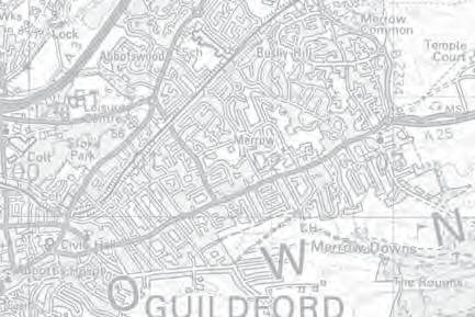
26 To preserve the setting and special character of historic towns (Purpose 4) The boundaries of the PMDAs are defined in accordance with NPPF paragraph 85 that states that local planning authorities should, define boundaries clearly, using physical features that are readily recognisable and likely to be permanent. The locations of defensible boundaries commonly influence the degree of openness within the surroundings of villages across the Green Belt. Following the identification of defensible boundaries within Stage 3 an assessment on the effects on the openness of the Green Belt has been undertaken for the PMDAs. If impacts on the purposes and openness of the Green Belt are likely to result from the major village expansion, further commentary is provided in Stage 3 on potential mitigation measures to reduce the identified Green Belt impacts. Stage 4: In summary, would it be appropriate to recommend a major expansion within the surroundings of the particular village given the guidance on large scale development and the Green Belt in the NPPF? Stage 4 of the methodology provides a summary on whether the village can appropriately accommodate a PMDA and whether the sustainability credentials justify the impact upon the Green Belt across the borough. The summary for each village within Stage 4 reviews the balance between the potential harm to the purposes and openness of the Green Belt, with the sustainability credentials that could be brought forward through the PMDA and the population expansion at the village in question If the sustainability credentials of the PMDA are considered to outweigh the potential harm to the openness and purposes of the Green Belt considering potential mitigation measures, the PMDA is recommended as a major village expansion within the Study. Alternatively, if the harm to the purposes and openness of the Green Belt is considered to outweigh the sustainability credentials, then the identified PMDA is not recommended for inclusion as a major village expansion within the Study. The findings for the potential major expansion of villages are provided on the following schedules for: Chilworth - 1,852 population and 4 th in sustainability ranking within Figure 2 of GBCs Settlement Hierarchy; East Horsley - 3,785 population and 3 rd in sustainability ranking; Fairlands - 1,412 population and 6 th in sustainability ranking; Normandy and Flexford - 1,784 population and 10 th in sustainability ranking; GUILDFORD BOROUGH GREEN BELT AND COUNTRYSIDE STUDY 23
GUILDFORD BOROUGH GREEN BELT AND COUNTRYSIDE STUDY
 GUILDFORD BOROUGH GREEN BELT AND COUNTRYSIDE STUDY Volume II - Addendum On behalf of Guildford Borough Council PPG Ref : BNL.0287 April 2014 COPYRIGHT The conents of this document must not be copied or
Babergh and Mid Suffolk Joint Draft Local Plan Consultation, August 2017, Public Consultation
 Babergh and Mid Suffolk Joint Draft Local Plan Consultation, August 2017, Public Consultation Having reviewed the documents, the Society has made the following response: Housing Delivery Q 7. Do you agree
Parish of Repton NEIGHBOURHOOD DEVELOPMENT PLAN
 Parish of Repton NEIGHBOURHOOD DEVELOPMENT PLAN BASIC CONDITIONS STATEMENT December 2018 CEF 4 Legal Requirements This statement has been produced by the NDP Working Group on behalf of Repton Parish Council
Neighbourhood Plan Representation
 Date: 10 th November 2017 Neighbourhood Plan Representation Land to the east of Callow Hill Road, Alvechurch Introduction This representation has been prepared by RPS Planning and Development on behalf
About 10% of the Borough's population lives in the seven rural parishes. Population figures from the 1991 census are given below:-
 8. THE DISTRICT VILLAGES 8.1 Population About 10% of the Borough's population lives in the seven rural parishes. Population figures from the 1991 census are given below:- Village No. of Persons Cottingham
Newcourt Masterplan. November Exeter Local Development Framework
 Newcourt Masterplan November 2010 Exeter Local Development Framework Background The Exeter Core Strategy Proposed Submission sets out the vision, objectives and strategy for the development of Exeter up
To secure a Green Belt around Cambridge whose boundaries are clearly defined and which will endure for the plan period and beyond.
 4. GREEN BELT OBJECTIVES GB/a GB/b GB/c GB/d To secure a Green Belt around Cambridge whose boundaries are clearly defined and which will endure for the plan period and beyond. To maintain the purposes
DUNSFOLD NEIGHBOURHOOD PLAN Site Selection Policies
 DUNSFOLD NEIGHBOURHOOD PLAN Site Selection Policies The criteria for assessing sites for future housing and business development in Dunsfold are set out below. (Development criteria, covering what it is
Neighbourhood Planning Local Green Spaces
 Neighbourhood Planning Local Green Spaces Introduction... 2 1. Why green space is important... 4 2. Neighbourhood plans and green space... 6 3. Evidence... 8 Statutory designations... 9 Green space audit...
Planning and Regulatory Committee 20 May Applicant Local Councillor Purpose of Report
 Planning and Regulatory Committee 20 May 2014 7. APPLICATION FOR PLANNING PERMISSION FOR THE CARRYING-OUT OF DEVELOPMENT PURSUANT TO PLANNING PERMISSION REFERENCE NUMBER 603451 DATED 28 FEBRUARY 2007 WITHOUT
Site Assessment Technical Document Appendix A: Glossary
 Central Bedfordshire Council www.centralbedfordshire.gov.uk Site Assessment Technical Document Appendix A: Glossary July 2017 1.1.11-1 - ii Appendix A: Glossary Term Agricultural Land Classification AONB
Oxford Green Belt Study. Summary of Final Report Prepared by LUC October 2015
 Oxford Green Belt Study Summary of Final Report Prepared by LUC October 2015 Project Title: Oxford Green Belt Study Client: Oxfordshire County Council Version Date Version Details Prepared by Checked by
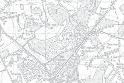
Effingham Neighbourhood Plan 1. Basic Conditions Statement
 Effingham Neighbourhood Plan 1 Basic Conditions Statement Effingham Neighbourhood Plan 2016: Basic Conditions Statement 2 Contents This statement has been prepared by Effingham Parish Council to accompany
Cookham Parish Council s Response to The Draft Local Borough Plan
 Cookham Parish Council s Response to The Draft Local Borough Plan As Agreed at the Planning Committee Meeting on 10 th January 2017. Designation of Poundfield as a Local Green Space The Parish Council
ROCHFORD LOCAL DEVELOPMENT FRAMEWORK: Sustainability Appraisal/ Strategic Environmental Assessment. Rochford Core Strategy Preferred Options Document
 ROCHFORD LOCAL DEVELOPMENT FRAMEWORK: Sustainability Appraisal/ Strategic Environmental Assessment Non Technical Summary Rochford Core Strategy Preferred Options Document October 2008 SUSTAINABILITY APPRAISAL
2014/0590 Reg Date 26/06/2014 Chobham
 2014/0590 Reg Date 26/06/2014 Chobham LOCATION: PROPOSAL: TYPE: APPLICANT: OFFICER: ASCOT PARK POLO CLUB, WESTCROFT PARK FARM, WINDLESHAM ROAD, CHOBHAM, WOKING, GU24 8SN Erection of a two storey detached
Sustainability Statement. Whitby Business Park Area Action Plan
 Sustainability Statement Whitby Business Park Area Action Plan November 2014 Contents Page 1. Introduction 1 2. Scoping 3 3. Sustainability Appraisal of Options 6 4. Assessment of Draft Area Action Plan
Derry City and Strabane District Council Planning Committee Report
 Derry City and Strabane District Council Planning Committee Report COMMITTEE DATE: 23 rd March 2016 APPLICATION No: APPLICATION TYPE: PROPOSAL: LOCATION: APPLICANT: LA11/2015/0395/F Residential Development
Perth and Kinross Council Development Management Committee 20 February 2013 Report of Handling by Development Quality Manager
 Perth and Kinross Council Development Management Committee 20 February 2013 Report of Handling by Development Quality Manager 4(4)(iii) 13/81 Erection of sports hall, associated changing facilities, offices
Guildford Borough. Flood Risk Sequential and Exception Test. May 2016
 Guildford Borough Flood Risk Sequential and Exception Test May 2016 Contents Relevant documents 3 Introduction 3 Background 3 What is the Sequential Test? 4 Stages of the Sequential Test 6 How should the
Everton s Neighbourhood Plan. Site Allocation - Assessment Criteria
 Everton s Neighbourhood Plan Site llocation - ssessment Criteria Introduction 1.1 This report assesses all the sites identified through the emerging Neighbourhood Plan for Everton and their potential for
LEEDS SITE ALLOCATIONS PLAN MATTER 3 GREEN BELT KCS DEVELOPMENT AUGUST 2017
 LEEDS SITE ALLOCATIONS PLAN MATTER 3 GREEN BELT KCS DEVELOPMENT AUGUST 2017 Smith Limited Suite 9C Joseph s Well Hanover Walk Leeds LS3 1AB T: 0113 2431919 F: 0113 2422198 E: planning@peacockandsmith.co.uk
19 th October FAO Paul Lewis Planning Policy Branch Planning Division Welsh Assembly Government Cathays Park Cardiff CF10 3 NQ
 19 th October 2009 FAO Paul Lewis Planning Policy Branch Planning Division Welsh Assembly Government Cathays Park Cardiff CF10 3 NQ Dear Sir / Madam Technical Advice Note 6 Planning for Sustainable Rural
STATEMENT OF OBJECTION TO THE PROPOSED DEVELOPMENT OF LAND AT CHURCH CLIFF DRIVE FILEY
 STATEMENT OF OBJECTION TO THE PROPOSED DEVELOPMENT OF LAND AT CHURCH CLIFF DRIVE FILEY You will be aware that Scarborough borough council have adopted a new local plan that includes land at Church Cliff
Suffolk Coastal Local Plan Review Issues and Options, August 2017, Public Consultation
 Suffolk Coastal Local Plan Review Issues and Options, August 2017, Public Consultation Having reviewed the issues and options documents, the Society has made the following response: Part 1 - Strategic
Schedule of Planning Applications Committee Date: 23 May Reference: 06/17/0726/F Parish: Hemsby Officer: Mr J Beck Expiry Date:
 Schedule of Planning Applications Committee Date: 23 May 2018 Reference: 06/17/0726/F Parish: Hemsby Officer: Mr J Beck Expiry Date: 22-05-2018 Applicant: Proposal: Site: Mr Gillett Change of use to the
OKEFORD FITZPAINE NEIGHBOURHOOD PLAN
 OKEFORD FITZPAINE NEIGHBOURHOOD PLAN Dear Parishioner, The Neighbourhood Plan Project Team have prepared this leaflet to summarise the full Neighbourhood Plan document. It provides a summary of the Vision,
Planning Position Statement Dunsfold Park. Dunsfold Airport Ltd
 Planning Position Statement Dunsfold Park Dunsfold Airport Ltd Quality Assurance Site name: Client name: Dunsfold Park Dunsfold Airport Ltd Type of report: Planning Position Statement Prepared by: Tim
3. Neighbourhood Plans and Strategic Environmental Assessment
 1. Introduction This report sets out a draft Screening Determination for the Preston Parish Council s Neighbourhood Plan and has been prepared by rth Hertfordshire District Council. The purpose of the
Introduction. Grounds of Objection
 Planning application ref. number 18/04496/APP Planning application to Aylesbury Vale District Council for the erection of 17 dwellings and associated works to the South of Hogshaw Road Granborough. Granborough
Development of land adjacent to Braggs Farm Lane and Rumbush Lane, Dickens Heath. Welcome. Today s exhibition. The proposal site
 Welcome Welcome to this event to discuss the development of land adjacent to Braggs Farm Lane. is currently in the preliminary stages of designing proposals to sensitively develop this site with high-quality
WINCHESTER TOWN 3.1 LOCATION, CHARACTERISTICS & SETTING
 WINCHESTER TOWN 3.1 LOCATION, CHARACTERISTICS & SETTING 3.1.1 The area referred to by the City Council, as Winchester Town, consists of the Winchester Wards plus the adjoining built up areas of Badger
Settlement Boundaries Methodology North Northumberland Coast Neighbourhood Plan (August 2016)
") Introduction This background paper sets out a methodology for the definition of settlement boundaries in the North Northumberland Coast Neighbourhood Plan. The neighbourhood plan is planning positively
Introduction This background paper sets out a methodology for the definition of settlement boundaries in the North Northumberland Coast Neighbourhood Plan. The neighbourhood plan is planning positively
The Corporation of the Town of Milton
 Report To: From: Council Barbara Koopmans, Commissioner, Planning and Development Date: May 7, 2018 Report No: Subject: Making it Possible Positioning the Town s Strategy for Growth and Economic Development
Ward: West Wittering. Proposal Change of use from public highway pavement to residential garden use.
 Parish: West Wittering Ward: West Wittering WW/17/03295/FUL Proposal Change of use from public highway pavement to residential garden use. Site Izora 1 Watersedge Gardens West Wittering PO20 8RA Map Ref
A VISION FOR BLAIRGOWRIE
 Welcome to the Westpark Partnership and Lidl UK GmbH Community Presentation. The purpose of this presentation is for you to view and comment upon the revised and updated proposals for the allocated development
APP/G1630/W/15/
 Appeal Decision Site visit made on 20 October 2015 by William Fieldhouse BA (Hons) MA MRTPI an Inspector appointed by the Secretary of State for Communities and Local Government Decision date: 20 November
Vigo Neighbourhood Plan Basic Conditions Statement
 Vigo Neighbourhood Plan Basic Conditions Statement Plan Period: 2016 to 2028 Status: Submission Version Qualifying Body: Vigo Parish Council Glossary of Some Terms & Abbreviations Used in this Document
an Inspector appointed by the Secretary of State for Communities and Local Government
 Appeal Decision Site visit made on 6 November 2017 by Rachel Walmsley BSc MSc MA MRTPI an Inspector appointed by the Secretary of State for Communities and Local Government Decision date: 19 th January
SOUTH EAST LINCOLNSHIRE LOCAL PLAN: HOUSING PAPER DONINGTON (JUNE 2016)
") SOUTH EAST LINCOLNSHIRE LOCAL PLAN: HOUSING PAPER DONINGTON (JUNE 2016) 1 DONINGTON S PLACE IN THE SPATIAL STRATEGY 1.1 Policy 2 of the South East Lincolnshire Local Plan 2011-2036 Draft for Public Consultation
SOUTH EAST LINCOLNSHIRE LOCAL PLAN: HOUSING PAPER DONINGTON (JUNE 2016) 1 DONINGTON S PLACE IN THE SPATIAL STRATEGY 1.1 Policy 2 of the South East Lincolnshire Local Plan 2011-2036 Draft for Public Consultation
Plumpton Neighbourhood Development Plan Revised Pre Submission Document - Regulation 14 Consultation
 REPRESENTATIONS... Plumpton Parish Council Plumpton Neighbourhood Development Plan Revised Pre Submission Document - Regulation 14 Consultation Representations submitted on behalf of: Cala Homes (South
Development in the Green Belt
 Supplementary Planning Document: Development in the Green Belt Consultation Draft February 2013 Local Development Framework How to comment This document was published on 21st March 2013 and comments should
DEVELOPMENT MANAGEMENT REPORT
 ITEM A08-1 DEVELOPMENT MANAGEMENT REPORT TO: BY: DATE: DEVELOPMENT: SITE: WARD: APPLICATION: APPLICANT: Development Management Committee Development Manager Proposed live/work unit in connection with existing
EFDC Draft Local Plan Consultation Theydon Bois Guidance Notes Extended Version
 EFDC Draft Local Plan Consultation Theydon Bois Guidance Notes Extended Version There are nine questions you can respond to in the consultation if you wish. Epping Forest District Council (EFDC) has a
INTRODUCTION NORTH HEYBRIDGE GARDEN SUBURB
 INTRODUCTION This event is being hosted by the promoters of the proposed North Heybridge Garden Suburb who are working with Maldon District Council and other key stakeholders on the preparation of a comprehensive
Ongar. Residential Sites. Vision for Ongar
 5.58 Located in the east of the district, is a District Centre of medieval origin that boasts a retail and service offer benefiting the local community and those in other settlements further afield. 5.59
EXTRACT FROM THE CUDDINGTON NEIGHBOURHOOD PLAN The Policies
 EXTRACT FROM THE CUDDINGTON NEIGHBOURHOOD PLAN The Policies Environment and Landscape Policy 1 - Landscape Setting Development should respect and wherever possible enhance the landscape setting of Cuddington
Variation No 1: Dundalk & Environs Development Plan Core Strategy
 Variation No 1: Dundalk & Environs Development Plan 2009-2015 Core Strategy Adopted on 29 th August 2011 CONTENTS Page Section 1 1.0 Synopsis 1 1.1 Background Document 1 1.2 Variation of Dundalk and Environs
LONGDEN VILLAGE DEVELOPMENT STATEMENT
 LONGDEN VILLAGE DEVELOPMENT STATEMENT 2017-2027 1 Longden Development Statement 2017-2027 15/01/18 1. Background 1.1 Longden Village Longden village is a very rural and traditional community first mentioned
DEMOLITION OF EXISTING BUNGALOW AND REPLACEMENT BUNGALOW. Ms Sukhi Dhadwar
 SITE PLAN ATTACHED 04. HIGH POINT BEGGAR HILL FRYERNING ESSEX CM4 0PN DEMOLITION OF EXISTING BUNGALOW AND REPLACEMENT BUNGALOW. APPLICATION NO: 15/00315/FUL WARD Ingatestone, Fryerning & Mountnessing 8/13
Stantonbury Neighbourhood Plan
 Stantonbury Neighbourhood Plan 2018-2031 Basic Conditions Statement October 2018 Intentionally blank 1.0 Basic Conditions Statement Introduction 1.1 This statement has been prepared by Stantonbury Parish
The targets do not adhere to the government projections or methodology, being aspirational rather than achievable.
 Question 1: Preferred Growth Option (see pages 7-9 of the consultation document) Do you agree with the preferred growth option for the Joint Local Plan? The targets do not adhere to the government projections
DEVELOPMENT MANAGEMENT REPORT
 ITEM A07-1 DEVELOPMENT MANAGEMENT REPORT TO: BY: Development Management Committee (South) Development Manager DATE: 21 June 2016 DEVELOPMENT: SITE: WARD: APPLICATION: APPLICANT: Outline application for
REFERENCE: B/03745/12 Received: 02 October 2012 Accepted: 05 October 2012 WARD(S): Totteridge Expiry: 30 November 2012.
: Totteridge Expiry: 30 November 2012.") LOCATION: 15A Pyecombe Corner, London, N12 7AJ REFERENCE: B/03745/12 Received: 02 October 2012 Accepted: 05 October 2012 WARD(S): Totteridge Expiry: 30 November 2012 Final Revisions: APPLICANT: PROPOSAL:
LOCATION: 15A Pyecombe Corner, London, N12 7AJ REFERENCE: B/03745/12 Received: 02 October 2012 Accepted: 05 October 2012 WARD(S): Totteridge Expiry: 30 November 2012 Final Revisions: APPLICANT: PROPOSAL:
Draft Hailey Neighbourhood Plan
 Persimmon Homes (Wessex) Draft Hailey Neighbourhood Plan Representations to West Oxfordshire District Council s Regulation 16 Consultation December 2018 2 Copyright 2018 Persimmon Homes Ltd. All rights
Northern Territory Compact Urban Growth Policy
 Northern Territory Compact Urban Growth Policy A Reference Policy Document to clause 2.7 (Reference to Policy) of the NT Planning Scheme May 2015 Table of Contents 1 Policy Setting... 3 1.1 Context for
Development in the setting of the Cotswolds AONB
 COTSWOLDS CONSERVATION BOARD POSITION STATEMENT Development in the setting of the Cotswolds AONB.1. Introduction Areas of Outstanding Natural Beauty (AONBs) are designated by the Government for the purpose
Case Officer: Sarah Kay File No: CHE/14/00515/REM Tel. No: (01246) Plot No: 2/6132 Ctte Date: 15 th September 2014 ITEM 1
 Plot No: 2/6132 Ctte Date: 15 th September 2014 ITEM 1") Case Officer: Sarah Kay File No: CHE/14/00515/REM Tel. No: (01246) 345786 Plot No: 2/6132 Ctte Date: 15 th September 2014 ITEM 1 APPROVAL OF RESERVED MATTERS FROM APPLICATION CHE/12/00234/OUT (1) LAYOUT,
Case Officer: Sarah Kay File No: CHE/14/00515/REM Tel. No: (01246) 345786 Plot No: 2/6132 Ctte Date: 15 th September 2014 ITEM 1 APPROVAL OF RESERVED MATTERS FROM APPLICATION CHE/12/00234/OUT (1) LAYOUT,
Rebuttal to Proof of Evidence from Dr Chris Miele (VSH Nominee) By Chris Surfleet - Cultural Heritage
 By Chris Surfleet - Cultural Heritage") CEN/R1.2/OBJ11/CUL Rebuttal to Proof of Evidence from Dr Chris Miele (VSH Nominee) By Chris Surfleet - Cultural Heritage CEN/R1.2/OBJ11/CUL REBUTTAL PROOF OF EVIDENCE CHRIS SURFLEET CULTURAL HERITAGE TRANSPORT
CEN/R1.2/OBJ11/CUL Rebuttal to Proof of Evidence from Dr Chris Miele (VSH Nominee) By Chris Surfleet - Cultural Heritage CEN/R1.2/OBJ11/CUL REBUTTAL PROOF OF EVIDENCE CHRIS SURFLEET CULTURAL HERITAGE TRANSPORT
46 Burley Street, Leeds, LS3 1LB Retail Statement
 , LS3 1LB Retail Statement , LS3 1LB Retail Statement October 2014 Indigo Planning Indigo Planning Limited Toronto Square Leeds LS1 2HJ Tel: 0113 380 0270 Fax: 0113 380 0271 info@indigoplanning.com indigoplanning.com
INCREMENTAL CHANGE AREA REVIEW March 2015 Page 1
 INCREMENTAL CHANGE AREA REVIEW March 2015 Page 1 Table of Contents Introduction... 3 Background to Review... 3 Comparison of the Schedules to the General Residential Zone... 7 Methodology... 7 Policy Context...
Public Consultation. Land at Monks Farm, North Grove. Welcome
 Welcome Welcome to our public exhibition for development on Land at Monks Farm, orth Grove. Gallagher Estates and Gleeson Strategic Land are preparing an outline planning application for new homes, open
WILMCOTE NEIGHBOURHOOD PLAN
 WILMCOTE NEIGHBOURHOOD PLAN 1. Introduction. 1.1 David Holmes Planning Ltd has been instructed to advise Wilmcote Parish Council, who wish to prepare a Neighbourhood Plan. In particular we are asked to
WELCOME GYPSY LANE. Wider Site Location plan. Proposals for the development of LAND OFF FOXLYDIATE LANE WEBHEATH. Proposals for the development of
 WELCOME The developers are preparing an outline planning application for a residential led development and need the community s views in order to develop the proposals further WHAT IS PROPOSED? A high
3/29 Rhu Marina Reporter David Russell. Body or person(s) submitting a representation raising the issue (including reference number):
 submitting a representation raising the issue (including reference number):") Development Plan Reference: 3/29 Rhu Marina Reporter David Russell The Council s submission to the Reporters starts on page 194 of the report. It is in four parts, 1. Summary of representations, 2. Modifications
Development Plan Reference: 3/29 Rhu Marina Reporter David Russell The Council s submission to the Reporters starts on page 194 of the report. It is in four parts, 1. Summary of representations, 2. Modifications
Kibworth Harcourt. Introduction. Introduction
 Introduction Introduction Welcome to this public exhibition on the proposals for the delivery of new homes on land at The Kibworths. The purpose of today s exhibition is to give you the opportunity to
11/04/2016. NPPF Paragraph 128. NPPF Paragraph 128. NPPF Paragraph 128. NPPF Paragraph 128. NPPF Paragraph 128
 Good practice in the preparation and understanding of NPPF-compliant heritage assessments/statements Stephen Bond, Heritage Places 1 NPPF Paragraphs 133-135 133: Where a proposed development will lead
Land at Fiddington Hill Nursery, Market Lavington
 Land at Fiddington Hill Nursery, Market Lavington Briefing Report for Market Lavington Parish Council Persimmon Homes (Wessex) April 2016 Background This brief report has been prepared following the Market
Great Easton Neighbourhood Plan Statement of Basic Conditions
 Great Easton Neighbourhood Plan 2017-2031 Statement of Basic Conditions OCTOBER 2016 GREAT EASTON PARISH COUNCIL Contents 1.0 Introduction....Page 2 2.0 Summary of Submission Documents and Supporting Evidence..
37 NAGS HEAD LANE BRENTWOOD ESSEX CM14 5NL
 SITE PLAN ATTACHED 37 NAGS HEAD LANE BRENTWOOD ESSEX CM14 5NL RAISE RIDGE, EXTEND HIPPED ROOF TO GABLE AND ADD SIDE DORMER WITH PART SINGLE PART TWO STOREY REAR EXTENSION INCORPORATING JULIETTE BALCONY
Examination of South Cambridgeshire Local Plan
 Matter SC6A - Policy SS/5 Waterbeach New Town Historic England( formerly English Heritage) 874 Rep Nos 59748, 60250, 60253 Examination of South Cambridgeshire Local Plan Historic England, Hearing Statement
Perth and Kinross Council Development Management Committee 24 April 2013 Report of Handling by Development Quality Manager
 Perth and Kinross Council Development Management Committee 24 April 2013 Report of Handling by Development Quality Manager Alterations,Carpenter House, Carpenter Street, Perth, PH1 5GB Ref. No: 13/00303/FLL
4 RESIDENTIAL ZONE. 4.1 Background
 4 RESIDENTIAL ZONE 4.1 Background The residential areas within the City are characterised by mainly lowrise dwellings sited on individual allotments. Past architectural styles, settlement patterns and
List of Policies. SESPlan. None applicable. Consolidated Scottish Borders Local Plan 2011: POLICY G1 - QUALITY STANDARDS FOR NEW DEVELOPMENT
 List of Policies Local Review Reference: 15/00021/RREF Planning Application Reference: 15/00616/FUL Development Proposal: Installation of 16no solar photovoltaic (PV) panels to roof Location: Raebank,
Briefing Document of CNP. June 2017
 Cholsey Parish Council Cholsey Neighbourhood Plan Briefing Document of CNP June 2017 Cholsey Neighbourhood Plan Page! 1 of! 8 Cholsey Plan Briefing v1.4 Page Left Intentionally Blank Cholsey Neighbourhood
WELCOME. Land North of STEVENAGE. We would like to thank you for attending our public exhibition today.
 WELCOME We would like to thank you for attending our public exhibition today. The purpose of this event is to share our proposals and hear your thoughts on our ideas. Members of the project team are on
2015/1020 Mr Edward Cockburn Caravan storage on hardcore base (Retrospective) Ranah Stones, Whams Road, Hazlehead, Sheffield, S36 4HT
 Ranah Stones, Whams Road, Hazlehead, Sheffield, S36 4HT") 2015/1020 Mr Edward Cockburn Caravan storage on hardcore base (Retrospective) Ranah Stones, Whams Road, Hazlehead, Sheffield, S36 4HT Dunford Parish Council have not commented Councillor Andrew Millner
2015/1020 Mr Edward Cockburn Caravan storage on hardcore base (Retrospective) Ranah Stones, Whams Road, Hazlehead, Sheffield, S36 4HT Dunford Parish Council have not commented Councillor Andrew Millner
WELCOME TO THE NEW WILTON PARK
 WELCOME TO THE NEW WILTON PARK VISION HISTORY OF WILTON PARK TOWARDS A PLANNING APPLICATION Our objective is to create a truly outstanding environment at Wilton Park. At the heart of our proposals is a
Final Revisions: Provision of single storey modular classroom and associated works.
 LOCATION: St Catherines Catholic Primary School, Vale Drive, Barnet, Herts, EN5 2ED REFERENCE: B/01924/12 Received: 17 May 2012 Accepted: 28 May 2012 WARD(S): Underhill Expiry: 23 July 2012 Final Revisions:
Former North Works, Lickey Road, Longbridge, Birmingham
 Committee Date: 14/11/2013 Application Number: 2013/06431/PA Accepted: 27/08/2013 Application Type: Full Planning Target Date: 26/11/2013 Ward: Longbridge Former North Works, Lickey Road, Longbridge, Birmingham
6 Growth Management Challenges and Opportunities
 6 Growth Management Challenges and Opportunities The Town has established a goal of attaining a 50% participation rate with respect to employment opportunities versus residential population. The Town s
Draft Eastern District Plan
 Draft Eastern District Plan Submission_id: 31238 Date of Lodgment: 13 Dec 2017 Origin of Submission: Online Organisation name: Turrulla Gardens Pty Ltd C/- Mecone Organisation type: Industry First name:
Statement of Community Involvement LAND OFF SOUTHDOWN ROAD HORNDEAN, HAMPSHIRE
 LAND OFF SOUTHDOWN ROAD HORNDEAN, HAMPSHIRE CONTENTS Page 1. Introduction 3 2. Pre-application Discussions 4 3. The Consultation Process 5 4. Consultation Feedback 7 5. Responses to Consultation Feedback
Longbridge Town Centre Phase 2 Planning Application
 Longbridge Town Centre Phase 2 Planning Application Non-Technical Summary of the Environmental Statement December 2013 Introduction A full application for Planning Permission has been submitted to Birmingham
9 Pershore. Introduction. Pershore Abbey
 118 Introduction 9.1 The historic town of Pershore lies on the River Avon and has a population of 7,000 (2009 Mid-Term Population Estimates). The main areas of the town are centred on the Abbey, the bustling
LAND USE AMENDMENT CORNERSTONE (WARD 3) 60 STREET NE AND COUNTRY HILLS BOULEVARD NE MAP 26NE BYLAW 22D2017
 60 STREET NE AND COUNTRY HILLS BOULEVARD NE MAP 26NE BYLAW 22D2017") Page 1 of 14 EXECUTIVE SUMMARY This Land Use Amendment application covers an area of 43.76 hectares ± (108.14 acres ±) located in northeast Calgary, bound by Country Hills Boulevard NE to the south and
Page 1 of 14 EXECUTIVE SUMMARY This Land Use Amendment application covers an area of 43.76 hectares ± (108.14 acres ±) located in northeast Calgary, bound by Country Hills Boulevard NE to the south and
Land at Rampton Road. Cottenham
 Land at Rampton Road Cottenham Introduction TEP is preparing an outline planning application for 54 dwellings on 6.9 hectares of land adjacent to Rampton Road, Cottenham on behalf of the owners Cambridgeshire
2014/0943 Reg Date 06/11/2014 Lightwater
 2014/0943 Reg Date 06/11/2014 Lightwater LOCATION: PROPOSAL: TYPE: APPLICANT: OFFICER: LAND REAR OF 4, 6 & 8 MACDONALD ROAD, LIGHTWATER, GU18 5TN Erection of 2 linked-detached two storey dwellings with
3(iv)(b) TCP/11/16(29)
(b) TCP/11/16(29)") 3(iv)(b) TCP/11/16(29) TCP/11/16(29) Planning Application 09/02229/AML Erection of a dwellinghouse, garage with upper floor accommodation and stables (Approval of Matters Specified by Conditions) at land
3(iv)(b) TCP/11/16(29) TCP/11/16(29) Planning Application 09/02229/AML Erection of a dwellinghouse, garage with upper floor accommodation and stables (Approval of Matters Specified by Conditions) at land
Neighbourhood Planning Guidance Local Green Spaces
 Neighbourhood Planning Guidance Local Green Spaces Introduction This guidance note has been produced for communities preparing neighbourhood plans in North Dorset to help them to identify, assess and designate
PLANNING DECISION NOTICE
 PLANNING DECISION NOTICE TOWN AND COUNTRY PLANNING ACT, 1990 Applicant WILLITON VILLAGE HALL STEERING COMM. C/O ALISON CALLOWWAY 54 NORTHCROFT WILLITON TAUNTON TA4 4RT Date Registered 11/08/2006 Application
Ipswich Issues and Options for the Ipswich Local Plan Review, August 2017, Public Consultation
 Ipswich Issues and Options for the Ipswich Local Plan Review, August 2017, Public Consultation Having reviewed the issues and options documents, the Society has made the following response: Part 1 Strategic
viii Figure ES1: Recommended changes to Green Belt boundaries in Waverley
 viii Figure ES1: Recommended changes to Green Belt boundaries in Waverley 50 3.4 Elstead (segments W5, W11, W18, W19) 3.4.1 Area of search 51 3.4.2 Assessment against Green Belt criteria Segment W5: land
Evesham 7. Reasoned Justification
 95 Reasoned Justification 7.1 Evesham is situated within the Vale of Evesham and has an estimated population of 22,800 (2009 Mid-Term Population Estimates). As a main town it provides a wide range of services
Planning Committee 04/02/2015 Schedule Item 6. Smith Farm Estate, Old Bridge Close, Northolt, UB5 6UA.
 Planning Committee 04/02/2015 Schedule Item 6 Ref: Address: Ward: Proposal: PP/2014/5145 Smith Farm Estate, Old Bridge Close, Northolt, UB5 6UA. Greenford Broadway Installation of sports pitch, reconstruction
REFERENCE: B/00601/12 Received: 11 February 2012 Accepted: 21 February 2012 WARD(S): High Barnet Expiry: 17 April 2012
: High Barnet Expiry: 17 April 2012") LOCATION: 37 Kings Road, Barnet, Herts, EN5 4EG REFERENCE: B/00601/12 Received: 11 February 2012 Accepted: 21 February 2012 WARD(S): High Barnet Expiry: 17 April 2012 Final Revisions: APPLICANT: PROPOSAL:
LOCATION: 37 Kings Road, Barnet, Herts, EN5 4EG REFERENCE: B/00601/12 Received: 11 February 2012 Accepted: 21 February 2012 WARD(S): High Barnet Expiry: 17 April 2012 Final Revisions: APPLICANT: PROPOSAL:
Neighbourhood Planning Site Assessment Pro-forma and Guide Version 2
 Neighbourhood Planning Site Assessment Pro-forma and Guide Version 2 September 2014 Site HNP 006 Land East of Stanbridge Road and North of Lower Road 1. Background information Site location and use Site
Carterton Construction Ltd is bringing forward plans for up to 85 new family homes and extra care facilities on land east of Burford.
 Welcome Carterton Construction Ltd is bringing forward plans for up to 85 new family homes and extra care facilities on land east of. We are at the early stages of designing our proposals and have a number
Welford-on-Avon. Neighbourhood Development Plan Welford-on-Avon Parish Council
 Welford-on-Avon Neighbourhood Development Plan 2011-2031 Welford-on-Avon Parish Council Parish Consultation: Summary Version December 2014 January 2015 Foreword This is the latest version of the Welford
DRAFT STRATEGIC ENVIRONMENTAL ASSESSMENT REPORT
 DRAFT STRATEGIC ENVIRONMENTAL ASSESSMENT REPORT Published by Limpsfield Parish Council in accordance with EU Directive 2001/42 on Strategic Environmental Assessment and with the Environmental Assessment