To ensure that city planning achieves its desired impact, the City Plan identifies four focus areas in the outer city. Skärholmen, which has an
|
|
|
- Agnes Barton
- 5 years ago
- Views:
Transcription

1 Stockholm City Plan

2 To ensure that city planning achieves its desired impact, the City Plan identifies four focus areas in the outer city. Skärholmen, which has an important regional function, is one focus area. More homes and jobs, partnered by other value-creation initiatives, will lead to positive development.

3 Foreword Stockholm is a fantastic city, which is why so many of us want to live here. In fact, Stockholm is expected to have 1.3 million inhabitants by Stockholm s growth is proof that it is an attractive city. But that growth comes with a shared responsibility towards all the people who live here and move here a responsibility that extends to future generations. Because although Stockholm is growing, we are not integrating and growing together as a city in all the ways that we should. Instead we are becoming more segregated and Stockholmers from different backgrounds are encountering each other less and less as they go about their lives. We have to work together to reverse this trend. With the growing city as its starting point, Stockholm s City Plan sets out the main direction for urban development over the next 25 years. Setting the course of the City s planning work allows city planning to play its part in creating a better city for everyone. How and where urban development is carried out plays a crucial role in creating a more cohesive and sustainable city. Homes for all is a central criterion. However, there are many other factors that will determine how well we succeed, such as the environment, gender equality, accessibility, health, safety and security. Good urban planning creates value in every part of the city. The new City Plan draws on the city s Vision 2040 a Stockholm for everyone. The vision means that wherever you live, you should be able to get to school or work using good public transport, enjoy access to high-quality squares, parks and green spaces, and have public and commercial services available locally. The City Plan s expansion strategy describes how the goals of urban development are to be achieved. With the everyday lives of Stockholmers and Stockholm s existing assets firmly in focus, the city will gradually be transformed, gaining new urban features. The City of Stockholm intends to facilitate and promote initiatives in partnership with market actors, while focusing on particular areas in order to fast-track desirable urban development. The direction set out in the City Plan is a combination of the successful urban development already in progress in larger areas, and a transformation of existing neighbourhoods, where the addition of new homes, jobs, schools, squares and parks are key elements. Stockholm must develop for the benefit of everyone who lives and works here which makes the City Plan one of Stockholm s most important strategic steering documents. Karin Wanngård Mayor of Stockholm Jan Valeskog Vice Mayor for City Planning, City of Stockholm


4 Foreword 3 Summary 6 1 Introduction 9 Starting points 10 What is a City Plan? 14 From global to local 16 2 Urban development objectives 19 A growing city 20 A cohesive city 22 Good public spaces 24 A climate-smart and resilient city 26 The Stockholm of the future the vision 28 3 Expansion strategy and implementation 31 Expansion strategy 32 Implementing the City Plan 38 4 Public interests 43 Housing provision 45 A socially cohesive city 50 Business and skills 57 Heritage environments in a growing city 62 Architecture and design 69 Transport and mobility 76 The green city on the water 87 Culture, sport and recreation 91 Climate, environment, health and safety 97 Utilities infrastructure Local development potential 111 Introduction 112 Rinkeby-Kista 114 Spånga-Tensta 118 Hässelby-Vällingby 120 Bromma 124 Östermalm 128 Norrmalm 132 Kungsholmen 136 Södermalm 140 Hägersten-Liljeholmen 144 Skärholmen 148 Älvsjö 152 Enskede-Årsta-Vantör 154 Farsta 158 Skarpnäck 162 Glossary 166 Stockholm development map Appendix Areas of national interest under the Environmental Code


5 Introduction The introduction describes the function of the City Plan and how it relates to other steering documents. It also describes the starting points that serve as a basis for the content of the plan in general. These underlying starting points include global challenges, soaring population growth, the climate challenge and socioeconomic differences between different parts of the city. City planning goals This section describes the four proposed city planning goals. The goals describe the urban environment and urban structure that Stockholm is seeking to achieve. The goals are clearly linked to the city s vision and sustainable development goals and are to act as support in all city planning and urban development. Expansion strategy and implementation A clear expansion strategy is needed to meet the city planning goals and the need for housing in the short and the long term. The four elements of the strategy are designed to steer urban development towards the city s vision a Stockholm for everyone. The implementation element describes the tools the city has at its disposal for realising the intentions of the City Plan. It also describes the important dialogue with citizens. Public interests The section on public interests describes a number of important practical issues affecting the continued development of the city. In a growing city like Stockholm, where city planning is complex, balancing different interests poses a major challenge. This chapter also contains planning directions. These are to serve as support in future planning. Local development opportunities Taking the city planning goals of the City Plan as its starting point, this chapter describes the development potential of each specific area of the city. These areas are grouped within the 14 administrative districts that make up the City of Stockholm. Public interests Introduction City planning goals Expansion strategy and implementation Local development opportunities
6 Stockholm City Plan Summary Stockholm is an attractive city. Surveys of Stockholm residents show that the people who live here are generally happy with their lives. In international terms, Stockholm comes high up the rankings on quality of life, innovative capacity and social trust. This attracts people wanting to live, study and work here, and the city is growing rapidly. By 2040, the City of Stockholm will have an estimated population of 1.3 million. Stockholm s attractiveness is positive for the city s development and role as an engine powering the whole of Sweden. However, it brings with it a number of important challenges, e.g. in building housing and adapting the transport infrastructure to keep pace. 140,000 homes need to be built by 2030 and it is likely that the rate of residential development will need to remain high even after that date. Stockholm s current transport infrastructure is feeling the strain, and pedestrian, cycle and public transport need attention. The cityscape is to be developed in a way that is socially sustainable, with good quality and architecture. Additionally, the city needs to focus on a number of other important challenges such as how we are to boost Stockholm s competitiveness, reduce the city s climate and environmental impact and tackle the demands made by a changing climate, while continuing the city s efforts for cleaner lakes and watercourses. Stockholm also needs to work for a gender equal city and reduce the social differences present in Stockholm today. The extensive city planning work that lies ahead gives Stockholm a unique opportunity to improve and develop. City planning is a powerful tool that can help to steer development in a direction that is sustainable. With intelligent and strategic planning, the whole of Stockholm will be able to benefit from the urban development generated by the construction of a large amount of new housing. Stockholm is to be a dense and cohesive city in which buildings and green spaces work together, enabling good living environments to be created. Assets that need to be added are more homes, jobs, attractive public spaces, good parks, accessible countryside, playgrounds, sport and culture and smooth-running services, with preschools and schools being a particular priority. City planning goals Stockholm is to be a city for everyone with dense and cohesive urban environments in which buildings and green spaces work together, enabling good living environments to be created. The Stockholm City Plan has four goals. A growing city Stockholm is to be a growing city, attracting people, companies and visitors from across the world. A rapid rate of urban development is to guarantee homes and public services for everyone. Good accessibility means giving people and companies everything they need to develop and grow. A cohesive city Stockholm is to be a cohesive city where moving between different areas and visiting new places comes naturally. People with different backgrounds must be able to encounter each other as they go about their daily lives and the city s many urban settings with all their different features must be accessible to all of the city s residents. Good public spaces Stockholm is to have many, diverse local areas with strong identities and flourishing district centres. Every part of the city must offer a good environment in which to live with good access to the benefits of urban living and well-designed, safe public spaces encouraging participation and engagement in local community life. A climate-smart and resilient city Stockholm is to be a climate-smart city in which efficient land use and a transport-efficient layout foster greater accessibility, a lower climate impact and limited consumption of resources. The structure of the city and its technical systems must be highly functional and resilient, enabling the city to cope with climate change and other stress factors. Expansion strategy and implementation The expansion strategy is to be a tool for planning and implementation, describing how the city is to prioritise its efforts to meet the need for housing in the short and the long term. The four elements of the strategy are designed to steer urban development towards the city s vision a Stockholm for everyone. 6

7 The four elements of the expansion strategy: The attractiveness of the heart of the city is to be used as a resource to benefit the whole of Stockholm. This means investing in creating high-density urban neighbourhoods in the areas surrounding the city centre and allowing the city s growth to ripple outwards over time. To ensure city planning has the impact desired, the City Plan identifies four focus areas: Kista-Järva, Skärholmen, Farsta and Hagsätra-Rågsved. The whole of Stockholm is growing, and the additional structure developed in every part of the city needs to add value while meeting the housing and sustainability goals. The city is to exploit long-term urban development potential to safeguard sustainable development. Less extensive development initiatives can have a major impact in improving attractiveness in the short term. These kinds of projects must be viewed holistically, so as not to impede more extensive city planning initiatives in the future. Impact analysis The report sets out the impact of the City Plan and documents the sustainability assessment that was carried out in parallel with drawing up the plan. The overarching aim is to integrate environmental and other sustainability aspects in the plan as far as possible. Areas of national interest under the Environmental Code The appendix sets out areas of national interest that are to be safeguarded under the Environmental Code and how the city intends to ensure that this is achieved. Areas of national interest are geographical areas that have been so designated because they contain nationally important assets or functions. How is the City Plan to be implemented? The section describes how implementation of the City Plan will lead to making the most of future opportunities and creating new assets in the city. Achieving this requires cooperation between physical planning, an active land use policy and the city s system of governance, with the sights set on sustainable development. The City Plan is used in setting priorities in Stockholm s annual budget, with an associated investment strategy. Public interests The section on public interests describes a number of important practical issues affecting the continued development of the city. In a growing city like Stockholm, where city planning is complex, balancing different interests poses a major challenge. This chapter also contains planning directions. Local development opportunities Taking the urban development goals of the City Plan as their starting point, this chapter describes the development potential of each specific area of the city. The areas are grouped within the 14 administrative city districts that make up the City of Stockholm. Facts According to the provisions of the Swedish Planning and Building Act, a City Plan is to provide guidance and support in making decisions on the use of land and water areas and how the built environment is to be developed and protected. The City Plan must be up to date to be able to provide guidance in subsequent planning and so reflect the political will of the municipality. During each mandate period, the City Council must therefore decide whether the City Plan is up to date or whether it needs to be revised. The City Plan is translated into detailed development plans and permits on land and water use, which are legally binding. 7

8

9 1 Introduction

10 Stockholm City Plan The attractiveness of the heart of the city is to be used as a resource to benefit the whole of Stockholm. Liljeholmen offers major potential for further urban development. Its excellent location will be improved by the construction of a new metro line between Fridhemsplan and Älvsjö. Starting points Challenges, new skills and trends In global terms, Stockholm is a small capital city that punches above its weight. In international rankings, Stockholm is among the top scorers on quality of life, safety and trust, as well as democracy, gender equality and innovation. Many people move to the region for precisely this reason. The Stockholm region is the engine powering the Swedish economy and Stockholm is its business, administrative and financial centre. It is home to areas that are important on an international scale. The city centre and the inner city host the financial sector and creative industries such as gaming, music and fashion. Kista boasts the ICT cluster at Kista Science City. The region has several high-ranking universities and higher education institutions. Global challenges Cities are becoming more important than ever. Rapid urbanisation means that 70 per cent of the world s population is expected to be living in cities by Stockholm is working to meet the UN s global development goal on sustainable cities and communities. Companies in Stockholm are increasingly competing with other cities for skills, capital and investment. Climate change and migration flows have direct and indirect consequences for development. Like other cities, Stockholm will therefore need to improve its capacity to swiftly adapt to new circumstances. Society needs to become more robust when it comes to the supply of many basic goods. Longterm spatial planning is an important instrument in Stockholm s work on civil contingencies planning and managing extraordinary events. This work is closely linked to planning transport, adapting to climate change and utilities infrastructure. Urbanisation will make infrastructure increasingly important in the cities. Soaring population growth The Stockholm-Mälaren region is currently one of the fastest-growing regions in Europe and by 2050 the population in the County of Stockholm is estimated to have increased by 1.2 million inhabitants, reaching 3.4 million. Over the past decade, the City of Stockholm has seen soaring population growth, with an increase on average of more than 15,000 inhabitants a year. The city s forecast is that Stockholm s population 10

11 Introduction The Stockholm-Mälaren Region is currently one of the fastest-growing regions in Europe will hit the million mark by 2020 and by 2040 there will be almost 1.3 million people living in the city. This population growth is largely due to a high birth rate. The second factor is a high degree of migration from abroad and other parts of Sweden. The average age of the people moving to Stockholm is low, and the city has a relatively young population. The rate of growth has tailed off somewhat in the past few years, mainly as a result of migration to other municipalities in the county. The increasing population means that homes are in high demand. Young people wanting to study in the city need somewhere to live. And so do people leaving home, moving in together and having a family, or relocating to the city for work. Business development is closely tied to whether employees are able to find housing. The City of Stockholm is the engine for development in the region, but this is dependent on more homes and jobs throughout the region as a whole. Accessibility in the region The transport system is to create high accessibility and good environments in which to live, taking up a limited amount of space and causing as low an environmental impact as possible. Ease of travel is extremely important to the region s population and businesses in terms of choosing where to live or where to base operations. Many people live within walking or cycling distance of work. Public transport means that another significant proportion of jobs in the region can be reached within an hour s commute. The proportion of the population using public transport in the morning rush hour is high and the proportion of journeys by bike is increasing over time. Creating the greatest possible ease of access between northern and southern Stockholm across the Saltsjö-Mälar water strait poses a major challenge for city and infrastructure planning. The region s inhabitants are increasingly crossing municipal boundaries, which is positive for growth. Changes in the central parts of the region ripple out to affect the transport system in an increasingly wide hinterland. Greater accessibility is crucial to the positive development of the city and its neighbouring municipalities. Nor should administrative boundaries even be noticed by people moving through the county. Joined-up planning is needed between the city and neighbouring municipalities to ensure that built-up areas and infrastructure work in tandem. Good links to the rest of the world are also important to Stockholm s attractiveness. Stockholm s Arlanda Airport is a hub with global and national flights. Stockholm is also a node in the national rail and road network. Stockholm s ports and quays are an important element in Stockholm s accessibility. Climate challenges in city planning Continuing global warming remains one of the greatest challenges we face. The City of Stockholm s target of being a fossil fuel free city by Many Stockholmers live within walking or cycling distance of work. 11
12 Stockholm City Plan Stockholm is one of the world s most connected cities. This helps to foster equality and create favourable social, environmental and economic development reflects the reduction in greenhouse gases required to keep global warming well below 2 C by This target was agreed at the United Nations Climate Change Conference in Paris in 2015, together with the aim of limiting global warming to 1.5 C. This ambitious target is a challenge for city planning. The structure of built-up areas and transport systems must facilitate low climate emissions. Sustainable energy use, eco-friendly transport and resource efficient eco-cycles need to be an inherent feature of all city planning. Planning for high-density, mixed-use development makes walking, cycling and public transport the obvious choices. In principle, this means that infrastructure covering the same land area as today must be able to transport more people and goods without quality suffering. Long-term strategies are also needed for a transition to different eco-cycle systems and more innovative solutions. Climate adaptation of the physical environment becomes increasingly important when precipitation and temperature conditions change, and more extreme weather events occur. At the same time, the question of how the city is to attain good water status in lakes and watercourses becomes even more important. Planning for land areas that can be used for several relevant purposes enables the city s climate adaptation, together with ongoing work to clean lakes and watercourses, to become an attractive and functional element in the urban environment. A warmer climate also increases the strain on health and the environment. The city needs to be built so that it can cope with higher temperatures without increasing the need for energy-intensive cooling systems. Digitalisation opens up opportunities Digitalisation is a central trend that is increasingly having an impact on social functions, business and people. The Digitalisation Commission has highlighted digitalisation as the single strongest change factor in society by the year The ability to be constantly connected affects both the design of urban environments and buildings and the efficiency of the transport system. E-commerce brings new consumption patterns that demand infrastructure and the ability to deliver goods to properties. Greater access to open data also helps to create new service functions and jobs. More than 90 per cent of Stockholmers are currently able to access the fibre network and Stockholm has 100 per cent 3G or 4G coverage. This means that Stockholm has already met Sweden s national broadband target, making Stockholm one of the worlds most connected cities. Continued development of information and communication technology improves opportunities to meet the city s sustainability targets. Achieving the target of being a fossil fuel free city by 2040 requires access to a well-developed fibre and 4G/5G network, as this is essential to a multitude of other digital tools that enable new eco-cycle, energy and traffic solutions. Clear social differences Stockholm has a mixed population in which nationality, education, occupational background and age vary. At the same time, there is both physical and socioeconomic segregation between different areas of the city, as described by the Commission for a Socially Sustainable Stockholm in a number of reports. The consequence of increasing residential segregation is that people with different backgrounds and different socioeconomic circumstances are tending to encounter each other less and less frequently as they go about their daily lives, which in turn reduces trust and mutual understanding. Perceptions of safety in public spaces differ between the sexes. Girls and women feel unsafe in particular locations more than boys and men do. In addition, access to attractive features of city living such as living close to work, good access to public transport, shopping, services, culture and well-designed public spaces and parks is unevenly spread across the city. The differences are particularly clear in terms of jobs in the region, which are increasingly concentrated in the city centre and districts to the north. We are becoming more aware of the part city planning can play in socially sustainable development. The major urban development that will be taking place in the years ahead opens up opportunities to reduce social gulfs and encourage encounters between people in the city. The City of Stockholm also has the ambition of increasing participation and dialogue in the city planning process. 12

13 Stockholm is one of the world s most connected cities. Today s society is characterised by mobility, in which information is accessible wherever we are, and where digital and physical are increasingly intertwined. Introduction Collaboration with communities, businesses and higher education institutions is fundamental to using city planning as a tool to counteract segregation. Greater citizen involvement and dialogue is needed to understand local needs and wishes when developing the urban landscape. The city is working with high-profile socially sustainable urban development projects in Focus Skärholmen, for example. The social goals are ambitious and new methods and forms of collaboration are being trialled. The knowledge gained, and the results of this work will be used to enrich the whole city. The different faces of Stockholm Stockholm has evolved gradually, deriving its unique identity from its location in an archipelago landscape. Dominant landscape features such as the high north-facing fault scarps of the Brunkebergåsen ridge, the fjards and the waterways are central to the city s development. Stockholm contains well-preserved areas dating from the thirteenth century onwards. The development of the city can clearly be read in its differing city development characteristics. Interweaving new development with the existing buildings is one of the most important and most difficult tasks of city planning. Planning for all functions of society Competition for land is a challenge in a growing city. High demand for homes can mean that other essential functions are not developed sufficiently rapidly. The City of Stockholm makes every effort to ensure that premises for private and public services, such as schools, preschools and sports facilities, are factored in early in the planning process. Many parts of the city need to speed up the construction of preschools and schools. Making school buildings more accessible to the general public and local organisations creates more meeting places and strengthens the role of the school in its local community. Regional cooperation is needed on effective solutions for large-scale technical facilities, such as waste management, recycling, energy plants and water and sewage works. However, small-scale, local solutions are needed too. The target of achieving a fossil fuel free city by 2040 means that structural changes in the urban environment may be needed to meet future needs for fossil free fuels and vehicle electricity. 13
14 Stockholm City Plan Current City Plan New City Plan What is a City Plan? According to the provisions of the Planning and Building Act, a City Plan is to provide guidance and support in making decisions on the use of land and water areas and how the built environment is to be developed and protected. When examining issues in line with this legislation, consideration is to be given to public and private interests. Chapter 2, section 1 of the Planning and Building Act The City Plan is to state the direction of the long-term development of the physical environment. The plan is to provide guidance on decisions as to how land and water areas are to be used and how the built environment is to be used, developed and preserved. Chapter 3, section 2 of the Planning and Building Act The provisions of the Environmental Code seek to encourage sustainable development, which means assuring current and future generations a healthy and good environment. Chapter 1, sections 1 7 of the Environmental Code The City Plan must be up to date to be able to provide guidance in subsequent planning and so reflect the political will of the municipality. During each mandate period, the City Council must decide whether the City Plan is up to date or whether it needs to be revised. The surrounding circumstances have changed considerably since the Stockholm City Plan titled The Walkable City was adopted by the City Council in March The City of Stockholm needs to tackle both a major increase in population and a number of challenges to attain environmentally and socially sustainable development. This was the reason why a new city planning process was launched. How a City Plan is used The City Plan takes a long-term perspective and aims to clearly set out how the physical development of the city will help to attain the vision of a Stockholm for everyone. According to the Planning and Building Act, a City Plan is to provide guidance on how the built environment is to be developed and protected. Chapters in Sweden s Environmental Code are also central to the application of the Planning and Building Act. A City Plan is not legally binding, but plays a central role in the city s development by virtue of its guideline function. Its focus is translated into detailed development plans and permits on land and water use, which are legally binding. The City Plan is extensive, covering both practical issues, known as public interests, and long-term objectives for the city s development. The City Plan sets out development opportunities and the assets that should be protected and developed. In many cases, areas may be designated for urban development far ahead into the future. This helps the city to steer projects taking place within a shorter time frame in the right direction. This City Plan sets out urban development opportunities for the next 25 years. Many of the strategic focuses included in earlier City Plans are still desirable but have not yet been realised. They have therefore also been included in this City Plan. The comprehensive plan for the Royal National City Park Stockholm section, adopted by the City Council on 20 April 2009 and Karolinska Norra Station, In-depth development of two city plans Stockholm section, adopted by the City Council on 29 September 2008 will continue to apply following the adoption of the new City Plan. The City Plan also sets out areas of national interest that are to be safeguarded under the Environmental Code and how the city intends to ensure that this is achieved, see appendix. The City Plan also has an important communicative role in that it clearly sets out the view of the City of Stockholm on future development. This makes it possible for Stockholmers, agencies and other stakeholders to gain a view on how the city might react to future proposals to change the urban environment and the effects this may have. The process The process of updating the City Plan complies with current legislation. As with other urban planning, the views of citizens and others were taken into account through consultation and a public exhibition phase. 14

15 15 Introduction
16 Stockholm City Plan From global to local Sustainable urban development According to the government, this refers to a process in constant flux in which social, economic and environmental sustainability is taken into consideration on the basis of local conditions. National Board of Housing, Building and Planning boverket.se Good built environment A national environmental objective that seeks to attain sustainable development in the built environment by ensuring that ecological, social and economic aspects are taken into account. National Board of Housing, Building and Planning boverket.se Fossil fuel free Stockholm 2040 The City of Stockholm has the goal of being fossil fuel free by 2040 with an interim target of a maximum of 2.3 tonnes of CO 2 e per capita by Questions regarding sustainable urban development are becoming increasingly relevant, both within Sweden and on the international stage. Stockholm works in line with the UN s global goal on sustainable cities and communities. The City Plan draws on the direction that the City of Stockholm has adopted in Vision 2040 a Stockholm for everyone. General goals and the direction of the City of Stockholm s operations overall, including its investment strategy, are laid down each year in the city s budget. As well as tying in with the city s vision, goals and steering documents, the City Plan also needs to relate to the plans and strategies at regional, national and global level. Global and national goals In 2015, the UN adopted Sustainable Development Goals (SDGs) and an Agenda for attaining economically, socially and environmentally sustainable development. In the run-up to 2030 the countries of the world are to move towards a sustainable, fair and equal future free from poverty or hunger. The goal on sustainable cities and communities means that towns and residential areas must be inclusive, safe, resilient and sustainable. At EU level, an urban agenda has been drawn up to attain sustainable urban development. A cohesive policy is to lay the groundwork for sustainable, innovative and economically strong development for the cities of Europe. The European Commission is particularly prioritising urban development issues during its programme period. In Sweden, the government appointed the Agenda 2030 Delegation to support the implementation of the SDGs. The SDGs are largely in line with the objectives previously laid down by the Riksdag, including public health objectives and the national environmental quality objectives. Sustainable urbanisation and sustainable cities will be in focus at national level in the years ahead. Sustainable regional development objectives The Regional Development Plan, RUFS 2010, provides objectives for the long-term development of the Stockholm region. The next plan, RUFS 2050, revolves around the vision that the Stockholm region is to be Europe s most attractive metropolitan region. The new plan will develop sustainability and physical infrastructure in the region. Buildings, infrastructure, utilities infrastructure, and green spaces are examples of central functions. The plan is to be available for decision-making during Vision 2040 a Stockholm for everyone Stockholm s vision was adopted in January 2017 and its aim is a Stockholm that is cohesive, climate-smart and economically and democratically sustainable. Bridging social disparities is a central theme. Achieving the vision will take active effort within the city, greater collaboration with actors in the region and deeper dialogue with the city s residents. 16
17 The city budget Every year, overall goals and the direction of the City of Stockholm s general operations, including its investment strategy, are laid down in the City of Stockholm s budget. As well as the City Plan, there are a number of different policies, strategies and programmes, firmly setting out the city s overarching vision and objectives in terms of practical action. All the city s committees and companies are charged with working in line with these. Environment Programme Stockholm s Environment Programme for regulates the city s work in important technical sectors, such as energy, transport, the eco-cycle and chemicals. The Environment Programme is to guide work on the growing city in a sustainable direction. The programme is linked to the city s integrated management system and has a number of objectives for attaining sustainable use of land and water, in line with the focus of the City Plan on reducing the city s environmental impact. Fossil fuel free Stockholm 2040 Stockholm s new climate strategy was adopted in 2016 with the aim of attaining a fossil fuel free city by Key starting points in this regard include smart technical solutions and lower demand for energy. For the people of Stockholm, this means reduced traffic emissions, increased collection of food waste and more energy-efficient homes. The amount of renewable electricity produced will increase and newly built homes will have to meet higher energy standards. This shift will require new opportunities to produce, store and distribute renewable energy in buildings and non-fossil fuels. The City Plan clarifies how this aim is to be achieved. Urban Mobility Strategy The city s Urban Mobility Strategy is largely about using the street space as effectively as possible. This means shifting focus from moving vehicles to moving people and goods. The strategy has a clear link to the City Plan in that it addresses how urban environments are experienced and used and the role of city planning in influencing the distribution of means of transport. The strategy is translated into action in individual plans and programmes, including the Bicycle Plan and the Road Safety Programme. Greener Stockholm Greener Stockholm was adopted in February 2017 and provides guidelines for planning, action and management of the city s parks and green spaces. The document comprises three overarching objectives and one strategic guideline on how green assets are to be safeguarded in the city s processes. These clearly set out the approach the city is to take in the long term on parks and green spaces and how the need for ecosystem services is to be met on the basis of planning directions and strategies in the City Plan and the Environment Programme. Action plan for good water status The action plan for good water status was adopted in It sets out how the city s work with water is to be developed with a clear focus on operational measures to achieve good ecological and chemical status. To achieve this, local action programmes are to be drawn up for all the bodies of water in the city, and form a basis for planning at area level. Other cross-sectoral steering documents Other important steering documents and documentation used in planning include Stockholm s e-strategy, stormwater strategy and the sports policy programme. The most relevant cross-sectoral steering documents are described as part of the chapter on public interests. The housing target 140,000 homes by ,000 homes by 2020 and 80,000 homes by Regional development objectives Proposals in RUFS 2050 An accessible region with a good living environment An open, gender equal, equitable and inclusive region A leading growth and knowledge region A resource efficient and resilient region without climate emissions Stockholm County Council. rufs.se Introduction 17

18 Stockholm is to be a cohesive city where moving between different areas and visiting new places comes naturally. Building in Bromsten began with detached homes in the early 20th century and density has increased over the years. Urban development is to improve links between Bromsten and Rinkeby.

19 2City planning goals

20 Stockholm City Plan Description of goal Stockholm is to be a growing city, attracting people, companies and visitors from across the world. A rapid rate of urban development is to guarantee homes and public services for everyone. Good accessibility is to give people and companies everything they need to develop and grow. City planning goal A growing city More and more people are moving to the cities of the world. Cities open up opportunities and enable people to be themselves. Cities bring together people with different backgrounds, interests and characteristics, they create relationships and exchange ideas. The urbanisation trend is particularly clear in Sweden and in Stockholm. Many people want to live in Stockholm and the city s clear ambition is for Stockholm to continue to grow and develop as an open, tolerant and welcoming city. Stockholm is to have room for more inhabitants and everyone who is born here, moves here to study or work, or comes as a new arrival to Sweden must have the opportunity of finding a home. A city where everyone can live Stockholm will need to have a major focus on building housing for many years to come. Today s lack of housing restricts the city s development and business growth. The housing shortage affects many people, particularly groups that are worse off, young people, students and new arrivals. Access to housing is crucial for business and education institutions. To attract the right skills, Stockholm needs to be able to offer housing in different price categories with different forms of tenure. The city has upped the pace of residential construction and is trialling new solutions, also for groups with a weaker status on the housing market. An attractive city Stockholm is one of the world s highest-ranking cities in terms of quality of life, gender equality, prosperity, democracy all important factors in competition for skills and capital in the global economy. In global terms, Stockholm is a small capital city that punches above its weight. Stockholm is especially appreciated for its attractive urban environments and proximity to parks, water and green spaces. The city is known to be one of the most beautiful capitals in the world, with the water, green spaces and buildings in harmony with the topography of the archipelago. Making the most of the attraction value of Stockholm s features and special characteristics is important in all city planning. City living on the rise with a wealth of variety In recent years, city life in Stockholm has seen a major upsurge with a growing number of restaurants, cafés and bars, entertainment, culture, sport, events and even more vibrant urban environments. Initiatives such as pop-up parks, street food, urban gardening and markets have seen Stockholm s streets gain new ingredients that create a richer, more flexible and more dynamic city. It is important to continue to develop the assets that energise Stockholm with new public spaces and by seizing on ideas that enrich the city. Flourishing businesses throughout the city Reducing today s regional imbalance with a large concentration of jobs in the inner city and to the north is an important goal. Equal development will take initiatives capable of attracting companies and institutions to set up where market conditions and good access are in 20

21 place in the south of Stockholm. There is great office space potential in urban development areas close to the inner city, such as Söderstaden, Liljeholmen, Älvsjö and Årstaberg. For city planning it is important to create mixed-use urban environments with attractive premises in good locations across the city. A smooth-running city For Stockholm to work, necessary public functions and services must be expanded in pace with population growth. Building new schools, preschools, hospitals, transport and communications, workplaces, parks, public spaces, sporting facilities, swimming pools, premises for services, culture and clubs and societies, as well as space for municipal utilities, are all essential elements of urban development. Sufficient land needs to be earmarked for all the elements that create a smooth-running city and good living environments on into the future. The growing number of children requires a particular focus on new schools and preschools. City planning goals An engine for Sweden and the region A flourishing business community in Stockholm is essential to the development of the region and the country as a whole. City planning is one of the city s important tools for continuing to create good conditions for business, not least for the knowledge-intensive sector. The most important urban features for localisation of office space are access to labour, transport, restaurants and services. High-density, mixeduse urban environments offer the features of city living that many companies are seeking. Stockholm city centre is nationally and globally relevant. The City area demonstrates a breadth that reflects the history and cultural diversity of the Swedish capital. High accessibility globally, nationally and locally High accessibility is crucial for Stockholm and the region s opportunities to grow and compete with other cities and regions. The city must meet increasing demand for travel and transport with infrastructure that is attractive, sustainable and resource and cost-efficient. The streetscape needs to be used effectively. The city is focusing on high-capacity modes of transport that make efficient use of the available space walking, cycling and public transport while the car will continue to play an important role for certain types of transport. Improved cost-efficient and attractive public transport between Stockholm and other towns is needed to increase accessibility in the region. Increased international accessibility is also important, with many direct connections to the rest of the world. The development of Arlanda Airport is therefore a top priority. It is important to expand the regional and national accessibility of the airport. Stockholm is to be a growing city, attracting people, companies and visitors. A rapid rate of urban development is to guarantee homes and public services for everyone. Söderstaden is to continue to be developed into a dense and multifunctional urban environment. Development along Årstastråket is important to link together Söderstaden with neighbouring districts. 21
22 Stockholm City Plan Description of goal Stockholm is to be a cohesive city where moving between different areas and visiting new places comes naturally. People with different backgrounds must be able to encounter each other as they go about their daily lives and the city s many urban settings with all their different features must be accessible to all of the city s residents. City planning goal A cohesive city A socially cohesive city requires that people from different local areas and with different backgrounds move in the same public space and see each other as they go about their day. These human encounters not only create a vibrant and interesting city. They are also important for a sense of belonging and understanding and counteract social exclusion. Stockholm has a structure in which many local areas are virtually sealed off, with weak connections to neighbouring areas. They may be surrounded by traffic barriers and unsafe areas at the rear of buildings, or have a topography that creates distance. One key task for city planning is to make structural changes that counteract the restrictions in the urban structure and pave the way for a more cohesive city. A network of urban spaces Construction and investment affect the way people move and who they encounter as they go about their daily lives. The street network needs to become more joined up if more encounters between people are to be created and flow-through between Stockholm s areas ensured. A cohesive network of urban spaces streets, corridors and places gives residents greater access to the city s wide diversity of environments and features. A more cohesive Stockholm will be a city that is richer in offering a greater range of experiences. The urban corridors of the future The street network is an important city planning resource in a growing Stockholm in which streets take up a large amount of land but are not always used effectively. Transforming oversized roads into urban corridors edged by new buildings with frequent crossing links, more services, businesses and a better urban environment would enable them to develop into lively city spaces that encourage neighbouring areas to grow and merge together. Prioritising walking, cycling and public transport, while continuing to ensure traffic flow for cars, will ensure that good capacity can be maintained. In the long term, it may be possible to develop several of the city s major traffic routes into corridors edged by new mixed-use development. The main roads will continue to perform an important task in terms of regional traffic, but in the longer term can be developed to become integrated parts of a coherent cityscape urban corridors. To achieve this, it is essential that the issue of hazardous goods is managed. This would enable the urban characteristics of the dense city and the boundary in terms of the urban living experience to be moved further outwards in the region, while making the most of major housing potential. This kind of development would require additional public transport and would require the city to work with other actors to find solutions to create healthy and safe urban environments. Public transport that brings the city together Public transport is an important tool in creating a more cohesive city. Where the lines run and 22

23 where stations and stops are located affects how people move through the city, which people will be sharing buses and which local areas are oriented towards the same destinations. Areas with poor public transport connections risk being isolated and finding themselves outside the connected city. When expanding the city s public transport network, it is essential to support patterns of movement that can have a positive impact on social sustainability. Today s radial public transport network needs to be filled in with efficient public transport links traversing the city, connecting the existing lines. It is important to put functioning transport chains in place between different modes of transport, with attractive interchange points. City planning goals A joined-up network of parks Much of Stockholm features a joined-up network of natural spaces, parks, green corridors and green walks in and between the different neighbourhoods of the city. The green pedestrian and cycle path network complements the city s streets and public spaces, offering an alternative landscape for moving through the city. This is an important recreational asset to develop further, as many Stockholmers appreciate daily contact with the countryside, and children being able to move freely and safely through their home neighbourhood. Developing well-maintained green links to popular functions along well-used walking routes can enable green spaces to make an even greater contribution towards the cohesive city. The park-like structure is a unique feature of Stockholm and a major asset to develop further in a denser and more cohesive city. With their long unbroken waterfront walks, Stockholm s popular shoreline and quays are particularly important, linking together different areas inside and outside the city boundary. Destinations in every area How people move through the city and the people they meet are affected by where different destinations are sited. Major destinations such as swimming pools, sports facilities, themed play areas or cultural institutions can encourage people to seek out new locations and gain access to new parts of the city. Many areas have places or events that are well known locally and could be a major attraction were they to be promoted and made more visible. These might be exciting playgrounds, beautiful squares, food markets, good restaurants or a regular festival. Everyday settings such as schools, playgrounds, shops, football pitches and allotments are important meeting places and if thought is put into their location, they can create new relationships in the city and strengthen bonds between different neighbourhoods. People with different backgrounds are to be able to encounter each other as they go about their daily lives and the city s many urban environments with all their different features are to be accessible to all. 23
24 Stockholm City Plan Description of goal Stockholm is to have many, diverse neighbourhoods with strong identities and flourishing local centres. Every part of the city must offer a good environment in which to live, with good access to the benefits of urban living and well-designed, safe public spaces encouraging participation and engagement in local community life. City planning goal Good public spaces Stockholm s wide diversity of local areas with different identities and characters is a major asset. As urban environments gain new buildings and are linked more closely together, the local areas, with their large and small local centres, will become more important as nodes in a denser and more cohesive urban landscape. By making the most of the differences between the different areas of the city and highlighting appreciated characteristics and cultural environments, city planning can help to create a more dynamic Stockholm with a wealth of attractive features. At the same time, local features can help to create a sense of belonging and continuity. Flourishing local centres The local centres of Stockholm s neighbourhoods are the natural focus of urban living at local level. It is important to exploit the opportunities offered by city planning to strengthen local centres with a population base, services and assets that bring them to life and see them flourish. With dynamic centres, with access to good everyday services, the local areas can serve as cornerstones of society with stronger social cohesion. Good access to urban assets Many areas will gain new housing, and at the same time will need the addition of other factors in order to offer a good environment for people to live in. It is important that all parts of Stockholm gain access to fundamental urban features such as services, culture, public transport, shops, jobs, venues for clubs and organisations, good public spaces and parks. More equal distribution of the city s assets combats segregation and reduces the risk of exclusion, which is positive for society in general. Mixed-use urban environments Many areas are currently dominated by housing and need to be developed with a greater mix of functions. Mixed-use urban environments with homes as well as workplaces mean people live close to the locations they need to use day to day, such as schools, shops, leisure activities and sports facilities. This increases accessibility and makes daily life easier. Proximity encourages an active lifestyle, with many people walking or cycling to destinations in their own neighbourhood, which is positive for the climate and for traffic flow, and an important source of health and wellbeing. A mix of functions also creates vibrant and safe environments with people moving around and encountering others virtually round the clock. This benefits the streetscape and local cohesion and creates a thriving climate for businesses. Varied housing stock A vibrant urban environment benefits from people with different backgrounds and lifestyles mixing as they go about their lives. A mix of 24

25 City planning goals housing types, apartment sizes and forms of tenure is an aim across the whole capital. This encourages integration and is important for creating a socially cohesive city. In parts of the city with monolithic housing stock, construction becomes an opportunity to add to the range of housing available, encourage greater local variation in types of household and provide greater opportunities to meet changing needs and for people to move up the housing ladder. Inviting public spaces One central task for city planning in the years ahead is to develop Stockholm s public spaces streets, squares, parks and corridors. Every local area is to have well-designed and well-maintained public spaces. Access to inviting and safe places that are accessible to everyone and which do not impose barriers due to age, sex or disability are fundamental in a democratic and equal society. This increases the richness of city living and affects the identity and the attractiveness of the city and its various local areas. All areas need to offer good environments for children and young people where they are afforded space for movement and games. Public spaces must be developed in a way that is sustainable in the long term so as to be used by increasing numbers of people who live and work in the city, and also from an operational perspective. Green assets Its countryside, parks and leafy shorelines are an important part of Stockholm s character and are appreciated by Stockholmers and visitors alike. Making use of the assets that the city s green spaces represent and developing parks and areas of countryside is an intrinsic part of city planning. As Stockholm s population grows, initiatives are needed to improve the city s green spaces, make them more accessible and add additional new parks. Green land will sometimes be built on, but the city s overall ambition is to improve people s access to Stockholm s green spaces. Public spaces must be developed in a way that is sustainable in the long term so as to be used by increasing numbers of people who live in, work in or visit the city. 25

26 Stockholm City Plan Description of goal Stockholm is to be a climate-smart city in which efficient land use and a transport-efficient layout foster greater accessibility, a lower climate impact and limited consumption of resources. The structure of the city and its technical systems must be highly functional and resilient, enabling the city to cope with climate change and other stress factors. City planning goal A climate-smart and resilient city Stockholm has ambitious targets to reduce climate impact. By 2040 the city is to be fossil fuel free, which means that the urban structure needs to be developed in a way that encourages sustainable travel and lower consumption of resources. The city needs to be adapted to change climate and our utilities infrastructure needs to be resilient and flexible. Effective land use To fulfil the city planning mandate, while also increasing accessibility, land has to be used effectively. Major urban development opportunities exist in land that is currently poorly developed, such as brownfield sites in former industrial and port areas, which are ripe for redevelopment, and over-dimensioned traffic areas in and between Stockholm s different local areas. In these locations, new buildings can help to bring the city together, improving local neighbourhoods, while making more efficient use of the infrastructure and transport resources that are already in place. A conscientious approach to different types of risk is important as the city becomes denser. A resilient and energy-efficient city In an age characterised by global climate change, urbanisation, soaring populations, exacerbated social tensions, the changing global order and economic differences, cities need to be resilient. This means that they need to be able to withstand change and stress factors without the built environment, transport systems or other important social functions collapsing. Safeguarding access to energy, clean water, food, digital systems, drainage and waste management is essential if the city is to function, and is vital to quality of life, health and the environment. The city s climate and environmental impact must reduce while the city has to be able to meet the demands a change in climate will pose. The built environment needs to be designed energy efficiently, on the assumption that the materials used have as low an environmental impact as possible. To enable a climate-smart, growing city, the buildings must be defined by sustainable energy solutions, smart environmental technology and a design tailored to future climate change. A flexible urban structure As far as the transport system is concerned, it is important that there is flexibility in the urban structure, with several parallel links in the street network. This provides alternative routes if any one section needs to be closed. Coordination between different modes of transport is also central, as is the urban structure being flexible over time, so that usage and design can shift as technology develops and needs change. If Stockholm s traffic system is to work effectively, total volumes of traffic must be reduced, particularly car traffic. 26

27 Robust infrastructure The large-scale utilities infrastructure that provides the city with heat, water, drainage, electricity, waste management and digital services has evolved over a long period of time. The systems are technically complex, and many functions depend on each other, which may constitute a risk should an unexpected event or disruption cause any one of them to fail. As utilities infrastructure is expanded, it also needs to be developed to ensure that it is sufficiently robust to cope with the challenges that heavy rainfall, rising sea levels or other disruptions may bring. City planning goals Climate-friendly urban environments Stockholm is expected to gain a warmer and wetter climate, as sea levels rise and the flow of lakes and watercourses changes. Climate change increases the strain on buildings, infrastructure and technical systems. More heatwaves also increase the risk of health problems, particularly among the older population. In city planning it is vital to build new neighbourhoods that are climate friendly and to adapt existing urban environments to cope with climate change. Climate impact must be mitigated as the city expands. The city needs to develop a network of green spaces and expanses of water that even out temperatures and increase flood resilience. Enabling the desired urban development also requires long-term regional development work on issues concerning catchment areas, rising sea levels and the long-term development of Lake Mälaren. Flourishing green infrastructure Green spaces and water are vitally important to the city s resilience and to the quality of life and health of local residents. With its huge diversity of species, Stockholm s green and blue environment contributes many important ecosystem services, such as cleaning stormwater. Locally, the fine-mesh network of small parks, areas of greenery and water, planting outside residential buildings, gardens, trees and planting on streets, and plants growing on walls and roofs are important for many ecosystem services. One starting point for city planning is to improve the green infrastructure and to build green solutions, such as ecosystem services, into new urban environments. In high-density areas, it is important to ensure that different functions are met within the same space. It is vital in city planning to build new areas that are climate friendly and to adapt existing urban environments to cope with climate change. The way stormwater is handled in Stockholm Royal Seaport is one example. 27


28 Stockholm City Plan Bromstensstaden Bromsten industrial area is being transformed into a dense and integrated mixed-use development. Once the redevelopment is complete, Bromstensstaden is expected to encompass approximately 1,600 apartments, parks, a preschool and buildings for community services. The Bällstaån river is to be widened and developed into a long park-like corridor. Illustration: White The Stockholm of the future images of the vision The Stockholm City Plan takes as its starting point the city s vision for a city that is cohesive, climate-smart and sustainable. A Stockholm where everyone feels welcome, a good place to live, study, work and run a business. A sample of illustrations from projects in the City of Stockholm show what the future might look like. Kista Äng Kista Äng is a new area being built close to Kista Science City, one of the world s foremost ICT clusters, with services and transport on the doorstep. Approximately 1,600 homes are planned here, with preschools and a school. The area will also be developed to include business premises, parks and a new square. Illustration: Landskapslaget The urban corridors of the future The street layout is an important city planning resource in the growing capital. Transforming major roads into urban corridors edged by new buildings with transverse links, services, and businesses will see these developed into lively city spaces that encourage neighbouring areas to grow and merge together. Illustration: White 28


29 Stockholm Royal Seaport Stockholm Royal Seaport is one of the city s designated environmental profile areas and one of the largest urban developments in Europe. Värtahamnen, which is part of Stockholm Royal Seaport, is being developed into an area with mixed functions, preserving the existing port operations. A total of over 12,000 homes and 35,000 new jobs are planned in Stockholm Royal Seaport. Illustration: AIX Arkitekter and Suteki Studios Slakthusområdet Slakthusområdet is being developed from a purely commercial area to a neighbourhood in which homes, jobs, retail, services and new parks and squares work together. Approximately 4,000 homes and 10,000 jobs are planned in the area. The picture shows a block in the future with a pocket park and a shared street. Illustration: David Wiberg City planning goals 29

30 The extensive building that Stockholm is set to experience creates opportunities to improve and develop the city. Mariehäll has been transformed from an industrial site to a housing development that includes Annedal, where 5,000 people will be able to live.

31 3Expansion strategy and implementation
32 Stockholm City Plan City planning is a powerful tool that can help to steer development in a sustainable direction Expansion strategy A clear expansion strategy is required in order to fulfil Stockholm s city planning goals and to meet housing demand in the short and long term. The strategy sets out where the city will target its investments and planning resources. It is rooted in the city s drive to crystallise the vision of a Stockholm for everyone, based on analy ses of local development opportunities and market conditions. Achieving this in the short and long term will require a balance between the four elements of the expansion strategy. To reach the target of 140,000 new homes by 2030, we need to build a dense and cohesive city, where the built environment and green structure interact and provide the conditions for good living environments. Expansion strategy as a tool for planning and implementation The construction boom that the City of Stockholm is set to experience creates a unique opportunity to improve and develop the whole city. City planning is a powerful tool that can help to steer development in a sustainable direction. Building and investment is needed if the city is to tackle population growth, reduce social disparities and achieve its climate objectives. Strategic planning can enable the whole of Stockholm to benefit from the urban development that is generated by extensive home building. The focus of city planning is on developing the particular qualities of the city and adding assets such as more housing, workplaces, attractive public spaces, high-quality places for social contact, good parks and playgrounds and good services, with a particular emphasis on preschool and school provision. City planning is to be developed from a socially sustainable perspective, with good architecture and equal access to urban assets. A starting point for all building is efficient land use. In many parts of Stockholm there is considerable potential on land that is currently poorly exploited. Land that was previously considered difficult to develop is now more valuable due to the pressing need for housing, and that creates huge potential for city planning. The expansion strategy is translated into a description of local development opportunities. The Stockholm City Plan s goals and overall expansion strategy provide guidance and support for future planning. A decision on commencement of detailed development planning is to be judged against the City Plan s four city planning goals and must meet the criteria in one of the four elements of the expansion strategy. 32

33 Expansion strategy and implementation Use the attractiveness of the inner city Concentrate investment on focus areas and connections Facilitate additions that create value Exploit long-term city development potential 33
34 Stockholm City Plan Use the attractiveness of the inner city The attractiveness of the inner city is a powerful resource that should be used to benefit the whole of Stockholm. Continue the focus on creating dense neighbourhoods in areas around the heart of the city to ensure a high rate of home building and create interesting environments for universities and businesses, along with new shared spaces where Stockholmers can encounter people from different parts of the city. Add new urban assets and strengthen the connections between the areas in and around the central parts. More extensive urban development offers chances to create more jobs, particularly in the southern suburbs. The high demand and central location provide good opportu- nities to continue allowing the city s growth to ripple out beyond the central core. Where in Stockholm? Most of the major urban development areas bordering the inner city are in various stages of planning. Most are judged to have high or very high city development potential. Areas where expansion is underway include Hammarby Sjöstad, Stockholm Royal Seaport, Liljeholmen and Hagastaden. Söderstaden, Årstafältet, Hammarbyhöjden-Björkhagen, Älvsjö and Alvik are examples of areas where planning is underway. Concentrate investment on focus areas and connections In order to bring viability to city planning, the City Plan highlights a number of focus areas in the outer city. These are whole districts, plus a number of corridors and connections that would create a more connected city. The city s investments and planning resources are concentrated in these locations in order to kick-start more extensive home building and urban development than would be possible under current market conditions. The market s stakeholders are thus given a long-term basis on which to make their contribution to the city s development. Home building should significantly boost the scope for cultural and sports facilities, jobs and enterprise, education and services. The investment in a small number of focus areas aims to provide opportunities to improve regional accessibility and strengthen these local areas as destinations in their own right. At the same time, there is plenty of scope to strengthen connections and improve the interaction be tween local areas within the focus area and those surrounding it. The focus areas and connections highlighted in this City Plan are an important step towards the vision of a city for everyone. The intention is to implement targeted investments in the new focus areas and on connections on an ongoing basis. Where in Stockholm? The proposed focus areas are Kista-Järva, Skärholmen, Farsta and Hagsätra-Rågsved. Around ten strategic connections associated with these areas also have priority. Proposed urban development in these areas will help to meet the four city planning goals in the City Plan. Kista-Järva Kista plays a vital regional role that is to be developed by strengthening connections with neighbouring areas and municipalities. The area is hugely important for innovation and commercial development through Kista Science City, while its high proportion of jobs makes it unique in the outer city. There is considerable housing potential that should be utilised and, alongside developing commerce and adding other assets, Kista s development could contribute to social sustainability throughout the local area of Kista-Järva. Skärholmen Skärholmen has an important regional function that should be developed, and this can be achieved by investments in new infrastructure. The Fokus Skärholmen project, which also includes Vårberg, Sätra and Bredäng, has clear ambitions regarding social sustainability. Together with other value-creating initiatives, more housing and workplaces will lead to positive development in Skärholmen. Connections within the district and with surrounding areas are to be strengthened. Farsta Farsta occupies a strategic location in the southern suburbs, with considerable city development potential and many assets that should be utilised and developed. This local area is important for the development of the southern suburbs, with the Stockholm Agreement from 2013 and investments in the metro facilitating extensive additional housing. It is important to create vibrant urban environments and to more clearly define and develop connections to surrounding areas and neighbouring municipalities. Hagsätra-Rågsved Hagsätra and Rågsved have considerable city development potential, not least as a result of the capacity increases that expansion of the metro will bring. The areas are to gain additional housing, businesses, services and culture while making the most of local assets. In the first instance, new buildings will be located close to public transport and commercial centres, on former car parks and along existing streets. Access to surrounding nature areas and districts needs to be improved. 34

35 The city is concentrating investment on a number of areas and connections in order to bring viability to city planning. The map shows the focus areas plus 10 strategic connections that have been given priority in the work to achieve a cohesive Stockholm. 10 places that bind Stockholm together Hagsätra-Älvsjö Bandhagen- Högdalen-Rågsved Tensta-Rinkeby- Spånga Kista-Husby-Akalla Fagersjö-Farsta Bredäng-Mälarhöjden Skärholmen-Vårberg Östberga-Årsta Hässelby Gård- Vinsta-Vällingby Älvsjö-Solberga- Telefonplan Expansion strategy and implementation Strategic connections that bind Stockholm together The Commission for a Socially Sustainable Stockholm stresses the City Plan s importance for a more cohesive city. Ten strategic connections have been identified and given priority in the work to achieve a cohesive Stockholm. It is important to strengthen these connections from a social sustainability perspective and they need to be readily deliverable. They are also significant for the implementation of the City Plan s intentions, expansion strategy and city planning goals. Developing these connections can improve access to urban assets, as well as boosting mobility and exchanges between the areas. The connections have been chosen based on their opportunities for development in terms of housing potential and other functions, their deliverability in the near future either in part or as a whole, and how they relate to the City Plan s expansion strategy and city planning goals. The strategic connections will be analysed in subsequent planning in order to obtain more detailed answers to the question of where interventions are needed and what those interventions should be. The question of development opportunities should determine where there are good conditions for active city life, commerce and sustainable transport, activities over different parts of the day and the opportunity to connect local areas. The strategic connections listed above are described in more detail in the chapter Local development opportunities. Facilitate additions that create value The whole of Stockholm is growing and every part of the city needs to be developed so that housing targets and sustainability objectives can be achieved. It is important that the city embraces good initiatives from market actors and facilitates infill projects that contribute towards the city s overall goals and create new value. These may be projects that add to the urban assets, such as new workplaces, schools and preschools, commercial and public services and well-designed public spaces. Where in Stockholm? The degree of potential for urban development varies across the city. Some areas have considerable city development potential and it may be desirable to embark on a major transformation in these cases, while other parts of the city offer more limited potential for various reasons and here certain additions that create value may be appropriate. Additions that create value, such as apartment blocks in residential areas with detached homes, are desirable in good locations for public transport and along central corridors with regard to cultural heritage. City planning initiatives need to be prioritised in the local areas that have poor access to basic urban assets and a socioeconomically weak population. 35

36 Stockholm City Plan Exploit long-term city development potential The city must make the most of any long-term city development potential in order to ensure sustainable development. There are a number of strategically important local areas, corridors and connections that will be developed at a later stage. Initiatives that contribute towards the city planning goals are to be promoted. Urban developments on a smaller scale can play a major role in improving attractiveness in the short term and generating interest in more extensive home building in the longer term. To make the most of any future potential, the individual projects must also be placed in a broader context, so that long-term objectives and extensive urban development initiatives are not rendered more difficult or impossible. Where in Stockholm? Areas adjacent to commercial and industrial areas are the kind of land that is particularly important to exploit in terms of its long-term city development potential. Other examples include areas near future infrastructure projects and urban corridors where there is the potential to transform over-wide streets in order to make local areas better connected. In the long term there is potential to create a new neighbourhood as part of the redevelopment of Bromma Airport. The City of Stockholm has contractually set aside the area for aviation purposes up until the year 2038, after which the area could be redeveloped into an urban area of mixed-use buildings. This is on condition that national and international accessibility is maintained. Access to Arlanda Airport also needs to be improved. Rinkeby has opportunities and a need for urban development. Through densification that adds new housing and work places, the centre of Rinkeby can be regenerated so that it provides a better location for services and fosters safety and security. 36
37 The city must make the most of any long-term city development potential in order to ensure sustainable development Opportunities for urban development The expansion strategy is translated into a description of the city s future development opportunities at both citywide and local level. This is outlined in the chapter Local development opportunities and is shown on the urban development maps. The urban development maps present the expansion strategy in the form of varying opportunities for redevelopment and additions to the city as set out below: Urban development areas transformation The City Plan identifies the areas that may be redeveloped for mixed use. Central areas that were formerly industrial sites and ports offer considerable urban development opportunities. Here the urban assets of the city centre emanate outwards in the form of neighbourhoods such as Hammarby Sjöstad, Stockholm Royal Seaport, Hagastaden, Söderstaden and Årstafältet. Älvsjö is an example of a local area that might be developed in the long term. Urban development areas addition The City Plan also identifies urban development areas where today s existing neighbourhoods can be made denser. These are areas where new housing, businesses, services, schools and sports facilities can be added, while also enriching the urban environment with better parks and new public spaces. Such urban development areas include Hammarbyhöjden-Björkhagen, Bagarmossen-Skarpnäck, Skärholmen, Rågsved-Högdalen, Kista, Tensta, Rinkeby and Husby. Areas where additional development may be considered Additional development opportunities also exist in the parts of the city not selected as urban development areas. This may involve improving the urban environment, adding new housing types, building a school or upgrading a local centre. There is also development potential in the city s low-rise suburbs, where density can be increased in locations close to public transport in particular, but also along central corridors. Stronger connections The urban planning map specifies a number of strategic connections that are of special significance for creating a more cohesive city. These are marked as pink arrows, but also include streets labelled as urban corridors. The urban development map indicates ecological corridors (green arrows) that need to be strengthened and also physical barriers that can be bridged with buildings or other interventions in order to strengthen the social connections between the different parts of the city (pink arrows). In the long term, major transport routes may also be developed to connect the city and reduce barriers. Around ten of the strategic connections have particular priority and are part of the expansion strategy. The opportunity to strengthen connections may also be more local, as shown on the urban development maps in the chapter Local development opportunities. New buildings, improved accessibility and good public environments in between the local areas can bring those areas closer to each other. Local streets with overcapacity can be developed with the addition of housing and workplaces. Expansion strategy and implementation 37

38 Stockholm City Plan Implementing the City Plan The successful implementation of the Stockholm City Plan will lead to advantage being taken of future opportunities and new value being created in the city. Achieving this requires cooperation between spatial planning, an active land use policy and the city s system of governance, with the sights set on sustainable development million people are forecast to be living in the County of Stockholm by The City Plan s role in the city s system of governance Alongside Vision 2040 a Stockholm for everyone, the City Plan forms the starting point for urban development in the City of Stockholm. They have both been adopted by the City Council and provide guidance for all the City of Stockholm s committees and municipal company boards. The complexity of city planning and the rapid pace of development require a committed holistic approach and bringing the parties involved into the planning process at an early stage. The City Plan is based on a perspective of long-term sustainability with a time horizon of It forms the basis for the priorities in the city s annual budget and its associated investment strategy. The aim of having a link between the annual budget and the City Plan s expansion strategy is to achieve a balance between what is desirable and what is possible in terms of urban development. The budget and investment strategy control the coordination of the city s investing committees, which can bring about synergies in the areas and locations that are highlighted in the City Plan as being of particular importance for investment. The City Plan is translated at area level and in detailed development planning The goals and expansion strategy of the City Plan are translated via the production of new detailed development plans. These two planning levels are regulated by the Planning and Building Act. The detailed development plans are placed into context at area level through what is known as area planning (voluntary planning level not regulated by law). The City Plan is translated at local level, while at the same time the knowledge contained in the area planning feeds back into the local development opportunities in the City Plan. Area planning identifies development opportunities in every part of the city, enabling the city to work proactively to take advantage of the local development potential. Based on the holistic view that area planning enables, the city is able to meet demand for housing, workplaces, preschools, schools, sports facilities, parks, culture, services and other The Stockholm Room in Kulturhuset shows the public a growing Stockholm using 3D maps, digital tours, talks and a large model on the floor showing existing and planned development. 38

39 functions. Area planning is expected to have an overarching concept regarding design and layout that will achieve urban environments and public spaces based on knowledge of that area s circumstances and identity. Area planning promotes broad collaboration within the city, so that different perspectives can be highlighted early on and the relevant committees and municipal company boards can coordinate their planning. Advanced working practices and tools for dealing with the children s perspective, social sustainability and gender equality are key elements of the area planning. Area planning thus creates an important foundation for urban development that adds social value. It is in area planning, for example, that the local needs as outlined in the City District Councils local development programmes can be accommodated. A decision on commencement of detailed development planning is to be judged against the City Plan s four city planning goals and must meet the criteria in one of the four elements of the expansion strategy. A City Plan with clear goals facilitates a greater capacity to work on general detailed development plans. This creates opportunities for greater flexibility at the detailed development plan stage and less micromanagement of design details, for example. General detailed development plans may be a suitable way of working when planning the urban development areas. Detailed development plans that precede land allocations may be another approach that could improve the efficiency of processes in certain projects. Active land-use policy for improved urban quality and reduced segregatio n Stockholm s substantial land holdings (around 70 per cent of the land in the municipality) provide good opportunities to implement the vision of a city for everyone. The city has had a new land allocation policy in place since 2015, aimed at increasing the pace of home building and ensuring that what is built is sustainable and delivers good quality at a reasonable cost. The City Plan outlines the city s preferences regarding land and water use, setting out the locations and specifying the goals that the city is working towards. Taking the City Plan as its starting point, the land-use policy can be used to bring basic urban assets to the areas that need them, increase the social mix in places with similar offerings and in all planning promote a more cohesive city. In areas with numerous property owners and where the city does not have major land holdings, there is a need to bring property owners together and create shared incentives and collaborative forms in order to drive development forward. Ongoing work on Fokus Skärholmen and Tyngdpunkt Farsta are examples of this to a certain extent. Expansion strategy and implementation 39

40 Stockholm City Plan Land allocation A land allocation is an option, within a particular timeframe and under certain conditions, to negotiate with the city on the terms for building new housing or carrying out some other development on a specific area of land owned by the city. The City of Stockholm s land allocation policy 2015 An active land-use policy and new working practices could stimulate a greater diversity of actors in the urban development projects and set out more clearly how the construction industry s actors can play their part in achieving sustainable development. Land allocations that apply quality criteria when choosing developers bring the highest possible quality to city planning. Localised city planning initiatives may be significant in improving the attractiveness of and generating interest in continued home building and long-term urban development. A key aspect of a more active land-use policy is therefore to more clearly choose land allocation processes based on what the city wishes to get from a particular location. The City Plan s city planning goals, expansion strategy, planning directions and local development opportunities provide a sound basis for an active land-use policy. Backed up by the City Plan and area planning, the new land allocation policy can be applied in a clearer manner, enabling city planning projects to create new value in a city for everyone. Viability depends on market conditions Stockholmers demand for housing and the market conditions for building are currently good in practically every part of the city. However, market conditions vary greatly between the different areas. The central areas are particularly attractive and so the conditions for a high rate of home building are also best here. In the case of investments further out from the centre, the industry and the city need to jointly ensure that new assets are added to promote positive development. Many of the areas in less central parts of Stockholm have considerable city development potential, particularly in the longer term. However, the pace of expansion cannot be as rapid. Since much of the urban development will take place in existing local areas, it is crucial to pursue those projects that are viable and can create added value. It is also important to build further in existing areas, while still taking advantage of the long-term development potential. Agreed public transport development and provisional home building Stockholm Agreement 2013 Metro Akalla-Barkarby Metro Kungsträdgården-Nacka/Southern suburbs Metro Odenplan-Hagastaden-Arenastaden Area for home building National Negotiation on Housing and Infrastructure 2017, city actions Stockholm Metro Fridhemsplan- Älvsjö Roslagsbanan extension to Stockholm City Area for home building New stations Metro line Tram/light rail line Rail line 40
41 A favourable market situation is to be used as a lever for urban development. To achieve a high rate of expansion, all the stakeholders involved need to secure the necessary resources. Concentrating on selected focus areas (Kista-Järva, Skärholmen, Farsta and Hagsätra-Rågsved), prioritised strategic connections and high-density development in locations close to public transport will help the city to invest and target resources. By showing the market the way, urban development can continue in the priority areas even during economic downturns. Expanded public transport a lever for home building Expanded public transport is a precondition for the construction of more housing in a way that keeps the transport system working and promotes sustainable transport. The infrastructure itself also creates the conditions for additional housing since proximity to rail-based transport is highly valued. As a result of the Stockholm Agreement 2013 and the National Negotiation on Housing and Infrastructure 2017, the City of Stockholm has committed to the construction of around 95,000 homes in total. This splits down into approximately 46,000 homes (Stockholm Agreement) by 2030 and 49,000 homes (National Negotiation on Housing and Infrastructure) by These homes will mainly be built in the southern suburbs, but also in the west and to a lesser extent in other parts of the city. The city s services a strategic issue as the city grows The expansion and upgrading of supply and production systems such as electricity, heating, water, wastewater, waste and digital networks is essential as the city grows. These essential systems are long-term in nature and require their own space, plus buffer zones in some cases. Securing the necessary supply and production systems requires good coordination between the responsible stakeholders. Longterm strategies are needed in this area to secure the city s transition to various eco-cycle systems, innovative and effective technical solutions and a climate-smart city. It is important not least because the utilities infrastructure may come to compete with other claims on the land but needs to be prioritised in order to secure the city s services. The handling of spoil from construction work is an issue that affects the perspectives of resource use, economics and climate. Initiatives for the recycling and coordination of sorted materials can strengthen the perspectives above. A growing city also poses logistical challenges. Roadworks, work on utilities and the transport of goods and waste put pressure on the traffic system, but they are nevertheless inevitable. The starting point should be that logistics and expansion of the utilities infrastructure should be as smart and resource-efficient as possible in order to facilitate the city s expansion and at the same time ensure good traffic flows in the transport system. Dialogue for better urban development In a growing and denser city, it is important to implement changes in dialogue with the public since the changes relate to places and environments where we have our homes and live our lives. Human rights, democracy and sustainability issues are priority issues for the City of Stockholm and participation is a key tool. The city s ambition is to improve the participation of the people of Stockholm in the urban development processes. This may be achieved through an expanded dialogue with the citizens at a local level and through well-developed forms of dialogue with children and young people, and with other groups that are under-represented in the urban development processes. Working more on early contact and dialogue can bring Stockholmers on board with the purpose of the city s plans, and advantage can be taken of new ideas and perspectives. Public participation is necessary in order to make use of knowledge about the local area, which in turn leads to better and more value-creating projects. It is desirable to explore new forms and digital tools for dialogue and debate, and feedback and evaluation following a completed dialogue are equally important. Good urban development requires collaboration A continuous collaboration with the government, region, public agencies and organisations is necessary in order to successfully realise the intentions of the City Plan. Regional collaboration is of the utmost importance for planning issues that are not limited to a single municipality, such as infrastructure, green structure and space for utilities infrastructure. Strong population and job growth requires good teamwork with the region and the county s municipalities, primarily the City of Stockholm s nearest neighbours. Links and connections at regional level must be created and strengthened where possible and necessary. A critical factor in this collaboration is the implementation of agreements on infrastructure between state and municipality. Partnership and collaboration on the development of cities also takes place at international and European level. The city is an active participant in several international forums, such as C40 and Eurocities, as a way of learning from others and sharing best practices. Stockholm s planning is also affected by the EU s environmental requirements, directives and regulations, and by the multilateral UN work towards sustainable cities encapsulated in the global Sustainable Development Goals and the New Urban Agenda. Find out more The consultation on the City Plan included a targeted dialogue initiative to canvass opinions from children and young people on future urban development. stockholm.se/oversiktsplan Expansion strategy and implementation 41

42

43 Public interests 4The City Plan provides guidance on the development of land and water areas within the limits of the City of Stockholm. The chapter on public interests provides data and guidelines for future planning. The City Plan sets out how the city takes into account public interests when deciding on the use of land and water areas. The public interests are listed in Chapter 2 of the Planning and Building Act. The act mentions economic growth, natural and cultural assets, good environmental conditions and good communications, amongst others. The Stockholm City Plan takes a number of factors into account, with Vision 2040 a Stockholm for everyone as its starting point. The City Plan addresses the public interests that the City of Stockholm considers most pressing. Under the requirement to report on the public interests, the city specifies which interests must be met, where they are located, how they are delimited and the weighing up of any conflicting interests. Weighing up different interests is one of the biggest challenges for a growing city such as Stockholm, where city planning is complex and often involves conflicts that have to be resolved. The municipal planning monopoly gives a municipality the exclusive right to decide on detailed development plans, although the government can, through the County Administrative Board, overrule the municipality s decision if the planning fails to meet certain national interests. According to the Swedish Environmental Code national interests are interests of national importance, in terms of their conservation or use, that municipalities must take into account in their planning. The national interests are listed in an appendix to the City Plan.

44 Stockholm City Plan The city s ambition is to create a denser urban environment by adding new housing in suitable locations across the whole of Stockholm. Skärholmen has been singled out as a focus area where at least 4,000 new homes are planned. 44
45 Housing provision One of the city s most important responsibilities is to create the conditions for all its residents to live in good housing. Housing is part of the city s essential infrastructure. A good system for housing provision is necessary for young adults to leave home, for new families to move to larger accommodation, for pensioners to move to smaller and cheaper accommodation, for new arrivals to settle in and for people with special needs to find suitable housing. A functioning labour market and economic development also depend on the provision of housing. Targets for building new homes The City of Stockholm is growing rapidly, with the population having increased by a fifth since the beginning of the millennium. Home building has gained momentum, but it has not been able to keep pace with demand from the rising population in either the City of Stockholm or the County of Stockholm. The consequences are a housing shortage, high housing costs, waiting lists for housing and overcrowding. Today, one in five Stockholmers live in cramped conditions. The shortage of housing disproportionately affects socioeconomically weak groups and young people. For these groups, a growing housing shortage often leads to insecure and unstable living conditions or overcrowding. The city s responsibility for housing provision leaves it with a major challenge, partly because of the lack of housing and partly because the city itself does not have control over all the factors that govern home building. One serious problem is the major discrepancies between different areas and households in terms of overcrowding and housing quality. Good economic growth and a rapidly rising population are throwing up difficult challenges for Stockholm. However, they also provide opportunities to develop the city in an even more positive direction. An extensive programme of home building is required in order to improve conditions and cope with the population increase, which is forecast to continue. The city s target is to enable the construction of 140,000 new homes between 2010 and Within this there are two interim targets: work will begin on 40,000 new homes between 2014 and 2020, and 80,000 new homes between 2014 and Housing provision is a pressing issue at national, regional and municipal level. According to Boverket s 2017 forecast of national demand, 600,000 new homes will be needed by 2025, of which a little over 320,000 will be needed by The proposal for RUFS 2050, the Regional Development Plan for the Stockholm region, states that at least 14,550 and up to 22,600 houses must be completed each year in the County of Stockholm up until 2030 and that the municipalities should be prepared for a higher scenario. Implementation The city s ambition is to create a higher-density urban environment by adding new housing in suitable locations across the whole of Stockholm. This requires a continued tight focus on more housing of varying sizes, types and forms of tenure. In the city s assessment, there is currently potential for home building in every part of the city, for both ownership and rental. Home building can be used to connect and integrate districts, bridge barriers, create socially mixed districts, improve public environments and strengthen attractive nature areas. It can also drive the development of public and commercial services. The general assessment is that the city is well placed to achieve the ambitious housing targets. There are currently around 120,000 homes at various stages in the city s planning process. There are also other projects that are not as far advanced. Guidelines for housing provision According to the Housing Supply Act, the municipality must plan so that the conditions are in place for all residents to live in good housing. The planning is to be incorporated into guidelines that are then adopted by the City Council. The guidelines are rooted in an analysis of demographic trends, demand for housing, the need for housing for specific groups and market conditions. The guidelines on provision of housing were adopted by the City Council in June Public interests 45
46 Stockholm City Plan Demographic trends The assessment of the need for housing is based in part on expected demographic changes. The County of Stockholm has a cohesive housing and labour market that is having to adapt to rapid population increases. The reason for the increases is the fact that the county has a relatively young population, a high excess of births over deaths and net inward migration. The County of Stockholm has around 2.3 million inhabitants, and in a base scenario the population is forecast to rise to 2.85 million by 2030 and around 3.34 million by The City of Stockholm has a current population of just over 900,000 and has seen the population grow by an average of over 15,000 inhabitants per year since The population is expected to continue to rise at the same rate. Forecasts indicate that Stockholm will hit the million mark by 2020 and by 2040 it will have close to 1.3 million inhabitants. The table below shows how the total population is predicted to rise by 157,000 in ten years, representing an increase of 17 per cent. The rise in young people (0 19 years) is strikingly high, which relates to the fact that the city already has a young population and so has a high birth rate. This is expected to mean that more families will need to move to larger accommodation when they have children. The growth rate in the category of young adults (aged 20 34) shows that considerably more than before will need a first home in order to be able to move away from their parents. This, coupled with the major increase in the absolute figure for the category of adults of working age (aged 35 64), is a key cause of the need for more housing over the next decade. Like the rest of the country, Stockholm is facing a steep rise in the number of older people. By the year 2040, almost 100,000 more Stockholmers will be aged 65 or above. Of these, over 35,000 more will be aged 80 or above. As Forecast population trend in the City of Stockholm broken down by age (rounded figures) Age Change Change in % , , ,000 21% , , ,000 10% , , ,000 16% , , ,000 26% All 924,000 1,081, ,000 17% Source: Statistical Yearbook of Stockholm 2016 Population changes 30,000 20,000 10, ,000-20,000-30, Population change Births over deaths Net migration The population of the City of Stockholm has changed over time. The rapid growth rate of the 1940s and 1950s subsequently slowed. The population fell from the late 1960s until the 1990s, before picking up again. Source: Statistical Yearbook of Stockholm
 is largely down to the fact that the large groups of the population who were born in the mid-twentieth century are now reaching old age.")
47 the need for elderly care increases, there will be 3,000 more people receiving elderly care by 2030 and almost 8,000 more by The relative rise in the numbers of older people (65 or above) is largely down to the fact that the large groups of the population who were born in the mid-twentieth century are now reaching old age. We are also living longer than we used to. This substantial rise in the number of older people creates increased demand for suitable housing. Property chains therefore have to work more smoothly, so that older people can easily move to smaller, cheaper and more accessible and appropriate housing, which then frees up housing for others. There are several explanations for the population increase in the City of Stockholm. The main cause is that the birth rate continues to exceed deaths by around 7,000 people. There is also net inward migration from other countries, at around 9,000 people, and from counties outside Stockholm, at around 4,000 people. On the other hand, the number of people moving out to other municipalities in the County of Stockholm has risen in recent years, with net outward migration in 2016 of around 8,000 people. Overall immigration from abroad has risen in recent years, while other factors affecting the population have remained relatively stable. People are flowing in and out of the city in high numbers, with around 69,000 people moving to Stockholm in 2016 and around 64,000 choosing to move out of the city. In addition, approximately 100,000 people move within the city each year. The people moving into the city are mainly aged Of those moving to Stockholm from abroad, around 55 per cent are from Europe. Of these, just over 15 per cent are Swedish citizens moving home again. Over the period , the number of households is set to rise steadily, from around 418,000 to almost 580,000. The average growth rate for household numbers is two per cent per year from , falling to one per cent in In absolute figures, that means between 7,000 new households per year in and just over 6,000 new households per year in Housing stock There are around 468,000 homes in Stockholm. Of these, approximately 402,000 are apartments in blocks, 44,000 are houses and 22,000 are specialist housing. Specialist housing means apartments for older people, disabled people, students and other specific groups. 59 per cent of the housing stock in apartment blocks is owner-occupied. 15 per cent is public housing rental apartments and 26 per cent is other rentals. The majority of the apartments are small with no more than two rooms and a kitchen. Distribution of apartments and houses by type of tenure Public rented housing 15% Other rentals 26% Owner-occupied 59% Specialist housing is not included in the table above. Source: Statistical Yearbook of Stockholm 2017 Public interests 47

48 Stockholm City Plan 88 % 88 per cent of Stockholmers feel that Stockholm offers a pleasant urban environment in which to live and work, according to the city s survey of its citizens in High and steady planning rate and new housing forms The city s goal to significantly increase housing production requires increased planning and needs the actors in the housing market to build the housing that is planned. Housing planning must be based on the long-term demand for housing and help to promote building at a high and steady level. Volatility and a lack of predictability in the construction market have proven to result in higher costs in the long term. Greater competition among the actors in the housing market is also important in bringing down construction costs. Several developers are working to improve the efficiency of the construction process. One example is the work of the municipal housing companies on the Stockholmshusen project. The blocks in this project are good quality and have a uniform and standardised design that reduces construction costs and cuts planning and production times. Another example is Snabba hus, which involves temporary solutions with time-limited planning permission that make housing available to young people aged more quickly than usual. New forms of housing might also include community self-builds, where a group of private individuals become developers. A steady and high expansion rate through economic cycles requires a broad product portfolio in terms of geography and forms of tenure. One major challenge is to build housing, particularly rental apartments, at a reasonable cost that enables more groups to enter the housing market. Home building for a cohesive city One important way to combat geographical segregation and achieve a socioeconomically more mixed city is to aim for more diversity of housing and tenure in every part of the city. The city is therefore working to introduce more of a mix to parts of the city with a monolithic offering of detached houses, terraces or apartment blocks with a particular form of tenure. This increases people s ability to remain in the area as their needs change or they climb the property ladder. Exploiting the existing housing stock effectively can combat inertia in the housing market. An increase in new production also contributes to this by stimulating property chains. Significantly more young adults are going to need a first home in order to move away from their parents in the future. At the same time, the population is ageing, plus there is a huge lack of housing for people with disabilities. Work to find land and suitable premises for homes for new arrivals continues through city coordination. A large proportion of the city s homeless people are judged to be capable of coping with their own apartment, with or without support, which can be interpreted as meaning that they are in a state of structural homelessness. This group s housing requirements needs to be met. The city s tools for housing provision Housing provision is about both new production and how the existing housing stock is managed, developed and brokered so that the city s residents and those who move to the city can access good housing. The city s duty to facilitate housing provision, in line with national 48
49 objectives and legislation, involves creating a sufficiently high level of home building, making it easier for citizens to access good housing in good environments, and planning housing for those groups for which the municipality has specific responsibility. The city s work to help the different groups for which it has specific responsibility young people and young adults, students, older people, disabled people, unaccompanied minors, homeless people and women in need of refuge accommodation is described in more detail in the city s housing provision guidelines. The city has considerable influence over housing provision through its major landholdings and its responsibility for spatial planning, and through three public housing companies, a company for care homes and a foundation that works on housing issues for vulnerable groups. In order to make it easier to obtain a home, the city has its own housing agency, Bostadsförmedlingen, which is open to everyone. It acts as a broker for youth and student apartments, priority apartments for those most in need, and other apartments that are available via a queueing system. The Elderly Care Committee is responsible for citywide planning of sheltered housing for the elderly. The Social Affairs Committee works with the City District Councils to plan the expansion of housing for people with disabilities and special needs. The Real Estate Committee contributes to the city s work on creating more housing for priority groups such as newly arrived immigrants, unaccompanied refugee children and so on. The housing stock and home building In 2016, Stockholm had 401,619 apartments, 44,429 houses and 22,370 specialist homes. Almost 59 per cent of all apartments and houses are owner-occupied. There has been a significant switch to owner-occupied tenure in both the private and municipal rental stock over the past 25 years. One and two room apartments make up over half of the housing stock. Planning directions Newbuild housing in Stockholm based on type and tenure 3,500 Ensure good planning readiness in order to allow a high and steady rate of home building. The planning of housing for people with special needs is to be secured in line the city s guidelines on provision of housing. The city is to be a driving force behind more efficient building of good quality homes. New methods are being trialled to promote the building of housing that more people are able to access. The city is to encourage diversity among the actors in the construction market in order to stimulate competition and so reduce production costs, create the conditions for reasonable housing costs and promote a varied urban environment. The city will work to provide a varied range of housing, forms of tenure and building types across Stockholm. Public interests 3,000 2,500 Rental properties * Owner-occupied Houses 2,000 1,500 1, In the 2000s, more owner-occupied properties than rental properties were built. The proportion of newbuild low-rise housing, one- or two-dwelling houses and semi-detached, terraced and link-detached houses (excluding holiday homes) remained at a steady level over the period There are current political goals to achieve an even split between the number of new owner-occupied and rental properties. * Rental includes category apartments such as student housing and housing for the elderly. Source: Statistical Yearbook of Stockholm
50 Stockholm City Plan A socially cohesive city Stockholm is to be a socially cohesive city with a vibrant, accessible and safe urban environment for people with different needs. Most Stockholmers state that they like their city and are happy where they live. However, the city is both spatially and socially divided and access to attractive urban assets varies. Socioeconomic segregation has grown in recent decades and there are major differences in perceptions of insecurity in the urban environment, depending on the local area, age and gender. Good everyday environment The built environment is based on and supports people s needs, facilitates experiences of beauty and pleasure, and offers a varied range of housing, workplaces, services, and culture. The government s clarification of the environmental objective A good built environment A Stockholm of Differences Read more at stockholm.se A socially sustainable Stockholm Spatial and socioeconomic segregation in Stockholm needs to be countered. There are major differences in living conditions and physical barriers or gulfs between districts that impede the city s cohesion. In its report A Stockholm of Differences, the Commission for a Socially Sustainable Stockholm highlights clear differences between districts with regard to socioeconomic conditions and access to urban assets. Proximity to workplaces, good access to public transport, shopping, public services and culture, and well-designed public spaces and parks are examples of the urban assets that people value having around them. City planning s current expansive phase can be used to create more equal access to these urban assets. The city therefore needs to actively create new value by working in an integrated way to promote social sustainability in every city planning project. As the city develops, the dialogue with its citizens must steer the future direction. The city should work particularly hard to reach those whose voices are rarely heard. Urban development for reduced segregation Stockholm has a mixed population, but is also a socially divided city. In Stockholm, areas of detached houses, apartment blocks and industrial areas are sometimes kept apart like small islands. Parts of the city are often separated by roads, tracks, water and green spaces. In many places, this creates a sense of distance between areas. The city s significant rate of growth opens up opportunities to build a more cohesive city that encourages people to come together. New connections between local areas can be created in various ways. It is important that the proposed urban development creates flows and mobility between local areas. Such city planning measures should be focused in particular on interfaces where the built environment offers inferior living conditions for a resourcepoor population or separates socioeconomically strong and weak groups and areas. The integrating function of preschools and schools should be incorporated into the planning, mainly through good location and high accessibility. Good meeting places in the right locations Although Stockholm may be a segregated city, the built environment offers many potential meeting places that can bring the city together. Stockholmers go about their daily lives on the streets, squares and public transport. Destinations such as parks and playgrounds enable social contact between local residents, and also contribute to mobility within the city. Commercial environments such as cafés and restaurants are important meeting places, as are workplaces, schools and venues for culture, recreation and sports. Public spaces are vital in developing urban living throughout the city. To improve social integration, it is important to develop more inspiring shared locations, where people from different backgrounds can see and encounter each other, as well as making sure that existing spaces feel safe and welcoming. Opportunities to arrange temporary events in the urban space should also be promoted. Multi-use public spaces allow the same area to provide a spread of activities for the city s residents. There need to be more meeting places in the city with more variety, in order to improve satisfaction and promote social relationships both within individual areas and between parts of the city. Good meeting places offering attractive content should be accessible near housing, in local centres and in the heart of the city. The 50

51 Public interests Social sustainability must run through all city planning and be an integral part of the city planning process. 51
52 Stockholm City Plan SVA, SIA or SCA? Stockholm has begun work on a method of measuring and creating new value in urban development projects. The method is called SVA (social value-creation analysis). Other municipalities use similar methods, such as SCA (social consequence analyses) or SIA (social impact assessment). areas that lack such meeting places need to be identified and prioritised in urban development. The establishment of well-designed public spaces and parks that are gender equal and accessible to people with disabilities needs to be prioritised in socioeconomically weaker areas. This relates in particular to places where overcrowding is a major problem, with high numbers of children and older people. Participation as basis for urban development When planning in Stockholm, with its more than one hundred neighbourhoods, it is essential to take account of how the area is perceived and used, and what changes might be seen as positive or negative. Dialogue and opportunities for co-creation for citizens, civil society and local businesses are therefore necessary at early stages of the city planning process. Dialogue with children and young people is a key element of this work. As the city sees denser development and new buildings are merged in with existing ones, the life and the activities that already exist in these various places must be respected. At the same time, consideration must be given to the needs that new residents can be expected to have. Reconciling those two aspects requires local knowledge and support, along with good forms of dialogue with the people who live and work in the neighbourhoods themselves. The city is also trialling new interactive methods in its planning, such as a citizens budget for developing public spaces. Citizen surveys and resident dialogues show that most of the city s inhabitants like where they live, although many would also like to see improvements with regard to safety and the provision of services, culture and sport. The City District Councils work on local development programmes is to be coordinated with the city s geographical land use planning and comprehensive planning to ensure a good partnership with those who live and work in a particular area of the city. Through coordinated site development between the city s administrations and companies and the relevant property owners and business people, resources and interests can be weighed in the balance and the sites can be developed in close proximity to local needs and in a way that acknowledges cultural heritage assets. In the areas where the city s public housing companies own many homes, the companies should take comprehensive responsibility for development of the cityscape. Safe and gender equal urban environment Everyone should feel that the urban environment is safe. The vast majority of Stockholmers do feel safe in the area where they live, according to the city s surveys. However many still feel unsafe, and this impacts on their life. This is particularly the case for women and girls. Promoting safety and security is therefore an important gender equality issue. It may be a case of considering the design of playgrounds and sports facilities, and the layout of streets, squares and other meeting places. The different genders use spaces for spontaneous sport differently, for example. The city should therefore use outreach activities to identify needs and opportunities for a more gender equal urban environment, where both women and men are afforded space on equitable terms. Perceptions of insecurity also vary significantly between neighbourhoods. In locations where residents feel significant insecurity, city planning measures often need to be combined with initiatives to combat criminality and social exclusion. Insecurity can also partially be due to a lack of trust and a fear of unfamiliar people and places. Connected neighbourhoods can therefore promote the feeling of safety and help to strengthen social cohesion. Well-designed and lit squares, streets, corridors, parks and playgrounds are important factors in improving feelings of safety and security. Amenities on ground floors and well-arranged urban spaces also have a positive effect. Insecurity can also be caused by a location not being well maintained. Physical measures and upgrades to promote a sense of security have therefore been implemented in many parts of Stockholm and this will continue. Dialogues with those who live and work in various areas, which are so crucial for finding appropriate solutions, might take the form of safety patrols, for example. An inclusive city The City of Stockholm s outdoor environments and public buildings must be safe and inclusive, whatever a person s age and physical capabilities. They should facilitate independent living with good quality of life, where everyone can get out and fully participate in city life without being dependent on other people. The city s provision of recreation, sports, meeting places, culture and entertainment should be distributed evenly across the city, so that distances shrink and participation increases. Disabilities should not limit people s opportunities to enjoy urban assets. Based on the city s accessibility work, issues concerning disability rights and accessibility for all should be factored into planning at an early stage. This also means identifying and removing obstacles to participation and ensuring that new obstacles are not created from the outset. Accessibility also means creating opportunities for everyone, 52
53 As the city develops, its future direction must be steered by dialogue with its citizens whatever their physical capabilities, to participate in society on equal terms. Universal design should be a guiding principle in all city planning projects. Stockholm s population growth entails an increase in both the number and proportion of children in the city. City planning needs to take this increase into account and prioritise children s needs early in the planning process when weighing up competing interests. This means, for instance, setting land aside for schools and examining the possibility of quality outdoor environments for schools and preschools. Discovering the city is a natural part of a child s development into an independent individual. Opportunities to explore the city on foot and by bicycle, and safely moving between school, friends and activities should be guiding considerations in city planning. Children s natural way to interact with their surroundings is through play and play promotes both physical and mental development. It is important to create variety by providing playgrounds for different ages. City planning should therefore strive to establish stimulating and good quality outdoor environments across the whole city. Stockholm s spatial and socioeconomic segregation creates a need for strategically located destinations for children and young people that can serve as meeting places and promote integration in different parts of the city. There is particular demand for non-commercial premises that can serve as meeting places. Schools should be located so that they encourage interaction between people from different areas and neighbourhoods. Meeting the needs of young people and older people in the same place can facilitate encounters between the generations. At the same time, it is important to take into account the needs of different age groups and people s different physical capabilities. Older people who are happy and able to participate are beneficial for social diversity in city life. Safety and security affect older people s inclination to venture out into society, and this in turn affects their independence, physical health, social integration and emotional wellbeing. The need of older people for security, accessibility and physical activity should be high on the agenda, along with the need for recreation and the ability to enjoy sports and culture. Planning directions All urban development should add social value. A social sustainability perspective should be integrated into the different stages of the city planning and development process in order to clarify how the planning adds new social value. City planning should promote equal access to basic urban assets such as public transport, public services, shopping, jobs, culture and recreation. Priority should be given to safe meeting places and corridors that encourage integration, where barrier effects in the environment hamper human interaction and movement between neighbourhoods, particularly between areas where residents backgrounds and circumstances differ. Urban development should promote the develop ment of well-designed and content-rich meeting places. Public spaces are to be planned so that they are flexible enough to be put to multiple uses by different groups. The involvement of the city s administrations and companies, businesses, civil society and the research community in locally coordinated site development is to be strengthened, with a view to developing the social assets of the urban environment. People should be given greater opportunities for participation and co-creation in urban development. Knowledge of different groups need for security, physical activity, meeting places and quality outdoor environments should provide an important starting point for urban development and lay the foundation for physical interventions in the urban environment. The needs of children, young people and older people should be given particular consideration, along with perspectives on gender equality and disability. City planning must have the best interests of children as one of its starting points, and child rights impact assessments are to be employed. Integrated child rights impact assessment and dialogue Stockholm has developed a method of integrated child rights impact assessment and dialogue. The method ensures that the child rights perspective is brought into projects at an early stage and then becomes an integral part of the city planning process. The method is important in ensuring that the needs of children and young people are raised in city planning. Disability rights Everyone has a right to self-determination and full participation in every part of society. The UN Convention on the Rights of Persons with Disabilities sets out what is required in order for disabled people to enjoy their rights on the same terms as everyone else, for example in school, working life, recreation and democratic decision-making processes. Source: City of Stockholm s Disability Ombudsman Public interests 53

54 Stockholm City Plan In a growing city, it is important that public areas allow space for artistic expression in its various forms. In Annedal, Ebba Bohlin s blue work Concrete transcendence bridges the Bällstaån river. 54

55 Public interests 55


56 Stockholm City Plan The City of Stockholm actively encourages companies and institutions to use the city s land and operations as a testbed for new innovations or as a springboard for future innovations. Stockholm s attractiveness is positive for the city s development and its role as a growth engine for the whole of Sweden. 56

57 Business and skills The Stockholm region is an important driver of Sweden s economy, with a large, knowledge-intensive service industry that is growing all the time. The city s access to a skilled workforce is directly linked to high-quality educational provision and good availability of housing. Work on greater digitalisation and a circular economy is creating opportunities for growth as new services and companies emerge. Stockholm as an engine of growth With its knowledge-intensive businesses, the Stockholm region drives the Swedish economy. The industrial structure is following global trends, whereby service companies proliferate in developed countries while manufacturing relocates to low-wage countries. Stockholm has a large proportion of startups new, small, fast-growing and innovative companies. With their ability to attract welleducated and creative workers, they give the city an important competitive edge and make a strong contribution to Stockholm s position as a world leader in certain industries. For Stockholm to remain an attractive place to live and set up a business, it has to continue to offer good access to a skilled workforce, high-quality educational provision and top-flight industrial areas and commercial centres. A fully functioning housing market with a wide choice of tenure types is one of the key challenges and something that depends on positive development across the whole region. A growing knowledge region Stockholm has a high and growing proportion of workers in the service sector (approx. 90 per cent). A large proportion of these jobs are knowledge-intensive (approx. 60 per cent), which creates significant demand for workers with a high level of education. Stockholm is currently one of Sweden s best educated municipalities, with over half of all year-olds holding higher education qualifications. The city s goal to be one of the world s leading knowledge regions is supported by the fact that the region is home to numerous top-quality educational institutions and creative environments. Stockholm aims to be a centre for international research and development activities, but success in this endeavour requires close collaboration between universities and businesses. From a business perspective, a skills shortage is currently the greatest obstacle to growth. This relates not only to the problem of matching employers and employees, but also the educational level of the workforce. The technology sector is one of the areas hit hardest by the growing skills shortage. Stockholm Business Alliance Commuting within the Stockholm-Mälardalen region has risen sharply in recent decades due to improved communications and the labour market s increased demand for specialist skills. Collaboration within the Mälardalen region has therefore become increasingly important. Interaction with other cities in the region is an important factor in the future growth of Stockholm. The East Link and the quadruple tracking to Uppsala are prime examples of investments that are crucial for Stockholm. When it comes to international marketing and initiatives to promote investment, the city needs to achieve better reach. For many years now, the City of Stockholm has therefore worked with other municipalities (currently 54 of them) through the international brand Stockholm the Capital of Scandinavia, in a voluntary partnership called the Stockholm Business Alliance. Public interests 57
58 Stockholm City Plan 40 % is how much the tourism industry has grown over the past ten years, particularly as regards guest nights and restaurant visits million guest nights in Stockholm in Education as basis for skills provision In order to secure long-term skills provision, the city has a plan for coordinating compulsory education (SAMS), which runs until the year 2040 and is updated annually. There is a need for around 35,000 new compulsory school places, which will be met by building new schools and expanding existing ones. The assessment of the need for compulsory education at City District Council level, as cited in the City Plan, is an interpretation of the SAMS report for May Demand for preschool places is also rising, to the extent that over 230 new preschools will need to be built. There is similarly a need for new upper secondary schools in order to have enough places for the students who continue to study after compulsory school. The centre of the city is highly attractive for both municipal and independent upper secondary providers and for enrolling students from the city and its neighbouring municipalities. Regional collaboration is particularly vital when it comes to the location and design of vocational training. As Stockholm gains additional housing and other functions, new upper secondary schools will also be needed. This increased demand is put at around 1,000 upper secondary places per year over coming years. From a planning point of view, it is important that land and buildings are available to meet these new needs. Fiercely innovative Stockholm is a strong and innovative region. Over 100,000 people work in around 40,000 companies in the information and communication technology (ICT) industry in the Stockholm region with Kista Science City, one of the world s leading ICT clusters, as the main centre. The technology-intensive sector in Stockholm is undergoing strong development and the pace of investment in technology companies is high, which creates additional scope for growth. There are numerous start-ups in Stockholm in industries such as gaming, financial technology and telecoms which are among the most competitive in the world. Stockholm is also fertile ground for companies and people in cultural and creative industries. Stockholm has a unique range of cultural institutions both large and small that generate considerable value and many jobs. Technology companies create major ripple effects in the rest of the economy. Studies show that for every new technology job, another two or three non-technology-based jobs are created in the same region. The new jobs that are being created range from the highly skilled to the unskilled. The City of Stockholm actively encourages companies and institutions to use the city s land Proportion of jobs by city district. 58
59 and operations as a testbed for new innovations or as a springboard for future innovations. A strategy for a smart and connected city has been drawn up with a view to encouraging new projects that will make the city smarter. All new initiatives should be rooted in the needs of the people who live or work in the city but also those who are just visiting. Innovative solutions, openness and connectivity will steer the way towards a smart and connected Stockholm. Digitalisation and new technology are seen as enablers of sustainable economic growth. Many jobs but uneven distribution Stockholm is in a favourable position as regards numbers of jobs. There are more jobs than there are people to do them, which means that there is more inward than outward commuting. Stockholm s jobs are, however, unevenly distributed across the city, with around two-thirds of jobs located in the inner city, despite only a third of citizens living there. A survey of the office market in Stockholm shows a strong interest in central locations with good public transport links and a plentiful range of shops and services. Stockholm s office market is therefore concentrated in the inner city, Kista and neighbouring municipalities such as Solna and Sundbyberg. This imbalance is due largely to better communications, proximity to Stockholm Arlanda Airport, Kista s development and access to attractive land for building. This places uneven pressure on the region s roads and public transport. It also means that the daytime population is distributed disproportionately across the city, creating varying viability for local shops and services. Vision 2040 sets out a clear ambition for the city and the region to be more cohesive, and for every part of the city to offer good conditions for housing, jobs and services. As part of this ambition, a number of major infrastructure investments are planned in order to better facilitate the balanced distribution of jobs and population growth in the southern parts of the city. Citybanan, the East Link, the Stockholm Bypass, metro expansion and Mälarbanan represent total infrastructure investment of over SEK 100 billion. This will have a positive impact on ironing out discrepancies and will enable new office buildings to be developed in Stockholm s less central areas. These investments will improve the viability of new offices in Liljeholmen, Hammarby Sjöstad, Söderstaden and in the long term also Årstaberg and Älvsjö. The city will actively promote and prioritise suitable locations in these areas for the establishment of workplaces and offices so that more jobs are created in the southern parts of the city. No. of jobs and working population (ages 20 64). No. of jobs in different parts of the city and no. of people of working age in 1990, 2005 and ,000 No. of jobs 400,000 Working population Public interests 350, , , , , ,000 50, Inner city Southern suburbs Western suburbs The distribution of men and women in work has remained stable over the years. There is no marked difference in the distribution between the inner city, where most jobs are located, and other parts of the city. Source: Sweco 59

60 Stockholm City Plan 667,000 is how many working people the City of Stockholm had in Tourism and shopping promote growth and integration The tourism industry is becoming increasingly important to Stockholm. Tourism in the city has increased by more than 40 per cent over the past 10 years, particularly as regards hotel stays and restaurant visits. The city has a good standard of hotel accommodation, with many top-class hotels, although there is a shortage of hotels in the budget category. Stockholm is now one of Europe s most visited destinations, with tourists spending almost a third of their budget on shopping. Stockholm hit a new record in 2016, with almost 13.5 million guest nights. In order to compete with international tourist destinations, Stockholm needs a greater and more varied offering of high-quality hotels, shops and restaurants, which places major demands on space in the inner city, as well as other parts of Stockholm. Meeting this need will require close collaboration between the relevant property owners and the city that encourages long-term visions and concepts. Flexibility over the uses the properties can be put to over time is always desirable. There also need to be arenas and venues of different types and sizes for events. In addition, the city s infrastructure needs to be able to cope with the growing tourism industry. The retail sector accounts for a significant proportion of employment in the city and, along with the transport, hotel and restaurant industries and the health and care sector, it provides many people with their first opportunity to enter the labour market. Retail is also an important factor in the city s attractiveness, both from a local perspective and for the growing tourism industry. Stockholm has a number of major shopping areas, both within the centre of the city and in the outer city. At local level, the city focuses on creating vibrant centres that can provide a good service for all residents. Adding new housing in good public transport locations increases the prospect of good access to local services. Multifunctional ground floors are one way to create local conditions for a variety of shopping and services. Industrial areas continue to develop In 2016, there were 667,000 working people within the boundaries of the City of Stockholm, and that number is rising as the population grows. This rapid growth puts pressure on access to land and real estate. When a company is choosing where to locate its business, a number of functions are of particular interest, principally accessibility and good access to communications, markets and labour. Access to different types of urban assets is also a key factor. The city needs to ensure that companies are furnished with long-term predictability, equitable rules and basic municipal services that do not differ depending on location. The city strives to co-locate workplaces, housing and services in the same area. There is also a need for pure industrial areas where industrial and disruptive operations can take place, such as Högdalen, Västberga and Årsta wholesale centre. Several former industrial areas are already urban development areas, including Globen/Slakthusområdet, Telefonplan and Liljeholmen/Marievik. Industrial areas Proposed addition of housing for a dense and sustainable mixeduse development Proposed retention as dedicated industrial area The map is based on the report World-class business areas published by Stockholm Business Region Development in The mapping has been refined in support of the proposals concerning which areas should be kept exclusively for industrial use and which could become mixed-use developments (see definition in Glossary). As the city adds new functions to an area, this creates new conditions that can affect existing companies. The city s industrial areas have differing challenges and profiles, depending on their location and current commercial composition. The city s planning should be based on the existing business structure as it works to transform pure industrial areas into mixeduse parts of the city. Bearing in mind the city s need for provision of goods, business-specific considerations should always be taken into account when developing spaces near or in Stockholm s industrial areas. Within pure industrial areas, the city will not accommodate individual actors wishes regarding a change of direction. No changes should be made without a strategic analysis of the need for industrial land, logistical solutions and essential technical services. The trend for locally produced goods, manufacturing in cutting-edge technology and 60

61 Stockholm is now one of Europe s most visited destinations, with tourists spending almost a third of their budget on shopping small-scale manufacturing will also affect the city s planning needs. Circular economy At national level, the government stresses the importance of the economy being smart, inclusive, innovative and thus competitive in the long term. The circular economy as a basic concept should also be incorporated into city planning. What it means is a smarter economy where materials, products and services are part of an eco-cycle system. A circular economy creates opportunities for growth and for new types of services and businesses. It may also involve establishing the means for people and organisations to rent, lend, share, sell on and repair. Public interests Planning directions The business community s need for premises, workers, communications and other infrastructure is to be incorporated into all planning. The Stockholm region s universities and colleges are to be given the physical conditions to develop. Access to upper secondary places that meet residents needs is to be secured, along with sufficient access to compulsory schools and preschools in every local area. Advantage is to be taken of any opportunities for more even distribution of jobs in the city by prioritising the establishment of offices where the appropriate market conditions exist in the southern suburbs. Flexibility regarding a property s areas of use, such as the possibility of public amenities on the lower floors or a hotel, must always be aimed for in good locations across the city. Business-specific considerations should be taken into account when developing spaces near or in Stockholm s industrial areas. Designated industrial areas are to be safeguarded and provided with the conditions for improved efficiency. Tourism is becoming increasingly important to Stockholm. Tourism in the city has increased by more than 40 per cent over the past ten years. Gamla Stan, founded in the thirteenth century, is the historical centre of Stockholm. 61

62 Stockholm City Plan Heritage environments in a growing city Much of Stockholm s unique attraction lies in the combination of the city s history and the people who make the modern city so alive. Just as every other era has left its mark, contemporary additions reflect today s city life and city planning. Stockholm must continue to be recognisable and retain the fundamental qualities that Stockholmers and visitors love so much. Architecture that is a valuable part of Sweden s cultural heritage and is important to the cityscape and landscape should be seen as a resource in urban development. Times of change As Stockholm has grown, new land has gradually been taken into use, with local areas being added, adapted and expanded. Each era has created its growth rings of buildings, streets, bridges, squares and parks from the Middle Ages to modern times. The city s development has involved periods of transformation and even full clearance. Stockholm is now a historical mosaic of architecture that makes a major contribution to perceptions of the city s overall identity and attractiveness. 62

63 Stockholm once again faces significant change. The current rate of expansion can be compared with the early urbanisation of the late nineteenth century and the peak level of development in the 20th century. Particularly in the outer areas, some of the upcoming changes are going to affect the existing heritage environment. Areas of the city will be brought closer together and new buildings and structures will be added to meet new needs. This provides opportunities to develop new assets in the urban environment, for example via well-designed buildings, parks, squares and streets. Interweaving new buildings with existing assets is an important element of city planning. New additions to the fabric of the city have to take a conscious approach to the assets of the heritage environment. City planning demands wide-ranging knowledge of cultural, historical, social and aesthetic considerations. This requires processes that are shared by the various stakeholders in the city planning, as a means to identify and reach a consensus on existing assets, and to define the scope for change. This is critical in ensuring that the city remains attractive. Stockholm s historic cityscape Building on its archipelago bedrock, Stockholm has gradually emerged as a city with a character all of its own. Distinctive geological features of the landscape include the high north-facing fault scarps, Brunkebergsåsen ridge, the fjards, the rivers and the central islands of the city archipelago. The city has been shaped in harmony with the landscape, as buildings, bridges and streets have accentuated or been subordinate to the features of the landscape. Today s Stockholm is a combined network of natural landscape and built environment. From key viewpoints, the city can be read as a collection of simple shapes: flat expanses of water, blocks of dense buildings with a coherent low-rise silhouette and an edging of shoreline and quays. On this cohesive skyline, landmarks stand out As the capital city, Stockholm is Sweden s most complex and multifaceted urban heritage environment. There is therefore a particular responsibility to manage and develop the capital in a way that complies with international agreements on cultural heritage, architecture and urban landscapes. Public interests Interweaving new buildings with existing assets is an important element of city planning, as exemplified by the terminal buildings at Strömkajen. Heritage environment A heritage environment is any environment that has been subject to human influence and carries the marks of human endeavour and activity. Swedish National Heritage Board. raa.se 63
 as a testament to the types of buildings that have been permitted to rise above the rooftops at different periods.")
64 Stockholm City Plan Cultural asset The cultural assets of the built or natural environment may be assessed from three complementary perspectives historical, aesthetic and social. National Board of Housing, Building and Planning (Boverket) as a testament to the types of buildings that have been permitted to rise above the rooftops at different periods. In the skyline of the outer part of the city, greenery plays a leading role, coupled with buildings that accentuate higher ground in the landscape or mark the emergence of a population centre around a metro station. The cultural basis for preserving and developing the cityscape varies depending on the part of the city concerned, the layers of history being affected and the type of intervention that is planned. Any changes that are made to the city have to consciously consider the topography, the urban silhouette and the relationship to the water. Taller buildings must be inserted with careful consideration for the overall impact on the cityscape. Green spaces, parks and natural areas are to be developed in a way that takes account of the historical assets while also introducing new aesthetic and social assets. The city s identity is defined in part by the physical nature of the landscape and the built environment, but it is also about the way the residents identify with and perceive a neighbourhood, place or building. Whatever is built today will become part of the city s future cultural heritage. A carefully considered approach is vital for guaranteeing a continued understanding of local history while at the same time giving space to new architectural additions. The significance of this is encapsulated in UNES- CO s Recommendation on the Historic Urban Landscape. Urban cultural heritage is seen as a fundamental resource in sustainable social development. Stockholm s diverse city development characteristics More than other capital cities, Stockholm has a structure where the city s growth can clearly be read in the different city development characteristics, which are described as Stockholm s growth rings. The look of the built environment reflects different stages in the city s development, along with social perspectives and aesthetic ideals. Each city development characteristic has its typical layout, architecture and features, often specific to that time period. City planning is rooted in knowledge of the specific character of the areas, the way they interact 64

65 Stockholm lies at the cutting edge of sustainable urban development. Hammarby Sjöstad is a relatively new neighbourhood with an eco-profile. with the features of the landscape, and their differing layouts and building types. A deliberate approach to existing assets is therefore an essential part of any infill and redevelopment. The city is revising Stockholms Byggnadsordning, a planning document that is intended to inform the decision-making processes. The historical assets and the city s built and natural distinguishing features are given prominence in the revised text. Guidelines describe how existing assets can be preserved and developed as the city continues with this fast pace of change. Major changes to the urban environment are to be preceded by in-depth heritage environment analyses. In the case of small-scale additions and changes, account must be taken of the surrounding city development characteristics. There needs to be a well-defined approach to the existing built environment s scale, location, proportions, building materials and colours. Changes to and renovations of individual buildings are to be based on knowledge of the existing heritage environment. Changes must be made in a conscious manner that takes account of and embraces local characteristics. An approach that strengthens historical assets may involve adapting to the existing character or using a more modern form of expression. Guidelines are available for changes such as Public interests More about cultural heritage classification The cultural heritage classification conducted on an ongoing basis by Stockholm City Museum provides a bank of knowledge that is used in the city s planning activities and decisions on planning permission. The aim is to ensure that identified heritage environments and buildings of special historical interest are preserved and developed in a way that takes account of their assets. The classification process will continue according to the needs of the city. 65

66 Stockholm City Plan balconies and loft extensions to help those applying for planning permission. Buildings and built environments of special historical interest Stockholm contains numerous built environments and buildings that are classed as being of special historical interest: the World Heritage Site Skogskyrkogården woodland cemetery; eleven heritage environments of national interest; a National City Park; a large number of ecclesiastical sites of historical interest, such as churches and graveyards; historical monuments in state, municipal or private ownership; and buildings and environments that are judged to be of special interest from a local, regional and national heritage perspective. There are also a host of ancient monuments subject to statutory protection and several areas that are of cultural value for their agricultural heritage. Stockholm s old town, Gamla Stan, is an entire ancient monument in and of itself, and is one of around 40 sites of high conservation value within the area of national interest that is Stockholm s inner city and Djurgården. Heritage environments of national interest and other areas of special historical interest are subject to stricter requirements regarding planning permission. Many of these areas are subject to long-standing planning provisions that make it difficult for the city to control development in a satisfactory way. It may therefore be necessary to draw up new detailed development plans. Heritage environments of national interest are dealt with separately in the appendix National interests under the Swedish Environmental Code. Planning directions Knowledge of the city s development characteristics and cityscape must form the starting point for change, renewal and densification of the city s existing areas. The assets of the heritage environment are to be identified, safeguarded, looked after and developed on an ongoing basis. New developments and changes and additions to existing environments must be executed sympathetically, with consistent characteristics and carefully designed details based on a thorough analysis. Architecture that has cultural value and is important to the cityscape and landscape should be seen as a resource in urban development. As a property owner, the City of Stockholm has a significant role to play in setting a good example, not least by drawing up preservation programmes and organising architectural competitions, in conjunction with both selected projects and the everyday administration of the city s buildings. Links Stockholm City Museum s classification map stadsmuseet.stockholm.se Boverket s theme on cultural assets in the Swedish Planning and Building Act knowledge bank boverket.se Swedish National Heritage Board s information on the Historic Environment Act raa.se UNESCO s Recommendation on the Historic Urban Landscape unesco.se Cultural heritage classification Property with buildings of particularly high cultural heritage value Property with buildings that are particularly valuable from a historical, cultural heritage, environmental or artistic standpoint Property with buildings of positive significance for the cityscape and/or of certain heritage value Property with buildings that do not fall into the other classification categories Property with buildings that are not yet classified or as yet undeveloped property Cultural heritage environments of national interest in line with Chapter 3 of the Environmental Code Environments classified by Stockholm City Museum as being of value in terms of cultural heritage 66

67 As the capital city, Stockholm is Sweden s most complex and multifaceted urban heritage environment Public interests The Royal College of Music was one of ten finalists for Stockholm s Building of the Year

68 Stockholm City Plan Correctly applied, architecture is the cement that connects people to the physical environment. 68
69 Architecture and design Stockholm s growth provides major opportunities for development, but also creates demands for a holistic perspective. Stockholm has historically played a leading role as an inspirational pioneer on city planning issues and wishes to continue to do so. Conscious architecture and city planning are crucial for a quality living environment where experiences, functions and technologies jointly lead to a society of sustainability and humanity. Architecture as a tool Architecture is the tool that shapes the city and its buildings, landscape and public spaces. It affects everyone who lives and works in the city or comes as a visitor. As Stockholm grows, the architecture needs to contribute to quality development that focuses on human wellbeing and experiences. Correctly applied, architecture is the cement that connects people to the physical environment. Architecture has the potential to create experiences and contexts between buildings and within urban spaces. The city s identity must be strengthened and developed with support from the heritage environment, while at the same time creating conditions for human encounters. The choices made through the architecture will affect the people of Stockholm for a long time to come and will form part of its future cultural heritage. It is therefore important that the discussion about architectural concepts and quality on every scale runs through the whole city planning process, and forms a substantial part of the dialogue and interaction between residents and other stakeholders in the city planning process. The City of Stockholm will promote discussions on the city s development and architecture by canvassing citizens views and collaborating with the research community and the business world. The most important task of the architecture is to ensure that new buildings and spaces deliver added value for the city and its residents. Social sustainability is one of the city s biggest challenges. However, city planning based on people s need and opportunities to live side-by-side can help to meet these challenges. Conscious architecture gives people an opportunity for participation and strengthens experiences and perceptions. Stockholm needs to promote quality and innovative architecture on every scale. City planning experiments on a small scale are encouraged, alongside research into new technology and innovative landscape architecture. Temporary architecture, art and active involvement in city planning processes can help to create new perceptions of and approaches to public spaces, support the architectural debate and inform the city s continued development. The follow-up of completed projects also provides knowledge for future work. Shared architectural objectives that are established early on and followed up throughout the process increase engagement and consensus. This secures the final quality of the project and provides a basis for evaluating the objectives and their results. The city aims to develop Links The city has a particular responsibility to manage and develop the capital in a way that complies with international agreements on cultural heritage, architecture and urban landscapes The European Landscape Convention, ELC coe.int Commission of Inquiry, Designed Living Environment a new policy for architecture, form and design SOU 2015:88. regeringen.se Public interests 69

70 Stockholm City Plan transparent and efficient processes that deliver high architectural quality, sustainable solutions and a vibrant city life. Strengthening the city s identity All new building projects must help raise perceptions of Stockholm and improve the shared living environment. Stockholm has historically always been the subject of carefully considered city planning. There is therefore a major responsibility to take account of and at the same time develop the city s assets as Stockholm grows. The aim is to strengthen and advance the city s identity by building and planning for the future, based on Stockholm s excellent features of city life, heritage environments and natural assets. Stockholm s character is created by the uniqueness of the various local neighbourhoods and their buildings. As the city grows, it is important to draw on its assets during expansion and redevelopment. One focus, from a sustainability perspective, is on safeguarding the importance of local identity and social capital. City planning needs to help bring about a design that enables more people to meet each other in an everyday context and that increases the flow of people between the different parts of the city. The interplay between the natural landscape and the built environment is one of Stockholm s key characteristics. New buildings and extensions should consciously take account of and develop the local area s uniqueness, relationship with topography, views and connections with the water and green spaces. The buildings that can be seen on today s skyline show the values that were granted precedence over the course of the city s growth. It is important to take account of the skyline s complexity, which has moving contours and three-dimensional depth. Projects that deviate from established heights must be of considerable public interest and deliberately located with regard to their symbolic value and their impact on the city s future skyline. In the event of major changes, an urban and heritage environment analysis is required to highlight the project s impact on the city as a whole, along with other planned or ongoing changes. Stockholm is a city in the north that sees marked changes in the seasons and enjoys a particular Nordic light. New urban spaces and 70

71 buildings should take account of these properties. As the city grows, stringent demands are placed on the perception of the microclimate and opportunities to spend time in the immediate vicinity of the buildings. Creating sunlit and sheltered streets, squares and parks for social interaction are important for active life in the city, particularly during the winter months. Urban spaces and buildings should interact with the daylight and be designed with an awareness of the light that the building radiates during the hours of darkness. An active urban space In its role as Sweden s capital, Stockholm has a focus on international hospitality, events and festivities that touches the whole of Sweden. Stockholm s streets, squares, parks and watercourses form a combined network of public spaces that are expected to support everyday activities and events plus the opportunity for public gatherings. A functional, accessible and permissive public space is therefore an important starting point in all planning aimed at encouraging a vibrant city. Great emphasis is placed on what public benefit each project brings. Its functions and assets should contribute to a more attractive urban space. Important considerations include safety, gender equality and making public spaces accessible to everyone, irrespective of their age, gender or disability. The goal is for Stockholm to offer a wealth of experiences and active urban living all year round. Public spaces are an important arena for interaction between individuals and activities in society. Streets and squares are where people meet and are seen by each other. Spaces and streets are designed based on future flows, where the surrounding built environment is expected to contain functions that encourage an urban space full of experiences, with plenty of activity on the ground floor. The city s spaces should have a robust and flexible design, so that they can have multiple functions and be used in different ways over the day and over time. This creates a sustainable city that can develop as society changes. Stockholm s natural landscape adds unique urban assets. Natural green corridors and landscaped parks are an important element of Stockholm s identity and have a major impact on the beauty and attractiveness of the city. New green assets need to be taken into Built environment and construction works must be designed and placed on the intended land in a manner that is suitable, with regard to the townscape and landscape, natural and cultural assets on the site, and in the interest of ensuring a favourable overall impression. Excerpt from the Planning and Building Act, Chapter 2, section 6 A building must demonstrate a good effect of design, colour and material. Excerpt from the Planning and Building Act, Chapter 8, section 1 Public interests 71
72 Stockholm City Plan New buildings are to be designed so that they contribute to activity and perceptions of human presence in the city Links Architecture Stockholm a strategy for designing the city stockholm.se/ oversiktsplan The City of Stockholm has specific guidelines for planning permission, addressing features such as balconies, loft conversions, kiosks and signs stockholm.se consideration in both new and existing settings, so that a balance can be achieved between built environment and greenery. The combination of the built environment and public green spaces should be designed to feel communal and accessible. Stockholm s watercourses form the city s largest cohesive public spaces and are a key feature of the city s development. All the views of the water are a unique and much appreciated asset. City planning should make the most of the water s assets and develop attractive waterside environments with care. The building s presence in the city The city s buildings are inherently different and bear witness to the various eras in the same way that whatever is built today will become the defining architecture of our time. Innovative solutions lead to new knowledge, experiences and architectural advances. Conscious and carefully considered architecture can lend Stockholm interpretations based on contemporary needs that contribute to sustainable urban development. The architectural concept is part of the building s overall solution, arising out of thoughts about the building s structure and use, plus the location s conditions and experiential assets. Issues touched upon include scale, positioning, the interplay between indoors and out, how spaces are linked to each other, light, the way the building ages and material choices. Formulating, discussing and creating a consensus around these ideas at an early stage creates a clear starting point for the players involved and the citizens concerned, which promotes a good end result. Planning new developments should include a conscious reference to scale and proportion not only the scale of the city and the surrounding buildings, but also the human scale. New buildings are to be designed so that they contribute to activity and perceptions of human presence in the city. Ground floors that allow for a range of commercial activities and bring a sense of openness provide the urban spaces with increased safety and diversity. The designs of the façades and roofs should contribute to the vibrancy of the city. The architecture in Stockholm should employ good proportions, deliberate colour choices and good use of light. Buildings should enrich the city over time, and so a long-term perspective should therefore be factored in. To facilitate a climate-smart growing city, the buildings need to feature sustainable energy solutions and smart green technology, along with adaptations to future climate change. The way we live is changing and the city s diversity can be increased by trialling alternative and adaptable living solutions. Buildings that have a flexible and functional structure allow for changes and different functions over time. Quality and aesthetic aspects also have to be taken into account. The City of Stockholm is to set an example in developing public buildings and spaces. High priority is given to the design of schools and preschools as everyday environments for children and young people, while sports, healthcare and cultural buildings are also environments for human encounters and places with symbolic value. They should therefore showcase quality design and occupy a strategic location in the city, so that they are perceived as accessible and help to create an identity. Planning directions Each building project should help to augment the perception of Stockholm as a whole and improve the shared urban environment for citizens and visitors alike. It should make a positive contribution to the surrounding area and interact with its immediate environment. In all city planning, the location within the city needs to be taken into account, with a focus on topography, views and contact with green spaces and the water. Public spaces should be planned so that they are attractive and encourage more people to stop and take part in active city life. The city s spaces are to be flexible and robust, so that they work at different times of the year, through the day and for both everyday use and special events. It should be possible to describe the architectural concept behind the building. Account should be taken of the way the building and the urban space interact so that they enrich each other. 72

73 Planning new developments should include a conscious reference to scale and proportion. KTH School of Architecture was named Stockholm s Building of the Year Public interests 73

74 Stockholm City Plan All new building projects must help raise perceptions of Stockholm and improve the shared living environment While the city restores and renovates Stockholm s historic Östermalms Saluhall, a temporary market hall occupies the square. 74

75 75 Public interests

76 Stockholm City Plan Transport and mobility The interplay between planning buildings and transport is vital in ensuring a high level of accessibility and good living environments within a limited space. Access is an important factor in sustainable urban develop ment and it can be created through closeness, which assumes high density, a mix of functions and good transport options. More people and more goods have to be able to reach their destinations, while con fining the transport system to the same space and reducing its environmental impact. High-capacity modes of transport such as walking, cycling and public transport therefore need to be given priority in the city. National objectives The goal for transport is to ensure the economic efficiency and long-term sustainability of transport provision for citizens and enterprise throughout Sweden. The priority areas include accessibility, safety, health and the environment. Swedish government regeringen.se City planning for sustainable travel and transport The city s streets and roads tend to serve multiple functions, such as leading transport to its destination and providing space for people to move around and spend time. The way our street environments are designed is extremely important in making Stockholm an accessible, cohesive and vibrant city, not least in relation to its neighbouring municipalities. It is therefore vital to coordinate the planning of new developments with transport planning at an early stage, so that the players involved can work together. The high-density city provides a range of good conditions for efficient transport. Mixed-use developments improve the opportunities for making journeys on foot or by bicycle. Traffic-generating developments can be located close to public transport to deal with the large flows of travellers and provide a basis for frequent services. It is also important that developments, infrastructure and vehicles are designed 76

77 to offer good accessibility to people with a disability. Studies show differences in the travel patterns of men and women, so this should also be incorporated into infrastructure investments. The City s Urban Mobility Strategy explains how Stockholm can meet the growing demand for transport by making choices and setting priorities within the space available. The impact of transport on road safety, the environment, health and the climate The city needs to improve its travel and transport options, without this having a negative impact on road safety, the environment, health or the climate. In the future, the environmental impact of cars will be significantly reduced, but their demand for space in the city will remain. Public transport requires vehicles that run on fossil free fuels and have high occupancy levels (many passengers) for it to be cost-effective. New technology and fossil free fuels will have a positive effect, but that effect depends on the scale and speed of their breakthrough in the market. To accelerate the transition, the number of charging points for electric vehicles needs to be expanded on the city s land and on private land. Policy instruments such as congestion charges or parking charges and availability affect transport demand and thus demand for infrastructure, new developments and public transport. These policy instruments should therefore be designed so that they support the developments and infrastructure set out in the Stockholm City Plan. Regional, national and international accessibility The transport system plays a significant role in a cohesive knowledge and labour market region. The EU has also emphasised the importance of a connected Trans-European Transport Network (TEN-T). A number of major roads, rail lines and ports in the Stockholm-Mälardalen region are included in this network. The rail system plays a central role in offering fast, high-capacity, eco-friendly transport. More and more workplaces in the county can be reached within an hour, which makes it extra important to prioritise travel by commuter train The design of our streets has a major impact on Stockholm as a cohesive, accessible and attractive city Public interests 77

78 Stockholm City Plan 15 % The objective is to make cycling in Stockholm easier and safer. Cycling will account for 15 per cent of all journeys at peak hours by Bicycle Plan, City of Stockholm 30 % of all journeys in the city centre are made entirely on foot. Stockholm County Council, Travel Habits in the County of Stockholm 2015 and regional train. In Stockholm, the stations in Älvsjö and Helenelund/Kista are judged to have great potential as a regional train stop, as part of a drive to further develop these areas. Regional trains are also planned to stop in Barkarby in order to increase accessibility in the north-western parts of the city. The Citybanan line is doubling its track capacity and, together with the expansion of the Mälarbanan line, this will pave the way for more frequent services and greater punctuality. Capacity in the region is nevertheless under strain and further investment is required in order not to impede development. The function of the main line has to be safeguarded and in the long term there may be a need for a new north-south link that can take the pressure off Stockholm s Central Station. The transport system and accessibility are crucial for the transport of goods. The vast majority comes in on the main roads and by rail on the western main line, the southern main line and the east coast main line, where capacity needs to increase in order to ensure service reliability and create trust among the business community. The waterways are also taking on an increasingly important role. Ports of Stockholm, which has national interest status, has been designated one of the EU s core ports. This means that these ports are given priority in the EU s common transport system and will be a core component of the Trans-European Transport Network. Arlanda Airport is important for Stockholm and the region s national and international accessibility, but it needs to grow further, particularly with regard to direct flights around the globe. The infrastructure that serves Arlanda Airport thus also needs to be upgraded with regard to local, regional and national travel. Walking as the transport mode of choice The dense, mixed-use city and the short distances make Stockholm highly pedestrian-friendly in international terms. Walking is a natural choice for short journeys, especially in the denser parts of the city. The City of Stockholm s plan for The Walkable City emphasises the importance of an interlocking, well-maintained and safe network of paths and of siting destinations within short distances. A leading cycling city Cycling to and from the centre of Stockholm has grown rapidly in recent years. The expansion of the cycle path network, greater health awareness and population growth are some of the factors that may lie behind this trend. 63,000 bicycles pass through the city centre each day (average over the past five years), which represents a rise of 66 per cent in ten years. 78

79 The City of Stockholm is planning to make cycling easier and safer. The key element of the city s Bicycle Plan is to remodel and expand the cycling infrastructure to create a cohesive and free-flowing cycle path network, where operation and maintenance help to make it convenient, safe and easy to cycle all year round. Through measures on the commuter network that links up the county s various municipalities, the city is also contributing to the implementation of the regional Bicycle Plan. The design of and measures regarding traffic flow and road safety on the city s streets, plus the availability of bike parking at home and at their destination, are important in encouraging more people to opt for cycling. Public transport as the backbone of the transport system Stockholm has a well-developed public transport system. The proportion of people who use public transport is also high in national and international terms. Public transport is the backbone of the transport system and it is crucial for the city s competitiveness and its citizens wellbeing. It is therefore important to see new investment in public transport and to ensure that the existing infrastructure is used and maintained effectively. To stand as an attractive transport option, the whole system has to be easily accessible and reliable, with frequent services that enable travel throughout most of the day. The Stockholm Agreement from 2013 included a decision to extend the metro to Nacka and the southern suburbs, Arenastaden and Barkarby. The blue line is being extended out as far as Gullmarsplan and the southern suburbs and connected to the Hagsätra branch of the green line. In the National Negotiation on Housing and Infrastructure 2017, the parties agreed on another new metro line serving Älvsjö-Fridhemsplan, an extension of the Roslagsbanan line to the city centre and an extension of the Spårväg Syd tramway. The vital commuter train system also forms part of the core public transport network, with large numbers of passengers commuting to and from work every day. It may be appropriate for regional trains to stop at places such as Älvsjö and Helenelund/ Kista, as well as at new commuter train stations in Solvalla and Rågsved/Högdalen or Fagersjö. Stockholm County Council has overall responsibility for public transport and the city has worked with the Council to draw up a core network plan. The plan outlines a network of lines that are scheduled for completion in The aim is to supplement rail-based public transport with a connected, cross-city network with good traffic flow and smooth changes. It is important to improve travel times on the core routes, and 80 % The objective is for public transport s share of motorised transport during peak hours to be 80 per cent by City of Stockholm s Urban Mobility Strategy Public interests Road network Primary road network Primary recommended roads for hazardous goods Route proposed to cease as a primary recommended road network for hazardous goods when Bromma Airport is closed Route proposed to cease as a primary recommended road network for hazardous goods when the Stockholm Bypass and Södertörn Link Road are completed Stockholm Bypass Södertörn Link Road Metro line Tram/light rail line Rail line 79
80 Stockholm City Plan reliability can be increased via separate public transport lanes and priority at crossings. These lanes can also be good for emergency vehicle access and response times. The core network plan may need to be adapted to increased residential construction and the projects set out in the Stockholm Agreement and the National Negotiation on Housing and Infrastructure. In new areas of urban development, it is essential to get public transport organised early on, in order to encourage the habit of sustainable travel in new residents from day one. Efficient freight deliveries As the city grows, so does demand for goods and services. In conjunction with the redesigning of the transport system to prioritise pedestrians, cycling and public transport, conditions for freight traffic will also be improved. In addition to goods, items such as soil, gravel, sand, spoil and construction materials also need transporting, as well as heavy machinery and hazardous goods. Goods are brought into the region by road, rail, sea or air, but the final stretch is almost always by road from one of the logistics centres on the outskirts of Stockholm. The city is pushing for vehicles and fuels to be cleaner, and working to manage the traffic via the location of the distribution centres, through various regulations (such as the environmental zone, loading rules or bans at certain times of day), plus lobbying projects and co-loading trials. This could lead to final deliveries being coordinated to a greater degree, with better adapted vehicles and less of an environmental impact. The city is also working to encourage more goods to be transported by alternative means, for example by rail and sea. This requires close collaboration between the stakeholders involved, including the incorporation of freight transport needs into city planning at an early stage. Freight traffic is a regional issue. Different types of goods have different location needs with regard to terminals, warehouses and transport routes, and optimum locations need to be established from a regional perspective. Årsta intermodal terminal is one of the few places in the Stockholm area that can switch goods between rail and road. It is therefore important for freight deliveries to the city centre and there are strong reasons for retaining these activities as things currently stand, despite the sites being attractive for other uses. Effective logistics centres also rely heavily on good approach roads, rail links and sea links. The transport of hazardous goods is necessary for a functioning city. The safe transport of hazardous goods is contingent upon their being steered towards the recommended road network for such cargoes. This should coincide with the national network of main roads as far as possible. The city proposes changes to the recommended road network for hazardous goods once the Stockholm Bypass and the Södertörn Link Road are completed. The city Stockholm Agreement 2013 In January 2014, an agreement was reached between the Government, Stockholm County Council, the City of Stockholm, and the municipalities of Järfälla, Nacka and Solna. Under the agreement: The metro is being extended out to Nacka, Arenastaden and Barkarby. The blue line is being extended out as far as Gullmarsplan and the southern suburbs and connected to the Hagsätra branch of the green line. The depot in Högdalen is being expanded and adapted to handle the maintenance and storage of the new trains that are required as the metro grows. The four municipalities commit to building a total of 78,000 new homes close to the metro either themselves or through another landowner/developer. Stockholm County Council is responsible for extending the metro. The work is being carried out in close collaboration with the municipalities. The investment in the metro is a huge project and will continue for many years. In summary, the County Council s task is to extend the metro by adding 20 km of new track and 10 new stations, to make the distances shorter as Stockholm gets bigger. This will allow the construction of 78,000 homes with good transport links in Järfälla, Nacka, Solna and Stockholm. Source: Stockholm County Council National Negotiation on Housing and Infrastructure Agreement within the national framework Negotiations on new public transport initiatives and measures to increase accessibility and residential construction in Stockholm were completed in March Under the agreement, a new metro line will be built between Älvsjö and Fridhemsplan, the Roslagsbanan line will be extended to the city centre, the Spårväg Syd tramway will be extended and a metro station will be built in Hagalund. There will also be an additional investment in expanding cycle paths in Coupled with these investments, over 100,000 new homes will be built in the County of Stockholm, 49,000 of which will be within the City of Stockholm. New metro between Älvsjö and Fridhemsplan with six stations Spårväg Syd tramway between Flemingsberg and Älvsjö New metro station at Hagalund between Arenastaden and Hagastaden stations Roslagsbanan extended to T-Centralen via Odenplan A total of 100,370 homes built by 2035 The public transport projects will commence by Source: National Negotiation on Housing and Infrastructure, March

81 is also working to ensure safer transport of hazardous goods through traffic management and other measures. When a new development or road maintenance work is planned along the recommended road network for hazardous goods, any actions will have to reconcile different interests and needs. The section on Climate, environment, health and safety has more on the approach to hazardous goods and other risk sources in the urban environment. Travel and transport on water Shipping has considerable capacity and for many carriers it is, or has the potential to be, more environmentally efficient than road transport. Stockholm has a long tradition as a seafaring city and shipping should take on greater strategic importance in the future, not least as a way to take pressure off the road and rail networks. The city should work with concerned parties and in existing collaborative forums to draw up a clear strategy regarding the conditions needed to make more use of the waterways, for goods, fuel and so on. This should be taken into account when ports and quays come into conflict with other desired uses. The ports of Stockholm receive many tourists and large quantities of goods. Värtahamnen, Frihamnen and Stadsgården-Masthamnen have extensive ferry traffic for passengers, as well as goods to and from Finland, the Baltic states and Russia. Stadsgården is the cruise liner terminal for scheduled services to Mariehamn and Åland. Norvik will see large quantities of goods handled and transported to and from the Stockholm region. The inland waterways have potential for more public transport and goods transport. The ongoing development in former dockland areas will eventually create greater passenger traffic and more possible hubs for switching between ferries and other public transport, plus walking and cycling. Central quays that offer attractive locations include Stockholms Ström, Nybroviken, Klara Mälarstrand and Söder Mälarstrand. Traffic flow for motor vehicles The city s streets must be designed so that they are safe, accessible, attractive and free-flowing. High-capacity modes of transport and commercial transport are to be prioritised in places and at times where private cars cause congestion, environmental or road safety problems. In order for Stockholm s road traffic system to work effectively, the city needs to work to reduce the overall volume of traffic, particularly cars. It is also important to reduce the number of short journeys by car in dense urban environments, to ensure good mobility for freight, public transport, cyclists and pedestrians. Public interests Stockholm is growing in popularity as a cruise destination. In 2017, the capital is expected to attract around 270 cruise ships and 650,000 passengers. Pictured is the new Värtaterminalen. 81
82 Stockholm City Plan In order for Stockholm s road traffic system to work effectively, the city needs to work to reduce the overall volume of traffic, particularly cars. Technological advances are likely to increase the availability of digital and automated services for mobility in the form of individually tailored information, greater car sharing and self-driving vehicles. Many solutions are at the demonstration phase, but there is considerable uncertainty as to which of them will break through and how quickly. The impact on the city s traffic is thus unknown at this time. It is therefore important to monitor work on solutions that promote sustainable development, to plan for future flexibility in the design and redevelopment of urban environments and to prepare for any changes to infrastructure based on new technology and/or different vehicles. The primary road network, as it is known, comprises those roads that are most important in terms of national and regional access for cars, buses and commercial traffic. The capacity problems on the roads are concentrated around rush hour, and largely on the primary road network. Beyond the city centre, the traffic jams are concentrated on the major approach roads and Södra Länken-Essingeleden. The City of Stockholm, the County Council and the Swedish Transport Administration constantly carry out traffic analyses. These have shown that the planned investments will be sufficient to maintain the current situation, even with the additional development. The Stockholm Bypass, for example, will provide better access between the northern and southern parts of Stockholm, and to some extent relieve pressure on the Essingeleden road. The planned Södertörn Link Road will increase capacity on the road network, which will be of great significance for the port in Norvik and its freight traffic. The Swedish Transport Administration is also examining the feasibility of an eastern link road and the impact this would have on the city and the region. The key to a road transport system that works is to plan a social structure that promotes short journeys and to prioritise pedestrians, cyclists and public transport along with commercial traffic. Urban corridors Stockholm s strong growth means that new developments are coming closer to parts of the primary road network. It is important to take account of transport functions and accessibility as a whole when new developments are being built or roads reworked. In some situations, overbuilding can be a good option, but this is often very expensive. In many cases, the creation of urban transport corridors can be a better alternative. The transformation of main roads and roadside areas into urban transport corridors can produce better and more connected urban environments, along with new housing, workplaces and services. In the event of such a transformation, it is important that the traffic flow on the primary road network is maintained, particularly for public transport and commercial traffic, while at the same time setting aside space for pedestrians and cyclists. Removing traffic barriers and creating more cross-city link roads means the city can be connected while making the most of future housing potential. In a shorter time frame, the city is prioritising the transformation of over-wide street spaces into effective and attractive urban corridors with good traffic flow. Along these streets, provision for pedestrians and cyclists often needs to be improved, and in some cases also for public transport. At the same time, it is possible to reassign street space for housing and commercial activities. Finding the right balance for each specific street requires careful investigation and a design that is based on the circumstances of the individual site and the impact on the transport system as a whole in the city and the region. Planning directions It is important to safeguard traffic flows on the primary road network, particularly for public transport and commercial traffic, when transforming streets. Stockholm s streets should be designed to be attractive and functional. Public transport needs to be planned alongside city planning and given high priority where there are substantial flows of travellers. Stops and interchanges should be placed in locations that have good conditions for city life. The city has to facilitate and prioritise the measures required for implementation of the agreed actions in the Stockholm Agreement 2013 and the National Negotiation on Housing and Infrastructure Pedestrian and cycle paths must be of high quality, i.e. safe, secure, free-flowing and easy to find. Functioning logistics are to be ensured in strategic locations via sufficient space, approach roads, waterways, lorry parks and centres for trans- and co-loading. Future port operations and ferry quays for public transport are to be incorporated into planning by reserving areas of land and adjacent water areas for the needs of the port operation. 82

83 The city will act to reduce road traffic sufficiently for CO 2 e emissions to fall by at least 80,000 tonnes Objective for 2020, Strategy for a fossil fuel free Stockholm by 2040 Public interests Ferry quay at Barnängsbryggan. 83

84 Stockholm City Plan Transport corridors Transport corridors Ongoing rail and road expansion Mälarbanan Tomteboda-Kalhäll, from 2 to 4 tracks Stockholm Bypass Slussen Agreed tracks and roads Metro Odenplan-Hagastaden-Arenastaden Metro Kungsträdgården-Nacka/Southern suburbs Metro Akalla-Barkarby Light rail Norra Ulvsunda-Kista-Helenelund Metro Fridhemsplan-Älvsjö Roslagsbanan to Stockholm City Spårväg Syd: Älvsjö-Skärholmen-Flemingsberg Expansion of Högdalen depot Existing track and stations replaced Tracks and roads under consideration Spårväg City: Centralen-Djurgården/Ropsten East Link Lidingöbron New stations Main line/commuter train station Tram/light rail station Metro station Existing communications Metro line Tram/light rail line Rail line 84 Ongoing rail and road expansion Mälarbanan Tomteboda Kallhäll Stockholm Agreement 2007 Completion 2028 Extending the Mälarbanan railway line will increase capacity and improve journey times particularly for commuter and regional train traffic. Stockholm Bypass, new stretch of the E4 Ongoing, completion 2026 An extension between E4 Skärholmen E4 Häggvik, which links up with Norrortsleden. The bypass connects the county north to south without having to go through the city centre. This will make long-distance journeys easier. Slussen Ongoing, completion 2025 Redevelopment to create a traffic interchange that is also a safe and effective hub for pedestrians, cyclists and public transport, while at the same time strengthening its attraction as a public meeting place. The redevelopment will reduce the risk of flooding in Stockholm and Mälardalen as well as securing the water supply for the two million or so people who source their drinking water from Lake Mälaren.
85 Agreed tracks and roads Metro Odenplan Hagastaden Arenastaden Stockholm Agreement 2013 Construction to begin in 2018 and last around 6 years. The new metro will run from the node at Odenplan to Hagastaden, where there will be an exit onto Norra Stationsgatan and one at Karolinska University Hospital, Solna. From Hagastaden, the line will continue to Arenastaden in Solna. In the National Negotiation on Housing and Infrastructure, a station in the Hagalund industrial area has also been added. Metro Kungsträdgården Nacka/southern suburbs Stockholm Agreement 2013 Construction to begin in 2018/19 and last around 7 8 years. Blue line extension from Kungsträdgården via Södermalm to Nacka Centrum and from Sofia in Södermalm via Slakthuset to Sockenplan, where it links up with the green Hagsätra branch, which will then become blue. Metro Akalla Barkarby Stockholm Agreement 2013 Construction to begin in 2018 and last around 6 years. Blue line extension from Akalla to Barkarby station, which will reduce journey times and connect the region crossways. Tvärbanan light rail line Norra Ulvsunda- Kista-Helenlund Planning ongoing, completion 2023 The Kista spur connects workplaces in the north with residential areas in the south and gives travellers a rail option for public transport to and from Bromma Airport and Kistamässan. The Kista spur also offers the option of switching to the metro, commuter trains and buses. Metro Fridhemsplan Älvsjö Included in the National Negotiation on Housing and Infrastructure A new metro line to strengthen links between the north and south of Stockholm. There will be six new stations: Älvsjö, Östberga, Årstafältet, Årstaberg, Liljeholmen and Fridhemsplan. This also includes extending the line from Liljeholmen to Aspudden as part of the new Fridhemsplan Älvsjö and Fridhemsplan Skärholmen metro line. Metro expansion of Högdalen depot Stockholm Agreement 2013 Expansion of the depot to meet the need for train storage space. The depot will be used by both the green and blue metro lines. A new 2.5 km length of track will be built in a tunnel from the Farsta branch to the depot. Roslagsbanan to T-Centralen Included in the National Negotiation on Housing and Infrastructure An extension of the Roslagsbanan narrow gauge railway line from Universitetet through a tunnel to a new station at Odenplan and on to T-Centralen, creating a direct link with the rest of the rail network and central Stockholm. Spårväg Syd Älvsjö Skärholmen Flemingsberg Stockholm Agreement 2007 and included in the National Negotiation on Housing and Infrastructure A high-capacity tram link across the city, connecting the regional centres of Flemingsberg Skärholmen Kungens Kurva and continuing onwards to Fruängen and Älvsjö. The radial tramways in the southern suburbs will be linked up and crossways travel will be improved, with interchanges at commuter train stations. Tracks and roads under consideration East link A link road with high-capacity public transport connecting Norra Länken in the north and Södra Länken in the south. Being investigated by the Swedish Transport Administration. Spårväg City Stockholm City Djurgården/Ropsten Extending the Spårväg City tramway from Kungsträdgården to Stockholm City station and on to Stockholm C and Cityterminalen will improve access to the city centre. A spur from Djurgårdsbron to Ropsten, via Norra Djurgårdsstaden, to link up with the Lidingöbanan light rail line, is a possibility being investigated by Stockholm County Council. Lidingöbron Lilla Lidingöbron will replace Gamla Lidingöbron. The new bridge will be a better and safer option for pedestrians, cyclists and mopeds, and will deliver a track upgrade for the Lidingöbanan light rail line. The project is being run by Lidingö municipality. Possible future links Not included on the map Western suburb link road Part of a fully expanded Huvudstaleden from Pampas to Drottningholmsvägen and Bergslagsvägen that can take the pressure off parts of the primary road network in the suburbs to the west. Possible tunnel from Drottningholmsvägen and Bergslagsvägen under Brommaplan and on to Huvudstabron. Supports urban development in Alvik. Danvikslösen, route 222 In order to bring the development of north-east Hammarby Sjöstad to fruition, the local traffic issues need to be resolved. An updated Dansvikslösen option requires investigation. High-capacity public transport Älvsjö Gullmarsplan ( Sickla Orminge) A high-capacity link connecting the busy Kungens Kurva/Skärholmen corridor with Fruängen Älvsjö Gullmarsplan ( Sickla Orminge). Metro Hagsätra Älvsjö An extension of the metro s Hagsätra branch connecting Hagsätra with the transport hub at Älvsjö station. Metro Hjulsta Barkarby An extension of the existing blue metro line connecting Hjulsta with Barkarby station and the other blue metro line to Akalla. High-capacity public transport to Bromma Airport and further west Attractive and high-capacity public transport to the north-west via Bromma Airport, the future area of urban regeneration. Light rail spur to Årstafältet and Östberga An alternative to a new section of metro is a spur off the light rail line that runs to Årstafältet and Östberga to ensure high-capacity public transport in these areas. High-capacity public transport to and from Sköndal Attractive and high-capacity public transport to/from Sköndal is desirable to keep up with the substantial urban development here. High-capacity public transport in the southern suburbs Attractive and high-capacity public transport with priority access that supports the urban development and allows for journeys that traverse the city. New commuter train station in Rågsved/Högdalen or Fagersjö Areas with great potential for future housing developments. Fagersjö has no alternative rail-based public transport and a station would facilitate public travel. New commuter train station at Solvalla New commuter train station to improve public transport provision for the new developments in and around Solvalla. Public interests 85

86 Stockholm City Plan Ecosystems create healthier urban environments with cleaner water and air and they help Stockholm to adapt to climate change by reducing flooding and evening out temperatures Links Read more about the regional green structure at: rufs.se Facts about nature in Stockholm Landscape and biotopes Species and groups of species Nature conservation miljobarometern. stockholm.se Planning data Park map Sociotope map stockholm.se Biotope map Oak database Areas of exceptional ecological importance ESBO (municipal green infrastructure) Habitat networks dataportalen.stockholm.se 86

87 Green city on the water Its nature, parks and water play a significant role in Stockholm s identity, beauty and attractiveness. As the city grows and becomes denser, the green environments need to develop along with the built environment in order to meet new needs. A key element of city planning is to improve parks and nature areas so they offer more features and better accessibility, while creating stronger green links and new parks in the right locations, in line with the guidelines in Greener Stockholm. The regional green structure also needs to be taken into account. Stockholm is one of the world s most beautiful cities, with fantastic features that are appreciated by Stockholmers and visitors alike. Stockholmers green living space Proximity to green spaces is highly valued among Stockholmers. It is also important for public health, since proximity to quality green spaces encourages more people to use them regularly for relaxation and physical activity. Stockholm s residents and visitors spend a great deal of time in the city s green spaces, using them for walks, play, picnics, sport and other recreation. For many years now, the City of Stockholm has been working on analysing shortcomings and needs, so that more Stockholmers can have access to good parks and natural areas. In dense parts of the city it is important to create multifunctional spaces with a good concentration of assets. Parks, schools and sports facilities can often be combined so that the same space has different uses and different users over the course of the day and the year. Particular attention must always be paid to the needs of children, older people and disabled people. It is essential to continue the close dialogue with Stockholmers about the content and management of existing and new green spaces. Overall green-blue structure The Stockholm region has a cohesive greenblue structure with broad wedges of forest and agricultural land, parks and water that reach into the centre of the capital. A network of parks, natural areas and green corridors combine with the many lakes, watercourses and coastal inlets to create the local greenblue structure in the city. Most Stockholmers are therefore close to parks, nature and water. The interplay between landscape, buildings, vegetation and water also creates conditions for unique flora and fauna. The green structure additionally contains much of Stockholm s history, in the form of its historic landscape, ancient monuments, parks and gardens. Park development as part of city planning As areas of urban development are transformed, new green environments need to be developed in harmony with the built environment. Emerging urban areas need parks, squares, sports facilities and corridors that provide important assets and benefit city life. The need for new and larger city parks with many different activities must be examined. It is important that the green-blue structure is planned out as a framework early in the process. This allows the urban ecosystem services to be integrated, gives vegetation a chance to become established and enables the new green environments to contribute to the identity of the local area. Many areas of the city have nature on their doorstep but the parks and corridors adjacent to the residential areas currently lack features or benefits. As these environments expand, green land will sometimes have to be used for new development. At the same time, it is important to reinforce any assets so that the perceived access to good parks and natural areas is assured, not least through measures relating to operation and maintenance. As density increases, there is a need for types of parks that can handle higher footfall and more functions. It is important that the parks have a character that is tailored to the local area s needs, identity and features, and that they are well integrated into the areas in which they sit. The creation of Stockholm corridors well-maintained green links with popular functions along well-used walking routes can strengthen the cohesive function of the city s natural areas and parks. Many environments are seen as green but are difficult to access, with unclear park entrances and buildings that to some extent privatise and obscure the space. These green assets can be made accessible to more people by developing the interplay between the built environment and the greenery the city fringe through inviting green entrances, better maintenance, park paths and new functions. A new development bordering on a public street or pedestrian and cycle path can also be a way of developing the interface between built and green. Public interests 87

88 Stockholm City Plan Greener Stockholm In February 2017, the City Council approved guidelines for planning, project implementation and management of the city s parks and green spaces, titled Greener Stockholm. Nature and culture reserves Existing: Hansta nature reserve Igelbäcken culture reserve Grimsta nature reserve Judarskogen nature reserve Kyrksjölöten nature reserve Sätraskogen nature reserve Älvsjöskogen nature reserve Flaten nature reserve Nacka reserve in the City of Stockholm Under consideration: Kyrkhamn Årstaskogen-Årsta Holmar Hagsätraskogen Rågsved recreation area Shore protection In the City of Stockholm, planned shorelines are usually exempted from shore protection. If a plan is changed, shore protection becomes relevant once more, but can be waived again in the new plan if there are specific grounds in line with Chapter 7 of the Environmental Code and the purpose of the plan outweighs the purpose of the shore protection. Read the Swedish Environmental Protection Agency s guidelines: naturvardsverket.se More activities in green and water areas Stockholm s numerous nature and culture reserves and wooded areas close to the city are a great asset for relaxation and leisure activities. Areas with fitness facilities and visitor centres are very popular and with better entrances, good accessibility and new destinations, other areas could be made equally attractive. Saltsjön, Mälaren, lakes and watercourses with accessible shores, quays and long waterfront promenades are a unique asset. Few other capitals can offer swimming, boating, fishing and skating in the heart of the city. Stockholm s bodies of water provide opportunities for both activity and relaxation and serve as a complement to the city s parks and squares. It is important to consider the potential to develop the shoreline for more activities on both land and water, with greater accessibility and better facilities for walking and cycling. Swimming, fishing and boating that work in harmony with the public s access to the waterfront areas should be encouraged. Stockholm s green infrastructure and blue structure In Sweden, there is often a greater variety of species in cities than in the countryside, since the green urban environments are generally protected from intensive farming and forestry. Stockholm is home to old oak landscapes and rocky pine forests with trees that are centuries old and significant biodiversity. The city s bodies of water also often have high natural and recreational value. Vegetation-clad shores, wetlands and small watercourses are particularly important natural habitats that fulfil key functions in the city s ecosystem, although they are sensitive to outside influence. There are watercourses in Stockholm that are home to several species of national importance. Biodiversity is partly dependent on large cohesive natural areas, known as core zones, connected by functional transition zones. The City of Stockholm maintains data on these core zones and the transition zones and habitats that are important for retaining Stockholm s rich flora and fauna, otherwise known as its green infrastructure. The County Administrative Board is currently analysing which green links for oak woodland species and coniferous forest species are of regional importance. The functions of the green infrastructure need to be maintained in order for Stockholm to grow in a sustainable way. Changes that affect the green infrastructure must always be analysed carefully before any decisions are made. Where functions may be negatively impacted, support measures are to be considered. It is important to strengthen weak links, for example by planting trees on areas of grass, squares and streets. The bodies of water in the city and the region join together to form a blue structure, with catchment areas often extending over municipal boundaries. Water quality and water flows are affected by everything that happens in the catchment area. Local action plans for the city s bodies of water set out the measures that need to be taken, see the section on Climate, environment, health and safety. Small natural Green infrastructure Municipal green infrastructure of importance to Stockholm s biodiversity Regionally important oak habitat corridors The municipal green infrastructure includes a network of habitats for oak woodland species, coniferous forest species and wetland species. The regional oak habitat corridor is extrapolated from the County Administrative Board s report 2015:13 Deciduous woodland and oak habitats in the County of Stockholm, plus the City of Stockholm s oak database. 88

89 There is a buzz around the roofs. Many roofs now have beehives, which support biodiversity and help to raise awareness of the increasingly vulnerable status of bees. Every year, several species of plant are lost due to the falling bee population. watercourses and wetlands are being preserved and the opportunity to reinstate already culverted watercourses and drained wetlands is being explored hand in hand with city planning. Remaining natural shores are to be preserved and physical disturbance is to be avoided in ecologically sensitive shore zones. It is necessary to have in place a well-developed regional collaboration on the region s green and blue structure, with its green wedges, catchment areas and other inter-municipal green and blue links. Ecosystems bring major benefits to Stockholm The green infrastructure forms the basis for the ecosystem services that the city needs. The ecosystems create healthy urban environments, with cleaner water and air and less noise. They also help Stockholm to mitigate climate change by reducing flooding and maintaining more even temperatures. In order for the city s green structure to deliver ecosystem services over the long term, it needs to be resilient and able to adapt to various disruptions and changes. Improving the city s resilience also requires smart green solutions (urban ecosystem services) to be built into new and regenerated urban environments, for example in the form of urban gardening and use of roofs, terraces and vertical spaces for greenery. An important starting point is to plan for multiple functions in the same space, so that ponds that clean and attenuate stormwater runoff, for example, are also attractive features in the urban environment that enrich local biodiversity. In a denser city, more people make use of the city s parks and natural spaces. The increased wear and tear creates a need for smart solutions regarding management and care in particular. Work is ongoing to integrate the urban ecosystem services into city planning, and in this context the green area factor is a valuable tool in ensuring that different green and blue functions are secured during new developments. Planning directions The park guidelines in Greener Stockholm inform decisions on how to meet Stockholmers need for recreation in a growing city. The features of the landscape, Stockholm s park tradition and the city s green cultural assets must all be taken into account. Stockholm corridors and other forms of new green environments, assets and functions are being developed in order to ensure good park access and standards, as well as a cohesive function. Robust green infrastructure and blue structure rich in biodiversity is to be maintained and strengthened. Specific attention should be paid to functions that are of regional importance for biodiversity. The development of urban ecosystem services should be integrated into city planning. Opportunities for multifunctional spaces are to be exploited. The city s water spaces, canals, lakes and watercourses must be protected and made accessible. In suitable locations, the opportunities for greater activity in and around the water should be improved. The city s work is to be characterised by efficient use of resources and a sound interaction between maintenance and development. Royal National City Park Ulriksdal-Haga- Brunnsviken- Djurgården is designated as a National City Park under Chapter 4, section 7 of the Environmental Code. Link Read about how the city s greenery provides ecosystem services at: cocity.org Biotope protection for lines of trees Lines of trees along a road or what was previously a road or in some other open landscape are designated biotope protection areas in line with Chapter 7 of the Environmental Code. Read the Swedish Environmental Protection Agency s guidelines: naturvardsverket.se Public interests 89

90 Stockholm City Plan In a growing city, it is important to make space for varied recreational facilities for all ages. 90
91 Culture, sport and recreation The strong interest in culture, sport and recreation among Stockholmers and visitors is fundamental to the city s life and attractiveness. Stockholm s cultural life is also of great importance for the whole of Sweden. The city has a unique range of cultural institutions both large and small that generate considerable value and many jobs. Parks, sports centres and other facilities are important for rich cultural and sporting life. The city s growth and the uneven distribution of the city s assets create a need for city planning that adds value to both existing and newly built areas. Space for culture in a growing Stockholm Stockholm is the cultural centre of the nation, with a large number of museums, national theatres and other cultural institutions. The diversity of cultural practitioners in Stockholm lends breadth and bite to the city s arts scene. Stockholmers want their culture to be diverse in terms of content and venue. Today, however, the vast majority of cultural institutions are located in the city centre. There needs to be access to cultural provision and opportunities to get involved in culture and the arts across the whole city. Vibrant culture in every part of the city depends on thorough knowledge of Stockholm s diverse cultural life. By drawing up an analysis of the basis for culture and cultural life in the area when planning major projects, city planning can help to distribute the range of cultural offerings more evenly throughout the city. Every area of the city needs access to community centres, studios and public spaces for creativity. Libraries and arts schools should be available, offering a good range of services and a good spread of users. Creating space for culture is a particular challenge in the new urban development areas and in the city s regeneration projects. It is important to acknowledge and take account of local initiatives in art and culture, and to plan for the needs of professional culture providers. Local cultural life tends to be rooted in civil society and a good interaction with the City of Stockholm s administrations and enterprises. Collaboration with culture providers, property owners and developers needs to include an in-depth picture of what activities can and should be afforded space in both existing and new parts of the city. Artistic expression in the city Stockholmers and the city s visitors spend much of their time in parks, squares and other public spaces, in school and preschool, and in the city s buildings and facilities. In a growing city it is therefore important, when building, redeveloping and renovating the city s buildings, facilities and public spaces, to allow space for artistic expression in its various forms. This helps to establish multifaceted, interesting, attractive and also democratic public spaces. All the people of Stockholm should have the opportunity to experience art in their local neighbourhood, representing a progression of art in the modern city, combined with contemporary architecture and spatial design. Applying the one per cent rule increases access to public art. Under the rule, one per cent of the project budget for newbuilds, redevelopments and extensions in the City of Stockholm is to be set aside for artistic endeavours. Sports and outdoor pursuits for all Access to sports facilities and green spaces and opportunities to enjoy physical outdoor Public interests 91

92 Stockholm City Plan Hammarbybacken is located in the heart of Stockholm, providing a unique opportunity to ski with fantastic views of the city. At other times of the year, Hammarbybacken is used for downhill mountain biking, running and as a panoramic viewpoint. Link Sports policy programme stockholm.se/ idrottspolitiska pursuits are important in maintaining a physically active population. Being able to walk and cycle to various destinations and activities similarly promotes an active lifestyle and is important for public health. In recent years, Stockholm has invested in several new sports halls, new artificial pitches and upgrading existing sports facilities. As Stockholm grows, the need for spaces for both organised and spontaneous sports will increase and it will be necessary to use existing sports facilities as efficiently as possible, as well as planning new sports provision. Greater capacity for sports is also a vital component of school expansion. To ensure equitable provision, sports planning should take account of equality perspectives when allocating funding for sports. The aim of the city s sports activities is to promote a rich and vibrant range of sports and outdoor pursuits. In this work, priority is to be given to children, young people and people with disabilities, and to the promotion of equality and equal opportunities. Socioeconomic status is a background factor that affects how physically active people are, and it is therefore especially vital to provide equal access to sports facilities and green spaces throughout the city. It is particularly important to incorporate a public health perspective into the planning process by considering the design of and access to necessary spaces and facilities for sports and physical outdoor pursuits. The variation in access to sports facilities from area to area needs to be evened out. The sports policy programme provides further guidance. Planning directions Venues for culture and events are to be planned in when existing areas are regenerated and new neighbourhoods built. The local needs and circumstances with regard to a diverse cultural scene are to be identified by drawing up a cultural analysis as the basis for planning. The dialogue with cultural practitioners and other stakeholders should be expanded. Access to public art should be increased by applying the one per cent rule. Public art should be protected and maintained. The need for sports facilities and functions among sports providers, schools and the public should form the starting point when planning different types of sports facilities and sports centres. A wealth of sports facilities and sports centres and opportunities for physical outdoor pursuits should be made available throughout the city. Their potential to also serve as urban meeting places should be exploited. 92


93 Access to sports facilities and green spaces and opportunities to enjoy physical outdoor pursuits are important in maintaining a physically active population Public interests Community venues and other meeting places Cultural centres Rural heritage museums and 4H youth farms Bookable schools Cinemas Assembly and meeting rooms Study associations own premises Libraries Recreation and youth centres Map of assembly rooms and other meeting places Museums and art galleries Theatres Bookable sports facilities 93

94 Stockholm City Plan 94

95 Space needs to be made available for culture and the arts across the whole city Public interests 95

96 Stockholm City Plan Good water quality is part of Stockholm s brand. Following targeted water measures over a long period, there are now unique opportunities for swimming and fishing right in the heart of the central areas. 96
97 Climate, environment, health and safety Climate change is one of the greatest challenges of our age. The environment and safety are recurring considerations that need to be addressed in city planning. Over many years, the City of Stockholm has worked in a targeted way to achieve sustainability on issues including the sound environment, air quality, water issues, soil contamination and risks of subsidence, landslides and erosion. City planning must play its part in developing the city s resilience and resistance, both in order to manage today s environmental and safety issues and to cope with future climate change. Eco-developments lead the way Stockholm has long been at the cutting edge of sustainable urban development. Hammarby Sjöstad employs environmental technologies for energy production and closed eco-cycles. Stockholm Royal Seaport is the next generation of neighbourhoods with an eco-profile, and as such it will be adapted to climate change and free of fossil fuels by as early as In 2010, Stockholm was selected as the first European Green Capital. The C40 Cities Climate Leadership Group declared Stockholm Royal Seaport the best sustainable urban development project in The innovation and learning process is important in environmental projects and requires collaboration on research and development. New forms of collaboration are also being developed, enabling dialogues and exchanges between different stakeholders. The city s sustainability requirements are based on its Environment Programme and provide an important background for urban development. Experience from Stockholm Royal Seaport is spreading into other urban development projects. Sound environment in the urban landscape In major cities such as Stockholm, the urban environment is inevitably affected by noise, mainly from roads, but also from air traffic, commerce and industry. Research shows that exposure to high levels of noise over time can lead to stress, sleep problems and difficulties concentrating. Environmental quality standards for noise inform the direction of the city s work to reduce the effects of noise. It is important, in the first instance, to deal with noise problems at their source and to incorporate noise reduction measures into city planning. The City of Stockholm and the County Administrative Board have long worked together on noise issues and have developed methods and practices for noise reduction that allow infill development in this dense city, applying what used to be known as the Stockholm model. The work moving forward includes adapting the city s guidance on noise management to the latest guideline values and data. New housing is well insulated and facilitates a quiet indoor environment, which increases the opportunities for high-density developments in the city. In environments that are exposed to noise, it is important to position and design buildings so that all the apartments have a side and an outdoor space that is protected from noise. Acoustic design and a holistic approach to noise enable good urban environments to be created even in exposed locations. Creating a good sound environment in public spaces such as squares, parks or natural areas is a key aim. Air quality in a dense city Air pollution in Stockholm arises largely from traffic, with particulates and nitrogen dioxide causing the greatest problems. Many of the air pollution standards that used to be a major problem are now met by a wide margin, with Stockholm meeting ten out of twelve environmental standards for air quality. Measures to reduce air pollution are associated primarily with the regulation and control of vehicles and traffic. Municipal and state measures have led to significantly improved air quality, and this positive trend is expected to continue. The positioning and design of buildings can have a major impact on air quality along city streets and busy roads. A conscious approach to the design of the built environment can prevent high levels of air pollution. Greenery and trees are also useful in improving Links Facts about the environment in Stockholm Ambient noise Air quality Water quality Flooding and heavy rain miljobarometern. stockholm.se Planning data on the environment in Stockholm Noise maps Air pollution Water quality Flooding and heavy rain dataportalen.stockholm.se The city s sustainability requirements in land allocation foretag.stockholm.se Public interests 97
 Areas with potential soil contamination ext-webbgis.lansstyrelsen.")
98 Stockholm City Plan Links Regional planning data on the environment, health and safety: Recommended road network for hazardous goods Dangerous operations and fuel stations Ground conditions (landslides and erosion) Areas with potential soil contamination ext-webbgis.lansstyrelsen.se Read about how Stockholm s lakes and watercourses are to become cleaner in the Stockholm action plan for good water status miljobarometern. stockholm.se air quality in the urban environment in certain cases, for example in parks or along roads, but they can also lead to reduced air circulation in narrow streets, for example, causing poorer air quality. The national environmental quality objective for fresh air forms the basis for the city s work. The Environmental Code specifies environmental quality standards for different forms of air quality. Spatial planning must not lead to these threshold values being exceeded. The city s main tool for ensuring better air quality, in parallel with technical advances, is to focus on city planning and traffic systems that reduce demand for private cars while promoting walking, cycling and public transport. Good status for the city s water areas Good water quality is part of Stockholm s brand. The city s bodies of water play a major role in the perception of the cityscape, recreation and outdoor pursuits. Following targeted water measures over a long period, there are now unique opportunities for swimming and fishing right in the heart of the city. However, eutrophication, environmental toxins and physical changes are still causing problems. The majority of Stockholm s lakes, watercourses and coastal waters are classed as bodies of water and by the year 2021, or 2027 at the latest, they are required to officially achieve good ecological status and good chemical surface water status. As the city grows and existing environments are further developed, a holistic approach and greater collaboration are required on water issues, as set out in the city s stormwater strategy and the Stockholm action plan for good water status. Over the coming years, work will continue on developing local action programmes for the city s bodies of water, in line with the EU Water Framework Directive and the Stockholm Environment Programme s objectives for the city s bodies of water. These will indicate the measures required within each catchment area to comply with the environmental quality standards. The local action programmes will underpin work on the detailed development plans and provide a general description of how the city will succeed in complying with the environmental quality standards for water when building housing and implementing other urban development projects. The action programmes will complement the City Plan, and the proposed measures are to be incorporated into planning. Urban development must not lower the current water status or jeopardise the achievement of good water status. Municipal coordination provides a foundation for measures concerning shared bodies of water such as Bällstaån, Igelbäcken, Brunnsviken, Mälaren, Magelungen, Drevviken, Strömmen and Lilla Värtan. The Östra Mälaren water protection area is subject to the County Administrative Board s provisions for the protection of Lake Mälaren as a source of drinking water for two million people. Large swathes of western Stockholm and the urban development areas of Skärholmen and Bredäng are situated within the protection area. Urban development in these areas needs to follow the regulations on protection. The same applies for the development of waterways, ferry traffic, hazardous cargo routes, ports and land-based transport. Stormwater ponds, wetlands, retaining reser- Calculated noise levels from road and rail traffic, 24-hour average,


99 voirs and biotope conservation measures are just some of the key interventions aimed at achieving good water status. Natural basins that collect water should be utilised, as they provide an opportunity to attenuate and clean stormwater. In urban development, local stormwater management measures need to be implemented on the development land and in public areas in order to attenuate flows and limit pollutants in stormwater. The city has drawn up guidelines on how to design stormwater management in order for the environmental quality standards for water to be met during urban development. Process-driven climate adaptation work The city s climate adaptation work is process-driven and aims to methodically identify the most imminent climate-related vulnerabilities. Identifying and resolving vulnerabilities due to heavy rainfall and high water levels takes priority, and principles for management of heavy rainfall are to be drawn up. Climate change poses new challenges for city planning in Stockholm. Flooding can cause material damage and interrupt public functions, which in turn can cause high costs for society. The risk of subsidence and landslides may also increase. The basic principle should be that no new development is planned in areas at risk of flooding, where damaging floods may occur. Raising the level of the ground to suitable heights may enable development in low-lying areas, on condition that this takes a holistic view of water flows in the local area and the need to attenuate and clean stormwater. Developments may also incorporate protective measures or be designed for flood management, for example by not placing important public functions on the ground floor. In some cases, other measures may also be needed to safeguard the city against heavy rainfall and rising water levels in seas, lakes and watercourses. Rising seas and higher water levels Stockholm s location between Lake Mälaren and the Baltic Sea inlet of Saltsjön makes the planning of water and flood risks a particular issue. The water levels in Lake Mälaren are largely dependent on inflow from surrounding watercourses and the ability to release water through the sluices in Stockholm and Södertälje. Stockholm is one of 18 highlighted areas of Sweden that face a significant flood risk, according to the Swedish Civil Contingencies Agency (MSB). The redevelopment of Slussen will make it possible to release more than twice as much water as before through the sluice, which will reduce the flood risk in Stockholm and Mälardalen for a long time to come. Sea level rises will have an impact on Stockholm over the longer term. According to the UN s Intergovernmental Panel on Climate Change (IPCC), in this century sea levels are expected to rise globally by almost a metre. Taking into account land uplift in Stockholm, this will mean a sea level rise of around half a metre by The extent of sea level rises over a longer time horizon is more difficult to predict. It is, however, conceivable that sea levels will rise faster after In the long term, higher sea levels could have a significant impact on Stockholm and Lake Mälaren. This presents a need for a collective assessment of suitable measures from a much broader social perspective. The lakes of Magelungen and Drevviken and Bällstaån river also have problems with Read more The County of Stockholm has had a regional action plan for managing climate change since The plan includes proposed initiatives to support spatial planning in the municipalities. Stockholm s Environment Programme and stormwater strategy set out the city s approach to achieving climate-resilient urban development. Another key factor is the risk and vulnerability work that the city has initiated. Public interests Calculated levels of nitrogen dioxide (NO 2 ) on the eighth worst day of emissions year 2015 Link Sustainable stormwater management the city s progress and guidelines stockholmvattenochavfall.se (environmental quality standard) Ecosystem services can be used in climate-resilience work miljobarometern. stockholm.se 99


100 Stockholm City Plan The map shows the natural and technical catchment areas. A catchment area is an area that collects rainfall, which then runs into lakes, watercourses and coastal waters or is channelled to water treatment plants. Östra Mälaren water protection area plus bodies of water and their ecological status. viss.lansstyrelsen.se, 2017 Good ecological status Moderate ecological status Poor ecological status Bad ecological status Water protection area Excerpt from Stockholm s rainfall model, indicating the probability of flooding after heavy rainfall (100-year event) and where the runoff goes. 100
101 high water levels. New developments should be located outside areas at risk of damaging floods due to high water levels. Alternatively, the ground level should be raised or buildings located and designed so that important public functions are not negatively impacted. It may also be relevant to have protective measures and areas in place that can serve as a buffer in the event of high water levels. This type of initiative is being explored for development projects along Bällstaån, together with measures to improve water quality. A transboundary collaboration between Stockholm, Järfälla, Solna and Sundbyberg with regard to Bällstaån provides support for the relevant municipalities development planning along the river. High water levels can affect the ability to channel away stormwater and wastewater. In the event of high water levels, it is important that land, buildings and the lowest lying parts of the wastewater system in buildings are located at a level that allows stormwater and wastewater to be channelled away by gravity into the recipient body of water and the public wastewater system. The lowest permitted connection levels will be reviewed as part of the city s climate adaptation work. Heavy rainfall and sustainable stormwater management According to the Swedish Meteorological and Hydrological Institute (SMHI), annual rainfall in Stockholm is expected to increase by almost 30 per cent towards the end of the century, with the rain also gradually becoming more frequent and more intense. As the city grows, more stormwater will need to be managed and local attenuation and cleaning measures secured. The city s stormwater strategy aims to achieve long-term stormwater management that takes account of water quality, capacity and the urban environment. The city s guidelines for stormwater management promote the value of areas with multiple functions. In addition to gathering and attenuating stormwater, these areas can be used for other crucial purposes and become an attractive and functional feature of the urban environment, supporting recreation and biodiversity, for example. See also the section on Utilities infrastructure. A climate-smart, growing city needs to be able to handle the effects of heavy rainfall. Heavy rainfall can cause a risk of flooding in built-up areas since the municipal stormwater system is usually designed for no more than a 10-year rainfall event. A rainfall model for Stockholm shows the probability of flooding in the urban environment in the case of a 100-year event. Urban development must take account of runoff routes and catchment areas, which often reach beyond the individual areas in the detailed development plan. Work on the city s rainfall plan indicates that this type of issue needs to be resolved within the catchment areas and not within detailed development plans. In conjunction with urban development, the adaptation of existing environments to the effects of climate change provides a key starting point. Making Stockholm capable of handling heavy rainfall requires a new approach to planning. To mitigate the negative effects of heavy rainfall, the stormwater system needs to be supplemented with surface runoff routes on the ground. In some areas, the water may need to be channelled to drainage basins where it is possible to collect and temporarily manage large volumes of water. Areas that are judged necessary to secure the city against climate change should not be set aside for other purposes in the plans. According to the city s rainfall model, the planning principles should be that development should be avoided in lowlying areas at risk of flooding, that drainage channels along the ground should be kept clear to secure runoff routes, and that the existing built environment should not be exposed to an increased risk of flooding. A warmer urban climate According to the SMHI, the temperature in Stockholm is expected to rise by between three and five degrees by the end of the century. With a warmer climate comes an increased risk of dangerous heatwaves. Periods of high temperatures can have a negative impact on health, particular for vulnerable population groups. The demand for cooling in homes and workplaces goes up, while demand for heating may come down. The city needs to grow so that it can cope with a warmer climate without the need for energy-intensive cooling. Buildings should be designed to screen off the sun s rays and make use of cooler night-time air. A warmer climate also puts pressure on the city s plantlife and ecosystems. A well-developed network of greenery and watercourses is a great benefit in meeting many of the urban environment s climate changes. Greenery in the urban environment also helps to even out high temperatures. Hazardous goods and other risk sources Hazardous goods such as fuels and flammable gases have to be transported and handled for a city to function. The consequences of an accident involving these cargoes in a densely populated city can affect many people in the local area. Accidents involving environmentally hazardous substances can also have serious consequences for society, such as pollution of watercourses. It is therefore important that spatial planning takes account of known risks and vulnerabilities. Issues of risk and safety are to be identified and analysed at an early stage in the planning. This is particularly the case for the planning of overbuilds. Generally speaking, risk management should be focused within 150 metres of the identified risk sources. Developments Link Climate reports from the County of Stockholm and the County Administrative Board s recommendations for building by water lansstyrelsen.se Risks in the built environment A subsidiary aim within Sweden s national environmental objective for a good built environment requires municipalities to identify and analyse risks of subsidence, landslides, erosion and flooding as a consequence of climate change. Government initiatives have generated a relatively good understanding of the risk areas for subsidence, landslides and erosion. Public interests 101
102 Stockholm City Plan Risk areas for soil contamination The County Administrative Board has surveyed 440 areas in the City of Stockholm that are classified as risk areas (2014), of which 150 are classified as posing a large or very large risk. The City of Stockholm has also compiled material and maps on potential soil contamination. Both sources of data should be analysed in parallel, since they contain complementary information. lansstyrelsen.se miljobarometern. stockholm.se in locations that are exposed to risk should be designed with safety in mind. In spatial planning it is, however, necessary to weigh the need for protection from accidents against considerations relating to other municipal and state goals for sustainable social development. It is thus possible that the acceptable risk may vary depending on the location in the city and local circumstances. The aim of risk management is to achieve as great a risk reduction as possible, with a focus on preventing serious consequences from more likely types of accidents. The extent of the safety measures should be proportionate to the proposed change in the city and to the way the safety measures affect the future use of the built environment. The safety measures in the detailed development plan primarily comprise measures in the new buildings and measures at the source. Quantitative criteria for social risk should not determine the suitability of future development, since these criteria do not take account of the benefits generated by urban development. Since there are no central government guidelines on what a safe city is, the City of Stockholm makes its own judgments and risk analyses, with the support of the County Administrative Board. The city has a number of industrial plants that are subject to specific safety requirements regarding the risk of accidents under the EU s Seveso Directive. When building in areas that are close to primary routes for hazardous goods or other risk sources, risk assessments are to be conducted and suitable action taken. Destinations for consignments of hazardous goods should in the first instance be located in the appointed industrial areas (see the section on Business and skills) that are directly adjacent to the primary road network for hazardous goods. The City of Stockholm is also working on measures to reduce the local impact of infrastructure in terms of the risk of accidents. These measures address street design, speed limits, times when hazardous goods may be transported and the use of pilot vehicles to accompany specific and exceptional loads. The same applies for the most dangerous classes of hazardous goods when using a traffic diversion route. It is also important to be well prepared to deal with accidents and have good collaboration with the fire service and relevant transport organisations. Existing destinations for loads with a high hazard class and high frequency deliveries, such as fuel stations, that are not located along primary routes for hazardous goods should, in the long term, be relocated or subject to requirements for special dispensation. The section on Transport and mobility contains more information about recommended routes for hazardous goods. Soil contamination To make best use of land, the city wishes to reuse areas that have previously been industrial sites, rail depots and ports. This often raises a need for soil remediation or other measures. There is also a risk of soil contamination spreading due to heavy rainfall, flooding, sub- Building near water The County Administrative Board has drawn up recommendations for building on Lake Mälaren and the Baltic coast, and along watercourses and lakes in the County of Stockholm. The County Administrative Board recommends that new cohesive developments and social functions of significant importance on the shores of Lake Mälaren and the Baltic Sea should have a lowest foundation level of 2.7 metres, calculated using the national height system RH For Lake Mälaren, the level is based on the current peak water level. For the Baltic Sea coast, the level is based on calculations of predicted future sea levels in If building is planned below the County Administrative Board s levels, the city needs to show that the development is not inappropriate. In the city s opinion, a more specific stance should be taken in subsequent planning and the issues need to be examined in each individual case on the basis of a holistic view. Structural solutions and local protection measures are to be employed in order to facilitate urban development. It should also be possible to take more large-scale protection measures within a reasonable timeframe. In the case of building on Lake Mälaren, the city takes into account the positive effects that Slussen s redevelopment will have on reducing the flood risk in Stockholm and Mälardalen for a long time to come. A general principle in the city is that the lowest water level for flood protection for cohesive developments and socially important functions on the Baltic Sea should be put at around 2.25 metres in RH2000, which expresses at least a 100-year perspective. The city s motive for applying this principle is set out in the memorandum Guidelines on design values for sea levels in development projects from 17 December 2015, and is based on data that SMHI has produced specifically for Stockholm. The city monitors advances in the science of rising sea levels, particularly with regard to regional variations and forecasts for the Baltic Sea region, and may take a different stance if the scientific data changes. 102

103 sidence, landslides and erosion, and perhaps then polluting watercourses. These risks are further increased due to the effects of climate change. The properties and quality of the land are an important factor in effective and sustainable building. Parts of the city s land remain undeveloped because of complex ground conditions, which can now be overcome as part of urban development. An assessment of the risk of soil contamination must be performed before any development takes place. In most cases, a general overview of the situation is also required. Risk of subsidence, landslides and erosion Ground conditions in Stockholm can largely be split into rock and moraine, but clay soil and boulder clay also occur. Heavy rain, flooding and snowmelt can affect clay soils in particular. The Swedish Civil Contingencies Agency has conducted a general stability survey of parts of Stockholm showing that the city is generally not greatly exposed to the risks of such incidents. A changing climate may, however, pose a risk of subsidence and landslides due to a change in groundwater conditions and soil properties. Geotechnically complex conditions usually lead to a need for ground reinforcement. New buildings, infrastructure and infill above ground can damage ground stability. It is therefore important that the geotechnical situation is investigated and dealt with in spatial planning. When building housing on clay next to roads or the metro, there is a risk that passing traffic will cause vibrations in the buildings, which can adversely affect people s health. This can be prevented through designs that ensure ground vibrations do not spread into the buildings. Preparedness perspective A changing world and greater uncertainty closer to home have led the government to revisit cohesive planning for a total defence service. Strict requirements are being set regarding functional protection measures within many social functions, and this may also have consequences for Stockholm as a city. The greatest risk is a lack of data and IT security. Digitalisation is leading to increased vulnerability, while at the same time the threat is growing. Planning directions New developments should be located outside areas at risk of damaging floods due to high water levels. Alternatively, the ground level may be raised or buildings located and designed so that important public functions are not negatively impacted, or protective measures may be taken. Climate adaptation of existing environments should be an important starting point in urban development. New developments should be avoided in low-lying areas and major runoff routes that are important in making the city climate-resilient. New buildings are to be raised and designed to cope with 100-year rainfall events and they should not cause an increased risk to existing buildings in low-lying areas. Urban development should involve the creation of a robust and climate-adapted stormwater management system, and make use of technical and natural catchment areas. Multi-functional spaces are to be used to delay, attenuate and clean water flows. New developments next to roads, rail lines and industrial plants where hazardous goods are handled must be designed on the basis of site-specific analyses and measures. Urban environments are to be developed so that no adverse health effects arise in terms of noise and air pollution. Safety and remedial measures are to be focused on the source in the first instance. Particular attention should be paid to air quality and noise in children s outdoor environments. Urban development must comply with the city s local action programmes and help to achieve a good status in the city s lakes, watercourses and coastal waters. Opportunities to treat polluted water via natural drainage basins, ponds and wetlands should be taken into account. Where soil contamination, a risk of subsidence or landslides or a flood risk has been identified, safety and protection measures are to be implemented to ensure the land s suitability and to manage the effects of any ground vibrations. Particular attention should be paid to soil contamination in children s outdoor environments. Public interests 103

104 Stockholm City Plan The city, businesses, academia, organisations and others need to collaborate more closely to develop Stockholm into a smart and sustainable city Utilities infrastructure Everyone who lives and works in Stockholm needs access to clean water, sustainable energy, a functioning wastewater system, fast broadband and resource-focused waste management. The city has long had efficient, large-scale utility systems. However, Stockholm s strong growth creates additional demand for capacity and technical functions. Long-term strategies are needed for the transition to a lower climate impact, different eco-cycle systems and innovative and effective technical solutions that are based on users needs. Distribution and production systems are not always visible in the cityscape, but they require their own space, and sometimes a buffer zone, and they often compete with other claims on land. 80 % of Stockholm s heating and hot water is provided by the district heating system. Towards a fossil fuel free city Stockholm is to be a fossil fuel free city by 2040 and is to cut emissions of carbon dioxide to 2.3 tonnes per capita by To achieve this target, fossil fuels need to be phased out, energy demand reduced, energy recovery increased and smart new technical solutions applied. The city s energy system is affected to a significant degree by external factors and Stockholm largely sources its energy from beyond the city s borders. The city does, however, have some influence in the energy field. This comes primarily from its strategic and systematic approach in developing the city s structure in a way that promotes sustainable travel, lower use of resources and local energy production. Conscious use and development of the city s own properties and vehicles also contributes towards achieving the target. The systematic approach includes investments in open district heating, where heating and cooling can be moved locally between commercial and industrial premises with differing needs, stored or distributed within the main network. This type of solution increases resilience in the system and allows energy trading between large-scale production in CHP plants and small-scale production in properties. Heat from wastewater is recovered in the 104

105 Hagsätra-Rågsved has considerable city development potential, not least as a result of the capacity increases that expansion of the metro will bring. Hagsätra- Rågsved is one of the city s four focus areas. city s water treatment plants, but can also be recovered locally. Stockholm s eco-development Stockholm Royal Seaport is currently trialling smart electricity grids and integration of district heating with low-energy housing. Opportunities for local energy production should be promoted in urban development. For maintenance reasons, passive solutions should be given priority over more technology-heavy alternatives. Investment in making existing buildings more energy-efficient is important in reducing energy consumption. Large-scale projects have been carried out in Järvafältet in recent years, generating useful knowledge that will inform other efficiency measures in the city s housing stock. The potential for solar energy should be exploited in new developments, existing buildings and city planning features such as sun-facing noise barriers. Technical solutions for energy storage and technology for solar heating and solar panels need to be given space and integrated into the planned urban environment. From 2019, all public buildings must be nearly zero-energy buildings. By 2021, all new buildings must have reached the same level, whatever their use. In Sweden, the definition of nearly zero is set by the National Board of Housing, Building and Planning (Boverket). Going fossil-free also assumes sufficient access to and long-term supply of renewable fuels. Fuel stations that can provide gaseous fuels, alcohols and electricity for vehicles may operate under different conditions to current refuelling infrastructure. Reliable and robust energy supply 80 per cent of Stockholm s heating and hot water is provided by the district heating system, which also produces some electricity. The network is largely connected across several municipalities in the county. The region s strong growth requires inter-municipal collaboration on existing systems and how future needs can best be met. The Lövsta area in the west of Stockholm is reserved for utilities infrastructure, so that a new energy production plant can be built. In urban development, account needs to be taken of the industrial spaces and buffer zones required in order to operate energy production plants. Stockholms Ström is a collaborative project aimed at creating a reliable and robust electricity grid in the region by changing the distribution system from overhead power lines to underground cables. In addition to securing the Public interests 105
106 Stockholm City Plan The water in the tap Every day almost 1.3 million residents and businesses in the county get their drinking water via Lake Mälaren s drinking water network. Stockholm s drinking water is produced at water treatment plants in Norsborg and Lovö, which draw their water from Mälaren. The lake water goes through several stages of purification before being pumped out into the water main and on to consumers. Source: Stockholm Vatten och Avfall Stockholm region s future electricity supply, this will free up new land for city planning. A number of subprojects within Stockholms Ström affect the City of Stockholm. The project Storstockholm Väst aims to reinforce the original measures in the Stockholms Ström project. This includes a new connection that is intended to replace today s power lines along Hamra-Överby-Beckomberga-Bredäng- Kolbotten plus Odensala and Överby. The project also incorporates the need for substation upgrades and new substations. Long-term and safe drinking water supply Drinking water is our most important necessity and it is crucial to secure its quality and quantity over the long term. Lake Mälaren provides more than two million people with drinking water. Although the quality is high and availability is currently good, climate change, social changes and the rapidly increasing population present major challenges for the future water supply. At regional level, work has begun on a regional water supply plan. The city is currently reviewing demand up to the year 2040 as regards watercourses, water operations and water networks. This includes examining the need to collaborate with other water producers to secure the Stockholm region s water supply. One crucial issue is the availability of water reserves, which are currently inadequate. Lake Mälaren is a vulnerable body of water with a certain amount of protection via the Östra Mälaren water protection area. Although Lake Mälaren is mainly affected by areas upstream of Stockholm, emissions from the city cannot be overlooked. Pollution carried via stormwater, problems with discharges and leaks from the wastewater network and other polluting activities need to be reduced. Increased rainfall and more extreme weather events risk increasing the amount of pollution. The regulation of Lake Mälaren in relation to the Baltic Sea may also affect the future. Over the long term, higher sea levels may have major impacts and require appropriate measures from a broader social perspective. The redevelopment of Slussen will reduce the risk of flooding, as well as securing the water supply for the two million or so people who source their drinking water from Lake Mälaren. Stockholm s reserve source of drinking water, Bornsjön, is located in Salem Municipality and can be used in emergencies. The current reserve capacity is insufficient to cover demand if water from Lake Mälaren were to become unusable. Groundwater is also a vital natural resource and part of the water eco-cycle. Stockholm s Brunkebergsåsen is a ridge with considerable groundwater reserves that play an important role in receiving and filtering rainwater. Although Stockholm s groundwater is not 4, ,500 5 Emissions, 1,000 tonnes CO 2 e 3,000 2,500 2,000 1,500 1, Tonnes per capita ändrat: delat upp oc roterat texte ändrat textg Stockholm s CO 2 emissions The city s total emissions of carbon dioxide split into buildings, other electricity and gas and transport. Source: Miljöbarometern Heating Other electricity and gas Transport Tonnes per capita 106


107 currently used for drinking water, it needs to be protected from further pollution. The water that feeds the city s lakes and watercourses largely flows from the groundwater reserves. Future wastewater management The wastewater treatment plants in Henriksdal and Bromma process and clean wastewater from over a million people and industries in the Stockholm area. Wastewater from south-west Stockholm is fed to the Himmerfjärden wastewater treatment plant in Botkyrka. To meet the needs of a growing population, the wastewater systems need to be expanded and upgraded. Stockholm s future wastewater treatment is a vital infrastructure project that involves closing the treatment plant in Bromma and building a 14 kilometre-long tunnel to carry wastewater from the western suburbs to the Henrikdal plant. Here, new technology will make treatment more efficient, while also increasing capacity. Modernisation and expansion of the network that carries water and wastewater is a major infrastructure challenge for the future. The city has almost 2,000 kilometres of sewers that handle wastewater. Around half of this network is a combined system where wastewater and stormwater are channelled along the same sewers to the treatment plants. In the rest of the system, stormwater is carried separately from wastewater. To meet the demands of new developments and future climate change, the city needs to gradually consider opportunities for more of the separate sewers. This would free up capacity within the wastewater network for connection to new buildings. Another benefit is the reduction in the risk of the wastewater system overflowing due to heavy rainfall. The expansion of a separate network must not, however, mean that larger quantities of untreated stormwater are fed into the city s water areas. The level of detail in the planning that takes place at area level is a suitable starting point for predicting and planning the need for sewer expansion. It will be necessary to collaborate with the local action programmes that will be developed for the city s bodies of water over coming years. Modern and resource-efficient waste management The city s waste management plan presents long-term principles for reducing the amount of waste and mitigating its dangers. All waste must be dealt with correctly so that it does not impact on the environment or public health. A Stockholmer produces around 480 kg of household waste per year (2015) and the trend is downwards. The city aims to substantially increase the proportion of food waste that is collected and has decided to build a recycling plant in Högdalen, where domestic food waste will be sorted on a large scale. As new neighbourhoods are built, modern, resource-efficient and sustainable waste man- EU s waste hierarchy Stockholm s Waste Management Plan is based on the EU s waste hierarchy which entails prevention of waste, preparing for reuse, recycling, energy recovery and as a last resort disposal in landfill. The City of Stockholm s Waste Management Plan Public interests Utilities infrastructure Waste plant Recycling centre Power station New power station Wastewater treatment plant Water treatment plant Transformer/substation Power transmission grid Stockholm s future wastewater treatment 107
108 Stockholm City Plan agement solutions will be required. Mechanical systems for collection are essential to meet future needs. Vacuum waste collection should be the first choice for new buildings in large urban development areas. New homes must make it easy for residents to do the right thing. Space for systems and different waste categories must be secured in order to facilitate collection and removal. In the case of smaller infill projects, a holistic approach should be taken that covers existing and new buildings. Waste is increasingly being seen as a resource. Good management of raw materials and waste over the long term is very much in the public interest and sites for effective waste management need to be provided. Space is required, for example, for recycling centres, recycling stations, stations for hazardous waste recycling and domestic recycling points in order to ensure environmentally sound waste management. Sites are also required for larger waste management plants, and regional collaboration will be needed to find the best solutions in this context. The city is also looking into the options for resource-efficient management of the large quantities of waste that arise from construction and infrastructure projects. Waste considerations generally need to be better integrated into the planning and development of the city s physical environment and into work to reduce the consumption of resources. An eco-cycle for materials, products and services needs to be made possible. In a circular economy, materials and products have a longer service life, less waste is generated and raw material extraction is lower. Municipal maintenance facilities for a functioning city Alongside well-developed technical systems for the city s electricity, heating, gas, water, wastewater and waste provision, it has to be possible to carry out care and maintenance of the whole city smoothly and on an ongoing basis. Everything from daily cleaning to more extensive seasonal jobs such as snow and sand clearance are vital for the functioning of the city. The question of how to manage snow and various bulk materials such as aggregates, gravel and soil is also hugely important, not least with a view to reducing transport needs. The need for municipal maintenance facilities must be met as part of any urban development. A smart and connected city Information and communication technology is not just about hard infrastructure, but also data storage, information exchange, analysis and facilitating new services in areas such as education, health and care services. Stockholm already offers many municipal online services that residents and companies can use. Comprehensive, open and competition-neutral digital fibre infrastructure as the basis for the digital systems, and Kista Science City as a leading cluster for business, research and development in the sector (including the development of 5G) are crucial for Stockholm s development. The eco-development of Stockholm Royal Seaport is an important testbed for new digital solutions. The City of Stockholm, businesses, academia, organisations and others need to collaborate more closely to develop Stockholm into a smart and sustainable city. The city s role will be to facilitate extensive co-creation, commitment and positive development via infrastructure, testbeds, open data and competitions. New types of collaboration need to be developed within the city in order to achieve functional, innovative and citywide digital solutions. A growing and connected city requires well-coordinated city planning to secure fully developed digital infrastructure in the city s new areas of urban development. Planning directions Energy-efficient buildings, strategies for the production, recovery and storage of energy and eco-cycle solutions for waste products are to provide a starting point when existing areas are being regenerated and new neighbourhoods built. Opportunities for local energy production, such as solar energy, are to be promoted. Reliable and eco-aware systems for drinking water provision and wastewater management are to be expanded as the city grows. Public recycling facilities are to be integrated into the urban environment and designed to be easy to use. The need for municipal maintenance facilities that are important for the functioning of the city is to be identified and met by allocating sufficient physical space in the city. The expansion of digital systems is to be assured and opportunities to integrate smart technical solutions into new buildings are to be exploited. 108

109 109 Public interests
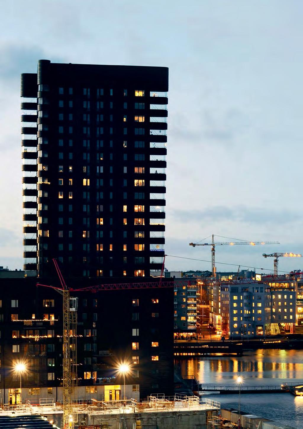
110

111 5Local development opportunities The city s aim is for jobs, homes and services to be found in the same area. Several former industrial areas are already urban development areas, such as Liljeholmen/Marievik. 111
112 Stockholm City Plan Local development opportunities Taking the city planning goals of the City Plan as its starting point, this chapter describes the development opportunities assessed to exist in each specific district of the city. The areas are grouped in line with the 14 administrative districts that make up the city of Stockholm. 1.3 million people are expected to be living in the city of Stockholm by The city-wide strategy on vibrant local centres has been produced to revitalise local communities. In the City Plan, Stockholm s centres are divided into four different types on the basis of this strategy. The four city planning goals of the Stockholm City Plan are to underpin all urban development. All city planning is to play a part in strengthening and developing the city s assets and adding value in the form of more homes, attractive public spaces, high-quality locations for social contact, good parks and playgrounds, sport and culture and smooth-running municipal services, in which the need for preschools and schools is particularly important. The goal of 140,000 new homes by 2030 requires a dense and cohesive city in which buildings and green spaces work together, enabling good living environments to be created. Stockholm will change as the city s density increases; different neighbourhoods will be linked more closely together and new additions will be made to today s urban environments to fulfil new needs. This opens up new opportunities for the city and the people who live and work here. Higher-density districts mean more homes, better local services, less travelling and daily life becoming easier in general. Taking historic assets into account, mixed-use development with more urban features can be attained by siting apartment blocks along central corridors in areas of detached homes where public transport is good. The cityscape is to be developed in a way that is socially sustainable and of high quality. Improving connections between the different parts of the city and bridging barriers are a central element, as is improving urban, social and green links. The descriptions in this chapter are mainly derived from analyses carried out in spatial planning. The City of Stockholm s administrations and committees have been involved in identifying different needs and development opportunities, such as for schools and sports facilities, and the needs and opportunities highlighted in the City District Councils local development plans. To safeguard the city s long-term need for compulsory education provision by 2040, the report on coordinated compulsory education planning in Stockholm (SAMS) is updated every year. The assessment of the need for compulsory education cited in the city plan is an interpretation of the SAMS report for May During the consultation period, a touring dialogue programme was conducted, visiting all of Stockholm s city districts. The opinions put forward during these dialogue opportunities, and the written opinions received during the consultation, were all valuable input for this chapter. Additional views were received following the exhibition phase and these have also been taken into account. The city planning goals, planning directions and expansion strategy in the city plan are translated in the city s ongoing work on planning at district level. The appendix on national interests is also an important consideration. For each city district, the section sets out the urban development opportunities that exist and are desirable at an overarching level. To attain the goal of a cohesive city, great focus is placed on various links, in and between the city districts and with neighbouring municipalities. Within each area, prioritised strategic connections are described, as are ecological corridors of regional and municipal importance. Ten of the strategic connections are prioritised (see the expansion strategy) to attain a cohesive city. Flourishing local centres and other places for social contact are vital to achieving vibrant urban environments and social sustainability. Built-up areas and the transport system must be interconnected if the city is to function. Different types of national interests involved are also set out for each city district, and are described in more detail in the appendix to the city plan on national interests. Areas that Stockholm City Museum has identified as being of particularly high value in terms of cultural heritage are also listed. Where these historical assets are concerned, development must be carefully considered. There may also be more areas of great value in terms of cultural heritage. Additional aspects addressed are the business perspective, the need for schools, and opportunities to improve sports and cultural facilities. Local urban development maps There is a map for each city district, containing more information of a local nature in addition to the information on the urban development map for Stockholm as a whole. Boundaries and links are approximate and will be studied in detail in subsequent planning phases. A decision to commence detailed planning must be examined against the four city planning goals set out in the City Plan and meet the criteria of one of the four elements of the Expansion Strategy. A more detailed description of what the information in the maps means is shown on the right. 112
113 Key to the local urban development maps on pages Urban development area transformation Area for proposed transformation to mixed use with homes, businesses, services, streets, parks, culture and sports facilities. Developing green assets and guaranteeing functions such as schools and preschools are an important element of urban development. The transformation can involve entire or partial changes in land use. Urban development area addition Mixed-use area where extensive additional development is proposed. The area may gain new homes, services, businesses, streets, parks, culture and sports facilities. Enhancing green assets and safeguarding functions such as schools and preschools are an important element of urban development. Additional development must be founded on an awareness of the existing features, assets and needs of the area. The area may include places where major structural changes are proposed. Area where additional development may be considered Area where additional development may be considered within the bounds of existing land use, founded on an awareness of the existing features, assets and needs of the area. Strategic connections Connections that are strategically important to attain the goal of a cohesive city. Links can be made via different types of measure, such as developing the cityscape with buildings, green corridors, activity zones, destinations and transformed streets. The strategic connections complement urban corridors and local links. Local links Local connections that are strategically important to attain the goal of a cohesive city. Links can be made via different types of measure, such as developing the cityscape with buildings, green corridors, activity areas, destinations and transformed streets. Local connections supplement strategic links, urban corridors and streets with a local character. Urban corridors Over-wide streets in the local road network and motorways with side areas that can be transformed into vibrant urban environments in the short or the long term. These connect existing districts effectively and sensitively along the whole or parts of the route. These roads will retain their important local and regional traffic function for personal and business transport, but a network of pedestrian and cycle routes will be built alongside and crossing the road. In the majority of cases, space will also be prioritised for high-quality public transport. Street with local character Street that largely only affects the district itself and which in the short or long-term is proposed to be transformed into a city street with new mixed-use development along whole or part of its length. The city street will be designed as an attractive public space with good, safe traffic flow for pedestrians, cyclists and cars. Space for public transport can be prioritised when necessary. Development area regional ecological corridors Area with proposed improvements to significant regional ecological infrastructure. At the same time, recreational assets can be developed to enrich the immediate environment. Development area municipal ecological corridors Area with proposed improvements to significant municipal ecological infrastructure. At the same time, recreational assets can be developed to enrich the immediate environment. Centre Centres are divided into four categories, based on their size, function and circumstances: Node with a regional function, Centre for more than one area, Local centre and Small local centre. The centres are important for attaining the goal of good public spaces with flourishing local centres. Key meeting places Places that are significant in attaining the goal of a cohesive city and a good public environment. These locations cover community premises and other places for social contact (see page 93), sports facilities and schools that attract visitors from different parts of the city and so help to bring people with varying backgrounds together, while strengthening the local identity of the area itself. Key meeting places complement centres and parks. Proposed nature reserve Area where an inquiry is in progress on potentially creating a nature reserve. Rail or road development agreed or in progress Rail or road currently under negotiation Core public transport network The core network is the backbone of public transport, binding together municipal centres and other important nodes in the county. Inside the city of Stockholm, the core network connects different districts to each other and to important transport hubs. Means of transport are adapted to suit passenger profile and capacity requirements. Stockholm s commuter cycle corridors Commuter network that creates a joined-up system, connects districts and links areas across municipal boundaries. Industrial area Area with opportunities for industry and disruptive operations, ports, terminals and certain municipal and technological utilities. Utilities infrastructure Major plants for utilities infrastructure. New metro station New main line or commuter train station New tram stop Metro station Railway or commuter train station Tram stop Station/stop to be closed Ferry stop Stops for passengers travelling by water. In some cases can be used for freight transport and deliveries. Nature/culture reserve, National City Park or World Heritage Site. Nature area Water Road Tunnel Rail Local development opportunities 113

114 Stockholm City Plan History Its consistent separation of pedestrians and vehicles and uniformly designed apartment blocks make Rinkeby characteristic of Sweden s largescale construction projects of the 1960s. Husby and Akalla were developed a decade later and are also typical of their time. Rinkeby-Kista Development opportunities Rinkeby-Kista offers unique potential. The district brings together an internationally diverse population with several centres for services, areas for jobs and excellent transport links. Kista is one of Sweden s and the region s most important areas for work. One common feature throughout the city district is that the housing stock needs to be added to, while public spaces are in need of refurbishment. It is important to increase the mix of businesses, homes and higher education so as to further increase Kista s attractiveness. The City Plan s expansion strategy defines Kista-Järva as one of four focus areas, and Kista is also designated a regional urban core in RUFS ,273 inhabitants in 2016 estimated to rise to 67,125 by 2040 There is a great need for places for local people to meet and public services need to be improved. The total need for new school capacity for compulsory education in the district by 2040 is judged to be equivalent to two new schools and covers construction projects in progress, planned expansion of existing schools and future needs in line with the interpretation of the SAMS report Additional preschools are also needed. It is estimated that the following sports facilities will be needed by 2040: three artificial pitches, three sports halls, one athletics facility and one open-air pool. An open-air pool is planned in Järvafältet. There needs to be more scope for culture in this area. Interventions to improve safety are urgently needed. The infrastructure investments already decided on are vital to the development of the area. For example, a planned new metro line between Akalla and Barkarby will link the city district to Järfälla. The expansion of the Stockholm Bypass is already underway and construction of the Tvärbanan light rail line to Kista is planned to start in The development of core bus routes and the continued expansion of the main cycle corridors will improve accessibility within the district and to other areas and neighbouring municipalities. Developing existing connections to destinations including Helenelund, Barkarby and Kymlinge, and creating new ones, will reinforce strategic links with the neighbouring municipalities of Sollentuna, Järfälla and Sundbyberg. Better connections to and across Järvafältet are also essential, including pedestrian and cycle paths and countryside walks. It is important to develop existing and new destinations in the green area of Järvafältet. The prioritised strategic connection between Kista, Husby and Akalla can be strengthened by developing Hanstavägen into an urban corridor. Rinkeby-Kista offers unique potential 114

115 The opportunity to improve the green and recreational aspects of the Järva wedge, both eastwards and westwards, should be studied. Access to Järvafältet can be improved with a clearer connection between the built-up area and the natural landscape in certain respects, and more entrances to the culture reserve. Kista As a significant cluster, mainly in ICT, Kista Science City is one of the most important places for jobs in Sweden and in the region. Higher education is also represented here with Stockholm University and KTH Royal Institute of Technology campuses, as well as research centres. The architecture is very varied, and several tower blocks have been built in recent years. Kista offers major opportunities for continued urban development by continuing its current path towards an even more attractive urban environment with a mix of jobs, homes, services and higher education. Here Husby and Akalla are a resource for Kista s expansion with improved connections as well as new homes and jobs. There is a need to improve the standard of the public environments in the area and to seek to create premises with footfall on ground floors along urban corridors and at nodes, for example at Jan Stenbecks Torg, and along Hanstavägen, Torshamnsgatan and Kistagången. Continued development of the Kistamässan conference centre is essential to boost its profile as a significant workplace, destination and meeting place for visitors from the rest of Sweden and the world. The Kista Galleria shopping centre is very popular and opportunities to add housing and workplaces as well as retail premises that open on to surrounding streets should be investigated. Paving the way for an influx of more assets of urban living and services, such as restaurants, cafés, hotels and culture, will also create an attractive cityscape for residents and companies. On top of business investments, 6,000 homes are currently planned for Kista. It is judged that there is potential for even more homes. Additional homes would bring a need for new schools and preschools. Access to parks in central Kista needs to be improved, e.g. by developing Grönlandsgången into a green corridor and creating parks within the block structure. As this part of the city is developed, opportunities to reach it on foot, by bike and by public transport need to be improved by expanding links to surrounding areas. Extending the Tvärbanan light rail line to Helenelund, and the metro to Barkarby staden and Barkarby station, which will also become a regional train station, will further improve access to Kista, boosting its importance for the region as a whole. Helenelund becoming a National interests Transport E4 E4 Stockholm Bypass E18 Road 275 Akallavägen/part of Hanstavägen Road 279 Ulvsundavägen Ostkustbanan rail line (just outside the boundary) Helenelund station (just outside the boundary) Air Bromma Airport Geographical in terms of natural and cultural value Hansta Natura 2000 area Local development opportunities Key, see page
116 Stockholm City Plan The large number of ancient monuments show that Hansta has been populated since the Bronze Age. regional train station would also have a positive impact. The major potential for new construction mainly lies in the area south of the E4 motor way, along Hanstavägen and in Ärvinge. In the longer term, Hanstavägen, apart from the section that is part of the primary road network, and Torshamnsgatan and Kistagången could be transformed into urban corridors lined with new mixed-use development. Rinkeby Rinkeby is mainly characterised by apartment blocks, two to eight storeys high. The taller blocks are located bordering Järvafältet, with the number of storeys decreasing towards the south. Pedestrians and vehicles are consistently separated with walkways and crossings on different levels. Since the 2000s, the area has gained new buildings within the existing street layout. The Rinkebystråket development has recently been completed and Rinkebyterassen is currently in progress. Development will see improved connections between Rinkeby and Bromsten and Tensta and it is essential to improve pedestrian and cycle routes between these areas and to develop the park corridor in Rinkebydalen and Tenstadalen. The prioritised strategic connection between Tensta-Rinkeby-Spånga can be improved by developing housing, public services and new places for people to meet. Good links to Stora Ursvik in the neighbouring town of Sundbyberg are also essential. Rinkeby has a need for urban development and the potential, primarily through infill along existing streets and within the existing housing layout. The plans to add new mixed-use development along Rinkeby Allé will help to achieve this. Sports and cultural facilities need to be improved in the district. There is also a need for smaller office and business premises. The local centre in Rinkeby can be improved by densification adding new homes and workplaces, making it a safer and more inviting environment with a higher provision of services. There is to be an aim to provide new premises for services, small-scale office space, retail opportunities and improved parks near to the square at Rinkeby Torg and in major corridors. Husby and Akalla Husby and Akalla were built at the same time and are connected to Kista by the prioritised strategic connection. These neighbourhoods are characteristic of their period and modes of transport are clearly separated from each other. Akalla industrial area has a strategic location next to the E4 motorway and the new Stockholm Bypass, and is therefore a significant location for jobs. Järvafältet makes inroads into the built environment like green wedges, creating delimited parkland, in contrast to the open natural and historic landscape that has been left to grow wild. The arts and conference centre in the historic buildings of Husby Gård and the preserved village of Akalla By are important destinations to protect and develop in each of these areas, for example through a more attractive park corridor from Husby centre to Husby Gård. Akalla dominates the landscape, with its tower blocks dotted through the centre of the district. In Husby, on the other hand, the buildings, mainly apartment blocks, are more homogenous. Work is currently in progress to update Husby centre. Husby and Akalla have urban development potential and are in need of it, mainly through infill within the existing built structure. Their location is key here, given their proximity to Kista and Järvafältet, and improved access via the new metro extension to Barkarby and the Stockholm Bypass. Higher density of homes and workplaces must go hand in hand with enhancing local centres, with opportunities for better provision of services. At the same time, this improves safety and security for people in the area. Husby Kulturkvarter, a local arts network, is a good starting point for encouraging more arts and culture. The main road Hanstavägen can further connect Akalla, Husby and Kista if it is transformed into an urban corridor. A mixed-use development bordering Järfälla municipality can be created at the Hjulsta interchange, which would strengthen the link with Barkarbystaden and Barkarby station. In the long term it would be desirable to reinforce the link to the centre of Sollentuna with new housing at the Husbykorset interchange and along Turebergsleden. Hansta Hansta is part of the Järva wedge, which is strategically important as a regional green structure. The large number of ancient monuments show that Hansta has been populated since the Bronze Age, and the valleys in the area around the farmstead at Hägerstalund are characterised by the open fields of this historic landscape to this day. In the early twentieth century, Hansta became an area for military manoeuvres, but ownership was taken over by the state in Today it is a nature reserve and popular recreation area for the people of Stockholm, Järfälla and Sollentuna. New, safe green paths for walkers and new attractions and destinations can reduce the separating effect of Hansta and strengthen links to Barkarbystaden in Järfälla. Hägerstalund will be developed into a landscape park for recreation with visible historical features and new natural assets. Environments classified by Stockholm City Museum as being of value in terms of cultural heritage Hansta and Järvafältet with their farms Kista Gård 116

117 As a significant cluster, mainly in ICT, Kista Science City is one of the most important places for jobs in Sweden and in the region Local development opportunities 117

118 Stockholm City Plan History Tensta is a district dating from the 1960s, largely with apartment blocks and consistent traffic separation. Detached houses are found in Solhem, Bromsten, Sundby and Flysta. The city district also contains one of the largest commercial areas in Stockholm Lunda with its mixture of industry, logistics and offices. Spånga-Tensta Development opportunities Spånga-Tensta can be developed with new housing as well as public and commercial services. Its proximity to Järvafältet and the opportunities to develop the environment alongside the Bällstaån river can create additional value. Access to Järvafältet can be improved with clearer funnelling between the built-up area and the natural landscape. Järvafältet will take on an important role in linking together the districts that surround it through new pedestrian and cycle paths and more activities and destinations. The opportunity of enhancing the green and recreational aspects of the Järva wedge should be studied. The area will become more accessible once the Mälarbanan railway line and the Stockholm Bypass are complete. 38,236 inhabitants in 2016 estimated to rise to 49,403 by 2040 Work on the Stockholm Bypass is currently in progress, opening up new opportunities for surrounding districts. The possible extension of the current blue metro line in the future, which would link Hjulsta and Barkarby station, would have a major positive impact on this district. Much of this city district is within the catchment area of the Bällstaån river, which means that the flood risk should be taken into consideration. Flat areas can also be affected by heavy rainfall. The area s public cultural activities serve as attractions and as important functions in a local context. The district needs additional locations where community groups can meet and cultural events can be held. Measures to create safety and security must be taken into account in planning. The total need for new school capacity for compulsory education in the district by 2040 is judged to be equivalent to three new schools and covers construction projects in progress, planned expansion of existing schools and future needs in line with the interpretation of the SAMS report It is estimated that the city district will need the following sports facilities by 2040: one artificial pitch and two sports halls. Tensta and Hjulsta Tensta and Hjulsta mainly comprise apartment blocks two to eight storeys high the taller blocks border Järvafältet, with the number of storeys decreasing towards the south. Pedestrian and vehicle traffic is consistently separated, and housing is arranged in relatively closed blocks. During the 2006 Housing Fair, the area gained new showcase buildings, including terraced housing. Tensta Art Gallery and the parkour course in Nydalsparken are popular attractions for the whole of Stockholm. Urban development will see improved links from Tensta to Solhem and Rinkeby and it is essential to improve pedestrian and cycle routes between these areas and to enhance the park corridor in Spångadalen and Tenstadalen with new attractions. The prioritised strategic link of Tensta-Rinkeby-Spånga can be improved by developing housing, public services and new places for social contact. The link to Rinkeby is to be reinforced by different types of urban development, improved pedestrian and cycle paths and possibly a bus link. Good links to the neighbouring municipality of Järfälla are also essential. Tensta and Hjulsta offer development opportunities, primarily through infill along existing streets and within the existing housing layout. More homes of a mix of sizes and forms of tenure are needed to reduce overcrowding and segregation. Tensta centre can be developed with additional commercial services by creating new homes and new workplaces. Renovating existing 118

119 buildings and public spaces, such as parks, is a high priority. There is great potential to considerably improve the square at Hjulsta Torg, creating a safer environment by investing in public space with commercial services. Existing commercial services and community groups must be protected. To link Spånga and Tensta, new park functions can be added in Spångadalen and in the longer term Spånga Kyrkväg could be transformed into an urban corridor lined with new mixed-use development along parts of the main road. A mixed-use development bordering Järfälla municipality can be created at the Hjulsta interchange, which would strengthen the link with Barkarbystaden and Barkarby station. Bromsten Building in Bromsten began with detached homes in the early twentieth century. Density has increased over the years and today s Bromsten is characterised by a mix of detached homes, terraced housing, apartment blocks and smaller industrial buildings from different periods. Parts of Bromsten offer major opportunities for development. Detailed planning is in progress to transform Bromsten s industrial area into mixeduse development. Programme work has also commenced for the eastern part of Bromsten along Ulvsundavägen. There is great potential here for additional housing and to improve access to the metro line at Rissne-Sundbyberg and connect the districts together. In the longer term, Bromstensvägen and Spånga Kyrkväg could be transformed into urban corridors lined with new mixed-use development. Similarly, Duvbovägen could be transformed into a street with local character. Bromstensplan has the potential to be developed into a local centre. Duvbovägen acts as a trunk route for cyclists in the area and can be reinforced. Development in Bromsten is part of the prioritised Tensta-Rinkeby-Spånga strategic connection, which opens up opportunities for many new homes and public services. Lunda There have been industries and businesses in this area since the 1930s and over the years the area has developed to become one of the largest industrial areas in Stockholm with a mix of industry, distribution services and offices. Abutting the railway network and the European road network, the area s function as a terminal is strategically important. The industrial area is a major asset to be safeguarded, but also offers development potential, given the construction of the Stockholm Bypass. Solhem, Flysta and Sundby The housing here largely comprises detached homes from different periods. Spånga centre is an important public transport node for many of the neighbourhoods in western Stockholm and the area is more built up near the station, with apartment blocks on a varying scale. Today Spångavägen has an appreciated small-town character. Access to parks and parkland assets in central Spånga needs to be improved. There are opportunities for urban development around Spånga centre and in the area between Solvalla and Ulvsundavägen. In the longer term, Bromstensvägen, Sörgårdsvägen and Spånga Kyrkväg could be transformed into urban corridors lined with new mixed-use development. National interests Transport E18 Road 275 Bergslagsvägen/ Akallalänken E4 Stockholm Bypass E4 Stockholm Bypass/E18 Hjulsta interchange Mälarbanan rail line, including expansion to four tracks Spånga station Air Bromma Airport Environments classified by Stockholm City Museum as being of value in terms of cultural heritage The community of detached houses in Solhem Spånga church Tensta Local development opportunities Key, see page

120 Stockholm City Plan History Hässelby-Vällingby is characterised by green spaces and water on its doorstep, and largely consists of housing along the metro line with local centres at the stations. Vällingby-Råcksta is Sweden s first ABC town and represents the model of the Swedish welfare state in the mid-twentieth century. The industrial area in Vinsta is characterised by a variety of buildings for different types of business, and the Lövstaverket waste recycling centre is one of the city s larger technical facilities. Hässelby-Vällingby Development opportunities Hässelby-Vällingby enjoys an attractive location on the shore of Lake Mälaren and is on track to gain new regional importance with the expansion of the Stockholm Bypass with its interchange and slip roads at Vinsta industrial area. The function of Vällingby centre as an ABC town is to be developed, which will involve adding houses, workplaces and town centre functions in a way that reinforces the value inherent in its status as a heritage environment of national interest. Good locations for services need to be exploited along streets and at town centre locations for retail and community centres and arts centres. Improved public transport links are needed, particularly in western Hässelby as new homes are built. Access along the shore of Lake Mälaren should be improved, as should the ecological corridor between the Beckomberga area, Grimstaskogen and Kyrkhamn. 73,445 inhabitants in 2016 estimated to rise to 87,399 by 2040 Some of this district is within the catchment area of the Bällstaån river, which means that the flood risk should be taken into consideration. The Nälstabäcken river is also part of the natural water system, and its water regulation and recreational functions need to be taken into account and developed to their full potential. The Lövstaverket waste and recycling plant is one of Stockholm s major technical facilities. In addition to this, a new energy production plant at Lövsta may become relevant. In the longer term, Bergslagsvägen can be developed into an urban corridor, with infill of homes and urban development to link together the surrounding districts. The total need for new school capacity for compulsory education in the district by 2040 is judged to be equivalent to three new schools and covers construction projects in progress, planned expansion of existing schools and future needs in line with the interpretation of the SAMS report It is estimated that the following sports facilities will be needed by 2040: one sports hall, one artificial pitch and, in the longer term, one swimming pool. Preschools need to be planned as new homes are added. The need is particularly great in Vällingby and Råcksta, and in Kälvesta and Vinsta. Vällingby-Råcksta is of national interest in terms of cultural heritage. Grimsta sports centre is an important meeting place. Lövstabadet swimming pool, the conference centre at Riddersviks Gård and the lakeside swimming beach in Hässelby could all be developed into attractive areas for recreation and to bring people together across all of Stockholm s western suburbs. Vällingby and Råcksta Vällingby was opened in 1954 and is the district in which the city planning ideal of the ABC town was most consistently carried out. Work, homes and centre functions were to be gathered together in satellite towns, which would relieve the burden on central Stockholm. The housing is characterised by low-rise buildings in the town centre, surrounded by a ring of high-rise point blocks, gradually decreasing in height with terraces and detached homes on the outer edges. The construction of social housing was combined with workplaces and thoughtful architectural design in keeping with the features of the landscape. In the early twenty-first century, the central areas gained additional buildings in the form of retail premises and homes. 120

121 In Råcksta the buildings are mainly apartment blocks three to five storeys high, arranged in semi-closed blocks with homogenous areas of terraced houses and detached homes. The green corridor from Vällingby via Råcksta and on into Bromma is an appreciated feature that could be further improved. Arts activities such as the subsidiary of Stockholm City Theatre and the local cinema attract large numbers of users. Vällingby and Råcksta offer opportunities for urban development within the existing street layout. Vällingby centre will continue to be reinforced as a centre for several districts, with additional housing and business premises, in locations including Vinsta and along Bergslagsvägen. This would strengthen the prioritised strategic connection across Vinsta to Hässelby Gård. There are excellent opportunities to develop services and businesses and to develop the area surrounding Råcksta metro station. Grimsta Grimsta mainly comprises four-storey apartment buildings placed in semi-closed blocks around a shared courtyard. The location close to the Grimsta nature reserve creates good quality of life for local residents. Grimsta has some opportunities for infill development. The link to Vällingby needs to be improved with new routes for pedestrians and cyclists across Bergslagsvägen. The interface between the district and Grimsta nature reserve can be made clearer and safer with additional new buildings and walks along the boundary of the nature reserve. Grimsta sports centre and playing fields are important locations for social contact in Stockholm s western suburbs. Access to the nature reserve can be improved with clearer entrances and more attractions for recreation and leisure activities. The attraction of Grimstaskogen forest for outdoor recreation could also be boosted. Hässelby Gård and Hässelby Strand Hässelby Gård was built with a mix of four-storey apartment blocks and groups of high-rise point blocks with individual slab blocks freely sited in the landscape. Over the years only a few moves have been made to increase density in this district with residential infill. Hässelby Strand is characterised by a large-scale, open housing layout. New homes have been added, such as along Aprikosgatan and in the centre of Hässelby Strand. The closely interlocking network of green paths for walkers is an appreciated asset. The opportunities that Hässelby Gård and Hässelby Strand offer for urban development mainly lie within the existing street plan. In the longer term, Maltesholmsvägen and Lövstavägen should be transformed into urban corridors lined with new mixed-use development. The link with Vinsta, and Vällingby across Bergslagsplan is a prioritised strategic connection that should be strengthened by developing homes along Maltesholmsvägen and in the longer term by developing Bergslagsplan and National interests Transport E4 Stockholm Bypass Road 275 Bergslagsvägen Waterway, including buffer zone Air Bromma Airport Geographical in terms of natural and cultural value Lake Mälaren with its islands and shoreline Heritage protection Vällingby Råcksta ABC ABC stands for Work, Home and Centre in Swedish and is a type of urban planning that aims to ensure that residents live close to their work and local centre services. Local development opportunities Key, see page

122 Stockholm City Plan Hässelby Villastad is an older area of detached homes. There are some opportunities for urban development here. Planning is in progress to add approximately 550 homes around Riddersviks Gård. Lövstabadet swimming pool, the conference centre at Riddersviks Gård and the lakeside swimming beach in Hässelby could all be developed into attractive areas for recreation and for social interaction across all of Stockholm s western suburbs. Vinsta. The link to Kälvesta should also be reinforced. Hässelby Gård s centre should be improved with the addition of more homes, encouraging the development of more local services. The park corridor between Hässelby Gård and Ormängstorget should be made safer and more accessible. If a new CHP plant can be sited at the old landfill site in Lövsta, this could replace the heating plant at Hässelby Strand, so releasing land for urban development. Hässelby Villastad In the 1970s and 1980s, terraced houses, link-detached houses and detached houses in coherent estates replaced the original detached homes ( villa in Swedish) from the early twentieth century from which this area takes its name. Hässelby Villastad has some opportunities for urban development. Planning is in progress to add buildings around Riddersviks Gård and around the centre of Åkermyntan. There is also a need for new parks in some parts of Åkermyntan. Växthusvägen could take on a greater role as a linking corridor once the urban development area in Järfälla is complete. Proximity to the new Barkarby station is particularly important here. Apartment blocks can encourage local services and the expansion of public transport. Lövstavägen should be developed into an urban corridor through residential infill and premises for services. Schools, preschools and sports facilities should be prioritised to increase the number of places for social interaction in Stockholm s western suburbs. Enhancing the shoreline walk along Lake Mälaren should be a priority. Kyrkhamn must be protected as a nature reserve. Kälvesta and Vinsta Kälvesta is characterised by low-rise housing, mostly built in the 1960s and 1970s. Vinsta was developed with terraced housing, link-detached housing and detached homes in the 1970s and 1980s. Vinsta industrial area by Johannelund 122

123 metro station has been home to light industry, workshops and offices since the 1960s. Kälvesta has some opportunities for urban development, mainly through infill within the existing street layout. A new local node for local services could be developed at the Bergslagsvägen/Sörgårdsvägen interchange. Opportunities to increase density with housing along Björnmossevägen and Blomsterkungsvägen are to be studied. Vinsta industrial area could benefit from the ongoing work on the Stockholm Bypass and the existing metro station. This means that Vinsta has extremely high potential to be developed into a mixed-use district with businesses, homes and services. Johannelund metro station has great potential to become a local centre. Links to the hill at Johannelundstoppen and the Nälstastråket green corridor as well as new parks in Vinsta industrial area are important for good access to parks and green spaces. The link to Vällingby and to Hässelby Gård is a prioritised strategic connection that should be reinforced. In the future, Sörgårdsvägen could gain new buildings, transforming it into a city street lined with new mixed-use development. In the longer term, parts of Bergslagsvägen could also be developed into an urban corridor with new housing, while Skattegårdsvägen could become a city street with local character. Nälsta The buildings in Nälsta are dominated by detached houses and some terraced and link-detached housing, mainly dating from the end of the 1940s and later. Nälsta offers some urban development opportunities, mainly in conjunction with removal of the power line in the Nälstastråket green corridor. The north-western part of the green space offers opportunities for infill, which would develop the area into an attractive recreation area with better links between Nälsta and Vällingby. Environments classified by Stockholm City Museum as being of value in terms of cultural heritage Central buildings in Grimsta and Grimsta cemetery Kanaan-Kvarnviken Hässelby Gård Hässelby Strand Hässelby Slott Kyrkhamn Riddersviks Gård Lambarön Vällingby and Råcksta Local development opportunities 123

124 Stockholm City Plan History Many homes were built in Bromma in the first decades of the twentieth century. Areas of narrow apartment blocks were constructed in the eastern and central parts of the district, while a garden city was laid out to the south and west. The extension of the metro line brought additional homes and businesses in smaller urban centres near the stations. Bromma is a varied urban environment containing areas of low-rise housing, apartment blocks and areas with industrial and commercial use. Ulvsunda industrial area, the trotting track at Solvalla, beaches, shoreline walks, jogging tracks, nature reserves and parks make up a wide range of assets that set their stamp on the whole of Bromma. Bromma Development opportunities Bromma boasts a multitude of assets in its built environment with good examples of lowrise housing dating from the first half of the twentieth century and well-developed green structure. Local and regional public transport improvements and a holistic solution for the nodes of Brommaplan and Alvik offer major opportunities for the district to continue to develop. Alongside improved pedestrian and cycle routes, there are excellent opportunities to improve ecological corridors and create joined up recreational areas by developing the Lake Mälaren shoreline with paths along the shoreline and destinations. 77,295 inhabitants in 2016 estimated to rise to 114,428 by 2040 It is important that a large proportion of rented property is added to attain a greater mix of forms of tenure. The total need for new comprehensive school capacity in the district by 2040 is judged to be equivalent to seven new schools and covers construction projects in progress, planned expansion of existing schools and future needs in line with the interpretation of the SAMS report It is estimated that the following sports facilities will be needed by 2040: four sports halls, one athletics facility, three artificial pitches and possibly one swimming pool. Links to Sundbyberg along the Bällstaån river need to be improved. The local centres in the districts have the potential to be developed with the addition of new homes and businesses. At junctions on city streets there is the potential to improve and add to existing businesses and service points to develop smaller local centres. New locations are needed where people can come together to take part in a variety of arts events or attend a club or society meeting, but it is also important to safeguard existing business premises. Drottningholmsvägen, Spångavägen, Bergslagsvägen and Ulvsundaleden will be developed into urban corridors. It is important to bridge barrier effects by introducing more connections across main roads. The area surrounding Bromma Airport has major urban development potential as the airport is set to close after The future need for links and infrastructure to the urban development area should be incorporated in planning neighbouring areas. Much of Bromma today is affected by the airport and the restrictions this imposes in terms of noise and flight safety. Flexible and multi-functional parks could become important places for the district s inhabitants to meet and spend time together. It is important to protect the ecological corridors and create joined up recreational areas running along the shore of Lake Mälaren by creating paths along the shoreline for walkers, destinations, and pedestrian and cycle paths. Part of this area is within the catchment area of the Bällstaån river, which means that the flood risk should be taken into consideration. Other low-lying areas can also be affected by heavy rain and high water levels in Lake Mälaren and the smaller lakes. The areas between Grimsta-Beckomberga, Beckomberga-Kyrksjön and onwards to Judarn and Riksby-Lillsjön are important links for ecology and recreation and should be protected and improved, as should the link between Ålsten-Lillsjön and Bromma Airport. Central Bromma: Riksby, Åkeshov and Åkeslund Central Bromma is characterised by large areas of low-rise housing and by Bromma Airport. Brommaplan enjoys a strategic location with transport connections, shops and services, with the street network centring around the round- 124

125 about. The centre of Bromma also features the rocky terrain typical of this district with its De Geer moraine system, which is of national interest. There are major opportunities for urban development in the form of homes, businesses and services in the northern part of Riksby and around Brommaplan. The addition of new schools, preschools, sports facilities and cultural spaces, as well as new public space, is essential as the district grows. Access to parks in the area must be improved, for example by developing Tunnlandsparken and Lake Lillsjön and creating new parks in Riksby. Public transport needs to be improved at the Brommaplan node with more efficient means of switching between metro and bus travel, more entrances and exits to and from the metro station and improved traffic flow for buses in the surrounding network of streets. Bromma Kyrka and Eneby The housing here mainly comprises detached homes dating from different periods. Spångavägen could be transformed into an urban corridor lined with new mixed-use development. Bällstavägen could also be transformed into an urban corridor in the future. Bällsta The housing in Bällsta mainly consists of detached homes from the 1940s. The district also contains Solvalla with its established trotting track and the forest at Solvallaskogen. Solvalla has excellent opportunities for development. Planning is in progress for mixed-use development in parts of the trotting arena area with homes, businesses and services. Land needs to be reserved for new preschools and a school as part of this development. Solvalla s location can help to link the areas of Annedal and Ulvsunda, Spånga and Bromsten and strengthen links to the neighbouring municipality of Sundbyberg. Bällstavägen could also be transformed into an urban corridor in the future. The tram stop can help to boost the area s central location and facilitate new public activities and services. The possibility of a commuter train station here in the future should also be borne in mind. Solvallaskogen forest is a resource for recreation, in combination with new local parks and squares. Parts of Gamla Bromstensvägen have the potential to be transformed with new housing and services. Plans are in place for a new sports centre north of Bällstavägen adjoining Bällsta Gård, which could be developed into an important place for the residents of the western suburbs to meet each other. Ulvsunda industrial area and Mariehäll Ulvsunda industrial area was redeveloped in stages during the twentieth century and currently features a variety of industrial buildings with some retail in certain areas. In the future, the industrial area should continue to provide space for small and medium-sized manufac- National interests Transport Road 275 Bergslagsvägen/ Drottningholmsvägen Road 279 Ulvsundavägen Mälarbanan rail line Air Bromma Airport Waterway, including buffer zone Nature conservation Bromma De Geer moraine system Geographical in terms of natural and cultural value Judarskogen Natura 2000 area Kyrksjölöten Natura 2000 area Heritage protection Norra and Södra Ängby Olovslund Ålstensgatan Local development opportunities Key, see page
126 Stockholm City Plan turing businesses whose operations are not disruptive. There are opportunities here for highly innovative companies, which may contribute towards a greater level of services for businesses and the surrounding city. Mariehäll has undergone a transformation from industrial to residential development, partly with the area of Annedal, which was the showcase site of the Housing Fair in Ulvsunda continues to offer excellent opportunities for development. A transformation to mixed-use is in progress alongside the waterfront at Bällstaviken. As well as new buildings with new local parks and squares and a new city street, the banks of the Bällstaån river offer excellent opportunities for a long-distance riverside path. There is also the possibility of extending commuter ferry traffic here plus a small amount of freight by boat using existing quays. New homes mean land needs to be earmarked for new preschools and schools in Ulvsunda industrial area and in Mariehäll where need is high. Links from Annedal across the river to Sundbyberg and to Mariehäll and the Ulvsunda industrial area must be improved. New places for social interaction need to be created, providing local services, culture and sport, for example. The parts of the industrial area affected by the noise restrictions due to the presence of the airport can be developed further and continue to provide jobs and businesses. The need to establish quays for freight transport south of Johannesfred should be monitored and investigated. Corridors in strategic locations for pedestrians and cyclists can make it easier to move between the new district and the parts of the industrial area that have been retained. In the area between Ulvsunda industrial area and Mariehäll, new mixed-use development can continue to be introduced along Karlsbodavägen. Alvik Alvik is an important transport node in Bromma and the western suburbs, with the Stockholm metro, the Tvärbanan light rail line and the Nockebybanan tram line, as well as being served by several bus routes. Older suburban buildings and the local centre Alviks Torg immediately adjoin the node and a large area of offices and services is sited by the water and the shore at Alviks Strand. Alvik is a major development area in a strategic location close to the inner city. It offers excellent potential for development with buildings in a denser, more cohesive and varied urban setting with a mix of businesses, homes, schools and services. Alviks Torg combined with Gustavslundsvägen can be developed into a regionally important node with areas for retail, services and culture. In the longer term, Drottningholmsvägen can be developed into an urban corridor, taking into account smooth traffic flow for high-capacity public transport. Development in the area and along Drottning- holmsvägen must help to link Alvik to neighbouring districts. A green district with space for recreation should be created by developing new and existing parks. There is great potential to enhance and reinforce the path along the shoreline to establish a coherent corridor from the western suburbs via Ålsten and Minneberg, on towards Ulvsunda and Ulvsunda industrial area. Traneberg and Ulvsunda Traneberg is an area predominantly containing narrow apartment blocks and also includes the more post-modernist estate of Minneberg. Large parts of Traneberg are of value in terms of cultural heritage. The central park corridor is a valuable green asset. Traneberg offers some opportunities for urban development in the parts adjoining Alvik and as an element of developing the roads that link the isolated housing areas of Ulvsunda and Traneberg. Margretelundsvägen, Grindstuvägen and, in the longer term, also Svartviksslingan can be transformed into city streets with a local character, lined with new mixed-use development. The area also offers a certain amount of opportunities for new workplaces. The area of small detached houses in Ulvsunda needs a school, a preschool and other services. The paths along the shoreline in Ulvsunda and Traneberg need to be extended so that they run from Lillsjön to Alvik. Links to Ulvsundasjön lake should be improved and the park at Margretelund made accessible. The boatyards north of Margretelundsvägen should be built on in the longer term. Beckomberga Beckomberga encompasses a wide range of building types from different periods, which have created a hugely varied urban environment. The green space between Beckomberga and Norra Ängby is part of a cohesive green area for walks with high recreational value. Beckomberga has some opportunities for urban development. Spångavägen could be transformed into an urban corridor lined with new mixed-use development. Råckstavägen could similarly be developed into a city street with a local character. The area around Beckomberga hospital is undergoing transformation with homes, jobs and services. Once the power lines in the south of the area have been removed, new buildings will be able to be added. New housing brings a need to earmark space for new schools and preschools. The district also needs the addition of workplaces and some services. Blackeberg Blackeberg is a metro line suburb typical of its time, with a large urban centre at the metro station, several smaller centres out in the various estates of apartment blocks, a central park corridor and a few terraced housing blocks. 126
127 Blackeberg offers some opportunities for urban development. Work to transform Blackebergsvägen into an urban corridor lined with new mixed-use development is in progress. Islandstorget has the potential to be developed into a local centre. Blackebergs Torg is a vibrant centre and meeting place for local residents which is to be developed with additional construction, businesses and services. Smaller community spaces and better corridors for pedestrians and cyclists are needed to better connect Blackeberg with its neighbouring districts. New housing brings a need to earmark space for new schools and preschools. Blackebergsstråket is a central park corridor running through the district which must be protected and developed with new destinations and higher profile entrances that can help to link together surrounding neighbourhoods. Grimstaskogen is an important destination for outdoor recreation with a link to Blackebergsstråket. A recreational and ecological corridor to Södra Ängby should be emphasised. The district also needs the addition of workplaces and a certain amount of services. Södra and Norra Ängby Södra and Norra Ängby were largely built in the 1930s with large and small detached houses. Norra Ängby is the largest cohesive area of small cottages in Stockholm and a good example of the city s focus on self-build homes in the early twentieth century. Södra Ängby is the largest cohesive area of detached homes in functionalist style in Sweden. The areas are both of national interest in terms of cultural heritage. Apart from development along Bergslagsvägen, opportunities for infill development in Norra and Södra Ängby are therefore limited. The ecological and recreational corridor between Södra Ängby and Blackeberg should be reinforced. The development of Blackebergsvägen with the addition of new buildings will strengthen the connection between Södra Ängby and Blackeberg. Stora Mossen, Äppelviken, Olovslund, Smedslätten, Höglandet, Ålsten, Abrahamsberg, Nockeby and Nockebyhov The south-western parts of Bromma largely comprise detached homes and garden city characteristics. The terraced houses on Ålstensgatan are an early example of functionalist architecture, rational building and the use of simple materials. Ålstensgatan and Olovslund are both of national interest in terms of cultural heritage. Abrahamsberg is largely populated with narrow apartment blocks. South-west Bromma is well provided with parks and nature areas and the area is well served by public transport and other infrastructure, which is a resource for urban development. The area has some opportunities for urban development. The districts need additional building to ensure greater variation in the housing stock, with more rental properties as well as housing for elderly people, sheltered housing and student accommodation. There is slightly greater potential in Nockebyhov, where mixed-use development should be introduced. The beach at Solviksbadet/Smedslätten can be developed as a place for social interaction and a destination for recreation and sport. The district also needs preschools, workplaces and some additional services. The development potential mainly lies in local centres along the Nockebybanan tram line, and along Gustav III:s Väg, for example. In the longer term, once the water treatment plant has been shut down and the power lines buried, new construction could also take place. The paths along the shoreline need to be joined to form a coherent route. Advantage should be taken of opportunities to commute by boat to Gröndal, Stora Essingen, Kungsholmen and the neighbouring municipality of Ekerö. Environments classified by Stockholm City Museum as being of value in terms of cultural heritage The area of narrow apartment blocks in Abrahamsberg The area of narrow apartment blocks in Åkeslund The older suburban buildings in Alvik The housing in Alviksberget Beckomberga hospital The north-west shore of Lake Mälaren with summer homes Blackeberg Bromma church area The area of small cottages in Bällsta The area of small cottages in Eneby Höglandet Ålsten Smedslätten Äppelviken Nockeby Nockebyhov Stora Ängby Bromma Airport Stora Mossen The area of narrow apartment blocks in Traneberg Johannelunds Gård Sandvik Central Ulvsunda Ulvsunda Slott Åkeshovs Slott The allotment areas of Kortenslund, Glia, Riksby, Lillsjönäs and Stora Mossen Local development opportunities 127

128 Stockholm City Plan History As early as the mid-sixteenth century Ladugårdstorget was found on the site of what is now Östermalmstorg, and the main features of the seventeenth century grid street plan with its narrow roads can still be seen today. Since then, urban development has seen the addition of the esplanade system of the nineteenth century, the apartment blocks of functionalism, many museums, higher education institutions, embassies, port areas and the Royal National City Park. Östermalm is part of the cultural heritage area of inner city Stockholm with Djurgården, which is of national interest. Östermalm Development opportunities Östermalm is developing rapidly through an ongoing transformation of an older industrial and port district in Stockholm Royal Seaport (Norra Djurgårdsstaden). The combination of a dense urban streetscape and the expanse of Djurgården with its park and natural countryside are particular assets. The green link between Norra and Södra Djurgården can be strengthened while developing public space. This will provide more scope for cyclists and pedestrians and better opportunities for social contact and cultural experiences. The major expansion of Stockholm Royal Seaport means the addition of high-capacity public transport is vital. 73,522 inhabitants in 2016 estimated to rise to 104,371 by 2040 Besides high-capacity public transport, establishing parks and earmarking land for schools and preschools are some of the most important issues when developing this city district. Prioritising high-capacity modes of transport, and pedestrian and cycle traffic is particularly necessary in this high-density environment. The total need for new school capacity for compulsory education by 2040 is judged to be equivalent to four new schools and covers construction projects in progress, planned expansion of existing schools and future needs in line with the interpretation of the SAMS report It is estimated that the following sports facilities will be needed by 2040: one athletics facility and five sports halls for various purposes. The district heating plant and the Energihamnen port area are two of the city s major technical facilities. Much of the area falls within the Royal National City Park, within which any development should revolve around the park remaining an important recreational and ecological resource for a higher-density city. Parts of the National City Park should be developed as a destination for recreation. It is also important to preserve and develop green links within the National City Park and to nearby green spaces. Östermalm The seventeenth-century grid network with streets such as Nybrogatan and Storgatan is the backbone of this district. The seventeenth-century street layout can be seen at Karlaplan and the esplanades Strandvägen, Valhallavägen, Narvavägen and Karlavägen. Due to its topography, Lärkstaden was laid out at a later date and is a well-preserved example of early twentieth-century city planning, adapted to the landscape and with a less rigid layout. Intended The area has unique assets in the way the dense urban streetscape immediately borders the expanse of Djurgården with its park and natural countryside. 128


129 for foreign embassies and characterised by large plots, Diplomatstaden is the only area of its type in Sweden. The south-western part of Östermalm contains a number of quite low-density blocks housing various institutions, which today mainly contain workplaces. There are some opportunities for development in Östermalm. Links can be developed, and new ones created, with the urban development area of Stockholm Royal Seaport. Within the stone city, as it is known, infill is possible within the existing structure where there is a need to improve public space, for example with pocket parks and more green amenities, or to create greater continuity in the fabric of the city. More mixed-use development can be added on the north side of Vallhallavägen, provided that traffic impact can be reduced. In the future, the south-western parts of Östermalm could be transformed into a seamless continuation of the stone city. Public transport needs to be improved and there are opportunities to achieve this on land and by water. Placing the Roslagsbanan rail line in a tunnel to T-centralen via Odenplan will release land for housing at what is now Östra station. The Swedish Transport Administration is studying a potential eastern link road to connect the northern and southern link roads (Norra Länken and Södra Länken). If this is built, high-capacity public transport should also be planned. The area bounded by Birger Jarlsgatan- Humlegårdsgatan-Östermalmstorg-Nybrogatan is also included in the City urban development area, described in the section on the district of Norrmalm below. Södra Djurgården The unique environments of Södra Djurgården (generally known just as Djurgården ) give this area a long tradition as a natural park with attractive destinations for the people of Stockholm. The area is home to several cultural and entertainment institutions such as the Vasa Museum, the Nordic Museum, Skansen openair museum and zoo, Junibacken children s fun park and Gröna Lund amusement park. The island of Beckholmen has been a centre for seafaring and trading since the seventeenth century. The work of the dockyards on the island will be coordinated with the development of Beckholmen as a tourist attraction. It is important to protect and expand Djurgården s natural and cultural assets. New development could also increase the popularity of Djurgården s attractions. Ladugårdsgärdet Gärdet is a green area of the city with appreciated features. The housing blocks are open, with individual apartment blocks in line with the city planning ideal of functionalism but with imposing public spaces and a consistent streetscape that serves as a direct extension of the street layout of the stone city. Valhallavägen National interests Transport E20 Norra Länken Road 277 Lidingöbron Eastern link road The Värtabanan rail line including the area around the stations Västra and Östra Bangården The Roslagsbanan rail line Air Bromma Airport Värtahamnen, Frihamnen, Loudden Waterway, including buffer zone Geographical in terms of natural and cultural value Royal National City Park The islands and beaches of Saltsjön Heritage protection Inner city Stockholm with Djurgården More detailed planning The Plan for the National City Park the part that falls within Stockholm is an important document in Stockholm s city planning. The boundaries where planning is specified in more detail are not shown on the urban development maps. Local development opportunities Key, see page
130 Stockholm City Plan Stockholm Royal Seaport is one of Stockholm s eco-profile areas and is to be a fossil fuel free district by Targets and strategies that seek to ensure that development is sustainable are set out in the Programme for sustainable urban development Stockholm Royal Seaport, leading the way towards a sustainable future. is lined with institutional buildings, including Stockholm stadium, the Royal Institute of Technology and the Svea artillery regiment. Gärdet s playing fields and Tessinparken are two important parks with different characters and functions. Opportunities for urban development are mainly found within the Stockholm Royal Seaport area. There are some opportunities for infill development in this area. Gärdet s playing fields could be developed further for sport and as a destination for recreation, and housing could be developed around this recreation ground, clearly linking the urban structure to the green space. The Roslagsbanan railway line can be extended from Stockholm University to T-centralen via Odenplan, so creating a direct connection to the rest of the rail network and the city centre. It is essential to strengthen the ecological corridor between Norra and Södra Djurgården. Hjorthagen The area of narrow apartment blocks in Abessinien is an early example of a workers housing cooperative. The houses and apartments were of a high standard for their day and are unusually consistently designed. Ropsten is a very important node for transport to and from the municipality of Lidingö. Opportunities for urban development in Hjorthagen are mainly found around Husarviken and Ropsten, which are part of the Stockholm Royal Seaport urban development area. Improving public transport is a key issue here. There is a certain amount of urban development potential within the older housing by creating infill development within the existing layout and in the green ring around the hill. Hjorthagen will be linked to surrounding areas, which will improve access on foot and by bike. Hjorthagsparken fulfils an important recreational and ecological function for the area. Stockholm Royal Seaport Stockholm Royal Seaport is Stockholm s largest urban development project and is to be a trailblazing example of the next generation of sustainable districts. The urban development area covers Hjorthagen, Värtahamnen port (including Södra Värtan), Frihamnen and Loudden. The project incorporates a number of different features around which continued development will focus. The Gasworks building dating from the end of the nineteenth century is one of Stockholm s most prominent municipal facilities with significant value in terms of social history, cultural heritage and architecture, which leaves its mark on the entire northern part of the area. Cultural activities will be a significant aspect of the future gasworks area and the city is planning to site a library and an arts school here. It is essential that this area is served by high-capacity public transport. Expansion and detailed planning are in progress at Stockholm Royal Seaport to create a dense mixed-use city with a large number of new homes and workplaces. There will be considerable need for schools and preschools, with new schools required in Frihamnen and in Loudden. Drawing on the area s different features and creating smaller neighbourhoods that complement each other in their provision and design is one success factor, as will be respecting the history of the area and ensuring that the contemporary additions help to create attractive places to live and work. Links to neighbouring parts of the city must be created and improved. A high proportion of journeys on foot and by bike are a goal of this eco-district. Urban development here will go hand in hand with the creation of public spaces and the quayside in the area is to be made accessible as far as possible. Loudden is currently part of port operations in the area. Oil handling is to be phased out, freeing up land for city development. The cruise and ferry operations which are to remain at Frihamnen will be coordinated with the planning and construction of homes in the area. The area known as Energihamnen will continue with its commercial operations. Norra Djurgården Norra Djurgården is characterised by its natural landscape and the area of university and institutional buildings known as Science City (Vetenskapsstaden). The buildings here are deliberately sited in the extensive natural and park landscape and are clearly divided into clusters. The northern part of the area also features the housing estate of Ekhagen, dating from the 1930s. The area has some opportunities for urban development. Albano will form a node within Science City, between Hagastaden, Karolinska Institutet, Stockholm University and the Royal Institute of Technology. It is possible to increase density on land already laid claim to within Science City, taking into account the natural and cultural assets of the site and in line with the statutory protection of the National City Park, e.g. within Kräftriket and along Bergiusvägen. The barrier effect of the main road Roslagsvägen for people, plants and animals needs to be reduced. Environments classified by Stockholm City Museum as being of value in terms of cultural heritage Inner city Stockholm The ring of institutions in Norra Djurgården Hjorthagen Frihamnen Ekhagen 130

131 131 Local development opportunities

132 Stockholm City Plan History The district of Norrmalm is home to City, the heart of the region and Sweden s economic, political and cultural hub. The seventeenth century is represented here, as is the stone city of the nineteenth century. Norrmalm Development opportunities Norrmalm offers a mixed-use city centre environment, encompassing some of the oldest and youngest urban settings and a large amount of space taken up by railway lines. The greatest opportunities for urban development in this city district lie in the City area and in Hagastaden. The increased importance of Odenplan as a node, the expansion of Hagastaden and potential future development of Västra City will see major regeneration. Within the stone city, as it is known, infill is possible within the existing structure where there is a need to improve public space to create greater continuity in the fabric of the city. 70,263 inhabitants in 2016 estimated to rise to 82,376 by 2040 Sergels Torg is probably the bestknown public space in Sweden. The Citybanan railway line, the metro line extension from Odenplan to Hagastaden and Solna and the extension of the Roslagsbanan rail line to Odenplan and T-centralen will further improve public transport in the district. Hagastaden links together Stockholm and the neighbouring municipality of Solna. In the longer term, there are good development opportunities in linking Norrmalm to Kungsholmen by bridging the barrier formed by the area of track along the shoreline at Klara strand, e.g. with street overbuild projects. Meeting demand for parks and other public spaces poses a challenge in the dense inner city, as does increasing the number of schools, preschools and cultural venues. Opportunities for more greenery, e.g. on streets and in squares and in the form of pocket parks, need to be seized. The total need for new school capacity for compulsory education in the district by 2040 is judged to be equivalent to three new schools and covers construction projects in progress, planned expansion of existing schools and future needs in line with the interpretation of the SAMS report It is estimated that the following sports facilities will be needed by 2040: four sports halls and also artificial pitches. This is a challenging remit in terms of space, making joined-up planning particularly important. Prioritising high-capacity modes of transport, and pedestrian and cycle traffic is particularly relevant in this high-density environment. The whole of Norrmalm is part of the cultural heritage area of inner city Stockholm with Djurgården, which is of national interest. Norrmalm The buildings in Norrmalm were constructed over a long period of time and the city s planning history from the seventeenth century onwards is represented. Their common features are a uniform height, defined ground floors, often in a harmonised colour scheme with a varied rooftop landscape. Areas with modernist building stock are characterised by large properties and large volume buildings, sometimes filling an entire block. Individual buildings or groups of buildings such as churches, city administration buildings and office blocks tower above the skyline, demonstrating the values that were important in past eras of the city s growth. Some of the buildings are official public buildings fulfilling state functions as part of Stockholm s role as the Swedish capital. These include the government area of Rosenbad and the Nationalmuseum. The buildings in the southern parts of the City area have undergone major redevelopment, which has transformed the heart of Stockholm. The modern Hötorgscity development is dominant here, with Kulturhuset, the Riksbank and Sergels 132

133 Torg, probably the most famous pedestrian space in Sweden, which is in constant use as a place where people come together. Work on the programme for the City area is in progress with guidelines setting out how, where and in what way the area can be transformed on the basis of its existing layout. Planning is to have the goal of attaining safe and attractive public spaces. City Stockholm city centre is relevant for the whole of Sweden. City attracts businesses and head offices in particular, to an extent that is unique in the country as a whole. Stockholm s central station, the largest transport node in Sweden, gives the City area and Stockholm itself easy access to the surrounding region and the rest of Sweden. The Citybanan rail line creates new passenger flows and further improves access in the City area. Together with urban features in the immediate environment, it provides a forceful attraction for innovation-driven companies, as well as hotels, restaurants and the tourism industry. An attractive urban environment that meets the needs of housing, visitors and workers is an important success factor for Stockholm s growth and development. The blend of functions in the public space and in individual buildings is an important key to the vital urban environment that City epitomises. The arts and events in the City area demonstrate a breadth that reflects the history and cultural diversity of the Swedish capital. City has excellent opportunities for development. Development in the City area must not jeopardise Stockholm s inner city as an object of national interest. A higher density City and a more intensive urban environment can mainly be attained through changes in the existing buildings and development of the public space. This partly means bringing a greater mix of functions to existing buildings so that the heart of Stockholm can continue to beat 24 hours a day. In the large-scale setting of the City area, ground floors that are bustling with public activities, and expanded pedestrianised areas in which people can spend time are fundamental to attractive and safe urban living. Lower speed limits and less motorised traffic will also mean a quieter streetscape. Differences in level need to be addressed so as not to restrict access. Västra City offers the greatest opportunities for urban development and here Stockholm can grow in an attractive and central location to improve links to Kungsholmen, but also access to quaysides, the water and green spaces. Vasastaden Vasastaden is largely characterised by the block-based layout of the stone city. Stockholm s original area of university buildings is located around the hill at Observatoriekullen and this is where Stockholm City Library is found. Vasaparken was laid out in the late nineteenth century and is one of Stockholm s unique parks built around a rocky outcrop. National interests Transport E20 E4.25, Karlberg interchange Sofielundsplan interchange Stockholm C Älvsjö, Stockholm Ulriksdal The Citybanan rail line Stockholm N Värtabanan, including the stations Östra and Västra Bangården Stockholm C Station City Station Odenplan The Roslagsbanan rail line Air Bromma Airport Waterway, including buffer zone Geographical in terms of natural and cultural value Royal National City Park (Skeppsholmen, Kastellholmen and Bellevue) The islands and beaches of Saltsjön Heritage protection Inner city Stockholm with Djurgården Local development opportunities Key, see page

134 Stockholm City Plan Blocks built around leafy inner courtyards, dating from the early twentieth century, making good use of the terrain with an irregular structure and a character all of their own, are also represented. Sabbatsberg hospital was founded in the 1870s and has been renovated and gained additional buildings in various periods since then. The opening of the Citybanan rail link makes Odenplan Sweden s second largest public transport node, and will ease the travel situation for many of Stockholm s residents. Karlberg station is being closed at the same time. More detailed planning of the City Plan Karolinska Norra Station, More detailed planning of two comprehensive plans and the Plan for the National City Park the part that falls within Stockholm are important documents in Stockholm s city planning. The boundaries where planning is specified in more detail are not shown on the urban development maps. Regeneration of the hospital site opens up opportunities for urban development in Sabbatsberg with additional housing. Links through the area could be improved to better connect Dalagatan, Vasaparken and Torsgatan and could be developed to form an attractive corridor between S:t Eriksplan and Norra Bantorget. Hagastaden Hagastaden links Vasastaden with Karolinska Institutet and the Karolinska University Hospital area in Solna and the major regeneration work being carried out there. The area is gaining high-density development, with high-rise blocks largely providing new housing. There is also a focus on life science, in other words biotech, pharmaceutical and medical companies, which complement the retail, office work, research and education in the area. The new branch of the metro to Arenastaden will gain a station in this area with exits at Torsplan and Nya Karolinska in Solna. Schools, sports facilities and homes are planned in the eastern part of Hagastaden, at Norrtull. Continued development requires the moving of the municipal boundary with Solna and relocating Uppsalavägen. The programme enables a more managed link to the neighbouring municipality of Solna. Meeting the need for parks and open space is a challenge. Parts of Hagastaden are within the Royal National City Park and, with their sports and school functions, offer an appropriate public link with Hagaparken in Solna. Skeppsholmen The environment and the buildings on the islands of Skeppsholmen and Kastellholmen have been characterised by a historic maritime and military presence since the seventeenth century. The topography has been exploited to give a dominant position to buildings such as Skeppsholmskyrkan church and Kastellet. Otherwise, the green and leafy setting is a characteristic feature. The islands also house several museums and other cultural destinations. It is essential that Skeppsholmen s and Kastellholmen s high value as cultural heritage assets is retained. Where new building work is to take place, it must be publicly accessible and further enrich Skeppsholmen and Kastellholmen as a central location for nature and culture. Skeppsholmen and Kastellholmen are part of the Royal National City Park. Environments classified by Stockholm City Museum as being of value in terms of cultural heritage Inner city Stockholm 134

135 Local development opportunities As a capital city, Stockholm is relevant for the whole of Sweden. The city centre attracts businesses and head offices in particular, to an extent that is unique in the country as a whole. 135

136 Stockholm City Plan History Kungsholmen has been owned by the state but large areas of the island were donated to the City of Stockholm in the 1640s, which explains the many state and municipal institutions located here. The layout of the eastern part of Kungsholmen was set out in the 1640s when the street plan was first designed, and the area is characterised by the city planning layout decided for what were the suburbs of Stockholm at the time. The western part comprises narrow apartment blocks in Fredhäll and Kristineberg and former industrial areas that have undergone or are undergoing extensive regeneration. In the past few decades, Lilla Essingen has been transformed from a mainly industrial area to dense residential development. Stora Essingen is characterised by a mix of apartment blocks and detached homes in rolling terrain. Kungsholmen Development opportunities The ongoing expansion of the inner city s dense urban environment has Kungsholmen at its centre and stretches as far as the shoreline at Hornsberg. For this reason, additional homes, services and workplaces are essential. Walks and park corridors should be expanded around the entire Kungsholmen shoreline and that of the Essinge islands too. Pedestrian and cycle routes between Stora Essingen and Gröndal and to Lilla Essingen are to be enhanced. A new commuter ferry would facilitate travel to other parts of the city. The cohesive park corridor of Rålambshovsparken-Fredhällsparken is an appreciated and important asset for the whole of Stockholm. The parks are very popular and more accessible, flexible and multi-functional parks and areas for sport should be developed. 69,748 inhabitants in 2016 estimated to rise to 81,146 by 2040 The eastern parts of Kungsholmen are home to several public buildings that symbolise the democratic city, such as Stockholm City Hall, Rådhuset (Stockholm s court house) and the Stockholm police headquarters. They may find their location becoming even more central thanks to the development of the City area with the expansion of the central station and plans for redevelopment of Västra City further west. The total need for new school capacity for compulsory education in the district by 2040 is judged to be equivalent to two new schools and covers construction projects in progress, planned expansion of existing schools and future needs in line with the interpretation of the SAMS report Meeting the need for sports areas and premises is a challenge on Kungsholmen. A pitch in Fredhällsparken is planned to replace the pitch in Stadshagen. There is a need for a sports hall in the district by Parts of Kungsholmen are affected by flights into and out of Bromma Airport, which limits development here. The main road Essingeleden slices through Kungsholmen. The areas closest to the road and its slip roads could gain mixeduse development with homes and businesses. Kungsholmen Much of Kungsholmen comprises a dense grid layout of streets with buildings at a uniform height, small-scale properties in each block and a dense mix of residential and business use. The environment is lively and richly varied. The park corridor of Rålambshovsparken- Fredhällsparken is an important link for oak woodland species of animals and plants. The area offers some opportunities for urban development. Fridhemsplan and the junction of Fleminggatan and S:t Eriksgatan fulfil an important function as an urban centre and the bustling environment could be improved and developed into a safer and more attractive place for social contact. Fridhemsplan is also an important public transport node. Given the urban development area of Västra City, and the fact that the area surrounding Stockholm s Central Station is being regenerated, eastern Kungsholmen could more clearly be linked to the city centre. The area surrounding the junction of Fleminggatan and Scheelegatan offers good opportunities for further development as 136

137 a centre for the neighbourhood with good links to Norrmalm. Opportunities for more greenery, e.g. on streets and in squares and in the form of pocket parks, need to be seized. Stadshagen Stadshagen is characterised by the fact that it lies on a ridge in the urban landscape. Its name means town field and as this suggests, the area served as a recreation area close to the city for a long period. In the early twentieth century, the area was used for emergency housing and today is characterised by hospital buildings dating from various eras, including 1930s highrise slab blocks. Stadshagen is undergoing extensive regeneration and the area offers good opportunities to increase density with a mix of homes, workplaces, parks and services. The sports ground has a central social role in this neighbourhood. In the longer term, S:t Göransgatan could be transformed into a street with local character. It is essential to connect the stone city to northwest Kungsholmen via Stadshagen. Preserving and enhancing Stadshagen s ridge of high ground is a key starting point for planning. The hospital S:t Görans Sjukhus fulfils an important public function for the whole of the city. Marieberg Marieberg is a green neighbourhood with a variety of different building architecture sited in harmony with the topography, including some highly characteristic buildings on the city skyline. Proximity to the beach at Smedhusbadet is an appreciated asset. A programme shows that Marieberg offers high urban development potential with a variety of homes, services, businesses and new and improved public spaces. The majority of the new buildings are planned along Gjörwellsgatan and at Västerbroplan. Factors affecting development in Marieberg include height restrictions and aircraft noise from Bromma Airport. Fredhäll Fredhäll has an airy feel and its housing is mainly wide apartment blocks set in parkland and dating from the 1930s. The buildings enjoy a dramatic location on hills with views across the whole of the city and Lake Mälaren. There are some opportunities for infill in Fredhäll. Where new buildings are added, it is important to make space for new schools and preschools. Kristineberg North-west Kungsholmen is undergoing extensive regeneration, transforming it from a former industrial area into a high-density neighbourhood with a mix of homes, workplaces, parks and services. Kristinebergsparken links the park corridor of Fredhällsparken to the Mälaren shoreline and Hornsbergs strandpark. National interests Transport E4/E20 Essingeleden Road 275 Drottningholmsvägen Air Bromma Airport Waterways, including buffer zone Heritage protection Inner city Stockholm with Djurgården Local development opportunities Key, see page
138 Stockholm City Plan The stately home Kristinebergs Slott will be preserved and the park, Kristinebergs Slottspark, can be developed into a city park. The cycle route from Thorildsplan on the north side of the metro track can regain its role as an important cohesive link. A recreational link to Karlbergs Slottspark and on into Solna could be established here. Development in Kristineberg is also hampered by restrictions due to aircraft noise from flights into and out of Bromma. Lilla Essingen The centre of the island of Lilla Essingen comprises 1930s buildings designed following a highly characteristic high-density plan. In the past, the island was dominated by the industries of Primus and Electrolux and several buildings have been preserved as part of the island s historic identity. Parkland with paths running through it and open land with trees between the apartment blocks make the neighbourhood feel green and airy despite its high density. The Primus area offers excellent opportunities for mixed-use development. In other parts of Lilla Essingen, opportunities for infill are limited. Where new buildings are added, it is essential to create space for new schools and preschools. It is important to improve opportunities for recreation and contact with the water. Stora Essingen Stora Essingen is characterised by a mix of apartment blocks and detached homes nestling amid hilly terrain. Stora Essingen offers some urban development opportunities. Space for new schools and preschools is essential. Housing in the northern part of the island and infill to bring a more urbanised look and feel to the island can be trialled close to the local centre and its surrounding roads. New buildings on Stora Essingen could boost the businesses and services at Essingetorget. It is important to improve contact with the water. An area of mixed-use development could be trialled on the northern side of the island. Environments classified by Stockholm City Museum as being of value in terms of cultural heritage Inner city Stockholm The western part of Kristineberg Fredhäll The centre of Lilla Essingen The south of Stora Essingen 138
139 The ongoing expansion of the inner city s dense urban environment has Kungsholmen at its centre and stretches as far as the shoreline at Hornsberg Local development opportunities Kristinebergsparken links the park corridor of Fredhällsparken to the Mälaren shoreline and Hornsbergs strandpark. 139

140 Stockholm City Plan History Gamla Stan is Stockholm s historic centre and was laid out as early as the thirteenth century. Södermalm largely has a dense grid street layout with a mixture of businesses and homes. The city district is home to a large number of valuable and defining heritage environments. Hammarby Sjöstad is a relatively new development with an eco-profile. Södermalm Development opportunities Gamla Stan and Riddarholmen are the cradle of Stockholm, bearing traces from the Middle Ages to the present and Södermalm has an urban buzz with plenty of flourishing businesses. Opportunities remain to develop the cityscape at several locations. The centre of the city is rippling outwards, connecting Södermalm to Hammarby Sjöstad and Gullmarsplan, Hammarbyhöjden, Årsta and on towards Östberga. 128,684 inhabitants in 2016 estimated to rise to 148,486 by 2040 New development will link Södermalm to the districts to the south. Extending the metro from Kungsträdgården to Nacka and southwards will provide new station locations at Sofia and Norra Hammarbyhamnen, as a catalyst for further regeneration. Sufficient space needs to be provided for schools, sports facilities, culture and the arts, and for community groups to make the city s streets feel safe and welcoming. The total need for new school capacity for compulsory education in the district by 2040 is judged to be equivalent to two new schools and covers construction projects in progress, planned expansion of existing schools and future needs in line with the interpretation of the SAMS report It is estimated that the following sports facilities will be needed by 2040: three new artificial pitches and two new sports halls. There is a lack of parks on Södermalm, which means high visitor pressure in those that do exist. For this reason, it is important to preserve and make the most of opportunities to increase planting in properties, streets and squares. The island Årsta Holmar and the forest of Årstaskogen are being studied with a view to protecting them as nature reserves. Gamla Stan and Riddarholmen Gamla Stan is Stockholm s historic city centre and was laid out as early as the thirteenth century. Its name means old town and as this suggests, Gamla Stan was Stockholm until the nineteenth century. The area of Gamla Stan contains the island of Helgeandsholmen with the Riksdag building, home to the Swedish parliament. Gamla Stan and Riddarholmen are of great value in terms of cultural heritage and opportunities for new development here are extremely limited. 24,000 cyclists pass through Slussen every day in high season Coherently designed buildings could be developed, mainly at Skanstull, along Ringvägen and along Söder Mälarstrand. 140

141 It is essential that the value of Gamla Stan and Riddarholmen as outstanding examples of Sweden s cultural heritage is protected and that Gamla Stan remains a living city environment with a mix of homes and businesses. Riddarholmen will be energised and made more accessible by creating more public destinations and protecting the quays for waterborne public transport. Södermalm Much of Södermalm features a dense grid street layout. The area is buzzing with life and offers plenty of services, with the appreciated asset of being surrounded by water. There are some development opportunities within the existing city block structure. Coherently designed buildings could be developed at Skanstull, along Ringvägen and on the shoreline along Söder Mälarstrand. Development along Söder Mälarstrand would need to ensure ferry stops for waterborne public transport. Skanstull will be developed to create a dense and more multi-functional urban environment, making more efficient use of the space with better connections to Hammarby Sjöstad and Gullmarsplan. Masthamnen is important for Stockholm as a seafaring city and many tourists arrive there by passenger ship. Otherwise, the area is judged to offer major development opportunities. A holistic solution should be drawn up with infill construction in the form of homes, services and offices, while allowing space for passenger traffic in the area. A major urban development project, Persikan, is in progress in eastern Södermalm. In the longer term there may be an opportunity to regenerate the main roads Stadsgårdsleden and Värmdövägen, transforming them into urban corridors. This would necessitate port operations and the traffic function being taken into account and guaranteed. Slussen is undergoing rebuilding work to increase the outflow to Saltsjön and reduce the risk of flooding in Lake Mälaren. A node will be created here for all commuters once the planned bus terminal is built, connecting the Saltsjöbanan railway line and the metro. The traffic solution from the 1930s is no longer fit for purpose and is also to be replaced with a more pedestrian and cycling-friendly environment that emphasises the area s historic importance. Other prioritised public transport interventions are two new metro stations on Södermalm and improving traffic flow for buses on core routes. Accessibility and traffic flow for cycle traffic is another top priority, especially on busy roads such as Götgatan, Hornsgatan and Långholmsgatan. Reimersholme and Långholmen The buildings on Reimersholme were designed following the ideals of functionalism, in an open layout with freestanding blocks adapted to the landscape. Reimersholme boasts major natural assets. Långholmen has few homes but is of great importance for recreation thanks to its major natural assets and heritage buildings, National interests Transport E4.25, Karlberg interchange Sofielundsplan interchange Road 222 Stadsgårdsleden/Värmdövägen Stockholm C Älvsjö Ulriksdal/ Sundbyberg The Citybanan rail line Stockholm Södra station The Saltsjöbanan rail line Air Bromma airport Port of Stockholm, Masthamnen Fairways, including buffer zone Geographical in terms of natural and cultural value The islands and beaches of Saltsjön Lake Mälaren with its islands and beaches Heritage protection Inner city Stockholm with Djurgården Local development opportunities Key, see page

142 Stockholm City Plan including a historic shipyard and the central prison dating from the late nineteenth century. Walks and beaches for swimming can be developed and made more accessible on Reimersholme and Långholmen. Two new metro stations will be built on Södermalm and their locations can be developed as new nodes. Södra Hammarbyhamnen and Hammarby Sjöstad Hammarby Sjöstad in the district of Södra Hammarbyhamnen was created as a blockbased development with an eco-profile in the early twenty-first century. Its waterfront location is a key feature of city living in this neighbourhood. A strategic connection runs from Hammarby Sjöstad to Hammarbyhöjden and Björkhagen. The programme for Hammarbyhöjden and Björkhagen shows how this can be reinforced and Hammarbyhöjden linked to Hammarby Sjöstad and the inner city by developing Hammarbyvägen and Hammarby Fabriksväg as an urban corridor. This can either be done by overbuilding or by redeveloping the existing roads to counteract their barrier effect. The ecological corridor between the Nacka nature reserve and the forest at Årstaskogen must be reinforced and expanded. It is also vital to improve the links between Hammarby Sjöstad and Gullmars plan. The extension of the metro with a station at Luma and an exit at Mårtensdal will spur more office space use in this part of Stockholm. In the longer term, developing Värmdövägen into an urban corridor could enable many homes to be built in Hammarby Sjöstad, while also creating more links to Nacka municipality via clearer entrances to Nacka nature reserve. Henriksdal water treatment plant will be developed and become the main treatment works for the City of Stockholm. Environments classified by Stockholm City Museum as being of value in terms of cultural heritage Inner city Stockholm Långholmen The northern part of Reimersholme Danviksklippan Årsta Holmar 142

143 Södermalm is buzzing with life and is surrounded by water, an appreciated feature. Local development opportunities The area is buzzing with life and offers plenty of services. There is some potential for urban development here. Coherently designed buildings could be developed at Skanstull, along Ringvägen and on the shoreline along Söder Mälarstrand. Development along Söder Mälarstrand would need to ensure ferry stops for waterborne public transport. 143

144 Stockholm City Plan History This city district includes several of Stockholm s earliest suburbs, which started to be built in the late nineteenth century. The area contains the remaining nineteenth-century summer homes in Mälarhöjden and factory buildings in Liljeholmen, including in Vinterviken. The area has a long industrial history and Västberga industrial area is an important hub for a functioning city to this day. Hägersten-Liljeholmen Development opportunities Hägersten-Liljeholmen has a central location in the region and with its attractive setting on the shore of Lake Mälaren and excellent transport links, it offers major opportunities for continued urban development. In Liljeholmen it is essential to make good use of the area s excellent opportunities for creating more workplaces. New development turning Södertäljevägen into a mixed-use urban corridor is a necessity and would reduce barrier effects and better connect Liljeholmen to Årstadal and on to Södermalm. Vinterviken and the lake Trekanten are important recreational destinations for Stockholm s southern suburbs, while Telefonplan and Liljeholmen are important nodes in the city fabric. The function of the intermodal terminals at Västberga and Årsta for freight and logistics management must be assured and expanded. 87,026 inhabitants in 2016 estimated to rise to 125,982 by 2040 The green link along the Lake Mälaren shoreline, across Vinterviken and Trekanten to the forest at Årstaskogen, which performs important ecological as well as social functions, needs to be enhanced. The Västberga IP sports ground and the parks Aspuddsparken and Mellanbergsparken should be strengthened as green destinations of different types serving several local areas. The total need for new school capacity for compulsory education in the district by 2040 is judged to be equivalent to five new schools and covers construction projects in progress, planned expansion of existing schools and future needs in line with the interpretation of the SAMS report The city district also needs new preschools. It is estimated that the following sports facilities will be needed by 2040: four artificial pitches and one specialist gymnastics facility. Additionally, the swimming pool and sports hall at Västertorp is in need of modernisation or replacement with a new building. Construction work on the specialist gymnastics facility will begin in There are several important sites for art and culture in the city district, which need to be factored in when the area is developed. Liljeholmen The first industries were established in Liljeholmen in the eighteenth century and industrialisation here has taken various forms over the course of the years. Liljeholmen has undergone a major transformation since the start of the twenty-first century, with new homes, and more services and retail, and is now a major public transport hub. The lake, Trekanten, is a popular recreation area with fishing, skating and paths for walkers. Liljeholmen continues to offer excellent opportunities for development. Its key location will be improved by the construction of a new metro line between Fridhemsplan and Älvsjö. This will strengthen Liljeholmen s position as a workplace cluster where facilitating the establishment of new office-based businesses will be a priority. This will mean a shorter commute for more people living in Stockholm s southern suburbs and boost local businesses. There is a major and growing need for community spaces, particularly for young people. Construction of a new library in the district is being studied. The port area of Liljeholmshamnen has major city development potential. Extensive regeneration should take place by transforming the industrial area of Lövholmen into a new neighbourhood. This should include developing the cycle path network. More effort needs to be put into developing parks and emphasising the area s waterside location as a destination. 144

145 The ecological corridors between the forest at Årstaskogen and the water at Trekanten-Vinterviken also need to be improved. Aspudden and Gröndal The suburbs of Aspudden and Gröndal contain mixed housing from several eras. The mixture of buildings in Gröndal, including the distinctive star-shaped apartment blocks, Terrasshuset with its descending flower-bed terraces and the Galjonshuset tower block in the centre of Gröndal, are of national interest in terms of cultural heritage. There are beautiful walks along the shore of Lake Mälaren and the nature and park area of Vinterviken a popular area used for events, allotments and businesses in the industrial buildings preserved in this area since the days of Nobel. Aspudden has major city development potential with the addition of new housing, preschools and schools and services, highlighted in the programme for Aspudden and Midsommarkransen that was decided in The local centres of both Aspudden and Gröndal should be improved with more housing to boost existing businesses and services, and to attract new ones. As Lövholmen is developed, new mixed-use buildings could be added along Gröndalsvägen, improving traffic flow for the Tvärbanan light rail line. Improvements to Aspuddsparken could see the park serve as a destination for surrounding local areas too. Vinterviken should be developed into a destination with clearer routes and entrances that integrate the park with Aspudden and Gröndal. Midsommarkransen Midsommarkransen is a suburb that grew up around industry and workers housing from the 1910s and 1940s respectively. Today the large telephone factory building is home to several large businesses and workplaces, all of which help to make central Telefonplan a destination even from other areas. Svandammsparken is a popular park and meeting place in the area. Midsommarkransen offers excellent potential for development. Telefonplan is a creative cluster with the University College of Arts, Crafts and Design (Konstfack) as an important institution in the area. Creating more space for arts production and creative industries, more businesses and homes would be positive and should be an aim. Midsommarkransen s links to Liljeholmen and Årstaberg should be improved. The prioritised strategic connection from Telefonplan across Solberga and Älvsjö needs to be strengthened. More parks are needed in Telefonplan. Västberga This area is dominated by the Västberga industrial estate, Stockholm s largest industrial and terminal area and the most important freight terminal in southern Sweden. There are also smaller housing estates nestling within the area, dating from different epochs. The smooth functioning of Västberga industrial area, and particularly Årsta intermodal terminal and its access roads, is of regional interest. There are some opportunities for development in small areas in western Västberga with good National interests Transport E4 Stockholm C Älvsjö Stockholm, other, Älvsjö shunting yard etc. Air Bromma Airport Waterways, including buffer zones Geographical in terms of natural and cultural value Lake Mälaren with its islands and shoreline Cultural heritage protection Gröndal LM-staden and Telefonfabriken in Midsommarkransen Local development opportunities Key, see page

146 Stockholm City Plan links to Älvsjö and Telefonplan. Land use can be made more efficient and measures to increase security and reassurance should be introduced to improve transit through the area for pedestrians and cyclists. Västertorp and Hägerstensåsen Västertorp was built as a neighbourhood in the late 1940s. Its permanent sculpture exhibition gives the open spaces in Västertorp a unique identity. The buildings in Hägerstensåsen are mainly apartment blocks dating from different periods. These areas have some city development potential through infill along corridors, streets and squares. Personnevägen should be transformed into an urban corridor lined with new mixeduse development, which would also help to create bustling, safer streets. Improved routes across the ridge could better connect the area to neighbouring local areas. The local centres have the potential to gain new buildings to boost existing retail provision and services. The link to Fruängen should be improved. Fruängen Fruängen was built in conjunction with the expansion of the metro in the 1960s. Apartment blocks are found around the station, with tower blocks dotted through the rolling landscape. Fruängen offers excellent opportunities for development. The centre could be boosted as a public transport node, with services, retail and culture, offering more functions and public spaces around the metro. Vantörsvägen and Mickelsbergsvägen could be transformed into urban corridors edged with new mixed-use development. There are excellent opportunities to develop the link to the Jakobslund-Smista urban development area in the neighbouring municipality of Huddinge, especially in the corridors designated in the Bicycle Plan and through Spårväg Syd. Hägersten Hägersten is characterised by residential buildings from various decades of the twentieth century and the eighteenth-century manor house Hägerstens Gård. The area has a local centre around the metro station in Axelsberg, the Örnsberg industrial estate and Hägerstenshamnen with industrial settings and walks along the waterfront. Hägersten offers major city development potential through infill housing, preschools and schools, culture and services. The industrial area in Örnsberg can be regenerated with jobs and homes. Links between Axelsberg and Mälarhöjden need to be improved. It is essential to improve the centres in Axelsberg, Örnsberg and Mälarhöjden with infill housing and businesses, and to improve the connection to Telefonplan. The walk along the Mälaren shoreline can be expanded and made safer with new park functions and better links to the existing pedestrian and cycle network. Mälarhöjden The topography of Mälarhöjden is hilly, with a variety of buildings dating from different eras. Summer homes, detached homes and apartment blocks are dotted through the landscape, with views over Lake Mälaren and the rest of the city. Mälarhöjden has some opportunities for development, mainly in conjunction with transforming local roads and adjoining the metro station. The prioritised strategic connection to Bredäng can be reinforced by developing parks and continuing to turn Bredängsvägen into a city street. Environments classified by Stockholm City Museum as being of value in terms of cultural heritage Central Aspudden North Gröndal Central Gröndal Vinterviken The islands of Lindholmen and Rotholmen Eolshäll-Pettersbergsvägen Klubbacken and Brådstupsvägen LM-staden, Telefonfabriken and central Midsommarkransen Emmalunds Gård The area of narrow apartment blocks in Västberga and the small cottages in Väst berga- Hökmossen Västertorp Södra Mälarstranden, Sätraskogen etc. 146

147 Local development opportunities The mixture of buildings in Gröndal, including the distinctive star-shaped apartment blocks, Terrasshuset with its descending flower-bed terraces and the Galjonshuset tower block in the centre of Gröndal, are of national interest in terms of cultural heritage. 147

148 Stockholm City Plan History Until housing began to be built in this city district as part of Sweden s Million Programme housing drive, the area was largely rolling farmland with a few farms. The majority of the buildings in Skärholmen were constructed in the 1960s and comprise terraced housing, detached homes, apartment blocks and slab blocks in a hilly landscape. Several of the highest points in Stockholm are found here, with views for miles across Lake Mälaren and the rest of the city. Skärholmen Development opportunities Skärholmen unites one of the most beautiful locations in Stockholm, which enjoys fantastic views across Lake Mälaren, with excellent public transport links and access to a regional centre for commercial and cultural services. There are major urban development opportunities in the area and the City Plan s expansion strategy designates Skärholmen as one of four focus areas. The Fokus Skärholmen project covers at least 4,000 homes and the city district will improve existing assets and gain many more. Social sustainability is a particularly important starting point in developing this city district, and the forest Sätraskogen and Lake Mälaren are key features. 36,378 inhabitants in 2016 estimated to rise to 52,146 by 2040 Skärholmen centre is a regional urban core together with Kungens Kurva in the neighbouring municipality of Huddinge. It is vital to link the areas together by creating a network for pedestrians, cyclists and other modes of transport across the municipal boundary. The Stockholm Bypass between E4 Skärholmen and E4 Hägg vik will link together the northern and southern parts of the county. The Stockholm Bypass will boost Skärholmen s position in the region, although barrier effects from the E4/E20 will remain. It is important that action is taken to bridge this barrier. The Spårväg Syd light rail line will encourage development in the area by linking the regional urban cores of Flemingsberg and Kungens Kurva/ Skärholmen and the nodes of Fruängen and Älvsjö. The development of core bus routes and the continued expansion of the main cycle corridors will also improve accessibility within the district and to other areas, and to Huddinge and Botkyrka municipalities. Local connections need to be increased between the different centres within the city district. This can be done by creating a more interlocking street layout, improving navigability and by adding paths through green areas. It is also essential to continue to develop parks and squares as destinations. More jobs are needed in Skärholmen to create vibrant urban environments and to help to ensure that jobs are evenly distributed across the whole of the capital. It is also important to improve access to jobs in other parts of the city and the region. More infill development will boost commercial services and public services too. The total need for new school capacity for compulsory education in the district by 2040 is judged to be equivalent to three new schools and covers construction projects in progress, planned expansion of existing schools and future needs in line with the interpretation of the SAMS report It would be best if the new schools were sited so as to become destinations shared by students and residents in Mälarhöjden and Bredäng, and in Skärholmen, Vårberg and Vårby Gård. Skärholmen upper secondary school is strategically important in a long-term perspective. It is estimated that the following sports facilities will be needed by 2040: three artificial pitches, one specialist football centre and an ice rink. Vårbergs IP is planned to be the local sports centre. There is also a need for more cultural activities and more space for community groups to meet. The many activities that already exist need to be highlighted. Spaces bordering sports facilities should be developed for spontaneous physical activity and social contact, particularly geared towards children and young people. It is vital that measures in the outdoor environment and 148


149 new building work help to increase safety in public spaces. More actively used functions need to be established on ground floors, and there needs to be more activity at night, including art, culture and civil society involvement. The nature reserve of Sätraskogen forest is of a similar size to Södra Djurgården and is a popular area for recreation. The places for social contact and corridors in Sätraskogen should be accentuated and developed further. Working on entrances to parks and links between built-up areas and nature areas is also central. Sätraskogen is part of a long, connected corridor along the shore of Lake Mälaren, from Vårberg to Årstaskogen, an asset it is important to protect and enhance. Skärholmen and Vårberg Skärholmen and Vårberg were built in two valleys that can clearly be read in the city landscape. The areas have mixed housing with detached homes and terraces, apartment blocks and slab blocks. Pedestrians and cars are segregated in both areas, with a well-developed pedestrian walkway system in which green links lead through parkland and residential areas. With its large shopping centre, bustling square and excellent public transport, Skärholmen centre is a regional urban core together with Kungens Kurva. There is a wide provision of public art in Skärholmen. It is essential to seize on the major urban development opportunities that exist and further develop Skärholmen and its centre as a local and regional destination with cultural institutions, places where people can get together, public transport, retail and services. Offices and other workspaces are needed to create more jobs in Stockholm s southern suburbs. Car parks can be built on and there is an aim to ensure that ground floors are actively used throughout the day, especially in the centre and on major routes. Urban corridors that link the areas together can be created by providing space for pedestrians and cyclists and by building homes, businesses and services bordering the wide roads. The prioritised strategic connection between Skärholmen and Vårberg and between Vårberg and Vårby Gård should be strengthened, partly by developing the main road Vårbergsvägen into a city street and through investment in public spaces. Vårberg centre is in need of development and offers major development opportunities. The links from the centre to surrounding areas should be improved. It should be easier to orientate oneself, and new building should aim to eradicate unsafe areas. More homes and businesses could be added around the centre, especially along Vårholmsbackarna. Vårbergstoppen will be developed into a new local park. Västerholmsstråket and Johannedalsparken should also be strengthened as green destinations of different types serving several local areas. The green pedestrian and cycle corridors and the many parks are important for developing a closely interwoven, navigable network for people to move through the neighbourhood, benefitting the character of the area and enhancing its social assets. It is important National interests Transport E4 E4 Stockholm Bypass E20/Södertäljevägen Air Bromma Airport Waterway, including buffer zone Geographical in terms of natural and cultural value Lake Mälaren with its islands and shoreline Local development opportunities Key, see page

150 Stockholm City Plan to protect ecological corridors between Sätraskogen and nearby green spaces in Huddinge, such as the link to Vårby Gård via ancient oak trees in inner Skärholmen. Bredäng and Sätra Bredäng and Sätra largely comprise terraced housing, apartment blocks and slab blocks in a rolling landscape, each with their own local centre with services and a metro station. Pedestrians and cars are segregated, with feeder roads around the housing estates and a well-developed system of pedestrian walkways. The green meeting places of Sätradalsparken and Bredängsparken and access to the forest of Sätraskogen and Lake Mälaren are major assets in these areas. Bredäng and Sätra centres can be improved by clearly defining areas that act as squares and connecting the centre to surrounding streets and green walkways. There is good potential to add additional housing, preschools, jobs, services, culture and sport. Developing Bredängs Allé-Bredängsvägen would enable Bredäng to be more closely connected to Fruängen with infill development alongside the road. The public environments in these neighbourhoods are in need of improvement, with the addition of park functions, for example. The prioritised strategic connection between Bredäng and Mälarhöjden must be reinforced with supplementary building, improved navigability by developing the pedestrian, cycle and street network, and with park functions. Sätra offers opportunities to further develop the commercial area with retail that does not disturb local residents. In the long term, the industrial area in Sätra can be developed with homes, jobs, municipal and commercial services and new public spaces in good locations. In this context, it is important to transform Skärholmsvägen into an urban corridor. Environments classified by Stockholm City Museum as being of value in terms of cultural heritage The centre of Bredäng Södra Mälarstranden, Sätraskogen etc. Skärholmen unites one of the most beautiful locations in Stockholm with fantastic views across Lake Mälaren and excellent public transport. 150

151 151 Local development opportunities

152 Stockholm City Plan History This city district contains one of the oldest buildings in Stockholm, Brännkyrka church dating from the thirteenth century. Älvsjö station was opened in 1879 and development of the area began at the turn of the previous century, with the construction of detached homes in Långbrodal. Älvsjö is an important public transport node, while Stockholm International Fairs makes it a regional destination. To the south, the city district is bordered by Huddinge municipality and lake Långsjön. Älvsjö Development opportunities Älvsjö has major potential for development and will be expanded as a regional destination with the construction of the Älvsjö-Fridhemsplan metro line and Spårväg Syd. It is judged that parts of Älvsjö could be transformed into a high-density neighbourhood with a large number of new workplaces, homes, services, public spaces, culture and sport. Connections to the forests of Hagsätraskogen and Älvsjöskogen should be strengthened. 28,141 inhabitants in 2016 estimated to rise to 53,144 by 2040 In the future it might be possible to develop Huddingevägen and Magelungsvägen into built-up urban corridors, which would better connect local areas. This would be contingent upon safeguarding the function of these main roads as part of the primary road network and ensuring that hazardous goods and other risks could be managed. Major infill development in this city district must be partnered by planning for workplaces, schools, preschools, sport and culture. Exploiting the opportunities for new office-based businesses is essential. The total need for new school capacity for compulsory education in the district by 2040 is judged to be equivalent to five new schools and covers construction projects in progress, planned expansion of existing schools and future needs in line with the interpretation of the SAMS report It is estimated that the following sports facilities will be needed by 2040: four sports halls, one athletics facility and one artificial pitch. Central Älvsjö needs to be developed with new parks and zones tying surrounding neighbourhoods together, e.g. to Älvsjöskogen, Hagsätraskogen and to Huddinge municipality. Stockholm International Fairs is an important destination in the area. Low-lying terrain can be affected by heavy rainfall and this needs to be factored into city planning. Älvsjö, Långbro, Herrängen and Långsjö These neighbourhoods mainly comprise detached homes, with an extensive development of apartment blocks around the former Långbro hospital site. The area contains many small parks and green spaces adjoining roads. Långsjö and Herrängen border the municipality of Huddinge, and Långsjön lake is an appreciated asset in the area. There are opportunities to add housing, preschools, services and places for social interaction in these areas to create a greater mix and lively urban spaces. Älvsjövägen, Vantörsvägen, Johan Skyttes Väg, Svartlösavägen and Långbrodalsvägen should gradually be developed with new mixed-use buildings. The links from Älvsjö to Solberga and on to Telefonplan, It is judged that parts of the area could be transformed into a high-density neighbourhood with a large number of new workplaces, homes, services, public spaces, culture and sport 152


153 and from Älvsjö to Hagsätra are prioritised strategic connections. Älvsjöskogen nature reserve is to be enhanced as a regional recreation area with new destinations, corridors and places for recreation. Clearer park entrances are needed, as are good routes to the nature reserve and surrounding areas by bike and on foot, particularly for visitors arriving at Älvsjö station and visitors from Älvsjöskogen. The ecological corridor between Älvsjöskogen and Hagsätraskogen should also be improved. The walk around Långsjön lake should be enhanced with park functions. Älvsjö industrial area, south of Älvsjö centre, is suitable for light industry. Liseberg and Örby Slott Detached homes began to be built in Liseberg and Örby Slott in the early twentieth century and since then the neighbourhoods have gradually gained low-rise housing, detached homes and some multi-family dwellings. Örby Slottspark, the former manor house park, is a popular local destination. Development opportunities within the existing road layout are limited but there is a great need for supplementary building to connect these areas to Älvsjö and Östberga and the urban development projects being planned there. Where additional construction is possible, it is essential to develop cycle routes and green paths for walkers through Liseberg that join Örby Slottspark to Kvarnbacksskogen and the new park at Årstafältet. In the longer term, Åbyvägen can be developed into an urban corridor. Solberga Solberga has low-rise housing, narrow apartment blocks, point blocks and some newer buildings. The terrain and the landscape are ever-present in residential settings and the forest of Solbergaskogen, an appreciated nature and recreation area, is a central feature. Play areas and yards and green spaces outside housing blocks are an asset in the area. There is a major need to enhance Solbergaskogen with more destinations, paths for walkers and clearer entrances to the natural space. Neighbourhoods should also be better connected, by developing Folkparksvägen and Älvsjövägen. Here ground floors that are actively used throughout the day should be an aim. In this city district, measures to enhance safety and security are a priority in Solberga. The link to Telefonplan and to Älvsjö is a prioritised strategic connection that needs to be improved by developing homes and investing in the public space. Environments classified by Stockholm City Museum as being of value in terms of cultural heritage Långbro hospital Solberga along Folkparksvägen The area of point blocks in eastern Solberga The detached houses in Älvsjö Örby Slottspark National interests Transport E4/E20 Road 226 Huddingevägen Stockholm C Älvsjö Ulriksdal/ Sundbyberg Nynäsbanan rail line Älvsjö station Air Bromma Airport Local development opportunities Key, see page

154 Stockholm City Plan History The name Vantör is found in documents from the early fourteenth century. Apart from individual farms and crofts, building only started to take off here in the twentieth century. A wide variation of city development characteristics is represented here, from Stockholm s first garden city in Gamla Enskede to Årsta s model neighbourhood units. In the 1950s Högdalen and Bandhagen were developed with a centre around the metro station, typical of the era, surrounded by apartment blocks and point blocks. Enskede-Årsta-Vantör Development opportunities There are a number of major urban development areas in Enskede-Årsta-Vantör, as well as one of Stockholm s four focus areas in Hagsätra-Rågsved. Urban development areas such as Söderstaden, Årstafältet, Östberga and Årstaberg are planned as mixed-use districts, providing greater access to shopping, services, culture and offices as well as facilitating more workplaces in the southern suburbs. In the longer term, Gullmarsplan will be perceived as part of a densely woven city fabric from Södermalm to the south. Building along existing streets will join the urban development areas together. The prioritised strategic connection between Östberga and Årsta will be reinforced with the addition of new homes and public functions. Another prioritised strategic link runs between Bandhagen, Högdalen and Rågsved and it is important to strengthen this too, and also the connection from Hagsätra to Älvsjö. 97,993 inhabitants in 2016 estimated to rise to 149,884 by 2040 To attain more vibrant and safer urban environments, the areas need improved routes for pedestrians and cyclists. In the longer term, Huddingevägen, Magelungsvägen, Nynäsvägen and Örbyleden can also be transformed into urban corridors, with new buildings to join up surrounding local areas. This would be contingent upon safeguarding the transport function and ensuring that hazardous goods and other risks could be managed. The metro expansion will increase capacity, facilitating the development of homes and workplaces in this district of Stockholm. The stations at Enskede Gård and Globen will be closed, but the new stations at Slakthusområdet, Årstafältet and in Östberga will offer major opportunities for development. The agreements to extend the metro include an undertaking from the city to build a large number of homes in Stockholm s southern suburbs. The industrial areas of Årsta wholesale centre, Årsta Park and the Högdalen industrial area can be developed with greater density, with more workplaces than today. There are many ecological corridors in this city district that are important to enhance, including the link between Trekanten, Årstaskogen and Hammarbyskogen and the link between the open green space in Rågsved (Rågsved Recreation Area) and the forest at Älvsjöskogen. The ecological and recreational corridors between Rågsved recreation area and Högdalstopparna is to be improved as a vital part of the regional Hanveden wedge. Rågsved recreation area, Årstaskogen and Årsta Holmar as well as Hagsätraskogen are being studied as potential nature reserves. Rågsved recreation area should be enhanced with new destinations as a day out for the whole of Stockholm. There is a need for more schools and sports facilities in the city district, as well as more culture and arts provision, plus venues for use by community groups. The total need for new school capacity for compulsory education in the district by 2040 is judged to be equivalent to seven new schools and covers construction projects in progress, planned expansion of existing schools and future needs in line with the interpretation of the SAMS report It is estimated that the following sports facilities will be needed by 2040: approximately five new sports halls, two new artificial pitches and possibly a new swimming pool. Rågsved and Hagsätra Rågsved and Hagsätra largely comprise narrow apartment blocks sited amid a natural landscape 154

155 with high-rise point blocks dotted through the terrain. Proximity to Rågsved recreation area and Älvsjöskogen are major assets. These neighbourhoods are part of one of the city s four focus areas and offer major development opportunities for extensive additional housing, businesses, services and culture. New development should initially be sited in locations close to centres and public transport, on car parks and along existing streets such as Rågsvedsvägen, Hagsätravägen and Bjursätragatan. Several parks in these neighbourhoods are in need of improvement and new functions could be added. Additional construction on the edge of Hagsätra and Rågsved could help to forge closer contact with the nature areas and neighbouring parts of the city. In the longer term, accessibility could be increased by the addition of a new commuter train station or by connecting the metro to Älvsjö. Overall, this would boost Hagsätra and Rågsved centre, encouraging more vibrant, connected and safe environments. Creating a coherent walk along the Magelungen shoreline and developing new green corridors would join Rågsved more successfully to Högdalen and Huddinge municipality. The open-air pool at Älvsjöbadet could be transformed into an attractive destination in a new district park as part of the socially prioritised Hagsätra-Älvsjö corridor. It is also vital to enhance Rågsved recreation area, making it more accessible with clear entrances to the park and a culture and activity zone running from Rågsved centre. In the long term, cultural provision may be boosted by the planned opening of the city library. Högdalen and Bandhagen Högdalen and Bandhagen were developed in the 1950s as typical local centres of their time, designed around the metro station and surrounded by apartment blocks and high-rise point blocks in a natural landscape. Högdalen was planned as one of the major centres of the outer city. The areas are linked by Bandängen park, an appreciated asset. It is important to reinforce the prioritised strategic connection of Bandhagen-Högdalen-Rågsved by developing Rågsvedsvägen into a city street with new buildings and through the upcoming development of Bandängen as a city park. The major urban development opportunities in these areas will mainly be exploited by adding new infill on car parks in the centre and along existing streets such as Trollesundsvägen/Skebokvarnsvägen, Grycksbovägen and Sjösavägen. Additional building in these neighbourhoods would provide more customers and boost centres, which would have a knock-on effect in the form of safer and more populated public National interests Transport Road 73 Nynäsvägen Road 75 Södra Länken/Årsta tunnel Road 226 Huddingevägen Road 229 Örbyleden Stockholm C Älvsjö Ulriksdal/ Sundbyberg Stockholm/Årsta railway depot Nynäsbanan rail line Älvsjö railway depot Årstaberg station Air Bromma Airport Waterway, including buffer zone Geographical in terms of natural and cultural value Lake Mälaren with its islands and shoreline Cultural heritage protection Gamla Enskede Skogskyrkogården woodland cemetery (also World Heritage Site) Årsta centre Local development opportunities Key, see page

156 Stockholm City Plan spaces. Investments in environmental technology are being carried out at Högdalen industrial area and the zone will be extended to the south. Sport and culture could be increased in these areas. Bandängen should be developed as a city park with more activity zones and better links to Högdalen centre and Dalbotten park. Routes from Bandängen to Rågsved recreation area with green walks and cohesive park corridors should be improved. Stureby and Örby Örby community, with its detached homes, and Stureby started to be developed in the early twentieth century and their density has gradually increased, resulting in varied local areas with types of architecture from many different periods. The areas are leafy with mature vegetation. It is important to improve the local centres. There are some city development opportunities around the metro stations in Svedmyra and Stureby. Existing parks should be enhanced, and smaller parks should be established. Gamla Enskede Gamla Enskede is Stockholm s first garden city and parts of it are classified as an area of national interest in terms of cultural heritage. Gamla Enskede is also home to the Skogskyrkogården woodland cemetery, designated a UNESCO World Heritage Site. Enskededalen is a later area with closed housing blocks grouped along the pedestrianised Dalens Allé. The unique features and characteristics of Gamla Enskede must be protected. There are some city development opportunities, mainly along Enskedevägen, which will be developed into an urban corridor, and at Sockenplan. Sockenplan and Enskededalen centre can be developed with more homes, more accessible services and improved parks and squares in locations close to public transport and along central corridors. In the longer term, the Kristinedal industrial area can gain mixed-use development, paying major attention to the assets of the Skogskyrkogården woodland cemetery. Developing Dalens Allé would allow the link between Dalen, Nytorps Gärde and on to the Nacka nature reserve to be improved. Enskede Gård and Enskedefältet Enskede Gård and Enskedefältet are predominantly garden city neighbourhoods or communities of small cottages. Vårflodsparken is a popular park enjoying a central location in Enskedefältet. Much of Enskede Gård and Enskedefältet is designated as valuable in terms of cultural heritage. There are some development opportunities in parts of Bägerstavägen, Sockenvägen and Enskedevägen with additional buildings and parks. When the metro station at Enskede Gård is replaced by a metro station at Söderstaden, space will be released for new buildings along the current metro line. Enskede Gård upper secondary school is strategically important in a long-term perspective. Östberga Old Östberga emerged in the late 1950s and Östbergahöjden was added as part of the Million Programme. Stamparken is an appreciated and popular park in the area. This area contains two urban development areas Östberga and Årstafältet that can be viewed as a single entity. Årstafältet is to be developed into a dense and varied local area with different kinds of homes with different kinds of tenure, schools, preschools, services and parks and with accessibility improved by the metro extension. A new city park is being created which will add to and link up surrounding green spaces and local areas. The metro expansion opens up major urban development opportunities in Östberga, which will gain homes, services and businesses. A multi-activity building with a library is planned in the local centre. The prioritised strategic connection from Östberga to Årsta will be reinforced with new homes, and public functions and by developing Årstafältet into an attractive city park. The public spaces need improvement and it is particularly important to develop the square at Östbergahöjden and Backen park into attractive locations for social contact. Urban development must help to improve the centre of Östbergahöjden, increase local safety and facilitate better connections to surrounding local areas. It is important to improve the connection northwards towards Årsta, and also southwards to 156

157 Gamla Enskede is also home to the Skogskyrkogården woodland cemetery, designated a UNESCO World Heritage Site Liseberg, Örby Slott and on to Älvsjö. Creating new destinations in Östberga that attract visitors from other parts of the city is also important. Årsta and Johanneshov The local areas of Johanneshov and Årsta are close to both Årstaviken and Södermalm. Globen is a prominent landmark on the Stockholm skyline and the Tele2 Arena is the largest arena in the city. Årstaskogen forest is a green oasis that runs along the Årsta fault scarps towards the water at Årstaviken. There are two urban development areas in these locations Söderstaden and Årstaberg. A central element of urban development here is creating more workplaces and encouraging new office-based businesses to move in, contributing towards a higher number of jobs in Stockholm s southern suburbs. Development along Årstastråket is important to link together Söderstaden with neighbouring areas, with new building along Johanneshovsvägen, at Bolidenplan and at Valla Torg. Årstastråket interweaves several new districts into a continuous urban fabric from Hammarby Sjöstad-Skanstull, Gullmarsplan-Söderstaden via Årstastråket to Årstafältet and on upwards towards Årstaberg, Årstadal and Liljeholmen. It would also be positive were additional connections to be created between Årstaskogen and Södermalm. Strengthening the ecological corridor between Årstaskogen and Hammarbyskogen is strategically important. Söderstaden comprises the areas of Gullmarsplan Nynäsvägen, Slakthusområdet and the Globen area. Söderstaden is to continue to be developed into a dense and multifunctional urban environment with homes, workplaces, urban corridors, businesses, parks, preschools and schools as well as public spaces. Slakthusområdet offers particular potential for cultural activities and a library is planned. The excellent public transport situation and the many attractive local destinations will see Söderstaden strengthened as a regional node and a hub for sports, events and entertainment. More parks are needed in Blåsut and existing parks must be protected and developed. Årstaberg is to be transformed into a mixeduse district with homes, services, workplaces and sports facilities, and is also an important node for public transport, whose role will only be increased by the metro line extension. The connection to Årstafältet should be improved for pedestrians and cyclists. Additional infill construction can take place at local centres and along Enskedevägen, which will be developed into an urban corridor. It is also necessary to develop the interface between the built-up area and Årstaskogen and to add homes. The area contains Årsta Park, which is a pure industrial area. This is also the site of the Årsta wholesale centre, a depot which is a key element of the important, strategically located freight and logistics centre close to the centre of the city. Environments classified by Stockholm City Museum as being of value in terms of cultural heritage Bandhagen Gardens at Enskede Gård Detached homes in Enskede Gård The area of small cottages in Enskedefältet Gamla Enskede Slakthusområdet Gammelbyn old people s home and Stureby care home Årsta Gård The area around Skälderviksplan The area at Valla Torg The area along Bolmensvägen and Möckelvägen The point blocks on Sköntorpsvägen Östberga Partihallsområde Gamla Östberga Stugan/Skanskvarn and Dianelund allotments Local development opportunities 157

158 Stockholm City Plan History There are traces of human activity having taken place around Farsta Gård since prehistoric times. Towns of detached houses began to be built at the stations on the Nynäsbanan railway line in Fagersjö and Södertörns Villastad before the turn of the last century. The areas of low-rise housing in Tallkrogen and Svedmyra started to be built in the 1930s. Other neighbourhoods dominated by apartment blocks mainly emerged in the 1950s. Farsta Development opportunities Farsta is designated one of four focus areas in the City Plan s expansion strategy. Farsta enjoys a unique location in beautiful countryside between Magelungen and Drevviken lakes, with good public transport and access to a regional service and business centre. The expansion of the metro and the Citybanan line will increase the frequency and capacity of public transport, creating good opportunities to increase density with more homes and workplaces in this city district. The agreement to extend the metro includes an undertaking from the city to build 40,000 homes close to the metro line from Gullmarsplan to Hagsätra, Farsta Strand and Skarpnäck. 56,481 inhabitants in 2016 estimated to rise to 89,180 by 2040 As well as homes, the city district is well-placed for more services, culture and workplaces, particularly in Farsta. It is essential to create vibrant urban environments and a good balance of workplaces in every area of the city. Plans have been made for mixed-use development in the former Telia area with homes, businesses and municipal services. The total need for new school capacity for compulsory education in the district by 2040 is judged to be equivalent to five new schools and covers construction projects in progress, planned expansion of existing schools and future needs in line with the interpretation of the SAMS report A large number of new preschools will be needed in conjunction with the major expansion. It is estimated that four new artificial pitches will be needed in the area by Farsta IP is a sports centre in this city district. There is also a need to improve cultural activities and the presence of culture. Several ecological and recreational corridors need to be improved in the city district, such as across Örbyleden, between Magelungen and Fagersjöskogen and between Magelungen, Drevviken and Sköndal. The public environment should be designed so as to naturally stimulate movement and exercise. In the long term there are a number of major roads, such as Örbyleden and Magelungsvägen, that have city development potential with residential construction joining up surrounding areas of the city. The barrier effect of Nynäsvägen can be mitigated by means of more connections across the road. A high-capacity public transport link is needed to support urban development and enable transport across the southern suburbs and to connect several of the destinations in this area. Farsta, Larsboda, Farsta Strand and Farstanäset Farsta was expanded in the 1950s with new workplaces, homes and centre functions. Farsta is a node with good public transport links via commuter trains, the metro and buses, and enjoys a beautiful setting between Magelungen and Drevviken lakes. Farsta borders Huddinge municipality. A programme drawn up for Tyngdpunkt Farsta shows that the local areas have excellent urban development opportunities for more homes, workplaces and businesses, which is important for creating a vibrant urban environment with plenty of jobs. Larsboda industrial area will remain as a dedicated industrial area. A new modern food centre is planned in the area as companies move from Slakthusområdet. Extensive additional buildings along the main streets of the area can give central Farsta new 158


159 urban assets that increase navigability and create a more vibrant city environment. This would also make positive use of the good range of services and excellent location in terms of public transport. It is essential to develop existing parks and green spaces. There is an opportunity for homes, services and a park along the shore of Drevviken. A cohesive recreation zone could be established along the Magelungen and Drevviken shoreline and the banks of the Forsån river. Farstavägen and Magelungsvägen can be developed into urban corridors with new buildings and better connections between different local areas. About 5,000 new homes may be added adjoining Nynäsvägen, partly by transforming the Telia site into a vibrant local area with a mix of content, and partly by adding new buildings along Perstorpsvägen. Several new links should be developed crossing Nynäsvägen between Farsta and Perstorp/Sköndal, between Hökarängen and Sköndal and between Gubbängen and Norra Sköndal. Fagersjö Fagersjö lies between Magelungen and Högdalstopparna and offers great nature and recreation assets to enjoy. The buildings are apartment blocks and terraced housing, as well as older low-rise housing at the water s edge. There are major opportunities to build more homes in this area adjoining existing built-up areas and along Magelungsvägen. Links should be developed in Fagersjö and to surrounding local areas and destinations, Rågsved recreation area and Högdalstopparna. It is particularly important to develop the prioritised strategic connection to Farsta with additional housing, the transformation of Magelungsvägen into an urban corridor and by developing a recreational corridor along the shoreline. Improved connections within and to other parts of the city can enable safer and more reassuring environments to be created, as well as a more favourable environment for retail and services. Public transport to the area needs to be improved and a commuter train station would be a positive addition. Måsenparken is to be developed into an activity park. Sköndal Sköndal was mainly built in the 1950s. The area of Sköndal incorporates the urban development area of Stora Sköndal, which was built as an institutional care site in the early twentieth century. Stora Sköndal offers high natural, cultural and recreational assets and is a popular destination for swimming, sledging and walking. There are excellent urban development opportunities in Stora Sköndal. A major investment is being made to develop the area, creating a dense urban fabric with homes, services, workplaces, education and businesses. New public spaces, squares, parks, schools and sports National interests Transport Road 73 Nynäsvägen Road 229 Örbyleden/Tyresövägen Västerhaninge Älvsjö, also known as the Nynäsbanan Farsta Strand station Air Bromma Airport Local development opportunities Key, see page

160 Stockholm City Plan 5,000 About 5,000 new homes could be built adjoining Nynäsvägen, partly by transforming the Telia site into a vibrant local area with a mix of content, and partly by adding new buildings along Perstorpsvägen. facilities will be created. In this context, public transport needs to be reviewed and upgraded, including to Farsta and Skarpnäck. The planned urban development may improve the interface between the built environment and Flaten nature reserve and the entrances to the reserve. Skarpnäck and Stora Sköndal can be connected, and it may be possible to achieve this via Flaten nature reserve. In addition to urban development in Stora Sköndal, there are opportunities to add homes and services in Sköndal. Mitigating the social and ecological barrier effect of Tyresövägen would enable Sköndal and Flaten nature reserve to be better connected to Skarpnäck and Nacka nature reserve. Hökarängen and Gubbängen The built structure in Gubbängen and Hökarängen mainly dates from the 1950s and is of high value in terms of cultural heritage and clearly adapted to the topography of the area. Gubbängen has a mixture of buildings with several popular sports facilities on Gubbängsfältet and at Gubbängens IP. Hökarängen has a bustling local centre with a very well-preserved character and one of the first pedestrianised streets in Sweden. There are also valuable cultural activities in these areas. There are some opportunities for urban development and it is essential to strengthen and develop existing services in both centres. The industrial area in Norra Sköndal will be transformed into a mixed-use city neighbourhood with homes, workplaces and services. During the transition period, existing businesses and factories in the area should be taken into consideration. The areas can be linked together by means of development over time along Lingvägen with more homes and services, from Gubbängen via Hökarängen to Farsta. Parts of Gubbängsfältet and the Gubbängens IP sports ground could be developed with the addition of homes and businesses in the long term. It is important that the new buildings are integrated with the sports activities which will be further developed. In addition, roads such as Fagersjövägen, Målkurvan and Pepparvägen can be developed with a certain amount of new building and Örbyleden can be developed into an urban corridor. Högdalstopparna and Majroskogen should be enhanced as green destinations, with more functions and clearer entrances. Svedmyra and Tallkrogen Tallkrogen and Svedmyra are areas of low-rise housing. During the 1940s and 1950s, apartment blocks were also built, including point blocks and narrow blocks. There is scope for infill housing in these areas and more businesses are needed. The ecological corridor between Svedmyraskogen and Skogskyrkogården should be strengthened. Environments classified by Stockholm City Museum as being of value in terms of cultural heritage The centre of Farsta Drevviken shoreline North shore of Magelungen Skrinvägen and Dörrvägen in Gubbängen Hökarängen The cottages in Sköndal Stora Sköndal The cottages in Svedmyra The cottages in Tallkrogen 160

161 Farsta is designated one of four focus areas in the City Plan s expansion strategy. The area is important in the development of Stockholm s southern suburbs, where the 2013 Stockholm Agreement and investment in the metro will enable the construction of extensive infill housing. Local development opportunities 161

162 Stockholm City Plan History There were buildings in the area as early as the fifteenth century. Hammarbyhöjden was built in the 1930s and the latest addition to the city district Skarpnäck was created in the mid-1980s. Hammarbyhöjden is characterised by narrow apartment blocks. Björkhagen, Kärrtorp and Bagarmossen mainly feature apartment blocks with some point blocks dotted through the landscape. The built environment in Enskededalen and Skarpnäck is largely based around closed blocks. Skarpnäck Development opportunities Skarpnäck city district is a varied urban environment with good transport links. The fact that the district has access to the huge natural area of Nacka nature reserve is a particular asset. The expansion of the metro will increase the frequency and capacity of public transport, creating good opportunities to increase density with more homes and workplaces in this city district. The agreement to extend the metro includes an undertaking from the city to build 40,000 homes close to the metro line from Gullmarsplan to Hagsätra, Farsta Strand and Skarpnäck. 46,145 inhabitants in 2016 estimated to rise to 64,574 by 2040 Within the city district it is important to increase navigability with joined-up pedestrian and cycle paths, and to develop the Gullmarsplan-Enskede corridor via Hammarbyhöjden, Björkhagen and Kärrtorp. It is also essential to improve opportunities for attractive, high-capacity public transport across the southern suburbs and to link together several of the destinations. It is vital to join Skarpnäck to the inner city by means of more and better connections from Hammarbyhöjden to Hammarby Sjöstad and the inner city. Skarpnäck has good access to nature and recreation, with Nacka nature reserve, Flaten nature reserve and Hammarbybacken as valuable assets. The ecological and recreational corridor between Flaten nature reserve and the Nacka reserve should be strengthened. The corridor between Årstaskogen and Nacka nature reserve needs to be improved at various points. This is partly to improve regional ecological functions but also to improve municipal green links. Nytorps Gärde is to be developed as a local park, encouraging more social encounters, with the addition of more sports facilities and enterprises, while more homes can be built and the large and open park area in the centre can be developed with more activities for visitors of all ages. To further improve the huge asset that Nacka nature reserve represents, it is important to develop more and clearer entrances. Skarpnäck industrial area is close to the residential area and is therefore ideal for companies in light industry and warehousing and for offices. The total need for new school capacity for compulsory education in the district by 2040 is judged to be equivalent to three new schools and covers construction projects in progress, planned expansion of existing schools and future needs in line with the interpretation of the SAMS report Kärrtorp upper secondary school is strategically important in a longterm perspective. The city district needs more meeting places for culture and community groups, as well as space for artistic production and creative industries. It is estimated that two It is essential to improve navigability within the city district with joined-up pedestrian and cycle paths 162

163 sports halls, and possibly a swimming pool and an ice rink, will be needed by The barrier effects of Tyresövägen should be overcome. This can be achieved by strengthening connections between areas and with neighbouring areas, and also to the municipalities of Nacka and Tyresö. Hammarbyhöjden and Björkhagen Hammarbyhöjden is an area of narrow apartment blocks characterised by an open structure with green space retained between the residential buildings. Björkhagen s housing is mainly apartment blocks and point blocks. The areas have good public transport, and each has a local centre. A programme has been drawn up for Hammarbyhöjden and Björkhagen and demonstrates major development opportunities. Hammarbyskogen can be developed with new housing and the neighbourhood can be linked to the inner city by transforming Hammarbyvägen and Hammarby Fabriksväg into an urban corridor. This can either be done by overbuilding or by redeveloping the existing roads to counteract their barrier effect. Developing the Olaus Magnus Väg-Sparrmansvägen corridor and the Finn Malmgrens Väg-Malmövägen corridor will strengthen the link between Hammarbyhöjden, Björkhagen and Kärrtorp. Where infill is possible along this corridor and in the centre, commercial premises at ground floor level are desirable. Development opportunities are limited within the existing layout but there is scope for a certain amount of additional building. The green, ecological corridor between Nacka nature reserve and the forest at Årstaskogen must be enhanced Kärrtorp Kärrtorp mainly comprises housing built in the early 1950s, with long apartment blocks sited around semi-open green spaces. The local centre, with its services and cultural activities, creates appreciated assets in the area together with the Kärrtorps IP sports ground and the grassy field of Nytorps Gärde. As there is an intention to upgrade Kärrtorp centre, the area offers some opportunities for development in terms of homes and services. Kärrtorp will be linked to Björkhagen, Bagarmossen and Enskede by introducing features that give the roads more of a feel of city streets with local character. National interests Transport Road 73 Nynäsvägen Road 75 Södra Länken Air Bromma Airport Cultural heritage protection Pungpinan in Skarpnäck Local development opportunities Key, see page

164 Stockholm City Plan The fifteen terraced blocks on Kärrtorpsvägen in Mursmäckan are an excellent example of how terraced housing can work in an urban setting. Enskededalen Enskededalen is an area of older detached homes, a garden town mainly developed in the 1920s and 1930s. There is scope for a certain amount of additional building. Links to Dalen and destinations such as Kärrtorp centre and Nytorps Gärde should be developed. Bagarmossen and Skarpnäcks Gård Bagarmossen was largely developed in the 1950s, with semi-open blocks adapted to the terrain and a small local centre. Skarpnäck is laid out on a grid with buildings varying in scale but with a uniform character. The local areas are separated by an appreciated green space. A programme has been drawn up for these areas and demonstrates major local development opportunities. It is vital to add homes, services, businesses, more public spaces and interventions to increase safety and reassurance in these areas. Skarpnäck industrial area is to be developed, with more non-disruptive businesses. The central green strip between Bagarmossen and Skarpnäck will be enhanced with new activities and destinations so as to better connect the two areas. Existing corridors and social links both within the areas themselves and to neighbouring districts need to be promoted, as does the ecological corridor between Bagarmossenskogen and Skogskyrkogården. Ideally the barrier effect of the main road Tyresövägen could be mitigated so as to bet- 164

165 ter link Skarpnäck to Sköndal and the Flaten nature reserve. Orhem and Flaten Orhem and Flaten are part of the Flaten nature reserve. The water and other natural assets are important features that should be protected, and the areas are to be enhanced with more places for social contact, clearer entrances, and links to Sköndal, Skarpnäck and the Nacka nature reserve. Skrubba Skrubba is an industrial area bordering the municipalities of Nacka and Tyresö. It is being expanded and developed for light industry. In the longer term, urban development could be trialled, and the area could be turned into a mixed-use development as Stockholm and Tyresö grow. Environments classified by Stockholm City Museum as being of value in terms of cultural heritage Bagarmossen Riksrådsvägen Björkhagen Lilla Sickla Gård Enskededalen The northern parts of Hammarbyhöjden Kärrtorp The Dalen allotments Local development opportunities 165

166 Stockholm City Plan Glossary Term Additions that create value Body of water City development characteristics City development potential City planning goals Climate-smart Core port Demographic development Economic sustainability Ecosystem services Environmental quality standards Environmental sustainability Expansion strategy Focus area Green infrastructure Industrial area Local development opportunities Mixed-use development Definition Projects that contribute towards the city s overarching goals and create new added value and urban assets, such as new jobs, schools and preschools, commercial and public services and well-designed public spaces. In everyday language, a place where water naturally collects. According to the Stockholm Water Administration, a delimited and homogenous body of water of a certain size, for example comprising a lake, a watercourse, groundwater or coastal water. Refers to buildings, parks and green areas that with their period architecture and design give a district a certain character and reflect different phases of the city s development, historical perspectives and aesthetic ideals. The extent to which different parts of the city could be developed. Goals formulated on the basis of the city s vision, setting out a desired direction or effect. They describe the urban environment and urban development sought and are to serve as support in planning and urban development. An option that is better for the climate than the alternatives. For example, it is climate-smart to cycle compared with driving a car because greenhouse gas emissions will be lower. A port particularly prioritised in the EU s common transport system, forming the core of the Trans-European Transport Network (TEN-T). Describes how the distribution, size and composition of the population changes due to births and deaths, and inward and outward migration. Economic sustainability can be seen as a possible and desirable consequence of investments in social and environmental sustainability. Refers to the free services that the ecosystem provides to people and society. In the urban environment, ecosystem services can help to regulate the local climate, reduce noise, clean air and water, reduce flooding and increase biodiversity. Provisions on environmental quality that must be observed in planning. Environmental quality standards on noise and air must not be breached. Environmental quality standards for water must not deteriorate and attaining them must not be jeopardised. Environmental or ecological sustainability is about a society with closed eco-cycles and a balance between processes that build up and break down, without unnecessary waste of natural resources and energy and that preserve biodiversity and genetic variation. Describes the strategy for Stockholm s expansion and steers urban development towards the city s vision on the basis of market conditions. Sets out what is needed to meet the city planning goals and the need for housing in the short and the long term. An urban development area with high or very high urban development potential on which the city s planning resources and investments are focused in order to encourage more extensive construction of homes and urban development than would otherwise be possible under prevailing market conditions. Networks of green space needed to preserve biodiversity. Area with opportunities for industry and disruptive operations, ports, terminals and certain municipal and technical utilities. Opportunities for development identified at city district level. Urban development designed for a mix of uses, with homes, businesses, services, streets, parks, culture and sports facilities. Developing green assets and guaranteeing functions such as schools and preschools is an important element. 166

167 Planning direction Primary road network Public spaces Resilient Segregation Social capital Social sustainability Social value creation Strategic connections Sustainable society TEN-T Traffic diversion route Urban assets Urban corridors Volume of traffic Points out the desired direction of work and serves as support in subsequent planning. The primary road network comprises the roads that are most important for national and regional accessibility for cars, buses and commercial traffic. An umbrella term for streets, squares, parks and corridors. A resilient city can withstand different types of changes and stress factors without the built environment, transport systems or other important community functions breaking down. Segregation is when different groups of people live in different places in the same city, usually in districts or neighbourhoods with different social status and physical conditions. Instead of society being mixed and people with different backgrounds different socioeconomic status, skin colour, religion, and ethnic origin meeting naturally as they go about their lives, in a segregated society people mainly only meet other people who are like themselves. The degree of trust people place in others and in institutions and the extent to which social networks branch out and grow. Besides good health, education and work, a favourable social context, in other words access to social capital, is essential in ensuring that citizens are able to improve their life chances and exploit them to the full. A socially sustainable society is a gender equal and equitable society in which people lead good lives, in good health without unjust differences. A method of integrating social sustainability in the different parts of the urban development process. Connections that are strategically important to attain the goal of a cohesive city. Connections can be made by developing the cityscape with buildings, green corridors, activity areas, destinations and transformed streets. The strategic connections complement urban corridors and local links. The term refers to building a society that is founded on the three pillars that together form the sustainability concept environmental, economic and social sustainability. The Trans-European Transport Network (TEN-T) is a project aimed at maximising logistics in the EU s common transport system. The project designates roads, railway networks, waterways and satellite navigation systems needed to build the network. Prioritised projects include completion of the Nordic triangle motorways and railways linking Stockholm Oslo Copenhagen. Roads designated for transport that bypass a primary route when a primary road is closed or blocked. Proximity to work, good access to public transport, shopping, services, schools and preschools, culture and well-designed public spaces and parks. Over-wide streets in the local road network and motorways with side areas that can be transformed into vibrant urban environments in the short or the long term. These connect existing districts effectively and sensitively along the whole or parts of the route. These streets will retain their important local and regional traffic function for personal and commercial transport, but a network of pedestrian and cycle routes will be built alongside and crossing the road. In the majority of cases, space will also be prioritised for high-quality public transport. Denotes the total amount of traffic, i.e. movement of vehicles within a certain area for a certain period. Used when analysing transport and infrastructure. Hammarby Sjöstad. Once fully developed, approximately 35,000 people will live and work here. 167

168

169 169

170 PHOTOGRAPHY & ILLUSTRATIONS Per-Erik Adamsson/Ports of Stockholm page 81 Stefan Bohlin pages 144, 158 Pax Engström page 94 Johan Fowelin page 62 Simon Gate Cover, pages 8, 30, 38, 42, 51, 54, 76, 78, 83, 86, 90, 110, 114, 122, 124, 148, 161, 166, 168, 180 and illustrations on pages 14, 16, 17 Felix Gerlach page 74 Getty Images/ istockphoto pages 48, 70, 82, 103, 112, 117, 143, 147, 157 Lennart Johansson pages 2, 7, 15, 18, 21, 23, 25, 27, 36, 44, 47, 56, 61, 64, 68, 73, 92, 104, 109, 128, 131, 132, 136, 139, 140, 152, 154, 162, 163, 164 AC Jonsson page 54 Ingvar Karmhed/TT page 89 Yanan Li page 10, 135 Åke E:son Lindman page 67 Lieselotte van der Meijs page 13 Johan Pontén page 153 City of Stockholm page 118, 120 Svartpunkt AB page 96 MAPS AND MAP ILLUSTRATIONS City of Stockholm PRODUCTION City of Stockholm Art direction and cover design: Simon Gate and Blomquist Communication. Translation to English: Exacta PRINTED BY Åtta45, Stockholm, 2018 Nordic Ecolabel Printed matter,

171
1. Introduction to Linköping
 INTERREG IVC - Project "Hybrid Parks" Partner 5: Linköping Municipality Environment and Community Development Department Situation Report, April 2012 1. Introduction to Linköping Linköping is Sweden s
Recent UN and EU Sustainable Development Policies (Post 2015): What challenges for city planning and governance
: What challenges for city planning and governance") Recent UN and EU Sustainable Development Policies (Post 2015): What challenges for city planning and governance Europe at a crossroads: the challenge for future sustainable development 20 July 2016 Roudaina
Recent UN and EU Sustainable Development Policies (Post 2015): What challenges for city planning and governance Europe at a crossroads: the challenge for future sustainable development 20 July 2016 Roudaina
JOINT DECLARATION BETWEEN THE EUROPEAN UNION AND THE REPUBLIC OF INDIA ON A PARTNERSHIP FOR SMART & SUSTAINABLE URBANISATION. New Delhi, 6 Oct 2017
 JOINT DECLARATION BETWEEN THE EUROPEAN UNION AND THE REPUBLIC OF INDIA ON A PARTNERSHIP FOR SMART & SUSTAINABLE URBANISATION New Delhi, 6 Oct 2017 The Republic of India and the European Union, CONSIDERING
Vancouver. Title of the Initiative. Initiative Duration. Submitted by. Comments by the Jury
 134 Vancouver Title of the Initiative Initiative Duration Submitted by Comments by the Jury Visionary Vancouver: Creating a Welcoming and Sustainable Place for All 2009-2020 Wendy Au, Deputy City Manager,
Inspiring Technovation
 1 2 Table of content List of table and figures... Executive summary... 1. Introduction... 2. Material and methods... 3. Results... 3.1 Today s facts about Versailles: a diagnostic approach... 3.1 Vision
Strasbourg SUMP Award: Finalist factsheet. Local Transport facts. Urban transport policy objectives of the city:
 Strasbourg 2013 SUMP Award: Finalist factsheet Local Transport facts Name of the authority: Urban Community of Strasbourg, FR Website: www.strasbourg.eu Contact: Maeva Moreau Telephone: +33 388436514 Email:
STOCKHOLM ROYAL SEAPORT
 STOCKHOLM ROYAL SEAPORT a world-class environmental urban district Sweden is an innovative nation and home to some of the largest global brands in the world. Sweden has succeeded in combining economic
Excellencies, Dear colleagues from other agencies and organizations, Ladies and Gentlemen,
 Address by Dr Mechtild Rossler Deputy Director of UNESCO s World Heritage Centre The UNESCO Recommendation on the Historic Urban Landscape on the occasion of the European Heritage Heads Forum Leuven, Belgium,
Plano Tomorrow Vision and Policies
 Plano Tomorrow Vision and Policies PLANO TOMORROW PILLARS The Built Environment The Social Environment The Natural Environment The Economic Environment Land Use and Urban Design Transportation Housing
Scottish Natural Heritage. Better places for people and nature
 Scottish Natural Heritage Better places for people and nature Contents Summary... 3 SNH approach... 5 Place-making in policy and practice... 6 Developing the contribution of the natural heritage to place-making...
10.0 Open Space and Public Realm
 10.0 Open Space and Public Realm 10.0 Open Space and Public Realm The Public Open Space System is comprised of: outdoor spaces available for public use that are either publicly owned (e.g., parks and
Fostering metropolitan cooperation for sustainable urban development THE MONTRÉAL DECLARATION ON METROPOLITAN AREAS
 Fostering metropolitan cooperation for sustainable urban development THE MONTRÉAL DECLARATION ON METROPOLITAN AREAS October 7, 2015 This document has not been proofread 2 Fostering metropolitan cooperation
SOUTH AFRICA S PREPARATIONS FOR HABITAT III COMMON AFRICAN POSITION FOR HABITAT III. Habitat III Urban Breakfast 5 October 2016
 SOUTH AFRICA S PREPARATIONS FOR HABITAT III COMMON AFRICAN POSITION FOR HABITAT III Habitat III Urban Breakfast 5 October 2016 Context and Background 1. Africa intends actively shaping the New Urban Agenda,
COMPANY BACKGROUNDER March 29th, 2017
 COMPANY BACKGROUNDER March 29th, 2017 March 29th, 2017 What is La Pinada? La Pinada is the first Eco-district in Spain to be co-designed by its future residents and conceived around a school. It integrates
25th November Final statement by the ministers in charge of urban development
 11 25th November 2008 Final statement by the ministers in charge of urban development EU urban development ministers met in Marseille on 25 November 2008 at the invitation of the French Presidency of the
Eastern City District Plan
 OUR GREATER SYDNEY 2056 Revised Draft Eastern City District Plan OVERVIEW Bayside Burwood Canada Bay City of Sydney Inner West Randwick Strathfield Waverley Woollahra Snapshot of the Eastern City District
The Charter of European Planning BARCELONA 2013
 The Charter of European Planning BARCELONA 2013 The Vision for Cities and Regions Territoires of Europe in the 21st Century ECTP-CEU (The European Council of Spatial Planners Le Conseil Européen des Urbanistes)
Norwich (United Kingdom), 9-10 September 2004
, 9-10 September 2004") THE CONGRESS OF LOCAL AND REGIONAL AUTHORITIES Council of Europe F 67075 Strasbourg Cedex Tel : +33 (0)3 88 41 20 00 Fax : +33 (0)3 88 41 27 51/ 37 47 http://www.coe.int/cplre COLLOQUIES, SEMINARS, FORUMS
THE CONGRESS OF LOCAL AND REGIONAL AUTHORITIES Council of Europe F 67075 Strasbourg Cedex Tel : +33 (0)3 88 41 20 00 Fax : +33 (0)3 88 41 27 51/ 37 47 http://www.coe.int/cplre COLLOQUIES, SEMINARS, FORUMS
Global Report on Culture and Sustainable Urban Development
 CONCEPT NOTE Global Report on Culture and Sustainable Urban Development 1 Within the framework of the discussion on the Post-2015 Development Agenda, UNESCO has been engaged in supporting the full recognition
CITY COUNCIL AGENDA REPORT
 CITY COUNCIL AGENDA REPORT Subject: COUNCIL MOTION LRT ALIGNMENT REMOVAL FROM THE TRANSPORTATION MASTER PLAN On February 10, 2016 Councillor Hughes provided notice in accordance with Section 23 of Procedure
greenprint midtown SUSTAINABILITY ACTION PLAN 2012
 greenprint midtown SUSTAINABILITY ACTION PLAN 2012 MIDTOWN ALLIANCE SOUTHFACE ENERGY INSTITUTE RENAISSANCE PLANNING GROUP SUSTAINABLE ATLANTA PERKINS+WILL 2 GREENPRINT MIDTOWN 1. Introduction Sustainability
3. Endorse the LRT vision in transforming Surrey into Connected-Complete-Livable communities, and more specifically, the official vision statement:
 CORPORATE REPORT NO: R038 COUNCIL DATE: February 20, 2017 REGULAR COUNCIL TO: Mayor & Council DATE: February 16, 2017 FROM: General Manager, Engineering FILE: 8740-01 SUBJECT: Surrey Light Rail Transit
I.1 The Role of European Cities and Towns
 Charter of European Cities & Towns Towards Sustainability (as approved by the participants at the European Conference on Sustainable Cities & Towns in Aalborg, Denmark on 27 May 1994) Part I Part I: Consensus
CITYWIDE PLANNING DIVISION
 2014-2019 CITYWIDE PLANNING DIVISION a five-year work program for long-range planning November 2016 TODAY S PRESENTATION 1. Overview 2. Planning Priorities 3. Topics/Focus Areas 5. Essential Practices
Taking forward the All London Green Grid
 Taking forward the All London Green Grid Foreword Earlier this year, the Mayor published the All London Green Grid Supplementary Planning Guidance to the London Plan which set the vision, and framework,
Official Plan Review
 Official Plan Review Summary Report - The Built Environment August 2014 Part 1: Introduction Planning for a healthy, prosperous and sustainable community is an important goal for our municipality. From
TYRESÖ 2035 MUNICIPAL COMPREHENSIVE PLAN IN BRIEF
 TYRESÖ 2035 MUNICIPAL COMPREHENSIVE PLAN IN BRIEF 2 TYRESÖ 2035 TYRESÖ S MUNICIPAL COMPREHENSIVE PLAN TYRESÖ STRAND BOLLMORA INRE BREVIK ÖARNA SOLBERGA TROLLBÄCKEN RAKSTA BERGHOLM YTTRE BREVIK DEVELOPMENT
Good education Good living Green future
 D66 Groningen - english summary of the election programme - 2018-2022 Good education Good living Green future Together we make Groningen Highlights 2 Groningen has many things to offer: a vibrant cultural
Spatial and Economic Master Planning. Resilient, healthy and happy places to live, work and learn
 Spatial and Economic Master Planning Resilient, healthy and happy places to live, work and learn Leisure Integrated planning expertise Economy Driven Design By 2050, 70% of the world s population will
Elodie Gonthier (Team leader) Kevin Ramirez Sandra Velasco Krishna Chandran Anna Aghvanyan Sirin Hamsho
 Kevin Ramirez Sandra Velasco Krishna Chandran Anna Aghvanyan Sirin Hamsho") 2 T he nature of today s global economy highlights our interdependence and the need for much better global policies. Inspiring Technovation is pleased to present its report on transforming the city of
2 T he nature of today s global economy highlights our interdependence and the need for much better global policies. Inspiring Technovation is pleased to present its report on transforming the city of
The Dreispitz in Basel / Switzerland: New economy on old sites
 The Dreispitz in Basel / Switzerland: New economy on old sites 1. Introduction At 50.000m 2 Dreispitz is currently the largest and most ambitious development project in Basel, the second biggest town in
iii. Visioning framework
 III. VISION iii. Visioning framework III.1 Overview A vision is a clear and succinct description of what an institution and its community should look like after it successfully implements its goals and
1 October Dear Citizens of Charlotte and Mecklenburg County,
 1 October 2011 Dear Citizens of Charlotte and Mecklenburg County, As co-chairs of the Center City 2020 Vision Plan Steering Committee, we are proud to present the Center City 2020 Vision Plan, which sets
THE WALKABLE CITY Stockholm City Plan
 THE WALKABLE CITY Stockholm City Plan Adopted by Stockholm City Council on 15 March 2010 Foreword Stockholm has fantastic qualities that take it far beyond its status as capital of Sweden. Stockholm combines
City Introduction & Context
 City Introduction & Context Indicator Units Year of data Population 547733 Inhabitants 2011 Area 84.9 km 2 2014 Population Density 5090 Inh/km 2 2014 GDP 22800 /Capita 2014 Köppen climate classification
section 3: Vision, Values and Goals
 Vision, Values and Goals 3 2041 Vision: Victoria is an urban sustainability leader inspiring innovation, pride and progress towards greater ecological integrity, livability, economic vitality, and community
FOR A BETTER URBAN FUTURE
 FOR A BETTER URBAN FUTURE Rapid urbanization and its links with poverty, inequality, public health, migration, climate change and natural disasters to be one of the most pressing concerns of the United
LEIPZIG CHARTER on Sustainable European Cities
 LEIPZIG CHARTER on Sustainable European Cities PAGE 1 PREAMBLE The LEIPZIG CHARTER on Sustainable European Cities is a document of the Member States, which has been drawn up with the broad and transparent
SEVENTH SESSION. (Strasbourg, May 2000) Resolution 98 (2000) 1 on historic towns in Europe
 Resolution 98 (2000) 1 on historic towns in Europe") CONGRES DES POUVOIRS LOCAUX ET REGIONAUX DE L'EUROPE CONGRESS OF LOCAL AND REGIONAL AUTHORITIES OF EUROPE SEVENTH SESSION (Strasbourg, 23-25 May 2000) Resolution 98 (2000) 1 on historic towns in Europe
CONGRES DES POUVOIRS LOCAUX ET REGIONAUX DE L'EUROPE CONGRESS OF LOCAL AND REGIONAL AUTHORITIES OF EUROPE SEVENTH SESSION (Strasbourg, 23-25 May 2000) Resolution 98 (2000) 1 on historic towns in Europe
World Towns Agreement
 World Towns Agreement A Public-Private-Social Vision for Urban Centres Sponsored by Developed with support from MISSION STATEMENT We, the delegates and online participants at the World Towns Leadership
DUBLIN DOCKLANDS MASTER PLAN AND RELATIONSHIP WITH OTHER PLANS
 .1 National Policy and Programmes.1.1 Sustainable Development A Strategy for Ireland, 1997.1.2 National Climate Change Strategy, 2007-2012.1. National Development Plan 2007-201.1.4 National Spatial Strategy,
Vision for Mayfair and Belgravia
 Vision for Mayfair and Belgravia Vision for Mayfair and Belgravia Foreword We have a 20 year vision for Mayfair and Belgravia. It summarises our aspirations for the future of this London estate, which
Create Policy Options Draft Plan Plan Approval. Public Consultation Events. Phase 2
 Background Grandview-Woodland Community Plan In the spring of 2012, the City of Vancouver embarked on a comprehensive community planning program in the Grandview-Woodland neighbourhood. The process has
Concord Community Reuse Project Goals and Guiding Principles. Overarching Goals (OG)
") Concord Community Reuse Project Goals and Guiding Principles Overarching Goals (OG) No priority is implied by the order of presentation of the goals and guiding principles. Overarching goals for the Concord
Concord Community Reuse Project Goals and Guiding Principles Overarching Goals (OG) No priority is implied by the order of presentation of the goals and guiding principles. Overarching goals for the Concord
Stockholm the first European Green Capital. stockholm.se/international. The Capital of Scandinavia
 Stockholm the first European Green Capital stockholm.se/international The Capital of Scandinavia Stockholm the first European Green Capital June 2015 Publisher: City of Stockholm, Executive Office Contact:
2017 STRATEGIC PLAN CITY OF ST. AUGUSTINE
 2017 STRATEGIC PLAN CITY OF ST. AUGUSTINE WHO WE ARE CITY OF ST. AUGUSTINE VISION St. Augustine will be a diverse, livable, authentic waterfront city that builds upon its rich history and environment to
Transforming Saint John s Urban Heart -
 Transforming Saint John s Urban Heart - How Innovative Community Engagement Inspires a Bold Municipal Plan for a More Sustainable and Compact Saint John 2012 NNECAPA Conference - Brunswick, ME October
Hobart A Strategic Framework
 Hobart 2025 A Strategic Framework Adopted by the Hobart City Council 15 October 2007 Table of Contents Introduction...2 Vision and Future Directions...3 FD1 Offers opportunities for all ages and a city
EUROPEAN REGIONAL DEVELOPMENT FUND INTERREG EUROPE. Draft Cooperation Programme Tako Popma, 5 february INTERREG EUROPE PROGRAMME
 EUROPEAN REGIONAL DEVELOPMENT FUND INTERREG EUROPE Draft Cooperation Programme 2014 2020 Tako Popma, 5 february 2014 1 INTERREG EUROPE PROGRAMME CONTENTS Regulatory and policy context Programme Strategy
CITY CLERK. Parkland Acquisition Strategic Directions Report (All Wards)
") CITY CLERK Clause embodied in Report No. 10 of the, as adopted by the Council of the City of Toronto at its meeting held on November 6, 7 and 8, 2001. 10 Parkland Acquisition Strategic Directions Report
CITY CLERK Clause embodied in Report No. 10 of the, as adopted by the Council of the City of Toronto at its meeting held on November 6, 7 and 8, 2001. 10 Parkland Acquisition Strategic Directions Report
DRAFT FOR PUBLIC REVIEW. Game Plan for a Healthy City
 DRAFT FOR PUBLIC REVIEW 2018 Game Plan for a Healthy City 2 Denveright. Parks & Recreation Game Plan Draft for Public Review Draft for Public Review Executive Summary Game Plan Overview Executive Summary
SUSTAINABLE URBAN DEVELOPMENT AND COHESION POLICY EUROPEAN COMMISSION. Urban Policy within the framework of EU Cohesion Policy
 Urban Policy within the framework of EU Cohesion Policy 2007-2013 16/09/2007 SUSTAINABLE URBAN DEVELOPMENT AND COHESION POLICY 2007-2013 Marco Orani European Commission Directorate General for 1 SUSTAINABLE
Downtown Whitby Action Plan
 Downtown Whitby Action Plan Final Report October 2016 Table of Contents Introduction 1 Public Consultation 2 Walkability 3 Downtown Whitby Walkability Map 4 Vision 5 Goal & Objectives 6 Objective 1 7 Objective
Economy Vision Statements: Social Wellbeing Vision Statements: Natural Environment Vision Statements:
 Economy Vision Statements: 1. Our business environment makes us a region of choice for new employers as we encourage entrepreneurship and have a vibrant, diversified and resilient regional economy. 2.
Regional Training Workshop on Human Settlement indicators
 Regional Training Workshop on Human Settlement indicators Donatien Beguy, PhD Research and Capacity Development Branch UN-HABITAT Overview of 2030 Agenda for Sustainable Development and New Urban Agenda
1 Introduction. Chapter. In this chapter:
 Chapter 1 Introduction In this chapter: 1.1 A Snapshot of the Region 1.2 Towards a Sustainable Region 1.3 The Provincial Context 1.4 Purpose and Organization The Regional Municipality of York Official
PSRC REVIEW REPORT & CERTIFICATION RECOMMENDATION
 PSRC REVIEW REPORT & CERTIFICATION RECOMMENDATION KITSAP COUNTY COUNTYWIDE PLANNING POLICIES July 2, 2012 BACKGROUND A major emphasis of the Washington State Growth Management Act (GMA) is the need to
Enhance the Ordinary CALL FOR PARTICIPATION. How to strengthen everyday landscapes in Alpine city regions INTERNATIONAL AUTUMN SCHOOL 2018
 Green infrastructure sustainability to share for better living. CALL FOR PARTICIPATION INTERNATIONAL AUTUMN SCHOOL 2018 Enhance the Ordinary How to strengthen everyday landscapes in Alpine city regions
A Commons Approach to Sustainable Cities and Human Settlements
 A Commons Approach to Sustainable Cities and Human Settlements Commons Action for the United Nations and the Commons Cluster For the Open Working Group on the Sustainable Development Goals Monday January
Welcome to the Oakridge Centre Open House
 Welcome to the Oakridge Centre Open House Why is the City hosting this event? This open house is to inform you of a rezoning application submitted to the City of Vancouver to amend the existing CD-1 (Comprehensive
SUBJECT: Waterfront Hotel Planning Study Update TO: Planning and Development Committee FROM: Department of City Building. Recommendation: Purpose:
 Page 1 of Report PB-23-18 SUBJECT: Waterfront Hotel Planning Study Update TO: Planning and Development Committee FROM: Department of City Building Report Number: PB-23-18 Wards Affected: 2 File Numbers:
Świętokrzyskie region (PL): Modern water supply and sewerage disposal for more effective utilisation of local assets.
: Modern water supply and sewerage disposal for more effective utilisation of local assets.") Świętokrzyskie region (PL): Modern water supply and sewerage disposal for more effective utilisation of local assets. SYNTHESIS The Serwis village project was an infrastructure project in Nowa Słupia commune
Świętokrzyskie region (PL): Modern water supply and sewerage disposal for more effective utilisation of local assets. SYNTHESIS The Serwis village project was an infrastructure project in Nowa Słupia commune
Development of green infrastructure in EU regions Nature-based solutions delivering multiple benefits
 Development of green infrastructure in EU regions Nature-based solutions delivering multiple benefits A Policy Brief from the Policy Learning Platform on Environment Introduction What is green infrastructure?
SUMMARY. An Attractive, Competitive and Sustainable GREATER MONTREAL. Draft Metropolitan Land Use and Development Plan. April 2011
 April 2011 Draft Metropolitan Land Use and Development Plan GREATER MONTREAL An Attractive, Competitive and Sustainable SUMMARY Message from the Chair I am pleased to introduce this draft of the Metropolitan
Municipal Development Plan 2013
 UNIQUELY STONY PLAIN: Municipal Development Plan 2013 Quick Reference Guide What is a Municipal Development Plan (MDP)? The Town s highest-level planning document Sets the long-term vision and key themes
ANNEX A CONCEPT FOR SUSTAINABLE URBAN MOBILITY PLANS. to the
 EUROPEAN COMMISSION Brussels, 17.12.2013 COM(2013) 913 final ANNEX 1 ANNEX A CONCEPT FOR SUSTAINABLE URBAN MOBILITY PLANS to the COMMUNICATION FROM THE COMMISSION TO THE EUROPEAN PARLIAMENT, THE COUNCIL,
1. MAKING CHOICES. What kind of city will Toronto be in the 21st century?
 1. MAKING CHOICES Toronto is a great city! It has evolved into a special place that people care about deeply. It is a wonderful city in which to live, offering a diversity and richness of urban life that
Delhi Declaration on Heritage and Democracy
 Delhi Declaration on Heritage and Democracy The 19 th General Assembly of the International Council on Monuments and Sites (ICOMOS) i in Delhi, India on 11 15 December 2017 convened approximately 1000
Animating the Rideau Canal December 2013
 Executive Summary Animating the Rideau Canal December 2013 Why study the Rideau Canal? The Rideau Canal has been an important part of Ottawa throughout its history, and has shaped and been shaped by the
Great Plans for a Great City
 CHAPTER 1 Great Plans for a Great City 1 Figure 1.1 South Michigan Avenue today Figure 1.2 South Michigan Avenue will be one of many higher intensity, mixed-use corridors that will extend out from the
Integrated urban policies and land management The URBACT Experience Didier Vancutsem
 Integrated urban policies and land management The URBACT Experience Didier Vancutsem Didier Vancutsem URBACT Expert Prof Urban Planner ISOCARP Contents Integrated urban policies and land management: a
Claudia FUSCO. Head of Unit - Environmental Knowledge, Ecoinnovation. Directorate General for the Environment. European Commission
 Claudia FUSCO Head of Unit - Environmental Knowledge, Ecoinnovation & SMEs Directorate General for the Environment European Commission 70% of Europeans live in our towns and cities Most of our environmental
Living in Albemarle County s Urban Places
 Living in Albemarle County s Urban Places ALBEMARLE COUNTY, VIRGINIA A Closer Look at Albemarle s Approach to Managing Growth and Creating Quality Urban Environments www.albemarle.org Page 2 Living in
Landscape Conservation and Sustainable Development
 MRSS1123 Landscape Conservation and Sustainable Development Khairul Kamarudin October 2017 DEVELOPMENT CONSERVATION SUSTAINABLE DEVELOPMENT LANDSCAPE DEFINITION Landscape is the environment experienced
City Centre Plan. Palmerston North SMALL CITY BENEFITS, BIG CITY AMBITION 2018/21. Te Kaunihera o Papaioea Palmerston North City Council
 City Centre Plan Palmerston North SMALL CITY BENEFITS, BIG CITY AMBITION 2018/21 Te Kaunihera o Papaioea Palmerston North City Council Palmerston North City Council City Centre Plan 2 To fulfil the vision
City Regions Ireland
 City Regions Ireland 01 CITY REGIONS IRELAND COMPRISES OF CORK CHAMBER, DUBLIN CHAMBER, LIMERICK CHAMBER, WATERFORD CHAMBER AND GALWAY CHAMBER, ALL MEMBERS OF CHAMBERS IRELAND. 5 CITIES 8 PRINCIPLES A
1.3 TRANSIT VISION 2040 FROM VISION TO ACTION THEME 1: PUTTING TRANSIT AT THE CENTRE OF COMMUNITIES. Fully integrate transit with community planning
 TRANSIT VISION 2040 FROM VISION TO ACTION TRANSIT VISION 2040 defines a future in which public transit maximizes its contribution to quality of life with benefits that support a vibrant and equitable society,
2040 LUP is a part of the Comprehensive Plan and carries the same legal authority. Economic Challenges
 1.1. Guiding Anchorage s Growth Where will new residents settle over the next two decades? Where will people work, shop, and play? Will there be enough room to grow? How will Anchorage look? Will growth
Part I: Setting the Scene
 Part I: Setting the Scene B TABLE OF CONTENTS B.1 International imperatives... B.2 B.3 South African settlements - the policy environment... A vision for South African settlements... B A VISION FOR HUMAN
CITY OF CHARLOTTESVILLE, VIRGINIA CITY COUNCIL AGENDA
 CITY OF CHARLOTTESVILLE, VIRGINIA CITY COUNCIL AGENDA Agenda Date: December 16, 2013 Action Required: Adoption of Resolution Presenter: Staff Contacts: Title: James E. Tolbert, AICP, Director of NDS James
Fossumdumpa Stovner, Oslo
 Fossumdumpa Stovner, Oslo The site is part of a larger area of 25.000 sqm called Fossumdumpa, which is located in the center of Stovner district and situated in the Grorud Valley in the eastern part of
South District Plan OVERVIEW
 OUR GREATER SYDNEY 2056 Revised Draft South District Plan OVERVIEW Canterbury-Bankstown Georges River Sutherland Snapshot of the South District today and into the future The Greater Sydney Commission acknowledges
4 Sustainability and Growth Management
 4 Sustainability and Growth Management Introduction Traditionally, has assumed growth and development with limited consideration for the long-term negative social, environmental or economic impacts on
Fair Shared City: Gender Mainstreaming Planning Strategy in Vienna
 Fair Shared City: Gender Mainstreaming Planning Strategy in Vienna City of Vienna 1.6 million inhabitants, 23 districts increasing population after decades of stagnation: dynamic development areas high
MAYORS MEETING POLICYMAKERS DIALOGUE Creative city making and the New Urban Agenda CONCEPT NOTE
 X TH ANNUAL MEETING OF THE UNESCO CREATIVE CITIES NETWORK MAYORS MEETING POLICYMAKERS DIALOGUE Creative city making and the New Urban Agenda CONCEPT NOTE Date 3 p.m. to 5 p.m., 15 September 2016 Venue
ELK GROVE GENERAL PLAN VISION
 2-1 CHAPTER 2: 2-2 CREATING OUR The Community Vision for Elk Grove, expressed through a Vision Statement and a series of Supporting Principles, is a declaration of the kind of community that Elk Grove
The role of urban mobility in (re)shaping cities
shaping cities") The role of urban mobility in (re)shaping cities Mr. Andre Dzikus Urban Basic Services Branch Coordinator www.unhabitat.org Structure 1) Urbanisation - Challenges 2) Mobility shaping the city 3) Mobility
The role of urban mobility in (re)shaping cities Mr. Andre Dzikus Urban Basic Services Branch Coordinator www.unhabitat.org Structure 1) Urbanisation - Challenges 2) Mobility shaping the city 3) Mobility
Strategy for Public Spaces
 Part of the Urban Mobility Strategy Strategy for Public Spaces stockholm.se/framkomlighet THE STOCKHOLM CITY PLAN How Stockholm will grow URBAN MOBILITY STRATEGY Planning the city s streets and highways
LANDSCAPE INSTITUTE CORPORATE STRATEGY ISSUED 3RD APRIL Landscape Institute 107 Grays Inn Road London WC1X 8TZ United Kingdom
 LANDSCAPE INSTITUTE CORPORATE STRATEGY ISSUED 3RD APRIL 2018 Landscape Institute 107 Grays Inn Road London WC1X 8TZ United Kingdom MISSION The Landscape Institute (LI) aims to lead and inspire the landscape
OUR GREATER SYDNEY A metropolis of three cities. OVERVIEW. connecting people. DRAFT Greater Sydney Region Plan
 OUR GREATER SYDNEY 2056. A metropolis of three cities. OVERVIEW. connecting people. DRAFT Greater Sydney Region Plan October 2017 This document is an overview of the draft Greater Sydney Region Plan. To
THE ARCHITECTURAL POLICY OF ESTONIA. Passed at the Parliamentary sitting , protocol no. 43, item no. 5
 THE ARCHITECTURAL POLICY OF ESTONIA Passed at the Parliamentary sitting 22.10.2002, protocol no. 43, item no. 5 THE ARCHITECTURAL POLICY OF ESTONIA With the development of a market economy the responsibility
North Fair Oaks Community Plan Summary and Information
 North Fair Oaks Community Plan Summary and Information WHAT IS THE NORTH FAIR OAKS COMMUNITY PLAN? The North Fair Oaks Community Plan is part of the San Mateo County General Plan, and establishes policies
Auckland City Council
 Auckland City Council Future planning framework version 3.0 9 September 2010 Find out more: Telephone (09) 379 2020 or visit www.aucklandcity.govt.nz www.itsmybackyard.co.nz Foreword Future planning framework
Our City Centre is a vibrant, creative and welcoming destination, with a modern business, cultural, shopping, leisure and residential offer
 3. Sheffield in 2034 Our City sits at the heart of a strong, distinctive and internationally successful City Region economy which supports innovation and enterprise Our City Centre is a vibrant, creative
or there is no smart city without smart citizen
 or there is no smart city without smart citizen Thomas Madreiter, Director of Planning City of Vienna Meeting the Urbanization Challenge Smart City Solutions from Austria and California October 11, 2013
Fading line between the success or failure of a city
 Highlights > Articles Fading line between the success or failure of a city Vitality Interview Martin Dubbeling, ISOCARP Earning legitimacy as a city requires hard work keeping a 8inger on the pulse, staying
Journeys and destinations.managing Mobility in Europe. EU Cohesion Policy
 Journeys and destinations.managing Mobility in Europe EU Cohesion Policy 2014 2020 Final Conference of PIMMS-Capital INTERREG IVC Cohesion Policy The attraction of mobility Mobility is in our genes In
Urban Development and Planning in Vienna
 Urban Development and Planning in Vienna Angelika Winkler Municipal Department for Urban Development and Planning Urban Development and Planning in Vienna April 2013 1 Vienna Key Facts and Figures federal
Ningbo Initiative - APEC High-Level Urbanization Forum 2016
 2016/SOM3/006 Agenda Item: 3.5 Ningbo Initiative - APEC High-Level Urbanization Forum 2016 Purpose: Information Submitted by: China Third Senior Officials Meeting Lima, Peru 27-28 August 2016 EXECUTIVE
Resolution of 14 September Vision, Values, and Goals for the State Capital of Potsdam
 Resolution of 14 September 2016 Vision, Values, and Goals for the State Capital of Potsdam Imprint Publisher: State Capital Potsdam The Mayor s Office Department for Vision, Values, and Goals Friedrich-Ebert-Straße